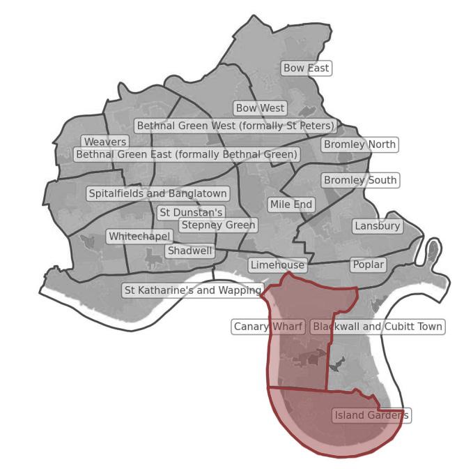
London Borough of Tower Hamlets Canary Wharf and Island Gardens Ward
LONDON BOROUGH OF TOWER HAMLETS
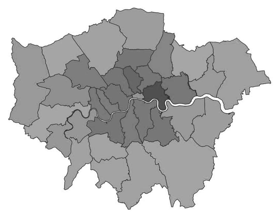
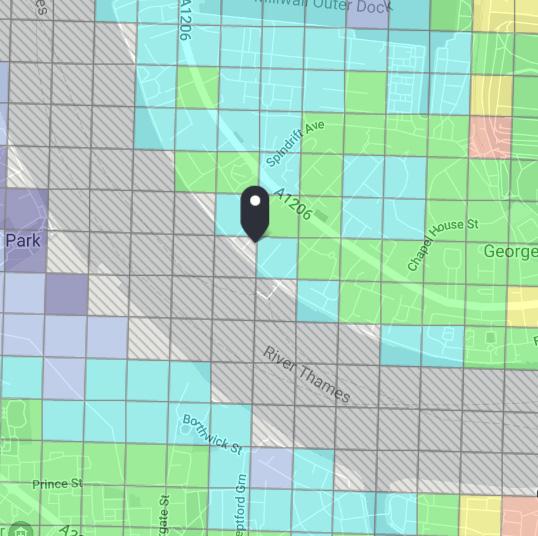
London Borough of Tower Hamlets is located in east London, England. It is situated on the north bank of River Thames. Some of the tallest skyscrapers in London is in the area, particularly in the Canary Wharf Ward. Five of the Wards, them being St. Katharine’s and Wapping, Canary Wharf, Island Gardens, and Blackwall and Cubitt Town have direct exposure and access to River Thames.
PLANS AND GOALS
Referring to London Plan 2021, optimising the potential to intensify the use of land to support additional homes and workspaces, promoting higher density development is in favor. In turn, this development has to consider important aspects such as connectedness to jobs, services, and amenities. This analysis aims to explore how different growth of each area could enhance or dismiss the experience of the residents, leading to collective living quality. The explored areas include networks, accessibility to amenities, building typologies, movement experience, and overall experience including sense of community and sustainability.
BRIEF
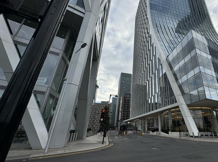
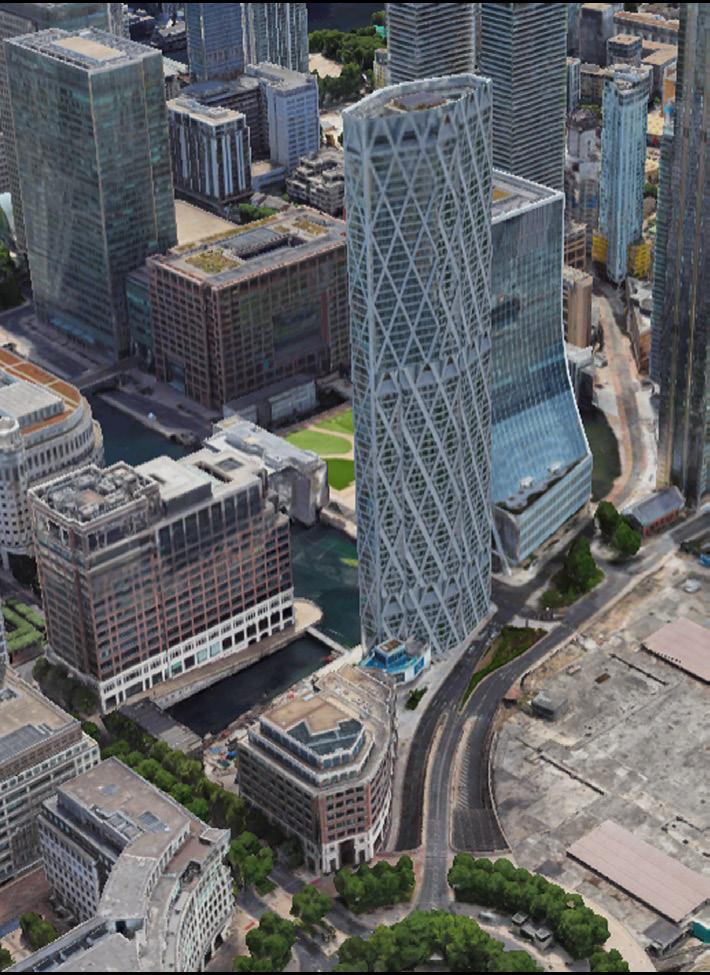
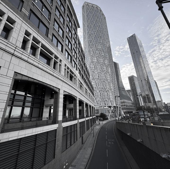
Canary Wharf is home to a number of the skyscrapers in London, accommodating spaces for major banks and global businesses. Aside from contributing to financial growth over the last few decades, the presence of tall buildings, averaging more than 40m in height, has brought significant morphological changes in the urban fabric in the neighbourhood, borough, and London at large.
Source: UK Office for National Statistics
CANARY WHARF WARD ISLAND GARDENS WARD
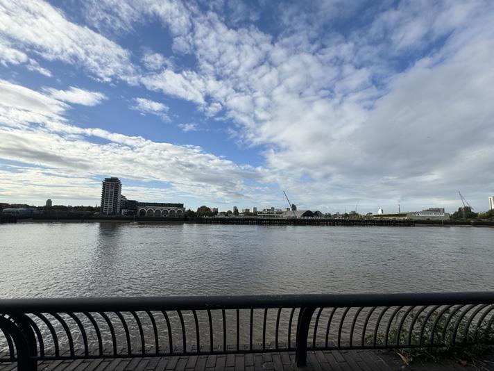
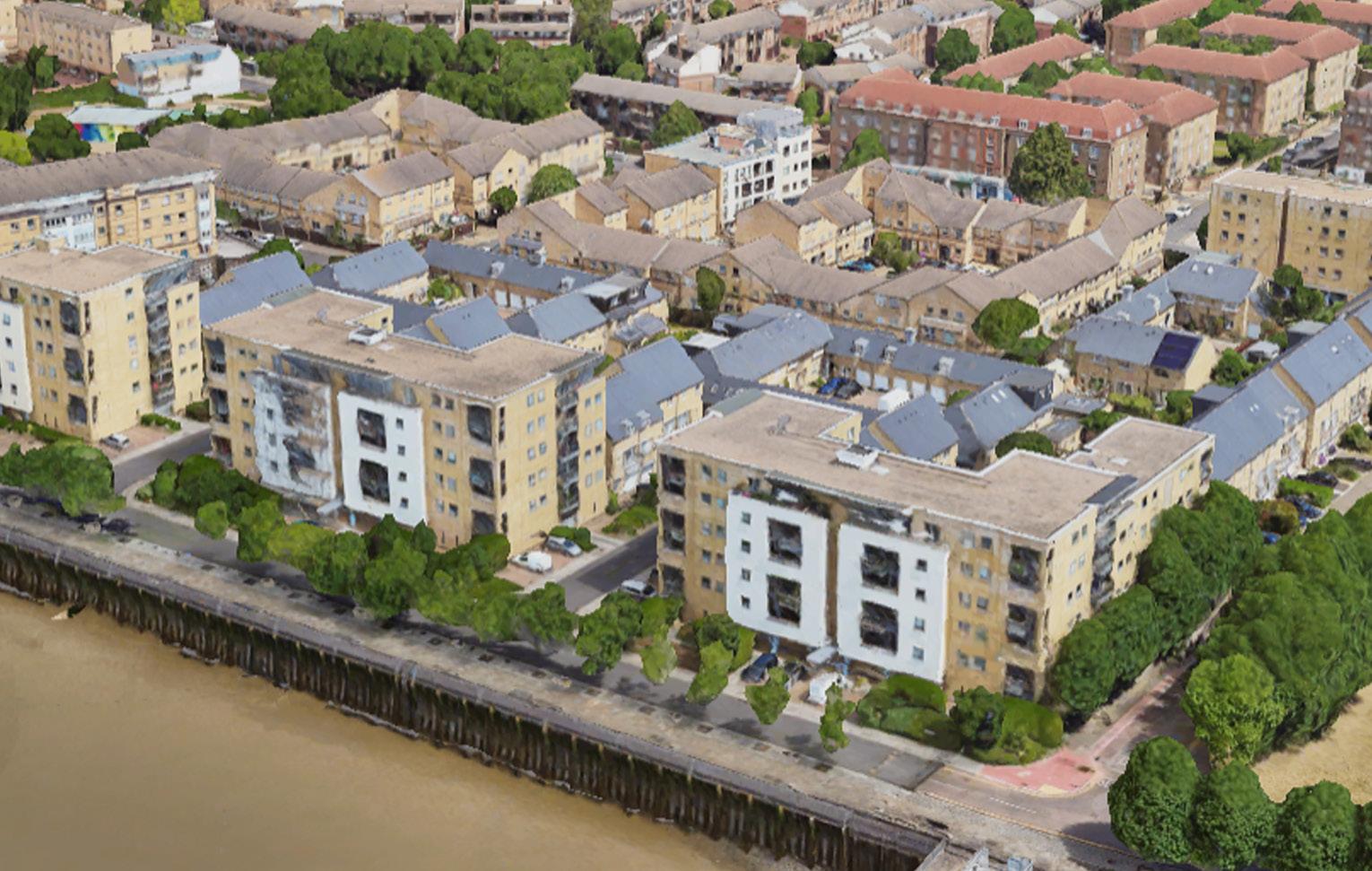
Island Garden Wards is located at the most southern part of London Borough of Tower Hamlets, and dominated by residential buildings. There are prominent greenspaces, them being Mudhcute Park and Farm, and Millwall Park which contributes to the character of the ward. Additionally, almost all of the southern perimeter of the ward directly face RIver Thames, offering expansive and unobstructed visual experience for the residents.
Source: UK Office for National Statistics
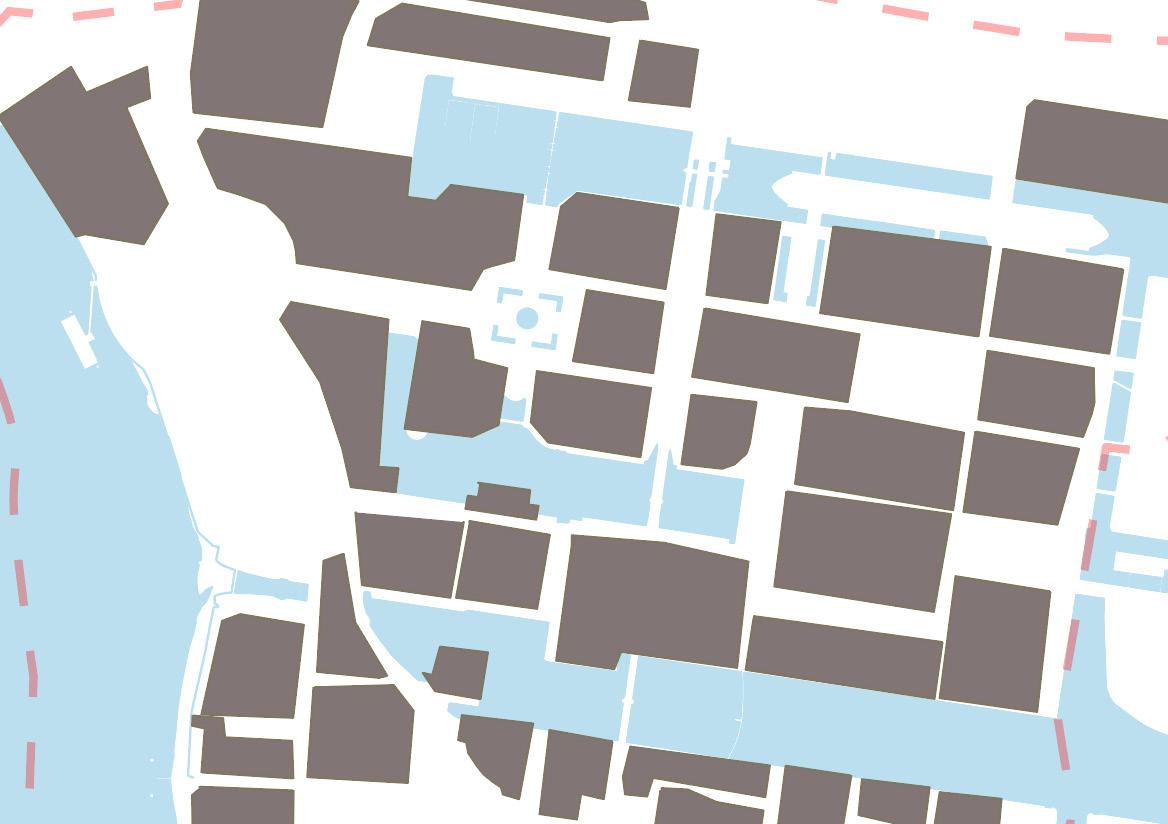
It is visible from the map that the northern part of Canary Wharf is dominated by skyscrapers, or high-rise buildings, reaching up to 200 metres tall. Where further to the south, in the Island Garden Ward, the buildings are dominated by low-rises, with an average of 10-20 metres tall.
BUILDING TYPOLOGY
The significant height difference could be infleunced by building uses, where in Canary Wharf, the tall buildings are mostly used for office, which some are mixed with retail purposes. Meanwhile, in the southern part of Canary Wharf, and ultimately in Island Gardens, building uses are mostly residentials.
BUILDING TYPOLOGY FOUND IN CANARY WHARF AND ISLAND GARDENS WARD
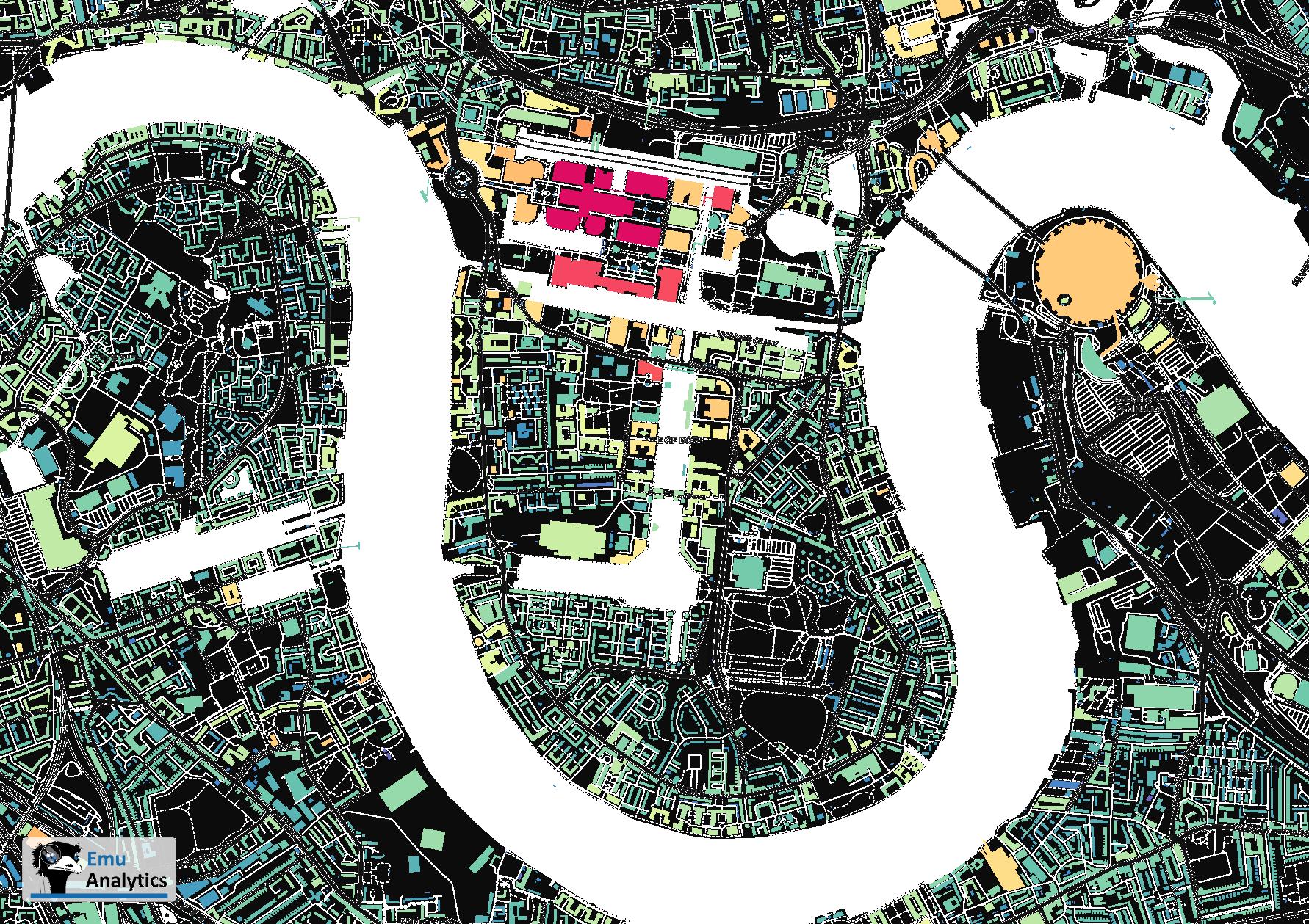
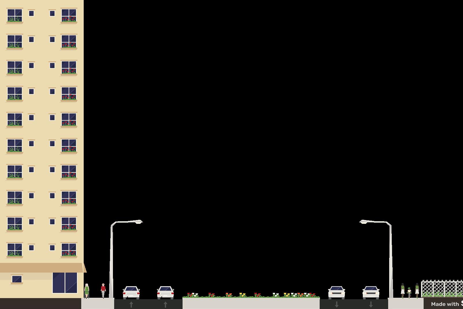
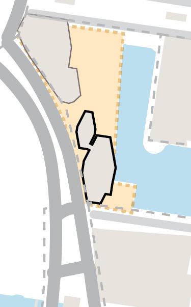
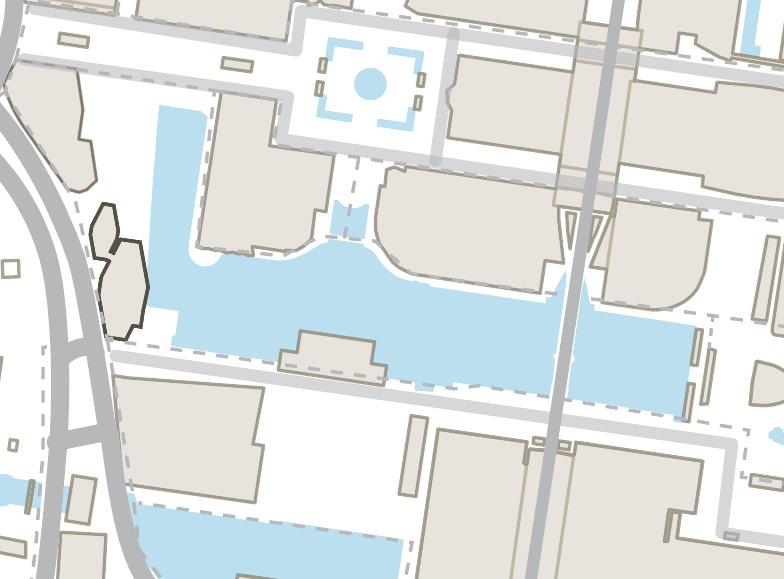
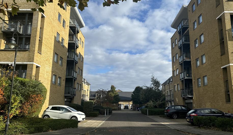
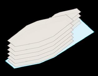
Building typology in the immediate area of The Newfoundland is dominated by high rise and mid-rise solitaires, shaping the skyline of the financial district. Overall, the buildings have certain prominence in the area by having large and tall masses. Even though the Newfoundland does not have the largest ground floor area, it stands out due to its height and facade design.
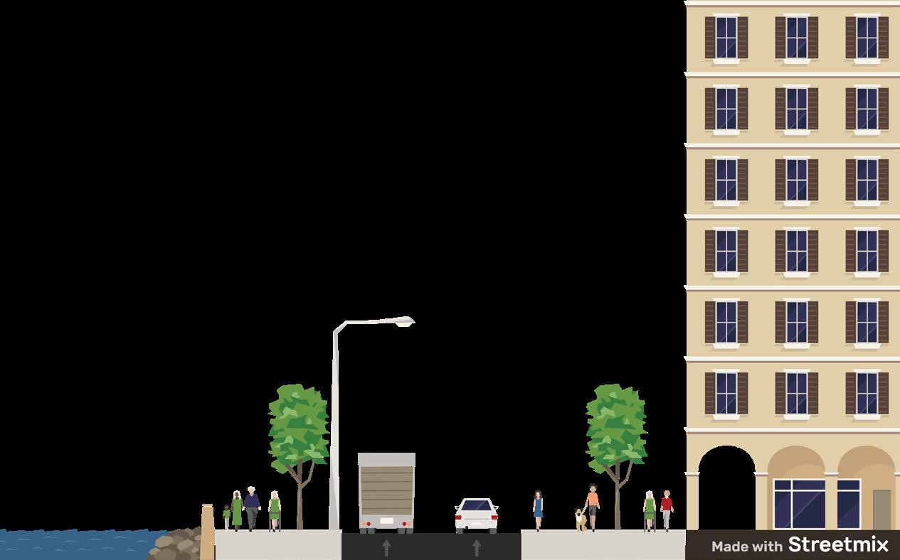
In Island Garden Ward, to the south of Canary Wharf, although the area is heavily dominated by a certain use, which is residentias, they have more various typologies if looked closely. The building footpirnt and plot areas are smaller, creating seemingly flexible pattern in terms of buildings and streets.
Courtyard Row
Solitaire Mid-rise solitaire Ribbon
Group
THE SOLITAIRE
Street Network
Public Transport Accessibility and Catchment Area Greenspaces
To Thames Path
Ward Boundary
A Roads
Minor Roads
Local Roads
Pedestrian
Ward Boundaries
The immediate area is surrounded by A roads, local roads and pedestrian paths. Particularly, the paths along the middle dock is redeveloped and decorated with art installation. On the southern side of the site, there is a pedestrian access to the Thames Path.
Catchment area within 10 minutes of walking. Bus stops
Station
The Newfoundland is well connected to the public transport services in the area. There are 7 bus stops available within a 5-minute walk. Additionally, underground and DLR stations are within 5-10 minutes walk
- linking to Stanmore and Stratford via Jubilee Line
- linking to Bank and Lewisham via DLR
- linking to Abbey Wood and Heathrow Airport via Elizabeth Line
Public greenspace
Lined trees
Private greenspace
Immediately in front of the entrance, there is a 280 m2 greenspace, which is highly used only by residents of the Newfoundland. It is visibly insufficient to cater to all of the residents.
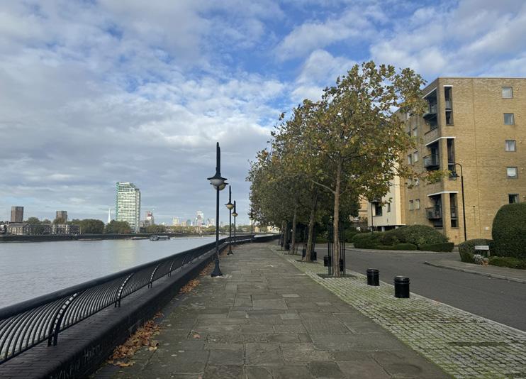
In the area, there are only 3 greenspaces available for public, a few lined-trees, and very little private greenspace. Although lined trees might not as significant as the other 2 greenspace, they are good elements to be added to the area that is dominated by tall buildings and paved footways. In contrary, there are more private greenspace available to the southern part of the area, where it is dominated by low and mid-rise housings.
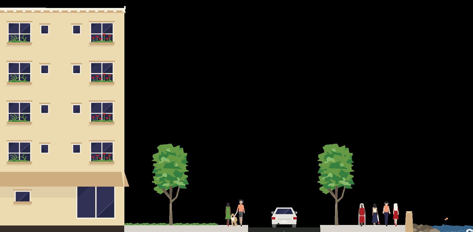
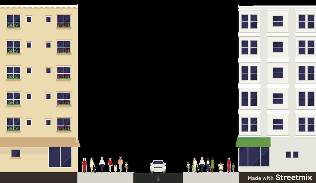
The A roads have high flows of traffic, especially at peak times. There are footways on the west side of the Newfoundland that allow direct access to the building. Due to the nature of the roads and vehicles, there are not many people walking along the footways
The local roads also have considerably high flows of traffic, but the vehicles are not moving as fast as they would in A roads. The sample section shows the footways along the Middle Dock decorated with trees, which provides pedestri-
Water Features
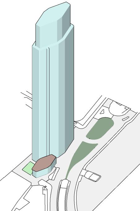
Facing the middle dock on the eastern side adds a visual value where it provides certain distance between the observer and the building so it does not seem too dominating. Even though Newfoundland did not face river Thames directly on its western side, the occupants can still enjoy the River Thames view from the upper levels.
BUILDING HEIGHT
Blocks in the nothern part of Canary Wharf tends to be rigid, bounded by major and local roads. It looked like it follows a certain axis, set by pre-existing West India Docks. The blocks are also easily defined by massive buildings in the area, each having a prominent presence to shape their own boundaries. 62
As a residential tower, the main activity suspected happening in the tower would be household acitivites. However, according to UK Office for National Statistics, the surrounding area has a tendency of people working from home. This increase the building usage, where it is potentially used all day. This might be influenced by the COVID-19 pandemic, where poeple switched to working from home.
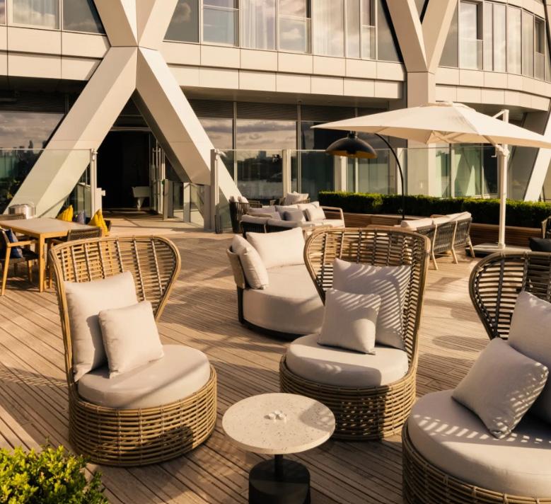
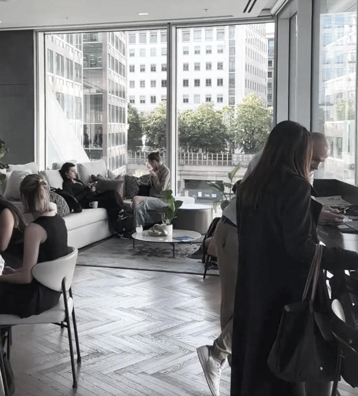
The Newfoundland is equipped with an number of private amenities located in the tower, including co-working spaces to support workers living in the tower. Other activities include sports, socialising in the dining space and children area, relaxing in the roof terrace. Estimated people movement in the building would be vertical movements, where they travel to the facilities provided on different levels of the building.
POPULATION
NEIGHBOURHOOD CHARACTER
60.3 % Born Outside of the UK
AGE
84.4% Aged 16 to 64 years
Proposals for tall buildings must respond to the character and context of the wider area in which they are located.(Tall buildings SPD,2022) In this context, the Newfoundland potentially cast shadows into the neighbouring sreets, buildings and openspaces, limiting sunlight accessibility
HOUSEHOLD COMPOSITION
43.8% One-person households
AFFORDABILITY
The neighbourhood is characterised by people aged 16-64 years. According to the Office of National Statistics, the most dominant job is financial service activities, at 20%, with the other occupation sits below 10% each.
According to the Planning Application documents, the Newfoundland does not offer on-site affordable housing. Instead, the applicant proposed donor sites for the affordable housing. A total of 856 affordable rooms are provided in donor sites comprising Burdett Road, Barchester Street, and Lovegrove Walk.
The Newfoundland Proposed off-site affordable housing
The development of the Newfoundland considers existing and additional deckings, following the Policy 7.30 of the London Plan: Development within or alongside London’s docks should protect and promote the vitality, attractiveness and historical interest of London’s remaining docks by preventing their partial or complete in-filling. The development added a 28sqm addition of decking, but followed with a study that further proves the addition would be a valuable attribute to the public realm and biodiversity enhancement.
For the residents to be able to enjoy larger greenspaces,they are recommended to go to the Eden Dock, located inthe middle dock which is now decorated with sitting spaces and art installation. They increases the potential of going to the dock on purpose, or pass through the dock while commuting, creating new movement and activity pattern.
Although the dock was not included in the block of the building, the proximity to this particular openspace could contribute to the living quality and experience at this tower. People would have more options to enjoy the outdoors, feel less-cramped and more connected to nature, since the eden dock is exposed to blue and green infrastructure.
CONNECTIVITY
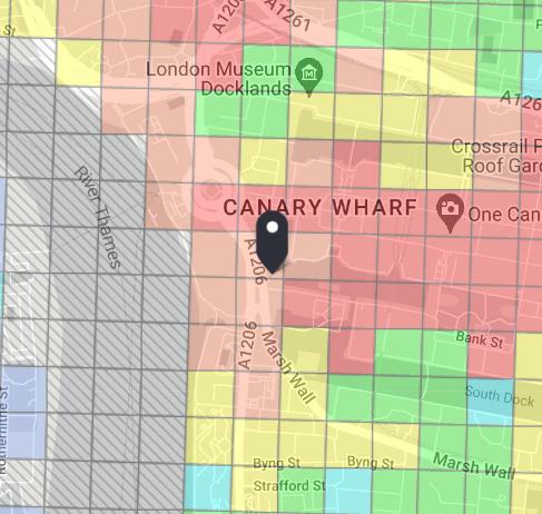
Referring to the previous analysis of the public transport accessibility, the Newfoundland has the PTAL rating of 5 due to its susbtantial connectedness to the public transportation services.
Source : Transport for London, 2024
Westferry Road
Between Westferry Circus and The Newfoundland
Between The Newfoundland and 5 Bank Street
Residential units Rooftop terrace
Eden Dock
The Newfoundland
Plot Boundaries
Block Boundaries
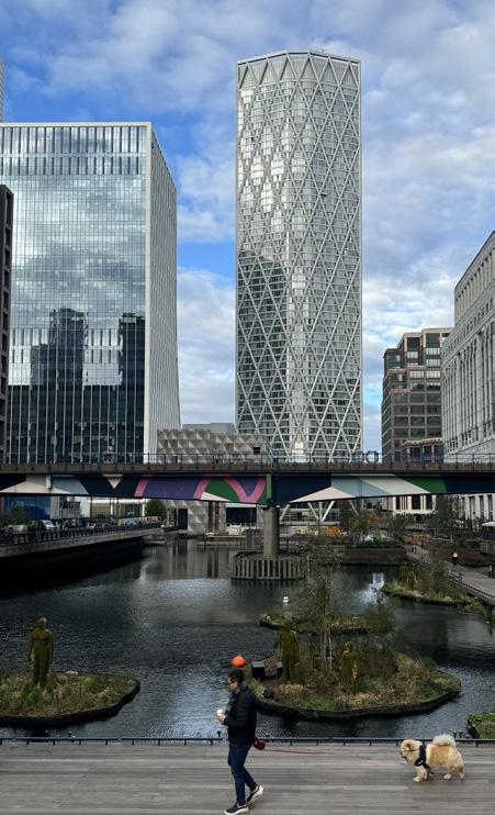
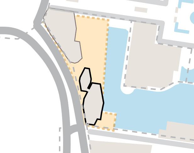
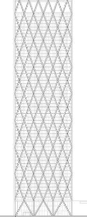
The Newfoundland is clearly distinctive from the buildings surrounding it. Although it stands in the area where towers are dominant, the newfoundland stands out as one of the tallest building with the solitaire typology. The distinctiveness of the building is supported by its height, at 226m, and its crossing facade design.
There are 3 points of acceess to The Newfoundland. The front entrance is from the eastern side/ Westferry Road. Secondly, pedestrians can pass through paved surface between Newfoundland and 15 Westferry Circus and through the greenspace. Thirdly, the back entrance is from the western side, accessed from the Bank Street.
AREA AND COVERAGE
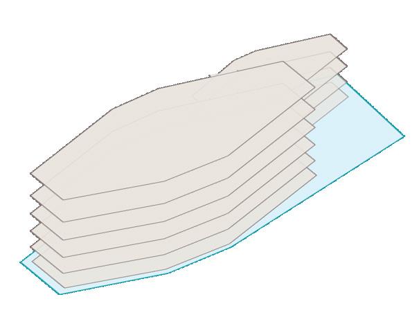
Total residential floor: 57 floors Estimated total resdients : 1938 occupants
There is a 280m2 open space at the ground level, at the north side of the building. Although it is accessible by public, it is most likely to be used only by the residents or staff to enter the Newfoundland. Hence, the nature of this space is semi-private. Another open space is a private rooftop terrace, which is only accessible by the residents and staff.
Source: hcl architects
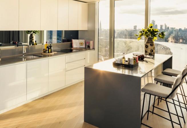
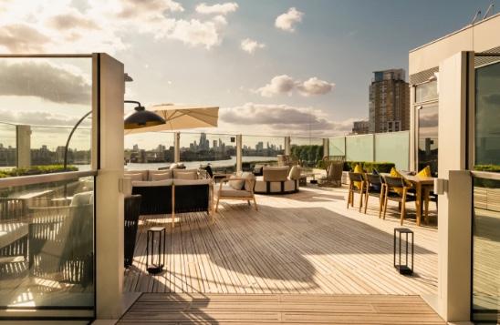
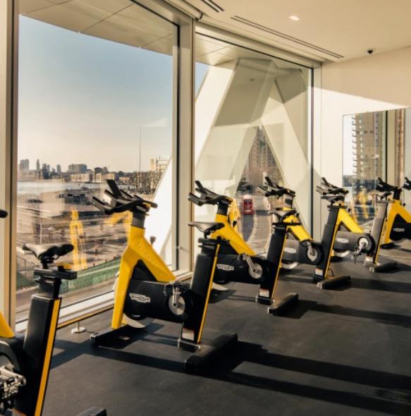
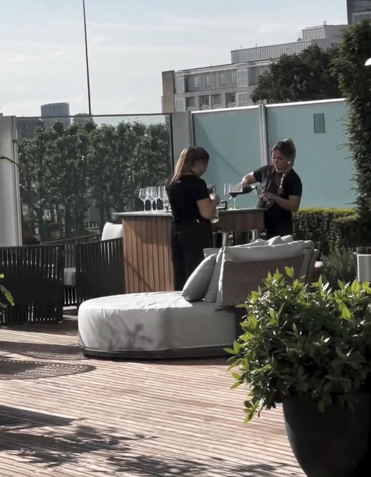
The newfoundland does not have large grounded-open space area. However, it provides amenities in shared spaces for the residents to socialise . The building offers indoor areas such as gyms, lounge, and working spaces. As for the outdoors, it provides rooftop terraces and children area, which are overlooking river Thames, increasing the experience quality.
Sustainability
The Newfoundland adopts a sophisticated energy management system ensuring that no energy is wasted and heat gets recycled, while the use of low-voltage LED lighting.
Westferry Road
Children area
Rooftop Terrace Working spaces Gym
THE COURTYARD
Public Transport Accessibility and Catchment Area Greenspaces
7 min
Ward Boundary
A Roads
Minor Roads
Local Roads
Gated local road
Pedestrian
Ward Boundaries
Street Type
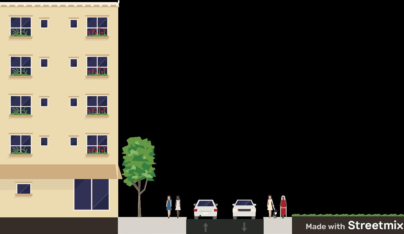
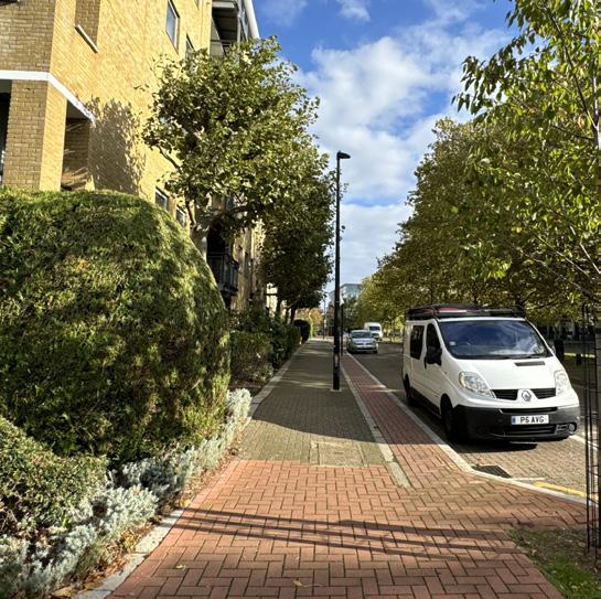
The area is surrounded by local roads and Thames path (pedestrian route) at the south western side. There are denser local roads, serving the needs of the area dominated by residential buildings. The pattern of the road is dominantly perpendicular to the A road, branching to serve the residential buildings.
Maritime Quay, gated local road
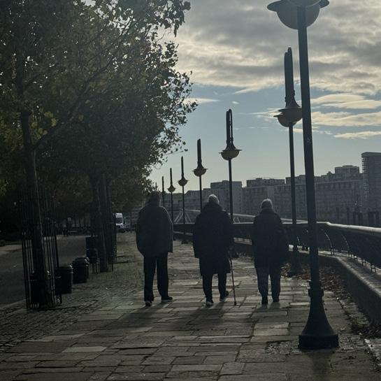
The immediate Maritime Quay road in front of the houses is gated. As a result, there is a low flow of traffic, and highly controlled vehicular activities. This makes the area feels safe and not intimidating. However, the Thames Path si still accessible by public and offers a scenic jogging or walking route along River Thames
The Shackleton Court
Catchment area within 10 minutes of walking.
Bus stops
Underground Station DLR Station
Napier Avenue
The courtyard houses (Hudson court, Shackleton court, and Amundsen court) are connected to the public transportation service, especially buses. There are 6 bus stops available within a 7-minute walk. Mudchute DLR station is available within 10 minutes walk, and the Island Garden DLR within 14 minutes walk.
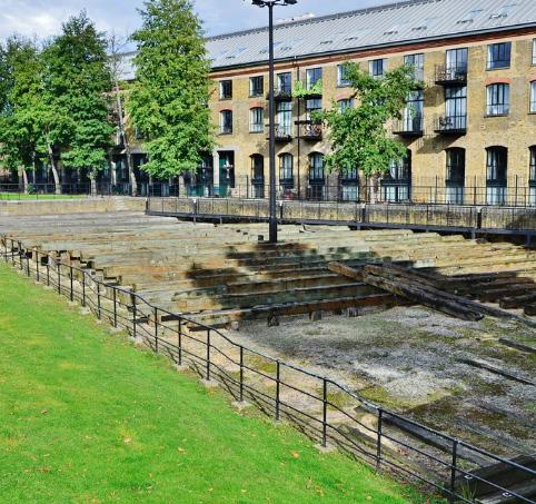
From the section, we can see how the buildings are not intimidating due to their height. Typical of this area, one side of the road is attributed with open space, hence giving the users or pedestrian a pleasant visual experience. In this case, the eastern side of Napier Avenue is a historical site, the SS Great Eastern’s Launch Ramp.
Public greenspace
Lined trees
Private greenspace
Island Garden Ward has considerably sufficient greenspaces. The greenspaces surrounding the residential areas are private gardens, that are planted plants, shrubs and trees. There are few
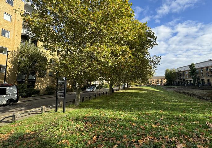
lined trees along the Thames Path immediate to the site. Ultimately, there is large greenspace, the Mudchute Park and Farm, and Millwall Park. In contrast to the private gardens in the residential areas, these parks largely contribute to the wider public by providing space for outdoor activities. Mudchute Park and Farm is also one of the largest inner-city farm, offering educational and recreational activities for children and general public. Movement towards and away from the park is expected.
Water Features
The houses directly face River Thames. There is lined tres along the Thames Path that provide shade. People are seen walking and jogging along this path, enjoying the openspace and scenic route along the river. This path is potential to foster social interaction between the residents or even the general public
ENVIRONMENT AND SITE CONTEXT
Blocks in Island Gardens ward are not as rigid as the blocks in Canary Wharf ward. However, they also convey a certain orientation or axis. The blocks and streets tend to have a perpendicular orientation to the Westferry Road. Presumably, since the road were built before modern developments, the local road and smaller streets were side roads coming out from the Westferry Road
BUILDING HEIGHT
The development of Hudson, Shackleton, and Perry Court is influenced by the existence of River Thames as the main water feature, and Westferry Road as the existing street network.
The buildings face River Thames, and the privatised road contributes to the sense of privacy and safety in the area, although it gives some degree of separation between the site and its immediate surrounding. The homogenity of the area (residential buildings) and the low-rise typology contribute to the quiet character of the area by not having too much concentrated activities on normal days
As residential buildings, the main activity suspected happening in the courtyard houses would be household acitivites. However , looking at there is no shared facilities or amenities available in the block, the residents would have to go outside the block to reach the facilities The movement would primarily be horizontal movement, where the residents go from the houses to neighbouring areas.
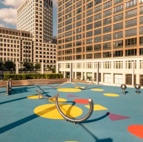
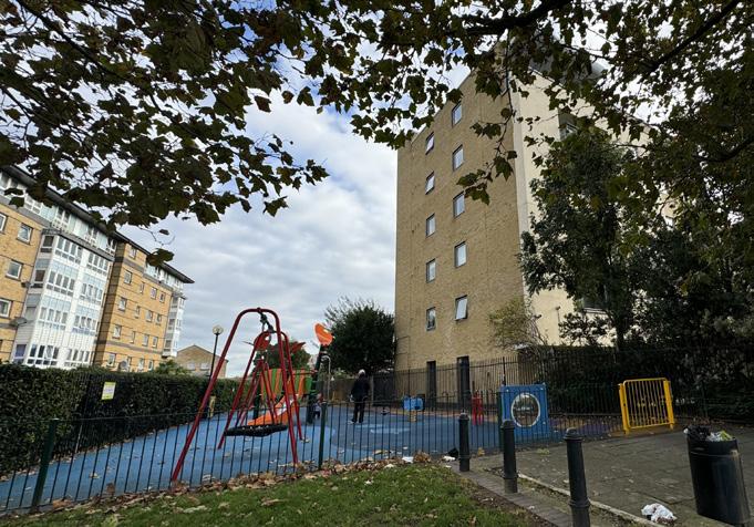
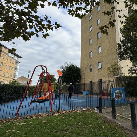
The nearest amenities are the children playground, thames path for jogging and walking, and one heritage site, which is the SS Great Eastern Launch Ramp. To reach larger greenspaces, residents would travel to Millwall Park and Mudchute Park and Farm.
POPULATION
NEIGHBOURHOOD CHARACTER
For the residential buildings in Maritime Quay, the angular plane is at 45o, giving the area good sunlight exposure, ventilation and street experience. The suitable height for the buildings also contribute to street experience where residents or users wouldn’t feel too enclosed and intimidated by the buildings, even though they are surrounded by them.
65.5 % Born Outside of the UK
76.9% Aged 16 to 64 years
HOUSEHOLD COMPOSITION
50.8% Single-family household
The neighbourhood is characterised by people aged 16-64 years, According to the Office of National Statistics, the most dominant job is financial service activities, at 11.7%, with the other occupation sits below 10% each.
This quiet and pleasant ambiance is further enhanced by the fact that it is directly facing the River Thames. The residents could have an interrupted, expansive view across the river, optimising their visual experience of the landscape and character of the place. This might also contribute to perceived density, by how people react to direct exposure of natural environment. This exposure arguably creates a positive impression of the area.
As for the bounding roads, the orientation of Napier Avenue and Brittania Road, which are the boundaries of the east and west (partially) of the block are perpendicular to the Westferry Road. Additionally, just to the east and north east of the block, there are statutory listed buildings. However, both of them has experienced redevlopment, and currently used for commercial and residential purposes.
CONNECTIVITY
Referring to the previous analysis of the public transport accessibility, Hudson, Shackleton, and Perry Court do not have a very good PTAL rating. Although the area seemed to have side roads that connects from one place to another, the connectivity in terms of public transportation system is not very good.
Source Transport for London, 2024
(best)
Children play area Launch Ramp
Between Shackleton Court and Perry Court
To Millwall and Mudchute Park
Unobstructed, expansive view to the river Thames
AREA AND COVERAGE
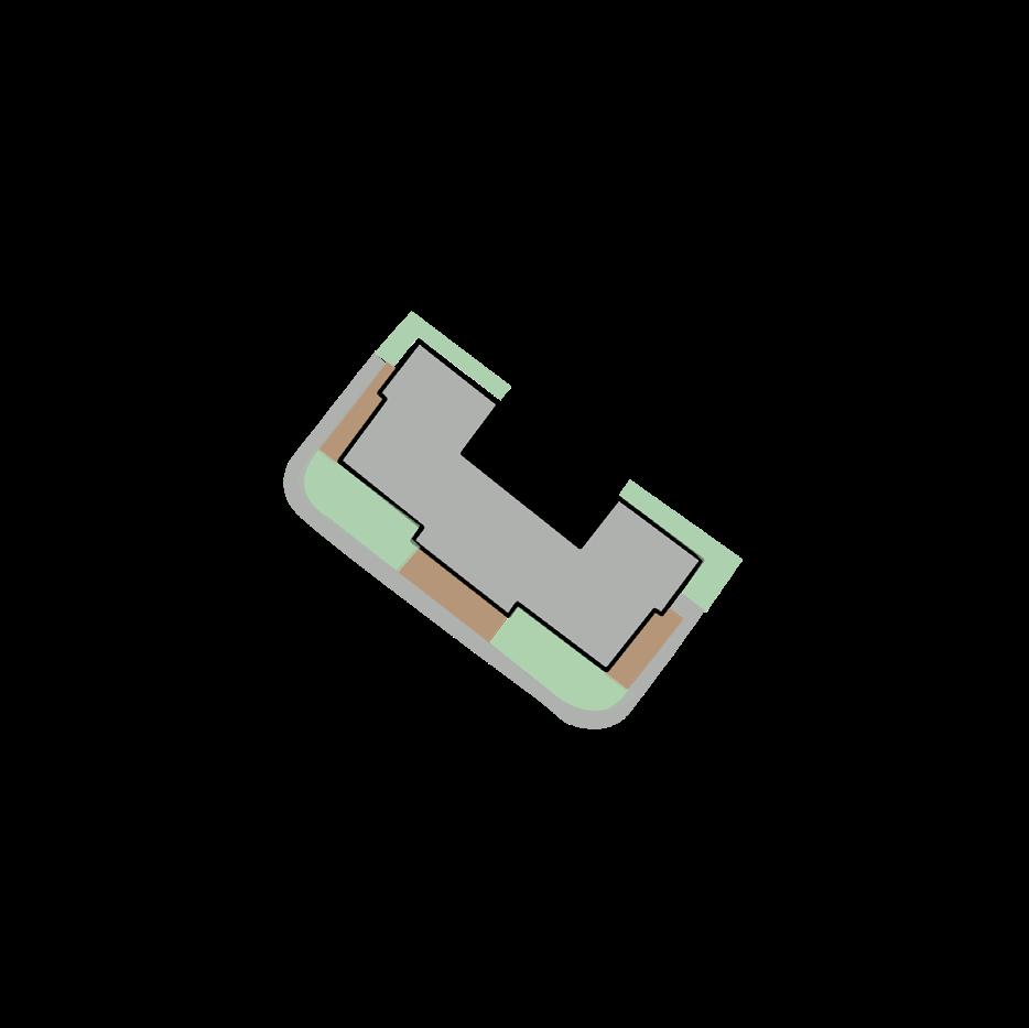
Plot area : 4204m2
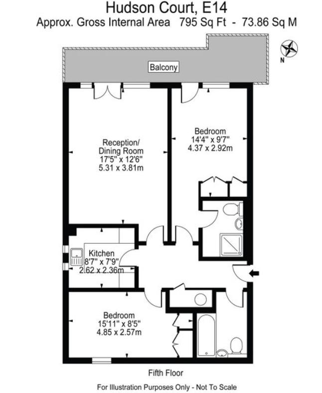
Hudson, Shackleton, Perry and Amundsen Court
Plot Boundaries
Block Boundaries
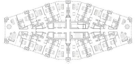
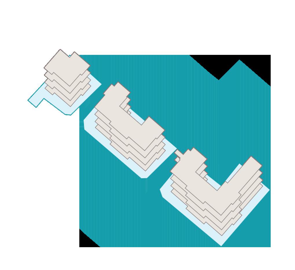
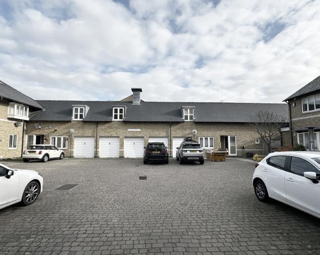
The Hudson, Shackleton, and Perry Court is located on the most southern part of the block. The residential buildings are courtyard types. However, interestingly, Hudson Court which is at the left is cut into only a quarter courtyard. The entrances to the buildings are in the inner side, and they have similar facade design as one of their shared viusal character.
Estimated total resdients : 480 occupants
Total residential floor: 6 floors and 5 floors
Estimated Total residential units: 120 units
Estimated GIA: 11560 m2
GREENSPACE AND OPENSPACE
There are 2 Points of access from Westferry Road houses. The main access is through Napier Avenue passed the gate to Maritime Quay. The second access is only accessible by pedestrian, which is through Brittania Road, passing through the small children playground and to the Thames Path-Maritime Quay.
Each of the building has its own paved perimeter with partial greenspaces. However, since Maritime Quay is closed off to public, this area could be considered as their privately-shared openspace, that also connects them to the Thames Path. Although the addition of the greenspace makes the experience more pleasant, one of the residents stated that they would go to Millwall park to enjoy larger greenspace
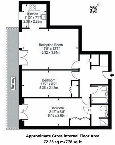
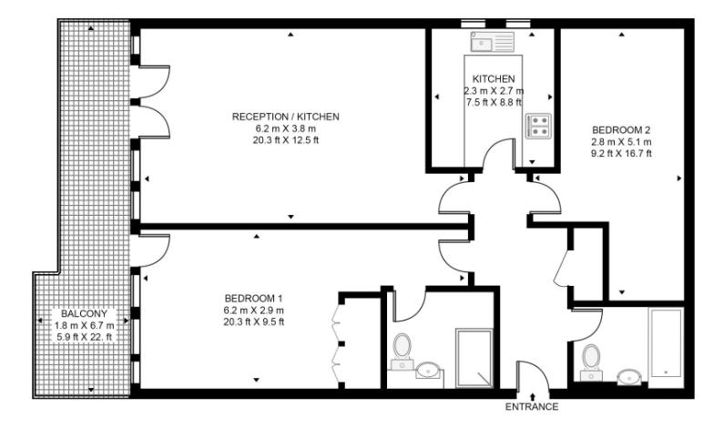
The residential types in these three buildings are typical, with an area average of 75m2. Each of the unit is equipped with 2 bedrooms, 1 kitchen, 1 living room, and 2 bathrooms. The average unit can accommodate up to 4 people.
SPATIAL ANALYSIS AND SENSE OF COMMUNITY
The block is surrounded by magnificent openspace, as it is quiet, feels safe, ample sunlight, equipped with sufficient footways for the pedestrian, and trees that offeres shade. Although the greenspace in the block is limited to private backyards and footways greeneries, and do not contribute to the wider greenspace network, it still adds value to the local sense of place. There is a children area at the side of the block, although it is gated, the residents would still use it from time to time. The SS Great Eastern Launch Ramp is equipped with a greenspace that promotes social interaction both to the residents and wider public.
Children area Thames Path Footways
SS Great Eastern Launch Ramp
Shackleton Court sample
Perry Court sample
Hudson Court sample
COMPARATIVE STUDY
Density
Street Experience
Sense of community and Accessibility
Although the ground floor area of the solitaire typology is slightly smaller than the courtyard (1724m2 < 1976m2), its Floor Area Ratio is far larger than the courtyard type (32.84>2.49)
As the tower is built for residential purposes, its habitable space is larger compared to the courtyard type, which is also shown by the difference of dwelling density or estimated residents in the building. As a result, a building footprint is not always directly proportional with occupant and/or dwelling density
The nature of the road bounding the block has significant effect as well. The Westferry Road in the northern part of Canary Wharf is relatively busier, since it is close to road junctions, coming from the northern part of Westferry Road (A1206), Limehouse Link Tunnel (A1203), West India Dock Road (A1261). Even though the Westferry Road stretches until Island Gardens Ward where the courtyard block is located, the experience of the road is substantially different. It feels safer to walk through the footways on the southern part of Westferry Road (in Island Gardens Ward), where vehicles move slower, and the existing buildings are smaller not overshadowing, hence clearer navigation.
Privately-shared activities from the Newfoundland do not contribute much to the larger public, since they are offered primarily for the residents. Physically, the Newfoundland is not gated, making it accessible to the wider public. However, there are not much active frontages in the ground level, making it less attractive and engaging to the passerbys.
The block of courtyard houses is not gated, and can easily be accessed by pedestrians from Napier Avenue and Brittania Road. In contrast, vehicles do not have the same accessibility as the pedestrians. The gated Maritime Quay Road prevent any unregistered vehicle from entering the premises.
The Solitaire
Gated Maritime Quay Paved parking lots
Rooftop terrace Lounge area/workspace
COMPARATIVE STUDY
FINAL REFLECTION AND CONCLUSION Greenspaces
Placemaking
The Solitaire
The Courtyard
The Newfoundland tower has 3 levels of basement, resulting in no permeable surface available in the area This leads to further site development and planning, where water drainage needs to be more carefully planned to avoid floodings or other unwanted issues. The ground coverage is on the higher side, which is 78%, exceeding the allowance percentage by 8%. The unavailability of shared greenspace also contributes to insufficient openspaces needed by residents of tall residential buildings identical to greater concentration of activities (Tower Hamlets Tall Buildings SPD, 2022).
Meanwhile, in the courtyard type, we can find lesser ground coverage at 47%. The plot area is divided between building footprint (47%), paved parking lots (33%), and permeable surface (20%). Although there are openspaces within the plot, they don’t contribute much to social interaction and activities in the block, thus creating a quieter neighbourhood and low density perception.
Rigid and defined blocks, separated by wider roads, streets, and squares.
Density has been long associated with calculations and specified standards. However, to have a comprehensive view of the urban environment, especially regarding living quality, wider aspects have to be considered as well.
Smaller and denser blocks, tends to follow the orientation of local roads and streets, and more curved boundaries
In terms of population density, the Newfoundland, which adopts a solitaire typology achieves higher density compared to the courtyard houses. Moreover, its building footprint is slightly smaller compared to the courtyards, aligning with the goal of site capacity optimisation in achieving high density living. This is an important aspect to prepare oneself for the coming future, as Tower Hamlets is one of the fastest growing parts of the country (High Density Living, 2020). However, high density could be achieved in various forms of development, which has been long promoted by researchers. Building high is indeed a proved method to achieve space optimisation in an urban context, but it certainly is not the only solution.
if we are looking at the larger scale, people who move along in the Newfoundland are greatly diverse, making their way to the offices, commercial and retail buildings, including seasonal population such as tourists. In contrary, the majority of people who move along in the courtyard houses area has narrower range, presumably residents or local community members. This might contribute to the closeness of the community, fostering strong relationships between the members.
Although the immediate block or plot in the courtyard houses does not offer physical space to formally interact, the friendliness of the surrounding area is arguably impactful to the perceived characters of the neighbourhood, thus influencing its livability.
After further analysis on both tangible and intangible aspects of the chosen buildings, I found that how a building, or groups of building exist within an urban environment is heavily tied with theirwider context. In both of my cases, although the block is located considerably far away from each other, and even in different wards, they have rather similar proximity to water elements. Since the built form is essentially a physical element in the environment that has experienced transformation (Kropf, 2017), natural elements thus play a significant part in forming an impression of the site. This too affect the perceived density as it depends on a range of individual and sociocultural factors, that explains further why a person will evaluate and react differently to perceived density (Pont and Haupt, 2009).
It is no wonder for the courtyard houses to be perceived as a quiet, calm, and desirable neighbourhood, further reinforced by the expansive view to the river. But In similar fashion, the Newfoundland which in this case houses many more families, could be perceived in similar ways since it is located at the side of a dock, bringing sufficient distance between the viewer and the building. This further proves that strategic development could play a significant part in delivering high density in a pleasant way, moving away from the negative perception of crowding. Although the openspace is not included in the block itself, it is arguable that buildings and their immediate surrounding area is almost inseparable, creating a particular, individual perception of density.
REFERENCES
1. Berghauser Pont, M., & Haupt, P. (2010). Spacematrix: space, density and urban form
2. Bürklin, Thorsten. & Peterek, M. (2008) Basics Urban building blocks. Basel: Birkhäuser
3. Canary Wharf, City Population. Available at: https://www.citypopulation.de/en/uk/london/wards/tower_hamlets/E05009323__canary_wharf/ [Accessed 7 Nov. 2024]
4. Carmona, M. (2021). Public places urban spaces: The dimensions of urban design. Routledge
7. Kropf, K. (2017). The Handbook of Urban Morphology. John Wiley & Sons Ltd.
8. London Borough of Tower Hamlets (2020) High Density Living, Supplementary Planning Document
9. London Borough of Tower Hamlets (2021) Tall Building SPD, Consultation Draft Report
10. Mayor of London (2021) The London Plan: The Spatial Development Strategy for Greater London. Greater London Authority
11. Newfoundland building: elevating life in Canary Wharf. Available at: https://thisisvertus.com/journal/newfoundland-building-elevating-life-in-canary-wharf/ [Accessed 8 Nov. 2024]
12. Transport For London WebCAT tool. Available at: https://tfl.gov.uk/info-for/urban-planning-and-construction/planning-with-webcat/webcat
13. UK Office for National Statistics. Available at: https://www.ons.gov.uk/census/maps/ [Accessed 7 Nov. 2024]