A special thanks to the following individuals for their support and assistance during the completion of this masterplan:
Jane Lew Town Council
Derek Harbert, Mayor
Debbie West, Recorder
Jonathan Clutter, Council Member
Tom Frazier, Council Member
Dave Ramsburg, Council Member
Ruth Straley, Former Mayor
CEC Design Team
Jim Christie, PLA
Andrew Gosnell
Colin McCardle
Eleni Knight
Dustin Toothman
Jon Michaux
Matt Pizatella, PLA, LEED AP BD+C
Table of Contents
Site Visit + Concept Development
Jane Lew Masterplan Recommendations
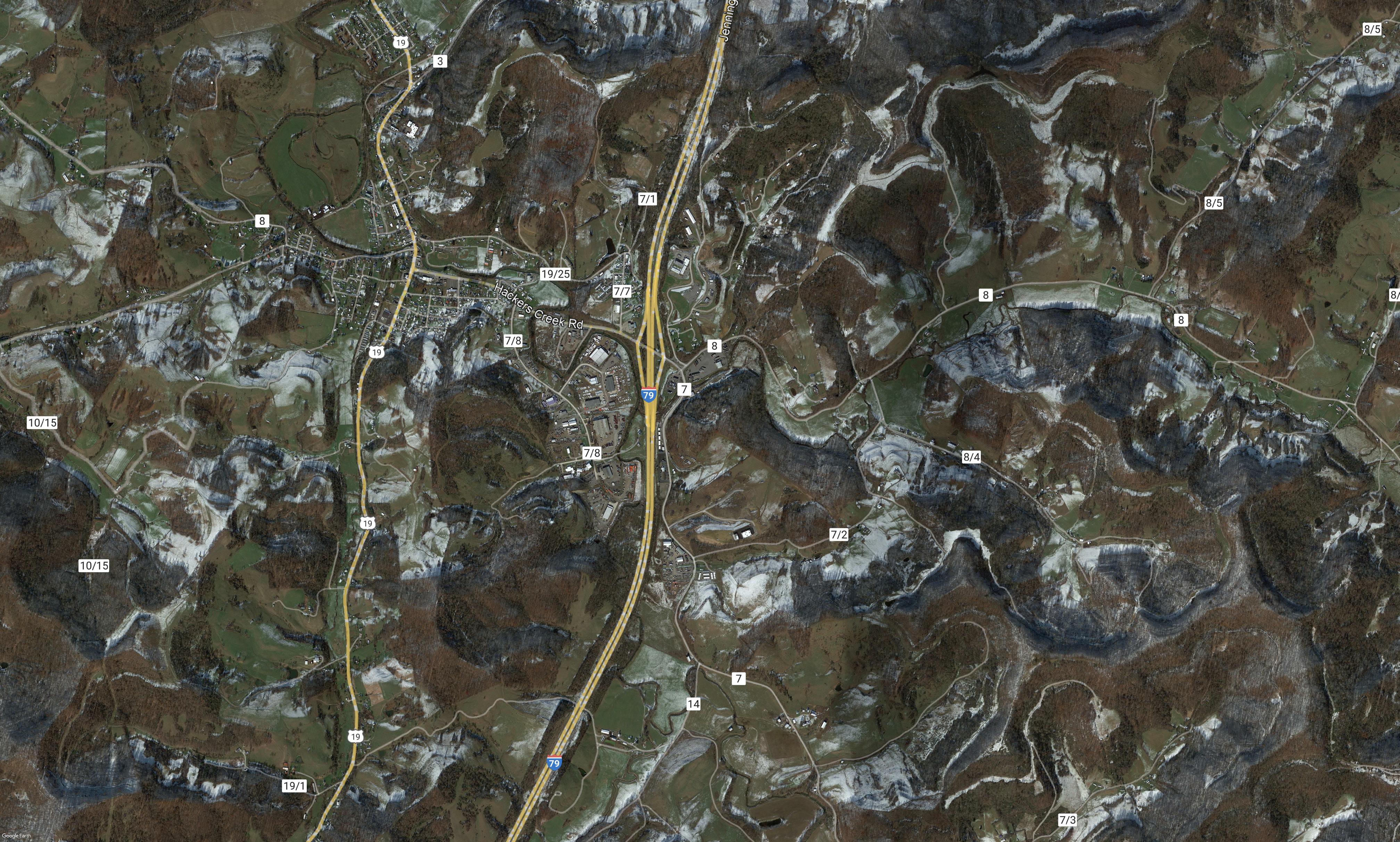
Regional Connections
Additional Considerations
Project Priority List and Funding Opportunities
Executive Summary
The proposed Jane Lew Park Masterplan is a recreation focused, park improvement strategy. The goal of this document is to enhance existing amenities at the Jane Lew Park while introducing new programs for the benefit of the community. The proposed vision for the public space balances the need for local sports facilities with the desire for a communitycentered park atmosphere. Key components of the plan include, but are not limited to: addressing ADA and general access concerns throughout the park; addition of community requested programs, such as pickleball and a new, all inclusive playground; and the addition of new activities such as mountain biking. A new event lawn and pavilion is also being proposed, creating a centralized location to support the annual festivals and holiday events that attract hundreds of visitors to town each year. In addition, the plan envisions a park that takes greater advantage of the natural beauty provided by Hackers Creek. This is accomplished through re-naturalization of the creek bank and interventions that allow park visitors to interact with the water. Proposed park improvements have the potential to connect into regional recreation systems that are being developed across Lewis County and the State of WV, such as the Lewis County Greenway. This will solidify Jane Lew’s position along these regional systems and help draw users into town and to the Jane Lew Park. Overall, the proposed masterplan not only enriches Jane Lew Park’s offerings, but also positions the town to leverage its outdoor recreation assets, contributing to the broader regional recreation economy.
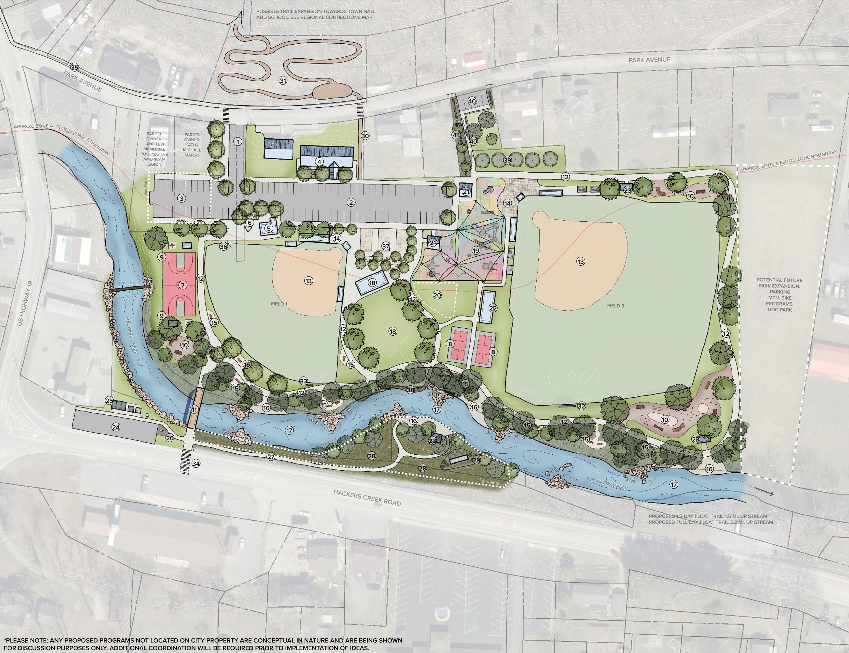
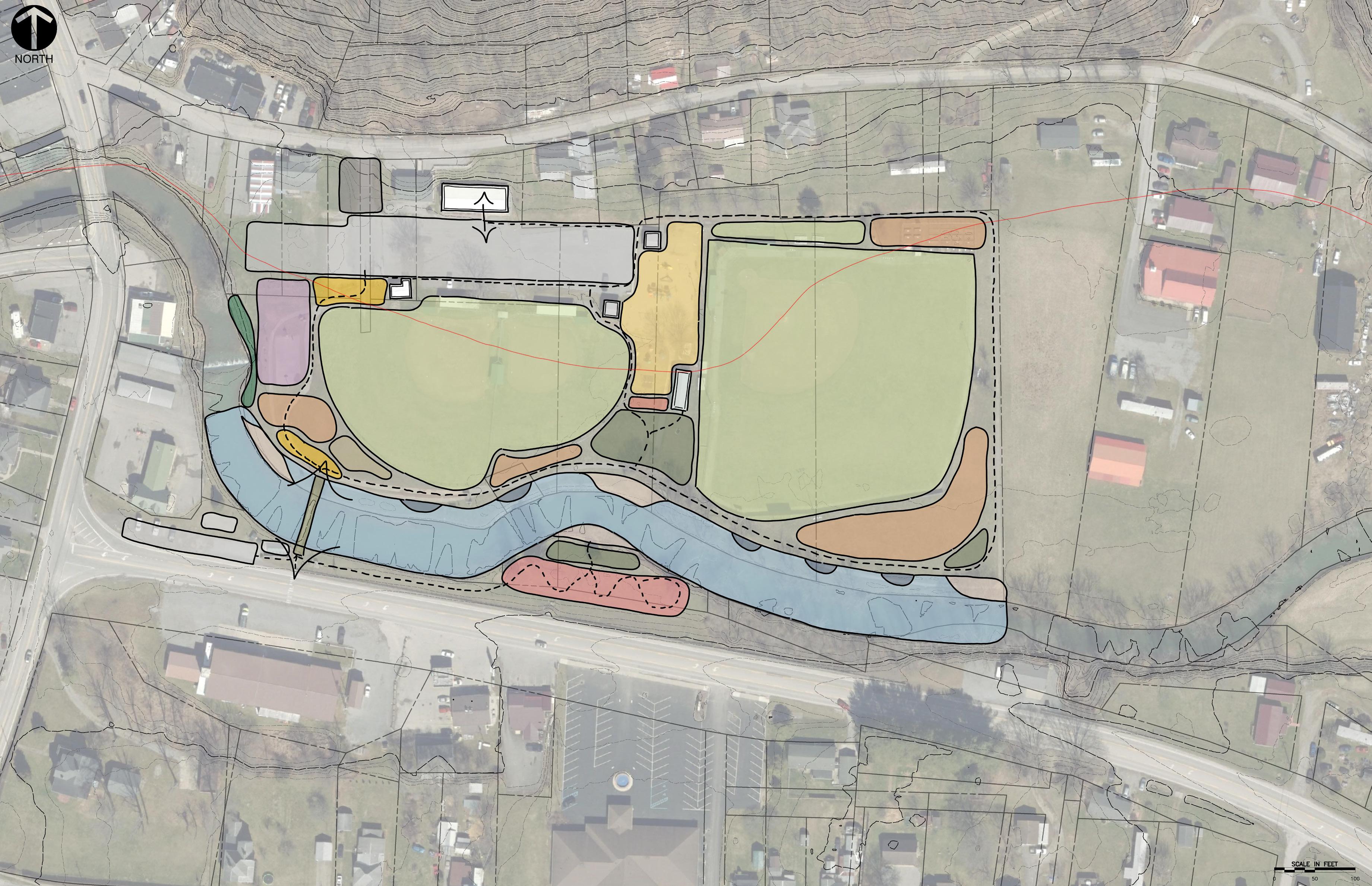
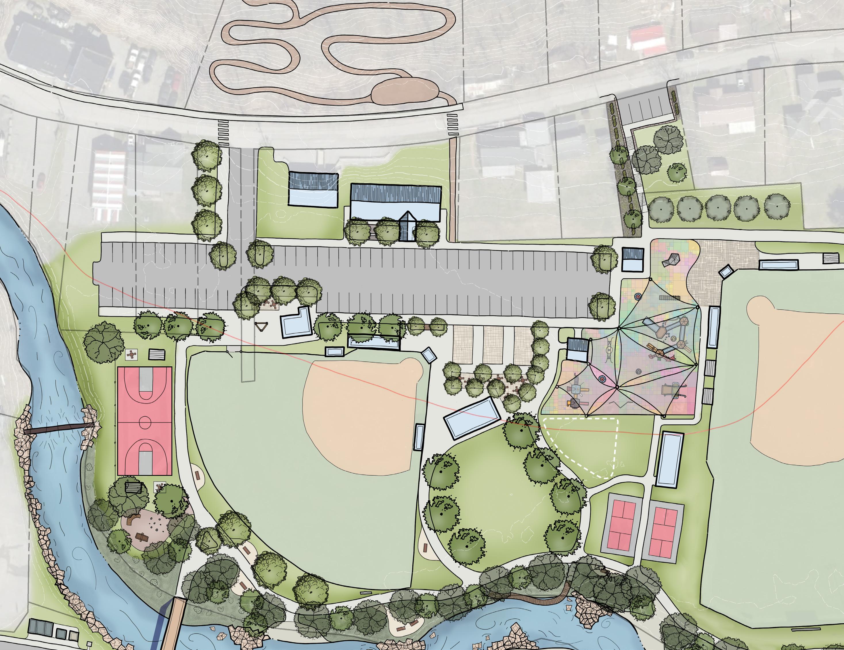
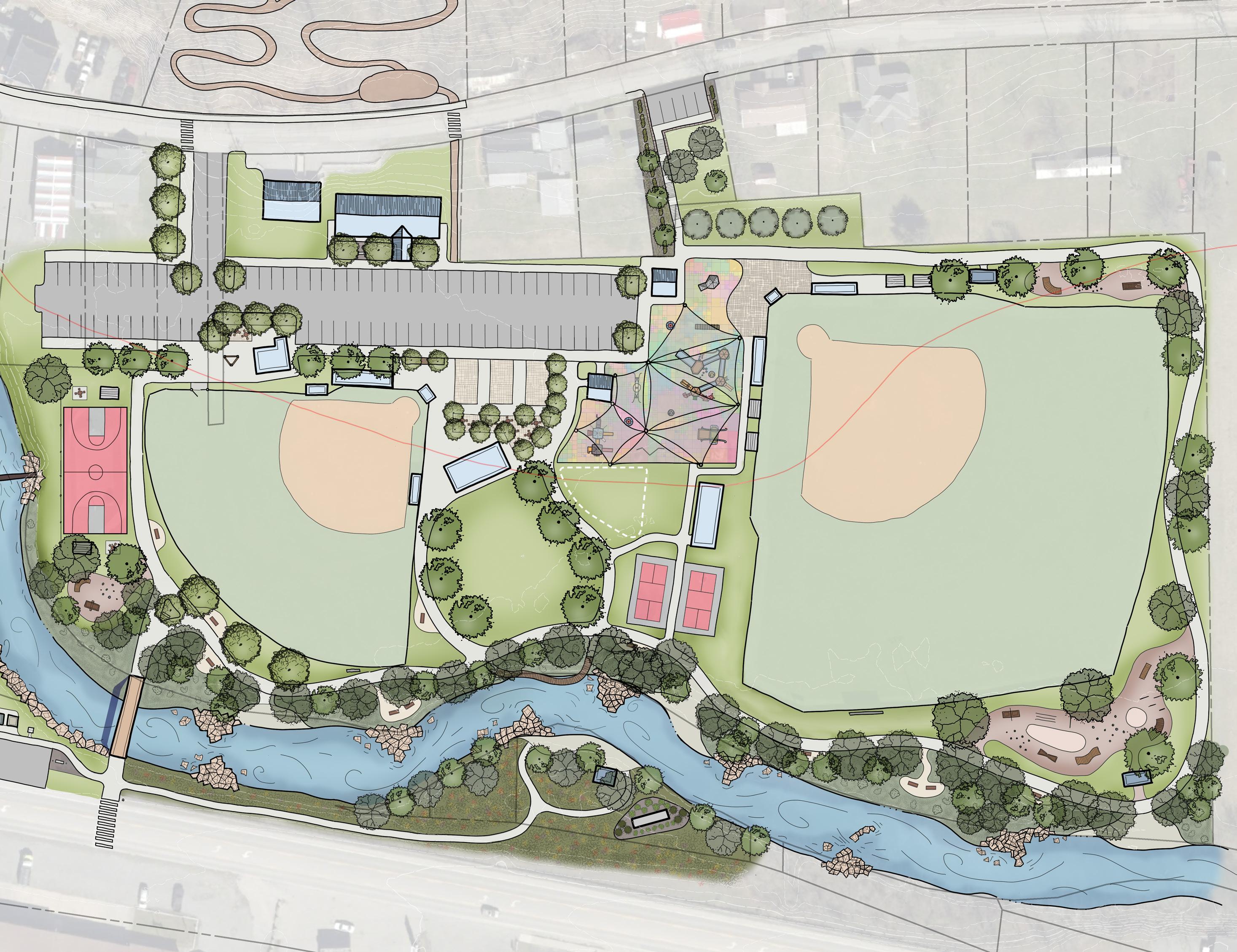
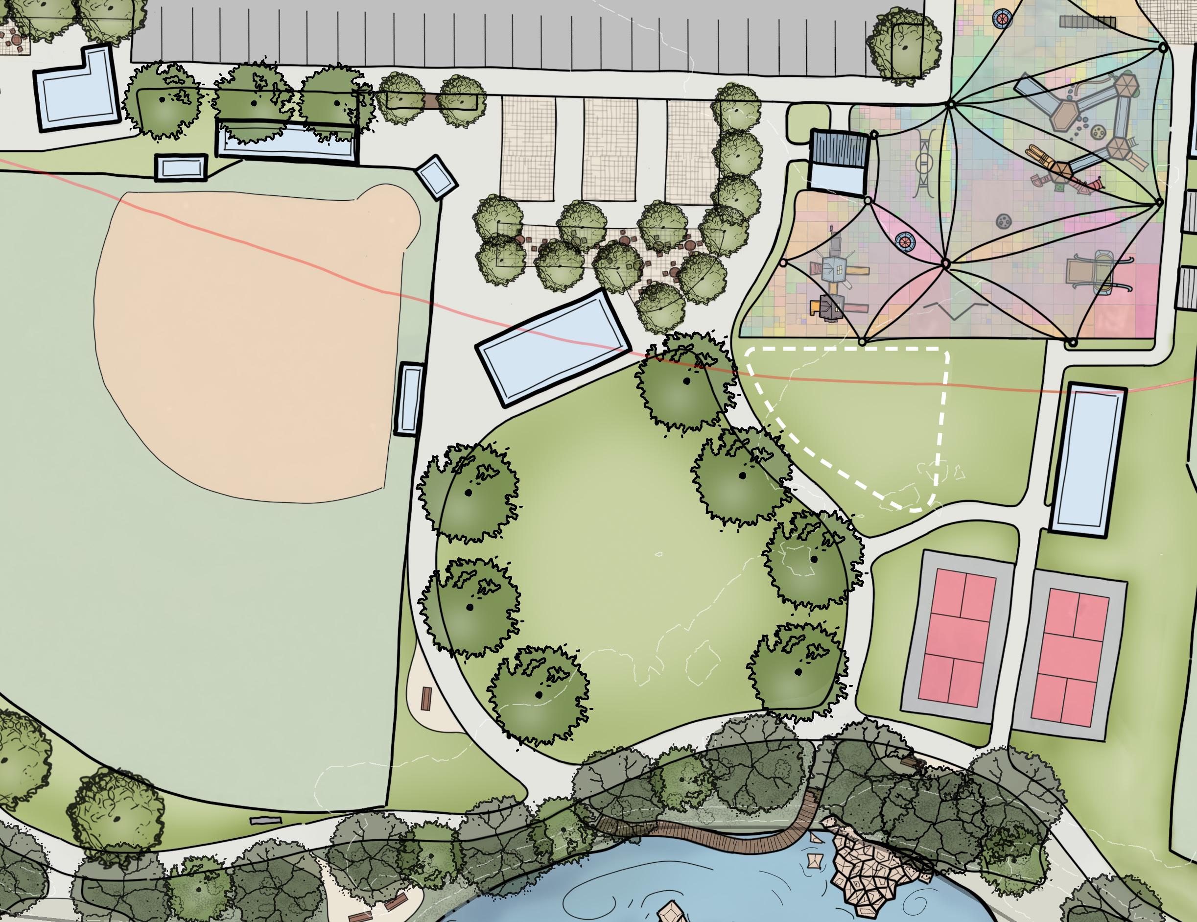
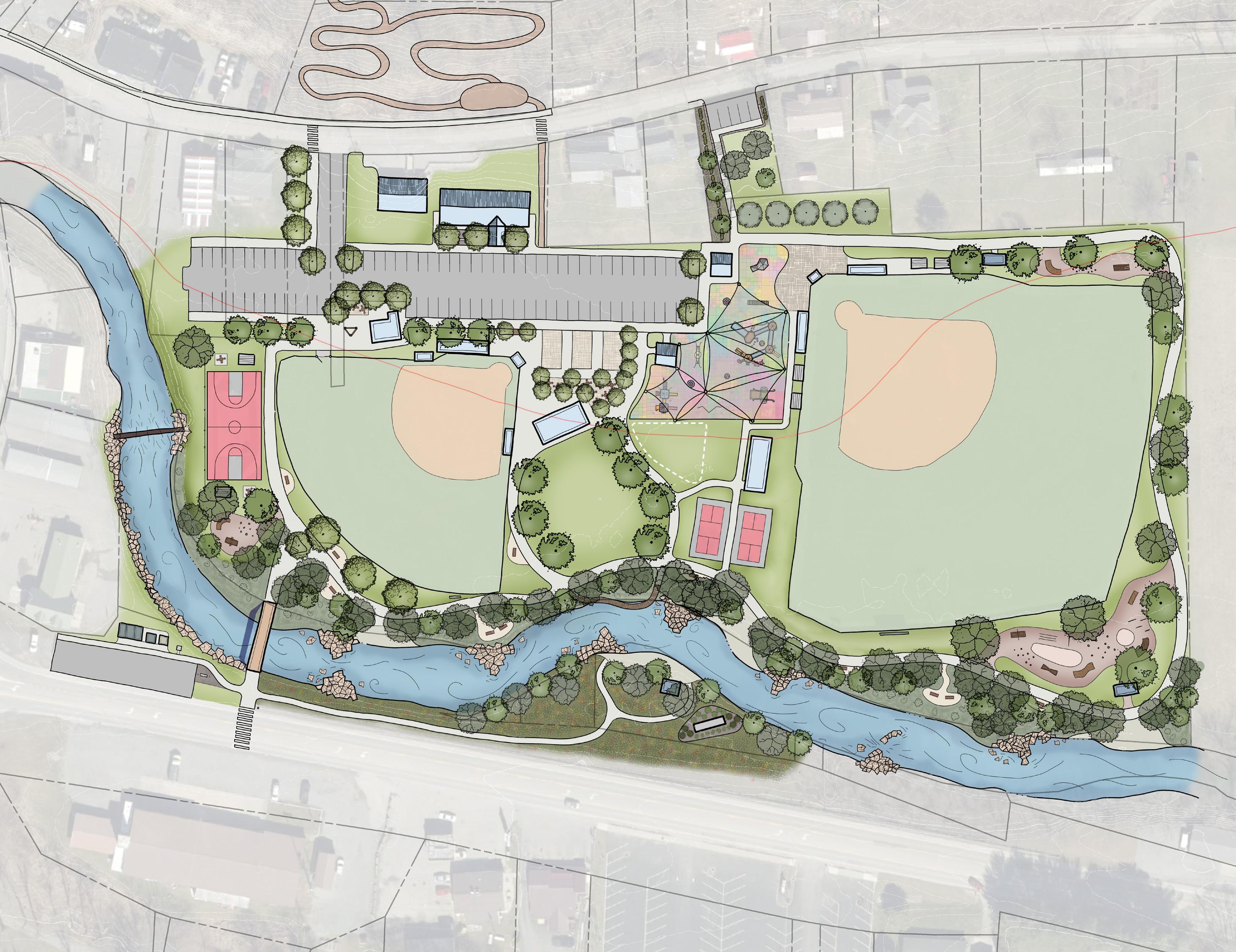
Plan Key
Improved Park Entrance
Reorganized and Resurfaced Parking Lot (58 Stalls)
Potential Parking Lot Expansion (24 Stalls, Will require additional discussion with private land owners)
Proposed Park Building Improvements (ADA Compliant and covered entrance, enhanced landscaping and memorial garden,
Existing Restrooms (Proposed facade improvements to match Park Building)
Proposed Park Entrance Plaza (With signage, shaded seating areas)
Proposed Full Size Tile Basketball Court (Utilize existing tables and chairs for seating around court)
Extended Protective Fence
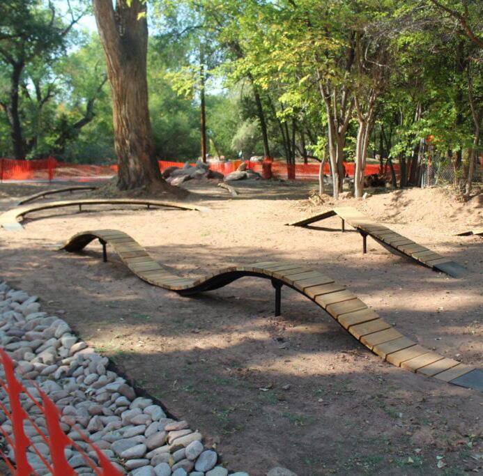
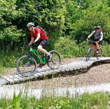
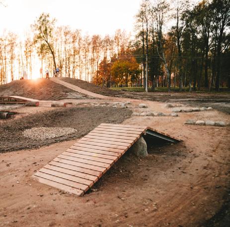
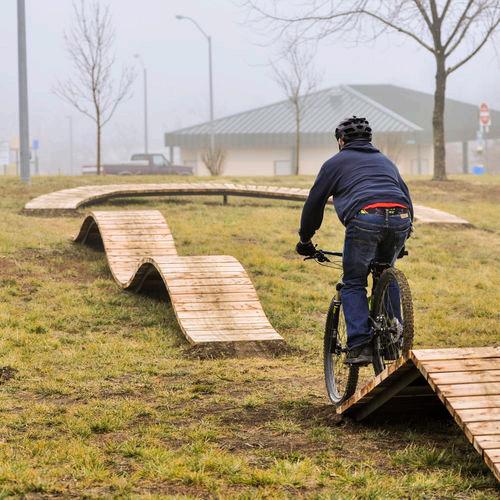
Proposed Mountain Bike Skills Development Area (Beginner to Intermediate)
Proposed New 10’ wide Pedestrian Bridge (Allows for two way pedestrian traffic and bike lane, designed to be ADA compliant)
Existing Ball Field (With existing bleachers, dugouts, and press box)
Proposed Ball Field Entrance Plaza
Proposed Seating Area
Proposed Floating Creek Amenity with Re-vegetated, Re-naturalized Creek Bank
Proposed Event Lawn and Pavilion
Proposed New Playground (Enhanced with new, ADA accessible, all inclusive play equipment, bouldering feature, PIP surfacing, and shade sails)
Existing Shelter
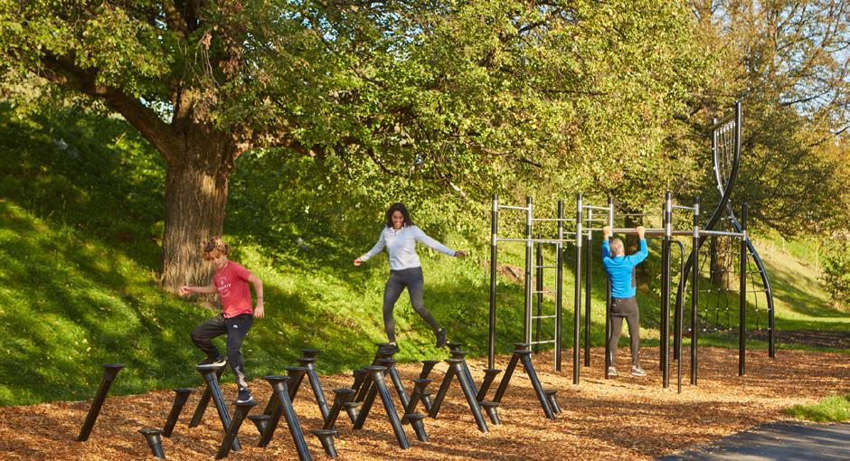
Existing Outdoor Fitness Pavilion
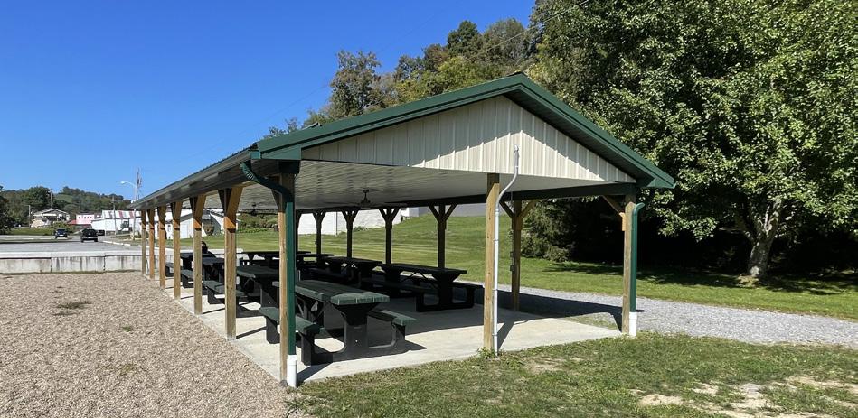
Proposed Shelter
Relocated Recycling Bins and Food Pantry
Relocated Park Sign and Flags
Proposed Access to Southern Bank of Hackers Creek (Additional coordination with land owners required for any proposed use of the southern Hackers Creek bank)
Proposed Welcome to Jane Lew Monument Signage
Proposed Trail Access
Proposed Single Track Mountain Bike Trail Loop (Opportunity for greater trail expansion through town)
Relocated Scoreboard
Proposed Improved Crosswalk with Lighted Signage
Proposed New Pedestrian Bridge
Proposed Pickleball Court
Proposed Multi Use Trail
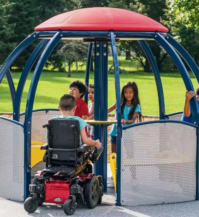
Proposed All Inclusive Playground
Proposed Hackers Creek Elements
Proposed Mountain Bike Programs
Site Visit + Concept Development
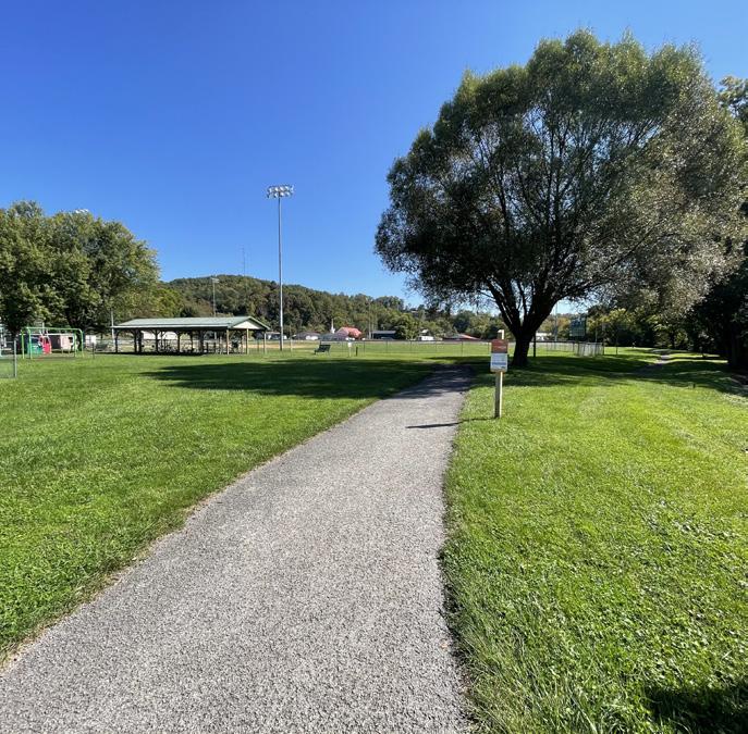
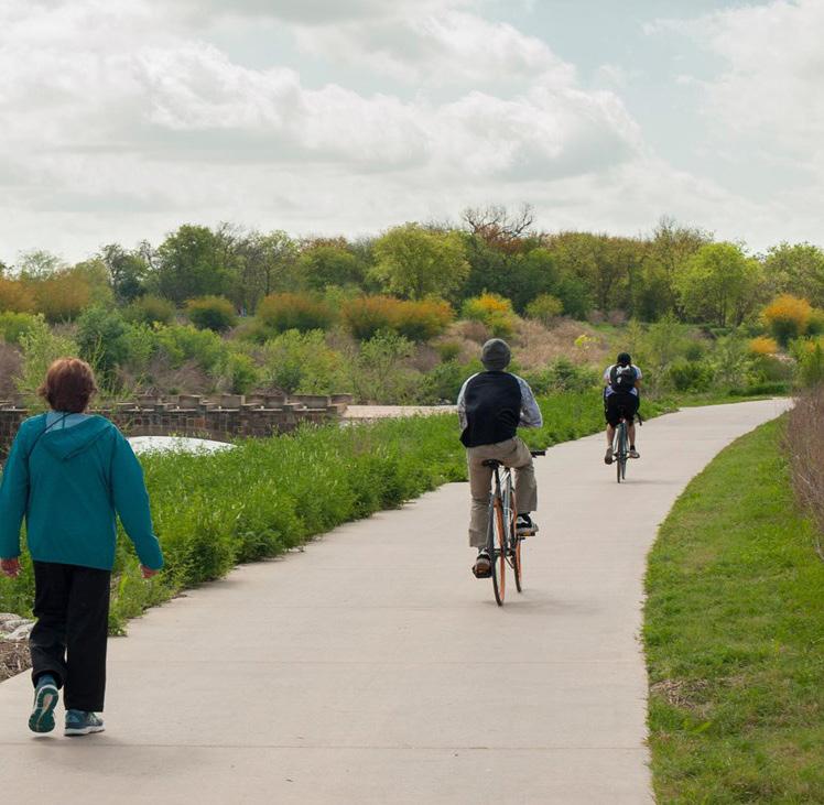
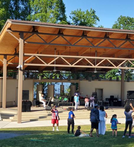
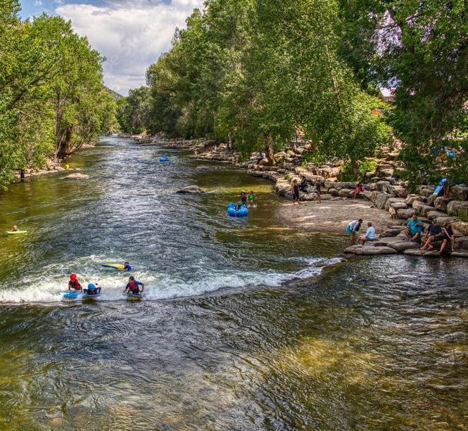
The first step in creating a masterplan for proposed improvements at the Jane Lew Town Park was to perform a site visit. First impressions revealed that the Park is a space well loved by the community. On multiple occasions, children were witnessed playing on the playground at lunch or on the basketball court in the late afternoon. Other adults could be seen taking a lap on the walking trail, often walking with their dog. Conversations with local community members attest to the popularity of the park, as many indicated that they can always see people taking advantage of the public space. Children who live in town often ride bikes to the park, and can be seen playing late into the evening. The trail often has users walking on it as well. Conversations with the Town Council revealed its popularity in the evening, with the sports fields being utilized for team practice and the Park Building for other community events. While the site visit was performed during the week, other witness accounts can attest to its popularity on the weekends, especially when a sports tournament or other local festival is being held. In particular, many individuals spoke highly of the Jane Lew Fireman’s Arts and Crafts Festival, where hundreds to thousands of visitors flood the town and browse offerings from local craft vendors. Sports tournaments are also said to bring an abundance of visitors to the park. Without a doubt, the Jane Lew Park is a beloved public amenity.
The site visit, along with conversations with Former Jane Lew Mayor Ruth Straley and the Town Council, revealed areas where improvements are necessary to ensure the park continues to serve the surrounding community. Some major items of concern include general ADA and accessibility improvements at many locations in the park, replacement of the pedestrian bridge, modernization and accessibility improvements to the playground, a community need for pickleball courts, transformation of the walking trail into a multi use trail, and opportunities to add new programs in the park that do not presently exist. The Former Mayor and Town Council mentioned multiple times that they would like to see the park image changed from the present “Jane Lew Ball Fields” impression back to the idea of it being the “Jane Lew Park,” a community space with other recreation opportunities besides ball fields. By incorporating additional amenities besides ball fields, this impression can be shifted.
Following the site visit, the master planning team compiled their observations from the site visit, information provided by the Town Council, and additional feedback received from community members to create the plan shown on page 7. Referred to as a ‘conceptual bubble diagram,’ the plan quickly locates existing and new park amenities for discussion purposes. A meeting with Former Mayor Ruth would confirm that the conceptual plan was meeting the expectations of what the town wanted for a masterplan, and would result in the recommendations found throughout this document.
Existing Conditions
Playground
Park Building
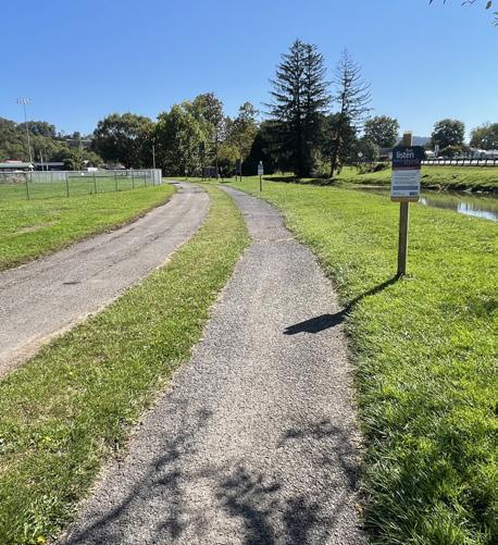
Walking Trail and Basketball Court
Walking Trail
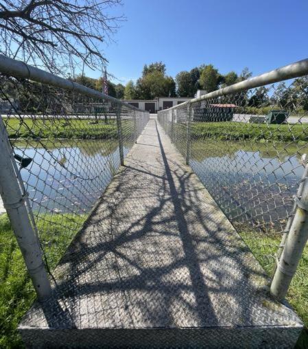
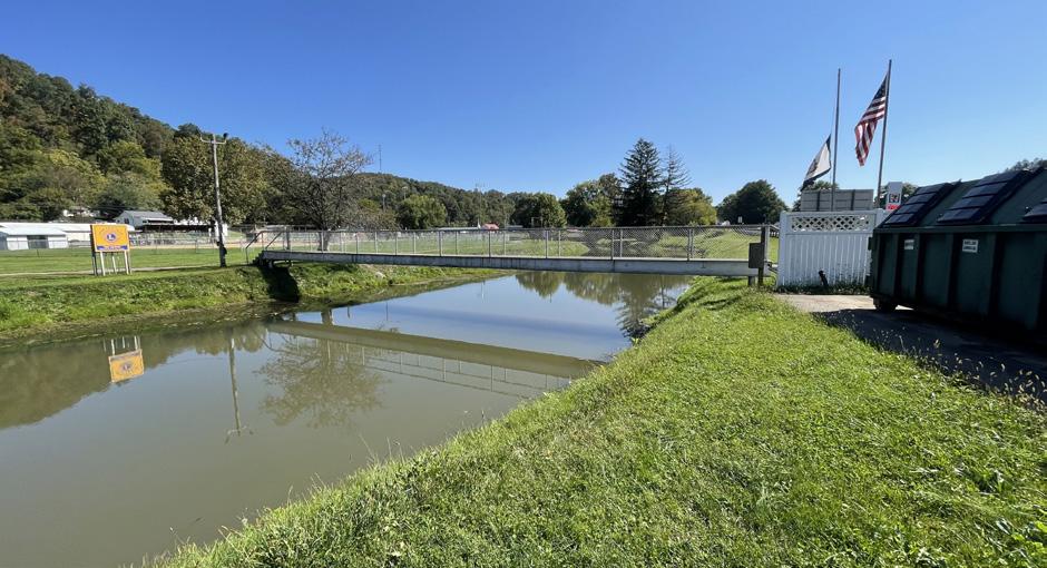
Pedestrian Bridge
Baseball Field (#2)
Conceptual Bubble Diagram
Jane Lew Park Masterplan
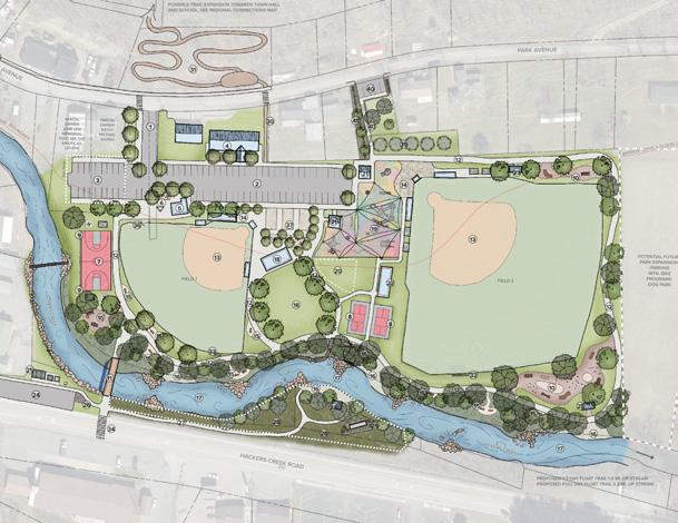
The proposed Jane Lew Park Masterplan, pictured right, enhances existing park amenities and integrates them with new park programs. This creates a cohesive design that balances the need for local sports facilities with the desire for a return to a community park atmosphere at Jane Lew Park. A widened park entrance is being proposed that accommodates both pedestrians and vehicles, which enters into a newly surfaced and reorganized parking lot. ADA and accessibility concerns have been addressed, including replacement of the pedestrian bridge and redesign of the Park Building entrance. A new playground is being proposed that accommodates a community need for equipment that is wheelchair accessible, while maximizing the amount of play space and providing much needed shade. The addition of pickleball and expansion of the existing basketball court to full size enhances sport related amenities in the park. Following the town's guidance, the smaller baseball field is removed and the area re-envisioned with additional park amenities. Proposed improvements around the remaining ball fields and existing restroom help address known concerns in these areas while aiding to the creation of a park-like atmosphere. Additionally, the plan makes use of Hackers Creek. This underutilized natural feature forms the southern park boundary and the plan proposes to re-naturalize the creek with opportunities for park visitors to interact with the water. An event area is being proposed in the park center, where former ball field 2 was located, allowing the town to better accommodate large events and opening the door to possible new park programing. Finally, mountain bike programs have been integrated into the new park design, providing a unique amenity for the town. A 10’ wide multi use path replaces the existing asphalt walking trail and connects park users to all amenities in the park. The proposed design creates new opportunities to connect to regional recreation systems, solidifying Jane Lew’s place in an ever growing outdoor recreation economy within the state.
The remainder of this document will explain each section of the masterplan in greater detail and review proposed recommendations that are pictured right. When applicable, example photos will be shown to communicate design intent. Refer back to this page when looking to see how each element fits into the larger park context.
Plan Key
Reorganized and Resurfaced Parking Lot (58 Stalls)
Will require additional discussion with private land owners)
Proposed Park Building Improvements (ADA Compliant and covered entrance, enhanced landscaping and memorial garden, and facade improvements)
Proposed Park Entrance Plaza (With signage, shaded seating areas)
Proposed Full Size Tile Basketball Court (Utilize existing tables and chairs for seating around court)
Proposed Tile Pickleball Courts (Located to allow for phased approach to masterplan implementation)
Proposed Mountain Bike Skills Development Area (Beginner to Intermediate)
Proposed New 10’ wide Pedestrian Bridge (Allows for two way pedestrian traffic and bike lane, designed to be ADA compliant)
Proposed 10’ wide Concrete Multi-Use Trail
Proposed Ball Field Entrance Plaza
Proposed Seating Area
Proposed Water Access
Proposed Event Lawn and Pavilion
Proposed New Playground (Enhanced with new, ADA accessible, all inclusive play equipment, bouldering feature, PIP surfacing, and shade sails)
Reorganized Parking along Hackers Creek Road (13 Stalls)
Relocated Park Sign and Flags
Proposed Access to Southern Bank of Hackers Creek (Additional coordination with land owners required for any proposed use of the southern Hackers Creek bank)
Proposed Wildflower Meadow
Proposed Trail Access
Proposed Single Track Mountain Bike Trail Loop (Opportunity for greater trail expansion through town)
Existing Scoreboard
Relocated Scoreboard
Proposed Improved Crosswalk with Lighted Signage
Proposed Sidewalk Connection Towards Town Hall (With potential to connect to Lewis County Greenway)
Proposed Future Parking Lot (5 Stalls, with sidewalk connection to park circulation)
Proposed Planting Buffer for Screening Between New Lot and Adjacent Property
Improved Park Entrance
Proposed Floating Creek Amenity with Re-vegetated, Re-naturalized Creek Bank
Extended Protective Fence
Relocated Recycling Bins and Food Pantry
Existing Restrooms (Proposed facade improvements to match Park Building)
Existing Shelter
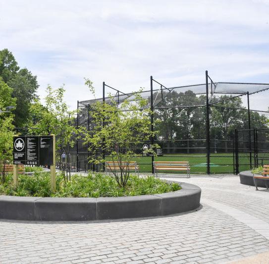
Existing Ball Field (With existing bleachers, dugouts, and press box)
Proposed Welcome to Jane Lew Monument Signage
Potential Parking Lot Expansion (24 Stalls,
Park Entrance + Building Improvements
Proposed ideas in this section of the Jane Lew Park Masterplan aim to create a unified park entrance that connects existing program elements and creates a welcoming and easy to navigate environment for park users. The proposed design accommodates both day to day park use and larger public events and sports tournaments. Known ADA accessibility conflicts are addressed, and existing buildings are modernized utilizing a unified facade theme.
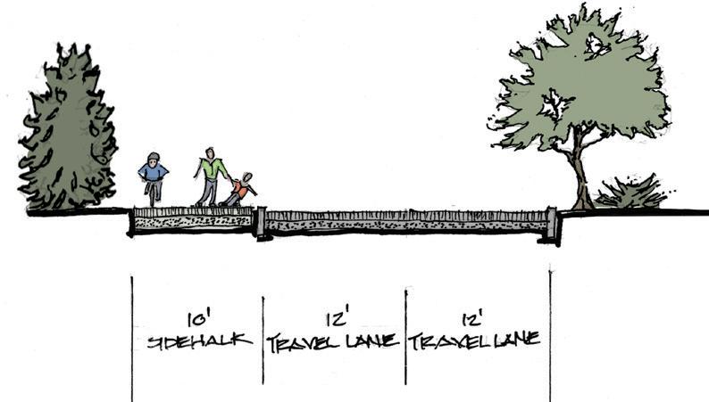
An opportunity exists to create a park entrance that better accommodates two-way vehicular traffic and improves accessibility for bike and pedestrian traffic. Utilizing the parcel of land directly west of the existing park entrance (owned by the Town of Jane Lew Public Service District), the design envisions regrading the hillside to accommodate a 24’ driveway, 10’ wide multi use path, and a vegetated buffer to help screen the adjacent private residence from park traffic. Pedestrian connections across Park Ave. will connect to a proposed sidewalk that leads into the Jane Lew town core (#35 on plan) . Potential exists to create a connection between the proposed sidewalk and the proposed Lewis County Greenway (additional coordination required). This helps form an important connection between the Jane Lew Park and the businesses that reside in Jane Lew.
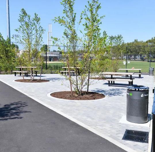
a The existing parking lot at Jane Lew Park is inconsistent and appears to have been pieced together overtime. The drive aisles between each ‘section’ of the current parking lot are not aligned. In addition, the parking lot is larger than it needs to be in some areas. A parking lot with a drive aisle and head in parking on either side should be 60’ in width. One instance in Jane Lew Park measures nearly 90’, which is wider than necessary. This inconsistency has led to vehicular conflicts during busy event days. The proposed layout simplifies the parking layout and the new footprint is dimensioned appropriately. This removes unnecessary width, creating additional program opportunities in areas adjacent to the parking lot. Approximately 58 stalls can be created through this reorganization. A sidewalk of varying dimensions (due to the proximity of adjacent property lines) is also added around the parking lot, ensuring safe and connected pedestrian circulation.
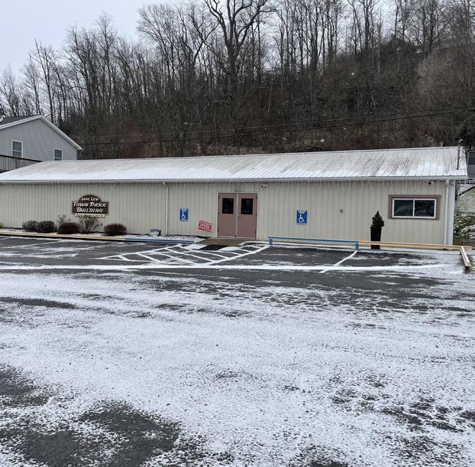
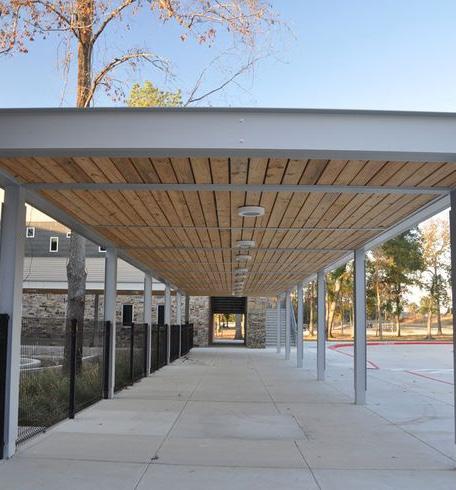
a The existing Park Building is a valued community space that hosts public events throughout the year. During the site visit performed as part of this masterplan, it was noted that the existing entrance does not comply with current ADA standards. For this reason, improvements are being proposed to address access to the building. In the process of reorganizing the parking lot, space is created to redesign the building entrance in a way that complies with ADA requirements. When this occurs, a covered entrance can be created. This helps to protect users from the elements when gathering outside of the building. At the same time, planting beds are created in front of the building. Not only does this beautify the space, but it can also serve as a memorial garden for the existing dedication stone for Shirley Dianne Hicks.
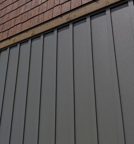
In addition to re-envisioning the building entrance, this masterplan also proposes to create a unified facade them for all park buildings found on site. This unified facade would be applied here, helping to modernize the park building
Discussions with the Jane Lew Town Council emphasized a need to maximize parking at the Jane Lew Park. The town struggles to accommodate the large crowds of visitors it experiences with its various sports tournaments and other public events. With this in mind, an opportunity exists to expand the parking lot into the two adjacent land parcels to the west. Additional discussions will need to occur between the land owners and the town in order to reach an agreement where the land can be used. The extension would add approximately 24 parking stalls to the overall parking count at the park.
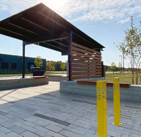
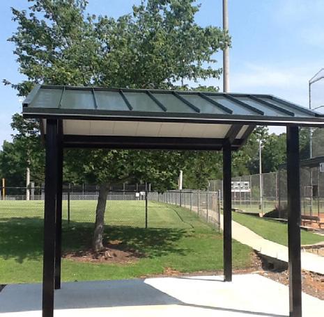
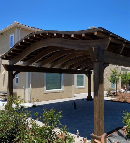
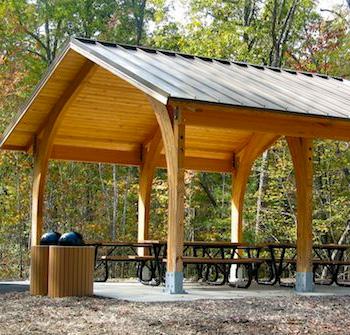
For proposed covered entrance improvements, a structure similar to what is pictured above left is recommended. It is a stand alone structure and easily adaptable to existing buildings. Roof line and other themes could be unified to match other proposed structures in park (such as proposed event pavilion, #18 on plan). For proposed facade improvements, some combination of wood and black paneling is suggested (above right). Facade can then be added to other structures in the park (restrooms, pavilions).
Example Section of Proposed Park Entrance
Hackers Creek
Park Entrance + Building Improvements
also marks the start of the proposed multi-use trail. From here, users enter the park via the trail.
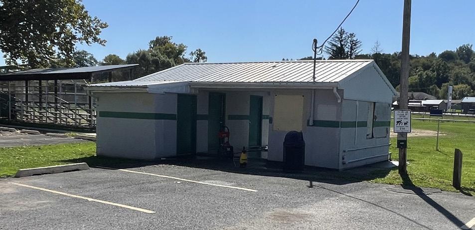
a The existing restroom facility at the Jane Lew Park is beneficial for accommodating public events. The facility is functional, and the only improvement being proposed is to update the building’s facade to match any future building facade themes that would be implemented at the park building. Additional improvements are being proposed to address pedestrian circulation around the building. See #6 for additional information.
The above images show a few possible elements of what can be included in the entrance plaza, including shade, seating, signage, and plantings. Infrastructure that supports activities in the park would be recommended, such as a bike rack.
in the park. The site's steep slope (avg. of 20% across parcel) limits the opportunity of using this for parking. To make the best cost effective use, the plan proposes a small, 5 stall parking lot created adjacent to Park Ave. This will require the construction of an approx. 10' retaining wall to implement. Stairs then connect this parking area to the main site circulation path. This will create a secondary park entrance.
During the reorganization of the parking lot, an opportunity is given to create an entrance plaza adjacent to the restroom facility. The creation of this threshold into the park provides a transitional space where visitors can become oriented to the park. This can be accomplished through the implementation of signage and information kiosks at this location. Maps can be installed to not only communicate what all the park has to offer, but also introduce visitors to regional attractions worth checking out. It also serves as a waiting or gathering space for users. Shaded seating provides a central and easily identifiable place for visitors to wait, such as to meet up with other members of their party or to simply observe their surroundings. It also can serve as a waiting area for the adjacent restroom. This plaza
There are limited safe pedestrian circulation routes that connect the park to Jane Lew's town center. To address this access concern, a sidewalk is being proposed along Park Ave. that has the potential to connect to Town Hall. Proposed crosswalks will connect this sidewalk to the park.
The Proposed Future Parking Lot (#40) is located in the middle of residential properties off of Park Ave. Out of respect of the neighboring properties, a planted buffer for screening is being recommended on the west side of the parcel. This will create separation between the proposed sidewalk and residence.
During the master planning process the town of Jane Lew became aware that there is an adjacent park property that they would be acquiring in the future. (Parcel ID: 21-04-008C-0083-0000) To plan for this park addition, the town requested that this additional area be considered for parking lot expansion. Parking is consistently a limiting factor
The above images represent a few different forms the planted screening buffer can take. It can be comprised of a variety of native trees and shrubs, or be comprised of primarily evergreens.
Existing Park Restroom Facility
Hackers Creek
Walking Trail and Pedestrian Connections
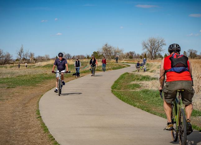
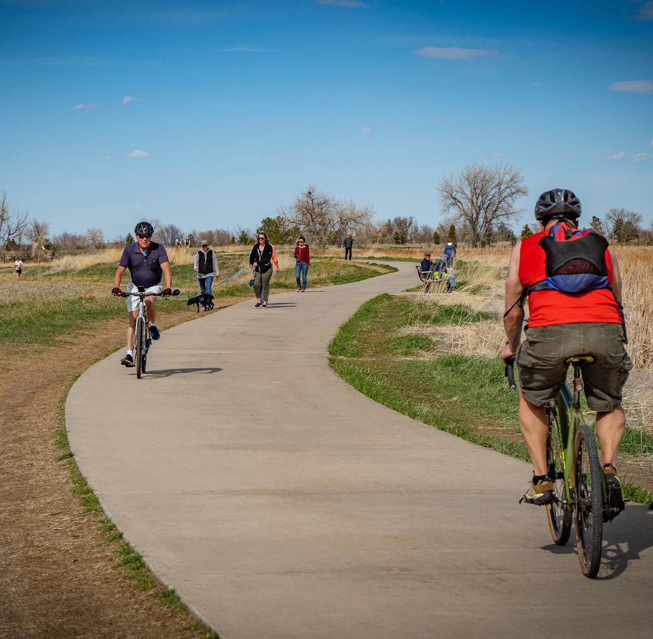
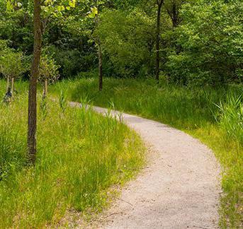
a Conversations during the master planning process indicated that two of the most popular recreational amenities found at the Jane Lew Park are the walking trail and ball fields. The popularity of the walking trail was later confirmed during site visits. At lunch time, several users were witnessed using the trail. The frequent use of the walking trail has led the town of Jane Lew to prioritize improvements to this amenity. The existing 6’ wide asphalt trail has become uneven over the years. Continual flooding from Hackers Creek and roots from nearby trees have resulted in lifted and/or washed away pavement. Drainage is a concern along the trail, and ice was seen in many locations during a winter site visit. ADA accessibility is also a concern, with one portion of the trail having a slope of +/- 10%. This masterplan proposes to replace the existing trail with a 10’ wide concrete path. The larger width will allow room for safe passing lanes for bikers, runners, and other fast paced users. Replacing the existing surface with concrete will allow it to resist flooding from Hackers Creek better than the current asphalt. The trail follows a similar alignment to what can be found in the park today, but has been adjusted to better accommodate other recommendations found throughout this masterplan. An approximate half-mile loop (sticking to outer trail loop, see blue dashed line on plan) and a quarter mile loop (taking path between event area and field 3, see red dashed line on plan) can be created with the trail alignment being proposed.
A 10’ multi use path will allow for pedestrians and bikers to recreate in the same space. Above images show a few different examples of concrete, multi use paths.
a
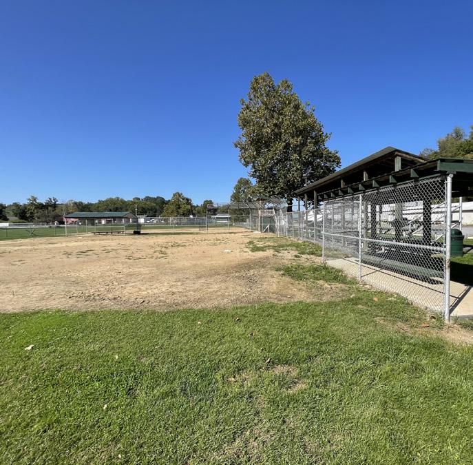
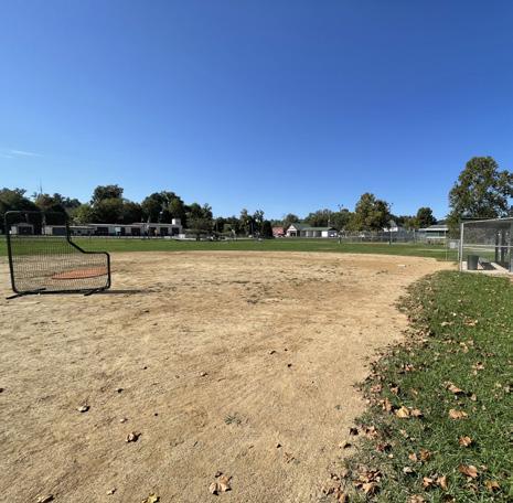
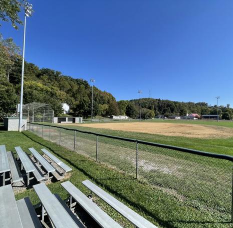
It is known that the existing ball fields at Jane Lew Park are highly valued by the community. Because of this, the town's ball field complex was carefully considered when thinking about the future of the town park. A goal from the beginning of the project was to create a park that balances the need for baseball/softball recreation facilities with other community focused recreational park programs. Following discussions with the Jane Lew Town Council, it is being recommended that Field 2 (existing middle field) be removed. This field is smaller than a standard baseball field and can only be used in a limited number of ways. Removal of Field 2 will allow for a greater balance of park amenities to be established that are not baseball/ softball related. This follows the council's vision of creating a community-centered park with a variety of recreational program offerings.
The remaining fields (Fields 1 and 3) are well taken care of and few improvements are needed at this time. Minor improvements that are recommended as a part of this masterplan, besides those listed on this page, include:
• Enclosing any open air dugouts, particularly the ones located on Field 1.
• Addition of a PA and siren system in the park, to provide live commentary for sporting events and alert the town when severe weather is approaching.
• Address drainage concerns in the outfield of field 3.
creating any conflict with those using the multi use path.
Field 1 Shaded Outfield Seating
In order to create a formalized entrance into each field complex area, a plaza is being proposed for each field entrance. This will create a gathering space before visitors enter the field or go to the bleachers, address known drainage issues and muddy areas, and provide additional seating and/ or shade at the entrance of each field. Users in wheelchairs will also be able to watch the game from these areas. In addition, it creates a cohesive design that ties into proposed pedestrian circulation. This will create safe pedestrian connections between the fields and key locations within the park.
Above images show additional examples of ball field entrance plaza and the different elements this could include.
Discussions with community members revealed that during game days park users often set up tents in this area to watch the game. There was concern voiced that removing the ability to set up tents would cause an issue when accommodating larger game day crowds. This area will remain as a place to set up tents. The planting of shade trees in this area is being proposed to eliminate the need to set up as many portable tents.
The existing scoreboard for Field 3 will remain at its current location.
To accommodate the new multi use walking trail and proposed recommendations along Hacker’s Creek, the scoreboard for Field 1 will need to be relocated. Shifting it closer to the fence line will create enough room to accommodate grading for the proposed multi use path and re-naturalization of Hackers Creek.
Bumped out seating areas between the multi use trail and baseball field fence line provide additional areas for park visitors to sit and watch a game. Priority will be given to those in a wheelchair, as these bump outs provide a location where wheelchair users can sit and watch the game without
During large, public events, the Town of Jane Lew utilizes Field 1 to park overflow vehicles. The proposed masterplan recommends shifting this gate to the west slightly. This will align the gate with the expanded driveway entrance into the park. In addition, mountable curb is recommended on the portion of sidewalk in front of this gate to allow for ease of access onto the field.
Above images show existing ball fields 2 (above left) and field 3 (above right)
Hackers Creek
Park Court Sports
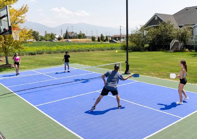
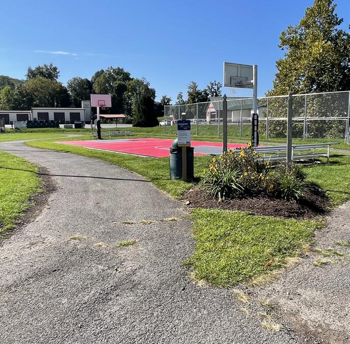
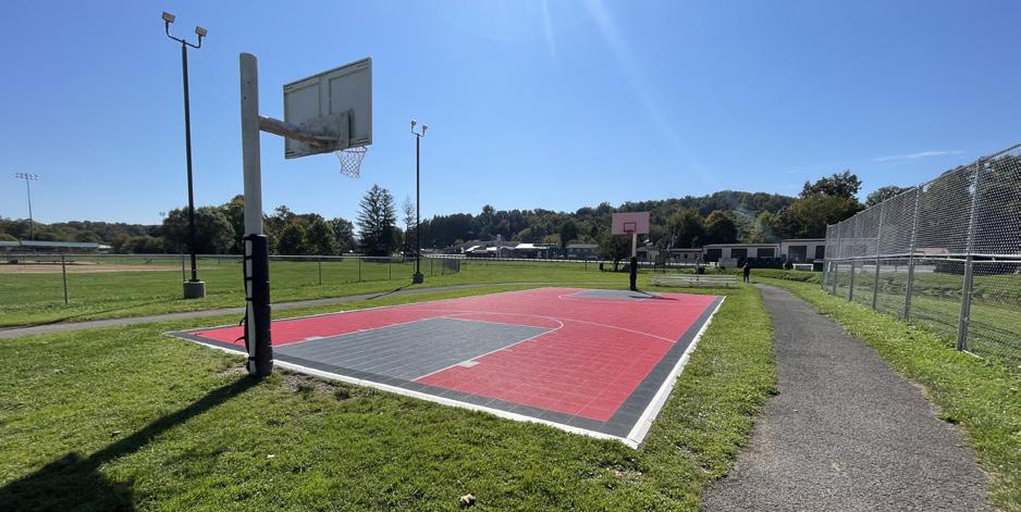
Conversations with Jane Lew locals revealed how popular the basketball court at the Jane Lew Park is with local youth. Several individuals spoke about seeing kids play games into the evening on most days. When asked about the park, the basketball court and its popularity were often mentioned by community members. The park masterplan proposes to enhance this beloved feature. The existing court is smaller (60' L x 30' W) than a standard basketball court (94' L x 50' W). It is recommended that the existing tile court is replaced with a full size tile basketball court. The town has had success with the tile court system, and would like to continue using this product.
requested that the pickleball courts be located in a way that allows for their immediate construction, taking into consideration existing elements, while also planning for the future construction of other masterplan elements as funds become available. For this reason, the masterplan proposes placing the courts south of the existing outdoor fitness pavilion. This locates them on either side of the existing walking trail, between existing ball fields 2 and 3. They can be constructed without major changes to the existing park layout. When field 2 is removed and the remainder of the masterplan realized, this location allows them to fit into existing layout and circulation with few changes. Similar to the basketball court, the town would like to continue utilizing a tile court system for the pickleball courts.
additional court area. This will create a barrier to prevent runaway balls from falling into the water, in addition to promoting park user safety at this location.
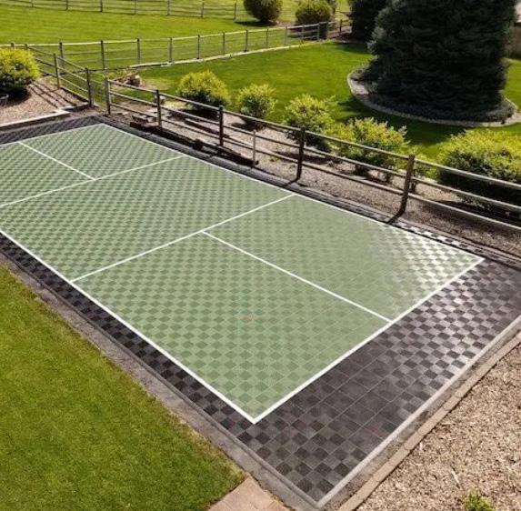
Pickleball is a sport rapidly growing in popularity across the country, and Jane Lew is no exception. A request for pickleball courts to be added at the Town's park has been received from multiple sources, including community members and from Lewis County officials. This will be in coordination with other pickleball court construction efforts in Lewis County, to ensure the local league has enough courts between the local towns for their members.
Due to their high demand, the Town
The existing protective fence creates a buffer between the current basketball court and the dam located on Hackers Creek. When expanding the basketball court to be full size, the protective fence will also need extended to accommodate the
To best accommodate games occurring on the basketball court, seating is being proposed for either end of the basketball court. This utilizes existing tables and bleachers found there today, but relocates them. This idea could be expanded upon in the future and utilize shade structures for user comfort. A few examples of what these shade structures could look like are shown below.
The above photos show different elements that could be included as a part of this seating area near the courts. The top left shows the existing tables. These could be re-purposed, and the new seating area can be similar to what is shown. Alternatively, other elements could be added, such as a small shade structure.
Existing tile basketball court at Jane Lew Park (pictured above) to be expanded.
Existing protective fence at Jane Lew Park (pictured right) to be extended.
Similar to the existing basketball court, a tile court is being proposed for the pickleball courts. Design and colors can be customized to match Jane Lew’s preference.
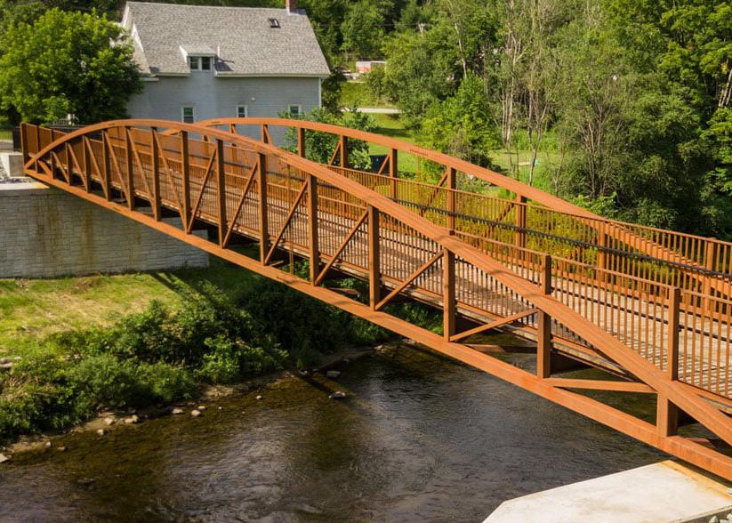
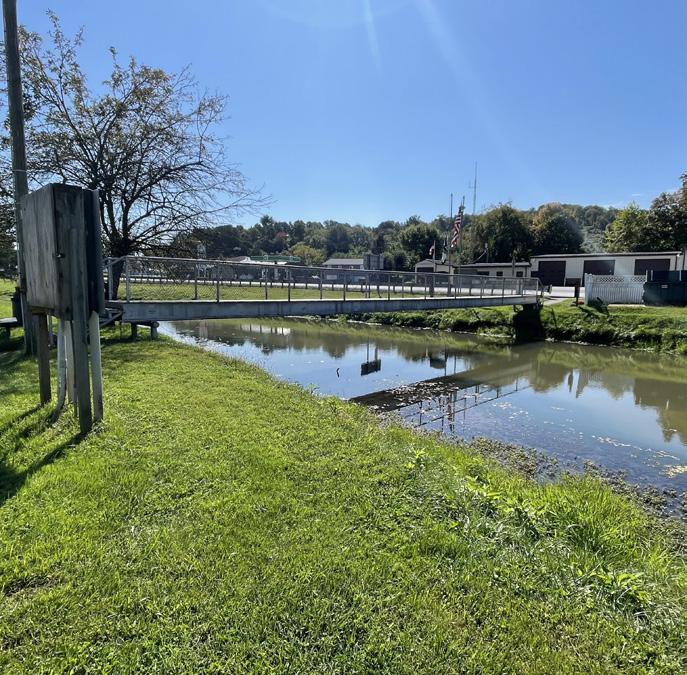
Pedestrian Bridge
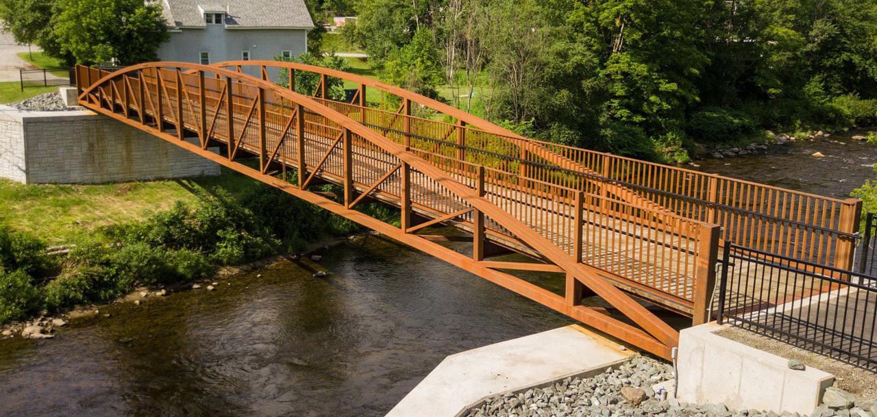
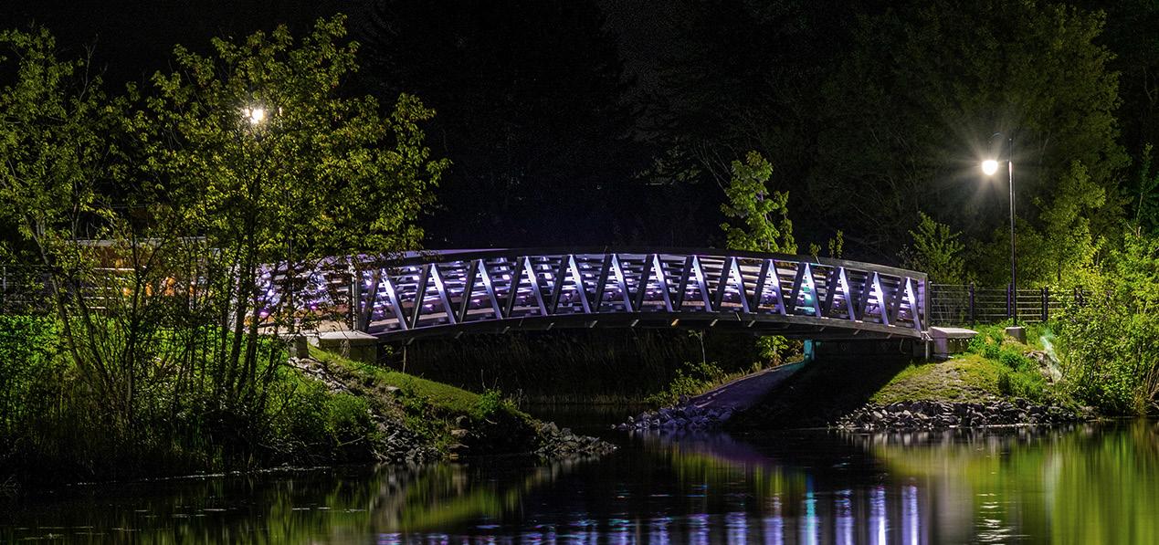
Early in the master planning process, the Town of Jane Lew identified that one of the top priorities is to address the pedestrian bridge found on the southern border of the park. The bridge, which was constructed in the mid 1900s, needs replaced. It is a narrow bridge that only accommodates one way pedestrian traffic, due to its 3’-4’ width. In addition, steps on either side do not comply with today’s ADA regulations and even make it a challenge for those with strollers or a bike to cross. Many stories were shared regarding the challenge of transporting a stroller across Hackers Creek. Being that this is the southern entrance into the park, and is located close to additional parking that is utilized during town events, it is essential that these shortfalls are addressed. Improvements to the pedestrian bridge and surrounding programs are described in this section.
taken into consideration when replacing the bridge. The town indicated that a more “weathered and traditional” look would best suit the town. They would like the bridge to match the surrounding architectural character in town. A covered bridge is also not preferred. With these details in mind, a pedestrian bridge made out of timber or Corten Steel is suggested. Any proposed bridge should also include lighting. The town would like to include lighting that can be manipulated, so that they can change the colors as the seasons change. Below are a few examples of possible bridge ideas.
a
The pedestrian bridge at the Jane Lew Park creates an important southern entrance into the site. Because of this, it is essential for the above conflicts with the bridge (i.e. accessibility access and bridge width) be addressed. Discussions with the Mayor and Town Council indicated that a multi use bridge design is preferred. To best accommodate both pedestrian and bicycle traffic, a 10’ wide bridge deck is recommended. This will additionally support a separate plan the town has to connect the park to the proposed Lewis County Greenway. For ease of access, it is also important that the new bridge design does not have any stairs. The proposed design regrades the site at this location to eliminate the use of any stairs and meeting ADA standards, while seamlessly integrating the bridge into the multi use path being proposed.
It is also important to note that the bridge is one of the first defining elements drivers on Hackers Creek Road see as they drive into town from Interstate 79. Aesthetics also need to be
a In the process of creating ADA access to the pedestrian bridge, a few of the existing programs will need to be rearranged. During this process, it is recommended that the existing gravel lot found along Hackers Creek Road is formalized into a dimensioned parking area, especially if it is used by the public. This will promote pedestrian safety. The proposed concept creates 13 parking spaces.
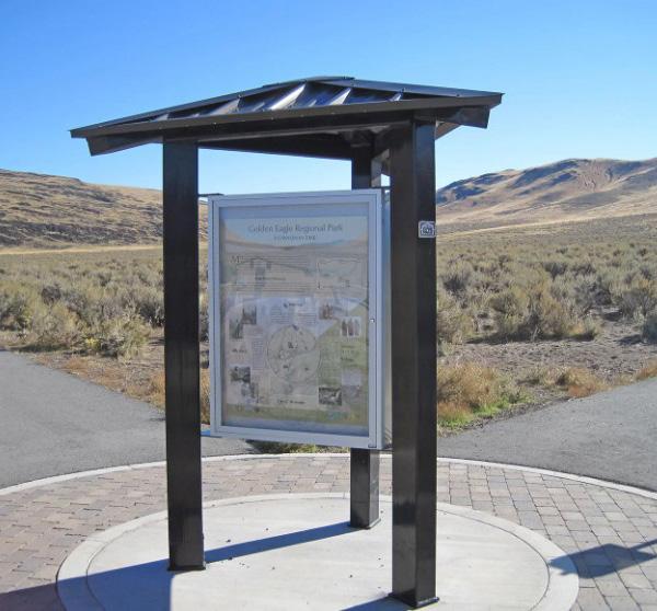
The pedestrian bridge access into the park creates an important, secondary entrance. For this reason it is recommended that a secondary park entrance sign and map information be added at this location. This will orient visitors on how to navigate the park as they enter from this side without having to walk to the primary entrance.
When creating ADA access to the pedestrian bridge, the existing recycling center will need to be relocated. Its current location also poses a safety concern, as there is limited space to access the bins without falling down the steep Hackers Creek bank. The proposed location addresses this safety concern and creates easier access between the recycling center and parking lot. The existing community food pantry will also need to be relocated slightly when creating ADA access to the pedestrian bridge.
To accommodate programs described on page 32-33, it will also be necessary to relocate the existing park sign and flags along Hackers Creek Road. The new location for this is being proposed in space where the existing recycling center is located.
The existing crosswalk between the pedestrian bridge and the fire department will remain. New, lighted crosswalk signage and signaling is recommended to promote pedestrian safety.
Above images show a couple possible design options for the pedestrian bridge. Materials such as Corten steel or wood is preferred. A bridge with nighttime lighting is also preferred.
Hackers Creek
Hackers Creek
Hackers Creek Road
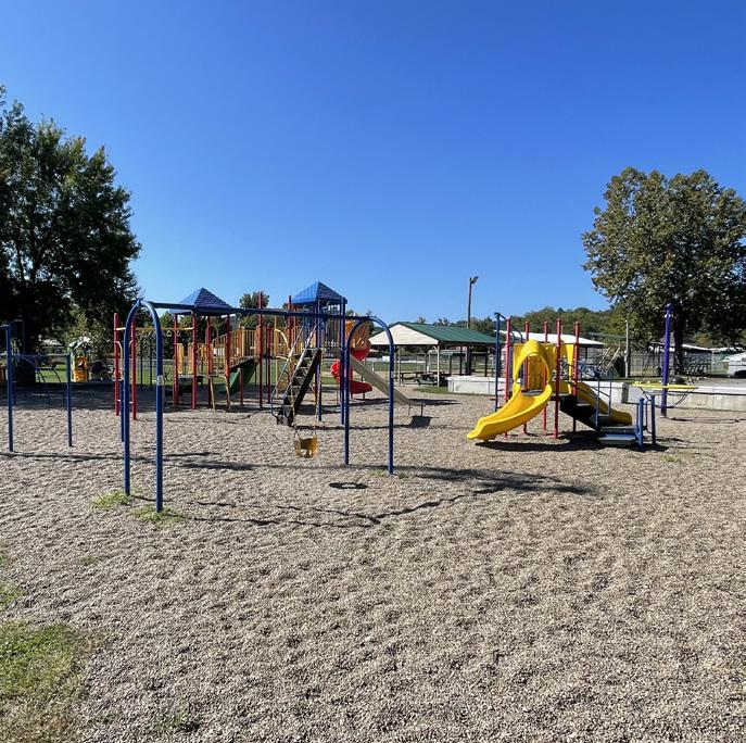
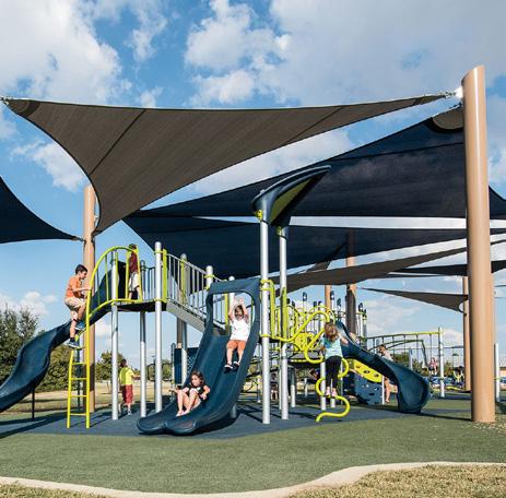
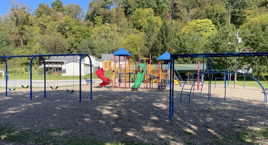
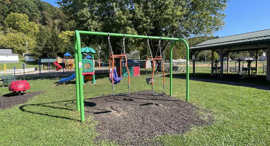
Playground
After one visit to the Jane Lew Park, it was evident that the playground is a popular feature in the park. Further conversations with locals confirmed this initial observation. Because of this, the town indicated at the start of the master planning process that they wish to invest in the playground to correct a few known concerns and make it an even better space for park users. The below section describes improvements being proposed in and around the playground as a part of this masterplan.
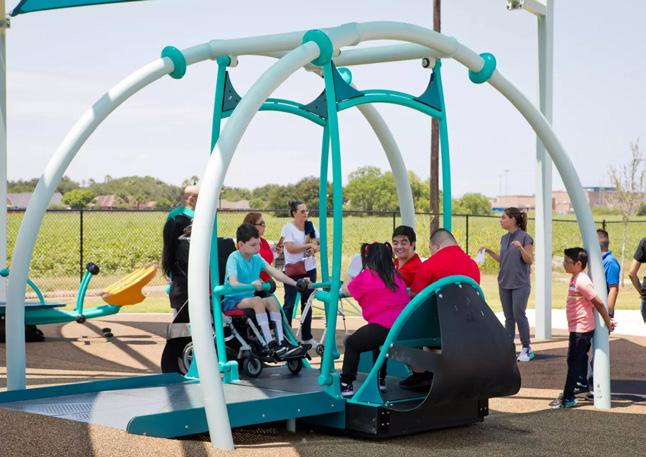
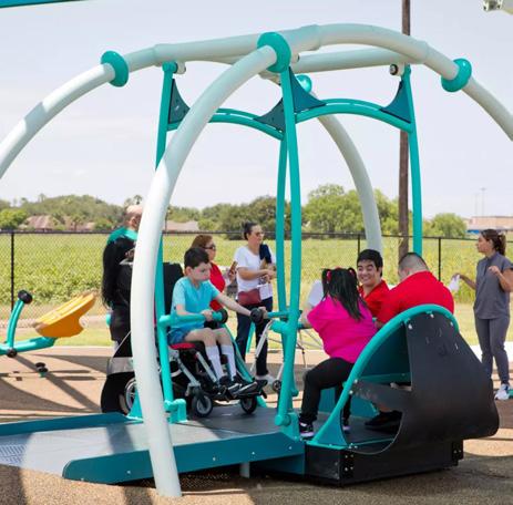
Discussions with the Town Council revealed there were several improvements that needed to be made to the park playground. As the park has aged, they are having an issue with equipment failing safety inspections. There are additional concerns regarding the current surfacing - pea gravel. Not only is it unforgiving for kids to fall in, but there have been reports of kids throwing it at each other. In addition, the town struggles to maintain the pea gravel when the park floods. Shade is also needed. Sitting in the center of the open park, only a couple trees surround the area. They do little to hold back the heat in the middle of summer. Lastly, there is a need in the community to have a playground that is accommodating for children of all abilities. The current playground equipment is not all inclusive, and the pea gravel can make it a challenge for someone with a mobility disability to navigate.
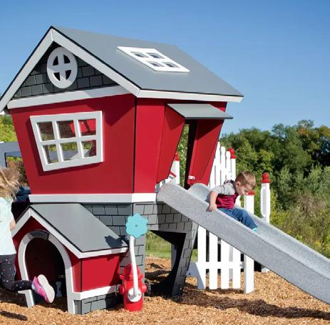
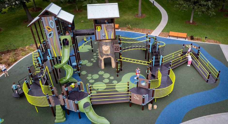
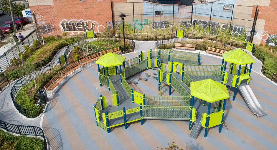
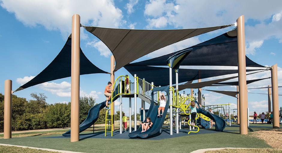
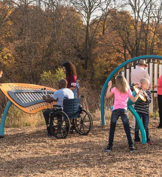
For these reasons, the Jane Lew Park masterplan proposes to replace the playground. When doing so, it is recommended that the playground equipment is all inclusive and wheelchair accessible. The design shown on the right includes several pieces of equipment that are all inclusive and/or wheelchair accessible, including a wheelchair accessible play structure and swing. Other proposed equipment allow for kids of all abilities to play together. The proposed design also adds in a few new types of play equipment, including
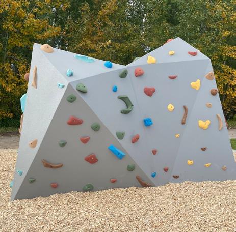
musical instruments and a bouldering rock feature. A classic West Virginia activity, the bouldering rock allows kids to test their skills at rock climbing in a safe, playground setting. Shade sails stretch across the play space, providing shade and alleviating heat in the middle of the day. Poured in place rubber surfacing is being proposed, eliminating the troublesome pea gravel. A last major modification to the existing playground is to reunite it. The existing walking trail cuts through the middle of the playground, dividing it into two different areas. The proposed redesign pushes this walking trail to the outside. This maximizes the amount of play space and connects the play areas together. A play area for 2-5 year olds is still maintained, with equipment for younger children being placed closest to one of the existing shelters. The remainder of the playground will be designed with 5-12 year olds in mind. Due to the existing floodplain and surrounding ball fields, opportunities to expand the playground footprint more are limited.
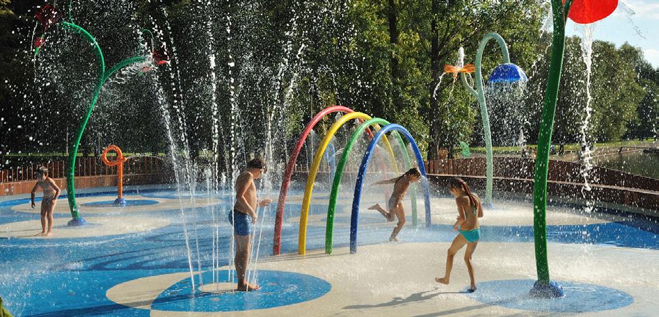
Discussions held with various entities during the master planning process indicated that there was interest in adding a splashpad to Jane Lew Park in the future. While specific details regarding this feature are unknown at the time of this masterplan, this is an element that still needs considered when envisioning the park's future. The area south of the playground (#20) is being reserved for this program.
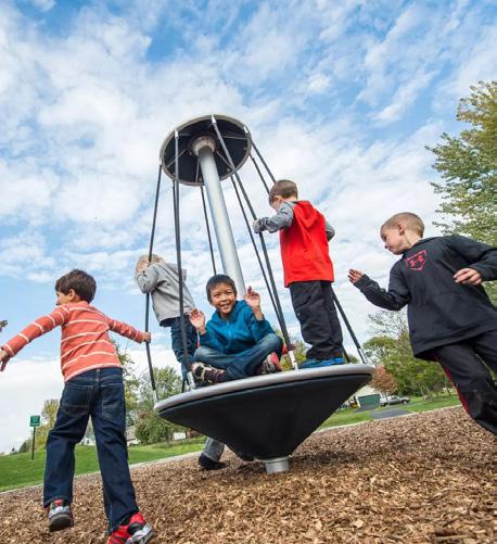
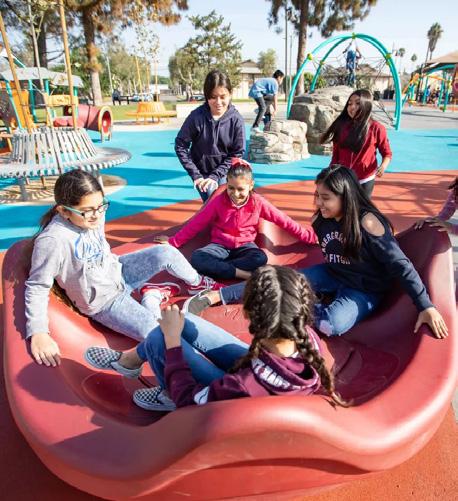
Above images show several of proposed playground elements in the design pictured right. Generally, proposed equipment is all inclusive and ADA accessible.
Playground
a
The park has two well crafted shelters existing around the playground. In the process of updating the playground, it is recommended that these shelters remain. The proposed design ties them in to the proposed sidewalk and playground design, allowing for their continued use.
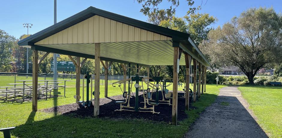
aGiven to the Town of Jane Lew via a grant, the outdoor fitness pavilion at Jane Lew Park contains exercise equipment. Similar to gym equipment, this allows park users additional exercise opportunities for their daily workout. The plan proposes that the pavilion remains in its existing location. Additional sidewalk located around this program connects it to the proposed park circulation.
The Jane Lew Park masterplan proposes to add additional sidewalk on the eastern border of the playground. This sidewalk then connects to the outdoor fitness pavilion (#22) and the proposed pickleball courts (#8) before tying in to the proposed main site circulation. This creates an important pedestrian connection between Field 3, the playground, the event lawn and pavilion, and the multi use walking trail.
One of the existing picnic shelters is pictured above. A well built structure, it is recommended that they remain and new playground designed around it.
The existing fitness pavilion is pictured above.
Photos pictured right and below show additional examples of play equipment and shade that can be included as part of the new playground design.
Event Lawn and Pavilion
a
During the master planning process, discussions with the town revealed that there is a need to create a space to host large public events. Whether it is for live music or movie nights in the park, a dedicated space to host larger gatherings of people would be greatly valued. With the consideration of removing Field 2 (existing center ball field), an opportunity to realize the full potential of this program was provided.
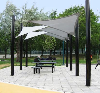
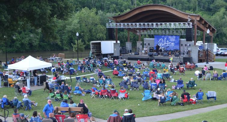
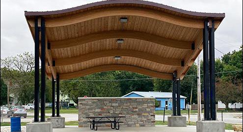
The park masterplan proposes the creation of an event lawn and pavilion in the center of the Jane Lew Park. When considering the pavilion, a few options are available. This structure could be designed to look like a formal stage within the park. Alternatively, it could be designed to serve both as a stage and large picnic pavilion. This dual use will ensure this program is used year round. The proposed design also contains a large lawn area with the potential to accommodate up to 1,000 people if seating is arranged in amphitheater-style rows. When no events are occurring, this area can serve as a large open greenspace in the park, with circulation paths forming the outer boundary.
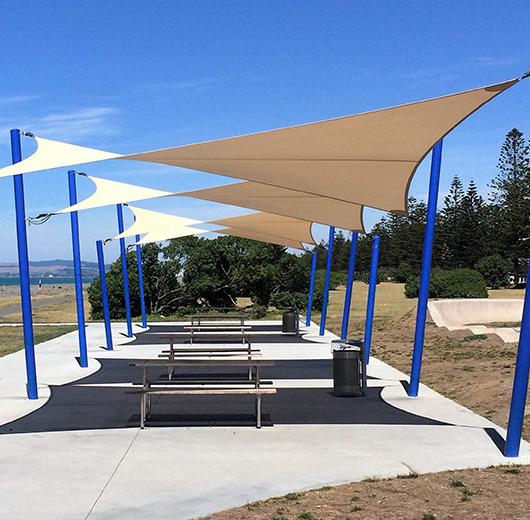
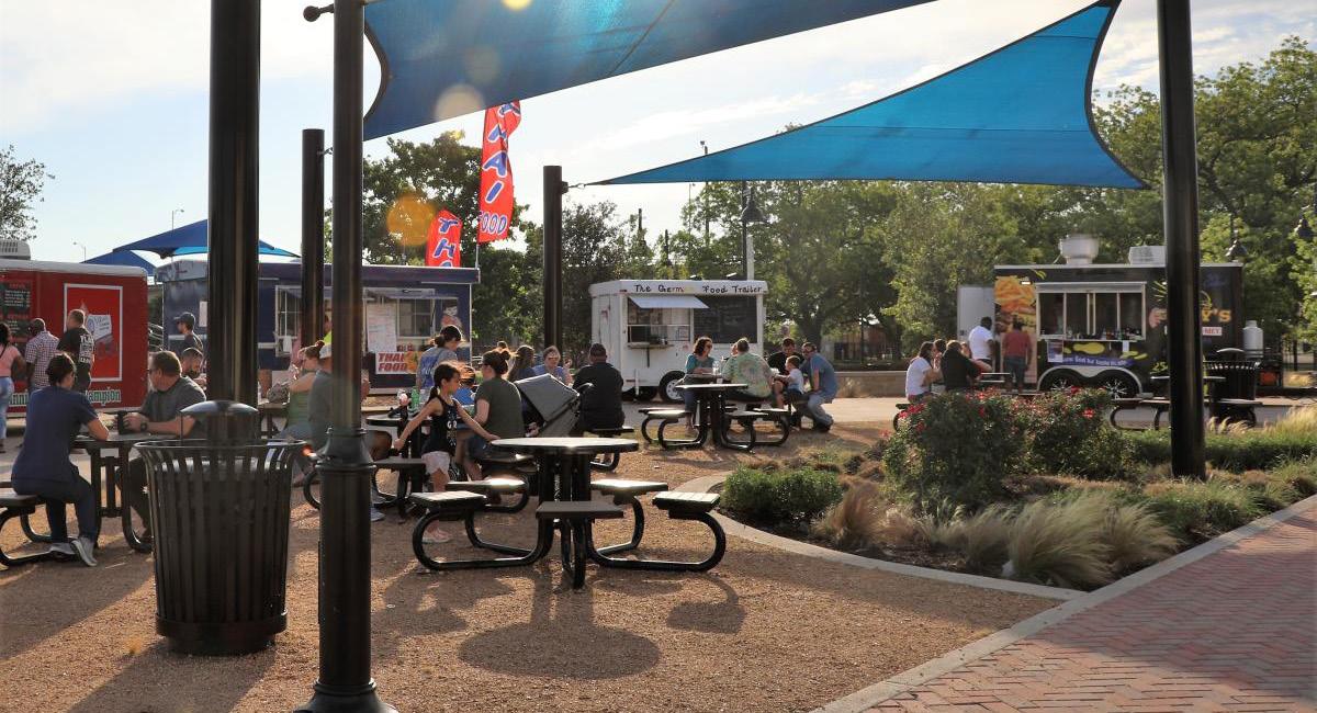
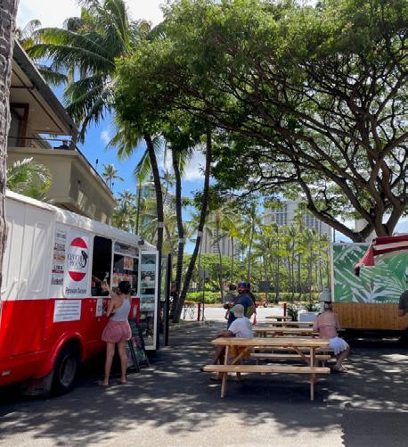
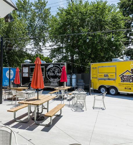
Building off of the idea of creating a large event - oriented program at the Jane Lew Park, a plaza is being proposed behind the event stage to support events. This plaza is unique as it provides for three food truck parking areas, in addition to shaded seating. Discussions with the Town Council indicated that 1-5 food trucks could be in the park at any time during any big events. This creates a formalized location for these businesses to park and sell their products during busy park days. Shaded seating nearby provides a place for visitors to consume their purchases.
Discussions during the project process also indicated a need for a location in town to host a local farmers market. This plaza can also serve that need. Market stands can be set up where the trucks would typically park and be spread throughout the plaza. A central location, this plaza can also be utilized to host other events in the park.
Several examples of the possible forms the proposed event pavilion and food truck plaza could take are pictured on this page. This could be designed to look more like a formal stage (top right photo) or be a dual purpose stage and picnic pavilion (2nd from top right photo).
Approx.ZoneAFloodZoneBoundary
Hackers Creek
Mountain Bike Programs
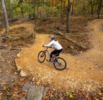
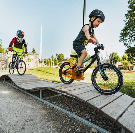
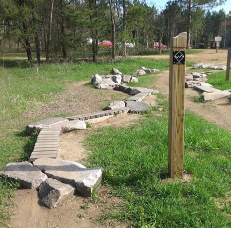
During master planning discussions with the town, one topic that was repeatedly discussed was the idea of changing the perception of the park from the ‘Jane Lew Ball Fields’ back to the ‘Jane Lew Park.’ Due to the popularity of the sport in the region, and the fact that the ball fields are the primary land use in the park, the site has often been referred to as the ‘Jane Lew Ball Fields’ over the years. One way the masterplan addresses this perception is by adding additional programs to the site besides ball fields. With the potential connection to the Lewis County Greenway, the idea of implementing mountain bike programs was proposed. In addition, discussions with community members revealed that local children can often be seen in the park with their bikes in the evening. To support this activity and help locals develop mountain bike riding skills, an ever growing sport in the region, a few ideas are being proposed: a
Conversations with the Mayor revealed that the parcel of land located along Park Ave., directly across from the park entrance is for sale. The town had previously considered purchasing it, but were unsure of how they would program it. The steep terrain poses a challenge for most ideas. One program that it is useful for, however, is mountain biking. The masterplan proposes that the town acquires the land to create a single track mountain bike trail loop. This will support the development of bike riders’ skills. When riders feel comfortable enough to attempt a more advance mountain bike option, they can try out the single track trail. A trail head at the base of the slope starts the loop.
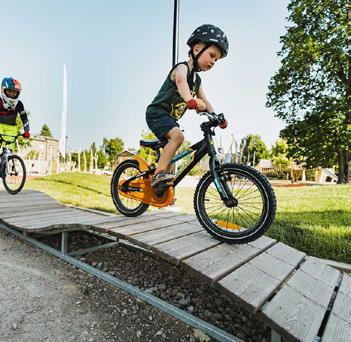
For those first attempting to mountain bike, it can be a daunting task. Mountain biking involves rough terrain, obstacles, and jumps. To help users develop these skills and become more confident once they start riding on a trail, the masterplan proposes the implementation of ‘mountain bike skills development stations’. Located at various locations along the multi use trail, each area contains a few obstacles for users to test and develop their skills on. Each obstacle is focused on developing a specific skill set that riders will need when they move on to more advance riding. From balance to jumps and turns, there is something for everyone. The family friendly program encourages all to attempt each obstacle. Riders can bike along the multi use trail, traveling from station to station as they please.
In addition to creating a single track mountain bike trail loop, opportunities also exist to create greater trail connections through town. By utilizing public right of ways and land easements (in the case of private property), trails can be created to connect the Jane Lew Elementary School to the park via this up for sale parcel. Potential trail connections also make it possible to connect the park to proposed town connections for the Lewis County Greenway. That way, bike riders and trail users can travel from the greenway into town and to the park with limited use of street sidewalks. See page 34-35 for an initial analysis of town connections. Additional regional connections to the park via trails may be possible and would require additional studies.
This trail access runs up the slope to the east of the Park Building, creating an important bike connection to a proposed program located on the parcel of land across Park Ave. See #31 for additional information. a
Example of a single track mountain bike trail is pictured right. A similar is being proposed for number 31 on the plan.
The above photos show several examples of elements that can be included in the proposed Mountain Bike Skills Development areas.
Hackers Creek Road
Hackers Creek
Hackers Creek
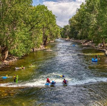
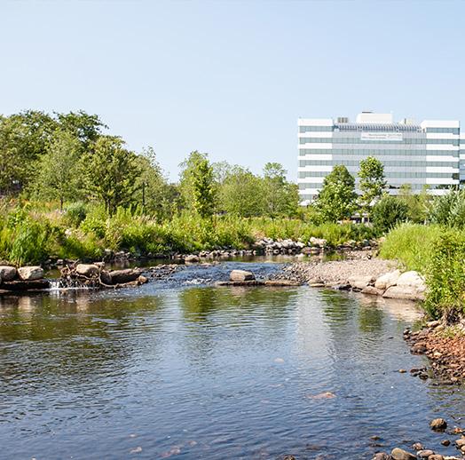
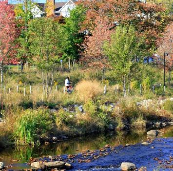
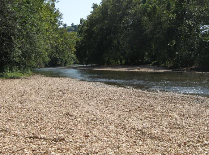
During site visits, one unique characteristic that was noted about the park was the beauty created by Hackers Creek. Located below Hackers Creek Road, the sound of traffic is quieter than expected. Instead, users can hear the sounds of flowing water, leaves rustling in the wind, and, if they are lucky, see some wildlife. Hackers Creek is a site feature that should be utilized more within the park. This was recognized during the master planning process, and the proposed plan re-naturalizes the creek banks and uses Hackers Creek to create a water based recreation feature for all. a
As previously stated, Hackers Creek adds a unique sense of beauty to Jane Lew Park. The masterplan proposes to make use of this aspect to add a special feature to the site. This provides an additional program not often found in a town park.
During site visits, it was observed that erosion is occurring on the creek banks. Trees can be seen starting to lean towards the water. In addition, the grass is mowed to the waters edge, which is not natural and can lead to further deterioration of the creek edge. The first idea proposed is to renaturalize/ re-vegetate the creek bank. Utilizing riparian perennials, shrubs, and trees, the creek bank can be re-planted to mimic traditional riparian environments found in nature. During this process, the current bank erosion can be addressed. Renaturalizing the creek banks will not only add value and increase the beauty of this area, but it will also aid in attracting additional wildlife to the park. Careful consideration should be taken when selecting plant species. Native species that attract local wildlife should be used, to increase the likeness of park visitors witnessing wildlife. Interpretive signage can even be installed to educate park visitors on the importance of the re-naturalization and even introduce some of the species that may be seen on any given day.
In the process of re-naturalizing the
creek banks and addressing existing erosion, an opportunity is created to add a special program that is not always found in a town park. By creating interventions that allow users to go down to the creek’s edge, there is an opportunity to allow park visitors to float the length of the creek found in the park. Putting in on the eastern border of the park, and utilizing an inner tube, kayak, or other flotation device, users can relax and float the approximately 1,000 ft. from one end of the park to the other. To make it an even more interesting feature, deflectors could be created when addressing the erosion on the creek, creating a water path that weaves back and forth, creating additional length for floaters to travel. A take out location will be placed before the pedestrian bridge, forcing users to exit before they approach the unused water intake dam. Implementation of this feature will give park visitors a chance to experience Hackers Creek in a way not currently allowed. Alternatively, additional locations have been identified to create longer floats that start out of town and travel along Hackers Creek, ultimately ending in the park. See the regional connections study on page 34-35 for more information.
Seating areas are being proposed along Hackers Creek, just off of the multi use trail. These areas, nestled among the newly re-vegetated creek bank and under the shade of trees, will give users a chance to rest while observing the sights and activity on Hackers Creek.
Proposed water access points at the beginning, middle, and end of the length of Hackers Creek in Jane Lew Park give park visitors a chance to go down to the water’s edge and interact with the water. They also provide take out locations to support proposed full and half day floats along Hackers Creek (see pg. 34-35). a a
Two additional picnic shelters are being proposed to support programs along Hackers Creek. See pages 32-33 for more information regarding proposed ideas for the southern creek bank.
Smaller picnic pavilions, such as what is shown above, are being proposed to support new programs in the park.
A boardwalk feature is being proposed along Hackers Creek. This additional immersive element will take park users through the re-vegetated creek bank and out onto the creek. This allows users to interact with the natural feature without getting wet.
The surrounding photos envision what the future of Hackers Creek could look like, with a re-naturalized creek bank and programs for water recreation.
Hackers Creek - South Bank
Although it is not currently part of the Jane Lew Park property, an area of land adjacent to the site has been identified as an opportunity to expand the park. Having several land owners, including the DOH, this is a proposed idea only for discussion purposes. Additional conversations will have to occur between the town and respective land owners to determine if the town can utilize this land for park purposes. The masterplan sees this area as an opportunity to create passive park features during the process of re-naturalizing the creek bank.
a
In order to create a safe pedestrian connection to the south side of Hackers Creek, a path starting at the southern side of the pedestrian bridge is being proposed. This will connect the greater park to the other passive park programs being recommended for this area.
a
On this portion of land along the south bank of Hackers Creek, an additional water access location is being proposed, directly across from the middle access point on the park side of the creek. This will provide an additional location to access the water and enjoy the natural beauty of Hackers Creek. a
a
Proposed water access locations on Hackers Creek can be simple and consist of a gravel “beach,” such as what is shown on the right.
To support proposed passive park activity on the southern side of Hackers Creek, a shelter is being proposed to provide shaded seating and give park visitors a chance to escape the elements when inclement weather occurs.
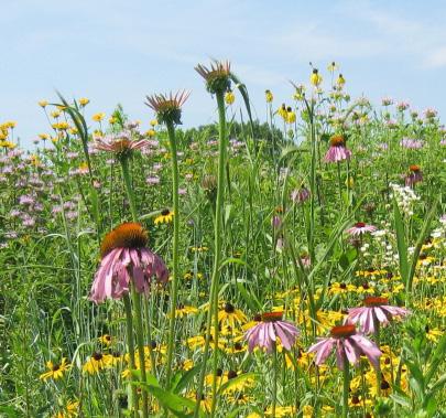
Development on this southern portion of land along Hackers Creek is limited due to its location in the floodplain and site accessibility. One program that it is great for is a native wildflower meadow. Complimenting the re-naturalization work being proposed along the creek bank, the meadow will attract additional wildlife. It will also create a pleasing view for drivers entering town along Hackers Creek. The proposed pedestrian access (#27) being proposed will weave through this meadow and give users a chance to explore this area.
Native wildflower plantings, shown left, add value to the landscape and attract local wildlife and pollinators that visitors may have a chance to experience.
A final recommendation for this area is the addition of a Jane Lew monument sign along Hackers Creek Road. A main entrance route into town from Interstate 79, the park marks the start of town limits. A driver’s first view at they enter town from this direction is this area of property, which reveals itself as you pass by a grouping of trees along the road just before this location. At the moment, there is little to signify that drivers are entering the town. A monument sign would help create this ‘grand entrance’ into town and advertise that drivers have reached Jane Lew. The sign would need to be tall, as it would sit several feet below the road. Foundational planting around the sign, combined with the proposed wildflower meadow, would help create a great first impression.
The above monument sign examples are only a sampling of the numerous ways this feature could be designed. Materials used should match other facade themes seen in town. In addition, a tall sign is recommended so that it can catch the attention of drivers on Hackers Creek Road.
The southern access can be simple and made out of materials such as crusher run.
Regional Connections to Jane Lew Park
This masterplan proposes the addition of several new recreational programs at the Jane Lew Park. Not only does this add value and create a diverse offering of activities at the Park, but it has the potential to tie into other key regional locations and activities that leave Jane Lew Park (and to a larger extent, the Town of Jane Lew) as a central hub to this regional system of recreational programming. Some of these ideas are proposed as a part of this masterplan, but will require additional studies. Others are projects previously completed as a separate study, but have the potential to form important connections to this project.
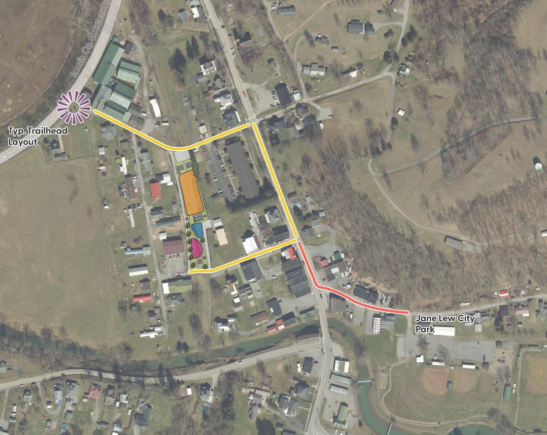
Lewis County Greenway
Completed by CEC in 2022, the Lewis County Greenway is a trail feasibility study that proposes a 40+ mile, county wide long distance trail. It connects several towns and regional attractions together, including Jane Lew, Weston, Jackson’s Mill, and Stonewall Resort. In addition, it connects the local towns to 150+ miles of existing trails and nearly 31,000 acres of public lands. Jane Lew is a trail head location along this greenway. By providing unique recreational features at the town park, opportunities exist to attract people off of the trail, through town, and into the town park. This leaves Jane Lew Park (and the town) as a regional recreation hub and has the potential to support the economic development of local town businesses via increased foot traffic past local storefronts. Proposed recommendations included in this masterplan help support this idea of Jane Lew becoming a recreation hub along the Lewis County Greenway.
For more information regarding the greenway, visit this website: https://arcg.is/4uOTX
Day Float Opportunities along Hackers Creek
This masterplan for Jane Lew Park envisions a future where Hackers Creek plays a larger role in supporting recreation in the park. A beautiful natural asset, the masterplan proposes to re-naturalize the feature and create interventions that bring park
guests and nature closer together. Opportunities are being provided that allow park guests to float along the length of Hackers Creek in the park. The masterplan has also identified locations up stream where put ins can be created, forming options for 1/2 day or full day Hackers Creek floats that start outside of town on and end in the Town Park. See the graphic on the right page for additional information. The intersection of Lifes Run Road and Hackers Creek Road provides a trail head and put in opportunity on Hackers Creek. It creates an approximate 3.2 mile, full day float to the Jane Lew Park. Other options exist in Jane Lew’s Industrial Park to create a half day float to the Town Park. Property along Display Drive, where the Mountain State Log Homes is located, has been identified as an option. Please note, these are only proposed ideas and will require additional coordination and studies between the town and private land owners before such an amenity can be created.
Pedestrian Connections in Town
Opportunities have been identified during this master planning process that create additional pedestrian connections between key locations in Jane Lew and the Town Park. If the town purchases the parcel of land for sale directly across from the park entrance, there are options to connect the elementary school to the park via a trail. This would require the use of public right of ways (ROWs) and trail easements on private property, when no ROWs are present. In addition, this same trail also has potential to connect to in-town connections proposed as part of the Lewis County Greenway. This creates a safe alternative between the Greenway and the Park that reduces the amount of time trail users have to travel alongside busy roads. Lastly, the masterplan sees the benefit of improving safe pedestrian walkways along U.S. Highway 19/Main Ave., particularly the block between Hackers Creek Road and Park Ave. This would create an additional, safe walking loop that park users can utilize during the daily walking routine. All of these proposed ideas are conceptual
in nature, and will require additional studies and coordination with respective land owners prior to implementation.
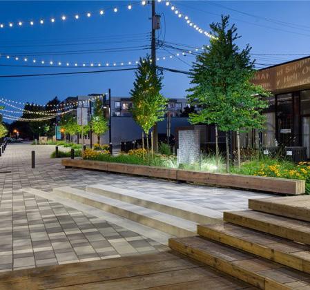
Proposed Streetscape Rendering from the Lewis Co. Greenway
Proposed Jane Lew Pocket Park, proposed as part of the Lewis County Greenway. Located behind Town Hall, it would form an important connector between town and the long distance trail.
Jane Lew Elementary School
Additional Considerations Project Priority List
The following is a list of additional considerations included as a part of this masterplan. Some are park specific improvements, other are town-wide recommendations. Some recommendations may require additional studies prior to implementation.
Park Specific
• Park PA system to support game days and other park programs.
• Siren for severe weather alerts.
• Upgraded security system (where security cameras are lacking).
• Part time or full time Park Director/Caretaker to provide park maintenance and help apply for funding to implement proposed recommendations in this masterplan.
• Potential removal of the existing dam on Hackers Creek. This dam was originally created as a water intake facility to support the town's public water needs. Their water is now purchased through American Water and the dam no longer functions as utility infrastructure. This removal will help to mitigate park flooding, promote fish passage along the watershed, and extend recreational opportunities downstream and create a connection to the West Fork River.
Town Specific
• Sidewalk connectivity study to identify key routes between park and residential neighborhoods. Safe pedestrian infrastructure should be proposed at these locations to ensure safe park access for town residents.
• Trail connection between Jane Lew Elementary School and the park.
• Trail connection between the proposed Lewis County Greenway trail head and the park.
This masterplan is comprised of a variety of projects aimed at improving the Jane Lew Park. Some of these can be considered short term projects with a relatively easy implementation process. Others can be considered mid or long term projects, which may take more time to implement due to complexity or funding requirements. The below list of projects are items Jane Lew has identified as a top priority moving forward and is based on feedback received. These efforts may happen simultaneously, with some (i.e. pedestrian bridge improvements) taking longer for implementation than others (i.e. pickleball courts). Additional park implementation priorities to be determined at a later date.
Jane Lew Park Improvement Priorities
1. Pedestrian Bridge
2. Pickleball Courts
3. Playground Improvements
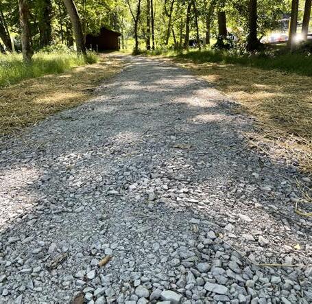
Recent photos of existing conditions at Jane Lew Park.
Funding Opportunities
It is understood that implementation of proposed recommendations found in this masterplan may be a daunting task. The first question may be “how do we acquire the funds to implement design ideas?” The good news is that there are numerous grants available to fund recommendations proposed in this masterplan. Grants range from national to state, and even local level grants. Many may require matches in order to receive funds. Upon request, CEC can assist the Town of Jane Lew with the preparation of grant submittal documentation, but the Town of Jane Lew ultimately has to apply for the grant. Below is an initial list of grant funds that may be considered beneficial in the implementation this Park Improvement Masterplan. This list is not exhaustive, and other opportunities may be available.
National Level Grant Funds
AARP Community Challenge Fund
Administered by: AARP
Deadline: Early March (Current Year: March 6, 2024)
Eligibility: Offering grants ranging from $500 to $50,000, the award grants to projects that support community members age 50+. Projects include improvements to open spaces, parks, and other recreation opportunities, delivering a range of transportation and mobility options that increase connectivity, walk-ability, bike-ability, and access to public and private transit. Microgrants are also available to support bike and walk audits to improve pedestrian safety in town.
Appalachian Regional Commission Federal Grants Program
Administered by: WV Department of Economic Development
Deadline: Applications are reviewed on an annual basis, typically in the fall of each year. Dates can vary based on which federal allocation is being
applied for.
Deadline for ARC Power Grant: Applications open February 1, with a letter of intent due March 1. For 2024, the proposal is due April 17, 2024.
Eligibility: Eligible projects included are those that improve infrastructure for water, wastewater, broadband, workforce development, entrepreneurial and business development, and local leadership and community capacity building. Projects approved must support one of the following goals:
• Invest in entrepreneurial and business development strategies that strengthen Appalachia’s economy.
• Increase the education, knowledge, skills, and health of residents to work and succeed in Appalachia.
• Invest in critical infrastructure, especially broadband, transportation, including the Appalachian Development Highway System; and water/wastewater systems.
• Strengthen Appalachia’s community and economic development potential by leveraging the Region’s natural and cultural heritage assets.
• Build the capacity and skills of current and next-generation leaders and organizations to innovate, collaborate, and advance community and economic development.
Active Transportation Infrastructure Investment Program (ATIIP)
Administered by: USDOT
Deadline: Application opens March 2024, awaiting additional information for deadline.
Eligibility: Active transportation projects or group of projects with a total cost of over $15 million, or total cost of $100,000 for planning and design grants. Funding is for active transportation networks that connect people to everyday destinations like public transportation, businesses, workplaces, schools, and other community activity centers, as
well as active transportation/trail spines that link communities and regions.
While qualifying work proposed in Jane Lew Park alone will not qualify the town to receive this grant, partnership with local organizations working to construct the Lewis County Greenway could create opportunities to fund aspects of this masterplan.
DOT Rebuilding American Infrastructure with Sustainability and Equity (RAISE) Grant
Administered by: USDOT
Deadline: Application opens in December, and closes in February of following year. Current application closed February 28, 2024.
Eligibility: Awarded for planning or constructing surface transportation infrastructure projects that improve safety; environmental sustainability; quality of life; mobility and community connectivity; economic competitiveness and opportunity including tourism, state of good repair; partnership and collaboration; and innovation. Submitted projects should have a significant local or regional impact.
T-Mobile Hometown Grant
Administered by: T-Mobile
Deadline: Applications are awarded on a quarterly basis each year.
Eligibility: This grant fund is focused on helping community spaces in towns with less that 50,000 people. The grant is to be used to fund projects that build, rebuild, or refresh community spaces that help foster local connections in town. Improvements to outdoor parks or trails is one of the qualifying project types for this grant.
Funding Opportunities
American Water Charitable Foundation - Keep Communities Flowing Grant Program
Administered by: American Water Charitable Foundation
Deadline: February - March of each year. Current year application closes March 15, 2024.
Eligibility: Helps communities served by American Water to enhance or create public park spaces that encourage the community to engage in water, nature inspired play, environmental education, and water based recreation.
State Level Grant Funds
Claude Worthington Benedum Foundation Economic Development Grants
Administered by: Claude Worthington Benedum Foundation
Deadline: Applications are accepted throughout the year.
Eligibility: The foundation serves communities in the region that are rural and enjoy abundant natural assets that provide economic opportunities that complement centers of technology-based growth. The foundation supports efforts to advance agriculture, outdoor recreation, artisanship, and cultural tourism. While they generally do no support the construction of projects, the purpose of the grant is to promote the planning aspect of community projects.
Recreational Trails Program (RTP)
Administered by: WV DOH
Deadline: Must file intent to apply by mid May of each year, with application due the following a month. (For 2024, intent to apply deadline is May 22, with a deadline to apply by June 26)
Eligibility: A subset of the Transportation Alternatives grant fund, this grant provides funds to create and maintain recreational trails for motorized
and non-motorized trails. The grant provides funding for pedestrian, bicycle, and equestrian facilities, in-line skating, cross-county skiing, and off road motorized vehicles.
Land and Water Conservation Fund (LWCF)
Administered By: WV Department of Economic Development
Deadline: 2024 funding cycle set to open August/ September 2024, with a deadline shortly after opening.
Eligibility: Provided as supplemental funding for the acquisition or development of high quality, public outdoor recreation areas throughout the state. Projects receiving funding priority include park renovations, expansions to promote active lifestyles, projects that innovate community cores, attract or retain visitors to an area, develop trailheads, or preserve other natural areas to impact community health objective.
Jane Lew has previously received a $42,300 LWCF grant in 2014 to fund ADA improvements at the Jane Lew Park.
Local Level Grant Funds
Lewis County Community Foundation Fund (LCCF)
Administered by: LCCF
Eligibility: The LCCF is a community foundation focused on providing funds to improve the local quality of life in Lewis County. They are focused on providing funds to invest in the betterment of Lewis County.
Other Funding Resources:
The following organizations may be able to assist Jane Lew with identifying additional grant opportunities and support the Town with their grant application process:
• WV Grant Resource Centers: https:// wvgrantcenters.com/
• West Virginia Community Advancement and Development: https://wvcad.org/