Appalachian Outlaw Trails
Conceptual Masterplan


5/22/24

draft


Special Thanks to:
Table of Contents The Valley Master Plan ................................................ 4 Regional Context ......................................................... 6 Appalachian Outlaw Trails .......................................... 8 Conceptual design process .......................................... 10 Phase one - refined bubble concept ............................ 11 Riverfront Development ............................................. 14 Town Center ................................................................ 16 town center - lodging ................................................. 22 extended campgrounds & commercial development .... 24 Adventure Area ........................................................... 26
The Valley MasterPlan
The 2019 The Valley Masterplan formulated the concept of integrating lodging and outdoor recreational opportunities within the Upper Kanawha Valley and specifically the location where the proposed Appalachian Outlaw Trails resides. The adjacent map is a snip from the original “The Valley Masterplan” depicting a 30+ mile long stretch of the Kanawha River with programmatic elements connecting throughout the region. The different colored shapes represent the major attractors in the area. The interventions in this original plan included tourism and community improvements including share the road trails, boat and kayak access, welcome centers, diverse lodging opportunities, motorized and non-motorized trail networks, and other potential opportunities spanning the valley. The purpose the masterplan was to showcase the incredible economic impact connecting regional recreation and toursim opportunity to entince individuals and the Kanawha and Fayette County to further develop projects throughout the valley. The Appalachian Outlaw Trails project is situated in the area that was determined as 4x4 off -road excursion. The Appalachian Outlaw Trails Masterplan is the next steps of detailing one element of The Valley Masterplan and will be major contribution for the Upper Kanawha Valley’s future as an outdoor recreation destination.
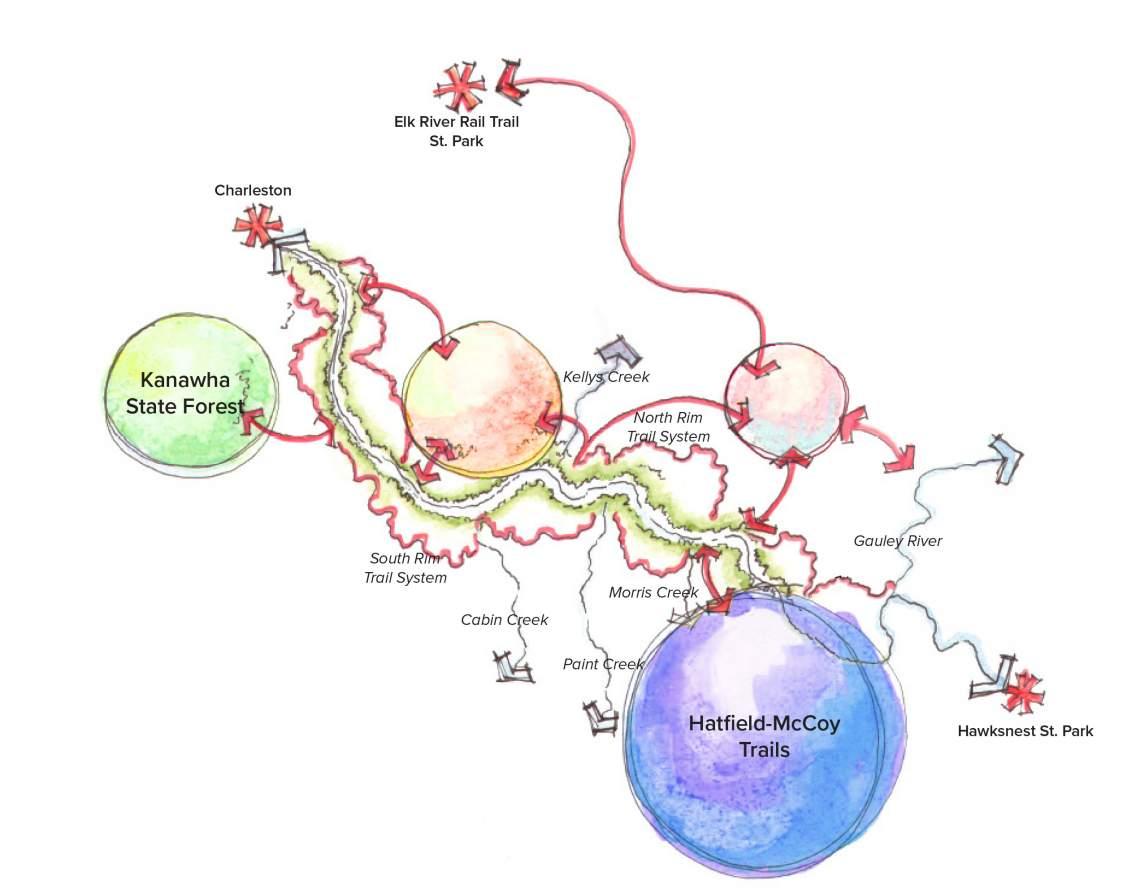
4 Appalachian Outlaw Trails Conceptual Masterplan draft 5/22/2024 Gauley Bridge KANAWHA RIVER Blue Creek Rail Trail 4x4 Off-road Excursion Mammoth Preserve Welcome Center Welcome Center
THE VALLEY MASTERPLAN PROJECT AREA OHIO PENNSYLVANIA
MARYLAND
Charleston Kanawha City Malden Dupont City Marmet Belle Chesapeake Dickinson Chelyan Shrewsbury East Bank Glasgow Hansford Pratt Hugheston Handley Montgomery Smithers Longacre Boomer Mt Carbon Charlton Heights Kanawha Falls Gauley Bridge Alloy THE VALLEY MASTERPLAN PROJECT AREA
VIRGINIA
KENTUCKY


5 Appalachian Outlaw Trails Conceptual Masterplan draft 5/22/24
Charleston
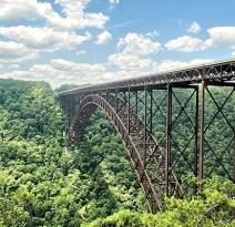
New River Gorge
APPALACHIAN OUTLAW TRAILS AREA
4x4 Off Road Excursion
Kanawha State Forest
Hatfield McCoy Trails
Mammoth Preserve
Scan to View the Full “The Valley” Masterplan
Regional Context
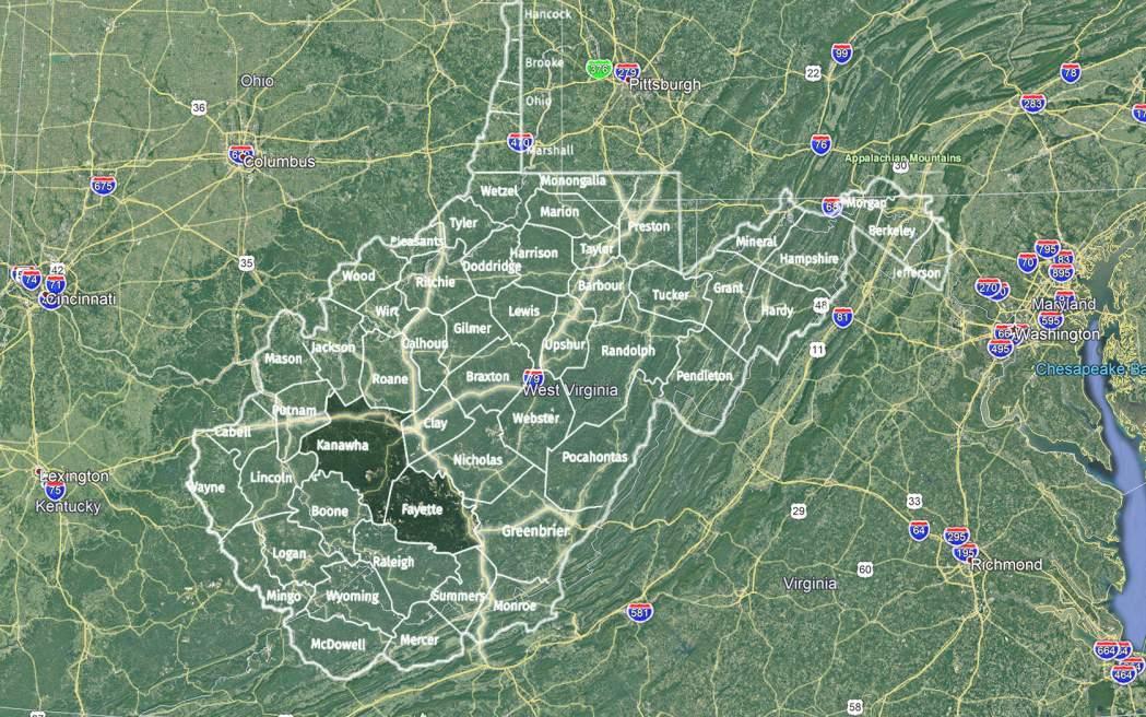
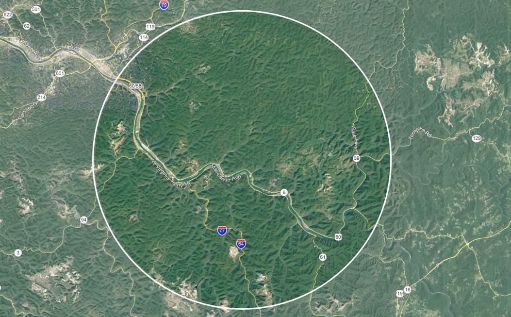
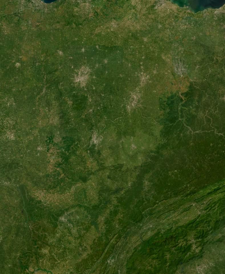
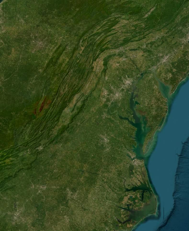
The Appalachian Outlaw Trail sits within the Upper Kanawha Valley region of Kanawha County. As seen from the excerpt from The Valley Masterplan above, it is a dynamic region ripe with possibilities. The demographic map (right) provide important information into the potential user-base within a 100 mile drive of the site. With the Appalachian Outlaw Trails being 15 miles from Capitol of West Virginia, it provides the necessary interstate traffic for access to the site. Creating the opportunity for a less than three hour drive for potential users from Ohio, Kentucky, Virginia, and slightly dipping into North Carolina. The regional context map (pg. 7) highlights the diverse recreational opportunities accessible within 50 mile drive from the Appalachian Outlaw Trail. Situated centrally, the proposed resort enjoys proximity to both the recently established New River Gorge National Park to the east and the popular Hatfield McCoy Ivy Branch Trails to the west.


• Population: 287,851
• Households: 122,800
• Median Age: 44.7
• Median Household income: $57,452


• Population: 565,373
• households: 234,374
• Median age: 44.7
• Median Household Income: $46,309

• Population: 2,704,473
• households: 1,101,557
• Median age: 42.6
• Median household income: $52,210
6 Appalachian Outlaw Trails Conceptual Masterplan draft 5/22/2024
Cleveland I l i n o i s N o r t h C a r o l i n a W e s t V i r g i n i a O h i o T e n n e s s e e K e n t u c k y Greensboro Greenville Nashvi le Louisv lle Knoxville Frankfort Springf eld Charleston Charlotte Cincinnati Pittsburgh Indianapolis Columbus New Jersey Maryland P e n n s y l v a n i a V i r g i n i a Norfolk Raleigh Richmond Dover Harrisburg Trenton Philadelphia Washington May 16, 2024 ©2024 Esri Page 1 of 1
25-50
site 50 - 100 mi. from site
25 mi. from site
mi. from
demographic map appalachian outlaw trails


7 draft 5/22/24 Charleston,
Appalachian
Kanawha State
HMT Ivy branch Trails Gauley
National
Regional
kanawha county Phase 1 masterplan development area future phases roane county clay county
WV New river gorge national park
Outlaw Trails
forest
River
Recreation Area
Context Appalachian Outlaw Trails
county fayette county jackson county putnam county
nicholas
county boone county
lincoln
Appalachian Outlaw Trails
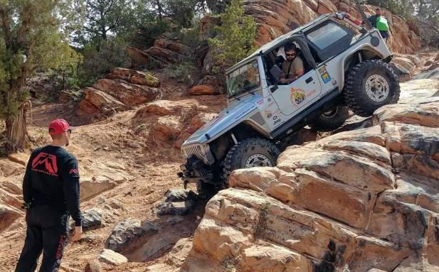
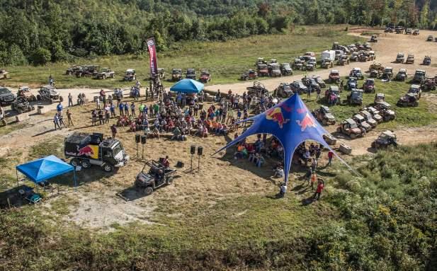
What is Appalachian Outlaw Trails?
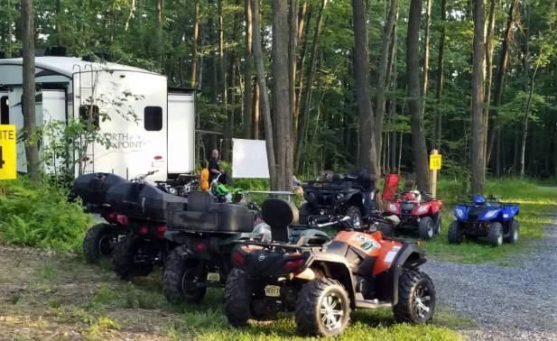
Appalachian Outlaw Trails is creating a vision for an off-roaders paradise. From beginner courses to extreme trails, it is a place for people to come and experience what off-roading in mountainous region of the Upper Kanawha Valley offers. Beyond the off-road trails, Appalachia Outlaw Trails will offer a break from the rugged terrain with other experience opportunities including Main Street, a place for dining, music events, shopping, and more as well as a direct connection to the Kanawha River to rent watercraft for a day on the water to fish, jet ski, and more.
Phasing
Appalachian Outlaw Trails is a longterm vision, with the potential to capture over 100,000 acres of beautiful scenery in the Upper Kanawha Valley to offer a one of a kind experience. This masterplan focuses on phase one (about 2,000 acres) of the longterm vision. Future phases will begin to expand upon the amenities and trails that are offered by Appalachian Outlaw Trails phase one.
Throughout viewing this masterplan, remind yourself to expand upon what is shown to see the vision, future possibilities, and connections that can be applied to create an amazing destination for those living in the Upper Kanawha Valley, West Virginia, and the nearly 2.7 million people within a 6 hour drive.
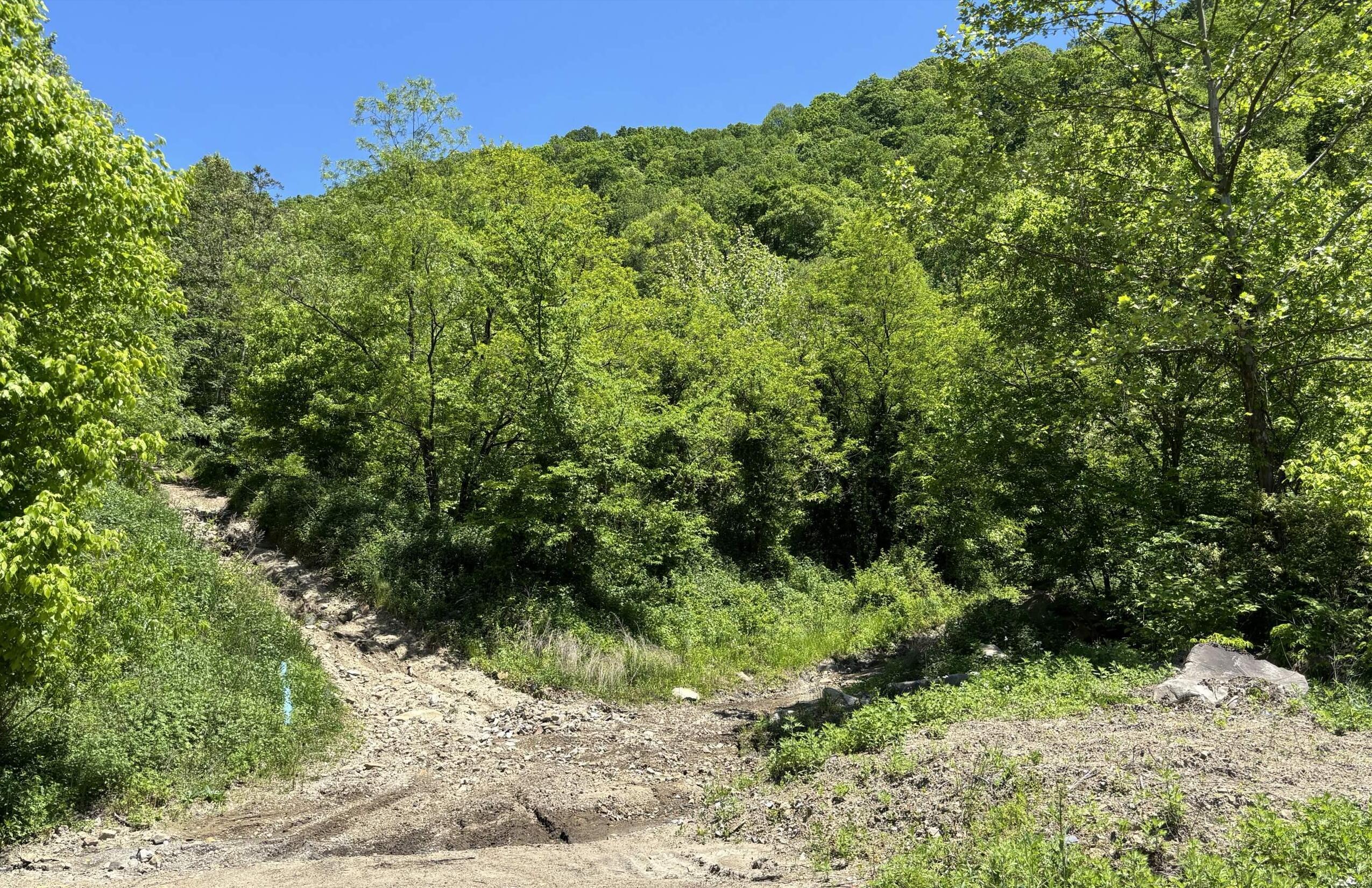
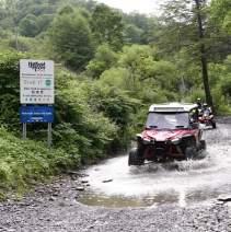
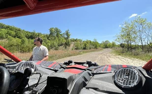
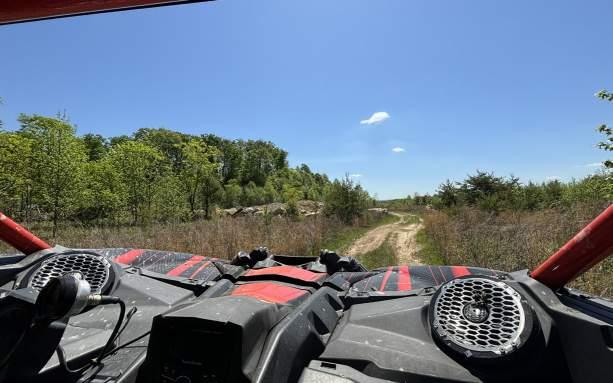
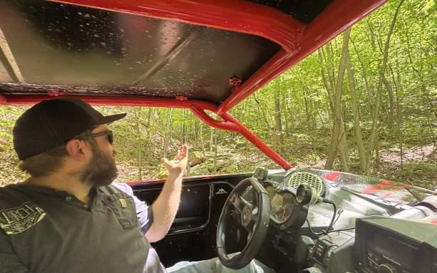
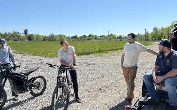
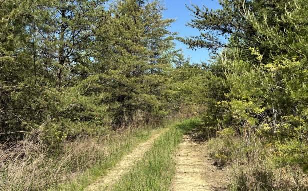
Site reconnaissance
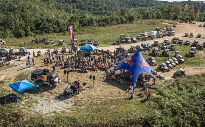
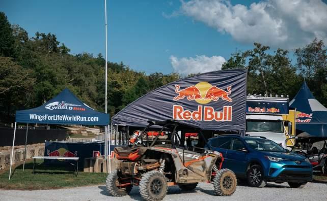
When visting the project site (see photos on right), the potential for the area was noticed immediately. Strong existing road connections helped guide the design and locations for program elements and the general layout of the property. Awesome view sheds were noticed while riding along ridge lines, providing additional insight onto the project design.

8 Appalachian Outlaw Trails Conceptual Masterplan draft 5/22/2024

Appalachian Outlaw Trails project phases
Main Entry
PHASE 01 PHASE 02 PHASE 03 PHASE 04 kanawha county Masterplan area Future phase 02 Future phase 03 Future phase 04
county
clay
county
nicholas
fayette
county
county
boone
Conceptual design process refined bubble concept
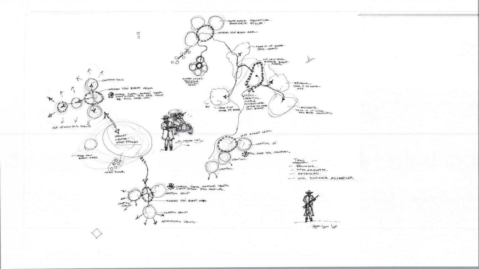
The conceptual masterplan depicted in this document is a visual representation of Civil and Environmental Consultant’s conceptual design process. The design process consists of three stages: bubble concepts, refined bubble concept, and conceptual layout.
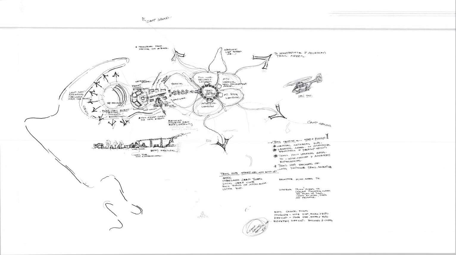
Refined bubble concepts are created after review of the bubble concept with the client and stakeholders. The revised elements are then further detailed and locked into a more distinct location for final concept development.
bubble concepts
Bubble concepts are a culmination of information gathered when speaking to project stakeholders, site visit inventory and analysis, regional connections, and programmatic elements to determine what the use-cases of the project are determined to be. Bubble concepts create areas roughly determined based on existing aerial and topological information to determine potential connection opportunities and additional programmatic elements to be infused into the project design.


conceptual layout
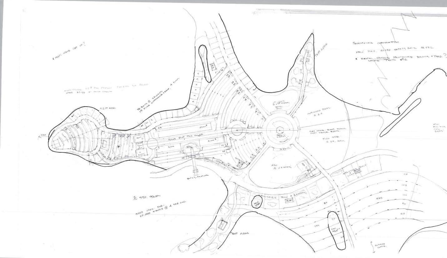
The conceptual layout is detailed to show more accurate dimensioning of site elements and includes additional information of each amenity of the site.
10 Appalachian Outlaw Trails Conceptual Masterplan
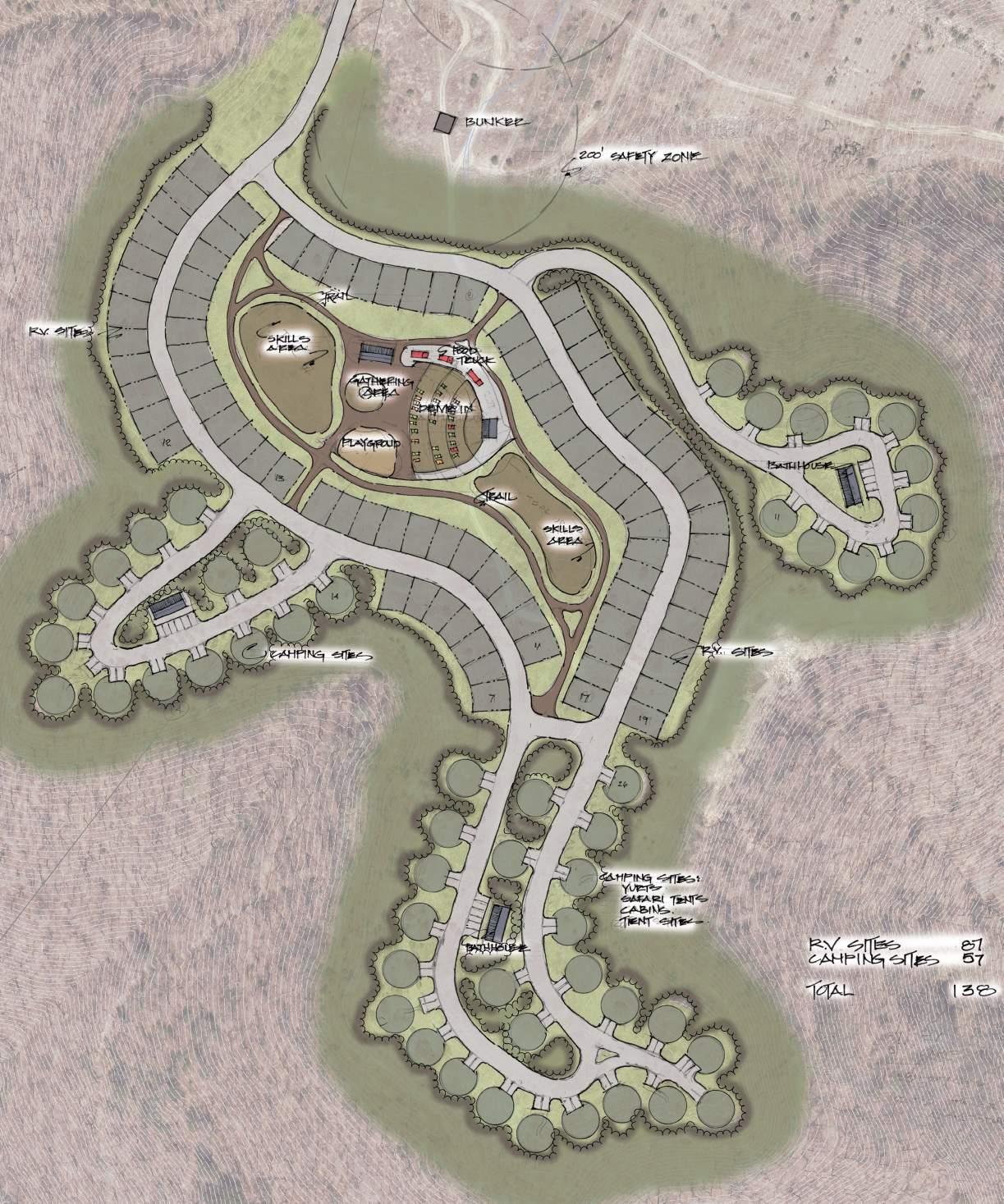
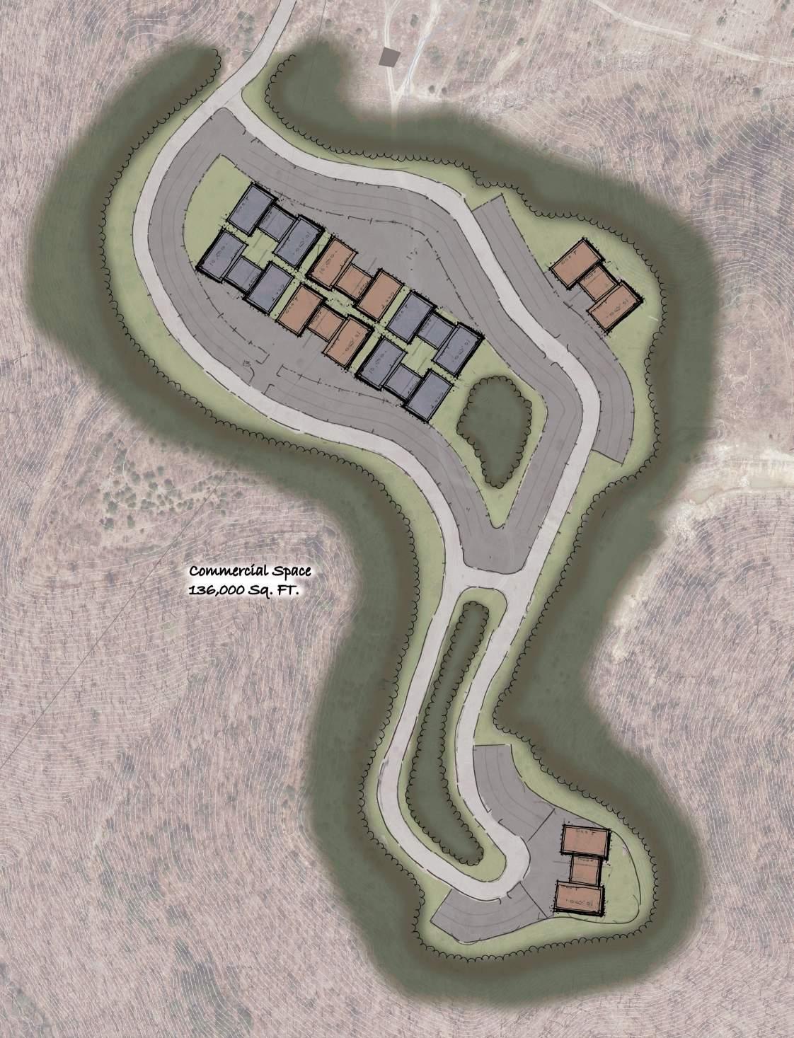
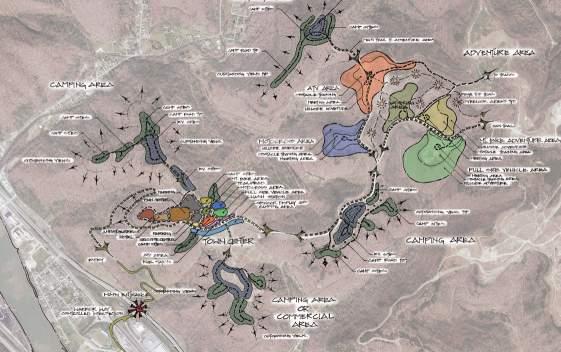
Phase one - refined bubble concept
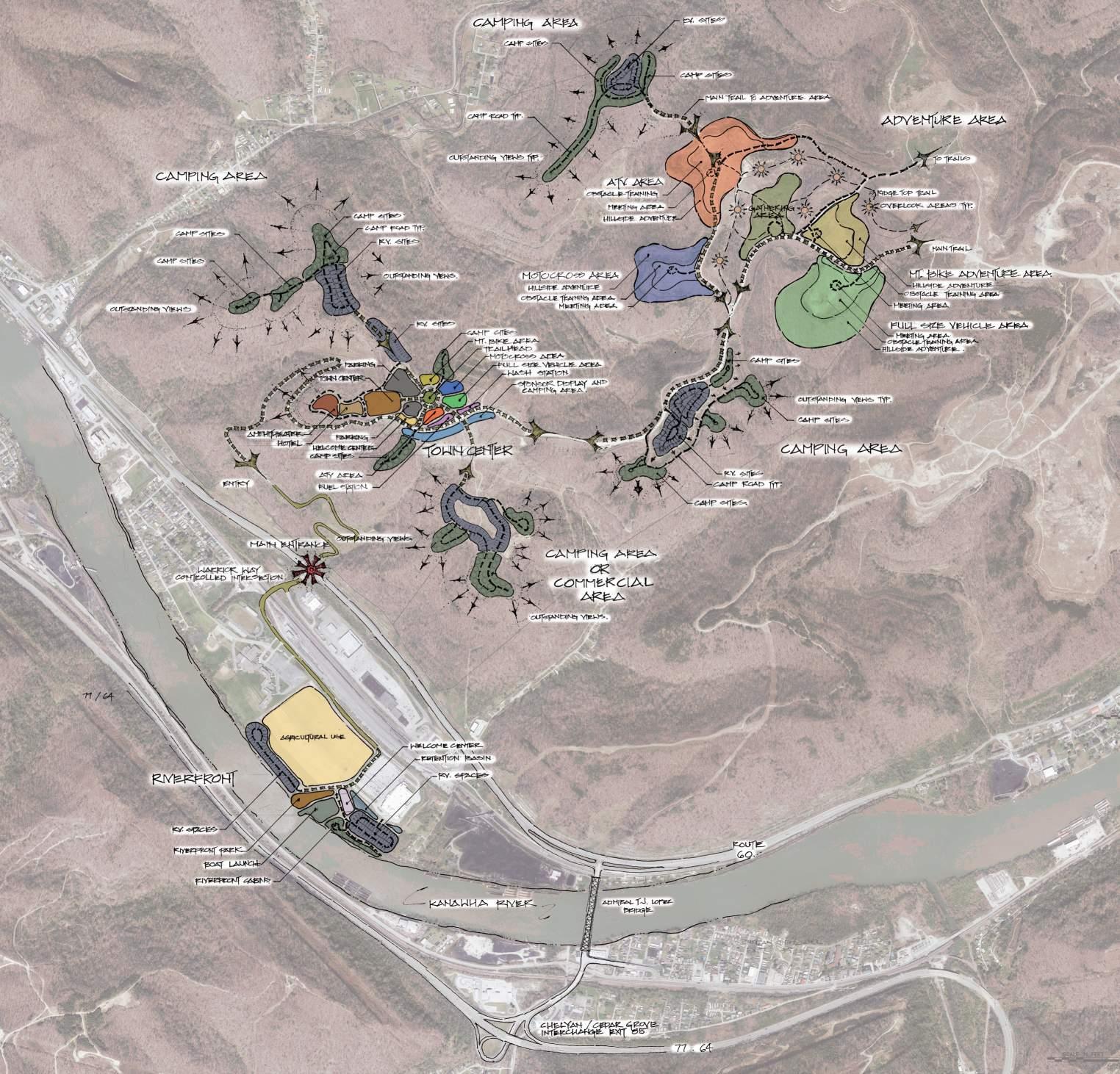
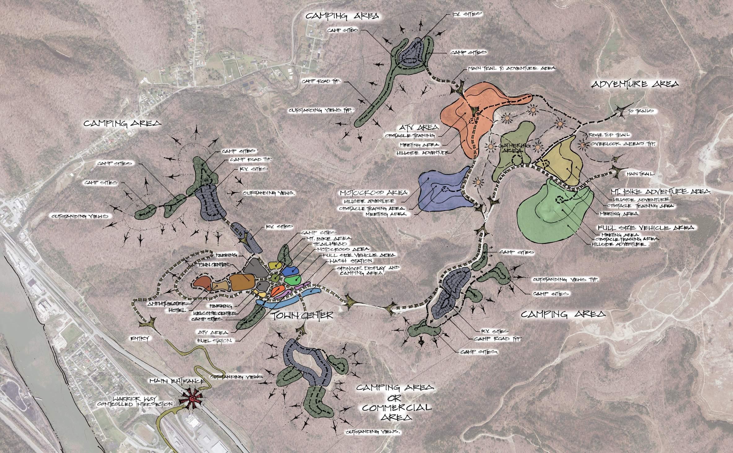
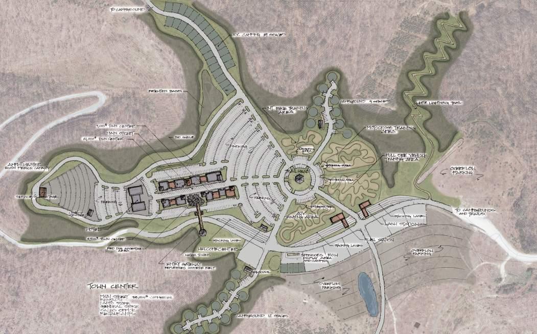
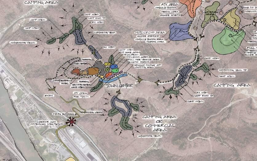
This conceptual use diagram provides a visual framework for our design basis. Its purpose is to emphasize the program requirements, goals, and objectives that guide the project’s overall design. Beyond representing site uses graphically, it’s essential to illustrate the connections between individual sites. Effective circulation is a critical factor in the success of any master plan. Access to the property is facilitated through an established interchange at US Route 60 with direct connected access to Interstate 64 and 77 across the Kanawha River from Area 01 via the Admiral T.J. Lopez Bridge.
Phase one consists of the first 2,000 acres of a 4 phase vision of 100,000 acres of program. A development of the fully developed project would become a unique opportunity for the Upper Kanawha Valley to become home to the largest privately owned trail system in the country.
The masterplan outlines the following areas:
• Riverfront Development
• Town Center
• General Camping
• Adventure Area
11 Appalachian Outlaw Trails Conceptual Masterplan draft 5/22/24
AREA 01 AREA 02
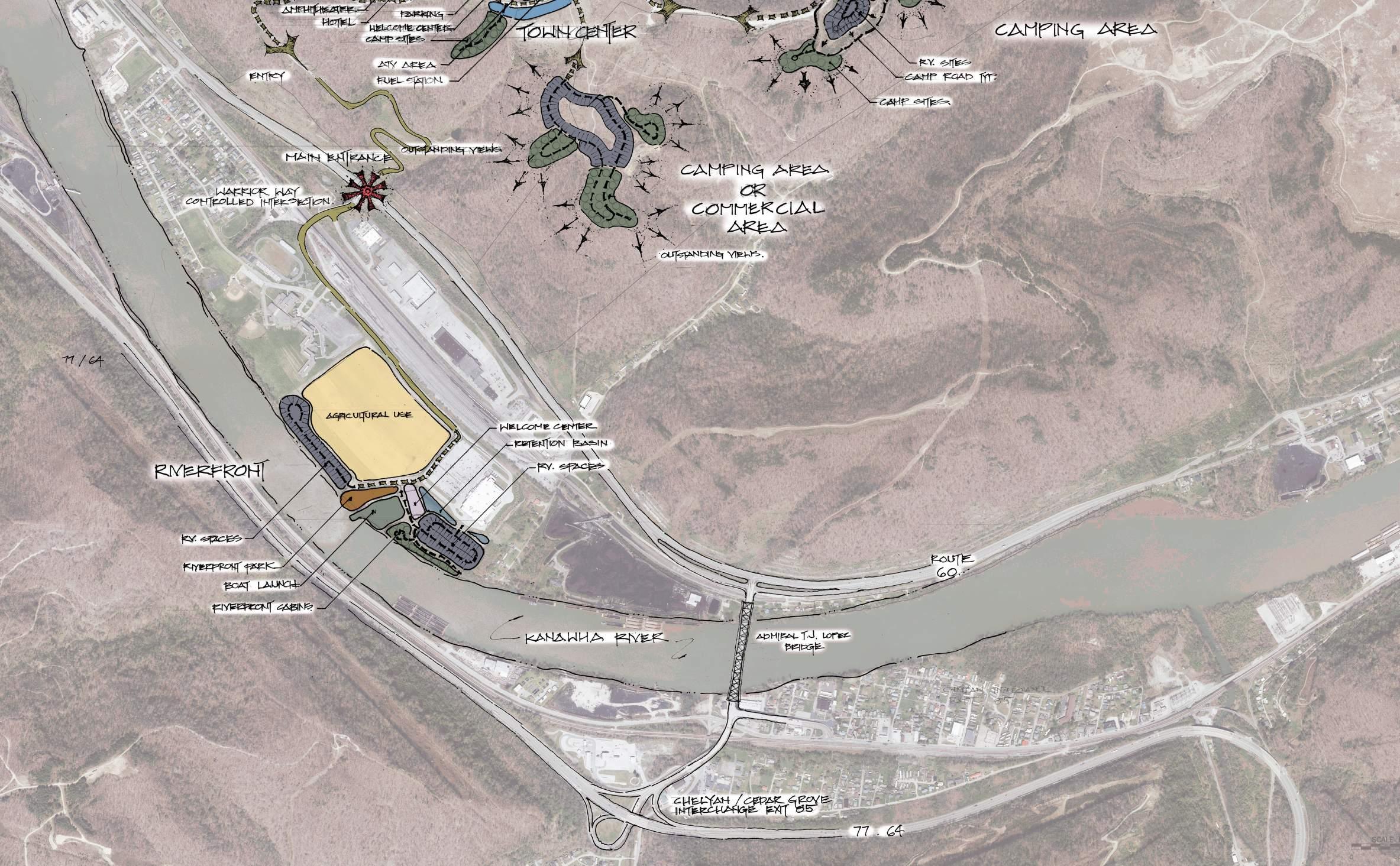
Riverfront development (pages 14-15)
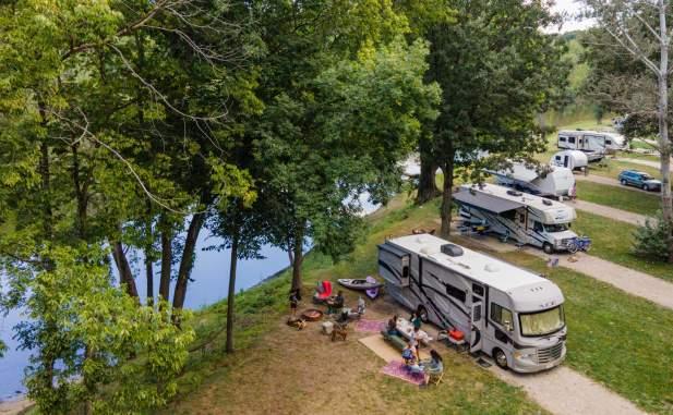
The riverfront development features a two-ramp boat launch, community park, welcome center, cabins, two RV park areas, and an agricultural section. The boat launch is the only full-service public facility on the 15-mile London pool of the Kanawha River. The park includes court games, trails, picnic areas, fishing docks, a pool, and a restaurant. The welcome center offers secure, year-round camping. The cabins and one RV section provide direct river access, while the other RV section offers year-round amenities. The largest area is dedicated to agriculture.


12 Appalachian Outlaw Trails Conceptual Masterplan draft 5/22/2024 AREA 01 Exit 85
AREA 02
TOWN CENTER (Pages 16-23)
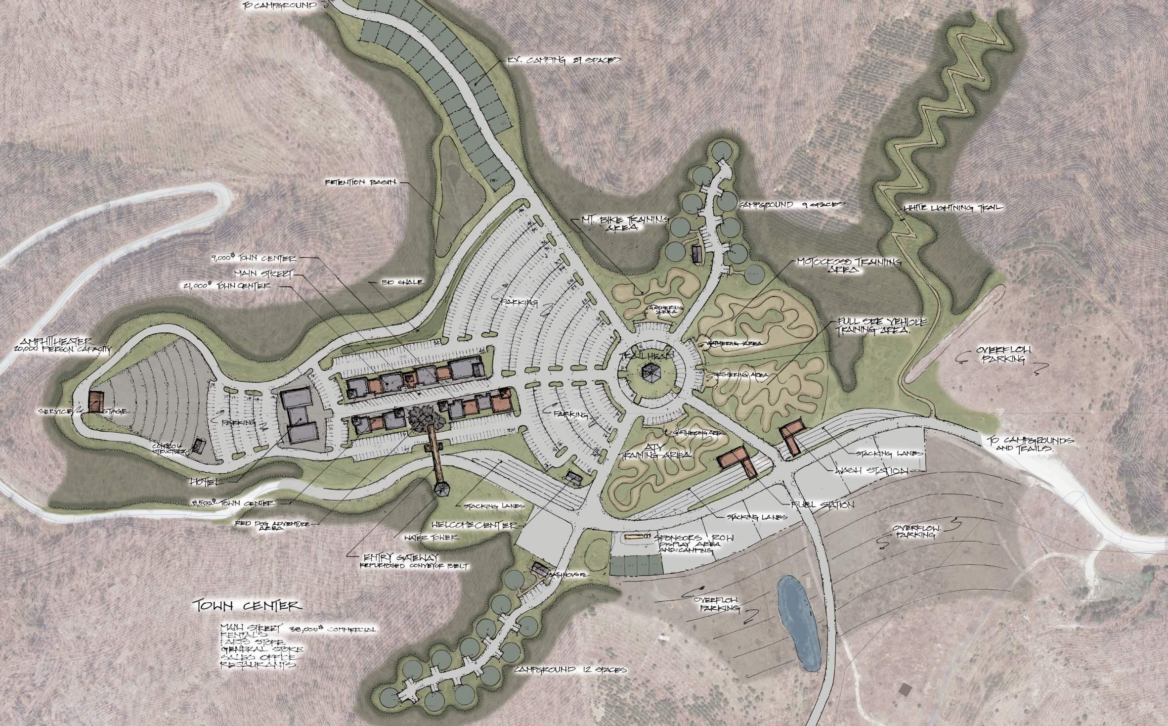
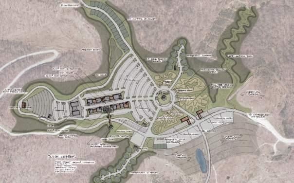
The town center is the dynamic hub of all the motor sport activities and events. At the end of the access road, the town center includes an entry feature, welcome center, fuel station, wash station, parking areas, vendor display areas that include camping areas, nearby camping and RV sites, Trailhead facility, main street development, lodging opportunities and a spectacular amphitheater event area with great view sheds of the Kanawha river and ridge lines.
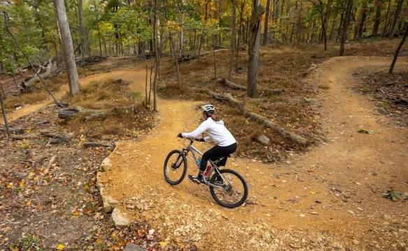
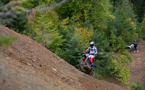
Adventure Area (pages 26-27)
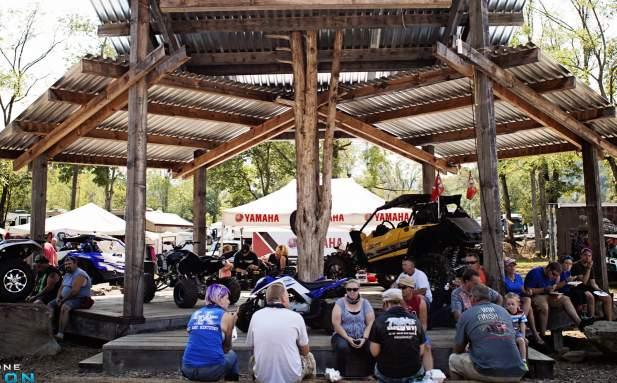
This area is designed for developing trail skills for intermediate and advanced riders. It features a central gathering spot for socializing and showcasing vehicles. Surrounding this hub are dedicated areas for mountain biking, motocross, ATVs, and full-size vehicles, each with a meeting area, obstacle training zone, and hillside practice area. A ridge top trail system connects these areas and offers viewing points overlooking the adventure zones.
GENERAL CAMPING & lodging AREAS (Pages 24-25)
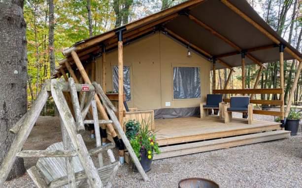
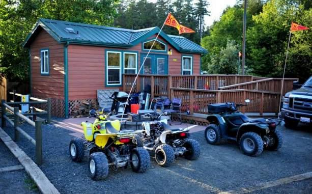
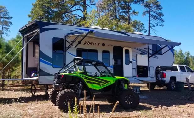
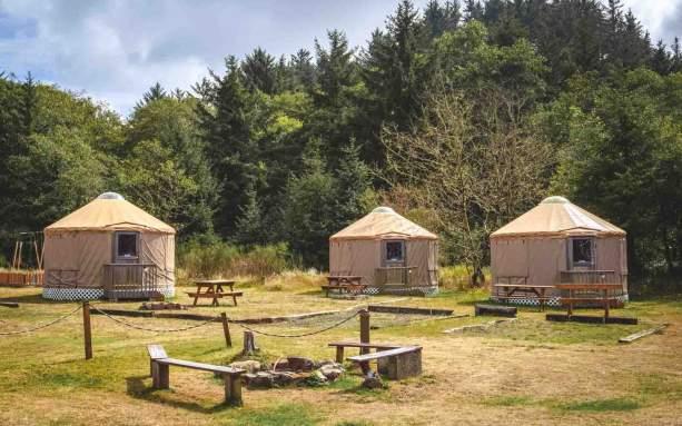
There are four camping areas in phase one they are all located on separate ridge areas providing outstanding views. They create a remote camping experience while being relatively close to the town center. Camping sites might include cabins, yurts, safari tents. RV locations are on the level areas along the ridge lines providing easy access. Each camping area include bathhouses and an amenity area.
13 Appalachian Outlaw Trails Conceptual Masterplan draft 5/22/24
Riverfront Development
The riverfront development area consists of:
• A two-ramp boat launch
• Community river front park
• A welcome center
• Riverfront cabins
• Two RV areas
• An agricultural area
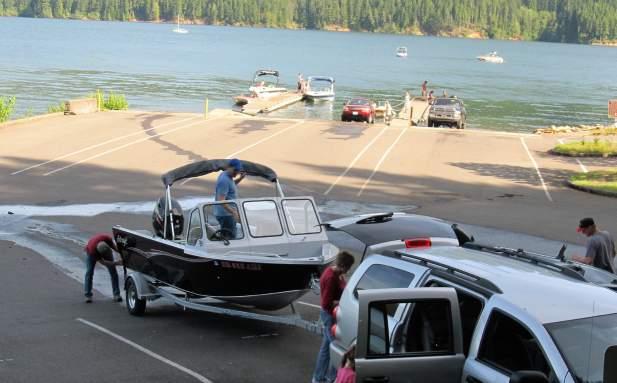
The boat launch facility would provide the only full-service public boat launch facility on the nearly fifteen-mile-long London pool of the Kanawha River. The community riverfront park includes court games, trails, picnic areas, fishing docks, a pool and restaurant area. The welcome center provides a secure camping experience and access to year-round facilities. The riverfront cabins offer direct river access with a fishing dock and boat slips. The RV sites are divided into two sections. The river front section offers direct river access and use of amenities. The interior RV section offers year-round camping and access to amenities. The largest portion of the riverfront park is dedicated to agricultural development. The addition of these facilities adjacent to the local commercial retail area will be a benefit to the businesses and tax base. 1 3 6 2 4 5

14 Appalachian Outlaw Trails Conceptual Masterplan draft 5/22/2024
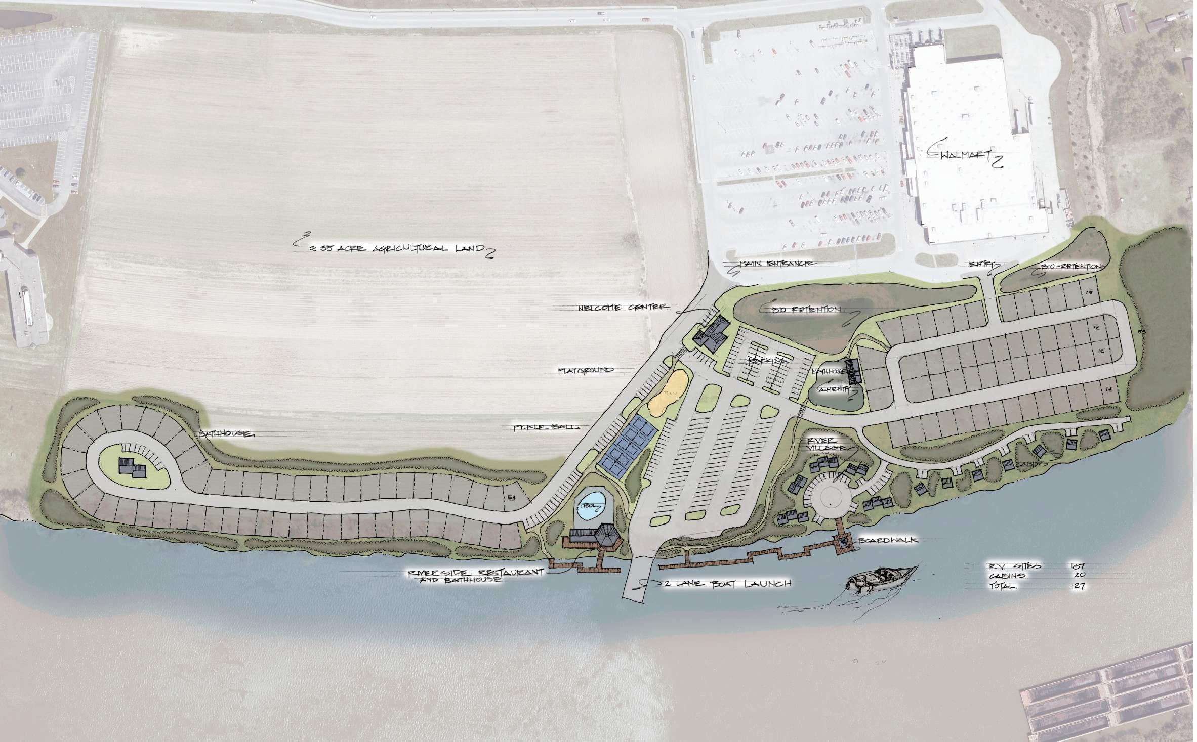
15 Appalachian Outlaw Trails Conceptual Masterplan draft 5/22/24 1 3 6 2 4 5 Rv Sites 107 cabins 20 total 127
KANAWHA RIVER
WARRIOR WAY
KANAWHA RIVER
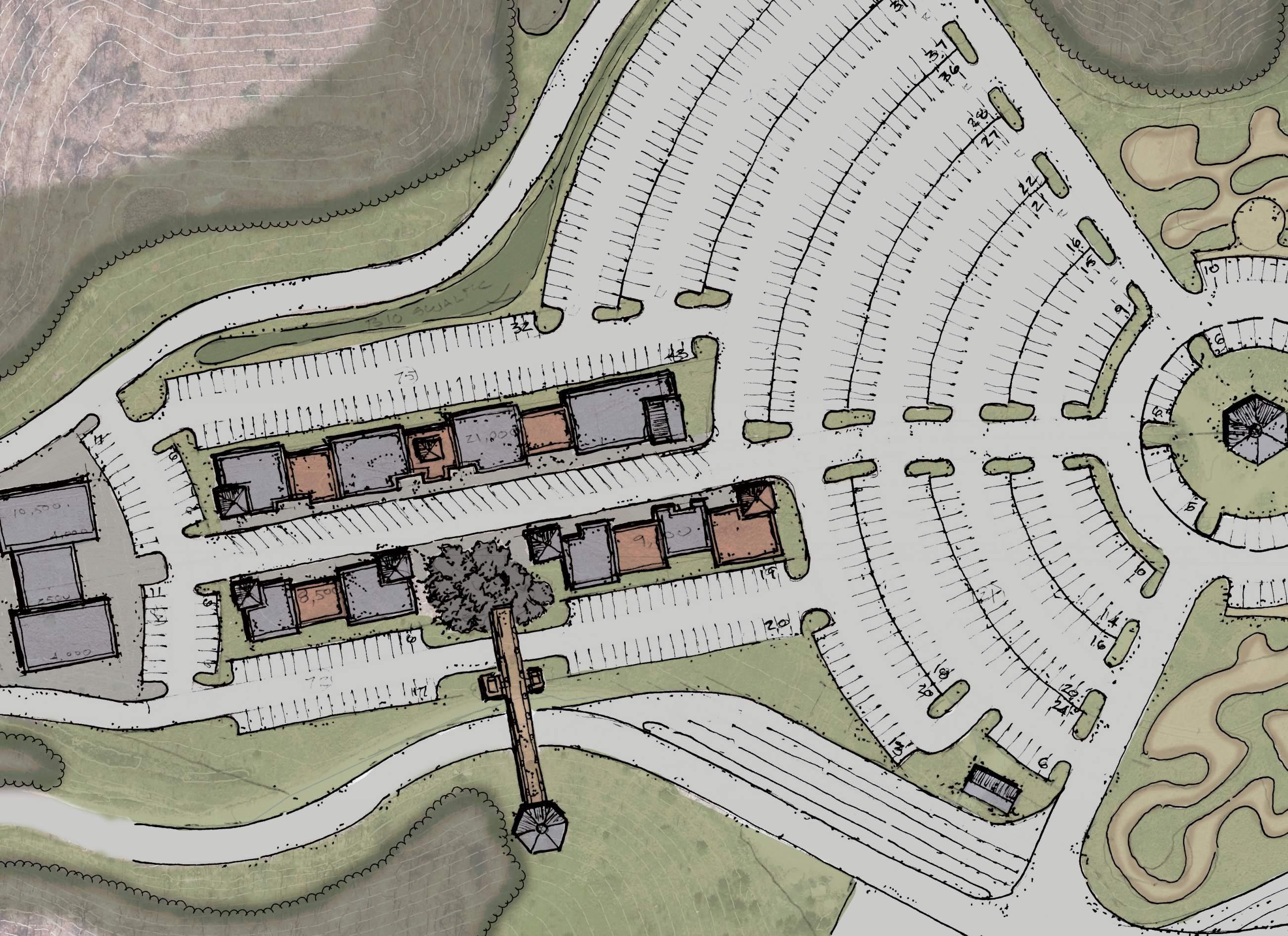
Town Center
The town center is the dynamic hub of all the motor sport activities and events. At the end of the access road the town center includes, an entry feature, welcome center, fuel station, wash station, parking areas, sponsor display areas that include camping areas, close camping and RV sites, trailhead facility, main street development, lodging opportunities and a spectacular amphitheater event area.
16 Appalachian Outlaw Trails Conceptual Masterplan draft 5/22/2024
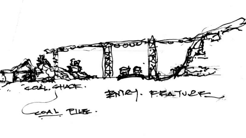
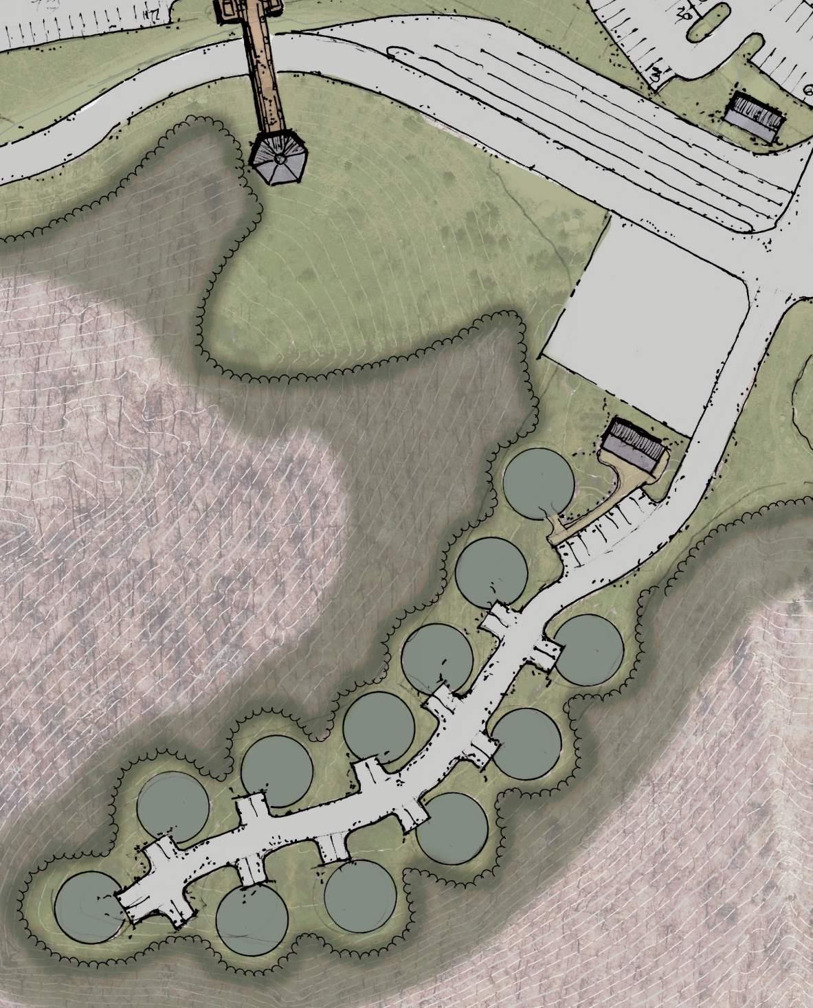
Sense of arrival
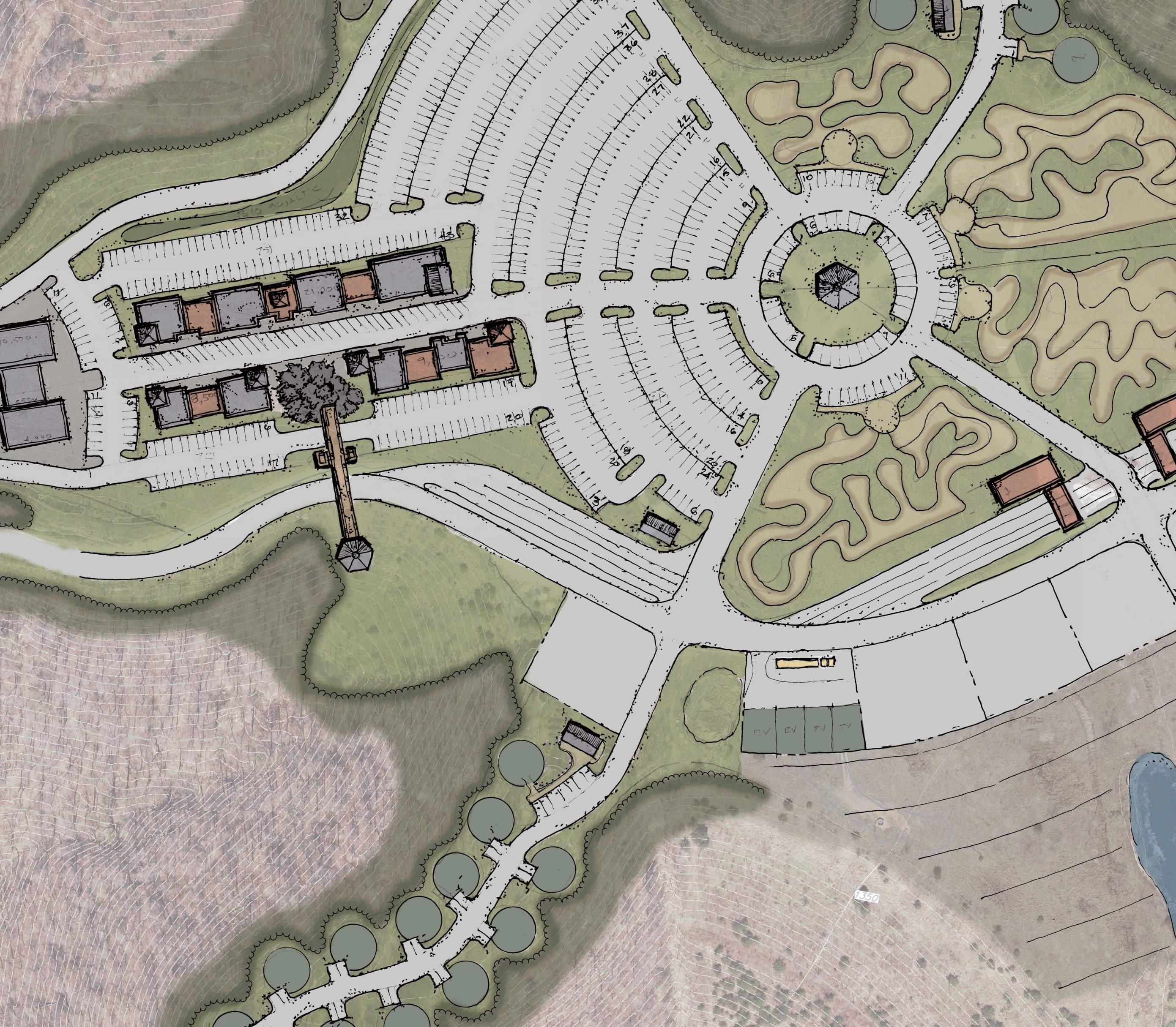
Arriving at the top of the entrance road is a re-purposed coal conveyor belt creating a unique welcome gateway. Anchored on the hill by the towns water tank the conveyor belt leads into the town center and cumulates in a large pile of red dog creating a visual focal point connecting the entrance to the Main Street of the Town Center. Ample short term stacking lanes are provided while guests check-in at the welcome center for their lodging accommodations, locations to areas of the site, and other information of regional local attractions if they choose to venture off the project area. Day use visitors can continue to the large parking area at the middle of Town Center to visit Main Street, meet at the trailhead, or an event at the amphitheater. Vendor row lines the main entrance allowing for high visibility for the vendors products.
KEY MAP CHECK-IN SHORT-TERM PARKING ENTRY FEATURE MAIN ENTRANCE ROAD WELCOME CENTER PARKING VENDOR ROW VENDOR ROW VENDOR ROW
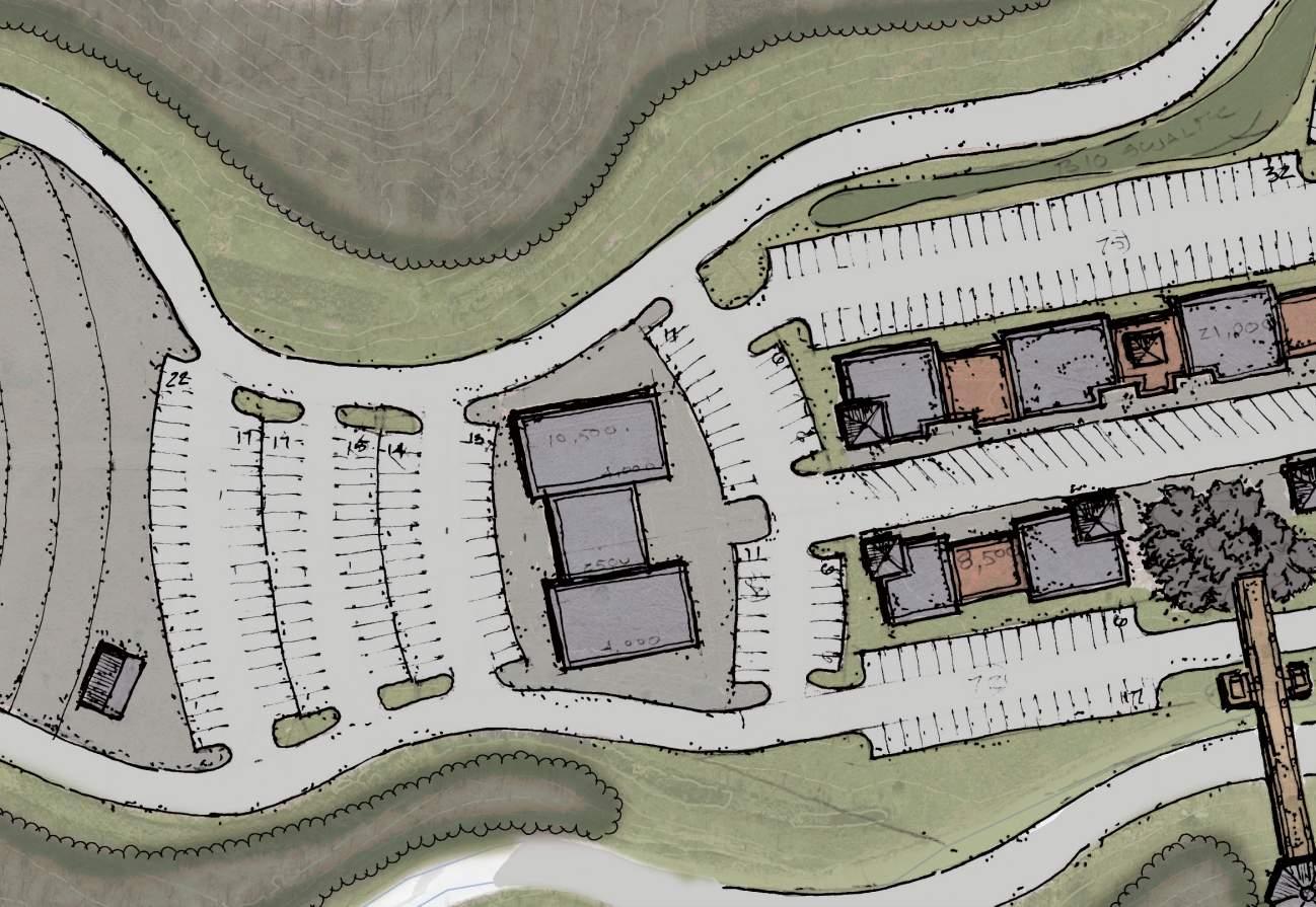
TOWN CENTER - MAIN STREET
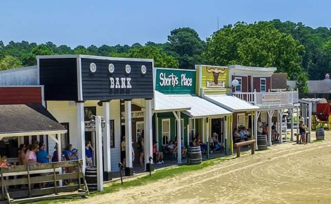
Main Street offers a pedestrian oriented experience. A western-themed building facade creating a sense of cohesive design while providing the visitors with all the modern opportunities to dine, shop, and be entertained. Businesses expected to be on Main Street would be general store, restaurants and saloons, arcades, parts and mechanic store, tire shop, vehicle rental shops, ice cream, and more. The one-way street with angled parking provides additional safety for the pedestrian experience while still allowing for vehicular access of all kinds. One-way streets allow for larger sidewalks and areas for outdoor seating, resting areas, and more.
 KEY MAP
MAIN STREET
MAIN STREET
KEY MAP
MAIN STREET
MAIN STREET
800 SPACE PARKING
TRAILHEAD
MAIN ENTRANCE ROAD
LOT
15K - 20K CAPACITY AMPHITHEATER
AMPHITHEATER & HOTEL
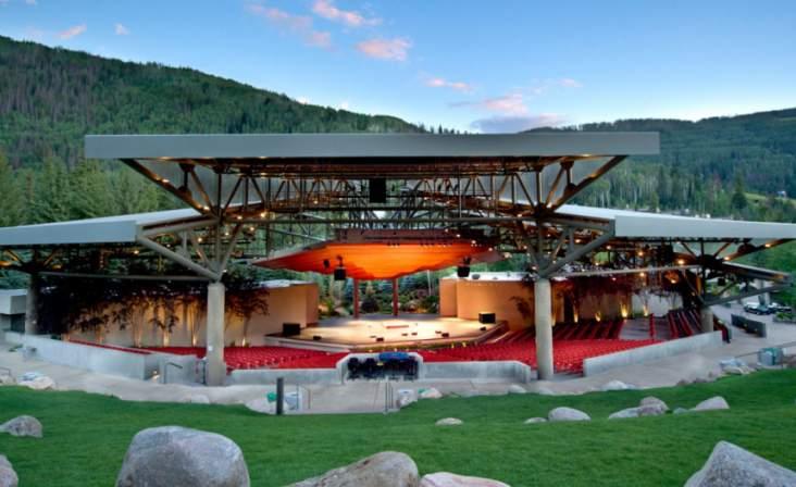
The amphitheater is located on a point of the ridge overlooking the Kanawha River valley. This spectacular panoramic view is some of West Virginia’s finest scenery. The amphitheater is sized to accommodate 1520,000 people for concerts and events. Close proximity parking provides separation of the hotel and amphitheater.
The 80-unit hotel is adjacent to the amphitheater. It provides a great opportunity for an overnight event, where a visitor can spend a day on Main Street, ride the trails, enjoy a concert, all without leaving the vicinity of the Appalachian Outlaw Trails
19 Appalachian Outlaw Trails Conceptual Masterplan draft 5/22/24
KEY MAP
VIEWS OF THE KANAWHA VALLEY
HOTEL & EVENT PARKING
80 UNIT HOTEL
MOUNTAIN BIKE TRAINING COURSE
GATHERING AREA
MOTOCROSS TRAINING COURSE
GATHERING AREA
GATHERING AREA
GATHERING AREA
FULL-SIZE VEHICLE TRAINING COURSE
Trail Head
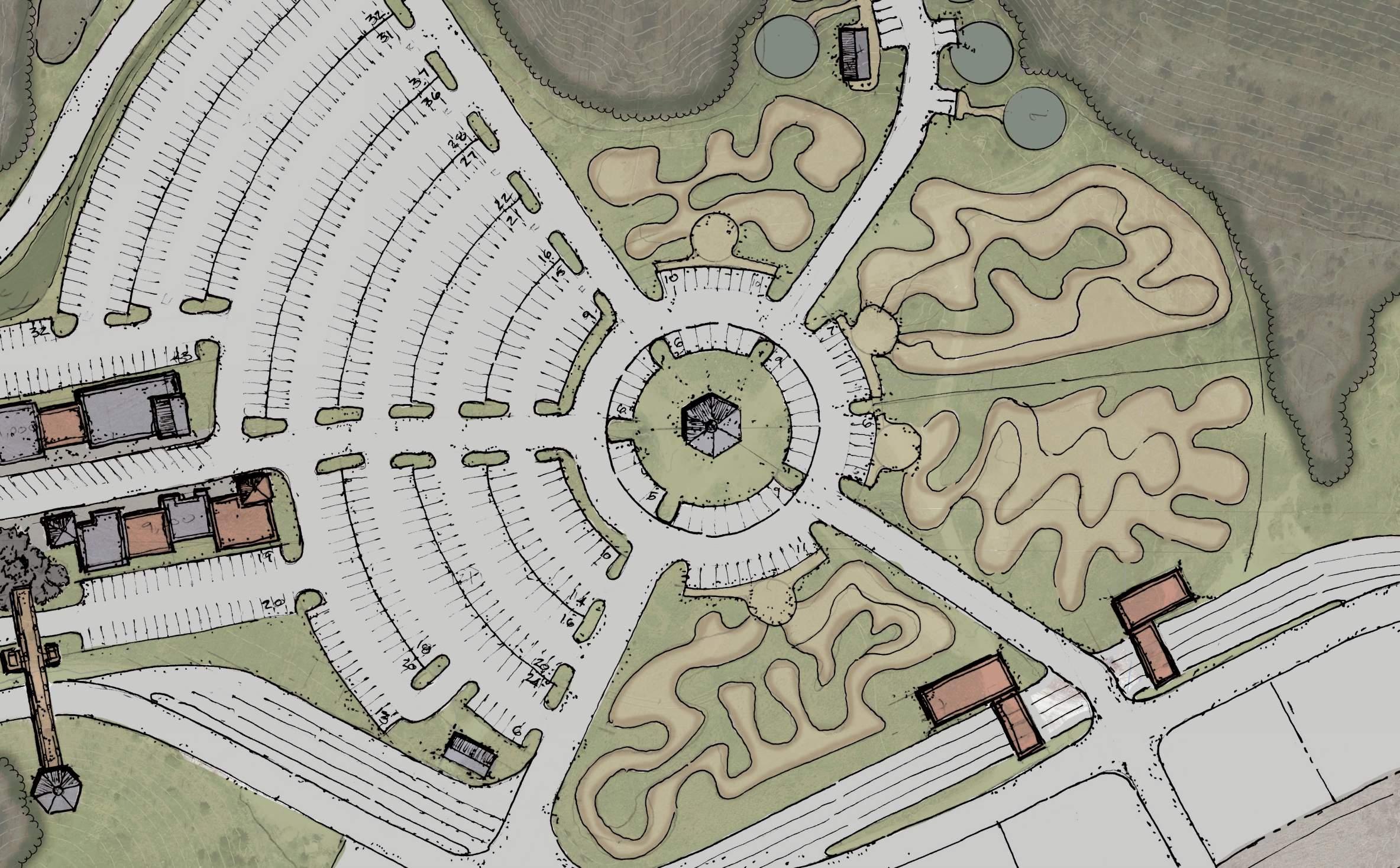
The trail head area is designed to be the beginning and end of every trail ride. Bringing people to the town center at lest twice a day. The central trail information center provides a meeting location, trail conditions, trail availability, and group riding information. Surrounding the information center are four separate learning areas dedicated to first timers and beginners wanting to try off-roading. Each area has a meeting area and various obstacle training courses to try. There are areas dedicated to mountain biking, motocross, ATVs, and full-size vehicles. Areas present the opportunity for training and riding safety courses for novice and younger off-roading enthusiasts.
ATV TRAINING COURSE
20 Appalachian Outlaw Trails Conceptual Masterplan draft 5/22/2024
KEY MAP
800 SPACE PARKING LOT
MAIN STREET
TRAILHEAD
VENDOR ROW AREA AND VENDOR RV CAMPSITES
Vendors ROW
The area along the main entrance road is dedicated for vendors to display their products. The location is perfect to ensure high visibility for advertisement. The lots are sized large enough to accommodate for RVs and for the vendor to maintain visibility of their display area at all times.
FUELING AND WASHING STATIONS
Adjacent to the main entrance road and close proximity to the training courses is the fueling station and wash stations with stacking lanes. Providing visitors the opportunity to fuel their vehicles prior to entering the trails and maintain a clean roadway when leaving the trails and back to camp or leaving the area.
VENDOR ROW AREA AND VENDOR RV CAMPSITES

21 Appalachian Outlaw Trails Conceptual Masterplan draft 5/22/24
TYPICAL VENDOR ROW LAYOUT
VENDOR PRODUCT DISPLAY AREA
WELC OME CENTER
FUELING STATION
ATV TRAINING COURSE
WASH STATION
VENDOR ROW AREA AND VENDOR RV CAMPSITES
KEY MAP
town center - lodging
Town Center lodging includes multiple types of overnight accommodations including hotel rooms, RV spaces, cabins, safari tents, and yurts. The cabin, safari tents, and yurts are intended to be used by groups of approximately 10 units. These locations include small private amenity packages for the users of that campground area. RV spaces have also been included for visitors who like to be close to all the action, but still want all the accommodations of a typical RV campground.
TOWN CENTER LODGING UNIT COUNT:
draft 5/22/2024
HOTEL - 80 ROOMS RV - 29 SPACES CAMPING - 21 UNITS 130 TOTAL UNITS KEY MAP 1 1 2 2 3 4 MAIN STREET 80 UNIT HOTEL 14 RV SPACES 15 RV SPACES HOTEL & AMPHITHEATER PARKING ROAD TO CAMPGROUNDSEXTENDED
23 Appalachian Outlaw Trails Conceptual Masterplan draft 5/22/24 3 4
50’ CAMPING AREA
50’ CAMPING AREA
VENDOR ROW
TRAIL HEAD
TRAINING COURSE
TRAINING COURSE
TRAINING COURSE
YURT, CABIN, OR SAFARI TENT UNIT
YURT, CABIN, OR SAFARI TENT UNIT
BATH HOUSE
BATH HOUSE
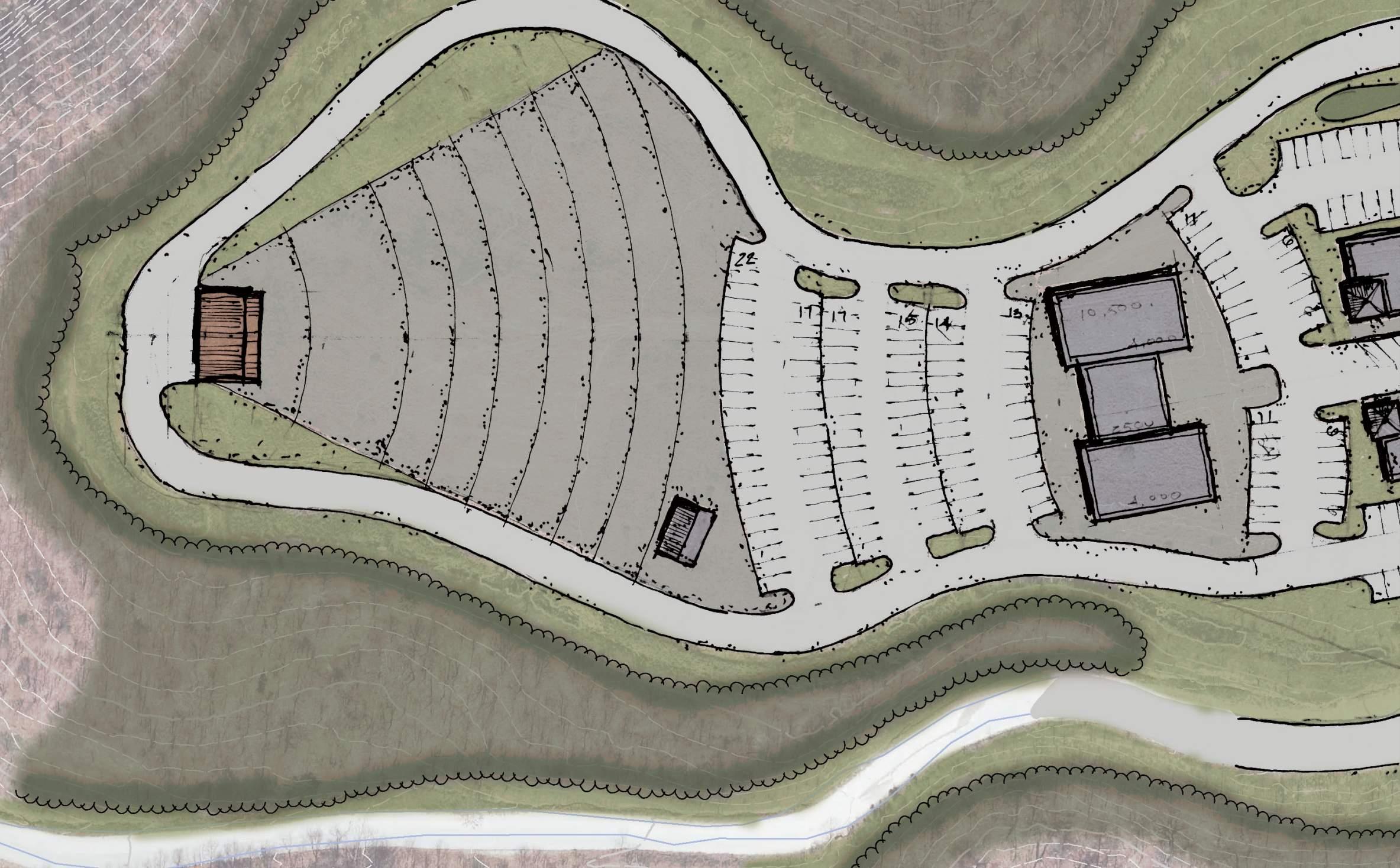
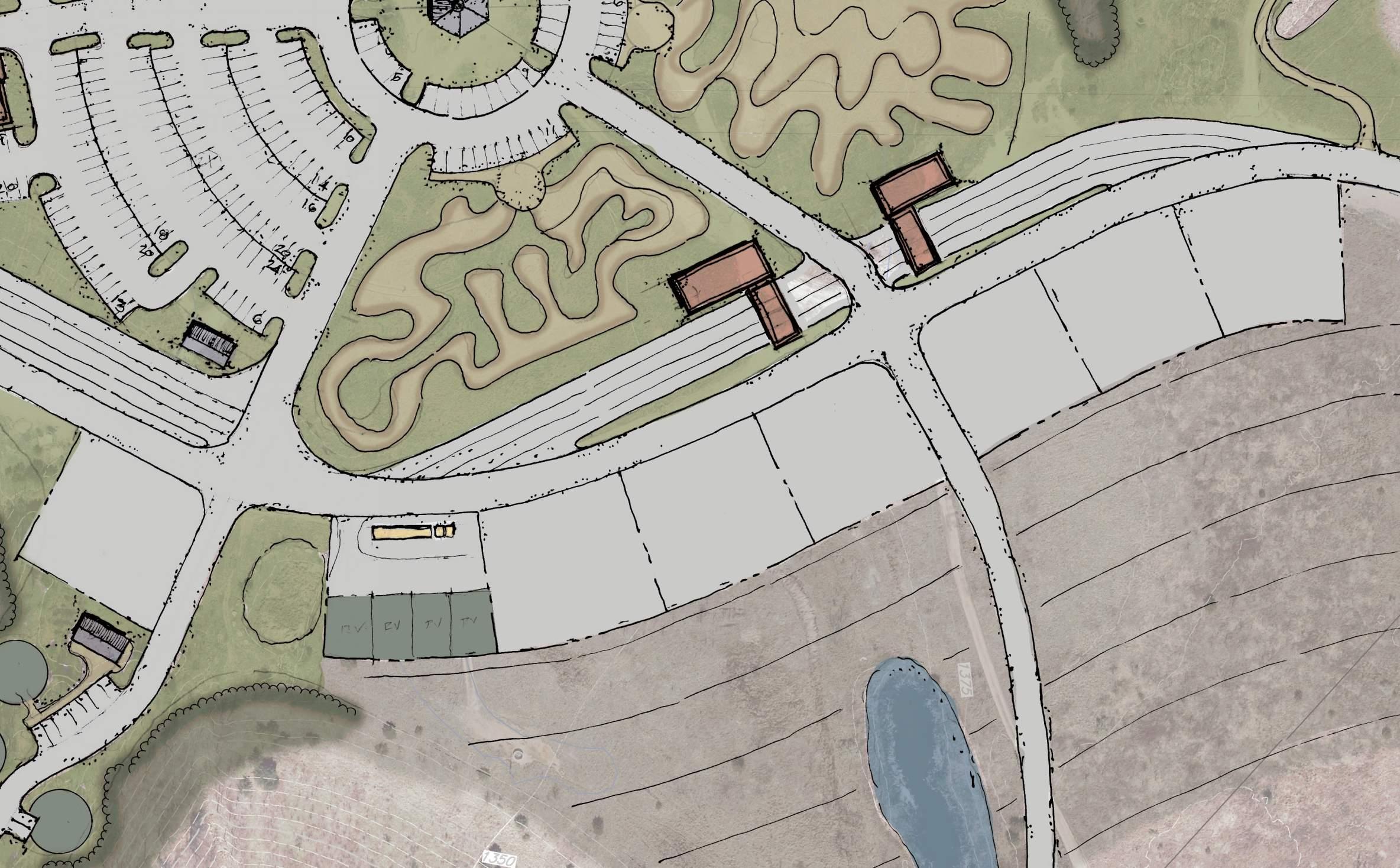
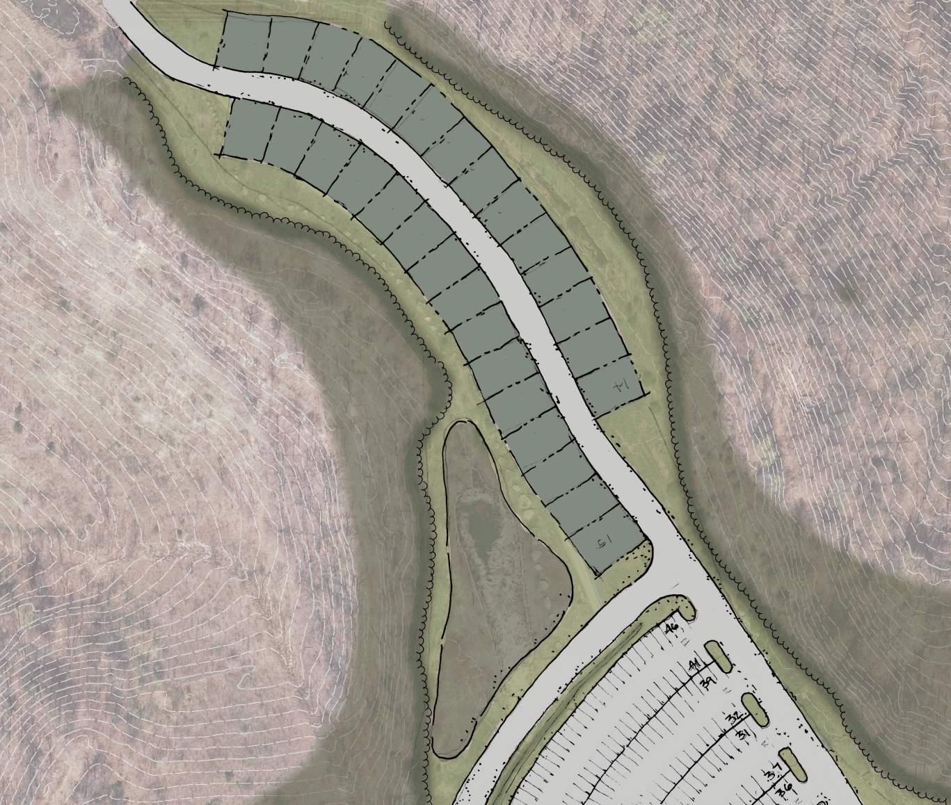
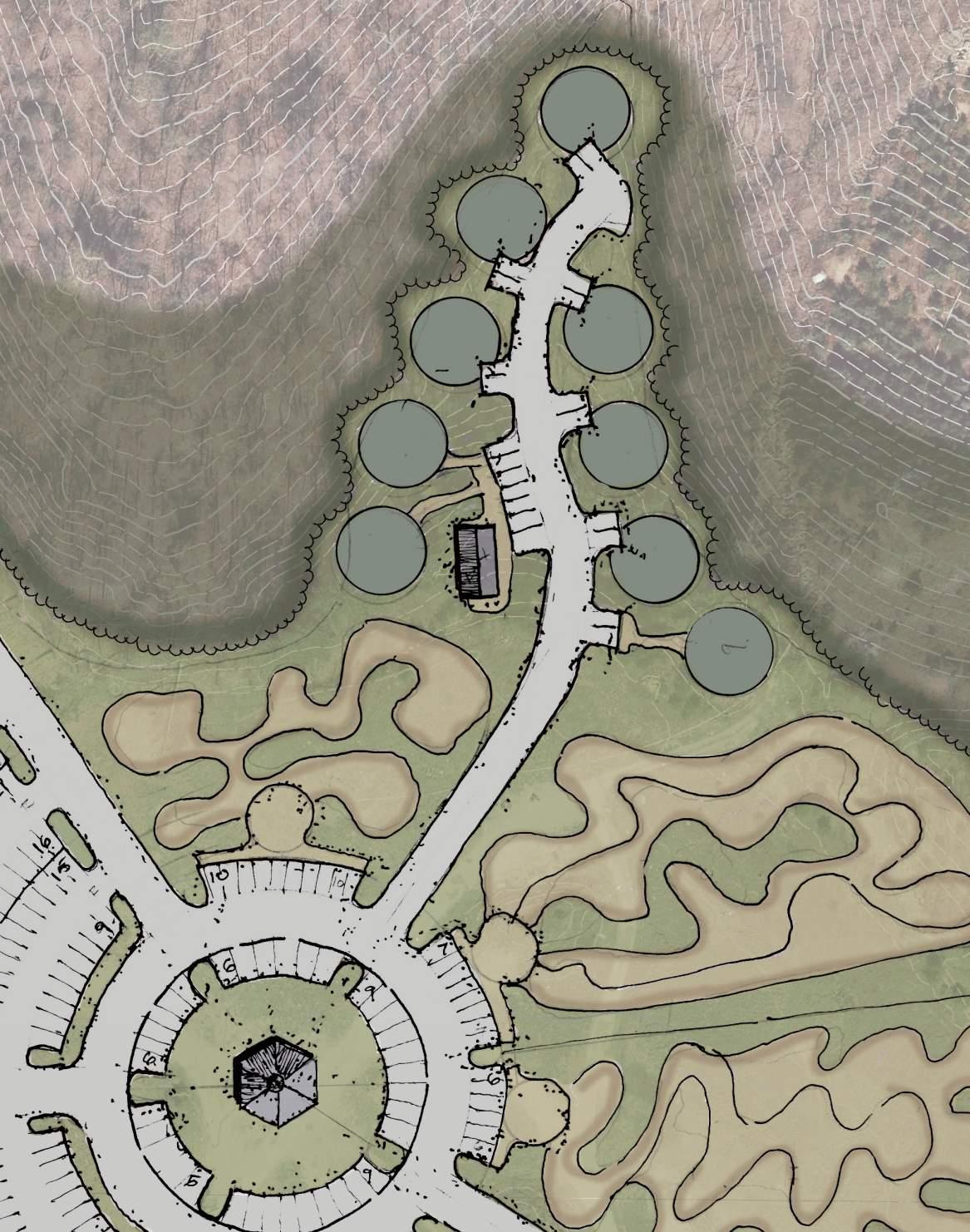
EXTENDED CAMPGROUNDS & COMMERCIAL DEVELOPMENT
The ridge line to the south of Town Center was developed into a 100-scale drawings depicting the use-cases as an extended campground area or a +/3-acre commercial development with direct access to the main entrance road and to the Interstate. The extended campground area design would be similarly designed for the campground areas North and East of Town Center.
The Campground areas consists of:
• RV Spaces
• Camping Areas
• Amenity Areas
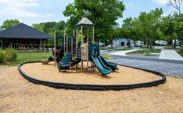
The RV spaces are laid out along the main ridge half of the sites have wonderful valley views while the other half front on the amenity area. The campsites are laid out on three spectacular isolated ridges each of these sites include a bathhouse. The campsites are sized to accommodate cabins, yurts, safari tents or tents. The amenity area includes a bathhouse, amphitheater, food truck area, campfire/ gathering area, playground, loop trails and two designated kids’ skill development areas. The campground can comfortably accommodate 550 visitors.

24 Appalachian Outlaw Trails Conceptual Masterplan draft 5/22/2024
1 3 6 2 4 5 KEY
MAP
25 Appalachian Outlaw Trails Conceptual Masterplan draft 5/22/24 1 3 6 2 5 extended CAMPING AREA Option Commercial Development option
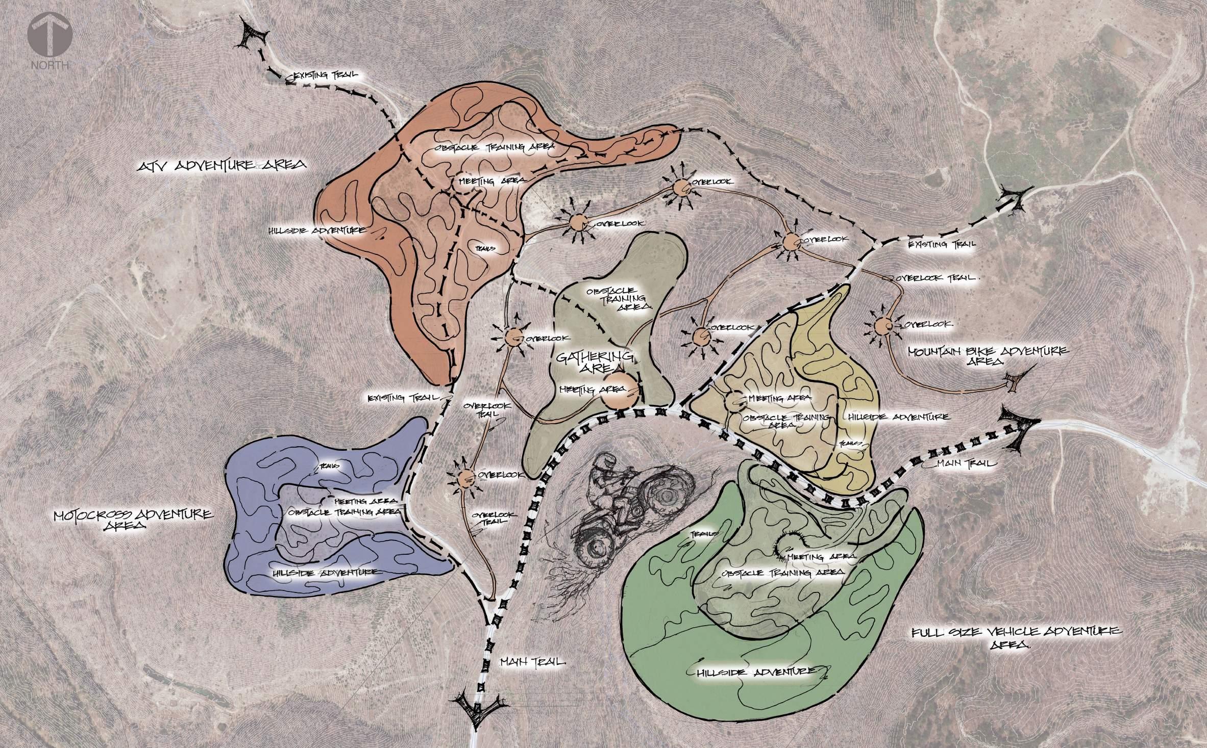
Adventure Area
This area is dedicated to developing and perfecting trail skills. Similar to the trail head facility in concept this area is for intermediate and advanced riders. A centralized gathering area allows the opportunity to meet hang out tell stories and show off your vehicle and even kick up some dust. Surrounding the central area are four areas dedicated to mountain biking, motocross, ATVs, and fullsize vehicles. Each of these areas has a meeting centralized meeting area, a level area of obstacle training and an area of hillsides to practice skills on. Interconnecting all the areas is a ridge top trail system connecting a series of viewing areas overlooking all the adventure areas.
The Adventure area consists of:
• Centralize Meet-Up Area
• Full Size Adventure Area
• ATV Adventure Area
• Motor-Cross Adventure Area
• Mountain Bike / E-Bike Adventure Area


26 Appalachian Outlaw Trails Conceptual Masterplan draft 5/22/2024
1
6 2
5
3
4
27 Appalachian Outlaw Trails Conceptual Masterplan draft 5/22/24 1
5 4 6 Adventure area KEY MAP
3