


The Town of Fayetteville is one of America’s Coolest Small Towns and has been recognized numerous times across the nation. With the designation of the New River Gorge as a National Park in 2020 and the New River Gorge Bridge sitting at the doorstep of Fayetteville, the town is set to be one of the premier National Park gateway towns in the United States. With the new designation of the National Park, tourism pressures are going to increase exponentially in the town of Fayetteville. Similar gateway towns exposed to the same situation have experienced tremendous economic pressures resulted in tragic outcomes. Many towns had visions of sharing their unique culture and identity with the towns’ visitors, unfortunately the towns are now completely unrecognizable to the locals were forced to leave due to economic stress and improper planning for the future prior to the extreme growth factor. Fayetteville, recognizes the pressures that are beginning to affect the town and proactively issuing the masterplan to relegate the issues and constraints of tourism on the town. The following plan is a working document of ideas gathered by working together with the town and its people over the last 6 months to provide a pathway of success to allow Fayetteville
The masterplan consists of three major components:
• Research Phase
• Masterplan Development Phase
• Implementation Planning Phase
The research phase includes several different task; a review of existing plans and studies that have been previously conducted in Fayetteville and the surrounding region, a site inventory and analysis that utilizes GIS technology with the review of scientific, cultural, and historical data of Fayetteville, and collection and analysis of four different case studies of similar gateway communities to gain insight as to how similar towns are addressing the pressure the tourism economy is placing on them.
Community engagement is large contributer to the ideas and designs set forth in the masterplan. A very successful public meeting, online surveys, and stakeholder interviews were conducted.
From the information collected during the research phase, four major themes are observable. The themes are the foundation of the program development for the masterplan. Each of themes are spatially located using a bubble diagram that studies the relationship between each program element and further refined into detail design areas. The following four themes complete the masterplan:
• Parks and Recreation
• Parking Opportunities
• Court Street Masterplan

• Town Square
A handful of the proposed elements can be implemented immediately, while others will require public-private partnerships and creative funding to drive construction. To determine a path forward it is important to consider project phasing and identify funding opportunities. Each project can be broken down into sections or phases and funding can be applied for as phases or as a full project. Each section provides supporting documentation for phasing opportunities as well as funding sources. Primary sources of funding provide are West Virginia Department of Highways (WVDOH), Appalachian Regional Commission (ARC), Economic Development Administration (EDA) and Tax Increment Financing Districts (TIF).
Long before the coal fields and railroads rolled through the hills, Native Americans called this place home for centuries. The protohistoric period for the Native Americans of the lower New River region began in 1492 and lasted until around 1650. While there were many tribes throughout history in this region, recorded history in the 1600s in the New River Gorge area depicted that the Shawnee were most prevalent.
The next two centuries brought great change to the region, starting with the civil war. The tactical potential of the Kanawha Valley between modern-day Fayetteville and Charleston wasrecognized by both the Union and confederacy and as such was fought over. The city of Fayetteville is considered the first place where the use of “indirect firing” occurred.


In 1863, West Virginia became the 35th State and shortly after was connected to the greater region by the Chesapeake and Ohio Railroad in order to serve the newly created New River coal fields. The region was considered to have some of the highest-grade coal on earth and created a booming industry throughout the early 1900s.

In 1978, the National Park Service designated the New River Gorge National River protecting more than 70,000 acres of land around the gorge. Today this area is home to the United States newest National Park, the New River Gorge National Park and Preserve, where the surrounding land is known for rafting, hiking and rock climbing as well as some of the best fall colors in the American East.
What we know today as Fayetteville, West Virginia is home to rich cultural and natural history. The history of the town traces back to 1837 with the homestead of Abraham Vandal, a Revolutionary War Veteran. The small community was called Vandalia and in 1872, was incorporated as the Town of Fayetteville in honor of Marquis de Lafayette. The town is a part of the Civil War Trail and played a small part for both sides in the war, but ultimately known for the timber, coal and railroad boom of the late 1800s and early 1900s. While the town’s first boom industries were due to extraction, it is now seeing its second-coming as a boom town for outdoor recreation.
As mining opportunities began to dissipate throughout the region in the 1950s and 1960s, new economic initiatives began to arise in the form of natural resources, specifically whitewater rafting, kayaking, and canoeing. In 1976 the New River Gorge Bridge, at the time the world’s largest arch bridge, opened access into communities like Fayetteville and brought with it the start of outdoor recreational tourism.
A masterplan is a document and policy guide designed to help communities create visions of what they would like to see develop in their town or city now and into the future. The masterplan establishes a framework for future growth, providing communities and local leaders with guidelines to direct their municipality’s decisions on policy, land use development, and preservation. A masterplan provides a long term vision for a town and is meant to be implemented over a period of 10+ years. A masterplan often divides proposed projects into a series of short, mid and long term goals. A masterplan document can be used to attract investments, receive grants, and
prioritize community projects. They are meant to be aspirational for a community. A masterplan envisions the possibilities for a community and outlines a path to achieve success.
Every proposed project within a masterplan has a program that it follows. The program takes into account the short, mid and long terms goals that are laid out in the masterplan. Creating actionable items that are needed to successfully implement each design. There are often many considerations that go into program development to create something that fits well into the masterplan and provides the town and community with what they need. In order to create a conceptual design for a site, a program must first be established. The following steps outline one way that a program can be developed for a project within a masterplan.
• Analyze the site and situation.
• Identify the needs, problems, and goals within the community.
• Create an outline based on the goals and needs.
• Write the program and its outcomes.

After the program is created it is often paired with information such as funding opportunities for those types of programs, phasing strategies to be coordinated over time, and the conceptual plan often accompanies the program.
Needs
• Need for town beautification, general utility infrastructure improvements
• Need for improved wayfinding and signage throughout town
• Need for a community center / indoor recreation facility
• As the community continues to change, there is a need to preserve and showcase local history
• Need for public restroom facilities
Goals
• Focus on promoting longer stays by visitors

• Create additional public spaces / plazas / pocket parks
• Create opportunities for more public art, create additional support for local artists
• Opportunities exist to re-purpose underutilized town properties through infill projects Implement a public transportation / ride sharing system
• Create additional programs to support both youth and senior citizen activities
Once a program has been developed and agreed upon by the parties involved, the program is set into motion. The program is broken down into the different elements. For example a park program might include a playground area, court games, seating areas, pavilions, etc. Each program element need to be sized and placed on the site, with the use of design and drawing. The programmatic elements are added to the plan and organized by design circulation walkways, spaces and roads. The final product results in a conceptual project plan. The plans are then implemented in accordance to the masterplan or phasing documentation.
The graphic below shows the iterative process of turning the program into a plan. The graphics represent the development of the town square and how the programmatic elements fit onto the site.
Implementation depends on how the project is being funded and who is in charge of the development. Often projects are phased if possible, allowing for funding to be broken up over time so that a singular project can move forward without funding the entire project at once. After the plan and funding opportunities have been established, construction planning begins. Each project in the Fayetteville Masterplan is designed to be completed in phases.

The Masterplan includes four major focus areas addressing each of the programmatic elements: Parks and Recreation, Parking Opportunities, Court Street Master Plan, and Town Square. The masterplan process was applied consistently through each of the sections. The in-depth presentation of the process is included in the appendix.
Problems
• Lack of town parking (especially during busy season)
• Lack of real estate expansion opportunities for commercial and residential development
• Uncontrolled growth of short term rental market
• Incomplete pedestrian connections in town to essential areas and the need additional street lighting and safe pedestrian crosswalks
• Lack of a variety of activities to do on weekends and outside of regular business hours
• Concerns over balancing tourism growth with the needs of the community
• Seasonality of local economy / lack of consistent workforce


Fayetteville is the epicenter of a recreational paradise. The character of the town clearly reflects the love of the outdoors. The analysis of the existing parks and recreation facilities, usage, and community engagement feedback clearly designate parks and recreation as one of Fayetteville's main goals. Continuation of cohesive design and the implementation of the Fayetteville Parks & Recreation Department will be prudent as the town's attractions grow.

The town of Fayetteville's Parks Department is responsible for the management of Charlie McCoy Town Park. This is a well loved and used park and is at its maximum use capacity. Some of the features include three baseball fields, basketball, playgrounds, gaga ball pit, dog park, splash pad, skate park, walking path, shelters and the trail head for the national park. This is a wonderful facility that needs to be continually maintained. This park could benefit from an individual masterplan addressing future needs, circulation and parking, existing usages and planning for future growth.
This park is located on North Court Street at the intersection with Keller Avenue. The park is on the National Register of Historic Places and in the Fayetteville Historic District. The park is the location of a historic Civil War era stone well constructed by Cleante Janutolo. The park contains a gazebo, plantings and picnic tables. The park is a wonderful green space in the heart of court street and a beneficial asset for future growth.
The memorial building is on the National Register of Historic Places. The Fayette County Commission purchased the land in 1947 and the building officially opened in 1951. The memorial building became a center piece for the county, hosting major activities and events. Unfortunately, the building is currently underutilized and important maintenance has been deferred to the point of structural damage. The building honors the men and women of the armed forces has the potential to become the central hub in Fayetteville with the proper upgrades and a programming director, the building will become an essential asset to the future growth of Fayetteville.


Fayetteville’s proximity to several great existing outdoor recreation opportunities supports the fact for great potential to be realized in the creation of additional, town specific recreation facilities and amenities. Local recreation opportunities will improve the quality of life for the town residents and continue to contribute to an overall sense of community while tourism growth and expansion is in progress. In addition, the recreation opportunities serve to create attractive town amenities for visitors. The creation of a robust system of outdoor facilities and amenities will solidify Fayetteville’s identity of being a gateway community to the New River Gorge National Park and Preserve and as a national outdoor recreation destination.
To best serve the needs of the town and its community, it is recommended that Fayetteville creates a Parks and Recreation department, which would include a director and supporting staff. The Parks and Recreation Department would oversee the operations and finances of the existing public parks and recreation spaces, proposed improvements to the Memorial Building, creation of the Fayetteville Greenway and Recreation Center, which will tremendously benefit and drive recreation tourism opportunities in a constructive and cohesive manner. In addition to the department, it is suggested that a Park and Recreation board is established with 501c3 status for funding and donations. It is recommended that the board would include three members of city council (including the mayor), one member of the county, two at large (public) and one member of the Convention and Visitors Bureau (CVB). The town’s hotel and motel tax and the 1% sales tax can be adjusted to increase the department’s budget and further help delegate the construction and implementation of the program elements and projects in the masterplan.
This park includes a veterans memorial, mausoleum, and an angel park. Funding should be provided for the continued maintenance and improvements required.


The development of a community-based recreation center was a major element derived from community response. Developing land adjacent to the school on Maple Avenue, opens up an opportunity to house the community recreation center. The location provides park access to the neighborhoods in the Nickleville Road area and provides for future park growth.
Taking into consideration the importance of parks and recreation to Fayetteville, the plan recommends unifying the existing parks department with the Fayette County Soldiers and Sailors Memorial Building, the creation of the pedestrian bike system (greenway), and the future recreation center into one governing body that could run and develop this system.
Skatepark at Charlie McCoy Park Youth Sport Leagues at the Memorial BuildingFayetteville NEEDS to be the regional trailhead for recreational opportunities

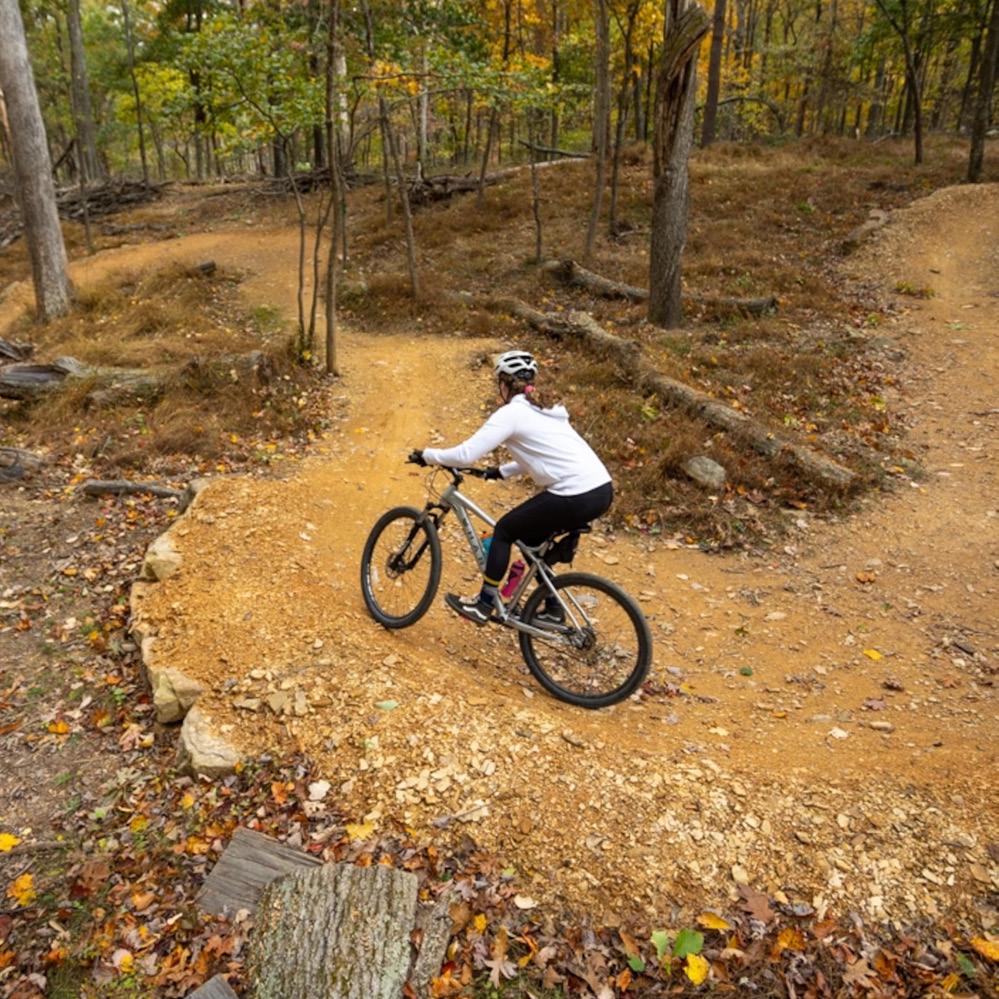

World class trails, climbing, white water and biking opportunities within walking distance from Fayetteville


When considering the creation of a parks and recreation department, the Fayette County Soldiers and Sailors Memorial Building (Memorial Building) is seen as having great potential for being an anchor in the town. This space is envisioned as being an Fayetteville event hub, with multiple purposes and activities occurring daily. Already home to the town’s library, this facility would also make a great location for the Fayetteville Convention and Visitors Bureau (CVB). The potential relocation of the CVB to the Memorial Building will support marketing of the facility and further attract visitors to the center.

For this is to occur, it is recommended that the facility is modernized to support a variety of programing and an increase in visitors, while preserving its historical look and character. During the modernization process, recommend improvements include: New roof as needed, HVAC improvements, structural needs, upgraded bathrooms and locker rooms, concession area, seating, lighting, scoreboard and pa systems. This space should also include any necessary changes to adhere to current ADA accessibility standards. There are also many different ways the building can be programed including: concerts, farmers market, theatre and movies, events, competition play and tournament play. The two main ideas that encompass reprogramming of the Memorial Building include the creation of a climbing and bouldering center and the establisment of a tournament play schedule.
Below are further thoughts on how the two programs would function throughout the year to support events and tournaments in the community:
priority. Some areas would be free to the public, while other would have a fee.
• It would be suggested that the Parks and Recreation Department team, along with a local outfitter, would provide the services and the opportunity to learn in a controlled environment prior to offering guide services in more remote locations.
• The tournaments would take place in December/January and another one in the spring/summer for the travel/AAU format.
• The tournaments can start with high school and expand to include middle school level and below. This would ultimately create a 3-4 week basketball tournament in winter and another in summer.
• This above tournament schedule could be easily replicated for the following sports.
• Volleyball - 2 Courts
• Wrestling - 2 Mats
• Pickleball - 3 Courts
• Concerts, Farmers Markets, and Seasonal Events
• Programming the space for quarterly concerts and/or festivals can be possible.
• The facility would be able to team with local festivals for indoor space, when weather does not permit outdoor performances.
• The facility could host an indoor farmers market year round.
• The facility would also provide support for current season events, along with programming for community and visitor events, depending upon the season and regional attractions.
Following the successful operations and improvements to the Memorial Building, expansion of the towns recreation facilities can be achieved. The creation of a recreational facility that compliments the Memorial Building and the Greenway is the next step in developing the communities recreational amenities.
• Basketball Example - 1 Court

• Create a tournament with a tagline such as “New River Gorge Classic Basketball tournament” that can be marketed by the CVB, with support by local restaurants and hotels. The tournament would start with an 8-team format and double elimination for a total of 15 games played over a weekend.
• Once successful, the tournament can be expaned to include the middle school court to double the number of teams and visitors to the facilities.


• In addition, a grander plan would be to include Summersville, Oak Hill, and Beckley to create a regional tournament and fill restaurants and hotels in the New River Gorge region.
• The proposed idea of a bouldering and climbing center is an indoor and outdoor facility that will allow for the climbing community to be in town on both fair and foul weather conditions. It is located one block away from Water Stone Outdoors, the premier climbing store in the region, and is within walking distance of many of the Town’s restaurants and parking areas.
• This recreation area will have both a bouldering park and a large climbing wall, which will be visible to the town’s residents and visitors.
• During foul weather conditions, and especially in winter weather, the stage inside will have a similar layout to the outdoor climbing area. This allows for 365 days of climbing.
• The facility will have rentals and guides to support anyone who would want to participate in local climbing activities, with safety being a top
 Fayette County Soldiers and Sailors Memorial Building (Memorial Building)- Exterior
Fayette County Soldiers and Sailors Memorial Building (Memorial Building)- Interior
Fayette County Soldiers and Sailors Memorial Building (Memorial Building)- Stage Area
Outdoor Bouldering and Climbing Areas

A greenway is often a linear open space, or corridor, that typically runs through a natural area, a stream or other water feature, or along important utility and transportation corridors. It is typically designed for multiple uses, such as recreation, transportation, conservation, and environmental protection. It is made to prioritize pedestrians and support multiple types of non-motorized users. Walkers, runners, bikers, and skaters are only a few of the possible greenway users. Designed as inclusive spaces, they also can include programming such as pocket parks, picnicking areas, educational signage, and nature exploration opportunities. A greenway system is often comprised of a network of interconnected trails that form important connections between areas of significant value. The system is typically integrated into the surrounding community, offering connections between neighborhoods, parks, schools, commercial areas, and other areas of importance. Greenways offer alternative transportation options to residents, improving their quality of life and easing traffic congestion on local roadways. They can contribute to the overall livability of an area, enhance property values, and support economic development.


The greenway system being proposed for Fayetteville is a community centered idea. It will create a multi-use path system to connect essential areas of the town together. The idea will connect to and utilize trails currently available for use at the Gaines Estate. Complete implementation will require a public-private partnership to have the project fully realized. The project benefits all in the community, and is not designed only for visitor use. For residents, the concept joins the various town neighborhoods together, and gives residents walkable access to local outdoor recreation, city parks, Fayetteville’s town center, local businesses, and the school. For visitors, it will serve a similar purpose, and connect guests from parking areas and lodging to local trailheads and outdoor recreation, campgrounds, parks, the town center, and local businesses. By promoting alternative forms of transportation, the greenway system will encourage a more active lifestyle and assist in alleviating traffic congestion from the local roads.
One way the Fayetteville Parks and Recreation Department can have a big impact on the quality of life for the local community is through the establishment of a town greenway and trail system. Being proposed as the Fayetteville Greenway, this trail system will connect neighborhoods to essential areas in town, including parks, the town center, and commercial areas. It will also expand the opportunities for residents and visitors to utilize alternate modes of transportation to navigate town. The Parks and Recreation Department would be in charge of planning and establishing the trails, as well as continued maintenance and upkeep.
The following graphics identify several existing and proposed pedestrian amenities that are needed to successfully implement the proposed Fayetteville Greenway System. Several proposed street and trail projects have been identified that will aid in completing this town-wide pedestrian system. While a town sidewalk study was not a part of this project scope, there are a few select streets that have been identified as needing improved for pedestrians as a part of this plan. The streets provide significant pedestrian connections to important areas in Fayetteville. The following recommendations connect neighborhoods to town, its amenities and businesses, and to local outdoor recreation. As the town looks to improve pedestrian infrastructure in the future, a more in depth sidewalk study and improvement plan is recommended.
Proposed Projects:

Daniels Street (connecting pedestrian bridge to town center)
Proposed Improvements: Sharrows and improved sidewalk
This route provides an essential connection between Fayetteville’s town center and the western residential neighborhood across Route 19, via the existing pedestrian bridge. Community engagement feedback indicated that this neighborhood can feel left out of town events. Strengthening the pedestrian connection along Daniels Street will help address this perception and increase the pedestrian connectivity to town. Improving this connection can also encourage further development of the western neighborhood. It is recommended that sharrows be implemented as a short term solution along Daniels Street. As budget allows, a long term goal would be to implement an improved sidewalk system.
Fayetteville Avenue/Park

Proposed Improvements: Sharrows and improved sidewalk

The route along Fayetteville Avenue and Park Drive is essential to creating a pedestrian connection between Fayetteville’s town center (Court Street) to their largest park, Charlie McCoy Park. Sidewalk currently exists, but is inconsistent and includes obstacles such as utility poles. The recommendation for this route is similar to Daniels Street. The first recommendation would be to implement a sharrow system. Then as budget allows, to create an improved sidewalk system.

To improve pedestrian safety when accessing the proposed trail system, a box culvert is being proposed near the intersection of S. Court Street and Austin Street, where House Branch crosses S. Court Street. This box culvert is important to the overall greenway plan by improving pedestrian safety. This portion of S. Court Street includes a curve that causes limited visibility to pedestrians attempting to cross the road. Traffic speed also leaves little time for drivers to react to any person or other obstacle in the road. In addition to improving pedestrian safety, the box culvert will create easier utility management for the service lines running through this area. This will also helps the town with existing storm-water issues created by the existing culvert.

Proposed Projects:
Proposed Improvements: Skills course with three levels along the greenway
In addition to the Fayetteville Greenway, a proposed multi-skill mountain bike system is being located in town. This will be on adjacent properties surrounding the PK-8 Elementary School and proposed Recreation Complex. The area will comprise of beginner, intermediate, and advance trails. It will increase the number of bike skill development opportunities in town. Overall, this program will further diversify the recreation opportunities being offered in town. Residents and visitors will have the opportunity to practice their skills without traveling far out of town.


Nickleville Road
Proposed Improvements: 8’-10’ Shared Use Path
This road improvement is essential to not only connecting the southern Fayetteville residential neighborhood to town center, but it also forms a connection to important recreation and future development opportunities along Route 16. Fayetteville currently has an acceptable sidewalk system along West Maple Avenue, leading out of town, until shortly after the elementary school. After this point, the road then becomes Nickleville Road. The existing sidewalk ends and there are limited shoulders. Creating an 8’-10’ shared use paths would improve pedestrian safety and allow residents of this neighborhood to walk or bike into town. This path would travel the entire length of the road and end at Route 16, where a connection can be made to Wolf Creek Park. This development contains a network of bike and hiking trails that currently have no direct pedestrian access. In addition, this connection will become an essential amenity as Wolf Creek Park becomes further developed.
Laurel Street
Proposed Improvements: Sidewalk

Proposed sidewalk connections along Laurel Street will provide pedestrian access from the residential neighborhoods to a main shared use path along Maple Avenue/ Nickleville Road. This will give the neighborhoods access to the overall pedestrian connection system. In addition, it will provide pedestrian access to the commercial properties along Route 19.

Maple Avenue (and connected roads)
Proposed Improvements: Sharrows and Shared Use Path
Maple Avenue and the roads that branch off of it, north of the Walmart plaza, present a great opportunity to create a shared use pedestrian path to give Fayetteville residents and guests a way to walk or bike to this shopping center. Maple Avenue improvements consist of a sharrow system. A shared use path would be establish on the unofficial roads that connect to it. This proposed system will connect this important commercial area to the residential neighborhoods of Fayetteville via the House Branch Greenway System.

Proposed Projects:

Nickleville Road
Proposed Improvements: 8’-10’ Shared Use Path

This road improvement is essential to connecting the southern Fayetteville residential neighborhoods to town center, it also forms a connection to important recreation and future development opportunities along Route 16. Fayetteville currently has an acceptable sidewalk system along West Maple Avenue, leading out of town, until shortly after the elementary school. At this point, the road becomes Nickleville Road. The existing sidewalk ends and there are limited shoulders. Creating an 8’-10’ shared use paths would improve pedestrian safety and allow residents of this neighborhood to walk or bike into town. This path would travel the entire length of the road and end at Route 16, where a connection can be made to Wolf Creek Park. This development contains a network of bike and hiking trails that currently have no direct pedestrian access. In addition, this connection will become an essential amenity as Wolf Creek Park becomes developed.
Gateway Park Opportunity

This location marks the southern gateway entrance for Fayetteville. The underutilized property that is adjacent to the intersection of Nickleville Road and Route 16 could be re-purposed into a trail head and information kiosk for the southern end of town. This would communicate to both visitors and guests that they are entering Fayetteville and give them an opportunity to find information on where to go. In addition, this development idea would provide other park oriented amenities for the southern residential neighborhoods of Fayetteville, where none currently exist.
Wolf Creek Park

Containing several miles of bike and walking trails, and with future development plans in the works, it would be important to form a pedestrian connection to Wolf Creek Park. Not only will it give residents access to the development and the amenities it has to offer, but it will also serve to connect future visitors to Fayetteville’s town center. This pedestrian connection is essential to consider at the town looks to plan for future visitor growth. It has the potential to lessen vehicular congestion on local roadways by promoting alternate forms of transportation.
Pedestrian Bridge Connection
This bridge location will serve to connect residents to the Kroger commercial plaza, allowing them to use alternate modes of transportation to travel to this important destination. Due to the traveling conditions on Route 19, it is unsafe for pedestrians to attempt to cross the road in its current condition. A bridge at this location will increase residential and visitor access to the commercial businesses.
 Wolf Creek Entrance River Expeditions
Wolf Creek Park and Trails
Pedestrian Bridge Connection
Kroger Commercial Development
Fayetteville Greenway
Gateway Park Opportunity
Nickelville Road
Proposed House Branch Greenway System
Pedestrian Bridge Connection Examples
Trail Head and Signage Example
Mountain Bike Skills Area Example
The indoor recreation center is a community driven facility that seeks to provide opportunities for community members within Fayetteville while also allowing areas for tourism-based sports and events. Monday – Thursday the facility will be community focused with youth leagues and local recreational opportunities and Friday – Sunday the facility would be able to house travel sports leagues and other tourism-based recreation such as mountain biking and climbing. This facility will complement the Memorial building and Charlie McCoy Park allowing for a strong parks and recreation infrastructure. The developments could be added into the TIF district plan to help establish infrastructure. This facility will provide the following programmatic elements:
• Basketball
• Volleyball
• Wrestling
• Pickle Ball
• Indoor Track
• Turf Areas for Soccer and Baseball
• Aquatic Area for Recreation and Physical Therapy
• This would allow for a local PT to use the facility adding additional community value.

The recreation center would also allow for a robust set of outdoor programs and activities, such as:
• Full-Sized Multi-purpose Field

• Flow Track for Mountain Biking
• Climbing and Bouldering Park
• Connection to Additional Pickle Ball Courts
• Connection to Town Greenway
Indoor Rec Center
Pickleball and Tennis Courts
Connections Greenway
Multi-Purpose Field
Climbing and Bouldering Park
Flowlines and Mountain Bike Trails


Lack of parking was identified as a universal concern during the public meetings, interviews and site analysis. Creating ways to address the concerns is a priority for the masterplan. Fayetteville’s existing parking plan consists of approximately 385 spaces. The parking areas can be divided into three categories – parking available anytime, parking available after 5 PM, and parking limited to two hours. Out of the total existing 385 parking spaces, 63 are categorized as parking anytime, 213 spaces are available after 5 PM, and 109 parking spaces have a two hour parking limit. No overnight parking is permitted within Fayetteville. Navigating and finding the available parking spaces can be a challenge, as not all parking spaces are clearly identified to drivers. While a town parking map is available on the town’s website and Facebook page, many areas are not apparent when navigating the town. The two-hour parking is clearly identified with many signs at eye level, but there is almost no clear parking information signage or wayfinding signage to the other parking locations. Street parking along Court Street provides the most convenient access to most of the town businesses and the after-hours and anytime parking are located in a ring surrounding the town center. Establishing clear and consistent information and wayfinding signage, clearly identifying the parking areas, and offering an online map will increase parking density and alleviate some of the towns parking issues. There are six specific areas of opportunities within the existing parking areas in Fayetteville. Conceptual designs have been implemented into the masterplan. Some projects require minimal effort to completed while others require some site-engineering and public-private partnerships. If the proposed areas were all constructed, Fayetteville would see an increase of 170 new parking spaces, nearly a 50% increase in parking spaces.

Parking Opportunities
Parking Area 1
Daniels Street and W. Wiseman Avenue
Proposed Parking Spaces: 55
Parking Area 2
Behind Town Hall
Proposed Parking Spaces: 39
Parking Area 3
Adjacent to S. Court Street
Proposed Parking Spaces: 25
Parking Area 4
Near Pies and Pints
Proposed Parking Spaces: 160

Parking Area 5
Around Memorial Building
Option 1 Proposed Parking Spaces: 68
Option 2 Proposed Parking Spaces: 56
Note: Concepts will require public and private cooperation. When working with private property owners dedicated parking spaces should be provided for them, to their satisfaction.
Project Name: Town of Fayettev lle Masterplan

C
Name: Town of Fayettev lle
Project No: 322-702
Developing a unified streetscape design for Court Street included rearranging existing parking and road alignments. There are currently 70 - two hour space available on Court Street. The Proposed design provides 90 on-street parking spaces. Combined with other proposed parking opportunities located adjacent to Court Street, increase the overall parking totals and benefit the core downtown business district.
Located in the Town Square Development plans.
5 4
3
Parking Area 1


Parking Area 1
Includes two new parking areas, one located off of Daniels Street and the other found off of W. Wiseman Avenue. The Daniels Avenue lot would require the acquisition and relocation of the existing ambulance service. A potential area could be near the Fire Department on Lively Street. The programs pair together well, and would give the ambulance service easier access to Route 19. The existing ambulance lot has eight private parking spaces. The proposed redesign for this property provides 21 new, public parking spaces adjacent to Court Street.


The proposed parking lot located off of W. Wiseman Avenue contains approximately 24 existing parking spaces. A parking study indicates that 10 additional parking spaces can be added. This would require developing a new entry off of W. Wiseman Avenue and adding two parallel parking spaces along this access. A one way loop system with 60 degree angle parking, and also provides a service area for D&K Collectibles.
Note: Concepts will require public and private cooperation. When working with private property owners dedicated parking spaces should be provided for them, to their satisfaction.
B

Note: Concepts will require public and private cooperation. When working with private property owners dedicated parking spaces should be provided for them, to their satisfaction.


Existing Parking Spaces
Proposed Parking Spaces

Total New Spaces
30 39 9

The existing parking area contains 30 parking spaces. By reorganizing the parking stalls and maximizing the use of all available space, a new layout can provide 39 parking spaces, increasing the parking by 9 spaces. As a part of parking area 2 the two handicap accessible spaces that are currently located on street would be moved here to improve safety. To establish this lot, minimum lot realignment will be required on the area of grass adjacent to the U.S. Post Office.
Key Map
Parking Area 3
Existing Parking Spaces
SouthCourt Street
Proposed Parking Spaces


7 25 18 Cathedral Cafe White Water Photography Existing Street Parking
11ParkingSpaces
14ParkingSpaces
View A 1 2 5 4 3 Parking Opportunities oject No: 322-702 ient Name: own of tev le oject Name: own of tev le Masterplan Key Map


W.MapleAve
W.MapleAve
Parking Area 4
Existing Parking Spaces
Proposed Parking Spaces


View A
Total New Spaces
Parking Area 4
90 160 70
View B
A B

Pints
Located along W. Maple Avenue between the American Legion Building and Pies and Pints. It focuses on the parking areas behind the existing businesses. The concept maintains the 3 existing entry and exit roads. The entry between Pies and Pints and Plateau Medical will be simplified into one 20’ entry drive with expanded walkways on both sides. The study area contained approximately 90 existing parking spaces. The proposed redesign for this area added 70 additional parking spaces, for a new total of 160. This project includes road realignment, minor grading, utility pole relocation, and cooperation and coordination between the businesses served by this area.
Note: Concepts will require public and private cooperation. When working with private property owners dedicated parking spaces should be provided for them, to their satisfaction.


Trail Connections to Fayetteville Greenway System See Parks and Rec Section
Key Map
Note: Concepts will require public and private cooperation. When working with private property owners dedicated parking spaces should be provided for them, to their satisfaction.

Parking Area 5 Option 1
Existing Parking Spaces
AProposed Parking Spaces


Total New Spaces
Parking Area 5
38 68 30
Developed for the area surrounding the Memorial Building and resulted in two options. Option 1 is focused only on parking, while the other includes a pocket park with a climbing wall. The existing parking surrounding the Memorial Building contains approximately 38 spaces. Option 1 provides an additional 30 spaces. This idea would require lot realignment, the use of retaining walls, and the installation of mountable curbing.
Key Map

Note: Concepts will require public and private cooperation. When working with private property owners dedicated parking spaces should be provided for them, to their satisfaction.

Parking Area 5 Option 2
Existing Parking Spaces
AProposed Parking Spaces


Total New Spaces
Parking area 5
38 56 18
Developed for the area surrounding the Memorial Building and resulted in two options. Option 1 is focused only on parking, while option 2 includes a pocket park with a climbing wall. The existing parking surrounding the Memorial Building contains approximately 38 spaces. The pocket park climbing wall option provides a total of 56 parking spaces, adding 18 more to the existing parking plan. It includes a pocket park and climbing wall, creating a destination recreation opportunity. See parks and rec section for more details.
Key Map


While there are seven entrances into the Town of Fayetteville, Court Street serves as the main entrance off Highway 19. As you approach the signaled intersection you are met with a view of the pedestrian bridge that crosses over Highway 19 (north bound) or the Tudors Biscuit World and Little General Gas Station (south bound). Each approach gives little insight into the atmosphere of Fayetteville and does not currently serve as a welcoming gateway into the town.

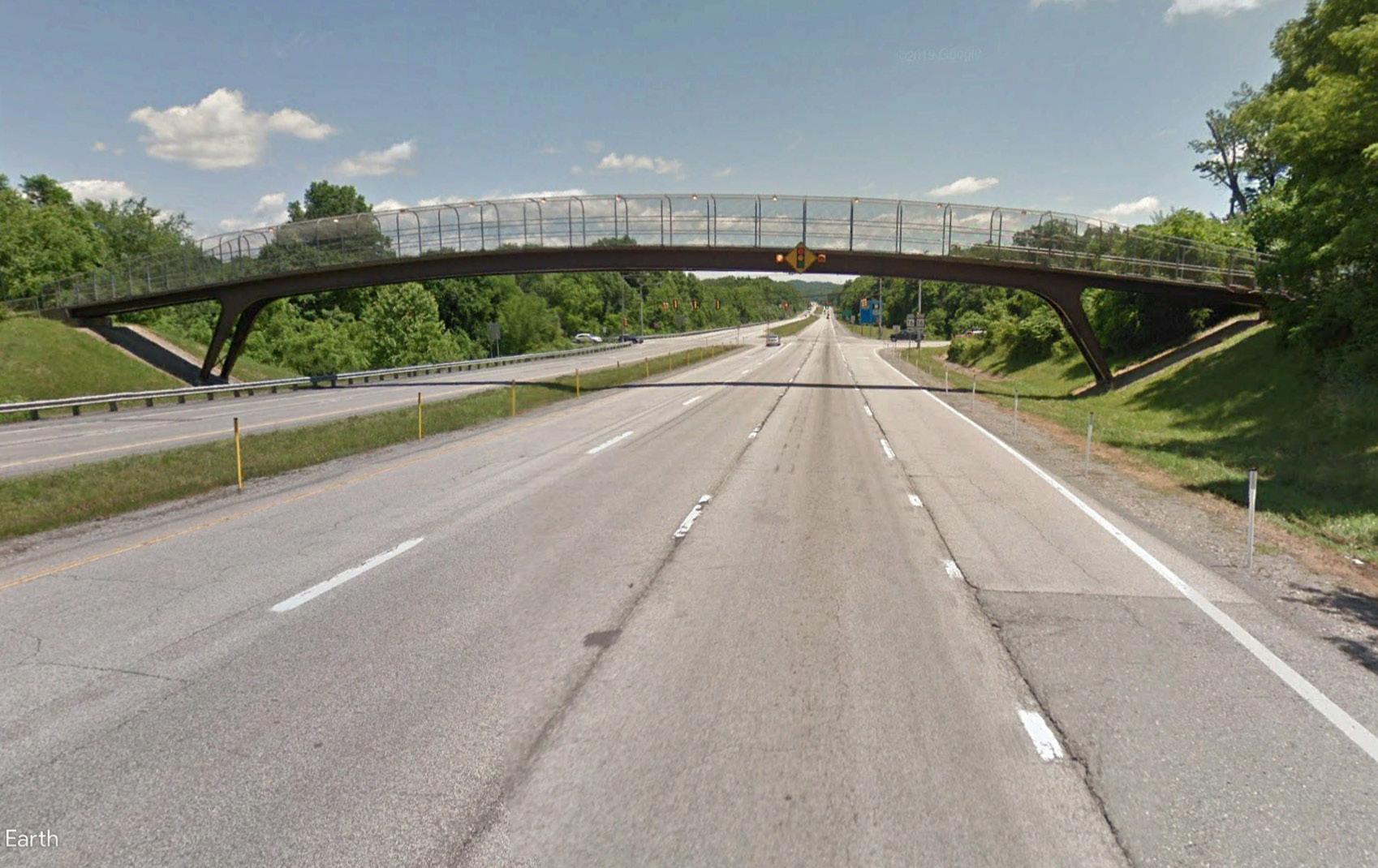

Along Court Street you are met with areas that could be viewed as unsightly, each unsightly areas become an opportunity for a project that highlights the beauty and uniqueness of Fayetteville. The list below outlines the existing challenges with Court Street.

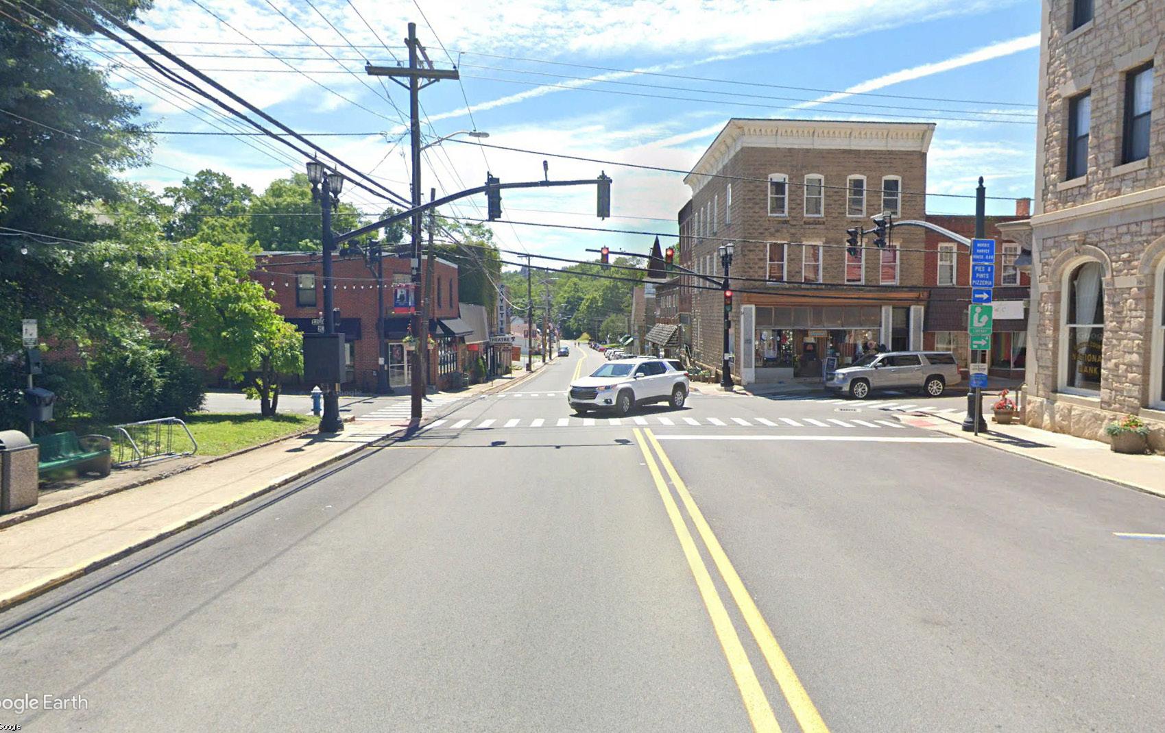


• Lack of defined entry into the Historic Town Center


• Overhead Power lines and Utilities


• Narrow / missing sidewalks
• Vehicle first design / pedestrian safety
• Lack of unified streetscape palette

• Broken or damaged historic walls

• Current facade conditions of mainstreet structures
• Lack of pedestrian focused spaces
• Wayfinding / Signage


Streetscapes play a crucial rule in the overall design and functionality of a town. They establish the town’s character and identity, prioritize pedestrian safety, contribute to an area’s sense of community, support social interaction, support local businesses, and can even promote best sustainability practices. Several comments received during project’s community engagement, along with the performed existing conditions analysis, led to a redesign of Fayetteville’s Court Street, the main road through town. This project increases the amount of parking in Fayetteville’s town center, promotes pedestrian safety, and captures and emphasizes several unique characteristics that define Fayetteville. The project contributes to creating a Fayetteville identity and helps promote a vibrant town center.
Below are descriptions of several common elements that were included as part of the final design for Court Street. The following pages include renderings and more detailed descriptions of the final design.

During the community engagement phase of this master planning project, one of the commonly heard comments regarding the existing conditions in Fayetteville is that parking can be an issue throughout town. When an event is happening within in Fayetteville’s town center, it can be difficult for attendees to find nearby parking. This issue is then exacerbated during the busy tourist season, where both visitors and town residents compete for the same parking spaces. This can become a concern as the town looks towards future growth. Lack of parking opportunities limit the growth of commercial businesses and can even limit Fayetteville’s ability to host large scale events. The situation also deters visitors from stopping to explore local businesses.
The new streetscape for Fayetteville’s Court Street addresses parking issue and increases the number of available parking found along Court Street by 20 spaces. In addition, several parking opportunities have been identified adjacent to Court Street. The new Court Street design preserves parking where most important. When possible, street parking is preserved for both residents and businesses located along the road. When this was not possible, parking is located a short walking distance from the important areas. In some areas, street parking in front of businesses has increased capacity. In others, underutilized roadside properties have been repurposed to accommodate small parking lots. By creating a system of on street and off street parking, Fayetteville will be able to better accommodate not only visitors, but also its residents.
Another common comment heard during the project’s community engagement is the lack of signage throughout town. In particular, it was identified that there is a lack of signage along Route 19 that indicates to drivers that they have reached Fayetteville. This led to implementing the concept of “gateways” along the proposed Court Street design. Having clearly defined gateways to identify the town’s entrances are important indicators to drivers that they have reached their destination, or to let them know where they are at geographically. Gateways are also important indicators to drivers that they are entering a new portion of the road where driving conditions may differ, and to proceed with caution. In the case of the proposed Court Street design in Fayetteville, the gateways, combined with other streetscape elements, tell drivers where they are and that they are entering an area where pedestrians may be present. The gateway structure will define the entry into downtown Fayetteville. With a height at over 20 feet including a cut stone base to match the existing historic stone walls, web steel towers with attachment points for art installations. Topped with a partial arch reminiscent of the New River Gorge Bridge. Allowing attachment points for banners to span the road. The gateways can also be the focus for events. One idea is a seasonal retiring of the helmet ceremony, used kayaking, biking and climbing helmets could be placed into the central column in a ceremony that could develop into a seasonal event that will add another layer of character and color to

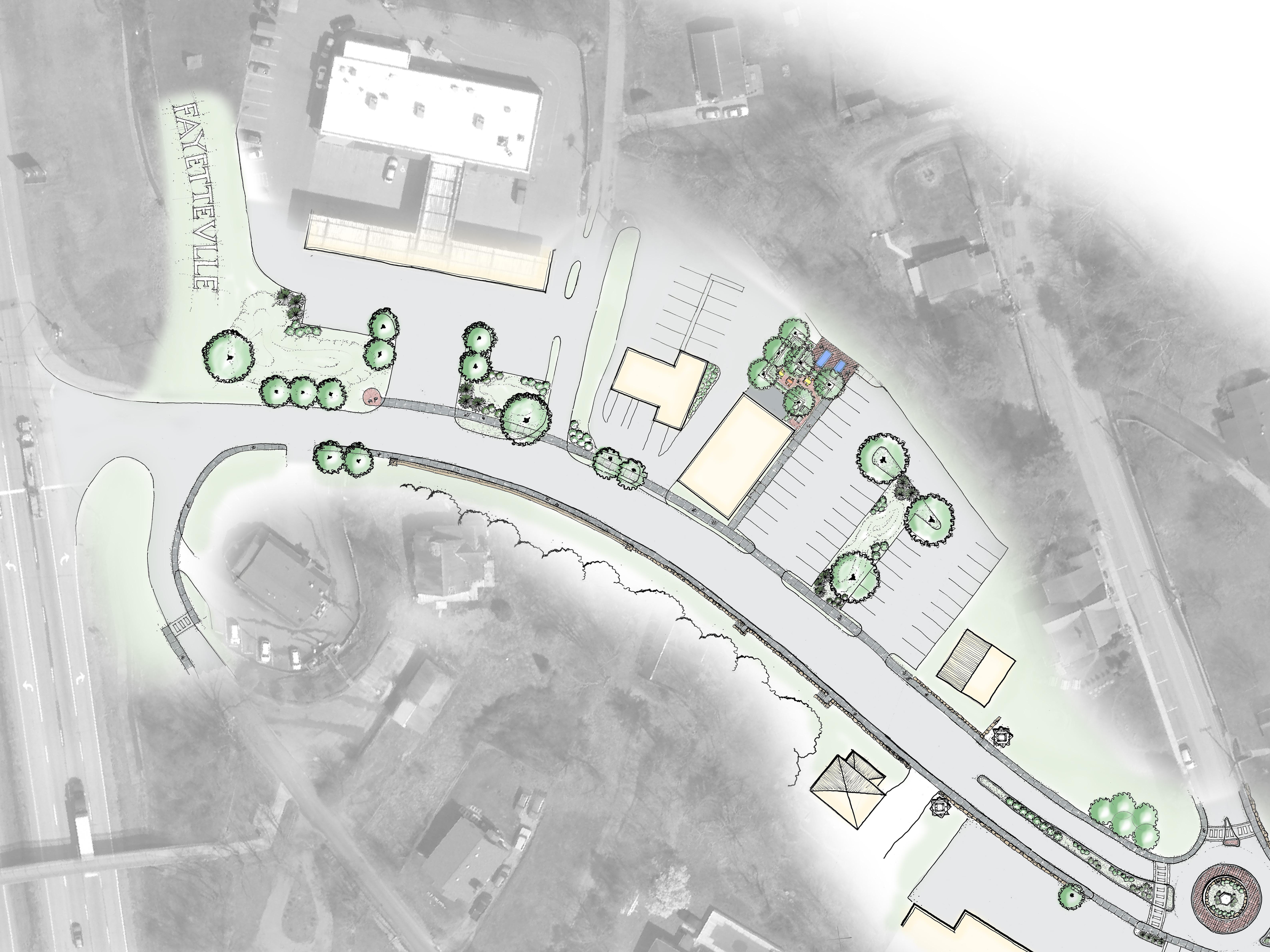
On either end of the proposed Court Street design, a gateway is being introduced. This is being indicated through the use of design elements such as sculptural metal columns, stone walls, and dramatic landscaping. There is also a roundabout and pedestrian crosswalk near each gateway. Besides allowing pedestrians to safely cross, the crosswalks assist in alerting drivers that pedestrians may be present and to proceed with caution. The roundabouts aid in directing the flow of traffic along Fayetteville’s main street. They provide drivers the chance to turn around and travel in the opposite direction on Court Street without having to exit the town center. Additionally, gateway elements are being proposed at the intersection of Court Street and Route 19 to indicate to drivers that it is the main route into Fayetteville. This includes a hillside sign with the letters “FAYETTEVILLE” and a mural wall as drivers enter Fayetteville via Route 19.
An important aspect of streetscape design is to have a unified design theme that can be applied to all site furnishings that are utilized along a road corridor. Streetlights can be one of the many elements that work together to create a Fayetteville “feel” along Court Street. Not only does a unified streetlight plan increase visual appeal, but it can also increase pedestrian safety at night.

Pedestrian scale lighting is designed to directly illuminate sidewalks. The fixtures are placed twelve to fourteen feet high and more closely spaced than parking lot or drive lighting. The lighting makes it easier for drivers to see pedestrians and improves the pedestrian’s ability to see their surrounding area and detect tripping hazards. It also increases the pedestrian’s sense of safety and security. Pedestrian scale lighting creates the feeling of being in a safe place to be after dark increasing usage. The light fixtures and poles will also enhance the overall streetscape design in Fayetteville.
The proposed design for Court Street incorporates new planting areas throughout the streetscape. Street plantings are added along the sidewalks when possible, and new planted medians have been integrated into the overall street layout. The plantings serve multiple purposes. First, they enhance the aesthetic appeal of Court Street, adding natural elements into the overall design. The natural features provide shade for pedestrians walking down the street. In addition, the proposed plantings will contain native plants and provide seasonal appeal to Court Street. Driving lanes have been narrowed to accommodate the plantings, which assist in slowing down vehicular traffic. They can also indicate to drivers that they are entering a new portion of the road and influence them to proceed with caution. The proposed streetscape has been designed to direct storm water to the planting areas, which is then collected and transported to water detention facilities. It will be naturally filtered by the plants and slowly released back into the environment.

The use of street furniture plays an important role in the overall design and functionality of a streetscape. Not only does it improve the visual appeal, but it also increases the comfort and livability of the town. This encourages residents and visitors to be outside and fosters social interaction, helping to build community. Within the proposed Court Street design, street furniture such as benches, tables, garbage cans, bike racks, lighting, and bollards have been placed to create a comfortable streetscape.
Safety lighting shall be established to brighten walkways, define entryways, and illuminate areas for safe nighttime use, allowing people to navigate safely without worrying about stairs or tripping hazards. Security lighting provides a level of illumination to clearly identify persons or objects and creates a psychological deterrent to criminal activity in the area being illuminated.
Accent lighting fixtures enhance various design elements. Illuminating architectural details, specimen plantings, and pieces of art. The accent lighting will enhance the streetscape design. The lighting will be fitted into the landscape in a harmonious way with other design elements.
Holiday lighting will be used to create festive atmosphere for events and celebrations throughout the year.
In the proposed design for Court Street, the existing sidewalks have been improved to promote a pedestrian oriented streetscape. When possible, they have been widened to approx. 8’ – 10’, utilizing space that was made available through reducing the traveling lane width. This widened sidewalk creates a pedestrian environment that feels safe and encourages both residents and visitors to walk throughout town. In addition to increasing sidewalk width, the sidewalks will be made out of different materials that indicate where pedestrians should walk and where other seating areas are located.
Crosswalks are also important tools to utilize when creating a pedestrian oriented streetscape. They indicate to pedestrians the locations where they can safely cross, and alert drivers where to expect pedestrians to be in the street. The number of crosswalks to locate in a street can be a balancing act, too many will create frustrated drivers who can become complacent to this safety feature. If too few are created, pedestrians are encouraged to walk anywhere in the street. Crosswalks have been strategically located along Court Street at places where pedestrians will most likely want to cross in a way that balances the need of pedestrians and motorists.
In addition to crosswalks, the Court Street design includes sidewalk “bump-outs” at intersections with ADA ramps. The enhance pedestrian safety in numerous ways. They increase pedestrian visibility at intersections to passing cars, they shorten the distance that pedestrians must travel to cross the street, and they can provide greater accessibility at intersections by giving more room to maneuver street corners. In addition, bump outs can serve as another traffic calming tool to assist in slowing the speed of drivers by visually narrowing the driving lanes.
Bike lockers have been placed at strategic locations along the street to allow visitors to securely store their bikes while exploring all that Fayetteville has to offer.
Bike lockers are either rectangular boxes or triangular. The handle bars are places on the wide side of the triangle. Bike lockers can support two bikes with a diagonal partition and dual sided access.

Fayetteville is blessed with a vibrant arts and festival event schedule. Encouraging and developing the events can become a powerful economic development tool. Existing and future options might include theater, music, culinary arts, applied arts, fashion design, and the media arts. Plan recommendations provide for the infrastructure that art and artists require. The plan includes numerous areas to establish murals or wall mounted installations, site locations for temporary or permanent sculptural or object installations, a large stage area, many options for plaza sized spaces and intimate spaces to accommodate many performance requirements. The spaces will include the infrastructure to meet the artist’s needs. To further the development of the arts and events community Fayetteville could provide space for artists and arts organizations. The space would provide workspace for the artists and art community further boosting the existing arts culture.
With its close proximity to the New River Gorge National Park, it is important to plan for visitors arriving by methods other than vehicular. It is also important to plan for visitors to park within town and travel out to the trails for the day. Therefore, it is important to provide amenities that give visitors the ability to secure their belongings.
The master planning process clearly identified signage as a major concern. The signage is inconsistent in size scale and placement. It is sometimes confusing or nonexistent where needed. This creates safety issues and harms the economy. The issues will require the town of Fayetteville working with the D.O.H. to establish new signage standards. Establishing signage that clearly identifies the entrance into Fayetteville at the intersection of court street (16) and route 19 is essential for visitors’ safety and the economy of the town. The existing signage is confusing or nonexistent. Establishing clear highway scale signage at this intersection is a high priority. Fortunately, there are opportunities to establish this signage. The existing pedestrian bridge and the entry areas facing 19 in front of Tudors Biscuit World and the Little General offer excellent location opportunities for this scale of signage. Clearly identifying this intersection will increase safety, reduce driver confusion, and direct more visitors into Fayetteville. The town should develop a Fayetteville specific signage standard reflecting the character of the town. This signage will help identify, direct, inform and define regulations clearly to everyone in the town. The signage will also define the town boundaries and help to unify the overall streetscape plan. Some steps to developing the signage plan might include:
• Conducting a marketing and branding study to develop a unique image to a unified design base for signage as well as other streetscape elements.
• Establish new signage standards based on the new design and placed into the zoning code.
• Establish a design review board to approve new signage.
• Establish size standards addressing maximum and minimum signage area, maximum and minimum heights, maximum and minimum sizes, permitted sign types and illumination standards.

• Establish common signage standards for identification, directional, informational, and regulatory signage.
• Establish illumination standards for internally lighted, externally lighted, and programmable digital signage.
The establishment of The signage standards will allow Fayetteville to create an integrated safe signage network providing easily understood information on the identification, direction, information, and regulations throughout the town. In addition to the functional aspects the signage will act as a defining and unifying design element throughout the town.
Another common comment that was received during the project’s community engagement was complaints about the overhead utility infrastructure along Court Street. Not only do the location of utility poles cause conflict at certain locations along the sidewalk, but the utility lines running above the road can be visually unappealing. In the proposed design for Court Street, utility lines are either being buried or rerouted, depending on the situation. This will remove the design conflict encountered with utility pole locations, and increase the visual appeal along the street corridor.
In order to achieve some of the proposed plan recommendations, flexibility to establish public right of ways (R.O.W.), or outright land acquisition of select properties may, be required. The city could partner with a nonprofit or EDA to acquire the parcels. The town may need to acquire the title or easements by way of voluntary negotiations.
Plan recommendations that address government opportunities or regional issues, but are outside the scope of this masterplan, include:
• A branding study for the Town of Fayetteville
• Working with other regional governments to establish transportation systems to alleviate traffic congestion
• Establish a city operated park board to oversee the development of:
1. A future town recreation center
2. The Soldiers and Sailors Memorial Building (currently county operated)
3. The existing and future city park system
• City wide sidewalk study and ADA accessibility study
• Annexation and zoning study
• Promote and establish green infrastructure
• Historical tax credit to help with façade and wall improvements
• Development along the Route 16 corridor
• Feasibility study for the rec center
• Signage and branding study
• Creation of a historic wall fund


There are several different elements that comprise the Court Street Masterplan. The elements work together to create a vibrant, cohesive design that solidifies Fayetteville’s identity, emphasizes pedestrian safety, and plans for the town’s future growth. The following text describes the individual elements on each portion of the streetscape, pictured on the right.
The highway entry from Route 19 to Court Street is the main entry into Fayetteville and is completely undefined. This large intersection is a wash in signage, none that clearly define or communicate that this is the entry into Fayetteville. The plan reccomends a large highway scale sign clearly identifying the entry. The sign would consist of large letters, spelling out FAYETTEVILLE, placed in front of an evergreen backdrop and would include LED lighting for ever-changing lighting options. The sign will conform to the existing landscape and not block views to existing businesses or signage.
sidewalk system on one side of the side and sharrows for the bicyclists.


In an ever changing world, it is important to incorporate sustainable design practices into our municipality’s infrastructure. Green infrastructure can often serve aesthetic and ecological purposes, contribute to carbon sequestration, and reduce the heat island effect. Court Street’s masterplan includes several sustainable interventions that work together as a system to collect storm water, filter out pollutants using plants, and slowly release it back into the environment. This method prevents pollutants from flowing into our watersheds and prevents traditional storm water management systems from being overwhelmed and causing flooding. In addition, it can slow down water velocity, decreasing erosion. Along Court Street, several green infrastructure interventions have taken place. Each planting bed, tree box, and median collects storm water off of the streets and sidewalks. This water if filtered through the plant’s roots and soils. It is then transported to two storm water detention facilities, located on either end of Court Street. Here, the water will be collected before slowly being released back into the environment. This prevents our storm water systems from being overwhelmed and causing flooding.
Community engagement feedback indicated that residents in Fayetteville’s western residential neighborhood, opposite of Route 19, can sometimes feel left out of town events. It is important to provide a safe pedestrian linkage between the pedestrian bridge and Fayetteville’s town center, via the new Court Street design. A sidewalk connection and crosswalk is being proposed to connect the pedestrian bridge to Court Street, allowing for safe pedestrian access.

Daniels Street provides another great opportunity to strengthen the connectivity between Fayetteville’s western neighborhood and the town center. This recommendation would create a pedestrian oriented connection along a quiet neighborhood street. It is recommended that sharrows be implemented as a short term solution along Daniels Street. The long term goal would be to implement an improved
This section of Court Street includes one of the mentioned storm water detention facilities, across the road from Tudor’s Biscuit World. Water that ends up at this site will have been collected from North Court Street, or the section of road from Route 19 to approximately in front of Town Hall. Since the majority of this green infrastructure will be below ground and invisible to most, this sustainable intervention also provides an excellent interpretive signage opportunity. Signage can be installed along the road educating residents and visitors on how the system works, and its importance. More information on this project’s green infrastructure can be seen in the graphic found after this streetscape masterplan.

Fayetteville is known for its vibrant culture and local artists. In fact, several examples of their art can be found throughout town currently. The local artistic talent contributes greatly to the town’s identity and should be expanded upon to truly create a unique destination. In order to grow the presence of local art throughout town, the Court Street Masterplan includes many areas for new local art. One of the locations is found right after Tudor’s Biscuit World entrance, on the right side of the road as you pull into town from Route 19. A wall is being proposed at this location to repair some erosion, along with fixing a concrete block wall that exists after the historic stone walls end. This wall will provide an opportunity for a mural wall, much like ones found on other walls in town, that will mark the town’s entrance. This mural opportunity will also help set the town’s character as drivers enter Fayetteville.

One defining characteristic of Fayetteville is the stonework that can be seen in the town’s retaining walls and buildings. The walls are located along Court Street and can share the story of the town’s history. Historic residents of Fayetteville include citizens from Pideicavallo, a town in Italy. The immigrants, who first came over to work in West Virginia’s coal mines, had a unique masonry style that can be seen in the existing stone walls. The community values the stone walls and feel that they contribute to the identity of Fayetteville. Unfortunately, over time, the walls have deteriorated. The proposed Court Street masterplan preserves the walls and proposes to restore the sections that have eroded. Interpretive signage can be placed along the street to explain the significance of the walls to Fayetteville’s heritage. It is proposed that local tax funds be adjusted to support a historical wall restoration fund, to provide finances for any current or future repairs.

With the numerous bike recreation opportunities found in and around Fayetteville, the town needs to support infrastructure that allows bikers to secure their belongings while exploring the town. Strategic bike infrastructure interventions will ensure convenience and encourage riders to ride into town and visit local businesses. Bike lockers are part of this solution and have been located on either end of Court Street. On North Court Street, they can be found behind Don Rizo Mexican Kitchen and Cantina.


There are several different elements that comprise the Court Street Masterplan. The elements work together to create a vibrant, cohesive design that solidifies Fayetteville’s identity, emphasizes pedestrian safety, and plans for the town’s future growth. The following text describes the individual elements that can be seen on each portion of the streetscape, pictured on the right.
Having clearly defined gateways to identify Fayetteville’s primary entrances are important to indicate to drivers that they are entering the town. This gateway can also serve as an important traffic calming purpose by slowing traffic down and signaling to drivers that they are entering a new situation on the road and to proceed with caution. In the proposed Court Street masterplan, the gateway elements mark the entrance into town and emphasize that drivers will be entering a pedestrian oriented roadway. The proposed gateway concept is being created through the use of structural columns, planted medians, crosswalks, and a roundabout. On North Court Street, the proposed gateway can be found at the intersection of Court Street and Keller Avenue.
As previously stated, local artists comprise a key component of Fayetteville’s identity. The proposed Court Street Masterplan utilizes this aspect in the design and locates many opportunities to display local artwork. This includes many areas for art installations, such as in the roundabout or in planting islands alongside the road. The art installations could be permanent exhibits, or a street art program could be developed that allows art to be changed out every year and encourages participation by town residents. For example, a theme could be established that determines the form of the art. Perhaps a hiking boot is chosen, to represent Fayetteville’s connection to outdoor recreation. A local artist could be chosen to make a number of boot sculptures, and residents chosen to decorate each one. The sculptures would be installed along the street for the season, and perhaps a voting contest could take place to determine the best one. This would promote interaction with both town residents and visitors. At the end of the season, the sculptures could be auctioned off to create revenue for the following year’s program. This is only one idea of how art can be incorporated along Fayetteville’s main street.

By rearranging the streetscape elements using only the existing road width, the proposed masterplan for Court Street increases the amount of street parking by 20 spaces. On this new road layout, travel lanes are decreased to 10’ in width, slowing down traffic and encouraging a pedestrian oriented environment. Street parking is primarily shifted to one side of the road. By utilizing angled parking spots, made possible by the lane width reduction, 20 parking spaces are able to be added that do not exist currently. During the design process, care was taken to consider the businesses located along the main road and to provide appropriate parking spaces for each shop, when possible.

The pedestrian focused spaces will provide gathering areas outdoors and encourage social interaction among the community and its visitors. Users will be able to relax on the street and people watch as they wait for other members of their party, eat a treat picked up at a local cafe, or simply to take in the sights and sounds of Fayetteville.

The elements that make up a streetscape design are important to consider when thinking about pedestrian safety and comfortability. In addition, the elements influence a town’s look, or character, and can impact the overall impression that a town leaves on both its residents and guests. The situation is no different in Fayetteville, and thought has been put into what elements are important to include as Court Street was redesigned. Pedestrian safety was put first, and the design includes large sidewalks to accommodate the possibility of having large amounts of foot traffic. Crosswalks have been located to assist pedestrians when crossing the street. In addition, bump outs have been designed at key locations to increase pedestrian visibility to drivers and decrease the amount of time it takes pedestrians to cross the road. Streetscape plantings serve aesthetic and shade purposes, in addition to providing green infrastructure. Street furnishings, such as benches, street lighting, garbage cans, and bike racks, all serve to support a vibrant, pedestrian first environment and encourage residents and guests to explore all that Fayetteville’s town center has to offer. Even the materials that form the sidewalks have been considered. Brushed concrete will indicate areas of pedestrian circulation, while brick is being utilized to indicate the areas where passive pedestrian activities can occur.


Considering traffic flow along Court Street is important to think about in the redesign of Fayetteville’s main street. Congestion can be common, which encourages dangerous driving habits as frustrated drivers attempt to navigate the streets. The use of roundabouts serve multiple purposes. It assists in managing the flow of traffic, increases safety, supports the gateway concept, and can serve as a traffic calming devise. In addition, it provides drivers the opportunity to turn around on Court Street without leaving the town limits. This can be especially helpful in various situations, such as looking for parking. If drivers do not find any street parking, they are able to easily turn around without leaving Fayetteville’s town limits and find a different parking area.
Identified early on in the design process as an opportunity for growth, the Court Street masterplan takes advantage of underutilized land adjacent to Court Street. Some of the spaces are being proposed as pocket parks. The spaces will include benches, shade, and other park like amenities to create a livable outdoor space.
Landscaping along the proposed Court Street design serves to provide important aesthetic and green infrastructure purposes. In addition, it provides shade for pedestrians on the sidewalk. This increases the livability of Fayetteville and encourages both residents and visitors to get out and explore the local shops and businesses.


There are several different elements that comprise the Court Street Masterplan. The elements work together to create a vibrant, cohesive design that solidifies Fayetteville’s identity, emphasizes pedestrian safety, and plans for the town’s future growth. The following text describes the individual elements that can be seen on each portion of the streetscape, pictured on the right.


Similar to the idea of pocket parks, the Court Street Masterplan identifies an opportunities to create a small, pedestrian oriented plaza along the street. The plazas have endless possibilities to their programming. They can provide space for adjacent businesses to spill out onto the sidewalk, provide outdoor seating for restaurants, or simply provide a similar purpose to pocket parks. The particular instance shown on this pace is located in front of D&K Collectibles and Fast Law Office. Overall layout and street furniture choices can determine the programming for the pedestrian spaces.


The block of Court Street located between Wiseman Avenue and Maple Avenue marks an important part of town. This location represents the central node of town activity and includes both the Fayette County Courthouse and the Town Hall building. During town festivals and events, this portion of Court Street is closed and events are hosted in front of Town Hall. The precedent set by the existing uses is preserved in the proposed Court Street Masterplan. A traditional town center feel is being proposed, with large sidewalks, angled parking, and street trees and furniture. This large, pedestrian oriented space will still be able to host future festivals and events. However, the pedestrian focused design opens the space up and contributes to an open and inviting feel. This area will continue to serve as the node of Fayetteville activity.

During the design process a few properties adjacent to Court Street were identified as being underutilized. The properties have the potential of being repurposed to support the need for additional parking. One of the locations is located where the existing ambulance service is located. This emergency service would be better located near other similar programs, such as the fire house. Relocating this facility would allow the property to be redeveloped into a parking lot. The proposed layout includes 20 new spaces.
During both the existing conditions analysis and the community engagement phases of the project, it was identified that the intersection of Court Street and Maple Avenue presents multiple issues. Driving lane alignments across the intersection do not line up. The turning radii of the corners present issues to driving trucks, which can be evidenced by the crumbling curve created when trucks drive over it. In addition, the crosswalks are not ADA compliant and pose risks to both residents and visitors. The proposed masterplan addresses the issues found at this major town intersection. The sidewalks have been “bumped out” at the corners. This increases pedestrian safety by increasing their visibility to drivers, shortens the distance they have to walk in the roadway to cross the street, and serves as a traffic calming device. In addition, the turning radii is increased to accommodate any typical traffic that may navigate the streets. The proposed design takes place in the existing road corridor, and only requires some additional space taken from the court house lawn to create.
Sidewalk bump outs, also known as bulb outs, are pedestrian oriented streetscape features that have been included as part of the Court Street Masterplan. Found along South Court Street, as shown on the plan to the right. The bump outs define entrances and street parking spaces, serve as traffic calming devices, and can serve as small gathering areas in front of local businesses. For pedestrians, besides slowing down vehicular traffic, they also decrease the walking distance for anyone who wishes to cross mid-street. In addition to all of the services, bump outs also create additional planting areas and contribute to the overall green infrastructure plan.


There are several different elements that comprise the Court Street Masterplan. The elements work together to create a vibrant, cohesive design that solidifies Fayetteville’s identity, emphasizes pedestrian safety, and plans for the town’s future growth. The following text describes the individual elements that can be seen on each portion of the streetscape, pictured on the right.

As a part of this masterplan project, a design has been proposed for the school board bus garage property. This will provide significant growth opportunities for Fayetteville. More information regarding the Town Square is detailed later in this planning document. However, it is important to form a strong connection between this transformative project and the town’s main street. Art and landscaping emphasize this pedestrian connection to Town Square.
Similar to the street-side plaza being proposed on North Court Street, South Court Street also includes one of the outdoor spaces in the Court Street Masterplan. Located in front of Cathedral Cafe, this provides additional outdoor seating for the business. Planting adds shade to this space and contributes to the overall green infrastructure plan.

The Court Street masterplan recommends a gateway for South Court Street, mirroring the proposed design on the opposite side of town. This gateway will be located at the intersection of South Court Street and Rotan Street. The reasoning behind this gateway is similar to the gateway being proposed on North Court Street. Having clearly defined gateways to identify Fayetteville’s primary entrances are important to indicate to drivers that they are entering the town. With this proposed design, both ends of Fayetteville’s main street will now be clearly marked as the beginning of town. Gateways can also serve an important traffic calming purpose, slowing traffic down and signaling to drivers that they are entering a new situation on the road and to proceed with caution. In the proposed Court Street masterplan, the gateway elements emphasize that drivers will be entering a pedestrian oriented roadway. The proposed gateway concept is being created through the use of structural columns, stone walls, planted medians, crosswalks, and a roundabout.

Considering traffic flow along Court Street is important to think about in the redesign of Fayetteville’s main street. Congestion can be common, which encourages dangerous driving habits as frustrated drivers attempt to navigate the streets. The use of roundabouts serve multiple purposes. It assists in managing the flow of traffic, increases safety, supports the gateway concept, and can serve as a traffic calming devise. In addition, it provides drivers the opportunity to turn around on Court Street without leaving the town limits. This can be especially helpful in various situations, such as looking for parking. If drivers do not find any street parking, they are able to easily turn around without leaving Fayetteville’s town limits and find a different parking area.
lockers are part of this solution and have been located on either end of Court Street. On South Court Street, they can be found beside Wisteria’s Gifts and adjacent to the proposed multi-use path connecting South Court Street to the proposed House Branch Greenway trail system.
A connection into Fayetteville’s town center is an important element to consider in the proposed House Branch Greenway system. This assists in bringing trail users off the trails and into town to explore the local businesses and attractions. It also strengthens the connection between residential neighborhoods and the town center and promotes the idea of using alternative modes of transportation to access local businesses and amenities. The Court Street masterplan includes a multi use path that travels adjacent to Rotan Street and connects to existing sidewalk that ends in front of Wisteria’s Gifts. This path creates a needed pedestrian connection between Court Street and the Love Hope Center for the Arts. In addition, it will tie into the greater trail system being proposed through the House Branch Greenway and assist in bringing trail users into town.
Green Infrastructure
South Court Street also includes green infrastructure, similar to proposed designs for North Court Street. Water will be collected from the streets via the various proposed planting areas and street trees boxes, beginning near Town Hall and traveling southwest along Court Street. Collected water will drain to a proposed stormwater detention facility, located in the greenspace found between South Court Street and Rotan Street. Water will then be slowly released into House Branch. This method naturally filters pollutants out of the water and alleviates local stormwater management systems from being overwhelmed. Since the majority of this green infrastructure will be below ground and invisible to most, this sustainable intervention also provides an excellent interpretive signage opportunity. Signage can be installed along the road educating residents and visitors on how the system works, and its importance. More information on this project’s green infrastructure can be seen in the graphic found after this streetscape masterplan.

During the design process a few properties adjacent to Court Street were identified as being underutilized. The properties have the potential of being repurposed to support the need for additional parking. One of the locations is in the vacant lot adjacent to the CVB. Utilization of this property would create an additional parking opportunity on South Court Street, where limited options exist today. This parking would support the restaurants and other businesses found on this side of town.
Due to the narrow road corridor along South Court Street, limited street planting is specified. This is done to maximize available space for street parking. When possible, planting is included in sidewalk bump outs and on the building side of sidewalks.
The proposed concept utilizes the existing road corridor in the new design. This results in the existing street parking being rearranged. When possible, street parking in front of commercial and residential properties has been preserved. When not possible, dedicated parking is located nearby. The rearrangement of Court Street results in an increase in the overall number of parking spots found in the town center.
With the numerous bike recreation opportunities found in and around Fayetteville, the town needs to support infrastructure that allows bikers to secure their belongings while exploring the town. Strategic bike infrastructure interventions will ensure convenience and encourage riders to ride into town and visit local businesses. Bike


Primary Collection Area
Secondary Collection Area
Secondary Collection Area
Planter boxes or Bioswales are essentially urban rain gardens with vertical walls or curbs that are connected to the overall green infrastructure system. They often have curb cuts that allow the system to collect the water that would typically run down the curb of the street before entering into a storm water collection point. This is a method of collecting large amounts of run-o that will then be treated through the system via the plants and soil material. While providing a tremendous amount of storm water management. The planting create beautiful green areas along the streets and through the area.


Primary Collection Area

At either end of this system there is an opportunity for a large rain garden / retention area that will allow for the majority of the storm water to be absorbed by plants and the soil before continuing down to the natural streams and the New River. These rain gardens help to anchor each end of the system while providing an ecosystem for birds and other pollinators as well as an aesthetic entry for the Town of Fayetteville.

Secondary Collection Area

Tree Boxes

Tree boxes are a method of green infrastructure storm water control that captures runo and treats it by filtering through the soil and plant material around the tree. Tree boxes typically consist of three parts: a chamber, soil and the tree itself. Once the water begins to soak through the soil it is filtered before continuing through the system.


Run o from storm water is a major cause of water pollution across the United States and especially in urban areas. Historically communities have used gray infrastructure which moves storm water through a traditional system throughout the city before going to a facility to treat it. Green Infrastructure allows for storm water to be absorbed and treated before ever going back into any system or natural area. During and event water is captured and moved through various planted areas where the plants and soil help to filter out any pollutants. The water can then be collected and put back into the system or absorbed through rain gardens and other bio-swales throughout the system.

Many communities face the problem of unsightly utilities in their downtown areas. However, the disadvantages to overhead utilities are more than just aesthetic. They are more susceptible to bad weather, such as high winds, damage caused by vehicle collisions, damage from falling trees or snow and ice storms and many other things. Overhead utilities also begin to cause pedestrian conflicts as utility poles are often located on or adjacent to the sidewalks and other pedestrian areas. During the masterplanning process a goal to create a concept where the utilities could be buried or moved away from the primary corridor of Court Street, creating an unobstructed view of the character and feel of the Town of Fayetteville. The diagram on the facing page shows the conceptual idea of moving the utilities from Court Street along alleys and side streets. This idea could be realized via burying the utilities or relocating them.


Benefits of Buried Utility Lines


• More Aesthetically Please
• Reduced Maintenance Costs
• Increased Reliability
• Better Land Use
• Increased Capacity (Not limited to available space on poles or towers)


Affordable long term housing, limited downtown parking availability, lack of public space for events, and no space for downtown commercial expansion became evident in the analysis. Fortunately, Fayetteville has a two-block area currently occupied by the county school board facilities and a defunct, former hotel building. This is an incongruous land use for the center of Fayetteville. The town and the county school board would be better served by relocating the school board facilities adjacent to the existing public school campus, located at the West Oyler Avenue exit off of Route 19, in the City of Oak Hill. The former hotel property would be repurposed to allow development that meets the needs of the town. Opening up two blocks in the center of town that Fayetteville could utilize. The plan recommendation is to create a dynamic, mixed use town square with large and small public spaces, strong pedestrian connections, opportunities for commercial expansion, a variety of longterm housing options, and the availability of centrally located parking facilities. The project area is defined by the area created between East Maple Avenue, Ankrom, Street, Fayette Avenue, Phillips Street down to the rear of the buildings along South Court Street. For phasing purposes, the proposed development has been divided into two halves - Town Square and Town Square South. Town Square is the portion or property west of Fayette Avenue, including property around the Wood Iron Eatery and the Fayette County Board of Education building. Town Square South includes the property where the existing Board of Education bus garage and former hotel is located.

The proposed Town Square development will contain a 3 - story parking facility. The structure will contain parking spaces dedicated to the apartment complex it will also provide parking for the commercial and office developments and additional spaces to aid in alleviating Fayetteville’s parking issues. The structure will be built into the existing topography and have entrances located on each surrounding street. First floor access from East Maple Avenue and Fayette Avenue. Second floor access from Ankrom Street, with ramps connecting all levels. The architecture of the facility will match Fayetteville and consist of facades similar to existing buildings found in town.
spaces on the south end of Phillips Street provides dedicated spaces for the 7 town houses and 105 spaces for the commercial and office users. The 48 space lot on the west side of town square south has 16 spaces dedicated for the town houses and 32 spaces for commercial and office use. The parking facilities provide more than the number of space needed to develop the entire town square south project.
The number one goal established in the 2014 comprehensive plan was to increase the diversity of housing types. With the increasing economic pressures placed on Fayetteville through the designation of the New River Gorge National Park, there was an incentive to develop short term rentals and second homes which will further lower the diversity and availability of affordable housing to the existing community. The town square development offers opportunities to alleviate issues.

44 apartment units have been programmed for the central plaza, found in Town Square. The units, located above first story shops and businesses, will have balconies and parking provided in the adjacent parking garage. Access to the units from the parking garage will be via connected walkways from the third story. In addition to apartments, the project also includes 23 new townhouses in Town Square South. Found adjacent to Phillips Street, eight of the properties will include a garage and additional outdoor parking, while the other 15 units will only provide outdoor parking.

One of Fayetteville’s main goals established in the 2014 comprehensive plan was to encourage new business development. Town square provides over 70,000 square feet of new commercial and office space directly adjacent to the existing commercial ares in downtown. The town square project is completely pedestrian orientated with a series of walkways and plazas to provide diverse opportunities to develop shops, restaurants and offices.
The proposed Town Square development includes commercial spaces in various building block sizes to accommodate businesses both small and large. Overall, the project allows for 65,000 sq. ft. of new commercial space. In Town Square, 22,750 sq. ft. of first floor commercial space is available in the building with apartment units, 5,675 sq. ft. of first floor commercial is found in the building along East Maple Avenue, and 13,500 sq. ft. of first floor commercial space can be found in the proposed building along Fayette Avenue. In the Town Square South development, a total of 23,000 sq. ft. of first floor commercial space is divided between the four proposed buildings.

The proposed Town Square development also increases the amount of office space being offered in Fayetteville. The concept includes 6,000 sq. ft. of second floor office space.
The distinct stonework found throughout Fayetteville was constructed by Italian immigrants from Piedicavallo, Italy. Piedicavallo is a small mountain town in the Alps. The masterplan intends to preserve this historical identity and incorporate design elements from Piedicavallo into the Town Square plan. The Court Street and Town Square masterplans include paving patterns, wall materials, and street design elements that tie historic Fayetteville back to its ancestral roots in a design palette unique to Fayetteville.
Two anchor towers at the structure’s corners will serve as stairways. Two bridges will connect the parking to upper level apartments programmed for the adjacent building. A large, central entrance corridor at the first story level will serve to strengthen the connection between the garage and proposed central plaza. Finally, a service corridor is located between the parking garage and adjacent buildings to provide delivery access to first story shops and businesses. This parking structure provides more than the number of spaces needed to develop the entire town square project.
The parking facilities proposed for town square south consist of 3 surface lots. A lot containing 16 spaces along Phillips Street, provides spaces for the town houses and commercial and office spaces for the owners and employees. The lot containing 119


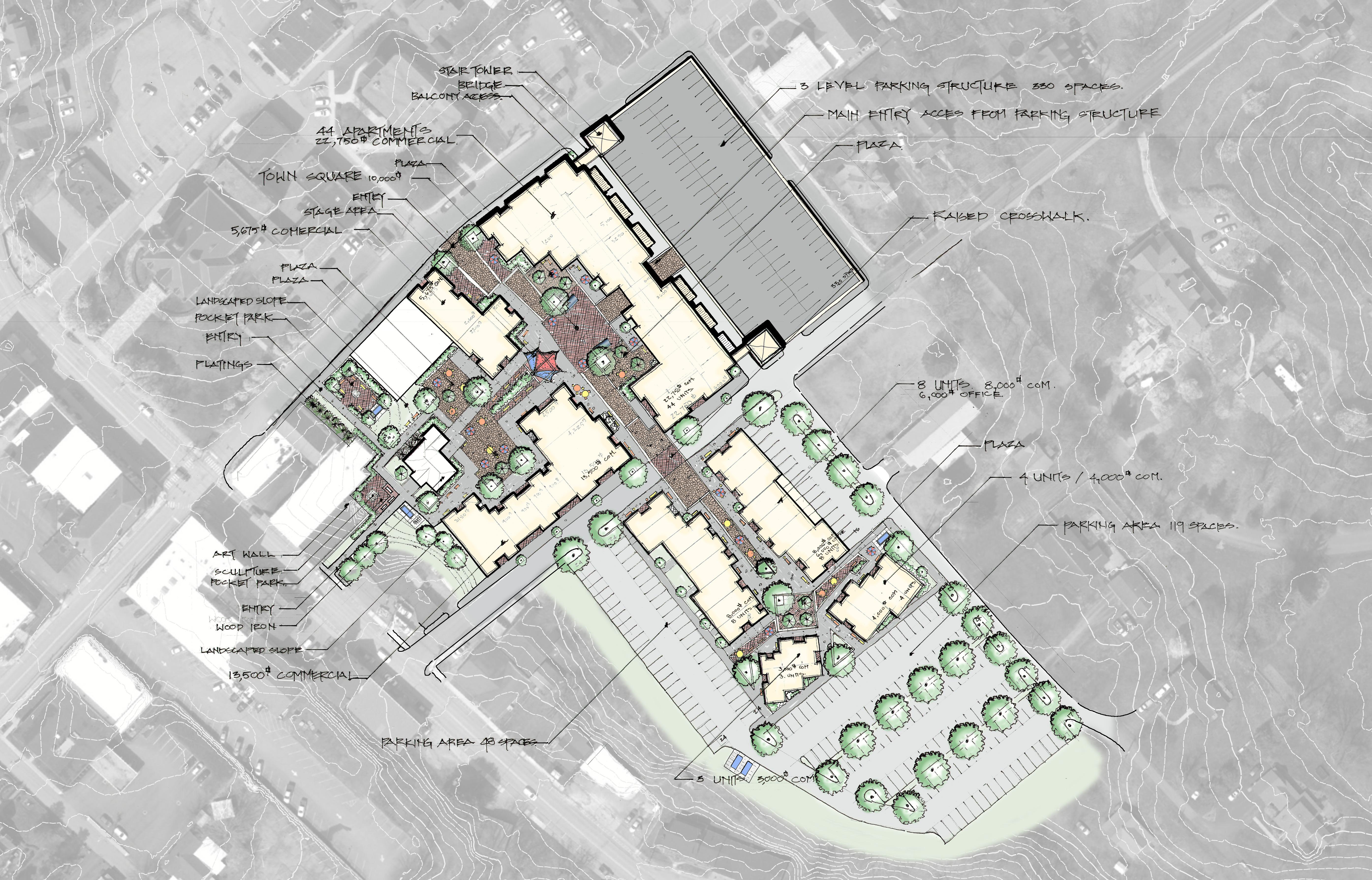
The concept of town square plaza is to create a space for Fayetteville to hold city wide concerts, events, festivals and functions in a safe pedestrian plaza. The existing transportation corridors remain open and are not impacted by events held in town square plaza.


Town square plaza is a centrally located at the crossing of the two main walkways, creating an open public space over 10,000 sq. ft. in size. The proposed development has a capacity of over 3,000 users. The area is surrounded by small shops and restaurants. The concept is then programed into smaller spaces such as plazas, pocket parks, seating areas, art installations, and other uniquely themed areas.

There are two pocket parks located along the pedestrian corridors leading into Town Square. The are small spaces created for people to gather, relax, and enjoy art and nature. One park is located along the pedestrian connection between South Court Street and the Town Square. It is formed by the corner of the theater building and a wider green space bordered by the walkway. The park includes landscaping, a
the sidewalk. The town square raised crosswalk connects town square with town square south mid-block on Fayette Avenue. The crosswalk will visually and physically maintain the design continuity across Fayette Avenue, maintaining the grade and the paving patterns.
The design concept of the smaller plazas are to provide shops and restaurants with opportunities to develop in smaller scale spaces.

Town Square contains five smaller plazas throughout the proposed development. Defined by buildings, walkways, and landscaping, the areas will create more intimate and quiet spaces to relax, eat a meal, visit with friends, and enjoy the sights and sounds of Fayetteville.

seating area, and an art installation location. The second park is found along the pedestrian walkway connecting East Maple Avenue to Town Square. This park has a formal layout, with hedges and flowering trees. It includes seating areas and a centrally located art installation piece.

Pedestrian Circulation
The pedestrian circulation for the town square project is broken into four sections.
Integrating the Town Square development into the existing fabric of Fayetteville is essential. Providing two pedestrian corridors one from South Court Street and one from East Maple Avenue, provide a casual park like walkway system ending at the plaza. This will give people walking the existing downtown streets, access ways to the plaza through an explorative adventure like walkway system.
The main entry points are mid-block on East Maple Avenue and Fayette Avenue. They are entirely pedestrian oriented. They allow access for emergency, maintenance vehicles, food trucks and event setup through a system of movable bollards. The walkways are wide with varied paving patterns reminiscent of Piedicavallo, Italy. The walkways wind through spaces made by building arrangements, plazas and landscaping to create ever changing views and experiences for the pedestrian.
Raised crosswalks are speed tables spanning the entire width of the roadway. The crosswalks act as traffic calming measures to allow pedestrians to cross at grade with

Access to the Fayetteville Greenway is provided by a spur trail beginning in the south-west corner of Town Square and ending at the green way east of the route 16 crossing. Trail access is available through connections created by the extensive pedestrian system of Town Square.
With the numerous bike recreation opportunities found in and around Fayetteville, the town needs to support infrastructure that allows bikers to secure their belongings while exploring the town. Strategic bike infrastructure interventions will ensure convenience and encourage riders to ride into town and visit local businesses. Town square has three bike locker locations.
Fayetteville has a nearly perfect opportunity to establish a Tax Increment Financing district due to the location of non-tax generating properties in prime and essential developable areas. Tax increment financing (TIF) is a value capture revenue tool that uses taxes on future gains in real estate values to pay for new infrastructure improvements. TIFs are authorized by state law in nearly all 50 states and begin with the designation of a geographical area as a TIF district. TIF Captures the projected increase in property tax revenue gained by developing the designated geographical area and uses that increase to assist in paying for projects. TIF designation allows for low or exempt tax producing area to improve by attracting private development and new business. TIF funding can be used for the development or redevelopment projects. Some project examples include:
• Infrastructure construction or repair – such as sewer expansion/repair, storm drainage, street construction/expansion, expanding access to the water supply, park improvements, bridge construction/repair, curb and sidewalk improvements, devices for traffic control, street lighting, etc.
• Land acquisition
• Land improvements – such as building demolition, brown-field remediation, or other site improvements
• Community revitalization construction – such as landscaping or street lighting
• The development or redevelopment of the project area for housing, housing developments (including residential, vacation, and retirement communities), public facilities, or industrial or commercial development
• New infrastructure for housing developments (including residential, vacation, and retirement communities), housing, or industrial or commercial development
• Other development that eliminates unsanitary or unsafe conditions; reduces overcrowding in the area, reduces traffic congestion, eliminates traffic hazards, or eliminates obsolete or detrimental uses to the area
• Other capital improvements to the area
• Any other projects deemed appropriate by the county or municipality with authority over the development or redevelopment project area or district as meeting the purposes of the West Virginia Tax Increment Financing Act

Establishing a TIF district in Fayetteville will be a powerful tool for implementing Town Square and the recreational facilities. The properties being considered for the TIF district generate almost zero taxes. By developing the TIF district tax revenue will increase and continue to increase as projects are finished allowing for even greater investment into the district and future projects.
Fayetteville has a lack of available property to expand for commercial and office space opportunities. However, through the analysis it was determined that the current location of the Fayette County Board of Education Facility and Bus Garage was located directly adjacent to the heart of town. If this property could be redeveloped it offers a two-block area where the above Town Square design was proposed. The town and the county school board would be better served by relocating the school board facilities adjacent to the existing public school campus, located at the West Oyler Avenue exit off of Route 19, in the City of Oak Hill. Moving this location will help to pull other the county school facilities into one place and offer a chance to upgrade those facilities. A conceptual study and layout has been done as a part of this project as a proof of concept for the relocation of that facility.
Parcel Number 98
Property Owner : The Town of Fayetteville
Property Class Type - X - Exempt
Land use - 612 - School
Note: Two of these areas are currently under development into the new Wiseman and High Apartments and a Boutique Hotel.
Parcel Number 148
Property Owner Board of Education
Property Class Type - X - Exempt
Land use - 612 - School
Parcel Number 96
Property Owner : Fayette County
Property Class Type - X - Exempt
Land use - 630 - Auditorium
Parcel Number 327
Property Owner : Board of Education
Property Class Type - X - Exempt
Land use - 604 - Other Misc Exempt
Parcel Number 332
Property Owner : Private Ownership
Property Class Type - R - Residential
Land use - 101 - Residential 1 Family
Parcel Number 148
Property Owner Board of Education
Property Class Type - X - Exempt
Land use - 612 - School

Proposed Bus Garage Relocation


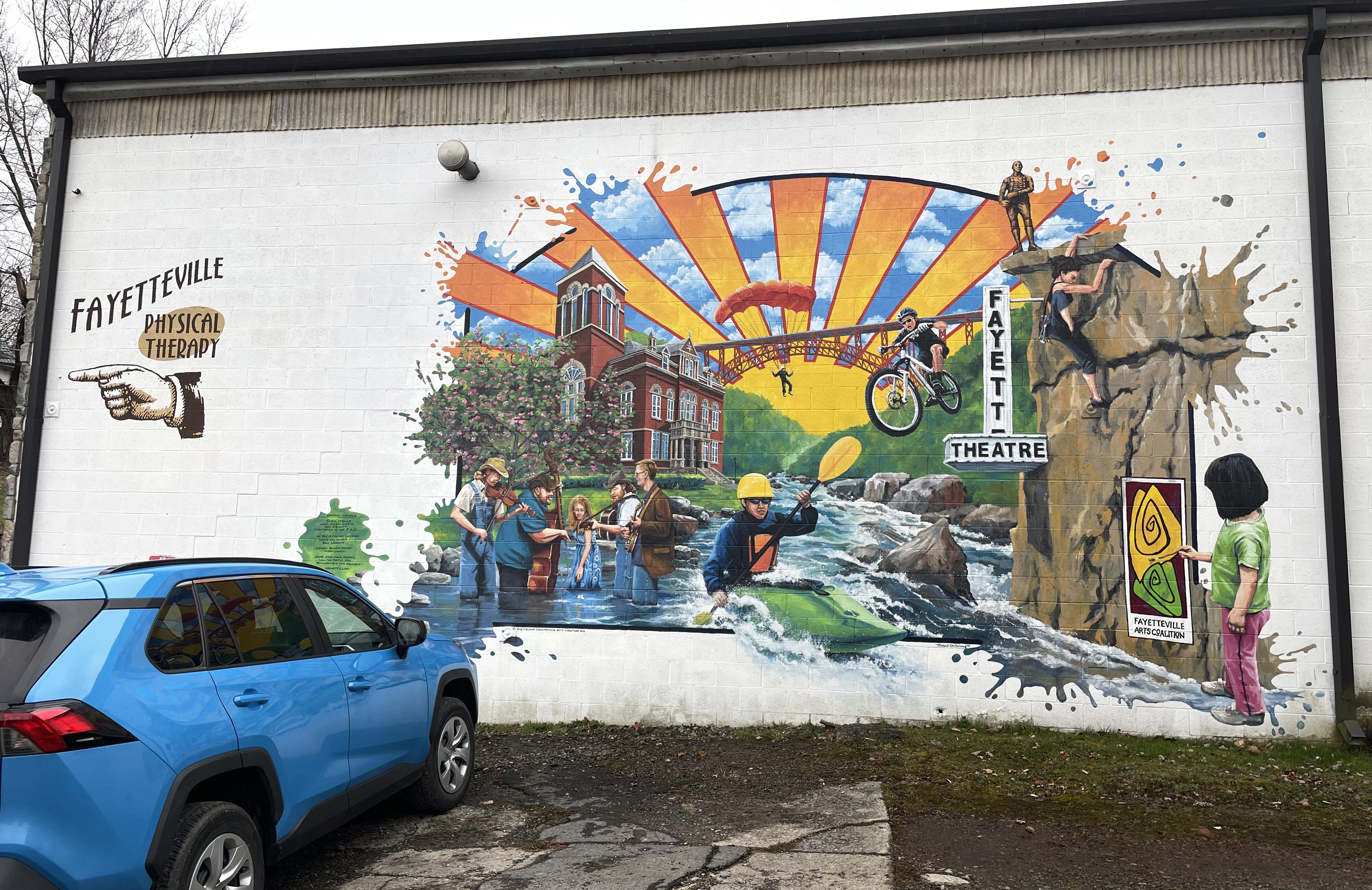
Long before the coal fields and railroads rolled through the hills, Native Americans called this place home for centuries. The protohistoric period for the Native Americans of the lower New River region began in 1492 and lasted until around 1650. While there were many tribes throughout history in this region, in the 1600s when recorded history began in the New River Gorge the Shawnee were most prevalent.
The next two centuries brought great change to this region, starting with the civil war. The tactical potential of the Kanawha Valley between modern-day Fayetteville and Charleston was recognized by both the Union and confederacy and as such was fought over. The city of Fayetteville is considered the first place where the use of “indirect firing” occurred.
In 1863, West Virginia became the 35th State and shortly after was connected to the greater region by the Chesapeake and Ohio Railroad in order to serve the newly created New River coal fields. This region was considered to have some of the highest-grade coal on earth and created a booming industry throughout the early 1900s.
As mining opportunities began to dissipate throughout the region in the 1950s and 60s new initiatives began to arise in the form of natural resources, specifically whitewater rafting, kayaking, and canoeing. In 1976 the New River Gorge Bridge, at the time the world’s largest arch bridge, opened further access into communities like Fayetteville and brought with it the start of even more outdoor recreational tourism. In 1978 the National Park Service designated the New River Gorge National River and with it protecting more than 70,000 acres of land around the gorge. Today this area is home to the United States newest National Park, the New River Gorge National Park and Preserve, where the surrounding land is known for rafting, hiking and rock climbing as well as some of the best fall colors in the American East.
What we know today as Fayetteville, West Virginia is home to rich cultural and natural histories. The history of the town itself traces back to 1837 starting with the homestead of Abraham Vandal, a Revolutionary War Veteran. This small community was called Vandalia, and in 1872 was incorporated as the Town of Fayetteville in honor of Marquis de Lafayette. This town is a part of the Civil War Trail and played a part for both sides in the war, but ultimately is known for the timber, coal and railroad boom of the late 1800s and early 1900s. While this town may have begun thriving around industries of extraction it is now thriving because of a different industry, outdoor recreation
Fayetteville Comprehensive Study
In 2014 the Town of Fayetteville completed a comprehensive plan, with an amendment to the plan in 2022. This plan contains research and resources for Fayetteville including a needs assessment highlighting all of the critical issues, and an action plan with the next steps for addressing the problems and outling opportunities.
Needs Assessment
• Housing
• Goal: Provide for diverse types of new housing while also revitalizing existing neighborhoods.
• Transportation
• Foster an efficient and safe multi-modal transportation system.
• Economic Development
• Encourage new business development.
• Land Use
• Encourage sound land use decisions that preserve open space, historical and scenic resources, community character and provide for clean air and water.
• Quality of Life
• Enhance the quality of life of residents by improving community amenities and facilities.
Action Plan

One of the primary reasons for creating a comprehensive plan is to provide a road-map for the community’s future. This becomes the action plan, which is a series of defined recommendations which is essential in helping the Town of Fayetteville achieve “its vision for the future”.
Goal 1: Provide for diverse types of new housing while also revitalizing existing neighborhoods.
Goal 2: Foster an efficient and safe multi-modal transportation system.
Goal 3: Encourage new business development
Goal 4: Encourage sound land use decisions that preserve open space, historical and scenic resources, community character and provide for clean air and water.
Goal 5: Enhance the quality of life of residents by improving community amenities and facilities.
As a part of our research during the design it was important to understand how far along many of the items in this plan were. Working with town representatives, we were able to outline what pieces of the comprehensive study had been completed to date. Below are the items that have made substantial progress since 2014.
Goal 1: Provide for diverse types of new housing while also revitalizing existing neighborhoods.
• New zoning ordinance and map were passed in 2022, along with a future land use map.
• Vacant structure ordinance was enacted and is used today. Vacant and dilapidated structure surveys were created, and both are actively monitored.
Goal 2: Foster an efficient and safe multi-modal transportation system.
• The town obtained a $5,000 grant through WVU for purchase of bike racks and maintenance stations. Racks were ordered but not installed and maintenance stations were to be built by the local bike shop owner.
• Several sidewalks have been installed, however the big priority areas for new sidewalks all border WVDOH streets and lack WVDOH support.
• A parking map was developed to show the availability of parking, that businesses allow and the time frame.
• Additional parking was provided at the former elementary school but due to construction has been lost. Parking was eliminated in front of the Theater due to tightness.
Goal 3: Encourage new business development.
• A new website was also developed.
• There are currently no vacant buildings in the district.
• Development of the National Park helped to draw in new businesses
Goal 4: Encourage sound land use decisions that preserve open space, historical and scenic resources, community character and provide clean air and water.
• A community energy plan was not developed. However, a public EV-Charging station was recently installed and is being utilized.
• A 1% Sales Tax was enacted with the intent to provide a funding source for stormwater projects throughout town. Stormwater projects should start occurring with the availability of this funding.
• GIS mapping of the stormwater system was completed in 2022.
• A local history developed a 150th anniversary book that has helped with education of not only the citizens but also furthered initiatives at the CVB.
• The Appalachian Gateway Community Initiative Fayetteville Team is also working on ways to preserve history and tell the story of Fayetteville.
• There have been a few items enacted that have helped protect historical resources.
• The Zoning ordinance from 1974 was successfully updated in 2022, after nearly 12 years of working on it.
•
Nuttallburg Mining Complex and Town: A Nationally Significant Historic Property (2006)
Nuttallburg Visitor Use Area Implementation Plan / Environmental Assessment (2008)
Codified Ordinances of Fayetteville WV (2022)
Fayette County Comprehensive Plan (2022)
New River Gorge National River Administrative History (2008)
Foundation Plan for New River Gorge National River (2011)
Town of Gauley Bridge Comprehensive Plan (2019)

Raleigh County 2030 Comprehensive Plan (2022)
Beckley Comprehensive Plan (2014)
City of Oak Hill Comprehensive Plan (2012)
2021 National Park Visitor Spending Effects
New River Gorge National River Environmental Assessment (2013)
Wolf Creek Watershed Stormwater Management Plan (2004 Downstream Strategies)


The Town of Fayetteville is located in southern West Virginia, between the towns of Summersville, WV and Beckley, WV. US Route 19 is the main road that transects the town and can be accessed via Interstate 77, Interstate 64, and Interstate 79. Fayetteville is located within a five hour drive for approximately 12% of the U.S. population (over 39 million people).

• Washington D.C.
• Pittsburgh, PA
• Columbus, OH
• Raleigh, NC
• Nashville, TN
As you move closer to Fayetteville its proximity to a large population is still impressive, with 3.2 million people within a 2-hour drive and over 600,000 within a 1-hour drive. Millions of visitors can easily travel to the Fayetteville region. Allowing them to enjoy the culture, local trails, and to marvel at the gorgeous vistas that can be experienced.

5 Hours
• 5 Hour Drive - Over 39 Million
• 2 Hour Drive - Over 3 Million
• 1 Hour Drive - Over 600,000
2 Hours 1 Hours Fayetteville


Fayetteville is split by U.S. Highway 19, a north-south federal highway which is accessed via Interstate 77, Interstate 64, and Interstate 79. The town is also split by WV Route 16 which serves as the primary entry into Fayetteville. While Fayetteville is the gateway to the national park and one of the best recreational locations in the state it remains very car centric due to the nature of the roads in the area. Many of the routes in and out of the city are state controlled roads.
Fayetteville has 7 entries into the town limits. As mentioned the primary entry is at the northern end of the town onto WV 16. As you enter town you are met with predominantly highway commercial such as restaurants and a fueling-station. As you travel further into the city the charm of Fayetteville begins and is something that should be emphasized at the gateway itself. There are three secondary entries, one being where WV 16 travels through town before connecting back to US 19 on the souther part of Fayetteville. The second being Fayette Station road which for the majority is one way and then brings you directly into town via County Route 82. The third secondary entry into town is off of US 19 onto County Route 8 (Laurel St.) which gives access to hotels and West Maple Avenue. The tertiary entrances are north to south ; Lively Street which feeds onto Maple Avenue, Maple Lane which feeds onto Nickelville Road, and Hinkle Road which feeds into both Nickelville Road and WV 16.
As you arrive to the primary entry into Fayetteville, Route 19 and Court Street, you are met with a pedestrian bridge that crosses the highway, linking the west side of town to the east side, Tudors Biscuit World and the Little General fueling station. Defining the entry into town with highway commercial land use. While the main route is a state route it still holds the charm of a small mountain town and a friendly atmosphere, after traveling past the initial commercial land use area. However, because this main route through town serves the majority of traffic including truck and service vehicles, during peak times it becomes a vehicle pedestrian conflict area.
Through our research and inventory and analysis we found many opportunities for increased pedestrian access. It is our suggestion that a full sidewalk study and analysis be completed to ensure the best future growth. The following list are some that were identified during our process and we believe would yield the biggest impact for the community.
• Missing Sidewalk Connection to Charlie McCoy Park










• Court Street and Maple Avenue Misaligned





• Reorganization of Court Street
• Confusing Signage and Way-finding


• Hazards
• Utility Poles in Walkways


• Lack of Pedestrian Crossing Near Love Hope Center



• Lack of Pedestrian Crossing at Appalachian Drive












• High speeds on WV 16 and throughout town
• Bad Lighting
• Poor sidewalk conditions


Parking was identified as a universal concern during our public meetings, interviews and site analysis. Creating ways to address the concerns was a priority for the masterplan. How can we make Fayetteville easier to navigate and enjoy for the local community and provide spaces for visitors. Through a parking analysis of existing conditions, areas of opportunity were identified Fayetteville’s existing parking plan consists of approximately 385 spaces. The parking areas can be divided into three categories – parking available anytime, parking available after 5 PM, and parking limited to two hours. Out of the total existing 385 parking spaces, 63 are categorized as parking anytime, 213 spaces are available after 5 PM, and 109 parking spaces have a two hour parking limit. No overnight parking is permitted within Fayetteville. Navigating and finding the available parking spaces can be a challenge, as not all parking spaces are clearly identified to drivers. While there is a town parking map available on the town’s website and Facebook page identifying available parking, some of the identified areas are not apparent when navigating the town. The two hour parking is clearly identified with many signs at eye level, but there is almost no clear parking information signage or way finding signage to the other parking options. The street parking along Court Street provides the most convenient access to most of the town businesses. The after-hours and anytime parking are located in a ring surrounding the town center. Establishing clear and consistent information and wayfinding signage, clearly identifying the parking areas, and offering an on-line map will increase their usage and help alleviate some of the towns parking issues. We also identified six specific areas of opportunities within the existing parking areas in Fayetteville. We developed concepts that work as individual projects. Some of the projects require minimal effort to achieve while others require some engineering and public private partnerships. If the opportunity areas were all constructed, Fayetteville would see an increase of 170 new parking spaces.
 2 Hour - On Street Parking
Anytime Parking
After Hourse Parking
2 Hour - On Street Parking
2 Hour - On Street Parking
Anytime Parking
After Hourse Parking
2 Hour - On Street Parking

While there are technically seven entrances into the Town of Fayetteville, Court Street serves as the main entrance off Highway 19. As you approach the signaled intersection you are either met with a view of the pedestrian bridge that crosses over Highway 19 (north bound) or the Tudors Biscuit World and Little General Gas Station (south bound). Each of the approaches give little insight into what the Town of Fayettevile holds for its guests and does not currently serve as a welcoming gateway into the town.


As you move along Court Street you are met with many things that could be viewed as unsightly, however each of the areas become and opportunity for a project that highlights the beauty and uniqueness of Fayetteville. The list below outlines some of the existing challenges with Court Street.


• Lack of defined entry into the Historic Town Center


• Overhead Power lines and Utilities

• Narrow / missing sidewalks
• Vehicle first design / pedestrian safety
• Lack of unified streetscape palette

• Broken or damaged historic walls

• Current facade conditions of some mainstreet structures
• Lack of pedestrian focused spaces
• Wayfinding / Signage


Many communities face the problem of unsightly utilities in their downtown areas. However, the disadvantages to overhead utilities are more than just aesthetic. They are more susceptible to bad weather, such as high winds, damage caused by vehicle collisions, damage from falling trees or snow and ice storms and many other things. Overhead utilities also begin to cause pedestrian conflicts as utility poles are often located on or adjacent to the sidewalks and other pedestrian areas. During the masterplanning process a goal to create a concept where the utilities could be buried or moved away from the primary corridor of Court Street, creating an unobstructed view of the character and feel of the Town of Fayetteville. The diagram on the facing page shows the conceptual idea of moving the utilities from Court Street along alleys and side streets. This idea could be realized via burying the utilities or relocating them.


Benefits of Buried Utility Lines


• More Aesthetically Please
• Reduced Maintenance Costs
• Increased Reliability
• Better Land Use
• Increased Capacity (Not limited to available space on poles or towers)


Often when the design process starts, the team begins a research phase analyzing what the strengths and weaknesses are of the project area. Part of this process is done through case studies. A case study is “a process of researching into a project and documenting through writings, sketches, diagrams, and photos.” This is done in order to find ways in which other projects, planners and designers have dealt with
•
• Signage and Wayfinding
In order to capture a cross-section to answer the challenges our team chose four Case Study Projects:
• Waynesville, North Carolina
• Moab, Utah
• Bar Harbor, Maine
• Housing Issues in Mountain Towns
Each of the projects was researched through various levels in order to gain an understanding of first their challenges and second their relation to the challenges being faced in the Town of Fayetteville.
Waynesville is an Appalachian Mountain Town with many similarities to the Town of Fayetteville. This community is the county seat of Haywood County and values its rich heritage and history as well as their strong and active arts community. As a ‘Gateway Community’ to the Great Smoky Mountains National Park and the Pisgah National Forest they struggle with circulation and overwhelming tourism as well as with diversifying their economy.
In 2019 the Town of Waynesville began the process of creating a comprehensive plan to help identify opportunities for future growth as well as addressing the challenges experienced as not only a ‘Gateway Community’ but also a growing town. Waynesville 2035 replaced their 2020 comprehensive plan and serves as a decision making guideline.


Key Issues were:
• Growth Management
• Jobs and Economics
• Redevelopment
• Affordable Housing
The issues helped to develop a draft set of goals based on comments. It was
similar issues in the past and learn from their mistakes.
A case study can serve as the beginning of a project or as a reference to apply design solutions against during the different phases of the project. The goal of a case study isn’t to find a project that is a one to one relation to our project but to find similar initiatives so that we can research their goals, objectives and outcomes in order to learn from its successes as well as from its mistakes.
Generally speaking there is no limit on the amount of case studies that can be analyzed during the research, but you should have enough to cover many of the general design concerns that were discovered during research of existing plans and/or provided by the client.
We began our research by analyzing the challenges that the Town of Fayetteville was experiencing as well as its role as a ‘Gateway Community’ to the New River Gorge National Park. Many National Park ‘Gateway Communities’ experience challenges for various reasons and align with those of the Town of Fayetteville while others are unique to either the park or geographical region. For example because of its location Fayetteville experiences limited availability to expand its town because of the boundaries of protected land for the National Park. Below is a list of the challenges we chose to explore when selecting our case studies.
• Increased Levels of Tourism
• Parking
• Infrastructure
• Housing Diversity
• Short-Term Rentals
• Working Across Jurisdictions
To begin planning the Waynesville Planning team developed a 4 step process:
• Initiation
• Analysis

• Draft
• Adoption
Through their initiation phase they were able to use public visioning workshops, open houses, surveys and other public engagement methods to develop a list of the most pressing issues for Waynesville.
important to community members that Waynesville maintain its aesthetic and character through the development and growth of the town. In order to drive that development it was determined that smart planning and job creation was necessary, as well as providing housing for those jobs being created. It was important to the community to diversify their economy to provide more than service and tourism based jobs in order to create industry to support families and a place where their children want to stay to build a family of their own. The last piece that pulls the ideas together is making sure to focus on amenities that create a good quality of life for the community members, arts and culture projects, trails and greenways, historic preservation were all points that were stressed during the public engagement process.
“Waynesville will enable the growth of a vibrant, healthy, and successful community - true to our history, small-town culture and heritage; responsive to the changing aspirations and needs of all our citizens; purposefully built on the principles of smart growth; mindful of the gift of our rivers and creeks, farmland and mountain vistas; and attentive to the opportunities presented in regional preservation, arts and education, economic development, and land use initiatives.”
The planning team then took each of the concerns and opportunities and developed a set of goals with actionable steps associated with each. Six overarching goals were developed from the initiation process. This helped to provide a framework for the recommendations, strategies, and plans that were outlined in their final document.
Goal 1: Continue to promote smart growth principles in land use planning and zoning.
Goal 2: Create a range of housing opportunities and choices.
Goal 3: Protect and enhance Waynesville’s natural resources.
Goal 4: Protect and promote Waynesville’s cultural resources.
Goal 5: Create opportunities for a sustainable economy.
Goal 6: Create an attractive, safe and multi-modal transportation system. Waynesville’s Connection to Fayetteville

While the Town of Waynesville is a bit larger in comparison to the Town of Fayetteville, (The population of Waynesville is 10,178 compared to Fayetteville’s 2,844), it holds many similarities that we can learn from. The entire city of Waynesville is bordered by national land, several National forests as well as the Great Smoky Mountains National Park. It is also only a 30 minute drive to Asheville, NC. This paired with the topography provides limited opportunity for outward expansion of the town, Fayetteville experiences this same concern. This requires that any and all development that is made to be done so in a way that aligns with a plan for the future of the town.
This area is proud of its community and for good reason, the proximity to so many beautiful natural resources as well as history, arts and other culturally significant areas is amazing. However, this creates a need to protect this sense of place that makes Waynesville so special. Fayetteville has an equally important identity, as one of the “coolest small towns” it is important, as it was for Waynesville, to enhance and protect the natural and cultural resources for the Town. Ensuring that Fayetteville’s Identity shines through every piece of the project will help bring a lot of the same success Waynesville has had.
Addressing circulation and transportation issues are at the top of the list for many communities and for Waynesville and Fayetteville this is no different. In their plan, Waynesville is working towards creating and encouraging multi-modal transportation systems. Greenways and bike trails, improved sidewalks, freight
While each of the relate to concerns and opportunities that we see in Fayetteville, our primary area of analysis for this case study was Waynesville’s desire to diversify their economy. Jobs and economic development was identified as the most pressing issue during their planning process. As with many towns and cities the 2008 recession heavily impacted their manufacturing based economy as well as housing and retail. In 2015 Waynesville’s economy began to rebound, however it was quickly identified that it was being driven mostly by the tourism economy. During this process it was identified that in order to protect against economic
resources.
• Tourism provides an opportunity for city and town promotion, allowing for the chance to draw people to move to the area.
• Economic development helps to strengthen the community by providing money and resources for local community growth.
• Increased visitation can cause damage to the natural environment, cultural resources and infrastructure.
• Areas with strong cultural heritage can experience a loss of identity through commercialization of culture and displacement of local populations.
• Jobs created are predominantly entry level or service industry jobs, creating a loss of mid to senior level work opportunities.
• Tourism economies can often be seasonal, causing problems with overcrowding during busy times and a ghost town effect in the off season. This in turn creates problems with maintaining the workforce due to lack of sales during the off season and little opportunity or amenities for locals during this time.
• Imbalance in funding can lead to a decline in the local economy over time and drive future business development away.

• Shift in property ownership. Often areas with tourism based economies are a perfect opportunity for outside investors to purchase property and businesses. This pulls most of the profits away from the local tax base leaving the area with little benefit.
downturns similar to 2008 it is important for the economy to grow in a balanced way that diversifies opportunities for the community. The planning team identifies five priorities moving forward to support economic development:
• Strengthen Waynesville Existing and Future Workforce
• Support the Growth of Local Businesses
• Focus New Business Recruitment Strategies
• Support the Continued Growth of Tourism in Waynesville


• Promote Small and Independent Businesses, Entrepreneurship and the Maker Economy
In order to understand the importance of a diverse economy it is important to identify what a tourism based economy is and why it cannot be solely relied on. A tourism based economy can be defined as, ‘when a city or town relies on money spent by non-local visitors to the city or town in order to justify and fuel its local economy’.
• Creates local jobs for retail, restaurants, transportation, entertainment, hospitality industries. Reducing unemployment throughout the region
Sustainable tourism takes a full account of its current and future economic,
mobility and public transit opportunities are ideas that align with the needs of both Waynesville and Fayetteville.
Not only is the proximity to each of the popular destinations a similarity but also the industry that is drawn to the area is similar. Waynesville Identified that in order to bring in new residents while also retaining its current residents and youth it was important to reach beyond tourism and diversify their economy to support jobs that go beyond the service industry. Focusing on creating space for mixed use development, maker space / entrepreneurial workspace, high-speed internet and working with local agencies to promote a “living wage”.
• Economic development brings money to the region. The income generated can make up a significant portion of the private, local and state income.
• Opportunities for entrepreneurs and local businesses. Hotels, bars, transportation, entertainment, shops and restaurants are all industries that can have an opportunity to open new businesses.
• Local economic development creates an incentive for infrastructural updates. Roads, greenways, medical, and educational facilities that benefit local citizens and tourists.
• Environmental and cultural stewardship. Economic development provides an incentive to preserve and maintain natural and cultural
social and environmental impacts, addressing the needs of visitors, the industry, the environment and the host communities. Creating a balance that has more benefits than negative impacts, especially relating to the environment, economy and communities. Sustainable tourism should create a better destination for local citizens and visitors.
Eco tourism focuses on educating tourists about the natural environment and visitors taking part in conversation and cultural activities. “Responsible travel to natural areas that conserves the environment, sustains the wellbeing of the local
people, and involves interpretation and education.” Education is meant to be inclusive of both staff and guests.
Sustainable Tourism Planning
Finding the right balance between the needs of people and places. It involves clearly defining purpose, vision and a point of difference or identity for your community. This will prioritize the benefits tourism can provide for everyone and amplify the quality of tourism over the quantity of tourism. Maximizes ecosystems, cultures and the quality of experiences offered visitors.
Sustainable Tourism Includes:
• A strong united vision, shared with communities, government and industry
• The use of evidence to support decision making, letting go of traditional approaches to tourism development.
• Connect with local indigenous and minority communities to capture their aspirations and further build the community.
• Monitor and evaluate the environmental, social, cultural and economic benefits of tourism.
• Consider risks and prepare for crisis and change.
• A focus on environmental and cultural advocacy and stewardship.
Smart Sustainable Tourism Achieves
• Preservation of cultural and natural heritage for the benefit of locals and tourists alike.
• Funding for construction of new infrastructure; water, sewer, power, Internet, cultural and educational centers that will benefit both community and visitors.
• More Income. Quality vs Quantity, Tourism Spending.

Moab sits 8 minutes from Arches National Park in Utah. This Western town is home to around 5,300 permanent residents. However, this community has seen many ups and downs since its inception. For many years Moab was an agricultural community until the discovery of Uranium and Vanadium in the 1920s and in 1950 Moab became the so-called “Uranium Capital of the World”. During this time Moab saw a population increase of around 500%, bringing close to 6,000 residents to the area. Houses, churches, and businesses were built to support this new industrial town. Campaigns for the promotion of manufacturing were bringing new places to Moab, the future was bright. However, as the cold war began to wind down so did the demand for Uranium and the city’s population began to dwindle, and many of the homes and businesses would sit vacant until the 1980s. Today, Moab attracts over 3 million visitors annually as the northern gates to Arches National Park, and campaigns to attract even more continue across the county.
In 1970 congress changed the status of Arches National Monument to Arches National Park. This provided a new opportunity for Moab to market its community. By the 1990s Moab was experiencing a new kind of boom, a recreational one. The rocky terrain had attracted thrill seekers from around the U.S. Thousands of mountain bikers and off-road enthusiasts began to visit the area. Moab was not prepared to handle such an influx of visitors and began to experience infrastructural failure at its water treatment plants and extreme traffic and roadway issues. However, the damage was not only infrastructural. In 1993 a larger crowd of tourists composed of mountain bikers and off-road enthusiasts began to fight and riot, destroying natural
resources in the process. After this event it was clear that something must be done to combat the issues. In 1994 the Canyon Country Partnership was formed to help to solve issues that spanned many different jurisdictional boundaries. This partnership was composed of Federal Officials, County Commissioners, National Park Service Members, U.S. Forest Service, and many other state agencies. This partnership was able to address many issues such as, the closing of unauthorized trails, upgraded site infrastructure, adoption of leave no trace principles and general guidance for the future of the area.
After nearly 30 years, tourism continues to increase throughout Grand County and Moab and it is no secret why. The beauty of Arches National Park and the world class outdoor recreation opportunities paired with the continued tourism campaigns at the County level, continues to bring in new visitors every year. However, the city and surrounding area still experience a high level of strain from the amount of visitation.
• Workforce and Housing
• Affordability and Equity
• Leadership and Decision Making
• Environmental Stewardship
The six pillars “create a framework that draws together important elements identified by community members as being most critical in terms of the future.”
On the surface a lot of connections can be made between Moab, Utah and Fayetteville, WV. Historically both towns have seen the ups and downs of a single industry market, have a similar past with a fast growing outdoor recreation industry, limited developable land, a transition from national area to national park and a desire to maintain the character of the community.
Both towns have incredible access to not only the National Parks that they border, but also a tremendous amount of outdoor recreation opportunities outside of the park. Mountain biking, rock climbing and white water opportunities are some of the best in their respective areas. This provides opportunities for not only entrepreneurs to open industry related businesses, but also for larger manufacturers to bring operations to the area. This allows for additional economic opportunity as well as incentives for improving and maintaining recreational access which leads to quality of life improvements for permanent residents.
Each town has a unique character that is in jeopardy because of housing, jobs, workforce and outside development. While future growth is necessary for the communities to grow, an important connection to be made between the two is the desire for a “locally driven future”. In the Moab - Together Tomorrow planning, nearly all of its pillars focus on ways to grow with and around the community rather than over-top of it. This approach is important in our process as well.
While the creation of the previously mentioned Canyon Country Partnership helped in many ways, issues with over-tourism and decision making continue to exist. This is typical of many gateway communities because of the different jurisdictional boundaries that exist. Fayetteville is no different, with the County, National Park, State
From increasing housing prices to the lack of professional opportunity the challenges of being a Gateway Community persist. In October of 2022 Moab - Tomorrow Together, a vision and strategic action plan, was published.

This vision and strategic action plan is the result of a nine-month visioning process that was directed by Future iQ. The process consisted of community surveys, workshops, focus group sessions, think-tanks, and a summit. The process was designed by Future iQ to be open, inclusive and transparent with the goal of working with the community to create a shared vision looking toward 2030.

Moab - Tomorrow Together was broken into three parts. Phase 1 was future visions. This phase focused on Community Surveys, Think-Tanks and Visioning Workshops. Phase 2 was action planning. This phase focused on the creation and meeting of focus groups and the future summit. The third part was the ‘Road Map’, where the plan was laid down for the future development and implementation of local plans and projects.
As a way to plan for future development the planning team used the information gathered during the planning process to develop six strategic pillars all centered around the goal of a locally driven future. The six pillars are:
• Tourism Trajectory and Economic Diversification
• Community Fabric and Wellbeing
and other town limits all a part of making decisions it is important to understand how to work with the challenges. One of the pillars in Moab’s plan is leadership and decision making. Moab saw change as inevitable and wanted to take control of it rather than allowing it to happen around them without question. This pillar focuses on encouraging closer collaboration between city, county, state and federal partners and local community members to help create better relationships and a more community driven approach to planning.
While almost every part of Moab’s Plan can be applied to Fayetteville, our team decided on this case study because of its approach to working across jurisdictional boundaries. In order to grow in a community central approach that voice must be heard and that can only happen through inclusive communication approaches between the town and its community members. This allows for a stronger process that then follows up the chain to build stronger communication between the town
design the gardens. This area was becoming a very popular place to be. A number of socially elite residents recognized the dangers of over development on the island and acted to preserve it. George B Dorr, Charles W. Eliot and others such as John D. Rockefeller Jr. who donated more than 11,000 acres of land to the park, worked over the years to help create what we know today as Acadia National Park. This aspect makes the park very unique in origin. Today Bar Harbor holds the largest portion of this park, which in total is approximately 49,000 acres.
In October of 1947 a fire broke out near Hulls Cove, for the first 3 days the fire was relatively small, burning or damaging only 169 acres. However, on that fourth day strong winds began to fuel the fire, causing it to grow and spread rapidly, and in just a short time over 2,000 acres had been engulfed destroying many of the cottages along “Millionaires Row”. The fire would go on to rage until November 14th. By then more than 17,000 acres had been burned,10,000 of which were located within Acadia National Park. While the loss of human life was extremely minimal, the property loss was astronomical. Damages were estimated to be over $23 million dollars, which today would be nearly 300 million dollars.
The fabric of Bar Harbor began to shift after the fire. While many permanent residents rebuilt their homes “Millionaires Row” was replaced with motels and hotels, to address the ever increasing tourist population. While the cottage lifestyle was on the downturn, due to the depression and newly implemented income tax program, the fire was the final blow to this way of life in Bar Harbor.
and the county and continues all the way up to the federal level with the National Park Service.
This plan first showcases the importance of leadership and decision making. In their feedback process it was shared that community members feel that change is ‘happening to them’ and that local control is out of their hands and possibly out of the hands of local government. In order to address this the team outlined three key action areas for improving this process.
• Encourage Closer Collaboration Between City and County
• Boost Local Participation in Community Decision Making
•
Each of the bullet points help to build a transparent and inclusive communication network that allows local voices to be heard. Local efforts include building community committees and forums, local workshops and advocacy plans, and finding ways to deemphasize political labels and boundaries.
Our team hopes to use similar approaches to create an approach to communication across the jurisdictional boundaries that aligns with the values of Fayetteville.
Bar Harbor is located on Mount Desert Island on the northeastern coast of Maine. It is home to approximately 5,000 permanent residents. Bar Harbor is also a popular resort town that serves as a gateway to Acadia National Park, with its city center located only minutes away from Acadia’s borders. During the 1800s the socially elite began to frequent the area as a summer vacation area, names like J.P. Morgan, President William Taft, John D. Rockefeller, Jr. and even current names such as Martha Stewart. By 1880 there were more than 30 hotels on the island and the rich and the famous attempted to outdo each other with estates and cottages. Many of them hired famous landscape architect Beatrix Farrand to
Bar Harbor is a year round community with more than 5,000 permanent residents. However, because of its popularity as a resort community it also attracts a second home population and struggles with housing loss due to short-term rentals that supply the ever growing tourism base. This community has a diverse selection of year-round employers. Not only are there many small businesses and restaurants that are fueled by the tourism industry, there are also larger employers that require skilled labor. MDI Hospital, College of the Atlantic, The Jackson Laboratory and MDI
While this doesn’t completely balance the economic drivers in the community it helps to maintain a steady base of employed residents that can support the other businesses. Bar Harbor’s geographical limits, aging municipal infrastructure and influx of visitors, present other challenges. Primary topics identified in their recent planning process were:
• Housing
• Infrastructure Investment
• Tourism Capacity
• Balance of Seasonal and Year Round Economy
Tourism Impact
Bar Harbor receives over 3.5 million visitors a year. While this impressive tourism sector generates income that can support municipal services, it is one of the main impacts on the aging municipal services such as solid waste, public safety, water and sewer.


Biological Laboratory support a few thousand jobs and are important economic drivers for the island.
Challenges

Bar Harbor
While many gateway communities suffer from a seasonality of economy due to tourism, Bar Harbor is unique in that it is home to four large employers that are able to support many of the residents of the community and surrounding area.
While Bar Harbor houses a robust seasonal public transit system, and other transportation alternatives, many tourists continue to rely on personal vehicles. During peak season this causes an uncontrollable situation throughout the downtown causing issues ranging in pedestrian safety to parking capacity issues.

As visitors and temporary guests in the community flood in, permanent residents are also on the rise. With its wealth of natural resources, small town community feel and employment opportunities it is no surprise why. However, this sparks yet another challenge that Bar Harbor is facing, housing and development. Nearly 50% of its land areas is conserved, making growing the community outward very challenging. As short-term rentals and second home ownership grows the availability of affordable housing for long term rentals and ownership decrease causing issues that place permanent residents and tourists at odds against one another.
Currently Bar Harbor is in the process of creating a comprehensive plan with an outlook to the year 2035. The goal of this plan is to serve as a guide for future growth, policies, master planning, land use decisions while maintaining the sense of place, history and natural resources of the community. In late October the team published the ‘Existing Conditions Analysis Report’, which serves to provide a baseline understanding of the current conditions throughout Bar Harbor, and will directly inform the 2035 Comprehensive plan.
The existing report is broken into the following chapters:

• Demographics
• Housing
• Economic Development
• Transportation
• Public Facilities, Services and Infrastructure
• Natural Resources
• Parks, Open Space, and Recreation
• Historic and Archaeological Resources
• Land Use
• Fiscal Capacity
Bar Harbor and Fayetteville share similar challenges with the lack of developable land, aging infrastructure, Tourism Capacity, and lack of economic diversity. However, two challenges that stand out beyond them all and one our team decided to focus on is housing and transportation infrastructure.

Housing
As with any gateway community the increase of out of town investment grows over time, especially in the short-term rental sector. While short-term rentals increase availability to bring tourists into the area and also provide economic boost through hotel taxes, it can also begin to drive out permanent residents through increases in prices, housing shortages, and lack of interest to develop long term rental solutions. For this reason Bar Harbor worked to develop a housing policy framework to address the issues. The goal of this framework was to “support Bar
• Develop Short-Term Rental Restrictions
• Develop Zoning for Employee Housing
• Develop Housing Needs Assessment and Action Plan
• Identify Zoning Barriers to Housing
• Encourage Low-Medium Income Housing through Zoning
• Create Partnerships with Community Organizations
• Create Partnerships with large Employers
• Secure National Park Service Town Hill Land
• Ensure Quality Rental Housing
• Reduce Red Tape / Streamline Approval Process
This framework allowed the Town of Bar Harbor to create short-term rental regulations, zoning for employee housing, and continue to search for ways to partner with housing organizations and employers.

Transportation Infrastructure
Bar Harbor, as with many communities, have a set of complex issues in regards to transportation. Nearly 4 million visitors to Acadia National Park flow through Bar Harbor. This seasonal influx puts pressure on the current public infrastructure in the Town, as well as creates congestion and safety concerns. The town was not
and cruise-ship visitors, and the possibility of a local-option sales tax, can address needs for infrastructure and other programs related to costs of tourism that are currently funded through property tax. Our team will utilize this information to provide insight and recommendations on next steps for Fayetteville to address issues in housing and transportation infrastructure
This case study does not focus on one specific town but a series of towns in Colorado that are referred to as Mountain Towns. Durango, Vail, Carbondale and Telluride are all towns situated in and along the Mountains in Colorado. Towns and cities throughout the mountains have played an important role throughout Colorado’s history. Whether it is providing goods and services for ranchers and miners of the European settlement era or today as they provide destinations for millions of visitors every year, the mountain towns are an important piece of the identity of Colorado. However, many years have passed since the towns offered trade opportunities to ranchers. Today the cities serve as gateways to some of the best mountain views, skiing, as well as several National Parks throughout the state.
In 2021 the Colorado Tourism Office showed nearly $21.9 billion dollars in visitor spending with over 84.2 million visitors. While this number is a decrease compared to 2019, it shows a recovery from 2020 and continues to grow. Towns like Durango see nearly 800,000 visitors a year, and vail sees more than 1.3 million. With its access to world class winter activities, 26 scenic and historic byways and its four National Parks, it is no surprise that Colorado is one of the prime vacation spots in the United States.
Planners in the early years of the communities had begun to think about the growth of the cities and put in place approaches that they believed would help. However, the Colorado mountain towns grew faster than anyone could have ever anticipated. Accelerated growth and the popularity of the towns as destinations lead to what can only be explained today as a housing crisis. Today the average house price in Durango is around 750,000. As the prices continue to soar the communities are
Harbor’s year-round community by having adequate and affordable workforce housing for residents who work in town, for families hoping to raise their children here, for seniors hoping to stay in the community as they age, and for businesses looking for a stable workforce and housing base needed to expand the town’s yearround economy.”
This framework established a set of ten different strategies for addressing housing needs in Bar Harbor:
planned for this amount of vehicular traffic and in turn has narrow streets and poor sight lines from parked vehicles which create dangerous situations for pedestrians, cyclists and other vehicles. While vehicular traffic is a large concern, the cruise ship industry causes an added layer with an influx of pedestrians on the street, causing additional safety concerns when paired with visitors to the park via car.
The issues have sparked opportunities and discussion around improvements to the public infrastructure as well as public transit opportunities. As a part of their plan the Town developed three transportation related goals:
• Develop more walking and biking trails and other recreational amenities that encourage residents and visitors to attain greater health and reduce automobile congestion.
• Monitor and improve the town’s seasonal parking and seek additional solutions to on-going parking and congestion problems including promotion of walking, biking and shuttle-bus alternatives to private automobiles in the downtown.

• Continue to explore ways in which application of revenue from parking
losing their working class, and in turn beginning to lose their sense of community. The tourism drive within the state is causing an influx of second home buyers and investors, who seem to buy the homes almost regardless of the asking price. This problem is not as simple as one might think, the housing prices are not being caused
by a shortage and in fact development of property continues to grow throughout Colorado. This problem is caused by a lack of affordable housing for the working class. Areas throughout the state have been searching for solutions to this issue and La Plata County Economic Development Alliance has even been awarded a REDI grant to develop a strategy. In forums surrounding this grant the true meaning of affordability was discussed. In a discussion centered around this topic “Andy
it could help to open up affordable housing opportunities. For example if you compare Durango, which has short-term rental regulations, to Steamboat Springs, which does not have the same limits, the difference is startling. Short-term rentals account for about 1-2% of all available units in Durango while it is more than 40% in Steamboat Springs. Places have begun to put moratoriums on short-term rentals in order to review their options for regulatory changes. Cities and towns are beginning to recognize the need for change and what is at stake if the issues are not solved. Through EDAs, citizen led groups, and partnerships with local and state governments, the communities hope to bring about positive change and a successful future for all Colorado mountain towns.
Fayetteville has for some time been experiencing a similar rise in second-home owners and investments in short-term rentals. While issues are not as extreme as what has occurred in Colorado, it is important to be aware of how bad things can get if left unchecked or with limited regulation. As we look across the needs of Fayetteville and its desire to maintain the sense of community that is in place, we hope to use this case study as not only a warning but a good example of how forward thinking about regulatory measures can help. Creating affordable housing is more than building new housing, it is ensuring that this housing is available for the workforce that is needed throughout Fayetteville.
Hawk with Timber Age said a standard needs to be set, and it likely needs to be below 60% adjusted median income.” and “To afford some of the in-town units you are at almost 200% AMI”. This group suggested that if solutions cannot be found, the county is heading for complete disaster. This group continues to work through solutions with the three goals at the front of every discussion:
• Strive to preserve existing below-market housing
• Promote development of new housing
• Increase Access to Housing Opportunities.
Other groups have discussed solutions such as implementing a progressive real estate transfer tax. This would help to create an affordable housing fund to help offset costs of subsidizing affordable housing.
In cities like New York you might expect to find yourself in a 400-500 square foot studio, but would you expect the same in Colorado? For many citizens in Durango this is the case. The ‘Daily Yonder’ reported on the story of Candace Mcnatt an operating nurse and mother of two teenagers living in her 350 square foot tiny home. This tiny home costs her around $1250 a month, half of the cost of her previous apartment in Durango. This story is surprisingly not very unique, with others reporting a rent of +$2000 a month for no more than 500 square feet. This hits especially hard for college students in the area who are either living in hotels, “quadruple-bunked in off-off campus apartments”, or even living in cars. Even with the limits on short-term rentals in Durango, a shortage of nearly 2,500 housing units still exist. While solutions such as the “Hermosa Orchards Village”, a community of 22 owner-occupied tiny homes, exist it is not enough to provide what is needed to the Mountain Towns.
Grants like the one given to La Plata County Economic Development Alliance are key in developing an achievable solution that will help provide a positive future for the full-time residents throughout Colorado. While issues still exist, initiatives such as regulation limiting the number of short-term rentals like the one finalized in 2014 in Durango are a glimmer of hope in the broader scheme of housing in Colorado mountain towns. If limits like this were imposed on other communities
Waynesville
Waynesville is an Appalachian Mountain Town very similar to Fayetteville. They once had a diverse economy that shifted into a tourism-based economy. Recognizing that the tourism industry is now the biggest economic driver gave them greater control over the towns future. Understanding of the tourism economy will allow the town to direct the developments, to maintain the town character, and allow for more overall economic diversification.
Wanynesville Comprehensive Plan (click to access)
Moab
Moab was founded on extraction industries that began to decline in 1970, similar to Fayetteville. In the 1980s the town began a campaign to attract tourists to the National Parks and recreational opportunities in Moab. The campaign was incredibly successful and outdoor enthusiasts overwhelmed the area to the point where riots occurred. Destroying natural and historic treasures. Moab had to develop a way to gain control and regulated the heavy recreational use. This required working with county commissioners, federal officials, BLM, USFS, NPS and 3 other state agencies. Moab helped to create the Canyon Country Partnership. The partnership allowed Moab to work across all the jurisdictional boundaries to begin to solve the issues. Fayetteville is in a very similar situation.
• Formation of Canyon Country Partnership (click to access)
• BLM Canyon Country Field Office (click to access)
Bar Harbor
Bar Harbor is the gateway town into Acadia National Park, similar to Fayetteville being a gateway town to the New River Gorge National Park and Preserve. Bar Harbor has addressed similar housing, transportation, and park expansion issues. In an effort to maintain the town character and way of life, they developed a housing policy framework and used it to create short term rental regulations, zoning ordinances and partnerships to address the housing issues.
A million visitors overwhelmed the circulation systems creating gridlock. Working with the National Park Service, establishing new infrastructure, and implementing
improvements like gateway centers, allowed for tour buses and shuttles to run on bus friendly roads following infrastructure upgrades.
Park expansion resulted in the town losing its tax base. To allow the National Park Service to protect critical parkland, and the town to maintain its tax base, they created the Maine Coast Heritage Trust. The trust has negotiated over 150 easements preserving 6,000 acres of new parkland benefiting the landowners, town, and park.
• Short Term Rental Zoning (click to access)
• Article on Short Term Rental Ordinance (9% cap) (click to access)
• Article 4, Land Use Ordinance Amendment (click to access)
• 2019 Boundary Law (click to access)

• Maine Coast Heritage Trust (click to access)
Lessons from Colorado Mountain Towns
Fayetteville is very similar to the mountain towns that developed in Colorado. Fayetteville is at the beginning of the pressures of tourism development and has the opportunity to proactively address the housing issues that the Colorado towns are reacting to. Unfortunately, some of the communities will cease to exist and become resorts and playgrounds for wealthy tourists.
Conditions that create a housing crisis
• Wildly expanding short term rentals that take long term rentals off the market.
• Wild price increases for housing, forcing long-term locals and young community members to be unable to live in the place they were born.
• Real estate market favors vacation homes
• Increase of newcomers, retirees, and professionals able to work remotely.
If the conditions persist two parent households will be forced to leave. Businesses will struggle to find workers. Development will favor high-end homes neglecting the development of apartments and mid-level housing. Locals will sell and leave the character of the mountain town.
Solutions:
• Lobby For policy shifts to enable more access to state and federal housing funds
• Tax short-term rentals as commercial properties and adopt new real estate transfer taxes for housing programs
• Establish a vacancy tax for homes that are underutilized
• charge second home owners a higher property tax
• Establish a secondary real estate market of deed restricted homes available to only employers
• Communities should buy deed restrictions on existing homes (Vail launched a program to convert 1,000 homes into local housing by 2027) (click to access)
• BETCH (Bringing Everyone Through the Crisis of Housing) (click to access)
• Aspen Destination Management Plan (click to access)
• Crested Butte Land Use Change for Seasonal Employee Dwellings (click to access)


One important step in the design of a community masterplan is following a robust community engagement process. The purpose of a masterplan is to create a future vision for what a community desires to become. Therefore, it is essential that all community members have the opportunity to express their thoughts and ideas. This will inform the designer’s own analysis and aid in ensuring that any proposed recommendations meet the needs of a community and those who live there. Designers have several tools that they can deploy to hear as many voices as possible during the community engagement process. Several of the tools were utilized during the creation of the Fayetteville masterplan. Below is a brief summary of each activity. The following pages in this section of the masterplan will expand on the findings from each activity.

An online community survey was created as a method for citizens to provide input anonymously and at their leisure. The CEC design team partnered with local officials in order to make the survey accessible to as many community members as possible. This activity would questions respondents on their opinions of Fayetteville and ask what they would do to improve various aspects of the town. The feedback received indicated that, in general, the town is a great place to live and that residents do not want to loose the cool small town atmosphere that exists today.
As part of the planning process, CEC also held a public meeting in an open house format. Activities were developed in the form of several independent stations that asked participants to provide information in a variety of formats. Community members were invited to attend and could walk around the room and partake in as many or as few activities as they wanted. This method was developed to break away from traditional public meeting processes where attendees are locked into hours long presentations and do not have many opportunities to interact with the design team. Instead, the process followed for this public meeting provided community members a way for them to engage with the planning team on their own terms and allowed them to choose what activities to engage with. Information gathered during this process reflected results similar to the online survey, but gave community members a chance to explain their opinions and greater detail and have conversations with project designers.


In order to have conversations with individuals who may have unique insights into certain aspects of Fayetteville, the CEC planning team additionally held a series of one on one interviews. Working with local government officials and the project steering committee, a list of potential project stakeholders was developed. The planning team would then reach out and schedule time to have discussions with the individuals. In total, 18 stakeholder interviews were conducted. This process would reveal a few additional trends that CEC had not yet heard in the other community engagement activities.
Throughout the whole community engagement process, the CEC design team was always open to talking to anyone who had information to share. Individuals were encouraged to reach out to the CEC design team to set up a meeting to discuss their thoughts and ideas. During site visits, the CEC team walked around town and spoke to those out and about and to business owners. Following the steps in the community engagement
process aided in collecting input from over 340 community members.
Once each step was completed in the community engagement process, the CEC design team reviewed and analyzed the collected information. The conclusions that were drawn from this step of the master planning process emphasized issues that were important to the community. As the CEC design team prepared their recommendations, analysis taken from this section of the masterplan was at the forefront of the decision making process. The hope is that this resulted in a plan that meets the needs of the Fayetteville community and results in a higher quality of life for all.
“What I love most about Fayetteville is the small town community feel and the connection to the beautiful outdoors!”
1. Lack of town parking (especially during busy season)
2. Lack of real estate expansion opportunities for commercial and residential development
3. Uncontrolled growth of short term rental market
4. Incomplete pedestrian connections in town to essential areas and need additional street lighting and safe pedestrian crosswalks
5. Need for town beautification, general utility infrastructure improvements
6. Need for improved wayfinding and signage throughout town
7. Lack of a variety of activities to do on weekends and outside of regular business hours

8. Seasonality of local economy / lack of consistent workforce
9. Concerns over balancing tourism growth with the needs of the community
10. General resistance to change among certain members of the community, Us. vs. Them mentality
“Fayetteville is my favorite place to be!”
“I moved to Fayetteville for a reason and I love it!”
“The people that I’ve met in Fayetteville are really the shining stars”
“The people here are great and always ready to help each other”
• Need for a community center / indoor recreation facility
• As the community continues to change, there is a need to preserve and showcase local history
• Opportunities exist to repurpose underutilized town properties through infill projects
• Focus on promoting longer stays by visitors


• Need for public restroom facilities
• Create additional public spaces / plazas / pocket parks
• Create opportunities for more public art, create additional support for local artists
• Implement a public transportation / ride sharing system
• Create additional programs to support both youth and senior citizen activities
• Encourage police to be more personable, encourage patrolling on foot or bike and interacting more with community and visitors


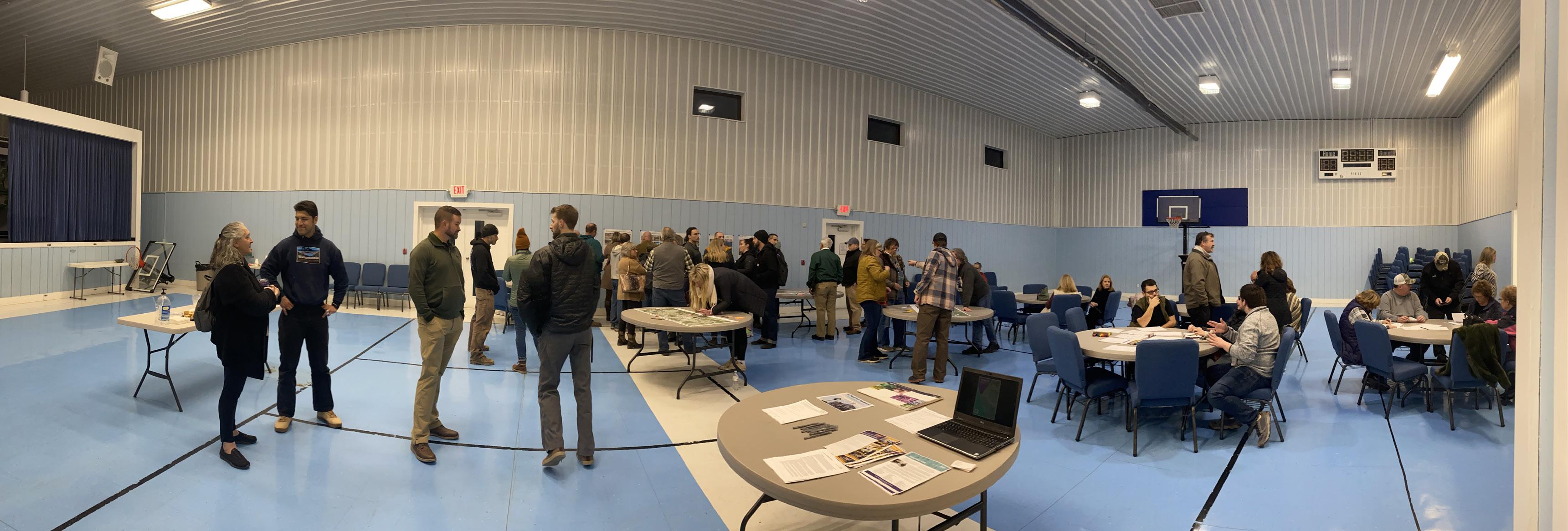

One tool that was utilized during the community engagement process for the Fayetteville Masterplan was an online engagement survey. This contained 20 simple questions in the form of short answer, multiple choice, and rating a series of statements on a likert scale. In addition to asking basic demographic information, the survey questioned participants on their opinions of Fayetteville’s existing conditions and what changes they would propose moving forward. The survey was created so that answers were recorded anonymously, to encourage all to participate and provide feedback. The CEC design team partnered with local government officials to advertise the survey and spread the word to as many community members as possible. This included both a post on Fayetteville’s Facebook page as well as advertising the survey link in a newsletter that is distributed to local businesses monthly. Printed copies of the survey were also available at Town Hall and were available at other public events during December 2022.
249 individuals participated in the this online survey, with approximately 75% of survey responders living within town limits. There was an overwhelming consensus that Fayetteville is a great, safe place to live. Parking, regulation of short term rentals, sidewalk connectivity, real estate expansion for housing and commercial developments, and utility improvements were a few of the top issues reported. It was also apparent that citizens do not want Fayetteville to lose its “small town charm.” Many are concerned that this will happen as the community continues to grow and experience the regional tourism impacts associated with the recent National Park designation of the New River Gorge. Several residents were also concerned that too much emphasis is being placed on planning and investing for tourism. As the town looks towards the future, they want to make sure that the community’s sense of place is not lost or forgotten. Residents want to see town improvements that improve the quality of life for those who live in Fayetteville, while also planning for future tourism.
Many issues that were identified in the community survey can be directly or indirectly associated with the large influx of visitors that has occurred with the New River Gorge National Park designation. Survey participants indicate that overcrowding of trails and other outdoor spaces makes it a challenge to enjoy the outdoors. Feedback indicates that Fayetteville is a place where small businesses thrive, however the seasonality associated with being an outdoor recreation destination has created challenges with the workforce and an irregular customer base for local businesses. This makes it hard for the planning of operations. There are desires for businesses to have consistent, expanded hours, and for a greater variety of public events to take place outside of the regular work day. Several comments indicate there is a lack of activities to do on the weekends, especially outside of the tourism season. In addition, wayfinding, while not an issue for locals, appears to be a challenge for visitors. The are only a few of the common, reoccurring comments received in regards to town/tourism conflicts.
At a first glance, it appears that Fayetteville is a wonderful community to live in. There are many positive aspects to the town that need to be preserved moving forward, as well as several areas for improvements. No matter what opinions exist among residents, tourism will remain in the region and can only be expected to grow. As the community looks to the future, they must work together to manage Fayetteville’s tourism and move past the “live here vs. visit here” mentality. At the same time, the town cannot forget about improving the quality of life for those who call Fayetteville home.
86% of Survey Responses Indicate Fayetteville is a Great Place to Live
92% of Survey Responses Indicate Fayetteville is a Safe Community
g ea
res den ia
and b&b
es den s
st ee s ee ng or gina
pa k ng
downtown
mounta n qua ty a ea
nvol ed Fun
suppo t ng qua n ness qua n
cool v bes
a r


recreation tour st
system ch dren Cha es on
deve opmen events
Nat ona Park vibe
town Communit y Park lose
Sense business Hope atmosphere
t ow n Small Love feel
19 ou doo s Cu u e Focus
l v ng owned good s ay orge a tract ons
S / 9 act PD
Fayetteville people outdoor Local businesses
rai s ami es act v t es
charm great Access downtown
Fami y h stor bu d ngs
bus nesses s ree Qu e F iend iness Roo s moved a mosphe e
ou doors ra f c ease neighbors sa ety
“While having tourists is great for the local area, we have to remember that there is more to a town than just tourism.”
walk sa e
r e s a u a n s l ve
cha m


c ose oca s H s or c ren a s our sm
kn t Beaut fu we coming seasona houses Vacat on events ho days A ordab e arch tec u e G ow ng
riend y place vibe shops stores hous ng
fe 30
cl mbing
Fa m fa me s marke
un ty ca ing home own
res aurants spec a commun ies
people
feel ng y a ea
b gges Food
h k ng re a l
Rt
“Have local police get out of patrol vehicles and be seen on foot in town, at the town park, and town events.”
“I don’t want to loose the small town feel, welcoming atmosphere to all people and the locally owned dominance of businesses, as well as the access to outdoor recreation opportunities.”
“I feel that Fayetteville is already safe, however I think there is a need for more street lighting throughout town and more sidewalks for walkability.”


Another tool that the CEC design team used to collect community input was conducting stakeholder interviews. Working with Mayor Sharon Cruikshank, Town Superintendent Matt Diederich, and the project steering committee, a list of potential stakeholders was developed. Included on the list were individuals who would be able to provide unique insight into Fayetteville and elaborate on some of the issues that the town faces. The list was comprised of:
• Local business owners
• Local developers


• Realtors
• Representatives from various local industries
• Local government officials

• Representatives from local and regional community groups

• Several local and state agencies

• National Parks Service
Throughout the course of the project, a total of 19 interviews were conducted. In addition, several other informal interviews were held when the CEC design team performed site visits. By talking to business owners, their employees, and others who were seen walking around town, CEC was able to gather more in depth input from a diverse audience.


Besides discussing Fayetteville from the perspective of each interviewed stakeholder, the CEC team developed an additional exercise to facilitate conversation. Pictured on the opposite page, the team created a SWOA analysis (Strengths, Weaknesses, Opportunities, and Aspirations). Similar to the more well known SWOT analysis (Strengths, Weaknesses, Opportunities, and Threats), SWOA is an analysis framework that can be used to help identify factors that impact the town and assist in creating an informed decision making process. However, in order to think about Fayetteville in a more positive aspect, the ‘Threats’ category from SWOT was replaced with ‘Aspirations.’ During this exercise, each stakeholder was asked to consider Fayetteville’s strengths, weaknesses, opportunities, and aspirations from their perspective. Not only did this provide information in a format that could be compared across all interviews, but it also provoked additional thought and conversation from the stakeholders. This led to other ideas being shared that may have not otherwise been discussed. The SWOA chart displayed on the opposite page shows the combined feedback received from all interviews. Additionally, each stakeholder was asked to identify what they felt Fayetteville’s three top priorities should be for the future. What is shown is listed in no particular order, but represents all of the prioritizes that were identified from each interview.
Being able to have a more personal, in depth conversation about Fayetteville led to the sharing of interesting insight that may have otherwise gone undiscovered in the other methods of community engagement. After doing several interviews, some common themes began to emerge. First, it quickly became clear that the loss of Fayetteville’s high school was a detriment to the community. Several individuals stated that the merging of high schools led to the loss of a main identifier for the community. Whether it was cheering on the high school sports teams or attending other extracurricular activities, the town enjoyed supporting the school and its students. The events brought the community together. Once schools were merged, many of the events now occur elsewhere. Since then, many felt that there are few events that have been able to bring the community together
like the school was historically able to. In addition, families are discouraged from moving to Fayetteville since the high school is not in town. It was mentioned that this is also seen as a negative aspect of the community. To help address this issue, it was repeatedly stated that an indoor recreation center or community center would help to fill the role that the high school once served. Being that the town is an outdoor recreation destination, an indoor recreation center would have an immediate user base, particularly when the weather is less than favorable. They also felt that this could be a space to organize new community events and facilitate other ways to bring local citizens together.
Another common theme that was identified throughout the interview process is Fayetteville’s lack of expansion opportunities, especially in the downtown district. There is limited real estate to expand businesses or residential buildings. The town is landlocked to the north by the New River Gorge National Park and to the south by Oak Hill. Moving forward, as the town continues to grow, Fayetteville will need to think about how all properties in town are utilized and identify infill projects to repurpose under utilized spaces. One example that was mentioned several times was the property owned by the Board of Education building and the school district bus garage. This space, while important, serves all of Fayette County and is not specific to Fayetteville. As this property is adjacent to Fayetteville’s historic downtown district and remains largely undeveloped, it sits on prime real estate. This is especially true when considering expanding commercial opportunities in Fayetteville. Identifying another location in the county that may be better suited for the Board of Education facilities and bus garage would then free up this existing property for future development. There are several other examples in town that this method can be applied to. Infill projects such as this are important to utilizing all properties in Fayetteville to their maximum capacity and will provide additional space for commercial and residential development.
A third common theme that could be seen across all interviews was the fact that Fayetteville is a great, welcoming community where all are able to thrive. There are many involved citizens who are working to create positive change within the town. The community is well connected and there are several different social “cliques,” where citizens with similar interested are able to connect and socialize. It is a location where small businesses are able to succeed and individuals are able to explore their passions and be outdoors. Most of all, it is safe. While everyone had their own opinions on how to address pressing issues facing the community, there was an overall consensus that Fayetteville is a wonderful place to live.
Completing the stakeholder interviews gave the CEC design team a better understanding of the challenges facing Fayetteville. In particular, it allowed the design team to look at the town from several different industry perspectives. As the project moved into the design stage, all feedback received was considered and proposed recommendations respond to the issues that were discussed.
Interview - Abbie Newell Director of Parks and Recreation, Fayette County Interview - Adam Stephens Arrowhead Bike Farm Interview - Melanie Seiler Active SWV Interview - John Tuggle, Lesley Taylor, Amanda Smarr Region 4 Planning and Development Council Interview - Tabitha Stover Fayetteville CVB Interview - Hannah Mitchell and Stacey Tope Love Hope Center for the Arts Interview - Andy Davis and Chance Raso New River Gorge Regional Development Authority Interview - Holly Clark Local Entrepreneur and Involved Community MemberThe below SWOA chart is a combination of all of the feedback received during the stakeholder interviews. Comments are listed in no particular order.

• Reputation of being a destination town
• Proximity to the New River Gorge National Park
• Many outdoor recreation opportunities
• Fayetteville is a place where small business owners can thrive
• Great people and community
• Fayetteville’s small town charm
• Fayetteville’s uniqueness
• Small town restaurants
• Fayetteville’s unique local history
• Great geographic location - within a day drive to many urban centers
• Many town newcomers are starting businesses, often women owned
• Town newcomers are engaged in the community and working for change
• Community desire to have more involvement from the arts community
• Fayetteville is appealing to outsiders
• Fayetteville is a safe and clean community
• Town infrastructure in need of improvements (sewage system, overhead utilities)
• Overall lack of broadband/high speed internet access
• Limited real estate and expansion opportunities in town for both residential and commercial
• Overall local mentality of not wanting change, “Us vs. Them” mentality
• Parking
• Community members working to transform the town are becoming burnt out
• Lack of professional jobs, jobs in general
• As the town continues to grow and evolve, risk losing local history
• Loss of high school was a loss of Fayetteville community identity
• Nothing to attract families to move to Fayetteville
• Seasonality of local economy
• Lack of affordable housing/housing variety
• Overall lack of signage, especially for visitors
• Sidewalks need improved
• Limited industries in town
• Limited child care resources
Potential Goals for Fayetteville:
Below are a list of the potential goals for Fayetteville that were developed in each stakeholder interview. Goals are listed in no particular order.
• Address parking issues
• Perform general improvements to Fayetteville’s infrastructure
• Create a recreation center/community center
• Improve the availability and variety of housing
• Improve town’s relationship with the DOH, work with the DOH more to achieve community vision
• Follow a planned approach to town development
• Expand and improve overall conditions and opportunities in downtown Fayetteville
• Create a greenway system to connect the town to outdoor trails and amenities
• Continue promoting Fayetteville and all that the town has to offer
• Better connectivity to New River Gorge trail systems and town amenities, such as grocery stores
• Expand and grow downtown area, provide more opportunities for small businesses

• Need for a hotel
• Find funding to implement proposed ideas from community and this masterplan
• Better utilization of existing spaces for activities - Identify properties in town that are available for development
• Town finally has tourists visiting - take advantage of this!
• Promote longer stays by visitors
• Develop a local business organization
• Create activities and programs for local community, do not focus on only tourism
• Need for housing and job opportunities as Fayetteville grows
• Beautification of town, increase town appeal for tourists
• Develop off season activities, work to turn Fayetteville into a year-round destination
• Opportunities for municipality partnerships to help support development projects
• Opportunity to become a shopping and eating destination for the region
• Bury utilities lines in town
• Overall town beautification
• Maintain viewsheds
• Maintain “Smallest Cool Town” feel
• Focus on supporting the needs of residents
• Utilize abandoned properties in town for new development
• Continue to develop Fayetteville into the East Coast’s Outdoor Recreation Destination
• Need for a sports complex/indoor recreation center to reestablish a sense of community
• Parking garage
• Hire a development director focused on fundraising and execution of completed masterplan
• Create an additional focus on attracting young families to move to the community/ region
• Increase support for senior citizens, advertise resources available for senior community



A final tool that the CEC design team utilized to collect input from the Fayetteville community was a public engagement event. On January 9, 2023, CEC facilitated an open house style event where community members were invited and asked to participate in a range of thought provoking exercises. A series of four stations were developed, each asking participants to think about Fayetteville in a different way. Approximately 80 citizens attended the event, and they were invited to participate in as much or as little as they wanted to. A sampling of the feedback from this event can be seen on the right.

• Station 1, General Information - An information sheet regarding the Fayetteville Masterplan project and the planning process to be followed, and printed copies of the community engagement survey for those who had not yet completed it.


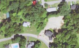


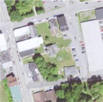


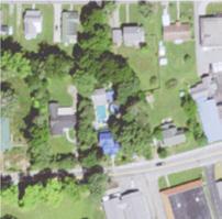


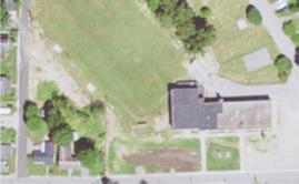


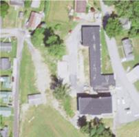


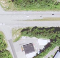


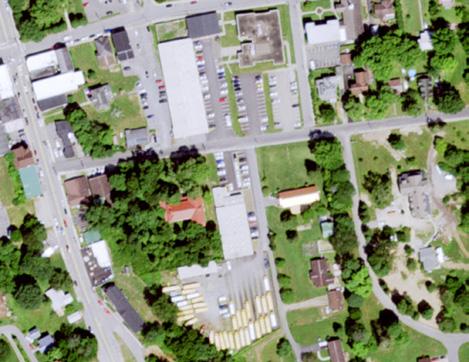


• Station 2, Mapping Activity - Presented with three aerial images at different scales, attendees were asked to write on sticky notes any relevant information that they felt the would be useful for the master planning team to know. The sticky notes were to be added at the appropriate location. Feedback received ranged from comments on vehicular and pedestrian circulation opportunities/ concerns to ideas for desired amenities and programs.

• Station 3, Visioning Exercise - The design team prepared drawing sheets with prompts and asked participants to draw “What you would like to see happen in Fayetteville?” or “How would you improve some of your favorite places in Fayetteville?” To help get started on their vision, the sheets contained basic outlines of a house, Court Street in the downtown district, or the facade of a business. Meeting attendees could then pick which sheet to draw on based off of their ideas.
• Station 4, Prioritization Exercise - Utilizing the concept of dotmocracy, a voting exercise, participants were given three green sticker dots and three red sticker dots. A series of images were then shown, representing multiple design options under categories such as housing, parking, and wayfinding. Participants were asked to consider all of the options shown to them and to add their green stickers to the images they felt were most important to Fayetteville, or that they would like to see implemented throughout the town. The red dots were reserved for those items that participants did not want to see in town.
The completion of this public engagement event would give the CEC design team the opportunity to interact with the local community and have discussions that would reveal more information than the online engagement survey. Overall attendees appeared eager to provide their opinions and were optimistic about the end result of this master planning project. Perhaps the most popular station was the prioritization exercise, which gave citizens the chance to provide opinions in a way that was visually appealing, interactive, and quick to ready and understand. Following the completion of this meeting, the CEC design team analyzed the information collected and utilized it to develop the recommendations presented in this document.

































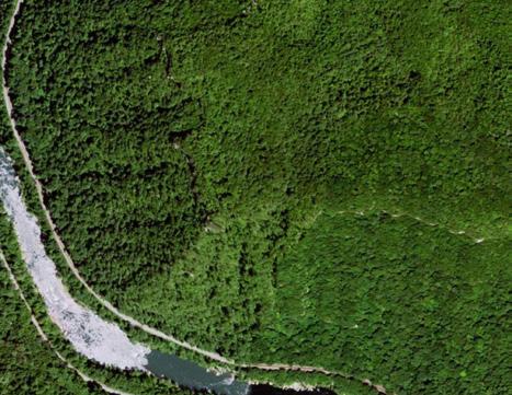


Dotmocracy Results - Conflicting / Least Favorable


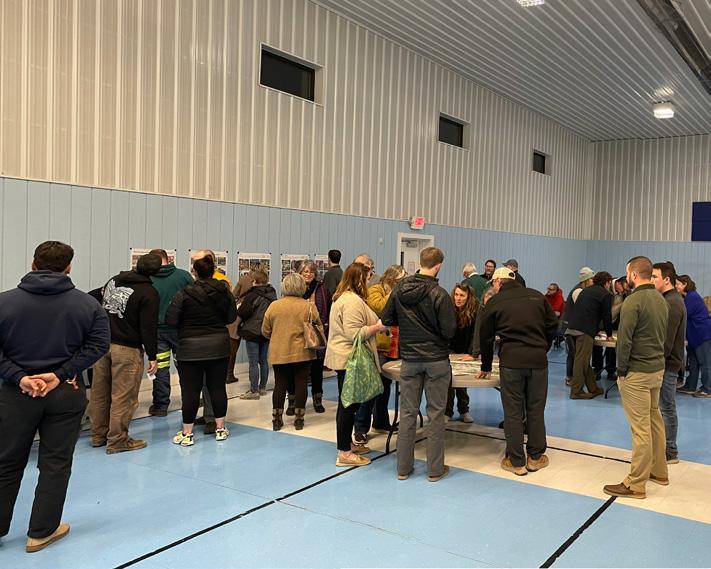


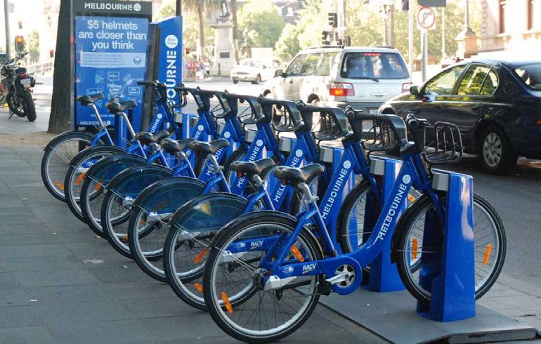


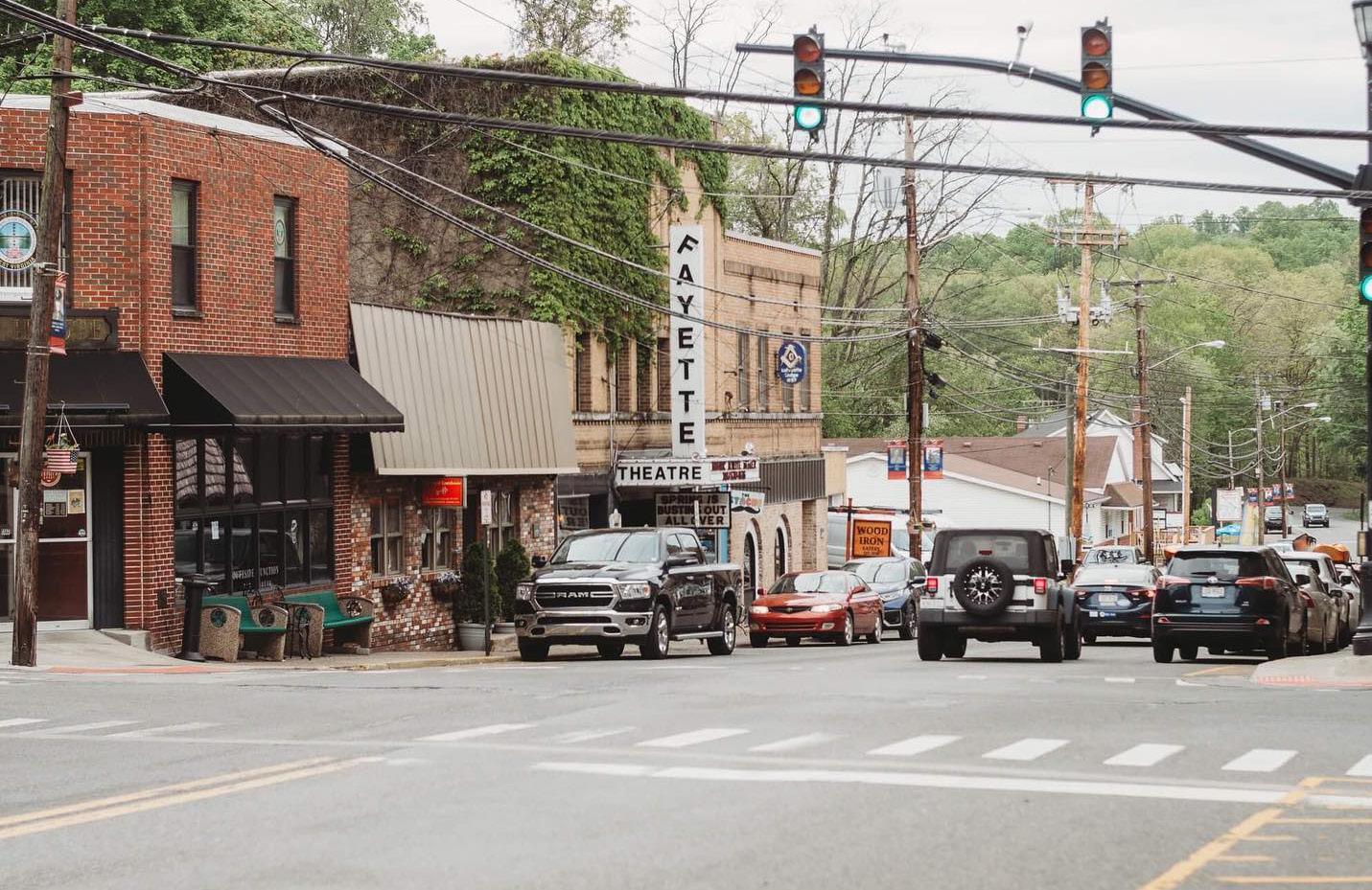

esri.com/tapestry
509 households are Heartland Communities
52.4% of households are in this segment
Heartland Communities: Cozy Country Living LifeMode
Well settled and close-knit, Heartland Communities are semirural and semiretired. These older householders are primarily homeowners, and many have paid off their mortgages. Their children have moved away, but they have no plans to leave their homes. Their hearts are with the country and they embrace the slower pace of life, but actively participate in outdoor activities and community events...
Learn more...
Click
The rural economy of this market provides employment in the manufacturing, construction, utilities, healthcare, and agriculture industries.
These are budget savvy consumers. They stick to brands they grew up with - know the price of goods. Buying American is important.
Skeptical about their financial future, they stick to community banks and low-risk investments.
Household Type: Single Family
Employment: Svcs; Prof Median Age: 45.6
They enjoy country music and watch CMT. Motorcycling, hunting, and fishing are popularwalking is the main form of exercise.
Median Household Income: $54,090
Residents trust TV and newspapers more than any other media.
Education: 35.9% have a college degree
5,465 households are Economic BedRock
48.7% of households are in this segment
Economic BedRock: Rustic Outposts LifeMode
Close to one in five employed residents work in mining, oil and gas extraction, or quarrying industries. Economic BedRock is a very rural, primarily Southern market. Married-couple families reside in over half of the households, with a quarter of householders that live in...
They hold strong religious beliefs. Many residents did not go to college. They make purchases for today because tomorrow is uncertain. Shop at department and discount stores.
Household Type: Single Family; Mobile Homes

Employment: Svcs; Prof; Constr
Own a domestic truck, dog, and ATV. Hunting, yard work, and gardening popular activities.
Median Age: 45.7
Learn more...
Dine at Dairy Queen, Pizza Hut, Sonic Drive-ins, and Golden Corral. Budgeted vacations are taken within the US, not abroad.
Median Household Income: $45,128
Click facts to 'Explore for more' details
They are slow to adopt technology. TV is the main source of information, news, and entertainment.
Education: 28.0% have a college degree


