4 minute read
Geohazards, engineering, and infrastructure

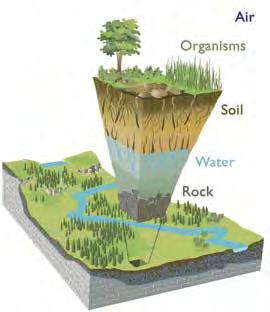
Earthquakes, landslides, floods, tsunamis, and volcanoes cost lives and billions of dollars. Geoscientists seek to understand the processes responsible for these geohazards to assist in disaster preparedness. Geoscientists also provide critical knowledge about the land and availability of local earth materials to ensure the wise location and safe development of infrastructure.
DID YOU KNOW
that a layer of clay can be ‘sensitive’?
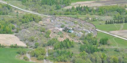
Underlying parts of Ontario and Quebec is a 15 to 100 metre-thick layer of clay deposited in the ancient Champlain Sea. Geoscientists have studied this clay and determined that because of its distinctive physical and chemical characteristics, it is ‘sensitive’ to river erosion, earthquakes, and human disturbance, and subject to sudden failure, which can cause catastrophic landslides. More than 250 collapses related to this clay have been identified; the most catastrophic was in 1908 at Notre-Dame-de-laSalette, Quebec, where 33 lives were lost.
S. Halchuk, Natural Resources Canada, 2018/FBY
The Earth is a dynamic planet and we must understand the behaviour of the ground beneath our feet in order to live and build on it safely. Geoscientists help ensure the safety of communities by studying the Earth processes linked to natural hazards. Mapping, remote sensing, geophysical surveying, and modelling are all used to identify areas susceptible to natural hazards. Findings are shared with engineers, policy-makers, public safety and emergency responders, and others to prepare and build safer communities.
Geoscientists, particularly engineering geologists and geomorphologists, study both the structure of the earth where infrastructure is built and the earth materials from which it is constructed. These geoscientists collect the data and build an understanding of the Earth and its materials that engineers and others rely upon to build a wide variety of infrastructure (including roads and railways; mines, quarries, and petroleum wells; dams, pipelines, bridges, and buildings) safely and with minimal public and financial risk.
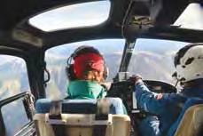
LIVING IN EARTHQUAKE ZONES Geoscientists, including seismologists, geophysicists, and structural geologists, continuously assess the seismic hazards for all parts of Canada. They are developing a better understanding of earthquakes and the hazards they pose, but are still a long way from accurately predicting exactly when and where an earthquake will strike. Although earthquakes can happen almost anywhere, the west coast of Canada is particularly vulnerable because of the movement along faults related to the ongoing collision of the Pacific and North American tectonic plates. Geological evidence suggests that strain between these plates is building again. Geoscientists continuously monitor earth movements in this
region and gather evidence of the historical movements on these faults and their impacts. Structural engineers and construction experts are using this information to update building codes and ensure that structures are built safely and are sufficiently robust to withstand the potentially strong earthquakes that strike this coast every 200 to 850 years.
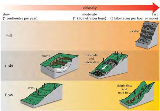
ROCKS IN MOTION In the Canadian Cordillera, steep terrain coupled with abundant precipitation results in many rock and soil slides and rock and debris flows. These pose a hazard to people, infrastructure, and homes downslope. Geoscientists study slopes susceptible to such hazards to determine how and under what conditions they might fail and to predict the location and severity of the hazard. Working with engineers, they develop measures to mitigate the risk and working with municipalities, they inform land-use planning decisions. where erosion is most likely to occur, how earth material will be transported, and predict where it is most likely to be re-deposited. This work is another example of the contributions geoscientists make towards ensuring resilience of our infrastructure and communities.
Sudden events, such as tornadoes, hurricanes, and intense rainfalls or snowfalls, as well as
R. Turner/FBY
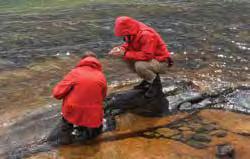
EROSION, DEPOSITION, AND COASTLINE LOSS Sudden weather events or the steady daily action of water, wind, and freeze/thaw over prolonged periods of time can cause significant erosion, movement, and the redepositing of rocks and soils. Geoscientists study the behaviour of both sudden and gradual natural earth systems and predict major flooding may pose a threat to life and infrastructure. Geoscientists measure the impact of past events, understand the processes by which these events can affect the land and provide advice on where to build and what potential impacts need to be mitigated when doing so, helping to protect lives and property.
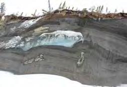
Rising sea level worldwide is causing added coastal erosion and coastline loss. This is a particular concern along low-lying coastal areas such as Canada’s Arctic and Atlantic shorelines. The loss of permafrost in the North is an added concern because land stability is suddenly reduced and increased amounts of sediment and water are being released into the ocean over huge areas, adding to erosion and deposition, and overall sea-level rise. Geoscientists are examining evidence of past erosion and monitoring current erosion in order to best advise coastline communities.
RED RIVER FLOOD MANAGEMENT, MANITOBA
The Red River in Manitoba flows through a shallow valley surrounded by a relatively flat clay plain. When river levels rise during the spring thaw, floodwater can spread some 40 kilometres across the surrounding plain. This has resulted in the flooding of numerous rural communities and, in some years, even the city of Winnipeg, where approximately 800 000 people reside.
Geoscientists scoured the landscape for evidence of previous floods and collected geological evidence indicative of their frequency and magnitude and the capacity of the river to contain them. This information informed a $665 million expansion of the Red River Floodway, completed in 2010, that now safely diverts floodwater around the city.3
3https://www.gov.mb.ca/flooding/fighting/floodway.html
DID YOU KNOW
that geoscientists are keeping their eyes on the coastline on which the northern community of Tuktoyaktuk, Northwest Territories, is built? It is rapidly eroding as a result of a combination of sea-level rise and thawing of permafrost. Some buildings have already been lost and the community may eventually have to move to escape the sea’s encroachment.