5 minute read
Geoscience at the cutting edge of innovation

GEOSCIENCE AT THE CUTTING
EDGE OF INNOVATION
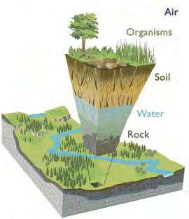
Geoscientists need more than boots and a hammer to provide the knowledge needed to discover, extract, manage, and protect Canada’s resources and to provide decisionmakers with the tools to make informed decisions about land use and protection from natural hazards. Using sophisticated techniques and tools, geoscientists collect gigabytes of information about the Earth to generate high-level science that helps plan for the wise use of finite resources and the social and environmental well-being of society.
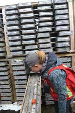
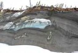
DATA A single rock sample can provide a trove of information, such as its location, density, and mineral and chemical composition, and its ability to conduct electricity, transmit a seismic wave, or to contain water or permit its flow. Geoscientists collect data at every scale, from the composition of tiny bubbles of fluid trapped inside a single mineral crystal or pollen grain that fell to the sea floor during the age of the dinosaurs, to the dimensions of mountain ranges and continental margins. They are specialists at data collection, management, and interpretation. Historical paper archives of reports and geological maps are becoming increasingly rare. Old maps, photographs, and reports are digitised and archived on modern digital media for safekeeping and easy access by modern day geoscientists.
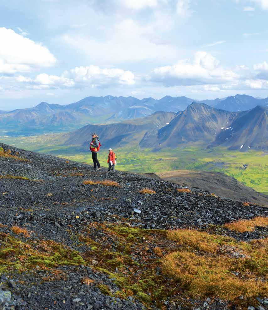
THE GEOSCIENTISTS’ TOOLKIT Today, geoscientists are highly skilled professionals with an extensive knowledge of rocks, strong logistical and operational skills, and the ability to work in multi-disciplinary teams. They are also able to work with the latest in modern technology and information. For example, recent breakthroughs in analytical technology allow geoscientists to quickly and accurately measure the chemical composition and mineralogy of rocks in the field, observe the chemistry within single mineral crystals, or date long-term physical changes in the Earth using isotopes produced by cosmic rays. Global Positioning Systems allow geoscientists to know precisely where they are located at all times, vastly improving their ability to record and map their observations, and Virtual Reality technologies provide exciting new ways to visualise the Earth in three dimensions (3D). Society’s needs for geoscientific information are increasingly sophisticated, and the scientists who provide answers are meeting the challenge. Geoscientists are on the cutting edge of innovation when it comes to finding new ways to use many of these developing technologies.
H. Falck
CYCLICITY, FLEXIBILITY, AND NEW DEMANDS The mining and energy industries tend to be cyclic, reflecting the economic expansion and contraction of different commodity markets over time. Notwithstanding this cyclicity, the work of geoscientists in industry continues to meet evolving needs, supporting the economy with innovative search techniques, new discoveries, and productivity improvements. Geoscientists’ basic understanding of earth processes is key to their ability to meet these challenges.
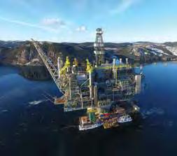
Rapidly developing technology implies increasingly sophisticated use of natural materials in our personal lives, in our industrial processes, and in environmental protection. This is particularly evident in emerging high technologies and renewable energy applications. Computers, cell phones, electric and hybrid automobiles, wind turbines, solar panels, and a wide range of personal and industrial high-technology devices require new sources of specialty metals, such as rare earth elements, cobalt, and lithium, which a few short years ago were little in demand. This, in turn, requires broadening in the requirements for geoscientific expertise and ever-evolving geoscientific skill sets needed to find and develop these resources. Geoscientists are in the forefront of changes in materials science, and in developing techniques to explore for and recover these critical materials.
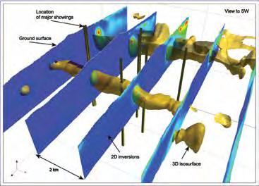
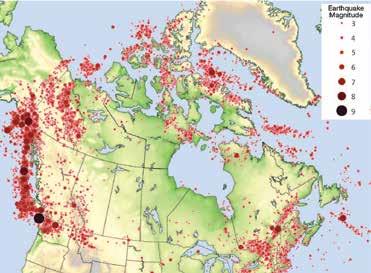
3D MODELS OF THE GROUND BELOW OUR FEET Although direct access to the subsurface is limited, geoscientists have developed remote sensing techniques that are integrated with surface observations of rocks types and structures to create 3D models of underground geology. Geophysical surveys at site, local, and regional scales can now produce precise models of the geological layers and structures in the subsurface. In the same way as an X-ray or MRI scan allows us to ‘see’ inside the human body, geophysical measurements coupled with knowledge of rock properties can be used to visualise the interior of the Earth. These subsurface models help geoscientists to predict the location of resources and assess the risks from natural hazards.
CANADIAN GEOSCIENTISTS IN A CHANGING WORLD Developing our natural resources, while protecting the environment that sustains life
Condor Consulting
on Earth, is key to the continued advancement and indeed survival of civilization in the 21st century. Global populations are steadily growing, and their increasing demands on the resource base are supplemented by those of emerging economies that rightfully aspire to the high living standards that are experienced in the developed world. The challenge for Earth’s people is to locate and utilise the necessary natural resources, and to do it in such a way that we do not compromise the health of the planet and its environments. Living sustainably, within the limits of our resources, increasingly requires the knowledge and skills of geoscientists who understand how the Earth works and have the knowledge and skills to address the problems that are posed by increasing numbers of people and their demands on the resource base of the planet. Canadian geoscientists are in the forefront of learning and application of geoscience and will continue to play a key role in our quest to live well and sustainably on planet Earth.
SJ Geophysics
TECH DEVICES
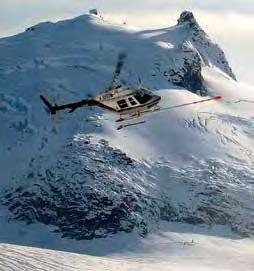
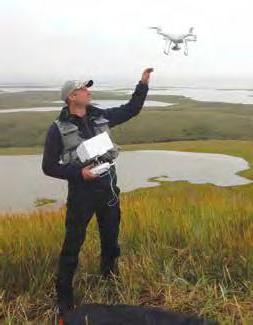
Geoscientists are at the forefront in adopting new devices as work aids and tools: drones (aerial surveys of field areas), supercomputers (data storage and modelling), wearables (GPS location devices), satellites (remote sensing and geophysics), driverless vehicles (isolated mine sites and radioactive uranium mines), virtual reality (3D modelling of petroleum reservoirs, mineral deposits, and aquifers).
NOTES
GEOSCIENCE AND CANADA UNDERSTANDING OUR EARTH: THE VITAL ROLE OF CANADA’S GEOSCIENTISTS 27
Geoscience and Canada