4 minute read
Geoscience, environment, and the economy

Geoscientists work across a range of disciplines to serve the needs of society. By working together with other scientists, geoscientists help to provide a complete picture of environmental issues to help decision-makers keep Canadian people, wildlife, culture, and landscapes safe and healthy, in balance with the strong economy needed to support a thriving society.
DID YOU KNOW
that Canada’s Earth observation satellites provide essential information on ocean, ice, land environments, and the atmosphere. Geoscientists interpret images captured by satellites to monitor and protect the environment, manage resources, and ensure the safety and security of Canadians.
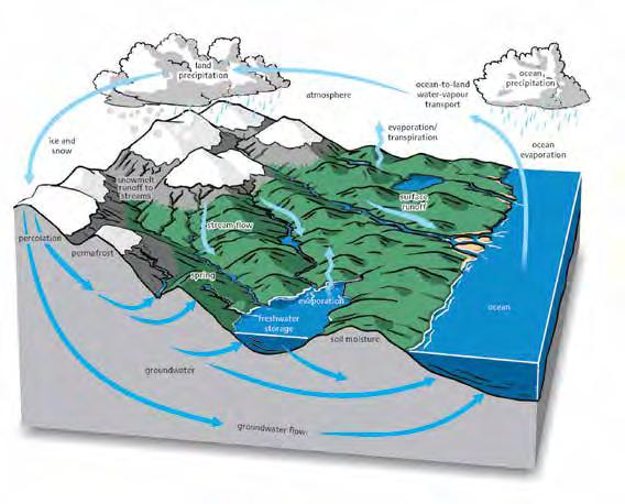
NASA/Chris Hadfield/ Wikimedia Commons Most people think of environmental issues only in terms of their biological and chemical components. However, the interaction between humans and the environment also has an important geoscience component. Consider how processes such as weather systems, surface drainage, coastal erosion, and deposition, or even the location of natural geological features affect the environment – addressing all of these requires an understanding of the relationship between the underlying geology and ecosystems.
Glaciologists, geochemists, hydrogeologists, geomorphologists, soil scientists, and inland water scientists (limnologists) all address environmental issues. Geoscience expertise and information are required by government departments, regulatory bodies, and industry to make sound, sustainable, and informed decisions with full knowledge of potential consequences to the natural environment.
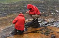
Canada’s wetlands, rivers, and coasts are changing because of natural processes and accelerated change resulting from human activity. Environmental geoscientists collect data about these changes, interpret the results, and communicate the likely environmental consequences.
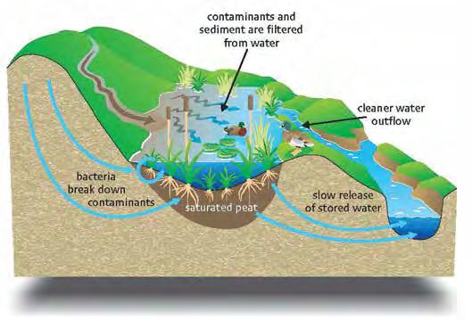
GEOSCIENTISTS AND THE CRITICAL ZONE The Critical Zone is the Earth’s near-surface environment where soil, rock, water, air, and living organisms interact, influencing the availability of life-sustaining resources. In the Critical Zone, a series of physical, chemical, biological, and human processes and reactions occur including recirculation of chemicals, water storage, and the movement of contaminants. Geoscientists play an important role in the understanding and management of the Critical Zone, including conducting scientific research on the role of geochemical processes, developing plans to manage water
J. Chorover/ Wikimedia Commons
resources and mitigate groundwater pollution, and informing government policies that protect the natural cleansing capacity that this key zone provides.
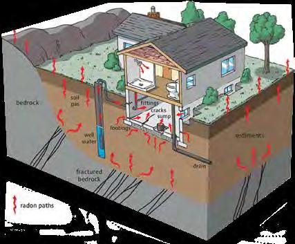
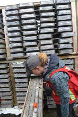
CONTAMINATED SITES Environmental geoscientists conduct environmental site assessments, remedial action planning, risk assessments, and monitoring and compliance testing of contaminated sites. They provide critical knowledge and advice to decision-makers and the public on the potential environmental impacts of a wide variety of commercial, industrial, and recreational activities in both urban and remote areas. Environmental geoscientists also have the challenging role of cleaning up sites where the soil, groundwater, and sub-surface have been contaminated by past commercial or industrial activities. Their role is to identify contaminated soil and water and ensure that it is all removed to be treated off-site, or that it is treated in situ by applying sub-surface treatment technologies to remove the contaminants.
Adapted from Turner et al./FBY
Remediation is defined as the removal of pollution or contaminants from soil, groundwater, sediment, or surface water for the protection of human health and the environment. The term rehabilitation is used in the aggregate and building stone sectors to describe the restoration of quarry or pit lands to their former use or condition, or another use or condition that is compatible with that of adjacent lands. The term reclamation is used in the mining sector to describe the restoration of soil, vegetation, and surface water features, modified during the life of a mine, to a quality, quantity, and appearance that represents pre-development conditions or the baseline environmental conditions measured and described during the beginning of mine development.
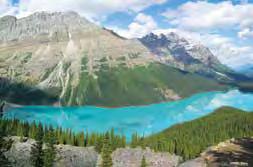
GEOTOURISM AND PROTECTING AREAS OF GEOLOGICAL SIGNIFICANCE Geoscientists contribute to the protection, study, preservation, and display of sites and landscapes of geological significance. Many Canadian sites are recognised for their exceptional geological value and protected for educational and scientific purposes through the UNESCO World Heritage site program. These include Newfoundland’s Gros Morne National Park – where remnants of ancient ocean crust are preserved at surface – as well as several internationally significant fossil sites, including the Joggins Fossil Cliffs in Nova Scotia, Mistaken Point in Newfoundland, Miguasha National Park in Quebec, and the Burgess Shale in Canadian Rocky Mountain Parks, British Columbia. Canada also participates in the UNESCO Global Geoparks program, sites that are managed with an emphasis on education, protection, and sustainable development. As of 2017, there were two designated Global Geoparks in Canada, the Stonehammer UNESCO Global Geopark in New Brunswick and Tumbler Ridge UNESCO Global Geopark in British Columbia. Preservation of these geologically interesting or significant sites can also provide an alternative economy, especially in rural areas, as millions of tourists are attracted to these strikingly beautiful geological landscapes.
CASE STUDY: MINING WASTEWATER MANAGEMENT THROUGH GENOMICS
Geoscientists are currently studying the ability of naturally occurring bacteria, present in mine wastewaters, to biodegrade and cleanse mine wastewater and materials (i.e., tailings). By studying these micro-organisms’ genes and their functions (genomics), promising new adaptive and flexible solutions can be identified to better assess, monitor, and remediate mining waste.