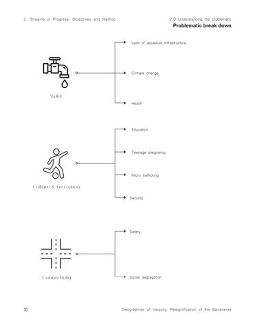
Water
Culture & recreation Connectivity
2.0 Understanding the problematic Problematic break down
Lack of aquaduct infrastructure
Climate change
Health
Education
Teenage pregnancy
Micro trafficking
Security
Safety
Social segregation
Geographies of inequity: Resignification of the Bananeras
Besides the main problematics mentioned above, we find in the PGT other —not minor but less prioritized— problematics that represent big opportunities for the progress of the municipality and therefore, the community. According to the PGT there is a project to position the Zona Bananera as a commercial municipality. Attract a higher percentage of purchase/spending to small local businesses. This program aims to improve the productivity and competitiveness of micro and family businesses in the municipality of Zona Bananera, both in the urban and rural sectors; it seeks to insert these units into the value chain of the existing clusters in the area (palm oil, banana and coffee industries). This program aims to improve the productivity and competitiveness of micro and family businesses in the municipality, both in the urban and rural sectors; it seeks to insert these units into the value chain of the existing clusters in the area (palm oil, banana and coffee industries). The goals are strengthening the commercial and productive activity of the municipality: training and incorporating appropriate technologies to produce more and with the quality demanded by the market, eliminating intermediaries, to improve the income of small producers. The agricultural sector is part of the identity of the Municipality, and there are multiple options in tourism, crafts and other cultural expressions are also important alternatives for this purpose. (PGT, 2020 – 2023)
It’s important to notice that even with the massive systematic problems in the municipality, this area is still part of the Colombian Caribbean, and it sits just a few kilometers apart from one of the most important touristic areas in the whole country. To be specific, is strategically located 40 kilometers from the port area of Ciénaga and Santa Marta, crossed by the railway network, and the Ruta del Sol highway that connects it to the interior of the country on the Bogotá/Bucaramanga corridor. We can find opportunities to create employment from the perks of the municipality such as its natural, historical and cultural richness. From the historical point, we can think of a landscape project for the collective memory and embrace the historical events to repair the society and make sure nothing like the Bananeras happen again from a solid base of local identity. High potential places for this project could be the railway that nowadays works as a cargo line, the Banana Museum and other costumes and carnivals that are consider intangible heritage.
“Likewise, the arrival of non-resident foreign visitors has increased. In 2012, the department received 15,872 foreign tourists; by 2018, the number had
Geographies of inequity: Resignification of the Bananeras
practically doubled: 30,945. These numbers are promising for promoting tourism in the municipality as an alternative to boost the economy, which is growing and can be directed towards greater production of profits, as a path to sustainable development.” (PGT 2020 – 2023)
In the cultural and natural aspect, there is a huge opportunity to replicate the tourism empire that the people from the Coffee region of Colombia have built for decades, where all the attractions surround the main agricultural product; from tours of the crops, experience the process from the grain to the final product, tastings, all other edible products that one can imagine, to even themed parks. There is a project to design four agrotouristic routes to advertise and sell as touristic services; Knowledge and tastes of Zona Bananera, The Banana route, Route of the African palm and Route of the Pancoger1; as agricultural activity is led by banana crops (11,250 hectares) and oil palm (55,000 hectares), export products to the United States and Europe, representing just over 94% of the cultivated area.
Currently, as everywhere else in the world —one could say— there’s a problematic with the Energy service. In general, the quality of the electric fluid is bad, It affects the commercial activity and the academic services, very similar to the situation in the rest of the Caribbean cost where there are constant interruptions of the system and the fluid presents frequent power oscillations that compromise the integrity of the few functioning equipment’s. This problem not only limits the normal activity of the production processes, but also generates over costs. The local government already has proposed a program to guarantee electricity generation through the implementation of solar energy. Although being a correct line of thought, I consider we don’t necessarily need to stop on solar. It is of the utmost importance to think of the most efficient way depending on the characteristics of the area. We can of course have solar energy in mind but also think about wind and especially water generated electricity as well. For instance, there is a considerable opportunity if one thinks about the extense net of water streams found in the area.
Both tourism and energy are issues that may not be as prioritized because they don’t represent a basic need as water or the other problems discussed before, but they are opportunities to develop a society that is self-sufficient and sustainable, characteristics that with the climate crisis taking over the world are crucial for the success of communities, now more than ever.
2.1
2.1 Opportunities Opportunites break down
Employment generation
Identity & appropriation
Collective historic memory
Economy booster
Resource efficiency
Equipment integrity protection
Transport availability
Geographies of inequity: Resignification of the Bananeras
1. Masterplan that targets the main problems of the area —water accessibility, lack or recreation and sports spaces and connectivity— and that focuses on the enhancement of the quality life of the people that inhabit the area
2. Enhance current areas of recreation and open space and find opportunities to expand the mentioned. This in order to foster the appropriate usage of free time, prevent kids from teenage pregnancy and micro trafficking, and promote physical and mental health.
3. Generate water reserves that store rainwater and develop a water treatment and management method that takes advantage of the massive network of water streams to provide clean potable water for the inhabitants.
4. Design a network of road infrastructure to improve connectivity between the urban and rural areas of the municipality and provide an electric system of transportation that is both sustainable and accessible to the population with limited resources.
5. Bring tourism to the area. There is a very strong tourist area just a few kilometers to the north because of Santa Marta —Capital of Magdalena region— and the Tayrona natural park —Natural jewel of the country with a massive diversity of ecosystems beach, tropical rainforest and glaciars form the Sierra Nevada—. Develop a system that tries to replicate the one in the touristic Coffee region of Colombia. Focus on the development of touristic experiences, tasting, knowledge on the harvesting process, parks, and all kinds of services around the plantations. Take advantage of the biodiversity hotspot where the area is located.
6. A landscape project that is aligned with the historical collective memory. Never forgetting where we come from and what we’ve been through to appreciate the beautiful and diverse agroecosystem that we have and that is unique in the world.
7. Develop a project that respects nature and the ancient knowledge and cultures that reside in the mountain -Sierra Nevada- in order to become culturally and socially responsible but also sustainable.
8. Design of public space to generate social and cultural integration between the inhabitants of the rural and urban areas and enhance quality of life.
Culture & recreation
Geographies
Connectivity
The objective of the research of the Zona Bananera is to develop a master plan of a Landscape project that directly influences and enhance the quality of both the urban and rural environment and the sense of community treasuring historical and cultural values and strengthening the appropriation and identity of the territory. In order to accomplish this, firstly, I made a general analysis of the basic parameters needed for a Landscape architecture project —place, characteristics, conditions, historical context and users—. Thus, I was able to do a reading of the main issues and identified the opportunities of the area. This base data allow us to set goals and start giving direction to the project, answering some questions such as where is this project? Why is it important to do a Landscape project here? Who is it for? In this way we give purpose and body —arguments — to the proposal. Moreover, it is necessary to find references on how to develop a successful project. Taking in account the problematics identified, there will be research for specific case studies for Water, Energy, and open public space in order to find inspiration and systems for soft infrastructure that have worked in areas with either similar conditions or problematics. Once the general analysis, the problematic and the case studies are understood and related to each other, there will be a concept development phase that synthesizes the idea of the project. Finally, there will be a proposal of a pilot project that will be broken down into different scales, in order to make it real, from the urban master plan scale to the detailed construction scale so we make sure the project is coherent within both space and matter. The idea of a pilot project implies that it is proposed a closer scale for just one of the eight studied towns. Having in mind that they all share the same conditions and characteristics, the goal is that the pilot project could be easily replicated on the other seven towns. To accomplish this, the project with include a series of guidelines with typological solutions —corridors, areas and objects— that can be applied in the selected areas for intervention in the general masterplan. The result of this dissertation should be a document with the analysis and trajectory of the project and a set of technical plans to balance both concept and execution.
Geographies of inequity, Restoration of the Bananeras
3. Strategy for water accesability and public space
Summary
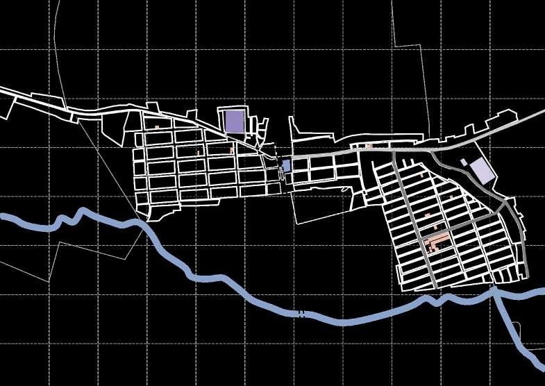
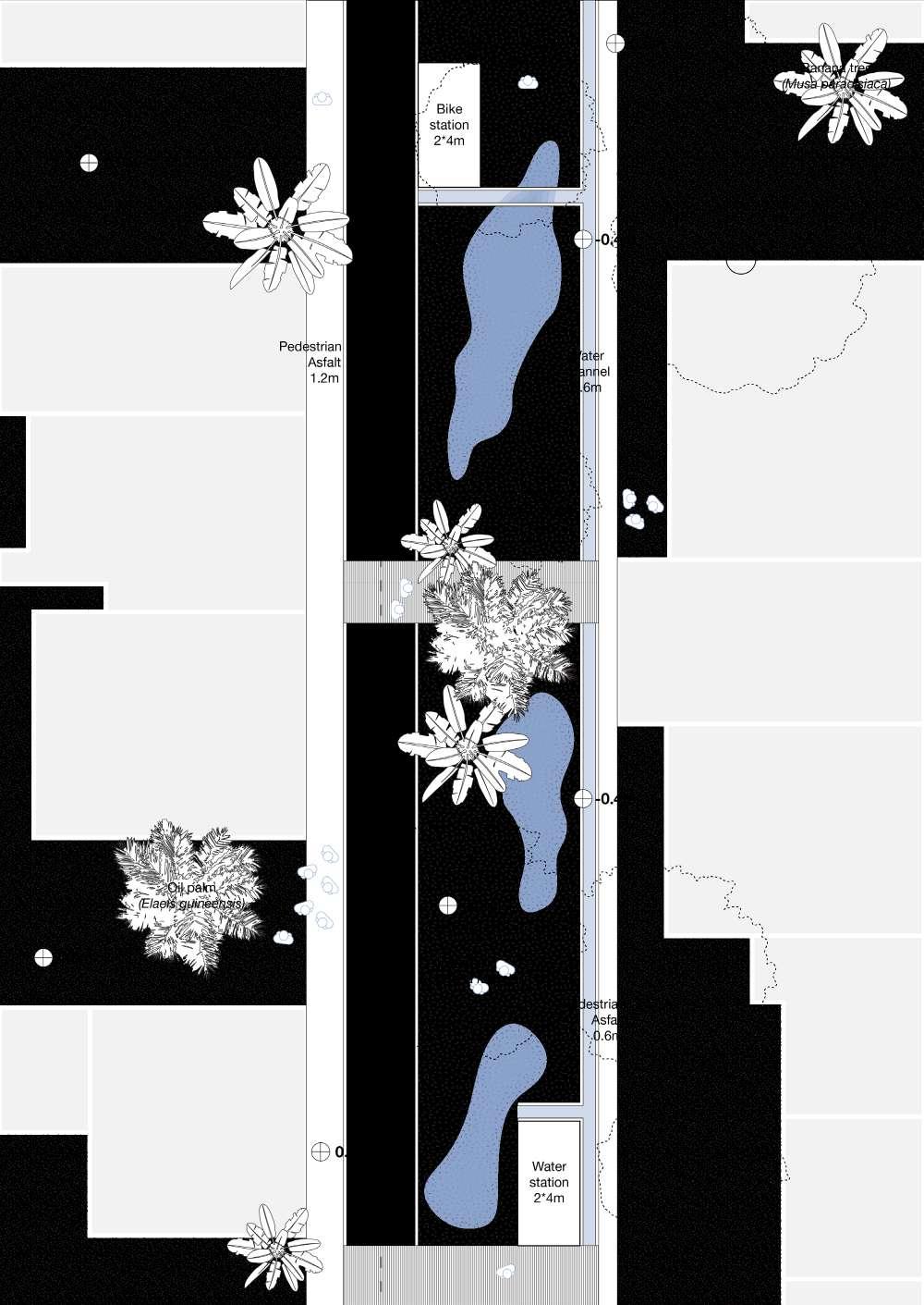
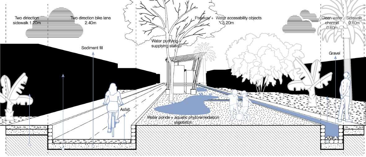
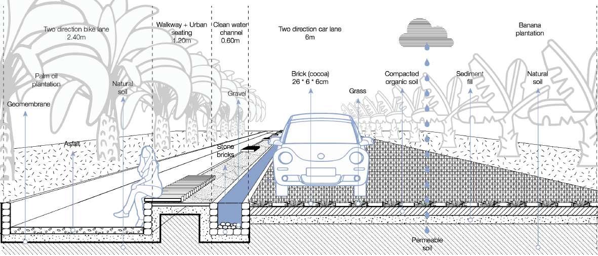
The strategy aims to integrate the area both vertically and horizontally by utilizing the railway infrastructure as a tool for collective memory. This serves as the project’s central axis, linking the eight towns. Additionally, six rivers are chosen to establish connections between the biodiversity hotspot s—the swamp and the mountain— addressing the disconnection caused by the floodplain and highway. Two key components structure the project: green corridors and sustainable strategies. The four types of corridors that establish a clean water network and public space are: a corridor that filters water from the mountain and connects to the municipality; a corridor utilizing the existing railway as a primary route linking all towns within the municipality; a pedestrian-only corridor with parkways at its center; and a corridor that accommodates vehicular traffic while ensuring soil permeability and pedestrian accessibility. While the four sustainable strategies are: Phytoremediation, using native plants to absorb toxins and rehabilitate mining-affected soils; Water purification, through natural filtration systems with artificial wetlands; Rainwater harvesting, through objects for collection, cleaning and supplying systems; and Solar panel hubs, to power electric bike stations, supporting sustainable transport and renewable energy use.
Project area

Geographies of inequity: Resignification of the Bananeras

Topography: There exists a massive geographical division between the mountain slope and the plain. This substantial gap between ecosystems is exemplified by a glacier mountain reaching an elevation of 5,775 meters above sea level, contrasted with a plain that transitions rapidly to the swamp, which, situated near the sea, descends below sea level at a swift rate. The area is marked by this dramatic elevation contrast, highlighting a significant gradient in the climate that goes from tropical rainforest thermic floors to high moors.
Geographies of inequity: Resignification of the
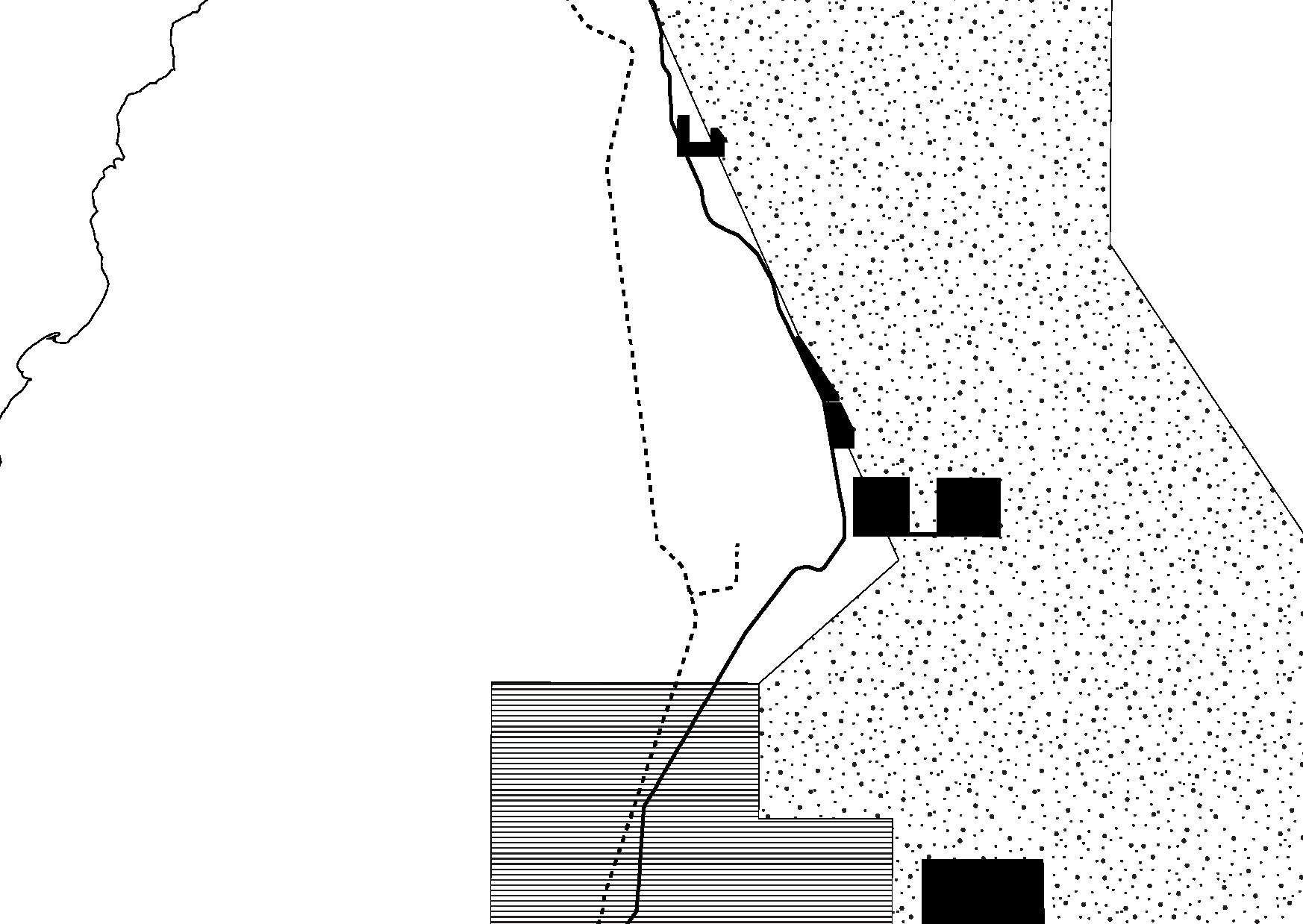
Mining: Is evident that the current exploitation, marked in black, is taking place on the crystallized basement of the mountain, while exploration areas, marked with lines, are located both in the crystalized area and the interior of the municipality. The exploitation zones, are situated in close proximity to the Ruta del Sol highway. This strategic positioning suggests that these areas have been deliberately chosen to facilitate the efficient transportation of extracted materials to the capital and interior regions of the country.

Water: On the mountain side (right) the water network is dense, characterized by numerous major rivers and streams naturally shaped by the terrain. The strong slope contributes to the richness of the alluvial plain (middle) in streams, it is also visible the appearance of human-shaped lines indicative of irrigation systems designed to connect with the primary network. Approaching the swamp (left), the streams progressively diminish, likely due to the reduced slope, generating floodplain conditions, where water tends to stagnate.
Geographies of inequity: Resignification of the

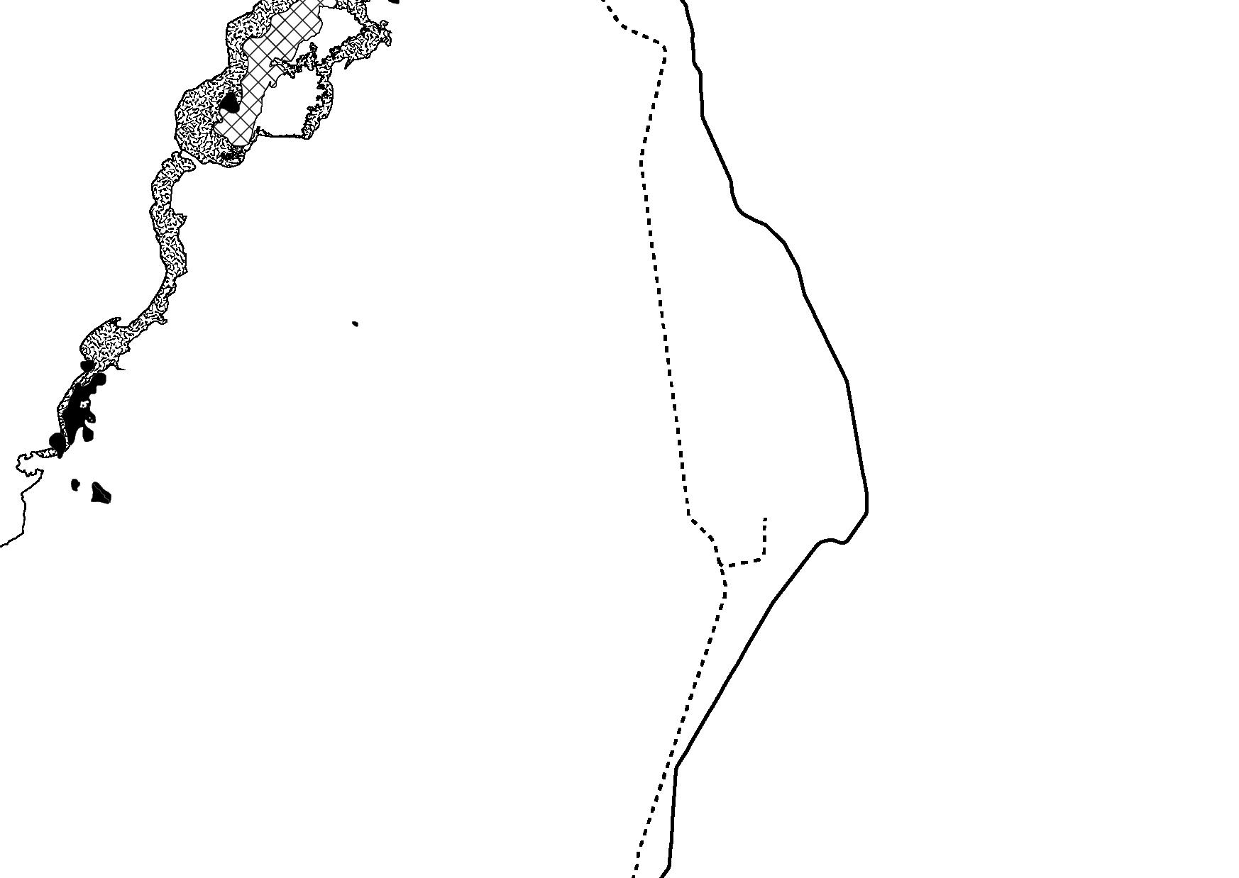
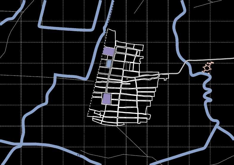
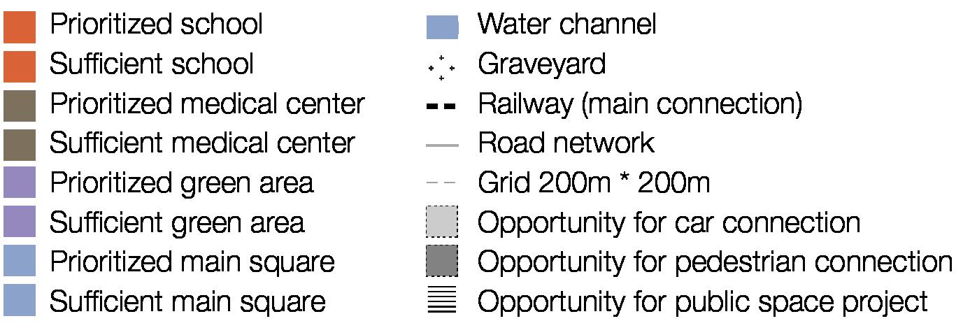
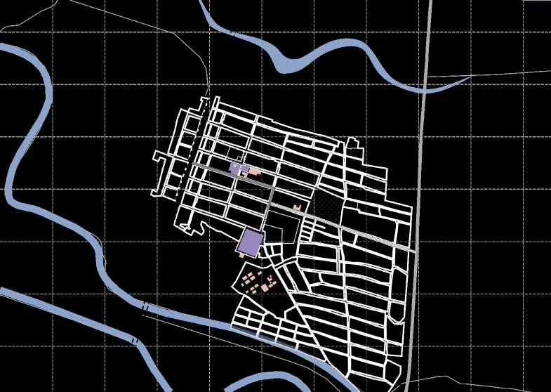
Urban settlements: Urban fabric possibly developed along the cargo railway infrastructure due to economic advantages, such as efficient transportation and trade. Historically, the railway facilitated access to markets, resource extraction, and connectivity, driving growth. Currently, it appears to be a disadvantage, as towns are constrained within the two barriers: the floodplain and the cross-country highway.

Road network: The road network illustrates how the population is effectively confined between two significant barriers: an ecosystem where there is no possibility for infrastructure or urban fabric development such as the Ciénaga grande swamp and the flood plain on its periphery and a huge infrastructure such as the Ruta del sol highway, that is a more evident barrier because of its linear typology.
Geographies of inequity: Resignification of the
Ecosystems: Given the geographical conditions of the area—a coastal biome situated on the periphery of the largest isolated system of the Andes mountain range—there exists a significant biodiversity hotspot. This region encompasses a diverse array of ecosystems, including mangroves, sandbanks, wetlands, islands, and, notably, the swamp.
Geographies of inequity: Resignification of the

Landcover: There is a strongly diversified land cover—bushes, forests, plantations, crops, and grasses—due to the complex water network. This network provides varied water availability and soil conditions, creating suitable environments for different types of vegetation. The dynamic interaction between water flow and sediment deposition supports this rich ecological diversity.
Geographies of inequity: Resignification of the Bananeras


Geographies of inequity: Resignification of the Bananeras

Geographies of inequity: Resignification of the Bananeras

Geographies of inequity: Resignification of the Bananeras
Geographies of inequity: Resignification of the Bananeras

Geographies of inequity: Resignification of the Bananeras


Objects
Using Kevin Lynch’s elements of The image of the city as a guideline to structure a strategy for an area that’s urban yet heavily influenced and surrounded by landscape is convenient. In the context of towns instead of a city may be appropriate due to several factors, such as their scale, complexity, and spatial organization, to use as inspiration three elements —instead of five— and develop variations according to the interactions of the site. In this case, given the vast spatial scale, different areas are located at considerable distances from one another and require connection through lines, and services provided by strategically placed objects between these.
Geographies of inequity: Resignification of the Bananeras

Strategy for water accesabiliity and public space
3.4 Water arteries: Lines, Areas and Objects
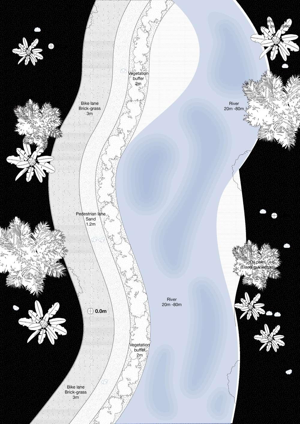
Line 01: Connecting with the Sierra
Geographies of inequity: Resignification of the Bananeras 3. Project
3.4 Water arteries: Lines, Areas and Objects
Line 01: Connecting with the Sierra


Geographies of inequity: Resignification of the Bananeras
3.4 Water arteries: Lines, Areas and Objects

Line 02: Railway as the Aorta
Geographies of inequity: Resignification of the Bananeras
3.4 Water arteries: Lines, Areas and Objects
Line 02: Railway as the Aorta


Geographies of inequity: Resignification of the Bananeras
3.4 Water arteries: Lines, Areas and Objects
Line 03: Hearth of the Urban fabric
Geographies of inequity: Resignification of the Bananeras
Line 03: Hearth of the Urban fabric
Geographies of inequity: Resignification of the Bananeras
3.4 Water arteries: Lines, Areas and Objects

Line 04: Highway veins, soil preservers
Geographies of inequity: Resignification of the Bananeras
3.4 Water arteries: Lines, Areas and Objects
Line 04: Highway veins, soil preservers


Geographies of inequity: Resignification of the Bananeras
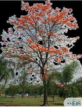
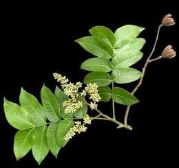
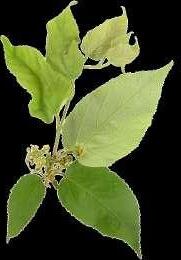
Guayacán Rosado ( Tabebuia Rosea )
Canopy Diameter: 10-15 meters.
Height: 15-30 meters.
Flower: Pink, trumpet-shaped, in large clusters.
Description: Deciduous tree with striking pink flowers, smooth gray bark, and broad canopy, thriving in dry season landscapes.
Lluvia de Oro ( Cassia fistula )
Canopy Diameter: 8-12 meters.
Height: 10-20 meters.
Flower: Bright yellow, long cascading clusters.
Description: Ornamental tree with vibrant golden flowers, lush foliage, and a striking appearance, often blooming in the dry season.
Cámbulo ( Erythrina fusca )
Canopy Diameter: 8-12 meters.
Height: 10-20 meters.
Flower: Red to orange, tubular clusters.
Description: Deciduous tree with striking red flowers, spiny branches, and broad canopy, offering vibrant color and dense shade.
3.4 Water arteries: Lines, Areas and Objects
Tree selection


Geographies of inequity: Resignification of the Bananeras
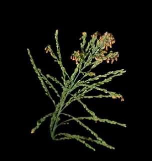
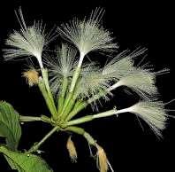
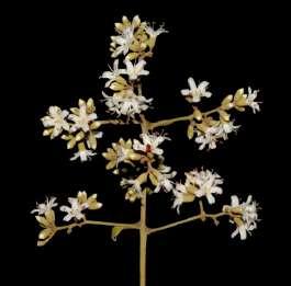
Lechuguilla de agua ( Pistia stratiotes )
Floating plant with rosette-shaped leaves and thick, sponge-like roots. It effectively absorbs nutrients and pollutants, improving water quality. It thrives in tropical climates and provides habitat for aquatic wildlife.

Jacinto de agua ( Eichhornia crassipes )
Floating perennial with broad, glossy leaves and attractive lavender flowers. It rapidly absorbs excess nutrients and contaminants from water bodies. Its dense mat formation can aid in controlling algae and stabilizing water ecosystems.

Nenúfar europeo blanco ( Nymphaea spp)
Aquatic plants with floating leaves and showy flowers in various colors. They help in nutrient uptake and provide shade, reducing algal growth. Their root systems stabilize sediments and improve overall water quality

Geographies of inequity: Resignification of the Bananeras
Area 01
Phytoremediation
Phytoremediation can be a sustainable strategy to restore soils impacted by mining in the Sierra Nevada de Santa Marta. This technique uses plants to absorb, stabilize, and detoxify heavy metals and other contaminants left from mining activites. To accomplish a proper restoration of the soil, it is proposed a three-step phyto process that includes; first, the selection of native plants that are adapted to the region’s tropical climate. Including “hyperaccumulators”, species it is needed for the effective absorbing of heavy metals such as lead, zinc, and cadmium from contaminated soils; Soil Stabilization through selection of tree species that help prevent soil erosion and enhance soil structure, which is critical in the mountainous terrain of the Sierra Nevada, this incorporates agroforestry and biodiversity contributing to long-term sustainability; and finally, monitoring and management, regular revisions of soil quality and plant performance ensures the success of phytoremediation efforts, guiding interventions as necessary.This process promotes environmental conservation and community livelihoods both in the Zona Bananera municipality and the indigenous territories.
Geographies of inequity: Resignification of the Bananeras
Plant selection Tree selection


Geographies of inequity: Resignification of the Bananeras
In order to provide clean water to the municipality, there are two natural-based proposals to purify the water coming from the sierra in a 2-step process. First, with aquatic species in the mountain and then artificial wetlands in the urban fabric. The aquatic species intend to clean the water that passes or passed by mining exploitation areas in the past. Having in mind the sierra is a protected territory, this solution is as less invasive as possible. Phytoremediation with aquatic species can remove toxic heavy metals and excess nutrients from mining-affected water bodies through their root systems. Once saturated, the plants can be harvested and safely disposed of, preventing further contamination. After the water streams pass the Ruta del sol highway, a system of artificial wetlands are proposed to clean the water from gasoline and other contaminants produced by an infrastructure such as this. The wetland environment slows water flow, allowing sediments to settle and pollutants to be absorbed by plant roots and microbial activity. This method is cost-effective and environmentally friendly, providing a habitat for wildlife while cleaning water. 3.4
Area 02
Water cleaning
Geographies of inequity: Resignification of the


Geographies of inequity: Resignification of the Bananeras
3.4 Corridors and strategies
Object 01
Rainwater harvesting
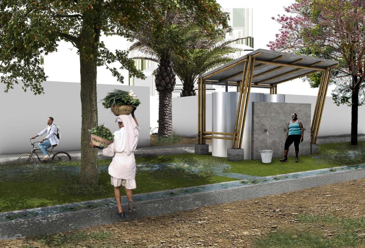
Finding other sources of clean water in the Zona Bananera municipality is crucial due to water scarcity. During intense rainfall in the wet season, water can be captured, stored and clean for daily use tasks for the population. The project proposes objects for collection, cleaning and distribution of rainwater, that can be placed around the corridors of the masterplan. The object is composed by a meshed collection roof that through a first flush diverter moves water water into tanks after discard the first flow of rainwater, which contains debris, dirt, and contaminants. Then a 3-step filtration process with mesh screens to filter large contaminants, then Charcoal filters to remove finer particles and finally a solar disinfection system to kill pathogens and ensure water is safe for drinking.
Geographies of inequity: Resignification of the Bananeras

Geographies of inequity: Resignification of the Bananeras
3.4 Corridors and strategies
Object 02
Electrical mobility
Having in mind the population of the area is strongly disconnected and also doesn’t have the resources to self-own means of transportation, the project proposes a clean-energy solution with e-bikes using solar power. The project proposes objects for energy generation to power electrical bikes that promote clean-energy mobility in the municipality and encourage physical activity and leisure. The objects can be placed around the corridors of the masterplan and are composed by roof of solar powers that feed electicity to a bicycle station where the bikes can recharge when not use. The object works both as the generator and parking station but also as an infrastructure that provides energy to smaller devices.
Geographies of inequity: Resignification of the

Geographies of inequity: Resignification of the Bananeras
Geographies of inequity: Resignification of the Bananeras 3. Project


Geographies of inequity: Resignification of the Bananeras 3. Project


Geographies of inequity: Resignification of the Bananeras 3. Project
Geographies
This project in Zona Bananera, Magdalena, offers a comprehensive response to the region’s entrenched socio-economic and environmental challenges. The area’s geographical and historical context, marked by its agricultural economy and isolation, has perpetuated cycles of poverty and limited growth opportunities. Despite the presence of two significant ecosystems — the Sierra Nevada de Santa Marta and the Ciénaga Grande — the region remains underdeveloped, primarily due to insufficient infrastructure, environmental vulnerability, and limited economic diversification. These issues are further exacerbated by the region’s history of neglect and the lasting impacts of past violence, as exemplified by the 1928 banana massacre.
Through a detailed analysis of the region’s conditions, the project identifies the urgent need for infrastructure development and social integration, with a particular focus on sustainable and environmentally conscious solutions. The contrast between Zona Bananera and the nearby city of Santa Marta highlights the role that geographical isolation and limited access to infrastructure play in exacerbating economic disparities. While Santa Marta benefits from its coastal location, diversified economy, and connectivity, Zona Bananera struggles with inadequate access to essential resources and services. The reliance on banana cultivation, a vulnerable industry susceptible to market and environmental fluctuations, further limits the municipality’s economic resilience and development prospects.
The proposed interventions seek to break this cycle by introducing green corridors and sustainable strategies designed to enhance infrastructure, promote sustainable tourism, and improve the quality of life for local residents. The creation of green corridors, such as water filtration networks and multi-use public spaces, addresses the fundamental issues of water accessibility, recreational spaces, and transportation connectivity. These corridors not only improve the urban fabric but also integrate the region’s rich ecosystems, offering opportunities for environmental stewardship and sustainable tourism development.
In tandem with these infrastructural improvements, the project’s sustainable strategies — including phytoremediation, water purification, rainwater harvesting, and solar energy hubs — emphasize the importance of environmental sustainability and resilience. By leveraging the area’s natural resources and incorporating sustainable systems, these strategies aim to rehabilitate the environment, improve access to clean water, and promote renewable energy use. The focus on sustainability ensures that development is aligned with the region’s ecological characteristics and supports long-term socio-economic growth without compromising environmental integrity.
Ultimately, this project represents a holistic approach to addressing the complex challenges faced by Zona Bananera. By enhancing infrastructure, promoting social cohesion, and integrating sustainable practices, the initiative seeks to foster a more resilient and prosperous future for the region. The emphasis on environmental sustainability, cultural heritage, and local community involvement ensures that the project is not only responsive to the immediate needs of the population but also positions Zona Bananera as a model for sustainable rural development in Colombia. Through this approach, the project aspires to transform the municipality into a thriving, self-sustaining region that can overcome its historical disadvantages and realize its full potential.