Beneath the Pines: Rebuilding the natural image of Sudbury through alternative residential development strategies. by Braeden Martel
A Thesis submitted in partial fufillment of the requirements for the degree of Master of Architecture (M. Arch) The Faculty of Graduate Studies Laurentian University Sudbury, Ontario, Canada © Braeden Martel
this page purposefully left blank.
THESISDEFENCECOMMITTEE/COMITÉDESOUTENANCEDETHÈSE
LaurentianUniversity/UniversitéLaurentienne OfficeofGraduateStudies/Bureaudesétudessupérieures
TitleofThesis Titredelathèse BeneaththePines:RebuildingthenaturalimageofSudburythroughalternative residentialdevelopmentstrategies
NameofCandidate Nomducandidat Martel,Braeden Degree Diplôme MasterofArchitecture(M.Arch) Department/Program Département/Programme Architecture DateofDefence Datedelasoutenance April10,2022
APPROVED/APPROUVÉ
ThesisExaminers/Examinateursdethèse:
BruceWrightsman (ThesisAdvisor/Directeur(trice)dethèse)
DennisCastellan (ThesisSecondReader/Deuxièmelecteur(trice)dethèse) JannaLevitt (ExternalExaminer/Examinateur(trice)externe)
ACCESSIBILITYCLAUSEANDPERMISSIONTOUSE
I, Braeden Martel, hereby grant to LaurentianUniversityand/oritsagentsthenon-exclusivelicensetoarchiveand make accessible my thesis, dissertation, or project report in whole or in part in all forms of media, now or for the duration of my copyright ownership I retain all otherownershiprightstothecopyrightofthethesis,dissertationor project report I also reserve the right to use in future works (such as articles or books) all or part of this thesis, dissertation, or project report. I furtheragreethatpermissionforcopyingofthisthesisinanymanner,inwholeorin part,forscholarlypurposesmaybegrantedbytheprofessororprofessorswhosupervisedmythesisworkor,intheir absence, by the Head of the Department in which my thesis work was done It is understood that any copying or publication or use of this thesis or parts thereof for financial gain shall not be allowed without my written permission. It is also understood thatthiscopyisbeingmadeavailableinthisformbytheauthorityofthecopyright owner solely for the purpose ofprivatestudyandresearchandmaynotbecopiedorreproducedexceptaspermitted bythecopyrightlawswithoutwrittenauthorityfromthecopyrightowner
XxxxxxxxxxxxxxxxxxxxxxxxxxxxxxxxxxxxxxxxxxApprovedfortheOfficeofGraduateStudies XxxxxxxxxxxxxxxxxxxxxxxxxxxxxxxxxxxxxxxxxxApprouvépourleBureaudesétudessupérieures XxxxxxxxxxxxxxxxxxxxxxxxxxxxxxxxxxxxxxxxxxTammyEger,PhD XxxxxxxxxxxxxxxxxxxxxxxxxxxxxxxxxxxxxxxxxxVice-President,Research(OfficeofGraduateStudies) XxxxxxxxxxxxxxxxxxxxxxxxxxxxxxxxxxxxxxxxxxVice-rectriceàlarecherche(Bureaudesétudessupérieures)
IV
Abstract
slow-development, alternative dwelling types, landscape conservancy & stewardship, agency in architecture
Rebuilding the natural image of Sudbury through alternative residential development strategies.
Beneath the Pines:
Sudbury Ontario has been host to innumerable extraordinaryevents,bothnaturalandman-made, that have created polarizing perspectives of the natural landscape. The relatively short 140-year history of white settlement in the Sudbury area at the hands of industrialists has seenthescarringofauniqueandgeologicallyrich landscapecomposedoverbillionsof years which has contributed to an uncertain image of the city, a loss of northern identity, and more generally,animagethatdoesnotreflectthespirit of the place of the people that reside inhabit the area. More recently, the suburbanization of Sudbury has further alienated the concept place and identity through the quick development of sub-divisions complete with foreign concepts of living in manufactured landscapes. The thesis explores the relatively short history of settlement within the natural landscapes of Sudbury and how it can inform strategies for the slow development of architecture that is distinctly of the place and of the people. The study of the morphology around Ramsey Lake informs new strategies for the public stewardships of important natural contributors to the image of the city. The thesis questions how alternative strategies for communitybuildingunited
by strong and formalized position of stewardship, can be formalized into new architectural typologies that contribute to the natural image of the city. Ultimately, a scarred image of the city has emerged and as the mining industry slows, and arguments against suburbanization strengthen, the thesis explores how individuals can reclaim a sense of ownership in the development of the image of the city through thoughtfully considered individual dwellings united by a collective focus of sensitive growth in tune with that of the natural landscape. Since the permanent settlements in the Sudbury area, industrialization have damaged the natural image of the city to the point where descriptions and pictures of the ancient landscapes only live in the imagination. This is a story of understanding the humans place within the timeline of history and serves to create new perspective of development in the naturally rich landscapes of Sudbury. There is a beauty of the Sudbury landscape, a beauty worth preserving through the oil paints of the Group of Seven that lies under scars of industry.
Abstract
VI
Acknowledgements
Beneath the Pines: Rebuilding the natural image of Sudbury through alternative residential development strategies.
Only two decades ago, I, a budding shipwright specializing in 2-by offcuts, developed a passion for making, and a subsequent resourcefulness of asking for my parents help in the retrieval of many sunken ships. Since then, I have understood that with eachstepforward,thereisanechoingthudofthe supportivestridesoffamilyandfriends.
The completion of this thesis, and that of the Master of Architecture degree, would not be possible, nor conceivable without the undying support of my family, friends, peers, and the examining board I was so fortunate to be affiliated.
To my thesis advisor Bruce Wrightsman, for your continued support, extended patience, and for encouraging me to tackle the frustrations central to my thesis query. To Dennis Castellan, for your graceful and timely delivery of inspiration and encouragement, your generosity, and for your endless authorship of wise passages which continue to galvanize in my mind each day. To Janna Levitt, for your original perspectives and contributionstotherigourofthethesis.
I’d like to thank my family for their tireless support and confidence in my travels off the beaten path, andforallowingasmallboyandhis plastic fisher-price construction tools develop a passion for building.
To Raechel Hamilton, for your soft care, outstanding work ethic, and continued support of me and my crazy ideas. You are my daily source of warmth and inspiration.
To Andrei Nemes, Tyler MacDonald, and Tristan O’Gorman, and to all of the friends I’ve met over the past six years, thank you for embracing me as part of our tight-knit family committed to making the world a better place and ensuring we enjoy each and every day. I feel lucky to have been part of such an exciting and inspiring atmosphere that has so profoundly impacted my life.
To Tammy Gaber, for always believing in me, and for teaching me the primary importance of kindness, respect, and optimism. Mark Baechler, for stoking a sense of curiosity and for so strongly instilling in me a growing passion for the wonderful world of design and architecture. To Amber Salach, and the team at Belanger Salach Architecture, thank you for your kinship, support, and for demonstrating the importance of a healthy and joyful work culture. To Matthew Schultz, for your steady support and for encouraging me to keep things weird.
Finally, To Hans Zimmer, for orchestrating the soundtrack to this thesis and for keeping me company during the late hours of the night.
Acknowledgements
VIII
Table of Contents
i ii iii iv v
Abstract Table of Contents List of Figures Preface
Acknowledgements
Beneath the Pines: Rebuilding the natural image of Sudbury through alternative residential development strategies.
1.0 2.0 3.0 4.0 5.0 6.0
Introduction
History of Residential Development in Sudbury
IndustryTowns Analysis
2.1 3.1 4.1 5.1 6.1
2.2 3.2 4.2 4.3 5.2 6.2 6.3
Suburban Links Analysis
2.3 2.4 3.3 5.3 5.4
Escape to the Lake
Suburban Lakeside Analysis
Industrial Image of Sudbury
Suburban Image of Sudbury
Future Image of Sudbury
Image of the City The Heart of the City
The Heart of the City
Morphology
Slow Development
Townend Homes
Walter’s Way Haystack Mountain School of Crafts
Designing an Alternative
Ethos
Design Guidelines
A Canvas for the Natural Image of the City Sea Ranch Design Trial
Bibliography
Table of Contents
X
F.
List of Figures
Slow-Development. Image by author, 2022.
Bethel Lake Aerial. Image by author, 2022.
Old and New. Image by author, 2022.
The Sudbury Basin. Image by author, 2022.
Industry Towns of the Sudbury Basin Diagram. Image by author, 2022.
Industry Town Typology Isometric Section Analysis. Image by author, 2022.
Industry Town Organization Plan. Image by author, 2022.
Industry Town Landscape Section. Image by author, 2022.
Industry Town Building Integration Section. Image by author, 2022.
Central Sudbury Development Diagram. Image by author, 2022.
Suburban Links Development Diagram. Image by author, 2022.
Suburban Links Isometric Section. Image by author, 2022.
Suburban Links Organization Plan. Image by author, 2022.
Land Division & Setbacks Plan. Image by author, 2022.
Suburban Links Landscape Section. Image by author, 2022.
Suburban Links Building Integration Section. Image by author, 2022.
Escape from Industry Diagram. Image by author, 2022.
Thomson, Tom. The Artist’s Camp, Canoe Lake, Algonquin Park, 1915 2017. Art Gallery of Ontario. https:// ago.ca/collection/object/agoid.69189.
Suburban Lakeside Diagram. Image by author, 2022.
Suburban Lakeside Isometric Section. Image by author, 2022.
Suburban Lakeside Organization Plan. Image by author, 2022.
Suburban Lakeside Landscape Section. Image by author, 2022.
Suburban Lakeside Building Integration Section. Image by author, 2022.
F. 24
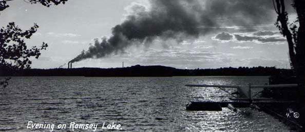
Evening on Ramsey Lake. Sudbury Heritage Museum. Accessed April 16, 2022. http://webcat.sudbury.library.on.ca:81/
Ramsey Lake from Northern Shore. Image by author, 2016.
Industrial Periphery. Image by author, 2017.
Industrial Image of the City Collage. Image by author, 2022.
Atop the Creighton Fault. Image by author, 2022.
Suburban Image of the City Collage. Image by author, 2022.
Future Image of the City Collage. Image by author, 2022.
New Reflections on Ancient Landscape. Image by author, 2016.
Frozen Heart of the City. Image by author, 2022.
F. 33
F. 02 F. 03 F. 04 F. 05 F. 06 F. 07 F. 08 F. 09 F. 10 F. 11 F. 12 F. 13 F. 14 F. 15 F. 16 F. 17 F. 18 F. 19 F. 20 F. 21 F. 22 F. 23 F. 25 F. 26 F. 27 F. 28 F. 29 F. 30 F. 31 F. 32 F. 34 F. 35
Beneath the Pines:
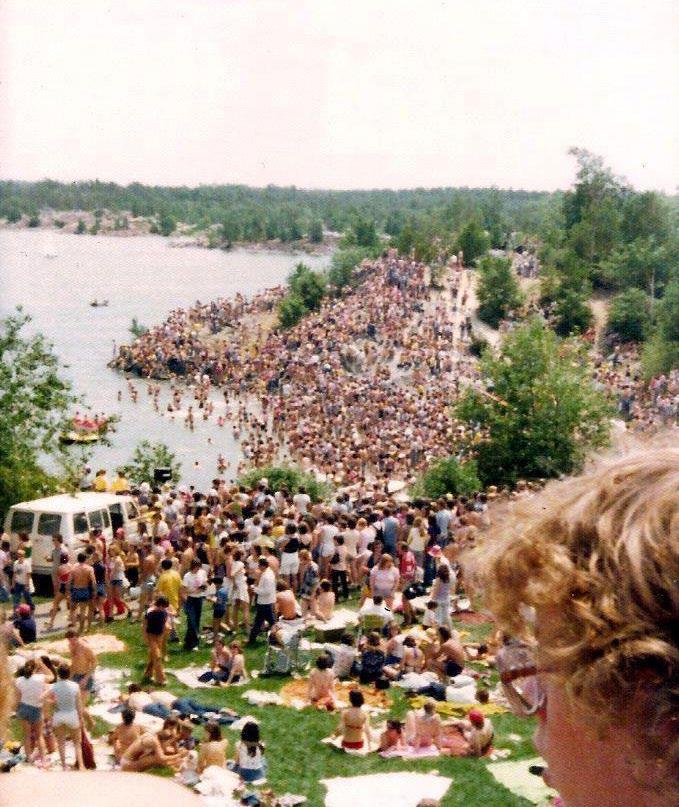
Summer Days Circa 1975. Sudbury Time Machine. July 10 2016. Accessed April 16, 2022. https://www. instagram.com/p/BHsnbWeAUis/?hl=en
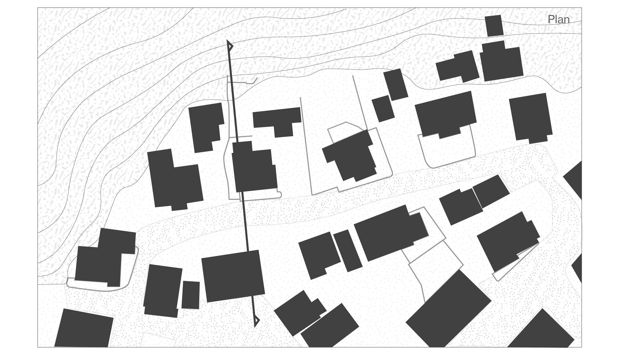
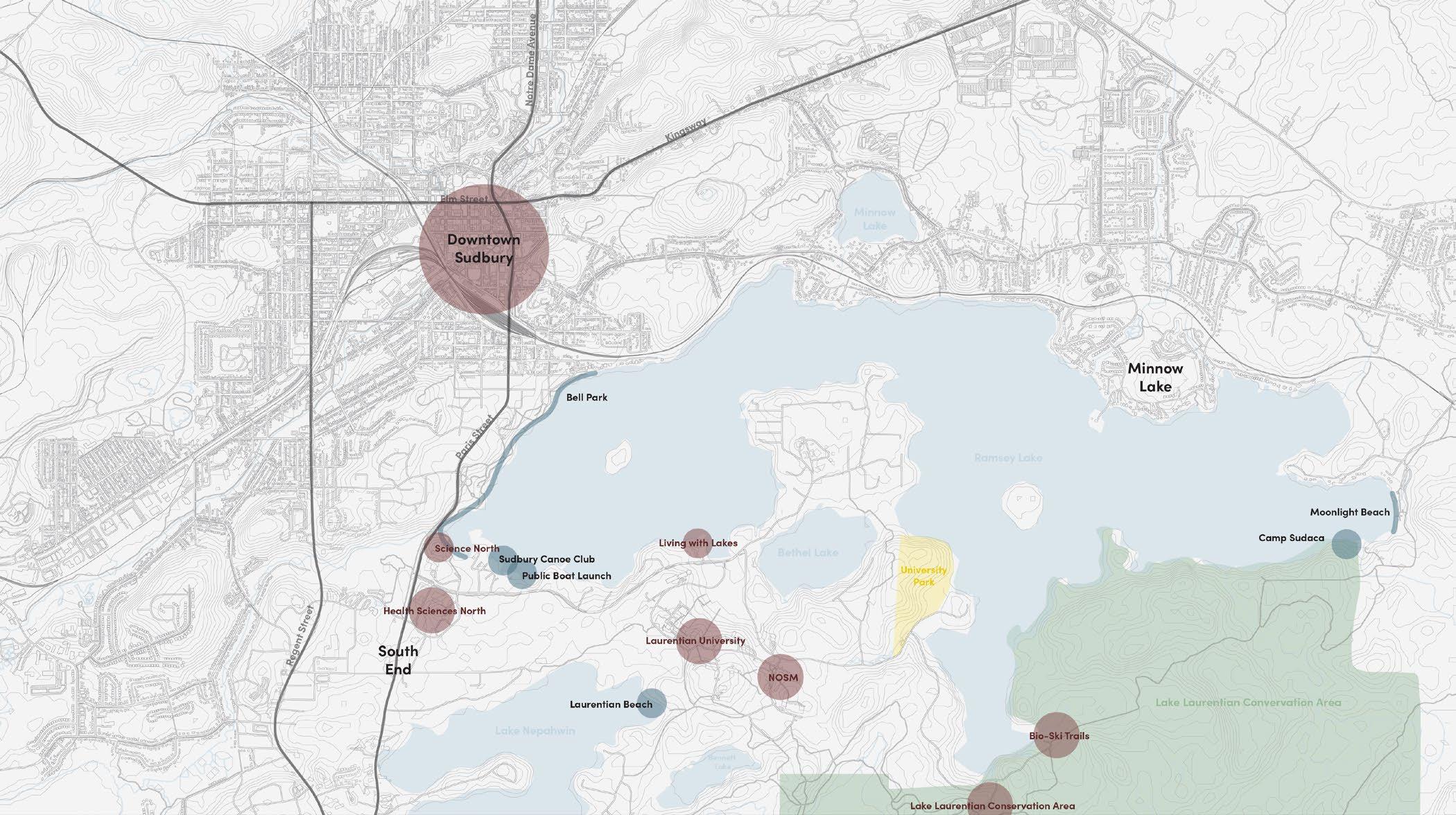
Mapping the Shores of Ramsey Lake. Image by author, 2022.
Canoe with Sails on Ramsey Lake. Sudbury Heritage Museum. Accessed April 16, 2022. http://webcat.sudbury.library.on.ca:81/search?/tcanoe/tcanoe;M=p/1%2C7%2C0%2CB/ frameset&FF=tcanoe;M=p&7%2C7%2C
Rebuilding the natural image of Sudbury through alternative residential development strategies.
01 3 5 7 11 13 14 15 16 17 18 19 21 22 22 23 23 24 25 26 27 28 29 29 35 36 37 38 39 40 41 45 48 49 47 33
F. 36 F. 37
F. 38
51 52 53
Gagnon, Clarence. Spring Thaw 2017. Clarence A. Gagnon: Canadian Artist Series. Ryerson Press, Toronto. 1945.
Gagnon, Clarence. Ramsay Lake, Summerhome, circa 1919. Sudbury Heritage Museum. Accessed April 16, 2022. http://webcat.sudbury.library.on.ca:81/search?/tramsay+lake+tent/tramsay+lake+tent/3%2C0%2C0%2CB/frameset&FF=tramsay+lake+summerhome+circa+1919&1%2C1%2C/indexsort=-1945.
F. 42 F. 43 F. 44
58 59 60
63 F. 46
F. 55
F. 39 F. 40 F. 41 F. 45 F. 45 F. 47 F. 48 F. 49 F. 50 F. 51 F. 52 F. 53 F. 54 F. 56 F. 57 F. 58 F. 59 F. 60 F. 61 F. 62 F. 63 F. 64 F. 65 F. 66
72-73
Ramsey Lake Morphology Studies 1. Image by author, 2022.
Ramsey Lake Morphology Studies 2. Image by author, 2022.
Ramsey Lake Morphology Studies Collage 3. Image by author, 2022.
Ramsey Lake Morphology Studies 4. Image by author, 2022.
Ramsey Lake Morphology Studies 5. Image by author, 2022.
Ramsey Lake Morphology Studies 6. Image by author, 2022.
Ramsey Lake Morphology Studies Collage 7. Image by author, 2022.
Ramsey Lake Morphology Studies Collage 7. Image by author, 2022.
Spring on the Onaping River. Kivi Park. November 20, 2016. Accessed April 16, 2022. https://www.facebook. com/kivipark/posts/we-need-to-find-the-a-y-jackson-painting-spring-on-the-onaping-river-stolenfrom/1200446669990963/
Between two Lakes Preliminary Sketches. Image by author, 2022.
View of the Creighton Fault. Image by author, 2022.
Rugged Details of the Creighton Fault. Image by author, 2022.
Sun over the Creighton Fault. Image by author, 2022.
Aerial view between Bethel and Ramsey Lakes. Image by author, 2022. Rocky Shoreline of Ramsey Lake. Image by author, 2022.
Looking East from Atop the Creighton Fault. Image by author, 2022.
Gramma’s Favourite. Image by author, 2022.
Geological History of Between two Lakes site. Image by author, 2022. Sourced: Saarinen, Oiva W. From Meteorite Impact to Constellation City: A Historical Geography of Greater Sudbury. Waterloo, ON: Wilfrid Laurier University Press, 2013.
Natural Footpath at Grundy Lake. Image by author, 2022.
Townend Home Collage. Image by author, 2022.
Townend Home 1. Image by author, 2022.
View of Ramsey Lake from Townend Home 1. Image by author, 2022.
View of Ramsey Lake from inside Townend Home 1. Image by author, 2022.
Townend Homes Organization Plan. Image by author, 2021.
View of Townend Home 1 from Inside Townend Home 3. Image by author, 2022.
North Wall, Townend Home 1. Image by author, 2022.
Townend Home 2, Cascading Facade. Image by author, 2022.
Townend Home 1 seen from Townend Home 2. Image by author, 2022.
Early Settlement Along Lake Ramsey. Sudbury Heritage Museum. Accessed April 16, 2022. http://webcat.sudbury.library.on.ca:81/search?/XK.Z.+Postcard+collection&SORT=D/ XK.Z.+Postcard+collection&SORT=D&SUBKEY=K.Z.+Postcard+collection/101%2C1117%2C1117%2CB/ frameset&FF=XK.Z.+Postcard+collection&SORT=D&150%2C150%2C 54 55 56-57 61 61 64 65 66 67 68 69 70 71 77 79 80 81 81 82 83 83 84 85 85
Townend Home 1 Integration to Landscape and City. Image by author, 2022.
List of Figures
XII
F. 79
F. 80 F. 81 F. 82
F. 83 F. 84 F. 85
F. 67 F. 68 F. 69 F. 70 F. 71 F. 72 F. 73 F. 74 F. 75 F. 76 F. 77 F. 78 F. 86 F. 87 F. 88 F. 89 F. 90 F. 91 F. 92 F. 93
98
Natural Stone Foundation, Townend Home 1. Image by author, 2022.
Stepped Building Form and Dead Partridge, Townend Home 2. Image by author, 2022.
Exterior Spaces and Circulation, Townend Home 2. Image by author, 2022.
Sea Ranch.Digital Image. Ecological Architecture: Planning the Organic Environment. Accessed April 16, 2022. https://searanch.ced.berkeley.edu/s/sea-ranch/item/534#?c=0&m=0&s=0&cv=0
Sea Ranch Condominium One 1965. Digital Image. Ecological Architecture: Planning the Organic Environment. Dwell. Accessed April 16, 2022. https://www.dwell.com/article/sea-ranch-architecture7f30ea15/6494419414468952064
Location Score. Scanned Drawing. Lawrence Halprin. Dwell. Accessed April 16, 2022. https://www.dwell. com/article/sea-ranch-architecture-7f30ea15/6494423952826880000
The Rush House. Digital Image. Dwell. Accessed April 16, 2022. https://www.dwell.com/article/sea-rancharchitecture-7f30ea15/6494433110543060992
Sea Ranch Cliffs. Digital Image. The Sea Ranch Lodge. Accessed April 16, 2022. https://www. thesearanchlodge.com/gatherings
Sea Ranch Walk-In Cabins, advertisement. Digital Image. Journey to the Sea Ranch. Accessed April 16, 2022. https://searanch.ced.berkeley.edu/s/sea-ranch/media/1017
Wilkhu,Taran. Walters Way with Landscape. Digital Image. The Modern House. Accessed April 16, 2022. https://searanch.ced.berkeley.edu/s/sea-ranch/media/1017
Self-builders of Walters Way. Digital Image. Architectural Association London. Accessed April 16, 2022. https://memberevents.aaschool.ac.uk/events/members-building-visit-to-segal-close-and-walters-way-inlewisham-se-london/
Walters Way Organization Plan. Image by author, 2022.
Turner, James Drew. Communal Street, Walters Way. Digital Image. The Guardian, 2015. Accessed April 16, 2022. https://www.theguardian.com/cities/2015/sep/16/anarchism-community-walter-segal-self-buildsouth-london-estate
99 100 102
103 104 105
86 87 87 89 89 90 91 92 93 95 96 97 106 107 115 116 117 118 121 122
Beneath the Pines:
Segal, Walter. Segal Method Sketch.Digital Image. The Architectural Review. Accessed April 16, 2022. https://www.architectural-review.com/buildings/walters-way-self-build-schemes-lewisham-london-by-thesegal-method
Rosenthal, Steve. Central Stair at Haystack. Digital Image. Steve Rosenthal Photography. Accessed April 16, 2022. http://www.steverosenthalphoto.com/index.php?architecture-educational Rosenthal, Steve. Haystack Mountain School of Crafts. Digital Image. Steve Rosenthal Photography. Accessed April 16, 2022. http://www.steverosenthalphoto.com/index.php?architecture-educational
Haystack Mountain School of Crafts Organizational Plan. Image by author, 2022.
Stilted Cabins. Digital Image. Haystack Mountain School of Crafts. Accessed April 16, 2022. https://www. haystack-mtn.org/campus-overview
Larabee Jones, Ed. Haystack Mountain School of Crafts, Deer Isle, Maine, Oblique elevation, 1962. Digital Image. Museum of Modern Art. Accessed April 16, 2022. https://www.moma.org/collection/ works/617
Tree and Boulder, Grundy Lake. Digital Image by author, 2022. Brothers. Digital Image by author, 2022.
Physical Sketch Site Model. Digital Image by author, 2022.
Primary Stakeholders Diagram. Digital Image by author, 2022. Between two Lakes Site Map. Digital Image by author, 2022. Parties and Stakeholders Diagram. Digital Image by author, 2022.
Natural Fields of Between two Lakes Map. Image by author, 2022.
DG The Ring Road. Digital Image by author, 2022.
Rebuilding the natural image of Sudbury through alternative residential development strategies.
F. 94 F. 95 F. 96 F. 97 F. 98 F. 99 F. 100 F. 101 F. 102 F. 103 F. 104 F. 105 F. 106 F. 107 F. 108 F. 109 F. 110 F. 111 F. 112 F. 113 F. 114 F. 115 F. 116 F. 117 F. 118 F. 119 F. 120 F. 121 F. 122 F. 123 F. 124 F. 125 F. 126 F. 127 F. 128 F. 129 F. 130 F. 131
123 124 125 126 127 128 129 130 131 132 133 134 135 136 137 138 139 140 141 142 143 144 145 146 147 148 149 150 151 152 153 155 157 158 159 160 161 162
DG The Ring Road Map. Digital Image by author, 2022.
DG Parking Clusters. Digital Image by author, 2022.
DG Paths Forward. Digital Image by author, 2022.
DG Attractant Forces Section. Digital Image by author, 2022.
DG Attractant Forces Plan. Digital Image by author, 2022.
DG Repelling Forces Section. Digital Image by author, 2022.
DG Repelling Forces Plan. Digital Image by author, 2022.
DG House Clusters Section. Digital Image by author, 2022.
DG House Clusters Plan. Digital Image by author, 2022.
DG Planes, Long-Section. Digital Image by author, 2022.
DG Planes, Cross-Section. Digital Image by author, 2022.
DG Piers, Long-Section. Digital Image by author, 2022.
DG Piers, Cross-Section. Digital Image by author, 2022.
DG Pins, Long-Section. Digital Image by author, 2022.
DG Pins, Cross-Section. Digital Image by author, 2022.
DG Stepping the Landscape Section. Digital Image by author, 2022.
DG Stepping the Landscape Roof Plan. Digital Image by author, 2022.
DG Horizontal Primacy Section. Digital Image by author, 2022.
DG Horizontal Primacy Elevation. Digital Image by author, 2022.
DG Forming the Roof Section. Digital Image by author, 2022.
DG Forming the Roof Roof Plan. Digital Image by author, 2022.
DG Living Roof Section. Digital Image by author, 2022.
DG Living Roof, Roof Plan. Digital Image by author, 2022.
DG Embracing the Landscape Section. Digital Image by author, 2022.
DG Embracing the Landscape Roof Plan. Digital Image by author, 2022.
DG Composing Understoreys Section. Digital Image by author, 2022.
DG Composing Understoreys Roof Plan. Digital Image by author, 2022.
DG Solar Orientation Section. Digital Image by author, 2022.
DG Solar Orientation Roof Plan. Digital Image by author, 2022.
DG Views and Light Section. Digital Image by author, 2022.
DG Views and Light Roof Plan. Digital Image by author, 2022.
Rocky Shoreline. Digital Image by author, 2022.
Design Trial Isometric Section. Digital Image by author, 2022.
Design Trial Isometric Section, Annotated. Digital Image by author, 2022.
Design Trial Organization Plan, Housing Cluster. Digital Image by author, 2022.
Design Trial Landscape Section. Digital Image by author, 2022.
Design Trial Building Integration Section. Digital Image by author, 2022.
Untapped Potential. Digital Image by author, 2022.
List of Figures
Preface
Inspired by the resourcefulness of humans when faced with a challenging seasonal climate a poem was written as a reflective inspiration for the research and development of an architectural typology deeply rooted in a landscape based approach where lifestyle and social norms yield to the collective stewardship of living within the natural landscape.
Beneath the Pines: Rebuilding the natural image of Sudbury through alternative residential development strategies.
XIV
An image of nature green and full, Displaced by shadow, monochrome and dull
Perspectives become much less accessible, Nevermind land made accessible.
The ground available to all who care, Limited now to those who dare.
Fresh blankets of snow and a sheet of ice, means sneakers will no longer suffice. New measures for transport would certainly be nice.
So here we are looking for wood, A slab of dead birch as we should, Bent and sculpted until made good, Our feet tied and knotted with leather, Means we are ready for all winters weather.
Nature provides all of the tools for the sensitive and seasonal means of transport when the mercury plummets. Creativity, sensitivity, and a general resourcefulness of the limits of nature provide the basis for the sensitive development solutions rooted in nature. The shift from a focus of convenience to a lifestyle more aligned with nature requires a flexbility of lifestyle where the human adapts to the dynamic conditions of the natural landscape.
Preface
1.0
Introduction
Key Terms
1.0
Introduction
Slow-Development
Slow-Development is a development concept that stands against the rapid strategies of the typical phased suburban developments. Inspired by the slow and incremental development of vernacular architecture, the slow-development strategy aims to return agency to residents ensuring that housing stock reflects the identity of both the natural landscape and the people who call it home. Slow-Development refers to pre-design strategies of a driving ethos, design guidelines, and overall concern for both the public and natural landscape in the definition of regional architecture.
Agency
Agency, for the purpose of this thesis, refers to the capacity for which residents may determine or develop their own living conditions. The acceleration of phased suburb developments built by developers for profit has contributed primarily to the fleeting agency of residents to choose their own form housing, making rare the case of a family purchasing an undeveloped property complete with it’s original vegetation, ripe for the creativity of the local people to develop their own housing as a genuine reflection of the people, place and natural landscape of the Sudbury area.
2
Beneath the Pines: Rebuilding the natural image of Sudbury through alternative residential development strategies.
Sudbury Ontario has been victim to innumerable extraordinary events, both natural and manmade, that have sculpted a unique and polarizing landscape with varying environmental perspectives held by its residents1. The geological richness of the area attracted large-scale settlement through booming economic development, however, this same development has also caused the scarification of the natural landscape throughout the relatively short history of white settlement. The opening of the mines and it’s supporting industries encouraged families to settle in the areas immediately adjacent to their respective places of work, on less-favourable land provided by industrial powers.2 These first acts of settlement in the
1 Oiva W. Saarinen, From Meteorite Impact to Constellation City: A Historical Geography of Greater Sudbury (Waterloo, ON: Wilfrid Laurier University Press, 2013), 18.
2 Oiva W. Saarinen, From Meteorite Impact to Constellation City, 262.
heart of the polluted industrial centres provide the founding condition of a lack of agency for residents at the hands of industrial powers. More recently, the suburbanization of Sudbury has further alienated the concept of agency in residential architecture through the large scale and quickly developed subdivisions complete with model homes from foreign place. Residents are now in a familiar position, at the mercy of developers focused not on the people but of profits.
Cases of individuals purchasing and developing their own lots are now extremely rare as large swaths of land are now acquired by capital-rich developers who, with the help of model houses and house-builder agreements, squeeze profits from the natural landscape and replace it with a manufactured landscape void of identity of the place. These larger developments completed through individual companies present a condition where residents looking to settle in the city are
3 Chapter 1: Introduction
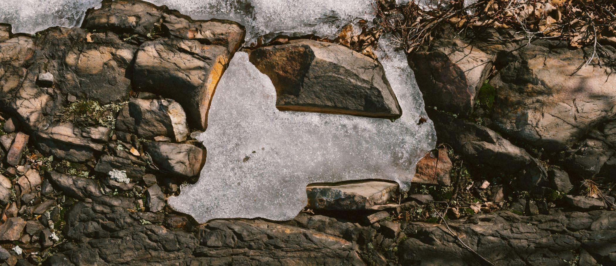
Below: (F. 1) Photo of ice setlling into the natural texture of the exposed bedrock found near Ramsey Lake.
forced to purchase expensive fully serviced lot in the suburbs that are void of the original landscape. Atop a foreign plinth of turf sits an ill-designed house for the now-feature-less parcel of land. The natural landscape beneath the subdivision lines of the lot sacrificed for the profiteering familiar to the founding developments of Sudbury and it’s industries. Alternatively, a rebellion of slow development occurred outside city limits on the vast lakes of the area where residents rediscovered the agency of building naturally within the landscape. Rolling hills outlined by short stands of trees undulating between the lakes of the area captures condition that has encouraged a sprawl through the development in the valleys between rock. The resulting urban plan features a prominent sprawl of mixed density, loosely linking the amalgamated mining towns.
Areas of natural landscape untouched by development exist just minutes from the downtown core. These areas are star-studded, with the usual actors of the Sudbury landscape prominent in their roles. A site lay on the southern shore of Ramsey Lake where a distinct image of Sudbury’s blackened, and exposed bedrock blurred by a dwarfed forest sloping down into the heart of the city. Areas such as these provide unique opportunities for a rural-urban living condition where one can feel part of nature while only being minutes away from the downtown core. Developing on a site between two lakes, one a main source of drinking water, presents new challenges and opportunities for residential development on the shorelines of the lakes that are an invaluable asset
Beneath the Pines: Rebuilding the natural image of Sudbury through alternative residential development strategies.
4
to the quality of life for the local residents, but also for it’s drinking water, recreational uses, ecological value, and it’s contribution to the image of the city.3
The thesis explores the relatively short and polarizing history of residential settlement in the Sudbury area and its effect on the image of the natural landscape. In Kevin Lynch’s book The Image of the City he describes the image of the city as “the product of many builders who are constantly modifying the structure for reasons of their own”4 In the escape from the profit-centered developments of the city, residents and architects who have slowly developed homes on the natural Sudbury landscape have found opportunities to contribute to the image of the city through slivers of good design that respects the spirit of place. The study of the morphology around Ramsey Lake
3 Oiva W. Saarinen, From Meteorite Impact to Constellation City, 18.
4Kenneth Lynch, The Image of the City (Cambridge, MA: MIT Press. 1979), 2.
will provide alternative strategies of approach for the selected site, the last developable land around the heart of the city. The thesis questions how residential architecture development can support an architecture of the place and of the people, while also supporting and encouraging the spirit of the landscape, to return to perspective of natural growth uniting human and landscape. Ultimately, the thesis hypothesizes that slow-development and site-sensitive design of residential architecture developed from studies of place can promote agency and an ability to reclaim the image of the city. As Juhani Pallasmaa noted, “the call for an ecological ethics, lifestyle, and mindset of sustainability is surely the most important force of change in the field of architecture since the breakthrough of modernity a century ago.”5
5 Brian MacKay Lyons, Robert McCarter, and Juhani Pallasmaa, “Local Architecture: Building Place, Craft and Community,” in Local Architecture: Building Place, Craft and Community (New York: Princeton Architectural Press, 2015), pp. 31-39, 31.
5 Chapter 1: Introduction
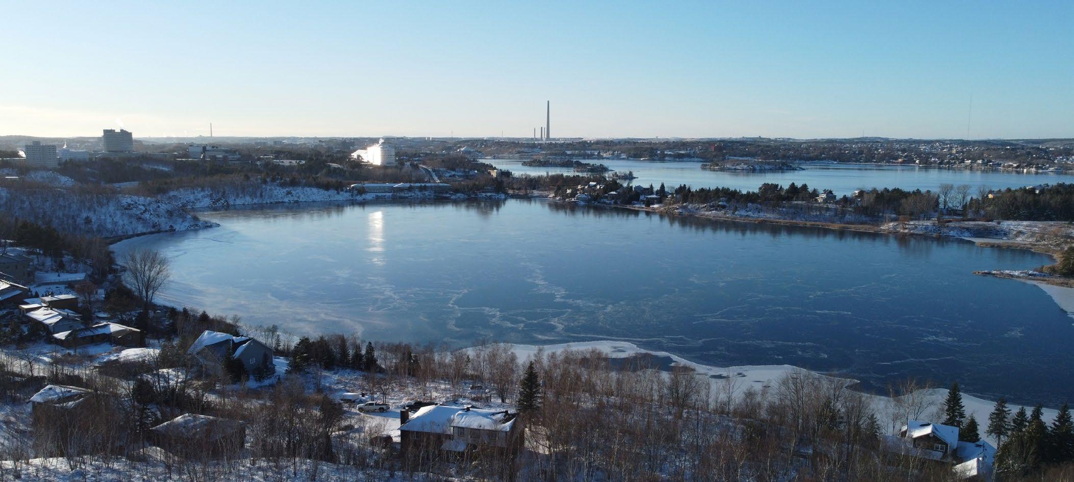
Below: (F. 2) Aerial photo of Bethel and Ramsey Lake, facing Laurentian University and the Superstack.
6
The chosen site provides an incredible opportunity to address challenges and opportunities unique in the natural landscapes of Sudbury. A diverse program featuring rich community, public, and residential programming envisions the shoreline site as one of reconnection to nature for both private residents and the general public. Lake Ramsey has historically been the home of both summer and winter recreation, and the dedication of the shoreline as public will return access to the shores of the lake. Community programming designed to maximize efficiency of each home sees the grouping of services and storage in shared buildings to minimize overall footprints and the overall impact of the development. Programs designed to strengthen the community through shared workspaces and recreational spaces ensure agency in the maintenance of the development and the social connection of the residents.
The residential program mitigates the topographically rich landscape through a series of homes defined by the natural condition. The camp-like dwelling has been instrumental in the development of the city of Greater Sudbury. The humble scale and intent of these dwellings support a greater intent of stewardship and of reconnection to nature. The scale of small dwellings present flexibility when working with a dramatic and natural landscape. Dwellings set in nature lightly inform the approach for the new typology. The residential program on the chosen site will be supported by a rich public program to increase accessibility to the Ramsey Lake, to further communicate the importance of the waterbody through access and recreation.
The theoretical framework of the project has been built through a layering of research to form a definition of slow development. The theoretical framework comprises research into locally celebrated and regionally designed architecture built on bedrock by architect Arthur Townend, the acclaimed Sea Ranch coastal project’s sensitive development prioritizing the preservation of the landscape through collective stewardship, architect Walter Segal’s experimental self-build community project which builds density on a sloped site in the heart of an urban context while exploring agency and identity in building, and finally, comprehensive research of the morphology of Ramsey Lake throughout the history of the city of Sudbury.
Beneath the Pines: Rebuilding the natural image of Sudbury through alternative residential development strategies.
Over its history, the image of the Sudbury has been described by the negative impacts of the industry, but to those who live here, Sudbury is the image of home. In her book Up North, Lisa Rochon described Canadians as being defined by the land, and that our architecture is landscape.6 I suspect that there is a beauty of the Sudbury identity that holds people here, maybe it’s the fragments of beauty that were considered worth preserving through the oil paints of the Group of Seven. The challenge then, is to develop an architecture that emerges from the land, is of the people, and communicates the image of the city and it’s scarred landscape.
6 Lisa Rochon, Up North: Where Canada’s Architecture Meets the Land (Toronto, ON: Key Porter, 2006), 16.

7 Chapter 1: Introduction
Below: (F. 3) Photo of the midday caught between a young birch tree and fading older tree.
2.0
of Residential Development in Sudbury Industry Towns Analysis Suburban Links Analysis Escape from Industry Suburban Lakeside Analysis 2.1 2.2 2.3 2.4
History
2.0
History of Residential Development in Sudbury
the Pines: Rebuilding the natural image of Sudbury through alternative residential development strategies.
10
Beneath
The story of the Sudbury area begins with an ancient cosmic event that accidentally would create one of the most mineral rich regions in the world. When the meteorite crashed down in the area 1.85 billion years ago it created a crater 2 kilometres wide. This crater would become known as the Sudbury Basin.7 It was in 1883 when the discovery of rust-coloured rock by a Canadian Pacific Railway employee would mark the area’s darkest chapter.8 The colonial industrialists flocked to the area and the resulting settlements and industrial processes would shape the area and be the largest contributor to the image of the area. The relatively short industrialization of the area and it’s incredibly destructive mineral extraction processes would scar the landscape forever.
7 Oiva W. Saarinen, From Meteorite Impact to Constellation City, 279.
8Oiva W. Saarinen, From Meteorite Impact to Constellation City, 279.
Below: (F. 4) Diagram depicting the layers of the Sudbury Basin caused by meteorite impact.
This is the story of Sudbury’s raison d’etre, or, in other words, the story of its founding as a place of economic prosperity over the last 140 years. The story of the formation of Sudbury reaches back even further than the meteorite impact that contributed to the area’s environmental determinism, however, the incredible industrial force is what ultimately led to the quick and largescale development of the area.9 The Sudbury area’s topography and landscape presented many challenges for the development of the city. The rich glacial and geological history is the reason for these developmental challenges and can be seen in the city’s abundance of lakes and waterways, dynamic topography, and exposed bedrock which provide visual cues of the Canadian shield. These distinctive landscape features have shaped the image of the city through its challenges to the
9Oiva W. Saarinen, From Meteorite Impact to Constellation City, 1.
Chapter 2: History of Residential Development in Sudbury
Sudbury Basin 11
developmental norm. It is not until recently that development has been restricted to the valleys of the area, creating sprawling neighborhoods connected by roadways. At the heart of this sprawling and undulating city of lakes lies the greatest lake to be contained within a city, Lake Ramsey. Located between the growing mines of the area, Downtown Sudbury, Ramsey Lake, and Bell Park provided the recreational assets for the growing community. It is in the surrounding areas between the lake and the mining areas where the residential development of the city was focused.
2.1 Industry Towns Analysis
Industrialization - Development at the outer rims of the Sudbury Basin
When the meteorite impacted the area long ago, it produced a shockwave that formed a crater 200 kilometres in diameter and redistributed broken and shattered rock to the edges of what we now call the Sudbury Basin.10 The edges of the Sudbury Basin were rich in minerals and were subject to the first areas of development as mines were created and immigrants settled to work these mines. The scattered mining areas at the edge of the large crater formed the first small towns in the Sudbury area. The opening of the mines and it’s supporting industries created an
10 Oiva W. Saarinen, From Meteorite Impact to Constellation City, 11.
incredible immigration of workers from all over the world and has resulted in the population of workers and their families settling in the area beginning with industrially sponsored workers housing.11 The agency in residential architecture and accessibility to alternative residential architecture has never been afforded to residents throughout the relatively short history of development in Sudbury at the hands of industrialists. The inequity and lack of agency is never more apparent than in the development of housing for the Italian population of workers in Copper Cliff at the very core of the mining operations and its associated pollution. Italian workers who immigrated with
11 Oiva W. Saarinen, From Meteorite Impact to Constellation City, 262.
Beneath the Pines: Rebuilding the natural image of Sudbury through alternative residential development strategies.
12
their large families were given tiny parcels of the most unfavorable land adjacent to the mines and downwind of the roast yards.12 As a stark contrast to the lifestyle subjected to the Italian population in their small homes in the path of devastating pollution, the managers of the mining companies developed their own large homes on plots of land upwind and a distance from the mining operations. Interestingly, it was the italian population in Copper Cliff who learned to build their little community called Little Italy on a mound of exposed bedrock that is ever-present in the landscape, one might image this architectural emergence was born out of necessity due to the nature of the land
12 Oiva W. Saarinen, From Meteorite Impact to Constellation City, 262.

Below: (F. 5) Diagram of the industry towns organized along the
acquisition, as opposed to the more common development patterns of building in the sprawling valleys. It is apparent through this short story of residential development in Little Italy, that the population was subject to poor conditions at the hands of the industrialists. The agency afforded to the immigrants was short-handed, as the greatest and most impactful decision of location, orientation, and scale had already been determined by a ruling force. As one of the oldest settlements in the area, this story marks the beginning of the struggle for residents to gain architectural agency at the hands of industrialists and those in positions of power and authority.
Chapter 2: History of Residential Development in Sudbury
Falconbridge
Sudbury Basin
Garson Coniston
Creighton
Copper Cli
ridges of the Sudbury Basin.
Below: (F. 6) Isometric section drawing illustrating the typological elements that emerge from the industry town conditions
2.1 Industry Towns Analysis
Isometric Section
In order to illustrate the typology of the early Industry towns, I have selected the neighbourhood of Little Italy situated adjacent to the mine in Copper Cliff.
Limited by the boundaries of the land given by the mining company, Italian immigrant miners and their families founded their community between large exposed rock outcrops in close proximity to their place of work. A neighbourhood bound by the natural restrictions of the landscape and of the limited agency of land, houses were erected in dense manner, linked by a web of paved streets, forming a community reminiscent of the dense neighbourhoods of the immigrant families parent country.
The residential development that occured during the initial industrial settlement of the Subury area feature very unique conditions that speak to the relationships to both the natural landscape and to the overall relationship between employee and employer. As noted previously, early settlement occured at the edges of the Sudbury basin where the mining industry was located. Residential development during this time focused primarily on the housing of the employees of the local industry.
Undesireable swaths of land owned by the mining companies were given for the development of
14
Beneath the Pines: Rebuilding the natural image of Sudbury through alternative residential development strategies.
Below: (F. 7) site plan drawing illustrating the unqiue organization of the Little Italy neighbourhood due to the unique conditions.
Density of the development a result of housing requirement and limitations of the ground conditions.
housing for employees and their families. In the case of the prominent Italian community of Copper Cliff, the land given by the mining companies were downwind of the disastrous, dangerous, and sometimes blinding roasting yards. The land was also located between two large rock outcrops which further encouraged a dense urban condition of tightly packed vertical homes flanked by rock outcrops in close proximity to the workplace.
The dense development centered between rock, creates conditions where homes are located directly adjacent to the street, and in some cases,
where all four sides of the home face a street condition. The homes located near the base of the rock outcrops are more generous in their outdoor space as the placement of the home directly off the street affords a natural landscape in their backyard. The unique relationships between the street and houses speak to the importance of the street as a community space , the required density to house the community, as well as the challenges presented by the blinding smoke of the roasting yards that made it difficult to find ones way to their neighbours.
Chapter 2: History of Residential Development in Sudbury
15
2.1 Industry Towns Analysis
The typological analysis of past residential developments examines the organization, the relationship to the natural landscape, the methods of touching the ground and the resulting typological elements which contribute to their identity signifying the time, place, and people.
Natural rugged terrain limiting development to more mild topography.
Above: (F. 8) Section drawing depicting the barren ground condition of the Little Italy area pre-development.
Organization Natural Landscape
Limited by the boundaries of the land given by the mining company, Italian immigrant miners and their families founded their community between large exposed rock outcrops in close proximity to their place of work. A neighbourhood bound by the natural restrictions of the landscape and of the limited agency of land, houses were erected in dense manner, linked by a web of paved streets, forming a community reminiscent of the dense neighbourhoods of the immigrant families parent country.
The disastrous industrial processes of the local mining industry immediately adjacent to the mining towns created unfathomable landscape conditions void of the trees, vegetation, soils and wildlife that was once abundant in the area. An undulating blanket of blackened bedrock complete with everpresent clouds of smoke occupied the residential areas of mining towns further disconnecting residents from the natural landscape that existed before industrialization.
16
Beneath the Pines: Rebuilding the natural image of Sudbury through alternative residential development strategies.
Urban condition created by increased density of vertically focused housing.
Above: (F. 9) Section drawing illustrating how currently sit in the landscape of Little Italy.
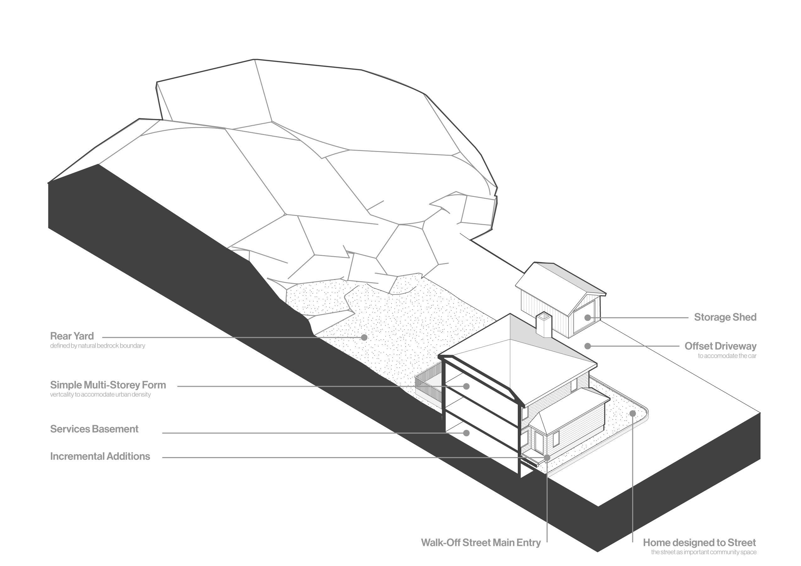
Touching the Ground Typological Elements
The houses built in Little Italy Copper Cliff are quite typical of the 20th century. Basements are dug and foundations are poured which produces a relatively short basement that serves as a maintenance and storage space below grade. The resulting main floor is raised from the ground level, creating a disconnect between inside and outside, and a conditon in which residents attempt to solve through various additions over time.
A modest simple two-storey masonry home extends vertically from the ground atop a short services basement. A composition of simple hip and gable roofs populate the tops of the dense community. Visually intriguing and varied additions demonstrate the restrictions and the lacking connection to the outside of the original simple form and foundation type, spaces for conditioned and unconditioned outdoor living such as porches, sun rooms, decks, and generally small additions enrich the home both practically and visually.
2: History of Residential Development in Sudbury
17
Chapter
Suburban Links Analysis

More recently, the suburbanization of Sudbury has further alienated the concept of agency in residential architecture through the quickdevelopment of sub-divisions and the templatestyle housing created for the profit of housing companies. Where these developments have been positive is in the development of populated roadways and residences that connect the mining areas contributing to a more complete whole of a city. Oiva Saarinen describes this shift in residential architecture.
“As the pace of urban development intensified in the 1950’s and 1960’s, many of the blackened surfaces disappeared as residences, lawns, and trees began to climb up the natural contours of the hillsides. This new trend appeared in different parts
Left: (F. 10) Diagram of the urban settlements growing away from the ridges of the Sudbury Basin.
of the city, including the York street and Grandview Neighborhoods. While more costly to build, these elevated neighbourhoods succeeded because they were attractive to higher-income residents.”
The neighbourhoods that arose on the hillsides of Sudbury lined the roadways along major roadways, or arteries, such as Kingsway and Lasalle Boulevard which provided access to the hillside neighbourhood on Grandview. These residential developments were unlike the older developments of Sudbury as driveways and garages became the focal-points of these car-centred neighbourhoods in the city’s New Sudbury area. The overall organization of the large neighbourhoods further contributed to the sprawl, and soon large arteries
Flour Mill Downtown Bell Park
Donovan West End
Sudbury Basin
Beneath the Pines: Rebuilding the natural image of Sudbury through alternative residential development strategies.
Right: (F. 11) Diagram of the suburbs linking the many neighbourhoods and industry towns of the Sudbury area.
built to navigate the topography of Sudbury developed perpendicular neighbourhoods that continued the sprawl. This relationship contributed to the reliance on the automobile to navigate the city. Large developments such as the New Sudbury Mall and a drive-in theatre further spoke to the carcentric developments of New Sudbury.
The quick progression of suburbs and the commodification of architecture resulted in a further loss of agency in residential development. Residents seeking a place to dwell were marketed to and brought to the suburbs where the distance, construction costs, and model home strategies would require residents to acquire large mortgages to maintain their lifestyles. As large plots of land
built to navigate the topography of Sudbury developed perpendicular neighbourhoods that continued the sprawl. This relationship contributed to the reliance on the automobile to navigate the city. Large developments such as the New Sudbury Mall and a drive-in theatre further spoke to the carcentric developments of New Sudbury. The quick progression of suburbs and the commodification of architecture resulted in a further loss of agency in residential development. Residents seeking a place to dwell were marketed to and brought to the suburbs where the distance, construction costs, and model home strategies would require residents to acquire large mortgages to maintain their lifestyles. As large plots of land were purchased and developed, then sold with agreements with
Chapter 2: History of Residential Development in Sudbury
 New Sudbury
South End
Minnow Lake
Sudbury Basin
New Sudbury
South End
Minnow Lake
Sudbury Basin
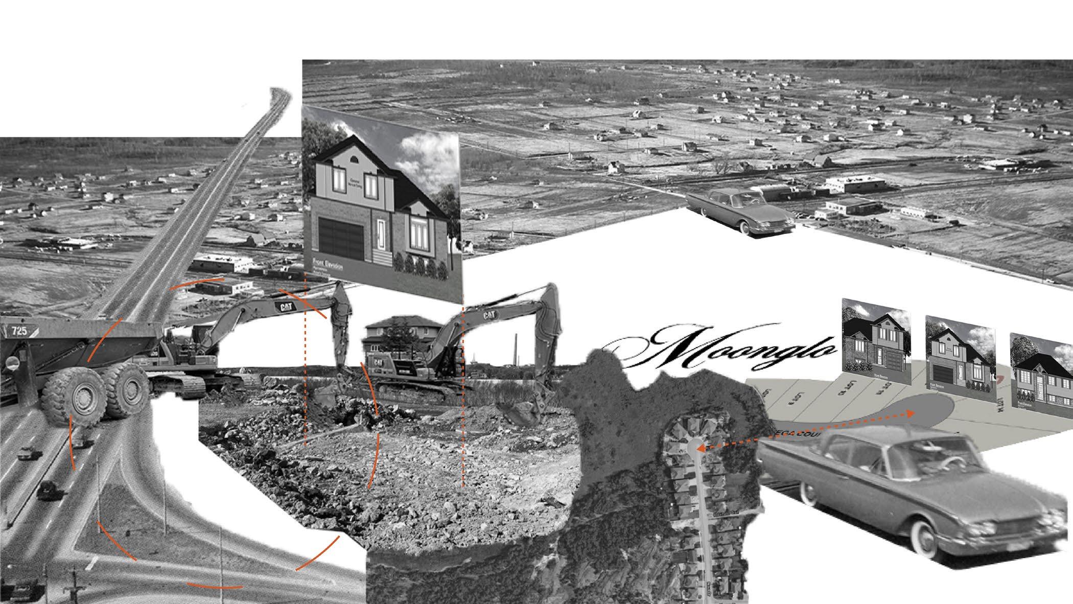
local home-building companies, residents were faced with less and less choice in their home and with soaring costs, model homes void of personal character were built. As Suburbanization continued, new processes for development were used. Oiva Saarinen described the development of the Moonglo Subdivision, in the city’s South End area located south-west of Lake Ramsey, “the Moonglo subdivision changed everything…. Originally a landscape consisting of rugged blacked bedrock and stunted trees, the area was blasted, flattened, and transformed into a neighbourhood setting that included more than 400 single-family homes, a large apartment building, and tree-lined avenues.”1 The development quickly operated through a phased-development approach where large purchases of land would be divided into parcels, the rock would be blasted and the land would be flattened, and quickly house-building companies would erect model homes void of architectural principles.
These resulting homes would then become the most prominent new dwelling for those looking for a home. The commodification of the house and the sheer speed of development created sprawling neighborhoods of lack-luster single-family model homes built on manufactured landscapes at the edges of the city. This new process has sparked considerable amounts of new subdivisions to adapt this new strategy, resulting in a lack of choice for those hoping to develop their own dwellings as an alternative to the catalogue browsing style of home-selection so prominent today.
1 Oiva W. Saarinen, From Meteorite Impact to Constellation City, 279.
20
Beneath the Pines: Rebuilding the natural image of Sudbury through alternative residential development strategies.
2.2 Suburban Links Analysis
Suburban development has become the typical means of residential development in the area. This development strategy is employed by private development companies that create houses for economic profit. Developers used a phased approach that results in large swaths of land being purchased, the land ‘developed’ and the lots are either sold blank, or template style houses are constructed by the development companies. The result is a typology of sameness employed across phased developments that sprawl further and further away from the urban core, leaving all but memories of the natural landscape.
Typological Elements
A modest simple two-storey masonry home extends vertically from the ground atop a short services basement. A composition of simple hip and gable roofs populate the tops of the dense community. Visually intriguing and varied additions demonstrate the restrictions and the lacking connection to the outside of the original simple form and foundation type, spaces for conditioned and unconditioned outdoor living such as porches, sun rooms, decks, and generally small additions enrich the home both practically and visually.
Chapter 2: History of Residential Development in Sudbury
 Below : (F. 12) Isometric Section depicting the typological elements of the suburban home.
Isometric Section
Below : (F. 12) Isometric Section depicting the typological elements of the suburban home.
Isometric Section
21
Below: (F. 13) Plan drawing depicting the barrier condition cause by the suburban development focus on the car, and set backs, causing houses to face each other
2.2 Suburban Links Analysis
Natural groundline and vegetation bulldozed out, further pushing the boundaries of nature and developed suburb.
typical setbacks of zoning bylaws
Left: (F. 14) Plan drawing depicting the typical set backs contributing to the sameness of the suburb typology.
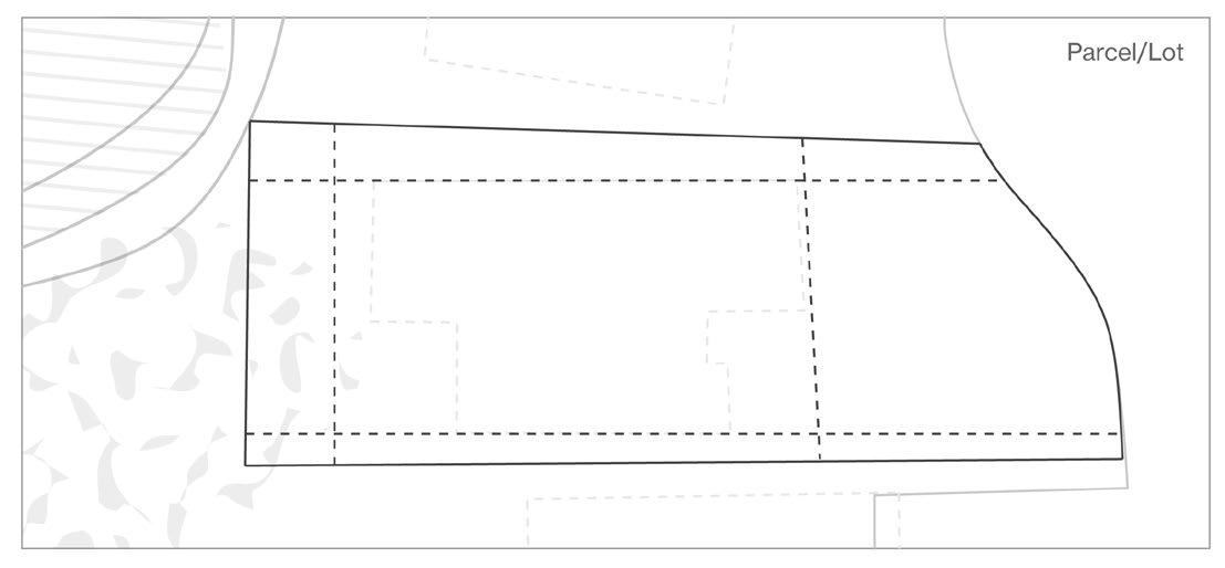
Organization
The flattened land and manufactured landscape rob architects and designers the ability to place a building sensitively upon the natural landscape. Subdivision development is founded on the loss of the unique natural landscape. Services lots provide little natural reference as the lot has been swept away by the developers in the name of economic development and misconceptions of ease and value. The placement of typical houses built for the economic gain of the developer further supports a house void of the natural landscape and void
of the identity of the individual, the place, and the landscape through the replication of suburban template homes. The prospecting resident is faced with limited decisions, choosing between an existing pre-built home designed and built by the developer, or choosing a ‘developed’ blank site void of its original landscape, and faced with the challenge of designing and building a home that is immediately limited by the lot, the lack of natural references, the house builder, and the suburban typology that has emerged over time.
Zoning by-laws together with the sameness of suburban developments create severe limits to the houses. The development patterns that emerge through the replication of these rules and strategies further reduces the opportunity for unique responses to residential architecture.
22
Beneath the Pines: Rebuilding the natural image of Sudbury through alternative residential development strategies.
Top: (F. 15) Site section depicting the natural landscape pre-development with overlayed dotted lines of the future suburban development.
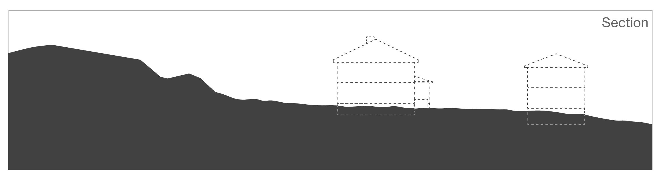
Bottom: (F. 16) Site section depicting the permanent alteration of the natural landscape and ground line for the placement of typical suburban housing.
Natural groundline and vegetation.
Natural Landscape
Phased developments focused on a quantitative approach utilize typical suburban strategies that rely on the construction of typical template style houses results in the blasting, flattening, and permanent alternation of the natural landscape to ensure the suburban typology can be repeatedly
Natural groundline and vegetation now permanently altered.
constructed. Sprawling arms of phased suburban developments extend further and further into the natural landscape, ultimately replacing it with a manufactured landscape that supports a foreign typology.
Touching the Ground
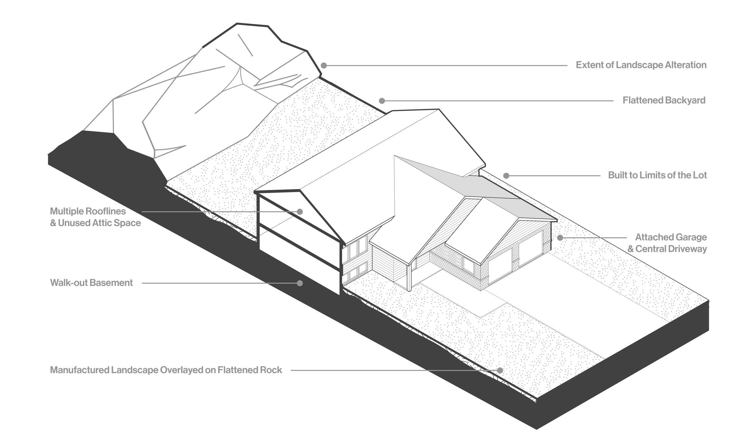
The natural landscape is flattened, blasted, bulldozed and ultimately destroyed to enable the application of a manufactured landscape that enables and supports the construction of template/ model homes. The landscape is altered to fit the construction of typical template homes designed for flat land and oriented primarily to the street and/ or cul-de-sac. In the case of the above typology analysis, the natural landscape has been flattened,
and in a great disastrous action the entirety of the natural landscape has been bulldozed to create a sectional condition that allows for a walk-out basement to increase the economic value of the house. This strategy sees the natural landscape as a burden and prioritizes the flattening and removal of unique ground conditions to be replaced by manufactured conditions that are foreign to the place. The house is not fitted to the landscape, it is forcefully driven into the ground providing an unrecognizeable landscape condition.
Chapter 2: History of Residential Development in Sudbury
23
Escape from Industry
It is in the slow-development of land outside of the city on the vast lakes of the area where residents have discovered agency in residential architecture. Interestingly, the areas to the south of Sudbury that have seen this migration to the lakes also represents some of the furthest distances between mining areas and dwellings. Residents who have migrated to the areas of Long Lake and surrounding lakes have escaped to the edges of land affected by the industrial pollution and the residential development control of developers. The trend of migrating to the area’s vast quantity of lakes occurred after the first world war where residents built summer cottages and permanent homes along the shorelines of the
over 100 lakes of the region.1 The areas chosen for settlement in these developments possessed distinctly Sudburian features and allowed residents slow-development as typical zoning by laws and building codes allowed for alternative lifestyles. People could acquire un-serviced, undeveloped land that was rich in natural features, and could slowly build a dwelling on the property at their own expense. The lack of housing-company interest in these areas meant that model homes were simply not the only choice in dwelling type. The slow-development of these cottage areas afford agency in residential development that the core of the city cannot. It is in these developments that the 1 1 Oiva W. Saarinen, From Meteorite Impact to Constellation City, 279.
Left: (F. 17) Diagram depicting the areas developed around the lakes to the south of the industry towns.
Beneath the Pines: Rebuilding the natural image of Sudbury through alternative residential development strategies.
Rural South End
Sudbury Basin
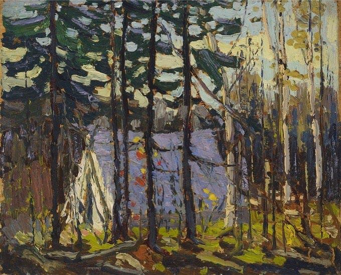
Right: (F. 18) Painting by Tom Thomson depicitng the modest artists camp set within the landscape. This painting describes a pattern of modest living in order to live within the untouched natural landscape.
thesis finds its grounding. It is apparent that there is a continued demand for residential development that offers an agency in architecture and a slowdevelopment process which has historically been met at the edges of organized municipalities, where the landscape remains relatively intact. It is an apsiration of the thesis to satisfies these demands of life rooted in nature in the heart of the city. Critical analysis of slow development projects in Sudbury and abroad will provide the framework of strategies to be employed in the design of the thesis project in order to explore how one could increase agency and accessibility to alternative dwellings at the heart of the city rather than the limited areas at the edge of the city.
The research of these homes and summer homes crafted over decades by families on the shores of the many blue lakes that interrupt the cascading hills of ragged rock, invites a depth of content and research best suited for it’s own comprehensive research study in order to be fair to the scale of the challenge. Continued research into this phenomenon would benefit the history of the Sudbury area and benefit greatly the definition of the vernacular of this place. More of a study of morphology than a study of typology, a compelling research project worth exploring in a focused inquiry aspiring to satisfy the query of the development of homes where the aspirations of the human in nature run free.
Chapter 2: History of Residential Development in Sudbury
25
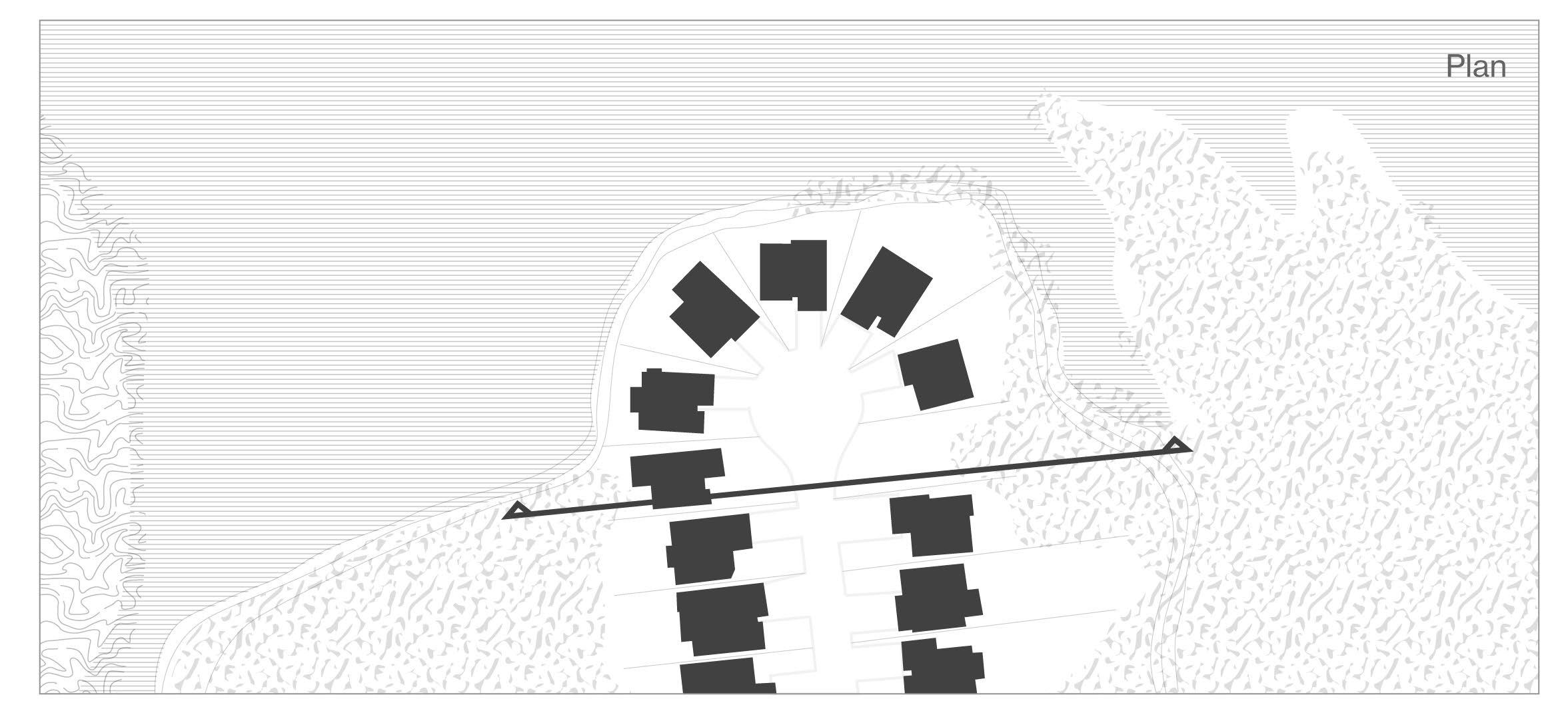
2.4 Suburban Lakeside Analysis
Where suburbanism meets the natural shoreline.
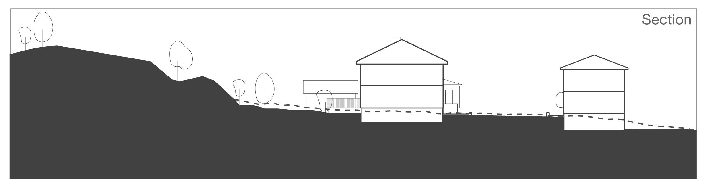
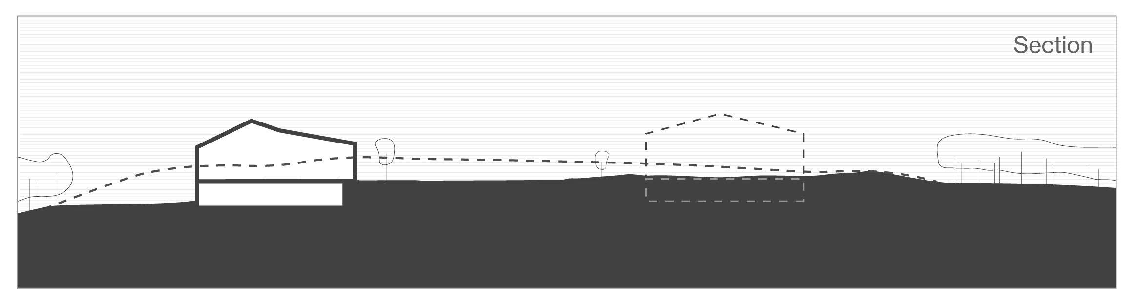
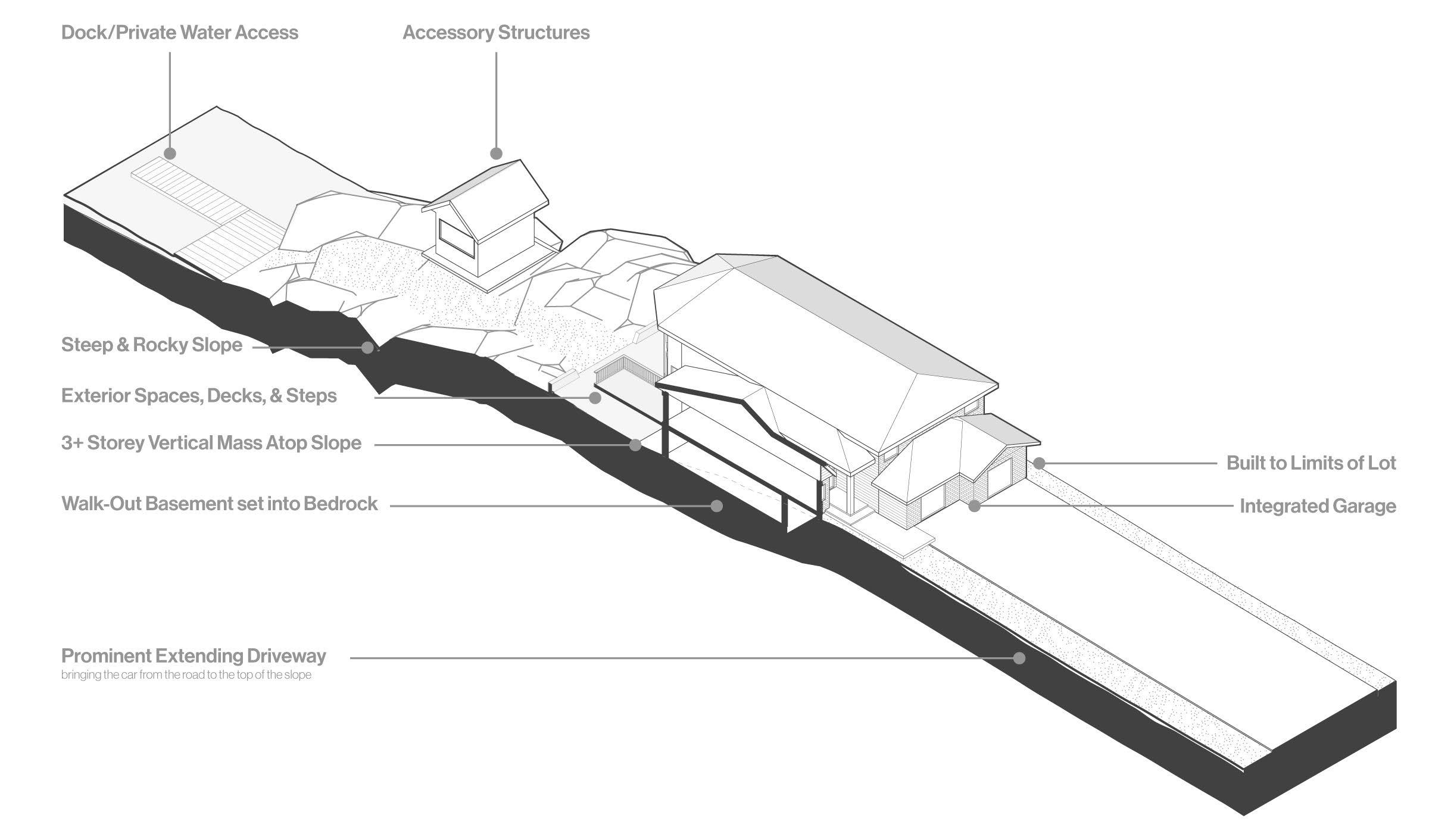
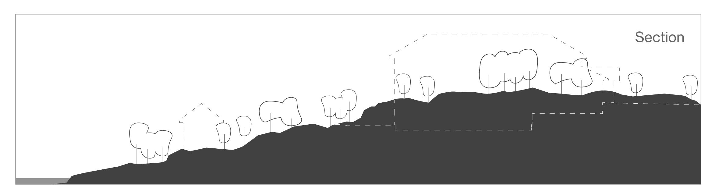
A dramatic natural landscape falls victim to the simplified suburban development strategies and zoning by-law restrictions. Positioned at the top of the rocky and elevated shoreline flanked by a natural shoreline and existing roadways, houses are built as close as possible to the water, while also taking advantage of the simplified height restrictions that encourage towering homes set to the limits of the site at the top of the steep shoreline. Many of the subdivided lots share similar natural conditions and are all subjec to the uniform regulations and bylaws that create a barrier condition between the lake and the road as large multi-story homes are placed side by side inline, atop the steep slope.
Left
This development condition creates a massive vertical and horizontal barrier that interrupts the relationship between the residents of Sudbury and the heart of the city, Ramsey Lake, with both persons on the water and those passing by on the roadways.
Rebuilding the natural image of Sudbury through alternative residential development strategies.
26
: (F. 19) Diagram of suburban settlements growing on the shores of Ramsey Lake, at the heart of the city.
Beneath the Pines:
2.4 Suburban Lakeside Analysis
Isometric Section
The suburban lakeside is a typology that features a diverse set of residential architecture further explored in the morphology analysis of Ramsey Lake. Contemporary examples of the residential architecture on the shores of the heart of the city have been growing in scale, creating monolithic barriers blocking the connection of the public to the body of water treasured by our community. For the purposes of this analysis, the contemporary houses developed using the suburban strategies popular today, will be analyzed in order to investigate the relationship between important natural landscape condition and the suburban strategies used in our city.
Typological Elements
A modest simple two-storey masonry home extends vertically from the ground atop a short services basement. A composition of simple hip and gable roofs populate the tops of the dense community. Visually intriguing and varied additions demonstrate the restrictions and the lacking connection to the outside of the original simple form and foundation type, spaces for conditioned and unconditioned outdoor living such as porches, sun rooms, decks, and generally small additions enrich the home both practically and visually.
Chapter 2: History of Residential Development in Sudbury
27
Below : (F. 20) Isometric Section depicting the typological elements of the suburban lakeside home.
Below : (F. 21) Plan drawing analysis of the Suburban Lakeside Neighbourhood Typology.
2.4 Suburban Lakeside Analysis
Houses set atop the shoreline ridge, built to the limits of the setbacks and zoning bylaws, create a barrier in both plan and section, blocking the connection between the public and the heart of the city.
Privatization of the shoreline prohibits public access and limits the outlook for Sudbury’s greatest source of water.
Organization
In plan, the effects of the repeated zoning bylaws can be seen as miniscule openings between houses afford a sliver of a view to Ramsey Lake. A condition of long driveways void of the natural landscape emerges as the reinterpreted suburban typology is implemented on Ramsey Lake. The distance between the roadway and the placement
of the house is flattened to afford car access from the road to the attached garages. This condition further reinforces the disconnect between the general public and Ramsey Lake through a vast expanse of flattened private space.
28
Beneath the Pines:
Rebuilding the natural image of Sudbury through alternative residential development strategies.
Driveway
Roadway
Steps
Gazebo
Deck
Dock Ramsey Lake
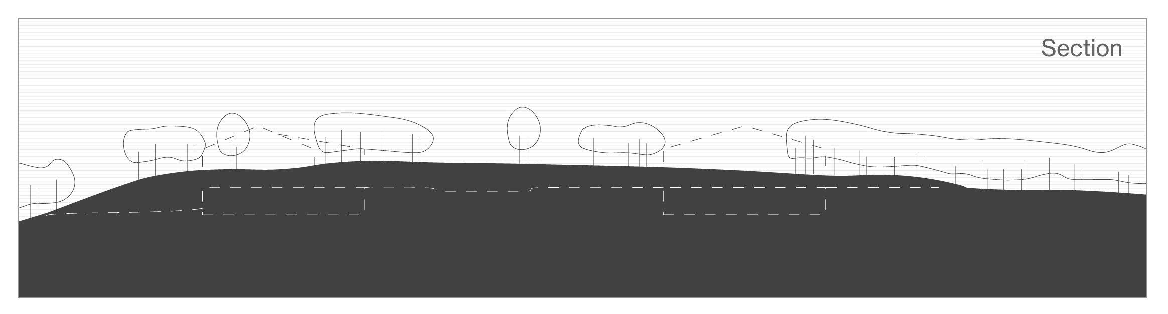
Top : (F. 22) Site section drawing analysis of the pre-development shoreline landscape.
Bottom : (F. 23) Site section drawing analysis of the post-development landscape conditions.
The topographically natural shoreline of Ramsey Lake acts as a large contributor to the image of the natural landscpae.
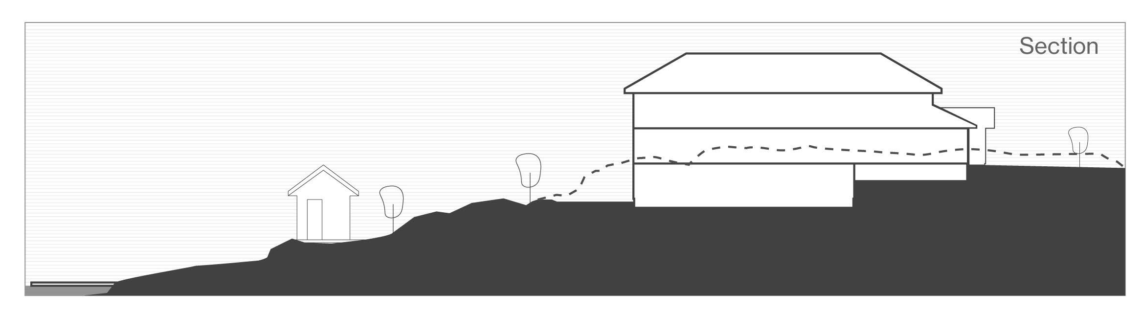
Natural Landscape
The natural landscape of Ramsey Lake features a steep shoreline comprising exposed bedrock and a healing sprawl of vegetation. When faced with the challenges of this natural terrain, developers have historically blasted, flattened, and altered the natural conditions of the site to place large houses near the water. Zoning by-laws, typical subdivision strategies, the challenging slope, and
Steep topography of the Ramsey Lake shoreline creates opportunity for manipulation of zoning bylaws, producing three-storey houses towering above the lake.
the human desire to live near the water results in the placement of houses atop the hill. The effect repeated over multiple repeated lots subject to the same conditions and zoning regulations results in a physical barrier, minimizing the connection of the heart of the city and natural landscape with the general public.
Touching the Ground
The flattened land and manufactured landscape robs architects and designers the ability to place a building sensitively upon the natural landscape. The phased approach to subdivision development creates a foundation based on the loss of nature which generally continues throughout the home building process resulting in a final home void of
the natural landscape and referencing conditions created by man. Sensitivity in architecture relies on having natural references for design. A developed lot void of it’s natural identity creates a condition where the sensitive design of how a building touches its site is much less genuine as the building has no natural reference.
Chapter 2: History of Residential Development in Sudbury
29
3.0
The Image of the City
Industrial Image of the City Suburban Image of the City Future Image of Sudbury
3.1 3.2 3.3
The Image of the City
Beneath the Pines: Rebuilding the natural image of Sudbury through alternative residential development strategies.
32
3.0
Through the reading of the book Image of the City by author David Lynch, the definition of the image of the city can be understood as being describes as: our perception of the city as residents and viewers of the city. The image is composed over time through the physical surroundings and physical elements and our perceptions of these elements through the five senses.2 Lynch argues that we are ourselves a aprt of the image of the city, and conjtribute to the image through our lifestyles. Importantly, Lynch also acknowledges the inequity that exists in the defining of the image of the city “but is is the product of many builders who are constantly modifying the structure for reasons of their own.”3 In the case of Sudbury, it is imperative
2 Lynch, Kenneth. The Image of the City. Cambridge, MA: MIT Pr., 1979. 2.
3 Lynch, Kenneth. The Image of the City. Cambridge, MA: MIT Pr., 1979. 2.
to critically examine who has contributed to the image of the city, and more importantly, who has been afforded the agency in defining the physical environment, and thus, the image of the city?
The billions of years of geological, cosmic, and glacial forces that have acted upon this land has of course been the main contributor to the overall experience of the landscape. This historical shaping of the area has created features, and challenges that create difficulties for city-building. However, over the relatively short period of time that industrialization has occurred on this land, it has created deep scars upon the natural image of the city. Through the industrialization period, the old-growth forests and diverse natural vegetation of the area has been destroyed and with it the soils have also eroded, leaving the bedrock exposed. The blackening of the rock has further stripped the image of the city of its vast geological history
Chapter 3: The Image of the City
33
Below: (F. 24) Historical image of Ramsey Lake dominated by the billowing smoke of the Copper Cliff mine.
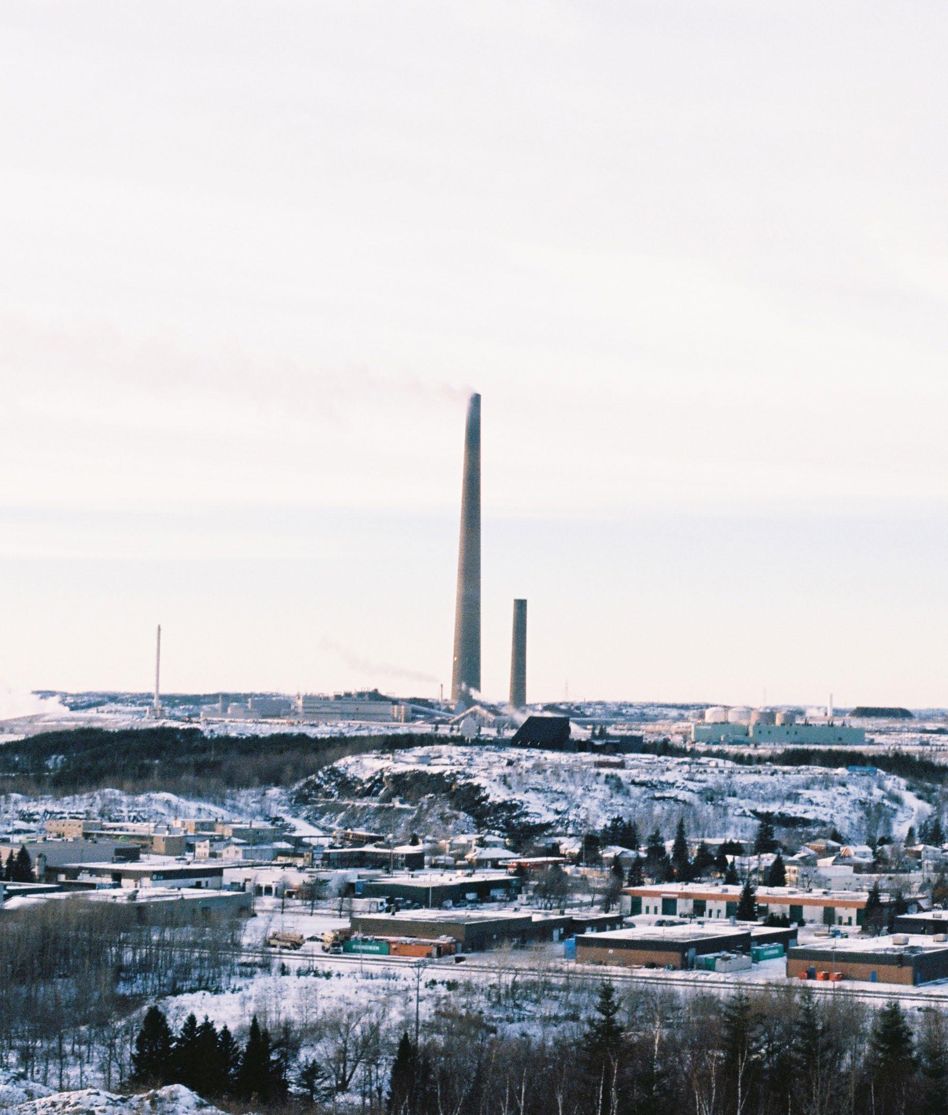
that can be read through the marking visible on the exposed Canadian Shield, however, the barren landscape complete with it’s blackened rock has contributed to an overall perception and image of the city as one of pollution and destruction in the name of economic development. Industrial architecture makes up the skyline of the city, and the city’s landmark of a Superstack, tasked with passing-on the pollution to other areas, is held as the cover image of the city. The ancient, natural, and rich geological image of the city of Sudbury has been destroyed and instead replaced by one of a blackened and polluted landscape in a relatively short period of time. The residential development of the city through industrialization and suburbanization has also further abstracted the image of the city from what it was and could be and instead replaced it with an image defined by industry and by the sameness of suburban sprawl.
In order for the residents to reclaim the image of the city, it is imperative that the agency in residential architecture be returned to the people in order to allow for the contribution of the image of the city through residential architecture. When the Superstack is scheduled to be torn down, and when alternative lifestyles are becoming more prevalent, there is no better time to develop alternatives to the norm that support agency in the contribution to the image of the city while also respecting the incredible billions of years of geological history of the area.
34
Beneath the Pines: Rebuilding the natural image of Sudbury through alternative residential development strategies.
Below: (F. 25) Photo by author depicting the relationship between industry and the horizon, contributing to the image of Sudbury.
The billowing smoke of the Superstack is an iconic landmark of the Sudbury area. It signals home to many heading back north, however, will an industrial piece of architecture always signal home to Sudburians?

Chapter 3: The Image of the City
35
Left: (F. 26) Photograph depicting the prominence of the industrial developments to the image of Sudbury.
By day and by night, the industrial architectural of the Sudbury area is a prominent contributor to the image of the city. These industrial images fften occupy the peripherals throughout the daily life of Sudburians.
36
Beneath the Pines: Rebuilding the natural image of Sudbury through alternative residential development strategies.
Right: (F. 27) Collage depicting the industrial images of the city, featuring elements of mining, housing, the barren landscape, and important landmarks of Sudbury.
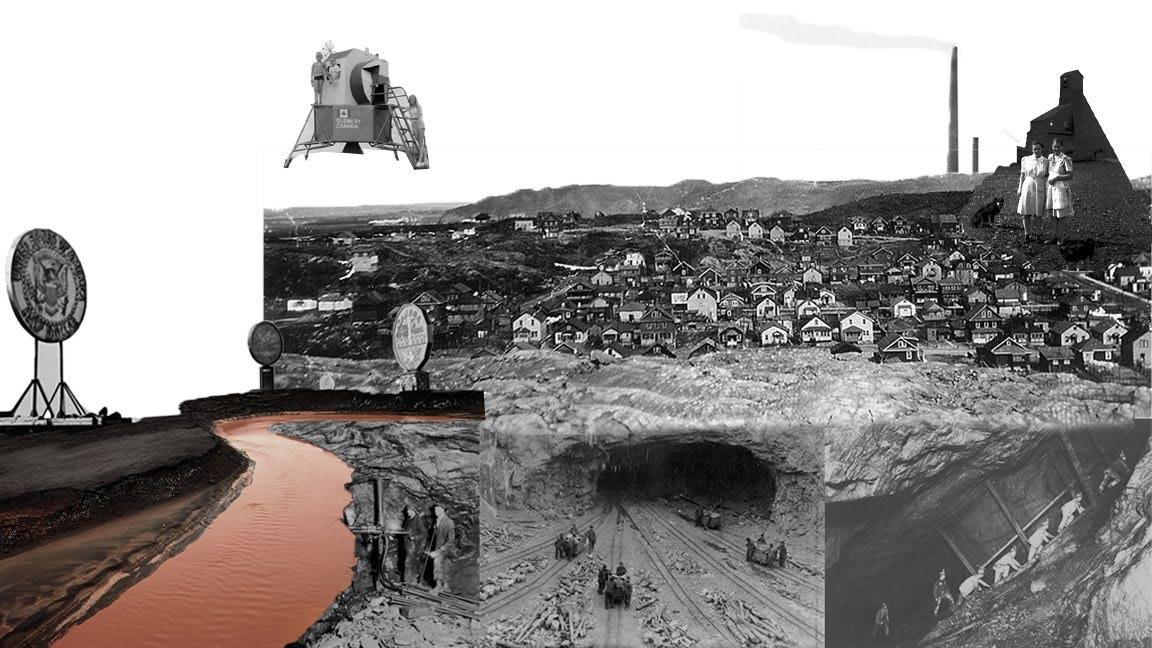
3.1 Industrial Image of the City
The image of the city has been claimed by the industrialists through physical interventions void of consequential thought toward the environment or the population. Industrial architecture and symbols of economic development stand as landmarks of the city and through the destruction of the natural landscape, are the main contributors to the image of the city.
Chapter 3: The Image of the City
37
Rebuilding
38
Left: (F. 28) Photo from atop the Creighton Fault, of the suburban development on the southern shore of Ramsey Lake.
Suburban housing at the edges of natural landscape. In the foreground, wetlands and grasses rise from the frozen ground, leading to a stand of confierous trees populating the Creighton Fault.
Beneath the Pines:
the natural image of Sudbury through alternative residential development strategies.
Right: (F. 29) Collage depicting the images produced by the suburban development strategies.
3.2 Suburban Image of the City
More recently, the image of the city is now being claimed by developers and the economic drivers of residential development through the flattening of the landscape, the manufactured landscapes, and the erection of ill-designed model homes that evoke an anonymity identifiable by no distinct city. The commodification of architecture and of the landscape now contribute to an image of sameness and of poor-design.
Chapter 3: The Image of the City
39
Left: (F. 30) Collage presenting the potentian contributors to the future image of the city of Sudbury.
3.3 Future Image of Sudbury
If afforded the agency, how might residents of this city define their own physical environment in order to contribute equitably to the image of the city? Slow development that emphasizes an amelioration of the quality of life and agency in residential architecture can contribute slowly to the definition of a new image of the city.
40
Beneath the Pines: Rebuilding the natural image of Sudbury through alternative residential development strategies.
Right: (F. 31) Photo depicting perspectives of the human immersed within the surrounding natural landscape of Sudbury.
Can being immersed in the natural landscape create new perspectives for how we can develop a new image of the city that is original to the natural landscape of the area?
Chapter 3: The Image of the City
41
4.0
The Heart of the City
The Heart of the City Morphology Studies A Canvas for the Natural Image of the City
4.1 4.2 4.3
The Heart of the City
the Pines: Rebuilding the natural image of Sudbury through alternative residential development strategies.
44
Beneath
4.1
At the heart of the Greater Sudbury area lies the main character of the formative story of Sudbury. Ramsey Lake has been the main actor in the story of Sudbury throughout the history of white settler activity in the area. The waterbody, through its scale and power, influenced surveyors from the very beginning, when it was still referred to as Lost Lake.1 Ramsey Lake, as it would later be called, became one of the main reasons for developing the area with the Canadian Pacific Railway (CPR) rerouting their path to the northern shore of Ramsey Lake where it would establish a lasting boundary on the lake.2 In 1883, surveyors working for the CPR discovered the rust-coloured rock on the railway line that passes by Ramsey Lake.
1 Oiva W. Saarinen, From Meteorite Impact to Constellation City, 63.
2 Oiva W. Saarinen, From Meteorite Impact to Constellation City, 63.
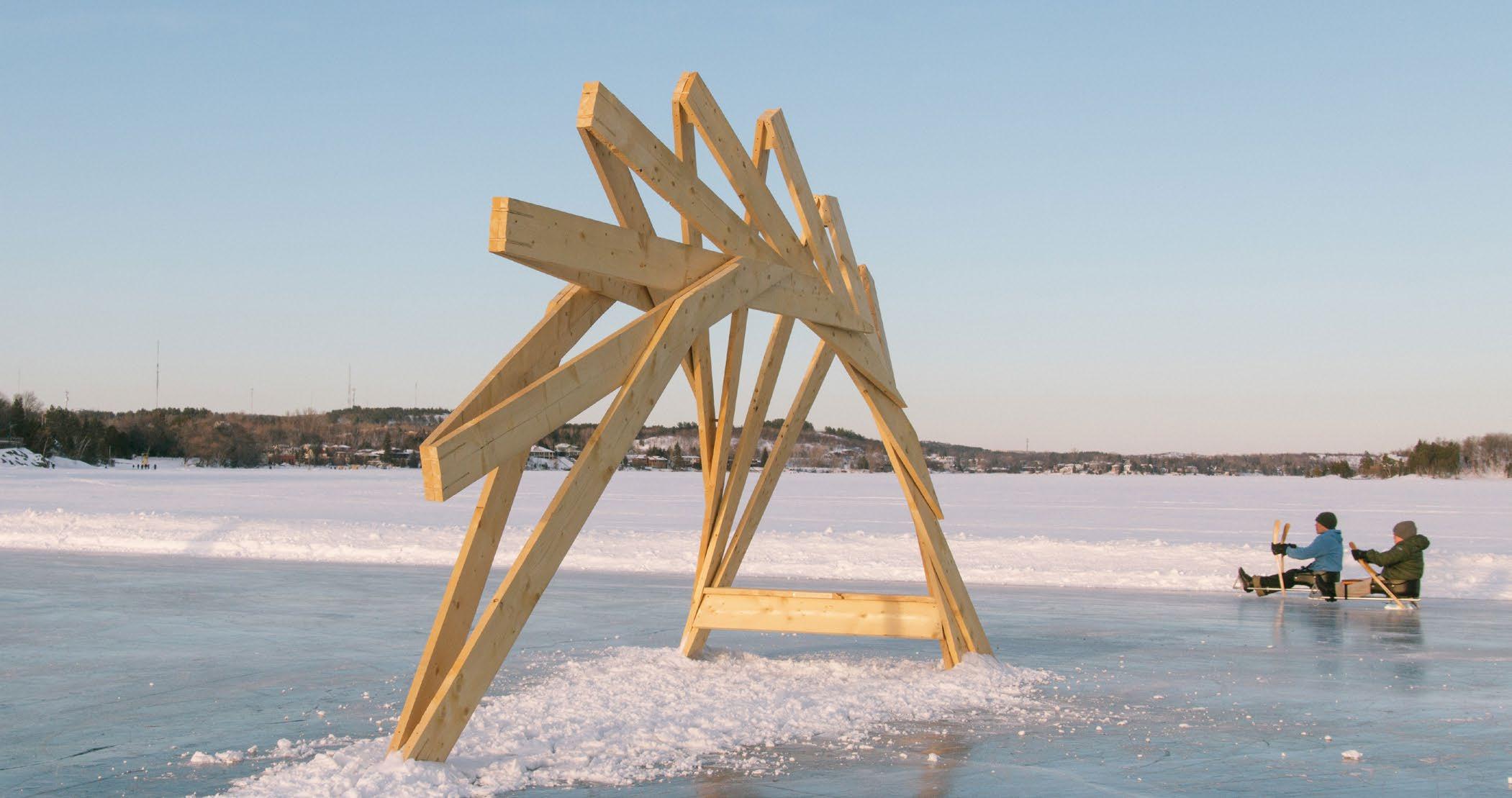
Below: (F. 32) Photograph of a seasonal architectural installation fixed to the heart of the city.
The discovery of precious metals in 1883 was the catalyst for a booming industry and exponential settlement in the area. As noted previously, early mining settlements of the area were positioned at the edges of the Sudbury Basin where mineral deposits were located. As these mining communities continued to grow and develop flourishing communities, a desire for recreation attracted residents to congregate on the shores of Ramsey Lake.3 Early development around Ramsey Lake involved primarily recreational programs that supported the desires of families looking to spend time on the weekends. Ramsey Lake offered a unique opportunity for recreation in both the summer and winter seasons. A waterbody host to a sailing club, swimming beaches, the recreational boats of anglers and families, as well as those
3 Oiva W. Saarinen, From Meteorite Impact to Constellation City, 72.
45 Chapter
The
of the City
4:
Heart
attracted to the water for its shoreline conditions, would evolve through natural processes and a swift change in seasons to provide Sudburians with new perspectives of the city was the water froze to playful sheet of ice.4
Ramsey Lake has been the magnetic force throughout time that has attracted residents of the mining towns on the edges of the region to congregate to a central hub of recreation. At the scale of the greater city, Ramsey Lake is at the center of the vast geographic area in close proximity to the downtown core. A strong connection to a vibrant downtown core establishes a rich connection to the various services and features of the city. As a host to the transit terminal, the Sudbury arena, arts and culture centers, a diverse and vibrant hospitality scene, a commercial and retail sector, the downtown core is an important connective force that along with Ramsey Lake, attracts residents from all regions of the city and encourages social connections. Programming on the shores of Ramsey Lake has been a focus throughout history, and has developed to include an internationally acclaimed Science center, a new watersports center, health centers, a shoreline park that is host to numerous seasonal events, and a series of bike and walking trails that all contribute to the power of Ramsey Lake and its ability to encourage spending quality time by the water.
4 Oiva W. Saarinen, From Meteorite Impact to Constellation City, 72.
46
Beneath the Pines: Rebuilding the natural image of Sudbury through alternative residential development strategies.
Below: (F. 33) Historical photo of a populated Bell Park on Ramsey Lake.
47
Chapter 4: The Heart of the City
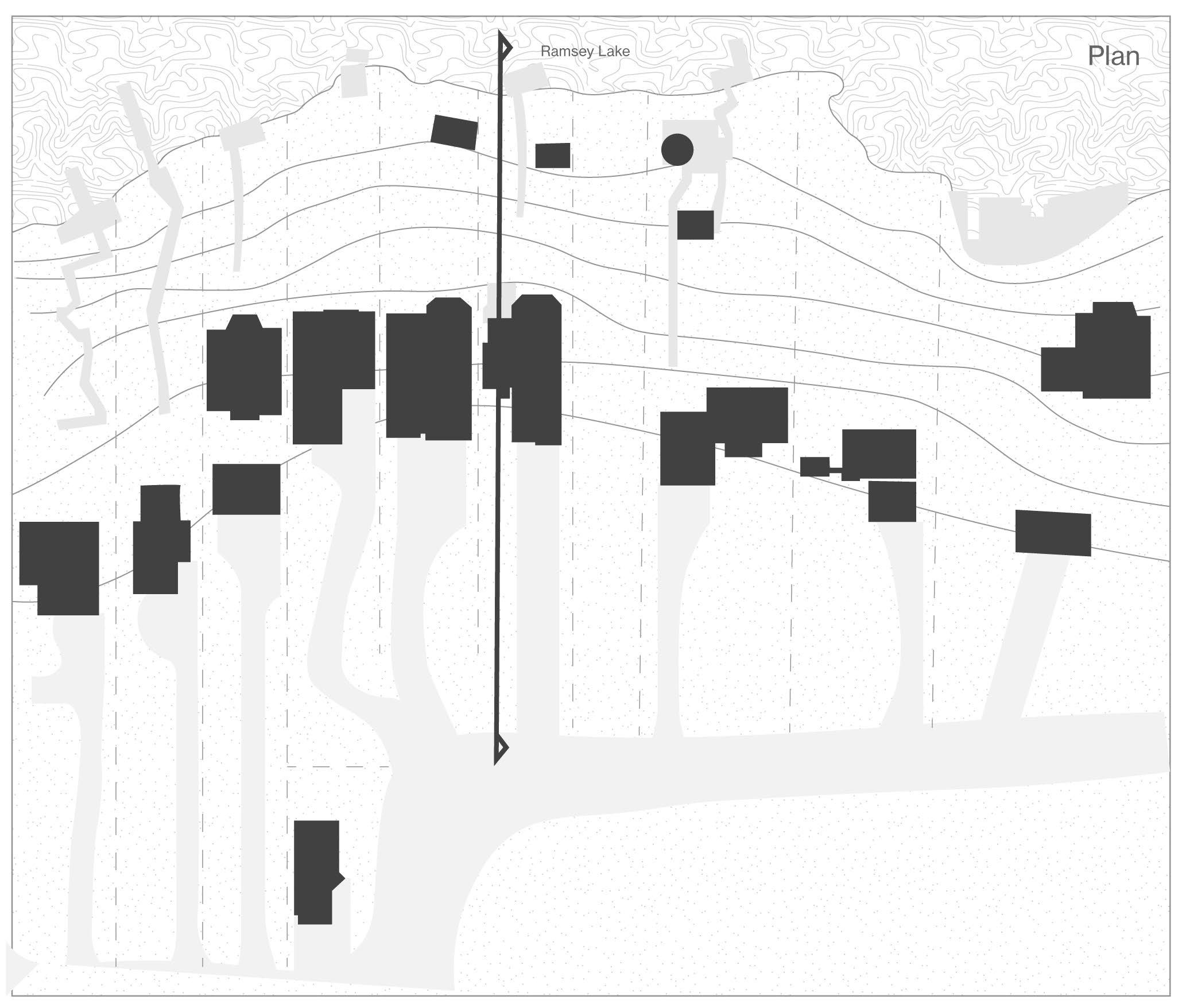
Left: (F. 34) Mapping culturally significant areas and programming around Ramsey Lake, at the center of Sudbury.
Ramsey Lake has been developed to feature western and eastern shorelines that are mostly dedicated to public used. However, the Northern and Southern shores have been privatized and comprise a much larger portion of the overall shoreline, reducing the impact of heart of the city.
At the heart of the city we find Lake Ramsey, the largest lake contained within a city, and most importantly, the city’s largest source of drinking water. It is not only in its delivery of drinking water that makes the lake so important to the city, but it is in its history as a center for recreation in the area that further depicts the lake as the beating heart of Sudbury.
Oiva Saarinen describes Lake Ramsey as “An important asset to the quality of life for the local citizenry, not only for its scenic and ecological value, but also for outdoor recreational purposes such as swimming, fishing, ice skating, and boating. Indeed, the use of these waterways has developed so much that Sudbury is increasingly viewed as a
“city of lakes” rather than a “city of rocks.”5 This is further reinforced through the municipality’s plan to further focus on preserving the lake and its recreational capacities now and in the future.6 The City has presented plans to further develop the eastern shores of the lake to fortify the idea that the Lake is at the center of the city.7
5 Oiva W. Saarinen, From Meteorite Impact to Constellation City, 18.
6 https://www.greatersudbury.ca/sites/sudburyen/assets/ content/div_planning/documents/Ramsey_Lake_CIP_no_ Appendices2.pdf
7 City of Greater Sudbury, Ramsey Lake 20 Year Master Plan,, 1994, https://www.greatersudbury.ca/sites/sudburyen/ assets/content/div_planning/documents/Ramsey_Lake_ CIP_no_Appendices2.pdf. 18.
48
Beneath the Pines: Rebuilding the natural image of Sudbury through alternative residential development strategies.
Right: (F. 35) Historical image depicting canoes sailing using the winds energy on Ramsey Lake.
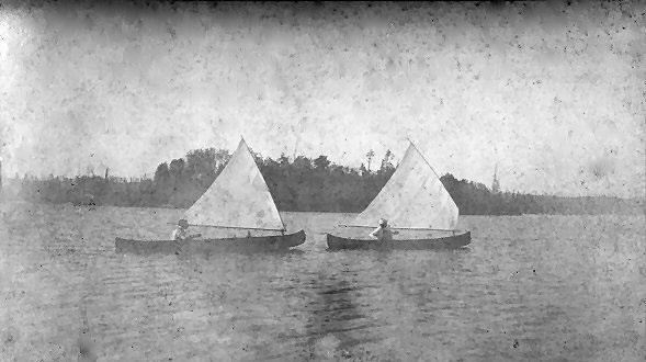
The Lake is increasingly becoming the face of the city as we transition away from the industrial era, into a more optimistic and environmentally focused future, led ultimately by the connective forces of Ramsey Lake.
The story of Sudbury began with Ramsey Lake and has been the medium through which its residents have connected with each other and with the powerful and unique natural landscape. The future of Greater Sudbury will continue to reference the waters of its central waterbody throughout its timeline and offer a connection to each forthcoming generation. Ramsey Lake is the heart of the city. Its heartbeat is felt with each wave, and its pulse is read in the ripples of the sand on its beaches. A spring
thaw makes audible the history of exploitation and of reconnection. Ramsey Lake as the actor and the subject awaits new relationships for its shores. Now home to over 890 residents, the evolution human dwelling relationships by the heart of the can be studied to further gain understanding of the story of the landscape and those it supports.8
8“Ramsey Lake 2019 Phosphorus,” Greater Sudbury, accessed March 2, 2022, https://www.greatersudbury.ca/ play/beaches-and-lakes/lakes/local-lake-descriptions/ ramsey-lake/.
4: The Heart of the City
49
Chapter
Morphology Studies
Beneath the Pines: Rebuilding the natural image of Sudbury through alternative residential development strategies.
50
4.2
Morphology in architecture is the study of the evolution of form within the built environment.9
The morphology of residential development around Ramsey Lake has been evolving ever since the waters have hosted human recreation. As the city of Sudbury grew to the west of the shores of Ramsey, so too did the population grow around the water itself. With the lake as a centerpiece of temporary recreation for so many residents, it is understandable that the natural progression would involve residents looking to live on the waterfront permanently. The relationship between humans and Ramsey Lake is a dynamic bond between a body of water that sustains life for the population
9 “Morphology (Architecture and Engineering),” Wikipedia (Wikimedia Foundation), accessed March 3, 2022, https:// en.wikipedia.org/wiki/Morphology_(architecture_and_ engineering)#:~:text=Morphology%20in%20architecture%20 is%20the,to%20people%20evolves%20and%20changes.
of humans who have at times exploited its waters. Through industrial endeavors and suburban development the waters of Ramsey Lake have been scarred and the unique landscape of its shores have been destroyed and exploited through an inconsiderate motivation driven by economy. Oiva Saarinen describes the architecture of the area as
“While most people would agree that these newer developments reflect significant advances in terms of engineering technology and improved greenery and make Sudbury more attractive overall, the generic style of curved streets, cul-de-sacs, and mall-style buildings often reflect little architectural imagination in transforming these rockscapes into something that is truly Northern.”10
If the relatively short history of residential
10 Oiva W. Saarinen, From Meteorite Impact to Constellation City, 279.
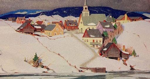
51
Chapter 4: The Heart of the City
Below: (F. 36) Painting by Clarence A. Gagnon titled “Spring Thaw” depicting a rural community build atop a steep shoreline.
Left:
architectural development in Sudbury cannot be attributed as an architecture of place, an architecture of the captivating landscape, then through an analysis of the morphology of the residential architecture on the shores of Ramsey Lake the opportunities and misfortunes of the morphology will arise.
Early Settlement
Evidence of the early morphology of Ramsey Lake exists rarely today. Visible only through historic images and modest architecture not attributable to the trends of today present a sense of a camplike development that recalls the descriptions of settlement habits following the first world war.11
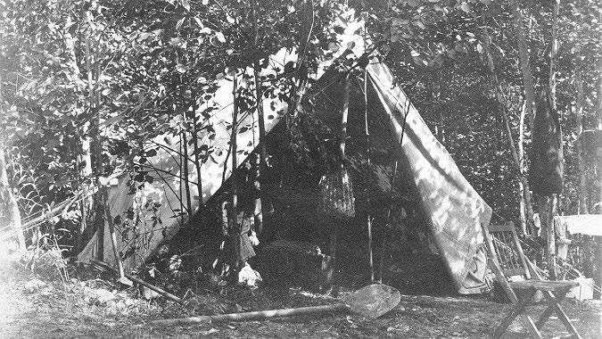
An unformal organization can be read, or more accurately a disorganization. Buildings are sited away from the shoreline, their scale and volume seemingly decided by the clearing naturally available and finalized by a dedication of “good enough”. A spot chosen beneath the trees, perhaps taking the place of the picnic blanket, provides the refuge one seeks by the water. Materials are chosen based
11 Oiva W. Saarinen, From Meteorite Impact to Constellation City, 279.
52
Beneath the Pines: Rebuilding the natural image of Sudbury through alternative residential development strategies.
(F. 37) Historical photo depicting early temporary settlements on Ramsey Lake.
on what’s immediately available, rather than of the global trends present today. A sense of desire to be next to the water and beneath the trees as opposed to a more common condition seen today. The small architectural interventions dissolve their scale across the land, finding clearings between trees and placing organizations of out buildings that encourage a walk in the landscape. The space between the buildings create new conditions and new textures from a shoreline elevation. Pathways, trees, the rising rocky landscape all visible between the buildings providing a generous image of the natural landscape for all that pass either by water, land, or by ice. The sense of arrival abstracted, and a new narrative begins as familiar trees, rocks, and soft patches below the foot incite an excitement
for the warmth of the home nearby. A walking path leads one through nature to a home tucked into the landscape. The pathway was not one of convenience, it was not formed by the placement of hot asphalt, but instead formed through a slowly developed compromise between action of the human and a reaction by the natural landscape. The earliest examples of the morphology of the area indicates a lightness and sense of a temporary construction, an understanding of placing ones place within the landscape, and building a structure that is just enough, so that the character of the landscape maintains its prominence.
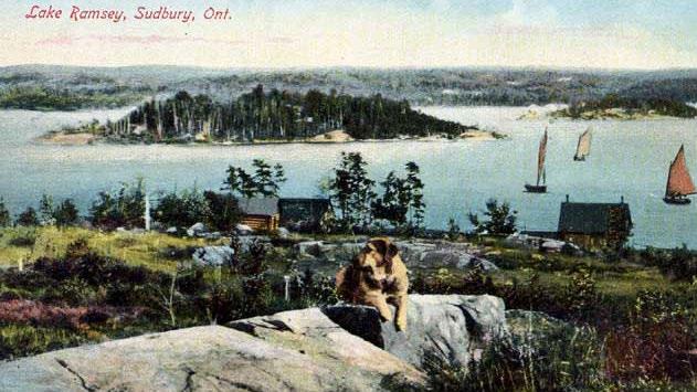
53
Chapter 4: The Heart of the City
Right: (F. 38) Historical image depicting early log cabin settlements on Ramsey Lake.
Left:
Elements of natural vegetation reserved for the spaces between houses populating property lines of each lot for the purposes of privacy.
Consequences of the Suburban Plan
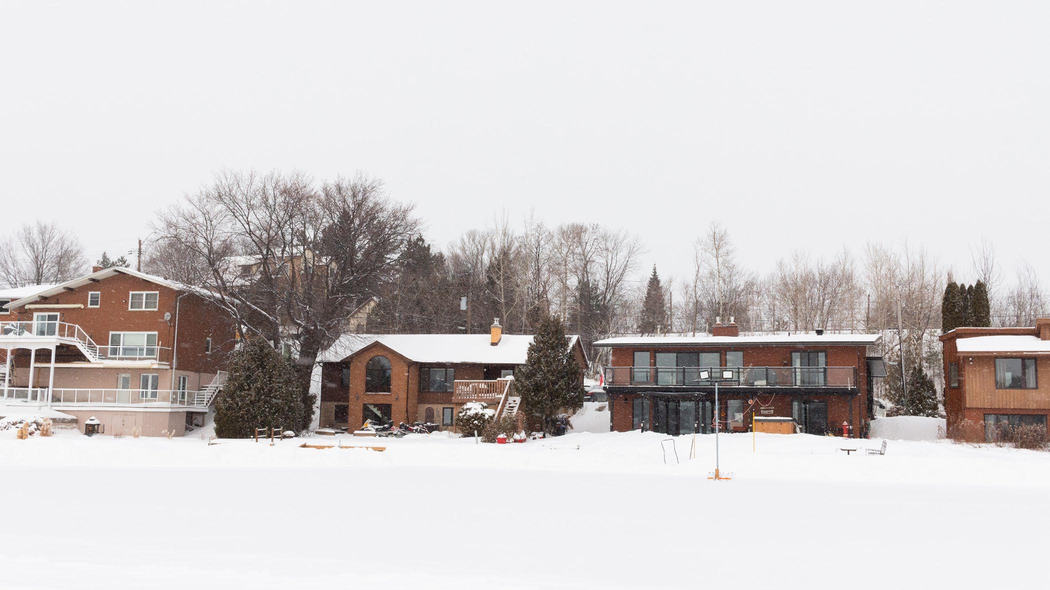
Suburban development strategies on Ramsey Lake contribute to a challenging condition between a man-made and two-dimensional organization system overlayed onto topographically rich and naturally dynamic shoreline condition. Suburban development strategies are universal. Which developers appreciate for their cost effectiveness and oversimplification. However, a system with no clear intention of place contributes little to the image of the city and certainly not to the perception of the greater public. They are of no place and should have no place upon the dramatic landscapes of Sudbury weaving between Sudbury’s prominent waterways.
Physical boundaries exist in the small, ondesigned areas between buildings that supports concepts of shoreline privatization. Boundaries also exist between the road and the shoreline as large volumes of house are erected to the limits of the site, creating a barrier of the shoreline to those in a car, in a canoe, or those passing by in running shoes. The roadway itself acts as a barrier between the shoreline and the neighbours across the road who are only afforded tiny glimpse of the water framed between a large mass of vinyl and a maple sapling emerging from a manufactured landscape of turf. The act of drawing property lines from a road to the shoreline privatizes the shoreline and encourages individual thought on a landscape shared by thousands and connected
54
Beneath the Pines: Rebuilding the natural image of Sudbury through alternative residential development strategies.
(F. 39) Photograph taken from the lake, depicting current development trends on waterfront lots of Ramsey Lake.
Right: (F. 40) Photograph taken from the lake, depicting the morphology influenced by zoning bylaws and suburb strategies.
Due to the setbacks of the zoning bylaws, a ribbon of housing of similar shape and scale are organized side by side, inline, creating a barrier.
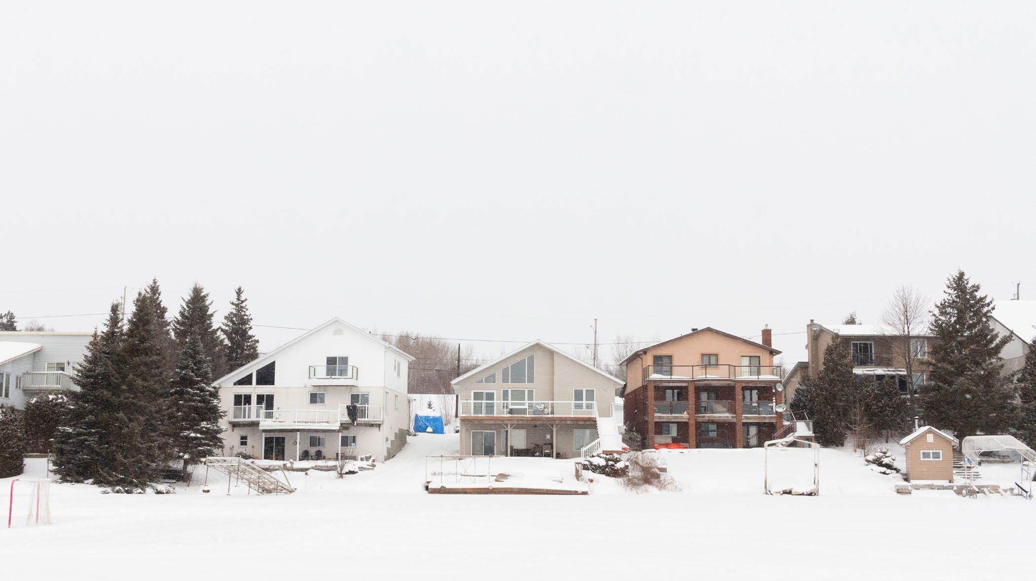
by a rich history. Interestingly, the public road provided by the city, provides the social fabric that unites the houses. However, each lot features their own private acces to the water in the form of infrastructure. It can then be assumed that, “if you build it, they will share it.”
The automobile has further distracted the home from its origins. A commute by car ends with a drive into a dark garage, and without a view out to the grand landscape or a soft step on the vegetation, one is burrowed between the walls of sameness.
55 Chapter
4: The Heart of the City
Beneath the Pines:
Below: (F. 41) Collage of four houses depicting the barrier condition created by the current development of large homes set to site setbacks.
Rebuilding the natural image of Sudbury through alternative residential development strategies.
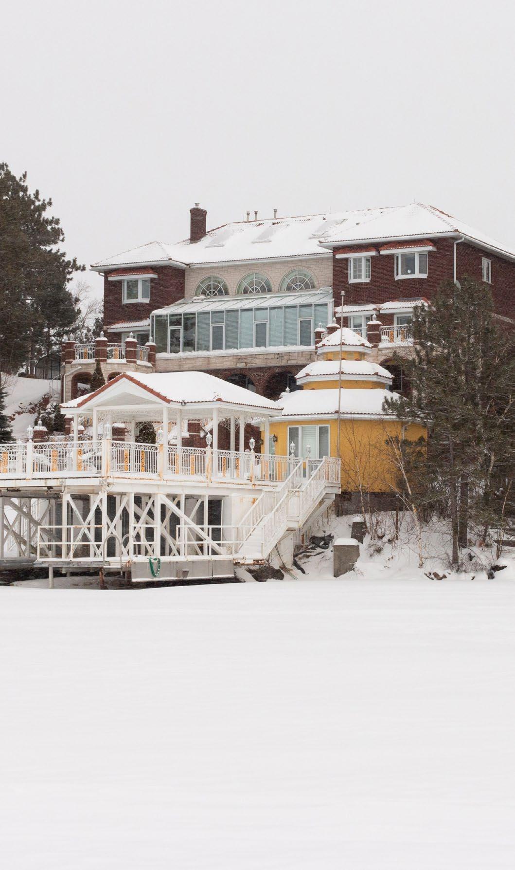
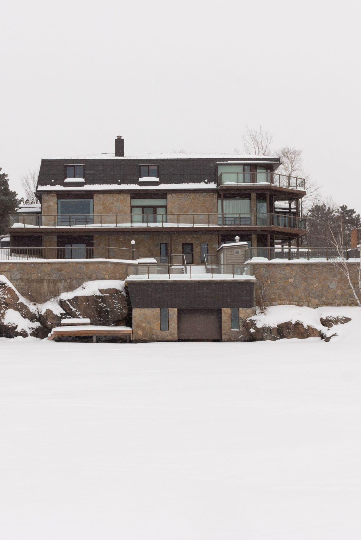
56
Due to the setbacks of the zoning bylaws, a ribbon of housing of similar shape and scale are organized side by side, inline, creating a barrier.
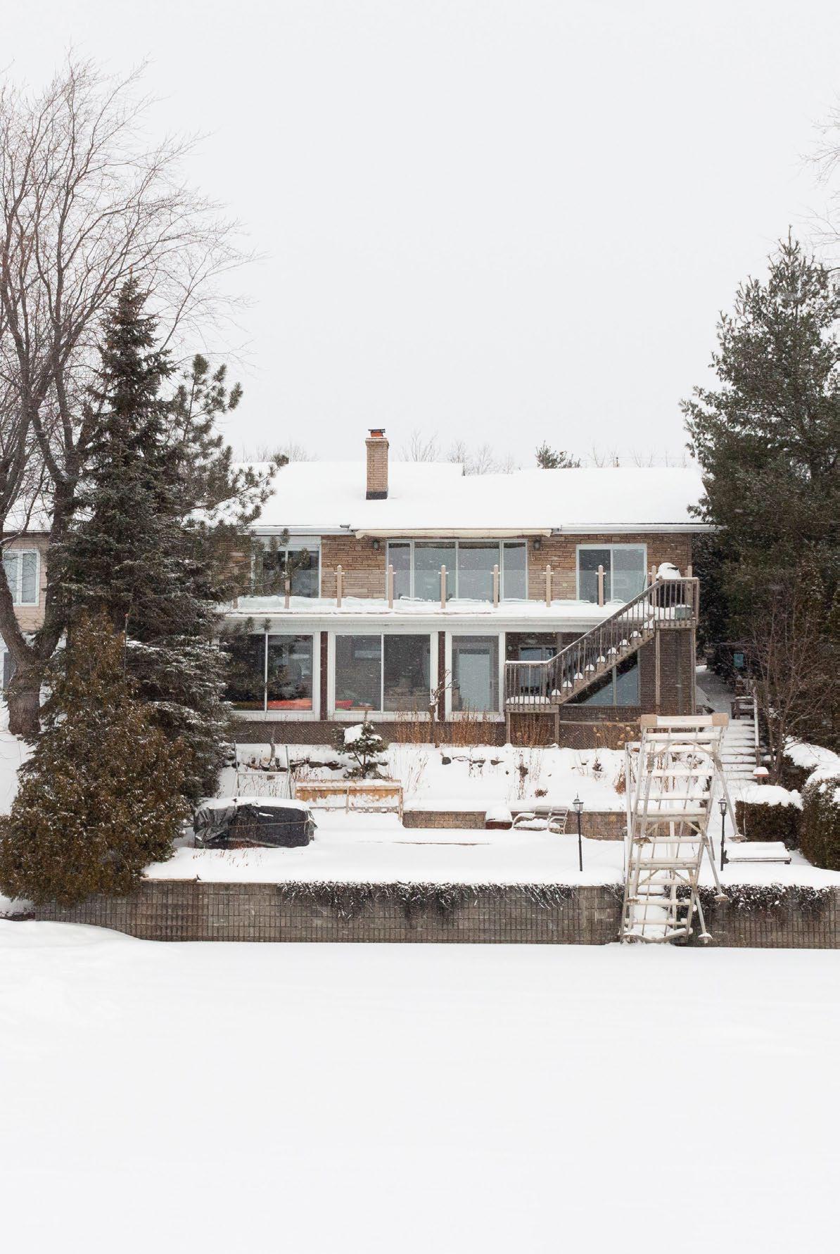
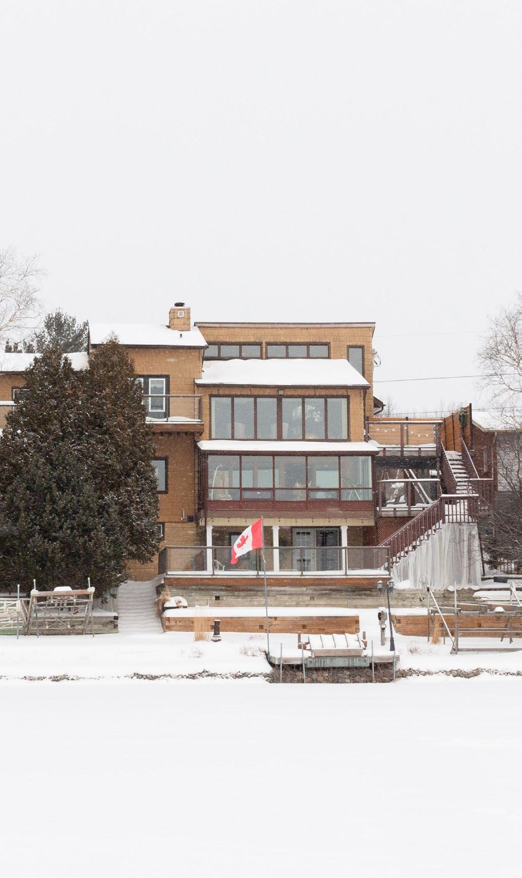
57 Chapter 4: The
of the City
Heart
Consequences of Parcel Design
The division of property from the straight road to the undulating shoreline can easily be read as buildings are imposed on an imaginary line that represents the obedience to the two-dimensional and redundant laws that have no clear intent other than to strengthen the visual identity of a singlefamily home. Zoning bylaws are often concerned with density and of adjacent building types and less concerned for the landscape beneath their designations. 12 Imperative natural conditions such as shoreline, dramatic site topography, geological significance of the area, and even reclamation efforts sponsored by the city. The zoning bylaws
12 Zoning by-Law 2010-100Z,” Greater Sudbury, accessed March 3, 2022, https://www.greatersudbury.ca/do-business/ zoning/zoning-by-law-2010-100z/
that govern a lot are even less considerate to the landscape it governs. Rigid restrictions and setbacks manufacture a barrier condition as residents consider the site carte-blanche and are only guide by maximum limits. Due to the sectionally rich condition of shoreline lots, the barrier is further reinforced through vertical plinth placed atop of the hill, abstracting and disguising the character of the slop. The result is a lot which was once dynamic and natural, now features a house built upon a manufactured landscape that allows for a home to meet maximum limits. When repeated over time, the barrier grows with each new developed home.
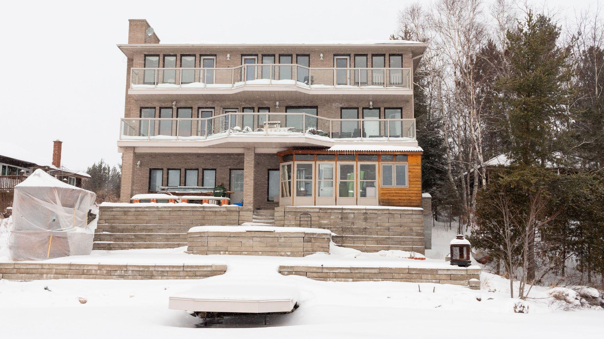
58
Beneath the Pines: Rebuilding the natural image of Sudbury through alternative residential development strategies.
Left: (F. 42) Photograph depicting the monolithic nature of three-storey homes built to the absolute liimits of the lot.
Three-storey homes built to the limits of site setbacks create monolithic buildings void of any reference to the natural landscape.
Right: (F. 43) Photograph depicting the evolving scale houses, further defining a morphology separate from the natural landscape.
New developments on Ramsey Lake prioritize panoramic views at the cost of the destruction and casting away of the natural landscape.
The Resulting Neighbourhood
The resulting neighbourhood is one that contributes little to the greater public. The suburban strategies that deliver sterilized sameness described in Lisa Rochon’s Up North does not convey the character of the place, or the true intentions of the residents.13
A privatized shoreline reinforced by a barrier set atop the slope conveys clearly that the suburban plan and the zoning bylaws and lot organizations reinforce a privatization that does not contribute to any shared construction of an optimistic future of the city of Sudbury. The resulting neighbourhood speaks not to one at the heart of the city, but instead of one of elitism and clear delineation between residents of the greater city. The imposition of rigid,
13 Rochon, Lisa. Up North: Where Canada’s Architecture Meets the Land. Toronto, ON: Key Porter, 2006, 21.
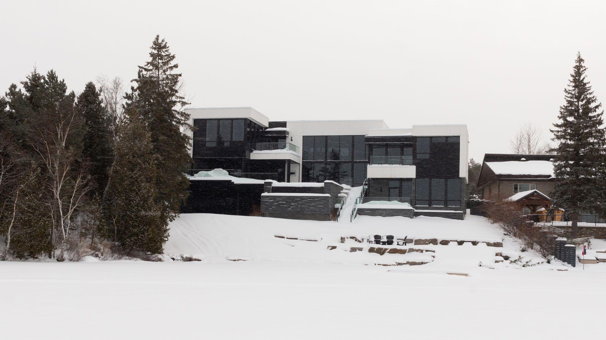
man-made system on dynamic natural landscapes encourages a carte-blanche approach by the individual to create their own landscape at the further detriment of the character and spirit of the landscape shared by all Sudburians.
Figure ground drawings, plan, section - relationships to road and shoreline organized in a comparative fashion to show how early morphology has evolved through suburb design.
Photos comparisons of houses/camp style buildings
It is clear that the morphology of the residential development around Ramsey Lake has evolved from ancient traditions of building small camp-like buildings built to the imaginations of the human responding to the landscape to newer practices
4: The Heart of the City
59
Chapter
of massive homes built to challenge the limits set out in the bylaws. The barrier condition existing in the current morphology can be remedied but only through a new approach to land-ownership, community design, and an overall change in perspective of the landscape and all of its dimensions.
Examples of humble buildings responding to their landscape and to the community as a whole do exist. The strategies studied from both the successful and less successful contributions to the image of the city will inform the design of a new approach to residential architecture on the shoreline.
Below: (F. 44) Photograph demonstrating a home built to the steep slope. of the natural shoreline.
The home set to the slope with a matching sloped roof stands out as an intentional act of respecting the landscape and builting true to site.
Pines: Rebuilding the natural image of Sudbury through alternative residential development strategies.
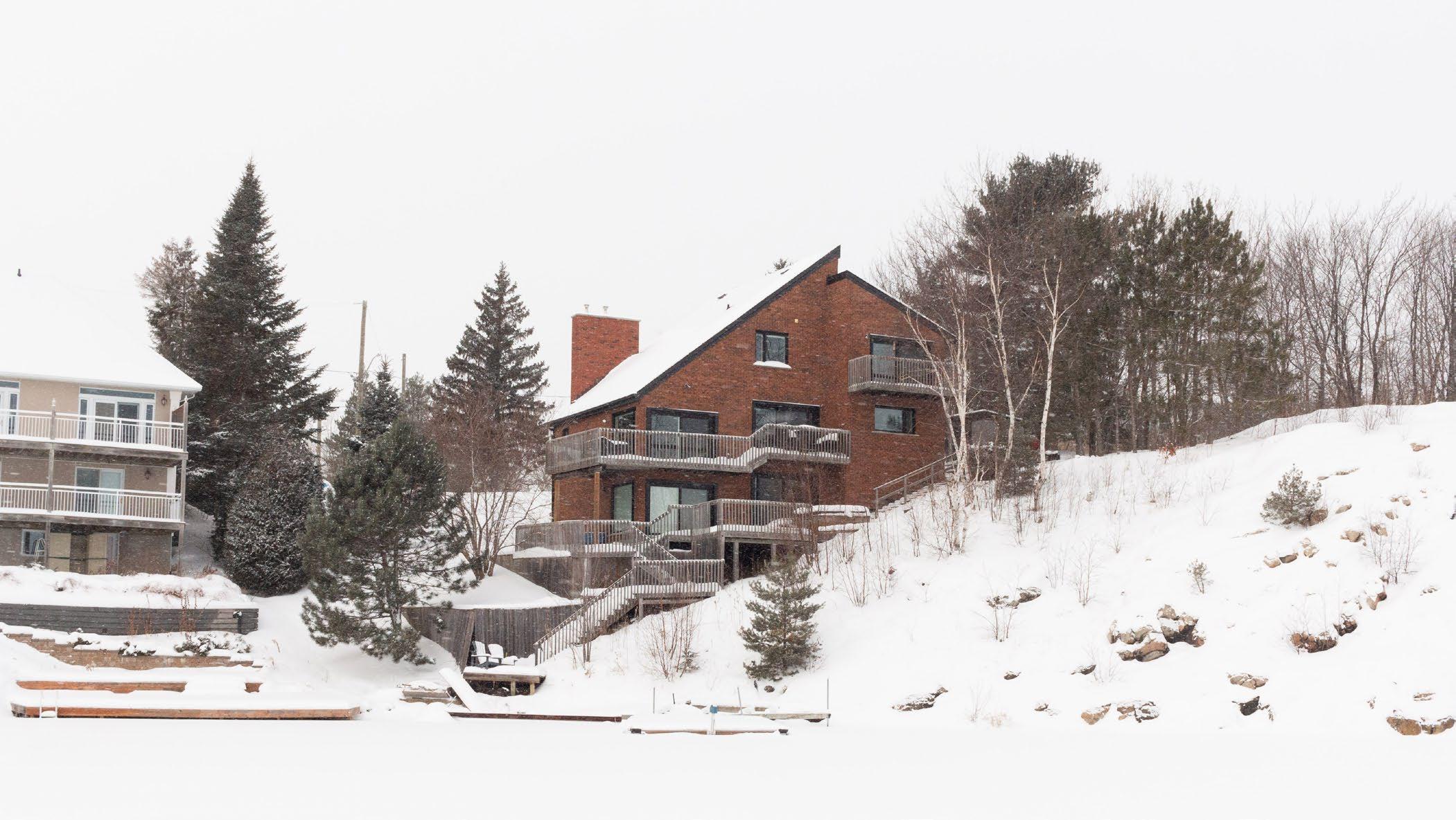
60
Beneath the
Right: (F. 45) Collage of four scenes taken from the lake, depicting modest building form, contributing to morphology more closely linked to nature.
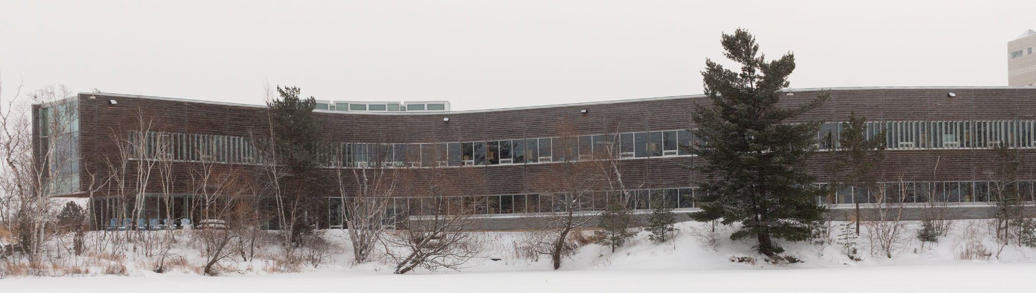
Modest buildings built sensitively allow for natural vegetation to continue growing, resulting in living within the natural landscape.
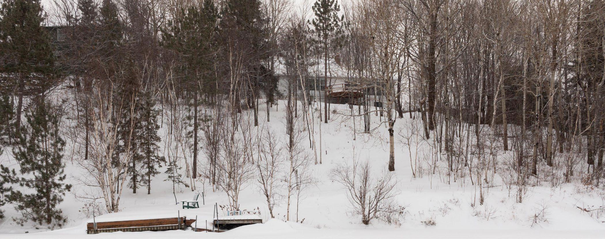
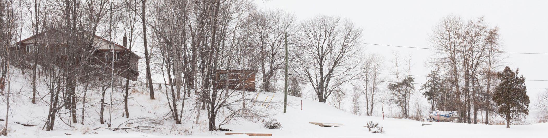
Chapter 4: The Heart of the City
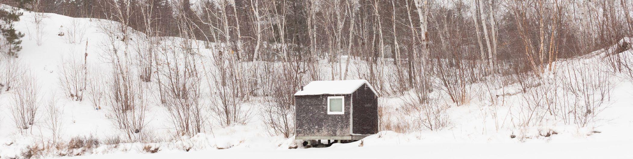
61
4.3
A Canvas for the Natural Image of the City
Beneath the Pines: Rebuilding the natural image of Sudbury through alternative residential development strategies.
62
The urban plan of the city features a prominent sprawl, however, it also features areas untouched by development just minutes from the downtown core. These areas are feature-rich with the distinct image of Sudbury’s blackened and exposed bedrock, young forest growth, and abut the heart of the city. Landscapes such as this provide unique opportunities of living near the with an feeling of being integrated in nature while also being just a short paddle from the downtown core. However, the excitement of these lake-side landscapes also bring forth new challenges when developing residential architecture on the shorelines of the city’s main source of drinking water and the historical recreational hub. The abundant sloped landscapes on the shores of the numerous lakes
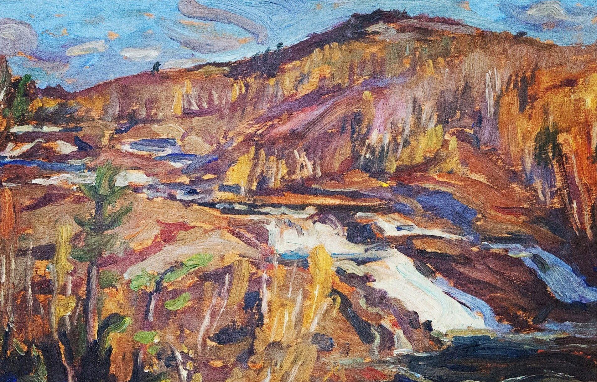
that dot the region are invaluable assets to the quality of life for the local residents, but also for the drinking water, recreational uses, ecological value, and it’s contribution to the image of the city.14 The geological, glacial, and cosmic history of Sudbury can be read from the striations, shatter cones, fault lines, abundances of peaks and valleys, as well as it’s various rock types that are the foundation of the city.15 A site must be chosen to explore the integration of residential architecture that supports both humans and the natural landscape. These prerequisites narrowed the search to a site at the
14 Oiva W. Saarinen, From Meteorite Impact to Constellation City, 18.
15 Oiva W. Saarinen, From Meteorite Impact to Constellation City, 11.
Chapter 4: The Heart of the City
63
Below: (F. 46) Painting by A.Y. Jackson titled “Spring on the Onaping River” depicting the beauty of the landscape fsurrounding the Sudbury area.
Beneath the Pines:
Left: (F. 47) Sketched site plan of the chosen site, on the southern shore of Ramsey Lake, at the heart of the city.
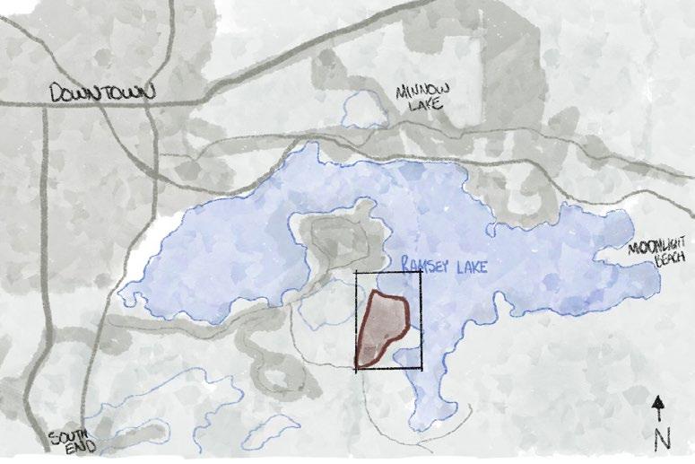
Rebuilding the natural image of Sudbury through alternative residential development strategies.
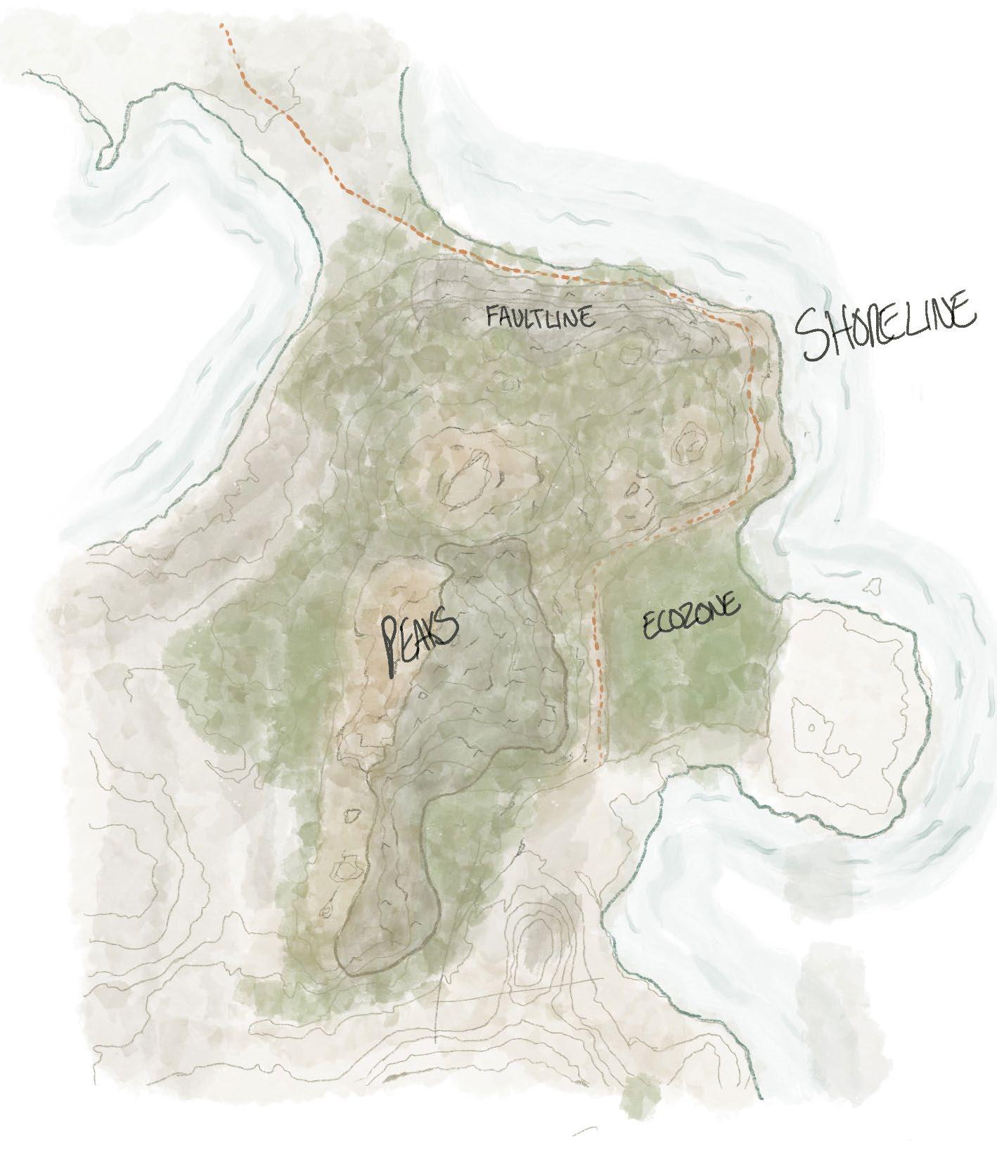
64
heart of the city, on the shores of Ramsey Lake, that could be a test to the evolution of the morphology of Ramsey Lake, and a site that featured not only the beautiful characteristics found in the rocky and topographically rich areas, but a site that also features evidence of the negative impacts of industrialization. A natural landscape found at the center of the southern shore of Ramsey Lake, featuring a unique condition of being between two lakes (Bethel and Ramsey), and with the evidence of a rich geological history seen through a dramatic fault line, will serve as an ideal site for the architectural development. This area at the heart of the city will become the site for the architectural intervention for the thesis project.
Historically, the development in Sudbury has addressed the prominent rocky landscape as an obstacle, often choosing to develop in the valleys between the rocky hills16. While this strategy has allowed for the power of the rock to remain a prominent character in the image of the city, it has also contributed to the sprawling of the Sudbury landscape where flatter regions of the city are developed using building traditions that do not convey the uniqueness of the topography of Sudbury that is so visible on path into the city. The Sudbury rock welcomes visitors trough a dramatic curtain of rock made possible by explosives and
16 Lisa Hirmer, “Sudbury Samples: Core, Periphery,” in Sudbury: Life in a Northern Town, ed. Andrew Hunter (Guelph, ON: Musagetes, 2011), 52.

4: The Heart of the City
65
Chapter
Right: (F. 48) Photo depicting the rapid topography change of the Creighton Fault,. View looking South onto the faultline.
drilling, hinting at the industry present I the city. Rock cuts occupy the peripheral vision as four lanes become two. Large hills act as signal of being home, for a split second the rocky hills are seen with a soft greenery clutching to its surface. Smokestacks appear on the horizon, marking the death of the rock further visible in the large slag piles at its base. 17 New developments occupy the horizon. Houses from a faraway place placed atop a flattened mountain. Forever signifying the arrival of suburban development. Rock is prominent in the image of the city, but the images of the rock present in the landscape
17 Lisa Hirmer, “Sudbury Samples: Core, Periphery,” in Sudbury: Life in a Northern Town, ed. Andrew Hunter (Guelph, ON: Musagetes, 2011), 52.
portray an image of brutality. An image of exploitation, an image of lost history, and a missed opportunity. Over the history of the development of the city, the rock has been either avoided, blasted, flattened, or made hidden. It is only in very particular cases where the Sudbury rock has been afforded its role of main character in the image of the city. The thesis project explores strategies for sensitive connections between architecture and rock, to contribute an architectural typology that respects the rocky landscape beneath it. The chosen site represents an ideal location for exploring relationships to a rocky landscape, and how architecture can influence new perspectives of architecture development on the challenging landscape. Connected through the fault line and

66
Beneath the Pines: Rebuilding the natural image of Sudbury through alternative residential development strategies.
Left: (F. 49) Photograph of the exposed rock of the Creighton Faullt. Evidence of the historical glacial formation of the site is visible in the textured rock.
Right: (F. 50) Photo, looking up from below, depicting the grandeur of the Creighton Fault.
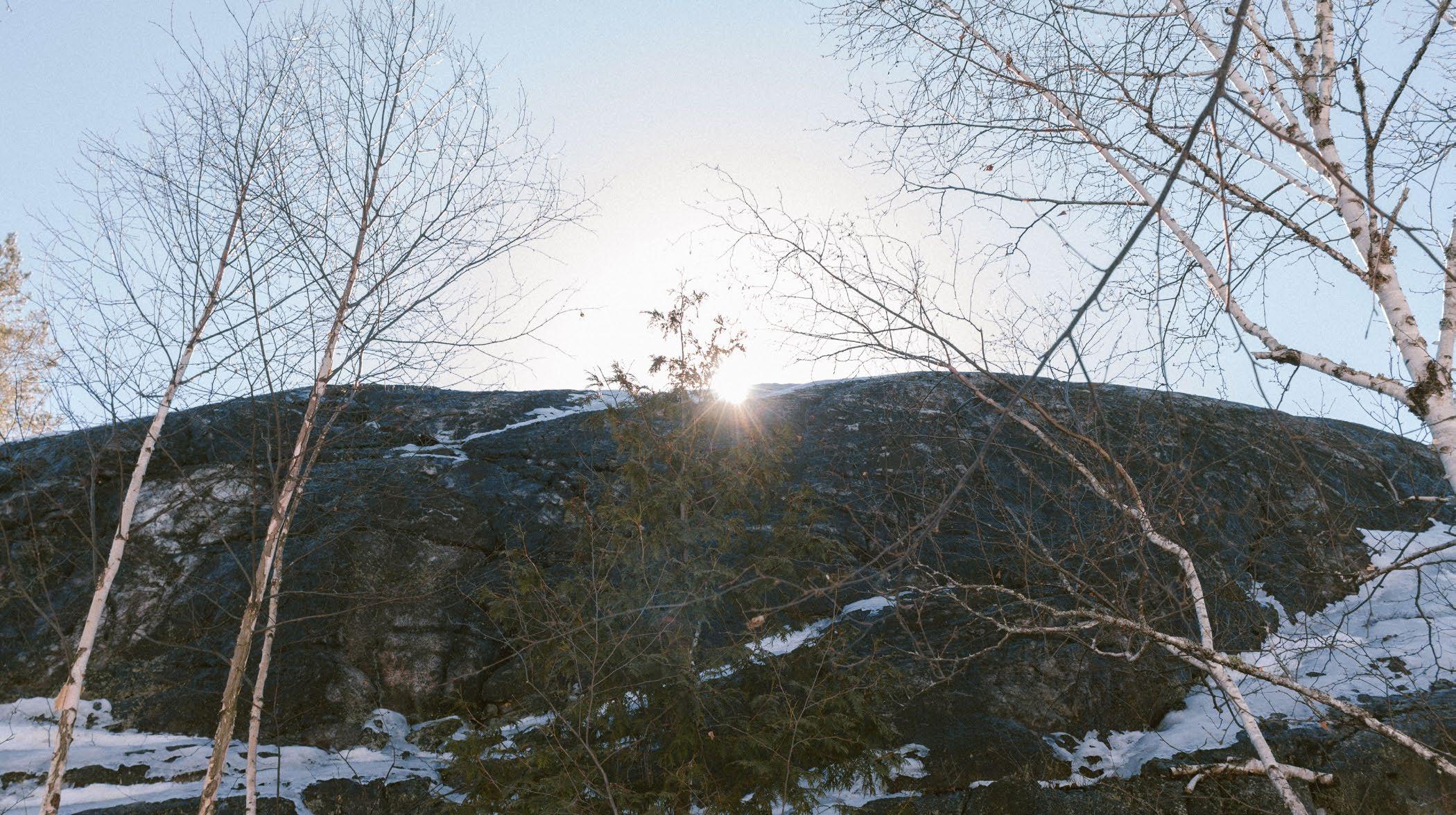
only a short distance from the site, Science North’s foundation stands physically and conceptually opposed to the destruction of the rock18. The science center is sited within the rock so that visitors may walk intimately within the foundation of the city. The Creighton fault is highlighted in the building the various rock types are displayed to present a geological history legible through the striations and textures of the rock. A site so closely linked in spirit and character to the site of Science North, it is imperative to incorporate the bold perspectives and relationships with the Sudbury
18 Bob Turner et al., “Science North, Greater Sudbury - Files. ontario.ca,” Science North, Greater Sudbury: Canadian Shield rock with stories of ancient meteorite impact, faulting and glacial sculpting (Science North, 2015), https://files.ontario.ca/ ndmnrf-geotours-science-north-en-2021-12-13.pdf.
rock to influence an evolution of the morphology of residential architecture in the area. A fault line provides a dramatic experience of humility. An experience of connection, to our ancestors as a people living with land, not against it.
67 Chapter 4: The
of the City
Heart
The importance of a site located on at the heart of the city has already been addressed, however, development at the edges of waterbodies requires careful and thoughtful strategies to minimize impact and encourage a natural shoreline condition. The southern shore of Ramsey Lake features a unique condition of landscape bound between two lakes. Bethel and Ramsey Lake stand a fault line apart, separated only by a small wetland marked by boardwalk. The dramatic and powerful site has hidden vulnerabilities at each shoreline which have been left relatively untouched. New developments on the area must address the sensitive shoreline and the focus on the health of Ramsey Lake is written into the future plans for the city, where “The long-term significance of Ramsey
Lake and its whole watershed is as a healthy and full functioning ecosystem that can: provide opportunities for individual and community growth and the enhancement of the local lifestyle.”19 It is clear that the health of the waterbody is a primary concern to the city and its residents, however, the untouched natural shoreline currently present provides a unique opportunity to explore a new relationship with the shoreline. As seen in the chapter on morphology, it is imperative to design the perspectives from the land and from the water to ensure the preservation of the natural and public
19 City of Greater Sudbury, Ramsey Lake 20 Year Master Plan, 1994, https://www.greatersudbury.ca/sites/sudburyen/ assets/content/div_planning/documents/Ramsey_Lake_ CIP_no_Appendices2.pdf. 21.
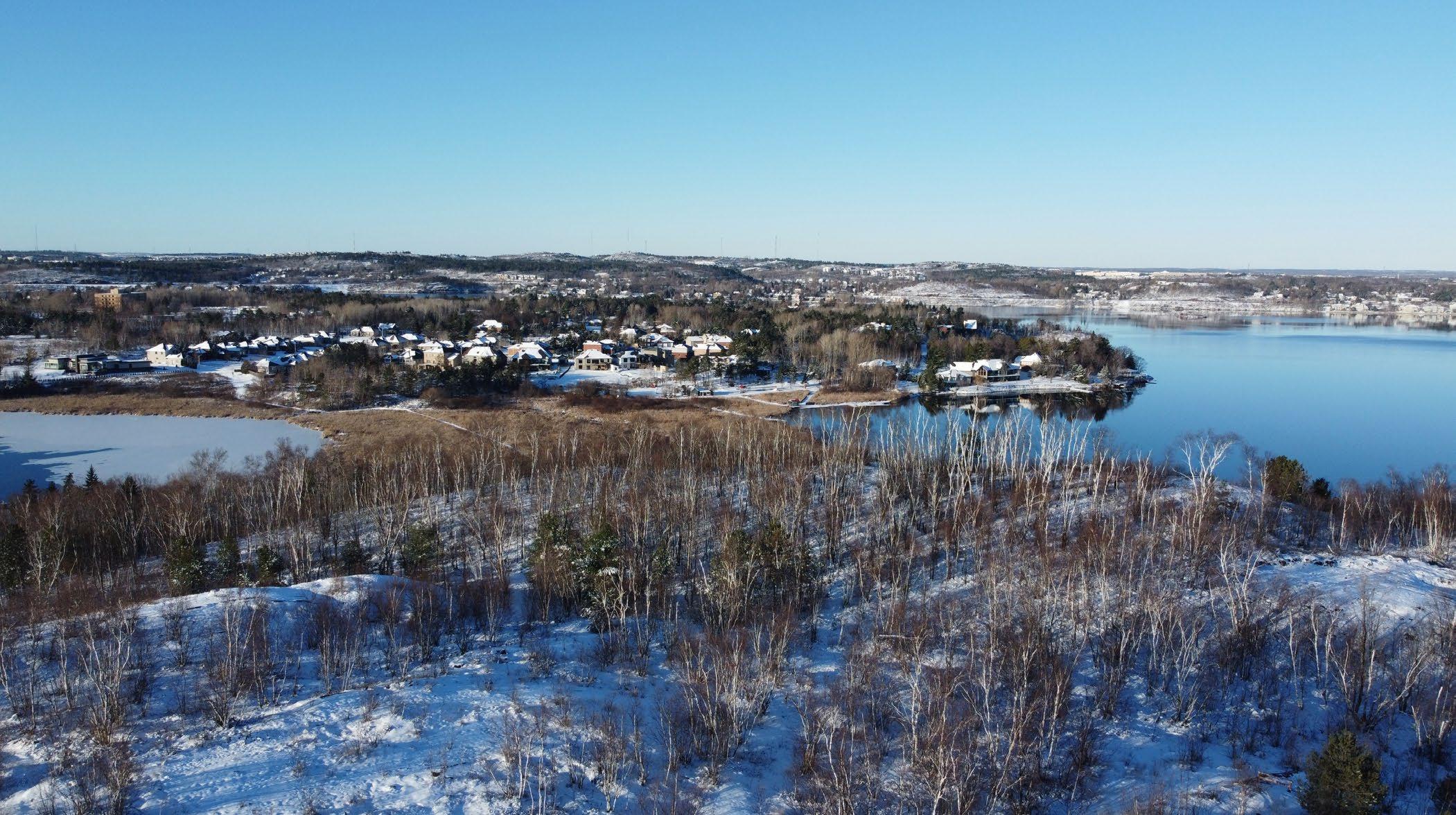
68
Beneath the Pines: Rebuilding the natural image of Sudbury through alternative residential development strategies.
Left: (F. 51) Aerial photo, looking North, illustrating the location of the site between both Ramsey and Bethel Lake.
Right: (F. 52) Aerial photo looking down toward the unfrzozen water as it meets the rocky shoreline of the site.
shoreline and through which its spirit and character can contribute to the image of the city in a way that blends human dwelling and natural shoreline growth in an intimate image.
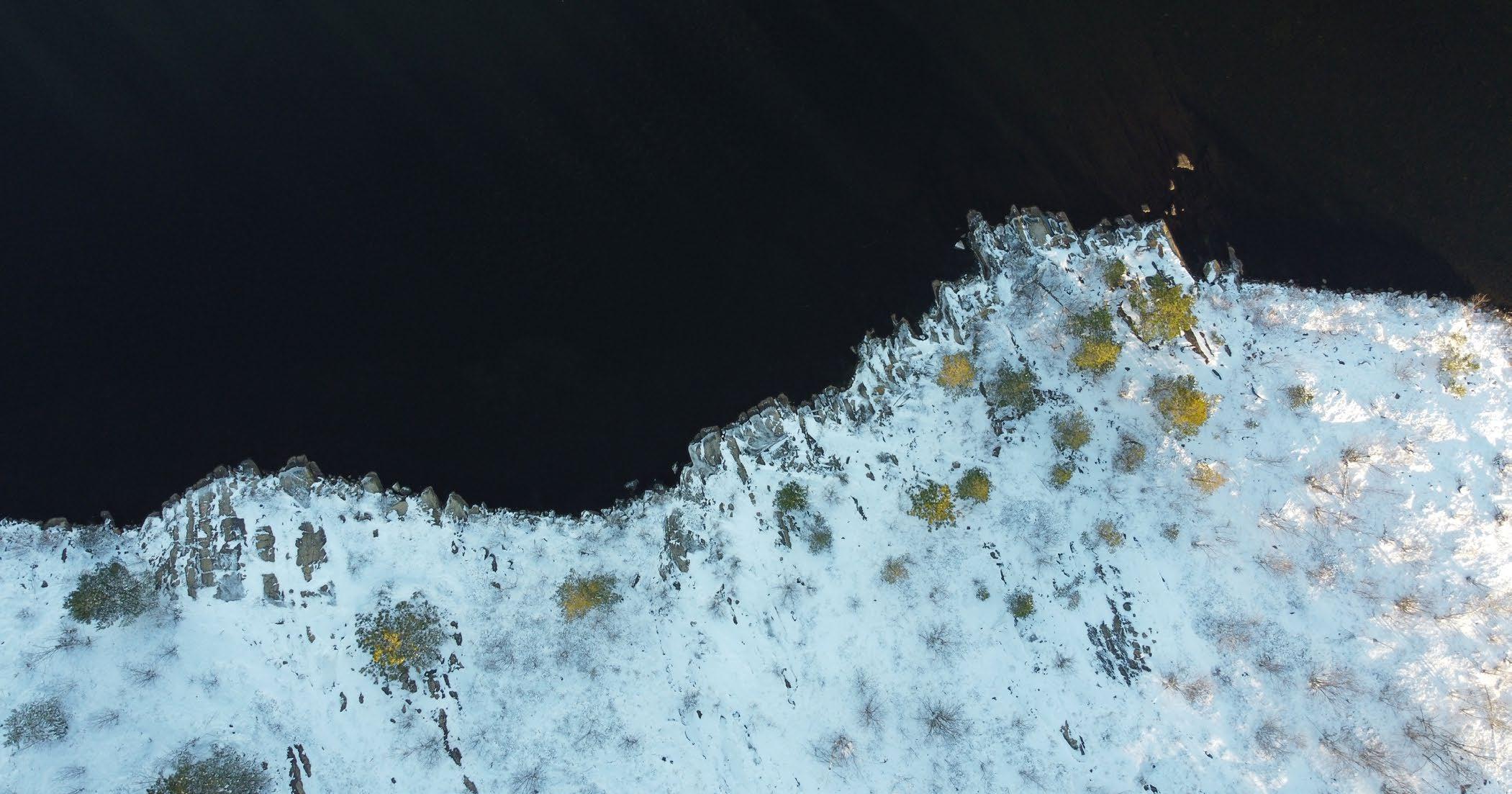
4: The Heart of the City
69
Chapter
The connection of water to land and finally to the sky is an imperative transition. The landscape of Sudbury features an undulating and dynamic horizon line. The soft edges of a stand of trees further dissolves the hard line of the horizon. The experience within the trees, becomes an intimate and dynamic experience between the sky and the land. Vertical interruptions to the rolling horizon lead our gaze up the trunks of trees to a dappling of light produced by a rising sun and a cool morning breeze. Generous views of the abundant hilltops of Sudbury are framed by the red pines limited to the northern edges of the site, anchored to the fault line. The ancestral trees that once acted on these grounds are long gone, but the regrown red pines offer glimpses and connections to what once was. The majority of the site sits under the weight of the vacant blue sky interrupted seasonally by
dancing leaves of a dwarfed deciduous stands. The abundant texture of the bright birch forest presents two stories, one of a reclamation of the landscape, and one a reminder of the brutalization of the landscape and all that stood between man and mineral. A longing for the canopy that once stood provides a conceptual approach to an architecture that aims to one day occupy the atmosphere beneath the pines.
A plot of land between two lakes on the southern shore of Ramsey Lake is home to a landscape with ancient roots that, with a break in tradition, with the help of the human will grow again. A community woven in the fabric of the landscape, beneath the pines a new form of architecture will honour and preserve the atmosphere of the land.
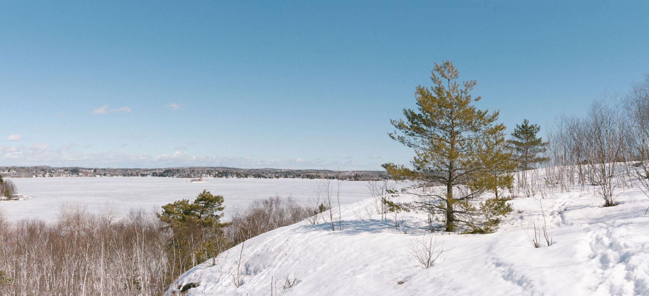
70
Beneath the Pines: Rebuilding the natural image of Sudbury through alternative residential development strategies.
Left: (F. 53) Photo taken from atop the Creighton Fault, depicting the unique panoramic views offered by the natural geological feature.
Right: (F. 54) Detail photo of blue spruce tree that stands on the North side of the Creighton Fault where a rare concentration of confierous trees live.
Chapter 4: The Heart of the City
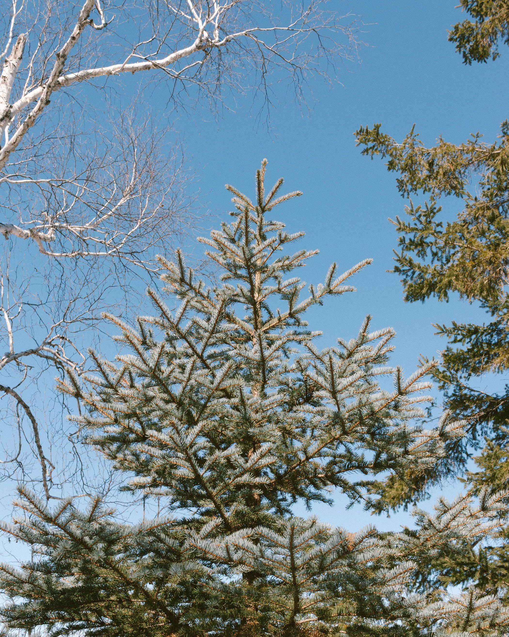
71
The diagram below represents an attempt to visually illustrate the billions of years of geological history that have forged the natural landscape , the destruction caused by industry, reclamation efforts, and the current dangers facing the site today by the ignorant suburban development plans of developers.
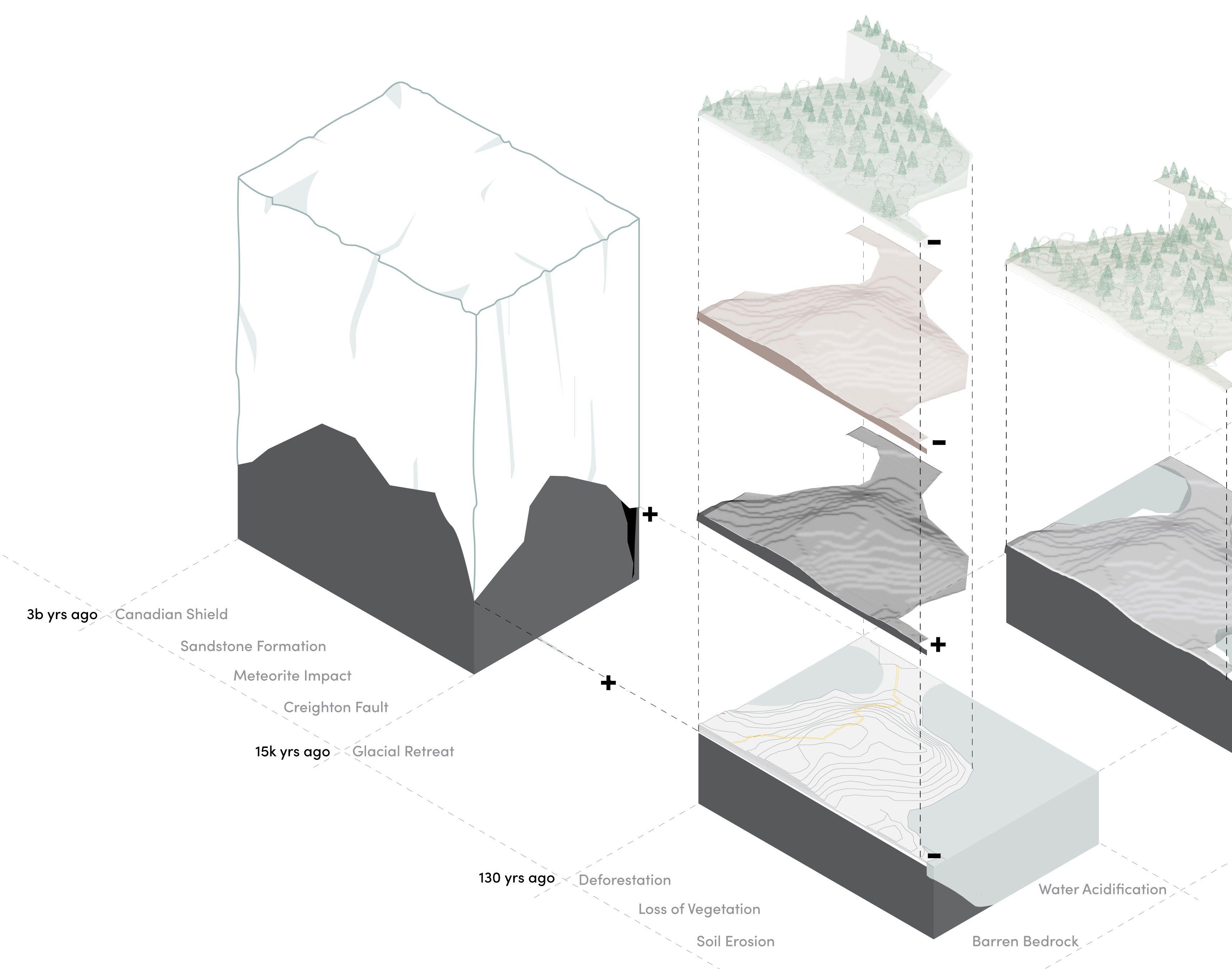
72
Beneath the Pines: Rebuilding the natural image of Sudbury through alternative residential development strategies.
Below: (F. 55) Diagram depicting the storied formation of the landscape that occurred over billions of year, overlayed with the destruction due to industry and the risks faced today.
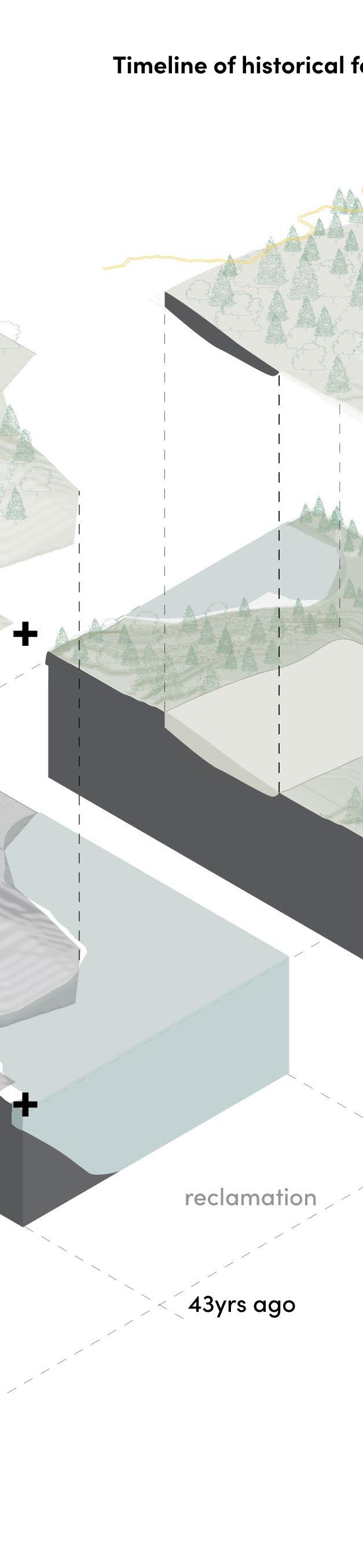
Ramsey Lake is the heart of the city and the greatest contribution to a unifying actor in which all residents can contribute to a natural image of the city. Public access and sensitive development are integral for the development of the shorelines of Ramsey Lake. It is clear that new forms of development rooted in a stewardship of the land are required for the development of these sensitive and culturally significant natural landscapes at the heart of the city.
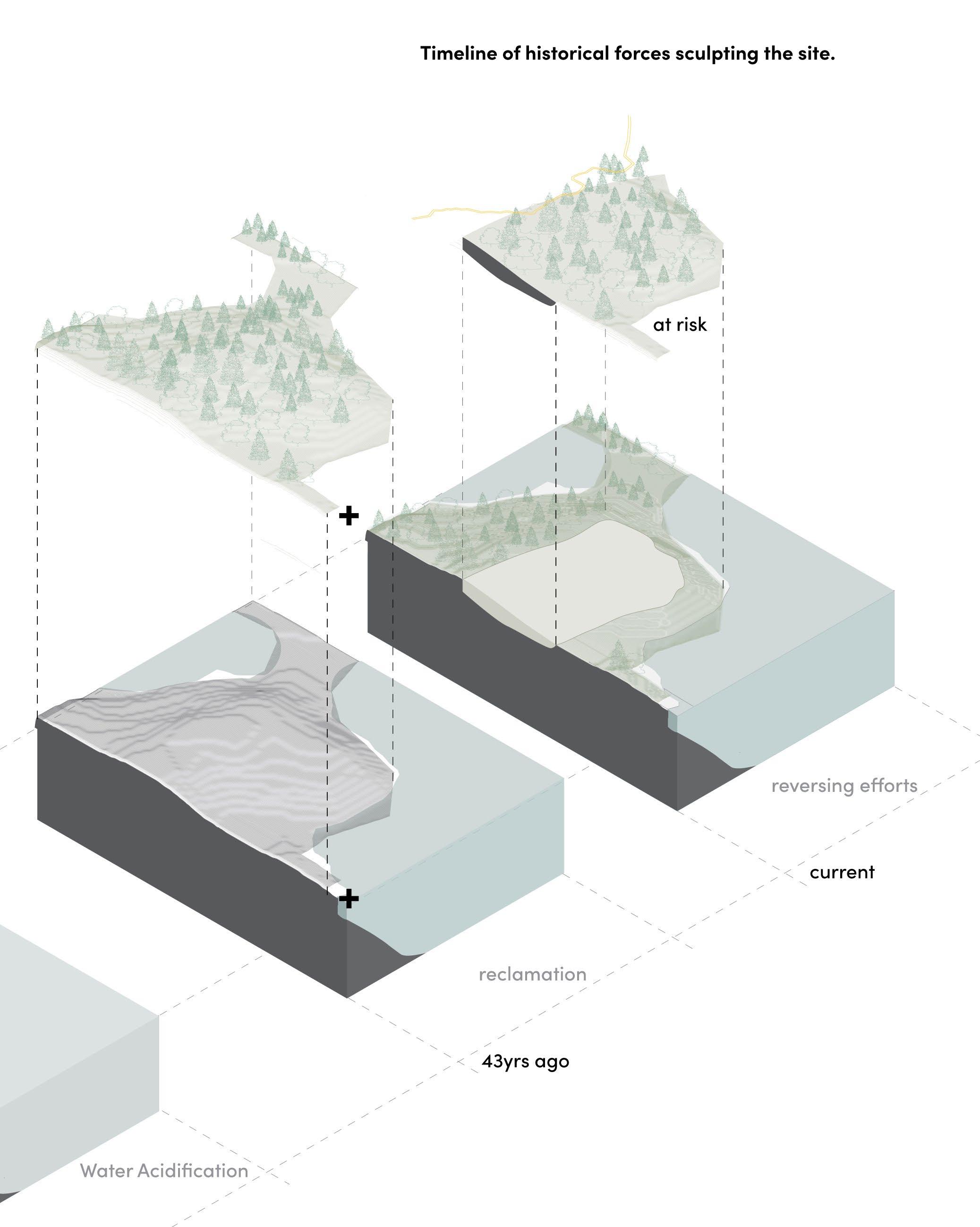
73 Chapter
4: The Heart of the City
5.0
Slow Development Townend Homes Sea Ranch Walter’s Way Haystack Mountain School of Crafts 5.1 5.2 5.3 5.4
5.0
Slow Development
Beneath the Pines: Rebuilding the natural image of Sudbury through alternative residential development strategies.
76
Slow development, in the case of this thesis, represents pre-design strategies for the sensitive and equitable development of architecture that represents the people and place. This chapter summarizes primary resource research contributing to the foundation of a slowdevelopment strategy informing the development strategies to be used for the design of the thesis project. Research into residential developments concludes that the earliest decisions made regarding strategy, relationships between nature and building form, foresight, and awareness of the spirit of place influence the future and continued success of the development. A comprehensive design vision that acknowledges both time and an adaptability to societal, environmental, economical, and natural fluctuations is imperative to the outset of a new development project. Four primary
development projects emerged as foundational precedent for the design of an alternative residential development strategy for the Sudbury area. The four main precedent projects include: three homes on crown street designed by the late local architect Arthur Townend, the Sea Ranch development on the Californian coast, the self-build community designed by architect Walter Segal on an urban London site, and the creative development of the Haystack Mountain School of Crafts on the steep shoreline of Maine. Four significant themes emerged from the above listed precedent projects: Ethos, Organization, Natural Landscape, and Touching the Ground. The Design Guidelines created as part of the thesis have been informed by the research of these primary precedents as well as the analysis of these foundational themes.
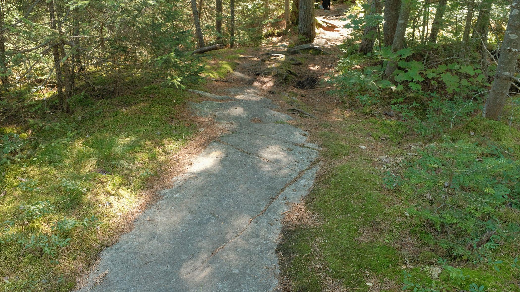
77 Chapter 5: Slow Development
Below: (F. 56) Photo of a foot path developed by foot traffic over time at Grundy Lake Provincial Park
Beneath the Pines:
Right: (F. 57) Photo collage of the three homes on Crown street designed by Arthur Townend. The collage depicts the strategy for which the three houses touch the ground lightly.
5.1
Three Homes by Townend
During the modernist movement of the midcentury, local architect Arthur Townend designed a series of three homes at the end of a residential neighbourhood tract. The three neighbouring lots were undeveloped properties that feature distinct natural character unique to the Sudbury landscape. Prominent views to Ramsey Lake, topographically rich landscape and a relatively untouched natural landscape provided a unique opportunity for Townend to develop a regional typology using his modernist toolkit on a distinctly Sudburian landscape. The results, are three bespoke homes on Crown Street that define a sensitivity, landscape integration, and alternative lifestyle that challenges what is possible when an architect designs sensitively with the natural landscape of the Sudbury area.
Rebuilding the natural image of Sudbury through alternative residential development strategies.
78
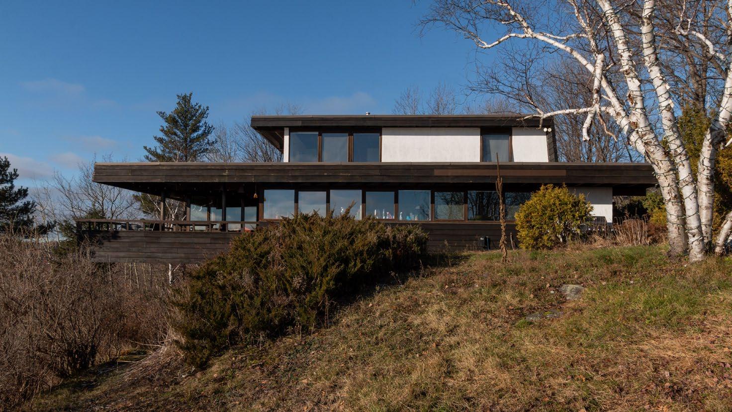
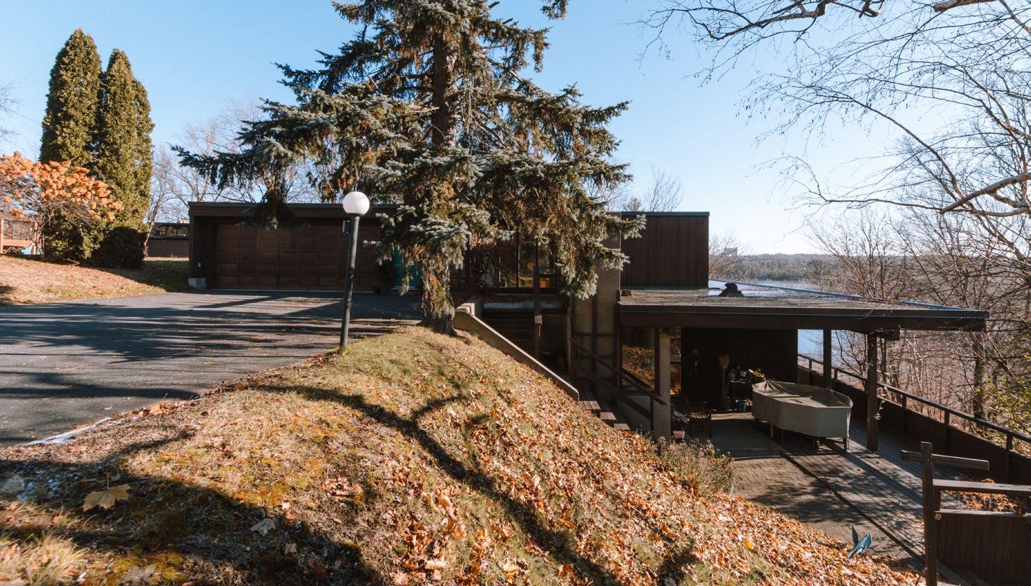
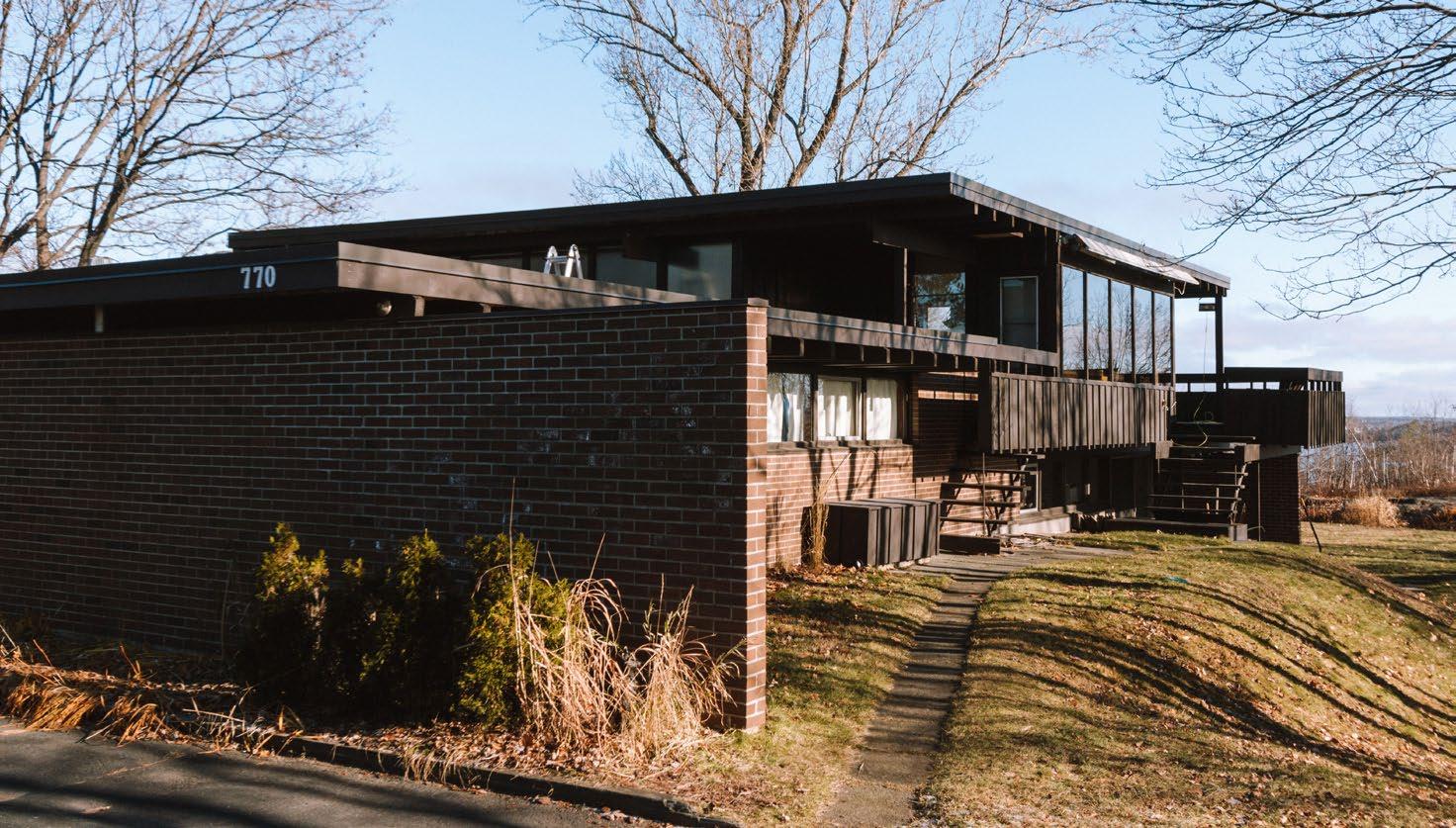
79 Chapter 5: Slow Development 1 2 3
Townend practiced architecture during a formative time of change and experimentation. The modernist movement deeply impacted the architect and its influence is prominent in his works. Practicing in Sudbury, the themes and techniques from the moidernist movement were used to develop a regional architecture distinctly designed for, and inspired by, the natural landscape of the Sudbury area, which is normally been neglected through typical development strategies. In her Thesis studying architect Arthur Townend, Jana Best describes the ethos of Arthur Townend using three themes: landscape, light, and space1. The key modernist theme of the indoor
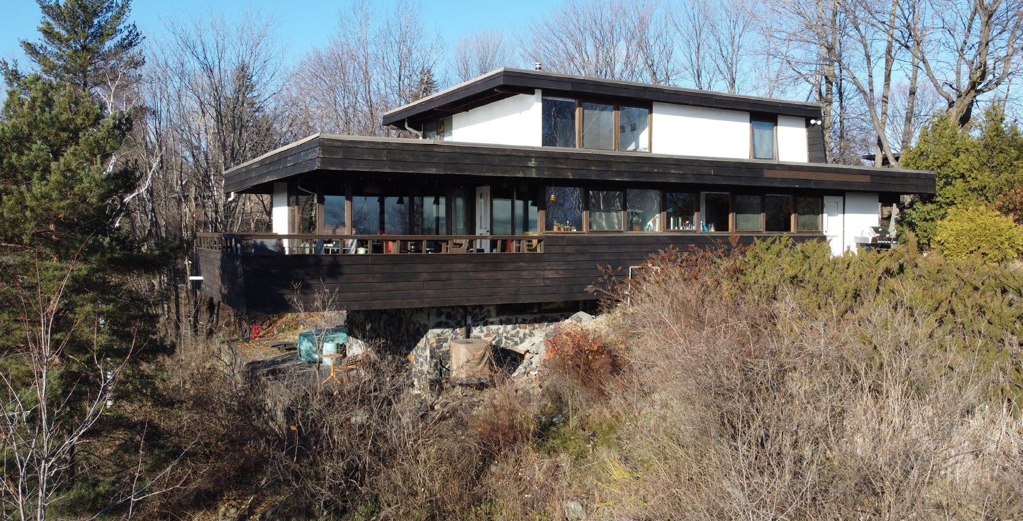
20 Ramsay Best, Janna. “The Architectural Imagination of S. Arthur Townend”. (Laurentian University, Interdisciplinary Master of Arts in Humanities, 2001) p.ii Abstract.
Ethos to outdoor relationship paired with the unique natural landscape and imaginative perspective of the architect, synthesized into new relationships with the land, building, and lifestyle. An ethos of compassion for, and appreciation of the landscape is imbedded in the architecture, reinforcing a lifestyle that is genuine to the place. Townend was inspired by the most prominent architects of the time, but he was also was driven by an urge to question what is typically done and used his creativity, as part of an ethos, to develop new strategies for building on the Sudbury landscape. The architect used his education, life experience, creativity, humility, and frustrations with the prominent acts of building template homes designed for no particular site and with no profound ethos referencing the unique climate or natural landscape that is imperative to place making. In effect, the architectural ethos of Arthur Townend stood as a challenge to the typical strategies of ignorant home building at the time.
80
Beneath the Pines: Rebuilding the natural image of Sudbury through alternative residential development strategies.
Below: (F. 58) Photo taken by drone demonstrating the integration of House 1 into its sloped site and the natural vegetation untouched and left to grow naturally.
Top: (F. 59) Photo of Townend Home 1 depicting how the home extends out to the pines to catch views of Ramsey Lake.
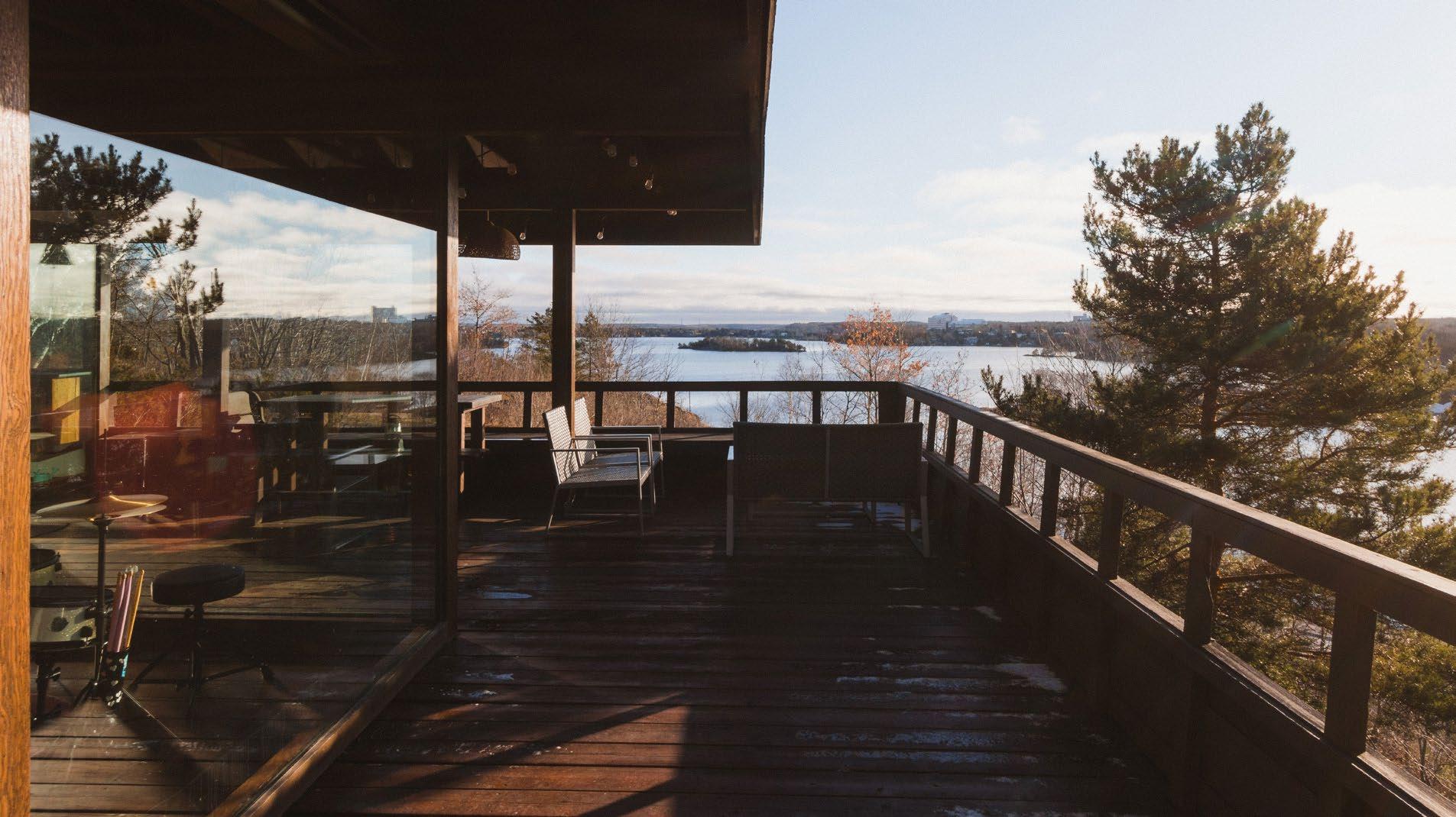
Bottom: (F. 60) Photo from inside Townend Home 1 depicting the indoor to outdoor relationship provided by generous glazing and a covered deck space.
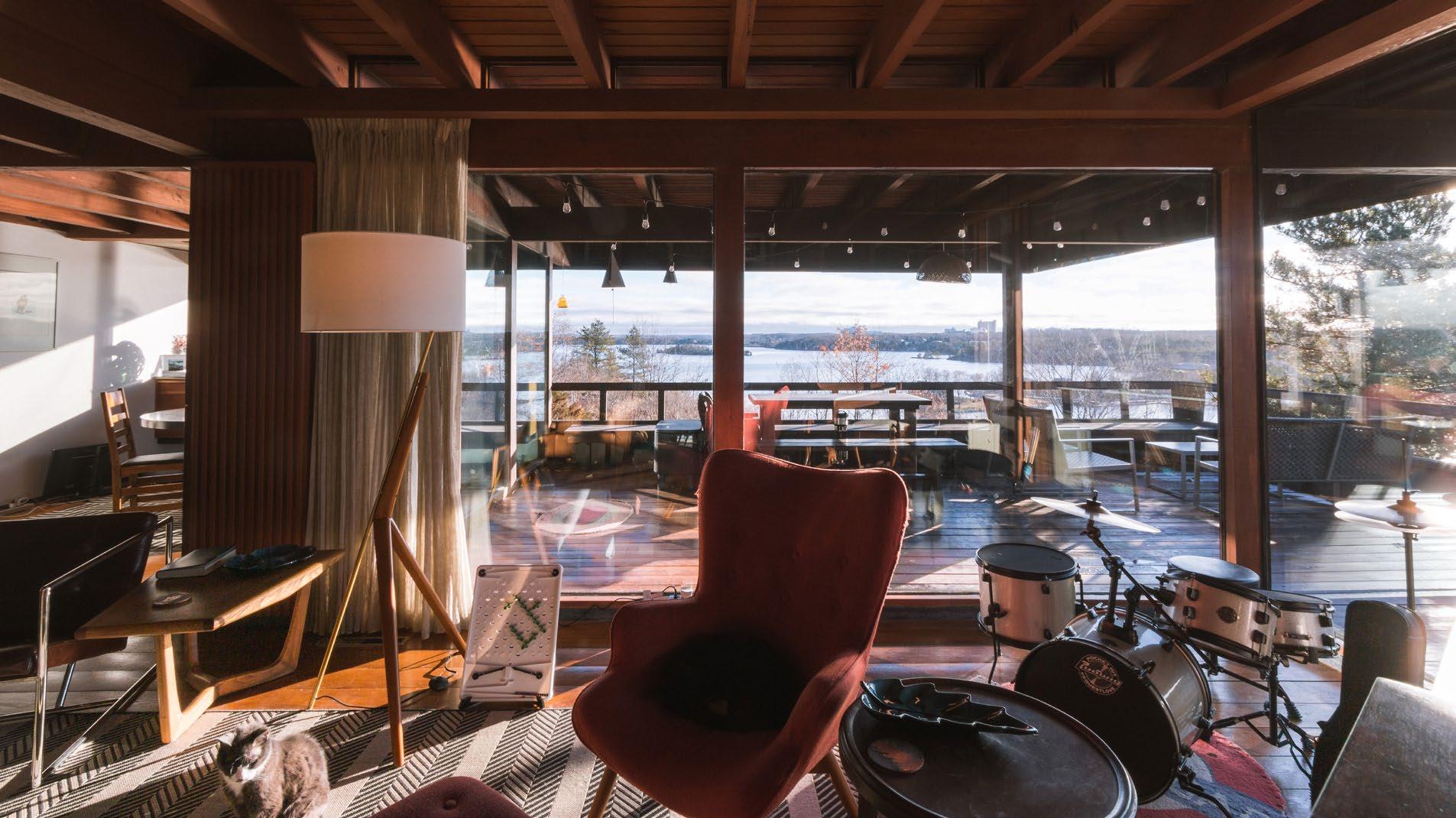
81 Chapter 5: Slow Development
Below: (F. 61) Neighbourhood plan diagram depicting the thoughtful relationship between the three homes. The homes benefit from unobstructed views of the lake and a natural privacy designed into each home.
Neighbourhood Plan
N
The Sudbury area would become the playground Townend required for expressing his frustrations with the typical developments and resulting neighbourhoods composed of homes staring at one another across the street. Three plots of land regarded as unfavourable provided the opportunity for Townend to create an alternative.
Located atop a hill at the end of a typical cul-desac development stood the three empty lots seated at the hills edges. These unconventional, topographically rich lots stood uninterrupted by the development of the neighbourhood, will all of their natural elements unique to the area left intact. With prominent views to Ramsey Lake, Bell Park, the Yacht Club, and the city beyond, the hilltop provided a unique opportunity for a new house typology fitted to the rocky landscape. The architect utilized the abundant opportunities of the natural landscape to carefully craft three homes which reference three primary conditions: the hilltop topography, the prominent views, and the
dynamic sun path. The reference points shared by the three homes allows for uninterrupted views to be shared by all. Solar orientation sculpted homes that were naturally closed to the frigid northern winds, and the sometimes overwhelming western setting sun while opening up to the south. This sculpting of form not only provides a dynamic experience of natural light with delightful variation, but also an natural privacy. The architects use of architectural principles and solar orientation allows the homes to speak to a greater collective and achieve a unique natural privacy, to communicate with one another and exist in a mutually beneficial relationship that respects both privacy and the prominent views of the area. The organization speaks to the possibilities of thoughtful design and the contribution of one home to the organization of a whole neighbourhood. The result is a sum that is greater than its part, representing an inspiring challenge to the typical neighbourhood development.
Beneath the Pines: Rebuilding the natural image of Sudbury through alternative residential development strategies.
82
Organization 1 2 3
Top: (F. 62) Photo of Townend Home 1 from the interior of Townend Home 3, depicting the orientation to the sun as the home opens up to the south while still maintaining privacy through shared orientation.
Bottom: (F. 63) Photo of Townend Home 1 depicting the window-less northern walll sculpted by shared orentiation to the sun that also ensures privacy between the Townend Homes.
83 Chapter 5: Slow Development
Natural Landscape
The group of three homes by Townend represent new relationships between building and landscape. These strategies are products of both the modernist movement, and the personal concern of the architect for the exploration of a regional adaptation of modernism in the complex and opportunistic landscape of the Subury area. The design of homes meant to unify the interior and exterior spaces, embracing views of nature, landscape and the city, and the extension of the home into the natural realm provides new relationships between home and its natural environment, supporting a lifestyle rooted in a compassionate alliance with nature. Nestled into the existing natural landscape, lightly touching the ground, the Townend homes present a modest sculpting of architecture that supports and influences symbiotic living. The analysis of these three homes makes clear that Townend was responding to the genus loci, which involves being inspired by the natural landscape and the spirit of
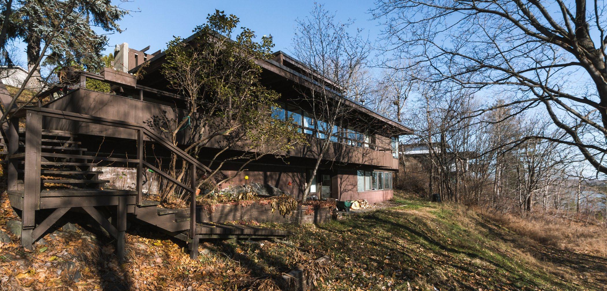
Below:
the place, servicing asa primary reference for the design, while also ensuring the genus loci would only be improved through the design of the home, and finally, by ensuring that the construction of the home would not alter nor destroy the spirit of the place. It is in the sensitivity to the natural landscape that allows for the primary design inspiration that ensures a process of design that produces a creative architectural solution as unique as the landscape in which it is fitted to. Arthur Townend saw the ragged landscape of the Sudbury area as an opportunity, and as a character that contributed to his ideas.1 A sensitivity and respect which grounds the architect in a modest collaboration between landscape and architecture stands as an aspirational affair for all future architects in order for the continued production of sensitive and original architecture contributing to the architectural identity of the area.
21 Ramsay Best, Janna. “The Architectural Imagination of S. Arthur Townend”, p. 10.
84
Beneath the Pines: Rebuilding the natural image of Sudbury through alternative residential development strategies.
(F. 64) Photo taken by drone demonstrating Home 2 and its cascading connection to the sloped landscape.
Top: (F. 65) Photo of Townend Home 1 from the interior of Townend Home 3, depicting the orientation to the sun as the home opens up to the south while still maintaining privacy through shared orientation.
Bottom: (F. 66) Photo of Townend Home 1 depicting the integration of the building and the natural landscape. The architecture acts as a additive strategy to extend the building out into the landscape sensitvely.
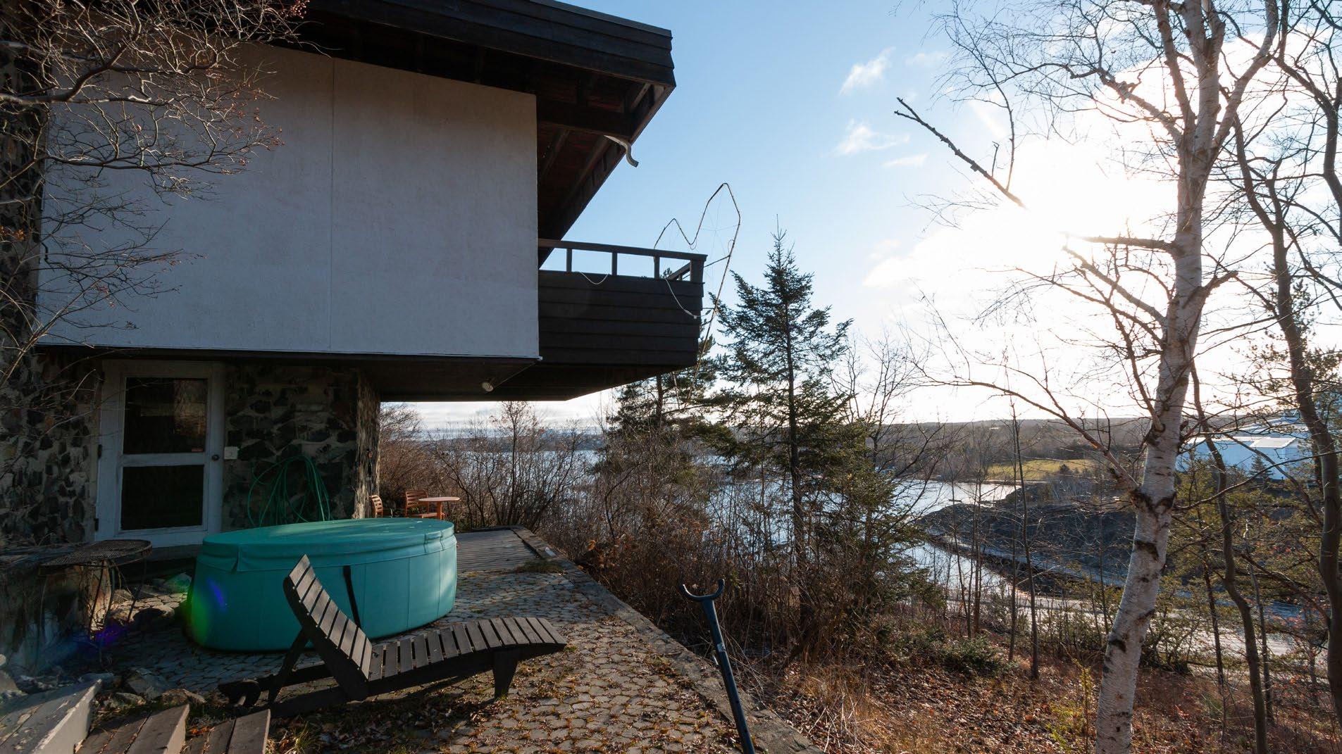
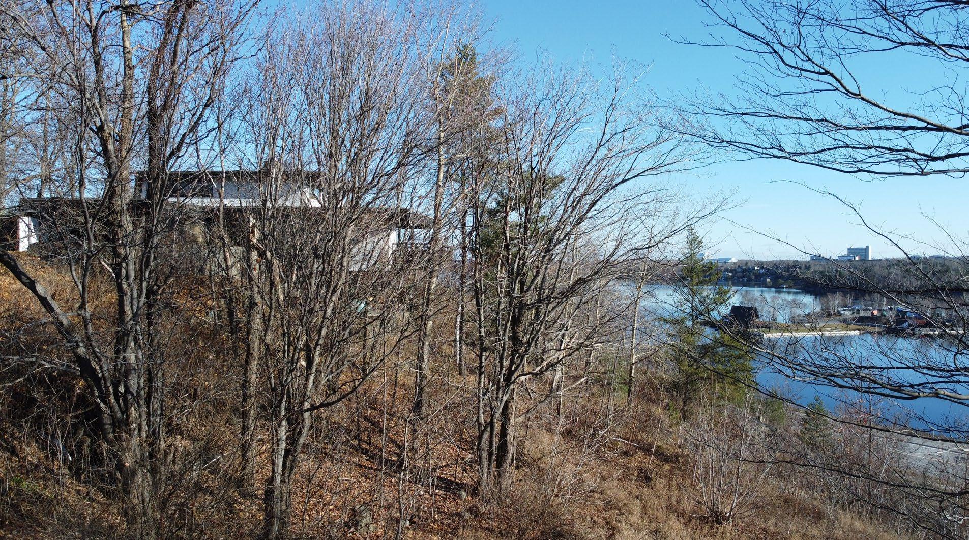
85 Chapter 5: Slow Development
Touching the Ground
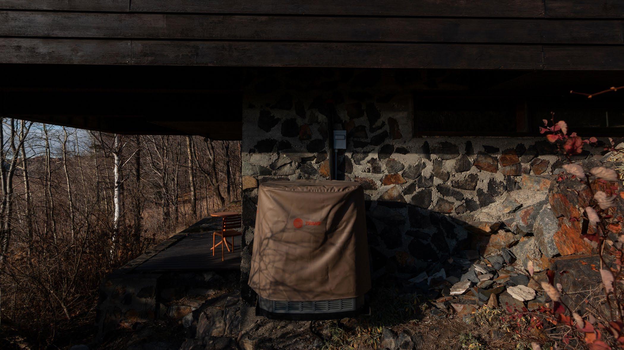
The three houses on Crown street are unique in that they all feature sensitive but distinct strategies for touching the ground. The creative integration of building into the landscape explored in these works by Townend stand as stark alternatives to typical development. Utilizing the natural slope of the site, respecting the natural hilltop, and cantilevering out to reduce the impact of the building all present formidable architectural expressions of sensitivity that contribute to a regional architecture that supports the ragged and unique topography. A welcome alternative approach to the Sudbury landscape, Townend was inspired by his time spent in the natural landscape of Sudbury and noted it as a “marvellous opportunity.”1 This mindset allowed his work to standout as a regionally appropriate alternative to the norm. The architect noted that his time spent within the landscape evolved his
22 Ramsay Best, Janna. “The Architectural Imagination of S. Arthur Townend”, p. 10.
ethos to fit buildings to the rock rather than to alter the landscape (which is typical) for the placement of a building. An ethos inspired by the natural landscape, produces architecture respecting the natural landscape, which further allows for a looping inspiration of the natural landscape. A house designed to step down the natural slope, a home built modestly atop the hill, and a home extending above the ground all present strategies where the architecture and subsequent lifestyle adapts and is fitted to the landscape rather than the land being altered to adapt to the architecture or the aspirations for a certain lifestyle. It is clear that sensitive architecture of this nature must begin with the architect first seeing the rock, acknowledging the rock, understanding the rock, and designing to benefit both the rock and the architecture. These strategies are clear in that a modesty and sense of oneness with the earth is required, and in the case of Arthur Townend, an architect who did not fray from bending the knee to the ground, to meticulously measure the rock.
86
Beneath the Pines: Rebuilding the natural image of Sudbury through alternative residential development strategies.
Below: (F. 67) Photo depicting the cantilever that extends out from a stone foundation creating a conditioned outdoor space.
Top: (F. 68) Photo of the stepping form of Townend Home 2. The home steps down the steep slope, staying true to the natural landscape, and evoking a connectedness to the sloped site through the interior experience of the home.
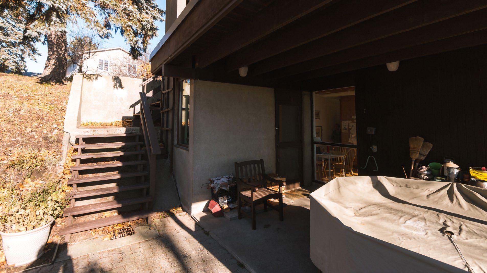
Bottom: (F. 69) Photo of Townend Home 2 depicting the stepped building forms and the exterior spaces created by a deep overhang. The architect designed exterior access to the building form to further connect the inteior and exterior.
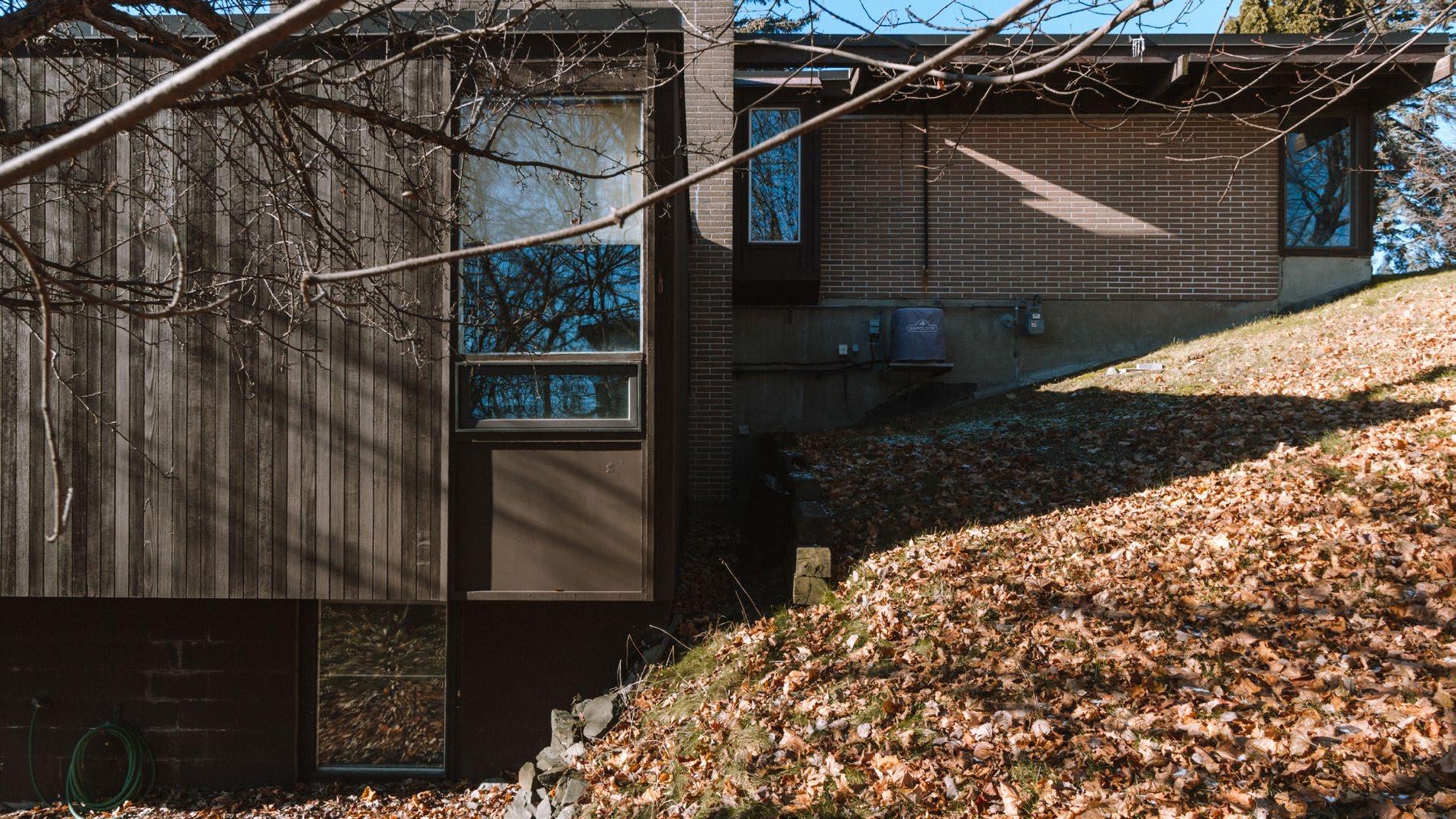
87 Chapter 5: Slow Development
Sea Ranch
The Sea Ranch optimistic residential development, that beginning in 1964, devoted itself to ‘living lightly on the land’ along a fragile and sensitive landscape of the Californian coast.1 United by a potent environmental ethos, a team of architects and landscape architects began defining a new typologies for living lightly on the land on such a significant landscape. The development is now host to condominiums, walk-in cabins, single-family homes, commons, public access trails, and recreational programming. A community woven tightly through a shared commitment to a sensitive lifestyle within the natural landscape continues to strive with each new building designed carefully to fit and depict the spirit of the place that originally attracted the development.
23 Lyndon, Donlyn, and James Alinder. The Sea Ranch: Fifty Years of Architecture, Landscape, Place, and Community on the Northern California Coast, (New York, NY: Princeton Architectural Press, 2014) p. 13.
88
Beneath the Pines: Rebuilding the natural image of Sudbury through alternative residential development strategies.
5.2
Top: (F. 70) Image of the Sea Ranch development depicting the roof lines that reference the prominent wind of the site.
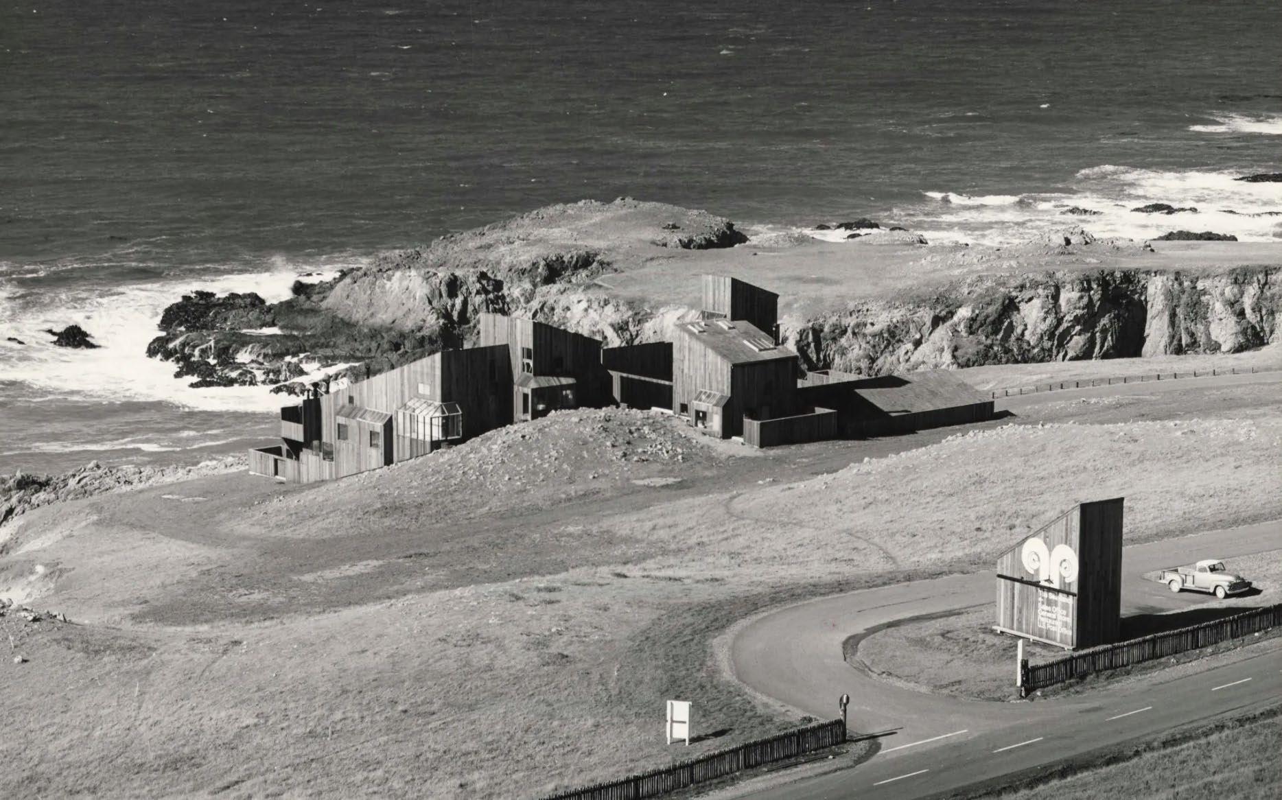
Bottom: (F. 71) Aerial photo of the Sea Ranch condominium, depicting the thoughtful integration of a large building set to a slope.
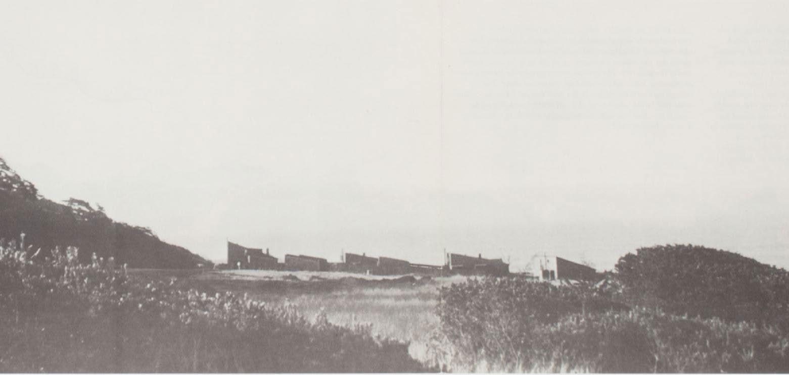
89 Chapter 5: Slow Development
Below: (F. 72) Location score drawing by landscape architect Lawrence Halprin depicting the early concepts of a landscape-based development strategies for the Sea Ranch.
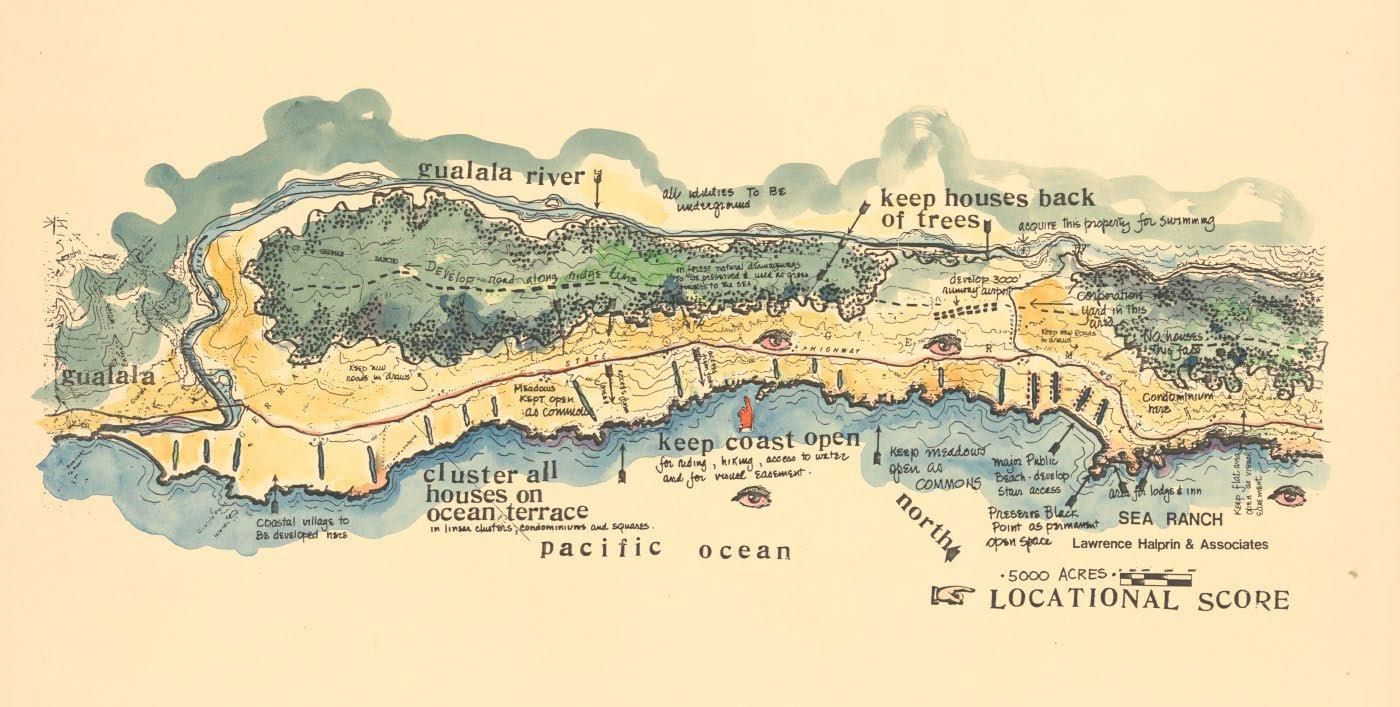
Ethos
Inspired by the identity and character of the land, the Sea Ranch development began with a strong sense of appreciation for the spirit of the place. Balancing the financial goals of the development company with a responsibility for the preservation and stewardship of the land, an ethos of living lightly on the land emerged. Landscape architect Lawrence Halprin engaged in a deep site study to develop an understanding of the natural landscape, it’s formation and the historic relationship between the landscape and humans.1 The ethos of living lightly on the land acknowledges an optimistic future where the acts of the human do not detract from the enjoyment of the natural landscape, and so, a unifying ethos became the
24 Lyndon, Donlyn, and James Alinder. The Sea Ranch: Fifty Years of Architecture, Landscape, Place, and Community on the Northern California Coast, p. 19.
foundational concept that influenced each stage of the development. The landscape first approach became an attractant force appealing to individuals and families who wished to live a life deeply woven to nature, with a unified stewardship for the greater enjoyment of the natural landscape. The ethos then perpetuates and over time as social norms and lifestyles continue to change, new people, new homes, and new experiences arrive at the Sea Ranch while continuing to share the natural landscape and spirit of the place that originally inspired the development. The birth of the ethos at the very beginning of the development can be characterized as the single most important element of the development that continues to ensure the success of both the residential program and the natural landscape.
Rebuilding the natural image of Sudbury through alternative residential development strategies.
90
Beneath the Pines:
Organization
The Sea Ranch Association challenged a young group of architects and landscape architects to develop new strategies for the residential development on a prominent and naturally rich landscape. Pre-design strategies including deep site research, sensitive master planning developed by a wise landscape architect Lawrence Halprin, provided the foundational approach and concepts for the development of building form on the natural landscape. Through Halprins deep site research a master plan featuring various scales of residential building form are organized throughout the site, organized and designed to natural references that welcome development opportunities.1 A large condominium building fitted to the coastal
25 Lyndon, Donlyn, and James Alinder. The Sea Ranch: Fifty Years of Architecture, Landscape, Place, and Community on the Northern California Coast, p. 79.
meadows, walk-in cabins set lightly into the redwood forest, single-family homes clustered next to public meadows, and the abundant public trails and recreational opportunities of the site provide unique variations in residential development that all speak to the unifying ethos of living lightly on the land.2 The ethos developed by Lawrence Halprin was used to generate a set of restrictions, rules, and Design Guidelines used to guide the sensitive design of buildings on the site, respecting the foundational ethos and spirit of the place. The Design Guidelines continue to be a prominent strategy for the Sea Ranch and as new challenges arise, the Design Guidelines are evolved to serve the original ethos as well as the contemporary ideals and issues at hand.
26 Lyndon, Donlyn, and James Alinder. The Sea Ranch: Fifty Years of Architecture, Landscape, Place, and Community on the Northern California Coast, p. 79.
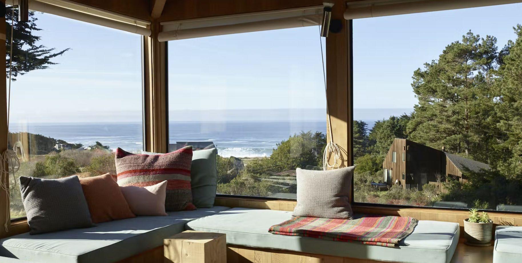
91 Chapter 5: Slow Development
Below: (F. 73) Photo from within a home at Sea Ranch depicting the indoor/ outdoor relationship and the uninterrupted views of the water, provided through the thoughtful design guidelines developed for Sea Ranch.
Natural Landscape
A 10-mile stretch of dramatic Californian coastline featuring jurrasic seacliffs, expansive meadows, clusters of redwoods and cypress depict an image of an extraordinary landscape with a poignant spirit of the place sculpted over centuries of natural and human influence. The Sea Ranch, acknowledging the importance of the unique natural environment committed a development ethos for the preservation of the natural landscape to ensure the continued success of the natural landscape. Understanding the impacts of the human on the land, the Sea Ranch association developed a set of restrictions, rules, and alternative development strategies to ensure that the natural landscaoe would not be compromised for the convenience of the human. Sensitive strategies developed at the Sea Ranch prioritize the greater landscape and challenge each homeowner, through design,
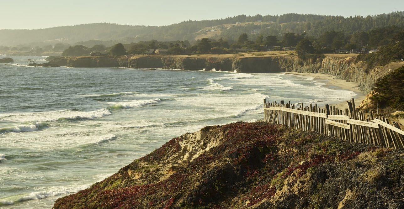
to live lightly on the land ensuring the continuation of the natural landscape throughout the projects lifetime and beyond. The landscape-first approach resulted in the development of design strategies drawn directly from the analysis of natural forces and conditions existent on site. These forces drove the design language which further increased the sensitivity and visual integration of building form.1
27
p. 71.
92
Beneath the Pines: Rebuilding the natural image of Sudbury through alternative residential development strategies.
Left: (F. 74) Photo depicting of a portion of the Sea Ranch development with houses set to the trees, as per the location score by Halprin.
Lyndon, Donlyn, and James Alinder. The Sea Ranch: Fifty Years of Architecture, Landscape, Place, and Community on the Northern California Coast,
Right: (F. 75) Image featuring a the front page of the Sea Ranch Life publication, demonstrating the various scales and types of housing as part of the development, as well as the important of biologists contributing to the conservation of the ecology.
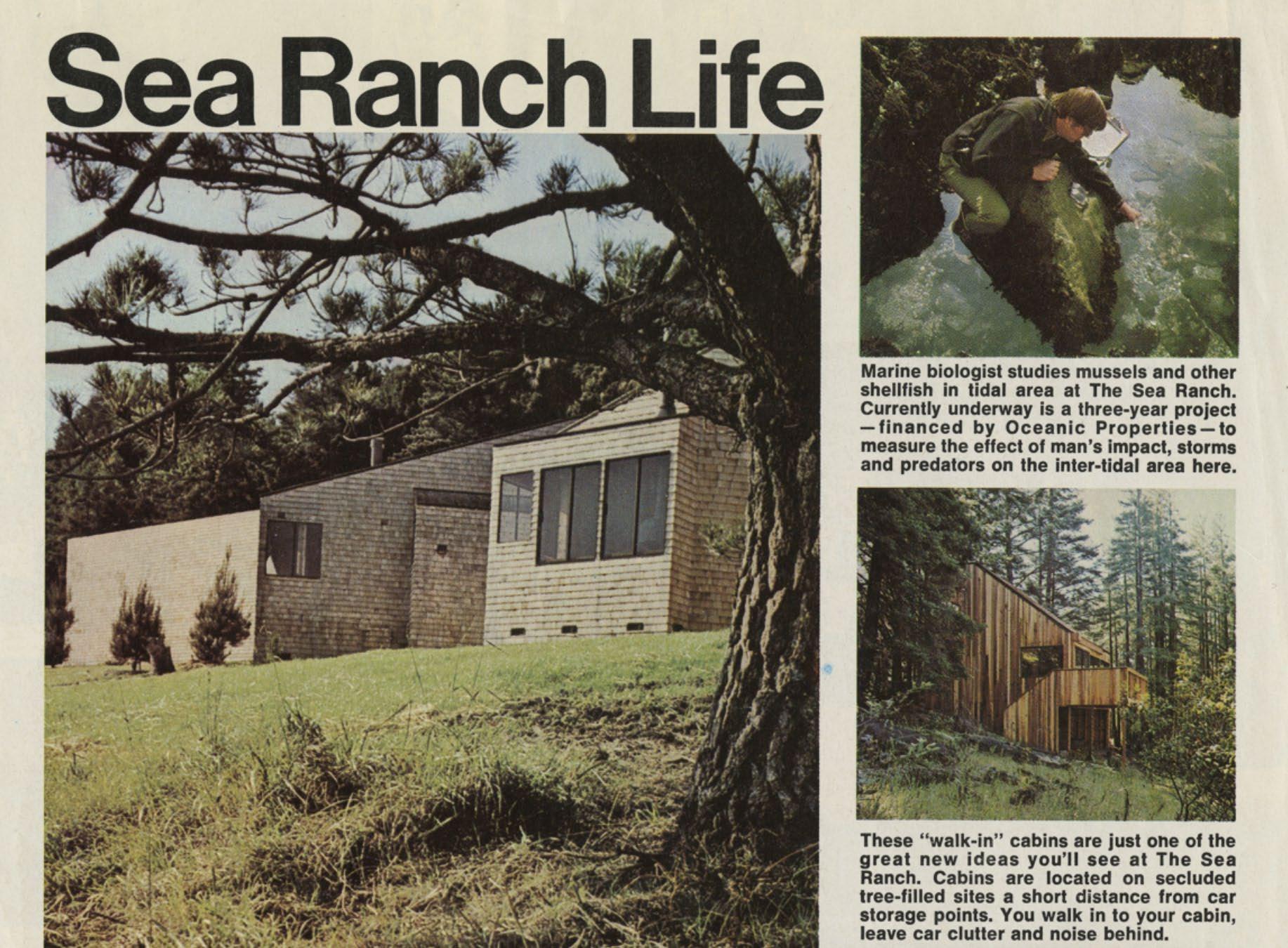
An ethos of living lightly on the land influences methods of touching the ground. Building form is sculpted by the natural landscape, climate, and prominent views. A focus on a strong connection to the ground results in the creation of above grade foundations fortifying a strong relationship to the ground that through the continued natural growth of vegetation begins to harmonize the relationship between building form and landscape. A commitment to modesty in built form is informed by the ethos of living lightly on the land inspiring a careful compromise in architectural scale for the prioritization of the spirit of place through shared
commons, open meadows, and open views to the coastline.1 The Sea Ranch is less of a study on touching the ground, but about building form emerging from the ground, understood as an extension of the landscape. To achieve this goal, a rigid set of landscape-driven guidelines must be utilized across the development to ensure that each individual speak to the larger order of a development driven by a stewardship for the land.
28 Lyndon, Donlyn, and James Alinder. The Sea Ranch: Fifty Years of Architecture, Landscape, Place, and Community on the Northern California Coast, p. 39.
93 Chapter 5: Slow Development
Touching the Ground
Right: (F. 76) Image depicting the tight organization of Walter’s Way. These self-built houses reflect their owners while also contributing to a larger order of houses built using the Segal Method.
Walter’s Way
Walter’s Way is a self-build residential community developed on a undesirable site in the heart of a residential neighbourhood. A singular shared street provides access from a typical residential neighbourhood to a truly unique alternative development. The community comprises 13 wooden post and beam houses designed and built using the Segal Method, an architecturally modern method for the development of self-built and adaptable houses using simple materials and techniques. The development was been praised for decades since it’s optimistic beginning in the 1980’s.1
29 Alice Grahame and Taran Wilkhu, Walters Way and Segal Close: The Architect Walter Segal and London’s Self-Build Communities: A Look at Two of London’s Most Unusual Streets, 1st ed. (Park Books, 2017), 18.
Beneath the Pines: Rebuilding the natural image of Sudbury through alternative residential development strategies.
94
5.3

95 Chapter 5: Slow Development
Ethos
The Segal Method was developed to return agency in construction to individuals in order to create a community of like-minded individuals who share a modest and social lifestyle. The Segal Method presents a set of strategies designed to be simple, easily understandable, and easily adapted by the individuals.1 The modern structural system and resourceful finishes result in a simple home that can and was built by the owners. Walter Segal focused his design work on the predesign strategies which allows for a more simple construction method. The architect made simple sketches that depicted how the building comes
30 Alice Grahame and Taran Wilkhu, Walters Way and Segal
Close: The Architect Walter Segal and London’s Self-Build Communities, 42.
together, and these drawings paired with the capable hands of the owners created a community of unique and optimistic homes in the center of a typical residential neighbourhood.2 Over time, these homes have been adapted, expanded, and in some cases completely rebuilt. The ethos of Walter’s Way speaks to the possibilities of creative solutions to housing when traditions and typical residential development strategies are cast aside and new ways of thinking are explored.
31 Alice Grahame and Taran Wilkhu, Walters Way and Segal
Close: The Architect Walter Segal and London’s Self-Build Communities, 38.
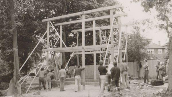
96
Beneath the Pines: Rebuilding the natural image of Sudbury through alternative residential development strategies.
Left: (F. 77) Photo of self-builders coming together as a community and erecting their Segal Method designed houses.
Right: (F. 78) Diagram depicting the organization of Walters Way. The community built their houses slowly over time, locating their houses where they would fit within the natural landscape, creating an organic growth of dense housing.
Neighbourhood Plan
N
Organization
Thirteen individual homes are united by the Segal Method and a central street which winds around the trees providing access to each home, and most importantly providing a social space for the community. A shared orientation to the sun allows for a common building form that is closed to the north and that opens up to the southern gardens. A natural privacy formed by shared orientation is further supported by a myriad of natural vegetation that conditions the outdoor spaces that are integral to the development. The architect had drawn potential organizations of the development, however, the balance between master plan, each home owner, and the natural landscape provided an organic organization that avoids the sameness of the surrounding typical houses of the greater
neighbourhood. Each home has been carefully placed between the natural vegetation original to the site. The homes are oriented to their southern gardens and outdoor space, an alternative to the orientation to the street of most residential developments. The shared street serves as both an access point as well as a important social space for the kids and adults of the community.1
32 Alice Grahame and Taran Wilkhu, Walters Way and Segal Close: The Architect Walter Segal and London’s Self-Build Communities, 216.
97 Chapter 5: Slow Development
Natural Landscape
The natural landscape of Walter’s Way was one large site regarded as undesirable land for the purposes of residential development. Walter Segal saw the potential of this site and began designing the site as whole which would not have each lot not cleared and ‘developed’. Instead the site was left natural and a driveway was fitted between trees to provide a shared street each owner could access their building site. Each building lot allowed the individuals to build their modest homes to adapt to their own interests and the interests of the the natural vegetation of each unqiue site.1
32 Crook, Lizzie. “Walters Way Houses Can Be Easily Adapted to Their Owners Needs.” Dezeen, December 8, 2020. https:// www.dezeen.com/2020/09/27/walters-way-houses-can-beeasily-adapted-to-their-owners-needs/.
A strategy afforded by the flexible modernist system designed between the natural vegetation, fitted lightly to the ground, and through abundant gardens and plantings, a natural landscape is remedied and improved through a shared modesty of lifestyle and commitment to social living and culture of alternative living. The result is an originally undesirable site becoming home to 13 families committed to living socially in a relatively dense community beneath the stand of trees original to the site unified by a modesty of living and by the thoughtful construction process designed by Walter Segal.
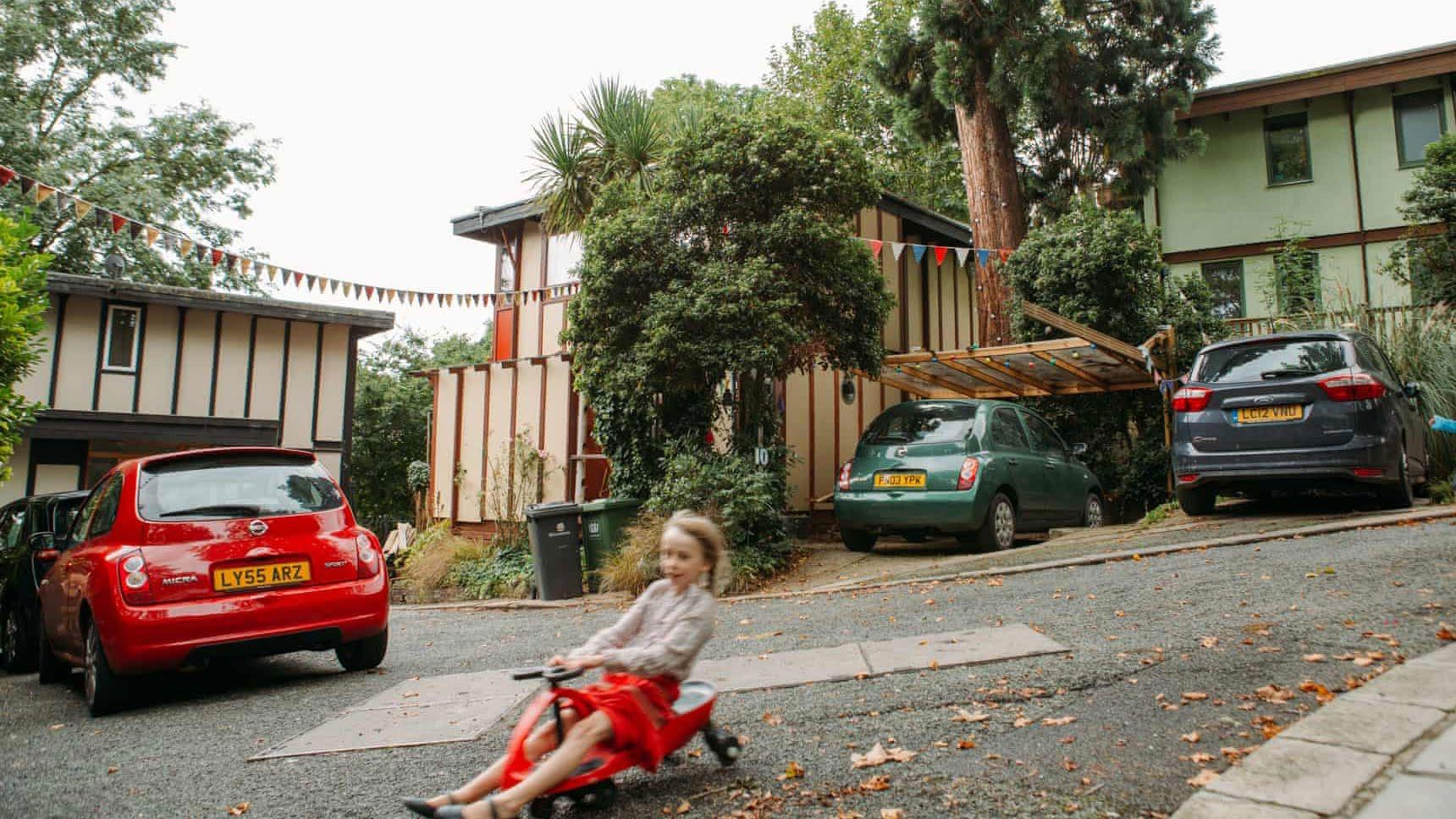
98
Beneath the Pines: Rebuilding the natural image of Sudbury through alternative residential development strategies.
Left: (F. 79) Photo taken at Walters Way depicting the shared narrow street and how it serves as an integral community space.
Right: (F. 80) Sketch by Walter Segal from the Segal Method illustrating the simple assembly components of a Segal Method home. These simplified drawings of the Segal Method made construction approachable and easy to follow.
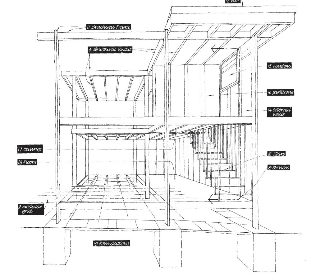
Touching the Ground
Walter’s Way features modest building forms fitted to the low sloped landscape using a minimally intrusive foundation system of concrete pavers that support stilts which continue into columns, that support a modular grid of light post and beam frames.1 This system developed by Segal ensures a sensitive approach to the placement of the home, allowing for the placement near trees while also striking a balance between a sensitive and
32 Alice Grahame and Taran Wilkhu, Walters Way and Segal
Close: The Architect Walter Segal and London’s Self-Build Communities, 42.
strong connection to the ground. The elimination of basements ensures a more sensitive approach while also reducing work normally requiring outside trades and site work which would increase costs and reduced the accessibility of the construction method. The modest piers and gravel plinth serve as the starting line for individuals to erect their modest, vertically-focused home without altering the natural landscape through typical foundation types. The sensitive approach allows for the natural landscape to continue growing and over time and with additional planting, the buffer between building form and the landscape begins to dissolve.
99 Chapter 5: Slow Development
Right: (F. 81) Photo looking South down the central staircase leading to the water at Haystack Mountain School of Crafts.
5.4
Haystack Mountain School of Crafts
Haystack Mountain School of Crafts was designed in 1959 by American architect Edward Larrabee Barnes. The crafts school is located on a sloped coastal site on Deer Isle in Maine. Comprising 34 modernist wooden cabins of modest scales, the buildings are stilted above the sensitive natural landscape and united by a series of wooden walkways and community deck spaces. The crafts schools unique architectural concept is inspired by the spirit of the incredible natural landscape, and the creative spirit of the crafts. The project is a celebration of landscape and craft, as the architecture serves to forge a unity through social concepts of living. Modest in scale and technology, the cabins stand as an evolution of the local vernacular while acting as a supporting cast to the astounding natural landscape.1
33 “About,” Haystack Mountain School of Crafts, accessed April 15, 2022, https://www.haystack-mtn.org/about/#architecture.
Beneath the Pines: Rebuilding the natural image of Sudbury through alternative residential development strategies.
100

101 Chapter 5: Slow Development
Left:
Ethos
Inspired by the magnitude of the natural landscape and by the creative mission of the school of crafts, architect Ed Barnes developed an ethos of modern simplicity, human scale, and social living that materialized into a series of modest building stilted on a sloped coastal site, unified by ribbons of decks, walkways, and community spaces set beneath the shadows of the pine forest.1 The social ethos uses a modern architectural language to promote and become the stage for which the creative minds of the crafts people paired with the beauty and magnitude of the natural landscape can be encouraged and highlighted. The architectural ethos translates a powerful natural landscape of
34 “About,” Haystack Mountain School of Crafts, accessed April 15, 2022, https://www.haystack-mtn.org/about/#architecture.
magnitude to one of humility and modesty through an architectural language prioritizing the human scale. An ethos of social modesty is manifested at every scale of the architecture, from the central deck providing shared views and access to the water, to the modest cabins accommodating simple living, while shared decks and community buildings become beacons for warmth and community building. The Haystack Mountain School of Crafts is a testament to the power of democratic and social ethos that is rooted in a respect for the natural landscape.
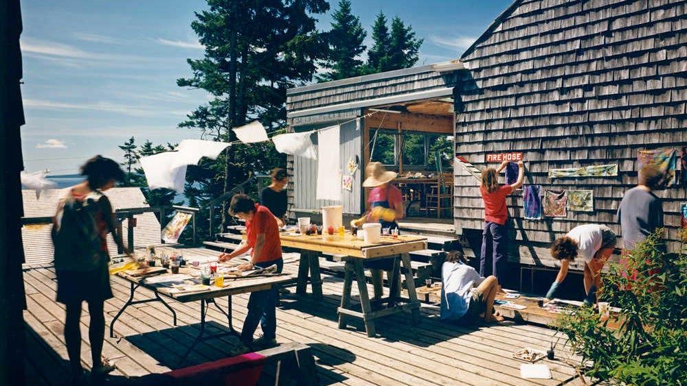
102
Beneath the Pines:
Rebuilding the natural image of Sudbury through alternative residential development strategies.
(F. 82) Photo of one of many community decks adjacent to workshop buildings. These spaces unite the community through art, leisure, and the best view of the ocean.
Right: (F. 83) Diagram depicting the overall site plan illustrating the organization methods used to build density along a sloped and rugged site. A central stair provides equitable access to the water while community decks offer unprecedented views.
Organization
NA central vertical circulation boardwalk set perpendicular to the slope and coastline provides equitable shared access to the shoreline and prominent views to the water at each step. A series of secondary boardwalks are set perpendicular to the slope and coastline to provide access to the various cabins fitted to the landscape between trees, rocks, and other natural elements. The walkways provide access to the rugged landscape at the human scale referencing the ethos of the project. The result is a series of modest cabins sit flating above the diverse landscape, anchored to wooden decks as if to evoke the images of yachts at rest on the abundant docks of the area. The diad between public and private space is explored as the architect allocated most services
to the shared spaces, leaving the cabins to exist as simple sleeping spaces to encourage a collective gathering in the social learning spaces. The effect is reminiscent to the wintery mountains that host both cabins and skiers throughout the season. United by sport, and by the necessary landscape a community forms through social experience.
103 Chapter 5: Slow Development
Overall Site Plan
Natural Landscape
A sloped site populated by a towering pine forest and softened rugged terrain provides a challenge to an architect tasked with building density on an unconventional building site. Architect Ed Barnes, inspired by the landscape, designed an additive approach to developing the project. Raised walkways, decks, and cabins allow for the project to be fitted between the forest, above the sensitive vegetation, and allows for a density of humans living on the site to minimally impact the natural landscape. If at some point the project were to be disassembled and removed, the natural landscape would remain relatively untouched. This modesty in temporary building ensures that the architecture of the place contributes to the enjoyment of the natural landscape while minimizing the potential for
negatively affecting the landscape and the public access to the land over generations to come. The development both elevates the experience of the natural landscape through a thoughtful experience while also being a circulation method that supports a minimally invasive approach to designing architecture on a unique site. The Haystack development is inspired by and supports the natural landscape ensuring a deep connection today and in the distant future.

104
Beneath the Pines: Rebuilding the natural image of Sudbury through alternative residential development strategies.
Left: (F. 84) Photo capturing the raised walkways above the sensitive landscape. The walkway provides access to the various shed-roof cabins stilted throughout the site.
Touching the Ground
The Haystack Mountain School of Crafts utilize piers and stilts to ensure a sensitive connection to the ground. Cabins are raised on piers to ensure a minimally intrusive foundation type which allows natural growth of vegetation to continue uninterrupted. This foundation type also allows for the architect to take advantage of the flexibility in construction that piers offer on tpographically rich sites. Through the use of raised cabins and walkways, the architect prioritizes the landscape and using additive techniques, provides a solution to circulation that does not alter the landscape for the purposes of human living. This strategy is true to the ethos originally set out by the crafts school and the architect. Here, the modesty and social responsibility is reflected in the architecture
Right: (F. 85) Digital scan of a sketch of illustrating the organization of cabins cascading down the sloped site united by the shared central stair.
adapting to the landscape, accepting its place as part of the ecosystem and not as it’s primary character. The ethos prioritizes a sensitivity to the landscape which challenges the typical development strategies and inspires a creativity for new solutions on a unique site. The architectural intervention allows for the delicate existance of the architecture existing as a backdrop to the dynamic arts and crafts, subsequent human life, and natural beauty of the landscape.
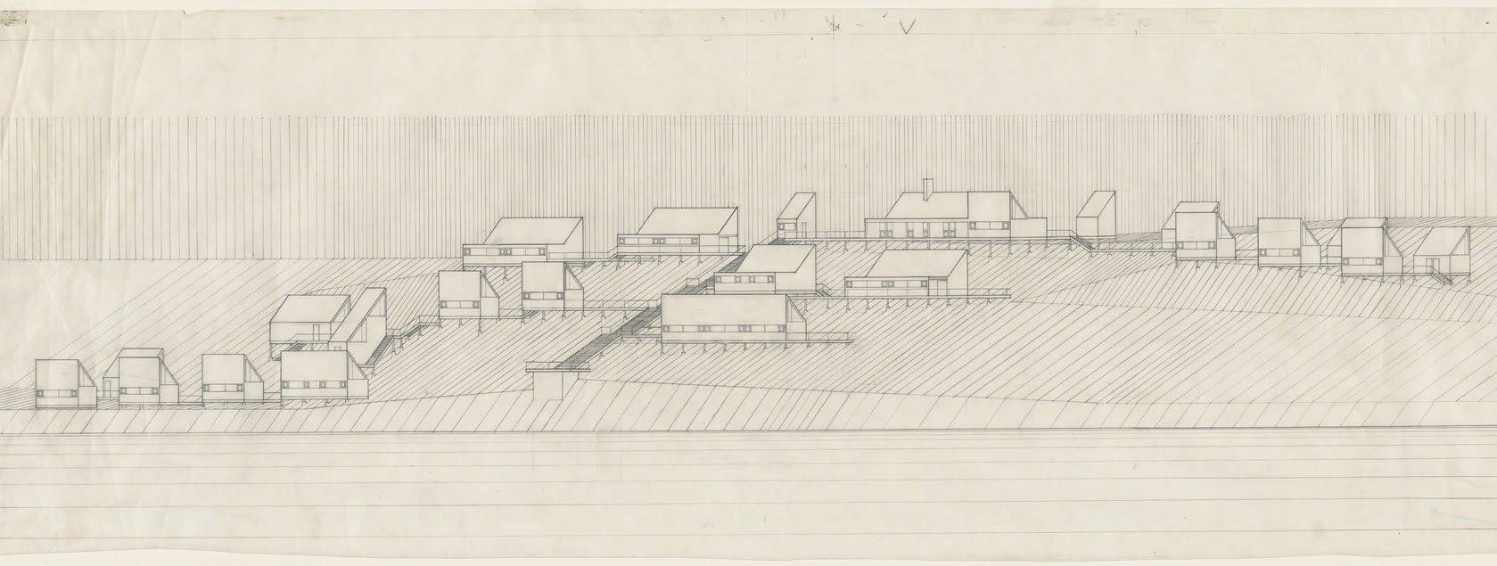
105 Chapter 5: Slow Development
Slow Development Strategies
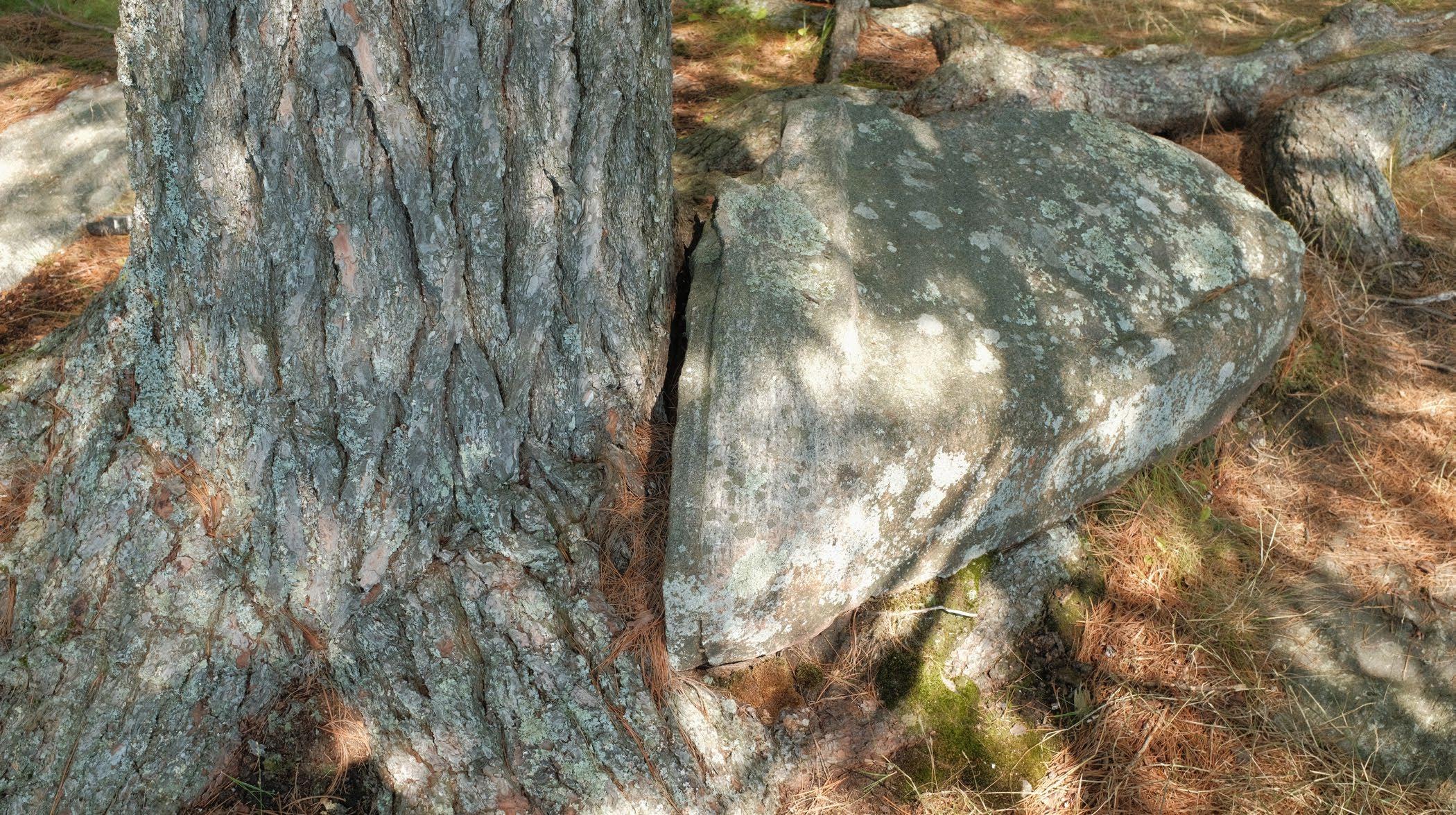
The four projects presented above share are a commonality of being located on sites comprising a challenging natural landscape, normally regarded as undersireable, which instead inspired an overall ethos of sensitivity of the project. This led to the requirement of an alternative approach and a resulting unique architectural philosophy and development. The analysis of these four main precendent informed the following: the opportunity provided by the natural landscape of the Sudbury area composed of a topographically rich undulating layer of bedrock, the importance of developing an ethos informed by deep site research to ensure the development supports the spirit of the place, the impact that design guidelines and restrictions provide to ensure the success of a development
committed to a sense of stewardship, and the importance of an additive approach to touching the ground which allows for the conitnued growth of the natural landscape while also providing the access required for humans in the natural environment. These strategies have informed the design phase of the thesis and have been used to define a slow development approach for the design of residences fitted to the natural landscape that speak to both the land surrounding it, as well as the family who call it home. The slow-development appraoch understands that the architect or designer in charge’s first acts are often the most poignant in the development. This means that the slow development approach engages in a focused pre-design phase to develop an ethos of the project
106
Beneath the Pines: Rebuilding the natural image of Sudbury through alternative residential development strategies.
Below: (F. 86) Photo of a tree that has grown around a boulder at Grundy Lake Provincial Park.
integral to the symbiotic relationship between human and nature, an organization that challenges the typical development strategies through the return to sensitive development and architectural principles, the importance of the natural landscape remaining as the main character of the development ensures the continued attraction of like-minded people interested in living within the ecology, as well as the importance of alternative methods for touching the ground which through a visual and physical realm can communicate the true intentions of the project. Inspired by the ethos studied, the slow development approach of the thesis is characterized by the phrase: beneath the pines, which takes inspiration of the canopy line of the ancient pine forests of the area, speaks to
the development of residential architecture, and a resulting lifstyle where one aspires to live modestly within the natural landscape, contributing to a symbiotic ecology, and unity of the community through a devotion to the stewardship of the natural environment. This is what it means to live beneath the pines.
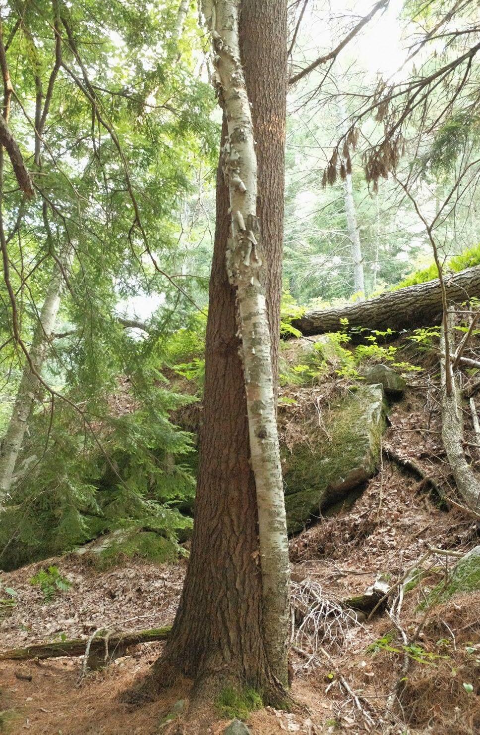
107 Chapter 5: Slow Development
Right: (F. 87) Photo of a birch tree that has adapted to twist around a pine tree while growing in search of light.
6.0
Designing an Alternative Design Guidelines Design Trial Ethos 6.1 6.2 6.3
6.1
Ethos
The ethos serves as a set of guiding principles that inform the design process, ensuring elements imperative to the alternative approach are implemented. The ethos is a distillation of research process, formed by both content emerging from precedent study as well as through primary research. In the case of slow-development, an ethos is an integral first step meant to guide the creation of pre-design strategies and to instill a collective vision for the development.
110
Beneath the Pines: Rebuilding the natural image of Sudbury through alternative residential development strategies.
Yes No
Stewardship Collective protecting land rights
Natural Fields protecting natural growth of landscape
Dwelling type original to landscape and people
Additive strategies tailoring building to landscape
Equitable public transportation infrastructure
Programing & trails encouraging public access
Modest houses set beneath the pines
Collective stewardship of the natural landscape
Support natural processes and animal habitat
Land division
Private land ownership
Shared contribution to a natural image of the city
Slow-development of homes sculpted by landscape
Imaginative new strategies original to the landscape
Lifestyles forged by deep connection to nature
Ethos Summary
Blasting or flattening of the landscape
Individual car-based development strategies
Commodity housing Barriers to shoreline and significant landscape
Towering homes dominating the landscape
Individual aspirations altering landscape
Interrupt the natural ecology and animal habitat
Private access to integral images of the city
Phased development destructive to environment
Repetive, ignorant, and place-less development
Disconnect from nature and the outdoors
Genuine dwelling typology emerging from a natural landscape, it’s people, and the place. Contributing to a community dedicated to the stewardship of the natural landscape, for the shared communal composition of a natural image to of the city by all residents.
111 Chapter 6: Designing an Alternative
6.2
Design Guidelines
112
Beneath the Pines: Rebuilding the natural image of Sudbury through alternative residential development strategies.
Approach & Organization
Stewardship Collective Planes Piers Pins
Founding Principles & Ethos
Natural Fields Parking Clusters
Touching the Ground Building Form
The Ring Road
By Foot
Fields & Forces
Attractive Forces
Repellent Forces Housing Clusters
Stepping the Landscape Horizontal Primacy Forming the Roof Living Roofs
Embracing the Landscape Composing Understoreys Solar Orientation Views & Light Materials & Finishes Limiting Dependency
113 Chapter 6: Designing an Alternative
Movement A L M N O P Q R S T U V D B E H C F I J K G
Right: (F. 88) Photo of a physical sketch model exploring the interplay of landscape and building form.
Preface
Design Guidelines provide considerations by the architect with the intent to further synthesize the character of the home with the overall community and the landscape. Design Guidelines provide thoughtful and flexible considerations for design questions that arise during the construction of novel homes. Considerations for conceptual drivers inspired by ethos, organization of the entire site and residing community, relationship to the natural landscape, and strategies for touching the ground comprise the main themes explored through the design guidelines.
The Design Guidelines have been designed to provide clear direction for the design of houses true to the ethos, while also ensuring some creative freedoms and interpretations to ensure the identity of the individual can contribute to the original home design representing both it’s people and landscape.
114
Beneath the Pines: Rebuilding the natural image of Sudbury through alternative residential development strategies.
The development of a physical scale model proved necesary for drafting, testing, and re-drafting of the Design Guidelines. The physical model encouraged a practice of exploring the integration of building form and natural landscape and methods of touching the ground.
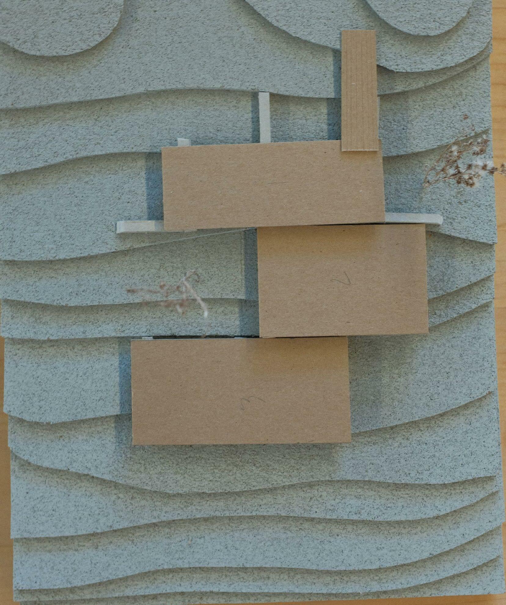
115 Chapter 6: Designing an Alternative
Below: (F. 89) Diagram describing the designed unity between the natural landscape, the residents of the site, and the general citizens of the city, forming the founding stakeholders for the Stewardship Collective.
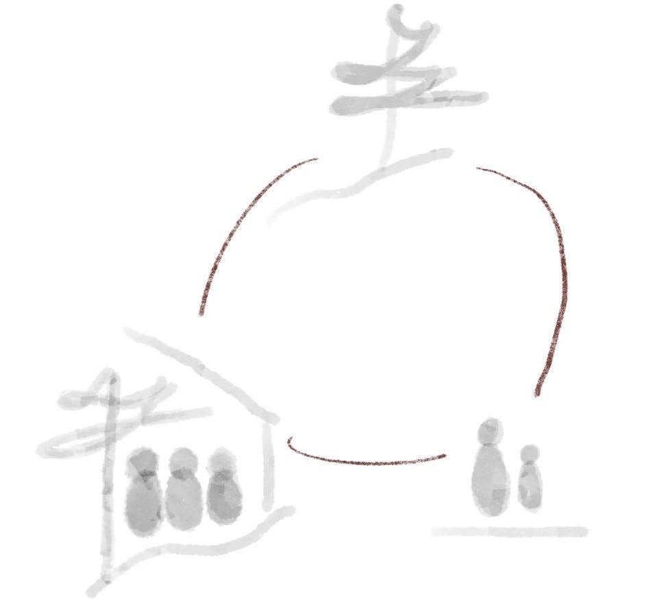
AStewardship Collective
Between two Lakes is a community united through a shared priority of the Collective Stewardship of the landscape. The community is designed as a landscape led development to ensure the preservation of, and symbiotic reconnection to, the natural landscape. The requirement for a Collective Stewardship organization type is due to the historical shift from modest buildings set into the landscape to the limitless aspirational buildings of the human that conquer the site. The privatization of the landscape, the subdivision of land into lots, zoning bylaws, as well as the culminating individual aspirations of the human when faced with a blank (often referred to as developed lot) represent the primary issues facing the relationship between residential development and the natural landscape.
Alternative strategies to the challenges presented above are foundational to the creation of a landscapeled, ecologically sensitive development. A collective organization is required to eliminate issues of land ownership, privatization of the landscape, lot subdivision, and the individualization/alienation of the lot to the landscape. Furthermore, A governing board is necessary to ensure the lawful practice of building and living in the landscape while also ensuring a unified set of standards for all residents to ensure fairness and accountability. The governing board represents the values of the community, and ensures the flexible and impartial practice of the founding principles that are imperative for the success of the community development, Between two Lakes.
Between two Lakes Site
Primary Stakeholders
Conservatonists
Stewardship Collective
The Stewardship Collective acts as the sole landowner of the Between two Lakes site. The preservation and the management of the land is thereby dependent on the democratically organized Stewardship Collective which is composed of the following:
- Private residents elected to the Stewardship Collective Managing Board
- Arborists, Conservationists, Ecologists, Landscape Architects, and Architects
- Elected member of the public to advocate for public access, programming, and perspectives.
Novel organizations such as this requires further exploration not possible under the scope of this thesis.
Beneath the Pines: Rebuilding the natural image of Sudbury through alternative residential development strategies.
116
Right: (F. 90) Map outlining of the site Between two Lakes managed by the Stewardship Collective.
Between two Lakes Managed by the Stewardship Collective
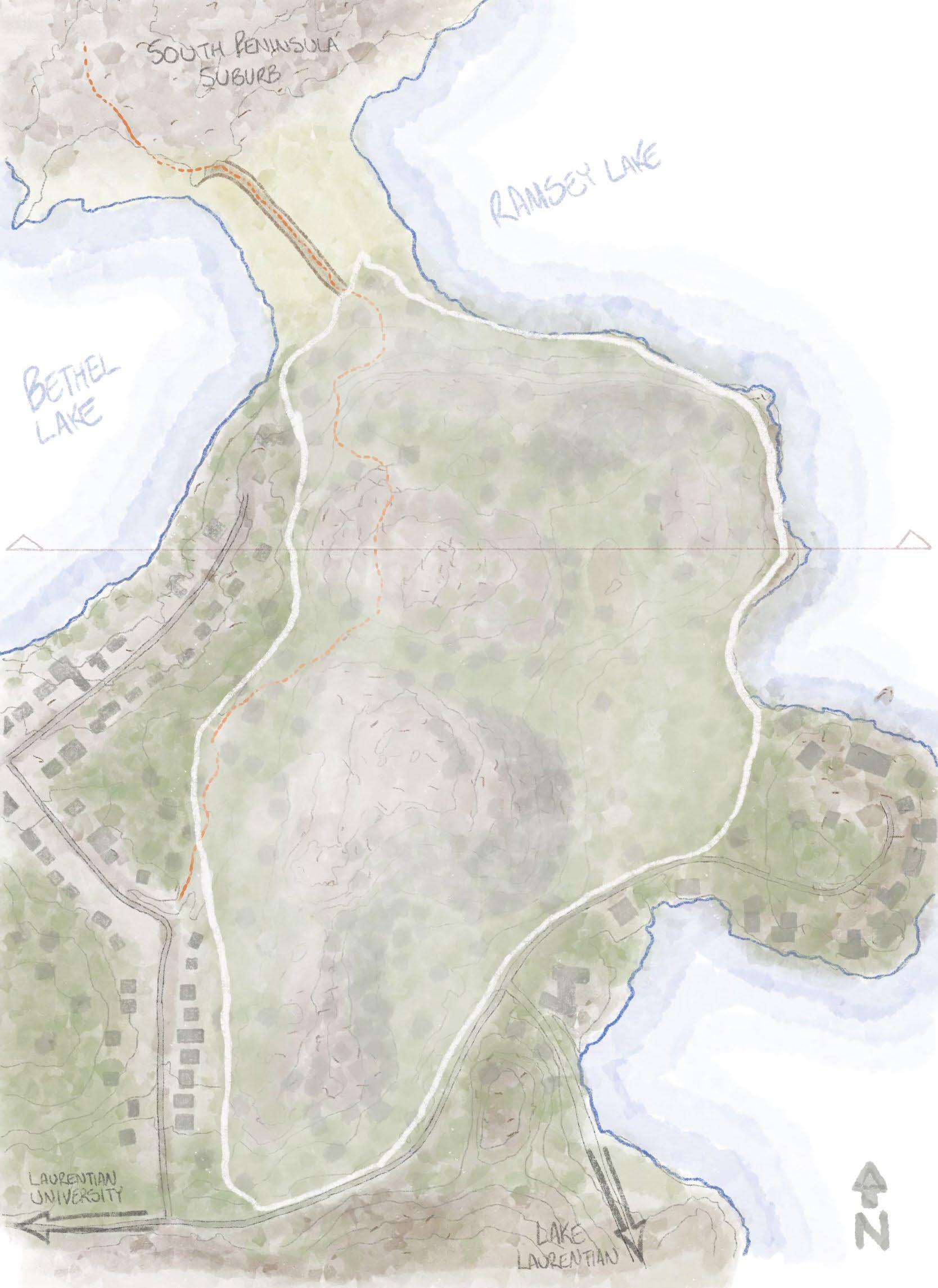
117
Chapter 6: Designing an Alternative
Below: (F. 91) Diagram describing the complex organization of stakeholders and parties required for the equitable development of culturally significant landscape.
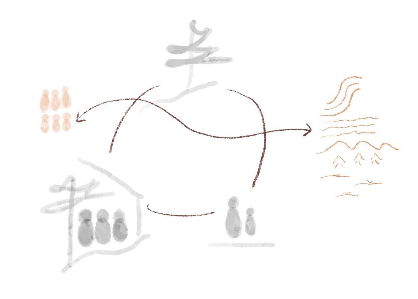
Founding Principles & Ethos B
Between two Lakes is a community united through a shared commitment of Collective Stewardship of the natural landscape. The landscape led development is designed to ensure the preservation of, and symbiotic reconnection to, the natural landscape by members of the public and private residents. The requirement for a Collective Stewardship organization type emerges from the shifting narrative away from modest buildings set within the landscape to a trend of monolithic barriers conquering the shoreline analyzed in the morpology chapter. The privatization of the shoreline and landscape, the subdivision of land into lots, ineffective zoning bylaws, as well as the development strategies popular today represent the primary issues facing the relationship between residential development and the natural landscape.
Alternative strategies that seek creativity in the face of challenging landscapes are foundational to the creation of a landscape-led, ecologically sensitive development. The Collective Stewardship organization allows for the elimination of issues regarding land ownership, privatization of the culturally significant landscape, lot subdivision, and the reduction of landscape as a mere privacy screen following lot lines. Furthermore, the governing board ensures the lawful practice of building and living in the landscape adhering to the ethos and Design Guidelines that ensure fairness and accountability. The governing board represents the values of the community, and ensures the flexible and impartial practice of the founding principles that are imperative for the success of the community development named Between two Lakes.
Between two Lakes site
Significant Landscape Conditions
Conservationists
Stewardship Collective
Rebuilding the natural image of Sudbury through alternative residential development strategies.
118
Beneath the Pines:
General Public
The Stewardship Collective at Between two Lakes is a not-for-profit organization that is committed to the symbiotic habitation of a sensitive and culturally significant land at the heart of the city. As previously discussed, Ramsey Lake is a foundational character in the story of Sudbury, and new relationships with land ownership and public use must be instituted to preserve the public value of the lake. The Stewardship Collective is a an organization formed to preserve and manage the sensitive site while ensuring a democratic and ecologically just organization that prioritizes the needs of the natural landscape while also ensuring the continued public access to the city’s greatest asset, all while creating new ways of developing sensitively within the natural landscape.
The founding principles of the Stewardship Collective:
- Preserve and support the natural landscape and the spirit of place
- Ensure and encourage public access and activity on site
- Facilitate creative strategies for the sensitive development of architecture on the site
- Develop new relationships between public and private space
The Stewardship Collective will ensure these goals through the following:
- Stewardship Collective ownership model for the entire site focused on the stewardship of the natural landscape first, and the development of sensitive architecture second.
- Design Guidelines for the sensitive construction of public and private buildings on a natural landscape.
Strategies requiring further development beyond the scope of the thesis:
- Further develop the concepts of Fields to form new relationships between the natural landscape, the public access to culturally significant landscape, and the private habitation of the landscape.
- A designed approach to the overall site that equally respects the three major stakeholders: the landscape, the private residences, and interests of the general population of Sudbury.
- Designing Public Access and Public Programming as part of a mixed-use alternative to typical residential development and zoning
- Ensure that the above contributes to an open framework designed to be expanded, modified, and further improved through the democratic process over time.
119 Chapter 6: Designing an Alternative
Natural Fields C
Natural Fields refer to the areas of the site which are the most culturally significant, and therefore are Fields of the natural landscape we are to be preserved, supported, and most importantly must be left open to all citizens. Natural Fields are determined through a process of deep site analysis, historic research, public participation. Natural Fields are limited to publicly programmed architecture, pathways, and accessibility strategies designed to increase public participation. The placement of private homes within Natural Fields is absolutely restricted.
Natural Fields are integral areas of the natural landscape that contribute most to the spirit of the place, and to the image of the city, thus, programmed public access to these fields is integral to ensure the general public can be active participants in the definition of a natural image of the city of Sudbury.
In the case of the Between two Lakes site, the following Natural Fields have been identified:
Faultline
The Creighton Faultline is a unique and dramatic geological feature present on the Northern end of the site. The humbling scale of the feature conveys the rich geological history of the natural landscape that has developed over billions of years.
Shoreline
The shorelines of Ramsey Lake are a major source of public recreation, however, over time the shorelines have become more and more privatized. The shorelines will be preserved as public space to ensure a connection to Ramsey Lake and the natural shoreline.
Beneath the Pines:
Pines
Peaks Marshland
The natural landscape of the Sudbury area is incredibly dynamic with rocky hills undulating throughout. Over time, the flattening and development of these hills has resulted in a loss of this dynamic image. The high-points of the area will be preserved.
Subject to the disastrous effects of mining and industrial processes over the years, the stock of both deciduous and especially confierous forests have been severely impacted. The regreening efforts present on the site will be preserved to support a maturing forest.
A marshland is present on the Southeast shoreline of the site. This area, complete with a young deciduous forest is host to wildlife and a diverse and sensitive vegetation.
Rebuilding the natural image of Sudbury through alternative residential development strategies.
120
Right: (F. 92) Map outlining Natural Fields designed as preservation and public space focused on the growth of the natural landscape .
Chapter 6: Designing an Alternative
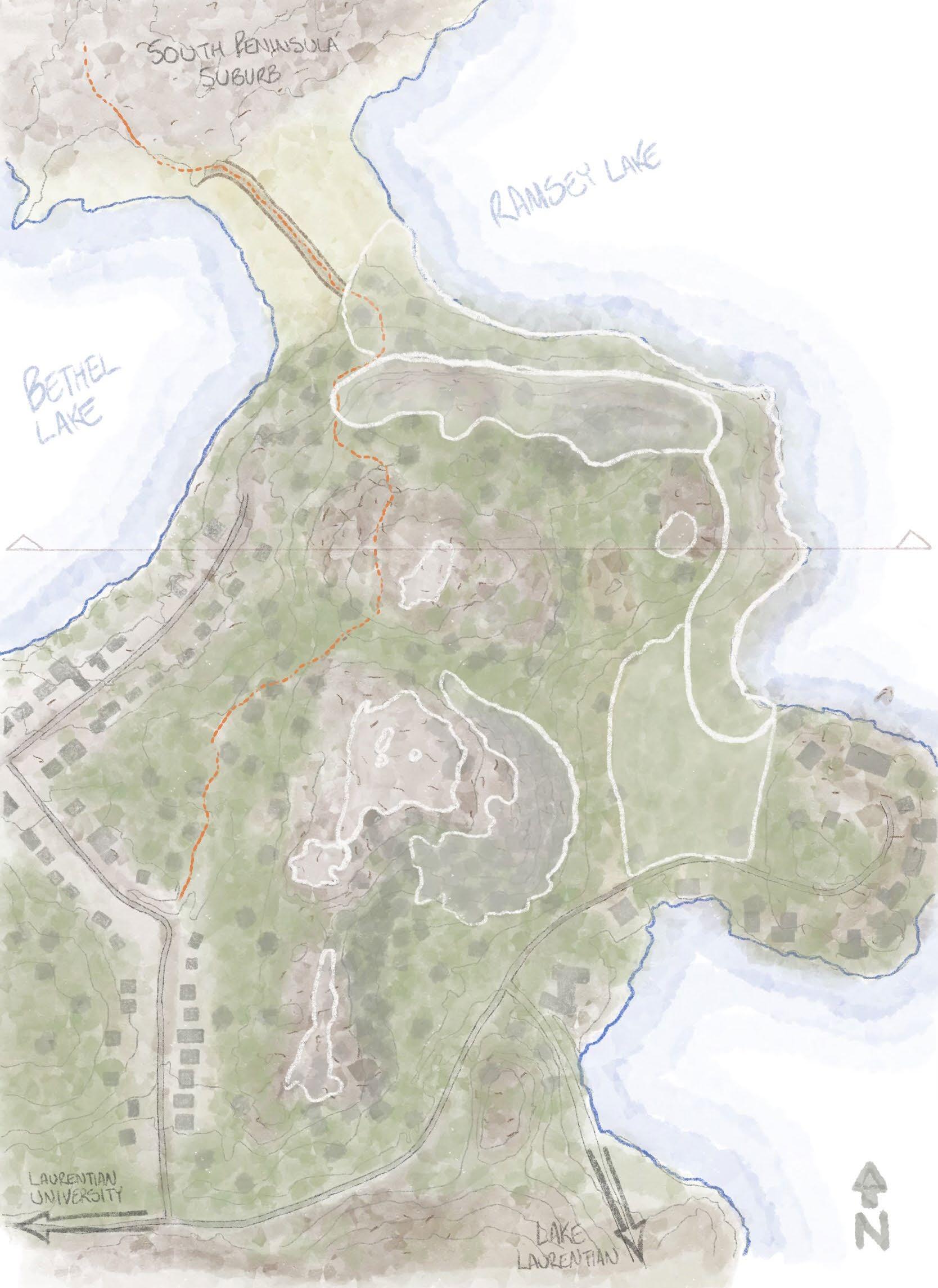
121
Left: (F. 93) Plan diagram demonstrating the Ring Road as it navigates through the landscape utilizing a landscape-first approach, minimizing impact.
Movement
As an alternative development strategy, Between Two Lakes seeks alternatives to the cul-de-sac and to the resulting relationships betwen the home and the person, the car, and the typical orientation to and dependency of the abundant roadways. Understanding that a primary road is imperatie for public transportation, emergency services, cycling, public access, and for general recreation, a one-lane, one way road provides access throughout the site while minimizing it’s footprint and maximizing it’s adaptability to future evolutions in movement.
DThe Ring Road
Plan
Walking Path
Bicycle Path

Electric Vehicle Route

Public Transit Route


Public Parking

The Ring Road is a one-lane roadway designed or the slowed movement by wheel throughout the site providing access by human-powered and motor-powered modes of wheeled transportation. Public Parking is provided along right side of the Ring Road. These parking spaces provide the general public access to the Natural Fields of the site while also acting as additional parking for visitors and guests.
Minimally invasive strategies for the ring road include:
• to follow areas of low slope
• to be positioned between Natural Fields, providing access
• to preserve the natural landscape, vegetation, and topography where possible
• to provide general access to both Public and Private fields
• to feature from left to right, a walking path, bike lane, car lane and parking.
• parking to be fitted in spaces between existing trees, where possible.
Rebuilding the natural image of Sudbury through alternative residential development strategies.
122
Beneath the Pines:
Right: (F. 94) Map illustrating a sketch of the Ring Road, following areas of low-slope and low impact to the natural landscape.
The development of the Ring Road marks the first step in the development. Providing access to the entire site through a slow one-way route, the road winds between trees, selecting the path of least impact while also following areas of low-slope the Ring Road serves as an inital test of the sensitive strategies developed for the site.
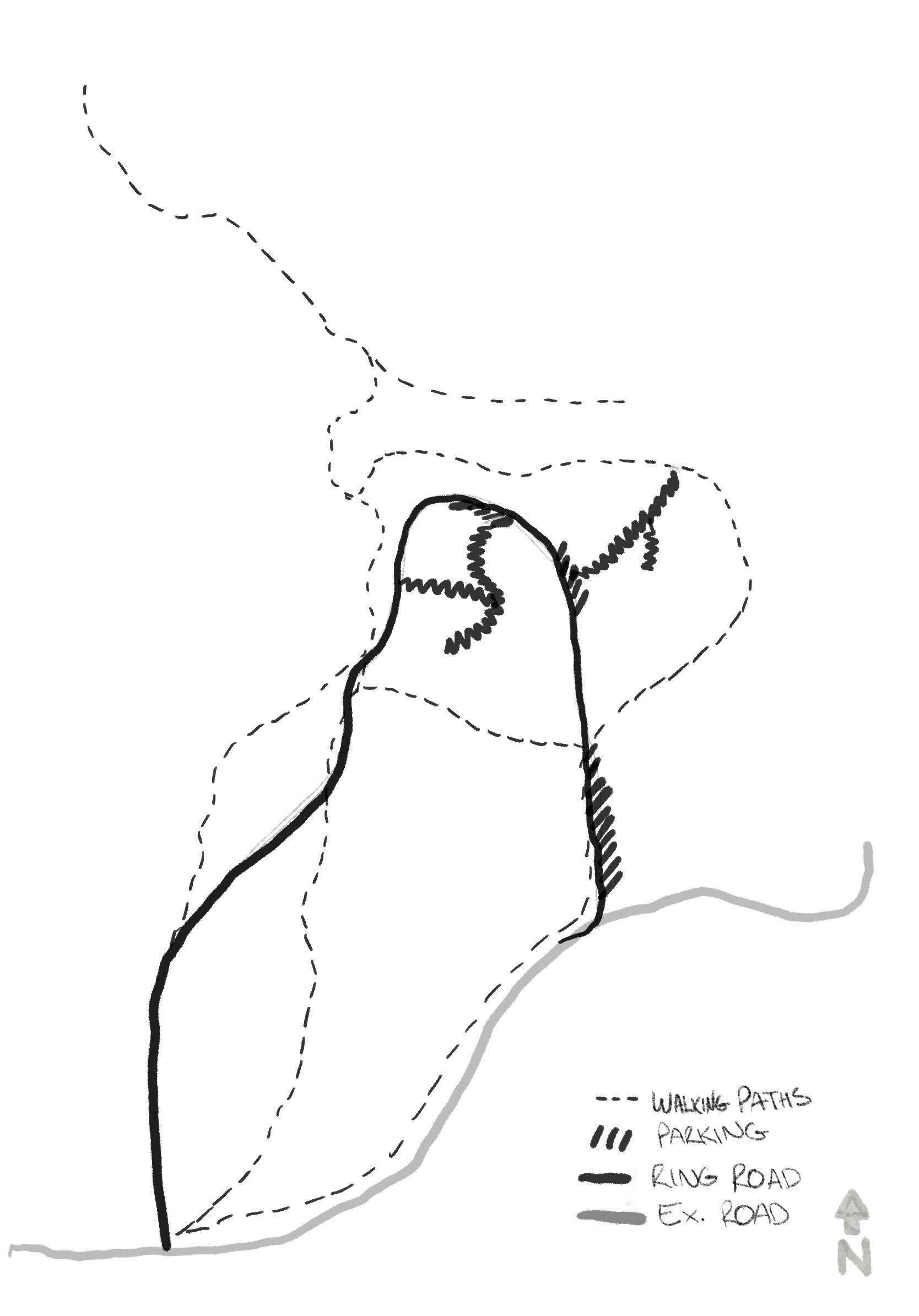
123 Chapter
6: Designing an Alternative
Housing Clusters H
H H H
H
Left: (F. 95) Plan diagram illustrating the strategies for clustered parking to minimize impact and reduce the prominence of the car on site.
Movement Plan
EParking Clusters
Walking Path
Bicycle Path Electric Vehicle Route
Public Transit Route Cluster Parking
Parking Clusters provide private parking for residents of Between Two Lakes. Parking is clustered to reflect the clusters of houses for which these clusters provide parking. The density and overall design of the parking clusters are to follow the natural features of the area. Pathways lead residents from the parking clusters to housing clusters and the various site paths and trails.
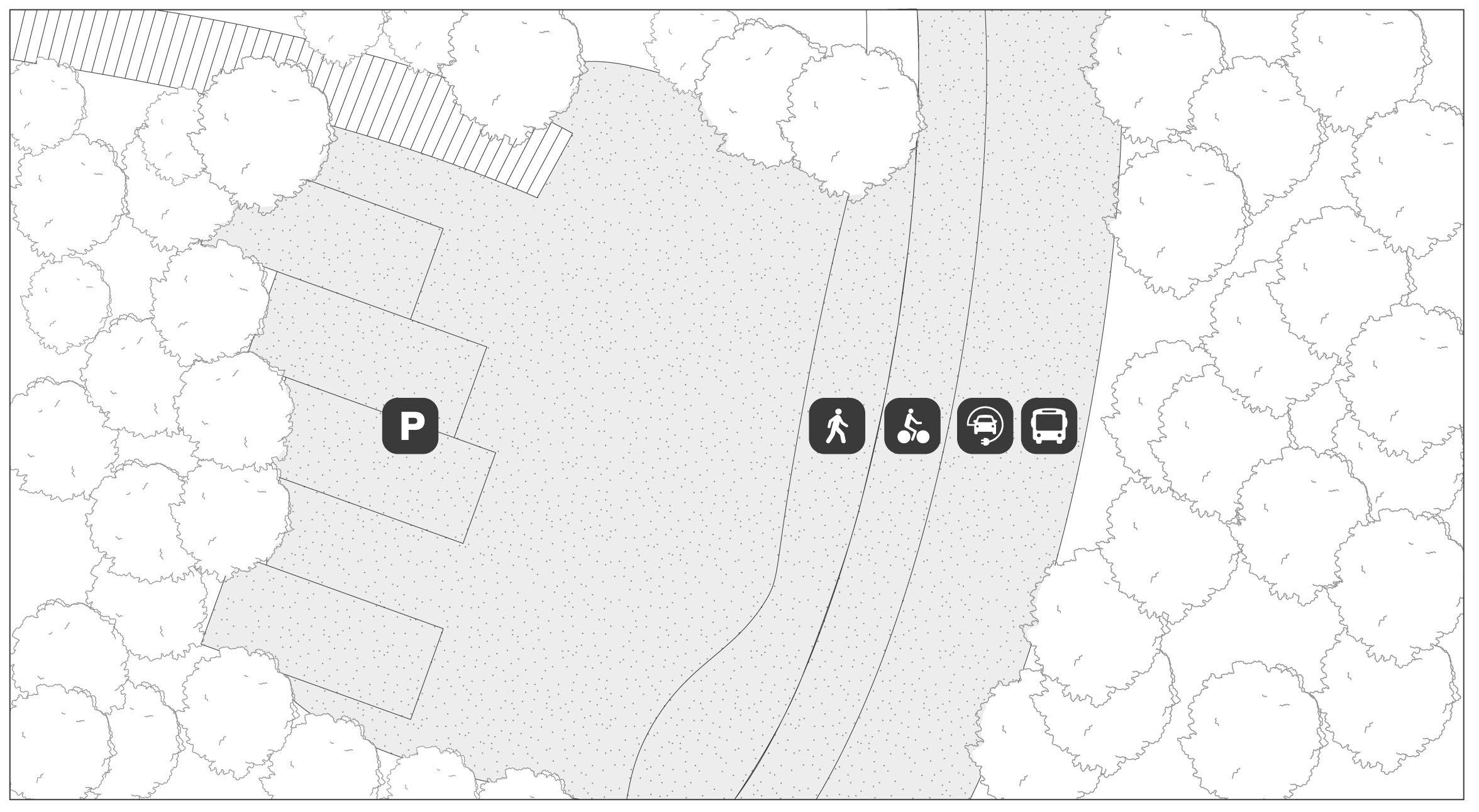
• Permeable pavers are to be used to ensure natural drainage and a minimized impact
• Landscape features are to be the main driving force for the placement of parking space
• Roof shelters comprising photovoltaic panels supports the transition to electric vehicles.
124
Beneath the Pines: Rebuilding the natural image of Sudbury through alternative residential development strategies.
Right: (F. 96) Diagram illustrating the sensitive paths leading from areas of clustered parking to housing clusters.
Paths Forward Plan Walking Path
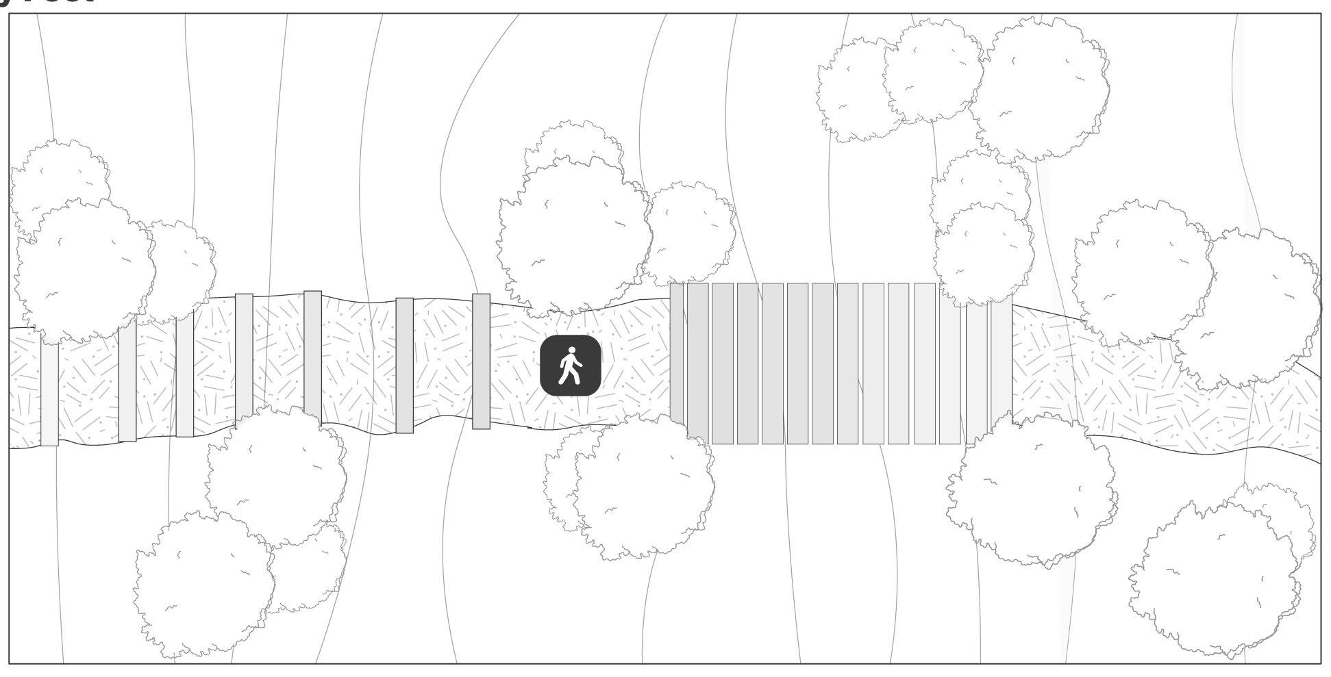
Parking Clusters provide private parking for residents of Between Two Lakes. Parking is clustered to reflect the clusters of houses for which these clusters provide parking. The density and overall design of the parking clusters are to follow the natural features of the area. Pathways lead residents from the parking clusters to housing clusters and the various site paths and trails.
• Garden Steps composed of a wooden retainer and soil fill provides a sensitive solution where steps are required to access areas of low slope.
• Boardwalks comprising a pressure treated structure topped with eastern white cedar are to be used to provide access where a raised walkway is necessary for accessibility and to preserve sensitive landscape.
• Boardwalk Steps are to be used where higher slopes and/or challenging terrain limit the accessiblity of the site.
• Paths are to be left unpaved to encourage the natural drainage and watershed of the site.
• The natural landscape is to be the main composer of paths, using the existing vegetation and terrain as the main drivers for the composition of the pathways.
125 Chapter 6: Designing an Alternative
F
G
Fields & Forces
Left: (F. 97) Section diagram illustrating the concept of Fields and Forces which interprets natural conditions into either attractant or repelling forces that negotiate the placement of building form on the site.
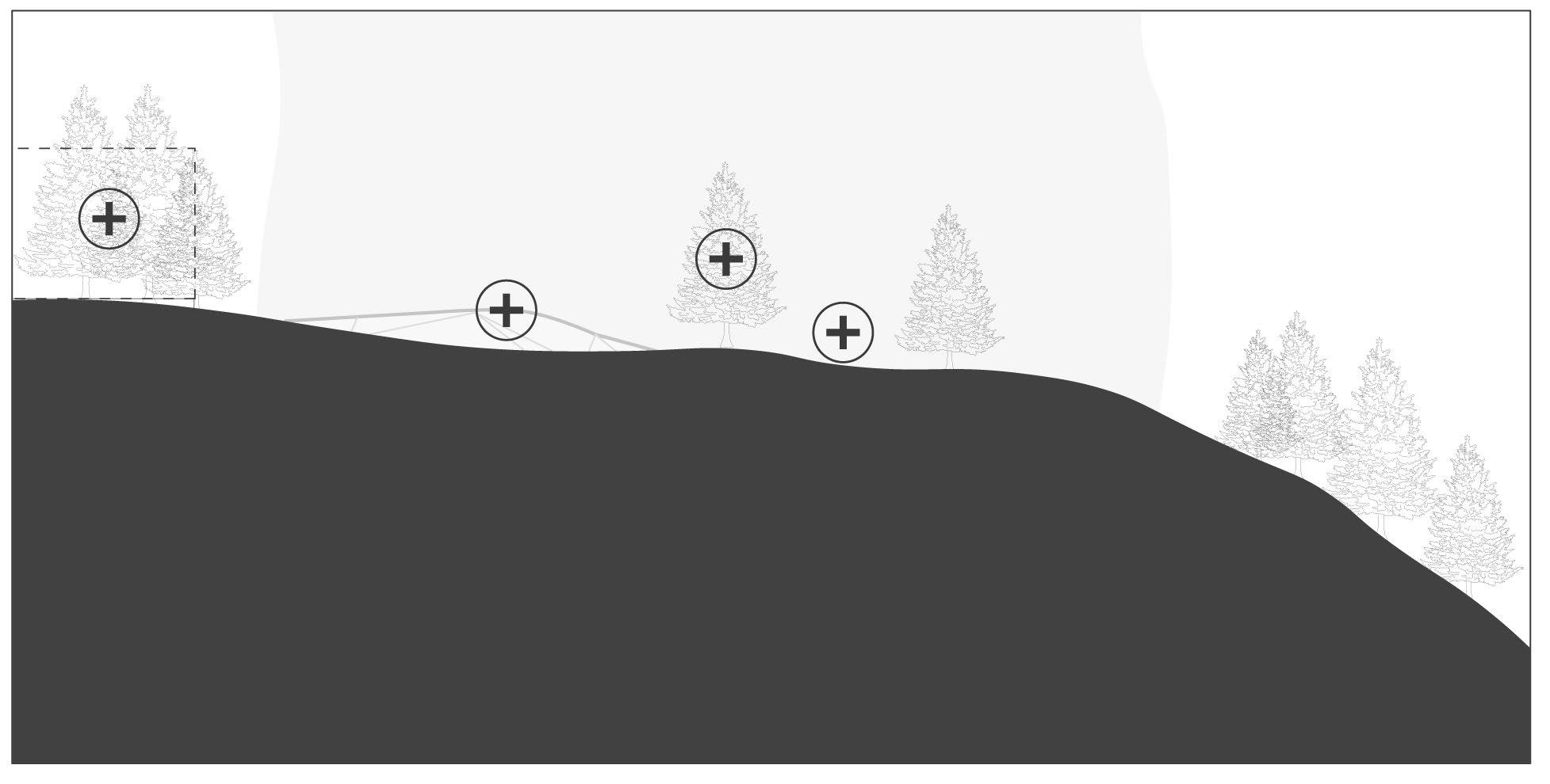
Fields and Forces refers to the interpretation of the natural landscape to determine areas suitable for the sensitive development of housing. Similar to the Natural Fields described earlier, smaller fields exist throughout the site which either welcome or dissuade sensitive development. Clusters of trees and vegetation communicate natural fields attractive to building form while areas of steep slope act as a repelling force for development. Fields and Forces both inform each other and exist in a dynamic relationship. Fields and Forces can be both positive and negative for the purposes of sensitive development within the landscape. These differences in perceiving the landscape are described below.
Attractant Forces
Existing building form (housing cluster)
Exposed bedrock
Low density tree cluster
Section
Attracting Forces refer to Fields and Forces that attract the sensitive development of houses. With the intent of developing sensitively on the natural landscape, there are some natural and man-made conditions that are conducive to the development of houses in sensitive manner. In opposition, there are also conditions that can be considered negative to the development of sensitive architecture. Attracting forces refer to the forces and fields that exist on site that encourage and attract development by nature of the conditions.
126
Beneath the Pines: Rebuilding the natural image of Sudbury through alternative residential development strategies.
Dense confiferous forest
Right: (F. 98) Plan diagram illustrating the landscape conditions that favor the sensitive development of building form.
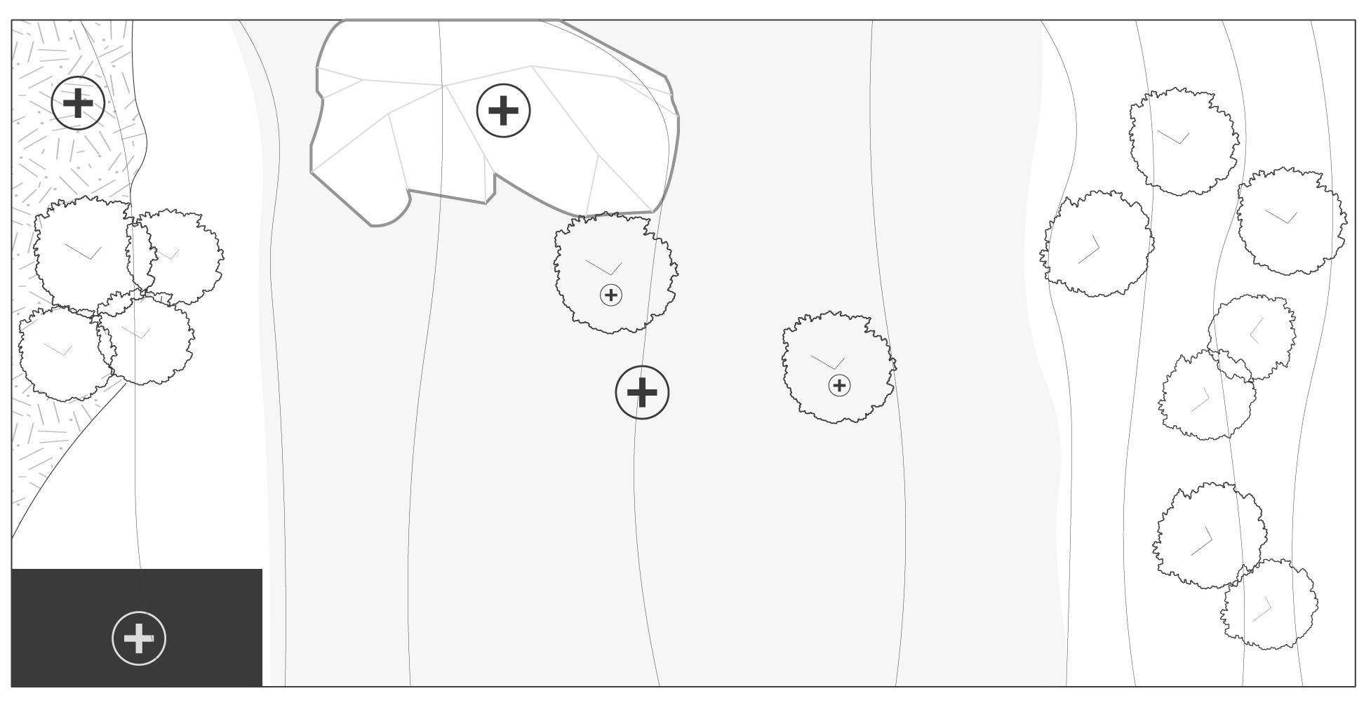
Exposed bedrock
Area of low-slope
Dense confiferous forest
Existing building form (housing cluster)
Low density tree cluster
Elements that may be interpreted as Attracting Forces:
• Clusters of trees and vegetation communicate a natural field that may attract building form. In this case, the field acts as a force attracting
• Houses, attracting more houses to compose housing clusters
• Areas of low slope
• Exposed bedrock encouraging building form that does not interrupt vegetation or soils
• Coniferous trees that building form can embrace and support
• Parking clusters
• Pathways and trails
• Areas with prominent views
Attracting Forces are imperative as they may serve as Natural References to be used for the thoughtful design of homes connected deeply to their site not only phyisically, but also through the composition of a lifestyle deeply rooted with the landscape. Visual and physical connections rock, trees and vegetation provide ideal references to watch as the seasons change.
127 Chapter 6: Designing an Alternative Plan
Left: (F. 99) Section diagram illustrating the repelling forces that dissuade the building of houses on sensitive or extremely challenging site conditions.
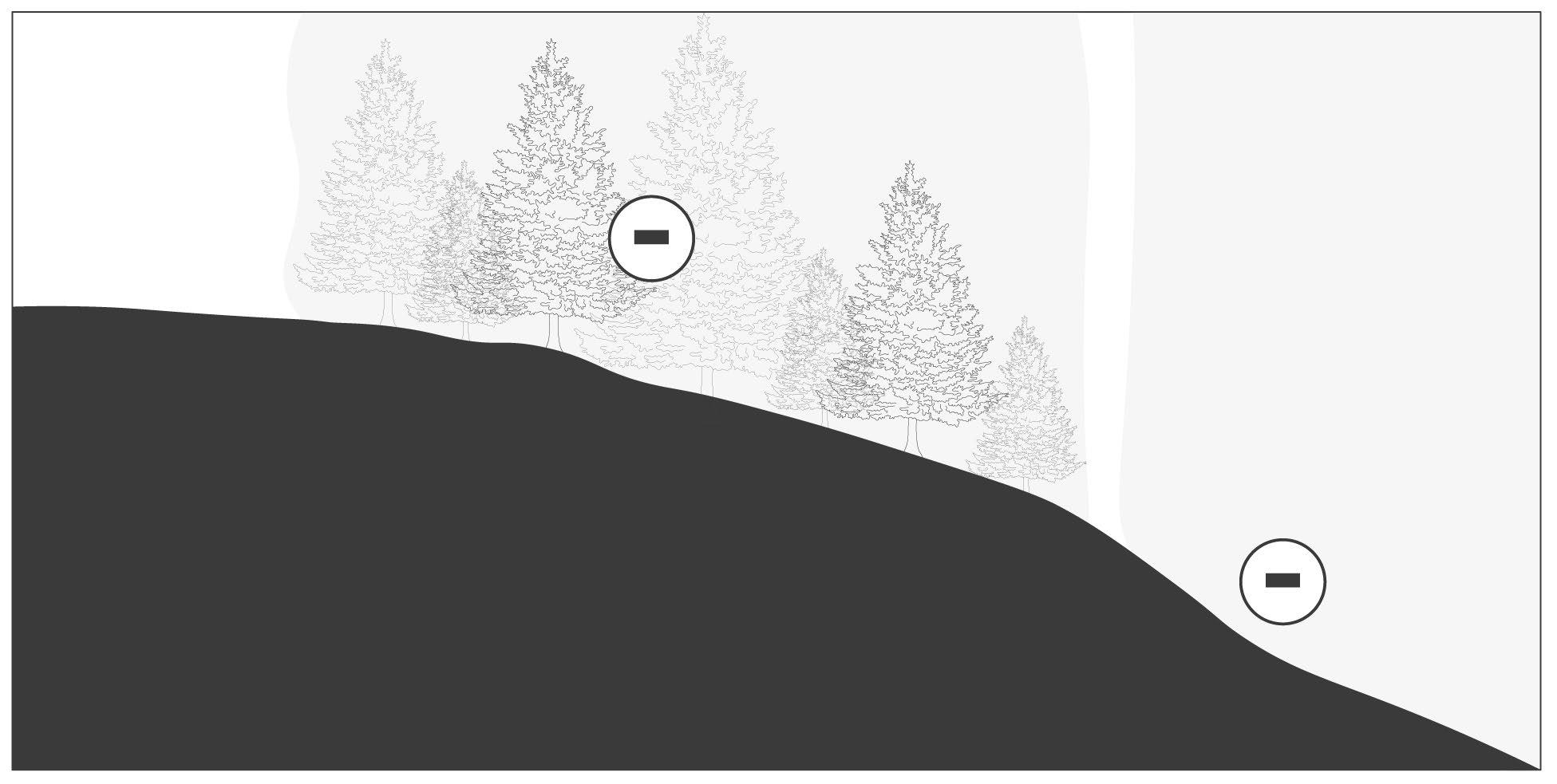
H Repelling Forces
Section
Dense stand of conifers
Neutral due to challenging approach,
Repelling Forces refer to Fields and Forces that are not conducive to the sensitive development of houses, therefore, repelling development from the area. Repelling Forces such as large stands of trees create a Field which repels development at an even greater magnitude. Repelling Fields act both in section and in plan as the natural conditions exist in three dimensions and/or spatially. Natural Fields which are most attractive for the enjoyment of all, are a prime example of Fields which act as Repelling Forces for the development of private houses.

128
Beneath the Pines: Rebuilding the natural image of Sudbury through alternative residential development strategies.
Right: (F. 100) Plan diagram illustrating areas of sensitive and important landscape that repel the building form in order to preserve the natural landscape,
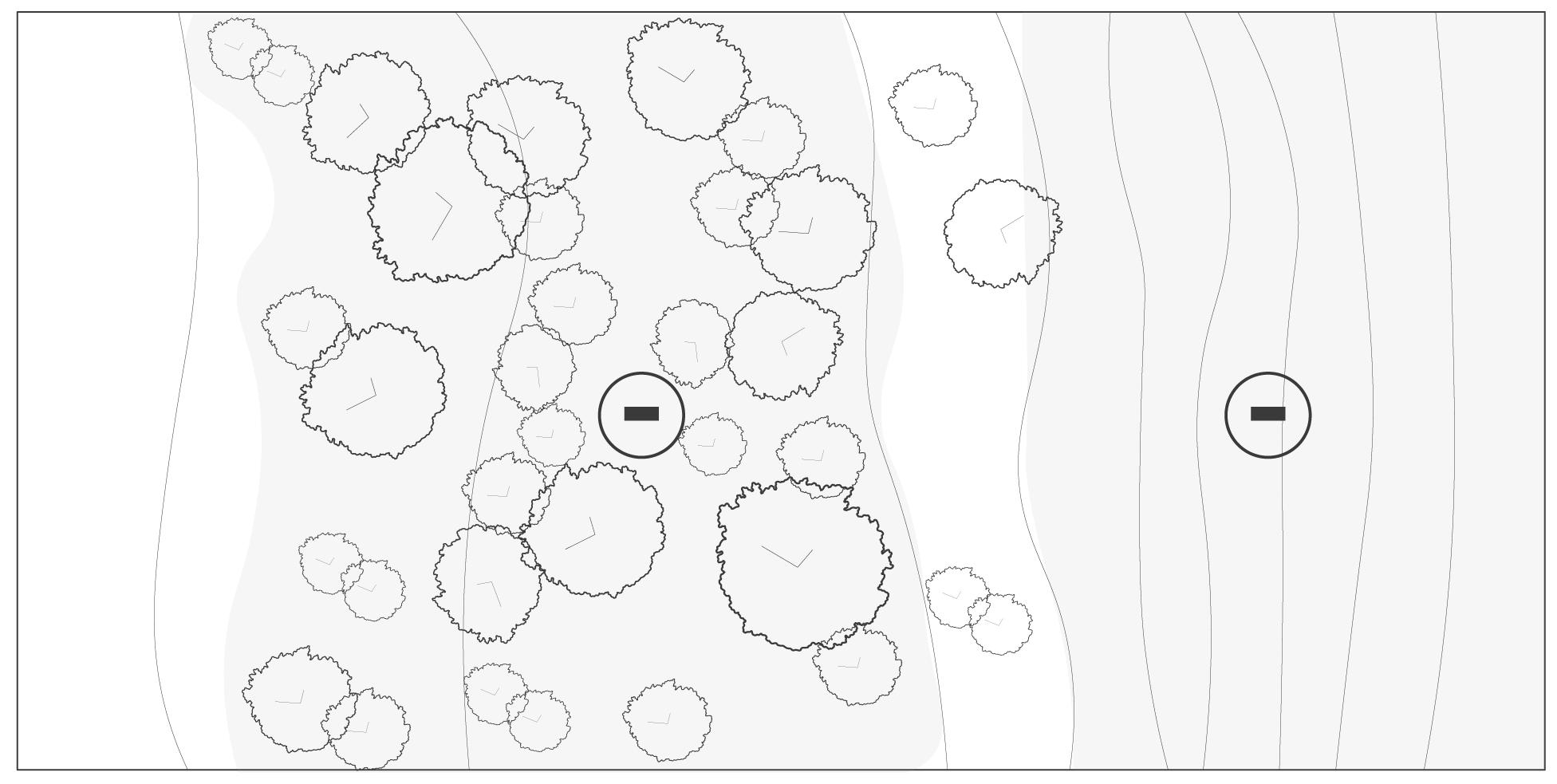
Dense stand of conifers
Elements that may be interpreted as Repelling Forces:
• Stands of trees, principally coniferous trees

• Areas of steep slope
• Natural Fields
• Culturally significant natural features
• Water features which can be unpredictable
•
Neutral due to challenging approach,
129 Chapter
Alternative
6: Designing an
Plan
I House Clusters
Left: (F. 101) Section diagram the sectional relationship between neighbours in a housing cluter that allows for shared views of the shoreline and landscape.
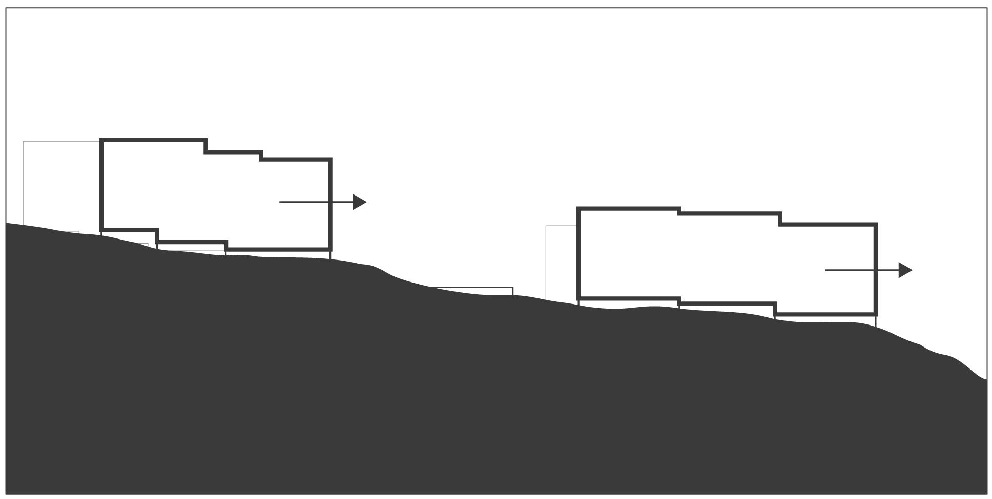
Section
Houses shall be organized in clusters slowly throughout the natural development of the site. Clusters of houses encourage a diad to determine a resulting density of housing through the clustering guideline as well as the natural landscape. A unique density of housing is achieved where the natural landscape and clusters of houses organize to provide a neighbourhood fitted to the natural landscape, above the exposed bedrock, and beneath the pines.
House clusters work in unison to pathways, parking clusters, and the ring road. The experience of approach of the home becomes one of subtle change in Fields from those more public, to a Field that becomes more private as one approaches the housing cluster.
Clustering houses encourages the sharing of resources and services, the building of community, and the dynamic and collective identity of a neighbourhood composed by unique individuals.
130
Beneath the Pines: Rebuilding the natural image of Sudbury through alternative residential development strategies.
Shared walkway House B Prominent Views
Prominent Views House A
Right: (F. 102) Plan diagram an sketch of how housing cluster may look, with shared pathways leading to parking cluters and to the landscape beyond.
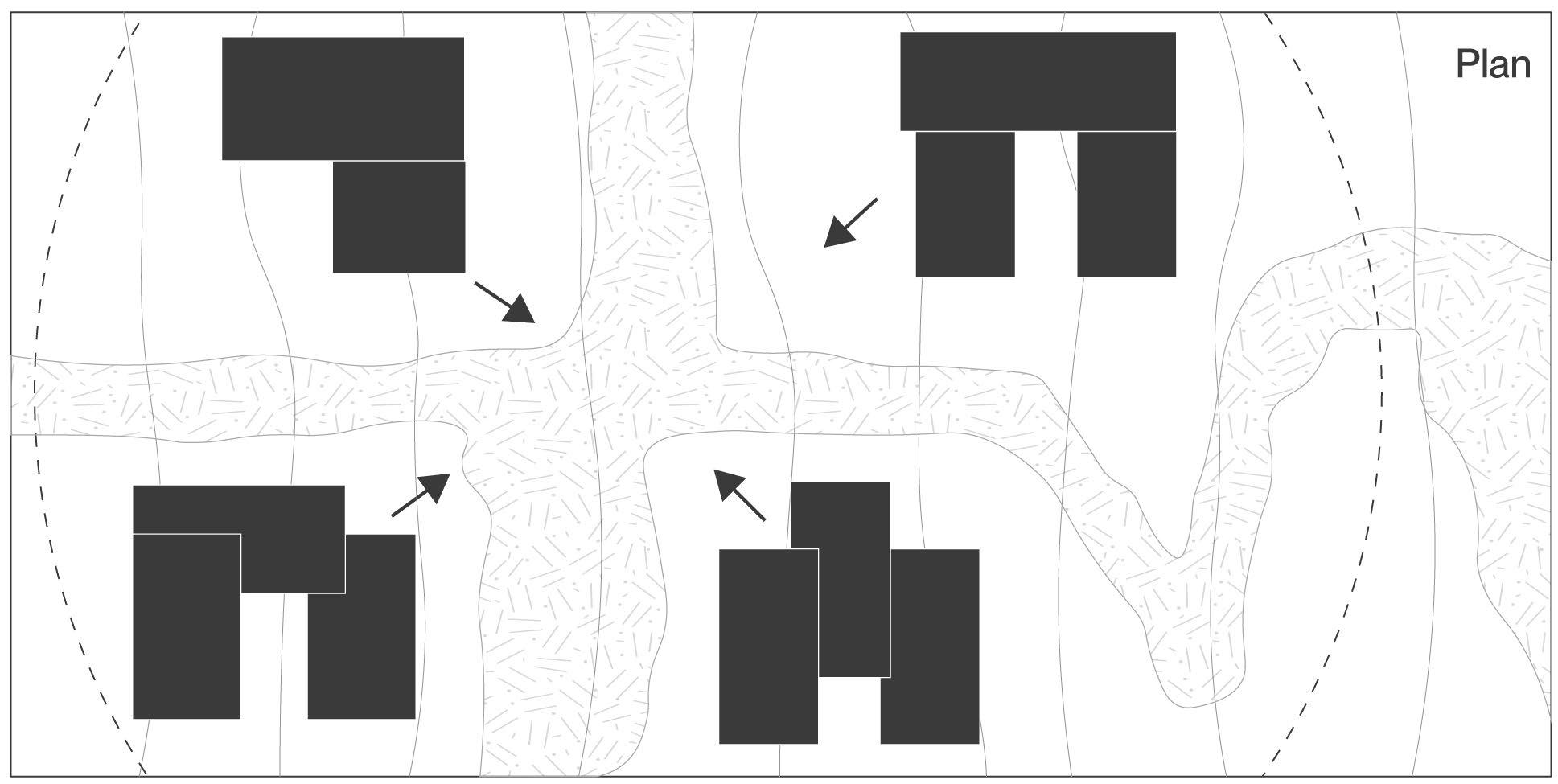
Shared walkway/ community space
Advantages for Clustering Houses:
• Sharing services, pathways, parking clusters
• Areas that attract housing may accomodate more than one house
• Community building through neighbourhood density
• Solar orientation ensures privacy between houses in the cluster
• House clusters form a Field which communicates privacy without the use of physical barriers
• Variations in density based on the natural landscape forms clusters with varied landscape conditions between houses
• Clustering enables the slow growth of neighbourhoods, negating the need for a phased approach
• Creative architectural solutions emerge when landscape and urban conditions exist
• Space between houses within the cluster is used as dedicated land for the natural growth of the landscape
131 Chapter 6: Designing an Alternative
House A
House C House B
House D
Left: (F. 103) Long-section diagram of the Plane landform strategy. This strategy utilizes exposed bedrock as connection point for a strong visual and physical connection.
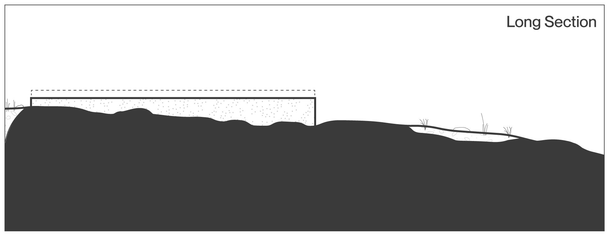
Touching the Ground Planes
Providing a strong visual and physical connection to the natural landscape, Planes are resilient land forms composed of concrete casted directly to the prominent exposed bedrock on site. This landform strategy acts as an extension of the rock and allows for a strong visual and physical connection while also ensuring for the continued sightlines to the natural landscape between, beneath, and around the landforms and the building it supports. Planes shall be placed perpendicular to the contour lines, however, the use of Planes fitted perpendicular to contour lines may also be encouraged depending on the desired effect.
132
Beneath the Pines: Rebuilding the natural image of Sudbury through alternative residential development strategies.
J
Right: (F. 104) Cross-section diagram cutting through two Plane landforms which elevate the building and allow for the natural landscape to flow underneath, in line with the natural slope.

• Planes are limited to a maximum height of 48”. Beyond a height of 48” the building must either step down, or a more appropriate landform must be selected from the Design Guidelines.
• When used perpendicular to the contour lines, plane landforms allow for the natural landscape to flow between the landforms and ultimately beneath the building allowing for views of the landscape flowing naturally under the building towards the shoreline.
• In the application of planes placed parallel to the contour lines, the planes encourage soil retention and for the natural landscape to flow under the building from a different perspective. This strategy should be used where the slope of the rock is minimal, and where small landforms are being used to retain soils in gardens and to support natural vegetation.
133 Chapter 6: Designing an Alternative
Left: (F. 105) Long-section diagram of the Pier landform strategy. This strategy allows for the foundation to give-way to sensitive landscape elements.
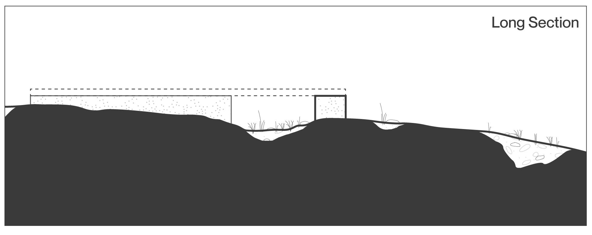
Touching the Ground
KPiers
Piers are low-lying concrete landforms cast directly to exposed bedrock. Piers are identical to Planes, though are employed across shorter distances where the placement of a Plane landform would disrupt an area of vegetation and overburden. Piers provide an important balance between a strong phyiscal connection and a sensitive approach to a varied ground condition. Piers provide an opacity to the ground across more perspectives.
134
Beneath the Pines: Rebuilding the natural image of Sudbury through alternative residential development strategies.
Right: (F. 106) Cross-section diagram cutting through two Plier landforms which elevate the building and allow for the natural landscape to flow underneath, in line with the natural slope.
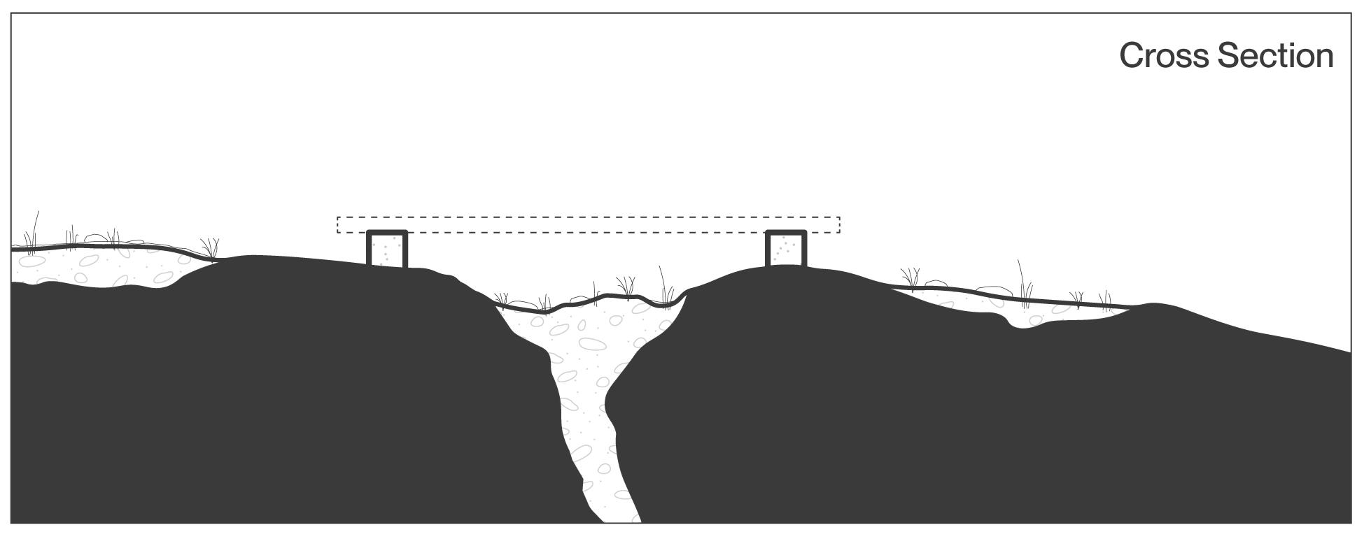
• Piers are limited to a maximum height of 48”. Beyond a height of 48” the building must either step down, or a more appropriate landform must be selected from the Design Guidelines.
• When used perpendicular to the contour lines, pier landforms allow for the natural landscape to flow between the landforms and ultimately beneath the building allowing for views of the landscape flowing naturally under the building towards the shoreline.
• In the application of piers placed parallel to the contour lines, the piers encourage soil retention and for the natural landscape to flow under the building from a different perspective. This strategy should be used where the slope of the rock is minimal, and where small landforms are being used to retain soils in gardens and to support natural vegetation.
135 Chapter 6: Designing an Alternative
Left: (F. 107) Long-section diagram of the Pin landform strategy. This strategy allows for the lowest impact on the site but limits the visual strength between building and the ground.
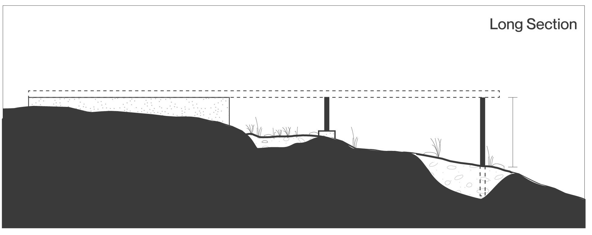
Touching the Ground
Pins
Pins refer to the most sensitive of the landform strategies. Slender posts are used to connect to either exposed bedrock or deep into overburden soil. Pins best used to support a building form where height exceeds the maximum height of other land form strategies. Extensions off of the main building are ideal situations where the use of Pins provides both a strong connection to the ground while also providing a transparency of the connection that encourages view of the natural landscape beneath, behind, and below the building form.
136
Beneath the Pines: Rebuilding the natural image of Sudbury through alternative residential development strategies.
L
Right: (F. 108) Cross-section diagram cutting through two Pin landforms can be advantageous where overburden is encountered on site.
• Pins are limited to a maximum height of 96”. Beyond a height of 96” the building or extension must either step down, or where an understorey is desired, the placement of building form may be used as a support.
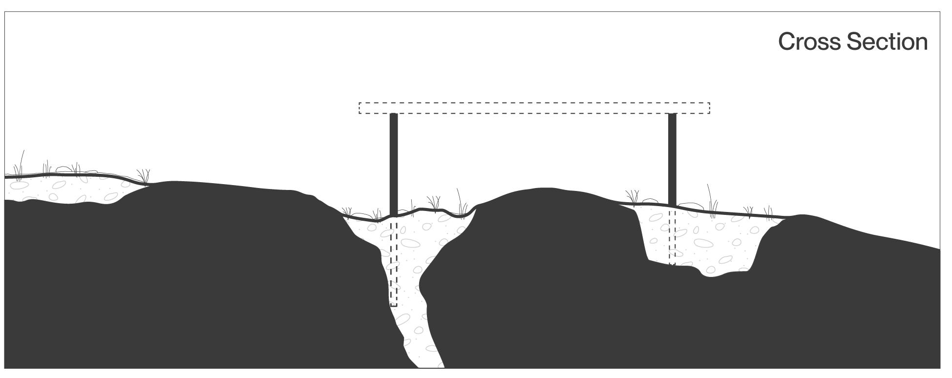
137 Chapter 6:
an Alternative
Designing
Left: (F. 109) Section diagram illustrating the incremental stepping of building form , reducing the vertical face, and respecting the slope of the site.
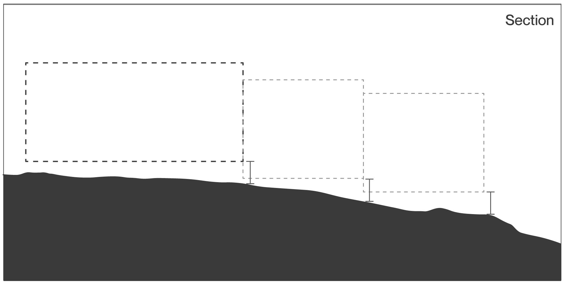
MBuilding Form Stepping the Landscape
Stepping the Landscape refers to the approach to building form on a topographically rich site. In order to avoid the physical and visual effect of a monolith fixed atop a slope, building form is fragmented and stepped to a lower level on the landscape to break the vertical lines and encourage a visual effect similar to the low slope hills of the site. A strategy directly opposite to the suburban lakeside typology of a multi-story barrier carved into and dominating the hilltop.
A building form that mimics the slope of the existing topography to communicate the natural landscape that sits beneath the building. The decomposition of form further supports the modest and sensitive intentions of building in the landscape. In section, a building form is divided into three volumes which individually step down the landscape, composing a dynamic building that mimics the movement of the landscape inside the building.
138
Beneath the Pines: Rebuilding the natural image of Sudbury through alternative residential development strategies.
Incremental stepping
Right: (F. 110) Plan diagram illustrating the stepped building form following and respecting the natural the slope of the site.
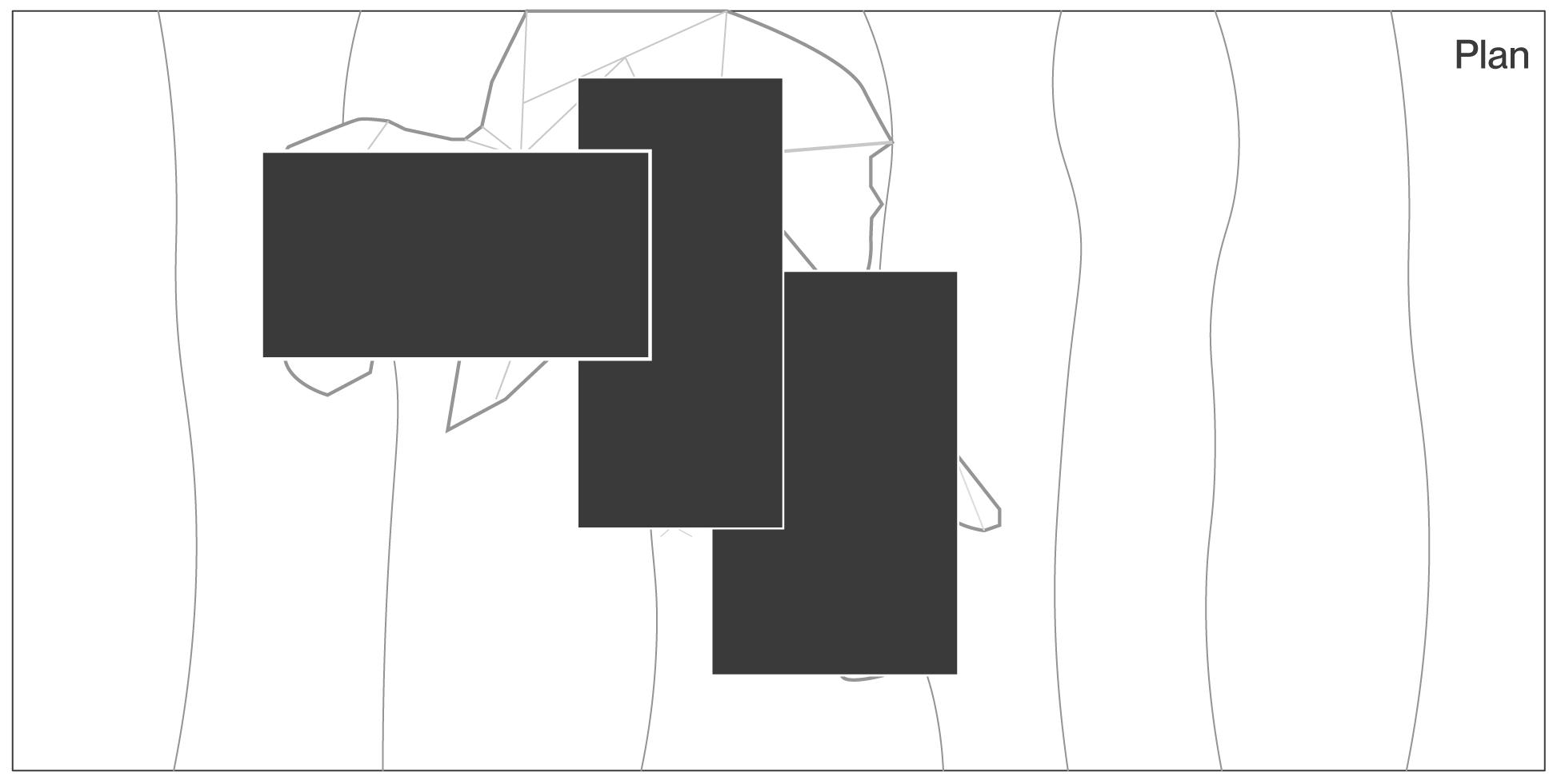
Exposed bedrock
The strategy results in a building form that steps down the natural slope, preventing the flattening or blasting of rock and instead fitting the building to the natural landscape. Effectively in direct contrast to the typical development strategies previously studied, Stepping the Landscape refers to the dissolution of vertical form into various modest building forms that step down the natural slope of the site.
In plan, building form is shown stepping the landscape both vertically and horizontally around natural site conditions such as exposed rock outcrops, trees, sensitive vegetation, and to provide variation in building form and to provide openings.
139 Chapter 6: Designing an Alternative
Building form stepping down slope
Left: (F. 111) Section diagram illustrating the use of horizontal primacy to reference the landscape, allowing for a building form to emerge that is of the landscape rather than of a typology.
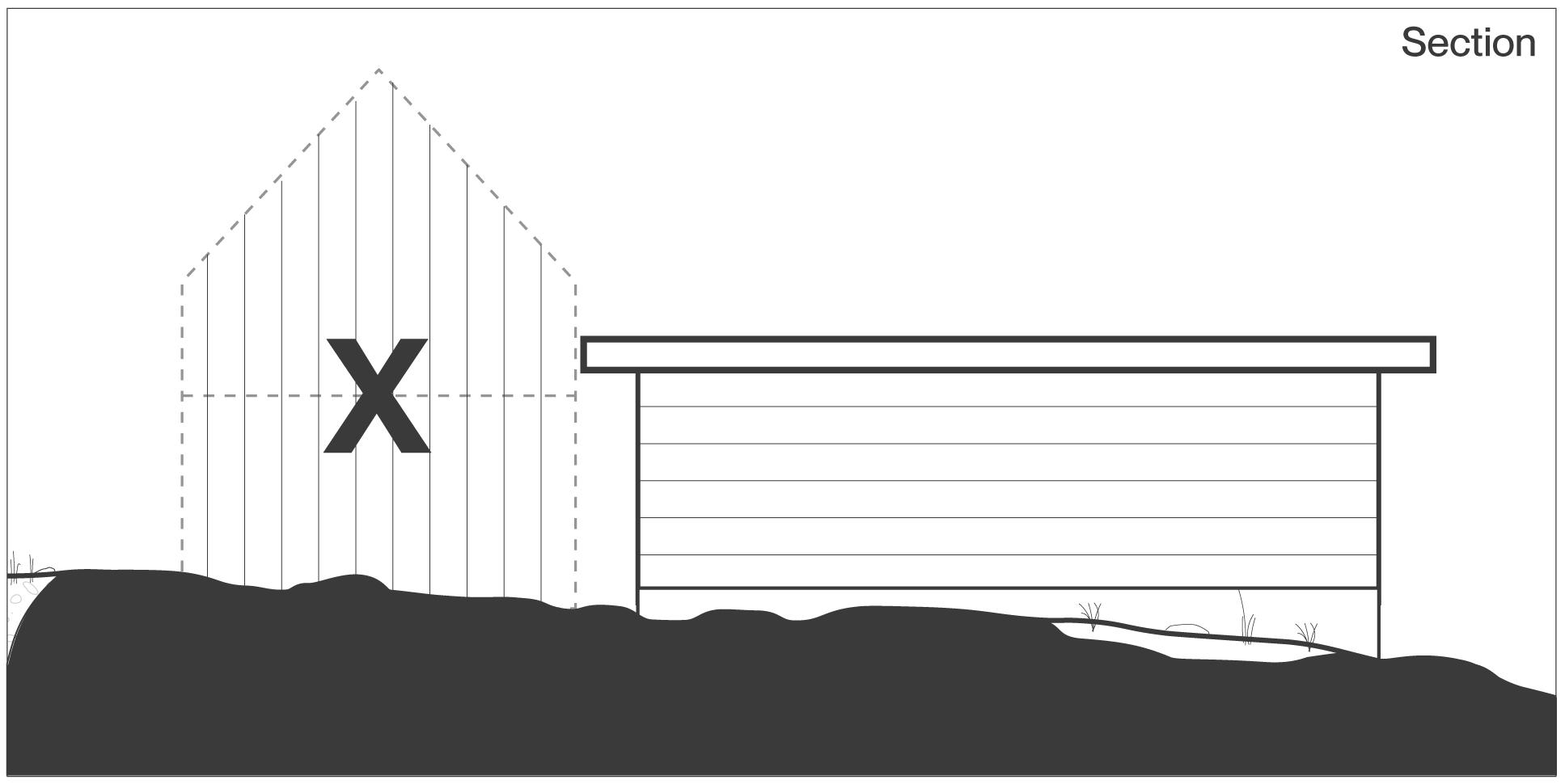
Building Form
Horizontal Primacy
Horizontal Primacy refers to a primary architectural concept which affects the design of the home at each scale. Horizontal Primacy refers to the intention of respecting the natural slope of the site, where any and all vertical planes are broken up into horizontal planes. The founding Horizontal Primacy strategy being the stepping of the building, all other scales of the building shall evoke a horizontal primacy to further communicate the modesty and stepping nature of the project.
Typical residential developments feature columns, and stylistic flourishes which are foreign to the site and place. In the case of the development at Between two Lakes, houses shall respect and convey the spirit of the place. Horizontal Primacy references the lost canopy of the ancient pine forest once present on the site. Horizontal Primacy as an architectural driver ensures a home that exists beneath the pines and communicates the delicate slopes of the topographically rich area.
140
Beneath the Pines: Rebuilding the natural image of Sudbury through alternative residential development strategies.
N
Right: (F. 112) Elevation diagram illustrating horizontal primacy as integral to the development of a modest building fitted within the natural landscape.
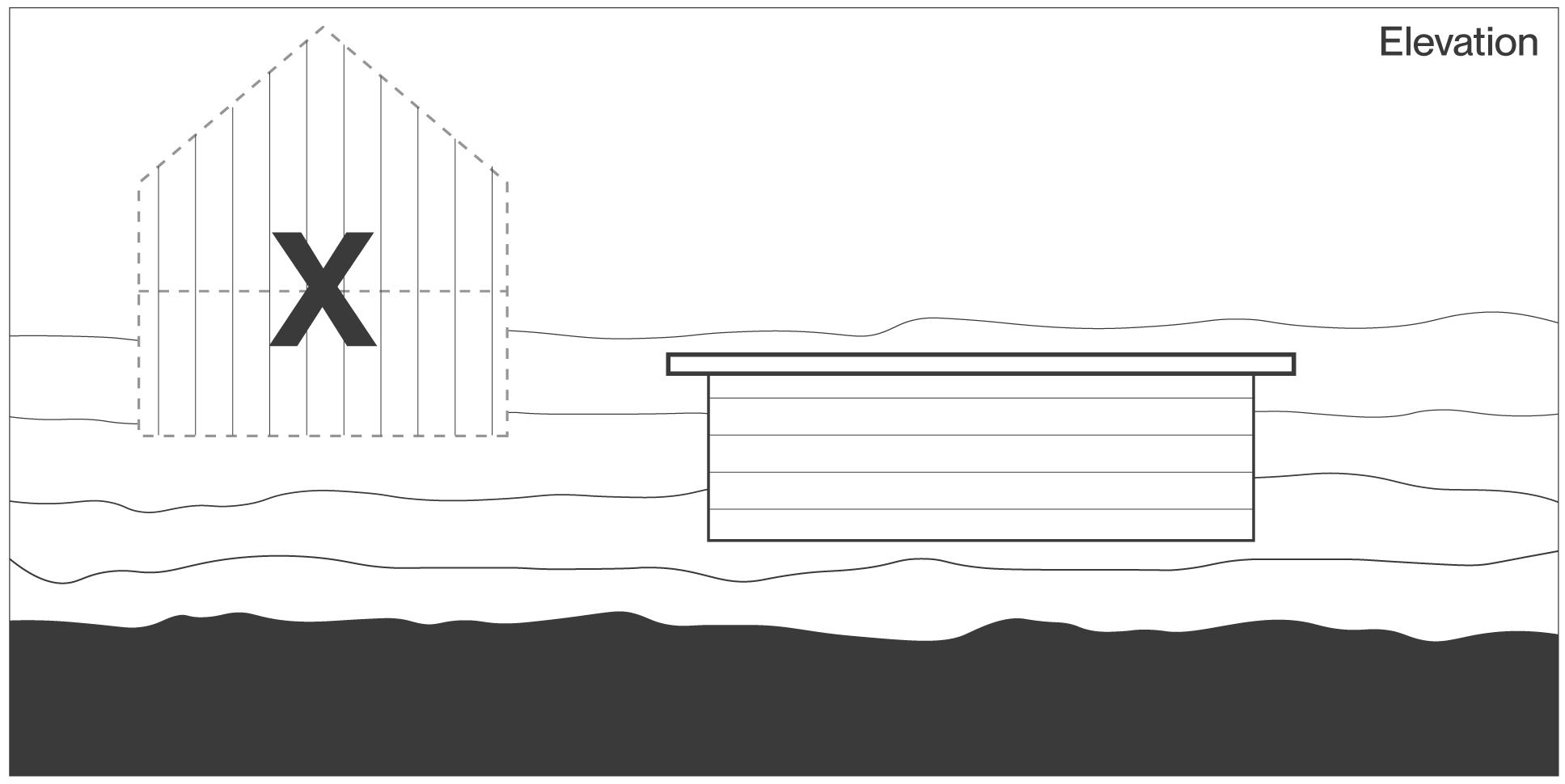
Elements to consider for Horizontal Primacy
• Ceiling heights and it’s affect on the exterior building form
• Visible vertical structure
• Cladding Materials
• Handrail and Guardrail design
• Roof slope design
• Stepping building form, frequency, magnitude of step
• Choice of landform
141 Chapter
6: Designing an Alternative
Left: (F. 113) Section diagram illustrating relationship between the natural slope encountered across the site and the slope of the roof.
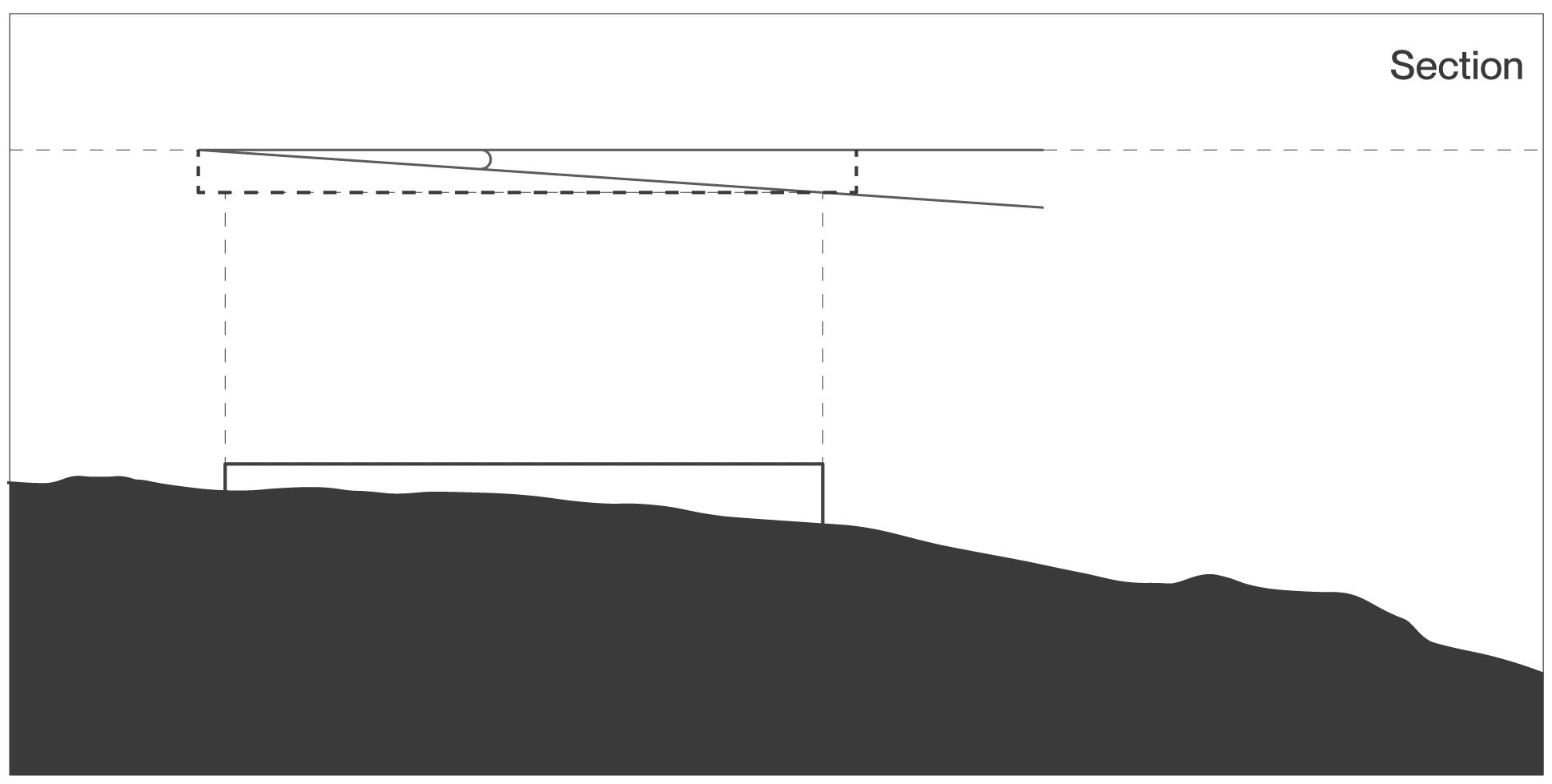
Building Form Forming the Roof
max 10 degrees
Roof form plays an important role in the overall relationship between building and landscape. Pitched and steep shed roofs reference a verticallity foreign to the this site. A flat roof, or very-low angle roof respects the Horizontal Primacy guideline while also referencing a relatipnship of buildings existing beneath the canopy of the anicent and future pine forests while also respecting the slope of the natural landscape. Roof form shared by many houses in a cluster ensures a visual connection to both the intentions of the community, but also to one another.
142
Beneath the Pines: Rebuilding the natural image of Sudbury through alternative residential development strategies.
O
Right: (F. 114) Plan diagram illustrating the sloped and stepped roofs supporting the natural water shed of the site by sloping the roof perpendicular to the site contours.
Roof form that is sloped down the natural slope of the site ensures the communication of the slope while also ensuring that water is shed to one direction, simplifying drainage and the design for watershed. The roof slope aligning with the natural slope of the site also encourages the natural watershed of the site, limiting the chances of pooling or other drainage issues and instead trusting in the natural processes which have acted on this site for millions of years.
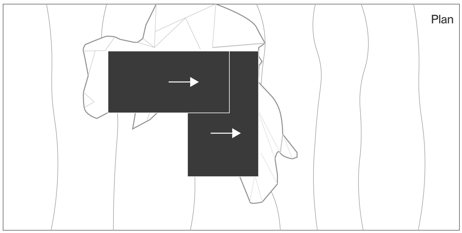
143 Chapter 6: Designing an Alternative
Left: (F. 115) Section diagram illustrating the stepped living roofs which return the lost vegetation to the site, supporting the ecology and animal habitat.
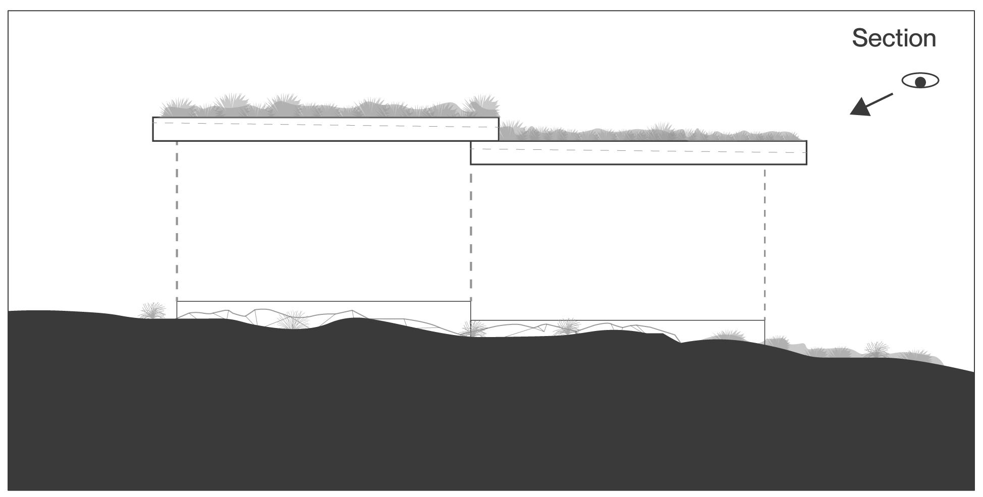
Building Form
Living Roof
Evidence of a cruel history at the hands of the industrial development of Sudbury exists on the site: a loss of mature forests, soils, vegetation and a general lack of biodiversity has resulted in dwarfed birch stands exposed rock outcrops and a blackening of the landscape.
Living roofs provide an opportunity to visually fortify the stewardship commitment to the landscape through the return of native vegetation and soils to the image of the landscape while also increasing biodiversity and a general synthesis between architecture and existing and future ecology.
In section, the living roofs further enrich the sectional aspects of the houses and provide a lush natural canvas to those looking down onto the roofs from highers points of the site. The living roof becomes the most visible feature of the house, further supporting the intention of a landscape-first approach.
144
Beneath the Pines: Rebuilding the natural image of Sudbury through alternative residential development strategies.
P
Right: (F. 116) Plan diagram illustrating the stepped living roofs visually communicate the dediction to the landscape and ecology.
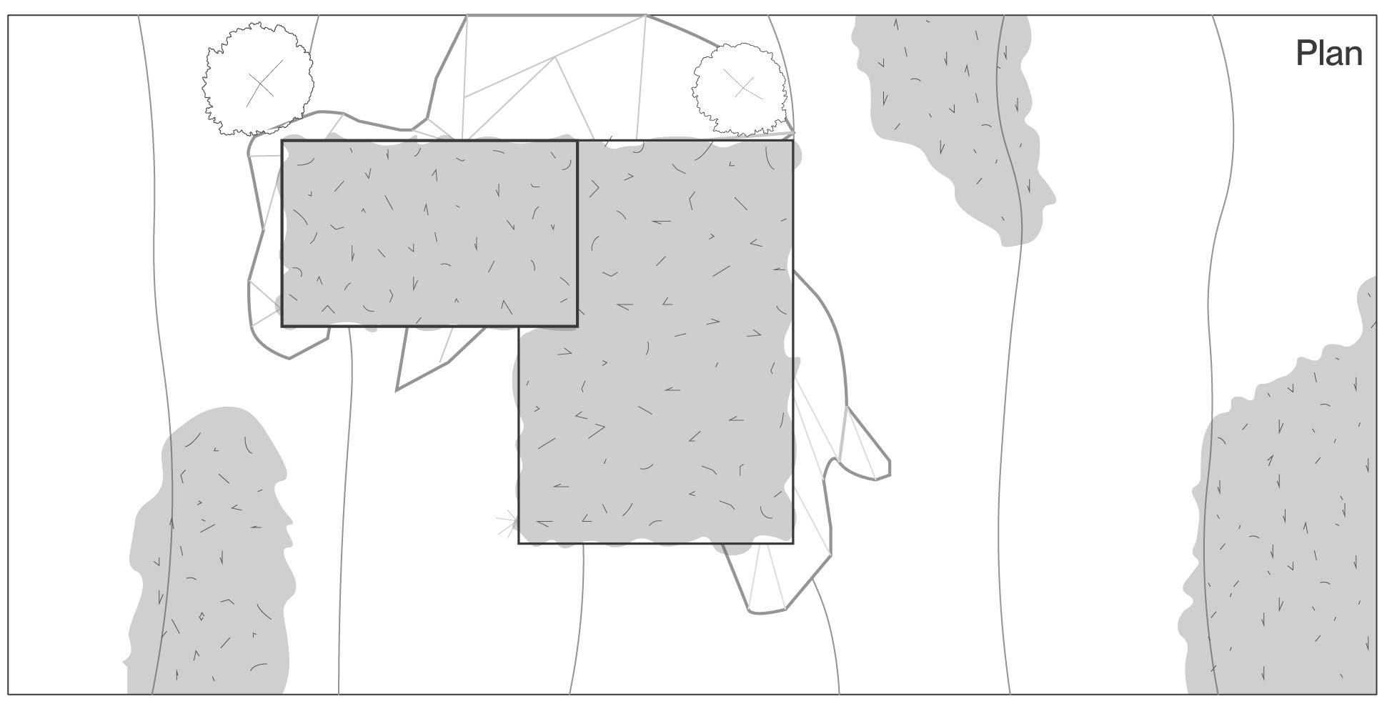
Existing vegetation
Living roof
Exposed bedrock
Living roof
Existing vegetation
Existing vegetation
In plan, living roofs sitting atop buildings fitted to exposed bedrock return vegetation to the landscape encouraging a remediation of the ecology and wildlife habitat while also ensuring a visual commitment to the remediation of the landscape to neighbours and to public visitors.
Considerations for Living Roofs
• Living Roofs support biodiversity, natural habitat for wildlife at all scales
• Can reduce temperatures of the immediate outdoor area
• Shall only be planted with plants native to the area
• Should be designed to be easily accessible
• Increased insulation performance in all seasons
• Absorbs rain and slows the shed of water during storms
• Will require structural analysis and increased structural invesment
145 Chapter 6: Designing an Alternative
Left: (F. 117) Section diagram illustrating the sculpting of building form around natural elements tp create a naturally landscape courtyard.
Building Form
QEmbracing the Landscape
Coniferous tree
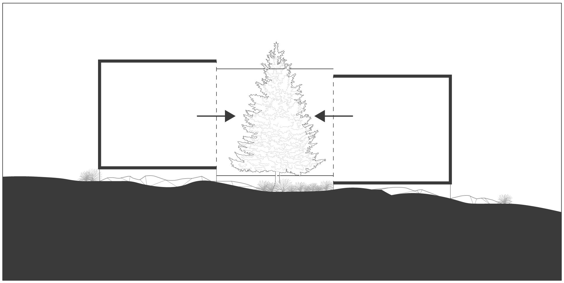
Building form opens to courtyard
Section
Embracing the Landscape refers to the sculpting of building form around natural references to create a courtyard with the natural landscape as the central focus for which the building orients itself around. A three-sided open courtyard ensures a stepped building form has a natural reference as a unifying element. Natural landscape conditions encourage a deeper connection to nature and help preserve and communicate the spirit of the place.
The spirit of the place as the natural composition of the landscape and the uniqueness that it brings to a specific site. Natural conditions evolve naturally over millions of years and using building form to embrace the natural references allows for a connection to the past, present, and future landscapes. The naturally landscaped courtyard acts as a unifying outdoor space encouraging interaction with the outdoors and providing unique spaces for the relationship between indoors and outdoors.
146
Beneath the Pines: Rebuilding the natural image of Sudbury through alternative residential development strategies.
Right: (F. 118) Plan diagram illustrating natural courtyard at the heart of the home. acting as a dynamic outdoor room, deepening the indoor/outdoor connection.
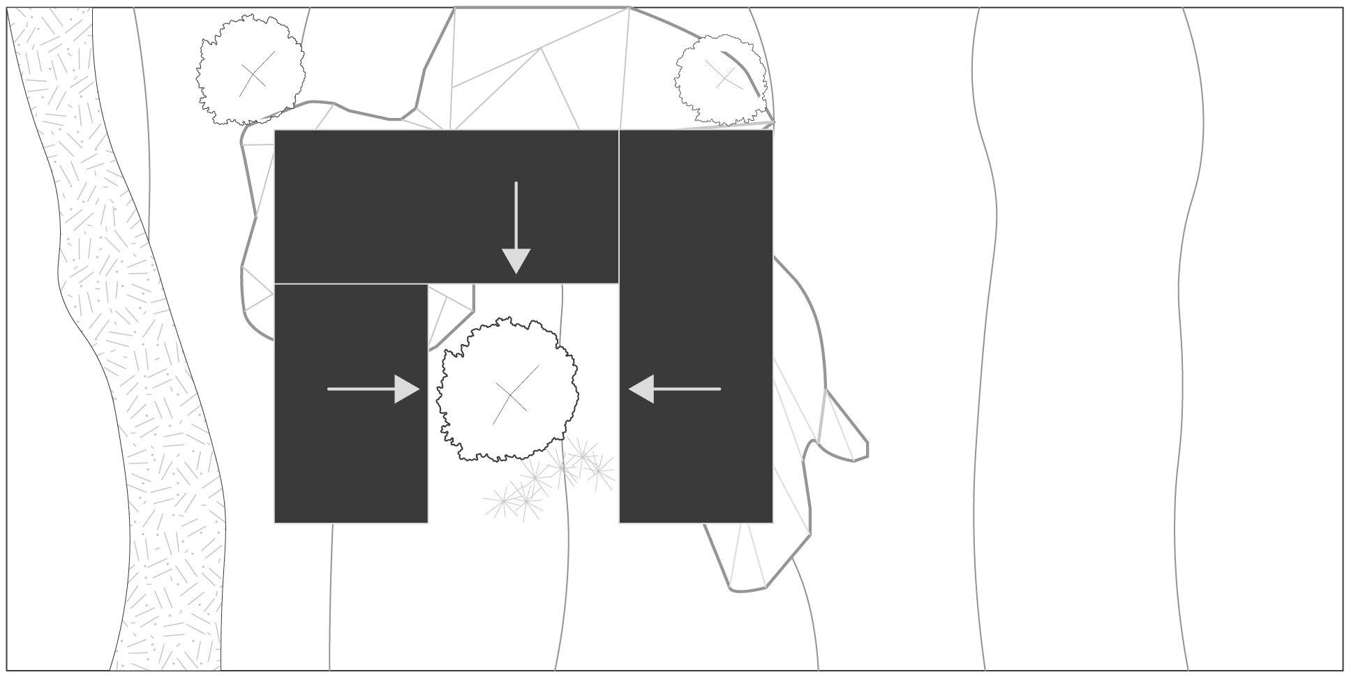
Considerations for Embracing the Landscape
• Embracing deciduous trees will provide dynamic shade in the summer and allow for the winter sun to warm the home
• Courtyards should shelter from the northern winds, and open up to the south
• Overhangs and screens can condition exterior space and will encourage outdoor living
• Circulation should be designed directly adjacent to the courtyard with large expanses of glass to further support a deep and dynamic connection to the landscape
• Opportunities for nooks and lounge spaces facing the courtyard are encouraged
147 Chapter 6: Designing an Alternative
Plan
Courtyard organized around natural landscape features
Left: (F. 119) Section diagram illustrating the possibilities for outdoor spaces that emerge from the stacking and stepping of building form and sectionally rich landscape elements.
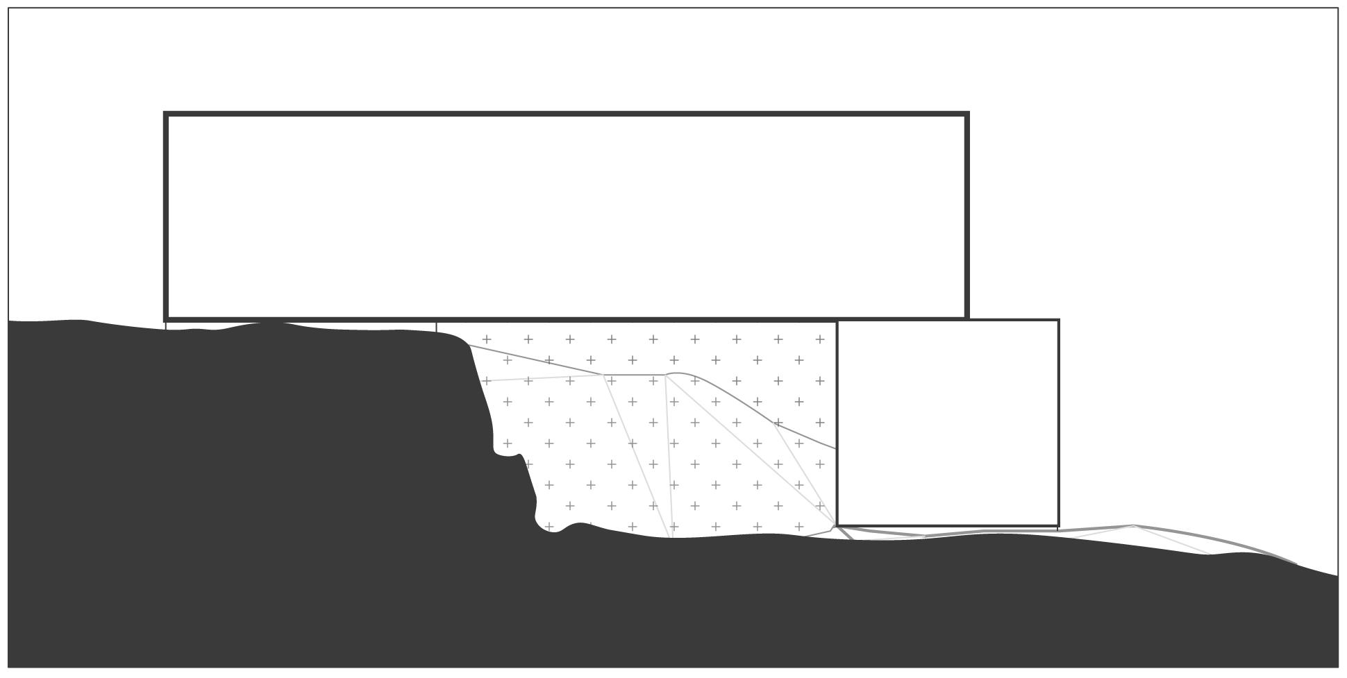
Building Form
RComposing Understoreys
Section
Exposed rock forming natural wall condition
Understory space
Building form Building form
The rich and varied topography of the site presents opportunities for how building form may be stepped on the landscape. Building form paired with natural formations of exposed bedrock and other vertically rising conditions can create opportunities for the creatiion of space through building form and natural architectural conditions of the landscape. In section, building form stepped by a magnitude of one storey presents one wall and the ceiling of an outdoor space further formed by a verticaly rock outcrop forming a courtyard-type exterior space.
148
Beneath the Pines: Rebuilding the natural image of Sudbury through alternative residential development strategies.
Right: (F. 120) Plan diagram illustrating the stacked and stepping building form set atop a rock outcrop, combining to create a conditioned outdoor space.
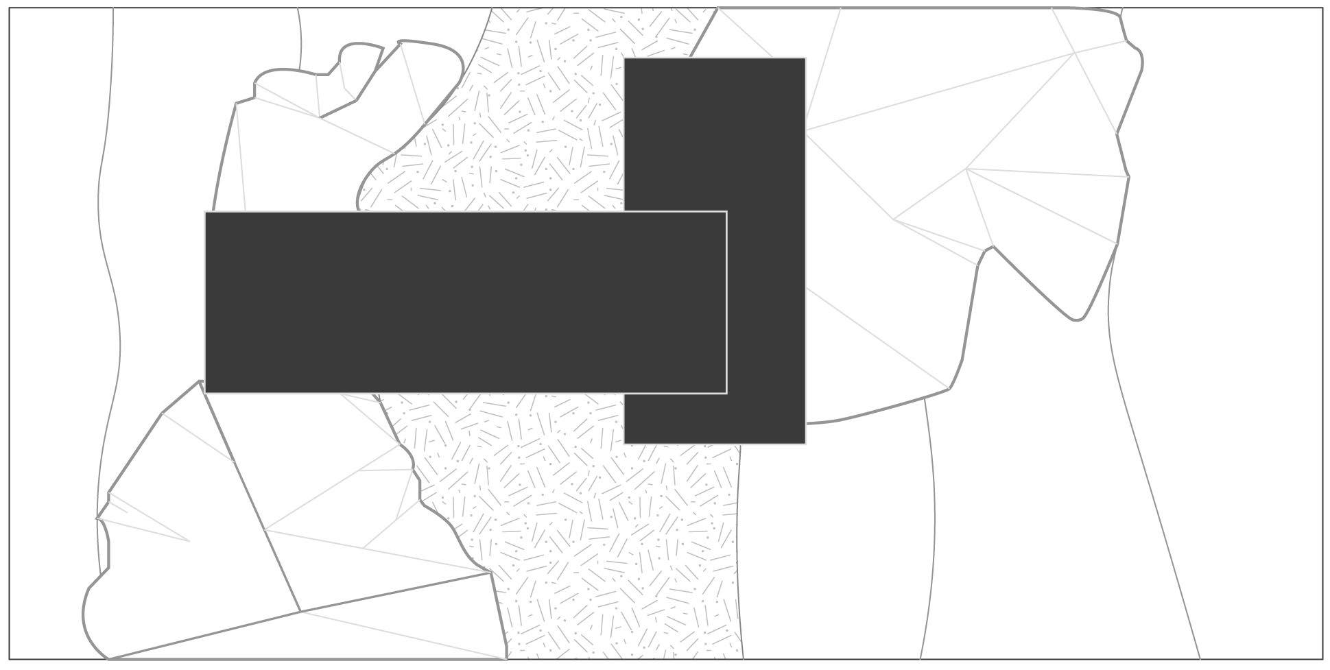
Exposed bedrock
Plan
Understorey space below building form
Exposed bedrock
The creation of intimate exterior spaces using both natural and designed elements reinforces a symbiotic relationship with the landscape.
Understoreys are extremely site specific and their integration shall only be used where the landscape offers and encourages its use.
149 Chapter 6: Designing an Alternative
Left: (F. 121) Section diagram illustrating the advantages of thoughtful orientation and design to the suns daily and seasonal path, allowing for passive heating and shading.
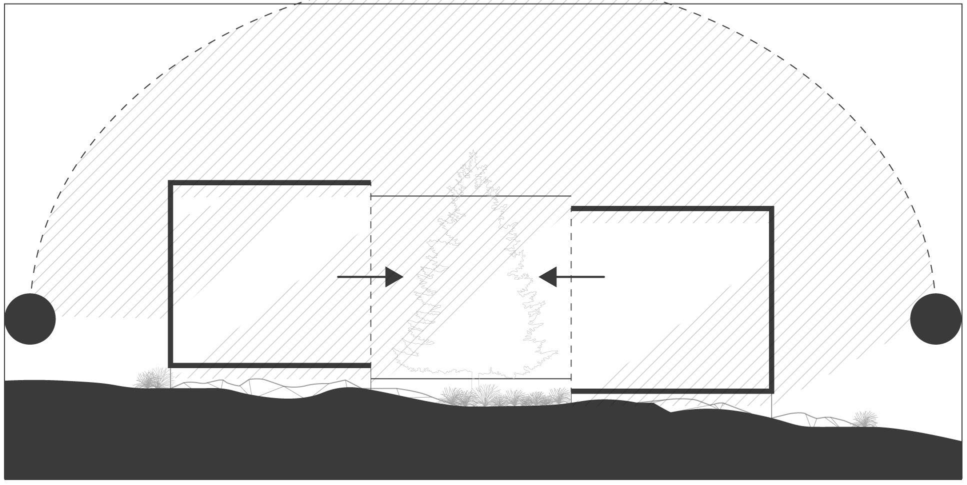
SBuilding Form Solar Orientation
Section
Sun path
Courtyard invites natural light deep into building form
Solar Orientation is a fundamential architectural principle that must be emplyed in the design of houses at Between two Lakes. The composition of houses that support both the natural vegetation and a healthy lifestyle is strictly dependent on natural light. Requirements for solar orientation are further required for the successful integration of courtyards, and for a deep indoor-outdoor connection.
Beneath the Pines: Rebuilding the natural image of Sudbury through alternative residential development strategies.
150
Right: (F. 122) Plan diagram illustrating the orientation to the suns path and the sculpting of building form for a dynamic experience of natural light.
Ensuring a common orientation between houses across the site ensures healthy homes the can support the growth of plants, vegetation and of humans, but also ensures privacy at the scale of the neighbourhood through a natural pattern that arises from orienting to a common element. This natural privacy condition is further supported by the courtyards sculpted by building form and through the fields of natural growth that exist between houses within a cluster.
151 Chapter 6: Designing an Alternative
Views to immediate landscape
Views to surrounding landscape & beyond
Left: (F. 123) Section diagram illustrating that openings should be designed for either the gathering of natural light, or for the designed views to the natural landscape.
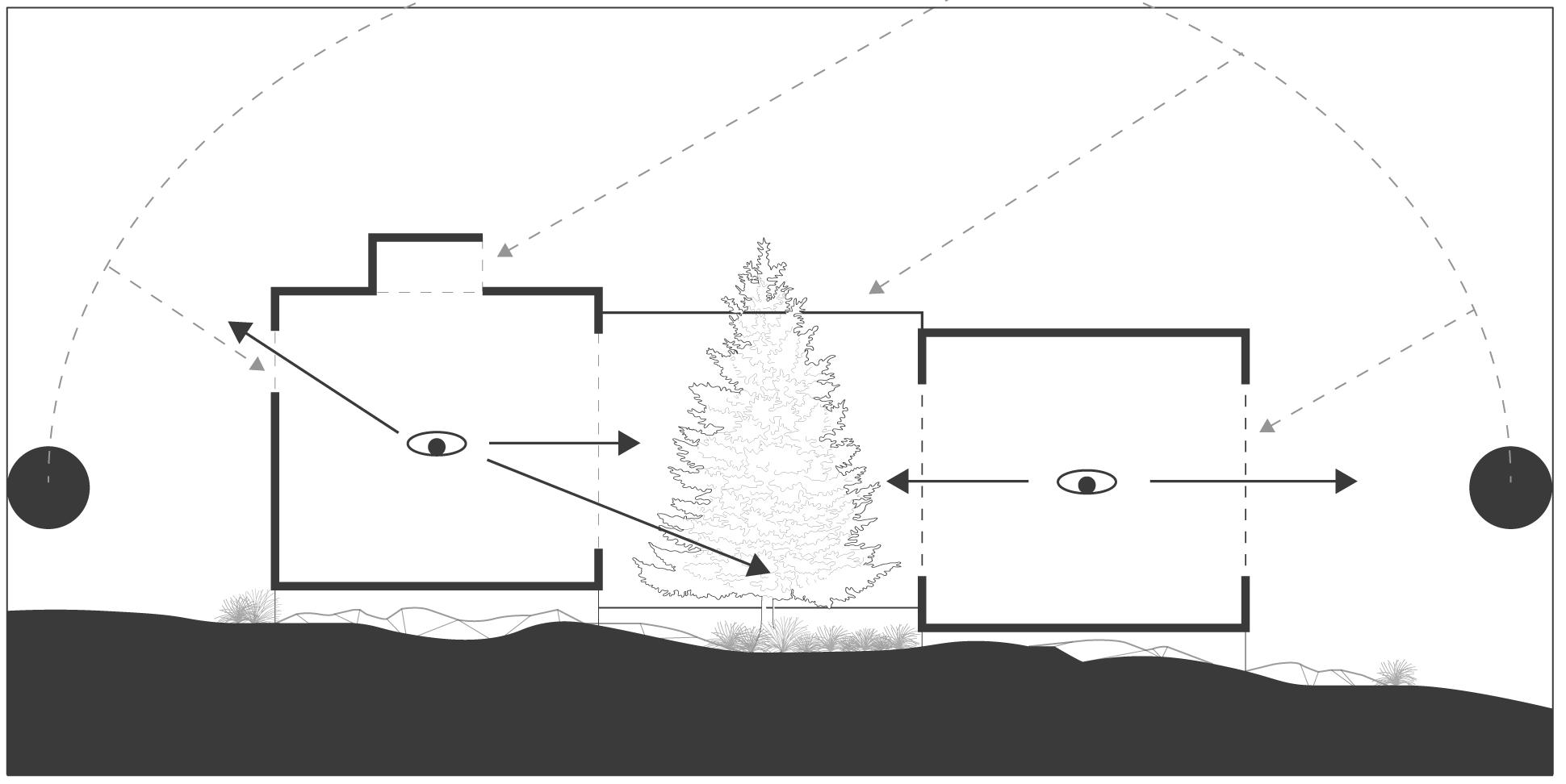
TBuilding Form Views & Light Section
Openings should be designed to either provide specific views and for the accumulation of natural light. Intimate views directed to natural landscape elements, to Attracting Forces, to naturally landscaped courtyards, to vegetation, and to the landscape flowing beneath the building, that help to convey the spirit of the place, are encouraged. Large views directed towards the shoreline and other major lines of sight should be located in shared spaces to encourage an experience of expanse and of shared enjoyment of primary views.
152
Beneath the Pines: Rebuilding the natural image of Sudbury through alternative residential development strategies.
Right: (F. 124) Plan diagram illustrating strategic placement of glazing allowing for a deeper connection to the surrounding landscape and prominent views while also absorbing natural light.
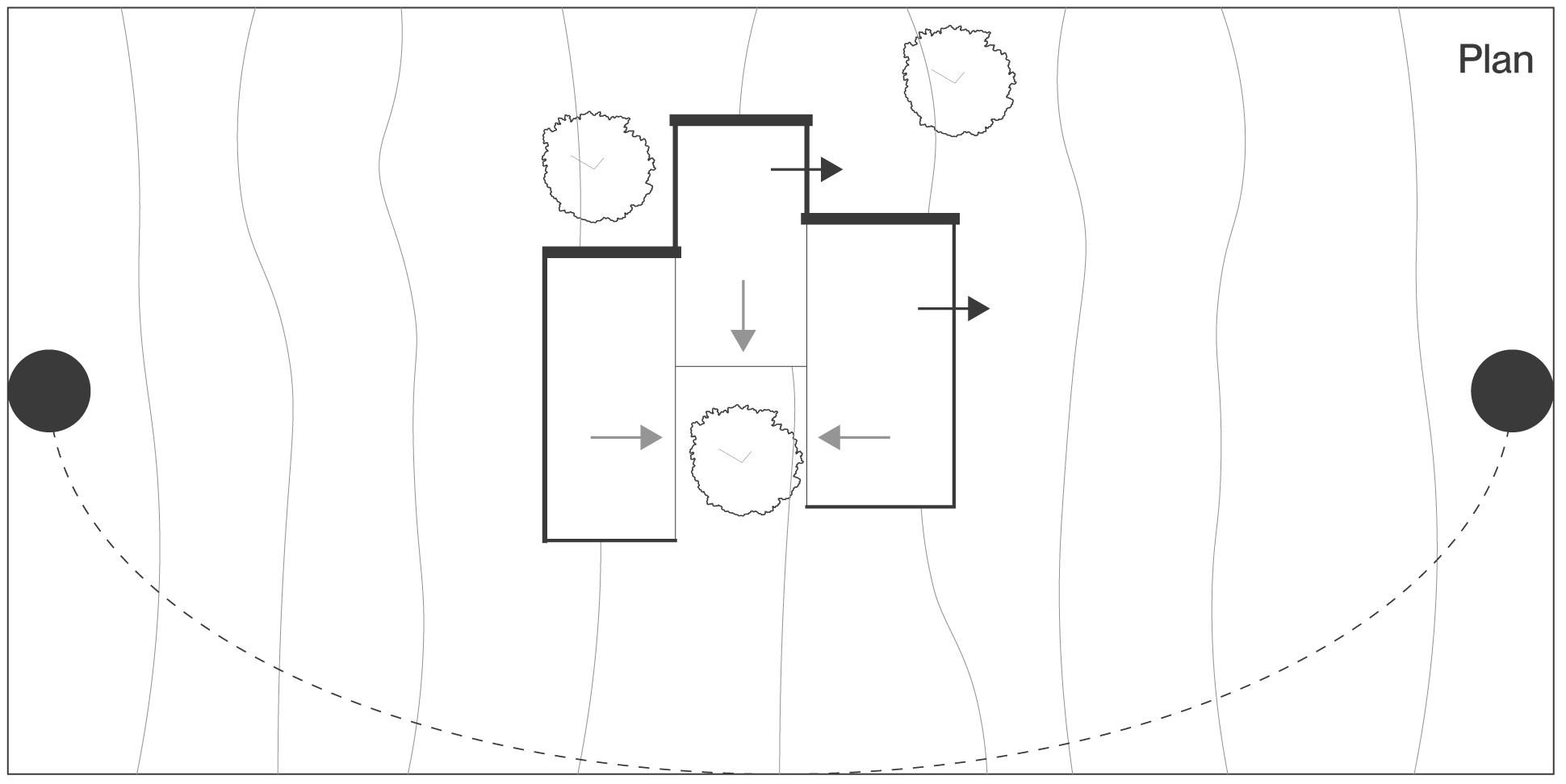
Prominent views
Prominent views
Building form sculpted to provide views and collect natural light
Openings directed towards the south will provide a dynamic relationship with the sun throughout each day, while openings directed to the North and skylights will provide soft diffuse light. Architects and designers should be creative in their use of windows, opting to thoughtfully design each opening for a specific purpose rather than the practice of facade design or window placement.
153 Chapter
an Alternative
6: Designing
Building Form
Materials & Finishes
Natural materials should primarily be used in all instances where feasable. It is in the intent of the community to favour the use of natural and organic materials above all others as part of the stewardship commitment.
Buildings are to be constructed using local wood products whenever possible in order to support local industry, reduce costs, increase agency and accessibility to construction, while also ensuring a light building.
Plane and Pier landform foundations are to be formed using concrete cast in-situ to bedrock. Pin landforms should be composed of steel in a either a clear finish, or a colour that will blend into the landscape using a matte finish.
Wet trades such as tiling and other construction processes resulting in materials that cannot be reused or recycled should be not be used.
Dull colours are found within the natural landscape should inform the colouring of building materials. Allowing water to be the primary reflective surface within the landscape ensures a modesty of building within nature that can further be improved by allowing the wildflowers and the ever-changing natural landscape to be the focus of colour. Keeping materials true to themselves, allowing materials to age naturally, and choosing clear finishes where applicable all support an organic attitude towards the nature of building, and to buildings in nature.
Natural Processes & Energy
Buildings should be designed to be self-dependent using passive strategies, and off-grid technologies to limit the footprint and impact of each building. Off grid strategies limit the need for large scale infrastructure that threatens the natural landscape and encourages the development strategies of suburban developments.
Photovoltaics for the purposes of reducing dependency on large infrastructure as well as to connect further with the sun is encouraged.
154
U V
Beneath the Pines: Rebuilding the natural image of Sudbury through alternative residential development strategies.
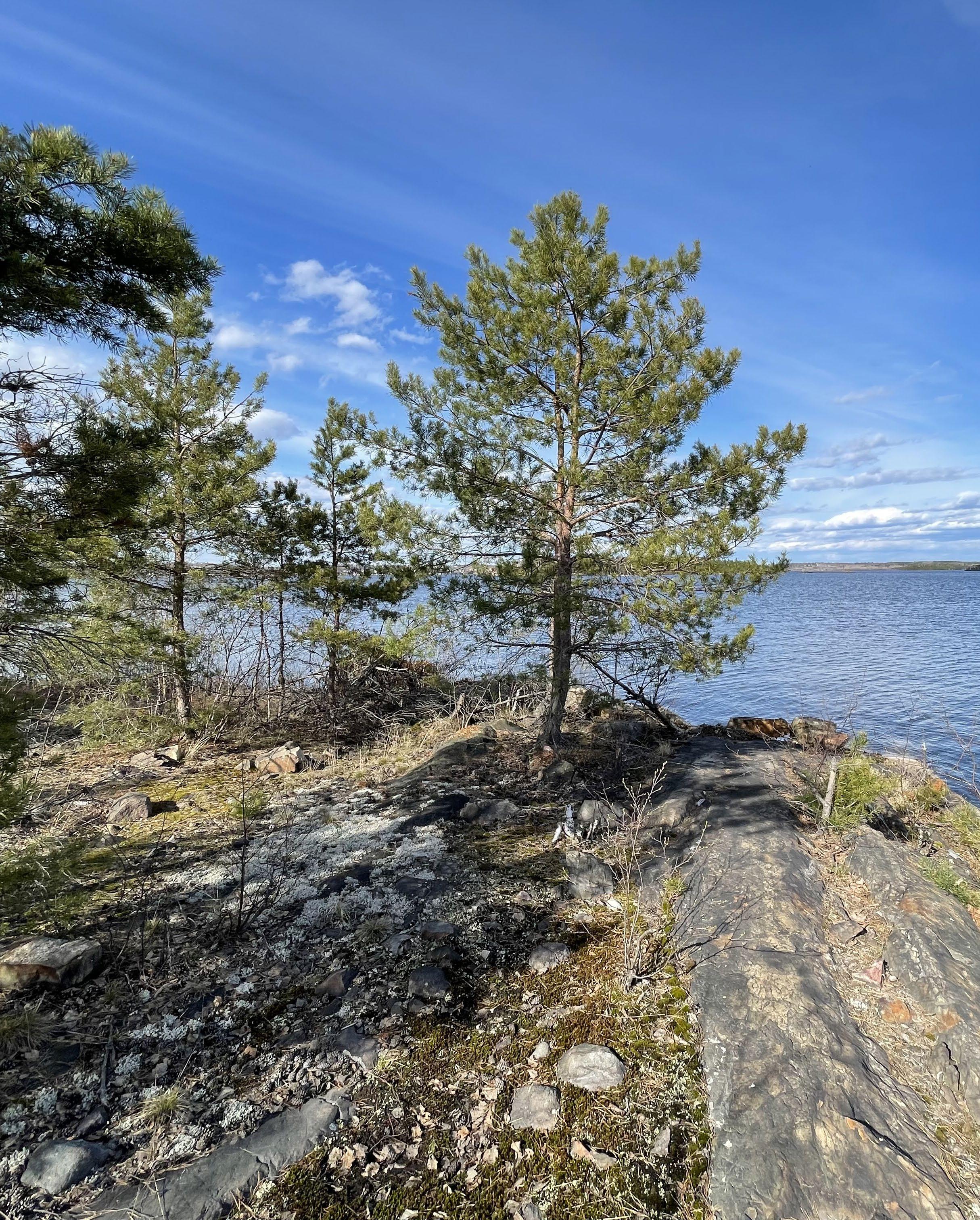
155
Chapter 6: Designing an Alternative
Below: (F. 125) Photo taken on the site of the rocky shoreline and young stands of red pine trees.
Right: (F. 126) Isometric section of the design trial house set within the natural landscape conditions found on site.
6.3
Design Trial
The design trial serves as a test of the ethos and Design Guidelines in their capability to address the various and unique natural conditions found throughout the site. The design of a house of reserved detail allows the relationship between the natural landscape and the building form to emerge as the focus. The design trial utilizes a hypothetical site complete with challenging natural conditions throughout. Fields and Forces and various guidelines have influnced the sculpting of building form organized around a naturally landscaped courtyard, between existing trees, following a slight slope, elevated above a rugged and mixed terrain. Designed so closely to the natural elements of the site, time will only further invite the landscape to be immersed with the home.
156
Beneath the Pines: Rebuilding the natural image of Sudbury through alternative residential development strategies.
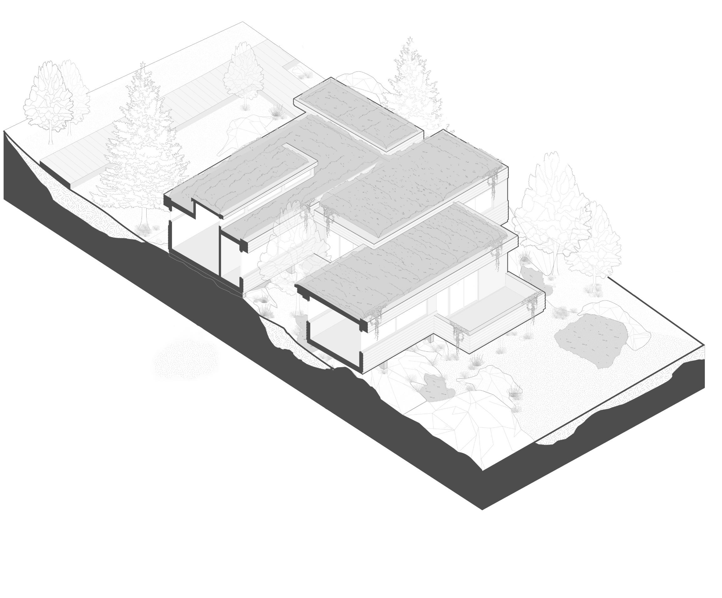
157 Chapter 6: Designing an Alternative
Design Trial Isometric Section
Ethos + Time
Inspired by a desire for oneness with nature and of a lifestyle deeply rooted in the natural landscape, the ethos of the residential typology is forged in the aspiration of symbiotic living beneath the pines. Understanding the dynamic timeline of the natural landscape, the building typology is designed to respond to the natural growth, ageing, and dynamism of everyday life in nature. As seasons continue to revolve into new years, the green roof will grow taller, the vines will drape lower, and the entire building will continue to immerse itself within the local ecology, contributing to the overall aesthetic of the natural environment while also benefiting the ecology through passive strategies such as soil retention, evaporative cooling, animal habitat support for animals and pollenators, sensitive placement of building form and construction processes, producing an architectural typology that supports a visual and ecological integration
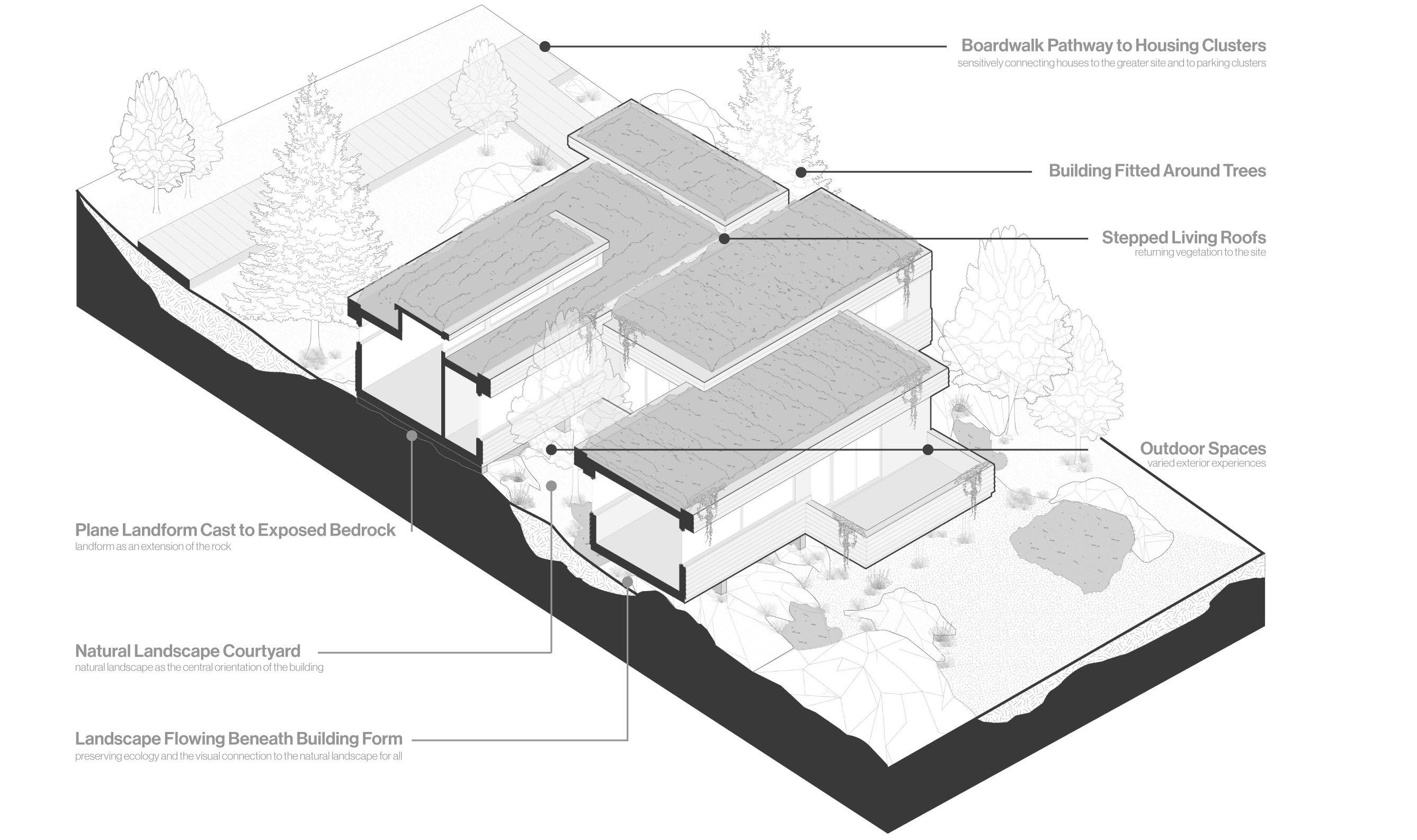
Left: (F. 127) Annotated isometric section illustrating the main features/strategies of the design trail set within the landscape.
that ameliorates over time which supports a lifestyle more connected to nature. Over time, as the home ages, it will become more and more immersed within the natural landscape, existing as an extension of the landscape, the two, no longer perceived as ever being separate entities. Healing the notion of humans existing separate from nature. Subsequently, the modest architectural gesture of sensitive integration with nature contributes to the development of a lifestyle deeply connected to nature, ecology, and the natural landscape of Sudbury that has historically been suppressed. Signifying a step away from the aspirations of the human and instead looking back to the sustainable history of human in nature, the ethos manifests in the building as a commitment to respecting our physical environment and our mortal place within the natural timeline.
158
Beneath the Pines: Rebuilding the natural image of Sudbury through alternative residential development strategies.
Right: (F. 128) Plan diagram depicting the organization of 5 homes, including the design trial, organized into a housing cluster set atop a hilltop.

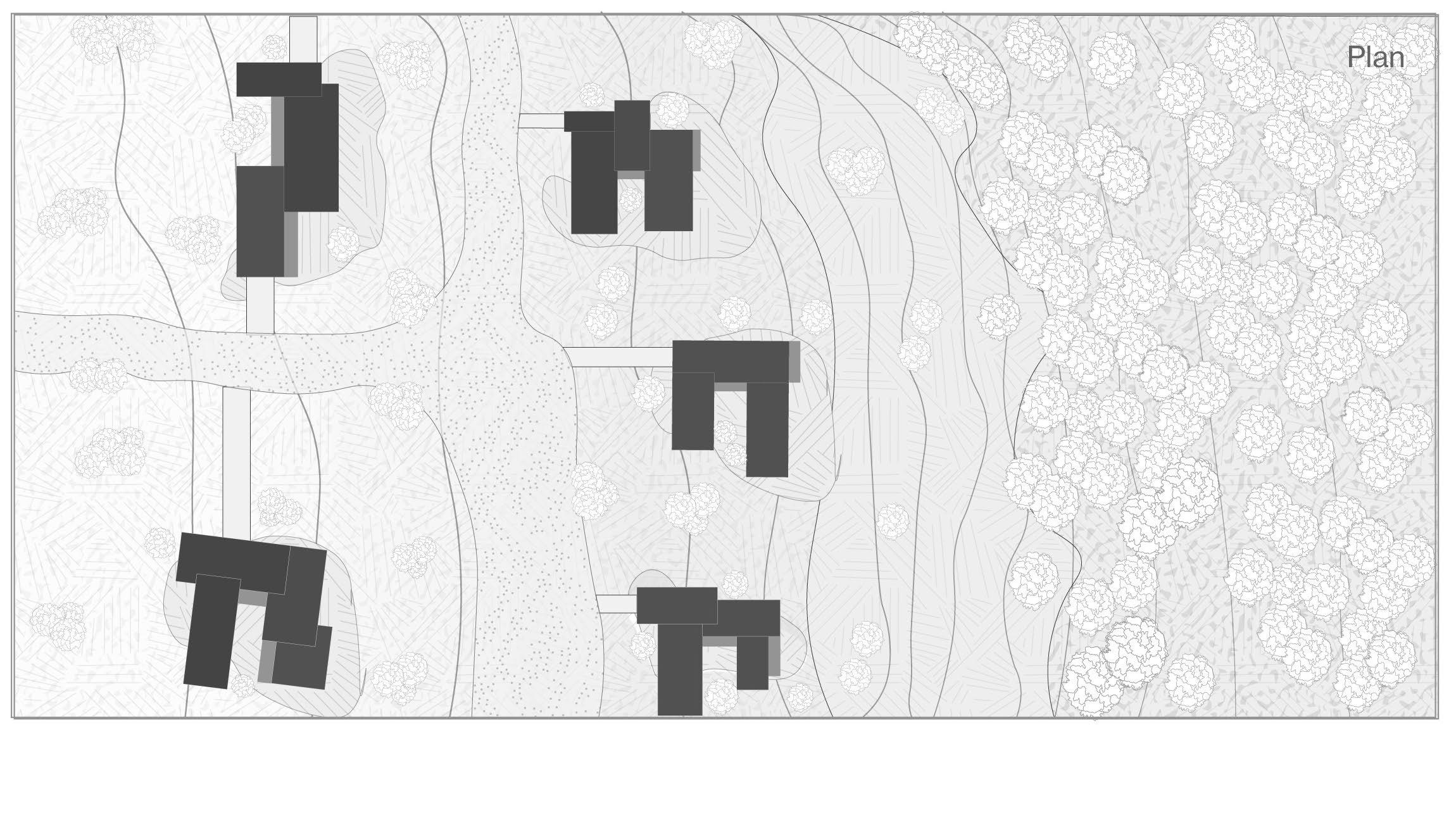
Organization
A house set atop the ridges of a sloped site with prominent panoramic views, southern exposure, and natural references celebrates a oneness with nature possible only by sensitive organizational strategies drafted in the Design Guidelines. Located along low sloped areas of the hilltops of the site, Housing Clusters are composed of homes fitted to the landscape, organized by order of the natural environment. Fitted between trees, rocks, and sensitive vegetation, individual homes are sculpted to their immediate site conditions and to the orientation references shared by all. Houses are clustered on fields the land which are welcome to building form, as per the Design Guidelines, so that houses can exist in a community while ensuring a minimized impact on the natural landscape. Integral to the clustering strategy, houses sit in the rugged environment benefit from
shared services which maintain all houses of the cluster. Pathways, parking spaces, houses, and services knit a community more closely together to ensure an equitable and enjoyable neighbourhood. Housing clusters naturally share natural references which like the Townend Homes ensures a privacy provided naturally through the thoughtful sculpting of building form to the natural references of the site. The houses shared orientation unite the residents with the shared natural landscape of the area. Organized not to the street nor influenced by the car and it’s required architecture, the housing clusters are formed instead by the natural references of the landscape, deepening a connection to nature and further uniting residents under a conscious lifestyle committed to the stewardship of the land.
159 Chapter 6: Designing an Alternative
Design trial home
Left: (F. 129) Section diagram depicting the natural ground conditions and vegetation of the site. The site is left to it’s original condition.
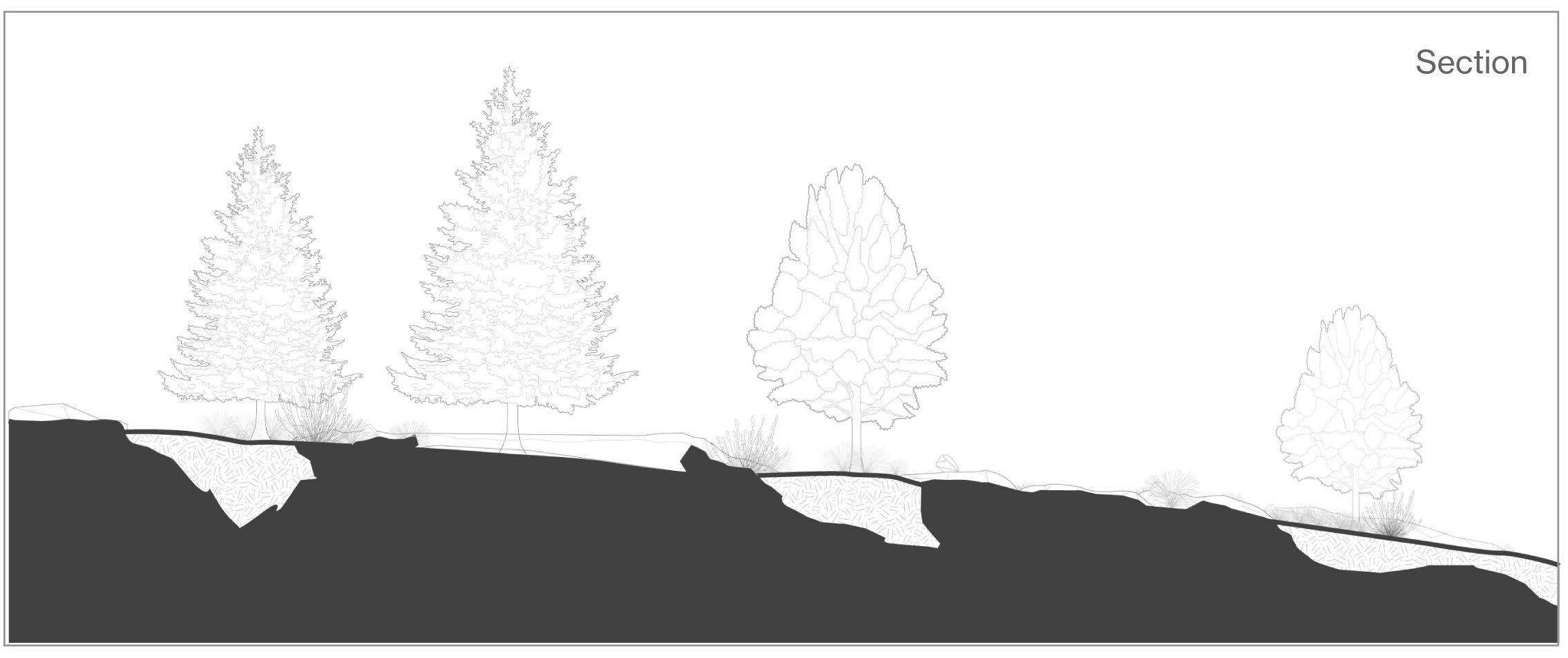
Natural condition of the site for the design trial
Natural Landscape
Serving as the main inspiration for an alternative strategy to resdeintial development, the integration of natural landscape and building form is imperative. Utilizing deep site discovery, historical research, and technical site analysis, strategies were developed that would allow for both a deeper integration between building and landscape, but also a for a lifestyle rooted in the natural landscape. Green Roof’s are employed in order to return vegetation to the barren rock, returning greenery once stolen by industry and supporting the overall ecology while also acting as an imperative aesthetic tool for the blending of the building into the natural environment. A Courtyard is sculpted by building form between and around natural references. In the case of the design sample, a deciduous trees is embraced on three sides home, using the suns path, providing seasonal passive shading and warmth. Most importantly, the naturally landscaped courtyard provides a natural connection between the building and it’s residents to the natural attracting
elements of the site. Paired with a circulation spaces adjacent to the courtyard, the movement within the building reinforces a deep connection to the natural landscape and the ragged and sloped ground below. Openings designed to the courtyard provide a backdrop for the dynamic transition of the day and seasons. Carefully designed outdoor spaces extend the home into the landscape where the connection to nature can strengthen and inspire. Solar orientation, conditioned spaces using courtyards and overhangs, and the placement of exterior spaces facing prominent views bring the residents closer to the immediate environment and the overall landscape. The stepped building form of modest scale ensures that the building references both the ground below as well as the canopy lines which will grow in the future, ensuring a continued fit within the landscape and a fortified balance between building and landscape to the delight of both residents and public on-lookers looking to enjoy the public fields.
Beneath the Pines:
Rebuilding the natural image of Sudbury through alternative residential development strategies.
160
Right: (F. 130) Section diagram illustrating the fitting of the building to the natural landscape, embracing the natural elements, and sensitively touching the ground using all three landforms.
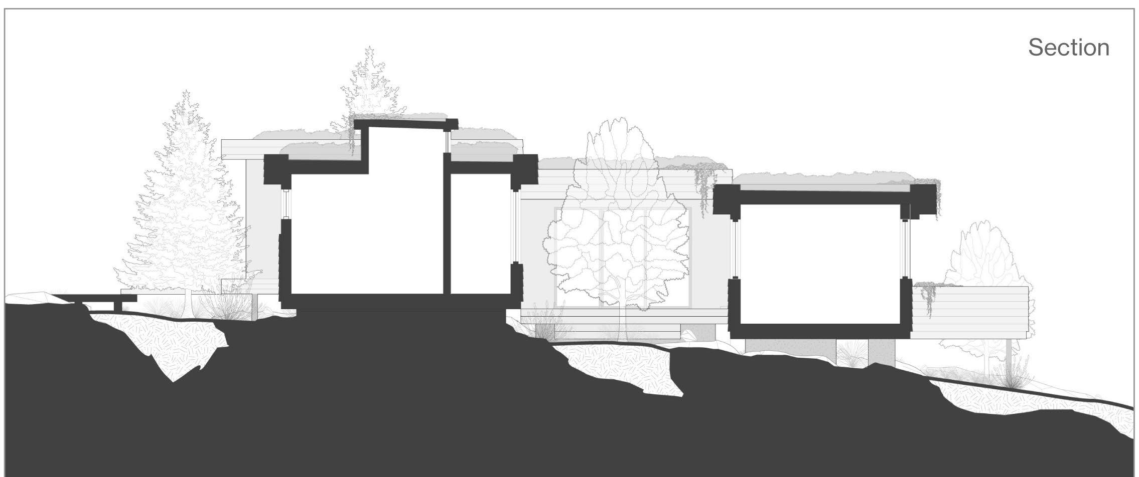
Touching the Ground
Representing the most complex challenge which in its own right deserves a dedicated thesis of its own, the design of a building that sensitively touches the ground challenged the mind for the bulk of the thesis exploration. Landforms emerged as the regionally appropriate strategy for both providing a strong visual and physical connection to the ground and greater landscape. The use of barren rock abundant on the site was inspired by Townend’s approach to residential design in the Sudbury area and his commitment to the preservation of the rock. Landforms cast to the barren rock using concrete ensure a landform which is reminiscent of the existing Sudbury rock a material which will age and further resemble natural rock forms of the landscape. The linear nature of the landforms allow for a flexibility of orientation of the planes, piers, and pins that allow for a dynamic transparency of the building form from various view points. The building and the natural landscape exist within each other, supporting a symbiotic
relationship both aesthetically and physically. The elevated nature of landforms allows the landscape to flow beneath the building, supporting the natural watershed, and from various view points, the ragged landscape beneath the building is revealed. Over time, the natural growth of the vegetation will continue to grow and further buffer and blend the building into the landscape. Importantly, the construction process for the landforms are modest and at the human scale, reducing the requirements for large machinery and destructive processes on the delicate landscape. The use of Landforms supports the stepping of the building which ensures a modest building form fitted to the natural references of the site minimizing the visual impact of the building form while also supporting the visual aesthetic of the landscape by on-lookers. As noted previously, the complexities of building form touching the ground requires further research and experimentation which inspires a lifetime of exploration and creativity.
161 Chapter
6: Designing an Alternative
Below: (F. 131) Photo taken atop a rocky hillside of Sudbury, demonstrating the widespread potential for the strategies developed in this thesis.
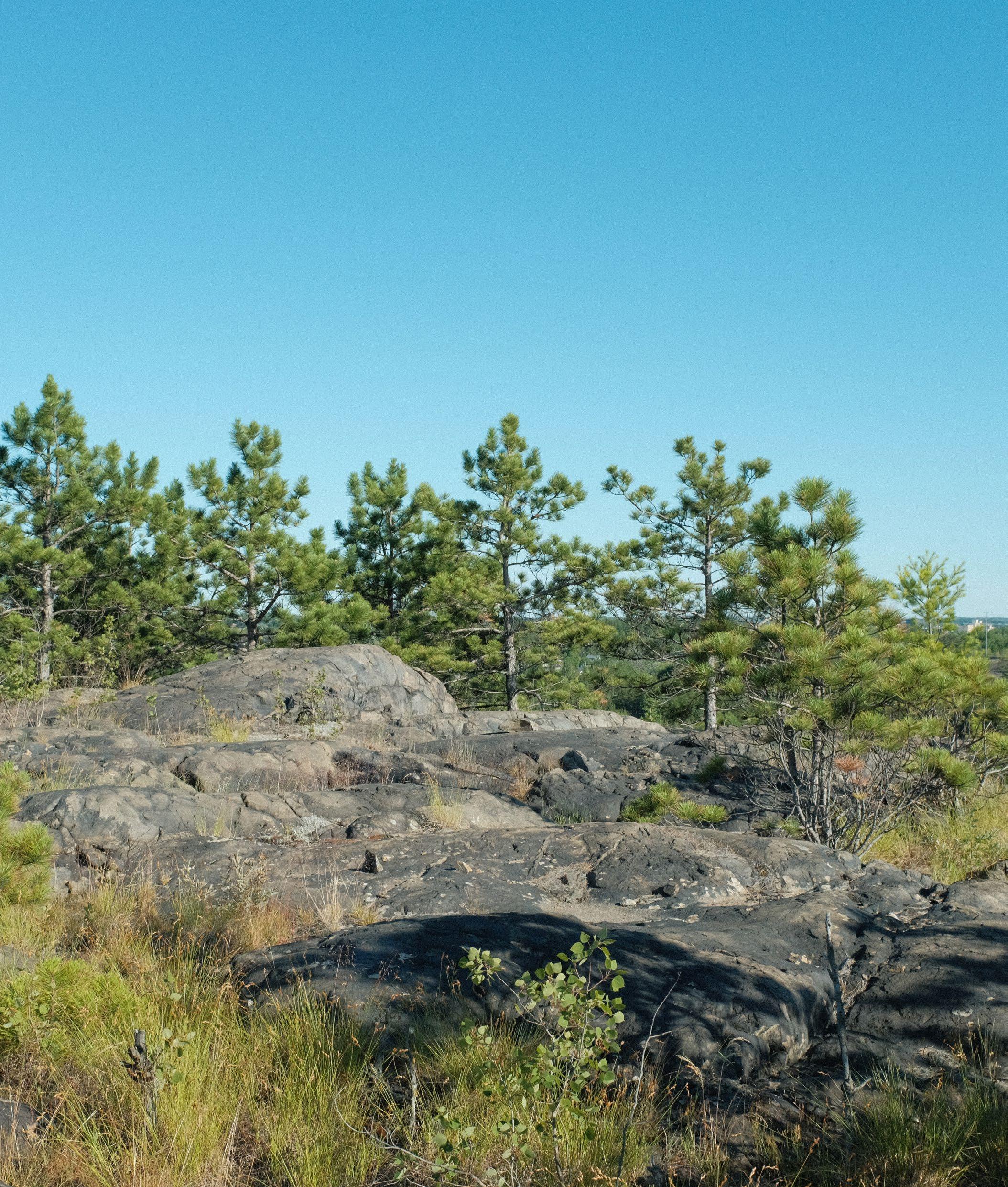
162
Beneath the Pines: Rebuilding the natural image of Sudbury through alternative residential development strategies.
Conclusion
Bound by an endless curiosity of the ancient landscape that once composed the identity of this area, and through the uninterrupted worry for the future of the remaining natural landscape, the desire to explore the intersection between residential architecture, the natural landscape, and the resulting image of the city. Further inspired by the query posed by Oiva Saarinen, regarding the lack of original architecture reflecting the incredible landscape of Sudbury, and by the sameness described by LIsa Rochon in her analysis of residential development, the investigation of the capabilities of an alternative residential development strategy for the Sudbury area was underway. A study of the historical development of residential architecture in the Sudbury area to analyze the housing typologies that have contributed to the image of the city. The relatively short century and a half of human settlement in the area contributed to an image of the city that reflect the abuses to once magnificient anicent natural landscape. Reflecting on the housing typologies developed by industry and later through the commodification of the house, it was clear that a lack of architectural agency has composed an image of the city that reflects the aspriations of the industrialists rather than that of the landscape and its residents. Manifesting this argument is the definitive Sudbury landmark that is the SuperStack, mockingly towering high above the ancient pines that once stippled the rugged landscape. A unique natural landscape
with a storied past at the hands of industrialists warrants renewed efforts for the human to develop a sensitive architectural typology that not only is inspired by the landscape, but that preserves and celebrates the unique attributes of the area we call home. Research and experimentation lead to the conceptualization of slow-development. An alternative form of residential development defined by four main principles, an ethos generated by a deep understanding of genus loci, alternative strategies to organization of housing, the integration and overall importance of the natural landscape, and methods for the imperative architectural challenge of sensitively touching the ground. Slowdevelopment inspired a set of Design Guidelines which serve as a framework for the sensitive design of architecture within the sensitive natural landscape of the site. The Design Guidelines directed a design trial exercise where building form was sculpted by natural references abundant across the site. The design duidelines unite each singular design of a home to the collective, each contributing to the stewardship of the land and a shared exploration of a new lifestyle rooted in nature. This exercise stands as an example of the capabilities of ethos-driven challenges to the norm, and how the creation of restrictions and guidelines may inform a creative and sensitive architectural typology. In a world where standing out is advantageous, we must return to the modest fulfullment of a life beneath the pines.
163 Chapter
Alternative
6: Designing an
Bibliography
Beneath the Pines: Rebuilding the natural image of Sudbury through alternative residential development strategies.
164
“About.” Haystack Mountain School of Crafts. Accessed April 15, 2022. https://www. haystack-mtn.org/about/#architecture.
City of Greater Sudbury, Ramsey Lake 20 Year Master Plan. 1994. https://www. greatersudbury.ca/sites/sudburyen/assets/content/div_planning/documents/Ramsey_ Lake_CIP_no_Appendices2.pdf.
Crook, Lizzie. Walters Way Houses Can Be Easily Adapted to Their Owners Needs Dezeen, December 8, 2020. https://www.dezeen.com/2020/09/27/walters-wayhouses-can-be-easily-adapted-to-their-owners-needs/.
Grahame, Alice, and Taran Wilkhu. Walters Way Et Segal Close: The Architect Walter Segal and London’s Self-Build Communities: A Look at Two of London’s Most Unusual Streets. Zürich: Park Books, 2017.
Jackson, A.Y. A Painter’s Country: The Autobiography of A. Y. Jackson. Toronto, ON: Clarke, Irwin, 1976.
Lyndon, Donlyn, and James Alinder. The Sea Ranch: Fifty Years of Architecture, Landscape, Place, and Community on the Northern California Coast. New York, NY: Princeton Architectural Press, 2014.
Lynch, Kenneth. The Image of the City. Cambridge, MA: MIT Pr., 1979.
Lyons, Brian MacKay, Robert McCarter, and Juhani Pallasmaa. “Architecture and Human Nature: A Call for a Sustainable Metaphor.” In Local Architecture: Building Place, Craft and Community, 31–39. New York: Princeton Architectural Press, 2015.
Moore, Allen, Lyndon, and Turnbull. The Place of Houses. Berkeley: University of California Press, 2000.
Ramsay Best, Janna. The Architectural Imagination of S. Arthur Townend. Laurentian University, Interdisciplinary Master of Arts in Humanities, 2001.
Rochon, Lisa. Up North: Where Canada’s Architecture Meets the Land. Toronto, ON: Key Porter, 2006
Saarinen, Oiva W. From Meteorite Impact to Constellation City: A Historical Geography of Greater Sudbury. Waterloo, ON: Wilfrid Laurier University Press, 2013.
165 Bibliography