
RIVERINE PARK MASTERPLAN
Acknowledgement of Country
Bayside Council acknowledges the traditional custodians: the Gadigal and Bidjigal people of the Eora Nation, and pays respect to Elders past, present and emerging. The people of the Eora nation, their spirits and ancestors will always remain with our waterways and the land, our Mother Earth.”



Kogarah
Westconnex
Substation
1. Introduction
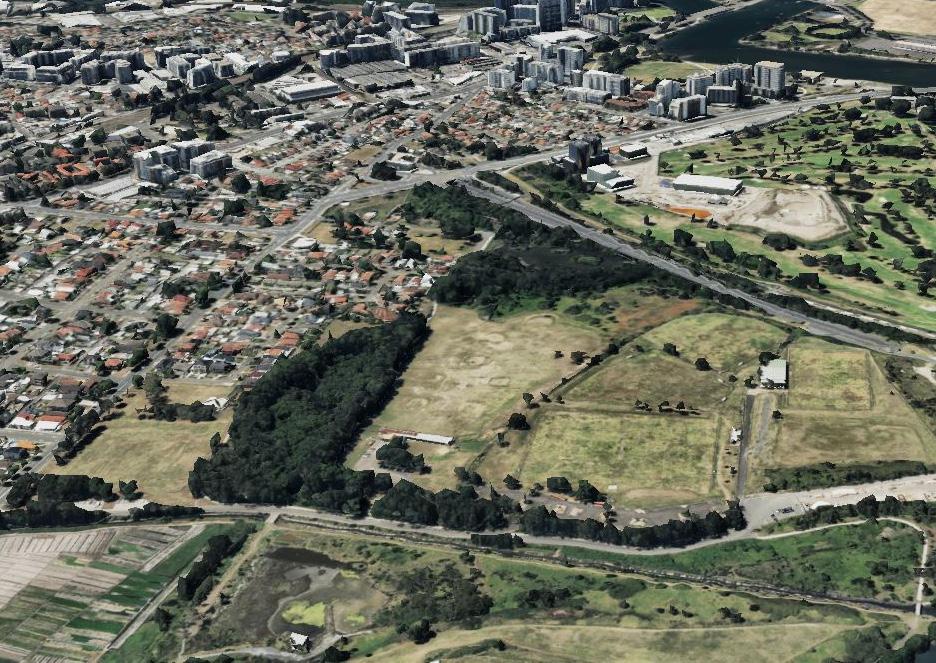
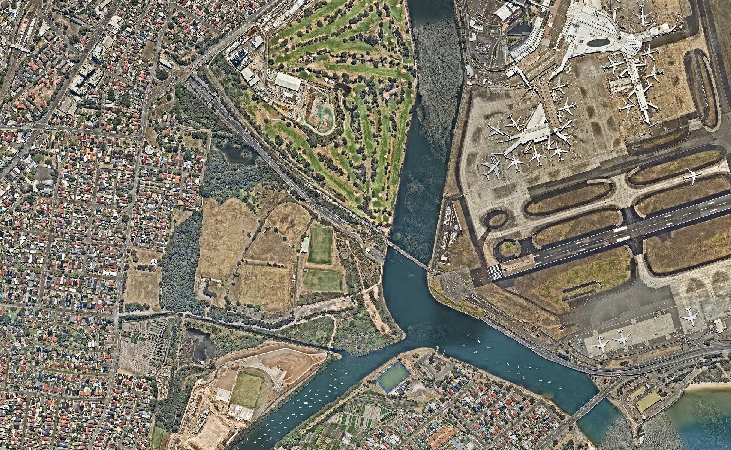
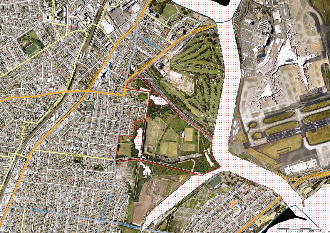
Riverine Park is situated 400 metres from Sydney International Airport and adjacent to the Arncliffe and Banksia urban growth areas.
Positioned adjacent to key city infrastructure including the M5 and M8 motorways, Sydney Water desalination pipe, Southern and Western Suburbs Ocean Outfall Sewer (SWSOOS), the park has been heavily impacted by its infrastructure history and surroundings.
The park’s landscape bears the imprint of its history, having been heavily modified by past land use including Sewage farms, sand mining and land-filling.
The Riverine Park Masterplan acknowledges the layers of history that have shaped this precinct and moreover, it identifies the opportunity for the precinct to improve and become an inviting public space with a prime foreshore presence. This masterplan builds upon the analysis, consultation , objectives and actions outlined in the Arncliffe and Banksia Green Plan , Central Sydney Green Grid and the Bayside Priority Green Grid Corridors and Spatial Framework.
The masterplan envisions a future where Riverine Park and its periphery open space thrives as a symbol of progress and adaptability, transforming formerly neglected spaces into thriving, vibrant, beloved, activated environments.
Key design considerations informing the plan include:
• Legibility of access and circulation including universal access.
• Addressing conflicts that will arise as use increases between vehicles, pedestrians and cycle movements.
• Connectivity with its urban context and broader public realm.
• Recognition of site heritage and local values.
• Enhanced tree canopy and strategies to mitigate the urban heat island and climate change.
• Increase planting selection from the existing planting palette to improve biodiversity and botanical diversity.
• Enhancement of outdoor spaces and its programming.
• Provision of an all inclusive play space and amenities.
• Opportunity to create event spaces for a range of activities and programs.
• Upgraded park furniture, pavements, structures and park amenity.
• Improved signage and use necessary way-finding recognise First Nations language and culture..
• Consider opportunities for public art and potential for trails within and beyond the park.
• Improve views to better connect the open space to the Cooks River foreshore.
• Increase usage and flexibility of existing underutilised amenities, facilities and civil assets.
• Increase usage and upgrade sporting and recreation, facilities to meet the needs of the growing community.
1.1 Design Principles & Strategy
Our vision is to craft a dynamic and welcoming landscape project that seamlessly integrates nature with recreational activities. Emphasising water-sensitive urban design and native vegetation, our initiative celebrates the unique setting at the Cooks River mouth and aligns with the significant Green-Blue grid in the Bayside LGA. The park is designed to offer diverse recreational opportunities, catering to a wide array of community members, enhancing river connectivity, championing environmental sustainability, and encouraging active lifestyles for everyone.
The Riverine Park Masterplan is guided by the following design principles:
- Respect Site Context
- Coastal and Environmental Protection
- Connectivity within and beyond
- Promote active lifestyles and recreation
- Safety for all
- Sustainable infrastructure
These principles are elaborated in Chapter 5, supported by evidence-based Design Strategies that inform the comprehensive Riverine Park Masterplan and its implementation phases.
This report references numerous guidelines and studies that underpin the development of the Riverine Park Masterplan, ensuring a robust and well-informed approach.
INTEGRATING RECREATION AND WATER-SENSITIVE DESIGN
Develop a vibrant, inclusive riverside space that merges water-sensitive design with varied recreational offerings.
GREEN BLUE GRID UNIFICATION CONNECTING COMMUNITY, SUSTAINABILITY, AND ACTIVITY
Enhance the park with native flora, sustainable water practices, and spaces for community and sports activities, aligning with the green-blue grid concept.
Foster a nature-integrated park that strengthens community-river ties, supports environmental sustainability, and promotes active living.
2. Background
2.1 Current Site Context
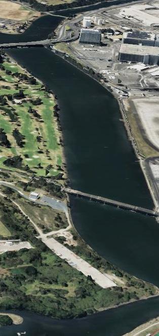
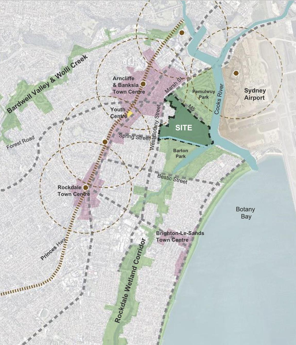
Riverine Park is located at 210 & 210B West Botany St, Arncliffe to the west of Sydney International (Kingsford Smith) Airport and 10km south of the Sydney CBD. It is bounded by Cooks River, Firmstone Gardens, West Botany Street, Barton Park and Muddy Creek.
The overall site is approximately 39 ha in size (Figure 1 - Location Plan). The site is covered by State Environmental Planning Policy (Precincts—Eastern Harbour City) 2021. The majority of the site is zoned for open space with a road reserve corridor through the centre of the site.
The Riverine Park site is entirely within the suburb of Arncliffe which is a residential area comprised of mostly low density dwellings and some unit development and is adjacent to the Bayside West Urban Growth precinct. The park is approximinate 1km from Arncliffe Train Station and town centre, 1 km to the Botany Bay foreshore, is within the Rockdale Wetlands Corridor identified as part of Sydney Green Grid recreational open space and wetlands. The Rockdale Town Centre and Brighton-Le Sands Town Centre are both approximately 1.5km away. The end of the east-west airport runway is only 400 metres away from the study area and part of this site is impacted by the airport public safety area (PSA).
The main access to Riverine Park is via West Botany Street which is a regional road. Secondary access for pedestrian and cyclist is via Eve Street, Firmstone Gardens and a active transport link from the adjacent Barton Park connecting to the M6 Stage 1 Active Transport Corridor that terminates at Scarborough Park. Future stages of this active transport corridor are anticipated to continue along with the implementation of the M6 motorway.
In the past decades, the park has been underused. Mostly because the quality of the park infrastructure and amenity have declined and the uncertainty associated with the future road corridor limited the appetite for investment.
Consequently, the site has been temporarily used as a compound to support infrastructure such as construction of the M5, M6, M8, as well as desalination works and telstra cable installation. It has relatively limited recreational facilities that do not match its potential to serve the growing community of Bayside in a prime position along the foreshore of The Cooks River. The site history has left it vulnerable to misuse by opportunists such as vandals who frequent the site and inflict damage and further alienate the general public resulting in the perception that this park is unsafe. The nature of the site is also increasingly witnessing homelessness as well as parking for adjacent construction including heavy vehicles occupied by nearby businesses.
The completion of infrastructure work, such as the M5, M6 and M8 now allows this open space to return to an entirely public use. The Riverine Park Masterplan seeks to guide the reactivation of the park to create a vibrant and exciting place that caters for the Bayside Community.
2.2 Historical Context
The traditional owners of the area are the Aboriginal Peoples of the Eora Nation including the Gamaygal, Gwegal, Bidjigal and Gadigal Clans and collectively they are known as the “water people”.
Prior to European settlement, the Bayside Local Government area was comprised of coastal, wetland, waterway and bushland environments that sustained the Eora Nation with plentiful resources to support a rich culture.
Arncliffe’s name comes from a small village called Arncliffe in North Yorkshire, England. The name appears in the Domesday Book of 1086, as ‘Arneclif’, meaning Eagle Cliff.
Between 1895 and 1899, The Southern and Western Suburbs
Ocean Outfall Sewer (SWSOOS) was constructed for the disposal of sewage from much of Southern Sydney. It stretched from Marrickville to Rockdale. The sewage from this system flowed to a sewage farm located at present-day Riverine Park and Barton Park. The extensive tract of open space including Barton Park, Firmstone Gardens, Riverine Park and Landing Lights Wetland is a significantly disturbed landscape with areas of it used for a Sewage Farm servicing Sydney for 30 years until 1916.
The sewage farm which was 200 acres in size was Sydney’s earliest attempt at purifying sewage in the hope of beating the major sanitary problems of the era. The system is of considerable historical and scientific significance as one of the early sewers to service the southern, western and Illawarra suburbs of Sydney. In the late 1890s, the Sewage Farm was extended to allow for the disposal of the sewage from the Western Suburbs.
The northern side of the river was mainly occupied by small market gardens. The secondary function of the Sewage Farm was to utilise the manure value of the sewage to produce muchneeded vegetables for household.
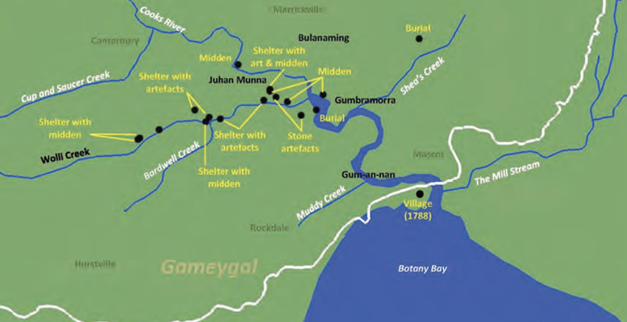
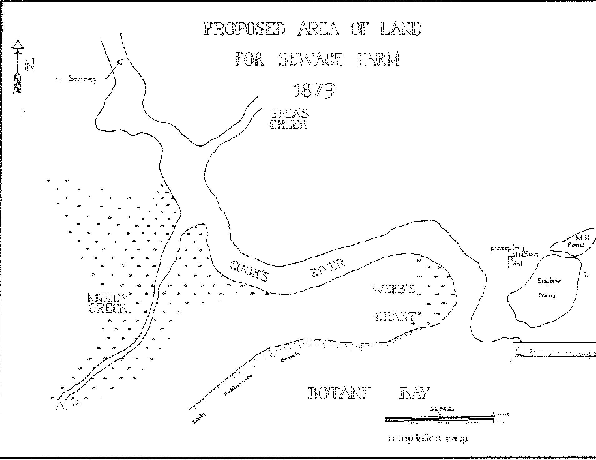
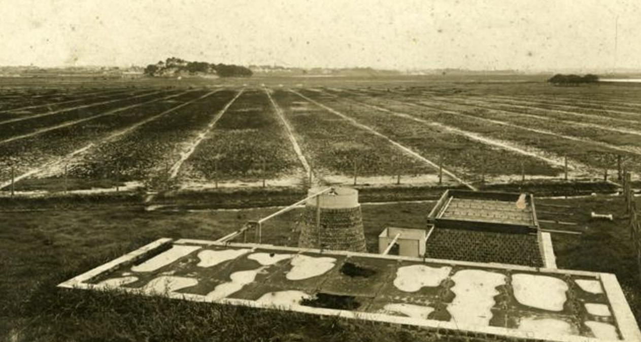
Figure 2 - Aboriginal uses of the Cooks River catchment before the arrival of Europeans. (Source: aboriginal history along the cooks river)
Figure 3 - The plan dated 1879 shows the Sewage Farm was proposed at the land on the southern side the mouth of Cook’s River (Source: Australasian historical archaeology, 8, 1990 )
Figure 4 - The photo of the Sewage Farm (Source: Bayside Library)
By the turn of the century, the Sewage Farm was in crisis. There was too much sewage on too little land, and the establishment was unanimously disliked by Councils and residents. By then, government priorities were changing, and following parliamentary investigations between 1906 and 1908, the decision was made to transfer the sewage to a new ocean outfall at Long Bay.
In 1916 the SWSOOS was extended to Long Bay ocean outfall. The whole of the sewage of Cooks River and Wolli Creek valleys now drains to this outfall. The three brick barrels, which are encased in concrete, are an excellent example of the oviform brick construction method of the time, which have provided continuous service for over 100 years. The Sewage Farm ceased operating in September 1916. Until 1939, almost all of the site of the Sewage Farm was alienated for sport or recreational facilities, once the Sewage Farm became historically expendable. Later, the SWSOOS No.2 was constructed in 1941 with both systems traversing the former Sewage Farm.
After the closure of the sewage farms, former Rockdale City Council created a large park at the site, by raising the level of the land and the swamp lands in the south-west corner no longer exists.
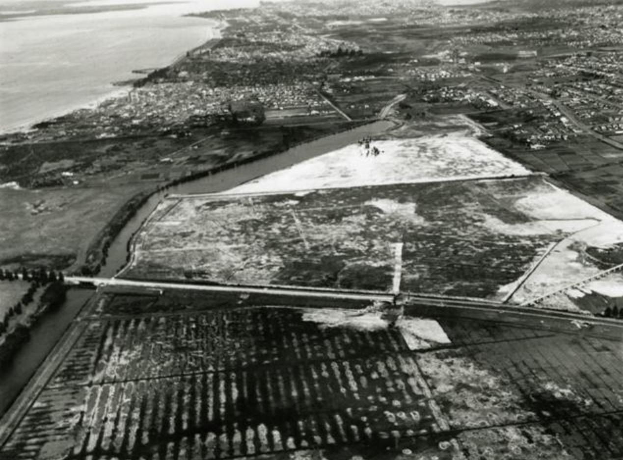
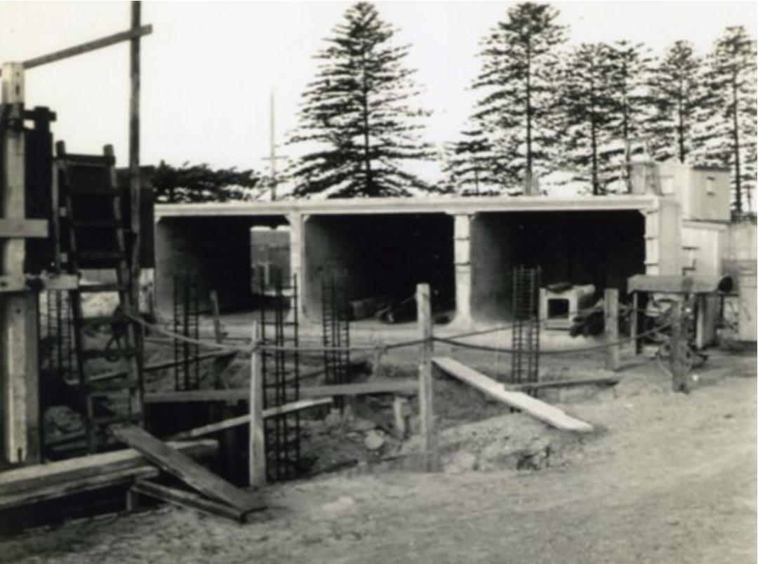
Between 1947-1956, Cook’s River was diverted south of its original mouth to a new outlet into Botany Bay, to allow for extensions to Kingsford Smith Airport. The former sewage farm land was resumed and was extensively sand mined for civil projects and later, as recently as the late 1970s, it was used as a council landfill site.
The history of the site is evident in its altered landform, disturbed and degraded vegetation and poorly developed infrastructure. There is little remaining of former vegetation and no evidence of past use by traditional owners. Yet nature has opportunistically developed alternative habitats that thrive and are now highly valued in the Landing Lights Wetland and the enriched soils continue to support the adjoining heritage listed market gardens.
This area was know as Barton Park North until Riverine Park was gazetted on 25 January 1996 as a reserve and formerly named. The name evolved from the waterways bordering the area. The name describes the planned theme of the park.
Figure 6 - Aerial view of the site and Muddy Creek before the diversion of the Cooks River, circa 1945 (Source: Bayside Library)
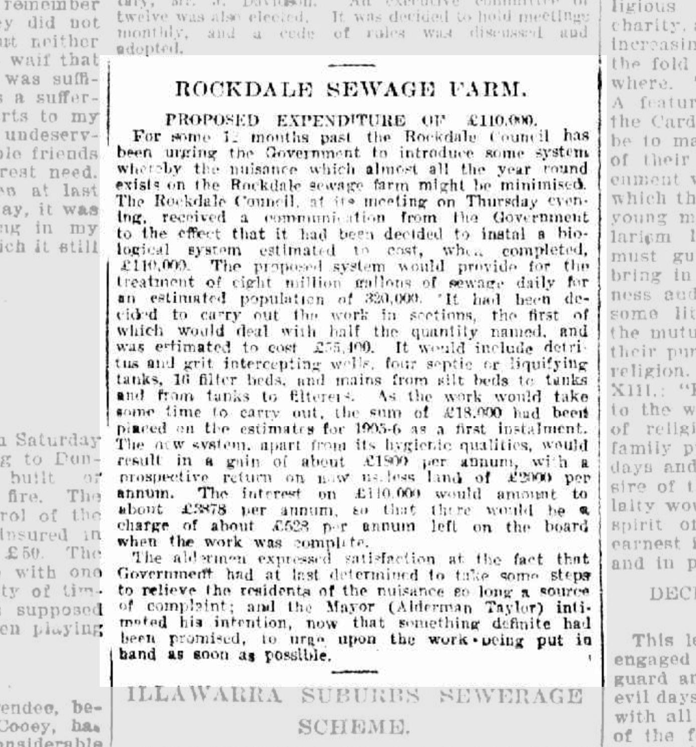
Figure 5 - News article about the Sewage Farm on The Daily Telegraph on Mon 11 Sep 1905
2.3 Historical Park Development
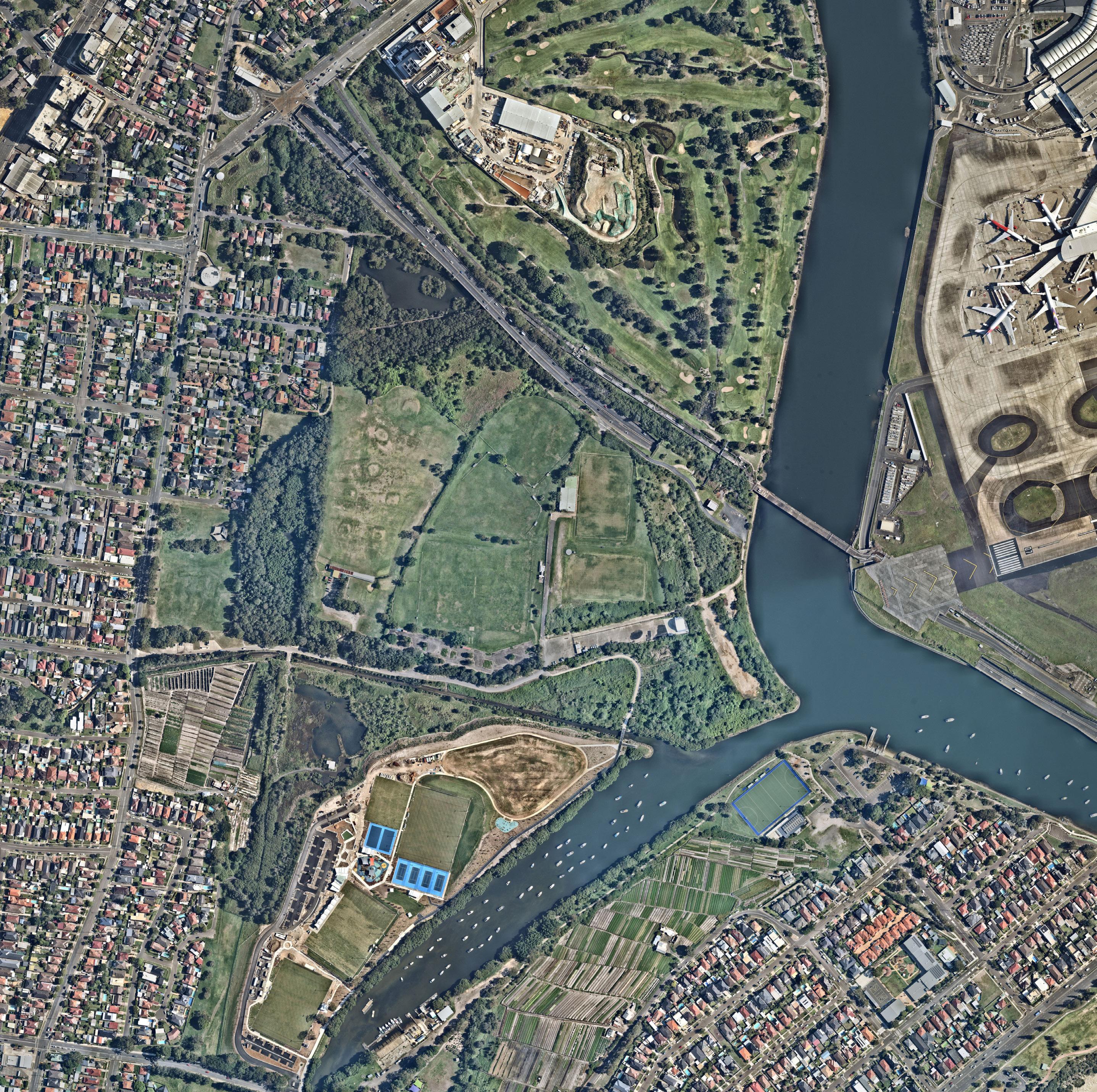
The aerial maps in this section demonstrate the history of park development.
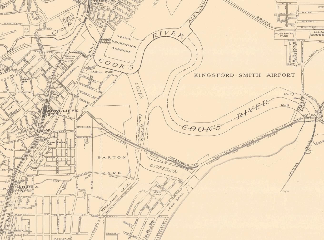
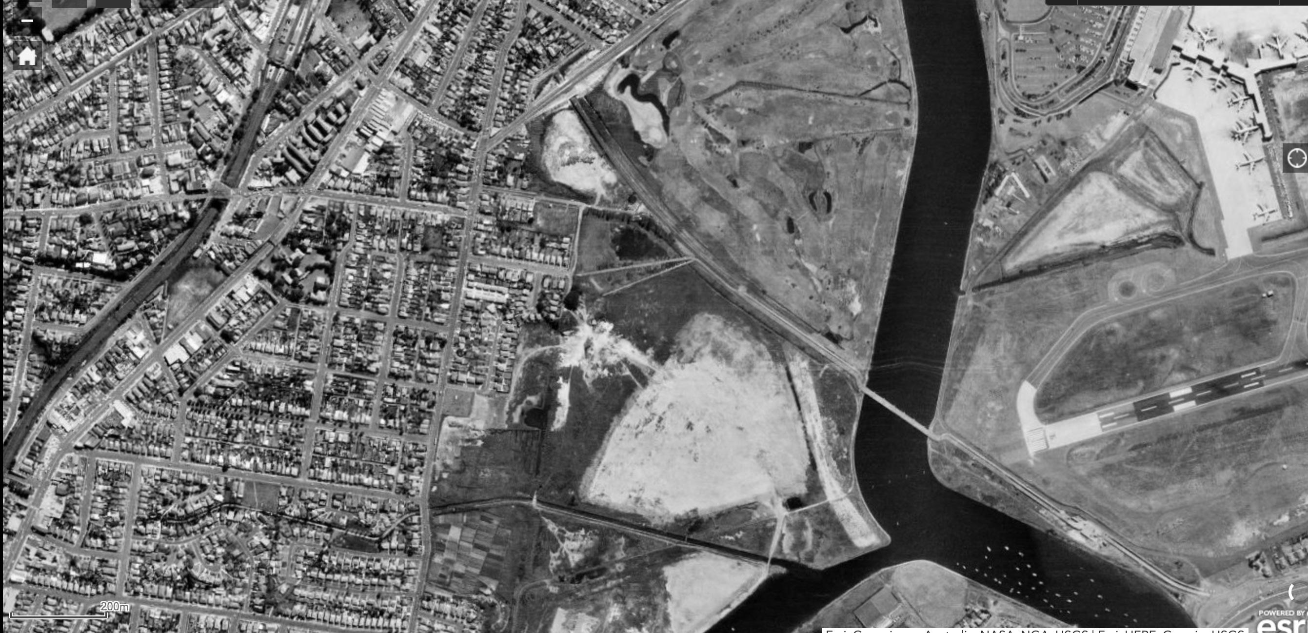
• YEAR 1943
The aerial photo taken in 1943 shows the landform before expansion of the airport and changes to the Cooks River and Muddy Creek.
The aerial map shows that the central area of the site was used as cricket fields after closure of sewer farm, while the west side facing West Botany Street and north-west corner are used as a Market Garden.
Evidence of the former sewage farm can be sighted at the adjacent Kogarah Golf Course site.
• YEAR 1955
The aerial photo in the 1950s shows that the landform is already significantly disturbed. Muddy Creek and the mouth of the Cooks River have been substantially changed due to the expansion of the airport.
The northern corner of the site and adjacent areas north were excavated for sand mining. There is evidence of a golf course north of that area.
• YEAR 1965
This site and the adjacent future parklands north and south were continually use for sand mining and land fill during this period.
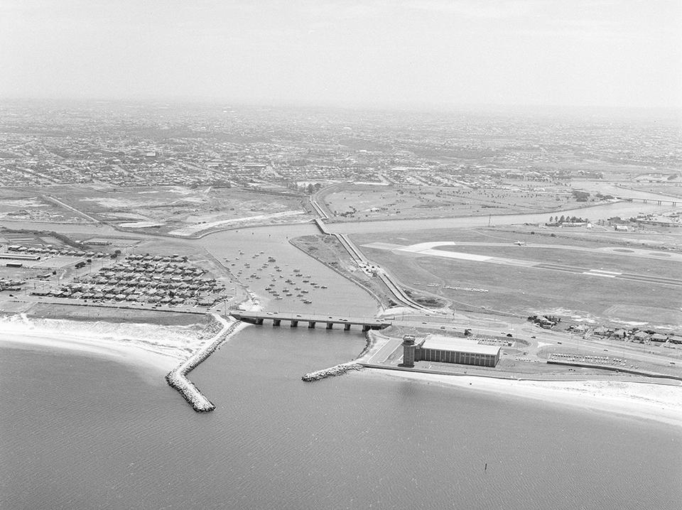
The expansion of Sydney Airport continues on the reclaimed land.
More residential developments appears in the area, replacing some of the market garden and paddock areas.
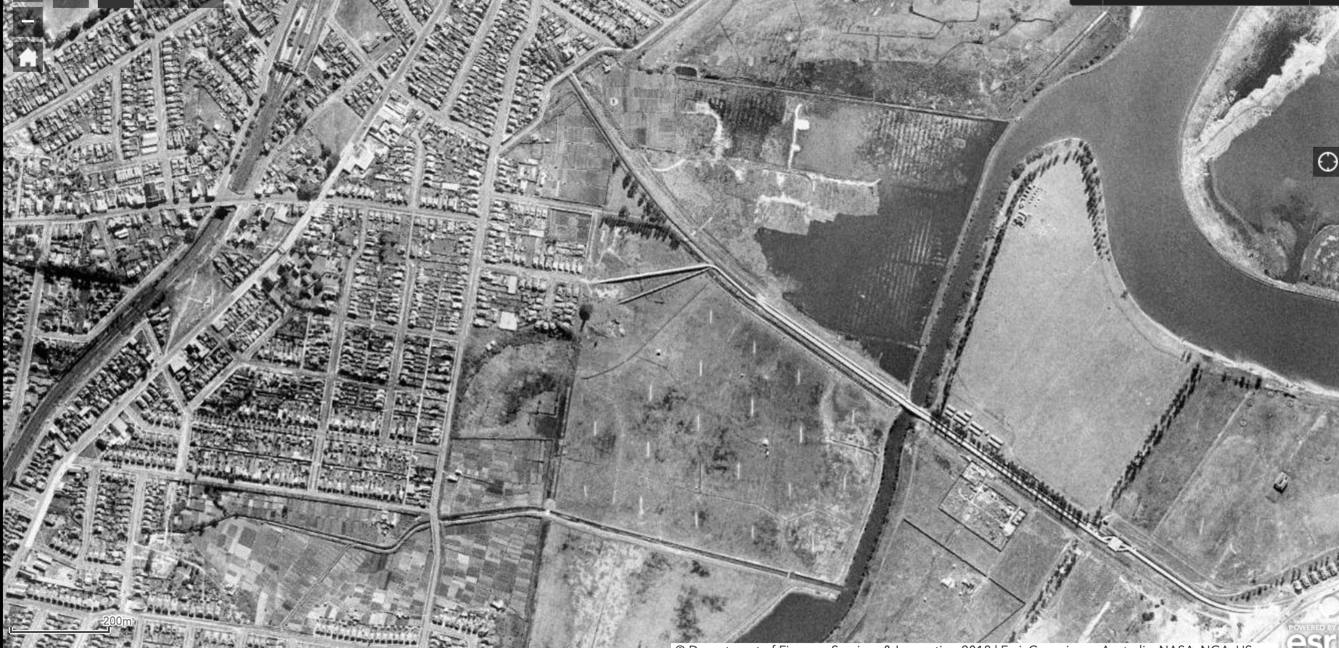
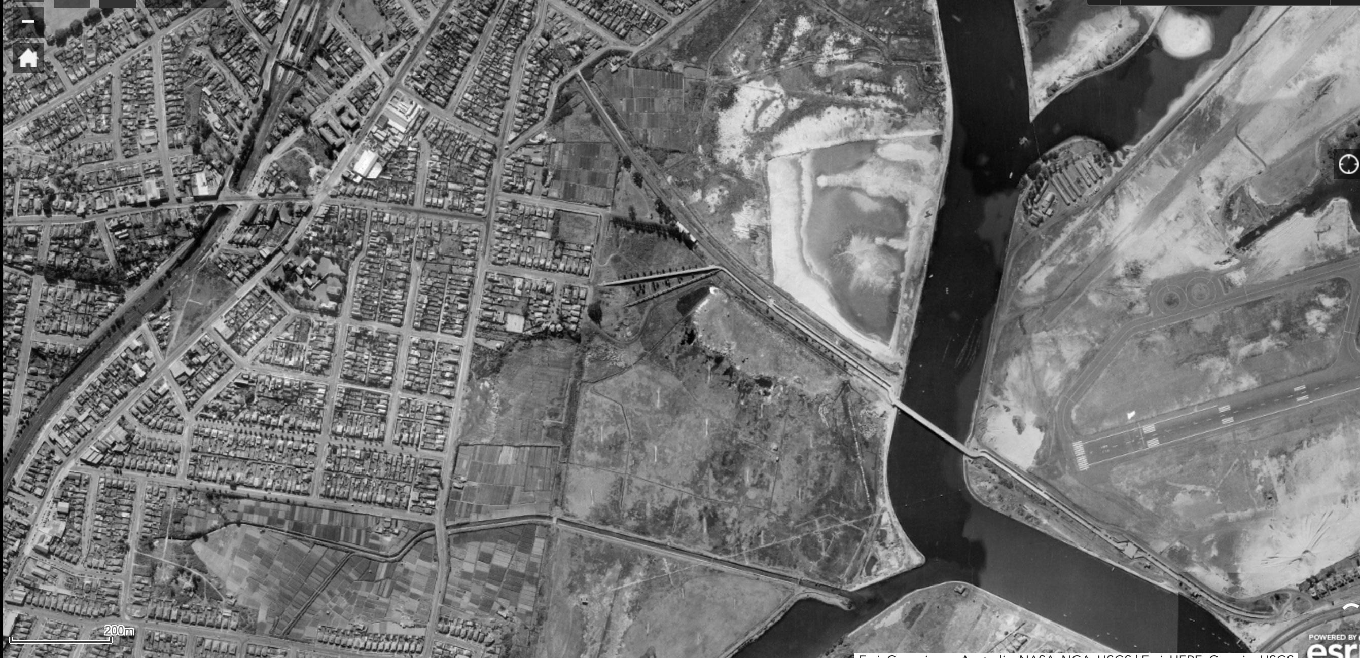
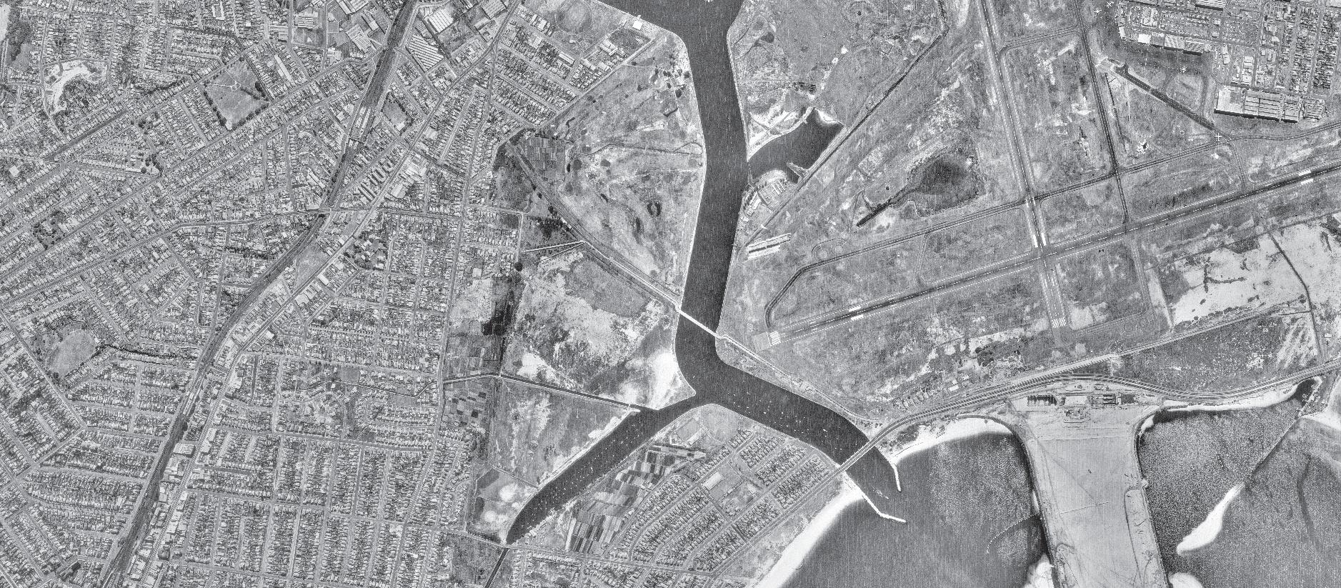
Figure 7 - The map shows the original Cooks River alignment and the realigned Cooks River. (Source: New South Wales. Department of Lands, cartographer & Central Mapping Authority of New South Wales. (1950). City of Sydney & environs.)
Figure 8 - Work underway on the building of the triple sewer at Kyeemagh after the reclamation and diversion of the Cooks River, late 1940s (Source: Bayside Library)
• Year 1975
By this time, the site was operated as a landfill for council operations. Ponds was extended in the lower areas of the site to become the Eve Street Wetland, Spring Creek Wetland and Landing Light Wetland later.
The adjacent land north is expanded as a golf course in areas formerly mined for sand.
More land was reclaimed by the airport.
• YEAR 1977
The precinct was filled and levelled and started to be used for sports and recreation again.
Some bike tracks can be seen at the eastern side of the site. Meanwhile, a stadium was built at Barton Park (south) and opened to public in 1978.
More market gardens in the West Botany Road precinct are disappearing.
• YEAR 1982
The aerial photo shows that the market garden within the site was completely removed by 1982. The site remains grass land with few canopy trees.
An asphalt vehicle road was built off West Botany Street to provide formal access to the site.
A small building is evident in the middle of the site.
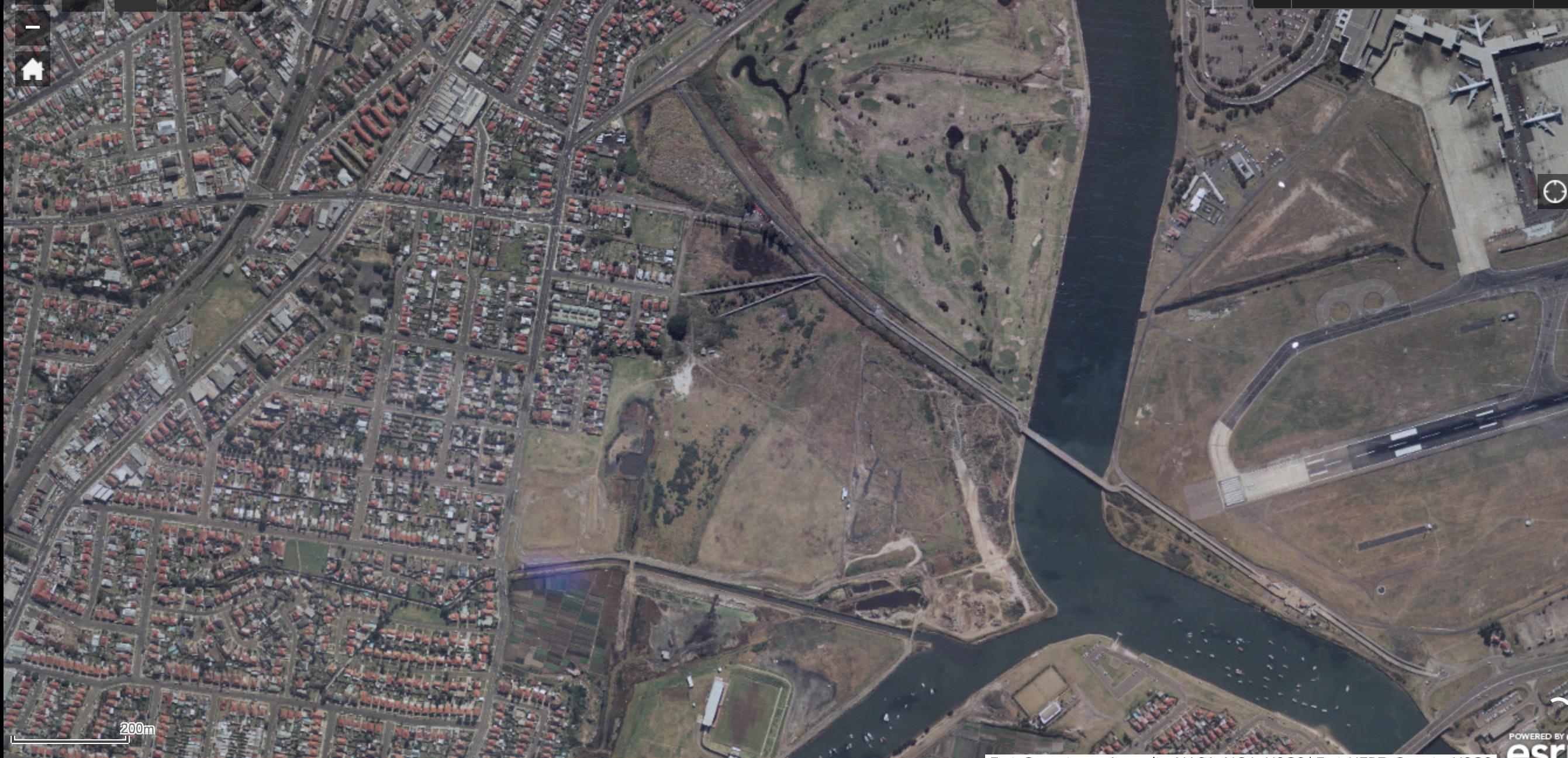
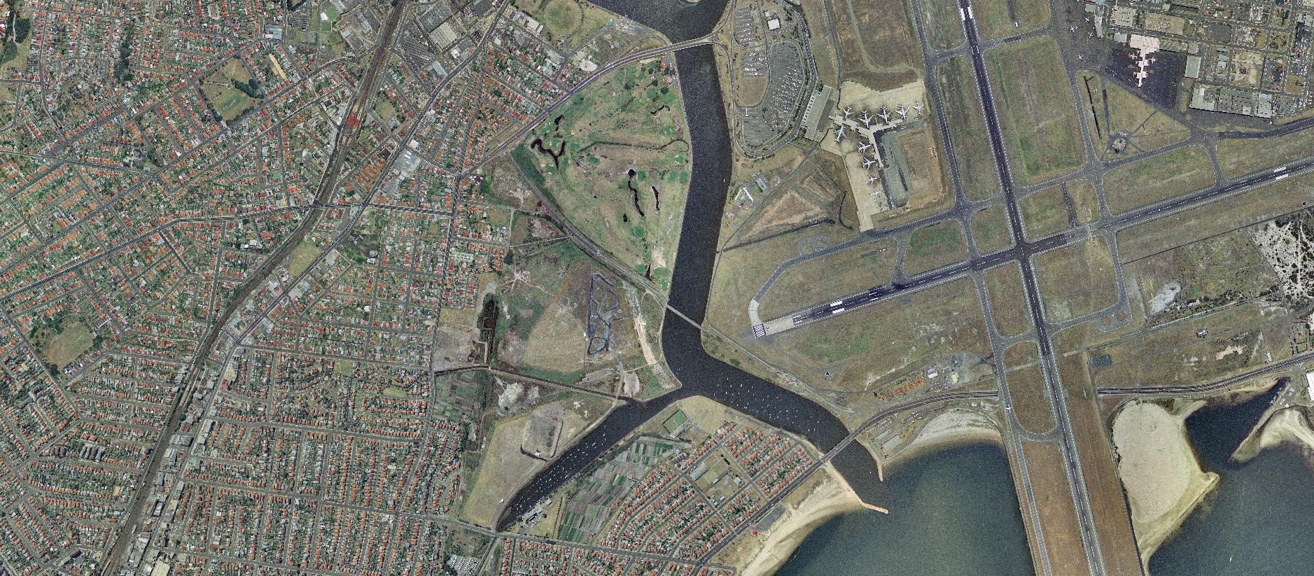
Figure 9 - Aerial view of Cooks River Entrance and the Airport in 1973, Riverine Park is visible in the background (Source: National Archives of Australia)
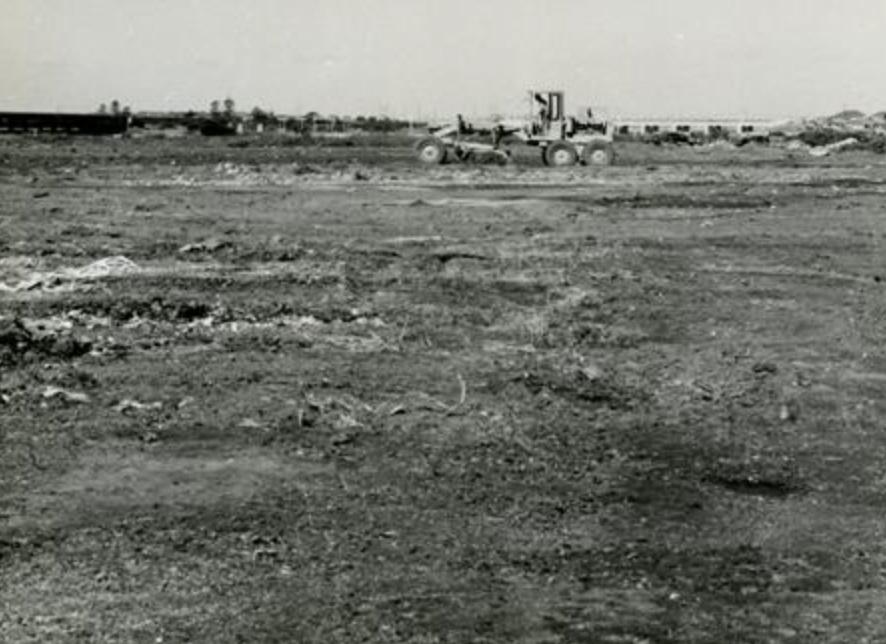
Figure 10 - Photo taken during development of park, after completion of garbage filling, levelling of land near the sewer carrier. September 1959 (Source: Bayside Library)


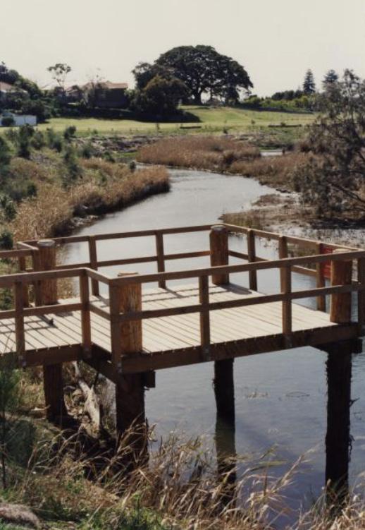
• YEAR 1994
The aerial shows the extensive grass cover across the site which is used for sport. Carparks, buildings and paths were created to serve the golf driving range and fields.
In 1988, bicentennial funding was made available for various council projects including a large salt marsh project near the Spring Creek Canal. During 1992-1993, work was undertaken at the Spring Creek Wetland, and officially opened to public in February 1994.
• YEAR 2004
This site was known as Barton Park North until the name Riverine Park was first gazetted on 25 January 1996 as a reserve.
Between 1998 and 2001, the M5 Motorway East was constructed. In the aerial map dated 2004, it emerges from the tunnel at Marsh Street, running parallel with the SWSOOS, along the northern boundary of Riverine Park crossing the Cooks River via an underground tunnel. A playground is evident at Firmstone Gardens.
• Year 2022
The park is used for sports activities and the playground has received a shade structure.
Around 2010, a desalination pipe was installation by Sydney Water to connect Kurnell desalination plant to Erskineville. The installation of the pipe removed existing vegetation near the eastern boundary of Riverine Park which can be seen in the aerial map. The pipe is not always underground and can be seen emerging or impacting landform along its route.
Recently, Council upgraded the pedestrian bridge at the mouth of the Spring Creek significantly improving user safety.
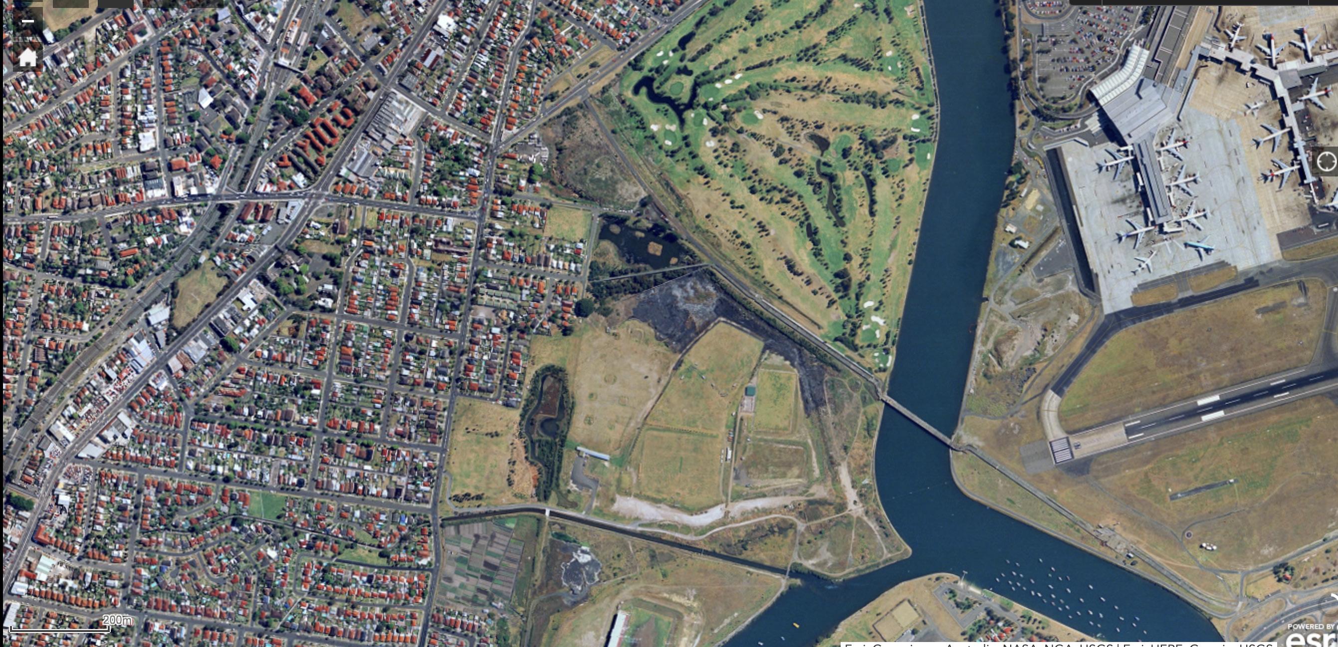
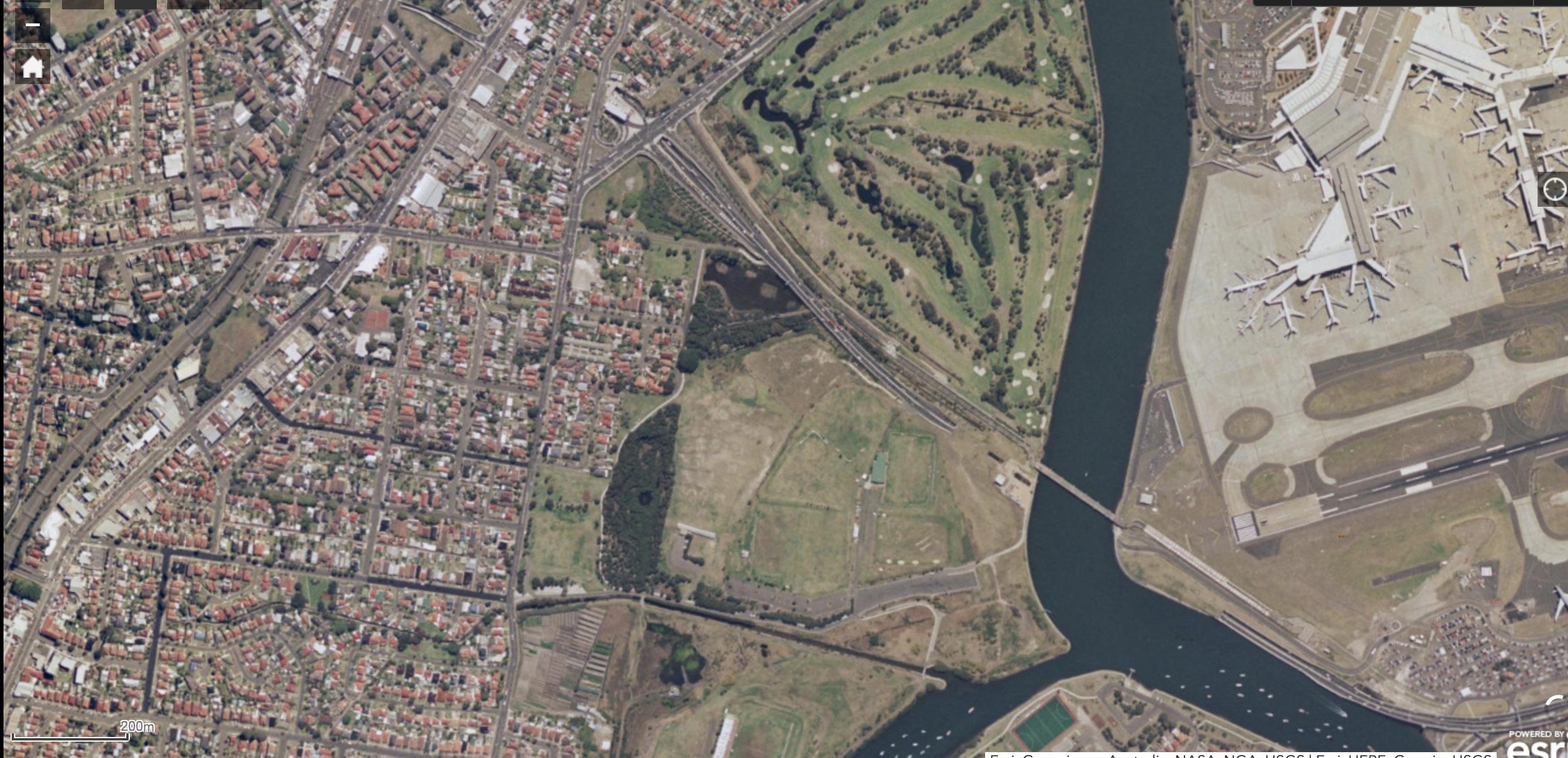
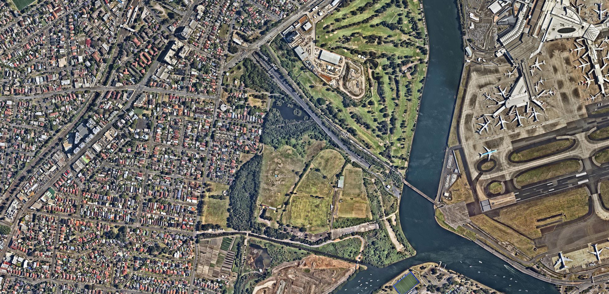
Figure 11 - The 1992 design of Spring Creek Wetland
Figure 12 - A photo of Spring Creek Wetland, 1993 (Source: Bayside Library)
2.4 Existing Facilities and Character
NOTE: site condition photos are on the following pages.
KEY
1. Main park entry from West Botany Street
2. Firmstone Garden Playground
3. Spring Creek Wetland
4. Golf Driving Range
5. Eve Street shared path and Moreton Bay Fig
6. Sport fields
7. Dilapidated amenity building
8. Spring Creek
9. Car park
10. Active Transport Link and Barton Park Bridge
11. Eve Street Wetland
12. Landing Lights Wetland
13. Arncliffe Market Garden
14. Southern and Western Suburbs Ocean Outfall Sewer (SWSOOS)
15. WestConnex Electrical Substation and associated compound
16. Eve St Reserve
17. Sydney water desalination pipe
18. Ausgrid temporary work compound
19. Temporary compound
Figure 13 - Existing Site (Source from: 2024 Near Map)
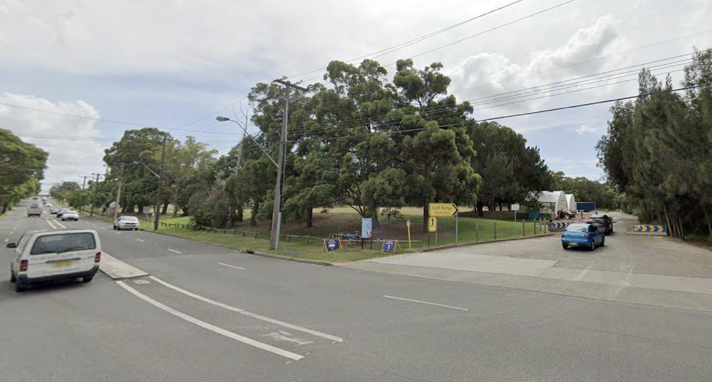
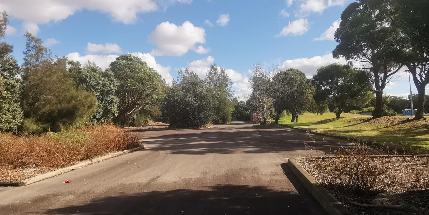
1. Main park entry from West Botany Street
The main vehicle entrance to Riverine Park is accessed from West Botany Street. It’s a vehicle and pedestrian mixed environment.
This small car park near the entry was used for a drive-through collection centre during the Covid pandemic.
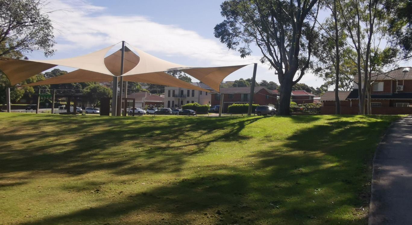
2. Firmstone Garden Playground
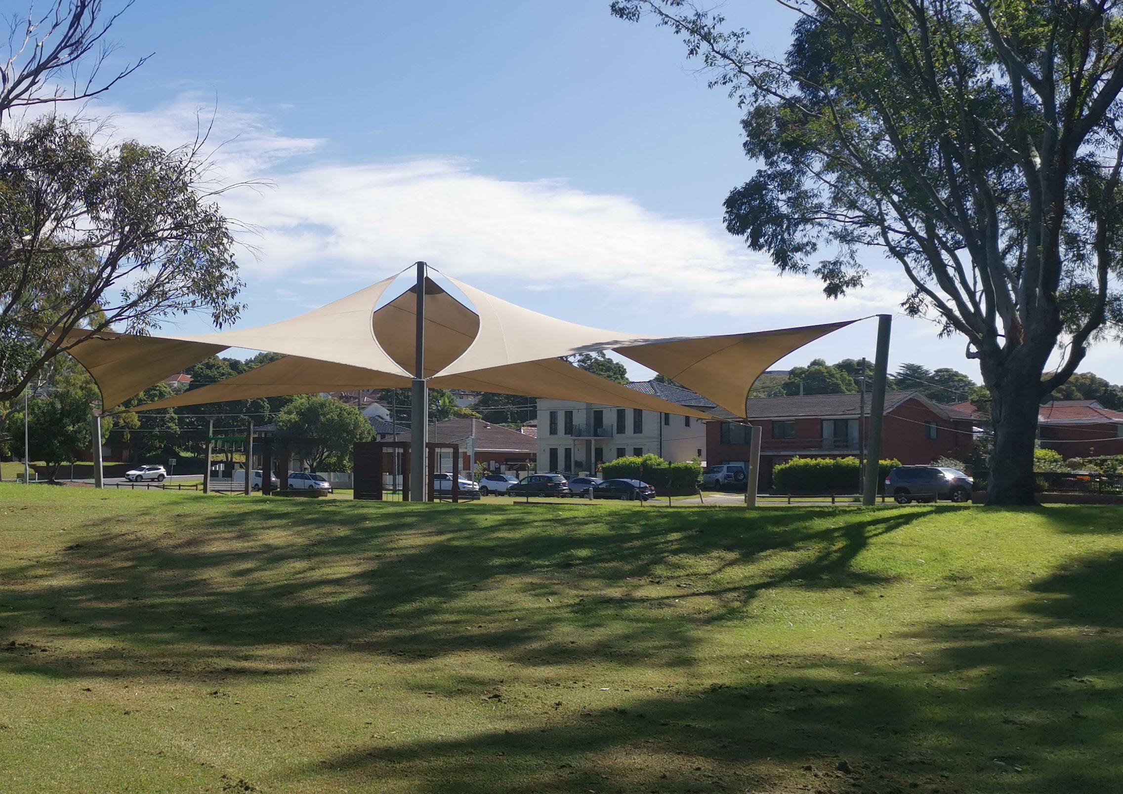
The playground equipment within mulch softfall was installed in 2006. This playground caters for a range of ages and is highly utilised. The condition of the equipment is nearing the end of its expected asset life of 20 years consisting of mostly timber and rope components. The playground is not supported with pathway connections or park facilities to support carer comfort or longer visitation. Renewal of this playground is planned as part of implementation of the Riverine Park Masterplan. The playground has an expansive shade canopy which provides a safe and comfortable play area for children in all seasons.
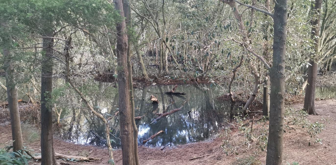
3. Spring Creek Wetland
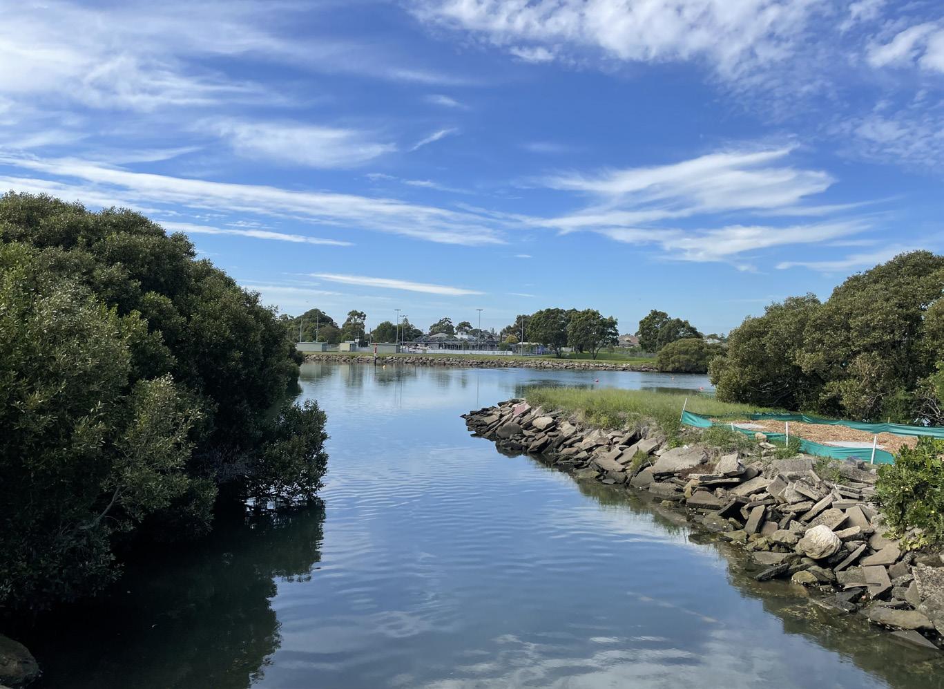
This rehabilitated wetland was constructed in 1994 but continues to suffer problems arising from poor design and construction. Its small catchment area leads to insufficient water levels, and the lack of maintenance has further degraded its condition.
Originally, mangroves were planted at the mouth of the creek, but now dominate and overshadow the waterbody. The wetland suffers from insufficient water source, and stagnates resulting in poor water quality, mosquitoes and odours resulting in complaints from nearby residents.
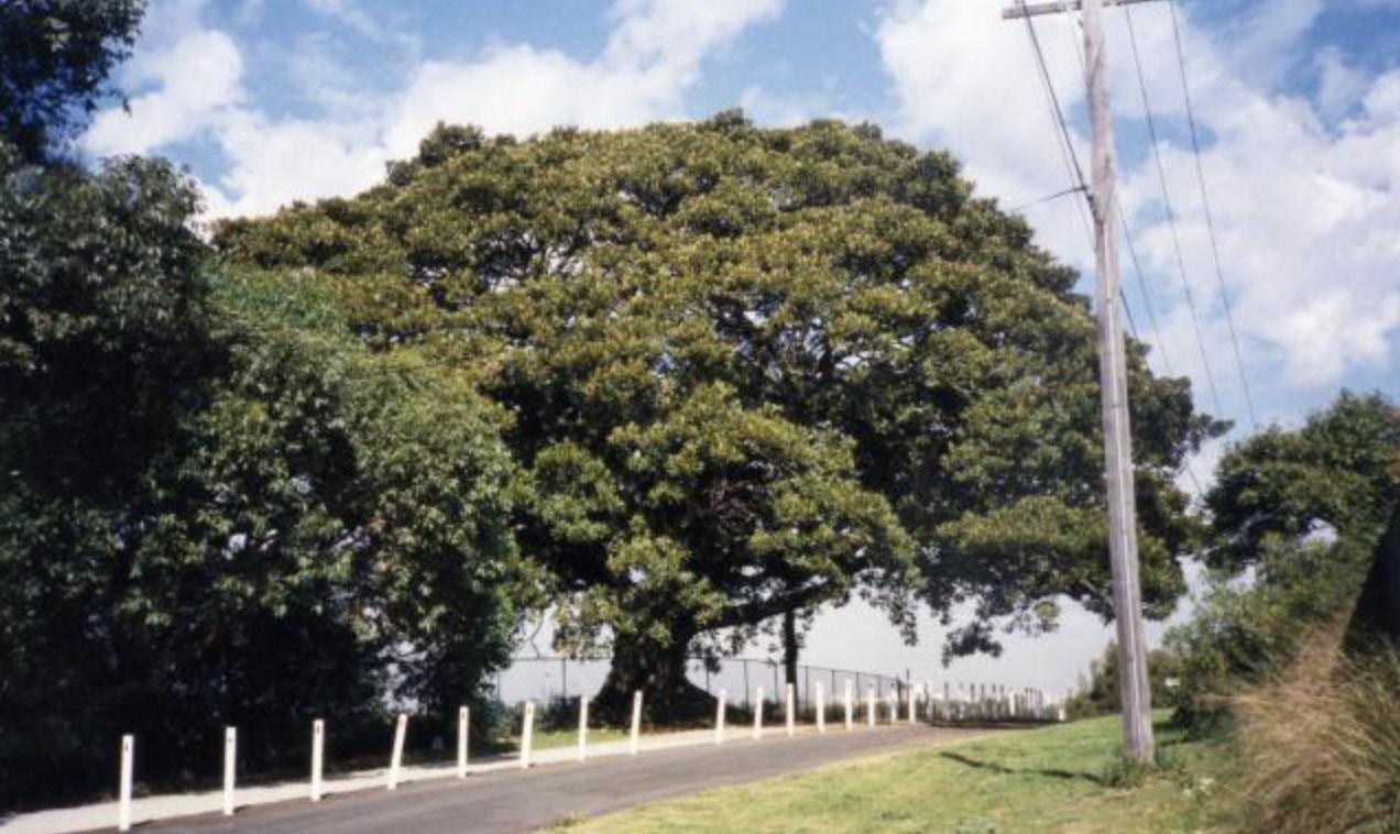
5. Eve Street shared path and Moreton Bay Fig
Situated at the end of Eve Street, the notable Fig tree acts as a distinctive landmark and elegantly frames the entrance to Riverine Park. Aerial imagery from as early as 1943 confirms the tree’s long-standing presence. The tree provides substantial shade, supports local biodiversity and enhances the area’s comfort and aesthetic appeal.
6. Sports Fields
4. Golf Driving Range
The central area of Riverine Park is occupied by a Golf Driving Range. There is an existing unmarked parking area containing approximately 60 parking spaces, which appears adequate for the usage generated. However, the driveway access and car park associated with the golf driving range are in poor condition.
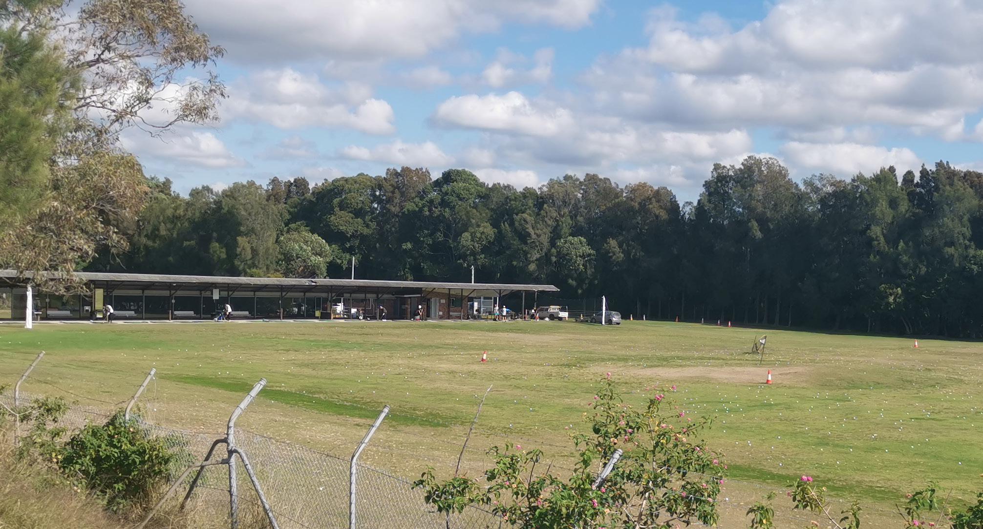
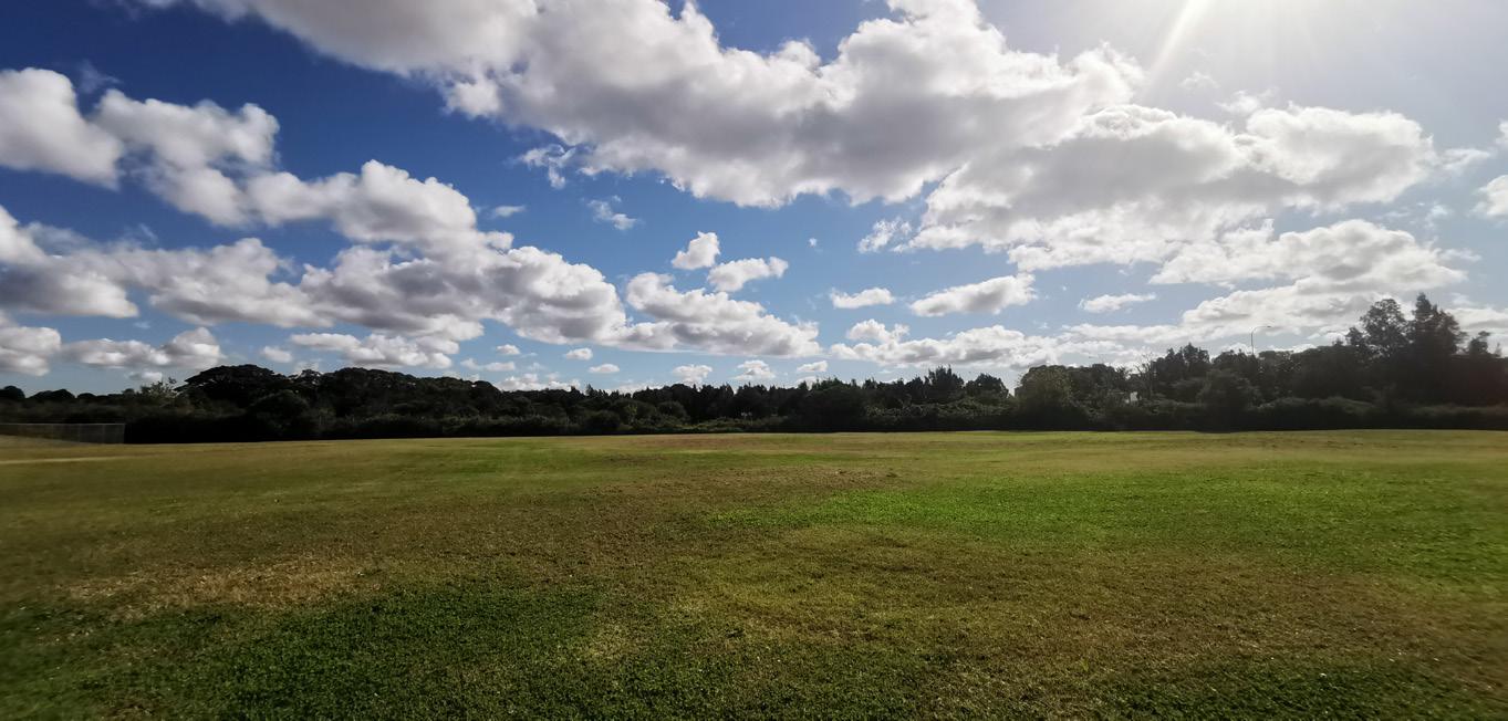
Several large sporting fields exist and were refurbished in 2022. The perimeter includes lighting, shelters and spectator seating.
7. Dilapidated Amenity Building
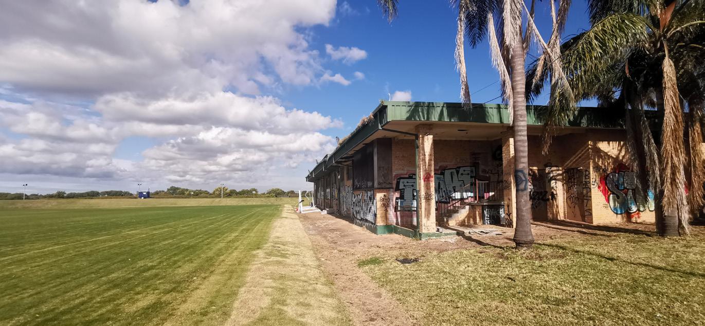
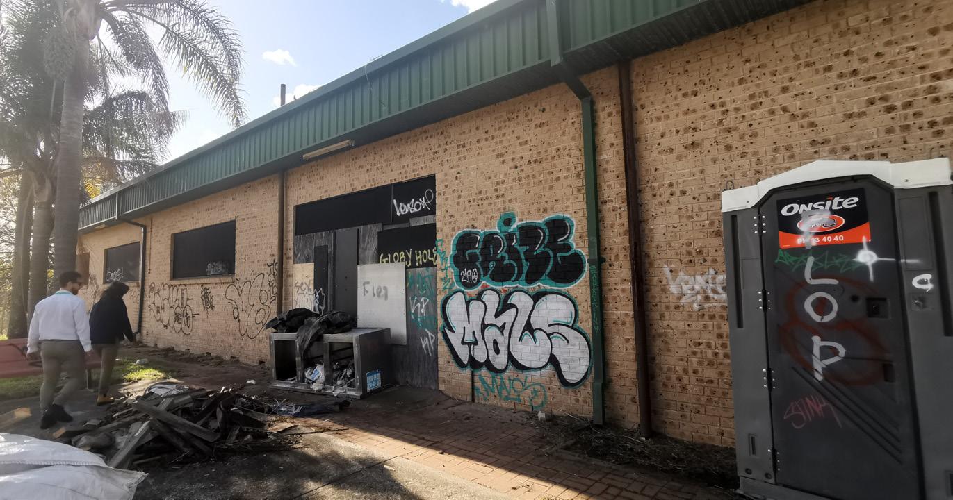
The amenity building, constructed in the late 1990s, has unfortunately been subject to vandalism and lack of use in recent years. Despite these challenges, the building’s structure remains sound and intact. Its central location, strategically positioned between the sports fields, provides significant advantages to spectators, and sporting groups.
The amenity building is directly accessible by vehicles via a sealed road, allowing for servicing, maintenance and deliveries. While the perimeter is paved, there is currently no formal pedestrian network, and pedestrians are required to use the service road.
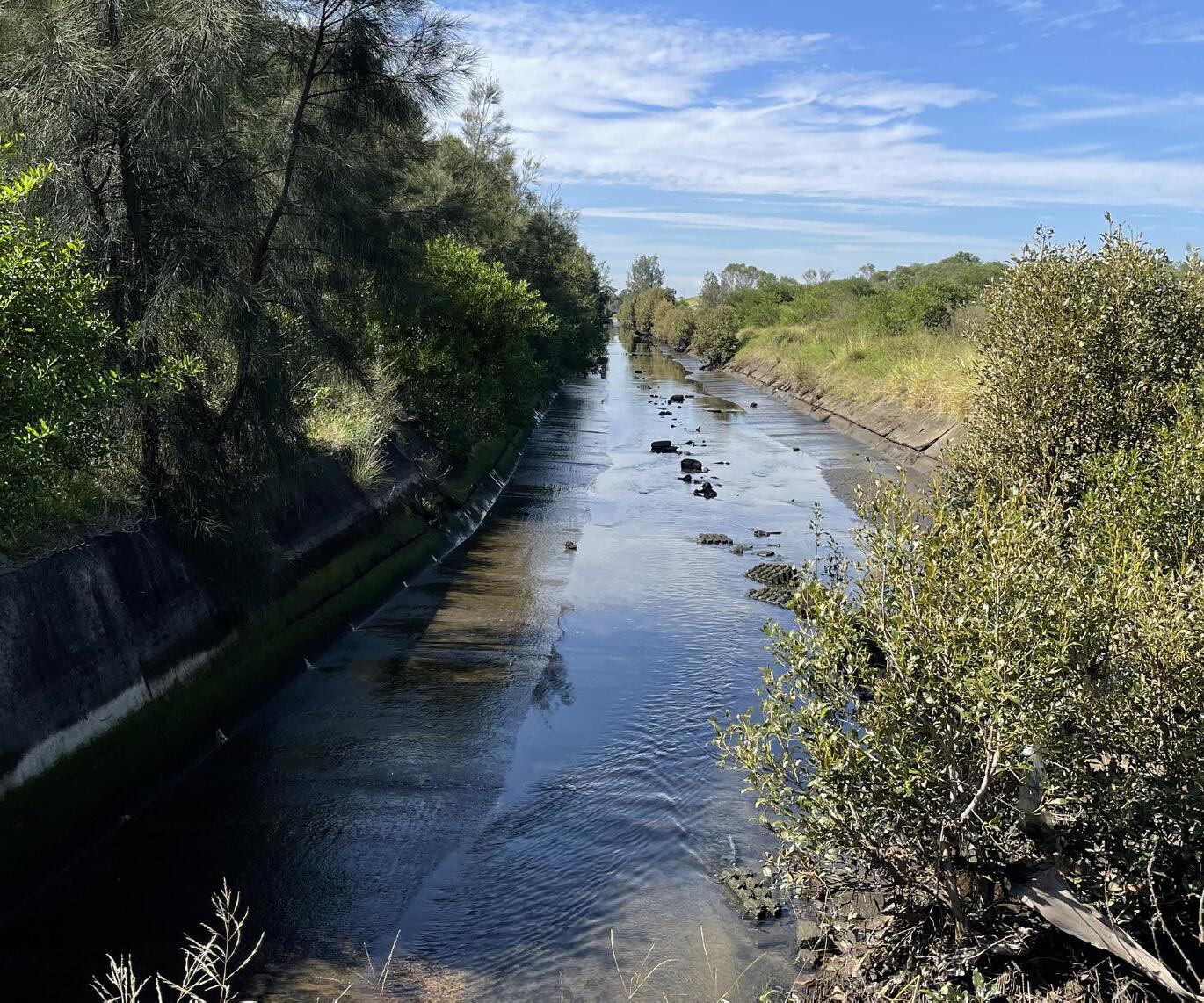
The brick and concrete lined open stormwater channel was constructed in the 1930’s as part of a Public Works initiative to provide employment during the Depression. It conveys stormwater flows from a catchment approximately 2.7km2 from Forest Road and Wolli Creek Road to Muddy Creek, Cooks River and Botany Bay. The existing channel is in very poor condition due to concrete cancer, subsidence of the sub-base and cracking by plants and root invasion.
At its downstream end in Muddy Creek a silt basin has been designed to collect sediment that flows along this channel to prevent silting of Muddy Creek. In 1994, Council completed a project in Muddy Creek to dredge the creek (50,000m3) creates 2 attempts for later dredging. One of these sumps is approx 300m3 & is located at the mouth of the Spring Creek.
This channel is suitable for naturalisation potentially retaining the concrete channel floors and reconstructing the revetment walls with sandstone battered walls and environmentally friendly design suitable for increasing marine biodiversity.
Due to the complexity of the channel naturalisation, Alluvium Consulting have been engaged to undertake a study on environmental, ecology and hydrology for Spring Creek and the adjacent wetlands. The future rehabilitation of this waterway forms an important part of the Riverine Park Masterplan, and will be detailed further in a separate report.
Riverine Park features a sizable sealed car park, designed to cater to the substantial influx of sports attendees. This car park is divided into two distinct sections. While the perimeter boasts adequate vegetation, there is a noticeable lack of tree canopy along the northern boundary and within the parking bays.
In recent years, the underutilised parking areas have been fenced off to prevent anti-social behaviour however the reduced activation encourages other unwanted behaviours as the carpark has poor visibility from other areas.
10. Active Transport Link and Barton Park Bridge
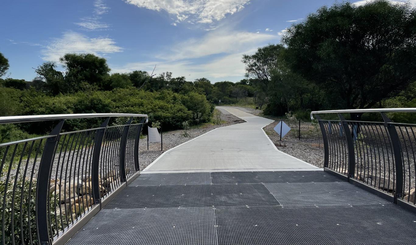
A north-south shared path connects from Bestic Street in the south, through Barton Park and Riverine Park. This connection provides key active transport links to Wolli Creek, Sydney Airport and further to Sydney CBD.
This shared path also branches off to form an east-west link along the Spring Creek through to Banksia train station and towards Arncliffe. This shared path relies on the existing vehicle access, and places users in conflict with vehicles.
These active transport links are subject to regular inundation due to the proximity to Muddy Creek and its tidal influence and flood prone location. The asphalt surface is uneven and is reaching the end of its serviceable life, but otherwise serves as an excellent link through open space in a prime location along the foreshore.
9. Car Park
8. Spring Creek
11. Eve Street Wetland
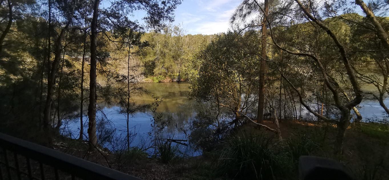
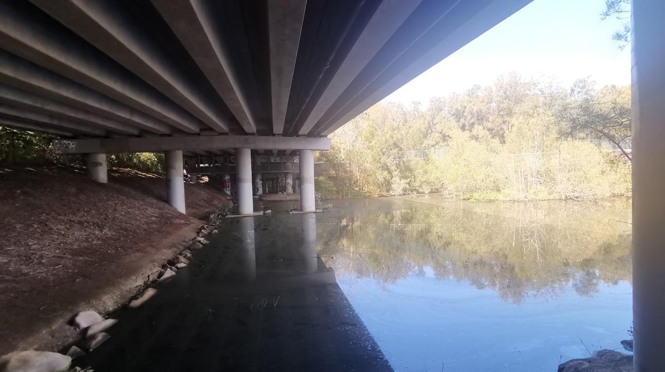
The Eve Street Wetland was naturalised in the late 1990s, at the cumulation of three creeks prior to entering Muddy Creek. While predominantly a natural environment, offering habitat to a variety of wildlife, the M5 bounds the northern edge.
12. Landing Lights Wetland
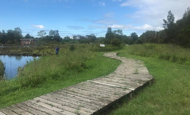
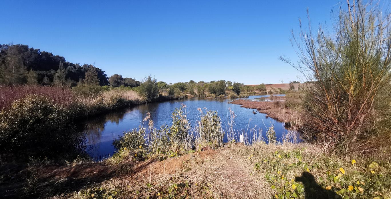
Landing Lights Wetlands is 4.9ha (approx.) and incorporates a low lying area of heavily disturbed bushland with overgrown weed. Access to the area is available via a footpath bridge over Spring Creek and timber boardwalk, both of which are in a state of disrepair.
The reserve occurs within soil landscapes mapped as ‘Warriewood’ as well as ‘Disturbed’ (Chapman and Murphy 1989). It is bounded to the north by a channelised tributary of Muddy Creek, just prior to Muddy Creek entering the Cooks River, known as the Spring Creek Drainage Channel. There is a swale running approximately north near the western boundary leading towards a standing body of saline water. Weeds occurring in the wetter lower lying areas are dominated by Juncus acutus. Weeds dominating higher areas are more varied and include Kikuyu, Green Cestrum, Lantana, Hydrocotyle bonariensis and Acacia saligna. Core bushland within the reserve is in poor to good condition.
Native species diversity is generally low. However the local communities associated with estuarine environments typically show a low species diversity compared to other local nonestuarine communities. Estuarine areas in the locality are also potentially dynamic, sometimes making identification of depauperate estuarine vegetation difficult. Bushland condition declines around the edges of the reserve and downstream from the exotic species infestations adjacent to the stormwater outlets.
13. Arncliffe Market Garden
The Arncliffe Market Gardens, established in 1892 and located at 212 West Botany Street, Banksia, New South Wales, is a heritagelisted site notable for its continuous use as a market garden since the late 19th century. It holds significant historical, social, and aesthetic value, especially for its association with early Chinese immigration and the vital role it played in local and regional food production, particularly during the Inter-War and Depression periods. Listed on the New South Wales State Heritage Register in 1999, the gardens are one of the few surviving examples of such market gardens in the Sydney region, showcasing early market gardening practices and providing rare insight into the cultural history of the area.
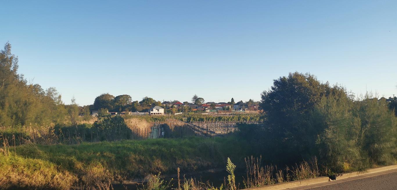
The SWSOOS, aligned to the M5, and the ancillary sewer connection near Eve Street is a heritage-listed infrastructure built between 1895-98. Historically significant as one of Sydney’s oldest main sewers, it was designed to end sewage discharge into Sydney Harbour and originally served the Botany Sewage Farm. Listed on the New South Wales State Heritage Register on 15 November 2002, this section of the sewer is notable for its technical significance, featuring three brick barrels encased in concrete, exemplifying late 19th-century sewer construction methods and in continuous operation for over 100 years.
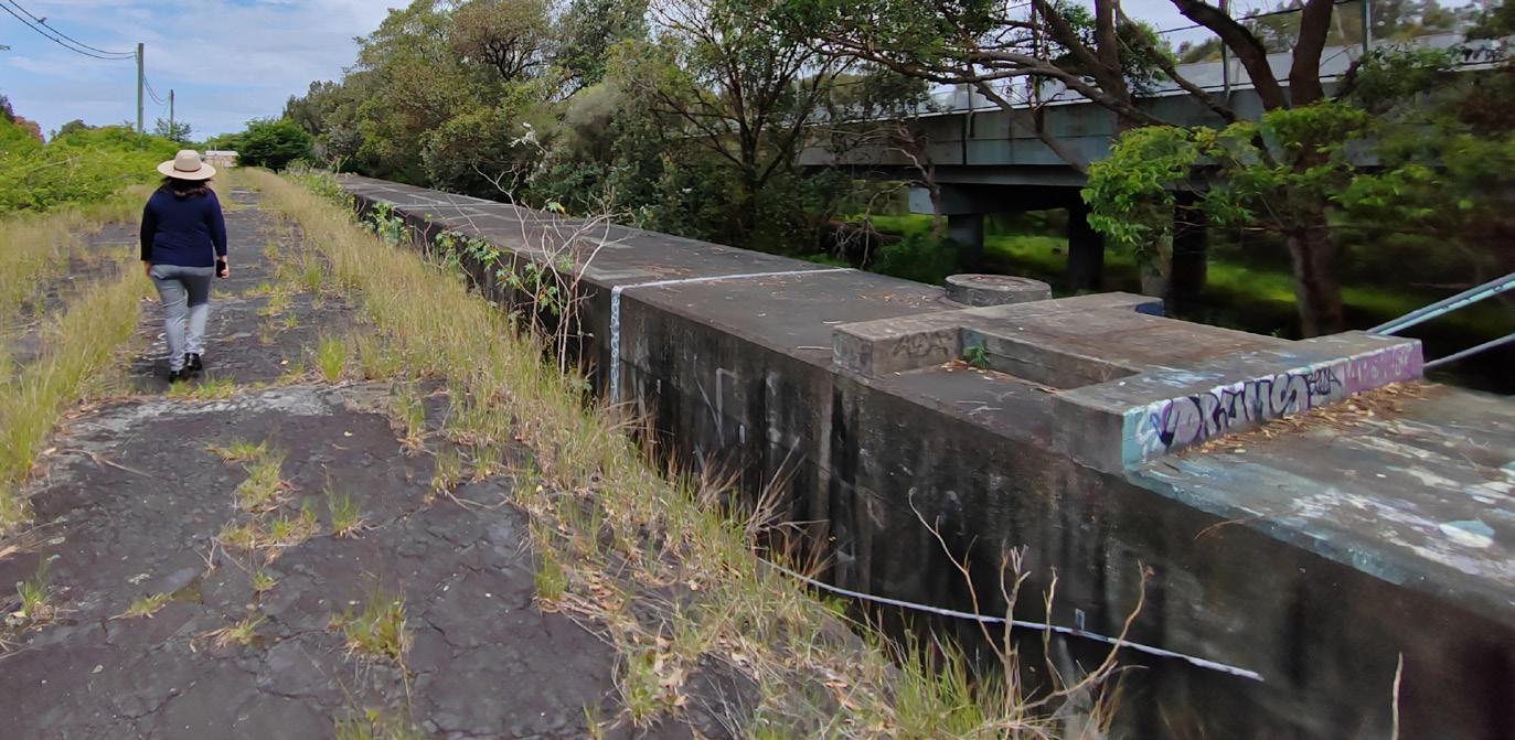
14. Southern and Western Suburbs Ocean Outfall Sewer (SWSOOS)
15. WestConnex Electrical Substation
Used by the relevant roads authority, the small depot and electrical substation is generally accessed via the nearby M5 slip lane. Whilst this substation has direct access from the M5, TfNSW rely on access through Riverine Park for heavy vehicles when required. This compound prevents through access to the open space north of Riverine Park and foreshore access is desirable and a point of negotiation with TfNSW.
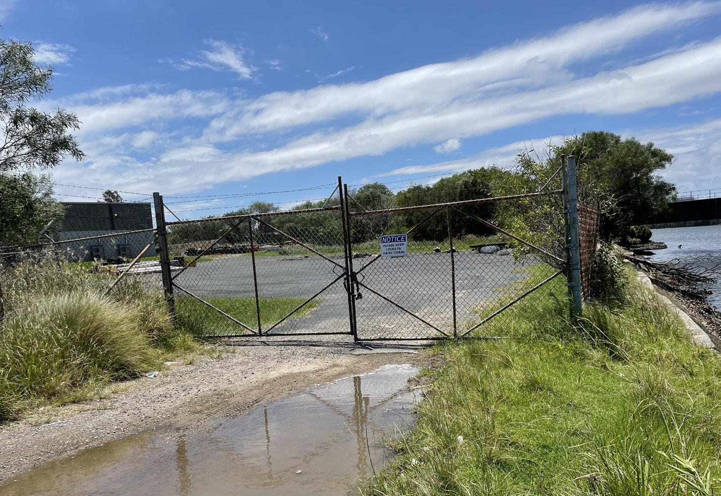
16. Eve Street Reserve
Eve Street Reserve is a small corner parcel of open space that could better serve the local community. It is bound by residential properties to the west and south, which offer minimal passive surveillance. It serves predominantly as a passive recreation lawn area, with utility and maintenance services occurring in the south eastern corner.
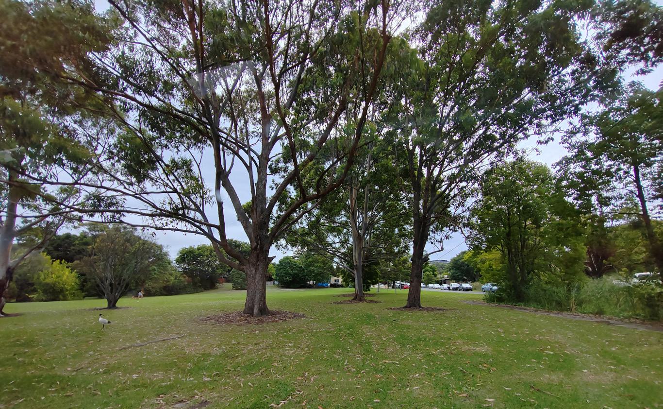
17. Sydney Water Desalination Pipe
While typically underground, the desalination pipe is exposed where it crosses the M5 and SWSOOS. This large scale infrastructure is a unique civil asset which dominates the landscape.
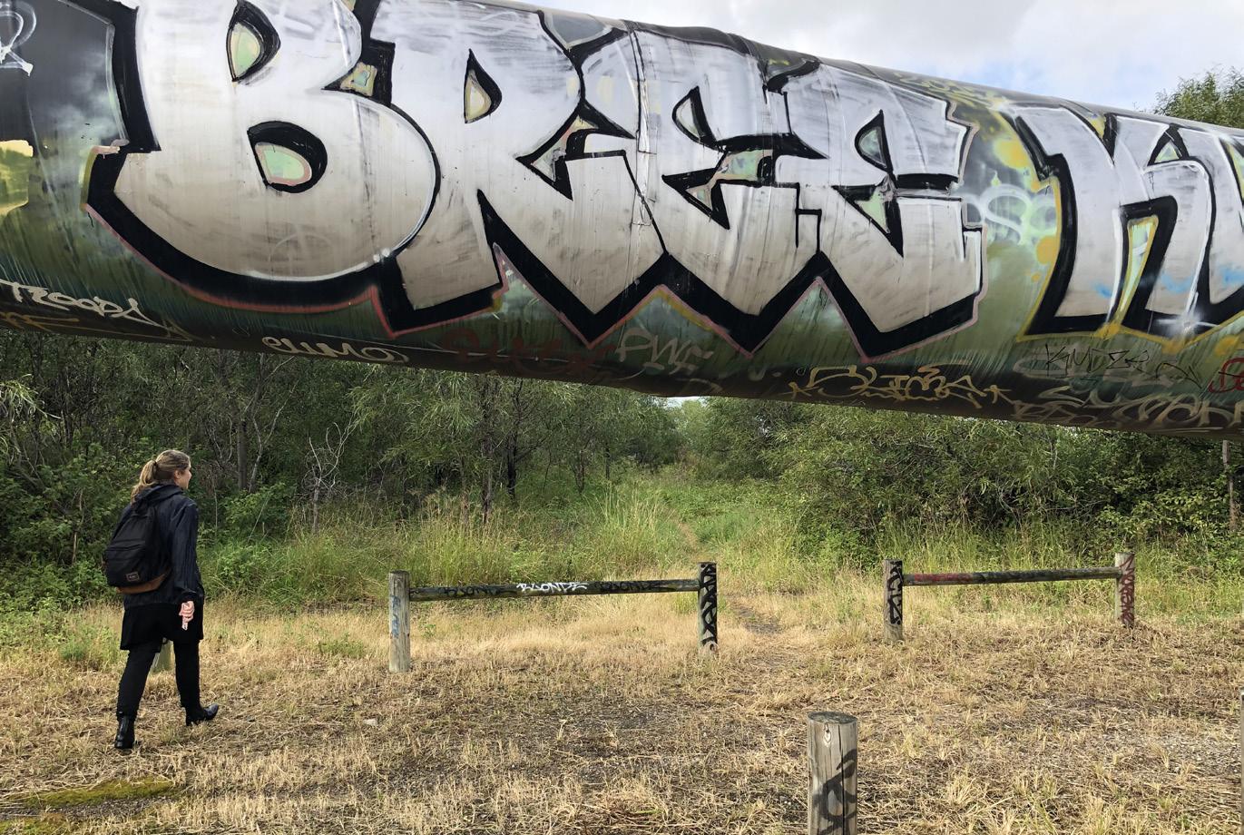
18. Ausgrid temporary work compounds
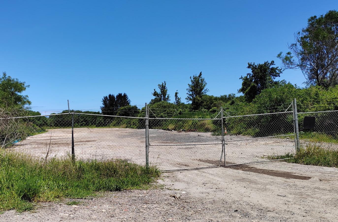
In the vicinity of the desalination pipe, there remains evidence of a former compound utilised by Sydney Water during its construction and later it was used by as a temporary compound by Ausgrid for nearby infrastructure works.
This former compound space has been cleared of vegetation and is fenced.
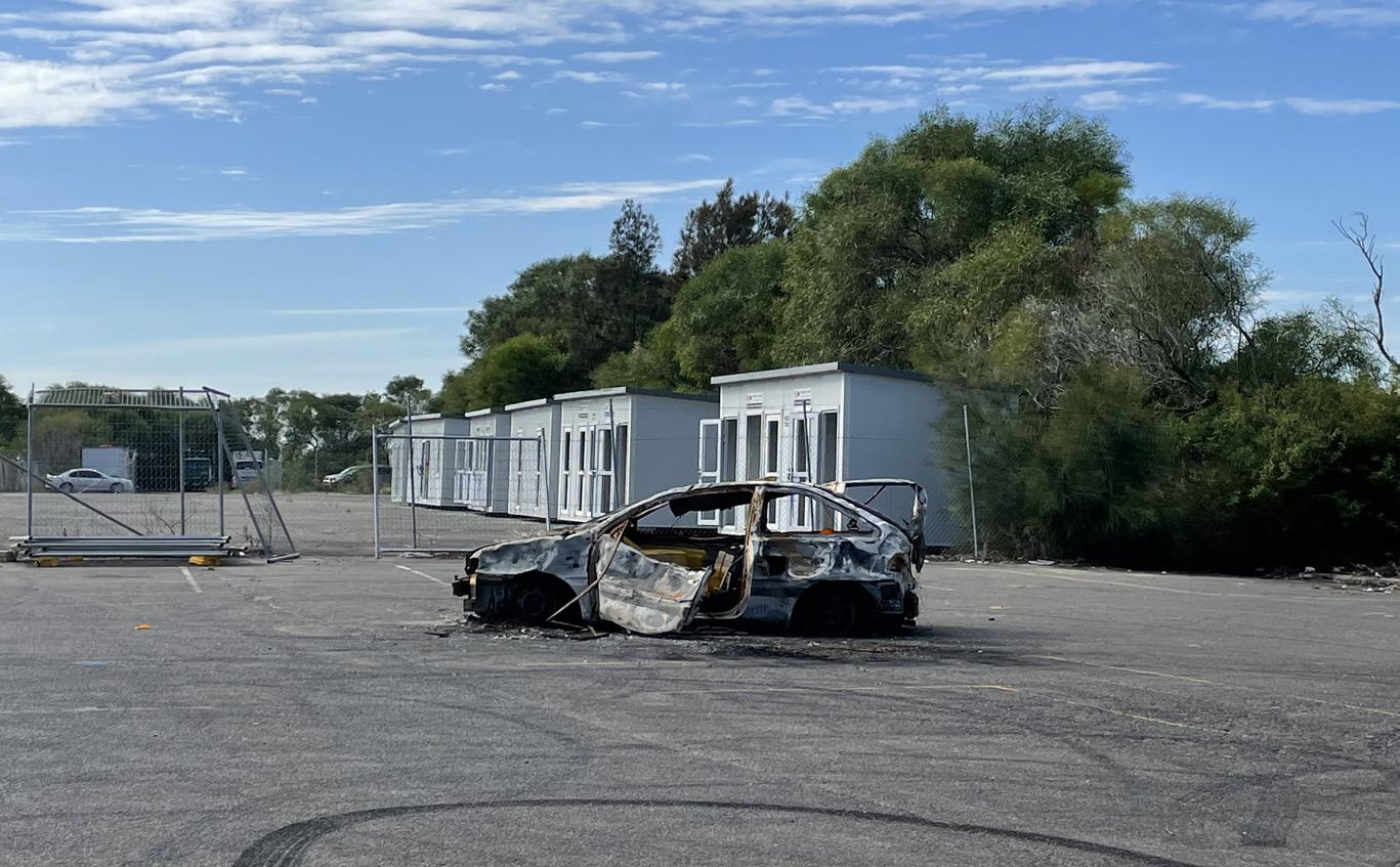
19. Temporary Compound
This temporary compound were used by Ausgrid for nearby infrastructure works. And is fenced with sealed car park.
The Cooks River Paddle Trail
The Cooks River Paddle Trail connects 25km network of waterways along the Cooks River, Wolli Creek and Botany Bay for leisurely water pursuits. This trail offers popular routes that people of all ages, skills and interests can participate in. Each route has an average time and length that can vary with tidal and weather influences. The website for this Trail offers safety information
and route planning suggestions and is supported with interactive maps. The website recommends starting the route at the River Canoe Club at Tempe which is in close proximity to public transport and car parking facilities. There are limited launching locations within the Bayside Local Government Area.
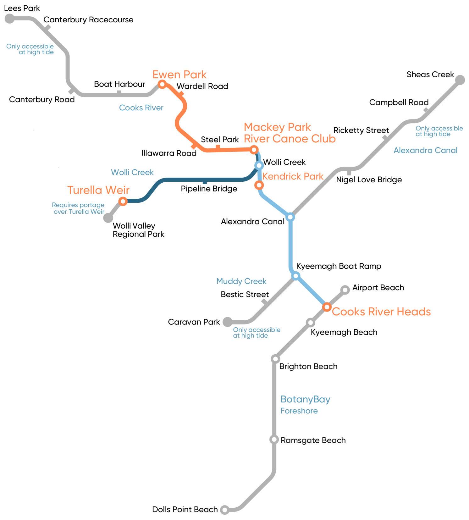
Figure 14 - Map of the Cooks River Paddle Trail (Source: https://cooksriverpaddletrail.au)
2.5 Land Ownership
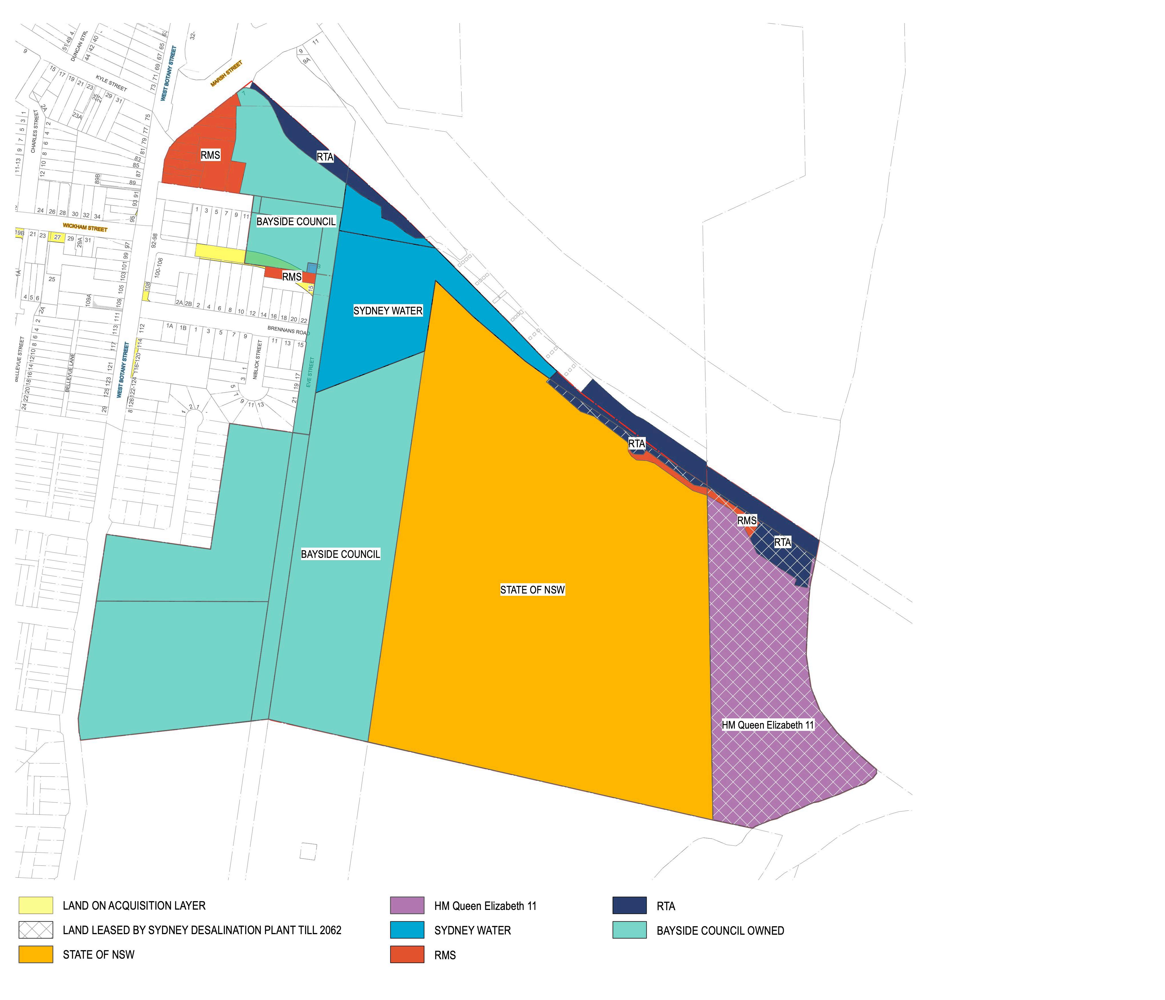
The majority of the site is owned by Bayside Council. There are some linear parcels along the northern boundary, adjacent to M5 Highway which are owned by TfNSW and the park comprises Eve St Wetland is owned by Sydney Water.
The map (Figure 14 - Acquisition and Land Ownership Plan illustrates land ownership across the site.
2.6 Stakeholders
A number of government and community groups serve as integral stakeholders, with investment in the use and future development of the Riverine Park area.
The M5 motorway borders the park’s northern edge, making TfNSW a significant stakeholder. They require access through Riverine Park for maintaining state infrastructure.
The map identifies land for future road acquisition which may no longer be required but is to be confirmed by TfNSW.
The hatched parcels (shown in the Figure 14) along the foreshore are noted in the titles as being leased until 2062 to the Sydney Desalination Plant (SDP). This may impact Council’s ability to implement the north south connection, and is subject to negotiation.
The park’s proximity to the Airport brings specific land use restrictions. This includes compliance with the Obstacle Limitation Surface (OLS), Australian Noise Exposure Forecast (ANEF), and the Public Safety Area (PSA), all influencing the development opportunities within Riverine Park.
Sydney Water holds assets in the area, including the Southern and Western Sydney Ocean Outfall Sewer System (SWSOOS), Eve Street Wetland, Muddy Creek, and the Spring Creek, all form part of the Cooks River Catchment. Additionally, the Cooks River Alliance, a coalition of multiple councils and Sydney Water, collaborates to tackle the environmental challenges of the waterway.
Riverine Park hosts various tenancies, including the Barton Park Golf Range. Recently the Arncliffe Aurora Football Club were successful in being selected as sporting partners for two soccer fields and amenities building. Another Expression of Interest will be exhibited in concurrence with this masterplan to seek additional partners to utilise the remaining sports fields in the centre of the park. These relationships will share the maintenance and stewardship of the park in a manner that supports increased utilisation by the Bayside community.
Local residents are important stakeholders as are the growing communities in Banksia and Arncliffe who will provide the necessary activation and passive surveillance for this park to flourish and succeed as a important recreational hub for local people and beyond.
2.7 Adjacent Land Use
Adjacent public open space
Barton Park is located on the southern banks of the Spring Creek and connects to Riverine park via a pedestrian and cyclist bridge near the mouth of the creek adjoining Muddy Creek. The access off Bestic Street allows vehicle access to the southern parking lot. Barton Park is complementary open space to Riverine Park and shares a similar history in terms of its development. The Barton Park Recreational Precinct is currently undergoing redevelopment, and is scheduled for completion in April 2024.
There will be substantial improvements to its sport facilties, active transport path network and improved accessibility.
Arncliffe Market Gardens (also known as West Botany Street Market Gardens, Rockdale Market Gardens, Banksia Market Gardens and Chinese Market Gardens) – 212 West Botany Road, Banksia. The market gardens are located on Crown Land that is on the State Heritage Register.
The Statement of Significance states that the Arncliffe Chinese Market Gardens are of high significance for their association with the Chinese community and their demonstration of a continuous pattern of land usage since the late nineteenth century. They are one of only three such surviving market gardens in the Inner
Sydney region and one of few similar surviving examples in the Sydney Metropolitan Region.
The site demonstrates prolonged and continuous use as a market garden. The site was first occupied as market gardens in 1892 by Sung Kuong War, Lee How and Sin Hop Sing. A 1930 aerial photograph shows the site still occupied as a market garden. Market gardens such as this played an important role in food production for the local and regional community, particularly during the Great Depression and Post and Inter-War periods.
Roads
Riverine Park is accessed from West Botany Street. Smaller local roads bound the park, such as Eve Street and Firmstone Gardens. While they do not allow access into the park, they do provide onstreet parking opportunities.
Residential Land
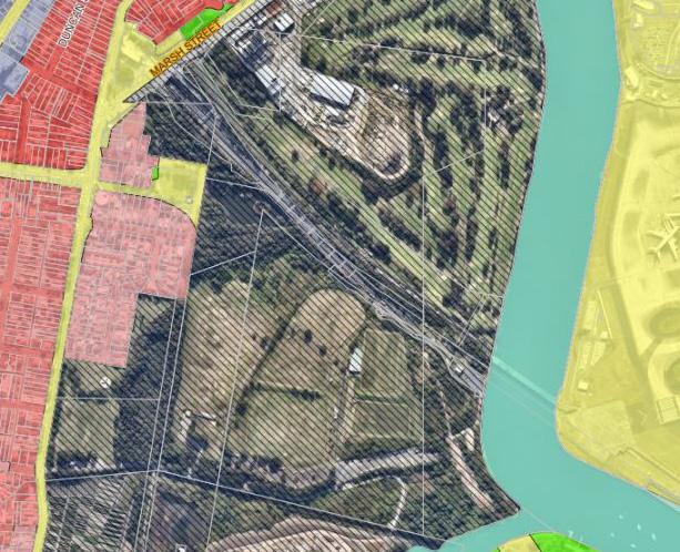
Land zoned as residential (R2) adjoins Riverine Park on the western side. This small pocket of residential land is bound by West Botany Street, and the market gardens to the south. Unfortunately, while some of the residences face towards Riverine Park, their views are typically restricted by wetlands and overgrown vegetation.
Opposite West Botany Street, land zoned as residential (R3) indicates a higher population density. Direct access is limited due to the busy nature of West Botany Street.
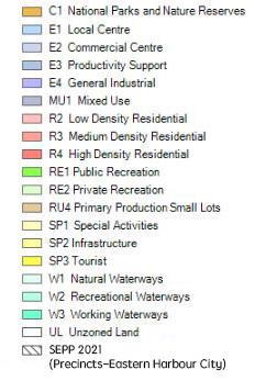
Figure 16 - Bayside LEP
2.8 Biodiversity, Ecology
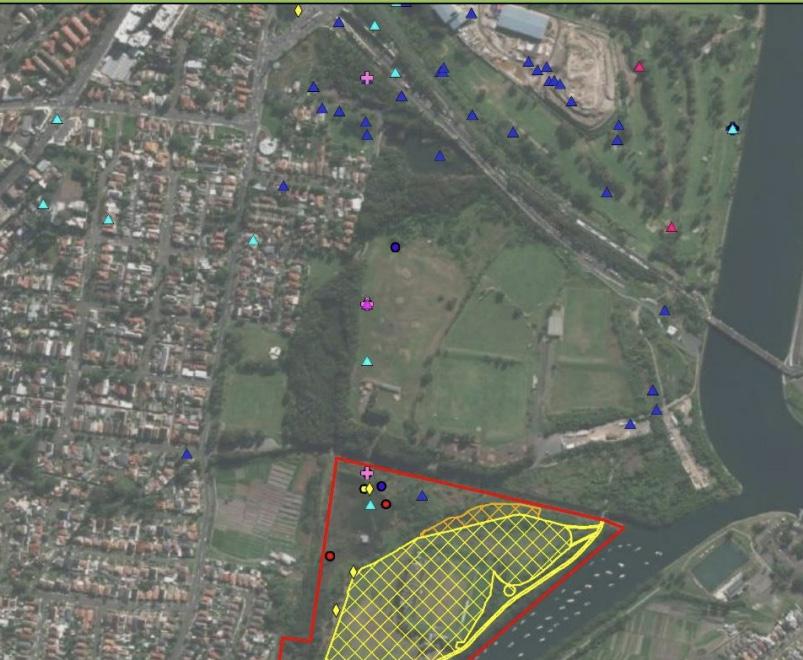
The sites contains some of the last remaining saline wetlands on the Cooks River and includes significant flora and Endangered Ecological Communities, such as:
• Bangalay sand forest
• Coastal saltmarsh
• Estuarine saltmarsh
• Swamp oak floodplain forest
• Mangrove forest
The wetlands provide habitat to a number of threatened Australian coastal bird species and migratory birds from as far away as Siberia, who visit during the warmer months to feed and fatten up before returning to the Northern Hemisphere to breed. With the significant urban development that has occurred along the Australian coast, Riverine Park serves as one of the few suitable sites in Botany Bay that can provide this important habitat. Critical species are:
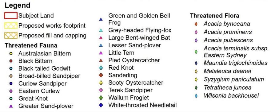
• Migratory birds (threatened species: the Terek Sandpiper, Broad-billed Sandpiper, Great Knot, Sanderling, Black-tailed Godwit and the Lesser Sand Plover)
• The Green and Gold Bell frog (GGBF, listed as Endangered under the Threatened Species Conservation Act 1995).
Riverine Park is also potentially habitat for threatened fauna species, such as the Grey-Headed Flying Fox, Select Microbats and Powerful Owl.
Spring Creek and Muddy Creek serve as important tributaries of the Cooks River with remnants of significant Mangrove (Avicennia marina) forest and riparian vegetation along the banks.
Any proposed works must be sensitive to the requirements of fauna, habitat and bird migrations in their design and location.
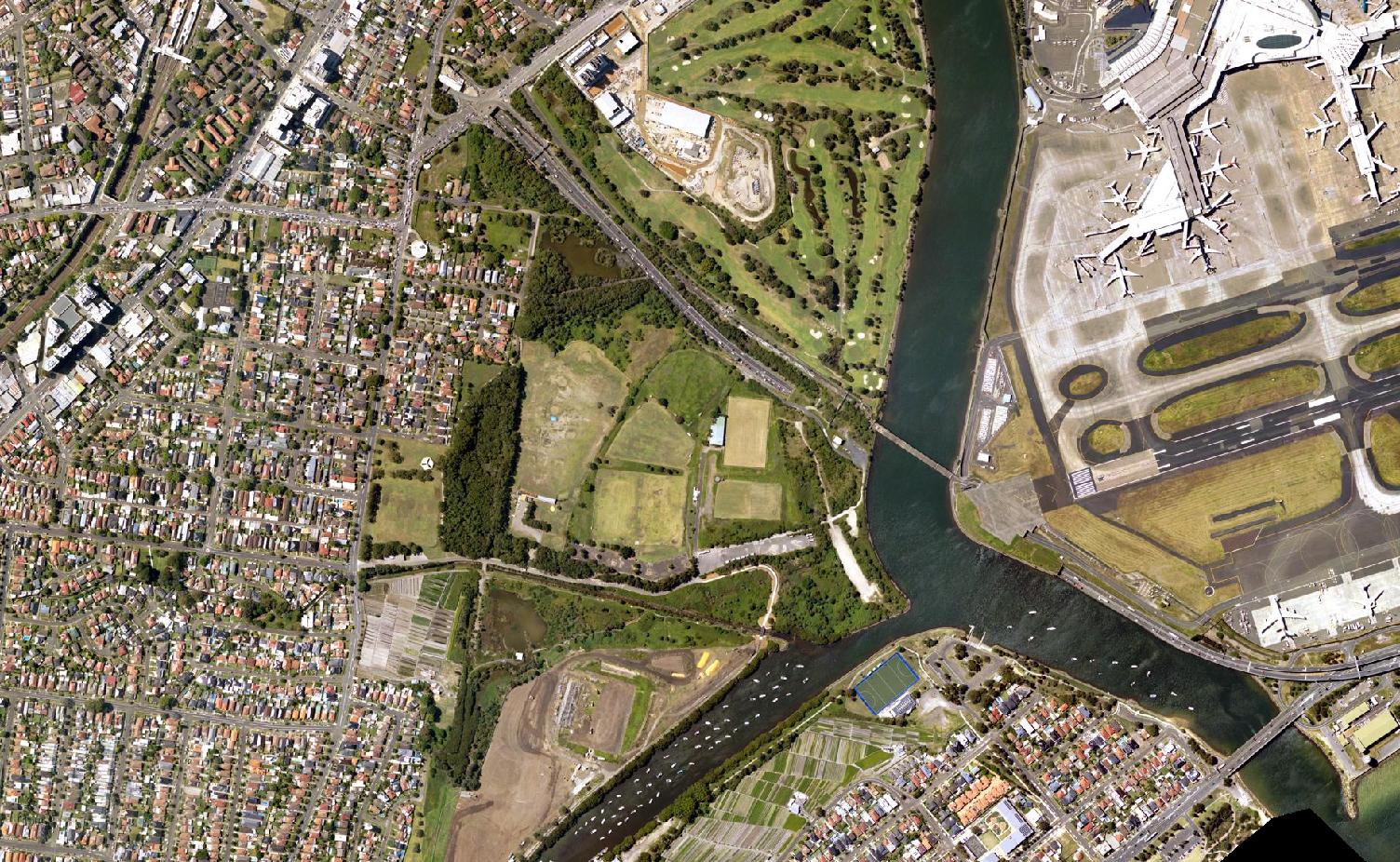


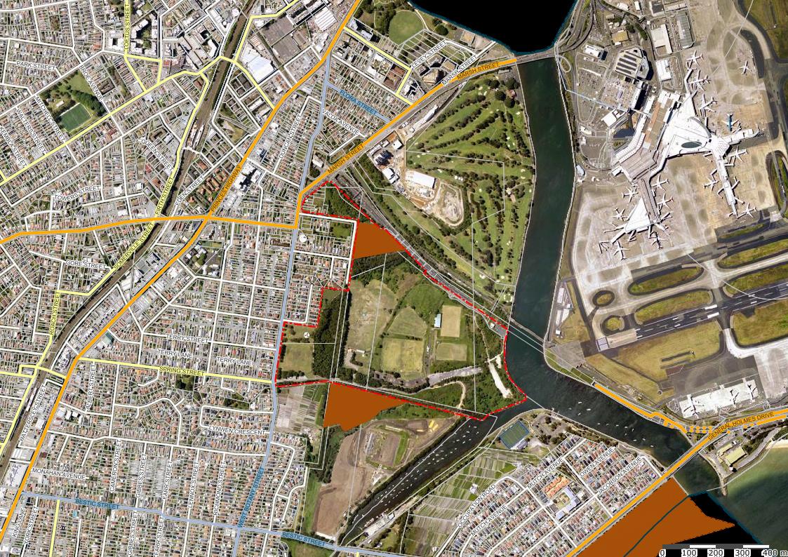


Figure 17 - Threatened Fauna and Flora Records
Figure 18 - Endangered Ecological Communities Map
Figure 19 - Shorebird Habitat Map
Green and Golden Bell Frog (GGBF)
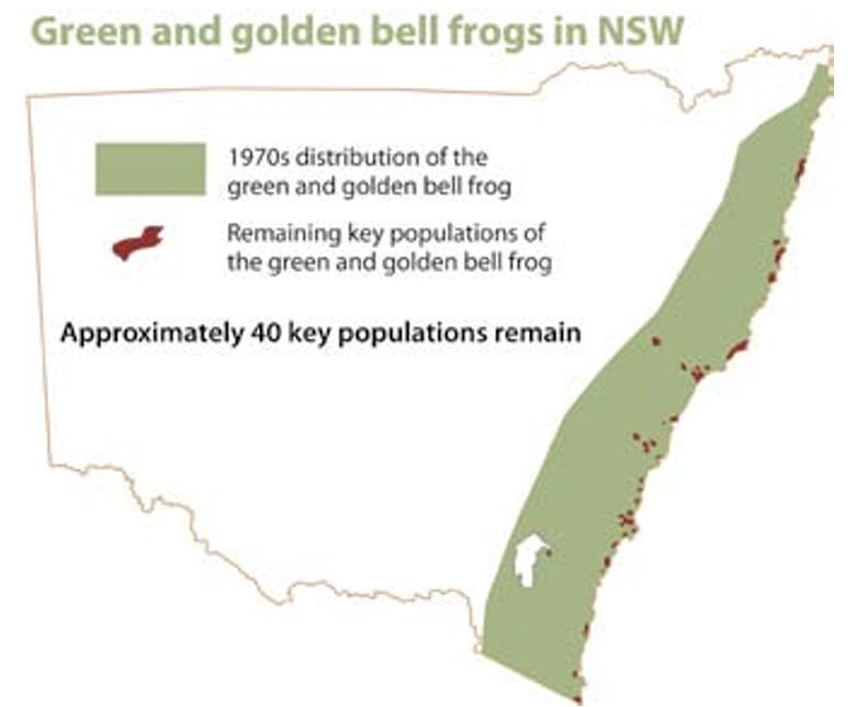
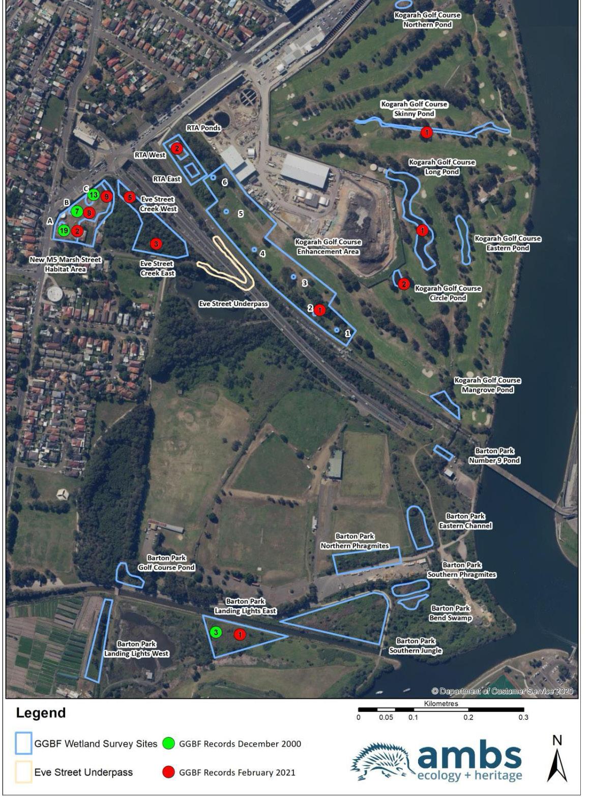
The GGBF is an endangered species which needs careful management to ensure its survival. Riverine Park is a critical habitat for this species, providing a unique opportunity for conservation efforts through habitat enhancement and careful ecological planning, ensuring the park not only serves the community but also plays a vital role in the survival and thriving of this iconic amphibian.
Any proposed activation adjacent to GGBF habitiat should allow for passive recreation only to avoid excessive impacts to this species, including light spill.
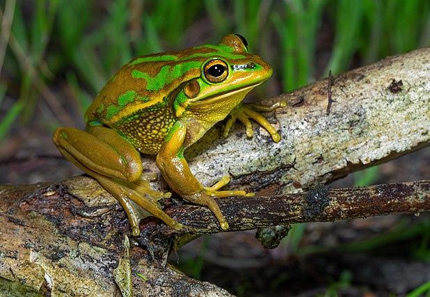
Council has previously engaged a specialist consultancy to undertake studies and provide advice on the ecologies in this area. Distribution can be separated into four typologies:
• Breeding Habitat - Includes a wide variety of freshwater and estuarine water bodies, ranging from ponds through to large lakes. Constructed naturalised stormwater basins are known to have been used for successful breeding.
• Foraging Habitat - Preferred foraging areas include flowering plants, grasses and foliage. Foraging often occurs in tussock vegetation where it can provide shelter and is close by to breeding habitat
• Refuge Habitat - Refers to spaces allowing GGBF to avoid danger and climatic extremes, such as hiding during inactive winter months. Stacked stones, rubble and felled logs are common examples.
• Connectivity Habitat - Connectivity habitat enables frogs to move between different areas of habitat at different times of the year. Drainage lines, swales, wetland banks and open lawn areas free of excessive human use are common examples.
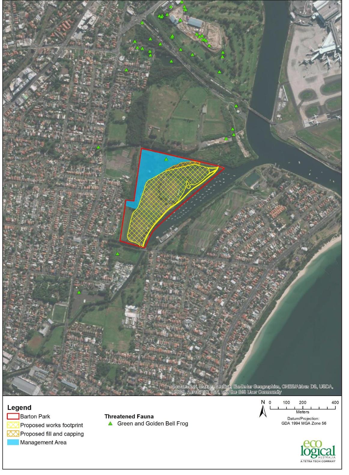
Figure 20 - Green and Golden Bell Frog records from surveys (AMBS Ecology & Heritage) 2021
Figure 22 - Former and current distribution of green and golden bell frogs
Figure 21 - BioNet records for Green and Golden Bell Frog (DPIE 2021)
Remant Vegetation
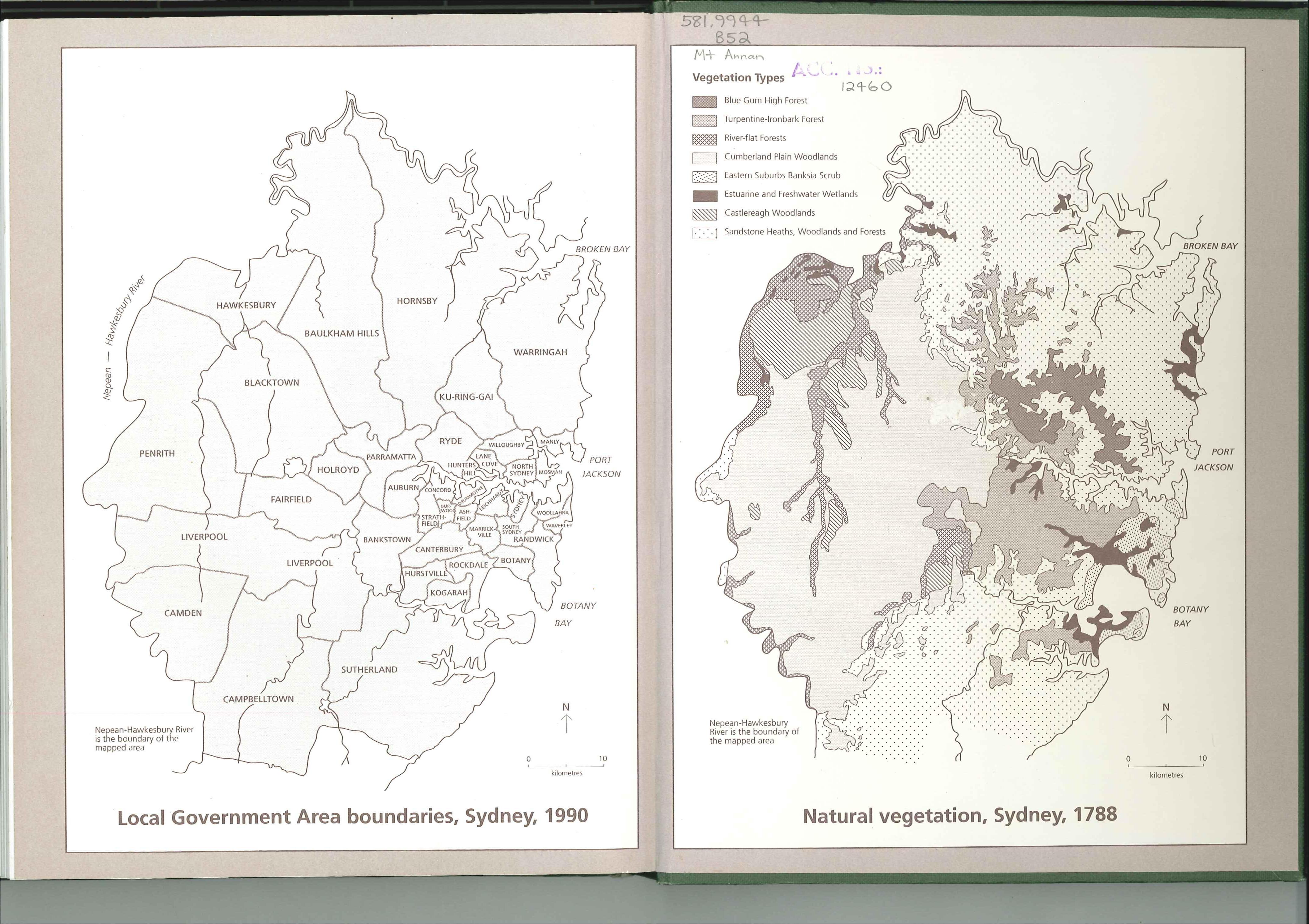
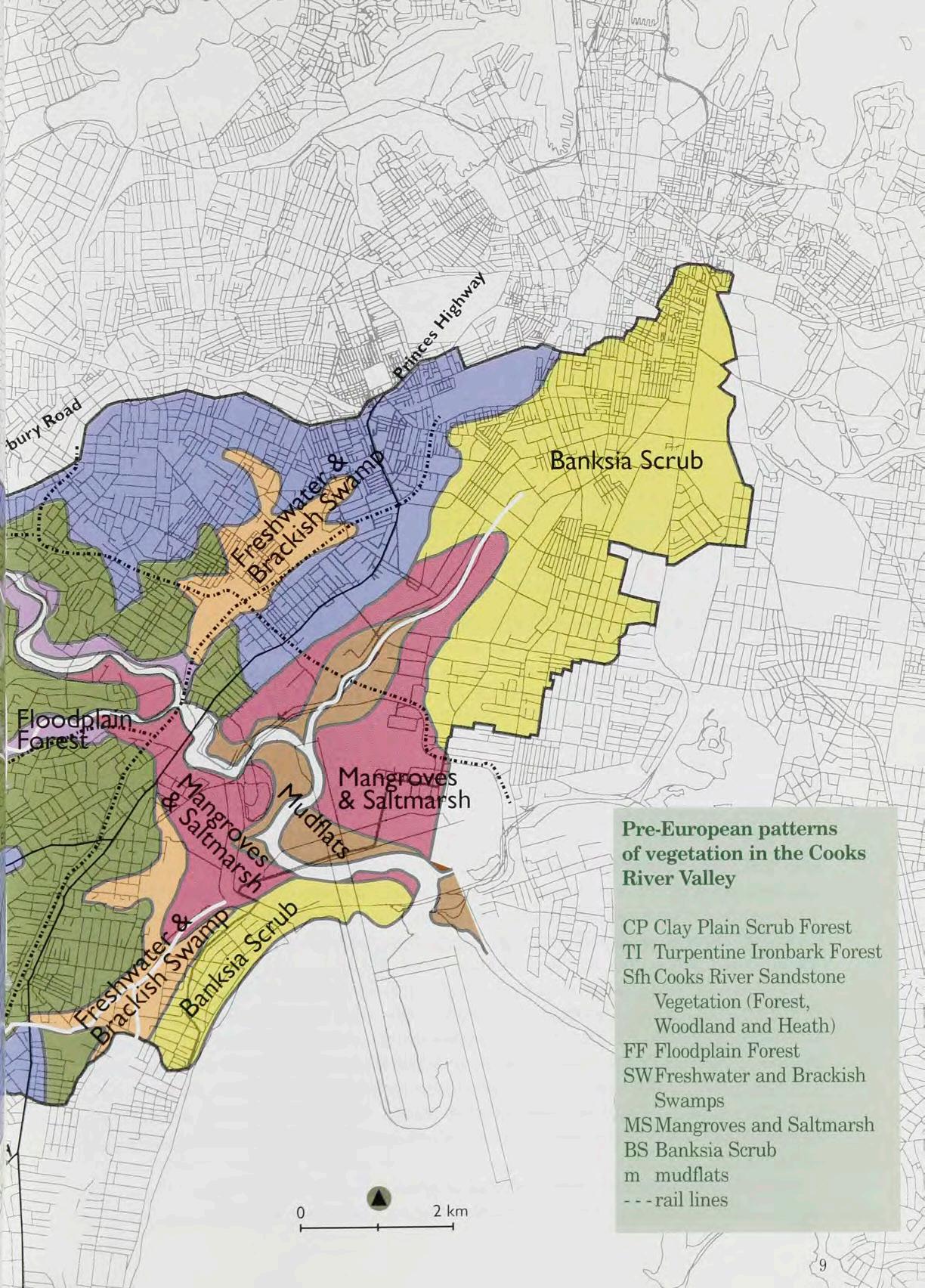
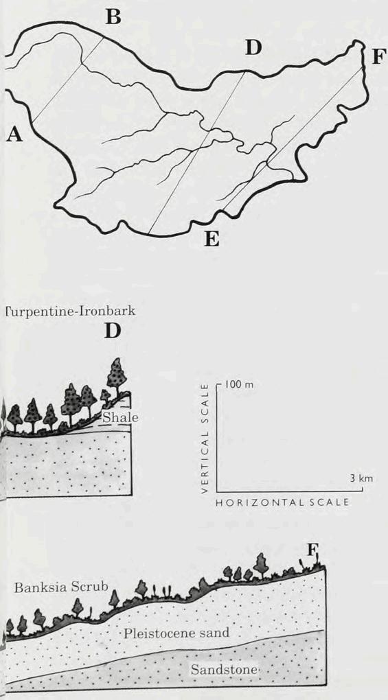
Pre-european patterns of vegetation along the Cooks River include Mangroves and Saltmarsh, Mudflats and Freshwater
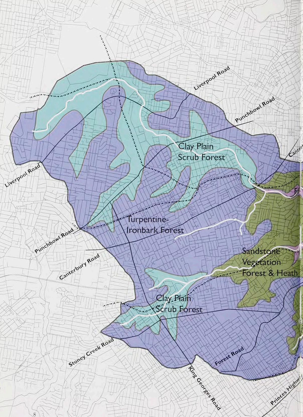

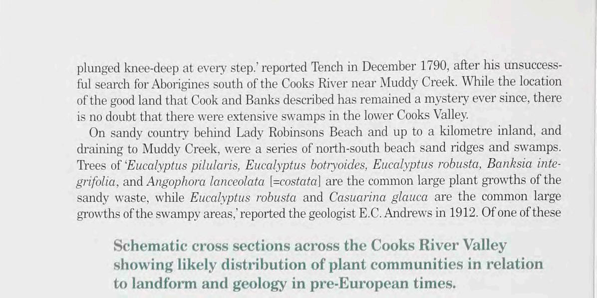
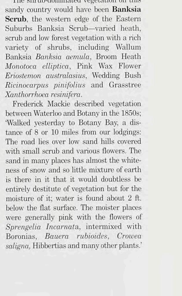
swamps Pat Moore's or Patmore Swamp a fairly heavy growth o bang alleys [Eucalyptus botryoides] and swamp mahogany trees [Eucalyptus robusta] abutted on the western side of this swamp—notable trees in every way, either in girth or foliage they were and no undergrowth bu a fine coating o native grasses of a meadow character, was how a loca resident recalled them as being n the 1870s (Carruthers 1925) The extensive Pleistocene/Holocene sand sheets of the Eastern Suburbs extend into the Cooks River catchment between Surry Hills and Mascot and behind Lady Robinsons Beach on the western side o Botany Bay Joseph Banks appears to have landed hereabouts on 4th May 1770 'Myself in the afternoon ashore on the NW side of the bay [Botany Bay] where we went a good way into the countrey which in this place s very sandy and resembles something our Moors in England, as no trees grow upon it but every thing s coverd with a thin brush of plants about as high as the knees The hills are low and rise one above another a long way into the countrey by a very gradual ascent appearing n every respect like those we were upon. The shrub-dominated vegetation on this
1 9
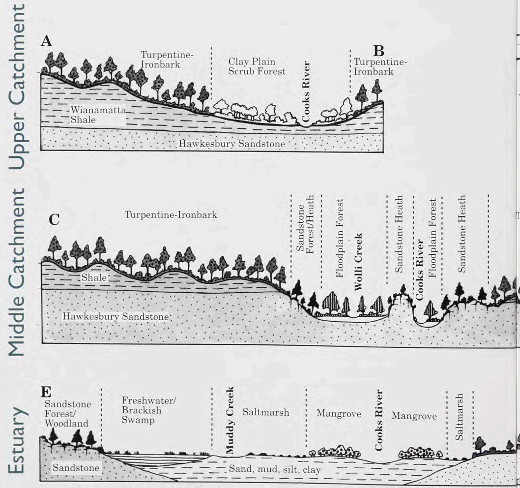
Vegetation cross sections (Source from: Missing Jigsaw Pieces - Bushplants of the Cooks River Valley)
Figure 24 - Pre-European vegetation (Source from: Missing Jigsaw Pieces - Bushplants of the Cooks River Valley)
2.9 Heritage and Conservation Assets
While there is no current evidence of remnants of Aboriginal sites in Riverine Park and its adjacent wetlands, the area’s location at the confluence of waterways suggests it may have held significant cultural importance for Aboriginal communities.
There are no heritage listed items within Riverine Park. Two adjacent sites are listed in Schedule 5 Environmental Heritage of the Bayside Local Environmental Plan 2021 (Bayside LEP 2021).
• The Arncliffe Market Gardens. This item is also listed in the Heritage Schedule of the Bayside LEP 2021.
• The Southern & Western Suburbs Ocean Outfall Sewer (SWSOOS). This item is also on the State Heritage Register as having significance as one of Sydney’s earliest infrastructure NSW under the Heritage Act 1977 (NSW). Riverine Park, along with its neighbouring park were originally utilised as a Sewage Farm in the late nineteenth century, later being mined for sands used in Council construction of roads and other civil assets before being operated as a land fill site for Council operations. In 1988 bicentennial funding was made available for various council projects including a large salt marsh project near Spring Creek.
While it is not in itself listed as a heritage item, it has a legacy of continued use as a public reserve since 1930 when according to Ron Rathbone Rockdale Council purchased 89 acres from the Water Board for 5 pounds per acre for the purpose of recreational purposes. This was in conjunction with other acquisitions from adjacent land owners and set about reclamation works in 1932 “to convert a low lying mosquito infested wasteland into the St George Sporting Complex”. Philip Geeves also describes the acquisition of 120 acres of the then disused North Brighton Sewage Farm.
2.10 Historical landfill Site
The use of the site as a sewage farm, sand mine and as an uncontrolled landfill site (including putrescible waste) means that the legacy of contamination must now be carefully monitored and managed.
A Long Term Site Environmental Management Plan (LTSMP) has been prepared for the site. This Plan provides guidance on:
• Contaminants at the site
• Measures to reduce landfill leachate generation rates by improving site drainage
• Measures to ensure appropriate soil cover is maintained
• Measures to monitor and manage landfill gas
• Responsibilities and obligations of relevant parties to administer the Long Term Site Management Plan
• Robust processes for the management, maintenance and upgrade works at the site.
• Environmental monitoring requirements
The NSW Environment Protection Authority (EPA) reviewed the LTSMP and concluded that the site does not require regulation, provided the LTSMP is implemented.
Any changes/works proposed, if not minor works as defined in the LTSMP, must be accompanied by a Remediation Action Plan (RAP). Depending on the scale of the works proposed, a Site Audit Statement (SAS) and revision of the LTMSP may also be required.
Due to the complexities and ongoing monitoring and management requirements of contaminated land, Council requires continued unrestricted access to the site, including all leased property, to undertake required monitoring and works.
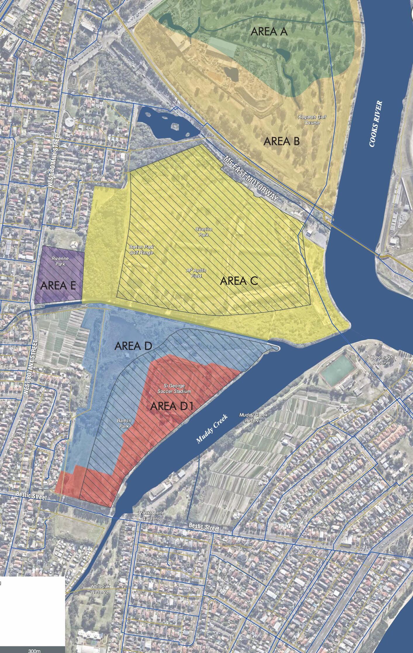
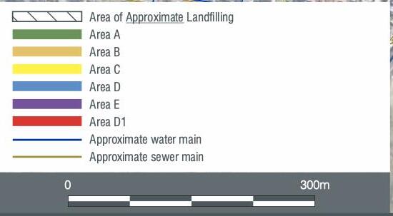

Figure 26 - Historical landfill area
2.11 Climate Change
The Report by BMT WBM “Botany Bay Western Foreshore Coastal Hazard Risk Assessment and Management Options Study” completed in 2013 provides a discussion of the geomorphology and coastal processes of Botany Bay and the surrounding study area followed by a risk based assessment of coastal hazard and their consequence. The study considered coastal inundation due to high water levels during storms resulting in inundation into rivers, creeks, drains connecting with the ocean and permanent inundation due to sea level rise. Sea level rise was calculated to increase 0.4m by 2050, and 0.9m by 2100 above 1900 mean sea level. That was widely accepted as competent scientific opinion based on reports by IPCC (2007) and CSIRO (2007) for NSW in the absence of other suitable recommendations although these figures are no longer prescribed by the NSW State Government.
The low lying areas within Riverine Park are subject to inundation as a consequence of sea level rise.
The importance of protecting and regenerating coastal ecosystems
Blue carbon refers to the carbon captured by the world’s coastal ecosystems, which are predominantly made up of seagrasses, mangroves and salt marshes. Blue carbon ecosystems play an important role in climate change mitigation as they store carbon dioxide up to 40 times faster than inland forests due to an ability to store large amounts of carbon in their soils and for far longer than terrestrial systems. It is estimated four times more carbon is sequestered in Australian soil beneath marine ecosystems over a given area than in other environments.
Other than storing large amounts of carbon, mangroves, tidal marshes and seagrasses are critical ecosystems, supporting coastal water quality, healthy fisheries, and coastal protection against floods and storms.
However, large areas of blue carbon ecosystems have been lost due to land reclamation, clearing, pollution and severe weather events. Tidal salt marshes cover roughly 140 million hectares of Earth’s surface, this is roughly half of their historical area and this area is continuing to decrease at a rate of 1-2% per year.
Coastal ecosystems are big carbon sinks so when they are degraded or destroyed. They emit large amounts of carbon. Experts estimate that as much as 1.02 billion tons of carbon dioxide is being released annually from degraded coastal ecosystems.
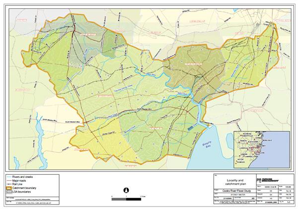
2.12 Hydrology and Flooding
Riverine Park is located in the Spring Creek and Muddy Creek sub-catchment.
The topography of the catchment is relatively flat with the upper reaches of the Muddy Creek catchment generally sloping in a south-easterly direction with the lower reaches draining north east towards the Cooks River. Muddy Creek is a small tributary of Cooks River.
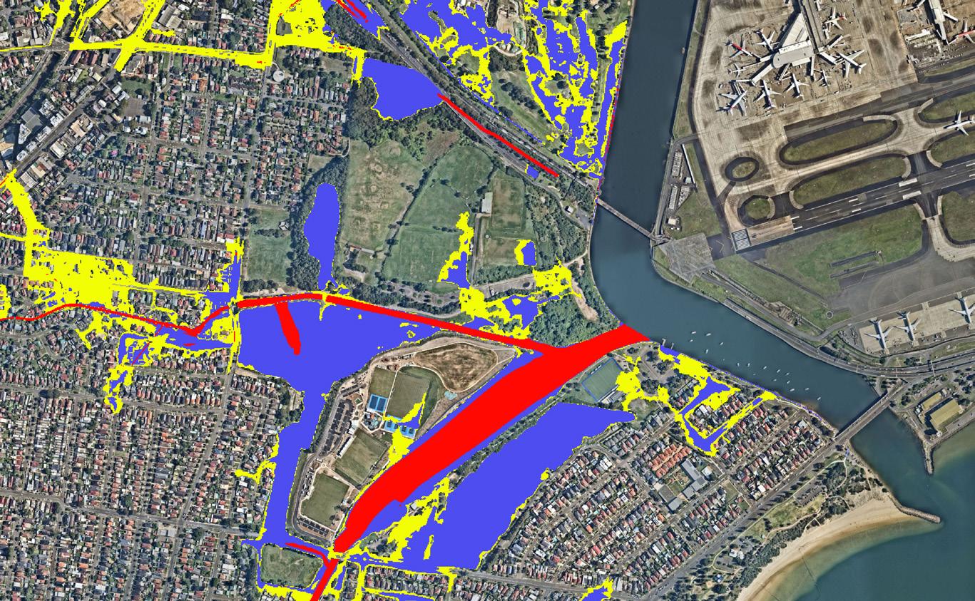
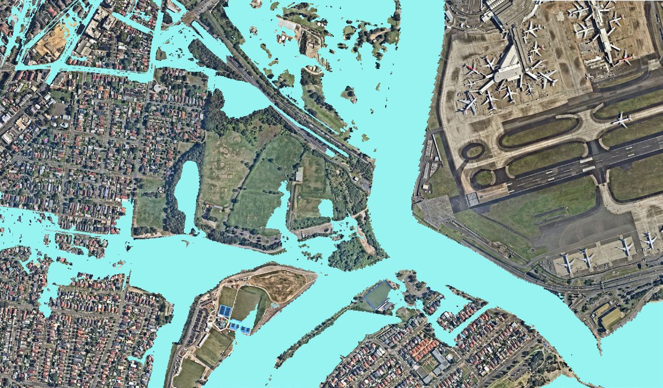
The Spring Creek has a peak elevation of 55.5m AHD with the catchment draining eastwards. The catchment is a highly modified landscape, comprising medium to high-density residential and commercial developments. It also includes major infrastructure assets which are raised above the natural ground level, restricting surface flows from west to east. In its current state, the creek overflows during 20% AEP events, resulting in ponding of up to 0.5m depth within Riverine Park and flooding of the access road.
The topography of the former land fill site impedes natural drainage which acts as a barrier for natural water flows from the west and exacerbates the impact of tides and flood waters along the banks of Muddy Creek along the east.
In addition to the Muddy Creek and Spring Creek catchments, a small urbanised catchment feeds into the Eve Street Wetland.
There are two relevant flood studies for this area including:
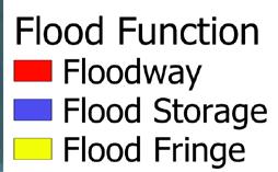
1. 1. Cooks River Flood Study, MWH and PB, 2009 Sydney Water commissioned this report to determine baseline conditions of the Cooks River Catchment to enable the design of naturalisation options to be considered as part of their ongoing asset renewal program.
2. Bayside West Floodplain Risk Management Study and Plan, May 2023, was commissioned to understand the existing flood behavior and to establish the basis for floodplain management activities.
Figure 28 - Flood function mapping within Lower Muddy Creek
Figure 29 - 1% AEP Flood extent
2.13 Aviation Safety
Close proximity to Sydney Airport impacts the height of structures, as well as the style and intensity of lighting that can be provided within the park, along with land-use constraints.
The National Airport Safeguarding Framework (NASF) comprises of 9 guidelines that apply to all airports in Australia and affects planning and development around airports including development activity that might impact operational airspace and/or affect navigation of aircraft.
The 9 guidelines are:
A: Managing Aircraft Noise
B: Managing Building Generated Windshear and Turbulence
C: Managing Wildlife Strike Risk
D: Managing Wind Turbine Risk to Aircraft
E: Managing Pilot Lighting Distraction
F: Managing Protected Airspace Intrusion
G: Communications, Navigation and Surveillance
H: Protecting Strategically Important Helicopter Landing Sites
I: Managing the Risk in Public Safety Areas at the Ends of Runways
Obstacle Limitation Surface (OLS)
The OLS is defined by international specifications, as adopted by CASA. It defines the airspace surrounding an airport that must be protected from obstacles to ensure aircraft flying in good weather during the initial and final stages of flight, or in the vicinity of the airport, can do so safely. Figure 2.19 Mapping of OLS (Gap analysis between OLS and AHD contours) identifies the constraints of the OLS as it impacts the heights of structures to under 20m in some sections of the park.
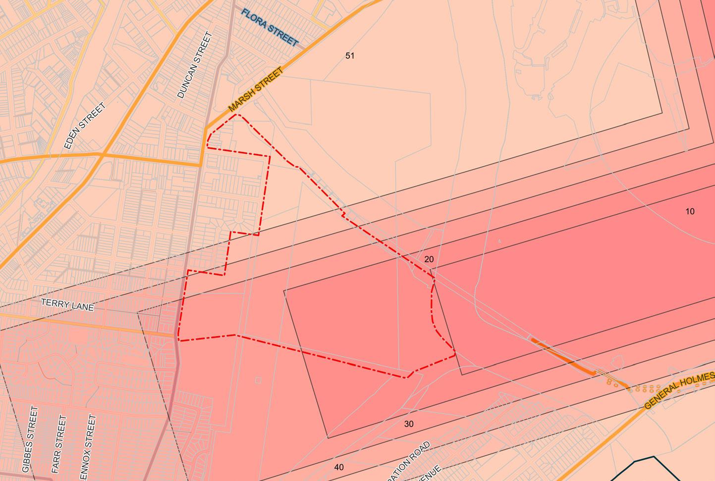
Figure 30 - Airport Obstacle Limitation Surface OLS Map
Figure 32 - Section B aviation impact
Figure 31 - Section A aviation impact
Public Safety Areas (PSA)
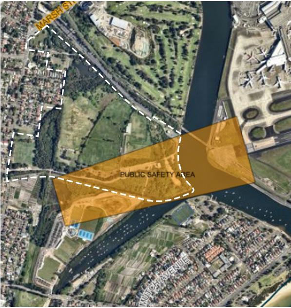
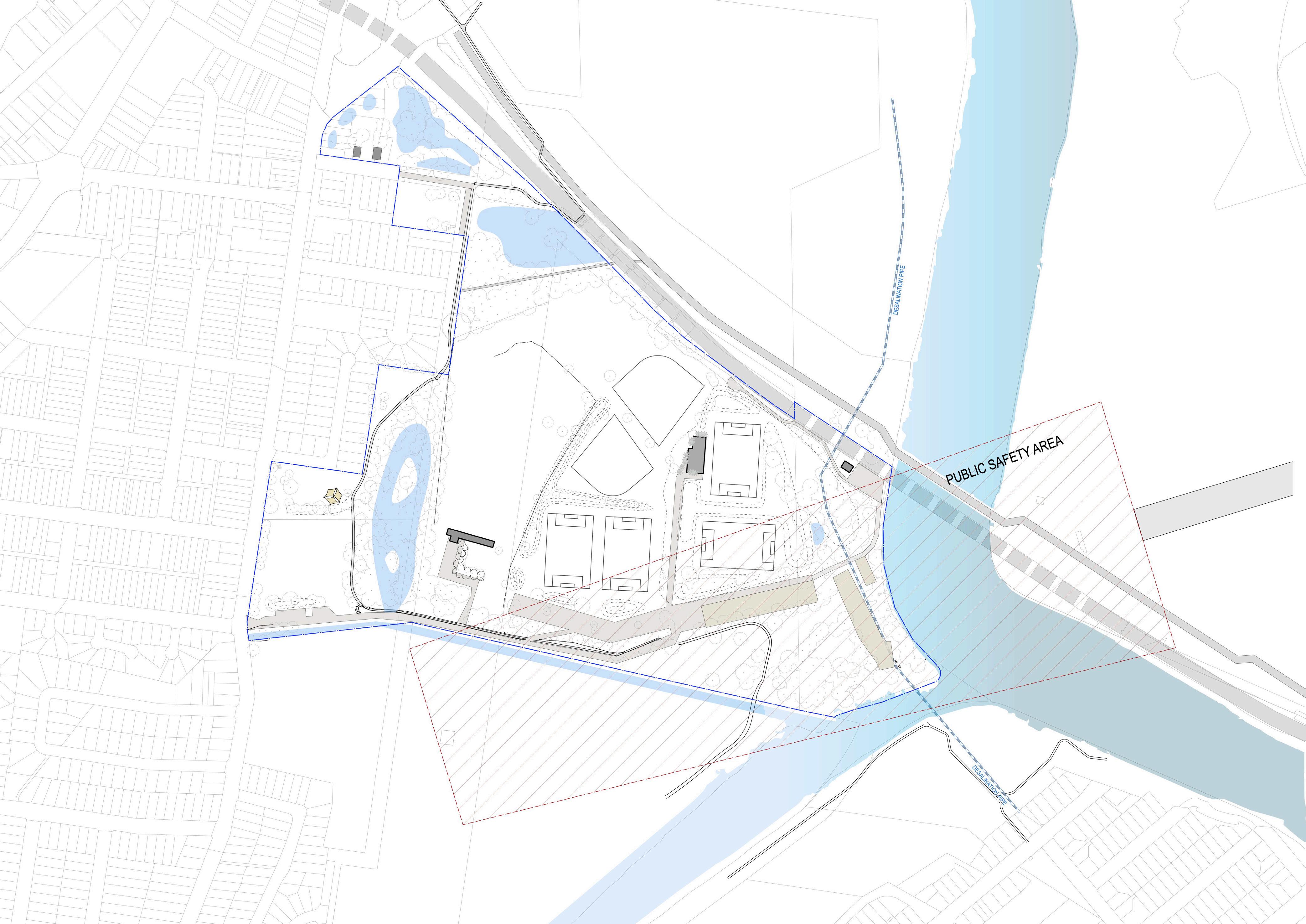
Public Safety Areas are implemented at airports to protect the safety of the public from aviation activities and accidents. Riverine Park is within the affected zones of 1,000 metres before the runway on approach or within 500 metres beyond the runway on departure. These zones are generally accepted standards set by the International Civil Aviation Organisation (ICAO). Figures below shows the extent of the PSA which limits the level of activity and permissible uses.
PSA COMPATIBLE USES
OUTER AREA
- 1 IN
100,000
• Long stay and employee car parking (where the minimum stay is expected to be in excess of six hours)
• Shorter stay car parking (with a safety case –depends on intensity of use)
• Built development for the purpose of housing plant or machinery and would require no people on site on a regular basis, such as electricity switching stations or installations associated with the supply or treatment of water
• Golf courses, but not club houses (provided appropriate mitigation measures are in place to reduce wildlife attraction risk - see NASF Guideline C)
• Open storage and types of warehouses with a very small number of people on site. The planning authority could consider imposing conditions to prevent future intensification of the use of the site and limit the number of people to be present on the site
• Developments which require few or no people on site on a regular basis such as buildings housing plant or machinery
• Low intensity public open space
INNER
AREA
- 1 IN 10,000
• Long stay and employee car parking (where the minimum stay is expected to be in excess of six hours)
• Built development for the purpose of housing plant or machinery and would require no people on site on a regular basis, such as electricity switching stations or installations associated with the supply or treatment of water
• Golf courses, but not club houses (provided appropriate mitigation measures are in
INCOMPATIBLE USES/ACTIVITIES
• Accommodation activities: This includes dwelling houses, multiple dwellings, resort complexes, tourist park, hostels, retirement villages or other residential care buildings
• Community activities: educational establishment, community centres, hospitals, theatres, child-care and playgrounds, detention facilities, place of worship
• Recreation activities: This includes parks, outdoor recreation and sport, major sport and entertainment facilities
• Entertainment and centre activities: Shopping centres, service stations, showrooms, markets, hotels, theatres, tourist attraction, garden centres
• Industrial and commercial uses involving large numbers of workers or customers: Intensive uses such as high impact, medium and low impact industry, warehousing, services industry
• Manufacture or bulk storage of flammable, explosive or noxious materials
• Public passenger transport infrastructure: This includes bus, train and light rail stations
Figure 33 - Sydney Airport Public Safety Area (source: Intramap) Figure 34 - General guidance for new/proposed developments on compatible and incompatible activities
FRAMEWORK)
Sydney Airport – Utilities reservation
The Sydney Airport Masterplan 2039 (Figure 25) identifies a very small parcel of land as an “AD4 – Utilities Reservation Zone” within Barton Park south west of the M5 East Motorway. This is within the Landing Lights Wetland. This parcel accommodates special uses of the airport.
Lighting near the airport
CASA has the authority under the Civil Aviation Regulations 1988 to control ground lights where they have the potential to cause confusion or distraction from glare to pilots in the air. Design Guidelines have been prepared to assist lighting designers and installation contractors to determine the location and permitted intensities of ground lights within a six kilometre radius of an airport. Sports field lighting and street lighting require careful consideration.
The intensity of reflected sunlight may also be considered under the regulatory regime.
2.14 Visual and Spatial Impact
Once considered a wasteland, the landscape of the area has undergone significant transformation since the mid-19th century. It served as a Sewage Farm for Sydney for 30 years until 1916, followed by sand mining for council civil projects and later as a council landfill site. These activities have dramatically altered the topography, making the site’s history and its resultant landscape challenging to comprehend for those unaware of its industrial past. The now highly valued wetlands are a direct consequence of previous sand mining activities. Interestingly, the heritage-listed Market Gardens have thrived, benefiting from the enriched soil due to deposits from the Sewage Farm.
However, this history of industrial use has not been without its drawbacks. The tree canopy and vegetation quality have suffered, dominated by weeds - a result of prolonged poor land management practices. Similarly, the Mangrove Forest, a product of these neglected practices, now obstructs sightlines to the water, with only two openings along the adjacent cycleway. The landscape shows little remaining evidence of former dune and woodland vegetation, and it’s unlikely that any traces of traditional owners’ past use remain.
Today, the site is characterised by vast grassland monocultures, necessary to contain the disturbed soils, with limited interruptions to the long views. These views are dominated by a three-tiered benched landscape with the highest point closest to the Cooks River and stepping downward towards West Botany Street. From this altered elevation, there are sweeping views towards the airport and across the Landing Lights Wetlands, Market Gardens, Spring Creek, Muddy Creek, Cooks River, and the residential areas of Arncliffe and Banksia, providing a unique perspective on the area’s complex history and current form.
2.15 Management and Maintenance
Maintenance of Riverine Park is primarily undertaken by Bayside Council.
Routine Park Maintenance
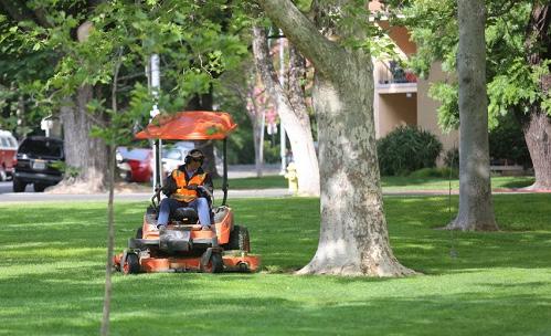
The parks staff undertake a range of routine park maintenance activities including mowing, litter collection, broad acre mowing of the outer fields and herbicide spraying.
Seasonal improvements are undertaken of the sports fields including
• Aerating
• Fertilising
• Top-dressing
• Turf repairs
• Filling uneven surfaces
• Turf weed control
• Line marking fields
Council is seeking sporting partners who as part their tenure will be required to undertake maintenance of their lease areas. These arrangements are mutually beneficial as this gives autonomy to sporting partners to manage the spaces of interest to them as well as reducing maintenance burden for council. These groups function under a form of user pay. The expectation is that sporting partners keep open spaces available to the general public and work collaboratively with council on this ongoing arrangement for the benefit of the broader community and the sporting groups involved.
Bush Regeneration
To protect the Landing Lights Wetland site Council undertakes significant weed control and vegetation removal which has continued since 2016. These works have included the removal of Grey Mangroves (Avicennia marina), Casuarinas species and Acacia species within and adjacent to the main wetland. Removal has occurred to protect the existing salt-marsh from being invaded by trees and shrubs that should not exist in this area and to open up the site to ensure it continues to provide important habitat for threatened and migratory coastal birds.
Works that have been completed include:
• Treatment of the weed species Juncus acutus along the boardwalk and within the saltmarsh area
• Removal of mangroves within the wetland and Spring Creek
• Removal of Casuarinas growing adjacent to Spring Creek
• Treatment of woody weeds such as Mickey mouse plant (Ochna serrulata), Green Cestrum (Cestrum parquii) and Golden wattle (Acacia saligna)
• Treatment of the fast-growing vines, Coastal Morning Glory/ Mile-a-minute (Ipomoea cairica), Turkey
• Rhubarb (Acetosa sagittata) and highly invasive groundcover Hydrocotyle bonariensis
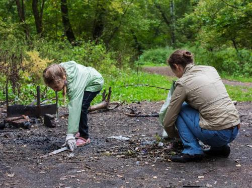
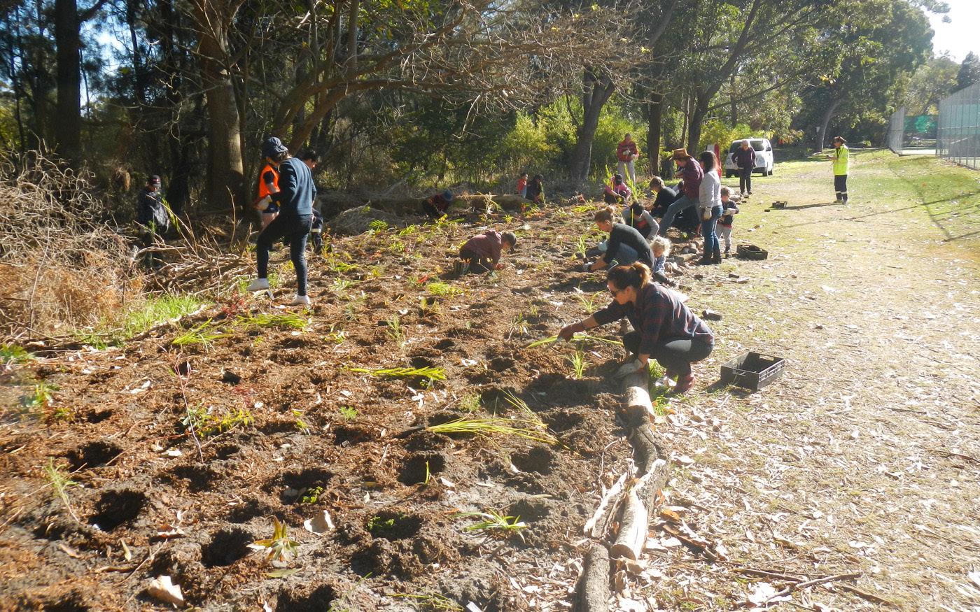
• Replanting with native species using community volunteers along the boardwalk
• Removal of rubbish that was blocking the pipe outlet of the
wetland
• Some parts of Riverine Park can continue to be conservatively managed with bush regeneration whilst in some heavily degraded areas a more target intervention effort will be required to restore suitable ecologies.
3. Planning Framework
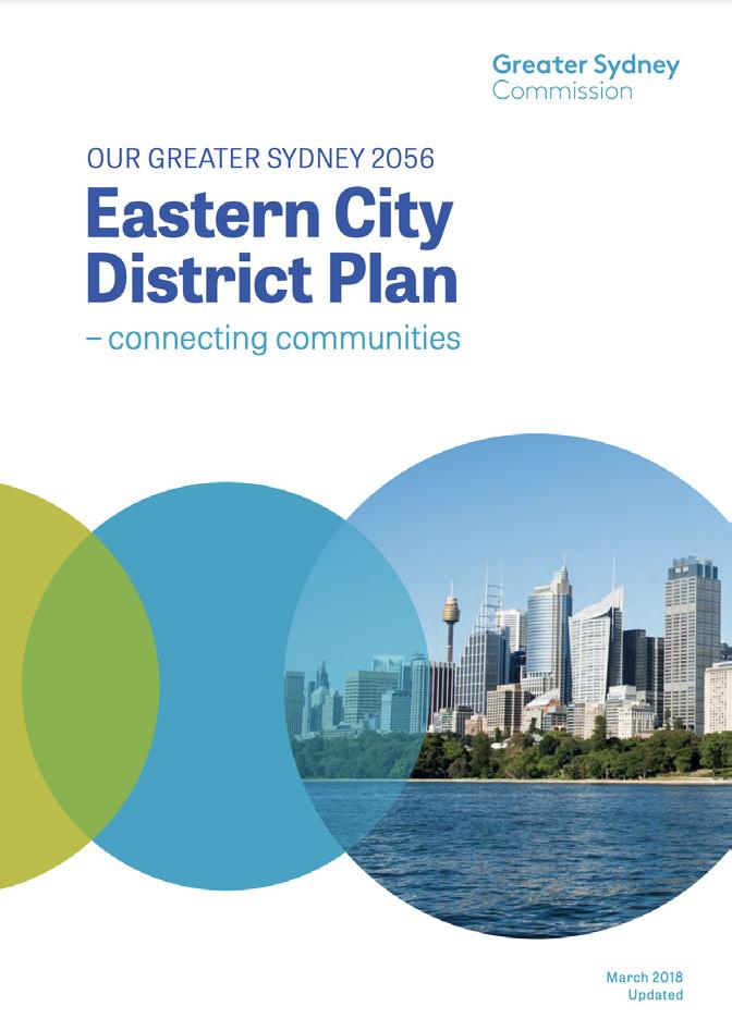
3.1 A Metropolis of Three Cities; Eastern City District Plan & Green Grid
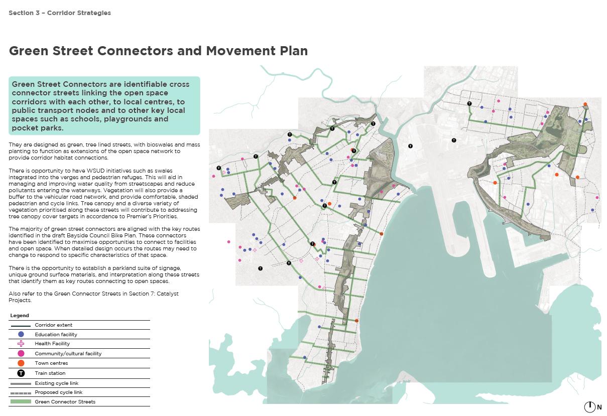
The Sydney Green Grid is an integral part of the Greater Sydney Regional and District Plans. Green space is a key liveability factor in urban areas that is made up of a network of green space that connects town centres, public transport hubs and major residential areas. The Green Grid is the State Government’s green infrastructure policy that promotes sustainable development while maximising quality of life and well-being. Specifically the Green Grid promotes the linkages between open space within the wider public realm through enhancing creek corridors, transport routes, suburban streets, footpaths and cycleways.
The Sydney Green Grid document identifies 4 major zones in the Bayside Local Government Area.
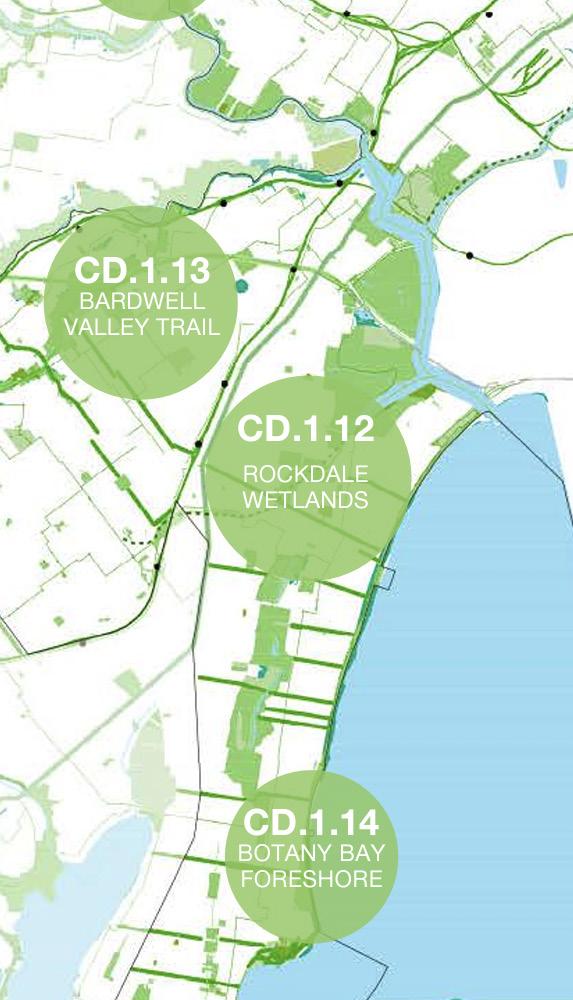
Riverine Park is within the group identified as CD.1.12 Rockdale Wetlands with the dominant grid layer identified as “ecological”. This group of projects have a very high conservation value extending from the Cooks to the Georges River along Muddy Creek, through Eve Street Wetlands, Spring Creek Wetlands, Landing Light Wetland, Patmore Swamp, Scarborough Park Ponds and through to Sans Souci. Opportunities include wetland restoration, education, interpretation and an improved pedestrian and cyclist environment.
It is also described as a very important recreational corridor with a significant amount of active sports grounds and facilities, cycle and walking trails.
The Green Grid framework aims to protect and enhance this important hydrological and ecological asset and create a connected open space corridor for walking, cycling and urban greening along the M6 corridor from the airport to the Sans Souci and beyond the LGA to Sutherland.
Figure 40 - A Metropolis of Three Cities; Eastern City District Plan & Green Grid
3.2 State Environmental Planning Policy (Precincts—Eastern Harbour City) 2021
Riverine Park is within State Environmental Planning Policy (Precincts—Eastern Harbour City) 2021, previously called Sydney Regional Environmental Plan No. 33 (Cooks Cove) (the SREP 33) and is zoned as ‘Open Space’ & ‘Special Use’ under that instrument.
Objectives and principles have been setout for Cooks Cove princinct in the SEPP.
Including :
(a) to establish planning principles for the development of land that promote the ecologically sustainable use of the Cooks Cove site, and
(b) to rezone land at Cooks Cove to encourage trade and technology uses, and to attract global-reach businesses which strengthen Sydney’s international competitiveness, and
(c) to capitalise on the physical proximity of the Cooks Cove site to Sydney International Airport and Port Botany to create trade-focussed development, and
(d) to facilitate master planning strategies that will promote the orderly development of public open space and trade and technology land uses, and
(e) to identify appropriate development form and capacity for the Cooks Cove site, and
(f) to provide open space for a range of recreational uses, and
(g) to provide for good public access through the Cooks Cove site and along the Cooks River foreshores, and
(h) to enhance the Botany Bay to Homebush Bay regional cycleway and pedestrian/cycle network, and
(i) to protect environmentally significant wetlands and the habitat of the endangered Green and Golden Bell Frog, and
(j) to establish vegetated riparian areas along the Cooks River and Muddy Creek foreshores, and
(k) to provide vegetated riparian buffers around the Marsh Street, Eve Street, Spring Creek and Landing Lights wetlands.
The objectives for the Open Space Zone include:
(a) to provide for active sporting and recreational land uses and club facilities, and
(b) to provide public access along the Cooks River and Muddy Creek foreshores, and
(c) to protect significant wetland areas within the Cooks Cove site and along the Cooks River foreshores, and
(d) to provide for facilities that are ancillary to the recreational use of public open space, and
(e) to provide vegetated riparian areas to enhance biological connectivity along the Cooks River and Muddy Creek foreshores,
(f) to protect and enhance the habitat of the Green and Golden Bell Frog established within Cooks Cove.
Figure 41 - Current zoning map of the Cooks Cove
3.3 Coastal Management Act 2016 No 20
State Environmental Planning Policy (Resilience and Hazards) 2021
The NSW Government established a new integrated coastal management framework in 2018 designed to better equip coastal communities to respond to existing and future coastal management challenges and opportunities.
The framework now comprises the following:
• Coastal Management Act 2016;
• State Environmental Planning Policy (Resilience and Hazards) 2021 – Chapter 2;
• NSW Coastal Management Manual;
• Coastal Management Programs;
• NSW Coastal Council; and
• Coastal and Estuary Grants Program.
Under the Coastal Management Act (CM Act) the Coastal Zone includes the open coast, estuaries, coastal rivers and the marine estate and is comprisesd of four Coastal Management Areas:
1. Coastal Wetlands and Littoral Rainforest Area .
2. Coastal Vulnerability Area.
3. Coastal Environment Area.
4. Coastal Use Area.
5.
Local councils have a central role in managing the coast and are required to manage maintenance, works and planning strategic directions in accordance with relevant state legislation, policies and plans, including the CM Act 2016 and Chapter 2 of the Resilience and Hazards SEPP.
A certified Coastal Management Program (CMP) and the Coastal Management Manual applies to all public authorities that exercise functions in connection with the coastal zone (e.g. Sydney Water, NSW Ports).

Coastal Management Program
Councils are the organisations responsible for preparing Coastal Management Programs (CMPs) for management of the coastal zone in their LGA.
The purpose of a CMP is to set the long-term strategy for the coordinated management of land within the coastal zone with a focus on achieving the objectives of the Coastal Management Act 2016. A CMP identifies coastal management issues in the scope area, the actions required to address these issues, how and when those actions will be implemented, and identifies the costs of the actions and viable funding mechanisms for delivery. These can include cost-sharing arrangements and grants.
The Coastal Management Manual 2018 outlines mandatory and non-mandatory requirements for a CMP. A CMP is prepared and implemented in five (5) stages as shown in Figure 2.
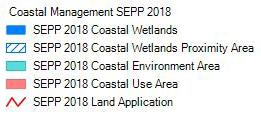
Coastal Wetlands
Coastal Wetlands Proximity Area
Coastal Environment Area
Coastal Use Area
Land Application

Once adopted by Council and certified by the Minister, Council can implement the actions in a CMP through its strategic management systems and land-use planning instruments.
The Department of Planning, Housing and Infrastructure (DPHI) help councils preparing a CMP with data and technical advice, provides oversight of the State’s coastal management program, and administers the Coastal and Estuary Grants Program that provides funding for councils to prepare and implement their CMPs.
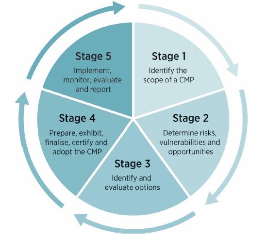
Figure 42 - State Environmental Planning Policy (Resilience and Hazards) 2021
Cooks River Catchment Coastal Management Program
The Coastal Management Program (CMP) applicable to this site is the Cooks River Catchment Coastal Management Program. This is a catchment based CMP as catchment activities are considered to have a direct impact on parameters in the coastal zone, such as water quality and hydrology. The involvement of Bayside Council in this program has been supported by Council via the regional organisation, the Cooks River Alliance.
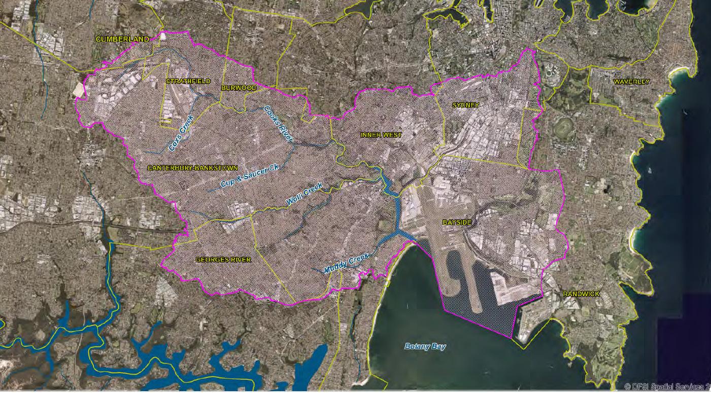
The Cooks River Catchment CMP covers the Cooks River and its catchment as well as the northern coastal area and catchment of Botany Bay within the Bayside LGA including Port Botany, Foreshore Beach and the Botany Freshwater Wetlands (Mapped as a Coastal Wetland Management Area – see Figure 3). It is managed by the Cooks River Alliance (CRA)
Stage 1 of the CMP process outlined in Figure 2 has been
completed with production of the Cooks River Catchment CMP Scoping Study – Stage 1 Scoping Study in January 2020. A scoping study:
• establishes the purpose, vision and objectives;
• determines the key coastal management issues and the spatial extent of the management areas;
• reviews current coastal management arrangements;
• determines where action is required via a first pass risk assessment;
• identifies knowledge gaps and information needs;
• includes a preliminary business case; and
• develops a forward program for subsequent stages of the CMP.
This CMP is now completing Stage 2 – Determine risks, vulnerabilities and opportunities, and is preparing to commence Stages 3 and 4.
Council is required to adopt a CMP before it can be submitted to the Minister for certification. Once it has been submitted Council can apply for implementation grants for the actions identified in a CMP. If a grant application is successful, then it will be activated once the Minister makes the decision to certify the applicable CMP associated with the grant.
It is important to note that Council will be ineligible to apply for grants under the NSW Coastal and Estuary Grants Program from 2024 if a CMP hasn’t been adopted and submitted to the Minister.
Figure 43 - Cooks River Catchment CMP study area (geographic scope).
3.4 Biodiversity Conservation Act 2016
Under the Biodiversity Conservation Act 2016 ‘Coastal Wetlands’ are a category of land included in the Biodiversity Values Map.
For any work involves the clearing of native vegetation in the Biodiversity Values map, a biodiversity development assessment report (BDAR) must be prepared.
Rockdale Biodiversity Strategy 2014
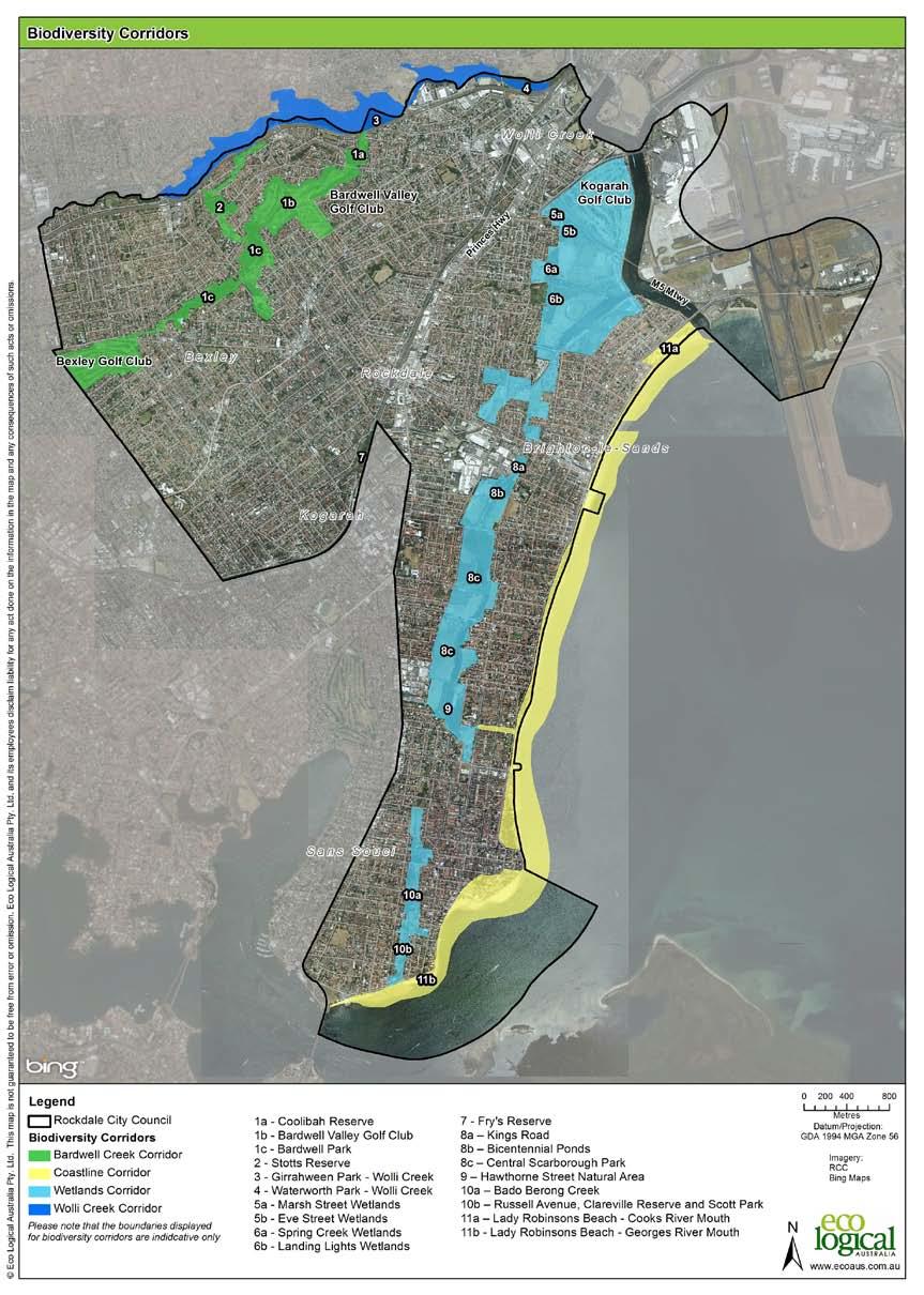
This strategy provides high level goals and targets to guide the development of open spaces with an emphasis on restoration and protection and enhancement of natural areas, improvement of waterway quality and creation of linkages along corridors of open space. The strategy identifies the following priorities for the Wetlands Biodiversity Corridor:
• Develop and implement habitat enhancement plans to increase the availability of foraging and roosting areas for migratory and non-migratory shorebirds, as well as small bush birds. This includes planting native vegetation known to support these species and creating or maintaining open water areas that serve as foraging sites.
• Conduct detailed habitat assessments to identify and map current habitats of the Green and Golden Bell Frog (GGBF) within the Marsh/Eve Street Wetlands. Develop protection strategies that may include habitat restoration, creation of breeding sites, and implementation of management actions to minimise disturbances.
• Collaborate with Sydney Airport authorities to develop and implement a bird management plan that minimises the risk of bird-aircraft strikes while supporting biodiversity. This could involve habitat manipulation to discourage bird presence within flight paths and monitoring bird movements.
• Undertake restoration and enhancement projects to support threatened estuarine and freshwater vegetation assemblages and coastal saltmarsh. This includes removing invasive species, reintroducing native plants, and managing water quality and hydrology to support the health of these ecosystems.
• Improve the ecological connectivity between the Landing Lights Wetlands and the broader Wetlands Biodiversity Corridor. This may involve enhancing existing ecological links, creating new habitat corridors, and integrating landscape features that facilitate wildlife movement.
• Design and establish buffer zones around the wetlands to protect them from adjacent land uses such as market gardens and the impact of the M5. This could include physical barriers, vegetated buffers, and signage to manage access and minimise disturbances.
• Develop and execute a comprehensive weed management strategy focused on the removal of invasive species like Juncus acutus and managing undesirable mangrove competition. This involves regular monitoring, physical removal, and potentially the use of environmentally sensitive herbicides where appropriate.
Fisheries Management Act 1994
The NSW DPI administers the Fisheries Management Act 1994 which protects mangroves, seagrasses and seaweeds on public water land and foreshores.
Under Part 7 of the Fisheries Management Act 1994, a permit is

Harming mangroves (i.e. damaging, destroying or removal)
Dredging and reclamation work
Temporarily or permanently obstructing fish passage
Using explosives and other dangerous substances
Mangroves are protected in New South Wales (NSW) under the Fisheries Management Act 1994 due to their importance as habitat for fish and fish breeding environments. Mangroves also protect foreshore land by absorbing the energy of tidal currents and storm-driven wind and wave action, creating a natural breakwater that helps stop erosion.
The presence of mangroves is also indicative of Key Fish Habitat, and is noted as highly sensitive by Fisheries NSW. A buffer zone and conditions to development within the vicinity of Muddy Creek and the Spring Creek will apply.

Rockdale City Council
6: Biodiversity corridors
Figure 45 - Fish Habitat Map
3.6 Bayside West Precinct Plan 2018 & Arncliffe and Banksia Green Plan
The population of the Arncliffe and Banksia Planned Precinct is expected to significantly increase by 2036. This Plan sets out strategic land use and infrastructure planning to guide the future transformation of the Bayside West Precincts. The Plan will inform future changes to the planning controls to enable the rezoning of the Arncliffe and Banksia Precincts, through future amendments to the Bayside Local Environmental Plan 2021.
The Bayside West Precinct identifies the importance of open space that is accessible, functional and adaptable to different stages of life for local residents and is reliant on provision to be provided by the large parks in Cooks Cove including Barton Park and to improve connections for pedestrians and cyclists.
In its current state, there is limited availability to aquire new land specfically for open space use. For this reason, redevelopment and expansion of existing open space assets, such as Riverine Park, Barton Park and elsewhere along Cooks River is essential.
This growth, combined with the introduction of new residential and mix used development, provides the opportunity to address the demands for open space and recreational activities.
The Green Plan provides a framework for the provision of the new open space, open space infrastructure, together with an integrated tree canopy network and green links will ensure these opportunities are met.
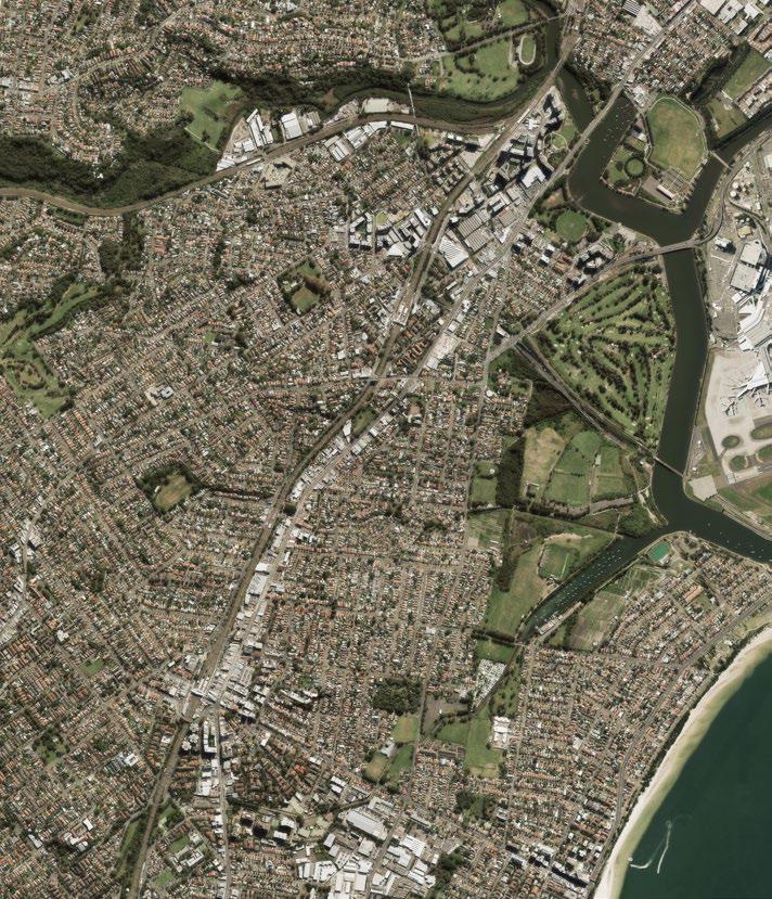

Figure 46 - Arncliffe and Banksia Green Plan

3.8 Active Transport Strategy
The NSW Government wants cycling to be a preferred mode of transport for short trips and a viable safe and efficient option for longer trips. Safe and connected cycling networks across Greater Sydney will enable more people to ride their bikes as part of everyday travel. The Strategic Cycleway Corridors has been developed to provide the foundation for safe and convenient cycleways that better connect centres, precincts and places, while supporting councils’ local bike networks.
The strategy highlights the importance of celebrating connections along our water fronts and connecting the coast to Wolli Creek, the Airport and towards the CBD via Cooks River.
Bayside Council is developing the Bayside Bike Plan, which aims to expand upon the Strategic Cycleway Corridors to provide safe cycle infrastructure for our community. Riverine Park and other opportunities along Cooks River and Muddy Creek present safe solutions for active transport free from vehicles and allowing interaction with open space, sports fields and the water’s edge connecting into the active transport corridor under construction as part of M6 Stage 1 to Scarborough Park.
4. Previous Community Engagement & What We Heard
4.1 Engagement for Bayside priority green grid corridors spatial framework 2020
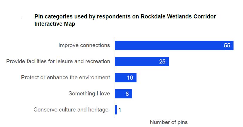
Riverine park is a key component of Rockdale Wetland Corridor, which is one of the three Bayside Green Grids. A survey through the interactive mapping exercise was organised in 2021. The outcome for the Rockdale Wetlands Corridor indicate a heavy demand for connectivity improvements. (See figure below)
Discussions with Local First Nations Representatives were undertaken in May 2021 in developing the Bayside Priority Green Grid Spatial Framework.
Below is summary of the key discussions that apply to Rockdale Wetlands Corridor:
• Promoting initiatives to improve water quality to make local food supply such as Mullet, rock oyster reefs and bluesummer crab edible and accessible to community
• Wayfinding and Acknowledgement to Country
• Graphic and potentially a digital songline that shares the story of the Mullet or other significant species and the importance of sensing and caring for Country.
• The creek bed with native species, grinding stones, sand pit patterns, sandstone creek bed and the kids being able to orientate themselves.
• Support any initiatives to expand Caring and regenerating Country and seeing more local residents plant endemic species in their gardens and Council in their public spaces.
4.2 Engagement for Barton Park Masterplan 2020
Key feedback received during the Barton Park engagement activities that specific relevant to Riverine Park were:
• Desire for holistic planning for the Rockdale Wetlands Corridor.
• High value is expressed for the wetlands and biodiversity of this area.
• Desire for Riverine Park and wetlands to be masterplanned.
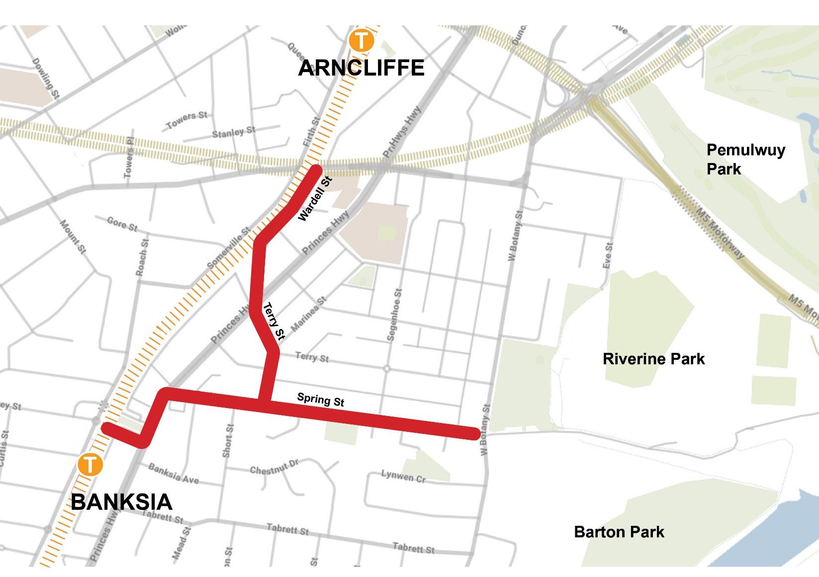
4.3 Engagement for Arncliffe and Banksia to Riverine Park Pedestrian and Cycle Links 2023
In 2023, the Council consulted with the community regarding the proposed Arncliffe and Banksia to Riverine Park Pedestrian and Cycle Links. The project was well received, with an overwhelming 92% of participants expressing their support. Over 70% participants showed a keen interest in the proposed share path and the signalised crossing at the intersection of West Botany Street and Spring Street.
The feedback received from the community has been considered, with particular attention given to the West Botany Street and Spring Street intersection. A holistic review of this intersection has been conducted within its broader context, taking into account various factors such as traffic flow, pedestrian safety, land ownership and seamless connection to the Riverine Park.
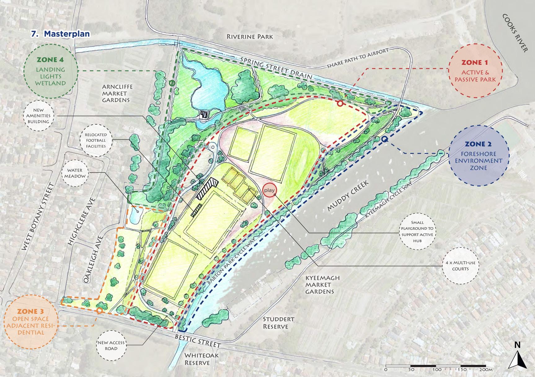
The proposed design aims to enhance connectivity and safety within the area, and contributes positively to the overall quality of life in the region. More details of the design will be outlined in Chapter 7 of the report.
5. Site Analysis and Design Opportunities
5.1 Functional Zoning
Existing conditions
The existing functional zones are segmented. Passive recreation space is limited to the Eve Street Reserve and the open space adjacent to West Botany Street. The active recreation zones situated in the central area of the park are isolated and enclosed. The environmental areas are under-maintained and are experiencing issues such as overgrown vegetation and weeds, poor water quality, and odorous smells. A considerable portion of the park has also become neglected. Overall, the existing park doesn’t offer sufficient passive recreation space and lacks connection between different zones, resulting in underutilization and poor passive surveillance.
Opportunities
Consolidating the environmental land seeks to improve visibility, accessibility, and functionality to the park and to ensure management practices are appropriate and limit further incursions into valuable environmental buffers. Blurring the boundary between passive recreation and active recreation creates a large central zone suited to the use by a variety of patrons. Spring Creek, Landing Light Wetland, and Spring Creek Wetland as the key environmental zones can be improved to establish highquality wildlife habitat and promote low-impact human interaction where appropriate.
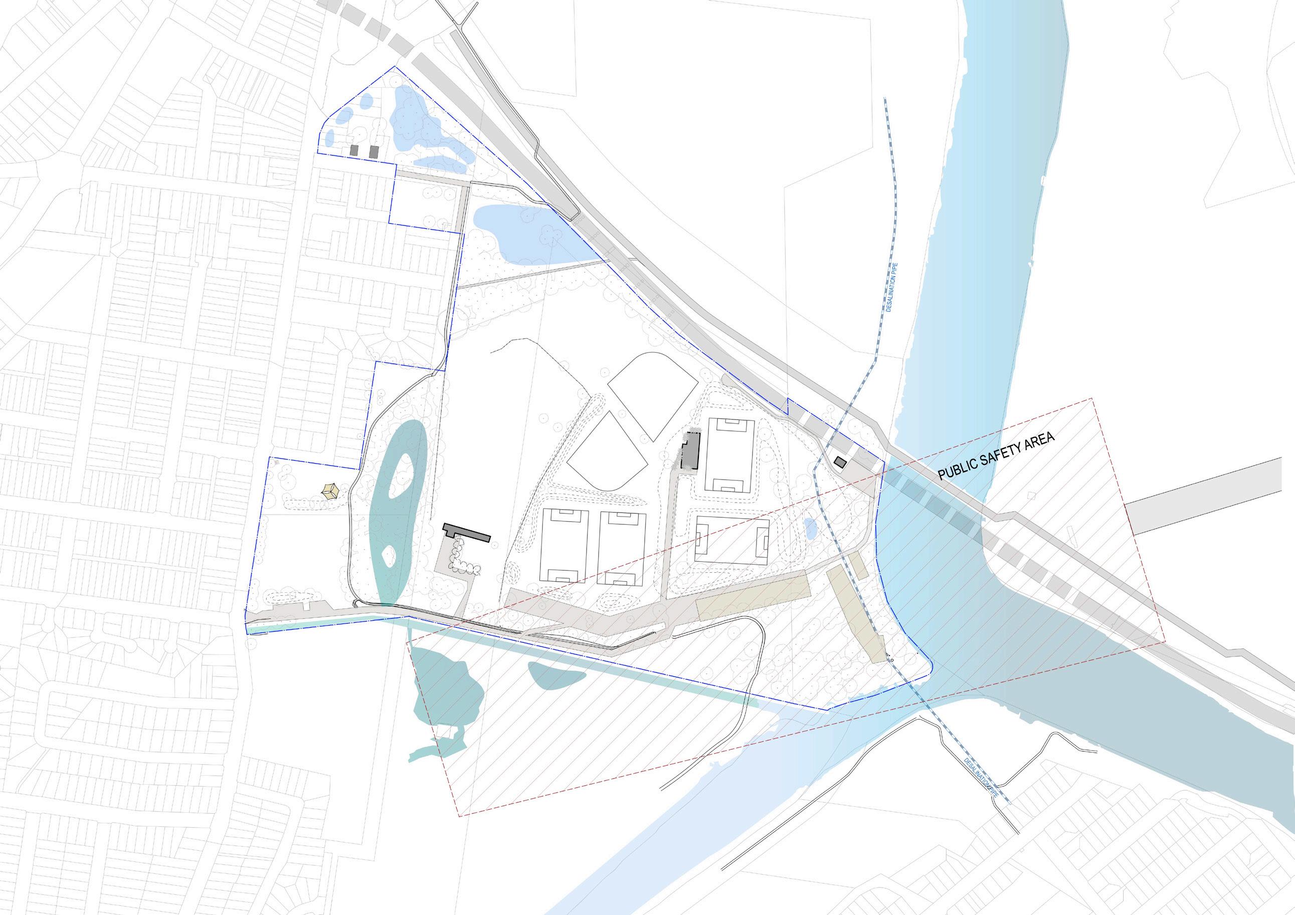
The active recreation zone is to be retained as sports are popular and welcomed by the community. Appropriate management of the Active Recreation Zone is essential to the park’s success. Although the implementation of appropriate barriers to manage vehicles and people in the vicinity of the golf driving range will still be required, the extent of the physical barriers and fences should be reduced for better accessibility and connectivity, also encouraging general community use outside of sports events. This would enhance the aesthetic appeal and ambiance of the space.
In addition to active recreation and sports, the importance of creating unstructured passive recreation spaces for walkers, families, dog walkers, runners, and cyclists cannot be underestimated. By proving passive recreation opportunities, it will activate the park and vastly improve passive surveillance.
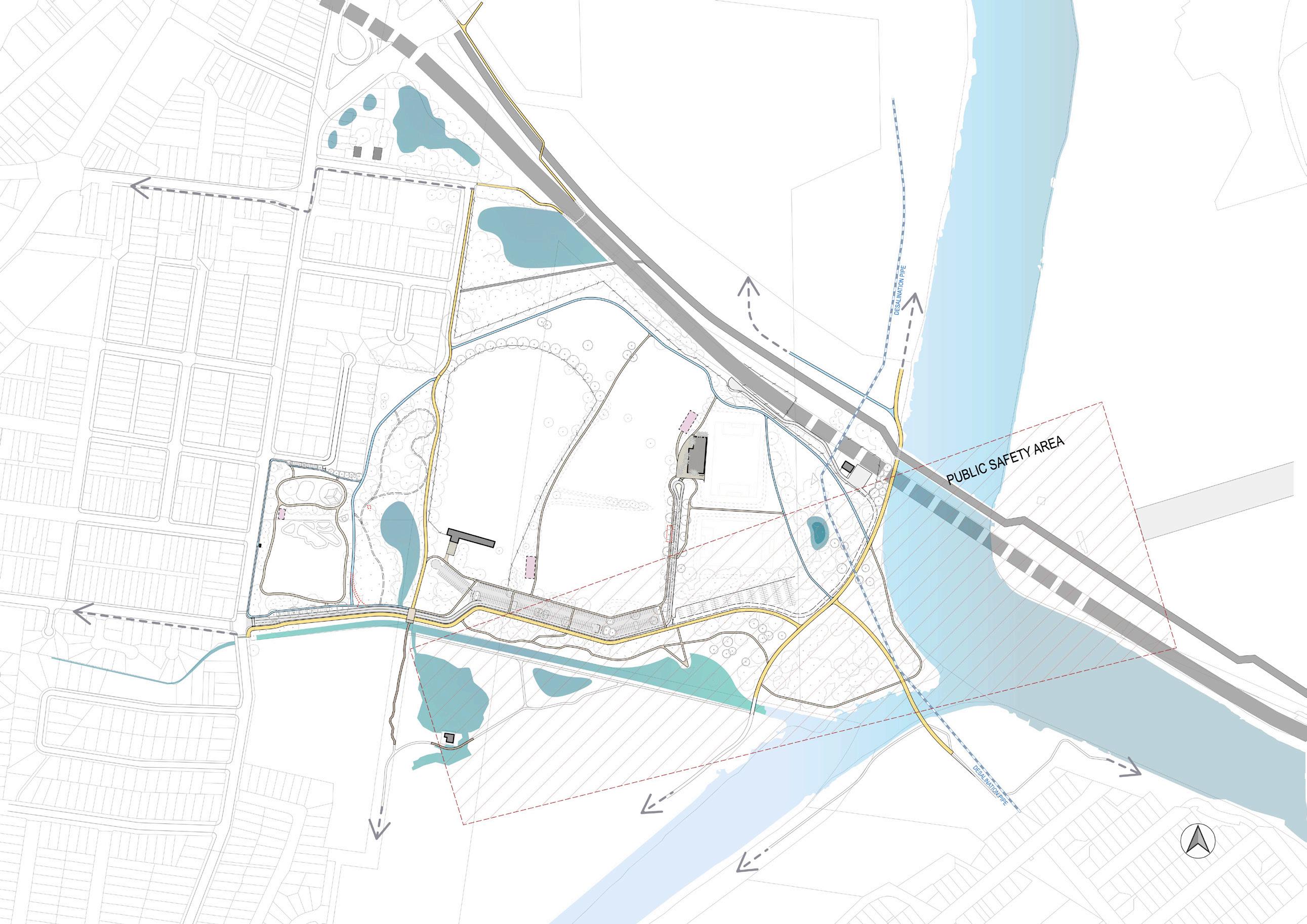
Figure
5.2 Transport, Circulation & Access
District Active Transport Network
State Environmental Planning Policy (Precincts—Eastern Harbour City) 2021 set the vision and principle for providing cycle and pedestrian link in the Cooks Cove site so that it contributes to the regional and district active transport network. The principles include:
• Create a publicly accessible foreshore, linked to public areas within the Cooks Cove site
• Enhance the Botany Bay to Homebush Bay regional cycleway and pedestrian/cycle network
• Create links to nearby the public transport services, the Bay-to-Bay cycleway, the Cooks Cove site and the foreshore.
• Provide a high-quality pedestrian environment within the street system.

Existing Pedestrian and Cycle Links to be retained

• Ensure accessibility is provided to places within the Cooks Cove site for all abilities The diagrams below demonstrate the existing and proposed public access paths through the site and along the foreshore. Improvements include links to the broader network to connect to local transport nodes such as Arncliffe Station and Wolli Creek Station, the Rockdale Wetland Corridor and the Barton Park Cycleway and further south along the M6 active transport corridor.
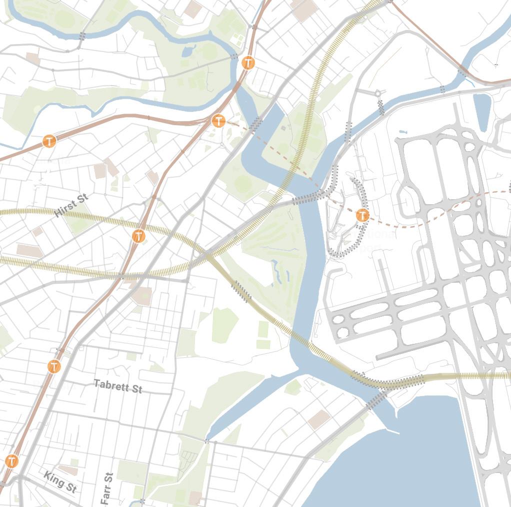
Enhanced future connections

Existing Pedestrian and Cycle Links to be retained
Existing Pedestrian and Cycle Links to be downgrade to pedestrian path
Arncliffe and Banksia to Riverine Park Pedestrian and Cycle Links

Opportunity for enhanced Pedestrian and Cycle Links
Future connection to Sydney Gateway active transport corridor
Public access paths through the site and along the foreshores
Pedestrian bridge to provide connection to Kyeemagh and Botany Bay foresore
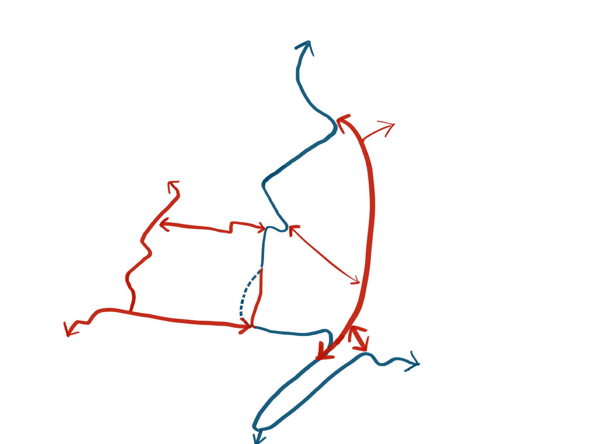
Connect to M6 Stage 1 active transport corridor
Connect to M6 Stage 1 active transport corridor
Wolli Creek Tempe
Arncliffe
Banksia
Rockdale International Airport
Wolli Creek Tempe
Arncliffe
Banksia
Rockdale International Airport
Figure 51 - Existing pedestrian/cycle link Figure 52 - Pedestrian/cycle link opportunities diagram
Existing Riverine Park Circulation Network
Overall, the existing Riverine Park suffers from limited and poorquality access and lack of internal circulation, particularly in terms of pedestrian access options. The main access from West Botany Street is inconspicuous, and the absence of dedicated pedestrian pathways has created a conflict-prone and unsafe mixed environment among vehicles, cyclists, and pedestrians.
Furthermore, a section of the active transport link, which runs along the northern side of the main vehicle entrance, has resulted in a series of unsafe crossing points along the journey, necessitating improved visibility and management of conflicts.
The existing park lacks of internal circulation. Particularly evident in the northern section of Riverine Park and the waterfront areas along Spring Creek and Cooks River, which is almost inaccessible. Consequently, this has resulted poor passive surveillance, and the recreation function has been compromised.
Opportunities
1. Enhance the accessibility of the park by improving the existing West Botany Street entry and establishing new access points. For example, install a signalised crossing at West Botany Street / Spring Street intersection; new pedestrian access point at Eve Street; provide on street car parking and pedestrian path at Filmstone Garden for playground and other park users; provide a footpath connection to the existing bus stop to encourage public transportation users; constructing a bridge over Muddy Creek to connect Kyeemagh; and establishing a shared path along the Cooks River foreshore. These interventions will enhance Riverine Park’s accessibility and contribute to the completion of the regional active transport network.
2. Create a hierarchy for movement to mitigate the conflicts between vehicles, cyclists and pedestrians. This structured approach aims to provide a clearer movement framework and to improve passive supervision and activation to increase

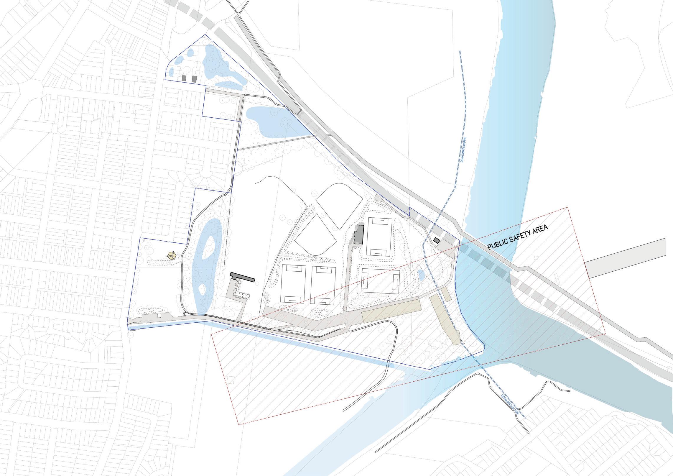
park safety. Additionally, prioritizing pedestrian-friendly infrastructure will contribute to the creation of a more walkable park environment.
3. Realign the access driveway to integrate with the car park to provide better passive surveillance and create an opportunity for separate shared path and pedestrian path to reduce conflicts between vehicles and active transport routes.
4. Develop a shared path circuit, prioritising direct routes to through Riverine Park while ensuring clear sightlines.
5. Provide a network of minor and secondary pedestrian links to interconnect the broader shared path circuit.
6. Provide accessible parking bays, turning circle, and Emergency Vehicle access to serve the amenity building
7. Provide walking tracks adjacent to waterbodies allowing for slower movement and dwelling, separate from the faster movement shared path network.


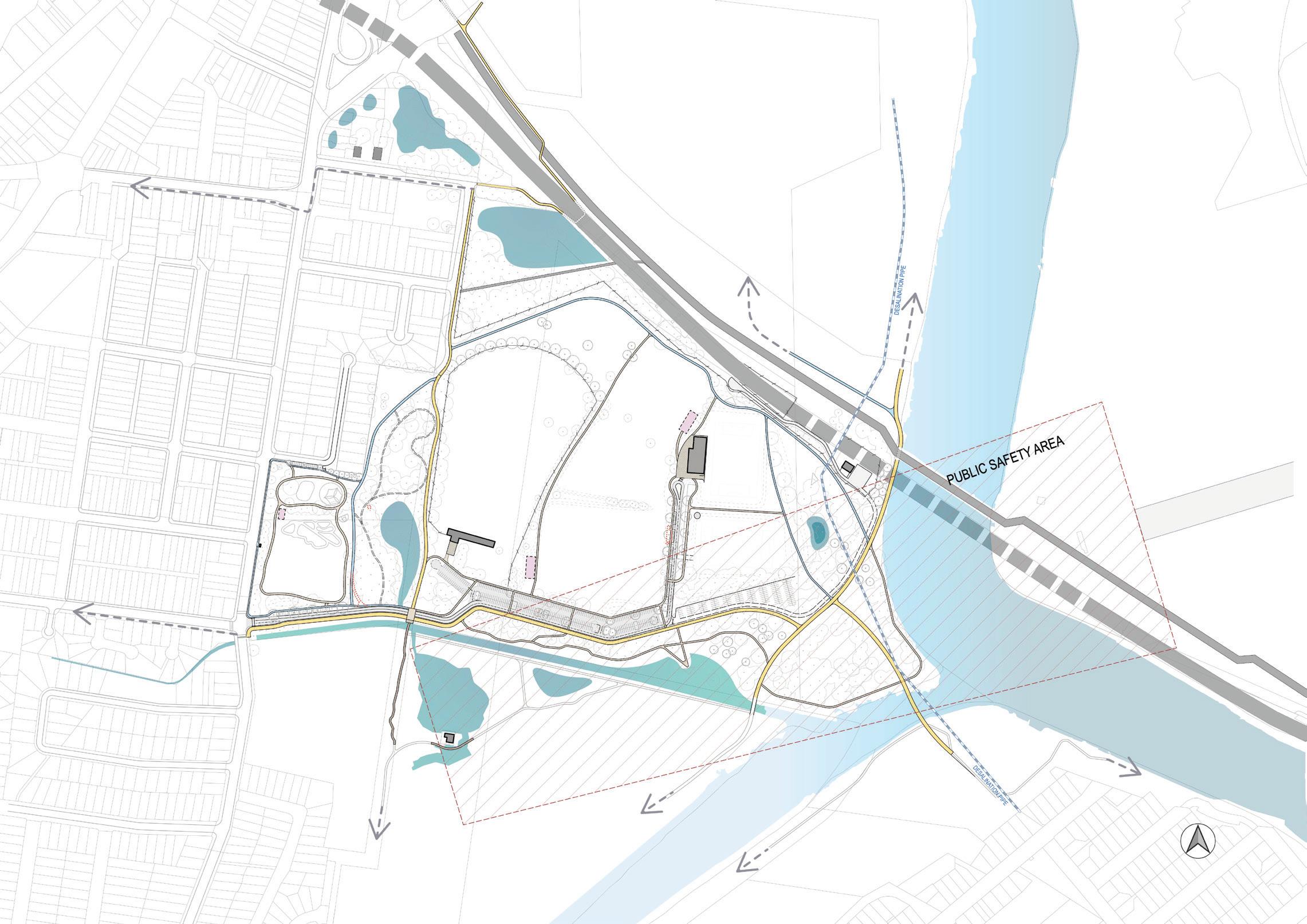


Park’s Entries and Access Route
This section will zoom in the park entry to analysis the existing access condition and the improvement opportunities.
The main access to the park is via West Botany Street. However, the existing access and circulation network present several issues:
• The main entry access from West Botany St is not very legible and lacks safe pedestrian and cyclist access.
• The existing bus stop at West Botany St is isolated and lacks a footpath connection to the rest of the park.
• The existing car park is isolated from vehicular and pedestrian movement, lacking passive surveillance.
• Conflicts exist at several locations between the shared path and vehicle access to the car park.
• Poor sightliness along the existing shared path pose safety risks.
• The existing carparks and facilities are disconnected and there is an opportunity to increase usability for park users especially at peak times.
Opportunities identified:
1. Create a hierarchy for movement to limit conflicts between vehicles, cyclists and pedestrians. To create a clearer movement framework and to improve passive supervision and activation to increase park safety.
2. Realign the access driveway to integrate with the car park to provide better passive surveillance and create an opportunity for separate shared path and pedestrian path to reduce conflicts between vehicles and active transport routes.
3. Realign the shared path to create a safer route with minimal conflicts with vehicle circulation and park users and better sight lines.
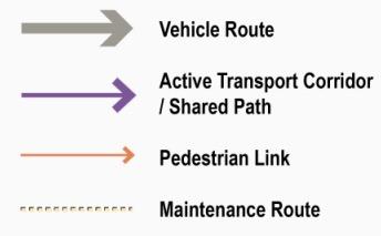
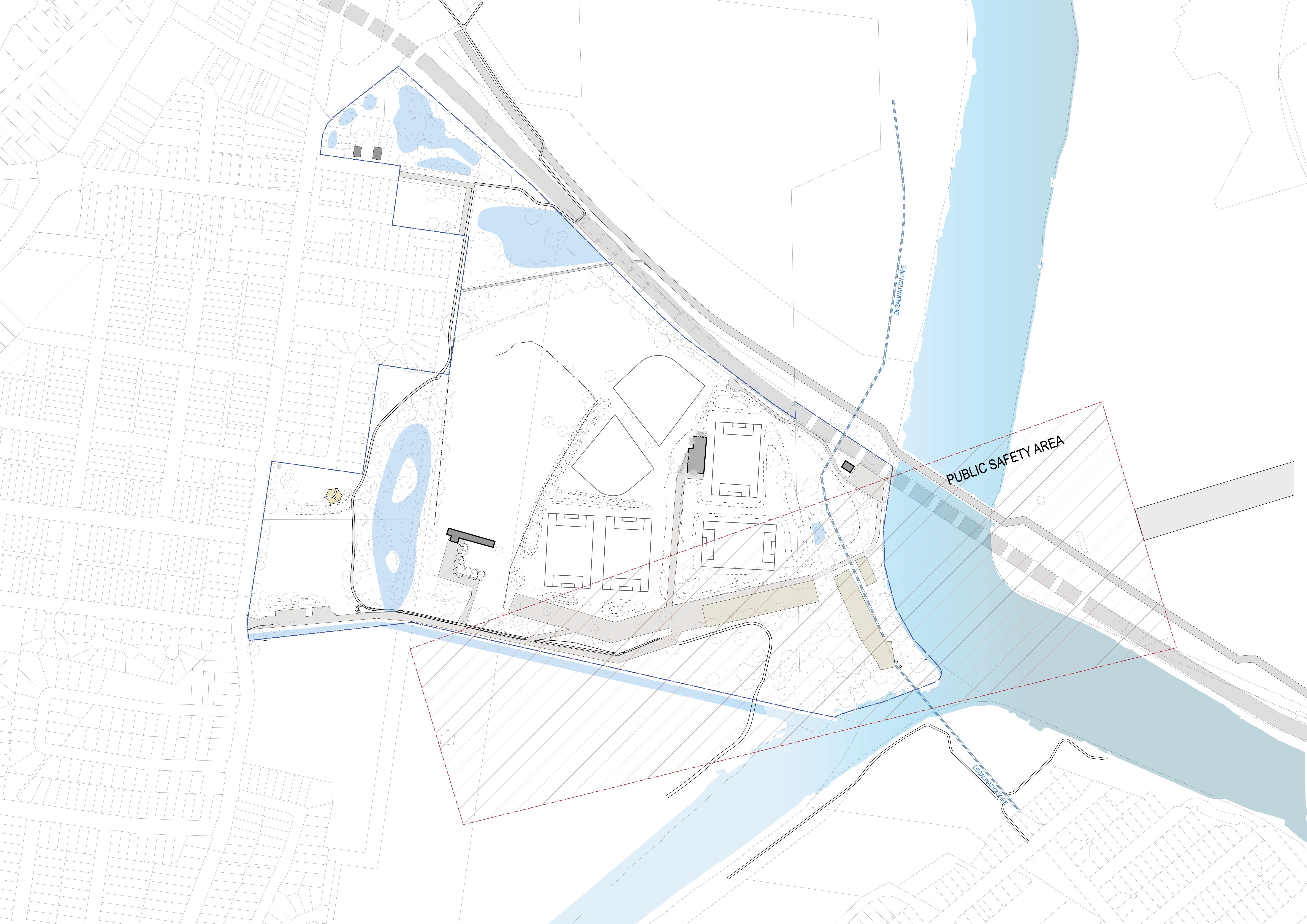
4. Some sections of the existing shared path to be downgraded to a pedestrian-only path where slower movement is desirable.
5. Provide a footpath connection to the existing bus stop at West Botany Street to encourage public transportation users.
6. Provide car parking at Spring Creek entry and Filmstone Garden for playground and park open space users.
7. Provide accessible parking bays, a turning circle, and Emergency Vehicle access to ensure safe and convenient operation for all park users..
8. Install a signalised crossing at the intersection of West Botany St and Spring St for a safer crossing and network connections.


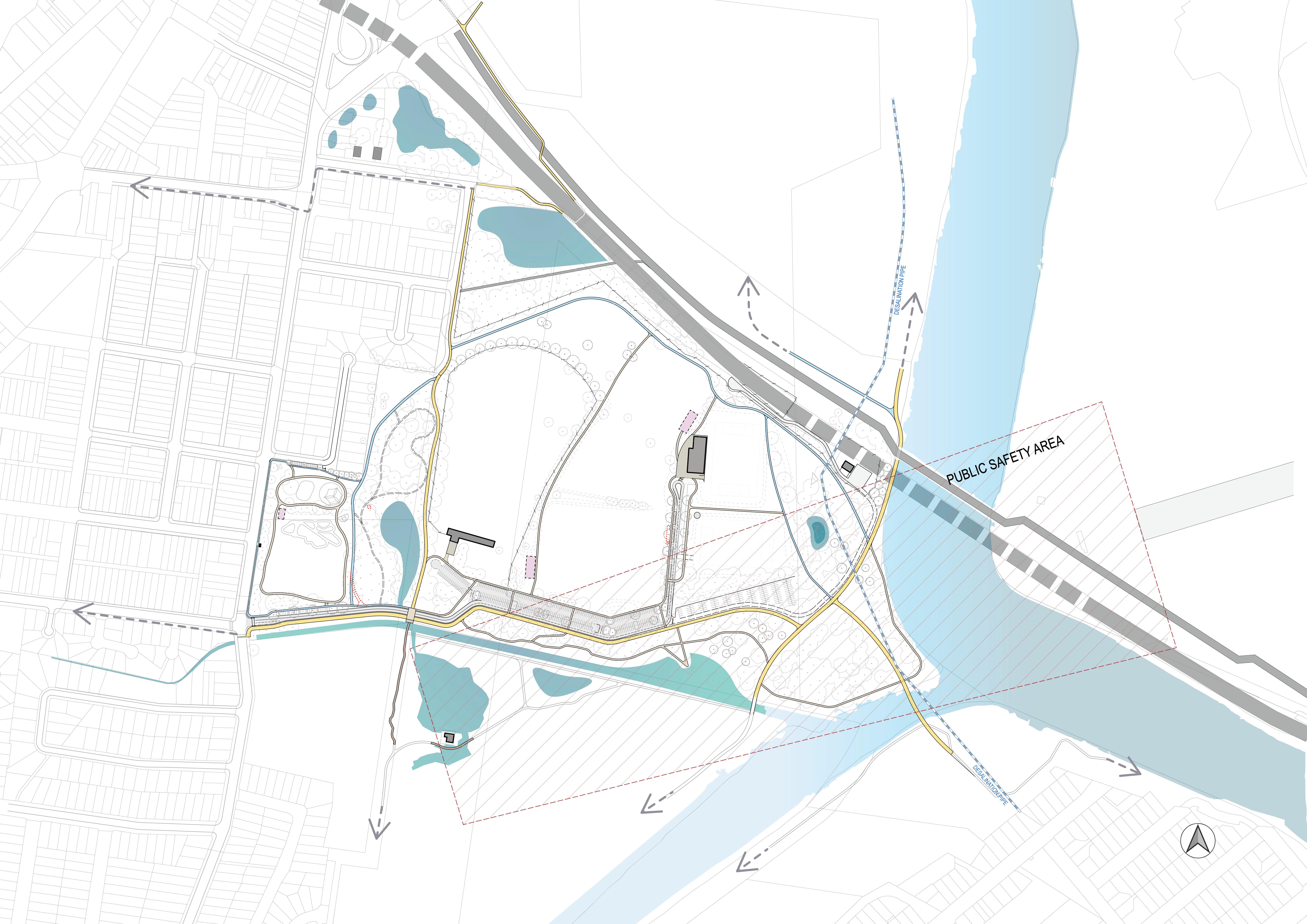

5.3 Biodiversity, Ecology and Tree Canopy
Existing Condition
Riverine Park, with its blend of established trees, wetlands, and mangrove species, plays a crucial role in supporting biodiversity and endemic species. However, large swathes of the park have suffered from inadequate long term maintenance, leading to an overgrowth of weeds that hinder water movement and suppress endemic species. Despite a tree canopy that covers about 30-35% of the site, the quality of this vegetation is highly variable. A significant portion comprises wood heathland and, worryingly, includes a mixture of weeds and invasive species that are not native to the area, further challenging the park’s ecological balance.
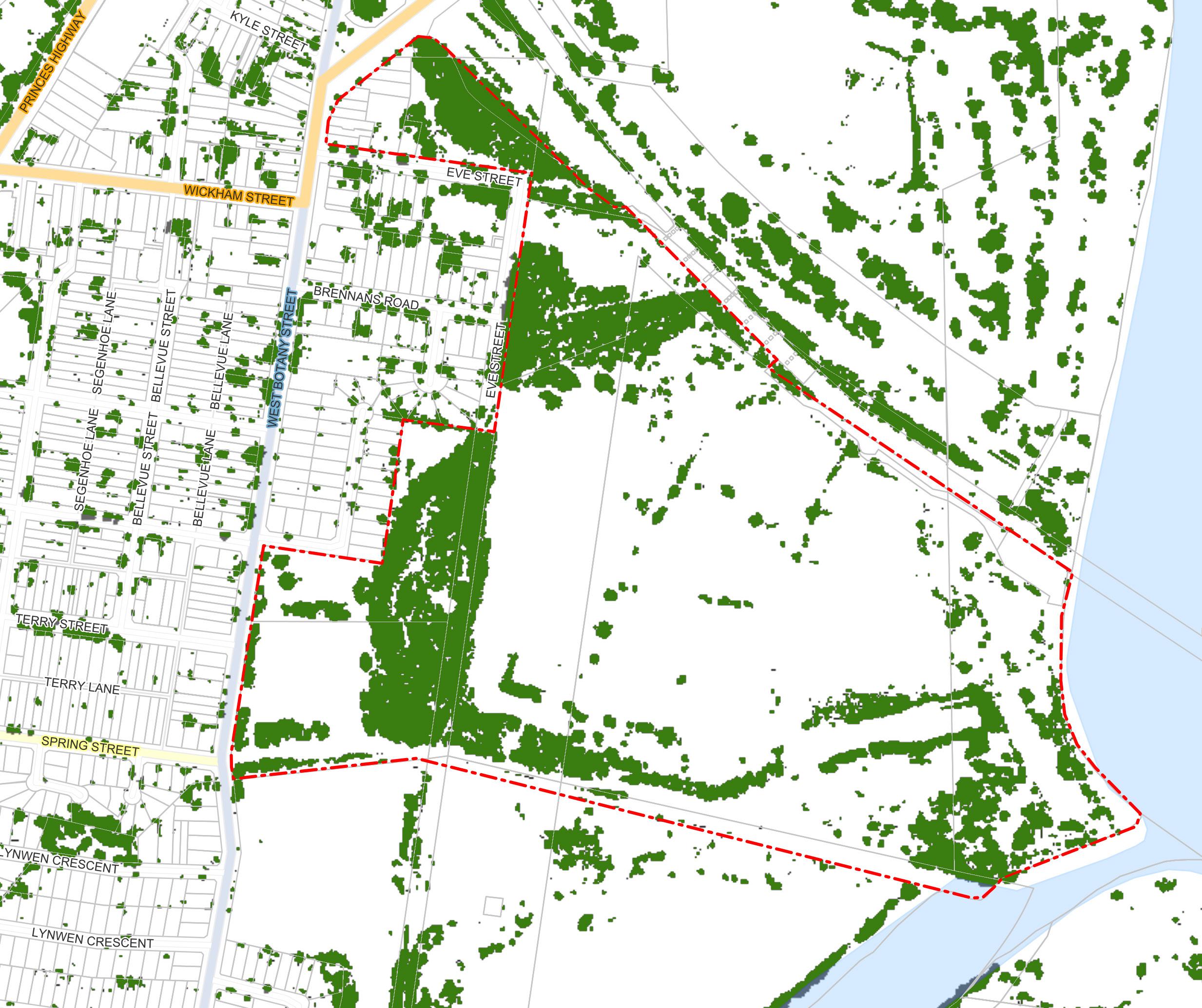
Opportunities
There is an opportunity to enhance Riverine Park’s ecological value by planting additional canopy and habitat in currently poorly maintained areas. However, this initiative must consider the constraints of the proximity of the airport Additionally, there is a chance to improve existing marine and
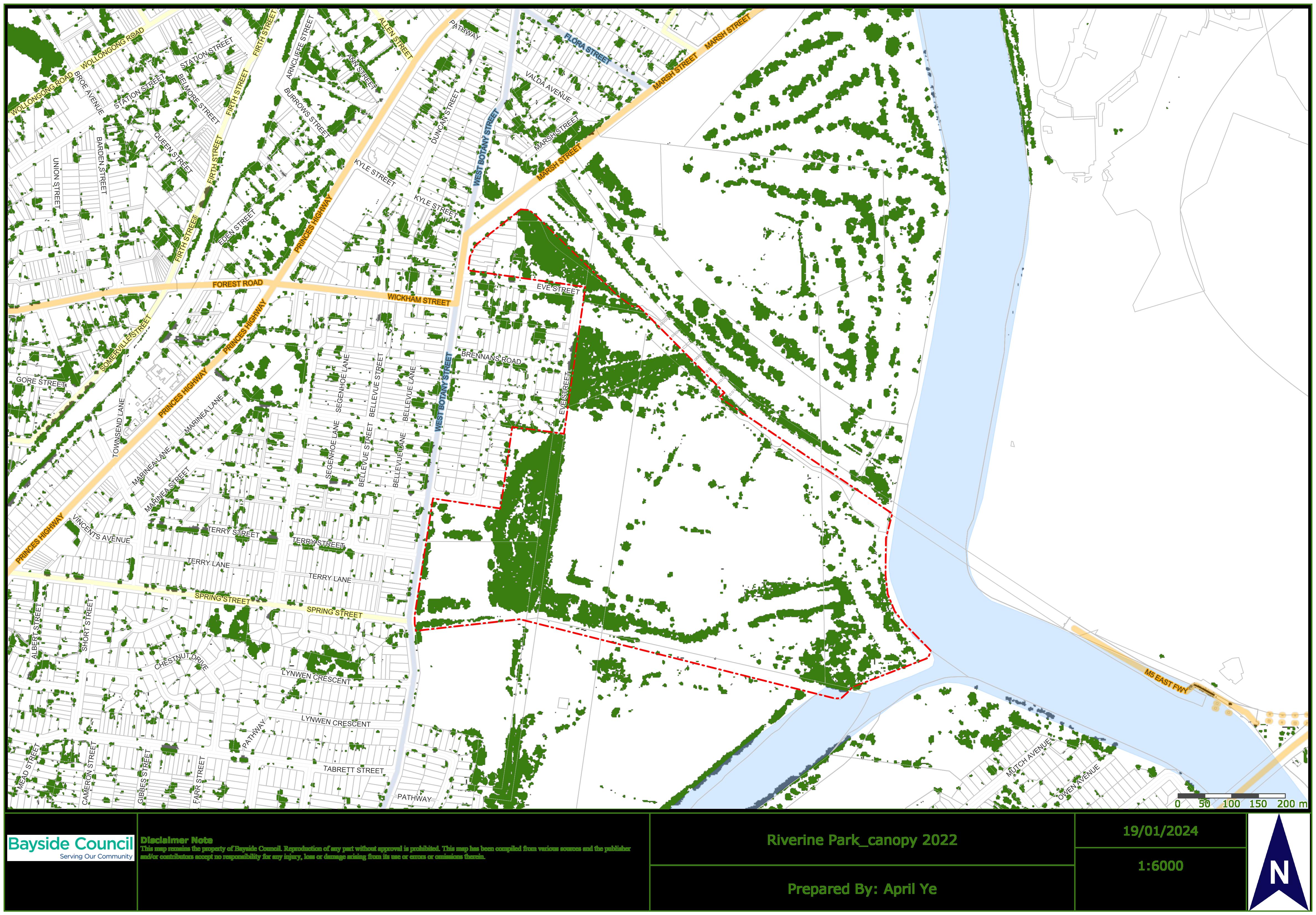
5.4 Waterways
Existing Condition
Situated on the edge of Botany Bay, Riverine Park’s prime attraction is its proximity to water, offering views of Cooks River, various estuary tributaries, and multiple wetlands. However, these natural features are currently underappreciated due to restricted access caused by a lack of accessible footpaths, overgrown vegetation, and fencing, limiting the potential enjoyment and engagement of visitors with these water-connected landscapes.
Opportunities
Maximising the potential of Riverine Park’s proximity to water is crucial. This involves improving water quality and aquatic habitats, creating opportunities for people to connect with the water, including direct access to the water’s edge, offering scenic views, and incorporating interpretative or educational elements.
Beyond enhancing visitor interaction with the waterways, these initiatives also present a vital chance to improve the health of the waterways, tackle stagnant water issues, and enhance sustainable passive irrigation and drainage systems.
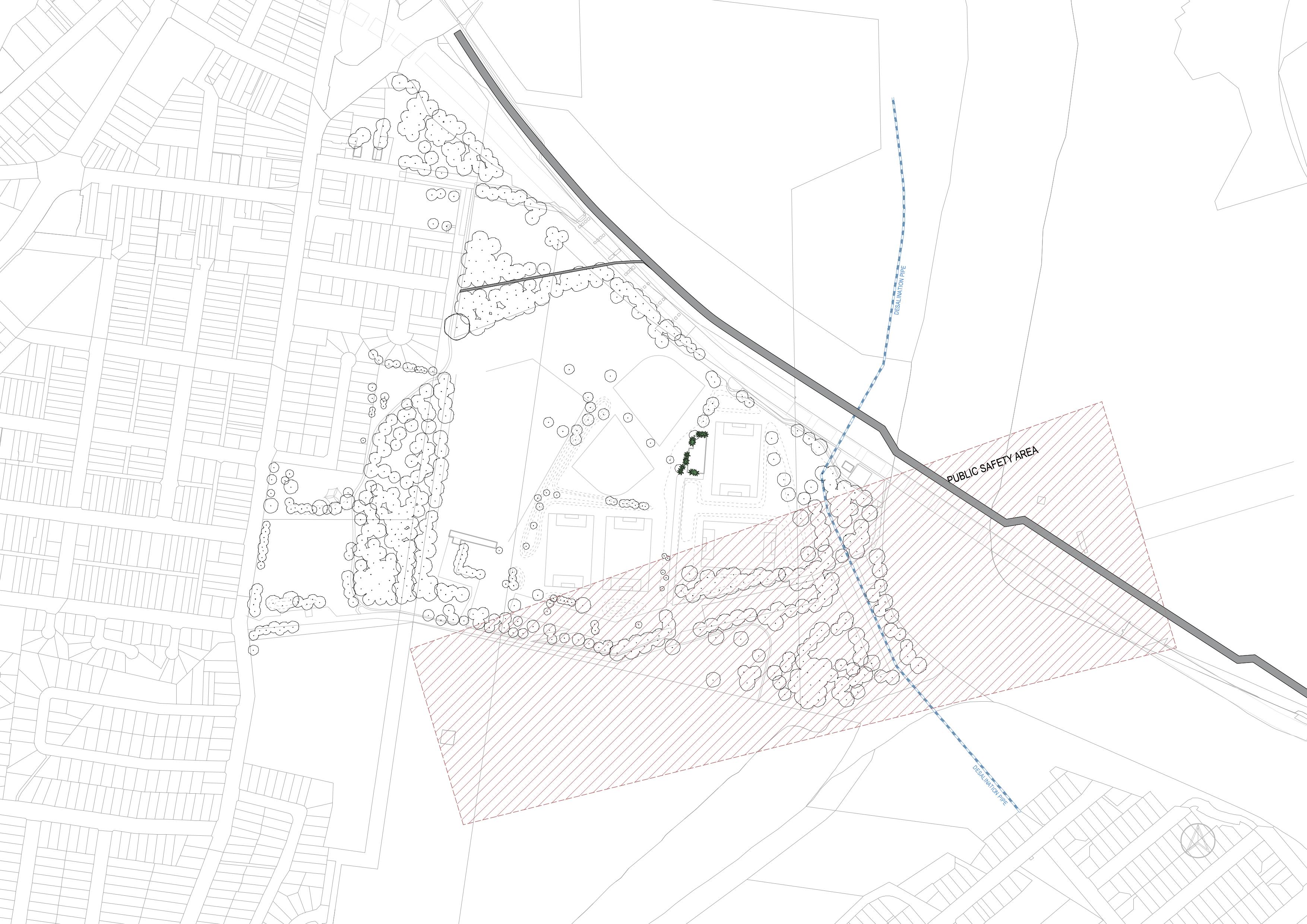
water meadow, frogs have been observed
and fish habitat Spring Creek Wetland built in 1990’s, is an unsuccessful rehabilitated wetland Improve water quality and function of Spring Creek Wetland
Protect and enhance the wetland and habitat. Provide vegetation buffer around the wetland area

Protect and enhance the wetland and habitat. Provide vegetation buffer around the wetland area
Protect and enhance the existing fauna habitat WSUD design to the carpark

lined drainage channel in poor condition, require asset renewal Key frog habitat
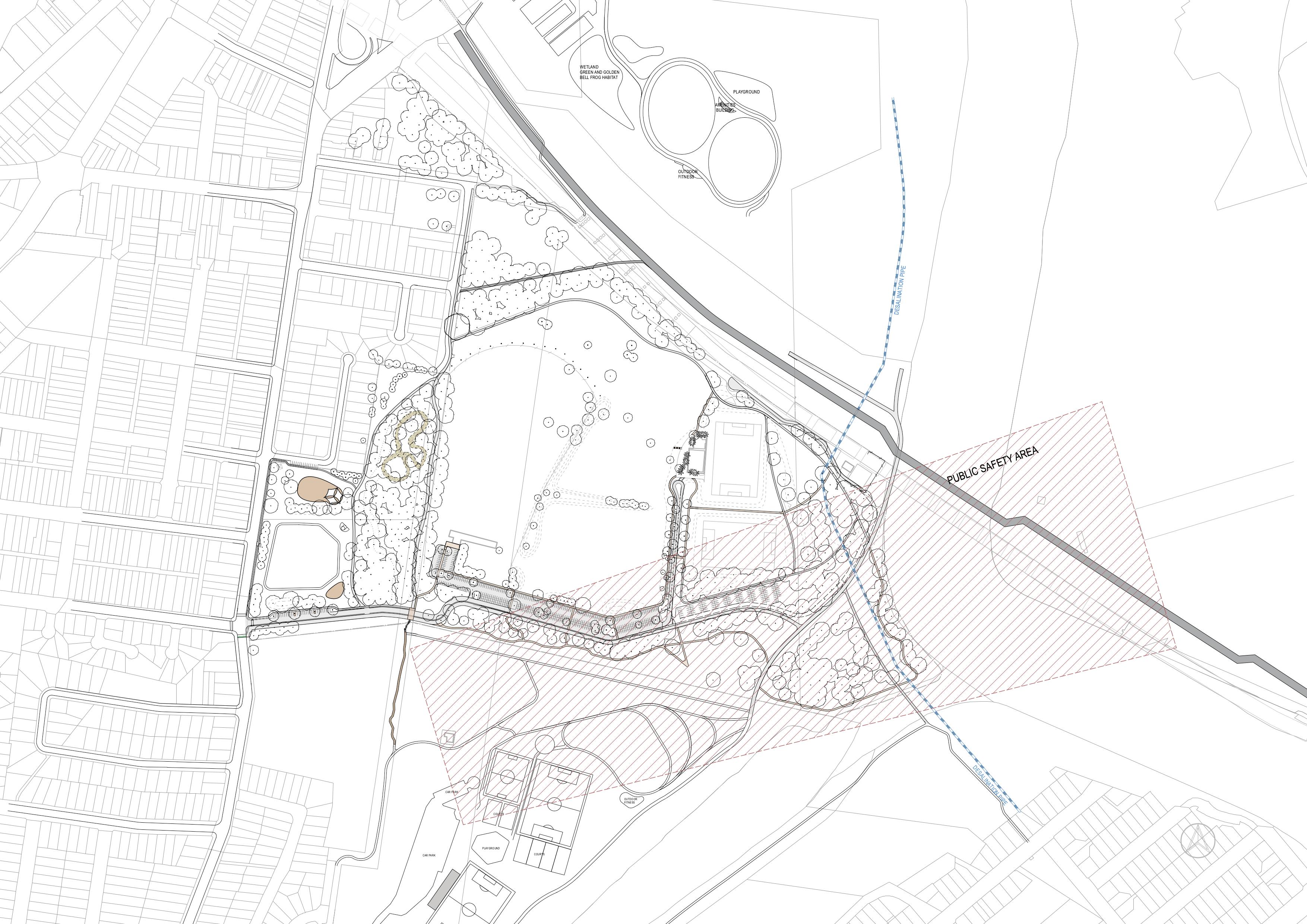
Spring Creek Naturalisation and opportunity for flood plain terrace to increase biodiversity and provide recreation opportunities
5.5 Spring Creek Naturalisation and Wetlands Improvements
The Spring Creek drainage channel was built some time prior to the 1940s. The drain’s function is to efficiently convey stormwater. Recent inspections of the asset have identified numerous failures in the concrete lining. The failures are predominantly on the drain banks, and at several locations, particularly on the southern bank of the drain, mangroves are growing through the banks. The mangroves are providing bank stability where the concrete banks no longer do but are impacting the capacity of the channel to pass flood flows. The channel base also shows signs of age but is still providing flood conveyance and is at less risk of continued failure given the relatively flat longitudinal gradient of the channel.
There are two wetlands adjacent to this portion of the Spring Street Drain - the Landing Lights Wetland to the south and the Spring Street Wetland to the north. These wetlands are hydraulically connected to the drain with tidal and storm flows passing between the drain and each wetland.
A set of objectives have been developed for its naturalisation. The project objectives are based around provision of a loved and revitalised Spring Creek waterway that is an enchanting destination, along with the interconnected wetland network, offering:
• A restored, naturalistic form adding valuable blue-green infrastructure to the area.
• A thriving ecosystem that supports precious aquatic and riparian communities.
• Enhanced liveability that service the growing local population and visitors of the newly improved Barton Park and Riverine Park precincts.
• A cost-effective asset both in construction cost and for its operable life.
• Safe management of large flood events within the waterway corridor to mitigate upstream flooding and ensure resilience in the face of rising sea levels.
• Improved water quality to enhance the overall environmental and human well-being of the project area.
Preliminary Investigation
Several options have been investigated and developed based on the following rationale:
• It is proposed that the northern bank of the concrete drain is removed entirely. The northern bank provides the most suitable opportunities for naturalisation. This would allow the low flow channel to be realigned to the left if desired.
• It is proposed that the majority of southern bank of the channel is left as is. This is because there are several constraints to the southern bank, such as the market gardens, Landing Lights Wetland and Barton Park. In addition, the mangroves that have established in the bank will be retained as they are providing bank stabilisation.
• Significant cost savings will be gained if the base of the concrete drain is retained. The reason for this is that the base of the drain is the most challenging location to work in and it is integrated with the southern bank and the protruding mangroves. Further, the base of the drain plays a major part in the channel’s flood conveyance function. Minor repairs to the base could be required to enable this. The base could also be replaced or realigned, so to achieve a fully ‘naturalised’ channel, or relined with a new lining material such as rock rip rap.
• Landscape treatments will need to incorporate habitat that is compatible with aviation safety framework requirements. As such the options present habitat types that focus on aquatic rather than ephemeral wetland habitats to limit the attraction of birds and risk of causing bird strikes
• Works are designed on the assumption that negative impacts to flooding are not acceptable and flood mitigation is improved.
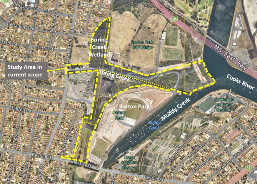
Figure 61 - Study area of Spring Creek Naturalisation
6. Principles
RESPECT SITE CONTEXT COASTAL AND ENVIRONMENTAL PROTECTION
CONNECTIVITY WITHIN AND BEYOND PROMOTE ACTIVE LIFESTYLES & RECREATION
SAFETY FOR ALL SUSTAINABLE INFRASTRUCTURE
Design Strategies
Acknowledge the traditional custodians - Gadigal/Bidjigal people of the Eora Nation.
Recognise the contribution to the early development of industrial Sydney.
Design responds to the modified environment including land management measures to limit impacts from past contamination.
Interpret the site history by creating a heritage, environmental and/or art trail
Promote public awareness, education and understanding of coastal processes and park management actions.
Engage with local First Nations people to prepare wayfinding plan for precinct.
Protect and enhance natural coastal processes and coastal environmental values including:
• natural character
• scenic value
• biological diversity
• ecosystem integrity
• resilience
Support the social and cultural values of the coastal zone.
Mitigate current and future risks from coastal hazards.
Expand the ecological communities to enhance their viability and protection.
Manage use and limit dog access in vulnerable ecological areas.
Connect to broader active transport network.
A hierarchy of movement for cohesiveness and legibility to mitigate and manage user conflicts.
An inclusive path system to provide opportunities for a range of users in terms of ages and abilities.
Reinforce safe access to the site by providing a sense of arrival and destination.
Provide opportunities for diverse recreational participation to cater for growing community demand.
Provide recreation for a range of ages and abilities.
Create places of interest and delight that encourage use of outdoor spaces.
Promote health and fitness within the local area by creating circuits and destinations.
Work with sporting partners to provide opportunities for the local communities to create a multi-sports hub for the district.
Create special places for relaxation, viewing, contemplation, unstructured recreation and socialising.
Create enhanced livability for the growing local population and visitors by ensuring that the park is available to everyone.
Adopt Crime Prevention Through Environmental Design (CPTED) principles to ensure that users feel safe when in the park.
Improve public amenity and lighting of movement networks to meet compliance and best practice standards.
Encourage high levels of use to promote the sense of safety for users.
Improve site surveillance by creating good sight lines and avoid hidden areas.
Design areas for shelter in hot or inclement weather
Maintain public access, amenity, use and safety near waterways.
Safe management of large flood events within the waterway corridor to mitigate upstream flooding and ensure resilience in the face of rising sea levels.
Create restored, naturalistic environments to add value to blue-green infrastructure to the area.
Recognise and respect operational requirements due to proximity to airport and M5.
Develop cost-effective assets both in construction cost and for its operable life.
This page was intentionally left blank
7. Masterplan
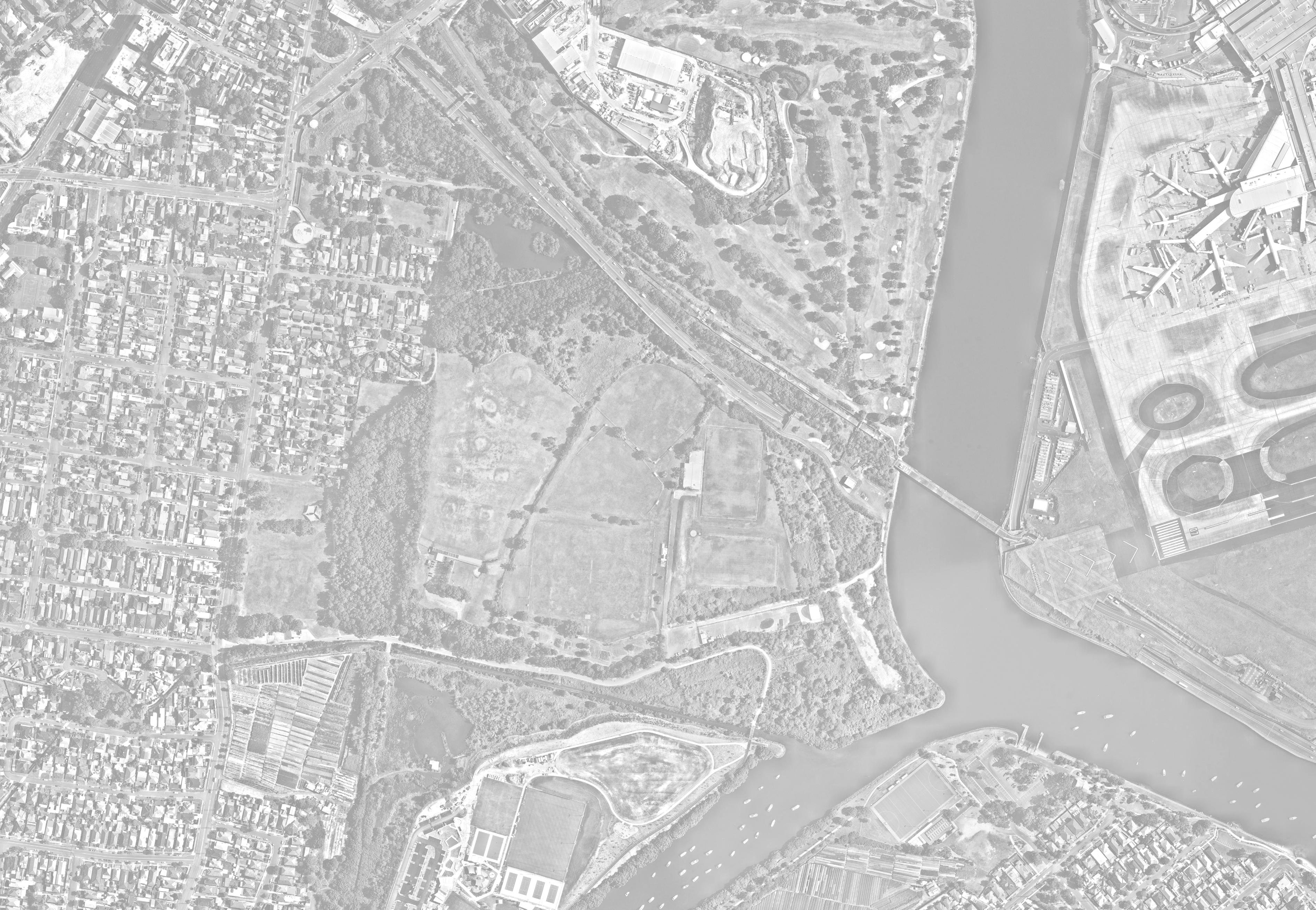
A Upgrade West Botany Street main entry
B Eve Street entry
C Cooks Cove entry
D Pedestrian bridge over Muddy Creek
E Pedestrian bridge over Spring Creek
F Upgrade park facilities and playground renewal
G Spring Creek naturalization and wetlands improvement
H Walking trails
I Realigned access road
J Community garden
K Environmental buffers
L Foreshore and wetland activation
M Refurbish existing amenity building
N Drop-off, pick-up, and accessible parking
O Overflow car park P Parking
Q Plane spotting slope
R Paddle and kayak access point S Dog off-leash area
Key elements summary
A Improve Riverine Park’s main entry at West Botany Street. Separate pedestrian circulation and vehicle circulation to create a safer environment, also make a smooth connection to the Spring Street pedestrian and cycle link. Provide traffic signal at the intersection.
B Enhance legibility and sightlines at Eve Street entry by realigning the path and pruning the overgrown vegetation.
C Formalize the trail under the concrete SWSOOS along Cooks River foreshore to create an active transport link that connects to Cooks Cove (future Pemulwuy Park) and Wolli Creek.
D Pedestrian bridge over Muddy Creek to connect to Kyeemagh and Botany Bay foreshore.
E Replace or upgrade the unsafe pedestrian bridge over Spring Creek.
F Upgrade park facilities, including renewing the existing playground, and expanding the activity zone to include additional facilities like pump track, outdoor fitness area and a 3-point basketball court, walking / learn to ride circuit
G Spring Creek naturalization and improvement work to Landing Light Wetland and dysfunctional Spring Creek Wetland
H Opportunities for walking trails through the former wetland, and remove the dilapidated viewing platform in the middle of the wetland
I Divert the access road to the car park.
J Provision for a future community garden at Eve Street Reserve.
K Environmental buffers includes revegetation and restoration to support habitat restoration and biodiversity, including protect and enhance Green and Golden Bell Frog habitat
L Improve access and amenity to the wetland and foreshore, incorporating low-impact recreational facilities such as boardwalks, viewing platforms, and interpretive signage to enhance visitor experiences while minimizing ecological disturbance.
M Sporting Partners to Refurbish existing amenity buildings.
N Provide drop-off, pick-up, and accessible parking along the access road, the configuration also considered the cul-de-sac turning head, accessible access and emergency vehicle access. Existing dilapidated building to be demolished.
O The existing compound area is within airport PSA, not suitable for intensified use, will be turned into an overflow car park
P Reconfigured and consolidated existing parking along the access road, incorporating WSUD principles and integrating additional tree planting. A small off-street timed parking area is proposed next to Firmstone Gardens for convenient access, providing an alternative park entry point.
Q Utilising the existing topography to create a lookout for plane spotting
R A paddle and kayak access point is indicated in the plan and will be welcome enhancements to the Cooks River Paddle Trail. Given its location under the PSA additional facilities such as seating, lighting and picnicking will not be possible. This site is not intended to be a full launching facility as it is too far from the car park. (The final location is subject to further investigation and detail design)
S The designated dog off-leash area is to be fully fenced to eliminate conflicts with other park users and wildlife habitats.
In addition to the key items outlined above, the masterplan has configured the pathway circulation to respond to the planned regional active transport links, as well as providing a more legible, fluent, and safer internal pathway network that connects each landscape precinct.
In addition to the existing sport precinct in the centre area of the park, the masterplan also proposes a series of open lawns for unstructured recreation. They are linked by paths and offer a sequential landscape experience.
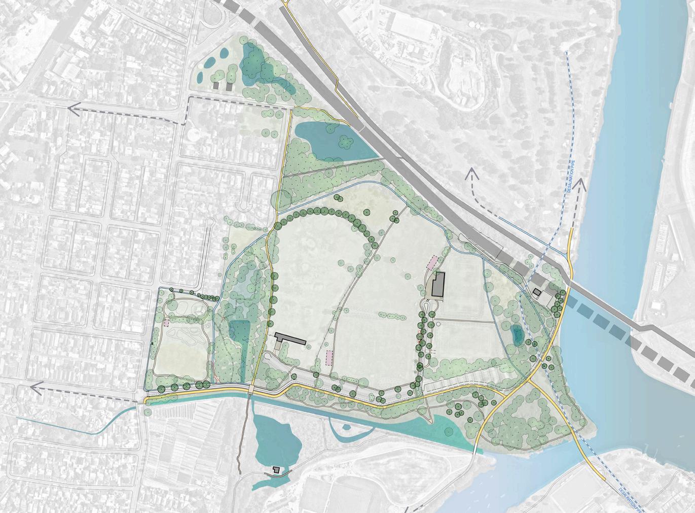
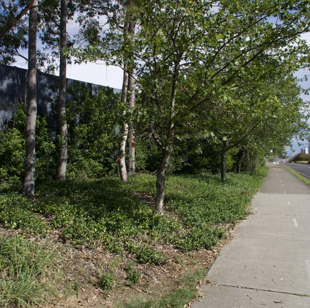
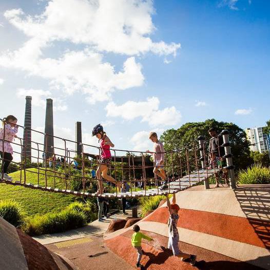
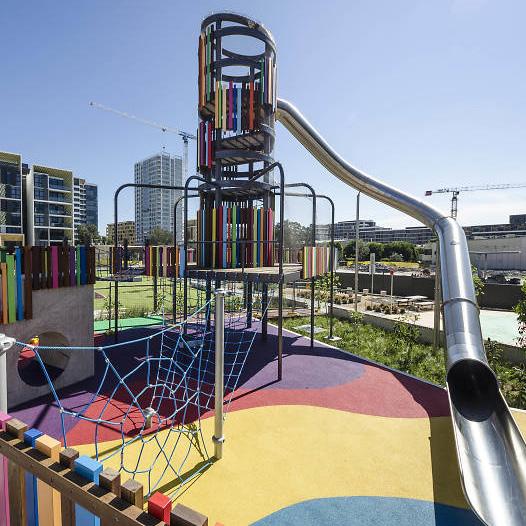
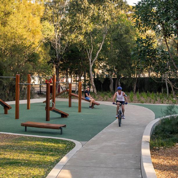
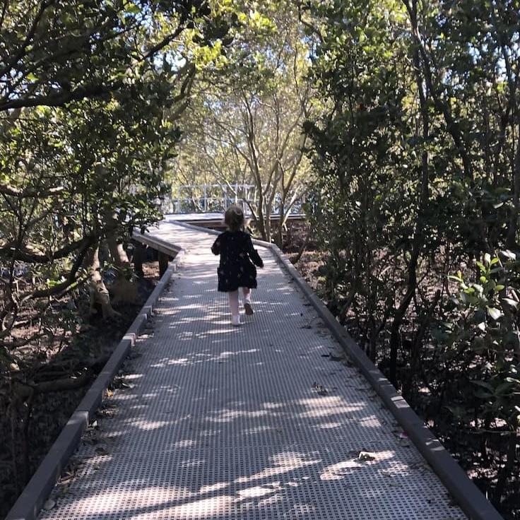
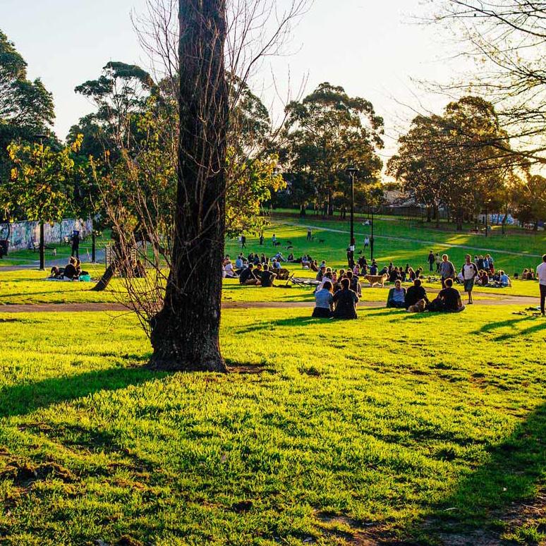
Figure 63 - Section location plan
Figure 64 - Section A & functional zone (north south) note: imagery for precedent purposes only
Figure 65 - Section B & functional zone (east west) note: imagery for precedent purposes only
GOLF DRIVING RANGE
SPRING STREET WETLAND
FIRMSTONE GARDENS
SPORTS FIELDS
SPORTS FIELDS
M5 SWSOOS PEMULWUY
Section A
Section B
GOLF DRIVING RANGE
SPRING STREET WETLAND
FIRMSTONE GARDENS
PEMULWUY
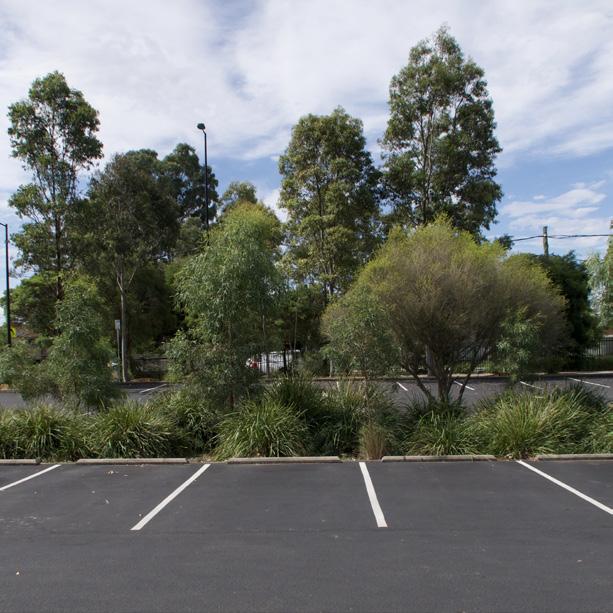
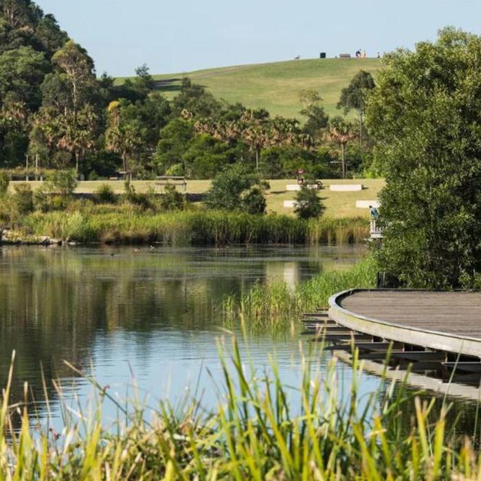
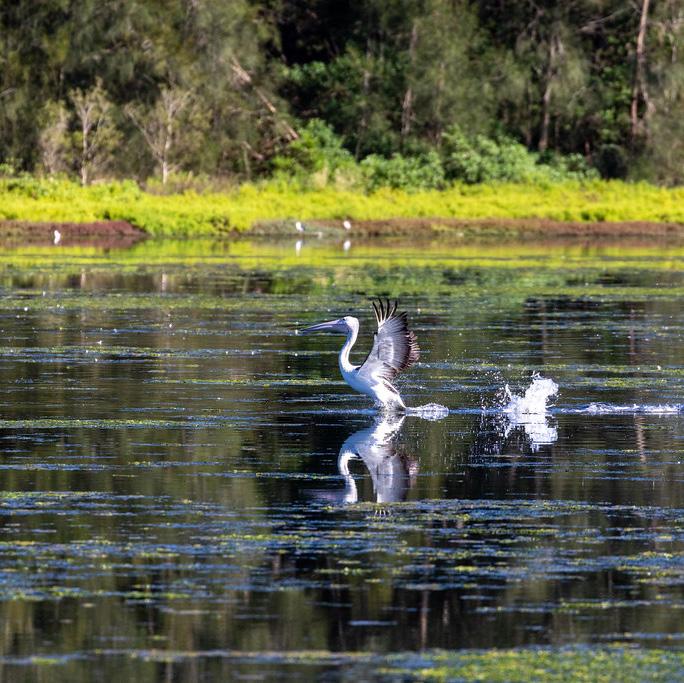
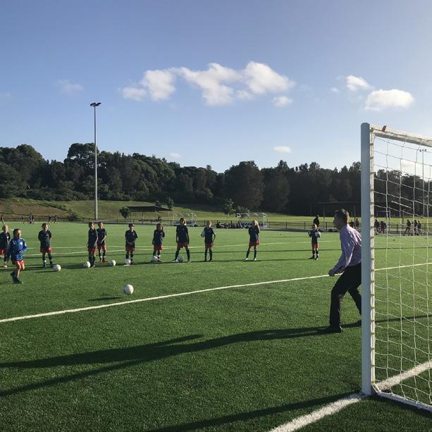
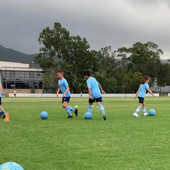
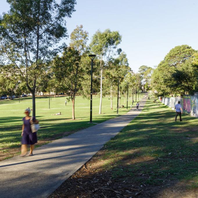
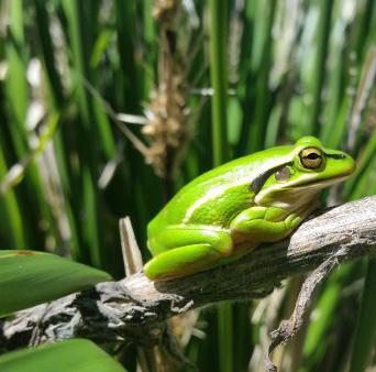
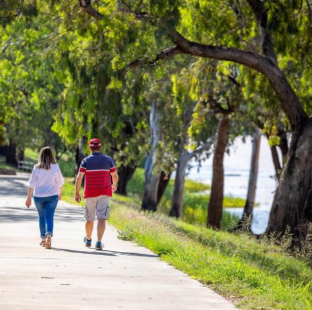
SPORTS FIELDS
COOKS RIVER FROG HABITAT
SPRING CREEK BARTON PARK
SPORTS FIELDS
COOKS RIVER FROG HABITAT
SPRING CREEK BARTON PARK
SPRING CREEK
SPORTS FIELDS BARTON PARK
SPRING CREEK
SPORTS FIELDS BARTON PARK
7.2 Functional Zoning Overview
Environmental Zones
Riverine Park is located within a rich ecological context. To the northern boundary there is a series of wetlands that are enclosed as part of Sydney Water and TfNSW infrastructure. To the south lies the Landing Lights Wetland and associated wetlands and to the Muddy Creek Foreshore:
• Renew the Spring Street drain and naturalise 700m section from West Botany Street to the confluence of Muddy Creek
• Modify Spring Street wetland to improve ecological conditions, reduce odours and prevent stagnation. Concentrate water into southern extent of wetland to produce flushing
• Improve water quality in the hydraulically connected water courses
• Enhance and create a series of wetlands to enhance marine diversity and frog habitat at Oakleigh Wetland (west of Barton Park), Frog Wetland and Estuary Wetland to enhance the aquatic and riparian habitat
• Design adjoining park infrastructure to direct overland flow into wetland areas to increase water infiltration and water quality moving through the system.
• Improve the quality of vegetated areas. Remove extensive areas of weeds including woody and noxious species. The works to include reconstruction and regeneration of vegetation including the protection of large canopy trees.
• Remediate the heavily disturbed land with planting, especially canopy trees using endemic species
• Enhance freshwater ponds to create detention for freshwater species such as the Green and Golden Bell Frog
• Promotion of Rockdale Wetlands Corridor as a series of restored blue-green assets, including wetlands, open spaces, and nature reserve precinct
Active Recreation
Riverine Park has been an under-utilised park with limited amenity for legitimate park users. Connectivity is poor and the low quality of the experience does not encourage users to explore this vast open space.
• Implement a clear hierarchy of movement to remove conflicts between vehicles and vulnerable users such as cyclists and pedestrians
• Improve safety for increased usage by cyclists and pedestrians in a shared environment
• Create better east/west connections and plan for connections to future open space to the north
• Improve links to the broader network to connect to local transport nodes including Arncliffe station, Banksia Station, and Wolli Creek Station
• Enhance north-south cycleway, which is part of the popular Bay-to Bay cycle network and beyond to the Rockdale Wetlands Corridor.
• Reconfigure existing walkways to provide relaxed
walking areas alongside the waterways
• Provide areas of parking located to service a range of recreation options including clear drop off, circulation and disabled parking spaces in the most suitable locations
• Collaborate with sporting partners to support grass roots sporting activities to encourage local participation
• Retention of existing sporting fields to create a high-quality multi-sports hub with improved lighting and drainage
• Upgrade sporting facilities to meet the demands of increasing population in the catchments
• New sporting facilities to be supported with amenities to the high standard provided in other parks to provide facilities for organised sport as well as casual users.
• Take advantage of the modified landform to provide mounds for spectator viewing and integrate shade trees.
• Investigate reconfiguration of the central active recreation area for a greater variety of sporting activities.
Passive Recreation
Vegetation management is essential to improve the quality and amenity of the parkland. This transformation will activate the eastern shoreline for airplane spotting and enhance accessibility and visibility of special areas such as the northern Fig Tree Lawn to create versatile spaces for picnicking, passive sports, and appreciation of nearby sports fields. The expansion of the western Firmstone Gardens Playground will introduce youth-oriented activities such as hoops, outdoor fitness, and a pump track, taking full advantage of the area’s mix of flat and undulating terrain.
The integration of Eve Street Reserve with Riverine Park to the north identifies a suitable location for a community garden, enhancing the area’s appeal and utility especially for residents living in higher densities nearby.
• Creation of formal routes and wayfinding signage using standards developed for use in Bayside Council
• Enhanced playground for children and families with nearby facilities for older children such as learn to ride circuit and broader riding circuit within parental view
• Improved angles parking and fencing near playground adjacent Firmstone Gardens
• Facilities for older children including urban pump track and 3-point basketball hoops and exercise hubs
• Provision of facilities to serve casual users such as picnic tables, seating, and water supply
• Provision of lighting throughout the park to create safe access and usage to support night-time use.
• Creation of a short and long walking and cycling circuits that include improved access to the foreshore and enhanced waterways
• Parkland settings for viewing planes in safe locations
• Improve pedestrian access and promote complementary activities such as the development of an educational route, art trail and/or heritage interpretation route

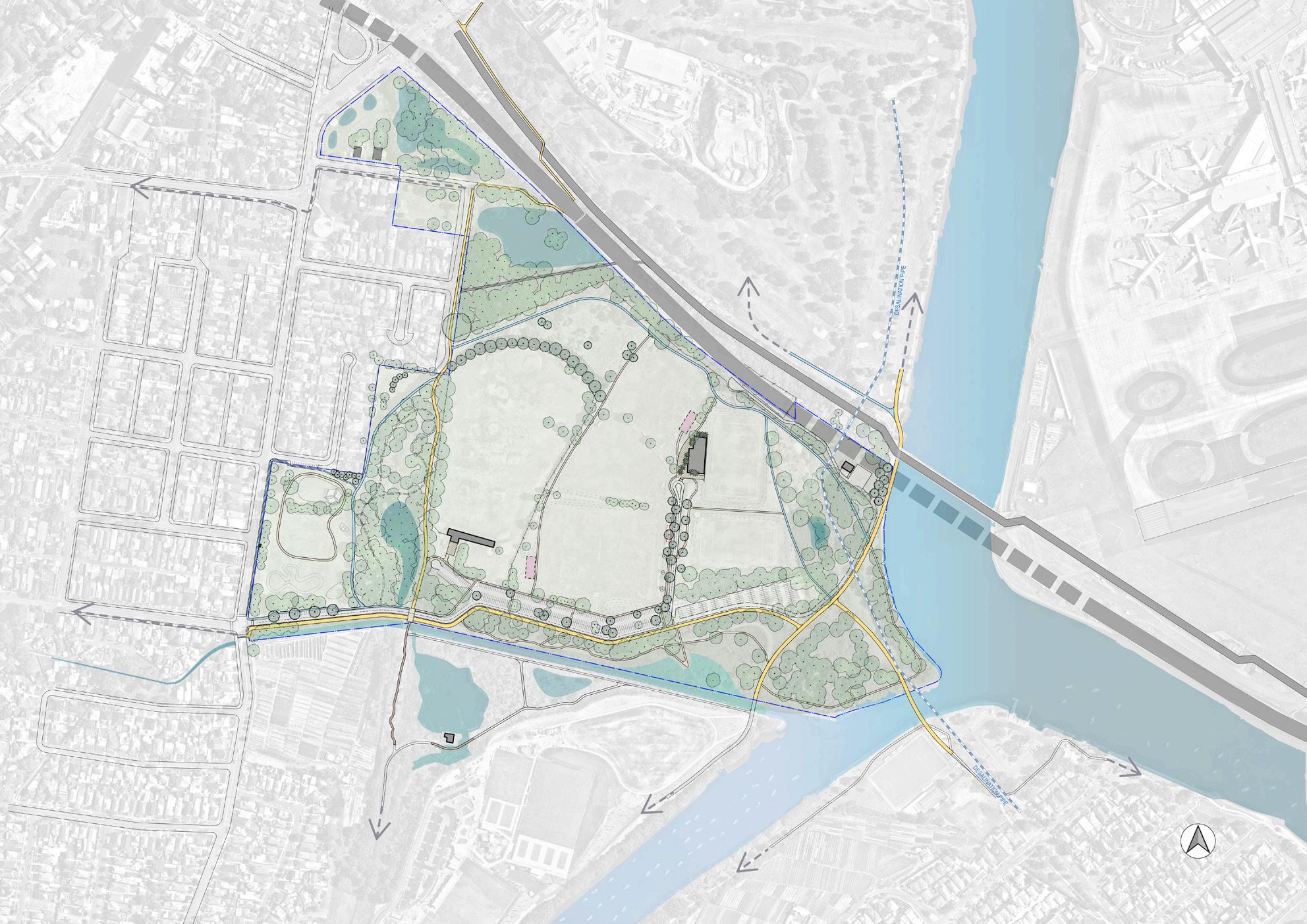

• Provide spaces that encourage passive recreation focuses on bird watching and enjoyment of locations adjacent water bodies
• Introduction of rocks/boulders in swale areas to encourage exploration and water play
• Improve access and pedestrian access in the Landing Lights Wetland including boardwalks
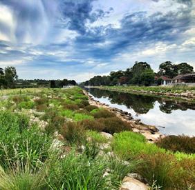
Park Infrastructure
Riverine Park is within a substantial infrastructure setting that supports the broader district. This infrastructure creates limitations for the future development of the park. The growth of this park will also need to be supported with suitable infrastructure to cater for increasing usage.
• A realigned access road improves access and visibility to sports fields, ensuring safe operation without conflicting with other park users.
• Overall increase of parking with improved circulation and overflow parking to support the corridor on busy days
• Locate any additional buildings close to existing facilities to allow connection to nearby infrastructure and to limit the extension of existing roads for servicing. These locations options will be discussed with future sporting partners and are shown as potential building envelopes.
• Improve traffic management particularly when exiting by providing adequate lanes and a signalised intersection to clear crowds on large game days
• Improved parking configuration to serve the whole park including improved circulation, tree planting, improved lines and signage and the reduction of oversized parking areas to limit anti-social behaviour in carparks.
• Provision for servicing of adjoining infrastructure with safety in mind for all park users.
Figure 66 - Proposed functional zoning plan
7.3 Amenity Building Strategy
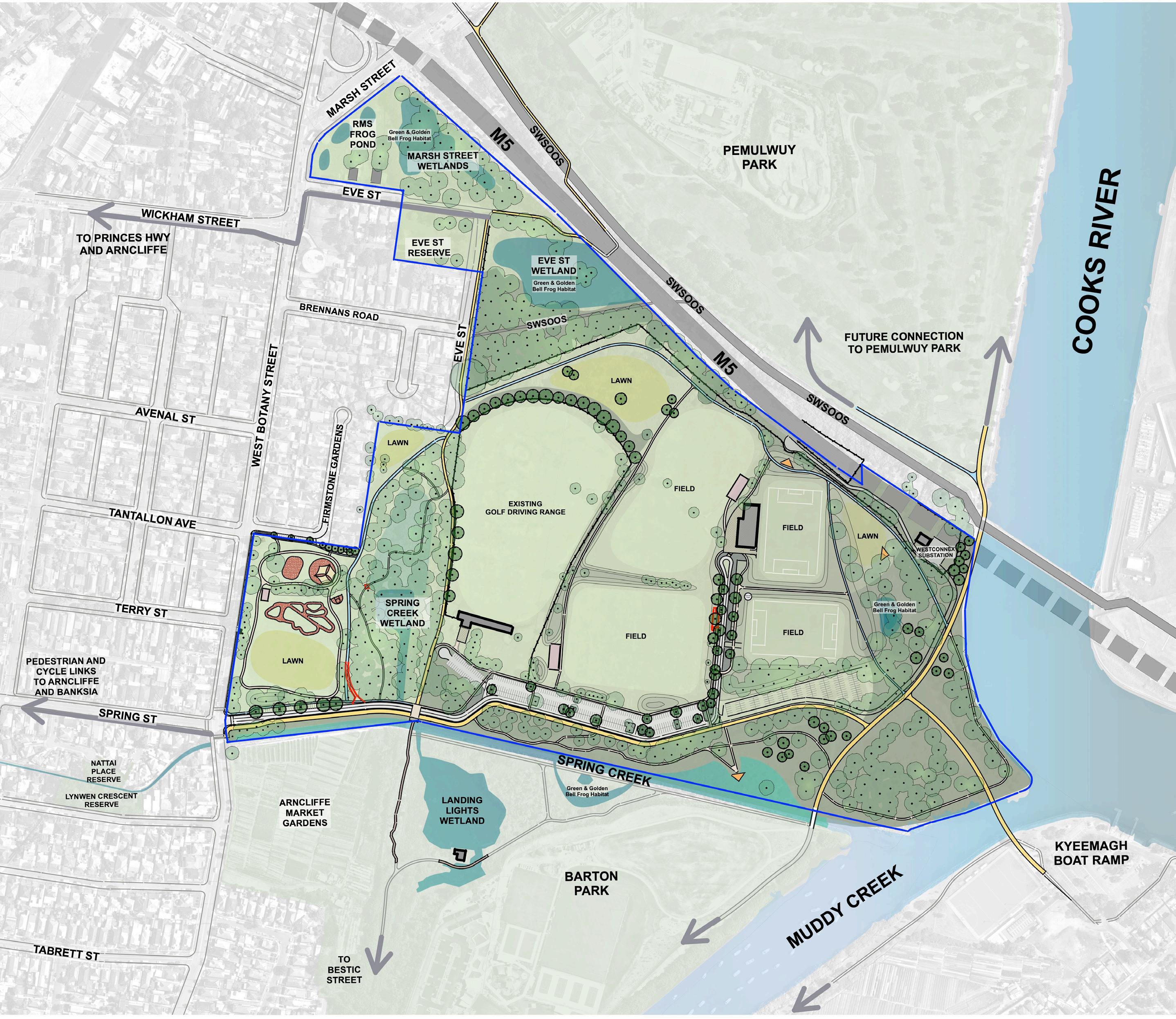
Existing amenities buildings
Potential building location and envelope
The provision of amenities must focus on convenience and accessibility to both passive and active users within the park area. Where new structures are necessary, the design of buildings must be oriented to reduce impacts to sightlines, be well lit, and situated in locations which will be well activated. All buildings must meet DDA and relevant accessibility standards.
Existing Built Form
BE1 - The central amenities block - Recently licensed to Arncliffe Aurora and will undergo renovations, allowing it to support both the sporting needs as well as the needs of the general community
BE2 - Golf driving range facilities - currently privately run and managed. There is an additional storage shed within the north section of the fenced golf driving range.
BE3 - A small building that requires demolition due to its poor structural condition poorly sited into a former landfill mound which must be reinstated.
Future Built Form
BF1 and BF2 indicates potential locations and suitable building envelopes to support sports activities. The addition of new buildings will be carefully considered to protect sight lines, ensure feasible connections to services, and servicing from existing road network.
The introduction of new buildings is limited to avoid intrusions on public open space and crime prevention through environmental design (CPTED) to deter vandalism, ongoing maintenance and liability for council.
New buildings cannot be attached to existing structures and must be designed to meet current legislation guidelines and contemporary standards.
Ideally the upgrade of existing building facilities will cater to multiple user groups - such as summer and winter sports organisations, as well as provide public access to toilets and shelter.
BF3 is indicates potential location for a small amenity block of toilets and basins for the park users.
7.4 Fencing and Barrier Approach
The masterplan seeks to maximise public access, passive surveillance, and expansive sightlines. Physical fences often detract from the quality of open space potentially alienating legitimate users. Fences and barriers contribute to the management of hazards and conflicts and assist the protection of property when properly designed.
Fencing and barriers wherever required, should maintain visual continuity, limit clutter and contribute positively to a high aesthetic quality that is legible and unobtrusive. The material selection must be robust and durable.
The diagram below illustrates the extensive use of high security fencing that has largely fallen into disrepair creating hazards in their current state. This heavy security approach is no longer appropriate for public open space that is intended to be highly utilised and inviting to the public. The past approach was necessary due to the isolated and neglected nature of the park until now.
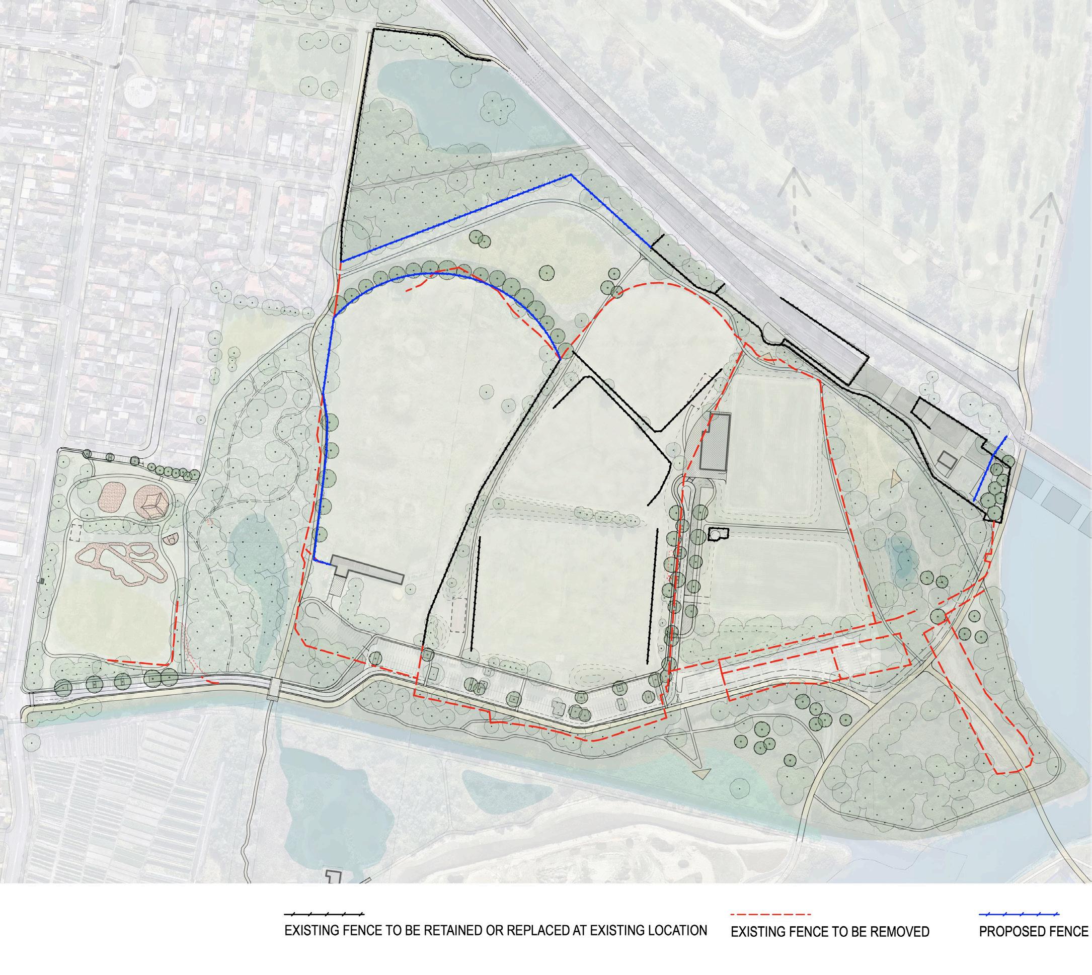
Active Precinct
Fencing and barriers in the multi-sport hub is required to protect the fields by managing the movement of vehicles as well as ensuring that balls are controlled to protect park users to reduce the risk of accidents. The multi-sport hub will remain open to users beyond the sporting partners and welcoming the general public.
The topography of the site offers a series of mounds which create some natural barriers that reduce the nature of ball hazards and will reduce the requirement for continuous fencing.
High fencing within the park is only acceptable surrounding the golf driving range and goal mouths to protect adjacent users.
Golf driving range fence to be moved 3-5m and replaced with higher fence with ball deflector.
In selecting material fencing may include modular components, removable sections, flexibility in design to allow for low-cost modifications. The public domain should remain transparent and pedestrian focused. Barriers such as bollards are useful where the public domain takes precedence where gating and movement control is required. Ensuring seamless public domain is essential to ensure appropriate access including universal access to the site.
Adjacent to M5 motorway
Operational areas and areas adjacent to critical infrastructure require security fencing to remain for public safety reasons. Existing fences along M5 motorway is chain link fence, and in poor condition. These areas may require anti-throw protection mesh-screens and will be referred to TFNSW to determine the standard required to protect their asset.
Adjacent to wetland
There are several wetlands within the park or in its vicinity. These wetlands are important habitat to many wildlife including Green and Golden Bell Frogs. Exclusion fencing and sediment controls are appropriate in these areas. Any new barriers need to be designed to be wildlife-friendly solutions that allow for habitat connectivity, wildlife passage, and biodiversity conservation, as well as avoid disrupting natural drainage patterns, nesting sites, or wildlife corridors. Special barriers will be required during construction to manage risks to wildlife.
Open Spaces
Physical fencing will be minimised in the public open space to ensure clear sightlines and uncluttered views. Lower boundary fences will be considered in some locations to reduce hazards in the vicinity of playgrounds and adjacent roads and to control vehicles. In some areas there will be a need for fencing/barriers to manage user conflicts such as where pedestrian and cycle movements may converge.
Adjacent Foreshore Waterside
During the detail design stage, risk assessments will be undertaken as part of the design process to determine the extent of fencing and barriers along the edge of water bodies and adjacent steep slopes. Balustrade fencing could be creatively designed to enhance the park’s visual appeal, create interesting vistas, and provide opportunities for interpretation or art installations.
Gates
Council manages parks with controlled gates to manage vehicle access after sunset. This will be considered in the context of legitimate user needs.
Figure 68 - Proposed fencing plan
7.5 The Cooks River Paddle Trail Access
Paddle and kayak launching facilities will be welcome enhancements to the Cooks River Paddle Trail that connects 25km network of waterways along the Cooks River, Wolli Creek and Botany Bay for leisurely water pursuits. Bayside Council has received feedback from the community that there is a strong desire for additional paddling and kayaking facilities and has proactively tried to obtain funding for additional facilities via grants from State Government agencies that to date have not been successful.
Safe access to the water for paddlers is currently not available in the Muddy Creek Basin or Riverine Park precinct and will be positive for environmental and human health by allowing people to access the water without having to come into contact with the creek bed.
Any facility must be located east of the pedestrian bridge that connects Barton Park to Riverine Park. This is due to the low water levels within the Spring St drain being insufficient for launching water craft particularly during low tides. At high tides the water levels may be adequate however the low level of clearance available under the pedestrian bridge may only be suitable for kayaks as paddle boarders will not have adequate clearance.
Any additional access points are more suitable for hitching and waiting rather than launching as the distance from the nearest available carpark is 250m. Features may include ledges, with hand rails and securing points to help people lower themselves into their crafts safely. Given its location under the PSA additional facilities such as seating, lighting and picnicking will not be possible. Floating pontoons are less likely to be feasible and deter anglers as due to its location under the Airport Public Safety Zone such activities must be discouraged.
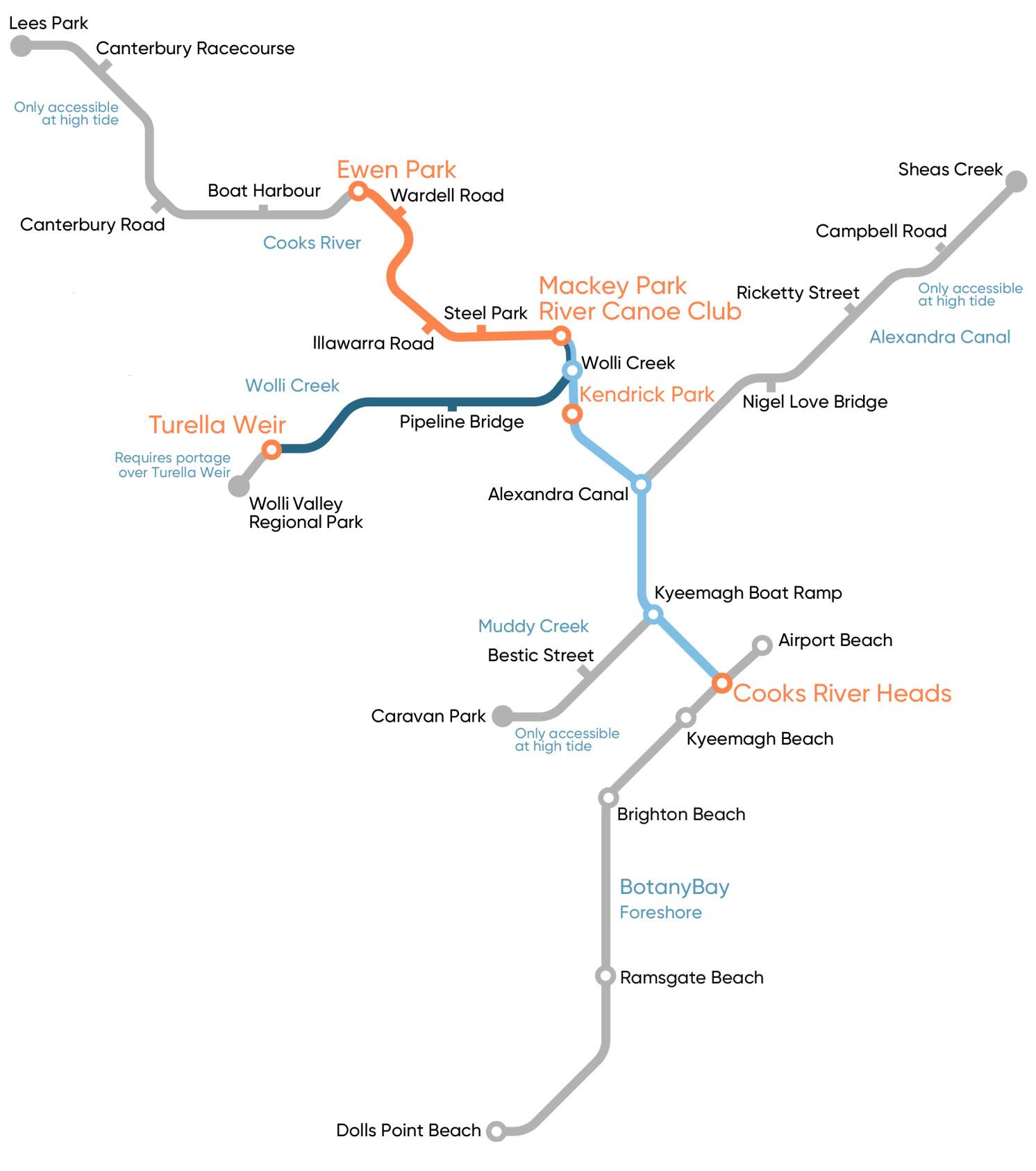
Riverine Park
7.6 Planting Strategy
General
Prioritise native plant species and promote biodiversity and habitat. Implement sustainable water mangement practices such as WSUD stormwater management to redirect overland flow into adjacent waterbodies via rain gardens to improve water quality by increasing water supply especially in drought periods. Support tree growth in hardscape areas with adequate soil volumes. Select species which suit current conditions and are resilient to future climate conditions.
Ensure sightlines are maintained through existing and proposed planting areas. Ensure planting is positioned with mature form in mind to reduce obstruction of cycleways, footpaths and driveways. Proactively manage existing vegetation for improved passive surveillance, tree health and sight lines for active transport corridor.

Active Recreation
Planting selection should promote quality canopy cover to protect spectators. Consider limiting the use of species which drop leaves, limbs or fruit close to sports fields. Ensure clear sightlines are maintained and vegetation does not conflict with active sports, cycleways and footpaths.
Botanical Name Common Name TREES
Angophora costata Sydney Red Gum
Cupaniopsis anacardioides Tuckeroo
Corymbia gummifera Red Bloodwood
Elaeocarpus reticulatus Blueberry Ash
Eucalyptus robusta Swamp Mahogany
Eucalyptus saligna Sydney Blue Gum
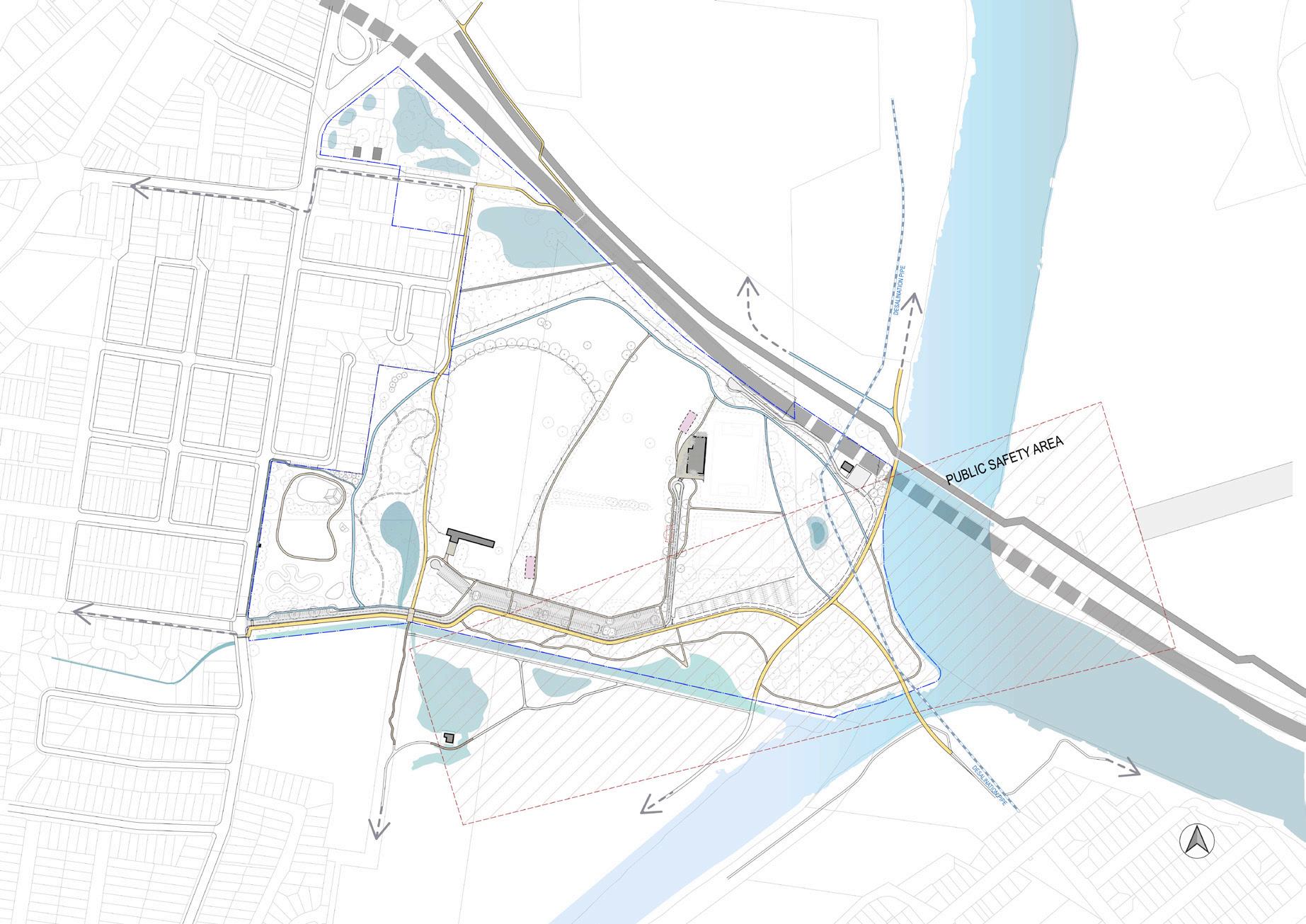
Melaleuca linariifolia cv. Snow in Summer
Melaleuca quinquenervia Broad Leaved Paperbark
note - restrict tree species height to meet Airport PSA requirements
Botanical Name Common Name SHRUBS
Banksia spinulosa 'Birthday Candles' Birthday candles
Callistemon 'Better John' Better John
Callistemon 'White Anzac' White Anzac
Westringia fruticosa 'Zena' Zena
Botanical Name Common Name
GROUND COVERS / GRASSES
Crinum pedunculatum Swamp lilly
Dianella caerulea Flax lilly
Grevillea juniperina 'Gold Cluster' Juniper grevillea
Grevillea lanigera 'Mt Tamboritha' Mt Tamboritha
Grevillea rosmarinifolia Rosemary grevillea
Hibbertia scandens Snake Vine
Lomandra 'Lime Tuff' Lime Tuff
Lomandra longifolia Spiny-headed Mat-rush
Lomandra 'Verday' Verday
Myoporum parvifolium Creeping Boobialla
Poa labillardierei Tussock grass

Passive Recreation
Planting selection to enhance public amenity, maximising existing mature tree canopy and expanding upon it with endemic species. Groundcovers, shrubs and sedge species should be used to separate spaces and uses while maintaining clear sightlines.
Botanical Name Common Name
TREES
Acmena smithii Lilly Pilly
Allocasuarina distyla Scrub She-Oak
Angophora costata Smooth-barked Apple
Angophora floribunda Rough-barked Apple
Banksia integrifolia Coast Banksia
Banksia serrata Old Man Banksia

Casuarina cunninghamiana River She-Oak
Casuarina glauca Swamp Oak
Corymbia gummifera Red Bloodwood
Corymbia maculata Spotted Gum
Elaeocarpus reticulatus Blueberry Ash
Eucalyptus robusta Swamp Mahogany
Eucalyptus saligna Sydney Blue Gum
Glochidion ferdinandi Cheese Tree
Hymenosporum flavum Native Frangipani
Lophostemon confertus Queensland Brushbox
Melaleuca linariifolia Paperbark
Melaleuca styphelioides Prickly-leaved Paperbark
Melaleuca quinquenervia Broad -leaved Paperbark
note - restrict tree species height to meet Airport PSA requirements
Botanical Name Common Name
GROUND COVERS / GRASSES
Astroloma pinifolium Pine Heath
Baeckea imbricata Spindly Baeckea
Billardiera scandens Apple Berry
Dianella caerulea Blue Flax Lily
Dianella revoluta Blueberry Lily
Dichondra repens Kidney-Weed
Entolasia marginata Bordered Panic
Ficinia nodosa Knotted Club-rush
Gahnia clarkei Tall Saw-sedge
Hardenbergia violacea False Sarsaparilla
Hibbertia fasciculata Golden Guinea Vine
Hibbertia scandens Snake Vine
Hypolepis muelleri Harsh Ground Fern
Imperata cylindrica Blood Grass
Kennedia rubicunda Dusky Coral Pea
Leucopogon ericoides Pink Beard Heath
Lomandra longifolia Spiny-Headed Mat Rush
Poa labillardierei 'Eskdale' Tussock Grass
Scaevola 'Purple Fanfare' Purple Fanfare
Themeda australis Kangaroo Grass
Viola hederacea Native Violet
Botanical Name Common Name
SHRUBS
Acacia longifolia Sydney Golden Wattle
Acacia longifolia var sophorae Sydney Golden Wattle
Acacia redolens Prostrate Acacia
Acacia suaveolens Sweet Wattle
Acacia terminalis Sunshine Wattle
Acacia ulicifolia Prickly Moses
Adenanthos sericeus Woolly Bush
Banksia aemula Wallum Banksia
Banksia ericifolia Heath-leaved Banksia
Banksia integrifolia Coastal Banksia
Banksia oblongifolia Fern-leaf Banksia
Banksia spinulosa Hairpin Banksia
Callistemon citrinus Crimson Bottlebrush
Correa alba White Correa
Correa decumbens Spreading Correa
Correa 'Dusky Bells' Dusky Bells
Dodonaea triquetra Common Hop Bush
Grevillea linearifolia Linear Leaf Grevillea
Grevillea sericea Spider-flower Grevillea
Hakea laurina Pin-cushion Hakea
Hakea teretifolia Dagger Hakea
Lambertia formosa Mountain Devil
Leptospermum laevigatum Coastal Tea-tree
Leptospermum polygalifolium Tantoon
Leptospermum trinervium Flaky-barked Tea Tree
Melaleuca nodosa Grey Honey Myrtle
Melaleuca squamea Swamp Honey Myrtle
Melaleuca thymifolia Honey Myrtle
Persoonia nutans Nodding Geebung
Pittosporum undulatum Sweet Pittosporum
Rhagodia spinescens Creeping Salt Bush
Viminaria juncea 'Golden Spray' Golden Spray
Westringia fruticosa Coastal Rosemary
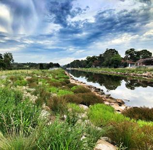
Environmental
Planting selection to promote the creation of habitat, stormwater filtration and supporting remnant vegetation communities. Careful positioning of plants to maintain passive surveillance and line of site is essential.
Botanical Name Common Name
TREES
Acmena smithii * Lilly Pilly
Allocasuarina littoralis Black She-oak
Angophora costata * Sydney Red Gum
Banksia integrifolia Coastal Banksia
Banksia serrata * Old Man Banksia
Casuarina glauca Swamp she-oak

Corymbia gummifera Red Bloodwood
Elaeocarpus reticulatus * Blueberry Ash
Eucalyptus saligna * Sydney Blue Gum
Lophostemon confertus * Queensland Brushbox
Melaleuca quinquenervia Broad-leaved Paperbark
Melaleuca quinquenervia Broad-leaved Paperbark
Melaleuca ericifolia Swamp Paperbark
Melaleuca linariifolia Snow-in-Summer
note - restrict tree species height to meet Airport PSA requirements
* indicates suitability for Green and Gold Bell Frog habitat
Botanical Name Common Name
Acacia elongata Swamp Wattle
Banksia aemula * Wallum Banksia
Banksia ericifolia * Heath-leaved Banksia
Banksia integrifolia Coastal Banksia
Banksia oblongifolia * Fern-leaf Banksia
Bauera rubioides River Rose
Callistemon citrinus * Crimson Bottlebrush
Correa alba * White Correa
Dillwynia sericea * Showy Parrot Pea
Dodonaea triquetra * Common Hop Bush
Eriostemon australasius * Pink Wax Flower
Grevillea linearifolia * Linear Leaf Grevillea
Kunzea ambigua Tick Bush
Kunzea capitata * Pink Kunzea
Leptospermum laevigatum * Coastal Tea Tree
Leptospermum polygalifolium * Tantoon
Leptospermum trinervium * Paperbark Tea Tree
Leucopogon ericoides Pink Beard-heath
Melaleuca squamea Swamp Honey-myrtle
Persoonia nutans * Nodding Geebung
Ricinocarpos pinifolius * Wedding Bush
Westringia fruticosa * Coastal Rosemary
* indicates suitability for Green and Gold Bell Frog habitat
Botanical Name Common Name GROUND COVERS / GRASSES
Caustis pentandra Thick Twist-rush
Dianella revoluta Blueberry Lily
Echinopogon caespitosus Hedgehog Grass
Epacris microphylla Coral Heath
Hibbertia fasciculata Bundled Guinea Flower
Hardenbergia violacea * False sarsaparilla
Hibbertia scandens * Snake Vine
Imperata cylindrica * Blood Grass
Leptospermum laterale Variable Sword-sedge
Lomandra longifolia * Spiny-headed Mat-rush
Microlaena stipoides * Weeping Grass
Poa labillardierei 'Eskdale' * Tussock Grass
Themeda australis * Kangaroo Grass
* indicates suitability for Green and Gold Bell Frog habitat
Botanical Name Common Name LOWER BANKS / FREQUENTLY INUNDATED
Baumea articulata Jointed Twig-rush
Baumea juncea Bare Twig rush
Bolboschoenus fluviatilis River Bulrush
Eleocharis acuta Common Spikerush
Juncus kraussii Salt Marsh Rush
Potamogeton tricarinatus Floating Pondweed
Schoenoplectus mucronatus Bog Bulrush
Schoenoplectus validus Softstem Bulrush
Triglochin procerum Water Ribbons
Botanical Name Common Name UPPER BANKS / INFREQUENTLY INUNDATED
Carex appressa Tall Sedge
Ficinia nodosa Knobby Club Rush
Lepidosperma laterale Variable Sword-sedge
Imperata cylindrica Blady Grass
Spinifex sericeus Coastal Spinifex
8. Staging and Funding Strategy
Short-Term (0-3 years)
Demolition (not including any buildings) - including removal of redundant fencing
Soil and Water Management
Earthworks
Drainage
Works under SWSOOS to connect to Pemulwuy Park
Open Lawn - improvements to existing grass areas other than sports fields
Passive Park Facilities incl. playground, 3 point basketball & outdoor fitness
Share Path Circuit including lighting & sections of elevated boardwalks where required
Improving Access and Amenity
External Electrical Services
Environmental Buffer - areas beyond Spring Creek Naturalisation
Protection of Frog Habitat - provisional sum as part of construction activities
$1,498,585 SRV / Contributions / VPA or Grant
$319,044 SRV / Contributions / VPA or Grant
$2,774,090 SRV / Contributions / VPA or Grant
$213,300 SRV / Contributions / Stormwater Levy / VPA or Grant
$588,750 Contributions / VPA or Grant
$134,141 SRV / Contributions / VPA or Grant
$2,250,000 SRV / Contributions / VPA or Grant
$6,405,297 SRV / Contributions / VPA or Grant
$250,000 SRV / Contributions / VPA / Grant or Sporting Partners
$62,500 SRV / Contributions / VPA or Grant
$4,750,000 Grant / VPA
$315,000 Grant / VPA
Additional Sporting Amenity Buildings - subject to further investigation Excl By others - Sporting Partners
Active Recreation Area - improvements to existing fields, additional lights, seating etc
Car Park & Road Works - realignment and upgrade including WSUD
Overflow parking
Plane Spotting Slope
Revegetation, Landscaping and Furniture
Demolition of abandoned building
Medium-Term (3-6 years)
Spring Creek Naturalisation & Wetlands - quantified separately based on option under development
Pedestrian
Gardens - supporting facilities such as fencing, paths, seating and park shelter except planting beds
Long-Term (6-10years)
Bridge over Muddy Creek (connect to Kyeemagh)
Restoration of sea wall along Cooks River embankment
Signalised crossing at West Botany Street and Spring
Excl By others - Sporting Partners
$4,008,407 SRV / Contributions / VPA or Grant
$190,008 SRV / Contributions / VPA / Grant or Sporting Partners
$331,440 SRV / Contributions / VPA or Grant
$548,583 SRV / Contributions / VPA or Grant
$24,639,145
$14,966,990 SRV / Contributions / Stormwater Levy / VPA or Grant
There are a range of funding sources that could be considered to deliver this significant project.
The list below provides an indication of how the project could be funded.
An Infrastructure Levy is currently collected for the area covering Riverine Park. This funding is available to fund replacement of existing infrastructure.
Council collects contributions from developments that generate additional demand and growth of infrastructure such as recreational facilities. These funds are collected under Section 7.11 and S7.12 of Environmental Planning & Assessment Act, 1979 (EP&A Act).
Council collects a Community Safety Levy specifically for enhancing community safety.
Council charges a Stormwater Levy to undertake significant improvements to the stormwater system to provide a cleaner and safer environment for the benefit of owners, residents and visitors.
Council will pro-actively seek grants from other government agencies to help achieve the vision for Riverine Park. This can include:
• Metropolitan Green Space Grants
• Environmental Grants for interface with wetland areas eg. Lookouts, interpretation, bush regeneration etc
• Sport and Recreation Grants
• Water quality Grants
• Coastal Grants
• Active Transport Grants
• Vegetation Management Grants
• Art and Education Grants
Council is partnering with sporting organisations that will assist in funding certain components identified in this plan.
9. Next steps
The draft Riverine Park Masterplan was exhibited for 4 weeks between 13 May 2024 and 10 June 2024.
Council received considerable feedback with strong support for the masterplan. The results of the Have Your Say process and feedback received were reported to Council on 24 July 2024. (https://infoweb.bayside.nsw.gov.au/Open/2024/07/ CO_24072024_MIN_4476.PDF ) Community feedback informed the final masterplan with revisions that include a fenced dog offleash park and paddle and kayak access/hitching location.
Priorities as determined by Council will proceed to detail design stage and further community engagement in due course.
Council will submit grant applications for suitable programs. Council is waiting to hear the results of the Urban Rivers and Catchment Program to find out if an application for $10 million was successful for the wetland and naturalisation project. An announcement is pending.
10. References
Bayside Council GIS mapping system
Bayside West Precinct Plan planning.nsw.gov.au
Bayside Priority Green Grid Spatial Framework bayside.nsw.gov.au
Barton Park Masterplan Report (Endorsed by Council 24 June 2020)
https://www.bayside.nsw.gov.au/sites/default/files/2024-03/barton_park_ masterplan_report.PDF
Benson, D, Ondinea, D and Bear, V “Missing Jigsaw Pieces - The bushplants of the Cooks River Valley”, Royal Botanic Gardens Sydney 1999
Benson, D and Howel, J “Taken for Granted: The bushland of Sydney and its suburbs”, Royal Botanic Gardens Sydney 1990
Biodiversity Strategy 2014 – A strategy for the Natural Assets of the City of Rockdale (Volume 1 & 2) bayside.nsw.gov.au
BMT WBM “Botany Bay Western Foreshore Coastal Hazard Risk Assessment and Management Options Study completed in 2013
Callaghan, C Removing the Stain: The Botany-Rockdale Sewage Farm, Sydney NSW Australian Historical Archaeology 8,1990.
Geeves, P and Jervis, J “Rockdale; its beginning and development” The Council of the Municipality of Rockdale
DCCEEW “Best Practice Guidelines Green and Golden Bell Frog Habitat”, Dept. Engineering and Climate Change NSW
DCCEEW “Best Practice Guidelines for Coastal Saltmarsh”, Dept. Engineering and Climate Change NSW
Long-Term Site Management Plan, Recreational/Open Space Land Use, Barton Park, New South Wales Prepared for Bayside Council by Edison Environmental and Engineering, 2020
NSW State Register – Statement of Significance. Summary for Arncliffe Market Gardens / Chinese Market Gardens 212 West Botany Street, Arncliffe; hms.heritage. nsw.gov.au
NSW State Register – Statement of Significance. SWSOOS No1, Western Main Carrier, Kogarah Golf Course, Western Main Outfall Sewer; hms.heritage.nsw.gov. au
Pictorial Memories ST. GEORGE: Rockdale, Kogarah, Hurstville Joan Lawrence, Kingsclear Books, 1996, Published in Australia
Plan of Management for Community Land and Public Open Space 2015, Rockdale City Council bayside.nsw.gov.au
Pollon, F, “The Book of Sydney Suburbs” Angus & Robertson Publishers, 1990
Rathbone, R W “A village called Arncliffe”
Rockdale Market Gardens Conservation Management Plan, on behalf of Planning NSW, written by Spackman and Mossop Pty Ltd; Tinslay Consulting Engineers and Patterson Britton & Associates, August 2002.
Rockdale – Its beginning and development (Revised Rathbone, 1986), Rockdale City Council
Sydney Regional Environmental Plan No 33 - Cooks Cove legislation.nsw.gov.au
Soil Landscapes of the Sydney 1:100,000 Sheet,1989 Sydney Australia
Spring Street Drain, Muddy Creek and Scarborough Ponds Catchments 2D Flood Study Review, BMT WBM, 2017
BMT WBM Bayside West Flood Risk Management Study, May 2023
Sydney Airport Masterplan 2039; sydneyairport.com.au
Sydney Green Grid, Government Architects Office; planning.nsw.gov.au
Sydney Water Corporation Cooks River Flood Study, MWH and PB, 2009
ABORIGINAL HISTORY ALONG THE COOKS RIVER , Cooks River Alliance 2017
Mosquito Risk Assessment Spring Street Wetlands, Feb 2014 Pathlogy West
Cooks River Catchment Flood Study - Stage 1, KBR
Barton Park Precinct – Green and Golden Bell Frog Management Plan and Wetland Environmental Management Plan, ECO LOGICAL AUSTRALIA PTY LTD
Barton Park Precinct - Wetlands Environmental Management Plan, ECO LOGICAL AUSTRALIA PTY LTD
Long-Term Site Management Plan, Recreational/Open Space Land Use, Barton Park, New South Wales Prepared for Bayside Council by Edison Environmental and Engineering, 2020
Acknolwedgements:
Bayside council employees and staff subject matter experts for engaging in interviews
Bayside Council Library staff for the provision of Historical Council Reports
Bayside Customer Service Centres Rockdale Library, 444-446 Princes Highway, Rockdale
Westfield Eastgardens, 152 Bunnerong Road, Eastgardens
Monday to Friday 8:30am – 4:30pm, Saturday 9am – 1pm
Phone 1300 581 299 | 9562 1666
Email council@bayside.nsw.gov.au
Web www.bayside.nsw.gov.au
