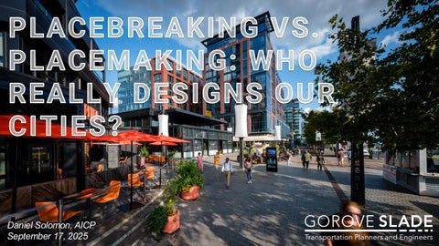
PLACEBREAKING VS. PLACEMAKING: WHO REALLY DESIGNS OUR CITIES?

Daniel Solomon, AICP
September 17, 2025
What’s PLACEBREAKING?
PLACEBREAKING Policies
How do we UN-BREAK things?

Daniel Solomon, AICP
September 17, 2025
How do we UN-BREAK things?
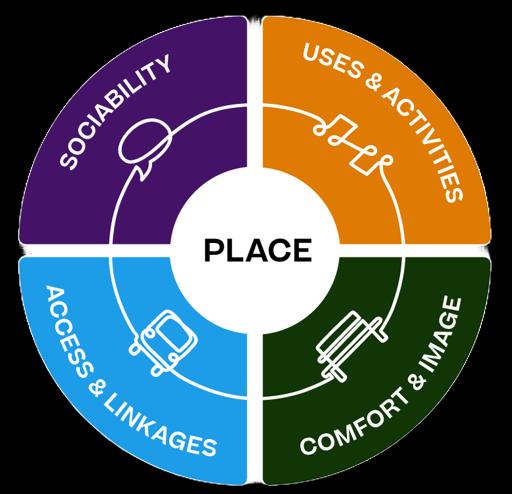
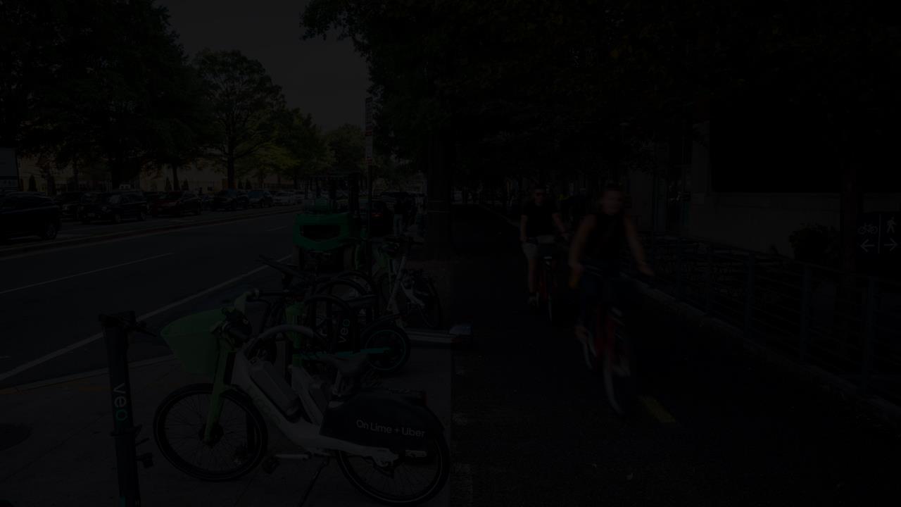
placemaking refers to a collaborative process by which we can shape our public realm to maximize shared value

› Can people easily walk to the place?
› Do sidewalks lead to and from the adjacent areas?
› Does the space function for people with special needs?
› Do the roads and paths through the space take people where they actually want to go?
› Can people use a variety of transportation options – bus, train, car, bicycle, etc. - to reach the place?
› Are transit stops conveniently located next to destinations such as libraries, post offices, park entrances, etc.?
› Balance between needs and human scale
› Minimize conflicts between pedestrians and vehicles
› Slow vehicular speeds
› Accessibility / Walkability
› Intuitive pathways for people
› Multi-modal connectivity
› Designing for people instead of cars
› Balance between needs and human scale
› Minimize conflicts between pedestrians and vehicles
› Slow vehicular speeds
› Accessibility / Walkability
› Intuitive pathways for people
› Multi-modal connectivity
› Designing for people instead of cars
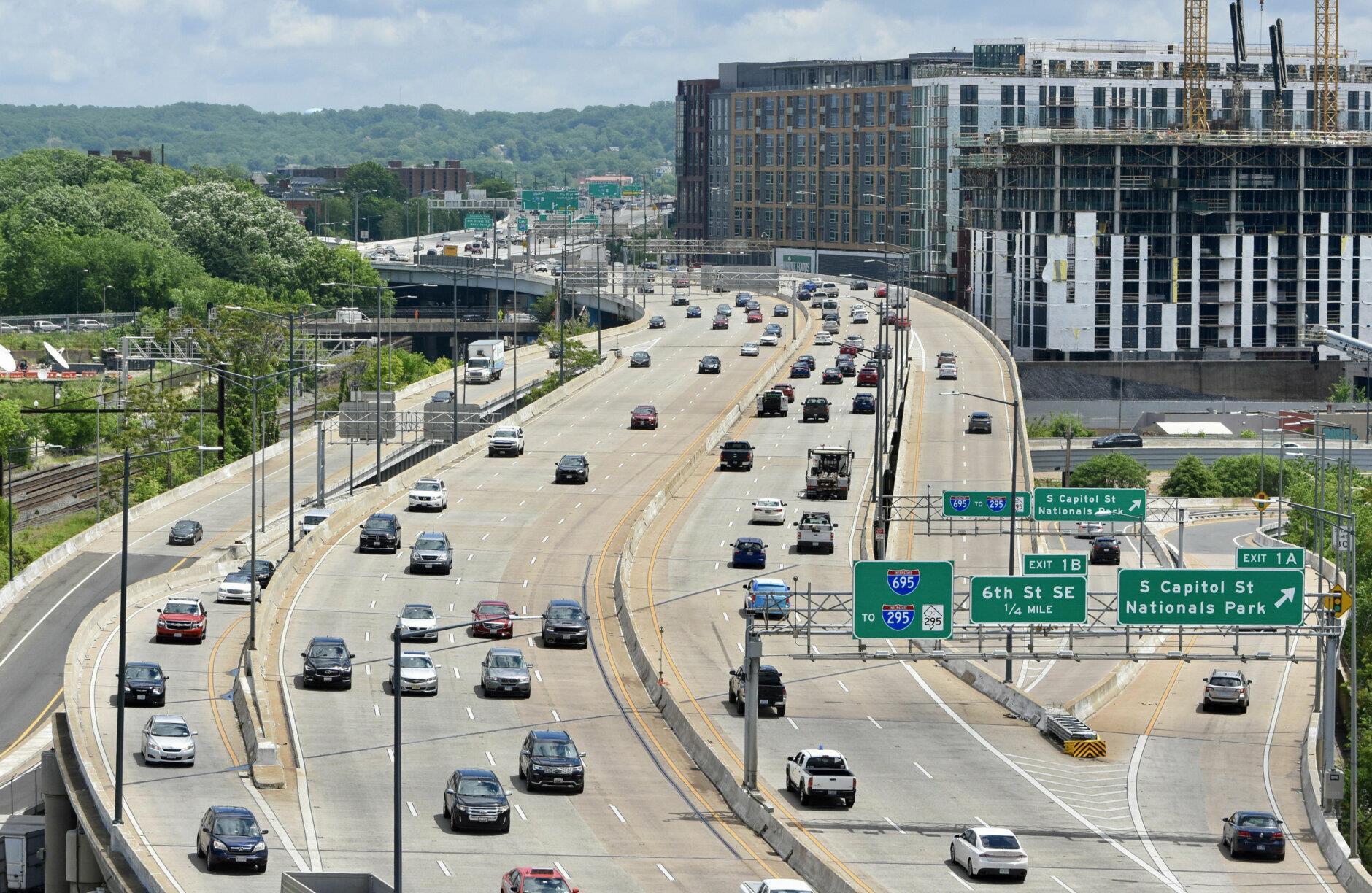
› No balance between needs and human scale
› Create conflicts between pedestrians and vehicles
› Fast vehicular speeds
› Inaccessibility / Non-walkability
› Intuitive pathways for cars
› Car-centric connectivity
› Designing for cars
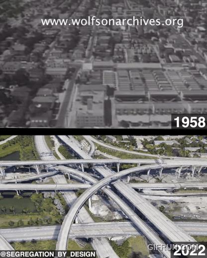
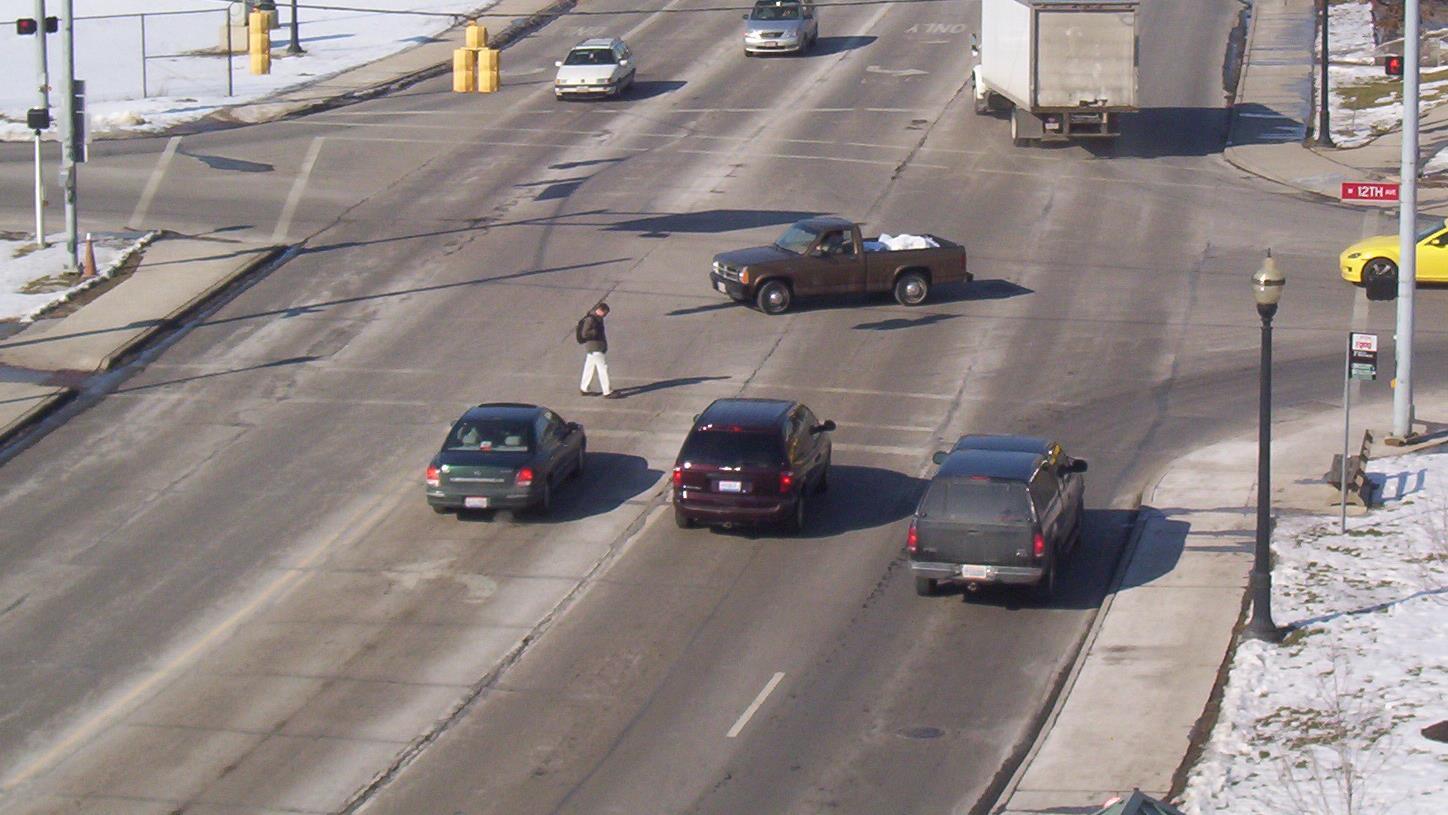
Urban highway construction in the late 1950s - early 1970s What’s the most famous


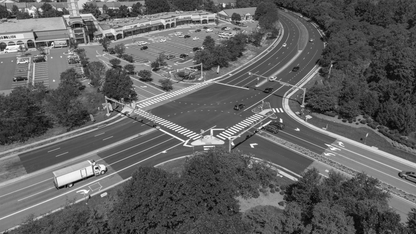
› "Missing" crosswalk
› High-speed design
› Built-in conflicts
› Cars directed to front door
› Humans not given a path
Standardization of analysis led to oversimplification & the rise of car-centric policies.
Most transportation work has no stated goals and objectives, and car-centric ones fill the vacuum.

“The joke is designed to poke fun at theorists for making unrealistic assumptions in order to simplify a problem to make it easier to solve (or solvable at all).”
https://www.sphericalcowblog.com/spherical-cows
“Assume the cow is a sphere”
“Assume everyone drives” (transportation version)

The cables of the Brooklyn Bridge were designed with a safety factor of six
Oversized infrastructure
Car-centric connectivity
Fast vehicular speeds
Inaccessibility/Non-walkability
Intuitive pathways for cars
Transportation Planners & Engineers Assist on Design (minimize impacts & right-size infrastructure)
Project is Designed (including site access/parking & other transportation details)
Parking Minimums and Other Car-Centric Standards
Traffic Study is performed
External Roadway Improvements Recommended
Transportation Planners & Engineers Assist on Design (minimize impacts & right-size infrastructure)
Project is Designed (including site access/parking & other transportation details)
Transportation Study is Performed
External Multi-modal & Operational Improvements Recommended
Parking Minimums and Other Car-Centric Standards
Transportation Goals & Objectives Developed
Overall Project Goals & Objectives Developed (when transportation is just one project element)
Alternatives Developed
Transportation Study (with metrics/evaluation criteria directly related to the goals & objectives)
Traffic Study
Alternative Selected
In the absence of clearly stated goals/objectives, these studies tend to be car-centric.
How do we UN-BREAK things?
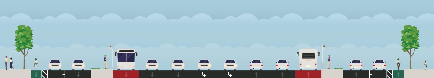
https://nacto.org/publication/urban-streetdesign-guide/
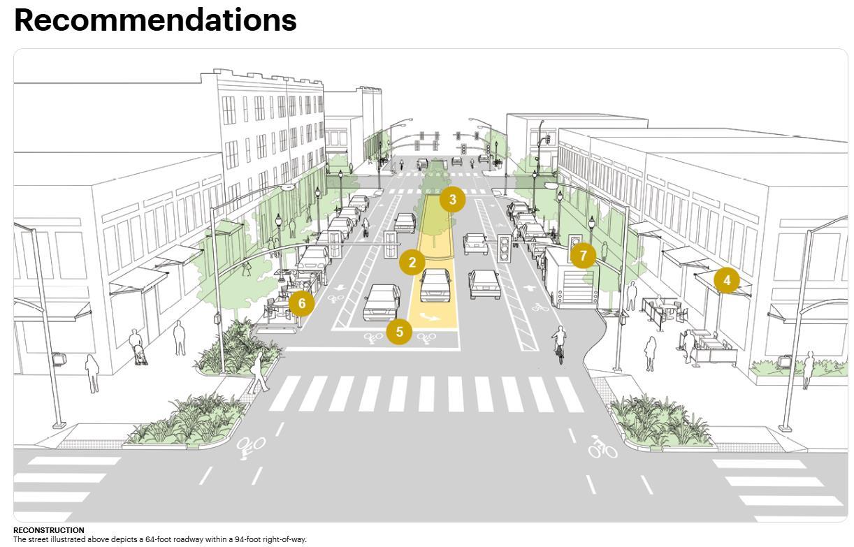
Regional Vehicular Traffic
Local Vehicular Traffic
On-Street Parking
Uber / Lyft Zones
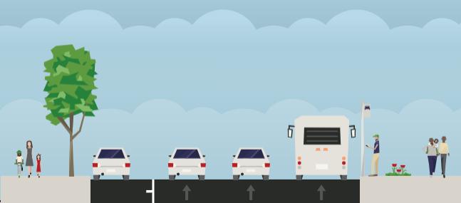
Transit-Only Lanes And
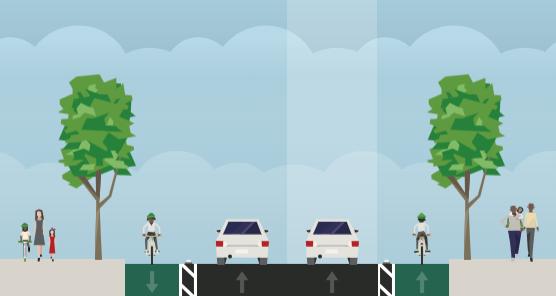
Street Trees
Protected Bike Lanes

Regional Vehicular Traffic
Local Vehicular Traffic
On-Street Parking
Uber / Lyft Zones
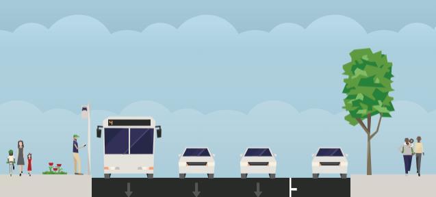
Transit-Only
Street Trees
Protected Bike Lanes
› Every street must be complete
› Standards over function
› Cars first and inaccessible
› No goals, defaults fill the vacuum
› Little to no context
› Networks, not every street
› Function over standards
› Humans first and accessible
› Set goals up front
› Context sensitive
https://commonedge.org/architects-design-just-2-of-all-houses-why/
Transportation Engineers Usually DO NOT Design:
› Lane Widths
› Curb Radii
› Sidewalk Widths
› Curb-ramps/ADAAccess
› Parking Garage Supplies
› Site Access Locations
› Loading Docks
Project is Designed (including site access/parking & other transportation details)
In the vast majority of jurisdictions, this is all that is required.
Parking Minimums and Other Car-Centric Standards
Traffic Study is performed
External Roadway Improvements Recommended
Transportation Goals & Objectives Developed
Overall Project Goals & Objectives Developed
(when transportation is just one project element)
Alternatives Developed
Transportation Study (with metrics/evaluation criteria directly related to the goals & objectives)
Traffic Study
Most guiding documents do not allow for this type of nuance
Alternative Selected
Transportation
PLACEBREAKING vs.
Transportation strategy + goals at the highest level → human-scale outcomes
• Every person gets a parking space
• Lots of dead space
• Nowhere near everyone gets a parking space
• Allows for density needed to build underground parking next to water
• Local access provided by Water Street, running parallel to Maine Ave
• Kept all local traffic off Maine Ave, protecting it from potential congestion
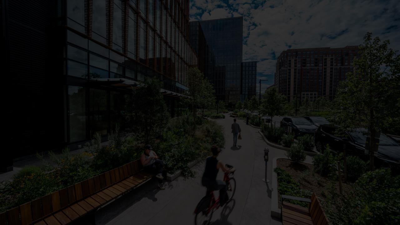
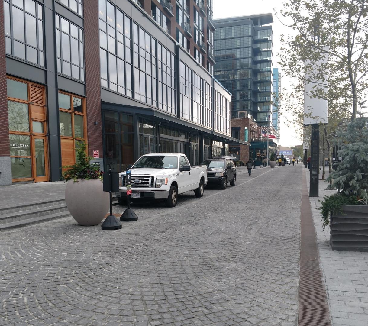
• Local access provided by series of shared streets
• Much less space dedicated to internal streets
• Trades some ‘messiness’ on Maine Avenue for human scale
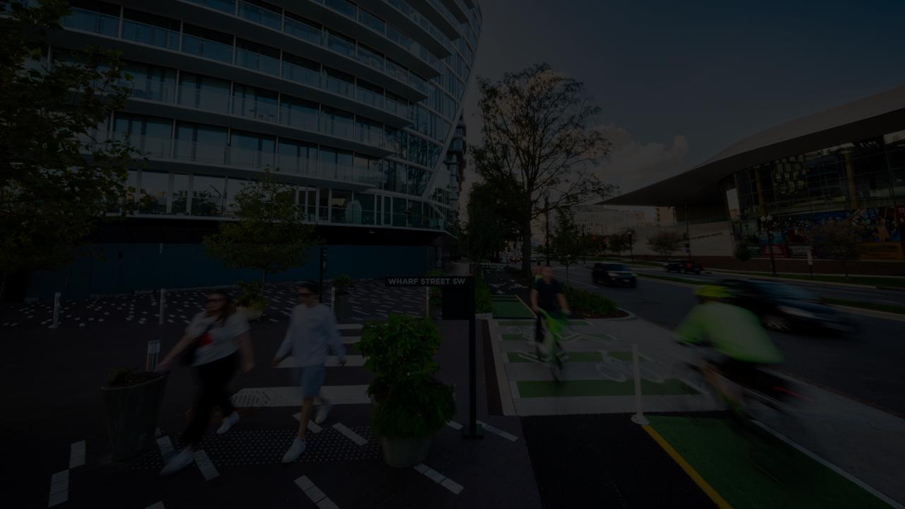
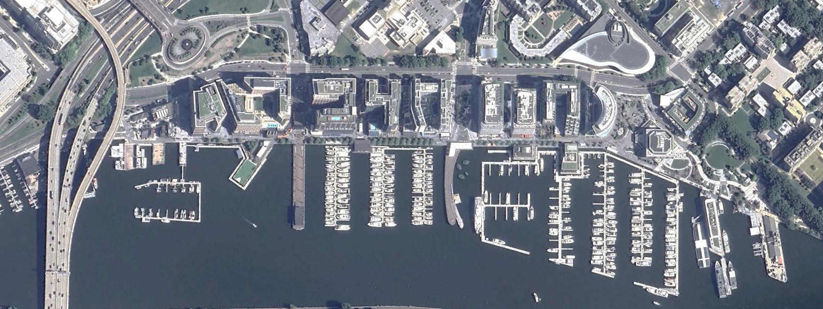
Variations in Paving Help Define Space
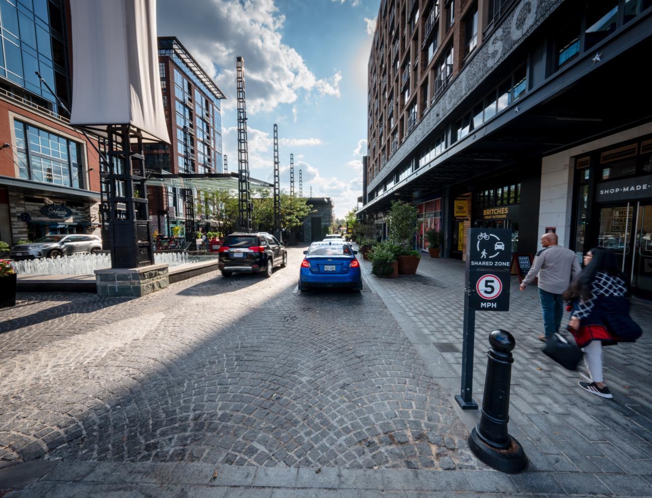
Accommodation of All Modes
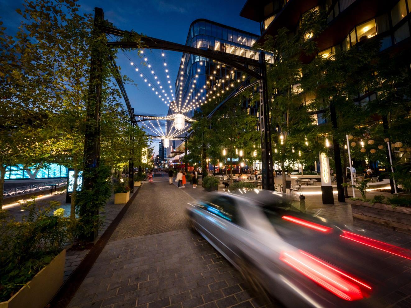
Service Vehicles on The Wharf Itself Transition to “Car-Light” Pedestrian Space
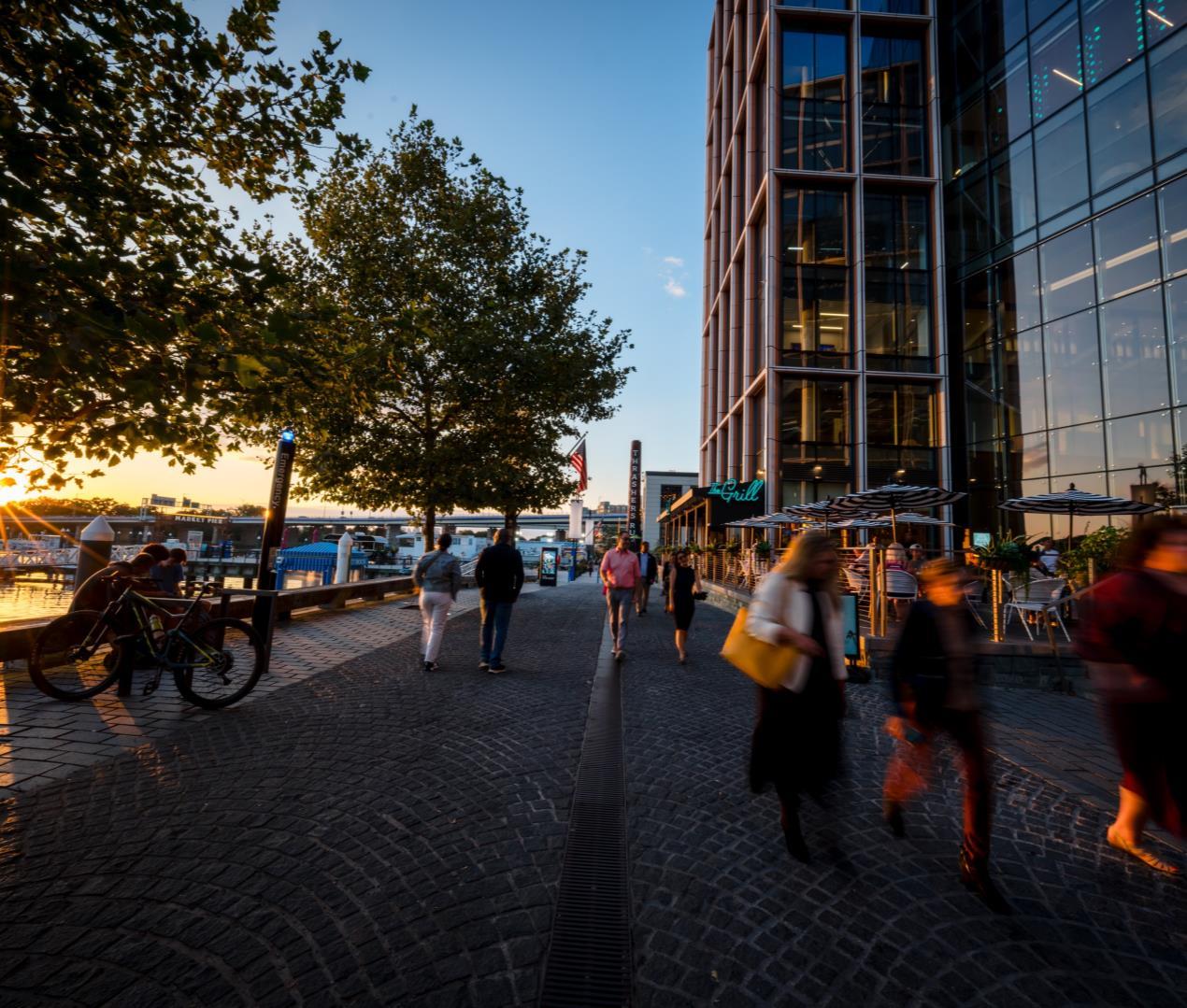
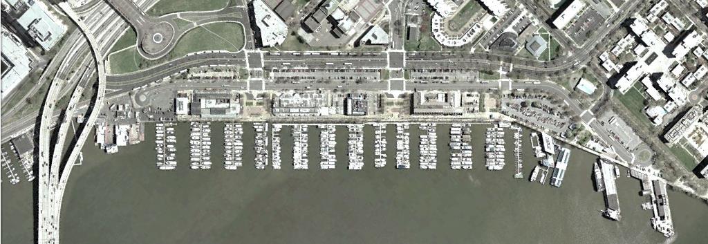
• Waterfront felt disconnected from City
• So much concrete and asphalt between places
• Mobility barriers
Approx. 290’ between buildings
• Shorter distance between buildings along Maine Ave
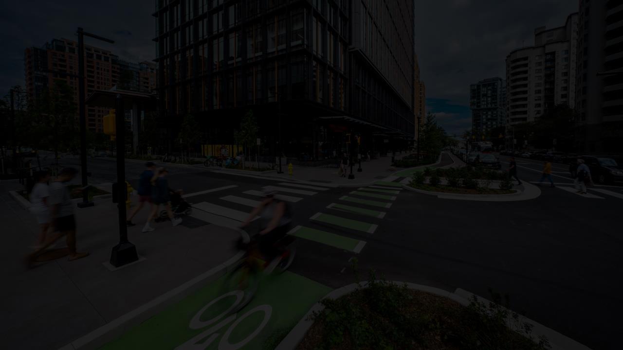
• Removal of right turn lanes on walks to/from The Wharf
• New traffic signal and associated crosswalks at Fish Market
Approx. 130’ between buildings
Daniel Solomon, AICP
September 17, 2025