KAMBALI RESIDENCE
A CLIMATE-RESILIENT, WALKABLE, AND VIBRANT NEIGHBOURHOOD To Live with The Nature Again, To Walk Again, and To Socialize Again
Angela UDI4001 Urban Design Studio 1: Climate Resilience - MI T2 2023 Monash University Indonesia
A CLIMATE-RESILIENT, WALKABLE, AND VIBRANT NEIGHBOURHOOD To Live with The Nature Again, To Walk Again, and To Socialize Again
Angela UDI4001 Urban Design Studio 1: Climate Resilience - MI T2 2023 Monash University IndonesiaA CLIMATE-RESILIENT, WALKABLE, AND VIBRANT NEIGHBOURHOOD
To Live with The Nature Again, To Walk Again, and To Socialize Again
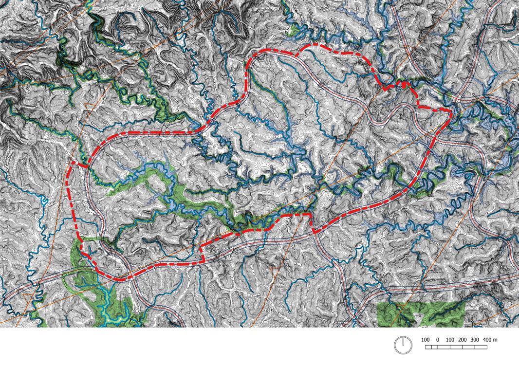
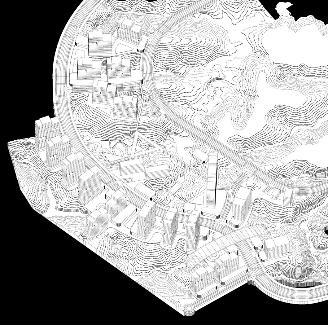
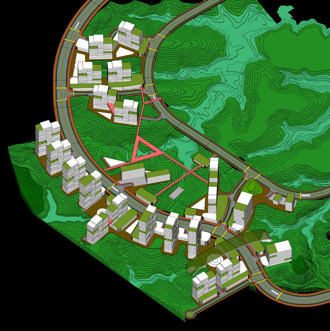
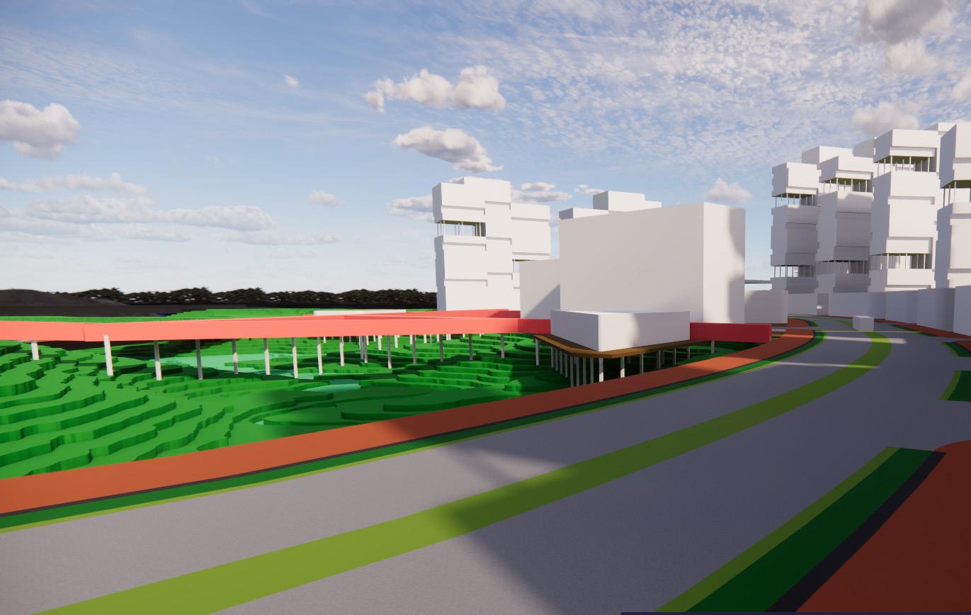
Surrounded by natural riparian, the downhill area has the potential for constructed wetland to create a unique and sustainable bond between green & blue features and the city itself
Rich in biodiversity, the uphill area has the potential for a conserved hill or urban park with a beautiful landscape design that acts as a point of interest as well as green patches
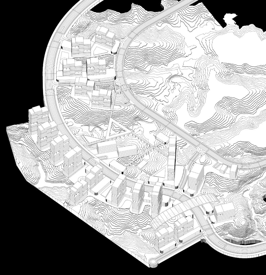
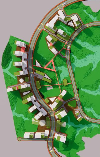
The preserved natural contours and varied streets create the impression of an organic city
Extreme contours reduce land efficiency, segregate the parcels, and make it difficult for pedestrians
Sustainable development, adapting to the existing natural elements by mostly preserving it to combat climate change, reduces the risk of forest fire hazard and smoke pollution, resilient to flood, as well as creates a comfortable micro-climate for the citizen through the implementation of Water Sensitive Urban Design (WSUD)
Low wind speed, relatively high temperature (worsened by climate change), low humidity


High risk of forest fire hazard and smoke pollution

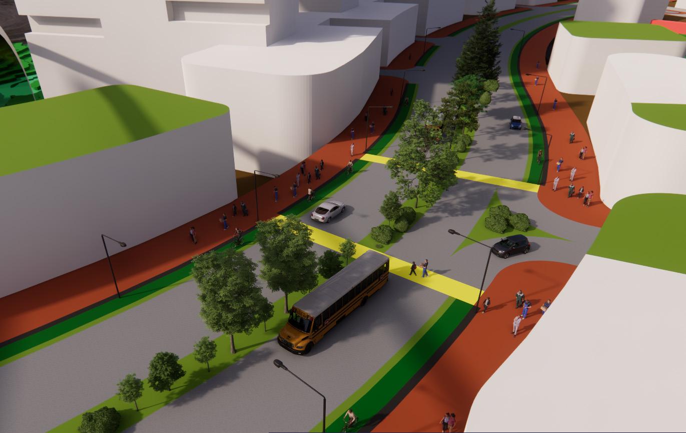
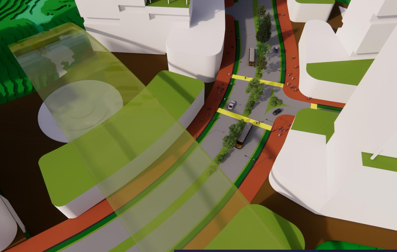
Comfortable and interesting access for walking, cycling, and using public transport. Can reach transport node and public amenities within 10 minutes or 220m radius (walkable)
Multi-access and multi-layer buildings to create activity diversity that makes the city vibrant. Various public spaces (even in private-owned land/ POPS) to create an inclusive city that connects its citizen, gnite collaboration and creativity
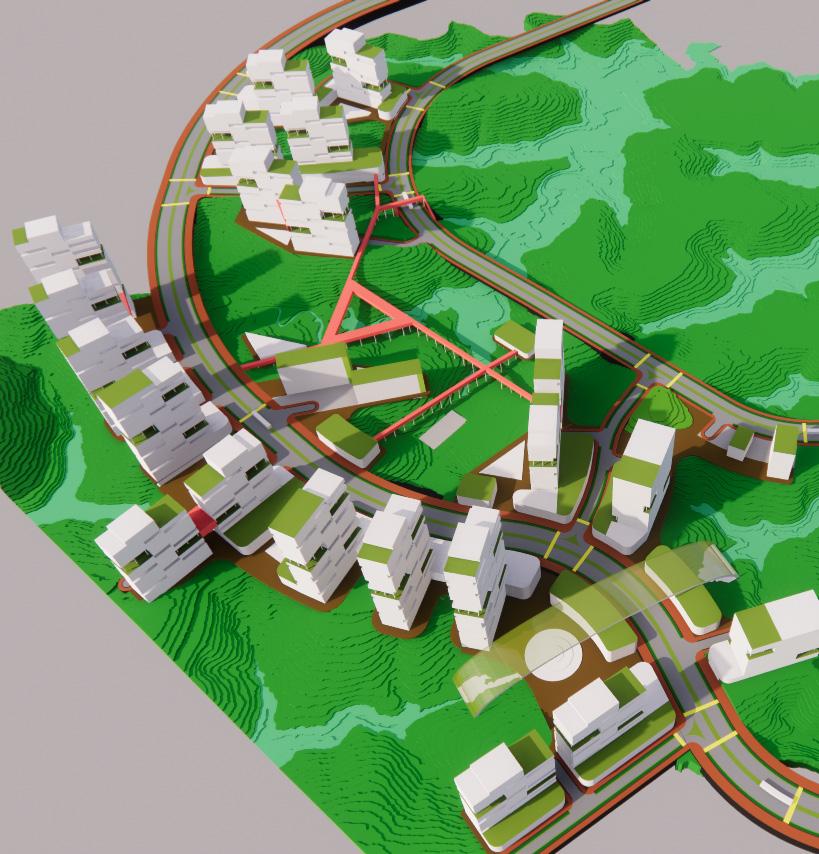
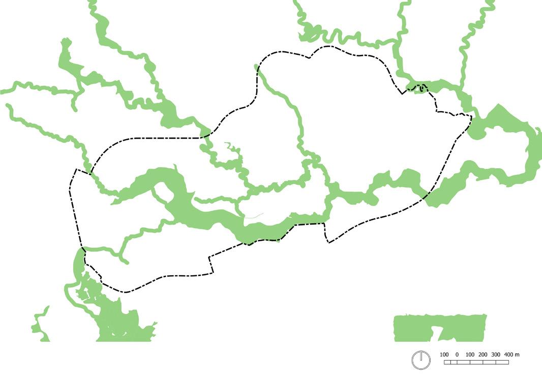
Roads are made to follow the most extensive contour to minimize land grading. The developable area is only 10m or 12m below the road elevation level. The rest is preserved (prioritized for constructed wetland). Some hills 6m above the road elevation level are conserved or for limited use only (prioritized for conserved hill or urban park with a beautiful landscape design). Space in between the developable area and preserved area are for limited-use, accessed only by pedestrian and cyclist
Base Contour Line
Preserved >-10.00 Contour Line from Road Elevation Level
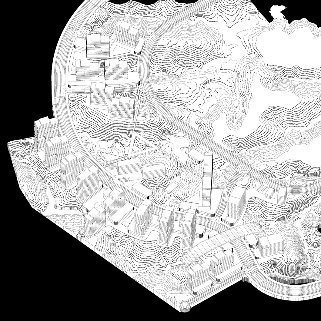
Preserved >-12.00 Contour Line from Road Elevation Level
Preserved >+6.00 Contour Line from Road Elevation Level
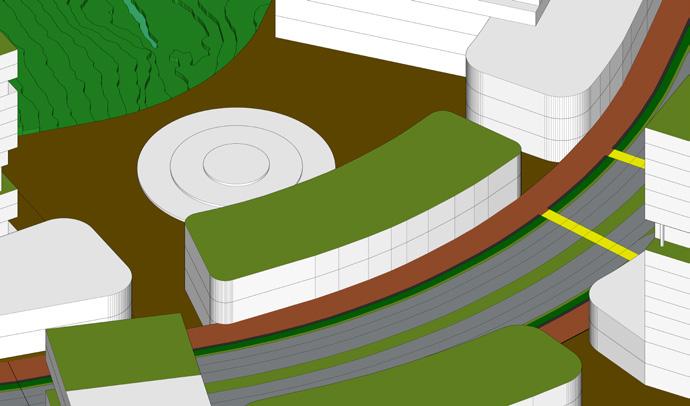
Bridge and Embankment
Ramp
Developable Area
Limited-use Area (Pedestrian and Cyclist Only)
Site (26.1042m2)
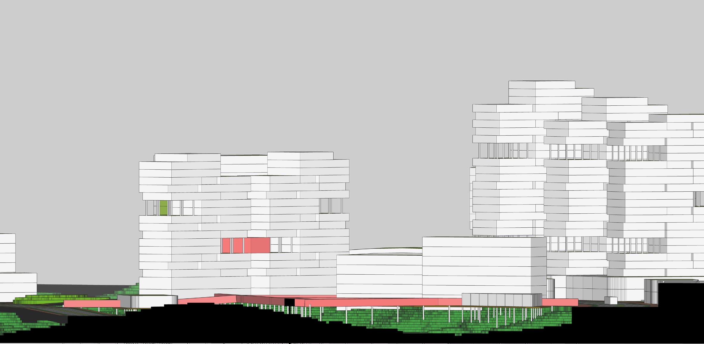
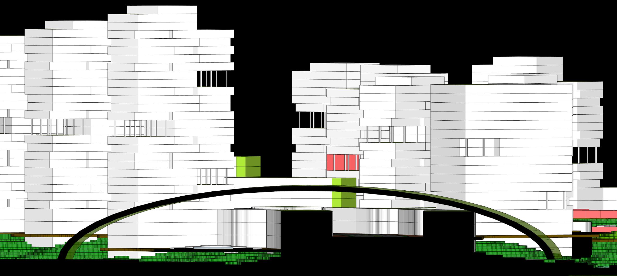
There are two parcel typologies: (1) parcels above the road elevation level and (2) parcels below the road elevation level. Parcel (1) will prioritize the connectivity approach of the ground-level connection, while parcel (2) will prioritize the second-level connection, Continuous access can be an active edge if it sits on the developable area. Interrupted access has the potential to be an active landscape (accessible for pedestrians) or a passive landscape (cannot be accessed). Towers that do not have active edges (podiums) are connected with a mid-level connection (refugee floor) in both parcel typologies
Parcel Typology Diviision
Potential Access
Potential Active Edge
Residential : 108.529m2 (53%)
KDB : 35-55%
KLB : 1,8-2,4
KB : 16-25 floors
Green Space : 33.698m2 (16%)
Office :10.872m2 (5%)
KDB : 35-55%
KLB : 1,8-2,4
KB : 10-14 floors
Amenities (Neig.) : 10.329m2 (5%)
Function : School, Library, District Office, Health Care, Pharmacy
KDB : 35-55%
KLB : 1,8-2,4
KB : 3-7 floors
ROW 36: Secondary Collector Street
ROW 24: Secondary Local Street
ROW 16: Secondary Local Street
ROW 12: Shared Street
Direct-Access Parking
Pocket Parking
BRT Main Corridor
BRT Direct Corridor
Transit Accessibility Radius (220m)
Pedestrian Sidewalk & Bicycle Lane On Street
Shared Street
Pedestrian Second-level Connection
Pedestrian Riparian Bridge
Green Promenade
Pedestrian Through-block Connection
BRT Main Corridor Stop
BRT Direct Access Stop
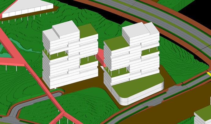
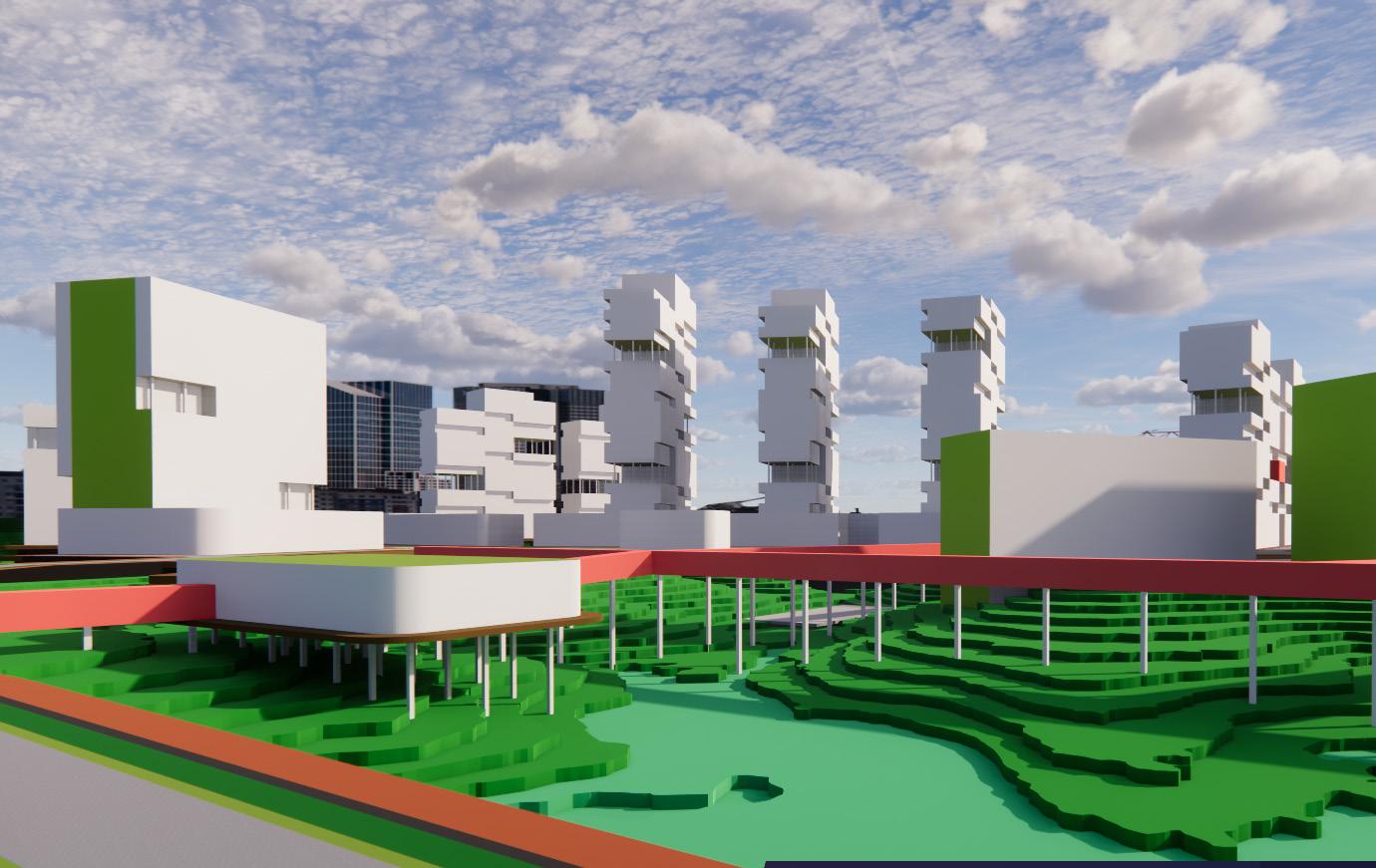
Lowest Skyline (1-7 floors)
Mid Skyline (10-16 floors)
Highest Skyline (21-23 floors)
North-South Orientation


Pedestrian Second-level Connection
Pedestrian Riparian Bridge
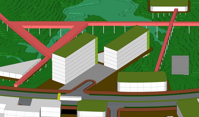
Active Edge
Commercial Node
Collaborative Space/POPS (Private-Owned Public Space)
Iconic Public Green
Source
Pathway
Blue Connection (Street Bridge)
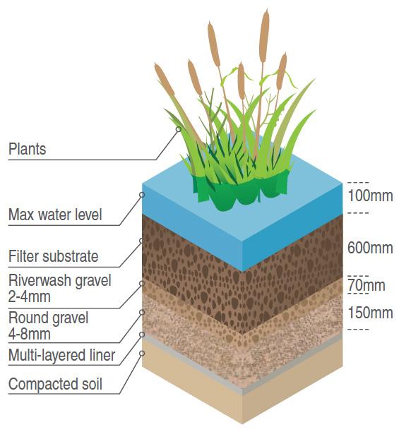
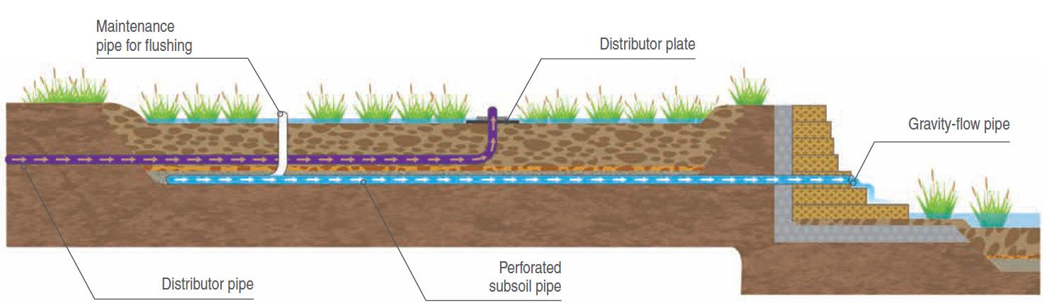
Constructed Wetland
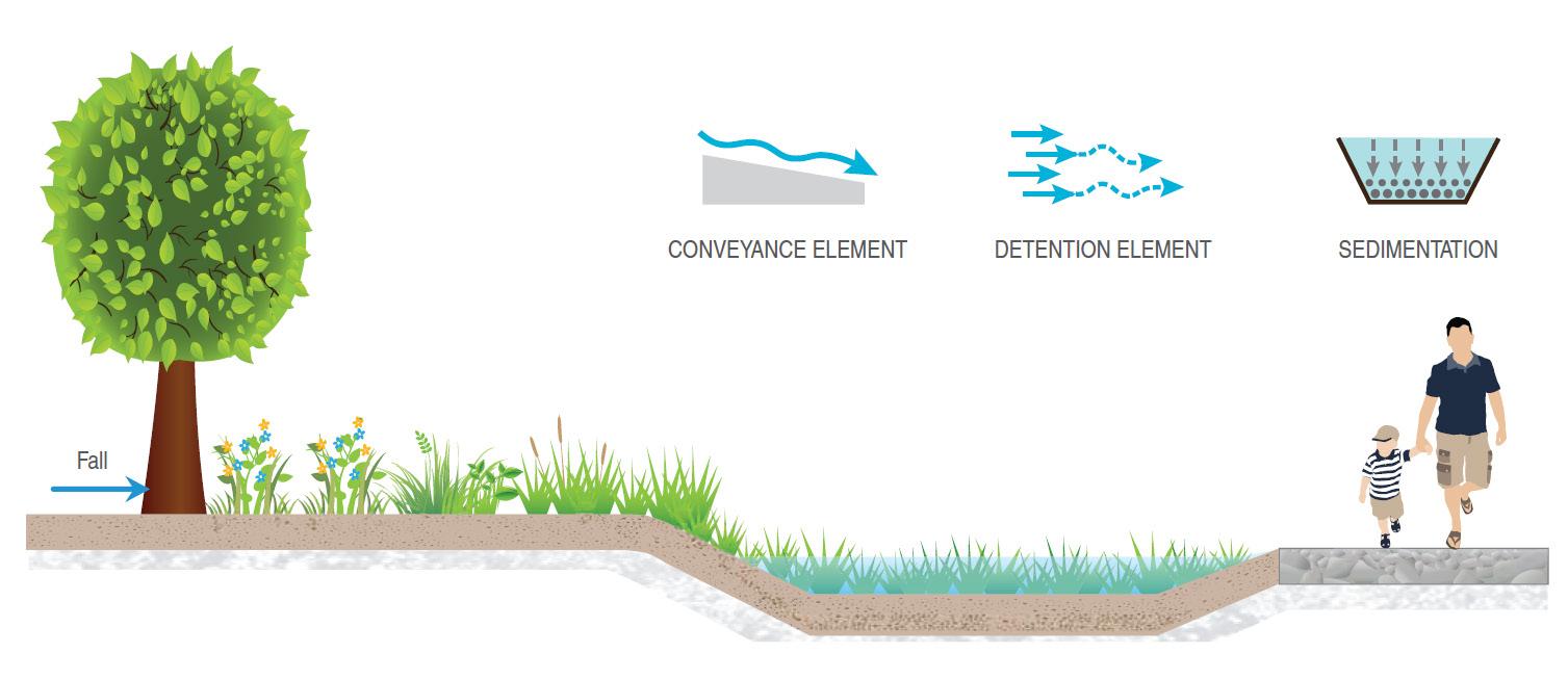
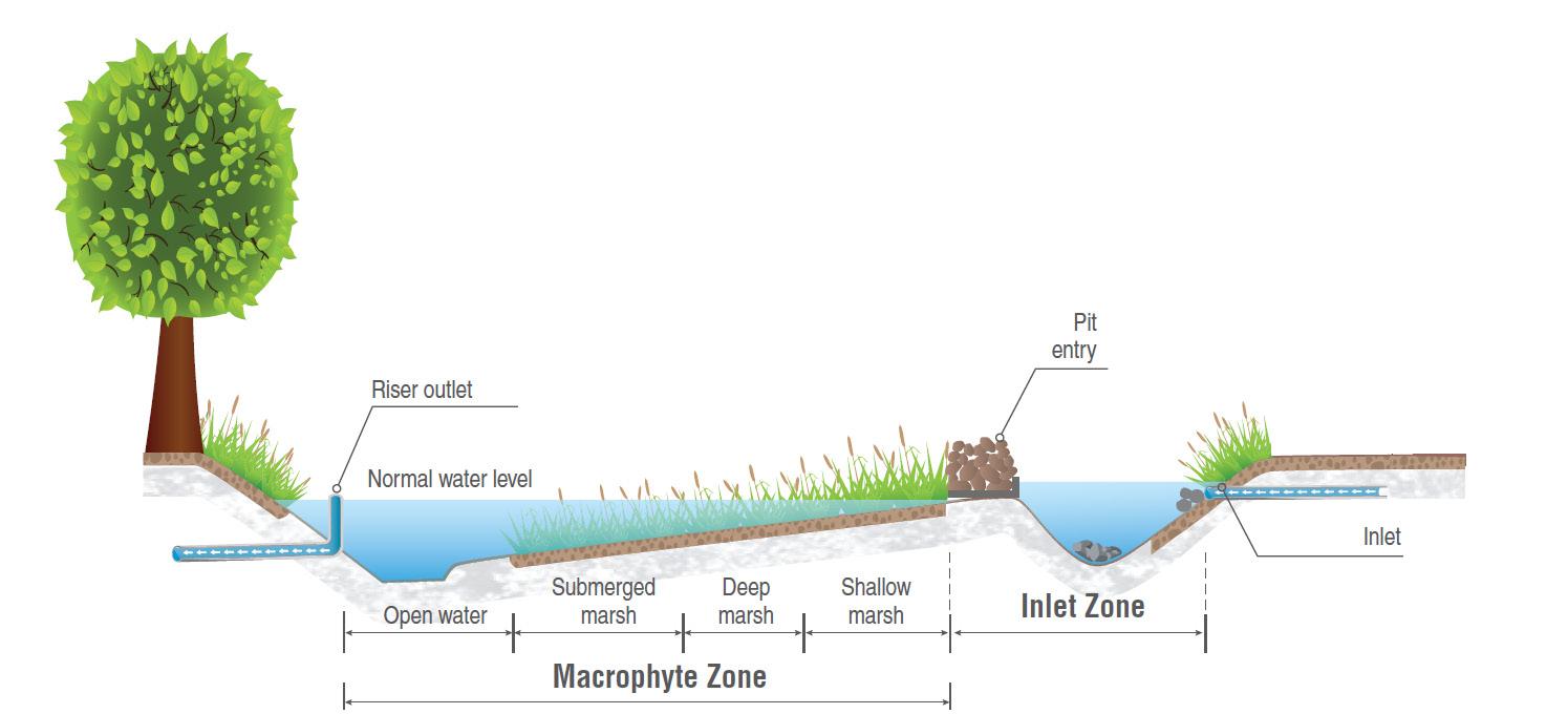
Iconic Public Green (can be flooded)
Riparian Green
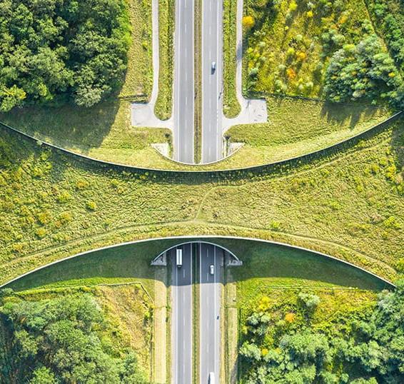
Green Finger Connection/Animal Bridge (Bird)
Parcel Pocket Green
Green Boulevard
Building Green (Green Roof, Green Wall, Vegetated Swales)
A distinct and iconic connection that represents the development big vision
Active and collaborative natural conservation with public involvement and attention
HUMAN & NATURE CONNECTION AXIS
A pioneer to apply green infrastructure in the urban context
(ACTIVE EDGES)
Create connectivity and makes the city more liveable
 1. HUMAN & NATURE CONNECTION AXIS
2. ECOLOGY & EDUCATION PATH
3. RIPARIAN LANDMARK
4. URBAN CORRIDOR
1. HUMAN & NATURE CONNECTION AXIS
2. ECOLOGY & EDUCATION PATH
3. RIPARIAN LANDMARK
4. URBAN CORRIDOR