RE-PEAT SCOTLAND
Transparency, Transformation, Transition
 2.0
Sara Halaoui Tingyu Chao
2.0
Sara Halaoui Tingyu Chao
Sara Halaoui
Tingyu Chao
RE-PEAT SCOTLAND
2.0
/ Acknowledgements /
We would like to thank our AALU tutors for the constant support in this journey. Sharing thoughts and opening new perspectives for the project through their knowldge and expertise.
We appreciate John Muir Trust’s help. Our work with the trust has been extremely vital for the developement of our policies, tools and design schemes. Inaddition to providing us with access to various sites and projects in Scotland.
And finally, we would like to thank all of the external jurors and organizations that have added a lot of input and insight to the project.
Architectural Association

Landscape Urbanism 2022-23
Directors ]
Alfredo Ramirez
Eduardo Rico Carranza
Studio Master ]
Clara Oloriz Sanjuan
[ History and Theory ]
Clara Oloriz Sanjuan
Teresa Stoppani
Technical Tutors ]
Daniel Kiss
Elena Luciano
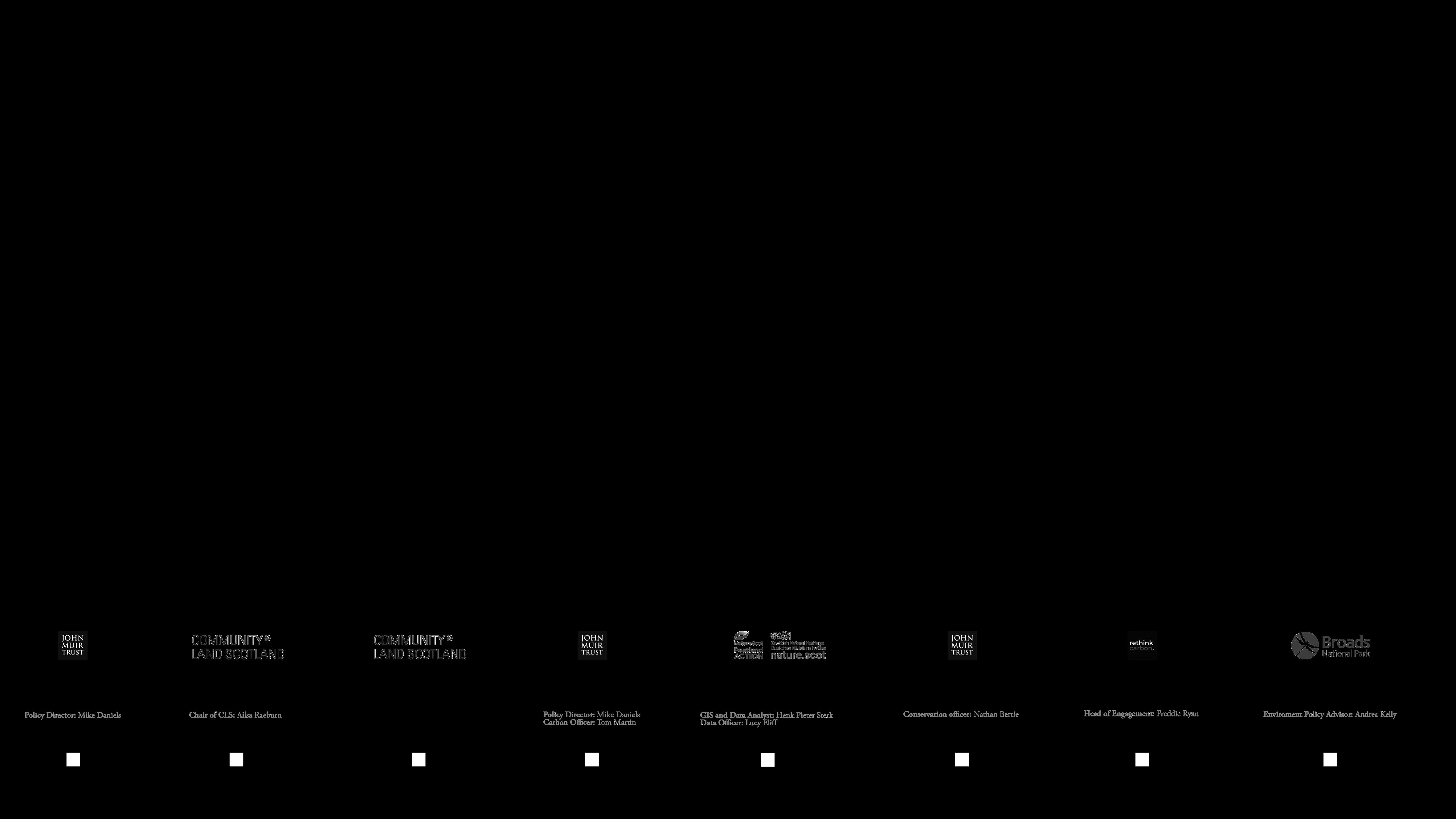
[Community Organisations]
[ John Muir Trust ]
Mike Daniels
Tom Martin
Nathan Berrie
[ Community Land Scotland ]
Ailsa Raeburn
Nature Scot_ Peatland Action ]
Henk Pieter Sterk
Lucy Eliff
Rethink Carbon ]
Freddie Ryan
[Extrenal jurors]
Rob Booth
Eleanor Salter
MSc Teammates ]
Chiachun Chen
Yuting Liu
RE-PEAT SCOTLAND 2.0: Transparency, Transformation, Transition AA Landscape Urbanism 2022-23 03 02
ARCHITECTURAL ASSOCIATION SCHOOL OF ARCHITECTURE 2022 23
Transparency, Transformation, Transition
LANDSCAPE URBANISM MArch
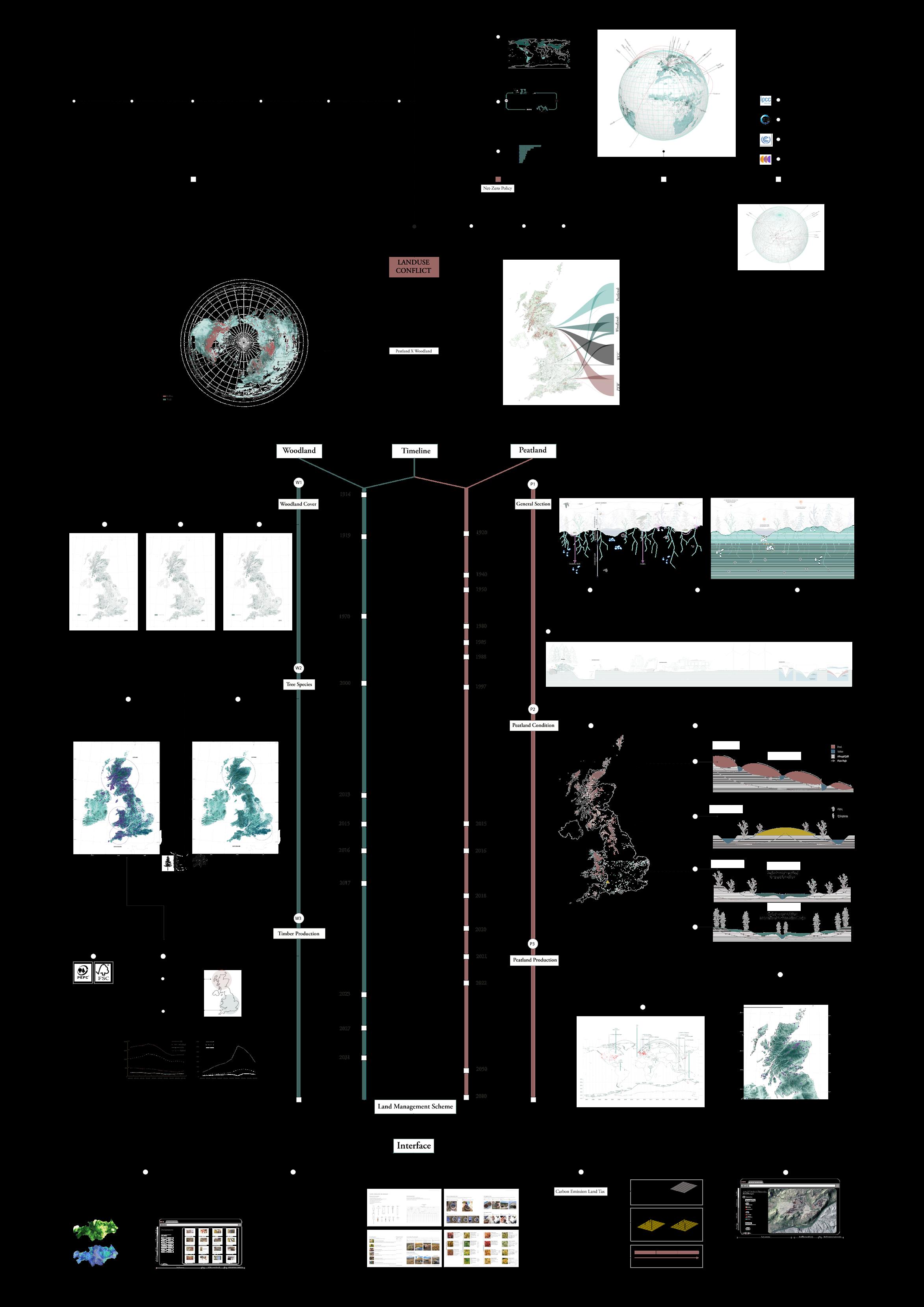
Planetary health and the fight against climate change are prominent issues in the current environmental scenario. They have been faced with sets of policies and strategies, chief of them are ones related to mass afforestation, leading to an increase in forest cover and creating major land use conflicts. To map out the land use conflict we have focused on the woodlands and peatlands as major terrestrial carbon sinks of the globe.
Due to their coexistence, they have lost their ability to sequester carbon and have become carbon emitters. The objective of the project is to look at how both land-uses are managed and exploited, spatially and temporally at the UK scale. Followed by the design of policies, management strategies, land assessment tools based on soil sampling, an interactive platform, and low-tech and high-tech site mapping techniques that can address the conflict at macro and micro scales. We are also tackling the concentrated landownership and carbon crediting systems and their potential links to local communities in Scotland.
The project aims at proposing a management scheme with all its necessary tools that would aid in the just transition to a Net-Zero. RE-PEAT SCOTLAND focuses on transparencyof landownership, the transformation of land management and the transition to a net-zero in Scotland.
/ WHAT ARE PEATLANDS? /
Knowing that they are not aesthetically pleasing as landscapes with trees.
How can we move people away from aesthetic expectations around landscapes?
How can we make the knowledge and awareness about peatlands available and transparent for communities to engage and take care o them?
How to democratize these landscapes beyond cashing carbon credits?
RE-PEAT SCOTLAND 2.0: Transparency, Transformation, Transition AA Landscape Urbanism 2022-23 05 04
/ ABSTRACT /
/ CONTENT /
[ I- Introduction ]
I.1. Project Structure: Anatomical Map
I.2. Planetary issue
I.3. Global Policies
I.4. Net-Zero Policy
I.5. Land-use Conflict
[ II- Peatlands x Woodlands ]
II.1. Temporal Analysis
II.2. What are peatlands?
II.3. Microscopic world
II.4. Peatland types and distribution across the UK
II.5. Peatland biodiversity and water table
II.6. Damaged peat
II.7. Woodland
[ III- Land Management Scheme
III.1. Structure
III.2. Land ownership
III.3. Existing Initiatives
III.4. Meeting with organizations
[ IV- Policy ]
IV.1. Carbon Emission Land Tax- John Muir Trust
IV.2. Modifications
IV.3. Tax Application process
[ V- Site Visits ]
V.1. Various Site Visits
V.2. Site a.1- East Schiehallion, Scotland
V.3. Site a.2- Patterdale, England
V.4. Site b.1- Glen Nevis, Scotland
V.5. Site b.2- Fort William, Scotland
V.6. Site b.3- Carnigorms National Park, Scotland
V.7. Site b.4- Norwich, England
[ VI- Interface ]
VI.1. Overview
VI.2. Land Data Land Assessment
VI.3. Community Manual
VI.4. Results
VI.5. Land management strategies
VI.6. Future scenarios
[ VII- Conclusion ]
VII.1 Democratisation x Communing towards a Real-Zero
VII.2 Organisation Engagement
[ VIII- Appendix ]
VIII.1 Interface Demo x East Schiehallion
VIII.2 Bibliography
[ I- Introduction
I.1. Project Structure: Anatomical Map
I.2. Planetary issue
I.3. Global Policies
I.4. Net-Zero Policy
I.5. Land-use Conflict
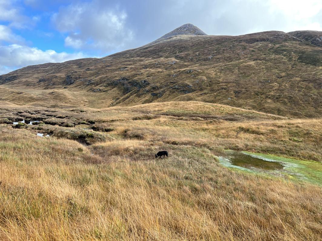
I. Introduction AA Landscape Urbanism 2022-23 06
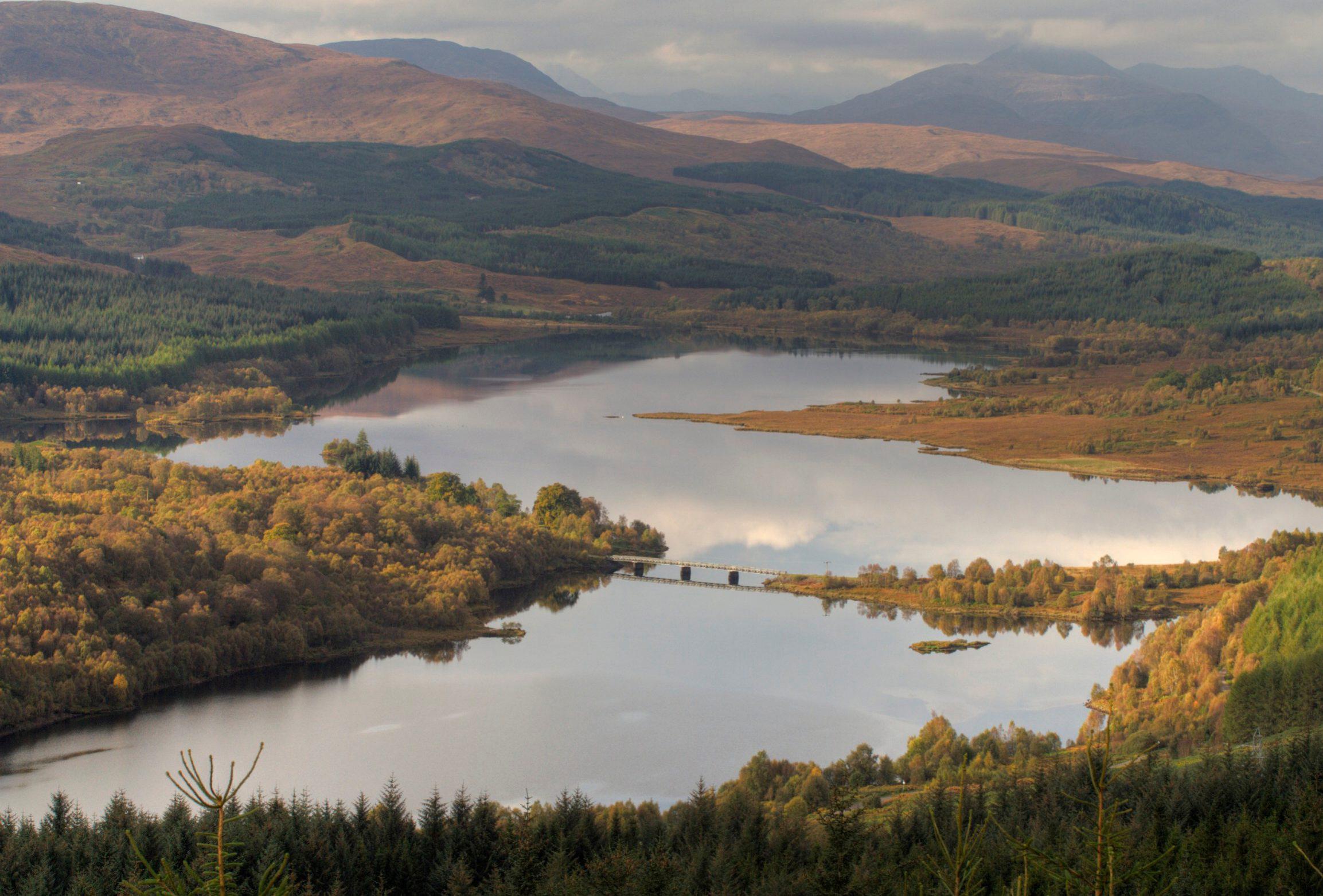
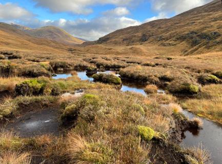
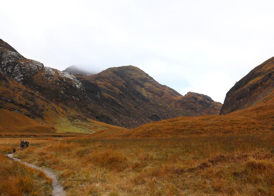
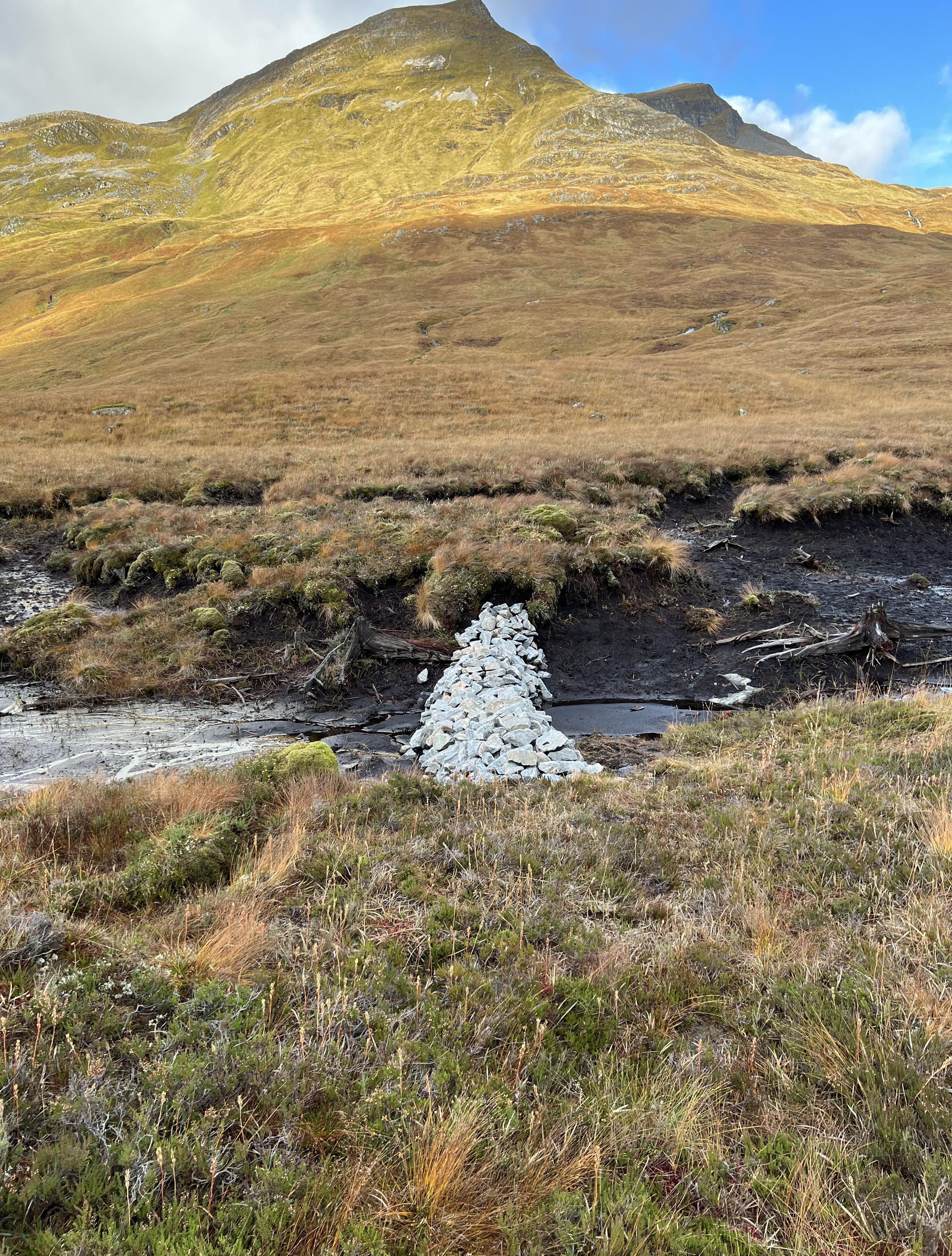
Fig.2- Carnigorms National Park. 8th Nov, 2022
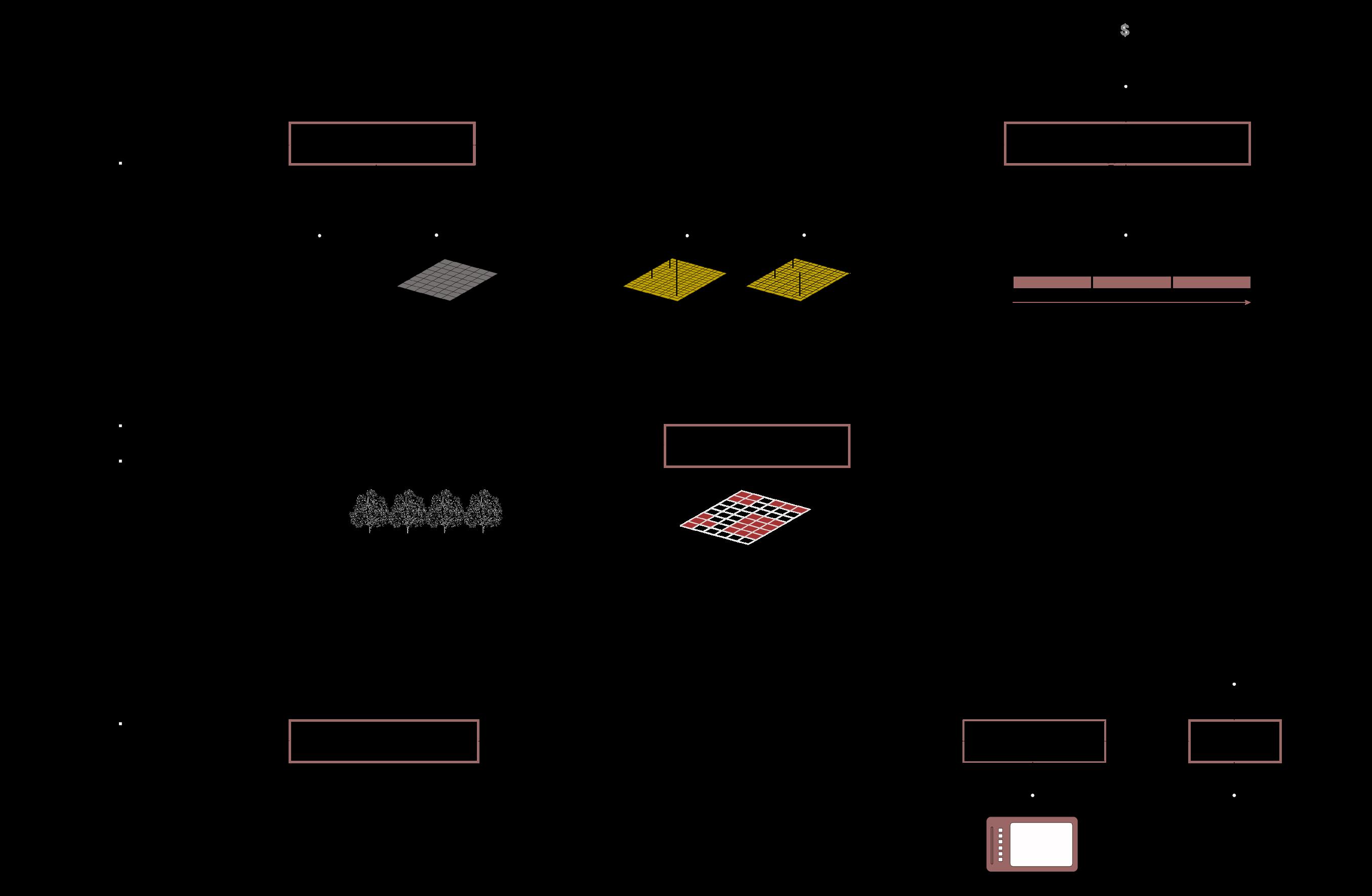
[ I.1 PROJECT STRUCTURE ]
The anatomical map reflects the projects various stages and drawings to better understand the process. It is divided mainly into three parts, that move in scale,from global to local, and futher zoom in to deal with a microscopic level of analysis, assessment and design.
Part
Part
I.2 PLANERTAY ISSUE
Tackling the democratisation of landscapes beyond cashing carbon credits has led us to think about climate change through carbon emissions.
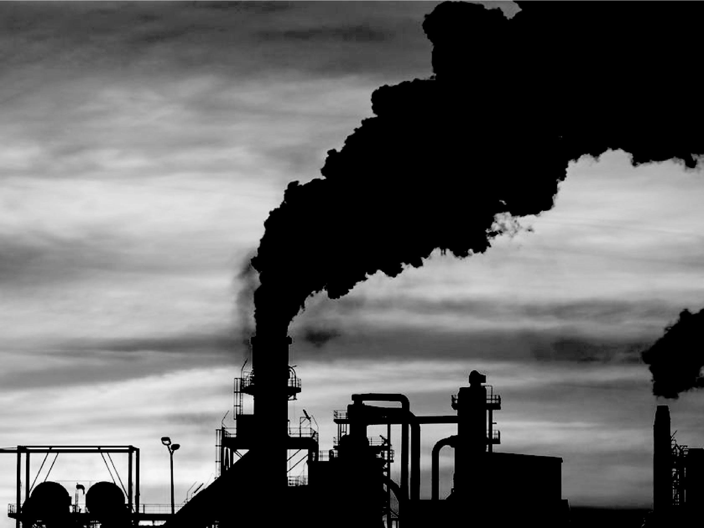
Planetary health and the fight against climate change are prominent issues in the current environmental scenario.
Source: https://www.greenmatters.com/p/how-do-carbon-emissions-affect-environme https://science.howstuffworks.com/environmental/green-science/human-activities-increase-carbon-dioxide.htm https://news.un.org/en/story/2021/10/1103892 https://www.nytimes.com/2022/02/28/climate/climate-change-ipcc-report.html
I. Introduction I. Introduction RE-PEAT SCOTLAND 2.0: Transparency, Transformation, Transition AA Landscape Urbanism 2022-23 09 08
I
II
III
Part
Part
I: Agenda and Issue
II: Peatlands and Woodlands
Part
to fight climate
Global acts of afforestation and deforestation Net-Zero Policy Land use Conflict Peatlands X Woodlands Historical relationship Analysis of Peatlands Analysis of Woodlands Existing Initiatives Policy Development Land Assessment tools Interface Development Soil Manual
Part III: Land Management Scheme Planetary Issue Global policies
chnage
- Anatomical Map[
Image by S. Halaoui
[ I.3 GLOBAL POLICIES ]

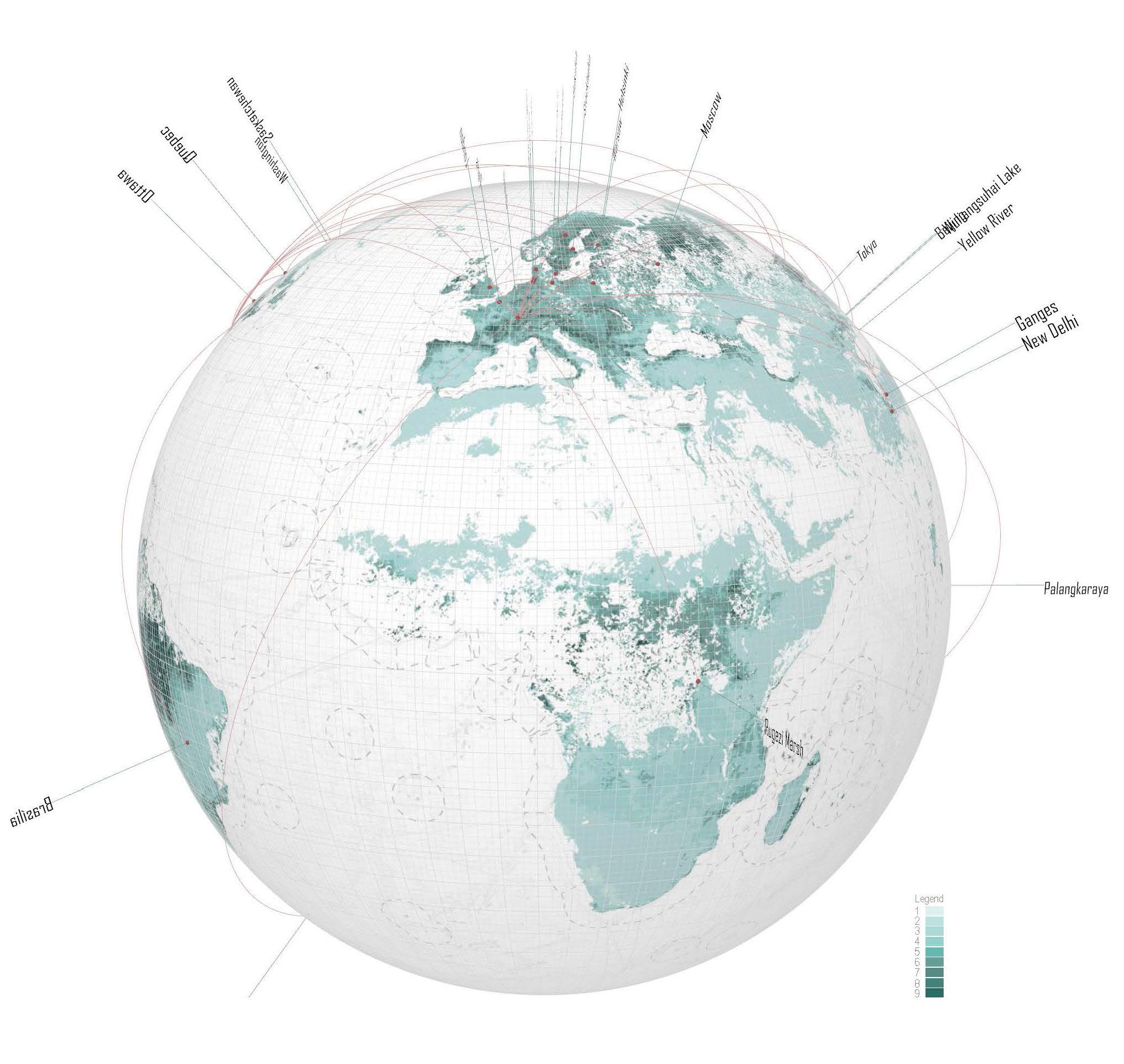
They have been faced with sets of policies and strategies acting on various scales and layers. Chief of them ones related to mass afforestation. It is clearly noticed that global organizations responsible of issuing these global policies are located and controlled by the global north with application of policies in the global south.
This change in tree cover has been mapped through time showing where policies have been shaping new forests across the globe.
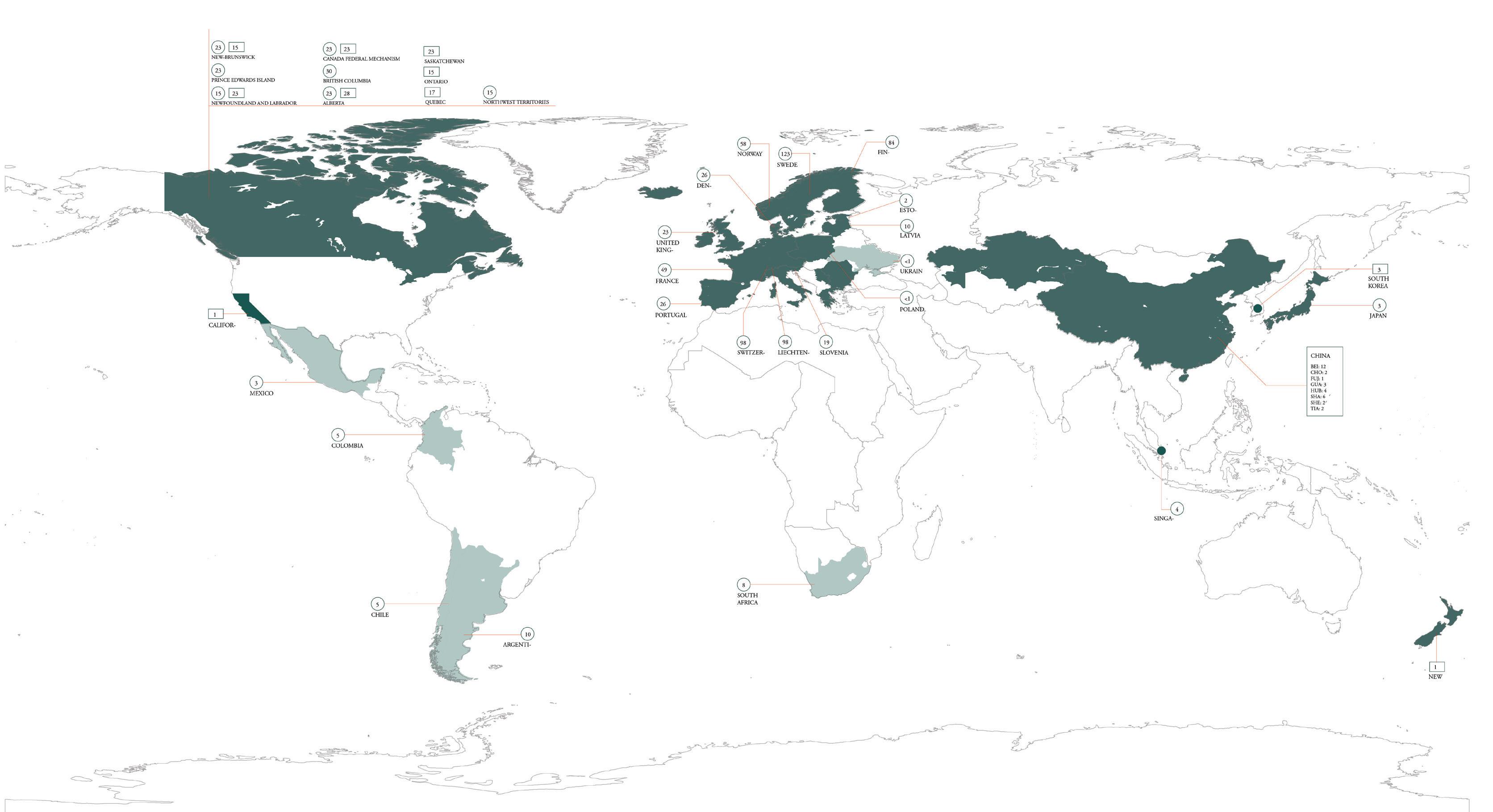
- Leaf Area Percentage -
[ I.4 NET NERO POLICY ]
Under the Net zero policy, big countries and companies tend to offset their emissions through a carbon crediting system. Net zero at a global scale requires that all emissions of greenhouse gases should be balanced by their removal from the atmosphere.
I. Introduction I. Introduction RE-PEAT SCOTLAND 2.0: Transparency, Transformation, Transition AA Landscape Urbanism 2022-23 11 10
- Global Policies & Leaf Area Index (LAI) - Image by C. Chen, T. Chao
Image by Y. Liu
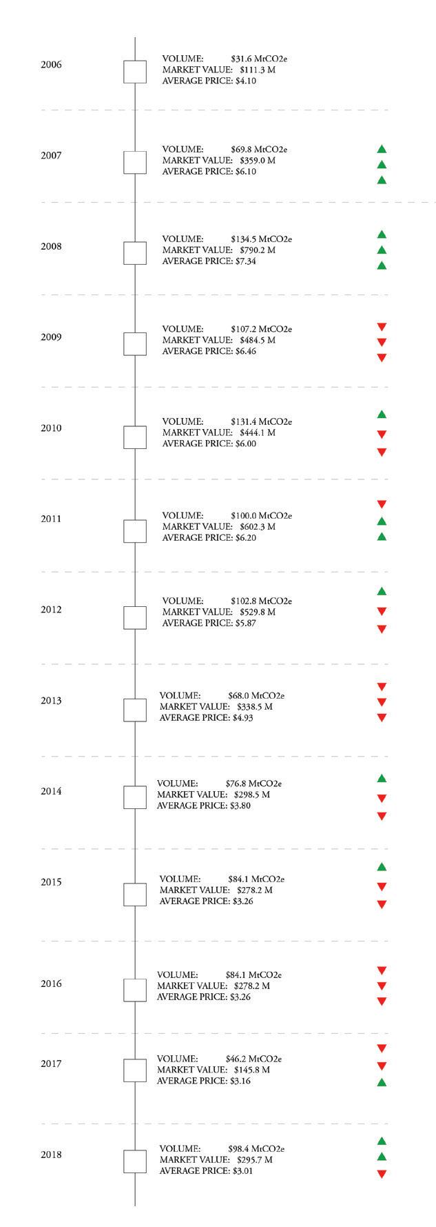
Image by S. Halaoui - Carbon Market | Major countires -
These policies have catered for:
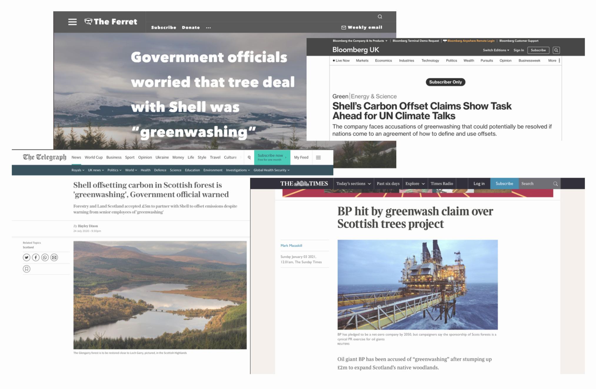
- Shell’s Glengarry Project, Scotland -
Environmentalists and activists criticize offset purchases as just greenwashing, especially when it comes to fossil fuel companies.Companies such as shell and BP, that have committed to reach net zero by 2050; impacting farmers, the community and small organisations and land owners.
Shell is funding a £5m Glengarry project, which is being developed by the Scottish government agency Forestry and Land Scotland. It is offsetting its emissions by planting trees on public land. Putting additional pressure on community owned land in an area where there is unequal land distribution.

Taking Dhule Wind project in India, where wind turbines are erected in a rural area, displacing farmers, cutting down trees and selling carbon offsets to foreign bodies.
Are these projects adapted to actual site conditions?
Is the intersection of trees with other land uses still valid to achieve net zero?
https://www.thetimes.co.uk/article/bp-hit-by-greenwash-claim-over-scottish-trees-project-9d957j9gz https://www.telegraph.co.uk/news/2020/07/24/offsetting-carbon-scottish-forest-greenwashing-government-official/ https://theferret.scot/shell-greenwashing-forestry-land-scotland/ https://www.bloomberg.com/news/articles/2021-10-25/shell-s-carbon-offset-claims-show-task-ahead-for-un-climate-talks
https://www.google.com/search?q=shell+glengarry+project&client=safari&channel=iphone_bm&sxsrf=AJOqlzUwVPRXC78qQh-XCbjGuuC36ZLakA:1674207946174&source=lnms&tbm=isch&sa=X&ved=2ahUKEwigqKXP7tX8AhVbTaQEHa59CmAQ_AUoAnoECAEQBA&biw=1199&bih=837&dpr=2#imgrc=tmblnN-zh-oKoM
I. Introduction I. Introduction RE-PEAT SCOTLAND 2.0: Transparency, Transformation, Transition AA Landscape Urbanism 2022-23 13 12
[ I.4 GREENWASHING [ I.4 DISPLACEMENT OF FRAGILE COMMUNITY ] [ I.4 MAJOR LANDUSE CONFLICTS ]
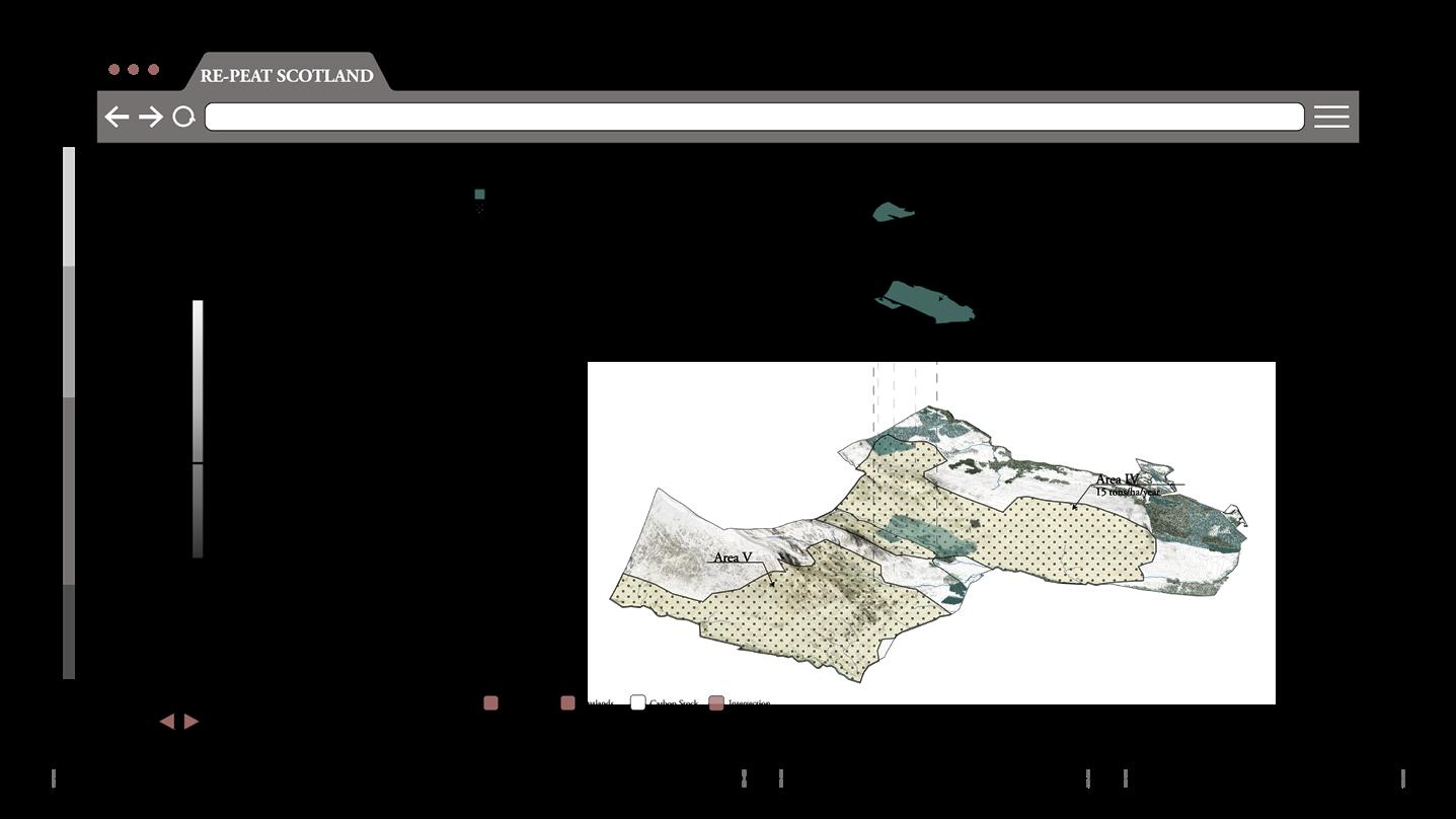
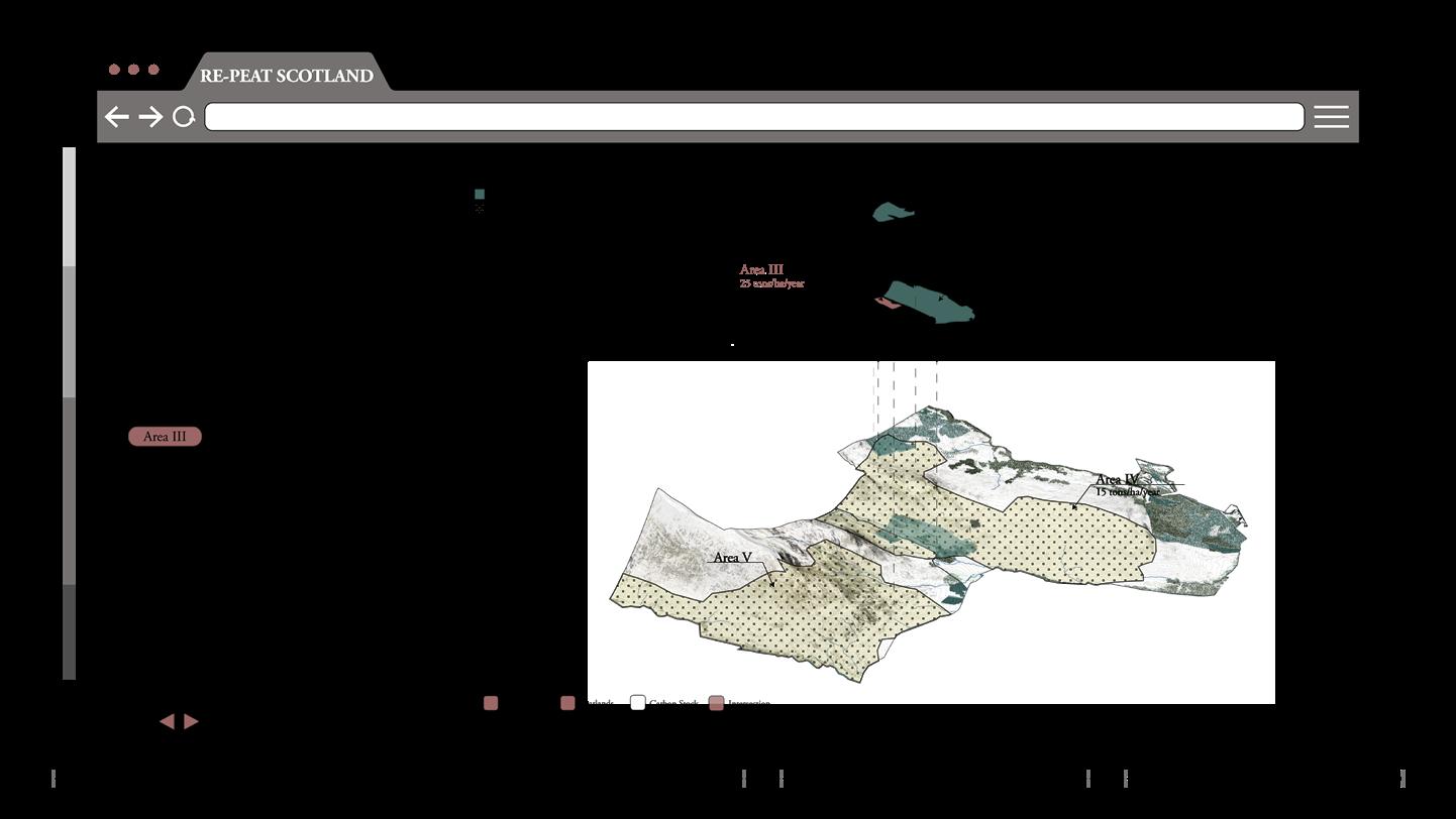
- Landuse Conflict x Global Scale -
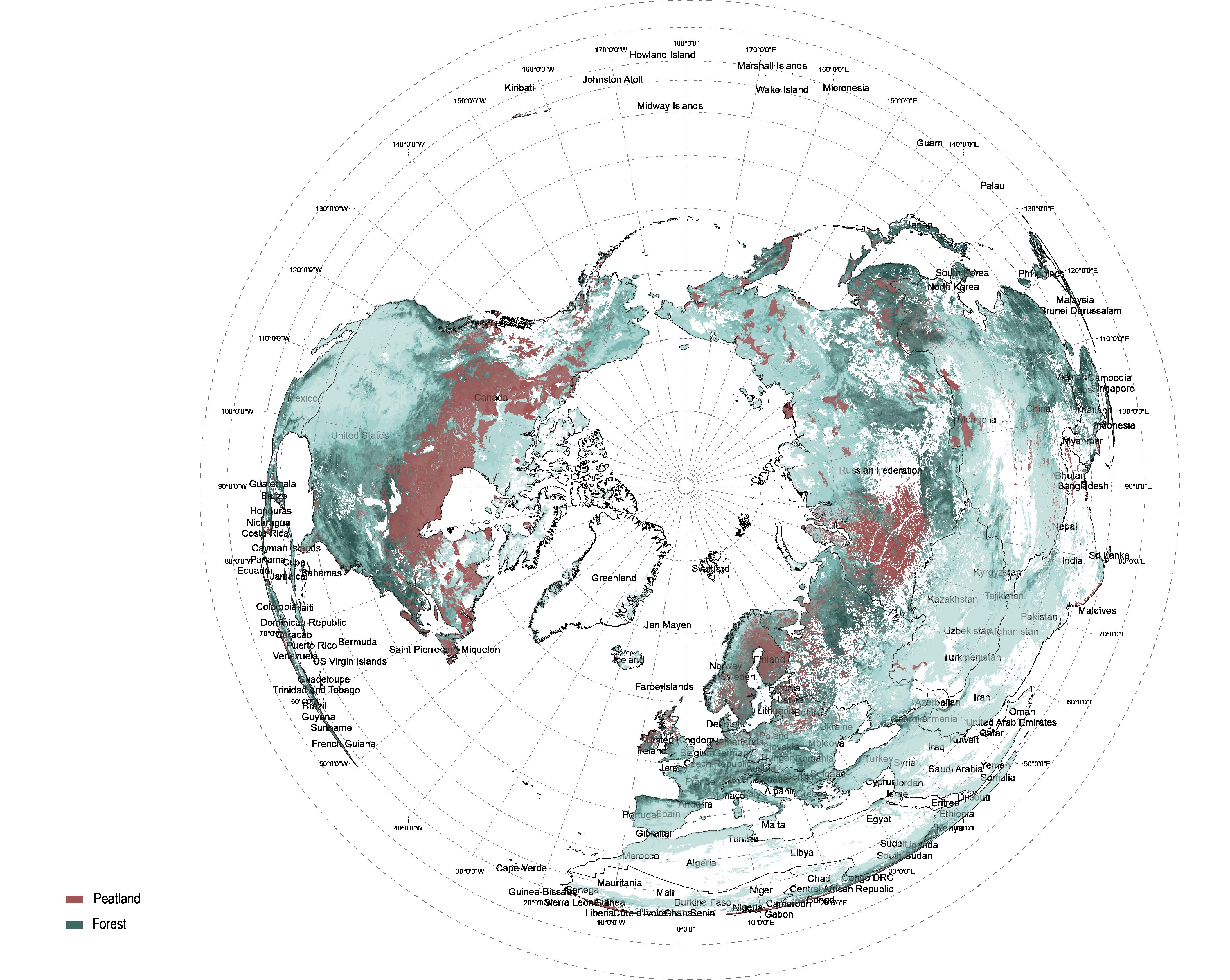
To map out the land use conflict we have focused on the woodlands and peatlands as major terrestrial carbon sinks of the globe. Due to their coexistence, they have lost their ability to sequester carbon and have become carbon emitters.
Peatlands mapped in red and forests in green.
12% Peatland UK
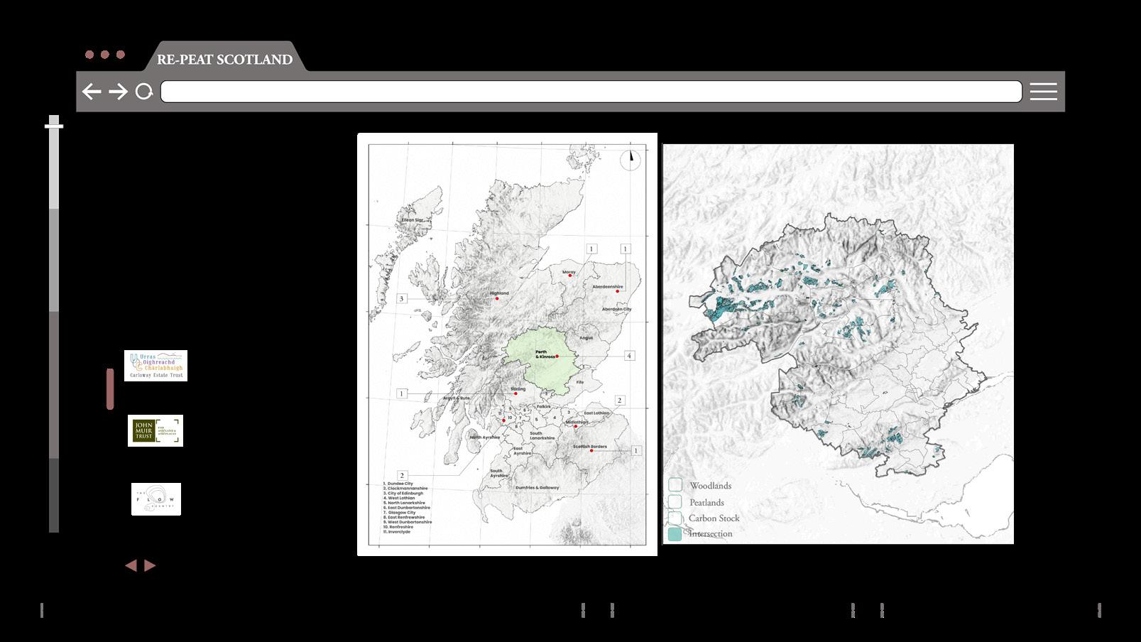
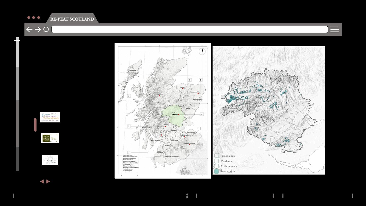
- National Scale _Landuse Conflict -
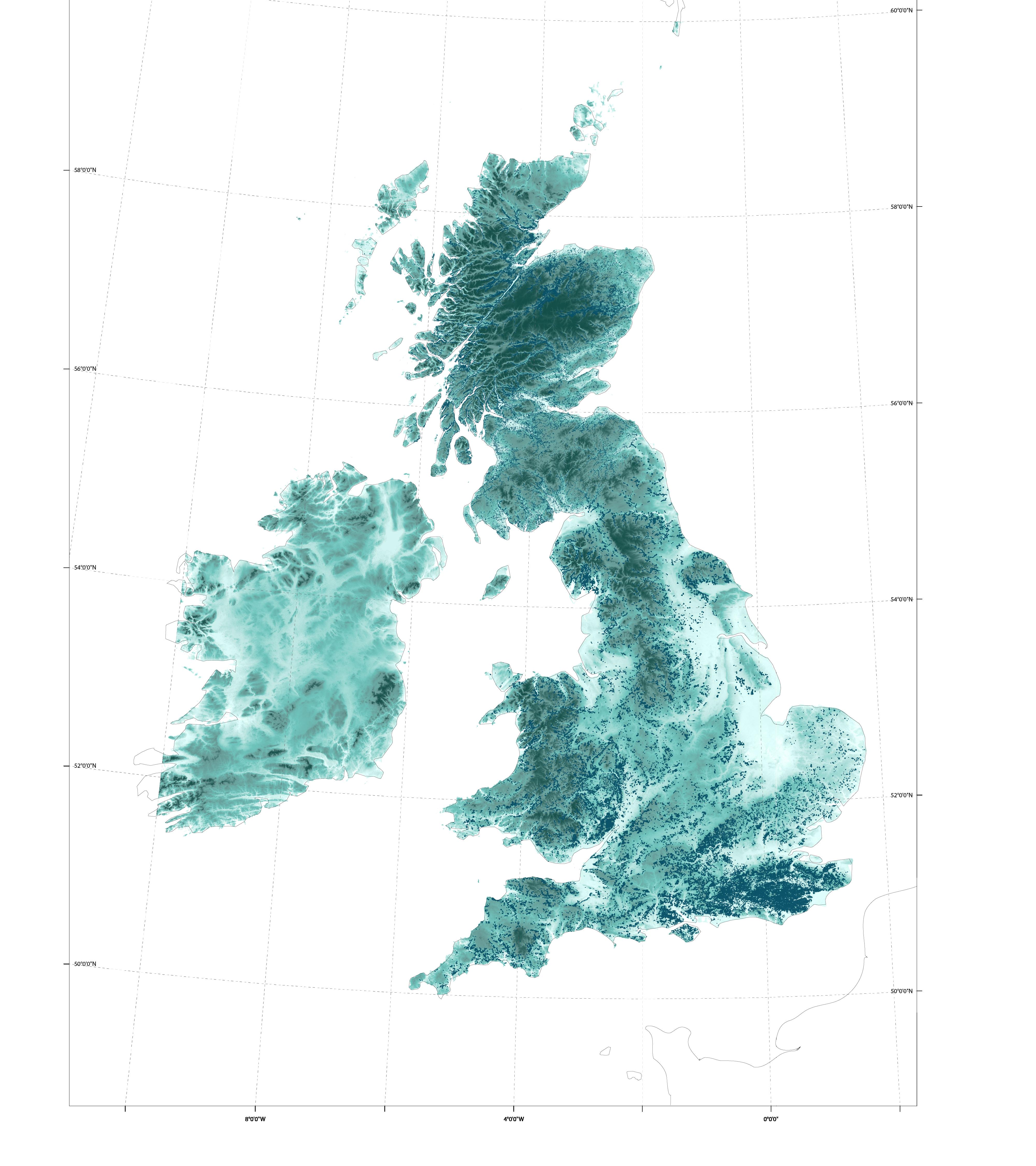
Zooming into the UK, we have mapped the woodlands, peatlands, and their intersection. All three categories are most notable in Scotland with very high intersection areas.
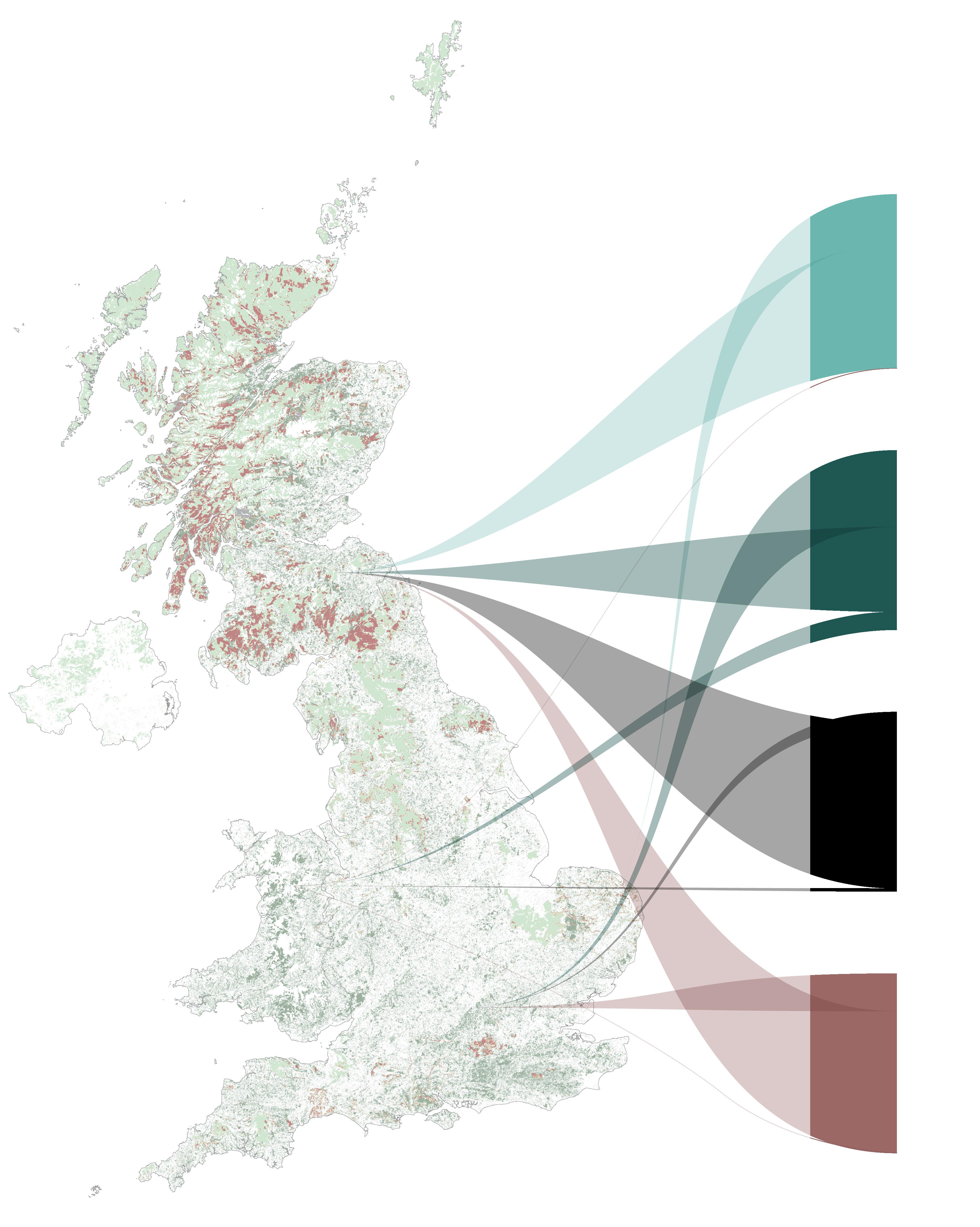
I. Introduction I. Introduction RE-PEAT SCOTLAND 2.0: Transparency, Transformation, Transition AA Landscape Urbanism 2022-23 15 14 Peatlands Woodlands Woodlands Carbon Credit Peatlands x Woodlands [ I.6 LANDUSE
]
CONFLICT
Image by T. Chao
- GIS global mapping _ Peatland and Woodlands - - Sankey map
_ Peatland and Woodlands
Image by Y. Liu
II-
II.1.
II.1 TEMPORAL ANALYSIS
‘If we see a landscape as some kind of waste space and devoid of detail, it becomes more vulnerable to dismissal or disinterest or improper use.’
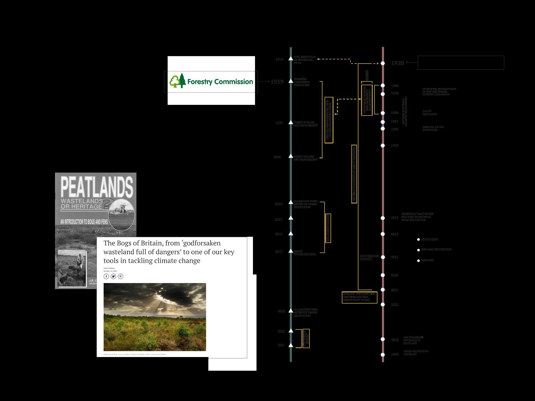
- Woodland -
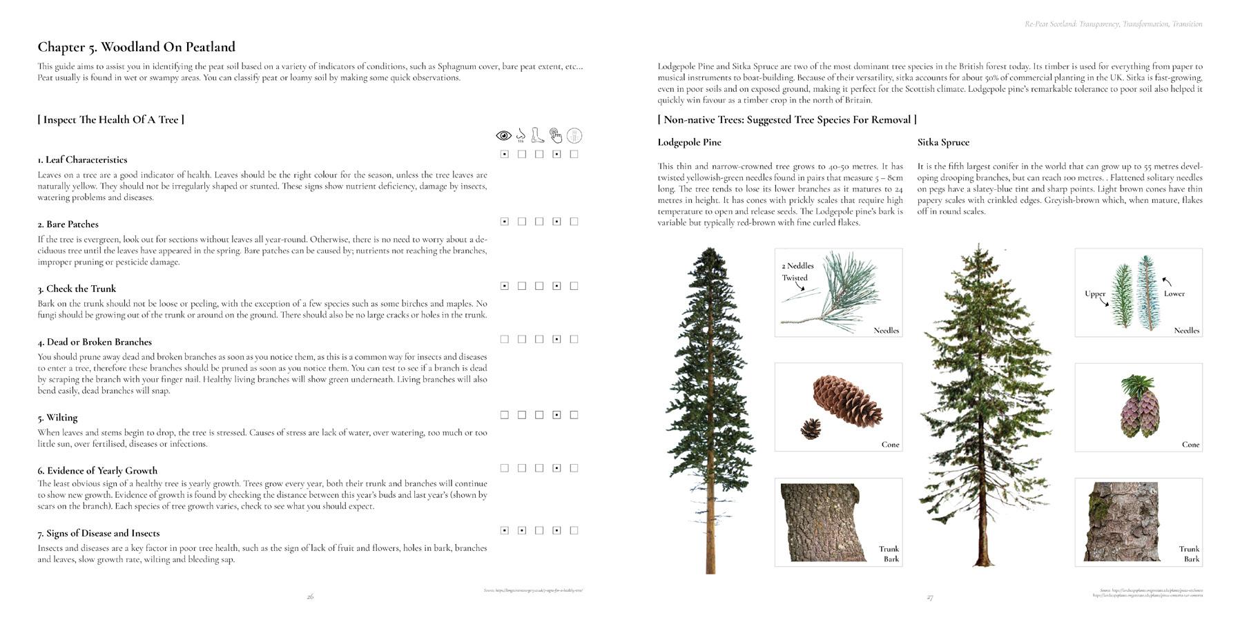
After WWI a huge reduction in woodland was noticed. UK was only covered by 5% woodlands. Therefore In 1919, the forest commission was formed. It created strategies to increase the woodland areas through mass plantation project on lands of low agricultural value, that lasted until the early 2000’s. Trees where mainly coniferous and used for timber production.
Due to the lack of native species in the UK, non-native ones were introduced to support these reforestation attempts. They introduced imported conifers such as the North American Sitka and lodgepole pine. Softwood production dominated in the Scotland and Hardwood in England.
By that time, UK issued certification for timber production called the PEFC, in line with the FSC and tracked down illegal logging.
In the 1970’s forest policies and management plans were issued. In addition to the Carbon budget plans that have impacted the forestation rates and the deadlines set to reach 13% of woodland coverage by 2016.
Timber production quantities are highly increasing and expected to continue increasing in the upcoming years.
- Peatland -
II.2.
II.3.
II.4.
In the 1920’s, peatlands became part of the reforestation projects, as lands of low value, or waste lands. This was noticed with respect to the formation of The Forest Committee. It lasted up until Peat action plans have been issued and then peatland strategies.

Between 1940-1980: large amounts of coniferous trees were planted on the peatland and, a few of them have succeeded and reached harvesting age by now.
Between 1950-1988, generous tax incentive system for peatland forestation took place, all under the pretext of encouraging employment, reducing timber imports and making wasteland productive.
And in 1980 1/10 of peatlands became forests. In the year 1988, the tax incentive system was removed, and during the early 2000’s the importance of peat has been realised.
Peatland strategies, policies and action plans were issued.
RE-PEAT SCOTLAND 2.0: Transparency, Transformation, Transition AA Landscape Urbanism 2022-23 16
[
Peatlands x Woodlands
Temporal Analysis
What are peatlands?
Microscopic world
Peatland types and distribution across the UK
II.5. Peatland biodiversity and water table
II.6. Damaged peat
II.7. Peatland Production
II.8. Woodlands
Macfarlane, BBC Culture
[
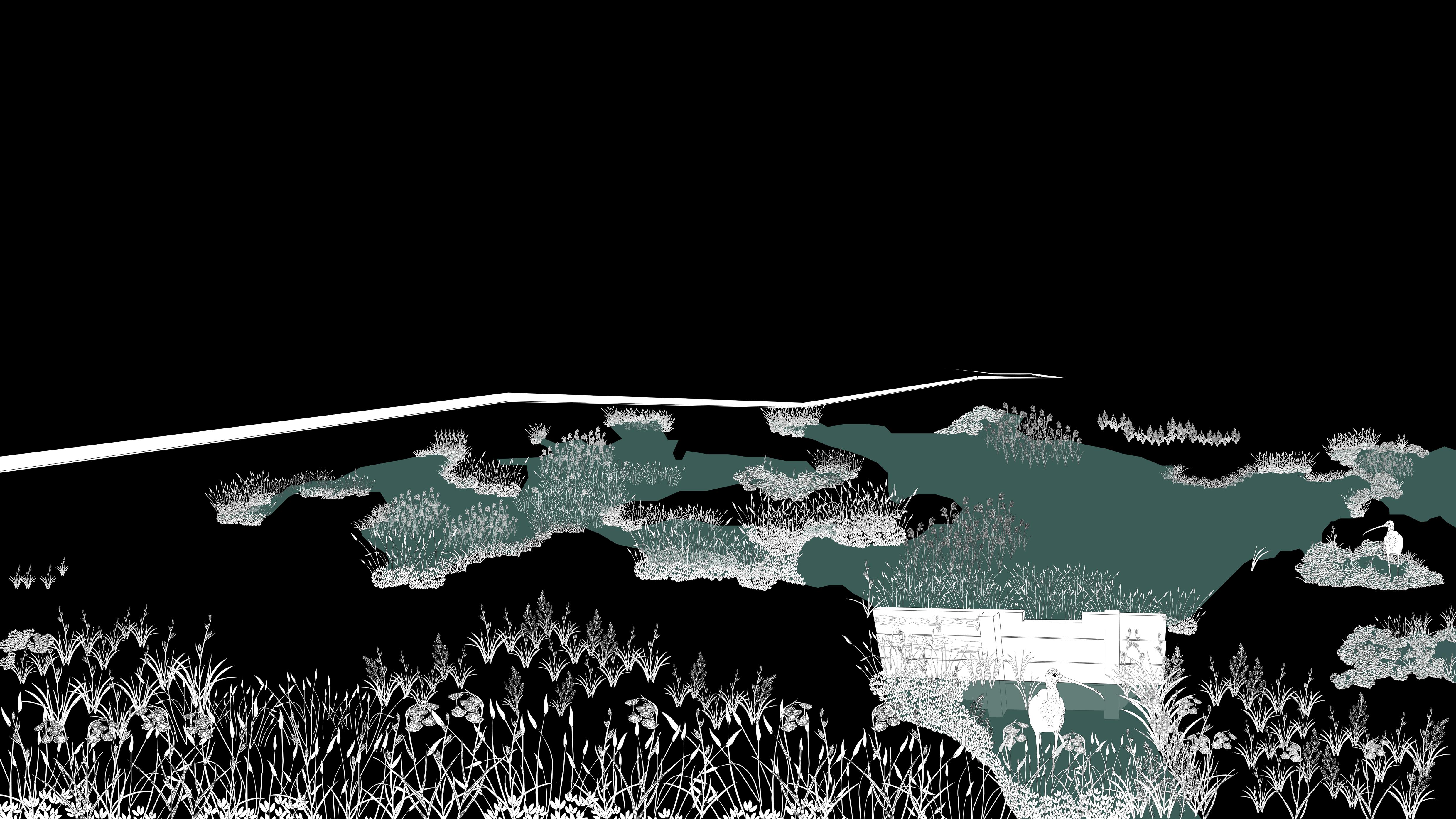
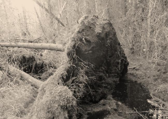
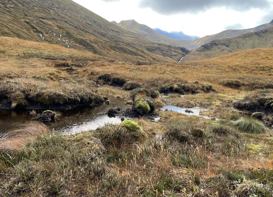
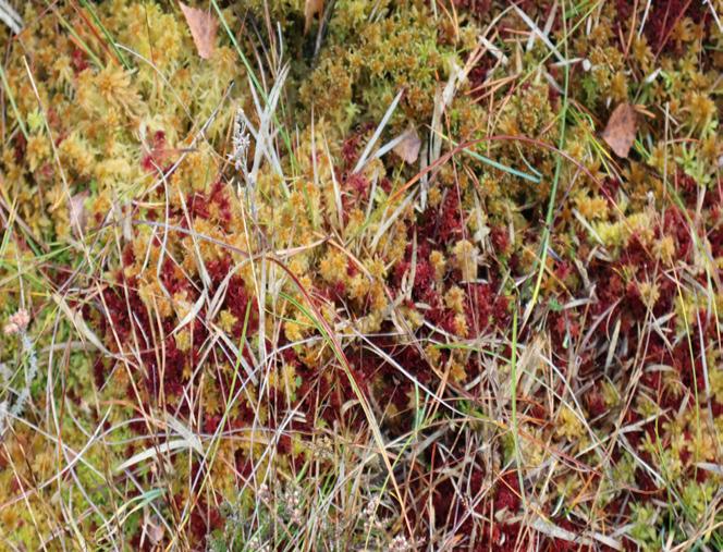
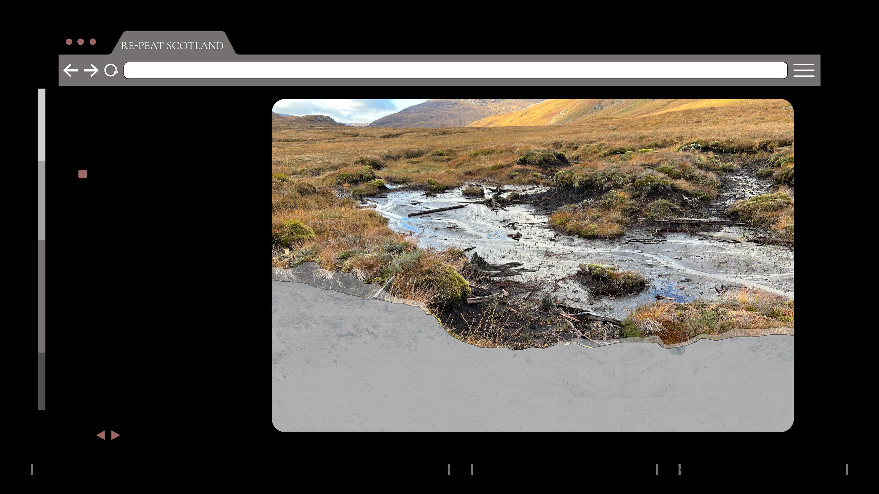
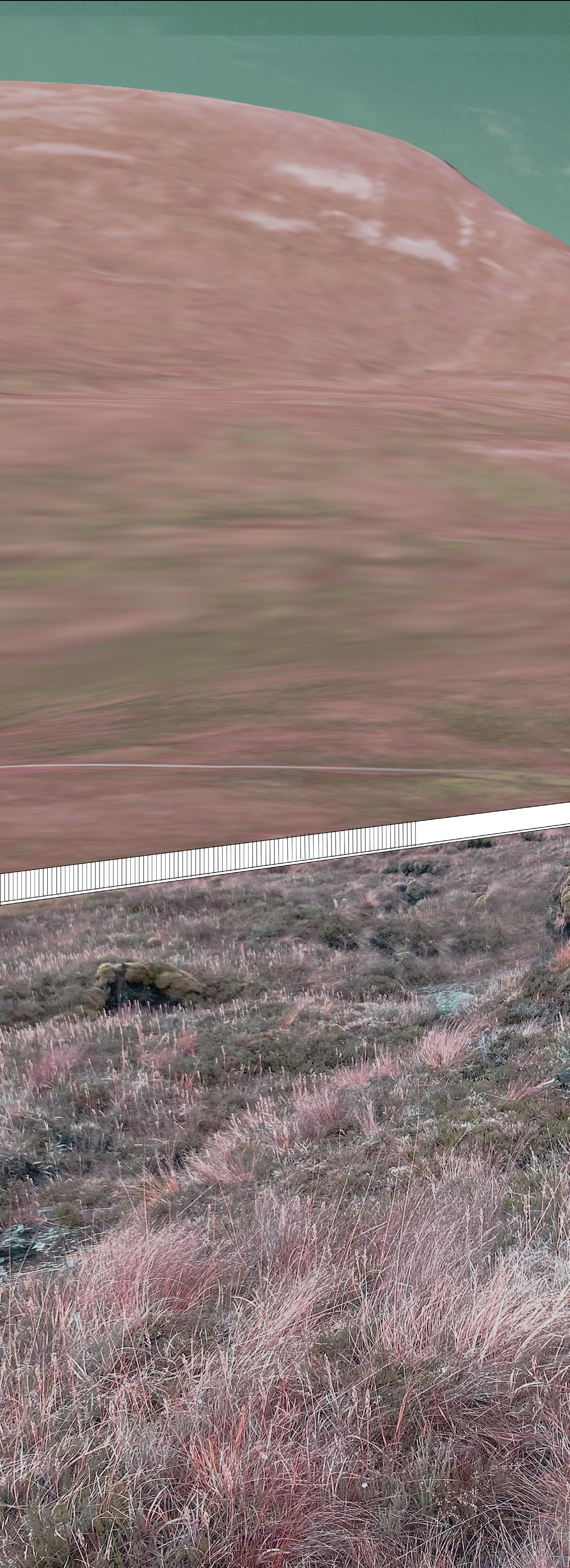
- Peatlands, Ben Nevis Estate, Scotland, 2022 - Image
Woodland Peatland
by S. Halaoui
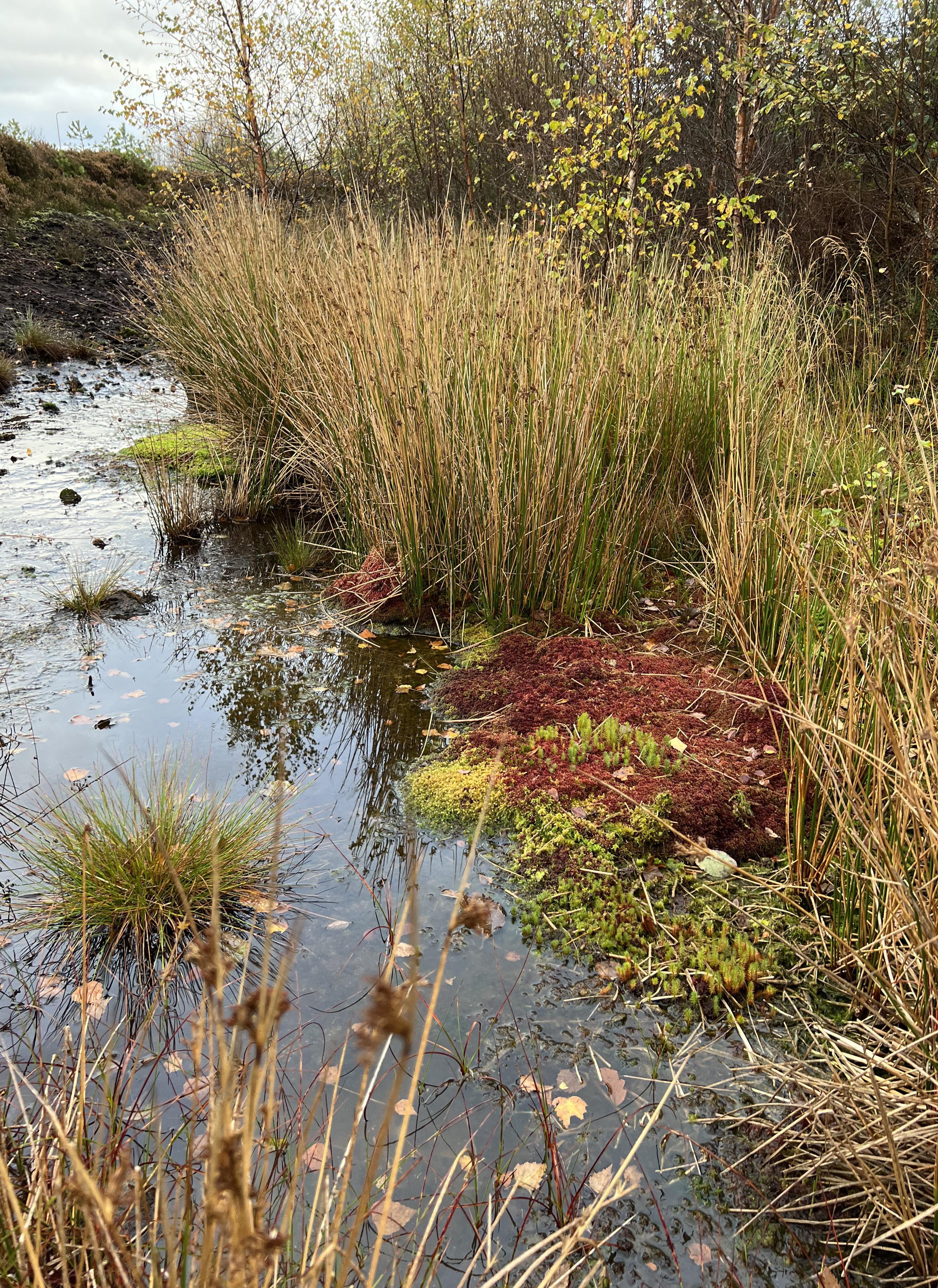
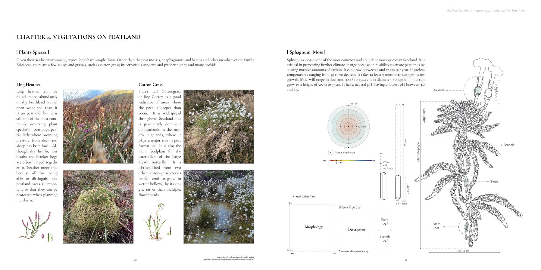
[ II.2 WHAT ARE PEATLANDS? ]
Defined by the International Peat Society: Peatlands are terrestrial wetland ecosystems in which waterlogged conditions prevent plant material from fully decomposing. Consequently, the production of organic matter exceeds its decomposition, which results in a net accumulation of peat.”
It is an accumulation of 1mm layer of organic matter per year. Therefore, It takes around 3000 years for a 3-meter, average depth peat, to form.
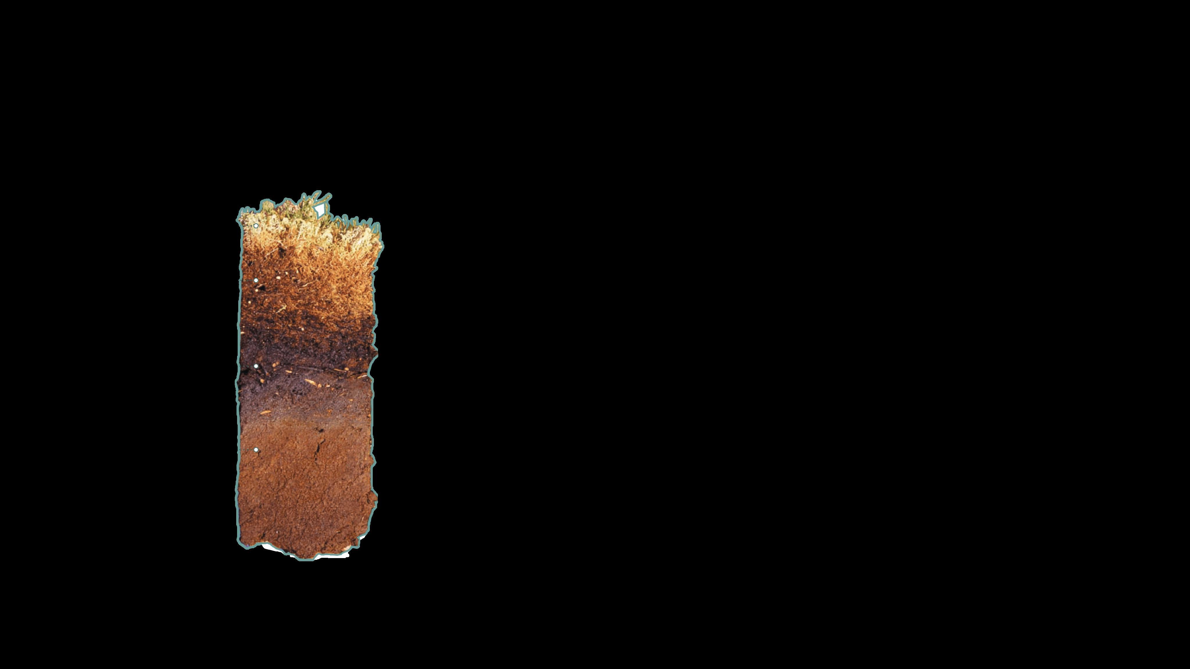
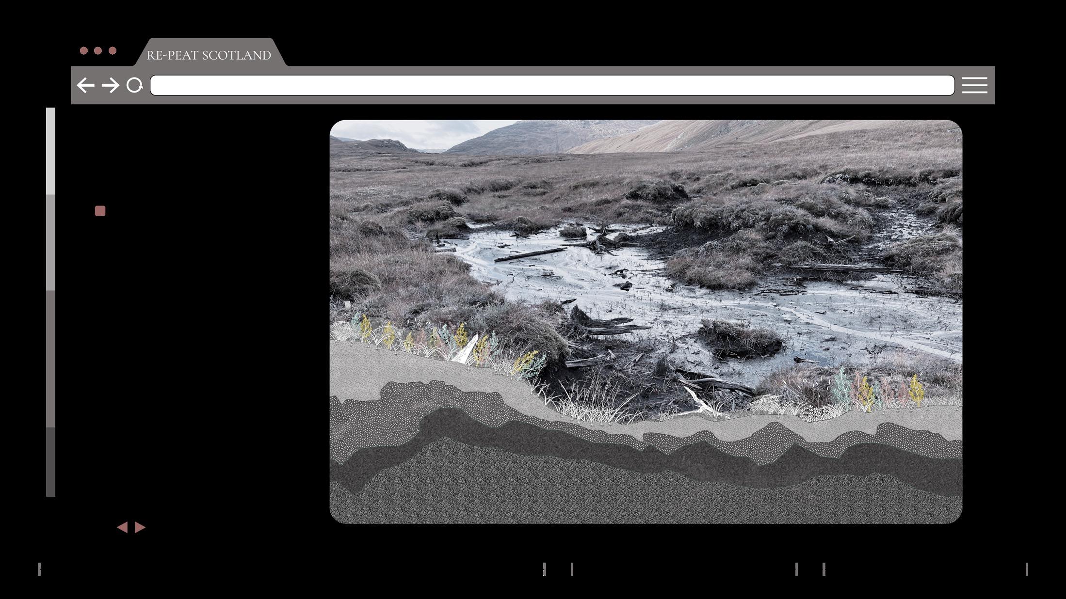
- Exposed Peatlands_ East Schiehallion -
[
II.4 PEATLAND TYPES ]

The map shows that the distribution of peatland types, yellow highlighting blanket bog, the orange is fen and red is raised bog. A peatland landscape can display a complex combination of blanket bog, raised bog and fens.
Topography, ground flow, water table and vegetation are important elements to form and classify different types of peatlands.
- Peatland types and distribution across the UK -

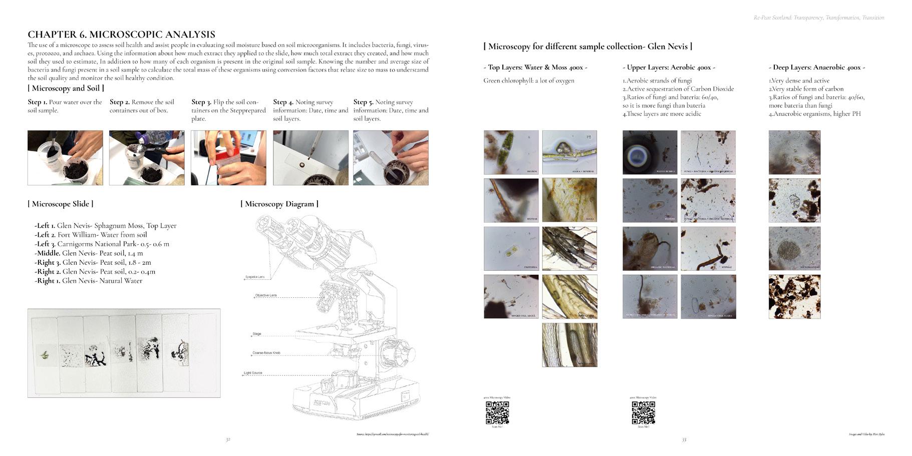
[ II.3 MICROSCOPIC WORLD OF PEATLANDS ]
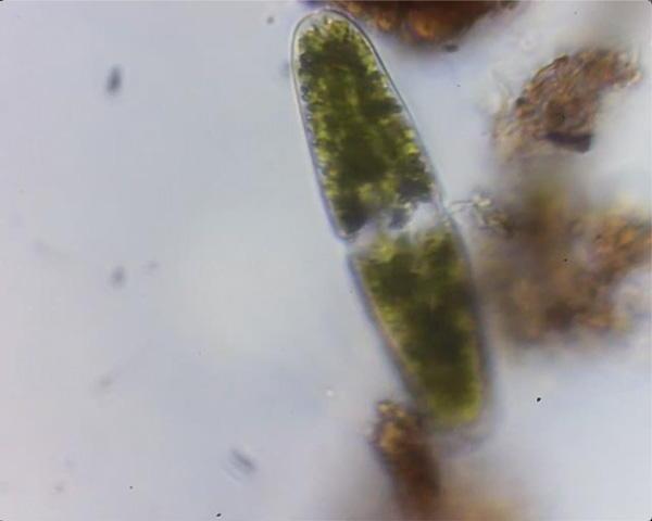
The importance of peatlands is dependent on the health and functioning of the microorganisms or its microbial communities that create it and live within it.
These creatures, that in many cases are very old and ancient, provide an image of how unique and precious these soils are.
Tackling peatlands microbial communities allows us to develop an alternative understanding of this ecosystem that goes beyond the carbon calculations and sequestration or as perceiving them as a global soil carbon stock.
II. Peatlands X Woodlands II. Peatlands X Woodlands Transparency, Transformation, Transition 19
[
] Blanket Bog Raised Bog Fen
PEATLANDS
National Scale_ Peat
[ BIODIVERSITY SECTION ]
Due to the process of peat accumulation, peatlands are carbon rich ecosystems that store and sequester more carbon than any other type of terrestrial ecosystem, exceeding the global above-ground carbon stock of forest ecosystems.
Peatlands are diverse and complex ecosystems.
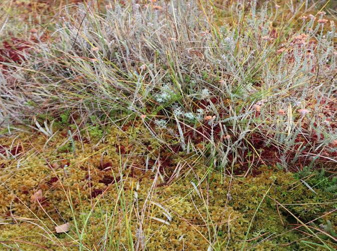
They are home to several animal species such as the: Snipe, hobby, bog bush cricket, and the skimmer.
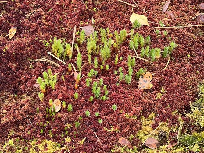
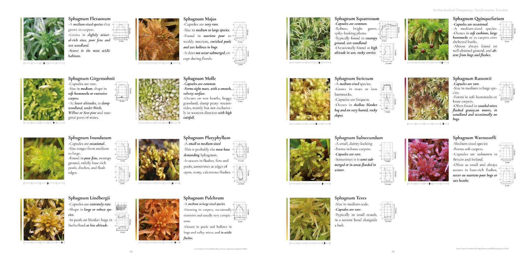
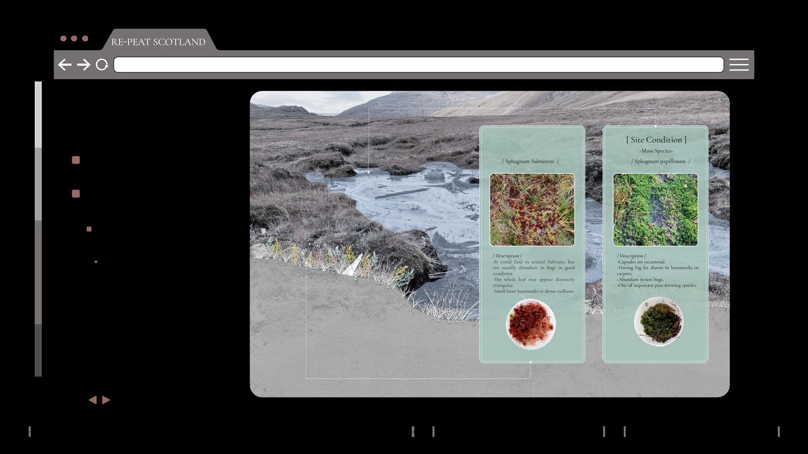
As for plants, the dominant species if sphagnum moss.
[ WATER TABLE SECTION ]
As for the water table, it is naturally and in healthy peat conditions, very close to the surface. The depth of the water table fluctuates throughout the different seasons and depending on the permeability of the soil.
II. Peatlands X Woodlands II. Peatlands X Woodlands RE-PEAT SCOTLAND 2.0: Transparency, Transformation, Transition AA Landscape Urbanism 2022-23 21 20
Image by S. Halaoui
Image by S. Halaoui
[ II.6 DAMAGE SECTION ]
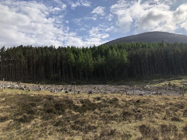
However, peatlands are the damage state. And the following section portrays the existing conflicts. From afforestation, peat extraction, wind-farms, and drainage.
-
II. Peatlands X Woodlands II. Peatlands X Woodlands RE-PEAT SCOTLAND 2.0: Transparency, Transformation, Transition AA Landscape Urbanism 2022-23 23 22
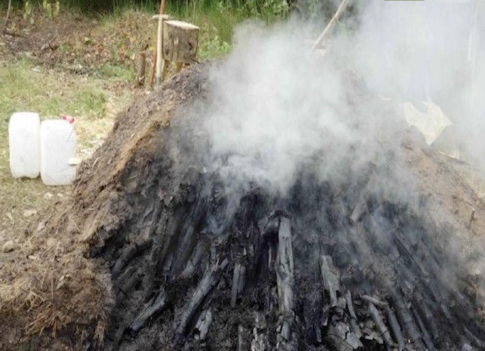
- Exposed PeatExtracted peat is used for whisky production
ConflictNon-native trees planted on peatland for timber production
Image by Y. Liu
- Exposed PeatDue to natural drainage and climate change
II.7 PEATLAND PRODUCTION
-
PRODUCTION -
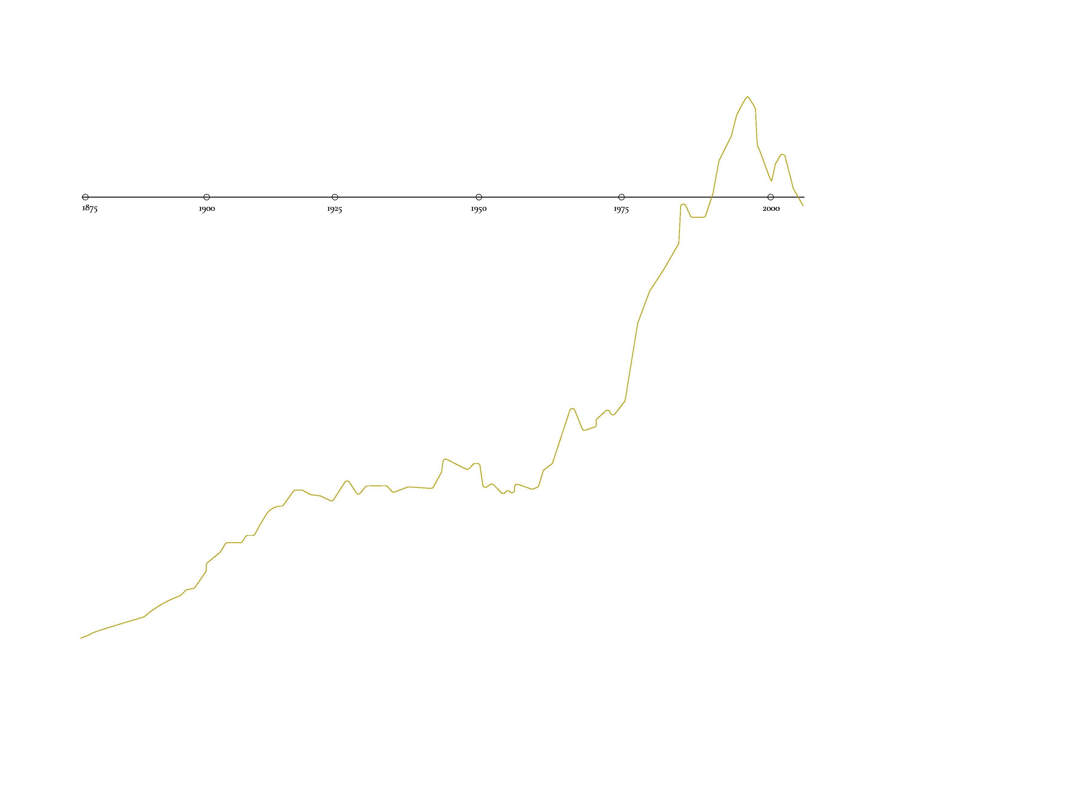
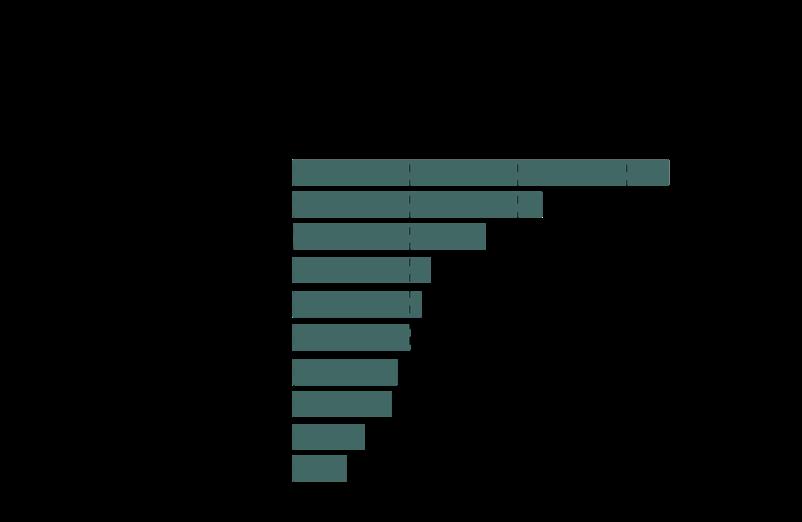
According to the statistics, the beverage industry has dominated the trade in various food groups, particularly in the production of whisky. Scotch whisky is well known for its peat flavor, and is highly demanded in the market, therefore production has gradually increased over time, in order to fulfill local and global demands.
Therefore, we mapped out the relation between peatlands, barley and cereal fields and the whisky distilleries in addition to extraction practices to show the impact of productions that highly rely on peat.
II. Peatlands X Woodlands RE-PEAT SCOTLAND 2.0: Transparency, Transformation, Transition 25 II. Peatlands X Woodlands AA Landscape Urbanism 2022-23 24
G G G G G G G G G G G G G G G G G G G G G G G G G G G G G G G GG G G G G G G G G G G G G G G G GG G G G G G G G G G G G G G G G G G GG G G G GG G G G G G G G G G G G G G G G Oban Lagg Jura Scapa Arran Tamdhu Harris Cardhu Ardbeg Tomatin Glasgow Falkirk Bowmore Bonhill Tormore Lochlea Dalmore Ardmore Arbikie Talisker Speyside Longmorn Linkwood Dufftown Deanston Bladnoch Wolfburn Pulteney Holyrood Glengyle Glen Ord Edradour Daftmill Caol Ila Balblair Lone Wolf Lagavulin Aberfeldy Aberargie Torabhaig Tobermory Teaninich GlenWyvis Glengoyne Eden Mill Clynelish Balmenach Annandale Ailsa Bay Dalwhinnie Springbank Glenturret Fettercairn Glendronach Blair Athol Glenmorangie Auchentoshan Ardnamurchan Highland Park Edradour No.2 Abhainn Dearg North Carolina Royal Lochnagar Scottish Borders Ben Nevis Township Macduff, Aberdeenshire Whisky Distillery’s Location Road Spring Barley Winter Barley Deep Peat Shallow Peat 150°0'0"E 180°0'0"E 110°0'0"E 70°0'0"E 30°0'0"E 10°0'0"W 50°0'0"W 90°0'0"W 130°0'0"W 170°0'0"W 80°0'0"N 60°0'0"N 40°0'0"N 20°0'0"N 0°0'0" 20°0'0"S 40°0'0"S 60°0'0"S 80°0'0"S 2020 2019 2018 2017 2016 2015 2014 2013 2012 2011 2010 2009 2008 2007 2006 2005 2004 2003 £3.8 bn £4.9 bn £4.37 bn £4.01 bn £3.86 bn £3.95 bn £4.26 bn £4.27 bn £4.23 bn £3.45 bn £3.13 bn £3.01 bn £2.82 bn £2.48 bn £2.37 bn £2.26 bn £2.38 bn 2.00 2.50 3.00 3.50 4.00 4.50 5.00 £4.7 bn EU North Euroupe Latam Caribbean North America Middle East North Africa Sub-Saharan Africa Asia Oceania 23.7% 33% 33% 3.3% 23.7% 23.7% 23.7% United State £728.9 m Latvia £175.9 France £375.3 m Singapore £246.9 Taiwan £181.8 m Germany £138.7 Japan £114.9 Australia £113 m Spain £108.8 m China £106.9 m
WHISKY
[
- WINDFARMS -
Image by T. Chao Image by S. Halaoui
II.8 WOODLANDS ]
Due to forest management policies and strategies and the aim to increase forest cover by set deadlines we notice that the forest cover in the UK has increased over the past century, and it is most notable in Scotland.
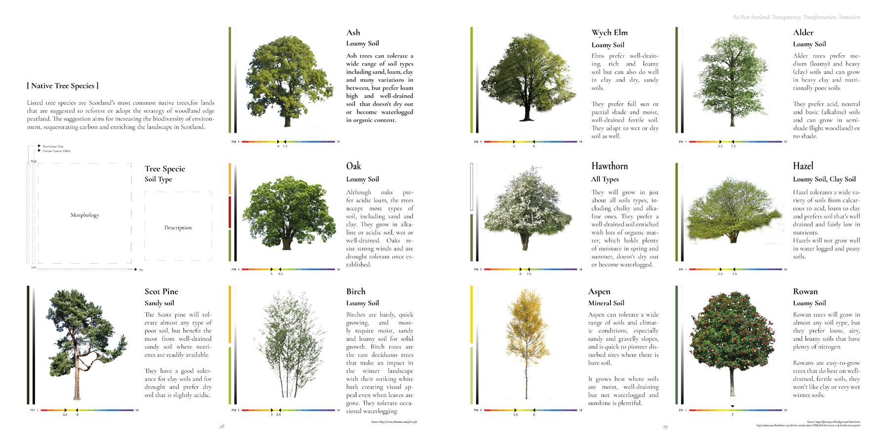
Woodland species in the UK are divided into native and non-native ones.
Native species are classified into Semi-natural woodlands and ancient semi natural ones, mostly dominant in Scotland and southern England.
Two thirds of them are privately owned by individuals and groups and only one third is publicly owned.
Due to the lack of native species in the UK, non-native ones were introduced to support reforestation attempts.
Sitka Spruce dominating in Scotland and Wales and the same applies to lodgepole pine.
Most of the non-native species’ plantations lie within the commercial forestry category. They supply timber production industry.
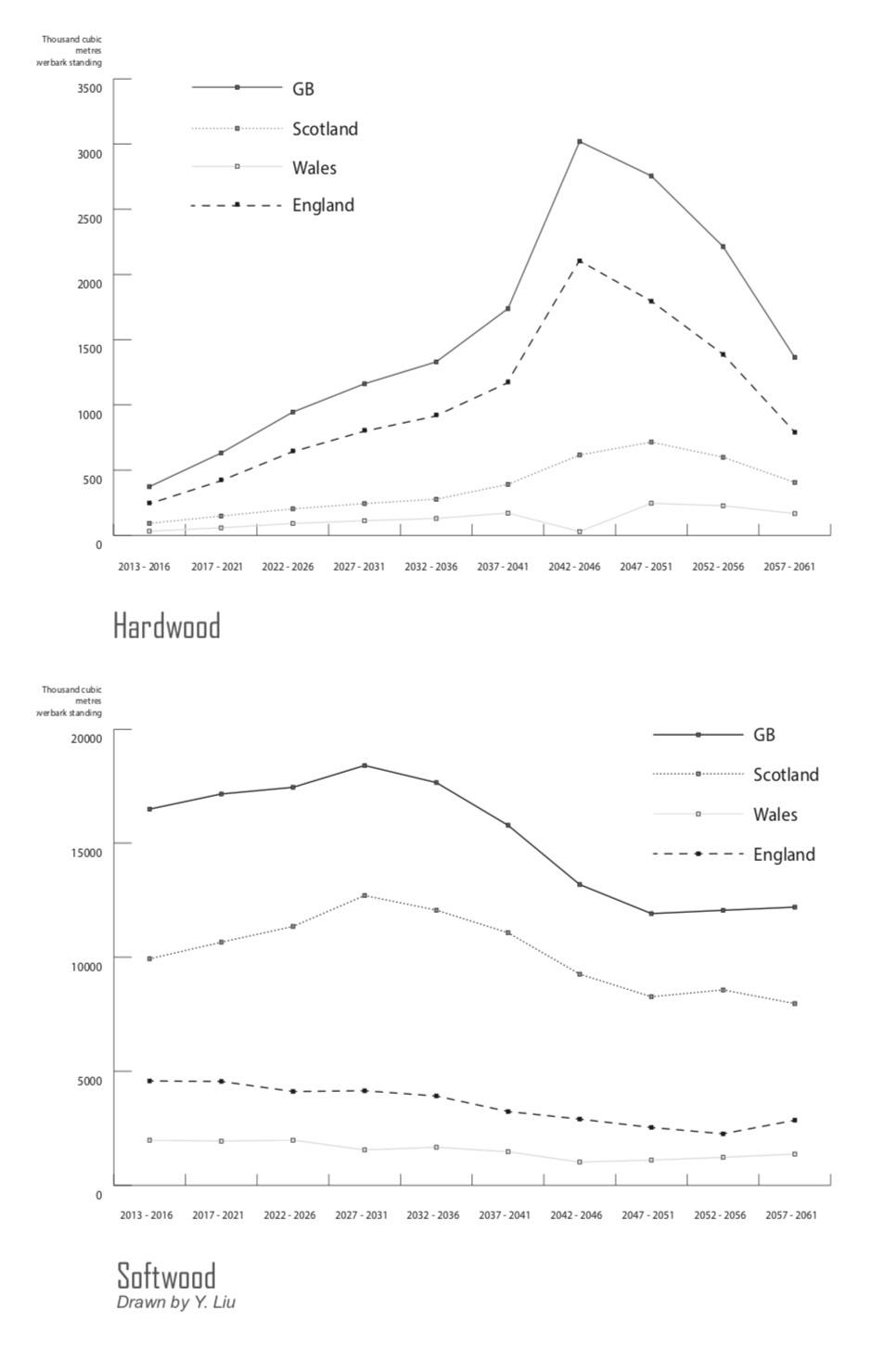
According to Forest Research, the production of timber in the UK is increasing, the line charts of Hardwood and Softwood Availability Forecasts both show that the wood production will still be increasing by 2030, and in Scotland, the timber production from private land is expected to have dramatic growth.
III.1. Structure
III.2. Land ownership
III.3. Existing Initiatives
III.4. Meeting with organizations
II. Peatlands X Woodlands II. Peatlands X Woodlands AA Landscape Urbanism 2022-23 26
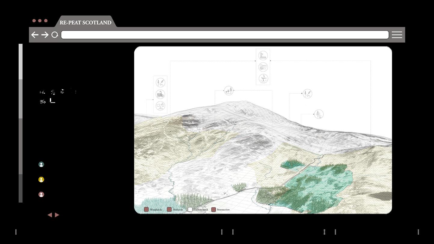
[ III- Land Management Scheme ]
- Peatlands, Cairngorms National Park, Scotland, 2022 -
Softwood Hardwood
- Ancient and semi-ancient woodlands map, UK
*All the drawings from this chapter until the end, done by S. Halaoui, T. Chao
[ III.1 LAND MANAGEMENT SCHEME STRUCTURE
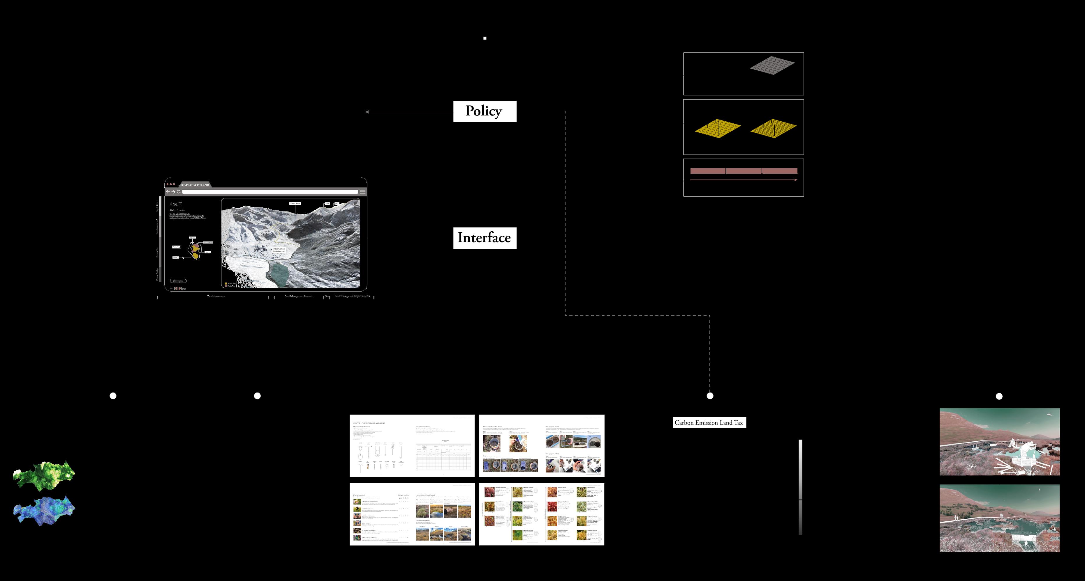
We aim at developing landuse policies for a transition to a real zero that will be applied through an interactive platform.
This platform will allow various means of land assessment, provide a community manual, carbon tax calculation and land management strategies.
[ III.2 ENGAGEMENT
Our focus was on community organizations and initiatives in Scotland.
Due to the concentrated land ownership, major landowners behave like monopolies across large areas of rural Scotland and have excessive power over land use and local communities.
Making use of landscapes as natural capital to sell carbon credits and offset emissions.
- Landownership in Scotland -
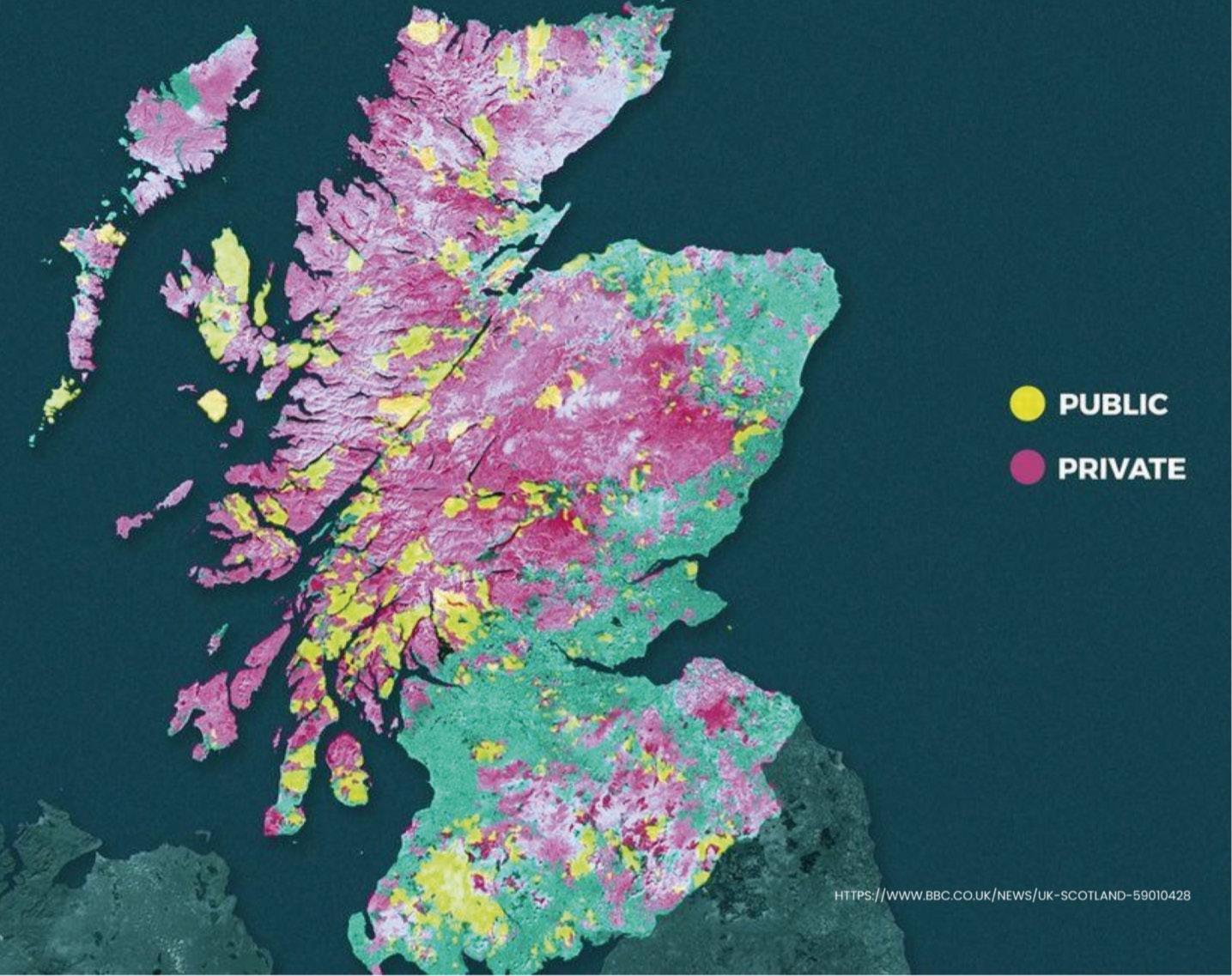
Maps were produced for the BBC Scotland programme, including this one showing public and private land ownership across Scotland
https://www.bbc.co.uk/news/uk-scotland-59010428
II. Peatlands X Woodlands II. Peatlands X Woodlands RE-PEAT SCOTLAND 2.0: Transparency, Transformation, Transition AA Landscape Urbanism 2022-23 29 28
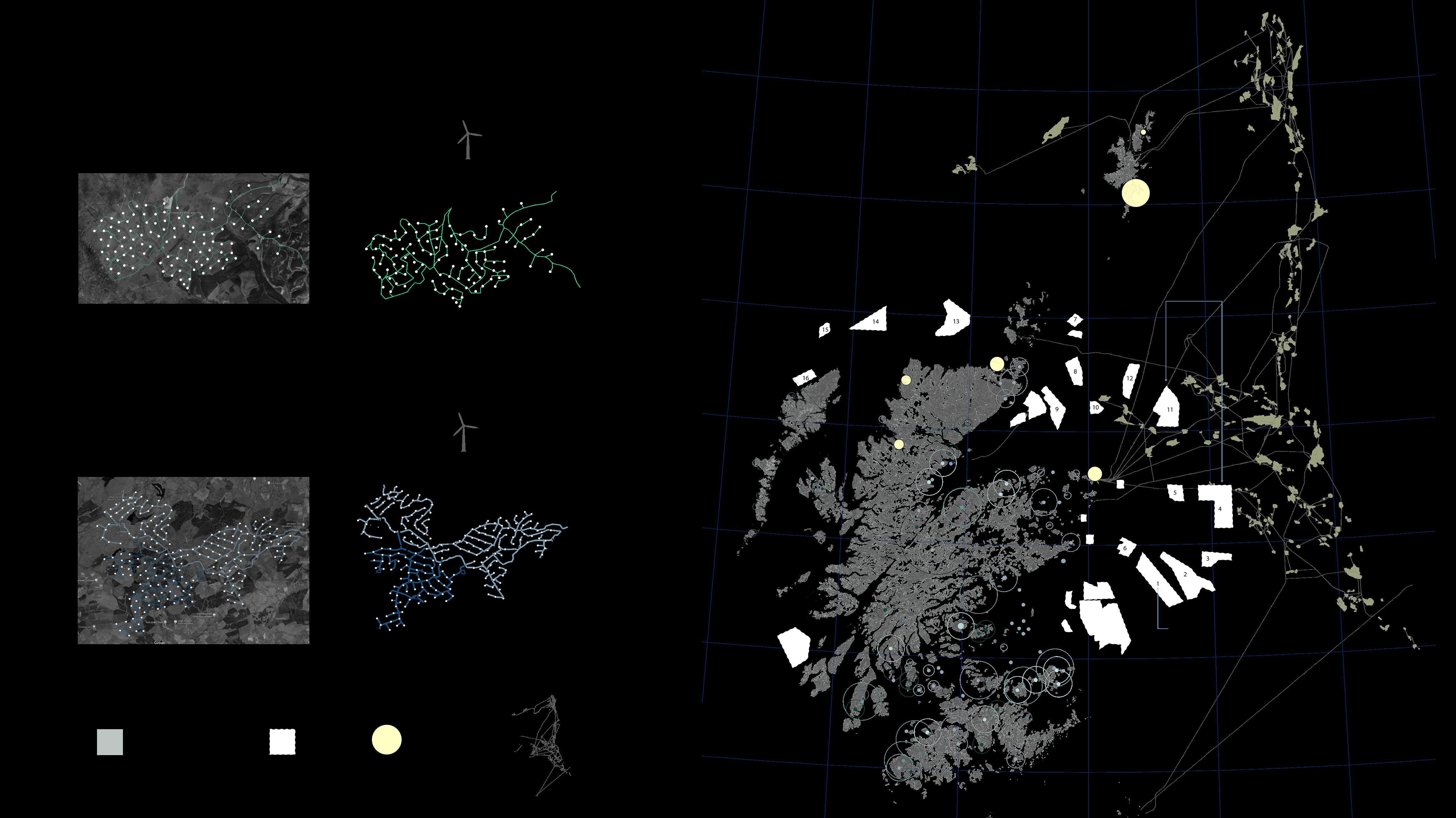
III.3 EXISTING INITIATIVES ]
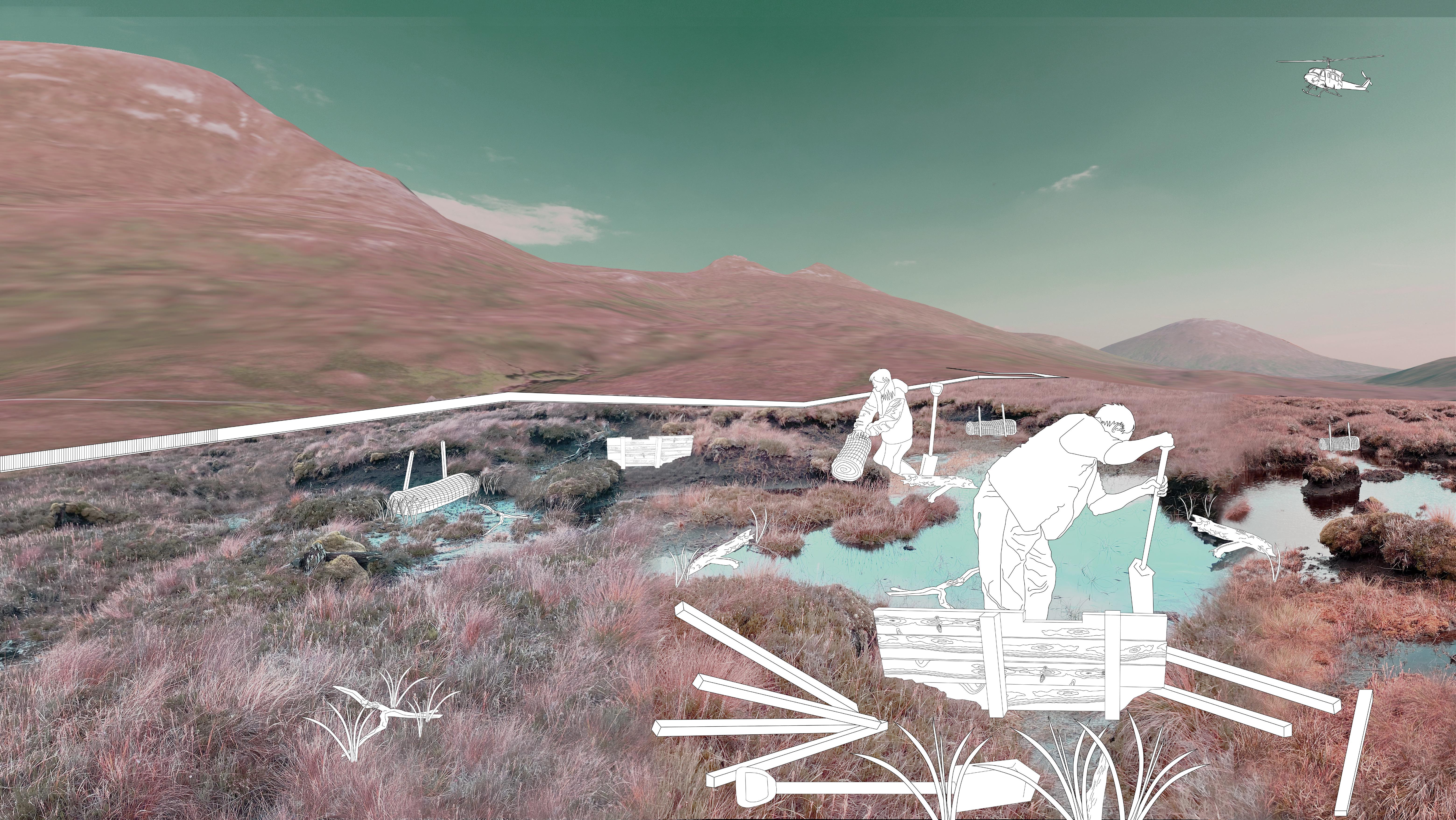
We tackled existing, community driven, initiatives in Scotland. Sites were selected based on the areas of conflict, land ownership, carbon crediting systems, and peat action plans. The aim is to gather the knowledge into a restoration manual where we come back with restoration polices that are not only related to the technicalities but expand to tackle the way communities manage the land.
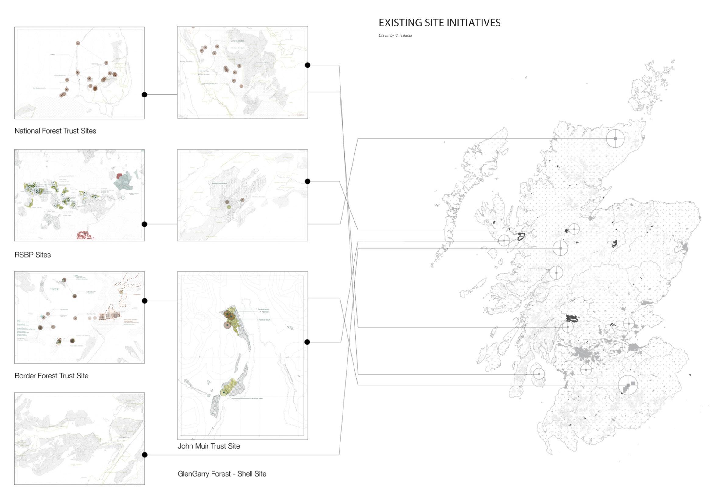
- Existing Initiatives - JMT
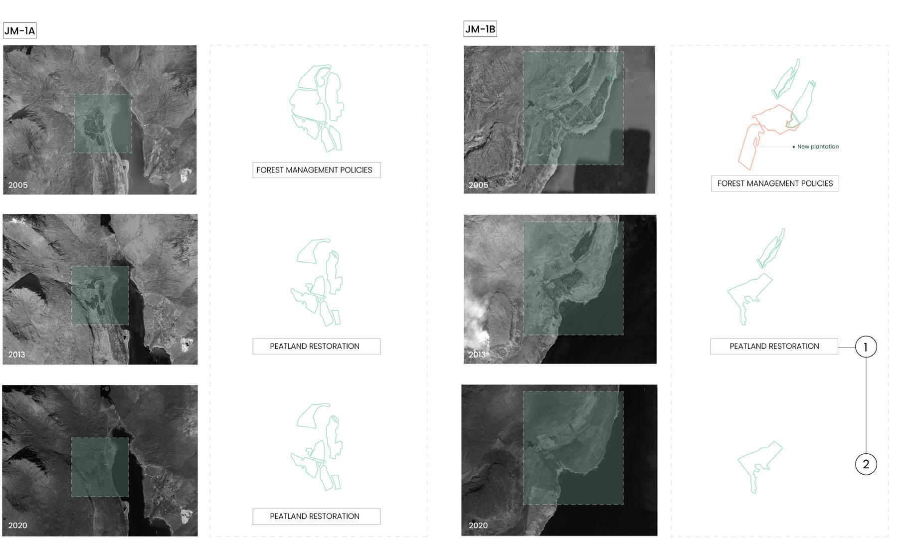
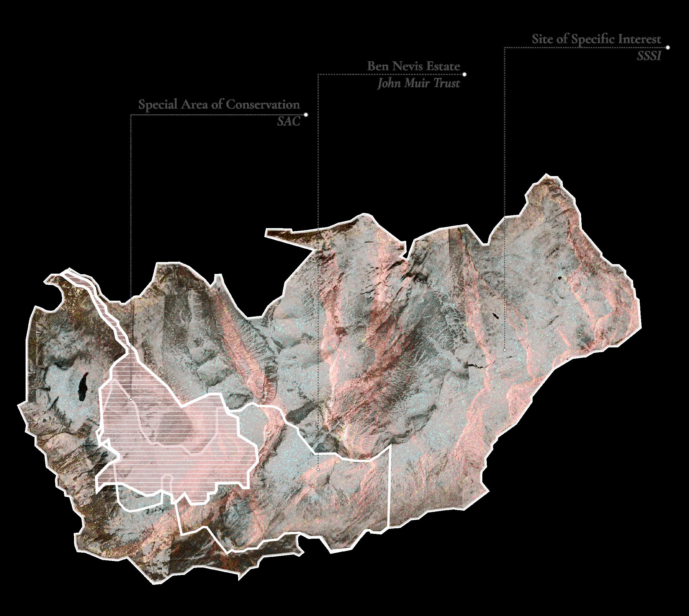
Owned by John Muir Trust, this complex site is based on the intersections of peatlands and woodland with complete and ongoing restoration projects of peat. Through time, the site has been subject to various policies and strategies that shaped the land. Where in the 1990s, due to forest policies, woodlands have been established on peatlands; this was followed by peatland restoration ones that led to the cut down of forest from the site as an initiative to restore the peat. One of the trusts main approach to reduce carbon emissions is to create a carbon emission land tax, incentivising behavioural change amongst Scotland’s large-scale landowners. In attempt to break the ownership concentration in Scotland, This trust has supported community ownership and in the year 2000 it aided the borders forest trust to gain ownership of privately owned lands.
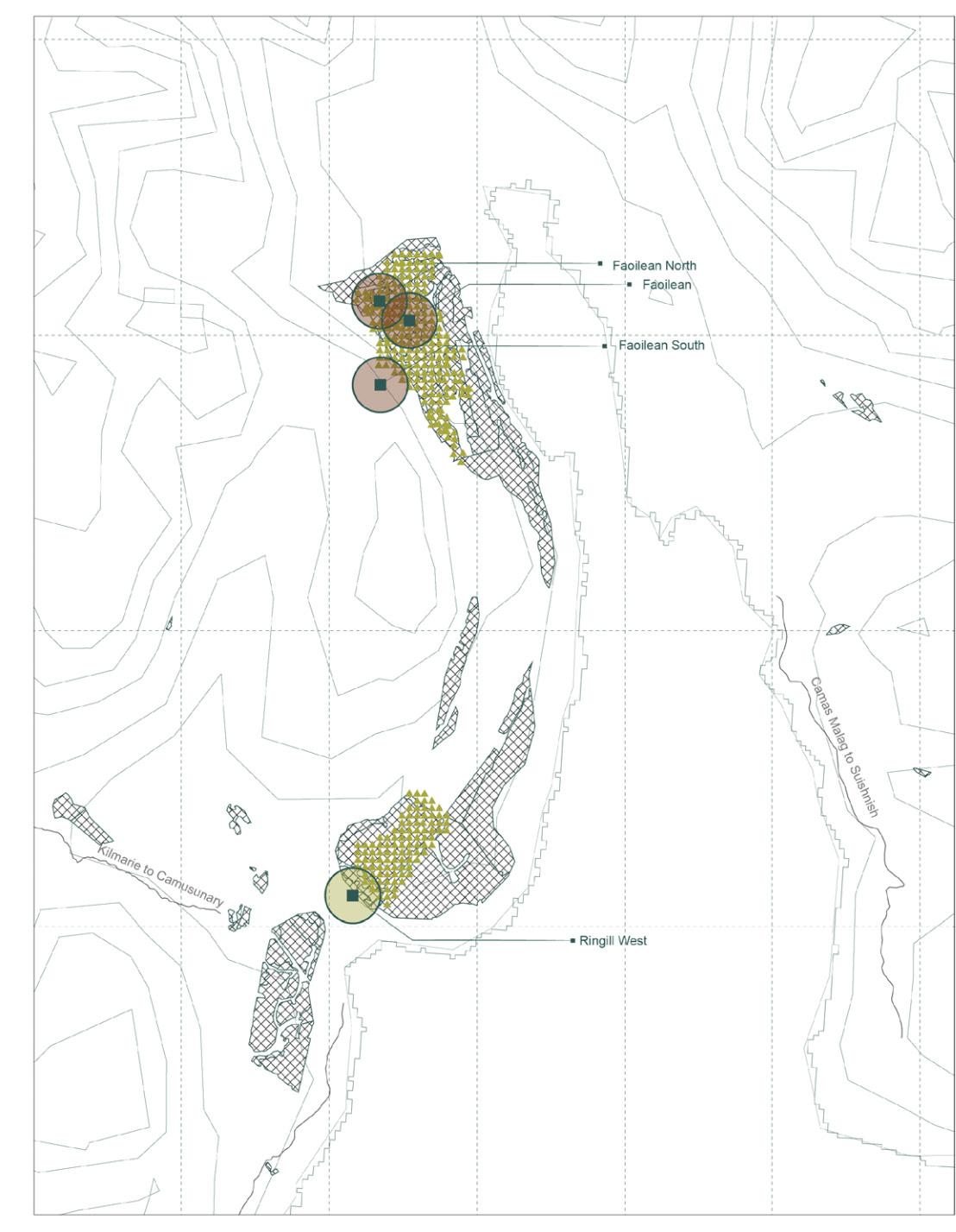
These community driven initiatives are managed and owned by the:
National Trust for Scotland
Royal Society for the Protection of birds
Border forest Trust
Forest Commission Scotland
John Muir trust
II. Peatlands X Woodlands II. Peatlands X Woodlands RE-PEAT SCOTLAND 2.0: Transparency, Transformation, Transition AA Landscape Urbanism 2022-23 31 30
- Community Organizations x John Muir Trust - [ III.4 MEETING WITH ORGANIZATIONS ]
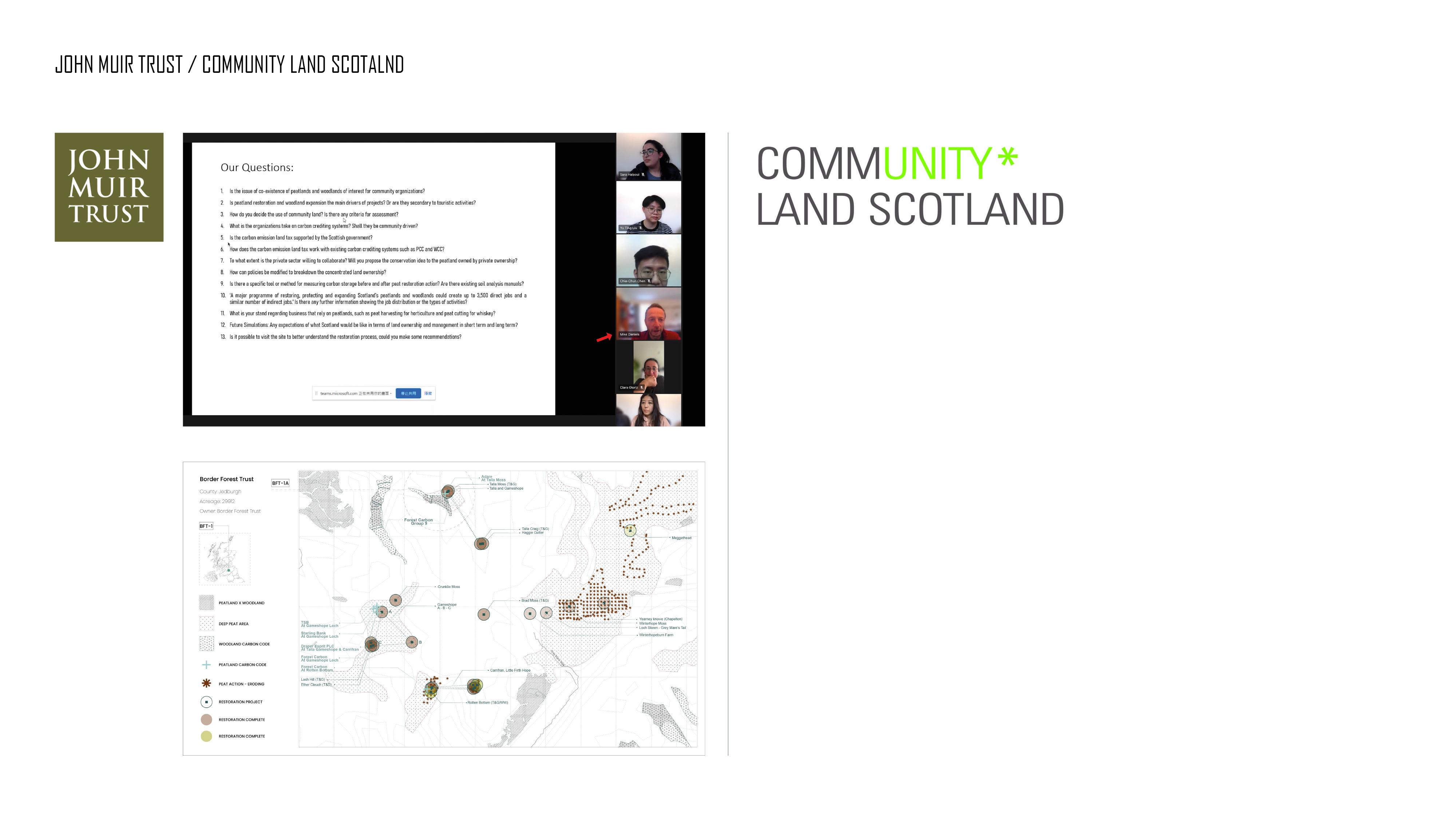
ENGAGEMNENT [ Scotland Scale_ John Muir Trust ]
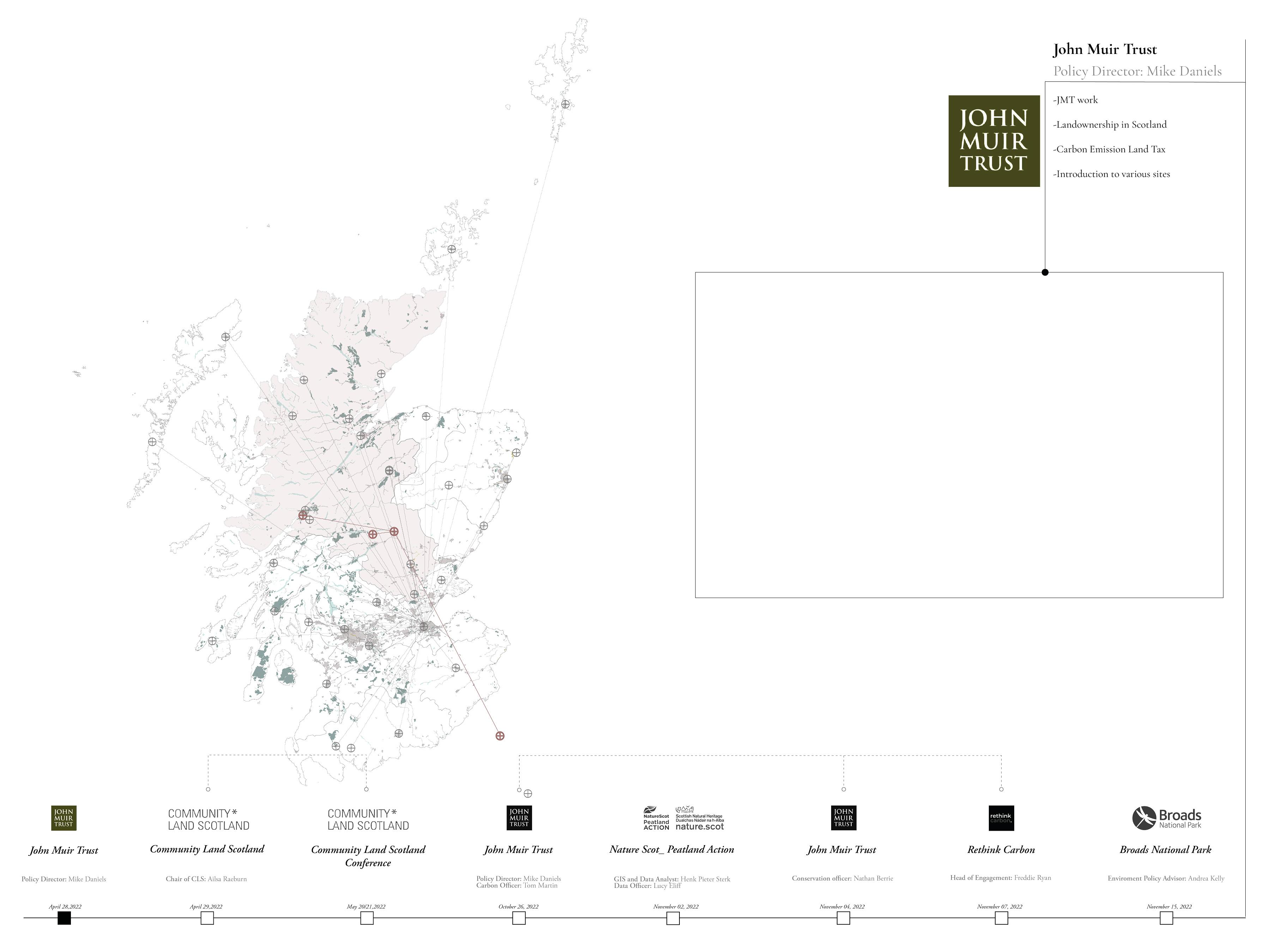
We first met with the policy director of JMT in April, 2022. We discussed land management schemes, the carbon land tax, and ongoing projects.
And in November 2022, we got in contact with JMT again. In this meeting we got updated on the tax development, got introduced to new initiatives in Scotland such as “Wilder carbon” and “Rethink carbon”.
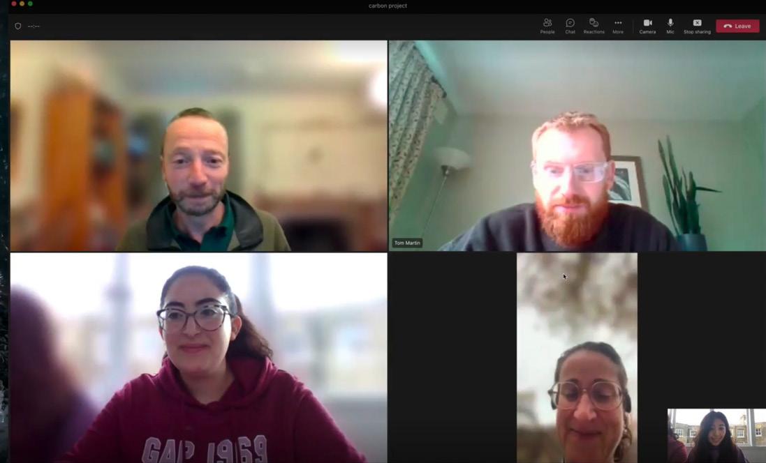
Mike got us in contact with land managers in Ben Nevis which was the main site in our visit to Scotland.
This meeting with JMT was an onsite meeting with Nathan Berrie, a conservation officer at the Ben Nevis estate.
II. Peatlands X Woodlands AA Landscape Urbanism 2022-23
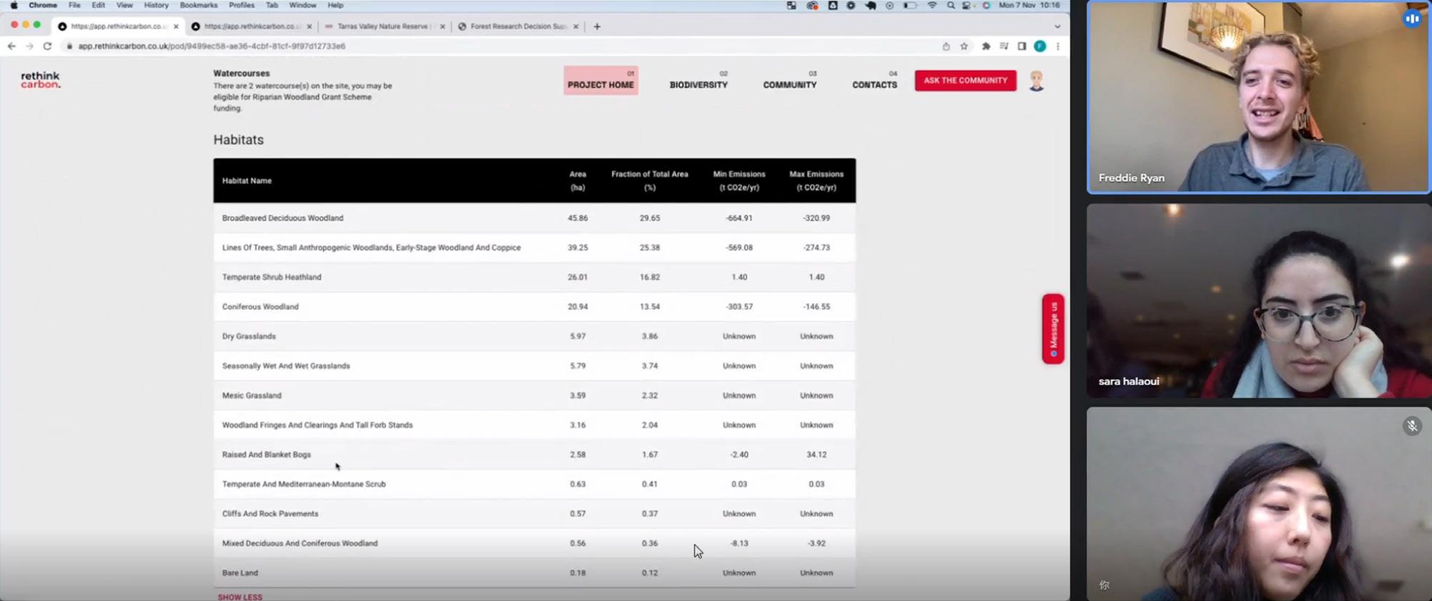
ENGAGEMNENT [ Scotland Scale_ Rethink Carbon ]
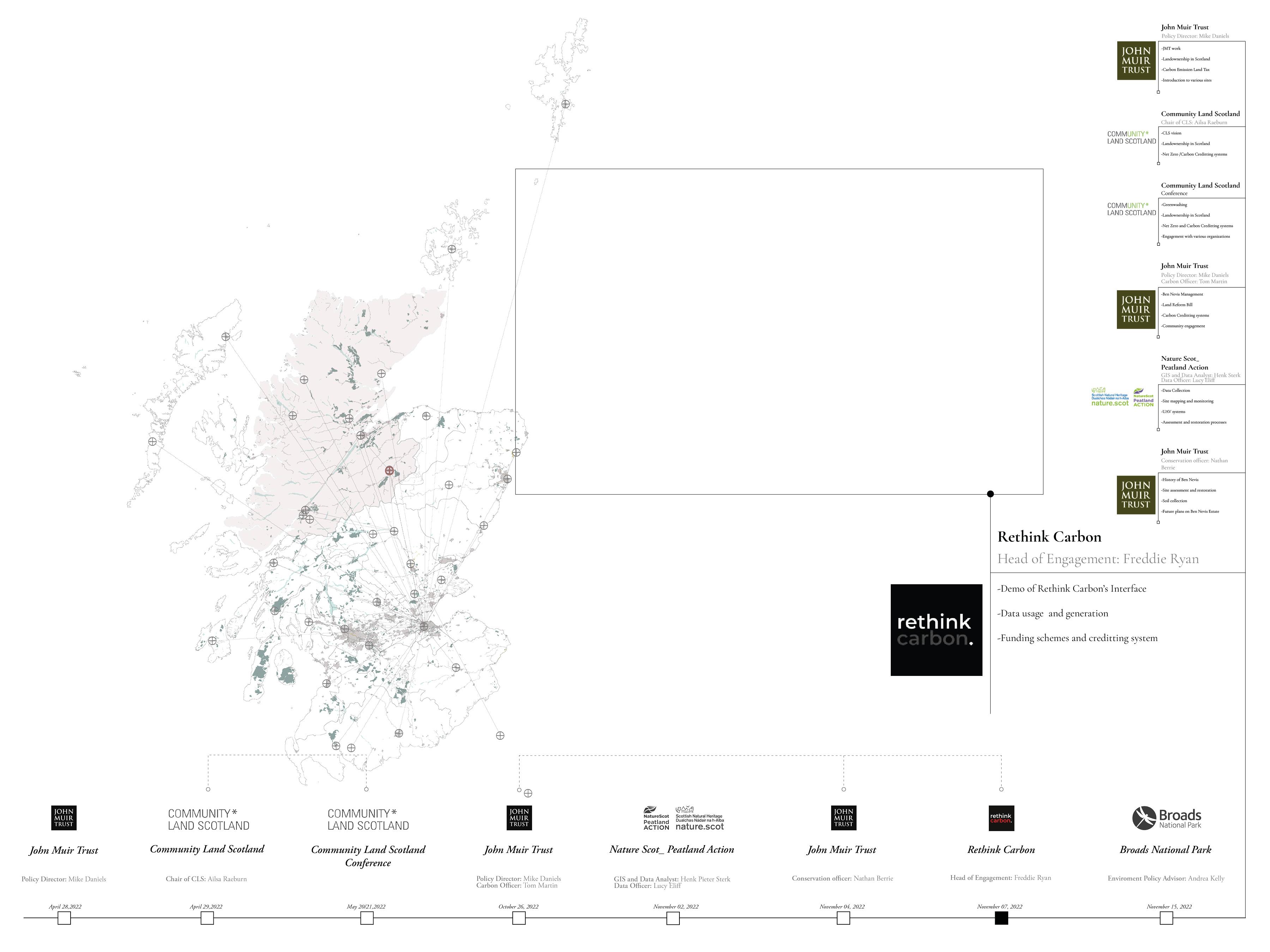
- Community Organizations x Rethink Carbon -
Rethink carbon is a start-up that uses technology to help land managers make more informed decisions and increase carbon storage/ capture on their land. Upon our meeting we came across various common points in terms of technicalities, however out tool is more community oriented and functions away from carbon credit generation and calculation.
[ IV- Policy ]
IV.1 Carbon Emission Land Tax- John Muir Trust
IV.2 Modifications
IV.3 Tax Application process
IV. Policy
- Ben Nevis Estate, Scotland, 2022 -
CARBO EMISSION LAND TAX - JOHN MUIR TRUST ]

This proposal has been developed by the John Muir Trust as an expansion to the policies and strategies developed to tackle climate change. The aim is to maximise the carbon sequestration potential of land in Scotland.
They proposed a Carbon Emissions Land Tax for large-scale landowners with properties over 1000 ha.
Based on hectarage, every landowner would be assessed for actual and potential carbon emissions and sequestration by relevant public agencies (SEPA, NatureScot), local authorities, and expert consultants.
Landowners would then be placed in a graduated banding scheme controlled by local authorities. Those landowners eligible for the tax could move to lower tax bands by changing land use to maximise carbon sequestration.
One of the main goals of this taxation is to drive positive behavioural change.
IV. Policy IV. Policy RE-PEAT SCOTLAND 2.0: Transparency, Transformation, Transition AA Landscape Urbanism 2022-23 37 36
[ IV.1
[ IV.1 TAX APPLICATION ] [ IV.1 CARBON EMISSION LAND TAX - MODIFIED ]
The following explains how the tax works: For lands above 500 hectares, an initial carbon tax is issued based on the actual carbon emissions.
If the landowner decides to change land use and abide by the proposed land management scheme, new carbon tax will be calculated. This tax is lower than the initial one.
We have built up on this tax proposal.
First by modifying its criteria.
Lands included will be classified into over 500 and under 500 hectares.
Creating carbon equations that would calculate actual and potential carbon emissions.
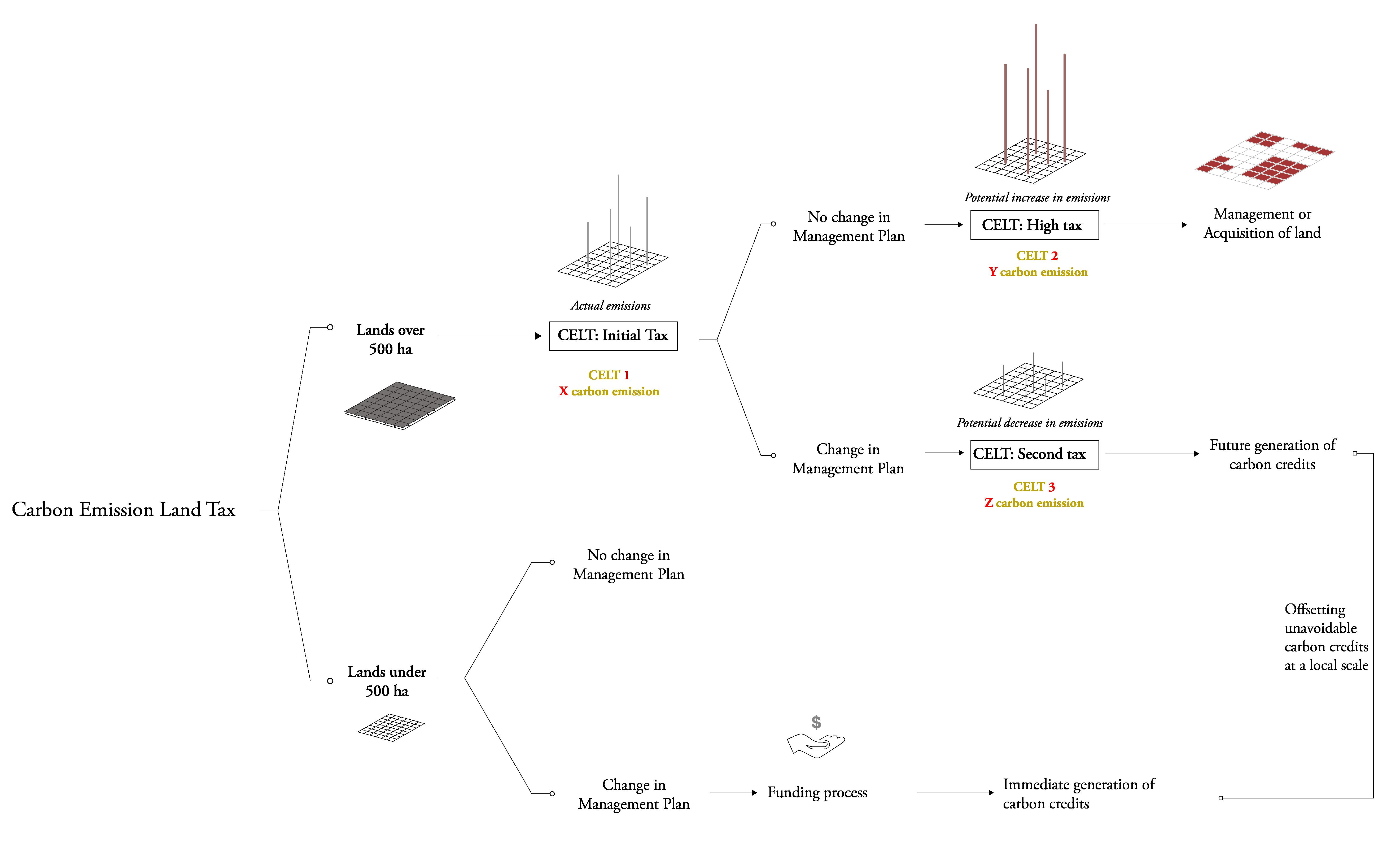
In addition to expanding the proposal to include a funding scheme that would support the small landowners and the fragile community included in the new management plan.
Second, the revenue will not only be used to fund further restoration and expansion projects but will also be used to support the community, especially in owning land.
Third by elaborating on the suggested tools
However, the tax would increase in case no change is implemented. AND a fragment of the land will be placed under the management and in some cases ownership of the community.
As for lands below 500 hectares, no tax is applied. Instead, they can apply for funding to enhance their land conditions.
This funding is part of the revenue collected from the tax in addition to existing schemes such as the peatland action fund by Nature Scot and the Scottish government.
IV. Policy IV. Policy RE-PEAT SCOTLAND 2.0: Transparency, Transformation, Transition AA Landscape Urbanism 2022-23 39 38
Fig.2- Carnigorms National Park.
8th Nov, 2022
[ V- Site Visits ]
V.1 Various Site Visits
V.2 Site a.1- East Schiehallion, Scotland
V.3 Site a.2- Patterdale, England
V.4. Site b.1- Glen Nevis, Scotland
V.5. Site b.2- Fort William, Scotland
V.6. Site b.3- Carnigorms National Park, Scotland
V.7. Site b.4- Norwich, England
V.1 VARIOUS SITE VISITS
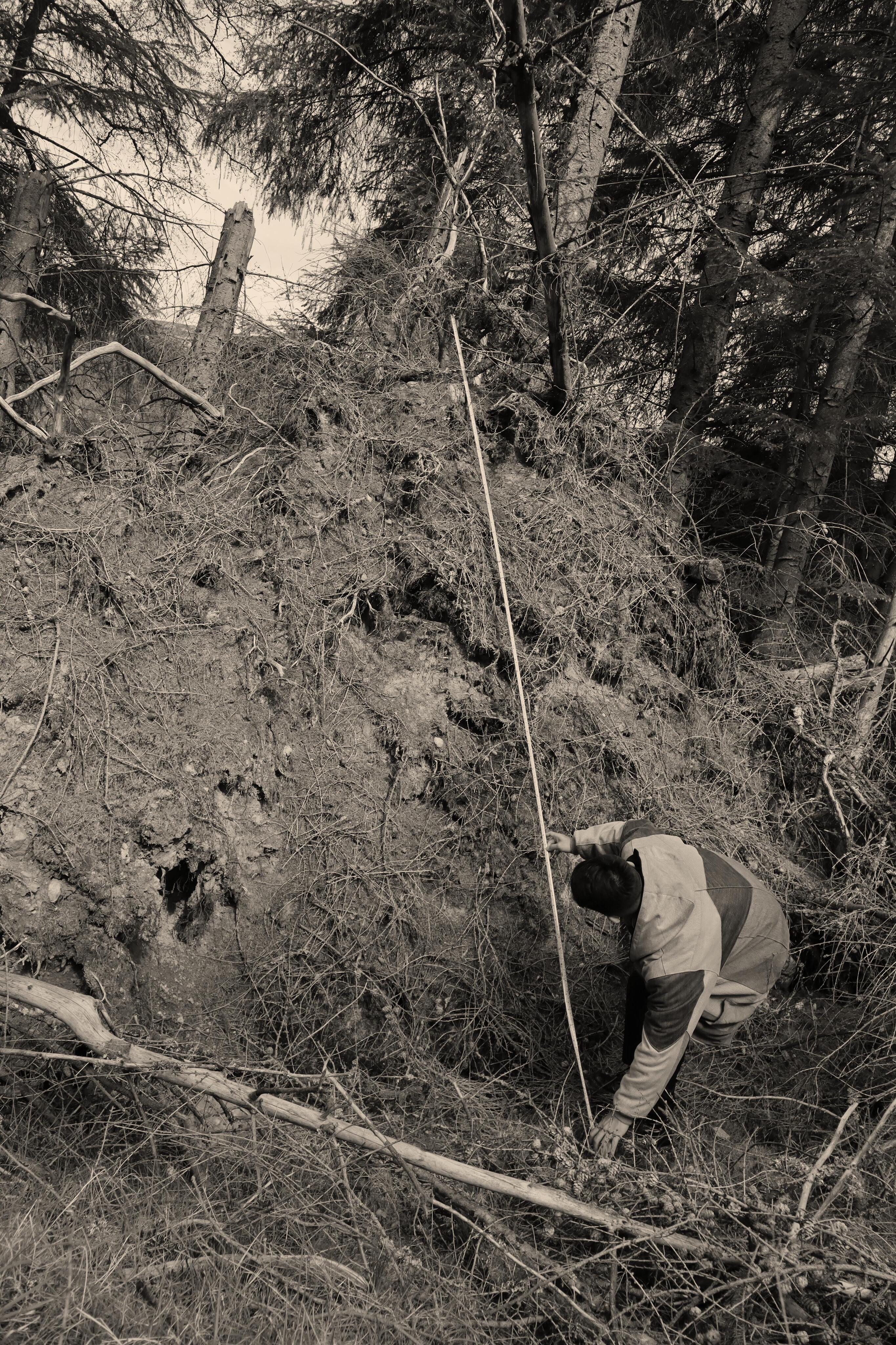
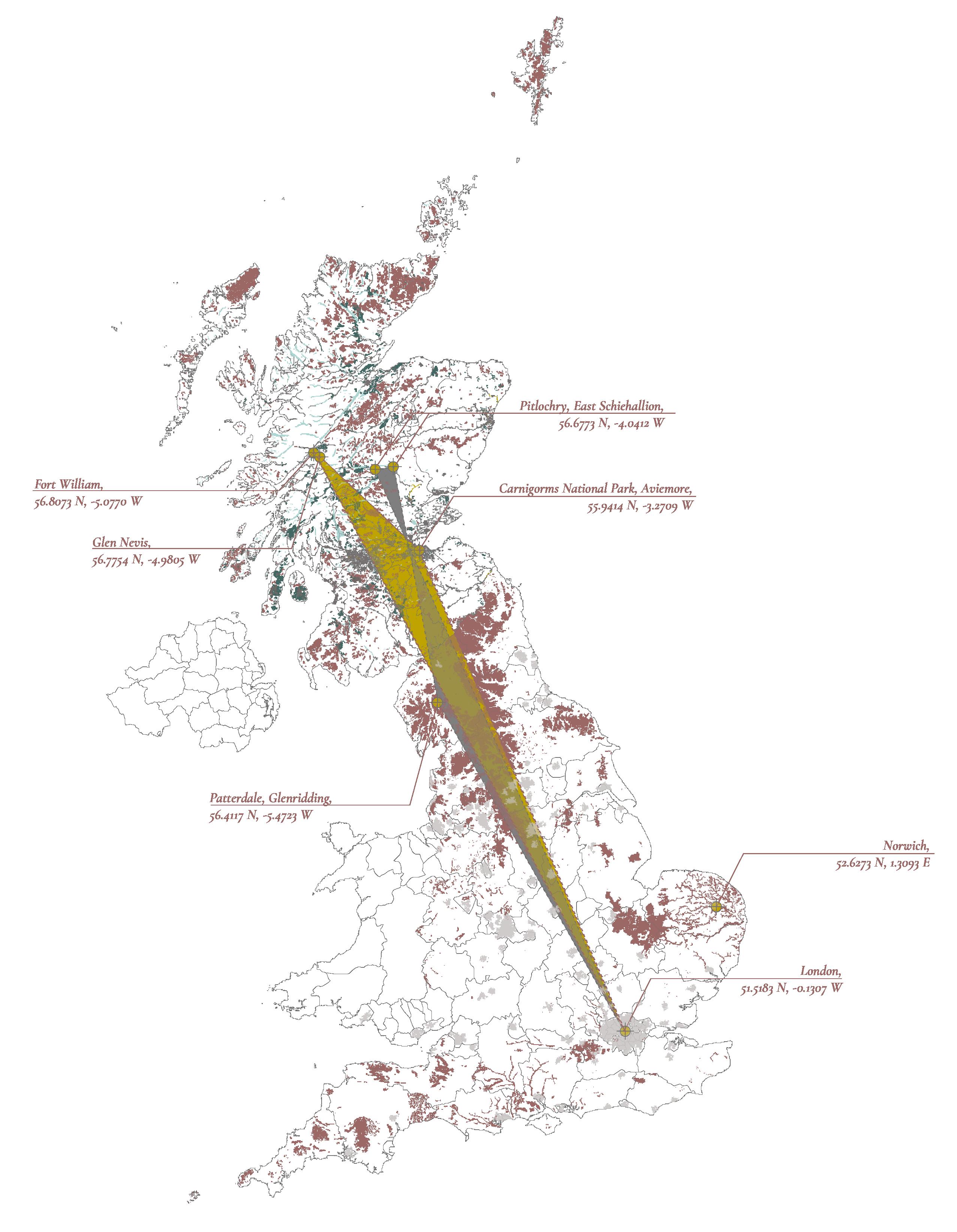
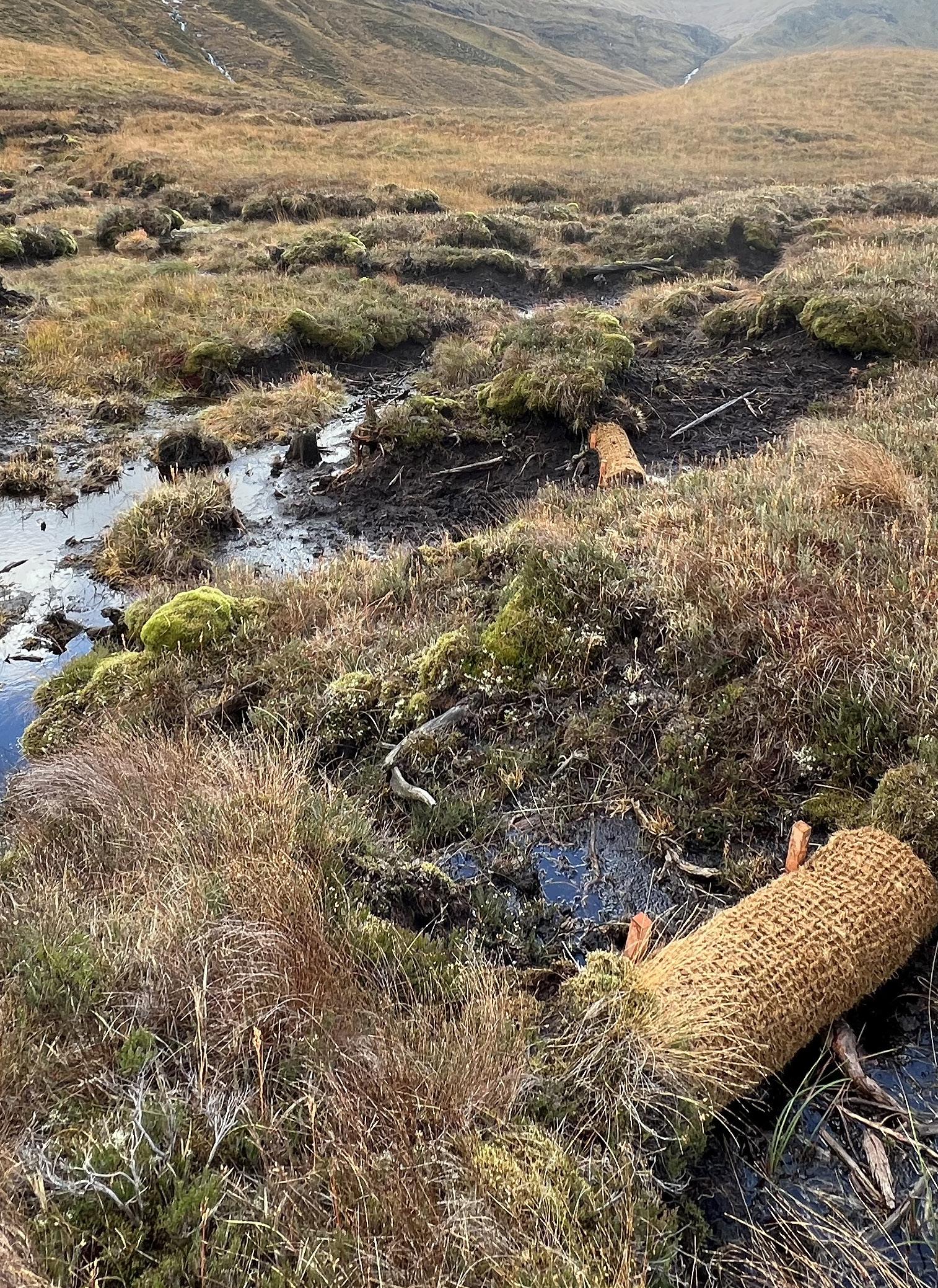
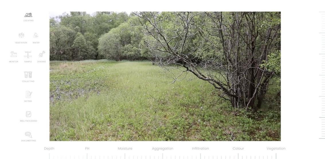
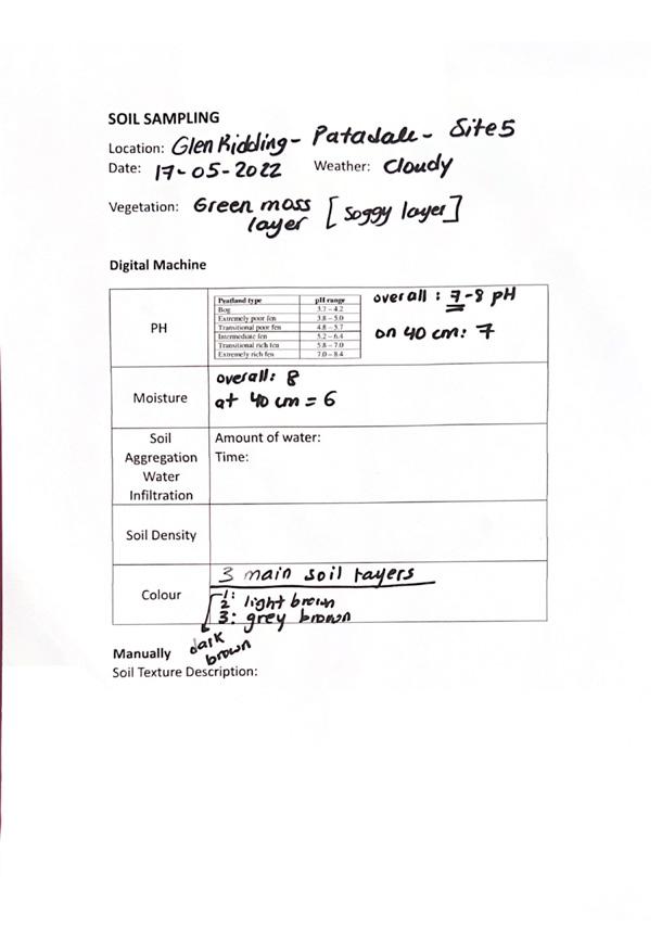
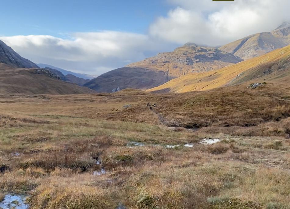
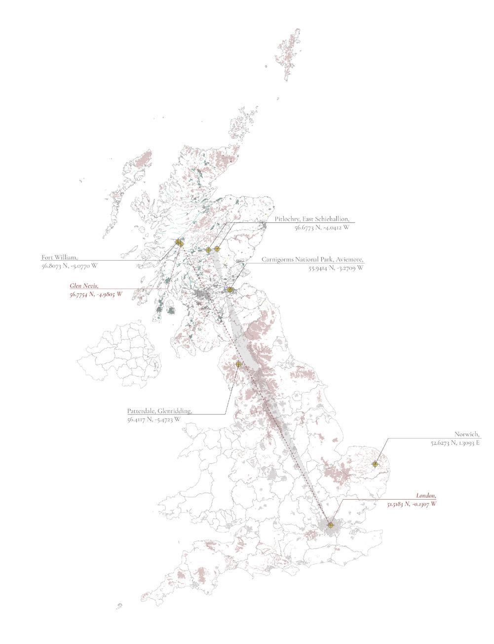
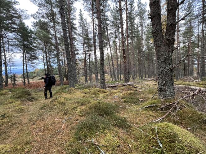
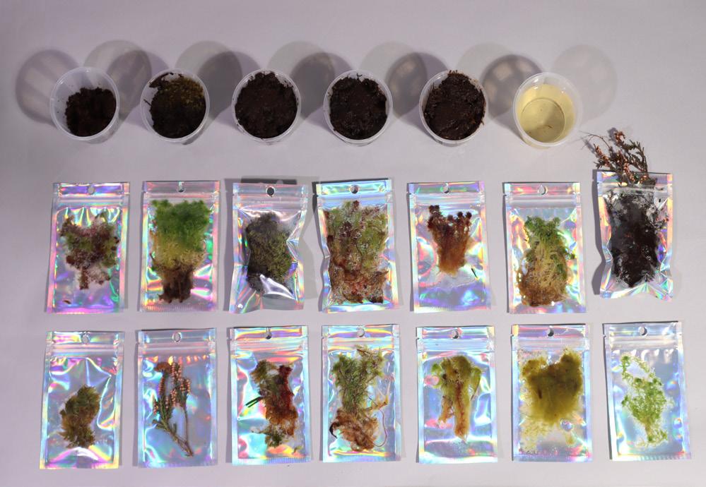
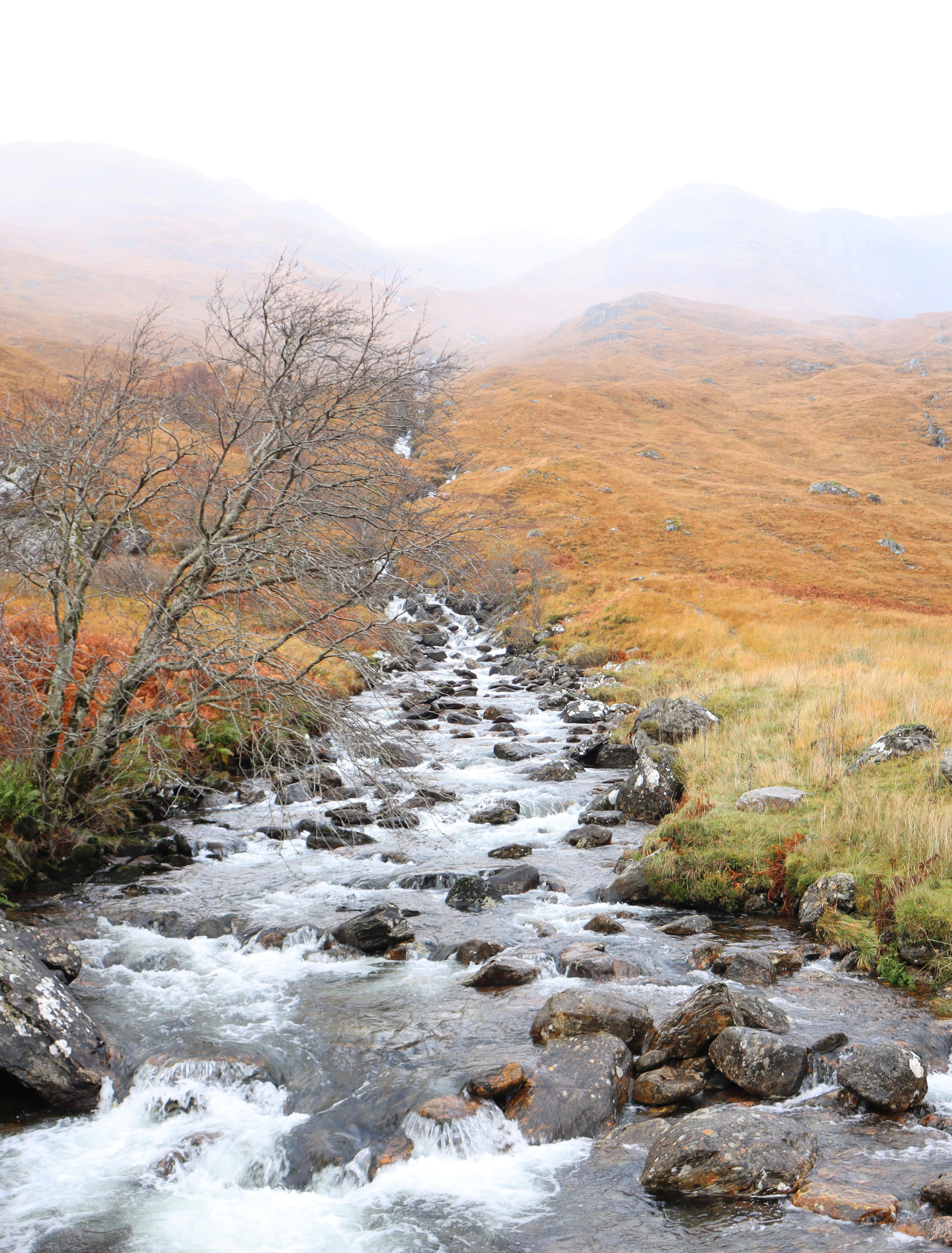
Our various site visits, that were possible because of the help and guidance of John Muir Trust, helped us gather knowledge, learn, and experience peatlands. Since last May we have visited 5 areas and 7 sites. Our first trip we were a team of 4 and went to Perthshire in Scotland. Then to Glenridding in England were we also visited 2 sites. And during this month both is us went back to Scotland to Fort William, where our main site visit to glen Nevis.
Followed by a site at Cairngorms national park. Finally, a site in Norwich. We experienced a productive peatlands that lie within the paludiculture.
V. Site Visits RE-PEAT SCOTLAND 2.0: Transparency, Transformation, Transition AA Landscape Urbanism 2022-23 41 40
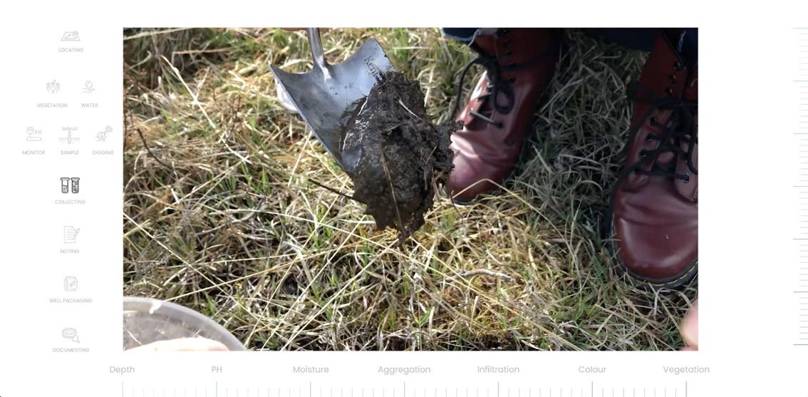
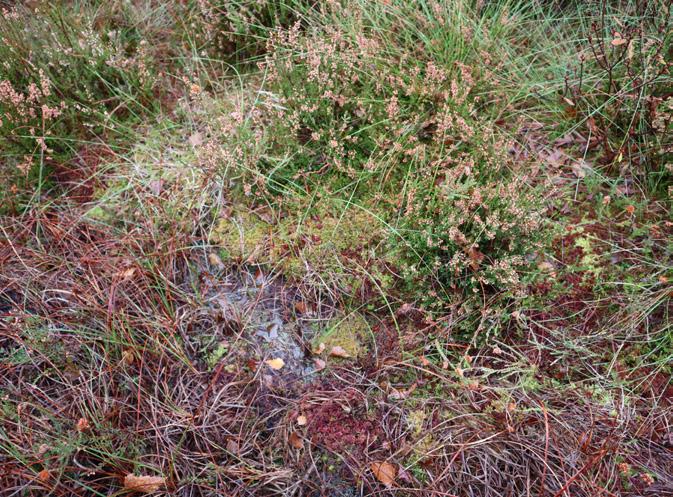
We recognised it from the special vegetation layer, soggy ground and paddles.
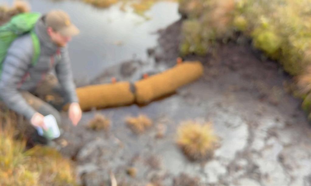
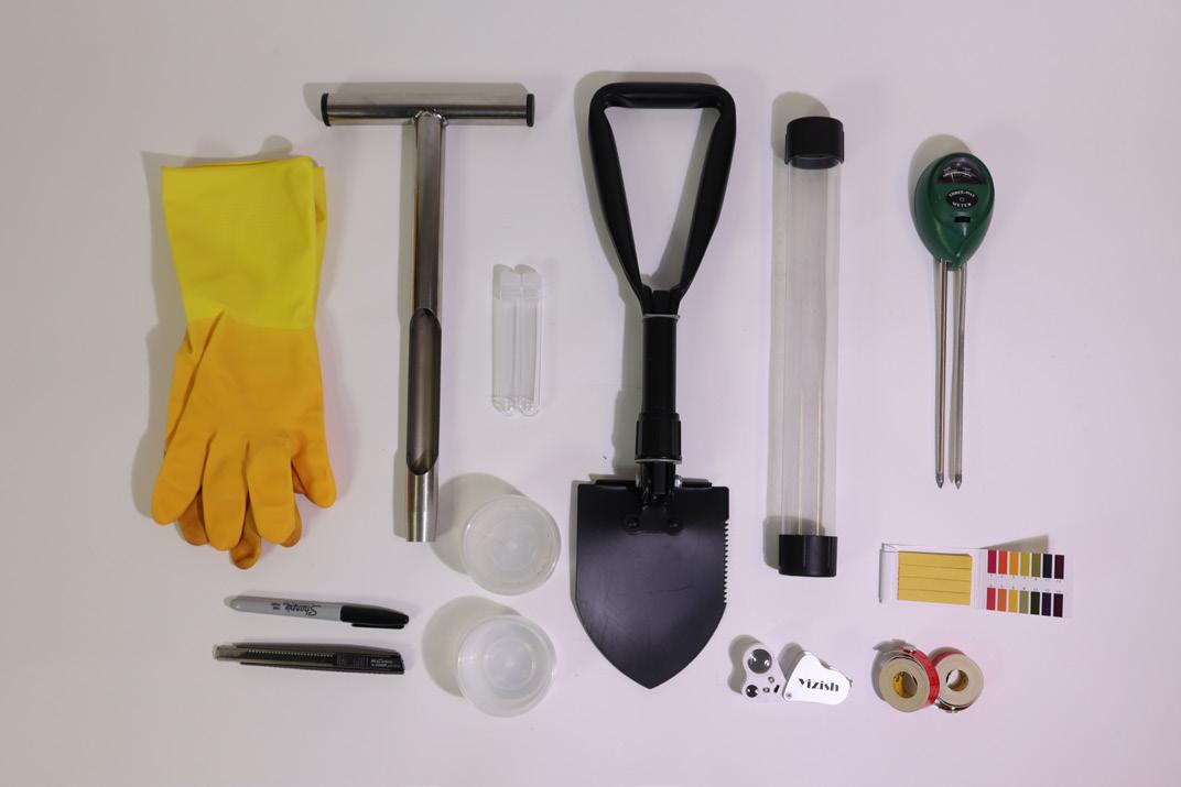
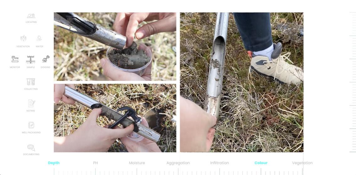
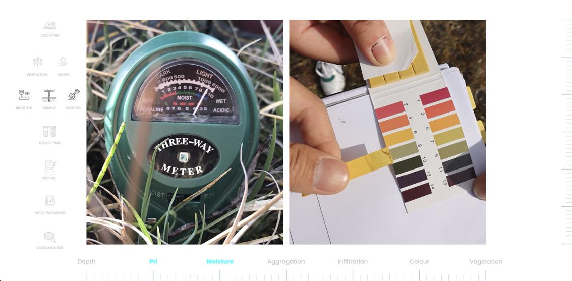
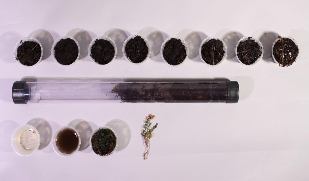
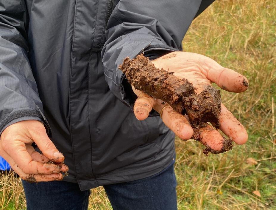
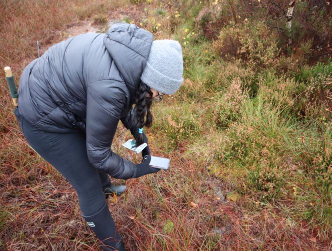
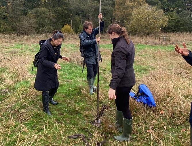
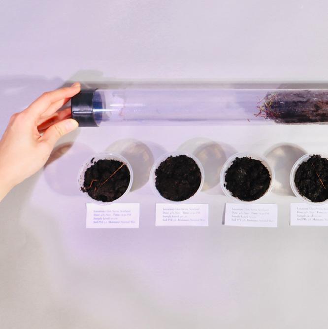
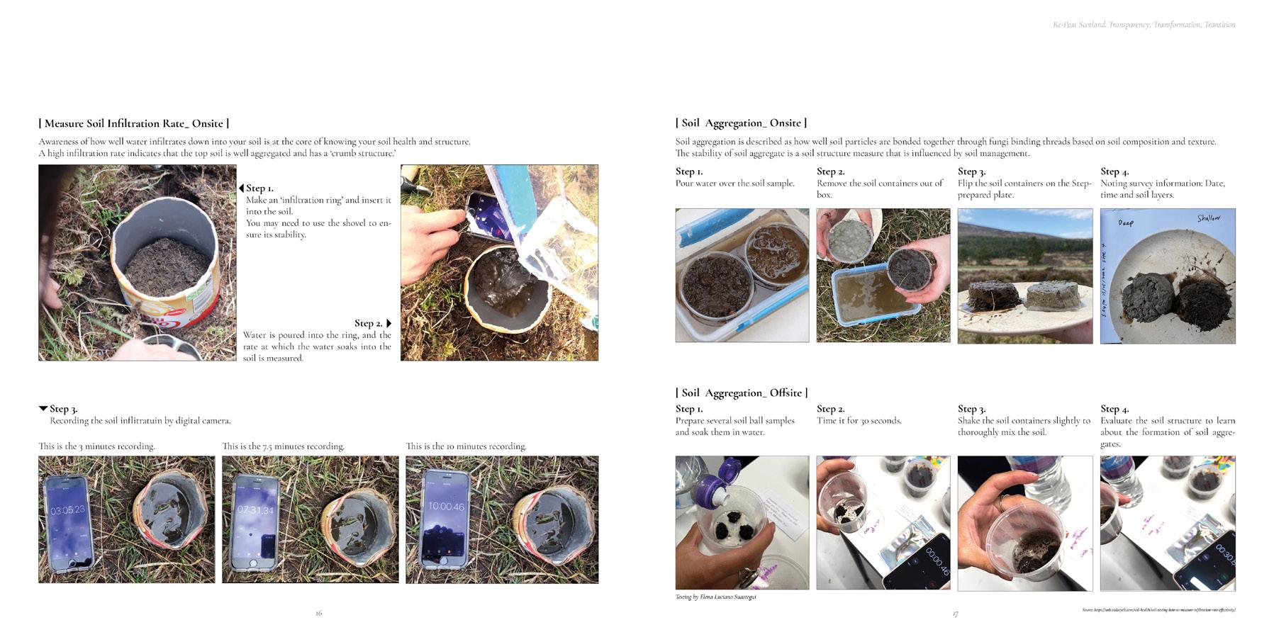
‘We used the soil sampler to see and collect soil samples form different layers.
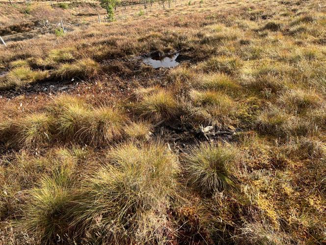
‘Upon arrival, we realized that this is the right place because the water table was very high and it appeared on the ground level.‘
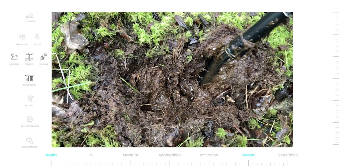
‘Both shallow and deep soil layers were dark and muddy and had strong organic, earthy smell.‘
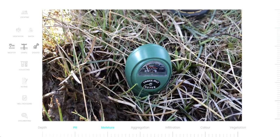
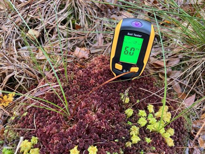
We started to test the soil attribute; It was easy to insert the monitor into the soil.
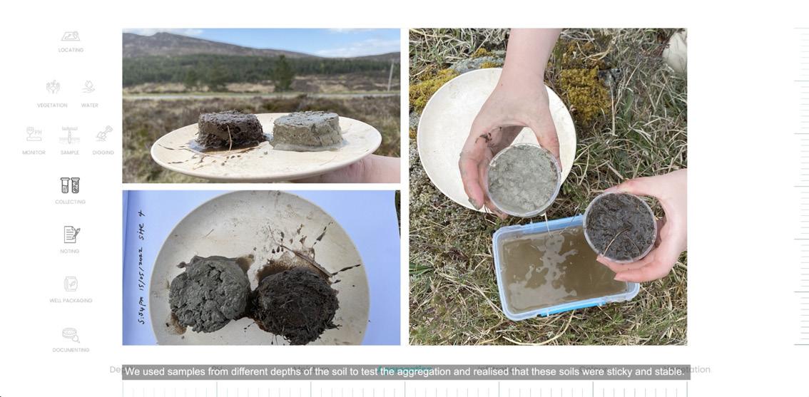
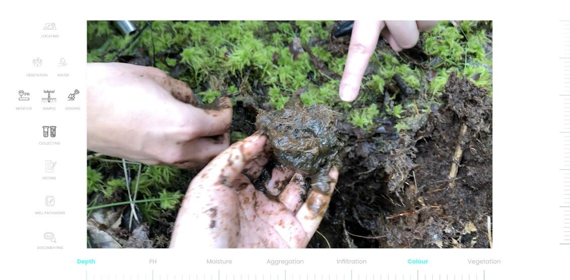
‘We used samples from different layers of the soil to test the aggregation and realised that these soils were sticky and stable.
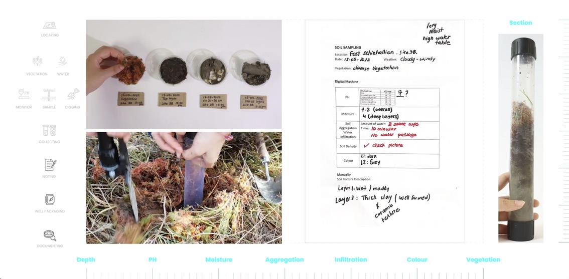
56.6773 N, -4.0412 W Pitlochry, East Schiehallion, Scotland
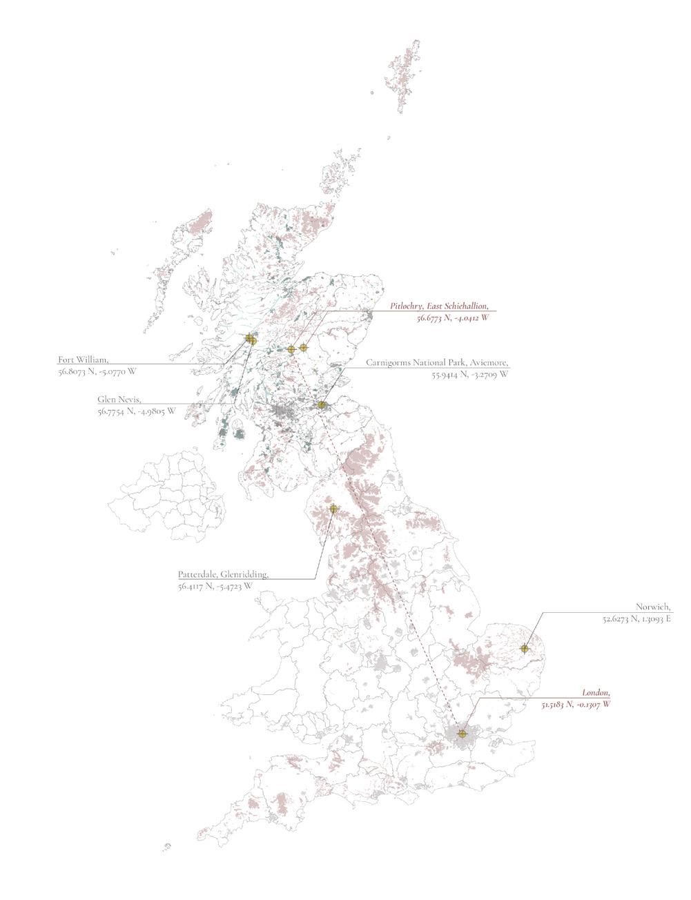
Shallow Peat and Removed Woodland Area
[
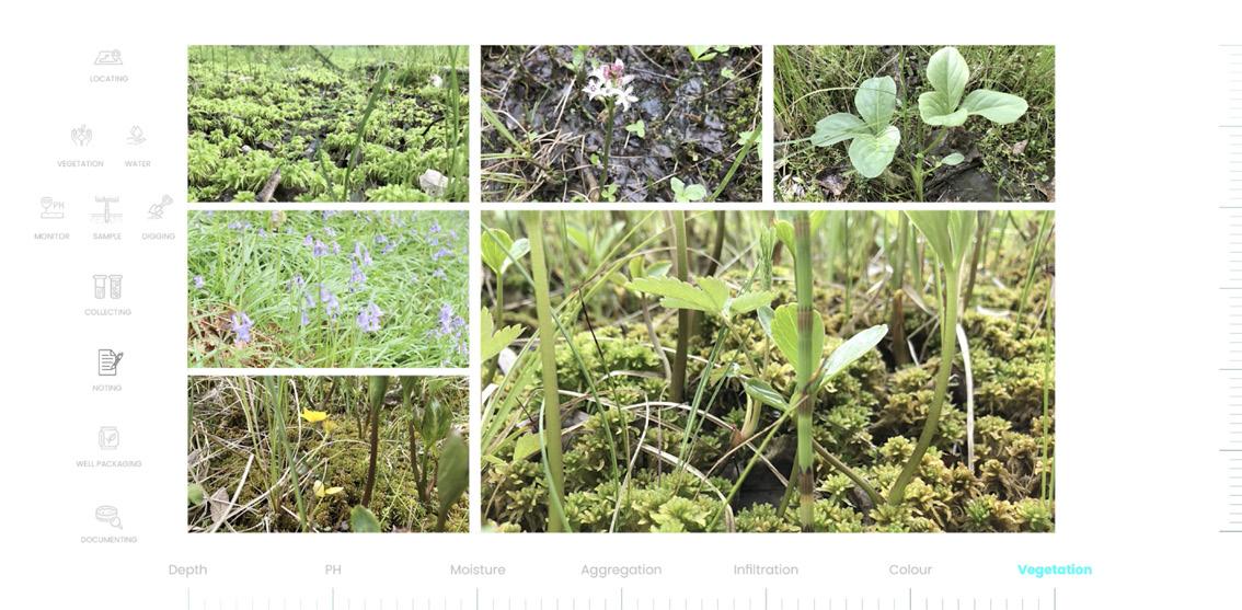
‘The ground is covered by a moss layer and while stepping on it, water will come out.‘
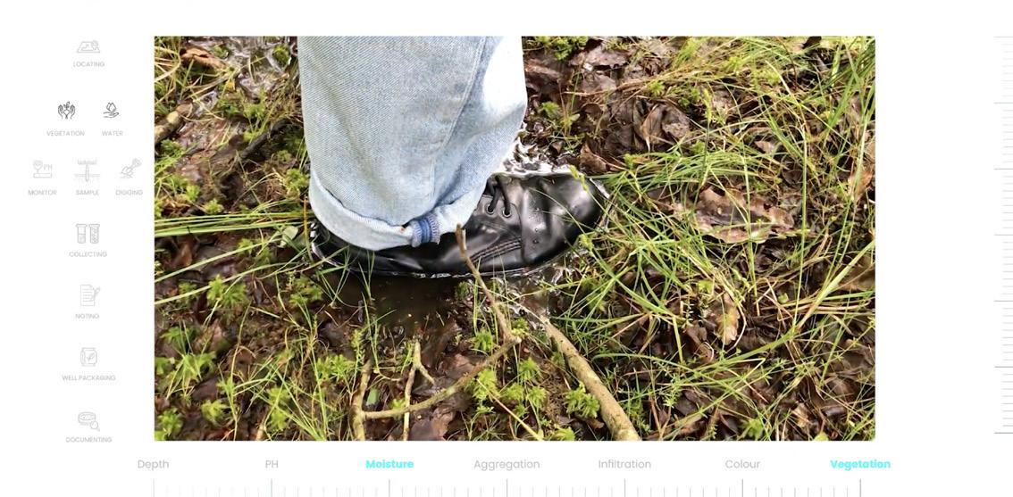
‘We also documented the groundcover vegetation and tree species to compare with different site.
Patterdale, Glenridding, England
56.4117 N, -5.4723 W
Deep Peat and Woodland Intersection Area
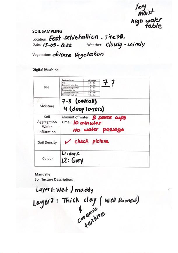
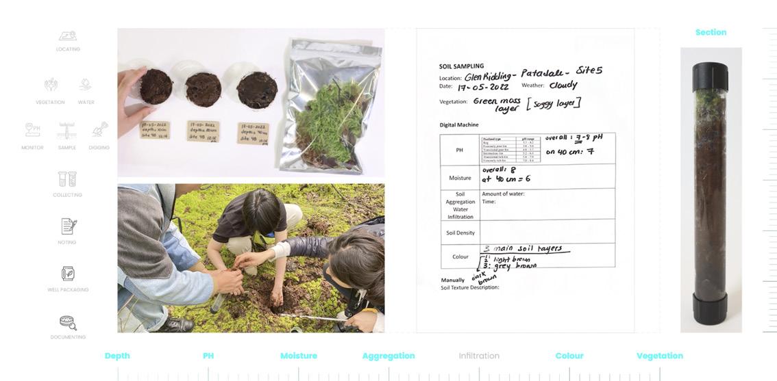
Moving on to the second site, Pitlochry. ALong the way back, we accidently found a good condition peatland. this is at the border of the site ‘East Schiehallion’ owned and managed by John Muir Trust. On GIS Maps, it showed as a shallow peat adjacent to the woodland that is being cutting down, except native tree species.
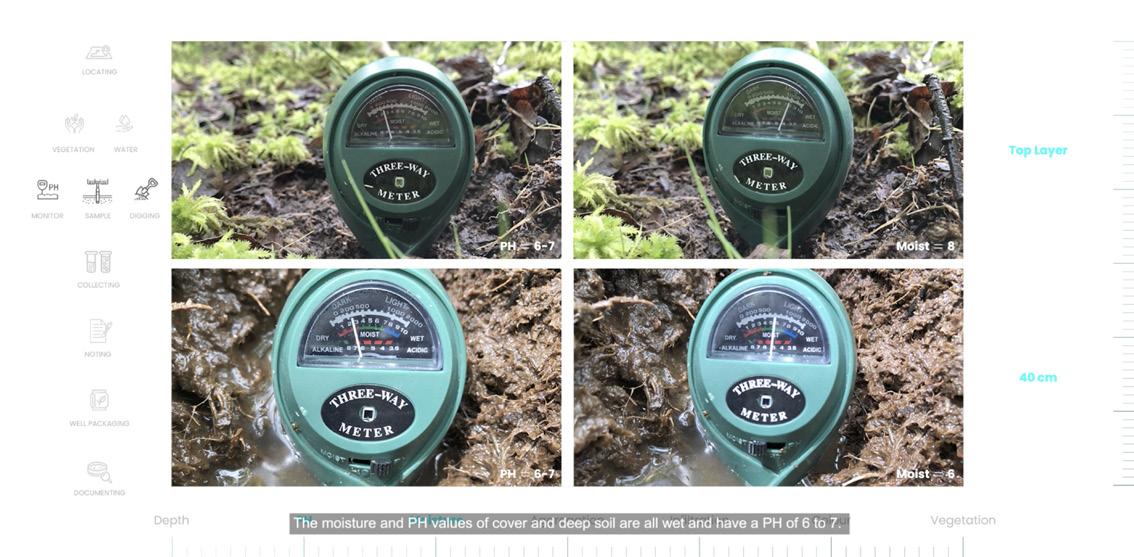
This site recorded a PH of 6 to 7, and the value of moisture was very wet.
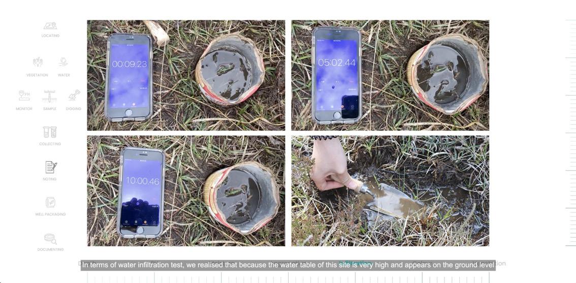
In terms of water inflitration test, we realised that because the water table of this site is very high and appears on the ground level, there was slow water inflitration.
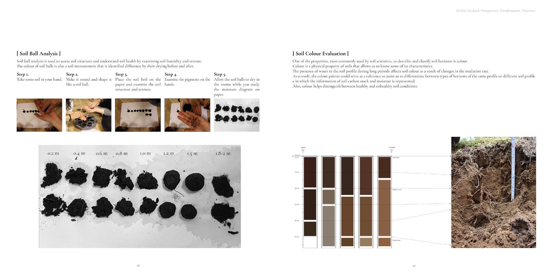
‘The soil between 5-10 centimetres were quite black and dark, and the colour of deeper soil was a bit grey
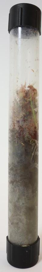
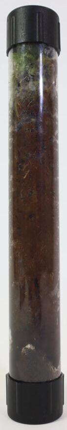
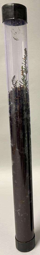
‘Finally, we used a transparent tube to collect the soil section and well document our test.‘
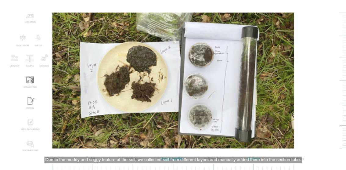
Moving to the second site in Patterdale. According to the GIS data, we located this site which is the intersection of deep peatland and woodland at a proximity from the town

‘The moisture and PH values of cover and deep soil are all wet and have a PH of 6 fo 7.4.‘
‘Due to the muddy and soggy feature of the ‘soil, we collected soil from different layers and manually added them into the section tube.‘
‘When collecting samples, we found out that the roots of the ground cover on site were quite deep.‘

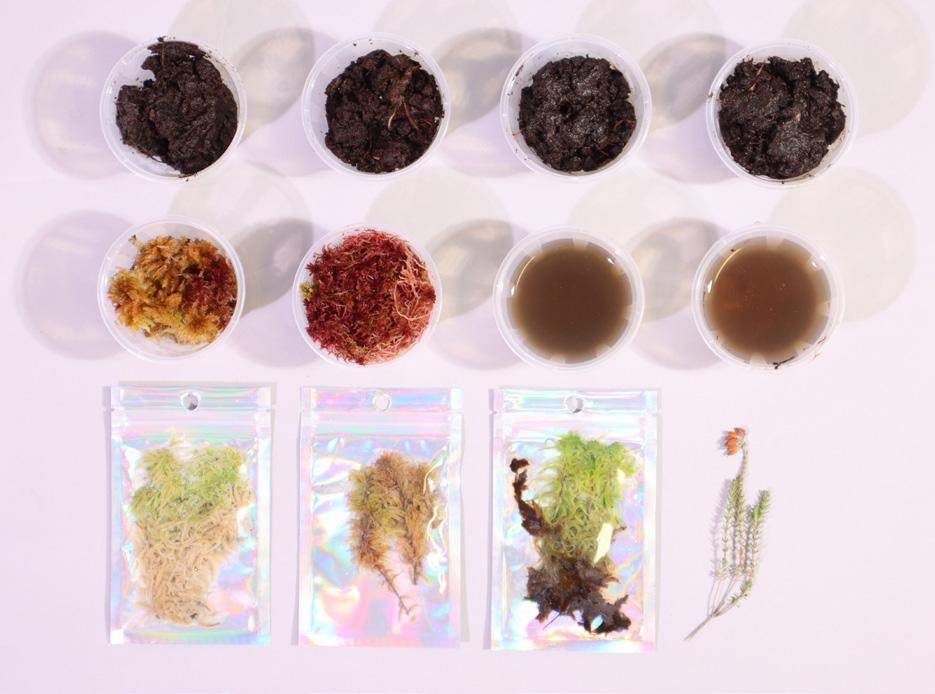
‘We have documented our soil samples at the school for further comparison between the different sites.‘
V. Site Visits V. Site Visits RE-PEAT SCOTLAND 2.0: Transparency, Transformation, Transition AA Landscape Urbanism 2022-23 43 42
[ V.2 SITE A.1 ]
V.3 SITE A.2 ]
[ V.4 SITE B.1 ]
Glen Nevis, Scotland
56.7754 N, -4.9805 W
Natural Exposed Peat and Deer Management Area
The historical understating of the sites various land uses pretty much explains the current condition of the site nowadays.
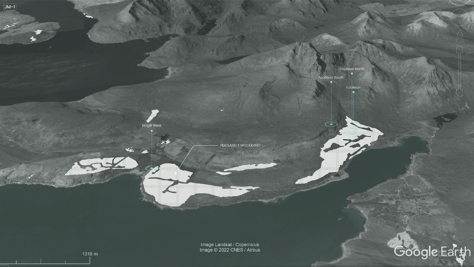
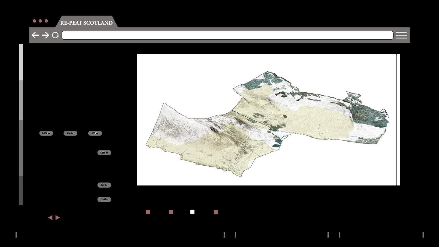
Ben Nevis estate has an area of 1761 hectares with 40 hectares of bare peat found within the Glen Nevis site. It lies within boundaries of Ben Nevis Site of Specific Interest and a Special Area of Conservation, these designations require consent for any activity that needs to take place on site.
This site visit was very crucial in the project since we were able to test our manual, tools and to deeply understand the spatiality of the site and its link with the various restoration projects and land management plans that take place.
Moutain formation due to collision of continents
First human activity traced on site
Experts say that the mountains in the state formed 420, 000, 000 years ago due to the collision of continents.
where the first human activity was traced back to the neolithic ages approximately 12,000 years ago.
This was followed by livestock farming that was practiced for centuries and lasted up until the year 2000.
Similarly, deer stalking that started in the 18th century and still exists on site but is being relatively controlled by deer management plans.
The current vegetation layer on site reflects on the history of high grazing on this land.
And from the middle ages until the 18th century, glen Nevis was utilised to create charcoal with burning platforms can still be found on the estate.
Since the year 2000 JMT acquired the land, they have focused on maintaining visitor paths and habitat restoration.
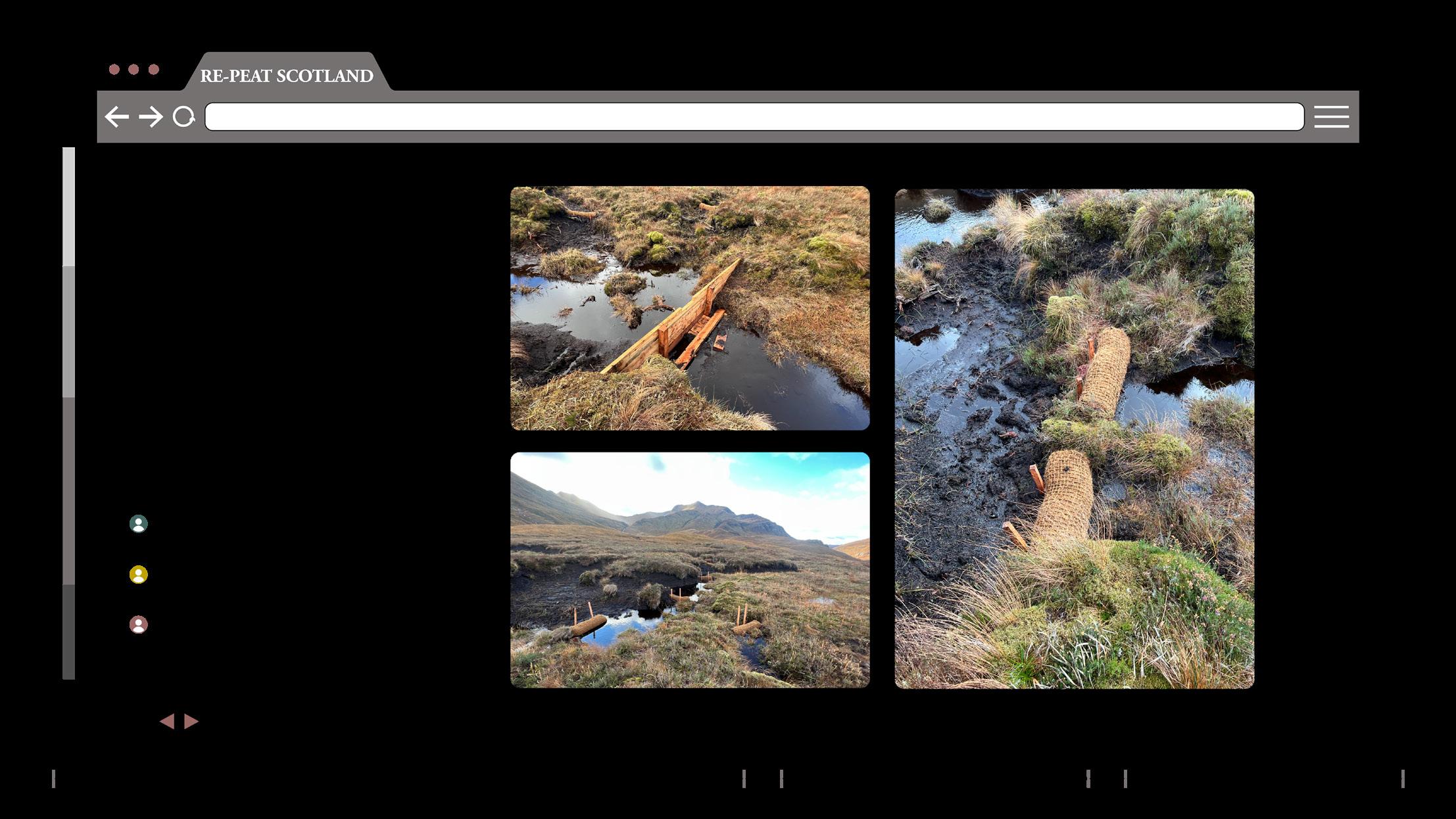
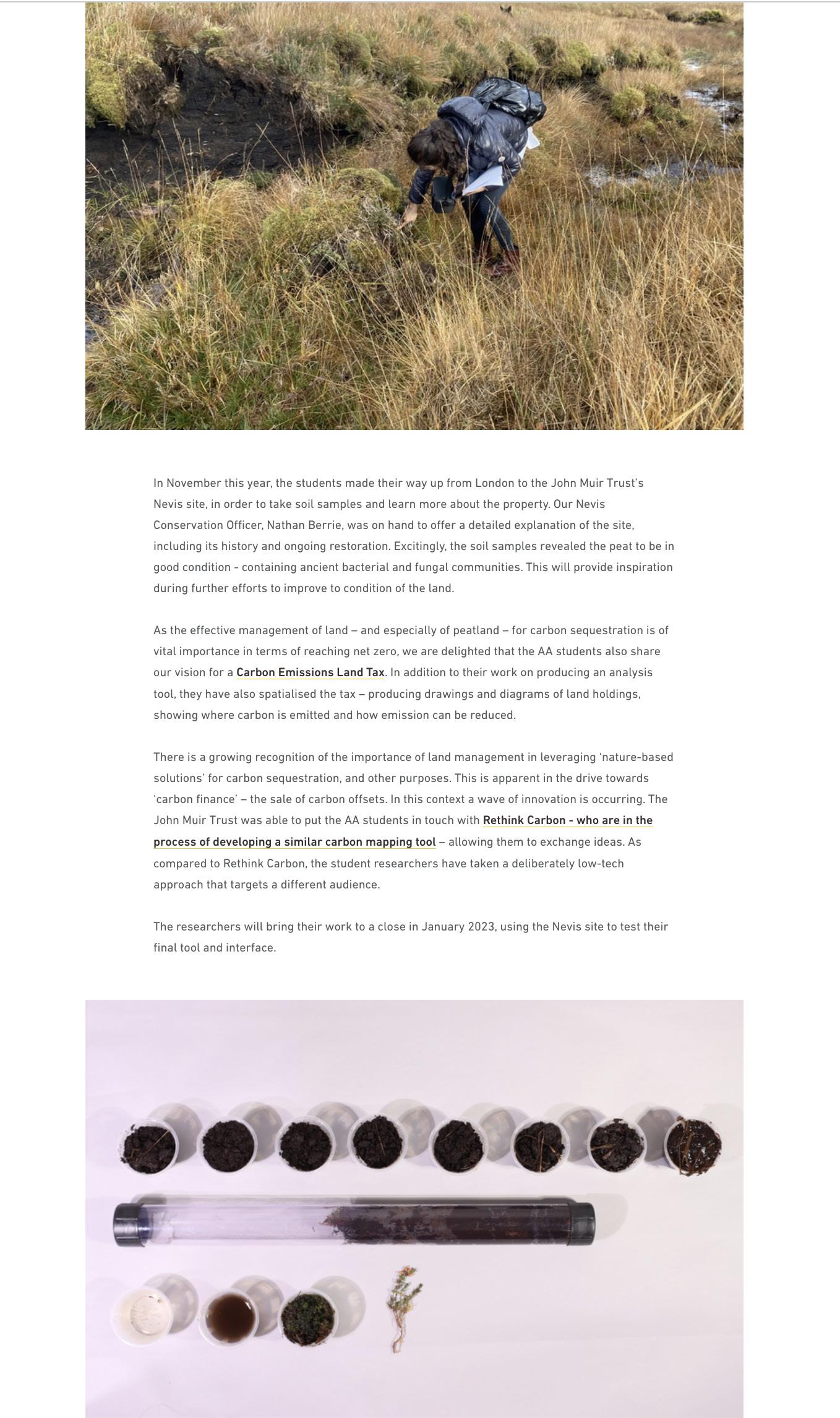
During the visit we collected various water, soil and moss samples and they will be used later in the project.
V. Site Visits V. Site Visits RE-PEAT SCOTLAND 2.0: Transparency, Transformation, Transition AA Landscape Urbanism 2022-23 45 44
-420,000,000 -12,000 -1500 -500 -300 -22 0
Grazing
Deer Stalking
Livestock
Creation of charcoal on site: Burning Platforms
- HISTORICAL
Livestock Gr 2000 Ownership by JMT 2022 Neolithic Age Middle Ages 18 Century 1 1 2 3 3 4 4 5 5 2
TIMELINE
Fort William, Scotland
Exposed Peat and Polluted Area
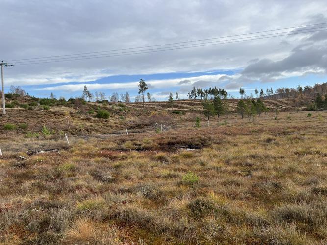
Carnigorms National Park, Scotland
Almost Healthy Peat
Norwich, England
Peat From Fens, Previous Woodland Area
Fort William site is located in Scotland. It is a peatland area at a proximity from the town center. This area through time has been drained and built on. Ongoing constrcution is still taking place on site. The drainage of peatlands and its urban context has led to its pollution and loss of biodiversity. On site we have tested the pH, collected soil and moss samples.
The Cairngorms National park has a very healthy area of peatlands. It is rich in moss species and the water table is very high. It is an area of conservation. On site we managed to collect some moss and soil samples to use them as control samples and for later comparison between sites. Dwarf native trees exist on this area of peat. It is a natural coexistence of woodlands and peatlands
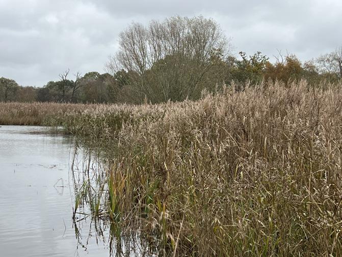
In Norwich, peatlands are classified as “fens”. They look and feel very different from the peatlands in Scotland. Fens are suitable for paludiculture. Historically, the site had woodlands; however they have fell due to the unhealthy intersection with the fens. On site we tested sampling tools and collected a small sample of peat.

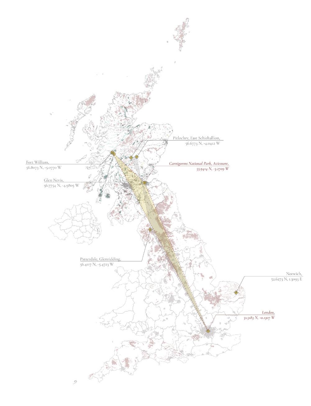
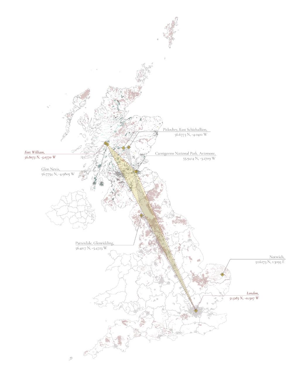
V. Site Visits V. Site Visits RE-PEAT SCOTLAND 2.0: Transparency, Transformation, Transition AA Landscape Urbanism 2022-23 47 46 [ V.5 SITE B.2 ] [ V.6 SITE B.3 ] [ V.7 SITE B.4 ] 56.8073 N, -5.0770 W 55.9414 N, -3.2709 W 52.6273 N, 1.3093 E
VI.1
VI.2
VI.3
VI.4
VI.5
VI.6
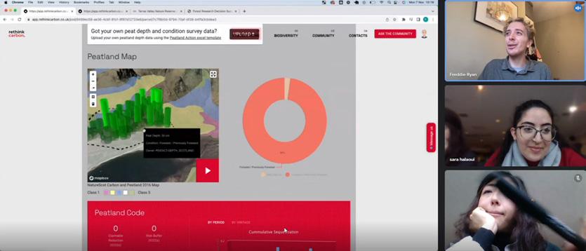
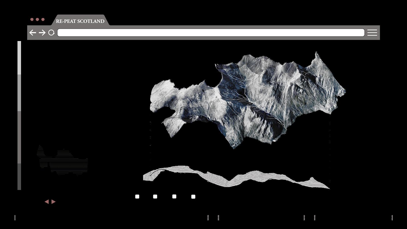
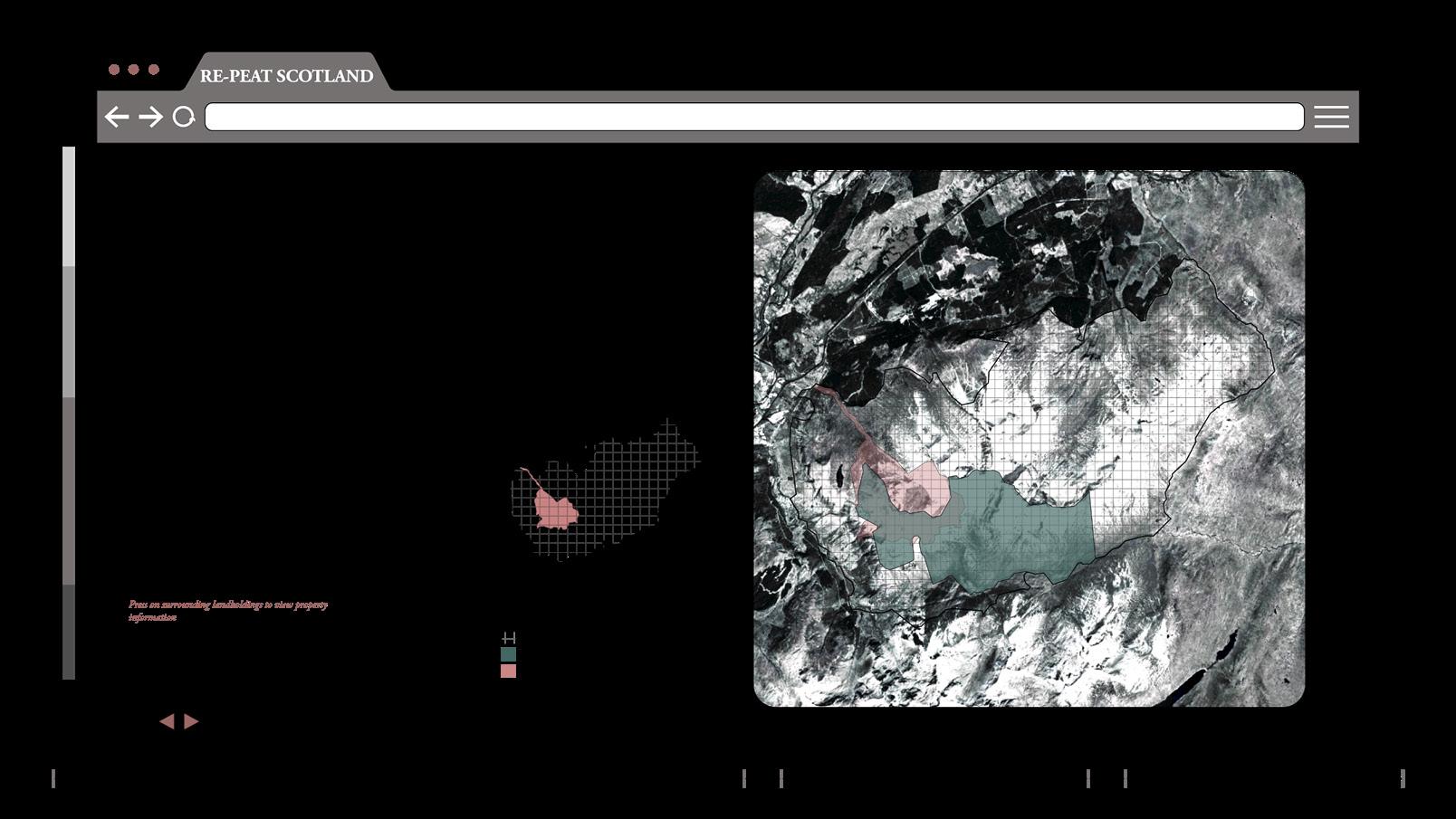
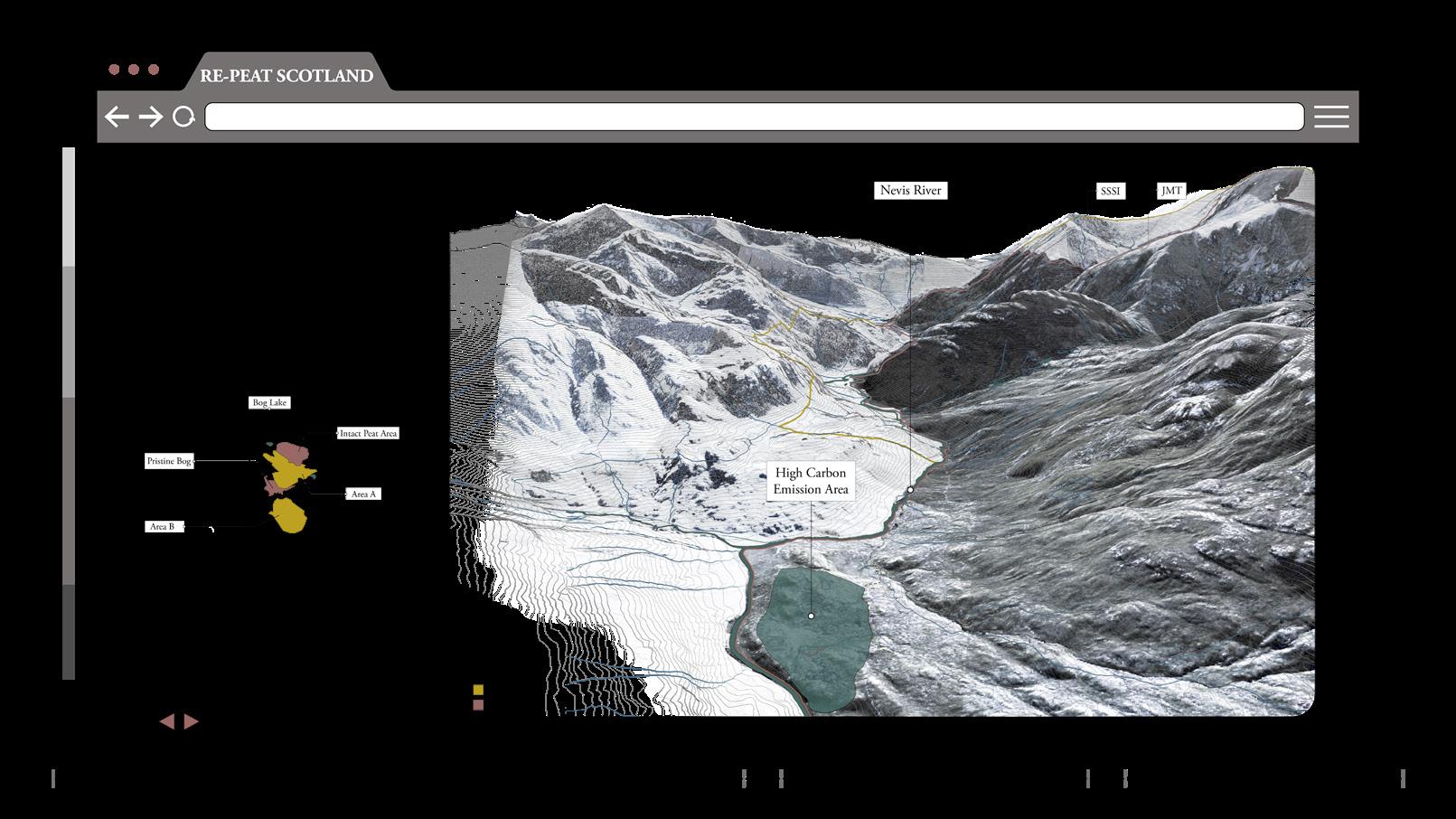
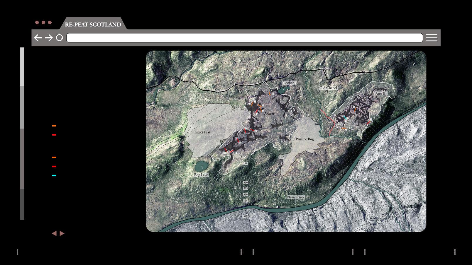
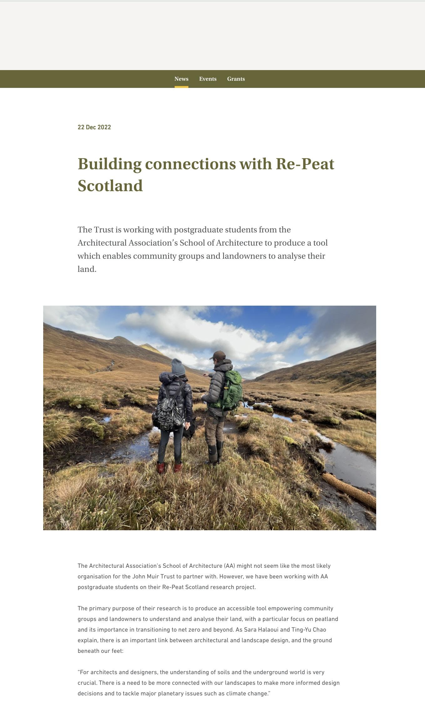
[ VI.1 OVERVIEW ]
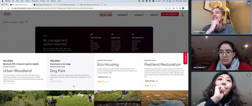
To spatialize this tax and provide access to our suggested tools, we have developed a platform where the users will have the ability to register their lands, undertake the assessment and be provided with the right management options and schemes.
This platform will also allow users to engage with experts and community trusts.
2
- The platform structure is divided into steps: Inputting land data, Land assessment, Carbon tax calculation, Land management strategies.
3
- Overview Page -
The platform starts with an overview page where the user can browse through different map scales and get the chance to look and engage with different completed and ongoing projects.
VI. Interface RE-PEAT SCOTLAND 2.0: Transparency, Transformation, Transition AA Landscape Urbanism 2022-23 49 48
[ VI- Interface ]
Overview
Land Data Land Assessment
Community Manual
Results
Land management strategies
Future scenarios
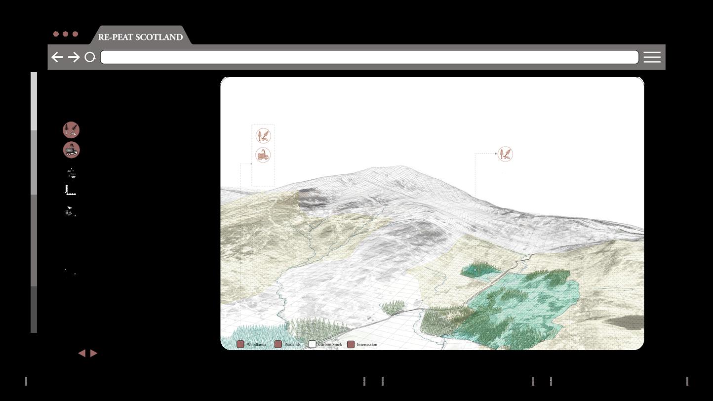
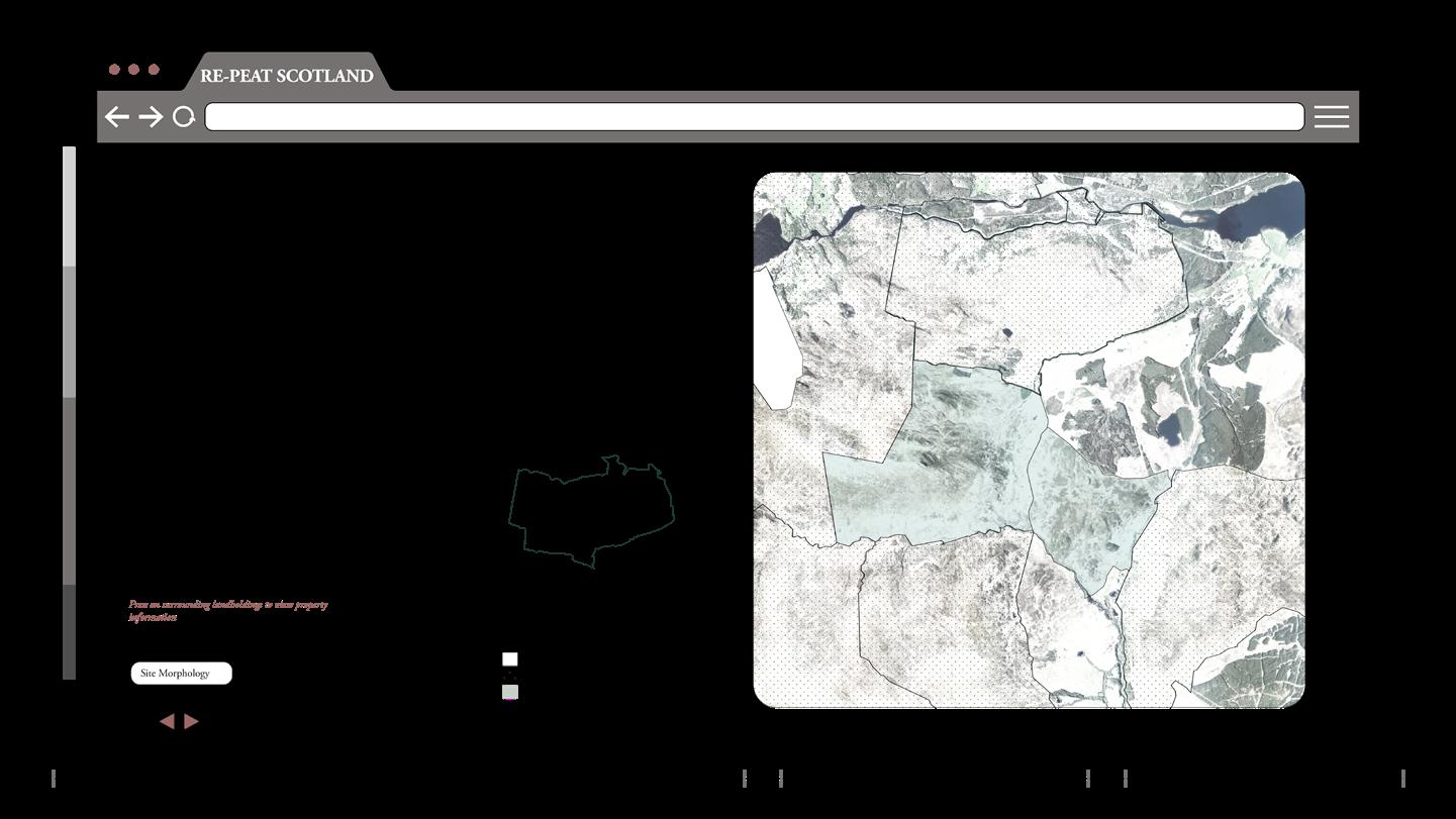
/ Glen Nevis /
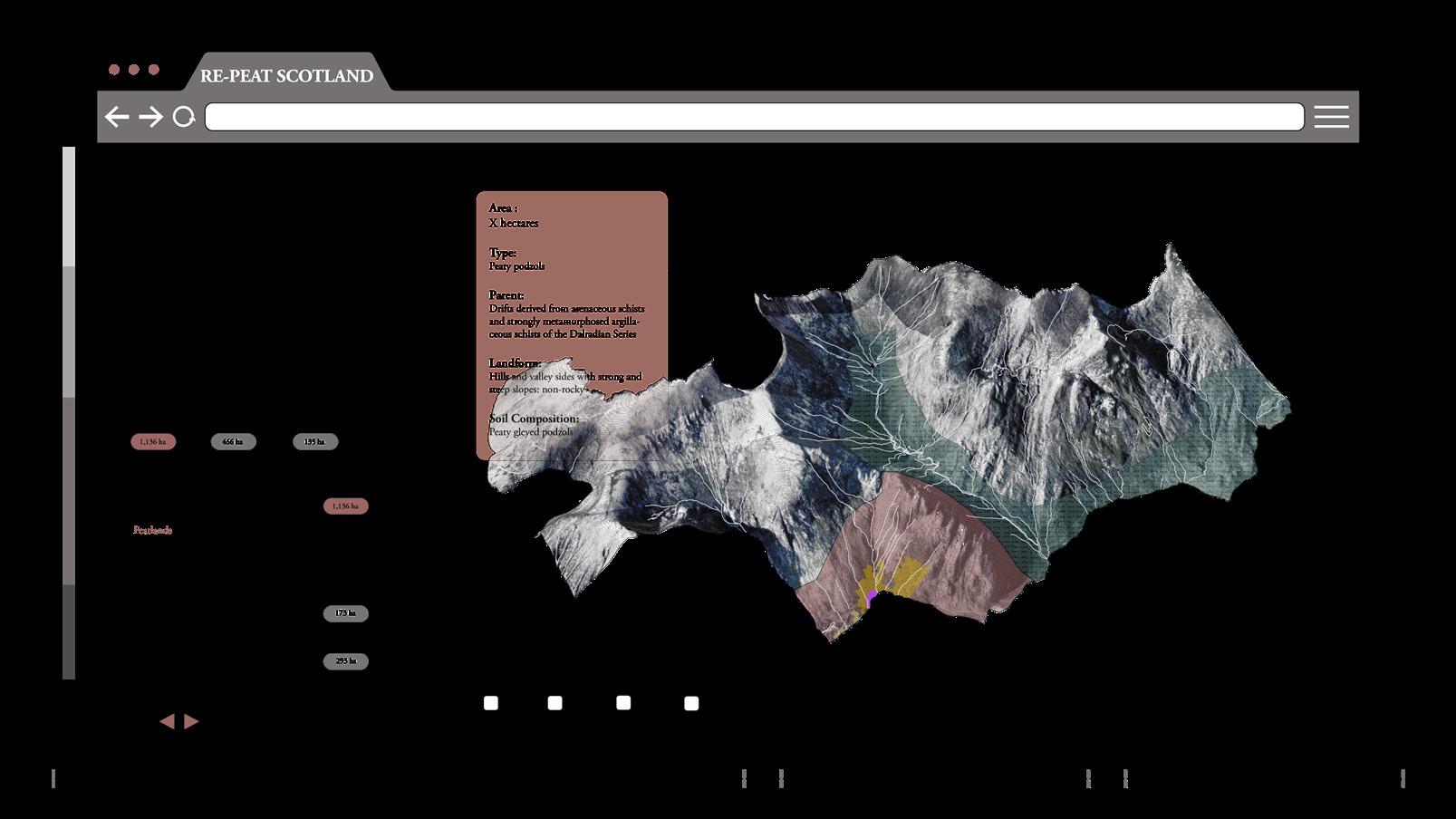
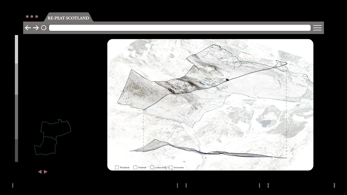
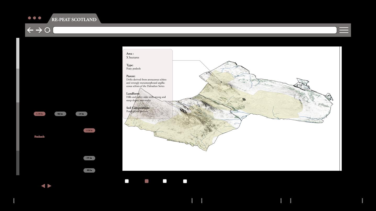
- Enter Land Data -
The user would enter the land number and
- Property InformationThe property information would show up.

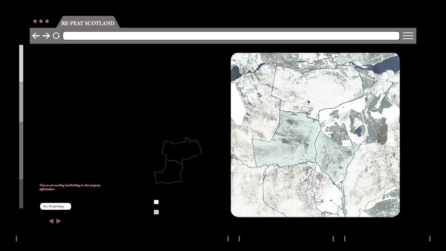
- Site Morphology -
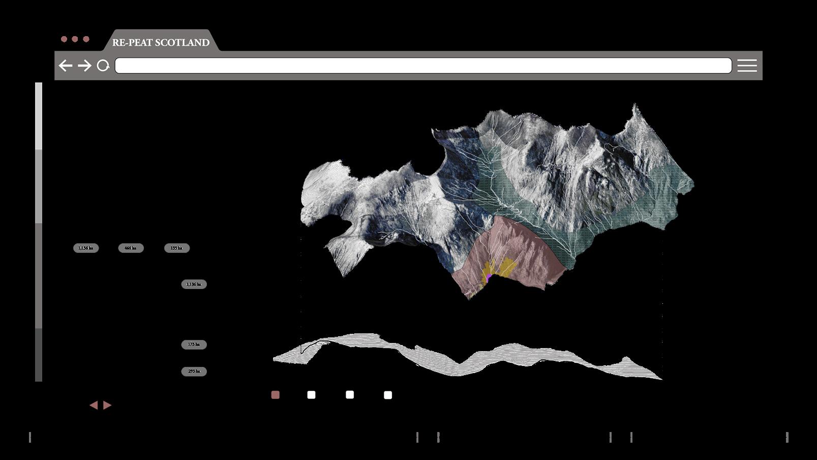
Users can also understand their site by pressing on the site morphology button.
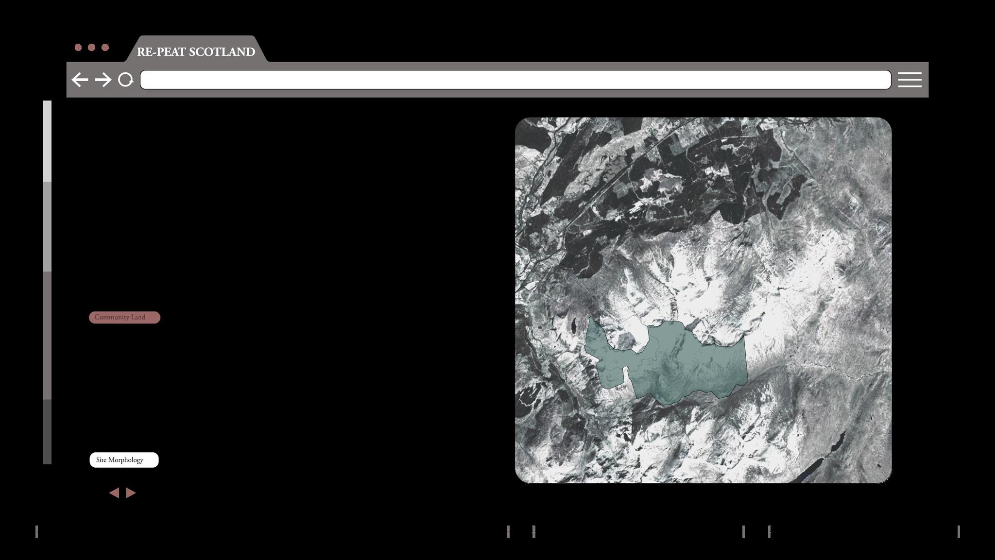
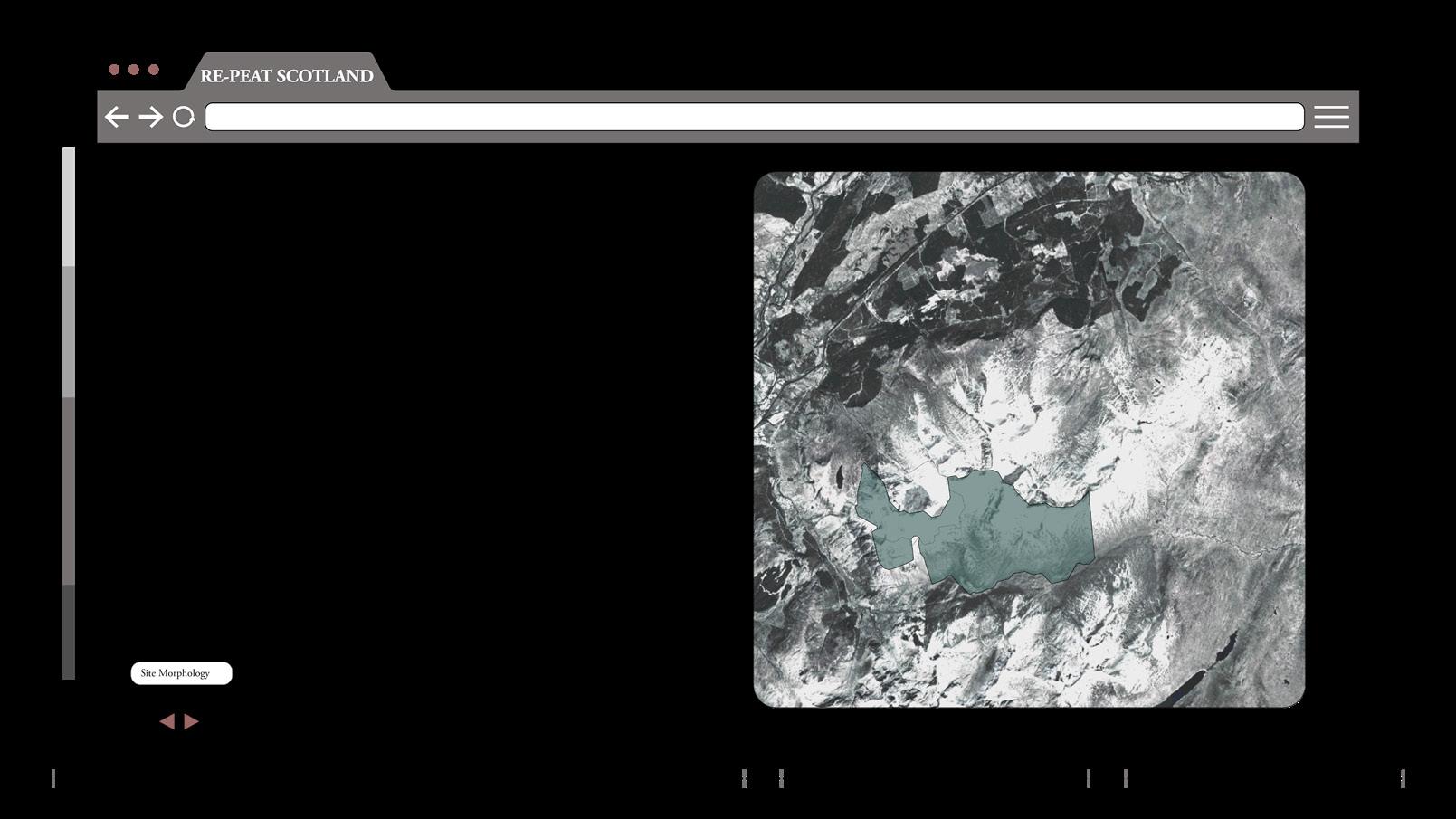
They can check the overall view, topography, and morphology of the site.
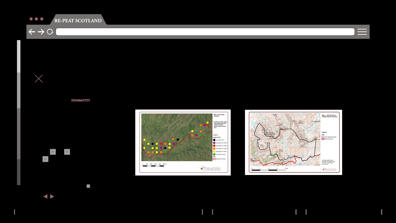
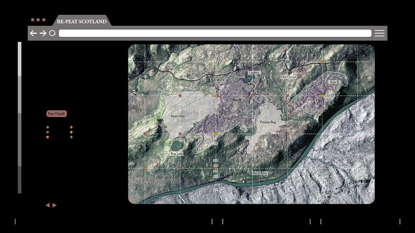
VI.2 LAND ASSESSMENT
- Land Asessment -
By moving to the next step, the user would need to specify the status of the land assessment. They could press YES, if they have previous land assessments done.
In this case they will be required to enter the assessment date, upload reports and necessary assessment maps.
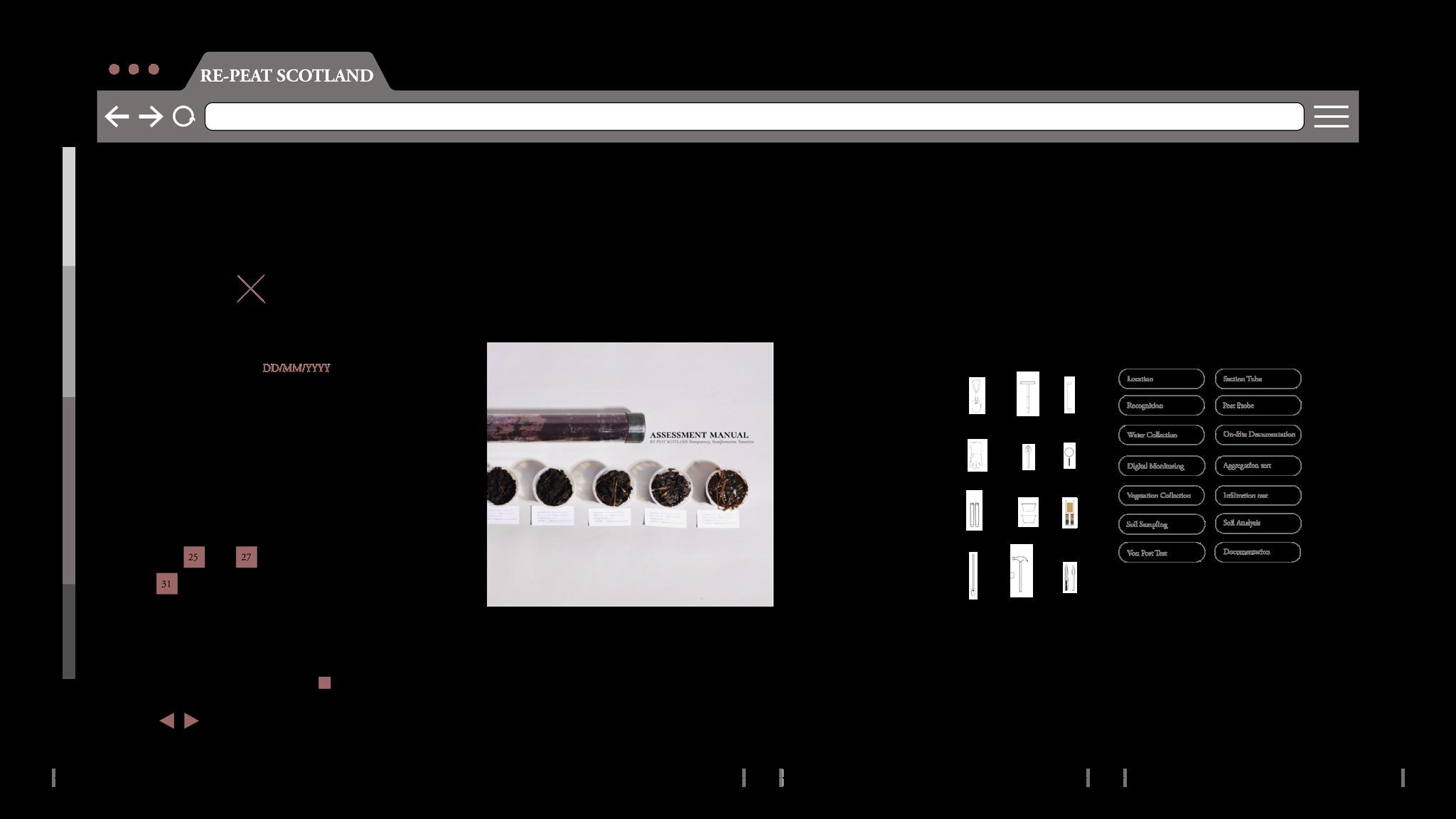
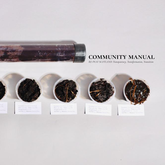
VI.3 COMMUNITY MANUAL ]
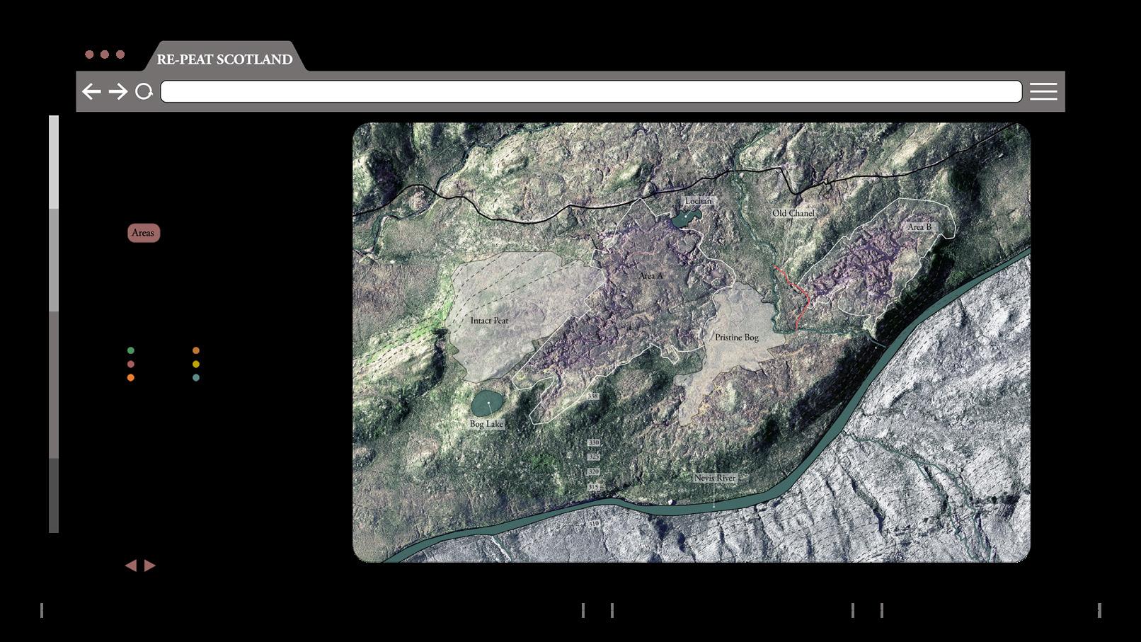
- OwnershipThen the user would specify the ownership. The aim is to build up the data collected to create an ownership map of Scotland that is public and accessible for all.
- Inputting LanduseLand use data is required. The user will enter the current land use. Simultaneously, computer generated areas of different land uses is shown. It provides a breakdown of specific areas on their lands.
- Land Asessment -
If they have no previous assessments, they can book an appointment with experts, download the assessment manual and apply for a tool kit.
- Neighboring DesignationsThe platform also provides property information of neighboring sites or designations such as the following example.
- Landuse DetailsOne can select a specific land use to get more detailed information.
- Land Asessment -
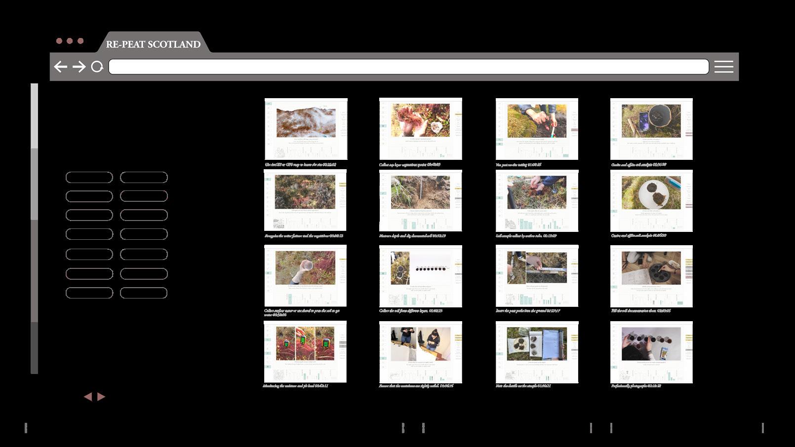
They can also press of the buttons to view videos that can teach them how to perform and document the assessment using various tools.
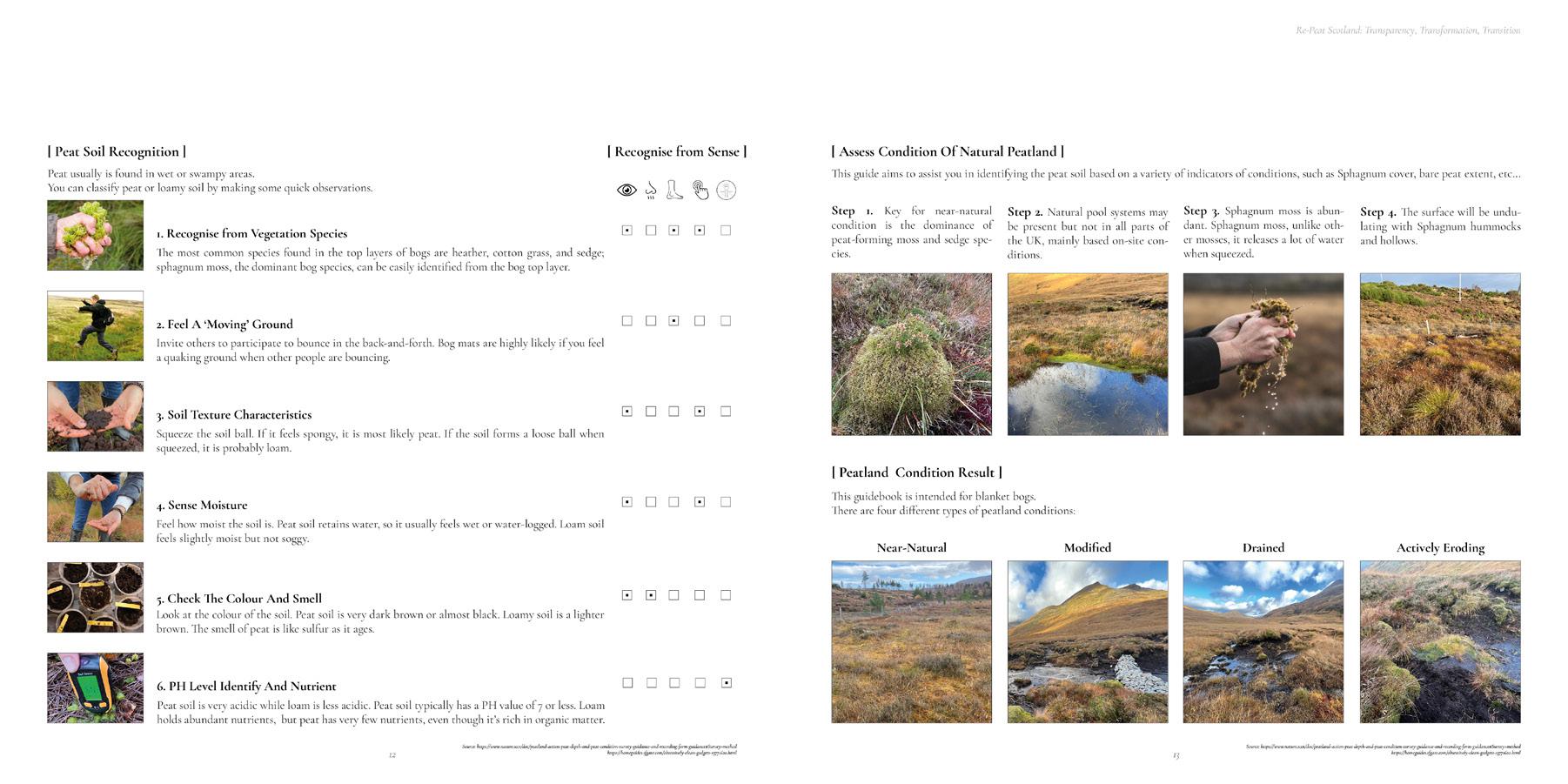
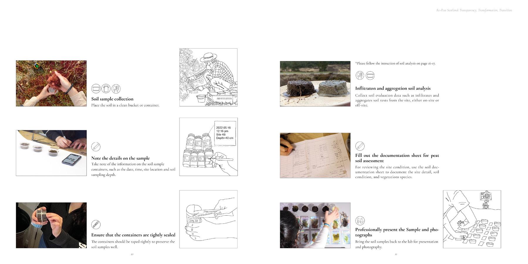
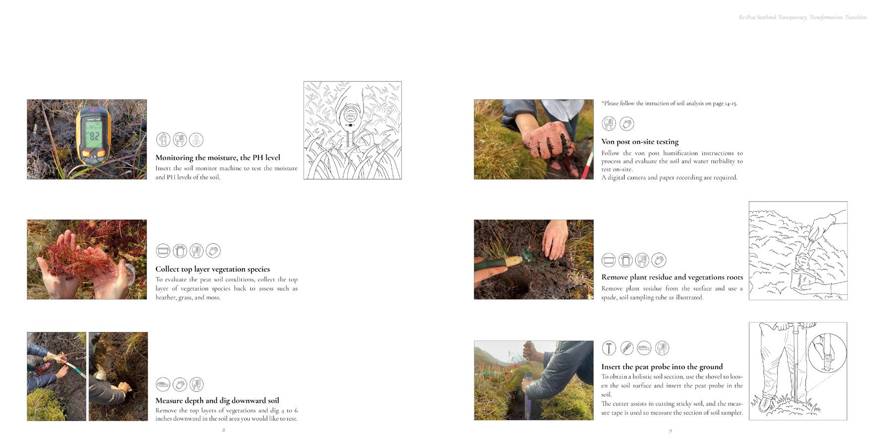
The assessment manual will bridge the gap between the community and their lands. It is a way to allow them to know more about these precious landscapes using their senses and personal experience.
The knowledge that will be built throughout the process can change the people’s perception to peatlands and allow them to develop the habit of caring and restoring them.
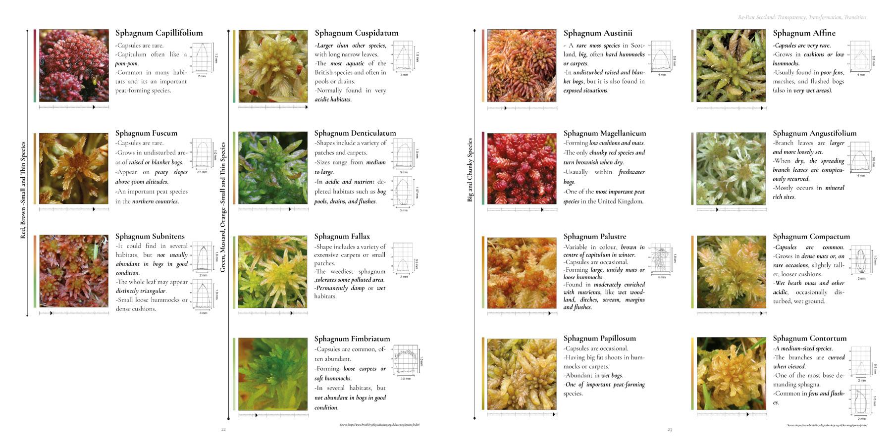
The manual has chapters related to strategies to identify peatlands, ones that allows the understating of sphagnum species and their variety, woodlands and microscopy.
VI. Interface VI. Interface RE-PEAT SCOTLAND 2.0: Transparency, Transformation, Transition AA Landscape Urbanism 2022-23 51 50
[ VI.2 LAND DATA
[
10 11 7 4 8 5 12 9 6 [
13
The manual has chapters related to strategies to identify peatlands, ones that allows the understating of peatland, sphagnum species and their variety woodlands.
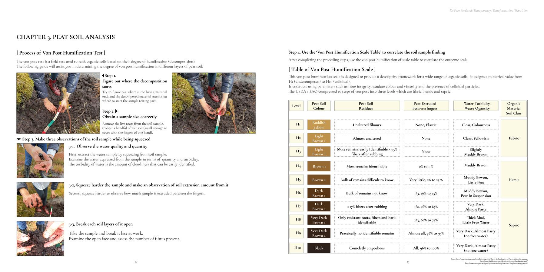
VI. Interface VI. Interface RE-PEAT SCOTLAND 2.0: Transparency, Transformation, Transition AA Landscape Urbanism 2022-23 53 52
- Content -
- Chapter 3Peat Soil Analysis
- Chapter 4Vegetation on Peatland
- Chapter 1Preparation for assessment
- Chapter 2Assessment process
- Peat Soil Condition -
14
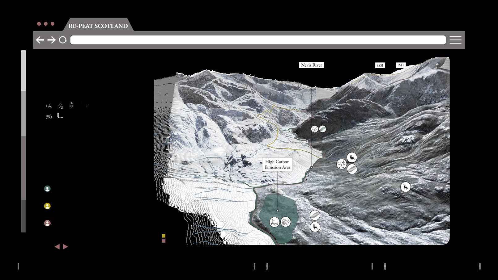
VI.4 RESULTS ]
After using the manual, A site section will be computer generated using data and results collected by the community, under the supervision of experts.
- Existing site imageThe following shows how the results will be displayed for the user. Site images will be used as background to help the user identify the area.
VI. Interface VI. Interface RE-PEAT SCOTLAND 2.0: Transparency, Transformation, Transition AA Landscape Urbanism 2022-23 55 54 RE-PEAT SCOTLAND 2.0: Transparency, Transformation, Transition 54
- Chapter 5Woodlands
- Chapter 6Microscopic Analysis
17
15
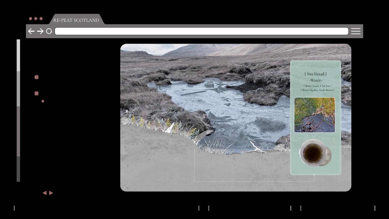
- WaterWater features will be highlighted on the site, with the sample location and sample collected.


18
- Tree StumpsOther features on site such as the tree stumps in this case are highlighted.
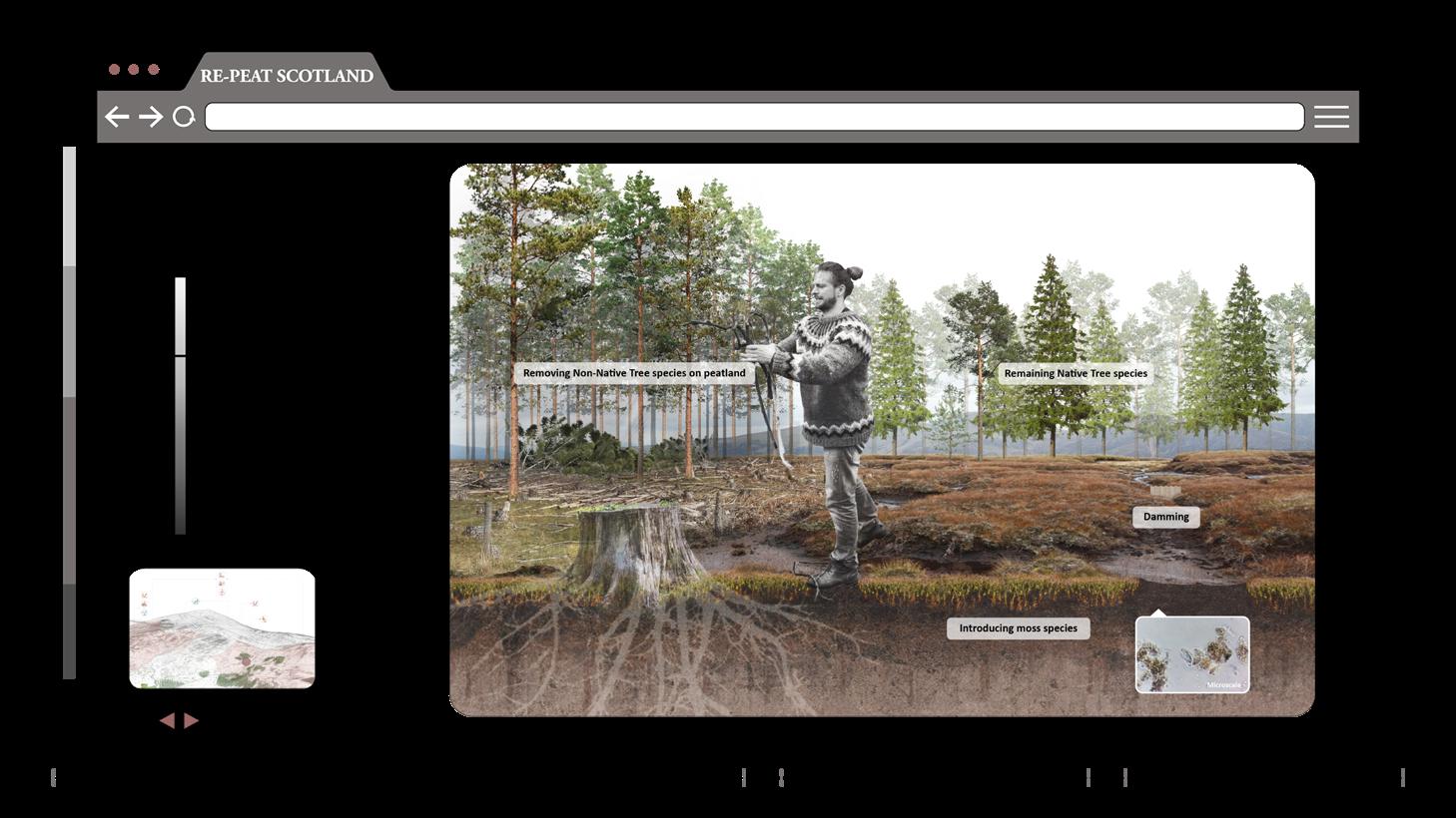
HIGH TECH
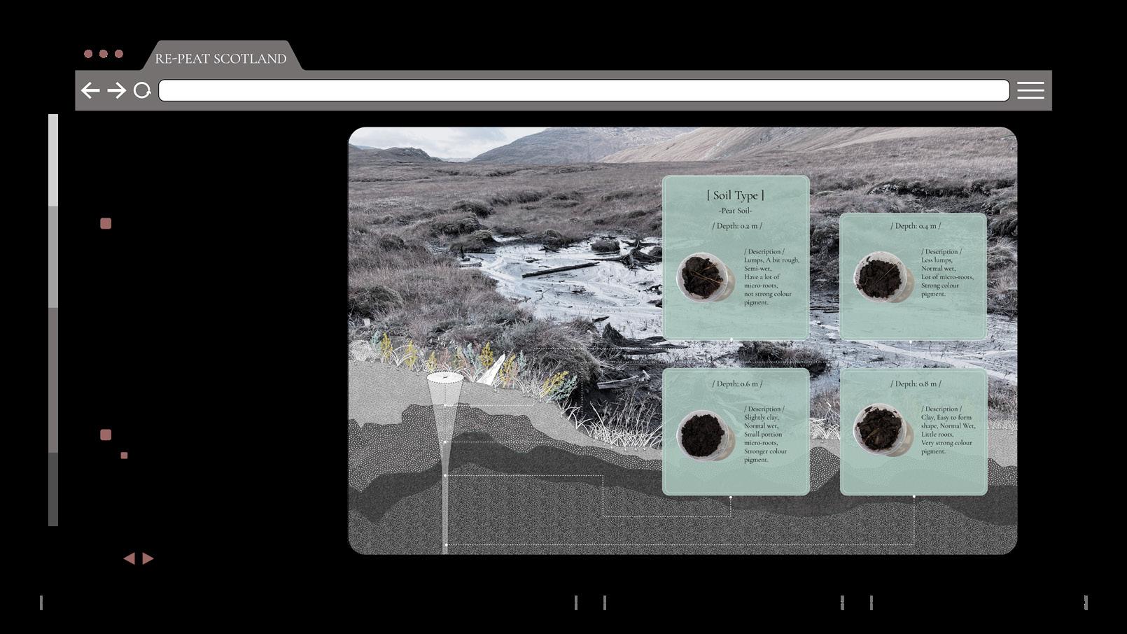
- Soil SamplesFrom the samples collected, different peat soil conditions will be identified.
- Microscopic Analysis -
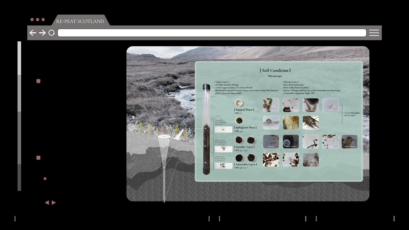
Following this low-tech analysis a high-tech one will show. It is done by experts. In this case it shows a detailed microscopic section of the peat soil on site. The top layers (aerobic layer) has 60/40 fungus to bacteria ration, its more acidic and active sequestration of co2. The deep layers (anaerobic layer) has a 40/60 ratio of fungus to bacteria, less acidity and a stable carbon stock within it. Water on this site is very rich with diatoms, reflecting on the healthy condition of the site.
16
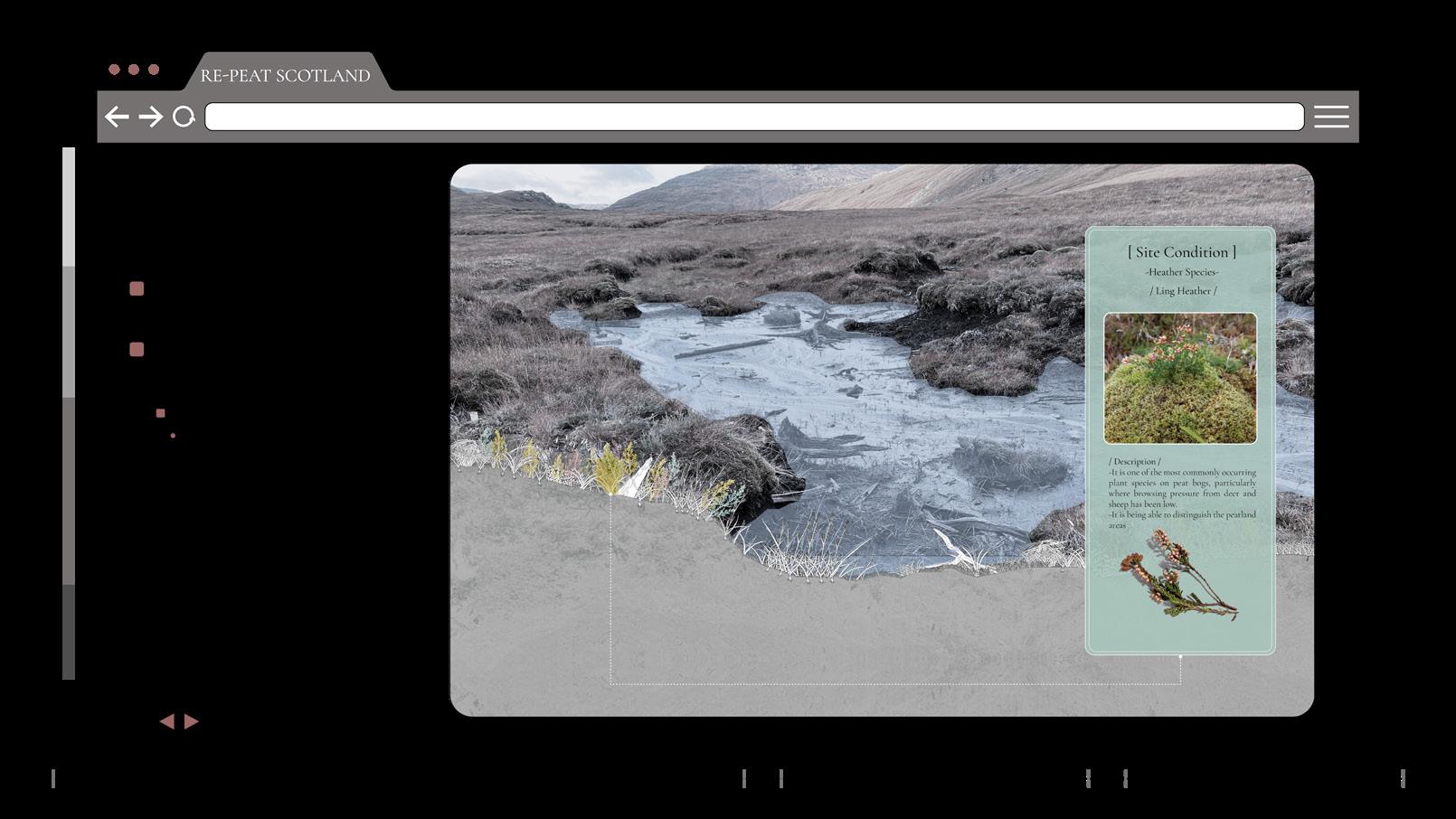
- Vegetation [ Heather ]Followed by the vegetation layer on site. In this case we have heather species and details are shown.
19 - Soil HatchesThis is Followed by a soil section of the site.
- PH AnalysisThis is accompanied by a pH analysis of the samples.
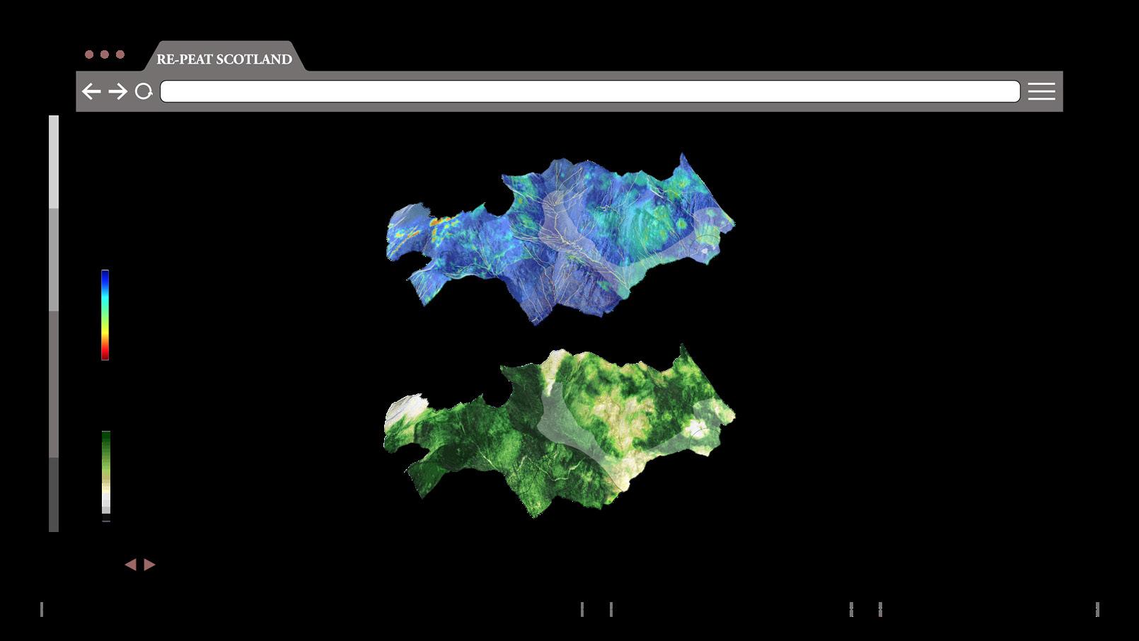
- Google Earth Engine MapsThis high-tech analysis also includes maps that show water content and vegetation layers on site. In this site, water content is quite high and vegetation layers are variable according to the different areas.
- Vegetation Sphagnum Mossand sphagnum species and they are shown along with the images of the samples collected.
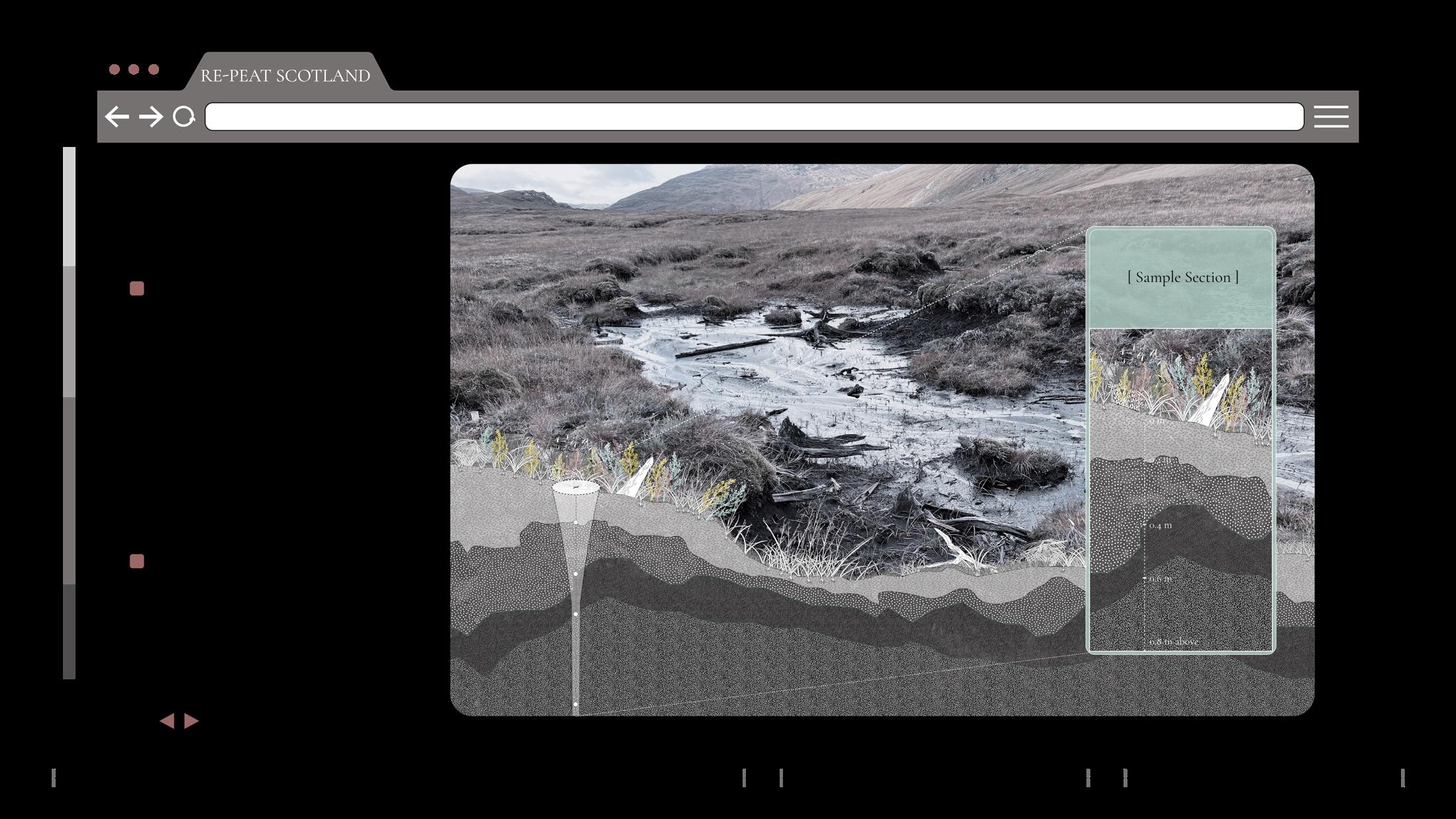
20 - Sample Location and Soil SectionThe sample location is also shown with a zoom in to the different soil depths and layers.
VI. Interface VI. Interface RE-PEAT SCOTLAND 2.0: Transparency, Transformation, Transition AA Landscape Urbanism 2022-23 57 56
21 23 24 22
[ TAX CALCULATION ]
[ VI.5 LAND MANAGEMENT STRATEGIES ]
[ RESTORATION PROCESS ]
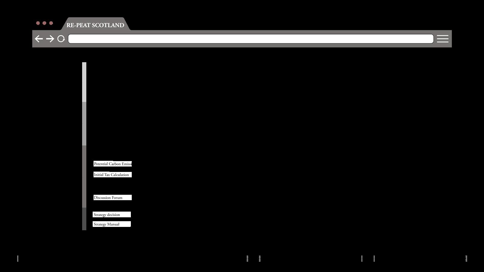
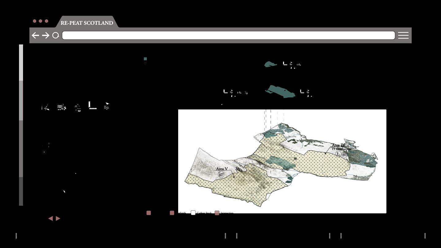
- Initial Tax CalculationAn initial carbon tax is calculated. These areas are identified and each one has detailed analysis of the carbon emitted. On the left side of the platform, a carbon scale will show the total carbon emissions alongside a taxing band bar.
27
- Zoom into Area IIThen zoom in to the high carbon emission zone. The user will get a general understating of the area.

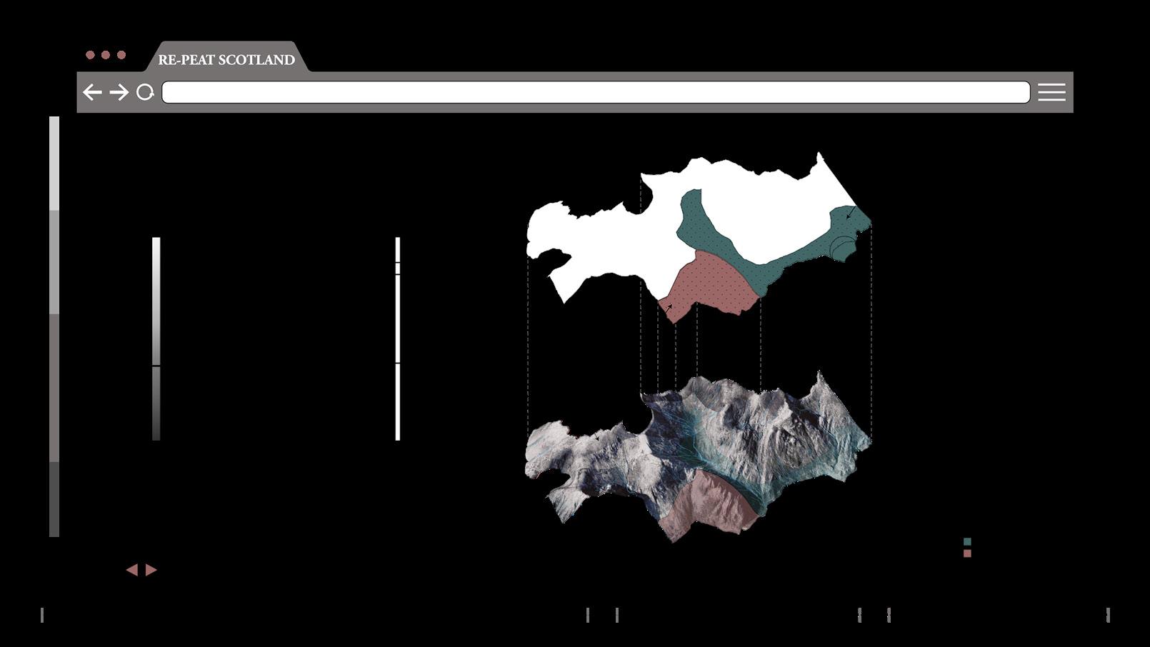


- FeaturesDetailed site features are shown
- Drainage -
They can also check the drainage lines that are causing the exposure and drainage of peatlands
- Different Areas
On SiteThis is followed by an option where the user will need to specify the area in which the strategies will be implemented. In this case, area 2.
- StrategiesBy moving to the next step, relevant site strategies are provided and the user can toggle through them.
31
- DepthUser can check the peat depth
- Dams -
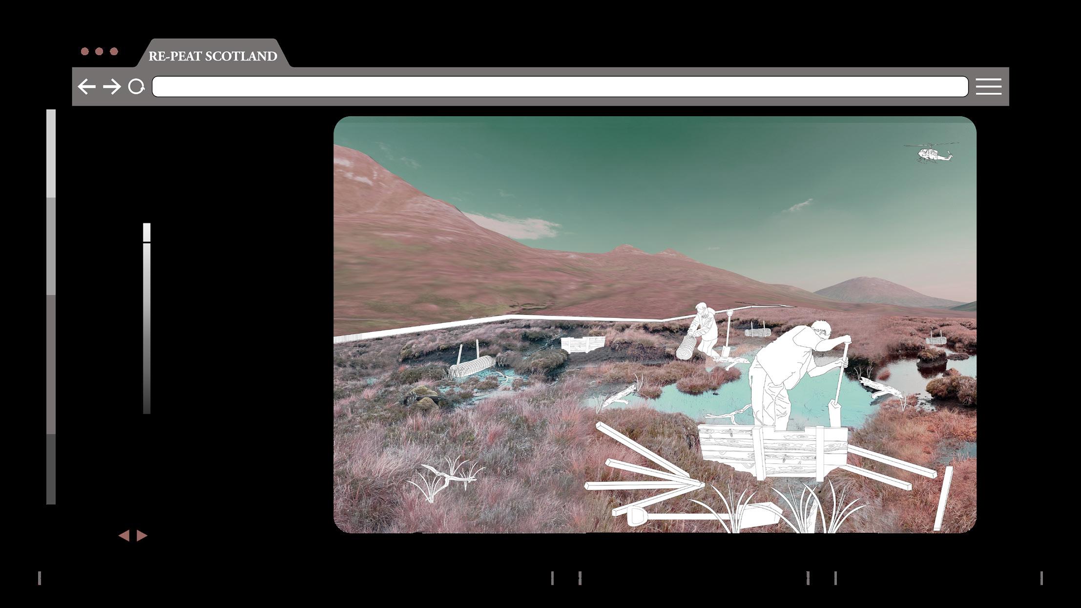
This is followed by a map that will show where the dams should be located and the types of dams needed in order to restore the area. In addition to highlighting were the revegetation is needed.
- Details -
The users will also be provided by material quantities, prices and access to various restoration manuals and revegetation guides that already exist. For example ones done by peatland action in Scotland.
- Discussion ForumA discussion forum allows the user to get the communities feedback through voting, asking experts, and chatting with community members.
32 - Exposed PeatIn addition to the area of exposed peat.
VI. Interface VI. Interface RE-PEAT SCOTLAND 2.0: Transparency, Transformation, Transition AA Landscape Urbanism 2022-23 59 58
AA Landscape Urbanism 2022-23 59
33 34
30
25
28 29 26
[ EXISTING SCENARIO ]
- Second Tax CalculationUpon agreeing, a second tax is calculated which is lower than the initial one.The restoration would reduce emissions by 2.54 tco2/ha/year therefore a total of 25.943 tco2/year.
Existing condition and restoration process and materials
VI. Interface
Transparency, Transformation, Transition
Heatherbale Dam Installation
Wooden Dam Installation Path Repair
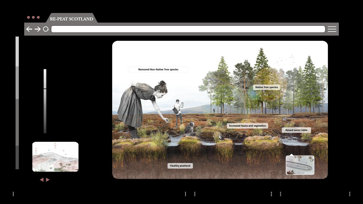
[ VI.6 FUTURE SCENARIOS ]
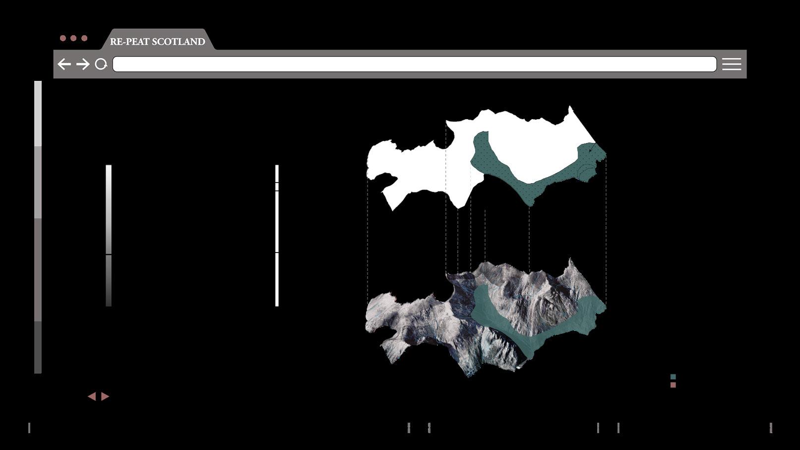
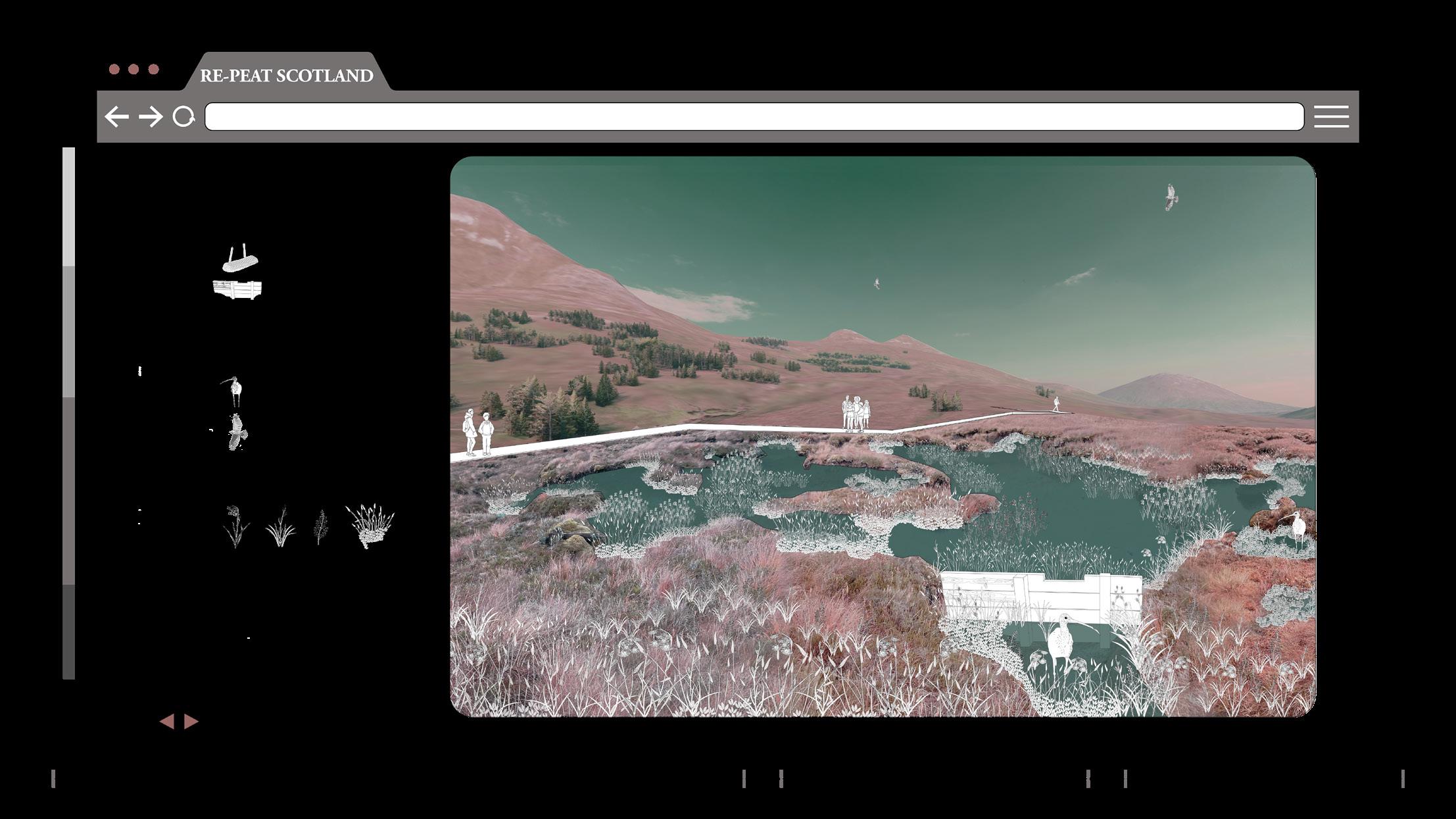
One last step, where an existing and future scenario of the site are shown.
Imagining the site after restoration, where peatlands regain their health.
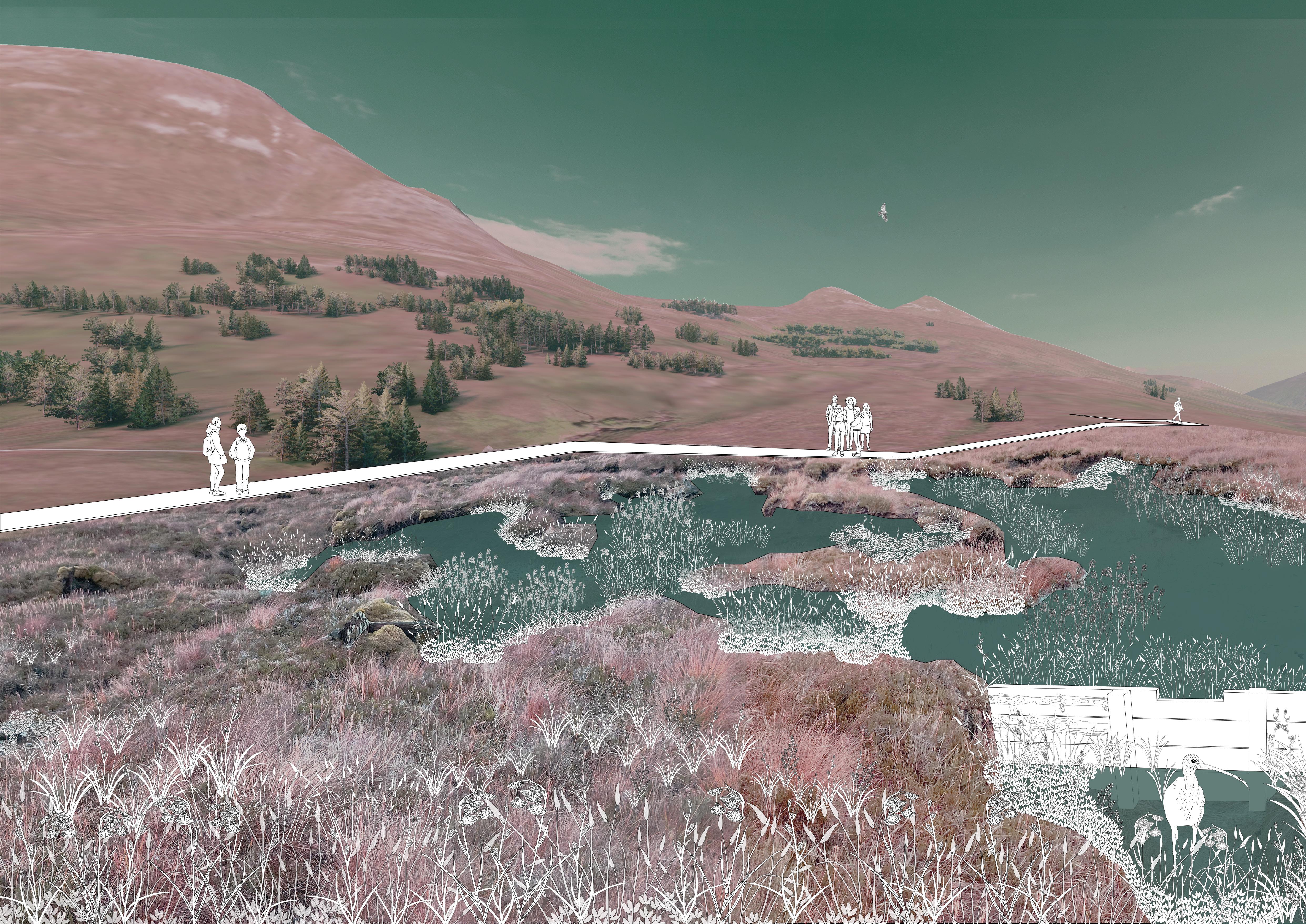
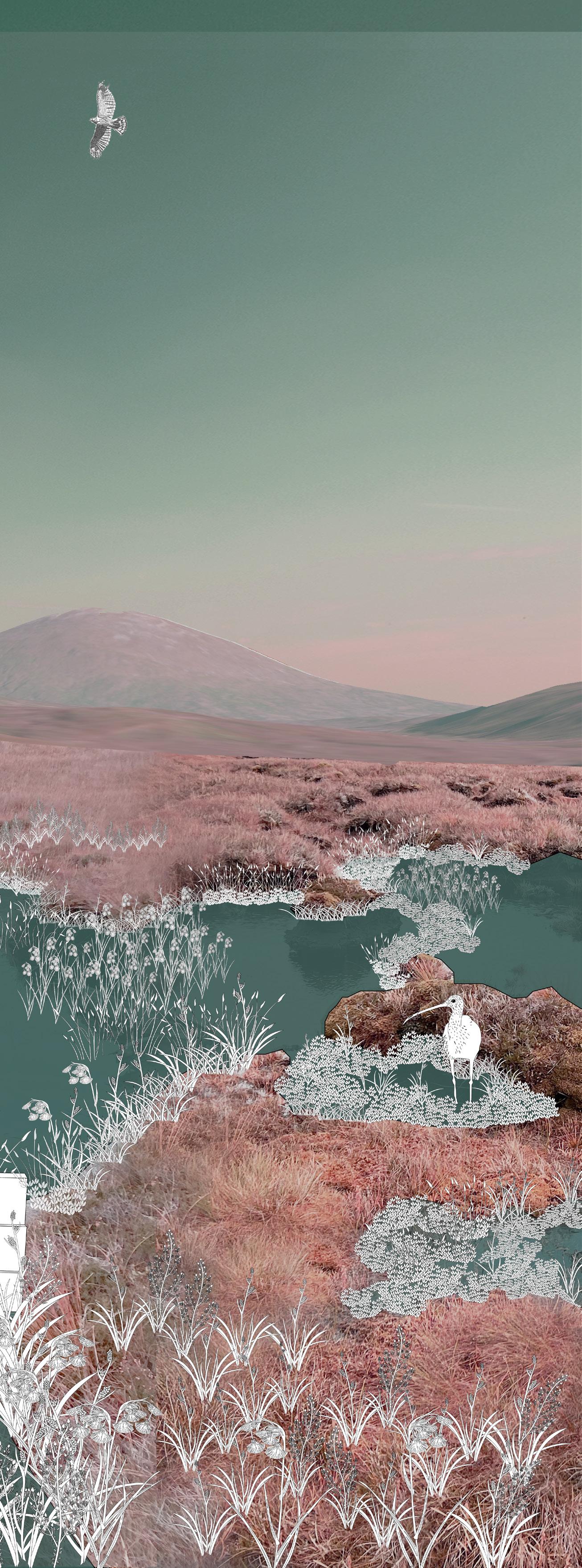
Water table increases, spread of various plant species (revegetation), animal species are part of the new scenario, and people can engage with the site by using the restored paths.
[ RESTORATION DOCUMENTATION ]
Later, Users can upload images of the restoration process.
VI. Interface
Transparency, Transformation, Transition
To conclude, with more sites involved, the Scottish policy and community manual could still develop and evolve to change minds, build awareness and shape perceptions and connections with landscapes.
These could be also scaled up to a global scale were peatlands, in the future can become global commons.

RE-PEAT SCOTLAND 2.0: Transparency, Transformation, Transition AA Landscape Urbanism 2022-23 65 64 VII. Conclusion
[ VII.1 DEMOCRATIZATION x COMMUNING TOWARDS A REAL-ZERO ]
[ VII- Conclusion ]
VII.1 Democratisation x Communing towards a Real-Zero
Fig.2- Carnigorms National Park. 8th Nov, 2022
VII.2 Organisation Engagement
VII.2 Organisation Engagement ]
We would like to thank JMT’s support and for publishing an article about our collaboration.
[ VIII- Appendix ]
VIII.1
VIII.2 Bibliography
RE-PEAT SCOTLAND 2.0: Transparency, Transformation, Transition 67 AA Landscape Urbanism 2022-23 66 VII. Conclusion
Interface Demo x East Schiehallion
Fig.2- Carnigorms National Park. 8th Nov, 2022
https://www johnmuirtrust org whats-new news/1346-building-connections-with-re-peat-scotland
[ VIII.1 Interface Demo x East Schiehallion ]
This interface has been tested using the “east scheihallion site”.
Unlike the glen nevis site, the site here is an intersection of woodlands and peatlands, with no previous assessment and different site conditions.
In this demo we did trials regarding the input of data, property information, land assessment, tax calculation and land management strategies.
By learning from this site, we enhanced the interface and did our final tool testing on the glen nevis site as shown previously in the booklet.
RE-PEAT SCOTLAND 2.0: Transparency, Transformation, Transition AA Landscape Urbanism 2022-23 69 68
[ VIII.2 Bibliography ]
An Assessment Of The Afforested Peat Land In England And Opportunities For Restoration. 2019. Ebook. 1st ed. uk: forest research. https://www.forestresearch.gov.uk/.
Andersen, Roxane, Russell Anderson, Steve Chapman, Neil Cowie, Ruth Gregg, Renée Hermans, Richard Payne, Mike Perks, and Vicky West. 2019. “Peatlands And Forestry”. The IUCN UK Peatland Programme.
Brown, Mark. 2017. “UAV Applications For Blanket Bog Res- toration And Monitoring”. Northpennines.Org.Uk. https://www. northpennines.org.uk/wp-content/uploads/2020/05/UAV-Pres- entation-1.pdf.
Burroughes, Tom. 2022. “Editorial Comment: Regulators, Fund Raters Go After Greenwashing”. Wealthbriefing.Com. https:// www.wealthbriefing.com/html/article.php?id=193718#.YhWOz- JPP08Y.
Carrington, Damian. 2022. “Oil Firms’ Climate Claims Are Greenwashing, Study Concludes”. The Guardian, 2022. https:// www.theguardian.com/environment/2022/feb/16/oil-firms-climate-claims-are-greenwashing-study-concludes#:~:text=Ac- cusations%20of%20greenwashing%20 against%20major,- most%20comprehensive%20study%20to%20date.
Chapman, Stephen, Alexandre Buttler, André-Jean Francez, and Fatima Laggoun-Défarge. 2003. Exploitation Of Northern Peatlands And Biodiversity Maintenance: A Conflict Between Economy And Ecology. Ebook. 1st ed. UK: Researchgate.
Domestic Peat Extraction. 2014. Ebook. 5th ed. UK: UK Com- mittee Peatland Programme. https:// www.iucn-uk-peatland- programme.org/sites/www.iucn-uk-peatlandprogramme.org/ files/5%20 Domestic%20Peat%20Cutting%20-%205th%20No- vember%202014.pdf.
Dyke, James, Robert Watson, and Wolfgang Knorr. 2021. “Cli- mate Scientists: Concept Of Net Zero Is A Dangerous Trap”. The Conversation. https://theconversation.com/climate-scientistsconcept-of-net-zero-is-a-dangerous-trap-157368.
GELMINI, TEFANO. 2021. “We’Re Living In A Golden Age Of Greenwash”. Greenpeace.Org.Uk. https://www.greenpeace. org.uk/news/golden-age-of-greenwash/.
Gewin, Virginia. 2020. “How Peat Could Protect The Planet”. Nature.Com. https://www.nature. com/articles/d41586-020- 00355-3.
Green Finance, Land Reform And A Just Transition To Net Zero. 2022. Ebook. 1st ed. Scotland: Community Land Scotland.
June Agricultural Census 2021. 2021. Ebook. 1st ed. Scotland: Scottish Government. https://www. gov.scot/binaries/content/ documents/govscot/publications/statistics/2021/10/results-scot- tish-agricultural-census-june-2021/documents/june-agricultur- al-census-2021/june-agricultural-census-2021/govscot%3A- document/june-agricultural-census-2021.pdf.
Macaskill, Mark. 2021. “BP Hit By Greenwash Claim Over Scottish Trees Project”. Thetimes. Co.Uk. https://www.thetimes. co.uk/article/bp-hit-by-greenwash-claim-over-scottish-trees- project-9d957j9gz#:~:text=Oil%20giant%20BP%20has%20 been,to%20expand%20Scotland’s%20native%20woodlands.&- text=However%2C%20the%20company%20says%20it,produc- tion%20by%20 40%25%20by%202030.
POSITION STATEMENT: Peatlands And Trees. 2022. Ebook. 1st ed. uk: IUCN. Accessed February 16.
Shaw, Duncan. 2022. “Plantation Of Sitka Spruce - Stock Image E760/0276”. Science Photo Library. Accessed April 24. https:// www.sciencephoto.com/media/177864/view/plantation-of-sitka-spruce.
Thom, Tim, Astrid Hanlon, Richard Lindsay, Joanna Richards, Rob Stoneman, and Stuart Brooks. 2022. CONSERVING BOG- STHE MANAGEMENT HANDBOOK. Ebook. 1st ed. UK: IUCN UK PEATLAND PROGRAMME. Accessed March 13. http:// www.iucn-uk-peatlandprogramme.org.
Trust, Woodland. 2022. “How Trees Fight Climate Change”. Woodland Trust. Accessed January 21. https://www.wood- landtrust.org.uk/trees-woods-and-wildlife/british-trees/how- trees-fightclimate-change/.
Understanding The GHG Implications Of Forestry On Peat Soils In Scotland. 2010. Ebook. 1st ed. UK: Forest research. https:// www.forestresearch.gov.uk/.
Wigan, Michael. 2020. “For Peat’S Sake Our Peat Bogs Are Just Fine Scottish Field”. Scottish Field. https://www.scottish- field.co.uk/outdoors/wildlifeandconservation/for-peats-sake- ourpeat-bogs-are-just-fine/.
“Can Trees And Woods Reduce Flooding?”. 2022. Woodland Trust. Accessed February 7. https:// www.woodlandtrust.org.uk/ trees-woods-and-wildlife/british-trees/flooding/.
“Community Lands Cotland”. 2003. Communitylandscotland. Org.Uk. https://www.communitylandscotland.org.uk/.
“England Launches Peat Action Plan IUCN UK Peatland Programme”. 2021. IUCN Peatland Programme. https://www. iucn-uk-peatlandprogramme.org/news/england-launches-peat- action-plan.
“England Peat Action Plan”. 2021. GOV.UK. https://www.gov.uk/ government/publications/england-peat-action-plan.
“Glengarry Forestry And Land Scotland”. 2022. Forestryand- land.Gov.Scot. https://forestryandland.gov.scot/visit/glengarry. “Government Officials Worried That Tree Deal With Shell Was “Greenwashing””. 2020. Blog. The Ferret. https://theferret.scot/ shell-greenwashing-forestry-land-scotland/.
“Green Lairds And The Great Carbon Offset: How To Reconcile Natural Capital, Net-Zero And Just Transition Priorities? BIEE”. 2022. BIEE. https://www.biee.org/meeting/green-lairds-andthe- great-carbon-offset-how-to-reconcile-natural-capital-net-zero- and-just-transition-priorities/.
“IUCN UK Peatland Strategy 2018-2040 Search”. 2018. Bing.Com. https://www.bing.com/ search?q=IUCN+UK+Peat- land+Strategy+2018-2040+&qs=n&form=QBRE&sp=-1&pq=iucn+uk+peatland+strategy+2018-2040+&sc=0-36&sk=&cvid=9 C903774C273415CAC7E77FFA2CA40D7.
woodlands.co.uk/services/ carbon/.
“Just Transition Commission: A National Mission For A Fairer, Greener Scotland”. 2021. Gov.Scot.
“Lodgepole Pine Alaskan Provenance Pinus Contorta Alba Trees”. 2022. Albatrees. Accessed April 24. https://www.alba- trees.co.uk/?products=pinus-contorta.
“New IPCC Special Report Highlights Importance Of Peatlands For Climate Change Mitigation”. 2021. Blog. Global Peatland Initiative. https://www.globalpeatlands.org/new-ipcc-special- reporthighlights-importance-of-peatlands-for-climate-change- mitigation/.
“Peat Cutting Hebridean Way”. 2020. Visitouterhebrides. Co.Uk. https://www.visitouterhebrides. co.uk/hebrideanway/ blogs/read/2020/09/peat-cutting-b36.
“Protecting And Repairing Wild Land John Muir Trust”. 1983. Johnmuirtrust.Org. https://www. johnmuirtrust.org/.
“Reviving The Wild Heart Of Southern Scotland”. 1996. Borders Forest Trust. https://bordersforesttrust.org.
“Shell ‘Drive Carbon Neutral’ Claims In Doubt After Forest Scru- tiny”. 2021. Blog. Source Material. https://www.source-material. org/blog/shell-drive-carbon-neutral-claims-in-doubt-afterforest- scrutiny.
“Sitka Spruce”. 2022. Forestry And Land Scotland. Accessed February 24. https://forestryandland. gov.scot/learn/trees/sit- ka-spruce.
“Specific Tree And Woodland Problems”. 2022. Forest Re- search. Accessed March 16. https://www. forestresearch.gov.uk/ research/25-year-forecast-of-softwood-timber-availability/.
“The RSPB Wildlife Charity: Nature Reserves & Wildlife Conser- vation”. 1889. The RSPB. https://www.rspb.org.uk.
“The Turf Spade”. 2022. Pcl-Eu.De. Accessed March 8. http:// www.pcl-eu.de/virt_ex/detail.php?entry=05.
“Why Our Forests Matter”. 2022. Externalworksindex.Co.Uk. Accessed April 24. https://www.externalworksindex.co.uk/en- try/133751/WoodBlocX/Why-our-forests-matter/.
“Why We Need To Keep Peat In The Ground - And Out Of Our Gardens”. 2022. Plantlife. Accessed March 6. https://www. plantlife.org.uk/uk/our-work/campaigning-change/why-we- need-to-keeppeat-in-the-ground-and-out-of-our-gardens.
“Woodland Carbon Code”. 2022. Scottishwoodlands.Co.Uk. Ac- cessed April 24. https://www.scottish
“Natural Resources Wales Satellite Technology Helping to Restore Peatlands in Wales.” Natural Resources Wales /. Accessed January 20, 2023. https://naturalresources.wales/about-us/news/ news/life-wrb-satellite-pr/?lang=en.
“Canada’s Peatlands: Towards National Assessment.” Global Peatlands Initiative. Accessed January 20, 2023. https://globalpeatlands.org/canadas-peatlands-towards-a-national-assessment/.
Gustaf Hugelius, Julie Loisel. “Maps of Northern Peatland Extent, Depth, Carbon Storage and Nitrogen Storage: Bolin Centre Database.” Stockholm University. Bolin Centre Database, July 28, 2020. https://bolin.su.se/data/hugelius-2020-peatland-1?n=hugelius-2020.
gs, Author. “Carbon Tax Land Conversation.” curvedflatlands, December 8, 2021. http://curvedflatlands.co.uk/land/carbon-tax-land-conversation/.
“Peatland Action Restoration and the Construction (Design and Management) Regulations 2015.” NatureScot. Accessed January 20, 2023. https://www.nature.scot/doc/peatland-action-restoration-and-construction-design-and-management-regulations-2015.
Callander, Robin. Rep. The History of Common Land in Scotland, January 2003. http://radicalimagination.co.uk/assets/com/commonweal_1.pdf.
“Peatland Communities around the World.” The Flow Country. Accessed January 20, 2023. https://www.theflowcountry.org.uk/flow-facts/peatland-communities-around-the-world/.
Marshall, C., Bradley, A. V., Andersen, R., & Large, D. J. (2021). NatureScot Research Report 1269 Using peatland surface motion (bog breathing) to monitor Peatland Action sites. Edinburgh: Nature Scot (formally Scottish National Heritage)
“Satellites Track ‘Bog Breathing’ to Help Monitor Peatlands.” NatureScot. Accessed January 20, 2023. https://www.nature.scot/satellites-track-bog-breathing-help-monitor-peatlands.
“Introduction to the Peatland Code: IUCN UK Peatland Programme.” IUCN Peatland Programme. Accessed January 20, 2023. https://www.iucn-uk-peatlandprogramme.org/peatland-code/introduction-peatland-code.
“Peatlands and the Historic Environment.” Historic England. Accessed January 20, 2023. https:// historicengland.org.uk/images-books/publications/peatlands-and-historic-environment/.
Salazar, Juan Francisco, Céline Granjou, Matthew Kearnes, Anna Krzywoszynska, and Tironi Manuel Rodó. Thinking with Soils: Material Politics and Social Theory. London, UK: Bloomsbury Academic, 2022
RE-PEAT SCOTLAND 2.0: Transparency, Transformation, Transition AA Landscape Urbanism 2022-23 71 70
Fig.2- Carnigorms National Park. 8th Nov, 2022
AA Landscape Urbanism 2022-23 \ 72
