Urban Stitching

Page 1

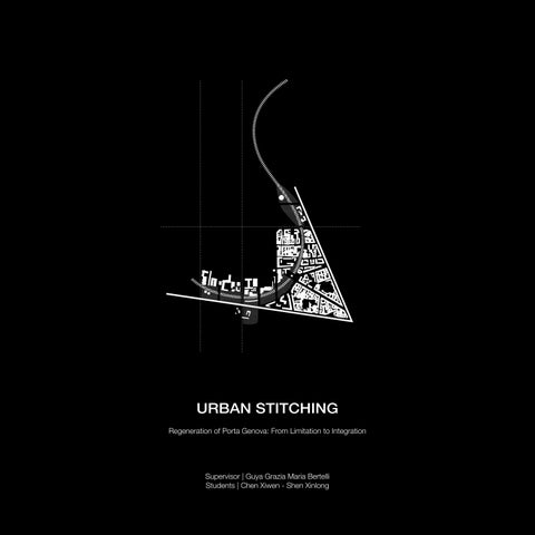
URBAN STITCHING

Regeneration of Porta Genova: From Limitation to Integration Supervisor | Guya Grazia Maria Bertelli Students | Chen Xiwen - Shen Xinlong

53
56 Drawing 25. Strategy plan.
26. Master Plan 1:2000.
Drawing

4.2 Masterplan

Every city has pockets of underused and underutilized land or distressed and decaying urban areas. These pockets of underused land weaken the city’s image, livability, and productivity. They are usually the result of changes in the urban growth and productivity patterns. To tackle the issues of decline and urban decay, these cities and others around the world have designed complex processes of urban regeneration.

Urban regeneration involves the targeted use of public and private funding to regenerate a specific area of a town or city by making purposeful changes in the built environment as part of a larger master plan. It focuses on urban areas that are known to be experiencing higher levels of deprivation than the rest of the local population or that are in a state of decline. Urban regeneration seeks to create new opportunities both for the local community and individuals and businesses looking to invest in the area by repurposing underused or redundant land and buildings in a wholesale transformational intervention. There are three main types of urban

regeneration: economic, social and environmental, all of which have the core objective of promoting prosperity by reducing social inequalities in these areas, thereby improving people's quality of life.

Social, economic and cultural changes are forcing cities to modify and reorganize the living space on the basis of new principles and new development logic: from this point of view “urban voids” and underused spaces offer a great opportunity to rethink territorial functions creating new synergies between the public, private and tertiary sector.

Every city has pockets of underused and underutilized land or distressed and decaying urban areas. These pockets of underused land weaken the city’s image, livability, and productivity. They are usually the result of changes in the urban growth and productivity patterns. To tackle the issues of decline and urban decay, these cities and others around the world have designed complex processes of urban regeneration.

59
60 Drawing 27. Master Plan 1:1000
61
Drawing 28. Master Plan - Tower 1:500 Drawing 29. Master Plan: Bridge 1:500 Drawing 30. Master Plan: Green House 1:500 Drawing 31. Master Plan: Urban Park 1:500.

5.1 Built-up Space

74
Milano City Museum: A narrative about water and city

Traceback

The site is located at Porta Genova railway station, which is the core of the Porta Genova. The train station is the oldest and currently in-use station in the city, witnessing the evolution of history and the urban landscape. Considering the decline in industrial activities and the emergence of new forms of urban connectivity, it is slated for closure and gradual dismantling.

Interaction

As the intersection of two important urban axes, the tower's orientation and position respond to the axes, creating a visual connection with the historic district. At the same time, the old train station will be transformed into an open square to continue the historical trajectory. Openings are processed on the facade to ensure the interaction between the tower and the city at different heights. The translucent facade material and the sunken square at the entrance enhance the permeability and openness of the boundary, providing opportunities for dialogue between architecture and the city.

Integration

The city is a place of collective memory. In the natural change of urban history, the city that once existed has not completely disappeared. Instead, the memory of the city is continued through places, monuments, etc. We define this tower as Milano City Museum, connecting the evolution of Milan through Navigli, envisioning the future possibilities of the city. Through this museum, we aim to cultivate a sense of identity and belonging among people, extending the memory of Milan and Navigli into the future.

75
Drawing 33. Tower: Stitching strategy
1. Main entrance 2. Sub-entrance 3. Sunken plaza 4. Metro entrance 5. Bicycle parking 6. Open-air exhibition 7. Open-air pool Drawing 34. Tower: Ground floor plan 1:500.

The ground floor of the museum is fully open to the public, with the entrance relocated to the underground level to enhance permeability and openness. It connects to the city through a sunken plaza. The underground level is linked to the ground floor via a water courtyard, where natural light refracted and reflected by water creates a unique spatial experience. The upper tower extends vertically into urban green spaces and water bodies, integrating with vegetation and water to become a new type of museum. Acting as a landmark, the tower also serves as a declaration of green commitment.

The assumed tour route begins at the entrance hall on the underground level, divided into four sections:

CITY MEMORY SQUARE_Ground Floor:

The historical traces of the original train station are preserved, serving as the foundation for an open plaza where outdoor exhibitions can take place. Sunken plazas and shallow pools at both ends emphasize the memory of the old train station.

WATER EXHIBITION Underground space:

Featuring temporary exhibition halls, bar, auditorium, service areas, and interactive exhibits about water. This section aims to immerse visitors in the theme of water and its significance in Milan's history and future.

MILANO EXHIBITION_Upper part of tower:

Visitors then directly ascend to the tower's roof terrace, commencing with a panoramic view of Milan before continuing the tour. Navigli is considered the focal point, offering insights into Milan's history, present, and future.

EDUCATION AND INTERACTION_lower part of tower:

This section focuses on sustainability practices related to green spaces and water usage. It serves as a continuation of the exploration of the future of Milano, emphasizing the importance of green and water sustainability for Milan's future.

77
history of Milan future of Milan educational space today's Milan navigli performance temporary exhibition temporary exhibition view multi-media view auditorium Drawing 35. Tower: Analysis diagram.
78 Drawing 36. Tower: -1F Plan 1:500
79 Drawing 37. Tower: -2F Plan 1:500. 8. ServicWe counter 9. Cloakroom 10. Cafe & Bookstore 11. WC 12. Staff office 13. Lobby 14. Temporary exhibition 15. Navigli exhibition 16. Underground pool 17. Storeroom 18. Auditorium 19. Mechanical room
80 F5 PLAN - Exhibition - Performance F6 PLAN - Exhibition - Multi-media F1 PLAN F2 PLAN - Library - Library
Drawing 38-45. Tower_Tower Floor Plan
81 F12 PLAN F13 PLAN - Exhibition - Auditorium - Exhibition F15 PLAN - Roof terrace F11 PLAN - View terrace
82
Drawing 46. Tower: Section 1:1000. Drawing 47. Tower: East elevation 1:1000
84
Drawing 48. Tower: West elevation 1:1000. Drawing 49. Tower: South elevation 1:1000.
86
Drawing 50. Tower: City memory square scenario.
87
Drawing 51-54. Tower: interior scenario. Drawing 55. Tower: Axonometric drawing.

5.2 Connection Space

Gallery Bridge: A connection between culture and agriculture

90

Traceback

The bridge is located in the middle of the linear site. Due to the limitations of this train yard, an important urban axis is severed: the art and cultural axis on the north side is suddenly cut off, and the accessibility of urban green space on the south side is also greatly reduced.

Interaction

Facing the complex and diverse urban context, the bridge is no longer just connections in space, but also connections in life. The ground floor is completely open, with only two vertical circulation spaces leading to the galley and roof garden respectively. This preservation of the spatial character of the bridge base provides informal activity space for citizens, while also preserving the continuity of the entire linear green space and public space.

Integration

Exhibition spaces and multifunctional room are placed inside the bridge, where nearby artists can hold exhibitions and events, attracting neighborhoods; the roof terrace also serves as the bridge deck, connecting to the green space at the other end. With the addition of the bridge gallery, a series of public spaces is established along this previously fragmented urban axis: the art and clutural district, art square, bridge gallery, ecological restaurant, and urban agriculture.

91
Drawing 56. Bridge: Stitching strategy.
Urban Agriculture 92
Canal Eco-Restaurant
Drawing 57. Bridge: Ground floor plan 1:1000.
Drawing 58. Bridge: Section A-A 1:1000.

In the continuous open space under the bridge, the activities taking place are integrated with the surrounding life. The square at the end of the road of cultural and art district can hold temporary exhibitions; the sunken square at the entrance of the gallery can also be used as a open-air theater to hold performances; the bridge encloses the square with the original building in the south, can hold agricultural market on weekends.

Bridge Gallery Art Street Art Square 93 1. Art square 2. Entrance sunken plaza 3. Service counter 4. Bridge access staircase 5. Bar 6. Urban agriculture 7. Open-air market 8. Eco-restaurant
94
Drawing 60. Bridge: 2F Plan 1:1000. Drawing 59. Bridge: 1F Plan 1:1000.

The flow lines of the bridge and the gallery remain independent, intersecting only partially in the atrium to achieve spatial permeability. The interior space of the gallery is fluid, with a viewing terrace designed to overlook the artistic and cultural street, encouraging interaction with activities on the street. On the opposite end, service spaces are positioned, utilizing their thickness to create high windows that mitigate direct sunlight into the exhibition space.

A B C D B C D A 95 9. Exhibition 10. Patio 11. Multifunctional room 12. Terrace 13. Storeroom 14. WC 15. Viewing terrace 16. Roof terrace
96 Drawing 61. Bridge: Section B-B 1:1000. Drawing 62. Bridge: Section C-C 1:1000.

By raising part of the roof, natural light can enter the room through reflection. At the same time, the height difference of the roof can naturally form a walkway.

97 Drawing 63. Bridge: Section D-D. 1:1000 Drawing 64. Bridge: North elevation. 1:1000
98
Drawing 65-68. Bridge: Bridge gallery scenarios.
99
Drawing 69. Bridge: Urban agriculture scenario.
100
Drawing 70. Bridge: Axonometric drawing.
101

5.3 Open Space

Green house: A sustainable urban living room

102

Traceback

The location of the green space was once an office and work zone, at the midpoint of the transition axis between agricultural formats outside the city and historical and cultural formats within the city. The surrounding buildings still retain the roof character of the industrial buildings. At the same time, there are many museums and cultural buildings in the surrounding area, and Mudec is less than one hundred meters away from the site. On the south side of the site is the channel of the canal.

Interaction

Facing the complex and diverse urban context, the bridge is no longer just connections in space, but also connections in life. The ground floor is completely open, with only two vertical circulation spaces leading to the galley and roof garden respectively. This preservation of the spatial character of the bridge base provides informal activity space for citizens, while also preserving the continuity of the entire linear green space and public space.

Integration

Exhibition spaces and multifunctional room are placed inside the bridge, where nearby artists can hold exhibitions and events, attracting neighborhoods; the roof terrace also serves as the bridge deck, connecting to the green space at the other end. With the addition of the bridge gallery, a series of public spaces is established along this previously fragmented urban axis: the art and clutural district, art square, bridge gallery, ecological restaurant, and urban agriculture.

103
Drawing 71. Green House: Stitching strategy.
1. Presentation 2. Flexible Space 3. Urban Farm Field 4. Square 1 1 2 3 4
Drawing 73. Green House: Ground floor plan
107 Drawing 74.
plan
Green House: First floor
Drawing 75. Green House: North elevation. Drawing 76. Green House: South elevation.

The greenhouse has a total of two floors and a height of 10m. It is built on a 4.5M*4.5m grid and uses standard prefabricated materials. It is very easy to build and has little impact on the local environment. The facade material uses polycarbonate panels. The panels are lightweight, strong and easy to assemble. The special translucent material brings a different experience to the building and the interior space than ordinary indoor spaces. There are lush vegetation and trees around. Many plants are also planted in the greenhouse, further blurring the boundaries between indoors and outdoors.

109 S N

Scenarios of urban landscape

110
Drawing 77-78. Green House: Urban greening scenarios.

Scenarios of urban waterfront

111
Drawing 79-80. Green House: Urban Waterfront scenarios.
112
Drawing 81. Green House: Axonometric drawing.
113

Turn static files into dynamic content formats.

Create a flipbook
Issuu converts static files into: digital portfolios, online yearbooks, online catalogs, digital photo albums and more. Sign up and create your flipbook.