
The Litchfield Zoning Regulations
Town of Litchfield, Connecticut
Planning and Zoning Commission
Effective Date: January 15, 2019
Amended: (Corrected) September 3, 2019
Original Date: July 22, 1970
1/15/2019

INTRODUCTION
In order to provide for the highest and best use of land and to balance various land use needs in the Town of Litchfield, Connecticut, the Litchfield Planning and Zoning Commission, acting upon its own initiative under statutory powers conferred, and believing it to be for the best interest of the Town and in conformity with the comprehensive plans of and for the Town, hereby adopts The Litchfield Zoning Regulations.
These regulations are adopted for the following purposes in accordance with the Connecticut General Statutes, as amended: to encourage the most appropriate use of land; conserve and stabilize the value of property; promote health, safety and the general welfare; protect and maintain the quality and quantity of surface and ground drinking water supplies; regulate and determine size and location of yards; provide adequate open spaces for light and air; secure safety - fire, panic, flood and other dangers; prevent undue concentration of population; lessen congestion in the streets; and facilitate adequate provisions for community facilities and utilities, such as transportation, water, sewerage, schools, parks, open spaces and other public requirements and for such other purposes as specified in Chapter 124 of the Connecticut General Statutes.
To carry out these purposes, these regulations designate, regulate and restrict the location and use of buildings, structures and land for agriculture, residences, commerce, trade, industry and other purposes; regulate and limit the height, number of stories, and size of buildings and other structures hereafter erected or altered; regulate and determine size of yards and other open spaces; regulate and limit the density of population; divide the Town into zoning districts for said purposes as seem best suited; and provide for the enforcement of such regulations.
Navigation
Determining how these regulations apply to a property is simple. Here’s how:
1. Locate the property on the Official Zoning Map and:
a. Determine the applicable Litchfield District; and
b. Determine any applicable Overlay District(s)
2. Locate the applicable Litchfield District in these regulations. Each district contains the applicable development regulations and standards, including permitted uses and Special Exceptions specific to the district. Permitted uses are permitted subject to any of the following:
a. No permit or site plan approval required; labeled “P” (e.g. “Farm Stand, Temporary On-Site – P”).
b. Issuance of a zoning permit; labeled “ZP” (e.g. “Single-Family Dwelling – ZP”); or
c. Review and approval of a site plan; labeled “SP” (e.g. “Country Inn – SP”).
For more information on how to apply for and obtain approval for a permitted use or Special Exception, see Permits, Approvals and Exceptions below.
3. Find out how the desired use is defined by reviewing the Glossary of Terms and Phrases. Note that in some instances specific standards apply and are set forth in the Glossary of Terms and Phrases.
4. Review all General Standards and Requirements and all Specific Standards and Requirements
1/15/2019
5. If you need site plan review, a variance, a Special Exception, design review, or zoning approval of any kind or are seeking to appeal an existing zoning decision, see Permits, Approvals and Exceptions.
6. If you are unsure about the meaning of a term, see the Glossary of Terms and Phrases.
7. For minimum parking requirements by use, if any, see Appendix A - Minimum Parking Requirements.
8. For a comprehensive list of amendments to these regulations, see Table of Amendments.
General Rules of Construction
The general rules of construction for these regulations are as follows:
1. The regulations set forth herein are binding on and govern the use and development of all real property in the Town of Litchfield. In the event of any conflicting statement or act by any Town official, these regulations shall govern and control. The phrase "these regulations" shall refer to the entire Litchfield Zoning Regulations.
2. The rules and definitions contained herein shall be observed and applied, except where expressly stated otherwise.
3. Words used in the singular shall include the plural, and the plural and singular; and words used in the present tense shall include the future.
4. The word "shall" is mandatory and not discretionary. The word "may" is permissive.
5. The word "lot" shall include the words “parcel” and "property.” The words "district”, "zoning district”, and “zone” have the same meaning.
6. The phrase "used for" shall include the phrases "arranged for," "designed for," "intended for," "maintained for" and "occupied for."
7. All uses not expressly permitted or otherwise permitted upon the approval of a Special Exception are prohibited.
8. Only those uses listed as a Special Exception are eligible to be permitted upon the approval of a Special Exception. Measurements
1. Measuring Distances. Use the shortest distance along a horizontal plane from the lot line and the edge of a structure, irrespective of the topography of the land.
2. Measuring Height. Use the vertical distance above the average level of the outside ground level along all walls of a building to the highest point of the roof.
3. Measuring Lot Depth. Lot depths are measured from the midpoints of opposite lot lines.
4. Calculating Lot Area. Minimum lot area requirements shall be exclusive of easements or other permanent restrictions prohibiting building or development.
Zoning Map and District Boundaries
The boundaries of all districts, as established herein, as amended from time to time, are those shown on the Official Zoning Map, Town of Litchfield, Connecticut, filed in the office of the Planning and Zoning Commission, and being part of these regulations. Any facsimile maps or electronic or on-line maps, including any printed herewith, are not official and are for convenience only. The phrase “zoning map," “district maps” or “map” shall mean the Official Zoning Map.
When in accordance with the provisions of these regulations, changes are made in district boundaries or other matters portrayed on the map, such changes shall be made immediately after the amendment has been approved by the Planning and Zoning Commission, together with an entry on the map as follows: "as amended to (date),” being the date of the most recent amendment.
Effective 1/15/2019
Where uncertainty exists as to the boundaries of districts as shown on the map, the following rules shall apply:
1. Boundaries indicated as approximately following the center lines of streets, highways, or alleys shall be construed to follow the center lines.
2. Boundaries indicated as approximately following plotted lot lines shall be construed as following the lot lines.
3. Boundaries indicated as approximately following Town limits shall be construed as following Town limits.
4. Boundaries indicated as following railroad rights-of-way shall be construed to be midway between the rights-of-way
5. Boundaries indicated as following shore lines shall be construed to follow the shore lines, and in the event of change in the shore line, shall be adjusted to follow the actual shore line.
6. Boundaries indicated as approximately following the center lines of streams, rivers, canals, lakes, or other bodies of water shall be construed to follow the center lines
7. Boundaries indicated as parallel to or extensions of features indicated in subsections 1 through 6 above shall be so construed. Distances not specifically indicated on the map shall be determined by the scale of the map.
8. Boundaries for the FP-O district are specifically set forth in the FP-O district regulations herein.
End of Introduction
[The Litchfield Districts to follow]
THE LITCHFIELD DISTRICTS

RESIDENCE DISTRICTS
Effective 1/15/2019
LR Large Rural Residences
LR districts are intended to reflect a very low-impact, single-use pattern of development with lots no smaller than 160,000 square feet in area in an estate or rural setting.
1. Lot Dimensions (Minimum):
Lot Area ..................................... 160,000 square feet
Lot Width.................................... 300 feet
Additional requirements in Subdivision Regulations
2. Building Placement (Minimum):
Front Setback 50 feet
Side Setback.............................. 40 feet each; 90 feet aggregate
Rear Setback 50 feet
Green Space ............................. 30%
Maintenance Shed 10 feet from rear or side lot line (not permitted in front yard)
3. Building Dimensions (Maximum):
Coverage 15% Building Height .......................... 35 feet
4. Signs:
a. One sign is allowed up to two square feet in area or up to 10 square feet in area for a Commercial Stable
b. One sign of a maximum of 16 square feet in area for a Farm, Farm Winery or for parcels owned by a tax exempt Land Trust.
5. Off-Street Parking: A driveway is required.
6. Milton Historic District: Lots within the boundaries of the Milton Historic District, as shown on the zoning map and as designated as LR, shall be subject to all of the LR district regulations, and are subject to any and all additional requirements of the Milton Historic District Commission.
7. Permitted Uses: The following uses are permitted in the LR:
Construction Trailer – ZP
Farm – ZP
Farm Stand, Temporary On-Site – P
Farm Winery – ZP
Public Administration Services – SP
Public Safety Facility – SP
Signs – Farm, Farm Winery and Land Trust - ZP
Single Family Dwelling – ZP
Temporary Trailers – ZP
8. Special Exceptions: The following uses are Special Exceptions in the LR:
Accessory Apartment
Affordable Housing
Bed & Breakfast
Cemetery
Club
Contractor/Tradesman Shop and Storage
Country Inn
Country Inn, Restaurant
Farm Stand (Permanent)
Farm Winery Accessory Use
Greenhouse-Nursery
Home Occupations
Kennel
Recreational Uses (Outdoor)
Philanthropic, Instructional and Educational Institutions
Stable, Commercial
Two-Family Dwelling (Duplex)
Veterinary Hospital
Worship Place
9. Accessory Structures: Allowed subject to Zoning Permit.
Effective 1/15/2019
RR Rural Residences
RR districts are intended to reflect a low-impact, single-use pattern of development with lots no smaller than 80,000 square feet in area in an estate or rural setting.
1. Lot Dimensions (Minimum):
Lot Area ..................................... 80,000 square feet
Lot Width.................................... 200 feet
Additional requirements in Subdivision Regulations
2. Building Placement (Minimum):
Front Setback 50 feet
Side Setback.............................. 40 feet each; 90 feet aggregate
Rear Setback 50 feet
Green Space ............................. 30%
Maintenance Shed 10 feet from rear or side lot line (not permitted in front yard)
3. Building Dimensions (Maximum):
Building Coverage 15%
Building Height .......................... 35 feet
4. Signs:
a. One sign is allowed up to two square feet in area or up to 10 square feet in area for a Commercial Stable
b. One sign of a maximum of 16 square feet in area for a Farm, Farm Winery or for parcels owned by a tax exempt Land Trust.
5. Off-Street Parking: A driveway is required.
6. Permitted Uses: The following uses are permitted in the RR:
Single Family Dwelling – ZP
Construction Trailers – ZP
Farm – ZP
Farm Stand, Temporary On-Site – P
Farm Winery – ZP
Old Barn Storage - ZP
Public Administration Services – SP
Public Safety Facility – SP
Signs – Farm, Farm Winery and Land Trust – ZP
7. Special Exceptions: The following uses are Special Exceptions in the RR:
Accessory Apartment
Affordable Housing
Bed & Breakfast
Cemetery Club
Contractor/Tradesman Shop and Storage
Convalescent Home/Nursing Home
Country Inn
Country Inn/Restaurant
Farm Stand (Permanent)
Farm Winery Accessory Use
Greenhouse-Nursery (Commercial)
Home Occupation
Housing for Elderly
Independent Living Retirement Facility
Kennel
Old Barn Adaptive Reuse
Recreational Uses (Outdoor)
Philanthropic, Instructional and Educational Institutions
Public Instructional and Educational Institutions
Public Utility Facility
Stable, Commercial
Two-Family Dwelling (Duplex)
Veterinary Hospital
Worship Place
8. Accessory Structures: Allowed subject to Zoning Permit.
Effective 1/15/2019
SF Single-Family Residences
SF districts are intended to reflect a low-impact, single-use pattern of development with lots no smaller than 20,000 square feet in area.
1. Lot Dimensions (Minimum):
Lot Area ..................................... 20,000 square feet
Lot Width.................................... 100 feet
Additional requirements in Subdivision Regulations
2. Building Placement (Minimum):
Front Setback 50 feet
Side Setback.............................. 15 feet each; 40 feet aggregate
Rear Setback 50 feet
Green Space ............................. 10%
Maintenance Shed 10 feet from rear or side lot line (not permitted in front yard)
3. Building Dimensions (Maximum):
Building Coverage 12%
Building Height .......................... 35 feet
4. Signs: One sign is allowed up to two square feet in area or up to 10 square feet in area for a Farm, Farm Winery or Commercial Stable.
5. Off-Street Parking: A driveway is required.
6. Permitted Uses: The following uses are permitted in the SF:
Single Family Dwelling – ZP
Construction Trailers – ZP
Farm – ZP
Farm Stand, Temporary On-Site – P
Farm Winery – ZP
7. Special Exceptions: The following uses are Special Exceptions in the SF:
Accessory Apartment
Affordable Housing
Bed & Breakfast
Cemetery Club
Contractor/Tradesman Shop and Storage
Country Inn
Country Inn/Restaurant
Farm Stand (Permanent)
Farm Winery Accessory Use
Home Occupation
Housing for Elderly (Non-Profit and For-Profit)
Philanthropic, Instructional and Educational Institutions
Public Utility
Recreational Uses (Outdoor)
Two-Family Dwelling (Duplex)
Worship Place
8. Accessory Structures: Allowed subject to Zoning Permit.
Effective 1/15/2019
GR Gateway Residences
GR districts are located in areas served by either a public water line or a public sewer line along main highway corridors located outside of the primary water and sewer service area centered in Litchfield Borough. Because these highway corridors are gateways to the Town and are served by only one utility line, these areas are not intended for extensive development. To preserve the greenway entry to the Town, these districts encourage residential lot layout and site design which will maintain natural vegetation, open fields, views and vistas as seen from the main highway. The GR district along the Route 202 corridor is served by a small diameter main sewer line which was extended into the Town from Torrington to allow connections to several uses in Litchfield with failing septic systems. Service to this line is administered by the Litchfield Sewer Commission under an agreement with the City of Torrington which allows for a maximum amount of sewage flow from Litchfield to the Torrington Sewage Treatment Plant. Land within this highway corridor is also known to be poorly suited for drilled wells which can provide adequate quantities of drinking water for residential use. The GR district in the Route 63 corridor is served by a water line (Aquarian Water Company).
1. Lot Dimensions (Minimum):
Lot Area
40,000 square feet
Lot Width 100 feet
Additional requirements in Subdivision Regulations
2. Building Placement (Minimum):
Front Setback 50 feet
Side Setback.................................20 feet each, 50 feet aggregate
Rear Setback 50 feet
Green Space ................................30%
Maintenance Shed 10 feet from rear or side lot line (not permitted in front yard)
3. Building Dimensions (Maximum):
Building Coverage.........................15%
Building Height .............................35 feet
4. Signs:
a. One sign is allowed up to two square feet in area or up to 10 square feet in area for a Commercial Stable
b. One sign of a maximum of 16 square feet in area for a Farm, Farm Winery or for parcels owned by a tax exempt Land Trust.
5. Off-Street Parking: A driveway is required.
6. Permitted Uses: The following uses are permitted in the GR:
Single Family Dwelling – ZP
Construction Trailers – ZP
Farm – ZP
Farm Stand, Temporary On-Site – P
Farm Winery – ZP
Signs – Farm, Farm Winery and Land Trust - ZP
7. Special Exceptions: The following uses are Special Exceptions in the GR:
Accessory Apartment
Affordable Housing
Bed & Breakfast
Cemetery Club
Contractor/Tradesman Shop and Storage
Convalescent Home/Nursing Home
Country Inn
Country Inn/Restaurant
Farm Stand, Permanent
Farm Winery, Accessory Use
Greenhouse-Nursery (Commercial)
Home Occupation
Housing for Elderly (Non-Profit and For-Profit)
Kennel
Philanthropic, Instructional and Educational
Institutions
Public Utility
Recreational Uses (Outdoor)
Stable, Commercial
Telecommunication Facilities and Sites
Two-Family Dwelling (Duplex)
Veterinary Hospital
Worship Place
Effective 1/15/2019
8. Accessory Structures: Allowed subject to Zoning Permit.
Effective 1/15/2019
HR Historic Borough Residences
The HR districts are located within the Borough of Litchfield Historic District and are hereby established to assist in the preservation of the unique character of the Borough of Litchfield by encouraging the enhancement of the center's historical character, the preservation and restoration of its architectural assets and their appropriate setting, and the continuation of its pedestrian scale and orientation. This area serves as Litchfield’s geographic and social center.
HR-30
Statement of Purpose: This district delineates a sector of the Borough of Litchfield Historic District that is characterized by large historic residential dwellings and structures located on proportionally large lots. The requirements for new construction and development in this district are designed to protect the single-family residential character and its widely recognized unique setting, especially the open space around its dwellings and its historic streetscape. As used in these regulations or the subdivision regulations, the term, “existing public street” within the HR-30 district shall include those streets or street segments both sides of which lie within the HR-30 district. These streets or street segments are North Street, South Street, Est Street, Prospect Street, Westover Street and Old South Road.
1. Lot Dimensions (Minimum):
Lot Area ..................................... 30,000 square feet
Lot Width 140 feet
Additional requirements in Subdivision Regulations
2. Building Placement (Minimum):
Front Setback 60 feet
Side Setback.............................. 30 feet each; 60 feet aggregate
Rear Setback ............................. 60 feet
Green Space ............................. 30%
Maintenance Shed 10 feet from rear or side lot line (not permitted in front yard)
3. Building Dimensions (Maximum):
Building Coverage...................... 12%
Building Height .......................... 35 feet
4. Signs: One sign is allowed up to two square feet in area giving the name of the land or buildings on which displayed
5. Off-Street Parking: A driveway is required and vehicular parking is allowed in any yard.
6. Additional Setback Regulations:
a. Side Yard Setbacks: A building erected on a lot in the HR-30 district, other than on an interior lot, must be located such that the distance between
each side of the new building or an addition to a building and the nearest side on an existing principal building equals or exceeds that block's "average distance" between two adjacent principal buildings. The "average distance" is to be determined separately for each side of each block within the HR-30 district, and is measured by the length of a line extending between the nearest points of any two adjacent principal buildings existing on the effective date of this regulation, which line runs as parallel as is possible to the street from which the principal buildings measure their front/rear setback. For the average distance for each block within the HR-30 district is as follows:
Street/Side Distance/Feet
North Street - West Side 121'
North Street - East Side 106'
South Street - West Side 106'
South Street - East Side 81'
Prospect Street - North Side 130'
Prospect Street - South Side 199'
Meadow Street - East Side 125'
Tallmadge Avenue - South Side 139'
Wolcott Street - South Side 70’
b. Front Yard Setbacks: A building erected on a lot in the HR-30 district, other than on an interior lot, must be located such that the distance between each side of the new building or an addition to a building and the nearest side on an existing principal building equals or exceeds that block's
Effective 1/15/2019
"average distance" between two adjacent principal buildings. The "average distance" is to be determined separately for each side of each block within the HR-30 district, and is measured by the length of a line extending between the nearest points of any two adjacent principal buildings existing on the effective date of this regulation, which line runs as parallel as is possible to the street from which the principal buildings measure their front/rear setback.
7. Permitted Uses: The following uses are permitted in the HR:
Single Family Dwelling – ZP
Construction Trailers – ZP
Farm – ZP
Public Administrative Facility – SP
HR-20
Public Safety Facility – SP
8. Special Exceptions: The following uses are Special Exceptions in the HR:
Accessory Apartment
Affordable Housing Club
Farm Stand (Temporary)
Farm Winery
Philanthropic, Instructional and Educational Institutions
Two-Family Dwelling (Duplex)
Worship Place
9. Accessory Structures: Allowed subject to Zoning Permit.
The HR-20 district is characterized by medium-to-large sized homes on lots smaller than those in the HR-30 district, and the regulations in this district are established to protect its single-family residential character, unique development pattern, spacing of buildings, and its historic streetscape. Lots in HR-20 are subject to the additional requirements of the Litchfield Historic District Commission.
1. Lot Dimensions (Minimum):
Lot Area ..................................... 20,000 square feet
Lot Width 100 feet
Additional requirements in Subdivision Regulations
2. Building Placement (Minimum):
Front Setback 50 feet
Side Setback.............................. 20 feet each; 40 foot aggregate
Rear Setback 60 feet
Green Space ............................. 10%
Maintenance Shed 10 feet from rear or side lot line (not permitted in front yard)
3. Building Dimensions (Maximum): Building Coverage 12%
Building Height .......................... 35 feet
4. Signs: One sign is allowed up to two square feet in area giving the name of the land or buildings on which
displayed, or of the owner or lessees thereof, and of their profession or activity.
5. Off-Street Parking: A driveway is required.
6. Permitted Uses: The following uses are permitted in the HR:
Construction Trailers – ZP
Single Family Dwelling – ZP
Farm – ZP
Public Administrative Services – SP
Public Safety Facility – SP
Farm Stand (Temporary) – SP
7. Special Exceptions: The following uses are Special Exceptions in the HR:
Accessory Apartment
Affordable Housing
Bed & Breakfast
Cemetery
Club
Effective 1/15/2019
Educational, Instructional, Philanthropic and Charitable Institutions
Farm Stand (Temporary)
Farm Winery, Accessory Use
Greenhouse-Nursery (Commercial)
Housing for Elderly (Non-Profit and For-Profit)
Recreational Uses (Outdoor)
Philanthropic, Instructional and Educational Institutions
Two-Family Duplex
Worship Place
9. Accessory Structures: Allowed subject to Zoning Permit.
Effective 1/15/2019
MF – Multi-Family Residences
MF districts are intended to reflect a low-impact, clustered pattern of development on lots no smaller than 160,000 square feet in area.
1. Lot Dimensions (Minimum): Lot Area ..................................... 160,000 square feet Lot Width.................................... 200 feet
Additional requirements in Subdivision Regulations
2. Building Placement (Minimum):
Front Setback 60 feet
Side Setback.............................. 30 feet each; 60 feet aggregate
Rear Setback
Green
Maintenance Shed 10 feet from rear or side lot line (not permitted in front yard)
3. Building Dimensions (Maximum):
4. Signs: A monument sign is allowed at the primary vehicular entrance.
5. Off-Street Parking: See Exhibit “A” for minimum parking requirements for specific uses. See also OffStreet Parking and Loading below for generally applicable parking regulations.
6. Permitted Uses: The following uses are permitted in the MF:
Construction Trailer – ZP
Multi-Family Dwelling – SP
Single-Family Dwelling – SP
Two-Family Dwelling – SP
7. Special Exceptions: None
8. Accessory Structures: Allowed subject to Zoning Permit.
9. Special Regulations:
a. All utilities shall be underground. All multi-family dwellings shall be connected with a municipal sewer system or with a private sewage disposal system approved by the Connecticut State Department of Health Services.
b. No building shall be less than 20 feet from any other building. The Commission may vary the requirements for spacing between buildings and building height if it determines that such variation will enhance the design of the project and give equal or better light, air, and privacy to apartment dwellers.
c. Recreation facilities, open spaces, and facilities suitable for active and passive recreation shall be provided to serve the project and shall be so designed and specified that a performance bond may be drawn These areas shall be adequately protected from streets, driveways, and parking areas.
d. Main interior walks shall be of sufficient width and construction to serve emergency vehicles and apparatus if a structure is not served by a roadway or parking lot on one side along its length.
e. Each lot line, except street lines, shall be paralleled by a continuous buffer strip at least 15 feet wide, planted with a mixture of evergreen and deciduous shrubs and trees, which shall be maintained in order so as to protect adjacent lot and the neighborhood in general from detriment.
f. Additionally, the provisions of Section V “MultiFamily” shall apply.
Effective 1/15/2019
RHOW - Residential Housing Opportunity/Workforce
1. Intent and Purposes:
The purpose of the Residential Housing Opportunity/Workforce Zone (“RHOW”) is to:
(a) Increase the availability of affordable and attainable workforce dwellings in Litchfield.
(b) Encourage the construction of workforce dwellings that is within the economic means of moderate and low income households, and is in a mixed-income development.
(c) Promote housing choice and economic diversity, including housing for low and moderate income households, within the Town of Litchfield.
(d) Efficiently utilize existing infrastructure and promote neighborhood planning by providing, where infrastructure support is available, a diversity of housing, densities, sizes, and prices.
Workforce housing which fully satisfies the intent, requirements and purposes of Section 8-30g of the Connecticut General Statutes, must be part of any housing proposal submitted for approval within the RHOW.
2. Permitted Uses:
The following uses shall be permitted subject to site plan and/or subdivision approval by the Commission in accordance with the standards set forth herein:
(a) Single-family residential dwellings, related maintenance sheds, structures and uses.
(b) Multi-family residential dwellings, related maintenance sheds, structures and uses.
(c) A mix of single-family residential dwellings and multi-family residential dwellings, with related maintenance sheds, structures and uses, may be allowed within one residential community development proposal submitted for approval pursuant to this Section. The single-family residential dwellings may be located on individual lots for sale.
3. Site Requirements:
No parcel of land shall be rezoned to RHOW unless it satisfies the following:
(a) has a minimum size of 10 acres;
(b) has frontage on a State highway; and
(c) access to public sewer.
4. Bulk, area, dimensional, and open space requirements:
The Litchfield Zoning Regulations
Effective 1/15/2019
(a) The following requirements shall be deemed to be the minimum or maximum requirements in every instance of an application involving individual lots upon which are proposed single-family dwellings:
(i)
(ii)
s.f.
(vi)
(vii)
(b) The following requirements should be deemed to be the minimum or maximum requirement in every instance of an application involving proposed multi-family dwellings:
(i)
lot area
lot width
(vi)
Other standards:
(a) Private roads:
Notwithstanding any other provision of these Regulations, or the Subdivision Regulations, where private roads are proposed, they shall:
(i) be designed and constructed to provide safe circulation;
(ii) be paved;
The Litchfield Zoning Regulations
Effective 1/15/2019
(iii) not be required to provide a minimum right-of-way, or be subject to a maximum length requirement;
(iv) where there is a dead end road, provide for a suitable and safe turnaround area, such as a cul de sac or hammerhead type turnaround, at the terminus of the road;
(v) be maintained solely at the expense of the property owner(s) of the RHOWD; and
(vi) be subject to a maintenance agreement between the property owner(s) of the RHOWD in a form that is suitable to the Commission and its attorney.
(b) Parking:
Notwithstanding the requirements of Appendix A of these Regulations, parking shall be designed to provide safe circulation and the following minimum parking:
i. one bedroom dwelling
ii. two bedroom dwelling
iii. three bedroom dwelling
(c) Density:
2 parking spaces
2 parking spaces
2 parking spaces
i. The maximum number of dwellings, whether single-family, multi-family or a combination thereof, within a RHOWD, shall not exceed one dwelling per gross acre.
6 Site Plan Documents Required to be Submitted:
Those documents provided by “Permits, Approvals, Exceptions, Section 7, Site Plan Review and Approval,” of these Regulations for site plan review and approval, are required to be submitted with an application filed pursuant to this Section, except as otherwise provided in this Section.
7. Traffic Study:
Upon request of the Commission, a traffic study shall be prepared and submitted to the Commission with regard to existing and proposed traffic conditions and circumstances. A traffic study shall not be required for any RHOWD comprising less than ten dwellings.
8. Application Requirements:
(a) Petition to re-zone, if required, as provided by these Regulations.
(b) An application for site plan, with only those documents provided by “Permits, Approvals, Exceptions, Section 7, Site Plan Review and Approval” of these Regulations being required as part of the application, except as otherwise provided in this Section.
(c) An application for subdivision approval, if required.
Effective 1/15/2019
(d) An application for site plan or subdivision submitted pursuant to this Section is not subject to the “General, Street and Drainage Standards” for the “Planning, Design and Construction” provisions of the Subdivision Regulations of the Town of Litchfield.
(e) Any application submitted pursuant to the RHOW, shall include an “affordability plan,” as provided by Section 8-30g of the Connecticut General Statutes, as amended, where any designated entity or person, charged with administering the affordability plan, or any subsequently designated entity or person, shall be subject to the Commission’s approval.
9.
Definitions:
(a) A "Residential Housing Opportunity/Workforce Development" (“RHOWD”) is a housing development with “workforce dwellings,” as defined herein, in which not less than thirty percent (30%) of the dwelling units will be held or conveyed by deeds containing covenants or restrictions which shall require, for a period of at least forty (40) years, that such dwelling units be rented or sold at, or below, prices which will preserve the units as affordable housing, as defined in Section 8-30g of the Connecticut General Statutes, as amended.
(b) "Workforce Dwelling" means a dwelling unit within a RHOWD that is in an “affordable housing development,” as provided by Section 8-30g of the Connecticut General Statutes, as amended, that qualifies as “assisted housing” or as a dwelling in a “set-aside development,” as provided by Section 8-30g, as amended, and is subject to long-term rental or sale price restrictions that comply with Section 8-30g, as amended.
10. Requirements For Workforce Dwellings:
(a) The following requirements shall apply to Workforce Dwellings:
(i) Workforce Dwellings shall be of a construction quality that is comparable to market-rate dwellings within the development.
(ii) Workforce Dwellings shall be dispersed throughout the development, and built on a pro rata basis as construction proceeds.
(iii) In conjunction with an application for approval of a site plan for a RHOWD, the applicant shall submit an "Affordability Plan," as required by Section 8-30g of the Connecticut General Statutes, which shall describe how the regulations regarding affordability will be administered. The Plan shall include provisions for the administration of and compliance with this Section; procedures for providing notice to the general public of the availability of affordable dwellings; identification of the method for designating affordable dwellings; procedures for verification and periodic confirmation of dwelling occupancy income; and compliance with affordability requirements.
(iv) A violation of the provisions contained in this Section shall not result in a forfeiture or reversion of title, but the Planning and Zoning Commission of the Town of Litchfield, or its
The Litchfield Zoning Regulations
Effective 1/15/2019
designated agent, shall otherwise retain all enforcement powers granted by the Connecticut General Statutes, including Section 8-12.
11. Controlling provisions and requirements:
(a) If any provision of these Zoning Regulations or the Subdivision Regulations conflict with any provision of this RHOW, then the provision of this RHOW shall control, even if the other provision of these Zoning Regulations or the Subdivision Regulations provides additional filing requirements or additional standards, which shall not apply to a proposal submitted pursuant to the RHOW. Any RHOW proposal must comply with Section 8-30g of the Connecticut General Statutes.
(b) In particular, the provisions of the General Standards Requirements governing “Lots in Residence Districts,” shall not apply to a proposal submitted pursuant to the RHOW. Any RHOW proposed must comply with Section 8-30g of the Connecticut General Statutes.
End of Residence Districts [Commerce Districts to follow]
THE LITCHFIELD DISTRICTS

Effective 1/15/2019
HTC Historic Town Center
The HTC district is located within the Borough of Litchfield Historic District and is hereby established to assist in the preservation of the unique character of the Borough of Litchfield by encouraging in its commercial district the enhancement of the center's historical character, the preservation and restoration of its architectural assets and their appropriate setting, and the continuation of its pedestrian scale and orientation. This area serves as Litchfield’s geographic and social center.
In addition to these regulations, the Borough of Litchfield Historic District Regulations shall apply to all lots within the HTC district.
1. Lot Dimensions (Minimum):
Lot Area 20,000 square feet
Lot Width.................................... 100 feet
Additional requirements in Subdivision Regulations
2. Building Placement (Minimum):
Front Setback 20 feet
Side Setback 10 feet each, 25 foot aggregate
Rear Setback 30 feet
Green Space ............................. 10%
Maintenance Shed ..................... 10 feet from rear or side lot line (not permitted in front yard)
3. Building Dimensions (Maximum):
Building Coverage...................... 25%
4. Signs: One wall sign and projecting sign is allowed.
5. Off-Street Parking: See Exhibit “A” for minimum parking requirements for specific uses and see OffStreet Parking and Loading below for generally applicable parking regulations.
6. Permitted Uses: The following uses are permitted in the HTC district: Construction Trailer – ZP
Farm – ZP
Farm Stand (Temporary) – SP
Public Administration Facility – SP
Public Safety Facility – SP
Single Family Dwelling – ZP
7. Special Exceptions: The following uses are Special Exceptions in the HTC district:
Accessary Apartment
Affordable Housing
Bakery
Banks and Financial Institutions
Bed & Breakfast
Business and Professional Offices
Caterer
Contractor, Trades, Shop and Storage
Country Inn
Country Inn/Restaurant
Drug Store, Small Format
Drug Store, Large Format
Philanthropic, Instructional and Educational Institutions
Farm Stand (Temporary)
Printing Establishment
Recreational Uses (Outdoor)
Residential Use within a Business Building
Restaurant (Not High Turnover/Fast Food)
Retail, Convenience
Retail, Grocery Large Format
Retail, Grocery Small Format
Retail, Large Shop
Retail, Personal Services
Retail, Small Shop
Worship Place
8. Accessory Structures: Allowed subject to Site Plan approval.
Effective 1/15/2019
C-202 Route 202 Commerce
The C-202 district is intended to provide locations along the Route 202 corridor for a variety of business, retail, personal service uses and other uses in a manner that maintains the rural and historic character of the community, permits safe flow of through traffic and manages conflict between business use traffic and local residential vehicular and pedestrian traffic.
1. Lot Dimensions (Minimum):
Lot Area ..................................... 20,000 square feet
Lot Width 100 feet
Additional requirements in Subdivision Regulations
2. Building Placement (Minimum):
Front Setback............................. 20 feet
Side Setback 10 feet each, 25 feet aggregate
Rear Setback ............................. 30 feet
Green Space 20%
Maintenance Shed ..................... 10 feet from rear or side lot line (not permitted in front yard)
3. Building Dimensions (Maximum):
Building Coverage...................... 25%
Building Height 35 feet
4. Off-Street Parking: See Exhibit “A” for minimum parking requirements for specific uses. See also OffStreet Parking and Loading below for generally applicable parking regulations.
5. Permitted Uses: The following uses are permitted in the C-202:
Banks and Financial Institutions – SP
Business & Professional Offices – SP
Bakery - SP
Bed & Breakfast - SP
Brewery, Micro - SP
Brewpub - SP
Caterer – SP
Commissary - SP
Contractor/Trades, Shop and Storage – SP
Distiller – SP
Drug Store, Small Format – SP
Farm - ZP
Farm Stand, Permanent - SP
Farm Stand, Temporary On-Site - SP
Storage, Personal, Mini-Warehouse – Indoor –SP
Medical Office of Clinic – SP
Recreational Facilities (Indoor)
Retail Small Shop – SP
Retail, Personal Services – SP
Public Administrative Facility – SP
Public Safety Facility – SP
Restaurant – SP
Retail, Convenience – SP
Retail Small Grocery Format – SP
Retail, Small Shop – SP
Single Family Dwelling – ZP
Storage Business, Outdoor Limited – SP
Tap/Tasting Room – SP
Telecommunication Facilities and Sites – SP
Veterinary Hospital – SP
Warehouse, Small – SP
6. Special Exceptions: The following uses are Special Exceptions in the C-202:
Accessory Apartment
Brewery, Large Car Wash
Cemetery Club
Continuing Care, Independent Living Retirement Community
Convalescent Home/Nursing Home
Country Inn
Country Inn/Restaurant
Drug Store, Large Format
Funeral, Undertaking and Internment Service
Farm Winery Accessory Use
Greenhouse/Nursery, Commercial
Hotel
Kennel
Mixed Use Building
Manufacturing, Light
Motel
Effective 1/15/2019
Motor Vehicle Fuel Sales with Convenience Retail
Motor Vehicle Fuel Sales without Convenience Retail
Recreation Uses (Outdoor)
Printing Establishment
Public Utility Facility
Research and Development Facility
Residential Use within a Business Building
Retail, Grocery Large Format
Retail, Large Shop
Shopping Center
Storage, Personal and Mini-Warehouse (Indoor)
Vehicle Sales and Service, Personal
Vehicle Sales and Service, Pleasure
Vehicle Sales and Service, Professional
Worship Place
7. Accessory Structures: Allowed subject to Zoning Site Plan approval.
8. Special Regulations:
a. No individual retail store may exceed 52,000 square feet of gross floor area.
b. Where an application involves land within or abutting an SF district, the application shall demonstrate that any new construction shall blend with the surrounding residences and neighborhood by use of building form, height, material and landscaping. Where the Commission determines that the proposed new construction does not meet the above standard, the applicant shall be required to submit a landscape buffer plan prepared by a Connecticut licensed landscape architect meeting the following requirements. Where the site's lot line abuts a SF district, the required setback area (see above) along the lot line shall be increased by 50% and shall be landscaped with evergreen shrubs or trees, or such evergreens in combination with embankments, fences and/or walls, so as to provide a screen and transition from the lot to the residential district. Suitable natural terrain and existing evergreen trees and shrubs may be preserved, or augmented with new planting, to satisfy the landscape requirement in the setback area. All portions of the lot not covered by buildings, other structures, outside storage or paved areas shall be landscaped with trees, shrubs, lawns or other suitable landscaping.
The Litchfield Zoning Regulations
Effective 1/15/2019
RC Riverview Commerce
The RC district is intended to accommodate the unique development pattern and conditions of the Thomaston Road commercial corridor along the Naugatuck River, CT – 118, and the Torrington town line.
1. Lot Dimensions (Minimum):
Lot Area ..................................... 20,000 square feet
Lot Width.................................... 100 feet
Additional requirements in Subdivision Regulations
2. Building Placement (Minimum):
Front Setback 5 feet
Side Setback.............................. 10 feet each, 20 feet aggregate
Rear Setback 10 feet
Green Space.............................. 5%
Maintenance Shed 10 feet from rear or side lot line (not permitted in front yard)
3. Building Dimensions (Maximum): Building Coverage 75%
Building Height .......................... 35 feet
4. Signs: A maximum of three of any different sign types.
5. Off-Street Parking: See Exhibit “A” for minimum parking requirements for specific uses. See also OffStreet Parking and Loading below for generally applicable parking regulations.
6. Permitted Uses: The following uses are permitted in the RC:
Bakery - SP
Banks and Financial Institutions – SP
Bed & Breakfast - SP
Brewery, Micro - SP
Brewpub – SP
Bulk Storage Facility – SP
Business and Professional Offices – SP
Caterer – SP
Commissary - SP
Construction Trailer – ZP
Distillery - SP
Drug Store, Large Format – SP
Drug Store, Small Format - SP
Farm Stand, Temporary On-Site – ZP
Greenhouse/Nursery, Commercial - SP
Manufacturing, Light - SP
Medical Office or Clinic - SP
Public Administration Facility – SP
Public Safety Facility – SP
Recreational Facilities (Indoor)
Research and Development Facility - SP
Restaurant – SP
Retail, Convenience - SP
Retail, Grocery, Small Format - SP
Single Family Dwelling
Storage Business, Outdoor Limited – SP
Storage, Personal and Mini-Warehouse, Indoor –SP
Storage, Personal and Mini-Warehouse, Outdoor – SP
Tap/Tasting Room - SP
Veterinary Hospital – SP
Warehouse, Small - SP
Wholesale Distribution - SP
7. Special Exceptions: The following uses are Special Exceptions in the RC:
Bed & Breakfast
Brewery, Large Cemetery
Crematorium
Mixed Use Building
Motor Vehicle Fuel Sales with Convenience
Retail
Recreational Uses (Outdoor)
Philanthropic, Instructional and Educational Institutions
Public Administrative Services
Public Recreation Facility
Public Safety Facility
Public Utility Facility
Restaurant High Turnover/Fast Food
Retail, Grocery Large Format
The Litchfield Zoning Regulations
Effective 1/15/2019
Retail, Large Shop
Retail, Personal. Services
Tap-Tasting Room
Telecommunication Facilities and Sites
Vehicle Sales and Service, Personal
Vehicle Sales and Service, Pleasure
Vehicle Sales and Service, Professional Warehouse, Large Worship Place
8. Accessory Structures: Allowed subject to Zoning Permit.
9. Special Regulations:
a. No dust, dirt, fly ash or smoke shall be emitted into the air.
b. No offensive odors or noxious, toxic, corrosive fumes or gases shall be emitted into the air.
c. No offensive or harmful wastes shall be discharged into any stream or watercourse or into any adjoining lot
d. No activity shall be conducted which is hazardous or dangerous to persons or property outside of the lot on which the activity is conducted.
e. Facilities where hazardous materials may be stored or utilized shall be designed so as to prevent contamination of groundwater in accordance with the Groundwater Protection Requirements herein.
Effective 1/15/2019
MO Municipal Office
The MO district is specifically intended to provide for the use of property for the administration and various other functions of Town government.
1. Lot Dimensions (Minimum):
Lot Area ..................................... 20,000 square feet
Lot Width.................................... 100 feet
Additional requirements in Subdivision Regulations
2. Building Placement (Minimum):
Front Setback 50 feet
Side Setback.............................. 10 feet each, 20 feet aggregate
Rear Setback 30 feet
Green Space.............................. 10%
Maintenance Shed 10 feet from rear or side lot line (not permitted in front yard)
3. Building Dimensions (Maximum):
Height .......................... 35 feet
4. Signs: A maximum of three of any different sign types.
5. Off-Street Parking: See Exhibit “A” for minimum parking requirements for Public Administrative
Services. See also Off-Street Parking and Loading below for generally applicable parking regulations.
6. Permitted Uses: The following uses are permitted in the MO:
Public Administrative Services – SP
Public Safety Facility – SP
Public Recreation Facility - SP
7. Special Exceptions: The following uses are Special Exceptions in the MO district: None.
8. Accessory Structures: Allowed subject to Zoning Permit.
9. Special Regulations:
a. Off-street parking areas may be permitted in the side and rear yards with a landscaped buffer along the lot line.
b. If the Commission determines that the proposed activity within the MO district may pose a threat to groundwater, the Commission shall require appropriate provisions to prevent groundwater contamination as set forth in the Groundwater Protection Regulations contained in these regulations.
End of Commerce Districts [Overlay Districts to follow]
THE LITCHFIELD DISTRICTS
Effective 1/15/2019
FP-O Flood Plain Overlay District
The FP-O district shall be superimposed over existing districts. The regulations applicable to the underlying districts shall continue to apply.
1. Designated Areas. The FP-O district boundaries shall be the special flood hazard areas designated as District A, A130 on the Litchfield Flood Insurance Rate Maps (FIRM), and the Flood Boundary and Floodway maps, dated June 15, 1992 on file with the Planning and Zoning Office. These maps as well as the accompanying Litchfield Flood Insurance Study or any revisions thereto are incorporated herein by reference. The areas of special flood hazard are identified and defined on the following documents prepared by the Federal Emergency Management Agency:
a. Flood Insurance Rate Map (multiple panels) Nos. 8 and 13, whose effective date is 1/2/92.
b. Flood Insurance Rate Map (multiple panels) No. 11, whose effective date is 7/3/90.
c. Flood Insurance Rate Map (multiple panels) Nos. 1, 2, 3, 4, 6, 7, 9, 10, 12, 14, 15, 16, 17, 18, whose effective date is 6/15/82.
d. Flood Insurance Rate Map (single panel) Index No. 090047 0001- 0018, whose effective date is 1/2/92.
e. A scientific and engineering report entitled “Flood Insurance Study, Town of Litchfield, Litchfield County” dated 1/2/92.
f. Flood Boundary and Floodway Map (single panel) Index No. 0900470001-0018 whose effective date is 1/2/92.
g. Flood Boundary and Floodway Map (multiple panels) No. 8, and 13, whose effective date is 1/2/92.
h. Flood Boundary and Floodway Map (multiple panels) No. 1, 6, 10, 15, 17, whose effective date is 6/15/82.
i. The above documents are hereby adopted and declared to be a part of these regulations. The Flood Insurance Study and/or maps are on file at: Litchfield Town Clerks Office.
2. General Provisions. All revisions to the National Flood Insurance Program through November 1, 1989, shall supersede all previous laws adopted for the purpose of flood damage prevention. In their interpretation and application, the provisions of these regulations shall be held to be minimum requirements, adopted for the promotion of the public health, safety, and welfare. Whenever the requirements of these regulations are at variance with the requirements of any other lawfully adopted rules, regulations, or ordinances, the most restrictive, or that imposing the higher standards, shall govern. The invalidity of any section or provision of this regulation shall not invalidate any other section or provision thereof. The degree of flood protection required by this regulation is considered reasonable for regulatory purposes and is based on scientific and engineering considerations. Larger floods can and will occur on rare occasions. Flood heights may be increased by man-made or natural causes. These regulations do not imply that land outside the area of special flood hazards to uses permitted within such areas will be free from flooding or flood damages. These regulations shall not create liability on the part of the Town of Litchfield, any officer or employee thereof, or the Federal Emergency management Agency, for any flood damages that result from reliance on this regulation or any administrative decision lawfully made there under.
3. Purposes and Objectives. These regulations are intended to promote the public health, safety and general welfare, and to minimize public and private losses due to flood conditions in specific areas by:
a. Regulating uses that are dangerous to health, safety and property due to water or erosion hazards, or which result in damaging increases in erosion or in flood velocities;
b. Requires uses vulnerable to floods, including facilities which serve such uses, to be protected against flood damage at the time of initial construction;
c. Controlling the alteration of natural floodplains, stream channels, and natural protective barriers that are involved in the accommodation of flood waters;
d. Controlling the filling, grading, dredging and other development that may increase erosion or flood damages;
e. Regulating the construction of flood barriers that will unnaturally divert flood waters or that may increase flood hazards to other lands;
1/15/2019
4. Special Administration.
a. Designation of the Local Administrator. The Commission is hereby appointed Local Administrator to administer and implement these regulations
b. The Floodplain Development Permit. A floodplain development permit is hereby established for all construction and other development to be undertaken in the FP-O district Application for a permit shall be made on forms furnished by the Local Administrator and may include, but not be limited to: plans, in duplicate, drawn to scale and showing: the nature, location, dimensions, and elevations of the area in question; existing or proposed structures, fill, storage of materials, drainage facilities, and the location of the foregoing.
c. Application for a Permit. The applicant shall provide at least the following information, where applicable; additional information may be required on the permit application form:
i. The proposed elevation, in relation to mean sea level, of the lowest floor (including basement or cellar) of any new or substantially improved structure to be located in Districts A1-A30, AE or AH, or District A if base flood elevation data are available. Upon completion of the lowest floor, the permittee shall submit to the Local Administrator the as-built elevation, certified by a licensed professional engineer or surveyor.
ii. The proposed elevation, in relation to mean sea level, to which any new or substantially improved non-residential structure will be flood-proofed. Upon completion of the flood-proofed portion of the structure, the permittee shall submit to the Local Administrator the as-built flood-proofed elevation, certified by a professional engineer or surveyor
iii. A certificate from a licensed professional engineer or architect that any utility flood-proofing will meet the criteria herein to utilities.
iv. A certificate from a licensed professional engineer or architect that any nonpresidential flood-proofed structure will meet the criteria herein for non-residential structures.
v. A description of the extent to which any watercourse will be altered or relocated as a result of proposed development. Computations by a licensed professional engineer must be submitted that demonstrate that the altered or relocated segment will provide equal or greater conveyance than the original stream segment. The applicant must submit any maps, computations or other material required by the Federal Emergency Management Agency (FEMA) to revise the documents enumerated in section 1 herein, when notified by the Local Administrator, and must pay any fees or other costs assessed by FEMA for this purpose. The applicant must also provide assurances that the conveyance capacity of the altered or relocated stream segment will be maintained.
vi. A technical analysis, by a licensed professional engineer, if required by the Local Administrator, which shows whether proposed development to be located in an area of special flood hazard may result in physical damage to any other property.
vii. In District A, when no base flood elevation data are available from other sources, base flood elevation data shall be provided by the permit applicant for subdivision proposals and other proposed developments (including proposals for manufactured home and recreational vehicle parks and subdivisions) that are greater than either 50 lots or 5 acres.
5. Duties and responsibilities of the Local Administrator. Duties of the Local Administrator shall include, but not be limited to the following:
a. Permit Application Review The Local Administrator shall conduct the following permit application review before issuing a floodplain development permit:
i. Review all applications for completeness, particularly with the requirements here for an application for a permit, and for compliance with the provisions and standards of these regulations
ii. Review subdivision and other proposed new development, including manufactured home parks to determine whether proposed building sites will be reasonably safe from flooding. If a proposed building site is located in an
Effective 1/15/2019
area of special flood hazard, all new construction and substantial improvements shall meet the applicable standards for construction and subdivision proposals herein.
iii. Determine whether any proposed development in an area of special flood hazard may result in physical damage to any other property (e.g., stream bank erosion and increased flood velocities). The Local Administrator may require the applicant to submit additional technical analyses and data necessary to complete the determination.
iv. If the proposed development may result in physical damage to any other property or fails to meet the requirements of the construction standards herein, no permit shall be issued. The applicant may revise the application to include measures that mitigate or eliminate the adverse effects and re-submit the application.
v. Determine that all necessary permits have been received from those governmental agencies from which approval is required by State or Federal law.
6. Use of Other Flood Data.
a. When the Federal Emergency Management Agency has designated areas of special flood hazard on the community's Flood Insurance Rate Map (FIRM) but has neither produced water surface elevation data (these areas are designated District A on the FIRM) nor identified a floodway, the Local Administrator shall obtain, review and reasonably utilize any base flood elevation and floodway data available from a Federal, State or other source, including data developed pursuant to the application requirements for a permit, as criteria for requiring that new construction, substantial improvements or other proposed development meet the requirements of these regulations
b. When base flood elevation data are not available, the Local Administrator may use flood information from any other authoritative source, such as historical data, to establish flood elevations within the areas of special flood hazard, for the purposes of these regulations
7. Alteration of Watercourses.
a. Notification to adjacent communities and the Connecticut State Department of Environmental Protection prior to permitting any alteration or relocation of a watercourse, and submittal of evidence of such notification to the FEMA Regional Director.
b. Determine that the permit holder has provided for maintenance within the altered or relocated portion of said watercourse so that the flood carrying capacity is not diminished.
8. Construction Stage
a. In Districts A, Al-A30, AE and AH, if base flood elevation data are available, upon placement of the lowest floor or completion of flood-proofing of a new or substantially improved structure, obtain from the permit holder a certification of the as-built elevation of the lowest floor or flood-proofed elevation, in relation to mean sea level. The certificate shall be prepared by or under the direct supervision of a licensed land surveyor or professional engineer and certified by same. For manufactured homes, the permit-holder shall submit the certificate of elevation upon placement of the structure on the site. A certificate of elevation must also be submitted for a recreational vehicle if it remains on a site for 180 consecutive days or longer (unless it is fully licensed and ready for highway use).
b. Any further work undertaken prior to submission and approval of the certification shall be at the permit holder's risk. The Local Administrator shall review all data submitted. Deficiencies detected shall be cause to issue a stop work order for the project unless immediately corrected.
9. Inspections. The Local Administrator and/or the developer's engineer or architect shall make periodic inspections at appropriate times throughout the period of construction in order to monitor compliance with permit conditions and enable
said inspector to certify, if requested, that the development is in compliance with the requirements of the floodplain development permit and/or any variance provisions.
10. Cease and Desist Orders.
a. The Local Administrator shall issue, or cause to be issued, a cease and desist order for any floodplain development found ongoing without a development permit. Disregard of a cease and desist order shall subject the violator to the penalties described in these regulations.
b. The Local Administrator shall issue, or cause to be issued, a cease and desist order for any floodplain development found non-compliant with the provisions of this law and/or the conditions of the development permit. Disregard of a cease and desist order shall subject the violator to the penalties described in these regulations and in accordance with Connecticut State Statutes.
11. Certificate of Compliance.
a. In areas of special flood hazard, as determined by documents enumerates in Section 1 hereof, it shall be unlawful to occupy or to permit the use or occupancy of any building or lot, or both, or part thereof hereafter created, erected, changed, converted or wholly or partly altered or enlarged in its use or structure until a certificate of compliance has been issued by the Local Administrator stating that the building or land conforms to the requirements of this regulation.
b. A certificate of compliance shall be issued by the Local Administrator upon satisfactory completion of all development in areas of special flood hazard. Issuance of the certificate shall be based upon the inspections conducted prescribed herein, and/or any certified elevations, hydraulic data, flood-proofing, anchoring requirements or encroachment analyses which may have been required as a condition of the approved permit.
12. Information to be Retained. The Local Administrator shall retain and make available for inspection copies of the following:
a. Floodplain development permits and certificates of compliance;
b. Certifications of as-built lowest floor elevations of structures, required pursuant to the construction state requirements herein and whether or not the structures contain a basement;
c. Flood-proofing certificates, required pursuant to the construction stage requirements herein, and whether or not the structures contain a basement;
d. Any variances issued as allowed herein; and
e. Notices required for the alteration of watercourses.
13. Construction Standards. The following standards apply to new development, including new and substantially improved structures, in the FP-O district.
a. Subdivision Proposals. The following standards apply to all new subdivision proposals and other proposed development in areas of special flood hazard (including proposals for manufactured home and recreational vehicle parks and subdivisions):
i. Proposals shall be consistent with the need to minimize flood damage;
ii. Public utilities and facilities such as sewer, gas, electrical and water systems shall be located and constructed so as to minimize flood damage; and,
iii. Adequate drainage shall be provided to reduce exposure to flood damage.
b. Encroachments. Within Districts A1, A30, AH and AE, on streams without a regulatory floodway, no new construction, substantial improvements or other development (including fill) shall be permitted unless:
i. the applicant demonstrates that the cumulative effect of the proposed development, when combined with all other existing and anticipated development, will not increase the water surface elevation of the base flood more than one foot at any location;
ii. the Town agrees to apply to a conditional FIRM revision, approval is received and the applicant provides all necessary data, analyses and mapping and reimburses the Town of Litchfield for all fees and other costs in
Effective 1/15/2019
relation to the application. The applicant must also provide all data, analyses and mapping and reimburse the Town for all costs related to the final map revision.
iii. On streams with a regulatory floodway, as shown on the Flood Boundary and Floodway Map or the Flood Insurance Rate Map, no new construction, substantial improvements or other development (including fill) shall be permitted unless:
a A technical evaluation by a licensed professional engineer shows that such an encroachment shall not result in my increase in flood levels during occurrence of the base flood, or,
b The Town agrees to apply to a conditional FIRM and floodway revision, approval is received and the applicant provides all necessary data, analyses and mapping and reimburses the Town for all fees and other costs in relation to the application. The applicant must also provide all data, analyses and mapping and reimburse the Town for all costs related to the final map revisions.
14. Standards for All Structures
a. Anchoring. New structures and substantial improvement to structures in the FP-O district shall be anchored to prevent flotation, collapse, or lateral movement during the base flood. This requirement is in addition to applicable state and local anchoring requirements for resisting wind forces.
b. Construction Materials and Methods.
i. New construction and substantial improvements to structures shall be constructed with materials and utility equipment resistant to flood damage.
ii. New construction and substantial improvements to structures shall be constructed using methods and practices that minimize flood damage.
iii. For enclosed areas below the lowest floor of a structure within Districts Al-A30, AE or AH, and also District A if base flood elevation data are available, new and substantially improved structures shall have fully enclosed areas below the lowest floor that are useable solely for parking of vehicles, building access or storage in an area other than a basement and which are subject to flooding, designed to automatically equalize hydrostatic flood forces on exterior walls by allowing for the entry and exit of flood waters. Designs for meeting this requirement must either be certified by a licensed professional engineer or architect or meet or exceed the following minimum criteria:
a a minimum of two openings having a total net area of not less than one square inch for every square foot of enclosed area subject to flooding; and
b the bottom of all such openings no higher than one foot above the lowest adjacent finished grade.
iv. Openings may be equipped with louvers, valves, screens or other coverings or devices provided they permit the automatic entry and exit of floodwaters.
15. Utilities
a. Machinery and equipment servicing a building must either be elevated to or above the base flood level or designed to prevent water from entering or accumulating within the components during a flood. This includes heating, ventilating, and air conditioning equipment, hot water heaters, appliances, elevator lift machinery, and electrical junction and circuit breaker boxes. When located below the base flood elevation, a professional engineer's or architect's certification of the design is required;
b. New and replacement water supply systems shall be designed to minimize or eliminate infiltration of flood waters into the system;
c. New and replacement sanitary sewage systems shall be designed to minimize or eliminate infiltration of flood waters. Sanitary sewer and storm drainage systems for buildings that have openings below the base flood elevation shall be provided with automatic backflow valves or other automatic backflow devices that are installed in each discharge line passing through a building's exterior wall; and,
1/15/2019
d. On-site waste disposal systems shall be located to avoid impairment to them or contamination from them during flooding.
16. Residential Structures. The following standards, in addition to the standards for subdivision proposals, encroachments and for all structures, apply to structures located in the FP-O district as follows:
a. Within Districts Al-A30, AE and AH and also District A if base flood elevation data are available, new construction and substantial improvements shall have the lowest floor (including basement) elevated 1 foot above the base flood level.
b. Within District A, when no base flood elevation data are available, new and substantially improved structures shall have the lowest floor (including basement) elevated at least three feet above the highest adjacent grade; or
c. Within Districts AH, adequate drainage paths are required to guide flood waters around and away from proposed structures on slopes.
17. Non-Residential Structures. The following standards apply to new and substantially improved commercial, industrial and other non-residential structures, in addition to the requirements for subdivision proposals, encroachments, and all structures:
a. Within Districts Al-A30, AE and AH, and also District A if base flood elevation data are available, new construction and substantial improvements of any non-residential structure, together with attendant utility and sanitary facilities, shall either:
i. have the lowest floor, including basement or cellar, elevated to 1 foot above the base flood elevation; or ii. be flood-proofed so that the structure is watertight below base flood level with walls substantially impermeable to the passage of water. All structural components located below the base flood level must be capable of resisting hydrostatic and hydrodynamic loads and the effects of buoyancy.
b. If the structure is to be flood-proofed, a licensed professional engineer or architect shall develop and/or review structural design, specifications, and plans for construction. A Flood-proofing Certificate or other certification shall be provided to the Local Administrator that certifies the design and methods of construction are in accordance with accepted standards of practice for meeting the provisions of Subsection 3, including the specific elevation (in relation to mean sea level) to which the structure is to be flood-proofed.
c. Within Districts AH, adequate drainage paths are required to guide flood waters around and away from proposed structures on slopes.
d. Within District A, when no base flood elevation data are available, the lowest floor (including basement) shall be elevated at least three feet above the highest adjacent grade.
18. Manufactured Homes and Recreational Vehicles
a. The following standards in addition to the standards in general standards, standards for all structures, apply in areas of special flood hazard to manufactured homes and to recreational vehicles which are located in areas of special flood hazard. Recreational vehicles placed on sites within Districts Al-A30, AE, AH, shall either:
i. be on site fewer than 180 consecutive days;
ii. be fully licensed and ready for highway use; or
iii. meet the requirements for manufactured homes set forth herein.
A recreational vehicle is ready for highway use if wheels or jacking system, is attached to the site disconnect type utilities and security devices and has no permanently attached additions.
b. A manufactured home that is placed or substantially improved in Districts Al - A30, AE, AH, that is on a site either: i. outside of an existing manufactured home park, or subdivision;
ii. in a new manufactured home park or subdivision as herein defined;
iii. in an expansion to an existing manufactured home park subdivision as herein defined; or
iv. in an existing manufactured home park or subdivision as herein defined on which a manufactured home has incurred substantial damage as the result of a flood; shall, within Districts Al, A30, AE, and AH, be elevated on a permanent foundation such that the lowest floor is elevated one foot above the base flood elevation and is
Effective 1/15/2019
securely anchored to an adequately anchored foundation system to resist flotation, collapse, and lateral movement.
c. A manufactured home to be placed or substantially improved in District Al, A30, AE, or AH, in an existing manufactured home park or subdivision that is not to be placed on a site on which a manufactured home has incurred substantial damage shall be:
i. elevated in a manner such as required herein; or
ii. elevated such that the manufactured home chassis is support by reinforced piers or other foundation elements of at least equivalent strength that are no less than 36 inches in height above grade and are securely anchored to an adequately anchored foundation system to resist flotation, collapse or lateral movement.
d. Within District A, when no base flood elevation data are available, new and substantially improved manufactured homes shall have the floor elevated at least three feet above the highest adjacent grade.
1/15/2019
PD Planned Development District – Continuing Care Retirement Community
1. Statement of Purpose and Definition. A PD - Planned Development district may be established by the Commission in accordance with the procedures, standards and criteria hereinafter specified and only for the purposes and uses specified herein.
a. Definition: For the purpose of this regulation a Continuing Care Retirement Community shall be as defined in the Connecticut General Statutes.
b. Purpose: This regulation is established in accordance with the recommendations of the Town’s Plan of Conservation and Development and is designed to permit the opportunity to establish a Continuing Care Retirement Community in an appropriate location consistent with the Plan.
2. Application Procedure.
a. Applicants shall first submit an application to establish a PD district in accordance with the provisions of this section.
b. This application constitutes a petition for legislative action to amend the zoning map and these regulations. The application shall be signed by the owner or owners of all lots in the proposed PD district (not including streets or utility rights-of-way not owned by the petitioner).
c. The Commission shall hold a public hearing on the application and act upon it in the same manner as required for amendments to these regulations.
d. A PD district may be adopted by the Commission only upon its finding that the PD district’s regulations meet the applicable purposes and criteria set forth in this section.
e. Either simultaneous with or after approval of an application for a PD district regulations, an application for a Special Exception and Detailed Site Development application shall be submitted.
3. Planned Development District Basic Criteria. The application to establish a PD district shall meet the following basic criteria.
a. The site, which may include multiple lots, shall consist of not less than 25 acres.
b. The maximum number of residents of such facility shall be 200.
c. The primary access shall be from a State highway. Primary access may be permitted from a Town Road provided: the access road intersection is in close proximity to a State highway; the traffic and access analysis (see subsection 4 below) demonstrates that the proposed access route will safely accommodate the projected traffic; and, the Commission determines that the access location will not be detrimental to a residential neighborhood.
d. The facility shall be served by a municipal water supply and a public sewer approved by the Litchfield Water Pollution Control Authority. All utilities shall be underground.
e. All main access roads shall conform to Town Subdivision Regulations and the specifications for streets therein and shall remain the property of the CCRC.
f. The applicant shall submit the proposed master concept plan and/or site development plan for review by the Design Review Advisory Committee. The application shall demonstrate that the CCRC will be designed as an integrated and harmonious development and the site design will meet the following general standards:
i. It shall be compatible with the Town’s rural visual quality. Buildings, parking and associated lighting shall be placed in off-road, “backland” areas suited for screening a large scale development from view from surrounding streets and properties.
ii. It shall protect water quality. The planned design shall not encroach upon or adversely affect sensitive water resource related areas.
iii. It shall identify and wherever possible protect the site’s historic features (including cemeteries).
4. Submission Requirements. An application for approval of a PD district shall be submitted in writing and shall be accompanied by the following:
a. A written PD district regulation in accord with sub-section 5 below.
Effective 1/15/2019
b. A precise boundary description and A-2 survey map of the proposed PD district boundary lines.
c. Where a detailed site development plan is not submitted with the application for a PD district, a master concept plan shall be submitted showing the proposed site and location of all proposed improvements.
The master concept plan shall provide sufficient information to demonstrate the general feasibility of the proposed site plan in accordance with the requirements of the section. It shall not require an “engineering level” of detail; provided that the information provided must demonstrate to the satisfaction of the Commission that the proposed site can be developed in compliance with the standards and requirements of this section and the design and location requirements of the proposed PD district regulations.
d. A traffic study/analysis including parking plan shall be prepared by a qualified traffic engineer, including:
i. Map showing access, traffic flow on site, lines of sight, Town roads and State roads leading to the site, service areas (loading, deliveries, waste removal), fire and emergency access, and parking as required below.
ii. Narrative detailing traffic flow, number of trips (in reference to times of day), deliveries, documentation of projected parking demand at peak use, impact on roads associated with use of the facility. The plan shall show requirements to control above (signage, one way, fire lanes etc.)
iii. Minimum parking and loading spaces shall be shown and developed for the following:
a Space for each employee (full and part-time) during largest work shift, plus 10% to allow for shift change.
b Service and deliveries i.e. dumpster, fuel oil, laundry, food, supplies, pick-up/drop off.
c Visitors: 1 space for each 5 nursing beds
1 space for each 4 assisted living beds
1 space for each 2 independent living units
d Residents: 1 space for each 10 assisted living beds
1 space for each independent living unit (maybe in garage)
e Other facility uses: appropriate space for any facility vehicles (shuttle, security, maintenance, handicap vans etc.)
f Parking for any out-patient or approved accessory use determined separately.
iv. The applicant may propose, and the Commission may approve, alternative parking requirements based upon a specific site plan.
e. A water quality impact analysis, sediment and erosion control plan and a storm water management plan prepared by a qualified engineer(s) licensed in the State of Connecticut shall be submitted with the detailed site development plan. The storm water management plan shall meet the requirements for an NPDES permit.
Where a master concept plan is submitted the applicant’s engineer shall submit a concept plan and narrative addressing impact on water quality and demonstrating that a detailed erosion and sediment control plan will meet the above cited standards.
The Special Exception and site plan application shall include proposed maintenance agreement(s) for all facilities and improvements relating to the implementation of these plans.
f. The master concept plan and site development plan shall demonstrate that the site and proposed buildings and improvements will meet the requirements herein. The following information shall be provided at a minimum.
i. Topographic elevations from throughout site.
ii. Silhouette profile from public access roads to site and from 500 to 1000 feet from site property lines looking north, south, east and west towards the site and from other potentially visually affected locations as deemed necessary by commission.
iii. Lighting evaluation demonstrating minimization of exterior lighting and lighting visible from outside the site and impact on the neighborhood.
iv. Visual impact of proposed signage
v. Report from Design Review Advisory Committee.
g. The applicant shall request letters commenting on the proposed master concept plan and/or site development plan from:
Effective 1/15/2019
i. Inland Wetlands Commission
ii. TAHD
iii. Aquarian Water Company
iv. Litchfield (sewer) WPCA or DEP as applicable
v. Fire Marshal
vi. Town Engineer
vii. Connecticut DOT
5. Regulation: A written PD district regulation to be applicable within the proposed district, in a form suitable for adoption as an amendment to these regulations, containing no less than all of the following:
a. A list of the precise uses of land, buildings and other structures to be permitted;
b. Standards for the area, location and bulk of buildings and other structures, and the area, shape and frontage of lots;
c. Site development and building standards;
d. Requirement that a Special Exception and site plan application shall be submitted for review and approval by the Commission; and
e. Any other regulatory provisions necessary to carry out the purpose of the district, including citation of other provisions of these regulations that are to be applicable within the PD district.
6. Fee: An application fee as specified in the Town Ordinance “Land Use Fee Schedule.”
7. Adoption of PD: The PD district may be adopted by the Commission with modifications deemed necessary by the Commission to maintain the purposes of these regulations. Notice of adoption shall be given in the same manner as required for amendment of these regulations. Any adopted PD district shall be shown on the zoning map with its own PD number and with reference to the Town records where the district regulations may be seen.
8. Time Limits:
a. If Special Exception and site plan applications have not been submitted within two years from the effective date of the adoption of a PD district, the Commission may proceed to delete the PD district and its regulations
b. Where Special Exception and site plan applications are approved, the Commission shall specify the time period within which a bond shall be submitted providing for assurance of the completion off-site improvements and on-site improvements relating to the protection of Town of Litchfield Zoning Regulations 118 Effective December 1, 2010 water quality, erosion and sediment control, public safety or other public interests.
c. Where a Special Exception and site plan applications are approved, the Commission shall as a condition of the permit specify the time period within which all work shall be completed in accord with the requirements of the Connecticut General Statutes.
d. No Zoning Certificate of Compliance shall be issued until all necessary components of a Continuing Care Retirement Community meeting the definition as stated herein are completed and ready for occupation.
End of Overlay Districts
[General Standards and Requirements to follow]
GENERAL STANDARDS AND REQUIREMENTS
See Table of Contents
Effective 1/15/2019
A. GREEN AND OPEN SPACE
Notwithstanding other portions of these regulations, no use shall be permitted in any district which does not provide for a minimum of 10% of the total (buildable) lot area, except for the 5% minimum in the RC district, free of any building, impervious surface material or other structures. The area shall be planted with grass, moss, ground cover, or trees in such a way as to allow natural percolation or rainwater, and not interfere with adequate drainage of rainwater from surfaced or built-up portions. Required open space shall be for the express purpose of maintaining the street tree belts along the streets dividing parking bays or areas and generally maintaining the open character and appearance of the town. The term "total lot area" as used in this section shall mean all areas of the lot except the area of any watercourse as defined and that under the Litchfield Inland Wetland Regulations and Map. The Commission designates as open space, under Connecticut General Statutes Section 12107e, all undeveloped land, with the following exceptions:
1. At least the area of one lot within a district.
2. All lands designated farm lands under Connecticut General Statutes Section 12-107c.
3. All lands designated forest lands under Connecticut General Statutes Section 12-107d and 12-76.
4. All lots of record in the office of the Town Clerk, which have been approved by the Commission as part of a building lot subdivision plan, excluding open space designated areas. Any such lot, which has an area more than twice the minimum area required in the district, shall have the land in excess of twice the minimum area classified as open space.
5. All land district, commercial, industrial or any other lands which permit greater density uses than single-family residences.
6. Any land designated open space by the Assessor for which an application to subdivide into lots has been made to the Commission. Effective on the date of approval as a subdivision or re-subdivision, the land shall be removed from an open space designation and a conveyance tax paid if required under Public Act 152 of the Connecticut General Statutes. Any lot created by subdivision or re-subdivision of land previously designated open space, after payment of conveyance tax attributable to the subdivision or re-subdivision, may be reclassified by the Assessor as open space, assuming it remains otherwise qualified, provided that the reclassification date shall become the date used to compute any further conveyance taxes that may become due and payable.
Effective 1/15/2019
B. GROUNDWATER PROTECTION
Where these regulations require compliance with Groundwater Protection Requirements, the applicant shall submit a Groundwater Protection Plan describing measures which will be taken to eliminate or minimize any potential negative impacts on the quality or quantity of groundwater supplies in Litchfield. The Commission may engage qualified agencies or individuals of its choice to review the Groundwater Protection Plan. If the Commission considers that the proposed measures will not adequately protect the groundwater supplies, it may request modification of the plan or reject the application. Items which the applicant and Commission shall consider include, but are not limited to, the following:
1. Hazardous materials storage facilities, areas and containers:
a. Above ground storage facilities for hazardous materials shall, at a minimum, be located within a structure with a base and containment (double) walls, and/or dike made of impermeable materials surrounding the containers. The storage facility and containment area must be of a material compatible with the hazardous materials which it is intended to contain (i.e. – coated concrete or coated metal). The holding capacity of the containment area must be at least 100% of the storage facility capacity. For a storage facility located within a roofed structure but otherwise exposed to the weather, the containment area shall be designed to enable removal of precipitation accumulation manually or have a drain valve which will allow uncontaminated stormwater to be manually released. Tanks shall be supplied with a mechanical type level gauge, not a sight tube, and may have a top vent pipe or overfill pipe which is directed into the containment area. Tanks with flammable and/or combustible liquids shall be provided with means to prevent an accidental release of liquid from endangering important facilities and adjoining property or from reaching waterways. Such means shall meet the following requirements:
i. The capacity of the listed primary tank shall not exceed 12,000 gallons.
ii. All piping connections to the tank shall be made above the maximum liquid level.
iii. Means shall be provided to prevent the release of liquid from the tank by siphon.
iv. Means shall be provided for determining the level of liquid in the tank. This means shall be accessible to the delivery operator.
v. Means shall be provided to prevent overfilling by sounding an alarm when the liquid level in the tank reaches 90 percent of capacity and by automatically stopping delivery of liquid to the tank when the liquid level in the tank reaches 90 or up to a maximum of 95 percent of capacity.
vi. In no case shall these provisions restrict or interfere with the functioning of the normal vent or the emergency vent.
vii. Spacing between adjacent tanks shall not be less than 3 ft (0.9 m).
viii. The tank shall be capable of resisting the damage from the impact of a motor vehicle, or collision barriers shall be provided.
ix. Where the means of secondary containment is enclosed, it shall be provided with emergency venting.
x. Means shall be provided to establish the integrity of the secondary containment.
xi. The secondary containment shall be designed to withstand the hydrostatic head resulting from a leak from the primary tank of the maximum amount of liquid that can be stored in the primary tank.
b. Any facility or part of a facility which is underground shall:
i. Be protected against corrosion by use of non-corrosive materials or steel components with factory applied corrosion resistant coating and permanent cathodic protection monitoring devices;
ii. Be designed, constructed and installed so as to allow failure determination of all underground piping without the need for substantial excavation; and
Effective 1/15/2019
iii. Be chemically compatible with the contained oil or petroleum liquid as determined by the manufacturer's warranty. In the case of components such as any pipe used to fill an above ground tank used for on-site heating purposes, secondary containments may be used in place of the requirements in b(1) above.
c. Drums that contain or have contained hazardous materials shall be sealed or covered at all times when not in use. Stacking of drums is discouraged. Large drip pans must be kept beneath drums which have spigots and are stored in a horizontal position on racks. Empty drums stored outside must be kept closed.
d. Incompatible hazardous materials must be kept separated from each other by a berm, dike, wall or distance sufficient to prevent a fire, explosion, or release of toxic fumes. Storage facilities must be properly labeled with contents. "No Smoking" signed must be located in conspicuous places wherever ignitable and reactive hazardous materials are stored.
e. Storage of chloride salts or coal shall be in watertight, ventilated structure constructed on a base of impermeable material Any outside area used for loading, handling or mixing of salt shall be designed so as to prevent seepage and runoff from entering groundwater or any watercourse.
f. Dumpsters which are used to store industrial or commercial wastes must be covered or located within a roofed area and must have drain plugs intact.
g. Potentially contaminated scrap, including but not limited to scrap parts, batteries and used filters shall be stored in proper containers to prevent environmental release of contaminants.
h. No steam cleaning of barrels or other equipment shall be performed outside unless provisions are made to prevent the contamination of groundwater.
i. Hazardous material storage facilities may not be located near the floor drains and must be designed such that the hazardous materials cannot travel to a floor drain should a spill or leak occur Interior floor drains may not be directed to any stream, storm drain, subsurface leaching system or dry well. Interior floor drains from any process areas may not be directed to a sanitary sewer without treatment.
j. Loading and unloading dock areas for hazardous materials must be designed to contain a liquid hazardous material should a spill or leak occur using techniques including surfaces of impermeable materials, drains with retention basins, and others as may be appropriate for the materials and the site.
2. Areas which might be used in a matter that could result in the introduction of hazardous materials into the ground (such as a parking lot) must be designed to prevent such potential pollution If prevention is impossible, alternative designs and structural solutions must be discussed in the Plan in terms of their ability to minimize the risk of pollution. Any outdoor surface made of impermeable materials (such as a parking lot) must be constructed or equipped with the proper mechanisms to prevent any groundwater contamination that may result from a use that can be reasonable anticipated. Appropriate mechanisms may include retention basins with oil, grease and sediment traps; other devices may be necessary depending on the potential use and the nature of the site Such mechanisms shall be designed in proportion to the size of the impermeable materials surface to as to accommodate all run-off that would result from the most severe rainfall The Plan must include a schedule for the maintenance of the mechanisms to be used.
3. The use of potentially harmful fertilizers and pesticides must be limited and alternatives with minimum environmental impact shall be discussed and evaluated in the Plan.
Effective 1/15/2019
4. For any other storage or use area dealing with a Hazardous Material not covered here, Best Management Practices shall be employed. If Best Management Practices are not available, then an alternative plan shall be developed by the project applicants.
C. LOTS IN RESIDENCE DISTRICTS
1. Interior Lots:
An interior lot is defined as a lot that does not meet the requirement for minimum lot width and may be permitted in any residence district upon the granting of a Special Exception subject to the general standards thereof, and subject to the following specific requirements:
a. It shall be served by an access way of not less than 40' in width at all points. The applicant shall show the location of the driveway within the access way. The driveway shall have a maximum grade of 12%. A grade of up to 15% may be permitted for a length of no more than 100'. For driveways in excess of 200' in length, the Commission may require pull off areas which will permit two vehicles to pass. For lengthy or steep driveways, the Commission may also require a pull off or parking area located at or near the intersection of the driveway with the Town road.
b. The access way shall be owned in fee simple by the owner of said interior lot.
c. In no case shall the area of the access way be included in the calculation of the required minimum lot area for the interior lot.
d. The interior lot shall meet all dimensional requirements of these regulations; however, the "street" line of the interior lots shall be that lot line which intersects the access way and is most parallel to the street line.
e. Interior lots may be permitted where the application meets the following criteria and requirements:
i. General: The applicant shall show that the design and layout of the proposed interior lots will be in keeping with the Town Plan of Development.
ii. Specific: The applicant shall show that the interior lots will preserve important natural resource features as identified on the Town Plan of Conservation and Development maps and other studies adopted by the Commission, including, but not limited to stream belt lands, farmlands (especially active farmland), land on ridge lines, and will result in the preservation of the natural landscape along a Town road or the view from a Town road or proposed subdivision road.
iii. When necessary to satisfy the above stated criteria, the subdivision plan shall limit on the interior lot, the area within which the house and driveway may be constructed.
f. No two access ways to interior lots shall be closer to each other than the minimum lot width measured along the street line.
g. In the HR-30, SF and HR-20 districts, all interior lots shall be not less than 40,000 square feet. In the RR district, all interior lots shall be not less than 120,000 square feet. In the LR district, all interior lots shall be not less than 200,000 square feet.
h. In any residence district, as part of a subdivision plan, the Commission may approve two interior lots or an interior lot and a lot meeting the lot width requirements of these regulations to be served by a single access way provided:
i. That the access way has a minimum 50 foot width at all points;
ii. The access way is under joint ownership of the owners of the lots it serves;
iii. A deed provision to this effect is approved by the Commission's attorney;
iv. The application approval is conditional upon the use of the said deed requirement; and
Effective 1/15/2019
v. In the HR-30 district all of the above shall apply and in addition the traveled surface of the driveway shall be no more than 12 feet in width.
vi. For driveways in excess of 20 feet in length the Commission may require pull off areas which will permit two vehicles to pass. For lengthy or steep driveways the Commission may also require pull off or parking area located at or near the intersection of the driveway with the public road.
i. Within the HR-30 district, a residential dwelling or accessory building on an interior lot shall be not less than 300 feet from the right-of-way of the nearest existing public street. The Commission may increase this requirement up to 600 feet in order to reduce any adverse visual impact of the new buildings on the historic streetscape considering:
i. The scale and proximity of existing structure;
ii. The topography of the site; and
iii. Reasonable use of the property consistent with the objectives of the HR-30 district.
2. Lots on a Common Driveway:
a. A lot including any interior lot, with driveway access to a Common Driveway shall be subject to a Special Exception according to the general standards therefor, and the following specific requirements:
i. Lots on a Common Driveway shall be permitted in the LR and RR districts only.
ii. The number of lots permitted on a Common Driveway shall be more than two but not more than a total of six lots. There shall be no more than four interior lots on a Common Driveway.
iii. A front lot, being a lot which meets the requirement of these regulations for lot width, that is proposed contiguous to a Common Driveway shall have its driveway access from the Common Driveway, except under the following conditions:
(a) Where the applicant demonstrates there is no driveway corridor which meets the grade requirement set forth in the Subdivision Regulations; or
(b) Where the report from the Inland Wetlands Commission recommends location of the driveway corridor from a Street.
iv. As a condition of approval the Commission may prohibit driveway access from a front lot to the street.
b. A lot(s) approved as a Special Exception on a Common Driveway shall be subject to the following conditions which shall be specified in the approval: "The owners of lots on a Common Driveway shall share in the ownership and the maintenance cost of the Common Driveway. Lots on a Common Driveway are subject to Special Exception requirements including the limitation that not more than six (6) lots shall be permitted with driveway access to a Common Driveway unless and until the Common Driveway is improved at no cost to the Town of Litchfield to the requirements of a Local Street as specified in the current Subdivision Regulations and Town Road Ordinance."
c. The Common Driveway shall meet the design and construction requirements set forth in the Subdivision Regulations.
d. Subject to the approval of the Commission and its attorney, the method for ownership and maintenance of the Common Driveway and any other common element associated with lots on a Common Driveway shall be as follows:
i. Where the plan proposes creation of common ownership interests subject to the Common Ownership Interest Act (COIA), Chapter 82B of the Connecticut General Statutes, the applicant shall provide a report from an attorney at law which identifies the common interests subject to COIA and that portion of the COIA document relating to the ownership and maintenance of the Common Driveway and other common interests.
ii. Where the subdivision proposes creation of common interests which are not subject to the Common Interest Act the responsibility for all maintenance, improvements and liability associated with the Common Driveway or other common interests shall be in a homeowners association.
Effective 1/15/2019
(a) Membership in the homeowners association shall be mandatory for all said lot owners each of whom shall have an undivided interest in the Common Driveway or other common interest elements. Said association shall have the power to assess members for all necessary costs.
(b) Applicants shall provide the Commission with copies of proposed deed covenants which shall identify Common Driveway maintenance responsibilities and other responsibilities of the homeowners association. Covenants in the deeds to property owners to all lots shall oblige the grantee, his heirs, successors and assigns to share with all other building lot owners in such expenses.
(c) These covenant provisions shall appear on the final plan map and shall be filed with the Town Clerk. It shall be the responsibility of the applicant to legally establish the homeowners association. The legal agreement and the by-laws of the association shall be submitted along with the deed covenants for review and acceptance by the Commission's attorney. The approved agreement and by-laws shall be filed with the Town Clerk with the final subdivision map.
(d) The Town must be authorized to assure compliance with all responsibilities related to the Common Driveway or other common elements of vital interest to the Town. The Town must be empowered to assess the association for all costs incurred for such purposes.
e. A lot on a Common Driveway shall be subject to the requirements above and the following additional requirements: i. The design and layout of the lot(s) and Common Driveway shall provide safe access for emergency services; and ii. The Commission shall be assured that the ownership and the responsibility for maintenance of the street will remain private.
3. Pre-Existing Lots. To clarify that pre-existing nonconforming lots of record, which are nonconforming in terms of lot area, shall be extended the same side yard lot requirements provided for lots of record which had been approved by the Commission prior to December 17, 1987 (the effective date of the change in these regulations from the former R40 and R6 zone to the prior R80 and R160 zone adoptions).
a. Any approved lot of record or lot of record that is nonconforming in terms of lot area, which was approved or created prior to December 17, 1987, and which has a total lot area, that is more than 60,000 square feet but less than 80,000 square feet shall be subject to the following side yard requirements: Side Yard Minimum = 20 feet; Side Yard Aggregate = 70 feet.
b. Any approved lot of record or lot of record that is nonconforming in terms of lot area, which was approved or created prior to December 17, 1987 and is located in the R80 Zone or the R160 Zone and has a total lot area that is less than 60,000 square feet shall be subject to the following side yard requirements: Side Yard = 20 feet; Side Yard Aggregate = 50 feet.
Effective 1/15/2019
D. OFF-STREET PARKING AND LOADING
Any use or construction on a lot, except for those expressly exempt from parking requirements as set forth in the use districts above, shall have off-street parking and shall conform to the following requirements:
1. Off-Street Parking:
a. Parking Areas - General: In addition to the minimum parking requirements specifically set forth in Exhibit “A” – Table of Minimum Parking Requirements, all of the following shall apply to all off-street parking areas:
i. Location and Size:
(a) All parking areas shall be on the same lot with the building or within 200 feet thereof as measured from the nearest lot line of the lot containing the building and the nearest lot line of the off-site parking area
(b) Location of required on-site parking in all districts is regulated by setbacks. Parking areas proposed to be located within a setback or within a public right-of-way shall require a Special Exception.
(c) A single parking area shall not exceed one acre in total area. Parking areas larger than one acre in total area shall be divided into smaller parking areas with planted buffers (15 foot minimum depth) between them to minimize the perceived scale of the total field of stalls.
ii. Layout and Softscaping:
(a) Parking areas shall be paved, striped, and shall have bumper and wheel guards where needed
(b) Parking areas shall be planted with trees a minimum of four inches in caliper measured six inches above ground level, so that there is at least one tree per ten parking spaces within the parking lot. All such trees must be staked with two three-inch diameter stakes and protected by curbing against damage by vehicles. A minimum planting area equivalent to 180 square feet per tree shall be provided. Trees must be replaced when damaged or destroyed.
(c) Required parking areas shall have a landscaped island at each end of each row of vehicle spaces and an intermediate island for every fifteen or fewer vehicle spaces. Such landscape islands shall be not less than nine feet wide in the direction parallel to the row and not less than 20 feet along in the direction perpendicular to the row. Each such island shall have a suitable curb of stone or poured-in-place concrete, and shall be planted with grass or ground cover. All hydrants shall be located in such islands.
iii. Space and Aisle Dimensions: Parking spaces shall be designed in accordance with the following minimum dimensional requirements:
(a) All parking spaces where a vehicle has direct access to/from the parking space and a public right-of-way shall be either parallel or placed at a 45 degree angle to the right-of-way.
(b) Parking spaces where a vehicle accesses the public-right-of-way via an access driveway or and are not directly accessible to/from a public right-of-way shall be of a perpendicular layout.
(c) The following table and graphics provide the minimum dimensional requirements for parking areas and spaces:

2. Access and Circulation – General: Vehicular access to and circulation on a lot shall be designed in a manner that:
i. Safeguards against hazards to traffic and pedestrians in the street and upon the lot;
ii. Avoids traffic congestion on any street; and
iii. Provides safe and convenient circulation upon the lot.
3. Access and Circulation – Specific:
i. Shared Driveways: The primary purpose of a shared driveway is to minimize curb cuts that preserve street traffic carrying capacity, reduce traffic congestion and improve safety of vehicular and pedestrian movements. Shared driveways are encouraged along state highways and major town roads but are also appropriate in locations on other town roads where the Zoning Enforcement Officer, in consultation with the Town Engineer, finds it will improve safety of traffic movement and upon submission, review, and approval by the Commission
ii. Review and Approval: Upon the Zoning Enforcement Officer’s approval, shared driveways maybe utilized by two adjacent residential lots or by one or more lots and businesses in a commerce district. The shared driveway shall also meet the requirements of the Town Driveway Ordinance.
iii. Private Agreement Required: As a condition of any such site plan approval, the applicant shall submit a shared driveway agreement to the Zoning Enforcement Officer in form and substance that is acceptable to the Town Attorney. The approved shared driveway agreement must be executed and recorded with the deeds to the lots
4. Off-Street Loading: An area for the loading and unloading of good and materials shall be accommodated on a lot. The location, adequacy and suitability of the loading area shall be determined by the Zoning Enforcement Officer upon review of a site plan. The Zoning Enforcement Officer shall consider the nature of the use, the volume of the vehicular and pedestrian movement that passes the lot, and the location of the principal building in relation to the street.
E. TEMPORARY CONSTRUCTION TRAILERS: Construction trailers are allowed to be located on a lot only while a building permit is open, but in no event longer than 18 months and shall be removed immediately upon the closure of a permit
F. OUTDOOR AND EXTERIOR LIGHTING:
a. The following shall apply to all outdoor and exterior lighting on a lot:
i. All external illumination shall be stationary and shielded or recessed within the roof canopy and directed in such a manner that the source (bulb, tube, etc.) of light will not be visible from any street or from any adjoining lot and that the illuminated areas shall be confined essentially to the lot where the illumination originates.
ii. The use of LED and other energy-efficient lighting is encouraged.
iii. The maximum height shall not exceed 20 feet above the grade directly below the fixture housing the light source.
Effective 1/15/2019
iv. All motion sensing light fixtures shall be fully shielded.
v. Any privately or publicly owned outdoor light fixture with a lamp of initial output over 10,000 lumens located within 50 feet of any residential (including multi-family residential) lot or public right-of-way shall utilize an internal or external shield, with the light fixture and shield oriented to minimize light trespass over the adjacent property or right-of-way line. If an external shield is used, its surface must be painted black to minimize reflections.
vi. All outdoor lighting shall comply with 505.6.3, Light Pollution Controls, of the Connecticut Building Code.
b. The following types of outdoor lighting are prohibited:
i. Search lights, flood lights, laser source lights, or any similar high intensity light, except in emergencies by police, fire, or medical personnel or at their direction; or for meteorological data gathering purposes.
ii. Any lighting device located on the exterior of a building or on the inside of a window which is visible beyond the boundaries of the lot or parcel with intermittent fading, flashing, blinking, rotating or strobe light illumination.
Effective 1/15/2019
G. SIGNS
There are seven types of signs that are allowed The seven sign types, maximum sign dimensions, and total sign areas are set forth below. All freestanding sign heights are measured from the average natural grade directly below the sign, except as otherwise expressly provided herein.
1. General.
a. No sign shall advertise or refer to an activity, use, structure, or business which does not take place or which is not located on the same lot as the sign.
b. No sign shall be of the flashing, scrolling, animated, pulsing, moving or rotating type.
c. Signs must be constructed of good material, firmly supported, maintained in good condition and repair, and removed when the purpose for which they were erected no longer exists. This provision does not apply to the display of National or State flags, or the display of flags or banners by a church, club, institution, or campaigns, drives, movement or event.
d. No sign shall be affixed to the roof of any building. No sign attached to a building shall project higher than 15 feet as measured from the highest point of the sign to the average level of the outside ground level along the wall of the building to which it is attached. No free standing sign shall project higher than 15 feet as measured from ground level.
e. Naked or unshaded incandescent or fluorescent electric light bulbs shall not be allowed by themselves or as part of any sign, except as part of holiday seasonal decorations or community events or celebrations
f. Except as otherwise expressly provided herein, all signs attached to the ground shall be located inside the State and Town right-of-way (take) line
g. Notwithstanding anything to the contrary contained herein, the following shall apply to all signed in the residence districts:
i. One sign up to two square feet in area giving the name of the land or buildings on which displayed, or of the owner or lessees thereof, and of their profession or activity.
ii. “No Trespassing” or other signs indicating the private nature of premises of a maximum of two square feet in area.
iii. Non-illuminated temporary signs of a maximum of six square feet in area pertaining to sale or lease of premises where displayed, or construction under way. Such signs shall be removed when the premises is sold, rented, or constructed.
iv. Town, State, Federal, Church, or School bulletin board of a maximum of 16 square feet.
v. One sign of a maximum of ten square feet in area for a Farm or Farm Winery.
h. Notwithstanding anything to the contrary contained herein, the following shall apply to all signs in the commerce districts:
i. Business and advertising signs providing that the total area of all signs on a lot shall not exceed one square foot in area for every foot of frontage occupied by the principal structure on the lot, or 100 square feet, whichever is less. Only one side of the principal structure shall be used to compute the maximum sign area.
Effective 1/15/2019
ii. The Commission may permit the construction of business signs meeting the area limitations herein in required yards on lots fronting on Route 202 as a Special Exception; provided that no sign shall be located in the State right of way, and that all the other requirements of this Section of these regulations on “Signs” have been met.
iii. Shopping centers and business parks may be permitted to display a directory – identification sign in a front yard, suitable in size and location to the individual site subject to a Special Exception.
iv. Open or Decorative Flag for Commercial Uses:
(a) One flag with the word “Open” or one flag with a logo, symbol, or other decorative design appropriate to a commercial use may be permitted by each business in a commerce district or on a lot in association with non-conforming commercial use provided that:
(i) the size of the flag shall not exceed 3’x5’;
(ii) the location of the flag shall not obstruct pedestrian or sight lines and shall be approved for safety by the Zoning Enforcement Officer;
(iii) The flag shall not be illuminated;
(iv) The flag shall be on display during business hours only;
(v) The owner of the use shall apply for a permit from the Zoning Enforcement Officer;
(vi) The flag shall be located on the building or the freestanding sign associated with its commercial use.
(b) Within the HTC district, an applicant shall receive approval from the Historic District Commission for the location of the flag, the flag, the type of holder and the flagstaff to be used for any open or decorative flag.
The Zoning Enforcement Officer may order the removal of any signs that are not maintained or erected in accordance with the provisions or this section. Any person, firm or corporation violating the provision of this section shall be punishable by a fine as provided for in the Connecticut General Statutes.
2. Awning Signs
Maximum Area: 75% of total face area of valance portion; 25% of total face area of sloping portion
Maximum Width: Width of shopfront
Maximum Lettering Height: 18 inches on sloping portion; 16 inches on valance portion

Effective 1/15/2019
3. Panel, Hanging and Monument Signs
Maximum Area: 15 square feet for hanging sign; 24 square feet for panel sign; 24 square feet for monument sign
Maximum Height: Eight feet for hanging sign, 12 feet for panel sign, and eight feet for monument sign (includes base)
Maximum Width: Eight feet for panel sign and monument sign

Panel Sign Hanging Sign Monument Sign
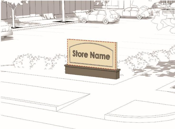
4. Projecting Signs
Maximum Area: Six square feet
Maximum Width: 36 inches
Maximum Height: 36 inches
Maximum Depth: Four inches

Effective 1/15/2019
5.
Maximum Area: Six square feet
Maximum Width: 24 inches
Maximum Height: 36 inches
Exclusion: Sandwich board signs shall not be included in the maximum number of signs allowed on a lot.

Maximum Area: One square foot per linear foot of front building facade
Maximum Depth: Six inches

Sandwich Board Sign
6. Wall Sign
Effective 1/15/2019
H. NON-CONFORMING USES, BUILDINGS/STRUCTURES, LOTS
1. Purpose As required by Section 8-2 of the Connecticut General Statutes, these regulations do not prohibit the continuance of any non-conforming use, lot, building or structure legally existing at the time of the adoption of these regulations or any relevant amendment thereto It is the public policy of the Town, and the intent of these regulations, that the degree of non-conformity in any non-conforming situations be eliminated, as quickly as justice allows
2. General Rule Concerning Change of Non-conforming Situation to Conform. Once a non-conforming situation, or any portion thereof, has been changed so that it conforms to these regulations, that situation or portion thereof shall not revert to or again become non-conforming.
3. Change of Non-conforming Use The Commission shall determine whether a non-conforming use has changed such that its status is altered from a non-conforming use to an unlawful use. In determining whether an activity represents such a change in non-conforming use, consideration shall be given to the following three factors:
i. The extent to which the new use reflects the nature and purpose of the original non-conforming use;
ii. Any difference in the character, nature and kind of use involved;
iii. Any substantial difference in effect upon the surrounding area resulting from the differences in the activities conducted on the lot.
4. Enlargement of Buildings Containing a Non-conforming Use. A building containing a non-conforming use in a residence district shall not be enlarged in total floor area or volume, except as approved by the Commission in accordance the following standards and requirements:
i. The Commission shall find that the proposed enlargement will not have significant additional adverse impact upon the surrounding land uses and the neighborhood
ii. The applicant shall provide a statement from the assessor or copies of the assessor's records documenting that the building has not been expanded since the date it became non-conforming Where the building was previously expanded the applicant shall document that the expansion was approved by the Town and the total floor area of the expansion does not exceed 25% of the total floor area of the building which is devoted to the nonconforming use.
iii. The total floor area of the enlargement shall not exceed 25% of the total habitable floor area legally dedicated to the non-conforming use at the time it became non-conforming (including any previously granted approval for expansion).
iv. Enlargements shall be allowed only to an existing building containing a non-conforming use No new building or structure containing a non-conforming use shall be permitted.
v. The total maximum building coverage of the lot with the enlargement shall not exceed 25% of the total lot area.
vi. Only portions of the building or structure that meet the yard and set back and other dimensional requirements of these regulations shall be eligible for a variance and the location and dimensions of the enlargement shall conform to the requirements herein.
vii. Off-street parking spaces meeting the requirements of these regulations shall be provided on the lot.
5. Enlargement or Additions No non-conforming building or structure shall be altered, enlarged or extended in any way that increases the area or space of that portion of the building or structure which is non-conforming This prohibition includes but is not limited to second-story additions or similar additions to the height or bulk of that portion of a building which is non-conforming.
6. Change to a Non-conforming Sign. A non-conforming sign is a sign existing prior to the effective date of these regulations (or pertinent amendment thereto) which does not meet the size, height, location, lighting or other requirements of these
Effective 1/15/2019
regulations. A non-conforming sign may be continued or repaired provided such repair does not result in an increase in the area of such sign or otherwise increase its non-conforming condition. Once a non-conforming sign is removed it shall not be reestablished Where the commission approves a change from one non-conforming use to another non-conforming use the new use may continue to utilize the existing sign space. A change in the location of sign space may be permitted by the Zoning Board of Appeals only where there is a reduction of the existing sign area and where, in the opinion of the Zoning Board of Appeals , the proposed signage will be more suitable for the lot and for the surrounding neighborhood.
7. Improvements and Repair. A non-conforming building or structure may be improved, repaired or reconstructed as made necessary by wear and tear or deterioration, however substantial improvements to buildings or manufactured homes in the FP-O district shall be subject to the requirements of the district.
8. Casualty Any non-conforming building or structure which has been damaged or destroyed by fire, flood, explosion, act of nature or public enemy may be restored and used in the manner in which it exists and was used prior to such damage. Any such restoration within the FP-O district shall meet the standards and conditions for said district
9. Changes While Permit is Open. Nothing in this section shall require any change in the plans, construction, or designated use of a building for which a building permit has been issued in accordance with these regulations, provided construction commences prior to the adoption of these regulations or any relevant amendment thereto, and is completed within one year of adoption of same.
10. Abandonment of a Non-conforming Use. The continuance of any non-conforming use, building or structure existing at the time of the adoption of such regulations shall not be prohibited. A non-conforming use shall not be terminated solely as a result of nonuse for a specified period of time without regard to the intent of the lot owner to maintain that use Whenever a non-conforming use of land, building or structure or any portion thereof, has been abandoned, such nonconforming use shall not thereafter be reestablished and all future use shall be in conformity with these regulations.
The Litchfield Zoning Regulations SPECIFIC STANDARDS AND REQUIREMENTS
Effective 1/15/2019
SPECIFIC STANDARDS AND REQUIREMENTS
See Table of Contents
Effective 1/15/2019
A. ACCESSORY BUILDING, STRUCTURE OR USE
An accessory building, structure or use is one subordinate and customarily incidental to the principal building, structure and/or use on the same lot. Accessory structures include barns, pool houses, swimming pools, maintenance sheds, personal stables, detached garages, and solar array.
B. ACCESSORY APARTMENT
A dwelling unit separate from but associated with the principal residential dwelling may be permitted by the Commission as a Special Exception if it meets all of the following requirements:
1. There may only be one accessory dwelling unit per lot and the owner of the lot shall reside on the lot.
2. There shall not be more than 2 bedrooms per dwelling unit.
3. The minimum habitable floor area shall be 500 square feet.
4. The maximum habitable floor area shall be no greater than 35% of the total habitable floor area of the principal residential dwelling on the lot.
5. May be located in the rear yard only.
6. An accessory apartment may be permitted in the principal residential dwelling provided that any proposed addition shall be to the side or rear and that the addition shall blend in with the principal dwelling and maintain its exterior appearance as a single family residence.
7. A total of at least three off-street parking spaces shall be provided for the use of the principal residential dwelling and the accessory apartment.
8. Parking spaces shall be screened from public view and located in the rear yard.
9. An accessory apartment may be located in an accessory building existing prior to August 12, 1988, where documentation is submitted certifying that the accessory building was in existence on August 12, 1988, and the accessory building is located within 75 feet of the principal residential dwelling, or the accessory building is located greater than 75 feet from the principal residential dwelling and the lot is subject to a deed restriction preventing subdivision or re-subdivision of the lot during the time that there is an accessory apartment in the accessory structure.
10.An accessory apartment may be located in an accessory building constructed after August 12, 1988, provided that the accessory building meets the front, side and rear yard requirements for the district.
11.The maximum habitable floor area for an accessory apartment in an accessory building may be increased by not more than 50% of the total habitable floor area of the principal dwelling where:
a. The lot area is more than 4 times the minimum required lot area for the district, or a minimum of 10 acres, whichever is less, and the applicant demonstrates to the satisfaction of the Commission that either of the following apply:
i. the lot is capable of being divided into separate lots for the principle dwelling and the accessory building in accordance with the requirements of these regulations for the district in which said lot is located;
ii. the lot is subject to a deed restriction preventing subdivision; or
iii. no resubdivision of the lot may take place during the time that there is an accessory apartment in the accessory structure.
STANDARDS AND REQUIREMENTS
Effective 1/15/2019
12.The accessory apartment shall have its own outside access to the parking area, and shall be equipped with its own kitchen, bath and utility services. The Regional Health District shall certify that the existing or proposed modified subsurface sewage disposal system is adequate to serve the proposed use. The apartment may utilize the existing sanitary system on the lot, if approved by the Health District. The Health District may require a complete new sanitary system, if the existing system is inadequate for the proposed use or if insufficient data is available concerning the nature of the existing system.
13.The Special Exception shall become null and void if the owner does not reside on the lot. A change in the ownership of a property with an accessory apartment will require approval by the Zoning Enforcement Officer and issuance of a written permit for lawful occupancy of the apartment. As part of the permit, the Zoning Enforcement Officer may require an affidavit to verify that the owner is in residence.
C. AFFORDABLE HOUSING/TOWN SPONSORED/NON-PROFIT
The affordable housing/town sponsored/non-profit use is a Special Exception in all residence districts. The purpose of this Special Exception is to provide the opportunity for Town or non-profit sponsored affordable housing in suitable locations according to a site design that is compatible with the rural and historic character of the Town and the neighborhood. New construction consisting of multi-family units or multi-family units mixed with two-family and/or single-family units and associated parking or other common facilities located on a single lot are permitted by Special Exception.
1. Eligible Applicants. Applicants or co-applicants for this Special Exception shall be limited to the following:
a. The Town of Litchfield or a Town authorized housing agency, such as the Litchfield Housing Authority, or;
b. A Community Housing Development Corporation meeting the requirements of the Connecticut General Statutes, Section 8-217, as amended, or;
c. A local non-profit organization which has qualified for tax exempt status as a charitable organization by the IRS pursuant to the federal tax code and is certified by the Board of Selectmen as able to carry out the proposed affordable housing.
2. Guarantee - Affordable Housing Purpose. The applicant shall provide documentation of legally binding measures guaranteeing that the housing will remain affordable as defined in the Connecticut General Statutes, Section 8-39a, as amended.
3. Water and Sewer Service. All dwelling units shall be served by a public water system approved by the State Department of Health Services and/or the Torrington Area Health District and public sewer facilities approved by the Litchfield Water Pollution Control Authority with the following exceptions.
a. On-site water service may be permitted where the applicant proposes multiple dwelling units for affordable housing on a site provided the application:
i. Is designed according to cluster or conservation development principles;
ii. Documents to the satisfaction of the Commission that the site has the capacity to provide the projected water needs of the units based upon test wells; and
iii. Includes a stipulation that no Certificate of Zoning Compliance shall be issued for a residential unit on the site unless the Torrington Area Health District has approved the quantity and quality of the on-site water service to the residential unit.
b. On-site septic sewer service may be permitted where the applicant proposes multiple dwelling units for affordable housing on a site provided the application:
i. Is designed according to cluster or conservation development principles;
Effective 1/15/2019
ii. Shows that each residential building on site is served by an individual on-site septic tank and leaching field system with a capacity not exceeding 2,000 gallons per day which is subject to the review and approval of the Torrington Area Health District; and
iii. Documents to the satisfaction of the Commission that the site and septic plans will provide for the long term sewer treatment needs of the development. The application shall include detailed plans for on-site septic system sewerage service prepared by an engineer licensed by the State of Connecticut. Plans shall provide adequate reserve septic field locations, which shall be kept open and undeveloped. The Torrington Area Health District shall provide a report to the Commission submitted with the application finding that the septic design plans meet its requirements. The application shall include a plan providing for the proper operation and maintenance of the on-site sewer service system.
4. Minimum Yard, Maximum Coverage, Maximum Height and Buffer Requirements. Maximum lot width shall be as required for the district in which the lot is located. All building and parking areas shall be setback from lot lines a minimum distance as required for the front, side and rear yard for the district in which the lot is located. All building and parking areas shall cover no more than the maximum percent of lot coverage as required for the district in which the lot is located. Buildings shall not exceed the maximum building height as required for the district in which the lot is located.
5. Site Within or Abutting Single Family Residence District. Where an application involves land within or abutting a single family residential district the application shall demonstrate that any new construction shall blend with the surrounding residences and neighborhood by use of building form, height, material and landscaping. Where the Commission determines that the proposed new construction does not meet the above standard, the applicant shall be required to submit a landscape buffer plan prepared by a Connecticut licensed landscape architect meeting the following requirements. Where the site's lot line abuts a residential district, the required setback area (see above) along the lot line shall be landscaped with evergreen shrubs or trees, or such evergreens in combination with embankments, fences and/or walls, so as to provide a screen and transition from the lot to the residential district. Suitable natural terrain and existing evergreen trees and shrubs may be preserved, or augmented with new planting, to satisfy the landscape requirement in the setback area. All portions of the lot not covered by buildings, other structures, outside storage or paved areas shall be landscaped with trees, shrubs, lawns or other suitable landscaping.
6. Minimum Lot Area and Maximum Number of Dwelling Units on a Site
a. Maximum Lot Area: The lot shall be of a size, shape and terrain adequate to accommodate the proposed number buildings and dwelling units and shall be in conformity with the following requirements for maximum number of dwelling units on a site. In no case shall the size of the lot be less than the minimum required in the district in which the site is located.
b. Maximum Number of Dwelling Units on a Site:
i. Purpose. The purpose of this requirement is to establish a reasonable maximum number of dwelling units permitted in consideration of the proposed site's development limitations.
ii. Requirement. The maximum number of "dwelling units" permitted on a site shall be four for each 40,000 square feet of "usable site area".
7. Parking Requirements
a. Each dwelling unit shall have two off-street parking spaces.
b. Parking spaces in an enclosed garage shall count toward this requirement only where a deed restriction or covenant or other legally binding measure limits the use of the garage space to parking.
8. Access and Other Improvements. All improvements (accessory, drainage, parking, erosion and sediment control, etc.) shall be designed by a professional civil engineer as follows:
STANDARDS AND REQUIREMENTS
Effective 1/15/2019
a. Construction plans shall be prepared in accordance with the specifications for a Construction Plan as set forth in the Subdivision Regulations.
b. The access way shall have a paved width, grade and alignment suitable for the number of proposed dwelling units and for safe access by emergency vehicles.
c. The Commission shall refer all applications for review and comment by the Volunteer Fire Department and the Fire Marshal.
D. BED & BREAKFAST
Lodging rooms for paying transient visitors located in a residential dwelling that meets all of the following requirements:
1. The owner of the principle dwelling resides on the lot housing the bed and breakfast use.
2. The lot shall be large enough to provide additional parking at the rate of one space per guest room, screened from public view and located in the rear yard.
3. The applicant must show that the structure is suitable to accommodate guest rooms based upon its interior arrangement, size and structural condition.
a. No more than three guest rooms rated for double occupancy are permitted in a structure in which the owner is in full time residence.
b. Full bathrooms shall be provided at the rate of one per two guest rooms.
c. The Regional Health District shall certify that the existing or proposed modified subsurface sewage disposal system is adequate to serve the proposed use. A complete new sanitary system may be required if the existing system is inadequate for the proposed use or if there is insufficient data concerning the nature of the existing system.
4. Minor additions may be made to a structure, up to 200 square feet, for improvements necessary for such occupancy.
5. The length of stay shall not exceed three days per guest. Food service shall be limited to continental breakfast only.
6. The operation of a "Bed and Breakfast" use shall require a written permit. This permit will be issued by the Land Use Administrator following approval of a Special Exception by the Commission. The permit will be effective for a two year period, and must be renewed for additional two year periods. Willful failure to abide by these regulations is cause for the Commission to revoke the permit.
E. CAR WASH
A car wash may be permitted subject to the following conditions:
1. The Special Exception application shall include a statement of use with the following information:
a. The application shall include a statement of use including proposed hours of operation, plan for staffing during all hours of operation, vehicle cleaning plan of operation, security, upkeep and maintenance of the site; monitoring of lights and noise control, observance of hours of operation, compliance with environmental safeguards, including water-use conservation measures; and onsite traffic and stacking control to prevent back-ups into public rights of way.
b. Projected business volume by season and by hours of operation.
c. Calculations of stacking requirements.
d. Detailed description of vehicle washing machinery and equipment proposed including any tanks.
Effective 1/15/2019
e. Environmental conservation plan including best management plan as required by the Connecticut DEP. This plan will describe wash procedures including water recycling, provisions for removal of sludge, and a description of waste water processing equipment and its efficiency.
2. The building and car wash system shall be limited to motor vehicles registered for use on a public road and the building and automation equipment shall not be designed to serve buses and other similar oversized vehicles. The Commission may limit the hours of operation to be consistent with standard business hours of surrounding businesses.
3. The car wash, including washing facilities, shall be served by a public water and sewer system and meet the requirements of the Groundwater Protection section, and shall provide for reasonable and feasible water conservation measures.
4. Adequate off road stacking space shall be provided for vehicles waiting for car wash service. The number of spaces shall be projected by the applicant and shall consider the time to complete a wash cycle.
5. Off-street parking shall be provided and all vehicle use areas on the site (stacking, parking, cleaning, etc.) shall be paved.
6. There shall be sufficient on-site vehicle stacking spaces to adequately serve customer demand and prevent vehicle backups into the adjoining public right of way; stacking space shall be provided calculated based on cycle times of the planned equipment providing a minimum of 26 feet of stacking space per vehicle, a minimum of 10 stacking spaces and a maximum based on site location and cycle times. The Commission may limit the number of stacking spaces and shall require that no vehicle shall be permitted to stack in a public right of way.
7. The facility shall be designed to reduce carry off or drag off of water onto a public street; vehicle washing shall be limited to inside the building with the exception of pre wash treatments applied immediately prior to entering the building.
8. All car wash apparatus (including vacuum stations) shall be enclosed or screened from adjacent streets and properties where the Commission deems appropriate to protect neighboring property values.
9. Site Plans shall be submitted with the application including a lighting plan, landscape plan prepared by a licensed landscape architect, a signage plan which may include on-site directional signs.
10.Architectural plans, elevations and renderings of the proposed building and landscaping shall be submitted in sufficient detail to determine compliance with these requirements.
11.Such plans shall demonstrate that the car wash building and other buildings on the site:
a. Incorporate façade design features in keeping with the character of the business neighborhood and historic character of the community.
b. Are capable of adaptive re-use to other uses permitted in the district.
12.A primary purpose of the landscape plan shall be to buffer the view of the building and pavement from the highway. It shall include a landscaped strip of not less than 20 feet along the entire frontage of the site. The landscape plan shall be consistent with the Guideline 4.4 and, where a berm is appropriate, Guideline 5.2 as stated in the Litchfield Treescape Plan, August 1998. Access way locations shall consider and utilize wherever possible recommendations of the Litchfield Route 202 Corridor Management Plan
13.The site plan and other design related plans shall be reviewed by the Litchfield Design Review Advisory Committee.
Effective 1/15/2019
F. CONSTRUCTION TRAILERS
Trailers used for business, office, and storage purposes in connection with a bonafide construction operation within the Town may be used for such purposes in any district for a period of time not to exceed the duration of the construction contract.
G. COUNTRY INN
A facility having ten or less guest rooms in which lodging is offered for compensation and meals for guest lodgers only may be offered that meets the following requirements:
1. The minimum lot area shall be five acres. The total area of impervious surfaces on the lot shall not exceed 15% of the total area of the lot. (For the purpose of this section of the regulations impervious surface shall include the footprint of any building and the area of any paved parking areas. The total area of the lot shall not include inland wetlands and watercourses area as defined on the Litchfield Inland Wetland and Watercourse Map.)
2. Modifications or additions proposed to accommodate the use of the structure as a country inn shall not exceed 50% of the total habitable floor area of the existing structure.
3. All parking areas shall be screened from view from surrounding residences. Parking shall be located to the side and rear of the structure, wherever possible. No parking shall be located within 50 feet of the front line or 25 feet of a side or rear lot line.
4. If a Special Exception is required, the applicant shall notify all lot owners within 1,500 feet of the lot boundaries.
5. No separate commercial use other than that related to food, beverage and transient accommodations shall be permitted.
6. A residence or structure in existence at the time of the adoption of these regulations may be converted for use as a country inn with meals offered for compensation to guest lodgers and the public, so long as the following conditions are satisfied:
H. COUNTRY INN/RESTAURANT
A residence or structure in existence at the time of the adoption of these regulations may be converted for use as an Inn/Restaurant, subject to the following limitations and standards:
1. The minimum lot area shall be five acres.
2. The lot shall be frontage on a State highway and the primary vehicular access to the inn/restaurant shall be from a State highway.
3. The number of guest rooms within the existing structure shall be limited to ten; however this maximum may be increased by an addition to the existing structure or by construction of a new building (for guest room use only) where the applicant can demonstrate that:
4. The addition or new construction is in keeping with the size, scale and appearance of the existing structure, and the size, shape, topography and landscape of the lot is such that the addition or new structure will be in a location which will blend in with the physical character and visual appearance of existing development on the lot, the surrounding neighborhood and the historic character and rural environs of the community. A residence or structure in existence at the time of the adoption of these regulations may be converted for use as an inn/restaurant.
I. CONVALESCENT HOME/NURSING HOME
A residence for the aging, sick, whether temporary or permanent that meets the following requirements:
Effective 1/15/2019
a. The minimum lot area shall be five acres.
b. The facility shall be served by a public water system approved by the State Department of Health Services and public sewer facilities approved by the Litchfield Sewer Commission.
c. The lot shall be of such a size and shape that a 300 foot in area square can be located within the lot boundaries.
d. The minimum setback distance for all buildings and parking areas shall be 100 foot from a State Highway right-ofway and 75 feet from a Town street right-of-way and 50 feet from all other lot lines.
e. The total lot coverage of the footprint of all buildings on the lot shall not exceed 10% of the total lot area.
f. The total floor area of all buildings on the lot shall not exceed 20% of the total lot area.
g. The total ground coverage by all buildings and other structures, outside storage area, areas for off street parking, loading, and driveway and all paved areas on the lot shall not exceed 30% of the total lot area.
h. A landscape plan for the lot prepared by a landscape architect, licensed to practice in the State of Connecticut, shall be submitted as part of the Special Exception application. All portions of the lot not covered by buildings, other structures, outside storage or paved areas shall be suitably landscaped with trees, shrubs, lawns or other suitable landscaping. Areas not disturbed by filling, grading, excavation or other construction activity, may be left as natural terrain when having a location, size and shape that supports the landscaping plan for the lot. Where the lot abuts a residence district the required setback area (see 4 above) along the lot boundary line shall be landscaped with evergreen shrubs or trees, or such landscaping in combination with embankments, fences and/or walls, to provide a screen and transition from the site to the residence district. Suitable natural terrain and existing evergreen trees and shrubs may be preserved or augmented with new planting to satisfy the landscape requirement in the setback area.
J. FARM
A tract of land used for commercial purposes as defined in Connecticut General Statutes 1-1(q) to produce agricultural, aquaculture, horticultural, floricultural, vegetable, tree or fruit products, and also including the raising, caring for, and training of horses and other livestock, but excluding the slaughtering of animals not raised on the lot. The term farming includes farm buildings and accessory farm buildings and structures and uses that are incidental to the normal farm operations. A farm shall meet all of the following requirements:
1. With the exception of dwellings and farm stands, all farm-related buildings and structures shall be located not less than 100 feet from any street line and 100 feet from any dwelling on an adjacent lot. This requirement shall not restrict the location of fencing for pastures. One sign of up to 10 square feet shall be permitted.
2. Commercial slaughtering is not permitted with the exception of animals raised on the lot.
3. No zoning permit shall be required for a temporary moveable farm stand provided that all of the following requirements are satisfied:
a. it is set up and used only for the sale of farm produce in season;
b. the produce has been grown on the lot; and
c. the stand is no greater than 100 square feet in surface area and is located not closer than 20 feet of the street pavement or travel way.
4. A temporary, moveable stand set up for the sale of local and Connecticut-grown products in season may be permitted as an accessory use to the principal commercial use of a lot subject to approval of a site plan application. The site plan application shall provide for sufficient parking and circulation for both the principal and accessory use.
Effective 1/15/2019
K. FARM STAND, PERMANENT
A permanent structure, or a part of an existing structure, associated with a farm for which a site plan has been approved by the commission for the display or sale of Connecticut-grown farm products substantially all of which are grown on the farm that meets all of the following requirements:
1. Shall be subject to all applicable setback requirements in the district in which it is located.
2. A minimum of one off-street parking space consisting of a dustless surface shall be provided for each 50 square feet of farm stand floor area. The Commission may require additional parking spaces where it determines it is necessary. The applicant may be required to show on the site plan a suitable area for future parking spaces. This area shall be open and adequately drained and may be maintained with a grass surface.
3. The floor area of a permanent farm stand shall not exceed 300 square feet. The Commission may approve a standalone farm stand or a farm stand within an existing building with a total floor area greater than 300 square feet upon the issuance of a Special Exception.
4. A permanent farm stand may be established within a barn or other similar building designed and used for farm purposes upon the issuance of a Special Exception.
L. FARM STAND, TEMPORARY OFF-SITE
A temporary, moveable stand set up for the sale of local and Connecticut-grown products in season may be permitted as an accessory to a commercial use on a lot subject to site plan approval. Such a stand may be permitted where there is sufficient parking and circulation for both uses.
M. FARM STAND, TEMPORARY ON-SITE
No zoning permit shall be required for an on-site temporary moveable farm stand provided that:
1. It is set up and used only for the sale of farm produce in season;
2. The produce has been grown on the lot; and
3. The stand is no greater than 100 square feet in surface area and is located not closer than 20 feet of the street pavement or travel way.
N. FARM WINERY
Any premises on which fruit is grown and wine/wine products are manufactured, stored and sold, meeting the permit requirements of Connecticut General Statutes §30-16 (as amended) and applicable definitions and guidance of Title 22 (as amended) of the Connecticut General Statutes and shall meet all of the following conditions:
1. All refuse areas shall be screened from view offsite and subject to all setbacks required for the district and a minimum of 100 feet from any dwelling on an adjacent lot.
2. One projecting sign up to ten square feet shall be permitted.
Effective 1/15/2019
3. A farm winery is a specific type of farm use and the following activities are recognized as a normal part of a farm winery use and are therefore allowed as a Permitted Use:
a. Retail sale of wine produced at the farm winery and related items;
b. A tasting room;
c. Wine sales by glass or bottle;
d. Artist receptions and temporary artists exhibitions;
e. Wine related seminars/meetings;
f. Wine tastings; and
g. Group visitations for the above purposes.
O. FARM WINERY ACCESSORY
All other activities beyond those listed in “Farm Winery” above, shall require a special exception as an accessory use by the Commission. Such activities are to be complementary and subordinate to a farm winery principal use. These farm winery accessory activities may be permitted as a Special Exception provided the following conditions and all other special exception requirements are met:
1. Site access, parking, and circulation criteria shall conform to the provisions of these regulations.
2. In completing the requirements of the special exception application, the applicant shall submit a written request to the Town’s fire marshal for comment on the suitability of any emergency access and fire protection provisions that are to be established in connection with the proposed use. A copy of such written request shall be submitted to the commission for its approval as part of the special exception application.
3. All refuse areas shall be screened from view offsite and subject to all setbacks required for the district and a minimum of 100 feet from any dwelling on an adjacent lot.
4. One sign up to ten square feet shall be permitted.
P. GREENHOUSE/NURSERY, COMMERCIAL
The retail display and sale of produce grown on the lot or the retail display and sale of flowers and floral arrangements whether or not grown on the lot that shall meet all of the following requirements:
1. The lot shall meet the frontage requirement of the district in which it is located. All structures shall be located not less than 100 feet from the street line and 100 feet from any dwelling on an adjacent lot. The side yard setback shall be not less than 50 feet for all buildings, parking areas and driveways.
2. Parking spaces shall be located to the rear and the side of the sales building and may be required to be screened from view from the road. The number of parking spaces required shall be the same as any large retail use.
Q. HOUSING FOR ELDERLY OWNED BY A NON-PROFIT CORPORATION
Housing for the elderly when owned by a non-profit corporation may be permitted subject to the following conditions:
1. The requirements of the MF district shall be complied with subject to the following exceptions:
a. Off-street parking shall be provided at a rate of not less than one space for each two dwelling units.
b. No site shall contain more than eight dwelling units for each 40,000 square feet of usable land area or fraction thereof.
Effective 1/15/2019
2. At least 350 square feet of habitable area for each single occupancy (efficiency) dwelling unit shall be provided.
3. At least 450 square feet of habitable area for each double occupancy (one bedroom) dwelling unit shall be provided.
R. HOUSING FOR ELDERLY OWNED BY A FOR-PROFIT CORPORATION
Housing for the elderly when owned by a for-profit corporation may be permitted provided it complies with the requirements of the MF district and each building consists of at least three dwelling units per building, but not more than 12 units per building.
S. HOME OCCUPATIONS
A home occupation, which shall include a traditional home enterprise, shall be allowed as a Special Exception in all districts except the HR-30 district and the MF district, subject to the following standards and criteria:
1. A home occupation use may occupy a portion of a dwelling or an accessory structure on a lot containing a single-family residence as specified herein and as determined by the Commission.
2. A home occupation located in a dwelling shall not occupy more than one-third (1/3) of the habitable floor area of the dwelling. The use shall be clearly secondary to the residential use of the dwelling and shall not change the residential appearance of the lot or the residential character of the neighborhood.
3. The home occupation use may occupy an accessory structure if all of the following apply:
a. The location and appearance of the accessory structure is consistent with the residential character of the lot and the neighborhood;
b. It can be demonstrated that the type and intensity of the proposed use in the accessory structure will not alter the primary residential character of the lot; and
c. Total area of the accessory structure devoted to the home occupation use shall not exceed the habitable floor area of the dwelling.
4. The home occupation use shall be conducted by the owner/resident of a dwelling and by members of the household residing therein One non-resident person may work in the dwelling in association with the home occupation use.
5. There shall be no exterior evidence of the home occupation including signs or off-street parking. A sign may be permitted only upon approval by the Commission.
6. The appearance of the lot and structure on the lot shall not be altered in a manner that would cause the residence to differ from its residential character either by use of materials, construction, lighting, signs or the emission of sounds, vibrations or electrical impulses.
7. There shall be no exterior evidence or storage of goods, supplies or other material associated with the home occupation.
8. There shall be no more than two business-related cars, vans or pickup trucks (or any combinations thereof) permitted on the lot in association with a home occupation use.
9. No on-street parking shall be permitted in association with a home occupation use. Off-street parking shall be provided to accommodate the parking needs of the home occupation, but in no event shall any parking be permitted in a front yard except on a driveway leading to a rear yard.
Effective 1/15/2019
10.The Commission may require a landscape plan which specifies plantings and locations designed to screen the off-street parking from view from a public street or neighbor. A landscape screen shall be required if, based upon site inspection and public hearing testimony, the Commission determines that such a screen is necessary to protect neighboring residential property values and to maintain the single-family residential appearance of the neighborhood.
11.Any home occupation use involving a process or activity which will result in an increase in the volume of water used over that which would be used for normal residential purposes or which may impact ground water quality shall be reviewed by The Torrington Area Health District. It shall be the responsibility of the applicant to provide documentation of the Health District review to the Town Zoning Administrator prior to receiving a home occupation permit.
12.A Special Exception is not required for the following activities in all residence district:
a. No business is conducted on the premises except by mail or telephone.
b. No persons other than members of the family are employed.
c. No external evidence of the business is visible.
d. No business signs are erected.
e. No pedestrian or automobile traffic other than that normally generated by a residence is permitted.
f. No hazardous materials other than those common to a single family residence use, such as fuel associated with onsite heating, are stored, used or disposed of on the property.
13.For the purpose of allow residences to be used for educational purposes to benefit the children as well as the adult of the community and the surrounding area, and recognizing that activities presently occur throughout the Town and provides a mechanism under which they can be monitored by the Zoning Enforcement Officer through issuance of a zoning permit, and not for the purpose of limiting educational instruction in residences in the Town, subject to issuance of a Zoning Permit by the Zoning Enforcement Officer, the use of a residence by the occupant for educational instructional purposes involving non-occupants may be permitted where:
a. No persons other than members of the family are employed.
b. No external evidence of the business is visible.
c. No business signs are erected.
d. Off-street parking for use by the residents and students shall be provided.
e. No more than two non-occupant individuals are receiving educational instruction at one time.
f. Educational instruction may be done for compensation by the occupant or members of the family residing on the premises.
g. Educational instruction shall be construed broadly to include but not limited to, academic tutoring, music lessons, singing lessons, fine arts lessons, test preparations, etc.
h. A permit shall be issued by the Zoning Enforcement Officer, upon application, for the use of a residence for educational purposes involving non-occupants.
i. The permit shall contain the owners name and the nature of the educational purpose.
T. SHOP AND STORAGE USE BY A CONTRACTOR OR TRADESMAN
A shop and storage use by a contractor or tradesman, defined herein as “Contractor/Tradesman Shop and Storage,” which allows for a home shop and storage use for a contractor or tradesman who conducts his trade primarily away from the home who provides a needed local service, including, but not limited to, plumbers, electricians, and carpenters, shall be allowed if approved as a Special Exception The standards and criteria established in this regulation are designed to permit this type of land use in locations and under conditions which will protect neighboring residential property values. The Commission may attach conditions to a Special Exception to assure compliance with these purposes and the following standards and criteria.
Effective 1/15/2019
1. In a residence and/or an accessory structure, such use may occupy a total floor area no greater than the habitable floor area of the first floor of the principal residence; however such use in an accessory structure shall not count in determining maximum floor area.
2. An existing or proposed accessory structure for such use shall be of a size, scale and appearance that maintains the residential appearance of the lot and blends with the surrounding neighborhood structures. The application shall clearly show and the permit shall limit the floor area of the shop and storage use as a condition of the permit.
3. The use shall be conducted within the approved areas of the residence or accessory structure only.
4. The use shall be conducted by the owner-resident of a single-family residence and by members of the family residing on the lot. No more than one non-resident person shall work on the lot in association with the use.
5. Work on the lot shall be clearly secondary to work of the contractor or tradesman off premises.
6. There shall be no display of products or external evidence which suggests a commercial retail use other than a single sign, the type and size of which to be determined by the Commission.
7. There shall be no exterior storage of goods, supplies or other material associated with the use
8. Such use that involves two or more business related vehicles, i.e. car, van, pick-up truck, truck, or trailer, may be permitted provided the lot is in a location where access and egress by said vehicle(s) will not be disruptive to the single family residential neighborhood, such as a location with direct access to a State Highway. In making its decision to permit business related vehicles on the lot, the Commission shall consider the size and type of vehicle(s), the projected number of trips, the access route(s) to the site, the findings from any on-site inspection and the testimony from the public hearing. In an approval for a shop and storage use involving business related vehicles, the Commission may attach conditions limiting the number, size and type of vehicles, the number of trips permitted, the hours of vehicle operation on the site and such other conditions necessary to assure compliance with the general criteria of this regulation.
9. Such uses that pose a major threat to groundwater quality shall not be permitted, and uses involving the storage, use or disposal of hazardous materials shall be permitted only where the Commission has determined that the proposed use will not pose a threat to ground water quality. Such determination shall consider the type of use, the amount and type of hazardous material(s) involved and the adequacy of plans submitted by the applicant for hazardous material use, storage and disposal.
10.Any such use that will increase the volume of water used or which could impact the quality of ground water supply shall be reviewed by the Torrington Area Health District. It shall be the applicant’s responsibility to provide documentation of review by the Health District.
U. KEEPING OF HORSES FOR PERSONAL USE.
Horses may be kept on a lot for their personal use by the owners and/or occupant of the lot subject to the following standards:
1. Horses must be owned by the resident-occupants, and are not for gain, direct or indirect, except that temporary boarding of horses for gain, direct or indirect, is permissible. Temporary boarding shall mean 30 days or less.
2. The minimum lot size for keeping one horse is two acres and an additional one-half acre for each additional horse.
Effective 1/15/2019
3. Stable manure must not create a health hazard from an air and water pollution standpoint to the community in general or the person inhabiting or using the lot, and the stabling of horses shall conform to all regulations of all applicable local and state health authorities. All manure shall be screened so as not to be unsightly from the public right-of-way.
4. Adequate fencing must be installed and maintained to reasonably contain the horses within the lot.
5. All structures shall conform to the setback requirements for the district, except that a stable shall not be closer than 50 feet from a dwelling on an adjacent lot.
6. Temporary buildings or trailers for the stabling of horses may be temporarily located on a lot, which for purposes of this section shall mean 15 days or less.
7. There shall be no storage of supplies outside of permanent buildings, except that the storage of wood chips used in the open is permissible, provided there is no conflict with any of the regulations contained herein.
8. A permit for the keeping of horses shall be issued by the Zoning Enforcement Officer, upon application. The permit shall contain the owner's name, the number of horses to be kept, and the location and area of their quarters.
V. MULTI-FAMILY DWELLING
There shall be not less than three dwelling units in a building or a group of buildings except uses accessory to such multifamily uses. Dwelling units in multi-family dwellings may be owned by a single owner or individually by tenants or both, but the lot shall be held in unified ownership and that shall meet all of the following requirements:
1. No multi-family building shall have more than thirty dwelling units contained therein. Buildings with more than twelve dwelling units shall be varied substantially in plane along the building's length.
2. Garage space or off-street parking space for 1.50 vehicles shall be provided on the lot for each unit.
3. No site shall contain more than four dwelling units for each 40,000 square feet of usable site area. Usable site area shall be defined as land other than regulated inland wetlands and watercourses as defined by the Litchfield Inland Wetlands Regulations and as shown on the Litchfield Inland Wetlands Map, 100 year flood hazard areas as defined by the Federal Emergency Management Agency and as shown on Flood Hazard Areas Maps on file in the office of the Commission, land subject to existing easements which prohibit building or development, and 50% of all land with a slope in excess of 25% as delineated on a site plan map showing topographic contours based upon a field or aerial survey and certified by a Connecticut licensed surveyor.
4. No building shall be less than 20 feet from any other building.
5. Recreation facilities, open spaces, and facilities suitable for active and passive recreation shall be provided to serve the project and shall be so designed and specified that a performance bond may be drawn. Said areas shall be adequately protected from streets, driveways, and parking areas.
6. Main interior walks shall be of sufficient width and construction to serve emergency vehicles and apparatus if a structure is not served by a roadway or parking lot on one side along its length.
7. Each lot line, except street lines, shall be paralleled by a continuous buffer strip at least 15 feet wide, planted with a mixture of evergreen and deciduous shrubs and trees, which shall be maintained in order so as to protect adjacent lot and the neighborhood in general from detriment.
Effective 1/15/2019
8. All multi-family dwellings shall be connected with a municipal sewer system or with a private sewage disposal system approved by the Connecticut State Department of Health.
9. Each property line, except street lines, shall be paralleled by a continuous buffer strip at least fifteen feet wide, planted with a mixture of evergreen and deciduous shrubs and trees, which shall be maintained in order so as to protect adjacent property and the neighborhood in general from detriment.
10.The Commission may vary the requirements for spacing between buildings and building height if it determines that such variation will enhance the design of the project and give equal or better light, air, and privacy to apartment dwellers.
11.A Site Plan prepared in accordance with these regulations shall be submitted and approved by the Commission before any building structure, parking lot, sign, land, or use is constructed, built or substantially altered in an MF district. The Zoning Enforcement Officer shall not issue a Certificate of Zoning Compliance for construction in an MF district unless a site plan for said construction has been duly approved.
W. NON-RESIDENTIAL DEVELOPMENT IN RESIDENCE DISTRICTS
The purpose of this section is to provide site design standards which will protect residential property values and the appearance of residential neighborhoods. This is accomplished by establishing site design standards to control new and especially large non-residential uses requiring building location and site design that is in scale with the surrounding residential uses and blends with the natural terrain of the site. The following site design standards shall be in addition to any other applicable zoning requirement. These standards shall apply in the residence districts to all buildings and accessory structures associated with any permitted use or Special Exception use with the following exceptions:
a. Buildings and accessory structures designed or intended for residential dwelling purposes.
b. Buildings and accessory buildings and structures designed and intended for farm use.
For the purpose of this sub-section the term "existing" shall be defined as the non-residential buildings or structures of a lot existing on July 6, 1992 - the original effective date of this section of these regulations.
1. The applicant may choose and apply only one of the following formulas for all building additions:
a. The total floor area of the addition(s) to an existing building(s) shall not exceed 25% of the total floor area of all existing buildings on the lot; or
b. The total building coverage (footprint) of the addition(s) to an existing building(s) shall not exceed 25% of the total building coverage (footprint) of all existing buildings on the lot, provided the total floor area of the addition(s) shall not exceed 35% of the total floor area of all the existing buildings on the lot.
2. The following standards limit the developed portion of a lot and the total floor area of the building(s) on a lot as a percentage of the Total Lot Area. These standards are consistent with the purposes of the Town Plan of Development and the intended scale of development in residence districts.
a. The maximum percentage of total building(s) footprint to the Total Lot Area shall be 10%. (“Building Footprint” is the area within the foundation of a building.)
b. The maximum percentage of total habitable floor area of all buildings to the Total Lot Area shall be 15%.
c. The maximum percentage of all surfaces covered with an impermeable material to the Total Lot Area shall be 25%.
3. Each non-residential building with a building footprint in excess of 4,000 square feet shall be setback from the front, side and rear Lot line by the distance required for the front, side and rear yard for the district in which the building is located, plus an additional 25 feet from the front, side and rear yard line for each 1,000 square feet, or fraction thereof, of building footprint in excess of 4,000 square feet.
Effective 1/15/2019
4. No parking area or internal driveway(s) connecting parking areas shall be permitted within the minimum front, side or rear yards. No above or below ground parking structure shall be permitted.
5. Grading of the site within the required yards shall be kept to a minimum. Where grading is permitted within a required yard the finished grade shall not vary from the original grade before construction by more than 3 percent.
6. Natural stands of trees and shrubs located within the required yards shall be preserved wherever possible. The Commission shall require planting of additional trees and shrubs on the lot to provide a visual buffer between the proposed buildings and structures and any adjacent residentially zoned property and from the street.
X. RECREATIONAL USES (OUTDOOR)
1. Outdoor recreational uses include clubs and other private recreational facilities when not operated for a profit. Commercial recreation facilities may be permitted provided the Commission finds that all external conditions of such use are compatible with other uses in the neighborhood and will not create undue congestion on the streets or depreciate the value of neighboring property and does not involve the internal combustion engine as a significant factor in any area of such use except normal maintenance.
2. Transient summer camping facilities may be permitted subject to approval of plans showing location of all camp sites and details of access and provisions for drinking water and sanitary/solid waste disposal and all other requirements herein.
Y. RESIDENTIAL USE IN A BUSINESS BUILDING
1. A business building containing a residential use shall be capable of being altered, remodeled or rehabilitated to accommodate habitation in a safe and healthy manner.
2. The lot area shall be sufficient to meet the parking requirements of the principle business use, plus one parking space for each apartment unit either on the site or in regulated parking area within 200 feet.
3. An apartment unit shall contain at least 500 square feet and shall be equipped with its own kitchen, bath, and utility services, and connected to the public sanitary sewer.
4. The apartment shall have its own outside access convenient to parking and access to the lot. Units located on upper floors shall have at least one access to ground level for the exclusive use of the apartment. Fire escapes shall be located only on the rear or side of the building.
5. In the Historic Town Center residential use in an existing business building is permitted by Special Exception provided the total floor area of the residential use shall be secondary to the total floor area of the business use and subject to all of the above requirements.
Z. STABLE, COMMERCIAL
A stable where horses are kept for profit or gain, including, but not limited to, boarding horses, riding instruction or renting of horses, riding academies, livery and boarding stables, animal and convalescent stables, rental and hacking stables, private club riding stables, only upon the granting of a special permit after a public hearing, and providing all of the following standards or conditions are met:
1. Any barns, riding rings, corrals and accessory facilities shall be contained within one lot of suitably drained land consisting of at least ten acres.
Effective 1/15/2019
2. Sufficient off-street parking facilities should be provided to accommodate all users and visitors to the lot, including spectators for horse shows or similar events. The roads for entering and leaving the lot shall not be located or placed in a manner to create pedestrian or vehicular traffic hazard on the public street or highway. There shall be one off-street parking space for each five users of, or visitors to, the lot, including spectators for horse shows or similar events.
3. Stable manure or hazardous materials utilized or stored must not create a health hazard from an air and water pollution standpoint to the community in general or the persons inhabiting or using the surrounding acreage, and therefore, the stabling of horses shall conform to all regulations of Local and State Health Authorities. Toilet facilities shall be provided for in accordance with local health requirements for normal operations as well as for horse shows and similar activities. If the Commission determines that the proposed activity may pose a threat to groundwater, the Commission shall require appropriate provisions to prevent groundwater contamination in accordance with the groundwater protection requirements in these regulations.
4. Adequate perimeter fencing shall be installed and maintained to reasonably contain the horses within the lot.
5. Fire control facilities for the barns, buildings and other facilities used for normal operations as well as for horse shows and similar activities shall be acceptable to the fire marshal.
6. The use of public address systems, the conduct of the instruction of rider, training of horses and the spectator participation in competitions, should be modulated and continuously controlled in order to avoid becoming a nuisance to surrounding neighbors as determined by the Commission.
7. No building or manure pit used for or in conjunction with the operation shall be located in a manner that any part thereof shall be less than 100 feet from the nearest line of any road, street or highway abutting the lot or any side and rear lot line. Riding rings and corrals shall not be within 50 feet of any residential use.
8. The use of temporary buildings or trailers for the stabling of horses in excess of 15 days is prohibited.
9. The area should be landscaped so as to harmonize with the character of the neighborhood. The land shall be so maintained that it will not create a nuisance as determined by the Commission. The manure storage area shall be so screened that it will not be unsightly. There shall be no storage of supplies outside of permanent building, except that the storage of wood chips used in the open is permissible, provided there is no conflict with Paragraph c above.
10.There shall be no external flood lighting which is objectionable, either due to brightness or to direct transmissions outside of the lot where it originates, as determined by the Commission.
11.The Commission may require the posting of a bond to guarantee the cost of construction and improvements.
AA.PUBLIC UTILITY FACILITIES
Any public utility facility subject to local zoning authority in accord with Connecticut General Statutes Section 16-235 shall require a Special Exception. This includes any steam plant, gas plant, gas tank or holder, water tank, electric substation, antenna or earth station receiver of any public service company where such facility is not subject to the jurisdiction of the Connecticut Siting Council.
1. Special Exception Criteria and Standards for all Utility Facilities:
a. Wherever possible public utility facilities shall be located in the RC district. Where a public utility facility is proposed in a residence district the applicant shall provide documentation that the facility is not feasible or suitable for location in the RC district.
REQUIREMENTS
Effective 1/15/2019
b. The applicant shall demonstrate that the location and size of the proposed site was selected to minimize the visual impact of the proposed facility on surrounding residential areas.
c. The site plan for all public utility facilities shall include all of the following: (i) landscape plan prepared by a registered landscape architect which shall show how the facility will be screened from surrounding residential uses to the extent feasible in consideration of the height of the facility; (ii) existing tree scape and other natural features to be preserved to screen the view of the facility from public streets and surrounding residential areas.
2. The minimum lot size for an electric substation in a residence district shall be three acres. Yard requirements shall be as provided for in the residential district in which the facility is located. Front, side or rear yard shall not be developed or used for equipment or storage.
3. The Floor Area of any water or sewer pumping station shall not exceed 300 square feet.
BB.SPECIAL STRUCTURES: SOLAR HARVESTING FACILITIES
Solar array are allowed as accessory structures subject to the issuance of a zoning permit or approval of a site plan, as applicable in each district.
CC.SPECIAL STRUCTURES: COMMUNICATIONS FACILITIES
1. Purpose and Intent: The following establishes standards and requirements for communication facilities and sites in order to regulate the placement of antennas, towers, and other related facilities in a manner that will protect the Town’s visual quality, safeguard the community and:
a. to require information necessary to evaluate a proposed facility;
b. to establish locations least disruptive to the public health, safety and welfare of the Town and consistent with the Town Plan;
c. to minimize adverse visual effects through proper design, siting and screening;
d. to avoid potential damage to adjacent properties;
e. to minimize the height and number of towers, especially ground mounted towers; and
f. to provide for the orderly removal of abandoned antennas and towers.
2. Use Regulations:
a. Exemptions: The following are exempt from these regulations:
i. Repair and maintenance of towers and antennas.
ii. Antenna(s) used solely for residential household television and radio reception.
iii. Satellite Antenna(s) measuring two meters or less in diameter and located in commercial districts and satellite antenna one meter or less in diameter regardless of location.
b. Permitted Facilities: The following regulated facilities are allowed as a Permitted Use, subject to the issuance of a Zoning Permit:
i. A regulated facility proposed on an existing structure as within a flagpole, steeple, chimney, or similar structure.
ii. A regulated facility proposed on an existing structure including, but not limited to, a guyed, lattice, or monopole tower, fire tower or water tower, provided the installation does not increase the height of the existing structure.
iii. Antenna(s) located on an electric transmission and distribution tower, telephone pole and similar existing utility structure, provided there is no more than a 20 foot increase in the height of the existing structure as a result of the installation. Such 20 foot increase in height shall not be permitted on a utility structure located within the Litchfield Historic District, the Milton Historic District, Northfield center or East Litchfield center as set forth on a map on file in the Planning and Zoning Office or within 150 feet of the pavement of any Town road or State highway proposed for or designated as a Town scenic road or State scenic highway.
Effective 1/15/2019
iv. Building (roof or side) mounts with antenna(s) provided such facility does not project more than ten feet above the building or height limit of the zoning district within which the facility is located. However, such mount may locate on a building or structure that is legally non-conforming with respect to height provided it does not project above the existing building or structure height, or more than ten feet above the height limit of the zoning district within which it is located.
v. A regulated facility intended solely for the purpose of Police, Fire, Ambulance and other Emergency Dispatch, unless it is to be shared by a commercial wireless service carrier, which shall require site plan review.
c. Special Exception Facilities. The following regulated facilities require a Special Exception:
i. Any regulated facility that does not qualify as a permitted use as set forth above; and
ii. All proposed ground mounted towers.
d. General Standards and Requirements for all Permitted and Special Exception Uses:
i. If feasible, regulated facilities shall be located on existing structures, including, but not limited to, buildings, water towers, existing communications facilities, utility poles and towers, and related facilities, provided that such installation preserves the character and integrity of those structures. In particular, applicants are urged to consider use of existing telephone and electric utility structures as sites for regulated activities.
ii. A licensed carrier shall be either an applicant or co-applicant and documentation of qualifications as a licensed carrier shall be provided. Where the application includes a facility regulated by the Connecticut Siting Council, the applicant shall document submission of an application to the Siting Council.
iii. The applicant shall submit documentation of the legal right to install and use an existing structure at the time of application for a Zoning Permit or Special Exception, as the case may be.
iv. Where an antenna or mount is proposed on an existing structure:
(a) For a Permitted Use facility, a plan shall be submitted showing the fall district and the facility shall not pose a safety threat to any surrounding lots.
(b) For a Special Exception facility, a plan shall be submitted showing the fall district and the facility shall be contained within the lot lines and shall not pose a safety threat to any surrounding lots.
v. Ground-mounted equipment for regulated service facilities shall not generate noise in excess of 45 db at the lot line.
vi. Roof-mounted or side-mounted equipment for regulated facilities shall not generate noise in excess of 50 db at ground level at the base of the building closest to the antenna.
3. Standards and Requirements Specific to Ground Mounted Towers:
a. Where a ground mounted tower is proposed, the applicant shall have the burden of proving that there are no feasible existing structures upon which to locate as an alternative to the proposed tower. If the applicant demonstrates to the satisfaction of the Commission that is it not feasible to locate on an existing or approved tower or other structure, the applicant shall provide a camouflaged or stealth tower design for the consideration of the Commission in addition to any conventional design which may be submitted by the applicant.
b. Towers shall be located to minimize the following impacts:
i. Where possible, towers shall be sited to have the least detrimental visual impact to highly rated scenic and historic areas, including ridge lines, properties listed in the State or Federal Register of Historic Places, and scenic roadways.
ii. To the extent possible, siting shall be in as low a population density area as is possible so as to minimize concerns over structural failure or attractive nuisance
iii. Towers shall, when possible, not be sited in Flood Plain Districts or Special Flood Hazard Areas.
iv. The Tower or Personal Wireless Service Facility shall not exceed the Federal Communication Commission (“FCC”) guidelines.
Effective 1/15/2019
v. When possible, towers shall be sited to avoid affecting rare or endangered flora and fauna in areas shown on the Connecticut DEP and Federal Listed Species and Natural Communities Map. They should also be sited, when possible, away from wetland areas.
c. A ground mounted tower in excess of 85 feet in total height located in a residential district shall be:
i. Considered a principal use and shall be the only principal use on the lot;
ii. Located on a lot of not less than two acres in area;
iii. Located on a lot with a size and shape sufficient to completely encompass the tower fall district except as may be modified as permitted herein; and
iv. Shall have a minimum street frontage of not less than 25 feet on a town road. The access drive to the tower site may be located within a right of way. The access drive shall be located within a corridor of land of sufficient width to safely accommodate the drive. The Commission may require that the access drive be landscaped where necessary to screen it from neighboring residential properties.
d. In order to ensure public safety, the minimum distance measured from the base of any proposed ground-mounted communications facility (tower) to any lot line, road, habitable dwelling, business or institutional use or public recreational area shall be the height of the facility/mount, including any antennas or other appurtenances plus 50%. An applicant may request a modification of the requirement that the Tower Fall District be located entirely within its own lot. The Commission may approve such a request where it finds that the alternate location will better meet the purposes of this section and providing the neighboring lot within the Tower Fall District is not developed and will be subject to a legally binding agreement preventing development during the time the tower is in place. In granting a request for such modification the Commission shall consider both the visual and safety impacts of the proposed facility.
4. Application for a Special Exception Facility. All applications for a Special Exception facility shall be filed with the Commission and shall submit the following (the Commission may waive one or more of the above where it determines that such is not necessary to determine compliance with these regulations):
a. Site Plan: A site plan including all of the following:
i. A topographic location map at a scale of 1" = 2,000' showing the location of the proposed facility.
ii. Existing and proposed towers in and outside the Town that would connect or be interconnected with, or "hand off" to the proposed facility.
iii. The boundaries of the tower viewshed (i.e. the area within which the tower can be seen based upon an assessment of the topography surrounding the site).
iv. For ground mounted towers, the applicant shall provide an evaluation of the visual effect of the proposed tower location both within the Town and adjacent towns. Areas of special concern to be addressed in this evaluation shall include, but are not limited to:
(a) The areas identified as existing or proposed open space or preservation areas in the Town Plan, especially land lying within 300 feet of a sub-regional watershed line as shown on maps prepared by the State DEP Natural Resources Center and on file in the Town Hall; and
(b) Areas within the Litchfield and Milton Historic Districts, Bantam borough and Northfield, Milton and East Litchfield center areas.
v. The applicant shall provide an additional copy of the application for a Town(s) located within three miles of the proposed site, and the Commission may submit this copy to the adjacent Town for review and comment.
vi. All lot lines within 300 feet.
vii. Tree cover on the subject lot and within 300 feet, by dominant species and average height, as measured by or available from a verifiable source.
viii. Outline of all existing buildings, including purpose (e.g. residential, etc.) on the subject property and all adjacent lots within 300 feet.
ix. Proposed location of antennas, mount and equipment shelter.
Effective 1/15/2019
x. Proposed security barrier, indicating type and extent as well as point of controlled entry.
xi. Location of all roads, public and private, on the lot and all adjacent properties within 300 feet, including driveways to serve the facility.
xii. Distances, at grade, from the proposed facility to each building on a vicinity plan.
xiii. Contours at each two foot intervals based upon AMSL (see “elevation” definition section) for the subject lot and adjacent lot within 300 feet.
xiv. All proposed changes to the existing lot, including grading, vegetation removal and temporary or permanent roads or driveways.
xv. Representations, dimensioned and to scale, of the proposed mount, antennas, equipment shelters, cable runs, parking areas, and any other construction or development attendant to the facility.
xvi. A sight line representation shall be drawn from any public road and/or building within 300 feet to the highest point (visible point) of the communications facility. Each sight line shall be depicted in profile, drawn at 1" = 40’. The profiles shall show all intervening trees and buildings.
xvii.Each sight line shall be illustrated by one four inch by six inch color photo of the existing conditions seen from any public road within 300 feet.
xviii. Each of the existing condition photos shall have the proposed communications facility superimposed on it to show what will be seen from public roads if the proposed facility is built.
xix. Site elevations, or views at grade from the north, south, east and west for a 50 foot radius around the proposed communications facility plus from all existing public and private roads that serve the subject lot. Elevations shall be at either one quarter inch equals one foot or one eighth inch equals one foot scale and show the following.
(a) Antennas, mounts and equipment shelters with total elevation dimensions and AGL of the highest point.
(b) If the security barrier will block views of the facility, the barrier drawing shall be cut away to show the view behind the barrier.
(c) Any and all structures on the subject lot.
(d) Existing trees and shrubs at current height and proposed trees and shrubs at proposed height at time of installation with approximate elevations dimensioned.
(e) Grade changes, or cuts and fills, to be shown as original grade and new grade line, with two foot contours above mean sea level.
b. Reports: Written reports including the following:
i. Report on Adequate Coverage, Adequate Capacity and Justification of Need for Ground Mounted Tower: A written report prepared by an radio frequency (“RF”) engineer shall address the following:
(a) A description of the service area for each communication system on the tower.
(b) A statement setting forth the rationale and justification for the proposed antenna or tower in the proposed location.
(c) A statement of the signal strength service objectives for each proposed wireless service on the tower.
(d) An analysis for each proposed use demonstrating that the proposed location will provide the required level of service and that other potential collocation sites in the service area will not provide equal or better service.
(e) Documentation that for each proposed use of the tower the proposed antenna height is the minimum necessary to provide adequate coverage.
(f) Demonstration that the service proposed cannot be provided with equipment added to an existing or other proposed antennas or tower.
(g) The applicant shall provide written documentation of all Facility Sites in Litchfield and any Facility Sites outside of Litchfield that are within three miles of the proposed site, in which it has a legal interest, whether by ownership, leasehold or otherwise. From each such Facility Site, it shall demonstrate with written documentation that these Facility Sites are not already providing, or do not have the potential by adjusting the Site, to provide Adequate Coverage and/or Adequate Capacity to the Town of Litchfield. The documentation shall include, for each Facility Site listed, the exact location in latitude and longitude, to
Effective 1/15/2019
degrees, minutes and seconds, ground elevation, height of Tower or structure, type of Antennas, Antenna gain, height of Antennas on Tower or structure, output frequency, number of channels, power input and proposed maximum power output per channel. Potential adjustments to these existing Facility Sites, including changes in Antenna type, orientation, gain, height or power output shall be specified. Radial Plots from each of these Facility Sites, as they exist, and with adjustments as above, shall be provided as part of the Application.
(h) The applicant shall demonstrate with written documentation that it has examined all Facility Sites located in Litchfield and all Facility Sites outside of Litchfield within three miles of the proposed site, in which the applicant has no legal or equitable interest, whether by ownership, leasehold or otherwise, to determine whether those existing Facility Sites can be used to provide Adequate Coverage and/or Adequate Capacity to the Town of Litchfield. The documentation shall include, for each Facility Site examined, the exact location in latitude and longitude, to degrees, minutes and seconds, ground elevation, height of Tower or structure, type of antennas proposed, proposed output frequency, proposed number of channels, proposed power input and proposed maximum power output per channel. Radial Plots from each of these Facility Sites, as proposed, shall be provided as part of the Application.
(i) Distance from Existing or Approved Tower and Use of New Technology: the applicant must certify in writing that existing or approved towers within the proposed service area of the proposed tower do not meet the applicant’s structural specifications or technical requirements or that a co-location agreement could not be obtained. In assessing the potential for co-location, and options for deployment of a tower, the applicant shall provide documentation that is has evaluated all available technology, such as super conducting wireless systems. Where the applicant or the Commission’s engineer determines it would be technically feasible to provide service by locating the applicant’s antenna on an existing or approved tower and a request for colocation has not been approved, the applicant shall provide documentation that it has submitted a request to the Connecticut Siting Council to provide for tower sharing pursuant to Section 16-50aa of the Connecticut General Statutes
(j) The applicant shall demonstrate with written documentation that it has analyzed the feasibility of repeaters in conjunction with all facility sites listed in compliance herewith to provide adequate coverage and/or adequate capacity to the Town. Radial plots of all repeaters considered for use in conjunction with these Facility Sites shall also be provided as part of the application.
ii. A soil report complying with Appendix I: Geotechnical Investigations, ANSI/TIA/EIA-222-G manual standards, as amended, verifying the design specifications of the tower foundation and anchors for the guy wires, if used.
iii. An Environmental Impact and Evaluation of the Site Emissions Report assessing the impact of the proposed tower and site construction and operation assessing its impact on:
(a) Areas designated as conservation or preservation areas in the Town Plan and in the State Plan of Conservation and Development. The following areas on, or adjacent to the site, shall be shown on the Site Plan and discussed in the Environmental Report:
(i) Protected areas.
(ii) All inland wetlands and watercourses.
(iii) Critical habitats for plants and animals.
(iv) Historic structures or sites, unusual features, buildings, monuments, or areas.
(v) Permanently protected lands, such as State park and forest lands, land protected by a land trust.
(b) Site emissions and radio frequency radiation (“RFR”) filing requirements. The applicant shall provide a statement listing the existing and maximum future projected measurements of RFR from the proposed communications facility, for the following situations:
(i) Existing or ambient: the measurements of existing RFR.
(ii) Existing plus proposed facilities: maximum estimate of RFR from the proposed Communications Facility plus the existing RFR environment.
Effective 1/15/2019
(iii) Certification, signed by an RF engineer, stating that RFR measurements are accurate and meet FCC guidelines as specified in the Radio Frequency Radiation Standards sub-section of this regulation.
c. Construction Plan Map: A construction plan map prepared by a Connecticut licensed engineer showing construction and drainage details, including the access road and construction or drainage improvements, including above-ground wires, cables, ducts, utility and signal cables, guying and guy-anchor details.
d. Height Verification Study. A statement from the applicant indicating that, weather permitting, the applicant will raise a balloon with a diameter of at least eight feet, at the proposed ground mounted tower site and to the proposed tower height. Such balloon shall be raised at least three days prior to the date of the public hearing scheduled on the application. A legal notice of the scheduled balloon raising shall be published in a local newspaper. Proof of such publication shall be submitted with the application.
e. Agency List. A list of all federal, State, regional, district, and municipal agencies, which have or will conduct a review of the proposed tower together a copy of any position/decision/recommendation of such agency or board with respect to the proposed facility.
f. Hazardous Materials. An environmental assessment that meets FCC requirements identifying and assessing the impact of the proposed facility on areas recommended for conservation as presented in the town plan and state plan of conservation and development. The applicant shall list location, type and amount (including trace elements) of any materials proposed for use within the facility that are considered hazardous by the federal, state or local governments.
5. Specific Requirements. The following specific requirements shall apply to any application for a communications facility:
a. Landscape and Screening Requirements: For a new tower a fence with a minimum height of eight feet shall be provided. Existing vegetation on and around the site shall be preserved to the greatest extent possible. A planting plan shall be provided to screen building(s), fuel tanks, other manmade structures and as much of the tower as possible. The plan shall show an evergreen screen surrounding the site. This shall be a row of evergreen trees (planted ten feet on center maximum). Evergreens shall have a minimum height of six feet at planting and be a type that grows to a minimum of 15 feet at maturity. The Commission may accept any combination of existing vegetation, topography, walls, or other features that meet or exceed the above evergreen screen requirement.
b. Monitoring and Maintenance:
i. The Commission may require as a condition of the Special Exception that after the communications facility is operational, the applicant shall submit, within 90 days of beginning operations, and at annual intervals from the date of issuance of the Special Exception, existing measurements of RFR from the facility. Such measurements shall be signed and certified by an RF engineer, stating that RFR measurements are accurate and meet FCC Guidelines as specified in the Radio frequency Standards section of this Regulation.
ii. The Commission may require as a condition of the Special Exception that after the facility is operational, the applicant shall submit, within 90 days of beginning operations, and at annual intervals from the date of issuance of the Special Exception, existing measurement of noise from the facility. Such measurements shall be signed by an acoustical engineer, stating that noise measurements are accurate and meet the Noise Standards of the Torrington Area Health District.
c. Federal Environmental Filing Requirements: The National Environmental Policy Act (NEPA) applies to all applications for wireless communication facilities. NEPA is administered by the FCC via procedures adopted as Subpart 1, Section 1.1307 et seq. (47 CFR Ch.1). The FCC requires that an environmental assessment (EA) be filed with the FCC prior to beginning operations for any wireless communications facility proposed in or involving any of the following:
i. Wilderness areas.
ii. Wildlife preserves.
iii. Endangered species habitat.
iv. Historical Site.
v. Indian Religious site.
vi. Flood Plain
The
Litchfield Zoning Regulations
Effective 1/15/2019
vii. Wetlands.
SPECIFIC STANDARDS AND REQUIREMENTS
viii. High intensity white lights in residential neighborhoods.
ix. Excessive radio frequency radiation exposure.
d. Other Requirements:
i. Commercial advertising shall not be allowed on an antenna or tower.
ii. Signal lights or illumination shall not be permitted unless required by the FCC or FAA.
iii. All other uses not clearly necessary to the operation/maintenance of the antenna or tower and associated equipment are prohibited, unless expressly approved as a condition of the permit. Applications shall describe in detail all associated equipment to be maintained or stored on the site.
iv. Not more than one unmanned equipment and/or storage building may be permitted on a site provided it contains no more than 750 square feet of gross floor area and is not more than 12 feet in height.
6. Removal. A communications facility not used for six months shall be removed by the facility owner. This removal shall occur within 90 days of the end of such six month period. Upon removal the site shall be restored to its previous appearance and, where appropriate, re-vegetated to blend with the surrounding area. As a condition of the approval of a demolition permit, the Commission may require a bond in an amount sufficient to cover the cost of completing this requirement.
7. Limitation on Authority to Deny. The Commission may not deny a Special Exception for a wireless communication antenna:
a. if the denial would unreasonably discriminate among providers of functionally equivalent services or prohibit or have the effect of prohibiting the provision of personal wireless services;
b. on the basis of the environmental effects of RFR emissions to the extent such facilities comply with FCC regulations concerning such emissions; or
c. for the collocation of new transmission equipment, the removal of transmission equipment, or the replacement of transmission equipment on an existing wireless communications tower, antenna or any base station that does not substantially change the physical dimensions of such communications tower, antenna or base station.
DD.TOWN LINE STREETS
The Map titled “Streets Located on Town Boundary Lines subject to Article V, Section 29 of the Zoning Regulations” dated March, 1999 (this map shall be maintained on file in the office of the Commission and the map shall be considered a part of this regulation as Appendix B) shows certain areas in the RR district that contain streets located on the Town boundary line. Where a subdivision street or a common driveway is proposed to intersect with a street located on the Town boundary line, a Special Exception must be obtained.
1. In addition to the requirements and procedures for a Special Exception, applications made under this section shall be subject to the following:
2. The applicant shall submit a subdivision plan and record map showing the location of the Town boundary line in reference to the intersection of the public street (pavement and right-of-way) and subdivision street (pavement and right-of-way).
3. The Commission shall refer the proposed subdivision plan and Special Exception application to the Town Engineer and Board of Selectman for review and comment.
4. The Commission may also refer the proposed subdivision plan to the Board of Education for review and comment on access by school busses and to the Volunteer Fire Department for review and comment on access by emergency vehicles
Effective 1/15/2019
5. The Commission shall consider any comments received from the adjacent town.
6. In considering a decision on an application for a Special Exception made under this section, the Commission shall consider the following:
a. The size and scope of the proposed housing development;
b. Whether Town services can adequately be provided to the proposed subdivision;
c. Whether the proposed subdivision road can be accessed and maintained, where necessary, by the Town of Litchfield Public Works Department;
d. Whether proper provisions have been provided to ensure that the residents of the proposed subdivision development can be accessed and effectively serviced by Litchfield Fire Department vehicles and other emergency response vehicles, and
e. Whether proper provisions have been provided to ensure that the residents of the proposed subdivision development can be safely and conveniently serviced by the Litchfield school system school busses.
EE. OLD BARN STORAGE AND ADAPTIVE REUSE
To encourage the economic viability of maintaining, restoring and reusing old barns which are no longer associated with farming or agriculture, the adaptive reuse of old barns will be permitted in the RR district in accordance with this section of the regulations. “Old Barn Storage” as defined in Glossary of Terms and Phrases will be permitted by issuance of a Zoning Permit. “Old Barn Adaptive Reuse” as defined in Glossary of Terms and Phrases will be permitted by issuance of a Special Exception Permit.
1. An application for a Zoning Permit for Old Barn Storage shall include a copy of the Assessor’s card for the property on which the Old Barn is situated, a floor plan of the Old Barn, and information establishing the age of the Old Barn as definitively as possible.
2. An application for an Old Barn Adaptive Reuse Special Exception Permit shall include the information required in subsection 1 above plus those requirements for a Special Exception as described in these regulations.
3. Any use of an Old Barn shall not significantly alter the exterior appearance of the building, provided that its foundation and structural elements may be rebuilt or reinforced, and the building may be modified to increase safety and to comply with applicable laws, codes, regulations and insurance underwriting requirements.
Effective 1/15/2019
PERMITS, APPROVALS AND EXCEPTIONS
A Zoning Permit and/or Zoning Certificate of Compliance must be issued prior to establishing or re-establishing any use on a lot.
1. Zoning Enforcement Officer. The Commission shall appoint a Zoning Enforcement Officer who shall be charged with the administration and enforcement of these Regulations. Specifically, the Zoning Enforcement Officer shall have the following duties and powers:
a. To determine whether any use of and improvements on a lot comply with all requirements of these regulations, and if so, to issue a Zoning Permit and/or Certificate of Zoning Compliance.
b. To inspect or cause to be inspected any use of and improvements on a lot and to order in writing any person to correct or abate any condition violating these regulations.
c. To maintain a full and accurate record of all applications, permits, certificates and other records required by these regulations.
d. To take any and all lawful actions as directed by a vote of the requisite number of members of the Commission.
2. Certificates of Zoning Compliance. No Certificate of Building Occupancy shall be issued by the Building Official of the Town of Litchfield until the Zoning Enforcement Officer has issued, in writing, a Certificate of Zoning Compliance stating that use of and improvements on a lot comply with the provisions of these regulations.
3. Zoning Permits. A Zoning Permit is required for the establishment of all uses, except for those uses identified with a “P,” which shall not require a Zoning Permit, but shall require a Certificate of Zoning Compliance. A Zoning Permit is not required for normal maintenance, repairs, re-roofing, re-siding, or decorative changes to a building or structure.
a. Zoning Permit Required: All of the following require a Zoning Permit approved and issued by the Zoning Enforcement Officer:
i. New construction of buildings and structures subject to these regulations, including parking areas, sidewalks and similar structures.
ii. Alteration of a building or structure, or parts thereof.
iii. All buildings or structures which are removed from or moved onto, or moved around within a lot, or demolished.
iv. The change in use of any lot from one category of permitted land use to any other permitted land use.
v. Placement of signs, except temporary signs, as specified in these regulations.
vi. After receiving approval of a variance by the Zoning Board of Appeals and prior to commencement of construction or use.
b. Applying for a Zoning Permit:
i. All applications shall be submitted in writing to the Zoning Enforcement Officer on forms provided therefor.
ii. All applications shall be accompanied by a fee as established by Town Ordinance on Land Use Fees.
iii. All applications for a Zoning Permit which do not require site plan approval shall be accompanied by a plan, accurately drawn to scale or showing the actual dimensions or distances, and showing:
(a) The actual shape and dimensions of the lot.
(b) The location and size of all existing and proposed buildings, structures, water bodies and other significant features on the lot as are necessary to determine compliance with these regulations.
(c) The existing or intended use of each building or structure.
Effective 1/15/2019
(d) Where applicable the location of subsurface sewage disposal systems, well, parking lots, and driveways, signs, landscape areas.
(e) Such other information as may be necessary to provide for the administration and enforcement of these regulations.
iv. For applications for building or development on a lot where the Commission or the Zoning Enforcement Officer questions whether the lot constitutes or is part of a subdivision, the applicant may be required to provide an affidavit issued by an attorney representing the land owner documenting that the proposed lot does not constitute a subdivision as defined in the Connecticut General Statutes
c. Expiration of a Zoning Permit: A Zoning Permit shall expire twelve (12) months after the date of issuance unless construction is started within twelve (12) months of the date of issuance and diligently prosecuted to completion of unless the permittee submits a written statement to the Zoning Enforcement Officer requesting an extension of the expiration date and explaining the reason for such request. The Zoning Enforcement Officer shall approve one or more requests for extension but shall not extend the expiration date for a total of more than twelve (12) months. No additional fee shall be required for a request to extend the expiration date of a Zoning Permit.
4. Flood Hazard Permits. A Flood Hazard Permit shall be required for all construction or earth moving activities or other improvements within the 100 year flood plain designated on the Flood Insurance Rate maps published by the Federal Emergency Management Agency and as provided for in these regulations.
5. Variances and Appeals. A Zoning Board of Appeals shall be formed and shall serve as provided by the General Statutes of the State of Connecticut to review, consider and determine whether to grant variances from these regulations and appeals of any order or decision made by the Zoning Enforcement Officer. The Board has the authority to adopt rules and procedures for all matters under its authority not otherwise in conflict with these regulations.
a. Variances. The Zoning Board of Appeals may approve, deny, or approve with conditions applications for variances from these regulations where for reasons of exceptional slope, size or topography of the lot or other exceptional situation or condition of the building or land, practical difficulty or unnecessary hardship would result to the owners of said lot from a literal enforcement of regulations. All determinations of the Board shall be made in accordance with the objectives of these regulations and in harmony with the purpose and intent expressed herein. Before any variance is granted, the Board must make a written finding in its minutes as part of the records in the case:
i. That special circumstances described in detail exist which are peculiar to the land, structure or building involved and which are not applicable to other lands, structures, or buildings in the same district.
ii. That relief can be granted without detriment to the public welfare or impairment to the integrity of these regulations.
iii. That the special circumstances do not result from the actions of the applicant.
b. Appeals. The Zoning Board of Appeals may affirm, reverse, or modify any order or decision made by the Zoning Enforcement Officer upon petition for appeal by an aggrieved person.
c. Applications to the Board. Applications for variances or appeals to the Board are administered by the Zoning Enforcement Officer and shall be accompanied by a true and accurate list of lot owners within 200 feet from any boundary of the lot which is subject to the application. The petitioner shall notify each of the lot owners by certified mail no later than five days prior to the hearing and shall present the return receipts to the Board.
d. Hearings. The Zoning Board of Appeals shall hold public hearings on all appeals and applications for variances and shall publish a notice of said hearing in a newspaper of general circulation within the Town in accordance with the General Statutes of the State of Connecticut.
Effective 1/15/2019
6. Special Exceptions. Those uses specified in each district as requiring a Special Exception require the review and approval of a Special Exception prior to their establishment or re-establishment on a lot. The Commission shall have the authority to approve, deny, or approve with conditions all applications for Special Exceptions.
a. General Standards of Review: All determinations of the Commission of Special Exceptions shall be made in accordance with the objectives of these regulations and in harmony with the purpose and intent expressed herein and upon a finding that in each case that the proposed building or structure or the proposed use of the land:
i. Will not aggravate a traffic hazard, fire hazard, or panic hazard;
ii. Will not block or hamper the town pattern of highway circulation;
iii. Will not tend to depreciate the value of property in the neighborhood or be otherwise detrimental to the neighborhood or its residents or alter the neighborhood's essential characteristics.
b. Additional Standards of Review: Uses identified in these regulations as Special Exceptions possess such special characteristics that each must be considered a special case. The following standards apply to all applications for a Special Exception and are to be considered in addition to the general standards of review set forth above.
i. Compatibility. Is the proposal is in harmony with the neighborhood, accomplishes a transition in character between areas of unlike character, protects property values, preserves and enhances the appearance and beauty of the community, and provides a harmonious relationship between existing and proposed buildings in the vicinity, specifically with regard to the visual relationship in terms of scale, proportions and particularly, the historic significance of the existing buildings.
ii. Location. The location of the proposed Special Exception use is such that the proximity of the proposed Special Exception use will not have a detrimental effect upon any church, school, library, public playground or similar facility or use; and the number of similar existing Special Exception uses in the vicinity is such that the granting of the proposed Special Exception will not be detrimental to the public health, safety and welfare.
iii. Traffic. Vehicular and pedestrian traffic projected as a result of the use, including traffic to and from and in the vicinity of the use, will not be hazardous or detrimental to the character of the district or the neighborhood. In making its determination with respect to this criterion, the Commission shall consider the proposed location, the size and layout of the Special Exception use, its nature and the intensity of operations involved, and its relation to local streets providing access to the site and the adequacy of proposed traffic flow controls and emergency access. The commission shall give due consideration to any recommendation by the Town Engineer regarding the adequacy of any town road proposed to be used for access.
iv. Parking. The number, location and arrangement of off-street parking and loading spaces shall meet the requirements of these regulations and shall be adequate for the proposed use and shall consider the impact of parking location and design on adjoining properties.
v. Impact on Public Facilities. The commission shall be satisfied that the applicant has shown the adequacy of:
(a) proposed methods for disposal of wastes and provision for (b) volume and quality of water supply,
(c) proposed measures for control of storm water run-off,
(d) proposed methods to foster an energy efficient layout and landscape plan,
(e) existing fire and police protection, transportation, water and sewer facilities, schools or other public facilities to meet the needs of the proposed use.
(f) the existing power service to the site to provide for the power needs of the proposed use. Where a development application involves changes or upgrading of power service to the site the Commission may require that the applicant provide a letter from the power company or power distribution company that the existing power infrastructure in Litchfield is adequate to meet the new power demand.
vi. Environmental Impacts: The Commission shall be satisfied that the applicant has shown the adequacy of proposed measures for prevention of pollution of surface water supplies and drinking water supplies. The
Effective 1/15/2019
commission shall consider the effect of the proposed activity on the quality and quantity of groundwater. The Commission may consider potential problems, including, but not limited to, the following:
(a) Hazardous material and storage areas;
(b) Existence of underground fuel storage facilities;
(c) Location of floor drains;
(d) Size, location and quality of run-off from parking lot areas;
(e) Any other use that may adversely affect the quality or quantity of groundwater.
Note: Where hazardous materials may be used or generated or where the activity may otherwise threaten groundwater, the applicant must comply with the provisions of the Groundwater Protection Requirements, and the Commission may not approve any Special Exception for such activity unless it makes a finding that the Groundwater Protection Plan will adequately protect groundwater. Land uses normally associated with the use of hazardous materials or which otherwise pose a high risk to groundwater quality by the nature of their operation include but are not limited to: institutional uses such as schools, colleges, trade schools, hospitals, nursing homes, high density housing developments (more than one dwelling per 1/2 acre site); large scale retail commercial development; medical, veterinary and similar professional offices; commercial retail processors; furniture strippers; dry cleaners; photo processors, beauty shops; appliance repair shops; auto body and service stations; machine shops; industrial manufacturing, research and storage facilities; waste disposal practices utilizing land treatment including landfills, lagoons and bulky waste sites. If there will be discharges of hazardous materials associated with the Special Exception use such that a discharge permit will be required from the Connecticut Department of Environmental Protection, this Special Exception shall be valid only during the time that such a discharge permit is in effect.
c. Procedures: The procedural requirements for considering Special Exception applications shall be as set forth in the Connecticut General Statutes, including the requirement for conducting a public hearing. The Commission may require the applicant submit a site plan with their application. No later than ten days prior to the date of the hearing (the date of the hearing may be included in calculating the ten-day notice requirement), the applicant shall send by certified return receipt mail a notice, in the form attached to the Special Exception application provided by the Planning and Zoning Commission, of the public hearing to the record owners of lots, as shown on the Assessor's records, within 150 feet in all directions from the subject lot’s perimeter boundary, including lots located across the street. Prior to commencement of the public hearing the applicant shall present the return receipts to the Commission as evidence of meeting this requirement.
d. Term of Special Exception: No Special Exception permit granted according to these regulations shall be effective until a copy of the Special Exception is certified by the Commission and is filed by the applicant in the Town Clerk's Office in accordance with state statutes. A Special Exception shall become null and void if all work in connection with the approved site plan, which is inseparable from and part and parcel of the Special Exception, is not completed within five (5) years after the date of the approval.
7. Site Plan Review and Approval.
a. When Required: Permitted uses identified with an “SP” shall not be established or re-established and no improvements shall be constructed, moved, enlarged, or substantially altered until a site plan has been approved and a Zoning Permit issued in accordance with the requirements of this section. Where site plan review is required, the Zoning Enforcement Officer shall not issue a Zoning Permit until the site plan has been reviewed and authorized by the Planning and Zoning Commission.
Effective 1/15/2019
b. Application for Site Plan Review: When applying for site plan approval, an applicant shall file four copies of the plan and one recording mylar with the Planning and Zoning Commission. The plan shall be at a scale of no less than one inch equals 40 feet and shall be certified correct by a Registered Land Surveyor licensed to practice in Connecticut. Where the site plan proposed changes in grading or construction of site improvements, including but not limited to drainage or storm water structures, parking lot or driveway improvements, the site plan shall be certified by an engineer licensed to practice in Connecticut.
c. Submission Requirements: The following are required to be submitted with an application for either type of site plan review; provided, however that the Commission or Zoning Enforcement Officer, as the case may be, may waive certain requirements where it determines that such information is not necessary to determine compliance with these regulations.
i. A plan showing location and size of lot, location of building and buildings facilities, signs, parking and restricted areas; number of dwelling units proposed, where applicable; all statistical data to show that the requirements of the regulations have been carried out; and all the land in the lot together with such detail of adjacent properties as will relate the proposed development to the neighborhood and to the street pattern within 500 feet.
ii. Proper and adequate provision for vehicular traffic, service roads, control of entrances and exits to highways, parking and loading.
iii. Proper and adequate provision for a safe water supply, disposal of storm water, and proposed contours at intervals of two feet or less.
iv. The relation of proposed buildings to the existing and estimated future development of the district.
v. Proper provision for the protection of existing residences and districts through the use of landscaping, fencing or buffering, and planting and landscaping around buildings and in parking areas.
vi. Floor plans of proposed apartments and recreation buildings, showing square feet of habitable floor area within each room, and the location of all recreation facilities, where applicable.
vii. Illustrations, elevations, and renderings of the proposed buildings and project area sufficient to clearly show the proposed development
viii. Adequate sewage disposal provided through connection with a public sewer or through use of a private facility. Such private facility shall have been deemed adequate by the Torrington Area Health District when a site plan of the lot is approved. The plan shall show the location of the building or buildings, location of the well (if provided), extent of the existing sewage disposal facilities and extent of the enlarged and/or new facilities. Plans of underground utilities, electricity, telephone, private or public sewer and public water shall be submitted to the Commission and the WPCA.
ix. Underground utilities (electric, telephone, private or public sewer, and public water) if required. All utilities in the MF district shall be underground. If the building(s) are to be connected to the public sewer, the site plans must be approved by the Litchfield WPCA.
x. Proper provision for facilities required in order to prevent pollution of surface and groundwater as a result of activities on the lot, including refuse collection facilities, oil and grease traps where required, and appropriate sumps and points for sampling.
xi. Location of wetlands, private and public drinking water supplies, and where appropriate, the boundary of the Wellfield Protection Zone and the boundaries of the aquifer/recharge areas as identified by Town maps.
d. Expiration of Site Plan Approval
All work in connection with either type of site plan shall be completed within the period provided for in the Connecticut General Statutes Either type of site plan shall include an approval block which shall state the date on which such period expires in accordance with the requirement of the Connecticut General Statutes. Failure to complete all work within such period shall result in automatic expiration of the approval of any such site plan. "Work" for the purpose of this requirement means all physical improvements required by the approved plan.
Effective 1/15/2019
e. Prior Installation. All site development work and auxiliary facilities, sewer, parking area, landscaping and planting, and recreation areas and related facilities must be installed prior to the issuance of a Certificate of Zoning Compliance or, in the discretion of the Zoning Enforcement Officer, a signed document guaranteeing completion by a specified date. The Commission or the Zoning Enforcement Officer, as the case may be, may accept surety in a manner acceptable to the Town Attorney, guaranteeing completion of improvements, which because of weather or other conditions, cannot reasonably be completed before a Certificate of Compliance might otherwise be properly issued.
f. As-Built Requirement Before a Certificate of Compliance is issued or surety released "as built" drawing for underground utilities and lines shall be submitted to the Commission or the Zoning Enforcement Officer, as the case may be, and the Litchfield WPCA.
g. Minor Modifications to Site Plan: The Zoning Enforcement Officer, after consultation with the Commission Chairman, may approve minor revisions to an approved site plan, provided such changes address unanticipated field conditions or improve safety or appearance. Examples of such minor modifications are revisions to architectural details or small changes to floor plans, parking lot layout, or utility pads. Any such minor modification shall meet the requirements of these regulations and any specific conditions of application approval. All such minor modifications shall be recorded on a form prepared for this purpose, which shall state the reasons for the request and provide details on the modification request. All minor modifications shall be reported to the Commission at its next regularly scheduled meeting
8. Erosion and Sediment Control Plans.
a. When Required A Soil Erosion and Sediment Control Plan shall be submitted for certification by the Commission with any application for development when the cumulative disturbed area is more than one-half acre. A single-family dwelling that is not part of a subdivision of land shall be exempt from these soil and sediment control regulations. A lot in a subdivision shall be subject to the requirement for an erosion and sedimentation control plan both as part of the subdivision plan and as part of this application for a zoning permit. The applicant shall describe in mapped and narrative form the measures to be taken to control erosion and sedimentation both during and after construction. The plan and its specific measures shall be based upon the best available technology and shall be in accordance with the principles and the minimum standards of the Connecticut Guidelines for Erosion and Sediment Control (1985), as revised.
b. Submission Requirements. Mapped information as required below shall be shown separately or as part of the site plan. Said plan shall contain but not be limited to the following:
i. A narrative describing the following:
(a) Development project
(b) Time schedule for:
(i) All major construction activities indicating the anticipated start and completion of development.
(ii) Creating and stabilizing disturbed areas.
(iii) Grading operations.
(iv) Applying erosion and sediment control measures and facilities onto the land.
(v) Design criteria, construction details, detailed installation/application procedures and maintenance program.
(vi) Soil erosion and sediment control measures.
(c) A map at a sufficient scale to show:
(i) A location plan showing the site at a scale of 1 - 1,000.
(ii) Existing and proposed topography including soil types, wetlands, watercourses and water bodies.
Effective 1/15/2019
(iii) Within the disturbed areas topography contours shall be at no less than two feet contour intervals based upon field survey.
(iv) Proposed site alterations and disturbed area, including cleared, filled or graded areas.
(v) The sequence of grading, construction activities, installation of erosion and sediment control measures and final stabilization.
(d) Review of Certification: The Commission shall either certify that the Soil Erosion and Sediment Control Plan complies with the requirements and objectives of this regulation or deny certification when the development proposal does not comply with these regulations. Nothing in these regulations shall be construed as extending the time limits for the approval of any application under Chapters 124, 125A, and 126 of the Connecticut General Statutes. Prior to certification, any plan submitted to the Commission may be reviewed by the Northwest Conservation District which may make recommendations concerning such plan, provided such review shall be completed within thirty days of the receipt of such plan.
(i) Conditions Relating to Soil Erosion and Sediment Control Planned soil erosion and sediment control measures and facilities shall be installed as scheduled according to the certified plan. The Commission may require a performance bond or other acceptable assurance to guarantee completion of the proposed erosion and sediment control measures. All control measures and facilities shall be maintained in effective condition to ensure the compliance of the certified plan.
(ii) Inspections by the Commission or its authorized agent during development shall ensure compliance with the certified plan and that control measures and facilities are properly performed, installed and maintained.
9. Design Review.
a. Committee: The Litchfield Design Review Advisory Committee is an advisory body charged with the duty to review and offer design recommendations on applications for properties located in the following districts: MF, C-202, RC, and in residence districts with nonconforming commercial properties. The Committee shall review and make written recommendations on:
i. All site plans;
ii. All new construction;
iii. Any substantial modification to a site that requires changes to the following: paved areas, traffic flow, landscaping, lighting, site mechanicals and signage; and
iv. All exterior additions or modifications to structures that require a building permit and a zoning permit.
b. Review Considerations: In acting on any application, the Committee shall consider those factors affecting the external appearance of the site. These factors include the design of the building and other structures; landscaping, lighting, signs, utilities, parking, and other objects visible to the public. The criteria used by the Committee are intended to assist the Commission and the applicant in achieving a design that is both functional and visually pleasing. The criteria are not intended to restrict imagination, innovation or variety.
c. Relationship of Building to Site:
i. The site should be planned to accomplish a desirable transition with the streetscape and to provide for adequate buffers between incompatible land uses, and safe vehicle and pedestrian movement.
ii. The visibility of parking areas from streets should be restricted by means of plantings, berms, decorative walls, building, or other means.
iii. Large contiguous expanses of parking should be avoided. Plantings, walls, berms and sidewalks should be placed within parking areas to control traffic and to reduce the parking area's visual impact.
d. Relationship of Buildings and Site to Adjoining Area:
Effective 1/15/2019
i. Adjacent buildings of different architectural styles should be separated by means of buffers and plantings.
ii. A harmonious transition from the site to adjoining properties should be provided by landscaping or other means.
iii. Harmony in texture, lines and masses is recommended. Monotony should be avoided.
e. Landscape and Site Treatment:
i. Where existing topographic patterns and vegetation contribute to the beauty of a development, they should be preserved.
ii. Service yards, dumpsters, utility structures, loading areas and other places that tend to be unsightly should be screened from public view by landscaping, berms, fencing or other means. The screening should be effective year round.
iii. In areas where plantings will not thrive other materials such as fences, berms or walls should be used.
iv. Exterior lighting should enhance building design. Lighting standards and building fixtures should be of a design and size compatible with the building and adjacent areas. Lighting should be restrained and excessive brightness should be avoided. The lighting shall comply with these regulations.
f. Building Design:
i. Architectural style is not restricted. Evaluation of the appearance of a project shall be based on the quality of its design and its relationship to its surroundings.
ii. Buildings should have a good scale and be in harmony with the neighboring development.
iii. Materials should be selected so that the proposed structure is in harmony with the adjoining structures.
iv. Materials should be of a durable quality.
v. Building components, such as windows, doors, eaves and parapets, should have good proportions and relationships to one another.
vi. Colors should be harmonious and should use only compatible accents.
vii. Mechanical equipment or other utility hardware on the roof, ground or buildings should be screened from public view with materials harmonious with the building. Alternatively, they should be located so as not be visible from public areas.
viii. Monotony of design in single or multiple building projects should be avoided. Variation in detail, form, and siting should be used to provide visual interest.
g. Signs:
i. Every sign should have good scale and proportion in its design and in its visual relationship to buildings and surroundings.
ii. Every sign should be designed as an integral architectural element of the building and site on which it is located.
iii. The colors, materials, and lighting of every sign should be restrained and harmonious with the building, the site, and the adjoining properties.
iv. The number of graphic elements on a sign should be held to the minimum needed to convey the signs principal message.
v. Each sign should be compatible with signs on adjoining buildings and sites and should not compete for attention.
h. Applications: In addition to any requirements for a site plan application or a Special Exception application, the applicant should submit the following information to the Committee:
i. A plot plan done by a professional architect, land surveyor or professional engineer. This plan should show landscaping, parking, utilities, sidewalks, lighting and building location.
ii. Fully dimensioned exterior elevations should be presented of all sides of every building. In the case of an enlargement of a building, the existing building as well as the proposed addition should be shown.
iii. Samples of exterior building materials including sample colors.
iv. The size, colors, location, and lighting should be shown for all signs.
Effective 1/15/2019
v. Information should be presented on how the proposed building or sign will complement the existing neighboring structures.
vi. The applicant should present any other information that the applicant deems necessary to aid the Committee in evaluating the design.
i. Waiver: The Planning and Zoning Commission, on written request by the applicant, may by resolution, waive the required submission of that part of the information as specified under subsection 4 hereof, if the Commission finds that the information is not necessary in order to determine compliance with these regulations. The Commission may require the applicant to provide additional information and data for clarification purposes and to implement the purpose of the required architectural review by the Committee.
10. Enforcing These Regulations. Unless relief from these regulations is otherwise granted as provide for herein or by order of a court of competent jurisdiction, these regulations are mandatory and shall be enforced by the Zoning Enforcement Officer in furtherance of the public health, safety, and welfare. The Commission in addition to other remedies at law or in equity may institute legal action to prevent, correct or abate any condition if it finds it violates these regulations.
Effective 1/15/2019
GLOSSARY OF TERMS AND PHRASES
A
Above Ground
Any structure that is not buried and is fully visible for inspection.
Adequate Capacity
Capacity is considered to be “adequate” if the Grade of Service (GOS) is p.05 or better for median traffic levels offered during the typical busy hour, as assessed by direct measurement of the Personal Wireless Service Facility in question The GOS shall be determined by the use of standard Erlang B Calculations As call blocking may occur in either the land line or radio portions of a wireless network, Adequate Capacity for this regulation shall apply only to the capacity of the radio components. Where capacity must be determined prior to the installation of the Personal Wireless Services Facility in question, Adequate Capacity shall be determined on the basis of a 20% busy hour (20% of all offered traffic occurring within the busiest hour of the day), with total daily traffic based on aggregate estimates of the expected traffic in the Coverage Area.
Adequate Coverage
Coverage is considered to be “adequate” within that area surrounding a Base Station where the predicted or measured median field strength of the transmittal signal is greater than or equal to -95dbm for at least 75% of the intended coverage area It is acceptable for there to be “holes” within the area of Adequate Coverage where the signal is less than -95dbm, as long as the signal regains its strength to greater than or equal to -95dbm further away from the Base Station For the limited purpose of determining whether the use of a Repeater is necessary or desirable, there shall be deemed not to be Adequate Coverage within said holes. The outer boundary of the area of Adequate Coverage, however, is that location past which the signal does not regain a strength of greater than or equal to - 95dbm.
Antenna
The surface from which wireless radio signals are sent and received by a wireless service facility.
Area Of Special Flood Hazard
The land a floodplain with a one percent or greater chance of flooding in any given year.
BBakery
A commercial establishment for the making of baked goods where sales of such goods are to other establishments or to customers who are not served baked goods or other food or beverages in the establishment. A bakery where customers are served at tables or counters shall be classified as a restaurant
Banks and Financial Institutions
An establishment that provides retail banking, credit and mortgage, or insurance services to individuals and businesses. This classification includes firms, check cashing and currency exchange outlets and stand-alone automated teller machines. This does not include payday loan/alternative financial establishments.
Barn
A building used for the shelter of livestock raised on the lot, the storage of agricultural products produced or consumed on the lot, or the storage and maintenance of equipment and supplies.
GLOSSARY OF TERMS AND PHRASES
Effective 1/15/2019
Base Flood
A flood having a one percent chance of being equaled or exceeded in any given year.
Basement
That portion of a building having its floor subgrade (below ground level) on all sides.
Best Management Practice
Guidelines designed by a Federal, State or other qualified agency which describe methods of building or operating a facility or of using land so as to minimize or eliminate pollution of ground or surface water drinking supplies and other negative impacts to the environment or living organisms.
Brewery, Micro-
An establishment where beer and malt beverages are made on the lot and then sold or distributed, and which produces less than 15,000 barrels (a barrel is approximately 31 gallons) of beer and malt beverages per year. Microbreweries sell to the public by one or more of the following methods: the traditional three-tier system (brewer to wholesaler to retailer to consumer); the two-tier system (brewer acting as wholesaler to retailer to consumer); and directly to the consumer. A micro-brewery may engage in ancillary sales of merchandise promoting the products produced thereby.
Brewery, Large
An establishment where beer and malt beverages are made on the lot at an annual beer production rate in excess of 15,000 barrels. A large brewery may engage in ancillary sales of merchandise promoting the products produced thereby.
Brewpub
An establishment where beer and malt beverages are made on the lot in conjunction with a restaurant or bar and where 40% or more of the beer produced on site is sold on site. Where allowed by law, brewpubs may sell beer "to go" and /or distribute to off-site accounts. A brewpub may engage in ancillary sales of merchandise promoting the products produced thereby.
Building
Any structure having a roof and intended for the shelter, housing or enclosure of persons, animals or materials.
Building Height
A vertical measurement from the established grade in the front of the lot or from the average natural grade at the building line, if higher, to the top of the cornice of flat roofs, or to the deck line of a mansard roof, or to the mid-height of the highest gable or dormer in a pitched or hipped roof, or, if there are no gables or dormers, to the mid-height of a pitched or hipped roof.
Building Line
A line parallel to the street right-of-way line at any story level of a building and representing the distance that all or any part of the building is set back from the right-of-way line.
Bulk Storage Facility
A facility whose primary purpose is the storage, distribution, mixing, or transfer of flammable or combustible liquids, gases, or solids, received or transferred by truck, train, tank vessel, pipelines, tank car, piping, portable tank or containers, or other method, including propane, methane, ethanol, gasoline, kerosene, oil, coal, and other fuels. This definition shall not include gasoline stations used solely for distribution to individual consumers; nor shall it include fuel stored at or on a farm, residence, business, or other facility where use of the same is limited primarily to on-site consumption.
Effective 1/15/2019
C
Camouflaged or Stealth Facility
A wireless communication facility that is disguised to appear more in keeping with the landscape of the area in which it is located or is otherwise hidden or made to appear to be part of an existing or proposed structure, or is placed within an existing or proposed structure. For example, a wireless communication tower designed to have the appearance of a tree is considered a camouflaged or stealth wireless facility.
Car Wash
A building and surrounding area of a lot that provides vehicle washing facilities where there is an employee on site during all hours of operation and washing and related cleaning services are not self-service and are provided by automated washing equipment including a blower, or other mechanical devices, and which may employ some hand labor.
Carrier
A company that provides wireless services.
Cemetery
A burial ground for the interment of the human dead, including columbaria and mausoleums, but excluding crematories or mortuaries classified as undertaking, funeral and interment services.
Certification
Approval by the Litchfield Planning and Zoning Commission that a Soil Erosion and Sediment Plan complies with the applicable requirements of these regulations.
Club
An organization of persons incorporated pursuant to the provisions of the membership corporations law or the benevolent orders law, which is the owner, lessee or occupant of an establishment operated solely for the recreational, social, patriotic, political, benevolent, or athletic purpose but not for pecuniary gain, and includes the establishment so operated. A club shall cater only to its members or guests accompanying them A "member of a club" is a person who, whether as a charter member or admitted agreement with the bylaws, and whose name and address are entered on the list of membership.
Collocation
The use of a single mount on the ground by more than one carrier (vertical collocation) and/or several mounts on an existing building or structure by more than one carrier.
Commissary
An establishment other than a restaurant in which food, containers, or supplies are kept, handled, prepared, packaged, or stored for transportation by mobile food establishments, and that serves as an operating base for a restaurant or catering business.. A restaurant may serve as a commissary for a catering business which is owned and operated by the restaurant.
Commission
The Planning and Zoning Commission of the Town of Litchfield, Connecticut.
Commissioner, Planning and Zoning
A member of the Planning and Zoning Commission of the Town of Litchfield, Connecticut.
TERMS AND PHRASES
Effective 1/15/2019
Common Driveway
A privately owned and maintained driveway with a gravel surface serving more than two lots but not more than six (6) lots and requires a Special Exception There shall be no more than four (4) interior lots on a Common Driveway
Communications Facilities
Public, commercial and private electromagnetic and photoelectric transmission, broadcast, repeater and receiving stations for radio, television, telegraph, telephone, data network, and wireless communications, including commercial earth stations for satellite-based communications. facilities include antennas, commercial satellite dish antennas, and equipment buildings. See Special Standards and Requirements: Special Structures - Communications Facilities
Community Center, Private
A building owned and operated by the owner of a lot in a MF district for recreational and social activities for the owners or occupants of the lot.
Connecticut-Grown Produce
Farm products that have a traceable point of origin within Connecticut as defined in Connecticut General Statutes §1-1(q) (as amended) and applicable definitions and provisions of Title 22 (as amended) of the Connecticut General Statutes
Continuing Care/Independent Living Retirement Community
As defined in the Connecticut General Statutes
Contractor/Tradesman Shop and Storage
A use by contracting and building tradesman, such as plumbers, electricians, contractors, painters, millworkers, carpenters, and other similar occupations, for storage of tools and other items associated with such trade or occupation, and where light fabrication may occur.
Convalescent Home/Nursing Home
A facility for the accommodation of convalescents or other persons who are not acutely ill and are not in need of hospital care, but who require professional nursing and related medical services including care during and after pregnancy; a convalescent home may be operated in conjunction with a hospital, or may be a separate facility in which such nursing care and medical services are prescribed by or are performed under the general direction of persons licensed to practice medicine or surgery in this State.
Cultural Institution
A nonprofit organization engaged primarily in the performing arts or in the display or preservation of objects of interest in the arts or sciences that are open to the public on a regular basis. This classification includes performing arts centers for theater, dance and events, museums, historical sites, art galleries, libraries and observatories.
D
De-Icing Chemical
Sodium chloride, calcium chloride, or calcium magnesium acetate
Development
Any man-made change to improved or unimproved real estate, including, but not limited to buildings or other structures, mining, dredging, filling, grading, paving, excavating, drilling operations, or permanent storage of materials or equipment.
GLOSSARY OF TERMS AND PHRASES
Effective 1/15/2019
Distillery
A facility for distillation of fermented products to produce distilled beverages with high alcohol content. Such facility may include bottling, packaging, warehousing, distribution, tasting, and tours as allowed by state law. When also allowed by state law distillers may sell distilled spirits "to go" and/or distribute them to off-site accounts. A distillery may engage in ancillary sales of merchandise promoting the products produced thereby.
Disturbed Area
An area where the ground cover is destroyed or removed leaving the land subject to accelerated erosion.
Driveway
A vehicular lane within a lot, or shared between two lots, usually leading to a rear yard, garage, other parking or loading area.
Driveway, Circular
A curvilinear driveway that leads to a building entrance, having two entrance and exit points, allowing a vehicle to travel in a continuous forward motion, usually in a front yard.
Drug Store, Large Format
A commercial establishment with a gross floor area of 10,000 square feet or greater, which fills a broad range of pharmaceutical prescriptions, and which includes the display and sale of health and beauty products and general merchandise on at least 65% of its gross floor area.
Drug Store, Small Format
A commercial establishment with a gross floor area of less than 10,000 square feet, which fills a broad range of pharmaceutical prescriptions, and which includes the display and sale of health and beauty products and general merchandise on at least 65% of its gross floor area.
Dustless Surface (Permanent Surfaces)
The ground covered with concrete, asphalt, or bituminous products.
Dustless Surface (Temporary Surfaces)
The ground treated with calcium chloride, crushed stone, turf grass, or similar dust-inhibiting surfaces, and maintained in good condition at all times.
Dwelling
A building designed or used as the living quarters for one or more families.
Dwelling, Multi-Family
A building or portion thereof containing more than three dwelling units that cannot be classified as a single-family dwelling.
Dwelling, Single-Family
The primary building on a lot designed for occupancy by one family, including rowhouses, which for purposes of these regulations shall mean a building containing multiple single-family dwellings being separated horizontally by fire resistive walls without openings and each having independent access to the exterior of the building in the ground story.
Dwelling Unit
A building, structure, unit or portion thereof, providing complete housekeeping facilities for one household
Effective 1/15/2019
E
Elevation
The elevation at grade or ground level shall be given in Above Mean Sea Level (AMSL) The height of a wireless service facility shall be given in Above Ground Level (AGL). AGL is a measurement of height from the natural grade of a site to the highest point of a structure The total elevation of the wireless service facility is AGL plus AMSL.
Environmental Assessment (EA)
An EA is the document required by the Federal Communications Commission (FCC) and the National Environmental Policy Act (NEPA) when a wireless communication facility is placed in certain designated areas.
Equipment Shelter
An enclosed structure, cabinet, shed or box at the base of the mount within, which are housed batteries and electrical equipment.
Erosion
The detachment and movement of soil or rock fragments by water, wind, ice or gravity.
F
Fall District
The area on the ground within a prescribed radius from the base of a wireless communication facility within which there is a potential hazard from falling debris (such as ice) or collapsing material.
Flood Insurance Rate Map
An official map of a community on which the Federal Emergency Management Agency has delineated both the special flood hazard areas and the applicable risk premium districts.
Flood Insurance Study
The official report by the Federal Emergency Management Agency, which contains flood profiles, the water surface elevation of the base flood, and other flood data.
Floodway
The channel of a river or other watercourse and the adjacent land areas that must be reserved in order to discharge the base flood without cumulatively increasing the water surface elevation more than one foot.
Funeral, Undertaking and Internment Service
An establishment primarily engaged in the provision of services involving the care, preparation or disposition of human dead. Typical uses include funeral parlors, crematories, mortuaries or columbaria. A "cemetery" means a burial ground for the interment of the human dead, including columbaria and mausoleums, but excluding crematories or mortuaries classified as Undertaking, funeral and interment services.
G Garage
A structure, or part thereof, used or intended to be used for the parking and storage of vehicles.
GLOSSARY OF TERMS AND PHRASES
Effective 1/15/2019
Green Space
An area of grass, trees, landscaping, or other vegetation set apart for recreational or aesthetic purposes and not containing any structures or driveways.
Gross Floor Area
The sum of the horizontal areas of all the floors of a building or structure, measured from the exterior faces of exterior walls or from the center line of walls separating buildings, structures or uses, and shall include the area of basements used for purposes with the following exception: the floor area of a basement occupied by building utilities and equipment, such as heating or ventilating equipment, or other similar equipment accessory to the building shall not be included in the calculation of gross floor area. The horizontal area of each floor level devoted to stairwells and elevator shafts shall be included in the calculation of gross floor area.
Ground Mounted Tower
Mounted on the ground (see Tower).
Groundwater
Groundwater Water beneath the surface of the ground in the district of saturation where every pore space between rock and soil particles is saturated with water.
Guyed Tower
A monopole tower or lattice tower that is tied to the ground or other surface by diagonal cables.
HHabitable Floor Area
The sum of the total horizontal area of those portions of each floor of a dwelling which are used as measured from the exterior faces of the walls of the dwelling It does not include basements, unenclosed porches, attics, garages or accessory buildings not used for human occupancy In determining the habitable floor area of an accessory apartment or dwelling unit within a multi-family dwelling, the center line of the interior wall(s) shall be used in the calculation.
Hazardous Materials
(A) any hazardous substance as defined in 40 CFR 302.4 and listed therein at Table 302.4, excluding mixtures with a total concentration of less than 1% hazardous substances based on volume; (B) any hazardous waste as defined in §22a-449(c)101 of the Regulations of Connecticut State Agencies; (C) any pesticide as defined in §22a-47 of the Connecticut General Statutes, which means any substance or mixture of substances intended for preventing, destroying, repelling, or mitigating any pest, or any substance or mixture of substances intended for use as a plant regulator, defoliant or desiccant; or (D) any oil or petroleum as defined in §22a-448 of the Connecticut General Statutes, which means oil or petroleum of any kind or in any form including, but not limited to, waste oils and distillation products such as fuel oil, kerosene, naphtha, gasoline and benzene, or their vapors
Hazardous Waste
As defined in §22a-449(c)-101 of the Regulations of Connecticut State Agencies
Home Farming
The cultivation of the soil for the production of crops substantially for noncommercial home consumption on a lot as an accessory use to a single-family dwelling, which may include the breeding, raising or keeping of animals, other than horses, for personal and non-commercial purposes as an accessory use to a single-family dwelling.
GLOSSARY OF TERMS AND PHRASES
Effective 1/15/2019
Hotel
A building providing lodging for persons, with or without meals, and intended primarily for the accommodation of transients and so designed that normal access to the rooms is through a public lobby.
Household
A person living alone or two or more persons living together as a single housekeeping unit as distinguished from two or more persons living together in any congregate or group housing. For purposes of these regulations, the following shall create a rebuttable presumption that the group is not a single housekeeping unit:
1. Keyed lock(s) on any interior door(s) to prevent access to any area of the dwelling unit with sleeping accommodations.
2. Members of the group have separate leases, or sub-leases and/or make separate rent payments to a landlord.
3. The group significantly reforms over the course of a twelve (12) month period by losing and/or gaining members
Housing For Elderly
Dwelling units designated to be occupied exclusively by persons who meet federally established criteria as being elderly. Others may occupy units to provide management and maintenance for the units and site or care and companionship for the elderly.
I Impermeable
Material impenetrable by water or other substances.
Independent Living Retirement Facilities
Housing where the occupants, the majority of whom are 60 years of age or older, are capable of living independently, but where programs or services are provided on site to support them in life enrichment and enjoyment and maintaining life skills that promote independent living
J
Junkyard
Any place in or on which old material, glass, paper, cordage or other waste or discarded or secondhand material which has not been a part, or is not intended to be a part of any motor vehicle, is stored or deposited. It also includes any business and any place of storage or deposit, whether in connection with another business or not, which has stored or deposited two or more unregistered motor vehicles which are no longer intended or in condition for legal use on the public highways or used parts of motor vehicles or old iron, metal, glass, paper, cordage or other waste or discarded or secondhand material which has been a part, or intended to be a part of any motor vehicle, the sum of which parts or materials shall be equal in bulk to two or more motor vehicles. Said terms shall also include any place or business or storage or deposits or motor vehicles for parts or for use of the metal for scrap or to cut up parts thereof. Excluded from this definition is farming equipment, other than motor vehicles, located on operating farms.
K Kennel
Any lot on which four or more cats or dogs six months old or older are kept for boarding, grooming or sale and shall meet all of the following requirements: on lots not less than three acres, and provided that no dogs are kept in any building or
The
Effective 1/15/2019
GLOSSARY OF TERMS AND PHRASES
enclosures within 150 feet of any lot line, and further provided that none of these uses shall create offensive odors, noise or unsightly appearance noticeable off premises.
L
Land Trust
An entity registered with the Secretary of the State of a state, which entity’s purpose is to preserve land for agricultural, woodland and/or open space use, including land owned and/or lands in which the entity has a perpetual conservation easement.
Lattice Tower
A type of mount that is self-supporting with multiple legs and cross bracing of structural steel.
Licensed Carrier
A company authorized by the FCC to construct and operate a wireless communication facility.
Lot
A unit of real property having boundaries established by the official tax map. See also Parcel; Property.
Lot Area
The total square footage or acreage contained within the lot line.
Lot, Corner
A lot with two frontage lines that intersect.
Lot Coverage
The portion of a lot, expressed as a percentage that is covered in buildings or other structures.
Lot Depth
The horizontal distance between the front lot line and rear lot line of a lot measured perpendicular to the front lot line.
Lot Line
A legal boundary of a parcel separating one lot from another.
Lot Line, Front
A lot line dividing a lot from a street. On a corner lot only one street line may be considered as a front line; provided that, where the length of a shorter street line is less than 90% of the length of the longer street line, the shorter street line is considered as the front lot line.
Lot Line, Rear
A lot line opposite a lot, it means a line within the lot, ten feet long, parallel to and at the maximum distance from the front lot line.
Lot Line, Side
A lot line that is not a front lot line or a rear lot line. A side lot line separating a lot from a street is a side street lot line. A side lot line separating a lot from another lot or lots is an interior side lot line.
Lot, Through
A lot with two or more frontage lines that do not intersect.
Effective 1/15/2019
Lot, Vacant
A lot without a building or structure.
Lot Width
The horizontal distance between the lot lines measured parallel to the front lot line.
Lowest Floor
The lowest floor of the lowest enclosed area (including basement). An unfinished or flood resistant enclosure, usable solely for parking of vehicles, building access or storage, in an area other than a basement area is not considered a building’s lowest floor. These areas must be designated in accordance with the definitions of “elevated building” as set forth in the FP-O district.
M
Maintenance Shed
A free standing permanent accessory structure not exceeding 200 square feet in total floor area, designated and used for the storage or location of tools, materials, and equipment associated with the maintenance of the lot, including all structures and ground area.
Manufactured Home
Prefabricated housing that is largely assembled in factories and delivered to a lot, but that is not a mobile home. The location of a manufactured home on a lot requires Site Plan approval in all districts.
Mobile Home
A structure, transportable in one or more sections, which is built on a permanent chassis and designed to be used with or without a permanent foundation when connected to the required utilities The term also includes recreational vehicles, park trailers, travel trailers, and similar transportable structures placed on a site for 180 consecutive days or longer and intended to be improved property. The placement of a mobile home on a lot requires a Special Exception in all districts.
Motor Vehicle Fuel Sales
“Motor vehicle fuel sales” means a building or other structure on a tract of land, used for the direct retail sale of gasoline, diesel, or other fuels for motor vehicles.
Mean Sea Level
For purposes of the National Flood Insurance Program, the National Geodetic Vertical Datum (NGVD) of 1929 or other datum, to which base flood elevations shown on a community’s Flood Insurance Rate Maps are referenced.
Medical Office or Clinic
A facility other than a hospital where medical, mental health, surgical and other personal health services are provided on an outpatient basis. Examples of these uses include: offices for physicians, dentists, chiropractors, or other health care professionals; outpatient care facilities; urgent care facilities; and other allied health services. These facilities may also include incidental medical laboratories. Counseling services by other than medical doctors or psychiatrists are included under “Professional Offices.” Patients are not provided with room and board and are not kept overnight on the lot. Medical Services and medical clinics include medical and dental laboratories incidental to the medical office use.
Mixed-Use Building
A building or defined area in which a combination of uses that are permitted uses or allowed as Special Exceptions may establish
GLOSSARY OF TERMS AND PHRASES
Effective 1/15/2019
Monopole Tower
The type of mount that is self-supporting with a single shaft of wood, steel, fiberglass or concrete and a platform (or racks) for panel antennas arrayed at the top.
Motel
A facility with six or more guest rooms or suites designed for transient habitation, where access to individual units is predominantly through a common lobby that may provide additional services, such as conference and meeting rooms, restaurants, bars or recreation facilities available to guests or to the general public. This classification includes motor lodges, hotels, hostels, extended stay hotels and tourist courts; but does not include rooming houses, boarding houses or residential hotels that are used, designed or intended to be used for sleeping for a period of 30 consecutive days or longer.
Mount
The structure or surface upon which antennas are mounted, including the following four types of mounts.
NNew Construction
Structures for which the “start of construction” commenced on or after the effective date of these regulations ad includes any subsequent improvements to such structures.
Non-conforming Building or Structure.
A building or structure that has legally existed since before the adoption of these regulations, or any relevant amendment thereto, and that does not meet one or more of the dimension requirements for building location on a lot.
Non-conforming Lot
A lot that has legally existed since before the adoption of these regulations, or any relevant amendment thereto, and that does not meet the requirements for the district in which the lot exists.
Non-conforming Situation
A non-conforming use, non-conforming building or structure, or non-conforming lot lawfully existing at the time of the adoption of these regulations or any relevant amendment thereto which does not conform to the requirements of these regulations or such amendment.
Non-conforming Use
A use of a lot, building or structure that has legally existed since before the adoption of these regulations, or any relevant amendment thereto, and that does not meet the use requirements for the district in which the building, structure or lot exists
A non- conforming use may be a non-conforming use of land only, of a building or structure only, or of a building, structure and land in combination.
OOld Barn
A building originally constructed for use in connection with farming or agriculture and which is more than 50 years old.
Effective 1/15/2019
Old Barn Storage
A storage business located in an Old Barn used or leased for the storage of motor vehicles, trailers, boats, equipment, machinery, supplies, trade inventory and miscellaneous property.
Old Barn Adaptive Reuse
A business located in an Old Barn which has received a Special Exception permit under these regulations may be used or leased as a Cultural Institution, provided that a Cultural Institution within an Old Barn shall not be required to be a nonprofit organization. An Old Barn may be used or leased for other uses permitted by Special Exception within the RR district and for a combination of permitted uses.
Offices, Professional
A facility for a firm or organization that primarily provides professional, executive, management or administrative services, such as accounting, advertising, architectural, city planning, computer software consulting, data management, engineering, medical, dental, chiropractors, or other health care professionals, environmental analysis, insurance, interior design, investment, graphic design, landscape design, law and real estate offices, drafting and recording studios. It excludes medical offices with more than two licensed health care professionals (see Medical Offices and Clinics), banks and savings and loan associations and offices that are incidental to retail, production, storage or other activities.
Offices, Business
Includes space in the building that houses the principal use or a detached building on the same lot, which is used for management, operations, or administrative functions associated with that use.
Omnidirectional (Whip) Antenna
A thin rod that beams and receives a signal in all directions.
Open Space
Includes, but shall not be limited to: land left in its natural, undisturbed state; protected agricultural land; and similar land areas for wildlife habitat protection, groundwater recharge, scenic or historic preservation, and the like, and designated “open space” per Connecticut State Statute Section 12-107E enabling a tax reduction allowance.
Owner
The owner or lessee of the lot or structure in question
P
Panel Antenna
A flat surface antenna usually developed in multiples.
Parking Area
An area other than a street used for the parking of five or more vehicles.
Parking Space
An off-street space having direct access to a street, available for the parking of one vehicle. Truck loading space, passageways and driveways shall not be included when computing area available for parking spaces.
Effective 1/15/2019
Philanthropic, Instructional and Educational Institutions
A private, non-profit organization which is not organized or operated for the purpose of carrying on a trade or business, and which no part of the net earnings of which inures to the benefit of any member or said organization or individual, operating operates for charitable, benevolent, spiritual, residential, instructional or custodial activities of government, education, religious, health care or similar purposes, including, but not limited to, private schools
Pool House
An accessory structure containing equipment used for a swimming pool and that may contain one or more full bathrooms and a living room, but not to be used for a household.
Public Administrative Services
Offices for the administration and other functions of local government and related uses, including, but not limited to, post offices, public libraries, public schools, and other governmental offices.
Public Safety Facility
A facility for public safety and emergency services, including police and fire protection and police and fire training facilities, road and highway maintenance and snow removal, and other public works.
RRadio Frequency Engineer
An engineer specializing in electrical or microwave engineering, especially the study of radio-frequencies.
Radio-Frequency Radiation (RFR)
The emissions from wireless telecommunications service facility.
Recreation
Areas and facilities for non-commercial, non-profit recreation, including both passive and active recreation. Passive Recreation includes areas for hiking, horseback and bicycle trails, swimming and boating but does not include the use of motorized vehicles. Passive recreation does not include facilities that require land clearing, earth moving or buildings other than that which is necessary for the above stated permitted trials and other passive recreational uses. Active Recreation includes parks, playgrounds, playing fields, golf courses and their associated access roads, parking lots and buildings.
Recreation Facilities, Indoor
Theatres, bowling alleys, indoor tennis, health clubs and other similar indoor recreation uses owned and operated by a private entity, but excluding any sexually oriented business or club.
Recreation Facilities, Outdoor
Outdoor recreation uses include country clubs and other private outdoor recreation facilities.
Recreational Vehicle
A vehicle which is (1) built on a single chassis; (2) 400 square feet or less when measured at the largest horizontal projections; (3) designed to be self-propelled or permanently towable by a light –duty truck; and (4) designed primarily not for use as a permanent dwelling but as temporary living quarters for recreational, camping, travel, or seasonal use.
GLOSSARY OF TERMS AND PHRASES
Effective 1/15/2019
Registrant
A person, who or which, has submitted a registration for a regulated activity in accordance with §22a-354i-7 of the Regulations of Connecticut State Agencies or Section 4 of the APA Regulations
Regulated Facility
The equipment, towers, mount, antennas and other structures subject to local zoning regulation This includes all telecommunication services not exempt from local regulation under the provisions of the Connecticut General Statutes and the authority of the Connecticut Siting Council or not exempt from local regulation pursuant to the Telecommunication Act of 1996 or such other federal legislation or a federal authority.
Research & Development Facility
An establishment primarily engaged in the research, development and controlled production of high technology electronic, industrial or scientific products or commodities for sale. This classification includes biotechnology firms and manufacturers of nontoxic computer components.
Restaurant
A food service establishment that meets all of the following criteria:
1. Customers are served only when seated at tables or counters;
2. No customers are served in motor vehicles; and Customers are not served primarily at take-out type counters regardless of whether the food is intended to be consumed on or off the premises; and
3. Any food take-out service is clearly incidental to the primary permitted use of serving customers seated at tables or counters.
Resubdivision
A change in a map of an approved or recorded subdivision or resubdivision if such change (a) affects any street layout shown on such map; (b) affects any area reserved thereon for public use; or (c) diminishes the size of any lot shown thereon and creates an additional building lot, if any of the lots shown thereon have been conveyed after the approval or recording of such map.
Retail, Convenience
A retail establishment of less than 10,000 square feet engaged in the sale of packaged foods, beverages, tobacco products, magazines and newspapers, personal or household merchandise.
Retail, Grocery Large Format
A retail establishment of greater than 30,000 square feet, but not a convenience store, for the display and sale of meat, fruits, fresh and packaged foods, cleaning supplies, paper goods, pet supplies, health and beauty products, ready-to-eat food products, bakery products, dairy products and similar items for human consumption and may include a bakery, delicatessen or prescription pharmacy.
Retail, Grocery Small Format
A retail establishment of less than 30,000 square feet or greater for the display and sale of meat, fruits, fresh and packaged foods, cleaning supplies, paper goods, pet supplies, health and beauty products, ready-to-eat food products, bakery products, dairy products and similar items for human consumption and may include a bakery, delicatessen or prescription pharmacy.
Retail, Large Shop
An establishment of 20,000 square feet or greater engaged in sales of goods, including, but not limited to: alcoholic beverage sales, furniture and home furnishings, electronics and appliances, clothing and shoes, jewelry, luggage and leather goods, sporting goods and hobbies, books, periodicals and music, tobacco sales, department stores, florists, office supplies and
Effective 1/15/2019
GLOSSARY OF TERMS AND PHRASES
stationary, gifts and novelties, pets, hardware, pawn shops, video stores and auto parts. This classification includes the retail sale or rental of merchandise not specifically listed under another use classification.
Retail, Personal Services
Personal service shops or stores with hazardous materials includes, but is not limited to beauty salons, shoe repairing, dry cleaners, and tailors.
Retail, Small Shop
An establishment of less than 20,000 square feet engaged in sales of goods, including, but not limited to: alcoholic beverage sales, furniture and home furnishings, electronics and appliances, clothing and shoes, jewelry, luggage and leather goods, sporting goods and hobbies, books, periodicals and music, tobacco sales, department stores, florists, office supplies and stationary, gifts and novelties, pets, hardware, pawn shops, video stores and auto parts. This classification includes the retail sale or rental of merchandise not specifically listed under another use classification.
Roof Mounted
Affixed to the roof of a building.
S
School
A facility for educational purposes that offers a general course of study at primary, middle, high school levels and vocational and trade programs that are incidental to the operation of the school
Security Barrier
A locked, impenetrable wall, fence or berm that completely seals an area from unauthorized entry or trespass.
Sediment
Solid material, either mineral or organic, that is in suspension, is transported or has been moved from its site of origin by erosion.
Separation
The distance between one carrier’s array of antennas and another carrier’s array.
Setback, Front
The required minimum clear distance between a front lot line and a structure.
Setback, Side
The required minimum clear distance between each side lot line and a structure.
Setback, Rear
The required minimum clear distance between the rear lot line and a structure.
Shopping Center
A group of commercial or other uses permitted in the C-202 district located on common property that has been planned, developed and is owned or managed as a unit with common off-street parking and a common access way.
Side Mounted
Affixed to the side of a building.
TERMS AND PHRASES
Effective 1/15/2019
Sign
Any structure or part thereof or device attached thereto or painted thereon, which shall display or include any letter, word, model, banner, flag, pennant, insignia, device or representation used as or which is in the nature of an announcement, direction or advertisement. The word “sign” includes the word “billboard” but does not include the flag, pennant or insignia or any nation, state, city, or other political unit, or of any political, educational, charitable, philanthropic, civic, professional, religious, or like campaign, drive, movement or event.
Single-Family Dwelling
A building or structure designed or used exclusively for residence purposes by one household; each dwelling being separated by open space or yards.
Soil
Any unconsolidated material or organic material of any origin.
Soil Erosion and Sediment Plan
A scheme that minimizes soil erosion and sedimentation resulting from development and includes, but is not limited to, a map and narrative.
Solar Array
A special structure comprised of one or more solar panels that produce electricity for the principal use of the lot on which the solar electric system is located, but does not include solar panels affixed to a roof of a building. See Specific Standards and Requirements: Special Structures – A:Solar Harvesting Facilities.
Special Structure
Special structures are communications facilities and solar array.
Stable, Personal
A stable used solely for horses owned by the resident occupant, except that occasional and temporary boarding of horses not for gain, direct or indirect is permissible.
Storage, Hazardous
The holding or possession of any hazardous material.
Storage Business, Outdoor Limited
The storage of materials outside of a structure other than fencing, either as an accessory or primary use.
Storage, Personal and Mini-Warehouse
Structures containing generally small, individual, compartmentalized stalls or lockers that are indoors and rented as individual storage spaces and characterized by low parking demand.
Storage Tank
A stationary device which is designed to store hazardous materials, and is constructed of non-earthen materials including without limitation concrete, steel, fiberglass or plastic
Storage Warehouse Business
A warehouse business located in a building utilized for the storage of items for the resale of wholesale and retail goods.
GLOSSARY OF TERMS AND PHRASES
Effective 1/15/2019
Street
A public thoroughfare more than ten feet in width which has been dedicated to the public for public use and which affords principal means of access to abutting lot
Street Line
A lot line dividing a lot from an abutting street, private way or alley way.
Structure
A structure is anything constructed or erected which requires location on the ground or attached to something having a location on the ground. For purposes of the FP-O district only, a structure is a walled and roofed building that is principally above ground, a manufactured home, or a gas or liquid storage tank.
Structure Mounted
Mounted on a structure other than a building.
Subdivision
The division of a tract or parcel of land into three or more parts or lots made subsequent to the effective date of the Subdivision Regulations for the purpose, whether immediate or future, of sale or building development expressly excluding development for municipal, conservation, or agricultural purposes, and including resubdivision.
Substantial Damage
Damage of any origin sustained by a structure whereby the cost of restoring the structure to its before-damaged condition would equal or exceed 50 percent of the market value of the structure before the damage occurred.
Substantial Improvement
Any combination of repairs, reconstruction, alteration, or improvements to a structure taking place over a ten (10) year period, in which the cumulative cost equals or exceeds fifty percent of the market value of the structure The market value of the structure should be either the appraised value of the structure prior to the start of the initial repair or improvement, or in the case of damage, the value of the structure prior to the damage occurring. For the purposes of this definition, a substantial improvement is considered to occur when the first alteration of any wall, ceiling, floor, or other structural part of the building commences, whether or not that alteration affects the external dimensions of the structure. The term does not, however, include any project for improvement of a structure required to comply with existing health, sanitary, or safety code specifications which are solely necessary to assure safe living conditions.
Swimming Pool
Any indoor or outdoor accessory structure intended for swimming, wading or recreational bathing, which may be constructed, installed or located in-ground, partially in-ground and may include permanent or storable swimming pools, hot tubs and spas. Above-ground pools are not allowed without a Special Exception.
T
Tap/Tasting Room
A room that is ancillary to the production of beer and malt beverages or alcoholic beverages at a microbrewery, brewpub, large brewery or distillery where the public can purchase and/or consume only the alcohol products produced on site and ancillary sales of retail merchandise.
GLOSSARY OF TERMS AND PHRASES
Effective 1/15/2019
Tower
A support structure intended to support antennas and associated equipment. This includes Guyed Tower, Lattice Tower and Monopole Tower.
Traditional Home Enterprise
A home use involving the creation and sale of home-made arts, crafts and goods which by the nature of the activity will generate only a very low level of traffic.
Trailer, Construction
A vehicle which can be drawn or be carried on a motor vehicle, whether on temporary or permanent supports. Trailers used for business, office, and storage purposes in connection with a bonafide construction operation within the Town of Litchfield may be used for such purposes in any district for a period of time not to exceed the duration of the construction contract.
Travelway
The paved or graveled portion of a public road or street which is designed, constructed and maintained for carrying vehicular traffic.
Two-Family Dwelling (Duplex)
A dwelling arranged or designed to be occupied by two families, the structure having only two dwelling units.
U Underground
A structure or structure component which is below the surface of the ground or is not fully visible for inspection. Facilities which are not considered to be underground include tanks and piping in underground areas such as basements, cellars, shafts, tunnels or vaults with manned access.
Underground, Storage Tank
A storage tank where ten percent or more of the volumetric capacity of the tank or component is below the surface of the ground and that portion which is below the surface of the ground is not fully visible for inspection.
Usable Site Area
Land other than regulated inland wetlands and watercourses as defined by the Litchfield Inland Wetlands Regulations and as shown on the Litchfield Inland Wetlands Map, 100 year flood hazard areas as defined by the Federal Emergency Management Agency and as shown on Flood Hazard Areas Maps on file in the office of the Commission, land subject to existing easements which prohibit building or development, and 50% of all land with a slope in excess of 25% as delineated on a site plan map showing topographic contours based upon a field or aerial survey and certified by a Connecticut licensed surveyor.
Use
The specific purpose for which land or a building is designed, arranged, intended, or for which it is or may be occupied and maintained. The term “permitted use” or its equivalent shall not be deemed to include any non-conforming use.
V Vehicle
A “vessel” as defined by §15-170 of the Connecticut General Statutes, which means every description of watercraft, other than a seaplane on water, used or capable of being used as a means of transportation on water, and any vehicle propelled or drawn by any non-muscular power, including without limitation an automobile, aircraft, all-terrain vehicle or snowmobile.
Effective 1/15/2019
Vehicle Sales and Services, Personal
A facility for the sale or rental of automobiles, motorcycles and pickup trucks and vans and accessories therefor, including storage and incidental maintenance and repair and maintenance.
Vehicle Sales and Service; Pleasure
A facility for the sale or rental of motor homes, recreational vehicles and campers, boats and personal watercraft, and similar equipment and accessories therefor, including storage and incidental maintenance and repair.
Vehicle Sales and Service; Professional
A facility for the sale or rental of tractors, construction or agricultural equipment, semi-trucks and trailers and similar equipment and accessories therefor, including storage and incidental maintenance and repair.
Veterinary Hospital
Any lot on which animals are kept for boarding, treatment or other purposes common to the practice of veterinary medicine.
W
Warehouse, Large
A facility for the storage of commercial goods within an enclosed building for distribution by truck, including, but not limited to, bulk mail handling facilities, larger than 20,000 square feet in gross floor area.
Warehouse, Small
A facility for the storage of commercial goods within an enclosed building for distribution by truck, including, but not limited to, bulk mail handling facilities, no larger than 20,000 square feet in gross floor area.
Water Pollution
An activity having a harmful thermal effect on or contaminating or rendering unclean or impure any waters, including groundwater of the state by reason of any waste or other materials discharged or deposited therein by any public or private sewer or otherwise so as directly or indirectly to come in contact with any waters.
Water Surface Elevation
The height, in relation to the National Geodetic Vertical Datum (NGVD) of 1929, (or other datum, where specified) of floods of various magnitudes and frequencies in the floodplains of coastal or riverine areas.
Waters
As defined in §22a-423 of the Connecticut General Statutes means all tidal waters, harbors, estuaries, rivers, brooks, watercourses, waterways, wells, springs, lakes, ponds, marshes, drainage systems and all other surface or underground streams, bodies or accumulations of water, natural or artificial, public or private, which are contained within, flow through or border upon this state or any portion thereof.
Wholesale and Distribution Business
A facility for storage and wholesale distribution of merchandise and bulk goods and nonretail store sales, including electronic shopping, mail-order houses and other direct-selling establishments. This use classification excludes retail sale of goods at discount prices for individual consumption.
GLOSSARY OF TERMS AND PHRASES
Effective 1/15/2019
Well Field
As defined in §22a-354h of the Connecticut General Statutes means the immediate area surrounding a public drinking water supply well or group of wells
Worship Place
An establishment for religious worship and other religious ceremonies, including religious education, rectories and parsonages, offices, social services, columbaria and community programs.
Y Yard
The area between the interior setback line on a lot and a lot line. See below.

Yard, Front
The area of a lot extending across the full width of the lot and measured between the building line and the front lot line.
Yard, Rear
The area of a lot extending across the full width of the lot and measured between the building and the rear lot line.
Yard, Side
The area of a lot extending from the front yard to the rear yard and measured between the building and the side lot line.
Z
Zoning Map, Official
The Town of Litchfield Planning and Zoning Commission Official Zoning Map showing zoning districts prepared in accordance with maps adopted pursuant to §8-3 of the Connecticut General Statutes
APPENDIX A –MINIMUM PARKING REQUIREMENTS
Farm Winery N/A
Funeral, Undertaking and Internment Service
Greenhouse/Nursery, Commercial
Housing for Elderly
Independent Living Retirement Facility
Industrial Laundry
Manufacturing, Light
Medical Office or Clinic
Mixed-Use Building
Motor Vehicle Fuel Sales with Convenience Retail
Motor Vehicle Fuel Sales without Convenience Retail N/A
Office, Business
Office, Professional
Philanthropic, Instructional and Educational Institutions
Public Administrative Services
Public Recreation Facility N/A
Public Safety Facility N/A
Public Utility Facility N/A
Recreation Facility, Indoor Private 1 per
Recreation Facility, Outdoor Private N/A
Research and Development Facility
Restaurant
Retail, Convenience
Retail, Grocery Large Format
Retail, Grocery Small Format
Retail, Large Shop
Retail, Personal Service
Retail, Small Shop
School
Stable, Commercial
Storage Business, Outdoor Limited
Storage, Personal and MiniWarehouse
Vehicle Sales and Service, Personal
Vehicle Sales and Service; Pleasure
Vehicle Sales and Service; Professional
Veterinary Hospital
Warehouse, Small & Large
Wholesale and Distribution
requirements for each use in a
of interior space
of interior space not including display area
ft. of interior space not including display area
Worship Place 1 per 4
occupancy
Farm
The Litchfield Land Use Regulations APPENDIX B – TOWN LINE STREETS
Effective 1/15/2019
APPENDIX B – TOWN LINE STREETS

Effective 1/15/2019
APPENDIX C – TABLE OF AMENDMENTS
The Litchfield Zoning Regulations were amended and restated in their entirety and made effective as of May 20, 2016. These regulations supersede and replace all prior zoning regulations, and the amendments listed below are only those made after the effective date of these regulations:
Effective Date Section
12/15/2017
Glossary of Terms and Phrases,
Residence Districts – LR, RR, GR
Paragraph 4, and Paragraph 7
7/20/2018
1/15/2019
Residence Districts
Residence Districts – RR
Specific Standards & Requirements
Glossary of Terms & Phrases
9/3/19
Residence/Commerce Districts
9/3/19
Commerce Districts
9/3/19
General Standards and Requirements
D - Off Street Parking and Loading 1(a) iii (b)
Description
Add definition for Land Trust
Add sign regulations for Farm, Farm Winery, Land Trust
Add new RHOW District
Add new use – Old Barn Storage and Adaptive Reuse
Add – Old Barn, Old Barn Storage, Old Barn Adaptive Reuse
Change – “Outdoor Recreational Facility to “Recreational Uses (Outdoor)” (to align with Specific Standards and Requirements Section X
Change – “Indoor Recreational Facility to “Recreational Facilities Indoor (to align with Specific Standards and Requirements Section X
Add …..”shall be of a perpendicular layout”