ZONING DIAGNOSTIC REPORT
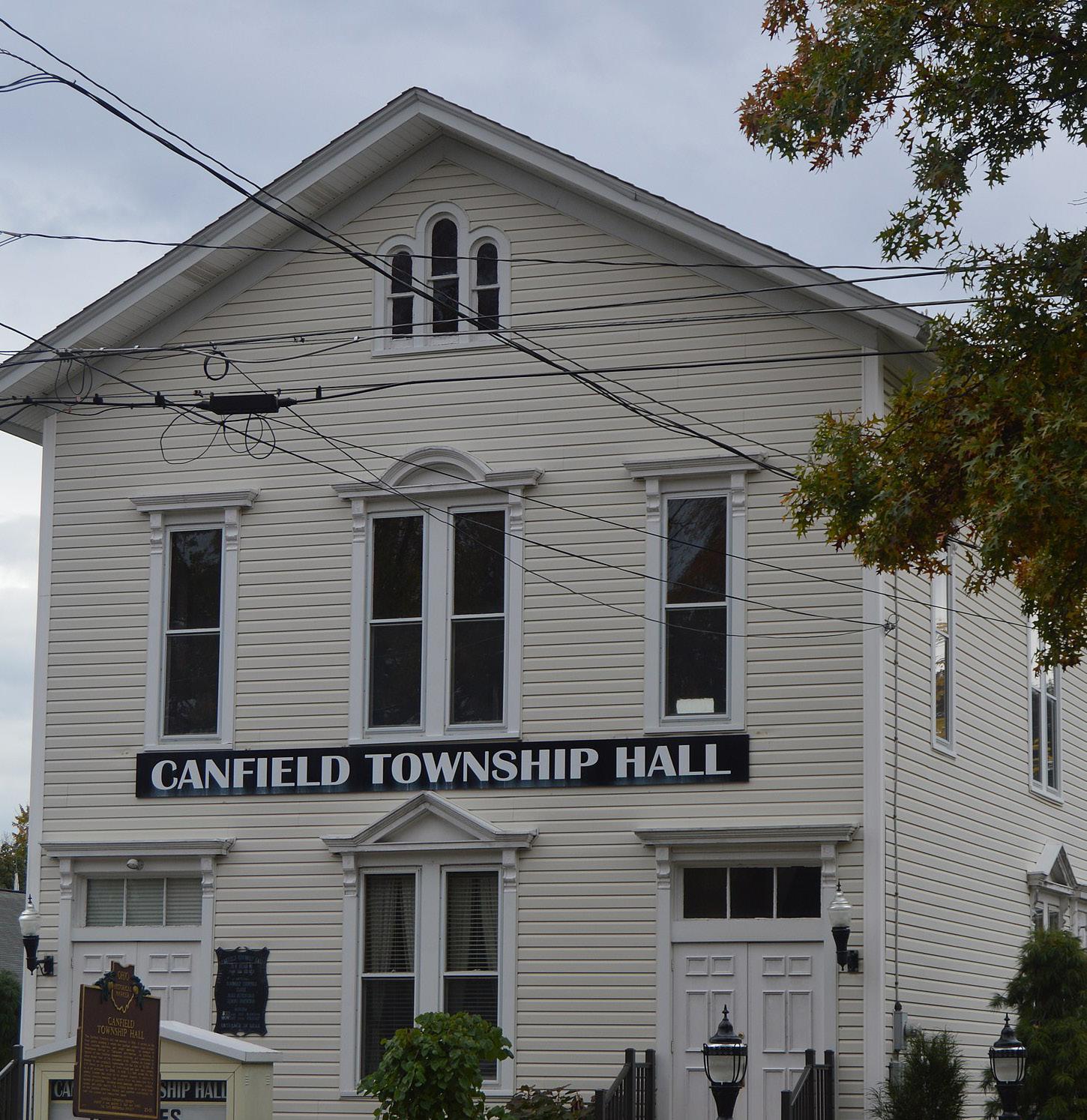
Canfield
Township, Ohio

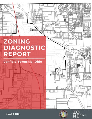
Township, Ohio
The story of Canfield Township dates to 1798 and the Connecticut Land Company (CLC). The Connecticut Land Company was an investment group that obtained title from the State of Connecticut to a major portion of the three million Western Reserve lands for resale to settlers. The CLC surveyed the land over two summers and laid out the land into five-mile square townships because 16,000-acre parcels worked better mathematically for the 400 investors.
Canfield Township, one of the 14 townships in Mahoning County, Ohio, comprises five square miles and approximately 8,500 residents within the unincorporated areas. By 1805 Canfield had 17 homes, a store, and a school. Canfield Township was named the Mahoning County Seat after the Trumbull and Mahoning County boundaries were redefined in 1846. However, Youngstown fought for the county seat, and Canfield lost after a three-decade battle in 1874. Canfields growth slowed and altered the community’s development pattern and character.
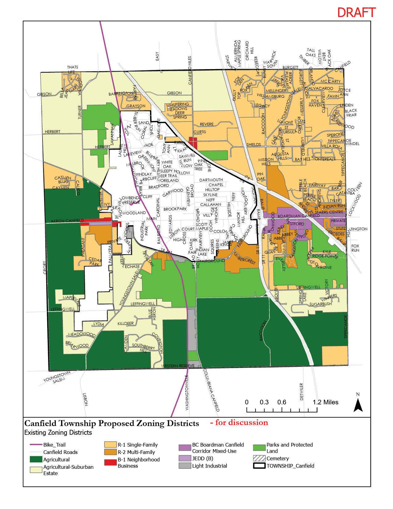
In 2023, the Township’s zoning will be 75 years old, and will have been intact for a third of the Township’s 225-year history. The Township comprises a relatively simple medium-to-large-lot single-family development pattern, exhibited in a semirural land-use pattern in the community. The Zoning Resolution largely reflects this development pattern but the code is more complicated than it needs to be considering the simplicity of the Township’s land uses. This can be seen with the eleven districts in the zoning resolution, but only eight districts are mapped (See Image No. 1).
The Canfield Township Zoning Resolution (“Zoning Resolution”) was overhauled in 2015 with minimal updates since. A zoning resolution should implement the community’s vision and goals. The code should clearly reflect and evidence the unique elements of Canfield Township and the collective vision of the Township’s its residents. Considering the 2040 Comprehensive Land Use Plan (“Plan”) was adopted in November 2022, this analysis present an opportunity for the Township to ensure the Zoning Resolution implements the Plan.
Several gaps and inconsistencies in the Zoning Resolution were identified during the Plan planning process, which become areas of inquiry. Additionally, it was discovered that the Township’s official zoning map had not been updated to be consistent with the 2015 Zoning Resolution. The Zoning Commission has undertaken a process to identify the inconsistencies and rezone areas of the map to bring them into compliance with the Zoning Resolution.
Consequently, the Township has engaged ZoneCo to undertake a zoning resolution diagnostic report to identify any additional inconsistencies and take advantage of the opportunity to streamline zoning processes and ensure that the Township’s zoning reflects the Plan goals. This diagnostic report summarizes our analysis, conclusions, and recommendations for the Township’s consideration. It is not scientific, but based on our professional knowledge and experience with zoning codes across Ohio and the United States.
December 16, 2022
DRAFT
The following principles guide our review:
1. Zoning should regulate only what needs to be regulated to advance the vision and promote public health, safety, and welfare.
Zoning regulations should place limits on the use of land only when necessary to promote general welfare. Regulations that do not relate to public interests, such as health and safety, may overstep the police power and may not be legally defensible.
2. Zoning should respect both existing and desired development patterns.
Zoning regulations should relate to a community’s desired development patterns and quality of life. When regulations are out of step with desired development patterns, landowners will often resort to variances to gain approvals for projects that should otherwise be permitted. This increases the cost of investing in a community. Furthermore, processing such approvals and variances can unduly burden government departments.
3. Zoning should be the implementation of a plan, not a barrier to achieving desired outcomes.
Zoning should be a tool to implement a community’s vision as expressed in its comprehensive plan. In many instances, a community invests time, funds, and energy into the development of a comprehensive plan, but zoning regulations are overlooked or revised over time in a disjointed manner.
This scenario leads to outdated, inconsistent, and disorganized zoning regulations that are cumbersome, intimidating, and costly for property owners and administrators alike, and impede planning goals and economic development. On the other hand, a comprehensive update to zoning within the long-term planning process allows for clear, usable, defensible, and consistent regulations that operate efficiently to protect the public’s interests and promote desired outcomes.
We reviewed the zoning resolution through the policy lens of the Comprehensive Plan. The Comprehensive Plan includes eight Goals; five of which are directly related to the zoning resolution as follows:
Guide and Manage Growth (GM)
Enhance Community Character and Image (CC)
Promote planned, responsible growth; with a balance of growth and development in appropriate locations coupled with the preservation of open space/ environment stewardship and farmland.
Create and enhance a distinctive character and image of Canfield Township that retains the rural character; leverages the area’s existing assets and amenities such as the bike path, nature preserves and parks as well as fairgrounds; and creates a sense of community in order to attract and retain people to live in the Township.
Cultivate a Vibrant Economy (VE)
Increase Housing Options (HO)
Improve Mobility (MO)
Support and enhance the local economy so that it provides distinctive business centers, attracts new businesses/jobs and contributes to a high quality of life.
Provide and maintain increased housing choices (with a variety of housing styles, size etc.), especially home options for new families, empty nesters, and residents who desire low-maintenance housing, in order to continue to attract and retain residents.
Provide sufficient transportation infrastructure to increase alternative mobility options throughout the Township such as providing bike lanes to improve traffic flow.
A significant change from the previously adopted Comprehensive Plan (2006-2021) is the departure from “preserving a suburban setting” (2006 Plan) to maintaining a small-town/rural environment in the 2040 Plan. The 2040 Comprehensive Plan does not mention “suburban” outside the Agricultural-Suburban Estate Residential District. The Plan states that rural land uses are comprised “clean water, forests, and wildlife; scenic beauty or a lifestyle that includes privacy, peace, and quiet; and the ability to farm.”
The Plan notes several strengths and challenges which can be addressed through policies such as the zoning resolution. Thus, looking through the lens of the Plan goals, we can assess the zoning resolution and make recommendations to achieve the vision.
Build on Township Strengths:
• Strong school system.
• Centralized location (close to Cleveland and Pittsburgh).
• Highway access (11, 76 and 80).
• Growing community, both residential and businesses (approximately 30 new homes a year).
• Community image and character.
• Rural/small-town feel.
• Reasonable cost of living and affordable housing.
• Canfield Fair.
• Bikeway.
Overcome the Challenges:
• Water and sanitary.
• Land in the Township being annexed into the City.
• Few options for multi-modal transportation, lack of sidewalks, bike lanes, etc.
• Parks and open space provided by multiple entities.
• Need for partnerships.
• Grow responsibly.
• Marketing and communication.
We envision Canfield Township as a township where our small town/rural character and high quality of life are celebrated, where our historical, cultural, and natural resources are preserved, our quality education and recreational facilities are known throughout the region, and our well-planned housing, commercial and professional businesses continue to provide a desirable place to live, work, and play for future generations.”
~ 2040 Comprehensive Plan Vision Statement
Land Us e & Code Sna pshot
The overarching goal of this zoning diagnostic is to assess the existing zoning regulations against the land use goals stated in the new Comprehensive Plan. In order to do this, we review the land use patterns, the zoning resolution in detail. This section provides an overview of our analysis of the land use and the zoning resolution.
The Comprehensive Plan identifies that Canfield Township had become one of the most desirable places to build in Mahoning County because of its rural character and small-town environment. For that reason, the township is one of the fastestgrowing townships in Mahoning County; as a result, 228 single-family houses were built between 2010-2017. In recent years, developers constructed larger and more expensive housing, along with businesses which can compromise the rural character and small-town environment. Consequently, the Township will need to ensure that new development adheres to the community vision and that redevelopment aims to retrofit the Township’s commercial areas to the community vision.
The Township’s existing land can be placed into four categories residential, commercial/industrial, public/quasi-public, and agricultural/vacant. The agricultural/vacant land comprises 45.6% of the Township. This is significant for a Township that is experiencing development pressure. However, It should be noted that the Township’s environment also limits and influences development patterns because it has floodplain/riparian corridors, wetlands, woodlands, and steep topography. Recognizing the environment will help maintain the small town/rural character while allowing development.
Residential land uses 41.7% of the Township. Furthermore, it is very low-density single-family homes on medium-sized and large-sized lots. Homes are far apart in most community areas, with significant street setbacks of 100 to 400 feet. Some newer developments use a more compact design with fewer setbacks of 20 feet.
Additionally, according to the Comprehensive Plan, currently, there are over 651 units planned in the Township based on lots/units in future phases of planned development and the number of vacant lots/units. Access to water, sanitary lines, and transportation access are also key components of locating future residential development.
Community facilities and parks comprise 12% of the land in the Township, with the County Fairgrounds, Mill Creek Metro Park, Kyle Woods Nature Preserve, Sawmill Creek Preserve, and several smaller parks.
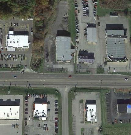
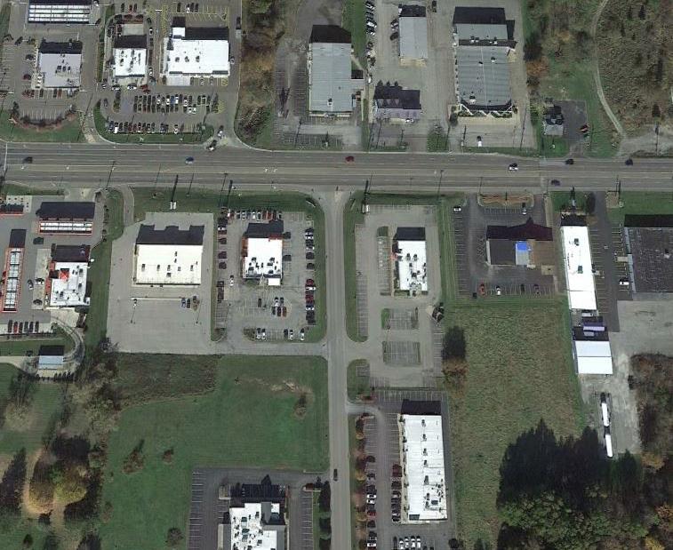
The commercial/industrial land uses comprise only .45% of the land area. A majority of the commercial/industrial parcels are located along US-224
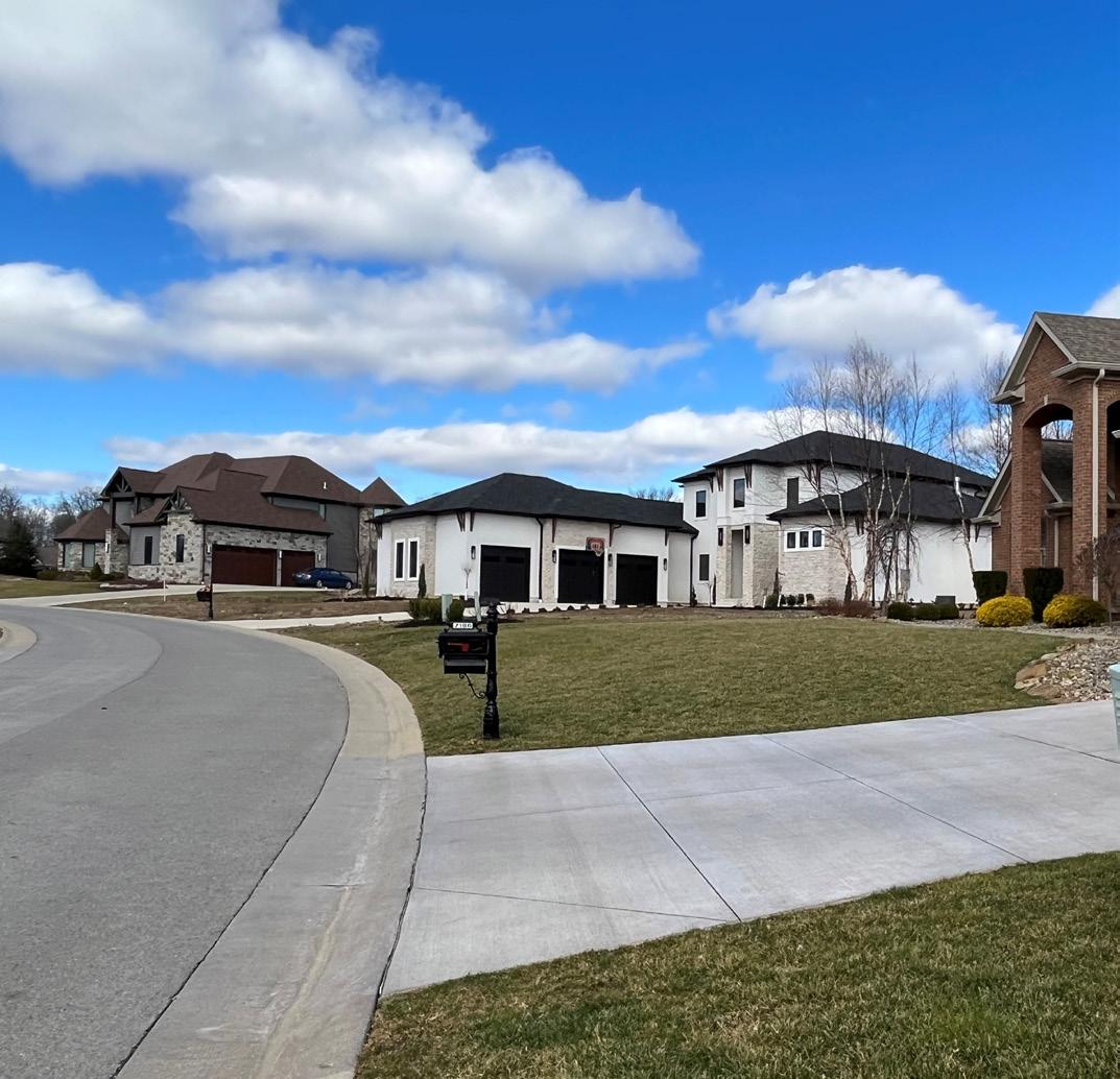
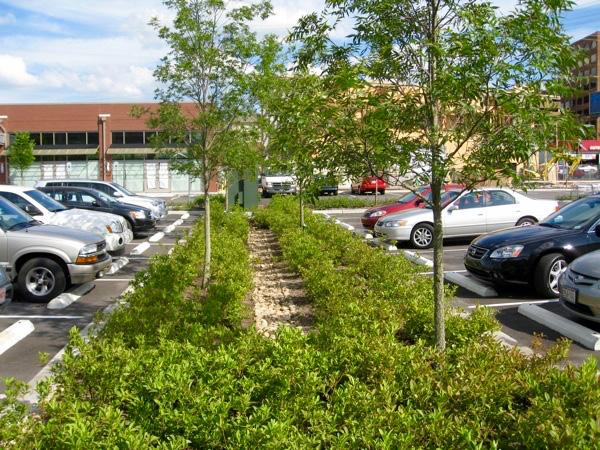
(Boardman-Canfield Road). Undoubtedly, the commercial development pressure is changing the Township’s small-town character into a suburban community along Boardman-Canfield Road with the vast parking lots and large setbacks (see Image No. 1).
Open space and natural landscapes emphasize small-town rural character. Vegetation should be more predominant than the built environment. A rural community can allow development if the community implements policies that support and guide the small-town rural character, such as reducing parking minimums to limit the size of parking lots and incorporating greening policies to bring natural landscapes to the commercial district. The Township has the potential to retrofit the Boardman-Canfield Corridor to reflect the small-town/ rural character by rewriting the zoning resolution.
Unfortunately, the sparse land use patterns in areas of the Township are due to the existing zoning resolution. Undertaking a zoning resolution immediately after completing the Comprehensive Land Use Plan is crucial to addressing policies that do not support the community’s vision. The Zoning Resolution should allow the Township to balance development with preserving the rural character and small-town environment.
Source:
The sparse development patterns are the Township’s greatest barrier to sustainability and fostering a greater sense of community character. As the Township grows, development standards should protect the natural beauty and greenspaces within a new open space district while steering development strategically.
Before analyzing the specific provisions of the zoning resolution, we begin by providing a sense of how the zoning regulations relates to the Comprehensive Plan goals. As the Township revises its zoning regulations, each new or revised provision should support at least one of the goals, including those provisions that are administrative or procedural.
In reviewing the zoning district regulations, there are 805 opportunities for the regulations to support the goals, and only 59 regulations support the goals. A limited number (258) are not affected, and 458 are barriers to a Comprehensive Plan goal. Overall, the provisions of the Zoning resolution do not advance the Comprehensive Plan goals or could be doing more to advance them.
It is important to note that those regulations identified as having no effect or that do not play a necessary supporting role should be reviewed and considered just as carefully as the other regulations to determine if there are ways that they may be amended or improved to promote the Comprehensive Plan goals.
The attached consistency matrix contains the data underlying the conclusions and recommendations in this Report. The consistency matrix includes specific comments and notes related to each provision of the Zoning resolution. Each provision in Canfield Township’s zoning resolution was evaluated and marked as either:
• Actively promotes each goals;
• Serves as a barrier to each goal; or
• Does not affect or play a necessary supporting role to each goal.
Table 1: Code Consistency
14%
Only 14% of the District provisions or the Generally Applicable Standards promote a Comprehensive Plan goal. Overall, the goals are more of a barrier than not playing a role or promoting the goals. The zoning resolution promotes the Guide and Manage Growth (GM) and the Enhance Community Character and Image (CC) the most. However, the provisions that promotes the goals are found in the Agricultural district, Special district, and unmapped districts.
The only district that promotes the Increase Housing Options (HO) is the MultiFamily R-2 district. The Neighborhood Business and Office district promote Improve Mobility (MO) in the zoning resolution; in reality, the districts are not mapped. Equally important is the organization/format, consistency, ease of use.
The zoning resolutation has a good foundation but requires modification to make the code clearer, equitable, and easy to use. At first glance, the zoning resolution appears to contain a clean format that is understandable; however, upon reading the code, there are issues with consistency, ease of use, and readability.
• The zoning resolution only uses Articles and sections.
◦ Adding Chapters would make the zoning resolution clear.
◦ The sections should be chapters, and the sub-sections should be sections.
◦ Additional sections could be added for clarity.
• Section organization is inconsistent.
• Sections are missing titles, or section titles are run-on sentences instead of short, clear titles.
• The zoning resolution contains excessive amounts of long paragraphs that need to be broken into sub-sections or placed in tables.
• Reorganize all sections, and place all procedures from other articles within the Administrative Article instead of scattering procedural information throughout the document.
• Reorganize the General Provisions Article and update the language in several sections.
• Excessive amounts of unnecessary language make the zoning resolution unclear and longer to read.
◦ Example Section 440.3 Minimum lot size: The language currently takes two sentences and a sub-bullet to say, “not applicable.”
◦ Language like this is throughout and can be cleaned up.
• The Zoning District sections should contain only the permitted uses, base development standards within tables, references to the
Tables & Graphics
• Illustrations and graphics would help convey the intent of regulatory concepts.
• Throughout the document, users must sift through multiple paragraphs of text to find base regulations and numeric standards that could easily be placed within a table.
◦ Put all base regulations in tables throughout the document.
Definitions
Key land use Impacts
• Many definitions are in Article II. However, there are additional definitions scattered throughout the zoning resolution.
◦ All definitions should be in one Article.
• Definitions will need a thorough review and potentially updated.
• Minimum livable floor requirement.
• Minimum parking requirements.
• Large lot sizes.
• Lack of pedestrian standards/sidewalk or trail connetions requirements.
• Lack of allowable uses.
• Lack of open space and natural landscape requirements.
• Lack of Sustainable Parking Lot design elements requirements that enhance rural character.
As noted earlier, a clear, consistent, user-friendly, equitable, and legally defensible Zoning Resolution that reflects the community’s vision is paramount to achieving a community’s desired outcomes.The following provides an overview of each Article and provides recommendations for the Township to consider.
Articles 1-3 contain the zoning resolutions’ general provisions, definitions, administration and enforcement, nonconformities, zoning permits, complaints, and violations. As mentioned before, the zoning resolution does not utilize chapters and subsections. It contains Articles, Sections, and subsections, sparingly and inconsistently. The administrative section of the code is not necessarily broken; however, it could be improved by creating consistent headings, formatting, and providing clearly prescribed timelines, procedures, and consistent standards and guidelines.
We understand that the Township has had the largest residential construction in Mahoning County and increased interest from commercial developers. The development pressure and lack of zoning districts to fit developers’ proposals increased the number of PUDs in the last few years. PUDs require more review than use by right in an existing zoning district.
A common misconception is that more review makes for better outcomes. The only way to judge whether this is the case is to evaluate what is being built due to these processes. In some instances, this may be the case. But from our observations and discussions, lengthier and more costly processes may have the opposite effect and encourage copycat design or creative but not better workarounds to subvert or expedite the process. Additionally, more process increases the cost and thus the regulatory risk of development in the Township.
Clear design guidelines (not regulations) can prescribe various design considerations that provide more consistent guidance for the community and the property owner and allow designers to be more creative within the general guidelines. Design Guidelines are a tool for architects, developers, and property owners to understand the styles or methods of compatible infill construction. If the proposal meets the guidelines, then it is approved. Debate occurs around whether the project satisfies the guidelines, not whether one official likes, dislikes, or prefers the proposal. Any back and forth between the Township and the applicant occurs within more clearly defined parameters.
Considerations: Consider the following:
• Update Title.
• Update definitions to remove standards.
• Update the Zoning Inspector, Zoning Commission, and Board of Zoning Appeals sections with the following:
◦ Reorganize and ensure a consistent organization and structure.
◦ Update purpose, definition, roles, and responsibilities.
• Remove unnecessary language.
• Include tables and graphics to organize procedures where appropriate.
◦ For example, a comprehensive procedures summary table is helpful for the user and administrator.
• Relocate the administrative sections to the end of the code.
◦ Modern zoning resolutions typically locate the administration, procedures, and glossary sections toward the end of the code to focus the reader’s attention on answers to the primary questions:
◦ What can I do with my property, and how can I do it?
◦ These important questions should be answered up front with procedures on seeking and obtaining approvals to follow for better organizational flow for the reader and the administrator.
• Measuring and interpreting language and reading the zoning map are essential elements of using the code and should be clearly spelled out with concise wording and graphics/charts
The zoning districts and associated standards outlined in Article 4 could be more user-friendly using tables and illustrative and regulatory graphics. This will allow each district to be efficiently laid out so that all standards specific to that district are contained in a maximum of one-to-two pages. Currently, 43 pages are dedicated to the zoning districts., which could be covered in 10 pages or less.
Further, duplication abounds in the district sections. Provisions related to general exceptions to height and yard regulations and any provisions generally applicable across districts should be located either in an introductory section or included with generally applicable regulations. Fewer long paragraphs and more tables and graphics will streamline each district.
The zoning resolution has 11 districts, but the map only has eight districts listed in the zoning resolution. Additionally, there is a Joint Economic Development District, an overlay district, on the zoning map but not in the zoning resolution. The Zoning District names are inconsistent between the zoning resolution and the zoning map. The following table illustrates the Zoning resolution named districts, the Zoning Map named districts, comments on the naming convention, and if it is missing from the Zoning Resolution or Zoning map.
(AC) Agriculture Conservation (A) Agricultural
(A) Agriculture Residential (A-SER) Agriculture Suburban Estate
(R-1) Single-Family Residential (R-1) Residential for Single-Family Homes
(R-2) Multi-Family Residential (R-2) Residential for Multi-Family Homes
(B-1) Neighborhood Business Not mapped (B-2) Office Not mapped
(B) General Business (B) Business
Inconsistent Name
Inconsistent Name
Inconsistent Name
Inconsistent Name
Inconsistent Name (LI) Light Industrial Not mapped
(I) Warehouse & Industrial (I) Industrial
(SP) Special District (SP) Special District Planned Unit Development PUD Planned Unit Development
Not contained in the Zoning resolution. JEDD Overlay District
The map only has an Industrial district.
The strength of the Township is the rural/small-town feel and has become one of the county’s most desirable places to build. In recent years, larger and more expensive housing has been constructed, which can be questioned if this fits in with the rural/small town feel or more suburban character.
The sparse development patterns are the Township’s greatest barrier to sustainability and fostering a greater sense of community character. As the Township grows, development standards should protect the natural beauty and greenspaces within a new open space district while steering development strategically. More robust landscaping standards would aid in facilitating highquality aesthetics. There are many environmental benefits to planting guidelines within landscaping regulations, such as plant diversity (which aids in ecosystem diversity), reduction in invasive species, and maintenance of existing maturegrowth plants and trees.
There are opportunities to make residential subdivisions even more sustainable by utilizing clustered development patterns while also relaxing minimum building or lot size requirements. This will steer development onto less environmentally sensitive lands while providing greenspace amenities for the community.
The zoning resolution Agricultural Conservation is known as Agricultural in the Zoning Map. The purpose statement indicates that this district promotes protecting and conserving large tracts of land for agricultural purposes. However, uses such as agritourism is not permitted use. The future land use map shows a decreased amount of land dedicated to this district. The Agricultural Residential or Agricultural Suburban Residential is to provide opportunities for large lot residential parcels without extension of utilities.
Considerations: Consider the following:
Agricultural Conservation/Agricultural
• Make Exclusive Agricultural District.
• Establish a 35-acre minimum.
• Remove livable floor area requirements.
• Remove clearance in living quarters – should be addressed in the building code.
• Update Permitted Uses:
◦ Add Agritourism to Agricultural (AC).
◦ Place parks under the Special District.
• Remove livable floor area requirements.
• Update Permitted uses.
◦ Conservation Subdivision (20-acre minimum, 50-acre maximum).
◦ Must be located on the current existing roads.
◦ Limited Agriculture on 2 acre+ outlots.
The only difference between this district’s and the Agricultural Suburban Estate district’s purpose is the opportunity for lots to be served by public utilities or site-sewer and water systems. The minimums, such as minimum livable floor area, and minimum lot width, do not support a diversity of housing. This district does not require the preservation of open space. This district contains more barriers to the Goals than promoting the goals.
Considerations: Consider the following:
• Update Purpose.
• Remove livable floor area requirements.
• Remove clearance in living quarters requirements– should be addressed in the building code.
• Add network-connected streets requirements.
◦ Sidewalks.
◦ Multi-purpose paths.
• Update Permitted Uses.
◦ Allow additional housing types.
◦ Consider creating Permitted uses with Standards.
◦ Allow Accessory Dwelling Units (ADUs).
◦ Create Cluster Subdivision regulations.
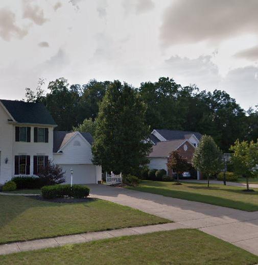
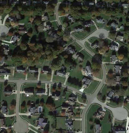
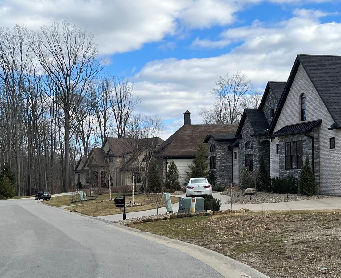
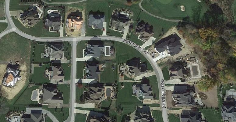
The Township is already allowing Cluster Subdivision developments, which is illustrated in the images below. This is the Winstead Crossings on Paddington Row in the Township. The proposed zoning changes would allow this type of development by right instead of through the Planned Unit Develoment process.
Clustered/Conservation Subdivision (CCS) ordinances allow residential developments in rural and urban fringe areas while retaining the natural character and significant wildlife habitat in the newly developed area. CCS developments are an alternative to traditional residential developments that typically result in substantial destruction of natural features and habitat. In contrast, CCS ordinances allow or require dense clusters of residential units in one part of the proposed project area, in exchange for permanently preserving open space and natural features. Under this model, the open space is rendered undevelopable, but may be used by the community for recreation, agriculture, or conservation
R-2 district’s purpose is to provide opportunities for smaller lots for singlefamily and multi-family attached residential units. However, the only difference between the single-family (R-1) and single-family (R-2) minimum lot size for a single-family unit is 1,500 feet, which is not an extreme difference.
Through both the use and development standards, the ability of the Township to facilitate housing diversity is limited. The R-2 Multi-Family Residential District requires a massive minimum lot size per dwelling unit. It requires a minimum livable floor area and highly inefficient land use within a multi-family district. The building height maximum is 35 feet, which is the same as the single-family districts, and should be increased.
The relaxation of development standards for multi-unit structures should be a high priority in any revision of the Zoning resolution. The Township should consider increasing density requirements and creating density bonuses to facilitate the provision of amenities, open spaces, or public art. Meetings should be held with local developers to get a better understanding of the kind of housing type demand they are currently witnessing in the Township and what they anticipate in the future.
Many communities on the fringes of high-growth cities are finding that their markets are ripe for multi-unit buildings, given the rise of single-person households, the desire to minimize home maintenance, and the demand for walkability, which would promote the Guide and Manage Growth, Enhance Community Character, Increase Housing options, and Improve mobility.
Multi-unit structures could be promoted as infill development within select commercial areas. Creating a regulatory environment conducive to housing diversity will require an overhaul of the current zoning regulations that apply to residential properties. The locations around the Township that will see development pressures should be identified, and developers should be steered toward development under zoning districts that promote housing diversity instead of planned districts.
This district partially supports the increasing housing options, but more could be done to support increased housing options and improve mobility. The Comprehensive Plan created a Future Land Use map, greater discussion and critical review of the proposed zoning changes will need to be had with staff and township officials.
Of the following items: the minimum livable floor area requirements is the single-most barrier to housing diversity in the Township. The country’s rapidly growing aging population desires smaller, maintenance free housing. According to AARP, the vast majority of 50-plus want to remain in their homes and communities as they age. If the older population currently lives
in a larger home, they prefer to stay in their community but in a smaller home. If smaller homes are not available, the residents will move to another community that has the desired housing type and amenities.
The Cottage Court or Bungalow Court is a type of development which communities are seeing a desire to build. A Cottage Court development is usually a group of small (1 to 1.5 story) detached structures arranged around a shared court visible from the street. The typical size is 500 sq. ft. to 1,400 sq. ft. This type of development is compatible with single-family homes. They are not tract homes, and they are not urban living domiciles. These homes create a neighborhood feel while providing housing opportunities.
This Report provides suggestions and considerations, which are not the final say for the zoning code rewrite. There would be additional steps and meetings to discuss the standards for each district, and the final zoning districts.
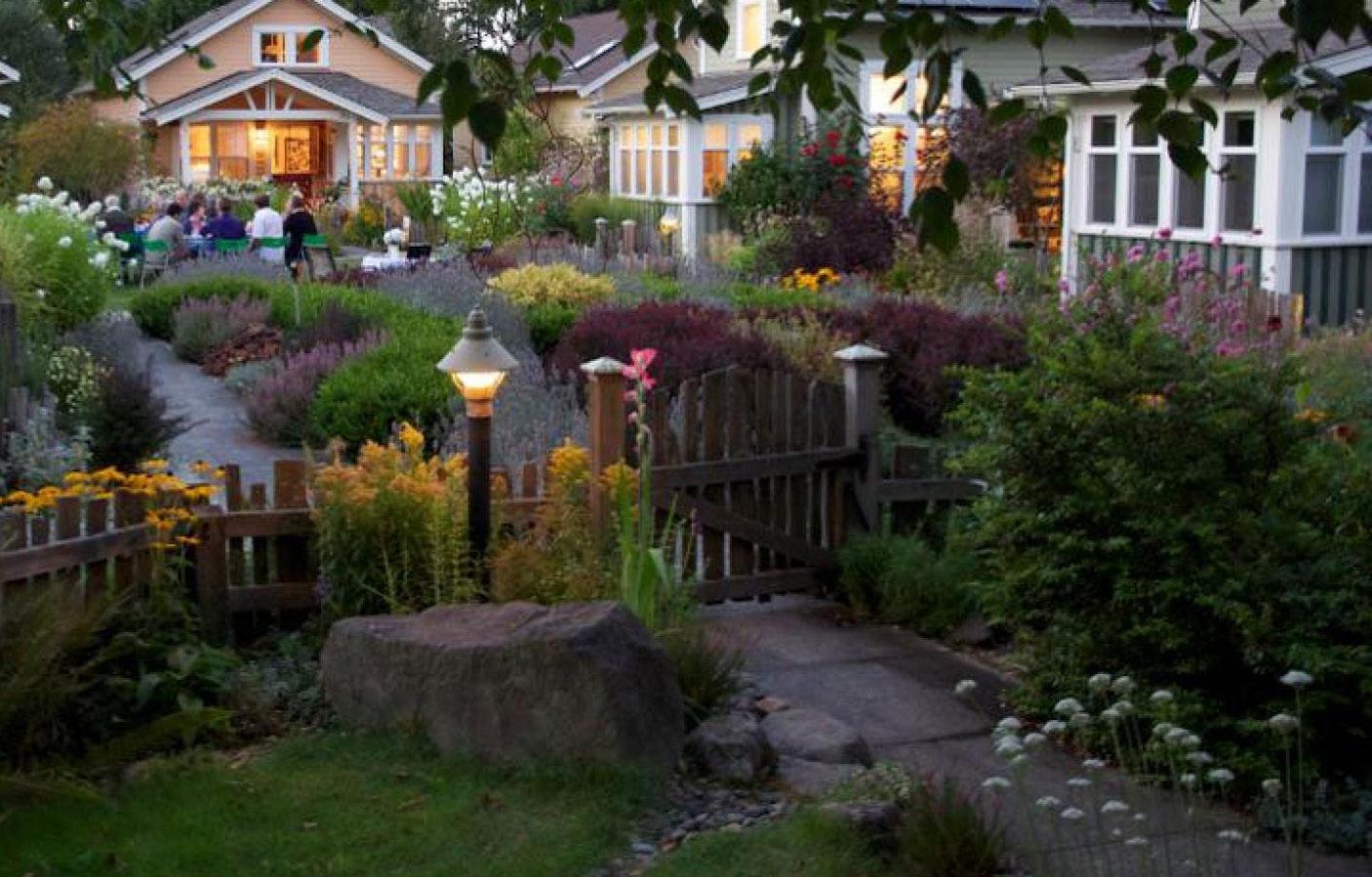
Source: CNU.ORG Ross Chapin Architects
Considerations: Consider the following:
• Update Purpose.
• Remove livable floor area requirements.
• Remove clearance in living quarters – should be addressed in the building code.
• Add requirements for water, sanitary sewer, and storm sewer.
• Add network-connected streets requirements.
◦ Sidewalks.
◦ Multi-purpose paths.
• Update Permitted Uses.
◦ Remove single-family from permitted uses.
◦ Must be located on current existing roads.
• Remove minimum lot width, and replace with maximum lot width.
• Reduce setbacks.
• Increase allowable height for multi-family dwelling buildings.
• Allow greater density.
Greater density is a relative term for each community, greater density for a rural community is not the same as greater density for a city. The term density usually conjures images of multi-story apartment buildlings. However, rural areas, like Canfield Township must also think about available utlities, septic system capacity, topography, and other natural resources which can be impacted by large development. Density in a rural area could mean development like the cottage courts.
As mentioned previously, US-224 (Boardman-Canfield Rd).is an auto-oriented commercial corridor with massive parking lots and lacks attractive landscaping, greenspace, or architecture consistent with rural character. The lack of sidewalks combined with the width and speed on US-224 means that the design cannot currently orient toward pedestrians.
Pedestrian-oriented development will be challenging to achieve under the current zoning resolution. The regulations generally promote urban fabric removed from the street and do not contribute to the street wall, with buildings spaced out. This requires that pedestrians travel long distances by foot because users are in high-speed traffic, and being far from each other is not conducive to a walkable environment.
This corridor’s undeveloped and underdeveloped parcels will be intuitive places for
commercial development in the coming years. Not only will commercial development likely come to these parcels, but there is ample opportunity for infill development. Revising the zoning resolution as the community grows will provide opportunities to improve this commercial corridor and create the sense of place that the community desires.
The Township should think critically about where undeveloped or agricultural land will face development pressures and assess the zoning regulations in those areas. Furthermore, there is much opportunity to increase the kinds of commercial uses and the mix of uses present in most non-residential districts.
The Township should evaluate the best means to facilitate quality infill development that helps to create a sense of place and amenities for residents as the community grows. The Township should consider developing regulations for outlots, and shared parking, and implement mandatory rear yard parking.
Additionally, the Comprehensive Plan provides a Regional Bike Suitability map which contains prioritized bike routes. Every applicant for new development should consider these future connections and be required to integrate sidewalk/multi-use path connects to the greater regional bike plan. Communities find bike paths and trail connections within commercial areas that can greatly improve vibrancy.
The Neighborhood Business, Office, and General Business are not mapped on the zoning map. However, the zoning map has a Business zoning district. The Comprehensive Plan provides suggestions for a Neighborhood Business district and a MixedUse district.
This district’s purpose supports the Comprehensive Plan goals but is not mapped. This district has a great foundation, and with a few modifications and mapping, it can greatly support Comprehensive Plan goals.
Considerations: Consider the following:
• Update Purpose.
• Update the maximum floor area to be more flexible.
• Remove the minimum floor area.
• Update Permitted Uses with additional uses.
• Incorporate low-impact development and sustainability principles.
• Incorporate open space requirements.
• Require pedestrian access/circulation.
• Require multi-use path connections for properties within 1,320 ft of the existing and proposed bike routes.
• Map this district.
This district is not mapped and should be removed from the zoning resolution. Include office in Neighborhood Business and Mixed-Use District.
This district is mapped but does not support the Comprehensive Plan goals. This district has a good foundation but requires a few modifications to incorporate elements that support the five goals.
Considerations: Consider the following:
• Rename the District to the Boardman-Canfield Corridor district (mixed-use district).
• Update the Purpose.
• Update Permitted uses to incorporate office and mixed-use development.
• Move Special Use standards to their own section.
• Remove minimum lot width.
• Reduce setbacks.
• Remove height reference to feet, and make the standard number of stories.
• Require new development to incorporate existing natural features.
• Add network-connected streets requirements
◦ Sidewalks.
◦ Multi-purpose paths.
• Require multi-use path connections for properties within 1,320 ft of the existing and proposed bike routes.
LIGHT INDUSTRIAL
This district is not mapped. However, the mapped Industrial district mapped closely resembles this district’s standards. At the same time, public parks (Walnut-Grove park) are zoned as Industrial and should be rezoned to the Special District. The parcels zoned Industrial need to be reviewed criticallyThe parcels zoned Industrial need to be reviewed critically.
Considerations: Consider the following:
• Update Purpose.
• Remove minimum lot size, min. lot width, min., and max floor area.
• Review all permitted/conditional uses.
• Create a Permitted Uses Table to view all districts at once
• Create a Standards Table to view all districts at once
• Require multi-use path connections for properties within 1,320 ft of the existing and proposed bike routes.
WAREHOUSE & INDUSTRIAL
This district is not mapped and should be removed from the zoning resolution.
The Special District is for recreation facilities, public parks, playgrounds, and conservation areas. This district is mapped, but not all parcels that fit this description are contained in this district. This district partially supports the Comprehensive Plan goals. This district has a good foundation but requires a few modifications to incorporate elements that support the five goals.
Considerations: Consider the following:
• Rename to Parks and Protected Land.
• Update Purpose.
• Rezone appropriate parcels into this district.
• Develop and apply rural character landscaping standards to parks.
• Require multi-use path connections for properties within 1,320 ft of the existing and proposed bike routes.
• Consider accessible locations for future parks.
◦ Close to neighborhoods
◦ Located off trails for alternative transportation options.
This district’s purpose partially supports the goals; however, the developed PUDs do not adhere to the mixed-use environment indicated by the purpose statement. The developed PUDs have residential development only. PUDs can be a barrier to development. It is suggested to incorporate desired elements into the districts.
Considerations: Consider the following:
• Suggest removing the PUD district and incorporating preferred standards into the other districts.
• If this district is kept,
◦ Establish a minimum of 20 acres and must contain mixed-use elements (both residential and commercial).
◦ Must contain a variety of houses with no minimum floor area.
This district is not in the zoning resolution. However, the standards are incorporated into the JEDD Agreements. This district is also mapped as an overlay district. The standards between the existing zoning districts and their respective JEDD zoning districts are like each other, with minor deviations. For example, for R-1, the only difference is yard setbacks, and the JEDD district has Design Standards for streets. JEDD R-2 has more permitted and conditional uses than the R-2 district.
Considerations: Consider the following:
• No changes can be made to this district because it is part of an Agreement.
• The Standards should be inserted into the zoning resolution.
Article 5 contains the zoning resolutions’ generally applicable regulations, standards, sign ordinance, special use standards, and environmental concerns. No graphics are included in this section, which limits ease of use and clarity. These provisions, particularly signs and off-street parking, lend themselves to tables and illustrations/graphics. These regulations do not support the Comprehensive Plan Goals, especially the Guide and Manage Growth, Enhance Character and Image, Create a Vibrant Economy, and Improve Mobility.

Off-street parking is an important issue in a largely auto-dependent community. Bicycle infrastructure and the culture of designated trails are not prevalent in the Township. Therefore, transportation is by private car and on foot. Ensuring adequate on-and-off-street parking is important to the success of the Township’s businesses and quality of life. However, massive parking lots do not enhance the rural character and do not preserve open space. Like most places, parking may be at a premium at certain times and readily available at others.
Historically, zoning resolutions prescribe off-street parking minimums to address peak demand, such as holidays and busy seasons. While this may ensure adequate off-street parking for peak times of the year, it overburdens private property at other times. Numerous underutilized and under-designed parking lots may have a detrimental impact on the character of a community. Large, poorly designed parking lots could diminish a community’s overall environment by detracting from the surrounding architectural or natural views along roadways.
Large parking lots take up massive amounts of community space to provide parking that may only be used periodically. Parking lots often need better integrated into the community to provide pedestrian connections. Communities across the nation have eliminated or right-sized their off-street parking minimums in favor of market determinations.
Considerations: Consider the following:
• Restructure and reorganize sections and subsections for clarity.
• Sign regulations need to be revised.
• Due to their significance, more careful attention should be paid to how hedges, walls, and fences are addressed in the code, namely through illustrative and regulatory graphics for clarity and ease of use.
• Incorporate pedestrian and bicycle standards into new development.
◦ Sidewalks.
◦ Paths.
◦ Bike lanes.
• Reduce parking standards.
• Reformatting and addition of tables and graphics.
• Develop Green and Sustainable Parking lot design elements that enhance the rural character:
◦ Maximizing shading and greening,
◦ Incorporating naturalized drainage,
◦ Utilizing paving that infiltrates,
◦ Using energy efficient lighting and renewable energy generation
◦ Adding safe pedestrian circulation, and successfully integrating and connecting parking in the community.
Isummary, the Zoning Resolution does not support the Comprehensive Plan goals; the recommendations will assist with creating a user-friendly zoning resolution and substantially further the Comprehensive Plan goals to further preserve the rural/small town environment.
The code lacks tables to organize lists such as uses. It also lacks illustrations and graphics to explain complex concepts more simply.
Overall, the code most notably promotes high-quality housing and nonintensification of development, with some emphasis on environmental sustainability. It does little, if anything, to manage growth, enhance community character, cultivate a vibrant economy, increase housing options, or improve mobility.
As this report details, much can be done to establish clear, consistent, userfriendly, streamlined, and defensible land use regulations custom-tailored to the Township.
Article I - Introduction
Title
Purpose
Applicability
Repeal of Prior Resolutions
Severability
Zoning Districts and Map
District Boundaries on Map
Rules of Measurement and Calculation
Floor Area
Height for Principal and Accessory Structures
Height for Signs
Interpretation
Article II - Zoning Districts
Purpose and Intent
AC - Agricultural Conservation District
Permitted Uses (repeats for each district)
Site Standards (repeats for each district)
Building Standards (repeats for each district)
A - Agricultural Residential District
R-1 – Single-Family Residential District
R-2 - Multi-Family Residential District
B-1 – Neighborhood Business District
BC - Boardman-Canfield Corridor (Mixed Use)
LI – Light Industrial District
POS - Parks and Open Space (SP - Special District Renamed)
Article III - Specific Regulations
Accessory Uses and Structures
Home Occupation
Limited Home Occupation
Expanded Home Occupation
Oil and Gas Wells
Private Airfields
Sexually Oriented Business
Strip Mining
Swimming Pools
Telecommunications Towers
Temporary Uses, Events, and Sales
Windmills and Anemometer
Article IV - Generally Applicable Regulations
Off-street Parking and Loading
Height
Landscaping and Screening
Permanence of Yards and Open Spaces
Corner Lots
Fences, Walls, Hedges, and Plantings
Riparian Setbacks
Fire Code
Public Nuisance Regulations
Article V - Signs
Purpose and Intent
Applicability
General Regulations
Exempt Sign Types
Prohibited Sign Types
Sign Types
Sign Illumination Types
Article VI - Nonconformities
Applicability
Continuation
Expansion
Abandonment
Damage or Destruction
Nonconforming Signs
Nonconforming Lots
Nonconforming Uses
Reversion of Non-Conforming Buildings and Uses
Article VII - Administration, Procedures, and Enforcement
Intent
Zoning Inspector
Zoning Commission
Board of Zoning Appeals
Zoning Permits
Temporary Permits
Variances
Conditional Uses
Text and Map Amendments
Application Procedures
Application Review and Decisions
Fees
Appeals
Complaints & Inspections (Enforcement)
Violations and Penalties
Actions Preventing Violation
Article VIII - Definitions Definitions