Cleveland Connect
Cleveland, OH
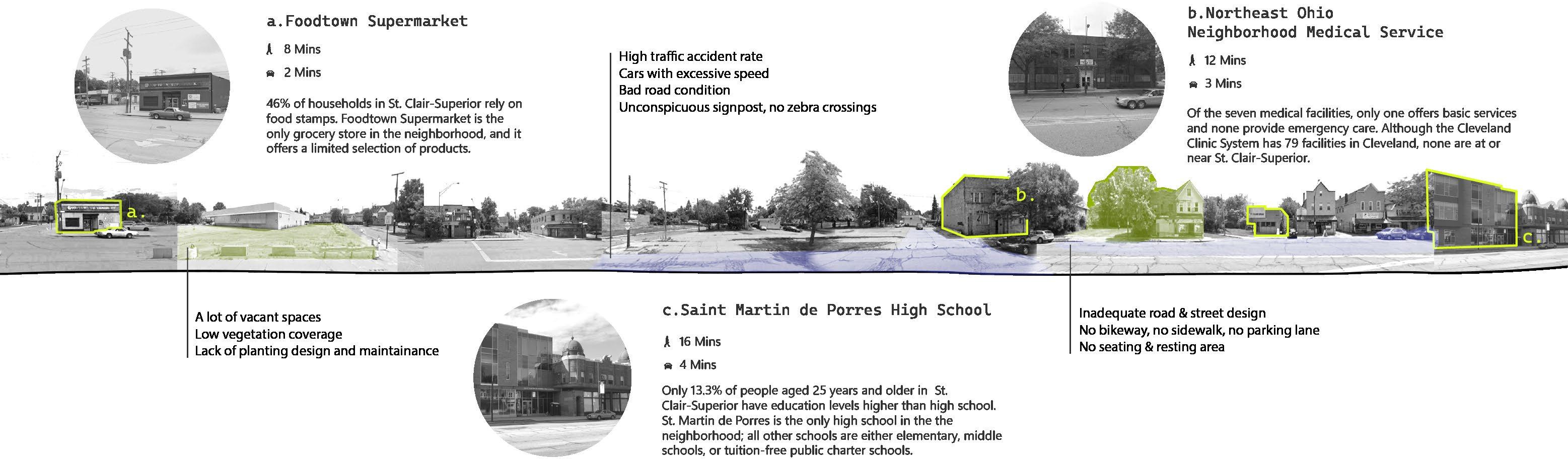
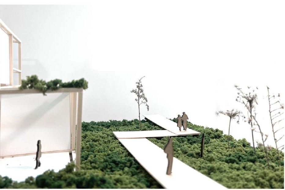
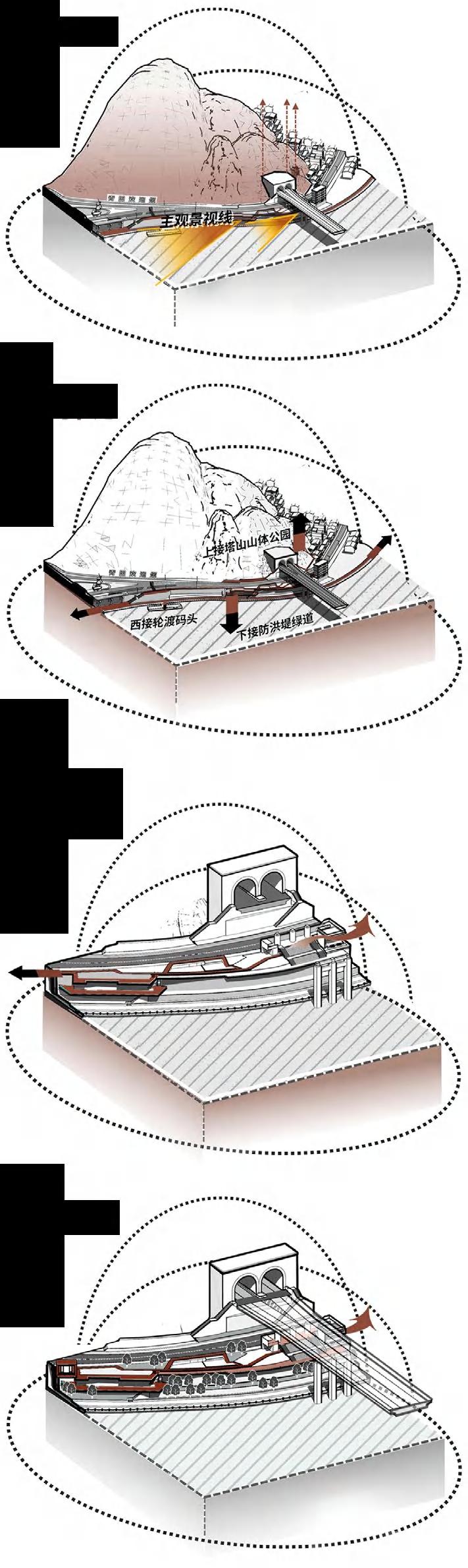
The Cleveland Lakefront and St. Clair-Superior neighborhoods face significant challenges due to barriers like Interstate 90, railways, and brown fields, isolating South Gordon Park and hindering accessibility. High traffic accident rates, poor road design, and inadequate pedestrian infrastructure further limit community access to recreational spaces. Meanwhile, the severe winters, with freezing temperatures and significant snowfall, exacerbate these issues. While winter sports are integral to the city’s culture, the neighborhood lacks adequate winter recreational space due to poor infrastructure. Aging sports facilities
Type
Date
Team
Position
Instructor Skills
Academic Work, 2024 ASLA Student Competition
2024 Spring
Feiru Deng, Wenqian Niu
Team Leader
Mitch Glass
ArcGIS, Adobe Photoshop, Illustrator, Rhino, Lumion
and unequal distribution of green spaces further affect this high youth population area, limiting community engagement and physical activity.
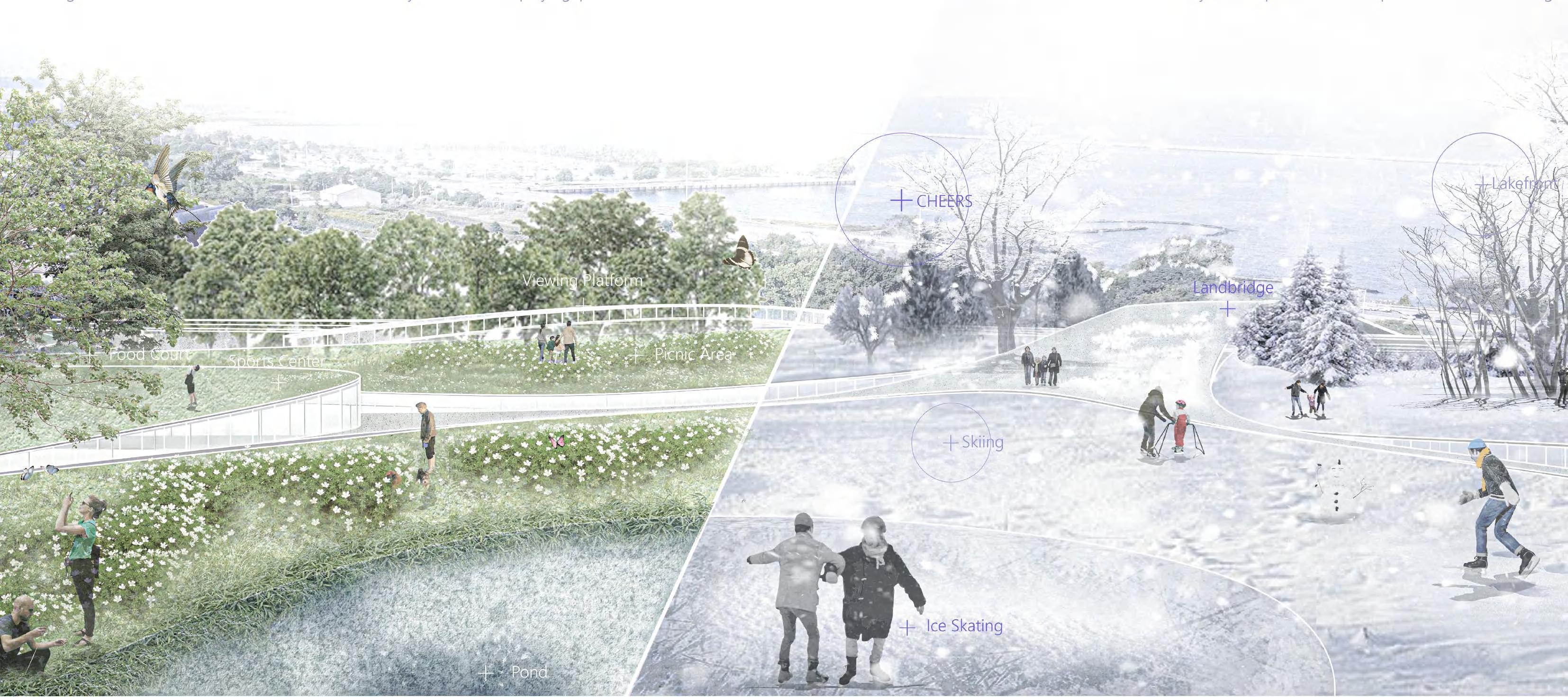
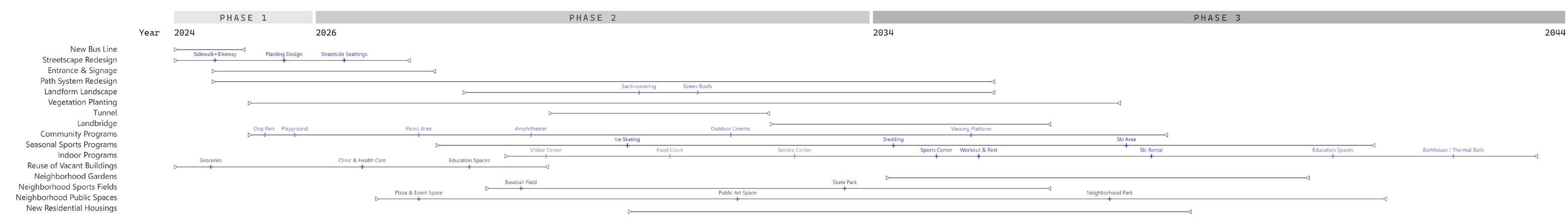
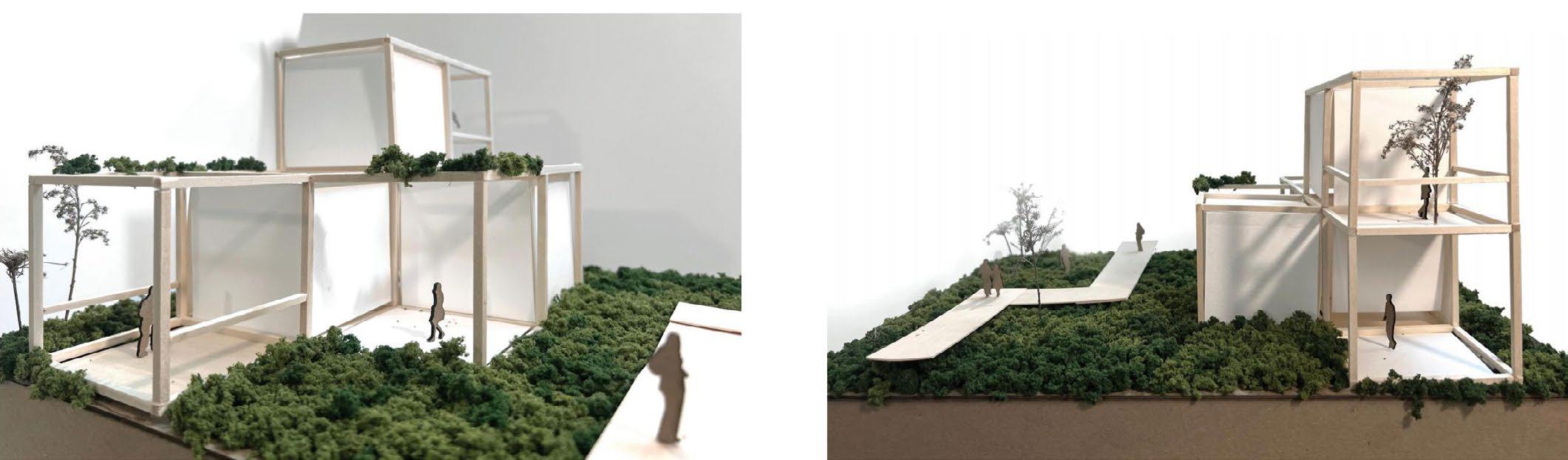
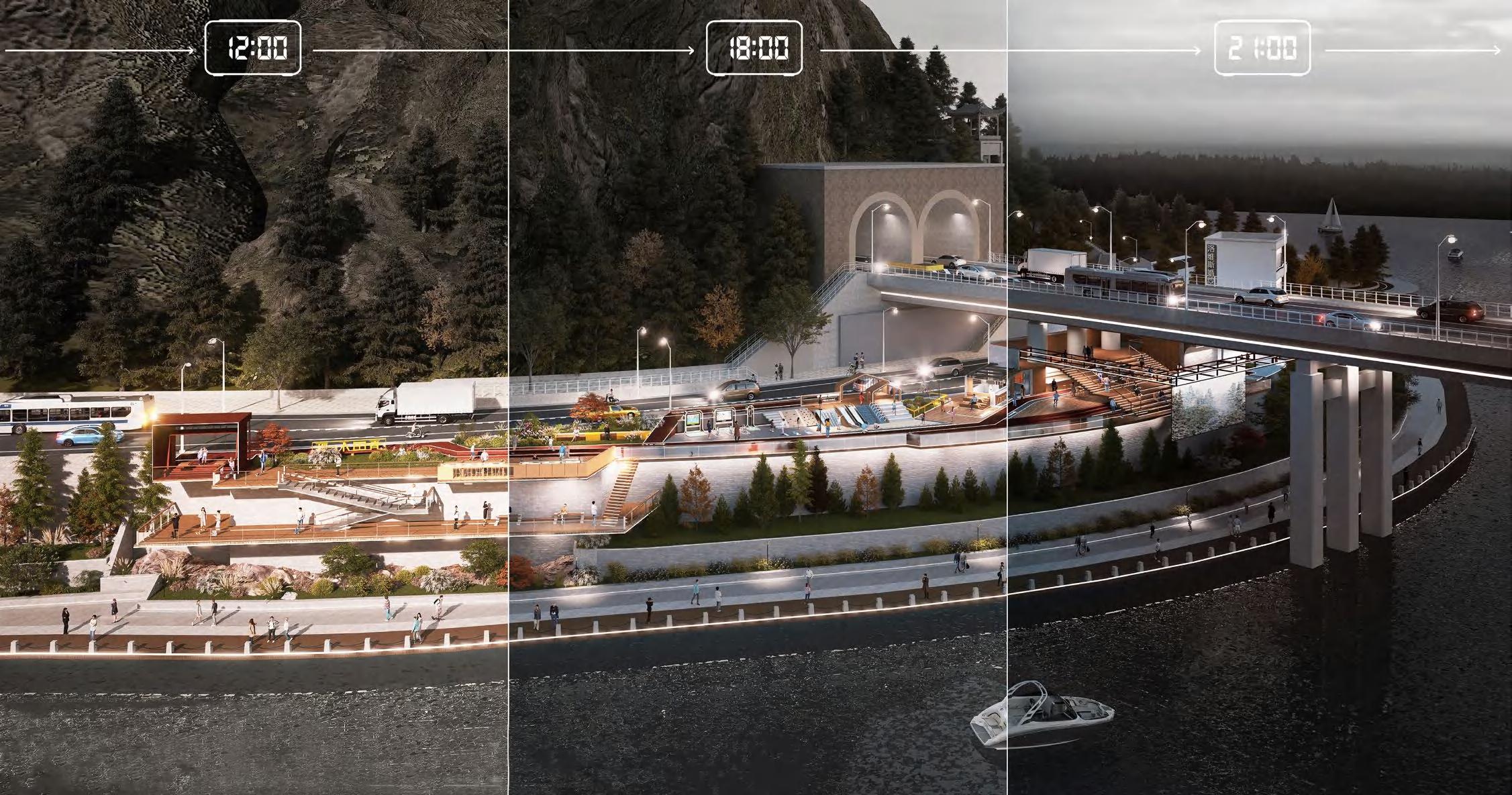
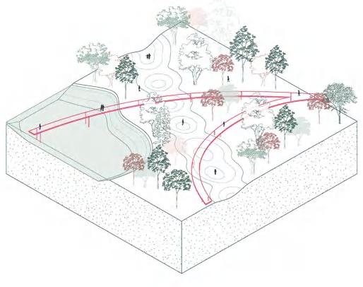
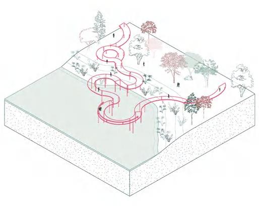
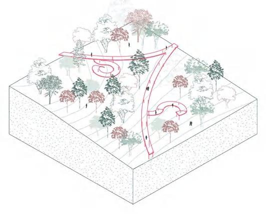
The proposal aims to improve circulation, increase green spaces, and enhance seasonal recreational facilities, addressing transit, ecological, and community challenges. This phased, sustainable strategy will revitalize South Gordon Park, reconnecting it with Lakefront Cleveland and the surrounding neighborhoods, ensuring a vibrant, accessible, and interconnected urban environment.
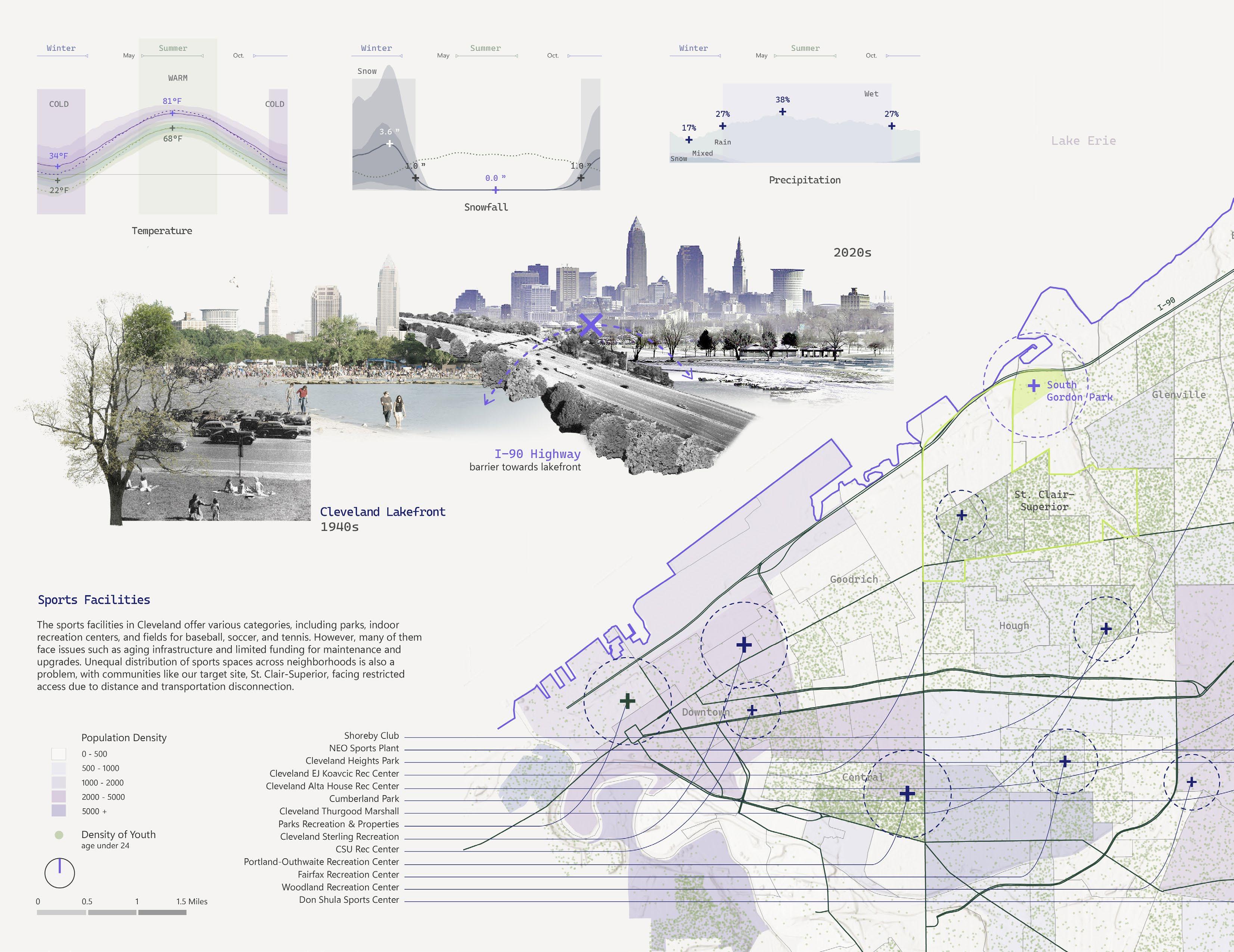
The city’s sports facilities, including parks and recreation centers, suffer from aging infrastructure and limited maintenance funding, leading to an unequal distribution of these spaces across neighborhoods. This disproportionality affects the St. Clair-Superior neighborhood, which has a high youth population density but lacks sufficient recreational facilities and green spaces, exacerbating issues of community engagement and physical activity.
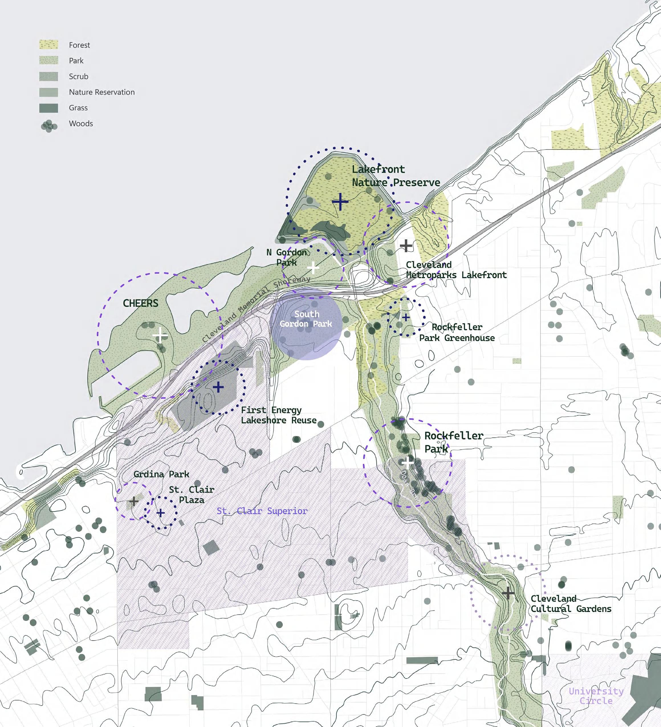

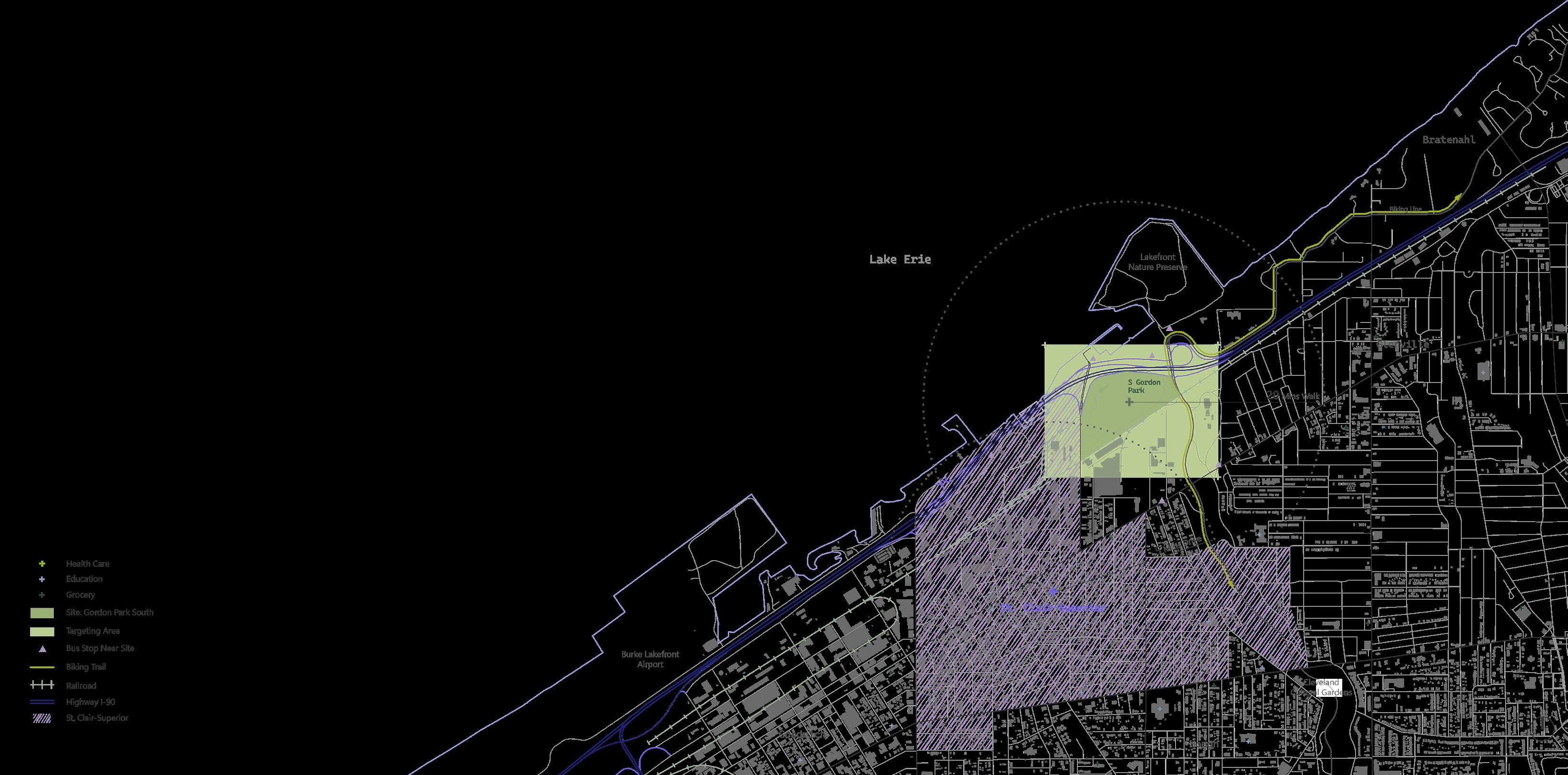
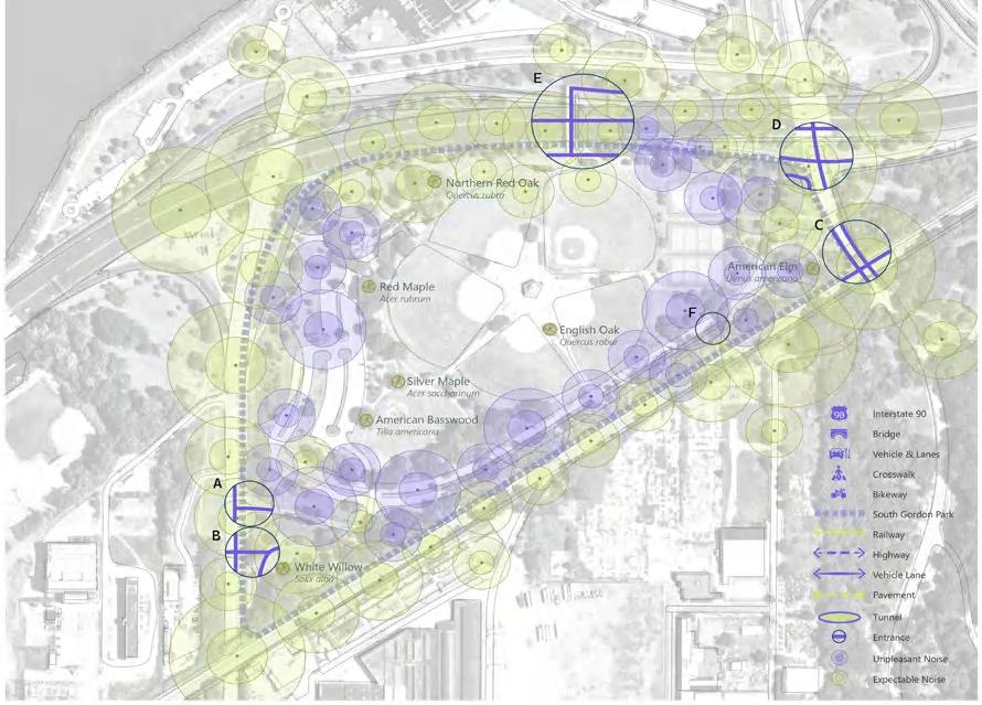
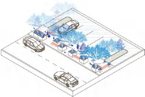
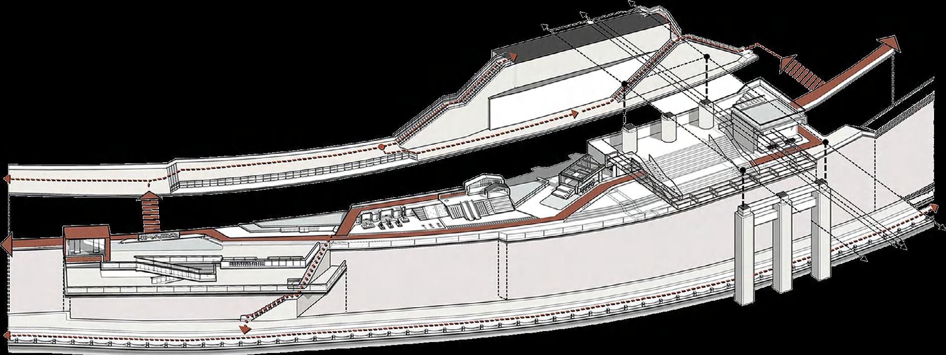
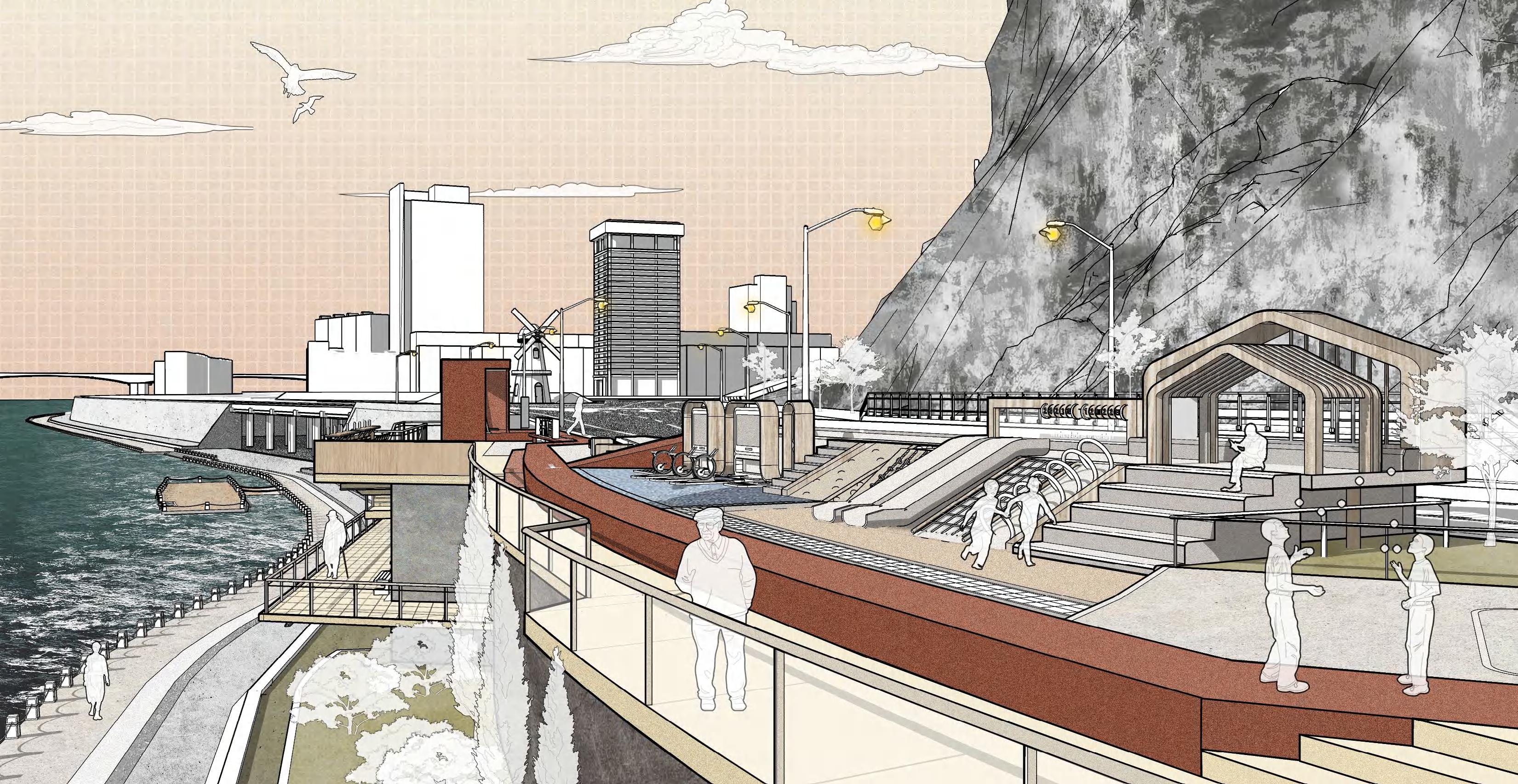
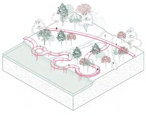
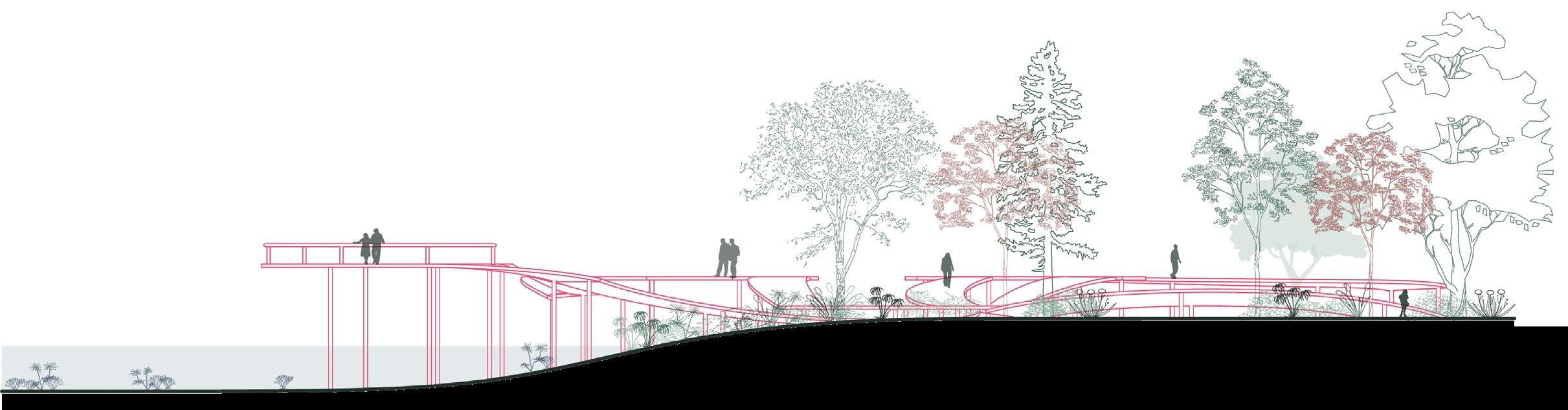
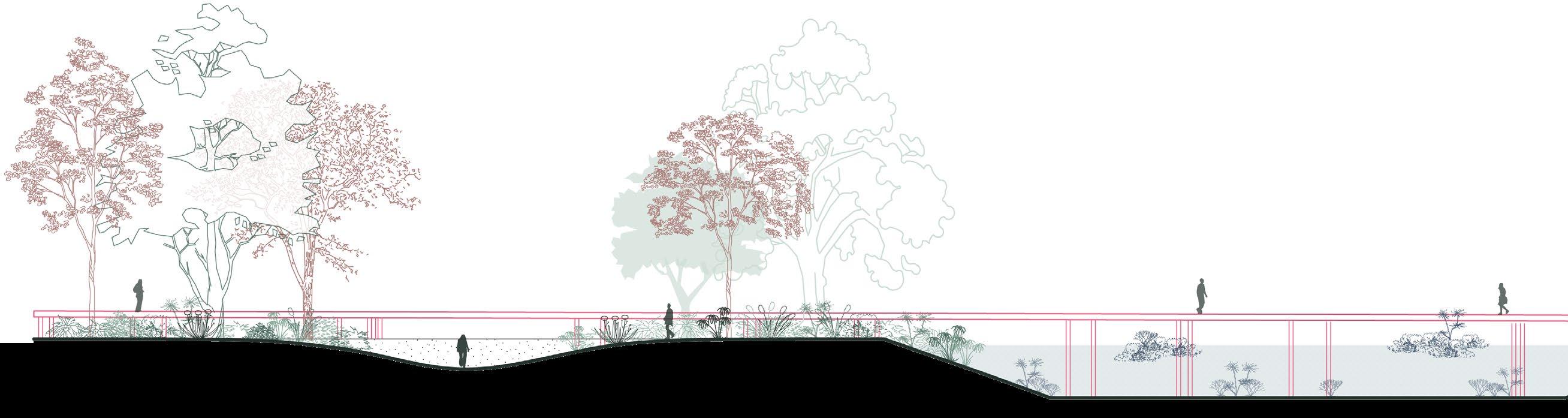
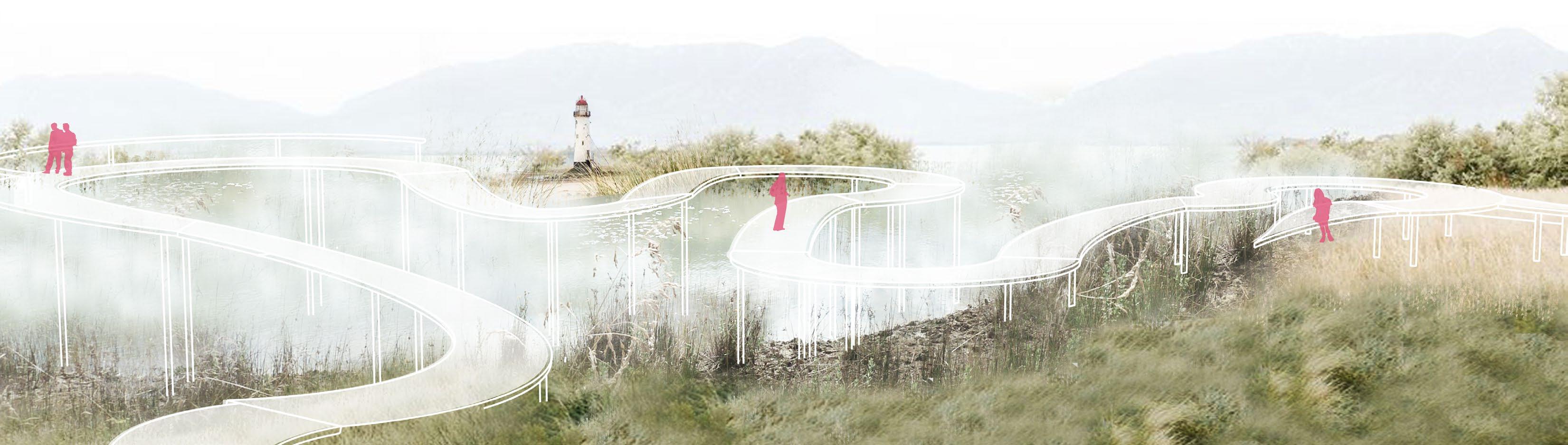
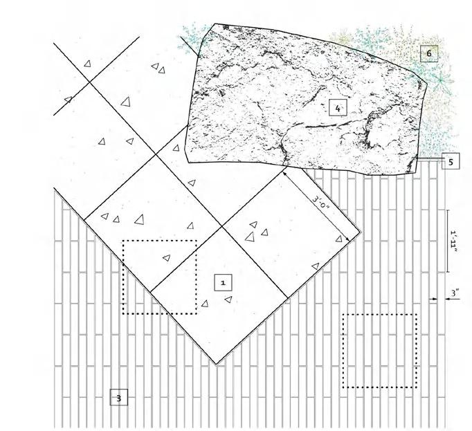
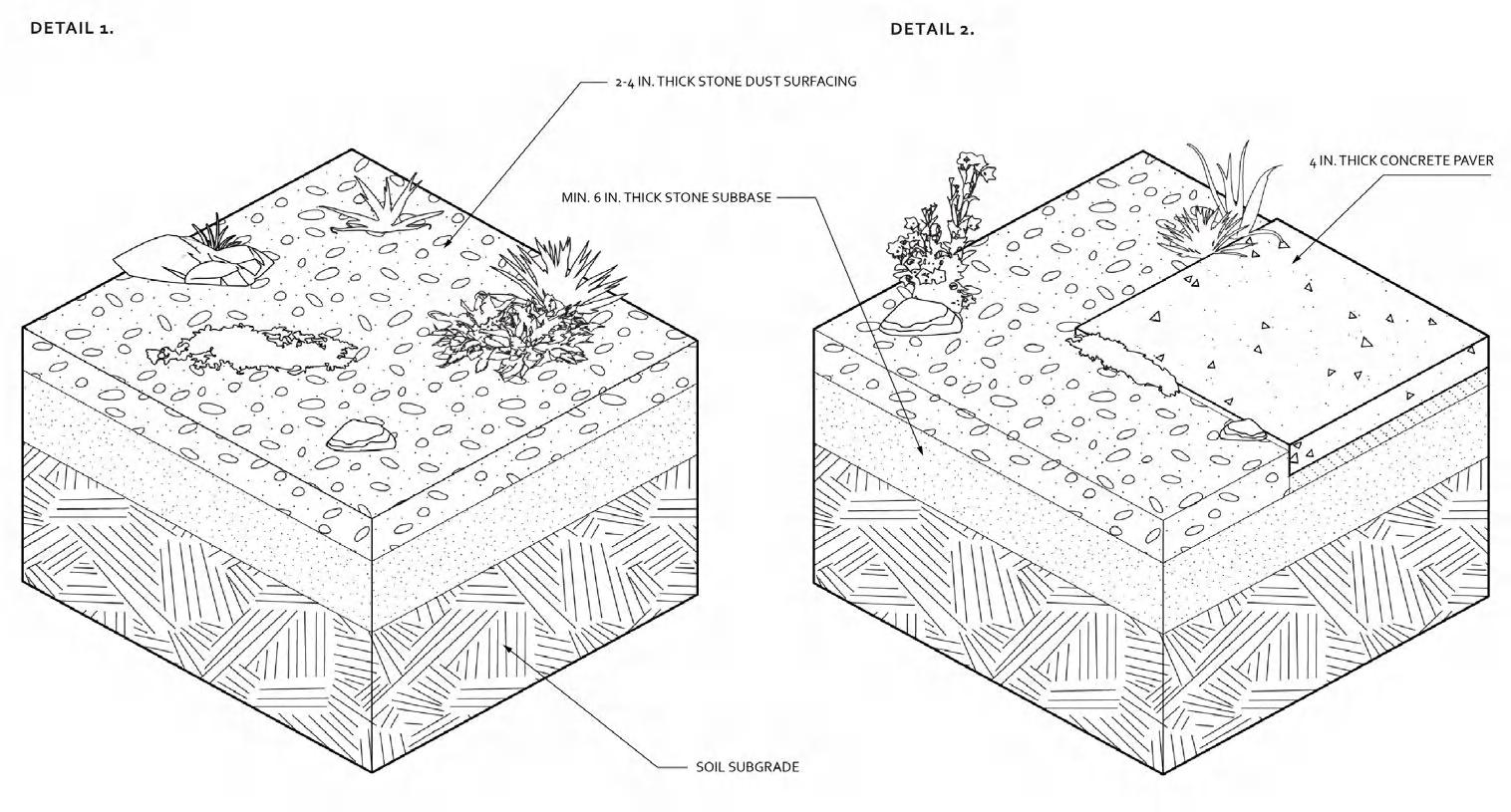
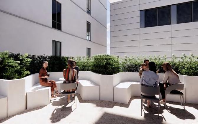
South Gordon Park faces significant challenges with poor road design, heavy traffic, and lack of bike lanes, making it unsafe for cyclists and pedestrians. The park’s entrances are unmarked and unsafe, further limiting accessibility. Highways nearby contribute to excessive noise, reducing the park’s appeal, while internal facilities suffer from poor maintenance.
(by Feiru)

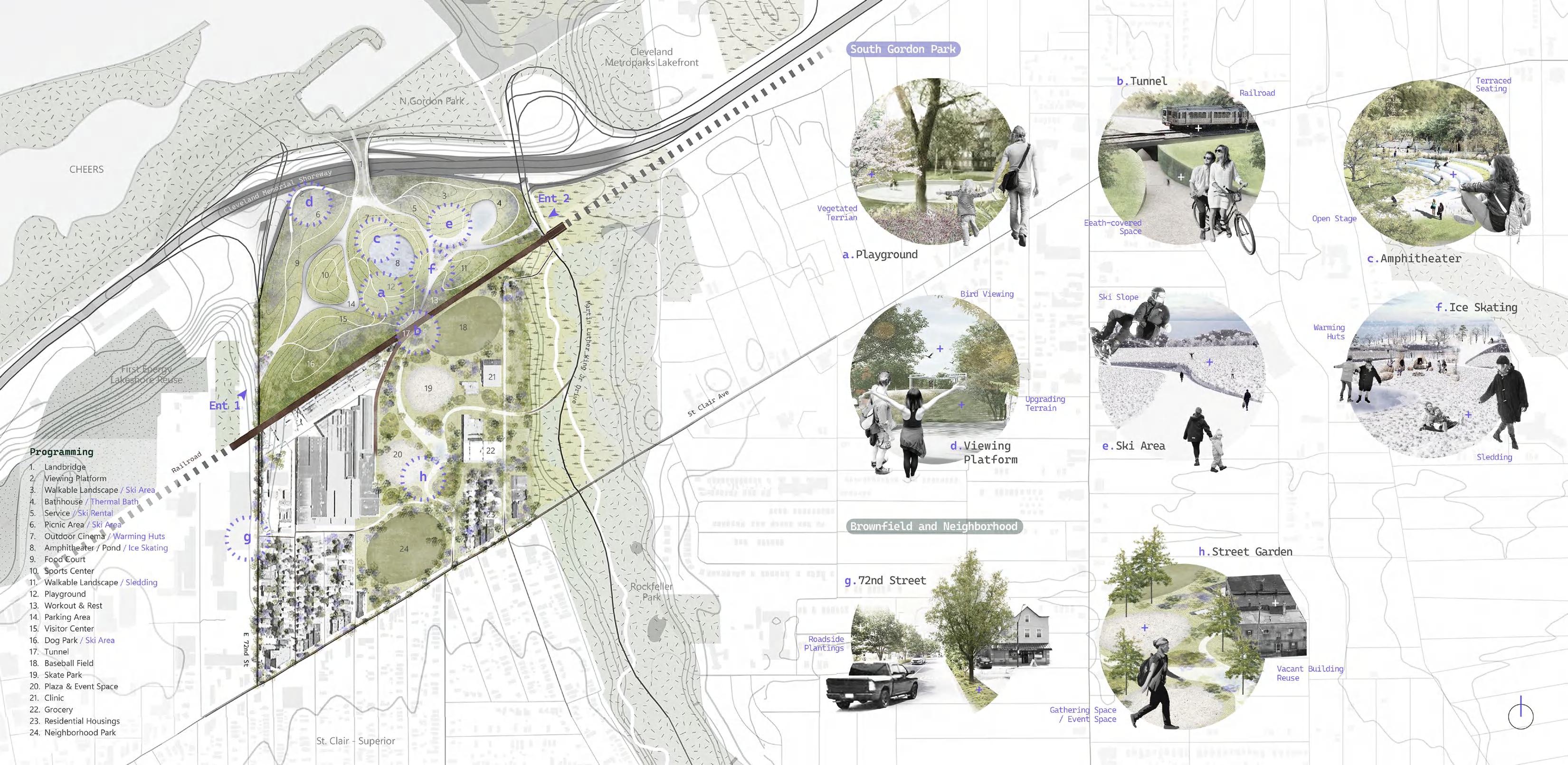
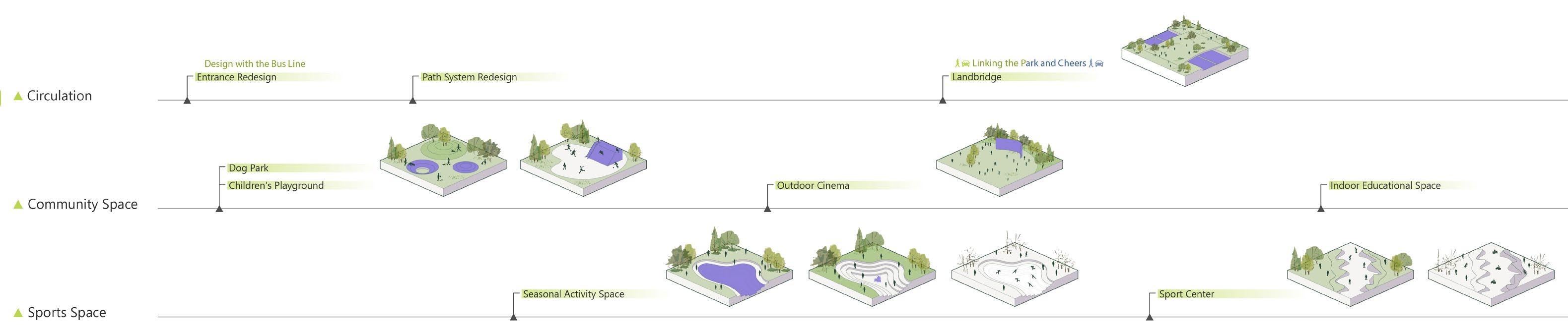
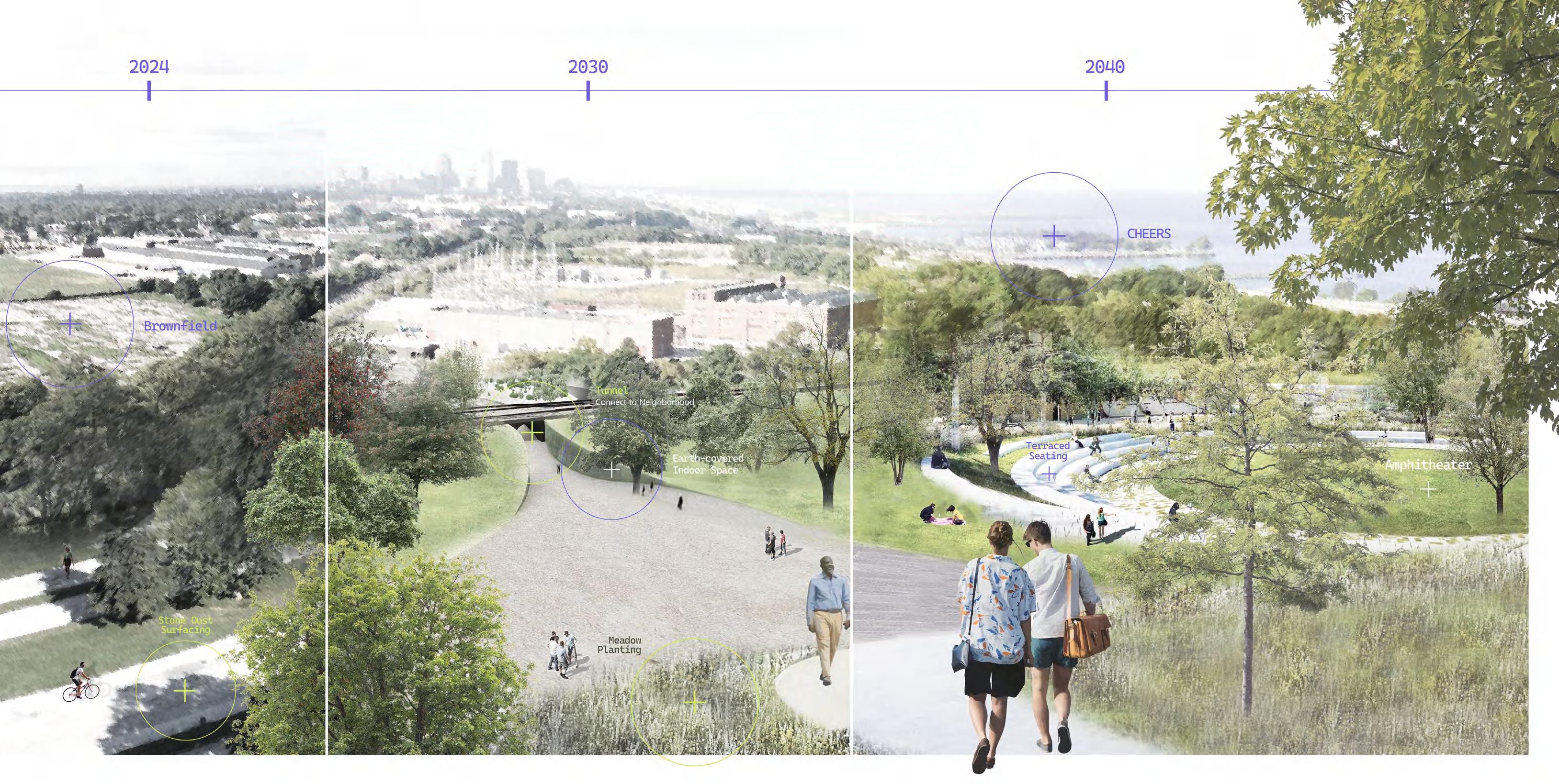
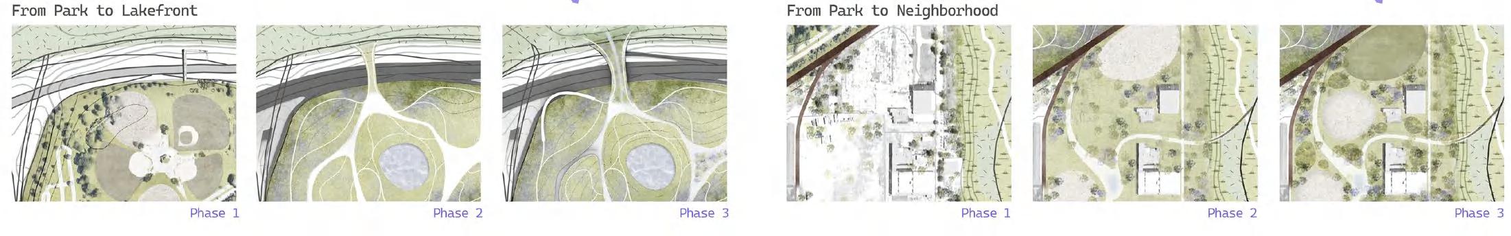
The design framework focuses on intertwining South Gordon Park with Lakefront Cleveland and reconnecting it with the neighborhoods. This approach emphasizes sustainable, phased strategies to address physical barriers and foster connectivity in the St. Clair-Superior community.
COOL LOOP
“Houston is So Hot Right Now!”
2024 SWA Summer Student Program
Type
Location
Date
Team
Program Leader
Client
Skills
Professional Work at SWA Houston Houston, TX
2024 Summer
Anne Tong,Jordi Prieto,Ken Tung,Sarah Oancia, Shiyun Wen, Wafa Bassiouni, Yanyao Cui
Natalia Beard
Downtown Houston + ArcGIS, Google Earth, Adobe Photoshop, Illustrator, InDesign, Rhino, Grasshopper, D5
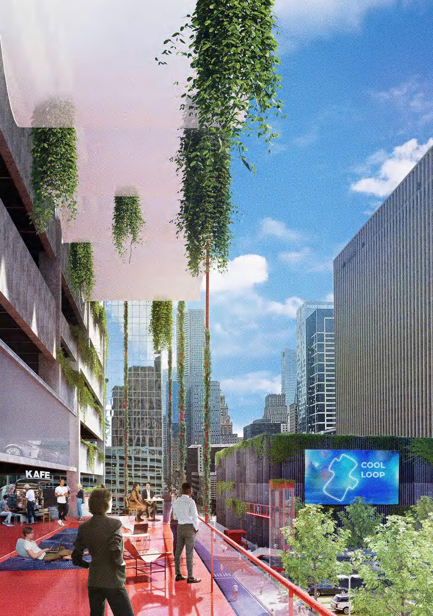
Downtown Houston boasts a collection of wonderful destinations, but its urban fabric is somewhat disconnected on a macro scale, making it challenging to navigate the entire area on foot. To address this, the project proposes the Cool Loop — an essential initiative for cooling the temperature, enhancing quality of life, activating Downtown Houston, and bringing people together.
The Cool Loop envisions vibrant streets where people congregate, benefiting from green infrastructure that reduces air temperature by as much as 5 to 10 degrees and paving temperatures by up to 30 degrees. It’s a place designed to experience and enjoy the unique energy of Downtown Houston, transforming the dream of an exciting urban life into reality. At different times, on various occasions, and for diverse users, the Cool Loop plays a central role in uniting Downtown Houston. It creates ‘hot spots’ that are both cool and fun to hang out in, making downtown not just a geographical center but also a focal point of the city’s positive aspects and identity.
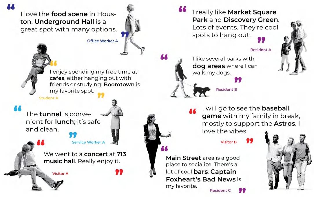
Downtown Houston is the center of America’s most diverse city, a fusion of cultures reflected in its world class food scene, dynamic arts districts, and thriving sports culture. It’s a hot spot for large events that bring Houstonians together, both on an annual and more regular basis.
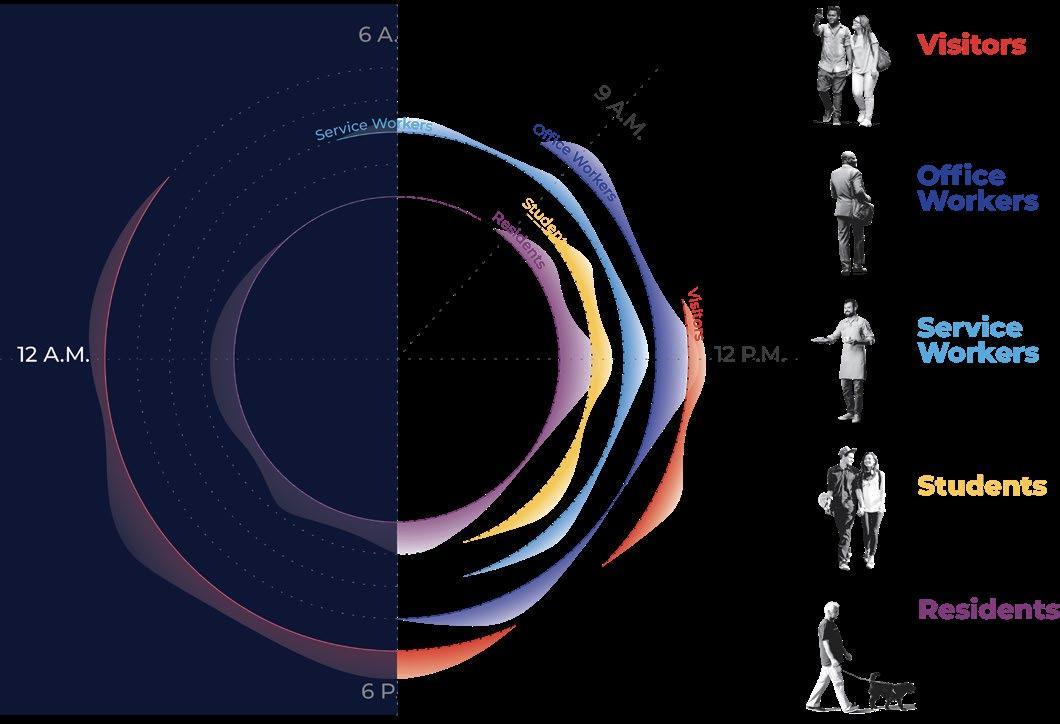
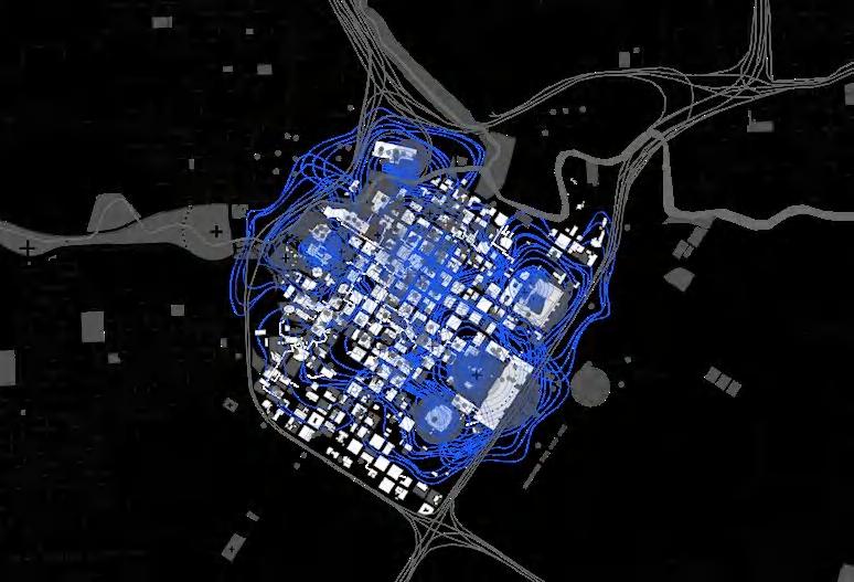
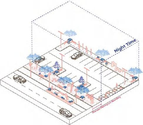
During the daytime, downtown Houston is very lively, with different groups of people gathering in various areas, but they are particularly concentrated on Main Street and in the tunnels.
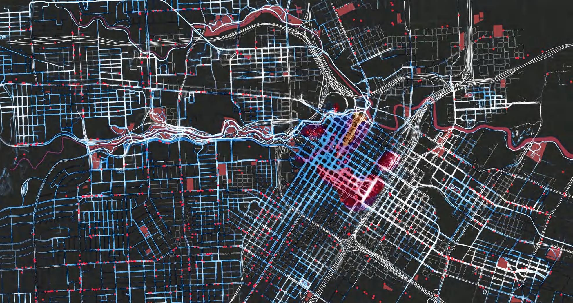
At nighttime, the energy in downtown decreases significantly, leaving mainly residents and visitors, who are mostly concentrated around event spots like the stadiums and clubs.
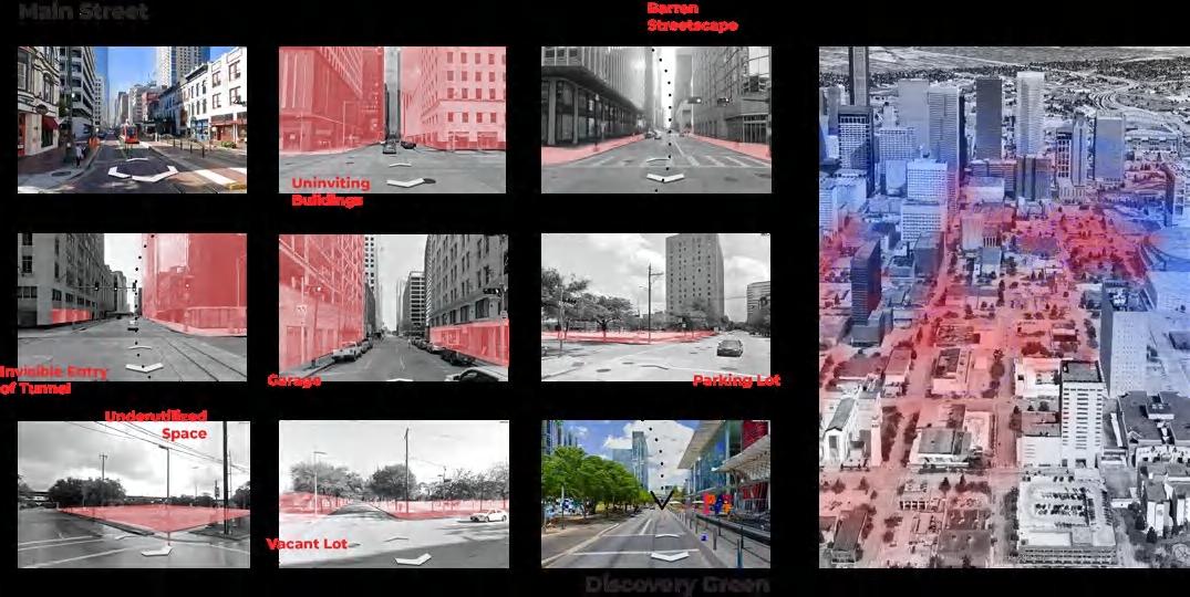
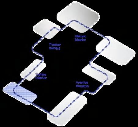
Gaps of Activeness
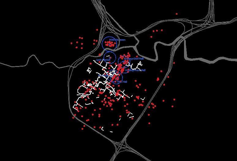
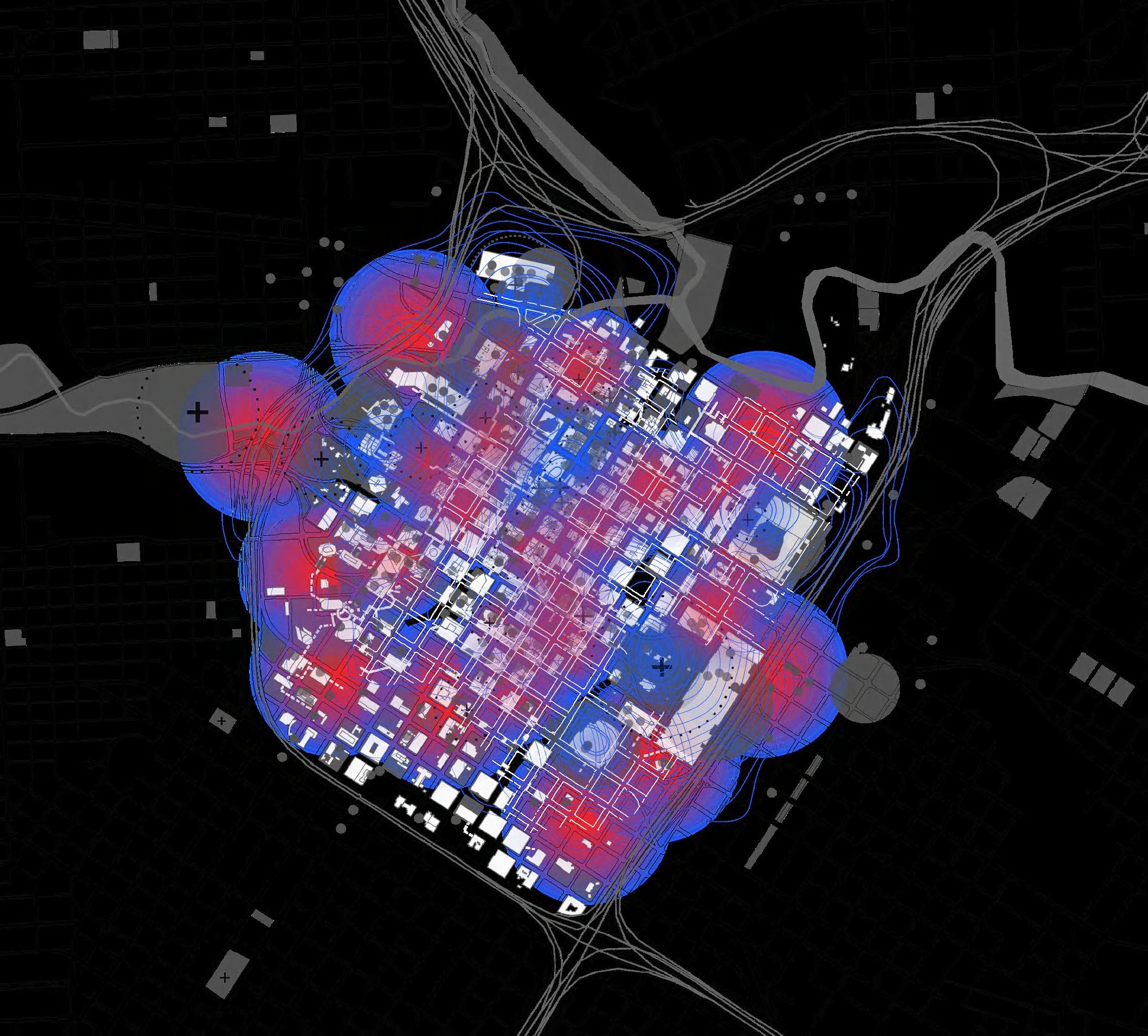
Missing “Middle Ground”

Our analysis showed that there is limited spatial overlap between social group activity in Downtown. Occasionally this may add up to activity deserts. However, the challenge presented by this disconnect presents unique opportunities: through strategic design interventions we can increase connectivity between hotspots, enhance public access and visibility of the tunnel system, and activate these activity deserts by creating spaces for interaction. This helps us find a middle scale of social activity that bridges the gap between large events and individual interactions, reflecting and celebrating the city’s diversity in everyday urban life.
Existing
Existing Social Zones
Event Social Spots
Leisure Social Spots
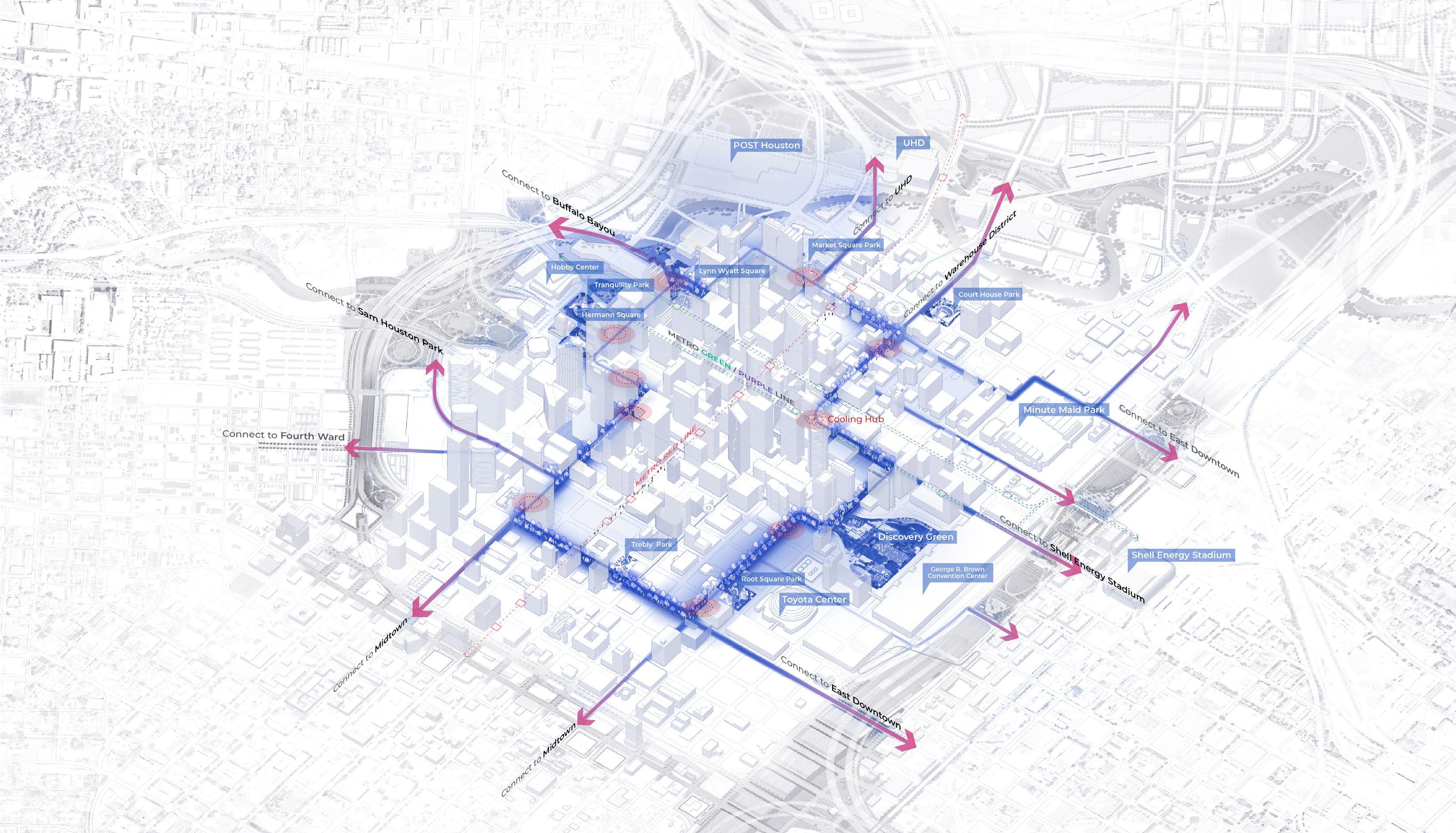
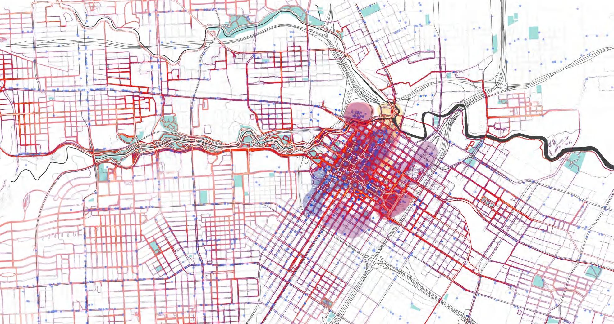
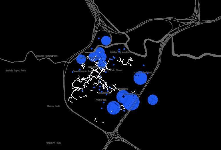
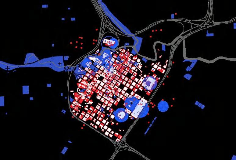
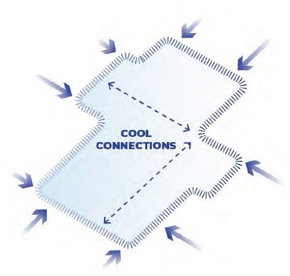
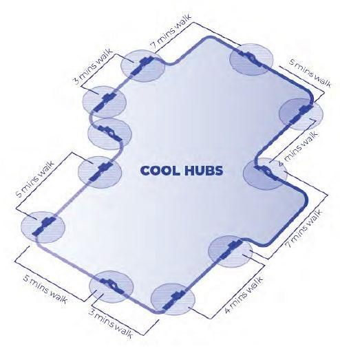
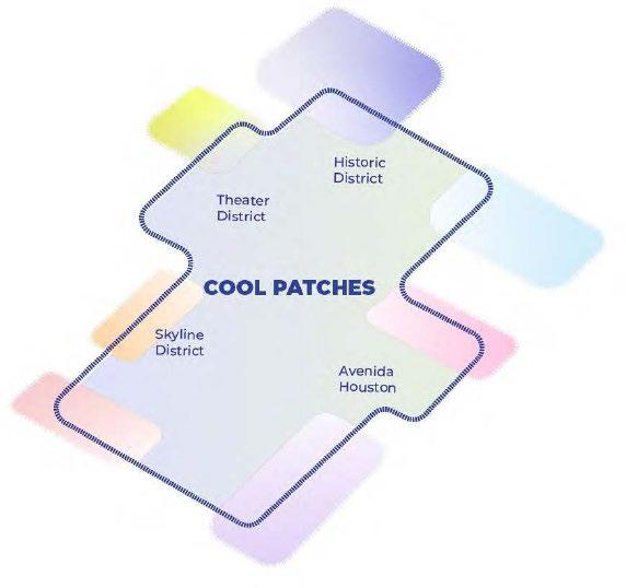
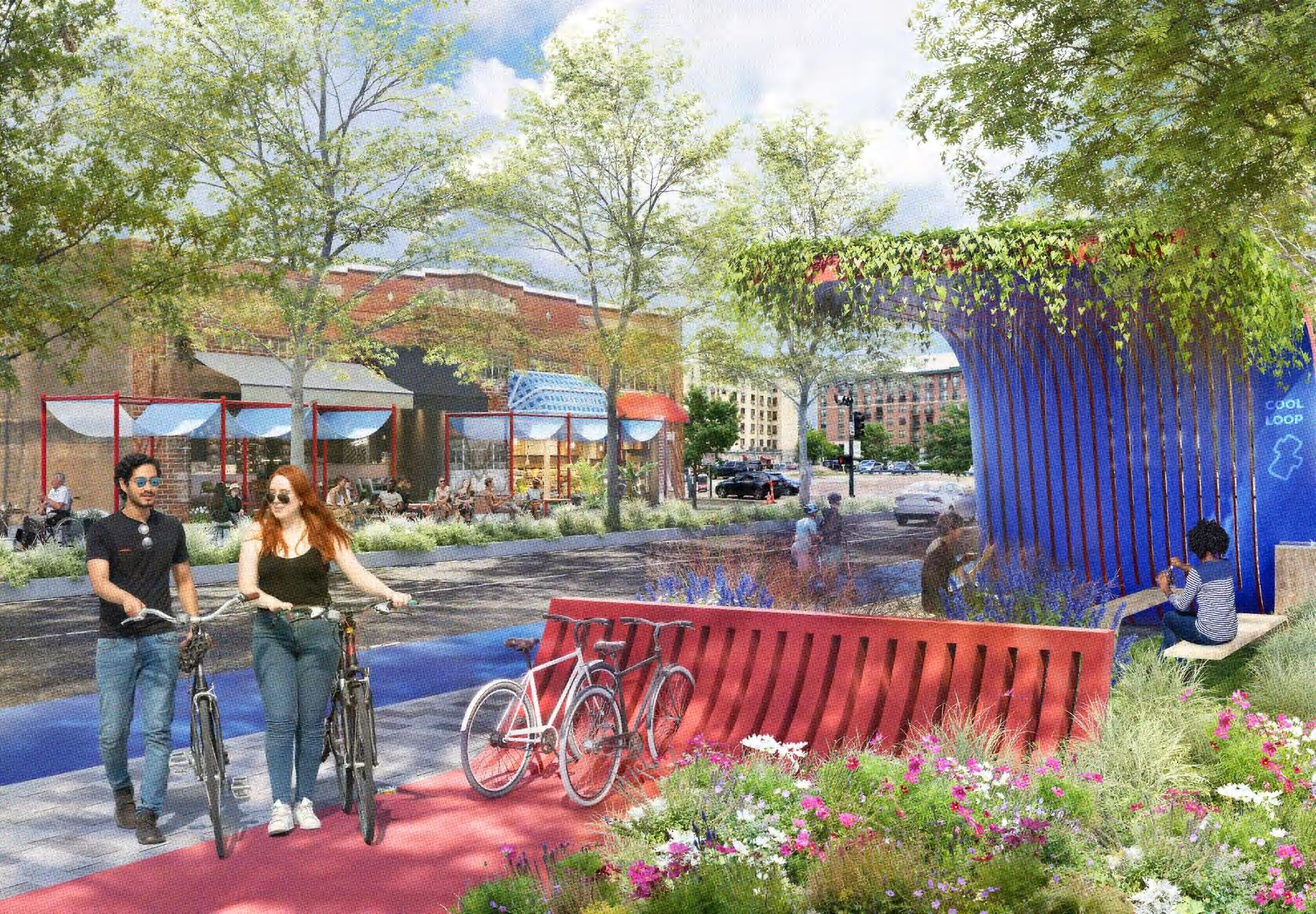
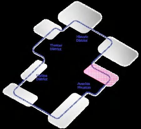
The Cool Loop
The Cool Loop is where Downtown Houston comes together, not just for parades and events, but in everyday life. Serving all modes of traffic, it occasionally transforms into routes for parades, rodeos, festivals, or races. The Cool Loop unites vibrant neighborhoods around downtown, strengthening community bonds. Along the Loop, seven Cool Hubs provide places to rest and connect, strategically placed at 5-7 minute walking intervals. These hubs also serve as gateways to the inner core of Downtown. Additionally, Cool Patches fill activity gaps, offering themed strategies that enhance the existing character and urban context of each area.
(by Ken)
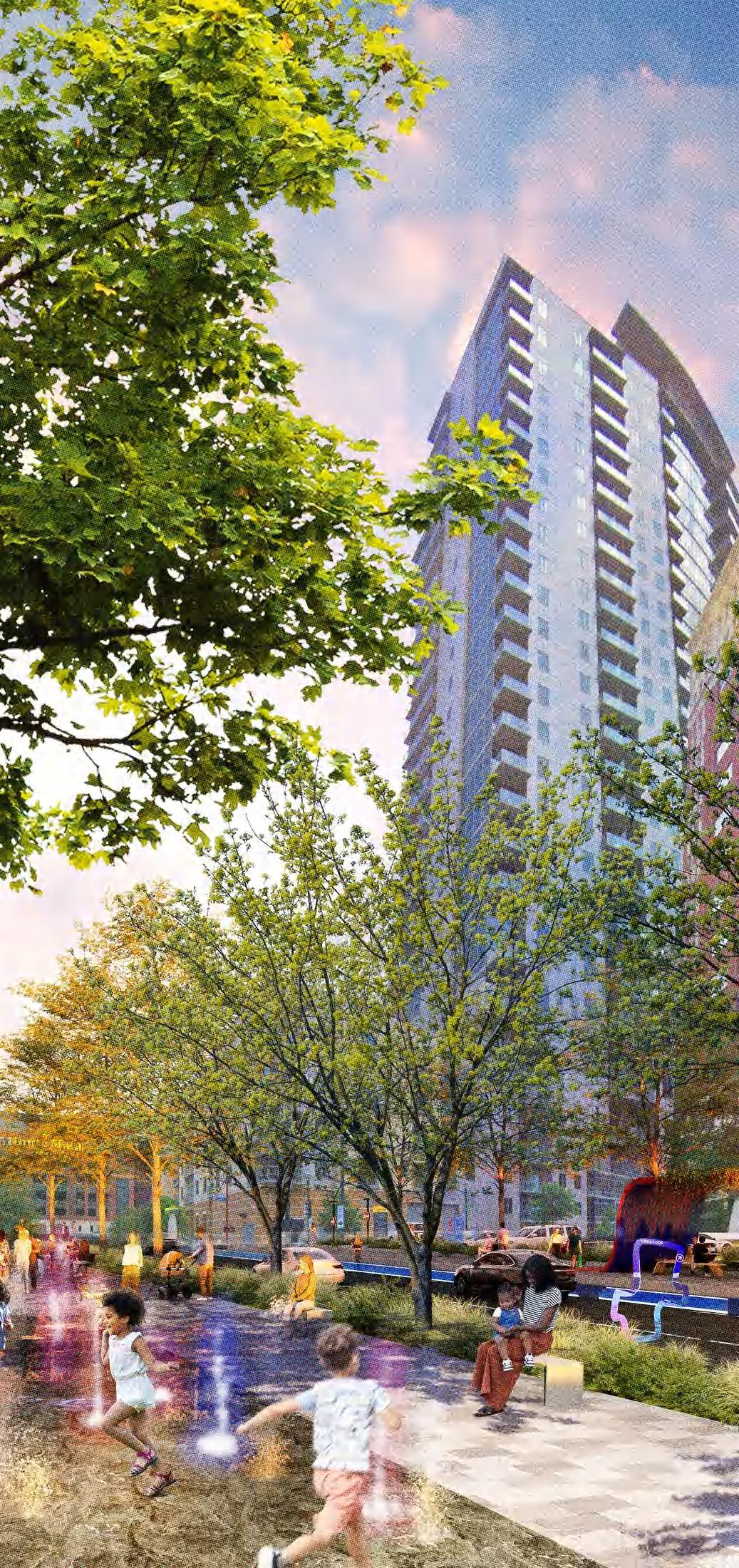
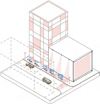
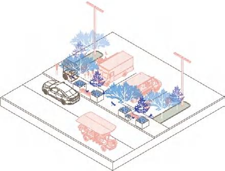
COOL PATCH / Community & Family
With the Cool Loop, high-quality neighborhoods are blossoming here, where energy and liveliness shine on the streets. Streets lined with local businesses, outdoor cafes, grocery stores, playgrounds, and cooling hubs that provide shade and refreshing moments for everyone in the community. At night, children playing in the water delightfully and also refreshingly cool. These spaces are designed to bring people together, promoting interactions across generations.
Toolkits
(by Shiyun and Wafa)

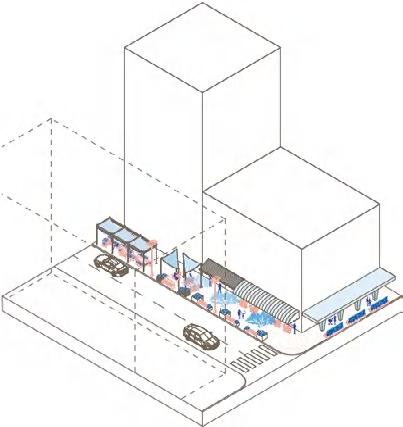
COOL PATCH / Food & Culture
This patch celebrate the diversity of Houston’s rich cultural identities and create comfort in the heat with food by one of the most popular treats to cool down: ice cream. This market has a variety of ice creams from all around the world. As the sun sets, this vibrant night market illuminated by beautiful neon lights. It’s a cool and exciting spot for nightlife.
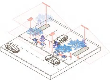
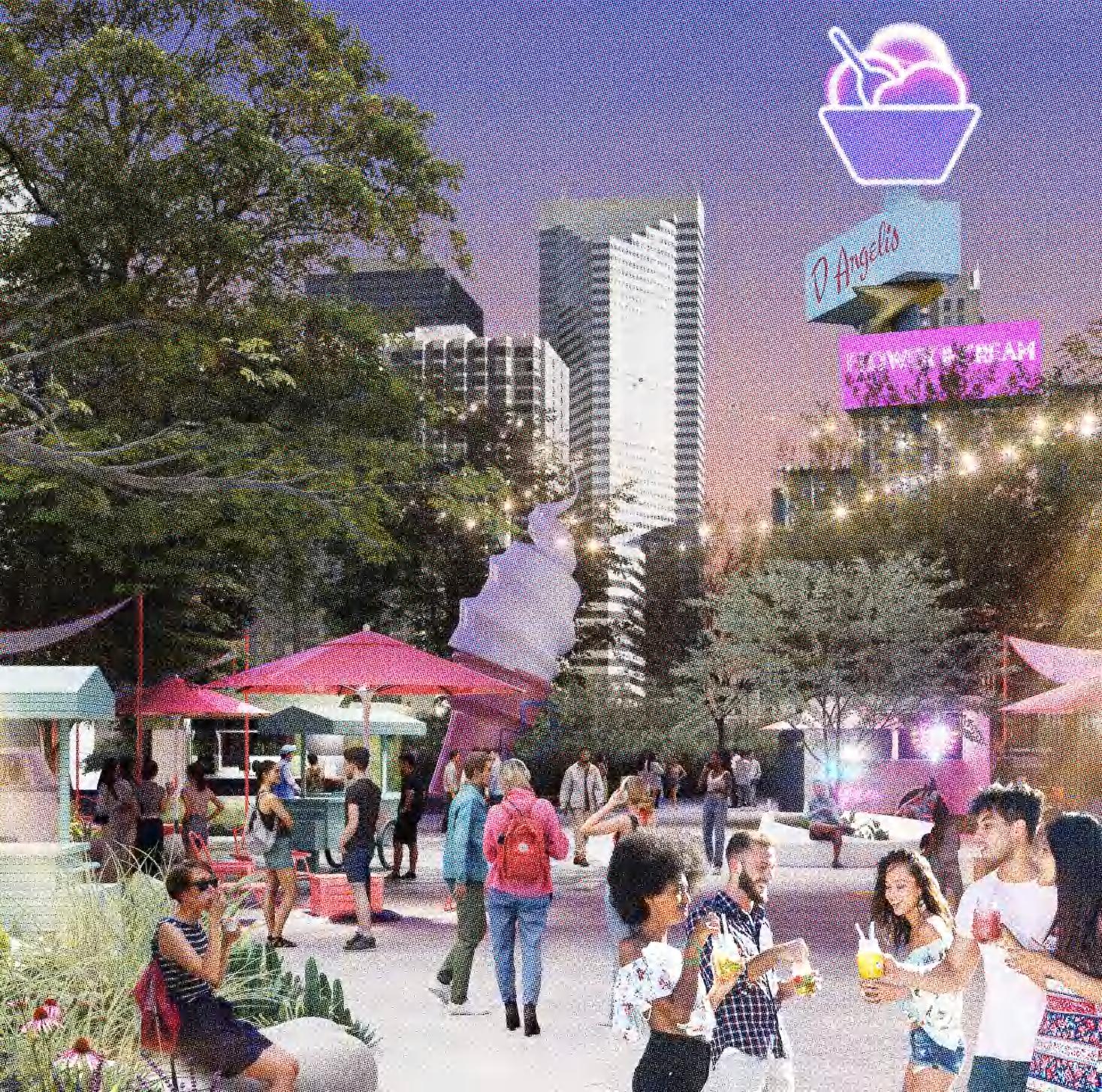
Food Truck Parklet Light Pole
Toolkits
(by Shiyun and Wafa) Daytime
Nighttime
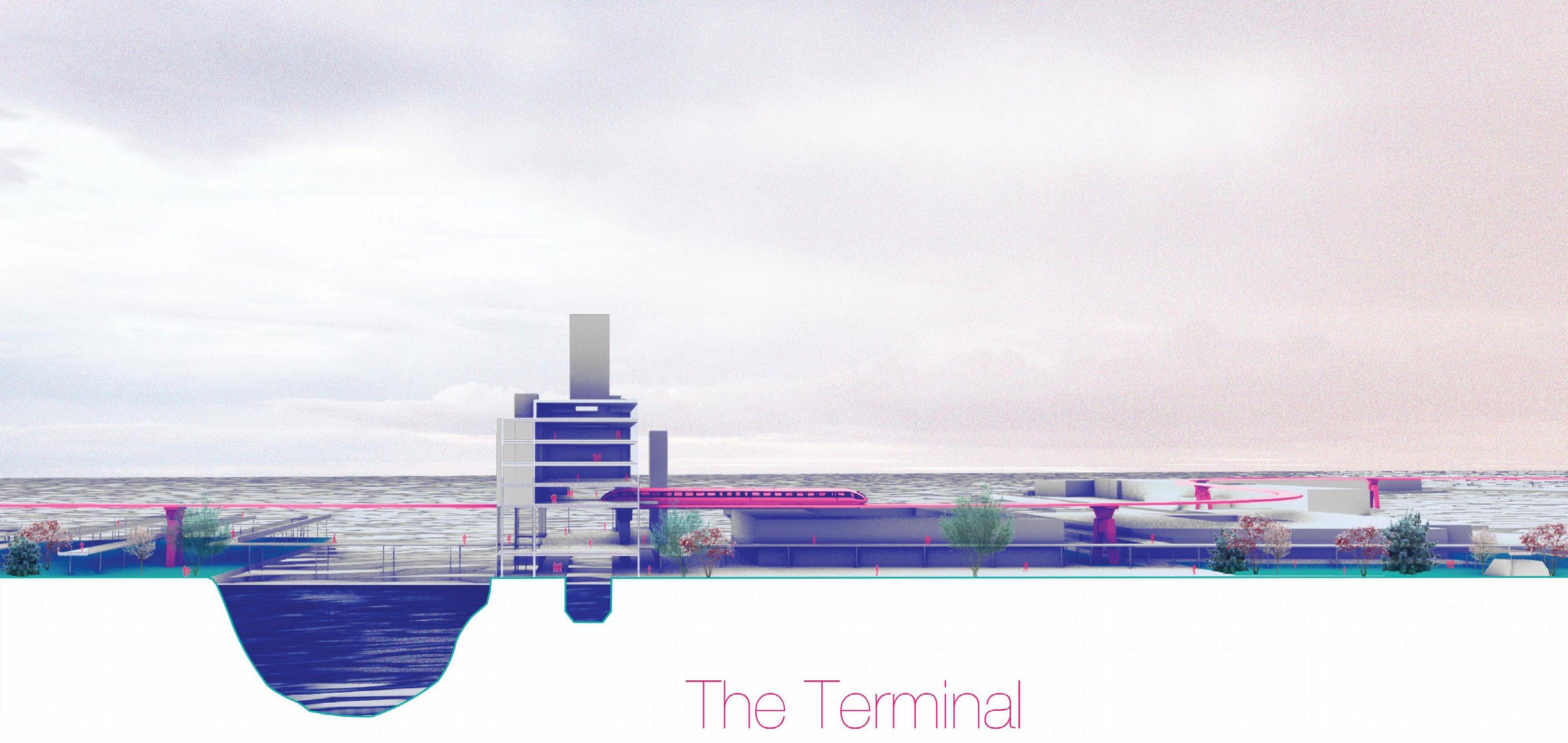
The Terminal
Type Date
Team
Instructor
Skills Academic Work 2023 Summer Jiayu Ruan Jennifer Birkeland ArcGIS, Adobe Photoshop, Illustrator, Rhino, V-ray Brooklyn, NY
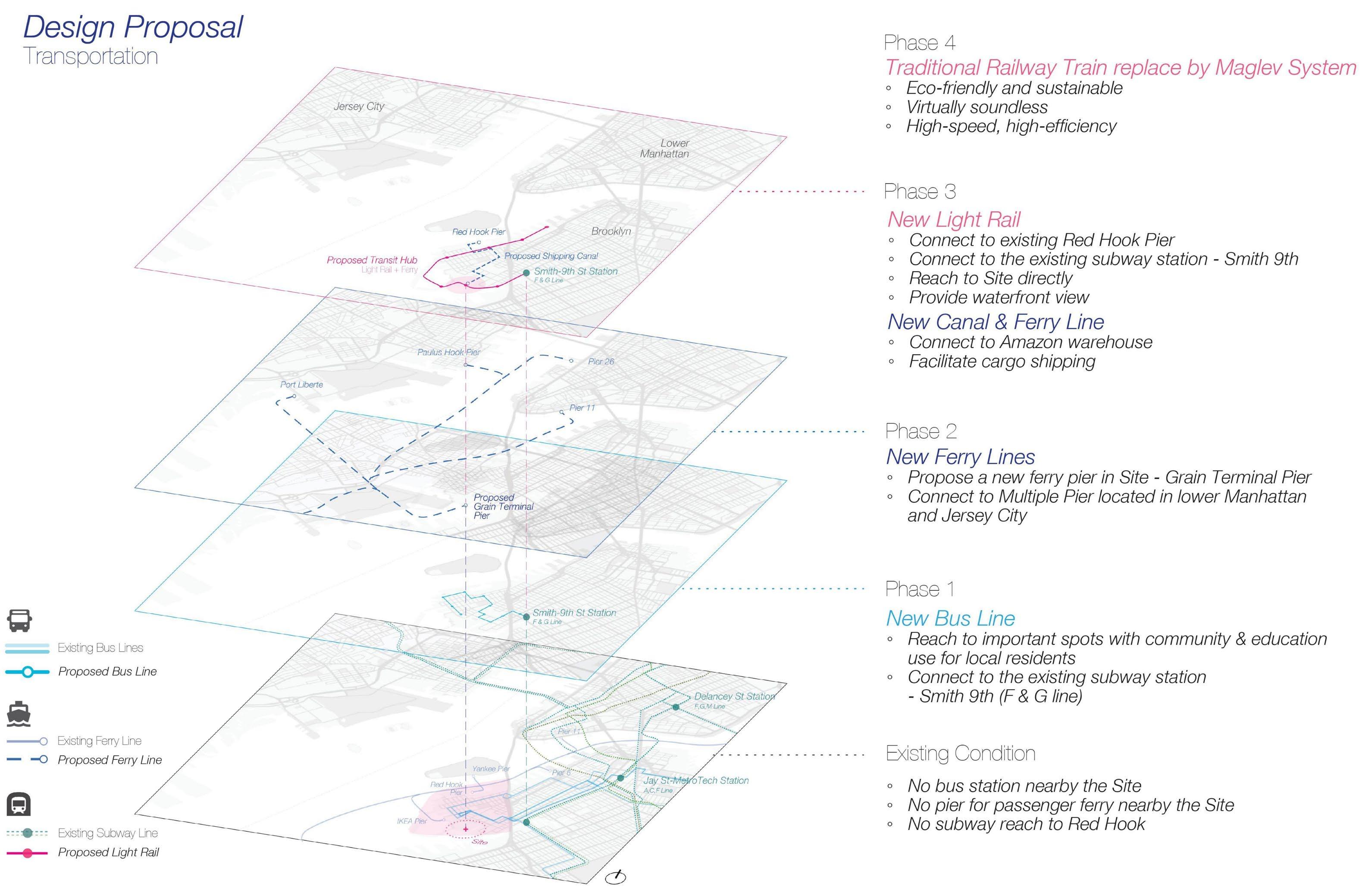
The project aims to connect the site and the surrounding Red Hook neighborhood to New York City and to enhance the vitality of the site and waterfront area by focusing on the upgraded transportation system and phased plan programming.
The proposal transforms the Grain Terminal which has been abandoned into a new transportation hub, including a new ferry line and new light rail system, while adding more educational and
cultural spaces to the site to help address youth education and employment issues in the Red Hook community. As the neighborhood develops, the Terminal and the transportation system will continue to evolve, connecting the site seamlessly to the whole city, and the functionality of the site will shift from education for the local residents to business and commerce for a larger target population, resulting in population growth, economic development, and land use diversity.
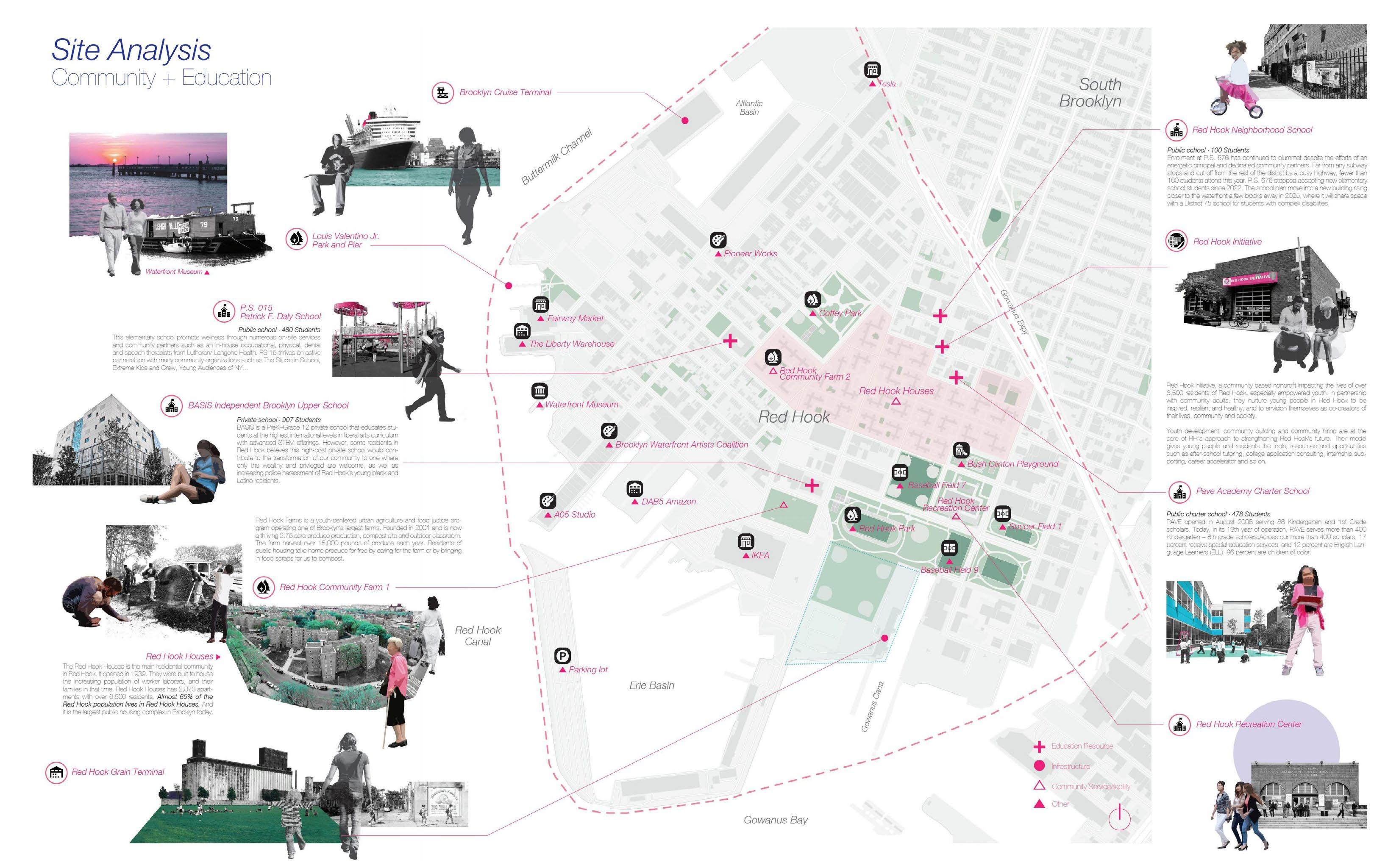
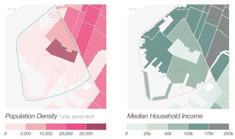
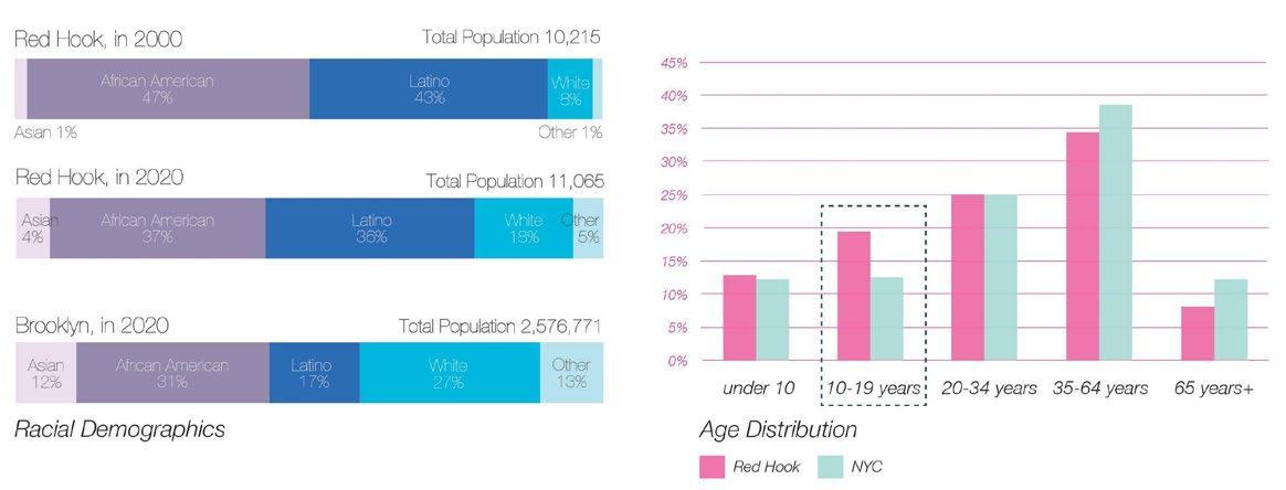
Red Hook is a culturally diverse neighborhood, with a mix of residential and industrial areas. The population mainly clustered in Red Hook Houses where over 7,000 residents lived. For age distribution, the Red Hook owns a younger community. There is a higher share of children in the community, especially teenagers in the 10-19 age range. Combined, children and young adults between the ages of 5 and 24 account for over 37 percent of the total population in Red Hook. Therefore, education is an important issue this proposal is going to focus on.
Concept Development (with
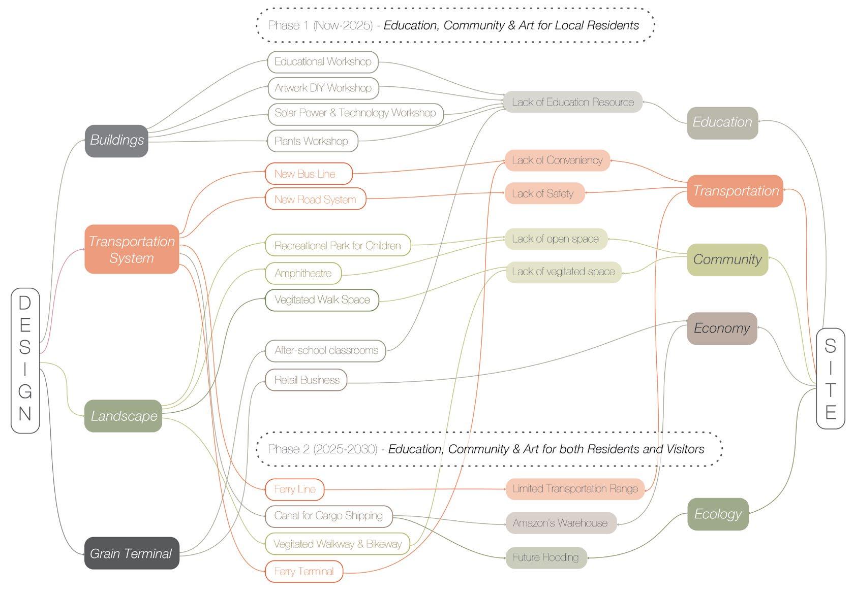
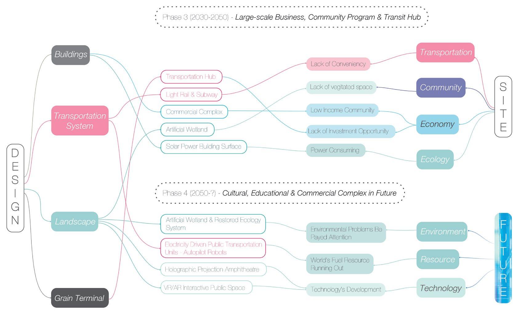
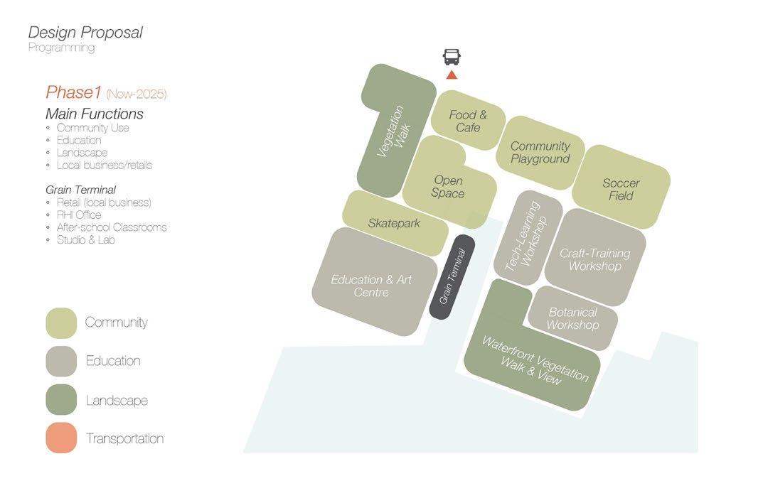
To address the main issues of the site and the Red Hook community, the design proposal provides a phased plan that focuses on the Grain Terminal, the transportation system, the landscape, and the use of the building. This means different representations of the same element at each phase, additions/changes in functionality, and innovations in the system.

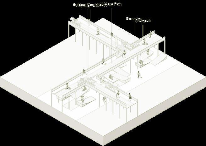
Community Skate park
Jiayu)
Pathway Phase1
Skate park + Walkway/Bike way
Pathway Phase2
Skate park + Walkway + Light Rail
Pathway Phase3
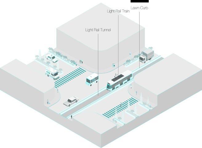
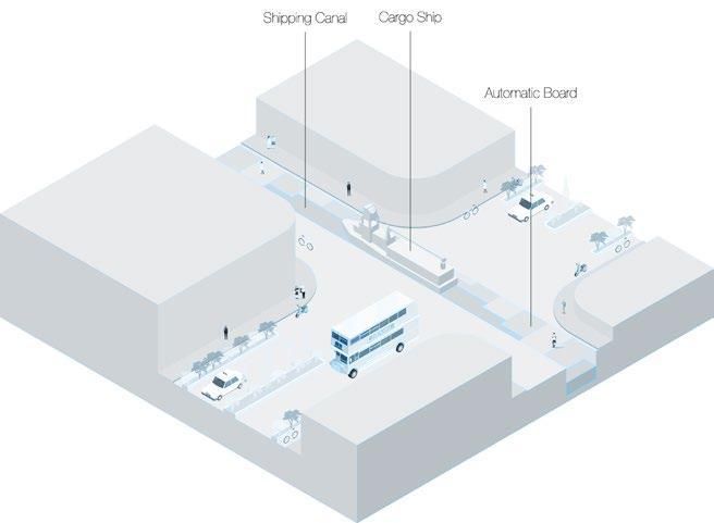
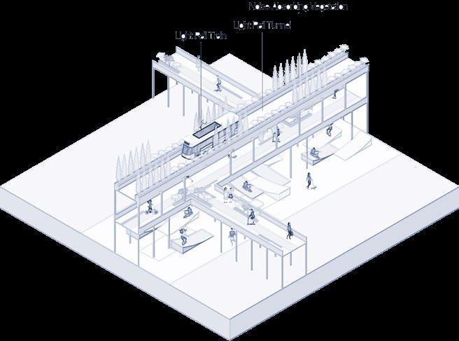
Light Rail + Subway Transit System Phase3 Cargo-shipping Canal
Transit System Phase3
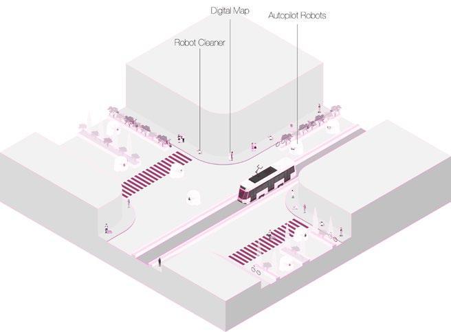
Autopilot Robots
Transit System Phase4
(Axons by Jiayu)
Master
plan Phase1-2
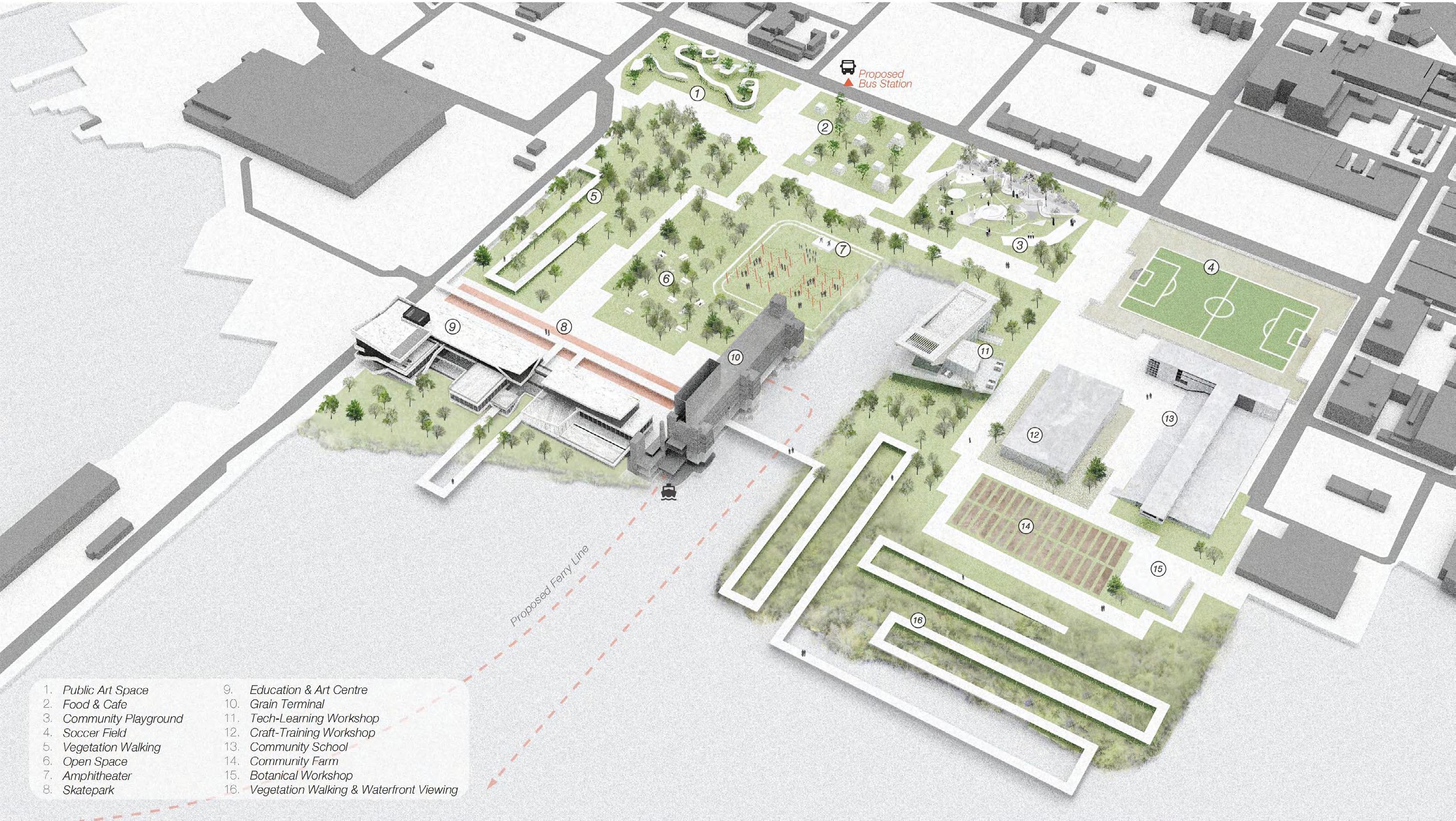
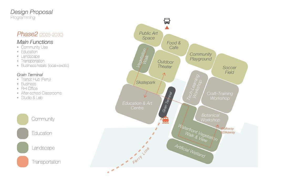
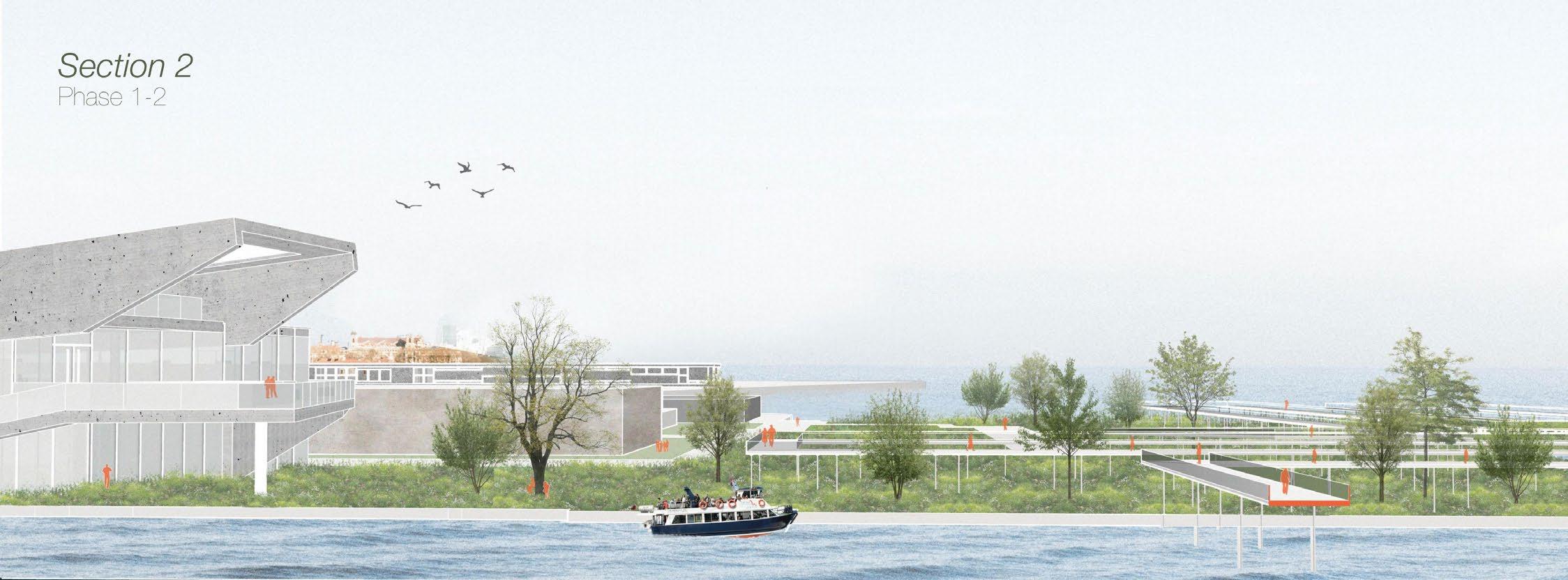
The main programs happening in phase 1 are new buildings built up to provide space for education use, the long walkway across half of the site, especially focus on waterfront and vegetated space to provide residents the experience of green and natural landscape view. Many open-air spaces provide various community facility programs such as public art space, picnic and dining area, and outdoor theater. In phase 2, the Grain Terminal will have the transportation function as a ferry pier.
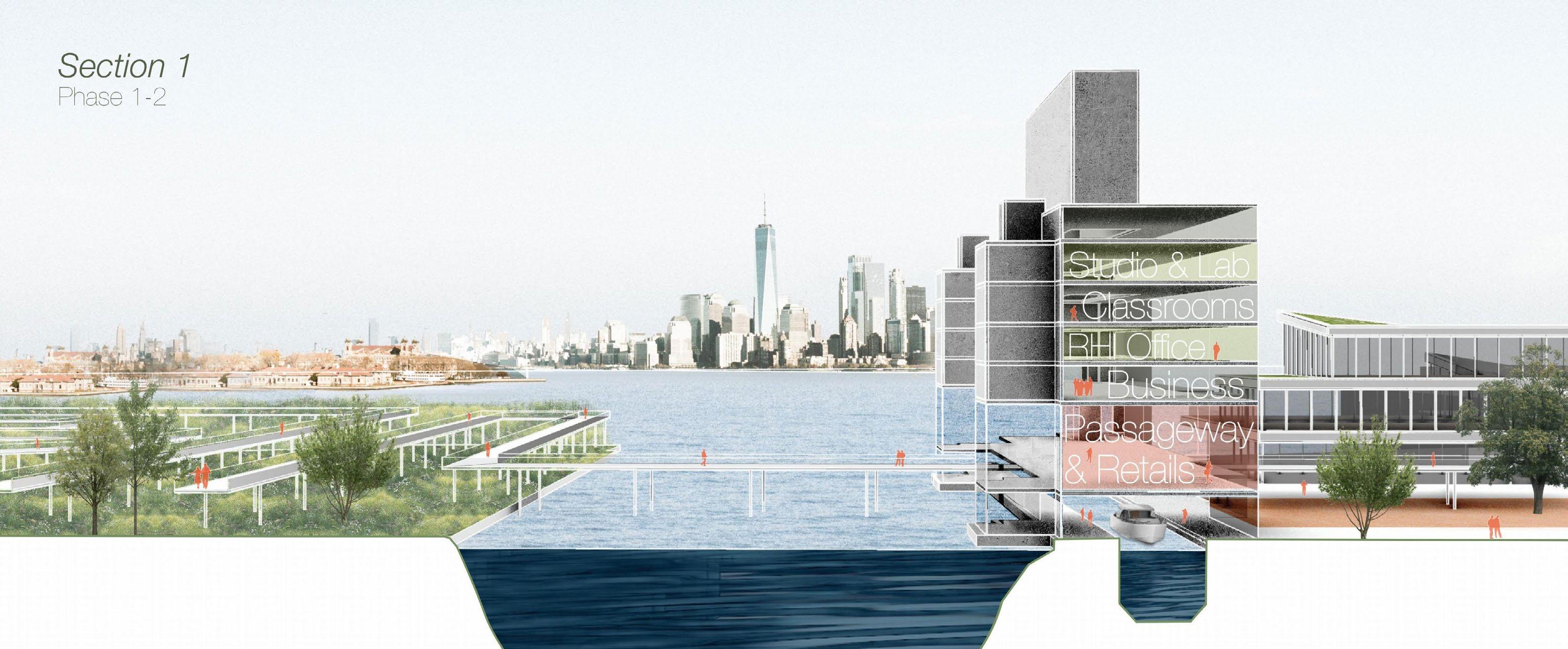
The walkway allows visitors to walk from the vegetated waterfront landscape, across the Gowanus Canal and then enter the Grain Terminal, the first level of the building turns into a ferry pier in phase 2. The second level is the passageway allows people to walk through the building. There will also be some retail and local businesses. The upper levels are for educational use and the RHI office.
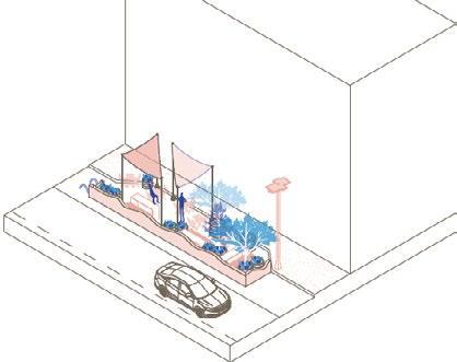
Across the Grain Terminal, there is an Education & Art Centre and a skate park under the walkway.
There are some workshop spaces designed for the site that provide different training programs, helping residents in Red Hook especially teenagers acquire one or more skills that will help them in their future careers and lives.
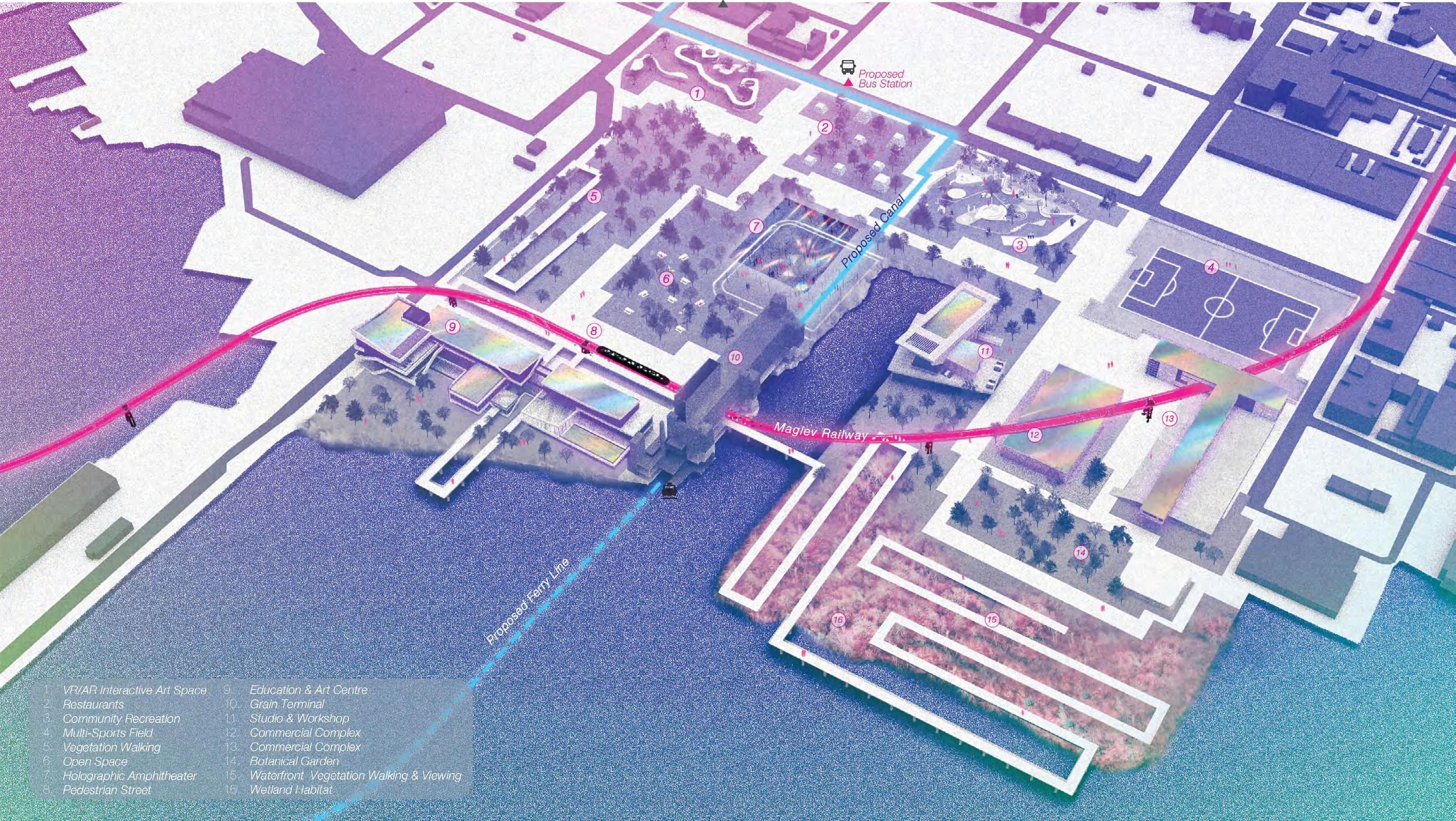
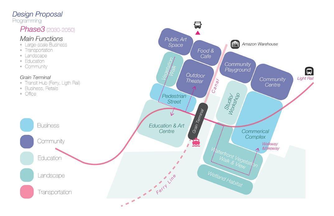
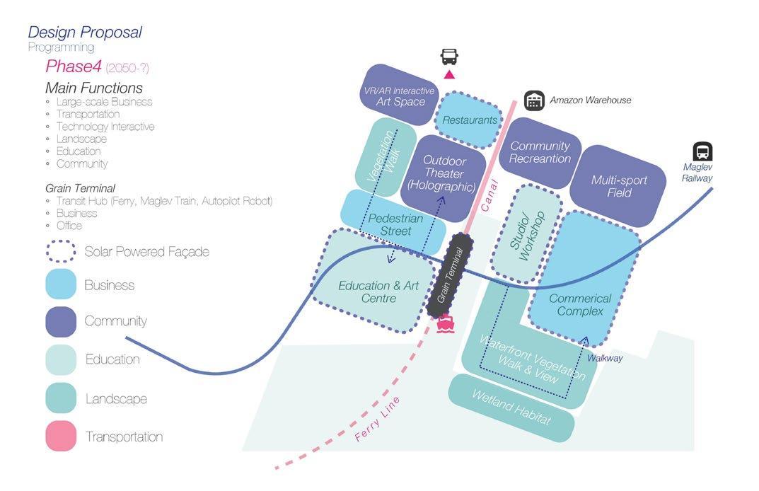
Master plan Phase3-4
This master plan shows the hypothetically ideal condition of the site and Red Hook in the next 50-100 years. The light Rail crosses the whole site and stops at the Grain Terminal, bringing visitors, residents, and people who work in Red Hook to the site. The proposed canal connects to the Amazon warehouse, facilitating cargo shipping. In this phase, buildings previously used for educational purposes will be converted to commercial use and business use, with solar power facades to collect and recycle energy with eco-sustainability design.
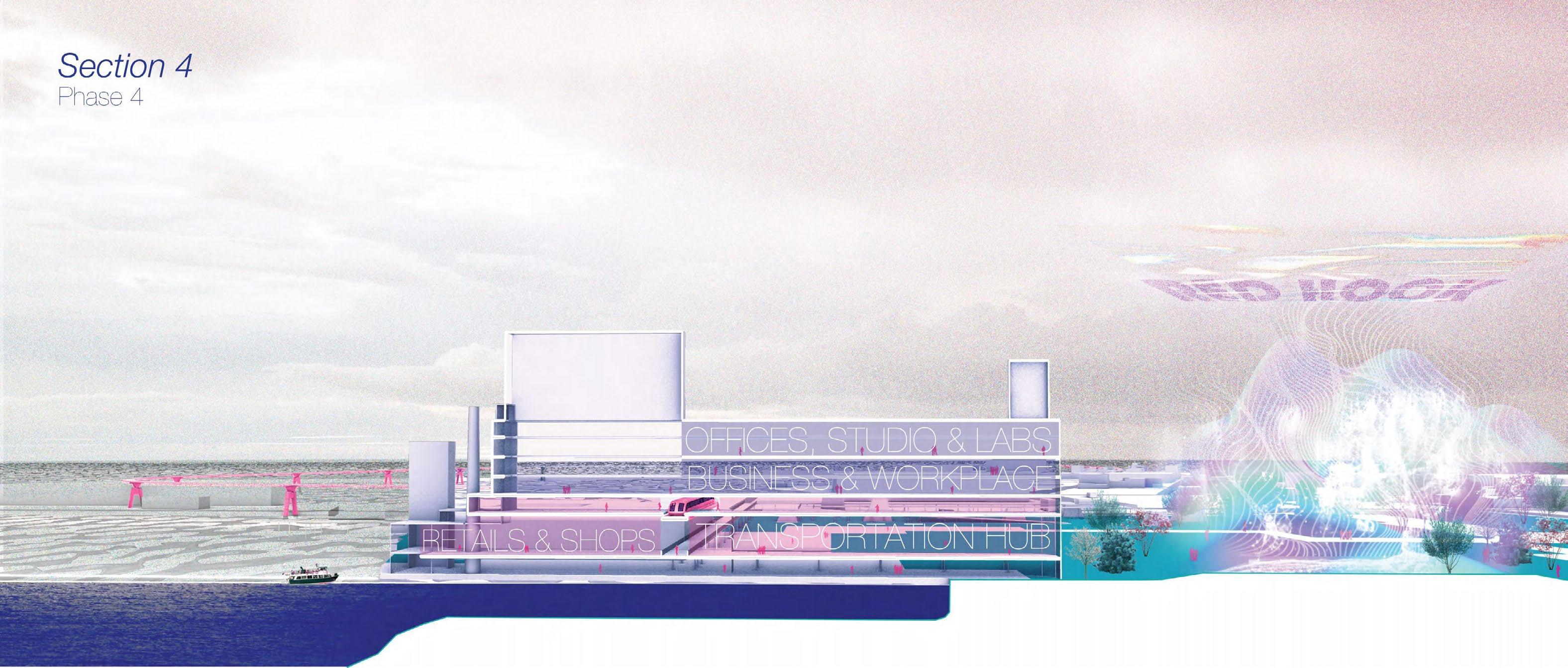
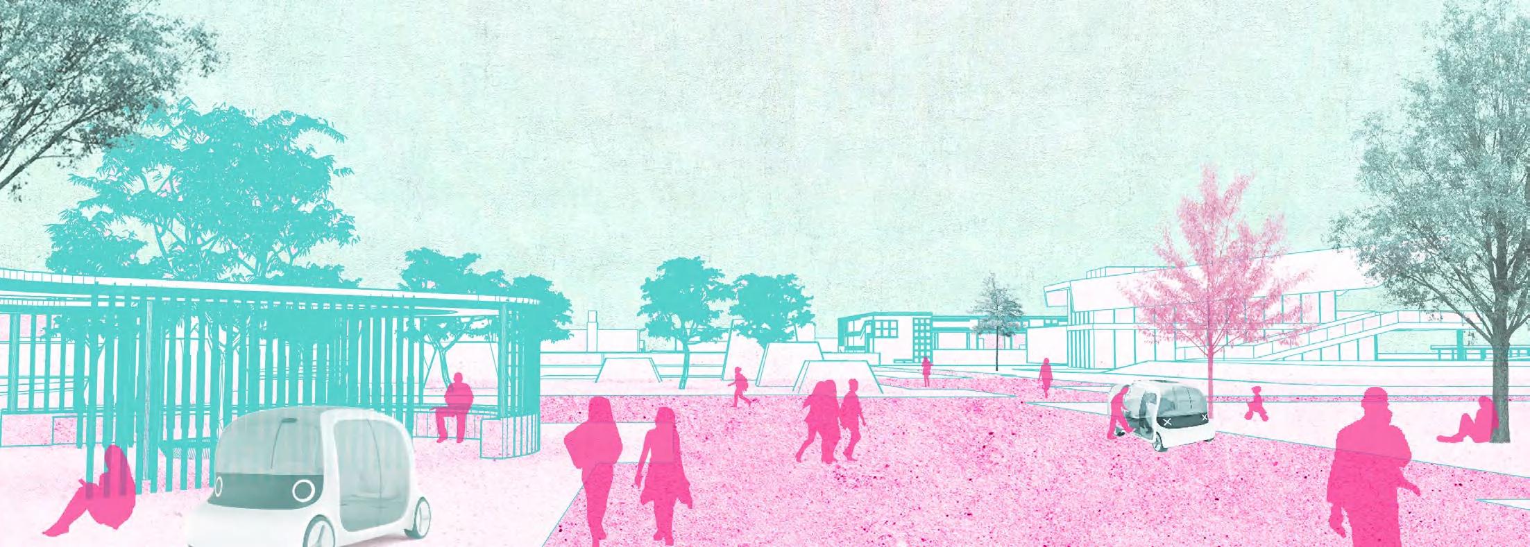
The transportation system will be upgraded in this phase, with the light rail replaced by the Maglev train across the Grain Terminal, using its lower level as a transit station. The train will go along the waterfront area, providing passengers with a broad riverside view and the skyline of Manhattan. At the same time, an Autopilot System will be introduced into the site in this phase, these robots help visitors more easily reach the various buildings and spaces of the site, which ensures safety and is more eco-friendly.
In open-air space, there will include new technologies such as holographic and virtual reality technology allow people to have more interactive, visionary experiences within the site landscape.
From Vine to Wine
Finger Lakes Region, NY
Type
Date
Team
Instructor
Skills
Academic Work, Research
2024 Spring
Individual Work
Anne Weber ArcGIS, Adobe Photoshop, Illustrator
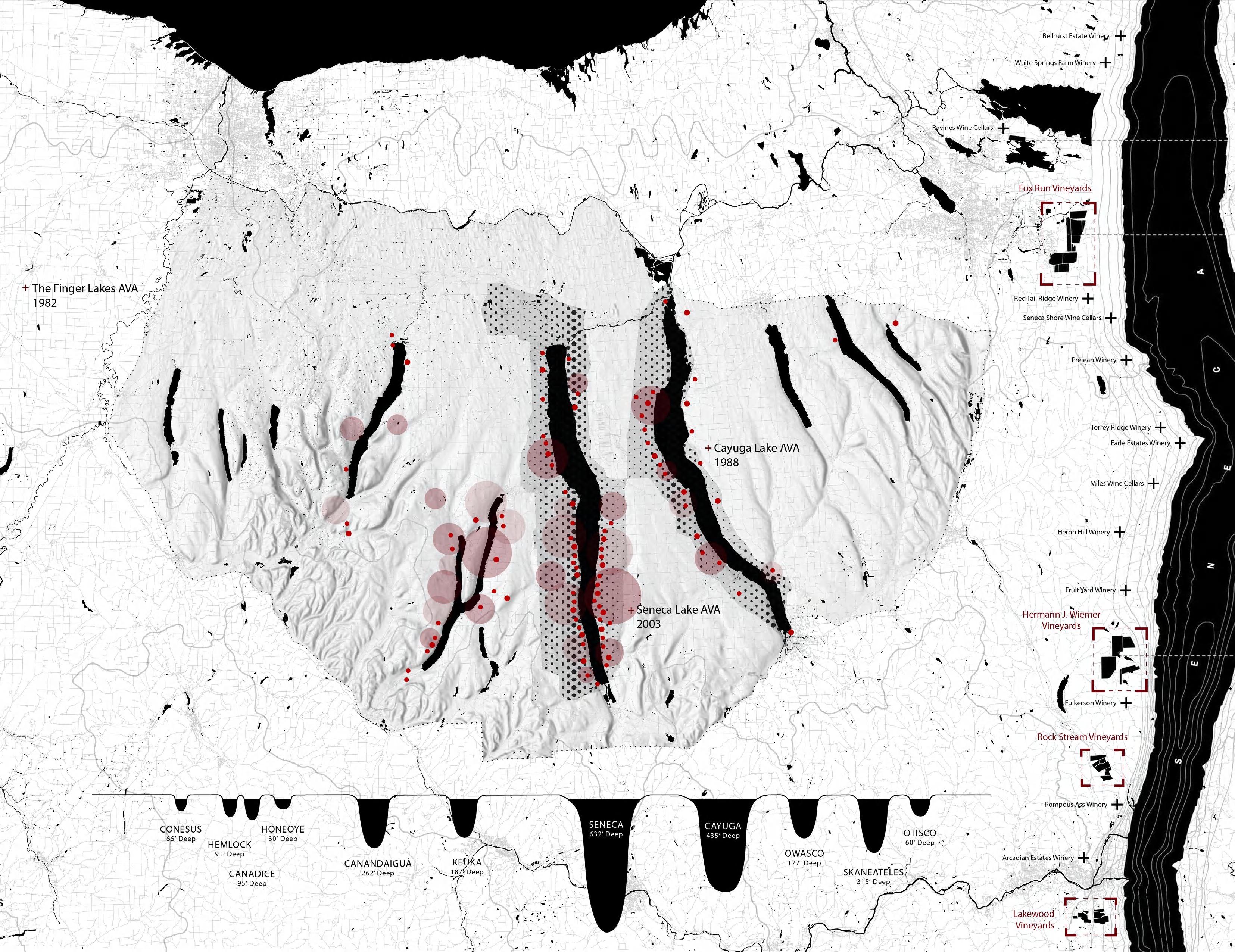
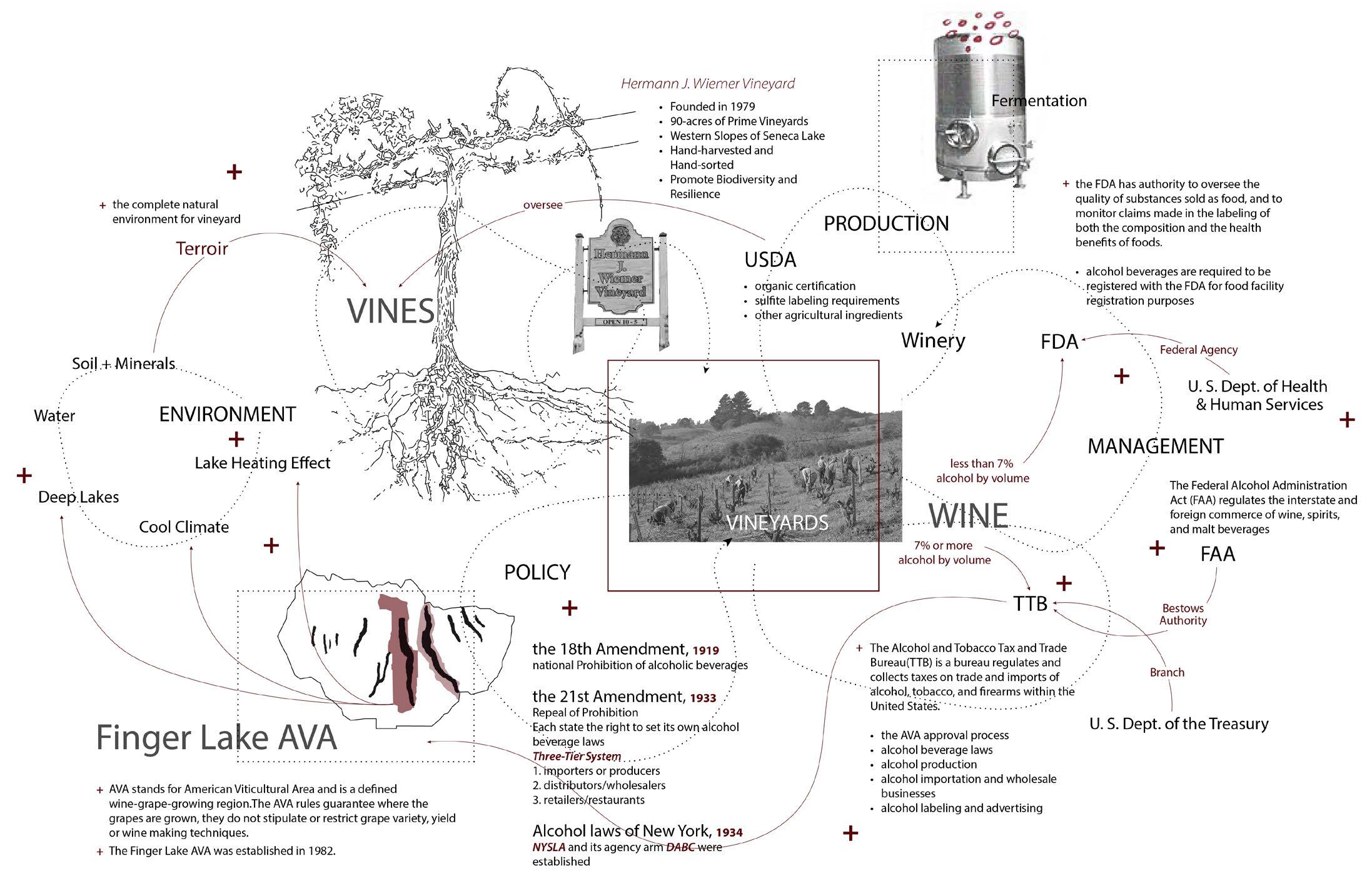
The Finger Lakes region, shaped by ancient glaciers, consists of eleven lakes that moderate local viticulture. The Finger Lakes AVA, established in 1982, spans over 11,000 acres, with major vineyards around Cayuga and Seneca Lakes. Unique micro-climates and diverse soil types contribute to the distinct flavor profiles of Finger Lakes wines. Climate change, however, threatens this viticulture. This project focuses on developing alternative management toolkits as sustainable practices to address future climate change and maintain the resilience and productivity of the Finger Lakes vineyards.
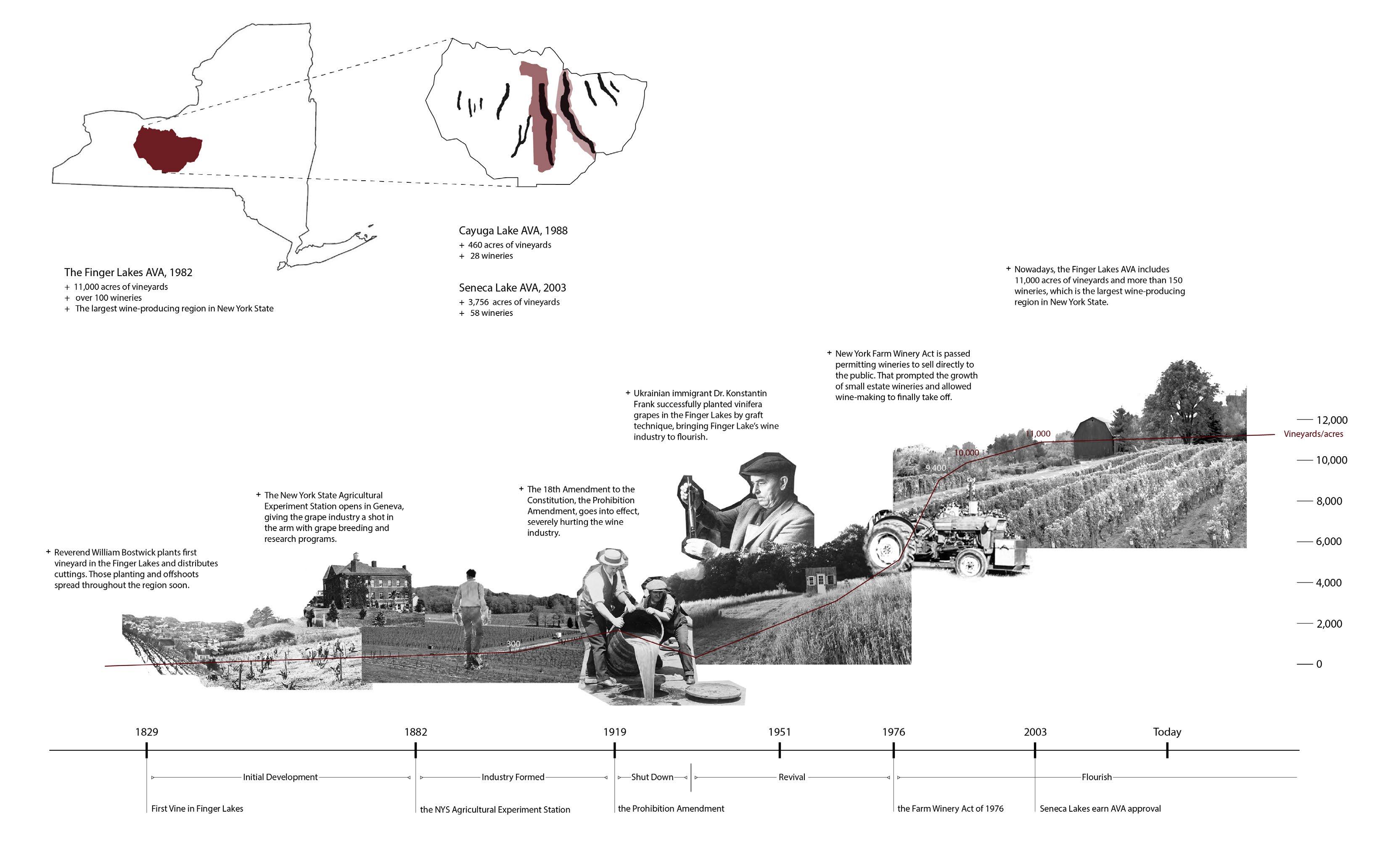
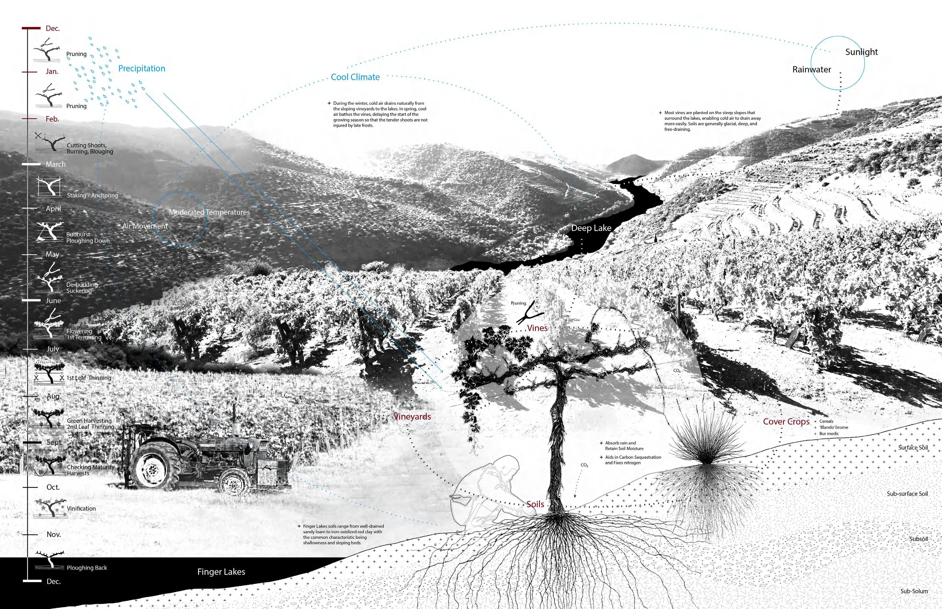
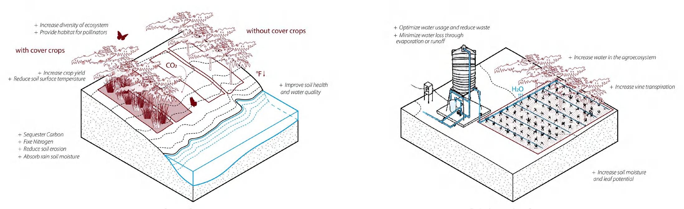
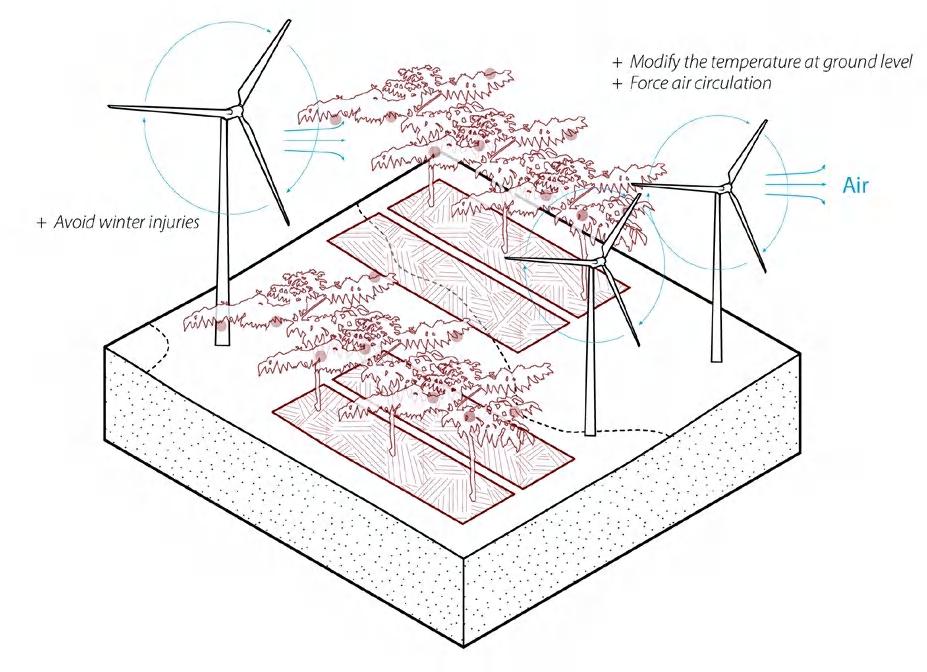
To address climate change risks and increase vineyard resilience, various management alternatives can be implemented. Cover cropping involves planting specific species between crops to improve soil health, conserve water, and lower temperatures, enhancing the soil microbiome and managing pests and diseases. In vineyards, cover crops like cereals, legumes, and medicinal herbs enhance vine health and adapt to weather changes. Drip irrigation optimizes water usage by delivering it directly to vine roots, reducing waste and maintaining soil moisture. Traditional methods like burning hay or mowing grass short combat frost, while wind turbines circulate air to prevent frost damage. These strategies ensure the resilience and productivity of Finger Lakes vineyards amidst climate change.
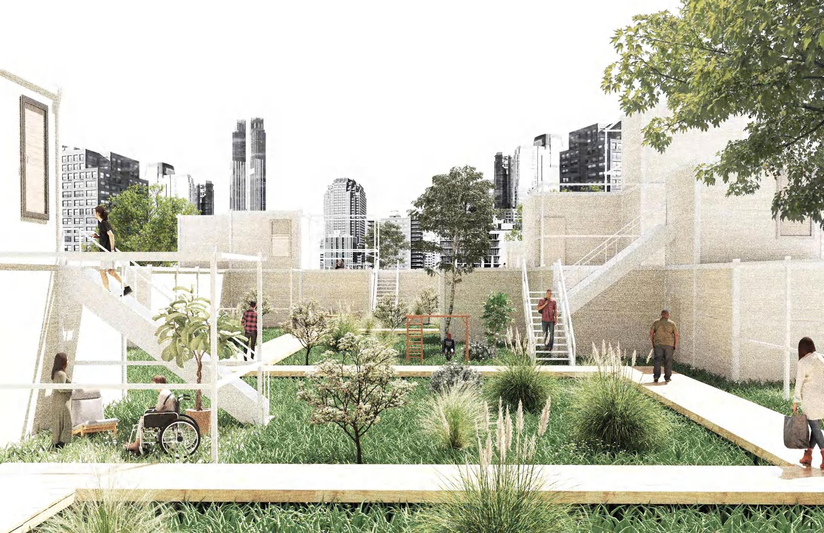
New Habitat
Jersey City, NJ
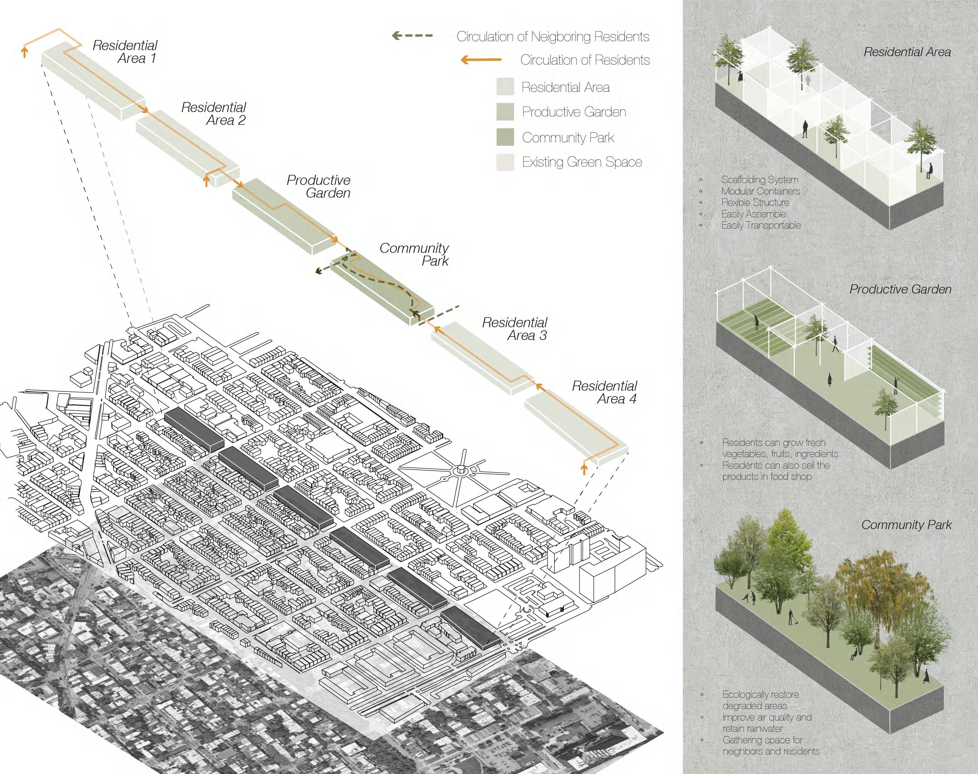
The project aims to turn the site into a new habitat consisting of a housing community that provides flexible accommodation for homeless people and an urban green space that offers neighboring residents new views of the city through the inclusion of an upland landscape. The goals of this new community are to bring supportive services, integrate various populations, and eliminate societal barriers. To facilitate the accommodation which could support a larger scale of people, the proposal takes the form of sustainable housing with a series of modular containers, each can be designated for its own
Type Date
Team Instructor
Skills Academic Work 2023 Spring Individual Work
Jennifer Birkeland
ArcGIS, Adobe Photoshop, Illustrator, Rhino, V-ray
specific functions. The whole intervention is open toward the street and fosters a sense of community within the neighborhood. Upland areas are connected to the street by staircases and each district is connected with each other by footbridges, facilitating pedestrian and circulation. Along with a street-level storefront, creating interaction between all members of the community. The middle two districts, especially Community Park, are characterized by an inviting public atmosphere with multiple connections, while the residential areas become inward-focused, in response to its private-focused functions.
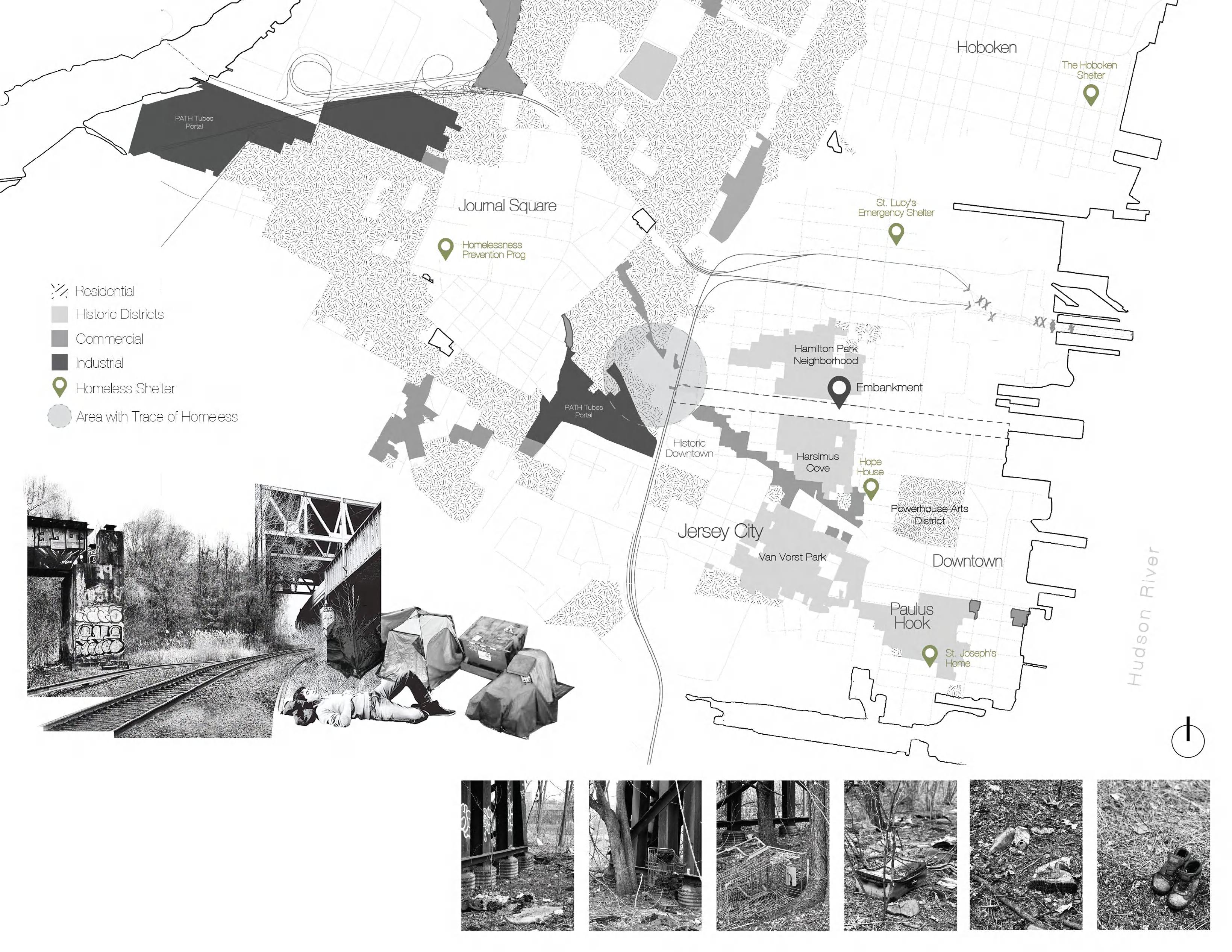
The abandoned railroad tracks of the PATH, now called the Crossroad, is currently in a state of disrepair, that it has been abandoned since the 1970s. There are traces of homeless individuals that have lived in this area. The homeless issue is crucial in Jersey City. In Hudson County, more than 800 persons experiencing homelessness were counted on a single night, and about 56 percent of those counted live in Jersey City. And most of homeless shelters are distant from our site and basically are located in townhouses or apartments that can only accommodate a small scale of people.
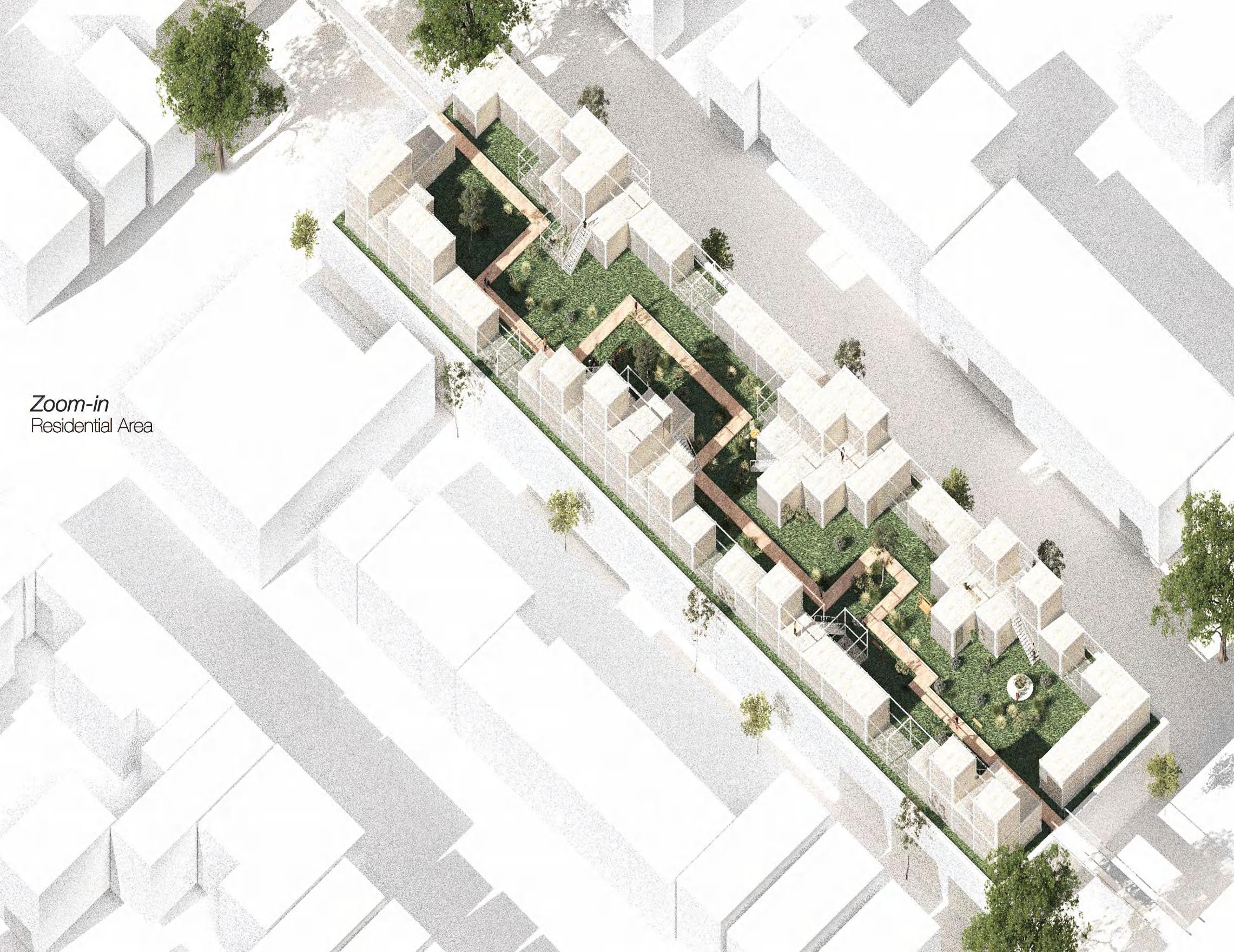
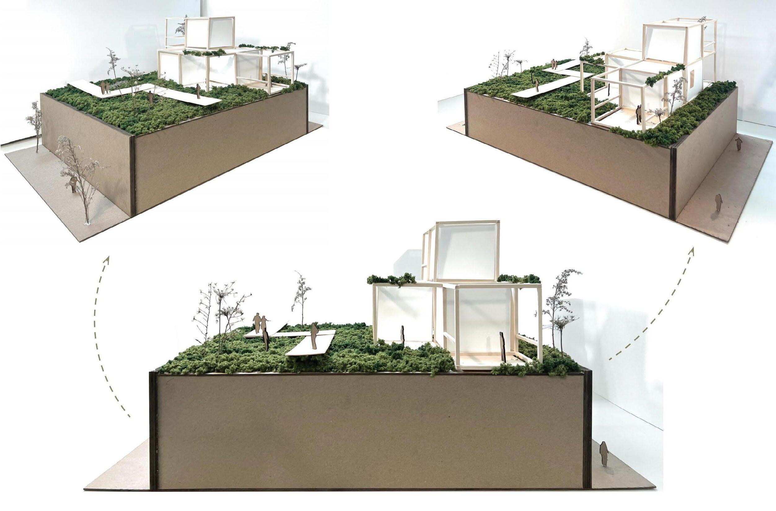
Zoom in into the residential area design, the basic structure system applied in this community is the steel scaffolding structure and a series of modular wooden containers. This flexible system owns the ability to add new features and change according to new needs, as well as easily transportable. The structure can be assembled and disassembled to deal with the ever-changing condition. In the future, the structure could also be completely dismantled or moved to a new site that needs help.
The outdoor space in the residential area has plenty of greenery and some community amenities such as benches, a viewing platform, small garden, giving residents a place to relax and socialize. A wooden trail facilitates the pedestrian and connects the private living spaces with the community space.
The units are designed for individuals and families, and assembled according to accommodation demand. In addition to daily-use rooms like bedrooms and bathrooms, residents are encouraged to use the shared amenities in the community space, which has shared kitchen and dining areas for cooking classes, group therapy, and other gathering activities.

Folding Park
Zhejiang, China
Type Date
Program Leader
Gov. of Qingtian County
Client Skills Professional Work at UAD 2023 Winter Yue Cao
SketchUp, Adobe Photoshop, Adobe Illustrator, D5
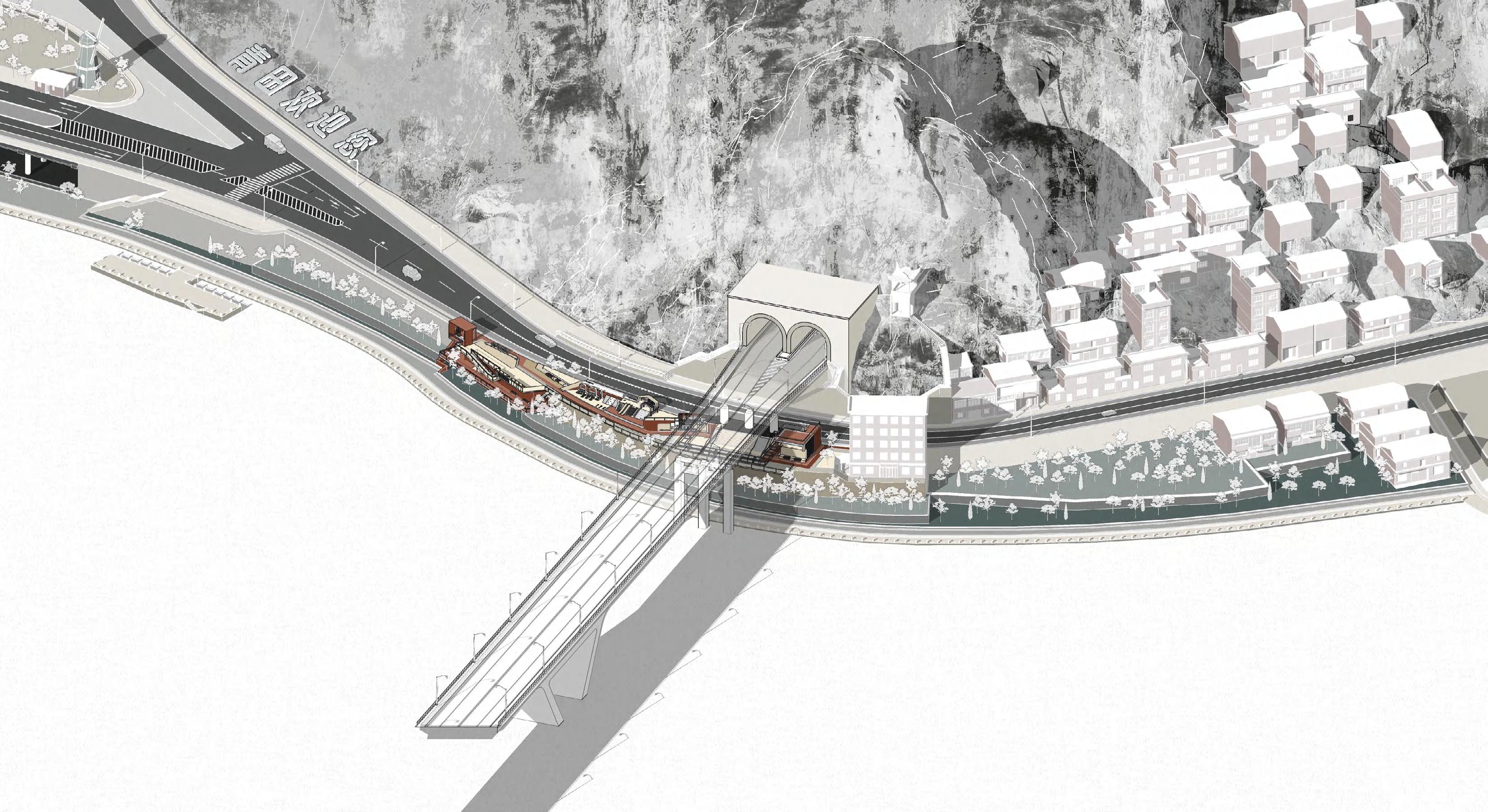
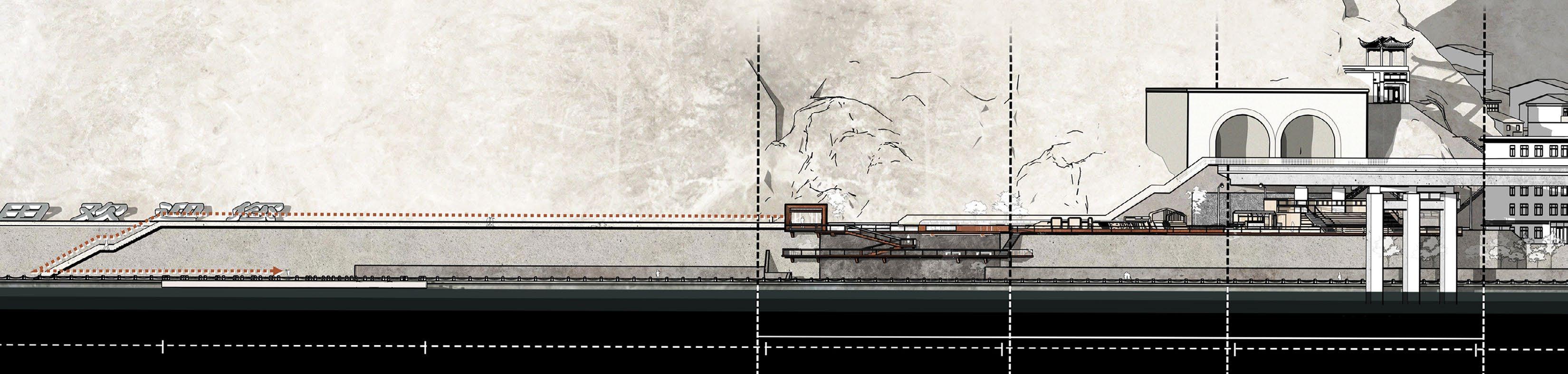
Aiming at the narrow and small base and the huge function carrying demand, using the design technique of “folding”, the park will overlap the undulating flow lines and zigzag repeat planes on the height difference elevation, and utilize the height difference of the levee that can be transformed to extend the three-dimensional space of the layered composite effect.
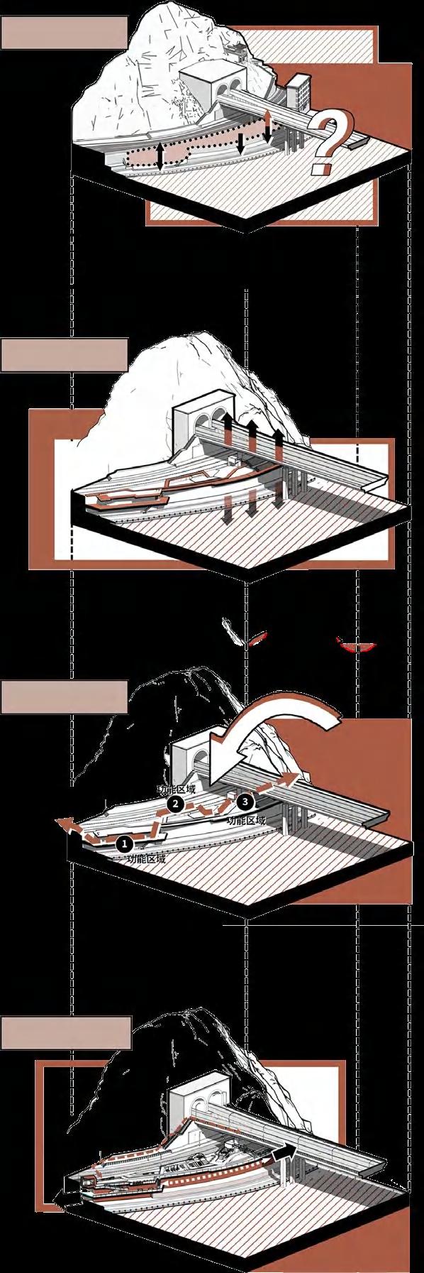
Site Analysis
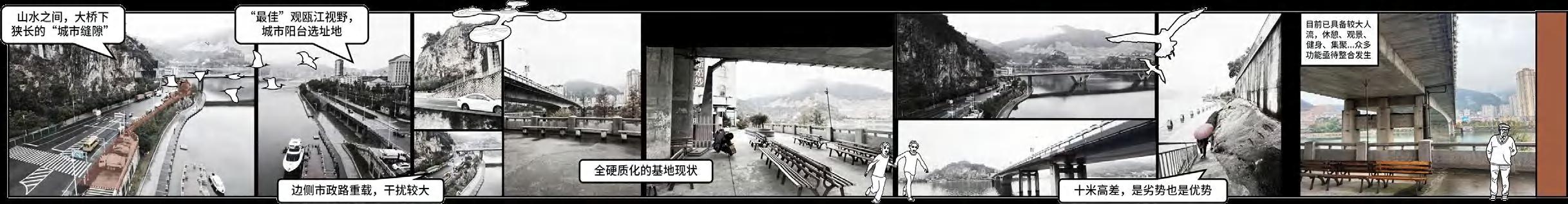
The site lies in the limited land availability and the severe lack of park space. There is a disconnect between the natural landscapes, with a shortage of areas for scenic stops and attractions. Additionally, the overpass bridge and flood control embankments create spatial constraints and traffic disruptions.
The three-dimensional growth of the park under the bridge extends the dimension of the park, mends the gap of the city, and makes up for the transportation breakpoints.
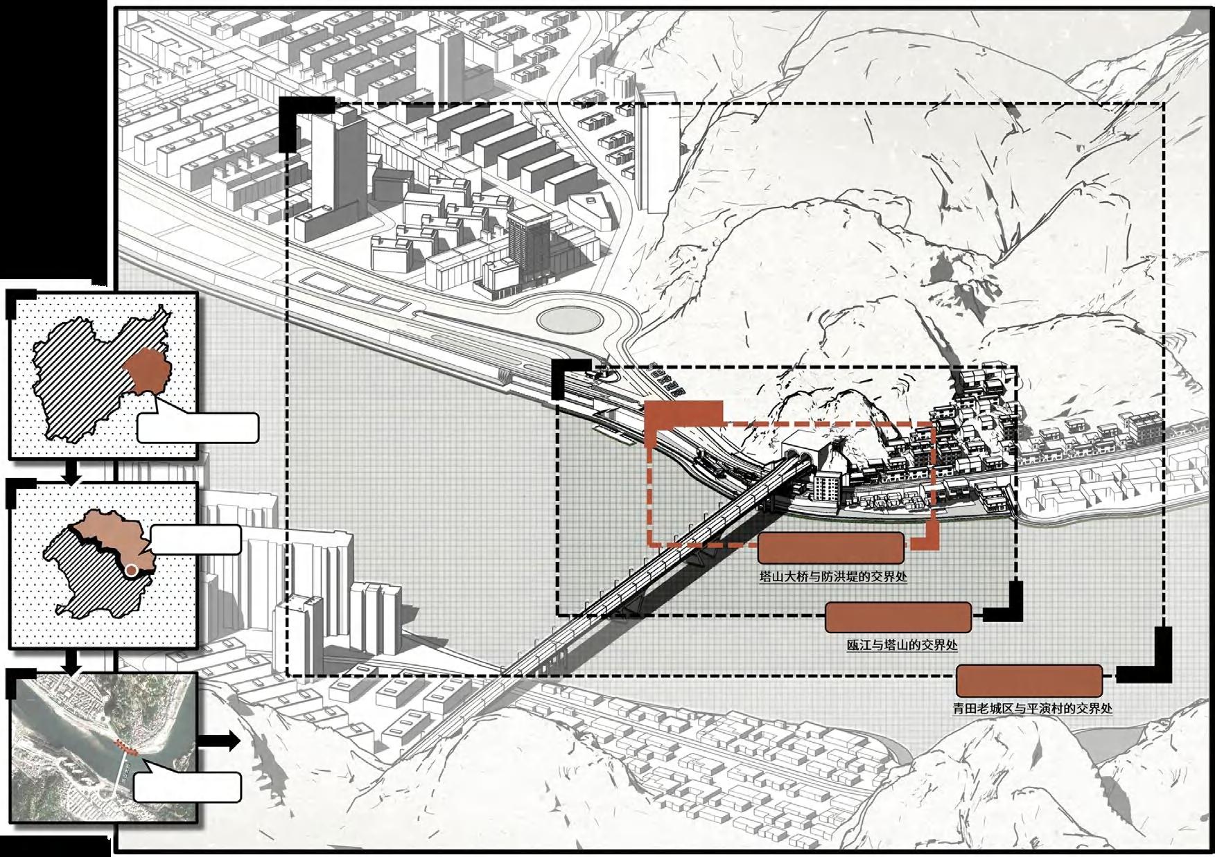
Qingtian, ZJ
Hecheng
Design Strategy
Iteration of Functions
Rationally develop and utilize the space under the bridge, and beautify the old facilities on the site. Provide rest and recreational facilities and equipment for the neighboring residents. Utilizing the terrain on the east side of the pocket park to design a cantilevered platform, construct a urban balcony, and form an excellent viewpoint. Meanwhile, in the future operation scenario, the functional scenarios will evolve according to the public’s needs, and become a multi-level, three-dimensional, sustainable, and full of vitality park under the bridge.
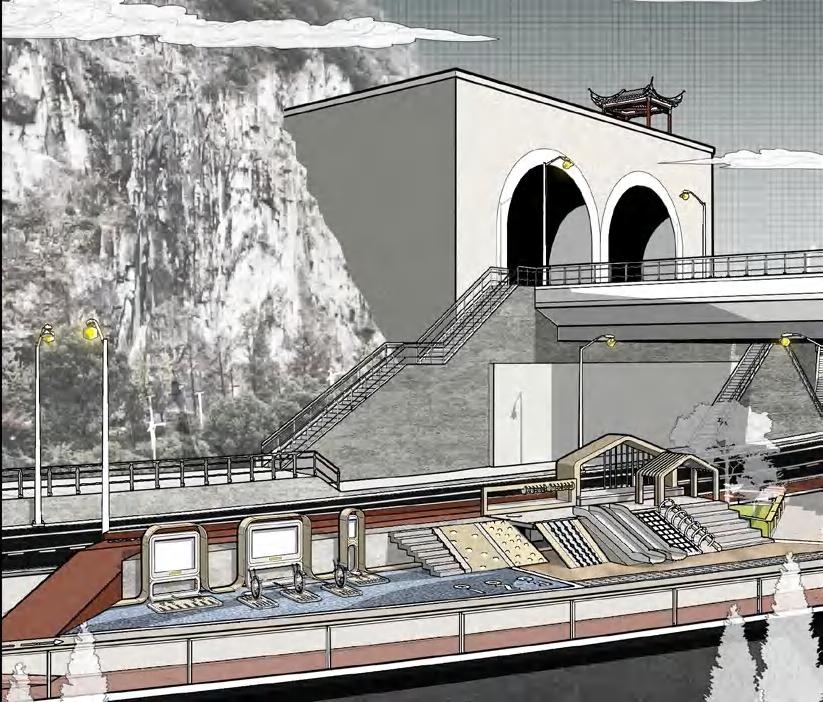
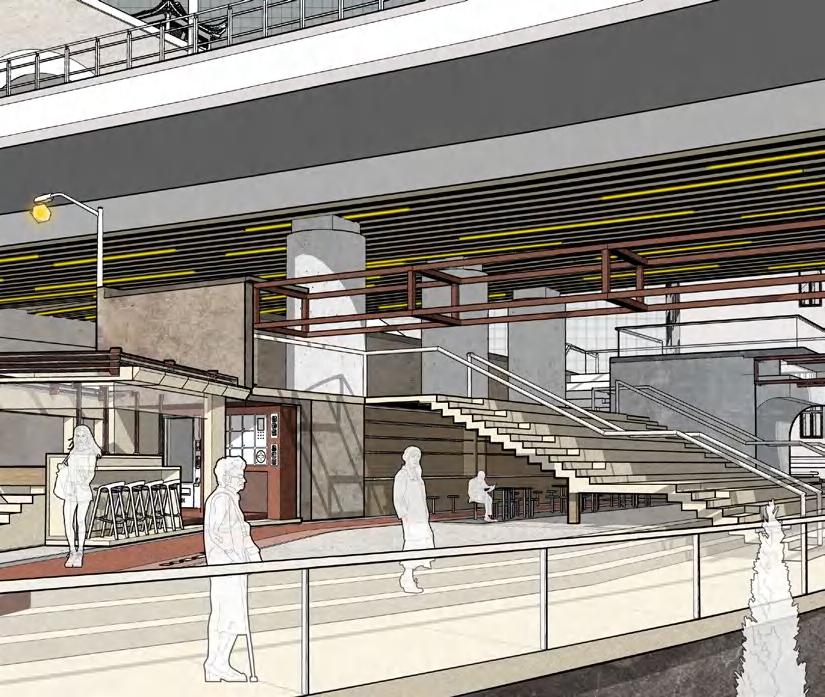
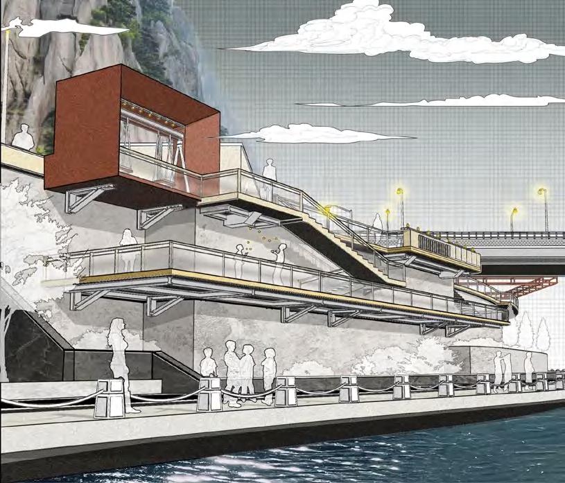
The amenities of this vibrant, multi-level, and sustainable park beneath the bridge include an outdoor workout area, cafés, and an open-air cinema, offering a dynamic blend of recreation, relaxation, and entertainment.

AquaRibbon
Ithaca, NY
Type
Date
Team
Instructors
Skills
Academic Work
2024 Spring
Sicheng Zhou, Wenqian Niu
Zac Boggs, Isabel Fernández
ArcGIS, Adobe Photoshop, Illustrator, Rhino
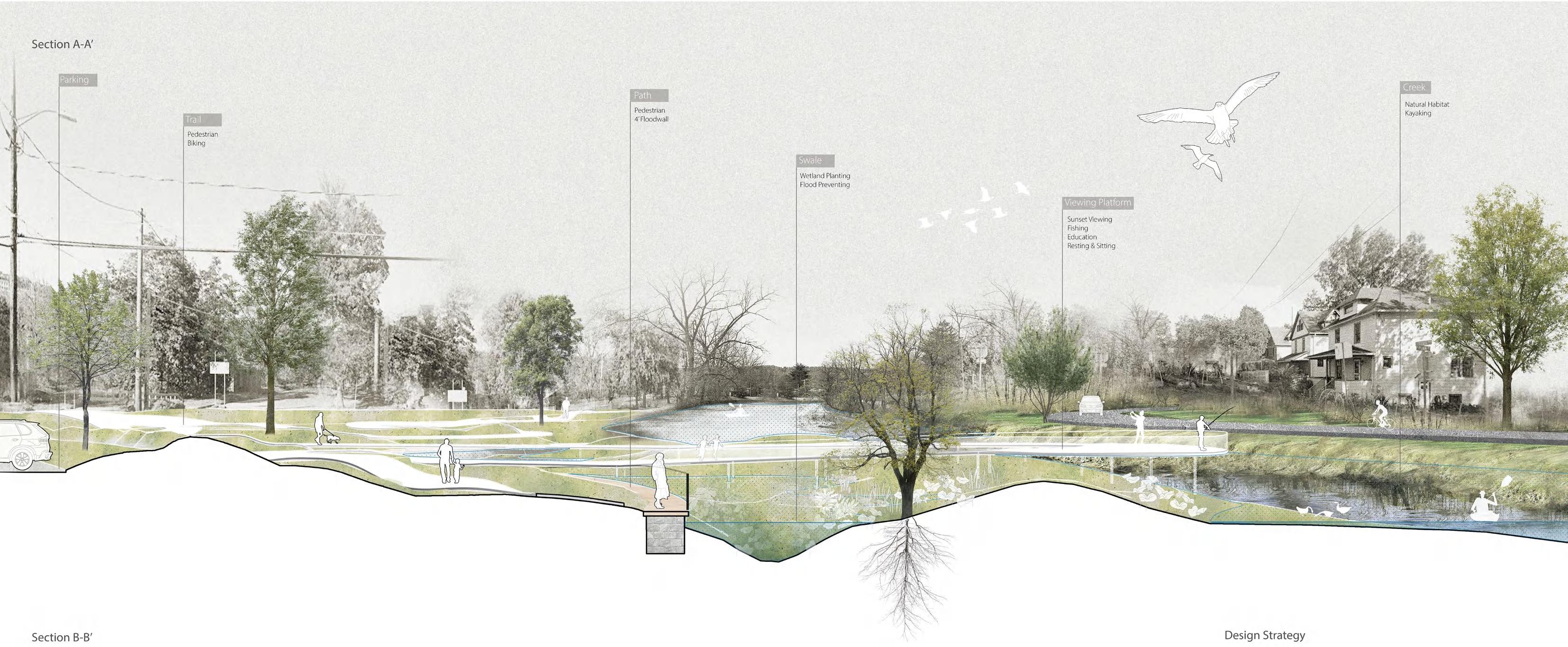
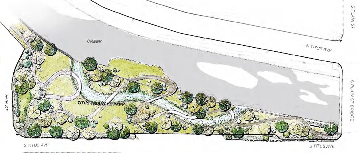
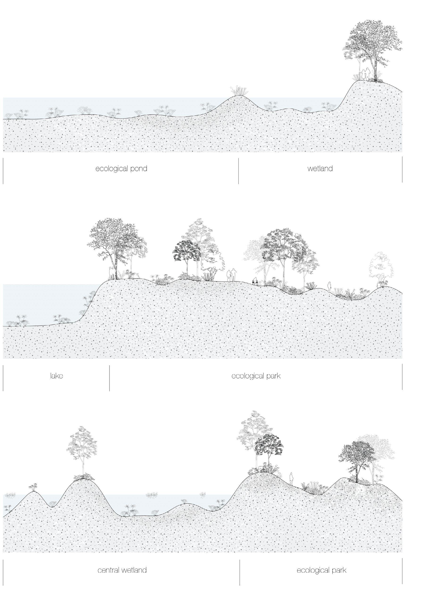
The project aims to establish a distinguished community park with an urban habitat emphasizing educational aspects. Welcoming areas guide visitors to a curvilinear trail leading to the waterfront, featuring diverse green spaces to restore ecological balance. Proposed island and wetland act as breakwaters, transforming the waterfront into an ecological habitat and enhancing resilience to flooding. Additionally, a raised waterfront walkway with a flood wall provides safe passage during floods, seamlessly integrating with the park’s offerings.
(with Sicheng and Wenqian)
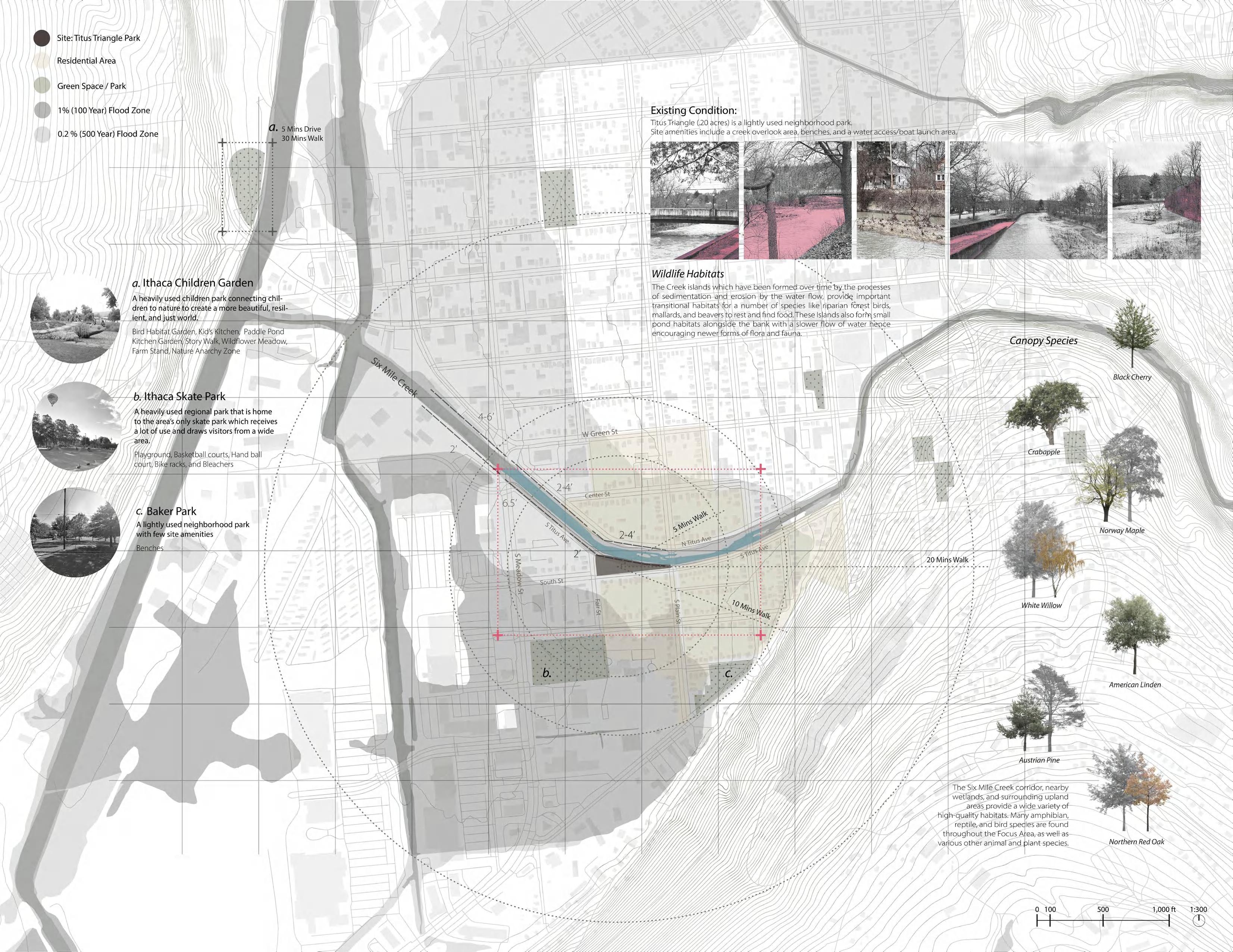
Within a five-minute walking radius, only two green spaces exist. Unfortunately, one serves solely as a skateboarding venue, lacking adequate facilities or scenic views, while the other is limited in recreational programs and design.
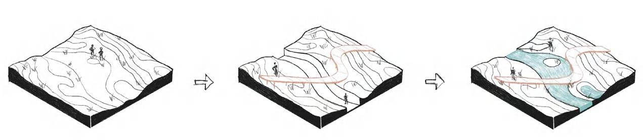
From an ecological perspective, creek islands on site have formed over time through sedimentation and erosion processes caused by water flow, providing important transitional habitats for species like riparian mallards. These islands also create small pond habitats alongside the banks with slower water flow, encouraging diverse species.
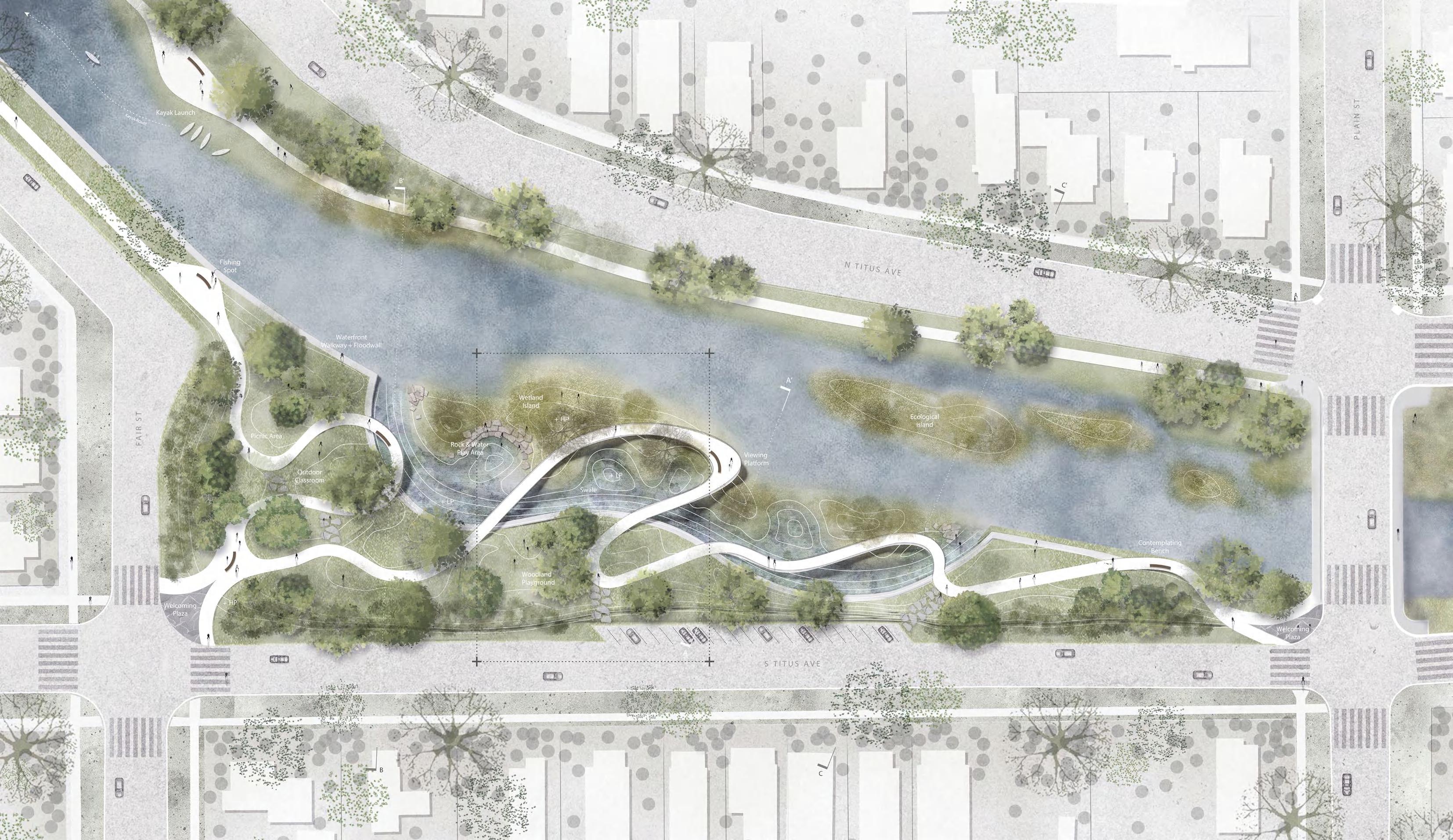
At both entrances of the park, where the roads intersect, two welcoming plazas signal the park and guide visitors to a curvilinear trail leading to the creek front. Within the park, diverse green spaces have been integrated to enrich community recreation and restore ecological balance.
Canopy Trail Water Garden Creekfront Viewpoint Woodland Playground
An upgrading wetland island, constructed as a breakwater, based on the existing creek island and connected to the parkland, transforming the creek-front into an ecological habitat. Additionally, a sunken area will serve as a swale during floods, aiding in water mitigation and enhancing the waterfront’s resilience.
The proposal includes plans for a second breakwater, envisioned as a waterfront walkway elevated along the creek’s existing wall. It will safeguard against flooding while seamlessly connecting to the park’s amenities.
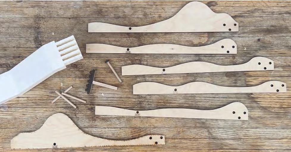
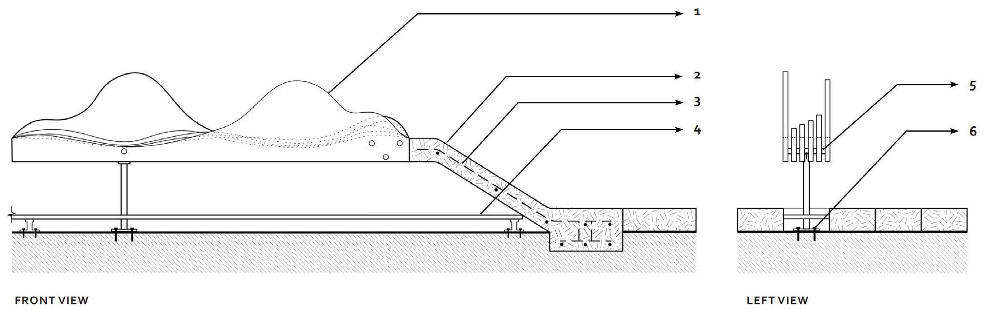
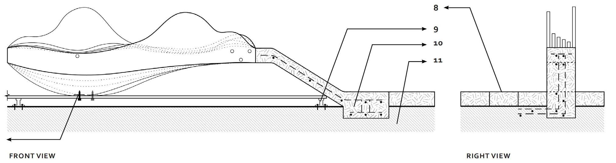
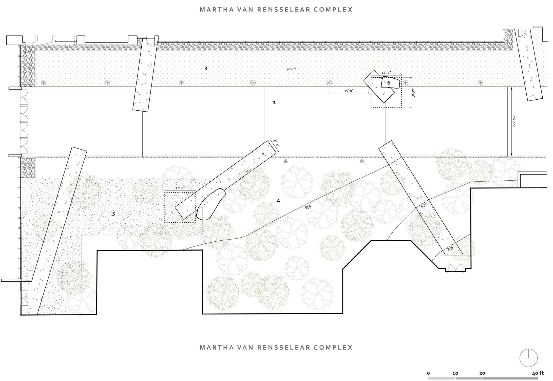
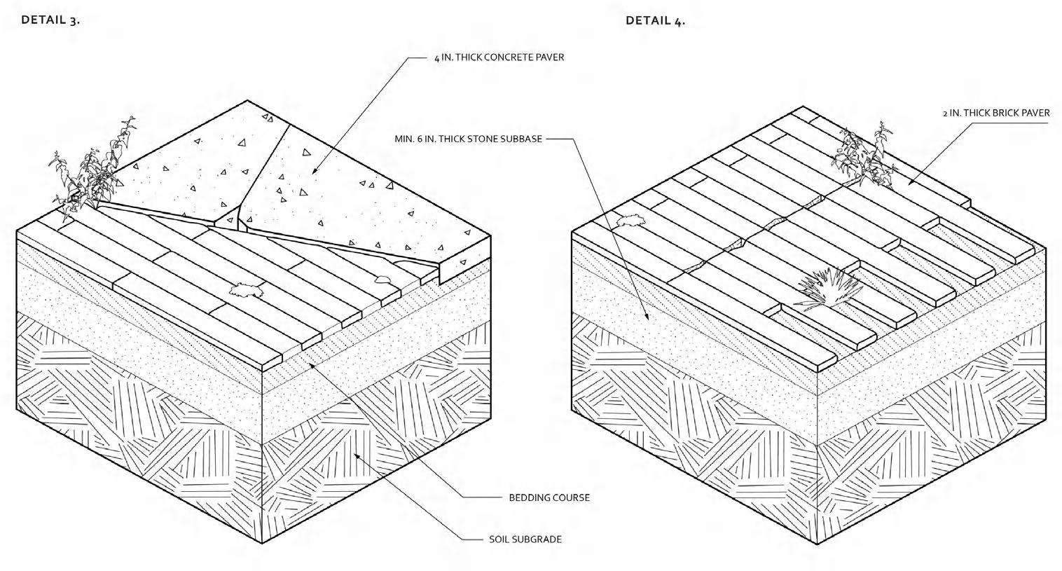
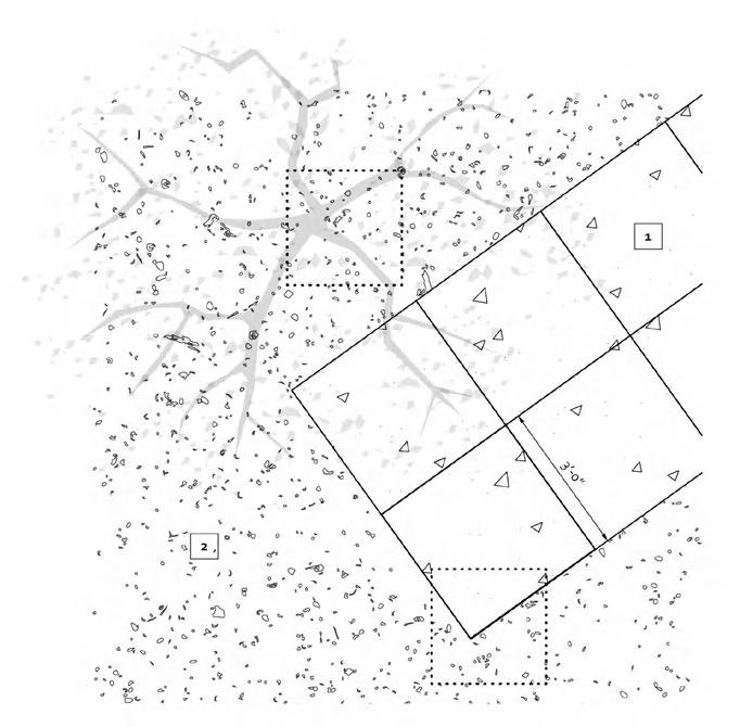
Other Works I Technical Drawings
Construction Details and Mock-up
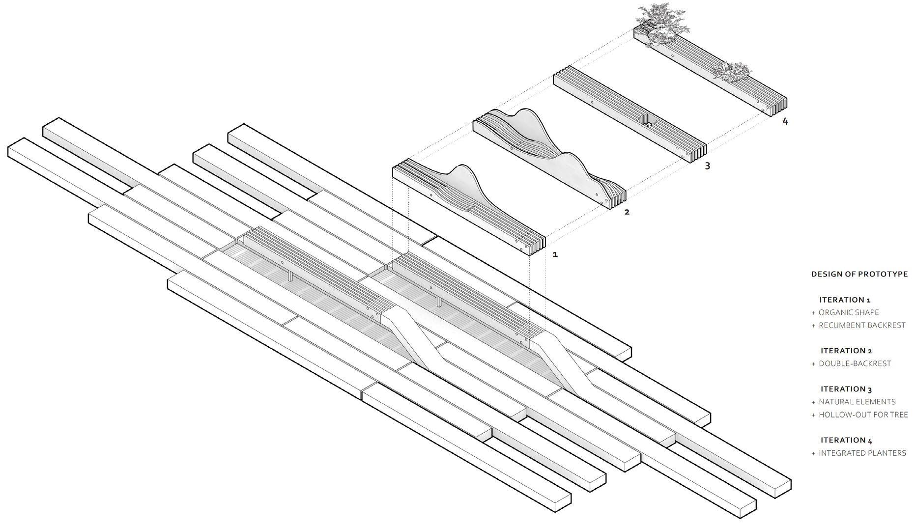
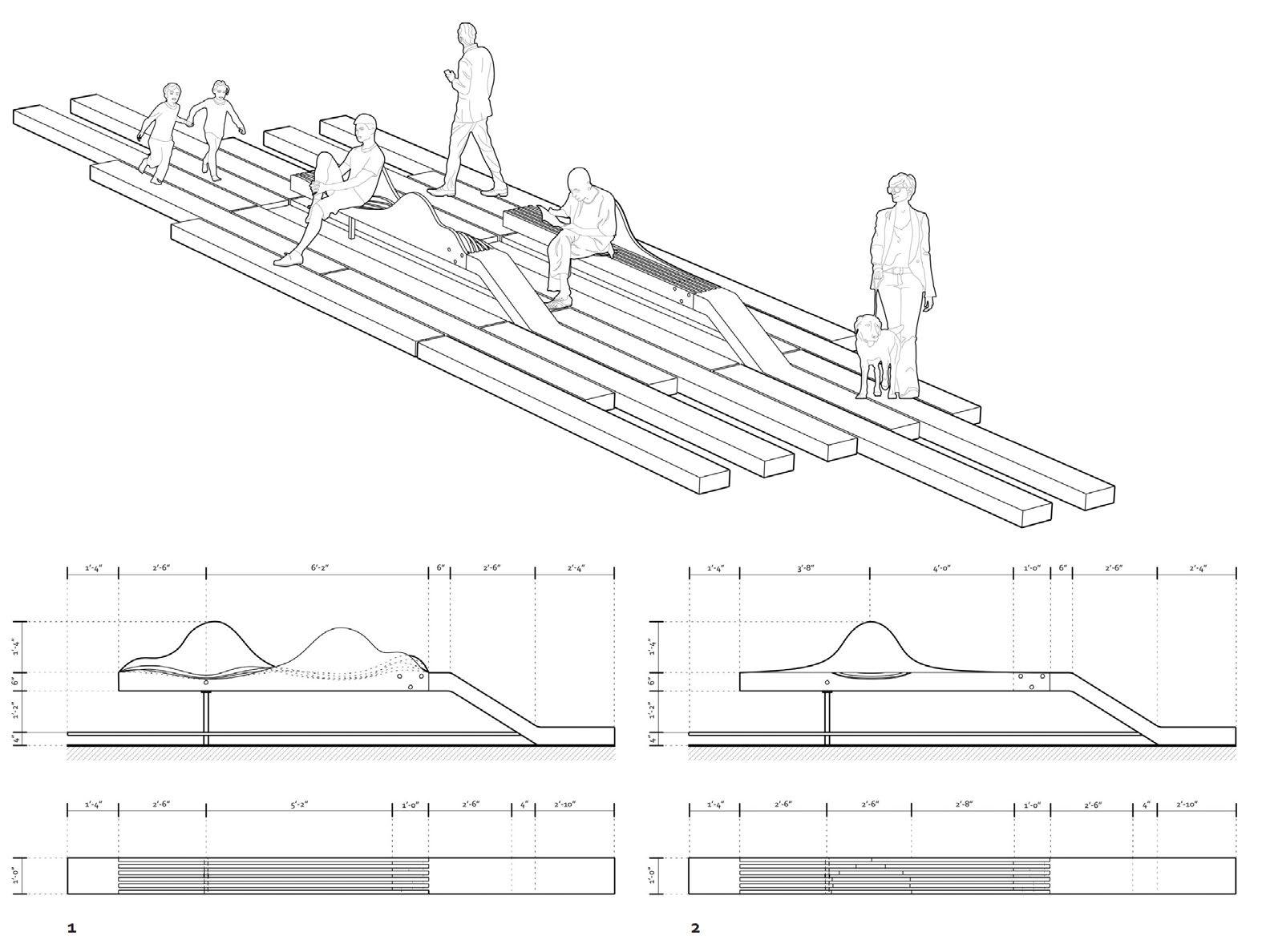
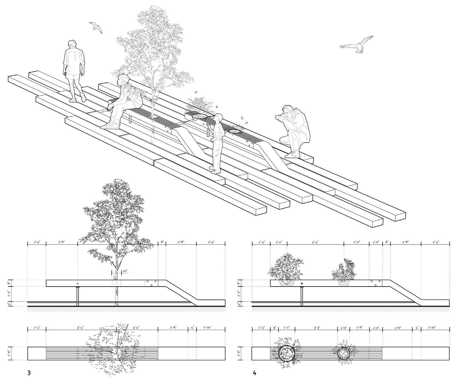
This project explores the “peel-up” benches of HighLine Park as a prototype, analyzing their materials and assembly. The goal is to create versatile, interactive installations that extend beyond seating. The design evolves from ergonomic benches with organic shapes to multi-functional elements.
Click to Watch the Video
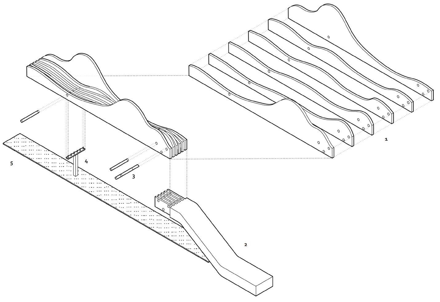
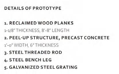
The peel-up structure was 3D printed to present form precisely wooden planks were CNC cut and leave the holes for rods joint. The bench leg structure were constructed by wood sticks and laser-cut chipboard.
In iteration 2, the bench leg was removed and the planks were transformed into a more organic and curvilinear shape along the bottom edge.
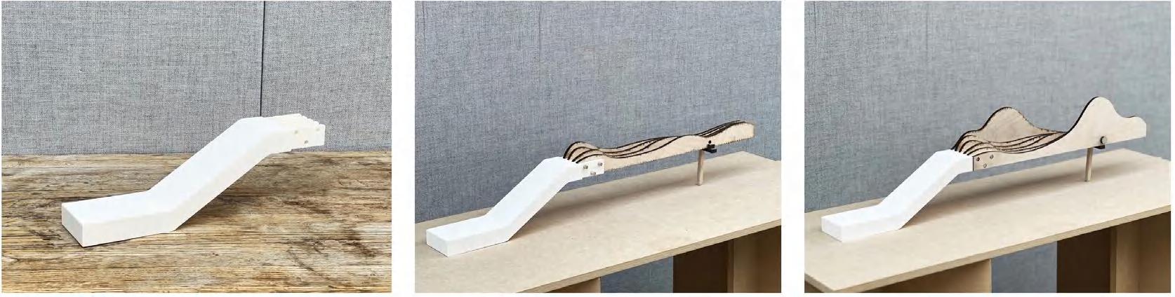
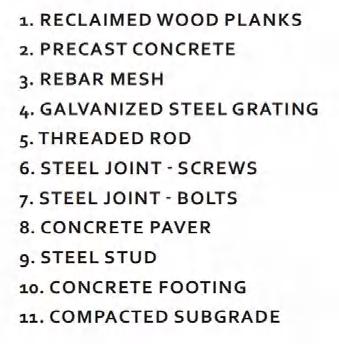
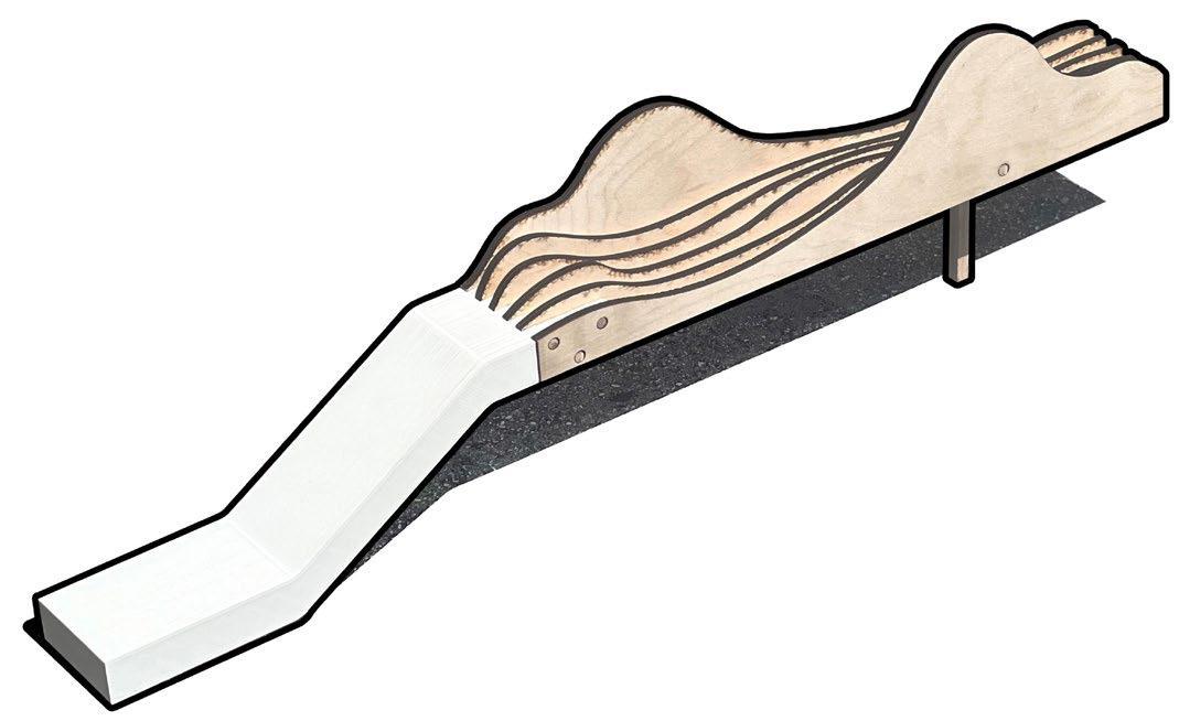
Iteration 1
Iteration 2
Grading
Materials and Layout Plan / AutoCAD, Illustrator
Other Works I Technical Drawings
Parametric Modeling
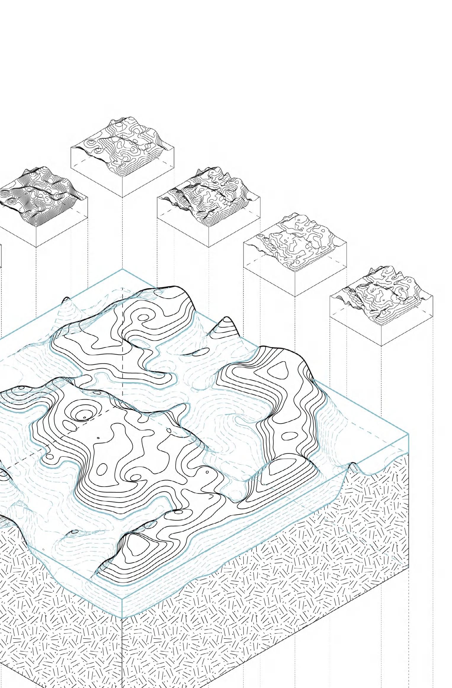
Developed a parametric surface by Grasshopper to explore the terrain, with a series of iterations demonstrating variations in UV count, depth, and contour spacing within this parametric landscape. The grade changes in the terrain are utilized to frame, develop, and control specific experiences within a wetland landscape.
Other Works I Interior Design
Type Date
Team
Instructors
Skills
Academic Work, Thesis
2022 Spring
Individual Work
Karin Tehve
Adobe Photoshop, Illustrator, Rhino, Enscape

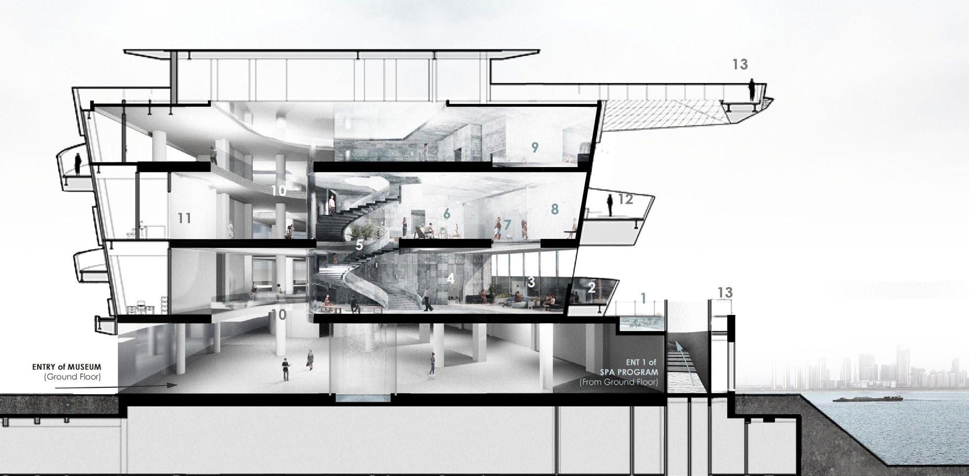
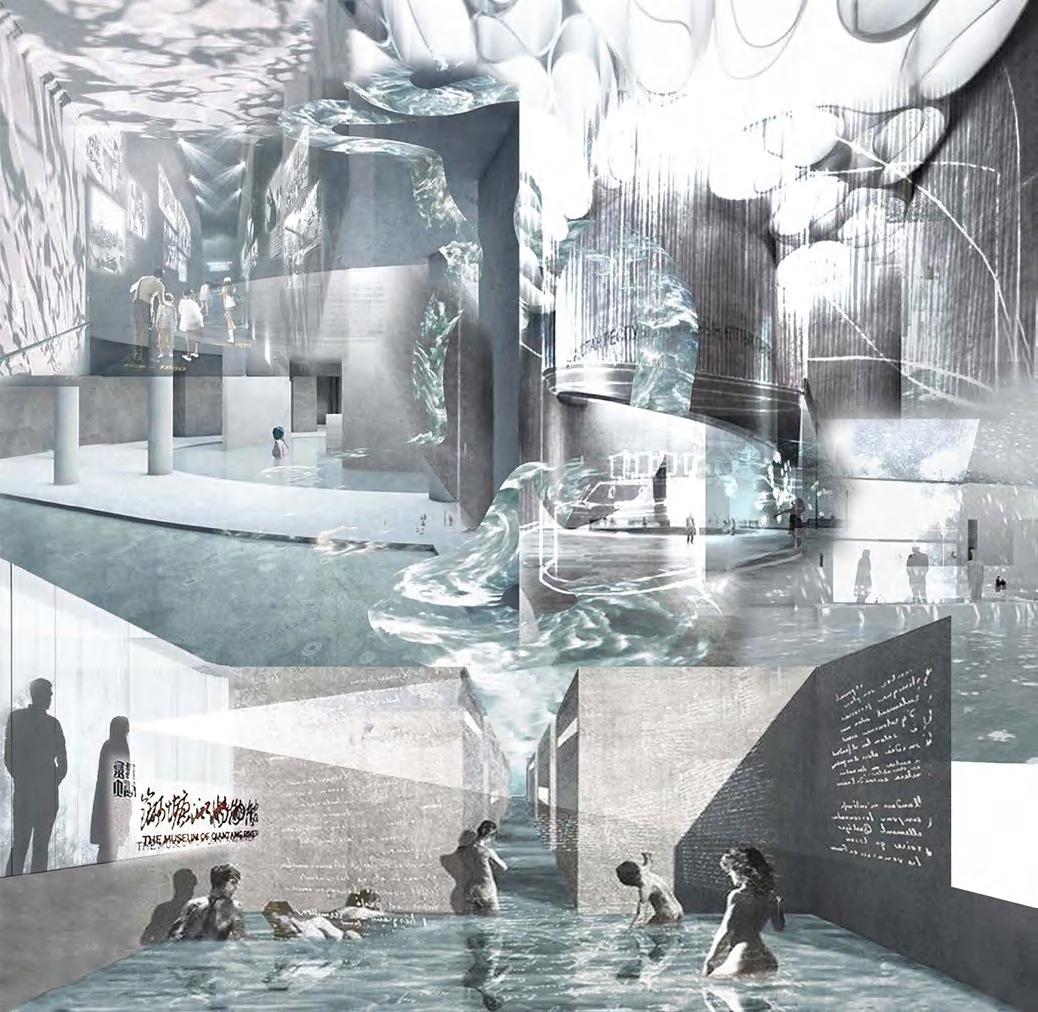
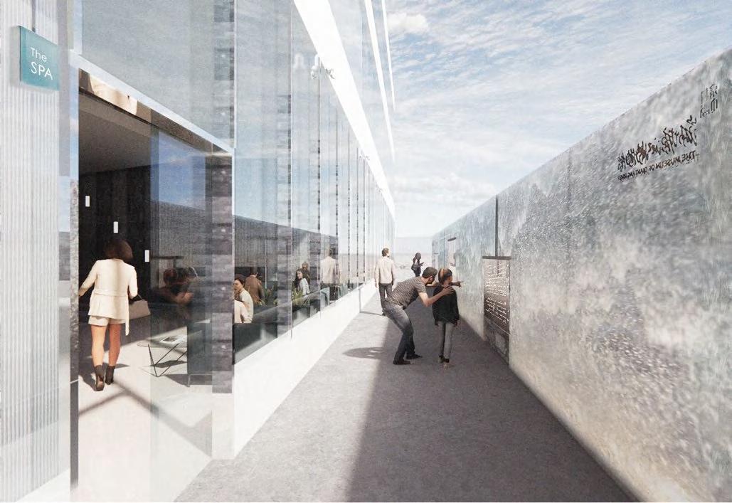
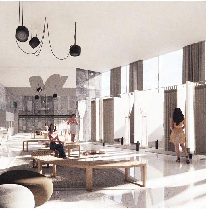
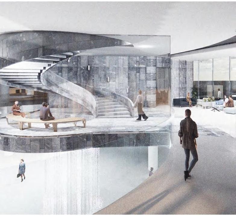
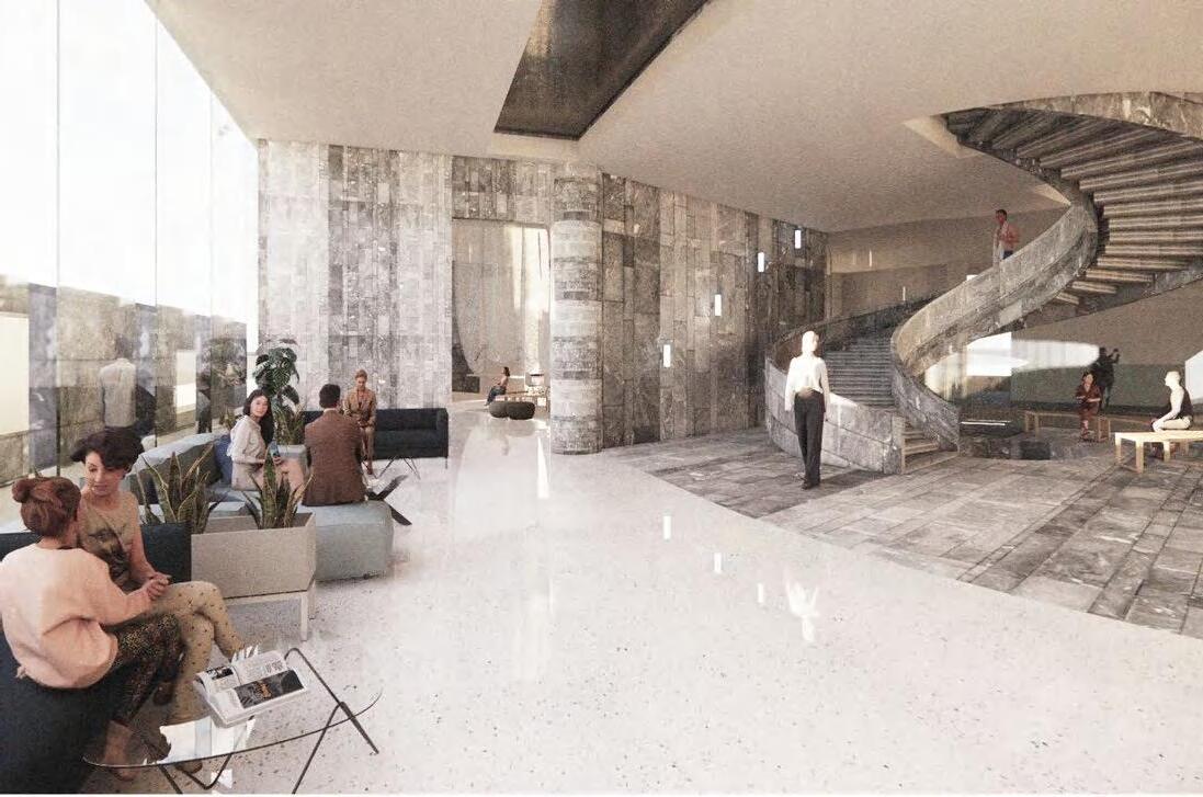
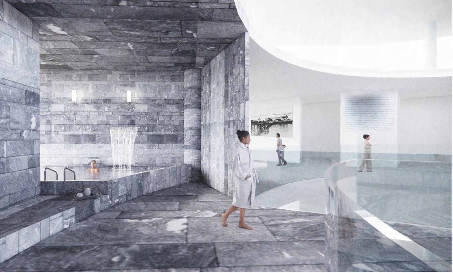
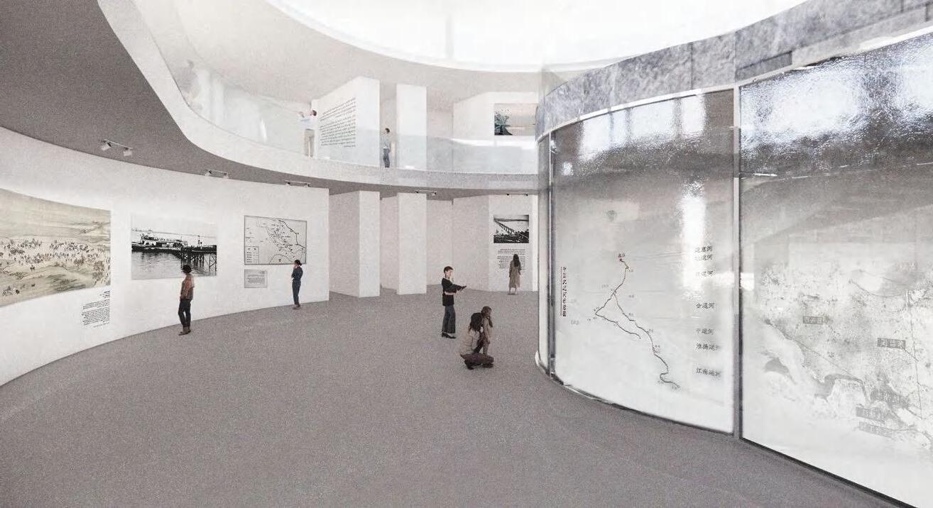
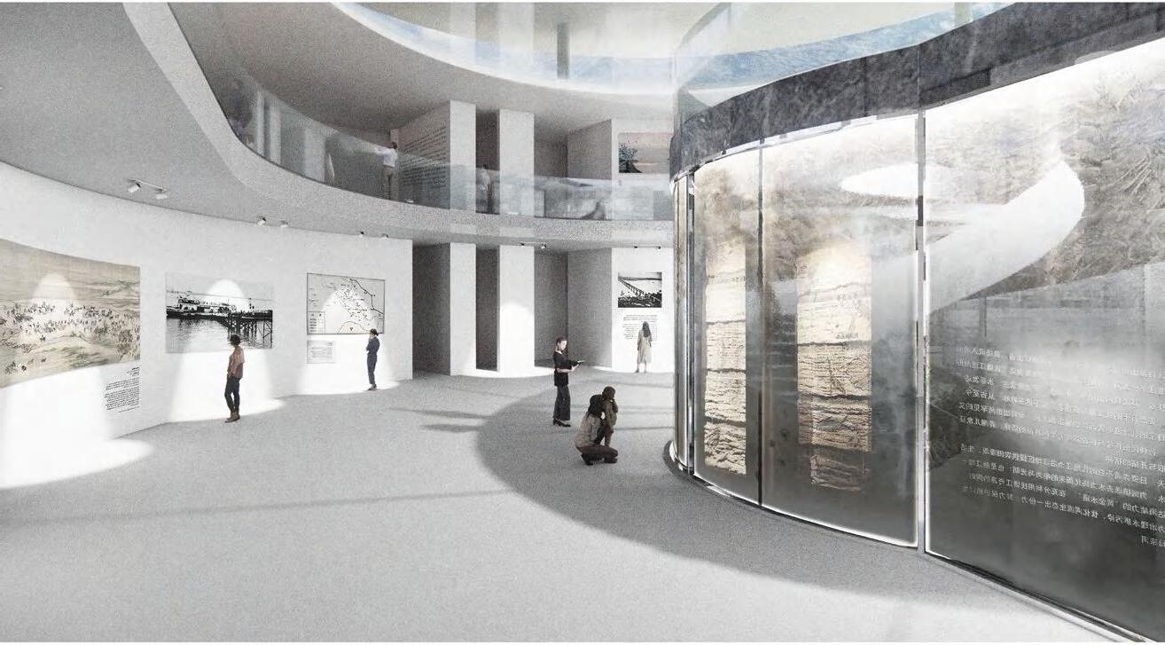
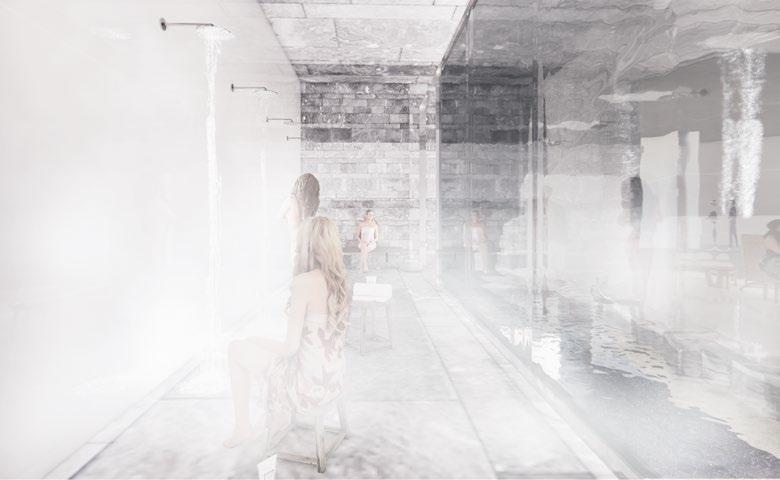
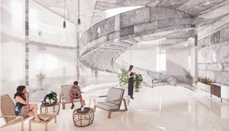
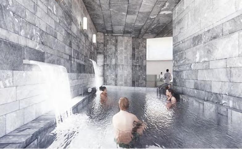
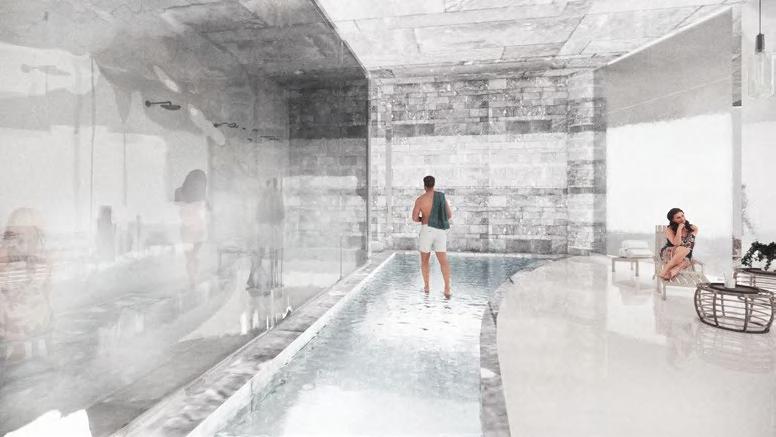
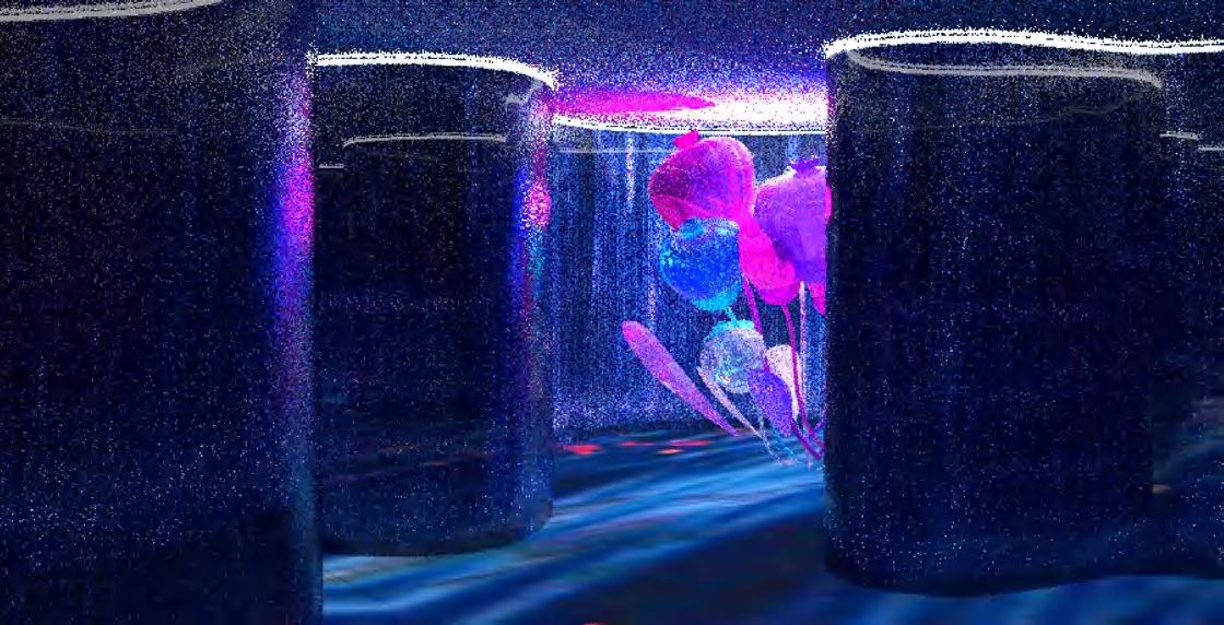
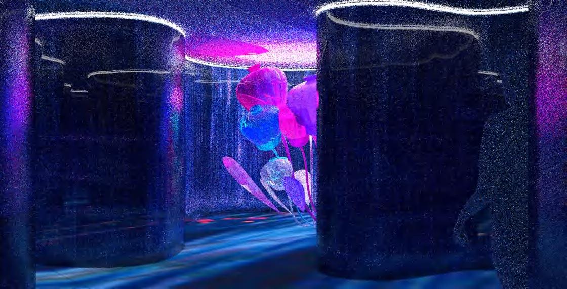
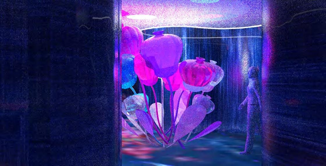
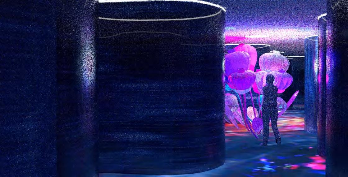
Water: Seeing & Being in Space
“Water offering both physical and psychological benefits due to its therapeutic nature.”
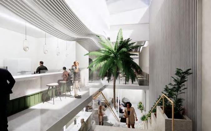
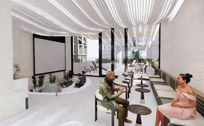
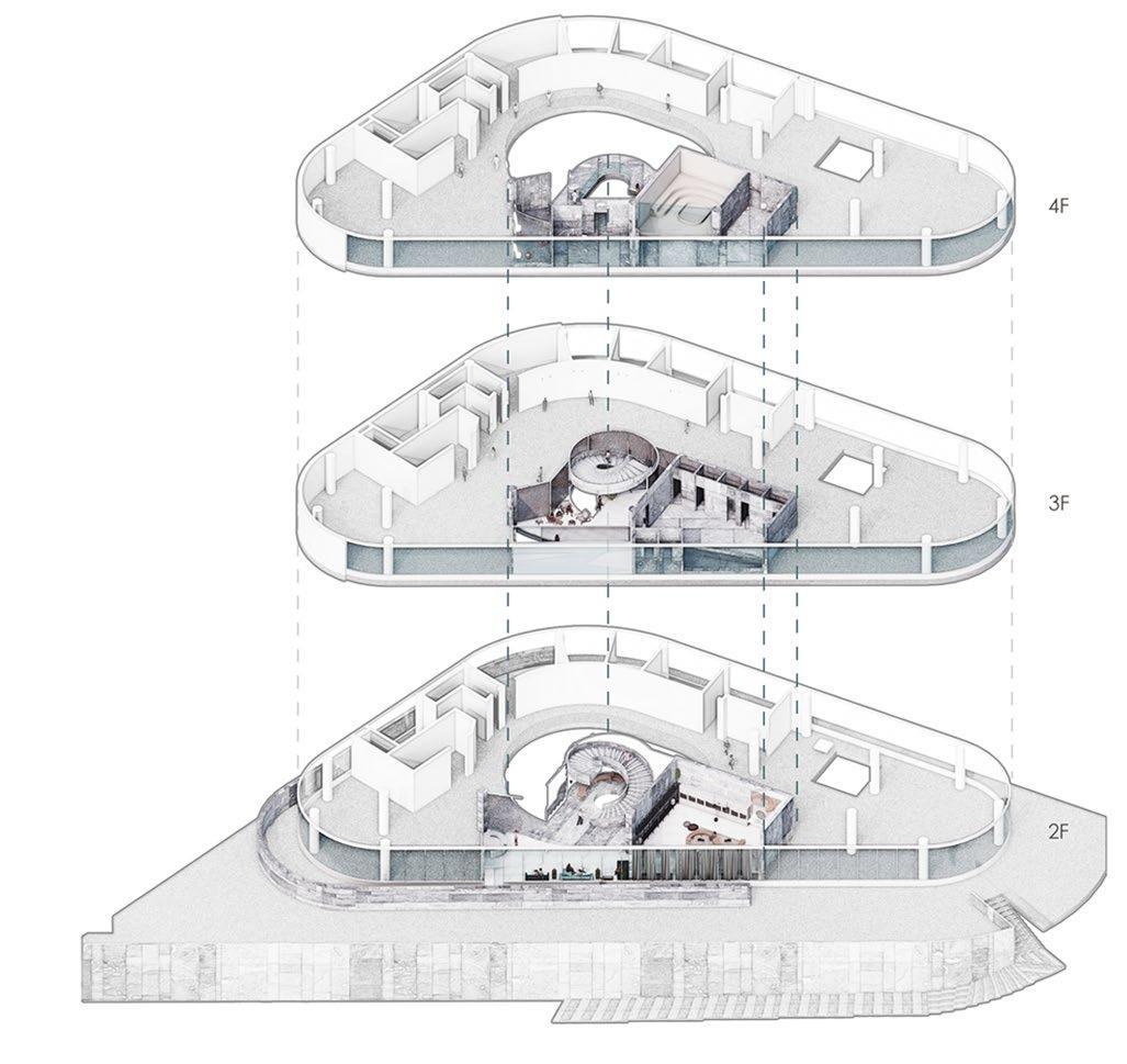
This thesis explores the sensory experience created between people and water through an integrated spa program within the Museum of Qiantang River. The project harnesses the therapeutic power of water by emphasizing its visual, auditory, and tactile qualities, particularly for individuals experiencing high stress. The transformation of water into different forms and temperatures shapes the spatial sequence of the spa.
Through the interaction between the museum and the spa program, the project introduces a new approach to exhibitions — one that immerses visitors in an experience with water. The intersection of the spa and museum creates a space where visitors can see, touch, and feel the water while engaging with the exhibits