August 1998
The monthly newsletter for people who live, work or play on the Upper Mississippi River
Vol. 6, No. 8
$2.75
Where Does All That Sand Cotne Frotn?
The Kingfish and the Combat Zone
By Robert E. Sloan
By Lee Hendrix
A
M
ost of us when traveling up or down the river see the big piles of sand the Corps of Engineers has dredged out of it. No matter how much the Corps dredges, there is still more sand. Then we track it in the house all winter and wish it would stay on the roads where it's needed. In fact, beneath the river of water is a river of sand. It not only has to be dredged out of the channel, but it continually shapes the big river, far more efficiently than can dredges. For instance, Point Douglas (near Hastings, Minn. and Prescott, Wis.) forms where the current on the north side of the Mississippi spills over into the slower St. Croix River current, loses speed quickly and drops its sand and silt to form a levee. During flood stage the levee gets built up higher. This levee forms the finger that nearly blocks the St. Croix, backing up the river to form Lake St. Croix. It has been doing this for the past 10,000 years and is an obvious place for railroads and Highway 10 to cross the St. Croix.
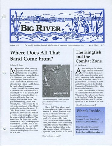
Sand from the Chippewa River in Wisconsin pushes the Mississippi River over to the Minnesota side.
Above Red Wing, Minn., sand from the glacier scraped out of the bedrock of Ontario, northern Minnesota and the area around Lake Superior drifts downriver until much of it is trapped by Lake Pepin. As the river flows into Lake Pepin, the current slows in the deep water of the lake and the sand falls out. The sand has been filling in the lake for eons. About 10,000 years ago Lake Pepin reached as far north (Sand continues on page 4)
river as big as the Mississippi, which is somewhere between 2,300 miles and 2,551 miles long, depending upon who's measuring, is far too long to be taken as just one river. On its journey from Lake Itasca, in north central Minnesota, to the Gulf of Mexico, the Mississippi River takes on several characters. Even a casual student of the river will see at least four rivers: The Wilderness River, from Lake Itasca to St. Anthony's Falls; the Upper Navigable River, from St. Anthony's Falls to the mouth of the Mis(Kingfish continues on page 2)
What's Inside ... Cu"ent Events Savanna Prison Blues, Lock Extensions, Duck Debate ..... 5 River Calendar & Almanac Dragon Boats, Catfish Fest, Butterflies and Rattlesnakes .. 8