What to Do Now? | 69
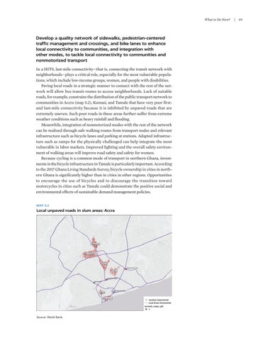
Develop a quality network of sidewalks, pedestrian-centered traffic management and crossings, and bike lanes to enhance local connectivity to communities, and integration with other modes, to tackle local connectivity to communities and nonmotorized transport In a HITS, last-mile connectivity—that is, connecting the transit network with neighborhoods—plays a critical role, especially for the most vulnerable populations, which include low-income groups, women, and people with disabilities. Paving local roads in a strategic manner to connect with the rest of the network will allow bus transit routes to access neighborhoods. Lack of suitable roads, for example, constrains the distribution of the public transport network to communities in Accra (map 5.2), Kumasi, and Tamale that have very poor firstand last-mile connectivity because it is inhibited by unpaved roads that are extremely uneven. Such poor roads in these areas further suffer from extreme weather conditions such as heavy rainfall and flooding. Meanwhile, integration of nonmotorized modes with the rest of the network can be realized through safe walking routes from transport nodes and relevant infrastructure such as bicycle lanes and parking at stations. Adapted infrastructure such as ramps for the physically challenged can help integrate the most vulnerable in labor markets. Improved lighting and the overall safety environment of walking areas will improve road safety and safety for women. Because cycling is a common mode of transport in northern Ghana, investments in the bicycle infrastructure in Tamale is particularly important. According to the 2017 Ghana Living Standards Survey, bicycle ownership in cities in northern Ghana is significantly higher than in cities in other regions. Opportunities to encourage the use of bicycles and to discourage the transition toward motorcycles in cities such as Tamale could demonstrate the positive social and environmental effects of sustainable demand management policies. MAP 5.2
Local unpaved roads in slum areas: Accra
Source: World Bank.


