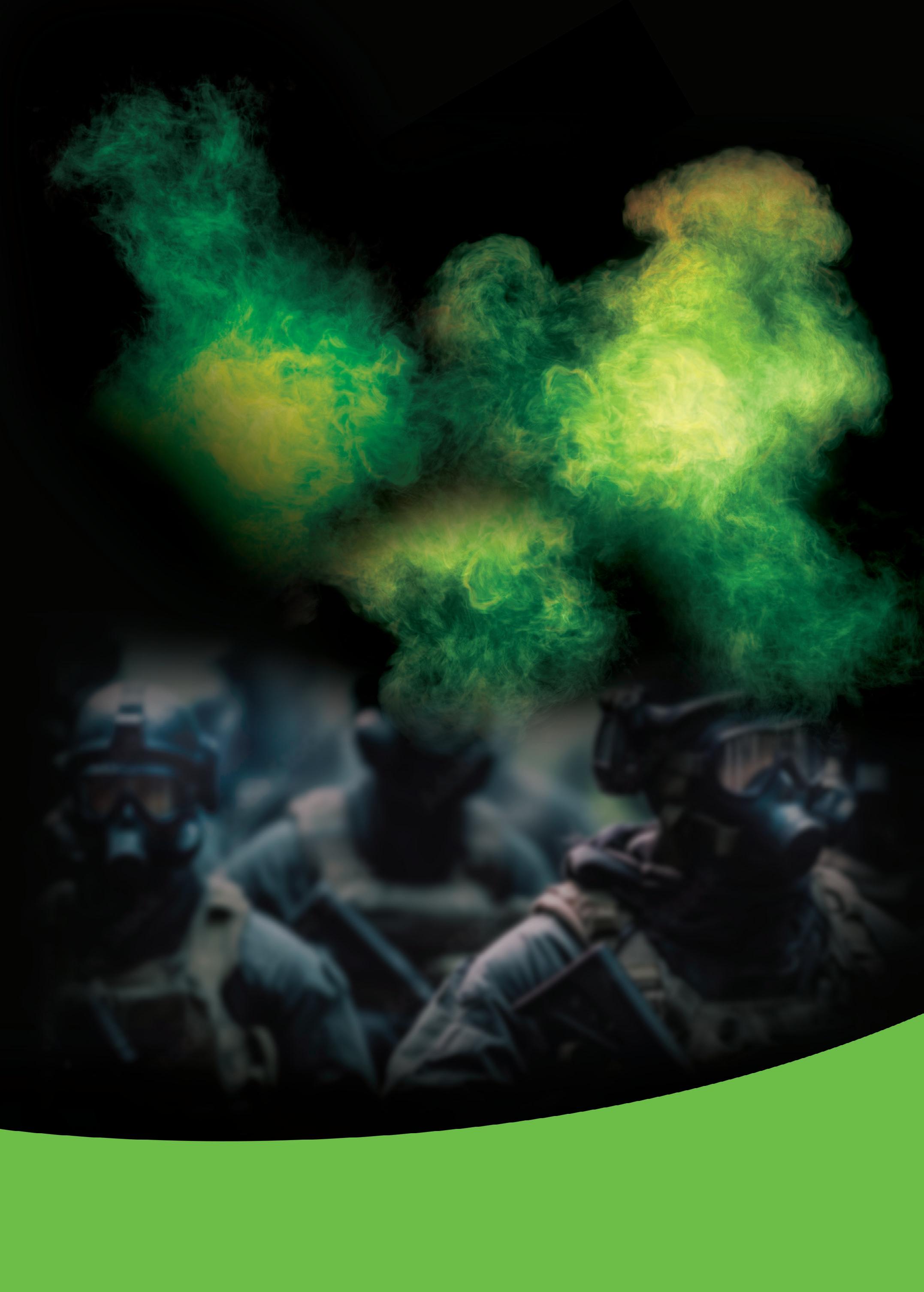

A full suite of multiband mission-critical portables and mobiles.
Unexpected challenges? Bring them on.
PP100007393 MAR/APR 2024 Vol.11 No.3


6
14 Engineers
17 Towards 1 Tbps throughput using sub-terahertz bands
18 Navigating tomorrow: RTLS trends and projections for 2024
23
29
30
32


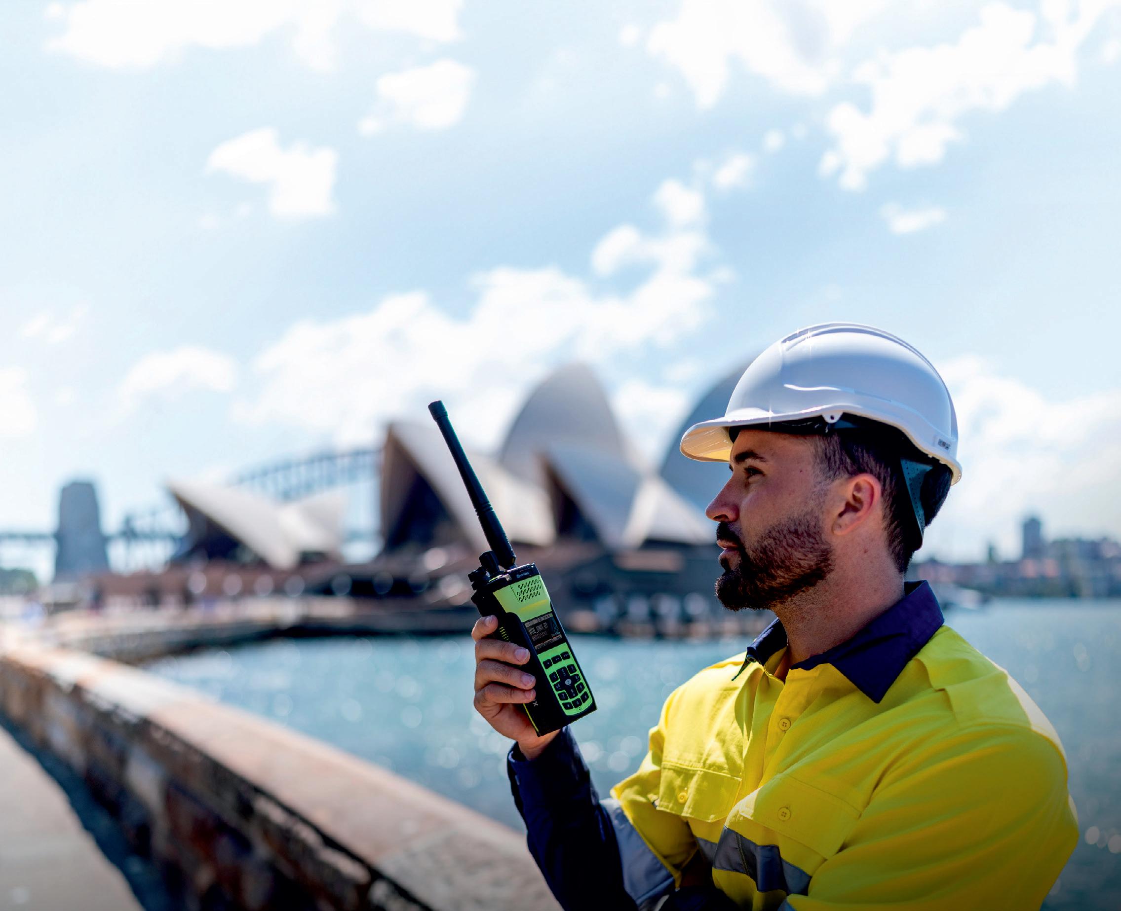
The Tait 9000 series is known worldwide for its mission-critical reliability and highly flexible capabilities. Tait designs and builds the 9000 series in New Zealand to the highest standards, because a truly tough job requires a Tait Tough solution.
Police, fire, emergency services, mining, oil and gas, transportation and utility workers face challenging and often remote conditions every day. They need communications equipment that is reliable, rugged and lightweight. That’s why Tait has the goal of engineering its 9000 series portables and mobiles to be the toughest, mission-critical radio networks ever made.
Communicating between agencies like police, public transport and emergency services must be convenient and efficient. These interagency conversations significantly enhance worker safety and can be the difference between life and death in our communities and workplaces.
Tait’s suite of multiband portables and mobiles enables communication between agencies by supporting P25 and DMR networks. Additionally, the Tait Tough suite of multiband portables and mobiles can function on VHF, UHF or both bands. They can be initially deployed as a single band and be easily switched to multiband over the air as required. The bands are not fixed and can be reconfigured. Visit taittough.com to see the extreme ways Tait’s radios are used every day.
March/April 2024 - Critical Comms 3 www.CriticalComms.com.au
Tait Communications www.taitcommunications.com This issue is available to read and download at READ ONLINE! www.criticalcomms.com.au/magazine Inside
March/April 2024
The new wildfire reality: mapping a response
create
automotive radar ‘hallucinate’
hack to make
Major investment to evolve and expand FirstNet in US
CMOS transmitter taps into the 300 GHz band
monitor air traffic at vertiports
Digital sensor network to
safety broadband investments to exceed $5.7bn by 2026 ON THE COVER A full suite of mission-criticalmultibandportables and mobiles. Unexpected challenges? Bring them on. PP100007393 MAR/APR Vol.11 No.3
Public
Just one issue after Critical Comms featured an article on the mission to class public safety communication as critical infrastructure (Jan/Feb 2024, page 13), the reliability of our telcos appears to be going backwards!
First, the United States experienced an eerie parallel of Australia’s Optus outage when, on the morning of 22 February, customers of telco company AT&T found themselves unable to make calls, text or use the internet on their mobile phones, unless they were connected to a separate Wi-Fi network. The ability to call emergency services was even disrupted for some AT&T customers — and for those who could get through, their location information was not delivered to the 911 call centre, leaving responders to check this manually. Perhaps most worryingly, the outage also affected the country’s public-safety broadband network, FirstNet, which AT&T has been building and maintaining since March 2017, and which had only recently announced a major upgrade (for more on the upgrade, see our story on page 23). With AT&T prioritising restoration of FirstNet, the outage was only fully resolved 11 hours after it began, and has since been attributed to an internal error.
Back in Australia, and for a 90-minute period on 1 March, Telstra’s Triple Zero call centre found itself experiencing issues transferring calls to emergency service operators. Telstra, as Emergency Call Person, receives all calls to Triple Zero and automatically transfers them to the appropriate state or territory emergency service — but while calls did arrive during this period, there was no calling line identification (CLI) information included. Call centre staff were instead forced to take down details — as with the AT&T incident above — and manually transfer each call, with 148 calls ultimately needing to be communicated to emergency services by email. It all comes across like a dark parody of The IT Crowd, complete with the need to restore the system by turning it off and on again.
As we entrust more and more aspects of our society to communications technology, we can only hope that the appropriate safeguards are put in place to prevent major outages such as those documented above. I hope the stories contained within this issue leave you overall excited, rather than concerned, for the future of critical comms.

Lauren Davis, Editor cc@wfmedia.com.au
Westwick-Farrow Media
A.B.N. 22 152 305 336 www.wfmedia.com.au
Editor: Lauren Davis
cc@wfmedia.com.au
Acting Publishing Director/MD: Janice Williams
Art Director/Production Manager: Linda Klobusiak
Art/Production: Marija Tutkovska
Circulation: Dianna Alberry circulation@wfmedia.com.au
Copy Control: Mitchie Mullins copy@wfmedia.com.au
Advertising Sales
Tim Thompson Ph 0421 623 958 tthompson@wfmedia.com.au
Liz Wilson Ph 0403 528 558 lwilson@wfmedia.com.au
Calendar
April
IEEE Wireless Communications and Networking Conference
21–24 April 2024
Conrad Dubai, United Arab Emirates hwcnc2024.ieee-wcnc.org
EENA Conference & Exhibition 2024
24–26 April 2024
Palacio de Congresos de Valencia, Spain eenaconference.org
May
Critical Communications World 2024
14–16 May 2024
Dubai World Trade Centre, United Arab Emirates www.critical-communications-world.com
ARCIA One-Day Conference and NSW State Networking Dinner
30 May 2024
NSW Teachers Federation Conference Centre, Sydney arcia.org.au/events/one-day-conference-sydney-may-2024
June
2024 EuCNC & 6G Summit
3–6 June 2024
Flanders Meeting & Convention Center Antwerp, Belgium www.eucnc.eu
EMPA 2024
5–7 June 2024
QT Canberra empaaust.empa.org.au
IEEE International Conference on Communications
9–13 June 2024
Sheraton Denver Downtown Hotel, USA icc2024.ieee-icc.org
Comms Connect New Zealand
26–27 June 2024
Te Pae Christchurch Convention Centre, New Zealand www.comms-connect.co.nz
July
ARCIA One-Day Conference and Qld State Networking Dinner
25 July 2024
The Greek Club, Brisbane arcia.org.au/events/one-day-conference-brisbanejuly-2024
For a full list of industry events, see criticalcomms.com.au/events
4 Critical Comms - March/April 2024 www.CriticalComms.com.au
All material published in this magazine is published in good faith and every care is taken to accurately relay information provided to us. Readers are advised by the publishers to ensure that all necessary safety devices and precautions are installed and safe working procedures adopted before the use of any equipment found or purchased through the information we provide. Further, all performance criteria was provided by the representative company concerned and any dispute should be referred to them. Information indicating that products are made in Australia or New Zealand is supplied by the source company. Westwick-Farrow Pty Ltd does not quantify the amount of local content or the accuracy of the statement made by the source. Print Post Approved PP100007393 ISSN No. 2202-882X Printed and bound by Blue Star Print
Head Office Unit 5, 6-8 Byfield Street, North Ryde Locked Bag 2226, North Ryde BC NSW 1670 Ph: +61 2 9168 2500 If you have any queries regarding our privacy policy please email privacy@wfmedia.com.au
read me?
Do you
YOU PROTECT THE WORLD’S CONNECTIONS. WE PROTECT YOURS.
With so much on the line, safety is job one. That’s why L3Harris provides customized, proven communications systems tailored to meet the diverse needs of your team. We put P25-standard network flexibility, reliability and security in your hands.
P25 open systems give you the power of choice, connecting you with L3Harris’ trusted mission-critical partners that offer customized solutions to fit your unique needs.
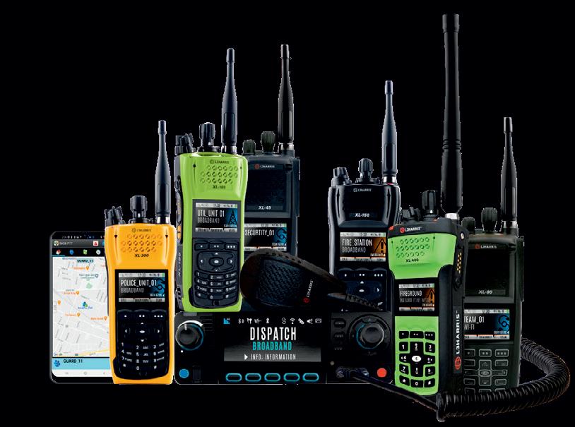
XL SERIES OF DEVICES
Built for your mission
+ P25 compliant for seamless interagency communications
+ Secure voice and data
+ Uncompromised audio quality in any setting
+ Intuitive interface in a rugged, ergonomic design
l3harris.com/en-au/all-capabilities/
utility-communications-solutions

6 Critical Comms - March/April 2024 www.CriticalComms.com.au
© iStockphoto.com/mbala mbala merlin
Anthony Schultz*

A firefighter-turned-researcher is helping pioneer data-driven solutions to tackle today’s unprecedented wildfires.
Chris Dunn, Assistant Professor at Oregon State University’s College of Forestry, spent seven years fighting fires in Oregon and has seen the challenges firsthand. Firefighters must make urgent decisions with limited information. Often, they can only understand situations by physically entering dangerous scenarios.
As a firefighter, Dunn was full of questions. What if firefighters could already know the location and condition of all possible fire control points? What if they could predict the best places to catch each blaze? What if responses were already planned for most scenarios? What if mitigation efforts had already happened in the right places to ensure their success? What if they knew exactly when and where fires could be beneficial?
Today, the questions can now be answered using maps, geospatial analytics and the power of collaboration.
Drawing the lines that contain fires
Dunn and colleagues from the US Forest Service’s Wildfire Risk Management Science Team at the Rocky Mountain Research Station are now using sophisticated mapping to give fire planners the information they need ahead of time. These tools are helping firefighters and communities come together to successfully manage fires.
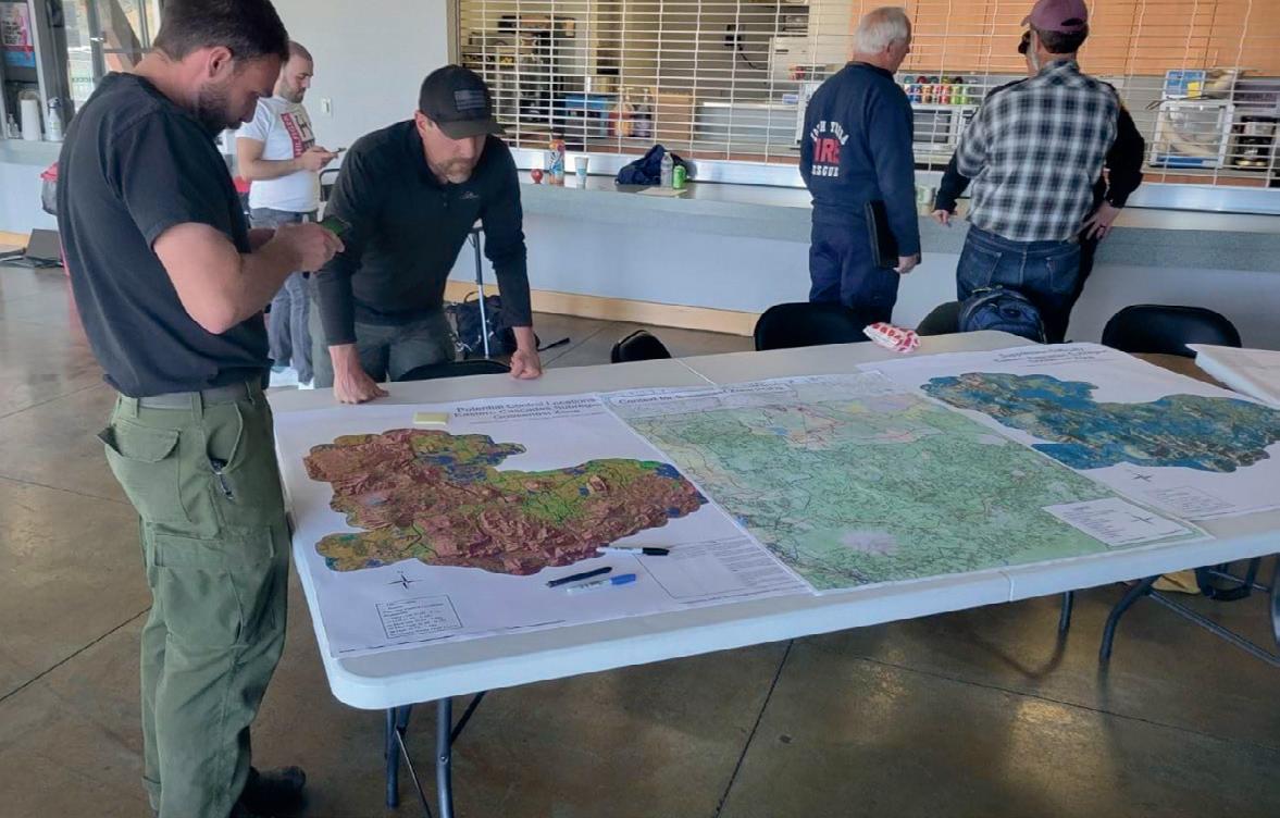
The map-centric framework the team co-developed is known as PODs (Potential Operational Delineations). PODs are areas on a map whose border lines are human-made or natural fire-stopping boundaries such as roads, ridges and water. PODs can range in size from a few hundred to thousands of acres.
These seemingly simple boundaries are built on a wealth of data. To create PODs, planners examine and divide the landscape for fire management, considering geographic features rather than property lines. Wherever a fire starts, a shared map shows which POD it’s inside of, and therefore the best places and opportunities to stop it.
The data behind the maps
PODs are built using geographic information system (GIS) technology, sophisticated mapping software that enables unlimited information about the relevant landscape to be included and analysed.
Dunn first encountered GIS in the 1990s as an undergraduate. He realised that since fires occur in space and time, GIS technology could help him better understand and respond to them. He took one of the earliest programs offered in spatial information management systems and added it as a minor to his Forest Management degree at Colorado State University.
Now, Dunn combines his firefighting experience and GIS knowledge to develop and implement PODs. He uses GIS to simplify complex data for fire management, transforming it into something operational and useful.
Three main layers of data and analysis come together within GIS to give PODs their power:
• A risk map: The Quantitative Wildfire Risk Assessment is a baseline map that shows both the potential chance of wildfire in any area and the value of anything within it. For example, areas with homes, protected wildlife, community water supplies, timber or powerlines carry higher value and therefore greater risk.
• An atlas of the best places to control fires: Potential Control Locations show the probability of successful fire containment from specific areas such as such as roads, ridges and rivers. The atlas factors in how each feature has worked or not worked to control previous blazes.
• A firefighting difficulty evaluation: The Suppression Difficulty Index is a visual representation of the effort required to suppress fire across the landscape. This data prioritises firefighter safety and represents how they operate; for example, steep slopes are more difficult and hazardous to work in than flatter areas. These tools and data are the jumping-off point for starting a fire planning conversation using PODs. Next, planners need to enhance the data with local knowledge.
From mental notes to maps
In developing PODs for a specific area, fire managers start by holding collaborative workshops with community leaders. They collaborate in person and online via GIS maps and other digital tools. In addition to data points such as risk assessment, control locations and firefighting difficulty, the GIS maps show roads and trails, watershed boundaries, structure locations and satellite imagery of the impacts of past fires.
March/April 2024 - Critical Comms 7 www.CriticalComms.com.au MAPPING
Firefighters and land managers bring invaluable local knowledge and expertise to the table, much of it unwritten. The PODs workshops are a way of institutionalising knowledge from fire experts so it can be easily shared and used by anyone who might need it.
“We blend the analytics with the local knowledge to make sure we’re not biased towards local knowledge and we’re not missing something in the analytics,” Dunn said. “You bring them together and you get the best outcome.”
This collaboration is critical because fires don’t recognise property lines or administrative boundaries. For example, the best place to stop a fire might be a road that runs through private property, so performing fuel reduction there might be crucial to future success. To create the best conditions for firefighters and the best outcomes for the public, people need to work together in shared stewardship of the land.
Dunn has found maps to be the clearest way to develop this common understanding of risks, management opportunities and desired outcomes.
Moving from maps to action
After initial workshops are completed, control points are verified in the field, POD boundaries are adjusted as needed and any new information can be added to the shared map. Then PODs become operational — a springboard for action such as planning prescribed burns, allocating funding to harden boundaries and communicating with any affected landowners.
Ashland, Oregon, is one community working with Dunn and the Forest Service to implement PODs. The valley community is surrounded by wildfire risk on all sides and narrowly escaped destruction during the Almeda Drive Fire in 2020. It’s also leading the way in data-driven fire mitigation and planning.
Dunn has worked with Ashland leaders to hold three PODs planning workshops, looking at the broader landscape of two million acres and refining a smaller area closest to the town. They prioritised protecting the municipal watershed and the town itself, paying special attention to the condition of boundaries most critical to those areas. Now they’re using that work to guide prescribed burns across Forest Service, municipal and private forests, focusing on areas where initial fuel reduction has already been completed under the Ashland Forest Resiliency project.
According to Chris Chambers, Ashland Fire & Rescue’s Wildfire Division Chief, “We use PODs to help prioritise where we put prescribed burns on the landscape and where to plan future fuel treatments on private and municipal land. We won’t have enough money to do everything that we want to do
PODs
developed by land managers through a series of collaborative workshops integrating local knowledge and fire analytics with the purpose of informing wildfire response and planning.
everywhere, so it’s best to put our money in places where it’s going to matter the most.”
Ashland leaders are implementing PODs down to the community level in a very detailed way. Their level of collaboration is also unprecedented, with around 95 people involved. Having access to GIS technology has facilitated city leadership’s collaboration with private landowners and partner agencies to create a unified plan. “We need to come together, and the data and maps help us do that. Maps help show people why action is needed,” Dunn said.
Shaping the future of fire management
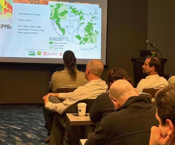
As Dunn and his colleagues have been working to develop and test PODs, word has been spreading.
The data-driven approach and its proven success motivated US Forest Service leaders to champion the concept to the highest lev-
els. Thanks to these advocates, $100 million in funding for PODs planning was explicitly embedded in the Infrastructure Investment and Jobs Act in 2021, with an additional $500 million allocated to hardening PODs boundaries.
While Dunn is excited to see adoption in national parks and forests, he knows PODs also have the potential to transform the plight of fire-prone communities. He hopes to see the approach thoughtfully implemented everywhere in a wall-to-wall network of smart maps. And with GIS technology, virtually limitless data can be added to create a fully integrated system that supports fire managers in every phase of prevention, planning and response.
“All of this is GIS. I wouldn’t do anything without it. Maps are the most effective communication tool to develop a truly functional strategy,” Dunn said.
This article was originally published on the Esri blog and has been reproduced here with permission.

*Anthony Schultz is Director of Wildland Fire Solutions at Esri. His background in wildland fire management and operations began as a wildland firefighter and progressed to responsibility for planning, program direction and coordination of Wyoming’s wildland fire program as the state’s Fire Management Officer (FMO). As a wildland firefighter, he worked for several federal agencies including the Bureau of Land Management and the National Park Service.
8 Critical Comms - March/April 2024 www.CriticalComms.com.au
are
MAPPING
The PODs process leverages a series of analytical tools and maps to engage land managers, fire staff and their partners to make risk-informed fire response decisions.
Photo courtesy of Chris Dunn.
Photo courtesy of Chris Dunn.
LARGE-AREA WI-FI SYSTEM FOR REMOTE AND DISASTER-STRICKEN AREAS
The Connectivity Innovation Network (CIN) — an initiative of the NSW Government — has joined forces with The University of Sydney, UTS, Pivotel Satellite, NBN Co, OneWeb and Real Access to develop a cost-effective large-area Wi-Fi (LAWi-Fi) system for rapid deployment in remote areas and emergency and crisis situations. In collaboration with the NSW Telco Authority, CIN demonstrated the LAWi-Fi system’s capabilities to enable large-area connectivity in emergency and remote areas, enabling efficient communication, coordination and access to critical resources for first responders and communities. Under the leadership of Professor Yonghui Li from The University of Sydney and Associate Professor Peiyuan Qin from UTS, the team developed novel LAWi-Fi protocols and multi-beam high-gain antennas. These advancements address the challenges faced by existing Wi-Fi solutions, which are suitable for indoor and close-range scenarios but are often costly for large-area deployment.
“This project represents a major breakthrough in enabling rapid deployment of Wi-Fi systems in crisis situations and remote areas that do not have any internet connections,” Li said. “Our novel Wi-Fi protocol stack and antenna design have significantly extended the reach and performance of Wi-Fi networks, offering a cost-effective solution for large-area deployment.”
A final demonstration of the project was recently held at Wattamolla Beach, Royal National Park. The centralised Wi-Fi protocol proved to be compatible with commercial chipsets, Wi-Fi 6 and older versions, for maximum compatibility and user accessibility.
The system aims to support up to 100 users with a 10 Mbps data rate in a 2x2 km area, ensuring rapid deployment and efficient outdoor operation capability. The backhaul, provided by Pivotel Satellite, includes LEOsat constellations such as OneWeb and Starlink, as well as NBN Co’s Sky Muster, with the possibility of LTE network integration. An SD-WAN solution supports network bonding and MultiPath Transport Protocol for essential data transmission. Additionally, the innovative Wi-Fi protocol addresses the hidden node problem, enhancing long-range performance and data rates. UTS-designed high-gain antennas offer wide beamwidth and dual-polarisation for stable data rates regardless of orientation.
“By addressing the hidden node problem and improving long-range performance and data rates, the project sets a new standard for crisis connectivity,” Qin said. “We believe that this technology has the potential to significantly transform disaster response and enhance connectivity in remote areas.”
The project’s large-area Wi-Fi system has potential practical applications in various industries, including agriculture, remote education, large warehouses, underground mines, industrial settings and emergency services.
COMMS CONNECT NZ 2024 SET TO BREAK MORE RECORDS
The 2024 edition of Comms Connect New Zealand is just three months away and already has more exhibitors booked than any of the eight previous shows. The organisers have now opened the Call for Papers, with submissions starting to roll in for what will be a high-quality two-day conference program to run alongside the expo.
“We are looking for case studies and technical application pieces from across a range of sectors, including public safety, mining, transport, infrastructure, remote monitoring and others now using critical comms tech to enhance their industry,” Event Director Geoff Hird said.
The event will return once again to the Te Pae Christchurch Convention Centre, from 26–27 June, and will again be run with the support of leading industry body RFUANZ, with Critical Comms the official media partner. The RFUANZ annual gala awards dinner will be held on the first night of the event, 26 June, at the venue.
Gold Partners for the event are Tait Communications, Zetron and Eaton, who will be joined by at least 40 more leading suppliers of critical comms technology. Hird noted, “We have increased our expo footprint for the second year running and it looks like this will [soon] be filled.”
For more details on the expo and conference, and to submit a paper for consideration, go to www.comms-connect.co.nz.


March/April 2024 - Critical Comms 9 www.CriticalComms.com.au
News
News

TELSTRA AND EUTELSAT ONEWEB DEPLOY LEO BACKHAUL IN AUSTRALIA
Telstra and Eutelsat OneWeb, part of Eutelsat Group, have jointly announced that the world’s largest rollout of OneWeb low Earth orbit (LEO) cellular backhaul is currently underway in Australia.
As part of the rollout, Telstra attempted an on-air voice call using Eutelsat OneWeb’s LEO solution at a site in Oxford Falls, Sydney. This is understood to be the first time a satellite backhaul call has been conducted on a commercial mobile network with a guaranteed quality level of services in Australia.
The Oxford Falls site is the first of more than 300 existing remote mobile base station sites currently using satellite backhaul that will be connected with Eutelsat OneWeb’s LEO solution over the next 18 months. In time, this capability will help Telstra expand mobile coverage as it supports new site deployments. A key feature of Eutelsat OneWeb’s service is the provision of service level agreements (SLAs) and committed information rates which promise a specified quality of service and performance.
Iskra Nikolova, Telstra Executive for Network and Infrastructure, said the rollout of LEO-enabled backhaul to remote mobile sites will enable the telco to “improve the customer experience in regional and remote areas, with lower latency, higher speeds and a more consistent experience”.
“There’s also potential for Eutelsat OneWeb, as a backup backhaul solution, to improve reliability in areas where terrestrial backhaul is susceptible to natural disasters and communities find themselves in isolation,” Nikolova added.
“The average bandwidth for these sites will increase at least 15x, and the average latency will reduce 10-fold. We’re very proud of this world-first achievement to have a LEO backhaul that guarantees that level of quality service.”
Telstra has been working with Eutelsat OneWeb to test and deploy the satellite operator’s latest technology, and will continue providing input into its future products and capabilities. Cyril Dujardin, Co-General Manager of Eutelsat Group’s Connectivity Business Unit, said his company counts Telstra as one of its most trusted partners, stating, “We are delighted to support Telstra in delivering consistent, leadingedge connectivity to its customers in Australia, regardless of location.”
AUST DRONE STARTUP ACQUIRES MAPPING SOFTWARE COMPANY
Australian drone technology startup Aerologix is accelerating its growth plans with a $2 million capital raise and the strategic acquisition of Brazilian mapping software company Mappa.
Founded in 2019 by ex-airline pilot Tom Caska (CEO) and former technology consultant Rakesh Routhu (COO), Aerologix matches drone operators with clients that need aerial imaging. Dubbed ‘Uber for drones’, the company has signed up more than 29,000 drone pilots since it was started.
Having launched in New Zealand last year, and now focusing on North and South America, Aerologix recently acquired Mappa — a cutting-edge mapping technology company that turns drone data into high-resolution maps. Mappa has a strong presence in South America and, under Aerologix’s management, will continue to operate as usual servicing its roughly 185 customers while its technology will also be incorporated into Aerologix’s offering under AerologixMaps.
Available globally, AerologixMaps seamlessly integrates into the Aerologix Drone Ecosystem, complementing the AerologixFly app. This integration provides pilots with access to patented Aeropath software, offering an automated flight solution specifically designed for inspecting vertical asset structures through the pilot app.
“A simple, affordable way of making maps is a real value-add for our customers and we already have more than 175 pilots on the waitlist,” Caska said. “AerologixMaps also allows us to establish drone pilot networks abroad without having to set up offices in every country. When and if we do set up our platform of drone pilot networks in international markets, we will have the correct data to do so.”
“Mappa was the missing piece in our plan to build a comprehensive global drone ecosystem,” Routhu added. “This acquisition not only supercharges our growth in South and North America but also provides a platform for a software-as-a-service (SaaS) model, along with additional revenue streams derived from monetising our extensive drone pilot network.”
Aerologix’s technology supports 135 different drone types, catering to diverse industries including renewable energy, construction, real estate and infrastructure. The company is one of a handful of drone companies onboarded into the Civil Aviation Safety Authority (CASA) digital sky platform, meaning both its Aerologix iOS and Android apps ingest CASA weather updates, location-based information and maps that show where pilots can and can’t fly.

10 Critical Comms - March/April 2024 www.CriticalComms.com.au
Aerologix co-founders Rakesh Routhu and Tom Caska.
Image credit: OneWeb.
Spectrum Analysers
Models
USB
TeraHertz
•
•
•
•
•
•
•
•

5G/LTE testing
Spectrum monitoring
Interference testing
Workshop, lab and hobbyist applications
Government and defence users 1/21 Nagle Street Wagga Wagga NSW 2650 Phone (02) 6931 8252 contact@silvertone.com.au silvertoneelectronics.com FULL SPECIFICATIONS ON OUR WEBSITE.
Full function spectrum analyser on your PC or laptop
Windows and Linux software supplied
Full API support for custom applications
for 1Hz – 43GHz
and SFP+ models
Generators
generators to 12.4GHz
Signal Generators
arbitrary waveform
to
Specialists in Spectrum Analysers, Electronic Counter-surveillance Systems, Software-Defined Radio and general Test & Measurement. DISTRIBUTOREXCLUSIVEFOR AUSTRALIA AND NEW ZEALAND.
sampling speeds! Signal
Tracking
Vector
for
generation
6GHz

REPORT: HOW MOBILE DEVICES ARE TRACKED IN MODERN WARFARE
One year on from Ukraine’s strike on Russian troops in Makiivka, which was said to have been made possible by tracking Russian troops’ mobile phones, Swedish telecoms security company Enea has released a complete review of mobile tracking methods used in modern warfare, with a focus on Ukraine.
The groundbreaking report, Location Tracking on the Battlefield, provides a comprehensive overview of the various methods employed to gain military intelligence through the tracking of mobile devices on the battlefield. This is believed to be the first time a complete perspective, including military radio-centric and mobile network-centric methods, has been offered in a single report, providing individuals and organisations the guidance to understand the full scope of risks when using connected devices in conflict zones.
After the Makiivka strike on New Year’s Day 2023, the Russian defence ministry stated that the use of mobile phones by their forces allowed Ukraine to locate the target for the attack. While this statement’s plausibility has been thoroughly discussed, a simulation by Enea presented in the report shows that it may have been possible for Ukrainian forces to track signals from the Russians’ mobile phones and thereby locate them. The possibility that this attack, described as a significant loss for the Russian forces, was initiated after mobile device tracking underscores the consequences of mobile phone usage in war zones.
While the attack on Russian forces in Makiivka is only one example, the report reviews the various methods used to track mobile devices on the battlefield in Ukraine, dividing them into three categories: radio-enabled location tracking, network-enabled location tracking and device-enabled tracking. No previous research has comprehensively addressed all methods with side-by-side comparisons, according to Enea, as it requires distinct expertise in each field.
Enea’s research gives detailed outlines of the methods used, in addition to guidance and recommendations on the risks of mobile device tracking in war zones; civilians and military personnel can thus evaluate the risks and benefits of bringing mobile devices into war zones and assess how to minimise risks if mobile device use is required. The report’s insights are based on original research of extensive open-source material, combined with intelligence from Enea’s mobile network Threat Intelligence Unit.
“This report brings an important understanding of how phones are tracked on the battlefield, adding crucial insights for telecom, military and government policymakers to enhance security measures and effectively leverage technological advancements in the field,” said Cathal McDaid, VP Technology at Enea and lead author of the report.
NEW ZEALAND’S HOURUA JOINS TCCA
New Zealand telecommunications service provider Hourua has announced its membership of TCCA, the global member-led organisation for all stakeholders in the critical communications ecosystem. Hourua is a joint venture between Spark and One NZ, the country’s two largest telecommunication and digital service companies, formed to meet the needs of New Zealand’s first responders using the new Public Safety Network Te Kupenga Marutau.
Hourua is contracted by Next Generation Critical Communications (NGCC), a government entity, to deliver the Public Safety Network’s cellular services for Fire and Emergency New Zealand, New Zealand Police, Hato Hone St John and Wellington Free Ambulance. These services provide a resilient multi-network cellular solution for first responders, enabling them to share information including data, voice, video and images.
With Public Safety Network Roaming now enabled across the Spark and One NZ networks, New Zealand’s emergency services have the best possible access to mobile services and around 28,000 km2 of additional coverage to help them keep the community safe. Later this year, the launch of the Public Safety Network Priority service will mean emergency services’ voice and data communications will get priority over other users when cellular networks are congested or degraded, safeguarding their communications.
“We look forward to making the most of the combined knowledge across all the members of the wider TCCA community to work with Next Generation Critical Communications and help the public safety community in New Zealand make the most of the current and emerging technologies,” said Vaughan Matthews, General Manager and Head of Business of Hourua.
“We are delighted to welcome another mobile network operator to TCCA membership,” added TCCA CEO Kevin Graham. “As in New Zealand, many countries are looking to leverage existing carriers to provide critical communications for public safety and other critical industry sectors. The experience Hourua will bring to our global community will be invaluable in helping other nations and agencies progress their programs.”
12 Critical Comms - March/April 2024 www.CriticalComms.com.au
News
iStock.com/South_agency
CASE STUDY
Utility chooses MIMO for water SCADA upgrade

With a service area encompassing four counties and offering a mix of terrain from foothills to the coast, Talquin Electric Cooperative provides power, water and wastewater services to its customer base in the Florida panhandle. But as Talquin’s old water and wastewater SCADA communications system neared end of life, it became a priority to replace the system with upgraded communications to bring stronger resilience to the utility, which it did with the assistance of Mimomax.
The challenge
Talquin’s legacy water and wastewater SCADA communications system was built around a centralised master repeater which served the whole territory. As explained by Nathan Sutfin, Network Manager at Talquin, “This repeater was a high-power VHF system with lower throughput built on a legacy centralised model. Another major risk was that we had challenges in acquiring replacement parts for the legacy system — this additional factor meant we had to move quickly.”
While Talquin’s water sites are positioned up high, the wastewater sites are typically situated in low-lying locations, including ravines and holes, which make RF connectivity difficult. “Traditionally, the legacy sites weren’t built with robust communications in mind, so we had some interesting RF challenges to overcome,” Sutfin said.
Furthermore, the service territory is prone to strong winds so the wind loading of antennas was a factor for consideration. Operating temperatures were also an important factor as in many parts of Florida there are extreme temperature swings from one day to the next.
With a bi-directional flow of data constantly measuring aspects such as pump activity, water levels and flow, near real-time network visibility was also imperative.
The solution
Talquin had some clear requirements for the replacement water SCADA communications system — decentralisation, low latency and high resiliency.
“We knew we had to limit the risk inherent in a centralised model,” Sutfin said. “With the Mimomax system, we built sectorised deployments across our territory in order to increase coverage and visibility to all of our sites. This approach helped to minimise the risk of losing the entire system due to a single repeater station going offline.”
The system designed with Mimomax Tornado radios comprised multiple tri-sector base radio sites with remote radios connecting to these sectors. Incorporating both MIMO and full duplex communications, the system was able to provide a higher data throughput than the original system, combined with ultralow latency for near real-time visibility.
“We piloted a few different systems but the choice to select Mimomax was based on a few factors — the extreme receiver sensitivities, which allows for data recovery in noisy environments via MIMO; the ability of the radio to seamlessly pass our underlay traffic; and the availability to support a direct IO for future use cases,” Sutfin said. “We needed radios that offered relatively low latency, high resiliency and could withstand harsh environments.”
The results
With over half the radios installed, the additional coverage provided by the Mimomax system has meant that sites that traditionally did not have SCADA connectivity may also be able to be connected, boosting Talquin’s network visibility.
“In terms of throughput, the performance of the new system is amazing,” Sutfin said. “From an RF perspective, the results have been good even though we are using the 400 MHz band, which is popular for LMR and pagers.
“Occasionally we may see interference; however, the radios have the ability to provide us with detailed stats so we can determine the nature of the interference and work quickly towards a resolution.”
MiMOMax Wireless Ltd www.mimomax.com
March/April 2024 - Critical Comms 13 www.CriticalComms.com.au
iStock.com/AndreyPopov

ENGINEERS CREATE HACK TO MAKE AUTOMOTIVE RADAR ‘HALLUCINATE’
Engineers at Duke University have demonstrated a system they’ve dubbed ‘MadRadar’ for fooling automotive radar sensors into believing almost anything is possible.
The technology can hide the approach of an existing car, create a phantom car where none exists or even trick the radar into thinking a real car has quickly deviated from its actual course — and it can achieve this feat in the blink of an eye, without having any prior knowledge about the specific settings of the victim’s radar.
“Without knowing much about the targeted car’s radar system, we can make a fake vehicle appear out of nowhere or make an actual vehicle disappear in real-world experi-
ments,” said Associate Professor Miroslav Pajic, who co-led the research. “We’re not building these systems to hurt anyone; we’re demonstrating the existing problems with current radar systems to show that we need to fundamentally change how we design them.”
In modern cars that feature assistive and autonomous driving systems, radar is typically used to detect moving vehicles in front of and around the vehicle. It also helps to augment visual and laser-based systems to detect vehicles moving in front of or behind the car.
14 Critical Comms - March/April 2024 www.CriticalComms.com.au
iStock.com/JIRAROJ PRADITCHAROENKUL
Because there are now so many different cars using radar on a typical highway, it is unlikely that any two vehicles will have the exact same operating parameters, even if they share a make and model. For example, they might use slightly different operating frequencies or take measurements at slightly different intervals. Because of this, previous demonstrations of radar-spoofing systems have needed to know the specific parameters being used.
“Think of it like trying to stop someone from listening to the radio,” Pajic said. “To block the signal or to hijack it with your own broadcast, you’d need to know what station they were listening to first.”
In demonstrating MadRadar, the research team showed off the capabilities of a radarspoofing system they’ve built that can accurately detect a car’s radar parameters in less than a quarter of a second. Once they’ve been discovered, the system can send out its own radar signals to fool the target’s radar. Each demonstration of MadRadar was done on real-world radar systems in actual cars moving at roadway speeds, showcasing its impressive accuracy — if the spoofing radar signals are even a microsecond off the mark, the fake datapoint would be misplaced by the length of a football field.
THE TEAM’S RESEARCH … SHOWS THAT MANUFACTURERS SHOULD IMMEDIATELY BEGIN TAKING STEPS TO BETTER SAFEGUARD THEIR PRODUCTS.
In one demonstration, MadRadar sends signals to the target car to make it perceive another car where none actually exist; this involves modifying the signal’s characteristics based on time and velocity in such a way that it mimics what a real contact would look like. In a second and much more complicated example, it fools the target’s radar into thinking the opposite — that there is no passing car when one actually does exist. It achieves this by delicately adding masking signals around the car’s true location to create a sort of bright spot that confuses the radar system.
“You have to be judicious about adding signals to the radar system, because if you simply flooded the entire field of vision, it’d immediately know something was wrong,” said David Hunt, a PhD student working in Pajic’s lab.
In a third kind of attack, the researchers mix the two approaches to make it seem as though an existing car has suddenly changed course. The researchers recommend that
4x4 MiMo 4G/5G IoT antenna
Panorama Antennas’ L[X]A[X]
M4-7-42[-X] MiMo antenna is designed to be a one-size-fitsall solution for IoT applications. The robust, low-profile housing contains 4x 4G LTE/5G NR elements covering 698–960/1427–4200 MHz. Versions of the product also contain up to 4x optional Wi-Fi elements supporting Wi-Fi 6e 2.4/5.150–7.125 GHz and optional L1 only or L1/L5 GPS/GNSS.
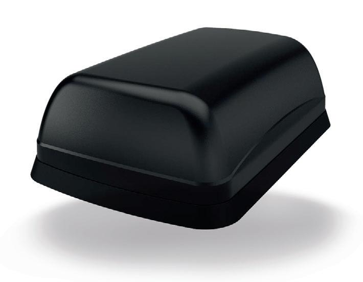
The housing is constructed from flame-retardant, impact-resistant plastic. The subtle, curved design makes the product difficult to vandalise and the IK10 rating means it is suitable for use in tough environments and devices located in public areas. The housing is UV stable and approved to IP69K for ingress protection.
The product is supplied with integrated low-loss, flame-retardant cables approved to UN ECE R118, while fitted connectors offer plug-and-play connectivity for a huge range of devices. The antenna can be installed on conductive or non-conductive panels without significant detriment to performance.
Panorama Antennas Pty Ltd www.panorama-antennas.com
carmakers try randomising a radar system’s operating parameters over time and adding safeguards to the processing algorithms to spot similar attacks.
“Imagine adaptive cruise control, which uses radar, believing that the car in front of me was speeding up, causing your own car to speed up, when in reality it wasn’t changing speed at all,” Pajic said. “If this were done at night, by the time your car’s cameras figured it out you’d be in trouble.”
The team’s research, presented at the 2024 Network and Distributed System Security Symposium in February, shows that manufacturers should immediately begin taking steps to better safeguard their products.
“These lessons go far beyond radar systems in cars as well,” Pajic said. “If you want to build drones that can explore dark environments, like in search and rescue or reconnaissance operations, that don’t cost thousands of dollars, radar is the way to go.”
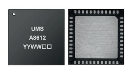
High power amplifier
The CHA8612-QDB is a gallium nitride on silicon carbide, radio frequency power amplifier from United Monolithic Semiconductors, operating between 7.9 and 11 GHz.
The two-stage high power amplifier provides 18 W (typical) of saturated output power and 40% power-added efficiency. The integrated circuit is manufactured with a GaN HEMT process, 0.25 µm gate length, via holes through the substrate, air bridges and electron beam gate lithography.
With linear gain of 26 dB, the product is versatile for a wide range of applications, from military to commercial radar and communication systems.
Richardson RFPD
www.richardsonrfpd.com
March/April 2024 - Critical Comms 15 www.CriticalComms.com.au SPOOFING
Industry Talking
ARCIA received great feedback from our activities in 2023 and we hope to continue building on this for the year ahead, with not only networking events set for Perth, Sydney, Brisbane, Adelaide and Melbourne, but conferences in a few of these states, along with our networking dinners, ensuring there is variety and something for all of our members to participate in.
Make sure you check out https:// arcia.org.au/events/ for our plans as they currently sit, with more being added as we move through the year, and remember to make space in your calendar for what fits in with your plans and your team’s needs.

This year will see a continued focus on critical communications at our conferences (Perth on 14 March, Sydney on 30 May and Brisbane on 25 July) and how it’s applied by various market sectors. Be it mining, rail, public safety, transport or utilities, everyone is embracing new technology that makes sense, and ARCIA is actively involved in promoting both LMR and broadband technologies.
Our promotion of broadband technologies does not mean that LMR is losing appeal around the globe; it is more that the sector is evolving. While we have been told continuously over the last decade that 4G/5G-based technologies will replace LMR, this is not yet the case and is unlikely to be for some time to come.
With the recent major cellular outages in Australia and the USA, it’s worth remembering that in many circumstances, having dual connectivity options has major benefits. All technology is subject to failure, sometimes in a minor fashion and sometimes in a spectacular way that makes headlines. Nevertheless, planning for this has never been more important, and providing critical users with agile systems that can continue to perform, even with reduced features or capacity during major events, is easier than ever before.
There are clearly different factors to consider for industry sectors and user groups, but I think we can safely say that LMR is here for the foreseeable future as we continue to see major investments for private, public and indeed country-wide networks around the globe.
Since our last update the committee has held our annual planning day in Melbourne, at which we were lucky to have 18 attendees from around Australia, all contributing to the year ahead and how we seek to improve the benefits we offer members and partners alike. We are very fortunate to have so many committed people and businesses who give their time and money for this vital day and we are extremely grateful to them all.
On a personal note, and with it in mind that it is one of ARCIA’s missions to help promote Australian manufacturing, having recently had the opportunity to visit the GME factory in Western Sydney, it was terrific to see the pride and commitment from this local team of people in all that they do. Whilst there I considered the number of times a CB radio operates a PTT, or a marine beacon is used, and the impact this is has right around Australia; it was very impressive to see. Of course, GME makes many more products than these two, but they really are a great example of how it is possible to make local manufacturing work.
Finally, we must acknowledge the fantastic support that the association is receiving from all our partners, not only in helping the association’s general goals, but also in supporting all of our events in a big way.
 Hamish Duff President, Australian Radio Communications
EDLC radial supercapacitors
Abracon has released a range of highpower electric double layer capacitor (EDLC) radial supercapacitors, specifically engineered to meet the accelerating demand for fast-charging, high-capacity energy storage solutions. They are key components for a wide range of industries, including automotive, renewable energy, industrial automation, consumer electronics and more.

The EDLC supercapacitors are efficient and compact, providing good energy density. Available in 2.7 and 3 V versions, they are suitable for applications that require rapid power bursts due to their ultrafast charge and dissipation capabilities. An online selection tool enables developers to select the desired supercapacitor performance by allowing them to filter by type, current, tolerance and more.
The supercapacitors are designed for longevity, with a long life cycle that minimises maintenance and enhances system durability; this eliminates the operational safety concerns often seen in lithium batteries. They are also able to operate across a wide temperature range, making them suitable for deployment in challenging environmental conditions. For example, they can operate down to -40°C, which traditional batteries cannot.
The supercapacitors can be used for uninterrupted and backup power supplies, micro energy storage, data transmission and various energy startup designs. They are also especially useful for wireless networks, energy harvesting, cold-crack engines, micro grids and more. element14
au.element14.com
16 Critical Comms - March/April 2024 www.CriticalComms.com.au
Industry Association. iStock.com/recep-bg
TOWARDS 1 TBPS THROUGHPUT USING SUB-TERAHERTZ BANDS

In order to enable the near-instantaneous communication promised by 6G, ultrahigh data speeds will be needed on wireless channels. In a study recently published in IEICE Electronics Express , researchers from Osaka University and IMRA AMERICA have found a way to increase these data speeds by reducing the noise in the system through lasers.
To pack in large amounts of data and keep responses fast, the subterahertz (sub-THz) band from 100 to 300 GHz will be used by 6G transmitters and receivers. A sophisticated approach called ‘multi-level signal modulation’ is used to further increase the data transmission rate of these wireless links. However, when operating at the top end of these extremely high frequencies, multi-level signal modulation becomes highly sensitive to noise. To work well, it relies on precise reference signals, and when these signals begin to shift forward and backward in time (a phenomenon called ‘phase noise’), the performance of multilevel signal modulation drops.
“This problem has limited 300 GHz communications so far,” said Keisuke Maekawa, lead author of the new study. “However, we found that at high frequencies, a signal generator based on a photonic device had much less phase noise than a conventional electrical signal generator.”
Specifically, the team used a stimulated Brillouin scattering laser, which employs interactions between sound and light waves to generate a precise signal. They then set up a 300 GHz-band wireless communication
system that employs the laser-based signal generator in both the transmitter and receiver. The system also used online digital signal processing (DSP) to demodulate the signals in the receiver and increase the data rate.
“Our team achieved a single-channel transmission rate of 240 Gbps,” said Professor Tadao Nagatsuma, PI of the project. “This is the highest transmission rate obtained so far in the world using online DSP.”
The results of the study are a significant step towards 300 GHz-band wireless communication, with the researchers anticipating that, with multiplexing techniques (where more than one channel can be used) and more sensitive receivers, the data rate can be increased to 1 terabit per second (Tbps) — ushering in a new era of near-instantaneous global communication. And such an era could be closer than we think, as Nagatsuma has separately been working with French researchers to break the 1 Tbps barrier using a different frequency band.
In order to reach 1 Tbps speeds, several tens or hundreds of gigahertz of bandwidth are needed, which makes higher frequencies like sub-THz appealing. And while there is extensive research into creating early sub-
THz communications systems, components for these frequencies are still under development and very scarce.
In a paper presented at the 2023 AsiaPacific Microwave Conference, Nagatsuma and the University of Lille’s Professor Guillaume Ducournau revealed that they had built a system using a combination of terahertz photodiodes and an electronics-based receiver covering a range of 500–724 GHz. In this frequency band, they used channel aggregation with 14 carriers and a range of 16 to 64 quadrature amplitude modulation (QAM) to achieve a total data throughput of 1.04 Tbps.
“I am … so happy to reach a single-lane 1 Tbps data rate,” Nagatsuma said. “That is a long-time dream of terahertz communication researchers.”
To measure the performance of their state-of-the-art system, the researchers used a 4-channel Keysight Infiniium UXRseries oscilloscope coupled with vector signal analysis (VSA) software. According to Ducournau, “The combination of wideband terahertz photodiode, receiver and the unique performance of Keysight’s UXR really enabled [us] to succeed in these experiments.”
Ducournau said he was “excited to see that photonics enabled the first aggregated greater than 1 Tbps sub-THz system, as photonics technologies have accelerated to boost terahertz communication research”. Photonics is just one new technology that is being investigated to enable communications at sub-THz bands; whether or not it will be widely adopted in the future remains to be seen.
March/April 2024 - Critical Comms 17 www.CriticalComms.com.au ULTRAHIGH DATA SPEEDS
iStock.com/ko_orn
Lauren Davis
NAVIGATING TOMORROW: RTLS TRENDS AND PROJECTIONS FOR 2024
Fabio Belloni*

Looking back at the rise of location technology throughout 2023, it’s evident that the spotlight on real-time locating systems (RTLS) will only intensify. With numerous companies exploring both the benefits of tracking assets and analysing their movements within and across different environments, the stage is set for a continued evolution of location-based services (LBS).
The landscape of RTLS is now undergoing a transformative journey, being driven by the pressing needs of diverse industries. We’re quickly realising the solution is no longer a built-for-purpose RTLS (ie, fully custom-tailored, including the infrastructure). Rather, RTLS users require scalable solutions that support multiple use cases while offering flexible integration and customisation possibilities. This is pushing the future of the industry away from a siloed, fragmented approach towards one where compatibility and interoperability are key. I expect that’s the future of RTLS, one that’s scalable.
Let’s further delve into the key predictions shaping the evolution of RTLS in the coming year.
Interoperability
As projects involving RTLS and indoor positioning systems (IPS) transition from proof of concept to large-scale implementations, companies across various sectors are seeking a more open and flexible system. In 2024, they’re pursuing options that will not only support different use cases but also offer versatility in infrastructure.
The renewed search for flexibility is because customers often have multi-facility environments that require tracked assets to move between different types of sites, which necessitates compatible RTLS systems. For instance, an industrial customer with multiple facilities may be running platforms and technologies from different vendors, or they may be operating both indoors and outdoors. All that location data must somehow be collected and harmonised to ensure RTLS interoperability as the tracked asset moves around.
To promote interoperability, system integrators should avoid vendor locking; this means refraining from embracing proprietary offerings that are not rooted in using standardised technology. This allows for open market competition, more secure availability of the product from multiple providers and, in particular, it allows the end customer
18 Critical Comms - March/April 2024 www.CriticalComms.com.au

to freely choose where to acquire some of the key components, whenever it is time to maintain, replace or expand their platform.
Hence, in 2024, I imagine we will see increased adoption of RTLS systems where everything is integrated and scalable. The underlying goal is to seamlessly track and monitor goods in real time across different spaces with diverse service requirements.
Scalability
I further expect manufacturers and logistics operators will continue to shift to an RTLS system that enables seamless tracking by combining multiple technologies (GPS, Wi-Fi, Bluetooth, etc) under the same infrastructure or platform. This is in contrast to other highly siloed forms of asset tracking that rely on a single asset tracking technology that’s often not scalable in different environments.
For instance, GPS tracking is an already well-known technology for tracking, but it is fundamentally not scalable because it often can’t function indoors. In contrast, a small electronic device — aka a tag — attached to the asset can broadcast its location through diverse technologies like Bluetooth and radio-frequency identification (RFID). This means a tag supports multiple technologies, allowing for seamless tracking both outdoors and indoors. This all is at the core of scalability: having a solution that scales across all types of
facilities, buildings and environments — a solution that can easily be built up depending on the operator’s needs.
That means 2024 will be the year for looking at the scalability costs and potential.
Digital displays
There is further room to build upon RTLS technologies in the coming year. We can look at electronic shelf labels (ESL) in grocery stores to see the possibilities, in which digital display units integrated into store shelving provide real-time electronic information about products.
Why is this relevant in the context of RTLS? Digital displays can seamlessly complement RTLS by automatically displaying real-time information like product specifications, quantity, expiration dates or information related to the process flow. Digital display dynamically updates the displayed information as assets move. In other words, ESL displays the relevant information about the product, while RTLS allows the product to be tracked.
Being able to track the location of assets while displaying the relevant information to the logistics operator is an incredibly useful tool. For example, the combination can display if the asset has arrived at the correct assembly line on time or if the goods have now been delivered at the wrong location. This impacts both the efficiency of operations, as well as reduction of direct cost by reducing the search time and avoiding logistical errors. The combination of RTLS and display tags is at the core of the digitalisation of the industrial environments.
Transport unit management
In the coming year, companies will turn to RTLS to monitor vehicle movements, locate warehouse equipment, optimise routes with data analytics and enhance overall logistics coordination. Think about logistic hubs and sprawling warehouses with many types of transport vehicles, like forklifts and roller cages. Coordinating all these units can be a hassle and inefficient, which is why there is now a move to leverage RTLS to increase production efficiency and reduce costs.
Interestingly enough, transport units used in intralogistics and cross-docking are a non-negligible operational cost; units can cost from tens to hundreds of dollars each. A midsize logistics company typically owns tens of thousands of such transport units, which are continuously circulating from the shipment to the destination point, indoors and outdoors across multiple facilities. A significant number of such units are lost, misplaced or unaccounted for every year. This is a significant cost to bear for any logistics or manufacturing company, negatively impacting their process optimisation efforts.
Final thoughts
As we gaze into the future of RTLS in 2024, it is evident that the trajectory of location technology is steering towards an era marked by adaptability, scalability and seamless operation across multiple facilities. The strides made in 2023 laid the foundation for a new way forward, driven not by a one-size-fits-all approach but by the nuanced needs of diverse industries and use cases.
This article was originally published on the Quuppa website and has been reproduced here with permission.

*Fabio Belloni is the co-founder and Chief Customer Officer at Quuppa. He is also a member of Forbes Technology Council — a community for world-class CIOs, CTOs and technology executives.
March/April 2024 - Critical Comms 19 www.CriticalComms.com.au
iStock.com/Patamaporn Umnahanant
LOCATION TECH
Network aggregation device
Dejero has developed a compact mobile network aggregation device, the GateWay 3220, to support critical communications at the edge for a wide range of applications, including fleet connectivity, first response, government, utilities, smart cities, connected homes and enterprise. The ruggedised and fanless chassis, developed in collaboration with Dell Technologies, is suitable for installation in vehicles and portable kits and provides resilient connectivity to the internet, cloud applications and private networks.
The device integrates Dejero’s Smart Blending Technology, delivering the connection diversity, redundancy and continuity that mission- and business-critical applications depend on for critical live video and data. The technology simultaneously blends multiple IP networks from multiple providers for expanded coverage and greater bandwidth from even the most challenging and remote environments.
In a range of public and private edge environments, innovative AI/machine learning (ML), analytics, Internet of Things (IoT) and container solutions enable new applications, deployment options and use cases. Bridging communication between physical sensors, the digital edge and private or public cloud services, the network aggregation device supports edge compute connectivity so users can anticipate and respond, in real time, to boost efficiency and improve mission- and business-critical systems. The device is specifically designed and engineered to deliver optimal blended connectivity at the far edge of a network.
Dejero
www.dejero.com


Fully rugged tablet
Getac has announced its AI-ready ZX80 — an 8″ , fully rugged tablet powered by the versatile Android operating system. Purpose-built to thrive in challenging work environments, from busy warehouses and logistics hubs to remote field locations and outdoor facilities, the product has a configurable design that offers extensive flexibility to match the user’s needs as effectively as possible.
The unit’s lightweight form factor (590 g), wide operating temperature range (-29 to 63°C) and bright 1000-nit, 16:10 aspect ratio screen make the tablet particularly well suited to key tasks such as forklift truck operation and UAV control success. MIL-STD-810H certification, IP67 certification and 1.8 m drop resistance mean it can easily stand up to the rigours of intensive field work.
A dual SIM design (one physical SIM and one eSIM) allows for rapid switching between carrier networks, while Wi-Fi 6E 802.11ax, Bluetooth v5.2 and optional dedicated GPS offer rapid data transfer and location positioning capabilities. Depending on user requirements, the tablet can also be configured with 4G/5G LTE, NFC and a barcode reader to fit different applications as needed.
The Qualcomm QCS6490 processor delivers high performance at low power levels, making it suited to IoT industrial field applications and commercial use cases. The tablet is also AI-ready, taking advantage of Qualcomm’s AI engine to offer on-device machine learning and the ability to run AI use cases while maintaining battery life. To maximise the potential AI capabilities, the device incorporates 12 GB LPDDR5 memory. It also comes with Android 13 pre-installed and is upgradeable to future Android OS releases.
The tablet is compatible with a comprehensive range of dedicated accessories, peripherals and software, helping users maximise device functionality in different industry scenarios; this includes third-party secure vehicle docks for optimal vehicle/forklift truck use, high-capacity hot swappable batteries for enhanced usability in the field and 65 W USB-C adapter and docking station for efficient use in the office. Users can also efficiently manage their tablets through preinstalled Getac software solutions.
Getac Technology Corp
www.getac.com
20 Critical Comms - March/April 2024 www.CriticalComms.com.au
Bayswater
Police Department Deploys Axon’s Next Generation In-Car Video System Connected by Cradlepoint
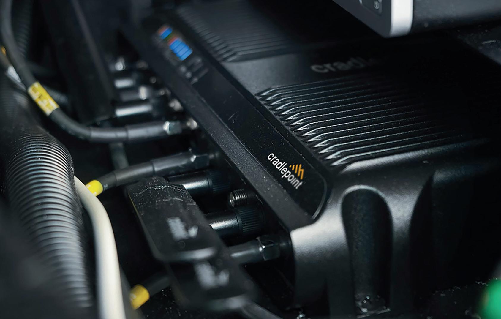
Modern law enforcement agencies such as police departments continue adding a wide range of key technologies that enable o cers to protect and serve their communities, from vehicles to stations and the IoT devices within them. Many of these devices and applications require easy-to-manage 5G and LTE solutions for reliable, secure, and mobile connectivity.
One example comes from one of the oldest US police forces. e Los Angeles Police Department (LAPD) deployed Axon Fleet 3 in-car camera systems last year. Axon’s Fleet 3 is the latest connected in-car camera system that integrates seamlessly with the Axon network via Cradlepoint.
Background
e LAPD had long recognised the need for enhanced technology in its patrol vehicle eet. e Department selected the ruggedised Cradlepoint IBR1700 routers and MC400 modular modem to support current and future connectivity needs.
ese products combine to deliver two modems that provide the LAPD with a dual-carrier, redundant approach, to guarantee that o cers on the streets always have the connectivity they need.
Solution
Axon is a technology leader in global public safety. Axon is building the public safety operating system of the future by integrating a suite of hardware devices and cloud software solutions that lead modern policing. Built from the ground up with ethics and transparency in mind, Axon’s Fleet 3 in-car camera system features the next-generation connected capabilities with state-of-the-art dual-view cameras to record clear panoramic views across three lanes of traffic. Fleet
3 also features a robust interior camera capturing a knee-to-head occupant view with enhanced night view capabilities. With pre-event buffering and multi-camera playback, agencies can ensure that critical footage is captured and reviewed.
Benefits
With the addition of Axon’s Fleet 3 to the already deployed Axon Body 3 cameras, the Cradlepoint and Axon systems seamlessly integrate for ease of use and manageability. Adding wireless connectivity to each vehicle unlocks the ability to wirelessly upload video data to the agency’s existing storage infrastructure. Cradlepoint NetCloud Manager provides remote network and cellular connectivity management to LAPD, allowing them to control and administer the entire vehicle fleet easily, effectively, and efficiently.
“The LAPD prides itself in innovation and leveraging technology to uphold public confidence, while working to reduce the administrative burden on our officers. The advances Fleet 3 offers, with improved image quality, in-car and body-worn video synchronisation, cloud storage in evidence.com and over-the-air uploading via our Cradlepoint routers. These advances will not only provide increased transparency for the public, but also improve the working conditions for our officers,” said Deputy Chief John McMahon, LAPD Chief Information Officer.
Cradlepoint & Axon
The LAPD is an example of a leading agency investing in modern tools to help their officers perform their duties in a safer, more effective way while increasing transparency for the community. Most of today’s tools require cloudbased connectivity for advanced decision-making capabilities and data handling. Cradlepoint is proud to provide fast and reliable 4G and 5G cellular connectivity that supports the Axon devices and applications helping front-line officers and the communities they serve.
Cradlepoint enables the freedom to connect people, places, and things that drive more experiences, more ways to work, and better business results — anywhere. e company is a pioneer in Wireless WAN, o ering advanced 4G and 5G routers and adapters — controlled through Cradlepoint NetCloud. Enterprise businesses and public sector agencies rely on Cradlepoint and its Cellular Intelligence to build a reliable, secure network wherever they need it, connecting xed and temporary sites, vehicles, IoT devices, and remote employees.

Cradlepoint Australia Pty Ltd
www.cradlepoint.com/au
March/April 2024 - Critical Comms 21 www.CriticalComms.com.au SPONSORED CONTENT
CASE STUDY
St John WA selects Omnitronics for ambulance dispatch
St John WA (SJWA), the largest ambulance service in the world in terms of geographical coverage, has commenced implementation of the omnicore Enterprise Dispatch system by Omnitronics, with the service now live with the State Operations Centre and across metropolitan operations.
With more than 236,000 hours of volunteer support, SJWA provides emergency medical services to the people of Western Australia. The not-for-profit organisation serves people day and night, through 17 different services and 196 ambulance locations across a state spanning over 2.5 million km2 in size.
Since the first Omnitronics dispatch installation in 2008, SJWA has consistently upgraded to access the most advanced dispatch technology available on the market. Its third Omnitronics dispatch system, omnicore Enterprise Dispatch, went live in late 2023 and is hosted in virtual machines with a primary server in Belmont and a duplicate backup site 26 km away in Wangara, Western Australia. The system has greatly enhanced SJWA’s communication capabilities, highlighting the crucial role that technology plays in delivering efficient and effective emergency services to communities.
While all metro and country channels are using Tait base stations via the DFSI or 4-Wire E&M interface, a high availability omniGateP25 gateway cluster provides access to PTT over satellite for remote locations. This will give country ambulances in remote locations the capability of multiple communications paths based on priority, including radio channels, 4G connections or satellite.
In addition, a custom-developed CAD interface for omni core Dispatch sends an alert and message for CAD job dispatch information directly to the user’s radios ensuring no job is missed when the

paramedics are away from the in-vehicle CAD terminals. A voice recorder is also integrated into the system.
“As a longstanding client, we are happy that Omnitronics have once again provided us with the latest cutting-edge radio dispatch technology and support us in communicating with both local and remote sites from our centralised operations centres,” said SJWA Radio Communications Manager Ray Pullen.
Omnitronics CEO John Jordan added, “The capability to provide custom engineered functionalities for our dispatch systems gives users like St John WA the opportunity to design a system to their specific organisational requirements. We are pleased to be able to offer them exactly what they need, so they can focus on their mission: saving lives.” Omnitronics Pty Ltd www.omnitronicsworld.com
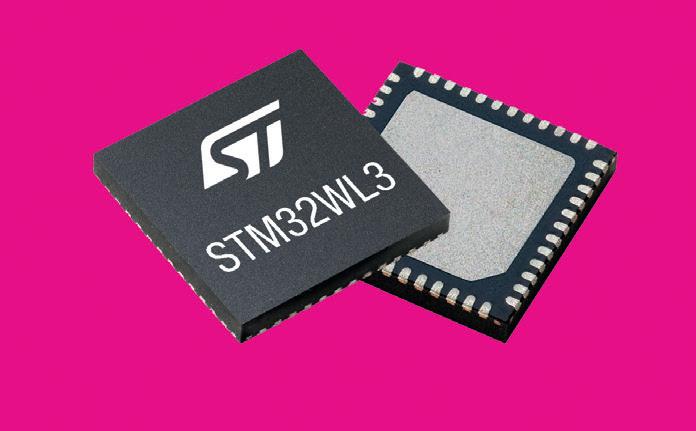
Long-range wireless microcontroller
STMicroelectronics has released a microcontroller (MCU) that fuses the company’s expertise in wireless-device design with its high-performing and efficient STM32 architecture. Novel power-saving features enable the extension of battery life in the wireless MCU beyond 15 years.
Especially valuable in remotely deployed applications including metering and monitoring devices and data from alarm systems, actuators and sensors in today’s smart buildings, smart factories and smart cities, the STM32WL3 wireless MCU can help limit power consumption and prioritise activities. Adoption and use of the efficient MCU can lead to improved user experience, service delivery and reduced environmental footprint, the company says. Device and application designers can leverage the wireless MCU to develop and deliver new products to the world quickly.
The product contains a power-efficient, multiprotocol radio suitable for long-range communication using licence-free frequency bands reserved globally for industrial, scientific and medical (ISM) applications. In addition to the main radio, ST has integrated an ultralow-power radio that the system can power-down to save energy while listening continuously for a wake-up signal.
Tailored to the specific needs of smart-metering applications, the device embeds an LCD controller and a specific peripheral — an LC sensor controller — for fluid flow measurement that eases the design of water meters and heat-cost allocators. Multiprotocol support enables deployment of one single platform over different long-range wireless technologies, including Sigfox, KNX, mioty, M-Bus and others.
STMicroelectronics Pty Ltd www.st.com
22 Critical Comms - March/April 2024 www.CriticalComms.com.au
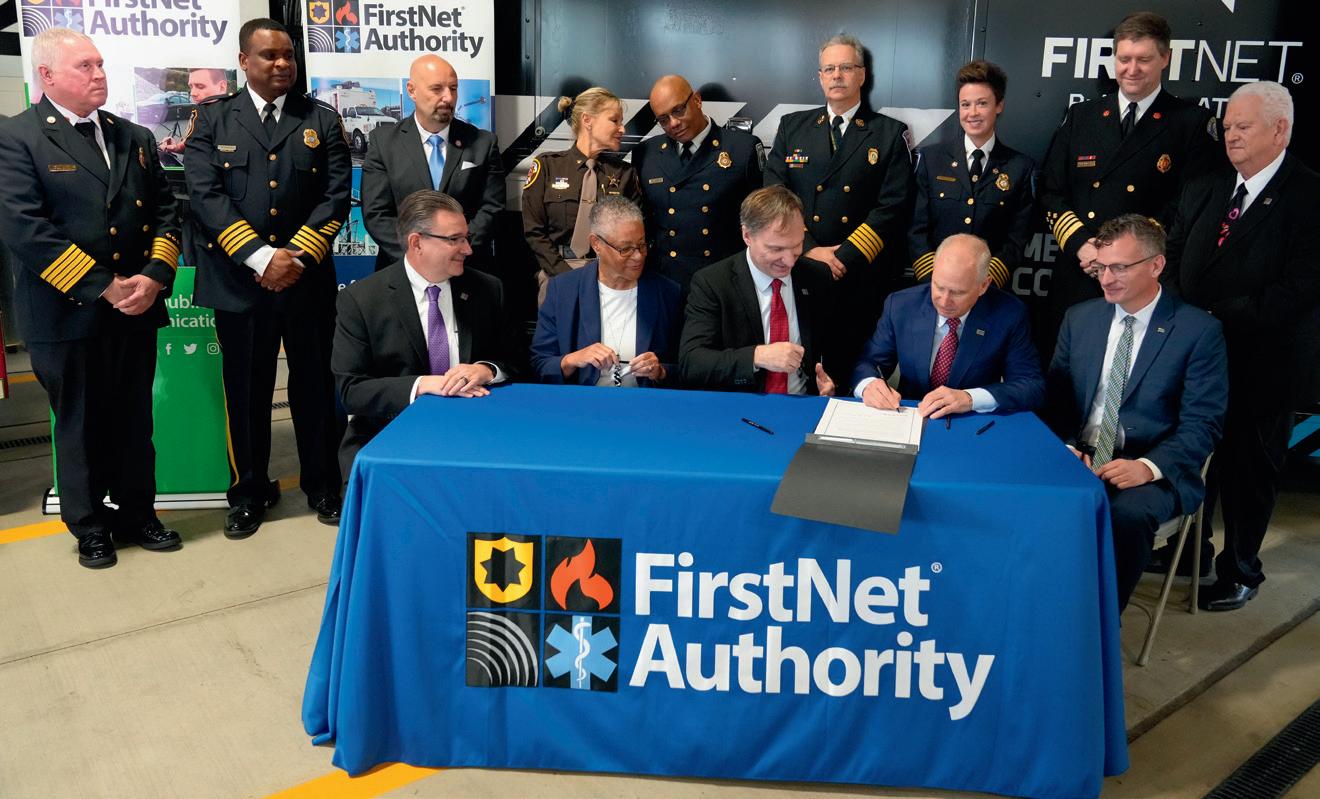
MAJOR INVESTMENT TO EVOLVE AND EXPAND FIRSTNET IN US
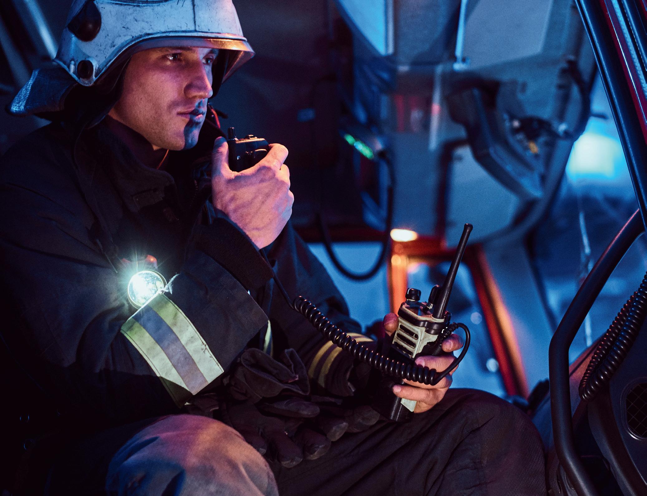
The FirstNet Authority and its network partner, AT&T, have announced a 10-year, $8 billion investment in the future of FirstNet — the USA’s public safety network.
The FirstNet Authority plans to invest $6.3 billion through its network contract with AT&T and anticipates an additional $2 billion for ongoing investments in coverage enhancements for public safety, which is currently under discussion by the parties. The initiative is set to ensure that FirstNet remains at the forefront of technology, continues to solve the communications challenges facing public safety today and has the flexibility to adapt to public safety’s future needs.
AT&T has already grown FirstNet — the only network built with and for America’s first
responders and the extended public safety community — to cover more first responders than any network nationwide. With more than 5.5 million connections and about 27,500 public safety agencies and organisations on FirstNet, first responders can communicate with one another during everyday operations, big events, emergencies in the field and more. This latest announcement launches the next phase of FirstNet and will include the following:
• Providing public safety on FirstNet with always-on priority and pre-emption across all AT&T 5G commercial spectrum bands, starting in March.
• Building thousands of new, purpose-built FirstNet cell sites across the country — including 1000 new sites within the next two years. Beyond the initial $6.3 billion investment, the FirstNet Authority anticipates additional investments over the next decade to deliver Band 14 coverage enhancements.
• Creating a standalone 5G core to enhance current 5G functionality with specific public safety features on FirstNet and support the transition of public safety’s Band 14 spectrum from LTE to 5G.
• Expanding mission-critical services — voice, video, data and location — to complement public safety’s localised, voice-only radio systems with reliable, wireless connectivity.
• Upgrading public safety’s dedicated fleet of deployable network assets with 5G connectivity to improve operational safety, security and resiliency.
March/April 2024 - Critical Comms 23 www.CriticalComms.com.au
PUBLIC SAFETY NETWORK
© iStockphoto.com/FXQuadro
• Readying the network to evolve beyond 5G, while remaining focused on public safety’s unique needs and emerging requirements when implementing future technological advancements.
With the initial buildout of FirstNet complete, the investment initiative will expand access to public safety’s Band 14 spectrum in the near term, with plans for additional coverage enhancements on a recurring basis. The FirstNet Authority will work closely with public safety across the states, territories and tribal lands to identify areas that could benefit from broader coverage. The FirstNet Authority will take this information into account, along with other public safety factors and network considerations, to ensure future
GNSS/INS smart antenna
coverage enhancements maximise investment dollars and make the biggest impact to public safety operations.
The transition to a full 5G network will meanwhile enable FirstNet to keep pace with current evolutions in technology and 3GPP standards-based mission-critical advancements. From using drones to transmit high-definition video during search and rescue operations, to opening the door to an influx of Internet of Things (IoT) data that will enhance situational awareness and improve emergency patient care, 5G is understood to be the foundation for the future of first responder-centric technologies.
The planned 5G network upgrades are set to generate faster speeds, increase capacity,
enhance the quality of service for FirstNet users and drive innovations in 5G missioncritical services. Plus, by integrating 5G on FirstNet with 9-1-1, public safety should be able to leverage the full potential of this technology, allowing for a more informed and rapid response to emergencies. Throughout the multi-year transition to a full 5G network, the existing FirstNet 4G LTE network will remain fully operational and maintain the level of service that first responders have come to rely on.
“We are dedicated to the future of public safety communications, and that starts with expanding and evolving FirstNet to meet first responders’ needs,” said Joe Wassel, Executive Director and CEO of the FirstNet Authority. “With this investment, we are ensuring FirstNet remains at the forefront of technology so that public safety can respond smarter, safer and more effectively. I look forward to our continued partnership with the public safety community and AT&T to deliver the most reliable, innovative communications network for public safety.”
“FirstNet is critical infrastructure that is reliably connecting those who tirelessly protect and serve,” added Jim Bugel, President –FirstNet, AT&T. “With 5G, public safety will unlock new and innovative tools to keep them mission ready — and we aren’t stopping there.
“Together with the FirstNet Authority, we will continue to expand and enhance public safety’s network based on their feedback, giving them the solutions and connectivity they need, both now and in the future. That’s the FirstNet promise — continually prioritising first responders and the communities they serve.”
Septentrio’s AntaRx-Si3 is a GNSS/INS (inertial navigation system) smart antenna in an ultra-rugged enclosure, designed for easy installation on machines such as agriculture robots. It leverages FUSE+ technology, which is designed to answer the need for position availability in tough industrial environments where GNSS signal reception may be temporarily compromised, such as under foliage. The IMU sensor in FUSE+ is designed to improve positioning integrity, which is critical for autonomous systems.
Robust inside and out, the device is designed to be mounted outside on a machine for operation in harsh environments out in the field. It is enclosed in an impact-resistant polycarbonate IP69K housing that can handle high levels of shocks and vibrations.
The multi-frequency receiver delivers Septentrio’s RTK positioning down to the centimetre level. This can be installed with minimal effort, which is beneficial for after-market upgrades, or easily removed at the end of the day to protect against theft or vandalism. There is also a built-in 4G cell modem, so there is no need for additional modem integration.
The device leverages Septentrio’s GNSS+ algorithms with advanced multipath mitigation, which allows uninterrupted operation in environments where satellite signals could be reflected off nearby machinery or high structures such as silos. It delivers positioning at a high update rate and low latency, which are critical for control loops in autonomous movement or rotation.
Septentrio
www.septentrio.com/en
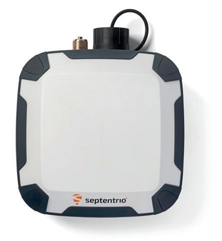
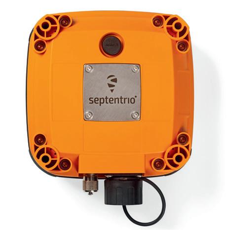
24 Critical Comms - March/April 2024 www.CriticalComms.com.au
PUBLIC SAFETY NETWORK
Image courtesy of First Responder Network Authority (via Flickr) under CC BY-NC-ND 2.0
Broadband hand-portable device
Sepura has launched the SCL3 TETRA and 4G/5G Device, a rugged broadband hand portable. Complementing the SCU3 Hybrid Vehicle Device, the product has the flexibility to be deployed as LTE only or as hybrid TETRA and 4G/5G, enabling the migration to mission-critical broadband communication.
The powerful device provides a link to future MCX communications, utilising its optional TETRA module to provide a migration path from existing TETRA communications to MCX services. Users can start today with TETRA TMO voice and LTE data and migrate to MCX voice and TETRA DMO for device-to-device (D2D) services.
Created with mission-critical users in mind, the 4G/5G rugged handheld device addresses the requirements published by NCCOM Nordic operators. PPDR (Public Protection and Disaster Relief) users are accustomed to rugged TETRA devices with physical buttons for PTT and emergency calls; these requirements are carried forward into the SCL3 LTE and hybrid device. The physical characteristics of the device support frontline operation in all environments, which include shifting temperatures, humidity and wet conditions. It also has a long life cycle, with continuing support for hardware, chipset, battery and software.
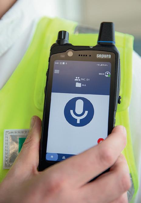
The device portfolio is complemented by a full ecosystem of accessories necessary to deploy to PPDR users. This includes chargers, audio accessories, car kit and carry cases, as well as a full mobile device management (MDM) service which provides over-the-air device management and software provisioning for both LTE and TETRA that is fully controlled by the end-user organisation.
For those who are embarking on their migration strategy to LTE, the device provides a safe and secure path towards MCX that can be started now allowing early use of broadband services while maintaining current TETRA communication. It combines best practice and the latest technology to provide users with robustness and functionality for the evolution of mission-critical communications.
Sepura www.sepura.com
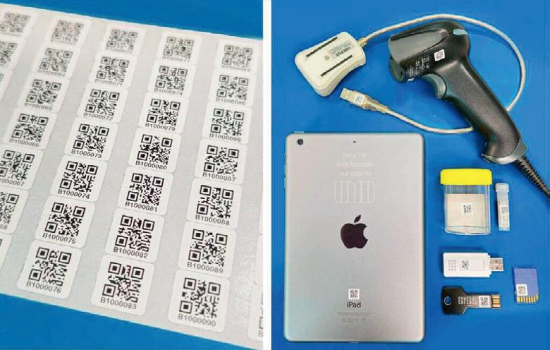
QR-coded asset labels
Unique Micro Design (UMD) has released UMD Q-Dots — small and tough adhesive QR-coded asset labels measuring 10 x 10 mm2. Their compact size makes them suitable for tagging or tracking assets such as vials, slides, ICT equipment, tools or anything where discreet labelling is desired.
The labels are printed at a high resolution, allowing them to easily be read by standard 2D barcode readers and smartphones. Each label has a unique number within the series.
A sleek polyester finish makes the labels robust, long-lasting and UV stable, so they can be used both indoors and outdoors. They can be read with up to 30% damage or markings.
Q-Dots help businesses keep track of assets, minimise asset loss and identify data — all on a label that is smaller than a thumb. They are printed by UMD in-house and custom options are available with customised sequences.
Unique Micro Design Pty Ltd www.umd.com.au
Ultra-compact, rugged 5G router
Semtech’s AirLink XR60, claimed to be the world’s smallest rugged 5G router, has been engineered with the needs of public safety agencies in mind. The ultra-compact and highly ruggedised device delivers high-performance 5G and Wi-Fi 6 connectivity to spacelimited and harsh environments — from tight industrial enclosures to fast-moving vehicles.
The product leverages 5G, Wi-Fi 6, gigabit Ethernet and USB-C technologies for instant communication, smooth video streaming and fast downloads. Its small footprint means it fits easily into gear-packed public safety vehicles.
With advanced networking capabilities, private network support and edge computing capabilities, the router is designed to futureproof connectivity and to accelerate digital transformation. It can withstand extreme temperatures, high vibration, and moisture and power fluctuations, helping users to maintain communications in harsh conditions.
Semtech www.sierrawireless.com
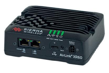
March/April 2024 - Critical Comms 25 www.CriticalComms.com.au
This issue, the Radio Frequency Users Association of New Zealand (RFUANZ) invited guest columnist Lloyd Wensley from Mount Campbell Communications to recount his company’s recent efforts to create a skid-mounted DMR Tier III radio site…
Having been invited to provide radio communications to multiple locations in the remote wilderness of the northern South Island for an international event, we decided to leverage off our existing DMR III network and our high-site Engine Alternator (EA) Set design. Three transportable skids with lifting arrangement were designed and built within a very tight time frame. The system was deployed over the two-month event with the three skids ‘leap frogging’ along the event course and various event locations. Some sites required half-hour helicopter-slung loads to an altitude of just over 2000 m AMSL, while other sites were set up on standard 6 ′ x 4 ′ road trailers, and one was even on a barge moored off the coastline looking into the coastal race way.
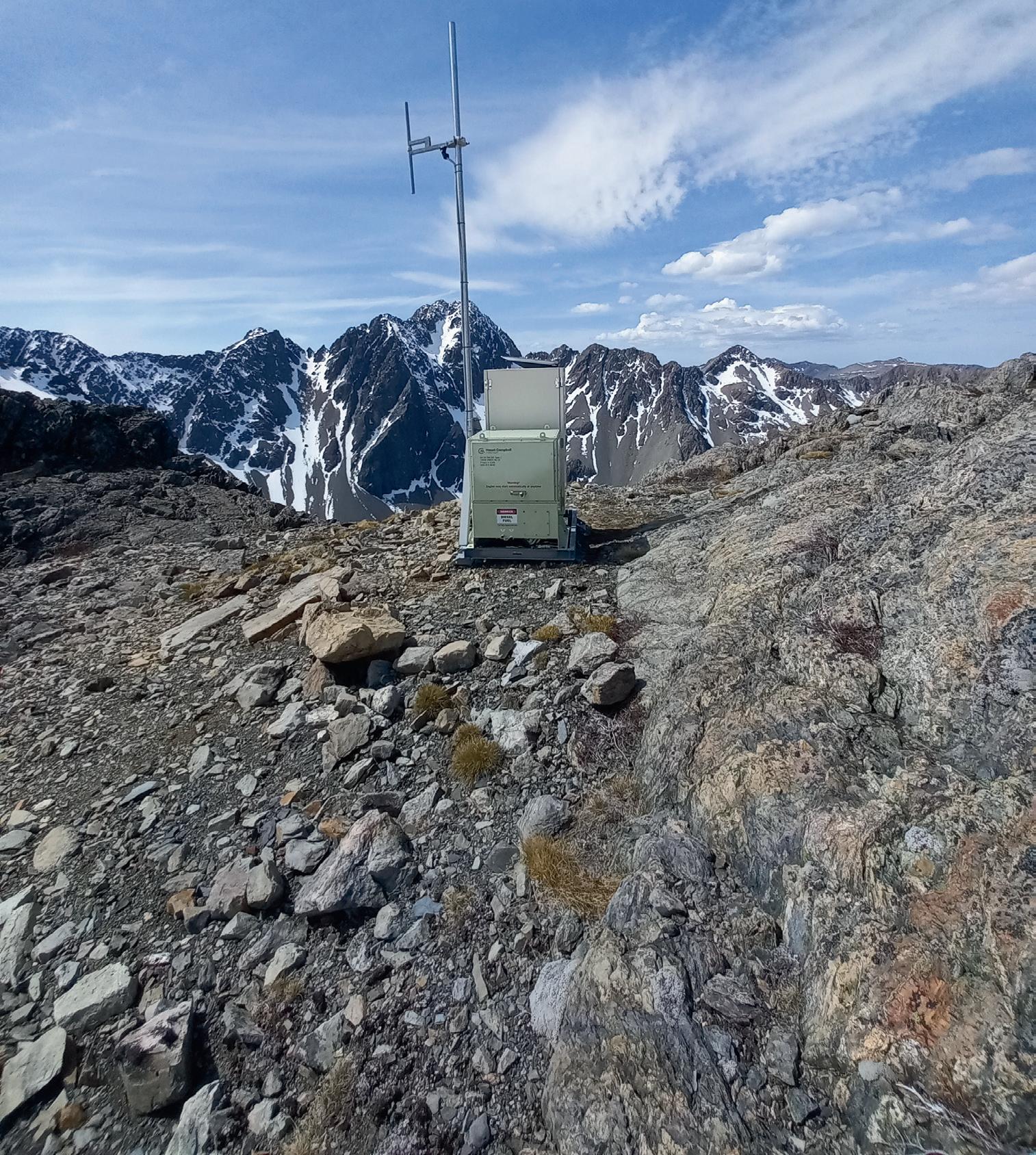
Each skid comprises a steel channel frame on which the EA Set and radio cabinet are mounted; a triangulated frame for a 4 m antenna mast with rugged Kathrein dipole. Certification of the lifting arrangement was required for slinging under a helicopter.
All the Mount Campbell team were involved one way or the other and with this teamwork the company achieved and exceeded the client’s expectations despite the very short time frame.
The delivered results were very satisfactory, giving the client direct communication from operations staff to remote field crews as well as location services, PSTN calls and man down alerts. Each skid was fitted with two RF channels giving three traffic time slots, which provided uncongested traffic between the client’s management operations and safety teams.
The skids can easily accommodate four RF channels providing seven time slots or a mix of DMRII or conventional in either the UHF or VHF bands. The skids are easily relocated and run autonomously at each location for more than two weeks. We recently ran one for 20 days without intervention for a temporary job.
The design has several novel features, including capacitor start (200F) instead of starter batteries and a purpose-built 80 L fuel tank with desiccant air breather and convenient fuel drain. The engine is an air-cooled rugged electronic engine with CAN bus to facilitate telemetry. The tank allows for approximately 100 hours run time. Each skid is TCP/IP linked to the network node via the Starlink commercial satellite service, which allows deployment anywhere!

Having got through the event, we are now reworking the electrical design for other applications to provide 14 VDC, 50 VDC and 230 VAC single-phase as well as a local engine control unit. The skids have recently been deployed for service while permanent sites are being engineered and for other applications.
Lloyd Wensley, Owner, Mount Campbell Communications.
5G private wireless solution
Nokia Digital Automation Cloud (DAC)
Private Wireless (PW) Compact is a 5G private wireless solution in a small form factor, optimised to meet the private wireless connectivity needs of small and mid-sized industrial sites.
Based on the Nokia AirScale small cells, the platform is designed to deliver pervasive connectivity for both human and machine in tough industrial environments. With the security, performance, ease of use, integration and scalability of the Nokia DAC private wireless solution, its smaller form factor aligns to the coverage requirements of small industrial sites and offers an economical entry point for small industrial premises. It is also claimed to be up to 60% more energy-efficient than Wi-Fi, resulting in a lower energy footprint.
For sectors like warehousing, where sites are densely populated with metal shelves and coverage holes can impact business by causing handover failures, parcel loss or tracking issues, the compact 5G private wireless solution enhances existing operational uses cases and makes many more possible. The platform is also suitable for small enterprises within ports, manufacturing, mining, petrochemical, retail and more industrial segments.
It is easy to use with plug-and-play deployment and IT native operability, and provides configurations for indoor, outdoor and mixed radio coverage. Larger enterprises deploying the product in small facilities will have the confidence of a single multi-site private wireless solution deployed across all their campuses. As enterprises expand their private wireless deployment over time, there is an easy upgrade path to add incremental capacity, users and radio configurations, as well as allow for the addition of Wi-Fi technology.
Nokia Solutions and Networks Australia Pty Ltd www.nokia.com
26 Critical Comms - March/April 2024 www.CriticalComms.com.au

LoRa module
Quectel Wireless Solutions has launched the KG200Z, a long range (LoRa) technology module designed to meet the needs of IoT projects requiring ultralow-power and long-range wireless communication. LoRa technology enables devices to transmit small packets of data over considerable distances with minimal power consumption.
The module delivers robust connectivity for IoT devices, with a transmission distance of 2–5 km in urban settings and 10–15 km in suburban areas. With a steadfast network connection, anti-interference capabilities and steady data transmission, the powerful and efficient device is suitable for businesses seeking to enhance their projects with advanced IoT connectivity.
The module is based on the STMicroelectronics STM32WLEx series microcontrollers, and designed for ultralow-power consumption and compatibility with the LoRaWAN protocol. Equipped with a built-in power management unit, power amplifier, low noise amplifier and RF transceiver switch, the module integrates an ARM Cortex-M4 core with the modulations of LoRa, (G)FSK, (G)MSK and BPSK, supporting the LoRaWAN standard protocol across a wide spectrum, including the 470–510 MHz and 862–928 MHz LoRa frequency bands.
The device features a range of connectivity options with multiple interfaces, including UART, SPI, I2C and SWD, catering to a range of applications. Its ultralow power consumption helps to extend battery life, making it an eco-friendly choice for IoT applications.
The compact profile of 12 x 12 x 1.8 mm in an LGA package allows for easy integration into a variety of devices, providing flexibility for manufacturers and developers seeking to implement IoT solutions. Quectel also provides two sub 1 GHz antennas for the module — the YEIN002AA and the YE0019AA.
Quectel
www.quectel.com

Body cameras
Yagi antennas
ZCG manufactures a wide range of Yagi antennas, including dual- or cross-polarised options, designed to cover the high-volume frequency ranges within the VHF, UHF and cellular mobile phone spectrums including 4G.
The company’s range of dualpolarised Yagis is available in all frequency ranges, including FM radio; VHF and VHF digital TV; UHF and UHF digital TV; cellular — 4G LTE and 4G; and ISM/IoT and LoRa.
Available in either 25 mm round boom or 25 mm RHS boom, and ranging from 6 through to 14 dBd models, ZCG has directional Yagi solutions to suit a range of requirements. The company can also custom-manufacture a Yagi to the user’s specified frequency range, with a turnaround time of 15 working days for dual-polarised Yagis.
ZCG
www.zcg.com.au
Axon has launched a series of body cameras designed for frontline workers in retail stores and healthcare facilities. Adapting the same life-saving technology trusted by law enforcement agencies around the world for enterprise organisations, the cameras are lightweight, customisable and integrated with Axon’s real-time operations and evidence management technology.
The cameras feature quality hardware alongside robust real-time capabilities and simple evidence management workflows, making it easy to act on captured footage. They help protect employees by capturing high-quality video evidence of employee–customer interactions, while also respecting their privacy. With a simple double tap activation that is lightweight for wearing, the cameras make it easy to record critical moments.
Employees are equipped with a communications beacon to protect themselves with situational awareness, allowing for quick and effective interventions. Axon Respond’s live capabilities enable employees to ask for help in the moment, while having a camera present encourages better behaviour and discourages crime in the workplace.
Finally, users can manage high-quality, easily searchable footage in Axon Evidence to gain transparency into all interactions. Footage can be uploaded, managed and shared internally and externally with law enforcement to expedite the path from incident to adjudication. This evidence can uphold internal standards, clear up claims or disputes, and build a library of in-field footage for ongoing training. Axon Public Safety Australia au.axon.com
March/April 2024 - Critical Comms 27 www.CriticalComms.com.au
CASE STUDY
Motor yacht gets a connectivity surge

New Zealand is something of a summer paradise for all boat owners wandering the Pacific; something to look forward to during the cold and wet winters. During those weathered times, many vessels undergo upgrades to be ready for the summer season, with one of the most important and essential being onboard connectivity. This is the reason the owner of a 24-metre sports motor yacht recently reached out to Global Marine Technology Services (GMTS) — a premium supplier of technology solutions to the marine, defence and super yacht sectors.
The challenge
Any vessel needs a reliable and secure network for optimal functionality and safe travels, whether it be for pleasure or business, entertainment or navigation.
According to the owner, the motor yacht’s current network relied on technology that was “outdated and inefficient”. Poor onboard experience, non-user-friendly interfaces and devices not operating
LTE-M cellular module series
u-blox has announced two LTE-M cellular module series, the SARA-R52 and LEXI-R52. These modules, designed for industrial applications, are powered by the u-blox UBX-R52 cellular chip and are tailored for integrated and concurrent positioning and wireless communication needs. Typical IoT use cases include fixed and mobile applications such as metering and utility, asset tracking and monitoring, as well as health care.
optimally led the owner to take action and upgrade the vessel’s network to a bespoke solution, finally obtaining a stable and secure connection.
The solution
GMTS’s Peplink partner operating in New Zealand tailored a package that satisfied all the owner’s requirements. At the heart of the solution, they deployed a Balance 20X, bonding one cellular together with a Starlink Maritime for a more reliable connection.
A 16-port rugged switch was also required for wired devices, including an AP One AX that was installed in a central, optimal location to provide better Wi-Fi coverage onboard the motor yacht.
The result
The owner’s expectations were exceeded, thanks to a significant boost in the motor yacht’s network. The new infrastructure allowed guests to take advantage of the fast Wi-Fi internet connection for entertainment, while providing the crew with crucial communications and navigation.
Additionally, the Kiwi partner has made its locally hosted FusionHubs available whenever the motor yacht may want to establish a SpeedFusion tunnel. This has been requested by many clients who don’t want to compromise their time onboard and want to watch local New Zealand content while sailing in other countries such as Fiji, Tonga and New Caledonia.
Global Marine www.gmts.io


Features embedded within the chip will allow users to dispense with additional components to design their products. SpotNow is a positioning feature that provides position data with a 10 m accuracy within a couple of seconds. It is meant for occasional tracking applications such as recycling waste dumpsters, elderly trackers or cleaning machines. The uCPU feature allows users to run their own software within the chip without using an external MCU. The uSCM (Smart Connection Manager), on the other hand, is designed for automatic connectivity management to achieve either best performance or lowest power consumption, eg, when a connection is lost and needs to be re-established.
The R52 series also introduces a combo module designed to offer simultaneous GNSS and cellular connectivity — an important attribute for applications requiring continuous or cyclic tracking. The SARA-R520M10 combo module comes equipped with an integrated u-blox M10 GNSS receiver and enables concurrent tracking with low power consumption, good TTFF and high RF sensitivity. It is tailored for users who seek the simplicity of a pre-integrated cellular and GNSS solution.
Many LTE-M modules only offer an RF output power of 20–21 dBm, whereas the R52 series offers 23 dBm, for stable connectivity in challenging coverage conditions. The LEXI-R52 provides the same features as the SARA-R52, but in a smaller form factor (16 x 16 x 2 mm), suitable for ultra-small applications like wearables. u-blox Singapore Pte Ltd www.u-blox.com
28 Critical Comms - March/April 2024 www.CriticalComms.com.au
iStock.com/Iacob
MADACI
CMOS TRANSMITTER TAPS INTO THE 300 GHZ BAND

Japanese scientists have developed a phased-array transmitter that overcomes several common problems of CMOS technology in the 300 GHz band, with its impressive area efficiency, low power consumption and high data rate highlighting its potential for several applications.
At present, most frequencies above the 250 GHz mark remain unallocated. Accordingly, many researchers are developing 300 GHz transmitters/receivers to capitalise on the low atmospheric absorption at these frequencies, as well as the potential for extremely high data rates that comes with it. However, high-frequency electromagnetic waves become weaker at a fast pace when travelling through free space. To combat this problem, transmitters must achieve a large effective radiated power.
While some interesting solutions have been proposed, it is challenging for a 300 GHz-band transmitter manufactured via conventional CMOS processes to simultaneously realise high output power and small chip size. Now, a research team led by Professor Kenichi Okada from the Tokyo Institute of Technology (Tokyo Tech) and NTT Corporation has developed a 300 GHz-band transmitter that solves these issues through several key innovations, as outlined at this year’s IEEE International Solid-State Circuits Conference (ISSCC) in San Francisco.
The proposed solution is a phased-array transmitter composed of 64 radiating elements which are arranged in 16 integrated circuits with four antennas each. Since the elements are arranged in three dimensions by stacking printed circuit boards (PCBs), the transmitter supports 2D beam steering.
As a result, the transmitted power can be aimed both vertically and horizontally, allowing for fast beam steering and tracking receivers efficiently.
The researchers used Vivaldi antennas, which can be implemented directly on-chip and have a suitable shape and emission profile for high frequencies. Another feature of the proposed transmitter is its power amplifier (PA)-last architecture. By placing the amplification stage before the antennas, the system only needs to amplify signals that have already been conditioned and processed. This leads to higher efficiency and better amplifier performance.
The researchers also addressed some common problems that arise with conventional transistor layouts in CMOS processes, such as high gate resistance and large parasitic capacitances. They optimised their layout by adding drain paths and vias and by altering the geometry and element placing between metal layers.
“Compared to the standard transistor layout, the parasitic resistance and capacitances in the proposed transistor layout are all mitigated,” Okada said. “In turn, the transistor-gain corner frequency, which is the point where the transistor’s amplification starts to decrease at higher frequencies, was increased from 250 to 300 GHz.”
The researchers also designed and implemented a multi-stage 300 GHz power amplifier
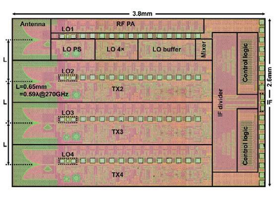
to be used with each antenna. According to Okada, excellent impedance matching between stages enabled the amplifiers to demonstrate outstanding performance.
“The proposed power amplifiers achieved a gain higher than 20 dB from 237 to 267 GHz, with a sharp cut-off frequency to suppress out-of-band undesired signals,” he said. The proposed amplifier also achieved a noise figure of 15 dB, which was evaluated by the noise measurement system in the 300 GHz band.
The proposed transmitter was tested through simulations and experiments and obtained promising results, achieving a data rate of 108 Gbps in on-PCB probe measurements — substantially higher than other state-of-the-art 300 GHz-band transmitters, the researchers noted. The transmitter also displayed remarkable area efficiency compared to other CMOS-based designs alongside low power consumption, highlighting its potential for miniaturised and powerconstrained applications. According to the researchers, notable use cases could include sixth-generation (6G) wireless communications, high-resolution terahertz sensors, and human body and cell monitoring.
March/April 2024 - Critical Comms 29 www.CriticalComms.com.au
TRANSMITTERS
Chip die micrograph.
© iStockphoto.com/filo
DIGITAL SENSOR NETWORK TO MONITOR AIR TRAFFIC AT VERTIPORTS
Researchers at the Fraunhofer Institute for High Frequency Physics and Radar Techniques FHR have been developing an entirely digital sensor network, including a radar sensor, that in the future will be able to closely monitor air traffic at so-called ‘vertiports’ (landing sites for drones and air taxis) and ensure safe flight operations. Not only is the system being considered for use in vertiports, it could also monitor corridors across cities used by transportation drones.
At the 2024 Olympic Games in Paris, the first passengers in Europe will be transported by air taxis, with air travel companies planning to equip Olympic venues with electrical vertical take-off and landing systems (eVTOLs) to transport visitors to events directly from the airport. Initially, these drone systems will be piloted by a human, with one passenger per taxi; in the coming years, they could be piloted autonomously. An important aspect of this concept is the safety of the vertiports used for launching and landing eVTOLs, which will be integrated into roofs, train stations, parking lots and other urban structures.
Researchers at Fraunhofer FHR aimed to tackle an important part of the safety of the new drone stops by equipping them with a modular, fully digital sensor network including a radar sensor. The network can be adapted to the size of each vertiport and uses both active and passive sensors with fully autonomous functionality, linking to each other and collectively sensing the port.
“The nodes are fully digital, and each sensor in the network functions entirely autonomously,” explained Oliver Biallawons, a scientist at Fraunhofer FHR. “The sensors aren’t coordinated by a central computer unit; they network themselves. They are able to

independently localise and organise themselves. Based on the principle of edge computing, each sensor has its own computer unit and can detect the location of other sensors in the network.”
The job of sending and receiving is shared between the individual sensors, which coordinate with each other. The decentralised active and passive sensors are installed on the ground and work together to sense the entire take-off and landing pad as well as the airspace above it. The network decides which sensor to operate in active (sending and receiving) and passive (receiving only) mode as required. The more sensors in the network, the greater the area that can be monitored. Even if a sensor or radar node is added or removed, the radar network can continue to function flawlessly.
The key to the network’s autonomous organisation and decentralised processing is the connection between the individual nodes via wireless communication channels integrated into the radar signal. By integrating the network communication in the radar signal, the signal can be seamlessly integrated into future telecommunications infrastructures. This represents an important milestone on the
path toward merging fully fledged radar and telecommunications, according to Biallawons.
“We are integrating the communication signal into the radar waves instead of using separate channels for radar and communication,” he said.
Another key feature of the so-called Civil Drone Systems (CDS) Network is that, in contrast to test monitoring systems based on mobile radio, the system is able to detect eVTOLs that don’t have a communication device such as a chip or tag. With the addition of AI, the safety solution can not only detect obstacles that block incoming or outgoing flight paths but also classify them. This means that it is able to classify objects such as trees, birds and drones. The radar network can even recognise the size of a drone and how many rotors it has.
“As urbanisation continues to progress, we expect at some point to see transport systems take to the air, too,” Biallawons said. “This can only be achieved with the help of sophisticated safety systems, such as our modular, resilient network of low-radiation, communicating radar nodes, which can achieve flawless take-off and landing.”
30 Critical Comms - March/April 2024 www.CriticalComms.com.au SENSORS
Image ©Fraunhofer FHR/Andreas Schoeps
CASE STUDY
Satellite IoT improves borehole monitoring in mines

Astrocast, a leading provider of satellite IoT (SatIoT) connectivity, has announced its partnership with Ontoto, an Australian provider of telemetry solutions to the mining and environmental compliance industry. Ontoto has successfully integrated Astrocast’s Astronode S into its Vibrating Wire data logger, which is being used across the mining sector to monitor mining boreholes remotely using SatIoT connectivity.
The Ontoto Vibrating Wire has been designed to monitor the pore pressures and static water levels in the ground surrounding a mining operation. This information is vital for mining operations to monitor the effects that their works are having on the environment — and for managing risks associated with mining, such as tailings dams failures.
Coupled with Ontoto’s industrial cloud solutions, mining operations receive constant and effective data from the logger; this data allows operational teams to respond quickly and effectively according to the information received, ensuring mining operations maintain environmental compliance. Astrocast’s SatIoT enables this data transmission remotely.
“One of the key challenges mining companies face is the lack of efficient connectivity in remote areas,” said Tim Blake, CEO of Ontoto. “Astrocast’s satellite connectivity solution provides us with a cost-effective and low-power-consumption alternative to traditional providers, enabling us to offer enhanced monitoring capabilities to our customers.”
The Astronode S, integrated into Ontoto’s Vibrating Wire, offers seamless connectivity via the Astrocast satellite constellation, making it useful for mining sites located in areas with poor or no terrestrial connectivity. Having now partnered with Astrocast, Ontoto has decided to replace its previous legacy satellite connectivity supplier.
The introduction of SatIoT technology into the Australian mining sector is set to enable improved automation, waste elimination and optimised production. Furthermore, there are aspirations across the sector to create a ‘connected mine’, consisting of enhanced monitoring capabilities, remote diagnostics and predictive maintenance — all of

which contributes to reducing unplanned downtime and maximising operational efficiency and safety. This is something that Ontoto and its Vibrating Wire (among other solutions) is designed to achieve.
Ontoto has extensively tested and successfully integrated the Vibrating Wire on several mining sites and currently provides exclusive satellite connectivity for several mines on the west coast of Tasmania; this experience has proved invaluable in developing a product that is robust enough to satisfy the most demanding applications. Astrocast will continue to work closely with Ontoto, providing ongoing support to ensure high-quality service delivery to customers in the mining industry.
“We are excited to support Ontoto in their mission to provide innovative monitoring solutions to the mining industry,” said Eric Menard, VP of Strategy and Business at Astrocast. “Our collaboration enables the deployment of efficient and cost-effective satellite IoT connectivity that is well adapted to Australia’s mining sector, bringing numerous benefits to the industry and its stakeholders.”
Astrocast
www.astrocast.com
March/April 2024 - Critical Comms 31 www.CriticalComms.com.au
iStock.com/tifonimages
Ontoto’s Vibrating Wire range.
PUBLIC SAFETY BROADBAND INVESTMENTS TO EXCEED $5.7BN BY 2026

SNS Telecom & IT’s latest research report indicates that annual spending on public safety broadband infrastructure and devices will exceed $5.7 billion globally by the end of 2026.
With the commercial availability of 3GPP standards-compliant MCX (mission-critical PTT, video and data), HPUE (high-power user equipment), IOPS (isolated operation for public safety) and other critical communications features, LTE and 5G NR (New Radio) networks are increasingly gaining recognition as an all-inclusive public safety communications platform for the delivery of real-time video, high-resolution imagery, multimedia messaging, mobile office/field data applications, location services and mapping, situational awareness, unmanned asset control and other broadband capabilities, as well as MCPTT (mission-critical PTT) voice and narrowband data services provided by traditional LMR (land mobile radio) systems. Through ongoing refinements of additional standards — specifically 5G MBS/5MBS (5G multicast-broadcast services), 5G NR sidelink for off-network D2D (device-to-device) communications, NTN (non-terrestrial network) integration and support for lower 5G NR bandwidths — 3GPP networks are eventually expected to be in a position to fully replace legacy LMR systems by the late 2020s. National public safety communications authorities in multiple countries have already expressed a willingness to complete their planned narrowband to broadband transitions within the second half of the 2020 decade.
A myriad of fully dedicated, hybrid government-commercial and secure MVNO/ MOCN-based public safety LTE and 5G-ready networks are operational or in the process of being rolled out throughout the globe. The
high-profile FirstNet (First Responder Network) and South Korea’s Safe-Net (National Disaster Safety Communications Network) nationwide public safety broadband networks have been successfully implemented. Although Britain’s ESN (Emergency Services Network) project has been hampered by a series of delays, many other national-level programs have made considerable headway in moving from field trials to wider scale deployments — most notably, New Zealand’s NGCC (Next-Generation Critical Communications) public safety network, France’s RRF (Radio Network of the Future), Italy’s public safety LTE service, Spain’s SIRDEE missioncritical broadband network, Finland’s VIRVE 2.0 broadband service, Sweden’s Rakel G2 secure broadband system and Hungary’s EDR 2.0/3.0 broadband network. Nationwide initiatives in the pre-operational phase include but are not limited to Switzerland’s MSK (Secure Mobile Broadband Communications) system, Norway’s Nytt Nødnett, Germany’s planned hybrid broadband network for public safety organisations, the Netherlands’ NOOVA (National Public Order & Security Architecture) program, Japan’s PS-LTE (Public Safety LTE) project, Australia’s PSMB (Public Safety Mobile Broadband) program and Canada’s national PSBN (Public Safety Broadband Network) initiative.
Other operational and planned deployments include the Halton-Peel region PSBN in Canada’s Ontario province, New South Wales’ state-based PSMB solution, China’s city and district-wide Band 45 (1.4 GHz) LTE networks for police forces, Hong Kong’s 700 MHz mission-critical broadband network,
Royal Thai Police’s Band 26 (800 MHz) LTE network, Qatar MOI (Ministry of Interior), ROP (Royal Oman Police), Abu Dhabi Police and Nedaa’s mission-critical LTE networks in the oil-rich GCC (Gulf Cooperation Council) region, Brazil’s state-wide LTE networks for both civil and military police agencies, Barbados’s Band 14 (700 MHz) LTE-based connectivity service platform, Zambia’s 400 MHz broadband trunking system and Mauritania’s public safety LTE network for urban security in Nouakchott. There are also local and regional-level private LTE networks for first responders in markets as diverse as Laos, Indonesia, the Philippines, Pakistan, Lebanon, Egypt, Kenya, Ghana, Cote D’Ivoire, Cameroon, Mali, Madagascar, Mauritius, Canary Islands, Spain, Turkey, Serbia, Argentina, Colombia, Venezuela, Bolivia, Ecuador, and Trinidad and Tobago, as well as multi-domain critical communications broadband networks such as MRC’s (Mobile Radio Center) LTE-based advanced MCA digital radio system in Japan, and secure MVNO platforms in Mexico, Belgium, Netherlands, Slovenia, Estonia and several other countries.
Even though critical public safety-related 5G NR capabilities defined in the 3GPP's Release 17 and 18 specifications are yet to be commercialised, public safety agencies have already begun experimenting with 5G for applications that can benefit from the technology’s high-bandwidth and low-latency characteristics. For example, the Lishui Municipal Emergency Management Bureau is using private 5G slicing over China Mobile’s network, portable cell sites and rapidly deployable communications vehicles as part of a disaster management and visualisation system.
In neighbouring Taiwan, the Kaohsiung City Police Department relies on end-toend network slicing over a standalone 5G network to support licence plate recognition
32 Critical Comms - March/April 2024 www.CriticalComms.com.au
and other use cases requiring the real-time transmission of high-resolution images. The Hsinchu City Fire Department’s emergency response vehicle can be rapidly deployed to disaster zones to establish high-bandwidth, low-latency emergency communications using a satellite-backhauled private 5G network based on open RAN standards. The Norwegian Air Ambulance is adopting a similar private 5G-based NOW (network-on-wheels) system for enhancing situational awareness during search and rescue operations.
In addition, first responder agencies in Germany, Japan and several other markets are beginning to utilise mid-band and mmWave (millimetre wave) spectrum available for local area licensing to deploy portable and smallscale 5G NPNs (non-public networks) to support applications such as UHD (ultra-high definition) video surveillance, control of unmanned firefighting vehicles, reconnaissance robots and drones. In the near future, SNS Telecom & IT also expects to see rollouts of localised 5G NR systems — including direct mode communications — for incident scene management and related use cases, potentially using up to 50 MHz of Band n79 spectrum in the 4.9 GHz frequency range (4940–4990 MHz), which has been designated for public safety use in multiple countries including but not limited to the United States, Canada, Australia, Malaysia and Qatar.
SNS Telecom & IT estimates that annual investments in public safety LTE/5G infrastructure and devices reached $4.3 billion in 2023, driven by both new projects and the expansion of existing dedicated, hybrid government-commercial and secure MVNO/ MOCN networks. Complemented by an expanding ecosystem of public safety-grade LTE/5G devices, the market will further grow at a CAGR of approximately 10% over the next three years, eventually accounting for more than $5.7 billion by the end of 2026. Despite the positive outlook, some significant challenges continue to plague the market. The most noticeable pain point is the lack of a D2D communications capability.
The ProSe (proximity services) chipset ecosystem failed to materialise in the LTE era due to limited support from chipmakers and terminal OEMs. However, the 5G NR sidelink interface offers a clean slate opportunity to introduce direct mode D2D communications for public safety broadband users, as well as coverage expansion in both on-network and off-network scenarios using UE-to-network and UE-to-UE relays respectively. Recent demonstrations of 5G NR sidelink-enabled MCX services by the likes of Qualcomm have generated renewed confidence in 3GPP technology for direct mode communications.

Until recently, another barrier impeding the market was the non-availability of costoptimised RAN equipment and terminals that support operation in spectrum reserved for PPDR (public protection and disaster relief) communications — most notably Band 68 (698–703/753–758 MHz), which has been allocated for PPDR broadband systems in several national markets across Europe, including France, Germany, Switzerland, Austria, Spain, Italy, Estonia, Bulgaria and Cyprus. Other countries such as Greece, Hungary, Romania, Sweden, Denmark, Netherlands and Belgium are also expected to make this assignment. Since the beginning of 2023, multiple suppliers — including Ericsson, Nokia,
Teltronic and CROSSCALL — have introduced support for Band 68.
The report ‘The Public Safety LTE & 5G Market: 2023 – 2030 – Opportunities, Challenges, Strategies & Forecasts’ presents an in-depth assessment of the public safety LTE and 5G market, as well as global and regional market size forecasts from 2023 to 2030. It will be of value to current and future potential investors into the public safety LTE and 5G market, as well as LTE/5G equipment suppliers, public safety and government agencies, critical communications service providers, mobile operators, MVNOs and other ecosystem players who wish to broaden their knowledge of the ecosystem.
March/April 2024 - Critical Comms 33 www.CriticalComms.com.au
iStock.com/Talaj MARKET ANALYSIS
Spectrum
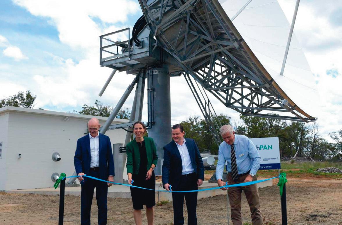
More precise positioning provides widespread possibilities
Safer travel, precision crop spraying, better real-time monitoring of livestock, virtual buffers to safeguard workers from site hazards, more accurate mapping of underground assets and heritage sites — the possibilities offered by the Southern Hemisphere’s first satellite-based augmentation system are varied and exciting.
Toitū Te Whenua Land Information New Zealand and Geoscience Australia are working together to bring SouthPAN — the Southern Positioning Augmentation Network — into being. This a major investment by the New Zealand and Australian governments in core digital infrastructure to improve positioning services across our land and maritime zones.
We are pleased to see the network fast taking physical shape, with the first of two uplink and ground control centres opened in early December at Uralla, NSW, and construction well underway at the second centre in Invercargill, New Zealand. These two centres will work in tandem to ensure we deliver a service that is robust, resilient and reliable.
So what does SouthPAN do? Satellitebased augmentation systems (SBAS) augment existing satellite positioning systems to boost their accuracy.
SBAS was originally designed for aviation safety by providing vertical guidance for approaches into aerodromes and improved search and rescue operating capabilities in a wider range of weather conditions. SouthPAN is expected to achieve Safety of Life certification for aviation in 2028, allowing aircraft to navigate in conditions they cannot currently fly in.
SouthPAN works by comparing satellite data against precisely measured positions to identify and correct discrepancies in positioning information. These corrections are sent to geostationary satellites and then broadcast to users, who can access SouthPAN signals throughout New Zealand, Australia and our maritime zones.
The network itself will be made up of two central processing and satellite uplink facilities (the Uralla and Invercargill centres), two satellite payloads, approximately 30 purpose-built GNSS reference stations (most located in Australia and New Zealand but also as far south as Antarctica) and a wide area network (WAN) connecting the ground stations and central facilities.
The difference SouthPAN makes is significant — it improves the accuracy of GPS from 5–10 metres to less than a metre, down to as little as 10 cm. You can imagine that if you’re spraying crops, mapping land, navigating a drone, looking for someone lost in the bush or doing multiple other tasks that require precision, this level of accuracy will make a major difference.
Early open services have been available since September 2022 for users with compat-

ible devices. SouthPAN is free of charge and means users can access precise positioning without paying subscription fees for other correction services.
For technology innovators and customers alike, this knocks down a major barrier to innovation. We are looking forward to seeing the innovations that will flow from SouthPAN as homegrown solutions are developed for the Australian and New Zealand environments.
This early availability of SouthPAN services, years ahead of full operational capability, means the projected economic benefits of at least $7.6 billion over 30 years are already starting to flow. We expect the system to be fully operational by 2028.
Reliance on location services enabled by precise positioning data is universal across Australian and New Zealand industry and in everyday life, and this is only expected to increase. SouthPAN services will provide access to accurate and reliable positioning services relied on by a growing range of applications.
This will bring widespread benefits across utilities, construction, resources and many other industries. It will improve safety and efficiency in aviation, maritime and road transport, and increase agricultural productivity. Examples include:
• Heavy vehicle automation, such as truck platooning, where vehicles can connect to each other as a group to transport goods.
• Precision agriculture applications like precision spraying, yield mapping, controlled traffic farming, inter-row seeding, precision spraying and livestock management.
• Personnel safety on construction sites through smart geo-fencing technologies that accurately identify the location of workers with key equipment, such as vehicles and heavy machinery.
Various industry sectors are already using SouthPAN’s services for purposes such as navigating drones and improving forestry management. Many GNSS receivers are already able to receive SouthPAN signals. This will increase as new models come on the market and we are working with a range of manufacturers to support and encourage uptake of SouthPAN.

34 Critical Comms - March/April 2024 www.CriticalComms.com.au
Appleyard
Director – Customer Delivery for Toitū
Whenua Land Information New Zealand.
Dr Martine Woolf heads the National Positioning Infrastructure Branch at Geoscience Australia. Michael
is
Te
Cutting the ribbon at SouthPAN’s first dedicated satellite dish in Uralla, NSW.


March/April 2024 - Critical Comms 35 www.CriticalComms.com.au www.WFMedia.com.au/subscribe The magazine you are reading is just one of 11 published by Westwick-Farrow Media. To receive your free subscription (print or digital, plus eNewsletter), visit the link below. FREE for industry and business professionals