
TRANSPORTATION MASTER PLAN
City of West Kelowna
Disclaimer
In preparing this report, HDR relied, in whole or in part, on data and information provided by the City of West Kelowna (the Client) and third parties, which information has not been independently verified by HDR and which HDR has assumed to be accurate, complete, reliable, and current. Therefore, while HDR has utilized its best efforts in preparing this report and supplemental information, HDR does not warrant or guarantee the accuracy of data, information or statements supplied by third parties or the Client. Use of this report or any information contained herein, if by any party other than Client, shall be at the sole risk of such party and shall constitute a release and agreement by such party to defend and indemnify HDR and its affiliates, officers, employees and subcontractors from and against any liability for direct, indirect, incidental, consequential or special loss or damage or other liability of any nature arising from its use of the report or reliance upon any of its content. To the maximum extent permitted by law, such release from and indemnification against liability shall apply in contract, tort (including negligence), strict liability, or any other theory of liability.
This page is intentionally left blank
PREAMBLE
The City of West Kelowna (the City) is growing and evolving, and this change brings with it a range of challenges and opportunities. Since incorporating in 2007, the City has grown to nearly 41,000 residents and is expected to add an additional 12,000 new residents by 2040.
The City is planning its future now by updating the Official Community Plan (OCP) and their Transportation Master Plan (TMP) (this document). These planning studies have been conducted in parallel through an integrated, open public process, providing the community and residents with an opportunity to shape the future of the City. Where the OCP and associated Community Vision set the goalposts for how the City wants to develop and grow, the TMP identifies a blueprint for developing the transportation network to move people and goods safely, efficiently, and sustainably for the next 20 years.
During the development of the TMP, an extensive community engagement program was carried out with the public and key stakeholder groups to learn about current challenges and gather ideas for mobility improvements. There is general consensus on the need for many key transportation improvements, such as addressing gaps in the walking and cycling networks, improving road safety, and improving network
resiliency by adding connections to communities that currently only have one point of emergency access and egress. However, the City’s large geographic area, low density / tax base, and rural nature of much of the existing network make it challenging to determine which areas to improve first, and by how much. This TMP attempts to strike a balance between competing objectives and lays out a framework for West Kelowna to continue developing its transportation network as funding becomes available. The TMP focuses on prioritizing quick wins and projects that will provide greater benefits, and shows how the network can grow to support the long-term development and vision for the City.
The TMP also considers how West Kelowna can proactively plan to embrace the changing societal paradigms while improving resiliency and aspects such as vehicle electrification, automation, mobility sharing, climate change, and community resiliency.
Ultimately, this TMP will be updated as the City grows, as technology evolves, and as mobility needs change. Shaped by your ideas, it serves as a blueprint for making the right transportation investments to support the Community Vision for safe and sustainable transportation options for people of all ages and abilities.

LAND ACKNOWLEDGEMENT
The City of West Kelowna is a growing and vibrant community located on the traditional territory of the Syilx/Okanagan Peoples.
APPENDICES
Appendix A: Highway 97 Advocacy Positions
Appendix B: TMP Engagement Phase 1 and 2: What We Heard Reports
Appendix C: Pedestrian and Bicycle Classifications
Appendix D: Emergency Access / Egress Projects
Appendix E: Network Assessment Report
Appendix F: Detailed Project List
Appendix G: Micromobility
Appendix H: Cross Sections
Appendix I: Macrosimulation Model Memo
Appendix J: Microsimulation Model
West Kelowna and the Okanagan Valley have been inhabited for thousands of years by the Syilx / Okanagan peoples, and they maintain a strong presence on the Westside, with Westbank First Nation communities located within and adjacent to the city.
West Kelowna was originally developed as separate rural communities before it was incorporated as a municipality in 2007, and then as a city in 2015. It falls within the Regional District of the Central Okanagan and is intrinsically tied to its Central Okanagan neighbouring communities, including the City of Kelowna to the east and Peachland to the south.
The city is known for its wineries, location adjacent to Okanagan Lake, and access to a high quality of life. The city is also evolving, with an increasing population and changing needs in terms of housing, built form, and transportation.
This TMP provides the opportunity for West Kelowna to take control of its transportation future and define how the community and its residents want to be able to travel now and over the next two decades.

#OUR WK
1.1 BACKGROUND
OFFICIAL COMMUNITY PLAN UPDATE
The City’s Official Community Plan (OCP) is the guiding plan for our city – it puts our Community Vision into action to shape the bright future of West Kelowna. It shows how and where the City will grow, demonstrating that strategic growth can occur hand in hand with the stewardship of natural resources, agricultural lands, and social assets. It envisions how emerging technologies might change how we live in the future.
Our OCP is a key resource for managing progress in our community. It is a blueprint for how our community will evolve to meet our collective vision and accommodate growth. The OCP applies to the whole West Kelowna community and is the main policy that Council uses to guide decisions. The OCP was developed hand in hand with the TMP update, as being conscious about the interplay between land use planning and transportation that bring efficiencies and provide better results for all.
The latest version1 of the OCP provides guidance for the City’s future growth toward 2040 and was adopted by City Council on August 22, 2023.
OCP
OCP GROWTH CONCEPT
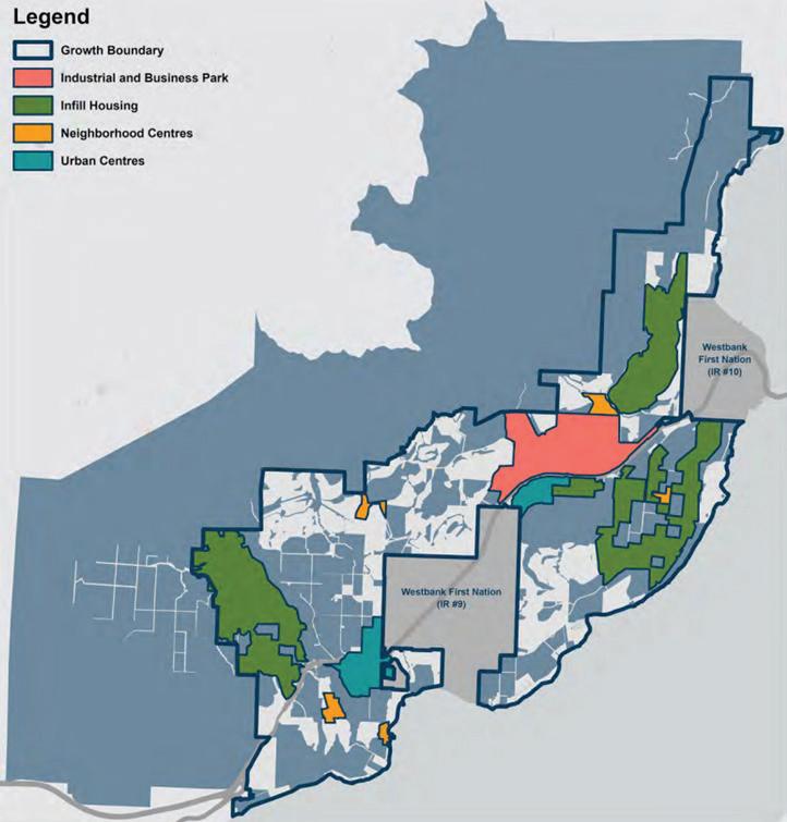
A core component of the OCP update is the Growth Concept, which summarizes how the City is expected to grow over the next twenty years, and in turn, where an increasing number of people can be expected to travel to and from. Growth will be directed into four Growth Concept Areas: Urban Centres, Neighbourhood Centres, Infill Housing, and Industrial and Business Park. These areas generally exist today, and the Growth Concept represents a further densification / focus on these areas. The Growth Concept was used as a basis for much of the TMP analysis, and the main building blocks from the Growth Concept that guided the TMP are shown and described in the following map.
The City of West Kelowna has experienced significant growth since it was incorporated in 2007. The current population of West Kelowna is nearly 41,000 residents, and the growth is expected to continue, with the population expected to grow by more than 12,000 new residents by 2040.
There is currently a discrepancy between the existing housing stock and the type of buildings that people would like to live in. Nearly 75% of all homes in West Kelowna are single family homes, whereas there is a considerable un-met demand for apartment, townhouse and duplex homes, with over 40% of residents saying that they would prefer to live in one of these types of higher density units instead of single-family home. The Growth Plan is being designed to accommodate this change in housing preference. Much of this non-single family residential growth with be directed towards the urban and neighbourhood centres.
Future commercial growth will also be focused in the urban and neighbourhood centres, while business and industrial growth will occur in the Business Park.
1 City of West Kelowna, 2023. Official Community Plan
INDUSTRIAL & BUSINESS PARK
The Industrial and Business Park and its employment lands are well positioned along Highway 97 to support the City and the Greater Westside, including WFN lands. Future development will look to build on and diversify existing industries to create resilience and adapt to shifting economic landscapes. Future uses within this area may include offices, studios, laboratories, manufacturing and processing, and technology.
INFILL HOUSING
Part of accommodating our future growth will include integrating additional housing in established neighbourhoods. Infill housing forms and densities can vary widely, from carriage house and secondary suite construction, to zoning amendments for smaller lot sizes. When constructed in a sensitive manner, infill development can be seamless, while making efficient use of existing service investments and enriching our neighbourhoods.
NEIGHBOURHOOD CENTRES
Complementing the two Urban Centres are five Neighbourhood Centres located throughout West Kelowna, addressing gaps within our community. While not as dense as the Urban Centres, these areas will see a range of higher density housing and commercial development, providing destinations and services to the surrounding neighbourhoods. The five Neighbourhood Centres include: Rose Valley, Smith Creek and Shannon Lake, Lakeview Heights, Gellatly Village, Goats Peak.
URBAN CENTRES
The two Urban Centres of this Land Use Plan are Westbank and Boucherie Urban Centres. These two Centres, each within immediate proximity to Highway 97, are well-positioned to welcome new residential development, commercial services, community and civic amenities, and the infrastructure to support this growth. The Urban Centres will not only serve the many residents in these areas, but also provide a range of services and amenities to the wider community.
1.2 PLANNING CONTEXT
DISTRICT OF WEST KELOWNA TRANSPORTATION PLAN (2014)
The previous TMP prepared for the City (formerly designated as a District) was completed in 2014. It builds on the goals and objections of the former OCP and identifies a wide range of improvement projects for the road, transit, and active transportation networks.
Many of the projects identified as part of the TMP have been completed, such as upgrades to Boucherie Road and many intersections within the City. However, many of the envisioned improvements have yet to be built, such as a new major connector route on the north side of the City, and the need for these improvements have been revisited through this study.
The 2014 TMP was advanced through the creation of West Kelowna’s Pedestrian and Bicycle Infrastructure Plan, which provided a plan for local active transportation improvements.
CENTRAL OKANAGAN REGIONAL TRANSPORTATION PLAN
The Central Okanagan Regional Transportation Plan (RTP) was a joint planning effort between the six different municipalities in Central Okanagan, including the City of West Kelowna. It identifies the regional projects and priorities that are needed to create a healthy and thriving region and to connect people with where they choose to travel. It includes a number of regional level projects on the Westside, including the Westside Trail, transit improvements on Highway 97, and the creation of mobility hubs to concentrate transit ridership and create locations where multiple forms of transportation are easily accessible.
The RTP is supported by the Regional Bicycle and Trails Master Plan, which was developed concurrently, and demonstrates a commitment to achieve seamless active transportation between West Kelowna and other local jurisdictions throughout the region, strengthening economic competitiveness, and enhancing quality of life.
MINISTRY OF TRANSPORTATION AND TRANSIT
The British Columbia Ministry of Transportation and Transit (MOTT) is responsible for the provincial highway network, and this includes Highway 97, a critical spine that connects the Central Okanagan and West Kelowna.
In 2023, the Ministry published the Central Okanagan Integrated Transportation Study2 (COITS), where they reviewed the role and purpose of Highway 97 and identify long-term highway improvements. Improvements that the study recommended include re-aligning the Highway 97 couplet into a two-way, four-lane highway on Dobbin Road in Westbank Urban Centre, which would enable Main Street to be re-imagined as a small, local main street where community and people are prioritized over the movement of cars. A list of advocacy positions for Highway 97 is provided in Appendix A
Other projects that the Ministry is also exploring in nearby to West Kelowna include transit improvements along the highway and William R. Bennett Bridge, the establishment of regional mobility hubs at Lake Country, Rutland, Westbank, and Peachland, and implementing new interchanges at Bartley, Ross, Westlake and Boucherie Roads. These improvements would benefit interregional connections to West Kelowna residents.
The Ministry has recently progressed a number of other initiatives that are relevant to the TMP, including PlanningTogetherBC3, which supports the integrated planning of transportation and land use as a means to enhance social, economic and environmental well-being of the community.
WESTBANK CENTRE REVITALIZATION PLAN (2011)
The City (then designated as a District) published a plan for Westbank Centre’s future development, providing a planning framework with a 25-year horizon for the urban centre and surrounding neighbourhood. From a transportation planning perspective, the study provides contexts for future development in this area with respect to specialized zoning and land use procedures, estimating parking supply and establishing new parking policy, as well as a desire to remove the Highway 97 couplet. The plan establishes strategies for development as the City prioritizes the transformation of the Westbank Centre vicinity to be a revitalized residential and commercial hub for West Kelowna.
While the 2011 Plan includes major policy recommendations that have been adopted as official plans (e.g., add active transportation routes, transit corridor implementation, street improvement programs, continue to support large commercial and emergency vehicles), Westbank Centre continues to be recognized as a significant urban centre in the city in need of renewed focus to improve its connectivity and urban offerings for the community. Westbank Centre is listed in the OCP’s Growth Concept by which new residential, commercial, and civic amenity development should be concentrated to benefit both nearby residents and the wider community. As a result, to further advance the principles laid by the 2011 planning study to better suit residents’ multi-modal and emerging mobility needs for this area in the future, the City will commit to a new Westbank Centre planning study for this important urban centre. 2, 3 https://www2.gov.bc.ca/gov/content/transportation/transportation-infrastructure/transportation-planning
WESTBANK FIRST NATION (WFN)
Westbank First Nation communities are partially enclaved and are situated adjacent to the City, and residents of all three WFN communities live, work, and play in each jurisdiction. Ensuring that the transportation network within the City aligns with the plans for these communities is thus an important consideration. WFN’s Master Servicing Plan includes a transportation component (referred to as the Transportation Final Report), published in 2018. It is our understanding that WFN will be updating this document in the near future.
BC TRANSIT
BC Transit4 is the transit service provider for the Kelowna Regional Transit System. This TMP was developed through cooperation and collaboration with BC Transit, and includes recommendations to improve access to transit and suggestions for areas that may warrant transit service in the future.
CLEANBC
CleanBC5 defines a set of actions to reduce provincial greenhouse gas emissions (GHG) to a target of 25.4 million tonnes (Mt) by 2030. It estimates that the majority of the 6 Mt reduction will be due to a transition towards lower and zero emission vehicles and cleaner fuels. Improved active transportation, transit and community planning are also identified in the plan as ways to help reach the target.
1.3 ENGAGEMENT
Public engagement and consultation with residents, businesses, and other interested parties, provide transparency to the study and allows those who participate the ability to shape the community they live and work in.
TMP consultation occurred over three phases:
• Phase 1 — Launch and Ideas (February 14, 2022 to March 6, 2022)
• Phase 2 — Future Network Improvements (January 24 to February 7, 2023)
• Phase 3 — Connect West Kelowna: The Transportation Master Plan Update (February 3 to February 17, 2025)
What We Heard reports, which summarizes findings and outcomes of the public engagement process, can be found in Appendix B.
1.3.1 PHASE 1 — LAUNCH AND IDEAS
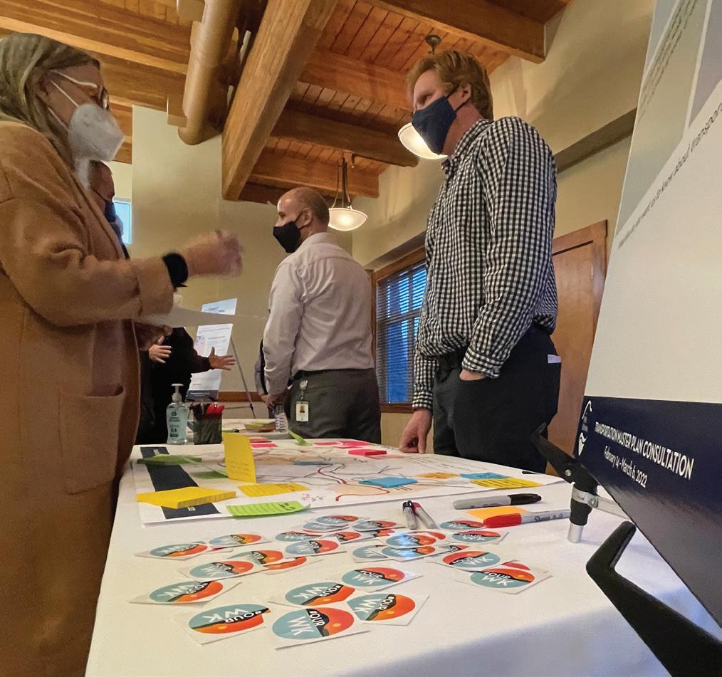
The initial phase of TMP consultation focused on informing residents of the new TMP under development and requested participation from the general public to communicate their interests and share their ideas with City officials, pertaining to current and future transportation needs. This section documents the consultation events held between February and March 2022.
Individual Meetings and Small Group Meetings
More than 26 organizations were invited by the City to participate in the individual and small group meetings. Most of the meetings were held virtually with some in-person meetings with seniors and youth. Recognizing the need to work closely with its partners, the City also held TMP-specific meetings with Westbank First Nation and Ministry of Transportation and Transit. A total of 13 individual meetings and six small group meetings were held.
Online: Share Your Ideas and Map of Favourite Places
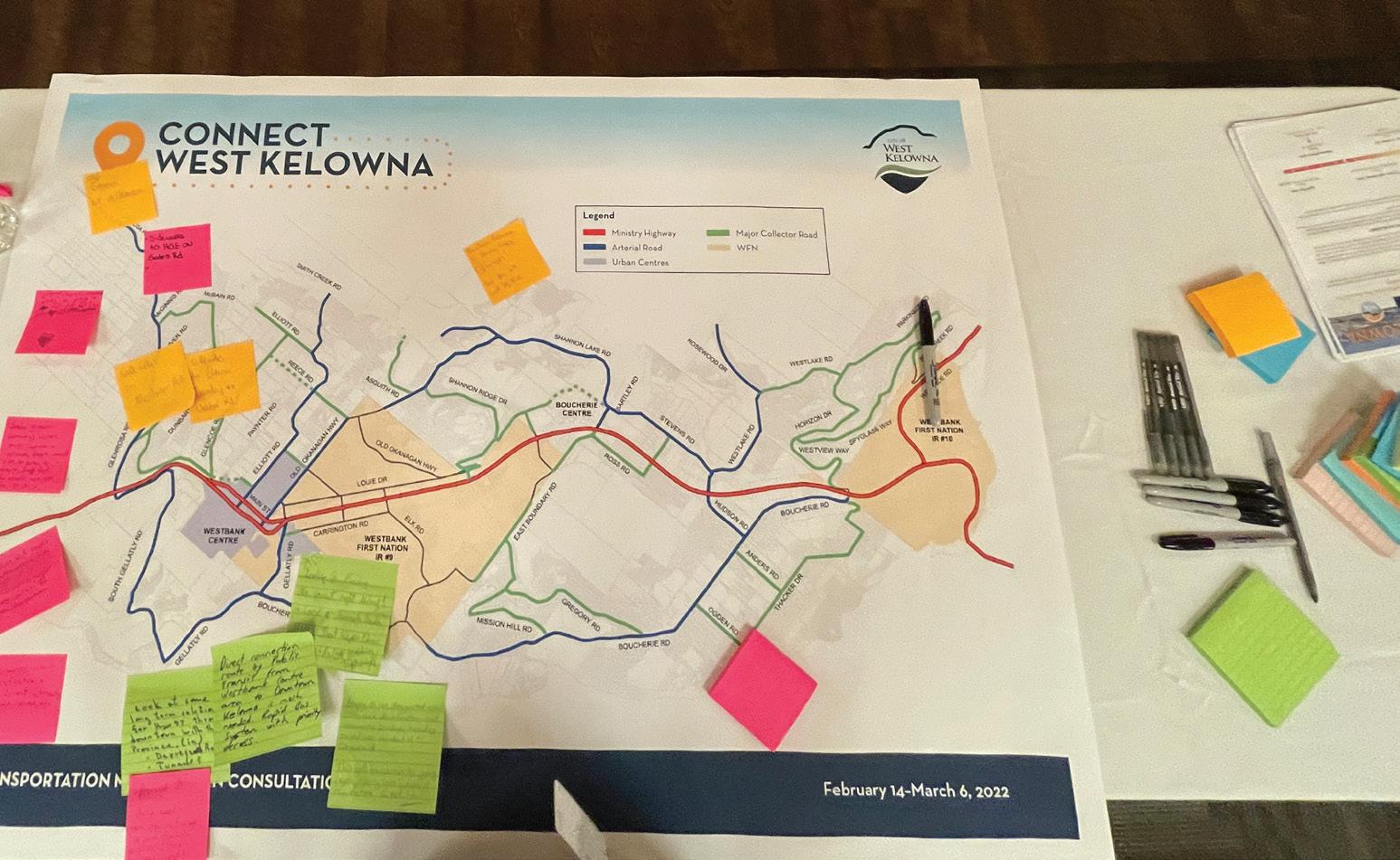
Residents were invited to annotate an online interactive map, placing virtual pins on favourite or important destinations, and also specified the mode used to access these locations. A total of 123 comments were collected on the interactive map.
In-Person: Pop-up Displays and Open House
The City had placed three pop-up displays at Westbank Library, Royal LePage Place Arena, and West Kelowna Warriors Game on February 19, 2022. Residents were able to add to sticky notes to respond to pre-prepared prompts:
1. What do you like to do and where do you like to go?
2. How do you get to work or school today?
3. How would you like to get to work or school?
4. What would make it easier for you to get around?
5. What else do you want us to know about transportation in West Kelowna?
The City held an open house on March 3, 2022 at Cove Lakeside Resort to share information and receive feedback. 90 people attended the open house.


Phase 1 Outcomes
Across all Phase 1 engagements, comments from residents and other interested parties were consolidated by the City and summarized below as future transportation needs:
• Safe Bike Routes: A safe and connected bike infrastructure will help encourage an active lifestyle, decrease road congestion, support the local economy and reduce emissions from vehicles.
• More Sidewalks: Safe and connected sidewalks will encourage people to walk to more places, create a healthier and more active population and reduce short vehicle trips.
• Improved Transit: Transit that is easier for people of all ages and abilities to use, more frequent and accesses more places efficiently will increase ridership and help reduce travel by car.
• A connected community: Improving active transportation connections within neighbourhoods, between neighbourhoods and urban centres, across the highway and to parks will help build a connected community and support a shift to more active modes of travel.
• Roads That Work for All Road Users: Traffic congestion is a challenge for residents, businesses and agricultural users. Making space for all types of vehicles and ensuring traffic flows smoothly is a priority.
• Improved Emergency and Evacuation Routes: Moving emergency vehicles and people in and out of neighbourhoods during an emergency or evacuation is a critical safety issue for residents and emergency responders.
• Safe and Welcoming Streets: Better lighting and crosswalks will help draw people of all ages and abilities to sidewalks, local businesses and outdoor areas.
• Equitable Access for All: Transportation is a key driver of equity and inclusion. Make sure people in lower income neighbourhoods, youth, people with diverse abilities, seniors and others can easily access jobs, friends, groceries, services, recreation and places that matter to them.
1.3.2 PHASE 2 — FUTURE NETWORK IMPROVEMENTS
Phase 2 the TMP consultation process built upon the input received from the community during Phase 1 consultation in 2022. During this phase, insights into the future transportation network were provided for residents and other interested parties to provide comment. The following consultation events were held in January and February 2023:
Partner and Technical Stakeholder Consultation Meetings
The City held ten (10) virtual / in-person technical meetings with representatives from Westbank First Nation, Ministry of Transportation and Transit, local governments, emergency services and development to share the recommended transportation network improvements for feedback and comments.
In-Person: Information Session
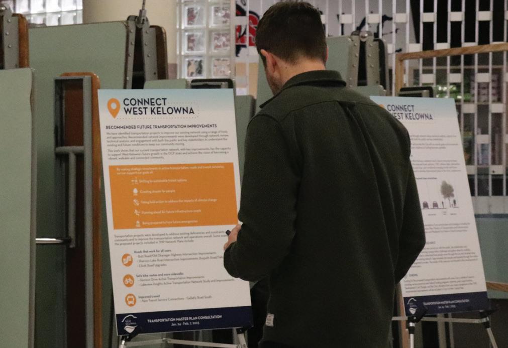
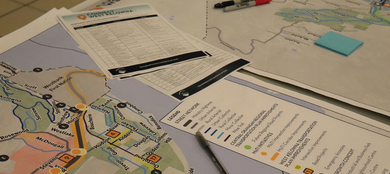
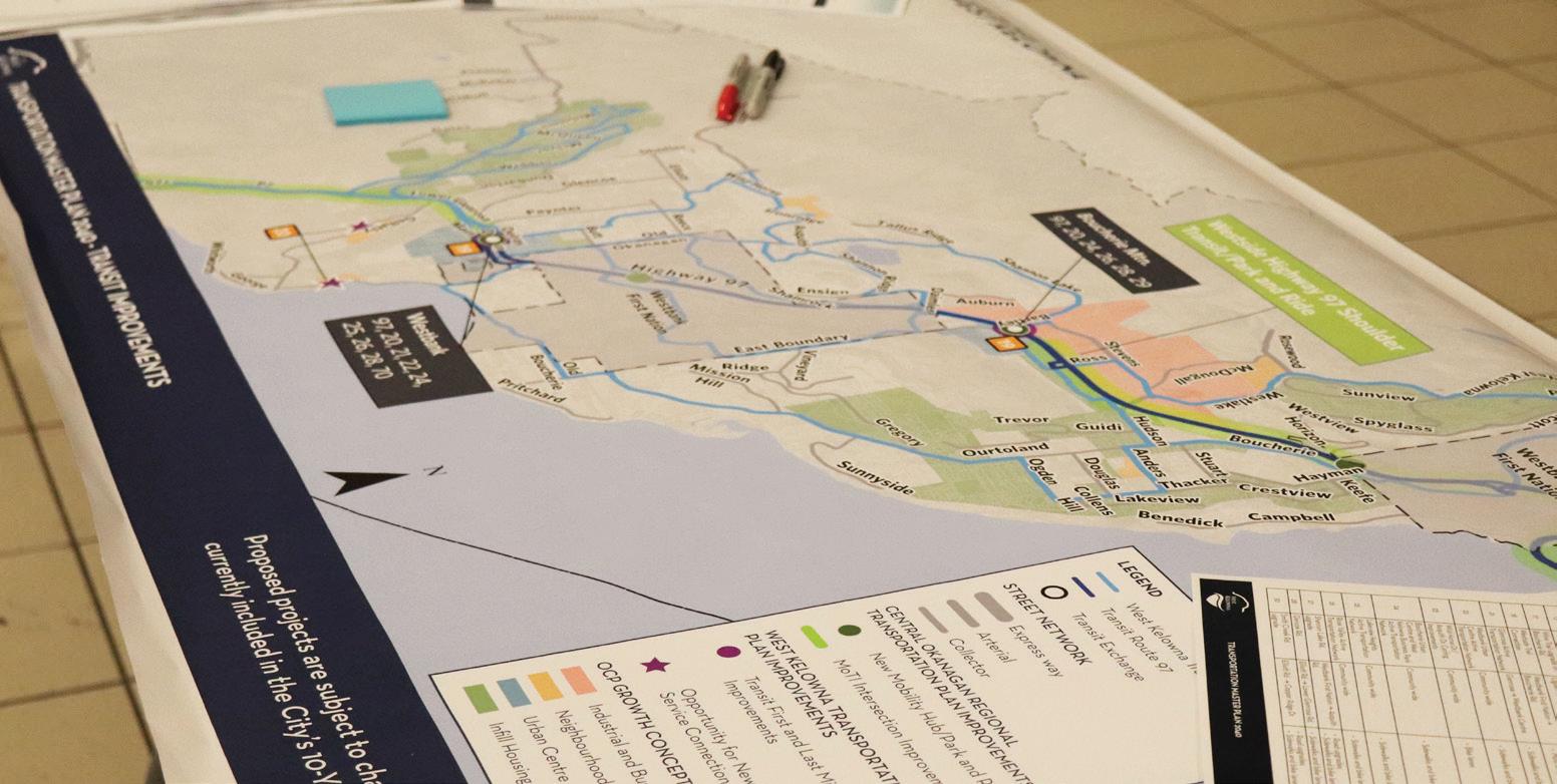
On February 1, 2023 the City held an information session to share information and receive feedback on the TMP Future Network Improvements and OCP update. The Information Session was held at Mount Boucherie Secondary School multi-purpose room and featured display boards that described the work completed to date, a project fact sheet to hand out, maps showing recommended network improvements, videos and a Feedback Form. Residents were asked to share their thoughts on the recommended network improvements through a series of structured questions on a Feedback Form. The Feedback Form was available online and at the Information Session. A total of 87 participants attended the in-person Information Session and 150 filled out the online Feedback Form.

Phase 2 Outcomes
Across all Phase 2 engagements, comments were consolidated as follows:
• Generally, participants support the recommended network improvements and the recommendations align with the future OCP Growth Concept;
• Participants support the improvements to the pedestrian and cycling network;
• Participants support additional sidewalk and road connectivity at the priority areas where West Kelowna’s transportation system requires improvement, followed by bike lanes and transit; and
• Participants would like to provide increased accessibility to seniors, children, and people with disabilities to safely access transit and active transportation routes.
1.3.3 PHASE 3 — FUTURE NETWORK IMPROVEMENTS
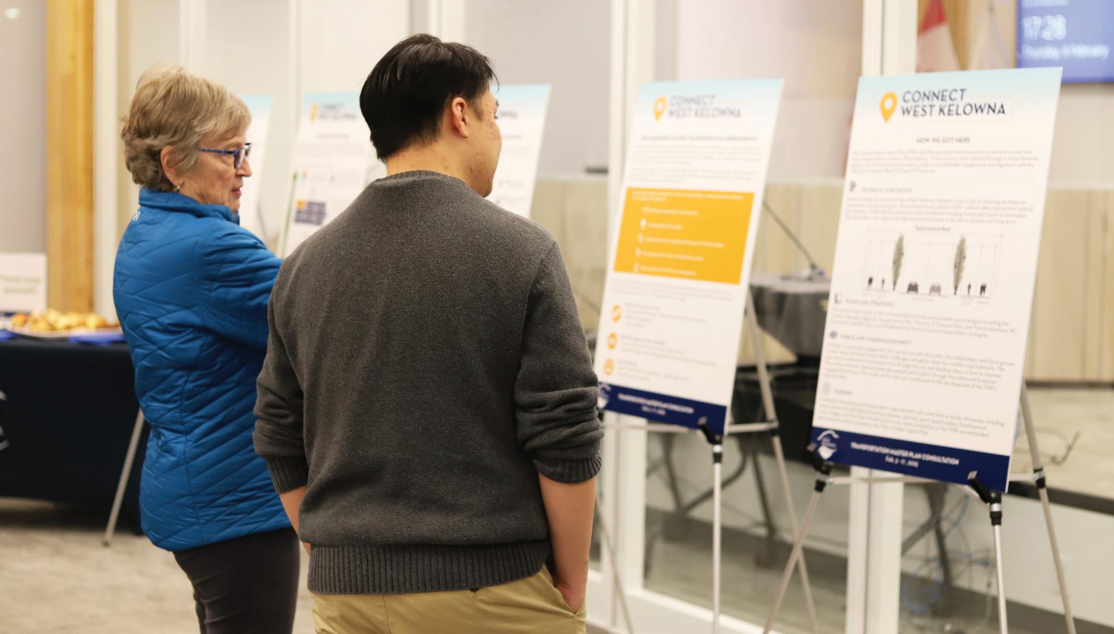
In the final phase of TMP consultation, Phase 3, residents were shown how feedback from Phases 1 and 2 were used to inform the development of the TMP. This engagement was conducted though a community open house and online survey. For this engagement, revised draft network improvement maps and proposed projects were shared with the public for comment. Additionally, roadway cross-sections were shown for the first time.
Online Survey (February 3 – 18, 2025)
Elements of the draft TMP were made available on the City’s website starting February 3, 2025. Residents were encouraged to provide feedback on the TMP progress, prompted by the following question:
“Share your thoughts on the Transportation Master Plan Update:
• Are we headed in the right direction?
• Is there anything we may have overlooked?”
The survey closed on February 18, 2025, and a total of 34 responses were received. Additional comments were also received via the TMP e-mail address.
TMP Update at the Community Open House (February 6, 2025)
A community open house was hosted at City Hall on February 6, 2025 where the proposed project lists, future network maps, the roadway cross-sections were shared with the public. City staff at the event illustrated how the TMP (among other City master plans) was guided by the Official Community Plan, and how such policies inform project planning and design.
General feedback received through the Phase 3 engagement included:
• Generally, participants support the recommended network improvements, especially improvements to the pedestrian and cycling network.
• Participants appreciated the opportunity to closely examine the future network maps, and were able to provide local insight on how the concept design for certain projects should be approached.
• Participants provided additional input on how the proposed projects should be prioritized, giving local context for road safety and active transportation needs.
The feedback received through the Phase 3 engagement has been incorporated into the final TMP and recommendations.
1.3.4 INDIGENOUS ENGAGEMENT
The City of West Kelowna is located on the traditional and unceded territory of the syilx/Okanagan peoples and presently neighbours the WFN. The project team sought perspectives of WFN throughout TMP development.
WFN was engaged in both Phase 1 and Phase 2 via TMP-specific meetings with City officials. Specific outcomes which pertain to WFN across these meetings and all other consultation events in general resulted in the following outcomes:
• General support was given for continued coordination between WFN, the City, and the Ministry.
• General comments were made that connections through WFN land should be improved.
• Future development of WFN, including master planning work, should be supported by this TMP and developed in coordination.
• A pedestrian connection was suggested through WFN to travel from Carate Road to Carrington Road.
1.4 KEY CHALLENGES & OPPORTUNITIES
A number of key challenges and opportunities guide how the transportation network will be planned and can evolve, and some of the primary ones are described below.
RURAL ROUTES
West Kelowna was originally developed as a rural suburb of Kelowna, and its agricultural heritage is still an integral part of the community today. The incorporation of West Kelowna in 2007 gave residents a stronger voice on transportation issues, not only related to the highway, but also concerning the local network. This rural nature, combined with the steep topography, led to the development of an auto oriented transportation network, with many two-lane roads with narrow shoulders, and limited walking and cycling facilities, transit connections, and network redundancy.
Opportunity: The existing roadway network provides transportation connections throughout the community. These connections provide a great starting point for the addition of walking, cycling facilities and further transit services, all of which can be added in a relatively cost-effective manner, providing significant health, equity and sustainability benefits.
EMERGENCY RESPONSE
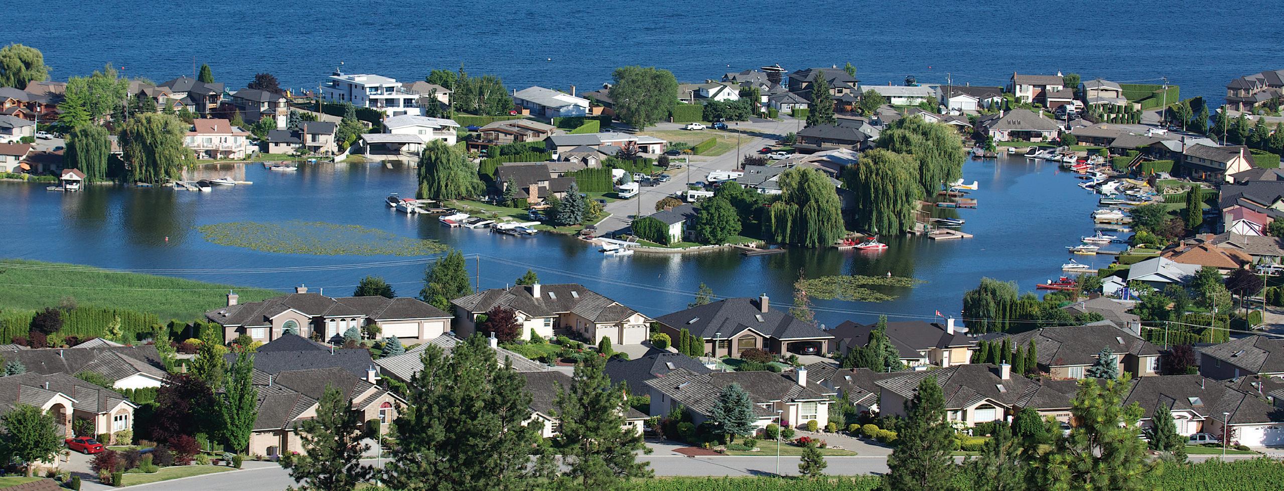
Resting between Lake Okanagan and the mountains, the natural beauty of West Kelowna is evident. However, the unique geography, including hills, streams and forested areas, have resulted in many neighbourhoods being developed with only one access, and this poses a threat in the event of emergencies such as fires or floods.
Opportunity: There are opportunities to improve connections to many of these neighbourhoods, and by doing so, also create secondary access points, which in many cases will provide travel routes to support emergency access, some auto trips, and new active transportation connections.
HIGHWAY 97
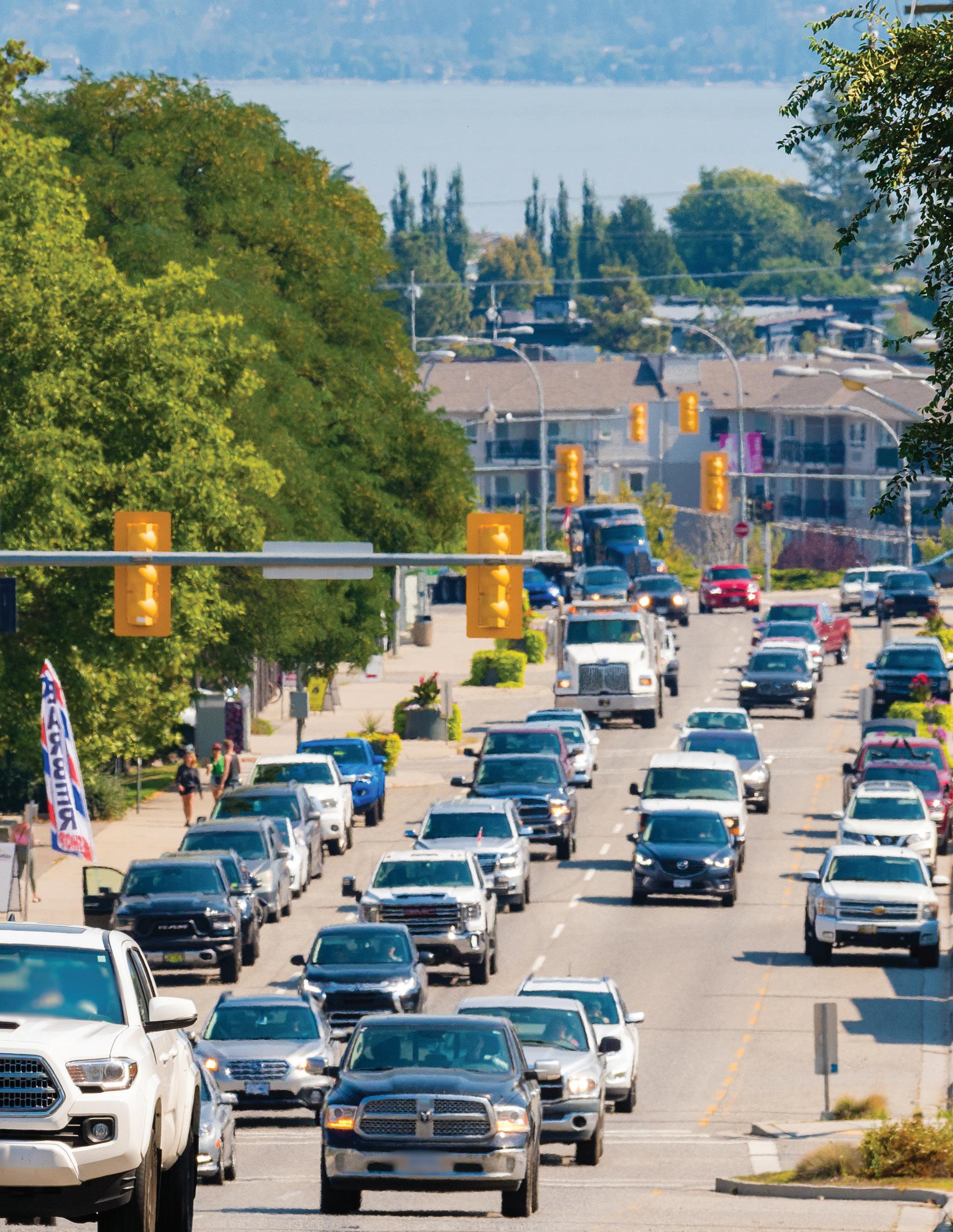
Since the opening of the first Okanagan Lake Bridge in 1958, economic growth and transportation in West Kelowna and throughout the Okanagan have been closely tied to Highway 97. The highway serves as the link that connects much of the city and the city to the rest of the region. However, the highway is also an impediment to forming a permeable, well-connected local multimodal network, and arguably some elements of the highway in West Kelowna have become a deterrent to growth. Past highway planning and improvements have primarily focused on efficiency and safety for highway users, with less focus for how these improvements impacted the local community, businesses, and nearby local streets and pathways.
Opportunity: The TMP and COITS provide a great opportunity to reimagine how the highway can serve residents and physically interact with the community. Improvements such as intersection upgrades or new interchanges will reduce travel times, while upgrades to support transit will help increase the attractiveness of this mode for trips within the City and to/from Kelowna. Similarly, the proposed realignment of the highway through Westbank Town Centre provides an opportunity to reimagine what Main Street could be if it were designed as a place for people within the community to come together.
BUILDING SMARTER
Recent societal trends and new technologies have changed the way we live. Many of these changes, from the Internet and smartphones to online shopping and social media have allowed services to become more accessible. There is little doubt that the way people live in West Kelowna in the coming decades will not be the same as today. Future mobility technologies have the potential to dramatically alter our current transportation systems, and this will necessitate a change in our approach to infrastructure, city development, and planning.
Opportunity: The City can capitalize emerging mobility technologies and advances in transportation for the benefit of its residents.
As neighbouring municipalities in the Okanagan are already planning similar initiatives, the City has a unique opportunity to provide new modes of transportation for residents and additionally facilitate inter-regional connections via these technologies. This includes supporting the widespread adoption and expansion of micromobility, ride-hailing, and evolution of transit stations into mobility hubs that can facilitate use of multi-modal travel. This also allows the City to maximize existing infrastructure without significant capital investments.
DIRECTION 2
2.1 OCP VISION AND FOUNDATIONS
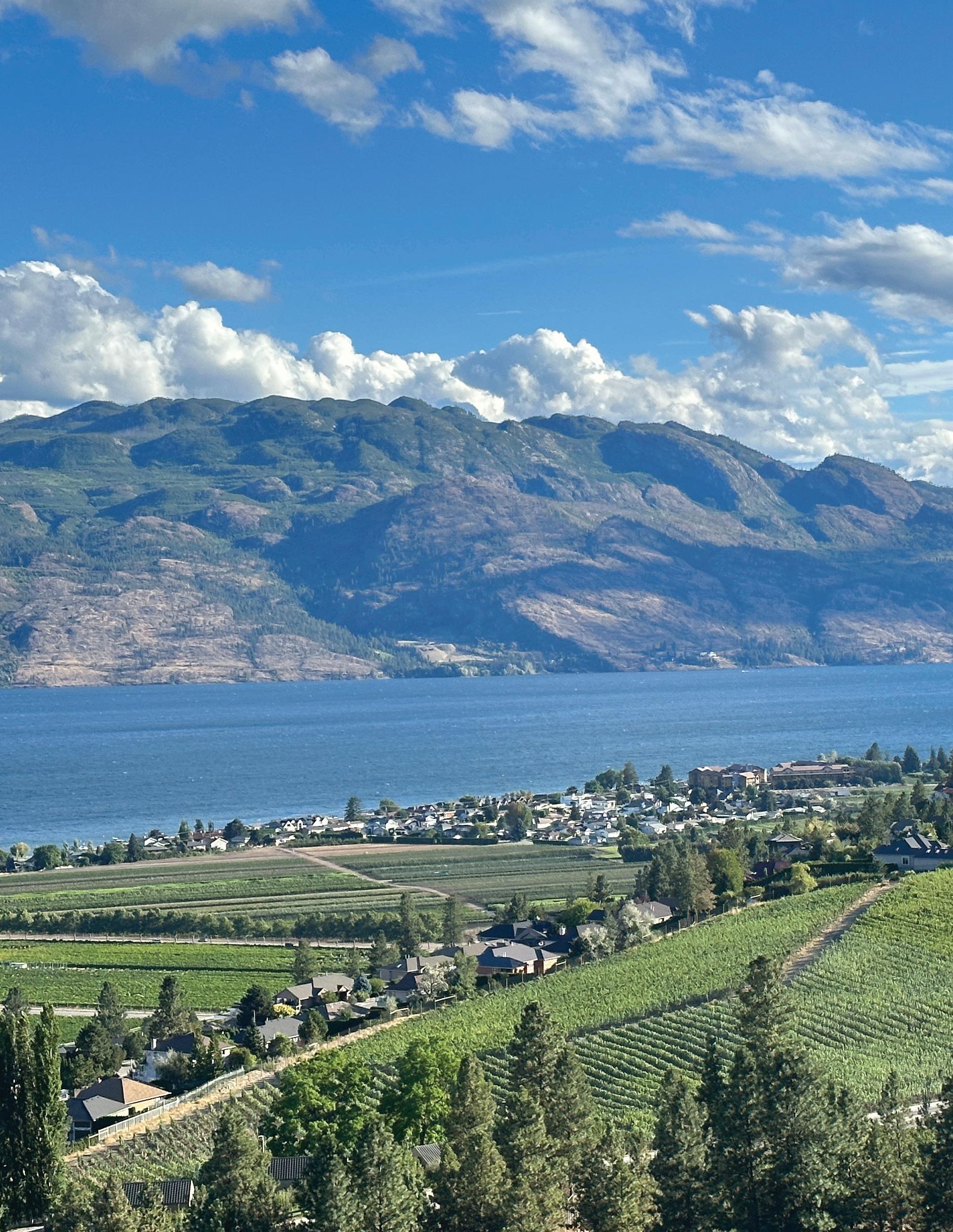
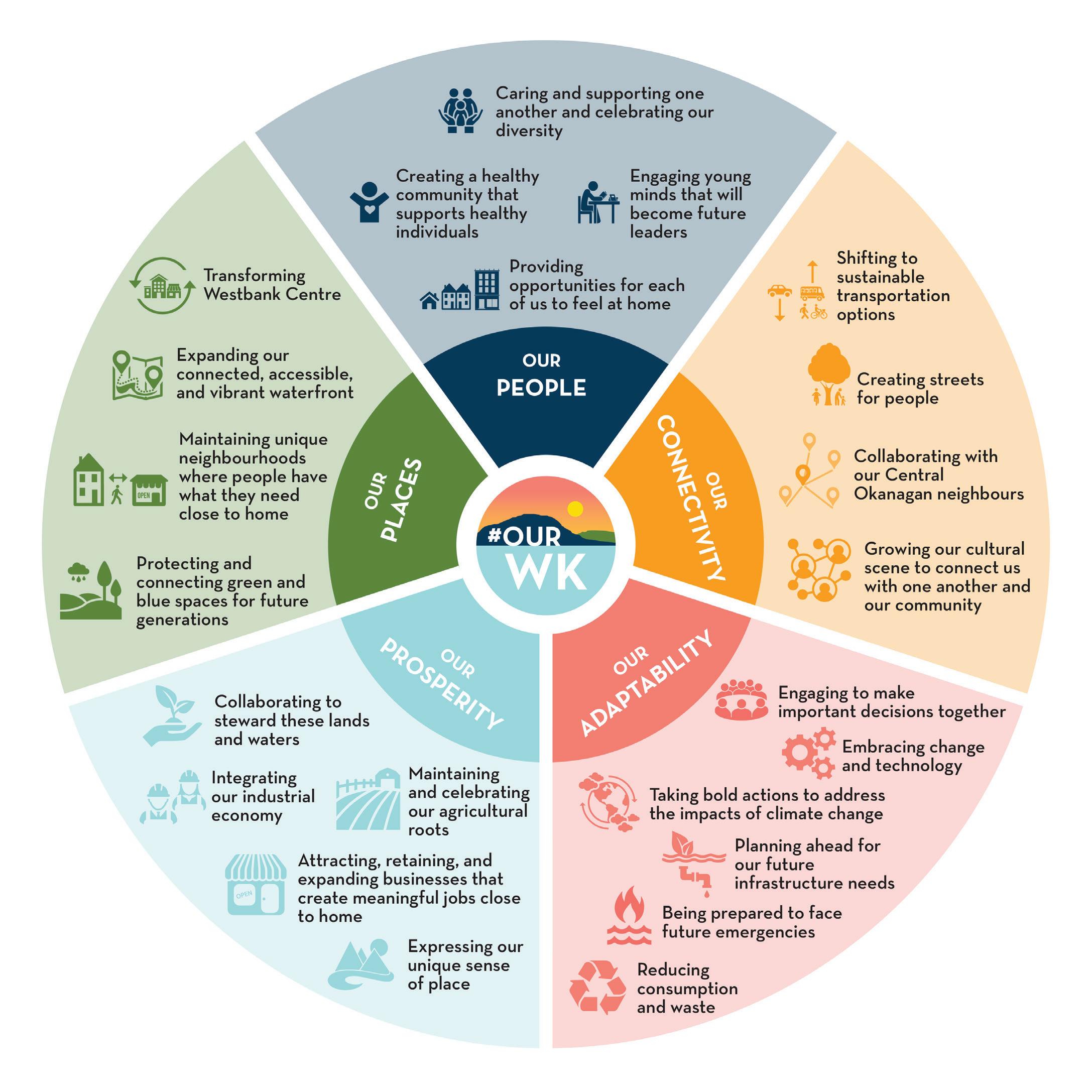
The OCP is the policy document that guides the City’s goals and aspirations around how the community should develop as the year 2040 approaches. A central component of the OCP is the #OurWK Community Vision:
In West Kelowna…
• We live in harmony with these lands and waters, with one another, and with our neighbours.
• We maintain a deep connection with our agricultural roots and we celebrate the one-of-a-kind character for our community.
• We prepare for and welcome change through innovation and collaboration.
• We are inclusive and supportive of one another, and we are ready to create our future together.
The vision is organized into five foundations:
OUR PEOPLE is about creating a community for all of us. West Kelowna wishes to be a place where you say hello to your neighbours; where you raise your children; where you can find a home that fits your unique needs and stage of life; where you live a healthy, fulfilling lifetime surrounded by friends and family. Our West Kelowna is a city that is inclusive and welcoming to all.
OUR CONNECTIVITY is how we experience our community. Our physical connections make it easy and enjoyable to move around and our social and spiritual connections link us with one another, with our neighbours, and with the region.
OUR ADAPTABILITY is how we work together to help our city be successful. This is where we commit to collaboration and making the best possible choices that will keep West Kelowna healthy, green, safe, and resilient for years to come.
OUR PROSPERITY starts with taking care of the lands and waters that support us. It is also about supporting businesses that will provide good jobs and places to shop, keeping our city thriving. It involves defining West Kelowna’s unique sense of place and sharing it proudly with the world.
OUR PLACES are the neighbourhoods and destinations we love. This is where we commit to maintaining what’s great and catalyzing improvements that will make places like Westbank Centre, our waterfronts, and our neighbourhoods even better, augmenting community pride.
These visions are directly related to how the City should design the transportation network, and how decisions should be made when it comes to prioritizing certain initiatives over others. Within the five foundations encompasses more specific key directions that represent West Kelowna’s values.
2.2 TMP POLICY
Policy for the TMP was developed to align with and achieve the vision and goals set out in the OCP. The TMP policies were developed around the five foundations, and sub-foundation policy areas were developed to provide a more detailed policy structure, as shown in the table below.
Policy development for the TMP was done in conjunction with the OCP team, and transportation polices for both the TMP and OCP were developed collaboratively.
This section includes two levels of policy recommendations: (1) General policies, which shall be used to guide the day-to-day planning and upgrading of the transportation system, and (2) action items that the City will specifically execute.
OUR PEOPLE General
Development General
OUR PLACES
OUR CONNECTIVITY
Development Urban Centres
Development Neighbourhood Centres
Active Transportation Transit Streets
OUR PROSPERITY Business
Future Technologies & Trends
OUR ADAPTABILITY
Resiliency
Transportation Demand Management
West Kelowna shall:
G.1 Improve the safety and reliability for people and goods to move around West Kelowna.
G.2 Make it easier for everyone to choose sustainable and affordable options for traveling to, from and within West Kelowna.
G.3 Work with other Central Okanagan communities to strengthen interregional transportation connections for all modes.
G.4 Coordinate with the Ministry on the planning of Highway 97.
G.5 Engage with Westbank First Nation to coordinate network improvements for all modes across municipal boundaries.
G.6 Mitigate the negative impacts of transportation such as light, noise and emissions through planning and design.
G.7 Reduce greenhouse gas emissions through the design and operation of the transportation network, in coordination with provincial mandates.
Actions:
G.8 Explore the creation of a Transportation Planning scope with staffing dedicated to strengthening the development of public transportation and TDM in West Kelowna.
G.9 Develop a process that regularly incorporates input from Indigenous peoples, stakeholders, and the public in transportation projects.
OUR PLACES
West Kelowna shall:
Development General
DG.1 Accommodate development in the Westbank and Boucherie Urban Centres and Neighbourhood Centres through progressive transportation planning requirements. This includes permitting higher vehicular levels of service and reduced trip generation and parking rates for new developments, when supported by comprehensive transportation demand management practices, with the goal of minimizing future vehicle trips and promoting walking, cycling and transit use in these areas.
DG.2 Minimize the consumption of undeveloped land when implementing new City and Ministry-led transportation infrastructure projects.
DG.3 Support shared parking and lower parking rates, when supported by parking analysis and/or a comprehensive transportation demand management program, in Urban and Neighbourhood Centres for new developments.
DG.4 Leverage proposed development in Urban and Neighbourhood Centres to improve the active transportation network.
West Kelowna shall:
DUC.1 Prioritize active transportation in urban centres.
DUC.2 Work with the Ministry to mitigate the impacts of Highway 97 on the Urban Centres.
DUC.3 Ensure streets in Urban Centres include safe crossings for vulnerable road users.
DUC.4 Engage local communities and incorporate art into transportation projects in the Urban Centres. This could include traditional / indigenous art, or community driven art such as murals or tactical urbanism.
DUC.5 Incorporate high quality streetscaping into transportation projects in the Urban Centres, including landscaping, furniture, art, plazas, etc.
Actions:
DUC.6 Work with the Ministry to shift Highway 97 in Westbank Urban Centre to advocate to transition Dobbin Road to a two-way highway to allow Main Street to convert to a two-way town centre street with a community / commercial focus.
DUC.7 Provide and manage on-street parking and loading in Urban Centres to support local businesses through curbside management.
West Kelowna shall:
NC.1 Connect neighbourhood centres with one another, Urban Centres, and surrounding areas through new and upgraded active transportation and road networks.
NC.2 Improve and design streets in Neighbourhood Centres to be appealing and safe.
NC.3 Advocate and engage with BC Transit to explore expansion of local transit service to new neighbourhood centres, such as Goats Peak and Gellatly.
OUR PLACES
Neighbourhood Centres
West Kelowna shall:
AT.1 Prioritize active transportation connections to the Urban and Neighbourhood Centres and encourage access to the areas without a vehicle.
AT.2 Provide strong walking, cycling and transit connections to the waterfront from the Urban Centres, Neighbourhood Centres, and Wine Trail.
AT.3 Complete a continuous all ages and abilities active transportation route from Bennett Bridge to and through West Kelowna Urban Centres for commuting and recreational purposes.
AT.4 Complete a continuous all ages and abilities AT route from Bennett Bridge to Peachland along the waterfront (Westside Trail).
AT.5 Continue to identify, prioritize and fill gaps in the active transportation network.
AT.6 Improve first and last mile connections around Westbank and Boucherie Mountain transit exchanges for walking and cycling to increase transit ridership.
AT.7 Provide safe AT facilities and crossings at high incident locations / intersections.
AT.8 Work with neighbouring municipalities to identify and develop regional AT connectivity.
AT.9 Provide strong walking, cycling and transit connections to and around schools and other locations with vulnerable users.
AT.10 Work with School District 23 to promote active transportation, healthy lifestyles, and sustainable travel behaviour among children and youth.
AT.11 Work with Ministry to improve pedestrian and cycling connecting across Highway 97, and the pedestrian environment along the Highway within Westbank and Boucherie Urban Centres.
Actions:
AT.12 Prioritize and develop the active transportation network as outlined in Section 4.3 and Appendix C
West Kelowna shall:
T.1 Work with BC Transit and MOTT to increase the frequency of transit on Highway 97 and support projects to improve bus speed and reliability on Highway 97.
T.2 Improve access to transit for walking and cycling by building first and last mile connections around existing transit exchanges.
T.3 Improve multi-modal connections to transit stops within and near Neighbourhood Centres.
T.4 Support the optimization of the bus network in West Kelowna to balance ridership and accessibility interests.
T.5 Continue to work in collaboration with BC Transit to support the development of a 3-Year Transit Plan for continued alignment with transit improvement priorities, including updates to this plan each year.
Actions:
T.6 Develop mobility hubs at Westbank and Boucherie Mountain transit exchanges to increase options and transit ridership.
T.7 Explore opportunities for demand-responsive transit with BC Transit and the City of Kelowna.
OUR CONNECTIVITY Street
West Kelowna shall:
S.1 Design and upgrade the street network to facilitate multi-modal travel and use by people of all ages and abilities.
S.2 Incorporate way-finding and universal design principles into infrastructure planning.
S.3 Maintain, optimize, and upgrade the road network to improve safety and manage traffic congestion.
S.4 Require transportation impact assessment for new significant developments (such as schools) that include evaluations of not only vehicular capacity and operations but also walking, cycling, pick-up drop-off, and transit.
S.5 Consider and mitigate the impacts of traffic from growth areas on existing neighbourhoods.
S.6 Design new roadways, infrastructure, and development from a ‘multi-modal-first’ perspective.
Actions:
S.7 Develop Terms of Reference guidelines for traffic impact assessment studies.
West Kelowna shall:
B.1 Work with Ministry to improve operations on Highway 97 and access to it for trucks and passenger vehicles.
B.2 Plan and design for truck routing, access, and deliveries in Urban and Neighbourhood Centres through efficient curbside management.
B.3 Work with BC Transit and City of Kelowna to optimize transit service for employees to the Industrial and Business Park areas.
B.4 Provide short- and long-term parking options in Urban and Neighbourhood Centres through curbside management to support business and accommodate customers and employees.
B.5 Protect and enhance agricultural uses and related business access through the planning and design of transportation projects.
Actions:
B.6 Protect and enhance truck circulation and access to the Industrial and Business Park areas.
OUR ADAPTABILITY Future Technologies & Trends
West Kelowna shall:
FTT.1 Plan for and incorporate emerging technologies and practices, such as facilitating on-demand transit, shared micro-mobility and its hubs, ride-hailing, electric vehicle/bike charging, and centralized deliveries, by leveraging experience from other municipalities in the Okanagan.
Actions:
FTT.2 Provide incentives to accelerate uptake of electric assist bicycles to serve utilitarian trips.
FTT.3 Work with the Ministry to enhance Highway 97 operation using intelligent transportation systems.
FTT.4 Monitor EV adoption and develop the electric vehicle charging network to support future demands, specifically in urban centres.
West Kelowna shall:
R.1 Design and adapt transportation infrastructure to be resilient to climate changes and natural disasters.
R.2 Improve the resiliency and operation of the existing road network through strategic improvements and intelligent transportation systems.
R.3 Work with Police, Fire and Emergency Services on an on-going basis to address transportation design and planning concerns.
R.4 Require that new developments over a size of 100 units have a minimum of two (2) road access connections.
R.5 Work with WFN to create Emergency Access Plans for neighbourhoods that cross boundaries.
R.6 Designate public roadways and active transportation routes, including emergency access connections, to remain free-flowing and publicly accessible. The City will not support the installation of gates or other physical barriers that restrict access to these routes, as they are integral to the interconnectedness and resiliency of the transportation network. These routes also support evacuation and emergency responses in the event of a wildfire.
Actions:
R.7 Prioritize and construct secondary and/or emergency accesses to neighbourhoods with only one access (Figure 4 and Appendix D).
R.8 Plan and design Westside Trail so that it can be used as an emergency access / egress route to serve the communities with only one current access (includes Casa Loma, Kalamoir – Lakeview, Sunnyside, GreenBay, Pritchard Drive).
R.9 Develop an emergency access / egress plan and communicate it to residents.
West Kelowna shall:
TDM.1 Promote a shift in travel patterns to reduce dependence on the automobile to support community, environmental, and health and wellness goals.
TDM.2 Promote active transportation, public transportation, and high occupancy vehicle (HOV) modes over single occupancy vehicle (SOV) modes.
TDM.3 Explore shared public-private parking facilities and other efficiency strategies such as car-share spaces.
TDM.4 Optimize on-street parking and loading zones to best meet the needs of nearby businesses, residences, and amenities by monitoring parking occupancy, restricting parking duration, and enforcement compliance.
Actions:
TDM.5 Consider developing and funding a Transportation Demand Management (TDM) Program in partnership with businesses and institutions to identify transportation mode split targets and actions to reach them.
TDM.6 Promote the creation of a car-share policy, zero-emission vehicles, EV charging stations, and TDM measures in new development, including targeted reductions to minimum parking requirements.
TDM.7 Develop a study to improve parking management strategies as the City grows.
2.2.1 ADDITIONAL
POLICY CONTEXT
The following sections provide additional context for select policies where further explanation and elaboration was needed to communicate the intent of the policy.
Transportation Requirements — Corresponding Policy DG.1
Similar to most municipalities, the City of West Kelowna requires proposed developments to demonstrate that they can be accommodated without negatively impacting transportation operations in the surrounding area. However, these types of requirements can have negative consequences and result in a self-fulling feedback loop, with forecasted traffic growth and congestion leading to road widening, which then re-affirms driving as the default mode of transportation, in-turn reducing the competitiveness of walking, cycling and transit, and resulting in more driving. This does not align with City initiatives, and the City wishes to break this chain by being more flexible with our transportation requirements when it comes to approving new developments, specifically in Urban and Neighbourhood Centres. This means the City will be accepting higher forecasted levels of traffic congestion, exercising restraint when building additional road capacity, and permitting reduced trip generation and parking rates for analysis when supported by data or transportation demand management measures.
Shared Parking — Corresponding Policy DG.3
Municipalities typically require each property to provide sufficient parking on-site to accommodate the maximum parking demand of that site and its land uses. However, different land uses have different parking demand profiles, i.e., parking is needed at different times of the day or the week. For example, schools and businesses have higher parking demands during the weekday, while homes have higher demands at night. This provides an opportunity for parking space to be shared between different users / land use types, especially in mixed use developments. Over providing parking is a poor use of resources and promotes driving by prioritizing vehicle storage over other uses. The City will support more efficient use and planning of parking, including shared parking, specifically in the Urban and Neighbourhood Centres. The City will also consider implementing a parking relaxation policy to standardize the process.
Curbside Management —
Corresponding Policy DU.7
In urban environments, the curb or parking lane is a valuable City-owned resource that can be managed to provide the most value to the City, its residents, businesses, visitors, and other users. This can be done by actively engaging with stakeholders and conducting studies to determine the best use of curb space in different areas and contexts. Curb space or on-street parking is used to pick-up and drop-off children at schools and transit users, is essential for deliveries to a business, and allows people conveniently park near their friend’s homes. Curb space in the City should be reviewed and managed to optimize the benefits for all, and this can be done through active parking management and time or permit restrictions. This is particularly relevant as emerging mobility services come online and potentially increase curbside utilization for their unique needs. Innovative uses of curb space will also be considered, such as the use of “parklets”, which became common during the COVID-19 pandemic, and are where under-used parking spaces around the world were re-purposed into seating areas and cafes. Various couriers and delivery services could also consolidate their destinations to “delivery hubs”, aimed at reducing long loading times and curbside usage in higher density areas.
Highway 97 ITS / Dynamic Message Signs — Corresponding Policy FT.3
Highway 97 is a critical corridor for West Kelowna and the region and is the preferred route for longer vehicle trips to/from the City and through it. A smooth operating highway keeps vehicle traffic manageable on the parallel routes in West Kelowna, including Shannon Lake Road and Boucherie Road. However, during disruption events on the highway, such as an accident, it may be beneficial to re-direct travellers to other routes through the City. An improvement such as dynamic messaging signs could be added to the highway on either side of the City, providing information to drivers on travel times through the City or to key destinations (such as Westbank Urban Centre), providing drivers with the information that they need to plan and adjust their trip, if needed. They would also provide certainty to travellers that the highway is the quickest, most efficient, and preferred travel route through the City most of the time. This would be an expansion of the current dynamic message signs, of which there are some located in West Kelowna and just to the south. They would only re-direct travellers to the alternate routes during a significant delay or collision.
THE PLAN 3
3.1 PROJECT OVERVIEW
Improvement projects were identified using a range of tools and approaches. The list of improvement projects includes projects that were:
• Previously identified and committed by the City and other agencies (e.g., MOTT)
• Identified through network review and technical analysis (see Network Assessment in Appendix E)
• Identified through engagement with both public and interested parties.
Projects were developed to address deficiencies, known issues, and to improve the transportation network operations, following the direction from the OCP vision and foundation, and the policies in the TMP.
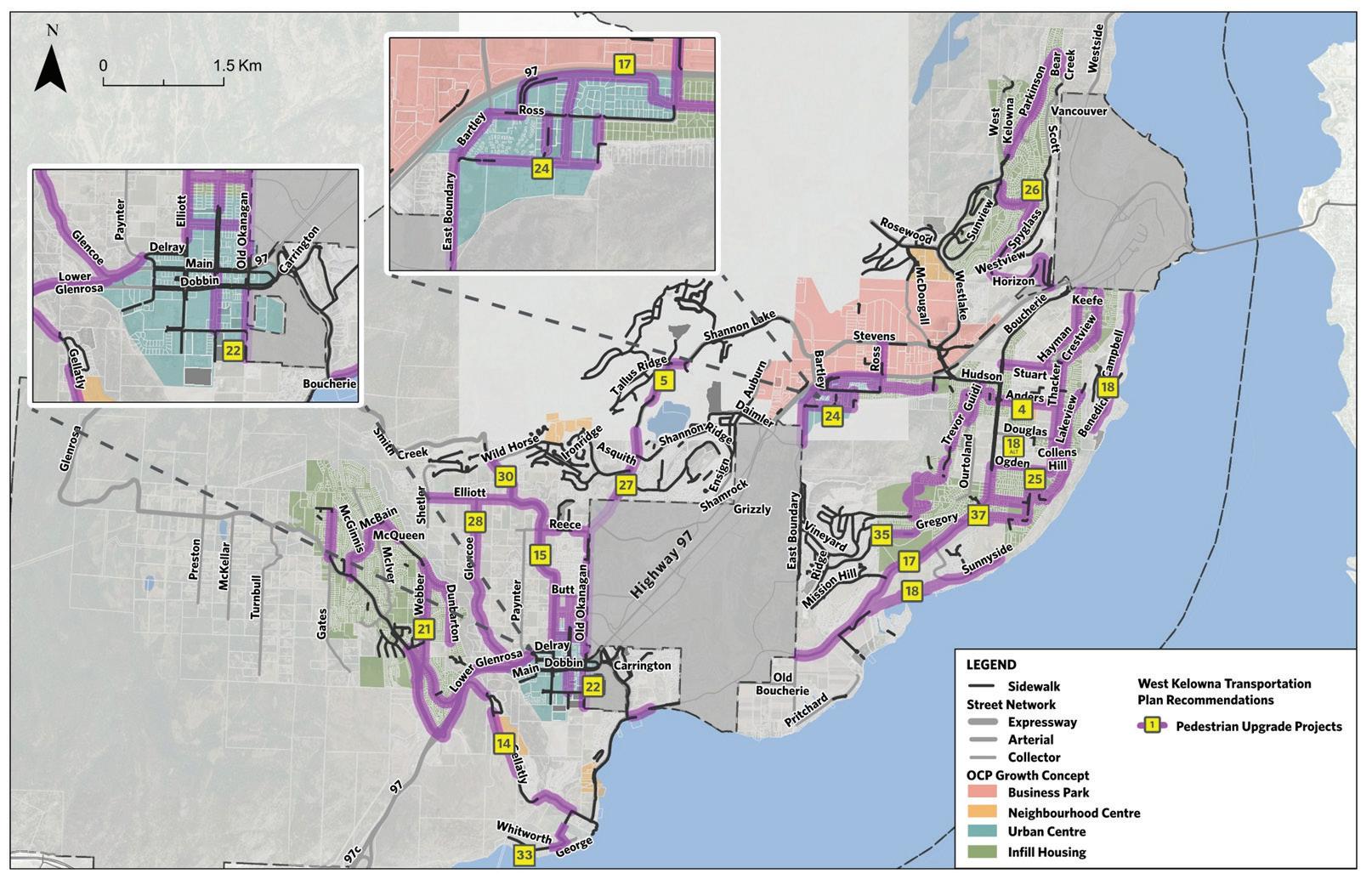
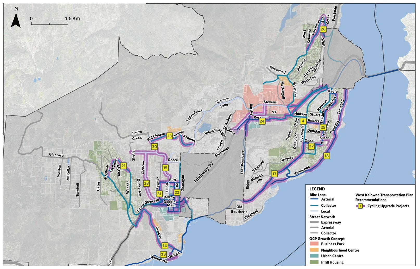
The following pages show the planned transportation network for the City, including new connections and projects. While the network has been split to show improvements by mode — walking, cycling, transit and driving — this is for readability only; it is envisioned that many of these projects will include components and provide benefits to all types of travellers that use each link or connection, and hence, some projects are shown on multiple maps. An introduction and context are provided at the start of each modal section.
Projects in each section are shown through maps and tables. The maps shows where the projects are, as well as important context, such as other background projects or initiatives from other parties, such as MOTT. The tables include the project’s ID, Name, Status, Extents, Components and Estimated Cost. Brief descriptions of each category are provided below:
ID — used to show where the project is located. Multiple improvements on the same corridor / location are often grouped to share one project ID / name.
Project Name — provides a general location and indication of the type of project.
Status — identifies what work is left to be done to implement the project, acknowledging that some projects are more advanced than others.
The three main categories are:
Planning Required — projects that have been identified through this study and/or have not been explored in detail and still require planning.
Design Required — projects that have been planned, i.e., the size, scope and contents of the project have been confirmed, but project has yet to been designed.
Implementation Required — A project that has been planned and designed and is ready for funding and implementation.
From / To — identifies the project extents.
Components — a brief summary of the main components that are considered to be included in the project and were included in the cost estimate.
Estimated Cost — a planning level cost estimate for the capital and planning expenditure required to construct each project, as defined in the “components” column in the table.
Project costs were grouped into qualitative categories denoted by dollar signs, with threshold values defined as follows:
Cost Category Cost Threshold (in 2025 dollars, including a 50% contingency)
$ Up to $2.5 million
$$ Greater than $2.5 million but less than $8 million
$$$ Greater than $8 million but less than $20 million
$$$$ Greater than $20 million
In addition to the projects recommended, the following background improvements are also included on the modal maps:
Central Okanagan RTP — Projects that were identified as part of the Regional Transportation Plan.
BC MOTT — Projects that the Ministry is anticipated to undertake in the next twenty years.
Appendix F includes further information and a more detailed description of each project.
3.2 WALKING & CYCLING
West Kelowna’s natural environment, climate, and enjoyable destinations and attractions make walking and cycling great travel options both within the City and the region. However, a historical lack of investment in these types of projects has led to an under-developed active transportation network with significant gaps. Walking, cycling, and other forms of active transportation are important because they are healthy, sustainable, cost effective and equitable transportation options.
Re-connecting the City through the addition of new walking and cycling facilities, whether through sidewalks, multi-use pathways, or bicycle lanes, is the best way to make these modes accessible for residents and visitors. Redesigning streets with treatments that offer traffic calming, wide-walking corridors, enhanced lighting, and pedestrian-oriented wayfinding will offer vastly improved comfort and safety for vulnerable road users. Providing additional pedestrian linkages and shared roadways with cars will improve network connectivity overall by adding to the available infrastructure accessible to walking and cycling modes. When used in conjunction with developing new walking and cycling infrastructure, all of the above listed opportunities play a role to improve the infrastructure for existing pedestrians and cyclists and welcome new users onto a safer active transportation network.
It starts with improvements in areas that would realize the greatest value, namely, to improve connections within the urban centres, neighbourhood centres, and around key destinations, such as schools. Next, those areas need to be connected with one another, enabling residents to travel comfortably and safely between major locations, residential areas, and community services. Finally, in the long term, the rest of the network can be then connected and completed. The projects outlined below will continue to develop a vast network of safer roads and urban pathways for active transportation users in West Kelowna with the design mindset codified by the policy in the previous chapter to build for safety, efficiency, and connectivity.
The City’s bicycling network employs a classification system consisting of arterial, collector, and local bicycling facilities. Arterial routes are intended to serve all ages and abilities, are designed to accommodate higher volumes of users, and the routes are primarily situated in locations which connect to the urban centres. Collector routes are built as routes which connect neighbourhoods or link them to urban centres, generally providing comfort to users of all ages and abilities. Local routes may be built on local streets or off-street paths and are located primarily inside neighbourhoods to provide connections to local destinations in low-volume contexts. These routes, if built in mixed traffic, should be accompanied by traffic calming and diversion measures to reduce the speed and volume of traffic.
Figure
3.3 TRANSIT
BC Transit operates transit service in the Central Okanagan, including in West Kelowna. West Kelowna has a well-developed transit network with a mix of local routes and the higher capacity Route 97, which provides a frequent connection to the rest of the Central Okanagan.
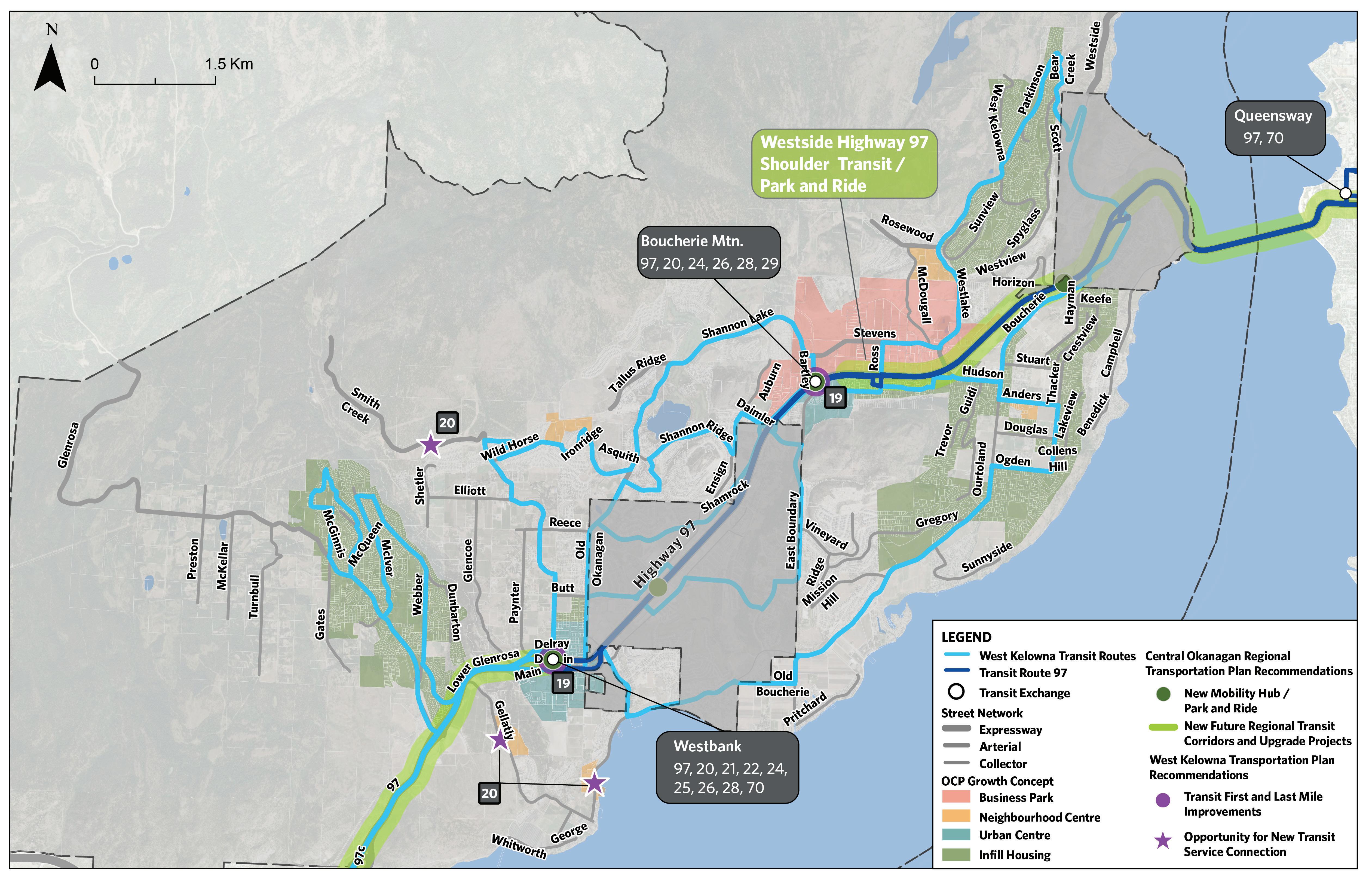
The RTP identified transit improvements along Highway 97 to improve bus reliability and travel speed, as well as the addition of mobility hubs and park and rides. The proposed projects for transit build on these concepts and aim to further leverage and enhance the existing transit service provided on the Westside.
Ongoing improvements strive to meet the performance, design and service standards set by the Transit Service Guidelines for the Central Okanagan Region6, developed by BC Transit in 2020. BC Transit follows this framework to periodically review service deficiencies and address them to the performance standards within the guidelines.
The two core improvement projects are the development of mobility hubs around the existing Westbank and Boucherie Mountain exchanges, and the potential addition of transit service to the planned neighbourhood centres at Goats Peak and Gellatly.
The mobility hubs would be built to leverage the existing Route 97 service on the highway, and would include connections to other forms of transit, such as park and ride facilities, bicycle storage and/or micro-mobility, electric vehicle parking / charging, and wayfinding. First and last mile improvements to the walking and cycling networks would be done in tandem to improve connections to the hubs and their transit exchanges. Other components that could be considered at the mobility hubs include retail and commercial land uses fronting / near to the hubs, outdoor lighting, public art, public plazas and seating, and the co-location of compatible uses, such as tourist information centres.
The City of Nanaimo7, Metrolinx8 in Southern Ontario, TransLink9, and ITE10 have all explored best practices for the development of mobility hubs and are great references for what could be incorporated into the hubs in West Kelowna, and more information can be found at the links in the footnotes.
6 https://www.bctransit.com/wp-content/uploads/604/447/2020-01-16-Central-Okanagan-Transit-Service-Guidelines-FINAL-DRAFT.pdf
7 https://www.nanaimo.ca/your-government/projects/projects-detail/downtown-mobility-hub-project
8 https://www.metrolinx.com/en/docs/pdf/board_agenda/20110218/MobilityHubGuidelines_optimized.pdf
9 https://sustain.ubc.ca/sites/default/files/Sustainability%20Scholars/2018_Sustainability_Scholars/Reports/2018-71%20Identifying%20 Best%20Practices%20for%20Mobility%20Hubs_Aono.pdf
10 https://www.ite.org/pub/?id=FB9BA468-9D2A-5B45-F502-21EDD578F800
The Growth Concept includes two new neighbourhood centres along Gellatly Road South, and it is recommended that transit service to these two new growth areas be considered. The transit service could either be a new service, or the rerouting of an existing service in the area. The addition of a new route is ultimately up to BC Transit, but the City of West Kelowna can advocate and engage with BC Transit to explore connecting these new growth areas.
The City will continue to collaborate with BC Transit to support the development of a 3-Year Transit Plan for continued alignment with transit improvement priorities, including updates to this plan each year. The most recent Kelowna Regional Conventional Transit 3 Year Plan was developed in 2023.
19 Mobility Hub, First & Last Mile Improvements
Table 2: Transit Projects
3.4 ROADS
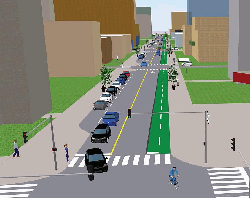
West Kelowna is spread over a large geographic area and is connected with an extensive road network. Because of the unique natural geography and existing development, creating new road connections could be challenging and costly. Due to the relatively low density of many neighbourhoods, most of the intersections and roadways in the City operate well within their capacity and are forecasted to continue operating within capacity for the foreseeable future.
Through engagement with the public and stakeholders as part of the TMP and OCP updates, and as expressed through the community vision, foundations and key directions, the primary motivations behind improving the road network are around improving safety, redundancy, and operations, and not necessarily increasing road capacity or adding major new roads.
The road project list includes limited new roads and road expansion projects. Many of the existing roadways have sufficient capacity, and building additional roadway infrastructure is costly, can negatively impact the surrounding land, and creates a long-term burden of increased maintenance costs. The proposed plan limits
investment in road infrastructure, leaving capital funding available for other projects, such as those in active transportation and transit, that will provide a higher return on investment in terms of achieving the community’s vision.
The one route where improving driving capacity and operation will be prioritized is Highway 97, as it experiences regular congestion and is an essential connection both within and to/from the City. The Ministry’s on-going COITS Study is focused on identifying upgrades on this critical link to improve vehicle operation, add capacity, and support other goals, such as transit reliability.
Further, there are opportunities to leverage any future investments in road projects by incorporating improvements for other modes at the same time, such as walking and cycling, or through considered planning to achieve other goals, such as improving routes to/from schools, or enhancing emergency access / egress. As an example, many of the emergency access projects identified (E-XX’s) are proposed to be built as multi-use pathways, but designed so that they can function as emergency access/egress for vehicles and emergency services if needed.11
To support the conceptual planning of Main Street, the City is working with the UBCO’s Centre for Transportation and Land Use Research (CETLUR) team to analyze and show how Main Street could be re-designed to serve more as a community centre when Highway 97 is shifted to Dobbin Street. The planning of Main Street and the overall Westbank Urban Town Centre remains on-going. A summary of the work is included in Appendix H
11 This concept is not new to BC, with the City of Coquitlam’s Urban Multi-Use Trails designed serve as emergency road access. https://www.coquitlam.ca/DocumentCenter/View/1587/Trail-Development-Guidelines-and-Standards-PDF
- Gosset Rd / Old Okanagan Hwy
- Gellatly Rd / Boucherie Rd
- Webber Road / Gorman Road
- Boucherie Rd / Mission Hill Rd
- Shannon Lake Rd / Tallus Ridge Dr
- Daimler Drive / Old Okanagan Hwy Planning Required Per
Planning study on a per intersection basis. Estimated average costs of $10,000 to study each intersection, and average cost of $1,500,000 to upgrade each (assuming only minor geometric improvements made)
New two-lane roadway built to an urban arterial classification, project to include component that encourages the use of Asquith Road to access the Tallus Ridge community
3.5 PARKING MANAGEMENT
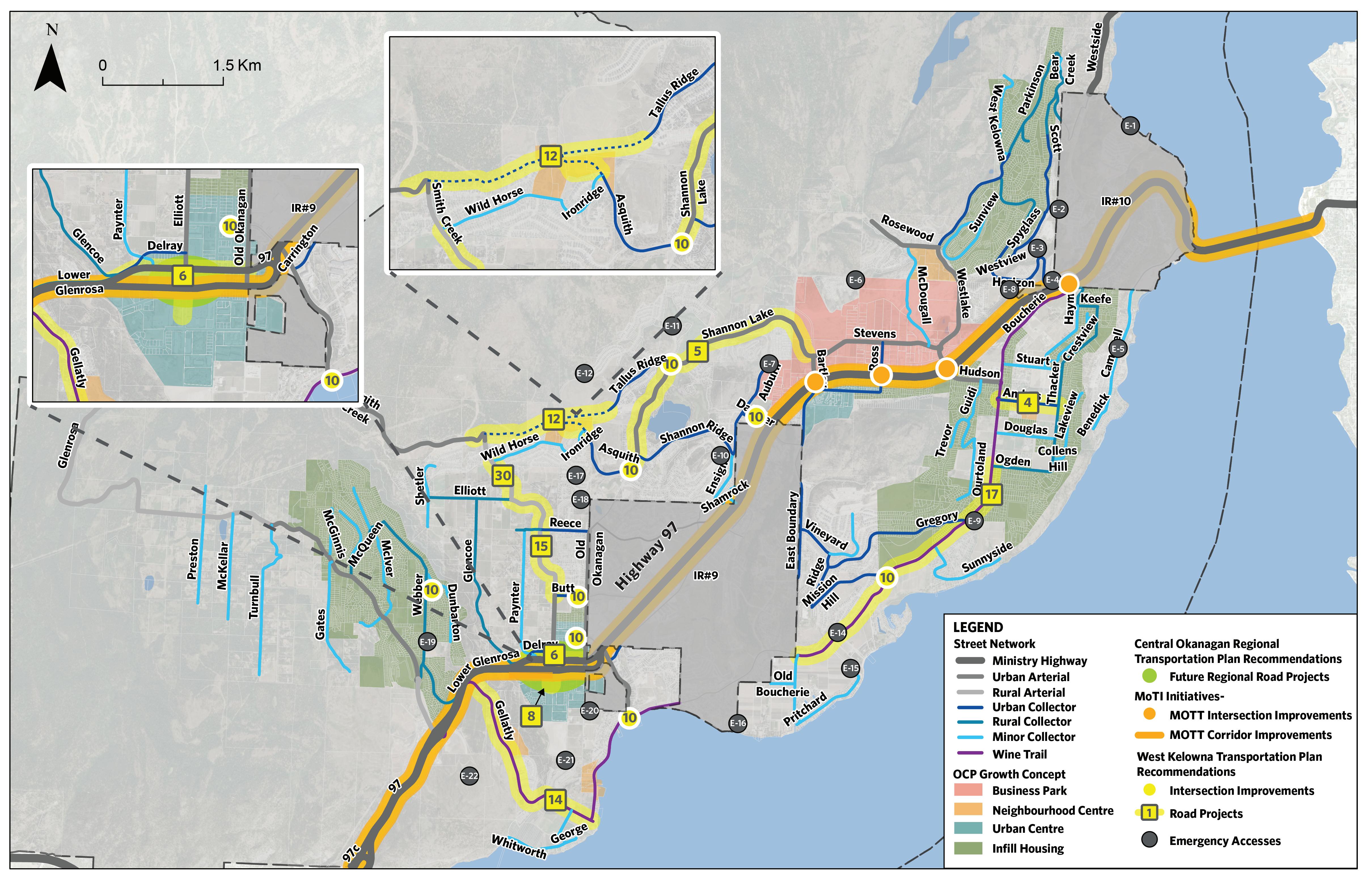
Managing parking demand while also providing for residents’ desires to develop safer and more comfortable multi-modal infrastructure is a challenge that many growing municipalities face, especially in more densely populated urban centres that have attractive amenities for both nearby residents and those commuting from other neighbourhoods. As the city builds new infrastructure, providing new or maintaining existing on-street parking allows residents to park near their homes and for businesses to accept deliveries. However, reclaiming or re-purposing new curbside space unlocks new opportunities for the city, such as providing safer walking and cycling facilities, green space, and summer patio space.
Monitoring parking utilization and managing parking supply is an important strategy that should be guided by a parking management plan to shape the growth of the city by providing for the desired travel behaviours that residents would want in an urban setting like West Kelowna. While the TMP does include high-level policy recommendations on parking and curbside management, conducting a parking management study is crucial to anticipating the City’s future parking and curbside use challenges.
The City of West Kelowna Parking Management Study was commissioned in 2024, which provides more details on the recommended parking management practices for the City.
3.6 CROSS SECTIONS
Cross sections have been updated and refined to align with the City’s vision and the network plans. This section summarizes the available cross sections and provides guidance on their use.
3.6.1 URBAN AND RURAL CROSS SECTION CATEGORIES
The OCP Growth Concept specifies the boundaries of the Westbank and Boucherie Urban Centres. For the application of these cross sections, roads that are located within this boundary are categorized as “urban” roads, while roads in the remainder of West Kelowna are categorized as “rural” roadways.
3.6.2 ROADWAY CLASSIFICATIONS
The cross-sections are defined using the following roadway classifications:
Arterial — Enable quick and efficient movement between destinations, with no regular access and limited intersections. This includes Urban, Rural and Wine Trail.
Collector — Provide a balance between access and travel, with frequent intersections but fewer accesses permitted compared to lower classified roadways. Includes Urban, Urban Minor, Rural, Rural Minor, and Hillside.
Local — Provide access to properties and a connection point to the City’s collectors and arterials. Includes Urban, Rural, and Hillside.
Public Lane — Small roadways which support commercial access and vehicle circulation.
Hillside — Serve the same function as the other collector and local roadways but were developed to be constructable on steep hillsides. Includes Collector, Local (with multiple access options).
Emergency / Active Transportation — Provides year-round access to pedestrians and bicycles and alternate access to vehicular traffic during emergencies.
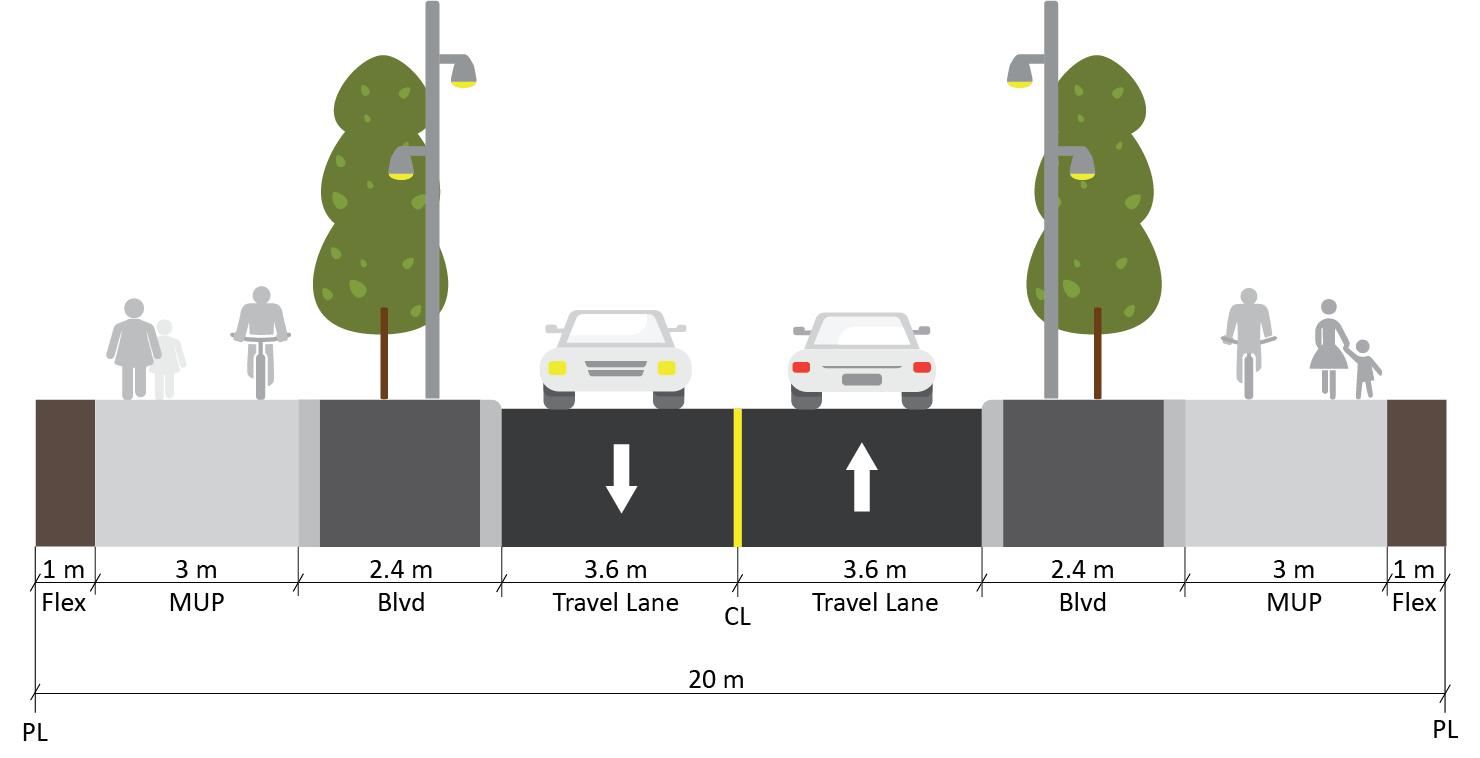
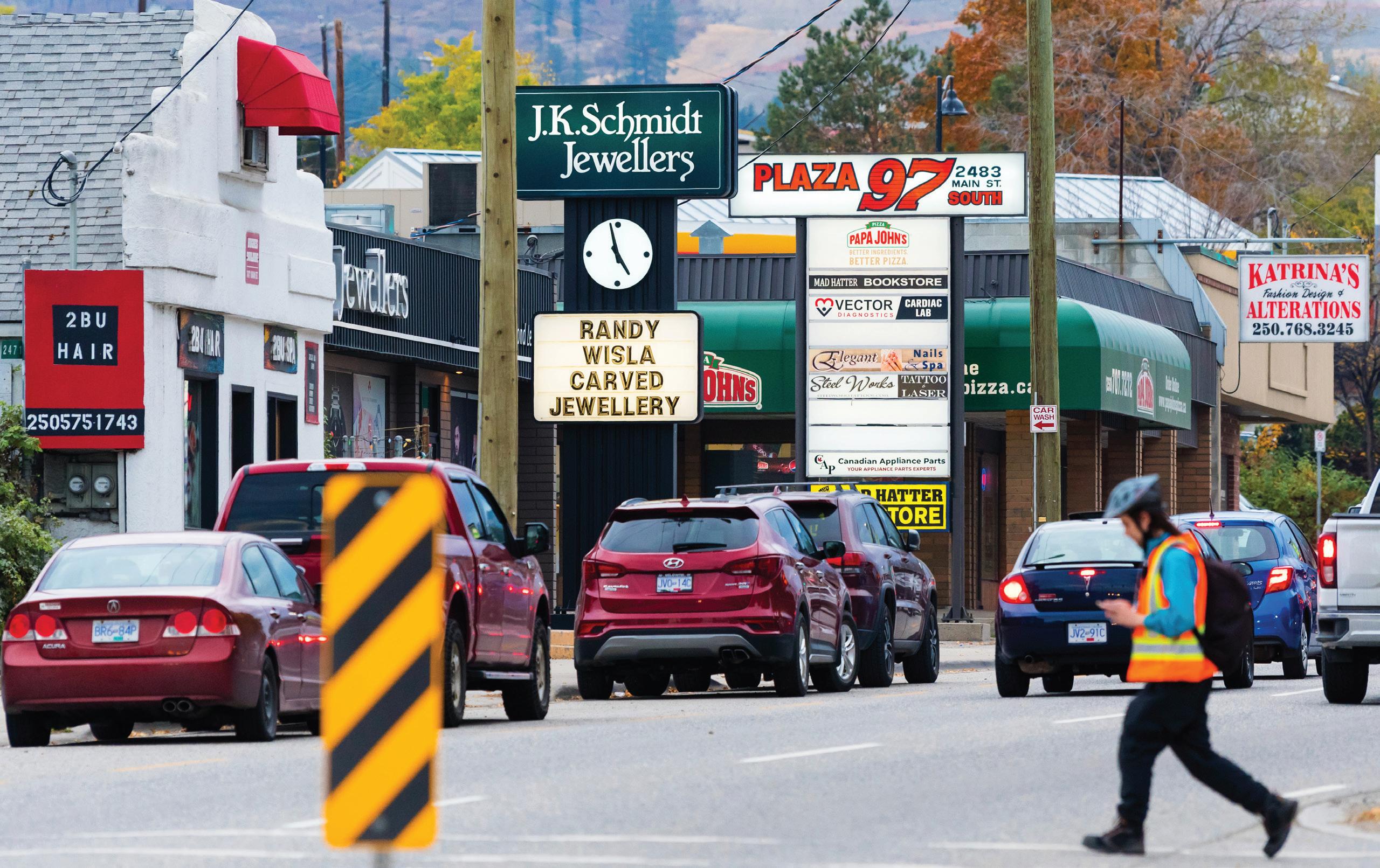
Figure 5: Cross Section Example — Wine Trail Arterial (20m ROW)
Table 4 summarizes key elements for each road classification, with illustrative cross sections shown in Appendix H. The following process is provided to support the selection of a preferred cross section for a specific roadway:
1. Determine whether the roadway is categorized as urban or rural, based on whether it is within or outside of the urban centres
2. Identify the roadway classification
3. Confirm the available right-of-way
4. Assess local context, including road cross section at either ends of the study area, and adjacent land uses to inform cross section selection
5. Determine the need for cycling infrastructure based on the future cycling network map, and the need for parking based on local context
6. Select/develop the preferred cross section
This process can be used to identify the preferred cross section based on the road classification and plans but also provides flexibility for compromises in location where sufficient ROW is not available, or where context sensitive solutions need to be made (such as to align with existing connective infrastructure).
If the cross-section requirements cannot be met due to a lack of right-of-way or non-alignment with nearby other segments of the roadway, then design exceptions can be explored. Alternatively, the desired cross-section can be built with the intent to obtain the necessary right-of-way in order to make adjacent road segments consistent at a future date (such as when redevelopment occurs).
It is important to note that the cross-sections are intended to be used as tools to guide the development of whole corridor designs. In many instances, it may be valuable to adjust / shift the elements to suit the local context (e.g., for safety, operational, or connectivity reasons) and alignment/compatibility to nearby road segments. The design guidelines offered by the BC MOTT or the Transportation Association of Canada can be used in lieu of city-specific specifications and standards.
It is also noted that components of the cross-sections can be shifted if needed to suit the context or preference for a given location. For example, either on-street or off-street (multi-use pathway) cycling facilities can be used, or typical landscaping or xeriscaping (landscaping which does not require irrigation) can be used for boulevards, depending on the location and context.
Urban Centre Network Studies — Project #36
The unique context and on-going redevelopment of the Westbank and Boucherie Urban Centres may require detailed network plans to identify the preferred cross sections for each individual roadway. This project has been identified as Project #36. For this project, the stepwise design process detailed above, as well as the listed cross-sections, would be used as a starting point, but the specific needs for each street would be reviewed and assessed, while also considering other factors (e.g., Highway 97 / Main Street redesign, or recent street upgrades). An area-wide plan would be developed to confirm the ultimate cross section of each street. This will enable the City to guide future development, and the build-out of the road network, through a systematic approach.
Table 4: Cross Section Summary
Urban Roads
Rural Roads
Note: Minor cross section details, such as 0.5-metre curb and gutters, are visualized in the cross sections but not explicitly labeled on the figures for simplicity.
IMPLEMENTATION & MONITORING 4
4.1 PRIORITIZATION
The projects have been prioritized based on their urgency of implementation by categorizing them into Immediate, Medium, and Long term. The prioritization was determined based on safety and operational improvement, city priorities, public feedback, and the level of network enhancement. This approach provides the City with flexibility in implementing the priorities based on projected funding sources in both the near-term and long-term, as discussed further in Section 4.5.
Table 5: Immediate Term Priorities (<5 Years)
Table 6: Medium Term Priorities (6-15 Years)
5 Ped / Road Shannon Lake Corridor Study Planning Required
20 Transit Opportunity for New Transit Service Connection Planning Required
28 Ped / Bike Glencoe Road
33 Ped / Bike Whitworth Road MUP Upgrades
34 Ped / Road School Zone Safety Review and Planning Study
35 Ped Gregory Road Sidewalk Extension
36 Ped / Bike / Road Urban Centre Network Studies
Planning Required
Planning Required
Planning Required
Planning Required
Planning Required
The breakdown of project costs over the three priority horizons is shown in Table 8, with approximately $20 million planned for the next 5 years, and around $160 million in investments planned after the next 5 years. It is noted that some of identified capital projects do not have planning level cost estimates, and thus their costs are not included in the table below.
Table 8: Project Costs by Priority Level
4.2 PROGRAMS
Programs can be used to structure the planning, design, prioritization, funding, and implementation of the recommended projects. The recommendations are listed below, and they will continue to be further developed and defined.
SIDEWALK CONNECTIVITY PROGRAM
Given the extent of sidewalk infill that is required, both in the Urban Centres and throughout the City, a sidewalk connectivity program is recommended. This program would be dedicated to maintaining a sidewalk inventory (preferably in GIS), prioritizing sidewalk improvements areas, in conjunction with the growth area planning and other considerations such as schools and coordinating with the implementation of other capital improvement projects to see if pedestrian infrastructure could be added on to other projects.
INTERSECTION AND CORRIDOR STUDY PROGRAM
A number of the projects that have been identified are for intersection and/or corridor studies. These studies would involve more detailed reviews of the design, operation, safety and condition of each location, and would then provide a detailed set of improvements that are required in each location. This program would organize, prioritize, and coordinate these studies. The recommendations from the studies could then be incorporated into the City’s transportation capital program.
TRANSIT SUPPORT PROGRAM
This program would focus on coordinating infrastructure development around the Westbank and Boucherie Mountain transit exchanges with the goal of growing transit ridership and liaising with BC Transit and the region to advocate for transit improvements. Additional goals of this program would be to build first and last mile connections around transit stations to encourage their use, and to develop the mobility hub concepts at these locations and integrate the planning of these concepts with ongoing planning in the Westbank and Boucherie Urban Centres. Improved transit service would be studied and planned for in development applications, so that residents could potentially utilize public transit to get to a new development.
SAFE ROUTES TO SCHOOL PROGRAM
This program would be to conduct a detailed review of the walking and cycling connections to all schools in the City, pick-up drop off operations, and parking. There are many safe routes to school guides12, and funding for this study may be available through the BC Active Transportation Network Planning, which provides up to 50% matching for planning studies of up to $50,000.
12 http://bchealthycommunities.ca/active-school-travel/ https://schooltravel.ca/school-travel-planning-toolkit/ https://www.calgary.ca/roads/safety/active-school-routes.html?redirect=/activeschools
4.3 PARTNERSHIPS AND COLLABORATION
Because of the shared ownership of the network within the City, the implementation of some of these projects will depend significantly on the initiatives of the City’s partners like BC MOTT, WFN, BC Transit, and other neighbouring municipalities, including Kelowna and Peachland. The City will work collaboratively with these partners to ensure that they are in the best interests of the community and that returns on
investments are optimized. The City will also identify new public and/or private partners and stakeholders to support and develop new initiatives that could be implemented through shared resources. Examples of initiatives could include coordinating on projects with shared benefits / jurisdiction and protecting future lands / corridors for future development and/or transportation connections.

4.4 MONITORING
Table 9 shows the proposed monitoring plan to regularly monitor Key Performance Indicators (KPI’s). The intent of this monitoring plan is to track the performance of the City’s transportation
systems and projects in this TMP by documenting the projects and their outcomes as they are implemented, where applicable, and using the findings for future planning exercises.
Key Performance Indicator
Key Corridors and Intersection Improvements
Highway 97 Performance
Mode Share
This will track
Which key corridors and intersections have been improved since the plan's conception?
How are the provincial initiatives planned to improve the overall safety and operational improvements?
How are the City initiatives encouraging modal shifts to more sustainable modes like Transit, Pedestrian and Bicycle for both commuting and recreational purposes?
Corridors in km, intersections in unit
Initiatives in unit
Reduction in Collisions
Public Satisfaction
Emergency access / egress
How are City improvement initiatives reducing safety incidents through the roadway network?
How are City improvement initiatives improving public satisfaction with their transportation network and alternatives?
How City improvement initiatives are providing residents with more than one access for emergency access/egress
Mode Share in % by calculating transit ridership and pedestrian and bicycle volumes or through census data, survey data, or interpolating both
Incidents at improvement areas in units and severity
Through transportation questions in existing online surveys
Reduction in the percentage of residents with less than one access to their community
Annual or during Project Data Collection
Table 9: Transportation System Performance Monitoring
4.5 FUNDING OPPORTUNITIES
Provincial and federal programs are available to support transportation projects. Below is a summary of some of the funding programs that are available and can be explored beyond The City’s municipal capital funding:
BC ACTIVE TRANSPORTATION
INFRASTRUCTURE GRANTS PROGRAM
13
Municipal and Indigenous governments are eligible to apply for a maximum of two active transportation infrastructure grants to complete walking or cycling projects. The provincial funds provide up to $500,000 per project in funding, and the portion of funding is determined based on the community size a type, with West Kelowna likely to receive a 50% match in funding due to its population. The fund can be used for pedestrian, cycling, rolling facilities, including end of trip, lighting and wayfinding facilities, but is not available for maintenance, beautification, or recreational sites.
DEVELOPMENT COST CHARGES
The City currently collects Development Cost Charges (DCCs) from the development application process, and these are intended to cover the impact of the proposed development and the additional infrastructure required to enable it. There may be opportunities to adjust the process with which these charges are applied and utilized. For example, instead of investing the contribution from a development in the immediate vicinity of each project, the same costs could be levied on the development, but the collected funds could be re-directed to a higher priority area or project of a similar type (such as sidewalk infill).
OTHER FUNDING SOURCES
The federal, provincial, and regional governments may also be potential sources of funding for certain improvements. While there are often no official funding programs and applications, once the approach to project prioritization and implementation has been confirmed, the City could reach out to government counterparts at all levels to investigate the potential for funding for these projects, especially if portions of some projects can harbour private funding commitments (e.g., developer contributions) or involve the other programs listed above. One example is the incorporation of projects near Highway 97, which could potentially be completed in tandem with planned highway upgrades being completed by the Ministry.

