



The Partnership was formed in 2015 as part of the nationwide Catchment Based Approach initiative and is jointly hosted by Westcountry Rivers Trust and South Devon National Landscape. Its activities cover the rivers, streams, lakes, estuaries and surrounding coasts of the Yealm, Erme, Avon, Salcombe-Kingsbridge, Dart and Teign catchments By working with communities and stakeholder groups, at local and catchment scales, the partnership aims to bring people together, for clean water and a healthy environment, for the benefit of everyone.
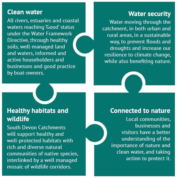

The primary driver for the Catchment Based Approach is the need for the UK to meet its water quality obligations under the Water Framework Directive It aims to promote collaborative working across sectors and decision making based on the best available data and evidence. In addition to water quality, the range of benefits derived from the river catchments including
• Drinking water
• Wildlife habitats
• Flood management
• Bio-security
• Recreation
• Culture & heritage
• Food production
• Health & well-being


There are diverse responsibilities, benefits and impacts associated with river catchments. Stakeholders are similarly diverse, and for effective collaboration between different groups, data and evidence are essential, not only for providing a basis for decision-making, but also in providing a shared vision and language. As such, data must be presented in a way that is both engaging and accessible.
This document is a ‘refresh’ of a report published by Westcountry Rivers Trust in 2015 It follows an approach developed via a stakeholder-led participatory process, in which stakeholders and technical specialists worked together to scrutinise data and evidence relating to environmental infrastructure and ecosystem service provision for an area of interest From this, they then developed conceptual models or ‘rules’ that can be used to identify the areas most likely to contribute to the provision of various ecosystem services. Fundamentally, this is a data visualisation and evidence exploration process that facilitates the development of a shared vision and language in a catchment group.
1. Identify and map the priority areas, drivers and receiving features affected by the relative provision (or absence) of each service This highlights where benefits are gained (or not) from a service, and where there may be reasons for its restoration and/or enhancement.
2. Identify and map the environmental infrastructure responsible for the provision and regulation of each service, and assess its current condition. This helps to identify the types of interventions that may be useful in a particular area and provides a basis for action or further exploration
3. Combine data in opportunity maps which aim to define areas of priority, suitability and/or opportunity for catchment management interventions.
4. Combine individual opportunity maps to identify areas with the potential to regulate the provision of multiple services. Catchment interventions in these areas may bring multiple benefits and provide targets for action and more detailed assessment
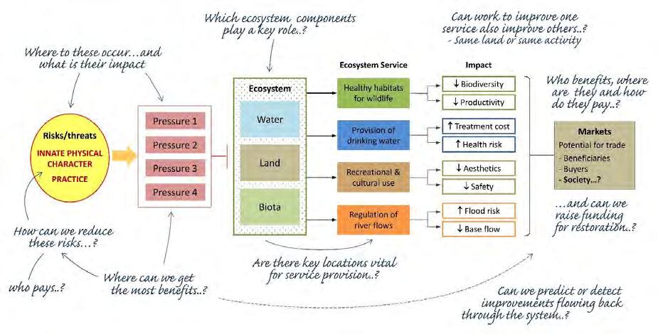
A diagram from the original report (2015), illustrating the ‘ecosystem services visualisation’ approach. Further information about the approach is described here

The South Devon catchments cover an area of around 1660 km2 (~640 mi2) and include the areas drained by the Yealm, Erme, Avon, Dart, Teign, and their tributaries and estuaries.
There are many other ecologically, socially and historically important sites in the catchment and a network of good quality river courses, with eight Special Areas of Conservation (SAC) and 79 Sites of Special Scientific Interest (SSSI).
Annual rainfall averages range from over 2000 mm on areas of Dartmoor to 1117 mm at the coast. The England and Wales average is 951 mm.
South Devon is an area with a varied landscape, including blanket bog, estuary and woodland, and incorporates the South Devon National Landscape and a substantial part of Dartmoor National Park
The main urban areas are Paignton, Torquay, Newton Abbot and Totnes.
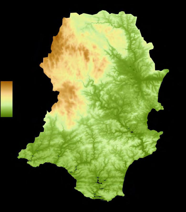
Digital terrain data is very useful for visualisation of landform, while detailed accurate data representing rivers, streams and other watercourses is also a vital component of any catchment mapping process.
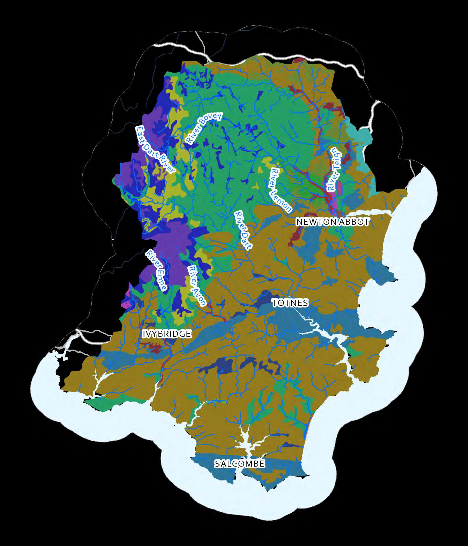
is the medium in which plants grow and is a vital habitat that supports a huge diversity of animal species and micro-organisms.
Fertile soil is critical for the production of food, timber and fibre, and it is therefore essential for our survival and economic prosperity Soils also influence the character our local landscapes and play a key role in the regulation of environmental services as nutrient cycling, water quality, water flow regulation and carbon storage.
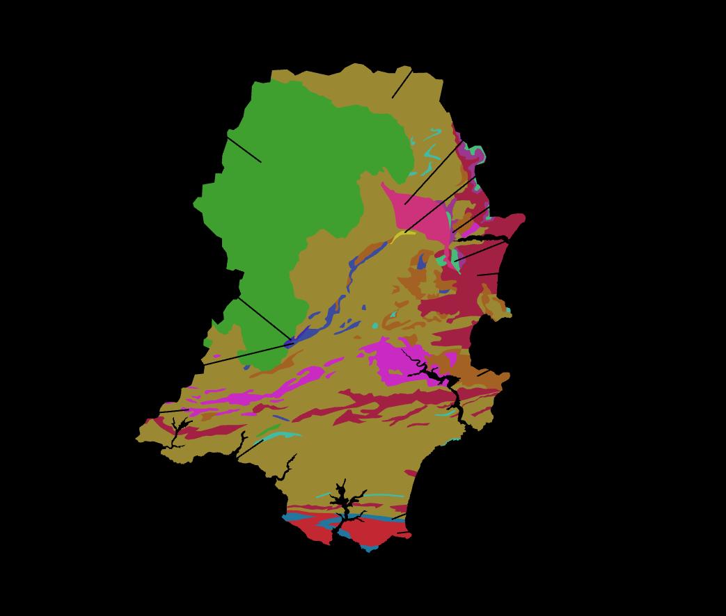
Geological maps are of potential use to a wide range of people with interests in planning and development, oil and gas (including shale gas) reserves, water and mineral resources (especially groundwater), waste disposal sites, utilities, transport, hazards and property insurance; as well as academic interests such as the Earth’s geological history, its fossils, and its landscape development.


Landcover is the physical material on the surface of the Earth, including artificial materials, such as roads and buildings in urban areas, but also natural and managed vegetated surfaces and inland water.
Information on landcover is useful in various contexts, including the management of natural resources, urban planning, carbon accounting and flood risk modelling This information also gives us an insight into how the land in a catchment is being (or has been) used and this can be a very useful indicator of ecosystem health/condition and its ability to provide different ecosystem services.
Landcover data can be obtained from a variety of sources, but its most important use is to give a broad overview of the catchment landscape character
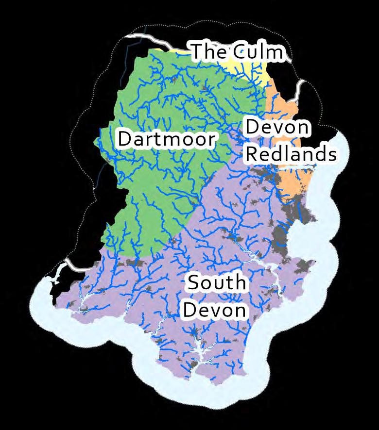
A National Character Area is defined as "areas that share similar landscape characteristics, and which follow natural lines in the landscape rather than administrative boundaries, making them a good decision-making framework for the natural environment " The Landscape Character Assessment (LCA) helps us to understand what components give English and Welsh landscapes their unique character
The agricultural activities undertaken in a catchment often define the character of the rural landscape and can have a significant impact on the environment and its ability to provide the services we need The results presented in the maps here are based on combinations of remote sensing and long-running annual agricultural surveys.
South Devon has a high proportion of agricultural land, with lowland arable and pastoral farmland including a range of crop types, as well as upland grazing land on Dartmoor.


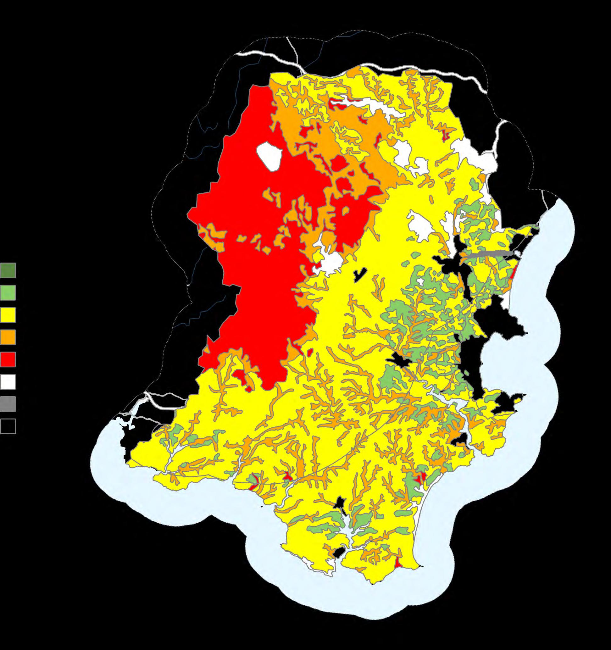
Agricultural land is graded by Natural England based including climate (temperature, rainfall, aspect, exposure, properties (gradient, micro-relief, flood risk) and texture, chemicals, stoniness) Grades range from one (lowest quality)
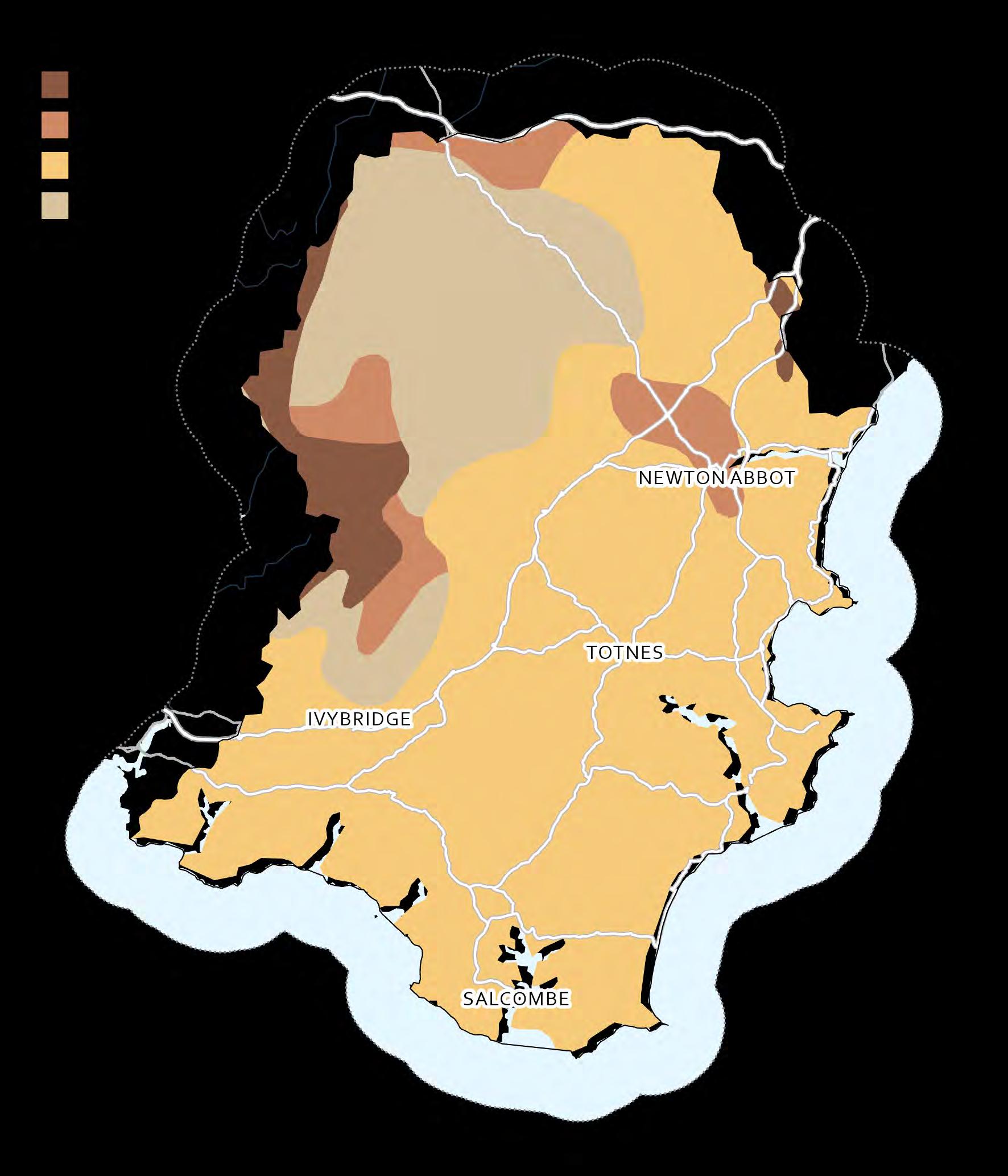
In South Devon, the highest quality farmland is mostly eastern areas of the region, whilst the lowest elevation areas of Dartmoor.


The Census 2021 statistics from the Office for National Statistics help paint a picture of the British population and how they live their lives.
Census data allow central and local government, health authorities and many other organisations to target their resources more effectively and to plan housing, education, health and transport services for years to come
The Index of Multiple Deprivation (IMD) 2019 provides a relative measure of deprivation at small area level across England. Areas are ranked from the least deprived (rank 32844) to most deprived (rank 1) across the country according to seven different dimensions of social deprivation (income, employment, health, education, housing, living environment and crime) and an overall composite measure of multiple deprivation. In South Devon, ranks range from 198 to 32466.




There are three principal locations where degradation of the water quality in our rivers and streams can result in the loss of ecosystem service provision and the subsequent deprivation of those who would normally benefit from this provision:
1) within the aquatic ecosystems themselves,
2) at downstream locations in the river system, and
3) where water is abstracted from rivers and reservoirs for provision as drinking water.
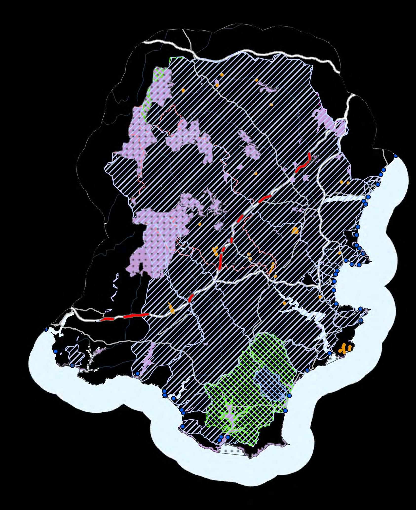
The distribution of some of these features across the catchment are shown on the map and listed in the table below. These features are critical in targeting the programme of work proposed in a catchment management plan (Licensed water abstraction and sewage discharge point locations are considered to be sensitive data and we have not published them here.)
Nitrate Vulnerable Zones (NVZs) An NVZ is designated areas at risk of agricultural nitrate pollution.
Source Protection Zones (SPZs) SPZs are defined as the area around a source within which all groundwater recharge is presumed to be discharged at the source.
Drinking Water safeguard zones (surface water)
These are non-statutory Safeguard Zones where action to address water contamination will be targeted to avoid the need to carry out additional water treatment by water companies. These Safeguard Zones are a joint initiative between the Environment Agency and water companies and are one of the main tools fordelivering the drinking water protection objectives of the Water Framework Directive.
Designated Bathing Waters A bathing wateris one where a large number of people (~100 people) are expected to bathe at any one time.
Special Areas of Conservation (SACs)
Sites of Special Scientific Interest (SSSIs)
Local Wildlife Sites
Typically obtained from Local Biological / Environmental Record Centre. Not included as not currently available.
Internationally important sites for conservation.
Nationally designated sites across the UK.
Non-statutory designated sites for wildlife.
Human population
Census 2021 free from the Office for National Statistics
Waste water treatment infrastructure (STWs) and industrial discharges
Resident and visitor population using the environment can be susceptible to the effects of poor water quality
Waterquality in a riverhas a direct bearing on the effluent volumes and concentrations that can be discharged from point sources of pollution.
Private water supplies These low volume abstractions (<20 m3/day), where treatment is often minimal, can be severely impacted by poor rawwaterquality.
Areas in the ‘riparian corridor’ are considered to pose an elevated risk to water quality because they have direct connectivity to the watercourse (no pathway present = no opportunity to disconnect mobilised pollutants)
The simplest way to identify areas in the riparian corridor and in close association with the rivers/watercourses is to create a buffer around a river dataset (the Environment Agency Detailed River Network was used here).
Detailed River Network (EA), VectorMap District Inland Water (OS Open Data) or OS MasterMap Water Network Layer can be used as the template for this analysis, but other river datasets can also be used
POSSIBLE UPGRADE: A good further analysis is to also identify agricultural fields with direct river frontage Fields can be selected using the MasterMap ‘general surface –natural’ polygons or the agricultural landuse polygons from Landcover Map 2007. Not included at this stage.
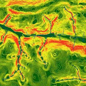
There are numerous sources of literature that cite slope as a critical risk factor that poses a threat to water quality
Slope is calculated from a Digital Elevation Model (this can be effective at any resolution of DEM, but data processing can become more challenging at finer resolutions)
50 m DEM (OS Terrain 50) freely available from OS Open Data, while finer resolution datasets are available for purchase from a variety of sources
POSSIBLE UPGRADE: There is some advantage to be gained by using zonal statistics function in GIS to calculate average slope on a field-by-field basis. This is technically quite difficult to achieve and cannot be done without some form of field boundary dataset Not included at this stage


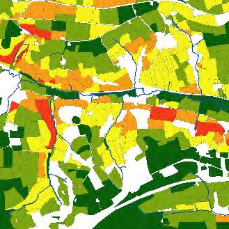
Soil typology/character is a key indicator of diffuse water pollution risk – some soils are particularly prone to run-off/erosion, while others represent a risk due to rapid leaching of pollutants in solution (Soil data from NSRI Cranfield – see map 3 )
Land areas that play important roles in regulating water quality can be identified by mapping key indicators of inherent water quality risk By documenting where these features occur and coincide, we can identify areas of land that play greater roles in the water quality regulation and where there is a correspondingly greater risk of water quality being degraded in the catchment. This then allows us to target these areas for protections or interventions that mitigate this threat.
* n.b. These individual criteria are not combined together at this stage – this synthesis is created later during the opportunity mapping process.
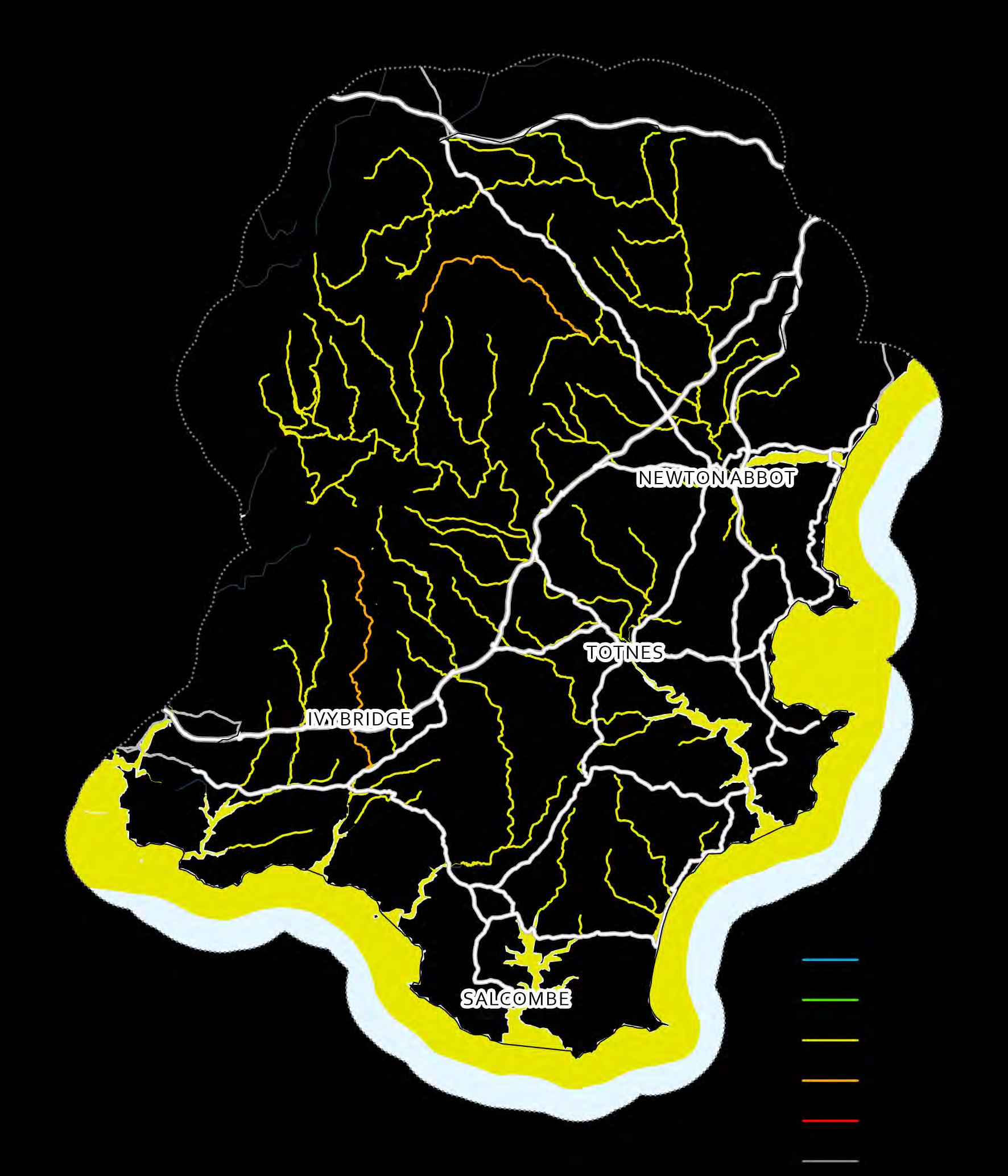
The principal set of evidence that we can use to assess the water quality in a catchment is the WFD classification of the waterbodies The different classes used represent different degrees of disturbance to the various indicators of ecological and chemical health being measured. For surface waters, such as rivers and lakes, the ‘overall status’ of a waterbody is comprised of an ecological and a chemical component.
Ecological status (see map 40) can be classed as Bad, Poor, Moderate, Good or High and is arrived at through assessment of a number of elements including aquatic invertebrates, fish populations, nutrients, oxygen levels, aquatic plants and specific pollutants (n.b. aquatic plant assessments are not available for South Devon). Chemical status can be Fail or Good and requires assessment of a range of Priority and Priority Hazardous substances Following the introduction of more stringent tests for the 2019 WFD assessment, every water body in South Devon (and England) has failed the tests for Polybrominated diphenyl ethers (PBDE) and mercury. Therefore all water bodies fail the Chemical status element and cannot achieve Overall Status of Good, even if they are classified as Good for ecological status.


Aquatic invertebrate assemblages are valuable for assessing the impacts of environmental stress Invertebrate samples collected using standardised methods are identified to the level of taxonomic family or species and their approximate abundance in the sample recorded. These data are then used to calculate biotic indices which are used to draw conclusions about the condition of the river and to make comparisons between sites on the same or different rivers.


Fish populations, especially of salmonid species, are widely accepted to be good biotic indicators of river ecosystem health The WFD assessment method for fish uses a non-parametric geo-statistical model called the Fisheries Classification Scheme 2 (FCS2) to predict the abundance of different fish species that should be found in a particular river based on a number of recorded environmental variables and the geographic location of the site.

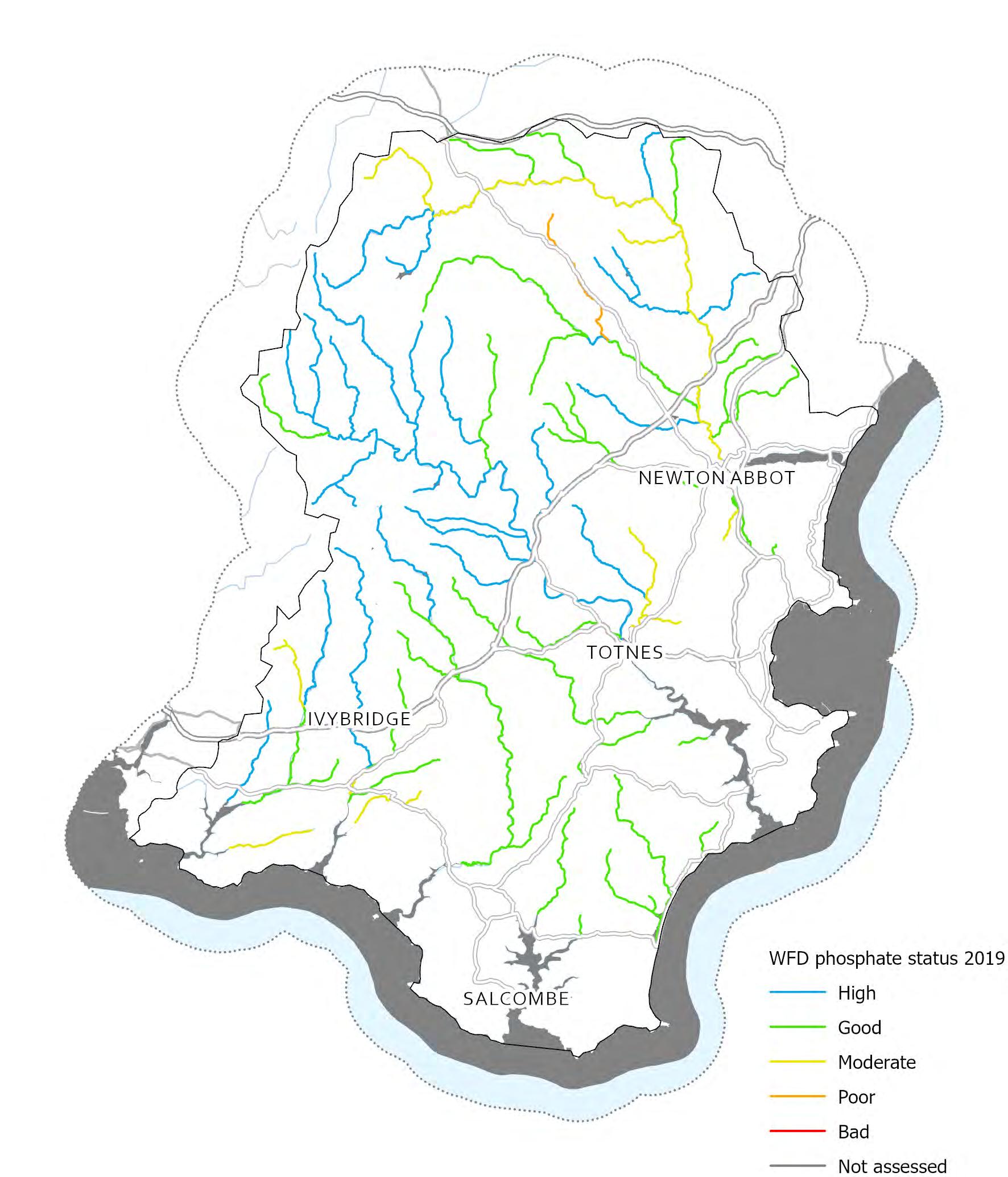
Compounds containing nitrogen and phosphorus (often termed nutrients) contribute to the ecological status of waterbodies and are natural and vital components of healthy aquatic ecosystems. They play a critical role in supporting the growth of aquatic plants and algae, which produce oxygen and provide habitats that support the growth and reproduction of other aquatic organisms.
Unfortunately, when nutrients accumulate in aquatic ecosystems they can drive uncontrolled and unbalanced growth of aquatic plants and algae in a process called eutrophication. This can cause severe problems for other aquatic organisms, the ecological health of the waterbody and for the humans who also depend on the water.
Communities of phytobenthic algae (known as diatoms) that live in a river are very sensitive to nutrient enrichment and are therefore good indicators of degraded ecological health
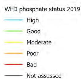
Note that “High” status indicates good water quality (i.e. lower phosphate).
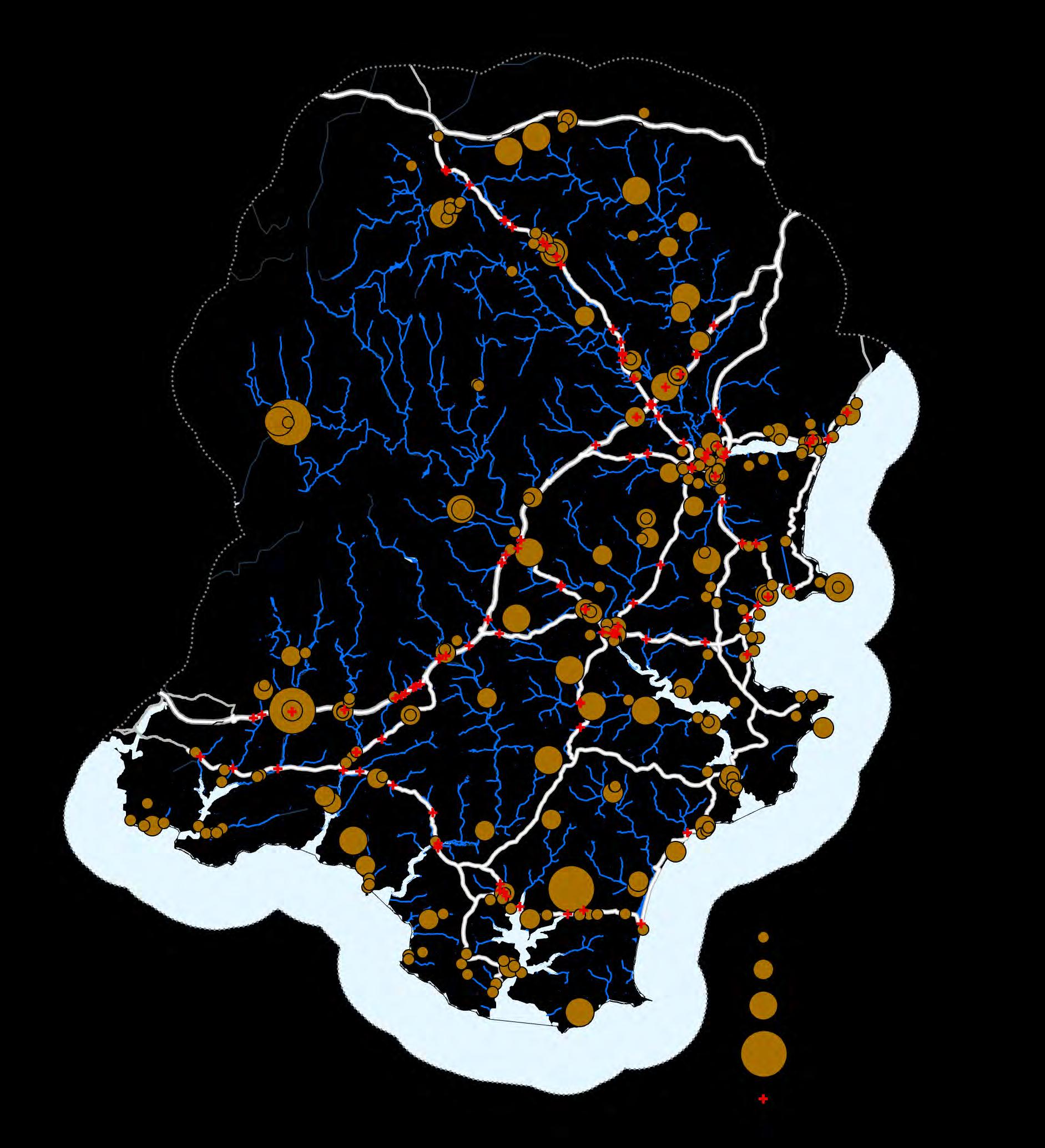
Given that the contamination in a catchment can be caused by a wide array of pollutants in different locations, and that these pollutants can each be derived from multiple sources, it is vital to explore the contribution that these sources of contamination make to the pollution load in different sections of the catchment.
There are a huge number of pollutants that can be derived from so-called point sources (outfalls, discharges, drains, mis-connections, etc ) and it is important to consider the location and contribution of these alongside examination of the different diffuse sources when making an assessment of the water quality problem in a catchment and designing a programme of interventions to correct it.
Environment Agency ‘Event Duration Monitoring’ datasets provide information on how often and for how long monitored storm overflows are discharged. The map shows how many occurrences the storm overflow was measured to discharge to the environment during 2023 (measured over 12 to 24 hours).


The sources of different pollutants occurring in a catchment can be estimated using data, water quality monitoring and modelling techniques
The Source Apportionment GIS (SAGIS) is one of these tools, which estimates the load, concentration and sources of nutrient pollution in waterbodies across an entire catchment area. Pollution sources are categorised by whether they are point (on-site waste water treatment or other) or diffuse sources (specifically livestock, arable or urban runoff), and the size of each circle relates to the total concentration of all pollutants
Across much of South Devon point source pollution appears to be a significant contributor to areas with greater total outputs (larger circles), though livestock farming is a substantial contributor in many areas too.
Priority areas for water quality protection and enhancement are defined as areas of increased risk or importance for water quality regulation. This includes accounting for landcover (see below), and how rapidly water may be transferred to rivers (proximity to river, slope, hydrological connectivity). The highest scoring areas are those where landcover has the greatest potential for interventions or changes in management that may benefit water quality, and where runoff may rapidly enter watercourses.
Land use is a key indicator of diffuse pollution risk as there are some practices / land uses which inherently pose more of a threat to water quality For example (notwithstanding that any land use can become a source of pollution if its condition deteriorates) arable, temporary grassland/rotational crops, permanent pasture and natural habitats have inherently reducing risk of generating pollution.
Map 20 created from cumulative scores
Proximity (<20 m) to river 0 or 10 Slope
10 or 20
Hydrological connectivity 0, 10 or 20
Arable / horticulture = 20
Improved grassland = 15
Landcover
Natural grassland = 10
Urban and other natural habitats = 5
Maximum score 70
Map 21 categories
Land use / landcover risk
Arable / horticulture = High
Improved grassland = Mid high
Natural grassland = Mid low
Urban and other natural habitats = Low
Soil condition assessment
Commercial product of NSRI (Cranfield University) or local soil surveyors. Not currently included.
Land drainage Dataset from the EU soils database. Not currently included.
Soil condition assessments are available from fine scale soil data, detailed local soil surveys or studies conducted using remote sensing techniques.
Areas likely to have land drainage. Remains un-proven – it may show where the risk is reduced for run-off, but not sure whether the impact on leaching has been considered.

The priority areas for water quality protection/enhancement are defined as areas of increased risk/importance for water quality regulation (as defined below) with additional information about land use and condition superimposed on the top The highest scoring opportunity areas for water quality enhancement are identified by superimposing additional information about activity or land condition onto the map of infrastructure that regulates water quality. (See previous page for further details.)
Land use is a key indicator of diffuse pollution risk as there are some practices / land uses which inherently pose more of a threat to water quality. However, any land use can become a source of pollution if its condition deteriorates.

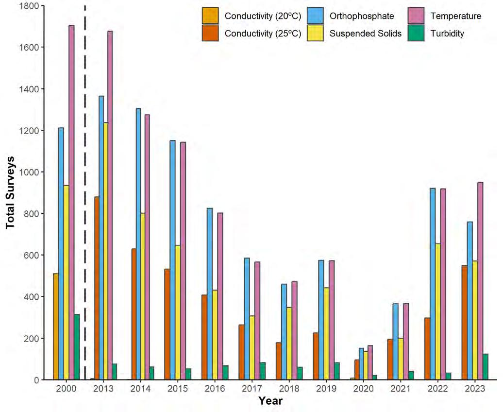
The data show a significant reduction in Environment Agency monitoring (by number of results) in South Devon from 2000 to 2020, followed by an increase after 2020. (Total max: 5240, Total min: 576). (See Map 24 overleaf for monitoring locations )
(2001 to 2012 not shown, as highlighted by the dashed line )
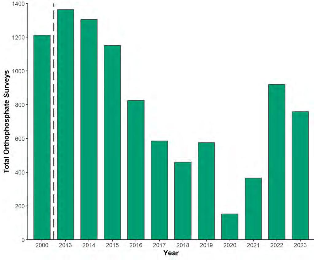
Orthophosphate (Ortho P) is a useful indicator of all the Environment Agency monitoring activities carried out In South Devon, the number of Ortho P tests carried out declined overall from 2000 to 2020 (2020 was interrupted due to COVID-19) but increased again after this. (Max: 1364, Min: 152).
(2001 to 2012 not shown, as highlighted by the dashed line.)
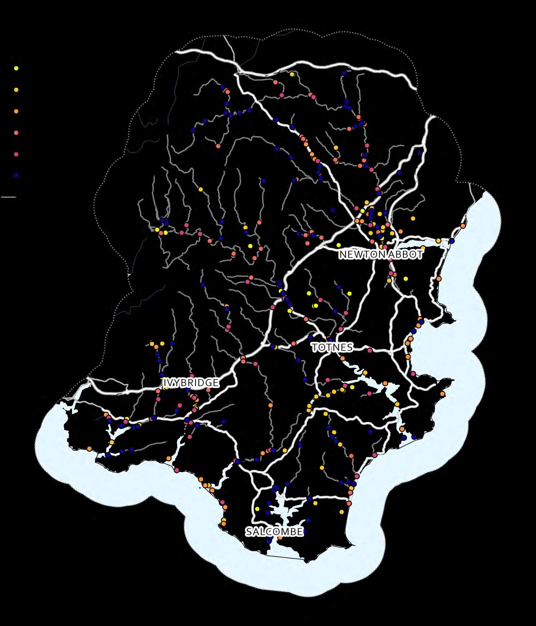
The map and data here show Environment Agency monitoring locations and numbers of samples for the key variables shown on the previous page (temperature, conductivity, turbidity, suspended solids and orthophosphate) Colours on the map indicate the year of most recent monitoring For example, a site last monitored in 2002 would appear yellow, whereas a site last monitored in 2022 would appear purple. However, this does not indicate the longevity of monitoring at any particular site.
Comparing South Devon with Devon and Cornwall more broadly, the proportion of orthophosphate tests during the same period is roughly equivalent at both scales They typically represent around 25-27 % of tests carried out (amongst the variables analysed here, see previous page).
Monitoring locations have not remained consistent. Some previously monitored locations are no longer represented (e.g. yellow and orange dots), and the overall numbers of locations and samples have generally decreased since 2000 However, this is not a linear trend, and both have also increased since 2021.



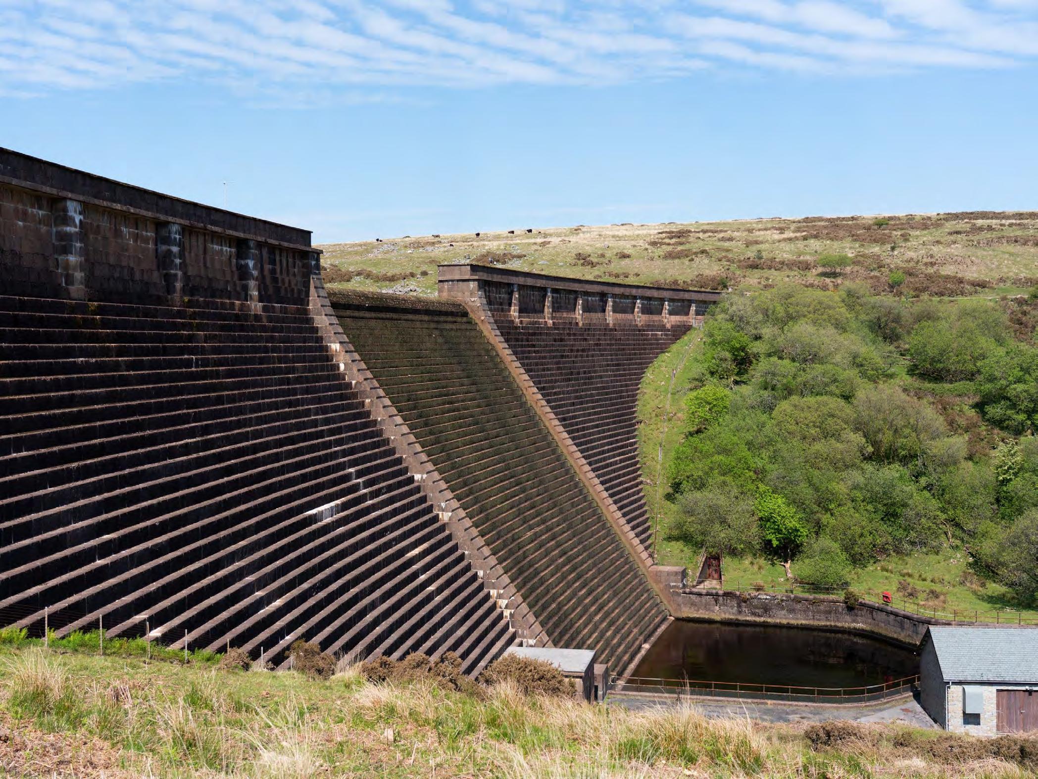


There are a number of locations in a catchment landscape where a reduced ability for an ecosystem to maintain base flows in rivers during periods of low rainfall will exert a negative impact.
Water quantity in a river has a direct bearing on the effluent volumes and concentrations that can be discharged from point sources of pollution Sufficient flows are required to ensure that effluent is diluted appropriately downstream.
Where abstraction intake licences exist for drinking water supply there is a clear need for baseflows to be maintained. Rivers also require sufficient flow during dry periods to remain in good ecological condition
Detailed information on water abstraction licences in England is not routinely published by The Environment Agency As a result, these data cannot be shown here. We have not mapped Sewage Treatment Works here for similar reasons.
Drinking Water safeguard zones (surface water)
EA dataset from Geostore https://environment.data.gov.uk/
These are non-statutory Safeguard Zones where action to address watercontamination will be targeted to avoid the need to carryout additional water treatment by water companies. These Safeguard Zones are a joint initiative between the Environment Agency and water companies and are one of the main tools for delivering the drinking water protection objectives of the Water Framework Directive.
Abstraction Locations Abstraction locations are held by the Environment Agency and cannot be published here.
Private water supplies
Should be recorded by Local Authorities, but not included as not currently available.
These low volume abstractions (<20 m3 per day), where treatment is often minimal, can be severely impacted by degraded rawwaterquality.

The principal land-based interventions that can delay the release of water from a catchment are (1) good management practices that maintain the healthy structure of soil, (2) the cessation of land drainage in areas with a propensity to accumulate water (i.e. that are naturally wet), and (3) the creation/restoration of upland and floodplain wetland habitats.
Wetland habitats, whether on upland peat-based soils or on the floodplain, have been shown by many studies to play a key role in the regulation of the hydrological cycle in river catchments and one of their principal actions is to act as water storage that releases water to rivers during periods of low rainfall and to contribute to the maintenance of base-flows.
Soil hydrology is a key factor when examining an area’s ability to hold water for longer and release it slowly to maintain base flows. Soils with a natural propensity to be water-logged are likely to play a greater role in regulating the flow of water through a landscape via surface waters, while free-draining soils (especially sandy soils) play a key role in transferring water into groundwater stores (see map right)


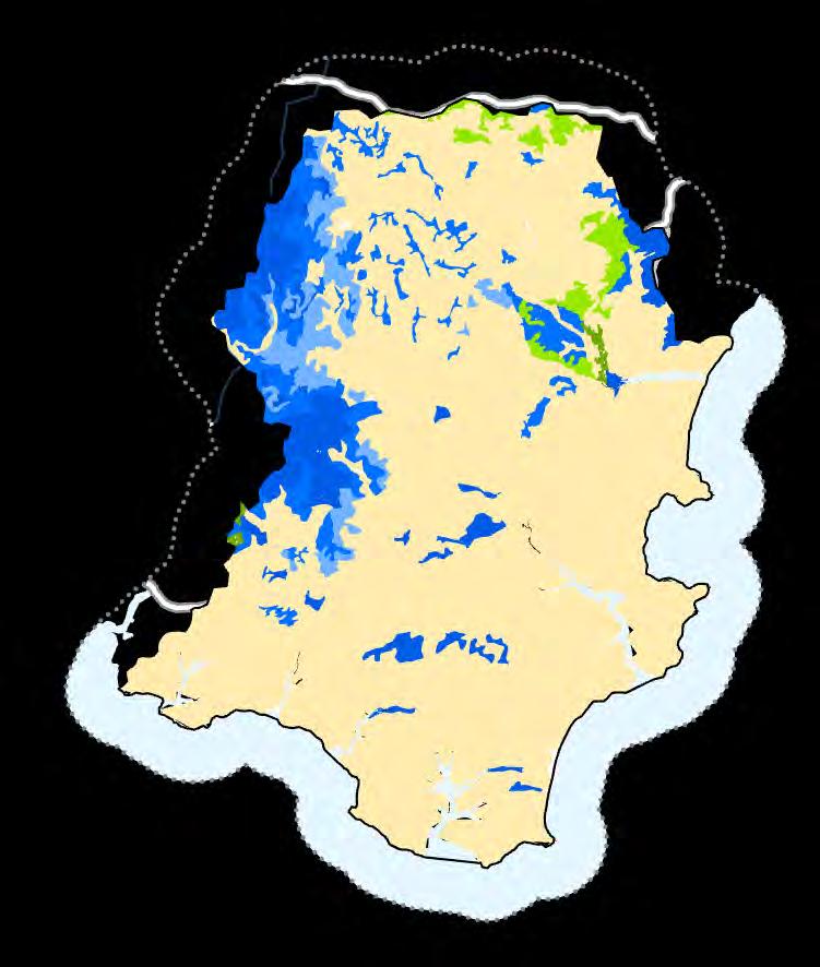
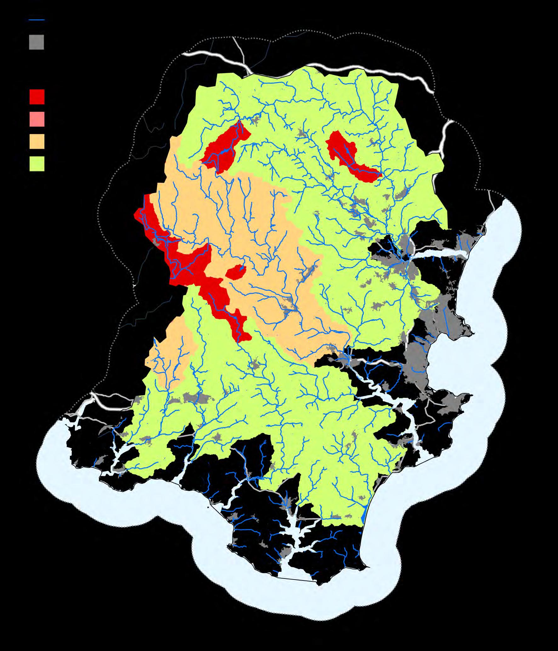
In order to assess the scale of any problems or deficiencies in ecosystem service provision from a catchment, we need to collate and assess all of the data and evidence linked to the assessment of water quantity for the maintenance of base flows When considering the provision of an ecosystem service, such as the regulation of water flow, it is important to consider the time at which the greatest demands are placed on the service and to look into the future to assess whether greater demands will be placed on the service in the future.
The Environment Agency is responsible for managing water resources in England and they use the catchment abstraction management strategy (CAMS) process and abstraction licensing strategies to do this They also identify where reduced flow may be causing rivers to be ecologically degraded through the WFD Classification and the
Reasons for Not Achieving Good Status..
CAMS and other water resources documents are available for download from EA website and local water company websites
Up-to-date information was not available for this
Hydrometry data can be obtained from the EA through a data request.
Not yet included
The Catchment Abstraction Management Strategies (CAMS) approach sets out how the EA will manage water resources within a catchment area. These plans are supplemented by a wide array of governmental and water company water resources management strategies and plans.
The EA Reasons for Not Achieving Good Status identifies the cause of less than Good classifications under WFD (activity, source, and sector). The cause is recorded using a defined set of pressures and reasons for not achieving good status. These data can be used to identify where low flow is causing ecological degradation.
In river flows are measured across a network of gauging stations. This data will require significant collation, preprocessing and analysis to get useful information out. Could alternatively get some of the very extensive CEH hydrological data, but this is commercial data.
Hydromorphological survey data collected as part of the River Habitat Survey (RHS) can be obtained from the EA through a data request. Other local organisations may also have this type of data.
Not yet included
There are a number of walkover survey methodologies (such as the WFD River Habitat Survey and the recently developed Rivers Trust Fluvial Audit) and biological sampling methods (such as the LIFE Invertebrate Index), which can be used to identify where lack of flow may be impacting the ecological health of a watercourse. These data may be challenging to obtain and is very difficult to analyse without assistance.
It is widely accepted that there are two main methods for the enhancement of water quantity regulation for drought alleviation (ie holding water in a catchment landscape for longer and releasing it more slowly after cessation of rainfall): 1) restore/maintain good soil condition everywhere, and 2) restore/create wetland habitats The former of these should be undertaken everywhere as a minimum requirement of good land management practice and every attempt should be made to identify soil in poor condition and restore its structure. Opportunities for the second can be identified using a wetland creation/restoration suitability mapping exercise similar to that adopted in the Wetland Vision and EA Habitat Creation Strategy Projects.
Soil hydrology is a key factor when examining an area’s ability to hold water for longer and release it slowly to maintain base flows Soils with a natural propensity to be water-logged are likely to play a greater role in regulating the flow of water through a landscape Here the NatMap Soils data available from Cranfield University were reclassified according to wetland creation suitability
Free to use Soil Hydrology dataset is free to download from the European Soil Portal (eusoils.jrc.ec.europa.eu). The EU Soils Database has a hydrology of soils layer as a 1km x 1km grid

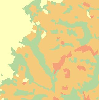
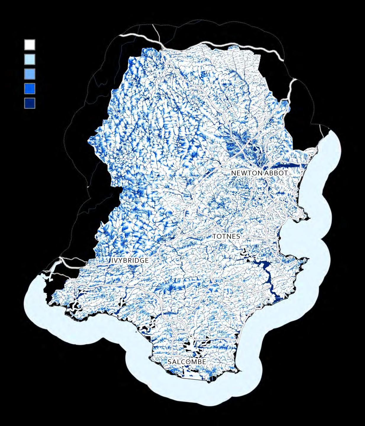
In some locations water has a greater propensity to run over the surface and collect due to the shape of the land and the accumulation of water over an upstream catchment area. These areas are of critical importance to the regulation of water flow as this is where moving water has the greatest chance of being slowed as it moves through the landscape
Surface Flow Index is modelled from topographic data using the Durham University Network Index tool in the open source SAGA 2.0 GIS package. Once calculated the ‘wettest’ 40 or 50% of the land surface can be identified as the most hydrologically connected
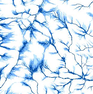
Map 29 created from cumulative scores
Floodzone 0 or 20
Hydrological connectivity 0, 10 or 20
Soil hydrology
Wetland restoration or creation is most successfully achieved on land with a high natural propensity to be seasonally or permanently wet or water‐logged either through groundwater efflux or surface water inundation.
In many strategic mapping approaches this land is primarily identified as being on the floodplain
EA Flood Zones are the best indicator of flood plain extent (although functional flood plain may be available from Local Authority through their Strategic Flood Management Plan – SFMP) Need to exclude Areas Benefiting from Flood Defences
EA dataset from https://environment.data.gov.uk/
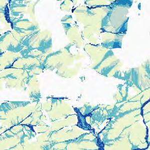
There are a number of factors that make it less likely that wetland creation would be appropriate or could be undertaken in a particular location These factors can be excluded from the opportunity identification process
Datasets include urban areas (OS Open Data), existing natural habitats (NE Priority habitats), existing designated sites (NE Designated Sites), important historical features (EH Scheduled Ancient Monuments), highly productive agricultural land (NE ALC) occurring on a particular site and Areas Benefitting from Defences (only used in map 31)
High wetland potential = 20
Medium wetland potential = 10
Low wetland potential = 5
No wetland potential = 0
Maximum score 60

Areas to consider excluding (grey, right)
There are a number of factors that make it less likely that wetland creation would be appropriate or could be undertaken in a particular location These factors may need to be excluded from the opportunity identification process
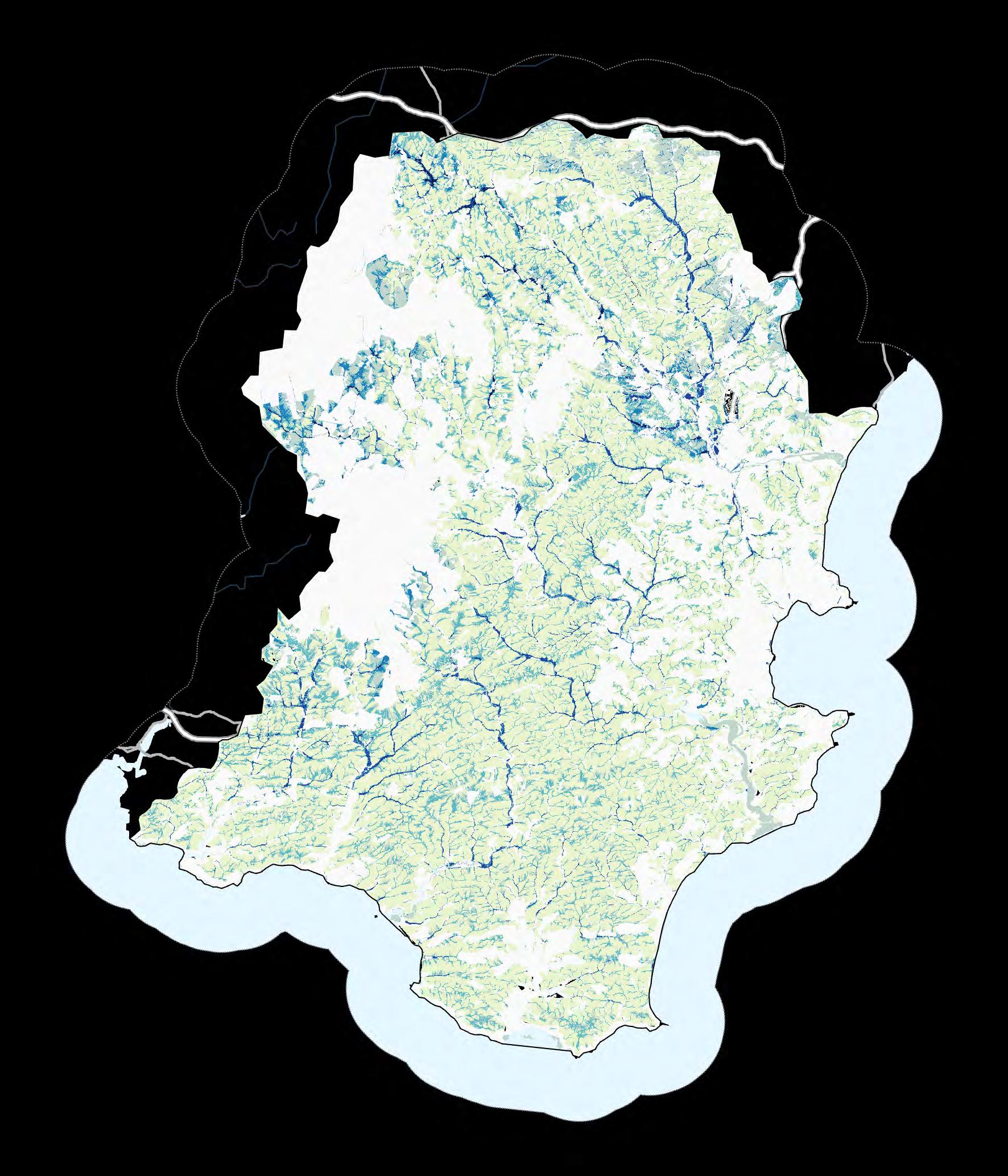
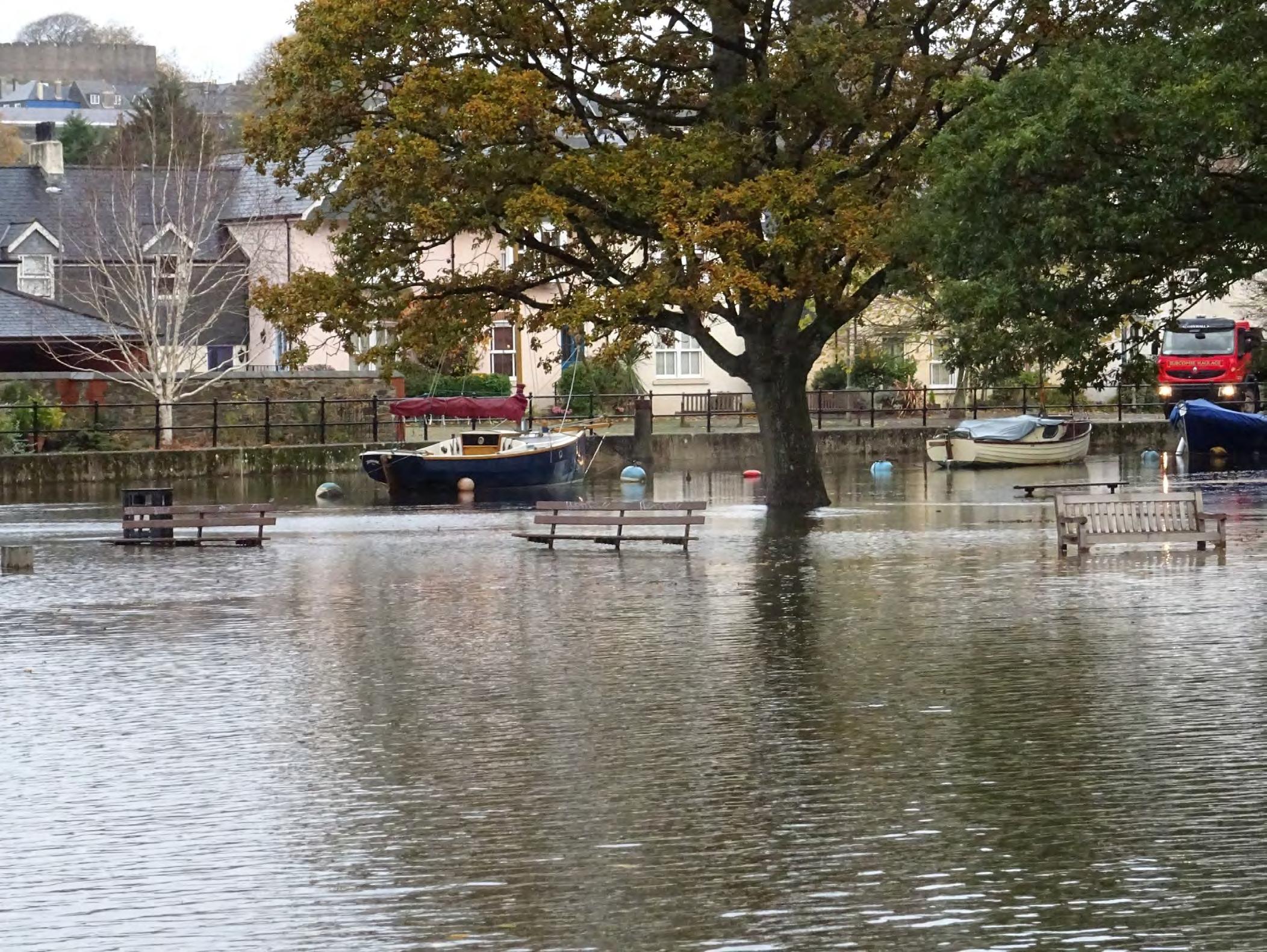


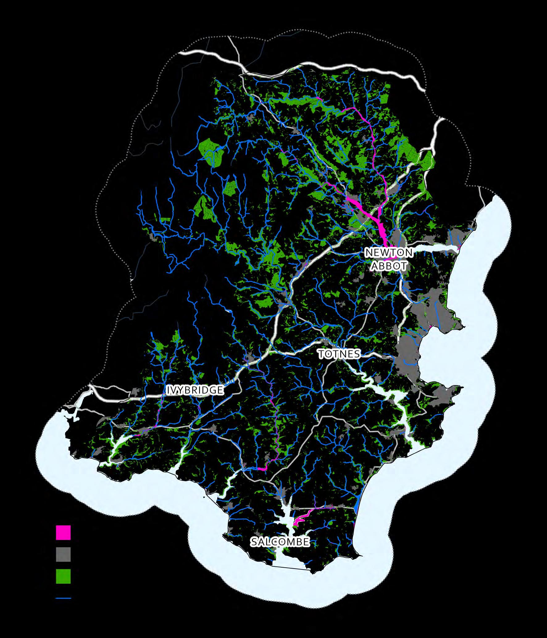
There are often many locations in a catchment where the unregulated release of water from the land and into our rivers can pose a threat to people living in the catchment and cause community disruption. In addition to residential properties there may also be locations where important buildings and other critical infrastructure are at risk of flooding
The properties and infrastructure at risk of being flooded can be mapped and cross-referenced against the Social Flood risk zones and the surface water flood risk areas to identify where there is a risk of flooding and damage to property or threatening human health and safety.
Hydrological Connectivity – see Map 13
There are some locations in the landscape where water has a greater propensity to run over the surface and collect due to the shape of the land and the accumulation of water over an upstream contributing area. These areas are of critical importance to the regulation of water flow as this is where moving water has the greatest chance of being slowed as it moves through the landscape.
Data / information Notes
Surface Flow Index – modified wetness
Digital elevation data is available from a variety of sources. 50m data is freely available from OS Open Data (Terrain50), while 5-10m data can be purchased from OS or Nextmap.
We can identify areas of high hydrological connectivity using the modified ‘wetness index’ used to create the Surface Flow Index/Network Index in the SCIMAP modelling framework. This can be run on DEM data at a variety of resolutions with varying effects in the outputs. This can be quite a technically difficult analysis, but will show areas with a propensity to accumulate water by surface or sub-surface flow.
A functioning flood plain will deliver natural peak flow attenuation, which acts to change the shape of the flood hydrograph (reducing the flood peak and increasing flood duration) due to a combination of storage capacity and increased resistance to over-land flow of water.
Data / information Notes
Flood Plain
Flood Zones are an EA dataset available from https://environment.data.gov.uk/
EA Flood Zones are the best indicator of flood plain extent (although functional flood plain may be available from Local Authority through their Strategic Flood Management Plan – SFMP). Need to exclude Areas Benefiting from Flood Defences (part of the Flood Map Package).
There is a large body of evidence that can be used to indicate whether high flows have caused a problem in a catchment and to therefore quantify the provision of this ecosystem service. Much of this information is captured in the Environment Agency’s Catchment flood management plans (CFMPs) which consider all types of inland flooding, from rivers, ground water, surface water and tidal flooding.
Historic flood map
Historic Flood Outlines are the maximum extent of all recorded individual Historic Flood Events from rivers, the sea and groundwater springs. The dataset shows areas of land that have previously been subject to flooding in England & Wales There is potential that areas not covered may have flooded in the past but either records do not exist, or they did not meet the Environment Agency criteria for inclusion.
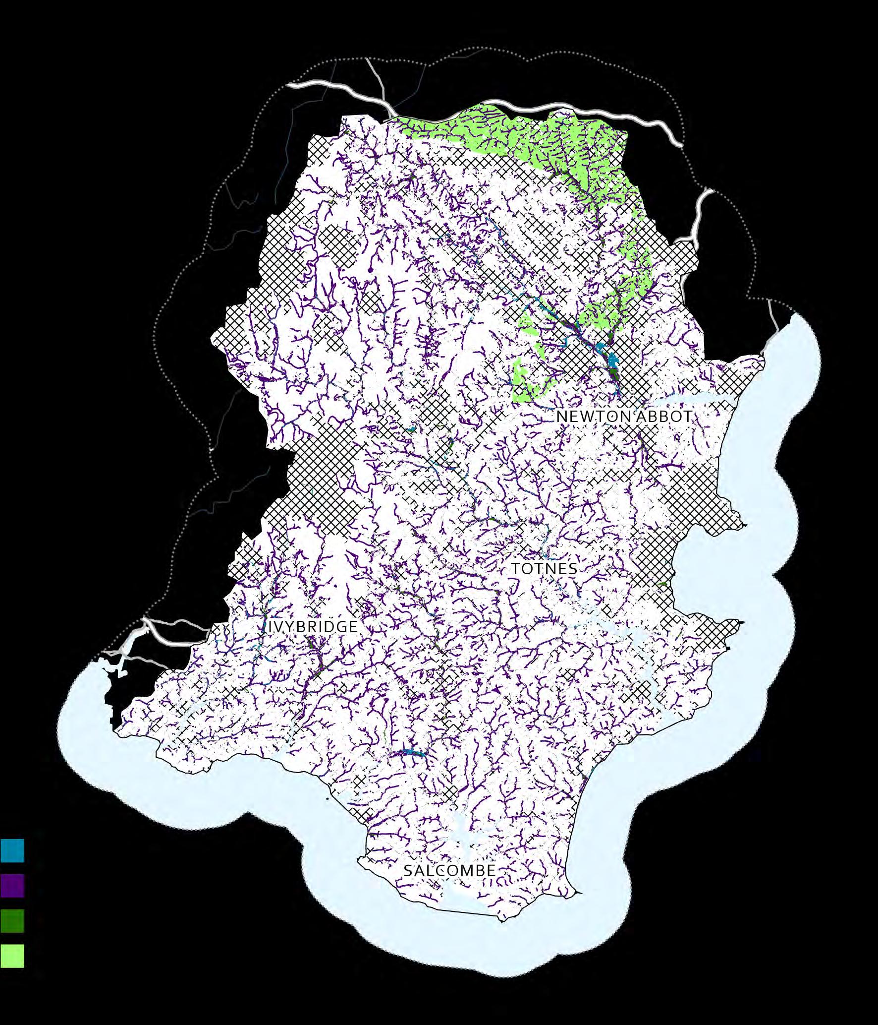
Working With Natural Processes (WWNP) is a form of flood risk management that can be implemented on existing natural features (i.e., hill slopes, rivers, flood plains and in coastal areas) and is another term for Natural Flood Management (NFM) In 2017 an evidence directory was published by the Environment Agency, this brought together the available evidence on WWNP and a series of open-access opportunity data were produced to identify areas with the potential to support specific WWNP actions (described below). The map shows the areas where these actions could be implemented. This map is focussed on the flood plain reconnection and tree planting. Runoff attenuation data are included, and are widespread across South Devon, but are small scale in comparison to the size of the catchment
Floodplain reconnection
Locations where it may be possible to establish reconnection between a watercourse and its natural floodplain, especially during high flows.
Riparian woodland
These are locations where tree planting may be possible on smaller floodplains close to flow pathways, and effective to attenuate flooding.
Floodplain woodland
These locations are estimates of where tree planting on the floodplain may be possible, and effective to attenuate flooding.
Locations where there are slowly permeable soils, where scrub and tree planting may be most effective to increase infiltration and hydrological losses
Runoff attenuation features
These include gully blocking and other features associated with slowing flows. Individually, these are too small to map at this scale, but collectively they cover approximately 32 km2 in South Devon
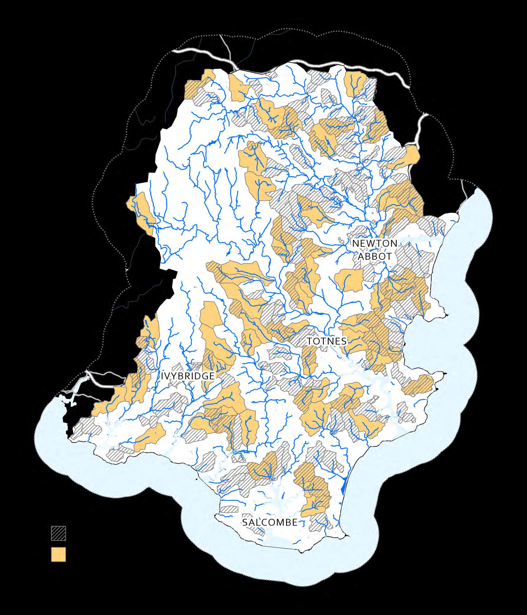
In light of the evidence that land-based interventions are likely to deliver the most costeffective and demonstrable flood risk benefit in smaller catchments, the flood risk management opportunity mapping process first identifies properties at risk of flooding with small upstream catchments (<5 km2 = max opportunity, 5-10 km2 = high opportunity) These small catchments are scored according to their size (following page)
The principle ‘soft-engineering’, land management or natural flood management (NFM) methods used to mitigate flood risk involve the prolonged storage of water on the land (in a pond or on the flood plain) either before it enters a watercourse or by removing it from the watercourse in specific locations and delaying its progress down through the river network
Most importantly, it has been extensively demonstrated that interventions of this nature can only be delivered at a level that achieves measurable attenuation of peak flows in small catchments below a certain size. Once a catchment exceeds this size the volume of accumulated flow reaches a point where it is not possible to store enough water to have a noticeable effect on the flood peak.
The areas of greatest opportunity for achieving demonstrable flood risk mitigation using NFM approaches were identified by combining the small upstream catchments of properties at risk with the areas with a propensity to be inundated, areas with high hydrological connectivity
The evidence indicates that landbased interventions are likely to deliver the most cost-effective and demonstrable flood risk benefit in smaller catchments and are therefore areas of greatest opportunity for implementing NFM approaches
Number of properties at risk
Properties at risk from flooding within these small catchments are also scored within this process. The catchments identified above with greater number of properties at risk receive a higher score


In some locations water has a greater propensity to run over the surface and collect due to the shape of the land and the accumulation of water over an upstream catchment area. These areas are of critical importance to the regulation of water flow as this is where moving water has the greatest chance of being slowed as it moves through the landscape
Surface Flow Index is modelled from topographic data using the Durham University Network Index tool in the open source SAGA 2.0 GIS package. Once calculated the ‘wettest’ 40 or 50% of the land surface can be identified as the most hydrologically connected.
Areas to consider excluding
The areas of greatest opportunity for achieving demonstrable flood risk mitigation using NFM approaches were identified by combining the small upstream catchments of properties at risk with the areas with a propensity to be inundated, areas with high hydrological connectivity and then removing areas with features that make it less likely that mitigation measures could be undertaken in a particular location
There are a number of factors that make it less likely that flood risk management would be appropriate or could be undertaken in a particular location These factors can be excluded from the opportunity identification process
Datasets include urban areas (OS Open Data), existing natural habitats (NE Priority habitats), existing designated sites (NE Designated Sites), important historical features (EH Scheduled Ancient Monuments), contaminated land (EA) or highly productive agricultural land (NE ALC) occurring on a particular site


There are a number of factors that make it less likely that flood risk management would be appropriate or could be undertaken in a particular location These factors can be excluded from the opportunity identification process Datasets include urban areas (OS Open Data), existing natural habitats (NE Priority habitats), existing designated sites (NE Designated Sites), important historical
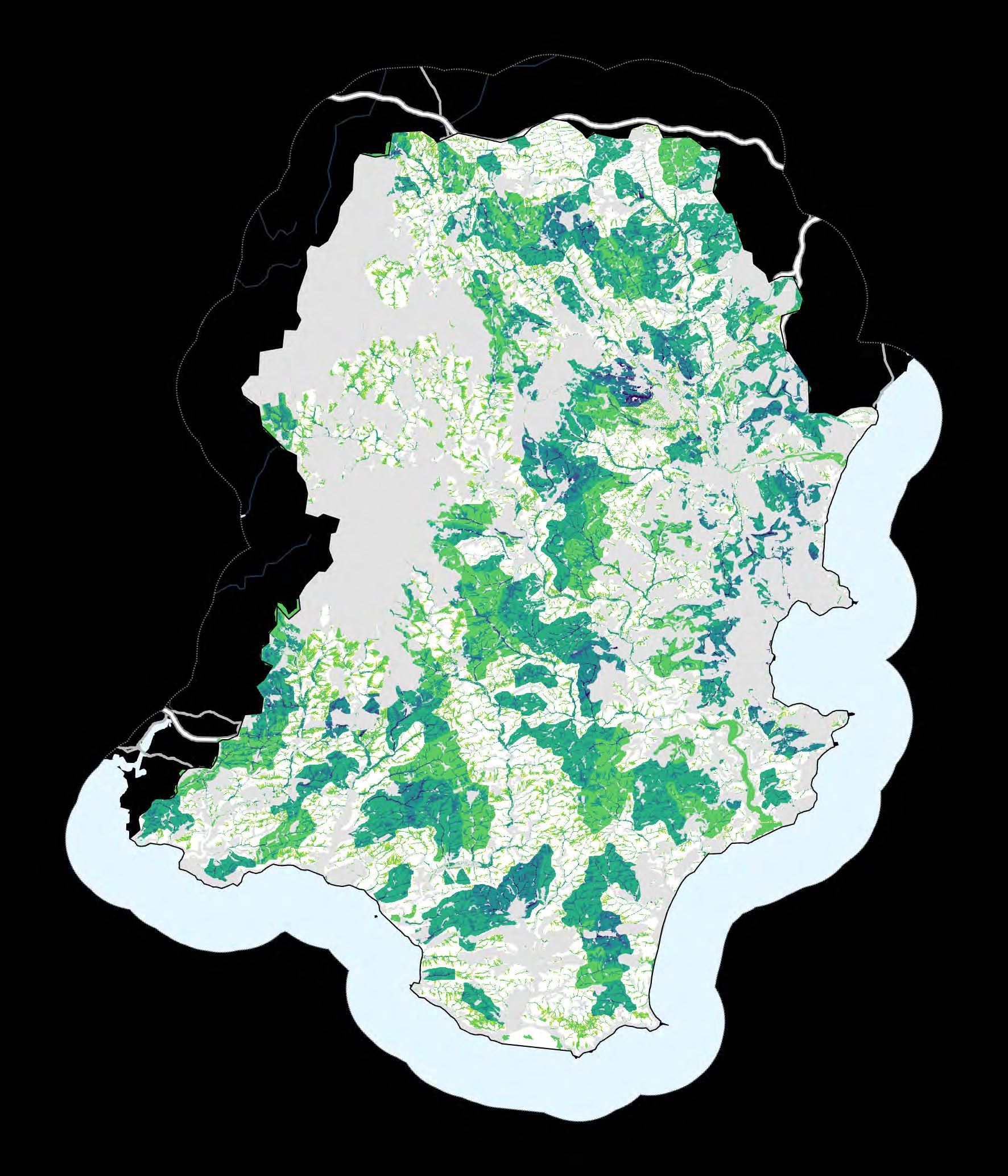


The conservation of wildlife and biodiversity in the UK has traditionally focused on three principal approaches: (1) the protection of important species and habitats through designation and protection of high quality habitats supporting priority species, (2) the creation and management of wildlife habitats on farmland through agri-environmental schemes (the so-called ‘pillar 2' of the EU’s Common Agricultural Policy, which is transitioning to Environmental Land Management Scheme (ELMS) post-Brexit , and (3) the protection or creation of natural spaces in urban areas (greenspaces) through local planning processes.
There are a number of statutory designations protecting England’s terrestrial and aquatic natural environment under local (Local Nature Reserves - LNRs), national (Sites of Special Scientific Interest - SSSIs, Ancient Woodlands, National Parks, National Landscapes, National Nature Reserves - NNR) and international law (Ramsar Wetlands, Special Protected Areas - SPAs, Special Areas of Conservation - SACs) These designated sites represent critical infrastructure in the conservation of biodiversity in the UK and should be prioritised for protection. It is possible for a site to have multiple designations.


SSSI condition is assessed as part of a six year cycle. These condition assessments are carried out on all the SSSIs in England and will continue to be carried out on a regular basis to help them monitor the health of these sites over the long-term. This map provides an indication of the habitats that would benefit from restoration, and those that should be maintained as they are already in favourable condition
The Centre of Ecology and Hydrology (CEH) have produced a model of expected plant indicator species for habitats in good condition. These are taken from the Common Standards Monitoring guidance for Sites of Special Scientific Interest and are used to assess the expected plant indicator species in an area. This dataset provides a measure between observed and potential species and is represented as a percentage in the map below


The species and biodiversity that occur in a catchment landscape are supported by the network of natural habitats and greenspaces that currently exist in the catchment landscape. Ecological theory suggests that the habitat patches must be of a particular extent and have sufficient connectivity between them in order for the landscape to have a functional ecological network and for the assemblage of species to be supported at the correct level.
Before any work is done it is vital that the habitat components of the landscape are mapped and that work is undertaken to protect and enhance them – there is no point working to add to the ecological network in a landscape if the current infrastructure in the landscape is being degraded or damaged at the same time
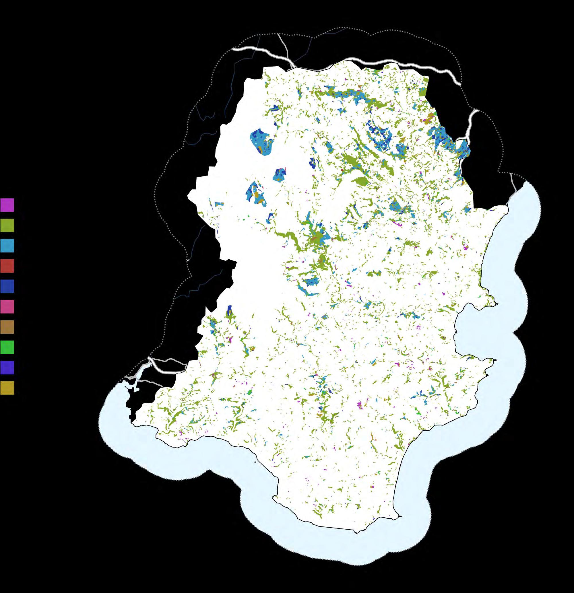
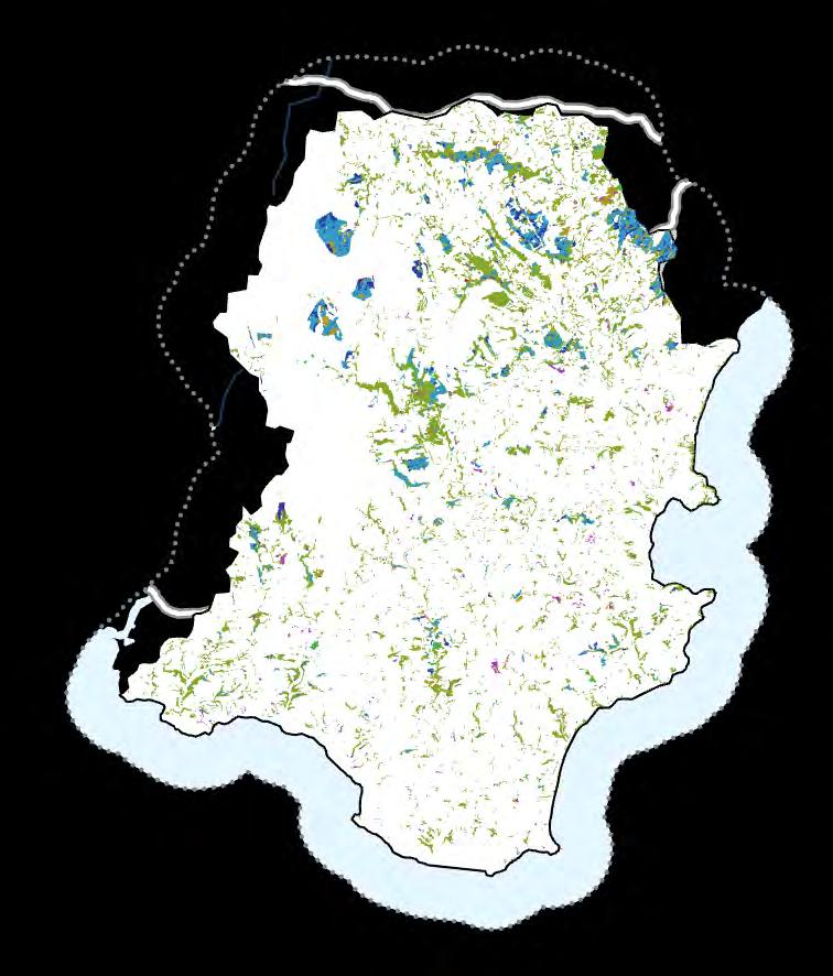
Priority Habitats are those which have been designated by Natural England to be of principal importance for the purpose of conserving biodiversity. There is a broad range of priority habitats in South Devon, including large areas of blanket bog on Dartmoor and maritime cliff habitats on the coast.
The National Forest Inventory (NFI) woodland map covers all forest and woodland areas over 05 ha (0005 km2) with a minimum of 20% canopy cover, or the potential to achieve it, and a minimum width of 20 m. This dataset gives an indication of different woodland types across a region. In South Devon, these are primarily broadleaved woodlands, often closely associated with river valleys. There are also some large conifer woodlands, which are often associated with commercial forestry.
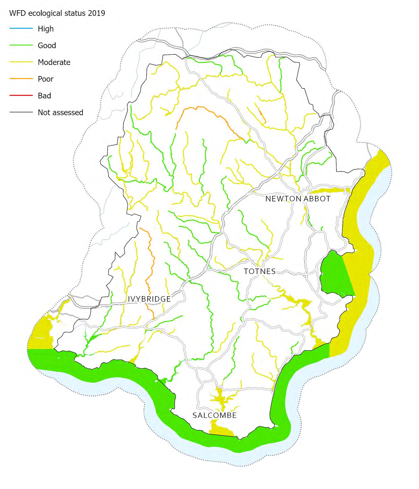
There are numerous data and evidence available for the assessment of ecological health, biological richness and wildlife across a catchment landscape. Designated sites are classified according to their condition and rivers and other aquatic ecosystems are assessed via a number of metrics, including WFD ecological assessments
In addition to these assessments there are also data on the long-term abundance of several key indicator species (mammals, farmland and woodland birds, breeding birds, plants etc), which can be used to indicate whether the biodiversity/wildlife in a landscape is declining or increasing Finally, there are number of analytical methods which can be used to determine whether habitats present represent a functional ecological network (e g Fragstats)
Assessing the provision of habitats for wildlife & biodiversity
Data / information Notes
WFD Ecological Status
EA dataset from https://environment.data.gov.uk/
Local Record Centre Species & Invasive Species data
Typically obtained from Local Biological/ Environmental Record Centre.
Not included
Indicator species data
Typically obtained from Local Biological/ Environmental Record Centre or other specialist recorders (e.g. BTO, RSPB, Mammal Society etc).
Not included
WFD classification assesses the biological quality (fish, benthic invertebrates, aquatic flora) of our aquatic ecosystems.
Local Environmental Record Centres hold the best quality species data, including data on invasive species.it is important to note that species records are not a true indication of species distribution and ecological health –they are just record of occurrence.
Long-term monitoring datasets exist for a number of species including woodland and agricultural birds – the BTO Breeding Bird Survey and the RSPB Garden Birdwatch are comprehensive and systematic in their sampling and could be used to indicate wildlife populations present.
Ecological Network Analysis FRAGSTATS is a spatial pattern analysis program for quantifying the structure (i.e., composition and configuration) of landscapes. The landscape subject to analysis is user-defined and can represent any spatial phenomenon. FRAGSTATS simply quantifies the spatial heterogeneity of the landscape as represented in either a categorical map (i.e., landscape mosaic) or continuous surface (i.e. landscape gradient).
Natural England have produced a series of priority habitat network and expansion maps. These maps include different zones (e.g. Network Enhancement Zones 1 and 2, Fragmentation Action Zone and Network Expansion Zone). The network maps were created to help land managers and stakeholder to identify locations for actions to improve the ecological resilience of existing habitats in line with the Lawton principles (more, bigger, better and joined) which have shaped the Government’s 25 Year Environmental Plan.
Habitat restoration-creation
These are locations where habitat creation or restoration is known to occur, this is primarily sites under relevant agri-environment options.
Fragmentation action zone
Land immediately adjoining existing habitat patches that are small or have excessive edge to area ratio where habitat creation is likely to help reduce the effects of habitat fragmentation
Network enhancement zone 1
Land connecting existing patches of primary and associated habitats which is likely to be suitable for creation of the primary habitat
Network enhancement zone 2
Land within close proximity to the existing habitat components that are unlikely to be suitable for habitat re-creation but where other types of habitat may be created or land management may be enhanced including delivery of suitable Green Infrastructure
Network expansion zone
Land within relatively close proximity to the Network Enhancement Zones 1 & 2 that are more likely to be suitable for habitat creation for the particular habitat and identifying possible locations for connecting and linking up networks across a landscape


In order to identify areas of land where there is the greatest opportunity for the restoration or creation of natural habitats to achieve an enhancement of the ecological network in the catchment we can combine a series of criteria that each indicate some level of suitability or opportunity One of the key criteria included in this process to create an opportunity map is the wetland suitability map created previously (map 23), which is combined with a number of other criteria (see below). It is important to remember that these opportunity areas for enhancement of the ecological network are to be targeted over and above efforts to protect and improve the condition of the existing habitat in the landscape.
The greatest opportunity for analyses of this type are for targeting wetland restoration or creation because this is most successfully achieved on land with a high natural propensity to be seasonally or permanently wet or water‐logged either through groundwater efflux or surface water inundation
The method for targeting wetland habitat creation or restoration previously described in the baseflow enhancement section (based on floodplain location, propensity for wetness or water‐logging due to hydrology and/or the characteristics of its soil) can be applied in this section

The Natural England Habitat Network identifies areas in the landscape where a relatively low level of intervention could potentially, by elevating the provision above a threshold level, yield disproportionately higher ecological benefits than would be realised in other areas It is generally accepted that ‘biodiversity opportunity areas’ of this type, however identified, should receive particular focus in the strategic targeting of measures as they do represent areas where greater improvements may be achievable
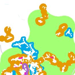

It is widely accepted that, while the creation of any natural habitat in isolation is likely to have some ecological benefit, the extension of pre‐existing habitats is likely to be far more beneficial for the enhancement of an ecological network at a landscape scale (the so‐called ‘big is best’ approach to conservation)
A 100m buffer on existing woodland and other natural habitats, but excluding existing natural habitats, urban areas and critical infrastructure. This can be restricted to agricultural land as this is the main opportunity area
Ancient Woodland was given higher weighting in this analysis

There are a number of factors which make it less likely that the creation or restoration of habitats would be appropriate or could be undertaken in a particular location These factors, which can be excluded from the opportunity identification process, include the presence of development, existing natural habitats, existing designated sites, important historical features, contaminated land or highly productive agricultural land occurring on a particular site

Areas to consider excluding (grey, right)
There are a number of factors which make it less likely that the creation or restoration of habitats would be appropriate or could be undertaken in a particular location These factors can be excluded from the opportunity identification process
Datasets include urban areas (OS Open Data), existing natural habitats (NE Priority habitats), existing designated sites (NE Designated Sites), important historical features (EH Scheduled Ancient Monuments) and highly productive agricultural land (NE ALC)
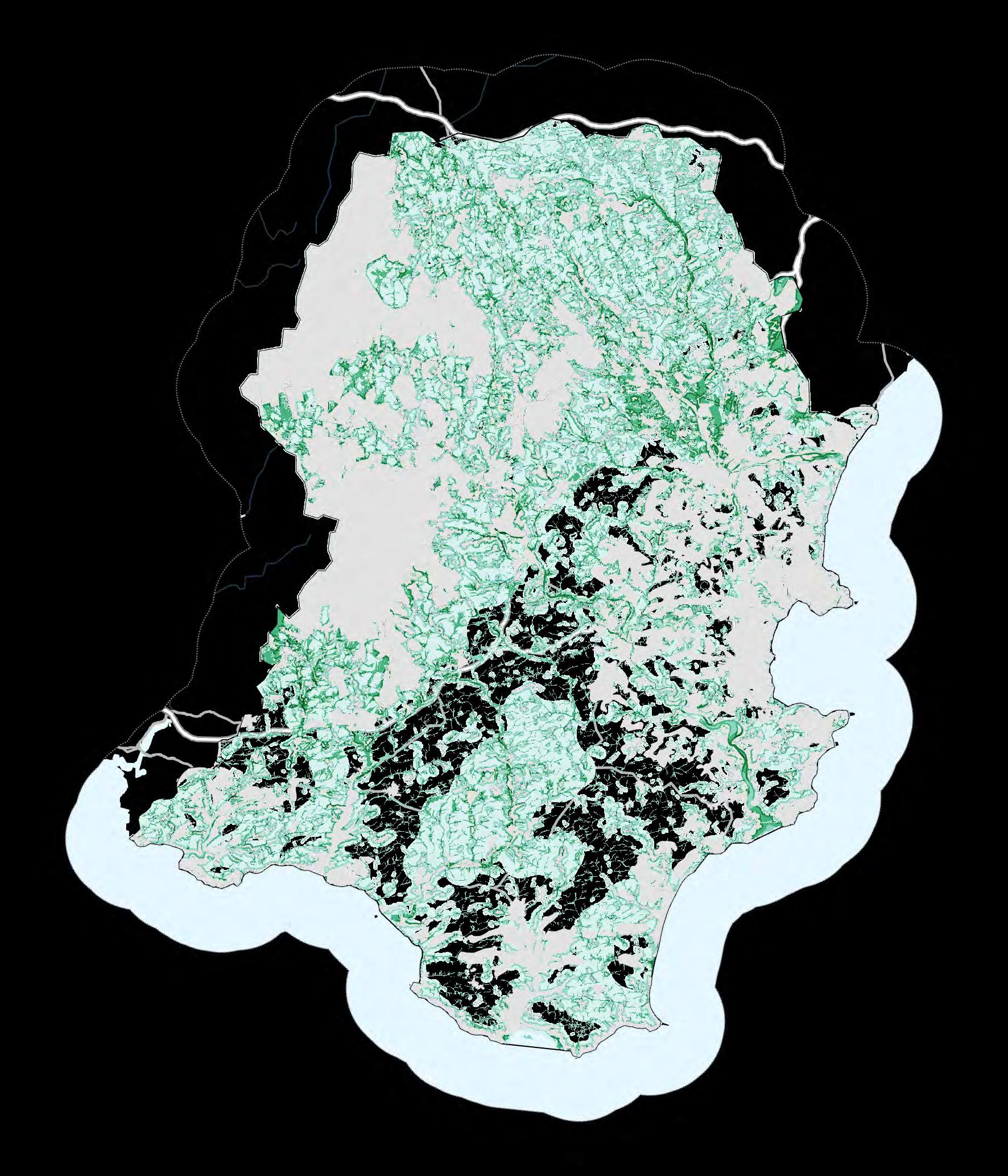


There are no statutory areas for targeting the benefits of carbon sequestration or greenhouse gas regulation, although the emissions from farmland and farming activities do receive a great deal of attention due to the potential for carbon to be sequestered in farmland soils
There is also significant focus on the major carbon stores (peatland and woodlands) and the drive to ensure that they continue to hold the carbon that contain and do not become carbon emitting sources of greenhouse gases. Everyone is a beneficiary of carbon sequestration and storage as it plays a key role in the regulation of the climate.
It is vital initially that we undertake a broad assessment of where greenhouse gases / carbon are currently sequestered in our catchment landscape These areas must be restored and/or protected to ensure that they do not become degraded and that their reserves of carbon/GHGs are not emitted into the atmosphere.
Soil is a key feature when assessing the current stocks of carbon sequestered in the landscape. Some soils (e.g. peaty soils) contain very high levels of organic material while others (e g sandy soils) have very little

that form a woodland current carbon stores
size.)
(39)
We have developed a series of simple rules (based on the latest research into carbon sequestration) that allow us to identify areas of land where there is the greatest opportunity for reduced greenhouse gas (carbon) emissions or increased carbon sequestration
These criteria also include areas where the required interventions are most feasible/not feasible for cost-benefit or practical reasons – farmers particularly relate to the concept of Agricultural Land Grade as a way of identifying areas of land which are difficult to farm due to steep slopes, poor soils or water-logging.
Soil sequestration capacity
Some soils have a higher natural capacity to sequester carbon than others While any soil can sequester carbon, clay-based soils have a greater capacity to lock up organic material, while lighter sandy or loamy soils have lower capacity for increased sequestration
Soils will reach maximum capacity for sequestration and a healthy peat-based soil may have limited potential for further sequestration as it is at its maximum capacity Clay soils have the highest capacity to sequester carbon, while peat is already close to saturation and cannot hold large amounts of additional carbon.

Agricultural Land Grade is designed to indicate areas of high and low productivity farmland
Many farmers have indicated that carbon sequestration rewards may be insufficient on land where productivity is high and recommend that measures to enhance sequestration should be undertaken only on ‘low grade land’
Agricultural Land Classification is free from Natural England GIS websitewww naturalengland org uk/publications/data

Map 45 created from cumulative scores
Coarse = 0
Soil texture
Medium = 10
Fine = 20
Arable / horticulture = 30
Improved grassland = 20
Landcover

Landcover and potential for change
Changing land management/farming practices have been shown to achieve small, often transient, step-change improvements in greenhouse gas emissions and/or sequestration, but significant step-change improvements are only achieved through permanent landuse change along an arable > rotational cropping > temporary grassland > permanent pasture > woodland > wetland continuum. Tilled land has little sequestered carbon and carbon sequestration begins after around five years following cessation of tillage and continuing for 20-30 years depending on the soil type

Re-wetting potential (hydrological connectivity)
The other intervention that can produce a step-change increase in carbon sequestration is extensification accompanied by re-wetting of land by manipulating the water-table (e g through blocking land drains). We can identify areas of high suitability for wetland creation (based on soil hydrology and hydrological connectivity) and this model can also be used to identify these areas of potential for carbon sequestration as well
Surface Flow Index is modelled from topographic data. Once calculated the ‘wettest’ 40 or 50% of the land surface can be identified as the most hydrologically connected
Existing land drainage systems can also be taken into account here
Natural grassland = 10
Urban and other natural habitats = 0
Re-wetting potential 0, 10 or 20
Land drainage (EU soils)
Agricultural land class (ALC)
No water management system = 0
A water management system exists to alleviate / waterlogging (drainage) = 10
Grade 1 / 2 = -10
Grade 3 / Urban / Exclusion / Non-
agricultural = 0
Grade 4 /5 = 10
Maximum score 90

Areas to consider excluding (grey, right)
There are a number of factors which make it less likely that carbon sequestration initiatives would be appropriate or could be undertaken in a particular location These factors can be excluded from the opportunity identification process


Other point attractions not mapped
Car parks
Accommodation locations
Heritage/historical interest attractions
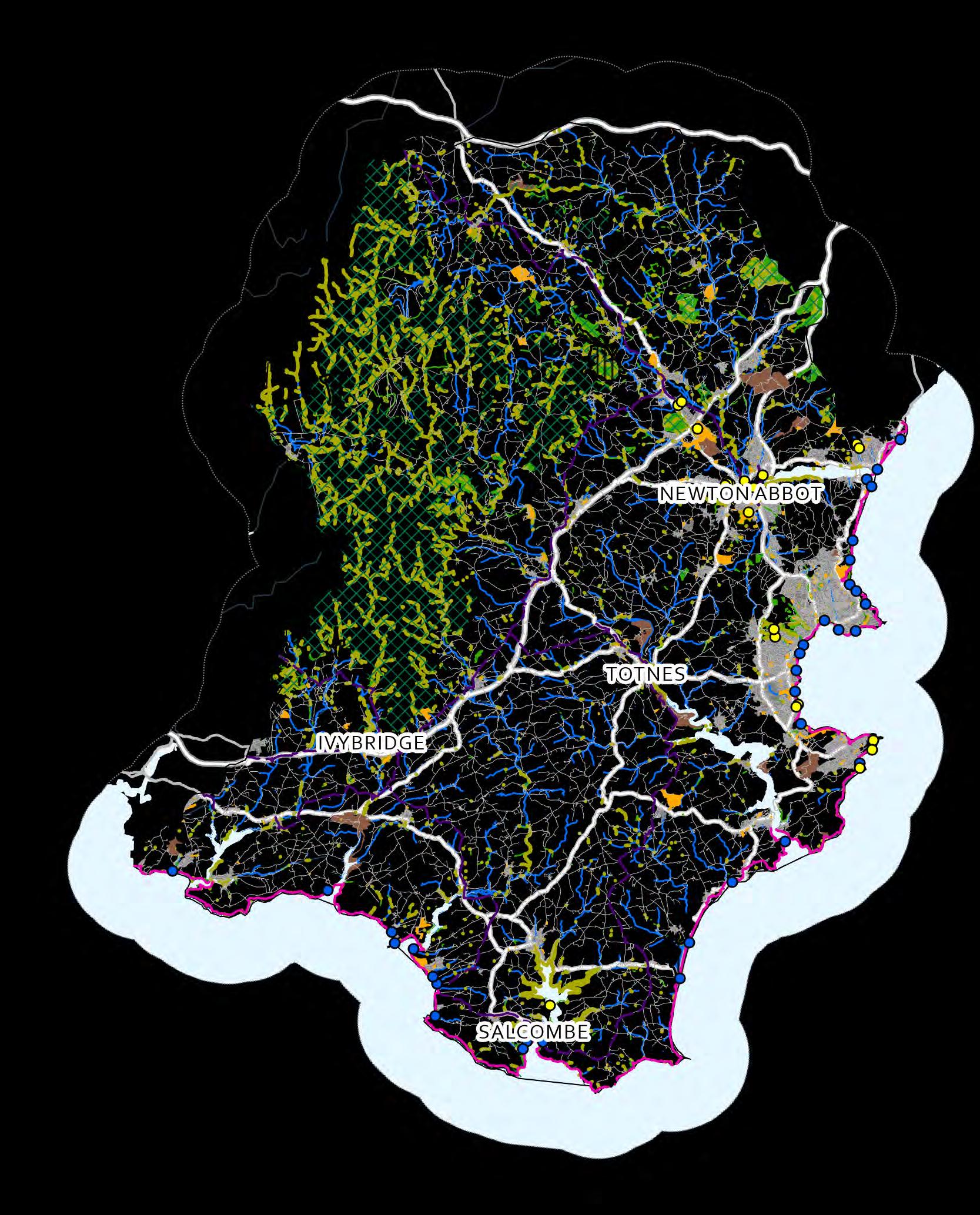
The biggest challenge in assessing the provision of resources and accessible land for recreation and cultural activities is mapping the current provision of those opportunities across the landscape catchment and to examine the way that these opportunities were accessed and managed
Only when this assessment has been made can the level of provision be assessed and compared to the level that is required by the residential and business communities.
The data presented here gives flavour of the infrastructure that exists – public rights of way are not mapped here, however this maps allows the levels of access to green and blue spaces (GBS) to be assessed in more detail
spaces, green and blue spaces
Nature reserves
NE dataset from NE GIS data website www.naturalengland.org.uk/publications/data
Access Land
NE dataset from NE GIS data website www.naturalengland.org.uk/publications/data
Publically accessible woodlands
Should be obtained from the Forestry Commission or Woodland Trust
Public open spaces (parks & gardens)
& other visitor attractions (open farms, leisure parks)
English heritage GIS website www.services.english-heritage.org.uk/NMRDataDownload/
Lakes & reservoirs
OS Vector
Designated Bathing Waters
EA dataset from environment.data.gov.uk
Accessible heritage sites
English heritage GIS website www.services.english-heritage.org.uk/NMRDataDownload/

Office for National Statistics
Built up areas
Linear features
Public Rights of Way (PROW) (not included)
Cycle & long distance routes
Minor roads, tracks and paths
National Nature Reserves (NNR) and Local Nature Reserves (LNR) are the best sites in England for seeing wildlife.
People can access ‘open access land’ across Britain without using Public Rights of Way
Woodlands with public access can be mapped using data from the Forestry Commission.
The English Heritage 'Register of Historic Parks and Gardens of special historic interest in England‘ currently identifies over 1,600 sites assessed to be of national importance.
Larger waterbodies are popular recreational resources (blue spaces) for people wanting to do water sports, angling, swimming etc.
A bathing water is one where a large number of people ~100 people) are expected to bathe at any one time.
Many World Heritage Sites/Landscapes and Scheduled Ancient Monuments (SAMs) have public access.
Urban areas themselves are key recreational spaces.
Includes footpaths, permissive paths, bridleways
Important recreational infrastructure (Sustrans National Cycle route)
Important recreational infrastructure
We have developed a series of simple rules (based on the latest research into carbon sequestration) that allow us to identify areas of land where there is the greatest opportunity for reduced greenhouse gas (carbon) emissions or increased carbon sequestration
These criteria also include areas where the required interventions are most feasible/not feasible for cost-benefit or practical reasons – farmers particularly relate to the concept of Agricultural Land Grade as a way of identifying areas of land which are difficult to farm due to steep slopes, poor soils or water-logging.
Increasing permeability
(Areas within 2 km of urban areas)
There is a need to increase the permeability of the rural or urban landscape to the resident population. To identify priority areas for creating recreational infrastructure we can place a 2 km buffer around urban areas to identify where access / recreation could be considered This can be done with a cost weighted distance analysis or Euclidean distance buffers
Population centres can be identified using a variety of datasets The OS Open Data Strategi product includes urban areas data as does the OS Open Data VectorMap District In this example the Office for National Statistics Built Up Areas was used to create a 2 000m buffer

Increasing access to existing Infrastructure

or project areas (National Parks, AONBs)
A number of organisations and institutions have undertaken strategic exercises to identify and map priority areas for the improvement of recreational access and these priority areas should be recognised when catchment management interventions are being considered in those areas
These areas, where they overlap represent an elevated probability of synergies forming between initiatives and for interventions to be delivered and funded
(Accessible greenspace within 500 m of urban areas)
Access to green and blue spaces can be achieved by opening or enhancing access to existing greenspaces, or by creating more green and blue spaces in areas close to human populations. Existing or proposed green infrastructure within 500 m of human population centres may have greater potential for increased access.
Natural England recommend that people should have an accessible greenspace of under 2 Ha <300 m from where they live (Accessible Natural Greenspace Standard: ANGSt)
The Woodland Trust has developed the Woodland Access Standard (WASt), which recommends that no person should live >500 m from at least one area of accessible woodland of at least 2 Ha in size.
Accessible green and blue space
Natural England’s ‘Green Infrastructure’ mapping has been used here to identify accessible green and blue space This includes CRoW Access Land (designated by the Countryside and Rights of Way Act 2000), national trails (e g South West Coast Path), waterside access and accessible woodland
This should include landscape-scale designations such as National Parks, National Landscapes and World Heritage Sites
Certain areas may be less suitable for enhanced public access due to a number of factors This includes potentially sensitive natural habitats and existing designated sites (e.g. SSSIs, NNRs), important historical features or highly productive agricultural land.

Areas to consider excluding (grey, right)
Certain areas may be less suitable for enhanced public access due to a number of factors These factors can be excluded from the opportunity identification process
Datasets include potentially sensitive natural habitats (NE Priority habitats), existing designated sites (NE Designated Sites), important historical features (EH Scheduled Ancient Monuments) and highly productive agricultural land (NE ALC)
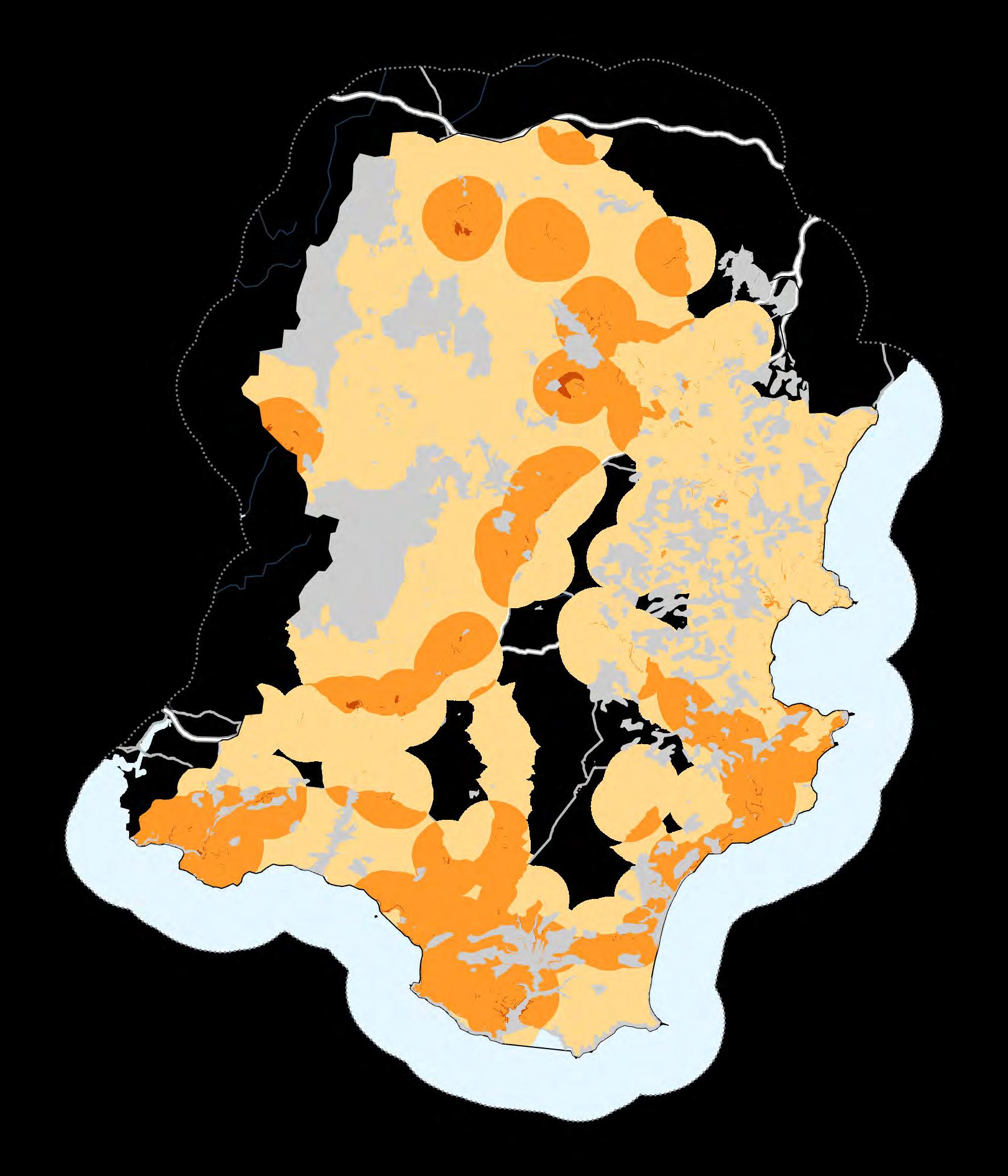


The final synthesis of these conceptual models and data exploration exercises is to combine them together to identify areas important for the provision of multiple ecosystem services.
Locations where areas of high importance or risk of opportunity in individual services coincide can be considered important targets for measures to enhance the provision of multiple ecosystem services
Scores from maps 20, 29, 34, 42, 45 and 47 are combined here, in addition to applying a negative weighting (-10) to areas that may be considered for exclusion. As with previous opportunity maps, this is a model for exploring potential opportunities and areas identified with high potential here may or may not be suitable for enhancing ecosystem services
Areas to consider excluding (see previous maps) provide valuable context here and should be considered


Publisher / Owner Dataset
British Geological Society BGSGeology 625K
CEH Land Cover 2021
Centre forEcology and Hydrology
Tellus South West DTM
Climate Just; Sayers and Partners LLP
Neighbourhood Flood Vulnerability Index(NFVI) and Social Flood Risk Index (SFRI)
Cranfield University Natmap Soils
Bathing Water
Bathing Waters ZOI Catchments
Detailed River Network 2023
Drinking Water Safeguard Zones (Surface Water)
Event Duration Monitoring - Storm Overflows - Annual Returns
Flood Map for Planning (Rivers and Sea) - Flood Zone 2
Flood Map for Planning (Rivers and Sea) - Flood Zone 3
Historic Flood Map
Nitrate Vulnerable Zones (NVZ) 2021 Designations
Reduction in Risk of Flooding from Rivers and Sea due to Defences
Source Protection Zones [Merged]
Attribution
Contains British Geological Survey materials © UKRI 2024 4
Maps/ Figures / Tables
Marston, C., Rowland, C. S., O’Neil, A. W., & Morton, R. D. (2022). Land Cover Map 2021 (land parcels, GB) [Data set]. NERC EDS Environmental Information Data Centre. https://doi.org/10.5285/398DD41E-3C08-47F5-811F-DA990007643F 5, 20, 21
Ferraccioli, F.; Gerard, F.; Robinson, C.; Jordan, T.; Biszczuk, M.; Ireland, L.; Beasley, M.; Vidamour, A.; Barker, A.; Arnold, R.; Dinn, M.; Fox, A.; Howard, A. (2014). LiDAR based Digital Terrain Model (DTM) data forSouth West England. NERC Environmental Information Data Centre. https://doi.org/10.5285/e2a742df-3772-481a-97d6-0de5133f4812 2, 13, 20, 29, 34, 42, 45
Contains adapted data from the Office forNational Statistics licensed under the Open Government Licence v.2.0. © Crown copyright and database right 2012. Contains Ordnance Survey data © Crown copyright and database right 2012.
Intellectual Property Rights (IPR) of NFVIand SRI belong to Sayers and Partners LLP. 'Sayers, P.B., Horritt, M., Penning Rowsell, E., and Fieth, J. (2017). Present and future flood vulnerability, risk and disadvantage: A UK scale assessment. A report forthe Joseph Rowntree Foundation published by Sayers and Partners LLP.' 30
Soils Data © Cranfield University (NSRI) and for the Controller of HMSO 2024
Mapping derived from soils data © Cranfield University (NSRI) and for the Controller of HMSO 2024 3, 27, 29
© Environment Agency copyright and/or database right 2016. All rights reserved. 12, 46
© Environment Agency copyright and/or database right 2015. All rights reserved. 12
© Environment Agency copyright and/or database right 2015. All rights reserved.© Crown copyright and database rights 2008 Ordnance Survey 100024198 20, 29, 34, 42, 45
© Environment Agency copyright and/or database right 2022. All rights reserved. 12, 25
© Environment Agency copyright and/or database right 2024. All rights reserved. 18
© Environment Agency copyright and/or database right 2023. All rights reserved. Some features of this map are based on digital spatial data from the Centre for Ecology &Hydrology, © NERC (CEH).
© Crown Copyright and Database Rights 2023OS AC0000807064. 30
© Environment Agency copyright and/or database right 2023. All rights reserved. Some features of this map are based on digital spatial data from the Centre for Ecology & Hydrology, © NERC (CEH). 30
© Environment Agency copyright and/or database right 2023. All rights reserved 31
© Environment Agency copyright and/or database right. Derived in part from geological mapping data provided by the British Geological Survey © NERC. Derived in part from data provided by the National Soils Research Institute ©Cranfield University. Contains Ordnance Survey data ©Crown copyright and database rights 2016. Derived in part from data provided by the Department for the Environment, Farming and Rural Affairs © Crown 2016copyright Defra. Derived in part from data provided by the Centre forEcology and Hydrology © NERC. Derived in part from data provided by UK Water Companies.
12
© Environment Agency copyright and/or database right 2023. All rights reserved. Some features of this map are based on digital spatial data from the Centre for Ecology & Hydrology, © NERC (CEH) © Crown Copyright and Database Rights 2023OS AC0000807064. 29, 30, 34, 42, 45, 47
© Environment Agency copyright and/or database right 2016. All rights reserved. 12
Waterquality data archive Environment Agency waterquality data from the WaterQuality Archive (Beta) 22, 23, 24
WaterResource Availability and Abstraction Reliability Cycle 2
WFD Lake WaterBodies Cycle 2 Classification 2019
© Environment Agency copyright and/or database right 2015. All rights reserved. 28
© Environment Agency copyright and/or database right 2015. All rights reserved. 14, 40
WFD River, Canal and Surface Water TransferWater Bodies Cycle 2 Classification 2019 © Environment Agency copyright and/or database right 2015. All rights reserved. 14, 15, 16, 17, 24, 40
WFD Surface WaterOperational Catchments Cycle 2 © Environment Agency copyright and/or
Publisher / Owner Dataset
European Commission European Soil Database v2.0
Forestry Commission National Forest Inventory Woodland England 2020
Highways England Highways England Priority Outfall
Historic England
Joint Nature Conservation Committee
Registered Parks and Gardens
Scheduled Monuments
Special Areas of Conservation
Agricultural Land Classification (ALC)
Ancient Woodland (England)
Areas of Outstanding Natural Beauty (England)
CRoW Act 2000 - Access Layer
Green and Blue Infrastructure (England)
Habitat Networks (Combined Habitats) (England)
Local Nature Reserves (England)
Natural England
Model estimates of expected diversity of positive plant habitat condition indicators
National Character Areas (England)
National Nature Reserves (England)
National Parks (England)
National Trails (England)
Priority Habitats Inventory (England)
Sites of Special Scientific Interest Units (England)
Built Up Areas (December2022) Boundaries GB BGG
Index of Multiple Deprivation (Dec 2019) Lookup in England
Local Authority Districts (December 2023) Boundaries UK BFC
Lowerlayer Super Output Areas (December 2021) Boundaries EW BGC V3
Population density
Attribution
© Copyright and all otherintellectual property rights in the European Soil Database remain the joint property of the European Commission and the Contributors. The European Commission Joint Research Centre acts as Licensorof the complete Database on behalf of the Contributors. The European Soil Database distribution version 2.0, European Commission and the European Soil Bureau Network, CD-ROM, EUR 19945EN, 2004 43, 45
Contains, or is based on, information supplied by the Forestry Commission. © Crown copyright and database right 2021 Ordnance Survey [100021242] 39
© Highways England 12
© Historic England 2024 and forspatial data only add Contains Ordnance Survey data © Crown copyright and database right 2024 47
© Historic England 2024 and forspatial data only add Contains Ordnance Survey data ©Crown copyright and database right 2024 29, 34, 42, 45, 47
Contains public sector data from © JNCC/NE/NRW/NatureScot 2019. Contains OS data © Crown Copyright and database right 2019. 35
© Natural England copyright. Contains Ordnance Survey data ©Crown copyright and database right 2024. 9, 29, 34, 42, 45, 47
© Natural England copyright. Contains Ordnance Survey data © Crown copyright and database right 2024. 42
© Natural England copyright. Contains Ordnance Survey data ©Crown copyright and database right 2024. 35, 47
© Natural England copyright. Contains Ordnance Survey data © Crown copyright and database right 2024. 46
Contains data supplied by orderived from Natural England, Ordnance Survey, Forestry Commission, Historic England, Environment Agency, Office National Statistics, MHCLG, Sport England, National Trust, Cheshire Wildlife Trust; Derbyshire Wildlife Trust; Kent Wildlife Trust; Essex Wildlife Trust; BBOWT © Natural England 46, 47
© Natural England copyright. Contains Ordnance Survey data © Crown copyright and database right 2024. 41, 42
© Natural England copyright. Contains Ordnance Survey data ©Crown copyright and database right 2024. 29, 34, 35, 42, 45, 46
Contains data supplied by Natural Environment Research Council. © Natural England Copyright 2016. Maskell, L.; Henrys, P.A.; Norton, L.; Smart, S. (2016). Model estimates of expected diversity of positive plant habitat condition indicators. NERC Environmental Information Data Centre. https://doi.org/10.5285/cc5ae9b1-43a0-475e-9157a9b7fccb24e7
© Natural England copyright. Contains Ordnance Survey data © Crown copyright and database right 2024. 6
37
© Natural England copyright. Contains Ordnance Survey data ©Crown copyright and database right 2024. 29, 34, 35, 42, 45
© Natural England copyright. Contains Ordnance Survey data © Crown copyright and database right 2024. 35, 47
© Natural England copyright. Contains Ordnance Survey data © Crown copyright and database right 2024. 46
© Natural England copyright. Contains Ordnance Survey data © Crown copyright and database right 2024. Contains data created and provided by Cumbria Biodiversity Data Centre on behalf of Cumbria Wildlife Trust. The data has been extracted from Cumbria Wildlife Trust's Grassland Inventory and is used underthe CC BY 4.0 International licence terms. 26, 29, 34, 38, 42, 45, 45, 47
© Natural England copyright. Contains Ordnance Survey data ©Crown copyright and database right 2024. 12, 29, 34, 35, 36, 42, 45
Source: Office for National Statistics licensed underthe Open Government Licence v.3.0 Contains OS data © Crown copyright and database right [year] 1, 6, 25, 28, 29, 31, 34, 35, 40, 42, 45, 46, 47
Source: Office for National Statistics licensed underthe Open Government Licence v.3.0 11
Source: Office for National Statistics licensed underthe Open Government Licence v.3.0
Contains OS data © Crown copyright and database right [year] 10, 11
Source: Office for National Statistics licensed underthe Open Government Licence v.3.0
Contains OS data © Crown copyright and database right [year] 10, 11
Source: Office for National Statistics licensed underthe Open Government Licence v.3.0 10
Publisher / Owner Dataset Attribution
OS Open Greenspace
OS Open Rivers
OS Open Roads
Ordnance Survey
OS Terrain 50
OS VectorMap District
Contains OS data © Crown Copyright [and database right] (2023) 47
Contains OS data © Crown Copyright [and database right] (2023) 1, 3, 6, 18, 25, 26, 28, 30, 31, 33, 46
Contains OS data © Crown Copyright [and database right] (2023) 14, 15, 16, 17, 18, 24, 25, 26, 29, 34, 40, 41, 42, 43, 45, 46
Contains OS data © Crown Copyright [and database right] (2023) 13, 20, 29, 33, 34, 42, 45
Contains OS data © Crown Copyright [and database right] (2023) 1, 3, 5, 6. 13, 14, 15, 16, 17, 18, 24, 25, 26, 29, 30, 31, 32, 33, 34, 35, 36, 38, 40, 41, 42, 43, 45, 46
Rural Payments Agency Crop Map of England (CROME) 2021 © Rural Payments Agency 8
Sustrans National Cycle Network Contains public sector information licensed under the Open Government Licence v3.0 46 The Rivers Trust SAGISPhosphorous - Riverconcentration (mg/L)
The University of Edinburgh Ag Census
Westcountry Rivers Trust WRT Micro-catchments
Esri ArcGISPro Basemaps
Produced by The Rivers Trust © Environment Agency copyright and / ordatabase rights 2018. 19
© University of Edinburgh Derived from Defra/Welsh Government/Scottish Government agricultural census surveys. 7
Westcountry Rivers Trust (2023). Dataset created by Westcountry Rivers Trust, using the Environment Agency’s Flood Zone 2 data (© Environment Agency copyright and/ordatabase right 2023. All rights reserved. Some features of this map are based on digital spatial data from the Centre forEcology & Hydrology, © NERC (CEH). © Crown Copyright and Database Rights 2023 OS AC0000807064); Ordnance Survey’s Terrain50 data and Ordnance Survey’s VectorMapDistrict data (Contains OSdata © Crown Copyright [and database right] (2023)). 33, 34
Esri UK, Esri, TomTom, Garmin, Foursquare, FAO, METI/NASA, USGS All