John J. Porcello, LHG
Expo 50 H2O Symposium
Spokane, WA
May 30, 2024

Yes! Yesterday and today:
A few decades from now: Yes … if we plan ahead!
• Simulates the two key physical aspects of the aquifer
• The plumbing
• Geology
• Permeability of aquifer soils/sediments and streambeds
• The water in the plumbing
• Recharge locations, rates, monthly/seasonal/annual variability
• Groundwater withdrawals (pumping for water supply needs)
• Natural discharge mechanisms for groundwater
• Including exchanges with Spokane River and Little Spokane River
1. Evolving uses of the model
• Regional scale, wellfield scale
• Resource management in an era of climate change
• Water supply reliability and vulnerability assessments
2. Better technology
• Better spatial resolution
• Better vertical resolution
• More robust simulation (e.g., stream/aquifer interactions)
• Coarse spatial resolution
• Washington focus
• 2D model (1 layer)
• Software limited
• No standardized code
• No visualization
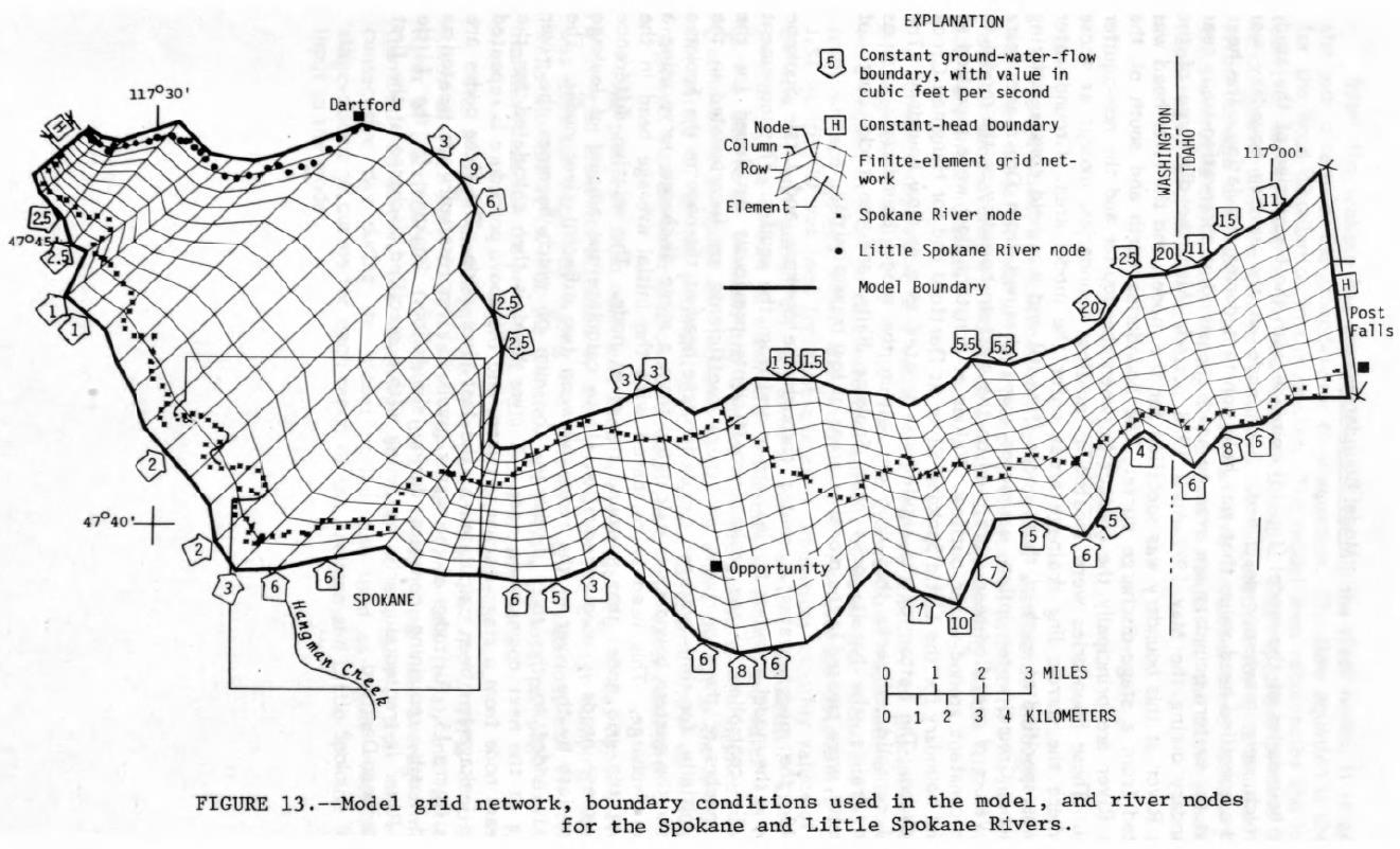
Source: Figure 13 from an Early USGS Model Report (Bolke and Vaccaro, 1981). Bolke, E.L. and J.J. Vaccaro. 1981.
Digital-Model Simulation of the Hydrologic Flow System, with Emphasis on Ground Water, in the Spokane Valley, Washington and Idaho. U.S. Geological Survey Open-File Report 80-1300, 43 p.
• Fine spatial resolution
• Washington only
• 3D model (3 layers)
• Used Dutch software (MicroFEM)
• Visualization built in
• Very stable (doesn’t crash)
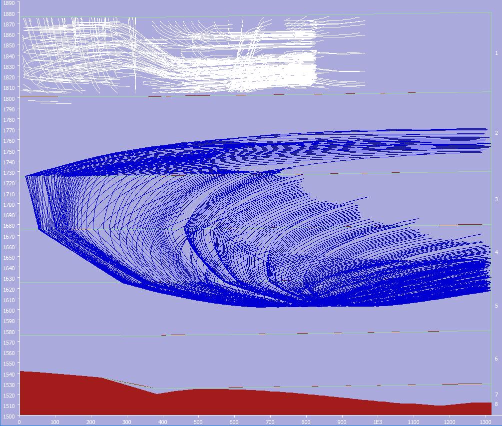
• Easy to delineate capture zones for water supply wells (wellhead protection planning)
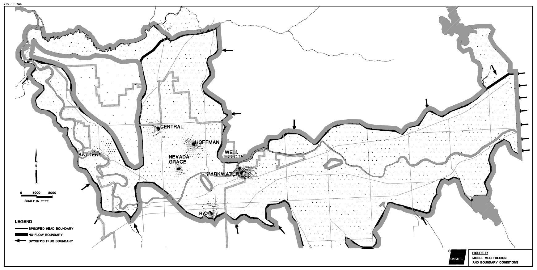
Source: Figure I-1 from the City of Spokane Wellhead Protection Report (CH2M HILL, 1998).
CH2M HILL. 1998. City of Spokane Wellhead Protection Program Phase 1 – Technical Assessment Report. Prepared in association with Dally Environmental, Fujitani Hilts and Associates, and SeisPulse Development Corporation. February 1998.
• Medium spatial resolution
• Entire SVRP Aquifer
• Mixed 2D/3D model
• 1 layer in and east of City of Spokane
• 3 layers north of City of Spokane
• Used USGS software
• MODFLOW
• Widely used
• Visualization available
• Could be unstable (crash-prone)
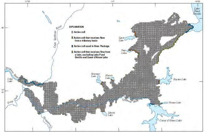
Source: Figure 32 from the USGS Bi-State Model Report (Hsieh et al., 2007).
Hsieh, P.A., M.E. Barber, B.A. Contor, Md.A. Hossain, G.S. Johnson, J.L. Jones, and A.H.
Wylie. 2007. Ground-Water Flow Model for the Spokane Valley-Rathdrum Prairie Aquifer, Spokane County, Washington, and Bonner and Kootenai Counties, Idaho. U.S. Geological Survey Scientific Investigations Report 2007-5044, 78 p.
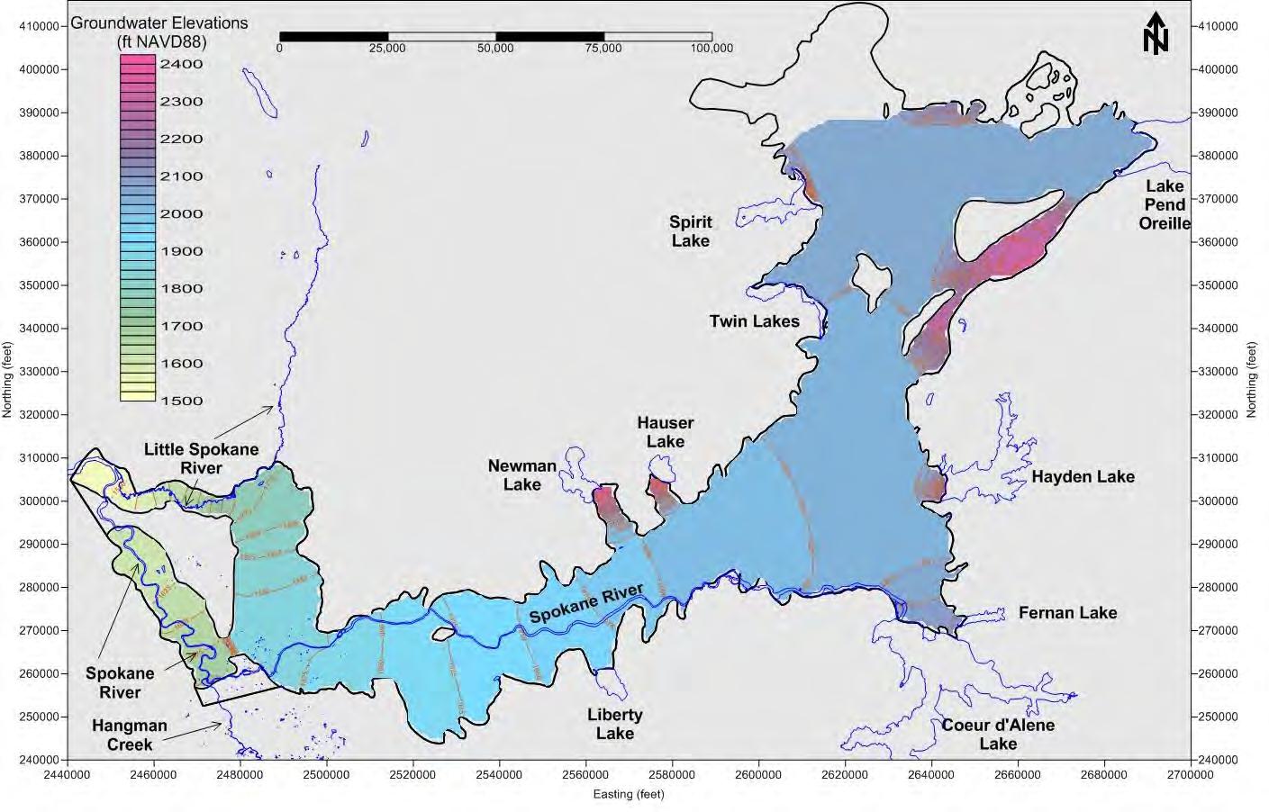
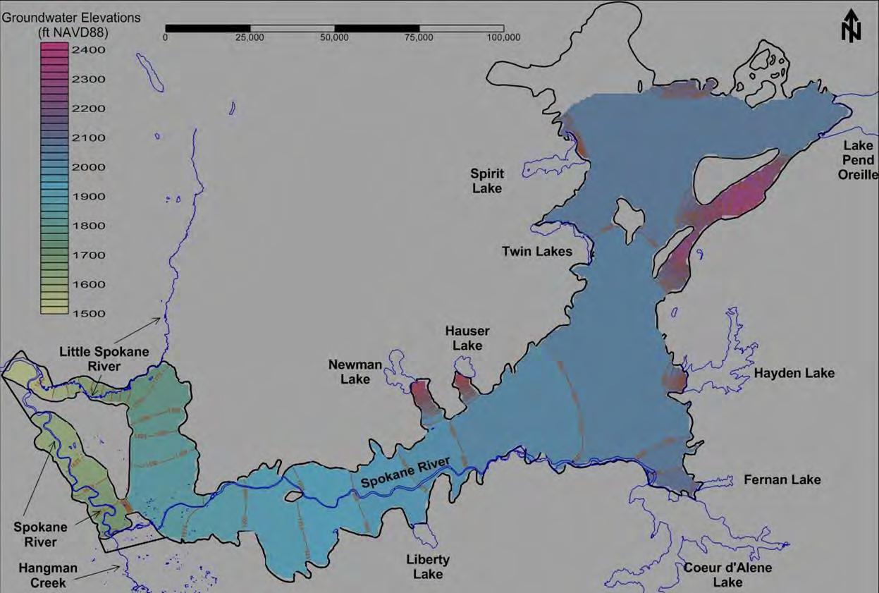
(City of Spokane & Spokane Aquifer Joint Board [SAJB], 2012)
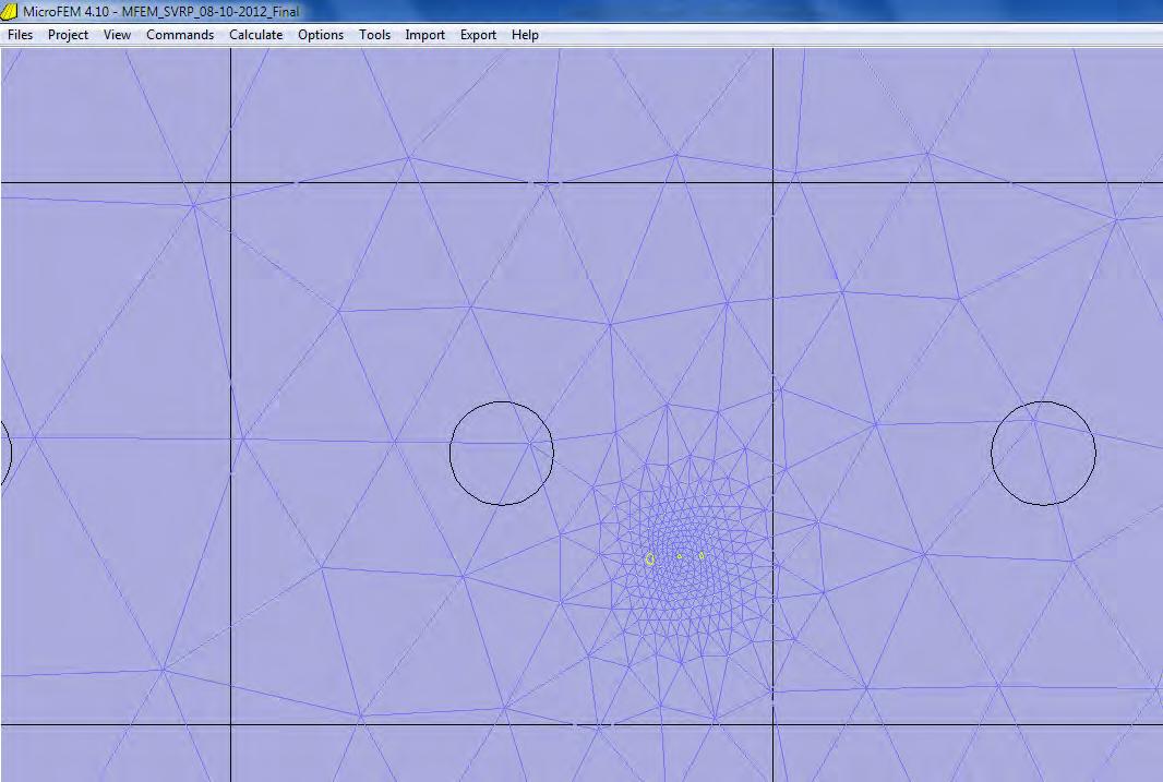
• Fine spatial resolution
• Entire SVRP Aquifer
• 3D model
• Initially 3 layers
• Then 8 layers
• Still using MicroFEM Dutch software
• Visualization
• Stability
• Ease of use
Bi-State Model
Square Grid Cells (Black) (MODFLOW) (Finite-Difference)
2012 City/SAJB Model
Flexible Mesh (Blue) (MicroFEM) (Finite-Element)

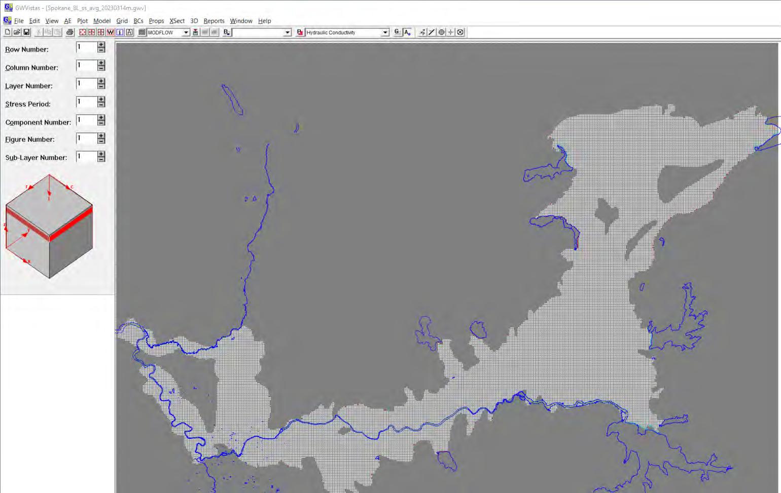
Parent Grid in the MODFLOW-USG Software (Uniform 400-foot Grid Spacing)

Parent Grid: 400-foot spacing
Spokane River: 200-foot spacing
City Wells: 50-foot spacing
Parent Grid: 400-foot spacing
Spokane River: 200-foot spacing
City Wells: 50-foot spacing
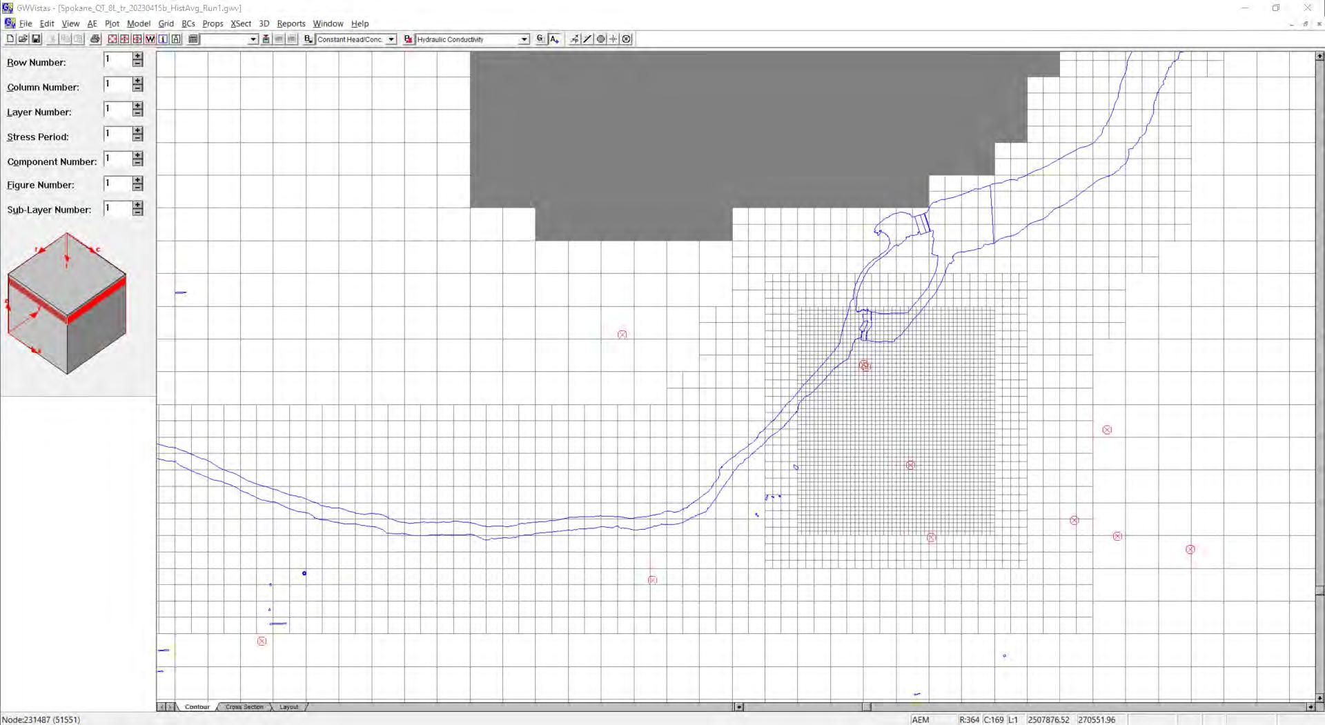
Source: GSI Water Solutions and City of
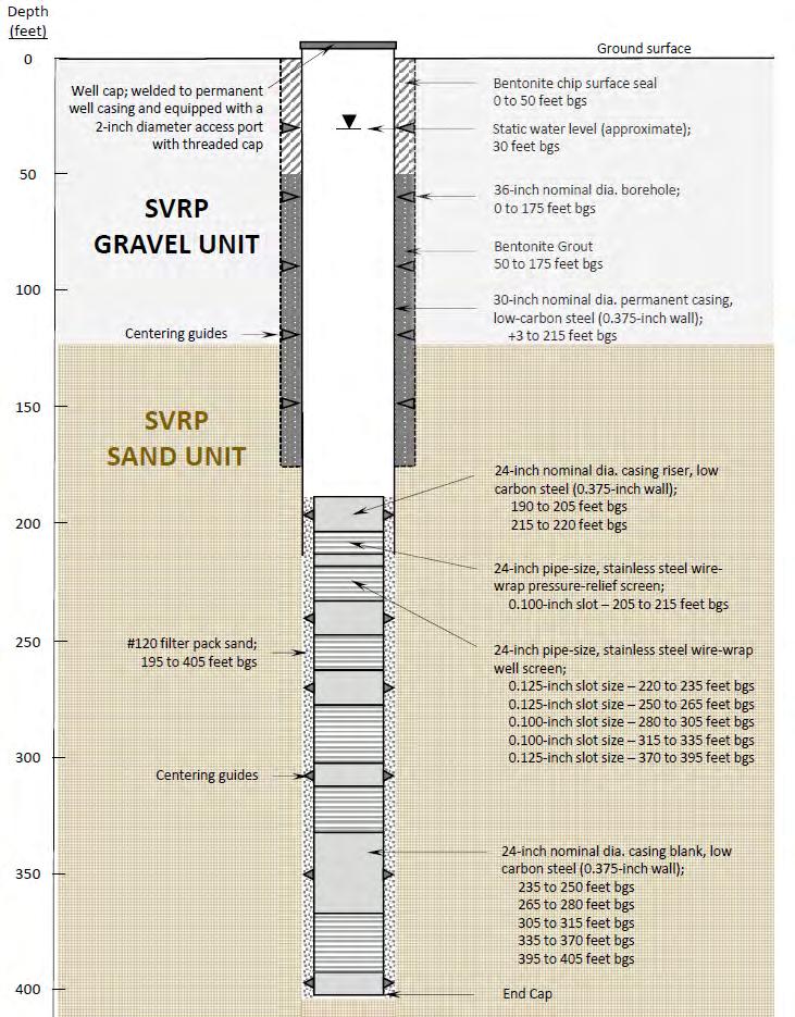

Cross Section Alignment
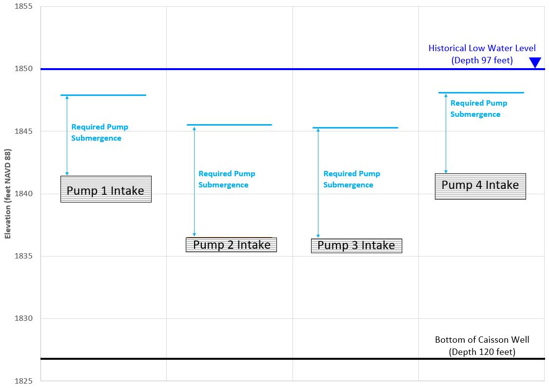
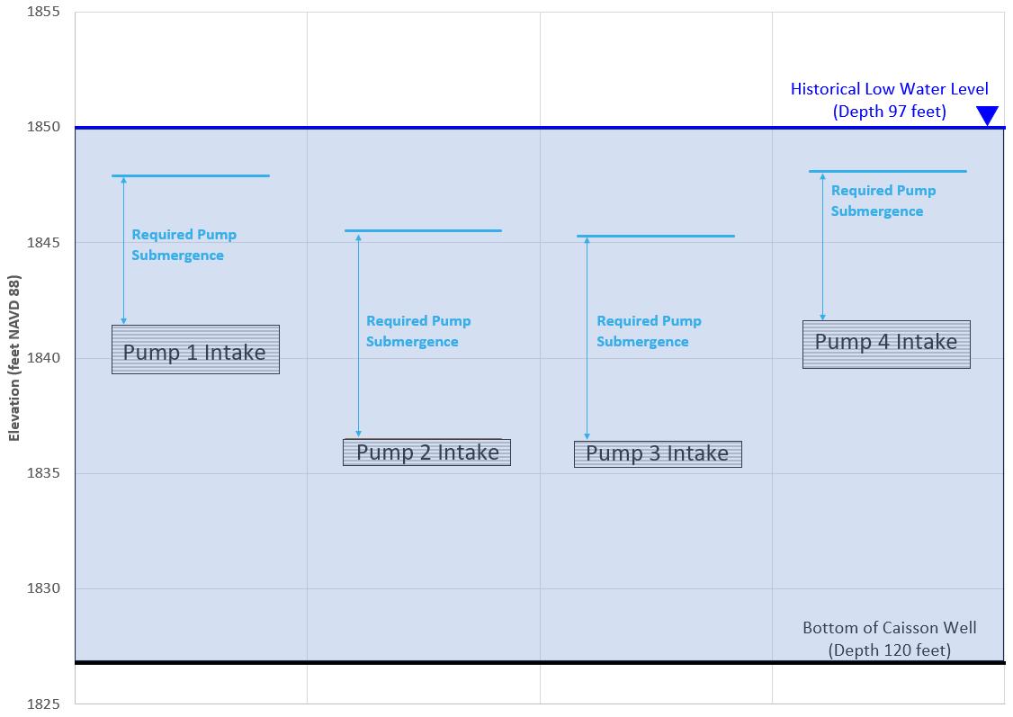
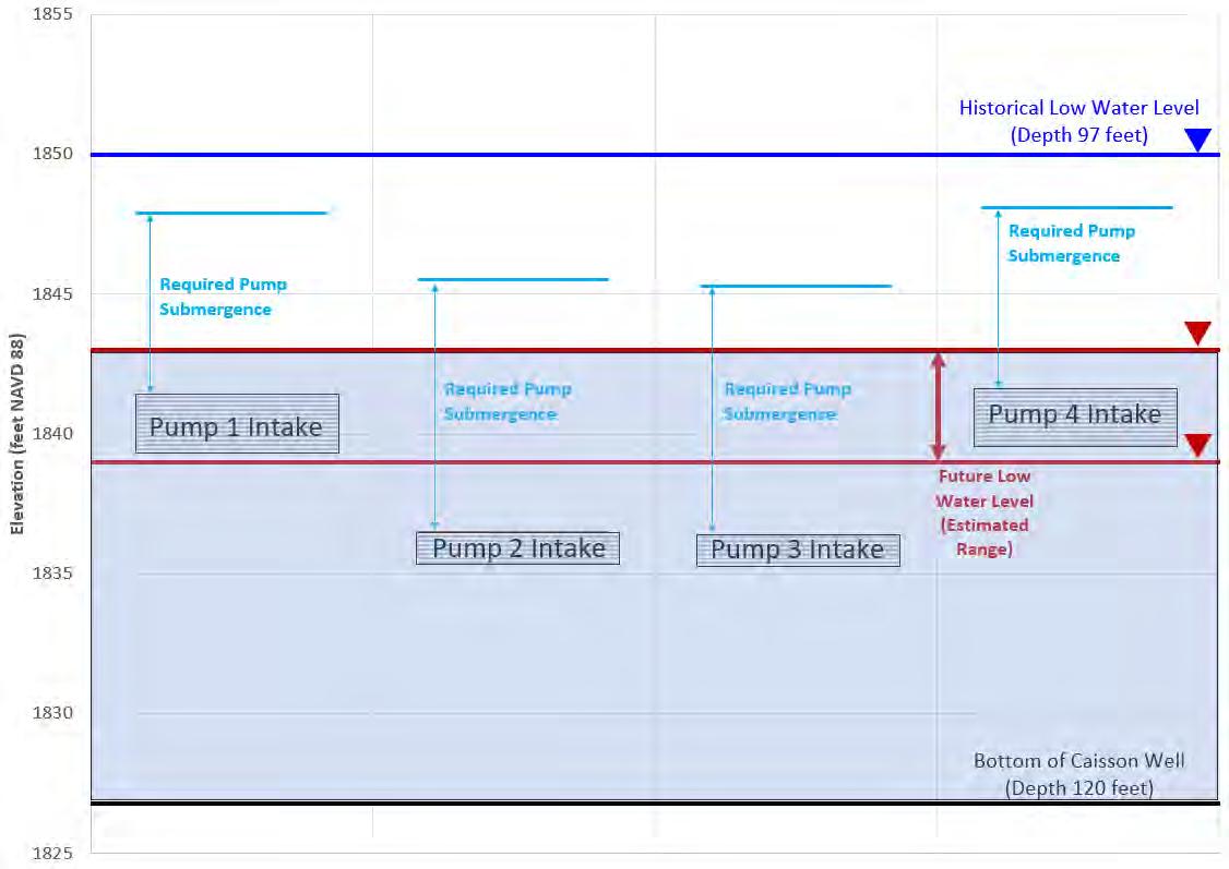
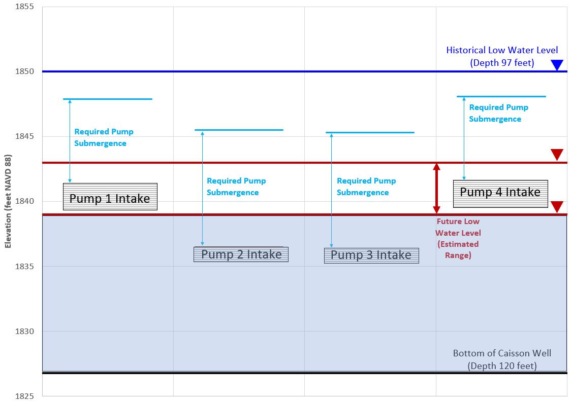
Current Shallow Caisson Wells
Concept for Deep Wells
Concept for Deep Wells Map View
Current Shallow
Caisson Wells
Cross Section
Alignment
Cross-Section View
Shallow Gravel Unit
Flow paths in connection with River
Flow paths moving away from River Deep Sand Unit
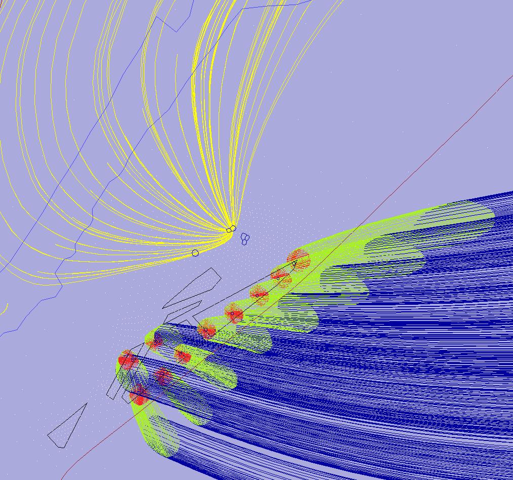
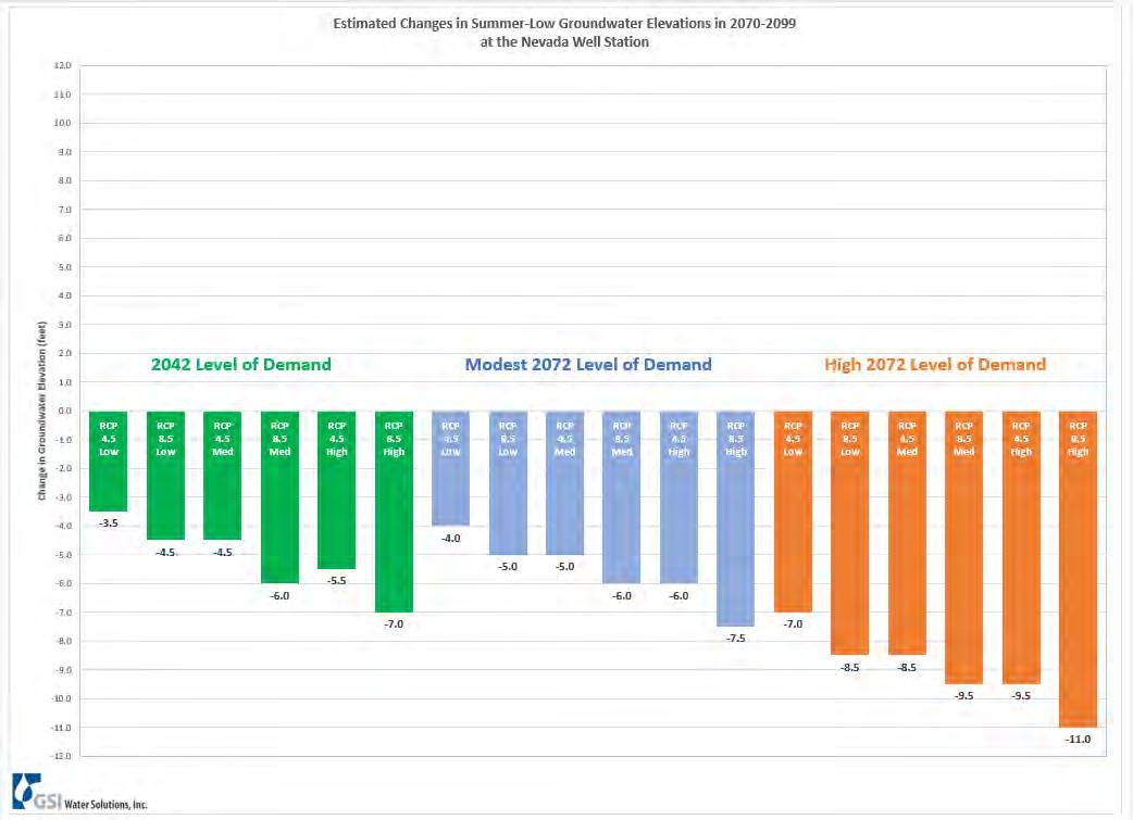
We can change groundwater pumping demands
• Locations
• Volumes • Monthly/seasonal variations
• Climate effects on water demands
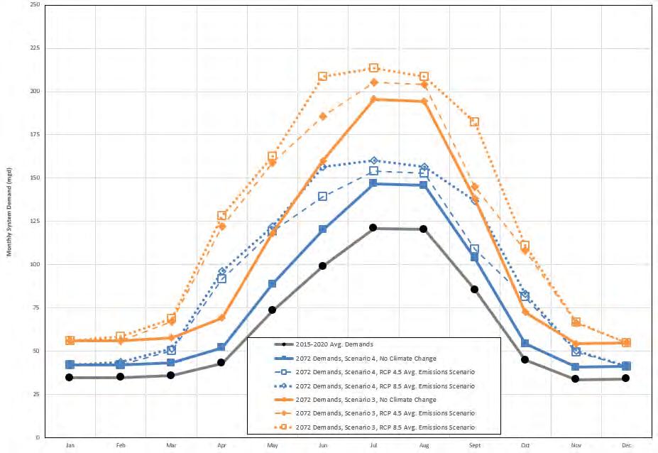
Orange = 50-Year High End Demand
Blue = 50-Year Medium Demand
Black = Current Demand
https://climatetoolbox.org/
We can change natural hydrologic inputs that are affected by a changing climate
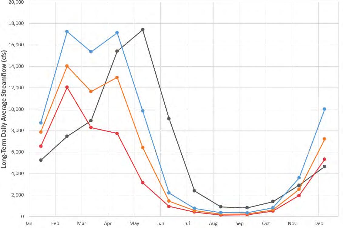
Historical Streamflows (Average 1950-2005)
Range of Projected Streamflows in 2070s through 2090s from Climate Models
Spokane River Streamflows at Post Falls Data Source:
https://climatetoolbox.org/
Note: RCP = Representative Concentration Pathway for future greenhouse gas emissions
Under a
50-Year
High-End Demand Scenario
Under a 50-Year
High-End Demand Scenario


Other Local Water Providers and Water Resource Managers
Individual Water Purveyors in WA and ID
Spokane County Water Resources Department, WA
Research Community
U.S. Geological Survey
USDA Natural Resources Conservation Service
Idaho Water Resources Research Institute
University of California, Merced
State and Local Agencies
Washington State Department of Health
Washington State Department of Ecology
Idaho Department of Water Resources
Idaho Department of Environmental Quality
Panhandle Health District, ID
Other Professionals
Dr. Dale Ralston
Landau Associates
Consor North America
CH2M HILL
GSI Water Solutions
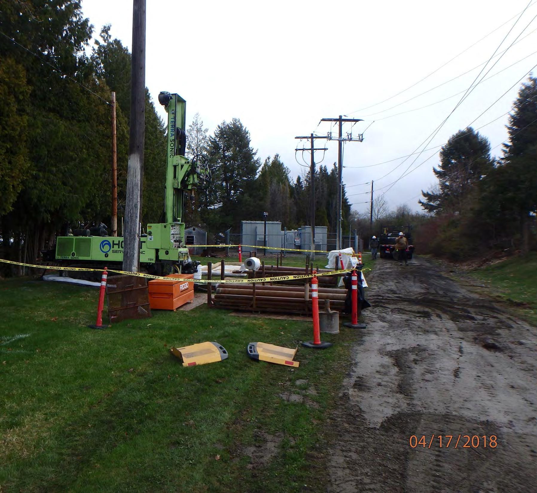
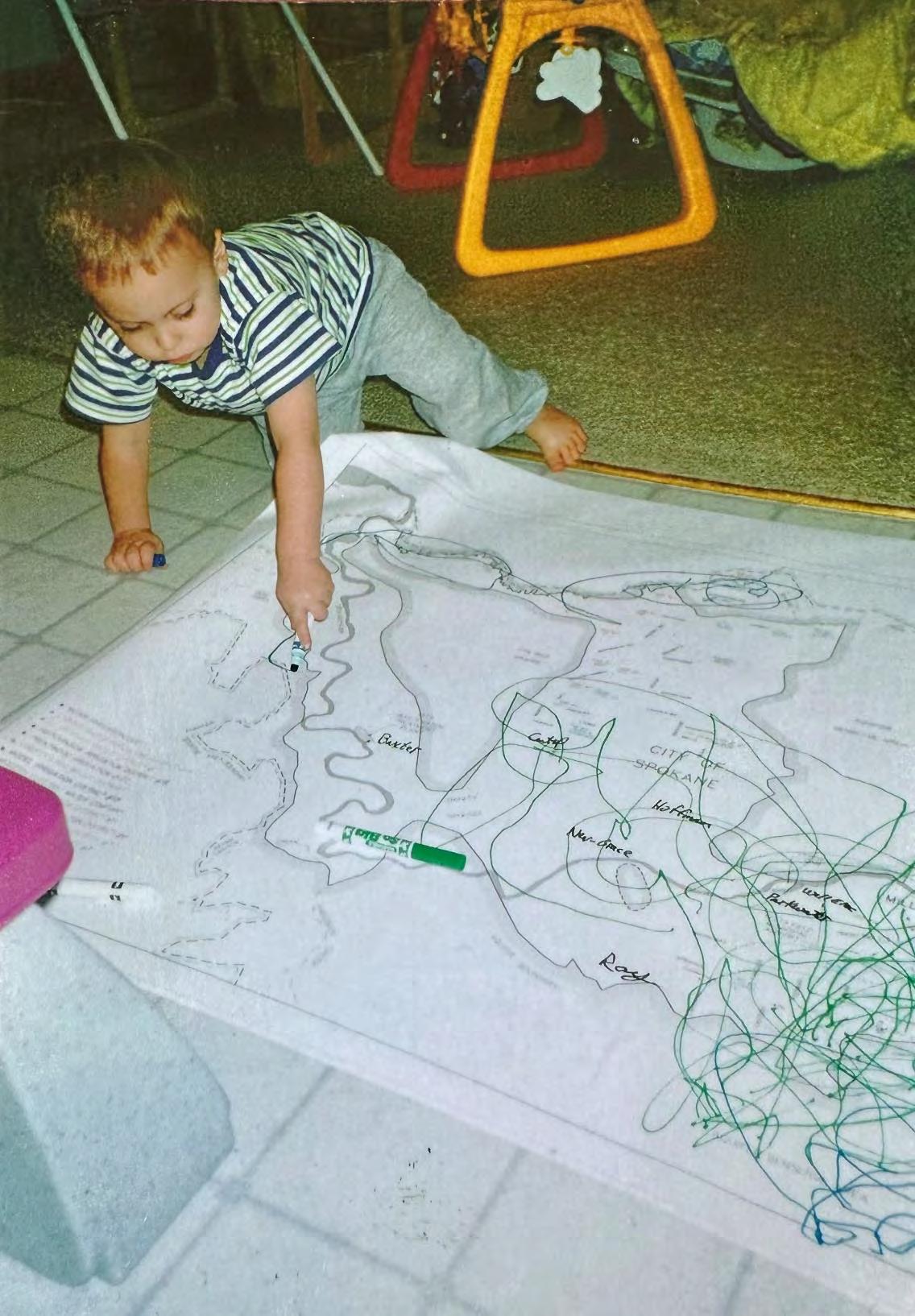
The author’s son delineating groundwater capture zones for the City of Spokane (circa 1995)
Why Use a GroundWater Model for Water Supply Resiliency Planning?
It’s better to use a model than to wing it!