How WTA is bringing people together to care for public lands
16 fall trails for lovely colors, quiet and so many mushrooms
3 WTA partnerships that are getting more done for trails
Our judges’ honorable mentions from WTA’s photo contest
Washington Trails
A Publication of Washington
Trails Association
Board of Directors
President | Ken Myer
Secretary | Bhavna Chauhan
Treasurer | Anson Fatland
VP Development | Halley Knigge
VP Governance | Todd Dunfield
Directors at Large
Bryce Bolen • Jared Jonson • Paul Kundtz
Chris Liu • Matt Martinez • Sully Moreno
Arun Sambataro • Ashleigh Shoecraft
Kelsey Vaughn
WTA Leadership
Chief executive officer Jaime Loucky
Washington Trails Staff
Magazine editor | Jessi Loerch
Communications director | Doreese Norman
Hiking content | Tiffany Chou
Graphic designer | Jenica Nordstrom
Copy editor | Cassandra Overby
Contributors
Writers | Melani Baker, Tiffany Chou, Krista Dooley, Loren Drummond, Chloe Ferrone, Joseph Gonzalez, MJ Mahan, Kindra Ramos, Craig Romano
Proofreader | Rebecca Kettwig
Designer | Victoria Obermeyer
Trail team | Tiffany Chou, Mary Hartman, Steve Payne, Catherine Vine, Holly Weiler
‘WTA Does So Much for Hikers’
This has been a challenging year for public lands. Between funding cuts, staffing shortages, privatization efforts and escalating challenges due to natural disasters, the Forest Service and other land management agencies are facing unprecedented pressures.
In times like these, the value and importance of partnerships become clear. By working together, we can meet the challenges facing trails today, and find solutions that power trails for the next generation.
I was out in the Teanaway Community Forest recently and saw the power of partnerships first-hand. For years, dedicated community members, recreation organizations and land managers have been working together to build a recreation plan and a trail system to meet the needs of the local community and visitors. WTA has been involved in the Teanaway Community Forest since the beginning and led the development of the trails plan for the West Fork Teanaway. Thanks to this partnership, more than 50 miles of trails, 100 campsites and a variety of outdoor activities are becoming available.
This year, WTA has been deploying all of our skills, resources and relationships to bring people together to support trails. Some of that is visible — like volunteer crews on local and iconic trails — and some of it isn’t — like how we organize hikers to speak up for public lands or how members fuel our programs through their financial support. But all of it makes a difference.
As the summer trail season winds down, we’re also shifting our focus to the future. As we develop our next strategic plan, we’ve reflected on what we do best and what trails and public lands need most. We’ve also connected with our partners, members, volunteers and community to hear what they value in our work. One Northwest land manager told us, “There is no other group we can trust in the same way.” A member said, “WTA does so much for hikers; they are a force multiplier for people who love the outdoors.”
One thing is clear: one of WTA’s superpowers is our ability to connect and stand with individuals and organizations who care about trails and public lands, and to help us all move together towards having a greater impact.
The coming years are certain to hold more challenges for trails. But we have a strong, active outdoor community — including 23,000 current WTA members — and deep partnerships, which allow us to do great things. We’re proud of what we’ve accomplished over the past 59 years and counting, and we are excited for what’s to come. Thank you for joining us in this journey. Your support makes all of this work possible.
Washington Trails Association
705 Second Avenue, Suite 300, Seattle, WA 98104
206-625-1367 • wta.org
General information | wta@wta.org
Membership & donations | membership@wta.org
Editorial submissions | editor@wta.org
Meet all our staff at wta.org/staff
Jaime Loucky | Chief executive officer
Stronger Together
WTA does a lot for trails — and we can do even more when we work with partners.
Features
6 How WTA is stepping up
From backcountry trails to the U.S. Capitol, WTA is bridging gaps caused by staff and funding cuts at the federal level.
20 A path to leadership
Five years of ensuring the outdoor leaders of tomorrow represent Washington’s diverse and dedicated hiking community.
24 Saws, physics and partnership
How WTA sawyers turned chaos into opportunity at Tiger Mountain in the wake of a storm that devastated trails.
38 The power of stories
Two books that highlight the diversity of people who get outside and how they connect to wild places.
On the cover
Make some ’shroom for fun!
The world is your oyster (mushroom)! Learn more about the cool fungi you can find on trail — and then go spot them!
Photos by Steven M. Smith, Joe Gonzalez
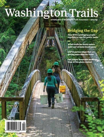
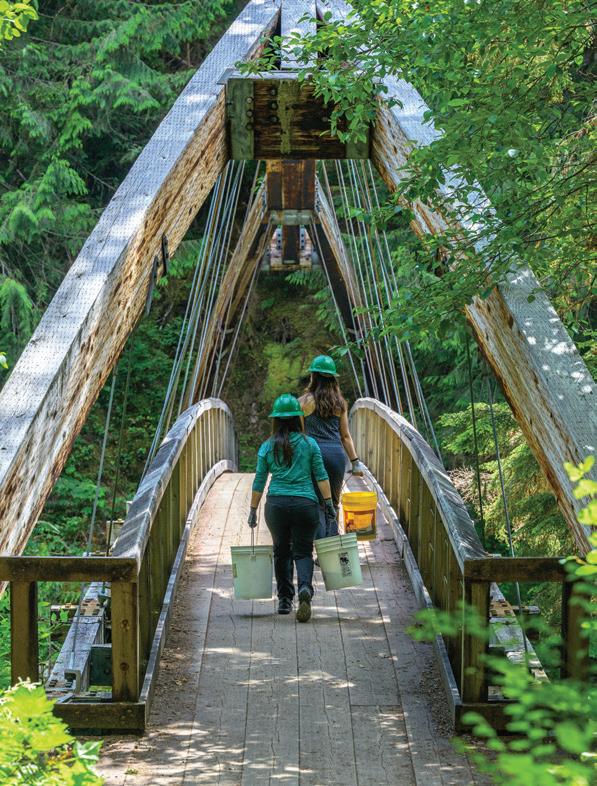
Steven M. Smith captured this photo of volunteers crossing the bridge over the Middle Fork Snoqualmie River during a joint work party between WTA and the Mountains to Sound Greenway Trust.
Departments
3 Front Desk
Greetings from our chief executive officer and magazine editor.
9 Trail Smarts
Fall is hunting season — here’s what you need to know to share the trails safely.
12
Trail Talk
WTA and our volunteers are rebooting popular trail systems around the state. Here’s some of the area’s we’ve already made a difference — and what’s next.
28
Trail Mix
See judges’ honorable mentions from our Northwest Exposure Photo Contest.
42
Hike It
Fall in love with these autumn hikes. 16 trails to add to your to-hike list.
POWERED BY YOU
Washington Trails Association is a nonprofit supported by a community of hikers like you. By mobilizing hikers to be explorers, stewards and champions for trails and public lands, together, we will ensure that there are trails for everyone, forever.
We Can’t Do it Alone
Earlier today, I took a break from work to take a walk to a creek near where I live. Right now, it’s full of salmon and it’s an absolute joy to watch them. When I arrived, I wandered along a trail near the stream and, through a small gap in the vegetation, I got an unexpected and delightful view of dozens of salmon, gently holding their place in the water. Suddenly, the water churned as the salmon all came to action at once. I looked up to see a family of four otters, one adult and three little ones. They’d clearly found a good spot for some hunting.
It’s still summer right now, but as I watched the salmon, I could tell that fall is coming. Fall is a wonderful time for hiking, and I hope this magazine gets you excited to spend some time on trail. If you need some ideas on where to get started hiking, check out my fungi-fanatic coworker’s story about mushrooms (page 32). Or, look at the great suggestions for seasonallyappropriate trails from our stellar Hike It volunteers (page 42).
WTA was founded by Louise B. Marshall (1915–2005). Ira Spring (1918–2003) was its primary supporter. Greg Ball (1944–2004) founded the volunteer trail maintenance program. Their spirit continues today through contributions from thousands of WTA members and volunteers.
Fall 2025 | Volume 60, Issue 3
Washington Trails (ISSN 1534-6366) is published three times per year by Washington Trails Association, 705 2nd Avenue, Suite 300, Seattle, WA 98104. An annual subscription for a physical copy of Washington Trails magazine is $20. Single copy price is $4.50. Periodicals postage paid at Seattle, WA, and at additional mailing locations.
POSTMASTER: Send address changes to Washington Trails Association, 705 2nd Ave., Suite 300, Seattle, WA 98104.
In this issue, we’re highlighting the many ways partnerships help get more work done for trails and public lands. We can’t do our work alone. We’re stronger and more effective thanks to our many partners. Other groups that care about public lands, like some of those we feature in our story on page 14, make it possible to do so much more to support trails and wild places. Those partnerships have helped care for beloved places. When a bomb cyclone hit last fall, it brought down countless logs on Tiger Mountain, a popular hiking area near Seattle. Some of the trails looked like they were covered with giant pick-up sticks. Thanks to a strong partnership with the Washington State Department of Natural Resources and dedicated crew leaders and volunteers who were willing to take on the technical challenge of clearing the trails, those trails are now hikable again (page 24).
All of this work — from making fun(gi) puns to using a chainsaw to clear a popular trail before peak hiking season — is made possible by members like you. Thank you for being a partner in caring for public lands and trails!
Happy hiking!
Jessi Loerch | Washington Trails editor | jessi@wta.org
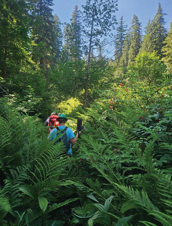
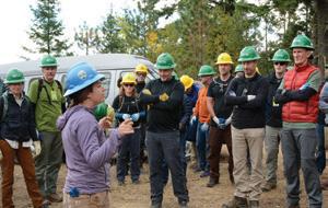
Volunteers walk an overgrown trail in North Cascades National Park. Staffing reductions across federal land managers have meant they’ve been able to do less trail work this summer.
Leadership & Innovation
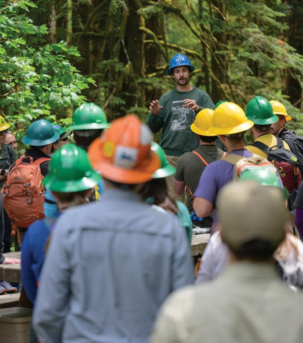
How WTA is Bridging the Gap on Federal Lands
In a challenging time, WTA is using all our skills, resources and partnerships to help public lands
By Kindra Ramos
houghtful management of our public lands has always been a bit of a puzzle. It requires piecing together government agencies, a variety of landscapes and the needs of people who recreate outside in many different ways. For nearly 60 years, Washington Trails Association has played a key role in helping hikers and land managers see the larger picture — and stepping in to help bridge any gaps.
One of WTA’s greatest strengths has always been as a connector — we bring people together and help find solutions to support the many people, groups and agencies that care about and protect public lands.
This year, that work has been more important than ever as our partners at the U.S. Forest Service and National Park Service struggle with massive cuts to staffing and funding. In this challenging year, WTA is working to fill that gap. While we cannot replace the people who manage national public lands, we’re doing what we can to support them and to improve the situation for the future.
All of that work is made possible by the strength of our community. Members’ financial support fuels our work and impact. Volunteers allow us to get so much more done, all across the state. And advocates answer our calls to speak up when many voices are needed to make positive changes for public lands. Thank you for all that you do to care for public lands and trails.
Here are some of the ways we are helping to bridge the gap this year.
Speaking up: WTA has rallied hikers to speak up all year. When we asked, thousands of hikers answered by contacting their lawmakers. That’s helped with some big wins in a challenging year, including public land sales being dropped from the large budget law passed this summer. Nearly 10,000 people signed our petition that was delivered to Doug Burgum, U.S. Secretary of the Interior, and Brooke Rollins, U.S. Secretary of Agriculture, as well as key leaders in Congress.
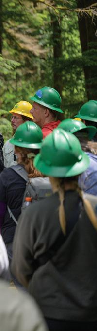
Trail work: Like we have for more than 30 years, WTA continues to care for trails across the state — many of them on national public lands. Each year, we work on about 300 trails across the state, with help from around 3,500 volunteers. As of early August, we’d already worked nearly 38,000 hours on federal lands — that’s more than $1.07 million in donated labor. With reductions in Forest Service resources, we’ve shifted our season to better support the areas with the highest needs and we’ve used member donations to help cover the costs usually funded by the
Forest Service. It’s a stopgap measure, but it’s letting us support trails while we advocate for better funding and capacity for our partners.
In-person education: WTA’s ambassadors — outreach volunteers who create a welcoming presence at trailheads and represent WTA at events in their community — have been talking to hikers more than ever. We’ve held over 80 events so far in 2025, including 30 at trailheads. Ambassadors spoke to thousands of people at those events. They offer guidance on Leave No Trace principles, answer questions about safe hiking and help hikers get the info they need to have a great experience on trail. This year, this work is even more important with fewer rangers on the ground on national public lands.
Building connections: Collective action is a cornerstone of our work at WTA, and this year, bringing people together is proving to be critical to protecting trails and public lands. For instance, in the southwest part
All of this work is made possible by the strength of our community.
of the state, the Forest Service has traditionally focused on bringing user groups — including hikers, mountain bikers, equestrians, dirt bike users and others — together to discuss issues in the area and find consensus. With cuts in staffing, the Forest Service no longer has the capacity to support that shared planning. So Ryan Ojerio, WTA’s Southwest regional manager, stepped up and created opportunities for user groups to meet and keep key conversations going. Coalitions like this make it possible to do work like a recent trails plan for the Gifford Pinchot National Forest possible. Connections among various
Michael DeCramer (right), WTA’s policy and planning manager, talks with U.S. Rep. Emily Randall during a hike along the Duckabush River. They discussed how the congresswoman can protect the Roadless Rule and push to renew the Legacy Restoration Fund.
trail groups and land agencies allow for thoughtful conversations and collaborations around how we can best shape the future of public lands. This year, WTA has continued co-leading the Recreate Responsibly Coalition to ensure that visitors to public lands are getting consistent, reliable advice. This work is helping to amplify the message to hike responsibly — it’s more important than ever to not litter or start wildfires, for instance — because there’s so little capacity to deal with such problems.
Free, easily accessible information: Through our website, social media and email newsletters, we are providing free information about current conditions. Many ranger stations are badly understaffed, meaning hikers can’t always get the information they need directly from land managers. We’re providing as much information as we can to keep hikers informed and safe. Trip reports help hikers learn about current conditions — land managers even refer to these regularly, because they often don’t have the staffing to check conditions themselves. Our Hike Finder Map has a wildfire overlay and information on air quality to help folks be prepared for current conditions. We keep our Hiking Guide up-to-date with information on trail closures. And every Thursday, we publish Hiker Headlines on our Signpost blog to share the most important information hikers need, right before the weekend.
Help us help our partners
WTA will always have a role in caring for public lands, especially in helping to connect hikers to opportunities to care for and have a say in the wild places they love. Right now, that means we’re bridging the gap by supporting work in national forests and national parks.
But WTA is only a piece of the puzzle. As time goes on, national public lands will suffer if funding and staffing are not restored. WTA is not the Forest Service. We are not the National Park Service. National forests and national parks are public spaces, and their stewardship and management are the role of the government. WTA can’t enforce rules, we can’t fix roads and we can’t conduct scientific studies. The agencies are mandated to care for these places, and they can’t do that without the proper funding and staffing.
We are partners of the Forest Service and National Park Service, and those partnerships can only truly thrive when our federal partners have the resources they need. We’ll keep stepping up — in advocacy, trail work, education, outreach and more — and part of that includes continuing to champion the Forest Service and National Parks so they have the resources they need.
Thank you for supporting WTA — as a donating member, a volunteer, a trip reporter, an advocate. By doing so, you’re also supporting the wild places we all love to explore.
How to Stay Safe in Hunting Season
By Loren Drummond
Wear blaze orange and hot pink to stay visible when hiking in autumn.
ur trails and public lands serve so many purposes and people — hikers, of course, but also trail runners, photographers, scientists, anglers, artists, mountain bikers, skiers and equestrians. From protecting clean water to offering us a place to unplug and reconnect deeply with the natural world, a rich tapestry of trails users make the most of our public lands all year long.
From fall to early spring, some public lands also permit hunting. Here are three tips to safely share the trails.
Do a little research
Washington's hunting season typically runs August-March, but shifts in the location and number and type of permits issued over that time. The Washington State Department of Fish and Wildlife regulates hunting in our state, and seasons can change year to year. Visit wdfw.wa.gov to find a current schedule of seasons and maps.
Assess your comfort level
If the idea of hiking during any hunting season makes you uneasy, choose one of the thousands of trails in places where hunting is not allowed, such as in a national park, at one the more than 100 Washington State Parks or on a local city trail.
Be heard and seen
The most important thing you can do is make yourself highly visible: Wear bright clothing that stand out. Blaze orange and hot pink are the best choices. Use an orange rain cover for your backpack, and deck out kids in bright or reflective clothes.
“What people should most consider is that they need to be visible even at low light,” said Deborah Essman, from Kittitas Field and Stream. She also suggests making noise. “I wouldn’t worry about ‘spoiling’ somebody’s hunt. You’re better off making noise and being safe. Most hunters use trails at some point during our hunt, but there’s a lot of cross-country hiking.”
by
Sauk Mountain.
Photo
Carl Gronquist
Memorable moments from WTA’s online community
Washington was the birthplace of my hiking spirit and WTA trip reports are a consistent tool I use to go adventuring. Whether I am heading out on a personal hike or professionally leading a trip, I always read trip reports for updates on trail conditions.
After using this tool and knowledge for years, I wanted to contribute. I was a beneficiary of others’ time and information, and I wanted to give back to the hiking community. I began writing reports and adding photos to them. I find writing trip reports to be a pseudotherapeutic journaling ritual. I’ve even made a few friends through the reports!
Join us online!
I prefer hiking with other people. I find so much value in the silliness, the awe and the achievement that comes from hiking together. I’ve found that people develop a “trail brain” — they become more optimistic, retrospective and talkative. If you ask someone a question in the city after work, their answer is probably going to be different than if you asked them that same question while hiking. I think people are better versions of themselves when hiking. (Unless they’re hungry!)
I have always loved a landscape photo but I try to have a human element — I want to show humans as a part of
nature. I’m so thankful for opportunities to see how the same trail changes throughout the seasons. My photos try to capture that. I hope to highlight how we can all go outside and make our own adventure.
This backpacking adventure was in the fall of 2024 with my girlfriend, Sarah, at Chain Lakes. I later learned that my she thought I was going to propose on this hike. I honestly should have; it was beautiful. Don’t worry, I made up for it later with an epic proposal in Olympic National Park. She said “yes.”
Sean Petersmark, @seanofthewild
Photo by Sean Petersmark
A quick look at what WTA is accomplishing on trails around the state
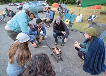
A Trail Party Highlights
WTA hosted two trail work jamborees in the Southwest region over the summer, at Mount St. Helens and Mount Adams. For jamborees, participants camp for several nights at a central location and crew leaders offer various options for trail work in the area. The base camp is a staging area, but also a hangout where participants share s’mores and stories, play games or music, and hear from experts on topics including geology, history and more. At Mount St. Helens, 11 crews were able to maintain 4.3 miles of trail, from six different trailheads on three trails. At Mount Adams, 12 crews maintained 3.6 miles of trail, across six different trails.
Good News for Trails
This August, King County residents voted “yes” to renew the county’s parks levy through 2031. WTA joined with partners to ask voters to support the levy, which is 85% of King County Parks’ budget. Now that the levy is renewed, WTA will continue to partner with King County and put the funds to work to improve trails. King County manages 185 miles of regional trails (think Burke-Gilman, East Lake Sammamish and Snoqualmie Valley trails) and 275 miles that the county designates as backcountry (think Cougar Mountain). Recent trail improvements made possible by the current levy include: reopening Taylor Mountain’s Beaver Pond trail, improving the safety and durability of Cal Magnusson trail to Pinnacle Peak (right) and building a new connector trail at Tolt-MacDonald Park.
Building Community at Refuge Fest
WTA was excited to participate in Refuge Fest, an event put on by Golden Bricks Events to create outdoor experiences and community for BIPOC folks. We’ve been part of the event since 2018. This year, staff members Barbara Molina and Justine Nishitani taught folks to create their own wood cookies using a crosscut saw. And Beatriz Rojas-Vazquez and Kailee Go, alums from the pilot year of the Emerging Leaders Program, provided resources and information about WTA and hiking to festival-goers.
A New Way to Get a Pass
Some national forest trailheads and campgrounds are adding a new way to buy a parking pass or pay for camping. You need the Recreation.gov app and it works even if you don’t have cell service. Get more information at wta.org/scan-and-pay.
Photos by James Alexander, Bob Zimmerman
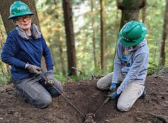
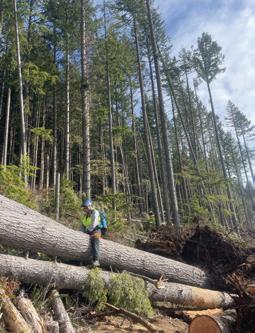
Rebooting Trails through Planning, Partnerships and Volunteer Power
By Melani Baker
oble Knob is one of the gems in the Snoquera region, a glacier-fed landscape northeast of Mount Rainier. When WTA trip reporter Trekski wrote about the trail, they said it offers “nearly constant amazing views” of Mount Rainier and the surrounding area.
But the drive to the trailhead is along 5 miles of a rough forest road that is often blocked by fallen trees and covered with “many sharp rocks that could ruin a tire,” as Trekski wrote. For more people to be able to safely experience Noble Knob and other Snoquera area trails, the right investments are needed.
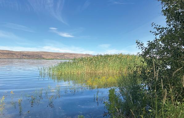
For 6 years, WTA’s Trails Rebooted work has supported popular outdoor recreation areas to meet the needs of everyone who wants to get outside. It’s been a community effort — trail advocates, WTA members, volunteers and many partners have made this work possible. We’ve helped build new trails in the Teanaway and Lake Whatcom areas, and we’re now assembling a team to look at Snoquera area trails. New trails completed in the Teanaway Community Forest
As part of our Trails Rebooted campaign, WTA expanded hiker options at Olsen Creek (this page), the Teanaway Community Forest (right) and the Snoquera area, including Noble Knob (lower right).
this summer were built thanks to more than 5 years of work by WTA and our partners. The Teanaway provides critical habitat for wildlife, including salmon. It’s a 1.5-hour drive from Seattle and has trail connections directly into the local communities of Cle Elum, Roslyn and Ronald.
Before the new trails were built, there were 140 miles of preexisting user-built trails, a clear sign that the public wanted to get outdoors in the Teanaway. Moving user-built trails away from private property and sensitive wildlife spots was a main goal for the Washington State Department of Natural Resources (DNR) and the partners that WTA led with DNR to plan the area’s new trail system.
Partners continued construction on different pieces of trail work: WTA worked on Frog Pond Loop, Evergreen Mountain Bike Alliance on Big Sandy Ridge trail, Mountains to Sound Greenway Trust on Cheese Rock trail and Back Country Horsemen of Washington on Aspen Grove Loop.
In a similar story, years of work by DNR staff, hikers and other outdoor enthusiasts have made it possible to hike at
by
Olsen Creek State Forest near Lake Whatcom.
“Before the new access to Olsen Creek, there were less than 2 miles of sanctioned trails on DNR land in Whatcom County despite the high demand and use,” said Hyden McKown, DNR’s recreation development manager for the Baker District.
In 2016, DNR invited public feedback about improving access to DNR lands in Whatcom County. Hikers, bikers, equestrians, hang gliders and whitewater kayakers provided input that led to the 2019 Baker to Bellingham Non-motorized Recreation Plan. Part of the plan was to create designated trails at Olsen Creek State Forest.
WTA was one of the partners who advocated for the funding for the project and helped build and improve trails once funding was in place. Combining the people power and expertise of different organizations made it possible for DNR to get the work done during the 4-month window when heavy trail work is allowed in this area.
“Seeing this process come to fruition, where we’re actually getting sanctioned recreation on the ground, is a huge win for recreation in general and for all the work that partners and the agency have put into it,” said Arlen Bogaards, WTA’s Northwest regional manager.
“Sanctioned trails enable DNR to reduce environmental impacts while creating more opportunities for people to experience the benefits of the outdoors. This includes the physical and mental health benefits of exercise, forest bathing, equestrian use or just taking in the views of Lake Whatcom, Bellingham Bay and even the Cascades on a good day. This initial phase at Olsen Creek provides more than 7 miles of multi-use trails,” said Andrew Giacomelli, DNR’s Baker District trails steward.
The ultimate goal is a 15-mile loop around Olsen Creek State Forest that offers connections to nearby public lands, such as Lake Whatcom Park. Future work will depend on funding. Sign up for WTA’s Trail Action Network at wta.org/tan, and we’ll email you at
key moments to speak up for funding for Olsen Creek and other projects.
WTA’s Trails Rebooted campaign is now looking at Snoquera, a recreation area along Highway 410 that is within an hour’s drive for millions of people. On Snoquera trails, you can enjoy fire lookouts, spectacular views of Mount Rainier and riverfront campgrounds.
Over time, a lack of maintenance on trails and roads has decreased the options for hiking in Snoquera. WTA has formed a coalition to explore how smart investments in trails can reduce recreation impacts and restore opportunities to get outside.
Our coalition represents hikers, mountain bikers, equestrians, motorized users, conservation organizations, Forest Service staff, and trail volunteers who are invested in a trail system that’s good for people and the landscape. Together, we will use the data we collect to make recommendations for sustainable trails.
Meeting the needs of all who wish to experience Washington’s trails improves the health of our communities, and it means that trails will have more voices to speak up for them. Creative partnerships are key to planning the future of Washington’s trail system. Upgrading these trail systems now, with growing demand in mind, will guarantee great experiences on trail for generations to come.
THE POWER OF PARTNERSHIPS
When we work with our partners, we can do so much more for trails
By Tiffany Chou
WTA champions trails every day — online, in the dirt, at the state capitol, at trailheads and more. And we can get even more amazing work done when we collaborate. Here are just a few examples of how WTA and our partners have improved trails and public lands around the state — together.
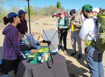
Spreading the word on responsible recreation
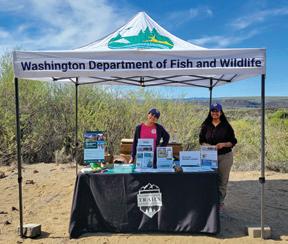
THE WASHINGTON DEPARTMENT OF FISH AND WILDLIFE
In April and May — prime hiking time in sunny Central Washington — 17 volunteers took turns talking with Ancient Lakes visitors about responsible recreation in the hot, dry environment.
The volunteers connected with 432 people about mitigating their impact, as part of a partnership with the Washington Department of Fish and Wildlife (WDFW), which manages the area. It was all part of a partnership, which began in 2023, to help educate hikers and other folks spending time outside.
Back in 2023, as part of its recreation strategy, WDFW wanted a partner to develop a trailhead ambassador program. Thanks to WTA’s extensive experience working with volunteers and our focus on stewardship and education, WTA was selected as WDFW’s sole partner for a pilot of the program for that year.
“We heard from visitors that they’ve seen changes in the workforce at the Forest Service and national parks and they
want to do their part when hiking on any public lands, including state lands,” said Chloe Ferrone, WTA’s Central Washington regional coordinator, who led the Ancient Lakes ambassador program. “Providing public education is extremely important, especially when there’s a shortage of public lands employees to do education and outreach.”
Over 8 days, the volunteers talked to day hikers, trail runners, backpackers, equestrians, families and bikepackers. One parent from a Girl Scout troop asked if the volunteers could share any wisdom, and the volunteers offered a fun impromptu Leave No Trace lesson. WTA had such success that WDFW asked us for tips to share with other partner organizations.
WDFW wants to encourage stewardship through education. It also wants WDFWmanaged lands to be welcoming to all, including folks interested in activities beyond hunting and fishing — like hiking.
“This is our best way of addressing some of these concerns, by having a friendly
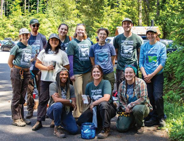
A group of WTA, Greenway Trust and REI folks get ready to work on the Middle Fork Snoqualmie Trail in 2023.
Photos by Steven M. Smith, Allie Tripp
Providing public education is extremely important, especially when there’s a shortage of public lands employees to do education and outreach.
presence there to answer questions, especially for newer recreators,” said Erin Browning, WDFW’s lands partnership and project coordinator.
That first year, WDFW and WTA recruited 19 volunteers and organized 36 events at six WDFW recreation sites in Central Washington and the Methow Valley. Volunteers greeted folks at trailheads, offered resources on hiking responsibly and shared information about wildlife. They also asked recreators about their experiences to help WDFW better understand how the lands are used. Building a new program required a lot of adaptability.
“It was a real learning experience on both sides,” said Allie Tripp, WTA’s senior strategic initiatives manager.
“I’ve really appreciated WDFW’s willingness to learn and adapt.”
“WTA continued to be flexible every week. They were constantly problem-solving and brainstorming new ideas to make the programming more effective,” Erin said.
The WDFW ambassador program has grown each year. This year, there were five partner organizations, including WTA, at eight locations.
“It’s been so wonderful to work with WTA. We really have a shared drive to make public lands welcoming,” Erin said. “This program might never have gotten off the ground without WTA’s support and partnership.”
A shared vision
MOUNTAINS TO SOUND GREENWAY TRUST
If you’ve ever hiked in the I-90 corridor, you’ve likely hiked in the Mountains to Sound Greenway National Heritage Area, which stretches from Seattle to Ellensburg and includes the Issaquah Alps, the Middle Fork Snoqualmie Valley and part of the Alpine Lakes Wilderness. The Greenway Trust, a nonprofit, cares for the area through advocacy, trail maintenance, habitat restoration and education.
The Greenway Trust is an expert at coordinating large-scale, multifaceted projects in the area and WTA has helped them with many trail work projects.
“Connections are our strength,” said Mackenzie Dolstad, the Greenway Trust’s field programs senior manager. “For us, it’s ‘How do we get great work done, and how can we do that together?’ We don’t have the ability to bring in 2,500 volunteer hours on a trail project, and we don’t need to because we have a great partner that can.”
In 2003 and 2004, WTA and the Greenway Trust collaborated on one of our first projects together: building a new trail to Rattlesnake Ledge.
The Greenway Trust managed the project. WTA built the first mile of trail, and the Greenway Trust the second. With the additional help of Seattle Public Utilities (which owns the land) and EarthCorps, the 2-mile trail — as we know it today — came to be.
At the height of the COVID-19 pandemic, the trail was closed. And after 20 years, it needed work to stand up to more hikers.
The Greenway Trust worked with Seattle Public Utilities, secured funding and planned the work. WTA was a major onthe-ground partner, providing thousands of volunteer hours.
“It’s cool that there’s this long-range project we’ve partnered on for two decades,” said Joe Olbrych, WTA’s Puget Sound field manager, who previously worked at the Greenway Trust and still partners with them frequently. “We have
WTA and the Greenway Trust have organized events together and supported each other’s endeavors over the years, including with trainings and trail work.
such a large scope, seeing the whole state. … We benefit from their intentional focus on an area.”
WTA and the Greenway Trust have also worked on trails like Annette Lake, Poo Poo Point and Mailbox Peak.
“It’s a very hand-in-glove relationship,” said Mike Stenger, the Greenway Trust’s recreation project manager. “That’s been built over years of collaboration, from board level on down.”
Just as building sustainable trails is important to both our organizations, so is advocating for sustainable trail funding and legislation.
Every other year, WTA hosts Hiker Rally Day to advocate for public lands during the legislative session. The Greenway Trust’s staff regularly join us. WTA and the Greenway Trust also co-lead the Recreate Responsibly Coalition’s Washington chapter, which creates unified messaging on being safe outside and caring for our public lands.
We care about the same landscape; we care about the same trail systems.
We’ve also advocated for funding together, such as for the Great American Outdoors Act that helped fund repairs to the Snow Lake and Annette Lake trails, and a Denny Creek trailhead renovation. And the King County Parks Levy, which we both supported, is a majority of the King County Parks’ budget.
“We care about the same landscape; we care about the same trail systems,” said Michael DeCramer, WTA’s policy and planning manager, who previously worked at the Greenway Trust and coordinates with them on advocacy efforts. “For decades, we’ve been working with their team to advance our visions of abundant, wellmaintained trails.”
Photos by Allie Tripp, Steven M. Smith, Emily Snyder, Anna Roth
A green space for hikers and wildlife
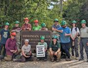
DISHMAN HILLS CONSERVANCY
Just a short drive from Spokane, the Dishman Hills Conservation Area has miles of trails to wander. The Dishman Hills Conservancy (DHC) is a nonprofit that connects and protects this area through education, conservation, recreation and stewardship.
Founded in 1966 — coincidentally, the same year WTA was founded — DHC works to keep this land public. Its goal is for the area to be a wildlife corridor with a wide trail system. It hosts guided hikes and an educational speaker series.
“WTA does a lot to make the trail system enjoyable for the public, but it wouldn’t be there for the public to enjoy at all if not for DHC working to acquire that property,” said Holly Weiler, WTA’s senior Eastern Washington trails coordinator, who has led dozens of work parties in Dishman Hills.
WTA and DHC, along with other organizations and agencies like Spokane County Parks, have created and maintained a beautiful recreation area that hikers enjoy year-round.
“It’s an oasis of public land surrounded on all sides by private land. It’s
WTA does work on the Dishman Hills trails all year — even when there’s snow!
easily accessible, with trailheads on all four sides and a user-friendly trail system designed for the whole family’s enjoyment,” said Lynn Smith, a WTA assistant crew leader who has volunteered many times at Dishman Hills.
DHC also knows that trails help preserve flora and fauna.
“If we didn’t have trails, people would do much more wandering around in areas with sensitive plants and harm the diversity there,” said Ruth Gifford, DHC’s executive director.
In 1991, dozens of wildfires ravaged Eastern Washington in what became known as Firestorm. The south end of Dishman Hills Natural Area and parts of the Iller Creek drainage, within what is now the conservation area, were heavily burned. Firefighting efforts included fire breaks. Eventually, DHC and Spokane County Parks acquired that land, and those bulldozer lines became trails. But those lines didn’t make for fun trails. They were steep — and prone to erosion — and the views were sparse.
WTA reworked the trail system, the first WTA project in the Spokane area. We
added switchbacks and rerouted trails to viewpoints of the Palouse and Spokane Valley, and other notable spots like the Rocks of Sharon, a great place for rock climbing and seeing wildlife like moose and elk.
WTA has worked on various other projects in the Dishman Hills, including helping build the Flying L Trail during the COVID-19 pandemic, some of the first work parties to try out COVID guidelines.
“WTA is an essential part of this bigger system,” Ruth said. “We wouldn’t have these trails without the help of WTA
The work that both of our organizations do is so dependent on the connected community.
and the volunteers who do that work ... WTA has techniques, standards and institutional knowledge that DHC doesn’t have.”
These days, WTA regularly returns to Dishman Hills, even during winter to clear downed trees and encroaching brush from snowshoe trails. And while WTA and DHC are key to keeping this area public and accessible, other partnership organizations and the community help make it possible.
“The work that both of our organizations do is so dependent on the connected community — those who support DHC by being members, those who support WTA by being members or volunteers,” Ruth said. “They’re contributing to something bigger and more permanent.”
THANK YOU TO OUR CORPORATE PARTNERS
Find out if your company matches charitable gifts. Your donation could go twice as far! To learn more about supporting WTA’s work, email corporate@wta.org.
PARTNER
$50,000+
HIKE-A-THON SPONSORS
$2,500+
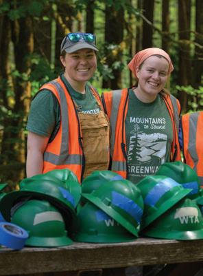
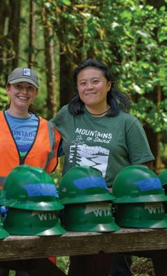
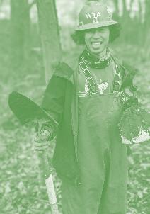
Creating a Path for Outdoor Leaders
Back in 2023, Michelle Mouw was one of the members of WTA’s Emerging Leaders Program (ELP), which helped participants learn skills and make connections that could help them pursue a career in the outdoor industry. She learned trail work skills, met many professionals in the outdoor sector and even led a trail work party for BIPOC youth at a neighborhood trail.
WTA celebrates 5 years of helping build a better future for trails through the Emerging Leaders Program
By MJ Mahan and Krista Dooley
After she finished with her time at ELP, Michelle was hired as a King County backcountry trail crew member for a season. The following year, she returned to WTA as a leader for the ELP crew. Then she spent a season as a Lost Trails Found crew leader.
“I directly used my leadership experience and additional trail skills (from ELP) to lead the Lost Trails Found crew,” she said.
This year, Michelle joined a restoration crew with the Mountains to Sound Greenway Trust and will begin a landscape architecture graduate program at the University of Washington in the fall. A time to celebrate
Michelle is just one example of the successes of the Emerging Leaders Program, which wrapped up its fifth season earlier this year. Now, we’re
Emerging Leaders Program helped make powerful connections for participants
looking back and celebrating the impact, connections and lessons learned from the program, which has attracted an array of applicants, from recent graduates to midcareer professionals, all looking to gain experience in trail maintenance and outdoor leadership while exploring new career pathways.
“It’s been such a joy seeing the Emerging Leaders Program grow and evolve over the past 5 years,” said Jaime Loucky, WTA’s chief executive officer. “When WTA first launched this program, we saw a need to create more spaces where early career leaders
could build skills and get to know the outdoor industry. Along the way, we got to see five cohorts of fantastic, motivated and talented people build their leadership and trail skills, and make connections with each other and with other partners. And we got to see them launch their careers.”
Learning and growing
The program began in the fall of 2020, when WTA launched a paid program that focused on building trail maintenance skills and learning in community, including for Black, Indigenous and People of Color (BIPOC) and LGBTQ+ folks, who
are underrepresented in the outdoor industry. At the time, we called it the Leadership and Inclusion crew.
“For most of us, this is the first opportunity we’ve ever had to develop our technical skills, network with outdoor professionals or learn about environmental stewardship as a career,” said Zachary Toliver, a member of the first crew.
That crew of six learned technical skills from outdoor industry professionals, including staff from WTA, the Washington Department of Natural Resources and Mount Rainier National Park.
“No matter what we’re learning or how much rain is dumped on us, the days always end filled with sincere enjoyment. Our conversations with experts go beyond the work, often into what everyday life is like in their respective fields,” Zachary said.
Thanks to participants’ feedback from that first year, we adjusted the program for a second year and renamed it the Emerging Leaders Program. Throughout
the 14-week paid program, participants focused on gaining trail maintenance and outdoor recreation skills and building a professional network.
WTA was excited to see how ELP provided such a powerful way to support leaders. Over the 5 years of the program, all of the folks who led the cohorts as a crew leader were returning ELP cohort members, had previously led WTA trail crews — or both.
Photos by WTA staff
WHERE ARE THEY NOW?
Here’s where ELP participants ended up after their time with the program. (Some participants fit in more than one category.)
41% worked at WTA
29% worked at community organizations
20% worked at parks/ conservation agencies or partners
Collaboration
ELP’s growing reputation attracted numerous partners and collaborators. In 2023, WTA’s advocacy team asked for and received funding for a partnership with Washington State Parks. Through this 3-year collaboration, ELP cohort members met State Parks staff, including rangers and staff who work in education, traditional art, natural resource management and tribal relations. They also did trail work at state parks. Washington State Parks staff benefited from the partnership as well.
“Getting to work with these future leaders in the outdoor industry over the past 5 years has been a great experience,” said Jason Armstrong, a park ranger. “They have provided me the opportunity to expand my leadership ability as I learn about challenges and barriers within the outdoor industry. Additionally, the group has accomplished some great work while at Deception Pass as we continue to improve trails and experiences throughout the park.”
ELP cohort members worked at 26 trail project locations with nine different land managers.
“It has been great to see the leaders and
crew members grow and explore new opportunities throughout the program each season,” said Leeanne Narwot, backcountry trail crew supervisor for King County Parks. “The large amount of passion and intention behind the program is apparent year to year as the program has changed. I have enjoyed partnering with ELP each year to get to know the members … while also offering opportunities to connect the crews directly with other staff within King County Parks. Being able to share a passion for trail work is truly a uniting force.”
Career paths
Again and again, cohort members said some of the most powerful aspects of the program were working on independent projects and learning from BIPOC leaders who are already in the outdoor industry and working to make the outdoors more welcoming. Through the program, WTA collaborated with more than 60 BIPOC community partners and outdoor professionals. Cohort members connected with those folks and learned more about their career journeys.
For the last three seasons, Chevon Powell has talked to cohort members
Before this program I felt unsure whether there was a place for me in the outdoor industry — this program has changed that feeling for me. I am much more excited to pursue a career in the outdoors.
—Maya Chinen, 2025 cohort
16%
12% attended grad school or an apprenticeship program worked in environmental education
8% worked at an organic farm
about her role as the founder and managing director of Golden Bricks Events, the creation of Refuge Outdoors Festival and being a BIPOC woman in the outdoor industry.
“I got to go hiking with the crew, and it’s so invigorating for me as a person that is 24/7 in the work,” Chevon said. “(ELP) aligns with what I do because I am serving BIPOC communities and creating spaces for BIPOC folks to be outside and live and thrive. … We need more diverse leadership in this work.”
Meeting people like Chevon helped cohort members see themselves in a similar place in the future. ELP participants built connections with professionals and got a better understanding of what jobs in the outdoor sector are like.
Valuable projects
ELP also included time for cohort members to work on a project that supported their own professional development interests and WTA’s mission. They wrote for Washington Trails magazine, coordinated volunteer trail work, translated outreach materials into Spanish, attended outreach events and facilitated a Salish Sea educational hike.
Before she joined ELP in 2022, Tiffany Chou had used WTA’s Hiking Guide when training to hike the Pacific Crest Trail. She wanted to give back, so she wrote Hiking Guide entries for urban trails. That gave her a chance to see the behind-the-scenes work for the Hiking Guide. And, when WTA was hiring for a communications coordinator, Tiffany’s previous experiences and new skills from her ELP project helped her get the job after her time with ELP. She has been working on WTA’s communications team ever since, including leading work on the Hiking Guide.
Gratitude
As we look back at the 5 years of ELP, we are so grateful to all the people, from cohort members to community partners to WTA members, who helped make it possible. And we continue to see power in the unique opportunities that programs like this can provide.
“Through ELP, we learned a lot about the importance of creating and holding this space and how rare these sorts of opportunities are, and the positive impact they can have on people’s lives. We need more programs like these to attract, foster and support the next generation of trail leaders,” Jaime said.
The future
The 2025 Emerging Leaders Program cohort was the last season to receive state funding in partnership with Washington State Parks, due to the extremely tight budget. Our team will be refining our approach and exploring new paths and partnerships to sustainably fund this program into the future. We are developing our strategic plan for the next 5 years, and we know it’s important for WTA to continue to support the next generation of outdoor leaders. Member donations help fund all of WTA’s work, including programs like ELP, but have not been able to fill the gap for ELP. If you would like to discuss the opportunity to have a financial impact on ELP going forward, please reach out to Andrea Michelbach at andream@wta. org or 206-557-3402.
Photos by WTA staff
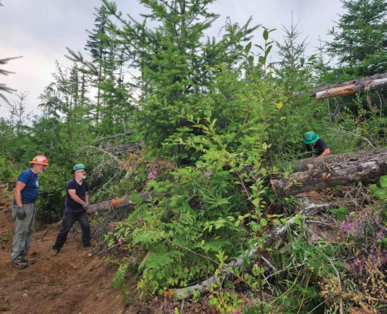
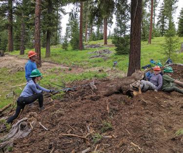
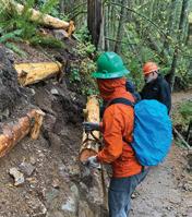
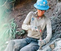
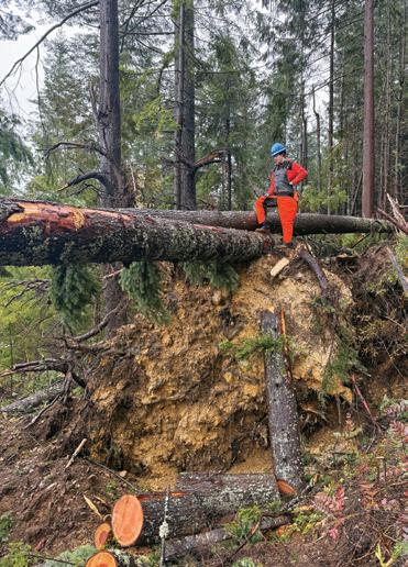
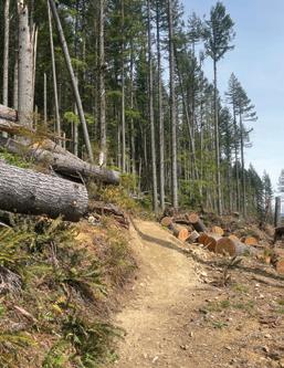
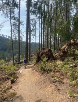
A Devastating Storm, an Impressive Recovery
A bomb cyclone brought down massive tangles of trees on Tiger Mountain. WTA helped lead the charge to clean it up.
By Chloe Ferrone
n November 2024, a large storm system — referred to as a bomb cyclone — ripped through the Pacific Northwest, causing severe damage to trails and property across Washington state. Tiger Mountain was hit was particularly hard, with dozens of trees torn up by the roots and blown across miles of trails and roads on the mountain.
With its network of well-maintained paths and its proximity to Seattle and surrounding areas, the Tiger Mountain trails, managed by the Department of Natural Resources (DNR), are hugely popular with day hikers and mountain bikers. Because of that, it was clear in the wake of the storm that cleanup efforts would need to be swift and efficient. And that would require coordinating across multiple agencies and nonprofit partners to get the job done.
Thanks to WTA’s skilled staff and volunteers — as well as a strong partnership with land managers like DNR — we were able to act quickly to help get these popular trails safe and hikable again.
Devastating storm effects
Emily Snyder, WTA’s Central Puget Sound trails and saw program coordinator, was one of the first to view the damage with DNR maintenance staff after the storm had passed.
Emily teamed up with Jenny Hakala, a recreation maintenance specialist at DNR, to survey the damage. When heading up Tiger Mountain, the crew initially drove past a familiar road gate because of the number of downed trees blocking it from sight. All across the trail system, tangled masses of trunks, limbs, root wads and debris created a three-dimensional puzzle of trees that would need to be cleared.
“None of us had ever seen anything that was that devastating,” Emily said. “We couldn’t even find the roads, never mind the trails.”
The wind gusts had moved up drainages and draws with incredible force, leaving wide swathes of the forest leveled.
Jenny determined that roughly 60 miles of DNR trails were severely damaged by the bomb cyclone storm event. “Trails were covered in uprooted trees and jackstraw piles that were impassable and seemingly impossible to tackle,” she said.
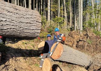
Volunteers step up
Meteorological elements had aligned to create the perfect storm, but fortunately for Tiger Mountain, circumstances also aligned to allow WTA to aid with
Left: Liza Noworyta, professional crew coordinator and a B sawyer, looks at damage at Tiger Mountain.
Below: Emily Snyder (holding chainsaw), Central Puget Sound trails coordinator and C evaluator, and Ben Semer, a volunteer crew leader and C sawyer, work on recovering trails.
the cleanup quickly and efficiently. Emily recognized this as a “once-in-alifetime” opportunity to put sawyers to work and to get some intensive saw time for those who wanted it. Unfortunately, only a few work days remained in WTA’s contract with DNR. So Emily got creative and scheduled chainsaw trainings for the area as a way to continue the work.
Emily was also being bombarded with volunteer requests to come out and help clear the damage.
“All our WTA chainsaw sawyers wanted to help,” she said. “My phone was ringing off the hook.”
The chaotic aftermath of the storm gave crew leaders and assistant crew leaders a chance to get as much saw time as they wanted.
“This was all pretty highly technical stuff and it speaks to the fact that we
Sawyer training
Anyone who operates a chainsaw on a WTA work party needs to be a certified sawyer. For crosscut, anyone can use a saw, but a B sawyer or higher needs to present and lead the team. To become a certified sawyers, volunteers go through a multiday U.S. Forest Service training course and evaluation. There are three levels of certification: A (apprentice), B (saw team lead) and C (expert/instructor).
have really well-trained volunteers who have really high-level skill sets,” Emily said.
“People are interested in learning these high-level skills, and they want to be able to use those skills to be responsive to community needs and projects. This storm cleanup was a great way to apply all the skills we teach our volunteer leadership and high-level sawyers.”
Silver linings for WTA sawyers
Emily explained that the saw trainings on Tiger Mountain proved to be a great opportunity to get hands-on training time for anybody looking to level up from a B-level to a C-level sawyer because everything they were cutting was so complex.
“This was not something that just anybody could go in and do without an advanced level of training and experience. It was definitely highly skilled work,” she said.
Everything the crews were cutting had to be done very carefully, with supervision and collaboration. “For many WTA instructors, once they’re cutting at those advanced levels, they end up spending more time teaching newer sawyers than actually running the saw themselves, so their own
skill development drops off or gets rusty,” Emily said.
“We used the Tiger work as advanced sawyer trainings so our B- and C-level instructors could actually get some trigger time and get to cut with other skilled sawyers. We learned a lot doing that. Our C sawyers fine-tuned their technical skills and cutting techniques, and some of our B sawyers were able to level up to C with the experience they gained, problem-solving their way through those debris piles.”
Getting the job done
The decision was made to prioritize main trails and easy loops, focusing on high-use trails. Last to open were longer connector trails, such as the south end of Tiger Mountain Trail and Side Hustle.
One challenge the crews faced was the intricate network of tangled trees, unbalanced root wads and the puzzle of deciding cut order and pattern to clear the trees safely.
“It could not be overstated the size and complexity of these blowdowns that required highly skilled and trained sawyers, a WTA specialty,” Jenny said.
Photos by Emily Snyder, Simon Lie
Another unique aspect of the project was the fact that it was freshly downed, green wood. Wind-loaded down trees store a lot of energy and have the potential to move dynamically when they are cut, with cut pieces often moving many feet in opposite directions at high speed. Recognizing the hazards, knowing where to stand to make those release cuts safely and how to control the release, minimizing dynamic movement with your cut plan, is an essential skill of high-level sawyers.
“There was a lot of physics happening,” Emily explained. “When trees blow down, the fibers in their trunks and limbs are under tension and compression. Sawyers call that ‘bind.’ When you cut through the bind, your saw can stick in the compression wood, or the tension wood can break or split spontaneously, moving with force in any direction. Identifying and mitigating all the potential movement and sticking points to come up with a cut plan that provided some safe space to stand sometimes took two to three sawyers strategizing together. Steep slopes and largediameter trees added to this complexity. If you were lucky, you got to be the one to execute it. We learned a lot through trial and error, but always with safety in mind.”
Squak Mountain was another area where WTA worked to clean up the damage. King County crews went in and cut a basic path through the storm damage with their chainsaw crews, with WTA crews coming in behind them with crosscut saws and rigging, rebuilding the trail as they went.
“We did a lot of tread repair, some rigging and more cutting in order to get those trails back to a standard corridor width and safe to be on again,” Emily said.
Contingencies for future storms
Another opportunity for collaboration came when WTA renewed its contract with DNR. The storm made everyone recognize the need to include language that allowed for contingencies, especially storm cleanup and rebuilding efforts should the trails ever need it.
“When the new contract was written, the wording changed so that we could pivot more easily if needed. One of our big learnings and takeaways from the whole thing was that our contract language was pretty locked down to the projects that we had agreed on with DNR,” Emily said. The new contract now allows work days and resources to be diverted to storm cleanup if trails are hit with another big storm.
Strong agency and nonprofit partnerships
Emily emphasized that the work was made possible by the strong partnerships between WTA and DNR, as well as the amazing certified volunteer sawyers from WTA, Evergreen Mountain Bike Alliance (EMBA) and other organizations who came out and helped, such as Washington Conservation Corps and Northwest Youth Corps.
“We all learned a lot about trail work, but what resonated the most were the strong partnerships in the nonprofit community that helped us get the trails back open to the public,” Jenny said. “WTA and EMBA sawyers came to the rescue, and with Conservation Corps crews and DNR staff, at least 4,000 hours were put into clearing these trails.”
Jenny added that WTA helped spread the word about the trail closures, making her and her crew’s job easier.
“People tend to push past closures thinking they can handle it, but when trails are closed, it’s for both safety and sustainability. Whether it’s closed because it’s an impassable trail or crews are currently working on these trails doing dangerous work, please respect the closures,” she said. “They are in place for your safety and the safety of the crews while they’re working.”
She also emphasized that it’s important to have land manager permission before doing any work. Trail users are encouraged to report any issues with a trail and let the land manager determine the best way to address it.
What’s to come?
Nine months later, the storm-damaged trails have all been reopened. WTA volunteer crews continue to work on the Tiger Mountain trail system. Over the last 2 years, they have helped build a reroute of the Middle Tiger Trail and a 1-mile section of the Tiger Mountain Trail impacted by the Tree Tip timber sale. Just this July, they completed a newly built trail junction and tread improvements through the logging scar to reopen the last closed section of that trail. There is still tread repair left to do, both from the bomb cyclone as well as general maintenance. If you’d like to see the work firsthand and are interested in volunteering to help with continued trail improvements on Tiger Mountain, look for our volunteer work parties happening there on Sundays in September.
Photos courtesy Jenny Hakala
Joy & beauty
Judges’ favorites from WTA’s 2024 Northwest Exposure Photo Contest
This photo brings me joy. There is a lovely balance of shadow and light. I adore the colors, the bokeh background of olive green dotted with sky blue and the pop of burnt sienna on this inquisitive robin’s chest. I especially love that this photo celebrates the beauty of nature that can be found in our Trails Next Door. — Jenica Nordstrom
A Light in the Darkness
Photo by Forrest Golic
This image of a hiker on Mount Ellinor’s winter route during the pre-dawn hours invites the viewer to share the experience. You can feel the cold and calm of a winter morning in the mountains. The vertical orientation was a great choice. It utilizes the “rule of thirds” with a clearly defined foreground accentuating the route, a middle third focused on the hiker, and the top third featuring the landscape and providing scale. The footsteps lead directly to the hiker. Despite the low light, it’s a remarkably sharp photo. Finally, the starburst from the headlamp is perfectly defined, putting a cherry on top of an already outstanding photograph.
— Doug Diekema
Nature Next Door
Photo by Allen Vu
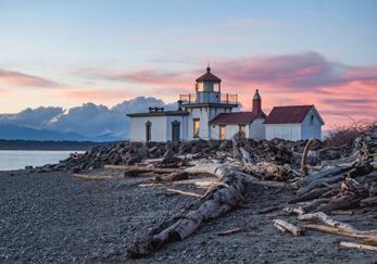
Ready for the Night
Photo by Ioana Veras Tobos
My honorable mention pick for 2024 is personal. Twenty-five years ago, I met the love of my life, by chance, at a lighthouse. Every year since, we’ve visited a lighthouse to commemorate. For our 20th anniversary, we hiked to the one beautifully depicted here, West Point Lighthouse. As the golden hour hands off to the blue hour, the windows appear to glow from within, as if the keeper were ready for the night ahead. The arc of the driftwood leads the eye to the lantern room and beyond, finishing the composition. Many thanks to the photographer for sharing a memorable vision of this lighthouse. Buff Black
A Moment of Peace
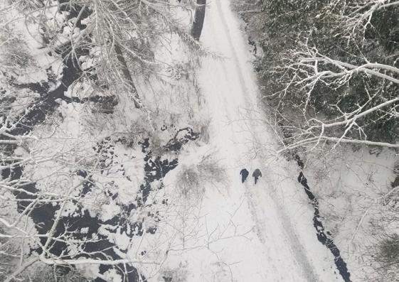
Photo by Mckenzie Campbell Davies
There are a bunch of reasons I love this photo. Ravenna Park in Northeast Seattle is such a sweet urban escape. You can do a mellow weekend walk or fast-paced run through the ravine — there are tons of loops and entry points, so it never feels the same twice. I love that this shot feels like a drone took it, but it was actually from a bridge right over the ravine. The black-and-white look adds to the mood — it makes the two hikers stand out in the quiet, wintry setting. There’s something peaceful about that contrast of movement and stillness. It’s a place that makes you slow down and take it all in. — Archana Bhat
Share your own photos
WTA’s 2025 Northwest Exposure Photo Contest is now open. Submit your favorite shot’s from Washington trails by Oct. 6.
wta.org/photocontest
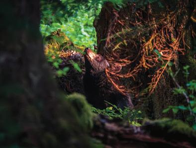
What Does a Bear Think About?
Photo by David Tillery
I believe wildlife photography may be the most challenging form of photography. You have to be in the right place at the right time and ensure you are doing everything you can to avoid disturbing your subject or altering their natural behavior. Trees and lighting can hinder your ability to capture your subject and sometimes the creatures are simply moving too quickly to frame the shot! But in this case, all the right factors came into play. The natural light creates the perfect spotlight on a gorgeous black bear enjoying a moment of peace on the forest floor of the Hoh Rainforest. — Victoria Obermeyer
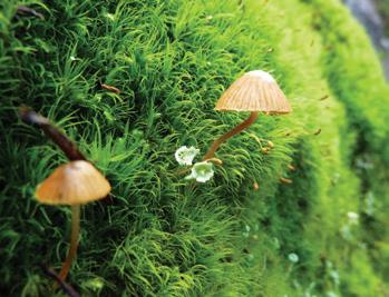
Find a New, Fun(gi) Perspective this Fall
Learn about the fantastic world of fungi and your hikes will be even richer
By Joseph Gonzalez
ate summer into early fall is my favorite time of year to hike in Washington. I’m just beginning to get tired of hiking after long days on trail all summer. And Mother Nature is getting tired, too. Blazing colors and bushels of berries feel like the exclamation point on peak hiking season before a transition to a sleepier season.
Finding a new outdoor interest on trail can help rekindle your relationship with nature. For me, that’s mushroom hunting. Slowing down to appreciate the fantastic world of fungi gives me a fresh perspective every fall and makes me feel closer to the land. And fortunately for us, Washington is a fungi kingdom. Learning about fungi can help you connect more deeply with outside spaces and bring a fresh perspective to your relationship with the outside world.
How to make spore-room for fungi
Mushrooms are ephemeral; some species only appear a couple of weeks out of the year before disappearing again, which is just another reason to appreciate them. They come in all different shapes, sizes and colors, and can be found in a range of habitats. They’re everywhere in Washington — if you know how to notice them.
Enough toad-stoolin’ around. Here’s how to learn more about mushrooms and how to find them:
Search WTA trip reports to learn where other hikers are finding fungi. Use the keyword filter to search for words like “mushrooms” or “fungus.”
Have a specific species in mind? Try searching for the mushroom’s name.
Fungi in Washington come in a rainbow of colors. Learn more about them at wta.org/ rainbow-fungi
Check out iNaturalist. It’s an online social network where folks share biodiversity information. Use the explore feature by entering “fungi” or enter the name of a species you’re looking for and use filters to look for recordings in a set date range. Then use iNaturalist’s map filter to see where people have recorded mushrooms across the state. You can then compare that with WTA’s Hike Finder Map to find the perfect trail in that area.
Learn about mushrooms before getting into “truffle.” Fungi are beautiful to look at and sometimes delicious to eat. But before you forage, make sure you have the knowledge to identify edible species and that you know the potential health risks
of consuming wild mushrooms. And while foraging is legal in many areas statewide, always check with land managers to ensure that foraging is allowed and that you have the proper permit.
Be a fun(gi) hiker. (Shii)take mushroom photos to share with others! The incredible world of fungi helps make fall hiking in Washington a unique and memorable experience. Share the love! You can cap off your hikes by featuring beautiful mushroom photos in your trip reports at wta.org/tripreports. We also have a flora and fauna category in our Northwest Exposure Photo Contest and fungi are welcome. Submit your photos by Oct. 6 at wta.org/photocontest.
Photos by: Alex Levine, Amanda Modery, Joseph Gonzalez, Tynesha Campbell
Going the Distance
How I trained for and completed a 100-mile run (at 64 years old!)
By Craig Romano
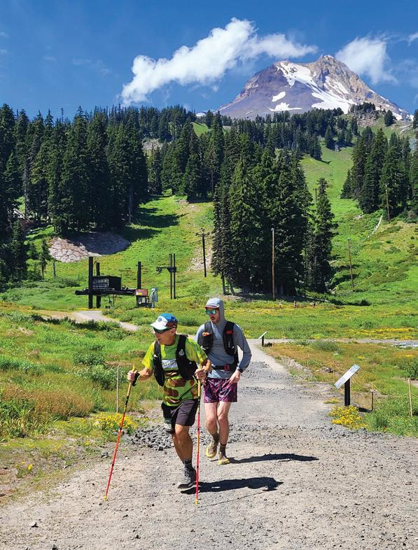
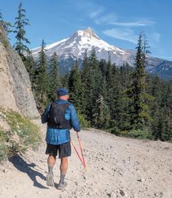
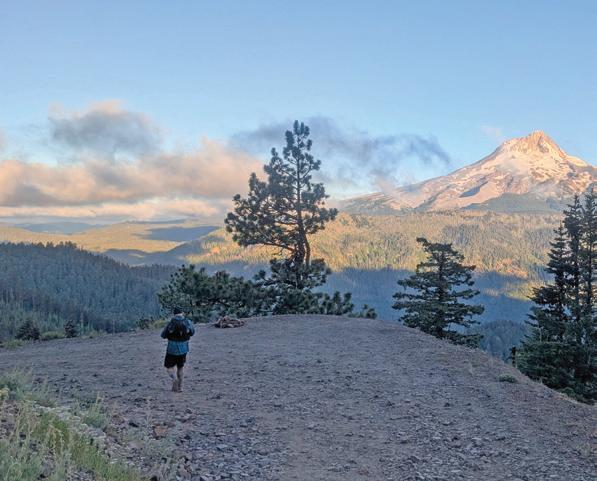
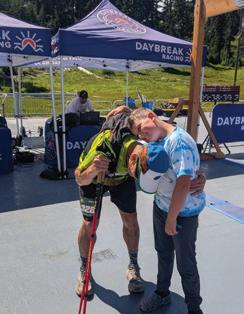
s I crossed the finish line, I was overwhelmed with euphoria. Family and friends greeted me and race directors presented me with a 100-mile finisher’s belt buckle. I didn’t feel any muscle fatigue or discomfort. My head was too high in the clouds to notice the toll the race had taken. In my younger years, running 100 miles was unfathomable. But in 33 hours and 38 minutes, I finished the Hood Hundred with its 17,400 feet of elevation gain. I made the cutoff by 22 minutes. It was my first 100mile run — and I did it at the age of 64.
I am now a 100 miler — one of a small but growing cadre of folks taking on this challenge. I first started ultrarunning in 2011 by training for my first 50-mile race for my 50th birthday. I successfully completed it, but afterward only occasionally ran shorter 50 kilometer races. In 2021, I turned 60 and my interest in ultrarunning rekindled. I had acquired an autoimmune condition, polymyalgia rheumatica, the year before and thought my running days were over. But after starting prednisone, I was able to run hard and pain-free again.
Once I was able to run again, my friend Peter invited me to run around Oregon’s Mount Hood on the 41-mile Timberline Trail. When I was able to complete that challenge, I realized I still had it in me. I also realized that I’d been taking my health for granted — and time was running out to do all the things I still wanted to do. With my condition in remission, I overhauled my diet and ramped up my running and hiking. For my 62nd birthday, I ran the Cuyamaca 100K (62.1 miles) Endurance Run in the mountains east of San Diego.
In October 2024, I decided it was time for the big one. I started training by running a 50-mile race — followed by three more, as well as several shorter but challenging runs. And I began mentally preparing. I read up on what it takes to do a 100-mile run, and I called upon friends who’ve done it. They had confidence in me and encouraged me. For my 2025 New Year’s resolution, I signed up for the Hood Hundred. I was committed.
On race morning, July 26, I lined up with 250 other runners, including several other first time 100 milers. Each of us was there for our own reasons — all ready to push ourselves far beyond our comfort zones. For me, it was a chance to fully embrace my human potential and truly live in the moment.
So you want to run a 100 miles?
Ultrarunning (runs longer than 26.2 miles, a standard marathon) has exploded in popularity over the past decades. According to UltraRunning magazine, in 2000 there were about 8,400 runners competing in 226 ultra races in North America. By 2024, more than 146,000 runners participated in 2,500 ultra races, including 12,400 runners in a 100-mile race. While the number of participants has grown, it’s still a tiny fraction of the population (0.03%) and of runners in general. About twice as many men as women tend to run ultras. But each year, ultras are attracting new participants — including women and younger runners. The average age of an ultrarunner is 43, but it’s dropping.
I’ve definitely noticed an increase in younger runners since 2011. Being younger has its advantages in many physical fitness feats, but ultras favor more seasoned athletes. It takes years and many miles to condition the body for the rigors of ultrarunning. It’s pretty impossible to complete a 100-mile run without a lot of experience and dedicated training.
When I began training, I consulted experienced 100-milers for advice on training, equipment, nutrition, hydration, running at night, injury prevention, mental preparedness and so much more. Almost everyone mentioned the importance of mental conditioning. Visualizing the run is as important as logging miles. You have to be strong mentally to overcome discomfort and urges to quit.
My advice, from what worked for me
Plan your training. If you’re a regular runner with a decent mileage base, consider upping your game. Start by increasing your overall mileage and long runs, but not too much or too fast, as your body needs to gradually adjust. A general rule is to not exceed a 10% increase in miles each week. Be sure to take adequate rest and recovery days — this is especially important for older runners. Your body needs to repair and build muscles through adequate sleep and nonrunning days. Mix up your routine. A day of paddling gives your legs a rest while still giving your body a good workout.
Prepare your body. I put in the miles, training on varied terrain and in different conditions. I ran mountainous courses
Craig Romano runs the Hood Hundred in July. Grady Olson (running behind him on facing page) helped with support.
Photos courtesy Craig Romano
for strength and rail trail courses for speed. I ran in heat and in cold rain. I did long day hikes. And I did back-to-back hard workouts. A mountainous hike the day after an ultra helped condition me to being on my feet and moving for long hours. Eat for performance. I lean heavily into proteins, fruits and vegetables. Beans and nuts are power foods. So are eggs and potatoes. I eat them regularly.
Prepare your race-day food and drink. Experiment with food, electrolyte drinks and energy gels to see what your body can tolerate and absorb. Your stomach will be stressed in a 100-mile run. I had gastrointestinal issues for the second half of the race, but I was able to take in calories and electrolytes via various liquids and gels to avoid dehydrating and running out of energy.
Prepare your gear. I made sure my race-day gear would work by training in it. If you want to run a long race, you need to make sure your gear won’t hold you back. Make sure your shoes are supportive, your socks don’t cause blisters and your clothing
fits comfortably. Test which ointments work to prevent chafing.
Prepare your support. While running is an individual pursuit, you’ll need a village of runners to help you. I recruited two of my best runner-friends for my crew and pacers, Grady Olson (WTA’s development operations and analytics manager) and Wendy Wheeler-Jacobs (former WTA board member). I’ve known both for years and have logged many miles with them. They were integral to the success of my run. At each aid station, they helped me and made sure I was back on course in good time. You can easily miss a cutoff time by lingering at an aid station. Wendy also paced me through the night, providing company and keeping me focused. She and Grady made sure that I ate every hour and that I stayed hydrated. My wife and son were on hand and supportive as well. My son ran with me for the last half-mile, giving me an emotional boost to finish strong.
Find a broader community. Join a running club for camaraderie and to meet running partners with shared goals.
Volunteer at a 100-mile race to see what other runners go through and how they deal with issues that arise. Witnessing other runners’ accomplishments will motivate you.
Pick a race that matches your style. Do you want to be alone on the course? There are 100-mile races with just a handful of runners. I picked Hood Hundred because it was a Western States 100 qualifier, which meant it would attract a large field. I thrive being around others. However, this was a tough course, with 17,400 feet of elevation change. Perhaps an easier race will be better for your first 100. There are ultras on rail trails, which means not much elevation change. I like backcountry runs, but many ultrarunners prefer races with multiple loops, allowing them to regularly see their fellow participants and making support logistics easier. Also consider time limits. Hood Hundred has a 34-hour cutoff. If you don’t make aid station checkpoints by certain times, you’re pulled from the race. A race with more generous cutoffs will be less stressful and will give you a better chance to finish successfully.
Why run 100 miles?
Completing a run of this magnitude will greatly increase your self-confidence and self-discipline, attributes that can permeate into other aspects of life.
The conditioning from ultrarunning helps me stay healthy, sleep well, strengthen my muscles and joints, increases my bone density and boosts my energy. It has certainly made my hiking easier. A 20-mile, all-day hike with lots of breaks isn’t as daunting after running 50- and 100-mile races. Ultrarunning has helped me maintain a fitness level greater than the majority of my peers. And it has allowed me to cover distances on the trail like when I was younger.
On second thought — I couldn’t run 100 miles when I was in my 20s and 30s!
Craig Romano is a guidebook author, craigromano.com.
Craig Romano runs Hood Hundred (left) and enjoys a well-earned hug from a critical member of his support team, his son.
Building Belonging, One Story at a Time
By Jessi Loerch
In 2018, Tommy Corey thru-hiked the Pacific Crest Trail. On that hike, he was moved by the strong connection he found with his fellow hikers.
“I think that was the first time I’d really experienced having a community of people that are like-minded in that we all enjoy nature,” he said. “We were all doing this really arduous thing. That was the first time I’d really experienced being immersed in nature with people and feeling that connection.”
After that hike, he was eager to get back on a long trail. But when he started hiking the Continental Divide Trail (CDT) in 2022, he didn’t find the sense of community he’d been craving. He felt disconnected and began thinking about
how he could build that connection and about what type of community he wanted.
“I want a community that is diverse. I want a community where you can see the spectrum of human existence represented,” he said. “I want all types of people because I think that there’s so much learning that comes from each other.”
Over his next month of hiking, that idea of learning from each other was all he could think about. Tommy had been a photographer since he was a kid, and he’d always dreamed of being an author. He envisioned a book full of photography and personal stories. Eventually, the idea
was pulling on him so hard that he quit the CDT and followed that urge to share stories and learning.
That project led him all across the country. He covered thousands of
miles, interviewed more than 200 people and took countless beautiful portraits.
It was important to Tommy to try to dismantle the dominant narrative about who is “outdoorsy.” He reached out to people of color, disabled folks, LGBTQIA+ and people with various body types. He talked to hikers, runners, surfers, mountain bikers, equestrians, kayakers and so many more.
Now, those stories and photos are collected into his book “All Humans Outside,” which features 101 people who adventure outside in a wide range of ways.
Just like thru-hiking, the path to creating the book wasn’t always easy. In particular, it was a logistical nightmare to string together a trip to photograph 101 people.
“Trying to meet up with 101 adventurous people was the bane of my existence,” he said.
He joked that he should have planned to photograph homebodies. It took him over 2 years to make all of the connections he needed. And while planning the trip was hard, photographing and talking to the people was a joy. Tommy was aiming to write a book about connection. Through the process, he found that he was building those connections and that community. Many of the people he photographed and interviewed are now his friends.
“A book like this is especially important right now, with the administration trying to erase stories and erase history from marginalized groups,” Tommy said. “Art and literature are the best places to share unique stories.”
He hopes his book can spark something new for those who read it.
“Each story in ‘All Humans Outside’ is a testament to the way individuals build communities and foster inclusivity, reminding us that nature and storytelling can bridge gaps and unite us all,” Tommy wrote.
In-person event
Catch Tommy Corey and several contributors from “All Humans Outside” at the Mountaineers Program Center (7700 Sand Point Way NE, Seattle) on Sept. 30. Doors open at 6:30, tickets start at $12.
Tommy Corey (black and white photo) featured 101 outdoor adventurers in his book, including (from top left) Mirna Valerio, Bennett Rahn, Perry Cohen and Arthur Aston.
Tales from the Dirtbag Diaries
A new way to enjoy stories of the many ways the outdoors help people find themselves
By Jessi Loerch
Since 2007, The Dirtbag Diaries podcast has been telling the stories of outdoor adventurers. With curiosity, insight and a lot of humor, Fitz Cahall, Becca Cahall and the whole Dirtbag Diaries team bring to life stories from running a river to thru-hiking to burro racing.
If you’ve loved the stories you’ve heard on the podcast, you’ll also love “States of Adventure” by Fitz Cahall. In 30 stories, Fitz highlights the ways the outdoors can help us find ourselves, even when we get lost.
The stories in the book have been translated from podcast episodes, or feature podcast guests. Fitz said one of the challenges of the book was translating an audio story — where there’s the nuance of people’s intonation — to text. Fitz has done a
good job of that — and the beautiful photos help tell the stories, too, in a way different from audio.
Even if you never take up burro racing, you can appreciate the joy of climbing through aspen to wide-open meadows, and the thrill of finishing a trip. Fitz thinks the relatability of the outdoor experience is part of what makes the stories like those in this book so moving. No matter what level we are in our outdoor pursuits, we’ve all shared common experiences.
“I may not be on the level of professional climbers, someone like Tommy Caldwell, who’s done the most difficult things on El Cap, but I’ve climbed El Cap and I’ve felt that feeling of having the light hit you on the wall. I have experienced that and that’s a bond that we all share, no matter what level we are in these sports,”
Fitz said. “We’ve all woken up on a cold morning. We’ve all stayed out later than we’ve wanted to. We’ve all had moments of joy and struggle. And no matter where you are in terms of how you want to challenge yourself, chances are you’ve done something that challenges you.”
When creating the book, Fitz tried to show stories that represented different stages of that journey. Sometimes the time running around and being “irresponsible” creates moments where people can find what they can be responsible for. Falling in love with a wild place can be a powerful motivator to help care for that wild place — and for all wild places.
“I think in our podcast, there is a template for a life lived with meaning, lived with purpose, lived with community, lived with fun, lived with joy and hard work,” Fitz said. “We all have the ability to have an impact in our communities, to have an impact in our own lives and that, to me, is why I think these stories have resonated and mattered so much.”
WTA on the Diaries
WTA’s trail director recently talked to the Dirtbag Diaries for a story about how national public lands are at risk, dirtbagdiaries.com.
For more stories about public lands, check out dub.sh/ EndangeredSpaces.
Photo by Gary Kanz Jr.
For many hikers, spring and summer are their favorite hiking seasons But for others, fall and winter are prime hiking time — for the fall colors, later sunrises and earlier sunsets, wintertime birdwatching, cooler weather and snowy landscapes. Whether you’re in the former or latter category, here are some fun hikes to check out for these upcoming shorter, chillier (but just as lovely and hikable) days.
cooldown
Fall and Winter are Coming
McNary Wildlife Nature Area
Tri-Cities Area
Venture across the Columbia River, just barely into Oregon, and ramble on easy trails where you’ll see and hear a wide variety of birds, mammals and reptiles. By Mary Hartman
Just downstream of McNary Dam — near Umatilla, Oregon, a hair below the Washington-Oregon border — a network of wide, flat trails winds its way among nine ponds, crossing riparian zones, native wetlands and shrub-steppe ecosystems. These rich habitats are teeming with wildlife. Over 200 species of birds have been observed here, as well as deer, marmots, beavers, minks, frogs and turtles. With the region’s mild winters, you can check out McNary Wildlife Nature Area in all four seasons.
One highlight of the area is a “Kids in Parks” TRACK Trail, a 1.5-mile, self-guided path designed for children (and grown-ups) to explore the outdoors. Pick up a brochure or scan a QR code at the Ferry Road trailhead for details. The TRACK loop and miles of other connecting trails and footbridges provide lots of space to explore east of Ferry Road. Although the TRACK loop is shown on the map as ADA-accessible, just north of Tower Pond, there’s a protruding root and a narrow footbridge with a significant step up, so that segment is not wheelchair friendly. Luckily, there are plenty of other routes without impediments.
More trails and gravel roads circle the ponds west of Ferry Road, providing access for fishing, and they are also great for walking and viewing wildlife. The ponds at McNary Dam Nature Area are stocked with trout every spring, but hunting is not allowed. Non-motorized boats are welcome, but there are no boat ramps.
Tip: While you’re in the neighborhood, visit the Pacific Salmon Visitor Center at Spillway Park to learn about salmon and hydropower.
TRAIL DETAILS
Distance: 5 miles of trails
Elevation gain: 20 feet
Highest point: 315 feet
Permit: None
Dogs: Leashed
Trailhead: From the Tri-Cities, drive east on I-82 about 25 miles and cross the Columbia River into Oregon. Take exit 1 for Hwy 730 West toward Umatilla. Turn right at the end of the exit ramp, then take another right onto Brownell Boulevard. At the “T,” turn right onto 3rd Street (unmarked). Drive under the freeway about 1 mile, then turn left on Ferry Road. The parking area is about 0.2 mile on the right.
Alternatively, from Walla Walla, head west on Hwy 12. In about 30 miles, continue straight onto Hwy 730 West for about 25 miles. In Umatilla, go under the overpass, turn right onto Brownell Boulevard and follow the directions above.
Trail access is also available on 3rd Street near Fountain Pond, at Spillway Park near the visitor center, and on Brownell Boulevard (west end). Accessible vault toilets are available 0.2 mile beyond the Ferry Road trailhead, at Brownell Boulevard, and at Fountain Pond. Accessible flush toilets are available in Spillway Park and at the Pacific Salmon Visitor Center.
NEARBY HIKES
McNary National Wildlife Refuge: Similarly named and only about a 45-minute drive from the nature area, the refuge near Pasco, Washington, features a paved trail that provides terrific access to wetlands and sloughs, where migrating birds congregate by the thousands. (2.8 miles roundtrip, 50 feet of elevation gain)
Amon Basin Natural Preserve: With 75 acres of riparian habitat along Amon Creek, this preserve has plenty of opportunities for the avid birdwatcher, with two wildlife-viewing platforms and lots of other fauna to watch out for, including beavers, minks and muskrats. (1.9 miles roundtrip, 79 feet of elevation gain)
Photo by Jay Grate
Priest Rapids Shoreline Trail
Tri-Cities area
Enjoy easy walking, wide-open views and plenty of sunshine along the Columbia River shore near Priest Rapids Dam.
By Mary Hartman
The Grant County Public Utility District operates the Priest Rapids and Wanapum hydroelectric dams on the Columbia River in Central Washington. Federal license requirements specify that the PUD must balance the diverse needs of power, fish, wildlife, tribal groups, flood control, irrigation and recreation. The Priest Rapids Recreation Area and the shoreline trail provide opportunities for recreation, hiking and camping.
The wheelchair-friendly 3.2-mile Priest Rapids Trail runs parallel to the Columbia River near the community of Desert Aire. Priest Rapids Recreation Area is an irrigated park with a 14-site campground, a small swimming beach and a boat launch at the approximate center of the trail. North of the park, the trail is paved. South of the park, the trail is a wide gravel road that is closed to motor vehicles. Picnic tables and benches are interspersed along the length of the trail, and there are locations where you can access the river to cool your feet. Parking, picnic tables and vault toilets are available at the park and at the north and south trailheads, but there is no potable water, so be sure to bring your own.
The trail passes through long expanses of beautiful shrub-steppe habitat. Outside of the recreation area park, there is very little shade except in places where cottonwoods and willows grow beside the river.
Tip: A short distance from the south trailhead is the Wanapum Heritage Center, with a wealth of thought-provoking exhibits about the Wanapum Tribe. There is no charge for admission, but check their website for current operating hours.
Distance: 6.5 miles roundtrip
Elevation gain: 45 feet
Highest point: 538 feet
Permit: None
Dogs: Leashed
Trailhead: From Vantage, cross the Columbia River on I-90 and take exit 137. Drive south on Hwy 26 for 1 mile, then turn right on Hwy 243. Drive about 17 miles and turn right onto the main road to the Desert Aire community (Desert Aire Drive). Drive about 1.3 miles and turn left into the recreation area.
NEARBY HIKES
Priest Rapids Wildlife Area:
The north trailhead is near the Washington Fish and Wildlife’s Priest Rapids Wildlife Area Unit, with a boat launch and wildlife viewing blinds. You’ll need a Discover Pass. (5 miles roundtrip, 50 feet of elevation gain)
Jackson Creek Fish Camp: Just downstream of Priest Rapids Dam along the Columbia River, this camp has a short trail and a dirt road that follows a creek to make a nice waterfront walk. (1.4 miles roundtrip, 10 feet of elevation gain)
Photo by Mary Hartman
Wheelchair Friendly
Brownie Trail
Long Beach area
Take a day trip or camp at Lake Sylvia State Park to hike the Brownie Trail, one of 22(!) named multi-use trails in the Montesano City Forest.
By Steve Payne
From the kiosk near the playground at the day use parking area, follow the paved path toward a dam at the southwestern tip of Lake Sylvia. Keep right to find the Forestry Trail trailhead and message board; the signed Brownie Trail begins steeply to the right.
The trail passes mostly through second-growth forest of firs, cedars and maples and was named in appreciation for a local Brownie Scout troop that planted a stand of fir trees along the route. The gain is steady over the first quarter-mile, where trail runners might “enjoy” hill repeat drills.
Don’t panic when you come to unmarked forks in the trail — some are cut switchbacks and others are faint social trails. Think like a hiker and stick to the obvious route. After a mile north and 400 feet up from the trailhead, you’ll reach the junction with the Sylvia Ridge Trail.
From here, you can return the way you came, head right to connect with the Lake Trail that leads back to the day use area or — with map in hand and the other Ten Essentials — plan a route that stitches together 20+ trail segments covering 20+ miles. These trails have clever names like Espresso Shot, Middle Earth, Pine Winder and The Jungle; they are primarily used by mountain bikers, but hikers are welcome throughout. You’ll find “You Are Here” maps to track your location and stay found.
Tip: To fuel the drive home, check out the Lemon Hill Cafe and Bookstore in Montesano for French bistro fare. There’s all-day breakfast at the delightfully kitschy Rusty Tractor Restaurant in Elma, or a low-and-slow BBQ at Ranch House BBQ and Steakhouse outside Olympia.
Distance: 2.7 miles roundtrip
Elevation gain: 630 feet
Highest point: 460 feet
Permit: Discover Pass Dogs: Leashed
Trailhead: From Olympia, take US-101/WA-8/US-12 west to the Montesano exit, then go right on Main Street, left on Spruce Avenue and right on 3rd Street to the park entrance. Turn left to go over a bridge to a large day-use parking area that includes ADA spots. The park has a reservable group kitchen, picnic tables, a designated swimming area, restrooms and a small playground. There are flush toilets, including an ADA accessible toilet, at the trailhead.
NEARBY HIKES
Schafer State Park: Lake Sylvia State Park’s sister park is 9 miles north of Satsop and offers camping, day-use areas, fishing, floating and hiking trails. (2 miles of trails, minimal elevation gain)
Wynoochee Lake: Just one hour north of Montesano, you can find camping, day-use areas, wading, swimming, interpretive and hiking trails here. (12 miles roundtrip, 1,100 feet of elevation gain)
Photo by Steve Payne
Flying L Trail
Spokane area
The Phillips Creek trailhead and Flying L Trail provide eastside access to the Glenrose Unit of the Dishman Hills Conservation Area from the Spokane Valley.
By Holly Weiler
The 2018 Spokane County Parks acquisition of the 179-acre former Flying L Ranch dairy farm and subsequent development of connecting trails have greatly expanded the options within the greater Glenrose Unit (also known as “The Cliffs”) of the Dishman Hills Conservation Area. Starting in the Ponderosa neighborhood in the south Spokane Valley, trail options include the 2.2-mile Flying L Trail, which climbs from the parking area and traverses a Ponderosa pine forest before breaking out into an open hillside, flanked along its lower reaches by an old apple orchard and a small year-round stream.
Located on the right and just past the stream, the Inside Passage Trail junction expands the trail options. Visitors can choose to remain on the Flying L trail, which eventually connects to the main Glenrose Trail, or turn north on the Inside Passage Trail leading toward The Cliffs trail (named after the area itself). Since The Cliffs Trail also connects to the main Glenrose Trail, it is possible to hike a loop instead of an out-and-back.
The Cliffs Trail leading north from the Inside Passage and Glenrose intersection was formerly a lollipop loop with an impressive view overlooking the Spokane Valley, but — due to the recent Dishman Hills Conservancy acquisition of the Keystone Property, purchased in early 2025 — there is now a critical public corridor and trail connection with the Dishman Hills Natural Area. It is important to note that the trail corridor is narrow, with private property located on either side. Please respect adjacent private property owners by staying on trail. Additionally, the natural area is a hiker-only trail system (dogs are permitted on leash, but neither bikes nor horses are permitted within the natural area).
The area is perhaps best for its spring wildflower displays, although it is accessible year-round and has something beautiful to offer in all seasons. Additional trails are also on the horizon, as Spokane County Parks recently acquired a private parcel located between the Flying L Ranch and the Cliffs. A new connecting trail is expected by late 2025.
Distance: 2.2 miles one-way
Elevation gain: 660 feet
Highest point: 2,788 feet
Permit: None
Dogs: Leashed
Trailhead: The Phillips Creek trailhead is located at 4102 S Sunderland Drive in the Spokane Valley. From Dishman Mica Road, turn southwest on Schafer Road. Turn west on Cimmaron Drive, passing Ponderosa Elementary. When Cimmaron intersects Sunderland Drive, continue west into the trailhead parking area.
NEARBY HIKES
Dishman Hills Conservation Area - Iller Creek: Take a hike on the edge of Spokane Valley with commanding views of the valley and the Palouse, yet another area in the Dishman Hills Conservation Area where WTA has spent many volunteer hours. (5 miles roundtrip, 1,200 feet of elevation gain)
Dishman Hills Conservation Area - Rocks of Sharon: The Stevens Creek trailhead is another access point into the conservation area, and offers hikers a path to Big Rock and the other gigantic Rocks of Sharon. (3.3 miles roundtrip, 800 feet of elevation gain)
Photo by Holly Weiler
Panther Lake Loop Trail
Seattle-Tacoma area
While views of the lake are limited, you’ll find plenty to enjoy in this small urban oasis. This loop travels through wetlands, so stay on the main trail to avoid damaging sensitive terrain or accidentally crossing onto private property. By Catherine Vine
Panther Lake was formed in the 1990s after two dams were constructed reduce flooding in the surrounding areas. Start by heading right along the wide gravel path. As you walk on the east side of the lake, you’re actually strolling along the top of one of the dams.
At 0.2 mile, the trail splits briefly and heads downhill before quickly regaining elevation. Stay left for a more gentle grade and continue along the path, where you’ll soon come to a small wooden bridge. Once you cross the bridge, you can take a short spur trail to your left that brings you down to the shore of the lake. A bench here provides a shady spot to enjoy the view.
Return the way you came to reconnect with the main trail. As you walk through the forest, note the varied habitats provided by the woods, lake and wetlands surrounding it. This section of the trail is a great place to catch a glimpse of spotted towhees. In the spring, keep an eye out for Pacific bleeding heart as well as the occasional trillium.
Distance: 0.9 miles roundtrip
Elevation gain: 36 feet
Highest point: 238 feet
Permit: None
Dogs: Leashed
Trailhead: From I-5, take exit 142B. Merge onto Highway 18 west and continue straight onto S 348th St., which will become SW Campus Drive in 0.8 mile. The entrance to the park will be on the right after 0.4 mile. There are two ADA parking spots at the trailhead, as well as a wheelchair-friendly portable restroom.
You can also take the bus: The DART route 903 stops at the aquatic center next door to the park, and connects to the Federal Way Transit Center.
The park is open from dawn to dusk.
NEARBY HIKES
Photo by Catherine Vine
After about 0.7 mile, the trail merges onto the paved BPA trail for about 0.1 mile before crossing a second bridge and returning to the parking lot. Be alert for cyclists on this section.
The trail is well graded and hard packed, but some wheelchair users may find the wooden bridge challenging, potentially making an out-and-back trip a better option. While overall elevation gain is fairly low, the trail climbs and drops small amounts throughout. The east section of the trail provides a flatter grade than the north and west portions.
West Hylebos Wetlands: Stroll along a boardwalk through a wetland surrounded by towering trees dripping with moss. Take a break at the lake, and check out the Deep Sink, one of the few remaining peat bogs in the area. But leave Fido at home, since dogs aren’t allowed here. (1.2 miles roundtrip, minimal elevation gain)
BPA trail: Bike, walk or run along this paved trail that connects several parks throughout Federal Way. Try exploring the full length of the trail, then hop on the route 182 bus to return to your starting point to make your trip a loop. (7.3 miles roundtrip, 797 feet of elevation gain)
Take Transit
Wheelchair Friendly
Loowit Trail
Mount St. Helens
Hike the State
Hike the State is a free event where experts share hike recommendations and tips to prepare you for the season. This August, WTA staff shared their favorite fall hikes, including this one. You can find the rest at WTA.org/hikethestate
A full loop of the Loowit Trail is unlike almost any other hike you’ll do. You’ll cross vastly different (and difficult!) terrains — massive ravines cut through Mount St. Helens from its eruption, swaths of ash and volcanic rock, lush meadows, rocky boulder fields and more. By Tiffany Chou
There are multiple access points to the Loowit Trail — a good starting point is Climber’s Bivouac. This year, trailheads on the northeastern side of the loop are closed weekdays, and the June Lake trailhead is day-use only. Many folks complete the circumnavigation in 2 or 3 days; keep in mind you cannot camp in the blast zone.
The first 2 miles of your hike are standard Washington forest fare along the Ptarmigan Trail to the junction with the Loowit, which may be lively as you share it with summiters. Head left to take Loowit clockwise, right to go counterclockwise. Going clockwise, you can camp at the South Fork Toutle River on night 1 and hike through the blast zone on day 2.
The first third of the loop is an eclectic hike with boulder-hopping, meadows, forest and dips in and out of ravines. You’ll then climb out of the river valley, walk across meadows and reach the blast zone: an otherworldly area, littered with volcanic rock, St. Helens looming over you. Pass the junctions to Loowit Falls and Windy Trail, and reach a natural freshwater spring. Fill up here! This may be the only other reliable source besides the South Fork Toutle River in the fall.
Climb over Alpine Butte, which rewards you with a beautiful walk across the Plains of Abraham. On the other side of the plains is Pumice Butte, with nice (dry) campsites.
The last third of the trail involves dust and determination. After some easy trail past Pumice Butte, you’ll reach some huge ravines. Be careful; the “trail” may sometimes be an eroded bootpath. Don’t forget to look up; you’ve got nice views of Hood, Adams and Rainier. You’ll end up back at a boulder field, then start the climb back up to the junction with the Ptarmigan Trail. Once you’re there, you need only stumble down those first, relatively mild miles back to the car.
Tip: There are very few water sources on the trail in fall. Be prepared for a heavy pack! You’ll be rewarded with solitude, minimal bugs and cooler weather.
Distance: 31.7 miles, roundtrip
Elevation gain: 5,460 feet
Highest point: 4,900 feet
Permit: NW Forest Pass or Interagency Pass
Dogs: Not permitted
Trailhead: From Vancouver, WA, follow I-5 to exit 21. Continue on Lewis River Road and take a right at the roundabout in a mile to stay on Hwy 503. In 30.6 miles, the road becomes Road 90. Follow Road 90 for about 3.5 miles, then turn left onto Forest Road 83. In 3.1 miles, turn left onto FR 81. In 1.7 miles, turn right onto Climber’s Bivouac Road, which takes you to the trailhead in about 2 miles. There are first-come, firstserved campsites and toilets at the trailhead, as well as many parking spaces. This is the same trailhead for summer summiters.
by Tiffany Chou
Photo
Keeping a few essentials in the car — like a jacket or raincoat — makes it easier to get outside with kids.
Hit the Trail
Kid-friendly car essentials for quick adventures with your family
Presented by Western Washington Honda Dealers
The school year can be busy for families, but with a little preparation, you can be ready to hit the trail with your kids when you find yourself with a bit of free time. Our partners at Western Washington Honda Dealers caught up with some of the parents at WTA to find out what they keep in their cars so they’re always ready to hike.
Jessi, Washington Trails editor, recommends keeping a towel or two in the car, along with a change of clothes for your kid. “I can’t say how many times I came home with my daughter wearing one of my shirts because she got in the water AGAIN.” Jessi also recommends snacks. “It’s almost impossible to hike with a hungry kid.”
Amanda, chief operating officer, seconded the snack recommendation. She also suggests a trash bag, which can double as a poncho, “because ‘I’ll deal with that mess later’ is a very valid parenting strategy when getting outdoors.” Amanda also keeps laminated guides to Washington birds and sea life in the glove compartment. “Anything outside you can turn into a scavenger hunt makes for a good time.”
Loren, senior digital strategy manager and parent to a preschooler, also swears by the value of a spontaneous scavenger hunt. She recommends keeping a small notebook and a pen in the car to create your own on the fly or to sketch out a quick map of a trail or park for a treasure hunt. She also keeps a cheap pair of kids’ binoculars in the car. Tucked in a
seat pocket, she keeps a re-sealable plastic bag with some toilet paper, hand sanitizer and a few dog waste bags for emergency bathroom stops on the way to the trailhead.
Brandon, senior North Puget Sound trails coordinator, keeps a pack ready to go. “We like to bring a backpack with sunglasses, a hat, water, snacks and binoculars for our kid. He carries his own stuff on hikes — it gives him a little independence and makes the whole thing more fun for him (and us).”
Graphic designer Jenica said, “Both my partner and I keep firstaid kits in the trunk of our cars. It seems we often need BandAids, and just having the kit in the trunk alleviates the mental load of packing.”
Southwest regional manager Ryan said that “even with a carefully pre-packed car, you still have to do some trailhead organization before heading out.” He recommends keeping books and simple games in the car to keep your kids occupied while you get everything ready to hike.
Once you’ve got the essentials in your car, you’ll be ready to hit the trail and enjoy time outside together. You can find tips on hiking with kids online at wta.org/kids and use our map, wta.org/map, or app, wta.org/trailblazer, to find a trail near you. Thank you to our friends at Western Washington Honda Dealers for supporting WTA and the free resources that help families get outside.
The
Trail’s not Any Easier, but Views are Still First Rate
Rachel Wendling first hiked to Necklace Valley — off of U.S. 2 — 8 years ago. When she returned to hike it again, she found that it hadn’t gotten any easier. After the first few mild miles, she was climbing a rooty, rocky trail with rocks that reached as high as her hips. And, of course, it was a brutally hot day. (The huckleberries in the valley did help ease the way a little.) For this trip, she continued on farther to Tank Lakes.
It was all worth it when she reached the destinations. She said the sunset was one of the best she’s ever seen on trail.
Follow along with other hikers’ adventures and share your own at wta.org/tripreports
Photos from Tank Lake and just south of Tank Lake.
Photos by Rachel Wendling
The Northwest Exposure Photo Contest is back! Enter for a chance to win incredible prizes, showcase your images and make a difference for trails. Enter your photos by Oct. 6.
Bonus Category: Random Acts of Kindness
For contest information and to enter, visit wta.org/photocontest