100 W Washington Street, Room 2000 November 4, 2024, 6:00 PM
CALL TO ORDER AND ROLL CALL
NEW BUSINESS
MINUTES
1. October 7, 2024, Planning Commission regular meeting * Discussion/Action
PRELIMINARY PLATS
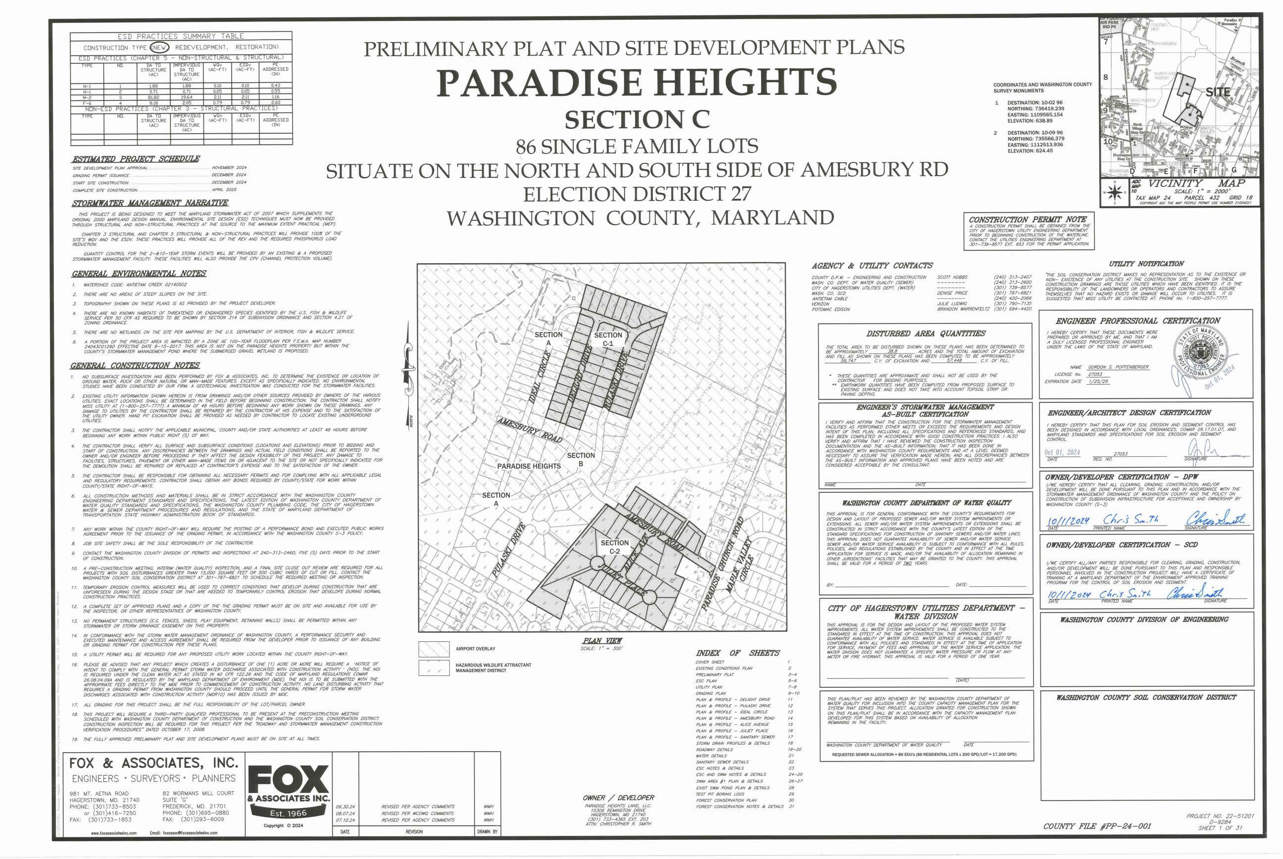
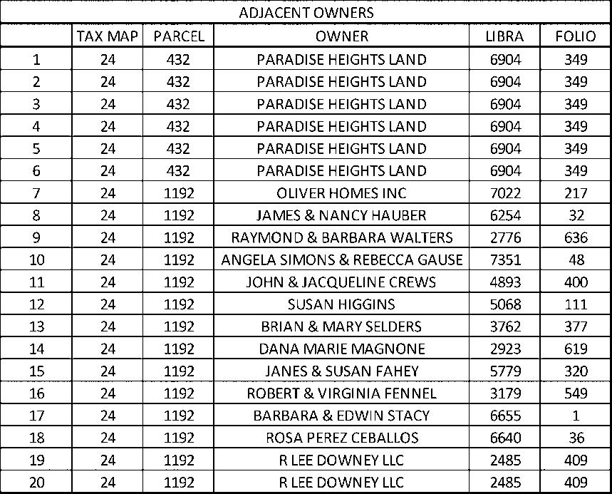
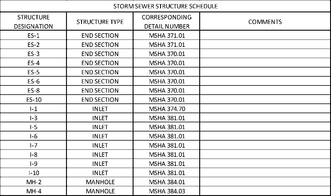
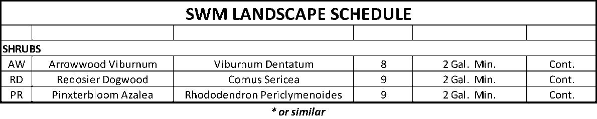
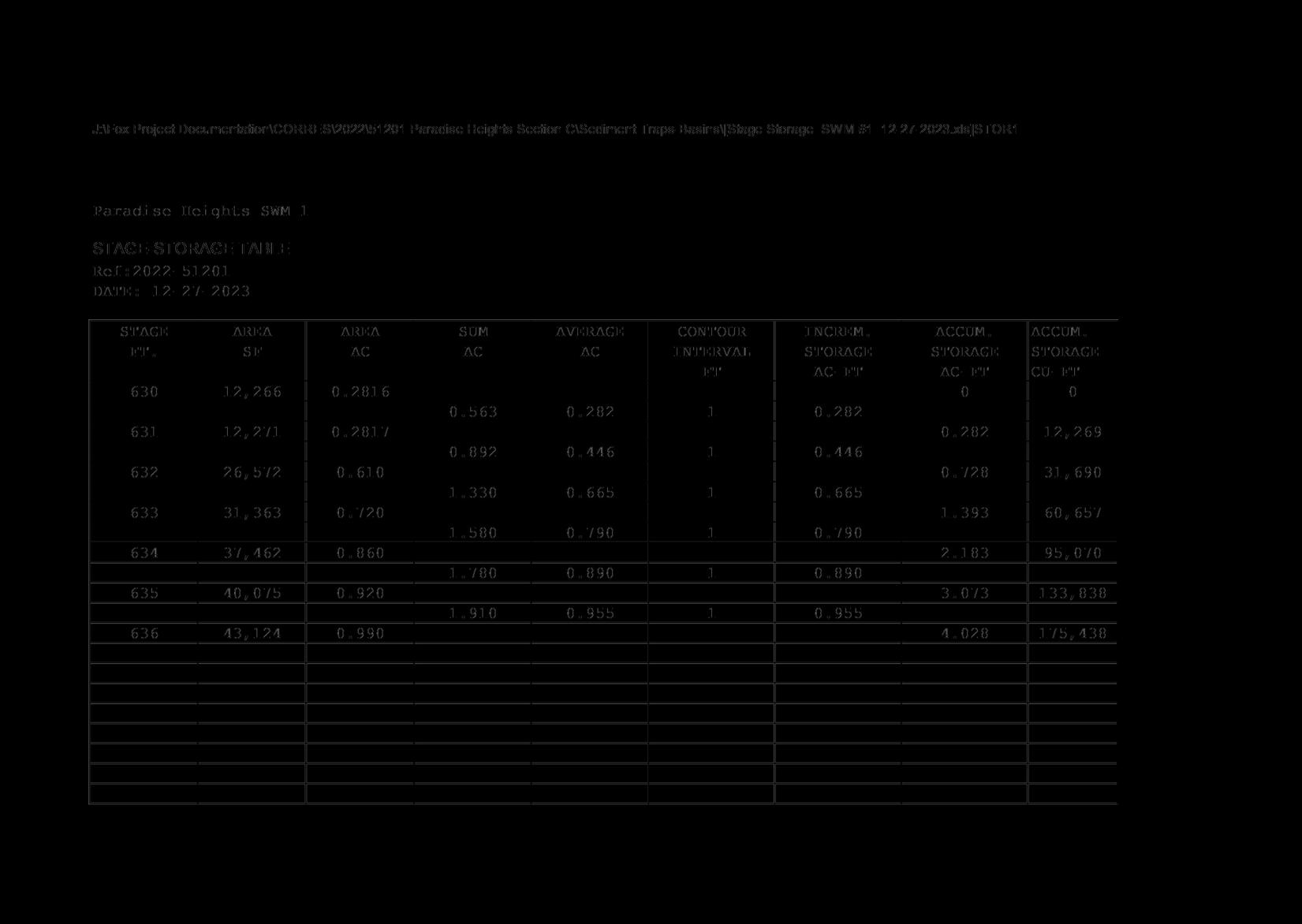
1. Paradise Heights, Section C [PP-24-001] – Scott Stotelmyer AND associated Forest Conservation Mitigation –Travis Allen * Discussion/Action
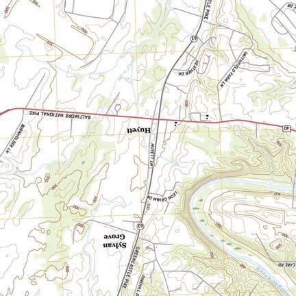
Preliminary plat and site improvement plan for 86 single-family lots within Section C of Paradise Heights; Location: Amesbury Road; Zoning: RS (Residential Suburban)
Request to use the payment-in-lieu of planting option to meet Forest Conservation Ordinance requirements
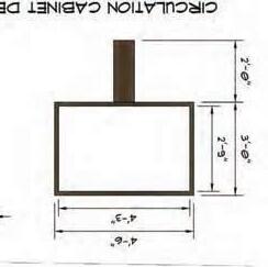
SITE PLANS
1. Creekstone Landscaping [SP-23-018] – Scott Stotelmyer * Discussion/Action
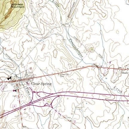
Site plan for proposed excavating contractor; Location: 13236 National Pike, Clear Spring; Zoning: A(R) –Agricultural Rural
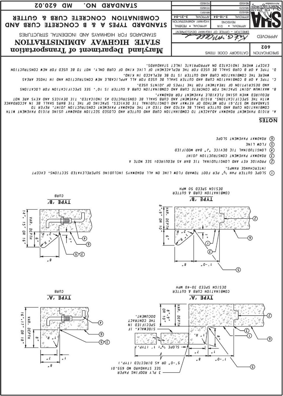
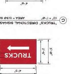
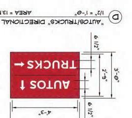
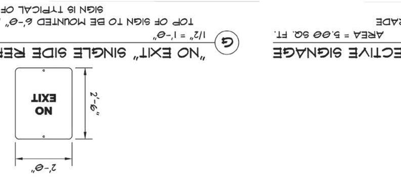
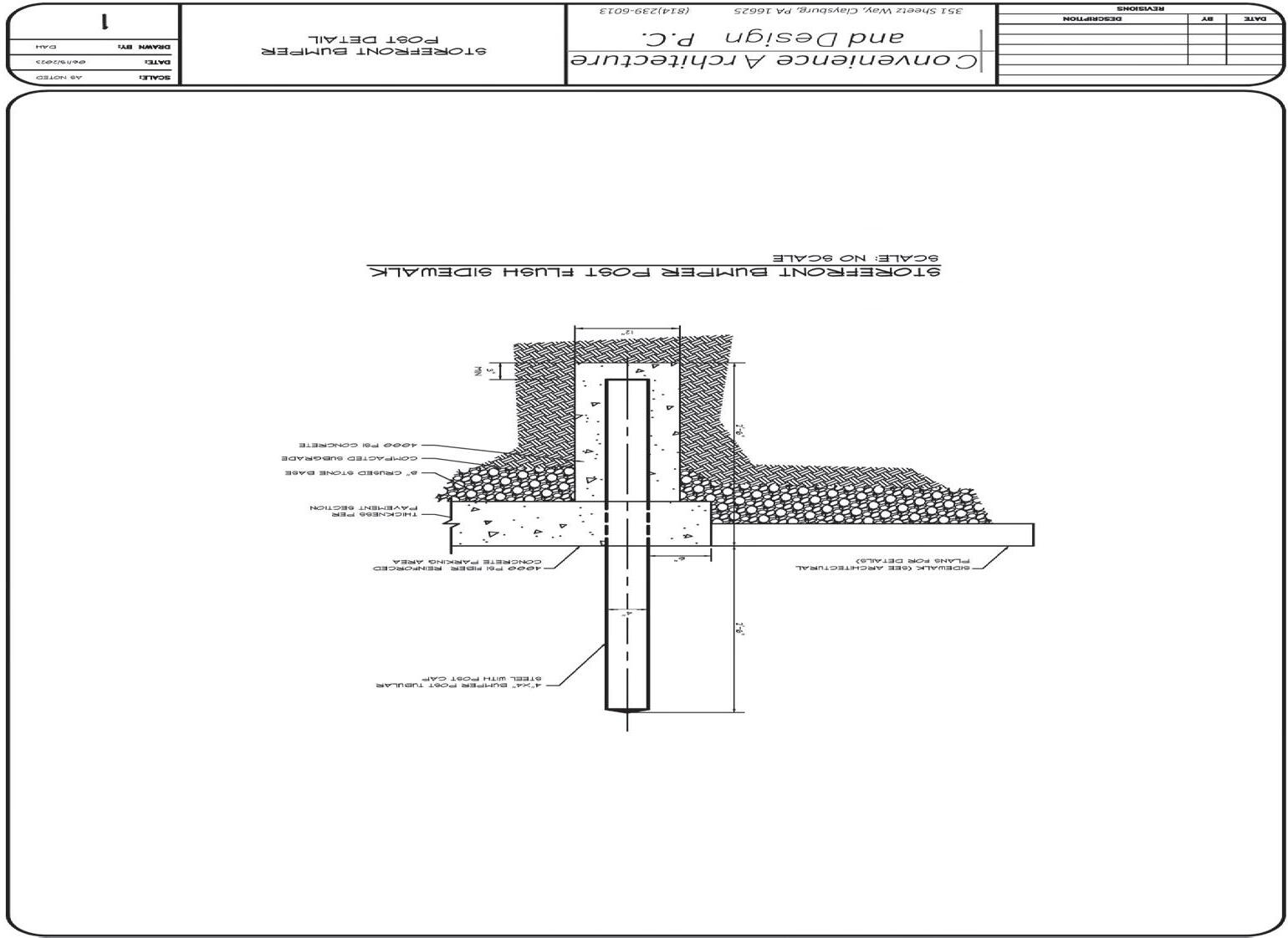
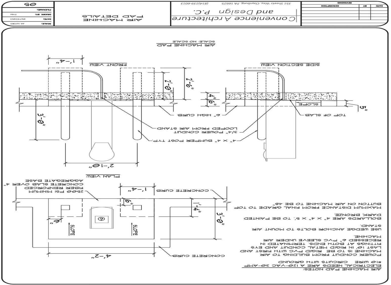
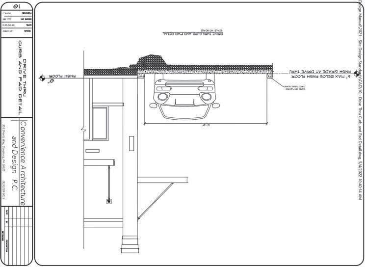
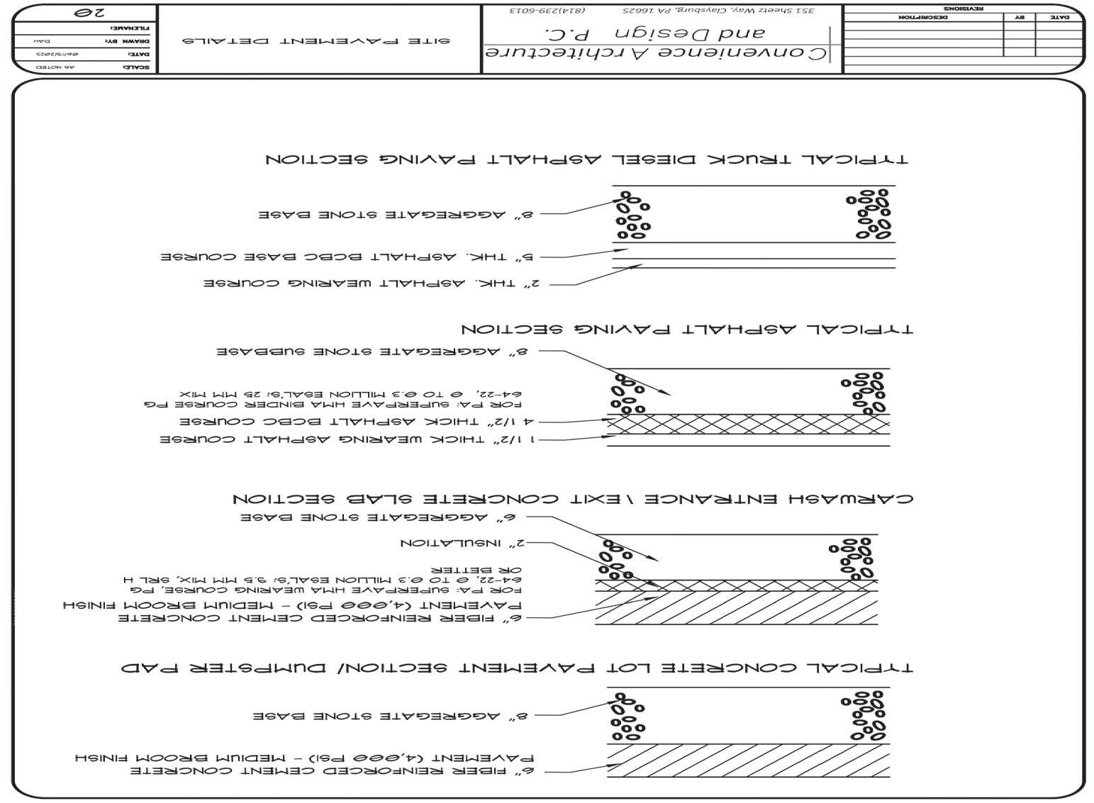
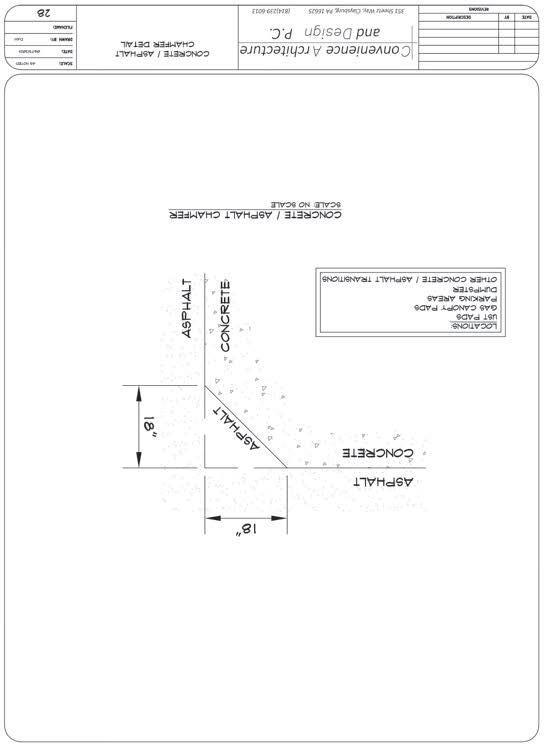
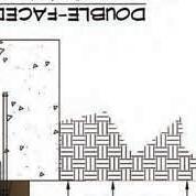
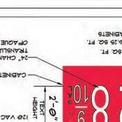
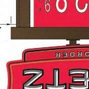
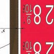
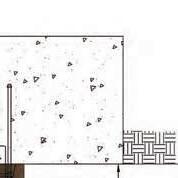
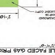
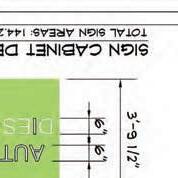
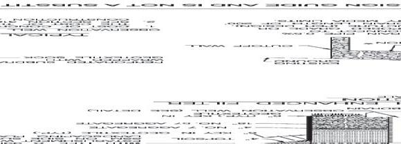
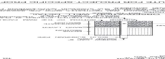
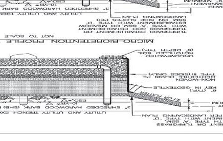
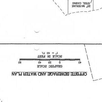
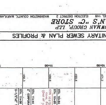
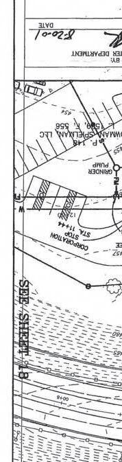
Combined storm water management concept and site plan for a Sheetz store with auto and diesel gas pumps; Location: 15919 Spielman Road; Zoning: HI (Highway Interchange)
FOREST CONSERVATION
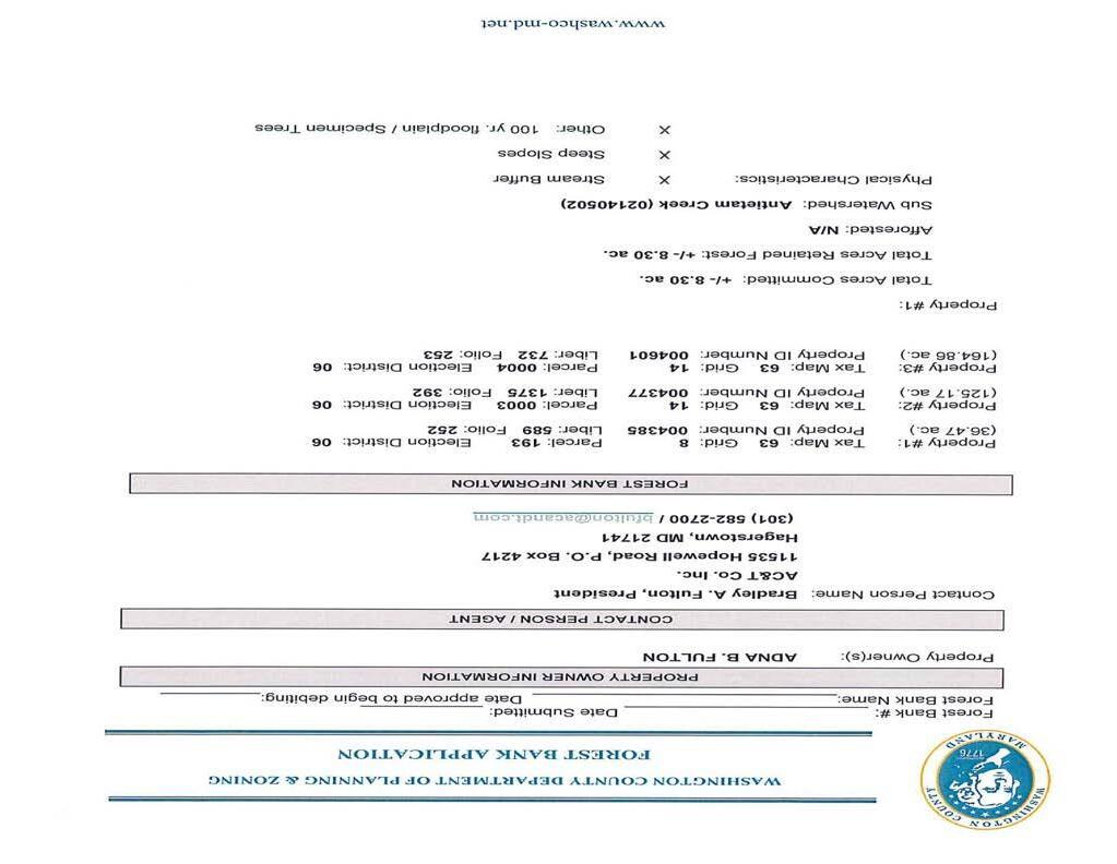
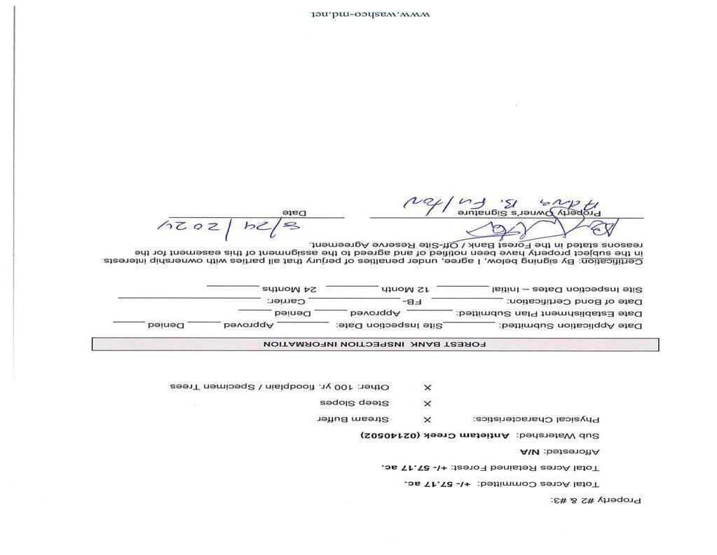
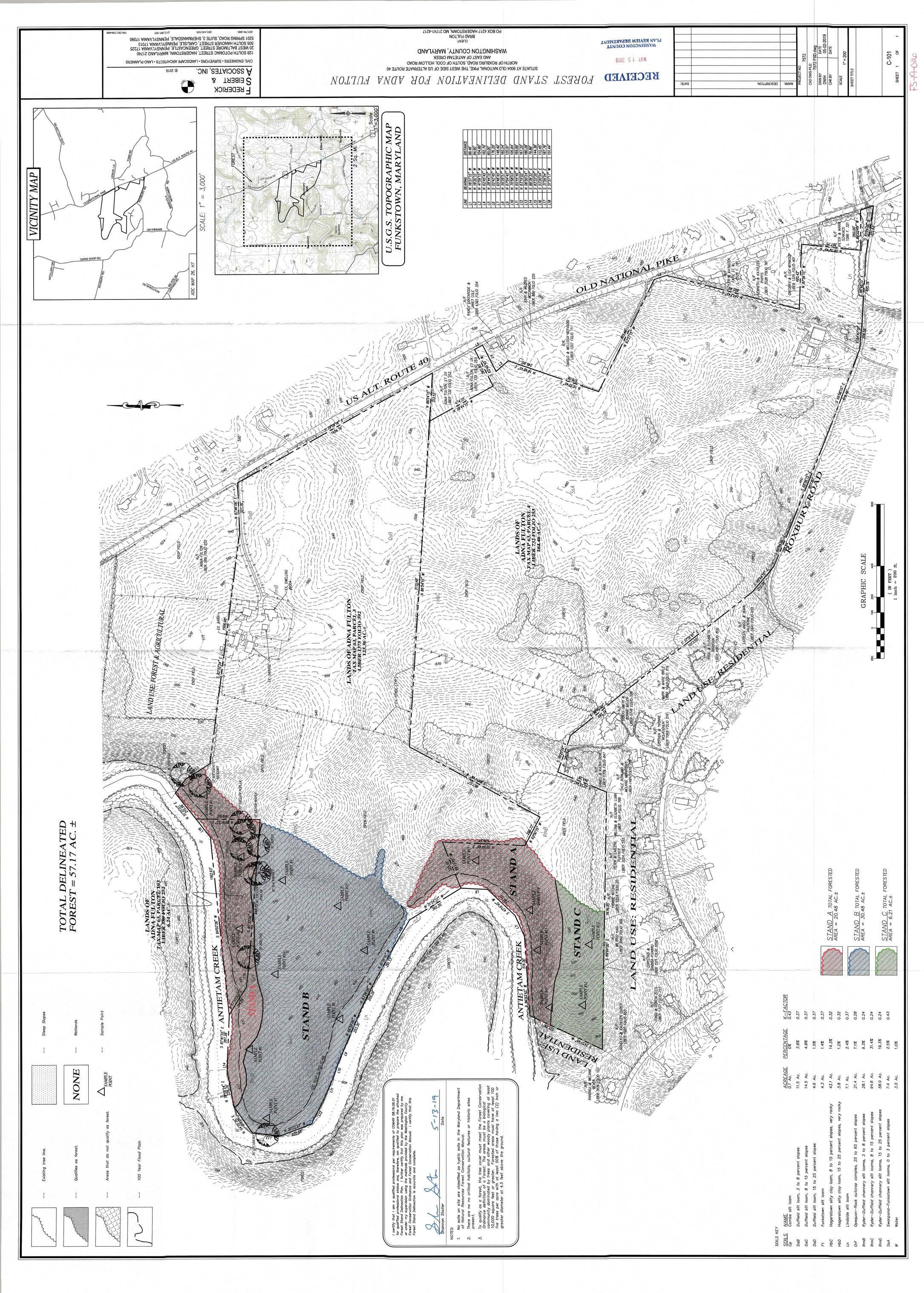
1. Adna Fulton Forest Bank – [FBK-24-001] - Travis Allen * Discussion/Action Forest retention bank of 65.47 acres on woodlands across three parcels on Old National Pike
2. Battlefield Estates [FP-24-006] - Travis Allen * Discussion/Action
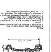
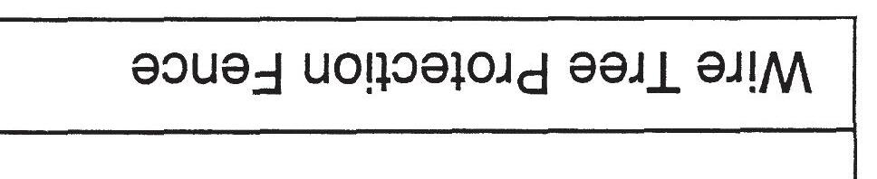
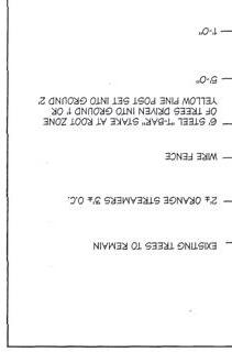
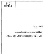
Preliminary/Final Forest Conservation Plan depicting the use of 59 street trees to address a portion of the forest conservation requirement with the use of the payment-in-lieu of planting for the remaining forest conservation requirement; Location: 125 orchard Drive, Boonsboro
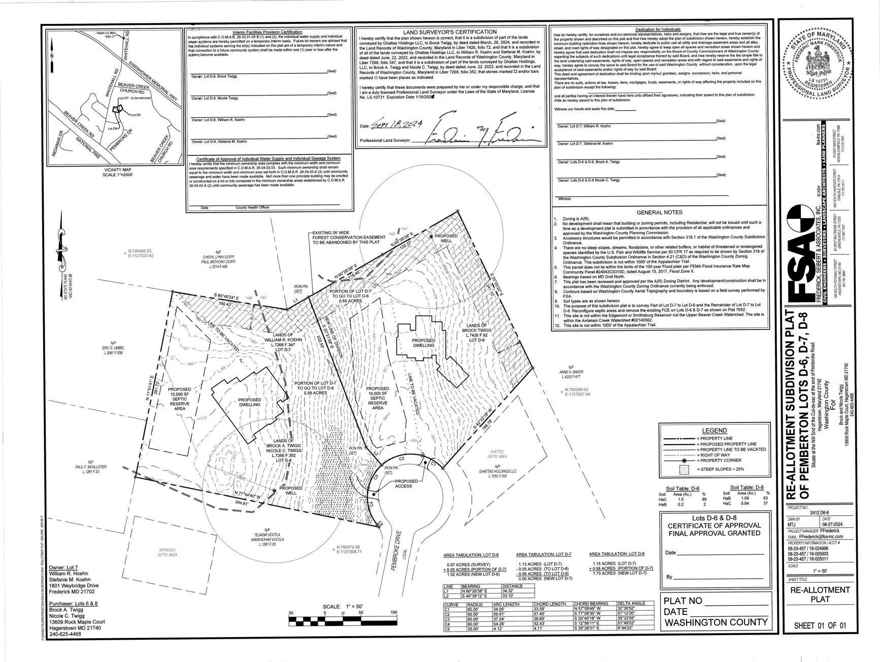
3. Pemberton Lots D6 and D8 Reallotment [S-24-031] - Travis Allen * Discussion/Action
Request to convert a .58-acre portion of the forest easement located on Lots 6-8 of the Pemberton subdivision into a payment to the County’s Forest Conservation Fund (PIL)
OTHER BUSINESS
1. MDP/MALPF Recertification Report – Chris Boggs Discussion/Action
2. Update of Projects Initialized – Jennifer Kinzer * Information/Discussion
3. Comp Plan Update - Jill Baker Information/Discussion
ADJOURNMENT
UPCOMING MEETINGS
1. December 2, 2024, 6:00 p.m. – Washington County Planning Commission regular meeting
*attachments
The Planning Commission reserves the right to vary the order in which the cases are called. Individuals requiring special accommodations are required to contact the Washington County Planning Department at 240-313-2430 to make arrangements no later than 10 working days prior to the meeting. Notice is given that the Planning Commission agenda may be amended at any time up to and including the Planning Commission meeting.
October 7, 2024
The Washington County Planning Commission held its regular monthly meeting on Monday, October 7, 2024 at 6:00 p.m. at the Washington County Administrative Complex, 100 W. Washington Street, Room 2000, Hagerstown, MD.
CALL TO ORDER AND ROLL CALL
Mr. Semler called the meeting to order at 6:00 p.m.
Planning Commission members present were: Jeff Semler, BJ Goetz, Denny Reeder, Terrie Shank, and Exofficio County Commissioner Randy Wagner. Staff members present were: Washington County Department of Planning & Zoning: Jill, Baker, Director; Jennifer Kinzer, Deputy Director; Misty WagnerGrillo and Scott Stotelmyer, Planners; and Debra Eckard, Office Manager
NEW BUSINESS
MINUTES
Motion and Vote: Ms. Shank made a motion to approve the minutes of the September 9, 2024 Planning Commission regular meeting as presented. The motion was seconded by Mr. Goetz and unanimously approved.
SITE PLANS
Fahrney-Keedy Home and Village [SP-23-007]
Mr. Stotelmyer presented a site plan for the proposed construction of cottages, duplexes and quads on the existing Fahrney-Keedy site located at 20748 Forte Way, Boonsboro. The property is currently zoned A(R) – Agricultural Rural. The new units will be accessed from Symphony Drive which is a private road. Water and sewer services will be provided privately. No new signage is proposed. Forest Conservation Ordinance requirements were met on the previous project. All reviewing agency approvals have been received.
Motion and Vote: Commissioner Wagner made a motion to approve the site plan as presented. The motion was seconded by Mr. Reeder and unanimously approved.
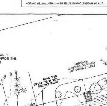
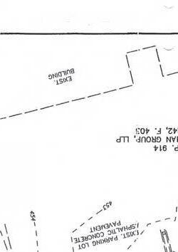
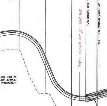
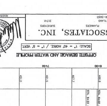
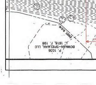
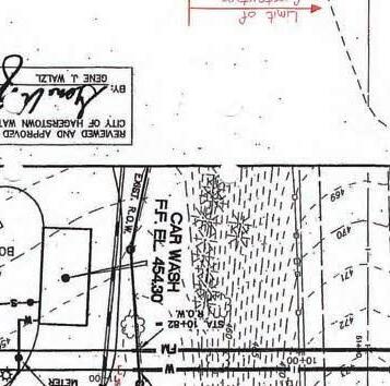
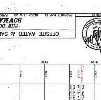
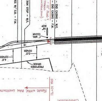
Bowman Lightner – Phase 3 [SP-23-041]
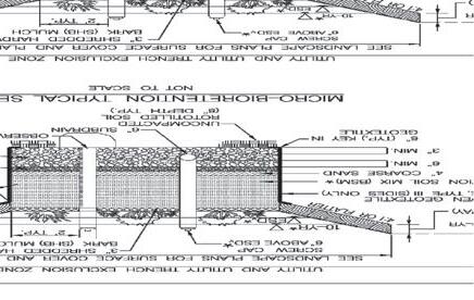
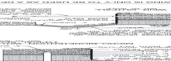
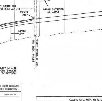
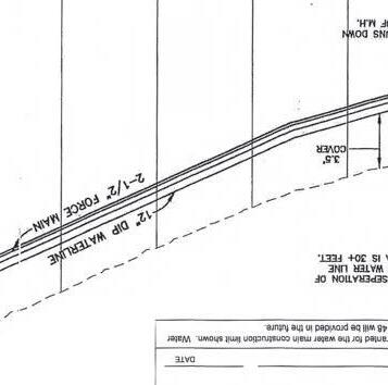
Ms. Wagner-Grillo presented a site plan for the construction of an overflow gravel parking lot to be used for empty box trailers (62 drop-off spaces). There will be one access to the lot from Spielman Road The property is 5.0 acres in size and is currently zoned HI (Highway Interchange). The hours of operation will be 7 a.m. to 6 p.m. with no employees on-site. There is no proposed signage or lighting on the site. Landscaping is proposed along Spielman Road and an evergreen buffer is proposed along the property line of James and Pamela Black. Storm water management will be handled through a bio-retention system All approvals have been received with the exception of the Washington County Engineering Department.
FOREST CONSERVATION
Bowman Lightner – Phase 3 [SP-23-041]
Mr. Allen presented a request for .92 acres of off-site forest mitigation for the disturbance of 6.21 acres associated with the above referenced site plan. The entire parcel is being developed and there is no qualified forest on-site or sensitive areas.
Motion and Vote: Mr. Goetz made a motion to approve the site plan and off-site forest mitigation request as presented contingent upon approval from the Washington County Engineering Department. The motion was seconded by Mr. Reeder and unanimously approved.
Update of Projects Initialized
Ms. Kinzer provided a written report for land development plan review projects initialized during the month of August which included three simplified plats and three forest stand delineations
Comp Plan Update
Ms. Baker announced that staff has completed the revisions to the Comp Plan and it is ready for the Planning Commission to review and provide comments. She requested that members please review the draft and return their comments within a two week period. We will then begin a 60-day public comment period as required by State law. At this time, we are planning to hold a public hearing sometime in January 2025.
UPCOMING MEETINGS
1. November 4, 2024, 6:00 p.m. – Washington County Planning Commission regular meeting
ADJOURNMENT
Mr. Reeder made a motion to adjourn the meeting at 6:30 p.m. The motion was seconded by Ms. Shank and so ordered by Mr. Semler
Respectfully submitted,
Jeff Semler, Vice-Chairman
PRELIMINARY PLAT STAFF REPORT
BASE INFORMATION
SITE NAME.............................: Preliminary Plat Site Improvement Plans for Paradise Heights Section C
NUMBER................................: PP-24-001
OWNER..................................: PARADISE HEIGHTS LAND
DESCRIPTION..........................: Preliminary Plat and Site Improvement Plans for 86 single family lots including site infrastructure within Section C of Paradise Heights.
DENSITY.................................: N/L Units Per Acre
PLANNER...............................: Scott A Stotelmyer
ENGINEER..............................: FREDERICK SEIBERT & ASSOCIATES
RECEIVED...............................: August 15, 2023
SITE ENGINEERING
HYDROGRAPHY, SENSITIVE & ENVIRONMENTAL INFORMATION
FLOOD ZONE..........................: No
WETLANDS............................: None
WATERSHED..........................: Conococheague Creek
ENDANGERED SPECIES...........: None
HISTORIC INVENTORY............: No Resources Present
EASEMENTS PRESENT.............: None
Staff Comments: Not Applicable
Disposal
Materials Stored on Site Buffer Design Meets Requirements Landscaping Meets Requirements
Lighting Plan Meets Requirements Pedestrian Access is Adequate Bus Stop is Within Walking Distance
Loading Area Meets Requirements Not Fast Track
Parking Spaces - Total Planned
Parking Spaces - Minimum Required
Parking Spaces - Per Dwelling Unit
Recreational Parking Provided
SCHOOL INFORMATION
ELEMENTARY MIDDLE HIGH
SCHOOL DISTRICT Jonathan Hager Springfield Williamsport
PUPIL YIELD
CURRENT ENROLLMENT
MAXIMUM CAPACITY
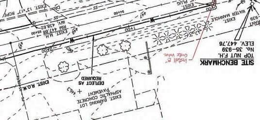
SP-23-028 Rhoton Farm
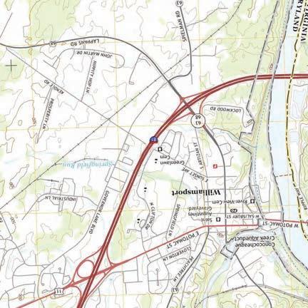
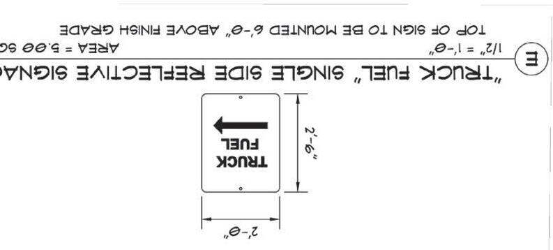
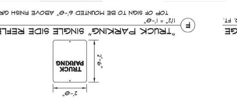
-Presented is a site plan for a new 1,023,120 warehouse located at 16545 Cargo Drive in Hagerstown.
-Access to the property is provided from Cargo Drive, via Greencastle Pike.
-Water to be provided by City of Hagerstown and sewer by Washington County.
-Hours of operation for both buildings will be 24/7.
-There will be pole and building mounted lighting on site.
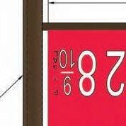
-There is proposed ground mounted signage on the site.
-There is an approved parking waiver to reduce the required parking from 736 spots to 566 spots. 572 are being provided
-Forest Conservation is being addressed on site.
-The developer is seeking a conditional approval from the PC tonight, contingent on receiving final approvals from Forest Conservation, Soil Conservation, Water Quality and the Health Dept. All of the agencies above have given the ok for this project to be presented tonight.
-Trevor Frederick from FSA is here if you have any questions.
SITE PLAN FOR TRAMMELL CROW - RHOTON FARM
SITUATED AT 12685 GREENCASTLE PIKE (MD ROUTE 63)
CIVIL ENGINEER / SURVEYOR: FSA INC. 128 SOUTH POTOMAC STREET HAGERSTOWN, MARYLAND 21740
PROJECT MANAGER: TREVOR FREDERICK EMAIL: TFREDERICK@FSA-INC.COM PHONE: 301.791.3650
DEVELOPER: TC MIDATLANTIC DEVELOPMENT V, INC 888 16TH STREET, NW WASHINGTON , DC 20006
ATTN: TOM CROSS EMAIL: TCROSS@TRAMMELLCROW.COM PHONE: 301.873.0029
SITE DATA
FUTURE
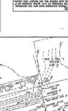
CUT-OFF TRENCH
SEDIMENT FOREBAY
5.For
PAVEMENT - TRUCK
1.Landscape
2.Landscape
3.Landscape
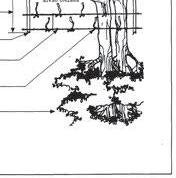
4.NO Substitutions of plant material without written permission of FSA. Planting plans have been proposed with plant sizes, types, and locations as important design elements.
5.Plants shall be in accordance with the current issue of American Standards for Nursery Stock published by the American Association of Nurserymen.
6.All plants shall be watered thoroughly during installation and prior to final acceptance.
7.All bark mulched areas shall be first covered with Typar Weed Barrier or approved equal.
8.All planting bed areas on the site shall be mulched with a hardwood bark mulch at a depth of approx. 3", unless noted otherwise.
9.Plant material shall be inspected yearly in order to remove and replace dead, diseased vegetation.
10.Warranted plant material that is 25% dead or more shall be considered dead and shall be replaced at no charge.
11.All plant material shall be warranted for two years. 60 days prior to the end of the warranted period, the Engineering Department shall perform an inspection. Of which there should be an 90% survival rate of all plant material. All surviving plant material shall be found in a healthy condition. The warranty shall commune on the date of initial acceptance by the owner.
12.The landscape contractor shall conduct a final inspection with the owner or owner's representative at the end of the warranty period.
13.Fertilizer Packets are to be Nutri-Pak 16-8-8 or approved equal per manufacturer's recommendations.
14. Landscape is recommended to be installed during the two growing seasons. Spring: April 15-June 15, Fall: September 1-November 1.
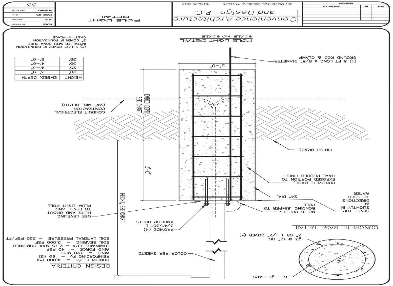
RZR-PLED-II-80LED-1050mA-40K
58 RZR-PLED-IV-FT-80LED-1050mA-4
SITE PLAN STAFF REPORT
BASE INFORMATION
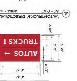
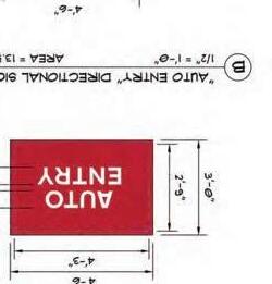
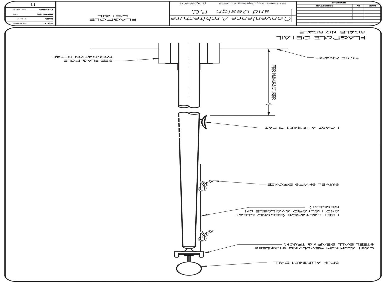
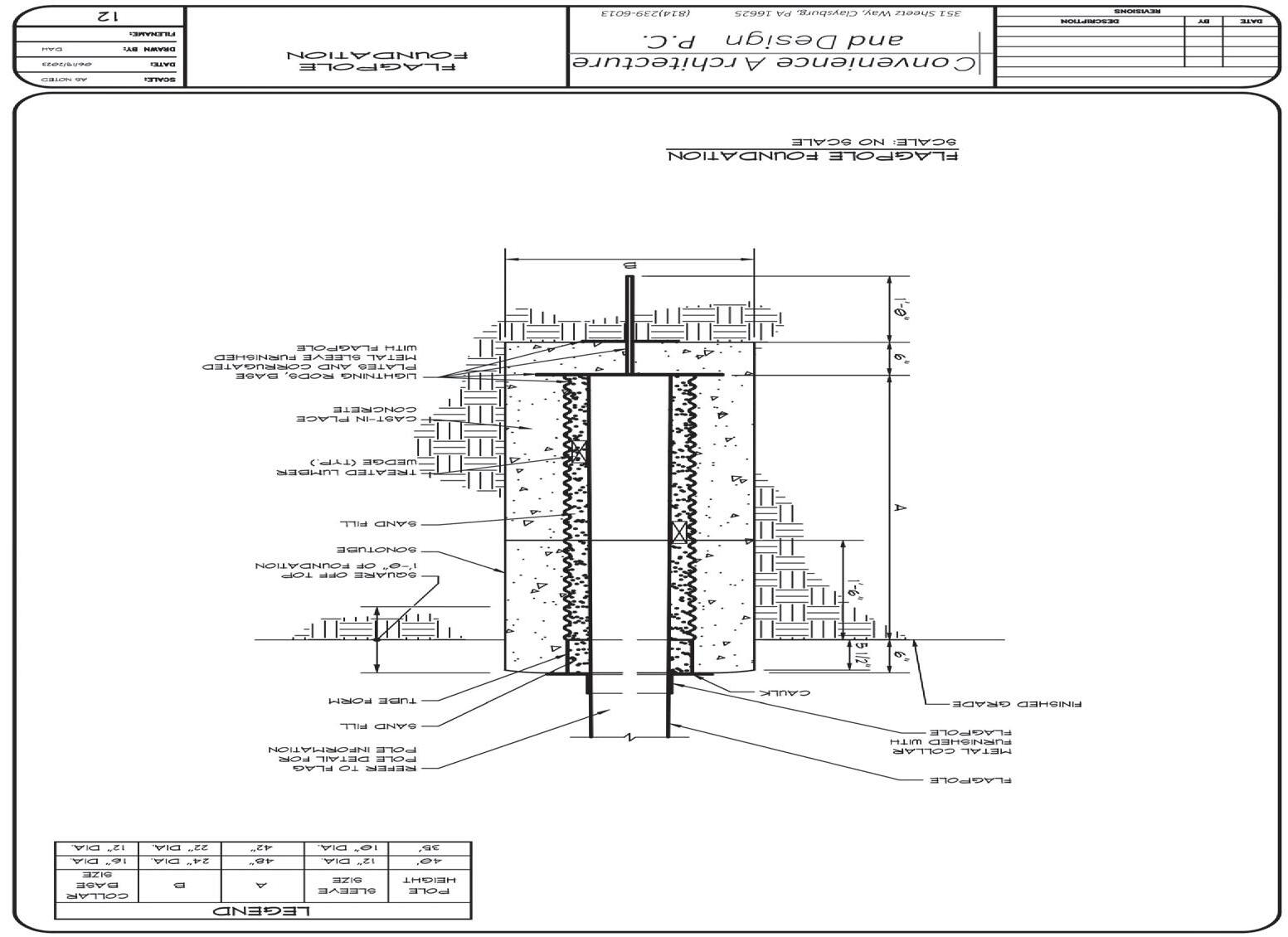
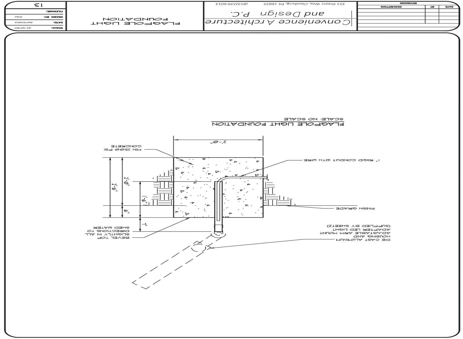
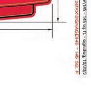
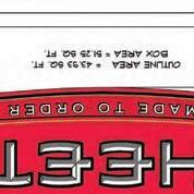
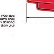
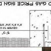
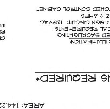
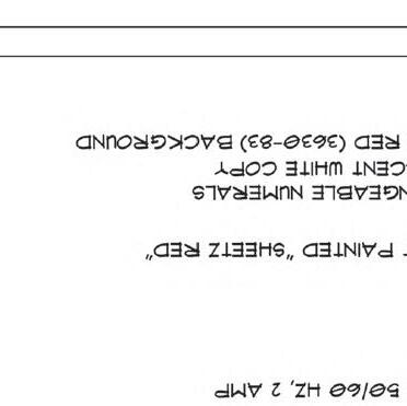
SITE NAME.............................: Sheetz- Spielman Road
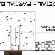
DESCRIPTION..........................: Combined SWM Concept and Site Plan for Sheetz Store with Auto and Diesel Gas Pump, with associated passenger vehicle and tractor trailer parking
Lighting Plan Meets Requirements Pedestrian Access is Adequate Bus Stop is Within Walking Distance Yes
Loading Area Meets Requirements Not Fast Track
Parking Spaces - Total Planned
Parking Spaces - Per Dwelling Unit 126
Parking Spaces - Minimum Required
Recreational Parking Provided 35 No
ACCESS SPACING VARIANCE NEEDED: No
NUMBER OF ACCESS POINTS: 2
SCHOOL DISTRICT Fountain Rock Springfield Williamsport PUPIL YIELD
CURRENT ENROLLMENT
CAPACITY
OffRampFromI-81(N)
OffRampFromI-81(N)
Ex.EdgeofGravel
Ex.EdgeofGravel
OffRampFromI-81(N)
OffRampFromI-81(N)
Ex.HandHole
Ex.EdgeofGravel
OffRampFromI-81(N)
DEPARTMENT OF PLANNING & ZONING
MEMORANDUM
TO: Washington County Planning Commission
FROM: Travis Allen, Senior Planner
DATE: November 4, 2024
RE: Adna Fulton Forest Mitigation Bank (FBK-24-001)
Attached you will find supporting documentation for a request to establish a 65.47-acre forest mitigation bank on Old National Pike, just north of Roxbury Rd. These documents include the application, forest banking easement plat, and two forest stand delineations.
Forest mitigation banks are generally established to provide off-site mitigation for development projects who must offset regulated forest clearing under the terms of Article 20 of Washington County Forest Conservation Ordinance (FCO). Forest mitigation banks may be established on newly planted forest or on existing forest. The applicant proposes to establish a forest retention bank at the site.
To utilize acreage contained within the forest bank, a prospective future development project must first demonstrate that they cannot reasonably accomplish the more preferred mitigation techniques listed in Article 10.1 of the FCO. If demonstrated, credits can be purchased from the bank to meet forest mitigation requirements for the proposed project. This would be the third legally established forest bank available for such purposes in Washington County.
If you have questions or comments regarding this request, please contact me using the information provided below.
RE: Forest Conservation Mitigation Review for (FP-24-006)
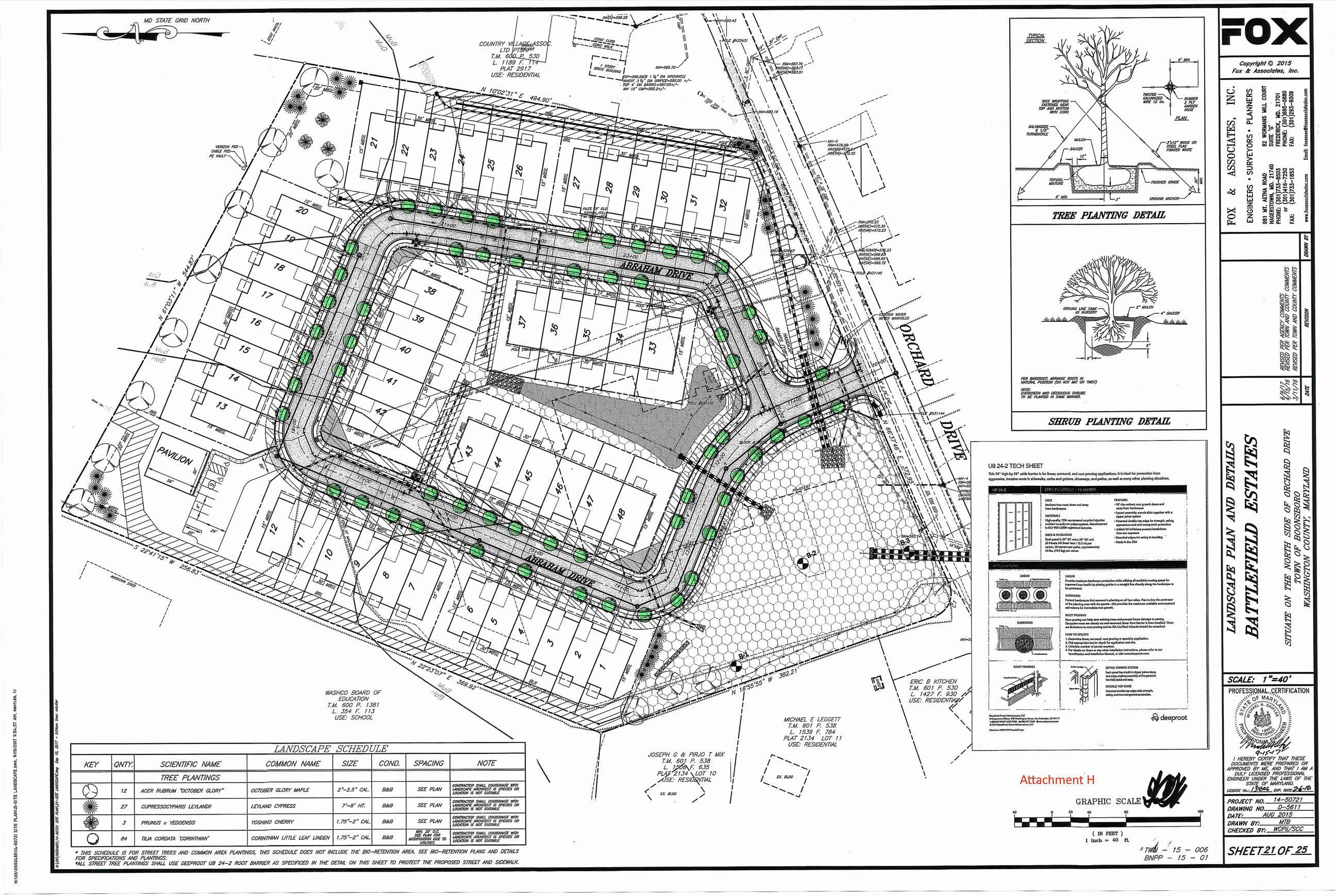
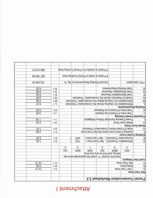
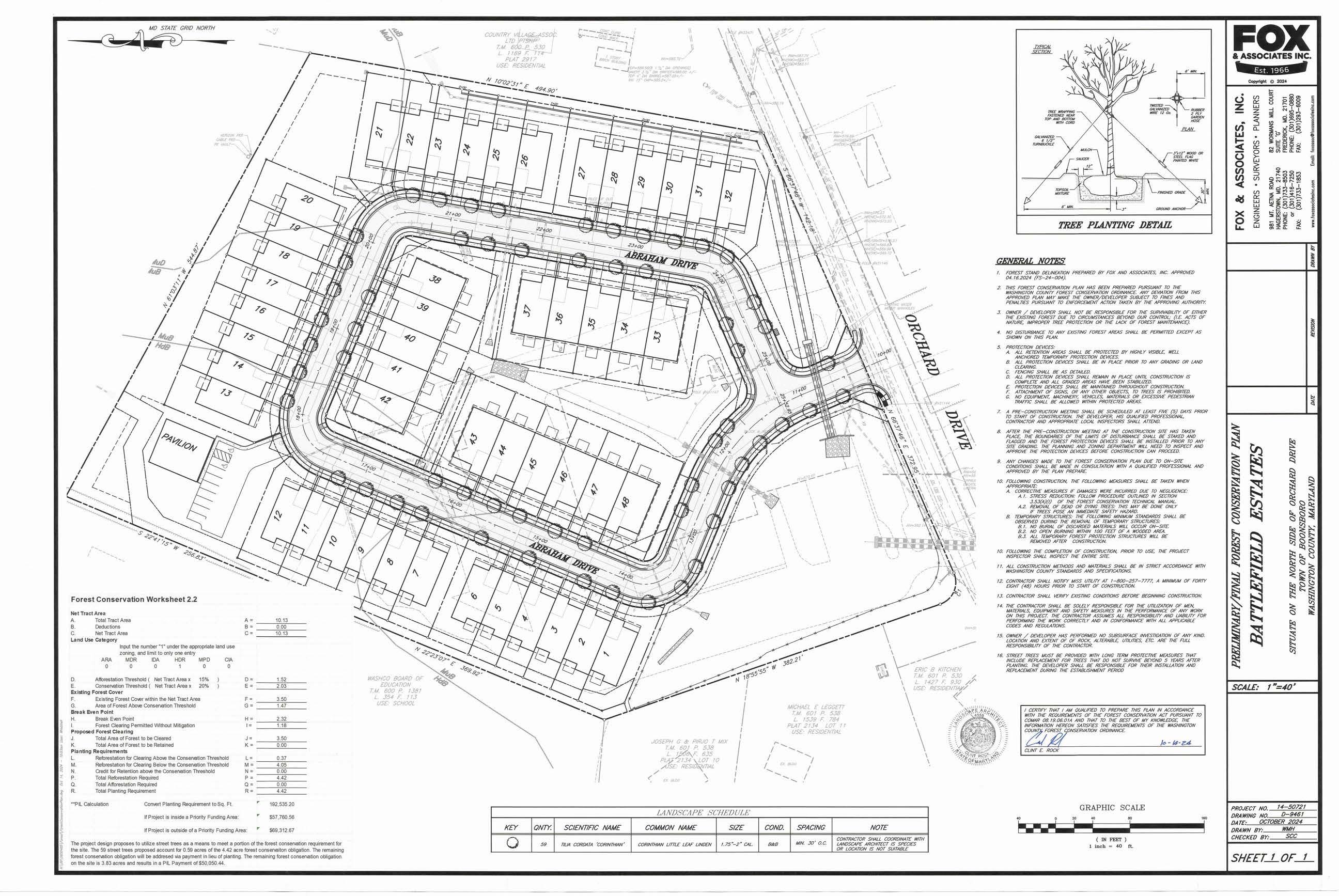
Attached you will find supporting documentation for a request to meet forest conservation requirements for this project. The applicant is requesting is to pay the fee-in-lieu to satisfy nearly all of the 4.42-acre planting requirement for a 48-townhome development on Orchard Drive in the Town of Boonsboro.
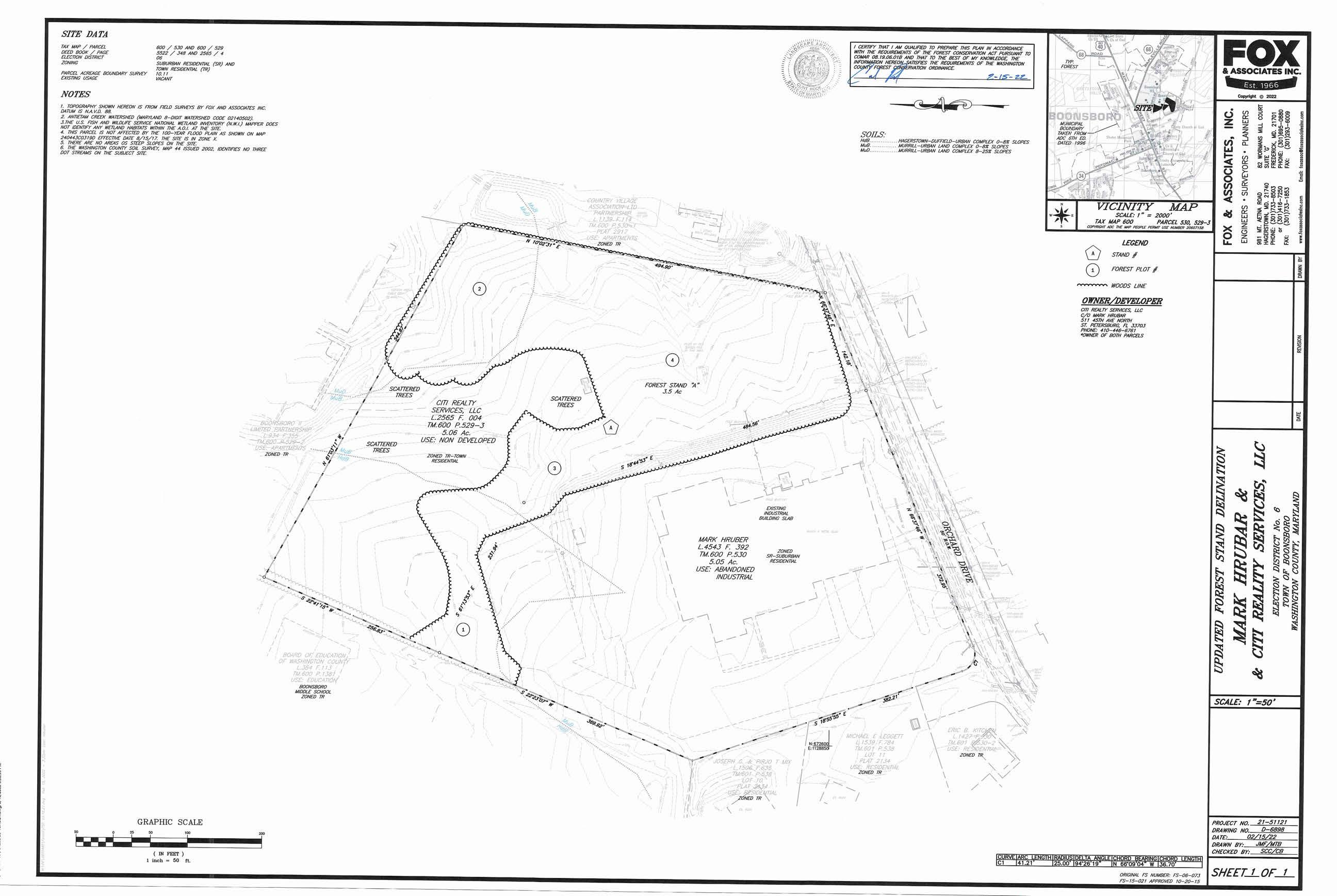
Enclosed for your review are three documents in support of the applicant’s request. These include the forest stand delineation; which shows the existing forest cover on the property, the forest conservation plan; which shows street tree locations, and the justification letter from Qualified Professional Clint Rock that makes their case for the request
Article 10.1 of the Washington County Forest Conservation Ordinance (FCO) describes the Preferred Sequence of Techniques for Mitigation for forest conservation plans. This list describes a hierarchy of of techniques ranging from onsite retention and planting to payment of fee in lieu. The overall intent of the FCO is to preserve or create as much forest onsite as is feasible within the constraints of each development project before meeting mitigation obligations offsite
If you have questions or comments regarding this request, please contact me using the information provided below.
Travis Allen Senior Planner (240) 313-2432
tallen@washco-md.net
October 14, 2024
981 Mt Aetna Rd
Hagerstown, MD 21740
Phone: 301-733-8503
Fax: 301-733-1853
Jill Baker Director/Zoning Administrator
Washington County Department of Planning & Zoning
747 Northern Avenue
Hagerstown, MD 21742
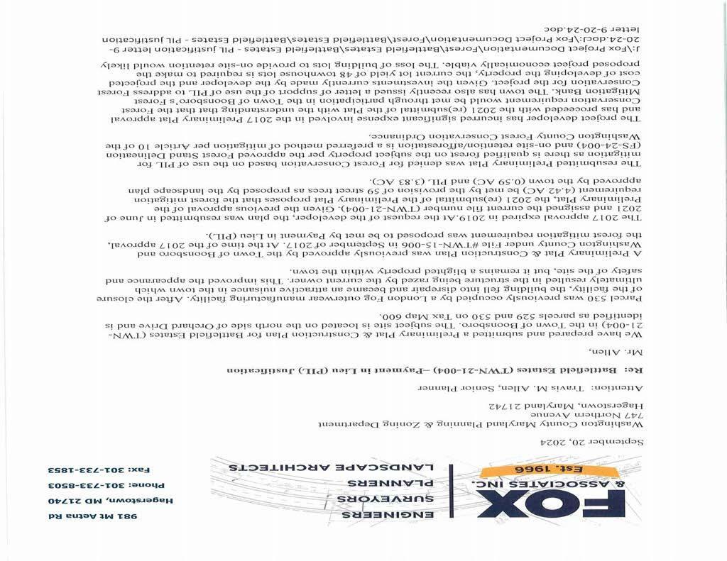
RE: Battlefield Estates
Preliminary Plat & Construction Plan
TWN-15-006 & TWN-21-004
Dear Jill,
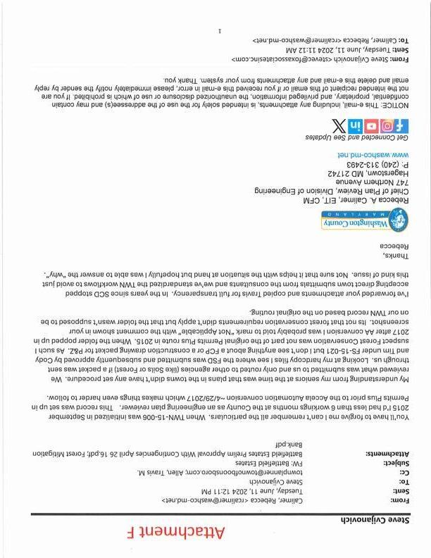
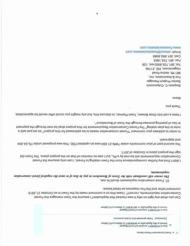
The purpose of this correspondence is to summarize recent discussions and email exchanges relating to the Forest Conservation Requirements for Battlefield Estates. This correspondence is also to serve as a formal request for this project to be placed on the Washington County Planning Commission agenda for their October 7, 2024, meeting for the Commission’s consideration to approve the use of the PIL as the means to satisfy the Forest Conservation Ordinance requirements. A separate letter prepared by a Qualified Forest Professional summarizing the reasons why the use of the PIL is the best approach to addressing Forest Conservation for the subject site accompanies this letter
The Battlefield Estates project, as currently planned, consists of 48 Townhouse lots on 10.13 acres. The 10.13 acres is made up of two (2) tax parcels. Parcel 530 containing 5.06 acres and Parcel 529 containing 5.07 acres. Parcel 530 was developed years ago as a London Fog outerwear manufacturing facility. The facility closed and the building was vacant for quite some time. The vacant building fell into disrepair and attracted homeless people to the building resulting in an increase in request for service calls to the location by police and fire authorities. This property became a blighted property and was a cause for concern for the Town of Boonesboro. The property owner demolished the building leaving only the concrete slab of the building remaining. This improved the appearance of the site and ended the problem caused by the homeless, but the property in its current state is not a fit with the surrounding neighborhood.
This project has a rather long history, and the numbered points below offer a brief overview of key events over the years.
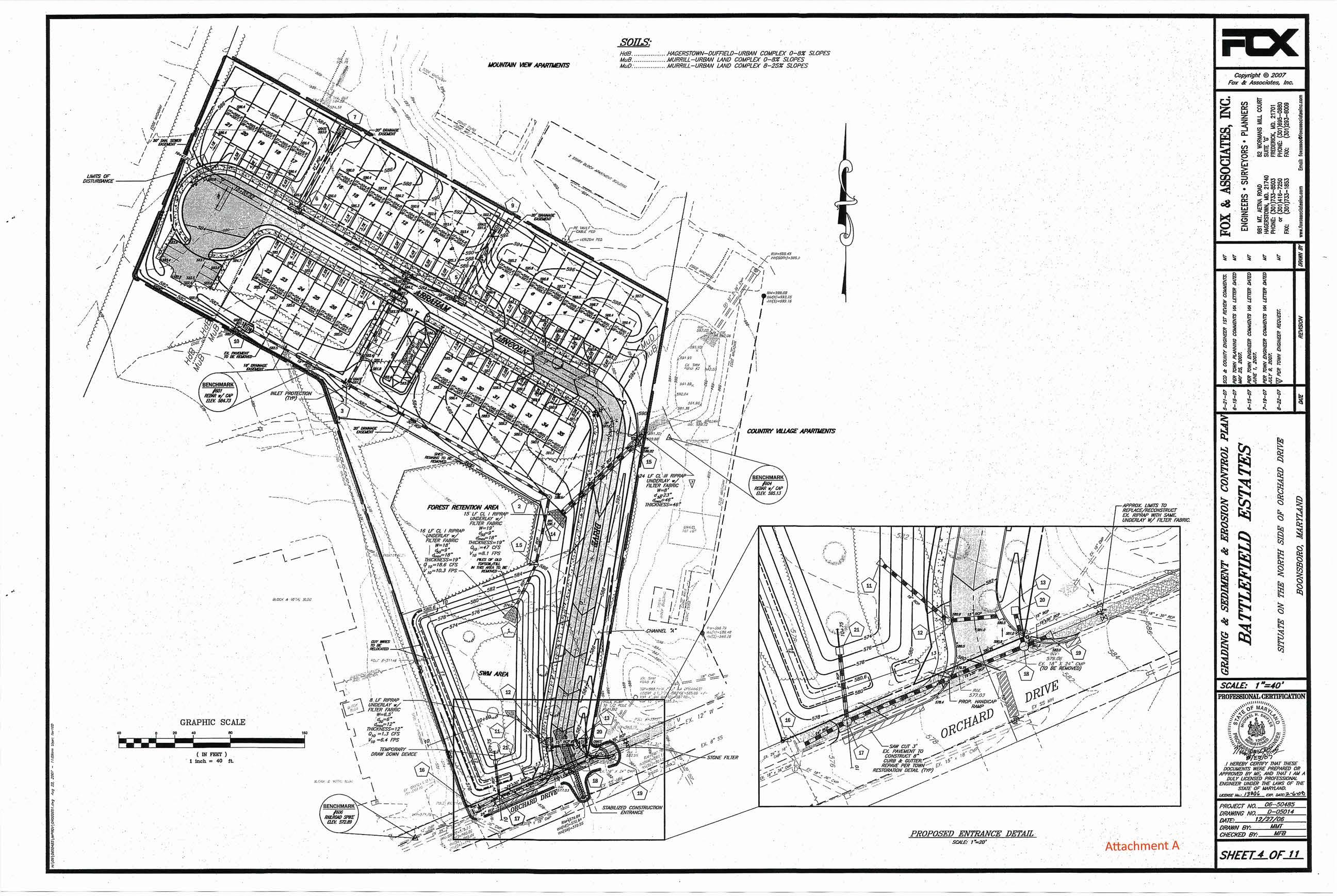
1. October 2006-A Preliminary Plat was prepared for 35 townhouse lots on parcel 529 which contained 5.06 acres. Parcel 529 is not the parcel the London Fog facility was situated on, but the parcel north of the London Fog facility. Please refer to attachment A.
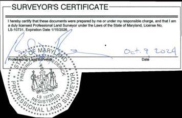
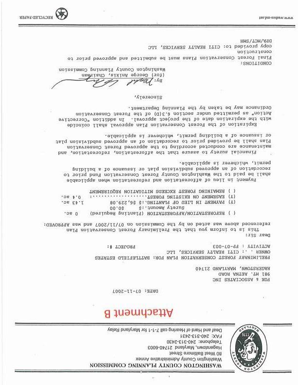
2. July 2007-A Forest Conservation Plan was filed under FP-07-003 where the Forest Conservation Obligation was met via on-site retention and PIL. The onsite retention contained 0.40 acres and the PIL was approved for an acreage of 1.43 acres. Please refer to attachment B.
3. August 2007-The construction plans for the 35 townhome lots proposed on Parcel 529 were approved.
4. October 2007-A Final Plat for the 35 townhome lots proposed on Parcel 529 was prepared. The Final Plat for the 35 townhome lots was submitted to the Town of Boonsboro in November 2008. We have no record of this Final Plat being approved It appears the 35townhome lot project was abandoned as our office didn’t conduct any further work on the project until early 2013.
5. February 2013-The parcel that is south of and contiguous to Parcel 529, Parcel 530, that was once the London Fog manufacturing facility was taken over by Columbia Bank due to a lawsuit of some sort.
6. May 2013-The Columbia Bank sold parcel 530 to Mark Hrubar. Mr. Hrubar was the developer of the 35-townhome lot plan from 2007. Mr. Hrubar is the current property owner and developer of the Battlefield Estates project.
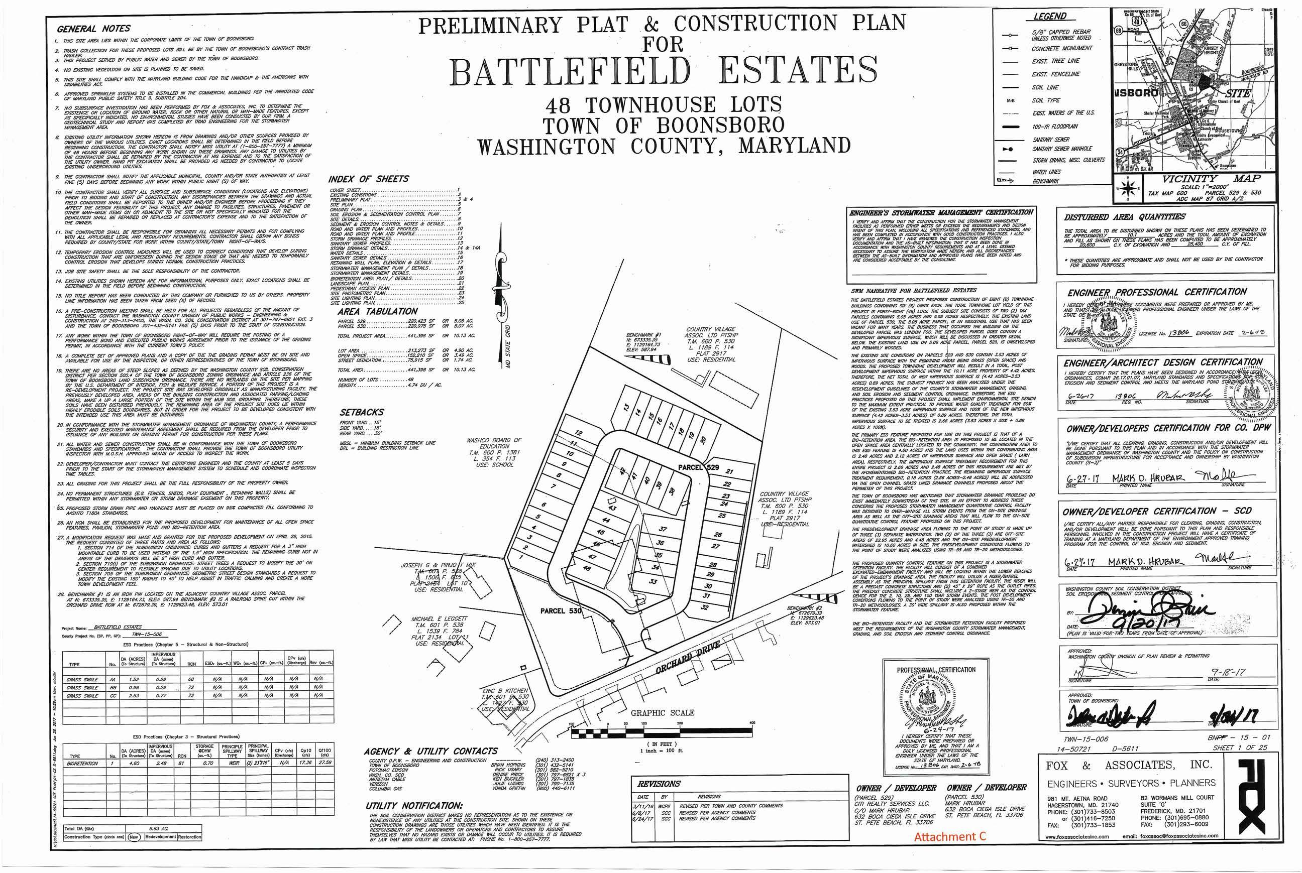
7. October 2014 -Fox began design efforts on the revised Battlefield Estates project where the project scope was expanded to include parcels 529 and 530. The project consisted of 48 townhome lots on 10.13 acres. This plan was assigned County file # TWN-15-006 and Town of Boonsboro file # BNPP-05-001.
8. September 2017-The Preliminary Plat and Construction Plan was approved and signed by agencies. The signing agencies included Washington Plan Review & Permitting (signed on 9-18-2017, WCSCD (signed on 9-20-2017), and Town of Boonsboro (signed September 2017). Please refer to attachment C.
9. After September 2017-The project laid idle, and the 2017 approvals expired in 2019.
10. June 2021-Fox was requested to resubmit the project plans for reapproval. The County assigned file # was TWN-21-004. The plans submitted were the same plans originally approved under TWN-15-006.
11. November 2021-County Engineering and WCSCD entered approvals in the route and the Forest Conservation planner entered a denial. The Forest Conservation comments were issued by Travis Allen and stated Forest Conservation needs addressed for the project and the previously approved FSD expired and an updated FSD would need filed. An updated FSD was prepared and approved under FS-24-004.
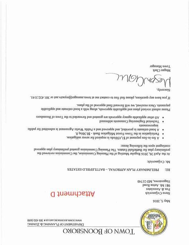
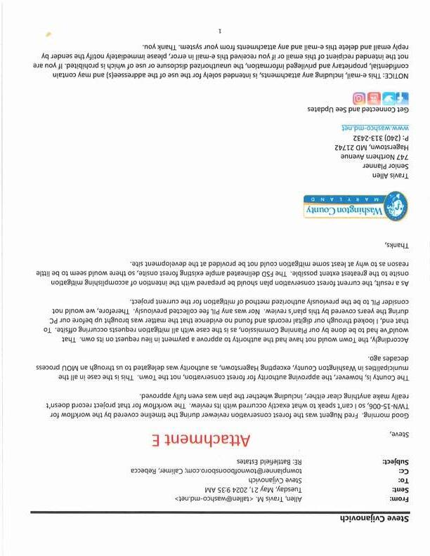
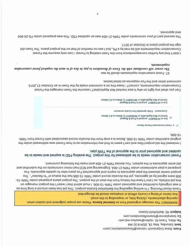
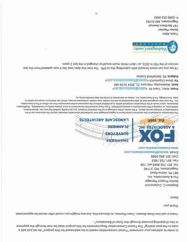
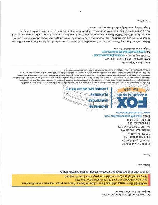
12. May 2024-I reached out to Travis Allen to inquire what notes were needed to address Forest Conservation. I honestly felt only notes needed to be added to the TWN plan stating that Forest Conservation would be addressed through the PIL. I based this understanding on the Town of Boonsboro letter dated 5-5-2016 which stated the Boonsboro Planning Commission granted Preliminary Plan approval contingent upon a few outstanding items. Please refer to attachment A. One of the items was “Participation in the Town Forest Mitigation Bank- $0.30/sq. ft. Given this statement we assumed the Forest Conservation requirement would be addressed by the PIL. Travis Allen prepared an email to me on 5-212024 stating he wasn’t the Forest Conservation Reviewer when the plan was signed by the County, WCSCD, and the Town in September 2017 and given his review of the workflow from the original project record of TWN-15-006, the history wasn’t clear. Travis further explained that the approval of the PIL is an approval of the Washington County Planning Commission and not the Town of Boonsboro. Travis’s email to me then concluded with…… As a result, the current forest conservation plan should be prepared with the intention of accomplishing mitigation onsite to the greatest extent possible. The FSD delineated ample existing forest onsite, so there would seem to be little reason as to why at least some mitigation could not be provided at the development site. The complete email exchange between Travis Allen and I is included in this correspondence as attachment E.
13. June 2024-As a result of Travis’s email, I emailed Rebecca Calimer hoping she could shed some light on this matter. The question that I posed to Rebecca was to clarify why the Forest Conservation Planner Review under the TWN-15-006 review was marked as “Not Applicable”. Rebecca’s response to my inquiry effectively stated given the date when the action was taken and that she was relatively new to the County at the time, that she was unable to provide detailed information relating to my request due to the age of the project and the conversion to Acella where possibly some information may have been lost/omitted during the Acella conversion. The complete email exchange between Rebecca and I is included in this correspondence as attachment F.
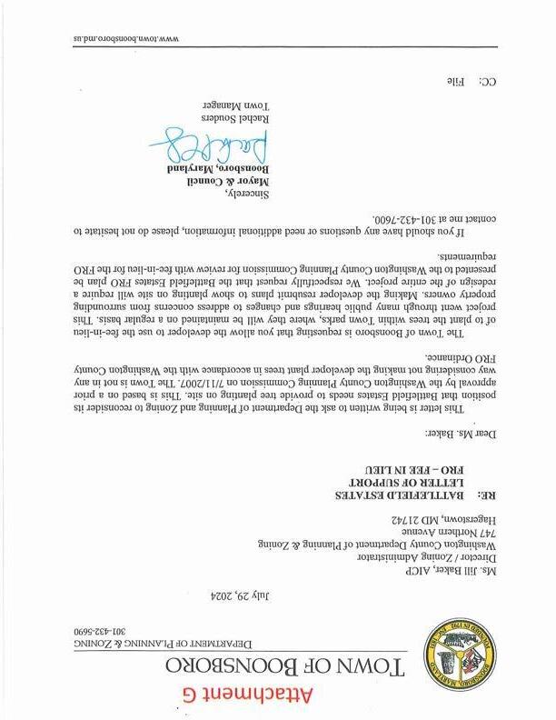
The project was approved by the County in September of 2017. The project developer has incurred great expense on the project leading to the 2017 plan approval. The developer’s understanding based on correspondence from the Town of Boonsboro was that the Forest Conservation requirement associated with the project would be met through participation in the Town’s Forest Mitigation Bank. The use of the term “Forest Mitigation Bank” was used in a letter from the Town, yet I understand the Town doesn’t have an “Official” Forest Conservation Bank. The Town recently issued a letter of support of the use of the PIL to address forest conservation on this project. Please refer to Attachment G. The Town’s support for the use of the PIL and ultimately the
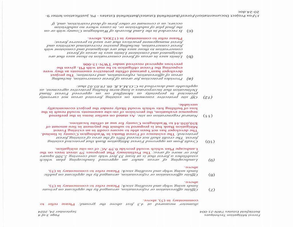
redevelopment of this blighted property is a testament to their desire to have the property improved with uses that fit the surrounding neighborhood. The development costs associated with the project do require a lot yield of 48 townhomes for the project to be financially viable. Should the lot yield be reduced to accommodate on site forest retention or planting, the lot yield would be reduced and likely result in the project being abandoned due financial non-viability. The project as was proposed under the 2017 approval and what is currently being reviewed for approval included the use of street trees along all interior streets in the community. The Town approved landscape design for the project proposes 59 street trees along the streets in the community. The use of street trees has been an accepted practice to address forest conservation requirements on several projects in the County. Please refer to attachment H where the extent of the street trees proposed are depicted. While the use of street trees doesn’t fulfill the Forest Conservation Ordinance completely it does provide for 0.59 acres of the 4.42 acres of plating required. The remainder of the forest conservation obligation is proposed to be met via the PIL in the amount of $50,050.44. Please refer to attachment I which is the Forest Conservation Worksheet that documents the 4.42-acre planting requirement.
In closing, we request that this letter and related attachments be provided to the Planning Commission for their consideration at the November 4, 2024, Planning Commission meeting. Should you have any questions or require further information, please don’t hesitate to contact this office.
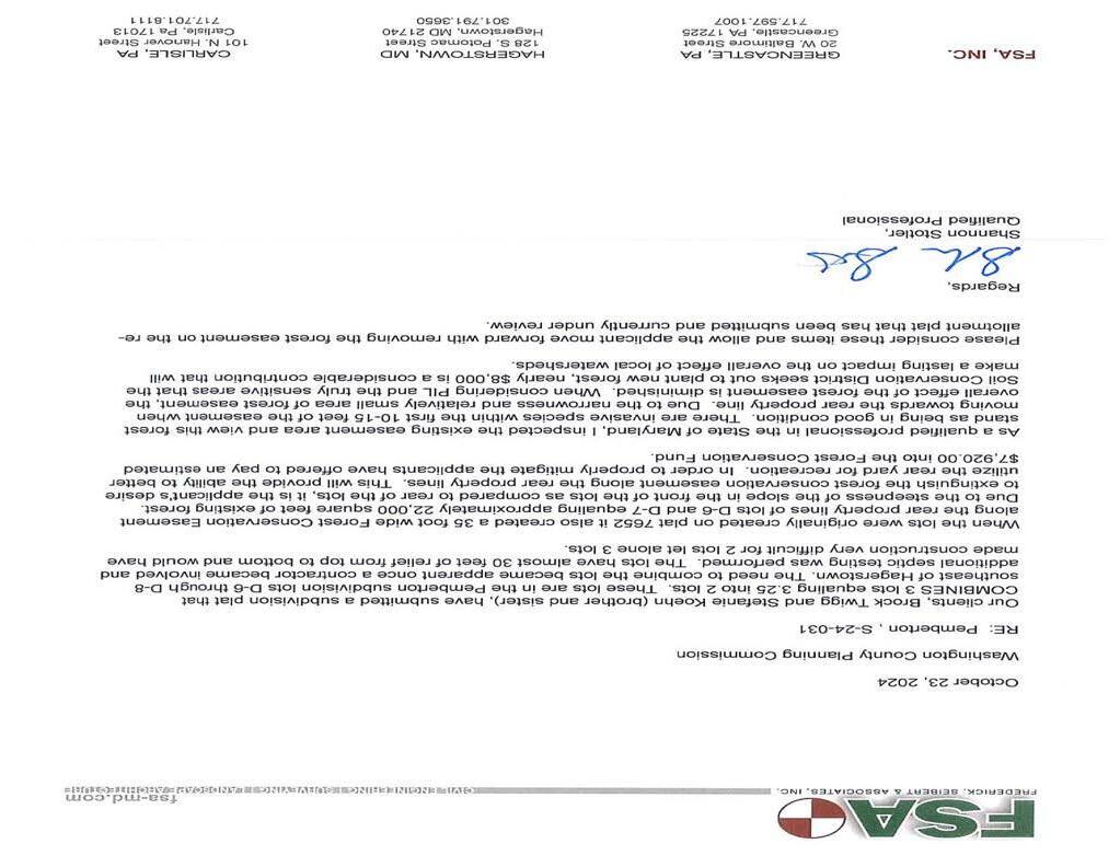
Attached you will find documentation for a request to convert a .58-acre portion of the forest easement located on Pemberton subdivision Lots 6-8 at 9838, 9841, and 9842 Pembroke Drive into a payment into the County’s Forest Conservation Fund (PIL) The requested conversion is a part of a subdivision plat under review which will convert three lots into two lots, adding portions of existing Lot D-7 to existing new Lots D-6 and D-8.
Enclosed for your review are two documents accompanying the applicant’s request. These include the revised subdivision plat; which shows the requested removal of the existing forest easement; and a justification letter from Qualified Professional Shannon Stotler which makes their case for this request.
Forest easements are intended to be permanent in the location that they were originally established unless special circumstances require reevaluation Fee-in-lieu is the least preferred mitigation technique in the County’s Forest Conservation Ordinance.
If you have questions or comments regarding this request, please contact me using the information provided below.
Prepared by: Chris Boggs, Rural Preservation Administrator
REPORT-IN-BRIEF: Every five (5) years Land Preservation staff is required to prepare and submit a certification report so as to retain an additional 42% (total 75% retention) of state agricultural transfer taxes. Land Preservation Staff will submit the certification report if approved by the Board of County Commissioners to MDP and MDA. The certification report is based on questions developed at the State level to assess the County’s Land Preservation Program and compliance with the Comprehensive Plan. While the certification report addresses all the county land preservation programs, Washington County has traditionally used 100% of the funds for the 60/40 match component of MALPP.
For its part, the Planning Commission must approve the Re-Certification Report and the Chair must sign when the report is ready. Ag Advisory Board approval is also required concurrently with Planning Commission approval.
Based on COMAR Title 34 Department of Planning, Subtitle .03 Land Use, Chapter .03 Certification of County Agricultural Land Preservation Programs
I. The county agricultural preservation advisory board, or the county office of planning or county planning commission, as designated by the county, and the governing body of the county:
A. Have approved the application for (re)certification of the county program (.05(A)(2)).
Letters were signed by: John F. Barr, President, Board of County Commissioners of Washington County, MD David Roth, Chairman, Ag Advisory Board
II. Financial Reporting. Both annual reports shall provide a financial report that includes:
A. Estimated revenues and expenditures for the county's agricultural land transfer tax account for fiscal years that have transpired in their entirety during the certification period (.10(B)(1)(a)); and
Agricultural Land Transfer Tax in Washington County
B. Revenue sources for, and estimated expenditures of, any other funds used to purchase development rights, provide financial enhancements to purchases of development rights, or administer the county's agricultural preservation program (.10(B)(1)(b)).
1 Note: The first report is due on October 1 following the completion of the first full fiscal year of the certification period, except as extended by MDP for reasonable cause.
The second report is due on October 1 following completion of the second full fiscal year of the certification period, except as extended by MDP of reasonable cause.
Washington County Recertification Application Checklist
December 12, 2016
Page 2 of 16
Expenditure of "Other" County Funds
C. Information necessary for MDP and MALPF to determine if the county is meeting its commitment of qualifying expenditures in an amount at least equal to the additional funds available to the county as a result of certification (a financial reporting form for this purpose is available from MDP) (05(D); .10(B)(2)).
As the figures above show, the county is more than meeting its commitment for qualifying expenditures.
D. All expenditures reported shall be identified as qualifying or non-qualifying expenditures (.10(B)(3))
E. Financial reports shall be verified and signed by the county's chief financial officer or by an independent auditor (.10(B)(4)).
Financial reports for FYs 2020, 2021, 2022, 2023 and 2024 were signed by SB & Company, LLC.
III. In addition to the financial report above, the FIRST and SECOND annual report of each certification period shall include: Attachment C
A. An inventory of properties which have been permanently preserved by an agricultural land preservation easement during the reporting period (.10(C)(2)).
B. The total number of easements purchased and acreage preserved through the county and State agricultural land preservation easement purchase programs during the reporting period (.10(C)(3))
Washington County preserved 6,684.71 acres for the five fiscal years FY 2020-FY 2024.
Washington County Recertification Application Checklist
December 12, 2016
Page 3 of 16
C. An update on progress made to reach the milestones established in the county's most recent program development strategy (.10(C)(4)).
Provided elsewhere in checklist.
IV. In addition to the financial report and the information required in the first annual report, above, the SECOND annual report of each certification period shall include:
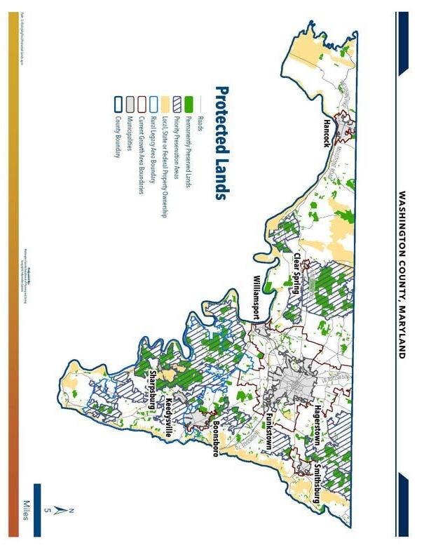
A. A map of all agricultural lands preserved in the county, including those preserved both during and before the certification period, showing those properties in relation to priority preservation areas (.10(D)(2)).
See Attachment A
B. A description of the programs the county has established to encourage participation of farmers in agricultural land preservation efforts, including purchase of development rights or financial enhancements related to the purchase of development rights, outside of MALPF (.05(B));
Washington County uses a full array of easement programs: MALPF, MET, Rural Legacy, MARBIDO-NGFAP, local PDRs with an IPP option, CREP, POS-Stateside and other federal programs such as transportation scenic easements.
C. An evaluation of the county's agricultural land preservation program, including the strengths and shortcomings in each of the following areas (.05(E); .05(E)(1)):
1. The ability of the county's zoning and other land use management tools to do the following in the county's priority preservation area (.05(E)(1)(a)):
a. Limit the amount and geographic distribution of subdivision and development in accordance with established agricultural land preservation goals (.05(E)(1)(a)(i));
Washington County reports the following: “While in the past Washington County had a liberal lot allowance of 1/5 in the Agricultural Zoning, the Sustainable Growth and Agricultural Preservation Act allows a maximum of only 7 subdivision rights per parcel. 16,300 subdivision rights were lost leaving only 18,400 rights available in the rural areas.”
b. Stabilize the land base (.05(E)(1)(a)(ii)); and
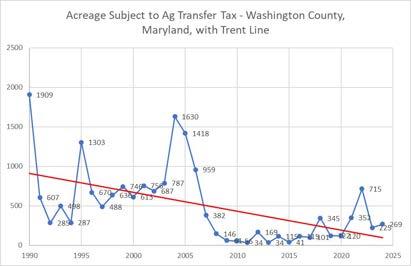
See above IV.C.1.a. In addition, the acreage subject to agricultural land transfer tax, depicted on the graph below, shows a steep decline after the 2005 downzoning, even before the economic downturn that started in FY 2009. (In 2005 Washington County made its zoning significantly more protective by changing it from 1:1 (Agriculture) or 1:3 (Conservation) to the following:
1:5 (+3 lots) Agricultural zone, 1:20 (+ 3 lots) Environmental Conservation zone, 1:30 (+ 3 lots) Preservation (Rural Legacy) zone. Plus 2 more lots at 1:50.
Washington County Recertification Application Checklist
December 12, 2016
Page 4 of 16
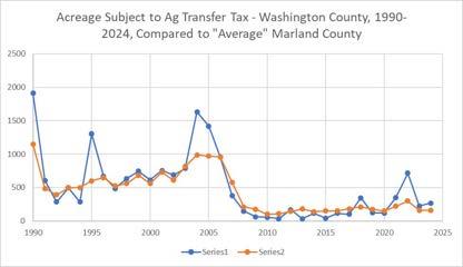
The chart below shows that since 1990, the total acreage subject to agricultural land transfer tax in Washington County is higher than in the “average” Maryland County. However, just a handful of years of development in Washington County explain all the difference. In fact, if you exclude the years 1990, and 1995 the total acreage of farmland converted in Washington County (14,469) would be lower than that for the “average” Maryland County (15,185)
Note: Series 1 = Washington County; Series 2 = Average Maryland County
Washington County Recertification Application Checklist
December 12, 2016
Page 5 of 16
c. Provide time for agricultural land preservation easement acquisition to achieve State and local preservation goals before the agricultural land resource is excessively compromised by development (.05(E)(1)(a)(iii)).
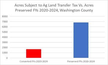
For the five-year period of FYs 2020-2024, Washington County preserved 6,853 acres while 1,681 were subject to Agricultural Land Transfer Tax. The county reports that “[s]ince the rate of conversion had slowed so significantly from past 5-year periods and the rate of protection will continue to increase with State funds being restored, it appears very likely that our permanent easement efforts will allow us to keep pace.”
2. The ability of combined State, local, and other agricultural land preservation easement acquisition programs to permanently preserve lands in the county's priority preservation area at a rate sufficient to achieve State and local preservation goals (.05(E)(1)(b)).
Washington County reports that of the 1,387 acres permanently preserved in FY 2024, all but 564 were inside of the PPA. This number is greater than previous years, mainly because the CREP program has been opened up to the entire County (not just the Rural Legacy Area), addition of MARBIDCO’s Next Generation Farmland Acquisition Program and funding has increased for MALPP easements, thereby giving the County the ability to preserve more farms, some of which are outside of the PPA. The five-year figure for acres subject to agricultural land transfer tax in the whole county was just 1,681, so easements are being acquired in the PPA at a rate sufficient to achieve State and local preservation goals.
3. The degree to which county land use and other ordinances and regulations restrict or otherwise interfere with the conduct of normal agricultural activities in the priority preservation area (.05(E)(1)(c)).
The county’s right-to-farm ordinance protects farmers by allowing any normal farm activity
Washington County Recertification Application Checklist
December 12, 2016
Page 6 of 16
4. The ability of county zoning, subdivision, and development regulations and policies to minimize the degree to which development in the priority preservation area interferes with normal agricultural activities (05.(E)(1)(d)).
As mentioned in IV.C.1.a above, the Sustainable Growth and Agricultural Preservation Act has countered the effects of the liberal 1:5 agricultural zoning. Meanwhile, Environmental Conservation zoning of 1:20 and Preservation zoning of 1:30 further limit development in rural areas, including PPAs. Further, in 2018 the County expanded its Rural Legacy Area, in which more than three quarters of the expanded area consists of Priority Preservation Areas.
5. The ability of county and other farming assistance programs to support profitable agriculture and forestry activities in the priority preservation area (05.(E)(1)(e)).
The recertification application reports that “Washington County has a complete package of farmer assistance programs, including Soil Conservation, Farm Services Agency, Extension Service, Ag Marketing specialist, as well as an active farmland preservation program. In addition, we have encouraged farm support services such as feed and equipment dealers to maintain a strong presence in the County.”
6. Statistics and other factual information necessary to evaluate the county's agricultural land preservation program, such as:
a. A description of the amount of subdivision and development allowed on land within zoning districts comprising the priority preservation area, including base density and additional lots allowed for clustering, density transfers between parcels, and any other provisions affecting lot yields (.05(E)(2)(a));
See IV.C.1.4, above. As mentioned above, for the 5 years of FY 2020-2024, 1,681 acres were subject to agricultural land transfer tax countywide. However, for the same time period, a large portion of those acres were due to development within the Urban Growth Area.
b. The numbers and locations of residential parcels and acres subdivided and developed within the priority preservation area during the most recent 5-year period (.05(E)(2)(b));
c. The total acreage and locations of farms and parcels permanently preserved through agricultural land preservation easements recorded in the land records of the county during the most recent 5-year period (.05(E)(2)(c));
Program totals were provided.
d. The constraints and restrictions placed by county ordinances and regulations on normal agricultural activities, such as minimum setbacks from property boundaries (.05(E)(2)(d)); and
Washington County reports that there are no restrictions placed on normal agricultural activities
Washington County Recertification Application Checklist
December 12, 2016
Page 7 of 16
e. The constraints and restrictions placed by county ordinances and regulations on non-agricultural development activities, in order to minimize conflicts with normal agricultural activities within the priority preservation area (.05)(E)(2)(e)).
Setbacks requiring a 50 feet buffer.
D. A program development strategy which:
1. Describes the way in which the goals of the program will be accomplished in the county's priority preservation area, including the county's strategy to protect land from development through zoning, preserve the desired amount of land with permanent easements, and maintain a rural environment capable of supporting normal agricultural and forestry activities (.05(F)(1)).
While Washington County’s overall goal is to protect 50,000 acres in permanent preservation in the county as a whole, the PPA properties receive bonus points in the priority rankings of their easement programs. In addition, the county’s easement priority ranking system gives about 25% of the total points available for properties which are contiguous to other easements. Since Washington’s PPA was selected in part because of close proximity to permanently protected land, the chances are higher for protection in those areas.
The Sustainable Growth and Agricultural Preservation Act has dramatically curtailed potential lot rights in most rural areas. As mentioned previously, between 7/1/2019 and 6/30/2024 only 231 acres of farmland were converted. Washington County expects that trend to continue; in fact, in several cases subdivided lots have been added back to farms being preserved with easements. The county program administrator, Chris Boggs, reports, “We have often heard people in the rural area complain recently about not being able to sell lots they have spent considerable money on to subdivide. We have seen a shift from using rural areas as temporary farmland until development occurs. There is a much stronger sense of permanence now in our rural areas.”
Finally, with the increased state funding levels and the county plan to use a portion of Installment Payment Program funds to gain an additional $600,000 of MALPP 60/40 match money each cycle, Washington County reports that it is on pace to achieve our goal of 50,000 acres in permanent preservation in the next 5 to 10 years.
2. Includes a schedule of activities the county will undertake to overcome shortcomings in the ability of county tools identified in the evaluation (.05)(F)(3))
With the limited number of lot rights now available in the rural area, the increasing pace of preservation, and the rate of land preserved compared to land developed, Washington County is on track to reach its goal of 50,000 acres of land permanently preserved by easement With state funding maintaining its current levels over the next few years, the county does not see obstacles to achieving its goals. Landowner interest remains very
Washington County Recertification Application Checklist
December 12, 2016
Page 8 of 16
strong for all programs and local support is high. [MDP data show about 41,000 acres under easements of all types in Washington County.]
3. Includes a schedule of milestones according to which the county hopes to overcome the identified shortcomings, including but not limited to changes the county intends to make or pursue in:
a. The county comprehensive plan, zoning, land use management tools, and related regulations and procedures (.05(F)(4)(a));
The comprehensive plan is currently being updated. The county does not expect to change its rural zoning because of the reduction of lots resulting from the Sustainable Growth and Agricultural Preservation Act, but it does intend to shrink the current Urban Growth Area, allowing for more conservation easement opportunity.
b. County easement acquisition programs (.05(F)(4)(b));
As mentioned in IV.D.2 above, the county reports that easement programs have seen increased interest, with funding being restored over the last several years at the State level and extra allocations of funding locally.
In FY2017, Washington County approved the use of County Real Estate Transfer Tax (RETT) to fund the MALPF 60/40 Match. Over the past 17 years, that funding has been used to fund the County’s Installment Payment Program (IPP). Soon, the County will finish paying out those easements, and the RETT will then be used in full for the 60/40 Match, as well as other funds. The Board of County Commissioners has approved a $1,330,000 allotment from the RETT, County ATT and State ATT towards the 60/40 Match for the FY24 MALPF Cycle, which will result in a full match from MALPF, and an overall allotment of $3,000,000 for the 60/40 Match mechanism.
c. County ordinances, regulations, or procedures supporting or restricting normal agricultural activities (.05(F)(4)(c));
Washington County has a Right to Farm ordinance that protects all normal agricultural activities. Every property sold in the County has a statement in the Transfer Deed stating that the county protects normal farming practices.
_____ d. County ordinances, regulations, or procedures limiting non-agricultural development activities that might interfere with the conduct of normal agricultural activities (.05)(F)(4)(d));
e. County strategies or mechanisms to fund easement acquisition (.05(F)(4)(e)); and Washington County created a 2% county piggyback agricultural land transfer tax. It runs its own PDR program, which has an Installment Payment Program (IPP). The county also accepts donated easements and uses its local share of ag transfer tax for 60/40 MALPF matching and the use of a county ag transfer tax for easements. In addition, Washington County is using IPP funds for additional leveraging in the MALPP 60/40 match. The county also has had success in obtaining easements through CREP and federal transportation funds.
Washington County Recertification Application Checklist
December 12, 2016
Page 9 of 16
f. Farming assistance programs and activities (.05(F)(4)(f)); Washington County has an active Soil Conservation Service, Farm Services Agency, Ag Marketing, Extension Service and Farm Credit to help farmers.
E. An inventory, in digital or tabular form, of the properties which have been permanently preserved by a recorded conservation easement, which:
_____ 1. If in digital form, is approved by MDP for content and format (.05(G)).
2. If in tabular form, includes, for each property:
_____ a. The number of each tax map on which each parcel comprising the easement occurs (.05(G)(2)(a));
_____
_____
b. Each grid cell number of each tax map for each parcel comprising the easement (.05(G)(2)(b));
c. Each parcel number through which the property can be identified on each tax map (.05(G)(2)(c));
_____ d. The total number of acres of each easement property (.05(G)(2)(d));
_____ e. The date on which the easement became effective (.05(G)(2)(e));
_____ f. The preservation program which holds the easement (.05(G)(2)(f));
_____ g. The means through which the easement was acquired, such as purchase, transfer of development rights between private parties, or another means specified by the county (.05(G)(2)(g)); and
_____ h. The easement purchase price, if the easement was purchased through or with financial assistance from a government program (.05(G)(2)(h)).
F. A description of any changes in the county priority preservation area and the priority preservation area element of the local plan (.10(D)(4)).
Washington County is nearing the completion of its update of its Comprehensive Plan. Once ratified, the County intends to complete a review and update of the Priority Preservation Area.
G. During the certification period, the county:
_____ 1. Has made reasonable progress on the recommendations and improvements scheduled in its most recent program development strategy, or can justify deviation from that strategy (.05(11)(B)(1)(c)).
Washington County Recertification Application Checklist
December 12, 2016
Page 10 of 16
We have made excellent progress in all programs since the last reporting period. We have recently surpassed the 41,000-acre mark, which puts us over eighty percent of the way toward our goal. Funding and interest in our programs continue to climb and we are optimistic of reaching our 50,000 acres of permanent preservation in the next 10 years. In that respect, we intend to review the 50,000 acre goal over the next several months in order to determine whether a revision to that goal would be beneficial.
In 2019’s recertification report, Washington County listed the following new items in its program development strategy:
• Emphasize best management practices on preservation parcels. This has continued to be on the forefront of the County’s preservation efforts, and is emphasized across all priority ranking formulas.
• Use a wider array of funding sources for matching dollars to increase funding. Not only has the County pursued donations from landowners and matching contributions from other agencies, but I has been able to contribute larger amounts of its own County funding over the past few years.
• Re-evaluate or affirm the County’s Priority Ranking Formula. For the FY2024 MALPF cycle, the County revised and updated its Priority Ranking Formula by inverting the points relegated for the “Proximity to Growth Areas and Municipalities” category. As of the FY2024 ranking and moving forward, properties closer to growth areas and municipalities receive a greater amount of points. Previously, the further a property was from the growth area, the more points it received. The Ag Advisory Board chose to take this action due to the pressure of development toward the outskirts of the growth area.
• Work with the MALPF EVS Committee to devise an EVS formula for MALPF applications in Washington County. This never came to fruition as the Ag Advisory Board decided that the existing format of appraisals would be a better option.
The recertification application states that the county has rezoned the Urban Growth Areas in ways that will make them more attractive for development.
2. Has been reasonably successful in preserving agricultural land and controlling subdivisions and conversion of agricultural land consistent with State and county goals and plans to preserve agricultural land and to protect environmental quality (.05(11)(B)(1)(d)).
As mentioned above, for the five-year period of FYs 2020-2024, Washington County preserved 6,853 acres while 474 were subject to Agricultural Land Transfer Tax. The previous five-year report, covering the fiscal years 2015-2019, showed 2,258 acres preserved and 474 converted.
_____ 3. Has made significant attempts to coordinate agricultural preservation efforts with those of neighboring counties, when appropriate, and MDP and MALPF (.05(11)(B)(1)(d)).
Washington County works with other Maryland counties on a regular basis through a variety of programs. Generally, it is in the form of providing guidance for, and troubleshooting, different nuances of the many preservation programs
Washington County Recertification Application Checklist
December 12, 2016
Page 11 of 16
available. However, there have been occasions, especially along the Appalachian Trail, where we have had to consult with our Frederick County counterpart. Further, the updating of MALPF Uses Policies has been a coordinated effort with several other Administrators, as Eric Seifarth sits on the Uses Committee. In addition, we have met with land preservation officials from W.Va. to seek Federal easement funds through NRCS.
The Washington County Agricultural Land Preservation Advisory Board has approved this application for certification.
WASHINGTON COUNTY AGRICULTURAL LAND PRESERVATION ADVISORY BOARD
By: David Roth, Chairman
Approval Date:
The Washington County Planning Commission has approved this application for certification.
WASHINGTON COUNTY PLANNING COMMISSION
By: David Kline, Chairman Approval Date:
The Board of County Commissioners of Washington County, Maryland, has approved this application for certification.
BOARD OF COUNTY COMMISSIONERS OF WASHINGTON COUNTY, MARYLAND
By: John F. Barr, President
Approval Date:
Washington County Recertification Application Checklist
December 12, 2016
Page 12 of 16
Washington County Recertification Application Checklist
December 12, 2016
Page 13 of 16
Washington County Recertification Application Checklist
December 12, 2016
Page 14 of 16
ATTACHMENT C - TOTAL ACREAGE AND LOCATIONS OF PARCELS PERMANENTLY PRESERVED FY 2020-2024
NAME
Gehr
Rinehart
MAP/GRID/PARCEL ACREAGE RECD DATE PROGRAM PURCHASE PRICE