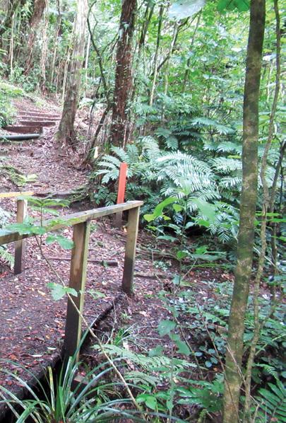
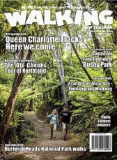
New Zealand Walk: Unveiling the beauty and history of the Nydia Track
New Zealand Shared Pathway; Cycling on the Kapiti Coast - an Autumn adventure
New Zealand Walk: Walking on Waiheke enjoying bird song
Event: Race Tekapo walks - with breath-taking views
New Zealand Walks: From forest to skyline Walking the Wilds of Puhi Peaks
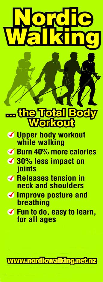
The ULTIMATE is Zerofit’s flagship product and perfect for hiking, golf, sailing or any outdoor activities when it’s cold. But if you are more active it is complemented by the Heatrub MOVE.
Twice as warm as a standard base layer, the material regulates tempertures as you move, so you won’t suffer from cold sweat, if your are running or cycling.
Please visit the Walking New Zealand Shop: https://walkingnewzealand.co.nz/productcategory/apparel/ for more details and to order.
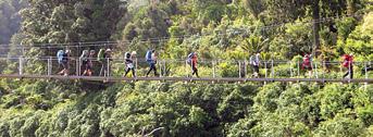
Cover: A group on a day hike on the Puhi Peaks near Kaikoura.
PUBLISHER/EDITOR: Frank Goldingham: Phone 06-358-6863, 027-274-0726
CONTRIBUTORS: Barbz Lowther, Phillip Donnell, Michael Hendriks, Yvonne van Eerden, Judy Eva, Sarah Davis, Kerry Eren and Monique Elario
ADVERTISING MANAGER: Frank Goldingham - 0800 walking (925-546) 027-274-0726
Walk talk
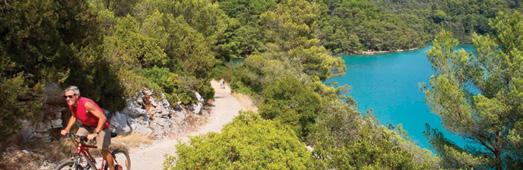
World Journeys’ Croatia deals for 2025
World Journeys has savings of up to 20% on select departures of two of its most popular Croatia packages.
The eight-day Bike & Cruise Croatia package from Split, returning to Split, combines cruising between islands, with daily cycling routes to experience the destination up-close – savings are available in June or August 2025.
The eight-day Deluxe Croatia Cruise explores Croatia’s islands aboard a deluxe superior ship from Split to Dubrovnik and back to Split, with guided walking tours and sightseeing en route – savings are available from 26 April to 27 August 2025. Savings apply on select dates only, vary per departure, and are subject to availability.
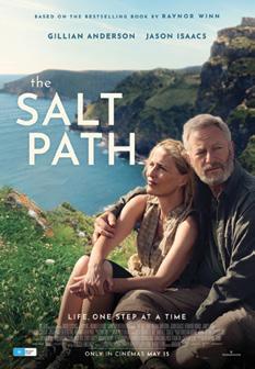
The Salt Path book now a motion picture
The Salt Path is the profound true story of husband and wife, Raynor and Moth Winn’s 630-mile trek along the beautiful but rugged Cornish, Devon and Dorset coastline. After being forcibly removed from their home, they make the desperate decision to walk in the hope that, in nature, they will find solace and a sense of acceptance. With depleted resources, only a tent and some essentials between them, every step along the path is a testament to their growing strength and determination.
The Salt Path is a journey that is exhilarating, challenging, and liberating in equal measure. A portrayal of home, how it can be lost and rediscovered in the most unexpected ways. The best selling book by Raynor Winn. is now in a film showing in NZ cinemas in May.
West Coast Wheel Creek
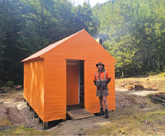
Hut gets a do-up
A six-person hut in near Maruia on the South Island’s West Coast has received a major makeover, with a refurbished roof, new piles and a smart paint job. The work was planned and led by ranger Matt Ainge, with team members Ben Pigott, Mike Detlaff, David Deck, Darrell Haworth (all DOC staffers from a range of teams) and John Edwards (volunteer).
Matt says, “the entire objective of this work was to protect this hut for generations to come, while leaving the hut in the original condition as we had found it.”
The hut was built in the 1960’s. Over the years it has received minimal maintenance, so a major spruce up was required. The job required the team to entirely re-pile the hut and replace almost all the bearers as some were completely rotten. The team discussed the work needed, which required digging under the hut to dig out and replace each pile, and repair and replace the bearers.
The inside of the hut also received attention, a new fire shroud and insert was put in the open fireplace to protect the outer steel and concrete with rollout protection on the front to minimise the chances of logs rolling out of the fire. A stainless-steel bench was also added inside over the existing painted timber bench. More bunk slats were added to the existing beds, and the entire inside was cleaned and the floor treated with linseed oil.
Matt says, “Apart from the fact that this job was a complete labour of love, it was great to have a range of people from different teams all working together, sharing knowledge, learning from each other and working together towards a common goal: protecting and maintaining the back country for all to enjoy.”
You can now view and enjoy the latest issue of Walking New Zealand magazine online for only $3.95 at http://www.walkingnewzealand.co.nz
Walk talk
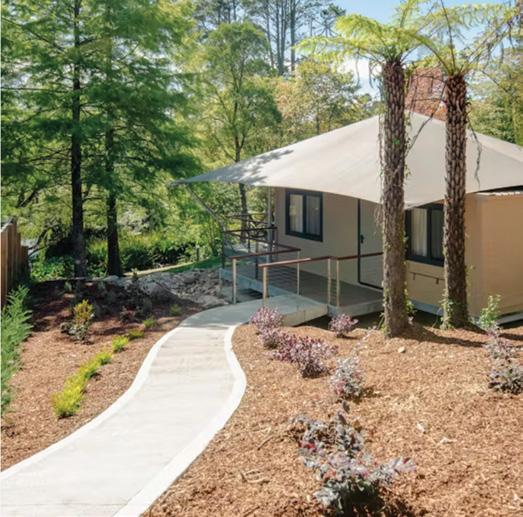
Glamping in Blue Mountains near bushwalking trails
Set within a 28-acre heritage estate in Blackheath, Parklands Blue Mountain’s new premium Lakeside Canopy tents offer a secluded hideaway in the gardens of the estate, positioned alongside the property’s private lake.
This is positioned as elevated glamping with the trimmings of a hotel stay, including Parkland’s luxury day spa.
Each Lakeside Canopy has indoor/ outdoor floorplans across 53sqm with ensuite bathrooms, beds, reversecycle air-conditioning and built-in kitchenettes.
Guests can spend time on the Canopy’s sun deck, and enjoy evenings beneath the stars by the Canopy’s outdoor firepit.
An overnight stay in Parklands’ Lakeside Canopies includes either breakfast inroom or in the main homestead.
Guests Glamping in Blue Mountains also have full use of the property’s facilities and the guest lounge located in the main lodge surrounded by the estate’s extensive gardens.
Parklands is positioned in the natural beauty of the Grose Valley with nearby bushwalking trails that merge with the World Heritage Listed Blue Mountains National Park.
A grand entrance through the property’s stately gates and driveway, flanked by ancient pines and cypresses, lead to the main homestead, garden cottages and Lakeside Canopies. parklands.com.au/rooms
Access to public conservation land still a challenge
What is happening with access to public conservation land in your region?
Despite encouraging news about recent changes to the Health and Safety at Work Act and the launch of a new access case map by the New Zealand Access Commission, access challenges continue across the country.
The Federated Mountain Clubs has long been involved in access issues nationwide, and they rely on your support to stay well-informed. If you come across any barriers to accessing public conservation land in your region, please get in touch and let us know.
Please send your observations, concerns or closure reports to eo@fmc.org.nz
Your favourite walk/cycle trail could win you a free subscription
We are looking for readers’ favourite New Zealand walks/cycling. Many of us go out regularly walking on a route which we class as our favourite, for a number of reasons. Perhaps because for it’s scenery, it’s safe, it’s challenging, it’s flat, it’s hilly, it’s varied, or for whatever reason.
We would like you to tell us in your own words what is you favourite walk and why. Email us a story from say 250 up to 1200 words including a photo or photos.
We will now give you a FREE subscription (six months or more, depending on the article), or extension to Walking New Zealand magazine for walks published.
You can also post an article to Walking New Zealand, 47 Lincoln Terrace Hokowhitu, Palmerston North, or email walkingnz@xtra.co.nz
If sending a photo by email please make sure photos are in high resolution. Our email address is: walkingnz@xtra.co.nz.
Please put “My Favourite Walk” in the subject line and include your name and postal address.
The H215 Professional 4 Function Pedometer
The H-215, 4-function pedometer is a superb, reasonably priced pedometer that counts steps, calculates distance, calories burned and has a 12/24 hour clock. This is the model that has sold over a quarter of a million worldwide. It has the largest display of any pedometer we tested and is very accurate.
Dimensions: (L) 5.6 * (W) 3.7 * (t) 2.7 cm
Price only $36.95 plus $6.00 P&P
Available now from:
Walking New Zealand Shop
47 Lincoln Terrace Palmerston North - Phone 0800-925-546 or email walkingnz@xtra.co.nz. www.walkingnewzealand.co.nz
Phone 0800925-546 for bulk prices
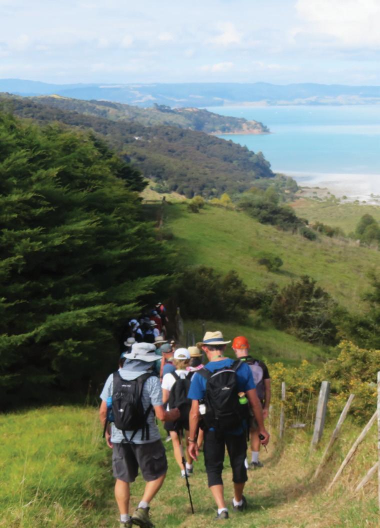
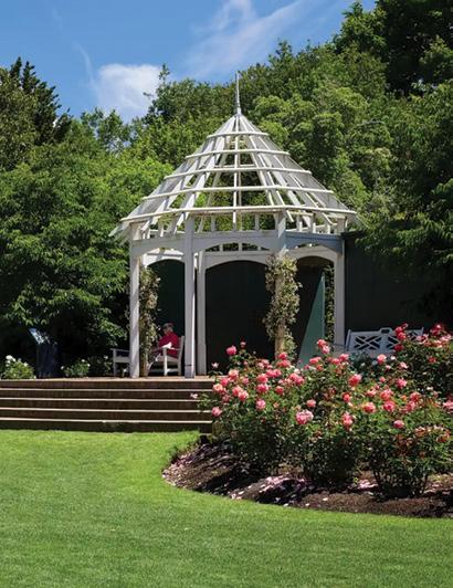
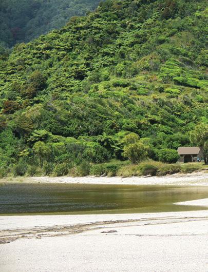
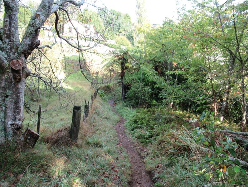
Waiheke enjoying bird song
This year at the Waiheke Walking Festival, we chose two walks displaying the amazing strides the community have made, towards a pest free island.
By Barbz Lowther
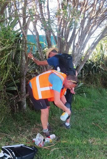
For years, many groups have been working hard at pest control, setting traps and educating the public on the harm that domestic cats and dogs can do to our native birds.
In 2018 all these groups were amalgamated under one umbrella – Te Korowai o Waiheke. The main goal of this group is to totally eliminate stoats, the worst pest, and make Waiheke the world’s first predator free urban island. This requires the whole community working together, with a dedicated team of staff and volunteers, who meet regularly with technical advisor experts.
By the beginning of 2025, 200,000 stoat traps have been set and serviced high tech transmitters, which sent alerts when an animal is caught, make trapping far more efficient. They are working!
In five years, 72% more native and endemic birds have been counted, 388% more kaka, 178% more kingfisher (kotare) and 170% more fantail (piwakawaka}
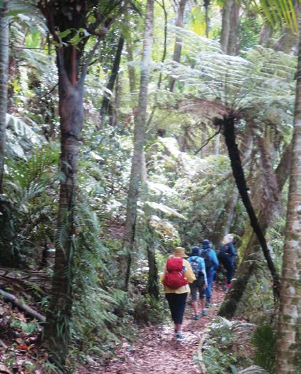
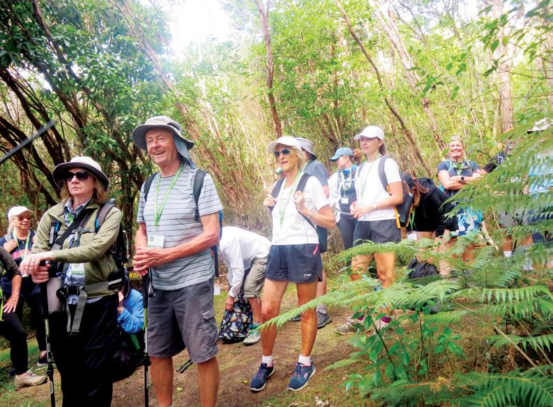
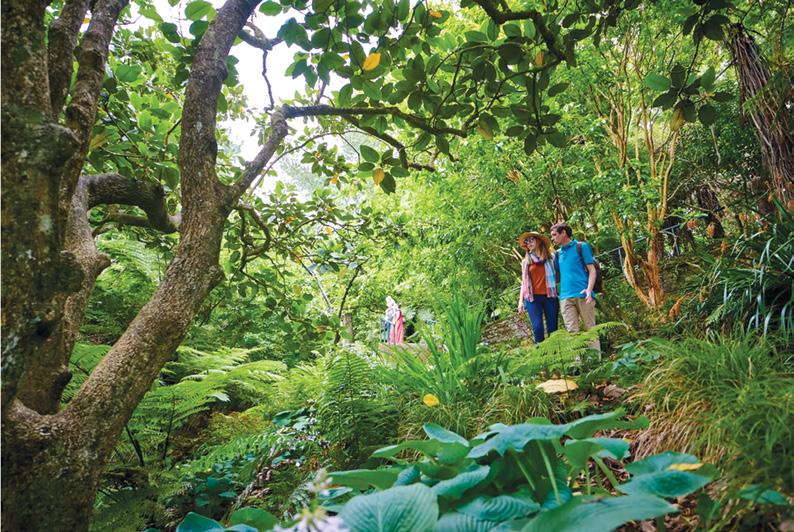
For our first walk, we met at Puketutu, or Trig Hill, and were greeted by a very noisy welcome from a group of kakas high in the pine trees. Swallows (warou) and fantails flitted all around and wood pigeons (kereru) sat gorging on nikau berries, not at all phased by our presence. Wekas wandered amongst our gear to see what they could grab.
After scrubbing our footwear to prevent any possible spread of kauri die-back from the mainland, our guide led us up though Awaawaroa Eco Village. This village houses 15 families who have collective owner-
Above: The group heading down to Awaawaroa Bay.
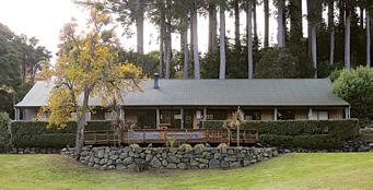
Self Guided Private Walking Track
* Choose between 3 or 2 day options.
* Lodge style accommodation with fully serviced kitchens, BBQ, hot showers, comfortable bunkbeds and pillows.
Dogs welcome, kennels available at lodgings.
Pack transport each day makes for a stress free adventure.
New Zealand Walks
Walking on Waiheke enjoying bird song
ship of forest, farmland and wetland, and value ecologically sustainable lifestyles. They live off-grid, using solar power and water tanks, which must be quite challenging in a dry summer. They follow organic practises and work to restore the natural habitat, with space for agriculture, forestry and other initiatives.
As we wandered through the property we learnt a lot about the uses of gorse and tobacco weed Both are used to hold the soil, and shelter young trees, which then grow tall enough to cut light to the weeds below.
There were some lovely big puriris
Above left: Wandering along the tops above Awaawaroa eco village.
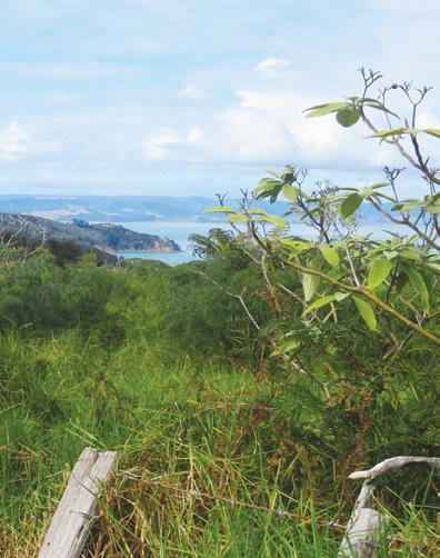
Above right: Looking out over the Hauraki Gulf,
Middle left: Cleaning footwear to stop possible spread of Kauri die-back.
Below left: Walking in Whakanewha under nikau.
Insert: A pest trap.
and several taraire trees . Some of these were dying off, due to a dry summer and a shallow rooting system. They will be used for firewood and garden mulch.
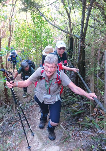
After just over an hour wandering under mahoe, manuka and tall kanuka, we reached the challenge of the day – a couple of very steep hill sections with steps hacked into the clay. The second and steepest one was negotiated with the help of a rope and was a lot of fun.
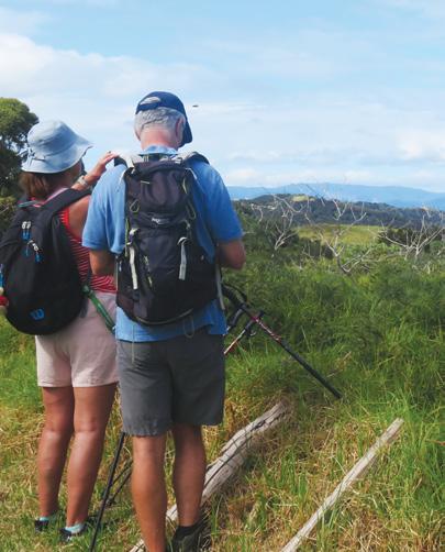
Reaching the top, we climbed the boundary from the Eco Village and spent a few minutes just admiring the beautiful views – back down over the village, to the islands in the Hauraki Gulf, and in the distance, mainland Auckland
We wandered along the tops, and following the fence line down, soon had awesome views of Awaawaroa Bay below. It was a gradual downhill to a manganese mine which operated here in the late 1880’s providing manganese for the iron and steel industry, but it wasn’t eco-
nomically viable, so closed by 1900. From here we followed red Te Ara Hura signs, down into wetlands filtering into Awaawaroa Bay. These wetlands are home to the giant kokopu fish, and several species of birds – bitterns, fern birds, pukeko and banded rail.
Our guide took some ‘goo’ from the base of a, flax (harakek) and offered it for cuts and scratches. It is said to have wonderful healing properties. A short walk along the road took us to Poderi Crisci Winery where we spent a delightful afternoon enjoying a delicious long lunch.
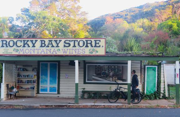
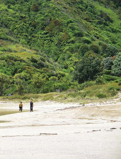
The following day we caught a local bus to Rocky Bay. From the bus stop we walked up Omiha Road past the old Rocky Bay store and hall before turning right onto Upland Road Track. At low tide it is possible to follow the track along the foreshore
to Whakanewha Sculpture car park – but- we hit high .
A trail led through the bush, joining with Dotties Lane Trail. Again we followed Te Ara Hura signs to avoid the nesting dotterels at Whakanewha Bay. Te Ara Hura is the long distance pathway around the island, and we intersected with little sections of it each day
Whakanewha Regional park on the south coast, was opened in 2007. The Dotterel Sculpture at the
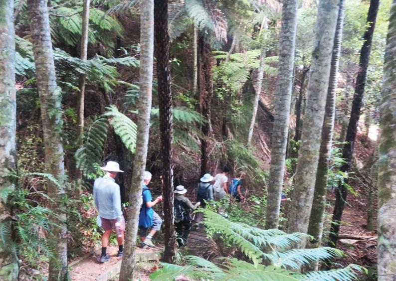
Above right: Walking through the kanuka forest.
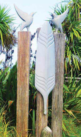
Middle right: The dotterel Sculpture symbolising Guardianship of our rare New Zealand birds.
Below left: The old Rocky bay store near the end of the Bus Run.
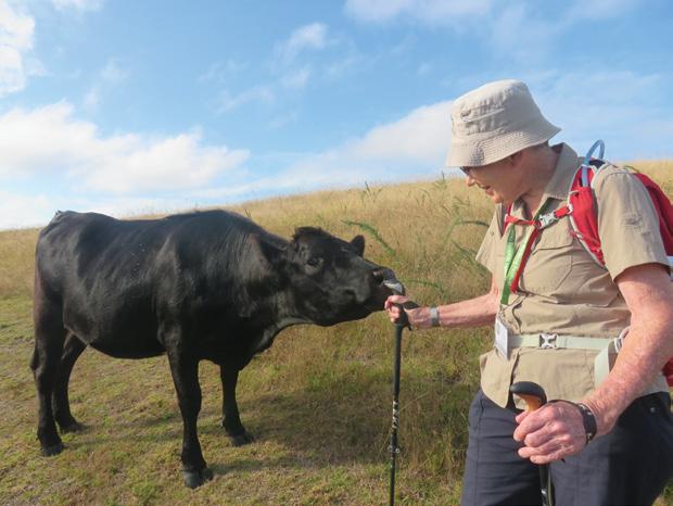
Below right: Cattle licking salt from the handle of Jills tramping stick.
New Zealand Walks
Walking on Waiheke enjoying bird song
carpark, symbolises guardianship of these rare New Zealand birds. The beach by the car park is also home to oyster catchers, terns, shags, herons and kingfishers.
Again our footwear was scrubbed, and we were lucky to have members of Te Korowai as well as Auckland Council rangers to guide us, tell us about their work and answer any questions. They were a wealth of information.
The park is dominated by broadleaf trees, - taraire,kohekohe and puriri, and podocarps like tanekaha
and kahikatea. Some are mature, some regenerating, with epiphytes clinging to their trunks and supplejack tangled underneath. Within the park are remnants of a once thriving Maori settlement and archaeological findings from European settlers who arrived in the 1830’s.
There are a variety of well marked and gently graded tracks with a base of dirt or orange Waiheke gravel, giving dry walking conditions.
We started on the Kowhai Track, in dappled sunlight, turned into tarata, and finished the loop on the nikau.
On the way we were shown the huge web of a funnel web spider, a pile of twigs and branches strategically placed to give shelter to geckos. There are two types within the park. We stopped for five minutes of total silence.
In that time we heard kakas, tuis, fantails, a grey warbler and a shining cuckoo – far more than we’d hear on the mainland in the same time. The birds were delightful. We stopped to watch a group of kakas playing and
Above left: Walking down the Nikau Track,
Above right: Kereru at Puketutu feeding on nikau berries.
Below left: Negotiating the ‘Rope haul”
squabbling and generally making quite a hullaballoo.
Returning on the Nikau Track we again saw kereru feasting
It was an interesting and informative day and one we won’t forget in a hurry. The guides were so passionate about their work, and the staggering improvements that have been made in bird counts already . It is something they can be immensely proud of. It is hoped that kiwi will be released on Waiheke Island in May this year.
Ouch! Sore feet while walking?
Hikers Wool is 100% New Zealand wool. Cushion your feet to prevent pain, rubbing and blisters.
Buy online or at selected stockists For more info visit www.hikerswool.co.nz
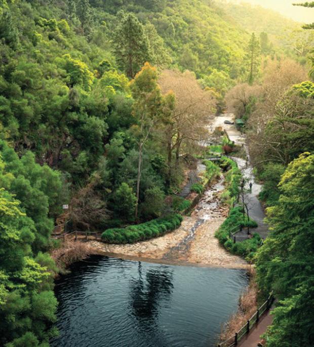
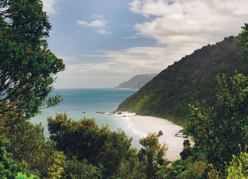
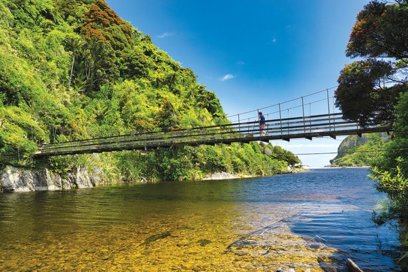
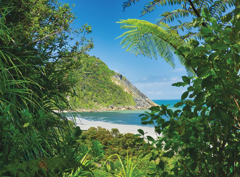
Unveiling the beauty and history of the Nydia Track, Marlborough Sounds
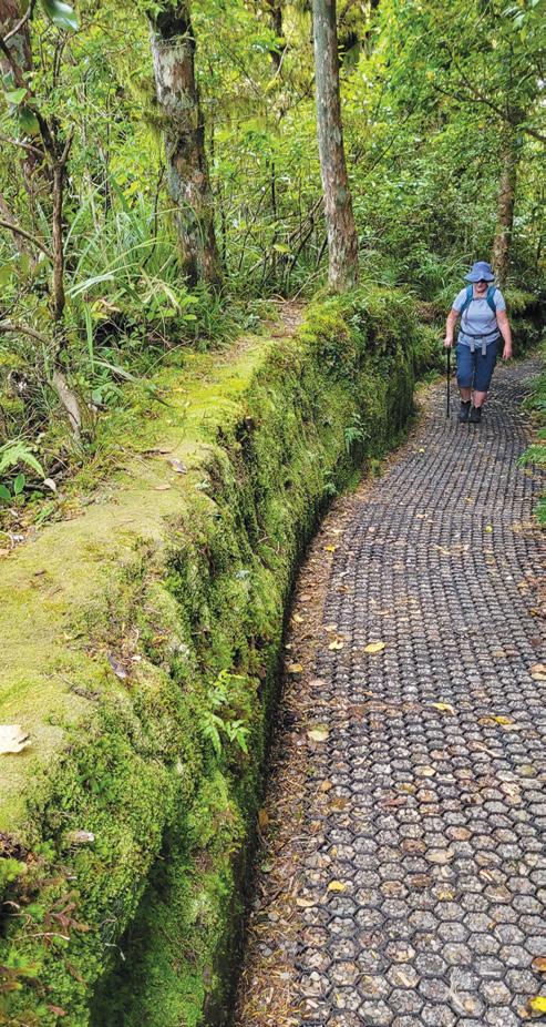
Nestled in the serene Marlborough Sounds of New Zealand, the Nydia Track offers a captivating journey through lush coastal forests, over scenic saddles, and along the historic shores of Nydia Bay.
This 27-kilometre track, traditionally a two-day tramp, presents a rewarding experience for hikers and a challenging yet exhilarating ride for mountain bikers. Nestled in the calm water of Te Hoiere Pelorus Sound it offers a much quieter experience than the busy Queen Charlotte Track.
The track meanders through a diverse landscape, showcasing the natural beauty of the Marlborough region. Hikers and bikers alike
will traverse through regenerating native bush, encounter mature podocarp forests with towering rimu and beech trees, and cross patches of farmland. The reward for the climbs are the panoramic views from the Kaiuma and Nydia Saddles, offering breathtaking vistas of Tennyson Inlet and the surrounding sounds. Glimpses of the sparkling sea peak through the dense foliage, adding to the scenic allure of the track.
Nydia Bay itself is steeped in history. In the late 19th and early 20th centuries, the bay was a bustling hub
Above top: Looking out to the Marlborough Sounds from the Nydia Track.
Unveiling the beauty and history of the Nydia Track
for timber milling. A 300-metre long wharf once stood, servicing the ships that transported the harvested native timber, primarily rimu, to other parts of New Zealand, including Christchurch.
A small settlement sprung up to support the industry. Today, remnants of this era are scarce, allowing nature to reclaim the landscape, but the historical significance adds another layer of interest to the area. The Māori name for Nydia Bay was Opouri, meaning “place of sadness,” and a pa (fortified village) once stood on the northern side of the bay, hinting at a rich cultural history predating European settlement.
Above top A bird’s eye view of On The Track Lodge at Nydia Bay.
Middle left: The wharf at Nydia Bay.
Below left: A mountain biker on a down hill section of the Nydia Track.
The Nydia Track is classified as an “advanced” track by the Department of Conservation (DOC), indicating that it requires a reasonable level of fitness. The terrain is varied, with unformed sections that can be rough, rocky, and uneven, often featuring large tree roots.
Some sections can be slippery and muddy, particularly after rain, and there are several unbridged stream crossings and one unbridged river
New Zealand Walks
crossing that require careful assessment. Sturdy tramping boots are highly recommended. For mountain bikers, the track is considered technically challenging (Grade 4) and is best attempted in dry weather due to the potential for slippery conditions.
For those wishing to extend their experience, Nydia Bay offers a DOC campsite with basic facilities. A unique accommodation option is also available at On The Track Lodge, situated roughly halfway along the track. This lodge provides a range of comfortable lodging, including vintage train carriages and chalets, along with amenities like hot showers, hot tub and kayaks, offering a welcome respite for trampers.
Access to the Nydia Track is available from two main points: Duncan Bay at the Tennyson Inlet end and Kaiuma Bay near Havelock. Both access points involve driving on winding roads, with the Kaiuma Bay Road being partly unsealed. Another option is to utilize water taxis or the Pelorus Mail Boat from Havelock to reach various points along the track or Nydia Bay directly.
The Nydia Track is a haven for nature enthusiasts. Birdwatchers can delight in the songs of bellbirds and tui, the sight of kereru (native wood pigeons), and the flitting movements of fantails and robins. Weka, a curious native bird, can often be seen foraging near the forest edges. In the waters of Nydia Bay, shags and gannets’ fish, and lucky visitors might even spot seals or dolphins.
In summary, the Nydia Track offers a multi-faceted experience, blending physical challenge with stunning natural beauty and a glimpse into the region’s past. Whether you choose to hike or mountain bike, the journey through the diverse landscapes and the tranquil destination of Nydia Bay creates lasting memories in the heart of the Marlborough Sounds. Remember to prepare adequately for the track conditions, respect the environment and private land, and enjoy the serene solitude of this remarkable corner of New Zealand.
Above A view from the Nydia Track into Marlborough Sounds.
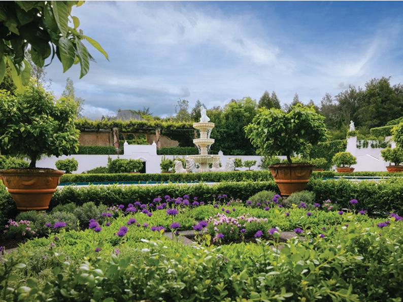
Wandering through Hamilton
Beside the banks of the Waikato River, just minutes from the heart of Hamilton City, Hamilton Gardens offers more than just flora—it’s a journey through history, culture, and imagination.
Our recent visit to this iconic New Zealand destination left us both invigorated and inspired, as we strolled through its many themed gardens, each transporting us to a different time and place.
Located at Hungerford Crescent, Hamilton East, Hamilton Gardens is easily accessible by car, bike, or public transport. There is ample parking available, and entry to the gardens is free, making it a perfect day out for walkers, nature lovers, families, or anyone seeking a peaceful escape.
The gardens are open every day from 9am to 5pm (May–September) and 9am to 7pm (October–April). The Visitor Centre and Information Desk are staffed during open hours and provide maps, walking suggestions, and background information.
Above left: The entrance to Te Parapara Garden.
Middle left: Trees beside the Waikato River.
Below left: Walking in a shaded area.
Above right: The lovely English Flower Garde,r
through wonder: a walk in Gardens
Upon entering, we were immediately greeted by beautifully maintained paths and signage that made navigation easy. With over 50 hectares of gardens and parkland, including 21 themed gardens, Hamilton Gardens is best explored on foot. Depending on your pace and interest level, you can spend 1.5 to 3 hours walking through the main areas.
We began our walk in the Enclosed Gardens section, where most of the themed gardens are located. This core area is flat, paved, and well-connected, offering about 2 kilometers of walking trails. There are benches scattered throughout, so it’s easy to stop, rest, or simply absorb
the atmosphere.
Our first stop was the Italian Renaissance Garden, with its symmetrical layout, terracotta pots, and classical sculptures. It felt like stepping into an estate from 16thcentury Tuscany. From there, we wandered into the Japanese Garden of Contemplation, where the quiet raked gravel, koi pond, and serene plantings brought a calming hush to our walk.
Each garden tells a story. We passed through the Indian Char Bagh Garden, inspired by the Mughal Empire’s paradise gardens. The scent of roses lingered in the air as
Above right: couple stop to enjoy the garden.
Below left: The beautiful Ancient Egyptian Garden. .Below right: On to a boardwalk throgh a forested area.
we admired the detailed architecture and water features.
One of the highlights was the Tudor Garden, with its green “knot” garden and heraldic beasts. It was followed by the Modernist Garden, a vibrant, abstract space inspired by mid-20th-century design. This constant shift in style and atmosphere kept us engaged and delighted around every corner.
Further along, the Surrealist Garden offered a playful, imaginative break—giant doors, tilted walls, and optical illusions made it a favourite for both children and adults. In contrast, the Chinese Scholars’ Garden impressed with its traditional pavilions and sense of scholarly retreat.
We covered about 3.5 to 4 kilometers over the course of two hours, including stops for photos, reading the interpretive panels, and enjoying a coffee at the Hamilton Gardens Café, which offers outdoor seating
Wandering through wonder: a walk in Hamilton Gardens
and views over the lake.
While the gardens are primarily about landscape design, keen-eyed walkers will appreciate the variety of plants and birdlife throughout the grounds. We spotted fantails darting through the trees and a pair of pūkeko near Turtle Lake. Flowering magnolias and camellias were in bloom during our visit, providing bursts of colour against the winter green.
Along the lakeside walk and riverbank trails, native bush areas offer
more natural-style walking paths, with gravel and some slight inclines. These tracks connect to the Waikato River Pathway, so it’s possible to extend your walk well beyond the gardens themselves.
What makes Hamilton Gardens particularly remarkable is how it evolved from a rubbish dump into an internationally award-winning attraction.
The land originally served as a Māori settlement and later as part of the 19th-century military barracks.
Fact file
Distance: Main loop walk is approx. 2–3 km; with extended paths and backtracking, expect up to 4–5 km total.
Most paths are wheelchair- and stroller-friendly.
Time: Allow at least 1.5 hours, more if you want to explore every garden in depth or enjoy a picnic.
Map: Pick up a garden map at the Visitor Centre, or use the Hamilton Gardens app for a selfguided tour.
Toilets, water fountains, a gift shop, and a café are located near the entrance
By the mid-20th century, it was being used as a sand quarry and city dump. In the 1960s, local visionaries, including landscape architect Dr Peter Sergel, began to imagine something different—a public garden that celebrated the world’s great garden traditions.
Hamilton Gardens officially opened in 1960, but it wasn’t until the 1980s and beyond that the themed gardens began to take shape. Instead of being a traditional botanical garden, Hamilton Gardens focuses on telling the stories of gardening traditions across civilisations, making it a unique concept globally.
Today, it welcomes over 1.3 million visitors each year and has received numerous international awards, including the International Garden of the Year (2014) at the Garden Tourism Awards..
Our walk through Hamilton Gardens was much more than just a stroll—it was a cultural voyage, a visual feast, and a rejuvenating escape into creativity. Whether you’re a local looking for a serene walk or a traveller in search of New Zealand’s hidden gems, Hamilton Gardens is a must-visit.
And best of all, it’s free—proof that some of life’s greatest experiences come at no cost, only the time to walk and wonder
Outstanding odyssey in Oz - with some great walks in South Australia
Phillip Donnell outlines some great walking options in South Australia
.Many Aussies venture offshore to Tasmania or Norfolk Island but if they want a holiday on the mainland they are drawn not only to the Red Centre, Gold Coast and Sunshine Coast, but also to the vineyards and trails of South Australia.
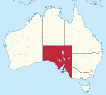
South Australia (commonly abbreviated as SA) has a total land area of 984,321km², making it the fourth-largest of Australia’s states by area. Over threequarters of its 1.8 million people
live in Adelaide. The state’s colonial origins are unique in Australia as a freely settled, planned British province, rather than as a convict settlement. Colonial government commenced on 28 December 1836.
By Phillip Donnell
Adelaide is the world’s second National Park City and Australia’s first, thanks to its centre being encircled by gorgeous parklands and a generous amount of suburban green space. Linear Park is an Adelaide must-do, featuring a walk by the River Torrens that snakes its way through the heart
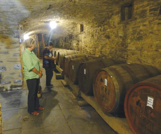
Above left: Aligator Gorge in Mt Remarkable National Park. Above right: Walking on the Clare Valley Trail. Below right: A waterfall in Gully Cleland Conservation Park: Below left: Wine in casks stored in the Severn Hills Vineyard.
of the capital.
Be sure to walk a section of the Adelaide Coastal Trail, (e.g. Port Noarlunga to Moana, Hallett Cove to Sellick Beach) and amble through the Botanic Gardens at Mount Lofty.
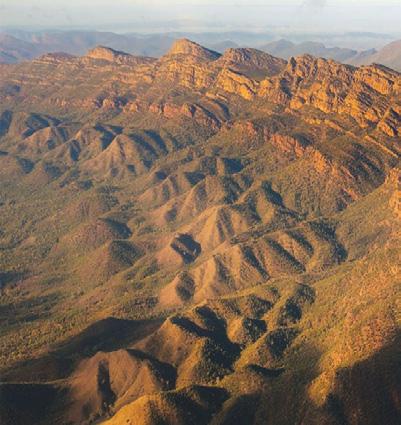
South Australia’s 1200-kilometre Heysen Trail runs through the Adelaide Hills, traversing some very scenic conservation parks (Mount George, Cleland, Morialta and Montacute) as well as several picturesque townships (Mylor, Hahndorf, Norton Summit, Cudlee Creek, Chain of Ponds). Superlative walks abound along its length. Morialta, along with nearby Belair Conservation Park, are waterfall wonderlands. With rugged mountain ranges, dramatic gorges, steep valleys and
Outstanding odyssey in Oz - with some great walks in South Australia
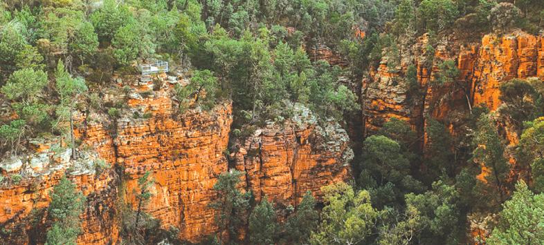
towering red cliffs, you could be forgiven for thinking the ancient landscapes of Mount Remarkable National Park were straight out of a postcard from Arizona.
By walking Alligator Gorge you can unearth another world carved into the rocks of the outback over
millions of years and discover the ‘terraces’, a long series of small cascades. At 960m, the summit is very reachable on a good trail starting at Melrose.
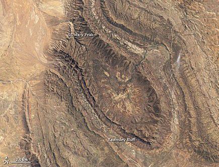
Wilpena Pound in Flinders Range National Park is crater-like in appearance, but the elliptical-shaped natural amphitheatre didn’t form in a meteorite strike. These semi-arid ancient ramparts encapsulate an area eight times larger than Uluru and 700 million years older than the Grand Canyon.
A climb to the summit of the highest mountain, St Mary’s Peak (1171m), allows you to revel in the expansive views over the ranges. It’s an iconic destination in every way.
Palaeontologists have called Red Banks Conservation Park one of the richest megafauna sites in Australia.
Thanks to the fas ci nat ing ‘Landscapes of Change’ interpretive walking trail, visitors can walk the path of the diprotodons, who lived here until about 65,000 years ago. The park conserves numerous threatened ecological communities, including scented mat-rush tussock grassland and mallee box wood land. Short-beaked echid nas, south ern hairy-nosed wombats, western grey and red kangaroos, birds and reptiles are among the park’s wildlife.
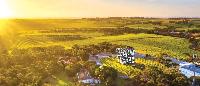
The Clare and Barossa Valleys are places where the mellowing hand of time has refined every detail. As two of Australia’s oldest wine regions (more than 50 wineries in each), the ingredients of a good life are as wellaged as its famed vintage.
Lake Bumbunga changes colour from pink, to white, to blue, depending on the salinity of the water throughout the year. Easy walking paths abound between wineries, the longest being the Riesling, Rattler, Mawson, and Lavender Federation Trails.
At Murray Bridge it is possible to walk along the third largest
navigable river in the world (after the Amazon and the Nile). From its mouth at Goolwa, you can take a cruise into the towering sand dunes, quiet waterways and snow-white sandy beaches of Coorong National Park, which predominantly covers a huge coastal lagoon ecosystem. The beach on the coastal side of the Younghusband peninsula is the longest in Australia.
Further south, take a short stroll or horse tram ride over the wooden causeway that connects the mainland at Victor Harbor to Granite Island Recreation Park. The island is characterised by huge granite boulders tinged with orange lichen.
Enjoy the coastal scenery and discover the island’s interesting history along the Kaiki Walk. Deep Creek Conservation Park contains a plethora of worthwhile walking opportunities.
The eagerly-photographed, wind-
blasted boulders of Remarkable Rocks, tucked within the wilds of Flinders Chase National Park, are synonymous with Kangaroo Island.
Not far away another geological masterpiece awaits, namely Admiral’s Arch, where stalactites frame the roaring Southern Ocean beyond. Stokes Bay was named the best beach in Australia in 2023, with its unique mix of monoliths, caves, surf and rockpools.
In Onkaparinga River National Park, diverse hiking trails take you to cliff tops with multiple magnificent views, or down to permanent pools teeming with life. You’ll see rugged ridge tops and the narrow river valley of the spectacular Onkaparinga Gorge.
The Echidna Trail winds its way amongst some of the best remnant vegetation and visits six heritage sites, including huts and houses built in the 1880s.
Boots Packs Rainwear
All your tramping essentials
One shop ~ Since 1988
You can experience all these features of South Australia, and much more, by participating in the November 2025 Footsteps day-walking tour. It’s a great way to relax and unwind before the busyness of the Christmas and end-of-year silly season!
This excursion is truly akin to tasting a hundred exquisite dishes in a
Above right: Darenburg Cube on Fleurieu Peninsula, South Australia. Belkow right: Wilpina Pound from space. single meal. You are warmly invited to participate.
Ouch! Sore feet while walking?
Hikers Wool is 100% New Zealand wool. Cushion your feet to prevent pain, rubbing and blisters.
Buy online or at selected stockists For more info visit www.hikerswool.co.nz
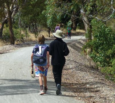
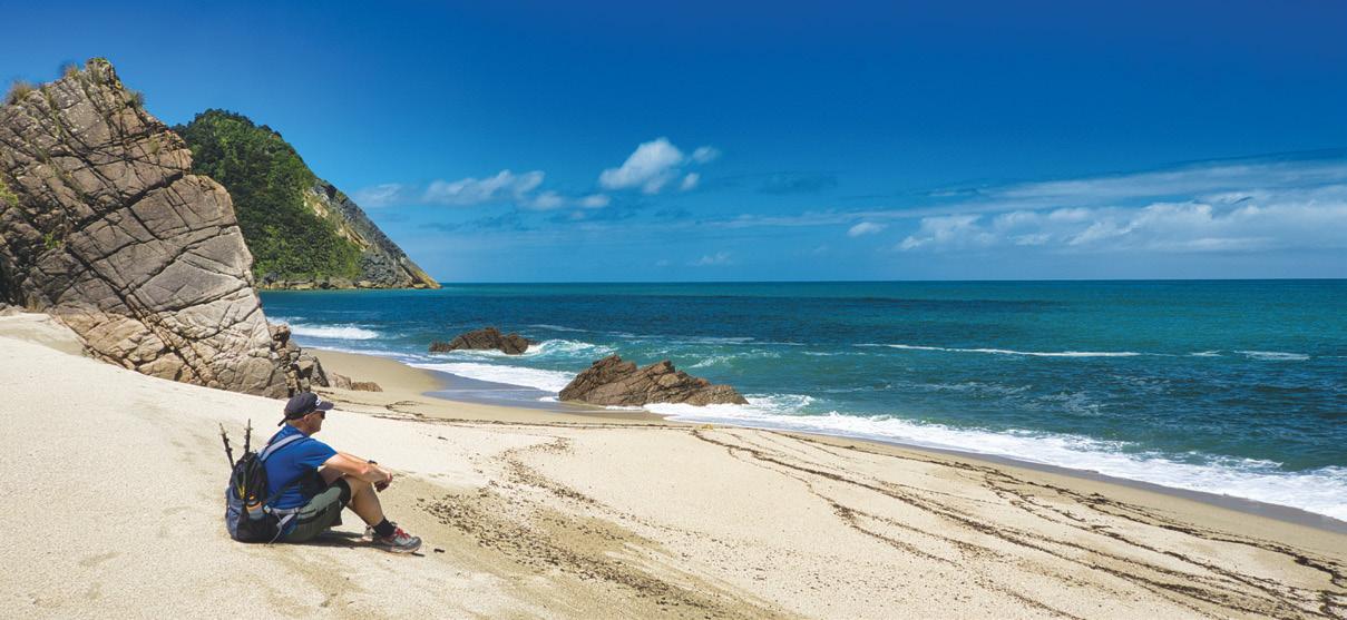
Scotts Beach & Nikau Walk Karamea
By Michael Hendriks
Karamea, an hour north of Westport and nestled at the northernmost point of the South Islands’ rugged West Coast, exudes a laid-back, “end-of-theroad” vibe.
Often overlooked, this hidden gem boasts several spectacular day walks in the surrounding area. With a backdrop rivers, estuary and native forest that meet a rugged coastline, the walks in the surrounding area are
exciting as they are diverse.
Despite its remote location, Karamea boasts a friendly and relaxed community with excellent accommodation, a local art gallery / information centre, several cafes and pubs for food, making it an ideal base for your walking adventures.
From Karamea to the end of the road at Kohaihai, a short 15km drive takes you through farmland along the coastline before the road narrows and transforms into a shingle road for the final 3km as you reach Kohaihai, the southern entrance to the Kahurangi National Park which is the start or ending point of the Heaphy Track
Sheltered by the dunes, this DOC camping site area also features a day shelter, water, toilets, and allows a maximum of two nights of camping.
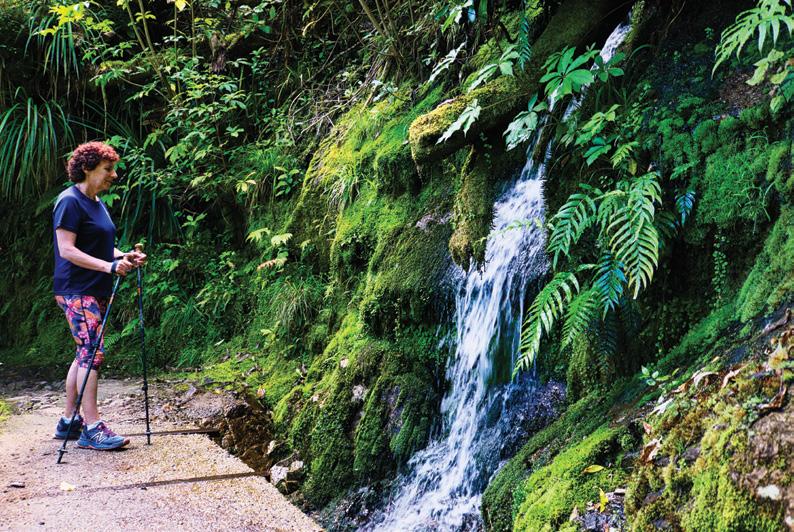
Scott’s beach walk is a beautiful short coastal day walk that forms part of the Heaphy Track and begins at the Kohaihai campsite. The track offers a leisurely 5-kilometre return walk, and with being able to combine the Nikau Walk makes a fabulous day walk to immerse yourself in the
Opposite page. Above left; Author, Michael at Scott’s Beach Middle left: Fellow walker, at the mossy stream. Beloe left: On the Nikau forest walk. Below: Walkers on the stunning Kohaihai River mouth.
Above right: Scotts Beach view (northern view) from the viewing platform. Below right: Bridge over Kohaihai River at the start of the walk.
Heaphy Track’s southern raw beauty.
The track begins next to the day shelter, with a gradual accent as it circles around to the swing bridge over the Kohaihai River and through the nikau palms, steadily climbing towards to the saddle. At the saddle, a small side track leads you to a picnic table and that initial breathtaking view of Scotts Beach.
From the top of the saddle, the track now descends gently down as it crosses a mossy stream along with stunning glimpses of Scotts Beach through the native bush before transitioning to a grassy area of Scotts beach camp site.
Stepping out on to the stunning
Scotts Beach, you will be surround by the native bush on this crescent-shaped beach along with the constant roar of the Tasman sea as it crashes on to the beach and surrounding headlands, which provides a spectacular setting to enjoy a break.
As you walk back up and over to Kohaihai, this time you’ll get an amazing view of the southern part of Scotts Beach before the track recrosses the saddle.
About a third of the way down the track, you will be rewarded with views of the Kohaihai River and the surrounding campsite, as the track makes its way back to the junction where the Nikau Palms Walk starts and a great addition to finish a stun-
New Zealand Walk
ning day’s walk in the Kahurangi National park.
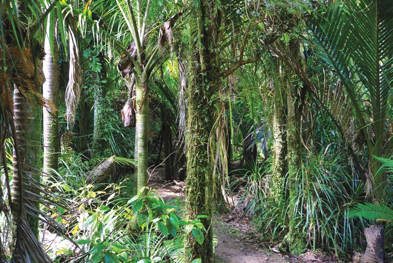
The Nikau Palms Walk is an easy 20-minute loop which also starts at the Kohaihai campsite and winds through one of the southernmost groves of nikau palms in New Zealand. This circular walk winds through the elegant, feather-like nikau palms, creating a lush, almost tropical ambiance. You’ll notice a variety of labelled native plants, including ferns and kahikatea trees to help with identification.
After completing the loop walk, it will bring you be back out to the Kohaihai bridge, and then it’s a short 5-minute walk back to the carpark
Before heading back to Karamea, take the time to explore Kohaihai area where the ale-brown river rounds a small sand bar meets the Tasman sea against the incredible backdrop of native bush and if you stay the night, you might also get to enjoy a magnificent west coast sunset.
Above: Scott’s beach (southern view) from the track.
Scotts Beach & Nikau Walk
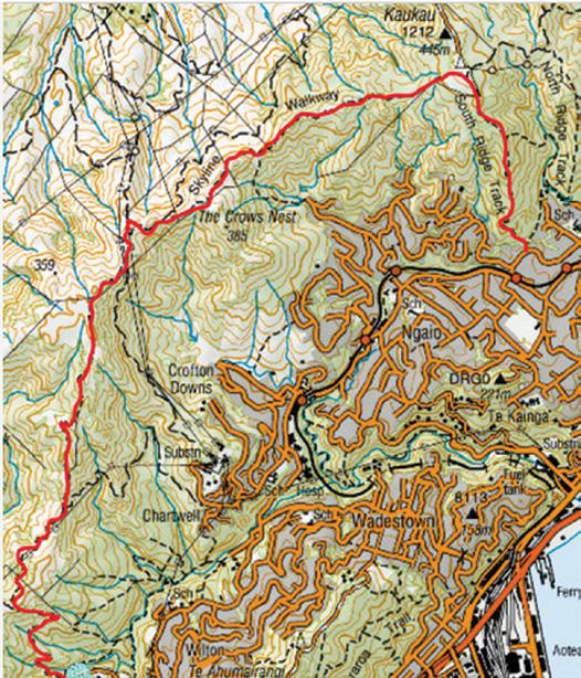
A day walk on the Te Araroa Trail
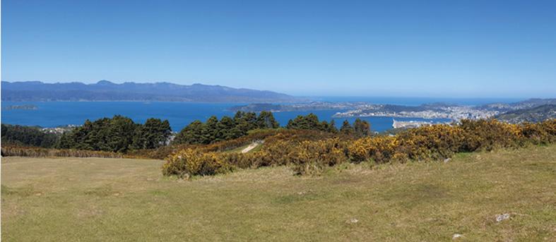
Now here’s a great idea for you – a day-walk on a section of the Te Araroa Trail in Wellington, suggested by the Wellington Te Araroa Trust.
Choose a fine day for the best experience – it can get breezy up on the Skyline Walkway section.
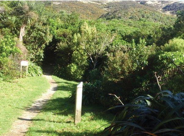
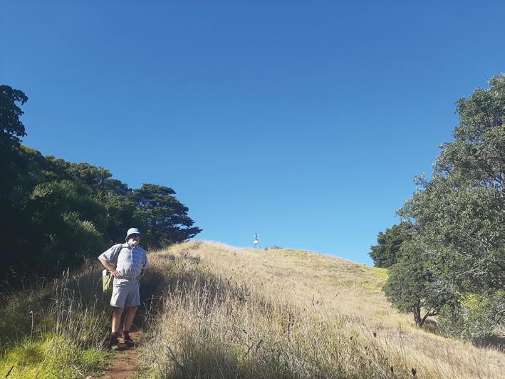
Catch a train to Johnsonville and walk up to Truscott Avenue car park, or drive to the car park. Cross the field and head up the track until you reach a junction with the Old Coach Road.
You are now on the Te Araroa Trail. Turn left, and head towards Mt Kaukau. Continue along the Mt Kaukau Walkway which is a part of the Skyline Walkway for about half an hour, then walk down Bell’s Track into Ngaio.
There are nice cafés in Ngaio where you can grab a coffee before continuing through the picturesque Trellisick Park on the Te Araroa Trail starting off Waikowhai Street.
Head up through Wadestown to more nice cafés and climb one of
the steepest streets in Wellington, Weld Street and the Te Araroa Trail into Mt Ahumairangi Park. From there follow the Northern Walkway around Mt Ahumairangi Park, dropping down St Mary Street to Tinakori Road.
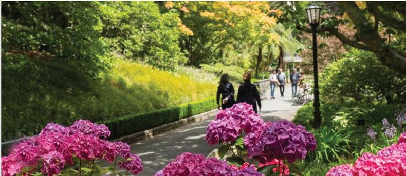
Stroll over to the Botanical Gardens for a leisurely lunch before
Above right: The view on the Mt Kaukau Walkway part of the Skyline walk.
Above: Walking in the Botanical Gardens.
Below left: The Bells Track down to Ngaio.
connecting with the Te Araroa Trail and walking down through Bolton Street Cemetery.
From the Cemetery, walk down to the Wellington Railway Station and catch a train back to Johnsonville. It’s only a 15-minute walk back up to the car park on Truscott Avenue.
Te Araroa Trail
We are looking for the best digital photos each month depicting walking
Now the time to get your digital camera out or look through your digital images and enter the
Walking New Zealand Digital Photo Contest
The image could be a scenic scene, a walk on the beach with the dog, a bush walk, a street walk or anything walking that takes your fancy.
The rules are simply: there must be a person or persons walking in the picture either front, side or back on, and can be in the distance. We require an emailed image in high resolution mode, in jpeg format as an attachment, and NOT embedded in Word or in the email, and NOT a link to a website to be downloaded. The subject line must have the words “Walking New Zealand Photo Contest” and the email must include the NAME, POSTAL ADDRESS and phone number of the person who took the photo and a small caption. In this contest ONLY ONE emailed photo accepted per month. Entry in the contest automatically allows us to print the image. The person who has their photo published will receive a six month subscription or a renewal to Walking New Zealand magazine of six months. If a picture is chosen for the cover page the person will receive a 12 month subscription or renewal Email your entries to: walkingnz@xtra.co.nz with subject line “Walking New Zealand Photo Contest” Only EMAILED entries will be accepted.
PHOTO CONTEST
Above: My husband Bruce taking a short walk on Mt. Richmond in Otahuhu. This is one of Auckland’s volcanic cones.
Photo by Jo Alexander of Epsom Auckland
Below left: Members of the Upper Hutt Walking and Tramping Club spent Waitangi weekend exploring walks in Egmont National Park - we did the walk to Wilkies pool and here Denise is walking alongside a lichen-covered bank. Photo by Sharon Dunstan, Whitby, Porirua.
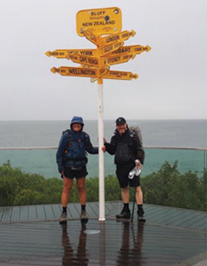
Above left: This is a photograph of Raymond Perry and Christine Postal taken on Tuesday 11th March 2025. They touched the Bluff sign after completing five months hiking on the Te
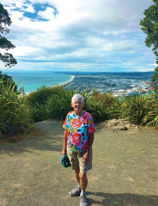
Above right: It may not be Everest but Summiting the 232m volcanic dome Mauao at Mt Maunganui was worthy to celebrate in a bright cheery tee shirt. Photo taken for Vicky Ross, Red Beach.
We
PHOTO CONTEST
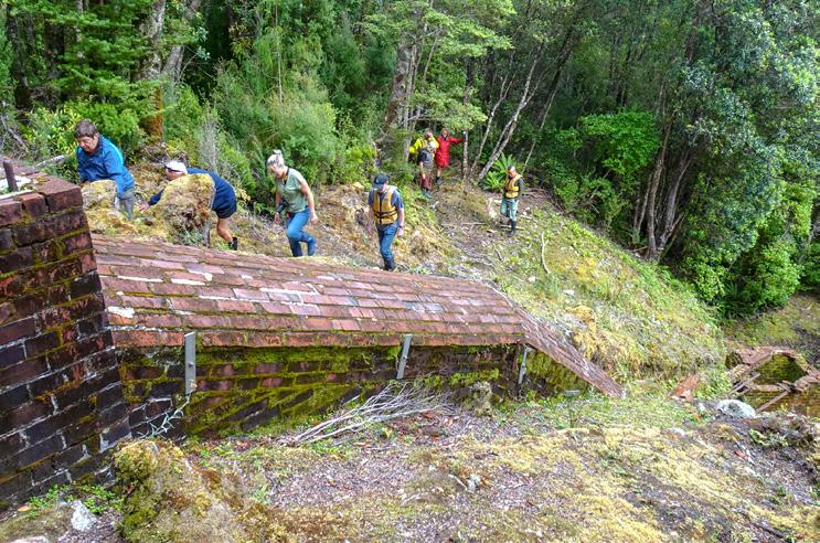
Below left: Our group at the remains of the Tarawera Smelter in Isthmus Sound in Preservation Inlet, which is one of the southernmost fiords in Fiordland. The Smelter was constructed in 1909-1911 in an attempt to process the complex gold-bearing ore from the Tarawera Mine. The venture was a failure and, after a trial smelting of 35 tons, the operation closed down. An inclined brick chimney from the smelter survives at the site. Photo by Clare Woodhall, Pandora, Napier.
You can also post an article to Walking New Zealand, Freepost 78863, P O Box 1922, Palmerston North.
If sending a photo by email please make sure photos are in high resolution.
Our email address is: walkingnz@xtra.co.nz.
Please put “My Favourite Walk” in the subject line and include your name and postal address.
Araroa trail. Photo by Edwin perry, Paraparaumu.
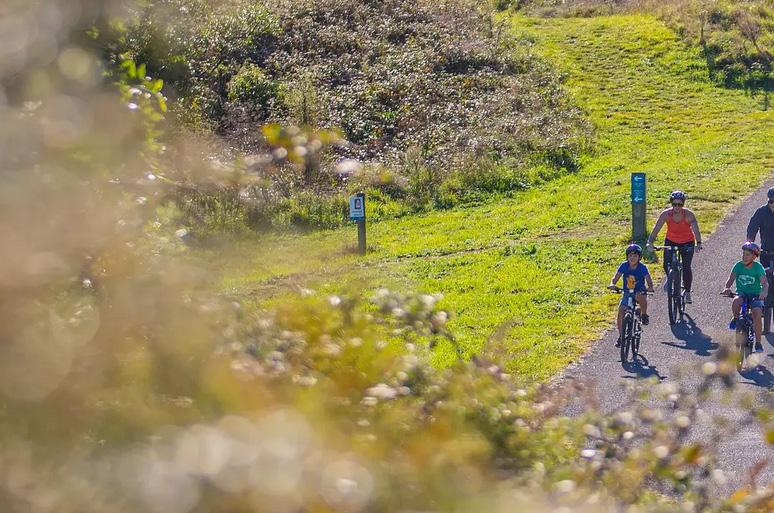
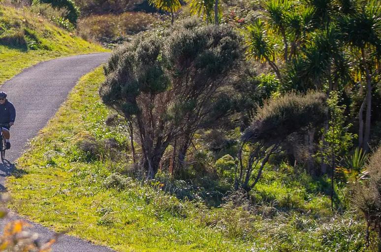
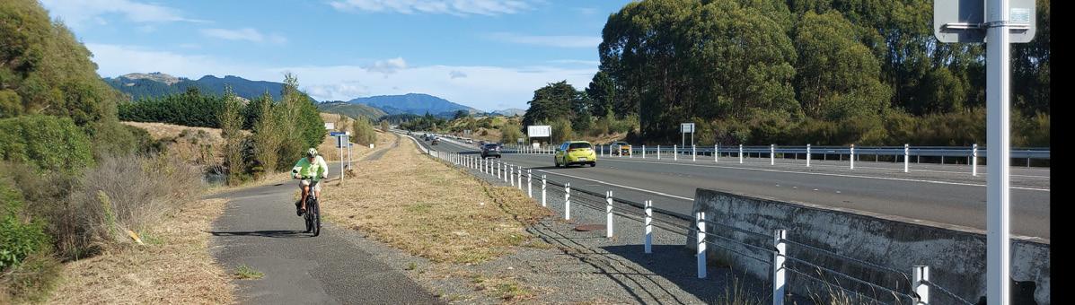
Cycling the Kapiti Coast: an Autumn
Above: A group on a sealed path of the trail.
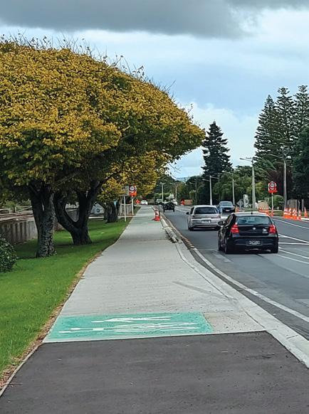
Below left: The new shared pathway from Otaki to the expressway. round a bout.
Below right: You pass the Otaki Markets open on the first and third Saturday of the month.
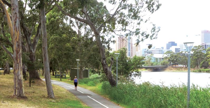
By Sarah Davis
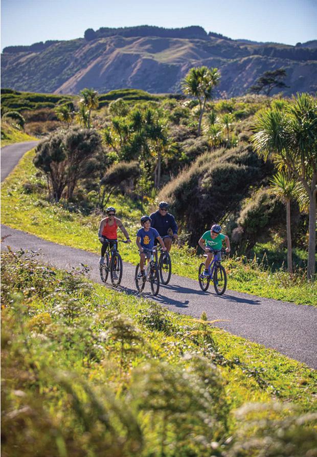
We embarked on a 35-kilometre journey along the Kapiti Cycle Trail (Coast35), starting at the BP Service Station in Ōtaki and concluding at Coastlands Mall in Paraparaumu.
This section of the trail, part of the broader Coast35 network, follows a
mix of firm-packed gravel paths and shared lanes, offering a smooth ride suitable for road bikes.
The route took approximately 2.5–3 hours of cycling time, with additional breaks for sightseeing and refreshments.
The ride began in the quiet township of Ōtaki, where the trail’s northern end merges seamlessly with the
adventure
Kapiti Expressway cycle path.
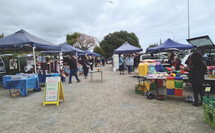
At the edge of the Otaki we go beside an interesting farmers type market held on the first and third Sunday’s of the month.
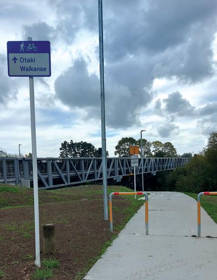
Then we found a new shared pathway from the Otaki township to the bridge over the main highway.
Autumn’s crisp air and golden foliage set the tone as we pedalled southward. The trail here is flanked by rural landscapes, with glimpses of the Tararua Range to the east and the Tasman Sea to the west.
Soon we are at the Kilns of Te Horo an exciting project, centred around Mirek Smíšek’s hand-built brick beehive kilns, located where Smíšek created a hub for ceramic art for more than 40 years. Celebrating the legacy of the past and again becoming a lively and inspirational place.
The Te Horo Kilns site is a wellrecognised and beloved community asset which Kapiti Coast locals have visited for generations to undertake creative hobbies, especially pottery classes and exhibitions held by the
Above The tunnel under the expressway just south of Te Horo. Below right; The KIlns of Te Horo.
Cycling the Kapiti Coast: an Autumn adventure
renowned Czechoslovakian ceramicist Mirek Smišek who lived on the site for 30 years between 1970 and 2000. The site includes a historic 100-year-old railway station, a pre1900 timber-framed cottage, and Smišek’s iconic beehive kilns and timber canopy.
The path now crosses the main trunk railway line and then goes through a tunnel under the main highway.
The path transitioned from open farmland to pockets of native bush, with occasional boardwalks crossing wetlands. Near Peka Peka, we spotted ngā manu (native birds) like tūī and kererū in the trees.
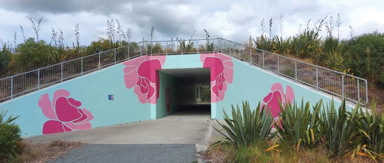
Murals adorned tunnels beneath roadways, adding vibrant splashes of colour to the journey. Bridges and underpasses provided safe crossings over railways and streams, while lakes near Waikanae reflected the autumn sky.
The trail is a mixed-use path, shared with walkers and occasional horse riders. A friendly “passing on your right” ensured smooth interactions
By mid-morning, we reached The
Above left: Cycling through a forested part.
Below left: The underpass at Otaki for those using the old SH road.
Above right: Coming on to the road that passes the Kilns of Te Horo.
Café at Harrison’s in Peka Peka, a cyclist-friendly spot nestled within a garden centre.
The southern stretch of the trail passed through Waikanae, where the path ran closer to the Kapiti Expressway. Despite the proximity to the highway, the trail felt secluded, with landscaped stop-banks and occasional glimpses of Kapiti Island.
The final approach to Coastlands Mall in Paraparaumu led us through suburban streets, marking the end of our journey.
The Coast35 trail proved ideal for cyclists of all levels, with its gentle gradients and clear signage. Autumn’s mild weather and quieter trails enhanced the experience, allowing us to fully appreciate the Kapiti Coast’s natural and cultural highlights.
top:
Above left: Crossing the main trunk railway south of Te Horo.
Middle right; An information sign about the pathway.
Above
The Kapiti Cycle Trail runs beside the expressway near Paraparaumu.
Explore our beautiful botanical world
Discover the first-rate walking tracks and spectacular scenery at New Zealand’s national arboretum, a unique park sanctuary for all ages
graded and marked walking tracks set amongst 13,000 exotic and rare trees, shrubs and climbers
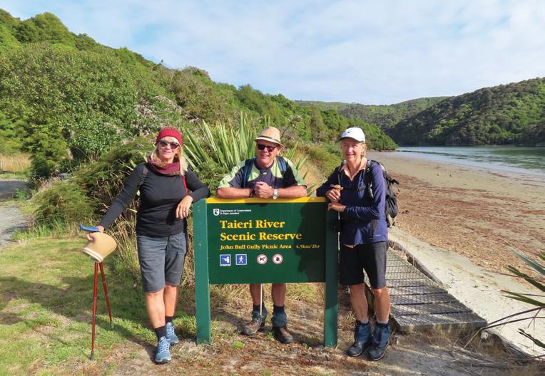
Taieri River Scenic Reserve an interesting walk
By Yvonne van Eerden
homestead
Visit our Homestead Tea House
Open Wed-Sun 10am-3pm Stay in our accommodation
Before we left Dunedin we checked the DOC website as there had been a lot of rain in the area several months before and
we knew Tunnel Beach was closed. DOC stated that the walk was closed due to flood damage but you could still walk to the John Bull Gully intersection which was still open.
It was a calm day with cloud and sunshine which was ideal for
“A nature lover’s paradise”
“This place is truly amazing”
“A must see in autumn”
P: 06 863 9003
E: enquiries@eastwoodhill.org.nz
A: 2392 Wharekopae Rd, RD 2, Ngatapa, Gisborne w w w.east w oo d hill.org . n z
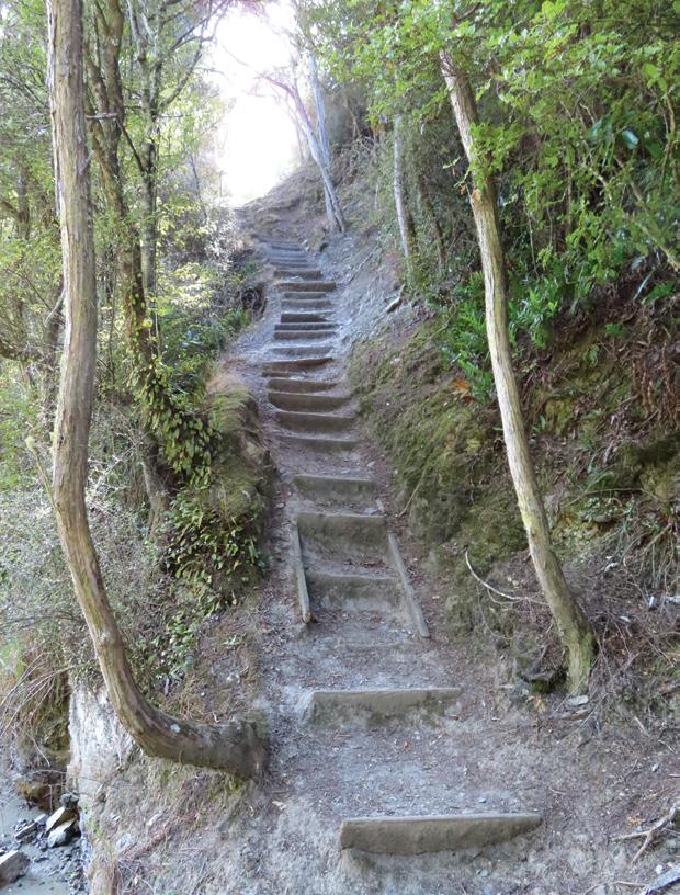
walking. The views along the track opened up so that you could see the river and surrounding areas.
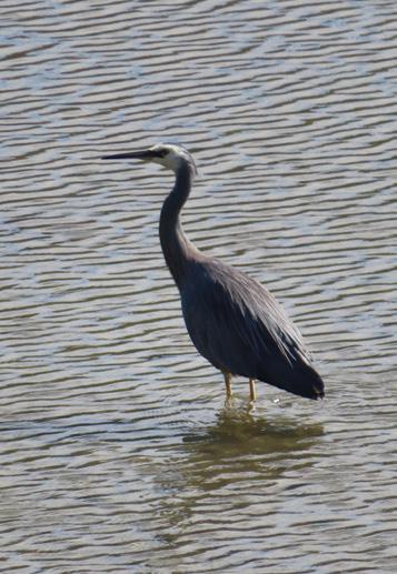
The white faced heron was soaking up the sun on the shore of the Taieri River and was not bothered about us at all.
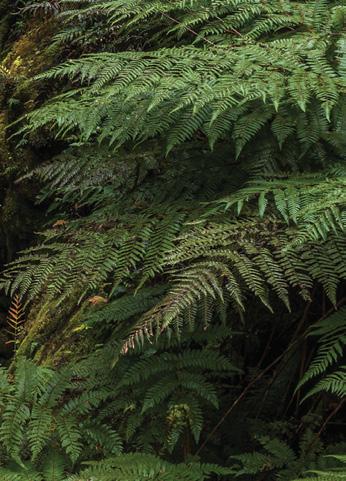
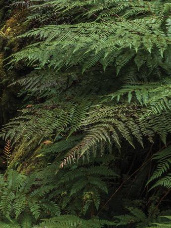
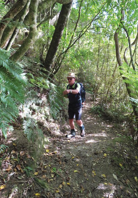
Further along the track we had the boardwalk which was surrounded with beautiful green ferns and trees, the bush was very dry. We kept our eyes open for the silver fern which we did see.
Once at the top we took our time to sit on the well positioned seat so that we could once again soak up the views.
This certainly was a magic spot to have our cuppa and take lots of photos. We were all happy at what we had achieved and thought that it was best to go down again.
It is a very interesting place to look around even if you do not want to do
the entire walk it is still a great idea to see how far you can go just to see the views along the track.
Above left: Well worn steps to the top.
Above right: Inspecting a fern on the track.
Below middle; A white faced heron.
By Judy Eva
Te Henui Walkway extension a little known walk
Situated on the opposite side of the rock strewn Te Henui Stream which flows from Mt Egmont to the sea and directly across from the well known and popular New Plymouth
Te Henui Walkway is the extension track not well known to visitors to the city as with many locals as it
does not seem to be openly advertised in any way except locally by mouth.
It is completely different to its counterpart in every way as it consists of a very narrow hilly and very roughly formed track along the top of a cliff which looks down and to across the stream to the well known
.main walkway of the same name. This narrow track continues for quite away weaving through differ-
Above: In the paddock turn right and go through the gate up into a large open grassed area then turn right up the hill.
Below left: Continue along the lane from Timandra Street.
ent types of foliage on a sometimes steep downward slope which is narrow, uneven in places and rough. It passes through changing scenery of native trees and foliage covering both sides as it slowly wends it’s way along heading slowly in a downward direction and then along the bank which is level with the river
The main Te Henui Walkway can be seen across the stream. From this point the scenery along the way is outstanding with a mixture of native trees, ferns pine needles and other foliage covering the tracks and several rustic wooden bridges crossing small streams. There is even a small waterfall on the upward slope if it has been raining.
There are signposts along the way
directing to streets up and above, but follow the sign that states Te Henui Walkway of which there are several leading up to the top of the bank but keeping to the track alongside the river and its beautiful scenery where you will eventually see the wooden steps on the left of the bank signposted where the track comes to an end.
Climbing up a rather steep bank to the top again follow the track that veers right at the top and it will take you out onto the end of Timandra Street, a no exit.
Head straight across the street and into the lane leading straight past the front of the large white colonial house on your right and as you come to the corner of the lane turn
right. There is a sign there stating Te Henui Walkway, and Waiwaka Reserve with an arrow pointing right take that and follow the lane down the hill onto the grass track leading to a closed spring loaded gate with a blue sign on it of a person with a dog. After entering through the gate the track will lead into a disused paddock, this is where the ground is very uneven and muddy after rain. Fol-
Above left: The entrance to the walk.
Above right: Gate at the bottom of the lane into the paddock. Brlow left: One of the little rustic bridges to cross Below right: Steps up to he top of the bank..
Te Henui Walkway extension a little known walk
low the narrow track veering right where you will see a yellow ribbon on a fence post, climb through there if you can or try one of the near by gates making sure you close it after you.
This will take you up onto open land and a high grassy hill on the right where there are usually sheep grazing. If you have a dog make sure it is on a lead. Trudging to the top of the hill there is a DOC (Department of Conservation) sign stating Historic Reserve.
Veering to the right of the sign there is a large metal gate usually shut. go through that gate making sure you close it again, If it is open leave it open.
Follow the narrow track veering left around the top of that paddock where you will come within sight of the main walkway at the bottom of a steep hill. There is a well formed sheep track veering down and to a style at the bottom of which you need to climb to enter onto the main walkway.
After climbing the style turn right and walk over the bridge then turning right onto the main walkway which will take you back to Cumberland Street if you wish to return to that point if you have a vehicle parked there or you can explore
more of this beautiful reserve.
This loop will take approximately one and a half to two hours to reach the main walkway depending on your energy and how many times you dawdle especially if it is your first time as it quite challenging and not easy to find in places.
If you do not need to return to Cumberland Street within a certain time enjoy exploring more of this beautiful walkway. There is always a friendly local who can help with information if you lose direction. The walkway is well signposted. Sturdy shoes and walking sticks are recommended for this loop walk. The Te Henui Walkway and reserve is dog friendly. There are no toilets the nearest ones are located at East End Beach at the sea end of the walkway. You can spend all day exploring this beautiful walkway. Take a stroll through the beautiful old Te Henui Cemetery heading toward the beach, it is signposted from down on the walkway.
The entrance to the extension walkway is at the bottom of the Cumberland Street hill next to the road bridge there is a style to climb or you can step over or under the pipe pole across the entrance. It is signposted.
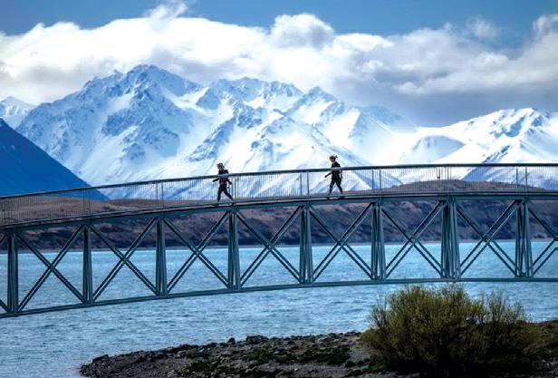
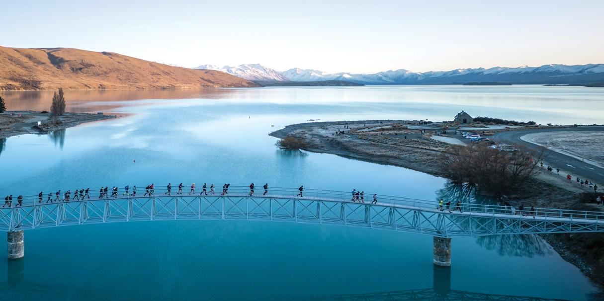
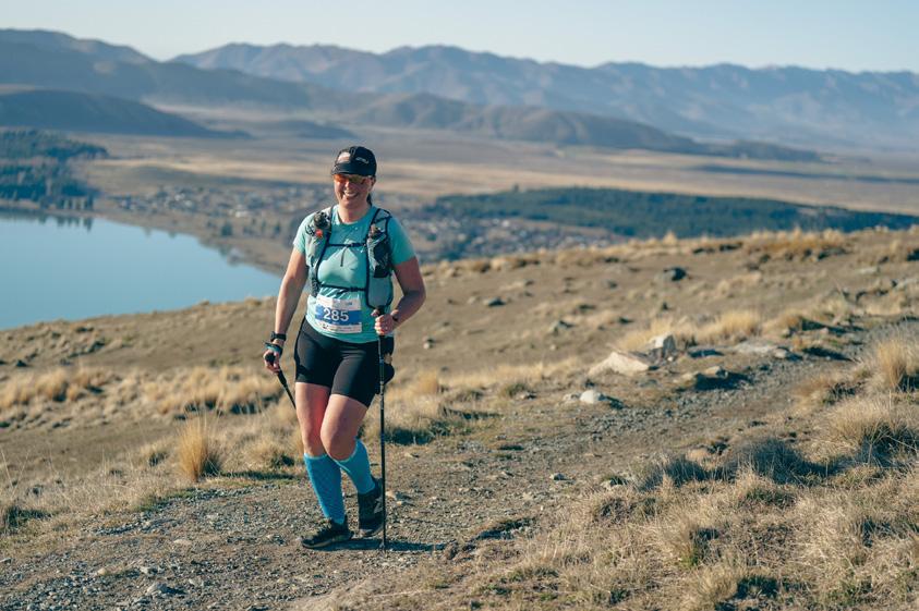
Race Tekapo
Could Merrell Race Tekapo be the most beautiful trail running and walking event in New Zealand? It certainly ticks all the boxes for jaw-dropping scenery. Every race distance on offer gives competitors unsurpassed views of snowcapped mountains, vast landscapes, and the iconic turquoise waters of Lake Tekapo.
Located in Lake Tekapo village, Merrell Race Tekapo is set right in the heart of the beautiful Mackenzie Region of New Zealand. Competitors travel from all over the globe to experience the untouched beauty of the area all the while competing in the event. With seven different distances on offer there really is ‘something for everyone’.
Lake Tekapo is part of the largest Dark Sky Reserve in the world and competitors in the longer distances get to line up under the stars before they head out on course. Walkers are encouraged at the event with the 21km, 16km, 12km, and 5km races all enjoying hundreds of walkers each year enjoying the scenery and atmosphere on the day.
“My running days are over,” says owner and organizer Kerry Uren, “but I love to walk. Making sure we encourage and cater for the many
Above left: An uphill climb.
walks with breath-taking views
walkers out there is really important. This event is all about getting out in nature, doing something for yourself, and enjoying the fun and friendly culture that we’ve created.”
Each course has been planned for the maximum ‘wow factor’ ensuring competitors experience as many visual highlights as possible. Depending on what distance is entered, walkers can experience the breathtaking 360-degree views atop Mt John, the iconic footbridge at Lake Tekapo, the famous Church of The Good Shepherd, and also enjoy some of the beautiful high-country stations that surround the lake.
“With the different distances on offer it allows competitors to choose from the more challenging options that include some elevation, or if you’re not wanting to puff too hard you can take on the 16km or 5km events and enjoy a more leisurely experience.” adds Kerry. “We have hundreds of walkers every year –some are quite competitive while others are very much having a social time out on the trails. It’s quite com mon for our runners to walk large sections of the course too so it’s a really supportive and fun day out for everyone.”
Merrell Race Tekapo encourages
competitors and their supporters to enjoy the many restaurants, cafes, and activities on offer in the wider Mackenzie Region. Organizers have made sure they pack as much fun out on course as possible, with even a ‘Fun Photo Shoot’ situated at the top of Mt John. Each year the theme changes and competitors come across a staged set, joining other competitors or going solo while the professional photographer snaps
the fun. Photos are complimentary, giving competitors a lasting memory of the fun atmosphere and incredible views on offer.
Lake Tekapo is based halfway between Queenstown and Christchurch. Book a flight, hire a car, and sort your accommodation. Come and see why Merrell Race Tekapo is truly an iconic destination race.
Above: Entrants on Race Tekapo traverse the bridge over Lake Tekapo.
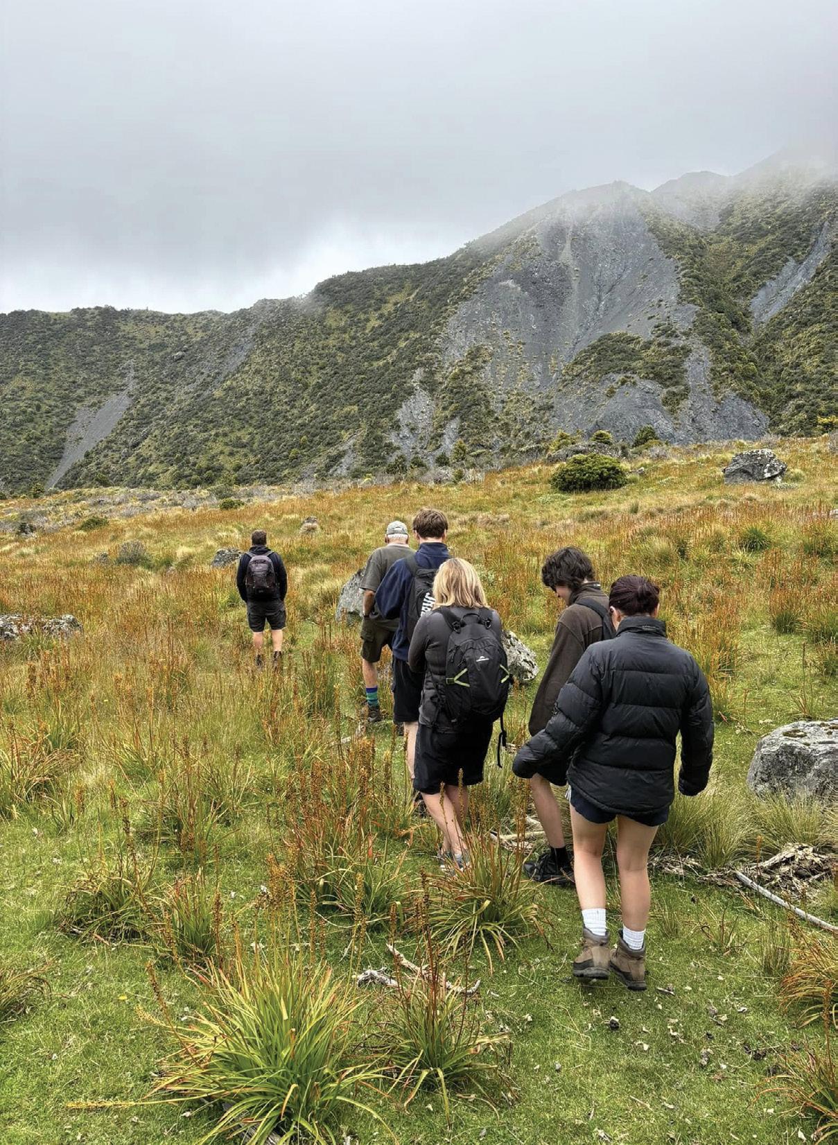
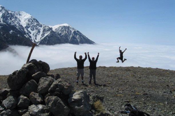
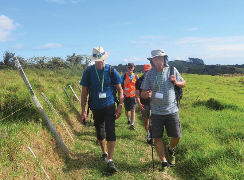
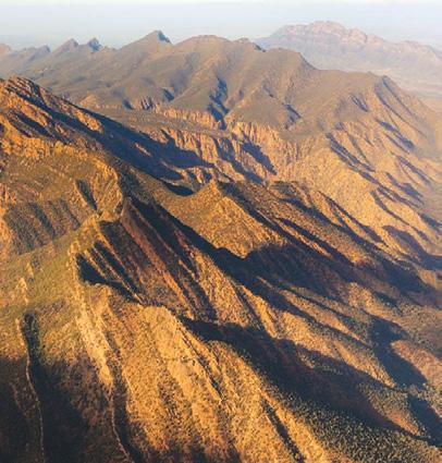
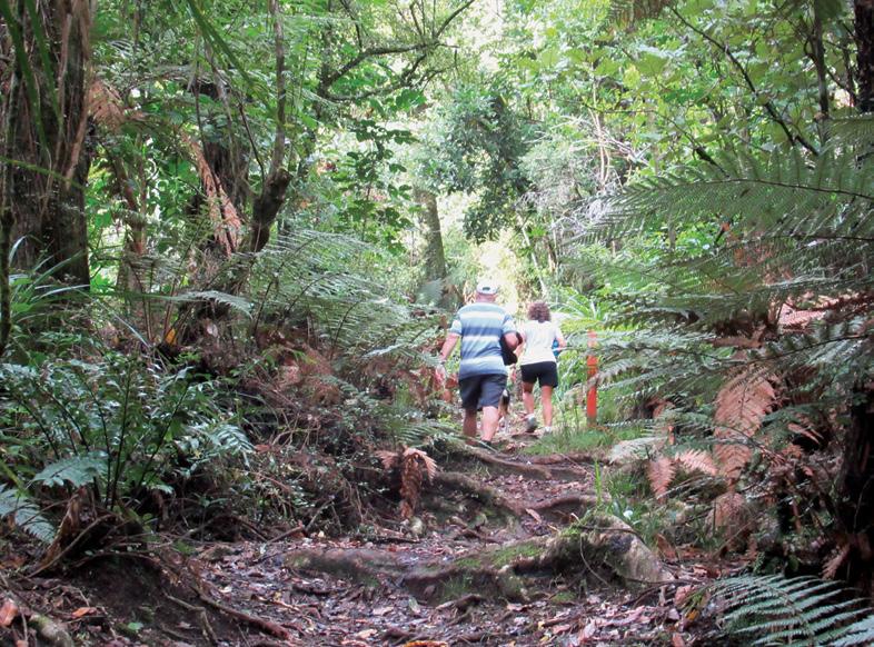
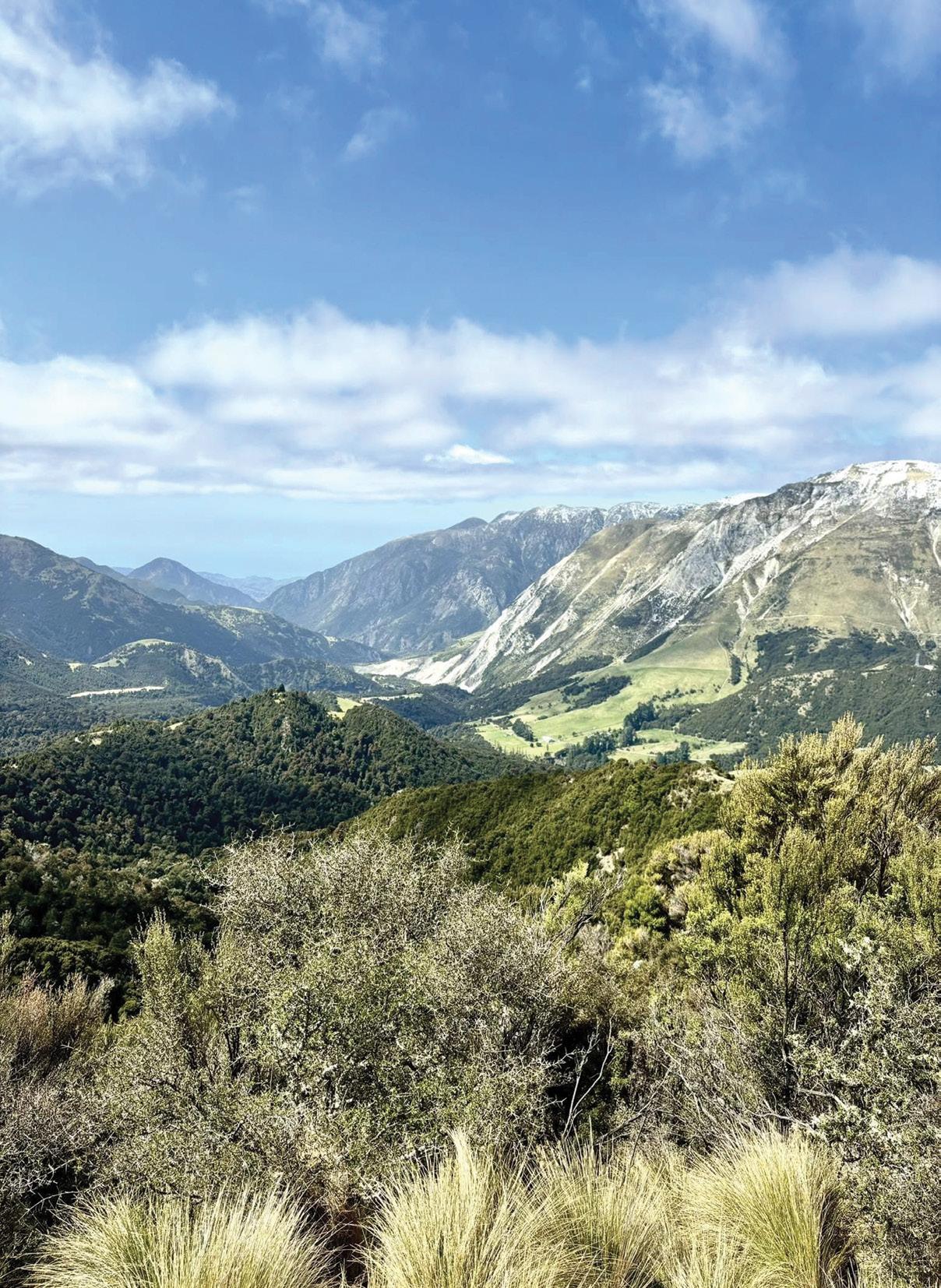
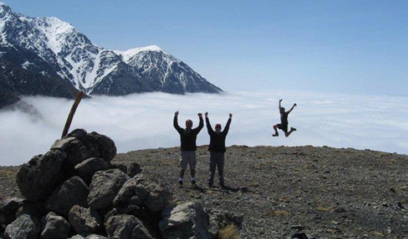
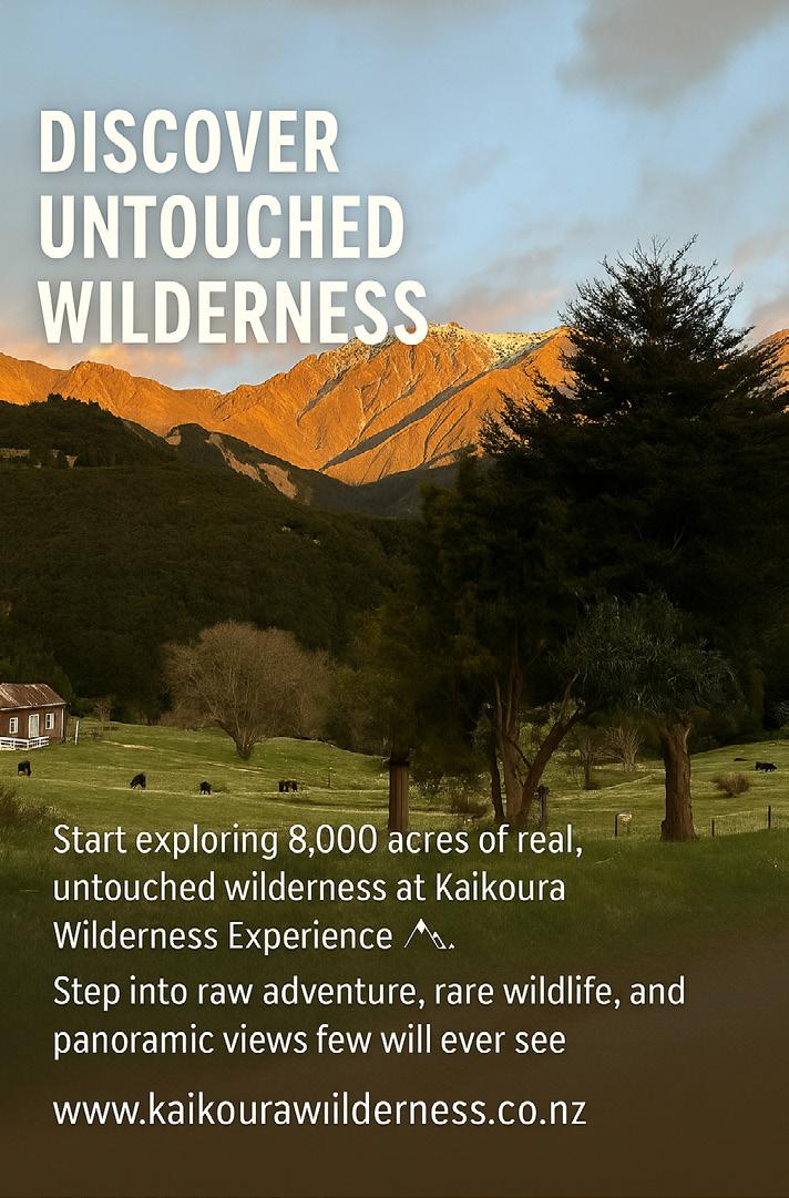
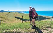
From forest to skyline: Walking the Wilds of Puhi Peaks
By Monique Elario
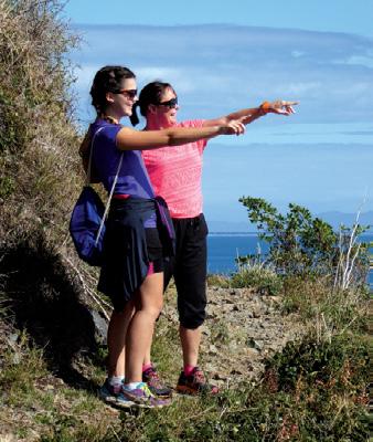
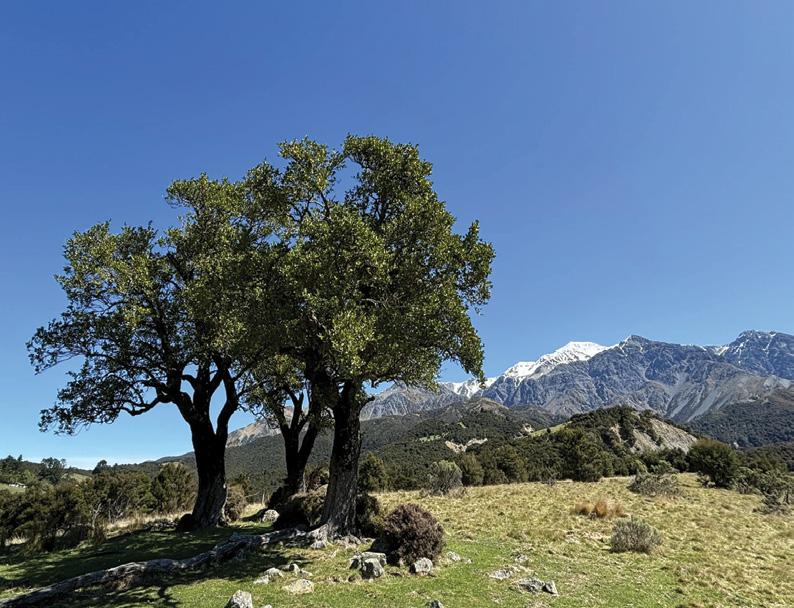
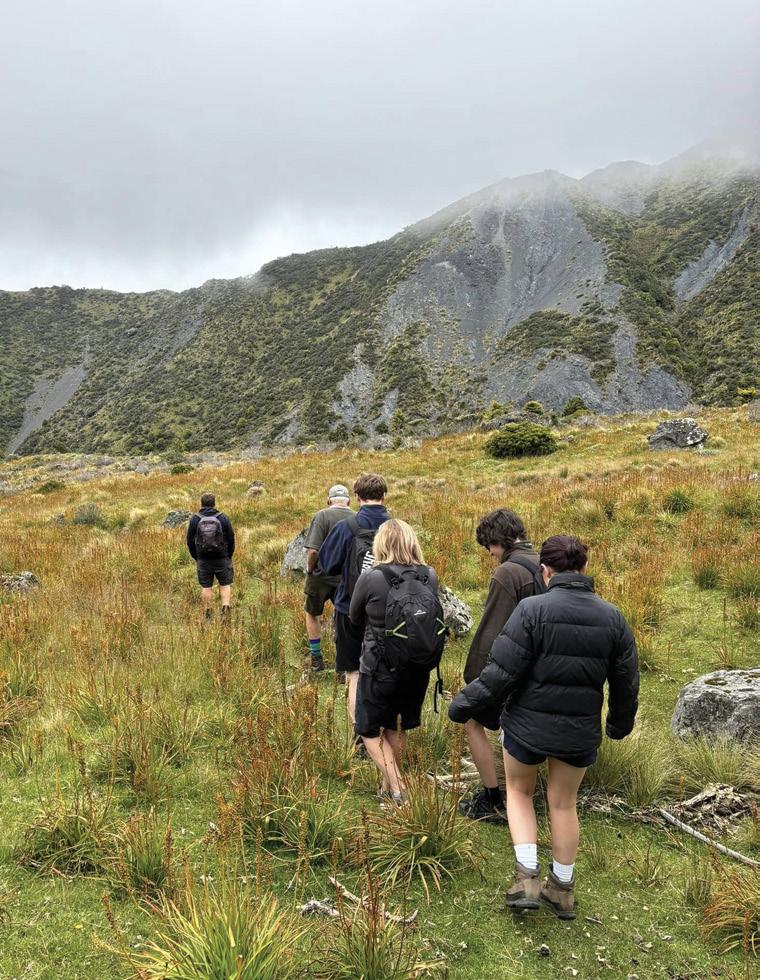
Tucked high in the hills above Kaikōura, where native bush climbs toward alpine ridgelines and wide skies, Puhi Peaks offers one of New Zealand’s most unforgettable walking experiences.
Here, you don’t just follow a trail — you journey from forest to skyline, through regenerating bush, rare native ecosystems, and panoramic views stretching from mountain to sea. With guided walks that immerse you in this privately protected land’s raw beauty and biodiversity, Puhi Peaks invites you to explore nature at its wildest and most wondrous.
Two Trails, One Unforgettable Landscape
At the heart of the Kaikōura Wilderness Experience are two guided walks — The Valley of Feathers and The Ridgeline Walk, each with its unique rhythm and beauty.
The Valley of Feathers Walk
If you’re after a walk that’s peaceful, personal, and packed with native beauty — this is it.
The Valley of Feathers Walk starts at the Woolshed, where you’ll be welcomed with a hot drink and a quick chat about the story of Puhi Peaks and why it’s such a special place. From there, you’ll head out on a guided walk through open farmland, native bush, and shady beech forest.
Along the track, you’ll spot native trees like manuka, kanuka, rimu, matai and totara, and if you’re lucky, a few of the birds that call this place home. As you climb up to Totara Saddle, the views open wide, with the mountains on one side and the Pacific Ocean on the other.
You’ll stop for a picnic lunch in a quiet spot with a view, before heading slowly back down through regenerating bush. Your guide will point out how the land is healing and growing, especially after the Kaikōura earthquake.
The day wraps up with a relaxed Opposite page: Looking down the vallety. Above right: “ We are above the clouds”.
Walking the Wilds of Puhi Peaks
afternoon tea back at the Woolshed — a perfect way to end a day spent walking, learning, and connecting with nature.
Duration: 10:00am – 3:00pm
Includes: Morning tea, guided walk, picnic lunch, and afternoon tea
Group size: Max 6 people per guide
The Ridgeline Walk
For those wanting a bit more challenge, the Ridgeline Walk offers a higher-altitude adventure with even more striking views.
After morning tea at the Woolshed, you’ll head through native forest and follow the trail above Happy Valley Stream. As you go to Skyline Ridge, the terrain shifts and the elevation builds, offering incredible views to the North Island on a clear day. You’ll break for a picnic lunch with the ranges as your backdrop, descend through the bush before returning to base.
It’s a walk for those who want to push a little further — and be deeply rewarded.
Duration: 10:00am – 4:00pm
Includes: Morning tea, guided walk, picnic lunch, and afternoon tea
Fitness level: Moderate to high
Beyond the Tracks
Puhi Peaks isn’t just a walking destination — it’s part of one of New Zealand’s most important conser-
vation stories. Protected by a QEII Covenant, this land is home to rare and endangered species, including the Hutton’s shearwater.
The team here is focused on preserving this land and sharing it with others in a way that’s respectful, sustainable, and unforgettable.
With more walking and cycling trails in development for 2025, Puhi Peaks is building something truly special — a chance for people to experience this wild, untouched part of Aotearoa like never before.
Bookings:
Walks run seasonally and spaces are limited. Visit www.kaikourawilderness.co.nz to learn more and plan your trip.
Above: The snow on the Kaikouras in the background.
Below right: A group on the mountain on a day hike.
Walking Clubs Groups
NORTH ISLAND
NORTHLAND
BAY OF ISLANDS
BAY OF ISLANDS WALKERS: Saturday (AM), Jacqui Watson 022-6019741, Roz Whittaker 021-063-1455
DARGAVILLE
DARGAVILLE TRAMPING GROUP: Last Sunday of month (AM), Lynley Thompson 021-102-3974, colvilleestate1@gmail.com
WHANGAREI
CARDIAC CARE WALKING GROUP: Wednesday (AM or PM), Jo or Hugh Knight 09-438-7976
MT ALBERT Y’s WALKING GROUP: Tuesday Friday, (AM), 09-846-0788 MT ROSKILL COMMUNITY HOUSE: Theresa McDonald, 09-624-3281 OUTDOOR ACTIVITIES CLUB AUCKLAND: midweek, weekends (BIA), walks, tramps, www.oacnz.org, OutdoorActivitiesAuck@outlook.com
ST HELIERS HIKERS: First/Third Wednesdays (all day), Glenn 09528-9726
STEP OUT WALKING GROUP: Thursday (AM), Olivia 09-555-5164
WOMENS OUTDOOR PURSUITS INC: Tuesday, Thursday, Sunday, Donna Sheppard, info@wops.co.nz, 09-535-8239, www.wops.co.nz WEST AUCKLAND
BLUE TOP WALKERS: Henderson, Tuesday, Thursday (AM), Terry Wilson 09-814-9523 or 021-266-1071, terryandsheena@gmail.com, www. bluetopwalkers.weebly.com
FIA OLA WOMEN’S DEVELOPMEMT WALK GROUP: Monday to Saturday, Anne, 09-813-0021
FIT4LIFE: Glenfield, Monday (PM), Friday (AM), Sarah 021 534 649
TE ATAU PENINSULA WALKERS: Monday, Friday (AM), Wednesday (PM), Mary Jones 09-834-6989
TE ATATU SOUTH ACTIVE 35+ WALKING GROUP: Te Atatu South, Wednesday, Edna, 09-834-1401
THE HAPPY WANDERERS WALKING GROUP: Wednesday (AM), Joy Williams 09-817-2464 or 027-353-3434
TITIRANGI TWILIGHT WALKERS: Tuesdays, Thursday, (PM) Titirangi Library, Wednesday (PM) Glovers Real Estate Green Bay, Louise 021437-547, louisenicholson@xtra.co.nz
TITIRANGI WALKERS: Sundays (AM), John Harris 09-627-0099, jeanah@ihug.co.nz
Fitness levels: “B” beginner, ”I” intermediate, “A” advanced. (AM) denotes morning walk, (PM) denotes an afternoon or evening walk. Group co-ordinators are asked to please advise us of any updates by fax 06-358-6864 or email walkingnz@xtra.co.nz.
WALKERS & TALKERS: Campbells Bay, Wednesday (AM), Brenda Gray 09-410-4019, Dorothy Ensor 09-478-6702
Fitness levels: “B” beginner, ”I” intermediate, “A” advanced. (AM) denotes morning walk, (PM) denotes an afternoon or evening walk. Group co-ordinators are asked to please advise us of any updates by fax 06-358-6864 or email walkingnz@xtra.co.nz.
PIONEER TRAMPERS:Thursday (AM) (IA),4-5 hour tramps in Banks Peninsula and the hills and lower mountains from Mt Hutt to Mt Grey, pioneertrampers@gmail.com
Available from independent book sellers or directly from author E-mail : vivianneflintoffbooks@gmail.com 900kms along an ancient pilgrimage trail in Northern Spain Web: http://www.vivianneflintoffbooks.com/
Gilbert 03-308-5894
KIWISENIORS WALKING GROUPS: for the over 50’s, Wednesday (AM), (BI), two groups, Janice Cochrane, Sport Mid-Canterbury, 03-307-0475
ASHBURTON STROLLERS CLUB: 1st Sunday and 2nd Wednesday of month, (AM), Diane Milne 03- 303-6250
METHVEN & DISTRICTS TRAMPING CLUB: David Wilson 027-431-3240 methvenADTC@gmail.com
60’S UP WALK GROUP: Monday (AM), Olive Swain 03-214-4802
YMCA WOMEN’S WALKING GROUP: Tuesday (AM), Joan Tuffery, 03-216-7377
ACTIVE WALKERS KIWI SENIORS: Thursday, Sport Southland 03-2112150, e:kiwiseniors@sportsouthland.co.nz, www.sportsouthland. co.nz
GORE
GORE DISTRICT WALKERS: Tuesday (AM), NgaireEvans 03-208-4744 or Maureen Jones 03-208-7322, maway50@gmail.com
HOKONUI TRAMPING CLUB: Margaret Hughes 03-208-7053
NORTHERN SOUTHLAND
NORTHERN SOUTHLAND WALKERS: 2nd and 4th Thursdays, Mossburn.: Jo Muir, 03-248-6474, Balfour: Christine MacLean 03-201-6390, Riversdale: Margaret McLennan, 03-202-5868
Notice to clubs and walking groups
If you notice there that the times, names or contact numbers etc on the list of Walking Grroups in the Directory on these pages needs updating please email us at walkingnz@xtra.co.nz. These are are free listing.
NEW ZEALAND
MAY 2025
3 Hanmer Half Marathon, Hanmer Springs
3 Rotorua Marathon, Rotorua
3 Southern Lakes Half Marathon, Cardrona, Wanaka
3 Tairua River Trail, Pauanui, Coromandel
3 We Run the Night, Mt Drury, Mt Maunganui
4 Wings for Life World Run: Auckland Penrose, Auckland
4 Wings for Life World Run: Christchurch, Wigram, Christchurch
7 King & Queen of the Crater 1: Mount Pleasant, Chritchurch
10 Best Dam Backyard Ultra, Otematata, Canterbury
10 McLaren Falls Trail, McLaren Falls Park, Tauranga
10 Saint Clair Vineyard Half Marathon, Saint Clair Vineyard, Martinborough
10 South Island Ultra Marathon, Greymouth to Hokitika
11 Summerhill Skedaddle, Papamoa
11 Gizzy Trail Run Series: Cooks Cove Walkway, Gisborne
11 WhyWomenRun Women’s Event, Auckland
11 3 Peaks Challenge Series 1, Wellington
14 King & Queen of the Crater 2: Scarborough Hill, Christchurch
17 ASICS Runaway Hawke’s Bay Marathon, Napier
17 Run Akaroa, 33km, Half Marathon & 10km, Akaroa
17 Born to Run 24 Hour Challenge, Whangarei
17 Leith Cross Country Relays & Ponydale Challenge, Dunedin
13 Tāmaki River Half Marathon, Point England, Auckland
16 Hātea Run Night Series: Downhill Flying Kilometre, Whangarei
19 Northland 100, Whangarei
19 Sprig & Fern 10K: Brightwater, Brightwater
20 Auckland Trail Run & Walk: Waiuku, Auckland
27 3 Peaks Challenge Series 3, Kelburn, Wellington
27 Leith Harbour Free 5K & 10K: July, Dunedin
27 Run Auckland: Western Springs, Auckland
29 Fergus 5 Fun Run & Walk, Hamilton
AUGUST 2025
2 Taupō Marathon,Taupo
2 Meridian Hydro Half Marathon, Manapouri
2 Mitre 10 Te Anau 10km, Manapouri
3 South Island Half Marathon, Lake Hood, Ashburton
3 Onehunga Half Marathon, Auckland
3 Step Up Challenge Sky Tower, Auckland
9 Dovedale Hill Race, Wakefield
9 Hanmer Springs Backyard Ultra, Hanmer Springs
9 Kaitaia Trail Run/Walk, Kaitaia
9 Run The Forest, Rotorua
10 Auckland Trail Run & Walk: Totara Park, Totara Park, Auckland
17 Run Auckland: Farm Cove, Pakuranga, Auckland
23 Halcombe Relays, Halcombe, Manawatu
23 Mount Maunganui Half Marathon, Mt Maunganui
23 Sprig & Fern 10K: Motueka, Motueka
24 Forest Run Fest, Bottle Lake Forest, Christchurch
24 Gizzy Trail Run Series: Manutuke Eco Sanctuary 1, Gisborne
24 Seddon School Tussock Run, Seddon
26 Fergus 5 Fun Run & Walk, Hamilton
27-30 The Great Naseby Water Race Ultramarathon Naseby Forest, Central Otago
30 Laps at the Lakes, Pauanui, Waikato
31 Auckland Trail Run & Walk: Riverhead Forest, Auckland
31 North Shore Marathon, Milford, Auckland
SEPTEMBER 2025
6 Kaikōura Whale Run, Kaikoura
6 Kinloch Off Road Challenge, Kinloch, Taupo
14 Emerson’s Dunedin Marathon, Dunedin
OCTOBER 2025
5 4 Paws Marathon, Bottle Lake Forest, Christchurch
5 Devonport Half Marathon, Devonport, Auckland
9-12 Bay of Islands Walking Weekend, Bay of Islands
11 Cromwell Half Marathon & 10K, Cromwell
NOVEMBER 2025
8 County Fayre Downhill Walk, Pohangina, Manawatu
14-23 Wairarapa Walking Festival South Wairarapa
REST OF WORLD
MAY 2025
3-4 The Two Day Walk, Blankernberge, Belgium
10-11 International Waendel Walk, Wellingborough, United Kingdam
17-18 International Walking Festival, Dalian, China
29-31 International Walking Festival, Chantonnay, France
JUNE 2025
14-15 Marche Internationale de Diekirch, Diekirch, Luxembourg
28-29 International Walking Festival, Viborg, Denmark
JULY 2025
3-6 International Walking Festival, Castlebar, Ireland
15-18 International Walking Festival, Nijmegen, Netherlands
AUGUST 2025
2-3 Lithuanian Marching Festival, Kaunas, Lithuanian
8-10 International Walking Festival,, Vassa, Finland
22-24 International Walking Festival, Duuchcov, Czek
30-31 International Walking Festival, Verday, Norway
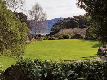
Waiheke Retreat
Waiheke Island, Palm Beach
* 3 bedroom house, sleeps up to 8, with spectacular views of the Hauraki
* Fully self contained including linen and towels, cooking facilities and bbq.
* Ideal for families and mature groups.
*
* Take in our stunning vistas and visit our world renowned vineyards.
* Finish your day with a wine on the deck overlooking beautiful Palm Beach. Contact Carol for availability, nightly rates and specials: 027 292 9374
Having trouble finding Walking New Zealand magazine in your favourite newsagent or supermarket?
Did you know you can now buy the latest copy of Walking New Zealand magazine posted to you at the retail price of $12.50 pus $3.00 postage or you can subscribe and SAVE.
You can buy a copy by:
* Visit www.walkingnewzealand.co.nz/magazine
* Email to walkingnz@xtra.co.nz with your postal address and credit card details
* Ring Freephone 0800 walking, and have your postal address and credit card details handy.
You can now view and enjoy the latest issue of Walking New Zealand magazine online for only $3.95 at http://www.walkingnewzealand.co.nz
3
6
9
CONTENTS for previous 15 issues
14 New Zealand Trail: The Greytown to Woodside Trail and beyond
17 New Zealand Trail: Trail accessible to all ages and abilities
18 New Zealand Walks: Many walks to explore in Pirongia Forest Park
20 Walking Festival: 45 guided walks in ECHO Walkng Festival
22 New Zealand Walk: Whangamata Stream Trail through a beautiful forest
24 Walking New Zealand Monthly Photo Contest
16
26
39
40
42
45
45
48
50
Trails: Waitomo - a bike walk adventure
14 New Zealand Trail: Ruakuri Scenic Reserve
16 New Zealand Walk: Washpen Falls Walk - Canterbury’s secret canyon walk
19 New Zealand Walk: Walk through a canyon in an ancient volcano
19 New Zealand Walk: Whangarei forestry walkway re-opened
20 Shared Pathway: Hauraki Rail Trail - Thames to Matatoki
23 Book: Hiking the Hexa - a journey on France’s newest through hike
24 Walking New Zealand Monthly Photo Contest
26 Overseas Walks: Trekking to Machu Picchu by the Salkantay Trek
30 Auckland Walks: Great Auckland spots for walking your dog
34 Overseas Walks: Colorado for thousands of hiking trails
39 New Zealand Walk: New footpath bridge opened in Wellsford
40 Directory of New Zealand Walking Groups
42 Coming Events: New Zealand
45 Coming Events: Australia
45 Coming Events: Rest of World
48 New Zealand Country Breaks
50 Index of previous 15 issues
51 Walking New Zealand Shop
52 Pak A Roo Jackets MARCH 324 2025
3 Contents
4 Walk Talk
6 New Zealand Walk: Taranaki Falls Loop walk a capti]vating experience
8 New Zealand Walk: Cathedral Cove attracts visitors from throughoutthe waorld
10 New Zealand Walk: Sandymount to Sandfly Bay walk a chance to see lions and seals
12 Auckland Cycle Trails: The best family friendly bike rides in Auckland