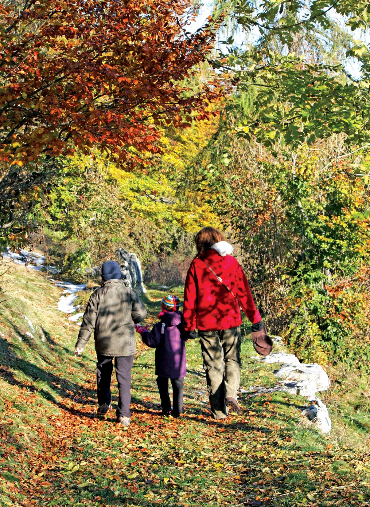
New Zealand Walks: Hooker Valley walks for magnificent scenery
New Zealand Walk: Mount Manaia Track a breath-taking mountain adventure
New Zealand Walk: Walking the Kaitawa Fairy Springs a serene adventure
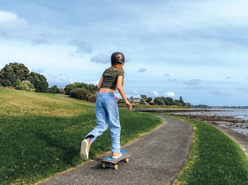
New Zealand Walks: Four short all weather walks in Auckland
Zealand Walk: A scenic stroll along the Mountains to Sea Cycle Trail
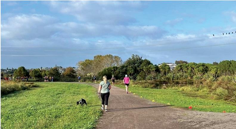
Event: Wellington Marathon’s closing in on four decades
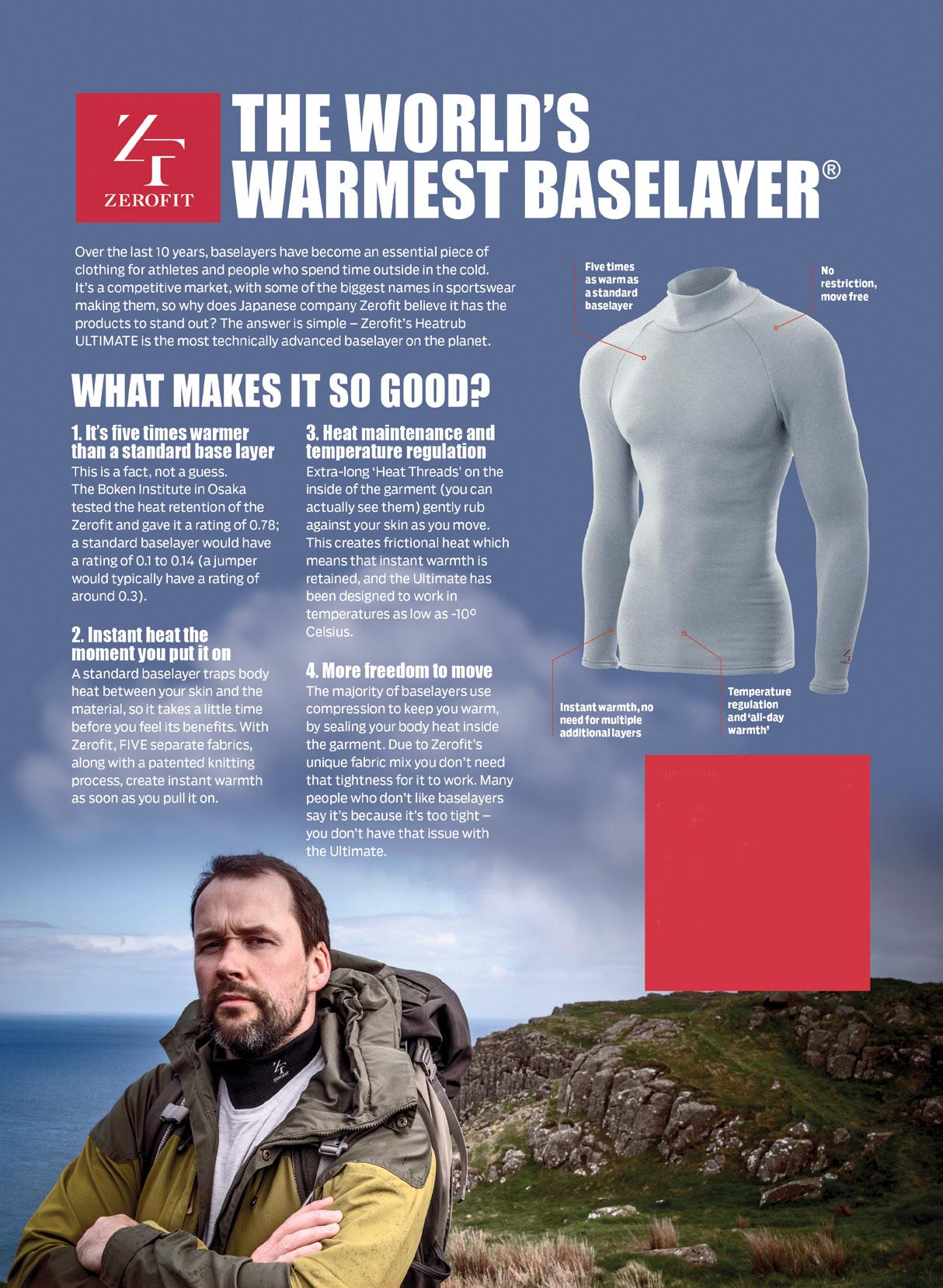
The ULTIMATE is Zerofit’s flagship product and perfect for hiking, golf, sailing or any outdoor activities when it’s cold. But if you are more active it is complemented by the Heatrub MOVE.
Twice as warm as a standard base layer, the material regulates tempertures as you move, so you won’t suffer from cold sweat, if your are running or cycling.
Please visit the Walking New Zealand Shop: https://walkingnewzealand.co.nz/productcategory/apparel/ for more details and to order.
Shop
PUBLISHER/EDITOR: Frank Goldingham: Phone 06-358-6863, 027-274-0726
CONTRIBUTORS: Barbz Lowther, Phillip Donnell, Catherine Tooher, Michael Taylor, Michael Jacques, Ceana Priest, Sarah Davis.
ADVERTISING MANAGER: Frank Goldingham - 0800 walking (925-546) 027-274-0726
Email: walkingnz@xtra.co.nz
COMING EVENTS ADVERTISING: Frank Goldingham 0800-walking (925-546)
Email: walkingnz@xtra.co.nz
SUBSCRIPTIONS: Phone 0800-925-546
SUBSCRIPTION RATES: New Zealand Residents;
WALKING NEW ZEALAND LTD, 47 Lincoln Terrace, Hokowhitu Palmerston North, 4410 Telephones 06-358-6863 - 027-274-0726
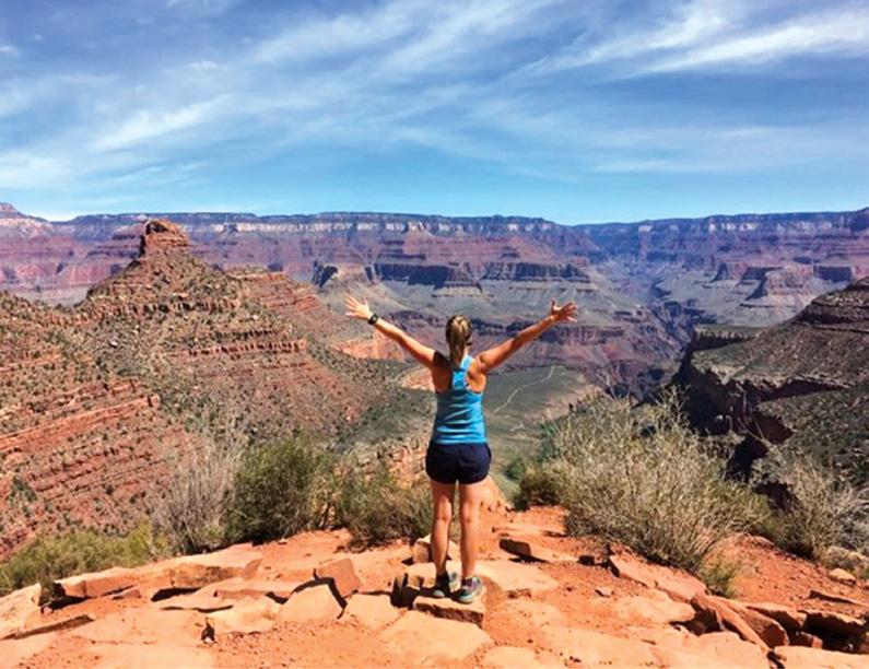
As Rome prepares for an unprecedented influx of visitors during the peak of the 2025 Jubilee, news of Pope Francis’ hospitalisation has drawn additional attention to the Vatican, with even more faithful making their way to the Eternal City in prayer and solidarity. According to Vatican News, an estimated 35 million pilgrims will visit during the Jubilee Year of Hope, attending religious ceremonies, processions, and cultural events in a spirit of faith and renewal.
With the flood of crowds expected, many travellers are looking for ways to step away from the congestion, whether for a brief respite or a more extended journey beyond the city.
“For those heading to Rome, adding a walking or cycling detour offers a much-needed break from the intensity of the crowds,” says UTracks General Manager, Kate Baker. “Our tours provide an immersive way to experience Italy, whether for a short getaway or a longer journey beyond the city.”
From medieval pilgrimage routes to breathtaking coastal trails, these detours unveil Italy’s hidden gems, where history and nature seamlessly intertwine and offer a perfectly crafted escape.
Amalfi Explorer
Escape the crowds by following this ancient footpath high above the Amalfi Coast. With jaw-dropping views of the Tyrrhenian Sea and charming local trattorias along the way, it’s a walker’s dream. From the spectacular Amalfi coast to the fascinating ruins of Pompeii, to the historic centre of Naples and the beautiful island of Capri, this trip offers the very best of this captivating region.
Walking In Puglia
Puglia is a land forged in history by a mixture of civilisations and cultures. This enriching journey combines archaeological and architectural treasures, with walking through valleys and along coastal paths surrounded by landscapes of red earth, olive groves and vineyards. See the unique dry stone cottages known as Trulli in intriguing Alberobello and the cave houses known as Sassi in Matera. Explore the enchanting maze of narrow streets in the ‘white city’ Ostuni, the seaside village of Otranto facing the Adriatic and visit the elegant Baroque city of Lecce.
Cycle Bolzano to Verona
For those who prefer two wheels, this enchanting cycle tour takes you through the historic Veneto region of north-east Italy. Starting from the mountains around Bolzano, passing the beauty of Lake Garda and winding through pretty meadows to Verona, the city of Shakespeare’s Romeo and Juliet. Cycle from hotel to hotel, through varied landscapes soaking in the history of this inspiring pocket of Italy.
Walk talk
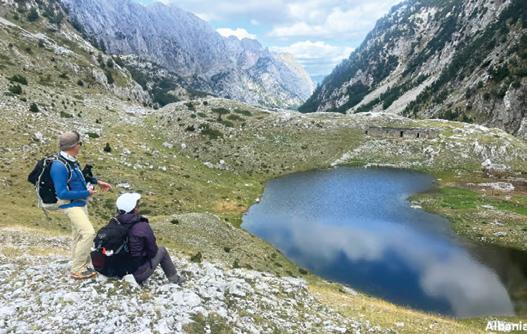
More travellers seek off-the-beaten-path experiences Walking tours continue to surge in popularity, with more people ‘over the ditch’ embracing active travel in Europe than ever before. UTracks reports that a growing demand for immersive experiences in remote destinations, are among their fastest-growing segments. These journeys take travellers deep into some of Europe’s most breathtaking landscapes, from Romania’s dramatic peaks to Iceland’s Nordic wilderness. Albania is a trending destination, gaining attention for its rugged terrains and rich cultural history. The remote village of Theth, nestled in a stunning valley, provides access to some of the country’s most spectacular trails, including the renowned Peaks of the Balkans Trail. This multi-country guided hike, weaves through Albania, Montenegro, and Kosovo at elevations of up to 2,300 metres, offers an unforgettable journey through dramatic mountain scenery and diverse cultural landscapes.
“Travellers are increasingly drawn to destinations that offer a sense of discovery,” says Kate Baker, General Manager of UTracks. “Places like Albania deliver that in spades, offering pristine nature, deep history, and warm local hospitality.”
“With more people seeking out destinations that feel personal and unspoiled, our walks offer the perfect balance of exploration and cultural immersion,” Baker adds.
Your favourite walk/cycle trail could win you a free subscription
We are looking for readers’ favourite New Zealand walks/cycling. Many of us go out regularly walking on a route which we class as our favourite, for a number of reasons. Perhaps because for it’s scenery, it’s safe, it’s challenging, it’s flat, it’s hilly, it’s varied, or for whatever reason.
We would like you to tell us in your own words what is you favourite walk and why. Email us a story from say 250 up to 1200 words including a photo or photos.
We will now give you a FREE subscription (six months or more, depending on the article), or extension to Walking New Zealand magazine for walks published.
You can also post an article to Walking New Zealand, 47 Lincoln Terrace Hokowhitu, Palmerston North, or email walkingnz@xtra.co.nz
If sending a photo by email please make sure photos are in high resolution. Our email address is: walkingnz@xtra.co.nz.
Please put “My Favourite Walk” in the subject line and include your name and postal address.
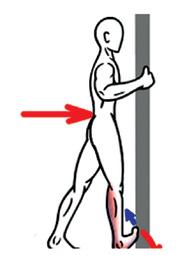
Five minutes a day eccentric exercise can improve your life
As little as five minutes a day of eccentric exercise could offer significant health benefits to those living a stagnant lifestyle, researchers from Edith Cowan University (ECU) found. The study, led by Dr Benjamin Kirk and Professor Ken Nosaka in ECU’s School of Medical and Health Sciences, evaluated the effects of a five-minute a day, home-based bodyweight eccentric exercise program on physical fitness, body composition, and both physical and mental health in sedentary individuals. Over a four-week period, the participants completed daily exercise consisting of 10 repetitions each of chair squats, chair reclines, wall push-ups, and heel drops focusing on eccentric - muscle lengthening contractions, by slowly stretching contracting muscles such as sitting to a chair slowly in which the front thigh muscles are lengthened while supporting the body weight.
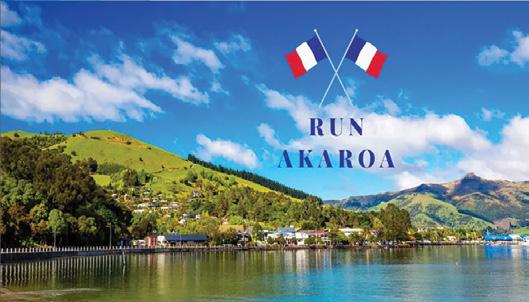
The inaugural Run Akaroa launches for May 2026
Run Akaroa is a new premier road running and walking event that has been created in the beautiful Akaroa Harbour near Christchurch on May 17 2026.
There are three distances to choose from with each course starting along the rim of an ancient volcano; overlooking the sparkling waters of the Akaroa Harbour and the South Pacific Ocean.
“We saw significant improvements in muscle strength, flexibility, strength endurance and mental health, suggesting that even small amounts of daily exercise can provide sustainable and detectable benefits in sedentary individuals,” Professor Ken Nosaka said.
“The results highlighted that eccentric exercises are very effective in improving fitness. This type of exercise is also more accessible to most people, as it makes use of body weight and eliminates the need to go to a gym.
“The eccentric exercises can also be spread out during the day, which makes it more achievable to those who are time poor.”
Southern Ocean Walk gourmet tour
The family owners of the Southern Ocean Walk in South Australia have added a new itinerary with a focus on food producers.
The new Fleurieu Gourmet Tour has been created for travellers who prefer more time to explore the produce the region has to offer whilst still enabling them to experience some of the stunning natural highlights of Deep Creek National Park, south of Adelaide.
Time in the renowned McLaren Vale wine region is also included in this four-day, three-night experience.
The courses are designed for maximum wow-factor and for this day only competitors can safely enjoy the famous “Summit Road” by foot.
With Akaroa being a top location for visitors from all over the country and around the world, come and Run Akaroa to experience it for yourself!
The H215 Professional 4 Function Pedometer
The H-215, 4-function pedometer is a superb, reasonably priced pedometer that counts steps, calculates distance, calories burned and has a 12/24 hour clock. This is the model that has sold over a quarter of a million worldwide. It has the largest display of any pedometer we tested and is very accurate.
Dimensions: (L) 5.6 * (W) 3.7 * (t) 2.7 cm
Price only $36.95 plus $6.00 P&P
Available now from:
Walking New Zealand Shop
47 Lincoln Terrace Palmerston North - Phone 0800-925-546 or email walkingnz@xtra.co.nz. www.walkingnewzealand.co.nz
Phone 0800925-546 for bulk prices
You can now view and enjoy the latest issue of Walking New Zealand magazine online for only $3.95 at http://www.walkingnewzealand.co.nz
www.walkingnewzealand.co.nz
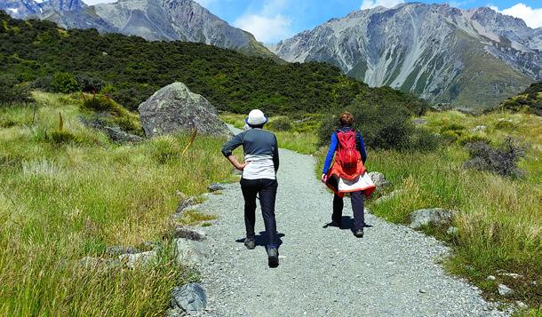
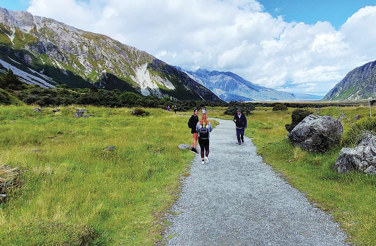
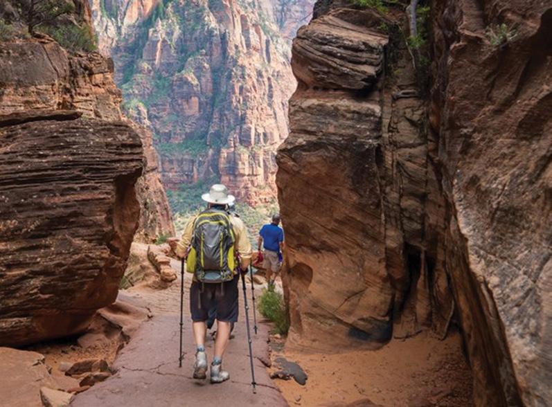
Hooker Valley Track for magnificent scenery
By Michael Taylor
As an experienced tramper who has traversed many of New Zealand’s hilly tracks, I was excited to tackle the iconic Hooker Valley Track in Aoraki/ Mount Cook National Park.
This 10.2 km return journey typically takes around three hours to complete, but I found myself savoring every moment and spending closer to four hours on the trail.
I set out early on a crisp Friday morning in March, hoping to beat the crowds and catch the first rays of sunlight illuminating the Southern Alps. The weather was pleasantly warm and sunny, with a few scattered clouds providing occasional respite from the sun.
The track began at the White Horse Hill campground, where I encountered a group of international tourists eagerly preparing for their hike. We exchanged friendly nods as I started my journey along the wellmaintained gravel path. The initial
section of the track was relatively flat, winding through open grassland and offering stunning views of the surrounding peaks.
About 15 minutes into the walk, I reached the Alpine Memorial, a poignant reminder of the mountaineers who lost their lives in these majestic but unforgiving mountains.
I paused here to reflect and take in the panoramic view of the Mueller Glacier lake.
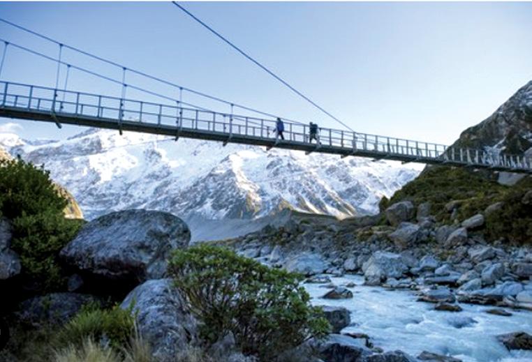
As I continued, I came across the first of three swing bridges spanning the Hooker River. The bridges were sturdy and provided an exhilarating crossing, with the rushing glacial waters below adding to the sense of adventure.
I met a family from Australia on the first bridge, and we marveled
together at the striking blue-grey colour of the water.
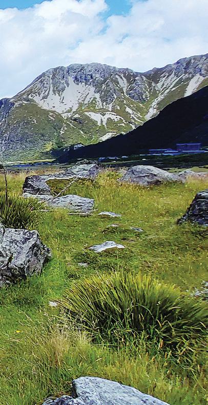
The track then led me around a moraine wall, where I encountered a group of geology students studying the unique glacial formations. They enthusiastically shared their knowledge, pointing out various features in the landscape and explaining how the glaciers had shaped the valley over thousands of years. As I progressed further into the Hooker Valley, the awe-inspiring form of Aoraki/Mount Cook came into view. The sight of New Zealand’s highest peak, standing proud against the blue sky, was truly breathtaking. I found myself stopping frequently to capture photos and simply soak in the magnificent scenery.
Along the way, I chatted with a couple from Wellington who were
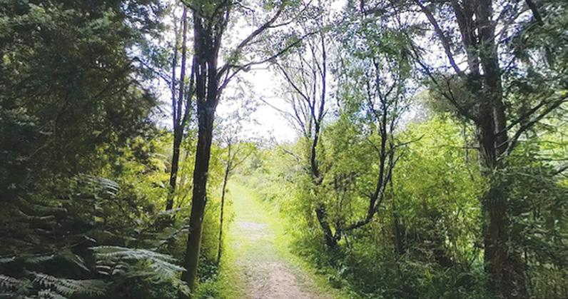
Above: the track through the valley.
celebrating their anniversary with this tramp. We shared stories of our favourite New Zealand hikes and agreed that the Hooker Valley Track was among the most scenic we’d experienced.
The final stretch of the track led me across boardwalks and gravel paths, with the anticipation building as I neared Hooker Lake.
When I finally reached the lake, I was rewarded with a spectacular view of icebergs floating serenely in the glacial waters, with Aoraki/ Mount Cook providing a majestic backdrop.
I spent a good hour at the lake, enjoying a well-deserved picnic lunch and watching as other trampers arrived, their faces lighting up at the incredible vista before them. I met a group of international students who were visiting New Zealand for the first time, and we bonded over our shared appreciation for the country’s natural beauty.
As I began my return journey, I noticed the weather starting to change. The clear skies of the morning gave way to increasing cloud
cover, adding a dramatic element to the landscape.
The shifting light created new perspectives on the scenery I had admired earlier, making the return trip just as engaging as the outward journey.
Throughout the walk, I was struck by the track’s accessibility. Despite my experience with more challenging tramps, I appreciated how the well-maintained path and gentle inclines made this world-class scenery
available to a wide range of visitors. I observed families with young children, elderly couples, and even a few people using mobility aids, all able to enjoy the splendour of the Hooker Valley.
As I neared the end of the track, I felt a deep sense of gratitude for the opportunity to experience such
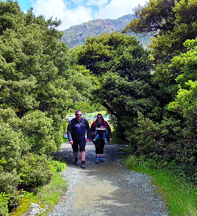
Above right: two walkers coming off the walk. Below right: A tunnel made by the trees.
Hooker Valley Track for magnificent scenery
a remarkable part of New Zealand. The Hooker Valley Track had lived up to its reputation, offering a perfect blend of scenic beauty, cultural significance, and accessible adventure.
Returning to the White Horse Hill campground, I reflected on the day’s journey. The 10.2 km walk had taken me just over four hours, including my extended stop at Hooker Lake.
I had experienced ever-changing weather, from sunny skies to dramatic clouds, and met a diverse group of fellow trampers from around the world.
Most importantly, I had gained a new appreciation for the raw beauty of Aoraki/Mount Cook National Park and the rich experiences it offers to all who visit.
If you’re planning to hike the Hooker Valley Track, here are some valuable tips to ensure a safe and enjoyable experience. Always check the weather forecast before your hike. The weather in the mountains can change rapidly, so it’s crucial to be prepared for any conditions. Begin your hike early in the morning or late afternoon to avoid crowds and enjoy better lighting for photography. Wear layers, including a
waterproof jacket, as the temperature can fluctuate significantly throughout the day.
Getting there: The nearest towns are Aoraki Mt Cook village (2 km), Tekapo (96 km) and Twizel (56 km). The track starts at the White Horse Hill Campground and car park at the end of Hooker Valley Road.
Above right: A suspension bridge over an alpine stream.
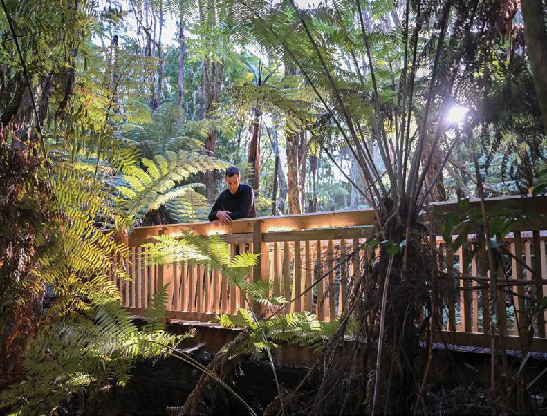
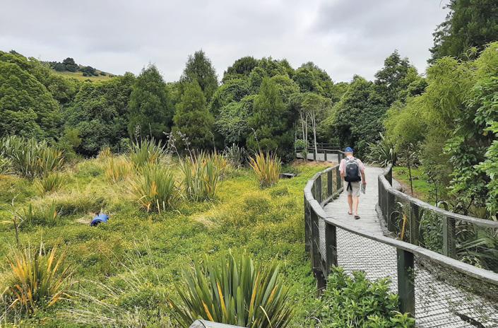
Pryce’s Rahui Reserve a fluvial terrace ecosystem
If you are travelling north through the heart of the Rangitikei region, Pryce’s Rahui Reserve offers a serene escape into native New Zealand bush, just a short drive from Hunterville.
This hidden gem, gifted by E O Pryce in 1941 and later incorporated into Forest and Bird in 1961, provides walkers with an opportunity to immerse themselves in the rich biodiversity of a fluvial terrace ecosystem along the Rangitikei River
The Walking Experience
The reserve boasts three distinct walking tracks, catering to various fitness levels and time constraints. These tracks vary in length from a quick 20-minute stroll to a more comprehensive one-hour exploration
For those seeking a more extended adventure, it’s possible to combine the different walks, creating a journey that can last between 90 minutes to two hours.
Upon entering the reserve, visitors are greeted by a sign just inside the inner gate, detailing the network of tracks available
This helpful guide allows walkers to plan their route according to their preferences and available time.
Flora and Fauna
As you traverse the trails, you’ll find yourself sur-
Above right: A impressive array of native trees.
New Zealand Walk
rounded by an impressive array of native New Zealand trees. The reserve is dominated by towering kahikatea (white pine), with rimu and matai emerging above a diverse broadleaf canopy
Other notable species include totara, beech, tawa, and kowhai, creating a lush, multi-layered forest environment
One of the highlights of Pryce’s Rahui Reserve is the presence of several remarkable mature trees. Near the north-east corner of the reserve, approximately 30 minutes’ walk from either direction on the yellow loop track, stands an impressive matai (black pine) specimen
This tree, registered as notable for its local interest, boasts a height of 34.10 metres and is surrounded by a relatively sparse grove of tawa. While there are a few other large specimens in the vicinity, this particular matai stands out for its impressive girth
While exploring the reserve, keep your eyes and ears open for the diverse birdlife that calls this forest home. You may be fortunate enough to spot or hear native birds such as the kereru (New Zealand wood pigeon), tui, bellbird, and fantail
.For the especially lucky and observant visitor, there’s even a chance of encountering the elusive long-tailed bat Track Conditions
The tracks within Pryce’s Rahui Reserve are wellmaintained and suitable for most fitness levels. The terrain is generally flat to undulating, making it an ideal destination for families and casual walkers
The figure-eight formation of the main track ensures that you end up back where you started, providing a sense of orientation throughout your walk
.How to get there: To reach Pryce’s Rahui Reserve from Hunterville, head south on State Highway 1 for approximately 17 kilometres. The reserve entrance will be on your right, marked by a Department of Conservation (DOC)
sign
While the exact location isn’t specified in the search results, it’s advisable to keep an eye out for the DOC signage to ensure you don’t miss the turn-off.
Conservation Importance
Pryce’s Rahui Reserve plays a crucial role in preserving a remnant of native forest in an area that has seen significant land-use changes over the years. By visiting and appreciating this protected area, you’re supporting ongoing conservation efforts and helping to ensure that future generations can continue to enjoy New Zealand’s unique flora and fauna.
In conclusion, a walk through Pryce’s Rahui Reserve offers a delightful journey into the heart of New Zealand’s native bush. Whether you’re a nature enthusiast, a bird watcher, or simply looking for a peaceful escape, this reserve provides an accessible and rewarding experience. From the impressive matai specimens to the chorus of native birds, every step through this forest is an opportunity to connect with the natural heritage of the Rangitikei region.
So next time you are in te Rangitikei pack your curiosity, and prepare for an enriching adventure in one of
Above right: A board walk in the reserve.
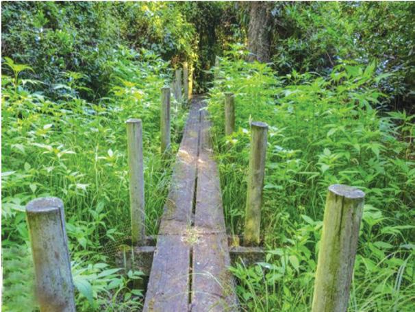
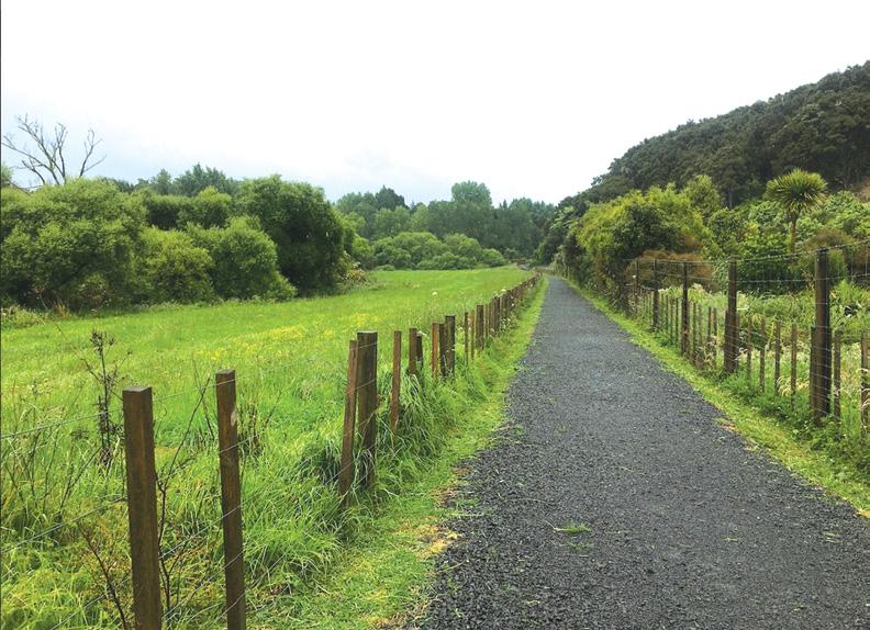
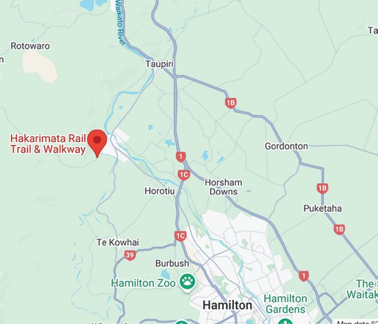
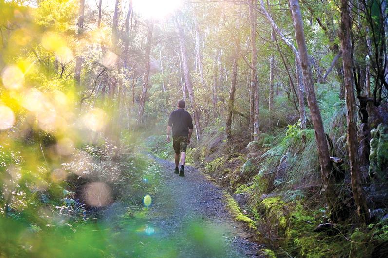
A family adventure on the Hakarimata Rail Trail
Our family recently embarked on a delightful journey walking along the Hakarimata Rail Trail in the Waikato region. This scenic shared walking and cycling trail, steeped in history and natural beauty, provided us with an unforgettable experience that we’re eager to share.
We began our adventure at the southern end of the Hakarimata Sce-
nic Reserve, where the Rail Trail is located. The trail is easily accessible, situated along Waingaro Road, about 2 km from the Waingaro Bridge in Ngaruawahia.
We found ample parking space, making it convenient for families with young children or those carrying picnic supplies.
The Hakarimata Rail Trail follows the route of the former Ngaruawahia
to Glen Massey Railway, offering a unique blend of historical significance and natural beauty.
As we set out, we were immediately struck by the trail’s accessibility. The well-maintained path is suitable for buggies, assisted wheelchairs, and bicycles, making it an inclusive experience for all.
Our walk took us approximately 30 minutes one way, covering a distance of about 1.5 km.
The relatively short duration and gentle terrain made it perfect for our family, including our younger children who sometimes struggle with longer hikes.
As we strolled along the trail, we were enveloped by the lush native forests of the Hakarimata Scenic Reserve. The kids were thrilled to spot various native plant species and listen to the melodious songs of tui and bellbirds echoing through the trees.
The dense forest canopy provided welcome shade, creating a cool and tranquil environment that was especially appreciated on a warm day.
One of the highlights of our walk was the occasional glimpse of the mighty Waikato River. These views offered a stunning contrast to the verdant forest surroundings and provided excellent photo opportunities.
Walking along the old railway line gave us a tangible connection to the area’s history. We explained to the children how this very path was once used for logging and transportation in the early 20th century.
This sparked their imagination, and they spent much of the walk pretending to be train conductors and passengers from a bygone era.
About halfway through our walk, we came across a picnic area with toilet facilities.
This proved to be the perfect spot for a short break and a light snack. The kids particularly enjoyed this pause in our journey, using it as an opportunity to explore the immediate surroundings and play a quick game of hide-and-seek among the trees.
As we continued, we were capti-
Above left: What was the former Ngaruawahia to Glen Massey railway line.
vated by the sound of running water. The trail features several small streams, and the gentle babbling added a soothing soundtrack to our walk
.The children were fascinated by these waterways, stopping to observe small insects and discussing the importance of clean water for the forest ecosystem.
As we reached the end of the trail and turned back, we reflected on our experience. The Hakarimata Rail Trail offered us more than just a walk; it provided an educational journey through nature and history. The relatively short duration and easy terrain made it manageable for our entire family, while the rich biodiversity and historical significance kept us all engaged throughout.
For families looking for an accessible and enriching outdoor activity in the Waikato region, we wholeheartedly recommend the Hakarimata Rail Trail. It’s a perfect blend of exercise, education, and natural beauty, all wrapped up in a familyfriendly package. Whether you’re locals like us or visitors to the area, this trail offers a unique perspective on New Zealand’s natural and cultural heritage.
As we made our way back to the car, already planning our next visit, we felt a deep appreciation for this wonderful resource right on our doorstep. The Hakarimata Rail Trail had given us not just a pleasant afternoon out, but memories that will last a lifetime.
The native forest and birdlife of the Hakarimata Range provides the perfect setting for a day out in one of the Waikato region’s most beautiful
landscapes.
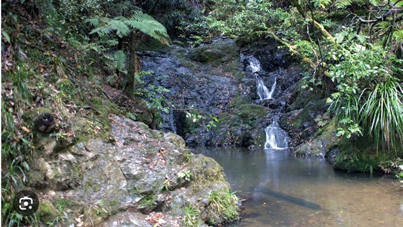
We found that there are three other walks in the Hakarimata Scenic Reserve that include 1,850 hectares of protected native forest A walk in the reserve will reward you with babbling streams, picturesque waterfalls and impressive views over the surrounding countryside.
Hakarimata Waterworks
Above right: A small stream along the route.
Below right: The former railway line runs through the trees.
Track & Summit Track
If you’re looking for a short walk, try the Waterworks Track, in the middle section of the Hakarimata Scenic Reserve. The streamside walk passes through attractive bush on the way to an old dam – perfect for family picnics.
Once you’re done, you can return back down the track or venture up to the summit, 374 metres above sea level, on the Hakarimata Summit Track, which includes the infamous
Ouch! Sore feet while walking?
Hikers Wool is 100% New Zealand wool. Cushion your feet to prevent pain, rubbing and blisters.
Buy online or at selected stockists For more info visit www.hikerswool.co.nz
A family adventure on the Hakarimata
Rail Trail
staircase, a popular challenge with both locals and visitors alike.
Track entrance: Off Brownlee Avenue, off the Ngaruawahia end of Hakarimata Road.
Waterworks Track Time: one hour return. Summit Track Time: three hours return.
Hakarimata Walkway
The 12km-long Hakarimata Walkway offers a full day walk through native bush including towering kauri and totara trees. The Waikato River and the nearby settlements of Ngaruawahia and Hamilton city can be seen from elevated points along the track.
Track entrance: There are three ac-
Foldable Hiking Poles
* Made from Aviation Aluminium
* Adjustable from 65cm -135cm
* Folds into 3 sections
* Straight rubber handle
* Comes with handy bag
* Colours Blue or Red
Buy two sticks and save $5.00
cess points to the reserve - off Waingaro Road to the south, from Brownlee Avenue and from Parker Road in the north. Time: Seven hours 30 minutes one way.
Hakarimata Kauri Loop Track
View native Kauri trees up close on the Hakarimata Kauri Loop Track. Marvel at these strong, ancient giants of the forest and stroll through a grove of young Kauri, as well as Rimu and Nikau on this picturesque bush walk.
large Rimu to the top viewpoint for an unmatched view to the north and west.
Track entrance: Parker Road, off Hakarimata Road.Time: 40 minutes one way to Kauri grove, two hours return full loop.
Please Note: Many of the walking trails in the Waikato region do not allow dogs. Hamilton & Waikato Tourism recommend checking with the Department of Conservation before taking your dog on any of the trails in the region.
$39.95 plus $7 .50 Shipping
Available now from:
Walking New Zealand Shop
47 Lincoln Terrace - Palmerston North Phone 0800-925-546 - email walkingnz@xtra.co.nz. www.walkingnewzealand.co.nz
The long flight of stairs at the beginning can be a challenge to get up but are worth it for the stunning views from the lower lookout looking north to Huntly and beyond. Continue on past an old pa site, through native bush, before reaching the base of a large Kauri Tree. The track then passes through a grove of young Kauri for a view of a bush-clad valley.
You can then return the way you came or traverse the track through
Your favourite walk could win you a free subscription
We are looking for readers’ favourite New Zealand walks. Many of us go out regularly walking on a route which we class as our favourite, for a number of reasons. Perhaps because for it’s scenery, it’s safe, it’s challenging, it’s flat, it’s hilly, it’s varied, or for whatever reason.
We would like you to tell us in your own words what is you favourite walk and why. Email us a story from say 250 up to 1200 words including a photo or photos.
We will now give you a FREE subscription (six months or more, depending on the article), or extension to Walking New Zealand magazine for walks published.
Walking New Zealand, issue no 326 - 2025
You can also post an article to Walking New Zealand, Freepost 78863, P O Box 1922, Palmerston North, or fax 06-358-6864.
If sending a photo by email please make sure photos are in high resolution. Our email address is: walkingnz@xtra.co.nz.
Please put “My Favourite Walk” in the subject line and include your name and postal address.
www.walkingnewzealand.co.nz
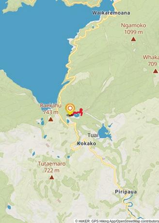
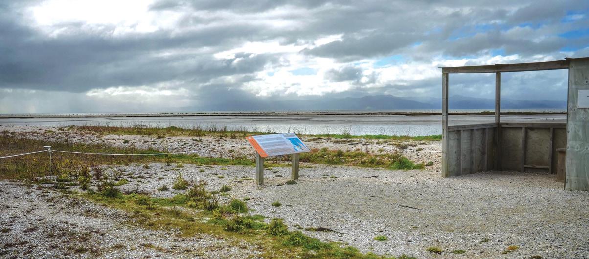
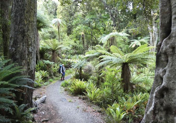
Walking the Lake Kaitawa Fairy Springs Track - a serene adventure
As we embarked on our journey to the Lake Kaitawa Fairy Springs Track, nestled in the heart of Hawke’s Bay, we were filled with anticipation and excitement. This enchanting walk, located near Lake Waikaremoana, offered a serene escape into nature’s embrace. The track is a short yet captivating loop that takes you through lush forests, past majestic rimu trees, beside thelake.
To reach the Lake Kaitawa Fairy Springs Track, drive approximately 12 kilometres from the Āniwaniwa Visitor Centre towards Wairoa. A signpost on the left indicates the turn-off to Kaitawa. Follow the sealed road down to the Kaitawa Power Station, where the track begins. The power station itself is a notable landmark, having been operational since 1948
The Lake Kaitawa Fairy Springs Track is approximately 2.6 kilometres long and typically takes about 30 minutes to an hour to complete, depending on your pace and how much time you spend
Boots Packs Rainwear
All your tramping essentials One shop ~ Since 1988
admiring the surroundings
The elevation gain is minimal, with about 83 metres of ascent, making it an accessible walk for most.
As you start your journey, you’ll cross a footbridge over the upper part of the Waikaretaheke River, which is diverted into Lake Kaitawa via a canal. The track then winds its way around the lake, offering glimpses of the serene water and surrounding forest. One of the highlights of the walk is the opportunity to see majestic rimu trees, their towering presence a testament to the region’s rich biodiversity.
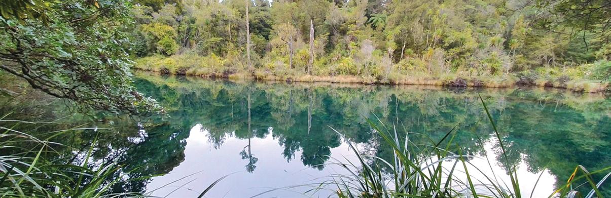
A short detour from the main track leads to the breathtaking Fairy Springs. This natural wonder is a translucent green pool where water gently wells up from the ground. The springs are fed by water that seeps through the lake bed of Lake Waikaremoana, a result of the geological history of the area. Despite attempts to seal these leaks for power generation, the water continues to flow, creating this enchanting spot
After exploring the Fairy Springs, the track leads back to the bridge and then follows a gravel road to return to the Kaitawa Power Station. This final stretch offers a chance to reflect on the tranquility of the forest and the unique features of the area.
For those looking to extend their stay in the region, there are several
■other attractions nearby. The Onepoto Caves, though currently closed, offer a glimpse into the region’s rich cultural history. Lou’s Lookout, also temporarily closed, provides spectacular views of Lake Waikaremoana. The Lake Waikaremoana Great Walk is another must-do for serious hikers, offering a deeper immersion into Te Urewera’s stunning landscapes
In conclusion, the Lake Kaitawa Fairy Springs Track is a delightful and accessible walk that offers a glimpse into the natural beauty of Hawke’s Bay. Its short length and serene surroundings make it an ideal excursion for couples or families looking to connect with nature. Whether you’re a seasoned hiker or just starting to explore the outdoors, this track is sure to leave you with lasting memories of New Zealand’s untouched wilderness.
Above top: The Kaitawa Fairy Springs where water comes up from the ground.
closing in on
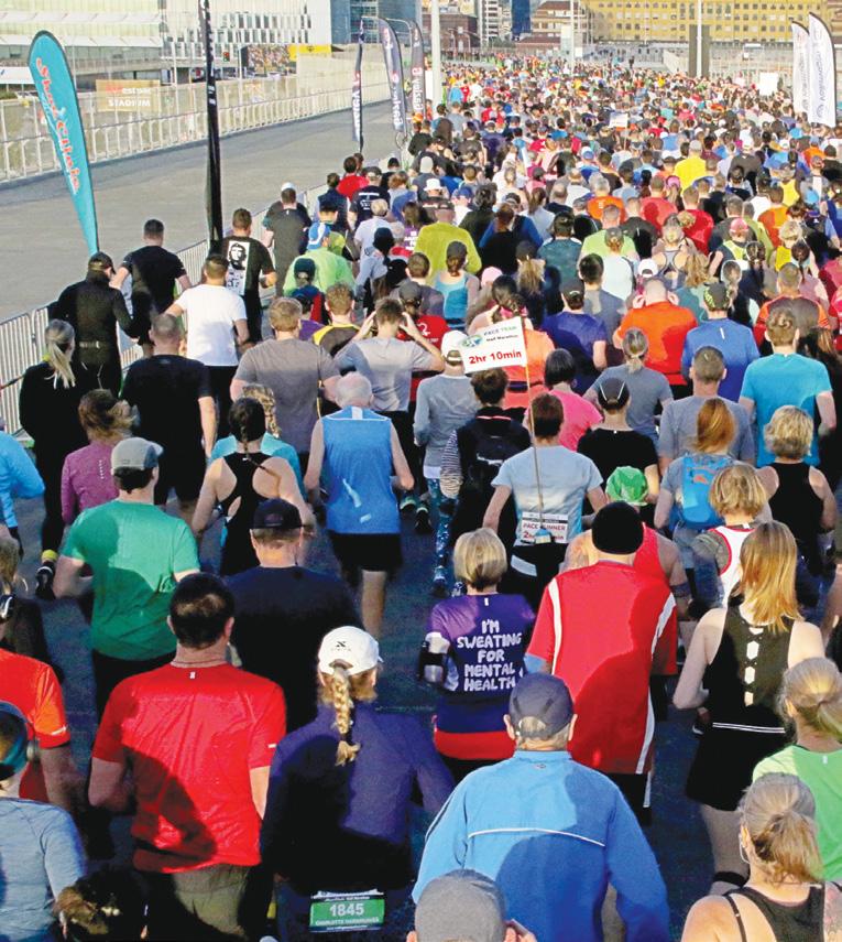
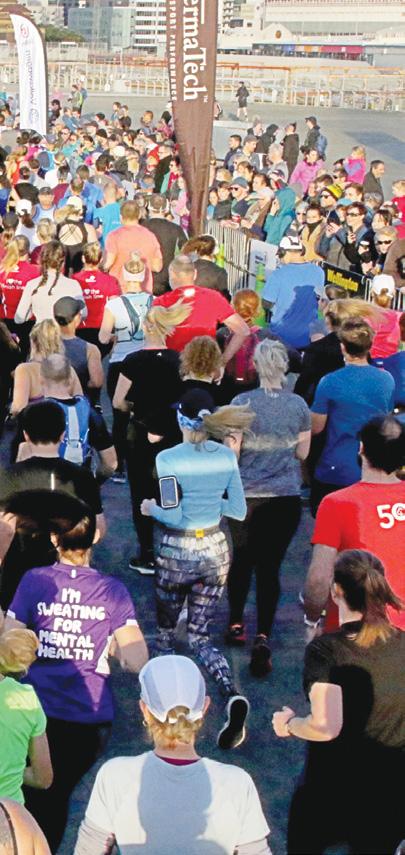
The Gazley Volkswagen Wellington Marathon should be celebrating its fourth decade on June 29th.
Established in 1986, 2025 does indeed mark 40 years since the event began. But as with much of society, Covid-19 cost the event two of those 40. And so, this year organisers celebrate the 38th Gazley Volkswagen Wellington Marathon, and despite those recent challenges the event is as popular as ever.
Wellington 40 years ago was a different city to the one you see now. The Waterfront areas were only just starting to be developed. The Museum Hotel still sat on the end of Taranaki Street, Te Papa Museum was just a glint in the eye of a few local politicians, and Sky Stadium was a windblown wasteland with a few rail tracks. But one thing that remains four decades later is the
Gazley Volkswagen Wellington Marathon, although that too is barely recognisable today.
More than 4000 participants from 20-plus countries are expected on June 29th. In 1986 it was a big deal when just over 1000 people turned out for the inaugural event, which back then was just a half marathon.
The route back then might surprise anyone who has done the event in the last 20 editions. Starting at the Taranaki Street wharf gates, the race headed south up Taranaki Street past the old Show Building to Island Bay, around the South Coast to Lyall Bay, under the airport to Miramar and then back on the current course around Evans Bay and Oriental Bay to finish at the Overseas Terminal.
For almost 20 years this was a successful local event attracting around 1000 entrants and was one of the first running events to actively welcome the walking movement when it arose during the mid-90s.
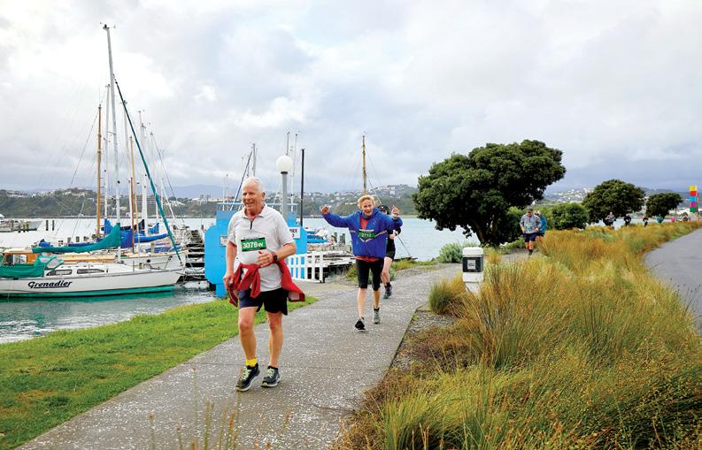
By 2004, however, increased traffic flows and Council requirements had made that route untenable, and organisers got permission to use Sky Stadium as a base for a new out and back course on the flat, fast and scenic waterfront roads through the city wharves and out around, Oriental Parade, Evans Bay Parade and Miramar Peninsula.
The revamped event was an instant success. Wellingtonians have a love affair with Sky Stadium, and with the addition of a 10k, then a Full Marathon, and the Kids’ Magic Mile the event is now a festival of
fitness that has grown to as many as 5000 participants from more than 20 countries.
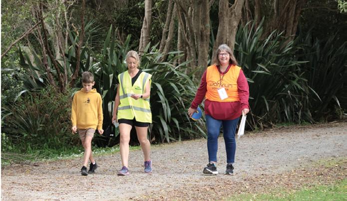
During this time, the Wellington Marathon was among the first running events to welcome the walking movement. They have grades catering specifically to walkers in every race, and their website’s history page shows race records for every age group in every race. Indeed, the event’s eldest ever entrant was a walker in Masterton’s 93-year-old Peter Tearle in 2019.
“Walkers are always very welcome,” says event manager Michael Jacques. Every year we have about 200 each in the 10k and half marathon, and about 40 in the full marathon. Frankly I’d love to see more because all we’re about really is seeing more people enjoying health and fitness.”
Jacques thinks the secret to the success of the event is providing something for everyone. “Obviously the Marathon is the feature event,” he says. “But not everyone is inclined to tackle 42k. So with the half marathon and the 10k and the Kids Mile, and the walk categories, there is an option for just about anyone who wants to challenge their fitness, and who wants to be part of a fun event.”
The 38th Gazley Volkswagen Wellington Marathon is scheduled for Sunday 29th June. For info and online entry, visit: wellingtonmara-
Above left:They are off in last year’s event.Below right: Along the waterfront at Evans Bay.
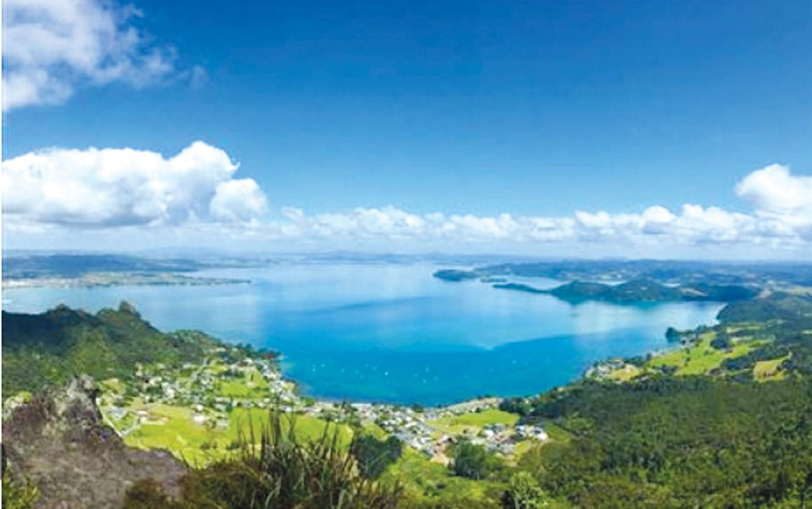
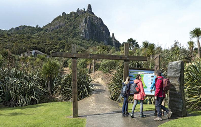
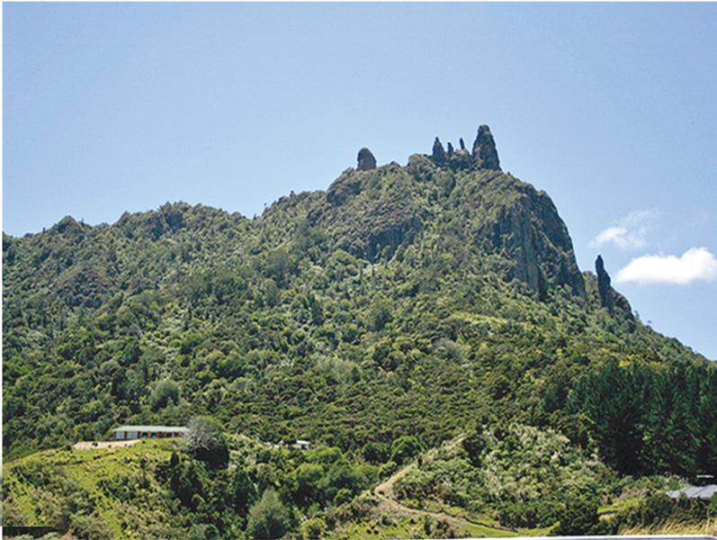
Mount Manaia Track - a breathtaking adventure
The Mount Manaia Track, located in the Whangārei Heads area of Northland, offers hikers a challenging but rewarding experience with stunning panoramic views. This popular trail takes you through beautiful native bush to the summit of Mount Manaia, standing 420 metres above sea level.
As you ascend Mount Manaia,
you’ll be treated to an ever-changing landscape. The track leads you under nīkau palms and kauri stands, with glimpses of northern rātā hanging from pōhutukawa among jagged bush-covered peaks.
As you climb higher, the views become increasingly impressive, culminating in spectacular 360-degree vistas of the Northland coastline,
Whangārei Harbour, and surrounding islands.
The trail passes through regenerating native bush, offering opportunities to observe our unique plant life. About halfway up, you’ll encounter an impressive stand of large tree ferns, their shed fronds creating interesting displays in the forest understory.
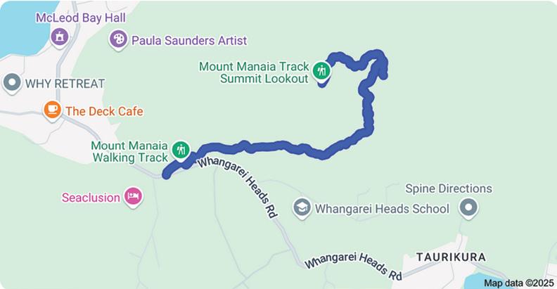
The Mount Manaia Track is rated as moderate to difficult, requiring a decent level of fitness.
It’s classified as a Grade 3 track by the Whangarei District Council, meaning it’s technically easy but physically demanding due to steep climbs and numerous steps.
The round trip typically takes between one and a half to two hours, depending on your pace and fitness level.
Above: A view from the top of Mt Manaia.
Below left: The start of the track to the summit.
Most hikers complete the trail in approximately one hour and 30 minutes. The uphill portion usually takes 45 minutes to one hour, while the descent can take 35 to 45 minutes.
The Mount Manaia Track is an out-and-back trail, meaning you’ll return the same way you came up
. The path is well-maintained, featuring: gravel paths and boardwalks, wooden staircases (over 1000 steps and natural rock lookouts (use caution as there are no safety barriers)
The track is approximately 3.8-4.4 km round trip, with an elevation gain of about 340-390 metres.
Mount Manaia is located in Whangārei Heads, about 30 minutes (30 km) from Whangārei city.
If travelling from Auckland CBD, it’s approximately a three-hour drive (192 km).
How to get there: Follow Whangārei Heads Road past the settlement of Whangārei Heads. Look for signs to Mount Manaia Track. There’s a parking area below Mount Manaia Club. The track starts just up the hill, behind the early settlers memorial
Best Times: The track is particularly beautiful at sunset, offering stunning views as the sun dips over Whangārei Harbour.
The Mount Manaia Track offers a challenging but rewarding hike through beautiful Northland scenery. With its well-maintained path, stunning views, and rich natural and cultural significance, it’s a must-do for visitors to the Whangārei area. Whether you’re a seasoned hiker or a casual walker looking for a bit of a challenge, Mount Manaia promises an unforgettable experience in the heart of Northland’s stunning landscape.
Above top: Mt Manaia showing the track at the bottom.
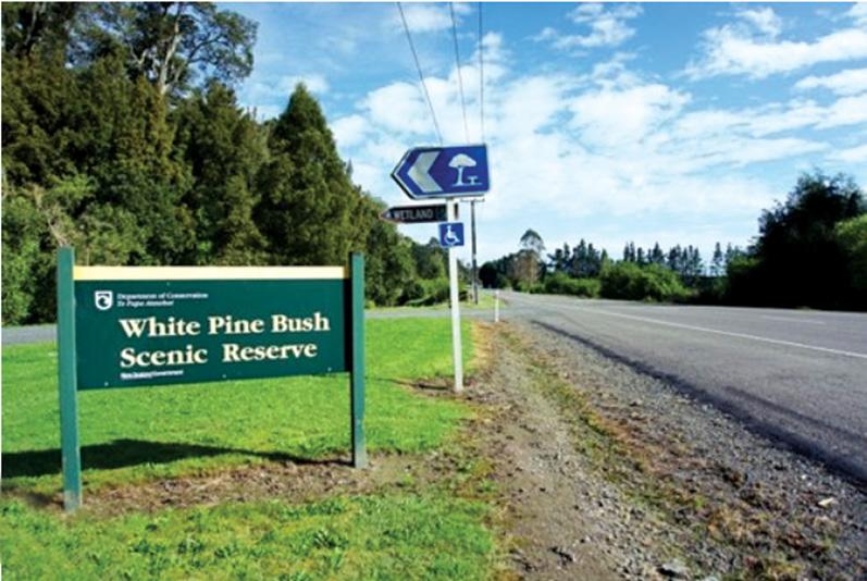
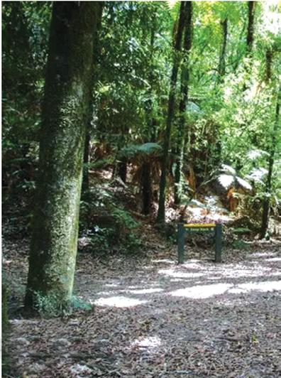
White Pine Bush Scenic Reserve a tranquil escape into nature
By Nicole Jones
White Pin ze Bush Scenic Reserve, located in Hawke’s Bay, is a stunning destination offering walkers a chance to experience one of New Zealand’s remaining coastal forests.
Situated approximately 30 km north of Napier on State Highway 2, this reserve is easily accessible and provides a tranquil escape into nature.
The reserve features two loop tracks suitable for varying levels of fitness:
Short Loop (800 m)
Time: Approximately 30 minutes
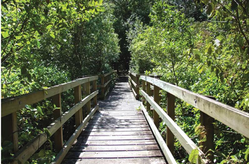
Track Type: Easy, wheelchair and pram accessible This loop offers a gentle walk through the forest and includes picnic tables at the top of the track, perfect for enjoying a meal while surrounded by native bird songs. Interpretive panels along the path provide educational insights into the flora and fauna. The route also features bridges and a picturesque nikau palm grove.
Long Loop (1.6 km)
Time: Approximately 40 minutes
Track Type: Moderate (not suitable for prams or wheelchairs) The longer loop extends above the picnic area and showcases towering kahikatea trees (white pines), native palms, and a stream with small waterfalls.Walkers may spot freshwater crayfish (koura), eels, and fish in the stream. This track also offers elevated views over parts of the reserve.
The White Pine Bush Scenic Reserve spans 19 hectares of protected native forest dominated by kahikatea trees. The lush nikau palm groves add unique beauty to the landscape.
You may be able to listen to birds like tui, fantails, and bellbirds. The reserve also supports red admiral butterflies, which rely on the stinging nettle (ongaonga) for food.
There is informative signage along the tracks about the ecosystem
A picturesque stream, small waterfall, and towering trees create an idyllic environment for nature enthusiasts are a feature of the reserve.
The short loop is ideal for families with young children or individuals with mobility challenges.
Walkers are asked to exercise caution around ongaonga plants, especially during summer when their growth is at its peak.
White Pine Bush Scenic Reserve is a must-visit destination for walk-
Above left: The entrance off State Highway 2. Below left: The bridge across a stream.
ers seeking tranquility and natural beauty near Napier. Whether you choose the short or long loop, you’ll be immersed in native flora and fauna while enjoying scenic views. With its accessibility and well-maintained tracks, this reserve offers an enriching experience for all ages.
How to Get There:
From Napier, drive north along SH2 for about 30 minutes. The reserve is clearly signposted and lies just past the Tangoio Falls track. Parking is available at the entrance, making it convenient for day visitors.
Above: left: A picnic table in the shade.
Good time to visit the western shores of the Firth of Thames
Words by Ceana Priest
Stash the binoculars and load up on hearty snacks—autumn is the perfect time for a scenic road trip along the western shores of the Firth of Thames.
While cooler days might make staying indoors tempting, there’s still plenty of sunshine to soak up along the coast. Breathe in the salty sea air as flocks of well-fed migratory birds take flight, heading back to their northern homes after a summer in Aotearoa.
Or venture inland to the Hūnua Ranges, where towering native trees shelter rare pepeketua/Hochstetter’s frogs and delicate pikirangi/green
mistletoe.
Tawhitokino Beach Path | Kawakawa Bay
This secluded gem is only accessible by foot, keeping the crowds away and earning its ‘secret beach’ status. From Waiti Bay, the coastal trail hugs a rocky headland streaked with colourful stone and oyster shells.
After passing massive pōhutukawa roots clinging to the cliffs, stroll across sheltered Tūtūrau Bay to the signposted track over Papanui Point. The stair climb is steep, but the sparkling views of the Hauraki Gulf make it worth the effort. As you descend, the stunning 1.4km-
long Tawhitokino Beach comes into view, with pōhutukawa trees offering shady picnic spots.
Need to know: Ensure you complete the walk within two hours on either side of low tide. Allow up to 60 minutes return for a short explore. Walking only. Parking at the end of Kawakawa Bay Coast Road. Dogs on leads.
Waharau Bush Path |
Waihihi Bay
Waharau Regional Park, stretching to the gravelly shores of Waihihi Bay, packs a mix of landscapes— farmland, riverbanks, and native forest.
This short, shady bush walk is a perfect introduction to the park. Follow a forest stream as you climb gently past tānekaha/celery pine and horoeka/lancewood, with spindly mānuka forming a leafy arch over the fern-lined trail.
Listen for kererū crash-landing in the canopy or spot playful pīwakawaka/fantails flitting behind you. Peer into the stream—you might catch a glimpse of kōura/ freshwater crayfish lurking below.
Need to know: Allow 30 to 45 minutes for the two-kilometre loop. Walking only. Entrance off East Coast Road. Drive past the visitor centre, and the trailhead and car park are shortly ahead on the right. Dogs on leads.
Above: Miranda Bird Hide. Photo Outdoor Kid
Below left: A walker on the Waharau Bush path. Photo Outdoor Kid
Tāpapakanga Coastal
Path Loop | Tāpapakanga Regional Park
This breezy coastal loop meanders past sun-bleached driftwood along a rugged shoreline. From the car park, head south along the stony beach, cross the Tāpapakanga Stream (or take the high-tide detour), then climb a grassy hillside for views of the Firth.
Visit the Ashby family cemetery before looping back via the redmarked streamside track or the longer Farm Walk, which passes grazing sheep and cattle. Snap a photo of the trail map near the car park for easy navigation. After the walk, unwind with a seaside picnic on the nearby sandy beach.
Information: Allow 45 to 60 minutes to explore. Walking only. Dogs on leads between 1 December and 30 June. No dogs during other times. Deerys Road, Tāpapakanga Regional Park.
Pūkorokoro Bird Hide
Track | Kaiaua
Spend a few hours birdwatching along the Firth of Thames, home to thousands of wading birds, including kuaka/bar-tailed godwits migrating from the Arctic. This 8,500-hectare coastal sanctuary is an avian hotspot, best explored with a stop at the Pūkorokoro Miranda Shorebird Centre.
Hire binoculars, chat with the volunteers, and head to one of the three viewing hides (a 1-hour return walk) or drive 2km south to the Robert Findlay Wildlife Reserve for a shorter 20-minute walk. For the best sightings, visit within two hours of high tide. The godwits begin leaving in early March.
Need to know: Allow between 20 to 60 minutes return. The wellgraded track suits buggies and wheelchairs (grab a gate security code from the centre). Walkers don’t require a code. East Coast Road south of Kaiaua. No dogs.
Ceana Priest is the author of Outdoor Kid guidebooks available at Paper Plus stores.
Ouch! Sore feet while walking?
Hikers Wool is 100% New Zealand wool. Cushion your feet to prevent pain, rubbing and blisters.
Buy online or at selected stockists For more info visit www.hikerswool.co.nz
Above right: The view from the Tawhitokimo Beach Path. Photo Outdoor Kid
Below right: A bridge on the Waharau Bush Path. Photo Outdoor Kid
Conifer Grove Path, Takanini
Walk from one playground to another along this family-friendly path in Conifer Grove. The trail is mostly on boardwalks or concrete, so it’s perfect for prams, scooters and small bikes – and it won’t get muddy if it’s been raining.
Enjoy views of the wetland and coast from the boardwalk and pier.
Glen Innes to Tāmaki Drive
Shared Path
Five short all-weather walks in Auckland
There are heaps of wonderful all-weather walks right across Auckland. Harbour views, mangroves and pockets of native bush are only a short stroll from cafes or museums meaning
you can easily find shelter if rain clouds are looming.
Here are five great short walks that will get the whole family moving – rain or shine.
Above left: Grove Path, Takanini. Below right: Devonport to the Navy Base Path.
The H215 Professional 4 Function Pedometer
The H-215, 4-function pedometer is a superb, reasonably priced pedometer that counts steps, calculates distance, calories burned and has a 12/24 hour clock. This is the model that has sold over a quarter of a million worldwide. It has the largest display of any pedometer we tested and is very accurate.
Dimensions: (L) 5.6 * (W) 3.7 * (t) 2.7 cm
Price only $36.95 plus $6.00 P&P
Phone 0800-925-546 for bulk prices
Available now from: Walking New Zealand Shop 47 Lincoln Terrace, Palmerston North - Phone 0800-925-546 or email walkingnz@xtra.co.nz. www.walkingnewzealand.co.nz
Te Ara ki Uta ki Tai ( the Maori name) means ‘the path of the land and the sea’, and this shared path is as scenic as you would expect from its name. Catch views of Purewa Creek and the Eastern railway line as you follow the path from Glen Innes to Tāmaki Drive.
Playgrounds along the way will delight smaller walkers, and the wide, even path is suitable for wheelchairs, prams and bikes. It can be walked in any weather – no risk of muddy shoes here!
Note that as part of Auckland’s Rail Network Rebuild, construction trucks may need to cross the shared path between the end of Purewa Road and the start of the Ōrākei Basin boardwalk, and staffed Stop/Go signs will be in operation.
Auckland Domain
Auckland Domain / Pukekawa has a wide variety of paths. If the weather is gloomy, embrace the romantic atmosphere of the Lovers Walk through native bush.
On the most miserable days, walk around the Wintergarden. It’s warm and dry under the arched ceilings, and feels even more magical for being sheltered from the elements.
Visiting the museum is another option to escape from wet weather.
Westhaven Path
The Westhaven Path skirts around Auckland’s picturesque waterfront. It’s a flat walk perfect for bikes and scooters, as well as prams and wheelchairs.
From Herne Bay, walk around under the Harbour Bridge to Wynyard Quarter. The views of Waitematā Harbour are impressive, whether you’re walking in full sun or under moody rain clouds. If it starts pouring down, shelter under the bridge or find refuge in the cafes and restaurants of Wynyard Quarter.
Devonport to Navy Base Path
This walking trail is a gentle stroll alongside the northern side harbour. Starting at the Devonport ferry terminal, follow the path along Queens Parade and enjoy scenic views across the water to the city skyline.
Walking to the navy base and back takes around 30 minutes – just enough time to get moving before escaping into Devonport’s cosy library,
Above right: A walk through native bush in Auckland Domain .
Middle right: The shared patheway on Glen Innes to Tamaki Drive.
Below right: Westhaven Promenade.
Auckland Walks
We are looking for the best digital photos each month depicting walking
Now the time to get your digital camera out or look through your digital images and enter the
Walking New Zealand
Digital Photo Contest
The image could be a scenic scene, a walk on the beach with the dog, a bush walk, a street walk or anything walking that takes your fancy.
The rules are simply: there must be a person or persons walking in the picture either front, side or back on, and can be in the distance. We require an emailed image in high resolution mode, in jpeg format as an attachment, and NOT embedded in Word or in the email, and NOT a link to a website to be downloaded. The subject line must have the words “Walking New Zealand Photo Contest” and the email must include the NAME, POSTAL ADDRESS and phone number of the person who took the photo and a small caption. In this contest ONLY ONE emailed photo accepted per month. Entry in the contest automatically allows us to print the image. The person who has their photo published will receive a six month subscription or a renewal to Walking New Zealand magazine of six months. If a picture is chosen for the cover page the person will receive a 12 month subscription or renewal Email your entries to: walkingnz@xtra.co.nz with subject line “Walking New Zealand Photo Contest” Only EMAILED entries will be accepted.
Opposite Page:
Above right: My husband Bruce enjoying a leisurely walk at the Pukaha National Wildlife Centre. This is where they breed endangered species and release them into the wild. Photo by Jo Alexander, Epsom, Auckland.
Middle right: Geoff Chapple among the ancient rimu trees on the Rakiura Track, Stewart Island. Geoff and Miriam walked the Rakiura Track on Stewart Island earlier in March and loved the beautiful bush on the first day towards Port William Hut. Photo by Miriam Beatson, Devonport, Auckland.
Below right: Walkers waiting for the bus after walking the Mnawatu Gorge Track from Ballance to Ashhurst - a walk in the recent Manawatu Walking Festival. Photo by Claire Pearson Takapu Valley, Wellington.
PHOTO CONTEST
Above top: The Women’s Outdoor Pursuits (WOPS) Thursday walk went to Waiheke Island. On the Mokemoke Pa headland walk, from Matiatia to Oneroa, looking towards Motutapu Island.
Photo by Lesley Ann Farmer, Glenfield, Auckland
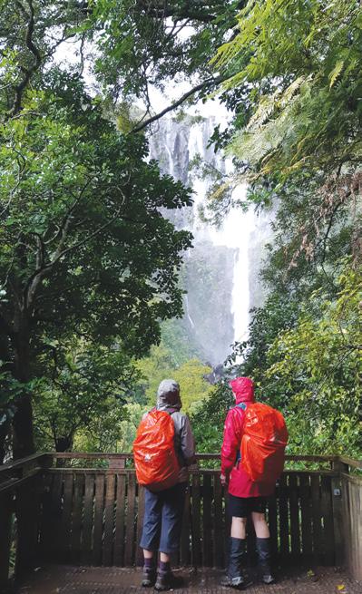
Below right: On a rainy August hike some time ago at Wairere Falls, Kaimai Range near Matamata. Our group were impressed by the view at the lookout.
Photo by Sue Eccles, Te Aroha.
We
You
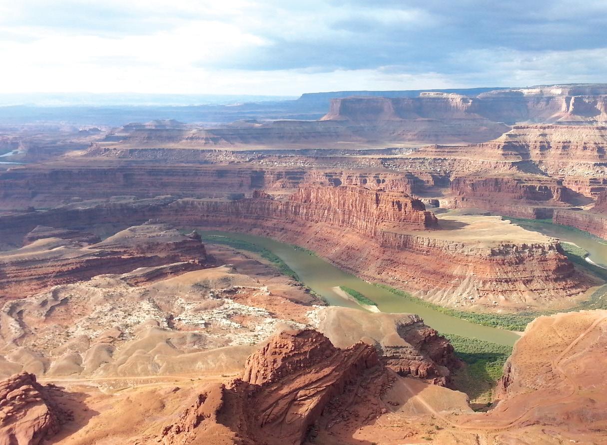
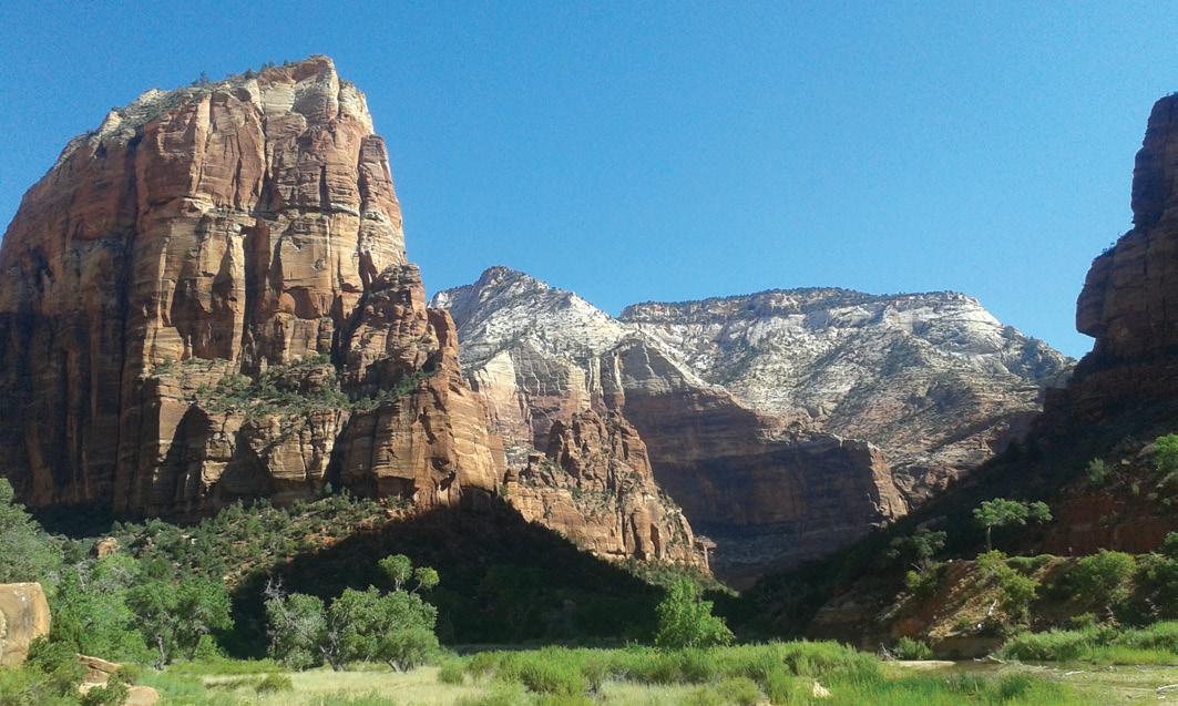
Red rocks and starry skies - walking in
Utah rocks! It is packed with a mind-blowing array of incredible land formations that are a wonder to explore.
These other-worldly landscapes are so unique they have their own language, with terms such as ‘tilted buttes’, ‘jumbled rocks’, ‘sedimentary canyons’, ‘hoodoos’, ‘spires’, and ‘folds’.
Such features are ubiquitous in what are known as ‘The Mighty Five’ - Arches, Bryce Canyon, Canyonlands, Capitol Reef and Zion National Parks.
These are among the most spectacular national parks in the world. In September 2025, you can be transported through this region of geologic wonder in the second section of the Footsteps Colorado/Utah walking tour. The scenery will continuously stop you in your tracks.
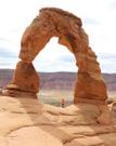
Arches
This park is a story in stone which began roughly 65 million years ago.
At that time, the area was a dry seabed spreading from horizon to horizon, subsequently uplifted and sculptured.
There are over 2,000 natural stone arches, in addition to hundreds of soaring pinnacles, massive fins and giant balanced rocks. We’ll hike to Delicate Arch, a 16m-tall freestanding natural arch. The trail is a steady uphill climb through dry desert terrain, occasionally passing stunted trees or rock piles providing welcome shade.
We’ll head back the same way and continue on to Devil’s Garden to explore more of the park by foot. Encounter the famous Landscape Arch and other inspiring arches in close proximity.
By Phillip Donnell
Utah’s mighty five
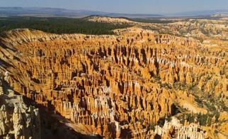
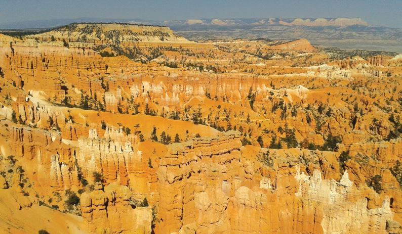
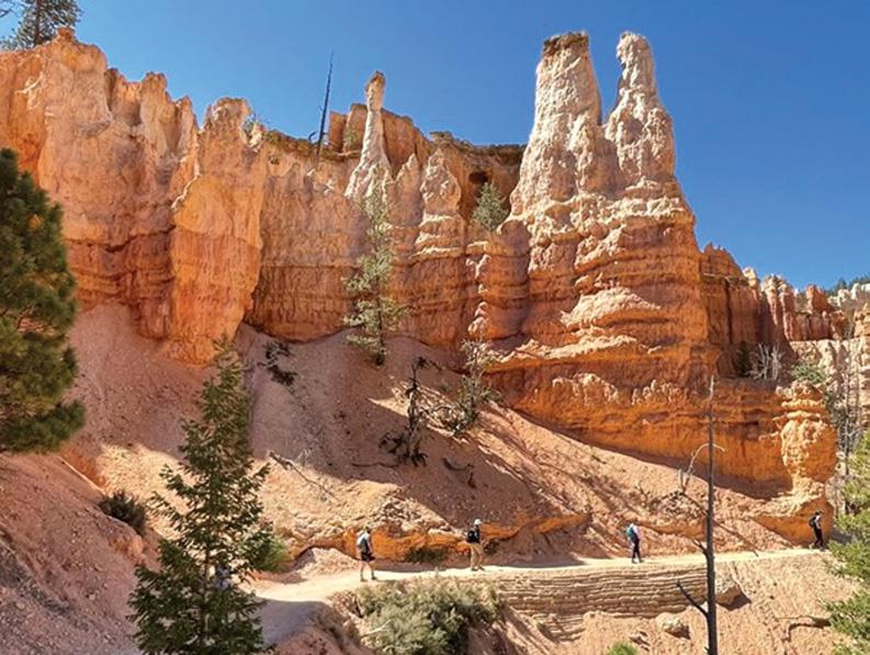
Bryce Canyon
A highlight here is the hike through the magical hoodoo rock formations of the Queens Garden Trail. It drops down into the canyon and we’ll wander through naturally-shaped rock gardens of brilliantly-coloured
spires, cliffs, and galleries. The trail loops up with the Peek-a-Boo Trail, creating a figure-8, passing by the ‘Wall of Windows’ and the ‘Hindu Temples’ before traversing up the famous switchbacks of ‘Wall Street’ that lead back to the rim.
Unforgettable close-up views of
Above right: Looking out at the Canyonlands. Below left: Delicate arches make an unusal photo. Below right: Water at the bottom of The Narrows in Zion.
beautiful and unusual hoodoo scenery are found along the Bird’s Eye Trail. The park’s main road leads past the overlooks at Sunrise Point, Sunset Point, Inspiration Point and Bryce Point to a forest of ancient Bristlecone trees. Prime viewing times are around sunup and sundown.
Red rocks and starry skies
Canyonlands
Experience Utah’s largest national park as you hike through the dramatic desert landscape carved by the powerful Colorado River. It is a wilderness of countless canyons and fantastically formed buttes.
We’ll explore it with a few short hikes, eyeing the skyward-jutting spires and needles, deep craters, and blue-hued mesas that dot the
Above left: Inspiration Point in Bryce.. Middle left: Walking in Zion. Below left: Waterpocket Fold in Capitol Reef..
Above left: Balance rock in arches.
Above right: Angels Landing in Zion
Below left: .Egyptian temple in Capitol Reef.
Below right: Queens Gardens in Bryce.
landscape.
The Grand View Point Trail (5-6 km) is a popular choice and a great chance to see some wildlife. Nearby is Fisher Towers, a 5 km trail that is a maze of soaring fins, pinnacles, minarets, gargoyles, spires, and strangely-shaped rock formations, a favourite subject of photographers for years. Equally gob-smacking are the vistas of the adjacent Dead Horse Point State Park.
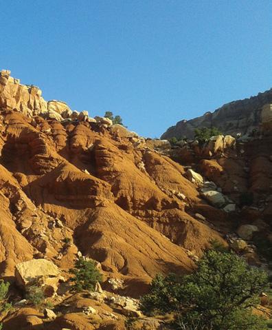
Capitol Reef
This park centres on a blip in the Earth’s surface (kind of like a giant rugged wrinkle stretching for 160 km) known as the ‘Waterpocket Fold’.
It manifests as layers of beautiful rock, ranging from shades of white to yellow to orange, and deep red. We’ll head out to hike the Cassidy Arch Trail, named after the famous Butch Cassidy. Although the climb is steep, it’s worth the visit as the huge arch is large and spectacularly photogenic at almost any angle!
We’ll also amble through the beautiful Cohab Canyon. Native Americans once called this colourful landscape of tilted buttes, jumbled rocks and sedimentary sleeves the ‘Land of the Sleeping Rainbow’. The banded orange and yellow walls do in fact resemble pastel-striped eggs and the holes and pockets texturing the surface create a sandstone honeycomb fortified in rock.
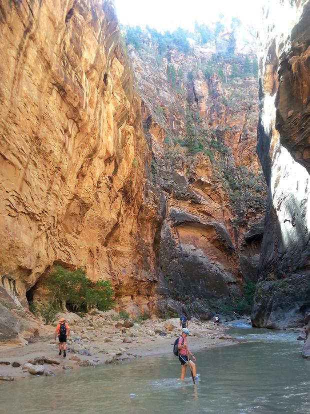
Zion
Zion is Utah’s most popular national park. As you wind through the magnificent canyon walls and
Red rocks and starry skies
towering cliffs that make up this majestic park, it is easy to see why it was (in 2023) the third most-visited in the country (after Grand Smoky Mountains and Grand Canyon).
It showcases dramatic panoramas of towering canyon walls, picturesque views of the Virgin River, and lushly-vegetated trails. Zion hosts some of the most breathtaking slot canyons in the world, as well as the opportunity to test your courage on the heart-stopping climb to Angels Landing, a 450m-tall rock tower.
Hiking ‘The Narrows’ is arguably the quintessential Zion experience. The walking is largely in the shallow river, bounded by sheer sandstone cliffs.
You are warmly invited to come and fully immerse yourself in Mother Nature’s best, building memories which you will always cherish. The ‘Mighty Five’ bring bedrock alive!
For details please download the dossier from www.footstepswalkingclub.com, or contact Footsteps by phone (021 172 3244), or email footstepsanz@gmail.com . The deadline is 1 May.
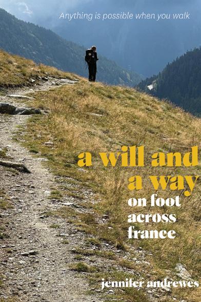
a will and a way on foot across France
In 2008, overwhelmed by career, motherhood, and daily life, Jennifer Andrewes took a leap—literally—and realised mid-air that anything is possible with the right mindset.
And so, after being diagnosed with early-onset Parkinson’s, she was inspired to walk off her symptoms. Soon afterwards she set out on an 1800 km pilgrimage across France, walking two ancient routes in search of healing, clarity, and joy.
On muddy trails and through mountain passes, her journey is one of courage, camaraderie, and self-discovery. Walk with her for an authentic Camino experience—and discover how a pilgrimage mindset can help you shed baggage, embrace simplicity, and find strength in every step.
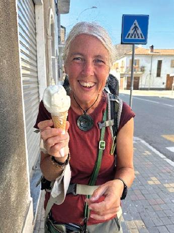
The author Jennifer is a New Zealand-based writer whose life journey is a testament to resilience, transformation, and an unstoppable spirit.
As a child, Dunedin-born Jennifer spent time living in France kicking offa life-long love affair with the country. An avid walker, Jennifer first joined a local walking group to meet people and explore the local countryside, while working as a language teaching assistant in Dunkerque. Thirty years later, she’s hooked! A communications professional, she has worked in tourism and government roles both here and in the UK, as well as undergoing stints as a freelance travel writer.
Her blog on the family’s French adventure www.myparallellives. com was widely enjoyed and it was prompting from readers that led Jennifer to write a book about the family’s experience: Parallel Lives: Four seasons in the French Pyrenees. Her subsequent posts about her pilgrimage adventures
are widely read and it was encouragement from followers that have led Jennifer to write a book about her Camino experiences.
Quotes for Parallel Lives: Four seasons in the French Pyrenees:
‘A delightful book about a real Kiwi family living their dream in a most magical part of France.’ Allyson Gofton, food writer
‘I loved this wonderful family adventure about Jennifer and her family’s unique, off-the-beaten track experience.’ Natalie Dourneau, Director, Alliance Francaise, Wellington
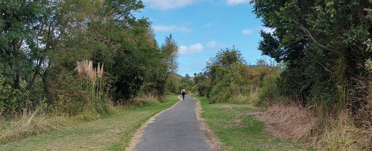
A scenic stroll along the Mountains to Sea Cycle Trail
By Sarah Davis
On the banks of the Whanganui River, the Whanganui River Top 10 Holiday Park serves as an ideal starting point for exploring a section of the renowned Mountains to Sea Cycle Trail.
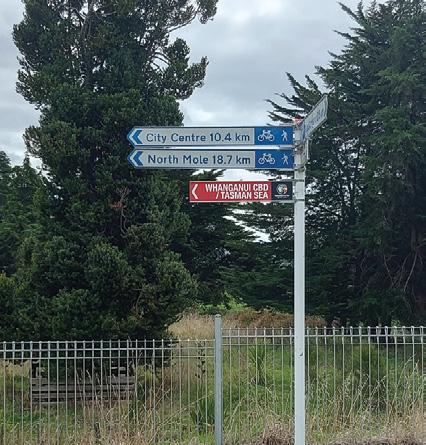
While the full trail spans an impressive 217km from Mount Ruapehu to the Tasman Sea our journey focused on the picturesque stretch leading to the charming village of Upokongaro.
Setting out from the holiday park, we crossed Sommes Parade turned right , following the trail that hugs the Whanganui River beside what is now Papaiti Road. The sealed path, suitable for both cyclists and pedestrians, offers a pleasant and easy walk with stunning riverside scenery.
As we strolled along, the gentle flow of the river accompanied us, providing a soothing backdrop to
Above top: The suspension bridge to Upokongaroa. Below right: The path wanders under trees for shade.
www.walkingnewzealand.co.nz
our adventure.
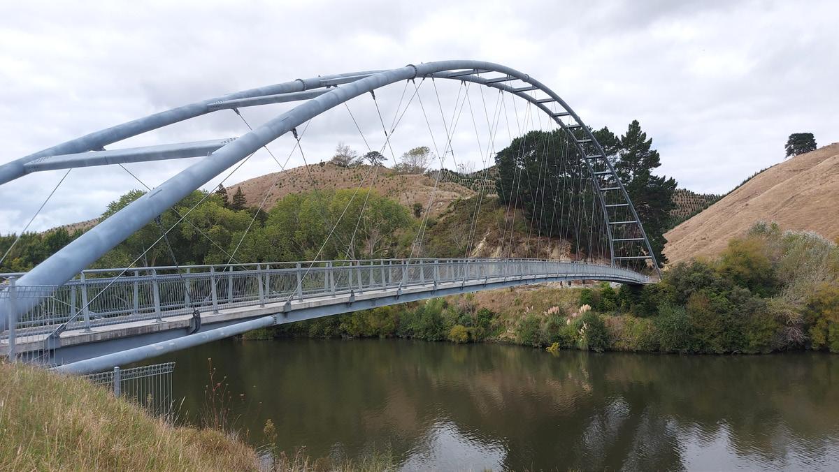
About 4.1km into our walk, we encountered one of the trail’s newest and most impressive features – a 130-metre long suspension bridge spanning the Whanganui River.
This architectural marvel, opened in December 2020, not only serves as a crucial link in the Mountains to Sea Cycle Trail but also offers breathtaking views of the surround-
A scenic stroll along the Mountains to Sea Cycle Trail
ing landscape.
Crossing the bridge, we found ourselves in Upokongaro, a quaint riverside settlement approximately 12km north of Whanganui.
The village, though small, exudes a charm that makes it a popular stop for both cyclists and day-trippers.
The highlight of Upokongaro is undoubtedly the café “Behind the Door on 4,” located at 444 State Highway 4. This hidden gem has become a must-visit spot for refreshments
Above top: Looking back before crossing the suspension bridge to Upokongaro. Middle left: A horse beside the river Below left:and right: The track wanders up and down beside the river.
and relaxation.
Housed in a lovingly restored old building that once served as a general store and post office, the café boasts fine wooden floors and several appealing dining spaces.
What sets this café apart is its enchanting outdoor area. The grounds have been beautifully landscaped, featuring gardens, decks, and secluded nooks that provide a tranquil setting for outdoor dining.
The “secret garden” at the back is particularly noteworthy, offering a peaceful retreat where visitors can soak in the local birdlife.
The café’s menu caters to various dietary needs, including vegetarian, vegan, and gluten-free options.
Their coffee, prepared by skilled
Above top A cyclist on the trail.
Above right: This part you cross over Papaiti Road.
Below left: At this part the road is between the trail and the river..
baristas, is a perfect pickme-up after the walk. For those with a sweet tooth, the scones have gained legendary status among regular visitors
“Behind the Door on 4” is more than just a café; it’s a community hub. The welcoming atmosphere has made it a popular gathering place for local groups.
For trail users, it serves as an essential pit stop, offering not only refreshments but also the opportunity to fill water bottles and purchase packed lunches for the onward journey.
The café’s operating hours from 9am to 3:30pm daily ensure that most visitors can enjoy its offerings.
Its location right beside the cycle bridge makes it an ideal resting point for both cyclists and walkers exploring the Mountains to Sea Trail.
Our walk from the Whanganui River Top 10 Holiday Park to Upokongaro, covering a distance of about 12km round trip, provided a perfect taste of the Mountains to Sea Cycle Trail. The combination of riverside scenery, the impressive new bridge, and the delightful café in Upokongaro made for a memorable day out.
Whether you’re a serious cyclist tackling the entire trail or a casual walker looking for a pleasant day trip, this section of the Mountains to Sea Cycle Trail offers a rewarding experience that showcases the natural beauty and warm hospitality of the Whanganui region.
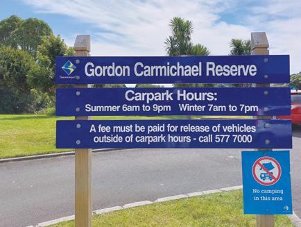
Gordon Carmichael Reserve a hidden gem
By Catherine Tooher
As you approach Gordon Carmichael Reserve from Tauranga, you’ll find yourself just a short drive northeast of the State Highway 1 Bethlehem roundabout.
The main entrance and car park are located on Carmichael Road, where you’ll also find convenient facilities like toilets and a playground.
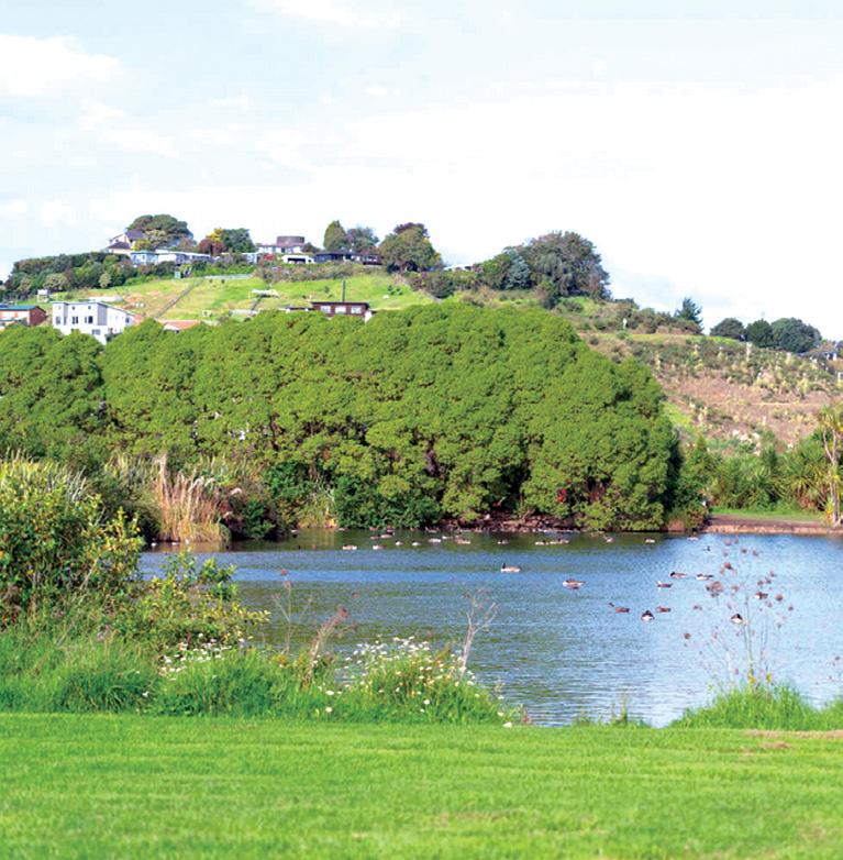
Upon entering this 60-hectare oasis, you’re immediately struck by the tranquil atmosphere.
The reserve is a hidden gem in the heart of suburban Tauranga, offering a peaceful escape into nature. As you set off on your journey, you’ll
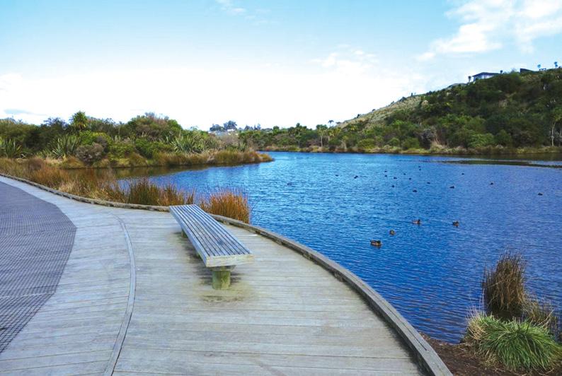
notice the well-maintained gravel pathways that wind through the diverse landscape.
The reserve boasts over two kilometres of walkways, including 230 metres of boardwalk lined with native plants.
If you’re walking, you can expect
to spend about 1.5 hours exploring the main trails, covering roughly 2 kilometres.
For cyclists, the journey would be quicker, allowing you to cover more ground and potentially explore the full extent of the reserve’s paths.
As you make your way through the reserve, you’ll be treated to a variety of landscapes. The wetlands are a highlight, showcasing the area’s role as a storm water reserve. You’ll pass by creeks, ponds, and saltmarsh areas, each teeming with life.
Keep an eye out for the diverse array of native birds that call this place home. Information boards along the way provide insights into the local ecology and history.
The reserve isn’t just about nature; it’s also a place of learning and community. You might come across the outdoor classroom area, used for educational programs
As you continue your journey,
Above right: The storm water settling pond teaming with life.
Below left: A seat to sit and enjoy the scenery.
you’ll appreciate how the reserve serves as a vital link between the neighbourhoods of Bethlehem, Brookfield, and Bellevue.
For those seeking a longer adventure, it’s possible to explore all the paths throughout the reserve, which would clock in at around nine kilometres.
This extended route would take you to the eastern end of the reserve, where you can discover the storm water settling ponds, a popular spot for families.
Looking to the future, several exciting improvements are planned for Gordon Carmichael Reserve. A cultural sculpture garden is in the works, which will add an artistic and cultural dimension to the natural beauty.
The storm water system is also slated for an upgrade, ensuring the reserve continues to fulfill its important role in water management.
Accessibility is a key focus of future developments. A new pedestrian crossing on Carmichael Road, opposite the reserve entrance, is being installed to make access safer
and easier for both pedestrians and cyclists
This improvement is particularly beneficial for residents of nearby retirement villages.
Another notable addition is the construction of a bridge/boardwalk connecting Eden Crescent in Brookfield to the reserve’s network of walkways and cycleways.
As your journey through Gordon Carmichael Reserve comes to an end, you’ll likely find yourself at one of the picnic areas, perfect for a rest and reflection on the natural wonders
you’ve experienced
The reserve offers a unique blend of recreation, education, and conservation, all within easy reach of Tauranga’s urban areas. Whether you choose to walk or cycle, Gordon Carmichael Reserve provides a refreshing escape into nature. It’s a place where you can observe wildlife, learn about local ecosystems, and enjoy the simple pleasure of being outdoors. As the reserve continues to evolve with planned improvements, it promises to remain a cherished green space for Tauranga residents and visitors alike.
Wairongomai Valley full of gold mining
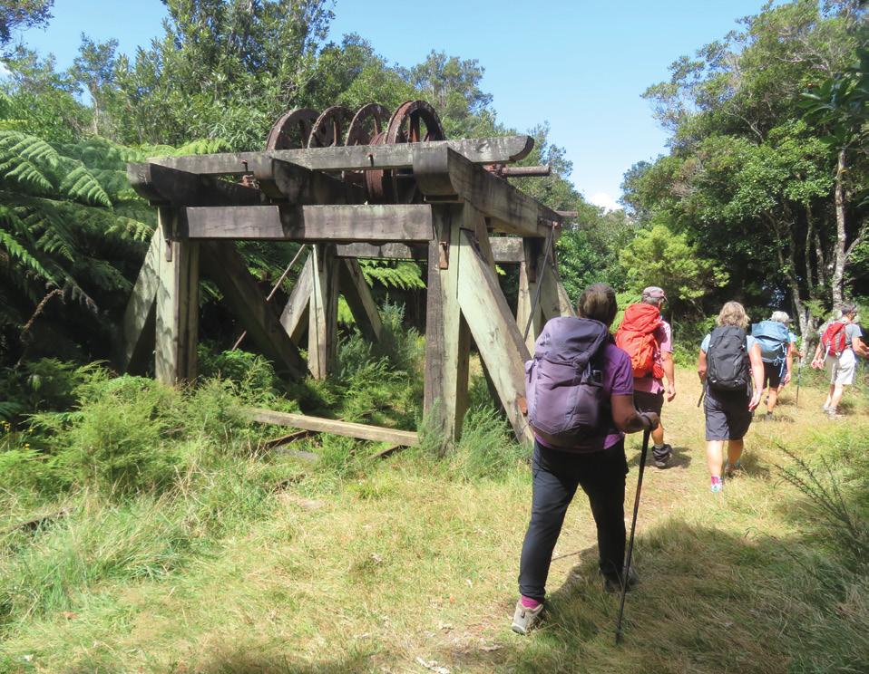
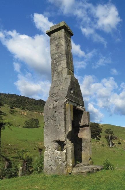
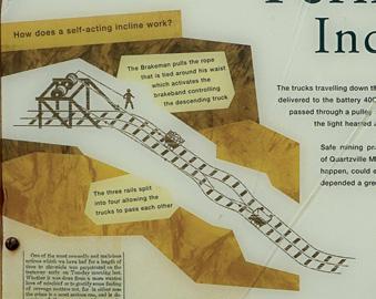
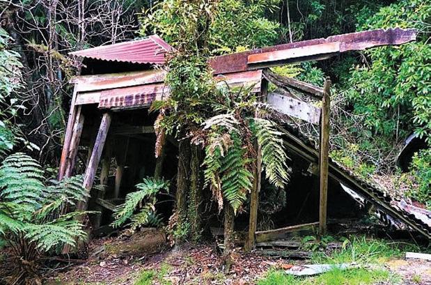
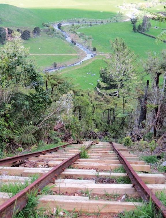
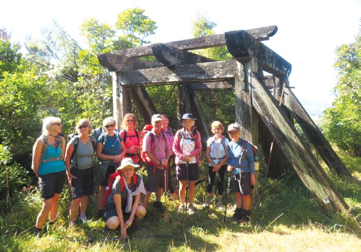
Above left: Walking past the top of Butlers Incline – the longest (400m) and best preserved incline. Below left: All that remains of Wairongomai township, in a paddock by the car park.
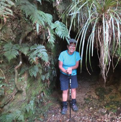
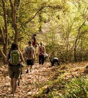
We recently revisited an old favourite Wairongomai Valley, close to Te Aroha, in the foot hills of the Kaimai ranges. This area is easy to access, being only an hour from either Tauranga or Hamilton, and just over two hours from Auckland.
Not only is it a lovely place to walk, with many well marked tracks to suit all abilities, but it also has a fascinating history from the gold mining days. Gold was first found here in 1880 but
although a lot of money was spent searching, the rock was too hard and the expense too great, so the gold era didn’t last long.
The area was abandoned for 100 years. Then In 2004, DOC started to restore the historic sites. Trails were reconstructed, and tramlines and old mining machinery were uncovered and preserved.
By Barbz Lowther
We are so lucky to be able to
mining history
enjoy it today.
At its hey day, 3,000 to 4,000 people lived at Wairongomai township, which had 12 shops, three hotels, a hall , a post Office and a school. All that remains now is a lone chimney. In 1882/3 the first railway in New Zealand, the Piako County tramline, was constructed to bring ore from Buck Reef, which extends 4 kms North/South along the Kaimai foothills, down to be processed in the
valley floor.
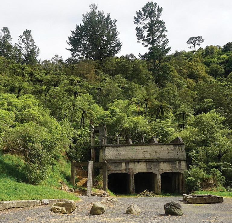
Bendigo battery was built the same year, with a 40 head stamper. It is one of the largest, and most complete plants existing in New Zealand. Horses pulled carts of quartz to three self operating Inclines, which
Above right: The Stone Crusher at the end of the car park.
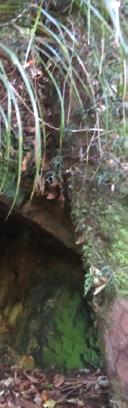
Below left: We passed many Mine shafts dug into the side of the hill. Below right: All that remains of Hardys Hut, and 9b – taken a few years ago. It is gradually disappearing.
New Zealand Walks
Wairongomai Valley full of gold mining history
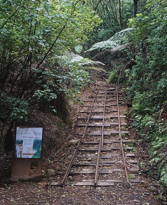
ferried the carts 3-400 metres below, the heavy buckets going down, automatically pulling the empty buckets back up. Halfway up, three rails were changed to four, to allow the carts to pass. The longest, steepest and best preserved incline is Butlers. Many of its sleepers and rails are the originals. Winching gear has been
re built at the top of Fern Spur and Butlers, and old gear still remains at the top of the May Queen incline.
The tramline is now a popular walking trail, taking us into areas, and showing history we couldn’t otherwise find. All trails are very well marked. Starting at the car park, we headed
up the track towards the low level drive, stopping to explore the bottom of the fern spur incline.
In a few minutes, we turned right, and followed the high level track, to the top of the incline. Stopping for a drink break, we had time to admire both the view far below, and the winding gear and information board.
Walking on steadily up the track, we reached the top of Butlers Incline in about an hour. This is the longest incline, rising 400 metres from Bendigo Battery by the river, up to the Winch Frame, at the top. This has been reconstructed, including two winch drums. After a short stop here to admire this winding gear, we tackled the upper section of the high level track. This was more gradual, with several
Above left: Looking down from the top of Fern Spur Incline.
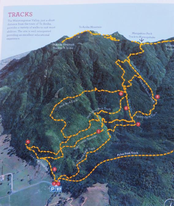
Above right: A map of the trails in Wairongomai valley.
Below left: ‘Shoe Strings’ Tramping group at the reconstructed Winding Frame at the top of the Incline..
streams flowing across the track, and falling down into the valley. Scrubby areas allowed awesome views of tall trees way down below. We passed the site of Quartzville, once home to a few thousand miners; with a post office a boarding house, and several shops. Now it is just a grassy patch among the trees.
A few minutes from here are the remains of Hardys Hut. Hardy provided supplies for the miners for several years, and was probably one of the few who made any money.
After a photo stop, we dropped down to the junction of the Piako Tramway, and the high level track. From here you can follow the tramway back to Butlers, or turn Left and walk to dog kennel flat near the summit of Te Aroha.
We turned right and in a few minutes, reached the top of the May
Queen Incline, where we stopped for lunch amongst old machinery. We followed rails to explore a stope (hole where ore was removed) and a large horizontal mine shaft.
From there it was an easy down hill walk beside the May Queen, and along to Butlers Incline. On the way we passed an old compressor, rescued from a nearby mine It provided compressed air to drive hammer drills. A jet of water under pressure was squirted into twin buckets on the circumference of the pelton wheel.
Walking back down, we took the Cadman Track, sidling along the base of Buck Reef. We past barely visible remains of old stables, for the horses used to pull the ore carts to the top of the inclines.
There were several mine shafts dug into the side of the hill. This is a pretty trail, with some huge old puriri
We
trees - a lovely way to finish a walk. We soon arrived at the junction with the high level track, a few minutes from the car park.
At the far end of the car park, you can see the remains of a rock crusher, used to crush rock from a nearby quarry, in the 1920’s.
We were back to our cars in just under five hours, feeling very lucky to be living where we are today, instead of in the harsh conditions the miners and their families endured.
There is so much to see at Wairongomai,, and a variety of walks to suit most people. The low level loop is a good family walk, the high level is more challenging, and for those who want to walk all day, there are the options of The Pylon Peak Track, the Piako tramline to Te Aroha, or joining up with the Waipapa track to Waitawheta.
Below left: The bottom of Fern Spur Incline
It is a valley with a walk for everyone, and certainly one of my favourites.
DIRECTORY of GUIDED WALKS
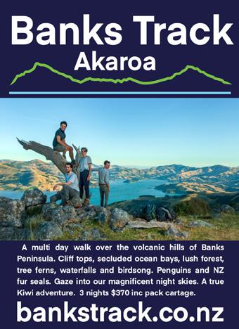
BANKS TRACK Akaroa
A multi-day walk over the hills at Akaroa 03-304-7612 bankstrack@xtra.co.nz www.bankstrack.co.nz
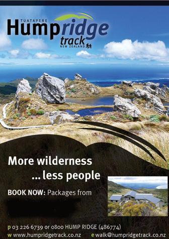
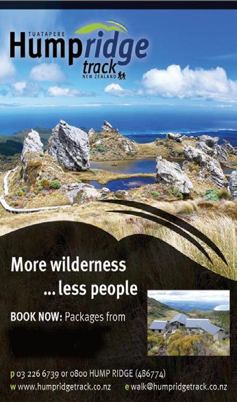
HUMPRIDGE TRACK Tuatapere
3 Day Loop Walk in Fiordland 03-226-6739 walk@humpridgetrack.co.nz www.humpridgetrack.co.nz
ISLAND HILLS STATION Nth Canterbury Private track, self guided, multi-day walk 022-464-0140 Shaun@islandhillsstation.co.nz www.islandhillsstation.com
NORTHLAND EXPERIENCES Northland E-Bike tours and walking groups 027-203-8416 hello@northland experiences.co.nz www.northlandexperiences.co.nz
PAPAROA GUIDED WALKS Greymouth
All-inclusive guided tours along the Paparoa Track, Marlborough and Tasman regions 027-527-2762 info@paparoaguidedwalks.com www.paparoaguidedwalks.com
TOTALLY TARAWERA Rotorua Your nature connection 07-362-8080 info@totallytarawerea.com www.totallytarawera.com
MT ALBERT Y’s WALKING GROUP: Tuesday Friday, (AM), 09-846-0788 MT ROSKILL COMMUNITY HOUSE: Theresa McDonald, 09-624-3281 OUTDOOR ACTIVITIES CLUB AUCKLAND: midweek, weekends (BIA), walks, tramps, www.oacnz.org, OutdoorActivitiesAuck@outlook.com
ST HELIERS HIKERS: First/Third Wednesdays (all day), Glenn 09528-9726
STEP OUT WALKING GROUP: Thursday (AM), Olivia 09-555-5164
WOMENS OUTDOOR PURSUITS INC: Tuesday, Thursday, Sunday, Donna Sheppard, info@wops.co.nz, 09-535-8239, www.wops.co.nz WEST AUCKLAND
BLUE TOP WALKERS: Henderson, Tuesday, Thursday (AM), Terry Wilson 09-814-9523 or 021-266-1071, terryandsheena@gmail.com, www. bluetopwalkers.weebly.com
FIA OLA WOMEN’S DEVELOPMEMT WALK GROUP: Monday to Saturday, Anne, 09-813-0021
FIT4LIFE: Glenfield, Monday (PM), Friday (AM), Sarah 021 534 649
TE ATAU PENINSULA WALKERS: Monday, Friday (AM), Wednesday (PM), Mary Jones 09-834-6989
TE ATATU SOUTH ACTIVE 35+ WALKING GROUP: Te Atatu South, Wednesday, Edna, 09-834-1401
THE HAPPY WANDERERS WALKING GROUP: Wednesday (AM), Joy Williams 09-817-2464 or 027-353-3434
TITIRANGI TWILIGHT WALKERS: Tuesdays, Thursday, (PM) Titirangi Library, Wednesday (PM) Glovers Real Estate Green Bay, Louise 021437-547, louisenicholson@xtra.co.nz
TITIRANGI WALKERS: Sundays (AM), John Harris 09-627-0099, jeanah@ihug.co.nz
WALKERS & TALKERS: Campbells Bay, Wednesday (AM), Brenda Gray 09-410-4019, Dorothy Ensor 09-478-6702
LEGEND
Fitness levels: “B” beginner, ”I” intermediate, “A” advanced. (AM) denotes morning walk, (PM) denotes an afternoon or evening walk. Group co-ordinators are asked to please advise us of any updates by fax 06-358-6864 or email walkingnz@xtra.co.nz.
COROMANDEL TOWN WALKERS: Tuesday, Thursday (AM) 07-8667101or 07-866-8560
KATIKATI
KATIKATI TRAMPING CLUB: fortnightly weekends (AM), Maddy Pyle 07-552-0215
KAWERAU
KAWERAU WALKERS: Kawerau, Thursday (AM), (B), Sport Bay of Plenty, 07-308-8304
HARRIERS WALKERS: Kawerau Thursday (PM), (A), Sport Bay of Plenty, 07-308-8304
ROTORUA
CROSS COUNTRY WALKERS: Tuesday, Thursday, (AM), (A), Sue Jenkins 07-332-5929 or 027-332-2692, suzwjay48gmail.com LAKE CITY ATHLETIC CLUB WALKERS GROUP: Tueday, Thursday (PM), Sunday (AM), Rob Colledge 07-348-7768, info@lakecity.co.nz, www. lakecity.co.nz
GREEN PRESCRIPTION WALKING GROUP: TMonday and Thursday (AM), (B), Melissa Gordon 07-348-4125
HEART SUPPORT WALK GROUP: Tueday (AM), Wally Walford 07347-6173
MOKOIA COMMUNITY CENTRE WALKERS: Wednesday (AM), (B), Melissa Gordon 07 348 4125 SPRINGFIELD STROLLERS: Wednesday (AM), (BIA), Glenys Searancke 07-348-4243
Fitness levels: “B” beginner, ”I” intermediate, “A” advanced. (AM) denotes morning walk, (PM) denotes an afternoon or evening walk. Group co-ordinators are asked to please advise us of any updates by fax 06-358-6864 or email walkingnz@xtra.co.nz. Price
HUTT VALLEY WALKERS: Saturday (PM), Carol 04-586-7784
WALKING FOR PLEASURE: 60’s Plus, Melling, Molly Shephers, 04-567-5727
WOMENS WALKING GROUP: Wainuiomata, every second Wednesday (PM), 04-564-6019
ACTIVE CHRISTCHURCH SUNDAY WALK: Sunday (AM) (BI), 03-9418999
AVONSIDE KIWI SENIORS: Wednesday (AM), (BI), Jan 03-389-2755
PIONEER TRAMPERS:Thursday (AM) (IA),4-5 hour tramps in Banks Peninsula and the hills and lower mountains from Mt Hutt to Mt Grey, pioneertrampers@gmail.com
60’S UP WALK GROUP: Monday (AM), Olive Swain 03-214-4802
YMCA WOMEN’S WALKING GROUP: Tuesday (AM), Joan Tuffery, 03-216-7377
ACTIVE WALKERS KIWI SENIORS: Thursday, Sport Southland 03-2112150, e:kiwiseniors@sportsouthland.co.nz, www.sportsouthland. co.nz
GORE
GORE DISTRICT WALKERS: Tuesday (AM), NgaireEvans 03-208-4744 or Maureen Jones 03-208-7322, maway50@gmail.com
HOKONUI TRAMPING CLUB: Margaret Hughes 03-208-7053
NORTHERN SOUTHLAND
NORTHERN SOUTHLAND WALKERS: 2nd and 4th Thursdays, Mossburn.: Jo Muir, 03-248-6474, Balfour: Christine MacLean 03-201-6390, Riversdale: Margaret McLennan, 03-202-5868
Notice to clubs and walking groups
If you notice there that the times, names or contact numbers etc on the list of Walking Grroups in the Directory on these pages needs updating please email us at walkingnz@xtra.co.nz. These are are free listing.
PROTEIN BARS
Lightly 40g bar coated in chocolate, these gluten free protein bars are well textured and full of flavour. Combining high protein content with great taste, they will keep you fuller for longer. The 12 pack contains an assortment of 7 flavours Caramel, Espresso, Fudge, Mint, Pineapple, Raspberry, Vanilla Bean.
$31.95 plus $8.00 Shipping
Walking New Zealand Shop
NEW ZEALAND
MARCH 2025
1 Motatapu Wanaka to Arrowtown, Queenstown
1 Papatowai Challenge, Papatowai, Catlins
1 Ultimate Beach Run, Mt Maunganui
2 Southern Cross Round the Bays, Auckland
2 Beach To Basin Fun Run, Whangarei
2 Footprints In The Sand, Foxton Beach
2 Hadlow-to-Harbour Fun Run & Walk, Hadlow, Timaru
2 Southern Cross Round the BaysAuckland
2 Surf to City, Invercargill
3 The Honest Lawyer 5K Series, Nelson
4 The Cook 5km Summer Series Run/ Walk, Hamilton East
4 The River Run, Gisborne
8 Blazing Hills Trail Run/Walk & OCR, Waimarino
7-9 Manawatu Walking Festival, Palmerston North
9 Kaiapoi Fun Run & Walk, Kaiapoi
9 Maraetai Half Marathon, Beachlands, Auckland
9 Rotary Run The Runway 5K, Hamilton
9 Rotorua Off Road Trail Run/Walk, Rotorua
9 Waipa Fun Run and Walk, Cambridge
11 The River Run, Gisborne
12 Highbrook Fun Run & Walk, East Tamaki, Auckland
18 Auckland Trail Run & Walk: Tāwharanui, Auckland
18 Bay of Islands Run / Walk Festival,
AUSTRALIA
MARCH 2025
8 Great Illawarra Walk, Shellharbour, NSW
22 Lake High - Great Victorian Walk for Autism, Mansfield, Vic
29-230 Aussie Peace Walk, Lake Burley Griffin Canberra, ACT
REST OF WORLD
MARCH 2025
1-3 IML Walking Festival, Yatsushiro, Japan
23 -24 IML Walking Festival, Canberrra, ACT, Australia
APRIL 2025
14 Paris Marathon, Paris, France
27 London Marathon, London, England
MAY 2025
3-4 The Two Day Walk, Blankernberge, Belgium
10-11 International Waendel Walk, Wellingborough, United Kingdam
17-18 International Walking Festival,
Dalian, China
29-31 International Walking Festival, Chantonnay, France
JUNE 2025
14-15 Marche Internationale de Diekirch, Diekirch, Luxembourg
28-29 International Walking Festival, Viborg, Denmark
JULY 2025
3-6 International Walking Festival, Castlebar, Ireland
15-18 International Walking Festival, Nijmegen, Netherlands
AUGUST 2025
2-3 Lithuanian Marching Festival, Kaunas, Lithuanian
8-10 International Walking Festival,, Vassa, Finland
22-24 International Walking Festival, Duuchcov, Czek
30-31 International Walking Festival, Verday, Norway
SEPTEMBER 2025
6-7 International Walking Festival, Gospic, Croatia
13-14 International Walking Festival, Beijing, China
19-21 International Walking Festival, Seefeld, Austria
21 In Flinders Fields Marathon, Diksmuide, Belgium
27-28 International Walking Festival, , Brno, Czeck Republic
OCTOBER 2025
4-5 International Walking Festival, Fulda, Germany18-19
NOVEMBER 2025
2 New York Marathon New York, USA
6-7 International Walking Festival, Arlington, Virginia, USA
25-26 International Walking Festival, Wonju, Korea
DECEMBER 2025
1-3 International Walking Festival, Higashimatsuyama, Japan
8-9 International Walking Festival, Taipei, Taiwan
15-16 International Walking Festival, Yogjakarta, Indonesia
Marathon, 10km, Kids’
WAIHEKE ISLAND
Waiheke Retreat
Waiheke Island, Palm Beach
* 3 bedroom house, sleeps up to 8, with spectacular views of the Hauraki Gulf.
* Fully self contained including linen and towels, cooking facilities and bbq.
* Ideal for families and mature groups.
* Walk our amazing coastal, bush and Te Ara Hura Tracks.
* Take in our stunning vistas and visit our world renowned vineyards.
* Finish your day with a wine on the deck overlooking beautiful Palm Beach. Contact Carol for availability, nightly rates and specials: 027 292 9374
now view back issues of
New Zealand magazine, two issues back from the latest, FREE at : http://issuu.com/walkingnewzealand.
Having trouble finding Walking New Zealand magazine in your favourite newsagent or supermarket?
Did you know you can now buy the latest copy of Walking New Zealand magazine posted to you at the retail price of $12.50 pus $3.00 postage or you can subscribe and SAVE.
You can buy a copy by:
* Visit www.walkingnewzealand.co.nz/magazine
* Email to walkingnz@xtra.co.nz with your postal address and credit card details
* Ring Freephone 0800 walking, and have your postal address and credit card details handy.
You can now view and enjoy the latest issue of Walking New Zealand magazine online for only $3.95 at http://www.walkingnewzealand.co.nz
CONTENTS for previous 15 issues
APRIL 325 2025
3 Contents
4 Walk Talk
6 New Zealand Walk: Lake Rotorangi Hydro Walkway a little gem
9 New Zealand Walk: Six top Kapiti walks - coastal, scenic and bush worth exploring
12 Waitomo Cycle Trails: Waitomo - a bike walk adventure
14 New Zealand Trail: Ruakuri Scenic Reserve
16 New Zealand Walk: Washpen Falls Walk - Canterbury’s secret canyon walk
19 New Zealand Walk: Walk through a canyon in an ancient volcano
19 New Zealand Walk: Whangarei forestry walkway re-opened
20 Shared Pathway: Hauraki Rail Trail - Thames to Matatoki
23 Book: Hiking the Hexa - a journey on France’s newest through hike
24 Walking New Zealand Monthly Photo Contest
26 Overseas Walks: Trekking to Machu Picchu by the Salkantay Trek
30 Auckland Walks: Great Auckland spots for walking your dog
34 Overseas Walks: Colorado for thousands of hiking trails
39 New Zealand Walk: New footpath bridge opened in Wellsford
40 Directory of New Zealand Walking Groups
42 Coming Events: New Zealand
45 Coming Events: Australia
45 Coming Events: Rest of World
48 New Zealand Country Breaks
50 Index of previous 15 issues
51 Walking New Zealand Shop
52 Pak A Roo Jackets
MARCH 324 2025
3 Contents
4 Walk Talk
6 New Zealand Walk: Taranaki Falls Loop walk a capti]vating experience
8 New Zealand Walk: Cathedral Cove attracts visitors from throughoutthe waorld
10 New Zealand Walk: Sandymount to Sandfly Bay walk a chance to see lions and seals
12 Auckland Cycle Trails: The best family friendly bike rides in Auckland
14 New Zealand Trail: The Greytown to Woodside Trail and beyond
17 New Zealand Trail: Trail accessible to all ages and abilities
18 New Zealand Walks: Many walks to explore in Pirongia Forest Park
20 Walking Festival: 45 guided walks in ECHO Walkng Festival
22 New Zealand Walk: Whangamata Stream Trail through a beautiful forest