A Landscape Architecture Portfolio of
Oktaviana MiffatulaniEducation
2016 – 2018 M. Sc Landscape Architecture Wageningen University, Netherlands
2010 Landscape Arcihitecture Exchange student to University Putera Malaysia
2008 – 2013 B. Agr Landscape Architecture IPB University, Indonesia
Professional experience
January – October 2022
February 2019 – September 2020
February – June 2018
February 2015 – July 2016
January 2013 – December 2014
Freelance landscape architect
Collaborate with Sheilsflynn Asia and Siura Studio
Landscape Architect Sheilsflynn Asia
Intern landscape architect Strootman landschaparchitecten
Landscape designer AECOM Indonesia
Assistant landscape architect Townland International
Professional skills
Softwares
Autocad
Adobe Package (PS, AI, ID)
Sketchup
V-Ray & Podium
ArcGIS
Microsoft office
Rhino
Grasshopper
Physical modelling
Handscketches
Indonesian Native English Fluent Dutch Beginner Language skills
“This portfolio highlights the evolution of my design thinking and research over the past six years experience, demonstrating my unwavering passion for integrating landscape design concepts into the design process.”
List of projects
• Revert! - Hoi An, VNM
• Suffolk business park - Bury St. Edmunds, UK
• Hopkins homes (SuffolkBusiness Park Lot) – Bury St. Edmunds, UK
• Apartmen R7A swan city - Tangerang, IDN
• British school of Jakarta - Bintaro, IDN
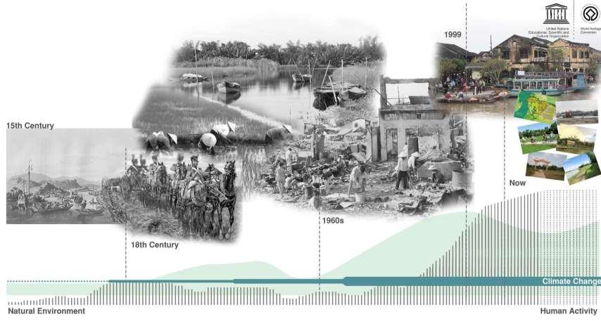
This project has had a profound impact on my landscape design thinkiing and has significantly influenced my career as a landscape architect. The field of landscape architecture is inherently dynamic, playing a pivotal role in shaping our environments and livelihoods. This study aims to unveil effective research for design by identifying key principles that can enhance the resilience of rapidly changing flood-prone landscapes.
Throughout this thesis project, I have come to recognize the paramount importance of prioritizing natural features in landscape design. It is also crucial to acknowledge that every society possesses its own coping mechanisms for dealing with natural disasters. By integrating these insights, we can create sustainable landscapes that are nurtured and maintained by local communities, supporting their way of life.
Water plays a fundamental role in shaping not only the visual quality but also the livelihood and future biodiversity of an area. Through this project, I am laying the groundwork for understanding the significance of water and landform in every landscape project, thus initiating important features to cultivate landscapes for the future.
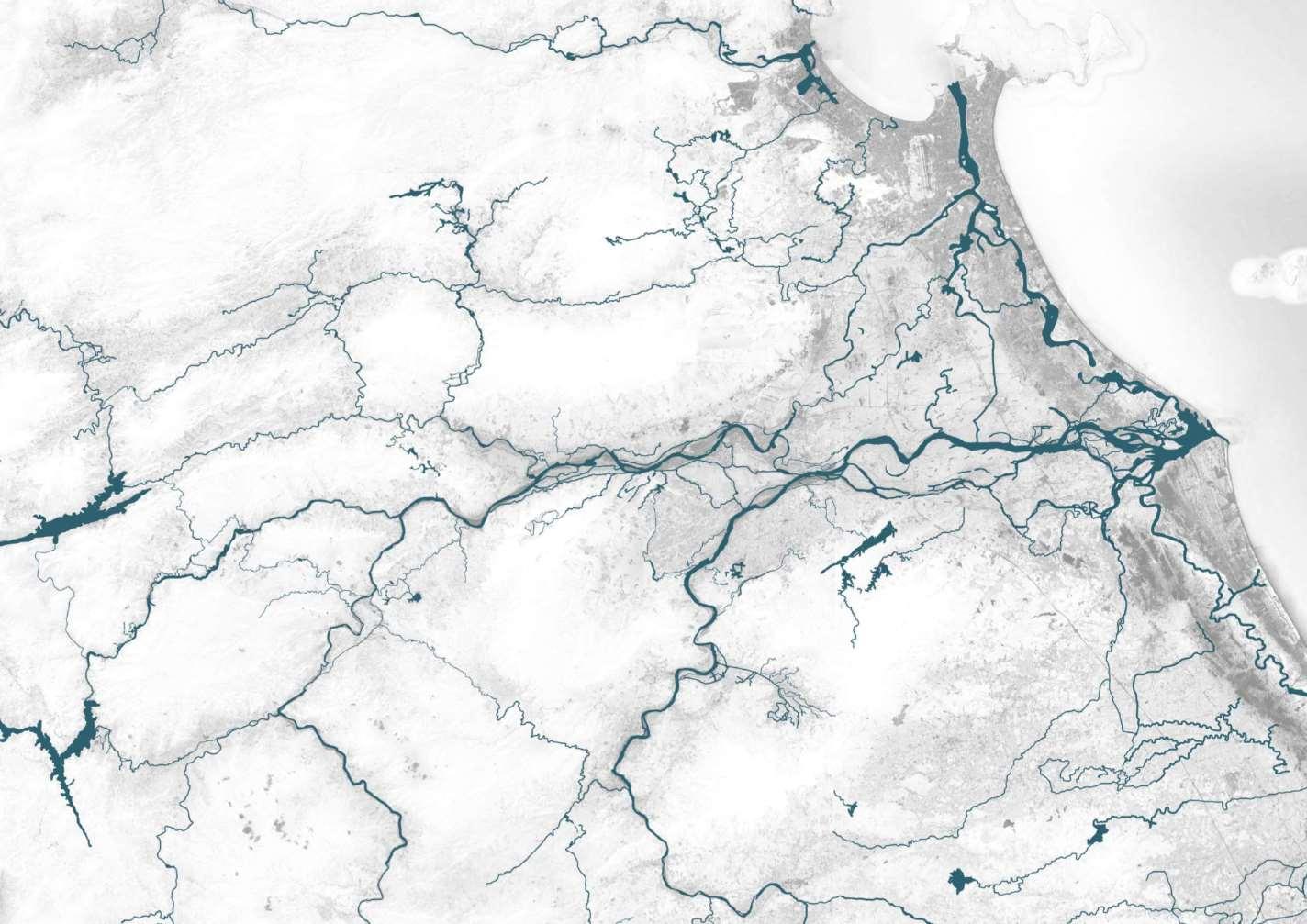
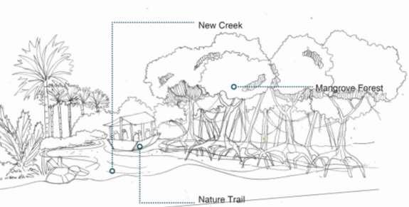
Revert! – Hoi An, VNM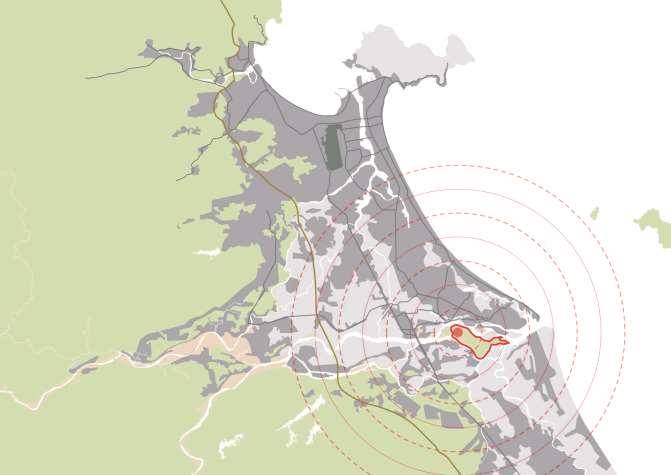
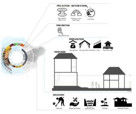
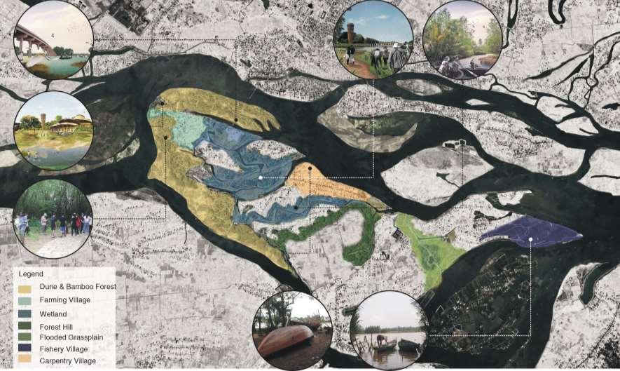
The site is situated on Cam Kim Island, located in Hoi An, Vietnam, within the middle of an estuary This natural area has demonstrated resilience against annual natural disasters Since the 13th century, locals have inhabited the island, primarily working as farmers and fishers The island faced a significant flood in the ` , prompting the community to develop social resilience strategies tailored to their landscape Over time, local awareness of natural disasters has evolved into a rich local wisdom that cultivates a productive landscape on Cam Kim Island
However, the impacts of climate change have begun to disrupt livelihoods, leading to more frequent flooding events in the area. To design a landscape more resilient to flooding, it is crucial to understand local knowledge of disasters, spatial information, and resilience principles. By integrating these insights, resilience landscape design principles can be developed to enhance the island's ability to withstand and adapt to future challenges posed by climate change and natural disasters.
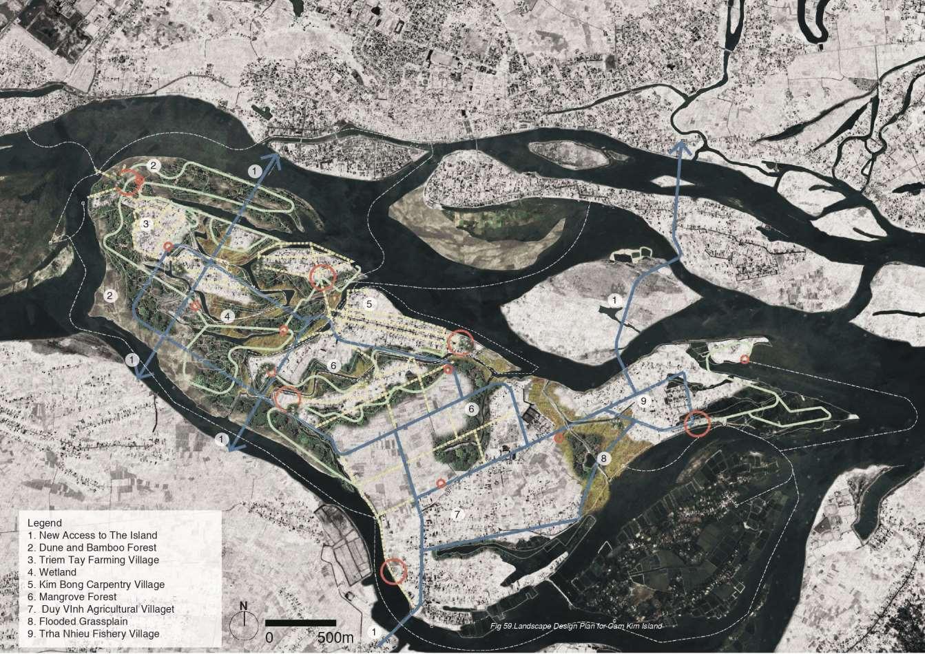
Landscape Design Plan
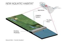
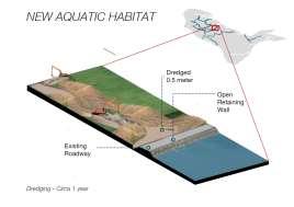
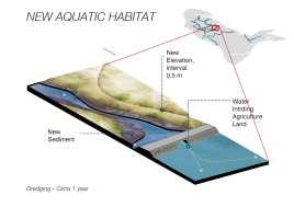
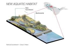
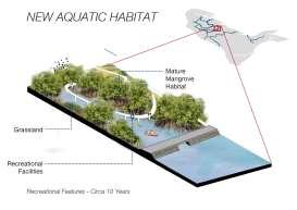
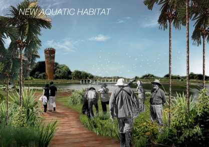
A new aquatic habitat is set to be constructed within the village by expanding the water area to encompass parts of the island. With the existing paddy fields no longer productive, wetland construction presents an opportunity to enhance future biodiversity by allowing water to infiltrate the island. This initiative holds the potential to benefit the local community by creating additional fishing areas and transitioning the community's identity from primarily agricultural to more focused on fishing activities.
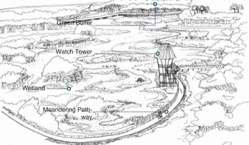
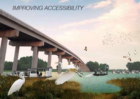
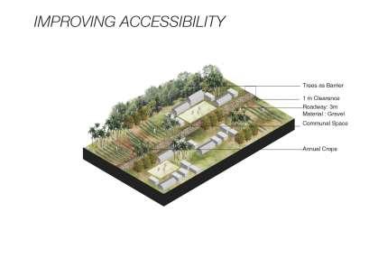
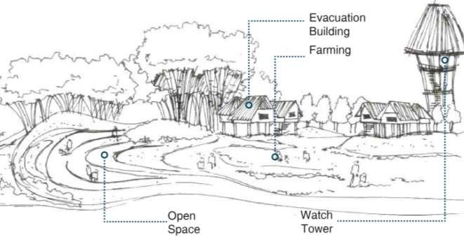
Improving accessibility
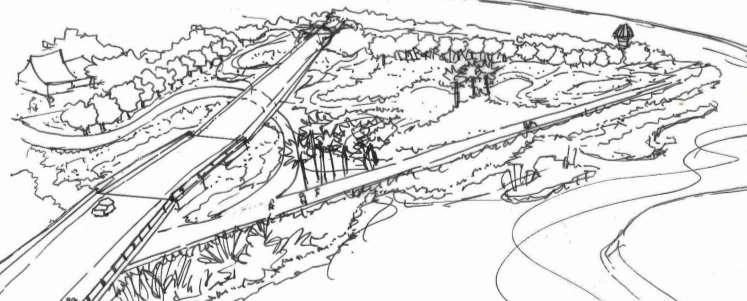
Improving accessibility is crucial for the site, particularly in floodprone areas. The addition of more access points, pathways, and boardwalks will not only enhance safety but also entice both locals and visitors to discover and admire the village's natural charm. Significant enhancements are required along the main accessibility routes. Preserving and constructing more pathways and boardwalks in the natural areas will be essential.

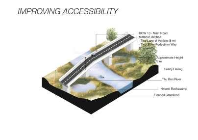
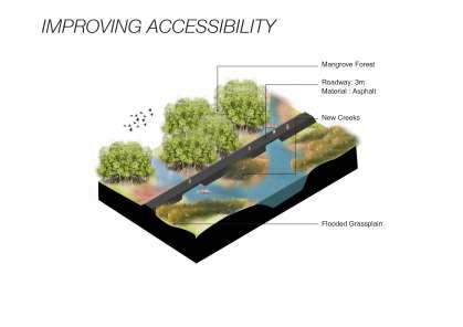
Improving accessibility is crucial for the site, particularly in flood-prone areas The addition of more access points, pathways, and boardwalks will not only enhance safety but also entice both locals and visitors to discover and admire the village's natural charm Significant enhancements are required along the main accessibility routes Preserving and constructing more pathways and boardwalks in the natural areas will be essential
From idea to visualisation of improving accessibility
Possibly evacuation points
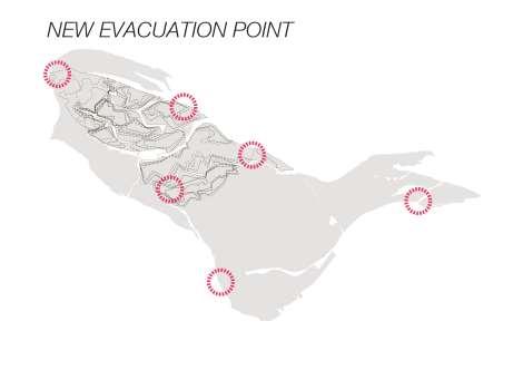
Future watch tower construction
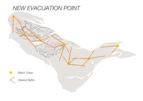
When heavy rain blankets the region, water levels rise, exacerbated by the gravitational pull of the full moon's tidal influence, which also elevates seawater levels. The disparity in mass between fresh and saltwater exacerbates the situation, causing water to bottleneck in the estuary. Consequently, water levels surge rapidly in the village.
If this scenario persists, a large-scale evacuation becomes imperative. Employing a medieval method of alerting locals, such as burning the watchtower, proves effective, especially considering the lack of electricity during such events Once the tower is ablaze, it serves as a direct signal to the mainland, prompting the immediate dispatch of a rescue helicopter to facilitate the evacuation process Looking ahead, a community-designed, cradle-to-cradle watchtower could be developed to safeguard the village's future
From idea to visualisation evacuation plan
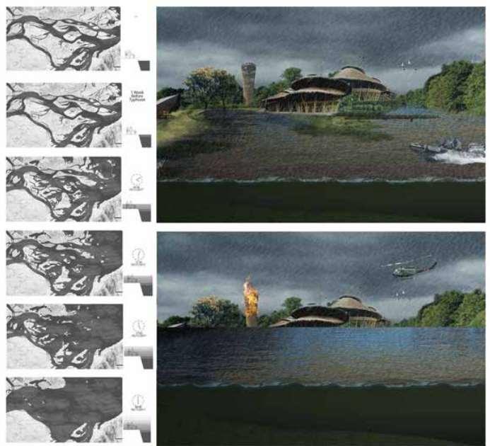
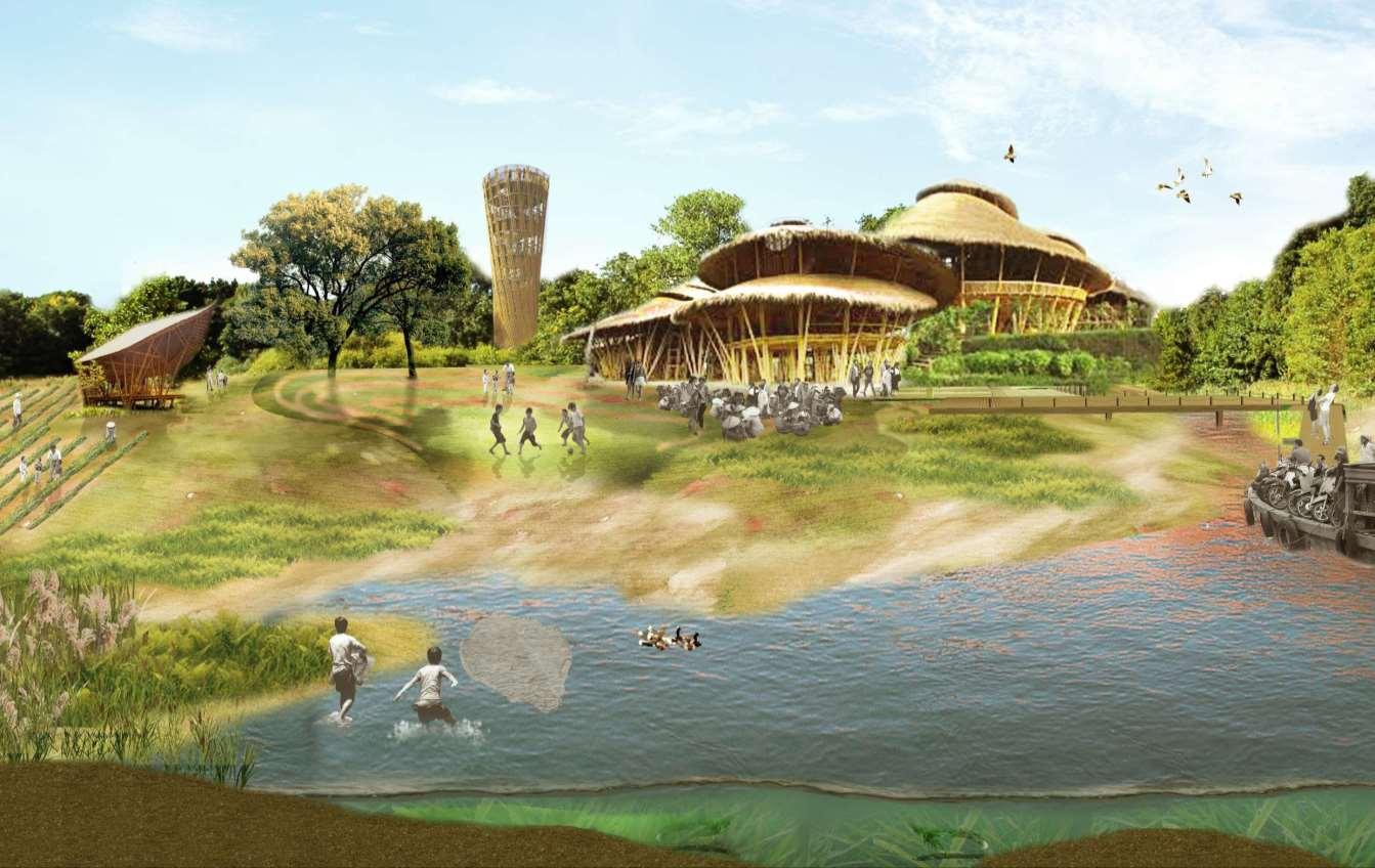
This visualisation depicts the landscape design during the dru season, highlighting the various activities and interaction and the local community at the new evacuation point.
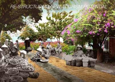
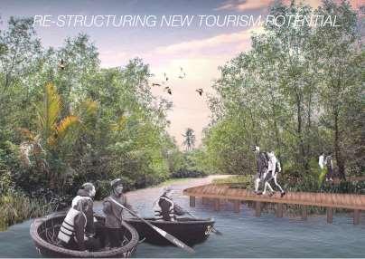
Finally, the village can undergo a transformation, enhancing its landscape character. By establishing additional nature reserves on the island, greater biodiversity can flourish, fostering a resilient community landscape while preserving its existing natural charm.
Once the landscape character is solidified, the local community stands to gain from the emergence of new forms of tourism for the island, ultimately enriching the well-being of the community.
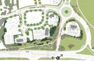
Suffolk business park – Bury St. Edmunds, UK
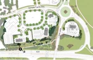
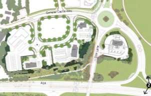
Suffolk Business Park, covering 57 acres, stands as a burgeoning commercial development area situated in Bury St. Edmunds. During my tenure at Sheilsflynn Asia, I was tasked with enriching the landscape quality of Suffolk Business Park, positioning it as an integral component of the green infrastructure extension of Bury St. Edmunds City. To achieve this goal, special attention was directed towards the Roadside plots adjacent to the A14, where the implementation of extensive woodland planting served as a visual mitigation strategy. This approach not only enhances the aesthetic appeal but also fosters the maintenance of continuous wildlife links and habitat corridors, thereby contributing to the overall ecological sustainability of the area.
This project holds immense value for me, as it taught me that design is a process of "suturing" ideas together. I gained insight into how each country has different approach to refining the landscape designs to meet client criteria. Throughout this project, I probed into understanding the process of creating Environmental Impact Assessment reports and Landscape Visual Impact Analysis reports. This method broadened my perspective, emphasizing the importance of considering not only the site itself but also its surrounding landscapes in the masterplan for the far future to ensure how good the design will work in the practice.
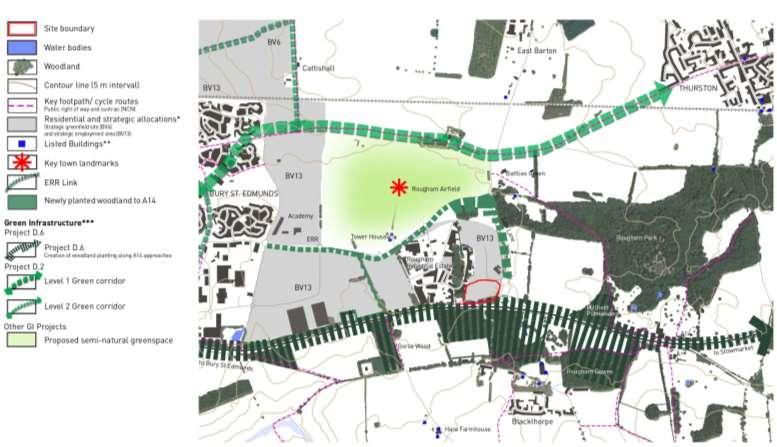
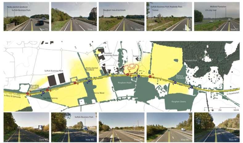
The landscape development of the roadside plots at Suffolk Business Park is closely aligned with Project D 6, which focuses on the orientation of the A14 road development and incorporates woodland planting to create diverse habitat mosaics along the corridor The planting strategy involves a mix of species such as pine, birch, and oak, with an emphasis on utilizing clear-stemmed specimens This approach aims to enhance visual permeability while contributing to the creation of a rich and varied ecosystem along the roadside, promoting biodiversity and ecological sustainability.
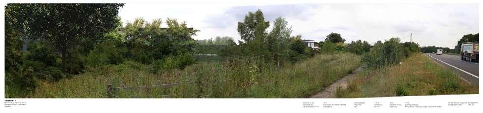
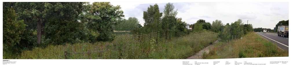
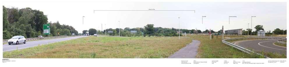
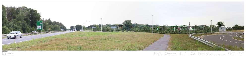
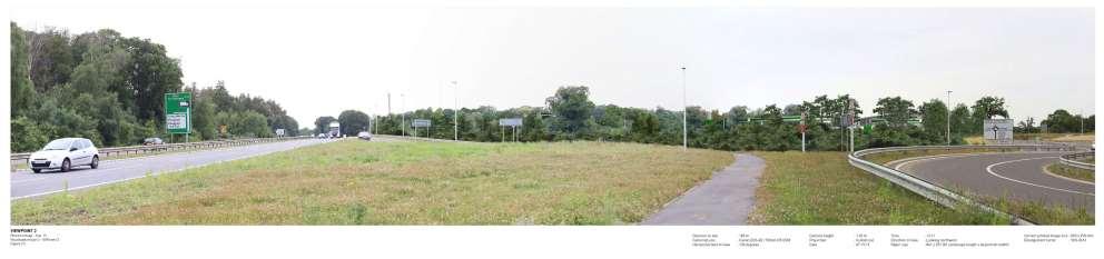
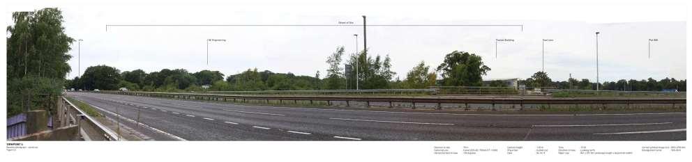
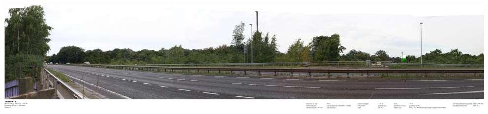
To evaluate the visual corridor permeability from the A14 to Suffolk Business Park, we conducted a thorough assessment using photos captured from Google Earth. Several viewpoints were identified, and three were selected based on their high sensitivity to the overall visual receptor. Later, these viewpoints were studied to understand the magnitude of changes so a future visual effects magnitude will be mitigate.
An extensive analysis was undertaken, weaving together elements including existing development plan, potential view corridors, structural landscape opportunities, and the assessment of current green infrastructure. This thorough investigation aimed to identify key features and strategic opportunities within the site to inform a strategy that promotes sustainability and enhances the overall landscape quality of Suffolk Business Park.
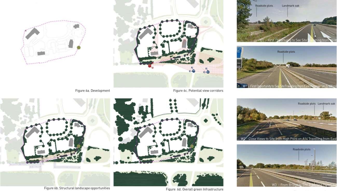
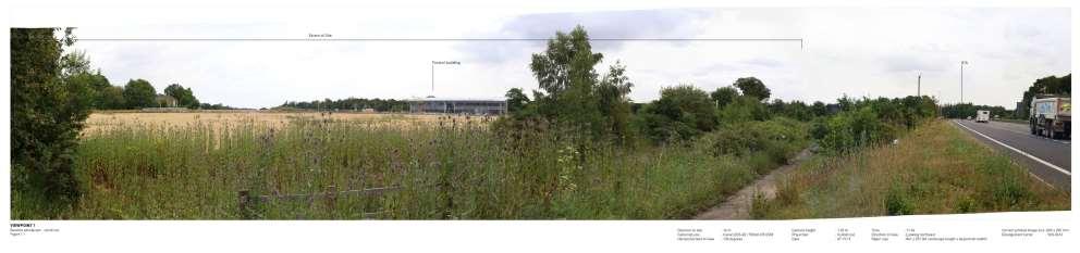
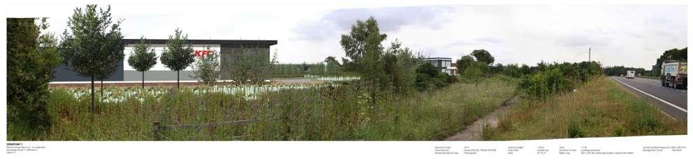
The visualisation study illustrates visual permeability of the design from A14 to the frontage of roadside plots.
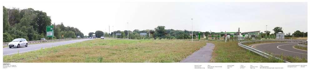
The visualisation study illustrates visual permeability from A14 to gas station as part of roadside plots.

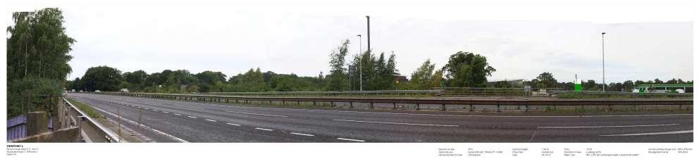
The visualisation study illustrates visual permeability from A14 to the frontage of roadside plots.
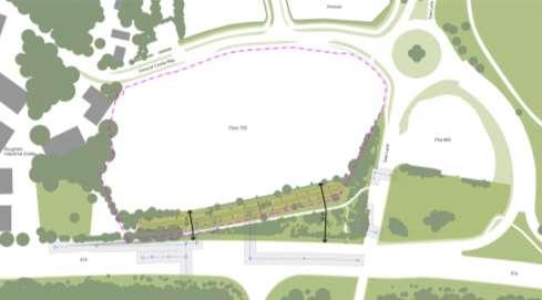
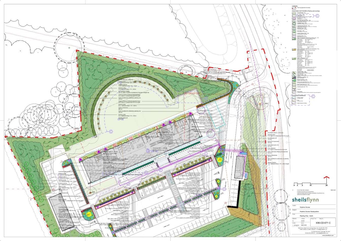
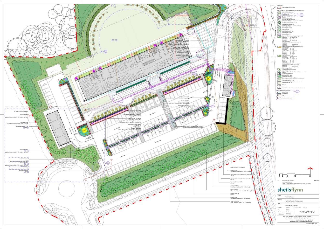
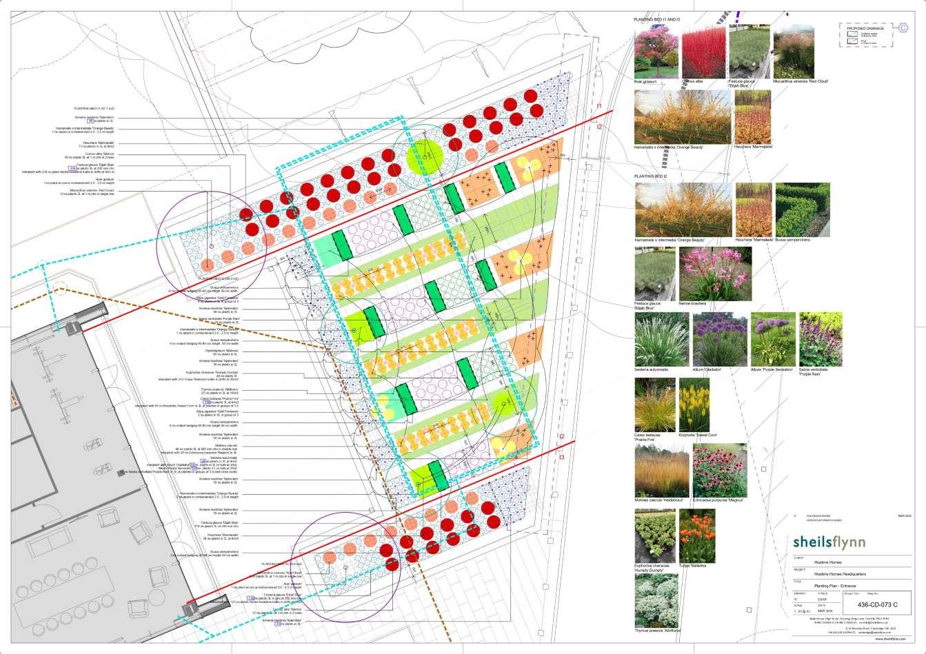
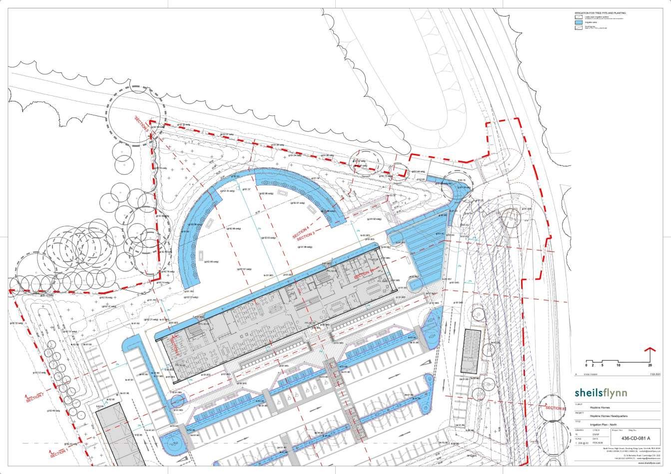
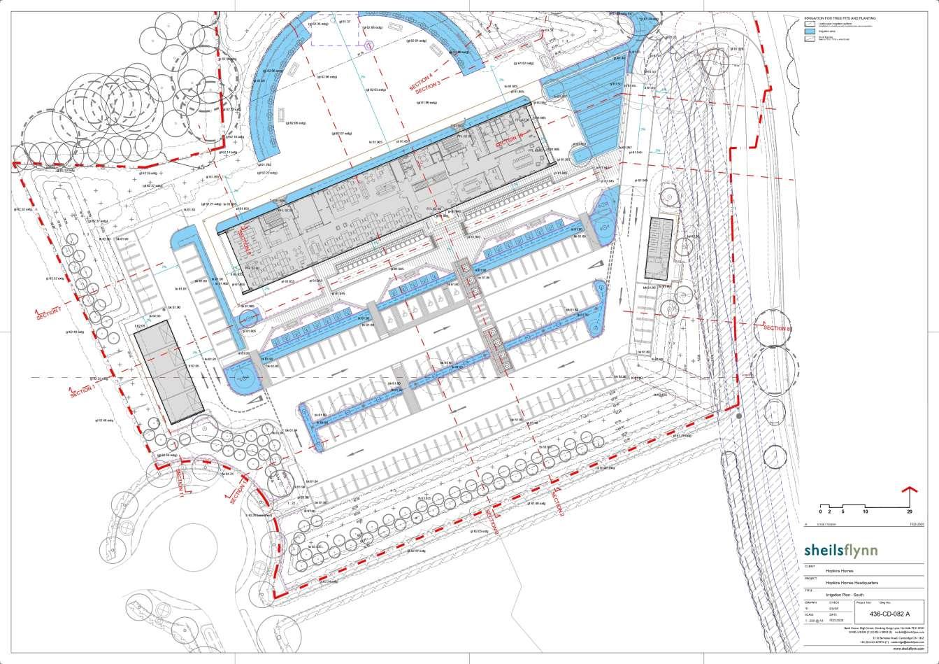
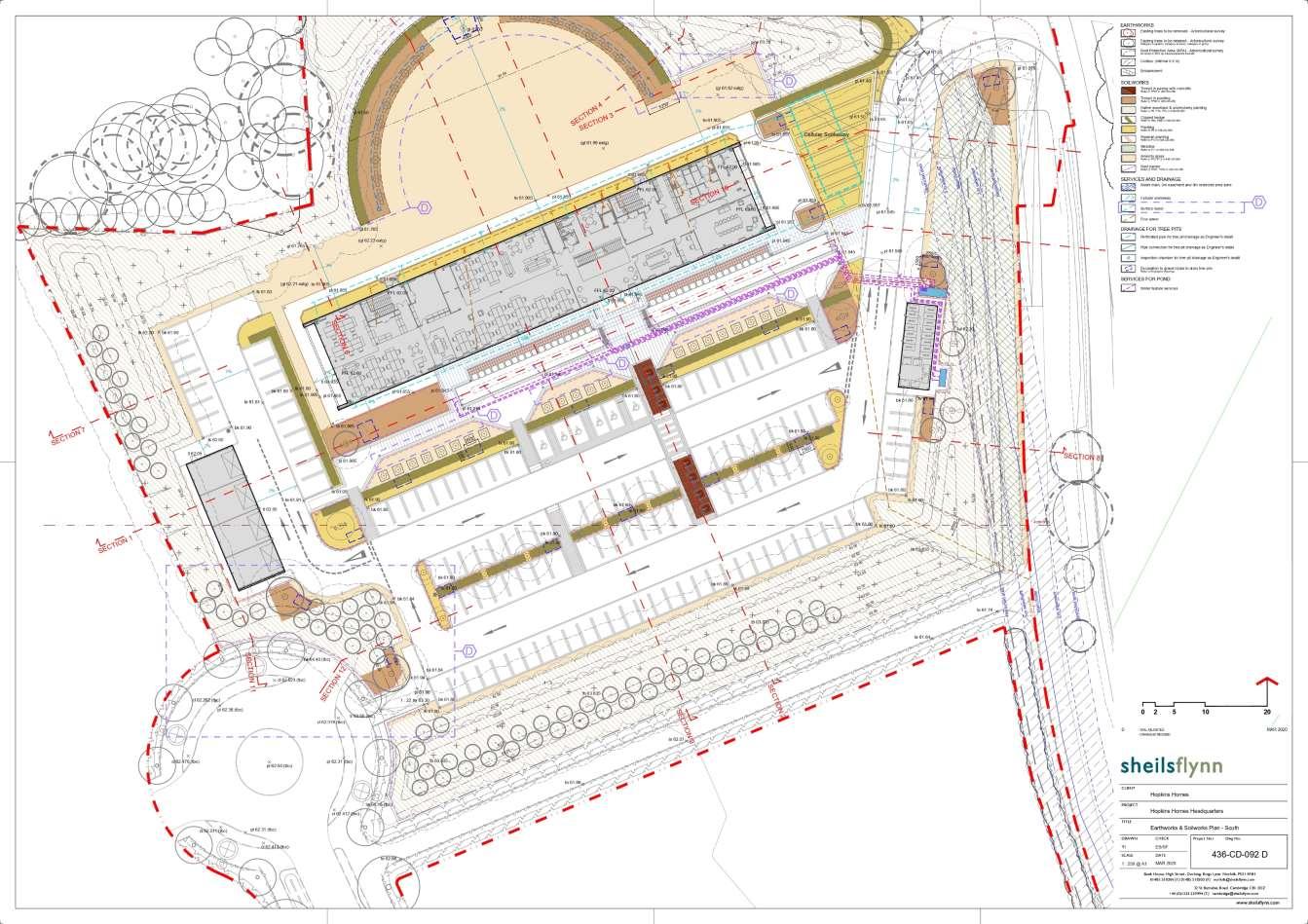
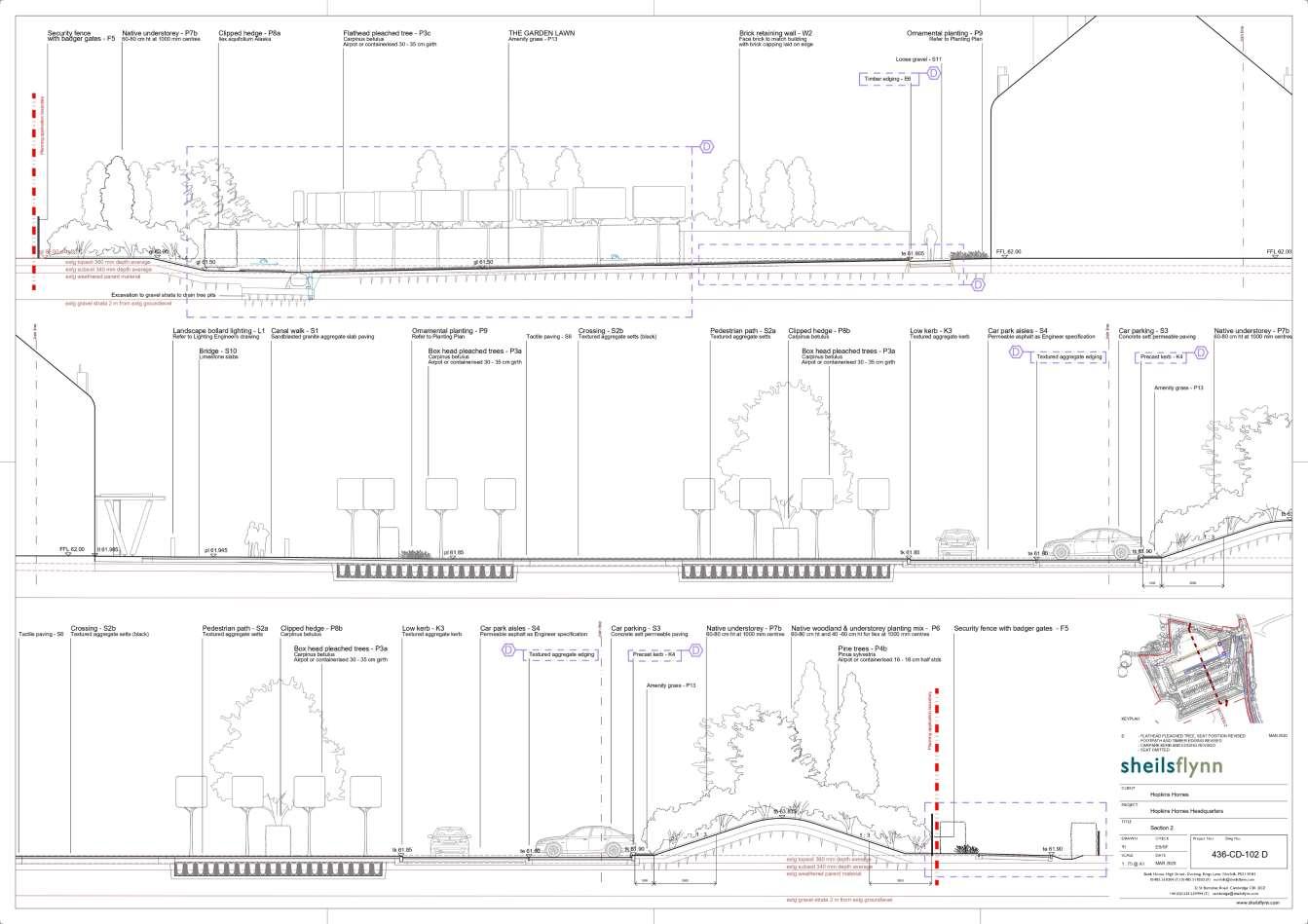
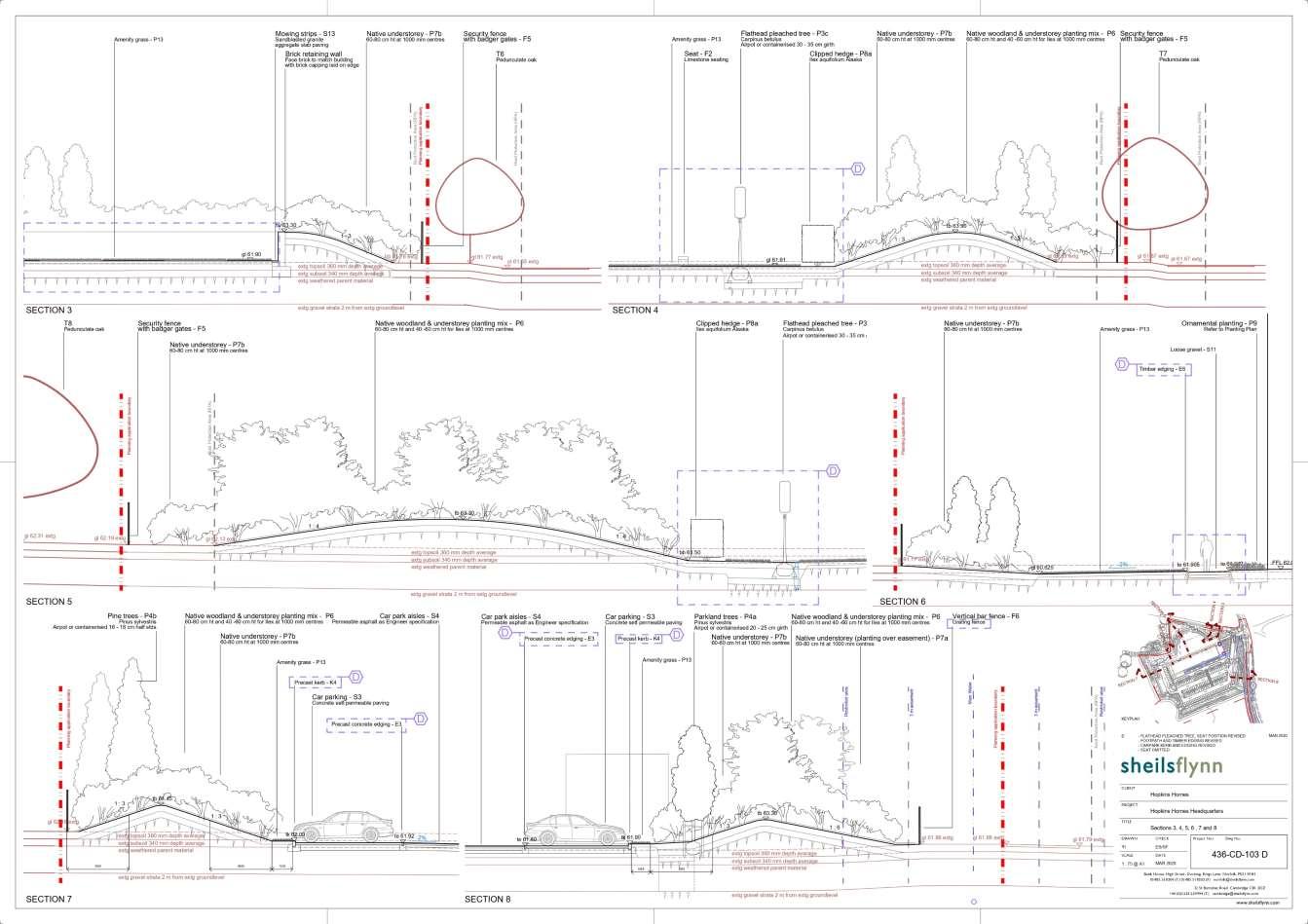
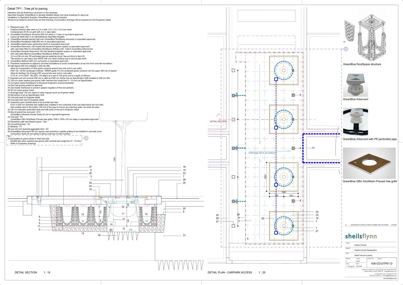
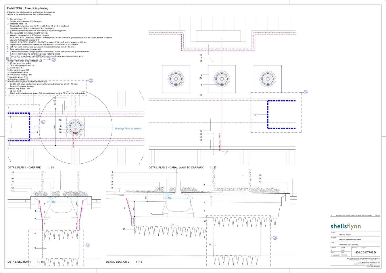
Hopkins homes (Suffolk Business Park Plots) Bury St. Edmunds, UK
Hopkins Homes planned to establish a new headquarters near junction 45 of the A14 roadway, featuring a 2,201 sqm building designed to accommodate 125 car parking spaces with charging points, showers, lockers, cycle storage, and integrated landscaping for their employees. My previous office was commissioned by the client to design this headquarters as part of the Suffolk Business Park (SBP) development. To align with the building design, we proposed a landscape that seamlessly integrated with both the outdoor spaces and the building interior, ensuring enjoyment and visual harmony from every perspective. As part of the landscape planning of SBP, we proposed the creation of woodlands to buffer the new development. At the building entrance, water features and ornamental plantings were incorporated to enhance the overall greeneries and aesthetic.
This project involved extensive experience in construction drawings, where I managed the design phase from strategic planning (referenced in the project above) to the detailed development of landscape plots within the SBP project. The emphasis during construction was predominantly on plantings, as the client prioritised understanding the investment on softscape element first. Consequently, we provided comprehensive construction drawings related to the planting desing on site. This opportunity allowed me to apply my knowledge of plantings, tailored to tthe UK site context, which has been particularly rewarding as the project moves towards construction

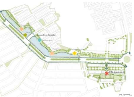
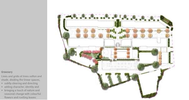
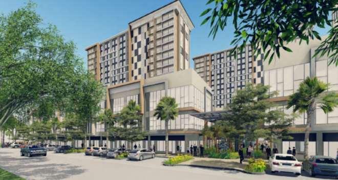
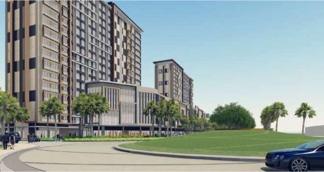
Apartment R7A Swan City Lavon – Tangerang, IND
The landscape of the R7A Apartment complex plays a vital role in the Swan City Green Corridor, serving as a focal point within the walkable sequence of green activity nodes that define this livable city. Positioned at the terminus of the green corridor, the masterplan presents a unique opportunity to create a distinctive landscape.
A thorough analysis of accessibilities, spaces, and greenery was conducted as part of the project, aiming to provide a lush green tropical outdoor experience. This endeavor provided valuable insights into the emerging trend of high-rise residential development in Indonesia. With residential spaces becoming more vertical, there is a growing need to develop landscapes, even in limited spaces such as rooftops, that are both beautiful and green. This ensures the creation of living sanctuaries where residents can engage in both daily living and recreational activities.
Moreover, this project facilitated collaboration with other designers, including architects and civil engineers, highlighting the importance of interdisciplinary teamwork in creating vibrant and sustainable urban environments. Planting strategies for the site must carefully consider the limited planting area to optimise biodiversity in between buildings and greeneries

Site analysis
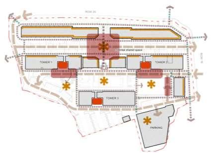
Landscape zones


Connections
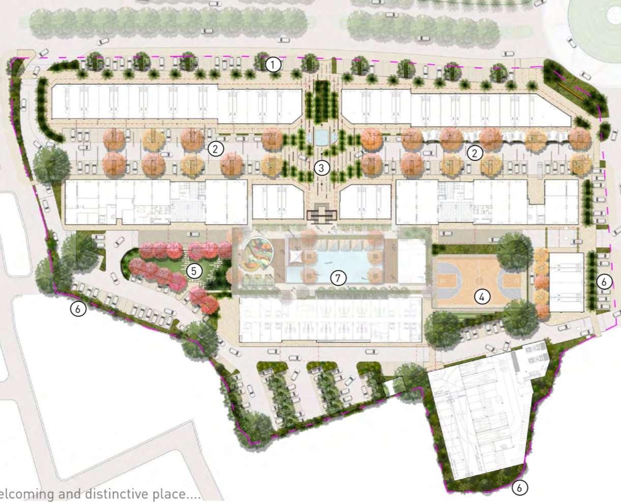
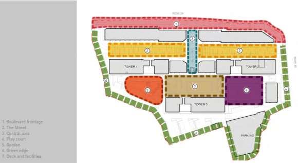
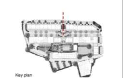
Overall Plan
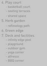
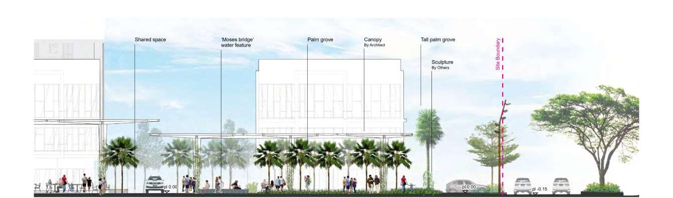
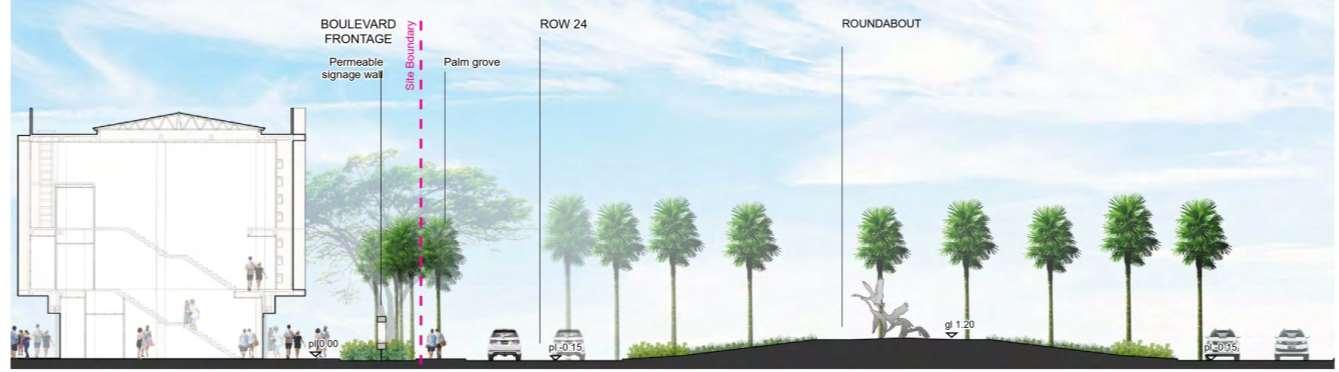
DETAIL PLAN – Boulevard frontage
Avenue trees extend across the boulevard, creating a forecourt to The R7A shop-houses. Next to the roundabout, groups of palms and elegant signage walls frame views towards the frontage

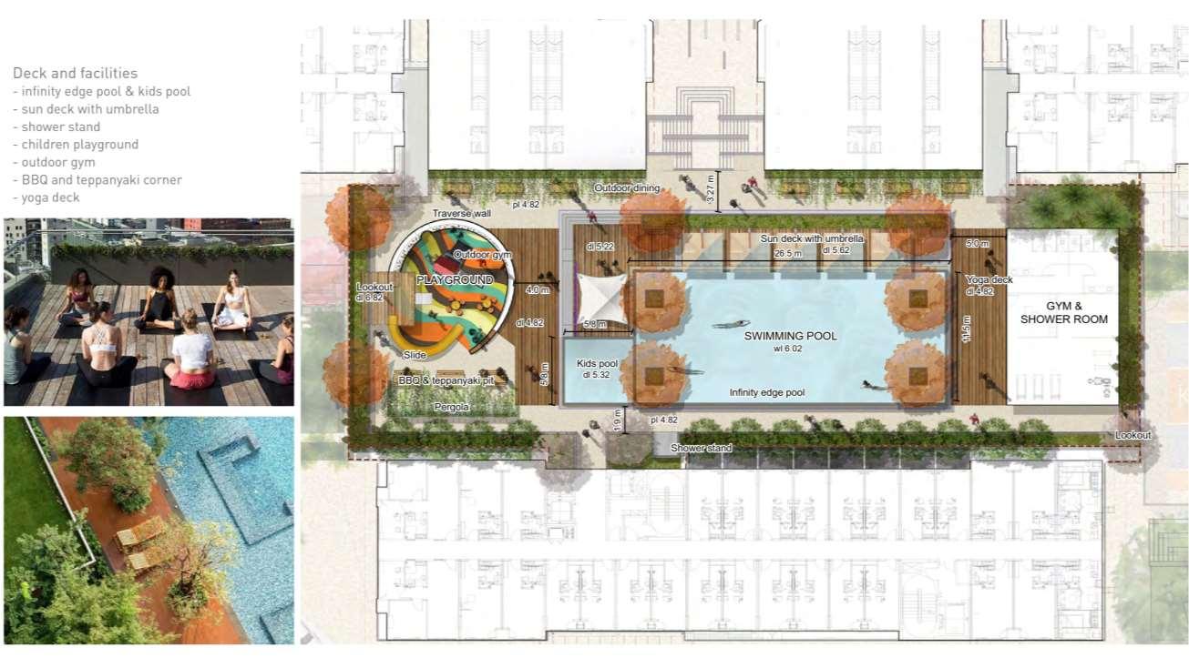
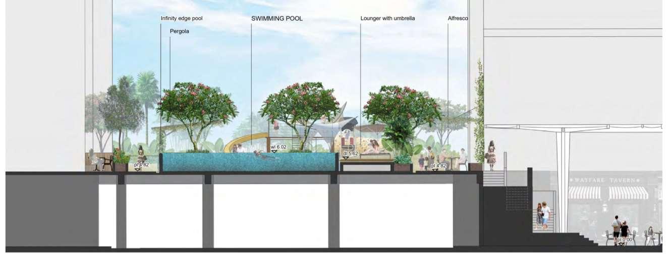
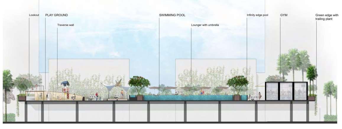
DETAIL PLAN – Deck and facilities
Pool deck, terraces, and play with overlooks to the play court, garden, and central infinity pool

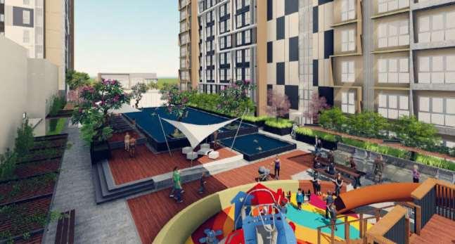
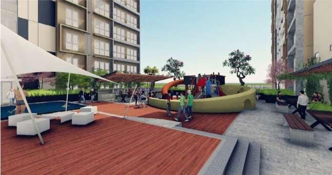
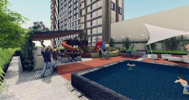 Visualisation of deck and facilities
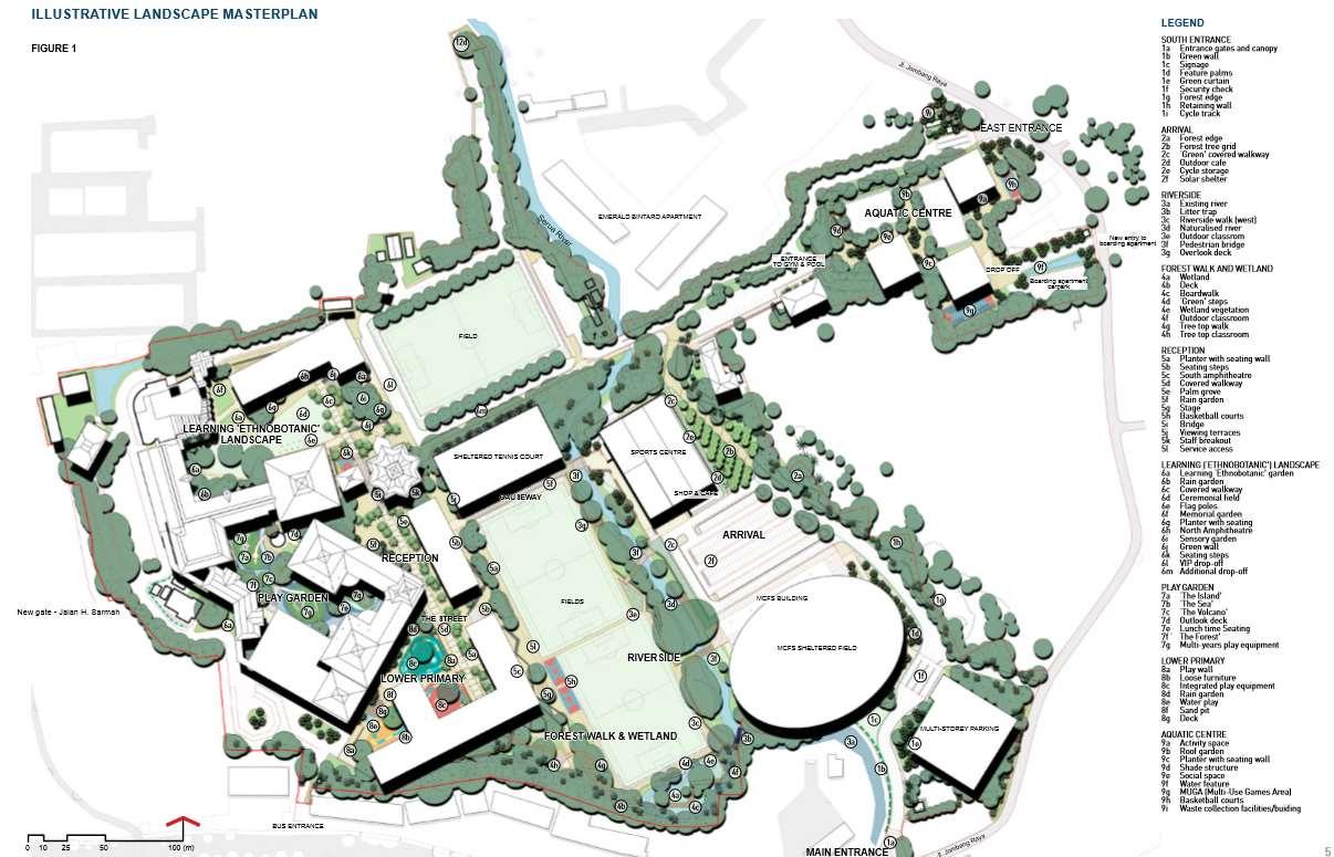
British School Jakarta – Bintaro, IDN
The British School of Jakarta commissioned PT. Sheilsflynn Asia to develop a comprehensive green landscape master plan for the school campus. This master plan evaluated the entire campus, offering a series of options to achieve its long-term objectives of establishing an external environment with vital outdoor spaces. These spaces are crucial in creating an attractive, healthy, and sustainable environment, fostering a natural-learning area for students. The project comprised three key outcomes: a site survey and appraisal report, a summary of stakeholder consultation report, and a landscape masterplan report.
Given the abundant greenery within the site context, the analysis began by identifying natural potentials and hazard risks to enhance safety for the pupils. Within this section, excerpts from the appraisal and masterplan reports are provided, accompanied by visualizations and flood analysis. The landscape design principles developed during my master's thesis played an important role in comprehensively understanding the site's design needs. The process began with leveraging existing features such as the river and greenery, which served as major potentials. This led to the selection of appropriate landscape materials and the identification of facilities that could be developed in the future, contributing to the creation of a robust and resilient school environment.
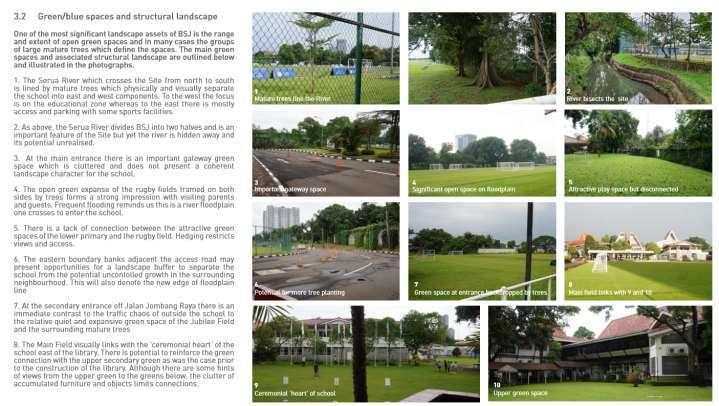
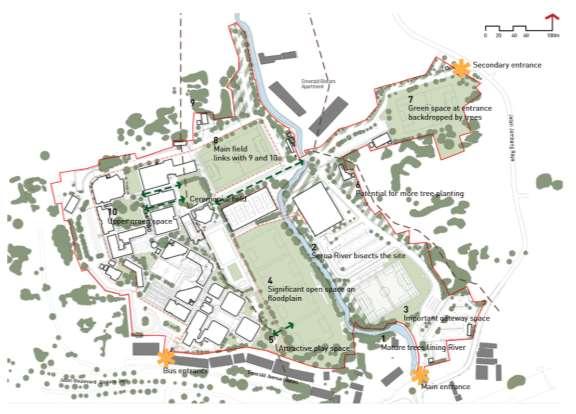
Green/blue spaces and structural landscape
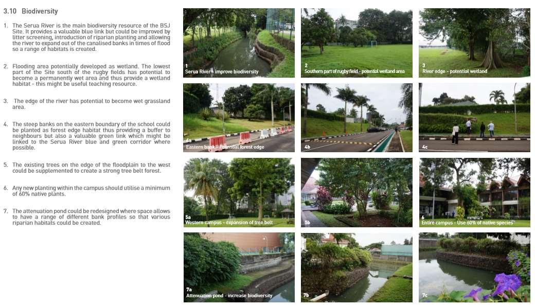
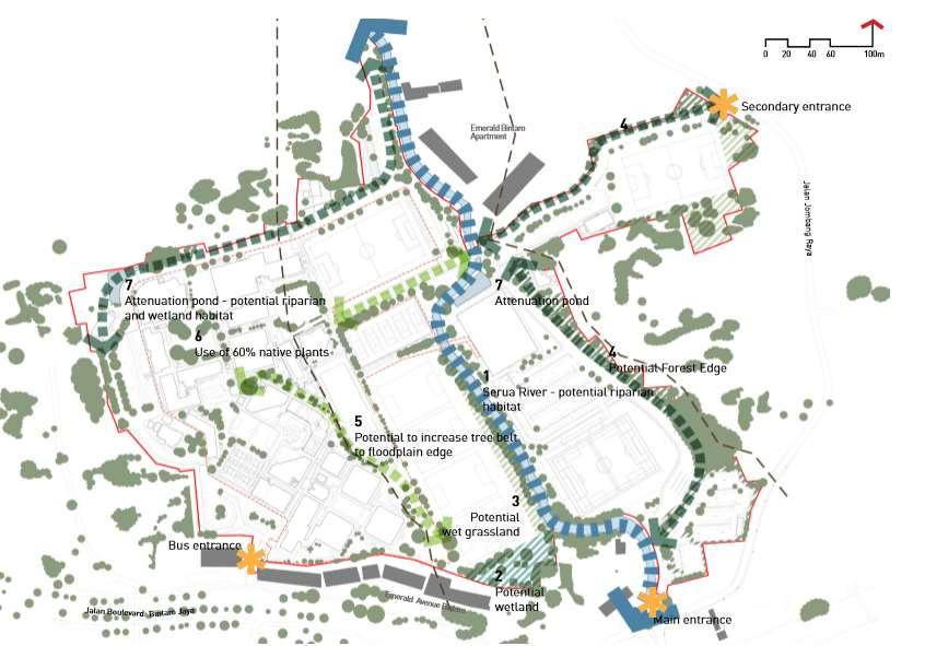
Biodiversity

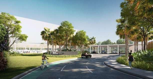
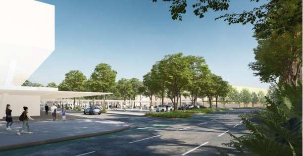
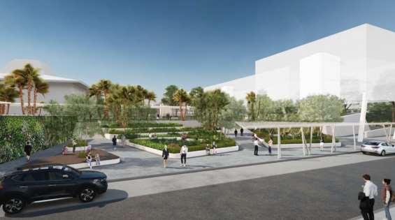
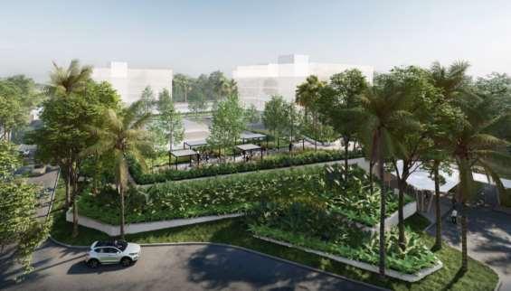 View from main entrance gate leading into the security check
View from newly widened access road - with pedestrian walkway
View from riverside walk to rugby field
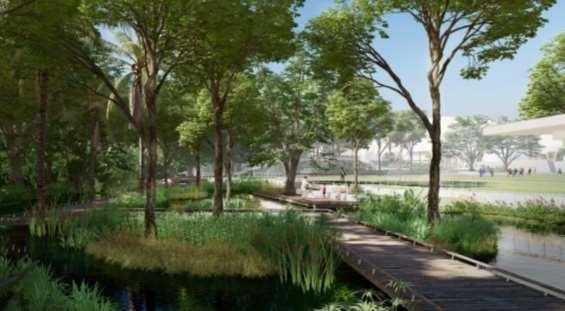
Visualisation of forest walk and wetlands
Visualisation of aquatic complex
View from main entrance gate leading into the security check
View from newly widened access road - with pedestrian walkway
View from riverside walk to rugby field
Visualisation of forest walk and wetlands
Visualisation of aquatic complex
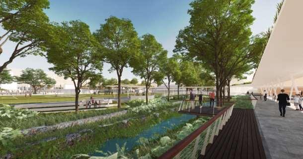
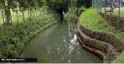
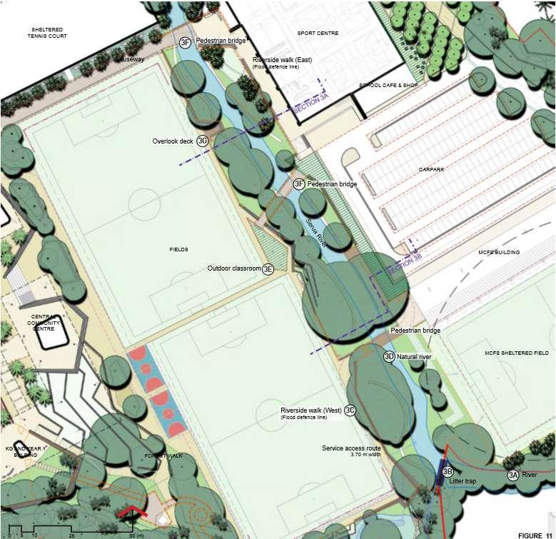
The Serua River divides the BSJ campus into west and east parts. Currently the River is ignored and hidden away whereas it has potential to become a point of focus and a strong feature of the landscape of the school Crossing the River and its floodplain should be celebrated and a daily reminder of how the landform has been shaped
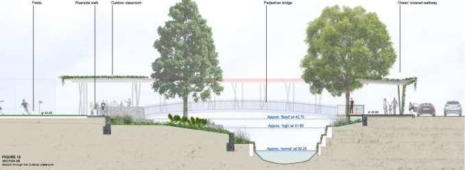
On both banks, new Riverside walks are to be created elevated above the maximum flood level.
On the east side at parent drop off and pick up outlook decks and the new elevated walk will allow views over the River to the school On the west side there will be decks,seating terraces and an outdoor classroom for learning outside A new landmark pedestrian bridge will facilitate better connections between the Sports Fields and the Sports Hall.
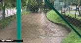
In terms of the River a new litter trap will be installed upstream at the school boundary This will remove the worst of the visible rubbish in the River but of course will not improve water quality
Given this, children will not be brought in contact with the waters edge as is the case with Taman Tebet which is a useful example of what can be achieved in Central Jakarta. Subject to Local Authority approval and the constraints of existing trees there might be opportunities to reduce some of the current channelisation of the river and allow it to expand its banks during high and flood flows
This modest step will attempt to reinstate some of the volume of the original floodplain in order to reduce flooding down stream.
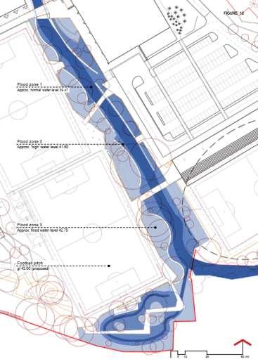
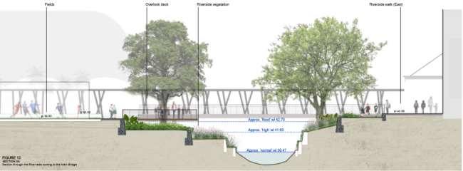
Flood analysis
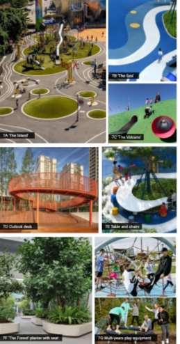
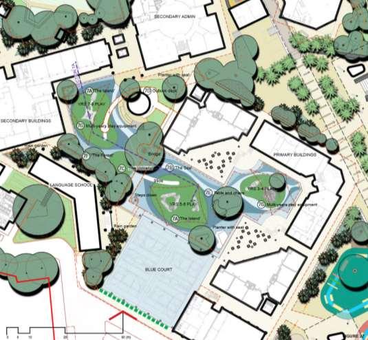
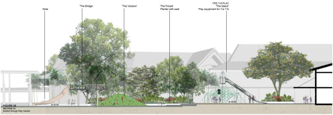
The play garden connects the Secondary and Upper Primary Schools and is designed to offer exciting, interesting, and safe play opportunities for Years 7-8, 5-6, and 3-4 The space extends from the existing basketball court to the play areas in the current Primary layout
The concept for the play area in inspired by an archipelago of Indonesia which has a collection of volcanic islands connected by a surrounding sea The design features three main islands, each equipped with play structures tailored to different year groups. Additionally, a “forest” area provides shaded seating and visually separates the play space from the Modern Language Building. An elevated walkway crosses the playground, offering a unique aerial view of the archipelago while also serving as a covered pathway below This design creates a dynamic and engaging environment that encourages imaginative play and exploration for students of various age group
Email: o.miffa0910@gmail.com +447789084602
Oktaviana Miffatulani (Vivi)