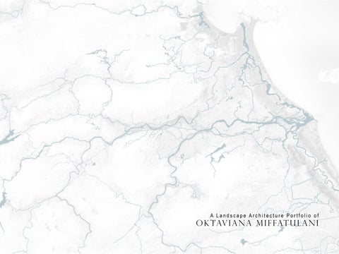
A Landscape Architecture Portfolio of
Oktaviana MiffatulaniEducation
2016 – 2018 M. Sc Landscape Architecture Wageningen University, Netherlands
2010 Landscape Arcihitecture Exchange student to University Putera Malaysia
2008 – 2013 B. Agr Landscape Architecture IPB University, Indonesia
Paper presentation at Arte-polis 5 Conference, Institut Teknologi Bandung - Title:
Historical Riverscape Revelation Case Study: Pontianak, West Borneo
1st winner Undergraduate Student Competition in Asian Cultural Landscape Association (ACLA), Seoul National University – South Korea
2nd Best selected Landscape Student Charrette International Federation of Landscape Architecture (IFLA) Asia-Pacific Region, Tongji University – People Republic of China
3rd winner Landscape Design Competition Eco-Airpport Soekarno-Hatta International Airport PT Angkasa Pura II
2nd Place Recycling Stuff in INDEX Human Ecology IPB
Silver Awards Sharp Idea Awards – Environmental Activity Category
Professional experience
January – October 2022
February 2019 – September 2020
February – June 2018
February 2015 – July 2016
January 2013 – December 2014
Freelance landscape architect
Collaborate with Sheilsflynn Asia and Siura Studio
Landscape Architect
Sheilsflynn Asia
Intern landscape architect
Strootman landschaparchitecten
Landscape designer
AECOM Indonesia
Assistant landscape architect
Townland International
Professional skills
Softwares
Autocad
Adobe Package (PS, AI, ID)
Sketchup
V-Ray & Podium
ArcGIS
Microsoft office
Rhino
Grasshopper
Physical modelling
Handscketches
Language skills
Indonesian Native
English Fluent
Dutch Beginner
“This portfolio highlights the evolution of my design thinking and research over the past six years experience, demonstrating my unwavering passion for integrating landscape design concepts into the design process.”
List of projects
• Charlton Quarry – Keynsham, UK
• Honingham Thorpe – Honingham, UK
• Suffolk business park - Bury St. Edmunds, UK
• Hopkins homes (SuffolkBusiness Park Lot) – Bury St. Edmunds, UK
• Apartmen R7A swan city - Tangerang, IDN
• British school of Jakarta - Bintaro, IDN
• Revert! - Hoi An, VNM
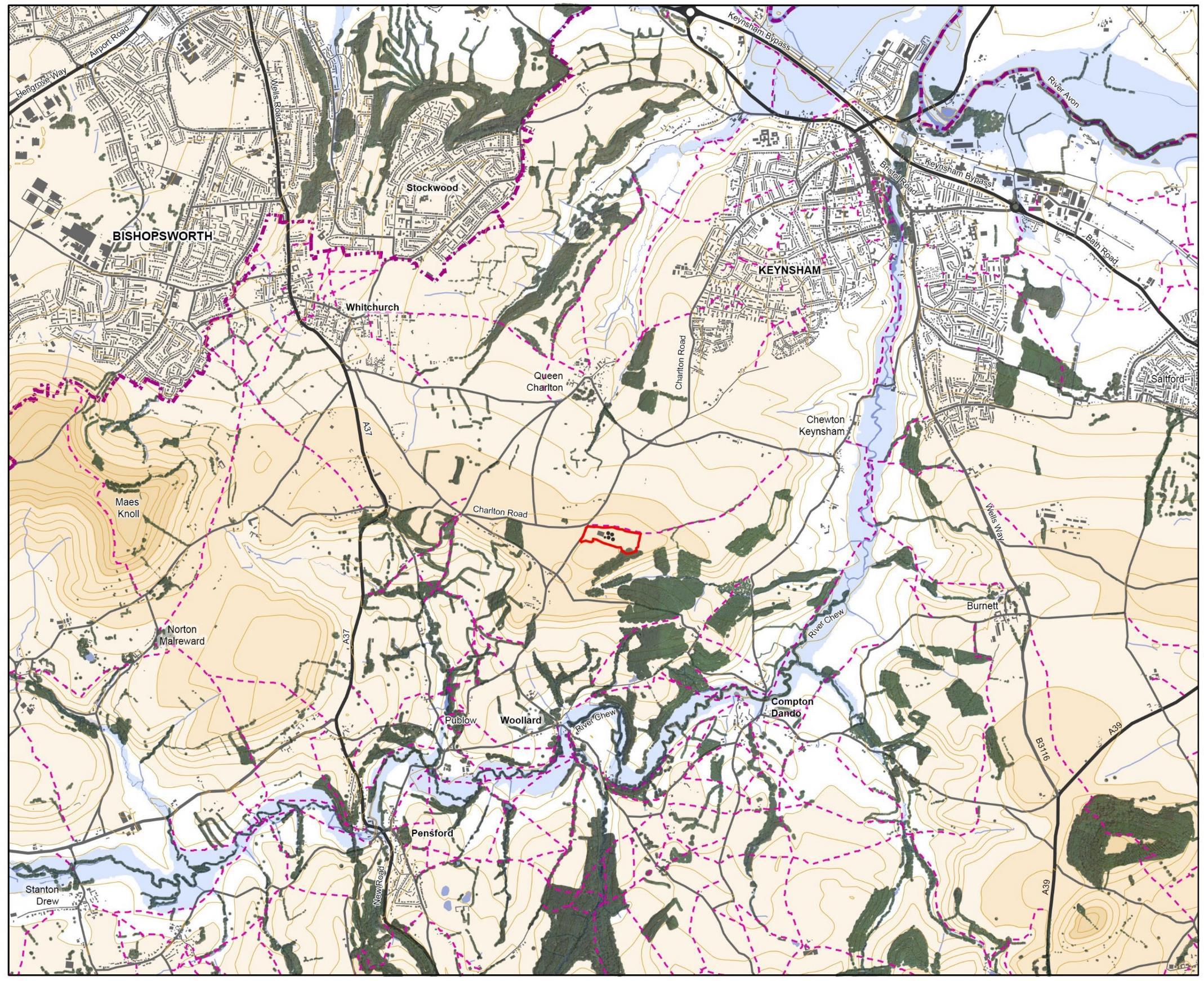
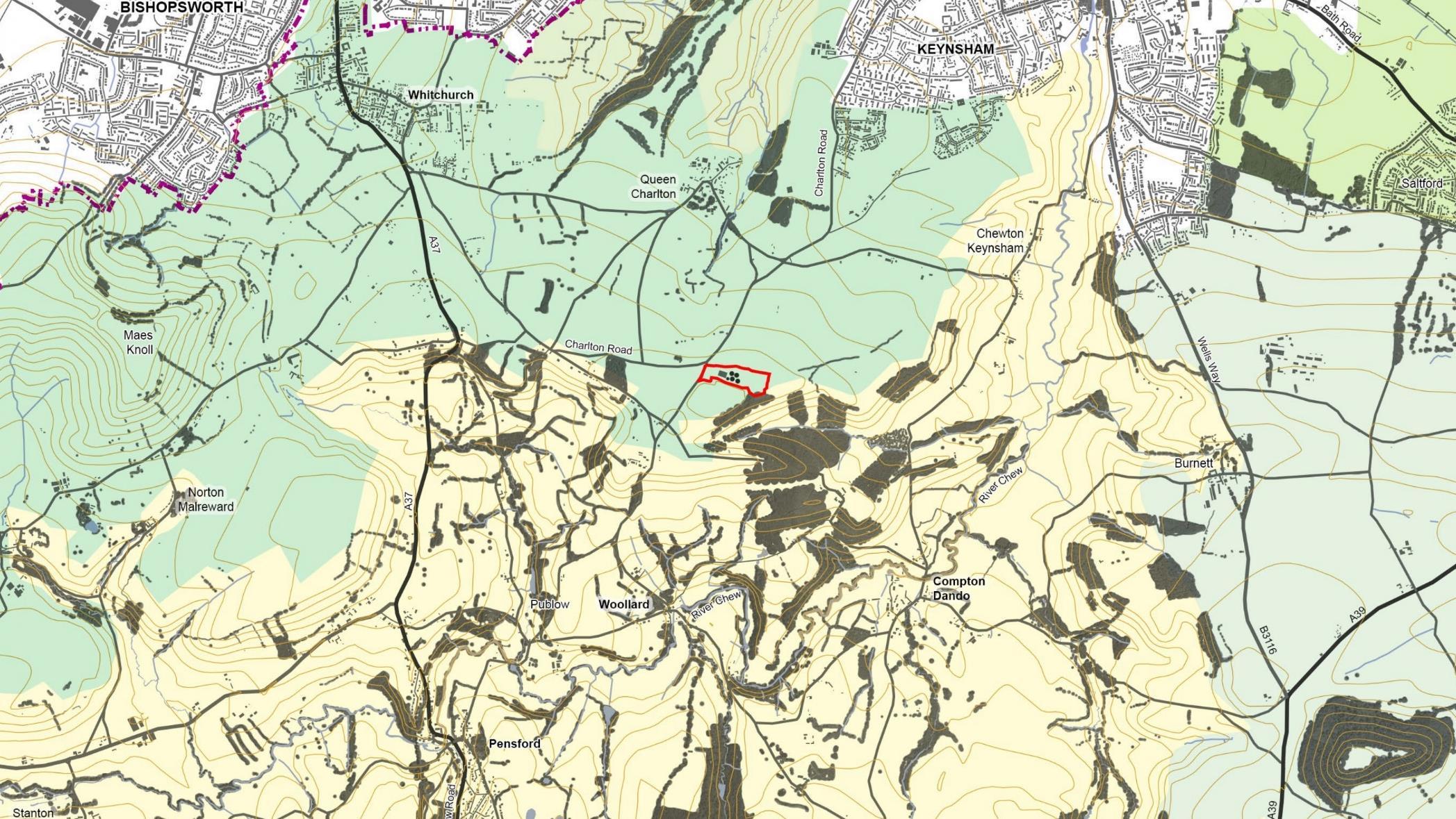
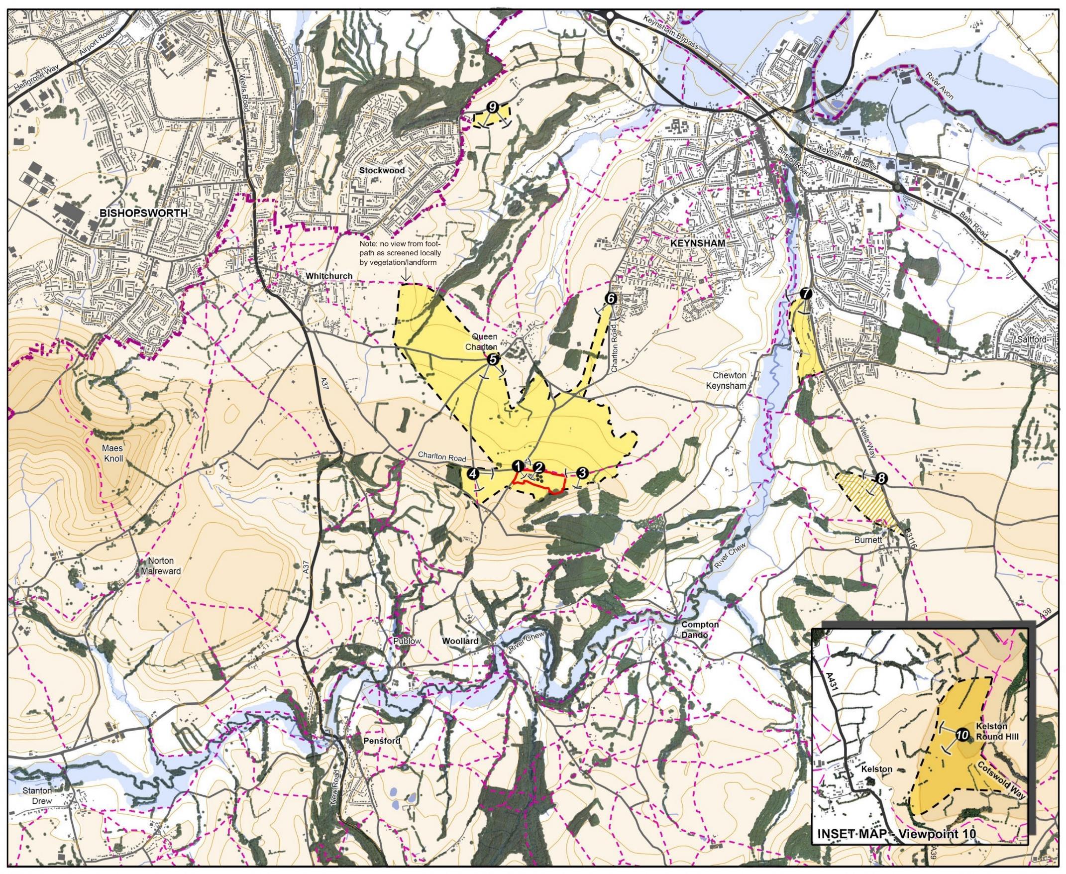
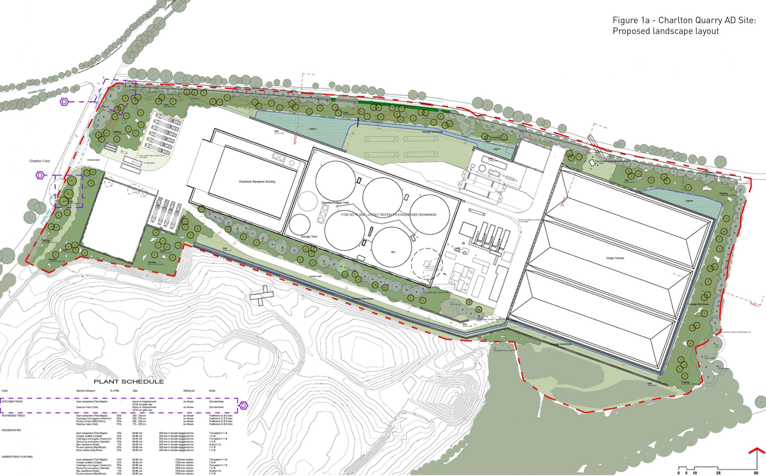
Charlton Quarry – Keynsham, UK
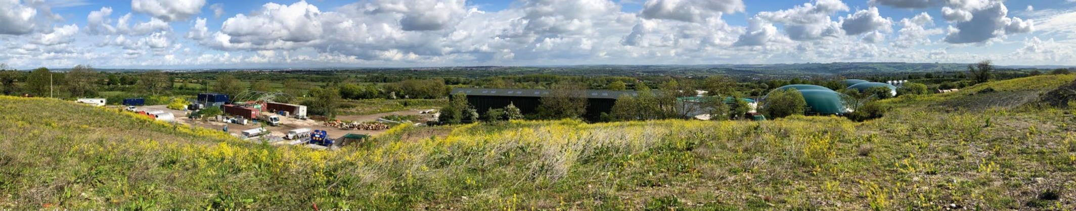
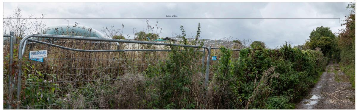
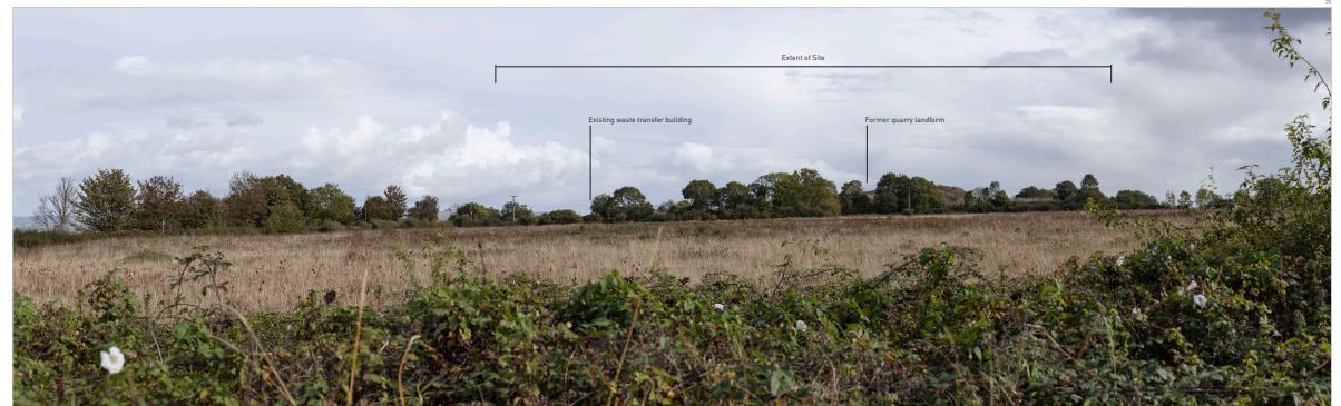
Charlton Quarry site consists of three main area: the incomplete Anaerobic Digestion buildings, the old quarry, and the woodlands. The AD infrastructure has been previously used for composting and stockpiling materials. The old quarry is used as soil transfer site. The woodland area is somehow unmanaged. The intention of this project is to address the material deposited in the quarry to reduce visual impact, provide improvement to surface water drainage, and to enhance the ecological value of the site.
This project is the first project which I learned about Landscape Visual Impact Assessment (LVIA). The process of this LVIA report prepared in parallel with the design process and informed the landscape layout and design of the proposals. Experiencing assessment that identifies the landscape components likely to be affected by development (e.g landscape receptors and visual receptors) is a new type of landscape assessment that I learned during this project. This method broadened my perspective, emphasizing the importance of considering not only the site itself but also its surrounding landscapes in the masterplan for the far future to ensure how good the design will work in the practice.
Landscape
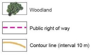
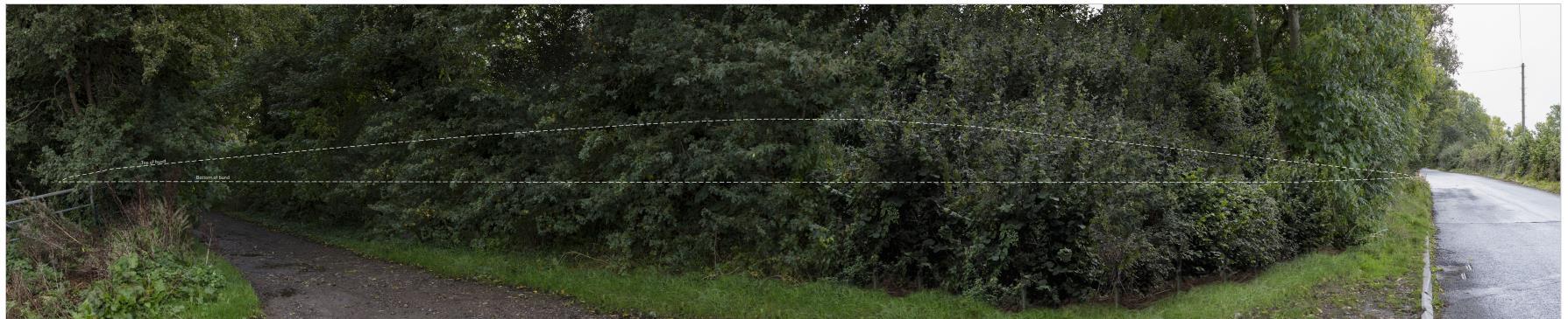
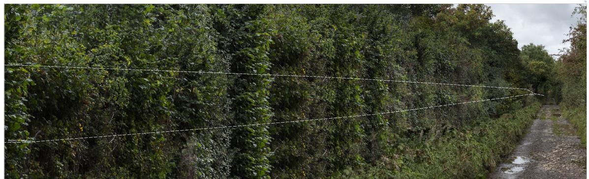
The site has been used for industrial activity for the past 80 years and is currently occupied by an unused incomplete AD Plant. At the northern boundary of the site, a public right of way is connecting Charlton Road with Redlynch Lane.
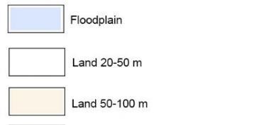
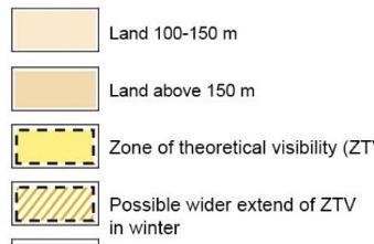
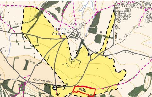
The site laid at the slope of 100-150 m (AOD) and the old quarry site filled and formed artificial mounds with 10-18m higher than existing elevation. In the approximate 1800km radius, Chew River is flowing to the southern part of Keynsham. It give the high sensibility of ecological value that has to be incorporated with the layout of industrial site
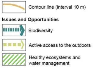
The identification of strategic Green Infrastructure (GI) and opportunities shows that the site development is not directly affect the integrity and strategic GI corridors value. Moreover, a positive contribution and enhancement is possibly proposed to this site development.
An existing healthy ecosystem and water management along the River Chew floodplain shows opportunities for north-south biodiversity corridors. An interpreted green corridors around Wandsyke is also strengthened the wildlife of the site development. The GI strategy takes into account the importance of the area Horseshoe Bats to protect its habitat and flight networks

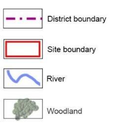
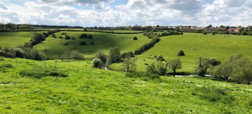
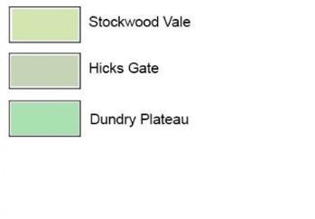
The site is located at the border of Dundry Plateau which sits next to Chew Valley characteristics
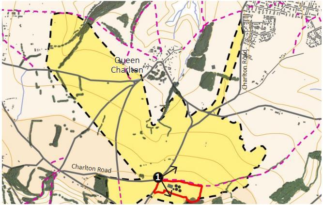
Photo lists:
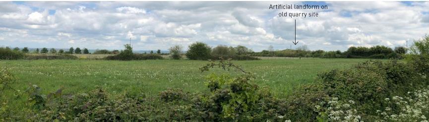
1. View to north from the old quarry site to the south –showing the Chew Valley characteristics
2. Chew Valley near Keynsham
3. Typical landscape characters in the fringe of Dundry Plateau.
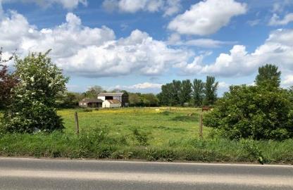
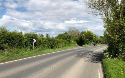
4. Charlton Road.
5. Typical plateau farmland landscape looking to north east towards the old quarry site
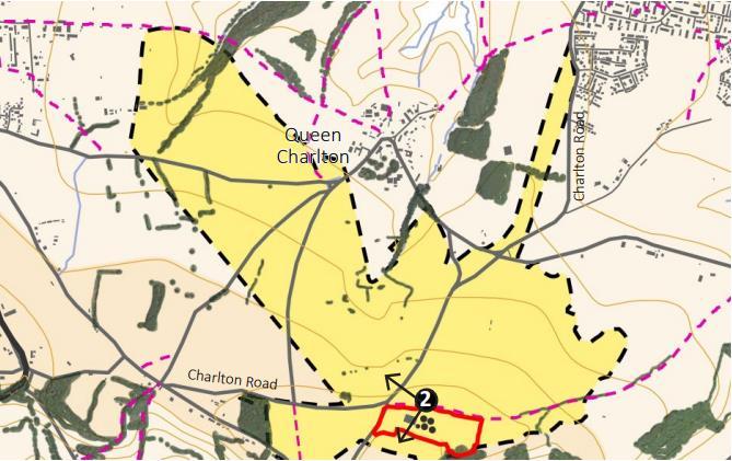
The drawing show the zone of theoretical visibility (ZTV) of the site. Within the ZTV, the people who will experience the view changes and visual amenity are:
• Residents
• Farm traffic and pedestrians using the public right of way
• Motorist, cyclist, and walkers travelling along Queen Charlton Lane, Highwall Lane, Dapwell Lane, Woodlards Lane, and Charlton Road.
The representation viewpoints which have been selected to represent the places from which the proposed development will be seen by these different groups Each viewpoints record the way the site will be perceived by local receptors

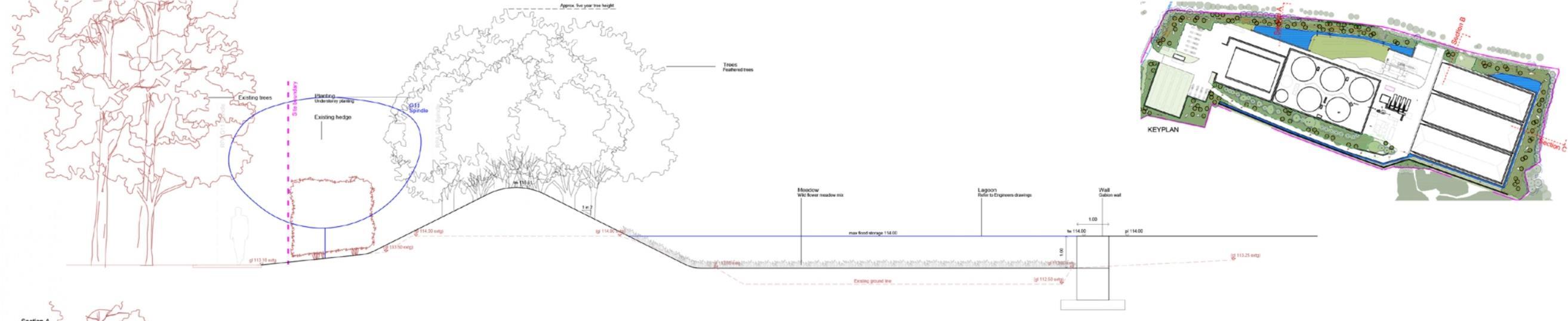
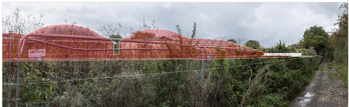
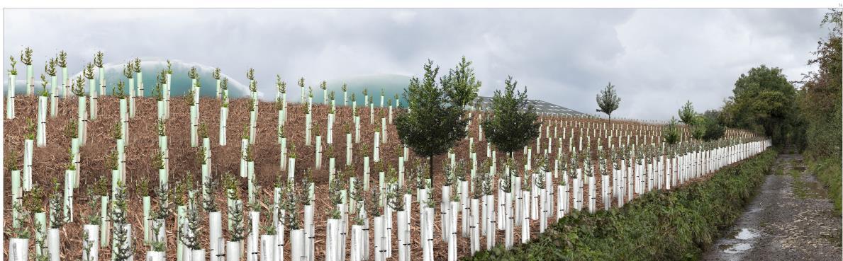
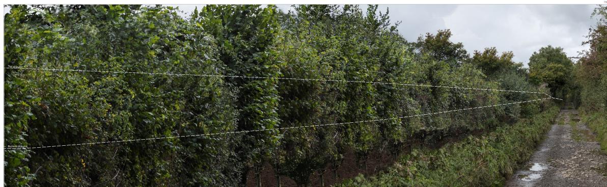
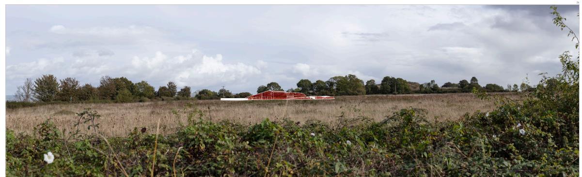
This proposed layout illustrates a revised layout and design to the existing AD Plant A new landscape layout proposed new woodlands planting that covers site, adding some water retention to minimise the impact of water surface damage, and more pathways as the parts of support the site managements. The planting schedule is also set to convinced the clients how the landscape is improving the visual impact of the site. The proposed trees and hedgerows boundaries are composed and aligned to link visually with vegetation pattern of the countryside. It will soften views to building site by restoring the native woodlands and will integrate this brownfield site within the landscape character of the site
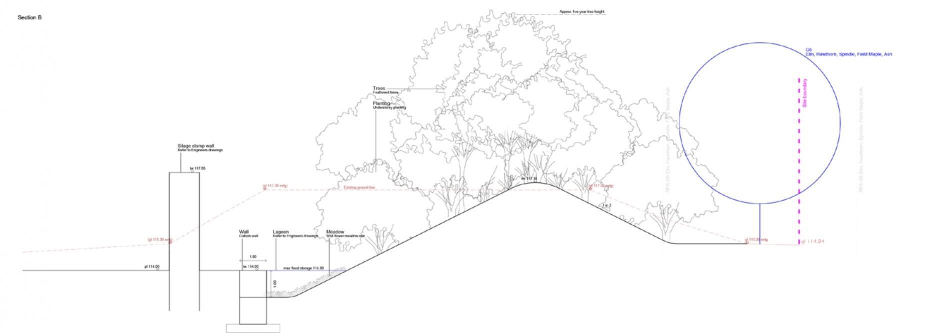
The sections indicates the level of proposed landscape on the site boundary so that the vision of reducing impact of water surface accomplished Series of landforms, woodlands and plantings, and water retentions are proposed in accordance to the new AD Plant layout so a visual impact possibility could be reduced after several years of completion.
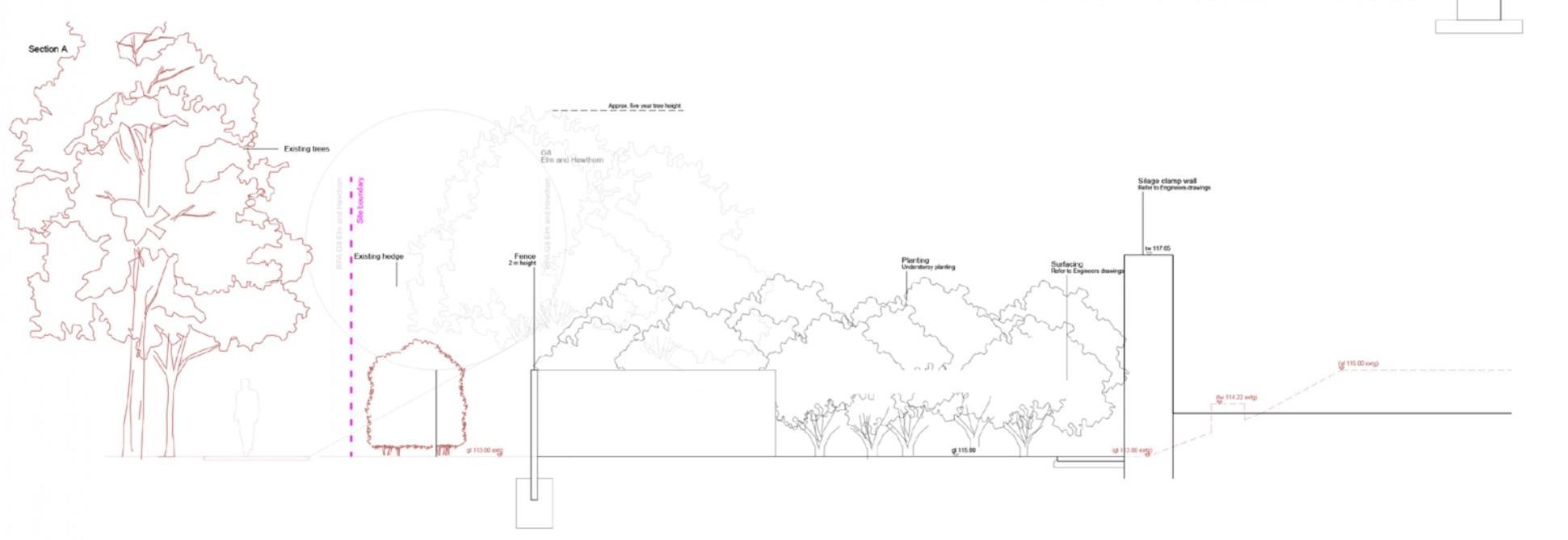
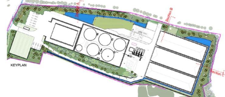
A SECTION B Keyplan
Location:
The junction between Charlton Road and public right of way looking south-east towards the site boundary
Visual receptors: Motoris, pedestrians, cyclist, horse riders for recreational purpose.
Site susceptibility: HIGH
Visual receptor sensibility: HIGH
Visualisation type 4 – AVR Level 3
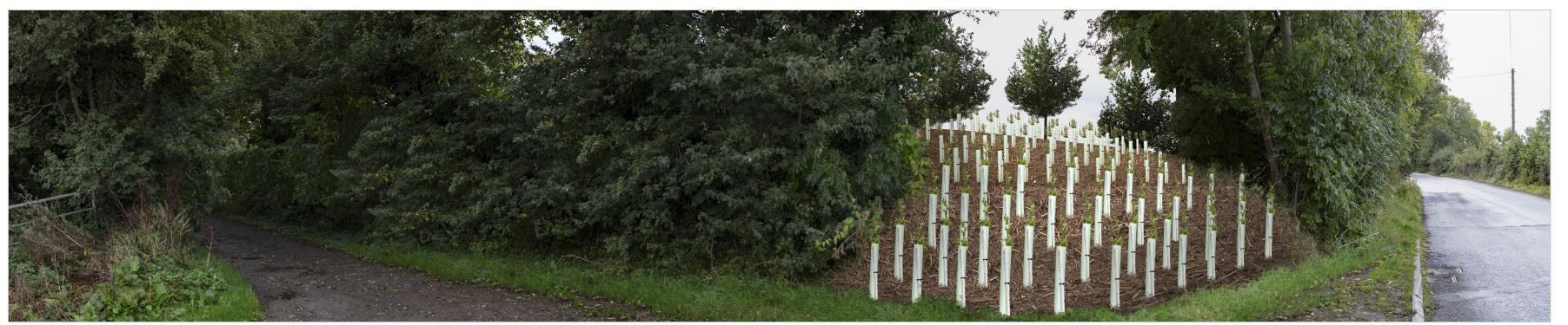
• At completion: the buildings are not visible, but there is possibility visual intrusion to the site at this time referring to just planting woodlands
• Year 5: the visual visibility to site is reduced since the woodlands is growing
• Year 15: mature woodland plantings will cover the site completely, reducing site susceptibility and visual receptor sensibility to LOW
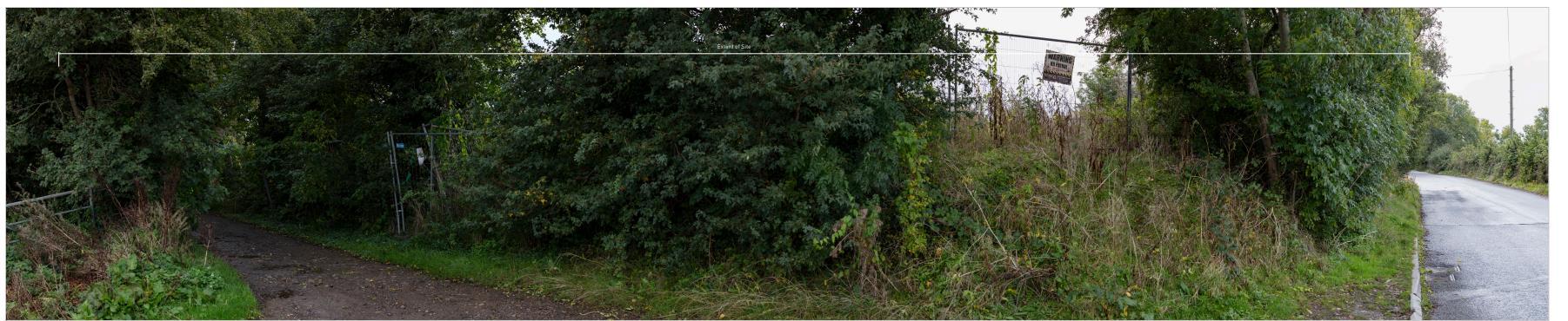
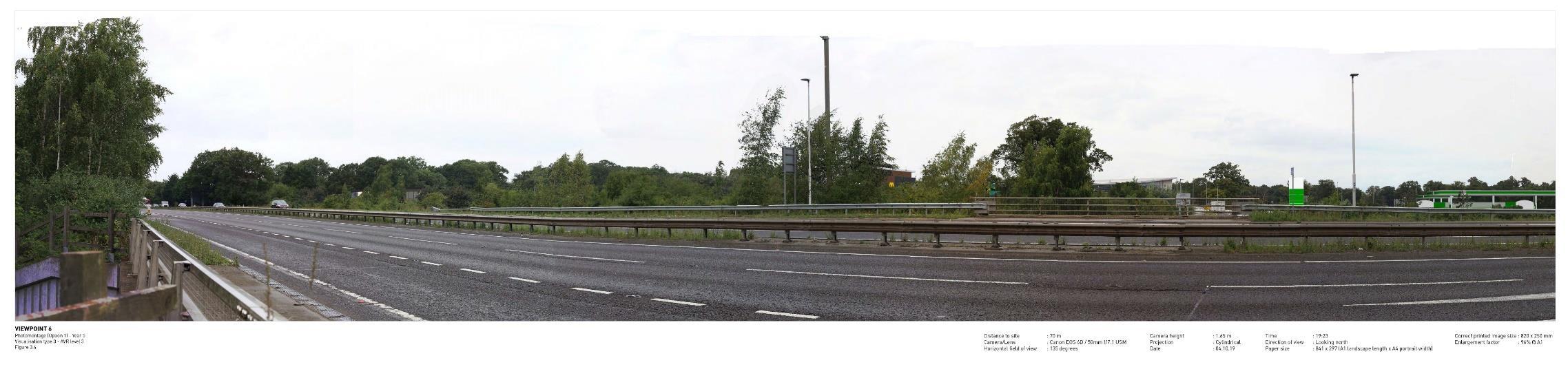
BASELINE
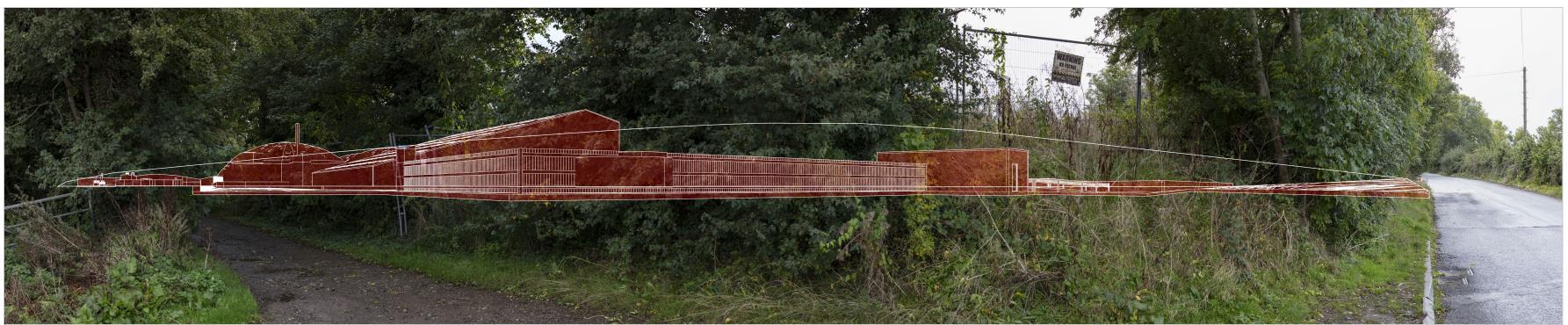
PHOTOWIRE COMPOSITE
Location:
View from public right of way looking south-west into the site and west along public right of way
Visual receptors: Limited farm traffic user
Site susceptibility: HIGH
Visual receptor sensibility: HIGH
Visualisation type 4 – AVR Level 3
• At completion: the AD plants are visible, but Site susceptibility and visual receptor sensibility is still HIGH
• Year 5: the visual visibility to site is reduced to MEDIUM
• Year 15: mature woodland and specimen trees plantings will cover the site completely, reducing site susceptibility and visual receptor sensibility to LOW
Location:
View to the west of the site – Woollard Lane in the south and Dapwell Lane looking east towards the site
Visual receptors:
Limited traffic farm users, pedestrians, cyclists, horse riders
Site susceptibility: HIGH
Visual receptor sensibility: HIGH
Visualisation type 4 – AVR Level 3
• At completion: the roof of management building is visible from this point making site susceptibility HIGH
• Year 5: the specimen plantings cover the management building turning the site susceptibility and visual receptors sensibility from this viewpoints LOW
• Year 15: mature woodland plantings will cover the site completely, reducing site susceptibility and visual receptor sensibility to LOW
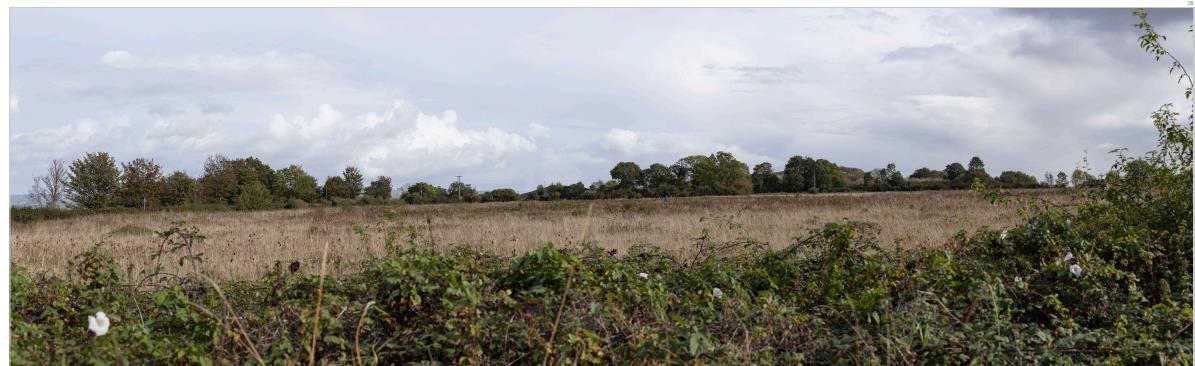
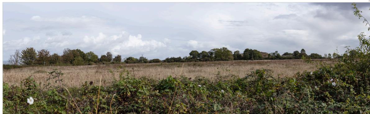
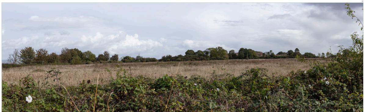
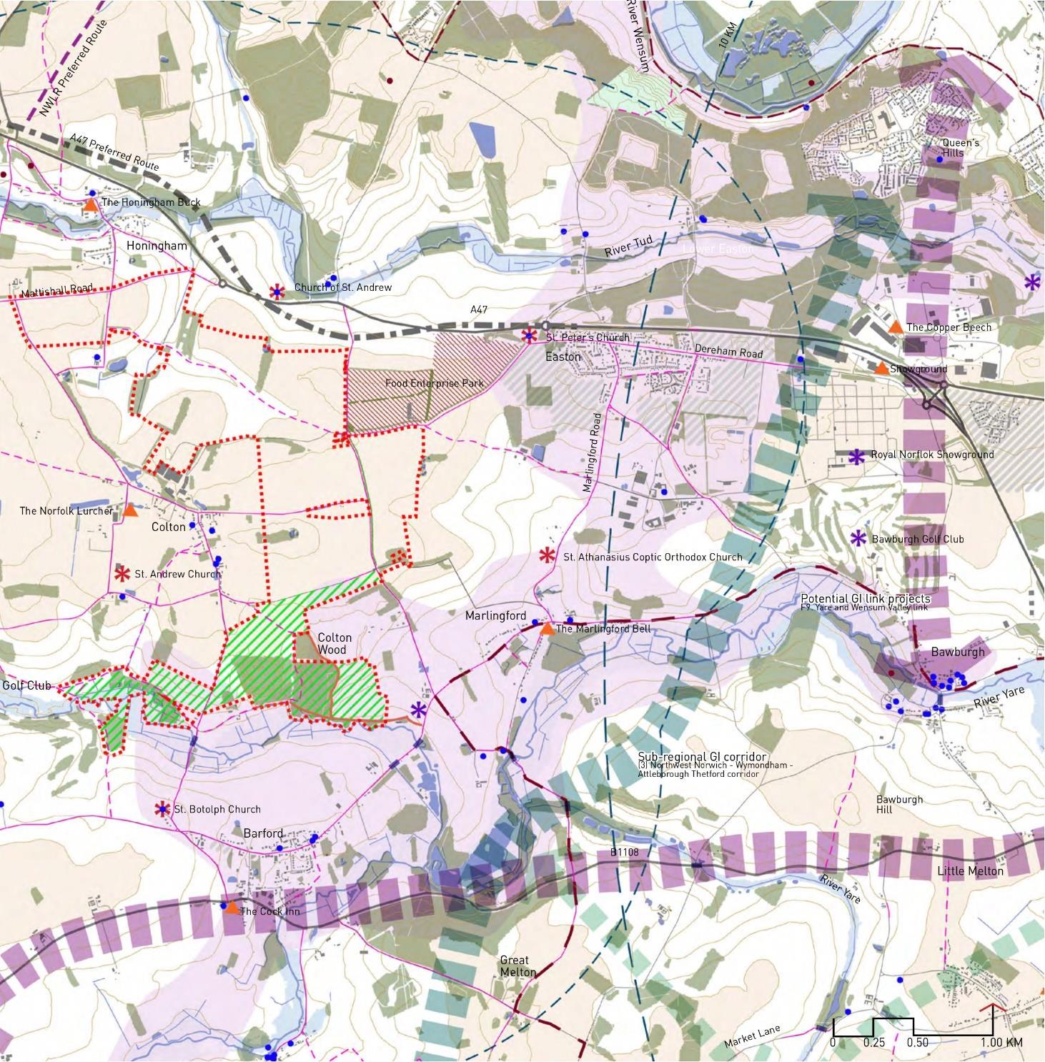
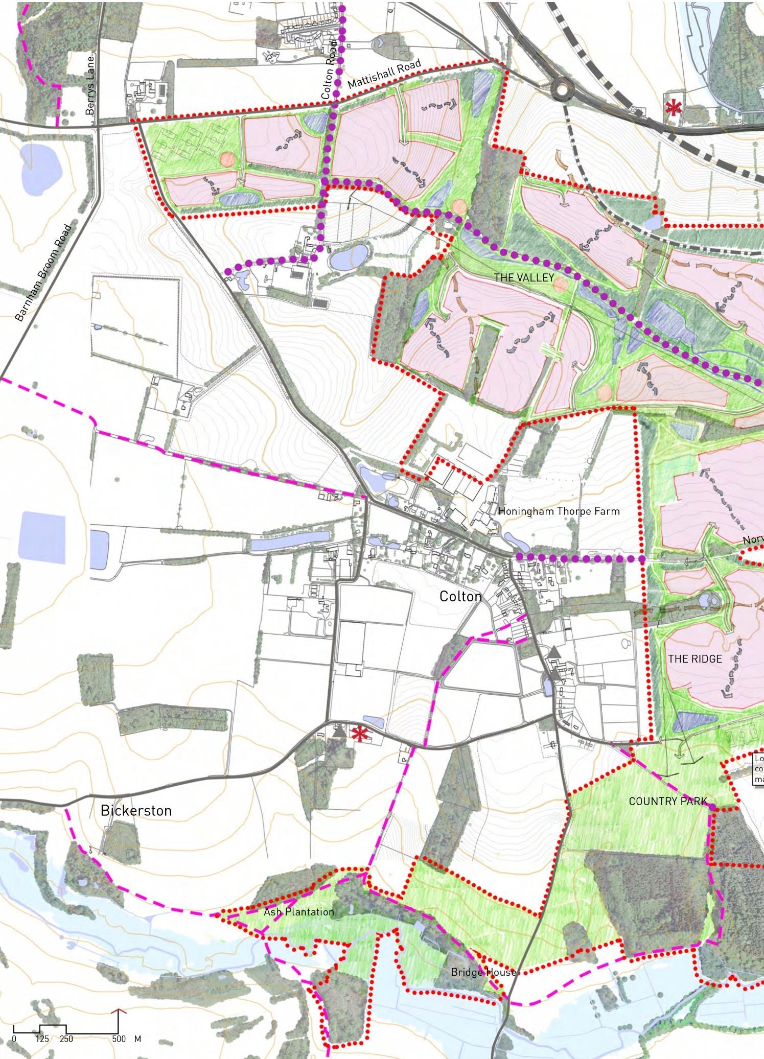
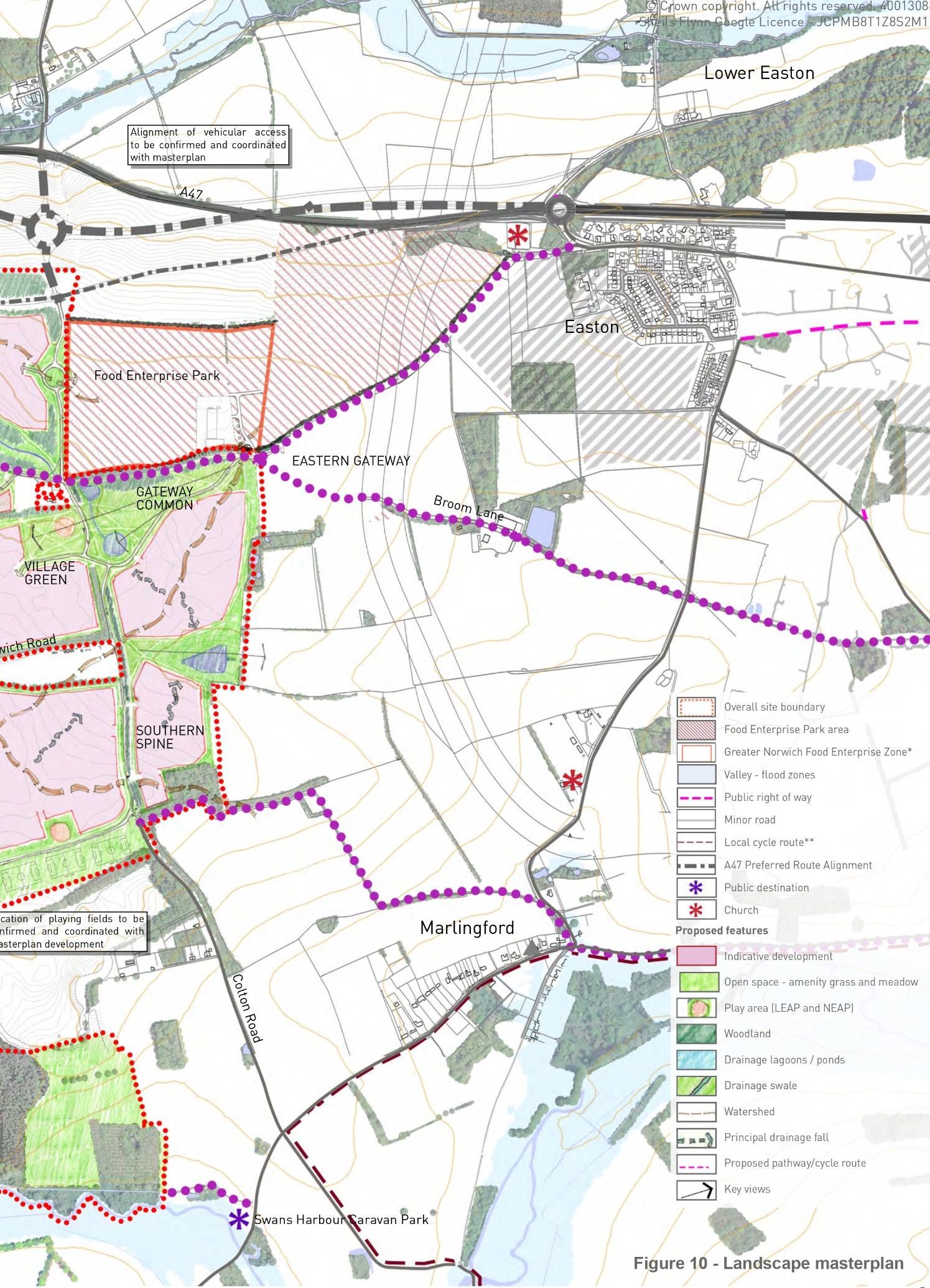
Honingham Thorpe – Honingham, UK
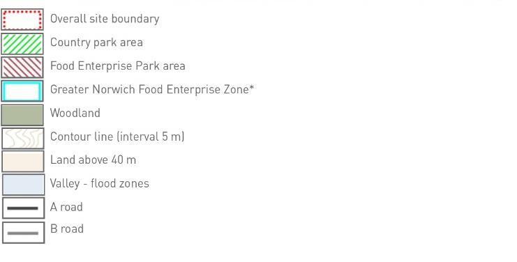
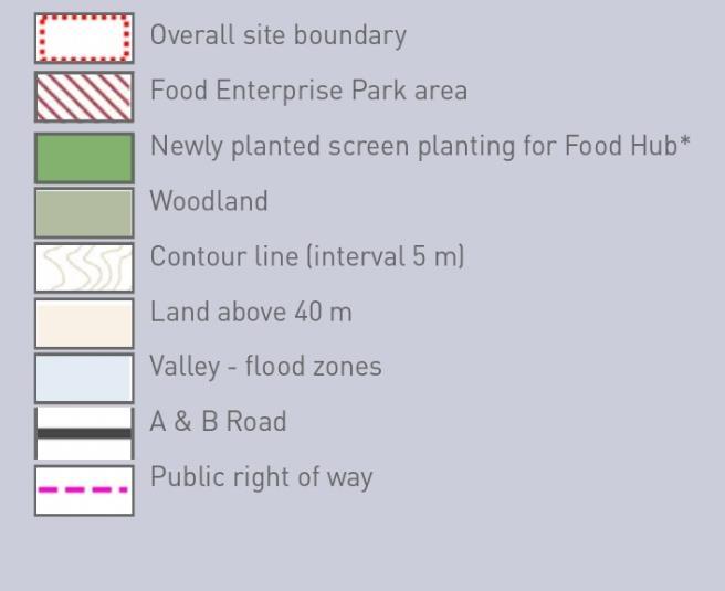
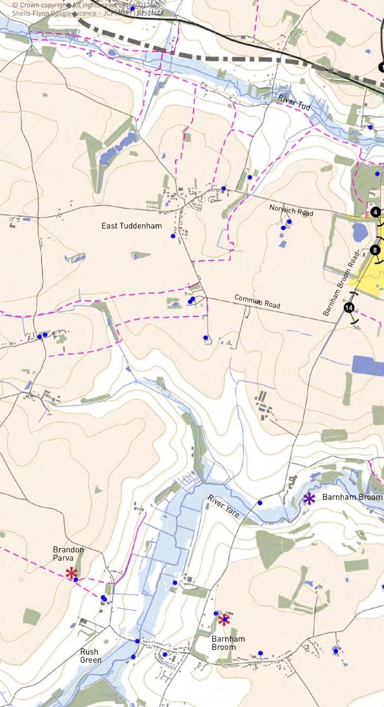
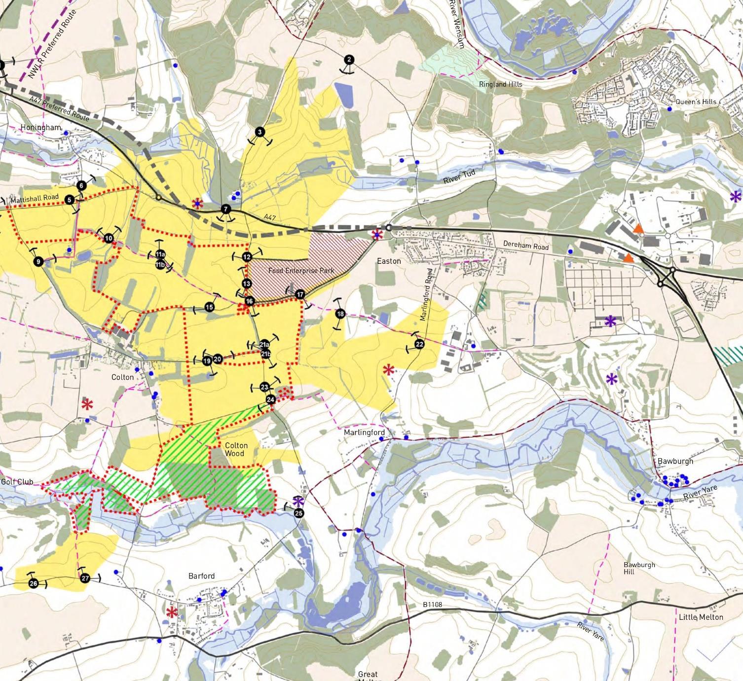
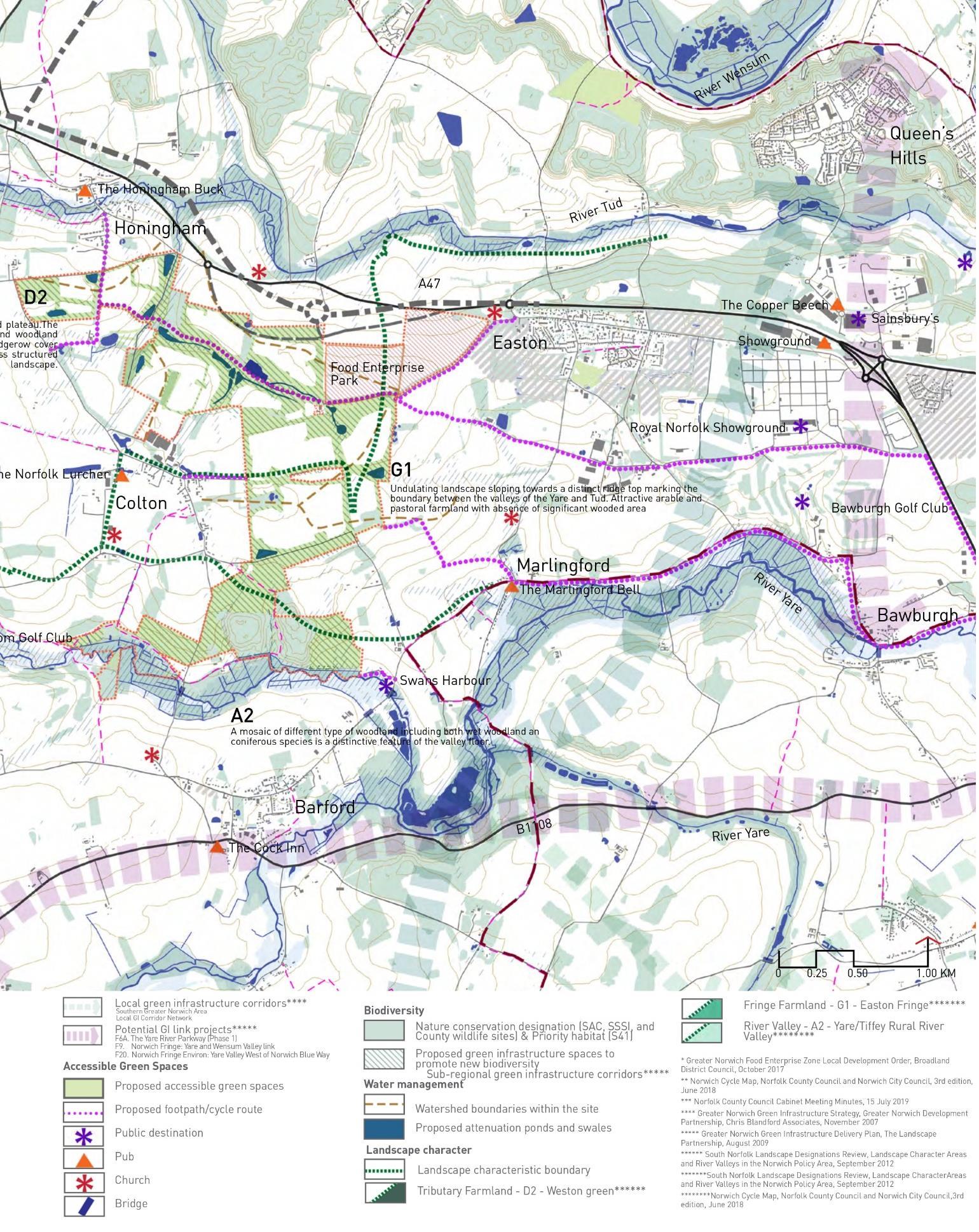
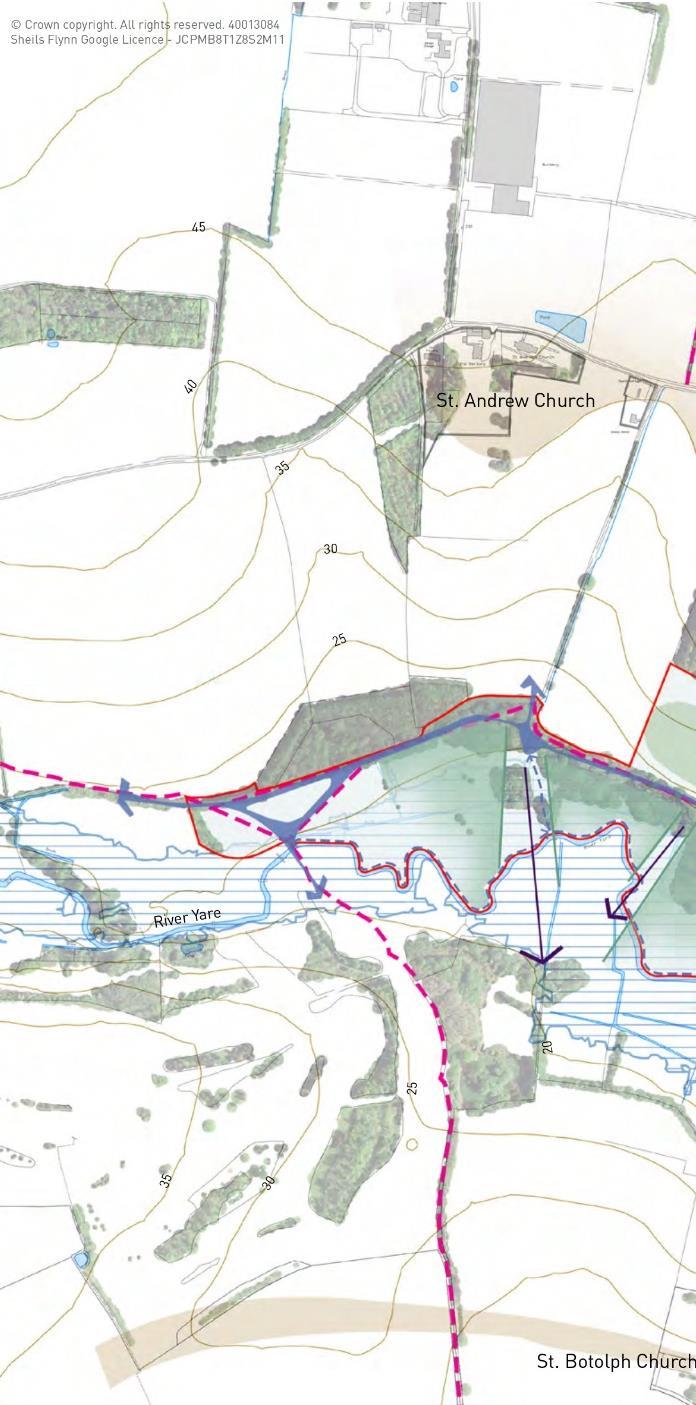
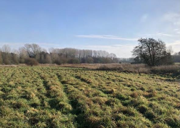
An ambitious proposal for a new community at Honingham Thorpe potentially to be leading as an exemplar for sustainable development. The site incorporates 81 ha of country park and 5 ha of nature reserves. The emerging plans include approximately 4,600 houses and 72 ha of employment space with new transport links, schools, community facilities and healthcare. The site is located in the ridge that separates the River Yare to the south from River Wensum. At the northern of the site, a piece of land is allocated for Food Enterprise Park which will support food production, processing, and agriculture trough the co-location of commercial enterprises. The southern part of the site developed as a country park above The River Yare.
During this landscape-led approach practice, I helped complete the Strategic Landscape Study Report by creating over 30 graphics. This included the landscape and visual appraisal of the site and the preparation of a concept design for the future riverside country park. The master plan for Honingham Thorpe aims to create a new community structure. This involved researching relevant landscape planning policy contexts, including landscape character assessments, green infrastructure strategies, environmental designations, and development planning policies to support the report.
Landscape context
The main site laid at the western of The Greater Norwich It can be accessed from A47 roadway The site boundary shows includes future Food Enterprise Park, area zoned as the first phase of the development – centre of the site boundary, and country park area on the lower valley alongside the floodplain of the River Yare.
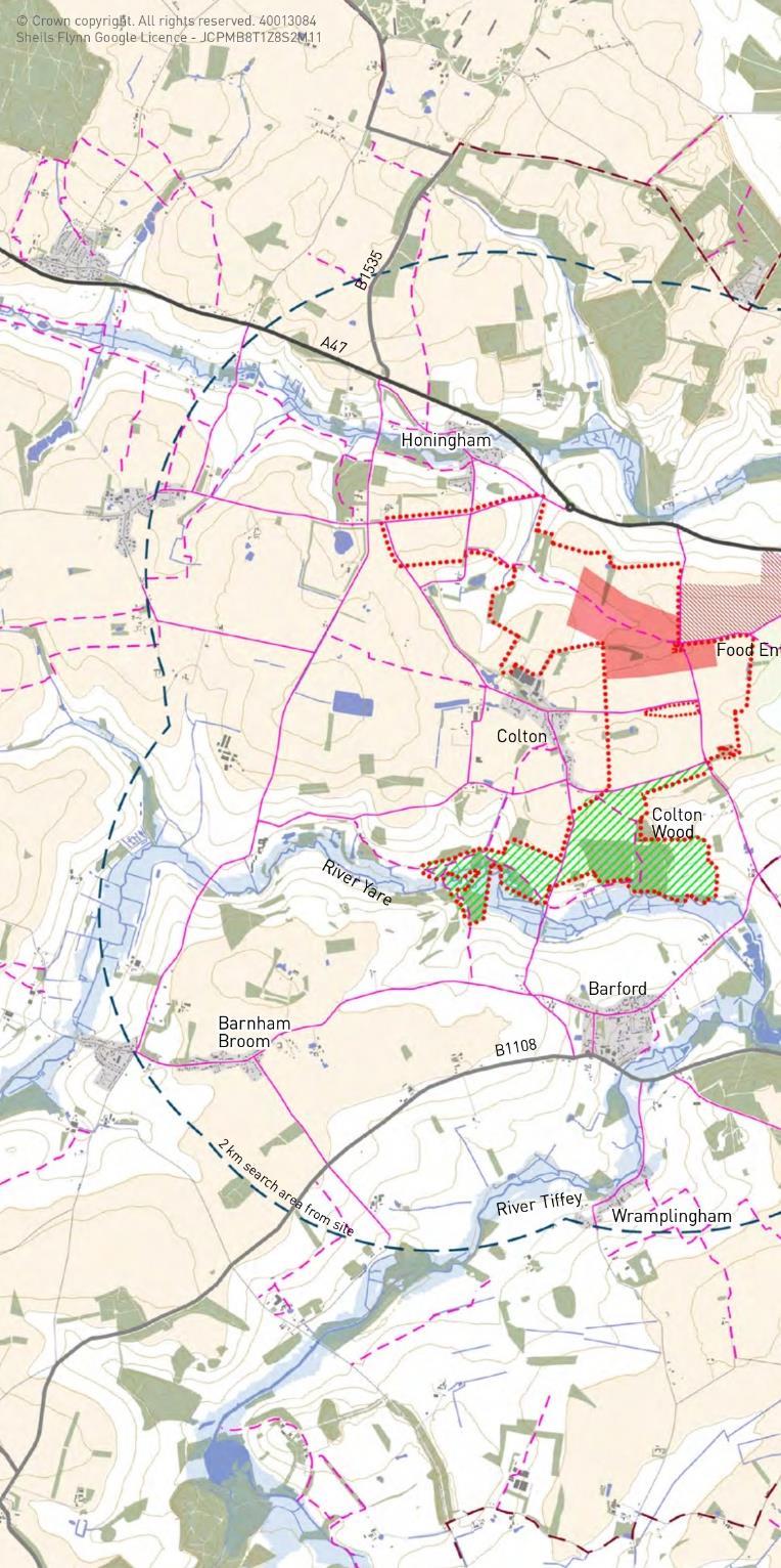
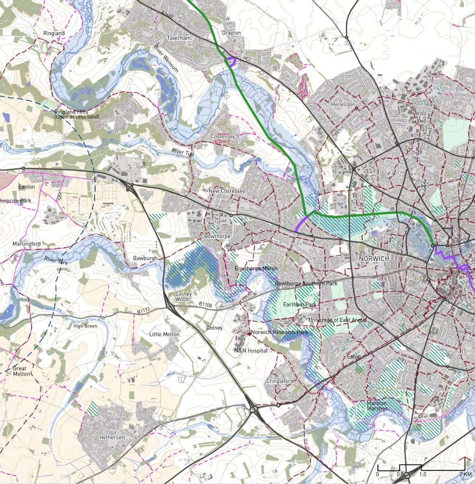
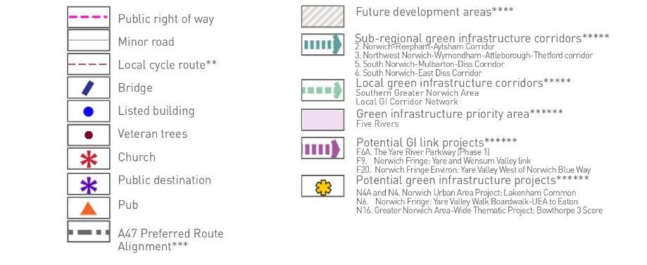
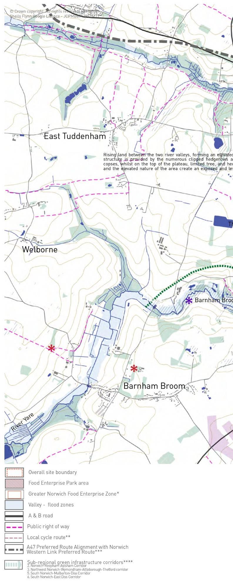
The main strategic GI corridors are along the river valleys of the Rivery Yare, the River Tud, and the River Wensum – parts of Five Rivers. The floodplains of these rivers contains a sequence of core habitats which are linked as wetland habitat enhancement and creation area.
Preliminary
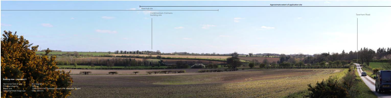
Visual assessment shows the zone of theoretical visibility (ZTV) for the site. There are 27 selected viewpoints to define the area within which receptors might reasonably expect to be visually affected in the future site development.
This preliminary visual assessment demonstrates that there are predicted to be
• The overall pattern of landscape become progressively more open as fields have been enlarged and more woodlands will be lost. It is predicted to inflict the predominant rural character of the farmland landscape.
• Some significant negative visual effects from Viewpoint 3 and 8 are predicted to become less significant as the mature tree planting proposed

This drawing exploring a conceptual strategy for the landscape of Honingham Thorpe:
1. Protecting the integrity of Northern Valley as a ‘Grange Lane’ .
2. Providing a new accessible landscape at Southern Valley as Country Park.
3. Generating The Ridge Spine landscape as a landscape connector between the development zones
4. Opening secondary gateway to link the country park and future development
5. Creating strategic mitigation at some key boundaries to minimise negative landscape impact In longer views from the north and south.
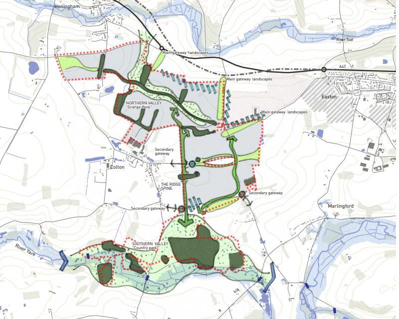
The diagram indicates a strategy which identify the opportunity for the new landscape infrastructure to enhance the quality of existing green infrastructure corridors and linking the site development. It shows potential to integrate recreation, ecology, and water management The landscape character is also taken into account to suggest how vary is the landscape of the site over the site that stretched from north to south
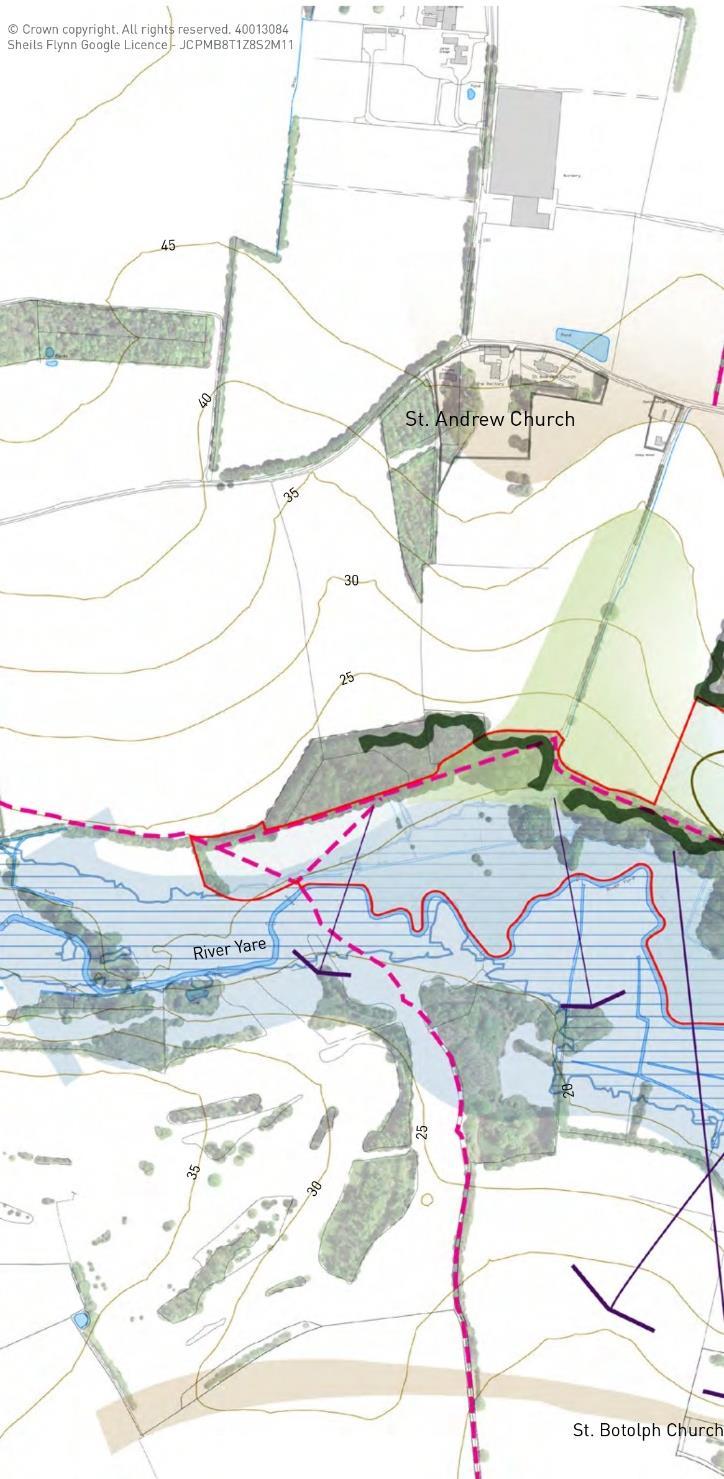
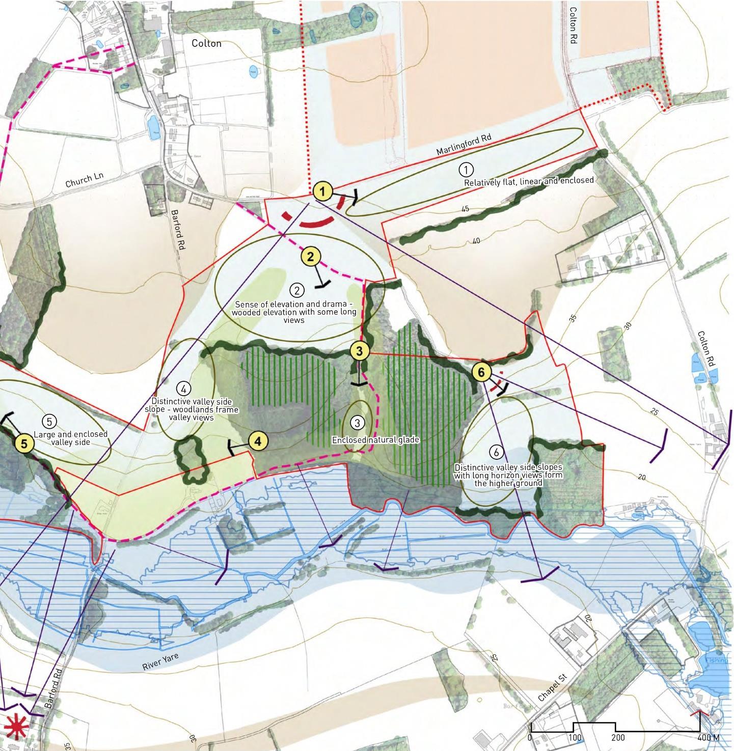
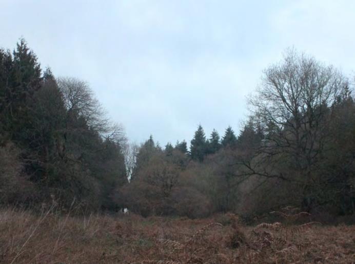
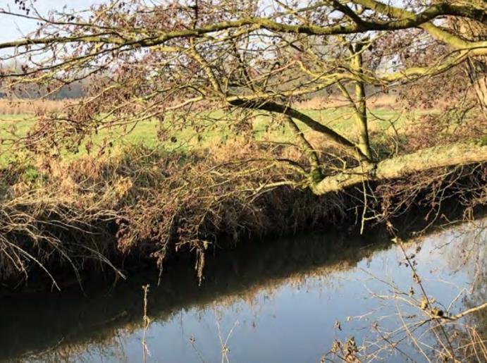
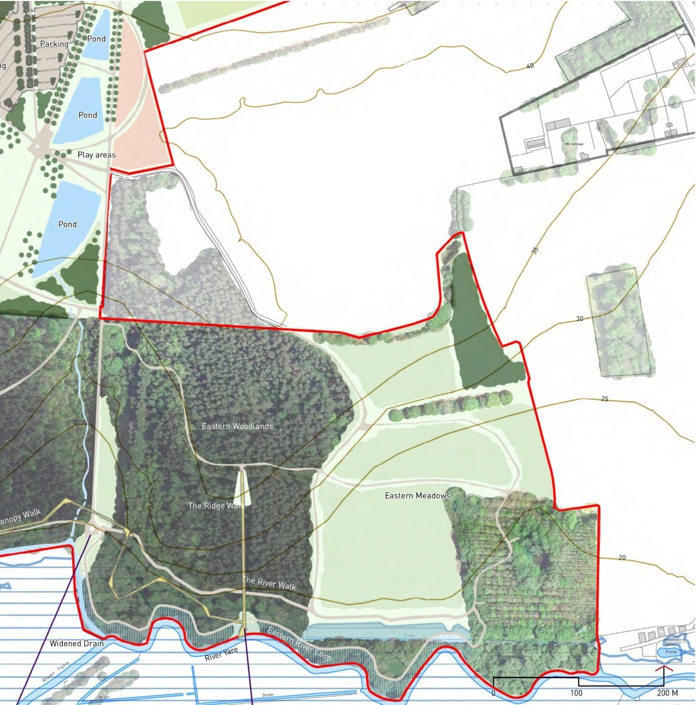
At the southern of the site, there is a chance to propose this area as a country park that is publicly accessible. The site situated next to River Yare which has combination of landscape features. The valley topography is sloping down to the river adjacent to River Yare flood meadow and marshes
1. Flat, linear, and enclosed landscape area next to Marlingford Road
2. Sloping down elevation enclosed wiith long views framed by the woodlands
3. Enclosed nature
4. Distinctive slope with woodlands frame
5. Large and enclosed valley side.
constrains
The distinct topography is the main consideration to explore various of opportunities and constrains for the site.
1. The northern part suitable as arrival and formal play, and events to the country park as the landform is flat
2. Proposing ‘The ridge walk’ that follow the existing contour
3. Creating ‘The river walk’ along the River Yare
4. Introducing potential ‘River loop’ walks with ecologically-led strategy to restore riverbank biodiversity
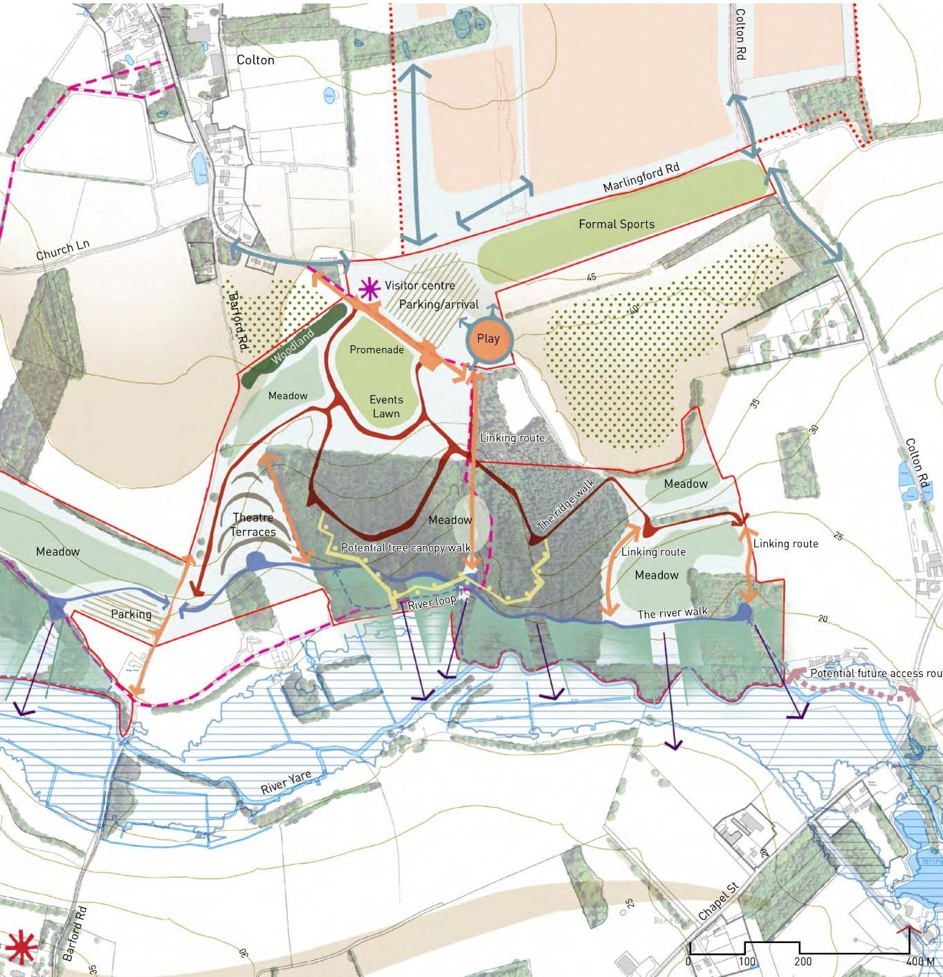
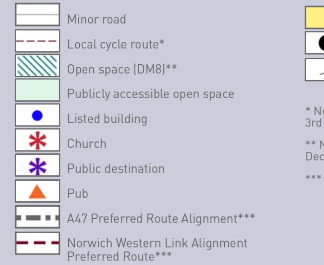
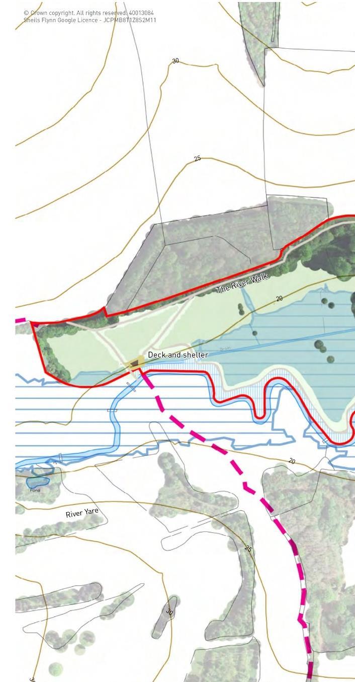
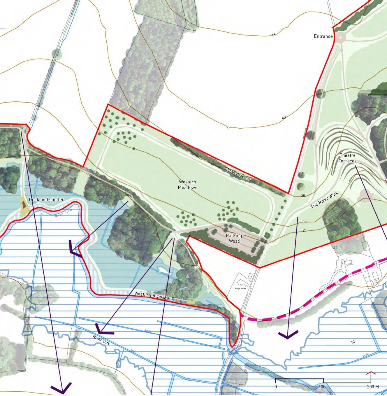
Park – Proposed landscape design (West)
At the western part of Colton Park the proposal is related to retaining existing ecological features by adding supporting landscape elements (e.g. pathways, park entrance, deck & shelter, parking, and River Loop)
• Colton wood will be the main object for this country park
• Introducing flood plain importance to the visitors as an ecological features by opening some viewpoints to the water streams.
• Maintaning grazing flood marsh in the western extension of the park as the visible parts of floodplain.

 Colton
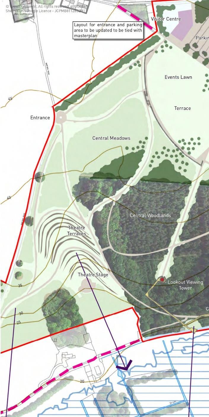
Park – Proposed landscape design (East)
The Eastern part is proposed as the main destination of Colton Park natural layout of country park will be still maintained and adding some landscape elements.
• Proposing some features at the entrance area (e g visitor centre, terrace and lawns, play area, and retention ponds
• Integrating the existing woodlands with several types of walkways (e g The Ridge Walk)
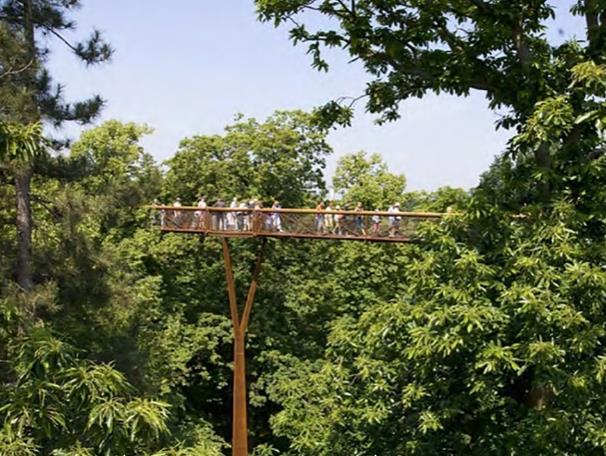
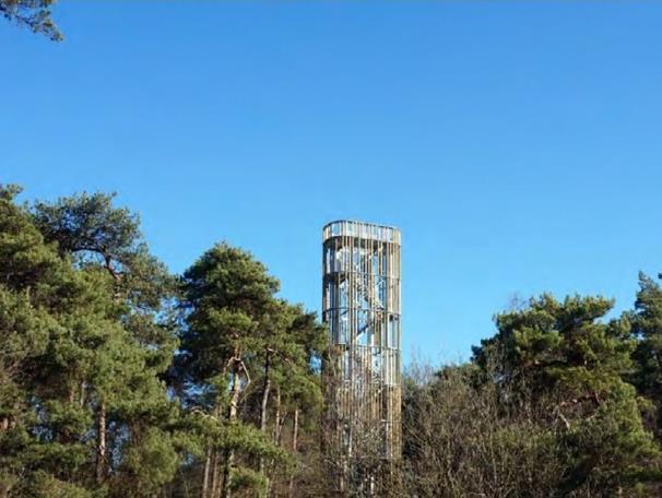
• Enhancing the viewpoints quality from the site to the flood plains by adding facilities (e.g. theatre terraces and stages, lookout viewing towers, and viewing towers.)
 Colton
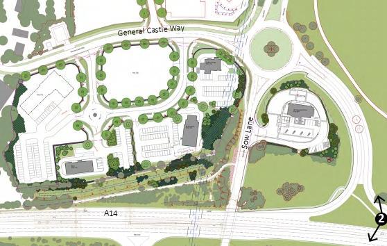
Suffolk business park – Bury St. Edmunds, UK
Suffolk Business Park, covering 57 acres, stands as a burgeoning commercial development area situated in Bury St. Edmunds. During my tenure at Sheilsflynn Asia, I was tasked with enriching the landscape quality of Suffolk Business Park, positioning it as an integral component of the green infrastructure extension of Bury St. Edmunds City. To achieve this goal, special attention was directed towards the Roadside plots adjacent to the A14, where the implementation of extensive woodland planting served as a visual mitigation strategy. This approach not only enhances the aesthetic appeal but also fosters the maintenance of continuous wildlife links and habitat corridors, thereby contributing to the overall ecological sustainability of the area.
This project holds immense value for me, as it taught me that design is a process of "suturing" ideas together. I gained insight into how each country has different approach to refining the landscape designs to meet client criteria. Throughout this project, I probed into understanding the process of creating Environmental Impact Assessment reports and Landscape Visual Impact Analysis reports too.
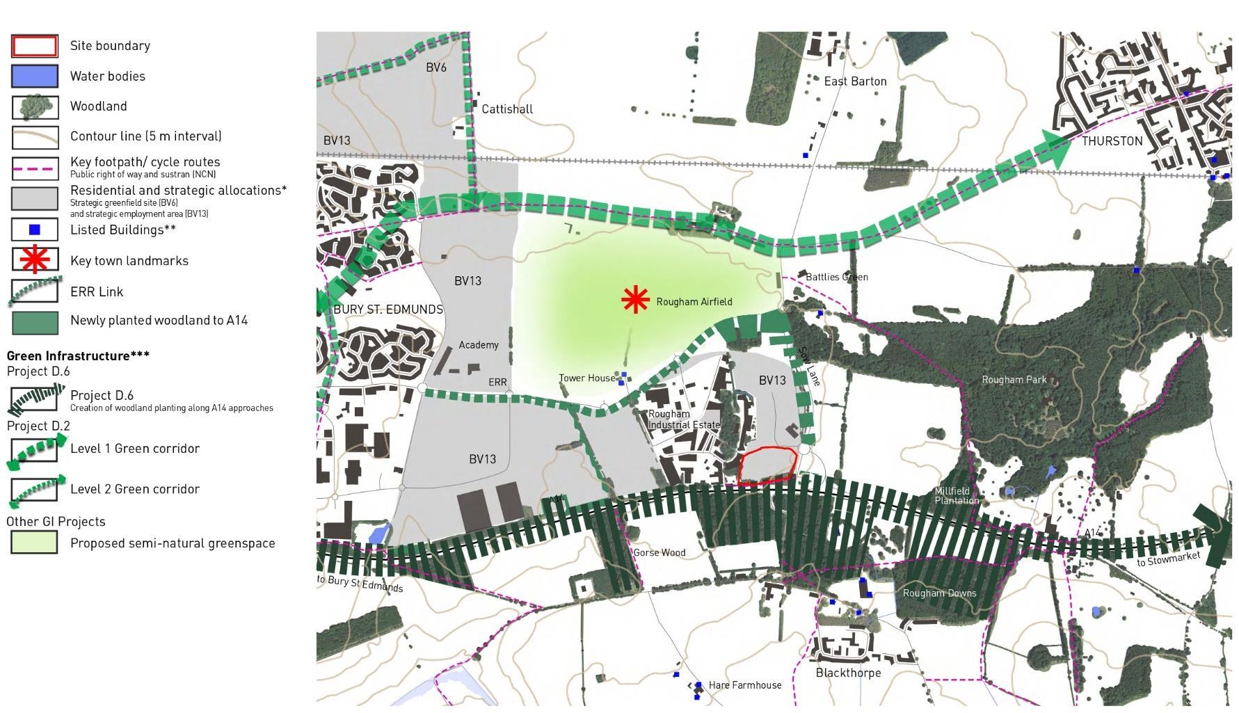
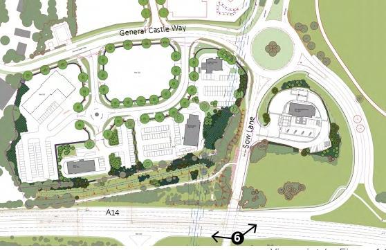
The landscape development of the roadside plots at Suffolk Business Park is closely aligned with Project D 6, which focuses on the orientation of the A14 road development and incorporates woodland planting to create diverse habitat mosaics along the corridor The planting strategy involves a mix of species such as pine, birch, and oak, with an emphasis on utilizing clear-stemmed specimens This approach aims to enhance visual permeability while contributing to the creation of a rich and varied ecosystem along the roadside, promoting biodiversity and ecological sustainability.
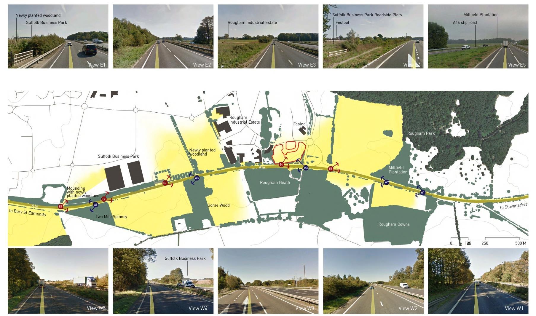
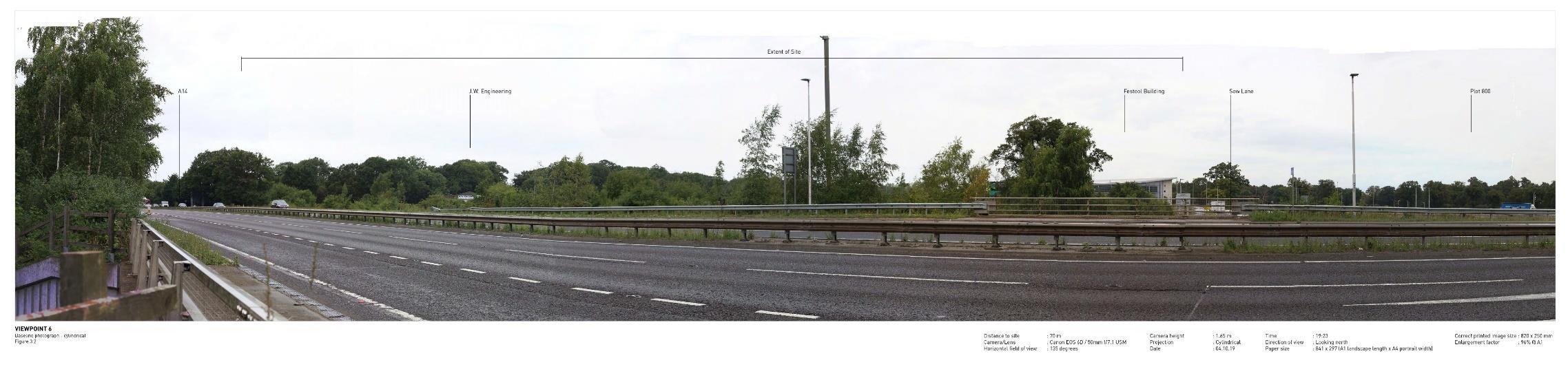
To evaluate the visual corridor permeability from the A14 to Suffolk Business Park, we conducted a thorough assessment using photos captured from Google Earth. Several viewpoints were identified, and three were selected based on their high sensitivity to the overall visual receptor. Later, these viewpoints were studied to understand the magnitude of changes so a future visual effects magnitude will be mitigate.
An extensive analysis was undertaken, weaving together elements including existing development plan, potential view corridors, structural landscape opportunities, and the assessment of current green infrastructure. This thorough investigation aimed to identify key features and strategic opportunities within the site to inform a strategy that promotes sustainability and enhances the overall landscape quality of Suffolk Business Park.
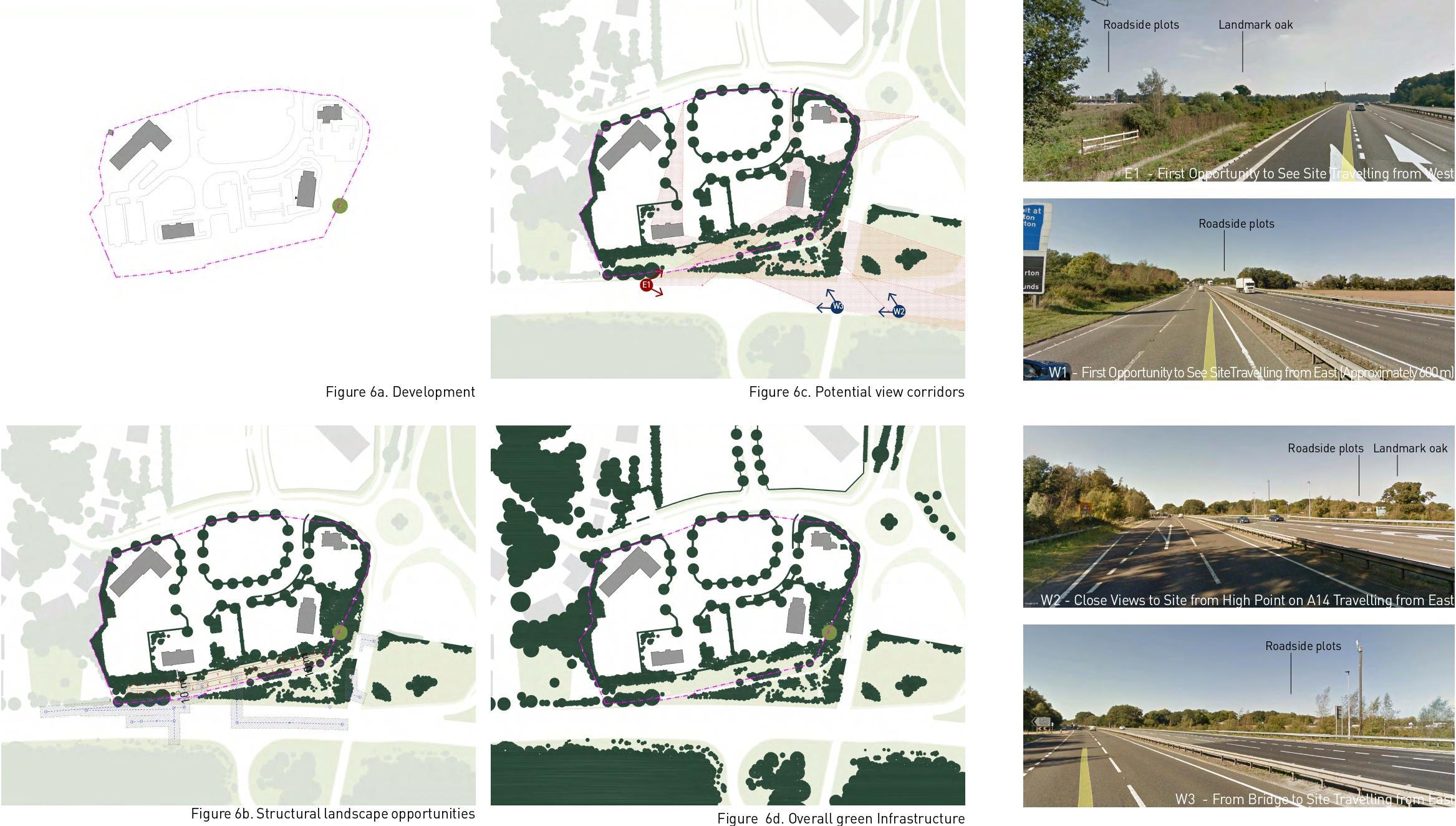
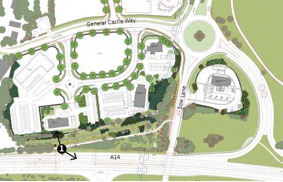

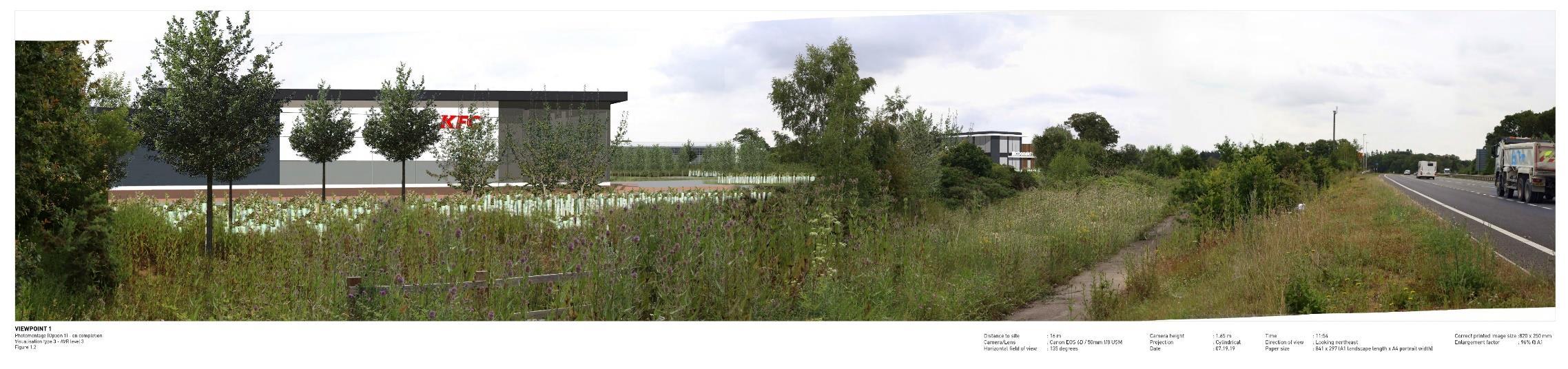
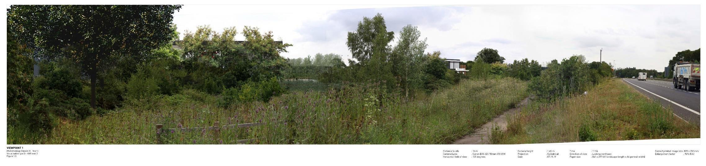
The visualisation study illustrates visual permeability of the design from A14 to the frontage of roadside plots.
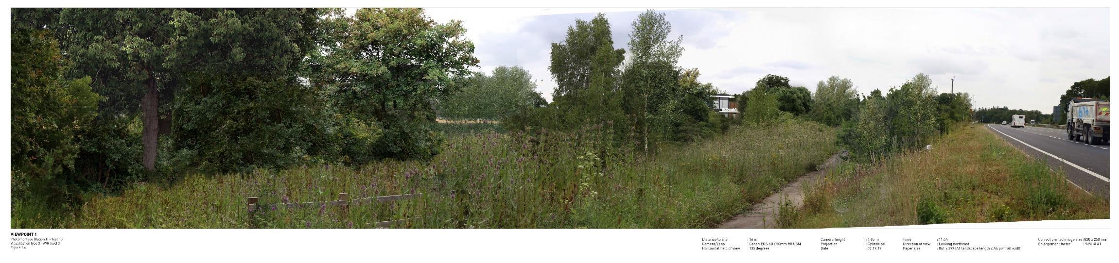
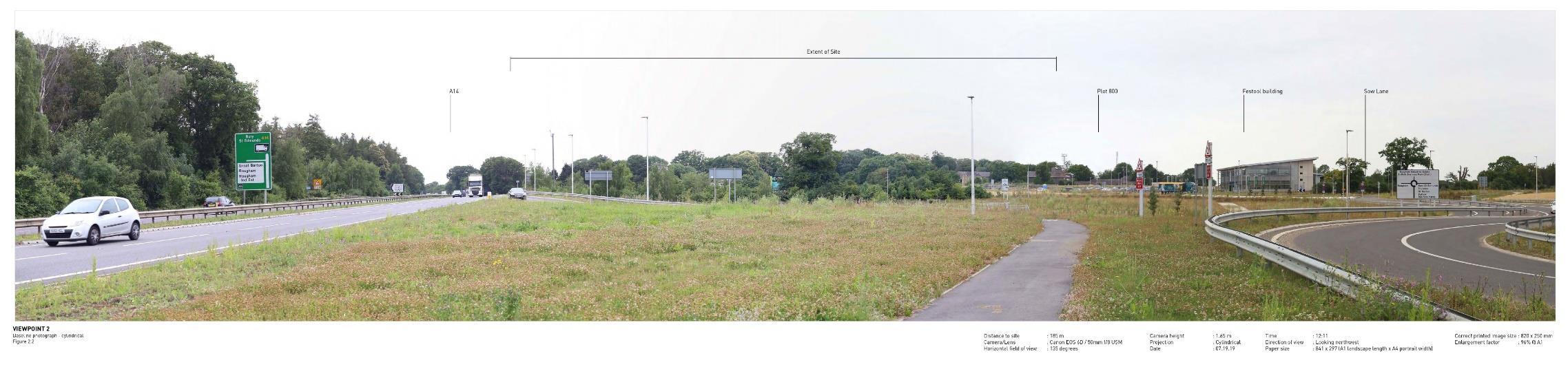
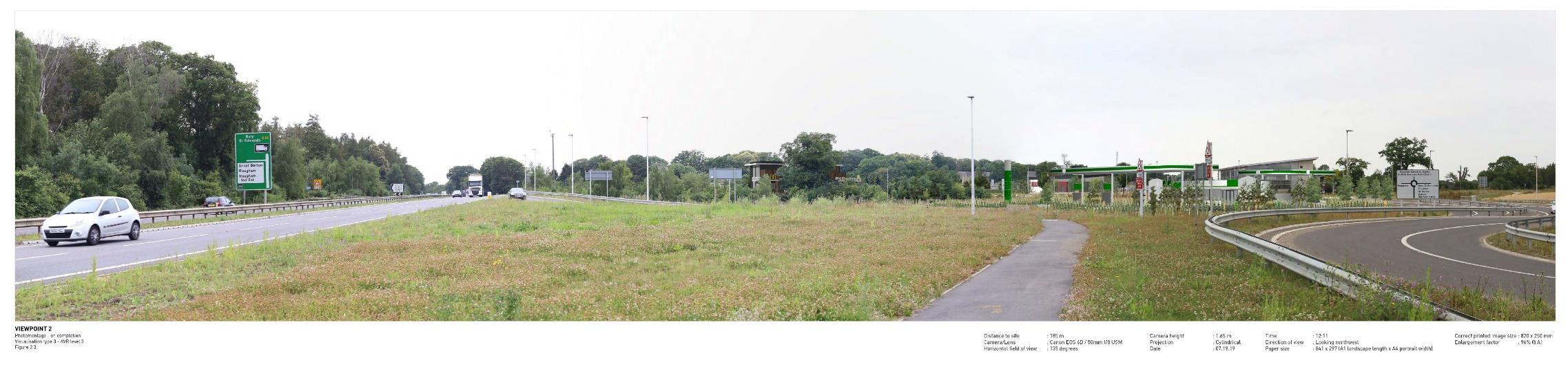
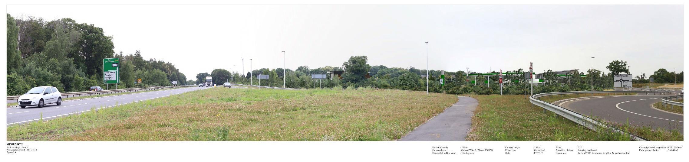
The visualisation study illustrates visual permeability from A14 to gas station as part of roadside plots.
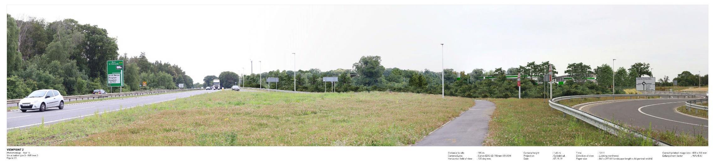

The visualisation study illustrates visual permeability from A14 to the frontage of roadside plots.

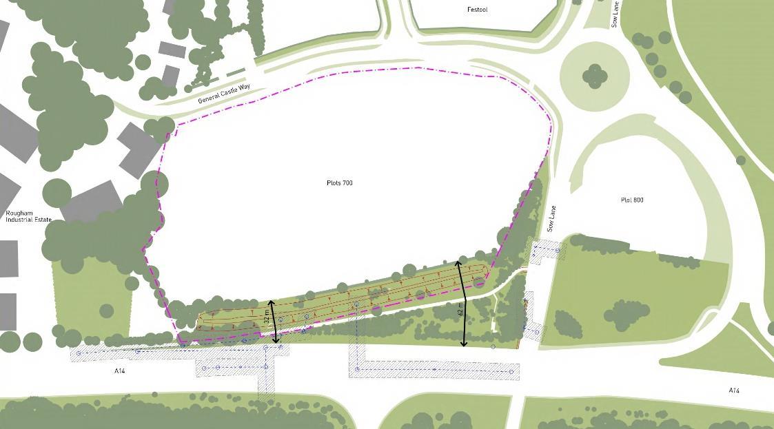
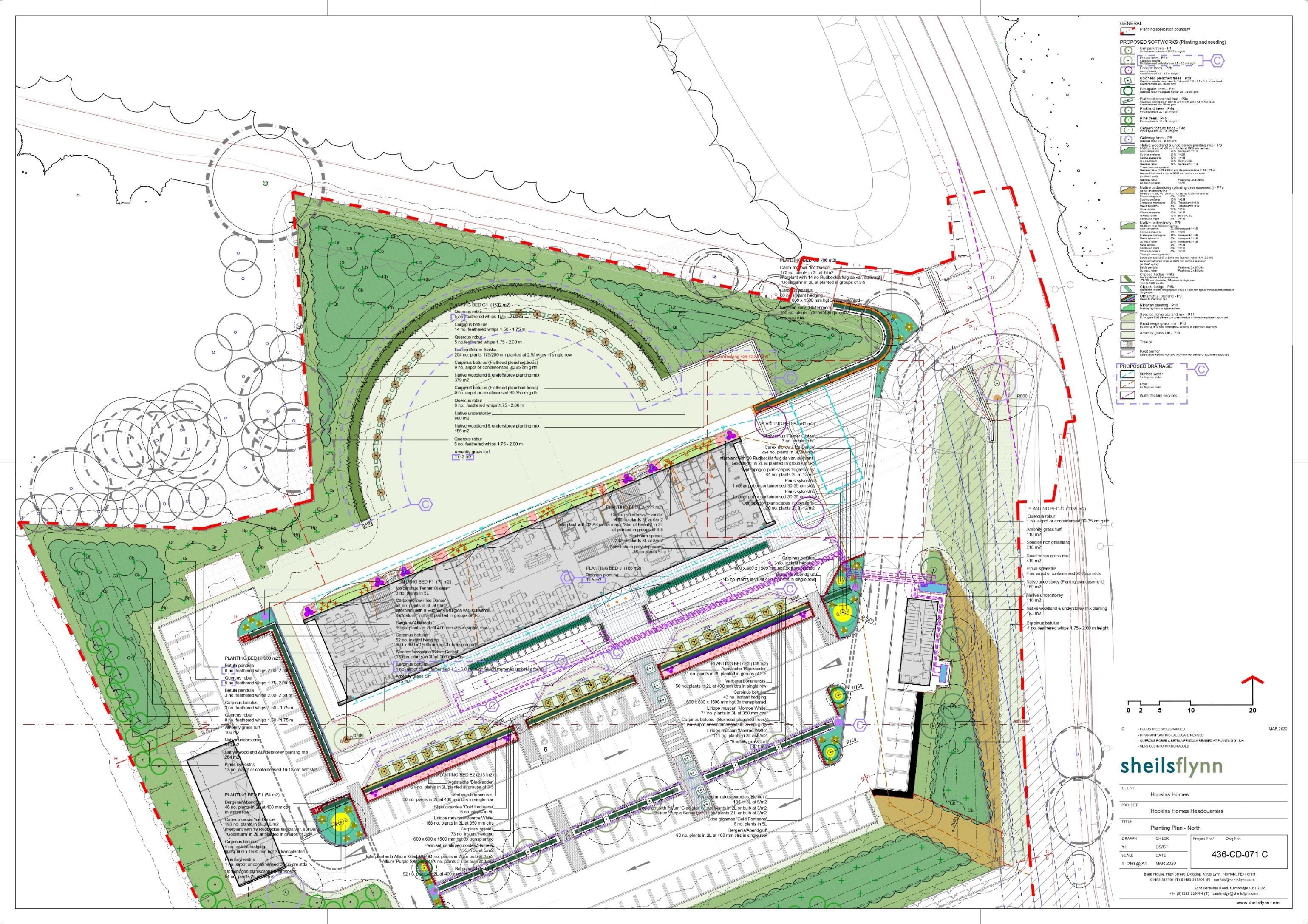
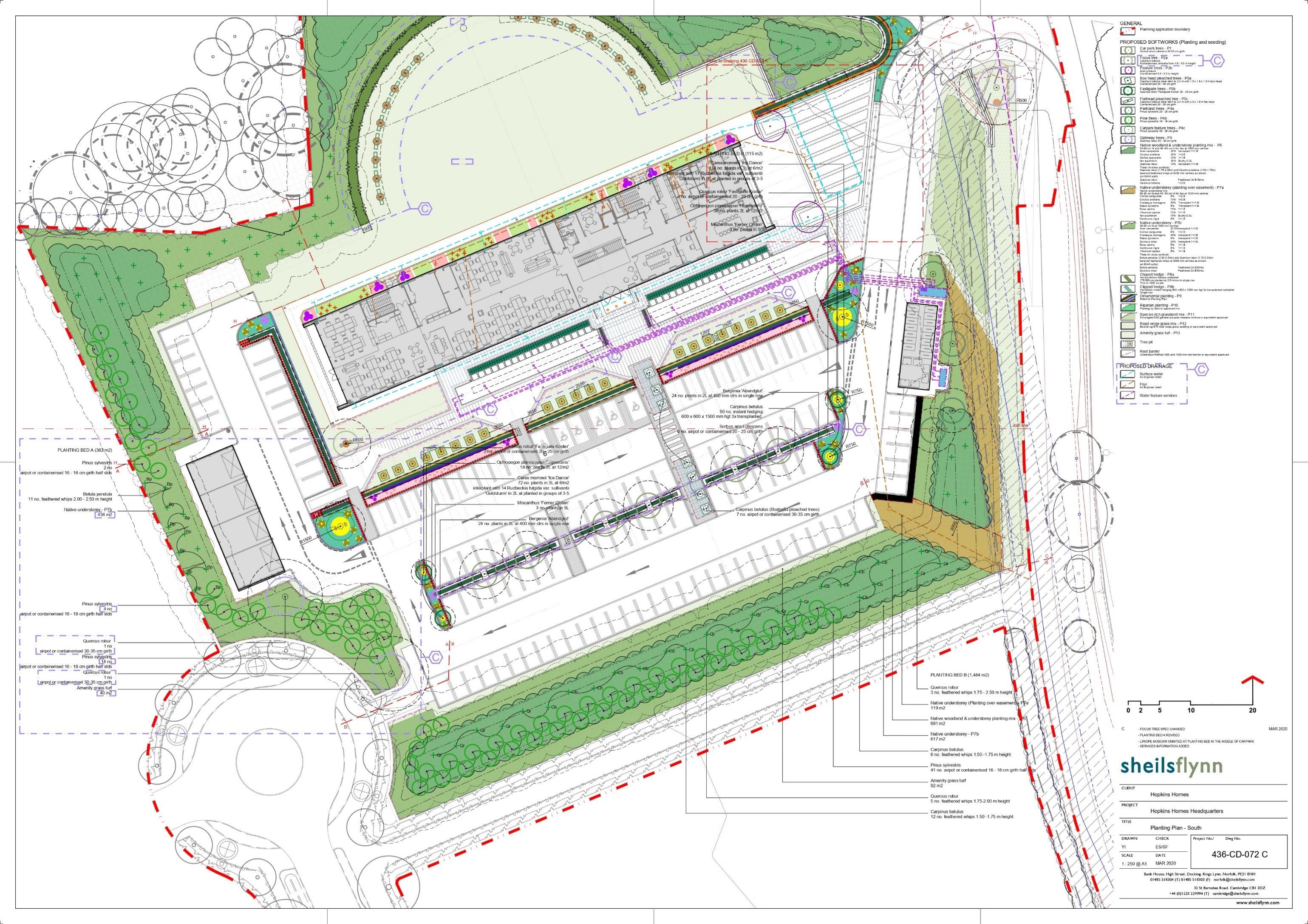
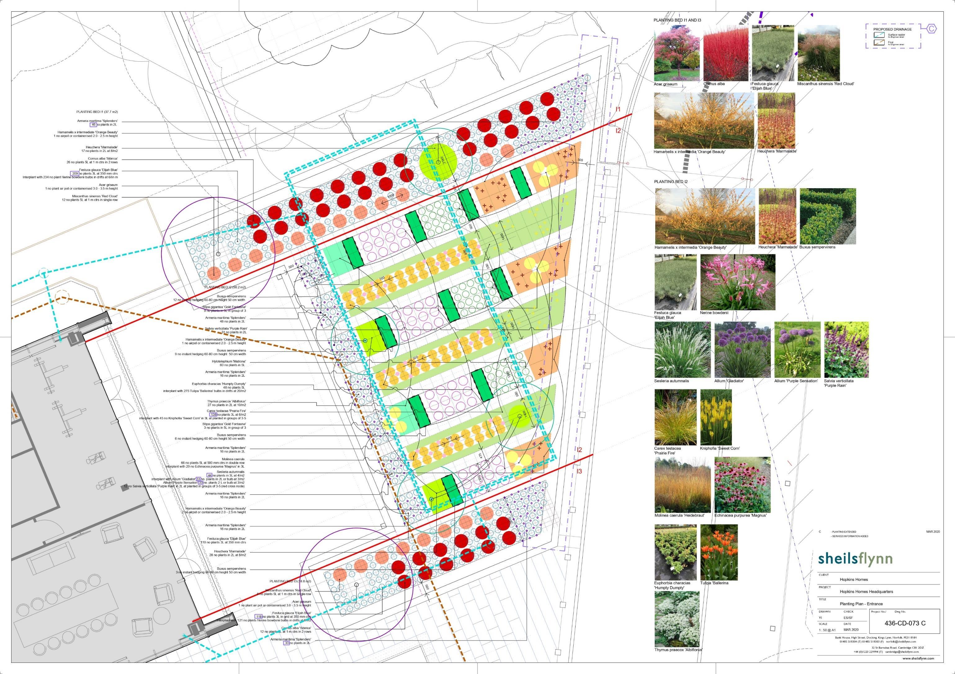
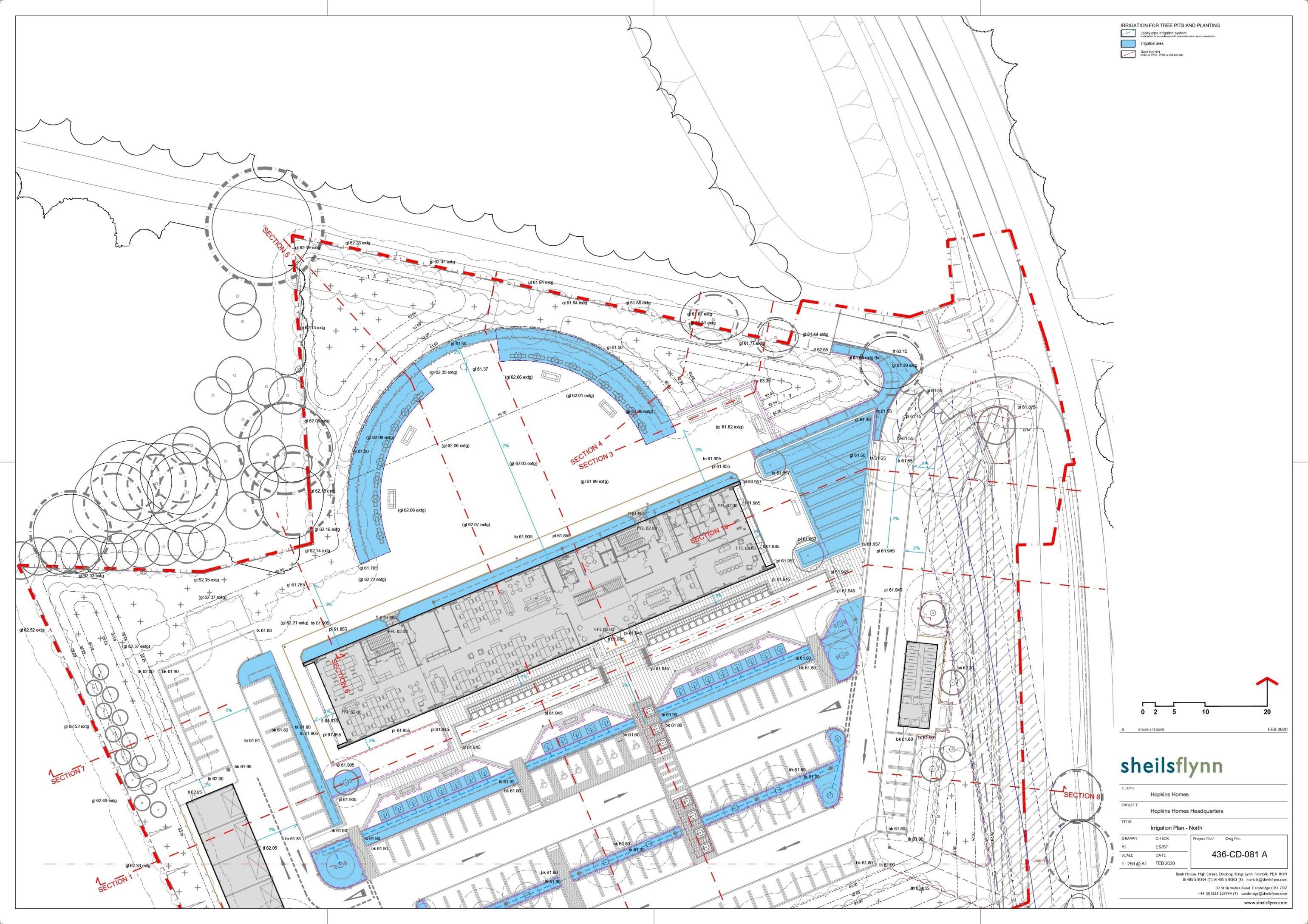
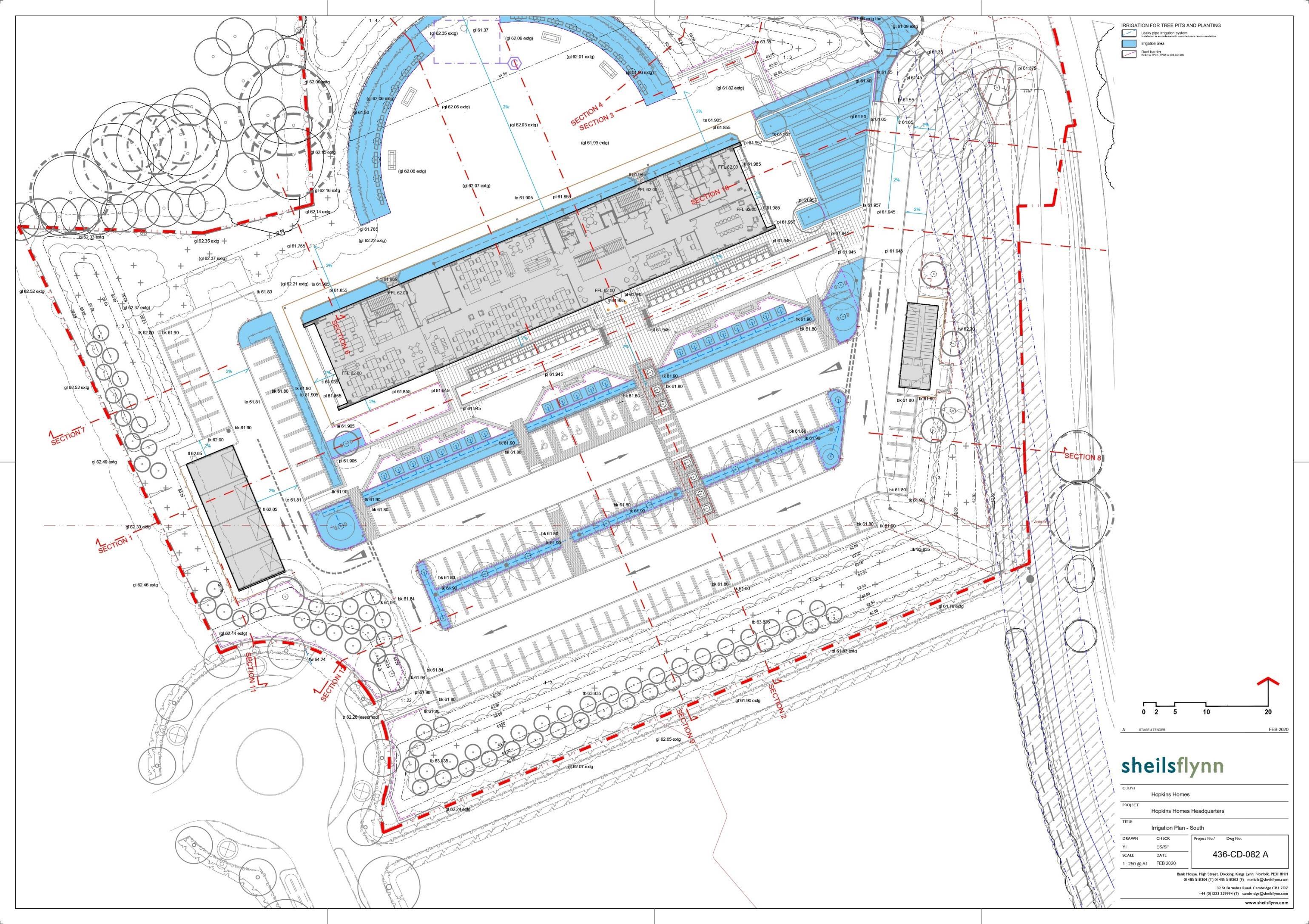
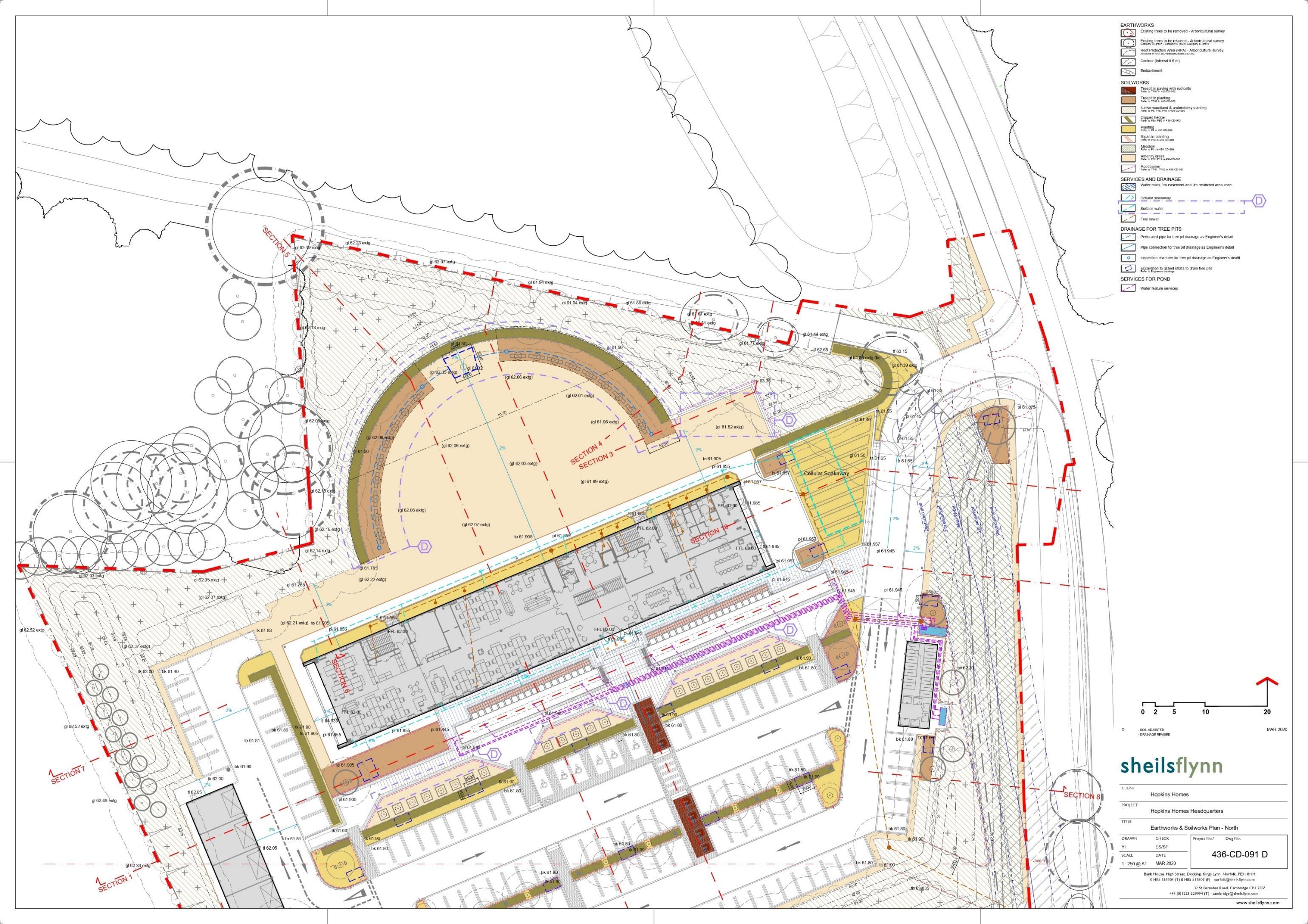
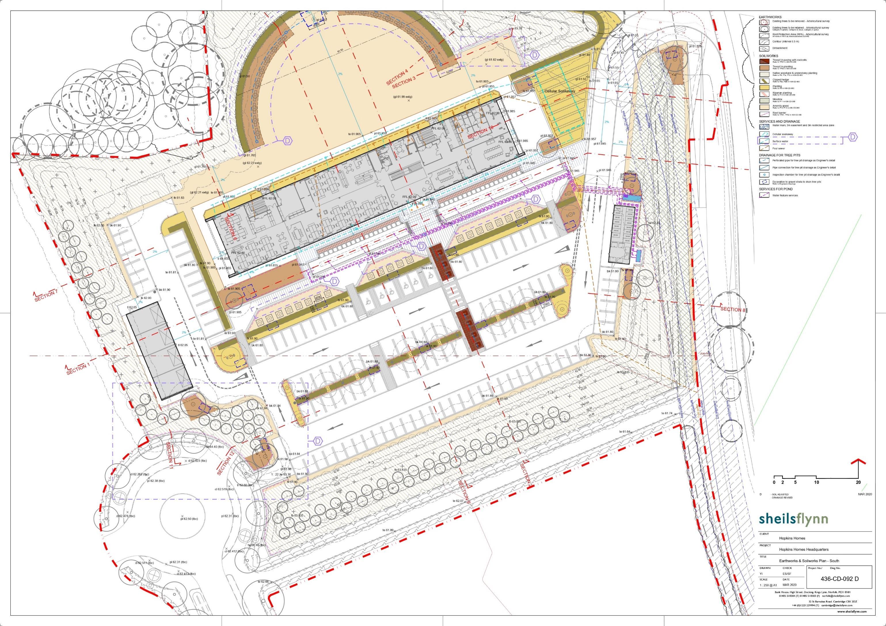
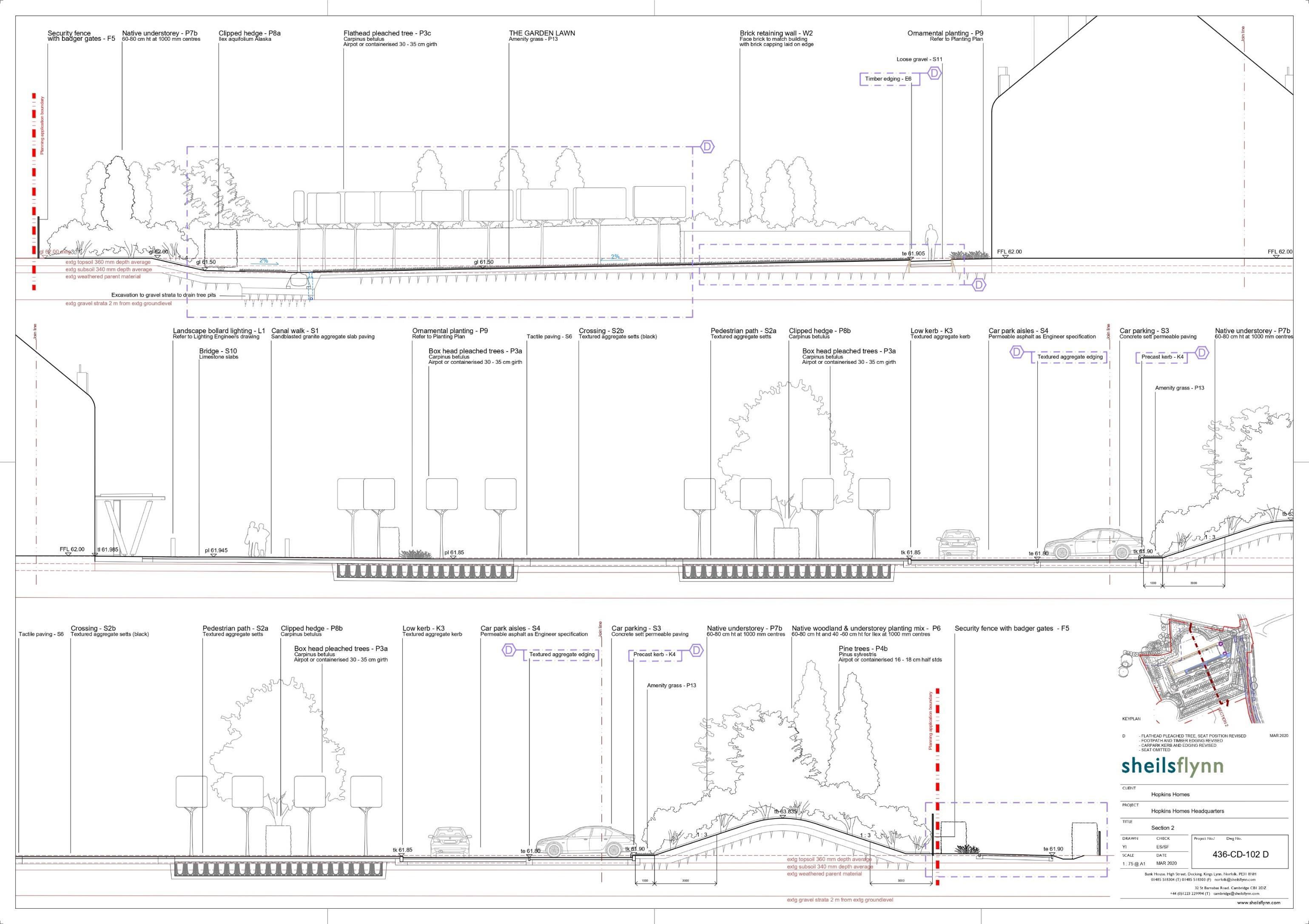
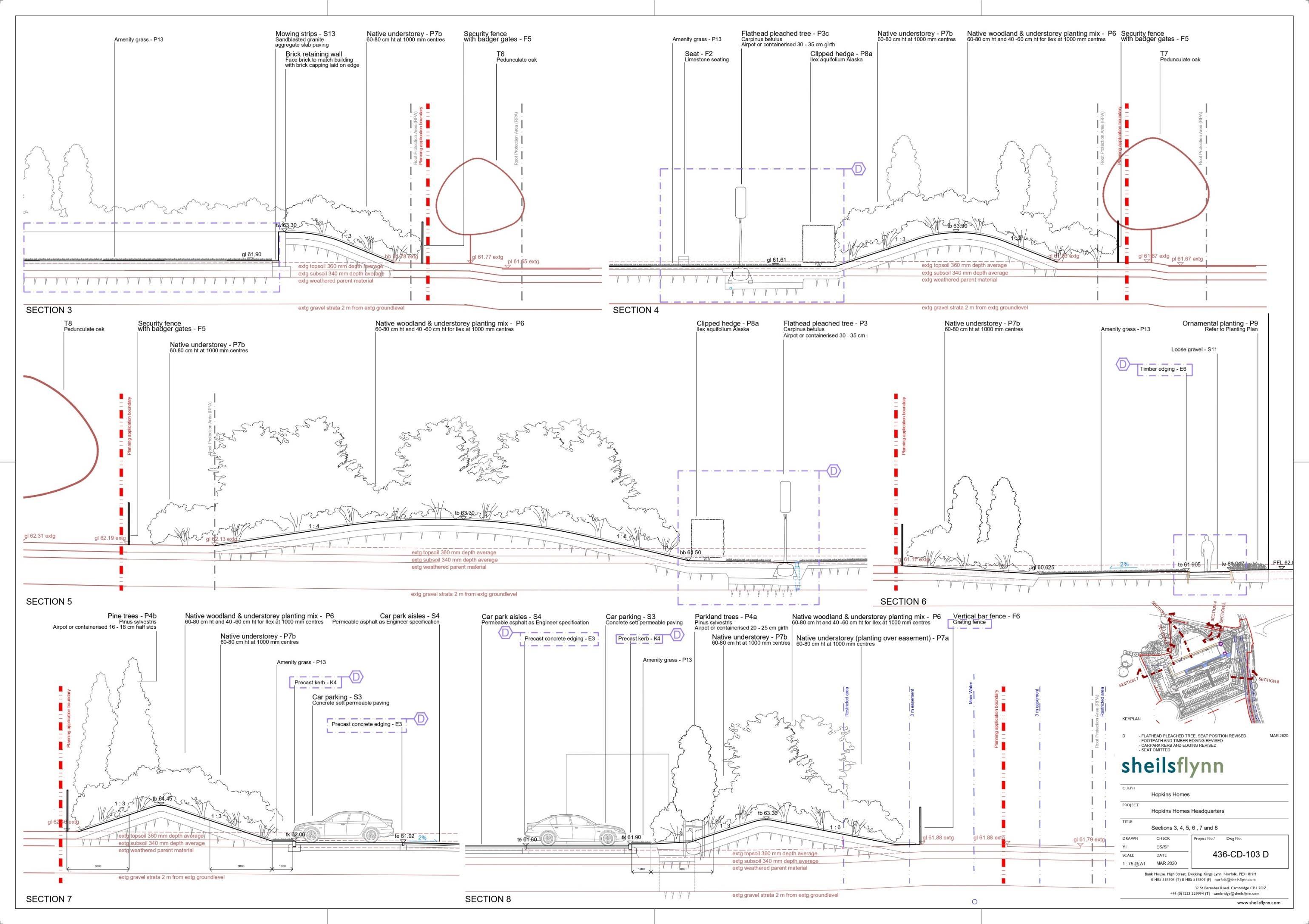
Hopkins homes (Suffolk Business Park Plots) Bury St. Edmunds, UK
Hopkins Homes planned to establish a new headquarters near junction 45 of the A14 roadway, featuring a 2,201 sqm building designed to accommodate 125 car parking spaces with charging points, showers, lockers, cycle storage, and integrated landscaping for their employees. My previous office was commissioned by the client to design this headquarters as part of the Suffolk Business Park (SBP) development. To align with the building design, we proposed a landscape that seamlessly integrated with both the outdoor spaces and the building interior, ensuring enjoyment and visual harmony from every perspective. As part of the landscape planning of SBP, we proposed the creation of woodlands to buffer the new development. At the building entrance, water features and ornamental plantings were incorporated to enhance the overall greeneries and aesthetic.
This project involved extensive experience in construction drawings, where I managed the design phase from strategic planning (referenced in the project above) to the detailed development of landscape plots within the SBP project. The emphasis during construction was predominantly on plantings, as the client prioritised understanding the investment on softscape element first. Consequently, we provided comprehensive construction drawings related to the planting desing on site. This opportunity allowed me to apply my knowledge of plantings, tailored to tthe UK site context, which has been particularly rewarding as the project moves towards construction
Email: o.miffa0910@gmail.com +447789084602
Oktaviana Miffatulani (Vivi)