MADISON
Greiner Brewery
Turn Right on Aulenbauch Ave. to Ryker’s Ridge
Springdale Cemetery
German immigrants brought their brewing traditions with them to Madison. Jacob Salmon opened the first brewery here in 1823. Mathew Greiner moved from Cincinnati in 1854 and built his brewery on the same site. Greiner was best known for his Famous Madison XXX Ale, which sold in cities as far as New Orleans.
Georgetown Historic Marker John Paul Park Heritage Trail
Incline Marker
Eagle Cotton Mill
St. Michaels Catholic Church Shotgun Houses
Greiner’s Brewery Visitor’s Center
Eagle Cotton Mill
Shotgun Houses These simple houses were common among working class families who built their homes near the factories where they worked. Visitors can still find shotgun houses integrated among the old mansions and townhomes of the factory owners.
Heritage Trail The Heritage Trail follows the old railroad from the west end of Vaughn Drive to a paved section, north of Crooked Creek, that ascends the wooded hillside to the State Hospital. The trail is a steep climb for cyclists, but it offers a beautiful view of the river valley and safe access to the hilltop.
Madison Incline The Madison incline is possibly the most important historic site in Madison. Completed in 1841, the incline connected the Ohio River to Central and Northern Indiana along the state’s first railroad. There were no other rail lines or nearby cities to compete with Madison, and the city’s population nearly doubled within ten years.
Old Riverfront
Much of the historic district was built during this era. By the 1860s, Madison’s isolation became its undoing as competing railroads avoided the steep descent in favor of other cities like Indianapolis and Louisville.
John Paul Park and Springdale Cemetery Named after one of Madison’s founders, John Paul Park was once the city’s first cemetery. Today the park is a secluded and peaceful corner of the city. In 1839 the graves were moved down the hill to Springdale Cemetery.
Georgetown The east side of Madison was home to a tense mixture of African Americans, Irish, and German immigrants. Georgetown, a small but prosperous Free Black community, emerged along Walnut Street. In addition to schools, churches, and businesses, Georgetown was a critical stop on the Underground Railroad. Elijah Anderson and George DeBaptist, along with many others, helped escaped slaves cross the Ohio River into
Madison and guided them out of town to Lancaster and Ryker’s Ridge. There were also strong pro-slavery sentiments in Madison. In 1839, a mob raided Georgetown, resulting in shoot-outs with the residents and the attempted drowning of former slave Griffin Booth. Doughfaces chased many of Georgetown’s leaders out of town before the Civil War.
The Lancaster-Dupont ride is another easy to moderate course on the northern edge of Jefferson County. Cyclists can discover the story of the abolitionist community at Eleutherian College, and Indiana’s Civil War history in Dupont. The Eastern Hills route offers the most challenging and scenic rides in the county. Riders wind along the ridges and valleys of the Indian-Kentuck Creek, encountering early farming communities on the way.
Madison’s immigrant community built St. Michael’s, Indiana’s second Catholic Church, between 1836 and 1839. Irish railroad workers utilized stones cut from the incline to construct the church. Life was not easy for Catholics in Madison’s early years. Most lived on the far reaches of town. In the 1850s, nativist mobs raided the homes of Catholic citizens and threatened to burn St. Michael’s.
EASY MODERATE DIFFICULT / HEAVY TRAFFIC GRAVEL
Madison’s idyllic riverfront is a far cry from the scene of the city’s industrial hub. In place of the paved walkway and open parks, imagine a busy landing crowded with riverboats and barges. Trains ran along Vaughn Drive servicing factories and slaughterhouses teeming with livestock. Raucous saloons and hotels entertained river men and factory workers well into the night. As industry declined in the twentieth century, the mills and factories were steadily abandoned. In 1937, the largest flood in Madison’s history destroyed what remained of the old riverfront.
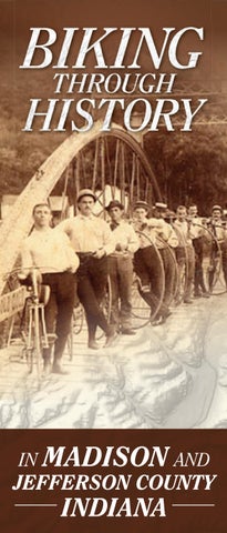
Biking Through History Downtown Madison is a beautifully preserved American river town. Founded in 1811, the city grew from a modest outpost to quickly become the largest city in Indiana. Heavy traffic on the Ohio River and the arrival of railroads spurred Madison’s expansion. Many notable figures in Indiana’s history, such as James Lanier and Judge Jeremiah Sullivan called this city home. By the twentieth century Madison’s prosperity was fading. As a result, Madison maintained its historic character of humble homes, grand mansions, factories, and commercial buildings mingled together. The historic district exhibits grand examples of early American architecture, including the Federal, Greek Revival, and Italianate styles.
Jefferson County offers some of the most scenic cycling routes in Indiana. Rides range from open farmland to rolling hills and deep valleys. Throughout the countryside quaint villages and forgotten scenes reflect the county’s rich history. Downtown Madison is one of Indiana’s historic treasures. Cycling is the perfect way to explore the 133-block historic district. Historic homes, museums, parks, and a lively Main Street provide any number of destinations.
This bicycle tour through Madison explores the fringes of the historic district, the neighborhoods of working-class immigrants, and the history of the riverfront. Madison is easy to navigate and cyclists should also explore the many sights in the center of town. A Walking Tour of Historic Madison Indiana is an excellent companion to this tour.
Madison Visitor’s Center
BIKE ROUTE DIFFICULTY
Old Riverfront
St. Michael’s Catholic Church
The Hanover ride begins at Hanover College,exploring the history of the college and the village of Hanover. The route continues at an easy to moderate pace through level farmland with wide-open views of the surrounding countryside. The Lancaster to Deputy route is a moderately challenging ride through rolling hills and forests along the Big Creek. Riders should imagine country life during the nineteenth century while passing historic villages, churches, and schoolhouses.
This massive mill is the most striking remnant of the second wave of Madison’s industrial era. As the industrial revolution swept the country, a new and larger scale of industry emerged. Built in 1884, the mill was the largest and most modern factory in town, complete with 300 looms, electric lights, and a sprinkler system. Hundreds of workers, many of Irish and German descent, produced muslin, tobacco canvasses, and twine into the 1930s.
Information on events, recreation, dining, and shopping in Madison. 601 W. First Street Madison, Indiana 47250 812-265-2956 | Toll Free 800-559-2956 www.visitmadison.org
Madison Area Bicycle Club This local cycling club hosts weekly rides. Their website features additional bike routes. www.madisonbicycleclub.org
Fizz’z Bike Shop Bicycle rentals and service in Madison. 311 West St. 812-273-3499
IN MADISON AND
JEFFERSON COUNTY
INDIANA
Beyond the hills that surround downtown Madison smaller communities grew up throughout Jefferson County. Many of these towns survive today, while others have nearly disappeared. The rides through the county follow scenic country lanes where adventurers can discover the hidden signs of Jefferson County’s history.