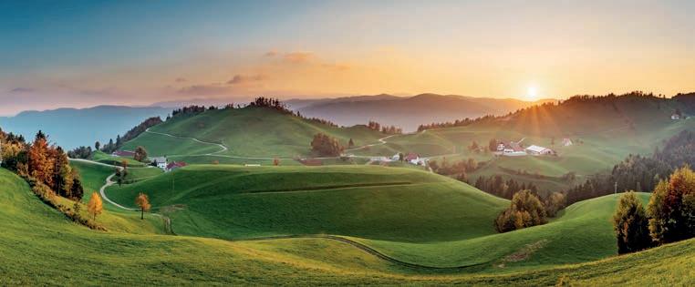
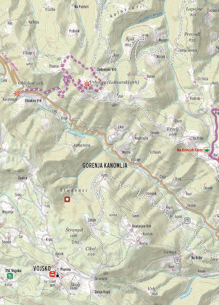
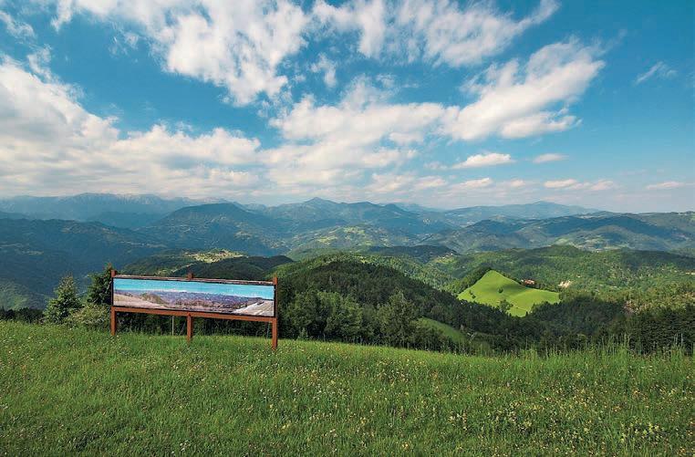
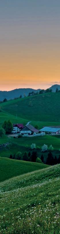
THE KRNICE PLATEAU
The area of the villages of Idrijske Krnice and Masore – where locals jokingly say that even flat land is sloping uphill – is home to kind, resourceful, and hard-working people.


The area of the villages of Idrijske Krnice and Masore – where locals jokingly say that even flat land is sloping uphill – is home to kind, resourceful, and hard-working people.
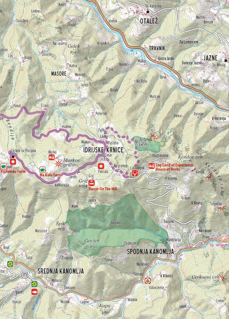
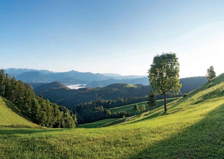
Between the valleys of the Idrijca and Kanomljica rivers, at an altitude of 1,000 m above sea-level, lies the Krnice plateau.
The always hospitable locals are happy to welcome guests in their homes and allow them to experience a world without noise and without the race against time. As well as to try out the healing power of herbs and a variety of excellent dairy products.
The steep slopes of Masore are still home to individual farms where generations have persisted through hard work for centuries.
One could say that the village of Masore is so close, yet so very far away from the rest of the world.
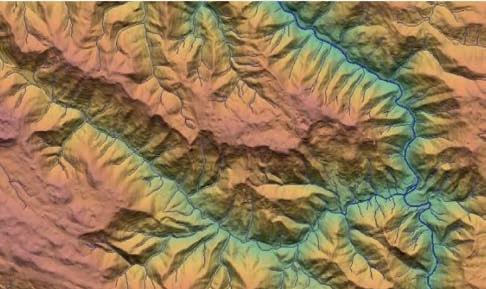
The geology of the Krnice ridge is marked by the strong Krnice fault, which divides the ridge into two parts. It starts near the primary school in Srednja Kanomlja, crosses the Krnice ridge near the Kenda homestead and continues towards Šebrelje. Along the Krnice fault, the northeastern block of rocks droped by several hundred meters. This type of fault – along which one block of rock moves downwards – is called a normal fault. On the northeastern block, up to Jelenk, we find younger Middle and Upper Triassic dolomites and limestones and a thin layer of volcanic tuff and tuffites. Much older rocks can be found on the southwestern side of the Krnice fault. There are Paleozoic rocks of Carboniferous and Permian age (330 to 270 million years), followed by Lower
Krnčan - Vrhovec (Lokvarski vrh)Jerebova Ravine Krnčan Pr Kendu
Triassic dolomite, marlstone with oolitic limestone, various dolomite rocks and volcanic rocks, which in the Pisance area are colored in yellow, reddish, purple, yellowish and brownish shades. On the Kanomlja side below Pisance, there are several layers of red quartz – jasper – among volcanic rocks.
The Kanomlja valley, which borders the Krnice ridge on the southwest side, was formed along the strong regional Idrija fault. The Idrija fault crosses the Kanin mountain range, runs along the valleys of the Soča and Idrijca rivers to Dolenja Trebuša, here it continues along the Hotenja and Kanomljica valleys across Kanomeljsko Razpotje and Idrija, crosses the entire Notranjska region and crosses into Croatian territory at Prezid. A beautiful view of the valley along the Idrija fault opens on both sides from Oblakov vrh.
Cross-section of rocks at Idrijske Krnice and Masore Kendov vrh - StržnicaGalek (831 m)
SW block (Krnice) NE block (Masore)
TRIASSIC
Middle
gray unlayered dolomite dark gray limestone with marl inserts dark gray dolomite white crystalline dolomite and white limestone various pyroclastic rocks light gray unlayered dolomite
Jul Upper
Cordevol
thrust line gray micaceous dolomite
Scythian Scythian
marlstone with oolitic limestone black layered limestone and dolomite quartz sandstone and conglomerate dark gray siltstone and sandstone
erosional surface
Upper Carnian Ladinian Anisian
Lower Lower
erosional surface
Middle
marl limestone gray unlayered dolomite
TRIASSIC
fault direction
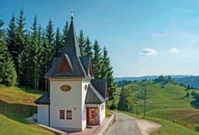
St Florian’s Church, designed by architect Cveto Koder, was built in 2001 and is known for its two beautiful mosaics by Fr Ivan Marko Rupnik. St Florian, the patron saint of firefighters, is depicted on the exterior wall overlooking the valley and protects the homes and the people, while the mosaic in the presbytery depicts an embrace of St Joachim and St Anne and Mary with Jesus, which symbolizes marital and parental love.
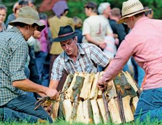
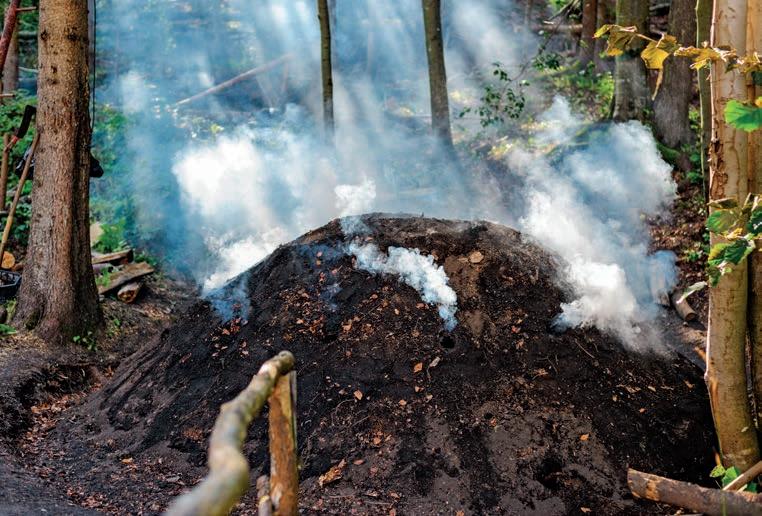
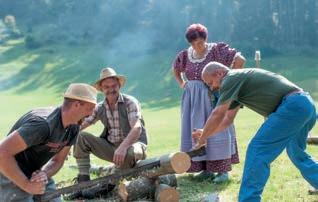
With the opening of the Idrija mercury mine at the end of the 15th century, there was a significant increase in the need for wood. Particularly in the period between the World Wars, charcoal burning was an important source of income for the inhabitants of Idrijske Krnice. These nearly forgotten skills are still kept alive at the yearly Charcoal Burning Festival in Idrijske Krnice.
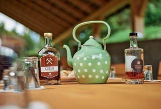
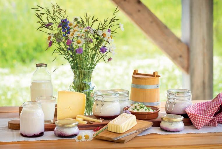
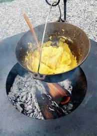
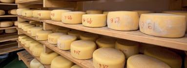
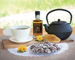
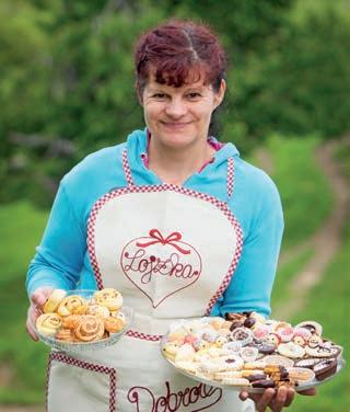
The visitors of the Krnice Plateau are welcomed by the hospitality of its farms and their exquisite home-made products and experiences, which are renowned far and wide. The Krnčan and Kenda farms have revitalized the tradition of dairy products. By prior arrangement, they organize tastings and farm tours for visitors. The Na Kalu farm offers its visitors »Delicacies from Krnice«, such as home-made bread, noodles, and fresh biscuits. At Dežela doživetij Log, guests can have a taste of delicious herbal teas and other products or enjoy a relaxing afternoon in their blossoming gardens. Everyone who would like to spend the night on the Krnice Plateau can find a good night's sleep in the pristine natural environment at Hiška Na Griču.
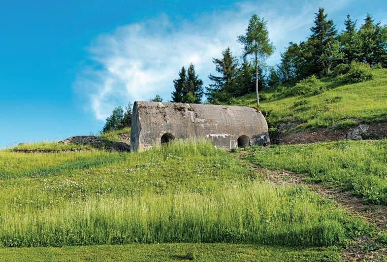
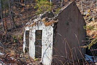
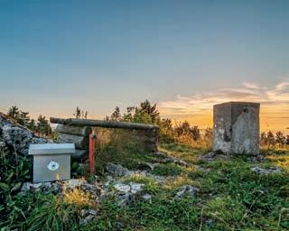
Throughout its history, the Krnice Plateau was not only the stage for geographical, geological, and meteorological changes –it also witnessed a series of tumultuous political events. In the period between the two World Wars, this strategic area right next to the Rapallo Border was the place where a number of barracks were built for infantry and artillery troops. Reminders of those times are the ruins of military buildings in the surroundings of Jelenk, at Prehod, Pancala and the farm Na Griču.
The legacy of this period is a web of roads systematically expanded by Italy between 1927 and 1943, the year of its capitulation. During World War II, the plateau was a refuge for many partisan units, with several makeshift hospitals for wounded soldiers.
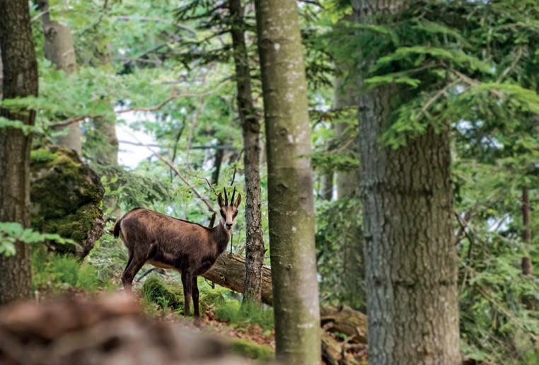
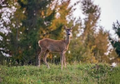
The mixing of the Dinaric Alps, Karst, and the Julian Alps with a touch of Mediterranean influence and a wide variety of rocks allow for an incredibly rich flora to prosper. Jelenk, the highest elevation of Krnice, with its top and upper slopes designated a natural monument, is where the Primula x venusta thrives, along with several protected species of orchids (Orchidaceae) and lillies (Liliaceae), numerous healing herbs such as mountain arnica (Arnica montana), astramontana (Inula hirta), and broad-leaved thyme (Thymus pulgioides subsp. montanus). The plateau is home to different species of animals, the most numerous among which are deer and stags. On the rocky slopes, we can see the Alpine chamois. The plateau is populated by boars, foxes, hares, and –rarely – even bears.

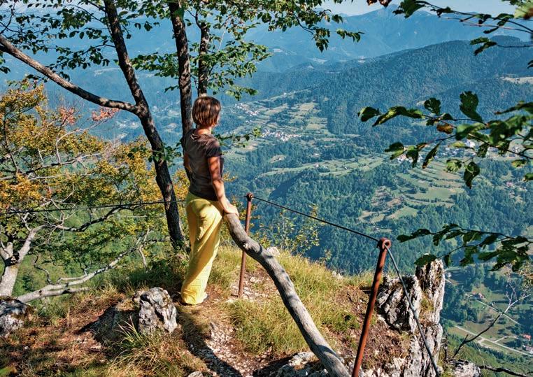
The varied terrain of the Krnice Plateau offers quite a few beautiful scenic peaks. Jelenk (1,107 m) is the highest peak and, at the same time, the most botanically diverse. Just below the top of Jelenk, at the viewpoint on the slope above the Idrijca river, there is a beautiful view of the hills of Škofja Loka and Polhov Gradec, the last pre-Alpine mountains and the Alps.
Undoubtedly, the most beautiful view opens from Lokvarski vrh or Vrhovec (1,079 m), where the view reaches all the way to the Dolomites, the Western Julian Alps and the Kanin mountain range.
Wide views also open from Markov grič (1,061m), where the view reaches all the way to the Carnian, Julian and Kamnik Alps to Krim and Snežnik in the south.
 The peak of Jelenk.
Serpentine road above Oblakov Vrh.
The peak of Jelenk.
Serpentine road above Oblakov Vrh.
Starting point: Oblakov Vrh mountain pass
Length: 9 km
Hiking time: 3 h 45 min
Elevation gain: 364 m Difficulty: easy hiking trail
Oblakov Vrh is the location of the fault zone of the famous Idrija Fault, one of the strongest and most important faults in the Southern Alps.
From the top of the hill of Lokvarski vrh or Vrhovec (1,079 m), where there is a panoramic sign, you can enjoy a beautiful view across the Šebrelje Plateau, the Trnovo Forest, the Idrija, Cerkno and Škofja Loka hills and, with good visibility, all the way to the Julian Alps.
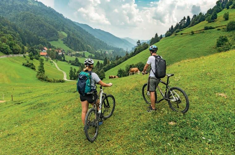
Starting point: The Idrijske Krnice-Masore crossroads
Length: 9 km Cycling time: 1 h 15 min Elevation gain: 204 m Difficulty: easy cycling trail
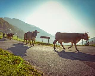
The path leads across the plateau, whose inhabitants, from generation to generation, with a respectful attitude towards nature, preserve the cultural landscape and cherish the values of the farmer's way of life. This enables the plateau to remain alive and populated. Today, in addition to cultivating the land, the locals devote themselves mainly to animal husbandry and forestry.
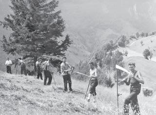
Farmstead chores in the past…
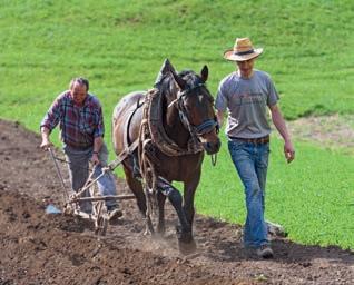
…and in the present.
m
Starting point: The Idrijske Krnice-Masore crossroads
Length: 4 km Hiking time: 1 h 30 min Elevation gain: 202 m
Difficulty: easy hiking trail
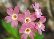
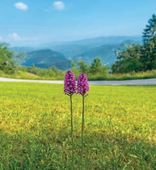
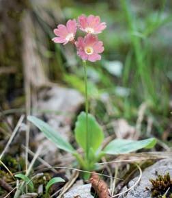
The pristine natural ambience of Idrijske Krnice and Jelenk is home to a rich array of local flora, including an endemic plant that thrives in this area: the Carniolan primrose (Primula x venusta).
Jelenk Fajkt
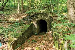
It is said that even Frederick Augustus I of Saxony wanted to see this unique botanical specimen, which is why Jelenk is also called "the royal botanical mountain". Besides the varied flora, you can also observe the fortifications of the Alpine Wall along the trail. They were built in the area of Idrijske Krnice during the interwar period between WW1 and WW2 by the Italian army.
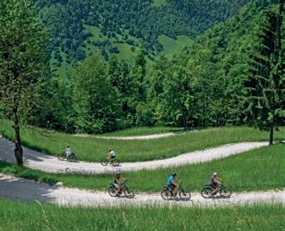
The Krnice Plateau is an excellent starting point for exploring the surrounding attractions. Go for a scenic bike ride through the Kanomlja Valley, through which the famous Idrija fault passes, and visit the mighty klavže of Kanomlja. A true hidden gem is the Govškarica basin, along which the trail leads from the Kanomlja Valley to the Krnice Plateau. The path, which passes picturesque waterfalls and pools, will not leave any lover of unspoiled nature indifferent.
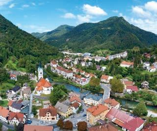
Along the way to the plateau is Spodnja Idrija - a hospitable place by the river Idrijca, which is a true paradise for all flyfishing and culinary enthusiasts.
A winding country road from Idrijske Krnice leads all the way to the picturesque village of Šebrelje. Not far off lies one of the most important sites of the Paleolithic in the world – the Divje Babe Archaeological Park. Next to the Church of St. Ivan, which is built in a place with exceptional natural energy, you can enjoy a wonderful view of the surrounding hills and steep ravines.
 Spodnja Idrija.
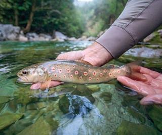
Brown trout (Salmo trutta).
Spodnja Idrija.
Brown trout (Salmo trutta).
• Farm "Na Krnicah"
Idrijske Krnice 4, 5281 Spodnja Idrija t: +386 31 512 848
• Farm "Pr’ Kendu"
Idrijske Krnice 1, 5281 Spodnja Idrija t: +386 41 205 903
• Farm "Na Kalu"
Idrijske Krnice 35, 5281 Spodnja Idrija t: +386 51 371 085 (afternoon)
• The Land of Adventure (Dežela doživetij Log)
Idrijske Krnice 45, 5281 Spodnja Idrija t: +386 31 608 247
• House on a Hill (Hiška Na Griču)
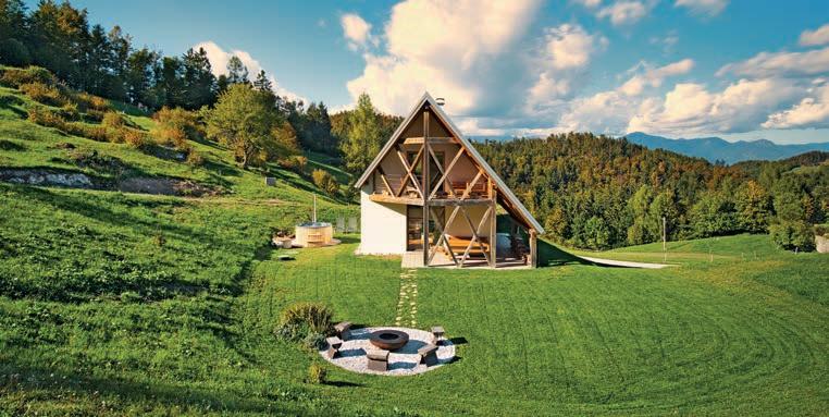
Idrijske Krnice 40a, 5281 Spodnja Idrija t: +386 31 695 780
• Pancala Picnic Area
• Jelenk Hunters' Association
• Sunday of Charcoal Burning (last weekend in August)
• Gathering of Village Musicians (Saturday before Carnival Saturday)
• Hike to Jelenk (Pentecost Sunday)
• St. Florian's Sunday (Sunday before 4 May)
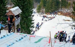
• Ski jumping in Pancala (in January or February)
Area: 50,30 km2

Highest elevation: Jelenk (1107 m)
Lowest elevation: Travnik (275 m)
Settlements: Idrijske Krnice, Gorenja Kanomlja, Masore Rivers and streams: Idrijca, Kanomljica
Most frequent rocks: various dolomites and limestones with fossils (of shellfish and snails), marlstones and colorful pyroclastic rocks
Main forest types: Dinaric fir and beech forests (Abieti-Fagetum dinaricum)
Botanical peculiarities: Carniolan primrose (Primula carniolica), Idrija primrose (Primula x venusta)
Scenic peaks: Jelenk (1106 m), Vrhovec or Lokvarski vrh (1079 m), Markov grič (1061 m)
Lokvarski vrh
Oblakov vrh Masore
Gorenja Kanomlja
Jelenk Idrijske Krnice
Spodnja Kanomlja
Idrijca Travnik Spodnja Idrija Govškarica Kanomljica
Srednja Kanomlja
Above the valleys of the Kanomljica and Idrijca rivers rises the Krnice Plateau with an average altitude of 900–1,100 m. The only settlement on the plateau is Idrijske Krnice, a typical dispersed mountain settlement. You can reach the plateau from Spodnja Idrija from Spodnja Kanomlja, from Oblakov Vrh or from Šebrelje. Oblakov vrh is accessible via the main road from Spodnja Idrija and the Kanomlja Valley. The valley road then continues along the Hotenja valley to Dolenja Trebuša, and in the west branches off towards the Vojsko Plateau.
d.o.o. • Circulation: 5000. Idrija, January 2023.
 Publisher: Idrija Tourism Board. • Concept: Nina Erjavec, Katarina Kenda • Editors: Nina Erjavec, Katarina Kenda Text: Nina Erjavec, Katarina Kenda, Mojca Gorjup Kavčič, Urška Bajec Rupnik, Jože Čar, Metka Rupnik, Lara Lapajne Golob, Anka Rudolf • Proofreading: Jaka Čibej • Photography: Andrija Majsen, Gregor Kacin, Bojan Tavčar, Anka Rudolf, Strga Photography, Grega Žorž, Jošt Gantar, Marko Šinkovec, Ivan Majc, Katarina Kenda, the archive of Ivan Vončina, the archive of the Idrija Tourism Board • Design: Ivana Kadivec, Jaka Modic • Maps: Kartografija d.o.o., Rafael Bizjak • Geological cross-section: Jaka Modic, adapted from Čar (2022) • Print: Papirus Print