Highest point on site Lowest point on site
Vegetation and Contour
The diagram on the left shows the contour and vegetation on the site. The site has an irregular contour which needs to be sustained as part of the preservation of the historic ruins on the site. This irregularity can lead to the site being not wheelchair friendly enough, even though a wheelchair access is provided to the site through the St. Nicholas Walk.
When we look into the Vegetation, it can be observed that they are concentrated towards the North east side of the site. Some scattered vegetation can be seen on the northwest and southwest ends. The site is adequately buffered from the Welles Street on the North by the medium canopy trees along the borders.
However, the site is completely exposed on the south side to the busiest road around it, and lacks any type of buffering. This can lead to the site experiencing more noise pollution from the A47 road.
Drainage
Sewer drains can be observed along the west, south and east sides of the site. The highest point in the site is at the northwest corner, hence the rainwater runoff will happen from the northwest to the southeast. The highest point of the surrounding however is at the southeast end of the site. Therefore the surface drainage flow occurs from south east to north and southeast to west from the A47.


Street Lights
Public Seating
Parking Metre
Trash Can
Traffic Signal
Post Box

Bollards

The above map shows the locations of man made features like Street Lights, Public Seating, Parking metrs, Trash Cans, Traffic Signals, Post Boxes and Bollards. The roads around the site are well lit at night as they are lined with sufficient street lights. Public seating are scarce in the area since it is a heavy traffic area where people and vehicles are constantly moving around and other than the River Soar, the area does not provide a view to sit and look at. Parking on the Talbot lane is metreed. There are two post boxes situated to the west and east of the site, at a distance of about 260 metres from each other.
Ground-cover and Condition


The map represents the ground cover of the site.
The corridors of the west wing of the building, visible from the outside are paved with stone blocks which gives an earthy ambiance to the building. The north wing of the building is also paved with smaller stone pavements, to provide continuation and unity.
The open area in the middle has two types of natural ground cover. The ruins of the Roman Bath House substantially characterizes the area. The spaces between the ruins of Roman Bath house and pedestrian paths provided on the site are covered with grass. This gives the site some kind of landscape features and the green patches are refreshing to the eyes.
 F ig 6.0.1: Location of Man-made features in and around the site.
F ig 6.0.3: Ground cover and Condition.
F ig 6.0.2: Significant Man Made Features in and around the site.
Stone Pavement Stone Pavement Roman Wall Ruins Grass covered Terrain
It can be observed from the map that the region has more multistory buildings that single storey buildings. The buildings to the immediate surroundings of the site are predominantly multi storey as well. Taller buildings dominate the outer parts of the map.
It can also be observed that when it come to unity of identity, height is not a strong character of the region, since the buildings are not harmonious in height.
We can see from the section that the taller buildings surrounding the site can overshadow the site, especially due to the Contours and depression of about 3 metres from the street level


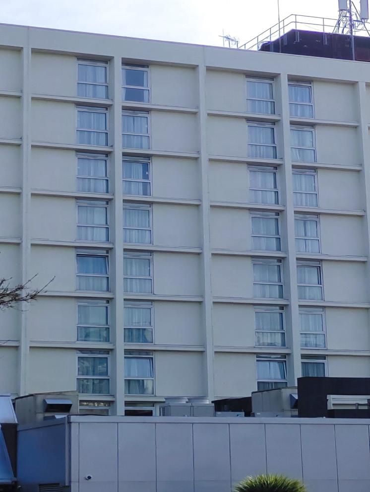
The site is surrounded with unsympathetically designed multi-sto rey buildings, including the Merlin Wharf Apartments, Empire Ser vice Apartments and the Holiday Inn. These are visible from the vicinity of the site and play a major influence on the skyline of the city, around the site, as well as the enclosure ratio of the streets surrounding it.
he spire of Leicester Cathedral and the tower of St. Nicholas Church are also two main visual points that can be observed from the site. The former is a major identifying feature of the pseudo-fingerprint of the City of Leicester.


The map shows the texture study of facades and ground around the site. It can be observed that there is a mix of traditional, modern and historical materials in the facades seen around. The Welles street showcases traditional facades, where as the Bath lane shows a dominance of Modern facades. In the Talbot lane, a mix of both traditional and modern facades can be observed. The St. Nicholas Church on the east of the site stands out with it’s brick and stone facades and stained glass window.
Vehicular Movement
Bicycle Movement
Pedestrian Movement
Tactile Paving
Traffic Calming Area
Traffic Signal


The map shows the circulation around the site. The movement happening around the site, i.e. along vehicular pathways, pedestrian pathways and bicycle trails are demarcated. Measures taken to ensure easy flow of vulnerable road users are also depicted on the map. These include traffic calming areas and tactile pavings. Traffic signals and bus stop markings are provided to direct motor vehicle users as well.


TRAFFIC CALMING AREAS
The traffic calming methods used on roads along the immediate surroundings of the site are as follows.

A47 ROAD
The A47 road along the south-east of the site has a loading bay, a bus bay and a drop off point. The traffic calming methods used on this 4 lane road is a Pelican crossing.
TALBOT LANE
The entrance to the Talbot Lane from the A47 Road is provided with a Sinusoidal Profile Hump at the intersection, followed by a surface texture treatment using block pavements throughout the lane. This ensures that the driver is alerted about the character change of the Lane from a busy vehicular road to a residential road.
BATH LANE
The Bath Lane, is provided with block pavements and entry treatment. These are used as a visual aid for drivers to ensure a considerable reduction in the speed of vehicles and to let drivers know that they are leaving a major road and entering an area of different character, i.e. a private lane. A difference in surface texture is also provided at the three way intersection with the Welles Street and the following private lane for the apartments along the lane.
WELLES STREET
The intersection of Holy Bones and Welles Street begins with a Sinusoidal Profile Hump, following which the street is completely block paved. Like mentioned above, a difference in surface texture is provided at the intersection with the Bath Lane using different types of pavings. It can also be observed that a slight hump is also provided at the changing point of pavings.
Even though there are traffic calming measures undertaken along the lanes around the site, it can be observed that there is a need for more measures in order to ensure a smoother flow of pedestrians and cyclists from the City centre to the site. This is most required at the intersection of the A47 Road and the St. Nicholas Place, adjacent to the Jubilee Square. The St. Nicholas Place currently acts as a transition space between the High Street and the A47.
Fig 7.1: Circulation around the site Fig 7.4: Sinusoidal Hump Treatment on Talbot lane


 F ig a: View from Nicholas Circle
F ig c: Bird’s eye view of site.
F ig d: View of Jewry wall musuem from courtyard.
F ig e: View of Jewry wall from courtyard.
