CULMINATING THE CORE
 Viraj Solanki
CONTENT
▪ Vision
▪ Concept
▪ Land use
▪ 3d massing
▪ Road Network
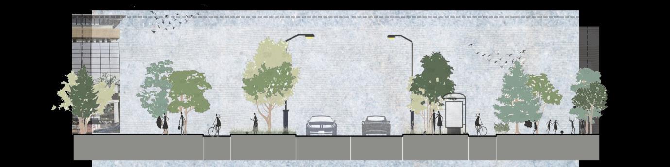
▪ Streetscape Design
▪ Scenic Street
▪ Major Public Space
▪ Design Visualization
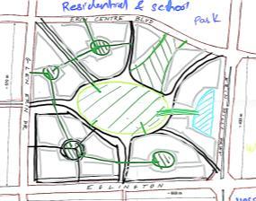
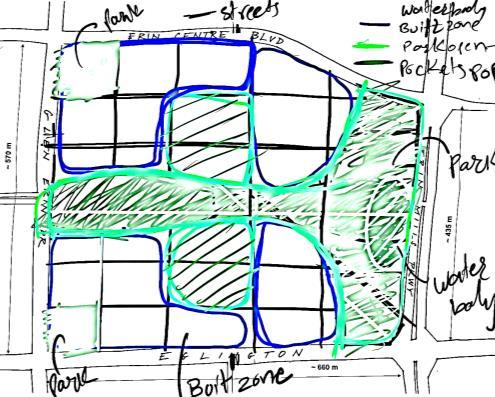
VISION
The concept envisions scenic stretch seamlessly integrating nature and built to inspire and revitalizes the surrounding environment. The land use is derived from existing context analysis bridging the gap of the neighborhood by providing various mixed use functions The notion promotes sustainability by integrating nature, community, and innovation to create a peaceful and resilient environment.
CONCEPT
Mixeduse built
Institutional built + Residential built Commercial built
Recreational built
Institutional Residential Road Network Commercial Recreational
Guiding Principle
▪ Establishing a network of lush green spaces and public areas that seamlessly connect and enrich communities.
▪ Developing lively and inclusive communities
▪ Develop self-sufficient and walkable mix-use neighborhoods.
▪ Creating a sense of place that is unique to its context
Residential Commercial
Institutional Recreational Recreational

+
Circulation
District
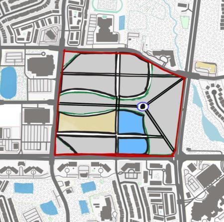
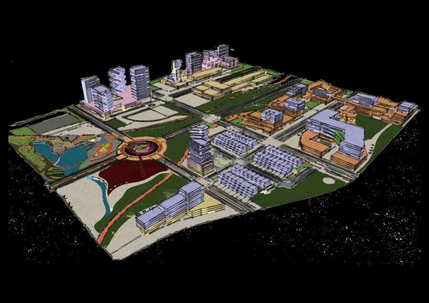
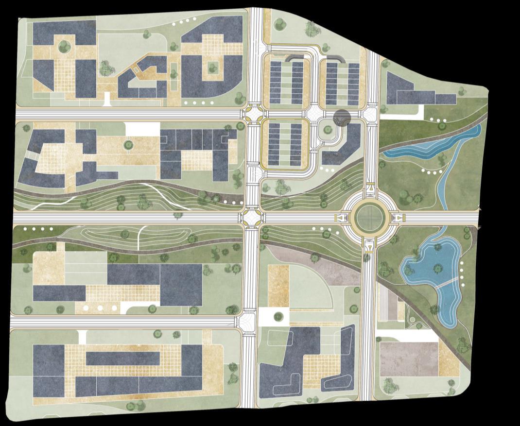
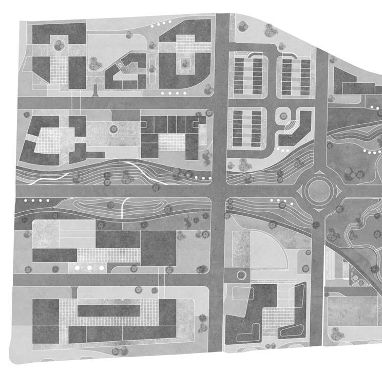
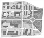
LAND USE
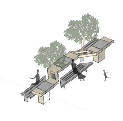
Food court along the green corridor contributes to the aesthetic aim by encouraging public participation The notion is to establish a high school and daycare building with student accommodation, filling the void of institutional spaces around the neighborhood. It will address the insufficiency of institutional spaces while fostering holistic education and community growth The concept envisions a high-rise building harmoniously paired with a public athletic field bridging the gap in community sports facilities and creating a vibrant urban space that promotes active lifestyles and community engagement
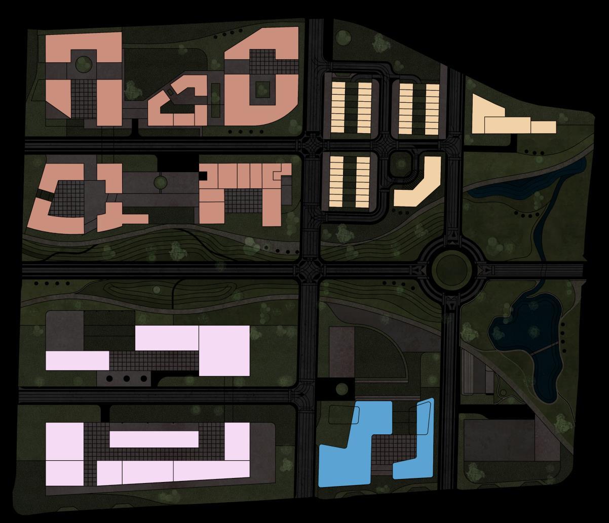
Institutional Commercial Erin Centre blvd. Eglinton avenue w. Erin mills Pkwy Residential Recreational LAND USE PLAN
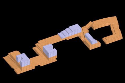

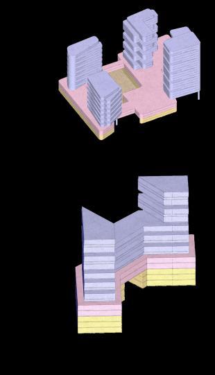
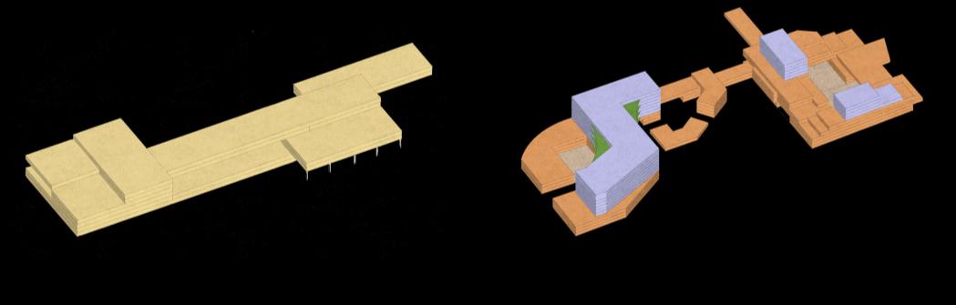
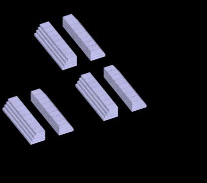
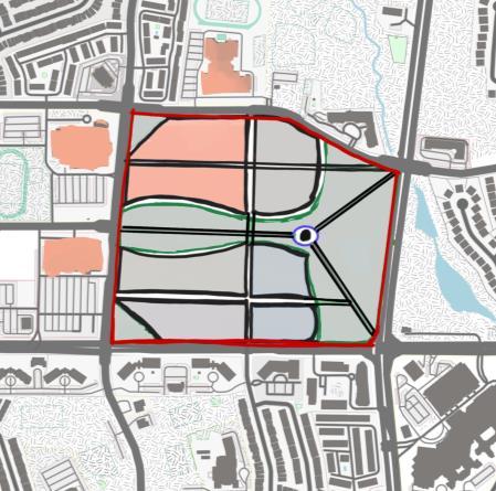
Institutional Commercial Residential Recreational 3D MASSING
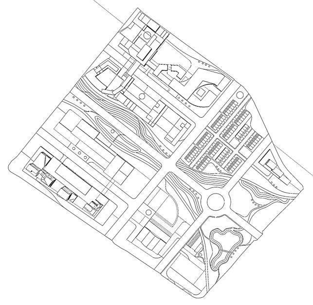
1. 2. 3. 8. 7. 6. 4. 5. 1.
8.
2.
7.
5.
6.
4.
3.
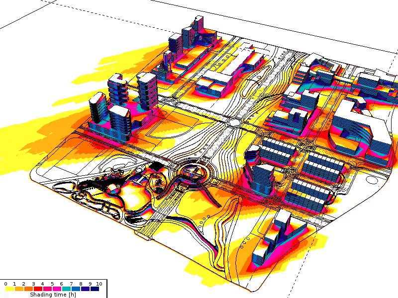
3D MASSING PLAN SHADING TIME
Pedestrian Connection
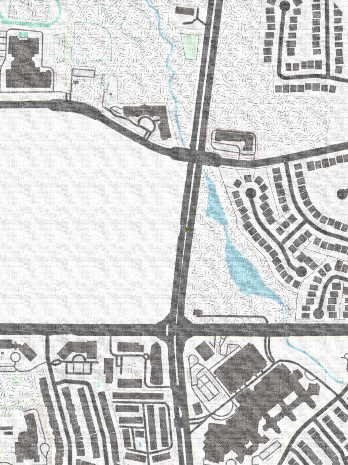
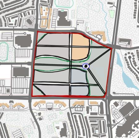
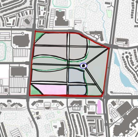
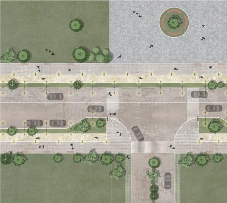
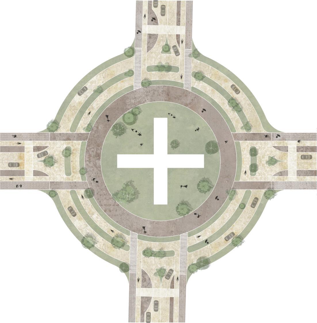
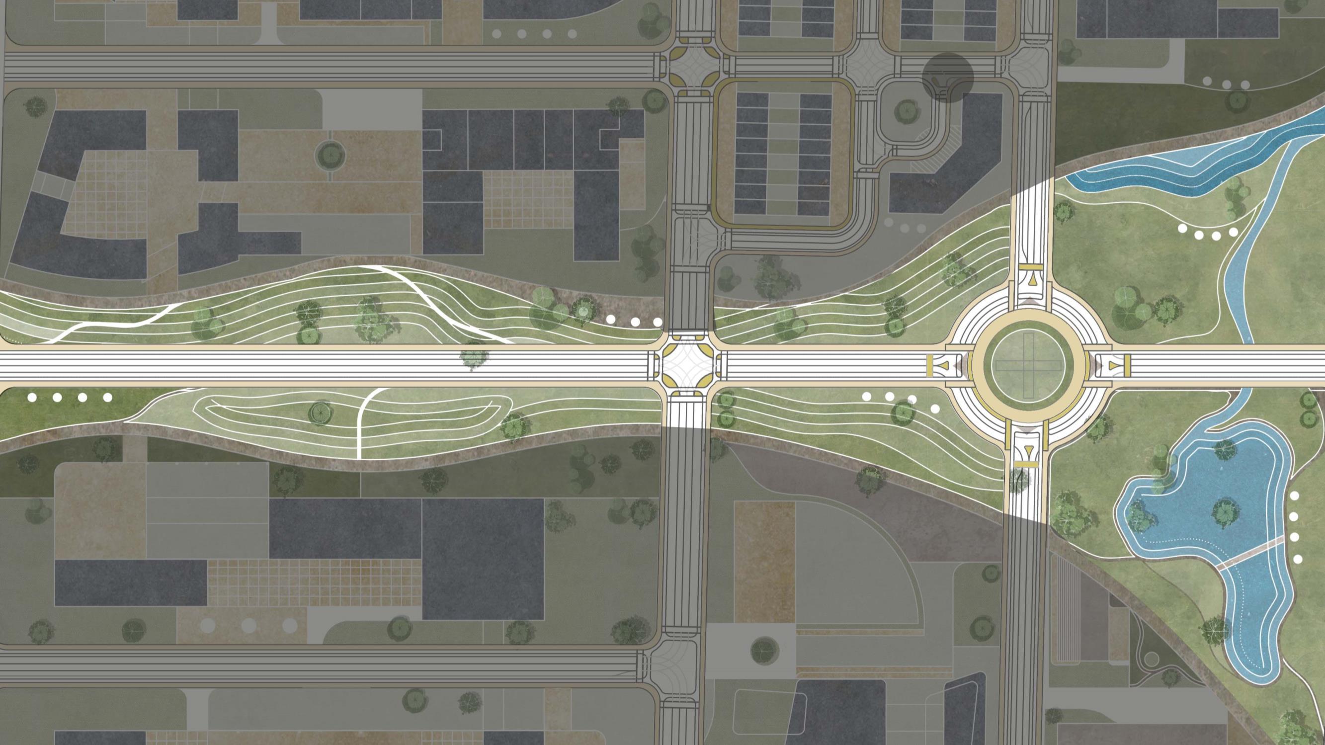
Road network is designed in a way to make it accessible for pedestrians and it creates connections to the built all around the site. While each street has dedicated bicycle lane and intersection is also designed to prioritize pedestrian and cyclist activities. Pedestrian access
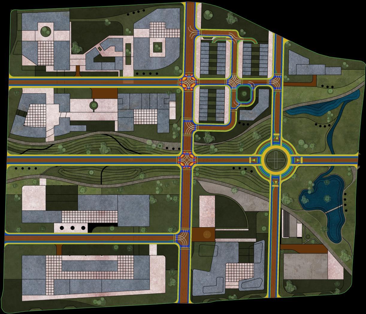

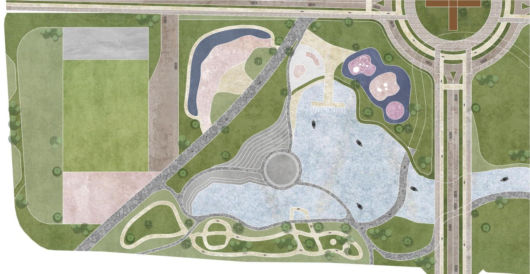
1. 1. 1. 1. 2. 3. 4. 11. 11. 11 12. 12. 8. 7. 6. 5. 9. 10. 13. 13. 1. Institutional built 2. Kinder garden school 3 Food court 4. Commercial 5 Indoor sports complex 6. Sports ground 0 30 90 120 Meter 7. Multiuse court 8. Skate Park 9 Open event ground 10. Amphitheatre 11. Townhouse 12 Highrise residence 13. Trail
120 Pedestrian access Green Buffer Vehicular access Bike lane
Road Network Plan
ROAD NETWORK
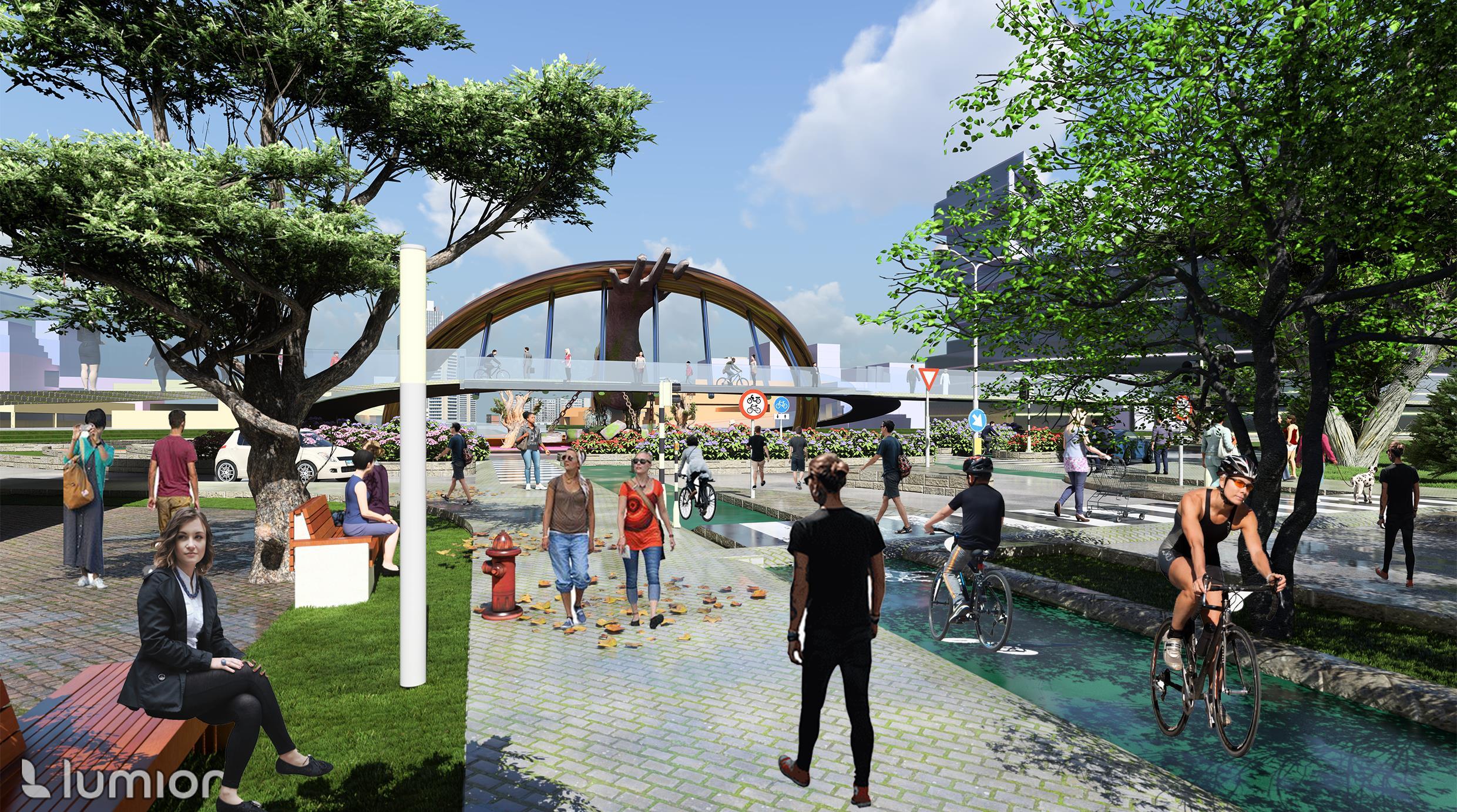
STREETSCAPE DESIGN
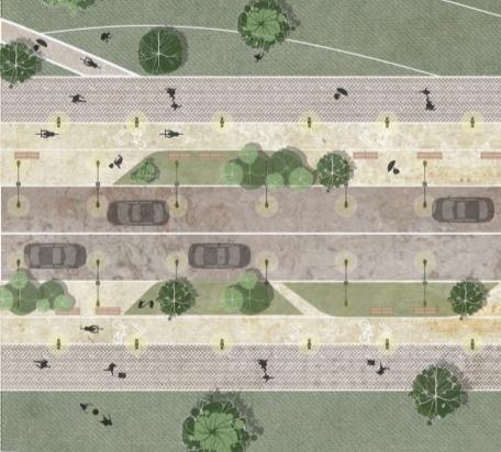
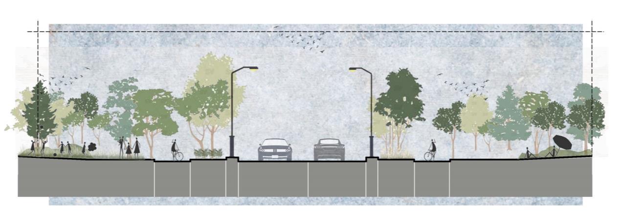
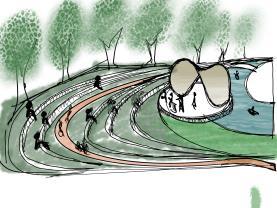
Scenic Street
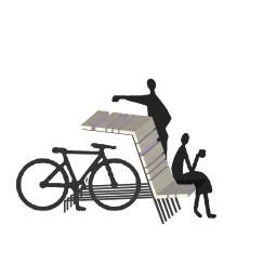
Integrating with surrounding trails, this scenic street boasts a dedicated cycle lane, well-appointed street furniture, lush pedestrian pocket spaces, and inviting green contours fostering leisure and recreation
This commercial street features distinct retail and commercial spaces on either sides, accompanied by pedestrian walkways adorned with greenery, a duallane roadway with designated parking.
Section Plan 1.8 M Bike lane 2.5 M Green Buffer 2.5 M Sidewalk 3.2 M Drive Lane 3.2 M Drive Lane 2.5 M Green Buffer 1.8 M Bike lane 2.5 M Sidewalk Commercial Street Section Plan 3.5 M Drive Lane 3.5 M Drive Lane 1.2 M Green Buffer 1.8 M Bike lane 2.75 M Sidewalk 2.5 M Parking Lane 1.8 M Bike lane 1.2 M Green Buffer 2.75 M Sidewalk
STREETSCAPE DESIGN
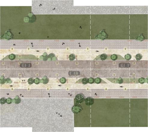
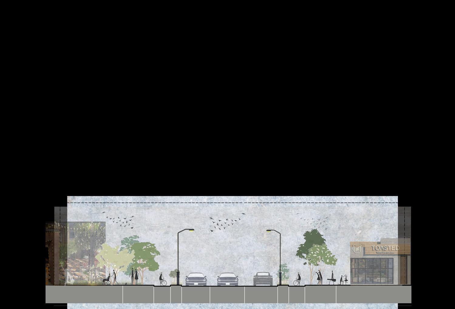
College Road
College Street harmoniously accommodates educational institutions with expansive pedestrian pathways, secure bicycle lanes, dedicated seating zones, and two lanes for vehicular traffic.
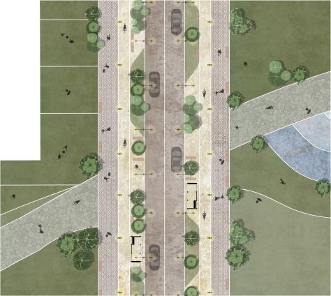
The central road anchored by public bus stops, the central street boasts broad pedestrian pathways seamlessly linking to surrounding trails, flanked by dual vehicular lanes, adorned with public furniture, and scatter with refreshing green spaces.
Section Plan 3.2 M Drive Lane 2.1 M Green Buffer 2.8 M Sidewalk 3.2 M Drive Lane 2.1 M Green Buffer 1.8 M Bike Lane 1.8 M Bike Lane 2.8 M Sidewalk Central street Section Plan 3.5 M Drive Lane 3.5 M Drive Lane 1.6 M Green Buffer 1.8 M Bike lane 2.75 M Transit Shelter 2.7 M Side Walk 1.6 M Green Buffer 2.75 M Transit Shelter 2.7 M Side Walk 1.8 M Bike lane
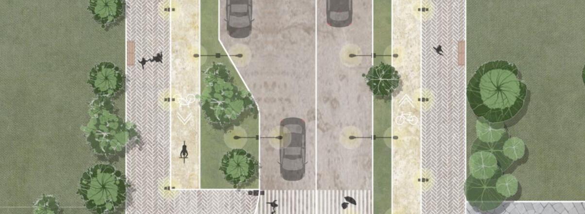
STREETSCAPE DESIGN
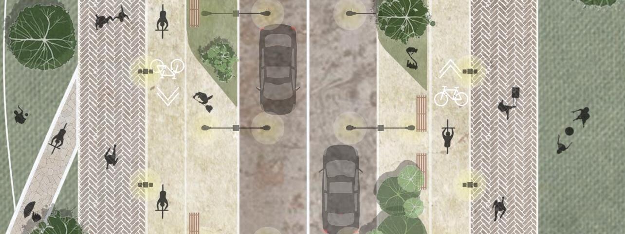
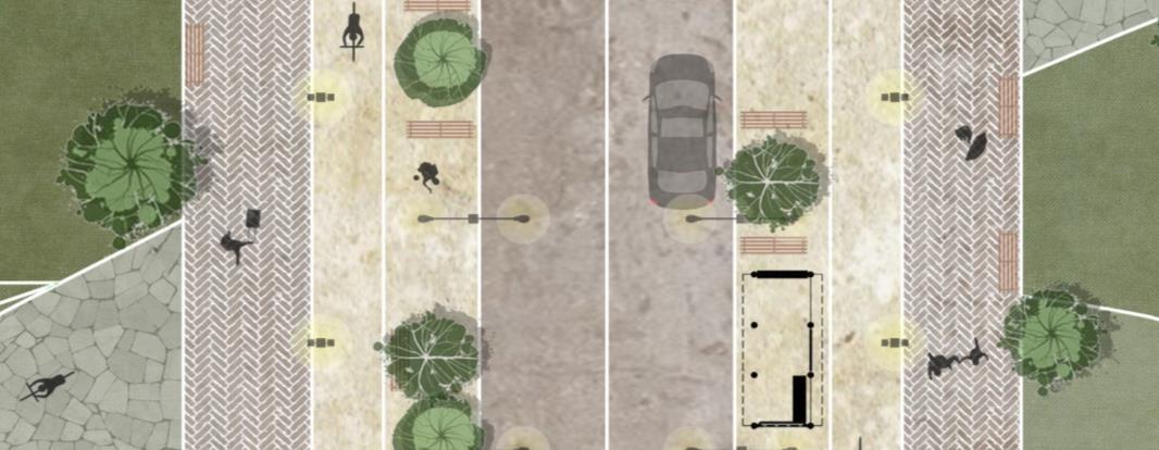
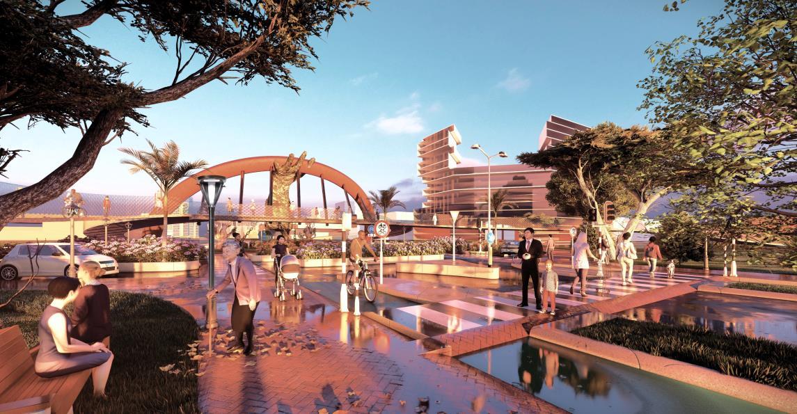
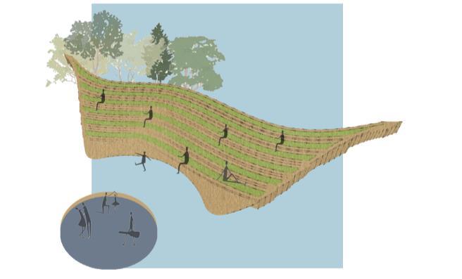
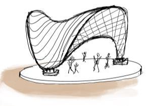
At the pivotal site intersection, an elevated pedestrian pathway serves as an observatory offering views of the surroundings, including the central green space
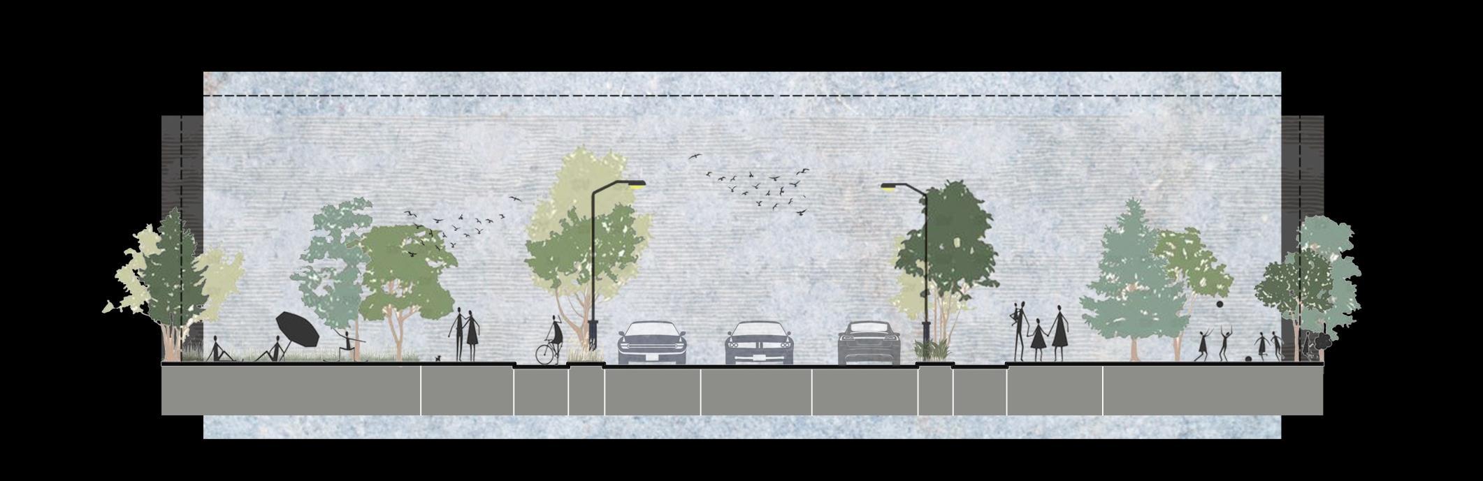
Intersection 3.5 M Drive Lane 3.5 M Drive Lane 1.2 M Green Buffer 1.8 M Bike lane 2.75 M Sidewalk 3.5 M Street Parking 1.8 M Bike lane 2.75 M Sidewalk 1.2 M Green Buffer
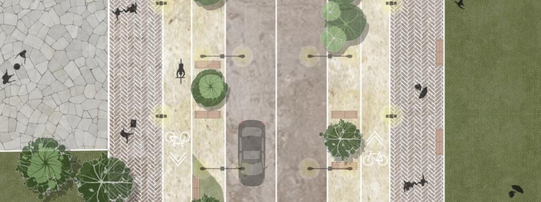
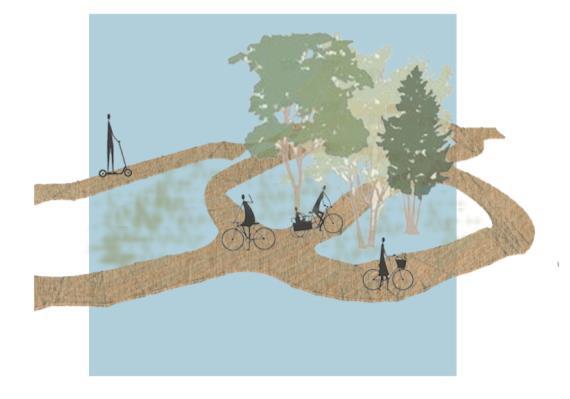
SCENIC STREET
Scenic street is designed in a way that it has trails alongside the street with different functions complimenting adjacent land use and leads towards major intersection creatingvistas.


Plan
Drive Lane
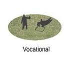
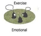
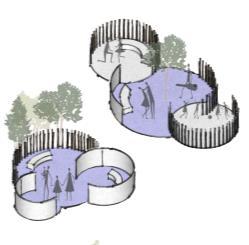
7PocketPark Social Spiritual Spiritual Intellectual Vocational Emotional Exercise
PopupLibrary
PopupLibrary ReadingNook ReadingNook
Picnic Patio Takeout Patio Takeout Patio Jungle Gym Jungle Gym Jungle Gym
JungleGym PlayArea
1.
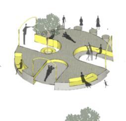
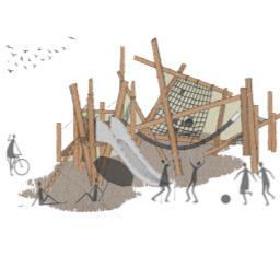
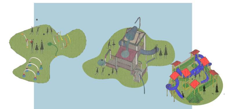
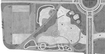
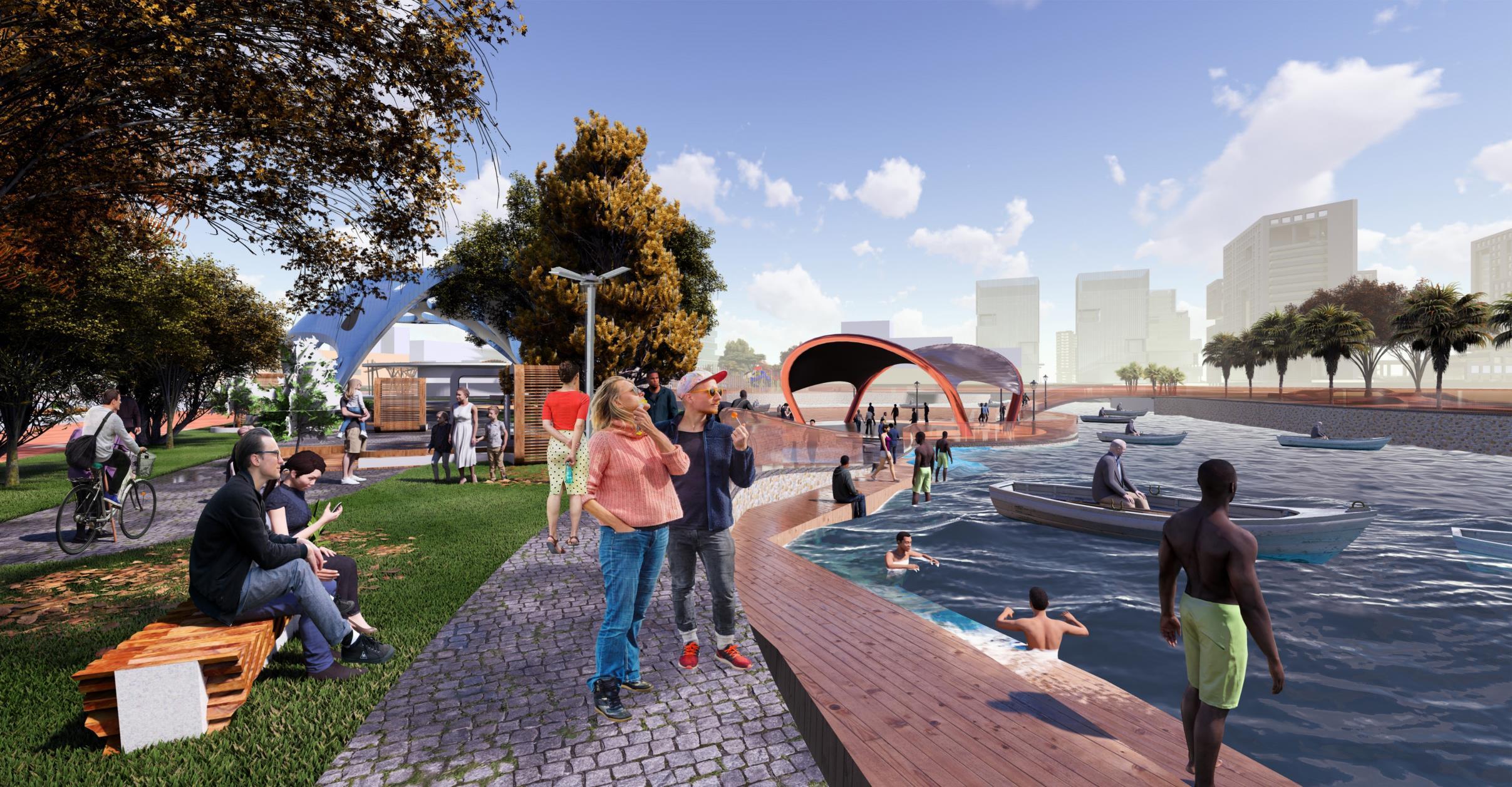
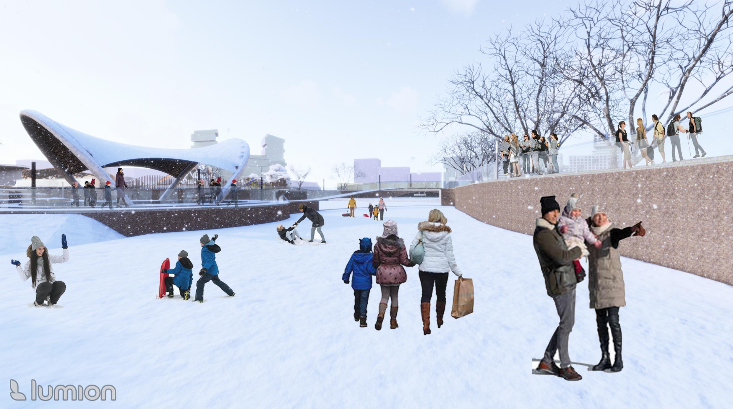
Major pubic space provides multiple activity catering every age group and will act as a gathering space for different seasons as it serves various purpose through out the year Anji plays will give and educational play experience to kids, spray park will provide an adventure activity in summer, amphitheater will be an added gathering space and waterbody connected through creek will have boating and kayaking in summer and ice skating in winters

Sand
Spray
Boating/ Kayaking
Amphitheatre
Bike Park
Space 10 30 60 0
1. Anji Play 2.
Pit 3.
Park 4.
5.
6.
7. Event
1. 2.. 3.
4.
PLAN 3. 5. 6..
5. 6. 7.
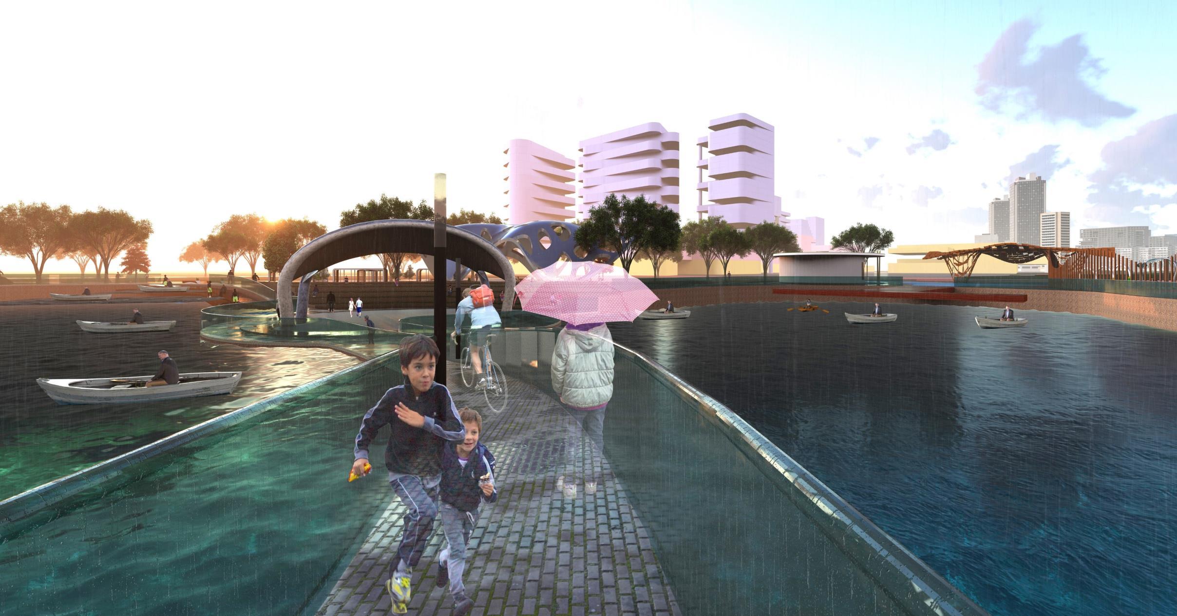
MAJOR PUBLIC SPACE

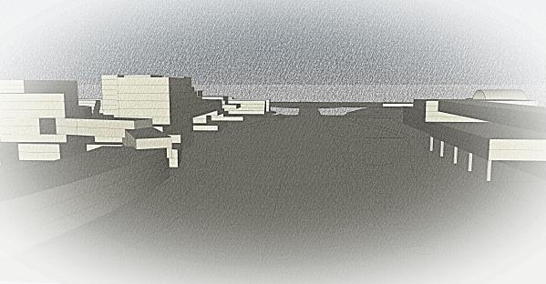
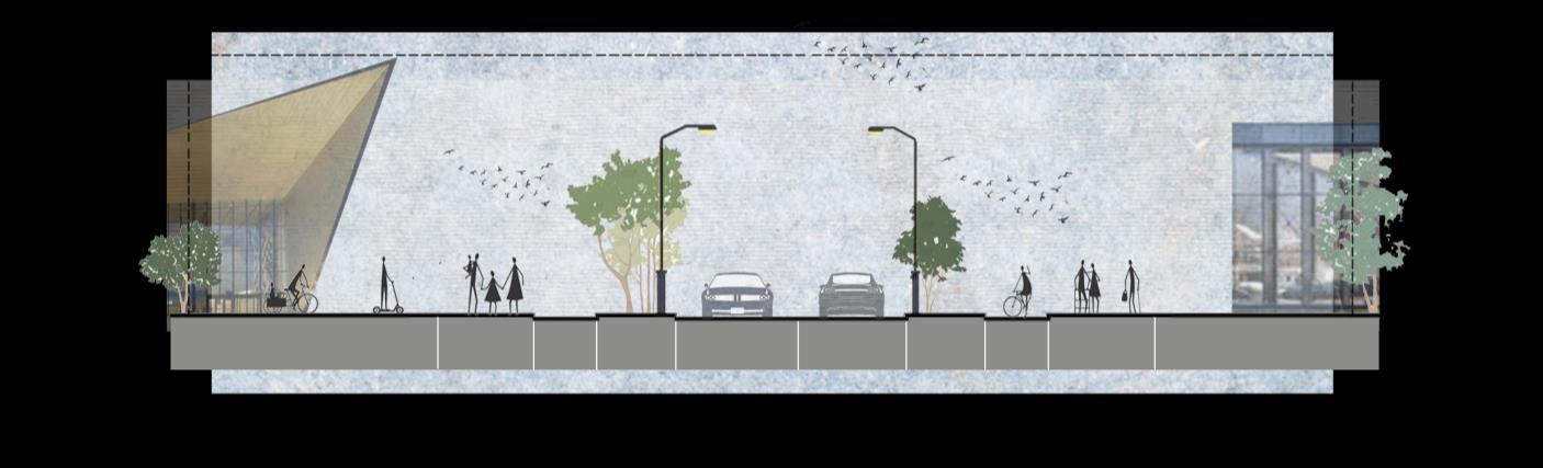
VIEW 1
View form scenic street toward raised viewing deck.
View
VIEW 2
from connecting bridge on the waterbody.
VIEW 3
View from pedestrian connection toward amphitheater.
4
VIEW
Winter view of lake
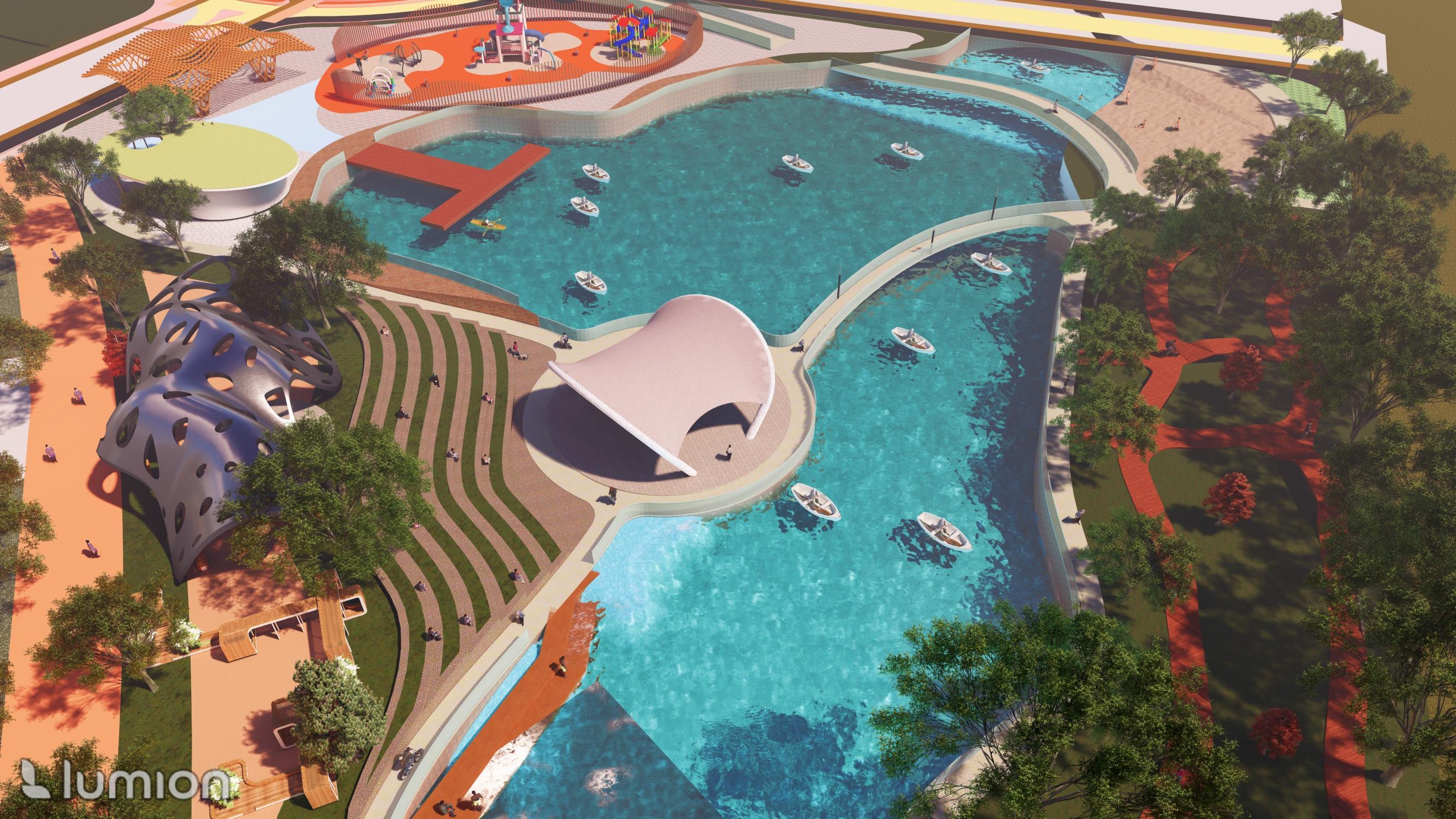
VIEW 5 Arial view of major public space.
