DESIGN CODE


This document contains proprietary intellectual property. It should not be replicated by other parties without consent from SEW.
Document Control
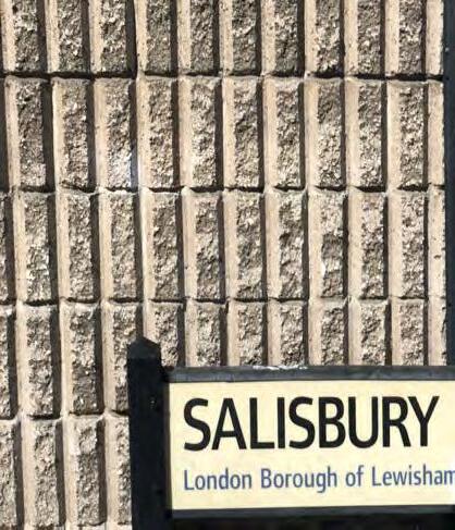
Job Title Lewisham Shopping Centre
Job Number 0386
Document Title Design Code
Document Name 0386-ZZ-ZZ-RP-A-PL0002
Revision P01
Date of Issue 18.10.24
Purpose of Issue For Planning
Compiled By HO / JN / HH / JH / ML / TC / AF
Reviewed By AF / TC / LL
Date Reviewed 17.10.24

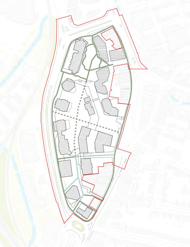
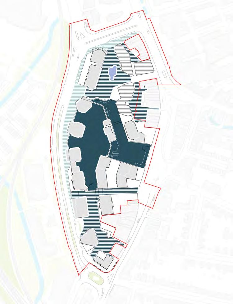
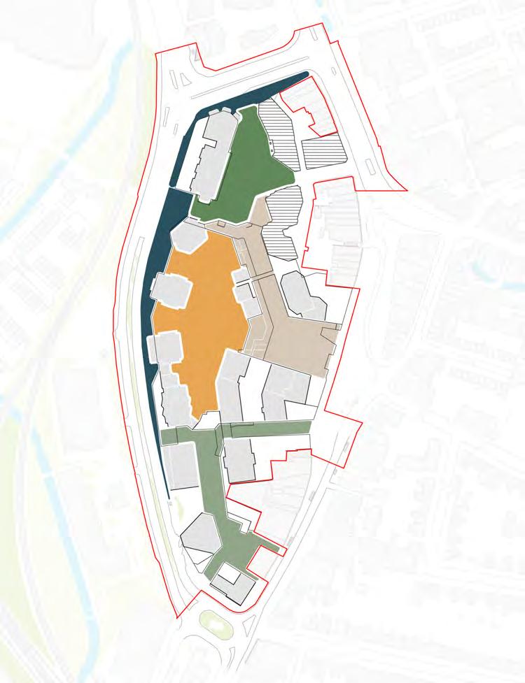
The planning application comprises of both an outline component as well as a detailed component.
The outline element of the planning permission will be governed by three control documents, namely the Parameter Plans, a Design Code, and the Development Specification. These documents and drawings will inform and control all future Reserved Matters applications, and conditions will require compliance with these documents.
The design development of Plots N1 and N2 which are being brought forward through the detailed component of the planning application have informed the Design Code.
Outline Component
Component Hybrid Planning Application
Documents
Parameter Plans Design Code Development Specification
Reserved Matters Application
Future reserved matters applications will be required to adhere to the control documents set out in the outline component.
Role of Design Code in relation to total suite of application documents
The outline documentation is structured in a way to seek approval for the most important aspects of the illustrative scheme. In addition however, a certain level of flexibility is maintained for future Reserved Matters applications.
This flexibility will attract high quality design teams to join the project going forward and offer creative solutions to the opportunities and constraints of each individual plot, while retaining a coherent sense of place across the masterplan and recognising the relative roles that each individual building will play.
For an outline plot, the Parameter Plans and Development Specification sets maximum extents. The Design Code then supplements this to provide further requirements at both a site-wide and plot-specific level.
These control documents (for approval) are then supported with the illustrative scheme, which provides one possible solution to the control documents (Parameter Plans, Development Specification and Design Codes), along with the Design and Access Statement and additional technical information.
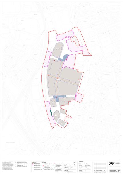
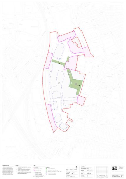
The Parameter Plans are grouped into types as outlined below:
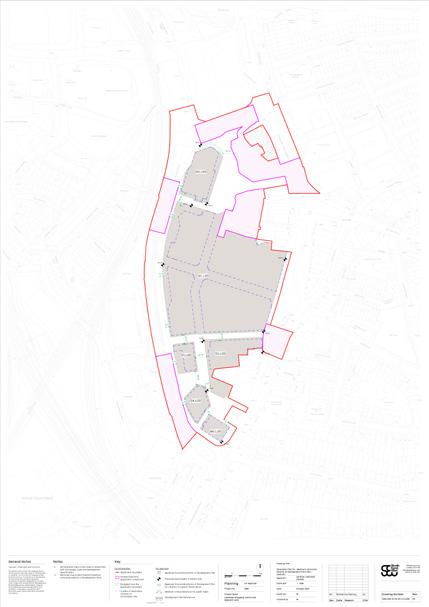
• Planning Application Boundary
• Demolition and Retention
• Proposed Development Plots
• Maximum Building Heights
• Maximum Building Maintenance Unit (BMU) Heights
• Access and Circulation
• Land Use
• Public Realm and Open Space
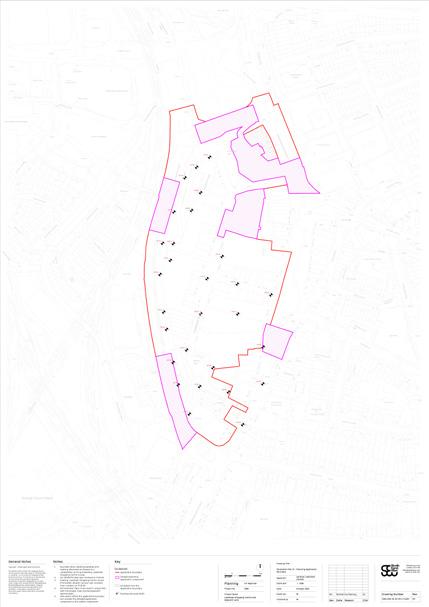

The plans capture the extent of demolition and strategic proposals for the outline component. In order to guide the interpretation of the Parameter Plans, a subsequent section in the Site-wide Codes sets out a number of details devised to clarify the rationale behind key parameters and principles.


The Development Specification is a control document to be secured via a planning condition attached to the hybrid planning permission, to inform the future submission of Reserved Matters (scale, layout, appearance, access and landscaping) for the outline component only.
NPPG Paragraph: 034 (Reference ID: 14-03420140306) requires information about the proposed use or uses, and the amount of development proposed for each use to allow consideration of an application for outline planning permission. The Development Specification addresses this requirement.
A 5% floorspace tolerance has been added where appropriate to reflect the illustrative nature of the outline measurements and to future proof for detailed design efficiencies at Reserved Matters stage.
The Class E component of the Town Centre type is also stipulated with a minimum area for each of the masterplan phases.
For future RMAs, a Reconciliation Statement will be submitted to track the overall quantum delivered by Phase.
Development Specification Extract Table - Proposed Uses
1 The residential C3 floorspace maximum excludes floorspace needed for servicing, as that is included in item 5
of Lewisham House for residential purposes
Sui generis uses defined at paragraph 2.7 below
Minimum Class E(a) retail floorspace (GEA) Phase 1: (inc detailed phase): 693sqm; Phase 2: 2,737sqm; and Phase 3: 15,351sqm
5 Minimum Class E(a) retail floorspace defined by 50% of the indicative schedule of accommodation (SOA) masterplan town centre floorspace
6 The town centre floorspace maximum excludes floorspace needed for servicing, as that is included in item 5
7 Sue generis uses defined at paragraph 2.7 below, with specific exclusions for the community & cultural uses floorspace
8 Elevated service deck to be shared between masterplan uses
The illustrative scheme demonstrates one way in which the masterplan can be designed to conform with all the control documents. For ease of communication It is used as the basis for the diagrams within this document. It is supported by the Design and Access Statement (DAS). This document provides an analysis of the site, the design evolution of the proposal, and a detailed explanation of the illustrative masterplan.
The role of the illustrative scheme and the DAS within the application is indicative only, but is important in contextualising the control documents.
The detail component is comprised of Co-Living Plot N1, Residential Plot N2 and a new northern entrance to the shopping centre. Whilst this document is not applicable to the detailed element of the application, the two plots have been developed in conjunction with, and have informed, the Design Code.
↘ Refer to the Design and Access Statements of Plot N1 and Plot N2 to understand how the design of the buildings relates to the coding developed in this document.
The National Planning Policy Framework (NPPF) 2023 establishes the requirements and guidance for the assessment or production of design codes. These codes should respond to local character and design context to produce frameworks for creating high-quality places. It also identifies that the production of the codes should be developed following an approach that is consistent with the principles as set out in the National Model Design Code.
The National Model Design Code (NMDC) (2021), therefore, develops more detailed guidance for the production of design codes. The design guidance for this proposal forms a specific response for the Lewisham Shopping Centre Redevelopment. It tailors a response
that is most appropriate to the specific characteristics and opportunity of this proposal, and balances a level of prescriptive control and degree of variety and change over time to deliver design quality over the long-term.
Central to the national policy guidance are the principles identified as the 10 Characteristics of Well Designed Places (National Design Guide). These characteristics define the key topics that should be considered in the production of design codes (where appropriate).
This Design Code has developed an integrated approach that reconciles the 10 Characteristics into three clearly defined themes: vision, landscape, built form.
By distilling the characteristics to these three central themes, this Design Code is able to succinctly emphasise the overarching vision for the Site as a response to the existing context and identity of the place. It then develops specific design guidance for both landscape and built form (at both a comprehensive
Site-wide scale and in response to more local character area or plot conditions) to maximise a clarity in the design priorities and usability of the design guidance (whilst still reflecting the full range of policy characteristics).
The codes have been developed with close engagement with the relevant statutory bodies and technical consultant input / testing to provide an effective basis for future design development and to most accurately reflect the vision and ambition for the Lewisham Shopping Centre Redevelopment.
The Design Code has considered three key strategic themes. These themes are developed below:
The project engagement consultants, Something Collective, developed a creative and responsive engagement strategy that has sought to reflect and amplify both the Applicant’s and the communities’ aspirations for the site. This approach has centred on creating opportunities to influence and uncover unique insights and solutions that might be overlooked in a top-down design process. As such, the proposals have been subject to significant design evolution following a reiterative process of testing ideas and concepts with smaller groups and with the wider public.
↘ Refer to Statement of Community Involvement
Access and inclusion is be central to the design of the Lewisham Shopping Centre Redevelopment.
The code outlines the site-wide access and inclusion principles which applies to all future RMAs.
↘ Refer to Site-wide / Access and inclusion, and the Access Statement
The proposal sets a new standard for sustainability in urban regeneration. Below are some of the key aspects that highlight the aspirational nature of the project and demonstrate it’s role as a benchmark for sustainable urban development:
• Embodied carbon excellence
• Leading in Energy Efficiency
• Biodiversity and Green Spaces
• Urban Greening and Climate Resilience
• Community-Centric and Inclusive Design
↘ Refer to Site-wide / Sustainability, Sustainability Statement, Energy Strategy and other relevant documents.
Alongside the pre-application process of consulting with public bodies, an extensive programme of consultation with the public has been ongoing for the past three years, taking form through the following activities. These have targeted hard to reach groups to get a wide range of opinions and feed back.
• Creation of a group of Design Champions
• Surveys (written, online and in-person)
• Newsletters
• Public Consultation events including e-gaming
• Themed public workshops
• Existing Site Tours
• Engagement with local youth group Circle Collective
This process of public engagement has not only informed the design of the illustrative scheme, but has also been used to ensure the 10 characteristics of the NMDC have been addressed through consultation.
The opposite page highlights in detail those themes in the Code that have been covered through the consultation process.
Context
• C.1.i - Character Types
• C.1.ii - Site Context
• C.1.iii - Site Assessment
• C.2.i - Historic Assessment
• C.2.ii - Heritage Assets Movement
• M.1.i - Street Network
• M.1.ii - Public Transport
• M.1.iii - Street Hierarchy
• M.2.i - Walking & Cycling
• M.2.ii - Junctions & Crossings
• M.2.iii - Inclusive Streets
• M.3.i - Car parking
• M.3.ii - Cycle parking
• M.3.iii - Services & Utilities Nature
• N.1.i - Network of spaces
• N.1.ii - Open Space provision
• N.1.iii - Design
• N.2.i - Working with water
• N.2.ii - SUDS
• N.2.iii - Flood Risk
• N.3.i - Net gain
• N.3.ii - Biodiversity
• N.3.iii - Street Trees Built form
• B.1.i - Density
• B.1.ii - Whether buildings join
• B.1.iii - Types and Forms
• B.2.1 - Blocks
• B.2.ii - Building line
• B.2.iii - Height Identity
• I.1.i - Local Character
• I.1.ii - Legibility
• I.1.iii - Masterplanning
• I.2.i - Design of buildings Public Space
• P.1.i - Primary
• P.1.ii - Local & Secondary
• P.1.iii - Tertiary
• P.2.i - Meeting Places
• P.2.ii - Multi-functional
• P.2.iii - Home Zones
• P.3.i - Secured by Design
• P.3.ii - Counter Terrorism Uses
• U.1.i - Efficient land use
• U.1.ii - Mix
• U.1.iii - Active frontages
• U.2.i - Housing for all
• U.2.ii - Type
• U.3.i - Schools
• U.3.ii - Community Facilities
• H.1.i
• U.3.iii - Local services Homes and buildings
The Design Code has been organised into chapters in parallel with the Design and Access Statement. The chapters are arranged to include the following:
• Introduction - An introduction to the Hybrid Planning Application, related documents, and a guide to using the document.
• Site-wide - Design codes applicable to all areas of the Site (both Landscape and Built form) to define coherent strategic design guidance and clarity of documentation.
• Landscape Character Areas - Design codes applicable to each specific area of the public realm to reinforce specific characteristics, constraints and design aspirations.
• Plot Codes - Design codes applicable to each specific plot
This Design Code is organised at three scales; Site-wide (both landscape and built form), Character Area (landscape), and Plot (built form). This approach enables the document to provide design guidance that will ensure a coherence in strategic principles across the development as well as respond to distinctive design opportunities in response to more local conditions.
In order to use the Design Code in developing design responses for particular spaces or buildings within the development, it is therefore necessary to both read the Site-wide chapter and the relevant section of the Landscape Character Area or Plot Code chapters. The Sitewide chapter should be read first to understand the key principles for the development.
Departures from the principles in the Design Code will be accepted where they can be justified as a result of further detailed design undertaken at reserved matters stage
In accordance with the National Model Design Code it is intended that the code principles will be applied flexibly according to local circumstances with scope for flexible application to allow for innovation. It is expected that the design code will be updated over time and where relevant substituted onto the planning permission via the planning condition discharge process. In accordance with NPPF paragraph 125(c), a flexible approach will be taken to applying policies or guidance relating to daylight, sunlight and overshadowing, where they would otherwise inhibit making efficient use of the Site and application of the Design Code principles.
Codes are formed of 6 components that both articulate the specific approved guidance requirements as well as providing additional referencing information, rationale and illustrative material to support interpretation. These components are identified below:
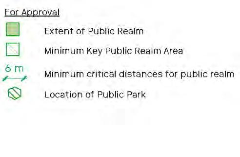
Minimum extent of Public Accessible Space
The minimum extent of Public Accessible Space must be achieved as shown on the Parameter Plan.
To ensure a minimum provision of Public Accessible Space.
Minimum extent of Park Area
The minimum extent of Park Area must be achieved as shown on the Parameter Plan.
To ensure a minimum provision of a park in the Public Accessible Space.
► Refer to Sitewide / Public Realm Typologies.
Public realm minimum widths
Minimum dimensions of public realm must be maintained as annotated on the Parameter Plan. This is shown between two Plot boundaries in green.
To safeguard Public Accessible Space.
Reference (including Chapter and Number)
► Refer to Sitewide / Public Realm Typologies.
Rationale (provides a summary of the purpose of the principle, identified in italic)
(summarising the key aspect of the code)
(with status identified in bold)
Cross-reference (cross-reference to other sections of the Design Code and other documents in the submission)
Supporting graphics (a range of forms of illustrative material and corresponding caption that help interpret the code)
The Design Code adopts a consistent hierarchy of status throughout that is emphasised in bold letters for each code. This is a critical component of the guidance - identifying the strength of the design guidance, level of commitment and the implications for how designers respond and future RMAs are assessed.
The approach taken is through the use of “must”, “should” and “could” statements. The specific definition of the respective code status is described in the diagram below.
The codes are organised with mandatory “must” codes which are made clear in coloured boxes, as well as the non-mandatory “should/ could” codes.
It is however recognised that there may occasionally be instances where there is a good and justified reason to depart from one or more of the guidelines. In these instances, a clear and robust justification should be made for the reasons for deviation from the guidance enclosed in this document. This justification should be put forward for reasonable consideration and acceptance by the LPA. For clarity, captions for plan diagrams in the document state whether the illustration is a Code (mandatory), otherwise they are for illustrative purposes only. Illustrations and codes within coloured boxes are mandatory.
“must”
“should”
“could”
Principles that are approved requirements for a compliant RMA. Shown in a coloured box.
Principles that are strongly encouraged (but also allow for alternative scenarios to be proposed within a RMA submission that meet equivalent objectives)
Principles that are suggestions or workable options (to be explored, considered and tested through the RMA submission)
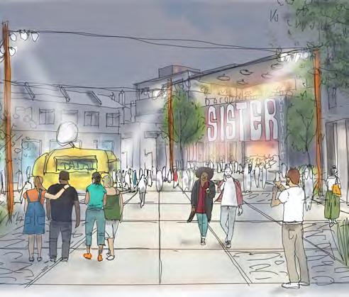
Throughout this process, we’ve gained a deeper understanding of the strong connection between the local community and Lewisham town centre. We’ve seen first-hand the vital and diverse role the town centre plays in residents’ daily lives. We’ve learned how different communities and age groups engage with the area in unique ways, and we’ve listened to the aspirations of those who want Lewisham to reclaim its place as one of London’s most dynamic neighbourhoods.
At the moment the town centre meets the basic needs of the local communities. The retail, leisure uses and public realm is adequate for some, but there is an exciting opportunity to amplify all that is currently offered, setting a new standard for Lewisham. This proposal has the ability to make Lewisham Town Centre not just the place local residents use, but a destination for the whole of London.
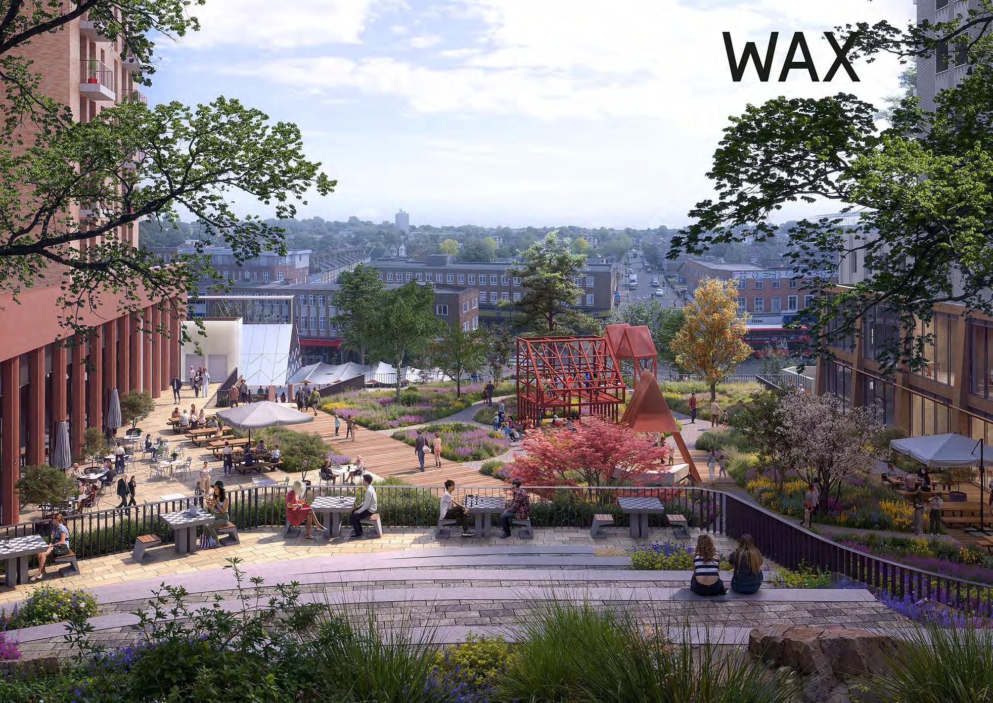
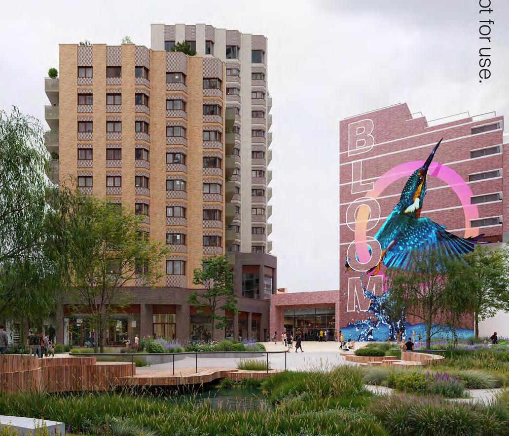
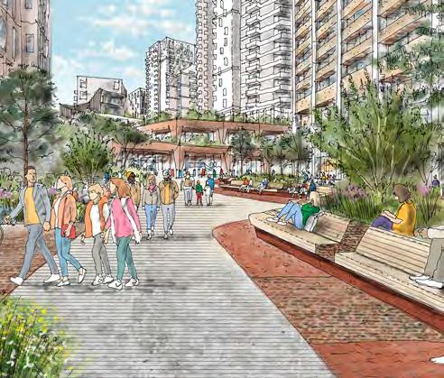
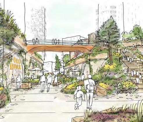
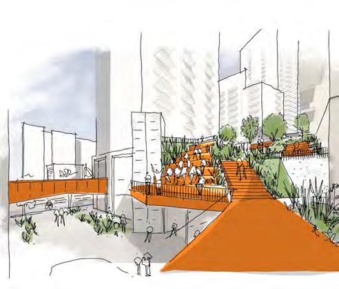
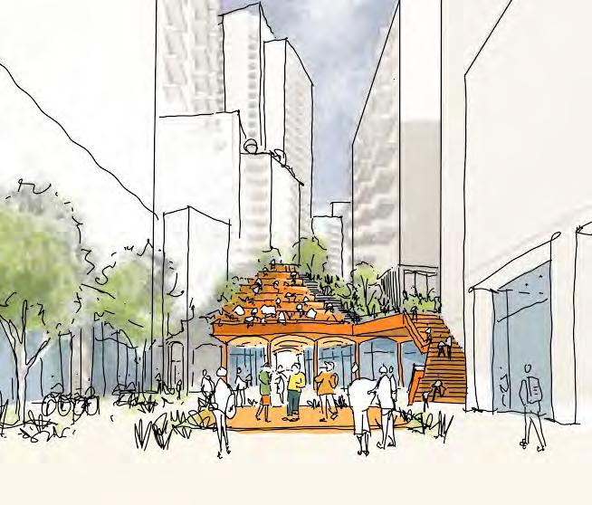
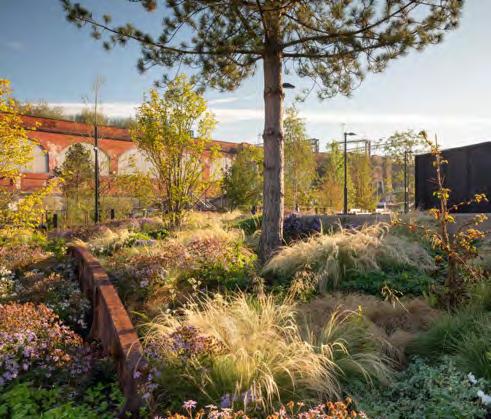
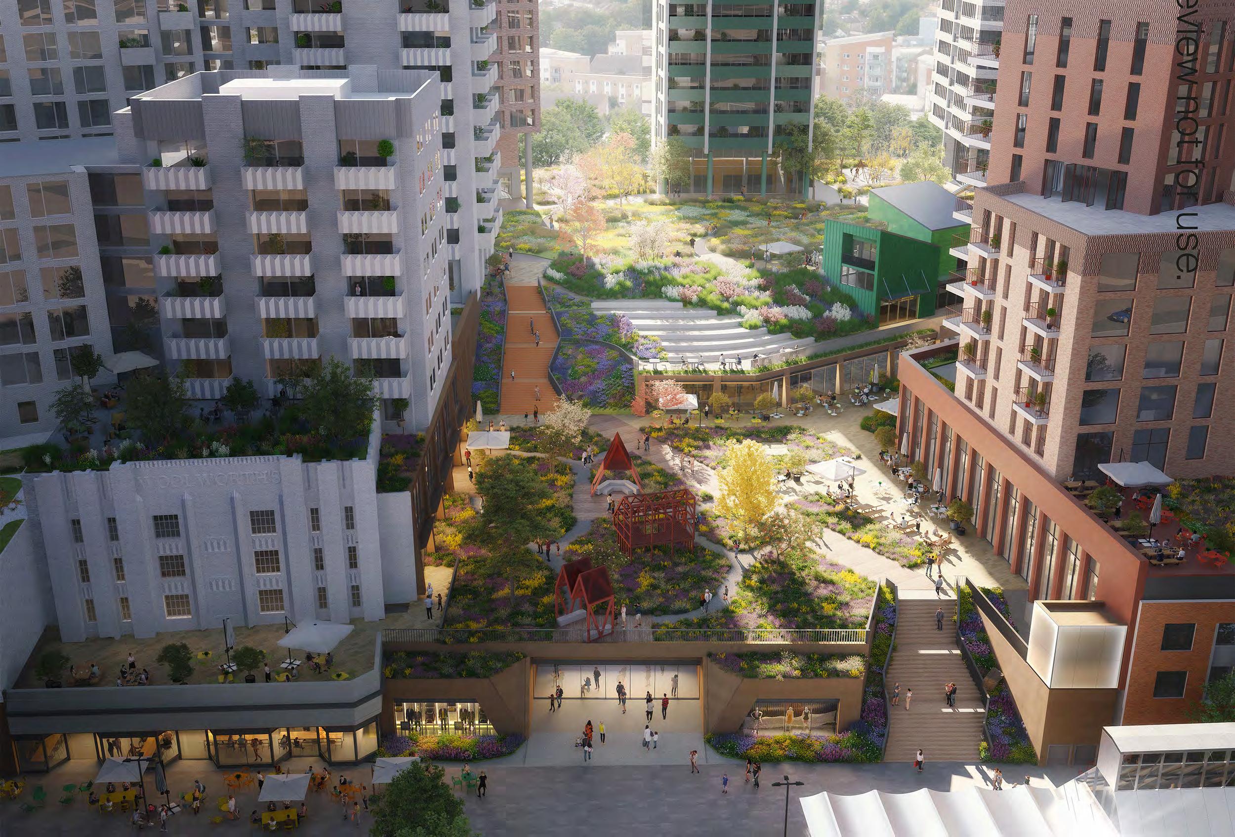
This vision goes beyond simply reconfiguring the shopping centre or adding muchneeded homes. We propose creating an array of new public spaces that will integrate access to nature into everyday life. Drawing inspiration from Lewisham’s history as a meadowland at the meeting point of the Quaggy and Ravensbourne rivers, we envision a contemporary meadow that includes a new public park, a civic square, and a re-imagined shopping environment, all connected through a multi-level landscape.
We believe that transforming Lewisham into a nature-led destination will help the town centre thrive, reinvigorating retail and introducing dedicated areas for restaurants, bars, and event spaces to elevate the leisure experience. A new community music venue will anchor a vibrant evening economy.
This redevelopment won’t just make Lewisham a place to visit - it will become a neighbourhood where people live, work, and connect. More than just a location, it will be a vibrant space for communities to come together, remaining central to residents’ daily lives while offering so much more in a nature-focused setting.

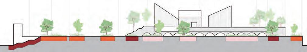
The parameter plans make reference to levels in their drawing titles and on the plans themselves. These pages set out the assumed levels across the site that have been based on the Illustrative Scheme.
The application site is split into three levels zones: North, Central and South. The main drivers for these zones are based on the below:
• Tying into existing levels around the site to ensure level thresholds are achieved
• Tying into the existing shopping centre ground floor and service deck level for continuity of its operation
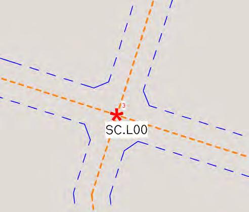
To achieve this, the ground levels (Level 00) for each of these zones are as below:
• North: 8.515m AOD
• Central: 9.4m AOD
• South: 9.8m AOD
Plots N1 and N2 are annotated for information only but are not controlled by this document.
As well as ground floor levels, each of the zones have unique building levels from Level 01 upwards. The sections on this spread show these, as derived from the illustrative scheme.
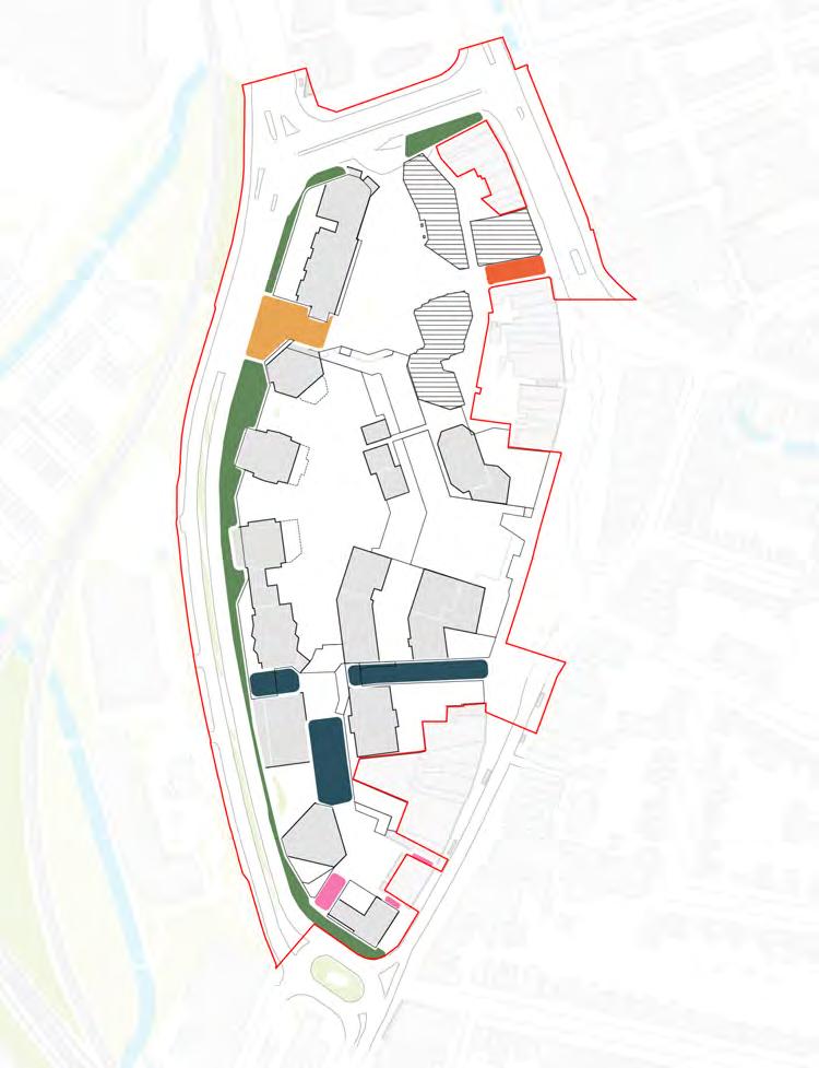
The northern zone (orange) applies to Plot N3 which has a unique condition to relate to the existing levels of Lewisham House.
The central zone (blue) applies to plots that are connected to both the shopping centre and associated service deck. These plots have a continuous first floor level (Level 01) of 15.18m AOD, and a second floor level that matches the Podium Park.
The southern zone (green) has a slightly higher AOD for its lower levels to tie into existing levels around the site.
The following pages summarise the relationship of the Illustrative Scheme to the maximum parameters set by the Parameter Plans.
Whilst a certain extent of flexibility is illustrated here, the following pages set out clarifications and further Codes related to the Parameter Plans.
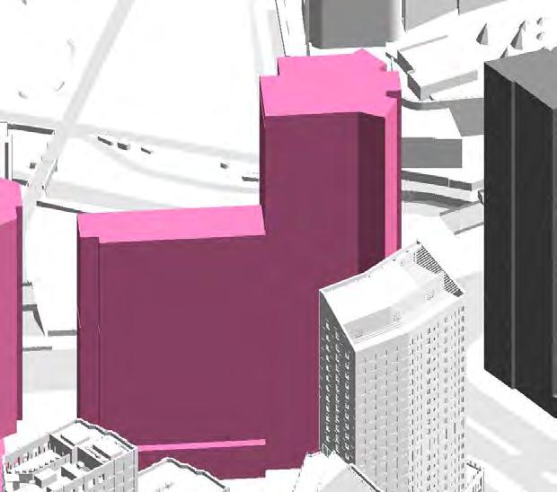

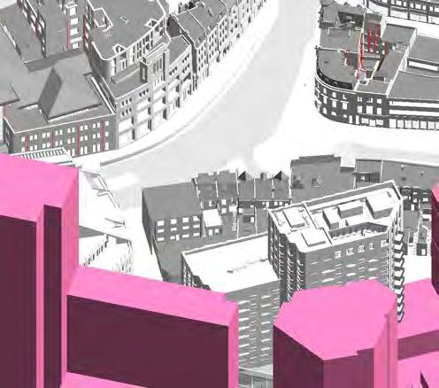
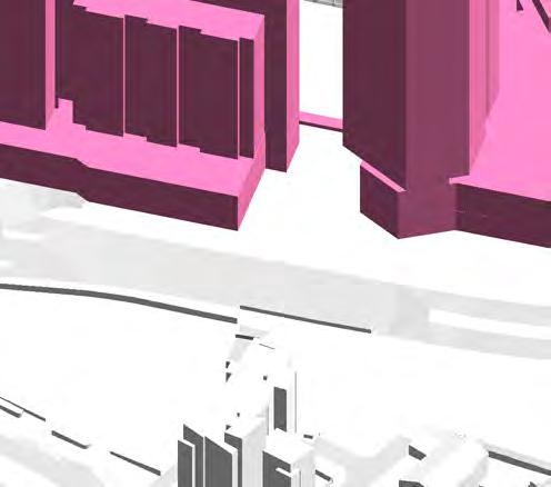
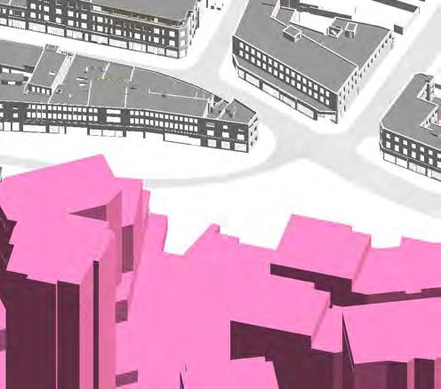
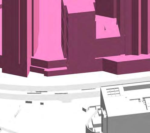
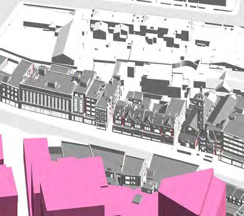
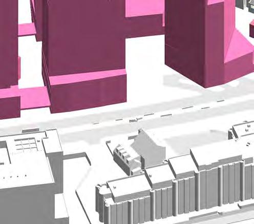
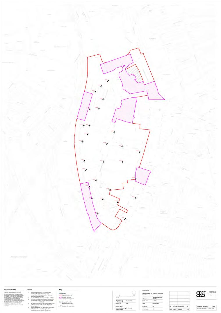
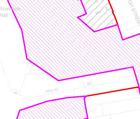
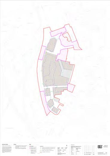
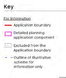
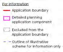
Detailed Component boundary
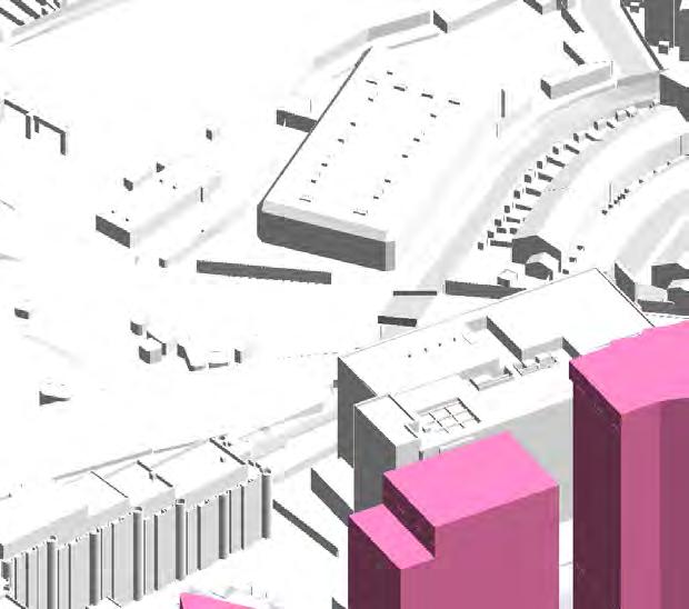
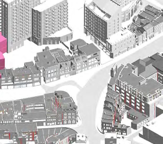
The pink hatch indicates the Detailed Component of the Hybrid Planning Application.
Information for the use of the Parameter Plan.
↘ Refer to Detailed Component of Hybrid Planning Application.
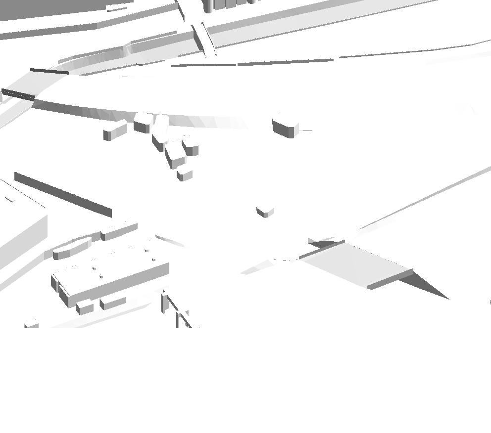
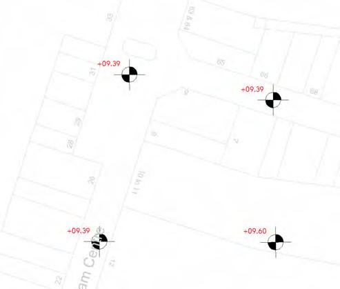
Existing site levels
Spot levels indicate existing site levels in metres (AOD).
Information for the use of the Parameter Plan.
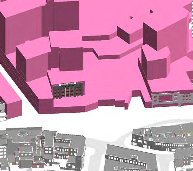
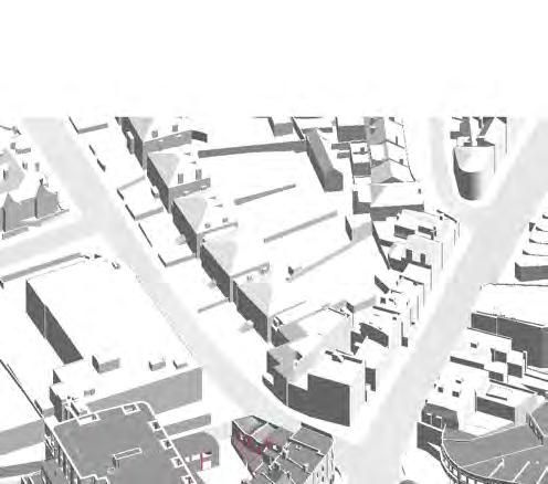
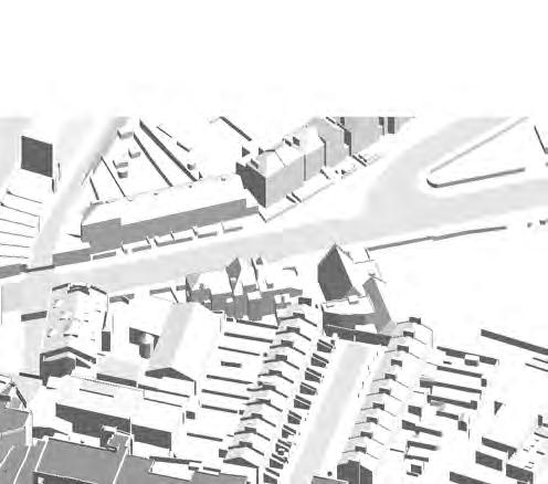
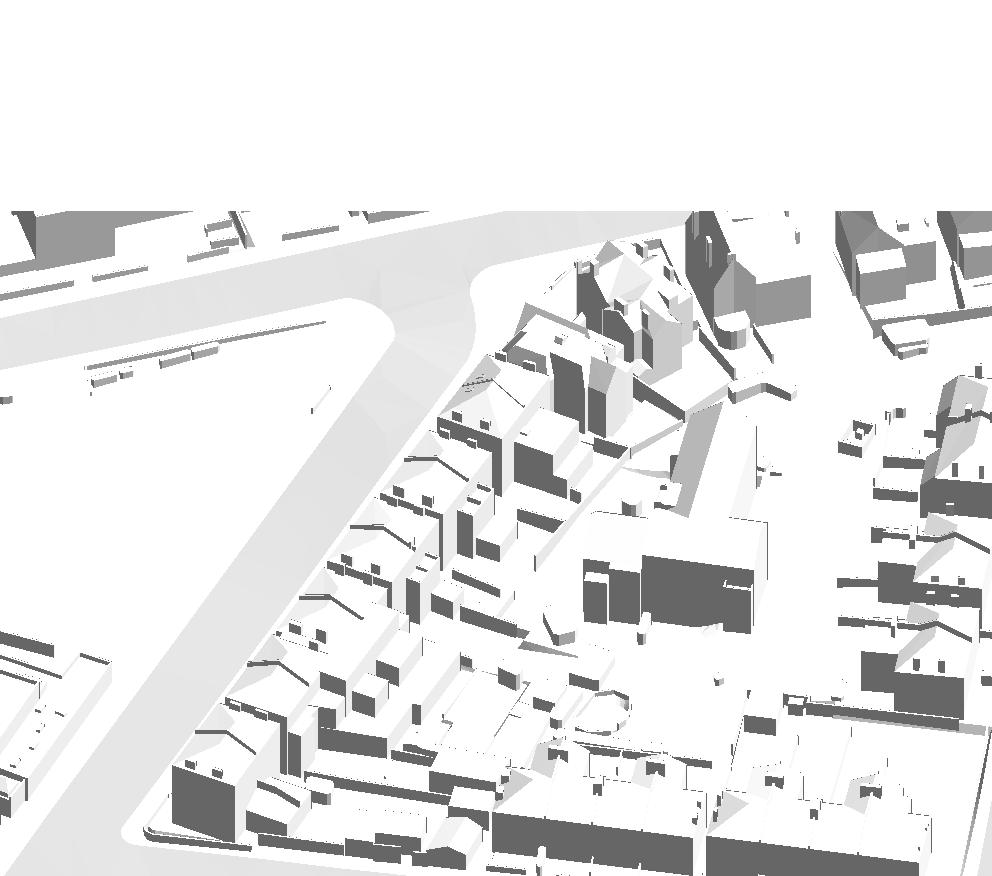
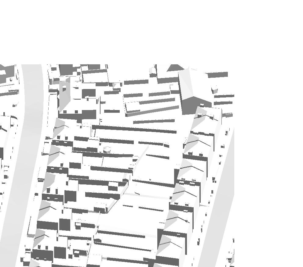
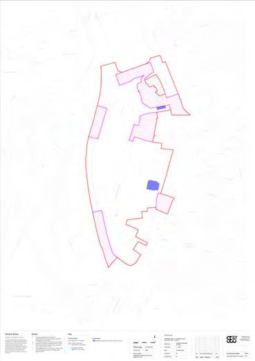
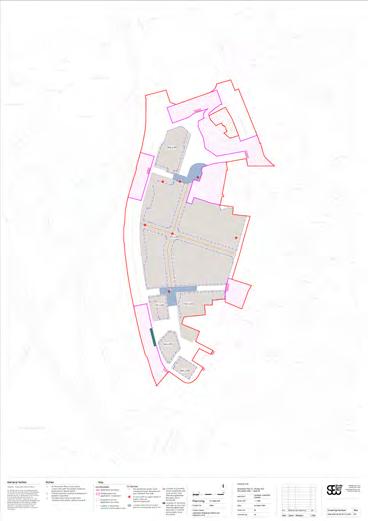
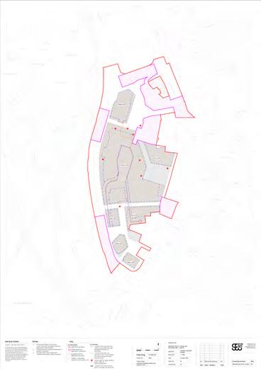
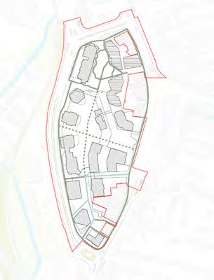
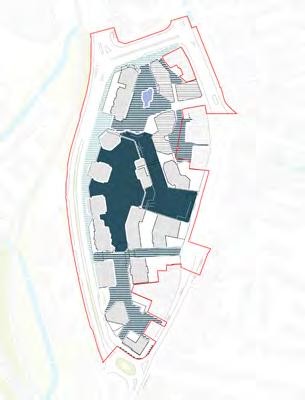
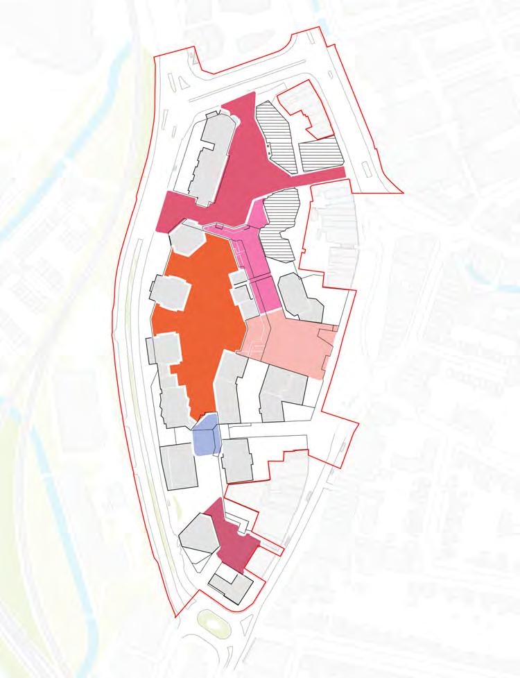
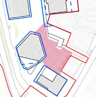
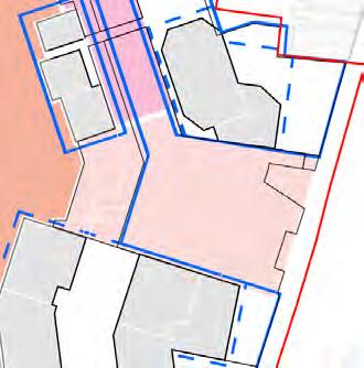
Planning Application Boundary Parameter Plan. This image is for illustration purposes only. Please refer to full scale Parameter Plan drawings.
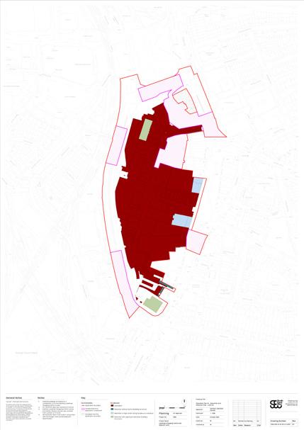
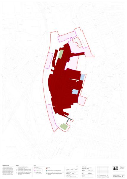
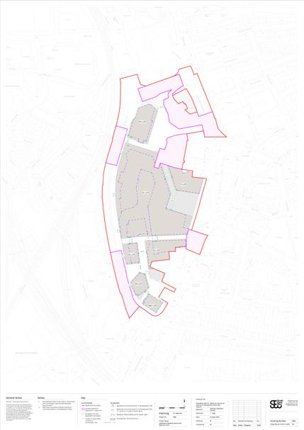
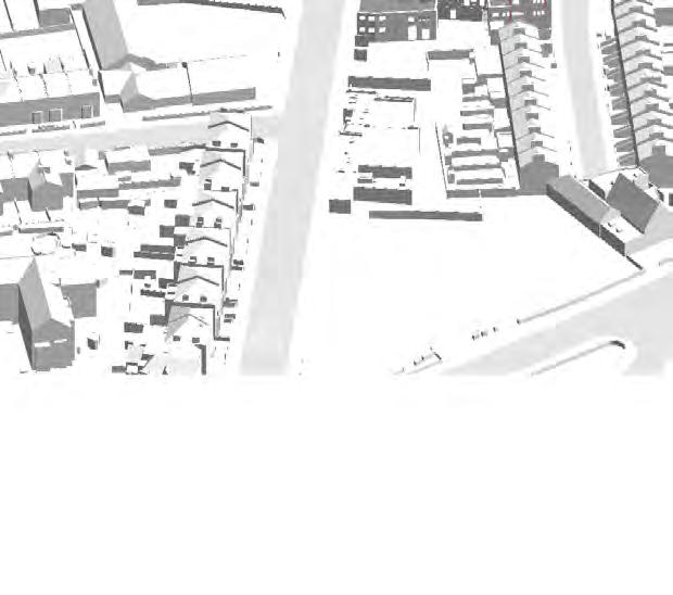
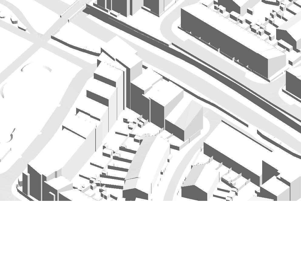
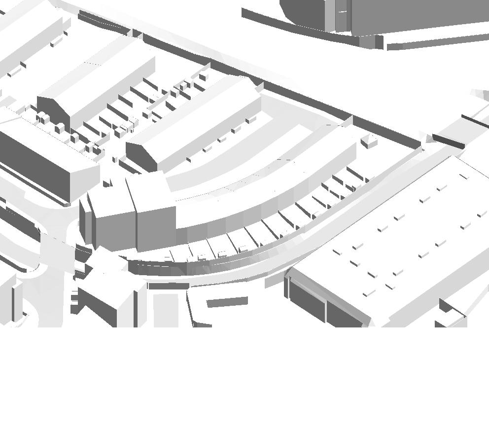
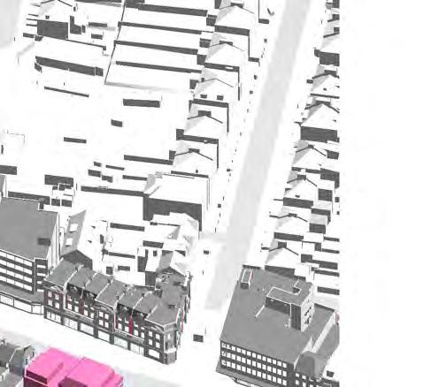
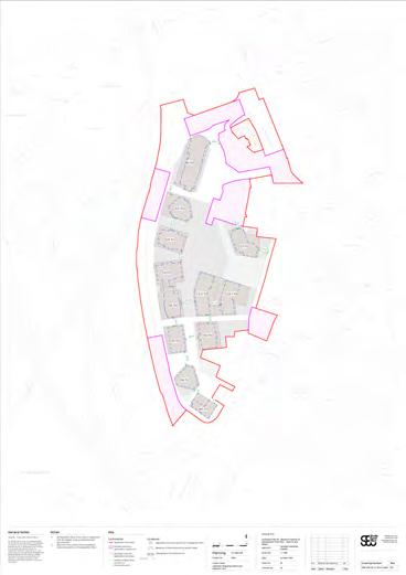
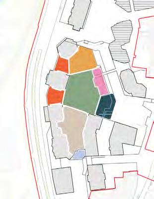
The Demolition and Retention Parameter Plans set out the existing urban fabric extents that will be kept or removed, as well as the level of retention of some existing buildings.
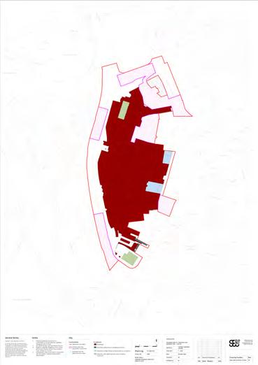
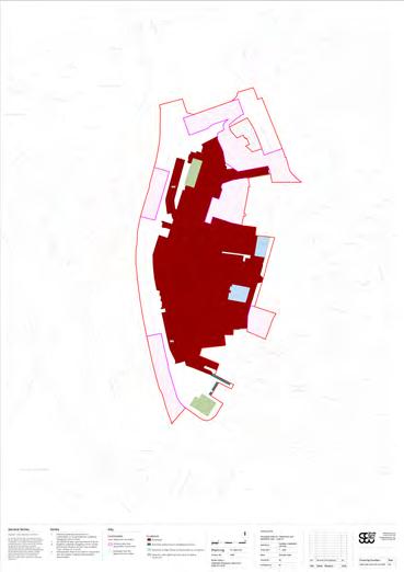
Demolition and Retention Parameter Plans. These images are for illustration purposes only. Please refer to full scale Parameter Plan drawings.
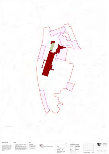
Retention of High Street facing façades as a minimum
Where indicated on the Parameter Plan, facade retention will be considered as a minimum requirement to retention of the existing building. Approaches to individual plots outlined in the Plot Codes chapter.
Information for the use of the Parameter Plan.
↘ Refer to Plot Codes / SC
Retention with significant alteration
Where indicated on the Parameter Plan, existing building structures will be retained with significant alteration. Approaches to individual plots outlined in the Plot Codes chapter.
Information for the use of the Parameter Plan.
↘ Refer to Plot Codes / MV and Plot Codes / N3

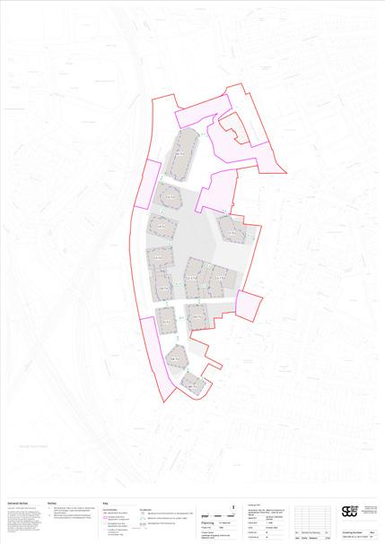
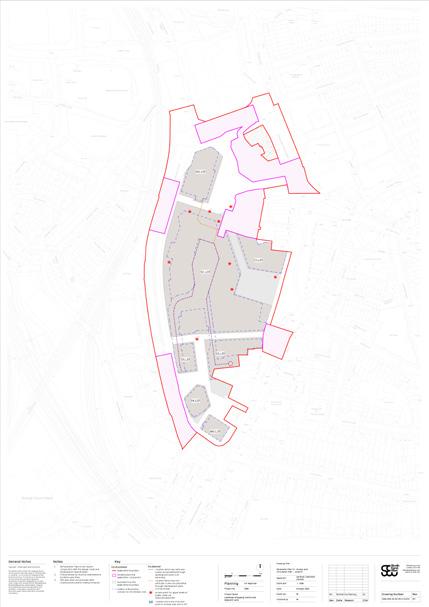
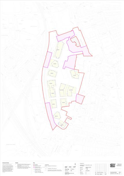
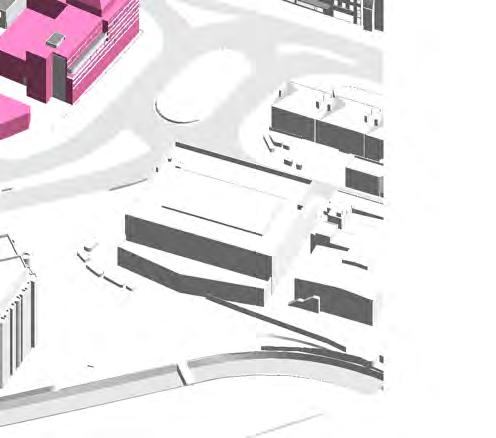
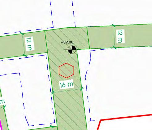
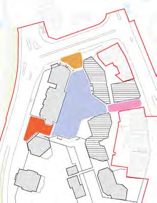
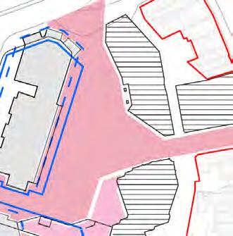
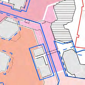
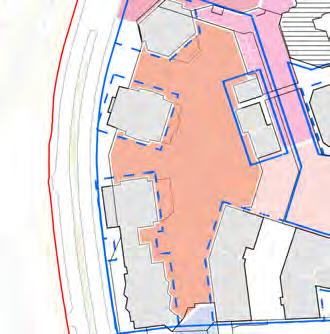
The Proposed Development Plots Parameter Plans set out the maximum development extents, as well as limits of deviation guiding the siting and alignment of buildings in relation to the Public Realm.

The drawings also highlight the minimum critical distances for public realm, typically between development plots.
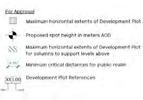
Plots
Development Plots define the area for built development. Development must sit within Development Plots except where otherwise indicated on the Parameter Plan.
To safeguard minimum public realm provision across the Site.
Development Plot reference
Development Plot
Development Plot maximum horizontal extents
Development Plots maximum horizontal extents
Development plot boundaries coincide with the Development Plot maximum horizontal extents in all cases indicated on the Parameter Plan.
Information for the use of the parameter plan.
S.07 Public realm minimum widths
Minimum dimensions of public realm must be maintained as annotated on the Parameter Plan. This is shown between two Development Plot boundaries in green.
To safeguard Public Realm.
↘ Refer to Site-wide / Public Realm Typologies.
Development Plot reference
Development Plot
Development Plot maximum horizontal extents
Proposed Development Plot
Parameter Plans. These images are for illustration purposes only.
Please refer to full scale Parameter Plan drawings.
Development Plot reference
Development Plot
Development Plot maximum horizontal extents
Public realm minimum dimension
Maintaining minimum public realm widths
If plot boundaries move during RMA design, the boundaries of adjacent Development Plots must move in parallel to preserve minimum dimensions of public realm. Development Plots boundaries must not move beyond the Development Plot maximum extents.
To provide flexibility whilst safeguarding the public realm.
Development plot extent for columns to support levels above
Where indicated, columns could be built within a zone outside of the Development Plot to support development of levels above. This is shown with a green hatch on the Parameter Plan.
To maximise public realm.
Development Plot reference
Development Plot
Development Plot maximum horizontal extents
Public realm minimum dimension
Relocated Development Plot boundary
Development Plot maximum horizontal extents
Development plot extent for columns to support levels above
Column
Balconies are permitted to extend beyond development zones, unless stated otherwise in this document.
Information for the use of the parameter plan.
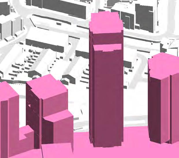
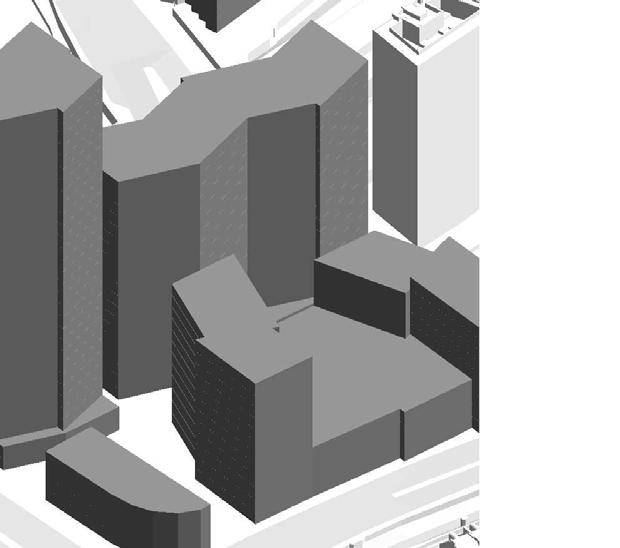
The Maximum Building Heights Parameter Plan defines the Maximum Envelope within which development is permitted.
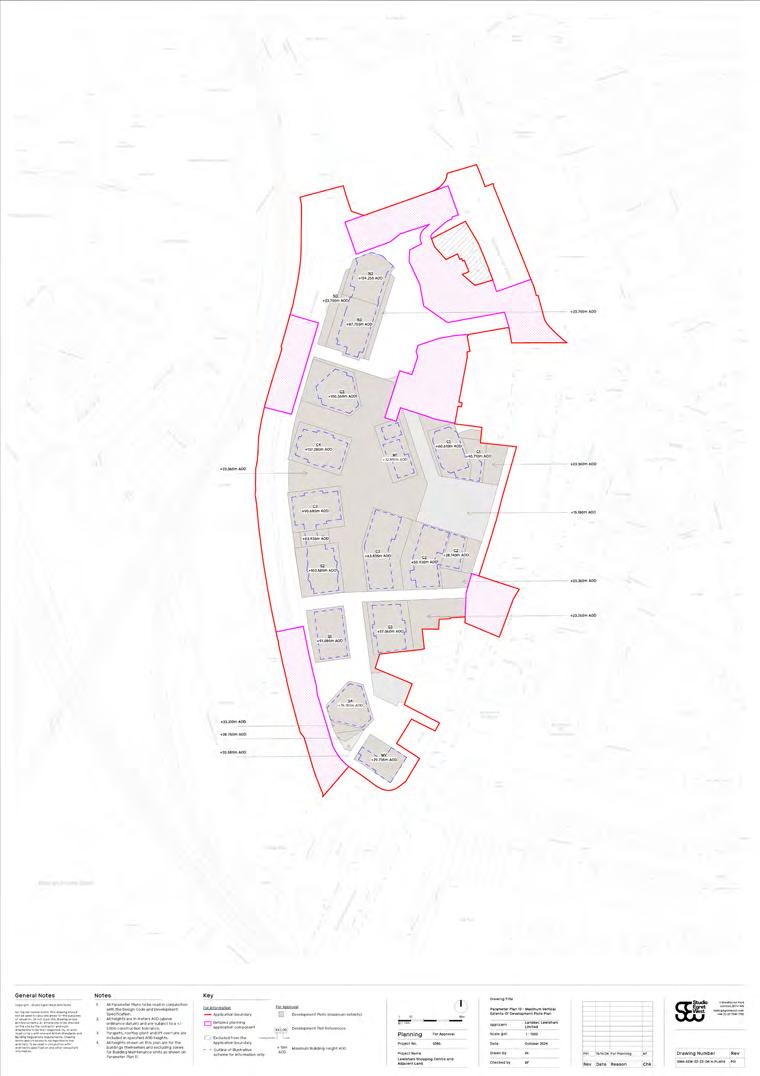
Maximum Envelope
The Maximum Envelope is set as a vertical extrusion of the Development Plot boundary.
Information for the use of the Parameter Plan.
Maximum Building Heights Parameter Plan. This image is for illustration purposes only. Please refer to full scale Parameter Plan drawings.
Maximum vertical extent defined as by AOD (Above Ordnance Datum)
The maximum vertical extent is set as distance Above Ordnance Datum (AOD), the mean sea level defined by the Ordnance Survey as Ordnance Datum Newlyn. It is not set according to the local ground level.
Information for the use of the Parameter Plan.
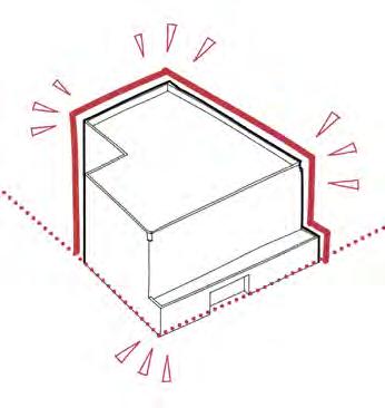
Permanent features in relation to the Maximum Envelope
Parapets, lift overruns and rooftop plant must not project beyond the Maximum Envelope. Elements such as communications aerials and flues could extend beyond the Maximum Envelope, as could Building Maintenance units in the zones shown on that Parameter Plan.
To limit impact on surrounding buildings and townscape.
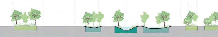
Maximum height AODs have been based on the typical floor to floor height assumptions indicated on the diagram to the right.
Information for the use of the Parameter Plan.
Indicative typical height assumptions for floor to floor heights
The Maximum BMU Heights Parameter Plan defines the zone within which a Building Maintenance Unit (BMU) may exceed the Maximum Envelope. Maximum BMU Heights Parameter Plan. This image is for illustration purposes only.
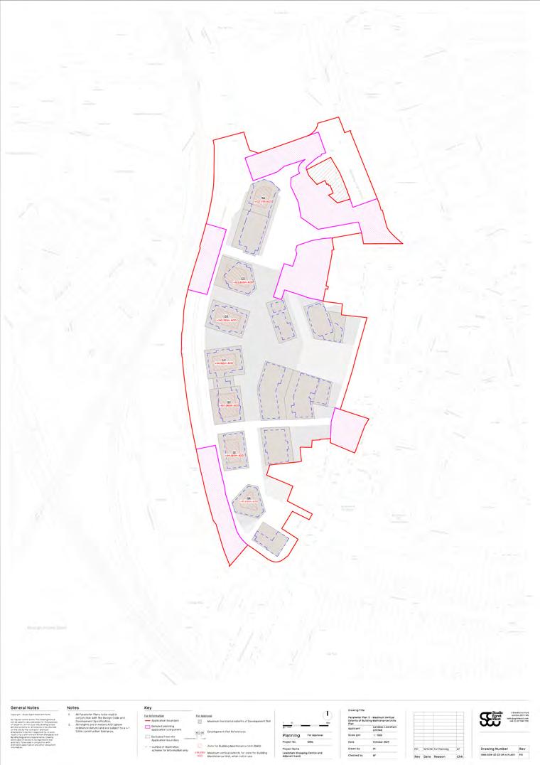
BMU location zone within Development Plot
BMU in the resting position must not extend beyond the envelope shown in the BMU parameter plan, but can do so in operation.
To limit impact on surrounding buildings and townscape.
↘ Refer to Site-wide / Quality and maintenance.
Plot
BMU location zone height allowance
BMUs within the allowable zone must not extend more than 3.5m above the Maximum Envelope when in operation, as indicated by the AOD.
To limit impact on surrounding buildings and townscape.
↘ Refer to Site-wide / Quality and maintenance.
Please refer to full scale Parameter Plan drawings.
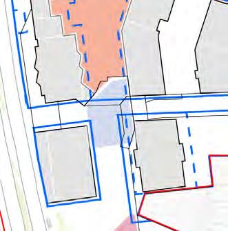
The Access and Circulation Parameter Plans set out the different forms of access points into the site, any routes through development plots and access points to upper levels of public realm.

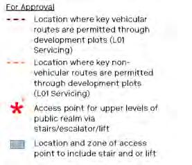
Access and Circulation Parameter Plans. These images are for illustration purposes only.
Please refer to full scale Parameter Plan drawings.
Location of access to the Site
Location of access points to the Site are illustrated with a coloured strip.
Information for the use of the Parameter Plan.
Extract of Parameter Plan
Key pedestrian public route through Development Plot
Where indicated on the Parameter Plan, a pedestrian public route must be provided through a Development Plot. These pedestrian public routes must be to the figure shown on the parameter plan as a minimum.
To safeguard pedestrian public routes through development.
↘ Refer to Site-wide / Access and movement.
Key vehicular route through Development Plot
Where indicated on the Parameter Plan, a vehicular route must be provided through a Development Plot.
To safeguard vehicular routes through development.
↘ Refer to Site-wide / Access and movement.
Development Plot
Key pedestrian public route through Development Plot
Development Plot
Key vehicular route through Development Plot
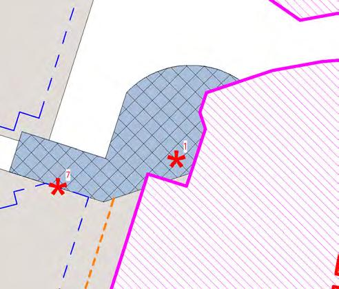
Access Point 1 must include landscaped stairs up to The Street (L01), and could include escalators or lifts.
To form part of the site-wide landscape strategy.
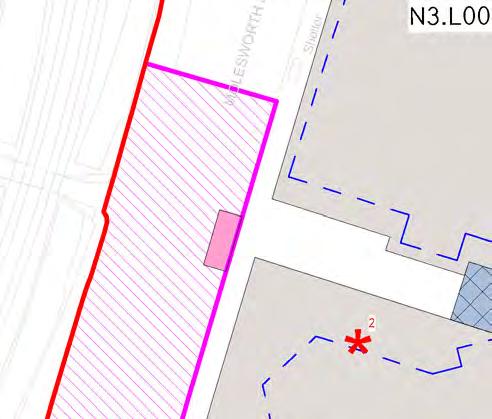
Access Point 2 must include stairs up to The Street (L01), and could be integrated into the Architecture of Plot SC/C5.
To provide a direct route from Cornmill Gardens to upper levels of the public realm.
Access Point 3
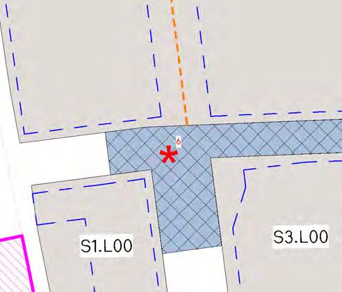
Access Point 3 must include escalators up to The Street (L01), and must include a minimum of two lifts up to Plot M1.
To provide a direct route from Plot SC to Plot M1 and the Podium Park.
Access Point 4 must include landscaped stairs and a minimum of two lifts up to The Street (L01), and could include escalators.
To provide generous public access from the High Street to The Street.
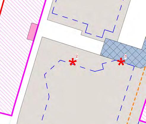
Access Point 5 must include stairs and a minimum of two lifts up to the Podium Park (L02), and could be integrated into the Architecture of Plot SC/C4.
To provide a direct route from the western Shopping Centre entrance to upper levels of the public realm.
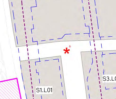
Access Point 6 must include stairs and a minimum of two lifts up to the Podium Park (L02).
To provide a direct route from the southern Shopping Centre entrance to upper levels of the public realm.
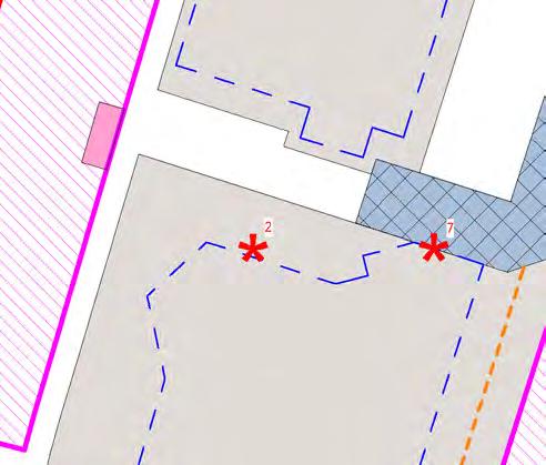
Access Point 7
Access Point 7 must include a minimum of two lifts up to The Street (L01).
To provide a direct route from the northern Shopping Centre entrance to upper levels of the public realm.
Where shown on the parameter plan, vehicular/ non-vehicular routes are permitted between plots at Level 01. This could be in the form of a bridge link.
To adhere to the site-wide servicing strategy.
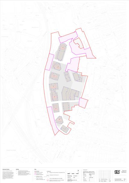
The Land Use Parameter Plans identify the predominant use of the development zones at different levels.

Land Use Parameter Plans.
These images are for illustration purposes only.
Please refer to full scale Parameter Plan drawings.
Predominant land use
↘ Refer to Development Specification. S.28
The land use indicated within the Development Plot boundary indicates the predominant land use.
Information for the use of the Parameter Plan.
Development Plot reference
Predominant land use
Predominant land use - mezzanines
Where mezzanine levels occur within Development Plots (at the levels identified in the introduction), the predominant land use should match it’s associated level.
Information for the use of the Parameter Plan.
↘ Refer to Development Specification.
Flexibility for arrangement of Land Use
Where two predominant land uses are indicated on the same Development Plot, the final arrangement is subject to detailed design.
Information for the use of the Parameter Plan.
↘ Refer to Development Specification.
Development Plot reference
Predominant Town Centre use
Predominantly accommodation uses (or living uses) with servicing access for commercial uses C5.L02
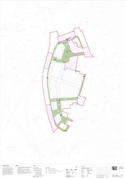
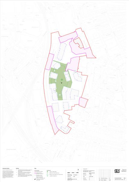
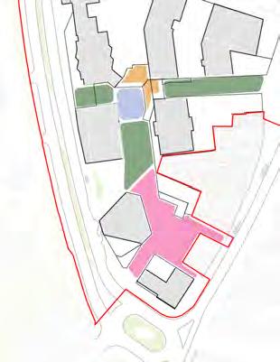
The Public Realm and Open Space Parameter Plans defines the types, location and extent of public realm and open space.
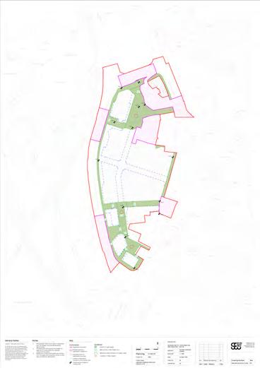

Public Realm and Open Space Parameter Plans. These images are for illustration purposes only.
Please refer to full scale Parameter Plan drawings.
Minimum extent of Public Accessible Space
The minimum extent of Public Accessible Space must be achieved as shown on the Parameter Plan.
To ensure a minimum provision of Public Accessible Space.
Development Plot
Development Plot maximum horizontal extents
Minimum extent of public realm
Minimum extent of Park Area
The minimum extent of Park Area must be achieved as shown on the Parameter Plan.
To ensure a minimum provision of a park in the Public Accessible Space.
↘ Refer to Site-wide / Public Realm Typologies.
Development Plot
Development Plot maximum horizontal extents
Minimum extent of public realm
Minimum extent of key public realm
Public realm minimum widths
Minimum dimensions of public realm must be maintained as annotated on the Parameter Plan. This is shown between two Plot boundaries in green.
To safeguard Public Accessible Space.
↘ Refer to Site-wide / Public Realm Typologies.
Development Plot
Development Plot maximum horizontal extents
Public realm minimum dimension
Minimum extent of public realm
Public Realm Typologies
The public realm typologies as indicated on the Parameter Plan are defined in the Design Code.
Information for the use of the Parameter Plan.
↘ Refer to Site-wide / Public Realm Typologies.
Proposed levels of Public Accessible Space
Spot levels indicate Proposed Ground Finished Floor Levels (AOD) of the Public Accessible Space, within a tolerance of +/-1m.
Information for use of the Parameter Plan.
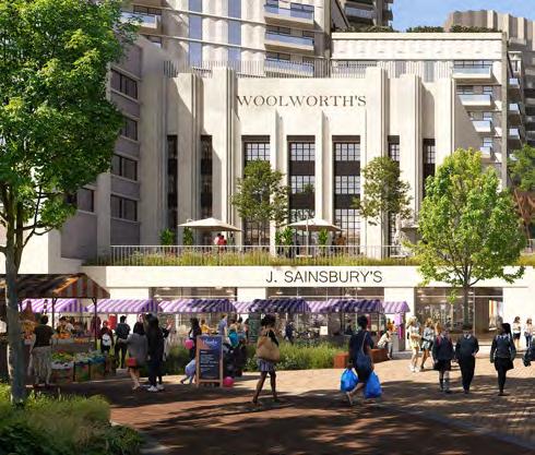
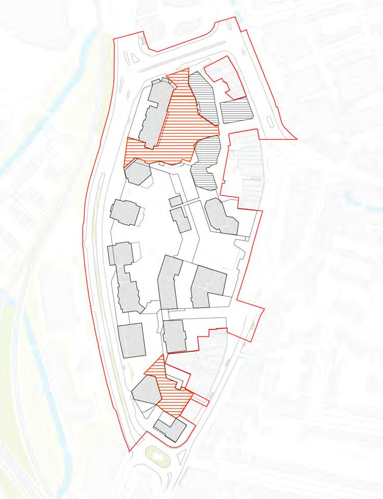
The scheme has evolved through an approach to retain as many buildings on the site as possible. Through this evolution many High Street properties have been retained and are now excluded from the application site. Where existing buildings on the High Street are proposed for demolition, every effort has been made to assess and retain as much of the buildings with heritage value as possible, including the Art Deco Woolworth’s facade.
The plots highlighted must contribute to the site-wide retention strategy.
Additional information on plot-specific retention approaches are provided within the Plot Codes.
To prioritise the retention of buildings on the site where feasible.
↘ Refer to Plot Codes / Plot N3, Plot Codes / Plot MV, Plot Codes / Plot C1, and Plot Codes / Plot C2.1
Site-wide
External boundary walls to existing properties
Proposals must ensure that the newly exposed wall does not detract from the public realm of the application site.
To ensure a coherent approach between the masterplan proposals and existing properties.
Proposals should contribute to animation of the public realm. This could be achieved through public art such as murals.
To animate the public realm.
Consultation with neighbours
Any proposed works to boundary walls should include direct consultation with adjoining land owners.
To promote a collaborative approach to wider town centre regeneration.
New boundary walls to existing properties
Where proposals expose walls that are currently internal, works must be undertaken to ensure they are enhanced to perform as an external wall.
To ensure a coherent approach between the masterplan proposals and existing properties.
Proposals should contribute to animation of the public realm. This could be achieved through public art such as murals.
To animate the public realm.
Any proposed works to boundary walls should include direct consultation with adjoining land owners.
To promote collaboration.
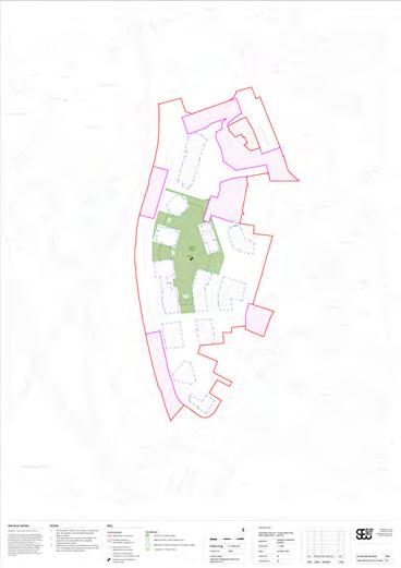
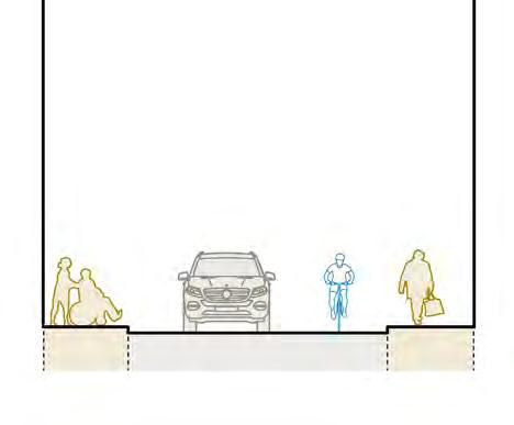
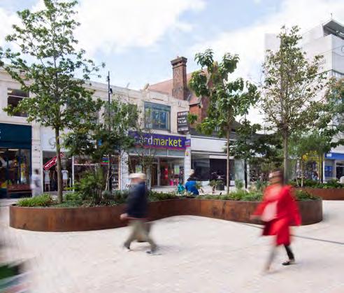
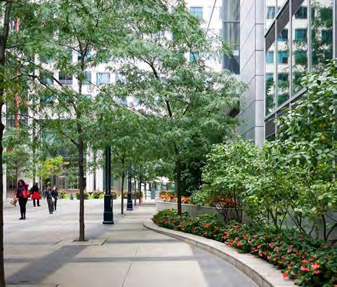
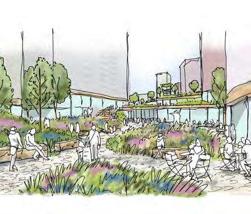
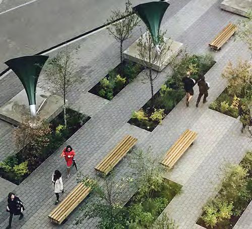
The illustrative masterplan is broken down into Spaces and Routes. Spaces describe key areas of programmed, car free, public realm that users will stop and spend time in. Routes describe streets and connections that allow users to access the key Spaces.
Minimum area dimensions are based on the public realm measurements defined by the maximum plot extents, shown on the Parameter Plans. Please read in conjunction with these documents.
The Spaces and Routes are supported by
a series of landscape strategies including movement, planting, sustainable urban drainage, architecture interface, furniture and play. These strategies are defined across the master plan and provide further detail on the relevant aspect of the landscape design. Aspects of the design relating to these strategies are therefore not described in the Spaces or Routes section of the document. Further detail of specific elements of each Space are provided in the Landscape Character Areas chapter of the Code.

The design of the Public Realm must align with the open space principles shown in the diagram below.
To ensure the Public Realm has a diverse offering and hierarchy of spaces.
↘ Refer to Landscape Character Areas section of document for further detail on individual qualities of spaces.
The dimensions provided on the following spatial diagrams are the minimum dimensions for each of the key Spaces as defined by the maximum plot extents shown on the Parameter Plans. Please read in conjunction with these documents.
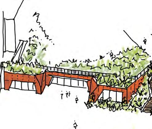
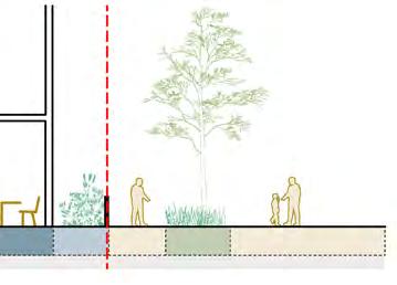
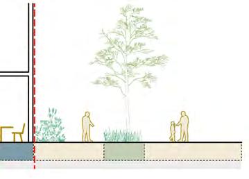
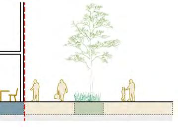
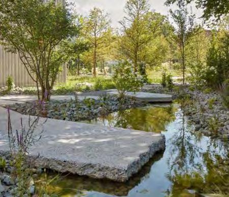
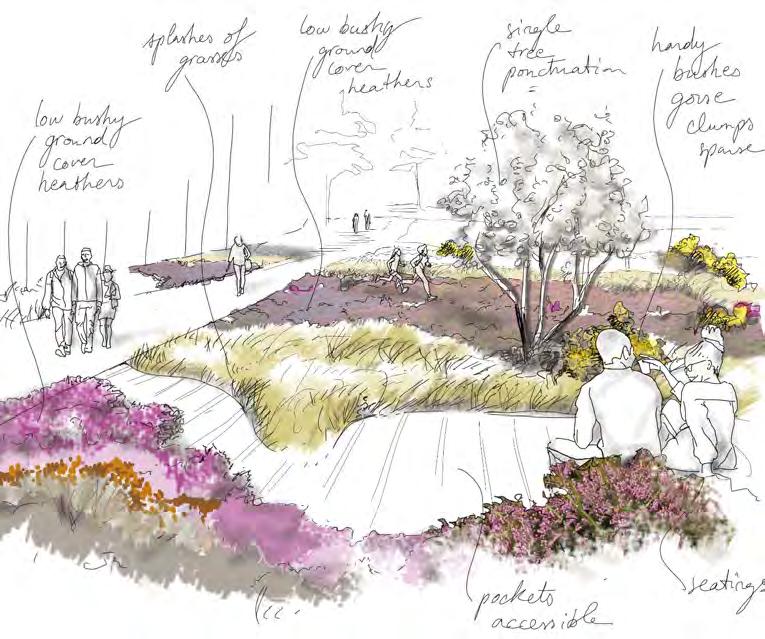
The Destination Square must provide a balance of hard landscape, generous planting and trees, with a hardscape area designed to accommodate events. It should provide planting and water as part of the recreational offering, including informal play.
To support the hierarchy of spaces defined for the Public Realm, and to offer a diverse network of open spaces.
↘ Refer to Northern Square / Landscape
The Street at Level 01 must provide a prominent street for retail and leisure between the Destination Square and Destination Terrace.
To support the hierarchy of spaces defined for the Public Realm, and to offer a diverse network of open spaces.
↘ Refer to The Street / Landscape
The Destination terrace at Level 01 must provide a green space overlooking the High Street. It should provide opportunities for dwelling, play and gathering.
To support the hierarchy of spaces defined for the Public Realm, and to offer a diverse network of open spaces.
↘ Refer to Eastern Terrace / Landscape
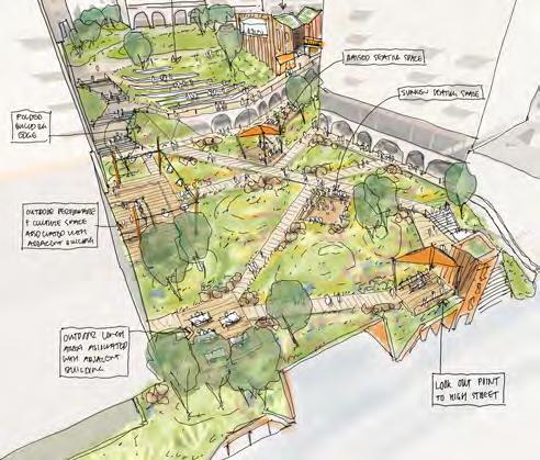
The Podium Park must be designed primarily as a green space to provide recreation and enhance biodiversity. It should serve the shopping centre visitors and the local community.
To support the hierarchy of spaces defined for the Public Realm, and to offer a diverse network of open spaces.
↘ Refer to Podium Park / Landscape.
The Platform must be designed as a multilevel landscape that defines the shopping centre entrance to the south, and stepped access up to the Podium Park. It should provide hardstanding to allow for events, adequate seating and viewing from above.
To support the hierarchy of spaces defined for the Public Realm, and to offer a diverse network of open spaces.
↘ Refer to Southern Squares / Landscape.
Market Square
The Market Square must provide areas of hardstanding for events and pop-up markets.
To support the hierarchy of spaces defined for the Public Realm, and to offer a diverse network of open spaces.
↘ Refer to Southern Squares / Landscape.
Routes
The routes to the Public Realm must align to the typologies shown in the diagram below.
To ensure the Public Realm has a diverse offering and hierarchy of spaces.
↘ Refer to Landscape Character Areas to understand Routes in relation to the masterplan
↘ Refer to Biodiversity Strategy for more information on planting character, function and species for each Route
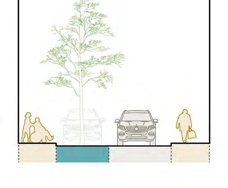
Dimensions
The dimensions provided on the following sections are the minimum clearances for the public realm defined by the maximum plot extents, shown on the Parameter Plans. Please read in conjunction with these documents. These sections also show the arrangement of hard and soft landscape.
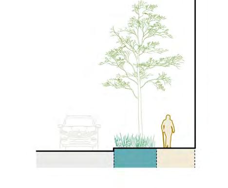
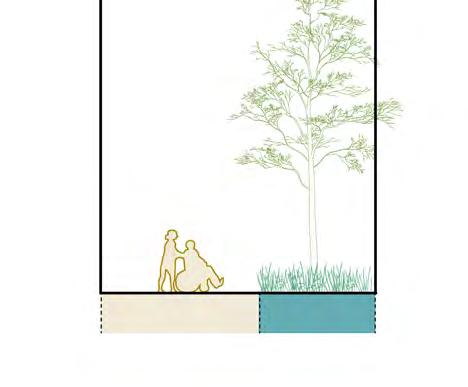
Greenway
Greenways must provide legible pedestrian footpaths. Greenways should have planting where possible. It is important to propose planting in between carriageway and footpath where practical.
To support the hierarchy of spaces defined for the Public Realm, and to offer a diverse network of routes throughout.
↘ Refer to Greenway / Landscape.
Link
Links must provide pedestrian footpaths and planting between Molesworth Street and the Northern Square. It should serve as a gateway and connection to Cornmill Gardens.
To support the hierarchy of spaces defined for the Public Realm, and to offer a diverse network of routes throughout.
↘ Refer to Northern Square / Landscape.
yards must be designed as a shared priority space to encourage pedestrian movement while facilitating servicing of adjacent plots.
To support the hierarchy of spaces defined for the Public Realm, and to offer a diverse network of routes throughout.
↘ Refer to Northern Square / Landscape.
Lane
Lanes must be designed as a shared priority space with trees and on street parking. It should propose planting where possible.
To support the hierarchy of spaces defined for the Public Realm, and to offer a diverse network of routes throughout.
↘ Refer to Southern Squares / Landscape.
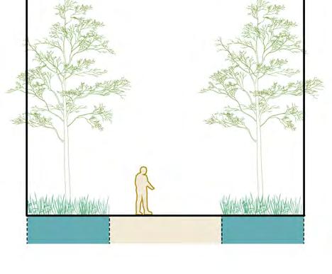
Passage
Passages must be designed as pedestrian only routes. It should propose trees and planting where possible.
To support the hierarchy of spaces defined for the Public Realm, and to offer a diverse network of routes throughout.
↘ Refer to Southern Squares / Landscape.
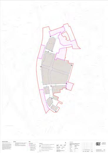
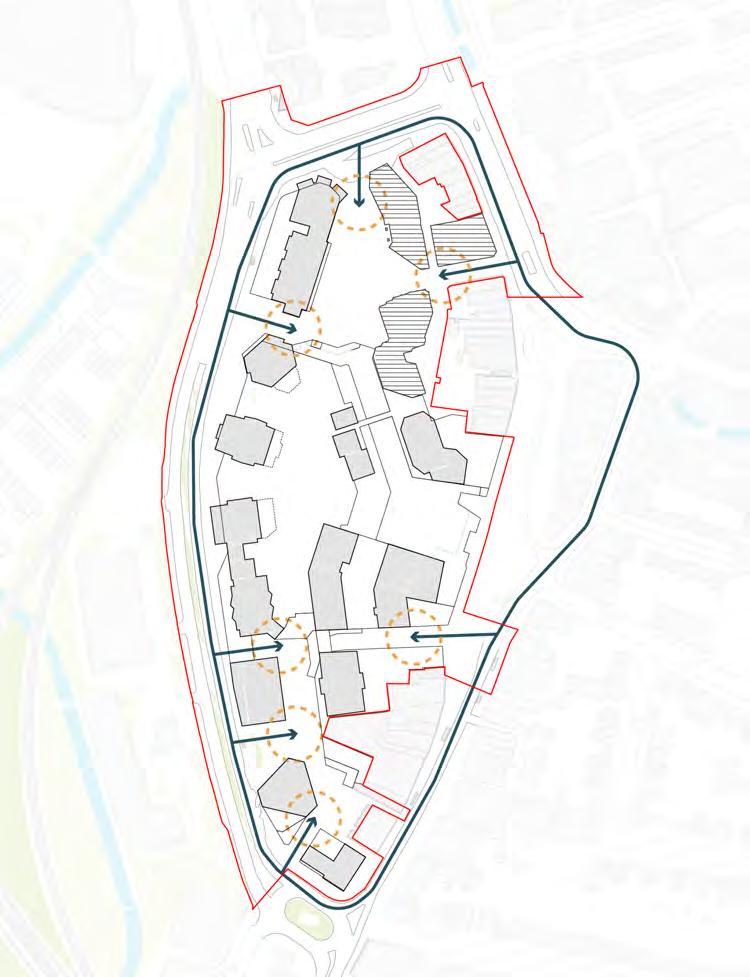
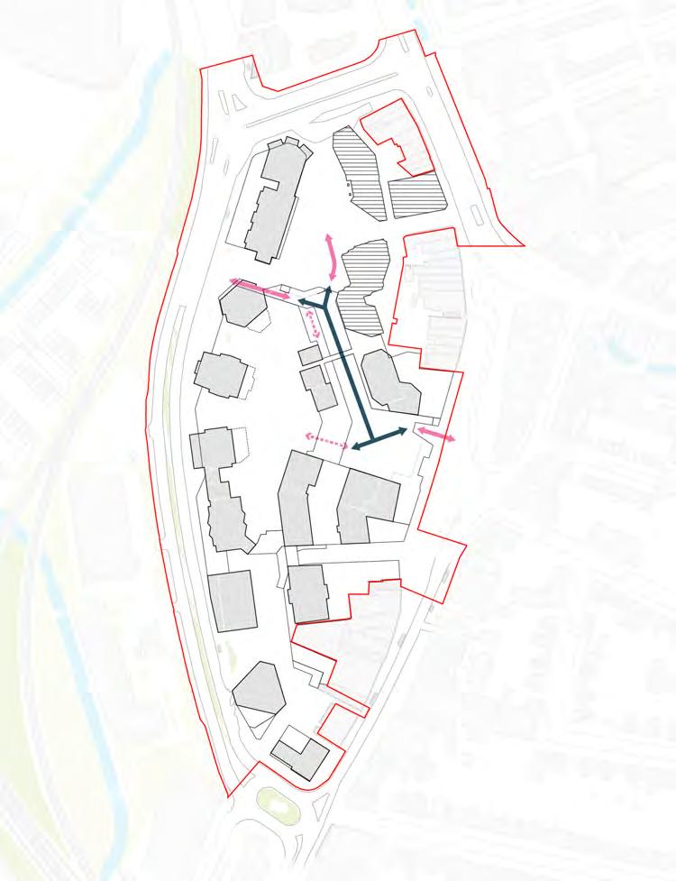
Key pedestrian routes - Level 00
The design of the Public Realm must provide legible north-south and east-west pedestrian routes at grade.
To ensure the Public Realm is designed to maximise permeability.
North-south route
North-south route (within Shopping Centre)
East-west route East-west route
Shopping Centre)
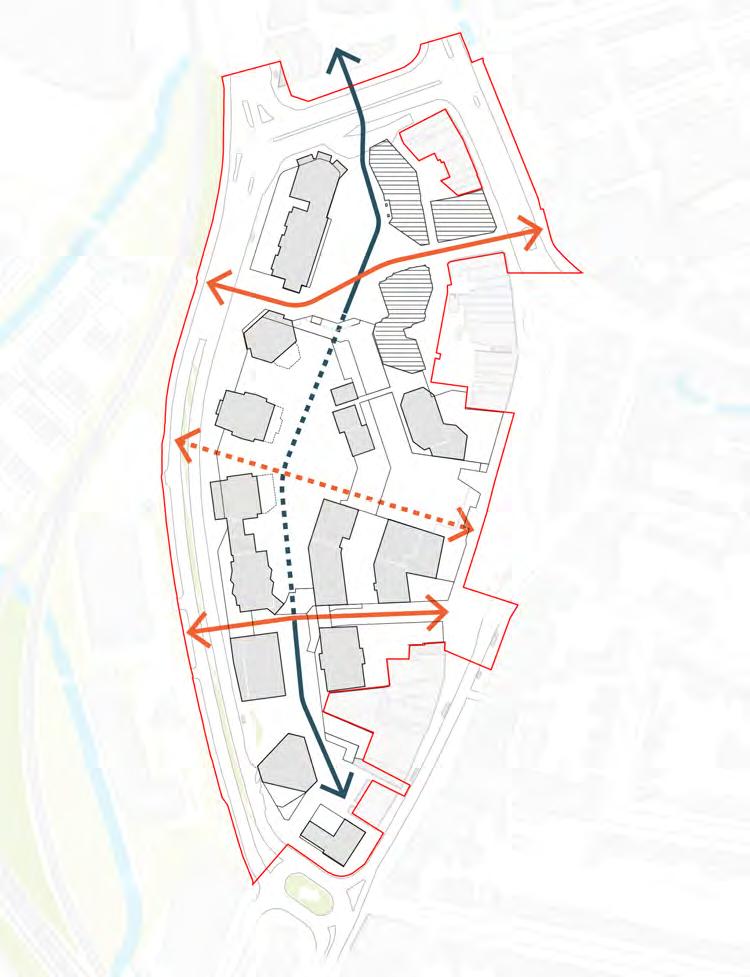
The development must provide a well defined and legible north-south route through the Northern Square, within the Shopping Centre, and the Southern Squares. It should provide a variety of indoor and outdoor experiences, while also remaining consistent with materiality, wayfinding and architectural interfaces with the Public Realm.
To provide a key connection between the Northern Square and the Southern Squares.
The development must provide several well defined and legible east-west routes. Routes should be open at all times to facilitate direct access to either side of the town centre and transport links.
To provide key connections between High Street and Molesworth Street.
Pedestrian network
The design of the Public Realm must provide a hierarchy of pedestrian routes.
To ensure the Public Realm is designed to prioritise pedestrian connectivity.
↘ Refer to Landscape Character Areas to understand Movement Strategies in relation to the masterplan
Pedestrian network, Level 00
Pedestrian priority
Pedestrian priority routes must not provide access to vehicles except for servicing, maintenance and emergency.
To ensure pedestrian experience is not limited by vehicles.
Pedestrian priority with vehicle access
All other routes must prioritise pedestrians. Routes should be supported with planting, trees and generous widths. Vehicle movements should be reduced where possible.
To ensure pedestrians are prioritised when vehicle access is permitted.
Servicing and waste network
The design of the Public Realm must provide key servicing and waste routes.
To ensure servicing routes do not limit pedestrian experience.
Designated areas of public space shown on the below plan should be free of parking.
To ensure parking does not limit pedestrian experience.
Cycle Parking
Cycle parking should be located at entrances into the masterplan.
To ensure the centre of the site is kept free of bikes.

Key pedestrian routes - Level 01
The design of the Public Realm must facilitate vertical access up to level 01 and provide a legible north-south pedestrian route between the Northern Square and the Eastern Terrace/ High Street.
To ensure the Public Realm is designed to encourage the use of spaces at podium level.
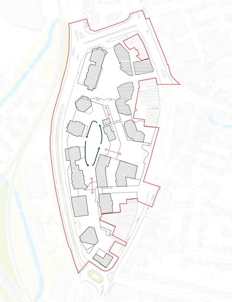
Key pedestrian routes - Level 02
The design of the Public Realm must facilitate vertical access to level 02 and provide a circular pedestrian route around the The Park.
To ensure the Public Realm is designed to encourage the use of spaces at podium level.
Access and inclusion must be central to the design of the Lewisham Shopping Centre Redevelopment.
This section outlines the site-wide access and inclusion principles which applies to all future RMAs.
The design must be inclusive, placing people at the heart of the process, acknowledging diversity and difference and considering the needs of different groups, including older people, children or people who experience sensory/neurological processing differences.
To ensure the design is inclusive for all users.
Maximise access
Design – including vertical circulation – must provide comfortable access to all parts of the site, its facilities, and services for visitors, residents and other users with a wide range of different requirements, in accordance with best practice guidance for inclusive design.
To ensure that the site is accessible to all
The pedestrian network must be designed as inclusive as possible providing easy navigation throughout the site, short and direct routes to facilities and services, and offering a sense of safety to all users of the public realm.
To ensure the site is easily navigable for all users.
Design must ensure that required standards for accessibility are met and respond to the evolving good practice guidance and social expectations about meeting the needs of disabled people.
To ensure that the proposal meets today’s standards and is responsive to future good practice.
Managing level changes in the public realm
Vertical circulation must be designed to provide multiple choices where possible.
To ensure level changes in the public realm are inclusive and accessible.
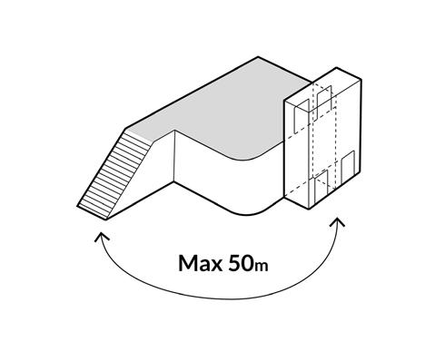
Where there are steps provided in the public realm, a lift must be provided within 50m walking distance. Whether people are travelling up or down a level, the minimum walking distance applies to both conditions.
To ensure level changes in the public realm are inclusive and accessible.
Public lifts should be provided as pairs, to a minimum compliance of 21 person / 1600kg per car. Lifts should be designed as ‘through’ cars to allow for wheelchair and mobility scooters to enter and exit without turning or reversing.
To ensure level changes in the public realm are inclusive and accessible.
Spill-out areas of 3m minimum should be provided in the Public Realm where adjacent to appropriate uses.
To allow for additional amenity provision beyond building line.
The interface of spill-out areas must be clearly defined.
To ensure spill-out areas are clearly delineated.
There should be a distinction between spill-out space and pedestrian zones.
To ensure there is free movement of pedestrians on footpaths and not encouraged along spill-out areas.
Defensible space should be provided to habitable units on podium and roof level. Landscaped areas within the Public Realm could supplement defensible space.
To provide amenity to homes adjacent to the Public Realm or communal amenity.
Sustainability must be central to the design of the Lewisham Shopping Centre Redevelopment.
This section outlines the sustainability principles that form the basis of the Sustainable Development Framework, which applies to all future RMAs.
↘ Refer to the Sustainability Strategy, Energy Assessment and other relevant documents.

Embodied Carbon
Reducing WLC throughout building design and public realm through material choices, optimised grid sizes and slab thickness, avoiding basements, efficient design

Maximising Urban Greening Factor and Biodiversity Net Gain across the site through unified meadow planting approach, retainment of majority of existing trees, increase in trees and planting

Increasing pedestrian access throughout the site, encouraging use of public transport networks and providing cycle facilities for building users

Reducing Energy Use Intensity and space heat demand through efficient design. Aspiring to achieve net zero carbon for regulated and unregulated energy for the masterplan

Water & surface water run-off
Improving water efficiency across the site, for example, using rainwater harvesting in the landscape strategy. Addressing flood risk by using permeable surfaces and nature-based SuDS

Minimising impact on air quality on the site by providing walking routes and EV charging points for new parking spaces. Using nature to reduce impact on air quality and no gas combustion on site for heating and hot water.

Climate change resilience
Prioritising passive design solutions where feasible and ensuring buildings and public realm are designed to be resilient to future climate scenarios

Health & wellbeing
Designing buildings that provide suitable daylight, acoustic, thermal comfort conditions for building users. Creating inclusive spaces for all as well as places for recreation and play in the landscape

Optimising material reuse opportunities across the site where possible and specifying low embodied carbon materials
The masterplan must deliver an integrated water management strategy, using the most up to date Sustainable Drainage Proforma by the Greater London Authority (GLA) to help inform the design.
To create a holistic water-conscious design using appropriate guidance.
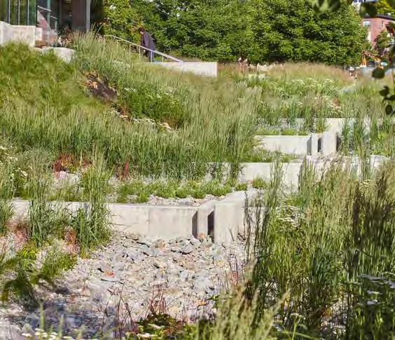
The design of the Public Realm must integrate SuDS features.
To reduce water run-off and improve water quality.
Natural drainage features such as rain gardens, detention ponds and retention ponds should be integrated into the soft landscape.
To reduce water run-off and improve water quality.
Permeable paving should be delivered as part of the drainage strategy.
To reduce water run-off and improve water quality.
SuDS features could be combined with other strategies to benefit the Public Realm design. These could include play, biodiversity and amenity strategies.
To improve the performance, functionality and experience of the Public Realm.
Planting for SuDS must be designed to maximise biodiversity value and habitat creation.
To enhance biodiversity value and create a network of habitat typologies.
SuDS must be designed with future maintenance taken into account.
To ensure SuDS features perform as required for the long term flood risk strategy.
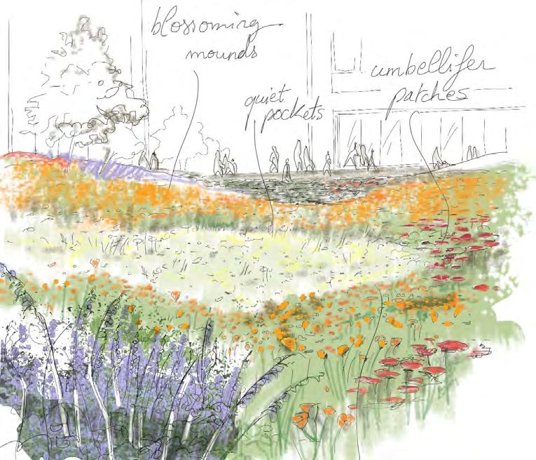
The design of the Public Realm must align to the planting character types shown in the diagram below.
To create a varied network of green links and habitat conditions to support life throughout all lifecycles.
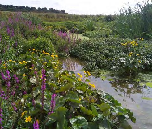
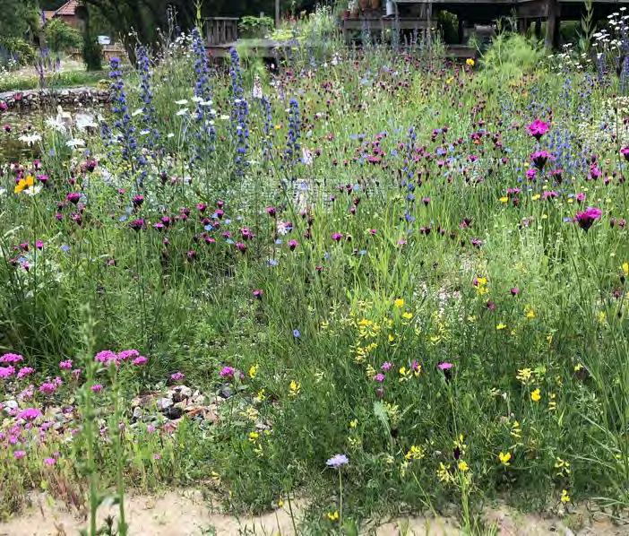
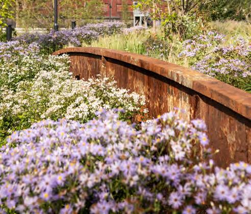
Within the water meadow character area there are three distinct zones. Each meadow typology responds to varying microclimate, soil type and water exposure within the character area. The water meadow is composed of the following planting typologies:
Wet Water Meadow: Associated with permanently wet pond areas. The typology will have a mixture of aquatic species suitable for sun and partial shade.
Marginal Water Meadow: Located at edges of water bodies, with species adaptable to both dry and flooded conditions in both sun and partial shade.
Urban Water Meadow: Located within the public realm with species more resistant to drought conditions and heavily used adjacent hard space. Species aim to visually deliver a water meadow character.

The Wet Water Meadow typology should include some of the species outlined below.
To ensure the water meadow character is maintained.
Aquatic and Marsh Plants
• Iris pseudacorus
• Juncus effusus
• Alisma plantago
• Carex elata
• Nyphea alba
• Menta aquatica
• butomus ombelwwlatus
• Hippuris vulgaris
• Sparganium erectum
• Trees
• Salix babylonica tortuosa
• Taxodium dystichum
• Salix alba chermesina
• Salix alba britzensis
The Marginal Water Meadow typology should include some of the species outlined below.
To ensure the water meadow character is maintained.
Moisture tolerant plants
• Veronicatsrum virginicum
• Stachys palustris
• Digitalis lutea
• Salix rosmarinifolia
• Matteuccia struthiopteris
• Sagitaria sagitifolia
• Carex riparia
• Lysimachia vulgaris
• Euphorbiua palustris
• Lythrum salicaria
Trees
• Alnus cordata
• Alnus glutinosa
• Betula alsbosinenesis
• Eleagnus angustifolia
Shrubs
• Crataegus laevigata
• Weigela florida ‘Foliis Purpureis’
• Physocarpus opulifolius ‘Diablo’
• Deutzia ‘Strawberry Fields’
The Urban Water Meadow typology should include some of the species outlined below.
To ensure the water meadow character is maintained.
Moisture tolerant plants
• Salvia x sylvestris ‘Mainacht’
• Cenolophium denudatum
• Eriocapitella hupehensis
• Baptisia australis
• Descampsia cespitosa
• Stipa tenuissima
• Hakonechloa macra
Trees
• Tilia platyphyllos
• Eleagnus angustifolia
• Betula alsbosinenesis
Shrubs
• Cornus mas
• Eunymus europeaus
• Viburnum in varieties
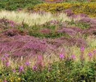
Within the rocky heath meadow character area there are three distinct zones. Each meadow typology responds to varying microclimate, soil type and water exposure within the character area. The rocky heath meadow is composed of the following planting typologies:
Open Heathland: Composed to create a more open grassland, with few shrubs. Suitable for nutrient poor and acidic soils on a well drained sub base.
Rocky Meadow: Located at level changes to steps, terraces, edges and walls. Species that grow between gaps and in crevices in nutrient poor soil.
Heath Inspired Meadow: Located in areas with heavy footfall and activity. Shade tolerant species that imitate hummocking behaviour of heath ground cover species.
The Open Heathland typology should include some of the species outlined below.
To ensure the rocky heath meadow character is maintained.
Grasses and perennials
• Ulex europaeus
• Cytisus scoparius
• Erica vulgaris
• Erica carnea
• Calluna vulgaris ‘Alicia’PBR
• Daboecia × scotica ‘William Buchanan’
• Deschampsia flexuosa
• Holcus lanatus
• Molinia caerulea subsp.caerulea
• ‘Moorhexe’
• Stipa pennata
• Alopecurus pratensis
• Phleum pratense
• Antennaria dioica ‘Alex Duguid’
• Jasione laevis ‘Blaulicht’
• Juncus effusus
• Achillea millefolium
• Ophioglossum vulgatum
• Pteridium aquilinum
• Vicia lutea
Trees
• Amelanchier lamarckii
• Quercus rubra
• Betula in varieties
• Pinus nigra Shrubs
• Rhus typhina
• Erica arborea
• Hamamelis
The Rocky Meadow typology should include some of the species outlined below. To ensure the rocky heath meadow character is maintained.
Rock Garden and Alpine Plants
• Armeria maritima
• Ajuga reptans
• Campanula petiolata
• Campanula macrantha
• Saponaria ocymoides rhs
• Aubrieta ‘Blaumeise’
• Alyssum montanum
• Iris ‘Cliffs of Dover’ and varietiies
• Veronica prostrata ‘Spode Blue’
• Nepeta x fassenii
• Aster alpinus ‘White Beauty’
• Euphorbia mysynites and varieties
• Catananche caerulea
• Nerine Bowendii
• Erigeron karvinskianus
Trees
• Pinus nigra
• Cornus mas ‘aurea’
• Rhus typhina
• Quercus ilex

Shrubs
• Erica arborea
• Hammamelis
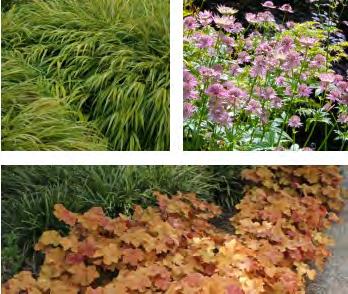
The Heath Inspired Meadow typology should include some of the species outlined below.
To ensure the rocky heath meadow character is maintained.
Perennials and grasses
• Cimicifuga simplex ‘Brunette’
• Astible japonica ‘Etna’
• Digitalis grandiflora
• Tellima grandiflora
• Astrantia major
• Heuchera vilosa ‘Caramel’
• Asperula taurina
• Heuchera vilosa ‘Caramel’
• Asperula taurina
• Hakonechloa macra
• Molinia caerulea ‘Heidebraut’
Trees
• Quercus rubra ‘aurea’
• Amelanchier lamarkii
• Cornus mas ‘aurea’
• Hammamelis
Shrubs
• Kerria japonica
• Cornus sanguinea
• Eunymus europaus
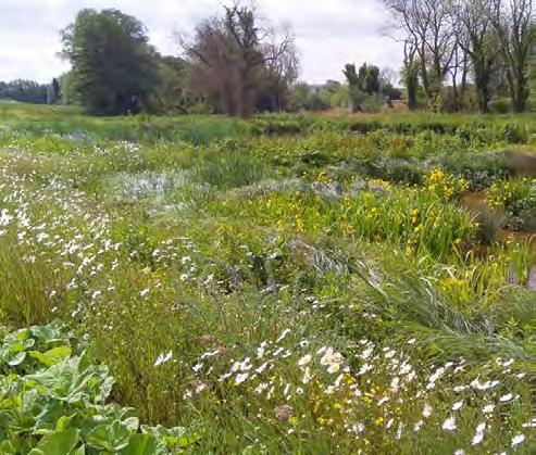
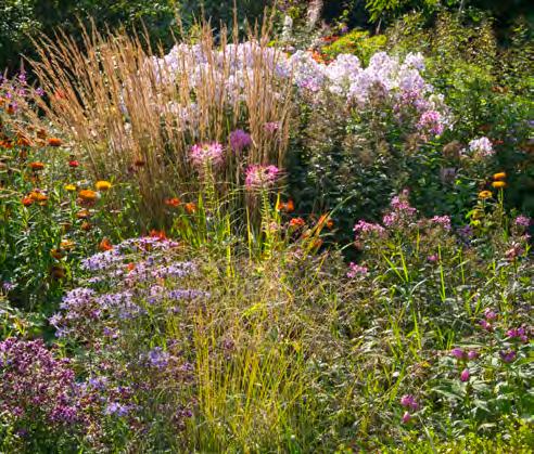
Within the wildflower meadow character area there are three distinct zones. Each meadow typology responds to varying microclimate, soil type and water exposure within the character area. The wildflower meadow is composed of the following planting typologies:
Flowery Glade: A grass dominant meadow with flowering interest. The central lawn space will be cut back strategically for recreational use.
Wildflower Meadow Glade: A palette of classic wildflowers, interspersed with superbloom species for high seasonal impact and naturalistic looking perennials.
Meadow Edge: Mixture of durable grasses, perennials and bushes, selected for shade tolerance and year round presence.
The Wildflower Meadow Glade typology should include some of the species outlined below.
To ensure the wildflower meadow character is maintained.
Grasses, perennial and wildflower mix
• Cynosurus cristatus
• Eschscholzia californica
• Festuca rubra
• Lupinus spp.
• Helianthus spp.
• Achillea millefolium
• Centaurea nigra
• Filipendula vulgaris
• Galium album
• Leucanthemum vulgare
• Origanum vulgare
• Plantago lanceolata
• Primula veris
• Rhinanthus minor
• Rumex acetosella
• Silene vulgaris
• Riza media
• Cynosurus cristatus
• Festuca ovina
• Festuca rubra
• Koeleria macrantha
• Nepeta grandiflora
• Knautia macedonia

• Agastache ‘Blackader’
• Echinacea purpurea
• Cosmos
• Salvia guaranatica ‘Amistad’
Trees
• Castanea sativa
• Cercis siliquastrum
• Acer sacharum
The Flowery Glade typology should include some of the species outlined below.
To ensure the wildflower meadow character is maintained.
Strong grasses and wildflower mix
• Grostis capillaris
• Cynosurus cristatus
• Festuca rubra
• Phleum bertolonii
• Poa pratensis
• Lolium perenne
• Leucanthemum vulgare
• Ranunculus acris
• Trifolium repens
• Tanacetum vulgare
• Coreopsis lanceolata
• Sedum Kamtschaticum
• Rudbeckia ‘Goldsturm
• Buphthalmum salicifolium
• Galium verum
Trees
• Castanea sativa
• Koelreuteria paniculata
• Acer sacharum
Shrubs
• Crataegus monogyna

The Meadow Edge typology should include some of the species outlined below.
To ensure the wildflower meadow character is maintained.
Shady grasses and wildflower mix
• Agrostis capillaris
• Cynosurus cristatus
• Festuca rubra
• Phleum bertolonii
• Poa pratensis
• Lolium perenne
• Achillea millefolium
• Digitalis
• Perovskia atriplicifolia
• Anemone × hybrida ‘Honorine Jobert’
• Hakonechloa macra
Trees
• Malus sylvestris
• Betula utilis ‘jacquemontii’
• Crataegus monogyna
• Cercis siliquastrum
• Koelreuteria paniculata
Shrubs
• Viburnum
• Crataegus monogyna
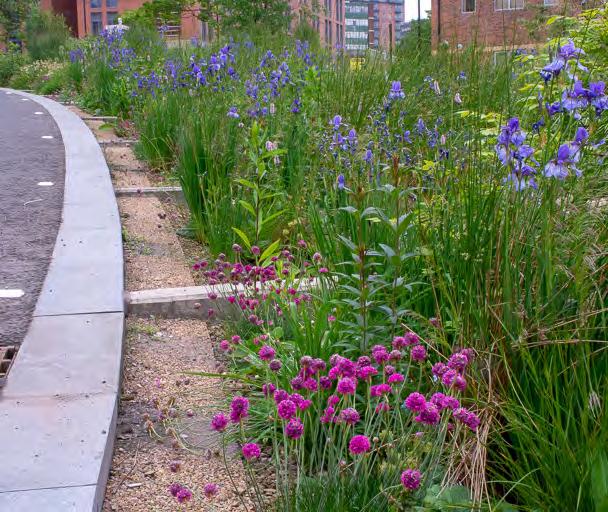
The Southern Squares should be designed to recreate open mosaic habitats, using a species mix that will thrive in low nutrient soils and drought conditions.
To ensure a highly active urban environment can sustain ecological value.
Grass mix
• Carex eburnea
• Melica uniflora f. albiflora
• Sesleria autumnalis
Euphorbia mix
• Euphorbia corallioides
• Euphorbia cyparissias
• Euphorbia polychroma purpurea
Urban wild plants
• Acaena buchananii
• Cymballaria pallida or Linaria pallida
• Sedum spurium ‘Fuldaglut’
• Solidago virgaurea
• Matricaria dioscoidea
• Amaranthus deflexus
• Erodium cicutarium
• Draba verna
Trees
• Betula utilis ‘jacquemontii’
• Carpinus japonica
• Pinus nigra
• Populus tremula
The Greenway along Molesworth Street and Rennell Street should be tree lined and include low level planting adjacent to the carriageways. Wildflower meadow will be suitable here due to its low maintenance requirements, high biodiversity value and can be integrated as sustainable urban drainage next to a busy carriageway.
To ensure a highly active urban environment can sustain ecological value.
The Greenway planting design should include some of the species outlined below:
• Achillea millefolium
• Aquilega vulgaris
• Aster amelus
• Centaurea nigra
• Delphinium grandiflorum
• Digitalis purpurea
• Eryngium vulgare
• Knautia arvensis
• Linaria vulgaris
• Myosotis sylvatica
• Origanum vulgare
• Primula veris
• Prunella vulgaris
• Ranunculus acris
• Salvia nemorosa
• Scabiosa columbaria
• Veronica spicata
• Valeriana officinalis
All planting areas should be designed to create ecological connectivity across the site.
To connect areas of vegetation and encourage movement of species through the site.
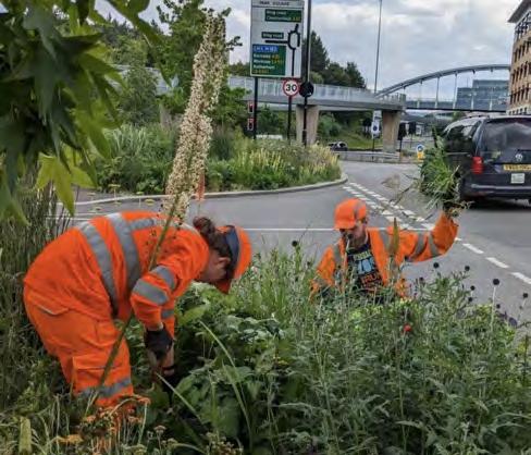
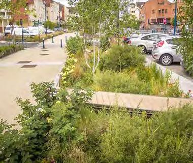
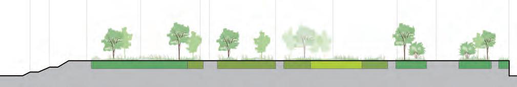
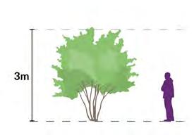
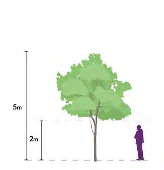
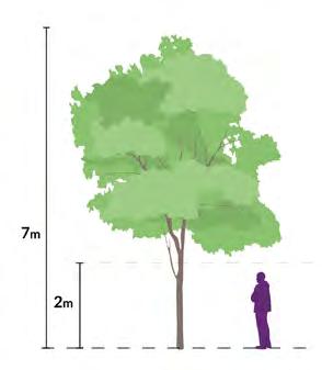
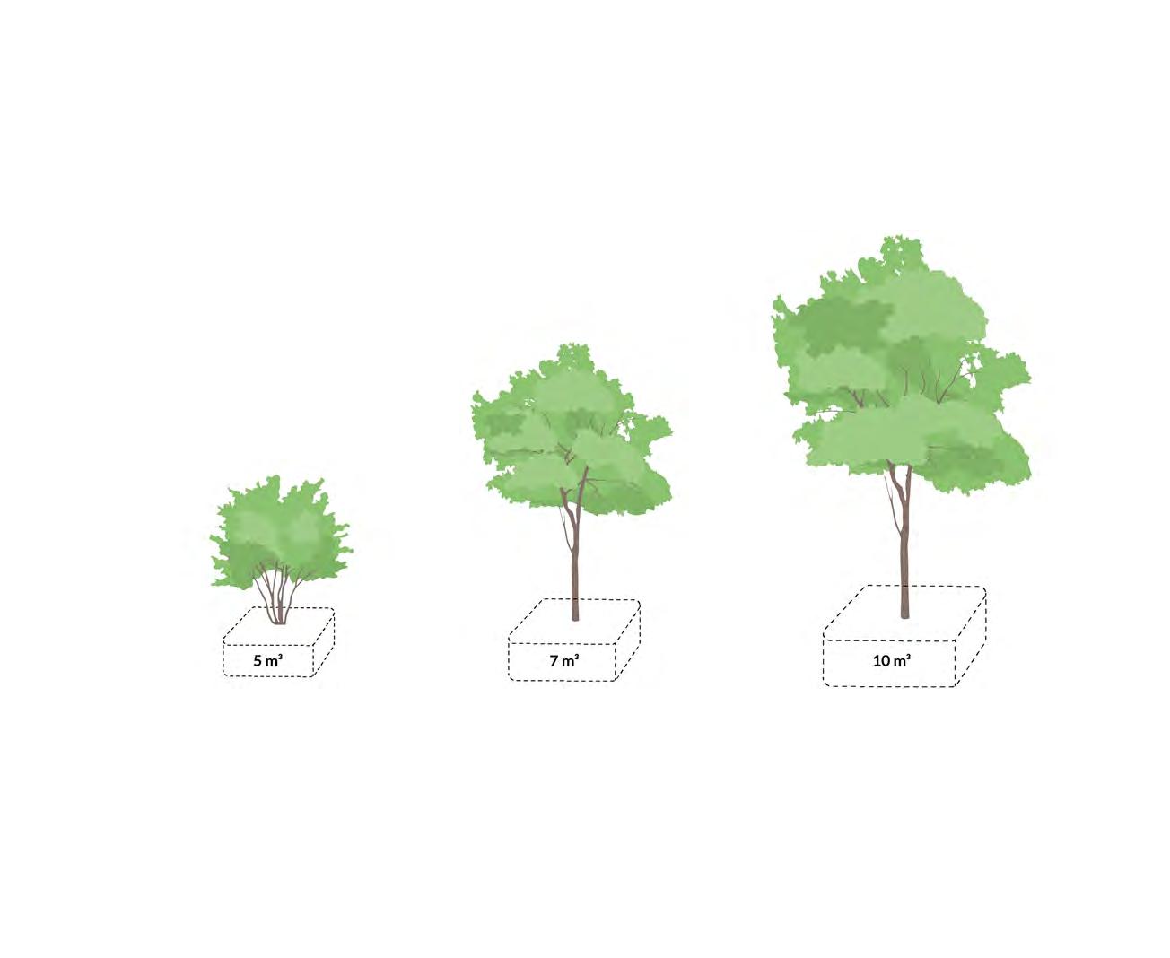
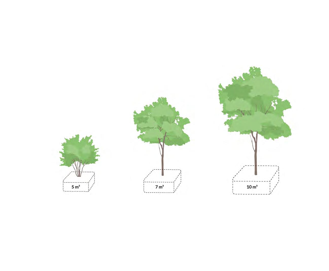
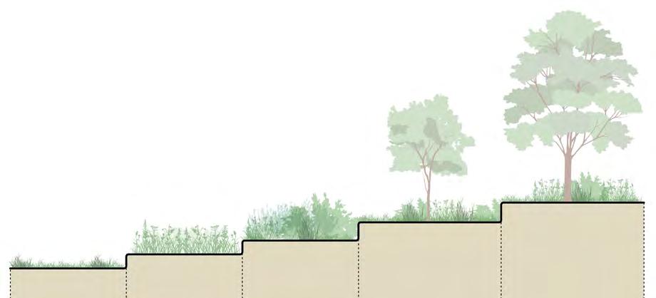
Trees play an important role in supporting the planting strategies defined within each character zone. The following codes set the minimum requirements for proposed trees throughout the masterplan, whether installed at grade or over structures.
↘ Refer to the planting strategy codes for guidance on species selection.
The following tree types must be met as a minimum throughout the masterplan.
To ensure proposed trees are consistent in form, physical attributes and visual properties as each RMA stage is developed.
•
•
•

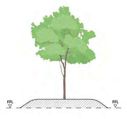
Where a minimum soil depth of 1000mm is not achievable for large tree planting, soil must be mounded or retained to reach a depth of 1000mm. Soil depths can be achieved by mounding from the finished paving level, or by raised edges/ seating. Ensure mounding does not impact height of parapet or edge protection.
To enable trees to thrive and ensure their long term success.
Planting must have sufficient soil volume to thrive. The following diagrams (on the following page) provide guidance on minimum requirements for soil volume in relation to planting type.
To ensure all of the planting has an adequate soil depth.
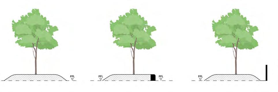
Planting on a bank or slope must comply with the following principles.
To enable planting adjacent to buildings or structures. S.106
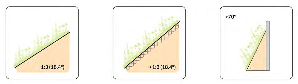
Planting on bank or slope less than or equal to 1:3 gradient
• Soil stabilisation not required
• Permitted adjacent to building or structure
Planting on bank or slope steeper than 1:3 gradient
• Soil stabilisation required
• Permitted adjacent to building or structure
Planting on bank or slope steeper than 70% from the horizontal plane
• Not permitted adjacent to building or structure (subject to fire classifications in relation to Building Regulations)
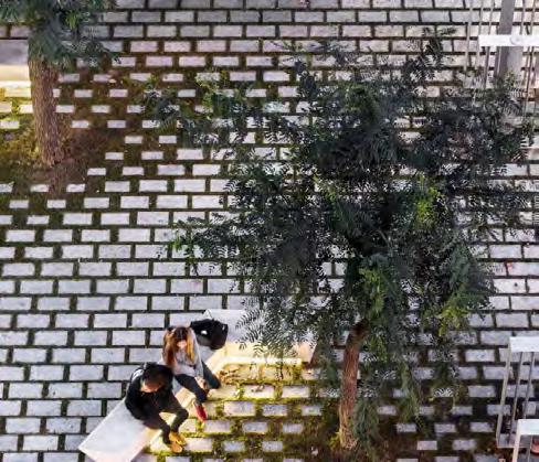
The material strategy for the Public Realm must be designed with coherence and quality in mind, in response to the Character zones identified.
To ensure materials will facilitate a diverse offering and hierarchy of spaces within the Public Realm that will age well over time.
Design of the hard landscape must be accessible and comfortable for all users, while ensuring materials will last and age well over time.
To ensure the Public Realm is designed to offer equitable, inclusive and welcoming spaces.
Design of the hard landscape should tie in with the surrounding streets and public realm.
To ensure the Public Realm ties into the local character.
Design of the hard landscape should integrate re-use of construction material. The Public Realm should look for opportunities to embed site won material.
To ensure the development contributes to circular economy aspirations.
Furniture, lighting and signage within the Public Realm must be designed to ensure there is a consistent approach across the masterplan and within the Character zones.
To ensure there is a connected experience to the Public Realm, while maintaining uniqueness and identity within each Character zone.
The design and positioning of seating should consider adequate resting points and intervals no greater than 50m throughout the Public Realm.
To create a functional and inclusive Public Realm.
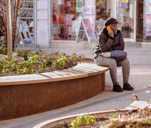
Seating areas should provide a variety of opportunities for wheelchair users, prams or pushchairs to be positioned adjacent to seating.
To create a functional and inclusive Public Realm.
The lighting strategy must be designed to help create a safe, welcoming and inclusive environment through good natural surveillance, clear sight lines, appropriate lighting and logical and well-used routes.
To create a safe and welcoming Public Realm.
Where external lighting is provided, it should minimise impacts on biodiversity by reducing spill of light into ecologically sensitive areas.
To minimise impacts on biodiversity.
The lighting strategy must support the sites town centre uses.
To encourage the town centre to be used for a variety of uses throughout the day and night.

Signage must be designed to be simple, consistent and inclusive. This should be achieved using a coherent design language throughout the masterplan.
To create a cohesive, navigable Public Realm.
Integrated signage
Signage should be incorporated into landscape features such as paving, lighting, seating and columns.
To reduce clutter in the Public Realm.
Signage should integrate information boards to explain habitat protection within the Public Realm.
To enable appreciation and understanding of nature.
The public realm should be laid out to ensure clear sight-lines along main desire lines.
To encourage natural wayfinding through the layout of the public realm design.
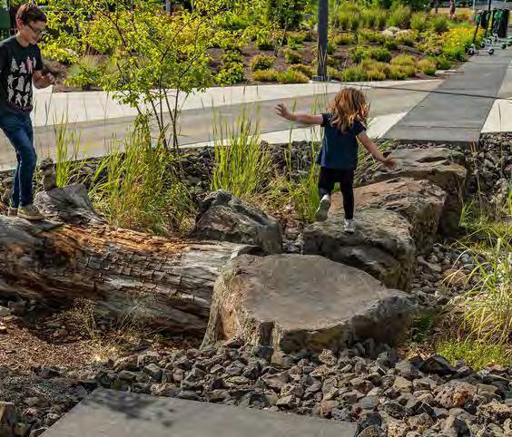
The Public Realm & residential podiums must provide a range of dedicated and non-prescriptive play spaces. The diagram below illustrates the zones in which play is allocated.
To ensure play spaces are strategically located to align with the landscape and place-making principles for the masterplan.
The Public Realm must integrate opportunities for play and recreation throughout the masterplan.
To ensure the Public Realm provides a diverse offering of play and amenity throughout the masterplan, outside of dedicated play areas.
The Public Realm must provide one focused destination play space with equipped play.
To create a diverse network of play spaces throughout the masterplan.
Designated play spaces must provide opportunities for interaction and engagement with nature. This could include soft landscape within play areas.
To ensure play spaces provide multiple benefits to support the overall landscape strategy.
Play spaces must be designed for a wide range of age groups, physical and neurological abilities. This includes consideration of play and seating for parents and carers.
To ensure play is accessible, inclusive and comfortable for all.
Play opportunities within level changes should be explored.
To maximise the positive benefits of the level changes created across the site.
Public art should provide engagement opportunities with the local community. This could include community engagement sessions or working with local artists.
To ensure public art is distinct and relevant to the local community.
Public art should be used in the Public Realm strategy to enhance the sense of place.
To ensure the art strategy reflects the public ream principles and local context.
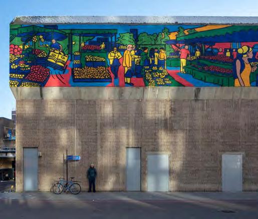
Elements of public art should celebrate local character, such as the history of murals at Lewisham Shopping Centre.
To ensure art works celebrate Lewisham and reflect the local community.
Residential terraces must be accessible and usable for residents.
To provide communal amenity for residents throughout the development.
Residential terraces should include doorstep play.
To ensure parents and carers of younger ages have access to play space adjacent to homes.
Residential terraces must include areas of soft landscape.
To ensure planting and biodiversity value is maximised within plots.
An artificial nest box for peregrine falcons must be installed on a suitable location at the end of the construction period as a replacement for the nesting site lost during the works on Lewisham House. This box should continue to be monitored by a suitably qualified ecologist to confirm that it is in use.
To safeguard mitigation for existing habitats on the site.
Overview
This section sets out the site-wide built form codes for the masterplan. It covers buildings across the masterplan under the following topics:
• Layout and massing
• Building Frontages
• Building Façades
• Special Features
• Approach to Heights
• Taller Buildings
• Entrances
• Balconies
• Materiality
• Microclimate
• Servicing and Maintenance
These codes are in the site-wide section as they apply to multiple plots. They should be read in conjunction with the Plot Codes to understand the full suite of Built Form codes that apply to each plot.
As plots come forward and are constructed, subsequent plots must respond to the built form resolution of the completed plots, particularly where these plots are adjacent.
The illustrative diagrams and text on this page set out the overall built form approach for the masterplan. This provides the starting point from which our Codes in this section have developed.
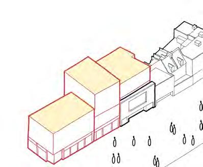
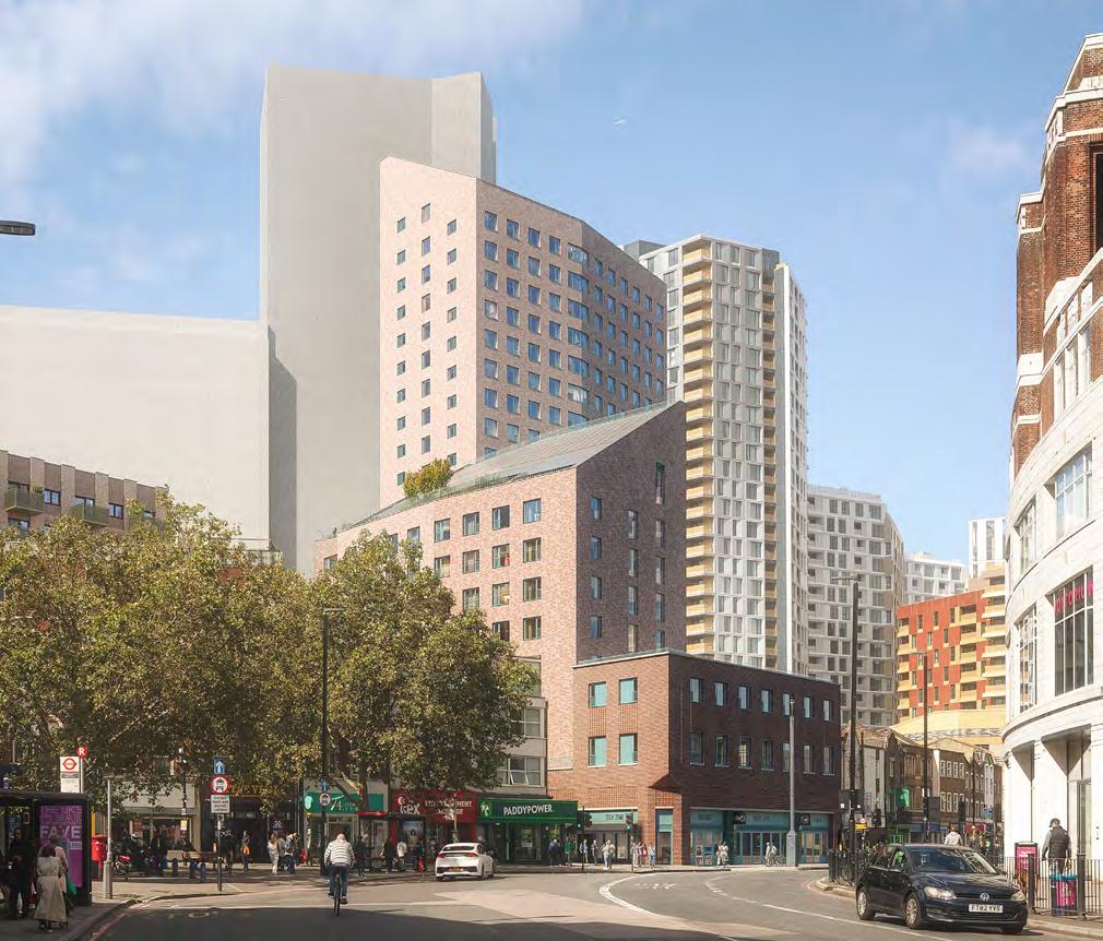
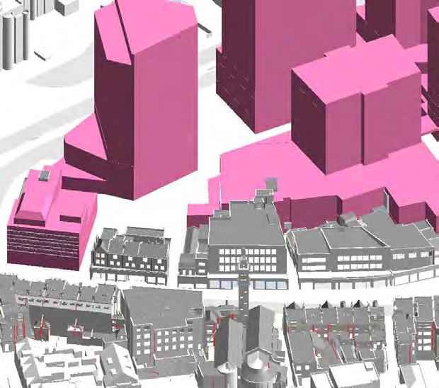
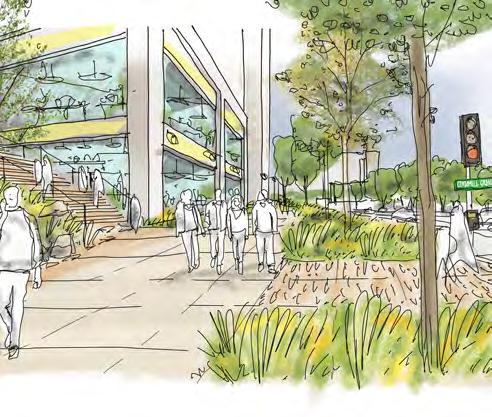
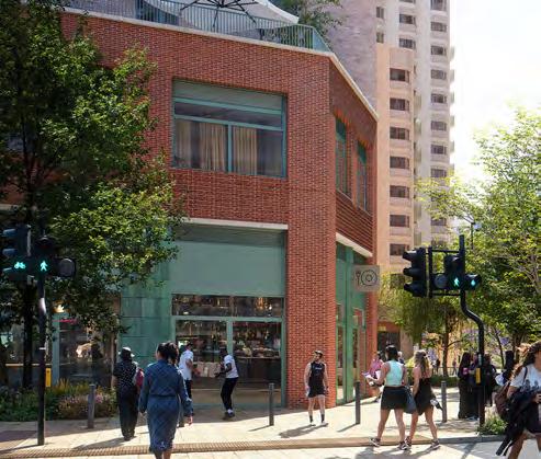
The starting point for buildings, particularly on the High Street, is for ‘Retention First’. This has resulted in more High Street properties being retained through the evolution of the scheme, and removed from the site altogether. Where necessary, new in-filled plots repair the High Street edge. Plots along the frontage use building breaks, height variations and elevation treatment to mirror the scale of the existing High Street.
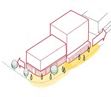
New infills and retained buildings form a continuous frontage of active town centre along the High Street. Prominent corners at new entry points are also delineated by new plots.
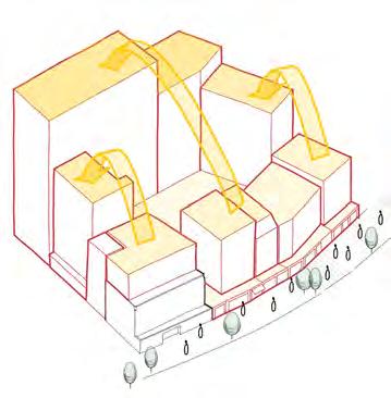
Building plots step up and away from the High Street, positioning taller buildings on the west of the masterplan site. New infills along the High Street respect the height of existing buildings to safeguard the setting of heritage assets.
General Summary
The following spreads set out the key design moves on the site that have informed the layout and massing of the masterplan. This illustrative information has been taken from the DAS, but is intended to provide important context to the Codes.
Respecting the existing street line with sensitive infills that celebrate the diversity of High Street buildings
New routes are created through the site, both at ground level and multilevel, with public spaces at their intersections
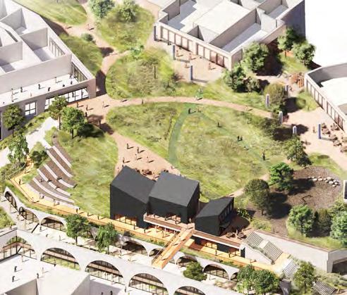
Community building (Plot M1) anchors the centre of the multi-layered landscape
Each plot responds to specific contextual requirements and therefore demands an individual urban design response
↘ Refer to Plot Codes section
Creating larger distances between taller buildings along Molesworth Street to address the wider townscape
Anchoring the site in its wider context
The main eastern facing façades of plots must align in plan along the High Street to adjacent buildings, excluding Plot SC.
To reinforce the historic High Street frontage.
Building lines addressing Lewisham High Street should conform to the urban grain of the existing building lines, excluding Plot SC.
To provide a strong streetscape frontage along Lewisham High Street.
Plots, or the relevant parts of plots, must respect the scale and height of adjacent buildings on the existing High Street.
To retain the existing High Street scale.
The High Street facing component of Plots should be expressed as landing on the ground at the buildings base.
To reflect the approach of existing High Street buildings and form a clear building line.
S.138 Layout
Central plots should be expressed as northsouth orientated buildings.
To create a cluster of buildings that are suited to the rectangular nature of the site.
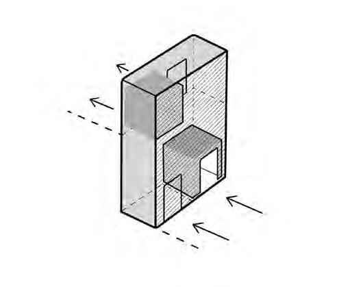
Building plots must be expressed as landing on the podium, with the base of the buildings taking on the expression of the podium. This could be achieved by treating the adjacent landscape as the ground level, whether the podium is at Level 01 or 02.
To create a continuous horizontal datum and to emphasise the ground plane.
Building plots must step up in height from east to west.
To respect the scale of the High Street.
Where plots sit on a podium that is larger than the footprint of the building above, these plots should be expressed as shown in the sectional diagram opposite.
To ensure coherence between adjoining plots in the masterplan.
Building plots must be adequately spaced apart, and should exceed the minimum critical distances shown on the parameter plans.
To ensure the masterplan creates ‘sky gaps’ between buildings from wider townscape views.
These plots must contain the tallest buildings on the site when the masterplan is completed.
To enhance the character of buildings on Molesworth Street
Landing on the Ground
Building plots must be expressed as landing on the ground on Molesworth Street, taking precedent over any continuous podiums in terms of form and prominence (including plot SC).
To avoid a continuous wall of development along Molesworth Street.
↘ Refer to Plot Code N3 for it’s landing on Rennell Street
Where plots sit on a podium that is larger than the footprint of the building above, these plots should be expressed as shown in the sectional diagram opposite.
To ensure coherence between adjoining plots in the masterplan.
Massing steps should be consolidated, avoiding steps of less than 2 storeys. Single storey massing steps could be acceptable on the top floor, provided there is a legible approach to the design.
To ensure clarity and hierarchy of massing.
Roofs should be generally flat. Roof articulation could be explored for Plot M1.
To improve the impact on the skyline.

Plot M1 must be located in the centre of the site, and respond in its siting to the multilevel landscape.
To anchor the heart of the site.
Plot SC typically forms the lower two levels of all plots that are part of the central podium.
Information to understand plot inter-relationships.
Because of the unique nature and constraints of each masterplan plot, there is a limited scope for flexibility in terms of frontage types. As a result, the frontage types shown on the spread opposite demonstrate a close relationship with the illustrative scheme.
The proposal looks to maintain as much active frontage at public facing levels as possible. This could result in shifting back of house uses, including plant, to mezzanine or upper levels to ensure the frontages are as active as possible.
The frontages illustrated and coded in this section refer to those facing onto adjacent public realm at the level stated.
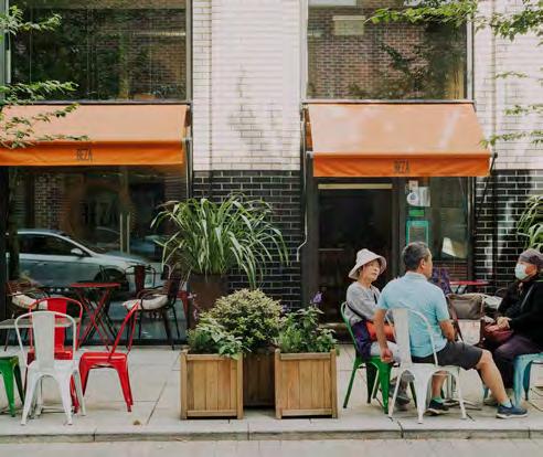
Active use refers to spaces that must engage with the adjacent public realm, including retail stores, cafés, residential lobbies and other services that encourage pedestrian activity and interaction.
To create a visually interesting and dynamic street environment, whilst providing natural surveillance and views of the public realm.
Active uses can fall into the category of Primary and Secondary frontages and therefore follow the appropriate coding.
Information for the use of the Frontages Codes.
Building frontages must respond to the hierarchy shown in the code diagrams on the following spreads.
To create a clear hierarchy of frontage types and to maximise active frontage to public realm.
Primary
Primary frontages refer to the main façades of a building that face and engage with the key public spaces.
Primary frontages must have predominantly active uses, with at least 60% active and must not include more than 5 consecutive metres of inactive frontage.
Primary frontages should predominantly constitute of the following:
a. Primary communal residential entrances, communal residential amenity space, private residential entrances and communal cycle stores when designed with views into the space and entrances onto the street.
b. Primary non-residential ‘shop fronts’, other commercial windows and community spaces and primary entrances.
c. A combination of the above.
To animate the public realm, and provide a dynamic visual connection with the activity inside the building.
Primary frontage expression
Primary frontages should express a richness in detail. This could be achieved with expression, detailing or materiality.
To support the hierarchy of key routes and spaces and contribute to the public realm.
Secondary frontages may still have some movement and visual appeal, they feature quieter, less visually engaging façades to those of Primary frontages.
Secondary frontages could have active uses or other uses, including Primary and Secondary residential entrances.
Secondary frontages should predominantly constitute of the following:
a. Secondary residential entrances and private residential entrances.
b. Secondary non-residential ‘shop fronts’ and secondary entrances.
c. A combination of the above.
To support a hierarchy of routes and spaces and concentrate animation on key routes and spaces.
Secondary frontages should have an articulated design and minimise blank façade. Secondary frontages could incorporate elements of servicing such as residential bike stores, and where services such as refuse and plant are located on secondary frontages, these must be integrated into the building design.
To support the hierarchy of key routes and spaces and contribute to the public realm.
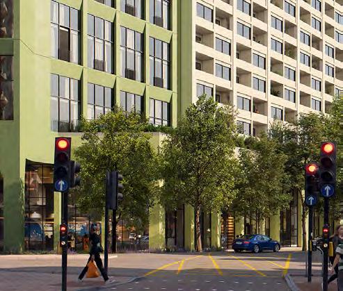
Building frontages should maximise transparency through larger openings in fenestration.
To create a permeable relationship between the public realm and active internal uses.
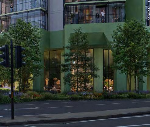
Dwellings and private residential amenity that have a direct and level interface with the public realm must incorporate adequate privacy through the consideration of internal layouts and provision of defensible space and appropriate screening, recesses or winter gardens.
To respect the privacy of the residents and reduce overlooking.
Private Residential frontage expression
The frontage expression should align with it’s adjacent primary or secondary frontages, but incorporate a terrace or defensible zone that is at least 1.5m wide in front of habitable rooms.
To respect the privacy of the residents and reduce overlooking.
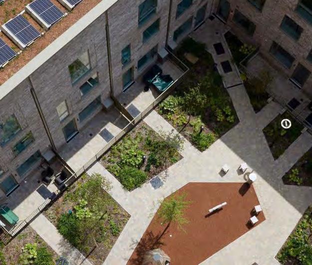
The internal concourse of Plot SC must be publically accessible active frontages, and must be predominantly for town centre uses.
To ensure the shopping centre is preserved for town centre uses.
Tertiary frontages should be located on quieter ‘tertiary routes’, and incorporate elements of servicing and inactive frontage. Their expression should follow the guidance on blank walls and inactive frontage.
To support a hierarchy of routes and spaces and concentrate animation on key routes and spaces.
Service areas must be minimised on building frontages addressing key routes and spaces. On all other frontages, they should be minimised to avoid large extents of inactive and blank frontages.
To create a permeable relationship between the public realm and active internal uses.
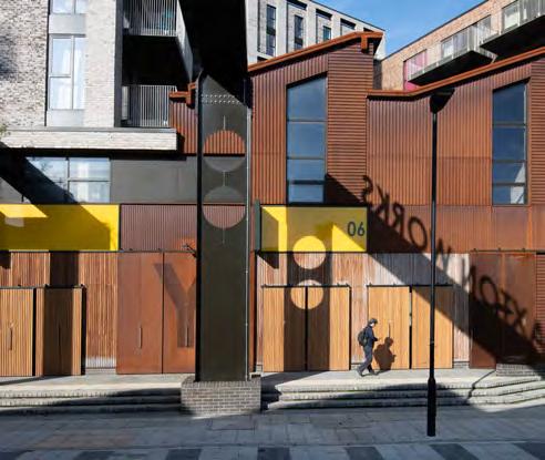
Blank walls and Inactive frontage expression
Blank walls and continuous inactive frontage facing onto public realm should be minimised. Where blank walls do occur, consideration must be given to their appearance and treatment, such as the incorporation of public art.
To reduce the extent of inactive frontages to discourage anti-social behaviour and improve safety.
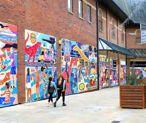
Mezzanines set back within primary frontages
Where mezzanines are provided within primary frontages, they should be set back from the building line by a minimum of three metres.
To create a continuous primary frontage.
Expression of mezzanines within primary frontages
Where mezzanines are provided within primary frontages, primary frontages should be expressed as a single height frontage.
To support a continuous horizontal datum and a hierarchy of primary frontages.
The strategy for entrances has been developed closely with the central multi-level podium. This has resulted in multiple residential entrances to residential plots that connect to the podium.
All plots have a residential entrance at ground level. Plots that are linked to the podium have at least one additional entrance that can be accessed from the Podium Park or The Street. This is important to give residents direct access to external public spaces.
Primary public entrances provide access to key internal public accessible uses, such as the shopping centre.
This section should be read closely with Frontages as the location of entrances are closely linked to Frontage types.
These entrances must:
• Be clear identifiable through design, without having to rely on signage
• Have an expression of two storeys or greater on Taller Buildings
• Provide clear legibility and visibility through to the internal space for wayfinding and natural surveillance
• Located to allow for a direct residential journey internally
• Be distinguishable from non-residential entrances. This could be achieved through change in materiality. They should also:
• Be located on primary frontages
• Provide integrated recessed areas in front to provide shelter
To ensure primary entrances are clearly legible, prominent for their role
These entrances must:
• Integrate clearly within the façade alongside adjacent uses
• Be expressed through its design as subservient to the primary entrance They should also:
• Be located on primary or secondary frontages
• Provide integrated recessed areas in front to provide shelter
• Be clear identifiable through design, without having to rely on signage
• Be distinguishable from non-residential entrances. This could be achieved through change in materiality.
To ensure secondary entrances are clearly legible, safe and easy to identify for residents
These entrances must:
• Provide clear legibility and visibility through to the internal space for wayfinding and natural surveillance
• Located to allow for a direct visitor journey internally
• Be distinguishable from residential entrances. This could be achieved through change in materiality.
• Provide integrated recessed areas in front to provide shelter
They should also:
• Be located on primary frontages
• Incorporate the appropriate signage
To provide clear access to key internal publically accessible spaces for a wide range of visitors to the site
These entrances must:
• Be subservient to all other entrance types
• Be integrated into the relevant frontage and façade type
They should also:
• Be located on secondary or tertiary frontages
To give priority to other entrance types and active frontages
Entrances must be clearly expressed and easily identifiable. This could be achieved through changes in tone or materiality or distinct architectural details.
To create legibility in building façades and improve wayfinding.
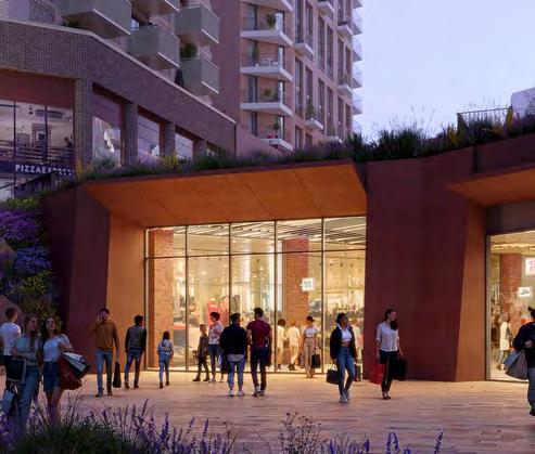
Building entrances should activate the public realm, particularly in locations where residential is the predominant or only use.
To animate the public realm.
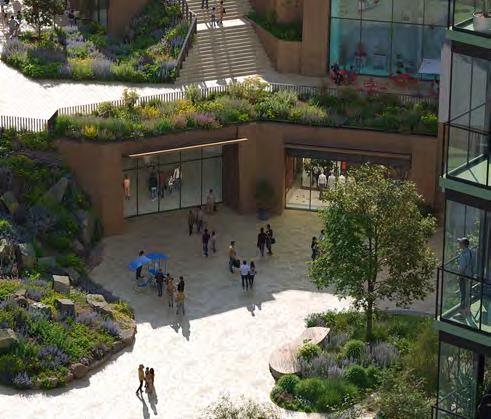
Where entrances do not address primary frontage they must be visible, well lit and secure.
To create comfortable and safe entrances.
As the building frontage types are quite specific, the façade types are generally aligned to these and should be read in conjunction with that section. However, there are additional controls that apply across multiple plots, which can be grouped as per the below:
• High Street façades
• Podium datum façades
• Podium Park facing façades
• Molesworth Street façades
• Island plot façades
• Shopping centre façades
A brief description of each of these is highlighted on the following spread, as well as any additional controls required.
High Street façades must:
• Respond to existing High Street buildings, with reference to adjacent roof pitches & any horizontal and vertical datums
• Celebrate prominence and variety of ‘shop front’ style and signage, through style and colour
• Acknowledge the common thread of brickwork along the High Street
• Consider the layout and design of the emerging High Street Market proposals
• Reference (if applicable) a hierarchy of uses facing the High Street between ground and upper levels
To respect and enhance the character of the High Street.
Podium datum façades
Façades must reference the datum line of the meadow through Architectural expression, change in massing, materiality or detailing.
To create a unified façade response to the streets and spaces around the podium.
Building façades addressing the Podium Park should express podium datum height of 1-2 storeys that differs from the levels above. This could be achieved through façade expression, treatment or tonality, such as larger openings.
To create a unified façade response framing the Podium Park.
Building façades addressing Molesworth Street should express a height of 2-3 storeys that differs from the levels above. This could be achieved through façade expression, treatment or tonality, such as larger openings.
To reinforce the prominence of buildings landing on Molesworth Street.
Façades must be set back or expressed in a secondary way to any adjacent façade types.
To create a hierarchy of façades at ground level and avoid continuous walls of development.
S.180 Shopping centre façade expression
Façades should have a minimum reveal depth of 500mm.
To reflect the character of the stepped landscape above.
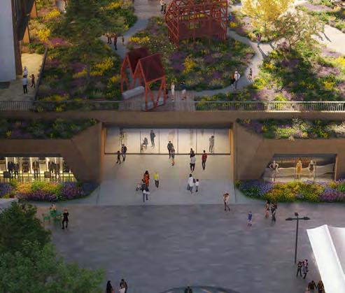
S.179 Island plot façades
Island plots must be designed in the round and present similar architectural approaches for each façade.
To recognise their siting as an island plot on the site.
Similar architectural approaches
Buildings should present similar architectural approaches for each façade on the building.
To ensure that architecture is cohesive.
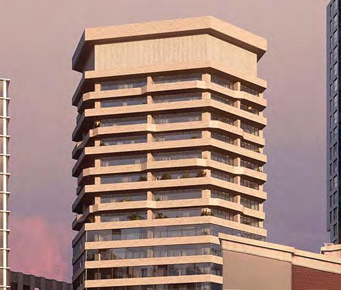
Building uses should be expressed and considered in the design. This could be achieved through details of variation such as transparency, size of apertures, colour, contrast, materiality or articulation.
To reinforce legibility and amplify activity.
Building façades should have an ordered fenestration pattern.
To create order in the composition of building façades.
Parapets must be integrated with the design of the façade.
To ensure that architecture is cohesive.
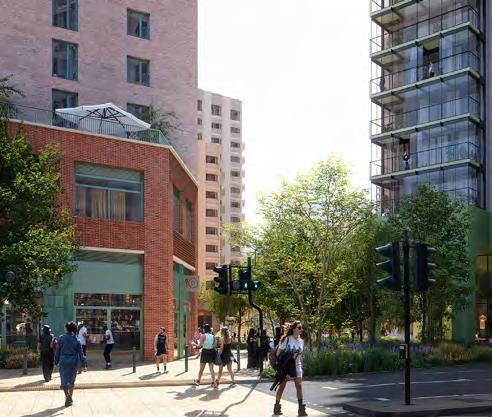
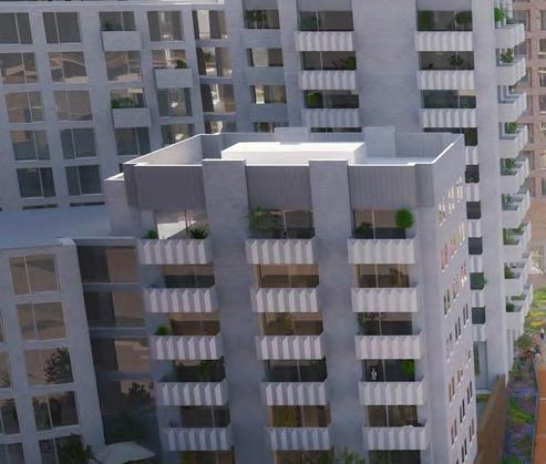
The proposed heights strategy for the scheme has been developed on the four principles adjacent.
The tallest building C4 acts as the Podium Park Anchor from views to the east. The absolute height of buildings is controlled by the maximum AOD in metres, as defined by the Parameter Plans. This is supported by the sitewide height strategy, as outlined on the next spread.
• Approach to retain as many buildings as possible on the High Street
• Retained buildings within application boundary enhanced through improvements and treatment to façades
• Any new interventions on the High Street to 4 storeys or less
• Small collection of buildings set back from the High Street but in relative close proximity
• Typically no more than 10 storeys
• Linear collection of north-south orientated buildings through the centre of the site
• Typically ranging from 10-15 storeys
• Taller buildings on the site along its western boundary, where immediate context is less sensitive than the eastern edge
• Variation is proposed in height from 15 up to 35 storeys
• To avoid the perception of a ‘wall’ of tall development on Molesworth Street, a hierarchy of the height of these taller buildings is proposed between 15 and 35 storeys
Buildings in this zone must not exceed four storeys and be in keeping with the heights of buildings on Lewisham High Street.
To retain and enhance the character of Lewisham High Street.
↘ Refer to Parameter Plans
Buildings in this zone should not exceed 10 storeys.
To reduce the scale of the proposals visible from the High Street.
↘ Refer to Parameter Plans
Buildings in this zone should not exceed 15 storeys.
To provide a central spine with a consistency height datum through the centre of the site.
↘ Refer to Parameter Plans
Buildings in this zone must not exceed 35 storeys, and should typically be no higher than 25 storeys.
To concentrate height away from Lewisham Hight Street.
↘ Refer to Parameter Plans
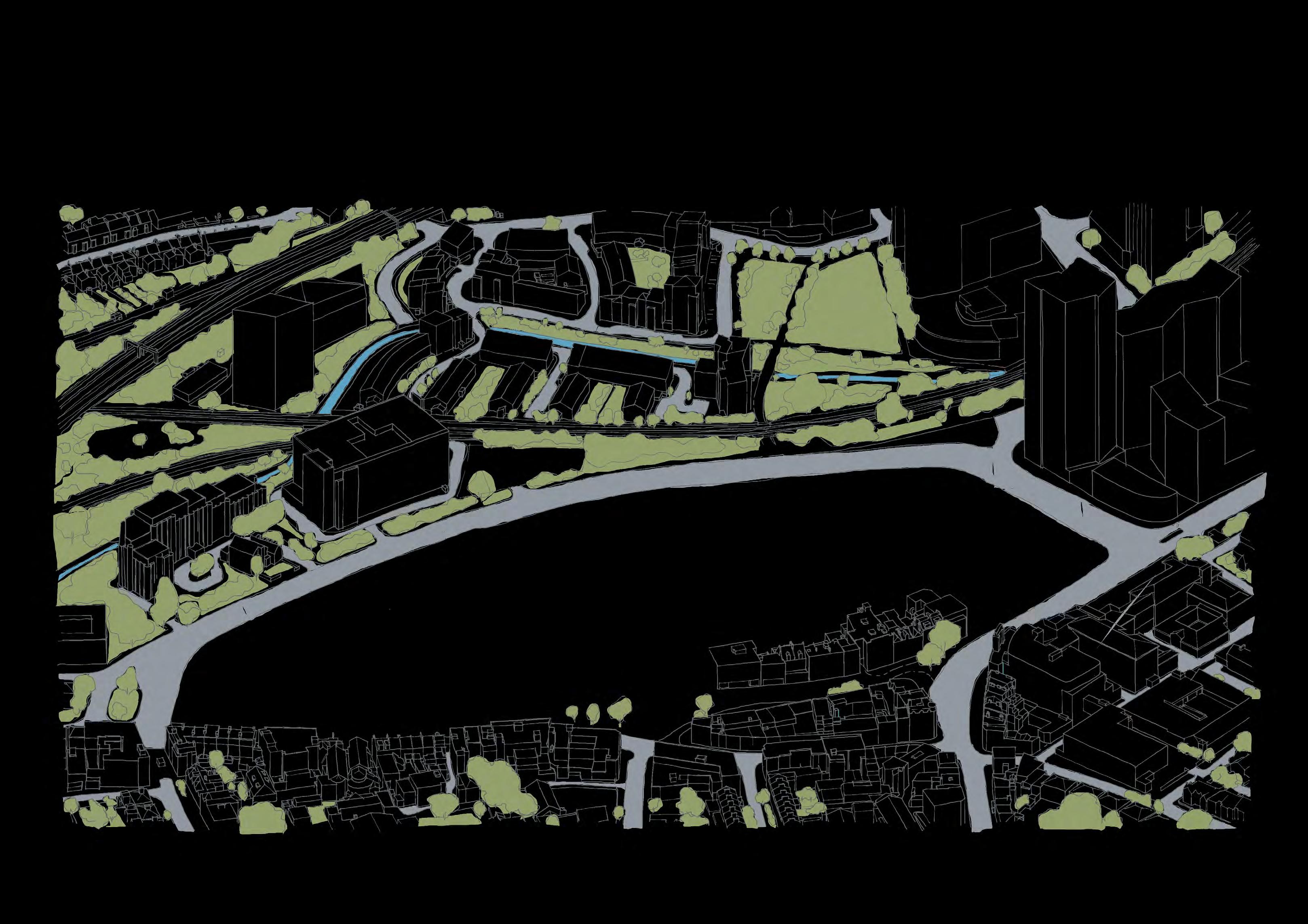
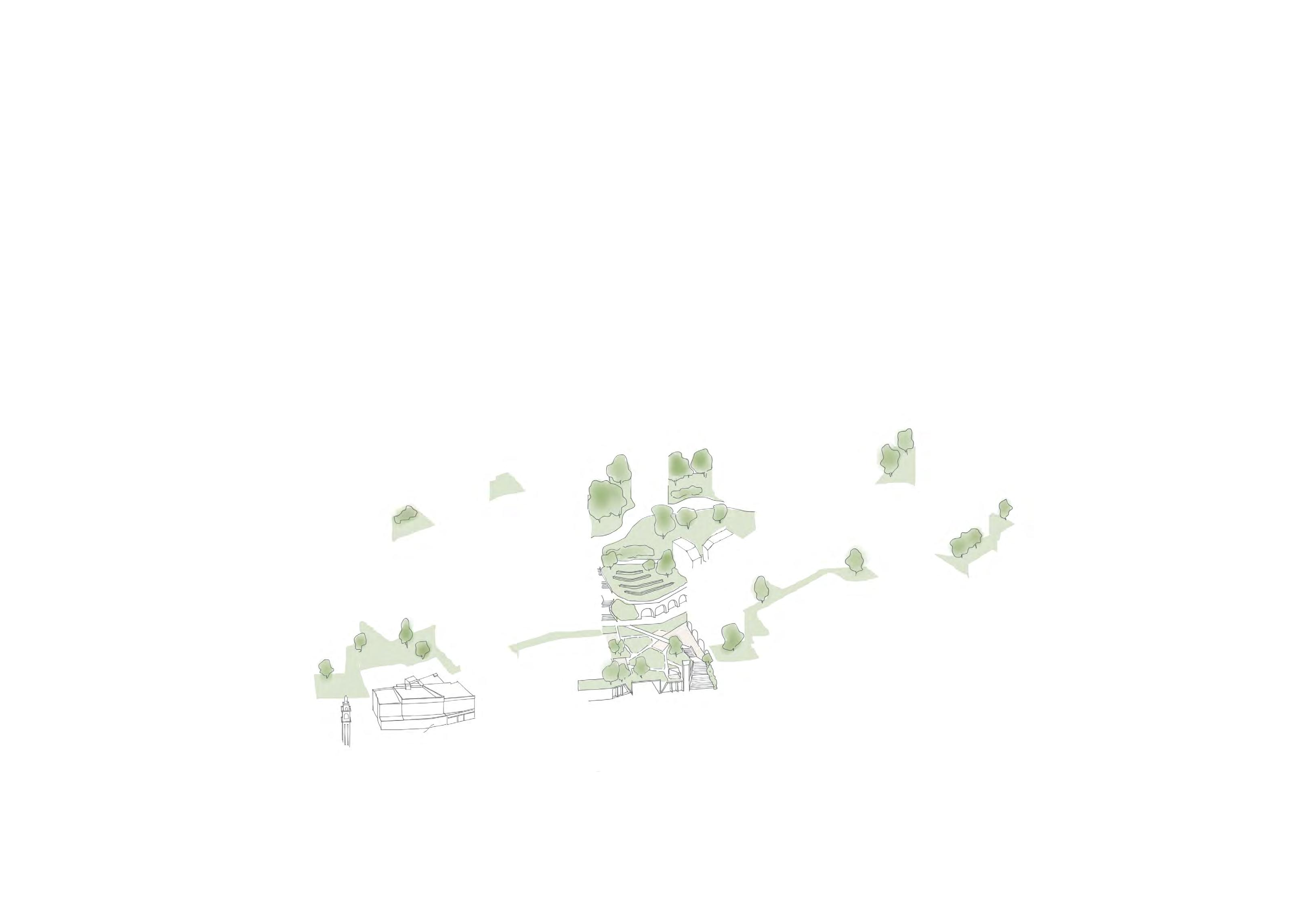
In line with good design principles, taller buildings are acknowledged in three components.
In addition, to relate the tall buildings to both their immediate and longer distance contexts, datums are used to harness both the meadow landscape and relationships between buildings.
The proposed heights strategy for taller buildings has been developed on the four principles adjacent.
Buildings are expressed as grounding on Molesworth Street. This is particularly important where buildings meet the shopping centre which is typically set back from the plots on Molesworth Street.
A distinction is made between the building’s base and its middle section, through change in materiality or expression. This is typically where the residential accommodation starts.
Datums between buildings are expressed to create strong relationship between the middle and tops of the buildings.
The tallest elements of buildings are expressed with a lightness and/or set backs in massing of two or more storeys.
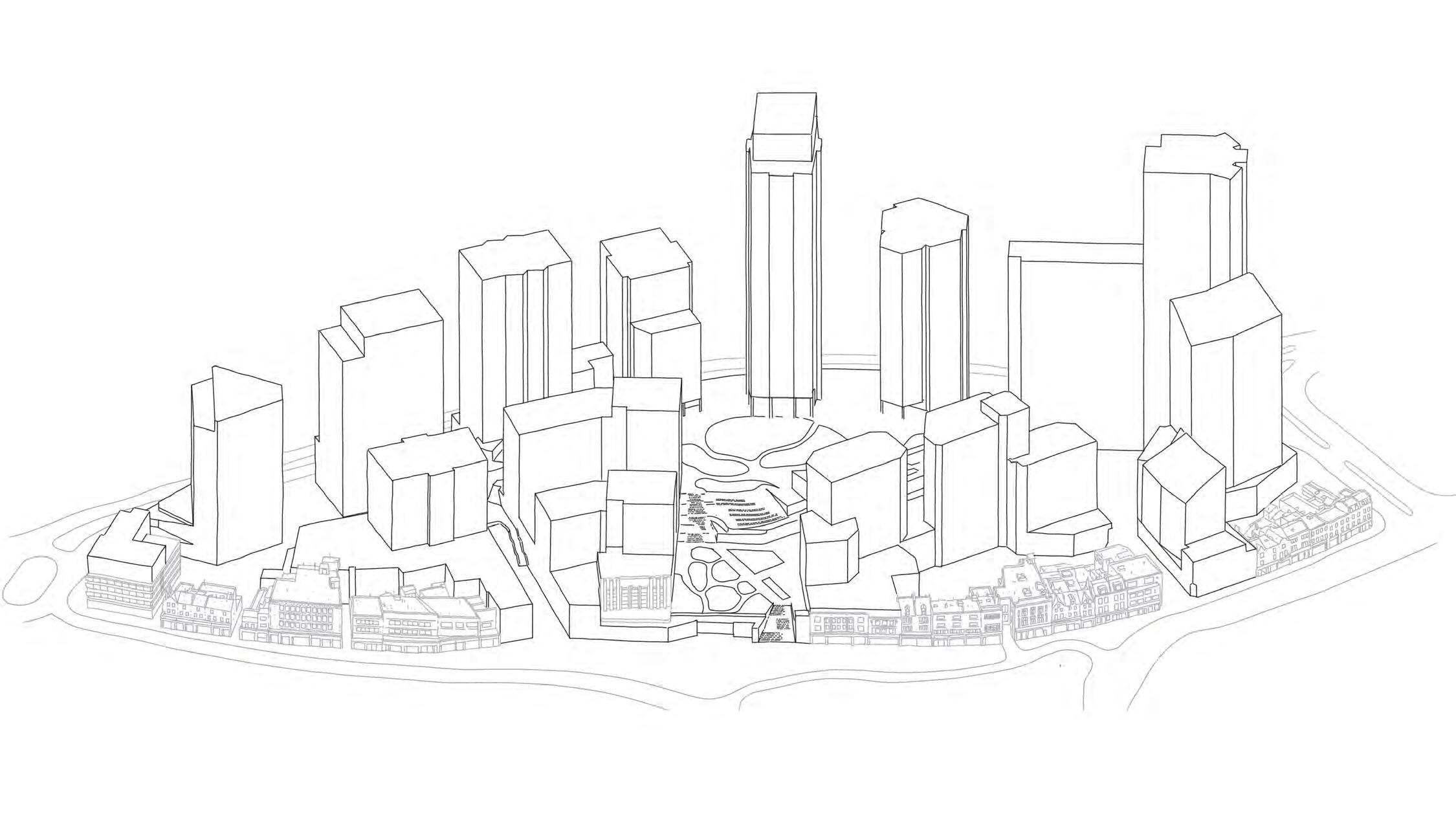
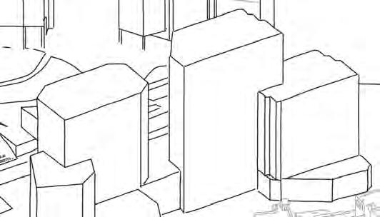
The base of taller buildings must:
• Express themselves as landing on Molesworth Street, even if colonnades are introduced at ground level
• Be proportionate in terms of height to the height of the overall building. For example, the base of Plot C4 could express a base of more storeys than Plot C5.
To ensure buildings meet the ground in a manner proportionate to building height.
The middle of taller buildings must be distinct from the buildings base.
To give prominence to the lower levels which have a town centre focus.
The tops of taller buildings must:
• be clearly articulated, well considered and integrate rooftop elements into a coherent overall form. It could be distinct from the middle of the building.
• consider their expression with a lightness, and/or set backs in massing, of two or more storeys.
To improve the impact on the skyline.
The design of tall buildings must contribute positively to its surroundings at Podium Park or street level. This could be achieved through integration with the landscape design or a high level of visual permeability.
To strengthen the public realm experience.

Datums through the centre of the building should be introduced. If this is the case, they must align/take cues from adjacent taller buildings. This could be achieved through changes in material tone, texture or detailing.
To create a strong relationship between all taller buildings.
The design of taller buildings should treat all façades as a ‘front’ not a ‘back’ or ‘side’, with attention to its design from short and long range views.
To ensure buildings are designed with consideration to all vantage points.
Taller buildings must consider their microclimate impact on public spaces at lower levels, and implement mitigation measures if required upon completion of the relevant tests.
To ensure taller buildings do not adversely impact on public spaces.
Taller buildings must consider their microclimate impact on residential amenity spaces on the building, and implement mitigation measures if required upon completion of the relevant tests.
To ensure taller buildings do not adversely impact on resident amenity.
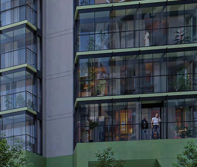
The height of tall buildings must create a dynamic and visually interesting skyline. This could be achieved with variation in height as indicated in the diagram below. Steps in height should be proportionate to the heights of the buildings, and typically no less than two storeys.
To create a dynamic and visually interesting skyline.
The masterplan has been design to give flexibility for future reserved matters applications for a range of means to provide private residential amenity as required by the relevant policy and guidance. This can typically be provided through the following strategies:
• Projecting balconies
• Semi inset balconies
• Inset balconies
• Inset balconies with winter gardens
• Internalised amenity/over-sized apartments
It is recognised that each of these approaches could be considered and explored, with a preference for types as shown opposite.
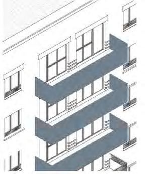
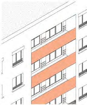
However, justification should be provided if internalised amenity spaces are proposed and should only be considered on grounds of unacceptable microclimate or residential comfort conditions are present. This could include high air pollution or unacceptable acoustic levels.
Typically it is proposed that the character of balconies is in-keeping with the Architecture of each plot rather than contrast. This is to ensure the approach for each building is clear and not overly complex across the masterplan.
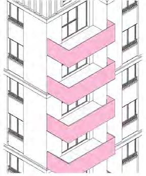
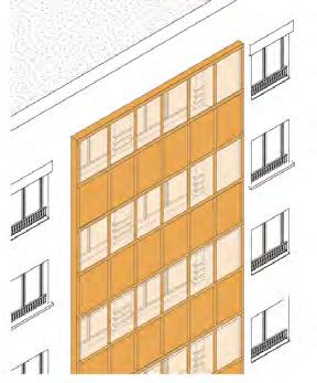
Balconies must respond to the architecture of the building in terms of tone, texture and composition.
To ensure that balconies are considered as part of a coherent approach to overall building design.
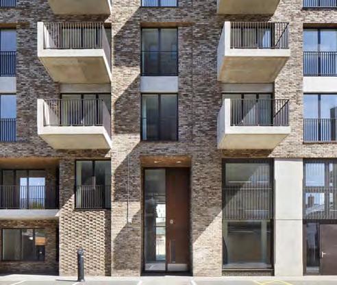
Balconies should be designed to respond to the varied context and orientation of each façade.
To ensure balconies are comfortable.
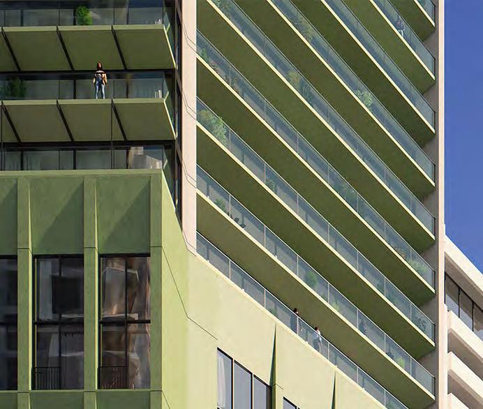
Balconies must be designed as part of a building-wide approach. This could include a considered approach to projecting and inset balconies on different façades.
To ensure a coherent design approach to buildings.
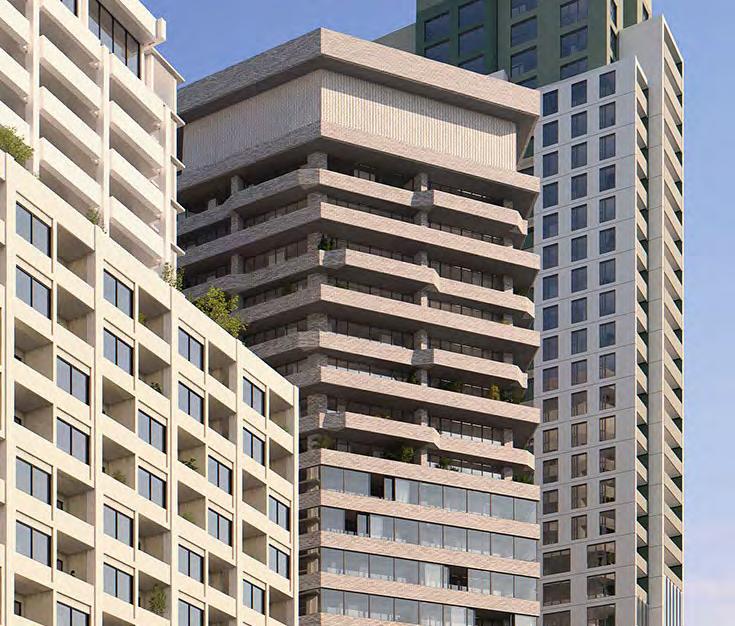
Where exposed to high levels of activity on key public realm and along Lewisham High Street, balconies should be treated to provide sufficient privacy.
To allow for sufficient privacy for residents.
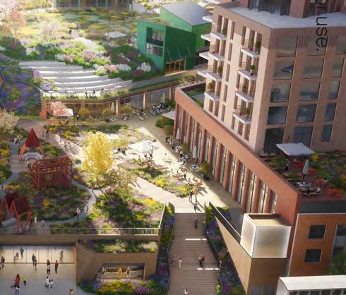
Where balconies directly face each other on adjacent plots, the face of each opposite balcony must be no less than 15m apart. Balconies could consider a staggered approach in plan, or inset balconies, to avoid this.
To allow for sufficient privacy for residents and to maintain good levels of daylight in public realm.
As a starting point, projecting balconies should not be the primary option, particularly where adverse microclimate issues are known.
To with the objective of ensure balconies are generally integrated into the Architectural language of the plot.
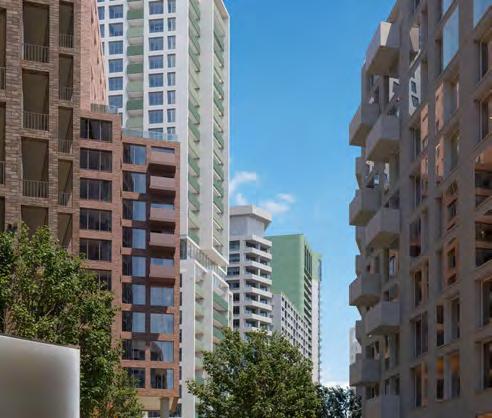
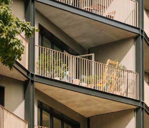
Internalised amenity should only be considered on grounds of unacceptable microclimate or residential comfort conditions are present. This could include high air pollution or unacceptable acoustic levels.
To prioritise external amenity spaces for residents.
Building plots should consider alternative balcony types to adjacent approved/built plots.
To avoid a monoculture of balcony types across the masterplan.
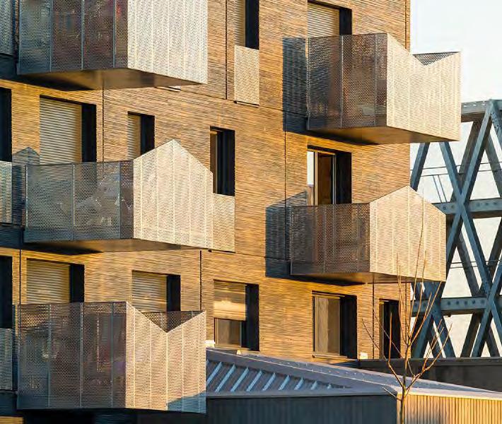
Taller buildings must consider balcony types that compliment and/or vary according to the design approach to the base, middle, datums and top.
To ensure a coherent Architectural expression.
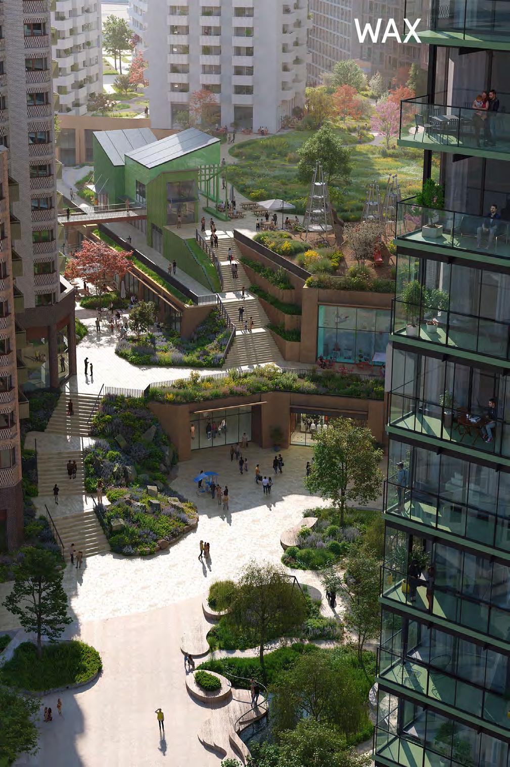
In addition to the site-wide codes, There are several plots and areas that warrant further codes as special features in the masterplan. These take place in the form of marker buildings, and specific components (façades or corners) that have more prominence.
The marker buildings on Molesworth Street have a similar role in the wider townscape, whereas Plot M1 acts as an important marker in within the site.
Marker buildings must be distinctive and recognisable. They should act as wayfinding features. This could be achieved through massing, façade expression or selection of materiality or tonality.
To create recognisable markers through the masterplan.
↘ Refer to Plot Codes / Plot N3, Plot Codes / Plot C4, Plot Codes / Plot M1, Plot Codes / Plot S4
Areas of prominence must be given particular importance, animate their locality and contribute to wayfinding. This could be achieved by façade treatments or corner articulation.
To mark primary movement routes or key entrances to the site.
↘ Refer to Plot Codes / Plot C1, Plot Codes / Plot C2.2, Plot Codes / Plot S3, Plot Codes / Plot SC
Key areas of prominence include the retained Woolworth’s façade in Plot C2.1, and the High Street corner of Plot MV.
The codes on this spread signpost to each of the relevant Plots, where codes on these features are outlined.
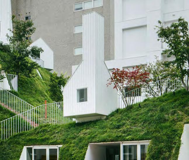
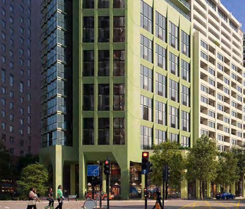
As explained in earlier sections of the Design Code, much of the focus of the illustrative scheme has been around the relationship of new building to the existing buildings in Lewisham High Street. To this end, the materiality and character of interventions on the High Street is designed to celebrate its diversity, whilst maintaining and reference the common thread of brickwork.
Generally, the lower levels of plots have a strong character in terms of material and tone, aligning with the High Street character that focuses prominence on the ground floor spaces. This is extended to the shopping centre type which has its own strong character, but one that is distinct from the more traditional approach of the High Street.
Buildings above are generally muted brickwork tones, intended to create a family of similar coloured buildings as a backdrop to the lower levels and contrasting with the verdant multilevel landscape. There is an opportunity to differentiate between these ‘background’ types through the groupings of the Central Spine buildings and Molesworth Street Buildings.
Marker buildings introduce more colour responding to their prominence in the townscape, and vertical access points such as external lifts also provide an opportunity for boldness and the introduction of public art.
The plan opposite and the image on the next spread demonstrate this and its relationship to the plots.
The primary material selection for these façades must be bolder in colour or texture than other Materiality types on the relevant plots.
This could be achieved through:
• Bright or glazed bricks
• Bold building detailing
• Contrasting colours
To celebrate the diversity of the High Street.


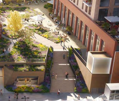
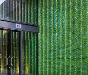
The primary material selection for this materiality type must be bold in tone or texture, and contrasting in tone to the upper levels.
This could be achieved through:
• Coloured concrete
• Bright brickwork
• Earthy tones
To focus the masterplan around the public lower levels.
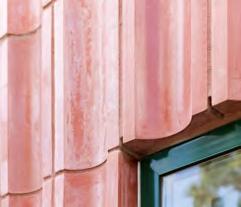
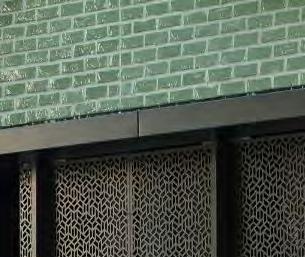
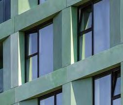

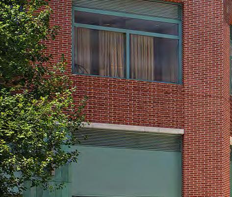
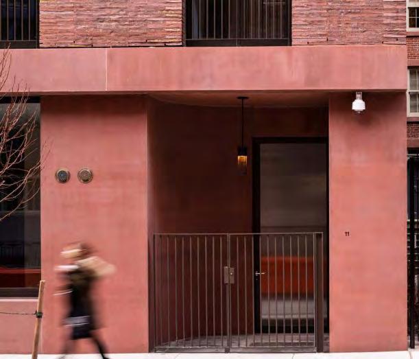
The Shopping Centre type must be distinct and recognise its role as the most publicly accessible on the site.
This could be achieved through:
• Weathered metal cladding
• Bright coloured concrete
• Glazed brickwork
• Earthy tones
To create a focal point at entrances.
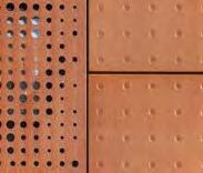

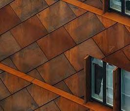
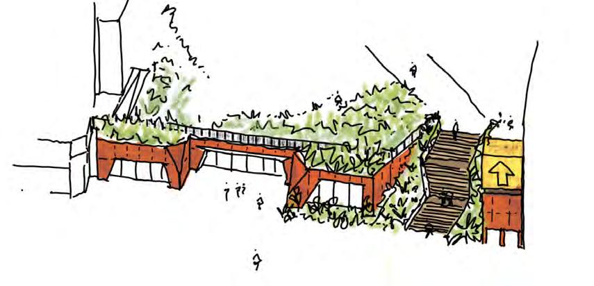
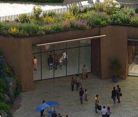
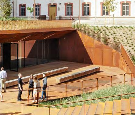
The primary material selection for Central Spine buildings must be brick and must be similar across the external façades of each plot. They must generally be of a lighter tone and contrast to the lower levels of the building.
To transition between the High Street and tall buildings on the masterplan, and focus attention on the lower levels.

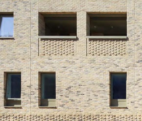
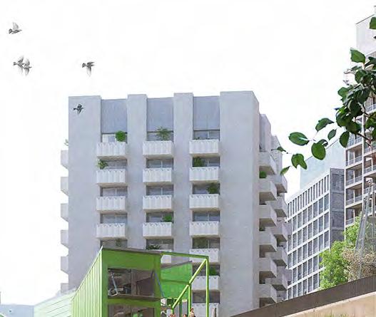
The infill buildings on Molesworth Street must form a close relationship to the Central Spine type of light brick, but could incorporate a subtly darker tone.
To respond to their location on Molesworth Street.
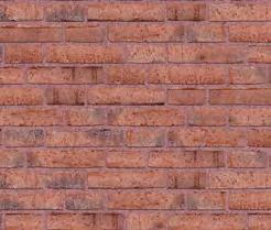
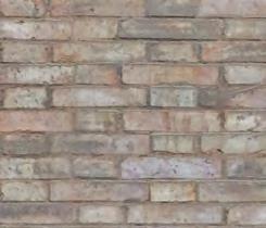
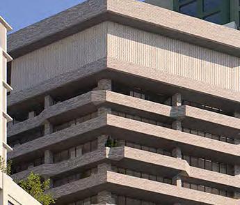
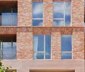
Marker types must incorporate colour and building detailing appropriate for their townscape role including being visible in longer views of the site. This could be achieved through green and yellow tones which reflect the meadow landscape, and fluted details.
To recognise the marker buildings role in their wider townscape setting.

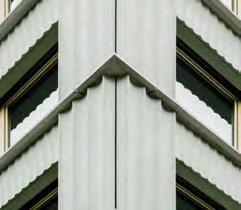
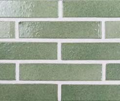

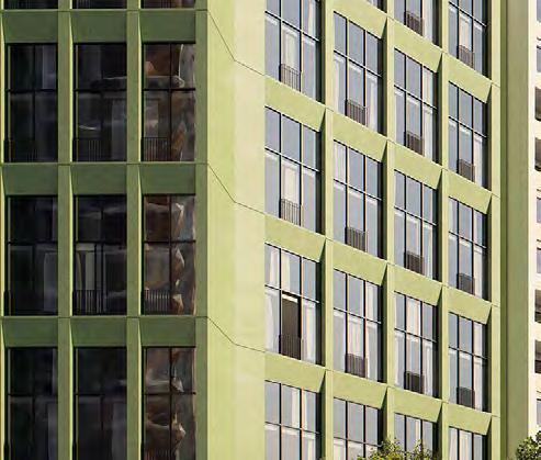
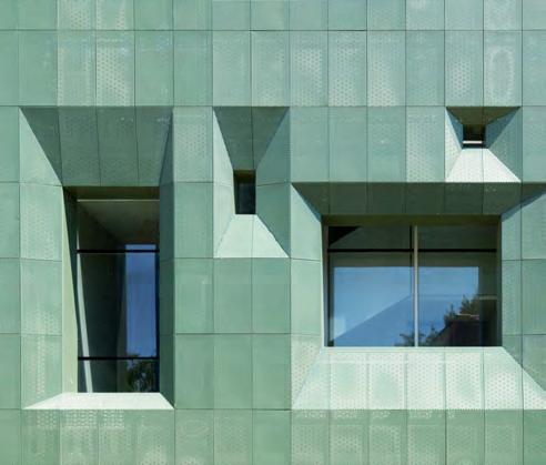
Vertical access points and Plot M1 must act as colourful interventions across the masterplan, with opportunities for public art/ collaborations. Lifts should be split into two components, with the upper section being more prominent.
This could be achieved through:
• Painted public art on brickwork
• Backlit glazing and signage for the upper component
To act as important wayfinding and key markers to the Podium Park.


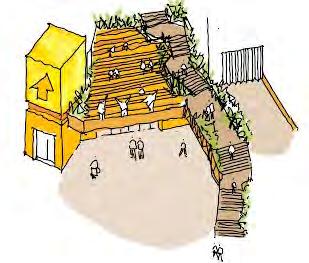
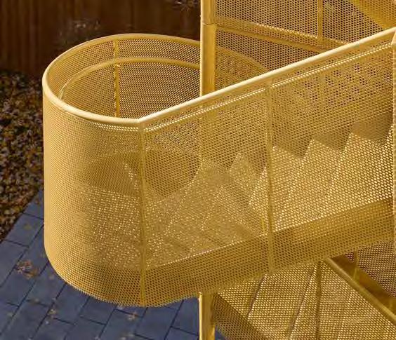
Building materials and treatment must be robust and have enduring qualities. Materials which will age naturally with a varied patina are preferred as the predominant material
To create durable buildings.
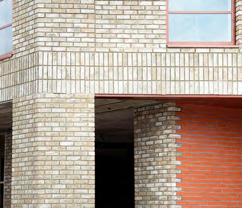
Materials that are prone to discolour, require frequent maintenance or weather poorly must not be used.
To retain the appearance and functionality of buildings.
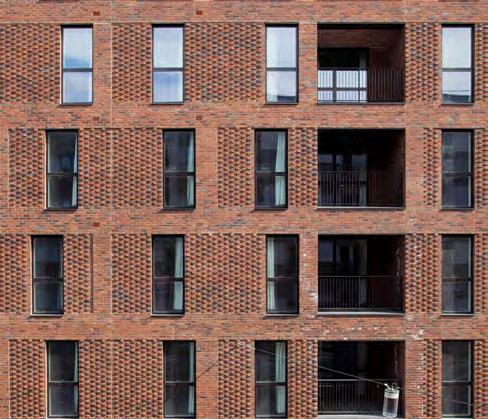
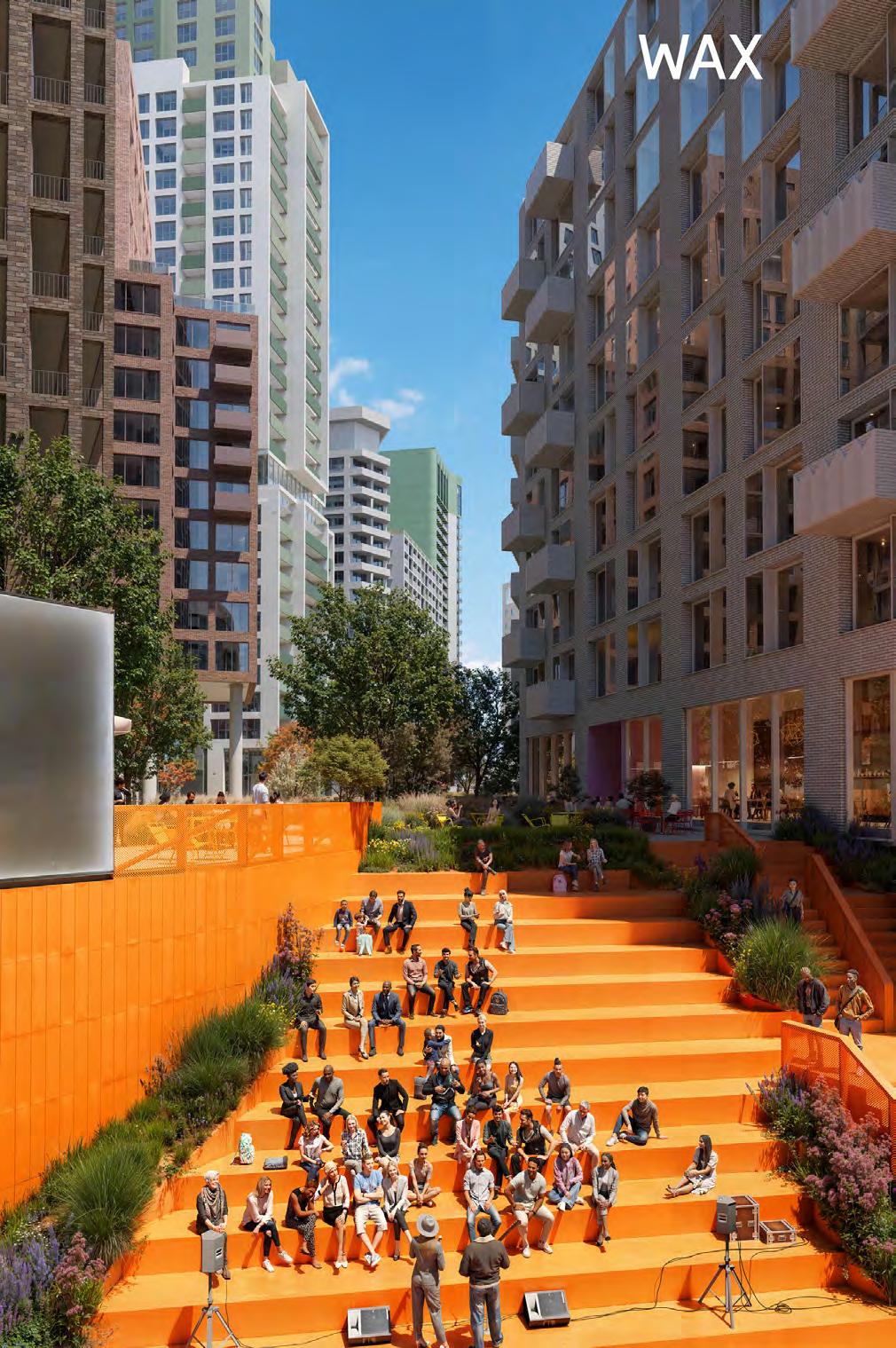
Designing for microclimate impacts can include:
• Maximising daylight/sunlight to homes whilst balancing against overheating risks, including reducing the number of single aspect homes (particularly north facing)
• Assess the location and type of external amenity spaces against wind, acoustic and other microclimate considerations
• Consider glazing ratios relative to façades in relation to overheating and daylight The illustrative scheme has evolved in response to microclimate analysis. Some key components of this evolution are described opposite:
• Manipulating plot massing and orientation to maximise daylight/sunlight into key public spaces, notably the Podium Park
• Reduce building heights along the High Street adjacent to existing homes
• Integrating mitigation through landscape along Molesworth Street for noise, air pollution and wind
Whilst future RMAs will continue to respond to microclimate considerations, this section identifies some key codes that should be considered at the outset.
Façade design must optimise nonmechanical approaches to energy use reduction, including optimisation of shading and glazing ratios. Each elevation of buildings could differ in order to address environmental issues.
To promote sustainable approaches to microclimate.
S.218
S.219
Plot design must consider every measure to design out single aspect north facing homes. Where they cannot be avoided, additional measures must be considered to enhance residential quality.
To promote sustainable approaches to microclimate.
Plot design must consider microclimate impacts on both existing and future neighbours.
To safeguard future plots and avoid adverse impacts on residential properties outside the application site.
Building layout and massing must be developed to optimise daylight levels on public realm and external residential amenity spaces.
To maximise the quality of external spaces.
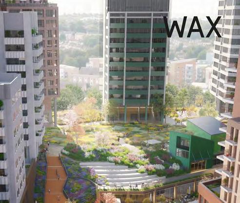
Outdoor spaces such as balconies, gardens and playgrounds should be located away from pollution sources.
Where this is not possible consideration must be given to mitigation measures such as planting, screen and good levels of air movement.
To reduce the impact of air pollution on outdoor spaces.
Where measures such as solar shading or canopies are required, they must be integrated and considered with the overall detailing and expression of the building.
To ensure the mitigation measure contribute successfully to the design of the building.
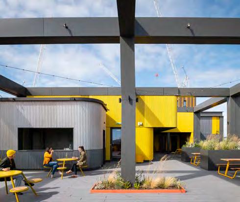
Large areas of exposed glazing should be minimised on south and west facing elevations, including floor-to-ceiling glazing.
To mitigate overheating risks.
The location and integration of services, drainage and ventilation grilles and louvres must be carefully considered. Grilles and louvres should be treated as part of the overall façade composition. Where practical, they should be avoided on the primary façade.
To refine the appearance of the building addressing the public realm.
Rooftop plant and other services should read as an integral part of the design. This could be achieved through extending the façade or setting back plant so that it is not visible from the street.
To create ordered and considered roofscapes.
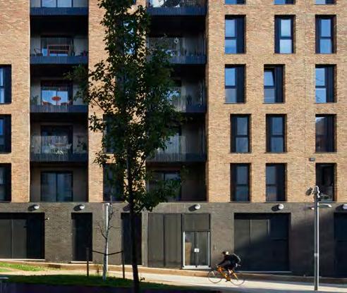
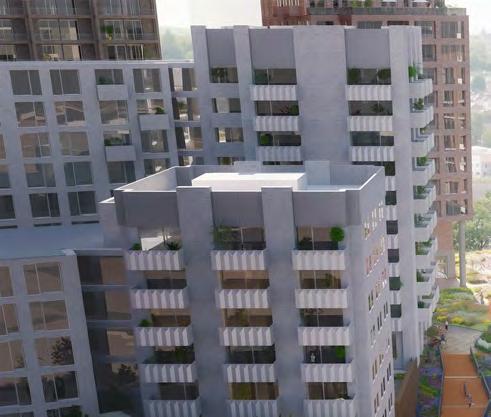
Rooftop plant and machinery should be set back from the outer face of the building by 2.00m.
To limit impact on surrounding buildings and townscape.
Communal refuse stores should be integrated within the building fabric. They should have appropriate access and not detract from the communal entrance.
To balance adequate servicing and an ordered and considered building façade.
Consideration must be given to the long term maintenance of building façades, and this must be considered early in the design stages.
To ensure architectural quality of buildings is retained and maintenance solutions are integrated within the design.
Overview
The Lewisham Shopping Centre landscape and public realm is composed of six character areas. The location of these is illustrated on the diagram opposite and summarised below. All character areas deliver the overarching landscape concept of Lewisham Meadow.
Zone 1 - Northern Square ‘Water Meadow’
Urban arrival square combining generous circulation space, building spill out zones, seating areas and a central gathering space, with an intensity of meadow style planting. Permanent water bodies and integrated SuDS features are important to the character of the square.
Zone 2 - The Street ‘Meadow Walk’
Active, elevated pedestrian street with a focus on places to eat and drink during the day and into the evening. Landscape design facilitates and encourages these uses whilst also ensuring clear and direct circulation routes.
Zone 3 - The Eastern Terrace ‘High Street Meadow’
Elevated square facing onto Lewisham High Street with a focus on providing space for young people. Active edges and seating structures amongst planting create a variety of social opportunities.
Zone 4 - The Park ‘Wildflower Meadow’
Large, elevated green space at the centre of the Lewisham Shopping Centre scheme. Predominantly focused on providing access to nature, open green space to socialise, destination play space and a community pavilion.
Zone 5 - The Southern Squares
Hard working network of streets, anchored by two squares. ‘Rhyme Square’ at the southern entrance to Lewisham Shopping Centre and ‘New Model Market’ adjacent to the music venue building. The larger square to the south is designed to accommodate a variety of different events.
Zone 6 - Molesworth Street
Molesworth Street maximises new green and blue infrastructure, whilst retaining existing trees and respecting existing utilities and bus stands. Ground floor activity and residential entrances enliven the street.
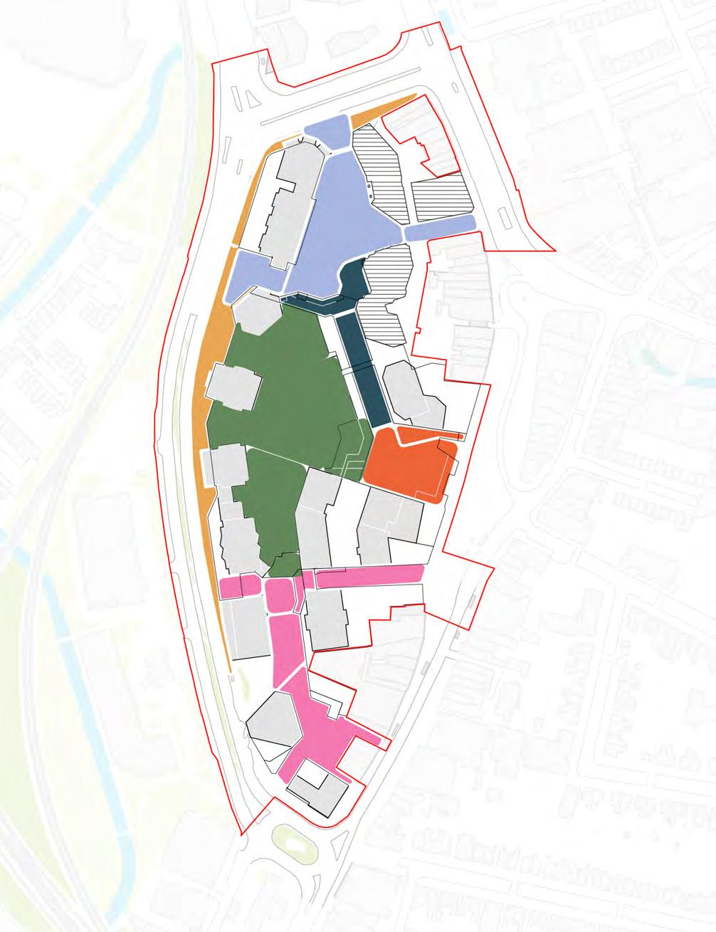
Overview
Urban arrival square combining generous circulation space, building spill out zones, seating areas and a central gathering space, with an intensity of meadow style planting. Permanent water bodies and integrated SuDS features are important to the character of the square.
The landscape design must reinforce the Northern Square as the primary public space for the development.
The square provides an important public space for Lewisham Town Centre and for the setting of the shopping centre and early phase building plots.
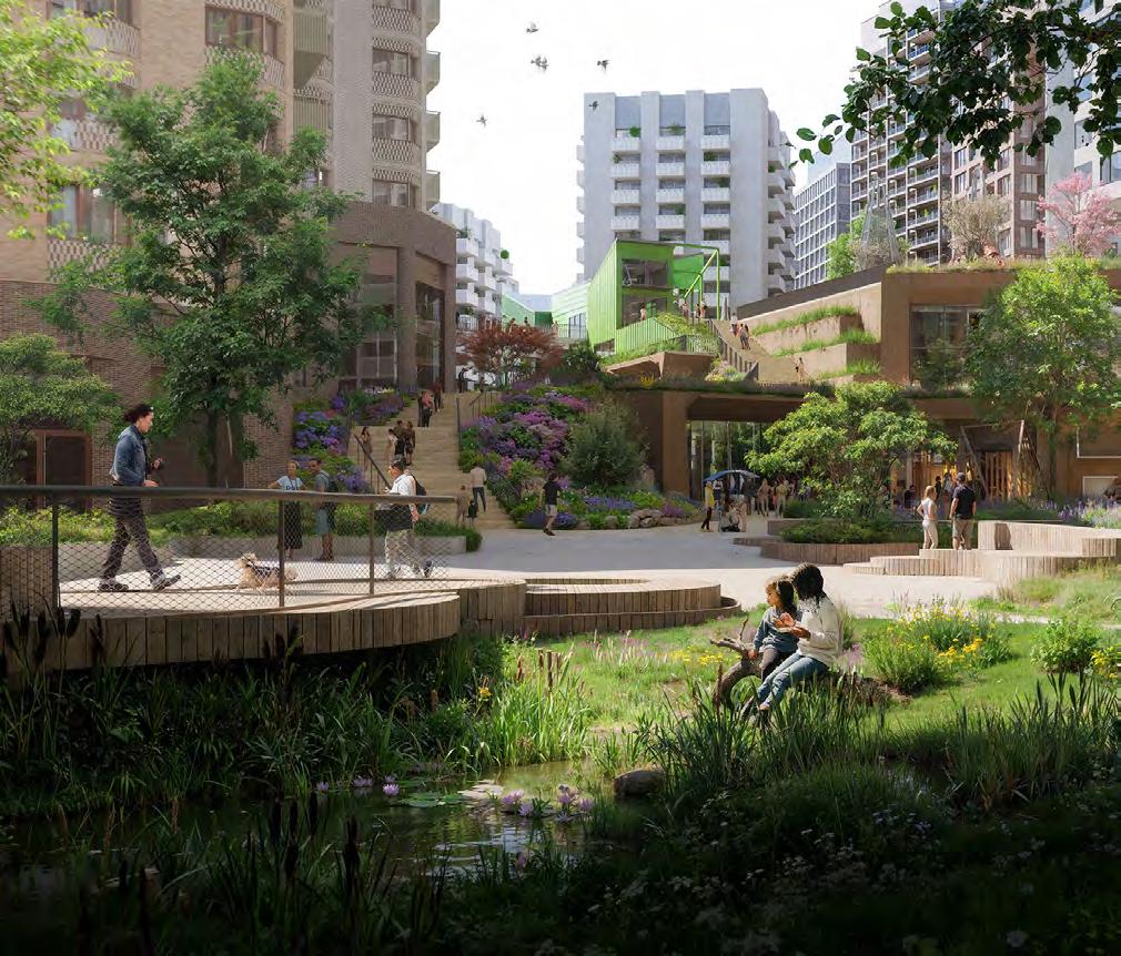
The Northern Square must be vehicle-free, except for emergency vehicles, maintenance and controlled servicing.
To ensure the Public Realm is pedestrian priority.
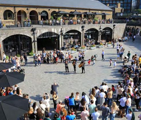
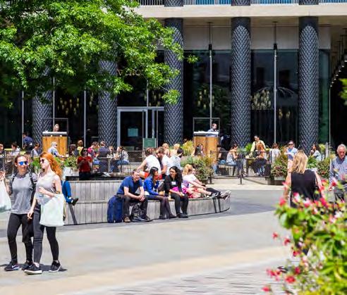
The Northern Square should provide a balanced distribution of hard and soft landscape.
To ensure the Public Realm supports people, as well as green and blue infrastructure.
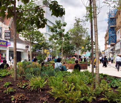
The landscape design should focus on celebrating water cycles and processes through SuDS features and permanent water bodies.
To deliver the ‘water meadow’ concept for the Northern Square and ensure an integrated approach to blue infrastructure.
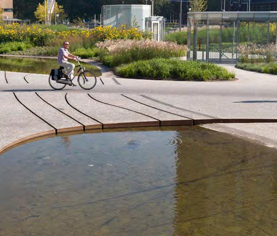
The landscape design for the Northern Square should be split into the zones illustrated on the adjacent diagram.
To ensure a hierarchy of spaces with different intentions is delivered.
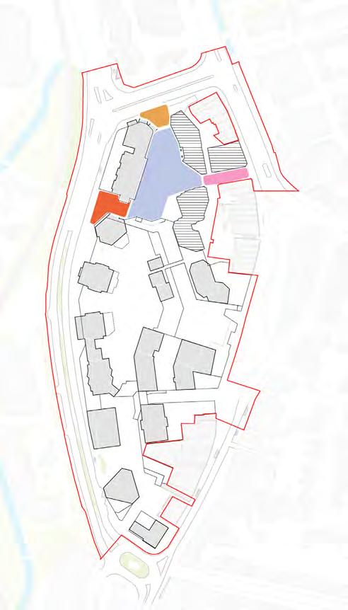
Water Meadow Square comprised of usable space and planted areas must be the focal public space within the Northern Square.
To ensure there is a clear central focal point to the northern square that supports town centre activity.
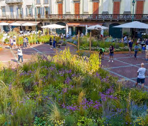
The square must provide an area of hardstanding for gathering and small scale local events.
To ensure a dedicated area for small scale events is provide to support the activity of the town centre.
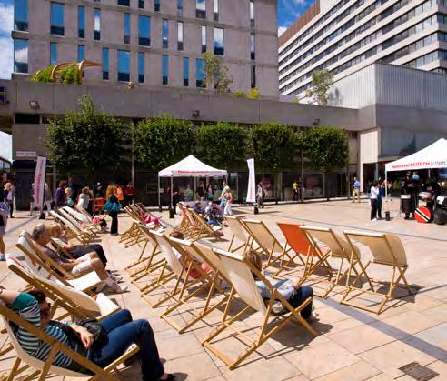
Rennell Street arrival
The arrival from Rennell Street crossing must provide a legible gateway into the Northern Square.
To maximise legibility between this main crossing point and the Northern Square/ Lewisham Shopping Centre.
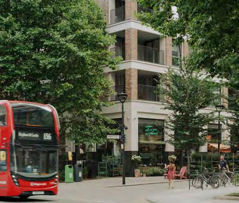
Rennell Street arrival planting
Trees and planting should be arranged to create a buffer between Rennell Street and the public spaces within Water Meadow Square.
To reduce the impact of noise, pollution and views on the Northern Square.
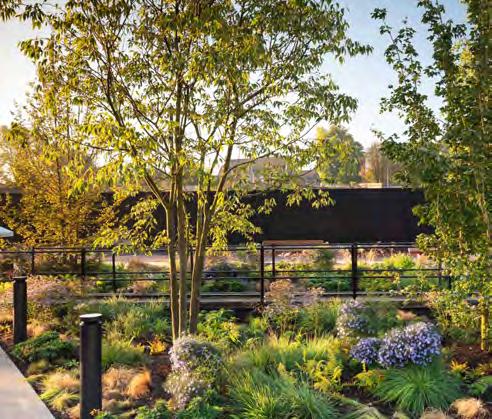
The High Street connection should be designed as a pedestrian-first environment, while also providing access for servicing vehicles.
To maximise the public realm experience in the Northern Square.
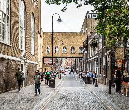
A legible pedestrian route must be provided to link the Northern Square across Molesworth Street, to Cornmill Gardens.
To create clear connectivity between the Northern Square and Cornmill Gardens.
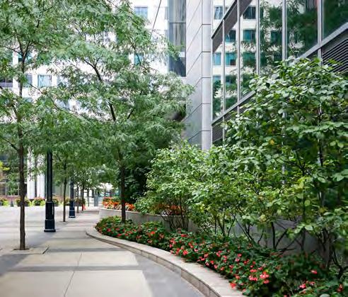
The Northern Square should use an organic design language.
To reflect the original design intent, inspired by water meadow patterns.
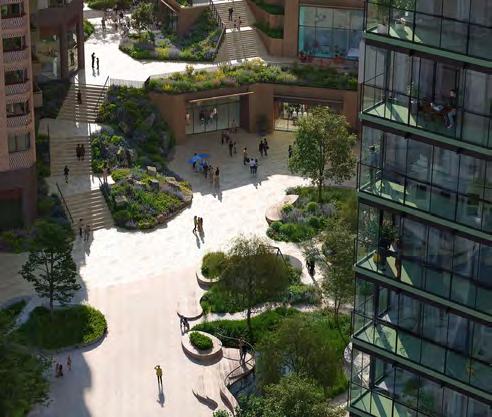
Active, elevated pedestrian street with a focus on places to eat and drink during the day and into the evening. Landscape design facilitates and encourages these uses whilst also ensuring clear and direct circulation routes.
Street character
The landscape design must work with The Street character as a linear section of public realm between active frontages at Level 01 podium.
To ensure the design fulfils the Public Realm offering for the masterplan.
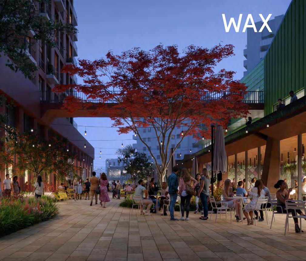
The landscape design for The Street should be split into the zones illustrated on the adjacent diagram.
To ensure a hierarchy of spaces with different intentions is delivered.
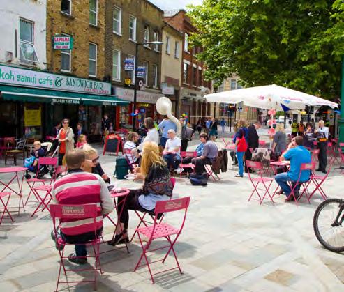
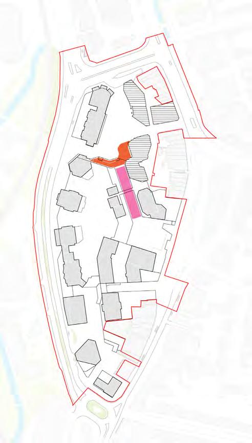
Meadow Walk must accommodate town centre uses at Level 01 podium as part of the wider retail strategy. Planted areas, spill out zones and seating should be provided to facilitate The Street.
To ensure the Public Realm strategy provides a diverse and unique experience on podium level.
Meadow Walk should be designed to accommodate spill out zones and seating within the public realm design.
To ensure spill out space is integrated and considered with the public realm.
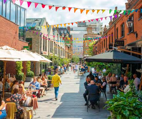
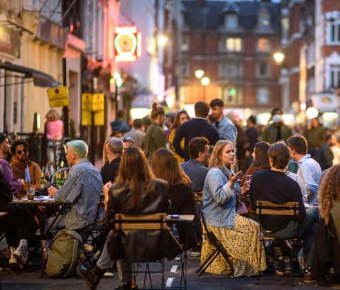
Meadow Walk should maintain a clear and visible public circulation route.
To ensure Meadow Walk is used as a connection between the Eastern Terrace ‘High Street Meadow’ and the Northern Square ‘Water Meadow Square’.
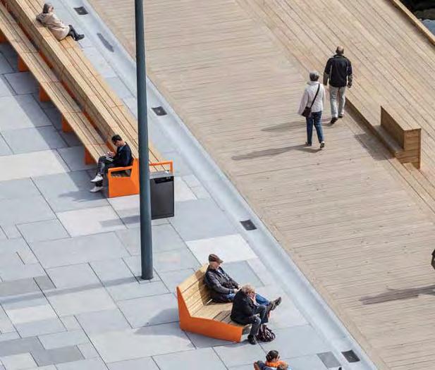
A planted, stepped connection between Water Meadow Square and Meadow Walk must be provided.
To ensure clear connectivity between two spaces for both pedestrians and nature.
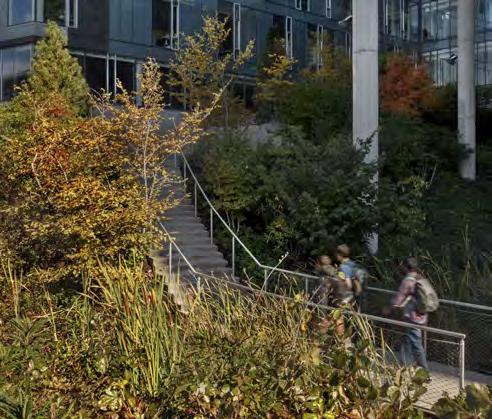
The stepping landscape should have a rocky materiality and character.
To ensure an informality to the design that supports a rocky heath meadow planting typology.
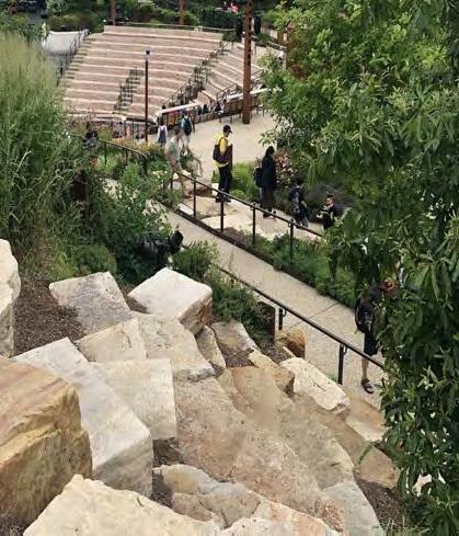
Overview
Elevated public space facing onto Lewisham High Street with a focus on providing space for young people. Active edges and seating structures amongst planting create a variety of social opportunities.
Elevated public space
The landscape design must reinforce the Eastern Terrace as a focal public space on Level 01 podium that connects with Lewisham High Street.
To ensure the Eastern Terrace plays an important in connecting the elevated public spaces to Lewisham High Streets.
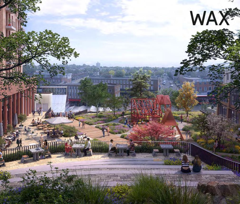
The Eastern Terrace Zones
The landscape design for The Eastern Terrace should be split into the zones illustrated on the adjacent diagram.
To ensure a hierarchy of spaces with different intentions is delivered.
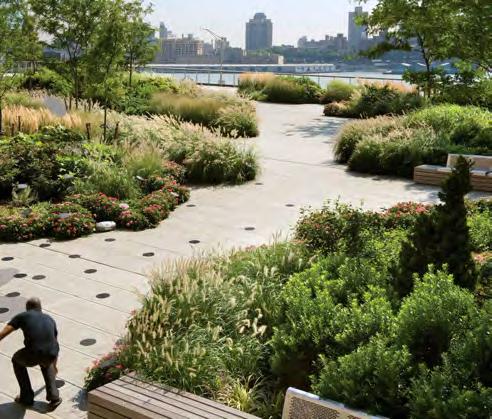
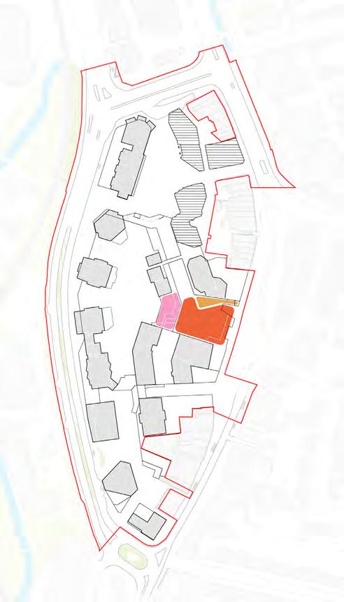
High Street Meadow Terrace should have a significant amount of planting.
To ensure a green space is provided adjacent to Lewisham Market along the High Street.

The terrace should have a variety of seating opportunities.
To provide different opportunities for socialising in various group sizes.
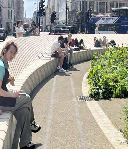
The terrace must consider young people within its design.
To ensure there is a space within the public realm that caters for the needs of young people who use the town centre.
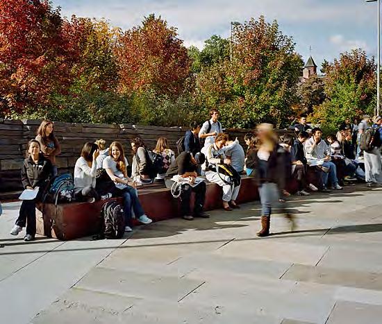
A generous area of hardstanding should be provided adjacent to the primary retail unit to the north of the High Street Meadow terrace.
To define a prominent area of external amenity at Level 01 podium adjacent to Lewisham Market along the High Street.
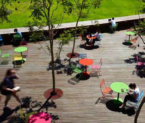
The Podium Terrace must provide a usable, multi-level area of public realm. This should provide opportunities for seating, amenity value and planting.
To ensure significant level changes support the Public Realm strategy.
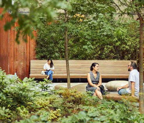
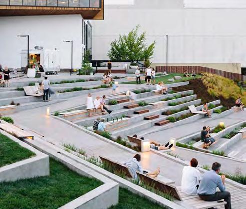
Overview
Large, elevated green space at the centre of the Lewisham Shopping Centre scheme. Predominantly focused on providing access to nature, open green space to socialise, destination play space and a community pavilion.
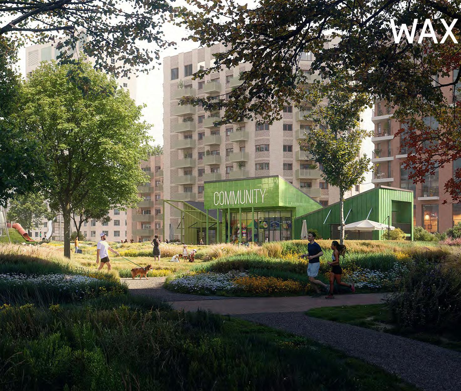
Destination Park
The landscape design must reinforce the The Park as the largest green, publicly accessible open space at the core of the development.
To ensure a significant new green space is delivered as part of the masterplan.
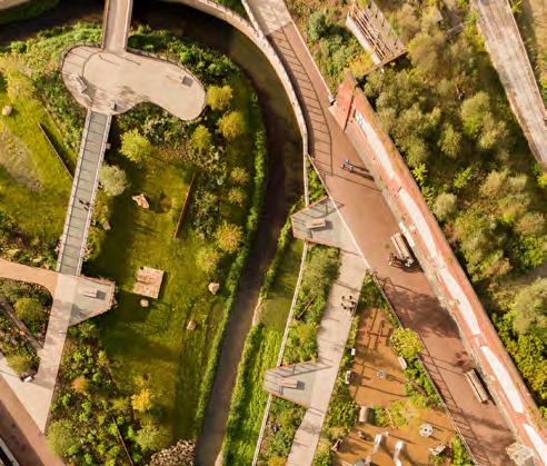
Green space
The Park must be predominantly soft landscape.
To ensure a significant new green space is delivered as part of the masterplan.
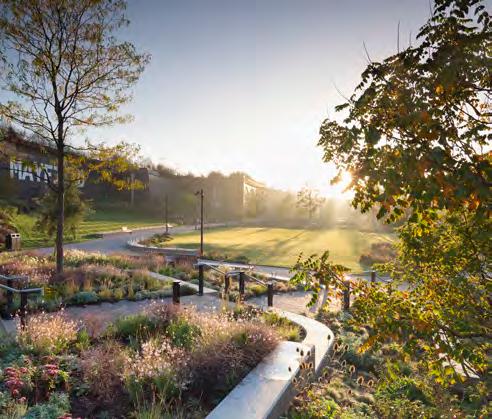
The Park must provide a unified design language, ensuring the different spaces collectively form a coherent character through aligned design strategies and/ or detailing.
To ensure The Park functions cohesively from space to space.
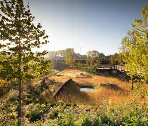
The Park should be designed as distinct zones to accommodate various, specific activities and pedestrian experiences.
To ensure the Public Realm provides a diverse offering.
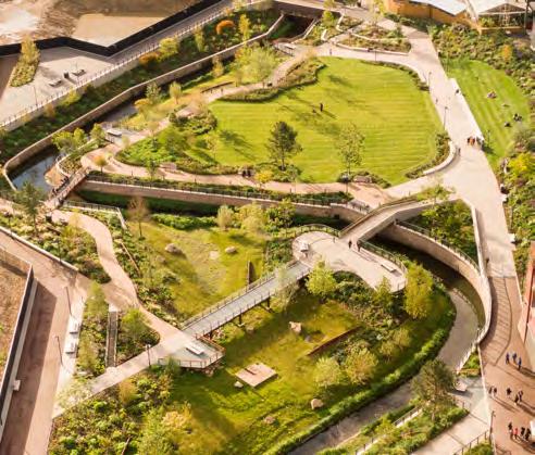
The pavilion must be located within The Park. It should be easily accessible and provide activation and shelter.
To create a point of interest and gathering place within The Park.
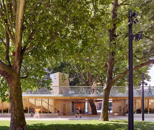
Materiality of routes should define the hierarchy of movement, using hard wearing and attractive surfaces, with a natural appearance.
To create a durable and legible green space.
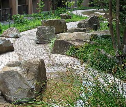
The landscape design for The Park should be split into the zones illustrated on the adjacent diagram.
To ensure a hierarchy of spaces with different intentions is delivered.
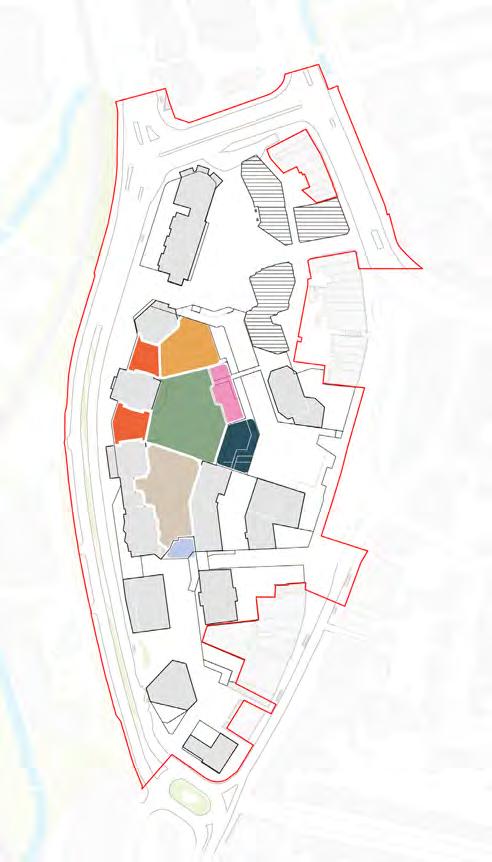
Lewisham meadows must be the focal green space on The Park. The space should comprise of usable and planted areas.
To ensure The Park supports informal recreational activities alongside nature.
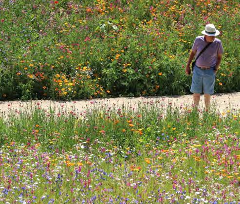
At least one area of short meadow or grass should be provided in The Open Meadow.
To support spontaneous everyday use such as informal sports and picnicking.
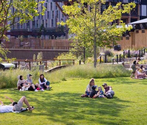
Urban meadow planting should contribute to the biodiversity value of The Park.
To create a biodiverse habitat on The Park.
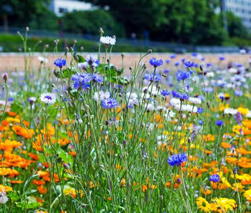
Lewisham meadows should provide opportunities for natural play.
To ensure play spaces are appropriate to the character of the Open Meadow.
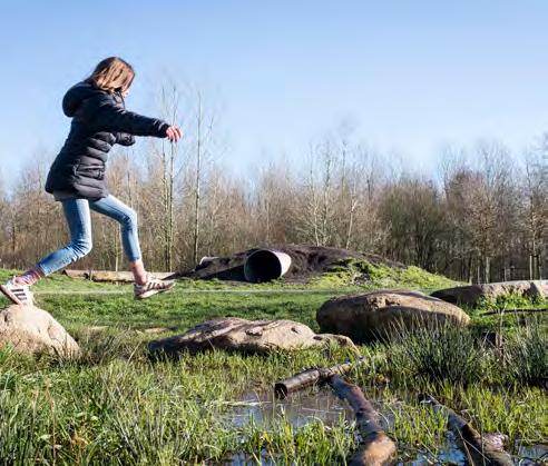
Destination play space must be provided on The Park as a key attraction for visitors.
To create a focal play space as part of the site wide play strategy.
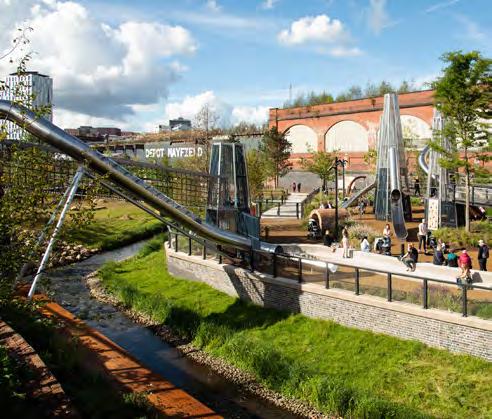
The Park must contribute to the overall site wide play strategy through a diverse range of dedicated and informal play areas throughout.
To ensure play value is maximised within The Park.
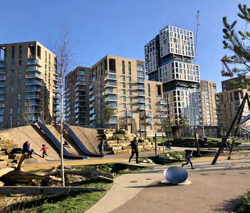
There should be a dedicated area of hardstanding to accommodate activity and spill out from the Pavilion.
To ensure activity within the Pavilion is not limited to being inside the building.
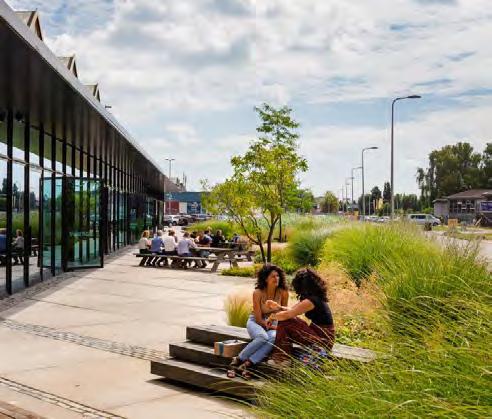
Planting and trees should help to create a connected multi-level landscape, establishing green links to the Public Realm along Molesworth Street.
To maximise green infrastructure connections throughout the masterplan and beyond.
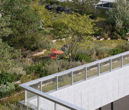
Planting and trees should help to create a nature buffer adjacent to Molesworth Street.
To mitigate the impacts of Molesworth Street on the experience on The Park.
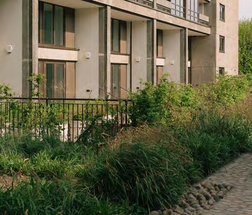
The Woodland Meadow should provide an increased intensity of planting to the south of The Park.
To create a biodiverse habitat on The Park.
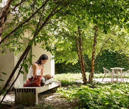
The Stepping landscape should provide a usable, multi-level area of public realm that provides opportunities for seating, amenity value and planting.
To ensure the benefits of significant level changes are maximised.
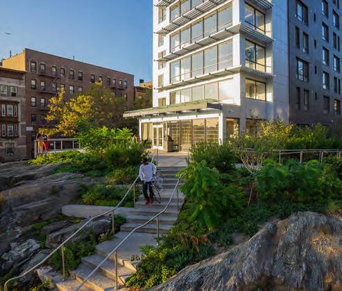
The Southern connection to The Park should be integrated with the Platform proposals.
To ensure significant level changes support the Public Realm strategy.
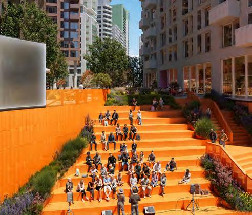
Overview
Hard working network of streets, anchored by two squares. ‘Rhyme Square’ at the southern entrance to Lewisham Shopping Centre (Plot SC) and ‘New Model Market’ adjacent to Plot MV. The larger square to the south is designed to accommodate a variety of different events.
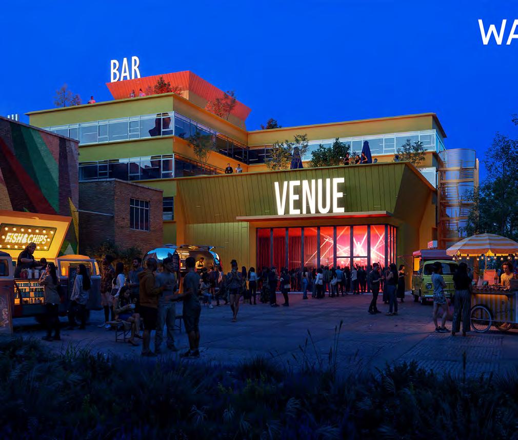
The landscape design for The Southern Squares should be split into the zones illustrated on the adjacent diagram.
To ensure a hierarchy of spaces with different intentions is delivered.
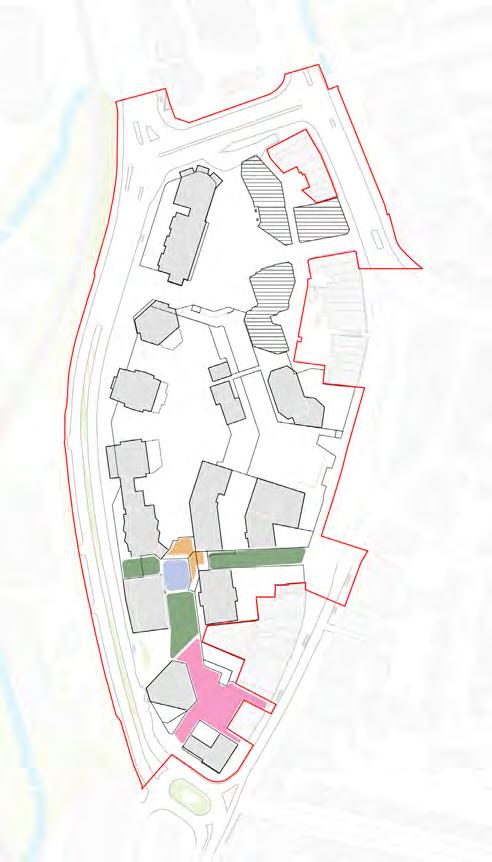
The Southern Squares must provide a unified design language - this should celebrate the characterful nature of Lewisham.
To ensure the Southern Squares has a vibrant, imperfect character.
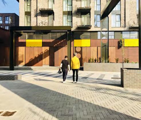
The Platform should be designed as a prominent architectural feature, integrated with the design of the bridges that form part of the service deck strategy.
To celebrate a key access point in the public realm strategy for the Southern Squares.
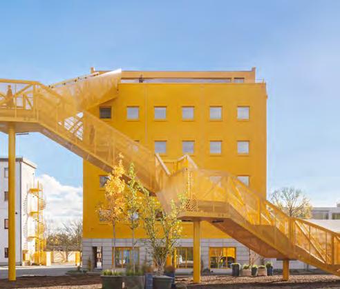
Rhyme Square must provide an area of hardstanding to allow for small scale events and gatherings.
To allow activity at the southern entrance to the shopping centre.

Streets throughout the Southern Squares must be designed as a pedestrian-first environment, while providing access for servicing and blue badge vehicles.
To maximise the public realm experience in the Southern Squares.
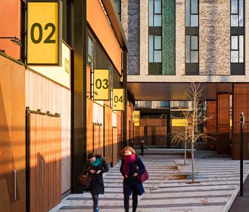
New Model Market must be the focal public space within the Southern Squares and accommodate flexible hard space.
To ensure a dedicated area for informal events and markets is provided at ground level.
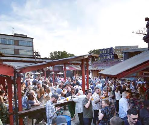
The Southern Squares should utilise recycled materials.
To create a more characterful, textured public realm that is appropriate to the proposed uses that will take place on the site.
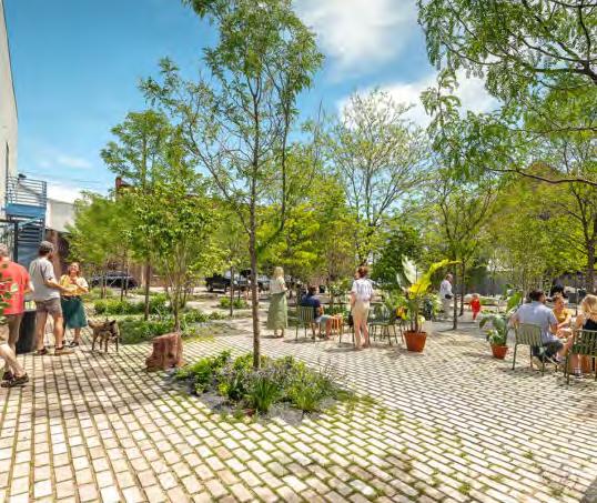
Overview
Molesworth Street maximises new green and blue infrastructure, whist retaining existing trees and respecting existing utilities and bus stands. Ground floor activity and residential entrances enliven the street.
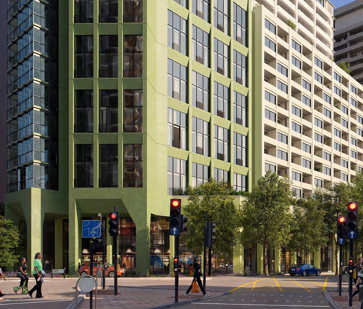
Green infrastructure
All opportunities for introducing new planting should be explored along Molesworth Street.
To maximise the public realm experience, improve biodiversity and mitigate the impact of the road.
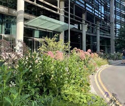
Generous pedestrian paths
Pedestrian routes should have a minimum 4m clearance.
To ensure direct circulation is maintained along Molesworth Street.
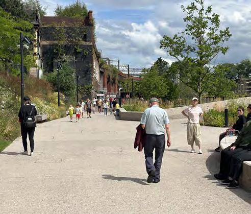
Opportunities for additional tree planting should be included within the landscape design.
To ensure the public realm experience responds to the heights of buildings.
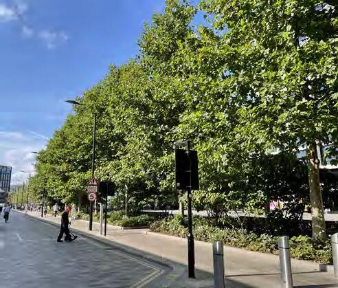
As explained previously in the document, the proposal has developed as such that each plot is unique. As such, the Plot Codes chapter is important in identifying the Codes to support this.
Each Plot is summarised initially to give its role in urban design terms. This provides important context and gives an indication to the reasoning behind the Codes.
The plots maximum parameter massing is then compared to the Illustrative Scheme, and areas of flexibility are identified where appropriate. Plot specific codes are then set out, and it is important that these are read in conjunction with the other relevant Codes in the document to provide the full suite of codes for each plot.
This plot is read as a pair alongside plot N2 (part of the detailed application). This creates a strong backdrop to The Podium Park at their western edge, and a backdrop to buildings along the High Street from the east. Together a private amenity space is created between them, with direct access to The Podium Park via a bridge over The Street.
A key role of Plot C1 is its requirement to have residential entrances across three levels. This ensures that residents have 24-hour access to their homes during the night when The Street and The Podium Park are closed, through the retained Lloyd’s building façade on the High Street.
The eastern elevation of this plot has an important role as it is a prominent façade from the High Street.
It’s role can be summarised as below:
• Retention First: Retain the façade of the existing Lloyd’s building on the High Street to respect the character of the High Street
• Pair with neighbouring plot N2 to frame The Podium Park and provide a backdrop to the High Street
• Position the entrances to create multi-level residential accesses
• Chamfered massing to enhanced aspect of homes
• Celebrate the lower shoulder of the building and its prominence in relation to the High Street
• Use podium levels to provide external amenity spaces for residents, including access to The Podium Park
The areas adjacent to the High Street have minimal/no flexibility.
There is a small amount of flexibility to the southern boundary of the plot for the taller component of the building.

Key façades that are visible from Lewisham High Street should respond to the character and scale of buildings along the street. This could be achieved through expression, detailing or materiality.
To ensure architecture responds to the existing context of Lewisham High Street.
The design of Plot C1 must prioritise the retention of existing buildings or façades and incorporate them into the proposal in a coherent approach.
Where technical design development demonstrates that a retention option is not possible, then reduced retention or façade retention are acceptable outcomes in the sequence identified in the adjacent diagram.
To retain the architectural character of the high street.
P.03
Frame the Eastern Terrace
The design of Plot C1 must define the edge of the Eastern Terrace.
To reinforce the edge of the public realm and frame the Eastern Terrace.
Reference
The design of Plot C1 must respond to the Detailed Component design of Plot N2. This could be achieved through massing, articulation or architectural expression.
To ensure a harmonious architectural response.
↘ Refer to Detailed Component of the Hybrid Planning Application.
Define
The design of Plot C1 must define the edge of The Street on L01. The Design of this facade must significantly match the facade addressing the street as part of Plot N2
To define the edge of a key route.
↘ Refer to Plot Codes / Plot SC
Animate The Street
L01 uses must contribute to the activation of The Street. These could include retail or F&B.
To create a vibrant and engaging public realm.
↘ Refer to Site-wide / Building frontages
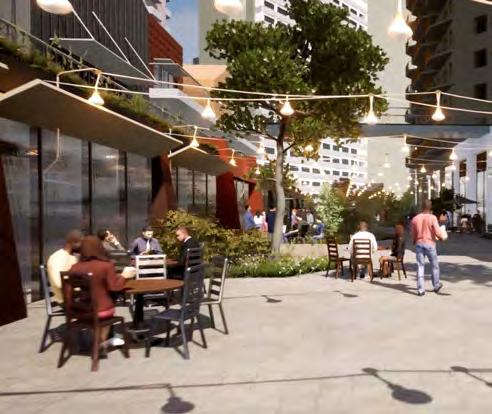
Vertical rhythm
The Design of this facade must significantly match the facade addressing the street as part of Plot N2. Some variation is permitted however they should visually read as a continuous frontage.
To create a cohesive and familiar rhythm along The Street.
↘ Refer to Plot Codes / Plot SC
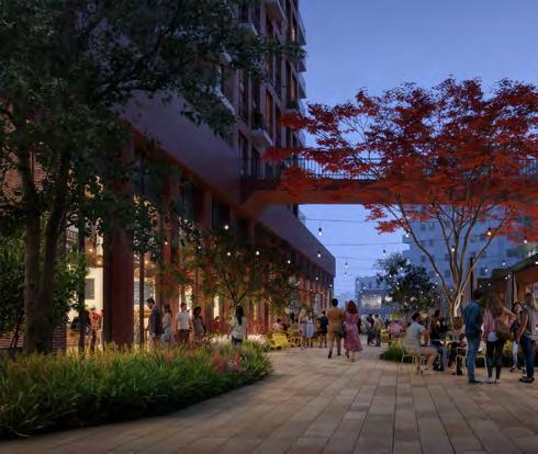
The eastern facing façade of the lower element (above podium) of Plot C1 must set from Lewisham High Street. The upper floors of Plot C1 form part of the High Street backdrop, not the High Street itself.
To ensure the character and scale of Lewisham High Street is retained.
To respond to the Architectural resolution of
These north-south linear residential plots (alongside C2.2) are central to the masterplan’s brick spine of buildings, and again is defined by retained elements of the existing site.
The Art Deco façade of the Woolworths building is retained and celebrated. This defines the character of the new residential plots behind which step up towards the Molesworth Street buildings. There is an opportunity for a larger town centre use behind the Woolworths façade that activates the Eastern Terrace.
It’s role can be summarised as below:
• Retention First: The plot retains and restores the existing Art Deco Woolworths Façade; Healing the High Street
• Massing shape & orientation split into distinct parts with taller component at the north to respond to Woolworths façade line and form edge of Eastern Terrace
• Northern components of massing respond Architecturally to the Woolworths vertical façade language
• Stepping up of massing away from the high street
• Duality of entrances from south at ground level, and north from eastern terrace
• Further entrance at The Podium Park level provides link through to private amenity space


Façades addressing Lewisham High Street should respond to the character and scale of buildings along the street. This could be achieved through expression, detailing or materiality.
To ensure architecture responds to the existing context of Lewisham High Street.
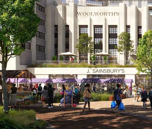
The design of Plot C2.1 must prioritise the retention of existing buildings or façades and incorporate them into the proposal in a coherent approach.
Where technical design development demonstrates that a retention option is not possible, then reduced retention or façade retention are acceptable outcomes in the sequence identified in the adjacent diagram.
To retain the architectural character of the high street.
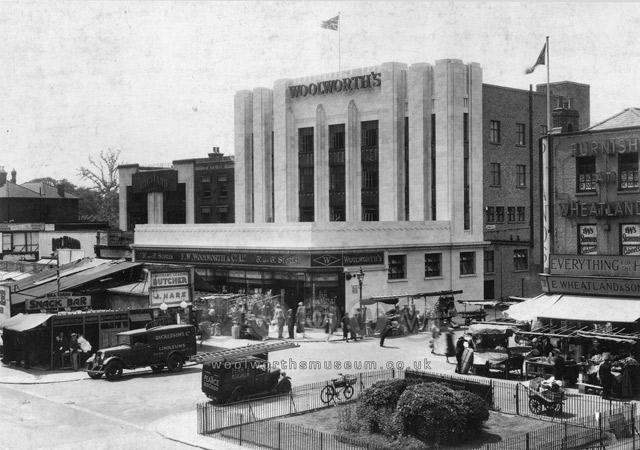
Frame the Eastern Terrace
The design of Plot C2.1 must define the edge of the Eastern Terrace.
To reinforce the edge of the public realm and frame the Eastern Terrace.
The design of Plot C2.1 should express taller elements as sitting on a podium. This could be achieved through architectural expression or materiality.
To create a more cohesive ground plan and respond to the Plot SC.
↘ Refer to Site-wide / Building façades
Minimum critical distance from Plot C2.2
The design of Plot C2.1 must ensure that the massing of upper levels allows for the minimum critical distance from Plot C2.2, as indicated on the Parameter Plan.
To enable appropriate building separation distances between Plot C2.1 and Plot C2.2.
↘ Refer to Site-wide / Parameter Plan Details
P.15 Communal amenity on L02
Communal amenity must be provided between C2.1 and C2.2 on L02. This should be planted and accessible to all residents.
To provide amenity and support privacy.
↘ Refer to Site-wide / Communal amenity
Treatment to balconies addressing internal communal amenity
Material selection and design of balconies addressing communal amenity should support privacy. This could include treatments with reduced permeability.
To support privacy for residents.
↘ Refer to Site-wide / Balconies
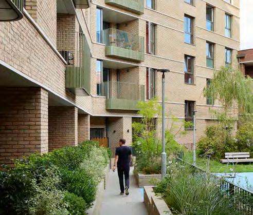
Plot C2.1 should consider a distinct building top.
To create a common language for the Central Spine of buildings along with Plot N2.
The northern components of both C2 plots must be informed by the Architectural language of the existing Woolworths façade. This could be achieved by incorporating a dominant vertical language.
To integrate with and celebrate existing site heritage.
These north-south linear residential plots (alongside C2.2) are central to the masterplan’s brick spine of buildings, and again is defined by retained elements of the existing site.
The Art Deco façade of the Woolworths building is retained and celebrated. This defines the character of the new residential plots behind which step up towards the Molesworth Street buildings. There is an opportunity for a larger town centre use behind the Woolworths façade that activates the Eastern Terrace.
A route at Park level will connect the communal amenity space between plots C2.1 and C2.2 to The Podium Park itself. This route should be visually open but secure.
It’s role can be summarised as below:
• Retention First: The plot retains and restores the existing Art Deco Woolworths Façade; Healing the High Street
• Massing shape & orientation split into distinct parts with taller component at the north to respond to Woolworths façade line and form edge of Eastern Terrace
• Northern components of massing respond Architecturally to the Woolworths vertical façade language
• Stepping up of massing away from the high street
• Duality of entrances from south at ground level, and north from eastern terrace
• Further entrance at The Podium Park level provides link through to private amenity space
The northern and southern boundaries are set by the adjacent Eastern Terrace and New Romer Place respectively.
There is a scope to push the building to the east, as long as minimal critical distances to Plot C2.1 is maintained. This is encouraged to maximise The Podium Park.


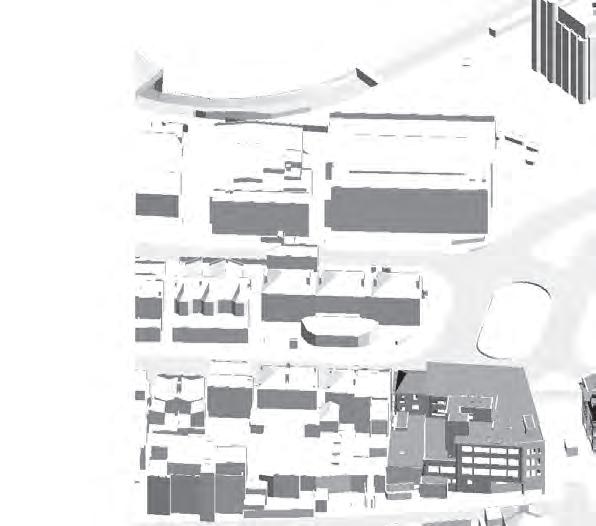
Frame the Podium Park edge
The design of Plot C2.2 must define the edge of the Podium Park.
To reinforce the edge of the public realm and frame the Podium Park.
Visual connection to the Podium Park
L02 frontages should be designed to provide a visual connection to the public realm. This could be achieved through openings, transparency and active uses.
To contribute to the activity and visual interest of the public realm.
↘ Refer to Site-wide / Building frontages
Hold corners
The design of Plot C2.2 should avoid setting in at corners at upper levels addressing the public realm. Exception could include setbacks at the top of the building.
To reinforce the sense of enclosure of the public realm.
P.21 Activation of Podium Park frontages
L02 uses should contribute to the activation of the Podium Park. These could include retail, F&B, residential amenity or residential entrances.
To create a vibrant and engaging public realm.
↘ Refer to Site-wide / Building frontages
Expression of upper level façades
The design of Plot C2.2 should express taller elements as sitting on a podium. This could be achieved through architectural expression or materiality.
To create a more cohesive ground plan and respond to the Plot SC.
↘ Refer to Site-wide / Building façades
Minimum critical distance from Plot C2.1
The design of Plot C2.2 must ensure that the massing of upper levels allows for the minimum critical distance from Plot C2.1, as indicated on the Parameter Plan.
To enable appropriate building separation distances between Plot C2.1 and Plot C2.2.
↘ Refer to Site-wide / Parameter Plan Details
L02 must be provide a physical and visual connection between the communal amenity space to the East and The Podium Park. This is intended to act as an access point to The Podium Park from plot C2.1
To provide amenity and support privacy.
↘ Refer to Site-wide / Communal amenity
Treatment to balconies addressing internal communal amenity
Material selection and design of balconies addressing communal amenity should support privacy. This could include treatments with reduced permeability.
To support privacy for residents.
↘ Refer to Site-wide / Balconies
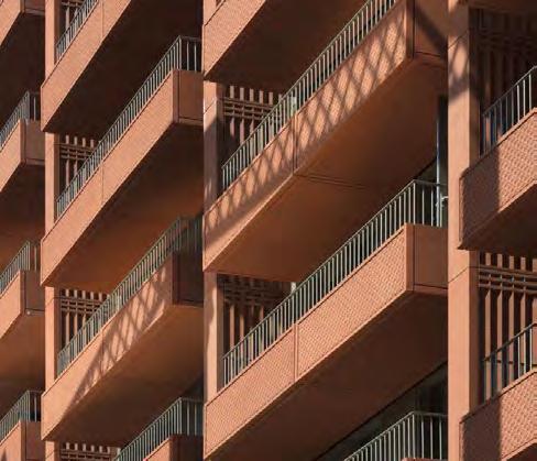
Plot C2.2 should consider a distinct building top of the tallest northern part of the massing.
To create a common language for the Central Spine of buildings along with Plot N2.
The northern components of both C2 plots must be informed by the Architectural language of the existing Woolworths façade. This could be achieved by incorporating a dominant vertical language.
To integrate with and celebrate existing site heritage.
This plot can be described as more of a background building, flanked on Molesworth Street by taller neighbours C4 and S2. A small set back links the building to Plot S2 and encloses the southern area of The Podium Park.
As with other residential plots that address both The Podium Park and Molesworth Street, the primary residential entrance is provided at ground level, with a secondary access at Park level.
C3 incorporates a set back at upper levels in its massing, to maximise daylight levels into The Podium Park. This set back ‘shoulder’ has a visual relationship with the taller component of Plot C2.2, and the central Park facing datum of Plot C4.
It’s role can be summarised as below:
• Manipulate massing to ensure comfortable building-to-building distances
• Duality of residential entrances at Level 00 and Level 02
• Physical connection to building to Plot S2 to provide shelter for The Podium Park area behind
• Park-facing upper level set-back to relate to adjacent C2 and C4
• Park level set-back to create colonnade and maximise public realm
• Potential to incorporate duplex homes on The Podium Park frontage to increase the variety of homes
The northern and southern boundaries are set by the adjacent Eastern Terrace and New Romer Place respectively.
There is a scope to push the building to the east, as long as minimal critical distances to Plot C2.2 is maintained. This is encouraged to maximise The Podium Park.


The design of C3 must express taller elements as reaching the ground on Molesworth Street. This could be achieved through architectural expression or materiality or a colonnade extending to Molesworth Street.
To express the verticality of taller building elements.
Building façades should have a framed articulation. This could be accentuated through a clear horizontal or vertical grid.
To respond to the scale of the buildings and create a clear language along Molesworth Street.
Upper level façades addressing the Podium Park should support activation of the Podium Park. This could be achieved through balconies or location of habitable rooms.
To animate key public realm.
↘ Refer to Site-wide / Building façades
L02 frontages addressing the Podium Park should contribute to activation of the public realm. This could be achieved through arrangement of active uses, spill-out space or visual connection to Ground Floor uses.
To create a vibrant and animated public realm.
↘ Refer to Site-wide / Building frontages
The location of primary residential entrances must be from Molesworth Street. A secondary entrance must be provided from the Podium Park.
To enable a ground floor entrance that avoids entering the building via the shopping centre.
↘ Refer to Site-wide / Entrances
Where duplex units are present, their façades should express the scale and individual nature of these homes. This could be achieved through steps in massing, a change in expression or materiality.
To express the individual scale of these homes and provide diversity in residential expression.
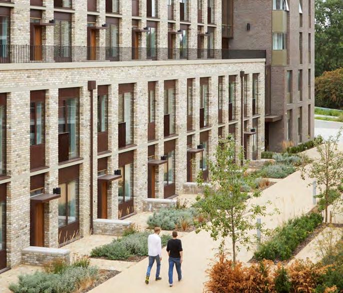
Defensible space for individual homes addressing the Podium Park
Where duplex units address the Podium Park, the design of Plot C3 should allow for planted defensible space adjacent to habitable rooms.
To create amenity and privacy for residents.
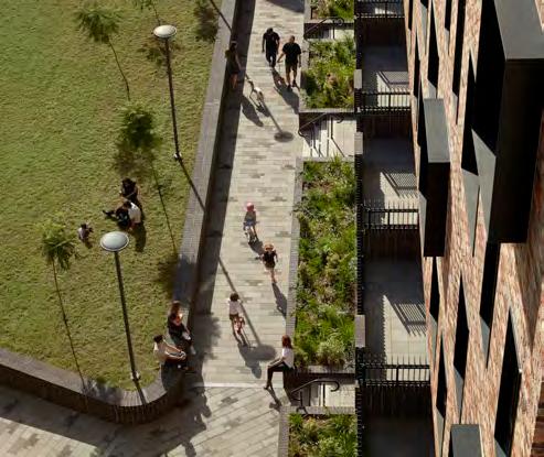
Plot C3 must incorporating an eastern facing setback at the top of the building of a minimum of two storeys.
To step down in height towards Plot C2.2.
Consideration must be given to omit/ minimise the link building to Plot S2.
To enable as much daylight/sunlight into the podium park as possible.
Plot C3 should create a strong relationship with the northern taller elements of Plot C2. This could be achieved through similarities in terms of massing, materiality and Architectural expression.
To frame the northern area of the podium park.
This plot has an extremely important role through its definition as the tallest building on the site. This is warranted to through its wider townscape setting, and its role in anchoring itself in The Podium Park from views to the east.
The building uses design principles for its base, middle and top and draws reference for these datums from neighbouring plots. As part of the suite of Molesworth Marker buildings (alongside N3 northern extension and S4) There is an opportunity to introduce colour, particularly at the buildings base and top, and explore aggregated forms in its massing and footprint.
It’s role can be summarised as below:
• Manipulate rectangular footprint typology to suit orientation and setting of neighbouring plots
• Park-facing upper level set-back to address The Podium Park
• Park level set-back to create colonnade and maximise public realm
• Enhance aspect of central single aspect homes to create aggregated plan form
• Introduce elevational datums to respond to neighbouring plots and apply tall building design principles
• Integrate a vertical access point from the shopping centres western entrance up to The Podium Park
There is limited flexibility to the northern, eastern and southern boundaries to maximise distances to adjacent plots and The Podium Park.
There is a scope to push the building to the west, as long as sufficient area on Molesworth Street is provided given the scale of the building. This could be explored to maximise The Podium Park.
There is minimal flexibility in the height of the building as the tallest plot on the site.


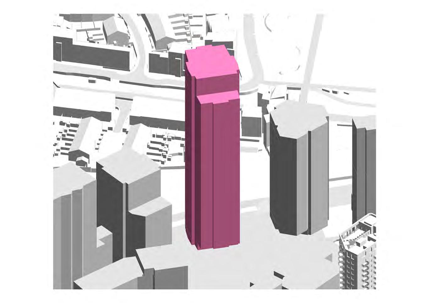
P.39
The design of Plot C4 must reflect it’s role as the tallest building in the masterplan. This could be achieved through expression of the building top, façade expression or order and proportion of openings.
To respond to the site-wide strategies for marker buildings and approach to heights.
↘ Refer to Site-wide / Marker buildings
Designed in the round
All façades of Plot C4 should be treated as a ‘front’ not a ‘back’ or ‘side’, with attention to its design from short and long range views.
To ensure buildings are designed with consideration to all vantage points.
↘ Refer to Site-wide / Building façades
Façades addressing Molesworth Street
The design of Plot C4 should express taller elements as reaching the ground on Molesworth Street. This could be achieved through architectural expression or materiality or a colonnade extending to Molesworth Street.
To express the verticality of taller building elements.
Upper level façades addressing the Podium Park should support activation of the Podium Park. This could be achieved through balconies or location of habitable rooms.
To animate key public realm.
↘ Refer to Site-wide / Building façades
The design of C4 should reflect a mid-height datum(s) that responds to the heights of Plot C5 and Plot C3. This could be achieved through a step in massing or a change in façade expression.
To create a strong relationship with adjacent buildings.
The Level 02 frontage addressing the Podium Park should contribute to activation of the public realm. This could be achieved through arrangement of active uses, spill-out space or visual connection to Ground Floor uses.
To create a vibrant and animated public realm.
↘ Refer to Site-wide / Building frontages
The design of Plot C4, in particular residential habitable rooms at grade, must safeguard privacy. This could be achieved through detailing or arrangement of openings.
To safeguard privacy.
↘ Refer to Site-wide / Building façades
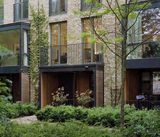
Steps in massing
The design of Plot C4 should express steps in massing at upper levels.
To create distinctive marker buildings across the site.
Podium Park facing colonnade
The Level 02 colonnade addressing the Podium Park should be of two storeys in height.
To give focus to the public realm and be of an appropriate scale to the building.
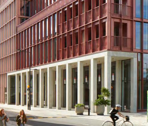
The plot must consider unique or special massing expression. This could be achieved through an aggregated plan form.
To undertake its role as a Marker building.

Plot C4 must incorporating an eastern facing setback at the top of the building of a minimum of two storeys.
To step down in height towards The Podium Park.
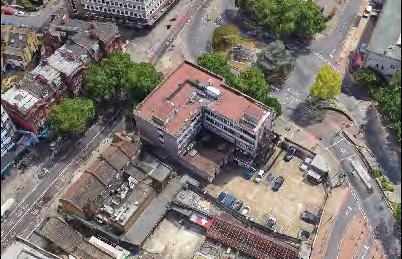
Balconies should be recessed on North and South elevations, and expressed differently to East and West elevations.
To create a subtle hierarchy between facades.
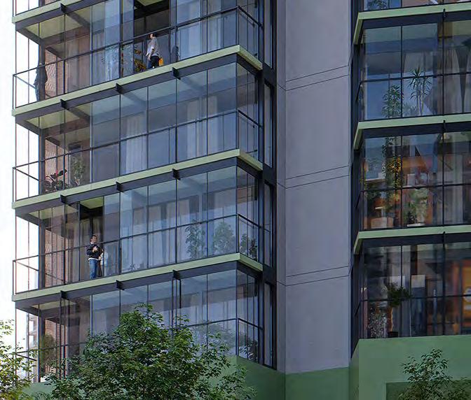
Plot C5 has a triangular footprint in response to its constrained location. This enables adequate distances to neighbouring plots N3 and C4, and orientates itself towards The Podium Park. It is set in from Molesworth Street to allow for a generous arrival point at the Cornmill Gardens crossing, and create a generous route into the Northern Square to the north.
As with other Molesworth Street plots, homes respond to microclimate conditions with either winter gardens, inset balconies or oversized apartments.
It’s role can be summarised as below:
• Triangular footprint responds to neighbouring plots C4 and N3 and addresses The Podium Park
• Park level set-back to create colonnade and maximise public realm
• Integrate a vertical access external stair from Molesworth Street up to The Street along its northern elevation
• Enhance aspect of central single aspect homes to create aggregated plan form
Minimal flexibility is provided on the eastern edge of the plot.
There is a scope to push the building to the west, as long as sufficient area on Molesworth Street is provided given the scale of the building. This is encouraged to maximise The Podium Park.


P.53 Footprint typology
The design of Plot C5 should have a nonrectilinear footprint. This could be achieved through a triangular footprint typology.
To maximise aspect of homes and respond to its surroundings.
Designed in the round
All façades of Plot C5 should be treated as a ‘front’ not a ‘back’ or ‘side’, with attention to its design from short and long range views.
To ensure buildings are designed with consideration to all vantage points.
↘ Refer to Site-wide / Building façades
Façades addressing Molesworth Street
The design of C5 should express taller elements as reaching the ground on Molesworth Street. This could be achieved through architectural expression or materiality or a colonnade extending to Molesworth Street.
To express the verticality of taller building elements.
Designed in the round
Upper level façades addressing the Podium Park should support activation of the Podium Park. This could be achieved through balconies or location of habitable rooms.
To animate key public realm.
↘ Refer to Site-wide / Building façades
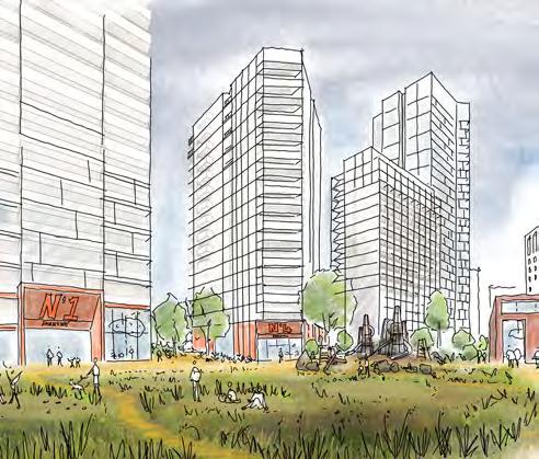
Level 02 frontages addressing the Podium Park should contribute to activation of the public realm. This could be achieved through arrangement of active uses, spill-out space or visual connection to Ground Floor uses.
To create a vibrant and animated public realm.
↘ Refer to Site-wide / Building frontages
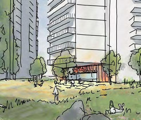
Primary residential entrance
The location of primary residential entrances must be from Molesworth Street. A secondary entrance must be provided from the Podium Park.
To enable a ground floor entrance that avoids entering the building via the shopping centre.
↘ Refer to Site-wide / Entrances
The design of Plot C5, in particular residential habitable rooms at grade, must safeguard privacy. This could be achieved through detailing or arrangement of openings.
To safeguard privacy.
↘ Refer to Site-wide / Building façades
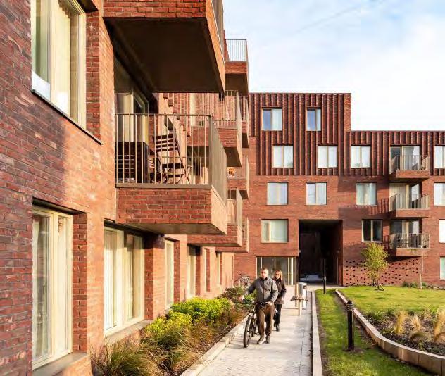
Where an access point is provided to connect the public realm, it must be integrated with the landscape and the building.
To ensure careful and considered interaction of access points with the public realm and architecture.
↘ Refer to Parameter Plan Codes
Building façades should have a framed articulation with a strong horizontal language.
To respond to the non-rectilinear building footprint and create a clear language along Molesworth Street.
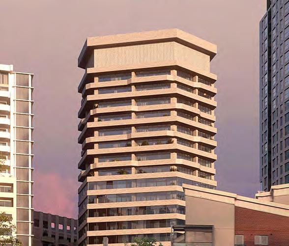
Plot C5 should relate to adjacent landscape on Molesworth Street to create generous public realm.
To create a sense of arrival for people crossing from Cornmill Gardens.
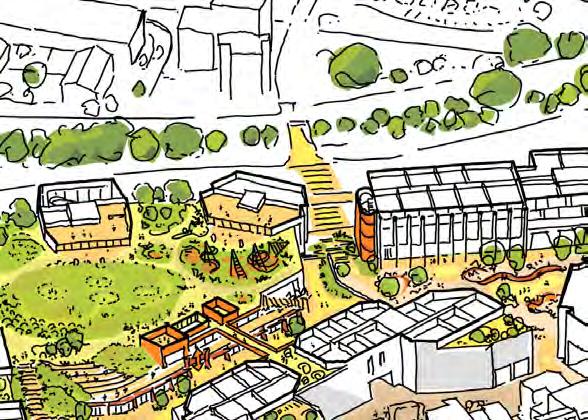
Maximising public space
Plot C5 must consider maximising the public space in the centre of the site. This could be achieved by shifting the building west towards Molesworth Street.
To maximise public open space and daylight/sunlight in the centre of the site.
The overarching concept for the masterplan hinges on the historic meaning of Lewisham as Levesham: The House Among the Meadows. Plot M1 anchors this concept in the centre of the site by taking on this role as the ‘house in the meadow’ and is vital as a unique building in tying the masterplan as a whole. There is an exiting opportunity for the building itself to be designed via an Architectural competition and/ or through co-design.
The plot’s role can be summarised as follows:
• A central marker building that provides a physical link between the shopping centre and The Podium Park.
• It is an important local asset to the masterplan, safeguarded for community use
• An external visual link across the stepped landscape from key public spaces to the north, south and east
There is scope to extend the plot slightly into The Podium Park, but this should be minimised to avoid reducing the extent of public realm.


An architectural competition for the design of Plot M1 must be used by future RMAs. This must be based on a brief that has been the subject of meaningful community consultation.
To encourage creative architectural approaches to the design.
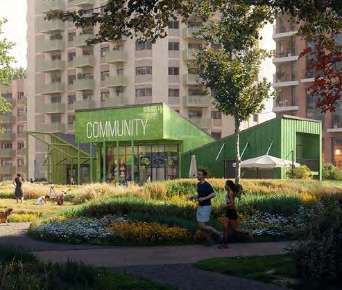
The design of Plot M1 must be integrated with the landscape. It could include referencing a similar material palette and integration of planting.
To allow for integration of the landscape design.
↘ Refer to Landscape Character Areas / Zone 4 - Podium park
L02 uses must contribute to the activation of the public realm. This could include community uses, culture or F&B.
To create a vibrant and engaging environment.
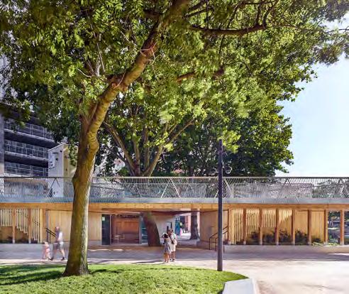
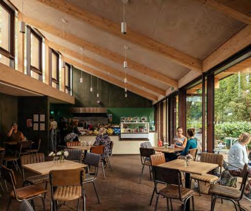
L02 frontages must be visually connected and with a high level of transparency.
To create a strong visual connection and activate the public realm.
↘ Refer to Site-wide / Frontages and Façades
The design of Plot M1 could have a distinct roof articulation.
To create visual interest and a distinct architectural character.
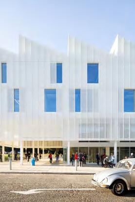
The design of Plot M1 could explore opportunities for diverse architectural expression.
To create a dynamic and engaging building.
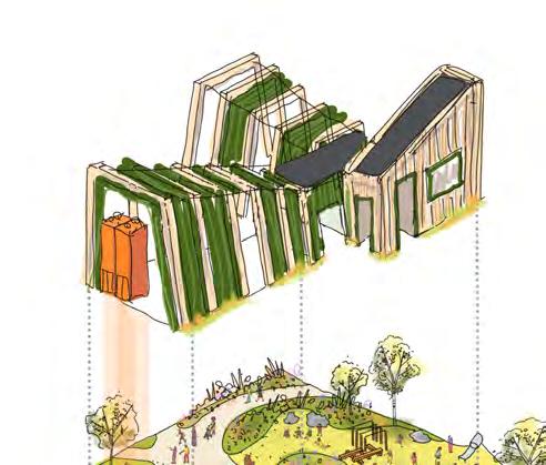
The design of Plot M1 could provide opportunities for integrated art. The artwork could be developed through consultation with the existing local community or engagement of a local artist.
To integrate the community’s identity with the architectural design.
The design of Plot M1 must explore opportunities for the use of alternative construction materials, such as timber subject to relevant building regulations and technical design development.
To create a unique typology within the Podium Park.
The design of Plot M1 must include a publicly accessible lift connection between L00, L01 and L02.
To create an accessible public realm.
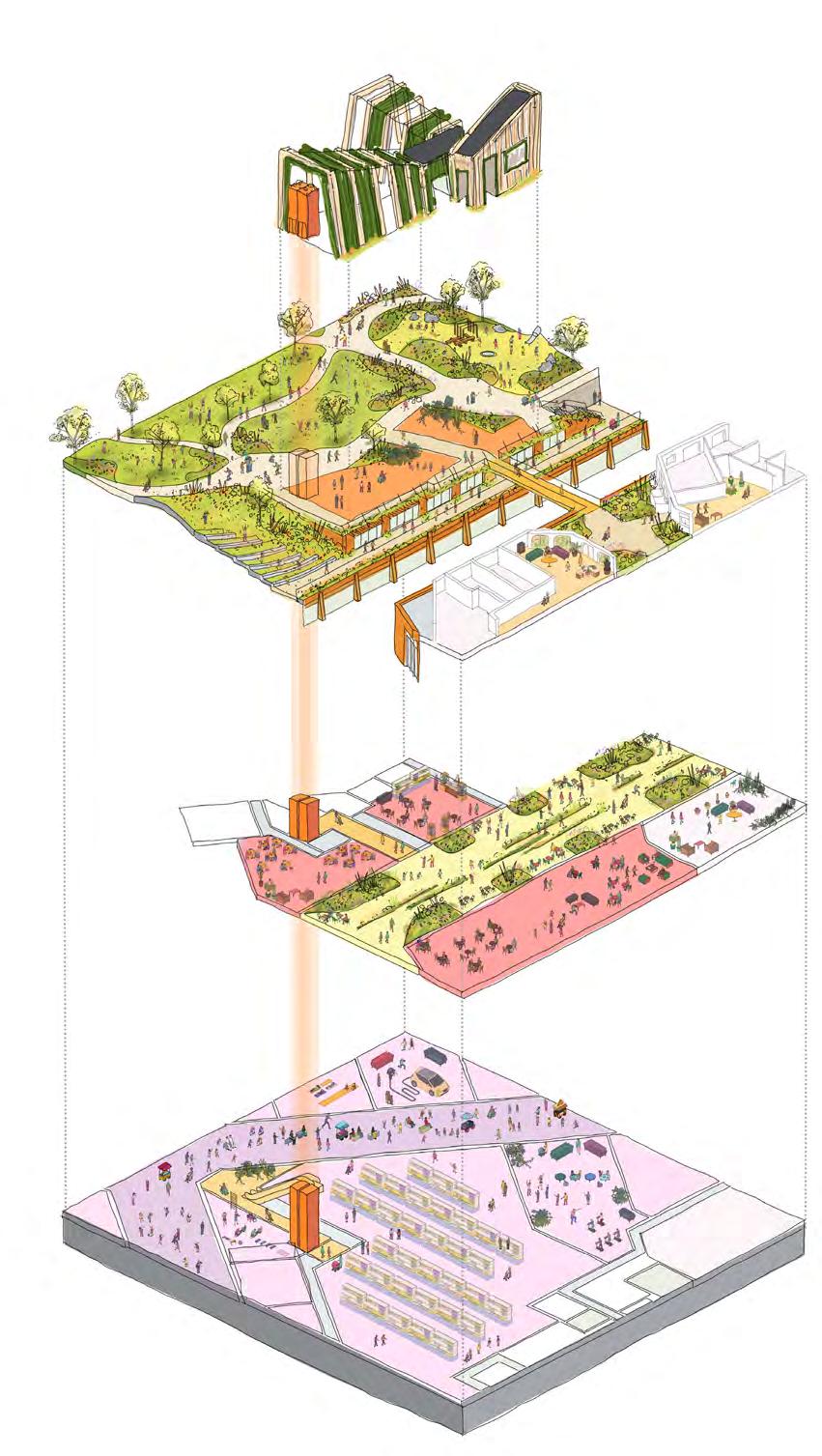
Plot MV utilises the existing commercial building to create a new music venue and cultural offering at the south of the site. The ambition for the programming is for a community led offering, with additional uses on upper floors such as recording studios.
The ground floor will provide an aspect both onto the High Street and to the New Model Market at the rear. A new rooftop bar is proposed to create a visual marker for the masterplan as a whole from the southern end of the High Street.
The plots key urban design role is summarised below:
• Retention First: Demolish low quality rear extension and retain as much of primary building as possible
• Build back double height space to rear to create music venue activating the ground floor
• Use upper levels to provide further community/music uses in existing building L-shaped upper levels
• Creation of a new rooftop bar to activate south eastern corner of the site
• Create a relationship between the ground floor uses and the New Model Market to ensure it is a public space used into the evenings
There is no to limited scope for flexibility due to the nature of retaining the existing building.

The design of Plot MV must prioritise the retention of existing building structure and incorporate it into the proposal in a coherent approach.
Where technical design development demonstrates that a full structural retention option is not possible, then partial retention is an acceptable outcome.
To retain and build on site history.
The design of Plot MV could extend the footprint of the existing building. The extension should respond to existing massing and layout.
To enable flexibility for a range of building uses and layouts.
P.73
Interventions or reconfiguration to the building’s internal fabric should be designed to allow for maximum internal flexibility.
To allow for creative reuse of the existing building.
The design of Plot MV should reflect it’s role as a community destination. This could be achieved through expression of its use in the design, integration with the public realm and incorporation of public art.
To integrate the community’s identity with the architectural design.
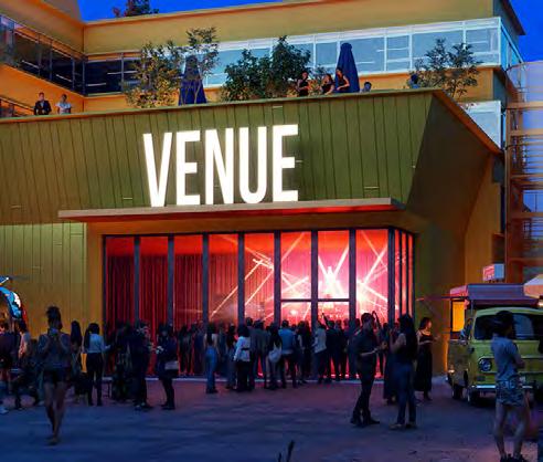
L00 frontages addressing the Model Market should activate the public realm. This could be achieved by designing permeable façades, avoiding blank walls, providing entrances or enabling spill-out space. Subject to technical design development and acoustic performance.
To activate the public realm.
L00 frontages addressing Lewisham High Street must contribute to the activation of the street. This could be achieved through a primary entrance from the street or visually permeable façades.
To contribute to and enhance Lewisham High Street.
↘ Refer to Site-wide / Building frontages
The design of Plot MV should provide an active use such as F&B on the existing roof level, where practical.
To create a destination on the southern end of the site.
Where an active use is proposed for the existing roof level of Plot MV, the design should include both internal and external spaces. Proposed structures should be of lightweight construction and could explore opportunities for architectural expression.
To support activation of the existing roof level and an opportunity for wayfinding at the southern end of the site.
The design of Plot MV could provide opportunities for public art. The artwork could be developed through consultation with the existing local community or engagement of a local artist.
To maximise public art opportunities.
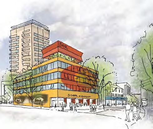
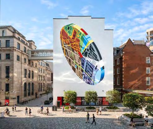
The design of Plot MV must ensure that the external fabric provides an appropriate acoustic buffer.
To minimise the impact of the music venue on neighbours.
The western strip of Plot MV must only include an escape stair.
To maximise the width of the main public route into the site at its southern entrance.
Any escape stairs must be external and expressed as a lightweight addition to the main building.
To maximise the sense of width of public routes into the site in this location.
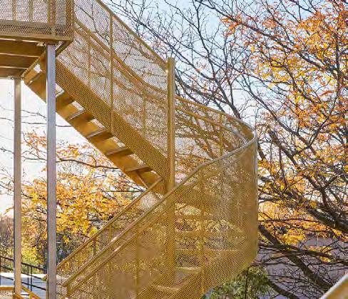
Plot N3 sits to the north of the site and completes the first phase of the masterplan, alongside detailed plots N1 and N2. This unique plot, in a similar strategy to Plot MV, retains elements and extends an existing building; in this instance Lewisham House. This creates a unique solution at both the north and the south of the site and bookends the masterplan with elements of retention.
The majority of the structural frame of the existing commercial building looks to be retained. This is then extend to the west, and to the north with a taller extension which acts as a masterplan marker. A ground level podium then completes the block and pushes out to form an active edge to Molesworth Street.
The plots urban design roles are listed below:
• Retention First: Demolish connected elements whilst retaining primary structural frame of Lewisham House
• Extend the existing frame to create east and west facing homes
• Introduce taller extension addressing Gateway Cluster of development
• Manipulate extension massing to maximise aspect of homes and address longer distance views from the north
• Lift up massing to the north to create more generous public realm, and extend out podium level to west to Molesworth Street edge
There is no to limited scope for flexibility at the northern and north-western boundary of the plot to maximise public realm on Rennell Street.
This is no flexibility on the eastern boundary of the plot due to the retention of the existing structural frame of Lewisham House.


The design of Plot N3 should celebrate the site history. This could be achieved through retention and conversion of the existing Lewisham House and any proposed additions responding to the existing massing and expression of Lewisham House.
To celebrate the existing character of the site.
The design of Plot N3 must prioritise existing buildings in the proposal in a coherent approach.
To retain and build on site history.
The design of Plot N3 must include a podium addition. The podium should frame the public realm and provide active uses to animate the public realm.
To provide greater flexibility in the design and redevelopment of Lewisham House and to contribute to animation of the public realm.
The design of Plot N3 must include additions and extensions to the existing Lewisham House. This could include but is not limited to expansion of the original footprint or additional storeys.
To provide greater flexibility in the design and redevelopment of Lewisham House.
The design of Plot N3 must be integrated with the public realm design of the Northern Square. The ground floor layout and location of entrances should enhance the design of the Northern Square.
To ensure that designs for architecture and public realm feel cohesive and considered.
↘ Refer to Landscape Character Areas / Zone 1 Northern Square
L00 uses must contribute to activation of the public realm. This could include retail, restaurants or cafés. Large areas of inactive frontages should be avoided.
To create a vibrant and engaging public realm.
↘ Refer to Site-wide / Building frontages
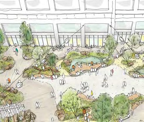
Animate the public realm
Building frontages realm. This could be achieved through visual connection, entrances addressing the public realm, high levels of transparency or spill-out space.
To provide a connection between ground floor uses and to animate the public realm.
↘ Refer to Site-wide / Building frontages
P.90 Residential entrances
The design of Plot N3 should provide primary residential entrances directly from the public realm. At least one entrance should be provided directly from the Northern Square.
To animate the Northern Square.
↘ Refer to Site-wide / Entrances
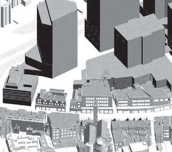
The plot must consider unique or special massing expression, subtly incorporating colour. This could be achieved through an aggregated plan form to any extensions.
To undertake its role as a Marker building.
Existing building expression
The plot must incorporate and externally express the primary structure of the existing building.
To celebrate the retention of the existing building.
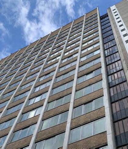
The podium terrace of Plot N3 must be usable and accessible. It should include planted zones and spaces for users to sit.
To provide comfortable outdoor amenity for residents.
↘ Refer to Site-wide / Communal amenity
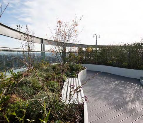
Plot S1 acts as a standalone plot in the south of the site, with the challenging role of integrating the two-way vehicular servicing ramp from Molesworth up to the Level 01 service deck. The ramp becomes a bridge link to S2 as it arrives at Level 01.
This simple rectangular student accommodation plot incorporates a step in its massing at roof level to transition in height between neighbouring plots S4 and S2. It’s role can be summarised as below:
• Align to Plot S3 opposite and set back to frame the public space between the two plots.
• Integrate the service deck ramp within its Architectural form
• Bridge link to Plot S2
• Step in massing at its southern elevation to transition in height on Molesworth Street
• Eastern facing primary entrance to activate new public space
Minimal flexibility is provided on the eastern edge of the plot to maximise the public realm between this plot and S3.
There is scope to push the building to the west, as long as sufficient area on Molesworth Street is provided given the scale of the building. This is encouraged to maximise public realm and building-to-building distances in the centre of the site.
P.94
The design of Plot S1 must incorporate and conceal the ramp connecting to the L01 service deck within its Architecture.
To enable site-wide servicing and vehicular access without causing detriment to the Architectural resolution of the plot.
↘ Refer to Site-wide / Access and Movement
The design of Plot S1 should avoid setting in at corners at upper levels addressing the public realm. Exception could include setbacks at the top of the building.
To reinforce the sense of enclosure of the public realm.
L00 uses must contribute to the animation of the lane. This could be achieved through active uses or residential entrances.
To animate the public realm.
Residential entrance
The design of Plot S1 must include a primary residential entrance from the lane. It must be clearly identifiable.
To assist with wayfinding and animate the public realm.
↘ Refer to Site-wide / Entrances
Plot S1 must incorporate a southern facing setback at the top of the building of a minimum of two storeys. The levels above the setback could be articulated differently to the levels below.
To step down in height towards Plot S4.
Building façades should have a framed articulation. This could be accentuated through a clear horizontal or vertical grid and façade depth.
To respond to the scale of the buildings and create a clear language along Molesworth Street.
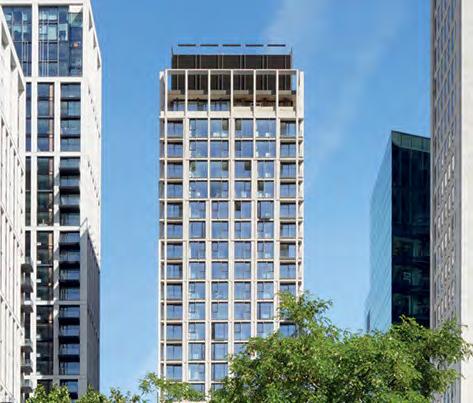
Similarly to Plot S1, this plot incorporates the service deck ramp as it meets Level 01.
A simple rectangular footprint in principle, its north-south elevations incorporate a faceted expression to direct and enhance views north and south.
Alongside Plot C3, the plot has a duality of residential entrances and a set-back residential link building.
The plot sits slightly taller than neighbouring plots C3 and S1 to avoid creating an overly curated townscape diagram.
It’s role can be summarised as below:
• Thin the building form to maximise public realm
• Discreet link building to Plot C3
• Duality of residential entrances at Level 00 and Level 02
• Faceted expression of north-south elevations to direct views from homes to key public spaces
Minimal flexibility is provided on the eastern edge of the plot to maximise the public realm between this plot and C2.2.
There is scope to push the building to the west, as long as sufficient area on Molesworth Street is provided given the scale of the building. This is encouraged to maximise public realm and building-to-building distances in the centre of the site.
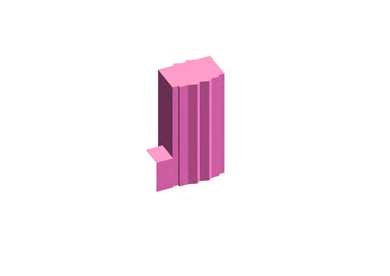
The design of Plot S2 could explore opportunities for articulation of the building line.
To provide visual interest in the massing of Plot S2.
P.103 Podium Park facing frontage
L02 frontages addressing the Podium Park should contribute to activation of the public realm. This could be achieved through the provision and layout of residential amenity on L02 or individual front doors.
To create a vibrant and animated public realm.
↘ Refer to Site-wide / Building frontages
The design of Plot S2 should express taller elements as sitting on a podium. This could be achieved through architectural expression or materiality.
To create a more cohesive ground plan for Plot SC.
Podium Park facing façades
Upper level façades addressing the Podium Park should support activation of the Podium Park. This could be achieved through balconies or location of habitable rooms.
To animate key public realm.
↘ Refer to Site-wide / Building façades
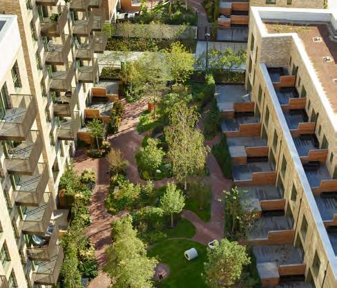
The location of primary residential entrances must be from Molesworth Street. A secondary entrance must be provided from the Podium Park.
To enable a ground floor entrance that avoids entering the building via the shopping centre.
↘ Refer to Site-wide / Entrances
P.105 Individual homes addressing the Podium Park
Where duplex units are present, their façades should express the scale and individual nature of these homes. This could be achieved through steps in massing, a change in expression or materiality.
To express the individual scale of these homes and provide diversity in residential expression.
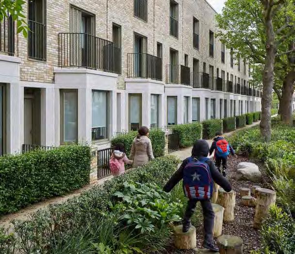
Defensible space for individual homes addressing the Podium Park
Where duplex units address the Podium Park, the design of Plot S2 should allow for planted defensible space adjacent to habitable rooms.
To create amenity and privacy for residents.
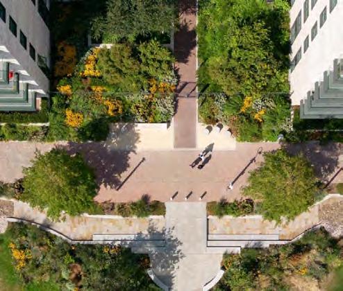
Building façades should have a framed articulation. This could be accentuated through a clear horizontal or vertical grid and façade depth.
To respond to the scale of the buildings and create a clear language along Molesworth Street.
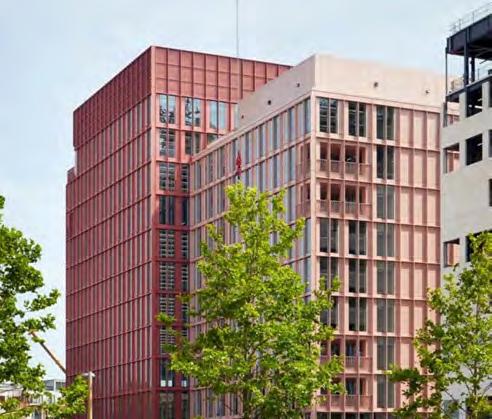
Plot S2 must consider maximising the public space in Rhyme Square. This could be achieved by shifting the building west towards Molesworth Street.
To maximise public open space and daylight/sunlight in the centre of the site.
Consideration must be given to omit/ minimise the link building to Plot C3.
To enable as much daylight/sunlight into the podium park as possible.
This plot, whilst being detached from The Podium Park, has a dedicated private amenity space at upper level that extends out to the High Street. As such it is well suited as a residential plot for affordable tenures.
At lower levels the plot extends out to the High Street, where there is an opportunity to create a bold intervention at the corner of New Romer Place, adjacent to Plot C2.
The plot is required to integrate a bridge link into Plot SC from the north for the servicing of Primark.
It’s role can be summarised as below:
• Frame New Romer Place route with Plot C2
• Set back from People’s Platform to maximise daylight into this public space
• Create bold intervention on the High Street
• Create large private amenity space for residents at Level 02
• Integrate bridge link and public stairs to Plot SC and The Podium Park
Whilst this plot is aligned with Plot C2 along its western elevation, there are opportunities to explore pushing the plot east to maximise the public space between S3 and S1. Furthermore, upper level set-backs or chamfers could be explored to help with the transition in height down to the New Model Market in the south.


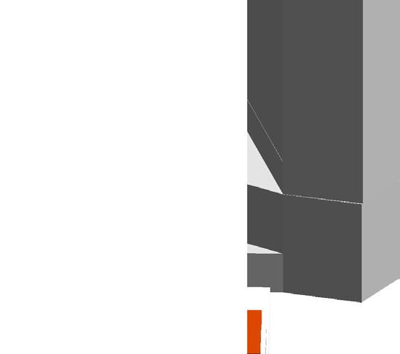
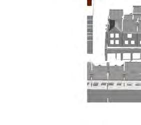
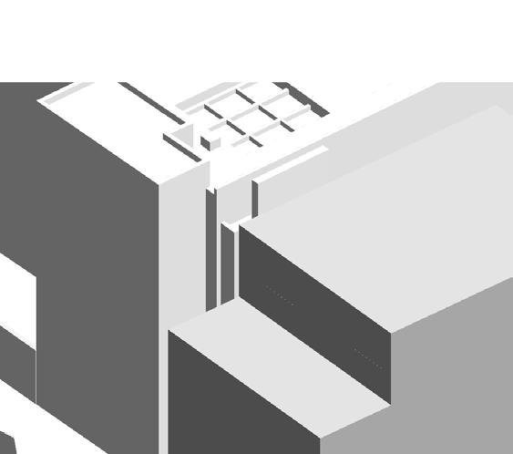
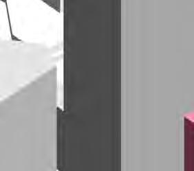

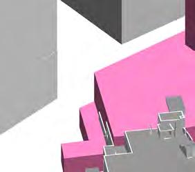

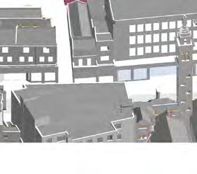


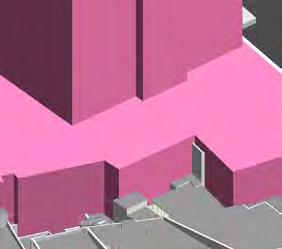


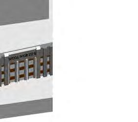
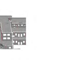
L00 frontages addressing Lewisham High Street should contribute to the existing character. This could be achieved through active uses, entrances and façade expression.
To ensure new designs contribute to the existing character of the high street.
↘ Refer to Site-wide / Building frontages
L00 frontages addressing New Romer Place should contribute to the activation of the public realm. This could be achieved through layout of active uses, entrances, façade expression and levels of transparency.
To animate the public realm.
↘ Refer to Site-wide / Building frontages
The design of Plot S3 should avoid setting in at corners at upper levels addressing the public realm. Exception could include setbacks at the top of the building.
To reinforce the sense of enclosure of the public realm.
The design of Plot S3 must define the northern edge of the New Model Market.
To reinforce the edge of the public ream and frame the New Model Market.
Level 00 frontages addressing the New Model Market must contribute to activation of the public realm. This could be achieved through arrangement of active uses, spill-out space or visual connection to Ground Floor uses.
To create a vibrant and animated public realm.
↘ Refer to Site-wide / Building frontages
Upper level façades addressing Lewisham High Street should respond to the character and scale of buildings along the street. This could be achieved through expression, detailing or materiality.
To ensure architecture responds to the existing context of Lewisham High Street.
↘ Refer to Site-wide / Building façades
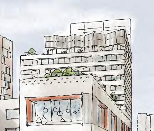
The design of Plot S3 should express taller elements as sitting on a podium. This could be achieved through architectural expression or materiality.
To create a more cohesive ground plan and respond to the Plot SC.
↘ Refer to Site-wide / Building façades
The design of Plot S3 must include residential amenity. This should be co-located with podium terraces, where practical.
To provide amenity to residents and connection to outdoor spaces.
The podium terrace of Plot S3 must be usable and accessible. It should include planted zones and spaces for users to sit.
To provide comfortable outdoor amenity for residents.
↘ Refer to Site-wide / Communal amenity
Where the design of Plot S3 creates a new boundary wall to existing properties, the wall should positively contribute to the public realm. This could be achieved through integration of public art or planting.
To create a more cohesive ground plan and respond to the Plot SC.
↘ Refer to Site-wide / Existing site fabric
Plot S3 must consider maximising the public space in Rhyme Square. This could be achieved by shifting the building east towards Lewisham High Street.
To maximise public open space and daylight/sunlight in the centre of the site.
Plot S3 could incorporate a southern facing setback at the top of the building of a minimum of two storeys, or a chamfered building footprint. The levels above the setback could be articulated differently to the levels below.
To step down in height towards the New Model Market, and reducing massing closer to the High Street.
Plot S4 completes the suite of Molesworth Marker buildings with N3 and C4. It has an important townscape role as a taller building visible from the south of the site, and its constrained location next to the New Model Market and the service deck ramp generate a distinct triangular form.
At is southern point, the massing steps back to its upper levels, reducing its mass towards the High Street and framing the route through to the Riverdale Sculpture Park opposite the site here.
It’s role can be summarised as below:
• Along with the other Marker buildings, this building introduces colour in its elevations with the concentration at is base and top.
• Starting point of triangular typology due to its adjacent constraints
• Stepping back of massing up the building to reduce its mass on the skyline and the southern portion of the High Street
• Create active uses to the south and east to mark the southern entrance to the site and frame the New Model Market
There no to minimal flexibility in plan due to the constrained nature of this plot.


Animate the New Model Market
L00 frontages addressing the New Model Market must contribute to activation of the public realm. This could be achieved through arrangement of active uses, spill-out space or visual connection to Ground Floor uses.
To create a vibrant and animated public realm.
↘ Refer to Site-wide / Building frontages
Footprint typology
The design of Plot S4 must have a nonrectilinear footprint. This could be achieved through a triangular footprint typology.
To maximise aspect of habitable rooms and respond to its surroundings.
Designed in the round
All façades of Plot S4 should be treated as a ‘front’ not a ‘back’ or ‘side’, with attention to its design from short and long range views.
To ensure buildings are designed with consideration to all vantage points.
↘ Refer to Site-wide / Building façades
The design of Plot S4 should provide activation at corners on upper levels. This could be achieved through the location of residential amenity or habitable rooms.
To provide animation on prominent corners.
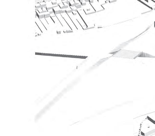
The plot must consider unique or special massing expression. This could be achieved through an aggregated form, stepping down at the south of the plot.
To undertake its role as a Marker building.
The plot must incorporate colour in the façades in a subtle manner at the base and top of the building. This could also be included in the middle of the building.
To undertake its role as a Marker building.
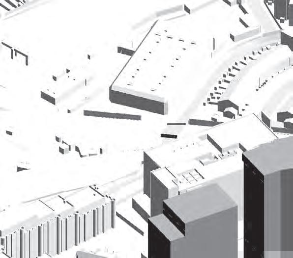
Externally, the plot has an important role as the most publically accessible plot, that will attract visitors to the site beyond the residents. For the purposes of this document, it forms the extent of the podium in the centre of the site, ground level and Level 01 inclusive. Relevant plots above then start at Level 02 upwards.
At ground level, shopping centre entrances are typically recessed from adjacent plots, incorporating areas of external cover to provide relief for shopping centre users. Other areas typically respond to the Architecture of the plots above, and is dictated mainly by Site-Wide codes for Façades and Frontages.
At upper levels, the stepped meadow landscape is integral with the plot design. Entrances through into retail spaces are designed with depth and relief to give a sense of heaviness: holding up the dense landscape above.
There is no to limited flexibility because of the plots and public spaces above, as well as existing and proposed key routes adjacent to the plot.
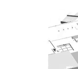
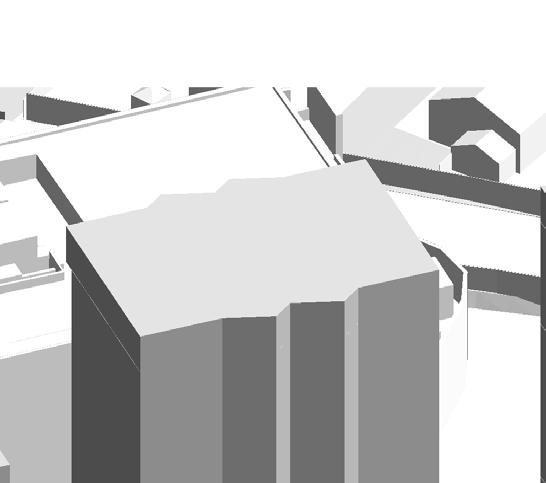


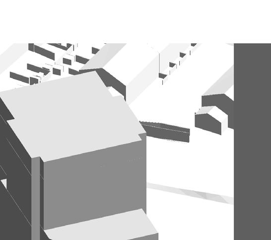


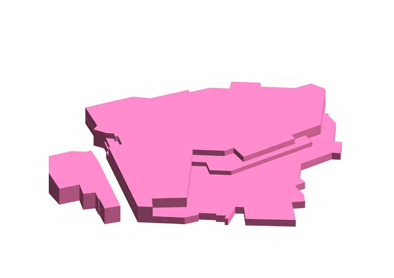
The internal concourse must provide seating for visitors.
To continue the culture of the existing shopping centre atrium as a space for visitors to relax and sit.
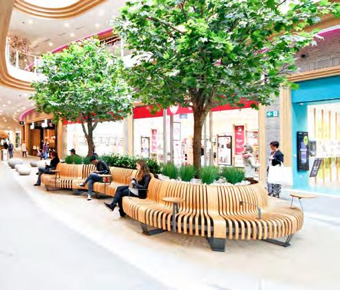
The massing and prominence of the plot must be subservient to adjoining plots on Molesworth Street.
To allow Molesworth Street residential plots to come to ground, and avoid a wall of continuous development.
The internal configuration and structure of the shopping centre concourse should look to maximise visual connections through the space and through to surrounding streets. This could be achieved by minimising columns along key visual routes.
To ensure that the concourse is open and legible for visitors.
Plot SC must be connected internally to Plot M1. This must include escalators and lifts, and have a connection at mid level to The Street.
To enable physical connections from the shopping centre concourse to upper levels of public realm.
The internal crossing point in Plot SC must incorporate public art. This must reference this historic shopping centre atrium clock.
To enable physical connections from the shopping centre concourse to upper levels of public realm.
Planting should be used as a material in it’s own right and fully integrated into the design of Plot SC. This could include planting coming to ground level.
To ensure planting is used as a visual connector between the multi-level landscape.