PORTFOLIO
TUGYAN KEPKEP
Landscape Architect, MA
CV / PERSONAL DETAILS
Name: Tugyan Kepkep
Date and Place of Birth: 12.10.1988, Istanbul
E-mail: tugyan.kepkep@gmail.com
Telephone: +44 (0) 7380201201
Address: Ground Floor Flat, 47 Mayton Street, London, N7 6QP
EDUCATION
2014 - Present PhD, Landscape Architecture, Istanbul Technical University (ITU), Istanbul
2012 - 2013 MA, History and Critical Thinking, Architectural Association, London
2006 - 2011 B.Sc., Landscape Architecture, Istanbul Technical University (ITU), Istanbul
2008 - 2009 Erasmus Exchange Programme, Landscape Architecture, Ecole National Supérieure d’Architecture et de Paysage de Bordeaux, Bordeaux
SKILLS
Language Turkish: Native Speaker
English: Fluent
French: Basic
Software AutoCAD, Vectorworks, Adobe Suit (psd, ind, ai), SketchUp, Microsoft Office
WORK EXPERIENCE
2021 - 2022 Erlam Studio
2021 - 2022 John Davies Landscape
2020 - 2021 SKAB Landscape, Urban and Architecture Design, London
2019 - 2020 Cameo & Partners, London
2018 - 2019 DHL, London
2014 - 2017 TYLA, Istanbul
2010 - 2012 Editor, EkoYapi Magazine, Istanbul
COMPETITIONS / AWARDS
2020 Equivalent Mention Salacak Urban Design Competition
2020 Home2030
2017 19 May Path Urban Design Competition
2017 4th Mention International Bandirma Park Competition
2016 1st Mention Sucuzade Area Urban Design and Project Competition
2015 Equivalent Mention Gaziemir Aktepe and Emrez Neighborhoods Urban Regeneration Competition
2014 Equivalent Mention Konyaalti Coast and Coastal Recreation Idea Project Competition
2014 Equivalent Mention Çanakkale Social Housing Area Urban Regeneration National Architectural Competition
OTHER WORKS
2021 - 2023 Visiting Tutor in Landscape Architecture Studio Class, Istanbul Technical University (ITU)
2015 - 2016 / ITU Research Project: Spatial Representation of Time: Commemoration, Memorialisation and Memorial Spaces
2014 - 2016 / ITU PhD Studies:
Wasted Lives and Spaces of City
Google Earth and Shift in Visual Perspective
2014 Sensible Cities: Interview with Carlo Ratti, EkoIQ Magazine, Issue 38
2012 - 2013 / AA Master Thesis: To The Clouds And Back: The Journey of The Body
2012 - 2013 / AA MA Studies:
Landownership in Jerusalem: Interview with Maximillian Jan Sternberg on architecture and social issues of Jerusalem
Old and New h city planning in modern architecture
Looking Through The Wall: Analysing the terms border and heterotopia in the works of Abramovic, Banksy and Dreyfus
2010 - 2012 / EkoYapi Magazine
Negative Can Be Turned Into Positive: Interview w. Saskia Sassen (Issue 11)
Mannahatta Project: Interview w. Dr. Eric Sanderson (Issue 10)
Learning Architecture Through Practice: Rural Studio (Issue 5)
SALACAK URBAN DESIGN COMPETITION
Prize: Equivalent Mention
Year: 2020
Location: Istanbul, Turkey
Organizer: Istanbul Metropolitan Municipality
Team: Alican Çırakoglu, Ilgın Avcı, Tugyan Kepkep, Seyma Çakır, Batuhan Kumru, Aslıhan Sücüllü, Merve Özcan, Münür Özçelik
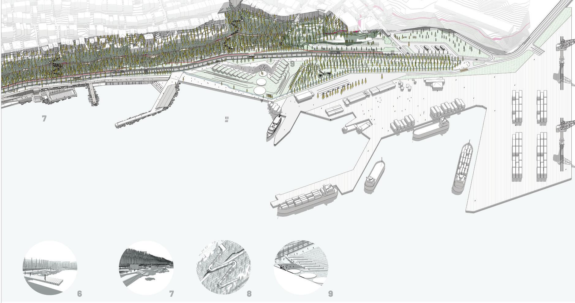
The history of Salacak sea-cost has been shaped by the cultural richness of two ends of, Üsküdar and Kadıköy. Salacak has a significant place in urban memory as the location where Üsküdar meets with sea. However recent interventions has damaged its natural characteristics and this caused the loss of public’s connection with the sea and loss of spatial identity.
The proposal aims to recover what has been lost through simple and holistic interventions and reconstruct the memory of “The Sea”. Istanbul Bosporus has been approached as a unique scene in which the project enables to create different views at it. The sea-land relation has been continued all through out the project as a spine which in parts has sharp, other parts has a blending structure.
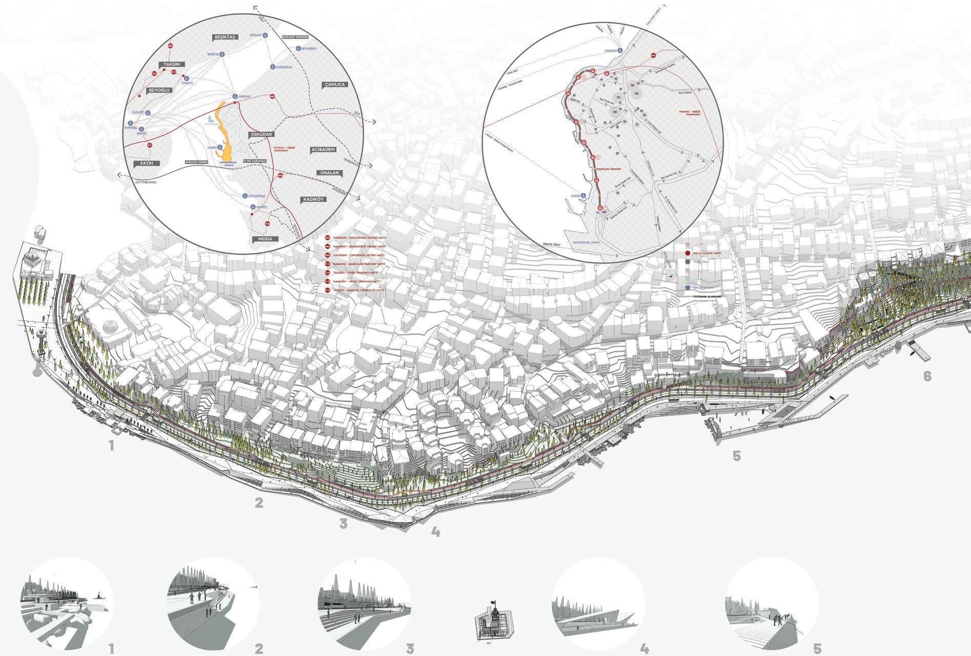
There are three main focus; Üsküdar square with Semsi Pasa Mosque built by Architect Sinan, old Bus Terminal, and Maiden’s Tower. They all have been evaluated as separate focus points, unified by the coastal line and vegetation characteristics. Üsküdar Square forms the historic, more traditional approach. Bus Terminal area presents a new urban open area for locals where social activities can be carried out. Maiden’s Tower location serves as the ideal location for social and touristic focus point. With proposed concrete canopy, it serves as the main view point.
Another important issue was transportation. The existing high-traffic road has been replaced with trams and bicycle roads, leaving only one lane for cars. Pedestrian lines have been enhanced and promoted through the spine.
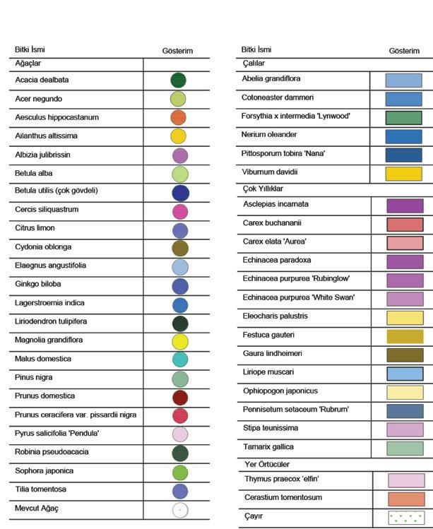
The vegetation characteristic of the area has been preserved. Proposed plants have been chosen from unique plants from Bosporus flora. In addition to this, the area’s inefficient water management problem has been solved with rain gardens stretching though out the transportation line.





HOME 2030

Year: 2020
Location: UK
Organizer: HM Government
Team: Ipek Kuzu, Irem Dökmeci, Tugyan Kepkep
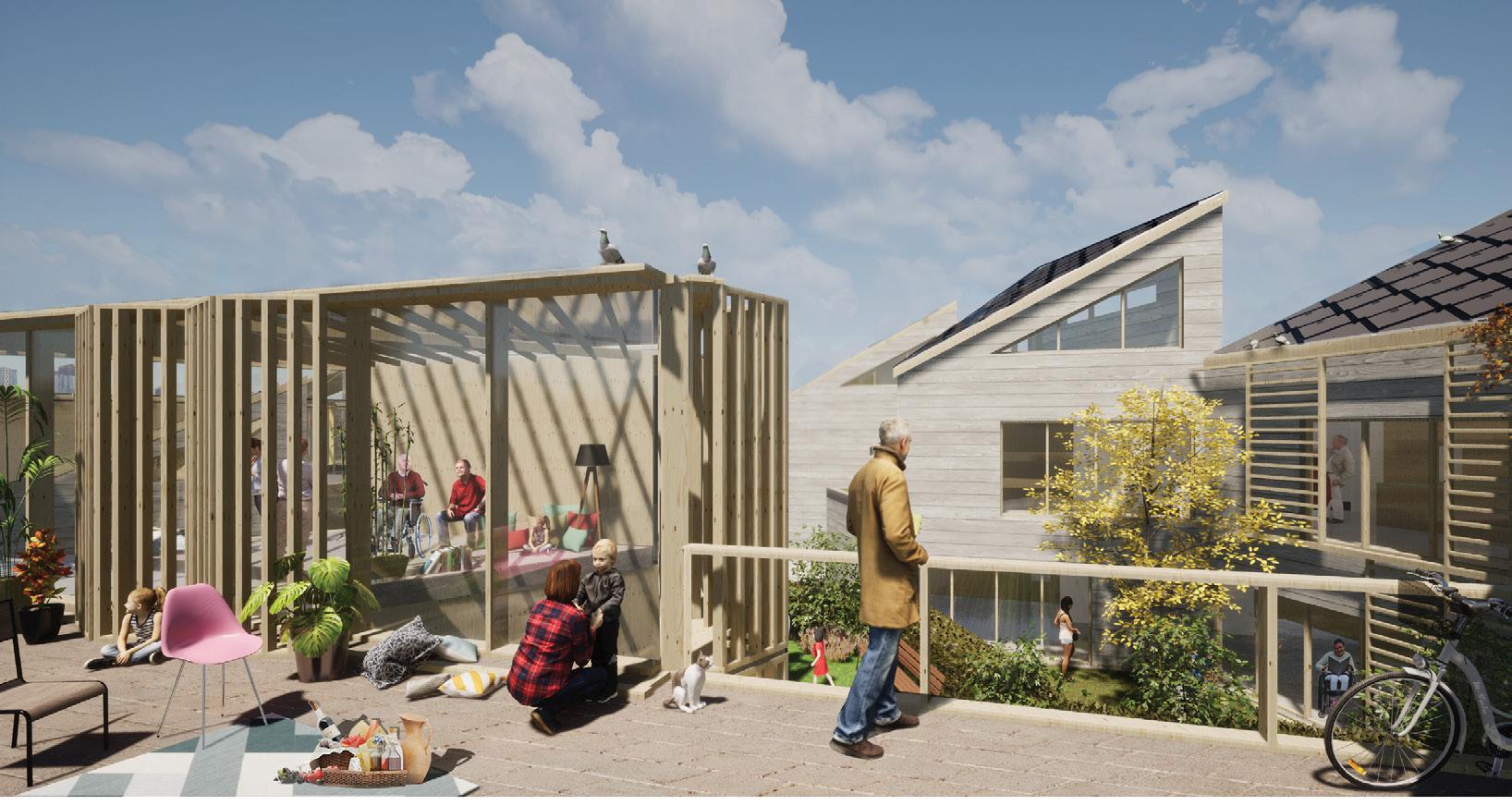
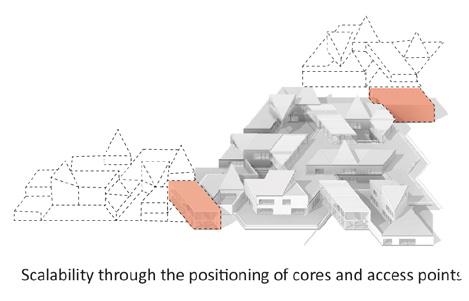
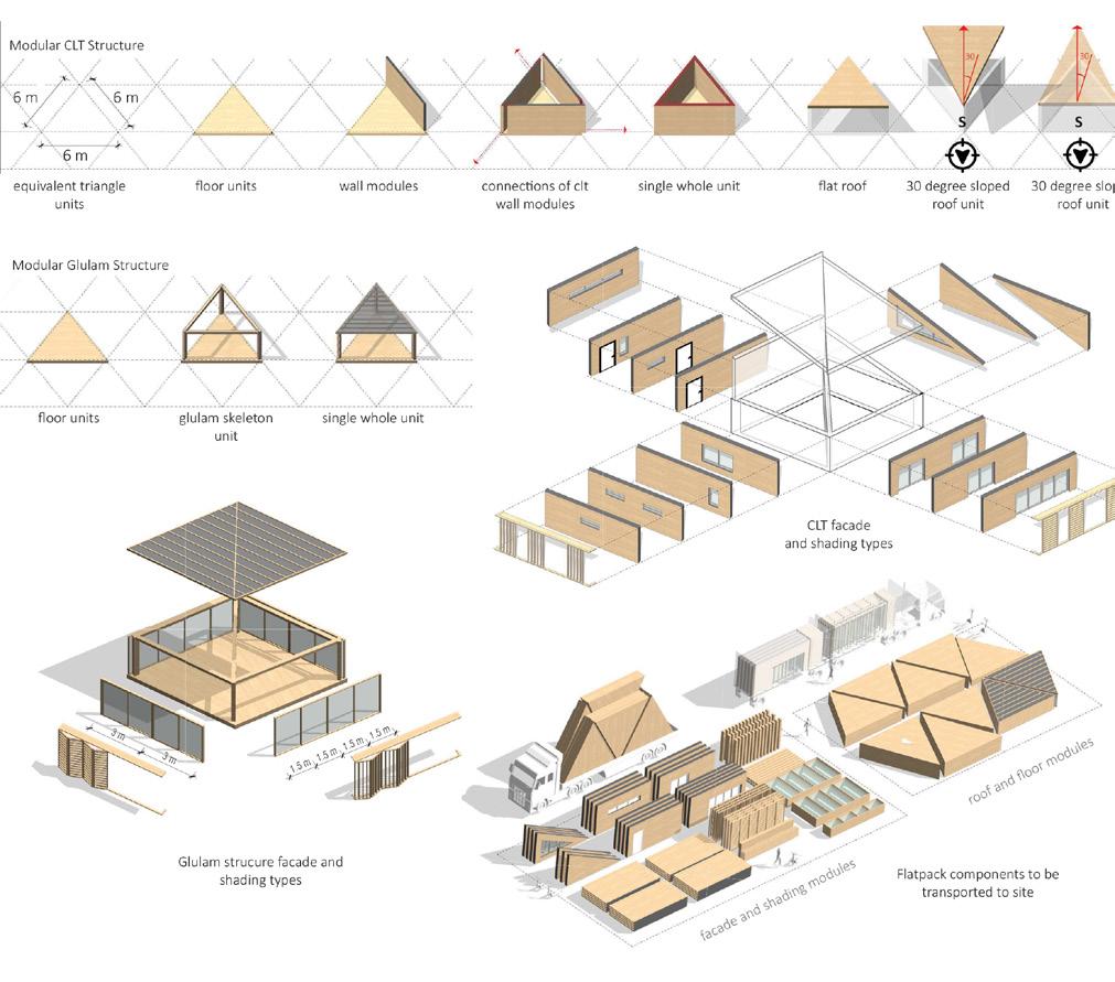
The goal of this proposal is to raise a holistic spatial approach which places social interaction at its core while both financially and environmentally benefiting actors of the built environment. The architectural design undertakes the role of creating a social environment that allows people to connect with their community through sharing, producing and identity building, while operational components provide a blueprint for the construction sector. The project carries out a cradle-to-cradle approach with all its operational and material components through a significant consideration into the whole building cycle, from business point of view to technical, constructional, management and finally deconstruction phases. The proposal aims to reach the net-zero-carbon goal and minimise environmental impact by combining multiple complementing strategies. In order to achieve these goals, these strategies not only take into consideration using modern technologies, but also a shift in operational and social aspects of design.

In design research, the main focus was on the social connection and how to develop a design narrative through it. In addition to expectations on social aspects of the competition brief, recent events have also shed a light on the fundamental importance of the sense of community and what it currently lacks. As the paradigm of daily life has shifted for good, current understanding of home is obliged to follow it. The confinement of a home is not sufficient, and this applies for every person. Daily life at home is expanding beyond this, creating a new network of places. This situation unveils the question of spatial privacy, especially in a society where individuality and ownership are considered as priority. In addition to this, a research1 shows that one of the biggest problems in the housing industry is the lack of acknowledgement for vulnerable people such as the elderly and people with disabilities, and their need for accessible spaces. Regarding these social concerns, embracing environmental goals and adopting a democratic approach in the sense of both material and spatial aspects constructed the fundamentals of our proposal. In this degree, the social demographic of the houses and communal areas of the project aims to be inclusive of all ages, categorised as 0-18, 18-60, +60; and lifestyles, categorised as single, couple, single parent, small and large family, cross generation and finally shared living.




INTERNATIONAL BANDIRMA PARK COMPETITION
Prize: 4th Mention
Year: 2017
Location: Bandirma, Turkey
Organizer: Bandirma Municipality
Team: Tarık Yasar, Nurhak Inan Karacay, Ilker Ertugrul, Tugyan Kepkep, Bengi Altunay, Basa Enuysal, Ali Talha Koc
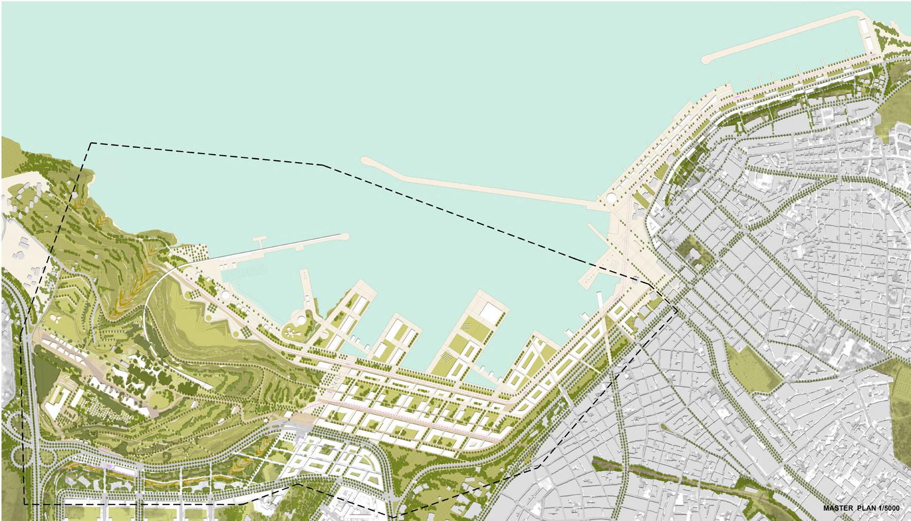
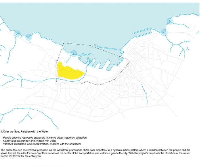
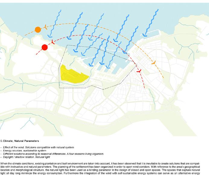
The project’s primary aim is to create an attraction center not only for Bandırma’s local population but also for visitors and close by settlements. In order to support this, a macro-scaled strategy plan has been developed by studying eight main subjects; Utilization diversity, Transportation, Green space, Water, Climate, Morphology, Demography and Application model. Carrying out these topics from macro to micro scale, a new urban pattern has been designed by referencing the existing natural and man-made interventions on the area. The project proposes an infiltrating layout of structures within the gaps provided by the existing conditions. Without any zoning, the project simply aims to settle where the area naturally leads to. This approach leads the architectural programme into a fragmented structure where the natural parameters such as making use of natural light and orienting towards the scenery defines the main characteristics. The institute building has been divided into two parts that are elevated from the ground level, allowing the preservation of the existing pattern. The cores of the blocks that connects the institute with the ground level are placed upon elevated platforms that can implement diverse programmes. The retail function has been divided into two parts, and following the existing building scale of Bandirma these parts are divided into smaller units. The four-starred hotel rooms are positioned on existing concrete blocks whereas the five-starred hotel’s form is associated with the existing concrete platforms. Both hard and softscape designs of the landscape also references the existing conditions in design and material. The proposed plantation strategy takes into account the prevention of erosion, providing feed for existing animals and requiring no maintenance. The choice of materials also follows the existing conditions. The natural stone that comes out from the local quarry and talus that is used as the main ingredient in mosaic pavements is proposed to be used.




KONYAALTI COAST AND COASTAL RECREATION IDEA PROJECT COMPETITION
Prize: Equivalent Mention
Year: 2014
Location: Konyaalti, Antalya, Turkey
Organizer: Antalya Metropolitan Municipality
Team: Tarık Yasar, Tugyan Kepkep, Gulce Kanturer, Caner Olcusenler, Alican Karalar
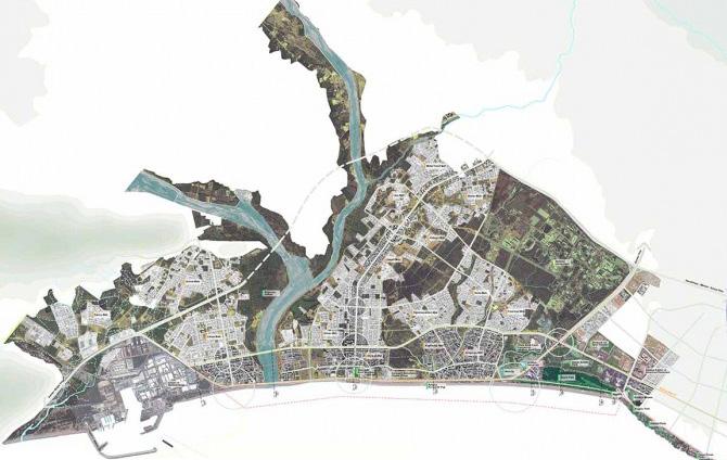
The project aims to generate an urban strategy while preserving and restoring the macro planing decisions. The design makes use of the potentials of 7 km long waterfront through protecting existing natural elements and increase the urban utilization. The project proposes to remove the existing road that has a high density of traffic and detaches the city and the sea.
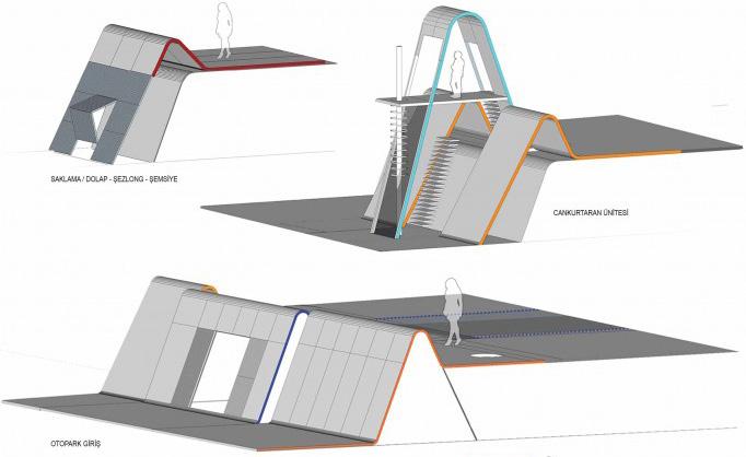
A new space design has been proposed in between the waterfront’s high and low levels to open access to daily social activities and related utilizations such as storage, security and relation.


PLANNING APPLICATION PROJECTS

Year: 2021-2023
Location: UK
Landscape Project: John Davies Landscape


Following three new residential development projects are samples from several which were focused exclusively on planning application. The work involved producing the complete landscape design package from design development to preparing all necessary documentations including Design Statement, Landscape Management Plan and Urban Greening Factor Report.
Eastcote Lane, Harrow, HA2


Lynton Grange, London, N2 9EU


URBAN GREENING FACTOR CALCULATION


APPLE Project
Year: 2021 - 2022
Location: Windelsham, England
Architectural Project: Heatherwick Studio & Veretec
Landscape Project: Erlam Studio
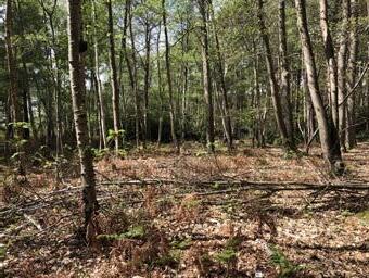
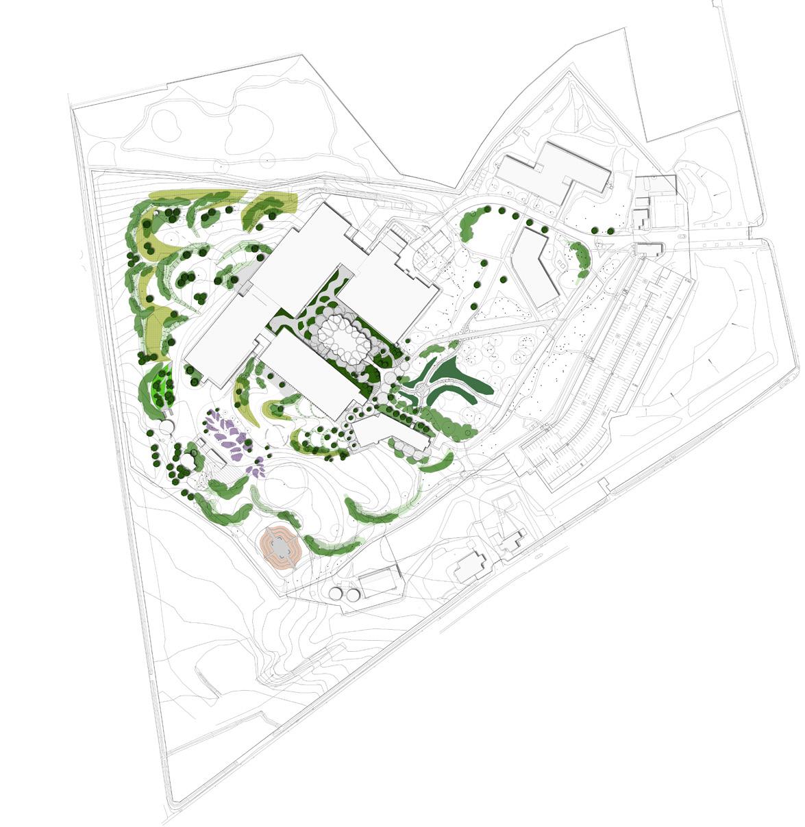
Landscape design of Apple Project aims to evolve the existing qualities of the site and present an inviting and productive environment for the new users of the site. The vision for the concept landscape design involved developing a vision to transform and add value to the already mature and abundant 47 acre site by injecting new life and making it an inspiring location to work.
Upper Meadow: set of landforms and planting providing series of spaces for exploration
Forest Garden: enclosed productive planting and composting
Medicinal Courtyard: plants selected for medicinal properties
The Prospect: sculpted landforms weaving together different adjacent spaces
Gardener’s building re-purposed as meeting / working space with outdoor terrace
Manor Gardens: revitalised planting and layout respecting historic setting
Pollinator Garden : landscape destination garden with focus on pollinator plants
Potential new location for gardeners compound or new tennis courts connected to main lawn by woodland walk.

Potential new deliveries and storage facility
Arrival and welcome- enhanced way-finding
Pedestrian arrival footpaths journey though woodland to reveal of new building
Lush planting cascading down to lower level around new building
Key
New tree planting

Planting around building H, including medicinal plants to the rear courtyard
Woodland under-storey planting



Shrub planting
Perennial planting
Swathes of meadow grass

Feature planting within orchard


Pollinator garden
Productive forest garden
Vehicle and Pedestrian Movement
Existing vehicle routes retained Adjusted vehicle route, material changed for pedestrian priority but allowing for vehicles and emergency access
Fire path with revised alignment Existing footpaths retained New pedestrian pathways Wider pedestrian circulation through the landscape


Potential walking/cycling route around site perimeter
Amaala Triple Bay Public Realm

Year: 2021
Location: Saudi Arabia

Landscape Project: Martha Schwartz & SKAB

Amaala Triple Bay is a coastal development project in Saudi Arabia designed by Martha Schwartz in collaboration with SKAB. The projects focuses on developing a masterplan for connecting marina, wellness core and Equestrian Hotel. In order to connect these three sites a Wellness Route strategy was developed which focuses on preserving, exploring, learning and focusing on wellness through the journey in landscape.
In DMP, wellness route design principle are preserving, exploring, learning and focusing on well-being.


3 scales of rest points are defined:
• Facilitated resting area: large rest points serve all users especially large group of visitors. Service scope of these rest points cover the whole linear park.

• Shared resting area: medium rest points can be shared between pedestrian, cyclist, horse and rider;
• Resting point: small rest points serve pedestrians, spacing 100m apart, evenly located in the primary and secondary shared path.

3 well beloved park cases were selected to help understanding the most guest friendly resting points design principle.
• Integrate 3 mobility networks: pedestrian path, cycle path and bridle path
Culinary Hotel
Articulated Circulation System
Right of Way
• Considering climatic factors, create different using experience for different users. For pedestrian and cyclists, more direct routes are preferred, while bridle path could be more meander
• Creating garden rooms based on articulated circulation system, which could be combined with resting, viewing and other landscaping facilities
Landscape Spatial System
Wellness Route
Wellness Spa Hotel
Resting Points System
Diagram shows the distance and facility for each resting area type based on DMP’s requirement.
Large rest point: fully facilitated
Toilet
Food Kiosks
Emergency

Fixing
Charging

Water
Medium rest point: shared by pedestrian, cyclist, equestrian users


Small rest point: used by small groups of pedestrian and cyclist


