Official Driving Guide OREGON
SCENIC BYWAYS

19 Seasonal road Seasonal road Seasonal road ALL-AMERICAN ROAD NATIONAL SCENIC BYWAY OREGON STATE SCENIC BYWAY OREGON TOUR ROUTE BYWAYS KEY REST AREA WITH TRAVELER INFORMATION For additional rest areas visit TripCheck.com STATE WELCOME CENTER 101 101 197 199 20 20 26 26 35 30 97 97 97 97 6 22 22 22 58 31 62 39 66 99W 223 226 242 126 216 216 138 227 140 140 18 18 34 38 42 47 47 126 138 224 211 213 140 5 84 5 126 46 Seasonal road 372 46 230 20 228 34 22 126 214 18 46 2810 227 39 177 36 33 202 Antelope Chiloquin Culver Depoe Bay Toledo Elkton Gates Lyons Gold Beach Grass Valle Idanha Malin Maupin Paisley Port Orford Powers Riddle Rogue River Shaniko Sisters Sunriver Waldport Yachats Merlin Gearhart Canyonville Jacksonville Veneta Dunes City Lakeside Drain Yoncalla Winston Glendale Shady Cove Gold Hill Central Point Talent Phoenix Butte Falls Oakland Westfir Coburg Harrisburg La Pine Bonanza Rufus Wasc Merrill Clatskanie Rainier Prescott Columbia City Nehalem Manzanita Wheeler Rockaway Beach Bay City Siletz Falls City Philomath Tangent Monroe Halsey Brownsville Sodaville Waterloo Millersburg Jefferson Scio Mill City Gleneden Beach Neskowin Cave Junction Fort Klamath Crescent Summer Silver Lake Christmas Fort Rock Chemult Steamboat Glide Idleyld Park Union Creek Prospect Trail Tiller 234 Biggs Cascadia Charleston Dorena Pacific City Netarts Oceanside Otter Rock Seal Rock Mapleton Winchester Bay Agness Jewell Alsea Bandon Brookings Coquille Florence Harbor Hood River Junction City Cottage Grove Creswell Lake Madras Molalla Estacada Sandy Welches Aurora Canby King City Dundee Banks Forest Grove North Plain s Cornelius Aloha Myrtle Creek Myrtle Point Oakridge Sutherlin Reedsport Scappoose Vernonia Stayton Tillamook Warrenton Astoria Lincoln City Newport Prineville Redmond Seaside Silverton Dallas Independence St . Helens Warren Sweet Home Blue River Walterville Warm Springs Crooked River Ranch Black Butte Ranch North Bend Lowell Cannon Beach Garibaldi Adair Village Monmouth Aumsville Sublimity Turner Keizer Sheridan Grand Ronde Amity Gaston Yamhill Carlton Moro Cascade Locks Sherwood Lake Oswego Troutdale Damascus Barlow Milwaukie Beaverton Oregon City Fairview Tualatin Maywood Wood Village McKenzie Bridge Brightwood Rhododendron Zigzag Government Camp Parkdale Odell Arch Cape Albany Corvallis Medford Eagle Point Springfield Ashland Bend The Dalles Coos Bay Grants Pass Klamath Falls Lebanon Newberg McMinnville Roseburg Woodburn Lafayette Dayton Gervais Hubbard St. Paul Mt. Angel Detroit Metolius Dufur Mosier Gladstone Hillsboro Tigard Gresham West Linn Wilsonville Salem Portland Eugene CALIFORNIA OREGON PA CIFIC OCEAN MT. ASHLAND C A S C A D E R A N G E C O A S T R A N G E MT. HOOD Upper Klamath Lake Summer Lake Crater Lake Paulina Lake East Lake Wickiup Reservoir Crane Prairie Reservoir Crescent Lake Odell Lake Green Peter Reservoir Dorena Reservoir Hagg Lake Goose Lake Crater Lake National Park ColumbiaRiverGorge NationalScenicArea Lake Billy Chinook Detroit Lake J o h n D a y Ri v DeschutesRiver Croo Sprague River KlamathRiver Rogue River IllinoisRiver ChetcoRiver CoquilleRiver Umpqua River SiuslawRiver NehalemRiver Columb i a R i v e r WillametteRiver Sandy River N Santiam River ClackamasRiver McKenzieRiver N.Umpqua River S.Umpqua River Cow Creek ApplegateRiver SiletzRiver Alsea River YaquinaRiver S Santiam River Calapooia River MiddleForkWillametteRiver 62 138 20
Seasonal road 20 26 26 30 395 395 395 95 95 74 19 19 74 82 86 78 82 3 37 11 218 206 206 244 237 203 245 205 201 204 207 207 140 350 39 84 84 31 395 26 19 51 73 24 7 7 73 53 52 Arlington Boardman Condon Dayville Elgin Fossil Granite alley Haines Halfway Helix Heppner Huntington Imbler Ione Jordan Valley Joseph Lexington Lonerock Long Creek Lostine Mitchell Monument Pilot Rock Richland Seneca o Spray Summerville Sumpter Ukiah Unity Wallowa Imnaha Frenchglen North Powder o Stanfield Adams Athena Weston Island City Cove Greenhorn Summer Lake Christmas Valley Plush Adel Service Creek Kimberly Starkey Fields Medical Springs Crane Diamond Rome McDermitt Burns Enterprise John Day keview Nyssa Umatilla Union Baker City Hermiston Milton-Freewater Ontario Echo Canyon City Mt. Vernon Prairie City Hines Vale Adrian Austin La Grande Pendleton NE VA DA OREGON WA S HING TO N ID AH O O C H O C O M OUNTAINS STEENSMOUNTAIN B L U E M T NS S T R A W B E R R Y R A N G E ALVORD DESERT WALLOWA MOUNTAINS H E L L S C ANYON Lake Abert Harney Lake Malheur Lake Wallowa Lake Lake Crump Lake Hart Lake Snake River Imnaha R i v e r GrandeRondeRiver WallowaRiver OwyheeRiver MalheurRiver John Day River PowderRiver Umatilla River River oked River oD n ner un d B l nezti R i v e r


Oregon has a way of reeling you in Oregon Department of Fish and Wildlife 503-947-6000 • MyODFW.com Scan Me Buy your license online, from anywhere at anytime. Scan the QR code for all the info you need to get started making memories with your family and friends!
60 OREGON TOUR ROUTES
Know that some areas are closed or partially reopened due to wildfire damage. Check for the latest conditions before you head out, respect all closures and proceed with caution in areas that have recently reopened. On

TRIPCHECK.COM 1 Cascade Lakes Scenic Byway, p. 32 3 WELCOME 5 ALL-AMERICAN ROADS 6 Historic Columbia River Highway Scenic Byway 10 Hells Canyon Scenic Byway 14 Volcanic Legacy Scenic Byway 18 Pacific Coast Scenic Byway 22 NATIONAL SCENIC BYWAYS 23 McKenzie Pass-Santiam Pass Scenic Byway 26 West Cascades Scenic Byway 29 Oregon Outback Scenic Byway 32 Cascade Lakes Scenic Byway 35 Mt. Hood Scenic Byway 38 Rogue-Umpqua Scenic Byway 41 OREGON STATE SCENIC BYWAYS 42 Journey Through Time Scenic Byway 44 Blue Mountain Scenic Byway 46 Elkhorn Drive Scenic Byway 48 High Desert Discovery Scenic Byway 50 Umpqua River Scenic Byway 52 McKenzie River Scenic Byway 54 Over the Rivers & Through the Woods Scenic Byway 56 Marys Peak to Pacific Scenic Byway 58 Trees to Sea Scenic Byway
61 Charleston to Bandon Tour Route 62 Silver Falls Tour Route 63 Vineyard & Valley Tour Route 64 Grande Tour Route 65 East Steens Tour Route 66 Steens Loop Tour Route 67 Diamond Loop Tour Route 68 Myrtle Creek-Canyonville Tour Route 69 Cow Creek Tour Route 70 Cottage Grove Covered Bridge Tour Route 73 RESOURCES 73 Driving Time Map 74 Visitor Information 79 Oregon’s Scenic Bikeways Check TripCheck.com or call 511 for the most up-to-date information on road conditions, seasonal closures, incidents and weather impacts.
the cover:
Kenji Sugahara)
care
you are
the roads
bicyclists, farm
and
SUSAN SEUBERT Contents
Pacific Coast Scenic Byway by Gregor Halenda (Pilot:
Drive with
as
sharing
with
equipment
wildlife.
 Cape Arago Lighthouse, p. 61
WELCOME
OREGON SCENIC BYWAYS AND TOUR ROUTES
Oregon’s roads showcase the state’s grandeur. The ability to access Oregon’s diverse natural beauty, as well as historical and cultural sites, has earned it 29 designated Scenic Byways and Tour Routes. On some byways, you’ll drive from the high desert to snowcapped peaks to verdant valleys in one go. You’ll experience the breathtaking views of Hells Canyon, Crater Lake, the Columbia River Gorge and the Pacific coastline.
This guide highlights the unique viewpoints and attractions along each route. We’ve included maps outlining the mustsee stops along each byway and details like mileage, drive times, best travel seasons and other helpful information for planning your trip.
The routes are categorized by designation — All-American Roads, National Scenic Byways, State Scenic Byways and Tour Routes — which comprise the most beautiful scenery in Oregon.
You’ll also find information about Oregon’s 17 State Scenic Bikeways (see page 79 and map sections), as well as information about electric vehicle charging stations (see page 80 and map sections).
While you are enjoying these scenic byways, please remember to drive with care as you are sharing the roads with bicyclists, farm equipment and wildlife.
Whether you’re an outdoor enthusiast, a history buff or merely looking for a relaxing drive in the country, Oregon’s Scenic Byways will reveal the many wonders that await.
Safe travels, Travel Oregon & Oregon Department of Transportation

TRIPCHECK.COM 3
TYLER ROEMER
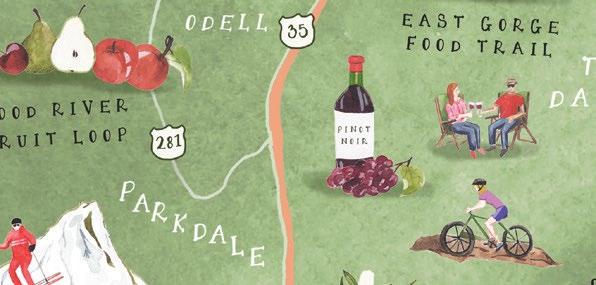
Welcome to your magical journey along The In nity Loop in the Mt. Hood and Columbia River Gorge region of Oregon. The In nity Loop is home to two of Oregon’s most iconic Scenic Byways, the Historic Columbia River Highway and the Mt. Hood National Scenic Byway. It’s also the launching o point for the West Cascades National Scenic Byway. The In nity Loop route makes for the perfect road trip in the region, ensuring you don’t miss any of our best sights. Your adventure will take you in and out of lush green forests, through bountiful orchards and vineyards, along the Historic Oregon Trail, up Oregon’s tallest mountain, and past sparkling rivers and streams. There are endless (one might even say in nite) adventures and experiences waiting for you, starting just 20 miles east of Portland. What are you waiting for? Take a few days and come explore for yourself.
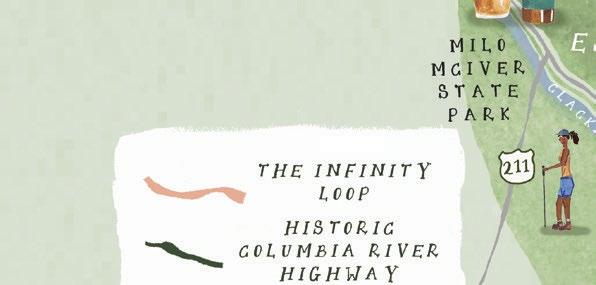
MORE TRIP IDEAS CAN BE FOUND AT WWW.HOOD-GORGE.COM


ALL-AMERICAN ROADS
In keeping with their designation, Oregon’s four All-American Roads represent some of the most scenic routes in the country. Check out the wondrous beauty of the Columbia River Gorge, Hells Canyon, Crater Lake and the Oregon Coast.
TRIPCHECK.COM 5
Pacific Coast Scenic Byway near Manzanita SUSAN SEUBERT
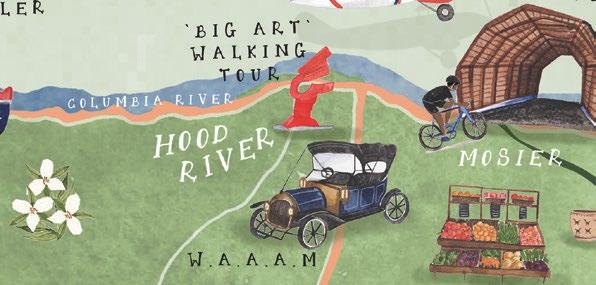
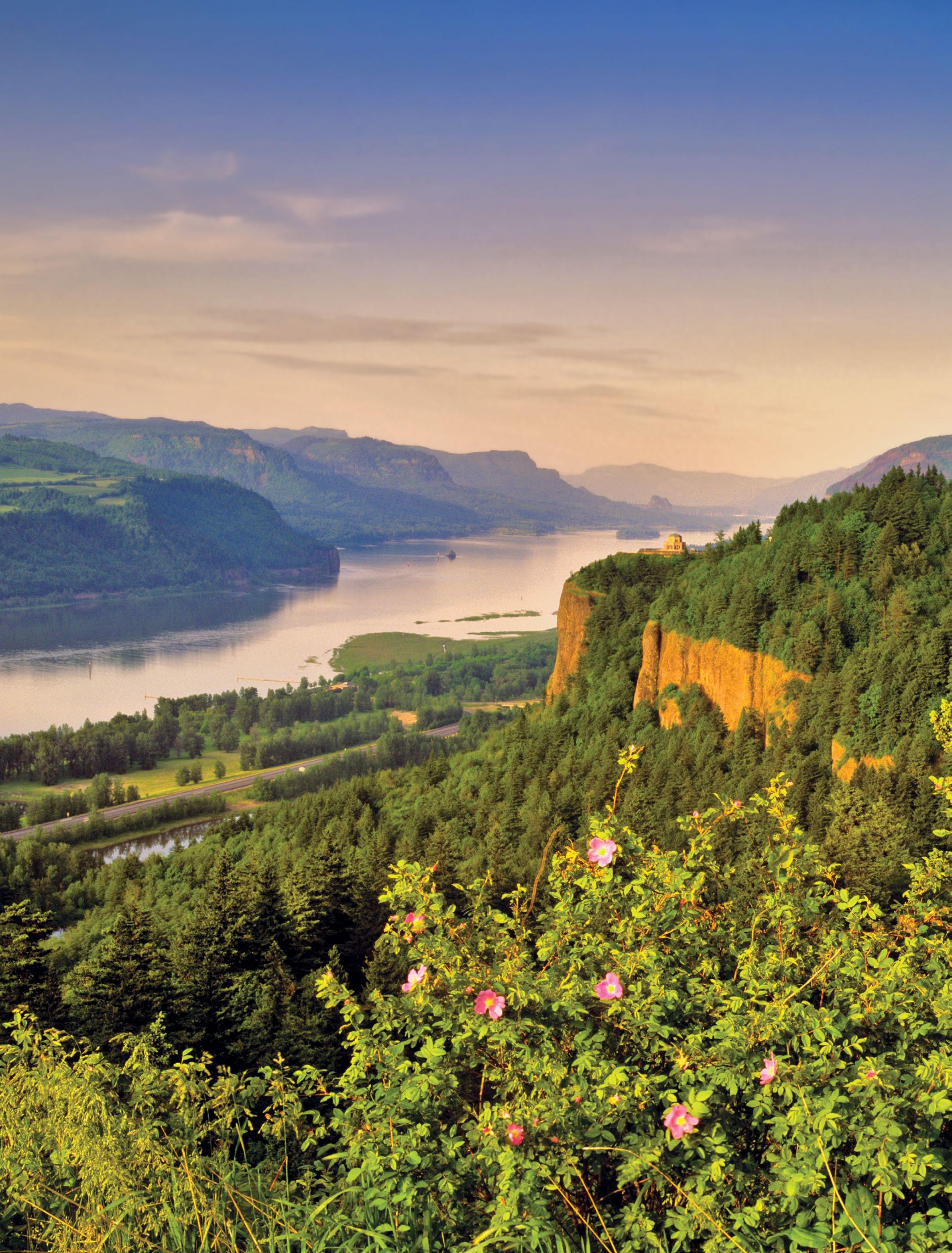
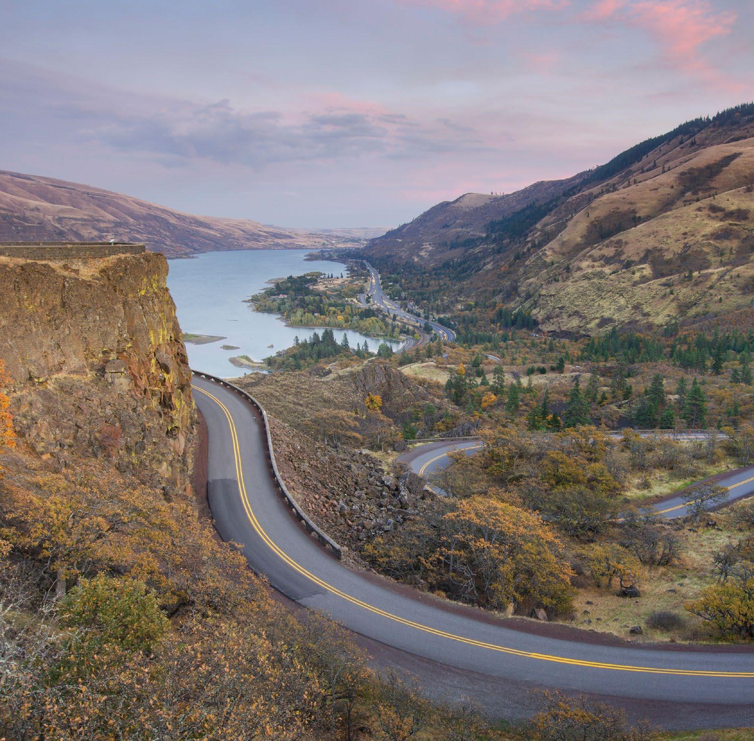
HISTORIC COLUMBIA RIVER HIGHWAY SCENIC BYWAY
70 miles/113 kilometers (allow 3 to 5 hours)
Weather: Travel during spring for best waterfalls, fall for good weather, mid-week for fewer crowds. Wintertime roads can be hazardous. Medical: Medical services/hospitals located in Portland, Hood River and The Dalles. See p.
ALL-AMERICAN ROAD HISTORIC COLUMBIA RIVER HIGHWAY SCENIC BYWAY 197 211 82 14 224 26 35 Sandy Zigzag Stevenson White Salmon Dufur Parkdale Celilo Village Government Camp Boring Welches Brightwood Rhododendron Odell Damascus MT. HOOD WASHINGTON Sandy River Columbia River The Dalles Hood River Cascade Locks Mosier Troutdale Rowena Bridal Veil Corbett 84
80. 1 2 3 4 5 6 7 8 9 10 6 TRAVELOREGON.COM/BYWAYS
DENNIS FRATES TRIPCHECK.COM 7
Vista House at Crown Point

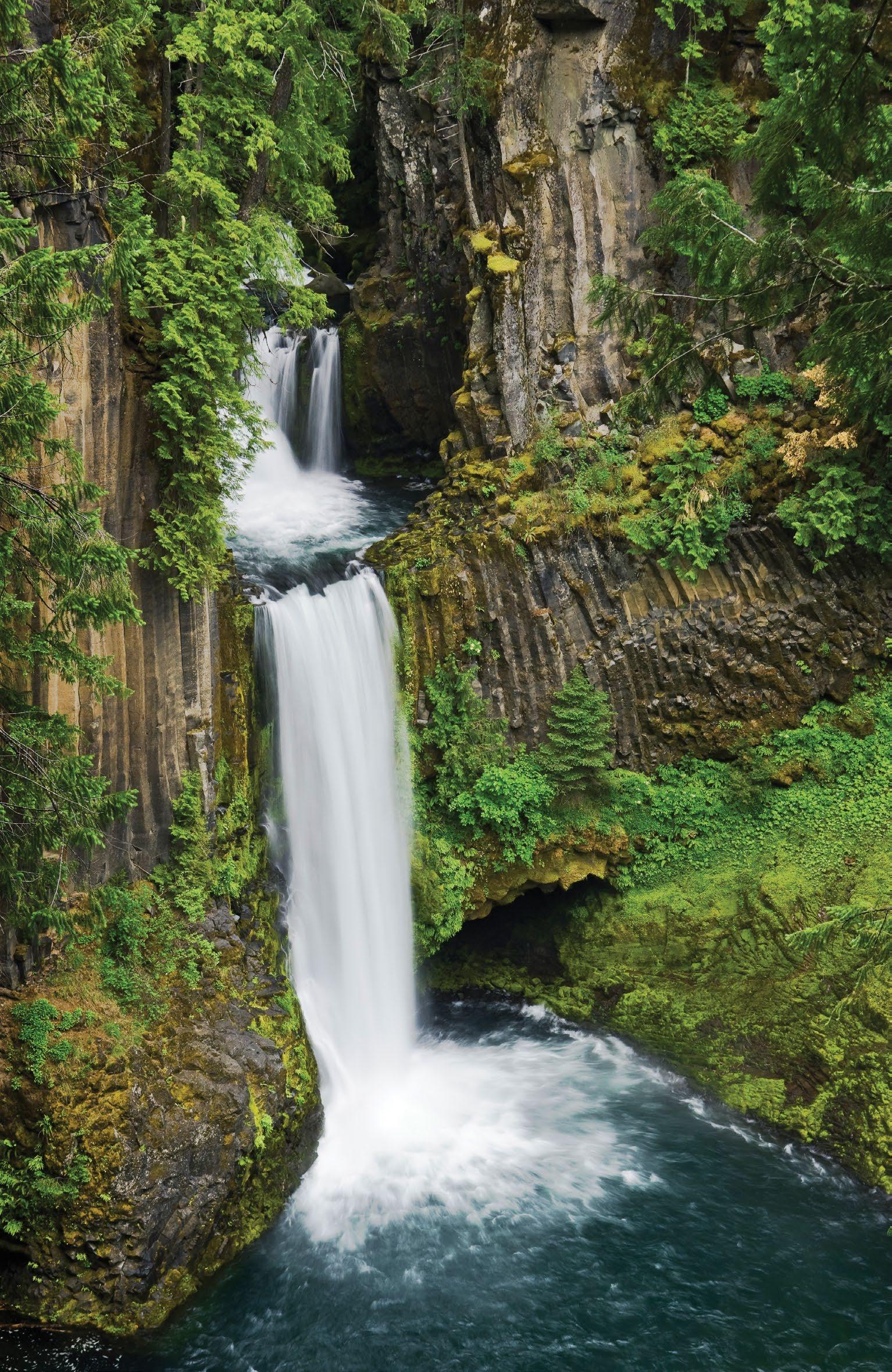
8 TRAVELOREGON.COM/BYWAYS
Clockwise from top left: Multnomah Falls; Twin Tunnels Trail; Tom McCall Preserve
CLOCKWISE: GREG VAUGHN; TYLER ROEMER; LIJAH HANLEY
A WORLD OF WATERFALLS
From Crown Point, the byway drifts down the mountain in gentle arcs suitable for touring cars from the early 20th century, showcasing the highway’s original stonework. You’re soon immersed in a deeply shaded, ferny oasis, where one waterfall after another tumbles from Gorge rim to roadside.
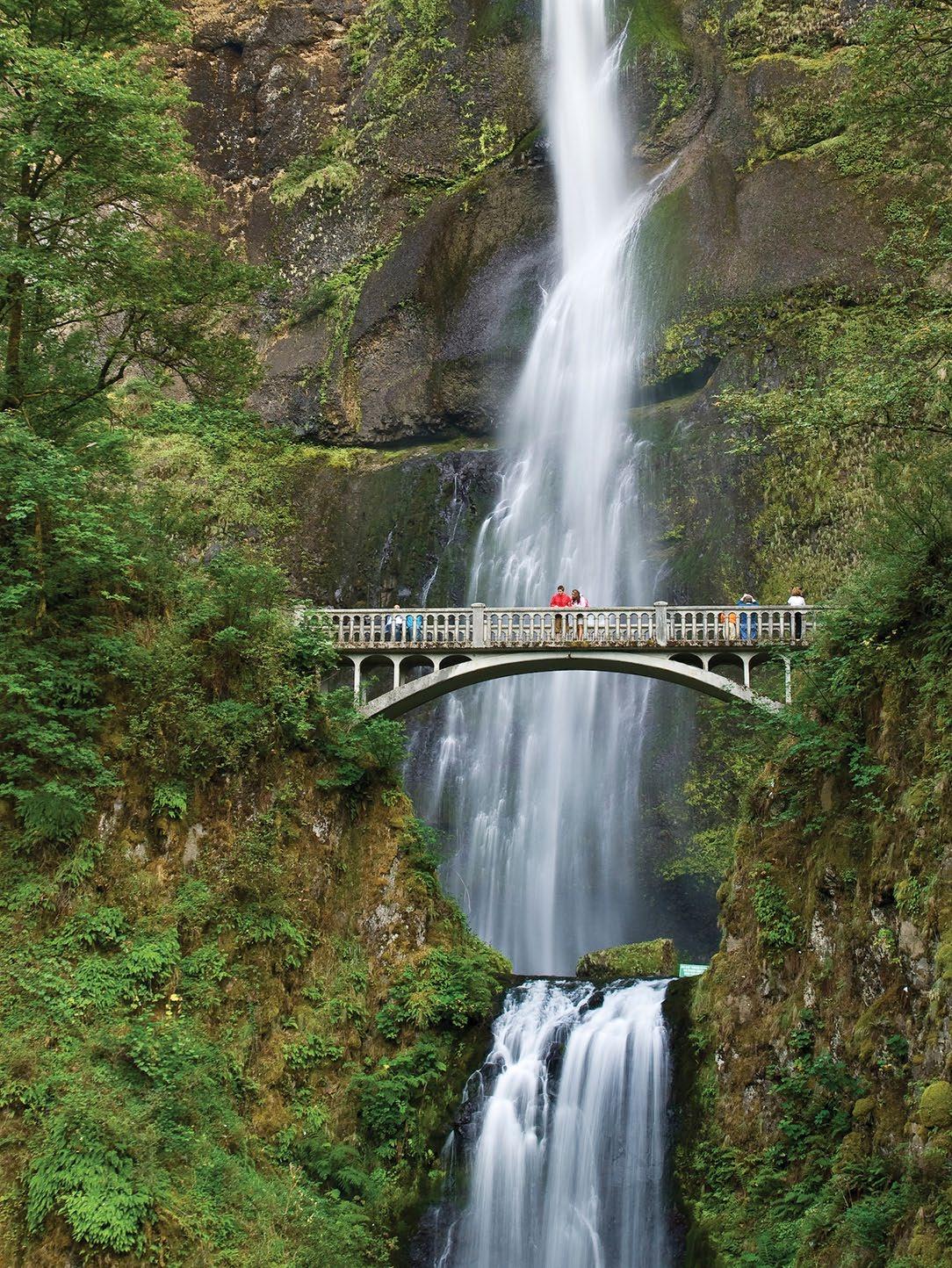
In 8 miles/12.8 kilometers, the byway skirts the base of five significant falls: Latourell , Shepperd’s Dell , Bridal Veil , Wahkeena and the granddaddy of them all, 620-foot 4 Multnomah , one of the tallest waterfalls in the nation. Many have viewing areas close enough to feel the mist and thunder. Several of these trails were affected by wildfire in 2017, so check for updates when planning your hike. East of Crown Point, familyfriendly Latourell Falls is a 2.4-mile loop that travels past two plunging waterfalls. Farther along the interstate, you can spot a car-free segment of the historic highway restored as the 5 Historic Columbia River Highway State Trail for bicycle and pedestrian use. The historic highway and adjacent waterfall hikes are popular destinations, especially on the weekends, so consider going early or visiting mid-week.
BONNEVILLE LOCK AND DAM TO HOOD RIVER
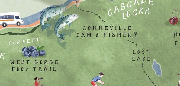
At exit 40, 6 Bonneville Lock and Dam was the first of many dams to tame the Columbia. The extensive Visitor Center includes an underwater window where you can watch fish wriggling up the fish ladder to bypass the hydropower turbines. Visitors should stop in to the Sturgeon Viewing Center for the chance to spot Herman the Sturgeon — 10 feet/3 meters long, 425 pounds and more than 60 years old.
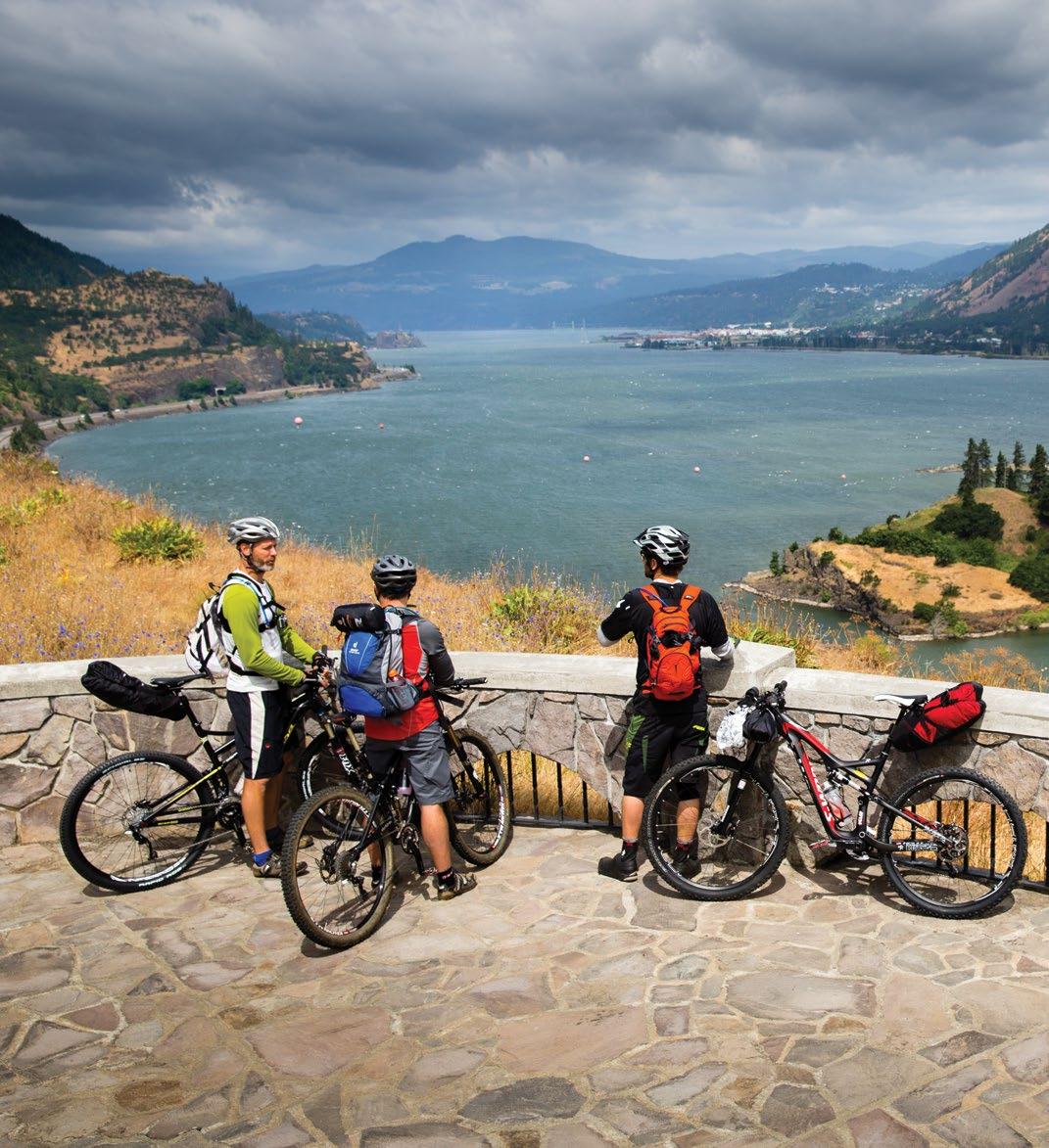
Before the dams, the Columbia churned through nearby Cascade Locks in a 7-mile/11.2-kilometer series of falls and rapids known as “The Great Chute.” Today sternwheeler boat tours paddle through this particularly dramatic stretch of the Gorge, where the river cuts through the Cascade Range. The Pacific Crest National Scenic Trail descends from the mountains and crosses the 7 Bridge of the Gods to Washington. Cascade Locks’ shady riverside setting, campgrounds, brewpubs and fresh fish market make it an appealing stop.
Kiteboarders and windsurfers frequent the Hood River area, 18 miles/28.9 kilometers east, taking advantage of the natural wind tunnel formed by the Gorge. This appealing outdoorsy town is also the gateway to the Mt. Hood Scenic Byway (page 35). Carved out of the Gorge’s walls high above the river, the 8 Twin Tunnels Trail is a sublime 5-mile/8-kilometer section of the Historic Columbia Highway State Trail for cyclists and pedestrians (closed to motorized traffic), and named for long tunnels chiseled through the basalt as part of the original road. Scenic overlooks abound.
MOSIER TO THE DALLES
The byway rejoins the historic highway at exit 69 in Mosier, the east end of the Twin Tunnels Trail. Here the Gorge transitions from the fir forest of the Western Cascades to the semi-arid plateau of ponderosa pine and oak savanna to the east. A viewpoint atop 9 Rowena Crest showcases dramatic geology, and footpaths lead into the Tom McCall
Preserve, a bounty of spring wildflowers and several endemic plants found only in the Gorge. The byway makes a spectacular snaky descent down the swooping curves of the Rowena Loops
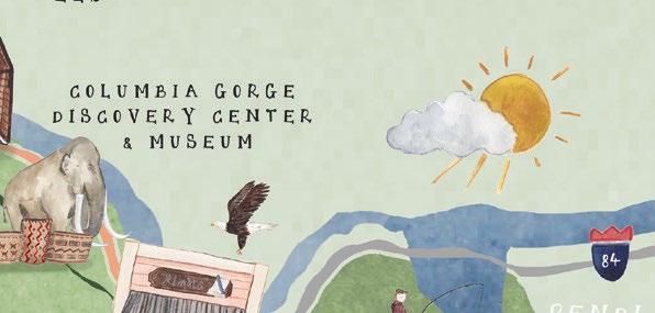
The eastern gateway to the Gorge, The Dalles was long a Native American gathering place. Downtown murals document its rich 19th-century heritage, first as a Lewis and Clark encampment, then as a staging area for Oregon Trail pioneers readying for the treacherous trip down the Columbia’s rapids. The 10 Columbia Gorge Discovery Center brings the region’s natural and cultural history to life. The stunning geologic beauty of the Columbia River Gorge combined with its incredible access to the outdoors and its friendly small towns will draw you back again and again.
Please note: Portions of the historic highway and many of the hikes along this route were impacted by wildfire in 2017. Check ReadySetGorge.com for trail conditions and TripCheck.com for road updates before you go.
ALAN MAJCHROWICZ TRIPCHECK.COM 9
Rowena Loops
HELLS CANYON SCENIC BYWAY
America’s deepest river gorge, Hells Canyon, and “Little Switzerland,” the Wallowa Mountains, star on this 208-mile/335-kilometer horseshoe route through the state’s northeast corner, the rich ancestral homeland of the Nez Perce tribe.
Talk about a local’s secret: It seems much of the world has yet to discover this incomparable region, where the lofty Wallowa Mountains dominate the horizon, and wide ranching valleys give the picture-perfect perspective from which to appreciate the view. More than 19 of the Wallowas’ peaks rise above 9,000 feet/2,743 meters, many of them forming the backpack-and-horseback paradise of the Eagle Cap Wilderness. Beyond, the land cracks into the great cleft of Hells Canyon and the wild waters of the Snake River. It’s a secret
LA GRANDE
Some 300,000 pioneers headed west on the Oregon Trail in the mid-1800s, literally seeking greener pastures to establish homesteads. The 2,000-mile/ 3,218-kilometer route passed right through 1 La Grande, and many pioneers chose to stop right there — where clear rivers flowed down from surrounding mountains into a broad, grassy valley perfect for growing crops and grazing cattle.
Just as it provided a resting stop along the Oregon Trail, today La Grande is a major commercial center in Eastern Oregon, with a lively downtown and
vibrant Eastern Oregon University. It’s a convenient jumping-off point for forays into the Wallowas.

ELGIN TO ENTERPRISE
The byway leads north on OR-82 through a fertile farming region replete with turf grass, barley, mint and other crops. Elgin , a farming and ranching town, hosts the Elgin Stampede, a stop on the professional rodeo circuit, each July. Downtown Elgin’s restored 1912 brick opera house hosts performances and houses a history museum. Elgin is also the departure point for trips on the 2 Eagle Cap Excursion Train , chugging through the deep canyons of the Grande Ronde and Wallowa rivers.
208
Weather: Travel June through October. Portions of the byway are typically closed in winter due to snowfall. Check TripCheck.com and local visitor centers for the most up-to-date information. Gas: Be sure to have plenty of gas before leaving Baker City or La Grande. Medical: Medical services/hospitals located in Baker City, Enterprise and La Grande.
At Minam, the byway climbs and bends south along the Wallowa River. It’s a particularly scenic stretch of road, with the Minam and Wallowa rivers flowing through creased canyons, and the oft-snowcapped Wallowas rising ahead. The 3 Minam State Recreation Area has riverside camping, popular with anglers and rafters.
The byway descends into Wallowa County and the Wallowa Valley, known to Chief Joseph and the Nez Perce as the “beautiful valley of winding waters.” The Nez Perce, admired for their superb horse skills, coexisted peacefully for decades with the settlers moving into their ancestral homelands. But the cultures clashed when Chief Joseph and his people were forced to flee the valley in 1877 to avoid relocation to a reservation in Idaho, marking the start of the Nez Perce War.
ALL-AMERICAN
ROAD
Hells Canyon Overlook Hells Canyon Dam National Historic Oregon Trail Interpretive Center 395 74 7 3 37 11 244 203 245 204 84 350 26 WASHINGTON IDAHO IDAHO Snake IRiver m n a ha River GrandeRondeRiver Umatilla River PowderRiver WallowaRiver Haines Sumpter Ukiah Imnaha North Powder Starkey Troy Flora Union Walla Walla Bates Prairie City Milton-Freewater Pendleton 86 82 39 Seasonal road Richland Baker City La Grande Joseph Enterprise Lostine Wallowa Halfway Elgin Imbler
CANYON SCENIC
HELLS
BYWAY
miles/335 kilometers (allow 7 to 8 hours)
1 2 3 4 5 6 7 8 9 10 10 TRAVELOREGON.COM/BYWAYS
DAVID JENSEN
TRIPCHECK.COM 11
Hells Canyon
DAVID M. COBB Wallowa Lake 12 TRAVELOREGON.COM/BYWAYS
In partnership with the National Park Service, the growing 4 Wallowa Band Nez Perce Trail Interpretive Center in Wallowa celebrates Nez Perce culture. It hosts exhibits and, each July, holds its Tamkaliks celebration of traditional dance, food, song and dress.
The byway continues through scenic farms and ranches spread out at the base of the broad-shouldered mountains. In Enterprise, the county seat, the downtown core retains an Old West feel with its 19th-century architecture and present-day agricultural economy. Visit the chamber of commerce to pick up information on all of Wallowa County’s attractions and events.
JOSEPH AND THE WALLOWAS
The small town of Joseph has grown into a thriving arts community, with several downtown galleries, studios and walks highlighting public art installations. Anchoring the arts scene is Valley Bronze, one of the nation’s most notable bronze foundries. It offers tours of the production process, from clay models to finished castings. The 5 Wallowa Mountains Office on Second Street has maps, permits, exhibits and information about the national forest, the Eagle Cap Wilderness and the Hells Canyon National Recreation Area.
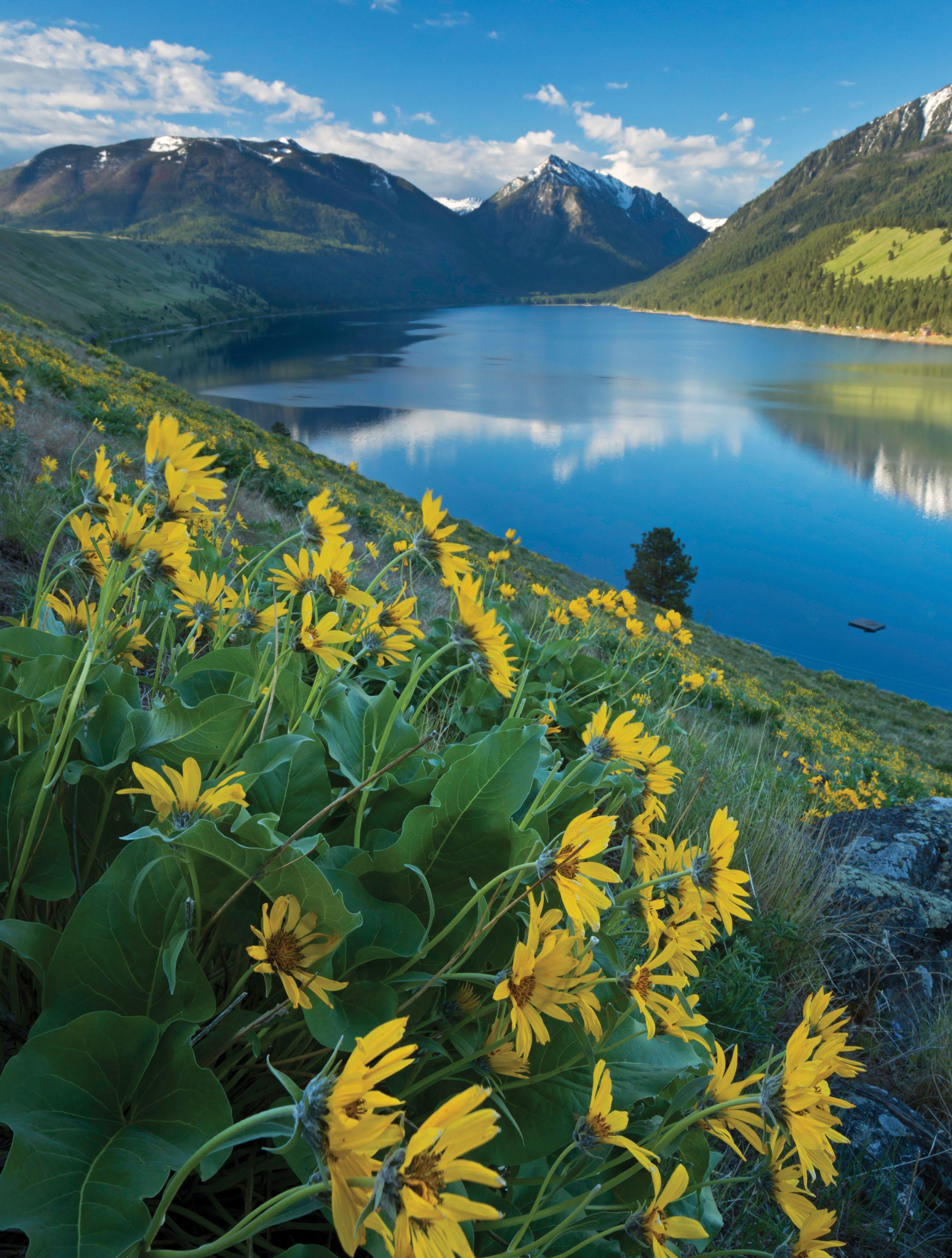
A mile/1.6 kilometers south of Joseph lies 6 Wallowa Lake, a deep-blue alpine
beauty formed by glaciers and wedged between high peaks. Wallowa Lake State Park has a campground and a marina with boat, kayak and SUP rentals. From midMay through September, the Wallowa Lake Tramway whisks passengers toward the summit of 8,200-foot Mt. Howard for easy access to high-altitude hikes.
At the head of Wallowa Lake, you’ll find some of the easiest access to Oregon’s largest wilderness area, the 360,000-acre Eagle Cap Wilderness
HELLS CANYON
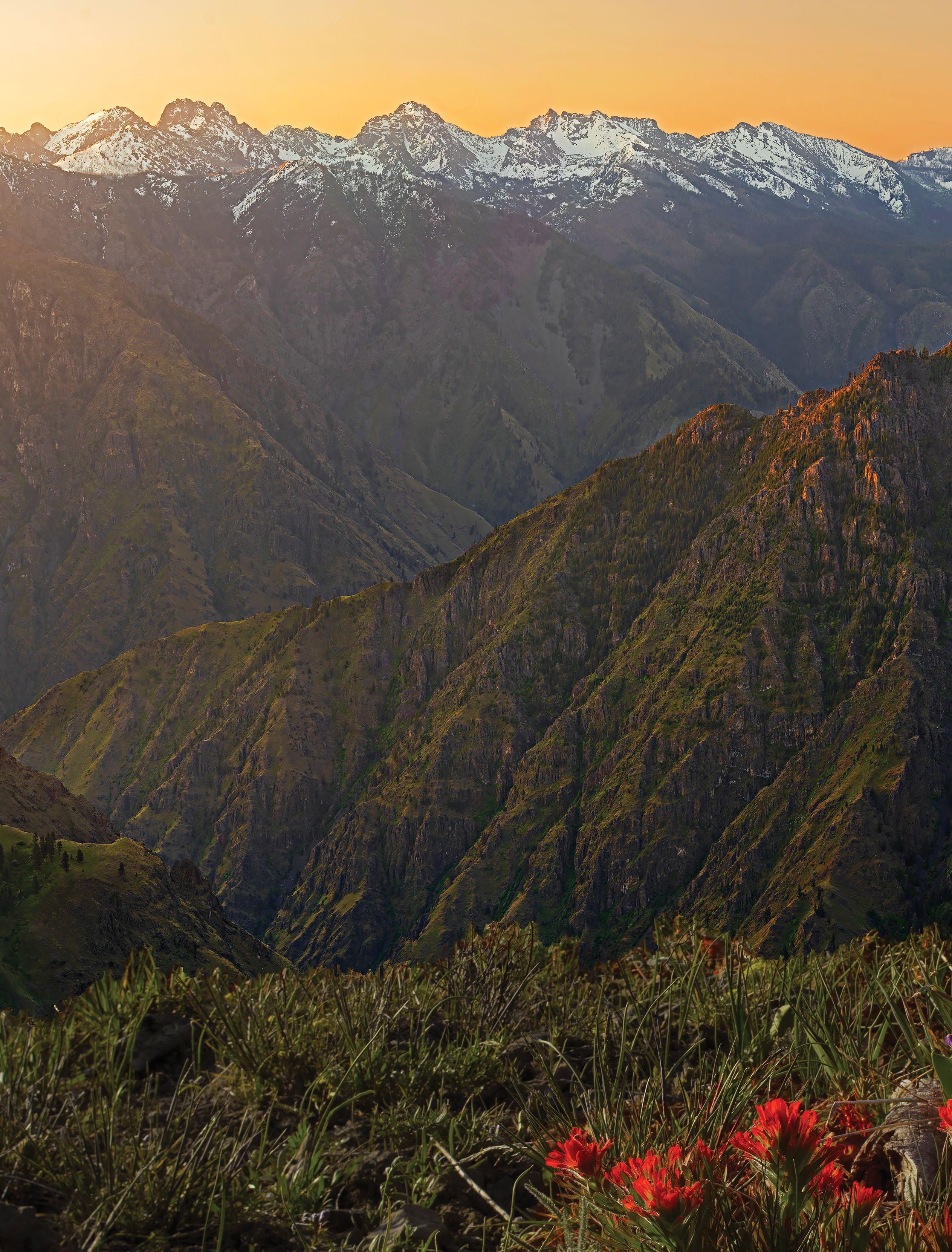
From Joseph, the byway heads east toward Hells Canyon. It follows OR-350 to FR-39, swinging south to briefly parallel the Wild and Scenic Imnaha River, important spawning grounds for chinook salmon and steelhead trout. For your first look at Hells Canyon, turn left on FR-3965 near the Ollokot campground to the 7 Hells Canyon Overlook . Perched at the rim, you’re peering down into the deepest canyon in North America. Spoiler alert: You can’t see the Snake River from this viewpoint, but the gorge is stunning — more than a mile/1.6 kilometers deep and carved by eons of Snake River erosion. From some areas on the east rim, Hells Canyon plummets more than 8,000 feet/2,438 meters, dwarfing even the Grand Canyon.
Back on the byway, FR-39 continues
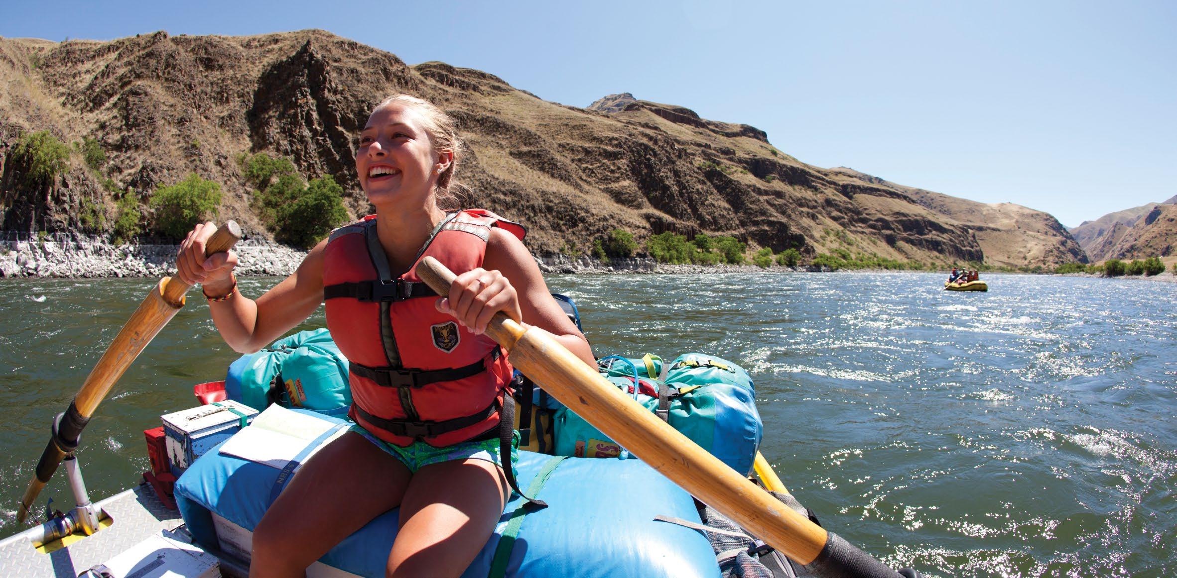
south to a junction with OR-86. Detour north past Copperfield/Oxbow to the 8 Hells Canyon Dam and the Hells Canyon National Recreation Area Visitor Center for a look at this mighty canyon from the river level. To really experience its grandeur, sign on for one of the area’s rafting trips or jet-boat excursions, which descend through the canyon and tackle the Snake’s exhilarating white-water rapids.
The byway winds west through the towns of Halfway and Richland along a route traveled by early settlers. You can explore the mountains and foothills here with one of many horse or llama guide companies whose sure-footed creatures pack your gear so you can enjoy the view. Near Baker City, the 9 National Historic Oregon Trail Interpretive Center offers exhibits and living-history presentations on the great migration that forever changed the American West. The byway ends in 10 Baker City, where it intersects with the Journey Through Time Scenic Byway (page 42), the Blue Mountain Scenic Byway (page 44) and the Elkhorn Drive Scenic Byway (page 46). Downtown Baker City is ripe for exploring with more than 100 buildings on the National Register of Historic Places. Take a horse-drawn tour or journey on foot and find a fine mix of museums and galleries as well as craft breweries, a distillery and an artisan chocolate maker.
JUSTIN BAILIE
TRIPCHECK.COM 13
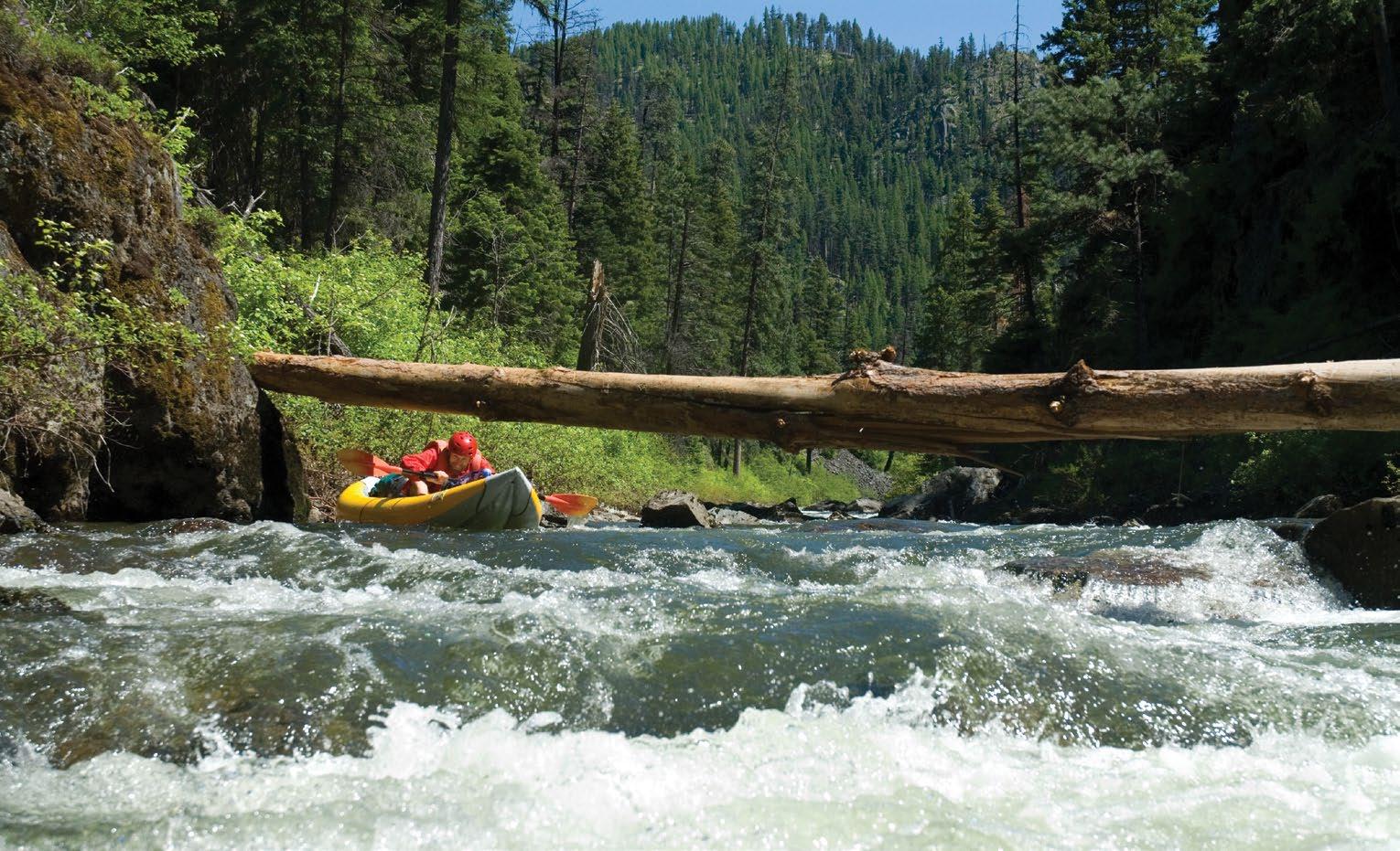
Rafting the Snake River in Hells Canyon
4 Crater Lake Lodge 5 Upper Klamath National Wildlife Refuge 9 Bear Valley National Wildlife Refuge 10 Lower Klamath National Wildlife Refuge 139 97 62 39 140 230 140 84 84 5 5 82 82 62 66 Union Creek Prospect Chiloquin Chemult Butte Falls Bonanza Malin Merrill Ashland 31 WASHINGTON CALIFORNIA Crater Lake National Park 138 140 97 161 Upper Klamath Lake Diamond Lake Crater Lake Tule Lake Fort Klamath Klamath Falls 62 Tulelake Dorris Lava Beds National Monument 1 2 3 4 5 6 7 8 9 10 14 TRAVELOREGON.COM/BYWAYS
Overlook before exiting the park through the south gate.
IAN SHIVE / TANDEMSTOCK
TRIPCHECK.COM 15
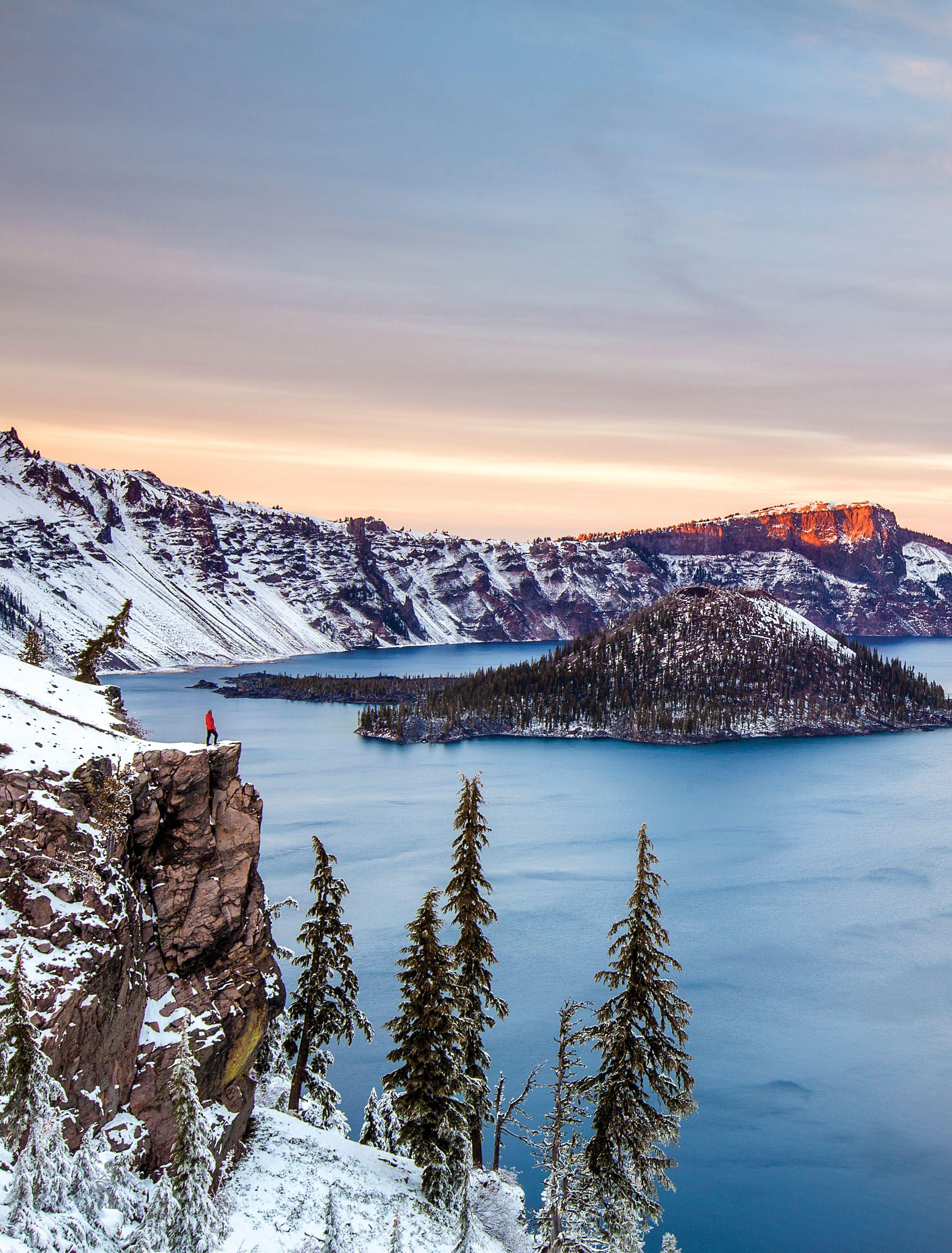
Crater Lake National Park’s Wizard Island
FROM TOP:
SUSAN SEUBERT; CHRISTIAN HEEB
Crater Lake
16 TRAVELOREGON.COM/BYWAYS
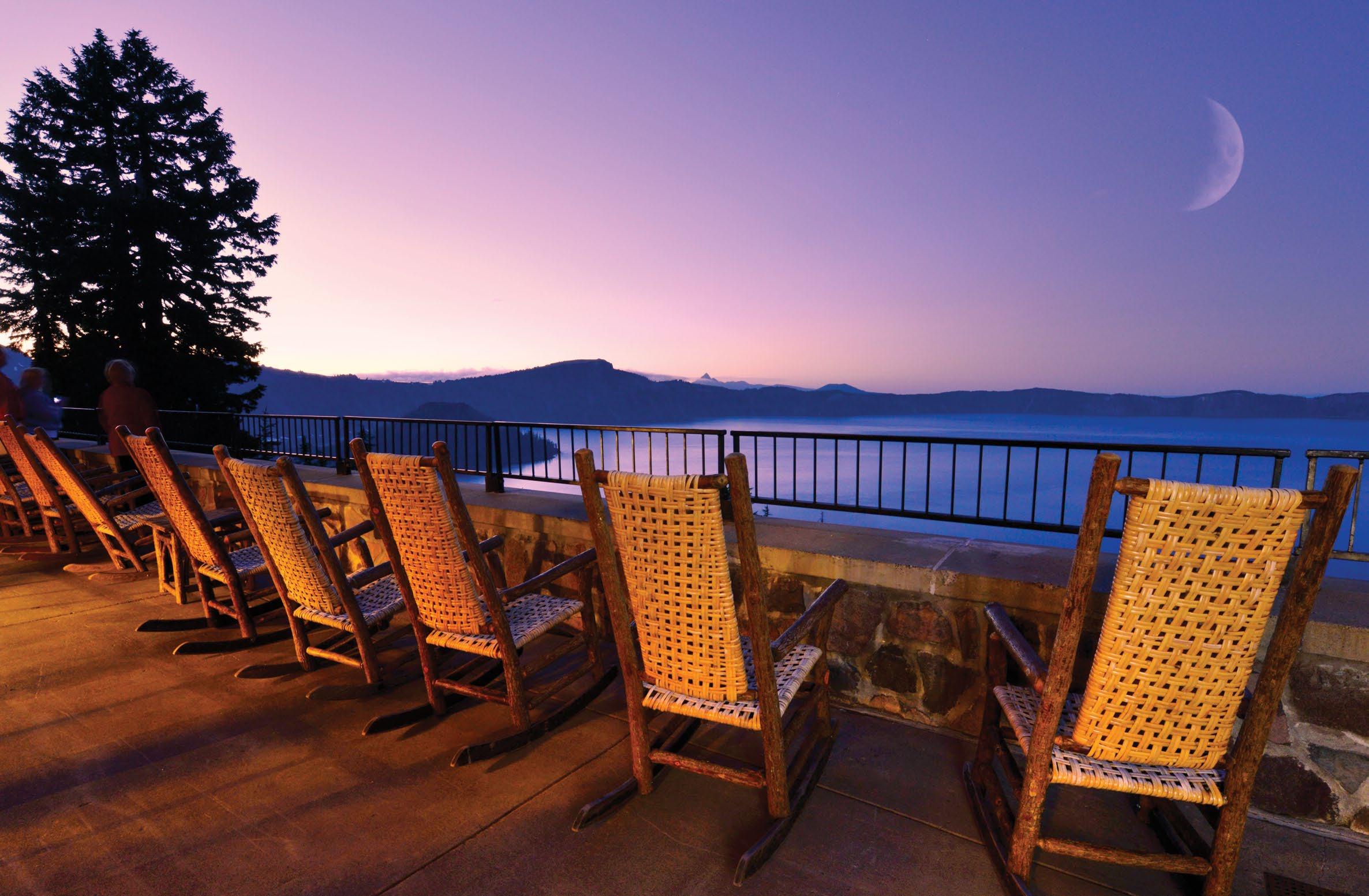
Crater Lake Lodge
FORT KLAMATH AND KLAMATH LAKE
From the national park’s south entrance, OR-62 leads southeast to Fort Klamath. Established as a U.S. military outpost in 1863, it now houses the Fort Klamath Museum, telling the story of the fort’s role in the Modoc War.
From Fort Klamath, the byway winds west and south, bending along the 5 Upper Klamath National Wildlife Refuge and 6 Upper Klamath Lake on West Side Road. Covering 133 square miles/214 square kilometers, Upper Klamath is Oregon’s largest freshwater lake; together with the adjacent wetlands and other area lakes, the Klamath Basin forms one of the largest freshwater ecosystems west of the Great Lakes.
A boat offers an ideal way to explore it. (Area concessionaires offer rentals.)
Self-guided water trails, like the Upper Klamath Canoe Trail near Rocky Point, weave among marsh grasses and lilies. Anglers know Upper Klamath for its trophy-size native rainbow trout.
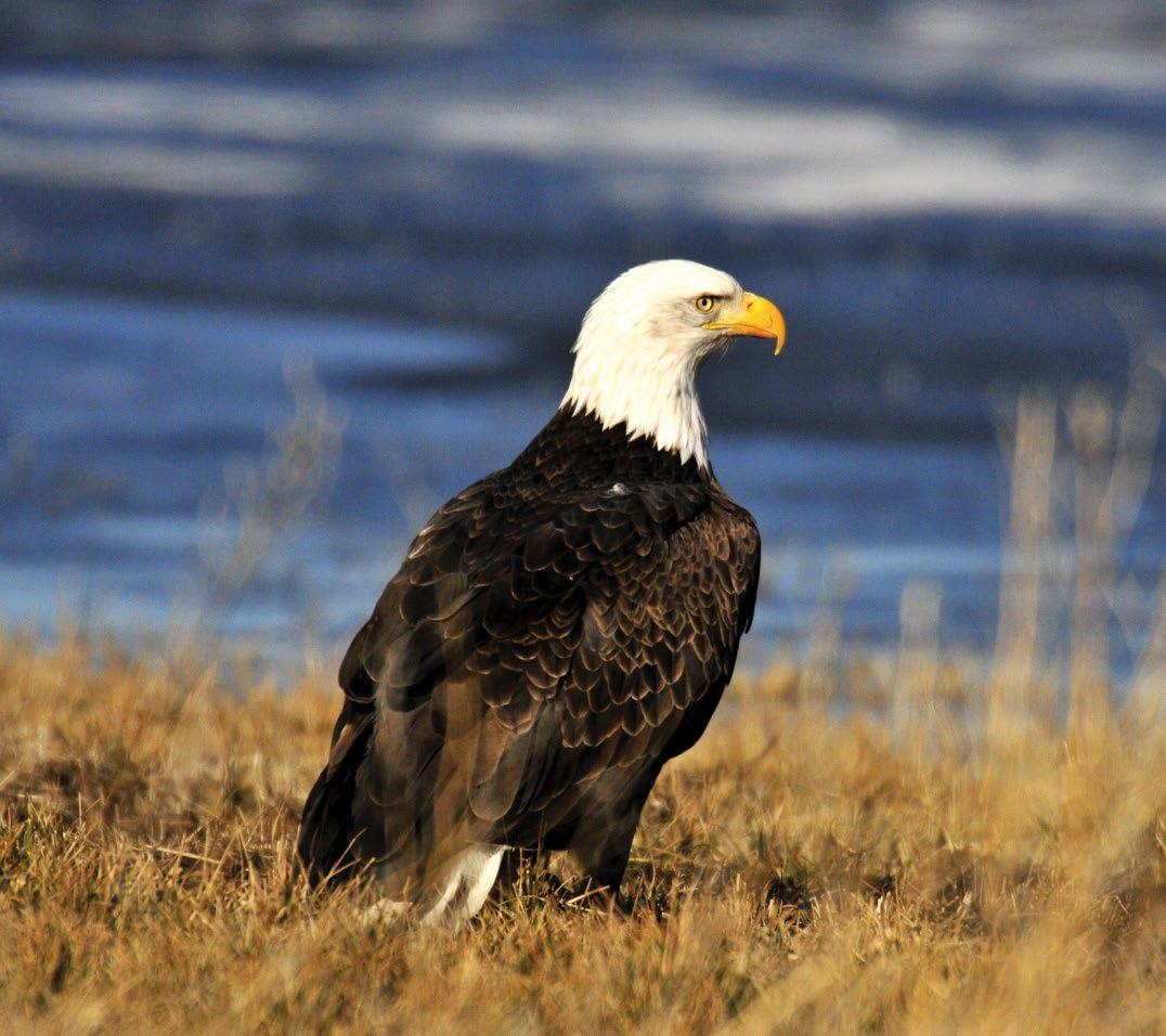
The waterways are a magnet for more than a million birds migrating up and down the Pacific Flyway. More than 300 different species pass through, including shorebirds like white-faced ibis, great egrets and sandhill cranes; raptors like American kestrels and northern harriers; and tens of thousands of geese, ducks and swans. It attracts the largest concentration of bald eagles in the Lower 48.
In the shadow of 9,495-foot/2,894meter Mt. McLoughlin, the byway joins OR-140 and sidles up alongside the lake at Howard Bay. This is a good area to spot nesting white pelicans and bald eagles, which soar through the skies here year-round.
KLAMATH FALLS
The byway passes through ponderosa pine, horse farms and cattle ranches before descending toward 7 Klamath Falls at the lake’s southern end. Walking trails along the waterways just below the lake — the Link River and Lake Ewauna — are good spots to stretch your legs and do a little bird-watching.
Klamath Falls has been an important hub ever since the railroad arrived in 1909, bringing with it well-heeled travelers from San Francisco and Portland. A booming “entertainment industry” for loggers and ranch hands quickly sprang
to life, too, with brothels, saloons and entertainment venues. A few architectural tributes remain, such as the 1905 Baldwin Hotel and the 1939 art deco Ross Ragland Theater. Also downtown, the
8 Favell Museum displays more than 100,000 Native American artifacts, the works of more than 300 contemporary Western artists and a one-of-a-kind collection of miniature working firearms.
The byway continues on US-97 south of Klamath Falls, traveling through two more of the refuges in the Klamath Basin: 9 Bear Valley National Wildlife Refuge and 10 Lower Klamath National Wildlife Refuge. At the Oregon-California border, the Francis S. Landrum Historic Wayside commemorates the Applegate Trail, an alternative to the Oregon Trail used by
pioneers headed for the Rogue River and southern Willamette valleys. Further south, the byway passes Tulelake, Lava Beds National Monument and Mt. Shasta, and continues on to Lassen Volcanic National Park.
FROM TOP: JOHN
PYLE/CAL SPORT MEDIA/ZUMAPRESS.COM; DENNIS FRATES
A bald eagle at the Upper Klamath National Wildlife Refuge
TRIPCHECK.COM 17
Klamath Marsh National Wildlife Refuge
ALL-AMERICAN ROAD
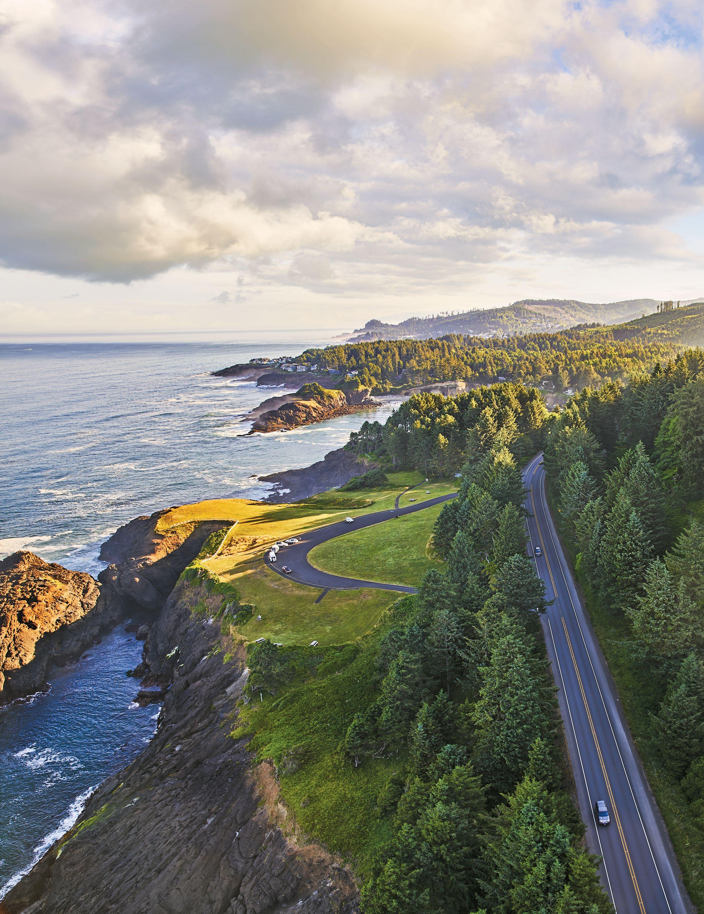
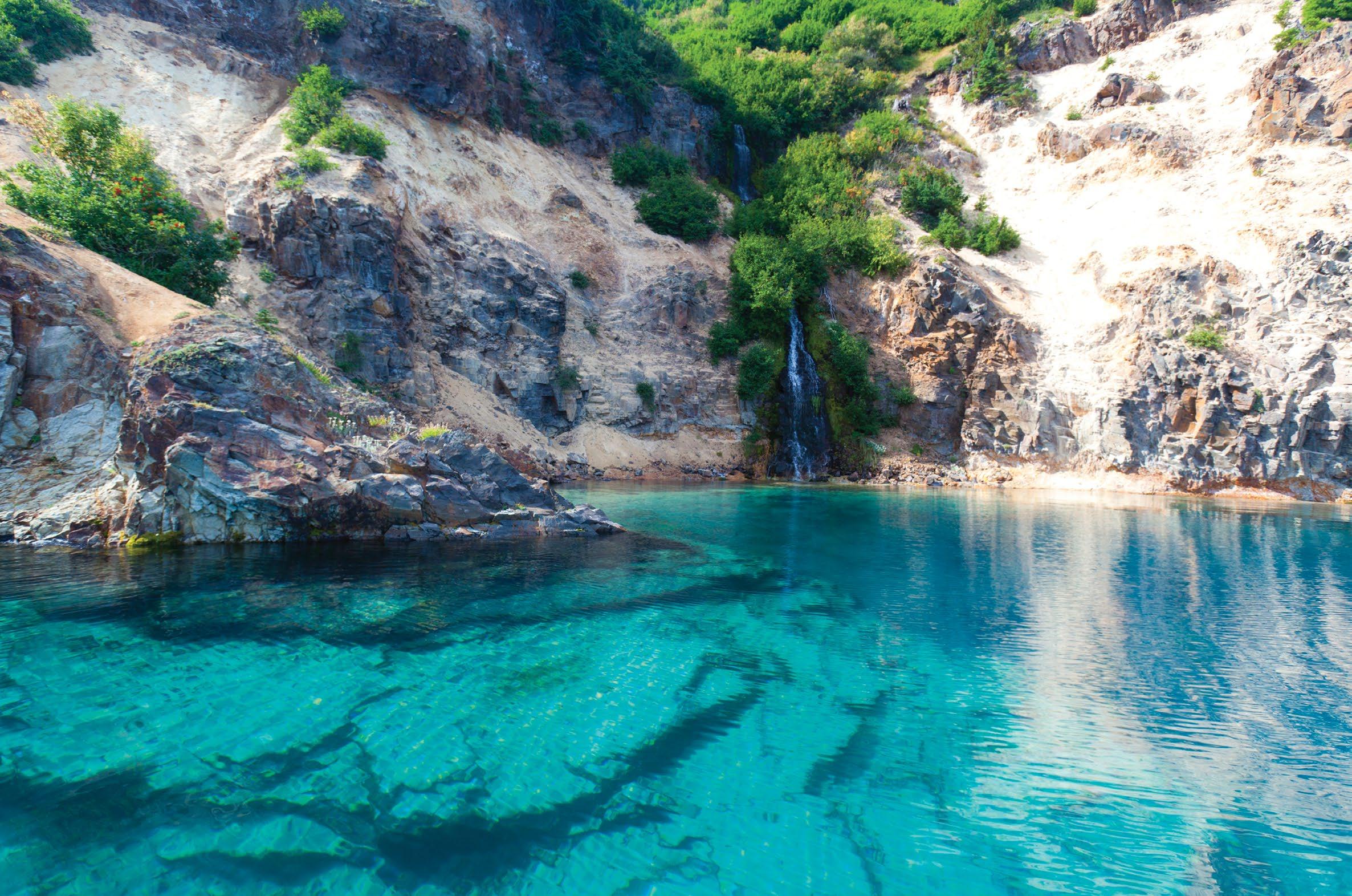
Oregon’s Pacific coastline stretches for 363 magnificent miles/584 kilometers — 199 101 26 30 20 47 22 58 62 62 66 99W 226 138 227 140 595 33 242 42 202 6 47 18 18 22 22 34 36 126 138 38 99W 5 84 5 5 82 82 CALIFORNIA WASHINGTON Columbia River NehalemRiver Wilson River Nestucca River SiletzRiver Alsea River SiuslawRiver Umpqua River C o quill eRiver RogueRiver IllinoisRiver ChetcoRiver Devils Lake ApplegateRiver Elkton Merlin Canyonville Banks Sutherlin Dallas Independence Grants Pass Roseburg Eugene Salem Agness Powers Coquille Grand Ronde Jewell Vernonia Forest Grove Newberg McMinnville Dundee Albany Corvallis Junction City Cottage Grove Myrtle Creek Riddle Cave Junction Myrtle Point Otis Siletz Toledo 223 Mapleton Oceanside Netarts Pacific City Charleston 101 101 Tillamook Rock Lighthouse Cape Meares Lighthouse Yaquina Head Lighthouse Yaquina Bay Lighthouse Heceta Head Lighthouse Umpqua River Lighthouse Cape Arago Lighthouse Coquille River Lighthouse Cape Blanco Lighthouse Seal Rock Gold Beach Bandon Tillamook Astoria Lincoln City Seaside Cannon Beach Manzanita Wheeler Rockaway Beach Garibaldi Winchester Bay Lakeside Nehalem Arch Cape Gleneden Beach Warrenton Gearhart Neskowin Depoe Bay Otter Rock Newport Waldport Yachats Florence Dunes City Reedsport North Bend Coos Bay Port Orford Brookings Harbor PACIFIC OCEAN See p. 79. See p. 80. 1 2 3 4 5 6 7 8 9 10 18 TRAVELOREGON.COM/BYWAYS
PACIFIC COAST SCENIC BYWAY
JEAN CARTER / AGE FOTOSTOCK
TRIPCHECK.COM 19
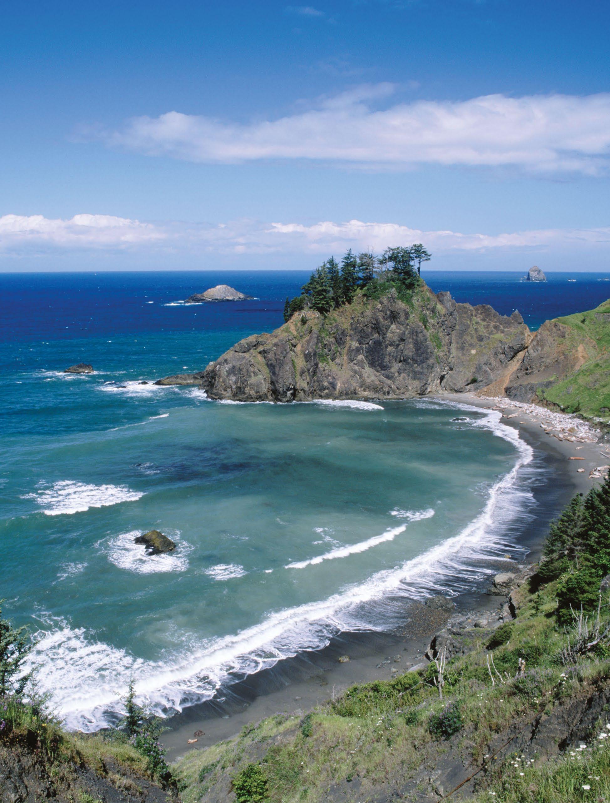
Samuel H. Boardman State Scenic Corridor
GARIBALDI TO NEWPORT
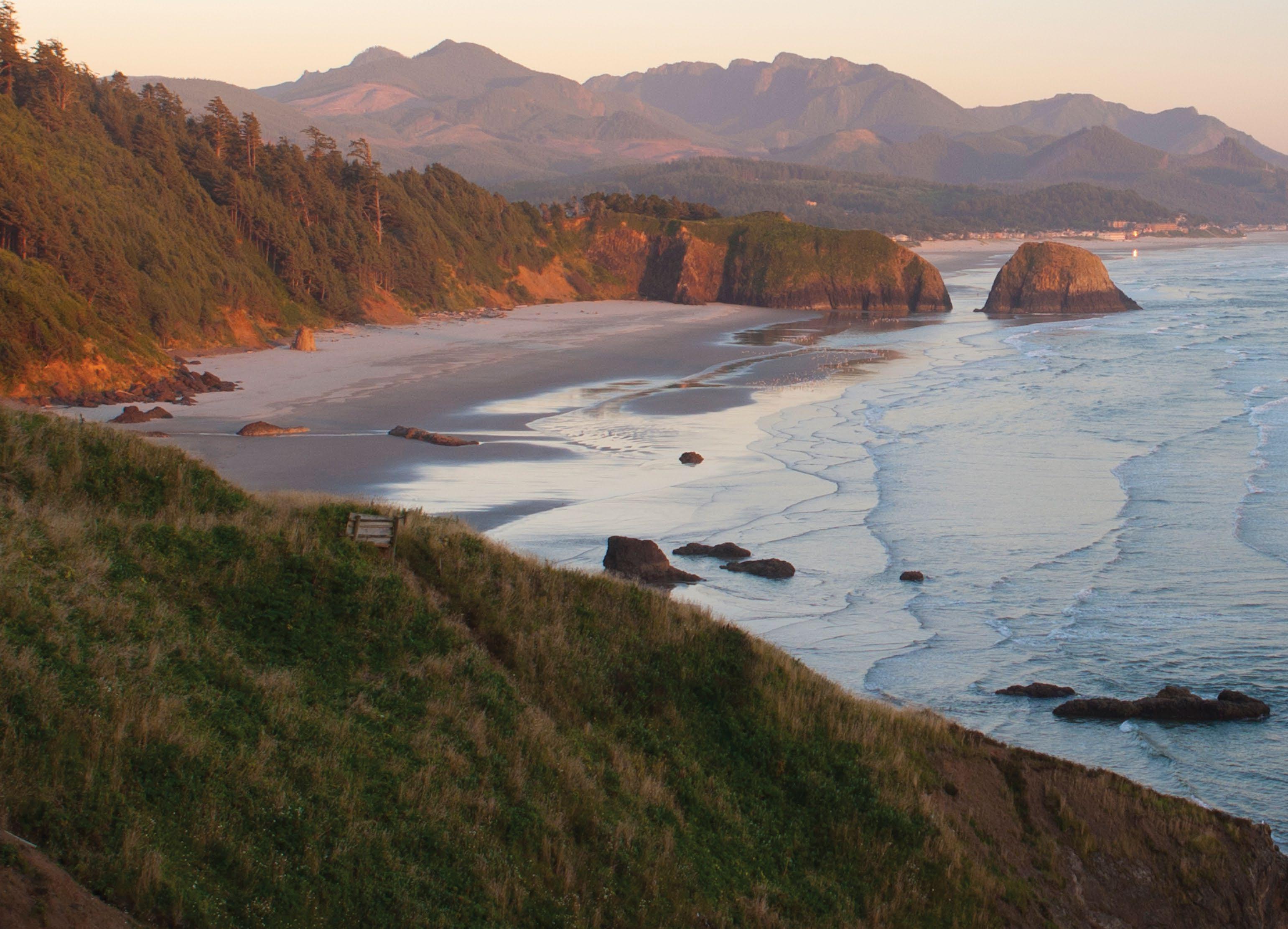
The byway arcs inland around Tillamook Bay at Garibaldi , a hub for fishing and kayaking. In Tillamook , take a self-guided tour and sample cheeses at the Tillamook Creamery. Head west on OR-131 for a detour along the Trees to Sea Scenic Byway (p. 58) to the Cape Meares Lighthouse. From here, continue south along the 3 Three Capes Scenic Loop to Cape Lookout State Park and onward to the massive sand dune of Cape Kiwanda in the little beach town of Pacific City. The route rejoins the byway north of Lincoln City, which draws kite flyers to its breezy beaches, skilled surfers to Nelscott Reef and hikers seeking solitude to the 4 Cascade Head Preserve, with trails bending up through old-growth forest.
The fishing village of Depoe Bay bills itself as the smallest navigable harbor in the world, where fishing boats and
 LARRY GEDDIS
Heceta Head Lighthouse
LARRY GEDDIS
Heceta Head Lighthouse
20 TRAVELOREGON.COM/BYWAYS
Ecola State Park
whale-watching excursions thread through a rocky channel to the Pacific. Gray whales tend to linger here, along with the many whales that migrate along the Coast.
Eye tiny critters in the “marine garden” of tide pools around Otter Rock. Nearby, the collapsed sea cave called Devils Punchbowl churns with swirling seawater. Explore more marine gardens and Oregon’s tallest lighthouse at Yaquina Head Outstanding Natural Area
NEWPORT TO COOS BAY
Newport sits on Yaquina Bay, marked by the pretty 1871 Yaquina Bay Lighthouse, Oregon’s last remaining wooden lighthouse. Visitors wander among the shops and restaurants of Nye Beach, and along the working bayfront, noisy with barking sea lions. Across the bay, the 5 Oregon Coast Aquarium enlightens 400,000 visitors each year
about what goes on below the surface with touch tanks, under water tunnels and interactive displays. With more than 40,000 students coming through its doors every year, the aquarium is a key educational resource for the state. And the nearby Hatfield Marine Science Center, part of Oregon State University, focuses much of its research on marine ecology and climate change.
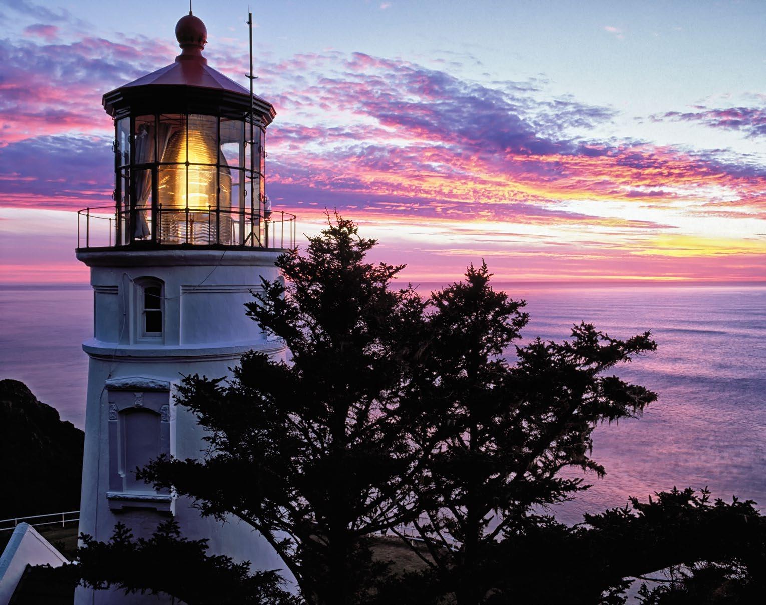
Near Yachats , waves boom and swirl against the furrowed base of 800-foot Cape Perpetua Scenic Area , and trails lead through old-growth forest above. Twelve miles/19.3 kilometers south, the 6 Heceta Head Lighthouse is Oregon’s brightest beacon and no doubt one of its most photographed. Visitors can tour the tower and stay in the lightkeeper’s home, now a B&B. At the nearby Sea Lion Caves , an elevator descends 208 feet/63 meters to an observation area in a huge natural cavern, where
Steller sea lions and other wildlife gather. It’s one of the oldest private attractions along the Oregon Coast.
The byway briefly dips inland as it approaches Florence, where fishing boats and shop-filled historic buildings line up along the Siuslaw River. Across the pretty Siuslaw River Bridge, the rugged coast gives way to mile after mile of high dunes and sandy beaches, stretching all the way to Coos Bay.
Near the 7 Oregon Dunes National Recreation Area , businesses offer dune-buggy tours, sandboarding equipment and ATV rentals. The recreation area’s headquarters in Reedsport has information and interpretive displays.
COOS BAY TO BROOKINGS
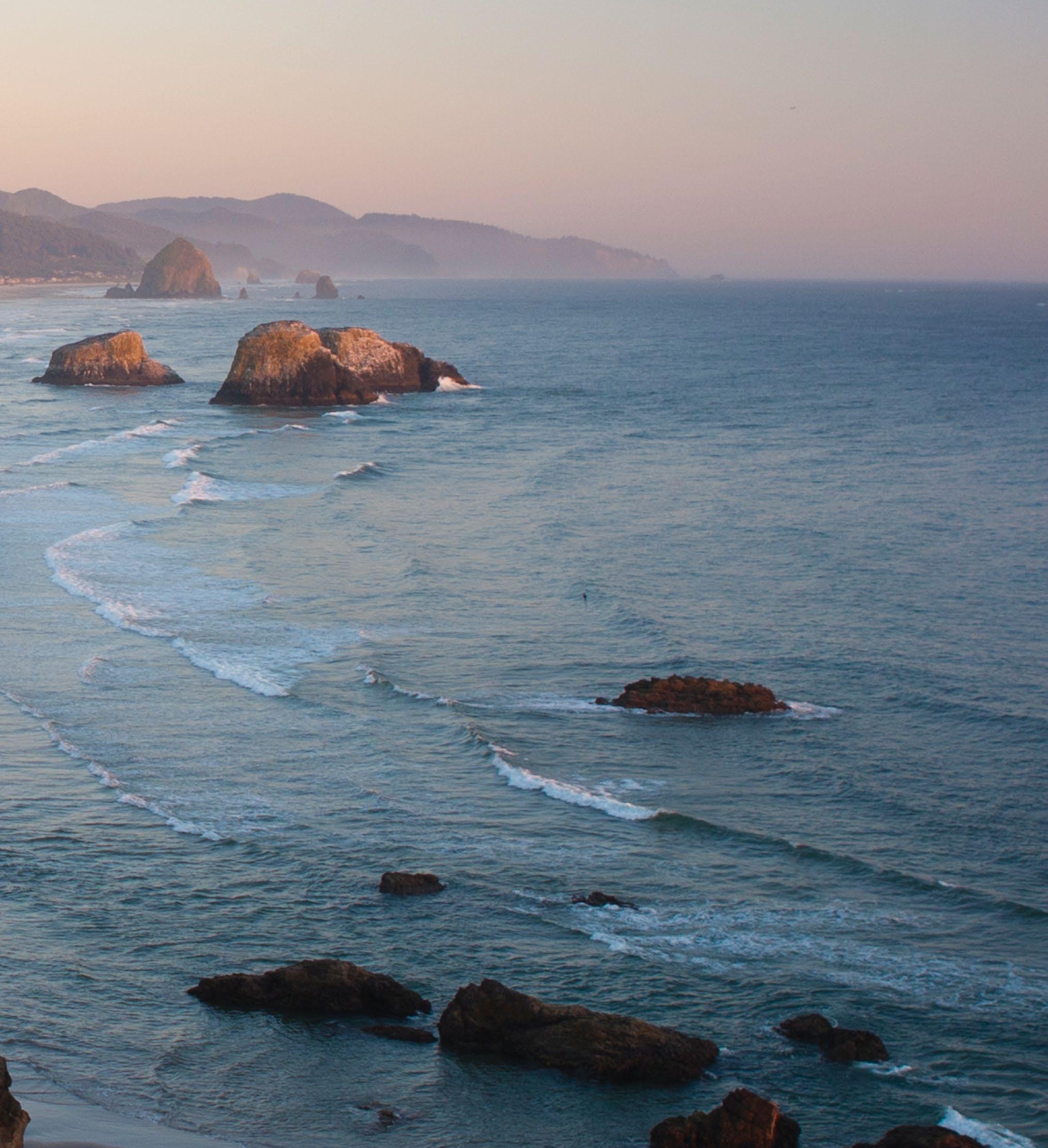
The Oregon Coast’s largest city and the largest natural harbor between Seattle and San Francisco, Coos Bay is a busy port for commercial and recreational fishing, crabbing and clamming. Nearby, the 8 Charleston to Bandon Tour Route (see page 61) hugs the coast, reuniting with US-101 in Bandon at the mouth of the Coquille River. Bandon is known for its world-class golf, art and sandy beaches punctuated with dramatic sea stacks.
The byway next greets the coastline at Port Orford, an exceptionally scenic fishing harbor and the start of the Wild Rivers Coast Scenic Bikeway (see page 79). Harbor seals and sea lions often frequent the rocky outcrops at 9 Port Orford Heads State Park The Sixes and Elk rivers draining down from the Coast Range offer great salmon and steelhead fishing. The Rogue River, a Wild and Scenic River famed for its rafting and fishing, meets the Pacific at Gold Beach. Jet-boat tours power upriver for a look at the scenic Lower Rogue.
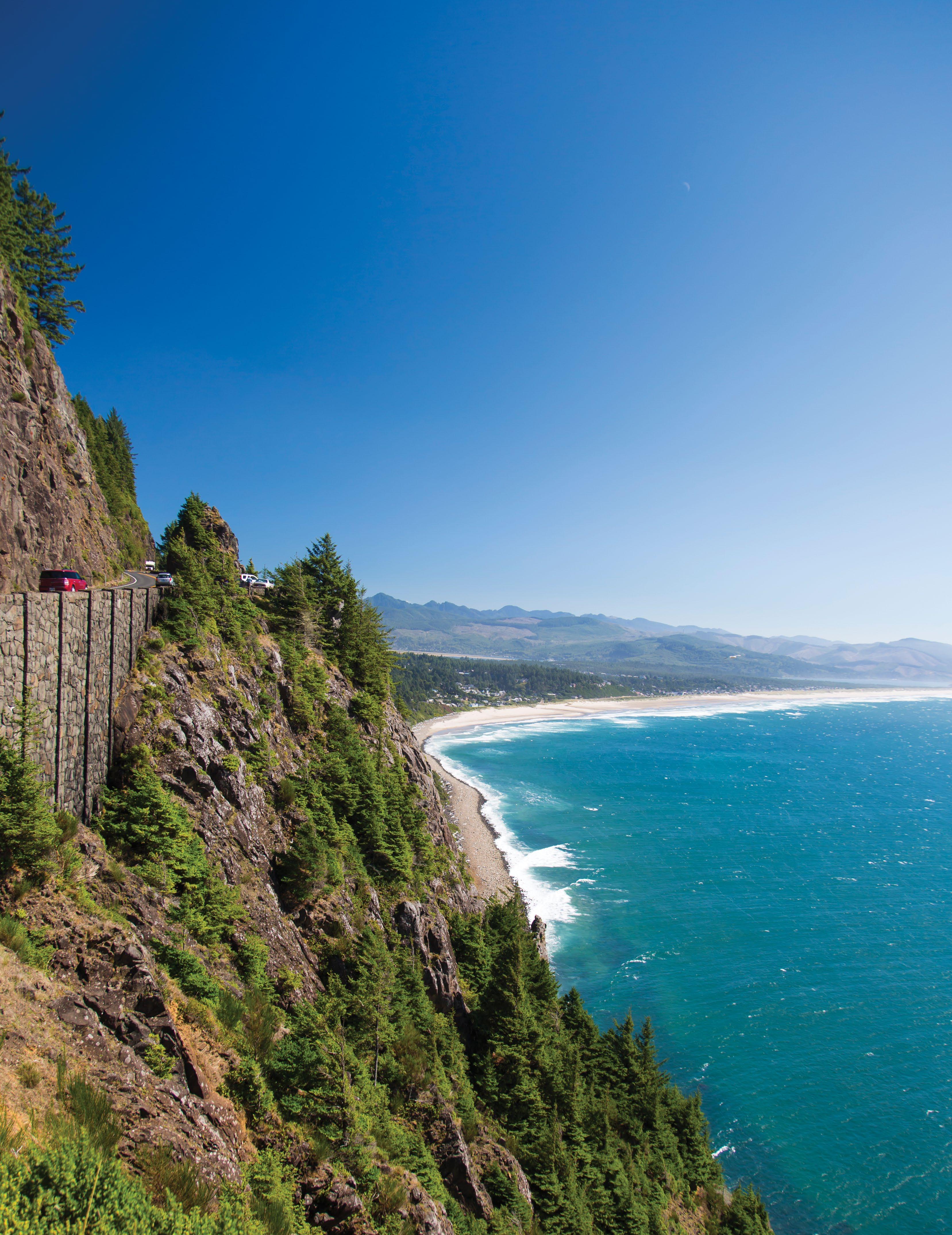
The coastal scenery dazzles on its final stretch, as the byway skims along cliffs and rocky shores dotted with tide pools. Beyond Pistol River, a famous windsurfing spot, 12 miles/19.3 kilometers of coastline are designated as the 10 Samuel H. Boardman State Scenic Corridor, with ample overlooks, hiking trails and beach access. The byway concludes south of Brookings, a region known for its temperate “banana belt” climate and the largest stand of coastal redwoods in the state.
TRIPCHECK.COM 21
SUSAN SEUBERT
NATIONAL SCENIC BYWAYS
These six National Scenic Byways are recognized for their cultural, historic and natural beauty. Drink in the snowy peak of Mt. Hood, the pristine waters of the Cascade Lakes, the high Cascade Mountains and the arid beauty of the high desert.
MALCOLM LOWERY
McKenzie Pass
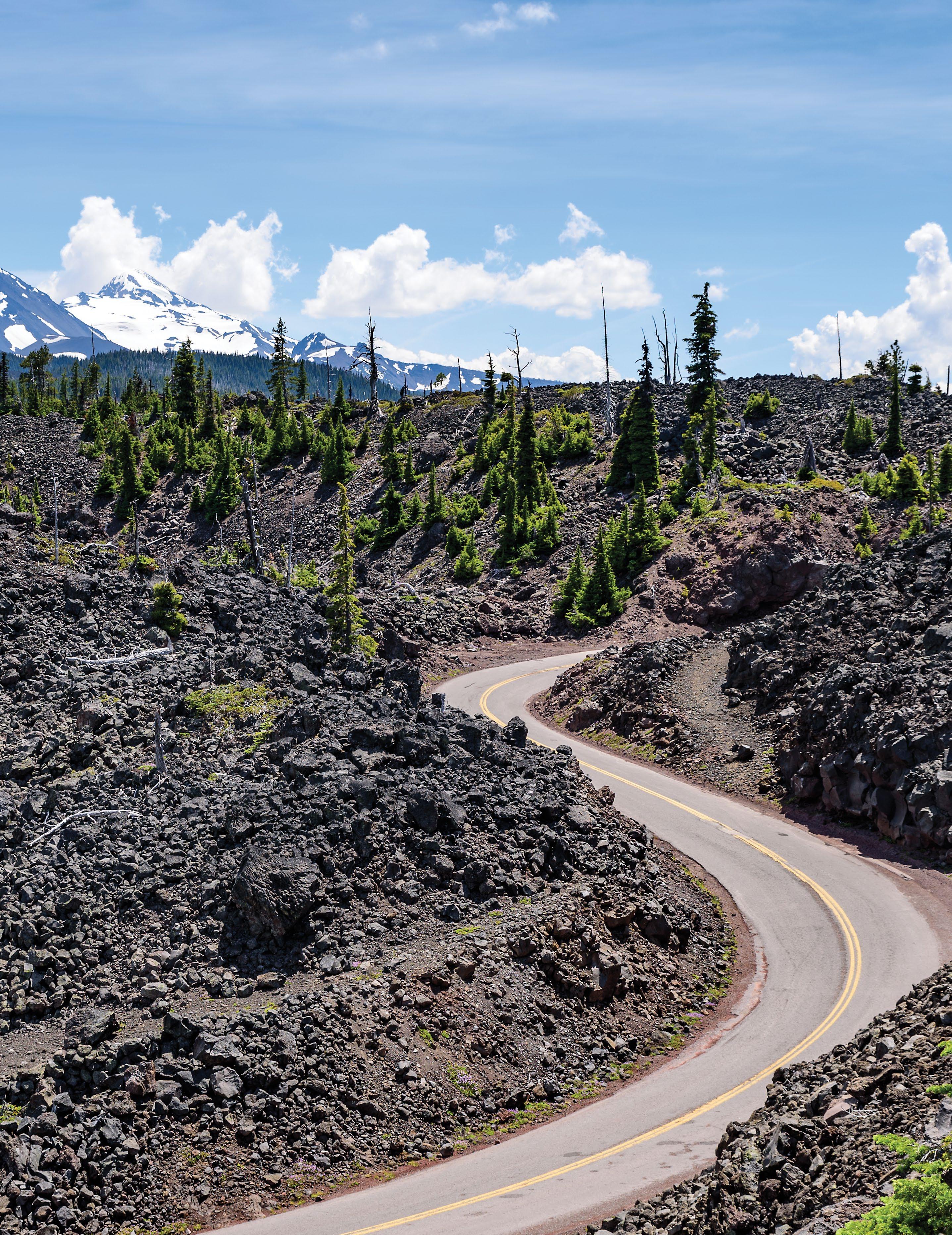
McKENZIE PASS-SANTIAM PASS SCENIC BYWAY
High-mountain lava fields, snowy volcanic peaks and panoramic Cascade-pass views present a striking world of contrasts on this 82-mile/132-kilometer loop route northwest of Bend.
NATIONAL SCENIC BYWAY
JUSTIN BAILIE TRIPCHECK.COM 23
McKenzie River National Recreation Trail
Oregon’s highest mountains create wildly contrasting landscapes, which you’ll clearly witness on this drive. On the east side of the Cascade Mountains, golden grasslands and lodgepole pine prevail; over the passes, you’ll cross into fir and cedar forests and mossy-green river valleys. Fire juxtaposes with ice, too, where snowy, glaciated peaks rise up from stark black lava fields. It’s a region of national significance — home to several endangered species, centuries-old pristine forest and noteworthy volcanic geology — that you can experience up close on a weekend road trip.
SISTERS AND SANTIAM PASS
Start the loop in Sisters, named for the Three Sisters — 10,000-foot/3,048-meter volcanic peaks rising up to the southwest.
Sisters has a charming Western ambience, with boxy 1800s-style architecture along its main street and storefronts filled with galleries, Western wear and antiques.
To travel the loop counterclockwise, follow the byway northwest on US-20/ OR-126. Near the 6,436-foot/1,961-meter cinder cone of 1 Black Butte, a side road leads north to Camp Sherman A cool spot along the spring-fed 2 Metolius River, it’s been a favorite summer retreat since the homesteader days, when wheat farmers came to fish and escape the high-desert heat. A scenic viewpoint overlooks the Metolius headwaters, meadows and a grand view of Mt. Jefferson to the north.
Continuing on the byway, you’ll get a prominent look at Mt. Washington as the road climbs toward Santiam Pass. On the
way, the road skirts the pretty sliver of 3 Suttle Lake, carved by glaciers and popular for boating and fishing.
4 Santiam Pass takes its name from the Santiam Indians, a Kalapooian tribe native to the area. Several ashen buttes and other volcanic features are visible from the 4,817-foot/1,468-meter pass. The Pacific Crest National Scenic Trail crosses here too, a particularly memorable stretch of the famous Canada-to-Mexico route, threading high among several volcanic peaks. This section of the road passes by mysterious Lost Lake, which fills up with water every spring and disappears in the fall down a hole into a lava tube. The byway descends the pass, then turns south on OR-126.
OR-126: THE McKENZIE RIVER HIGHWAY
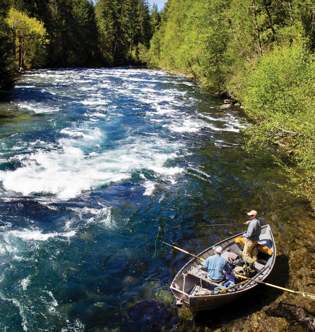
This stretch of the route showcases the beautiful peacock-blue waters of the Upper McKenzie, as the river tumbles south over waterfalls and through lava flows and here parallels the West Cascades Scenic Byway (see page 26 for details). The 5 McKenzie River National Recreation Trail also follows the river’s route for more than 26 miles/41.8 kilometers, with several well-marked access points from the byway. Popular with hikers and mountain bikers alike, the trail was named by Outside magazine as one of its 10 Great American Mountain Biking Trails.
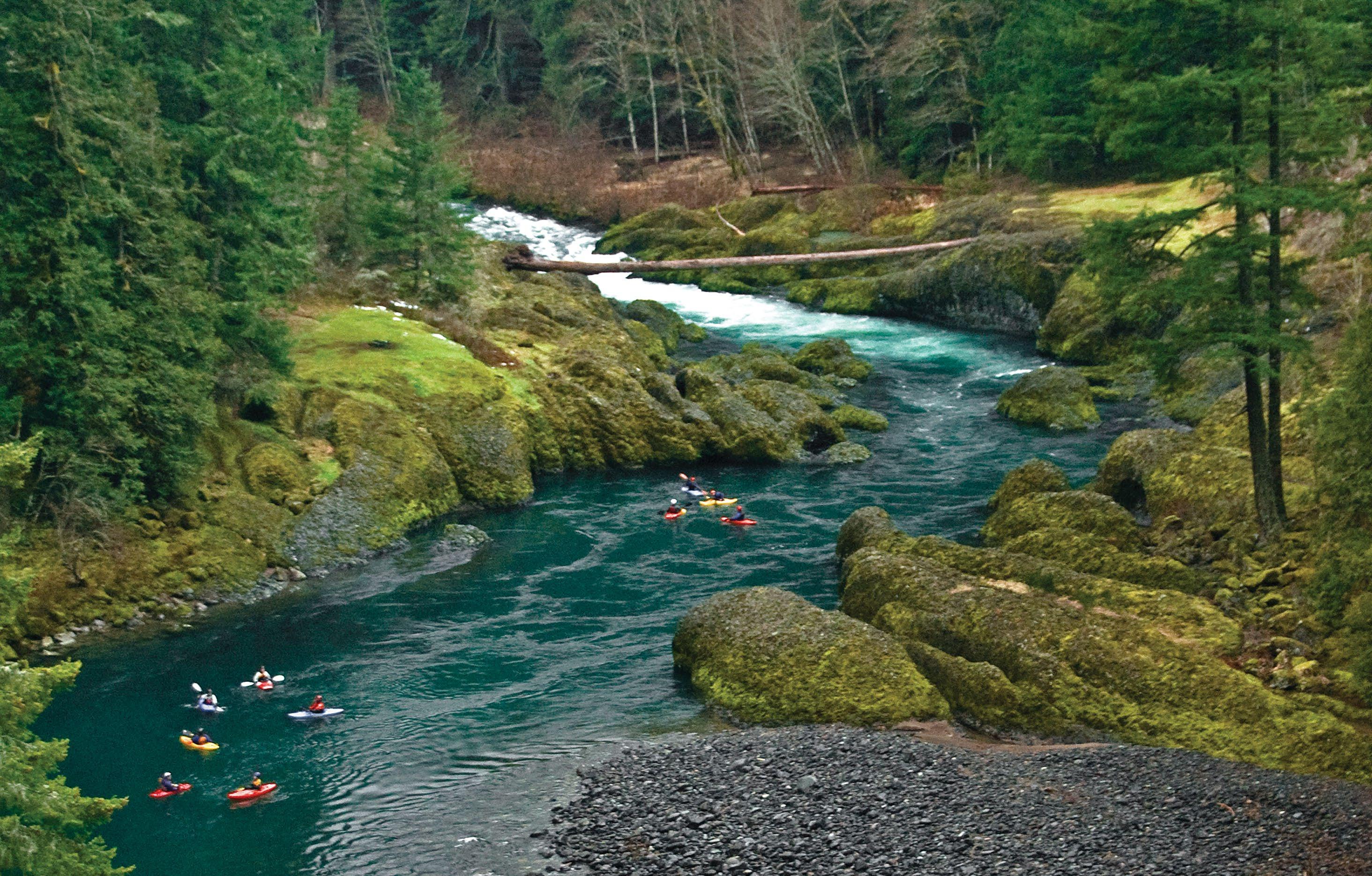
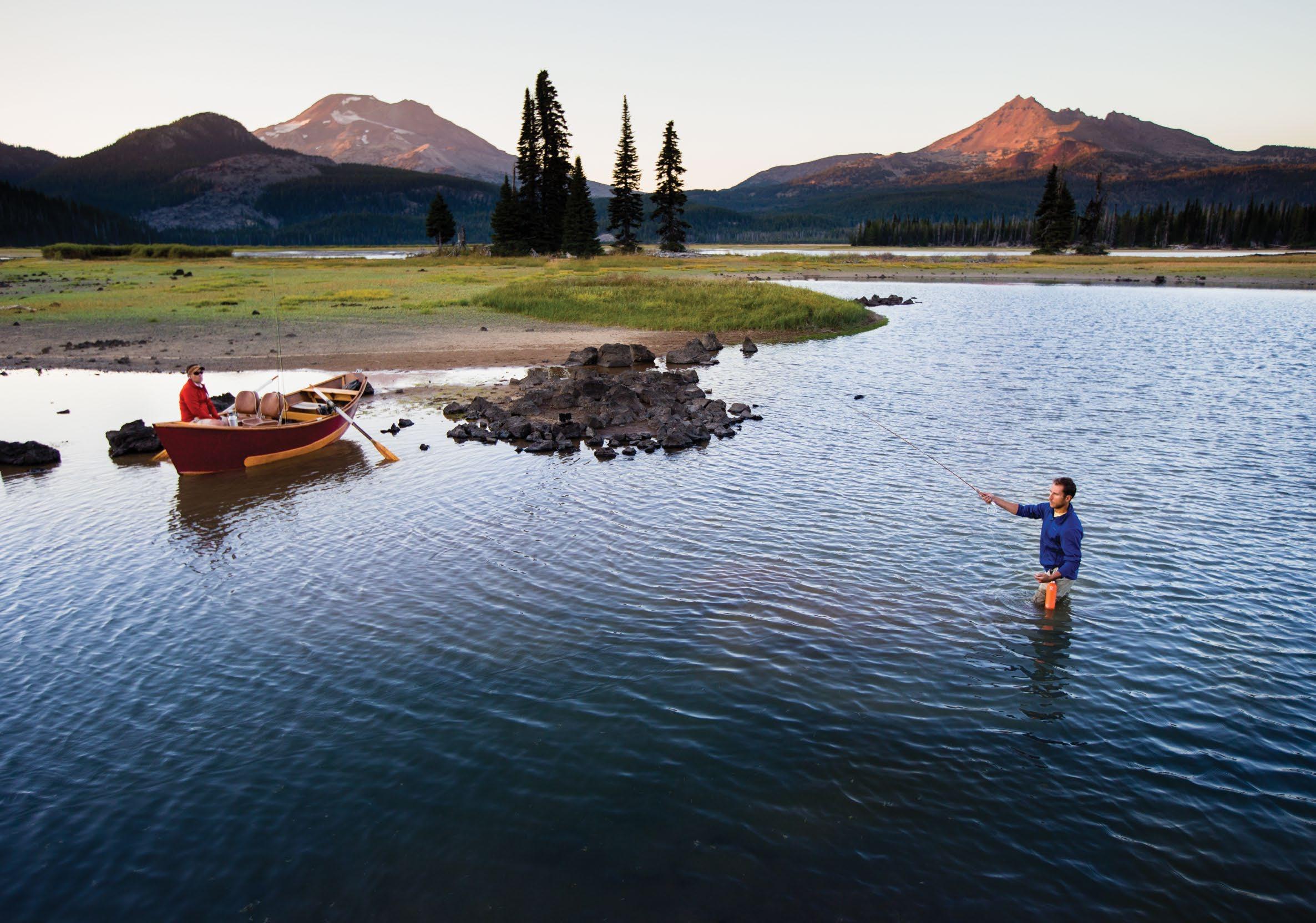
Fly-fishers, too, hold the McKenzie in high regard, casting dry flies for redband and rainbow trout. The McKenzie drift boat originated here — a dory with flared sides, a pointed stern, and a flat bottom with continuous rocker — specifically designed for maneuverability in rapids. Many area guides work the McKenzie and run its rapids in one of these time-tested boats.
Clear Lake is the headwaters of the McKenzie River, fed by numerous springs and formed when an ancient lava flow dammed the stream. A 5-mile/ 8-kilometer trail encircles the lake, but you can get a good view just by crossing a small footbridge or paddling in a canoe. The lake’s clarity is remarkable. A submerged 3,000-year-old forest — preserved by the cold waters — remains easily visible more than 100 feet/ 30 meters below the surface.
South SantiamRiver River oia River amette of Middle Fork Willamette River Me to l ius River Deschutes Rive r Lake Billy Chinook Crooked River Detroit Lake 97 20 20 19 Seasonal road 126 20 26 126 22 97 26 Blue River Idanha Detroit McKenzie Bridge Marion Forks Redmond Bend Terrebonne Madras Culver 126 242 126 Sisters Seasonal road Camp Sherman Black Butte Ranch
5 McKenzie River National Recreation Trail
6 Sahalie Falls and Koosah Falls
7 Scott Lake
8 Dee Wright Observatory
1 2 3 4 5 6 7 8 LARRY GEDDIS
See p. 79.
24 TRAVELOREGON.COM/BYWAYS
Metolius River
Lava flows also created 6 Sahalie Falls and Koosah Falls downstream, two beautiful cascades that you can see by hiking an easy 2.6-mile/4.1-kilometer loop trail. For non-hikers, Sahalie Falls can be viewed from the parking lot. The greatest volcanic oddity is farther downstream at the Tamolitch Pool , also listed on maps as “the Blue Pool.” Here the river reappears from a 3-mile/ 4.8-kilometer underground detour through a lava tube into a pool that is an impossibly iridescent blue.
OR-242: McKENZIE HIGHWAY
Past Belknap Springs, the byway swings east onto OR-242, the McKenzie Highway. Snow closes this seasonal road each winter. Before it reopens to vehicles in June, road crews plow open one lane for nonmotorized recreation, making it a favorite spring cycling destination.
In 9 miles/14.4 kilometers, a 1.3-mile/ 2-kilometer trail leads through lava fields reclaimed by forest to Proxy Falls . The lovely two-part falls spills over mosses and ferns, its waters largely disappearing right back into the green-blanketed rocks. The byway then switchbacks steeply through an area known as Deadhorse Grade, climbing nearly 1,200 feet/365 meters in just 4 miles/6.4 kilometers. You’ll be treated to more outstanding volcano views, this time of North Sister and Middle Sister. Double the view with a short side trip up to 7 Scott Lake, which mirrors these ragged peaks.
The forest abruptly ends just shy of McKenzie Pass, replaced by an expanse of dark and broken lava that stretches for 65 square miles/104.6 square kilometers. It’s one of the most recent and most remarkable examples of volcanic activity in North America, the result of eruptions from Belknap Crater about 2,000 years ago. Learn more on the Lava River National Recreation Trail, a paved path through lava gutters and ridges. The 8 Dee Wright Observatory — constructed of lava rock by the Civilian Conservation Corps in 1935 — has viewing ports to see many surrounding Cascade peaks. Mt. Washington, just 5 miles/8 kilometers away, looks close enough to touch.
From here the route begins its descent, with one last overlook at Windy Point before reentering the forest and returning to Sisters.
FROM
M c
Dee Wright Observatory at McKenzie Pass
TOP: GREG VAUGHN; ROBBIE
CLARAN
TRIPCHECK.COM 25
Suttle Lake Lodge
WEST CASCADES SCENIC BYWAY
This 215-mile/346-kilometer drive captures a quintessential slice of
NATIONAL SCENIC BYWAY
South Santiam River McKenzie River ClackamasRiver Calapooia River North Fork of Middle Fork Willamette River SandyRiver Detroit Lake North Santiam River Me to l ius River MiddleForkWillametteRiver Seasonal road 20 20 226 58 99W 219 211 213 214 34 228 126 242 126 26 35 22 Gates Lyons Scio Blue River Vida Dorena Waterloo Walterville Wilsonville Portland Molalla Silverton Mt. Angel Sweet Home Lowell Canby Barlow Scott Mills Sisters Sublimity Mill City Sandy Stayton Government Camp MT. HOOD Gresham Boring Damascus Oregon City Brightwood Camp Sherman 22 126 126 19 224 46 Seasonal road Seasonal road Idanha Detroit Estacada McKenzie Bridge Oakridge Westfir Marion Forks See p. 79. 1 2 3 4 5 6 7 8 26 TRAVELOREGON.COM/BYWAYS
CLOCKWISE FROM TOP: ANTHONY SMITH; GREG VAUGHN; LARRY ANDREASEN
Mt. Jefferson from Olallie Lake
Mountain biking in Oakridge
TRIPCHECK.COM 27
Clackamas River
National Recreation Trail leads along the river’s south fork and to a spur trail where the waters squeeze through a narrow basalt gorge.
ALONG THE NORTH SANTIAM RIVER ON OR-22
The byway pops out of the forest at the junction of OR-22 and Detroit Lake, popular with boaters and anglers. A dam on the Santiam River created this flowage, which, at high water levels, can have as many as 32 miles/51.4 kilometers of shoreline. The 4 Detroit Lake State Recreation Area has campsites and boat launches for day-trippers and overnighters alike. The route follows the Santiam River south through the Willamette National Forest on a deeply forested corridor. The corridor passes several campgrounds and trails that spin off into the woods and up toward 10,497-foot/3,200-meter Mt. Jefferson.
Visitors can tour the Marion Forks Hatchery, where chinook salmon and rainbow trout are raised for release into nearby rivers and lakes. Past the hatchery, the 5 Quartzville Back Country Byway (FR-11) eventually follows the Wild and Scenic Quartzville River,
accessing old-growth forest, flowages and a recreation area where the public can pan for gold. The West Cascades Scenic Byway climbs up to Santiam Junction, where it turns west on US-20, then south on OR-126.
McKENZIE RIVER AND BELKNAP BRIDGE
This stretch of the byway showcases the beautiful blue waters of the Upper McKenzie as it tumbles over waterfalls and through lava flows. From the junction of US-20 to the junction with OR-126/242, it shares the route with the McKenzie Pass-Santiam Pass Scenic Byway (see page 23 for details).
At OR-126, the road swings west at Belknap Springs , where a mineralsprings spa has operated for nearly 150 years. Farther west past McKenzie Bridge, the 6 Belknap Covered Bridge spans 120 feet/36 meters and is strong enough to support logging trucks. There has been a covered bridge at the site since 1890. This bridge was built in 1966, after a flood destroyed the previous one. The byway intersects here with the new McKenzie River Scenic Byway (p. 52).
McKENZIE BRIDGE TO WESTFIR
The final leg of the trip continues along the south fork of the McKenzie River on FR-19, also known as Aufderheide Drive. Near the Delta Campground, stretch your legs on the Delta Old Growth Nature Trail , a half-mile/0.8-kilometer loop among centuries-old western red cedar and Douglas fir. Cougar Reservoir is named for the big cats that inhabit the area, although you’re more likely to see plentiful deer and elk.
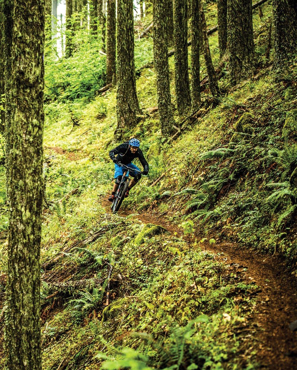
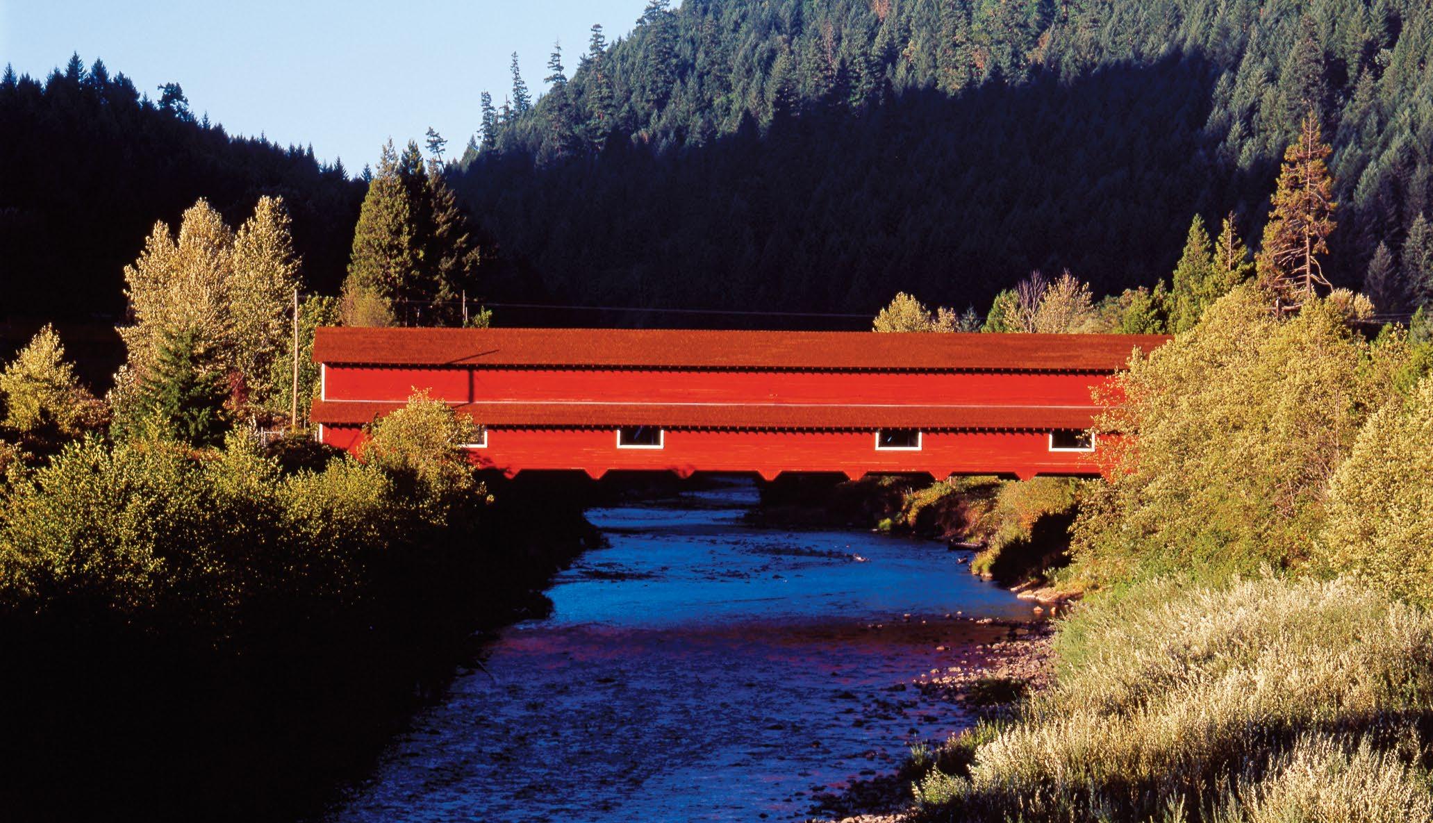
The road climbs to Box Canyon , where trails lead off into the 7 Three Sisters Wilderness . The byway leaves the McKenzie behind and soon meets up with the Wild and Scenic North Fork Middle Fork Willamette River. The superb scenery continues, tunneling through a deep canyon. In Westfir, the barn-red 8 Office Covered Bridge (Oregon’s longest at 180 feet/54 meters) stretches across the North Fork Middle Fork Willamette River — an enchanting conclusion to this scenic tour. Just next door, the town of Oakridge is a hub for mountain bikers, with miles of single-track trails twisting through its wild forests.
SUSAN SEUBERT 28 TRAVELOREGON.COM/BYWAYS
Office Covered Bridge
OREGON OUTBACK SCENIC BYWAY
The delicate beauty of the high desert sweeps from horizon to horizon on this 171-mile/275-kilometer drive across the Great Basin, a landscape as vast as an inland sea.
NATIONAL SCENIC BYWAY
KIRKENDALL-SPRING PHOTOGRAPHERS
TRIPCHECK.COM 29
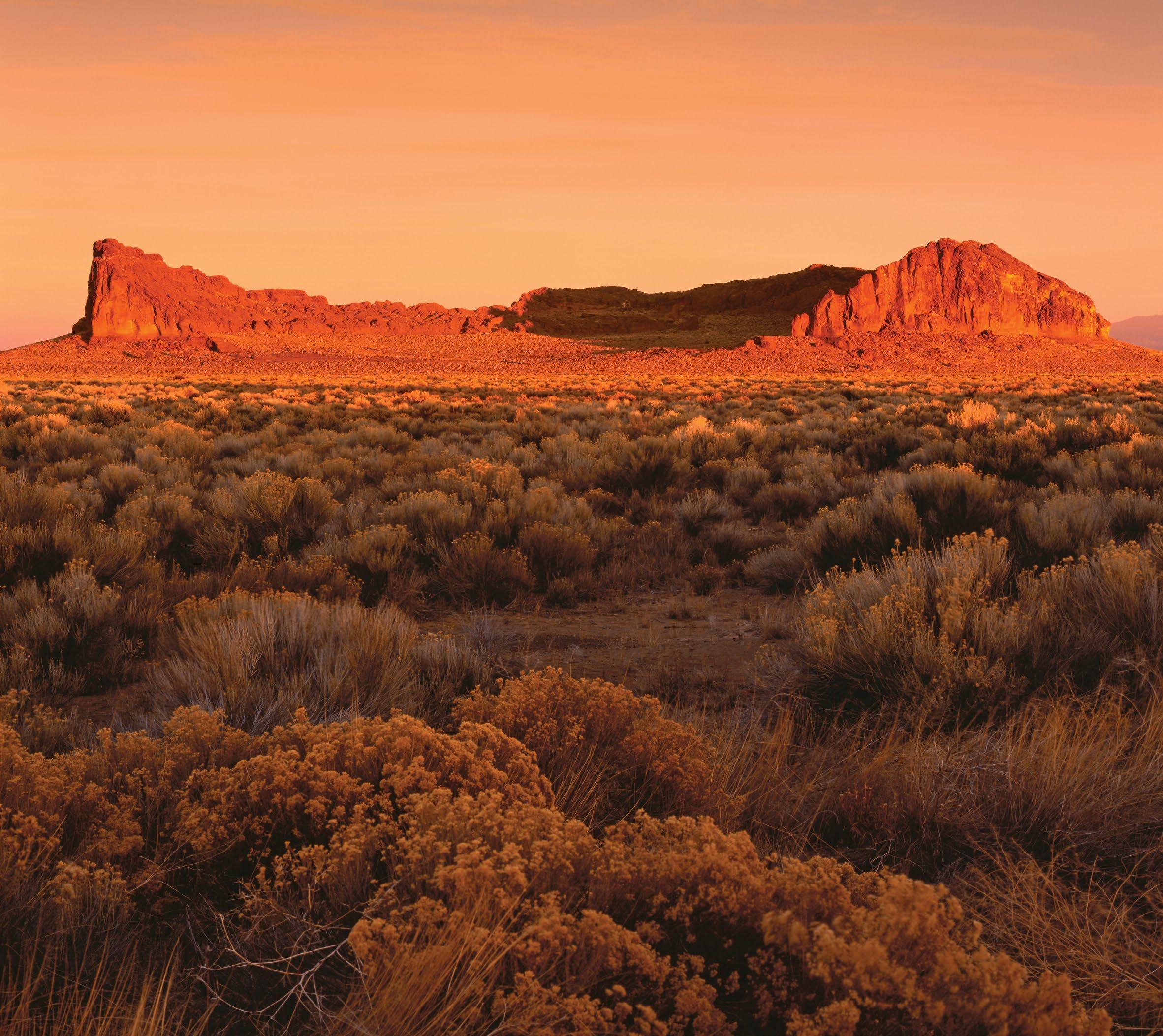
Fort Rock
cattle ranches in the nation.
At Valley Falls OR-31 joins US-395. To the east, the massive wall of 5 Abert Rim rises up nearly 2,500 feet/762 meters and stretches 30 miles/48.2 kilometers, the largest exposed fault scarp in North
1 La Pine 2 Fort Rock 3 Paulina Marsh 4 Summer Lake Wildlife Area 5 Abert Rim 6 Old Perpetual 7 Hart Mountain National Antelope Refuge 8 Goose Lake State Recreation Area Highlights Crump Lake Hart Lake 395 39 140 66 138 230 140 140 138 84 84 84 82 82 20 97 21 42 61 58 46 Burns Fort Klamath Chiloquin Oakridge Chemult Crescent Christmas Valley Bonanza Malin Merrill Plush Adel Klamath Falls CALIFORNIA NEVADA Upper Klamath Lake Summer Lake Lake Abert Diamond Lake Crater Lake Goose Lake Crater Lake National Park 62 Sprague River KlamathRiver 395 Summer Lake Paisley Lakeview Fort Rock Silver Lake La Pine 31 31 1 2 3 4 4 6 8 7 See p. 79. 30 TRAVELOREGON.COM/BYWAYS
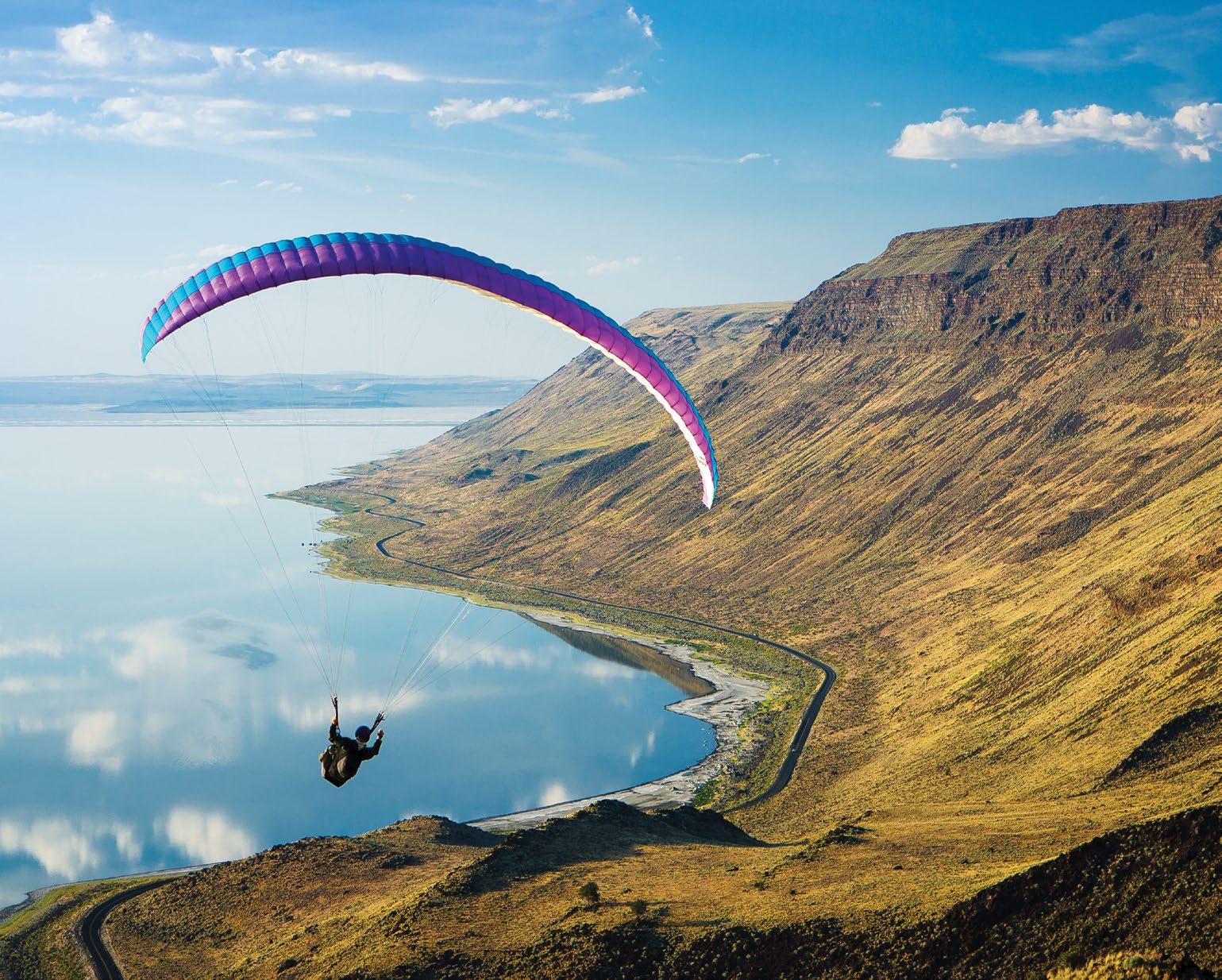
America. It’s become such a popular launch for hang gliding and paragliding that nearby Lakeview dubs itself the “Hang Gliding Capital of the West.” Its ample array of launch sites, open landing areas and favorable wind conditions draw enthusiasts from around the world. Black Cap, a popular launch, provides grand views of the Goose Lake Valley.
LAKEVIEW AND BEYOND
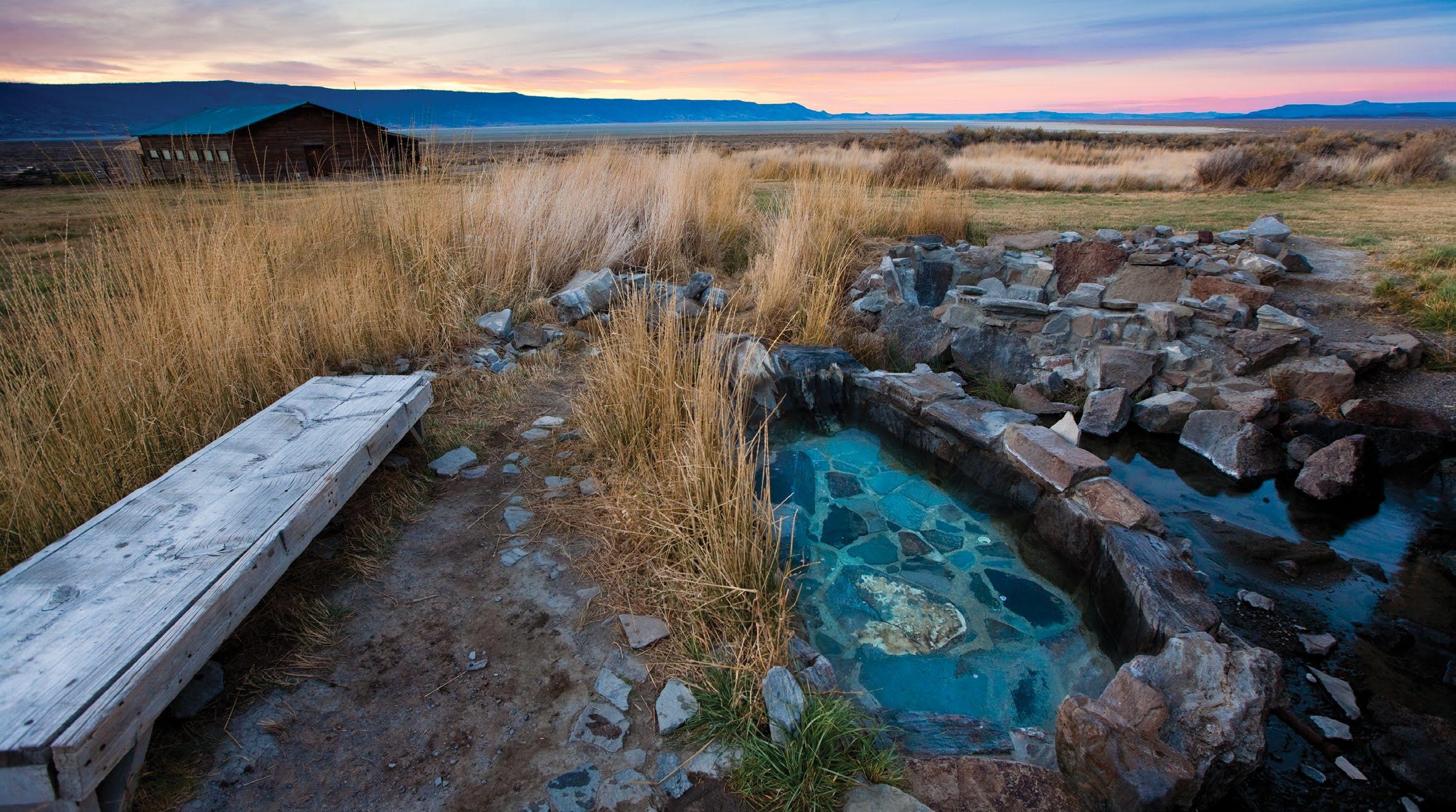
With an elevation of 4,800 feet/1,463 meters above sea level, Lakeview also claims the title of “Oregon’s Tallest Town.” It could come up with a geyser title, too: 6 Old Perpetual , located within a hot springs resort complex 1 mile/1.6 kilometers north of town, is Oregon’s only geyser, shooting a column of water up to 50 feet/15 meters into the air. It has a history of erupting every 90 seconds but has become more temperamental in recent years; the geyser still goes off regularly from October to May.
For those interested in wildlife and even more remote, wide-open spaces, consider detouring 65 miles/104.6 kilometers northeast of Lakeview via Plush to the 7 Hart Mountain National Antelope Refuge. Despite the erroneous name (you won’t find antelope here,
but rather native pronghorn), the refuge played a vital role in reviving rapidly declining populations of pronghorn, the fastest land mammal in North America. The 275,000-acre reserve is also a haven for bighorn sheep, golden eagles and prairie falcons.
The Outback Scenic Byway ends about 15 miles/24.1 kilometers south of Lakeview at the state-line town of New Pine Creek 8 Goose Lake State Recreation Area, a full-service state park campground, offers a shady resting spot for those continuing south to California.
(2)
TYLER ROEMER
Summer Lake Hot Springs
TRIPCHECK.COM 31
Hang gliding at Abert Rim
Devils Lake Crane Prairie Reservoir Cultus Lake Wickiup Reservoir Davis Lake Elk Lake Lava Lake Crescent Lake Todd Lake Paulina Lake East Lake Odell Lake Lake Billy Chinook Hosmer Lake 26 97 97 20 20 26 20 97 126 126 242 21 45 22 126 126 58 42 61 40 43 31 Culver Sisters Terrebonne Powell Butte Tumalo Camp Sherman Crooked River Ranch Madras Redmond Black Butte Ranch Metolius Prineville D e s c hutes River Crooked River 372 Bend Sunriver La Pine Crescent 46 Seasonal road 1 Drake Park 2 Cascade Lakes Highway 3 Mt. Bachelor Ski Resort 4 Broken Top Mountain 5 Sparks Lake 6 Elk Lake Recreation Area 7 Little Lava Lake 8 Crane Prairie Reservoir Highlights 1 2 4 3 5 6 7 8 32 TRAVELOREGON.COM/BYWAYS

DENNIS FRATES South Sister Mountain TRIPCHECK.COM 33
internationally inspired cuisine and gorgeous views of the Cascade Mountains.
LAND OF LAKES
As the byway descends from Mt. Bachelor to Dutchman Flat, you’ll get an impressive look at 4 Broken Top Mountain , which provides a rare opportunity to see inside a stratovolcano — a tall, canonical volcano. Volcanoes and glaciers together formed the dozens of lakes in this area, many created in basins scoured by ice and blocked by lava dams.
The route skirts an expansive wet meadow at the north end of 5 Sparks Lake, an exceptionally picturesque waterway covering about 250 acres, much of its shore jagged lava. The lake was a favorite subject of longtime Oregon photographer laureate Ray Atkeson, and a short loop hike near the boat ramp is named in his honor.
Near emerald-green Devils Lake, a
jumble of lava boulders tumbles down from Devils Hill . Archaeologists have found evidence of Native American encampments here, along with pictographs on Devils Hill dating back thousands of years. As NASA readied for its moonlanding missions in the 1960s, astronauts trained in these lunar-esque lava fields. Astronaut James Irwin carried a sliver of rock from Devils Hill on his Apollo 15 mission and left it on the moon.
CONTINUING SOUTH
Dozens of lakes beckon as the byway swings south on FR-46. To the west, trails lead to lakes hidden in the Three Sisters Wilderness . On the east side of the byway, the 6 Elk Lake Recreation Area offers easy water access, along with cabins, dining, a campground, a marina, boat rentals and other services. Both Elk Lake and nearby Hosmer Lake have superb views of Mt. Bachelor and great fishing.
The lifeblood of Central Oregon, the Deschutes River begins 5 miles/8 kilometers south as a small creek flowing from 7 Little Lava Lake. In its 250-mile/402.3-kilometer run north to the Columbia, it irrigates countless farms and ranches, and it is one of the West’s great fly-fishing and rafting rivers. The byway follows the Deschutes for a few miles as it flows through a meadow and 8 Crane Prairie Reservoir, famous for its 5- to 10-pound lunker rainbow trout, known as “Cranebows.” The eastern shore of the reservoir is an osprey management area; the fisheating birds of prey are frequently seen here, along with other raptors and shorebirds, including sandhill cranes.
You’ll pass several more lakes with good access for boats and fishing. The route ends at OR-58 near Crescent Lake and Odell Lake, two more spots to cast a line, launch a kayak and enjoy the Cascade Lakes.
TYLER ROEMER
34 TRAVELOREGON.COM/BYWAYS
Sparks Lake
MT. HOOD SCENIC BYWAY
The glacier-caked summit of Oregon’s highest peak creates a dramatic centerpiece for this 100-mile/161-kilometer route that skirts the mountain through fruit valleys and thick fir forest.
NATIONAL SCENIC BYWAY
LEE RENTZ
TRIPCHECK.COM 35
The Hood River Valley
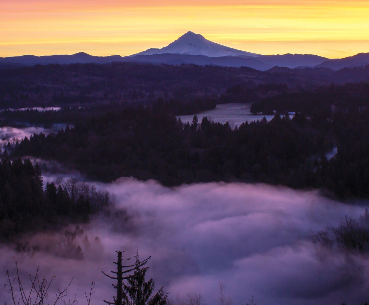
There are few more iconic symbols of Oregon than Mt. Hood, the state’s highest point at 11,245 feet/3,427 meters and the fourth highest peak in the entire Cascade Mountain Range. Known as Wy’east to the native Multnomah people, it is a dormant stratovolcano that last erupted in the 1780s; just a decade later, British navy explorers spotted it from the Columbia River and named it
HOOD RIVER
An hour east of Portland, Hood River enjoys an enviable location where the 1 Hood River, flowing down from Mt. Hood’s glaciers, meets the Columbia River. Long known as a fruit-processing center for the valley’s orchards, today Hood River is equally renowned for recreation. With plenty of public access to mountains, woods and water, this
Gorge. A waterfront path links popular launch sites in the port area.
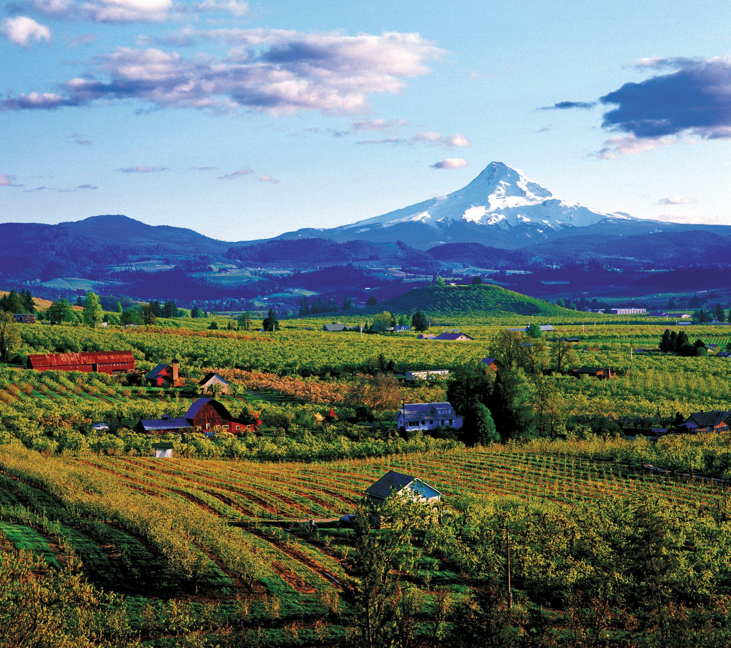
HOOD RIVER VALLEY
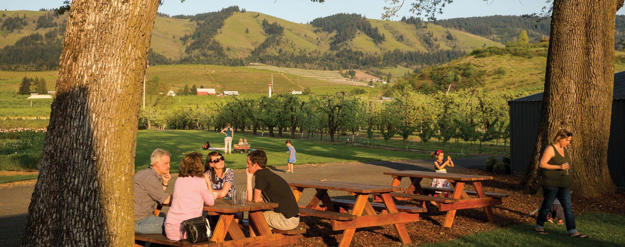
From Hood River, the byway leads south on OR-35 through the broad Hood River Valley along part of the 2 Hood River County Fruit Loop. Fertile volcanic soils, glacial water and a temperate climate have made the valley one of the
197 211 224 211 224 213 26 216 84 14 205 Cascade Locks Stevenson White Salmon Mosier Washougal Skamania Rowena Boring Damascus Bridal Veil Estacada Corbett Canby Oregon City West Linn Portland Milwaukie Molalla The Dalles WASHINGTON SandyRiver ColumbiaRiver ClackamasRiver Sandy 26 35 Troutdale Brightwood Welches Zigzag RhododendronGovernment Camp MT. HOOD Parkdale Odell Hood River Wood Village Gresham See p. 80. 8 7 6 5 4 3 2 1
NASHCO PHOTO 36 TRAVELOREGON.COM/BYWAYS
Wine tasting at the Gorge White House
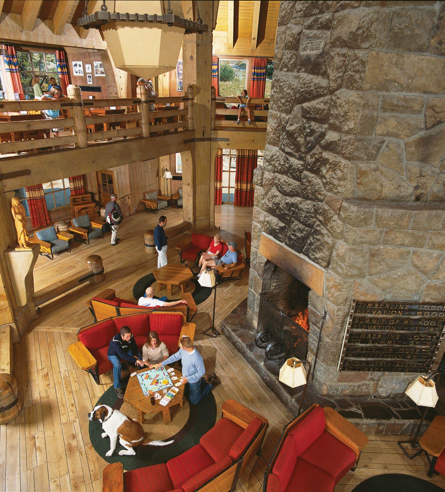
majestic Timberline Lodge, a triumph of wood and stone craftsmanship built by the Works Progress Administration in the 1930s. Perched at 6,000 feet/1,828 meters, 5 Timberline Lodge and Ski Area offers dining, lodging, easy access to alpine hikes, North America’s longest ski season, and the best view of Mt. Hood’s summit you can get without crampons and mountaineering skills.
ZIGZAG TO SANDY
From Government Camp, it’s downhill all the way to Wood Village. The steep descent was miserable for Oregon Trail travelers, who had to winch their wagons down a chute on the old Barlow Road at Laurel Hill , just past mile marker 51. Now it’s a pleasant drive, with resorts, restaurants, hiking trails and other services welcoming visitors to the villages of Rhododendron , Zigzag , Welches and Brightwood .
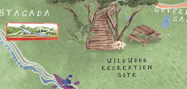
Past Welches, the 6 Wildwood Recreation Site is a great place to learn about Oregon’s environment, with interpretive trails along a wetland boardwalk and the lovely Salmon River. The Cascade Streamwatch window built into the bank gives a glimpse at the underwater life thriving in a tributary of this designated Wild and Scenic River.
SANDY TO TROUTDALE
If you prefer casting to watching, several fishing guides operate out of nearby Sandy. Mountain bikers now gather here too, thanks to a growing network of trails on federal lands at 7 Sandy Ridge Trail System, about 11 miles/17.7 kilometers east of town.
Just north of downtown Sandy, the 8 Jonsrud Viewpoint looks out across the expansive Sandy River Valley. Mt. Hood looms above, a view pioneers were no doubt relieved to have behind them.
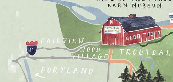
The byway continues west along Bluff and Orient roads through an agricultural area known for nursery stock and berries, then into the Portland metro area through historic downtown Gresham, Troutdale and Wood Village. These cities near the Columbia River offer an appealing mix of urban and outdoor activities, with hiking and biking trails, river access, resorts, concert venues, art galleries, great shopping and dining at the western gateway to the Columbia River Gorge National Scenic Area.
FROM TOP: MTHOODTERRITORY.COM; TIMBERLINE LODGE
Timberline Lodge
TRIPCHECK.COM 37
Mt. Hood from Jonsrud Viewpoint
199 97 58 39 138 227 140 42 66 62 138 38 84 84 5 5 82 5 5 Merlin Galice Central Point Jacksonville Selma Tiller Eagle Point Fort Klamath Chiloquin Oakridge Chemult Klamath Falls Medford Ashland Phoenix Talent Grants Pass Canyonville Sutherlin Oakland Upper Klamath Lake Crater Lake CALIFORNIA NorthUmpqua River Klamath River Sprague River SouthUmpquaRiver Crater Lake National Park RogueRiver Cow Creek Glide Idleyld Park Steamboat Union Creek Prospect Trail Shady Cove Gold Hill Roseburg 138 138 230 62 234 1 Winchester Dam 2 Douglas County Museum 3 Colliding Rivers 4 North Umpqua Trail 5 Toketee Falls 6 Diamond Lake 7 Rogue Gorge 8 Upper Rogue Highlights 1 2 3 4 5 6 7 8 38 TRAVELOREGON.COM/BYWAYS
DARCY BACHA North Umpqua River TRIPCHECK.COM 39
has earned the nickname “Highway of Waterfalls.” Several overlooks offer views of the river’s canyons and roiling white water. Well-marked trails lead to cascades like 5 Toketee Falls , a double-tiered waterfall, and to 272-foot Watson Falls , one of the highest in Southern Oregon. Just off the byway you’ll find Lemolo Lake Resort , a quiet hideaway known for its record-size brown trout.
DIAMOND LAKE TO THE ROGUE
Past Toketee Lake, OR-138 bids farewell to the North Umpqua and turns south to skirt the shores of 6 Diamond Lake. Framed by 9,200-foot/2,804-meter Mt. Thielsen and 8,363-foot/2,549-meter Mt. Bailey, Diamond Lake is indeed a jewel of the Cascade Mountains. In summer and fall, visitors enjoy resort facilities, horseback riding, boating, swimming, hunting, fishing and cycling a paved path around
the lake. Come winter, Diamond Lake Resort becomes a popular snowmobiling hub and also the base of operations for snowcat skiing and snowboarding on Mt. Bailey.
At the south end of Diamond Lake, OR-138 continues south toward Crater Lake National Park . To see Crater Lake, depart briefly from the byway and follow part of the Volcanic Legacy Scenic Byway (p. 14). The Crater Rim Viewpoint looks east toward the peaks and ridges ringing Crater Lake. The Rogue-Umpqua Scenic Byway joins OR-230 and swings southwest into the Rogue River-Siskiyou National Forest , where the Rogue emerges from underground lava tubes.
THE UPPER ROGUE RIVER
The route descends past old-growth firs and lava flows and into the Rogue River canyon, joining the river as it heads downstream. The byway joins OR-62 just north of Union Creek , the western terminus of a wagon road for settlers crossing the Cascades. A short path leads to an observation platform overlooking the 7 Rogue Gorge, a collapsed lava tube where the river now courses through a 25-foot-wide, 40-foot-deep chasm. A mile/1.6 kilometers south, the Natural Bridge interpretive site explains how the river disappears through an underground lava tube, forming a land bridge.
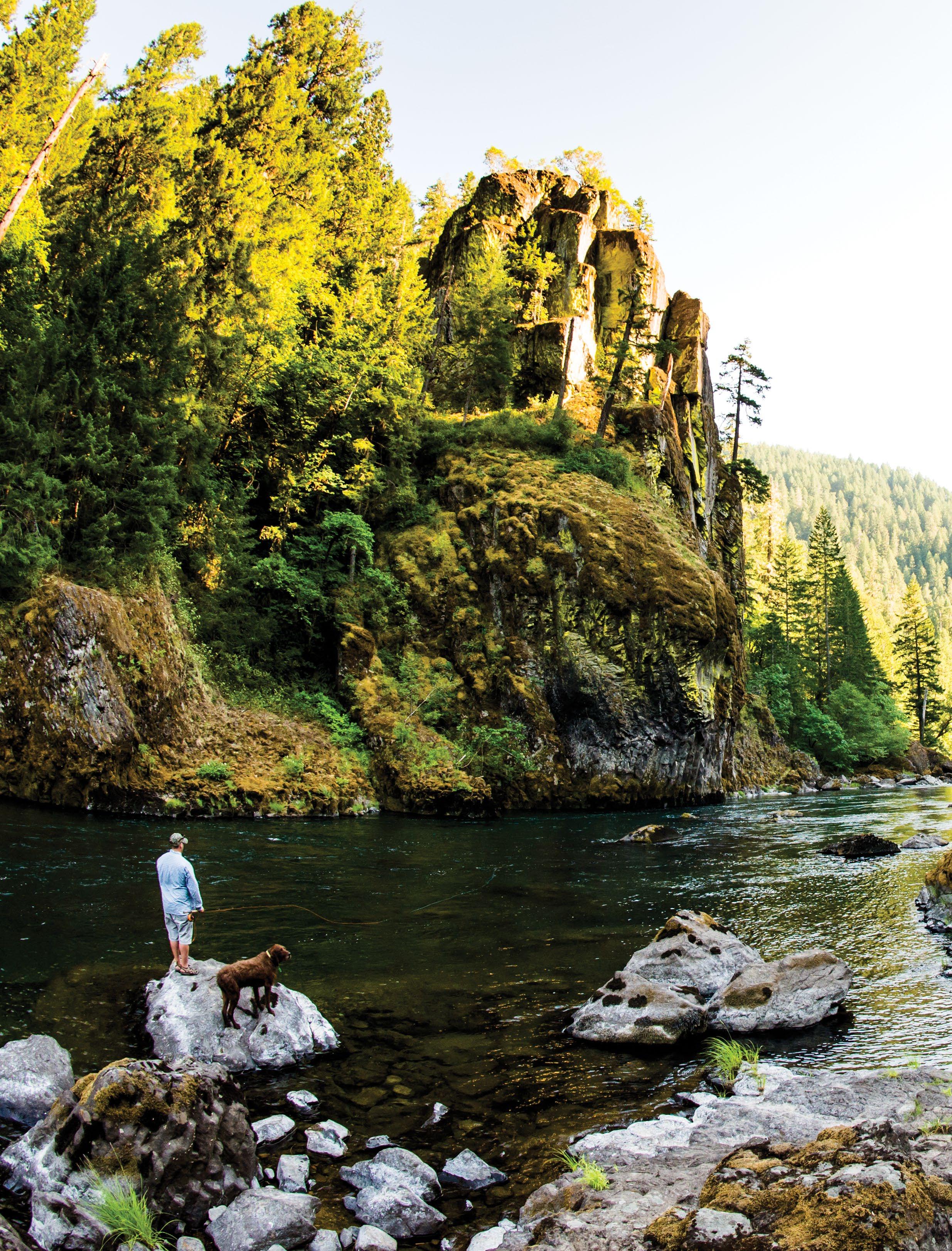
The byway passes several campgrounds and fishing spots as it follows the Wild and Scenic Rogue downstream. Like the North Umpqua, the Upper Rogue supports endangered populations of chinook and coho salmon, as well as cutthroat trout and steelhead. At Joseph H. Stewart State Recreation Area , the river widens into Lost Creek Lake, popular for boating and fishing. Just beyond the lake, the Cole Rivers Hatchery raises and releases salmon and steelhead into the Rogue and Applegate rivers each year. Farther south, Shady Cove is a popular departure point for anglers and rafters floating the
8 Upper Rogue
The byway joins OR-234, where several waysides entice travelers to linger along the river with a fly rod or a picnic lunch. The route ends at Gold Hill , less than an hour from the bustling Rogue Valley cities of Medford, Ashland and Grants Pass.
GREG VAUGHN
40 TRAVELOREGON.COM/BYWAYS
Toketee Falls
OREGON STATE SCENIC BYWAYS
The Oregon State Scenic Byways take travelers through nine diverse landscapes. Traverse the Blue and Elkhorn mountains, through the high desert, and along the Umpqua and McKenzie rivers. Find your way from peaks and trees to the sea, Over the River and Through the Woods or on a Journey Through Time.
 Cape Meares Lighthouse
JUSTIN BAILIE TRIPCHECK.COM 41
OREGON STATE SCENIC BYWAY
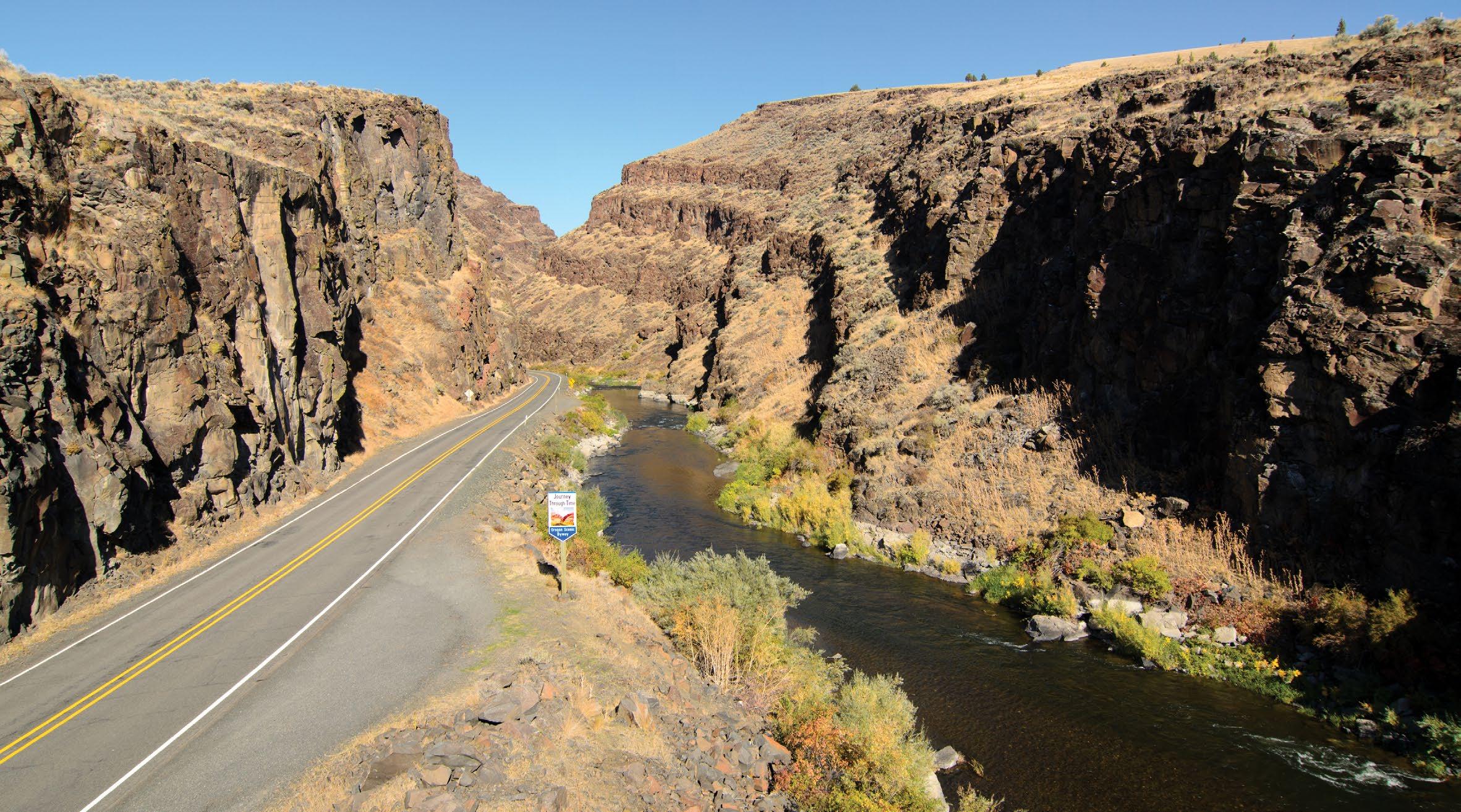
JOURNEY THROUGH TIME SCENIC BYWAY
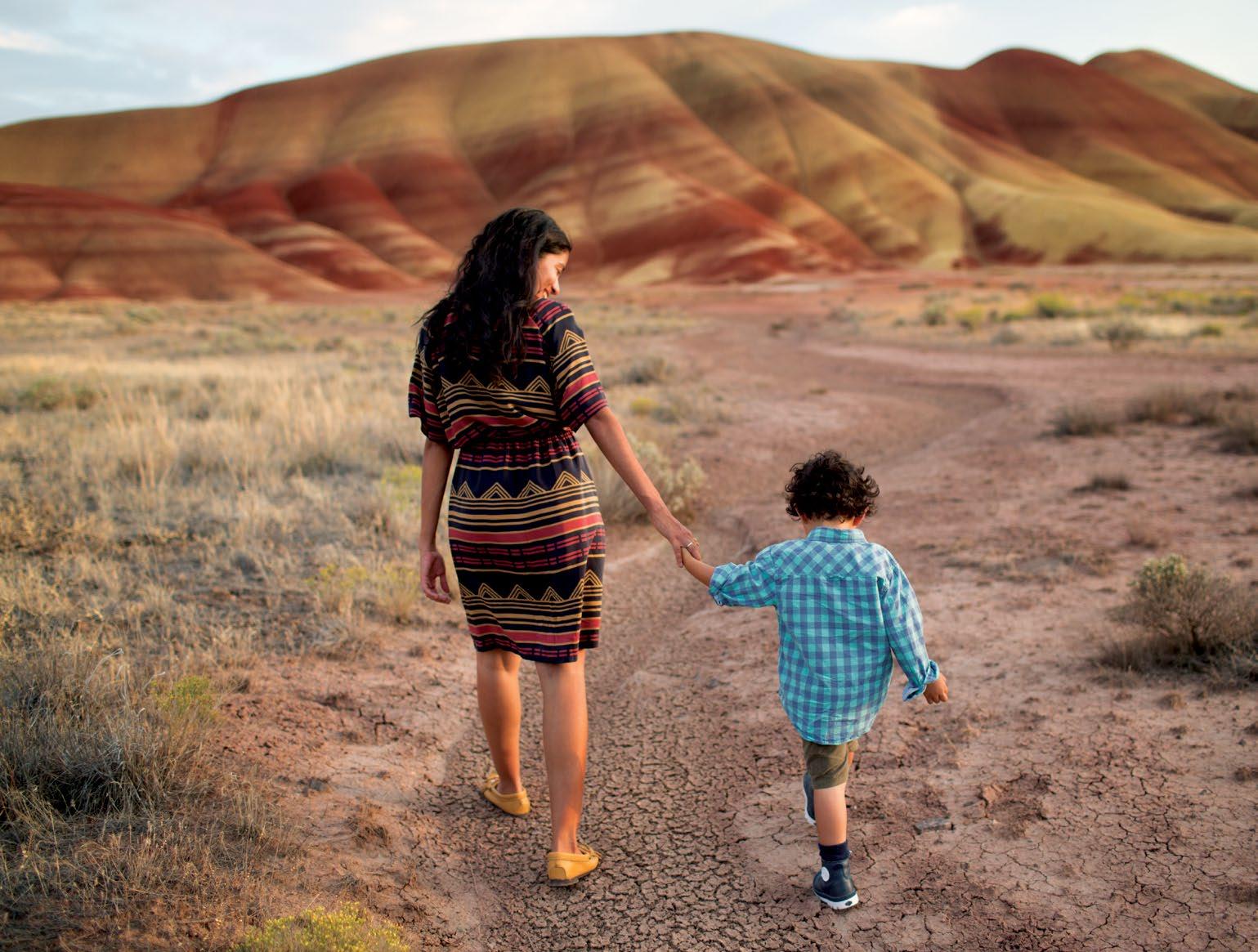
The marks of time are stamped across the landscape on this 286-mile/460-kilometer route through prehistoric fossil beds, mining boomtowns and surprising sights like the Painted Hills.
Driving across northeastern Oregon is a trip through the state’s historical timeline. This route begins at the Columbia River, the traditional fishing and gathering grounds for generations of Native Americans. It travels through river canyons and into the John Day Fossil Beds National Monument, where 55 million years of life are preserved in the rocks. And it explores communities past and present that tell stories of the state’s hardworking heritage in the woods, in the mines, on the ranches and on the railroad.
ROLLING HILLS AND RIVER CANYONS
The byway begins at Biggs , along the Columbia River, and curves up US-97 between the canyons of two more major Oregon rivers: the Deschutes and the John Day. The skies here seem huge and the views stretch for miles, with checkerboard wheat fields, undulating golden hills and spinning wind turbines.
In Moro, the 1 Sherman County Historical Museum collection includes thousands of artifacts of Native American
life, Oregon Trail migration and wheat farming. Continuing south, Shaniko was the wool shipping center of the world in the 1880s. Today this living ghost town springs to life at annual events celebrating its heritage.
FOSSIL BEDS AND PAINTED HILLS
The byway heads east along OR-218 from Antelope to the 2 Clarno Unit of the John Day Fossil Beds National Monument . The three John Day Fossil
LEON WERDINGER
42 TRAVELOREGON.COM/BYWAYS
Picture Gorge along US-26
Beds units, all on the byway, comprise a remarkably diverse record of more than 2,000 species of plants and animals dating back 6 million to 54 million years, forming one of the most complete fossil records in existence. Interpretive trails guide you under castle-like cliffs and past easy-to-spot fossils exposed in the rock.
5 Wild and Scenic John Day River, from which the fossil beds take their name. The John Day is the longest freeflowing river in Oregon and a delight for steelhead and smallmouth bass fishing as well as rafting in this arid climate. The North Fork joins the main stem of the river at Kimberly.
center has films, interpretive exhibits and local fossils on display, from ancient ferns to saber-toothed tigers. Trails lead through an amphitheater of bluegreen clay stone and up to an overlook of the John Day River Valley. Just before Dayville, the byway passes through Picture Gorge, with the river flowing below and jagged palisades rising above.
EAST TOWARD THE MOUNTAINS
The route follows US-26 east through John Day, once known for its cattle drives down Main Street, and the 7 Kam Wah Chung State Heritage Site. The 1870s landmark was a general store, doctor’s office, herbal pharmacy and ad hoc community center for the Chinese workers who lived here in the 1880s. The site includes a museum and an interpretive center.
Continue through 8 Prairie City on a particularly scenic stretch of the byway, with the Strawberry Mountain Wilderness as a backdrop, and up into the Blue Mountains on OR-7. The byway passes Whitney, once a busy center for area logging, mining and cattle operations. Now abandoned buildings are all that remain in this easy-to-reach ghost town.
East of the gold-mining center of Sumpter, the byway joins the Elkhorn
197 26 26 26 97 395 97 86 39 Seasonal road 53 73 74 19 74 3 37 11 126 126 216 206 244 203 245 204 207 84 84 82 350 82 207 WASHINGTON IDAHO Arlington Condon Elgin Haines Heppner Huntington Ione Lexington Ukiah Imnaha North Powder Unity Rufus Irrigon Starkey Troy Flora Maupin The Dalles La Grande Union Redmond Walla Walla Lonerock Imbler Milton-Freewater Prineville Madras Pendleton Wallowa Joseph Enterprise Lostine Richland Halfway Boardman Hermiston Snake River Imnaha R i v e r GrandeRondeRiver JohnDayRiver UmatillaRiver PowderRiver Deschutes River 19 218 207 19 97 7 26 Baker City Biggs John Day Antelope Mitchell Sumpter Kimberly Grass Valley Moro Shaniko Service Creek Fossil Dayville Prairie City Austin See p. 79. 1 2 3 4 5 7 8 6 CHANTAL ANDERSON
TRIPCHECK.COM 43
The Painted Hills
OREGON STATE SCENIC BYWAY
BLUE MOUNTAIN SCENIC BYWAY
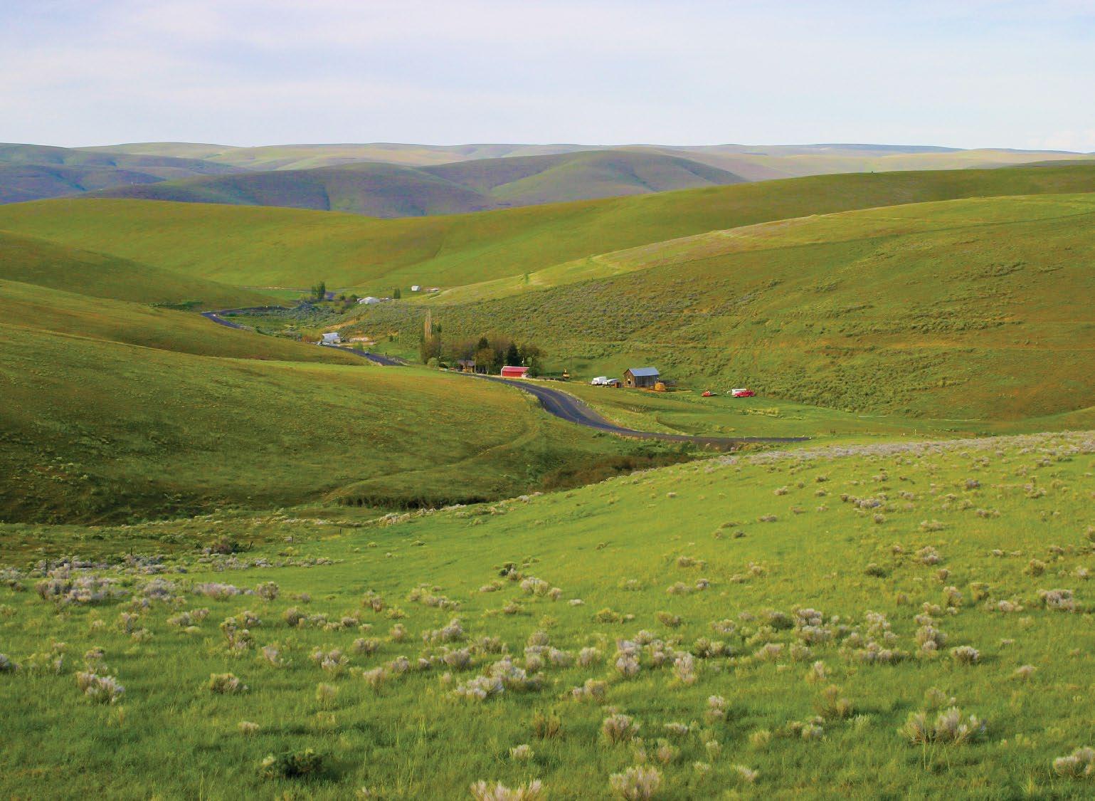
This 145-mile/233-kilometer route “cuts the corner” of Interstate 84 in northeast Oregon, leading through ranching communities up into the forests and wilderness areas of the Blue Mountains.
The Blue Mountains indeed look blue from a distance, a formidable range rising to more than 9,000 feet/2,743 meters and stretching from the Columbia River southeast to the Snake River. A harrowing obstacle for Oregon Trail pioneers, today this route up into the Blues is pure delight, winding past rolling ranchlands, rocky peaks, wild rivers and ample opportunities for recreation.
RANCHING COUNTRY
The west end of the byway begins along the Columbia River, where OR-74 leads south from I-84 at Heppner Junction
The 1 Willow Creek Wildlife Area provides habitat for upland game birds and waterfowl.
The Oregon Trail passed through what is now Cecil , with thousands upon thousands of pioneer wagons pulled by
oxen and mule teams making their way west in the 1850s to settle the Oregon Territory. For a brief detour off the byway, follow the Oregon Trail marker 13 miles/21 kilometers east to an information kiosk at 2 Wells Springs , where deep wagon ruts still furrow the earth.
Back on the byway, the route winds along Willow Creek, surrounded by rolling wheat fields and hillsides dotted with livestock. The communities of 3 Ione and Lexington began as sheep stations in the 1800s and still maintain classic examples of frontier architecture.
HISTORIC HEPPNER
Heppner calls itself the “Gateway to the Blues,” the commercial and recreational center for the nearby Blue Mountains
and Umatilla National Forest. The region is a popular destination for hunting, off-highway-vehicle (OHV) riding and, thanks to an elevation of 1,800 feet/ 549 meters that often brings winter snows, snowmobiling and skiing. Closer to town, four streams and the 4 Willow Creek Reservoir provide good fishing.
A historic walking tour of downtown Heppner highlights several turn-of-thecentury buildings, including its 1902 bluestone county courthouse. The clock tower, converted to an electronic mechanism in the 1950s, has been restored to its original weighted pendulum, which requires winding every eight days. The 5 Morrow County Museum houses a fine collection of pioneer and agricultural artifacts, and chronicles the region’s great flood of 1903, the deadliest natural disaster in Oregon to date.
INTO THE UMATILLA NATIONAL FOREST
The byway begins to narrow and twist as it departs the highway, winding through hills and canyons on Willow Creek Road and into the 1.4-million-acre 6 Umatilla National Forest . Right at the National Forest border, Cutsforth Park has a campground and cabins for rent as well as equestrian trails, and travelers will find ample trailheads for camping, hiking, horseback riding, OHVs and mountain bikes along FR-53.
A half-hour side trip south on FR5327 and FR-5316 leads to 7 Potamus Point , offering a magnificent canyon view of the Wild and Scenic North Fork John Day River drainage. Keep
LEON WERDINGER
44 TRAVELOREGON.COM/BYWAYS
North Fork John Day River
a look out for bighorn sheep that were reintroduced into the canyon.
THE UKIAH BASIN
The thick forest of fir and pine disappears as the byway descends into a lake basin permanently drained by an ancient earthquake. The town of Ukiah was originally called Camas Prairie for the bright-blue camas that covers the area in spring. Native Americans have long come here to gather camas root, a traditional food staple.
Four miles/6.4 kilometers past Ukiah on the byway (FR-53), the 8 Bridge Creek Wildlife Area provides important wintering grounds for Rocky Mountain elk. More than 1,000 elk gather here
395 19 218 207 19 7 26 82 74 19 37 11 206 244 245 204 207 84 84 73 WASHINGTON IDAHO Arlington Condon Elgin Haines North Powder Unity Irrigon Starkey La Grande Walla Walla Lonerock Imbler MiltonFreewater Pendleton Boardman Hermiston Mitchell Dayville Kimberly Service Creek Fossil John DayPrairie City Austin Baker City Sumpter Granite Snake River Imnaha R i v e r John DayRiver UmatillaRiver Deschutes R i v e r 53 74 Ione Lexington Heppner Ukiah See p. 79. 1 2 3 4 5 6 7 8 FROM TOP: VINCE WARREN; JONI KABANA Willow Creek Road Farmland near Heppner TRIPCHECK.COM 45
OREGON STATE SCENIC BYWAY
ELKHORN DRIVE SCENIC BYWAY
Scissor-sharp peaks and ridges define the Elkhorn Mountains of northeast Oregon, where gold-mining boomtowns have given way to a mother lode of natural beauty on this 106-mile/171-kilometer tour.
This byway packs plenty of sights into a 106-mile/171-kilometer loop through the mountains west of Baker City, long the lucrative hunting grounds of the Plateau Indian tribes and, later, where miners came to seek their fortunes. The true treasures are the Elkhorn Mountains and Baker Valley themselves, rich in beauty and history.
BAKER CITY
Already established as an agricultural center, Baker City flourished with the discovery of gold in Oregon in the 19th century. The “Queen City of the Mines” grew wealthy providing transportation, food and supplies to thousands of miners in the nearby mountains. When other towns dried up after the gold rush, Baker
City successfully transformed into a hub for logging, ranching and the transcontinental railroad.
Downtown storefronts and homes still show off Baker City’s opulence, especially the 1889 1 Geiser Grand Hotel , a meticulously restored Italianate beauty with mahogany columns and a stainedglass ceiling. The Baker Heritage Museum, housed in a 1920 natatorium, has exhibits on ranching and mining, and an excellent mineral collection.
ALONG THE POWDER RIVER
The byway follows OR-7 through ranchlands, turning west along the 2 Powder River. It threads through the basalt Blue Canyon and enters the WallowaWhitman National Forest , where grasslands and juniper hills give way to ponderosa pine forest.
The Powder River’s Mason Dam forms 2,235-acre 3 Phillips Lake, a popular spot for boating, fishing and waterfront camping. The lakeside Mowich Loop Picnic Area provides access to the North Shore Trail, part of the Phillips Lake Trail System, which winds along the lake for more than 6 miles/9.6 kilometers and is open to hiking, mountain biking and horseback riding.
GOLD COUNTRY
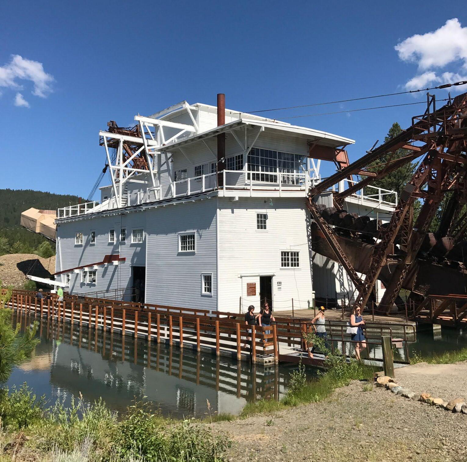
Past Phillips Lake, the Tailings Overlook gives evidence of the intensive gold mining that occurred in this area in the mid-19th century. A few miles west in McEwen , the Sumpter Valley Railroad Stump Dodger follows the narrow-gauge track used by miners and loggers over a
NICKIE BOURNIAS 46 TRAVELOREGON.COM/BYWAYS
Sumpter Valley Dredge
WASHINGTON 7 245 244 51 82 203 84 395 26 La Grande Starkey Ukiah Austin Prairie City North Powder Powder River 73 7 24 Granite Sumpter Haines Baker City 1 8 2 3 4 5 6 7
DENNIS FRATES TRIPCHECK.COM 47
Anthony Lakes
HIGH DESERT DISCOVERY SCENIC BYWAY
Far off the beaten path, this 127-mile/204-kilometer eastern byway ventures out among Steens Mountain and the Alvord Desert, linking to three other tour routes for an austere and awe-inspiring look at Oregon’s Wild West.
Before interstates and cell towers seemed to link every rural corner of America, there were places like this, where you could gaze out across an unbroken horizon, hear every birdsong and fall asleep under a bowl of dazzling stars. The High Desert Discovery Scenic Byway indeed takes you to such a place, then ups the ante with some serious geologic drama. From desert to mountain, this is Oregon’s frontier country. Bring a pioneering spirit and enjoy the adventure.
BURNS AND THE MALHEUR NATIONAL WILDLIFE REFUGE
The density in this part of Oregon is less than one person per square mile, on par with Alaska. 1 Burns , the county seat and largest community in Harney County, has its roots in ranching, which remains the region’s mainstay. Needless to say, this is the spot to stock up on fuel and supplies before heading south on OR-205.
Ahead lies the 187,757-acre 2 Malheur National Wildlife Refuge, an oasis of
wetlands and lakes that suddenly appears amid stark mesas and dry grasslands. Numerous creeks and rivers carry snowmelt down from the surrounding high country, feeding its three lakes — 3 Malheur, Mud and Harney — along with vast marshes and meadows. It creates an extensive marsh system that attracts an enormous array of birds and other animals. It’s considered one of the top bird-watching areas in the Pacific Northwest and is an important breeding ground and migratory rest stop on the Pacific Flyway. Spring is the most spectacular season, when snow geese and other waterfowl gather in such numbers that they can actually darken the sky.
The Narrows-Princeton Road leads east to the refuge’s headquarters, where the visitor center staff will happily provide tips on the best places to view wildlife, and an observation deck provides a good vantage point of Malheur Lake. The adjacent 4 George Benson Memorial Museum has exhibits and historic taxidermy mounts of many of the birds spotted here.
FORWARD TO FRENCHGLEN
Traveling south on the byway, you’ll continue to skirt the marshes and meadows of the refuge. Jackass Mountain rises to the west, and the Diamond Loop Tour Route (page 67) departs off to the east, visiting the Diamond Craters Outstanding Natural Area lava formations and the Peter French Round Barn
The historic community of Frenchglen is named for Dr. Hugh Glenn, a successful rancher, and Peter French, an employee and eventual son-in-law of Dr. Glenn’s,
OREGON STATE SCENIC BYWAY
MELISSA FARLOW
48 TRAVELOREGON.COM/BYWAYS
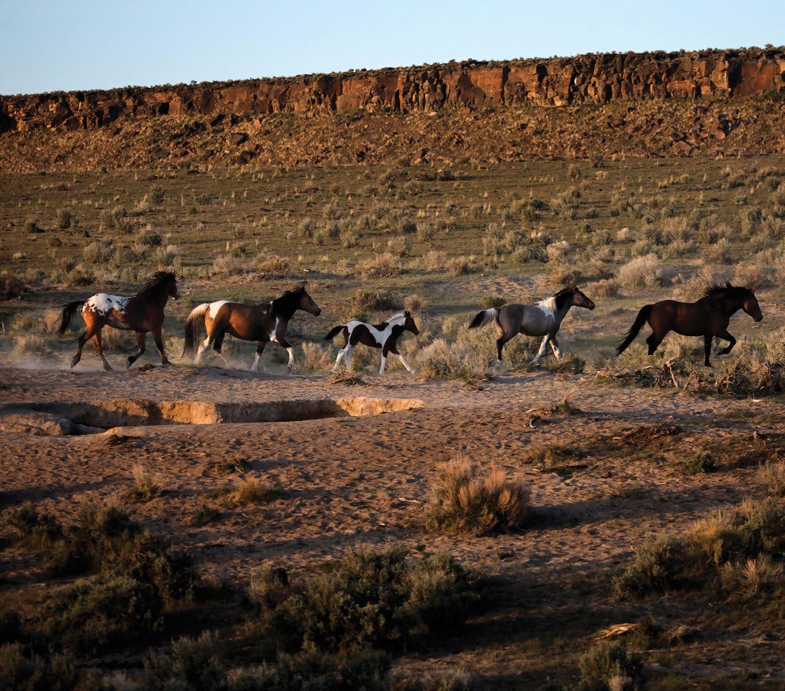
Wild horses south of Frenchglen
open today, providing lodging and familystyle meals March through October.
Frenchglen provides access to the 6 Donner und Blitzen River, which offers excellent fishing for redband
Valley past several private ranches, the byway concludes in Fields. This small ranching community has gas and other services, and is the departure point for the East Steens Tour Route (page 65).

Travel is best late spring through fall but passable year-round. Gas: Be sure to have plenty of gas before leaving Burns and Fields. Medical: Medical services/hospital located in Burns. 20 395 395 95 78 140 california Riley Wagontire Hines Crane Malheur Lake Harney Lake Alvord Desert Steens Mountain Diamond Donner und Blitzen River 205 Frenchglen Burns Fields 1 2 3 4 5 6 7 8 BRIAN O’KEEFE Donner und Blitzen River TRIPCHECK.COM 49
OREGON STATE SCENIC BYWAY UMPQUA RIVER SCENIC BYWAY
Enjoy a 66-mile/106-kilometer drive as diverse as the river itself, rolling through historic timber towns, wine country, fishing hot spots and fur-trading posts as it twists through the Coast Range on its way to the Pacific.
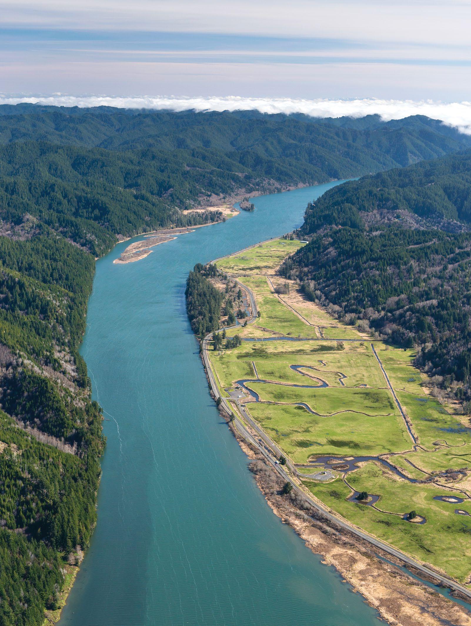
Along with generations of Native Americans who lived along its banks, the riches of the Umpqua River have long nurtured fur traders, loggers, fishermen and farmers. Its wealth of natural and historical treasures unfolds as you follow this river-valley route, a pleasant meandering trip through the dense forests of the Coast Range and along the Umpqua’s clear-flowing waters.
OAKLAND AND SUTHERLIN
The Umpqua River Scenic Byway begins in Oakland, once a busy railroad stop linking routes to Portland and Sacramento. Just a few minutes from the interstate, well-preserved 19thcentury brick buildings line its downtown “historic row,” a National Historic Landmark. Antique stores, a historic walking tour and the 1 Oakland Museum provide more glimpses into its intriguing past.
Sutherlin is a good spot to fuel up or grab a bite to eat before heading northwest on OR-138, where the byway soon meets up with the 2 Umpqua River on its crooked course flowing down from the Cascade Mountains. Twelve miles/ 19.3 kilometers past Sutherlin, look for the 100-foot-high walnut tree on the left side of the highway. Estimated to be more than 250 years old, it’s a mystery how this nonnative tree sprouted here.
KELLOGG TO ELKTON
The Umpqua River is legendary among anglers for its runs of chinook salmon, sturgeon and especially steelhead. Between Kellogg and Elkton , a
GARTH LENZ / ILCP 50 TRAVELOREGON.COM/BYWAYS
Umpqua River
particularly loopy and scenic stretch of river also offers some of the West’s finest smallmouth bass fishing. The byway joins OR-38 at Elkton and continues west.
Vintners have discovered that the Umpqua Valley’s rumpled topography of hillsides and river drainages, along with its coastal microclimate, produce a sur prising diversity of high-quality wines. Burgundian grapes like pinot noir and pinot gris thrive here, but so do warmerclimate Bordeaux varietals like cabernet sauvignon and merlot. In with its own American Viticultural Area — you’ll discover winery tasting rooms, along with several restaurants.
At the Elkton Community Education Center, a butterfly house and humming bird garden attract a number of colorful species, especially in July and August.
Adjacent 4 Fort Umpqua
duction of the Hudson’s Bay Company fur-trading post that operated just across the river from 1836 to 1854. Used as a regional center to gather and trade beaver pelts, it was the first non-Native settlement along the Umpqua.
SCOTTSBURG AND THE GOLD RUSH
This next stretch of the byway offers great river views as the Umpqua tumbles in a
101 5 North Bend Winchester Bay Charleston Westlake Coos Bay Cottage Grove Umpqua River Lighthouse Cape Arago Lighthouse Umpqua River 138 38 Sutherlin Oakland Elkton Reedsport See p. 80. 8 7 6 5 4 3 2 1
AGE FOTOSTOCK / ALAMY STOCK PHOTO TRIPCHECK.COM 51
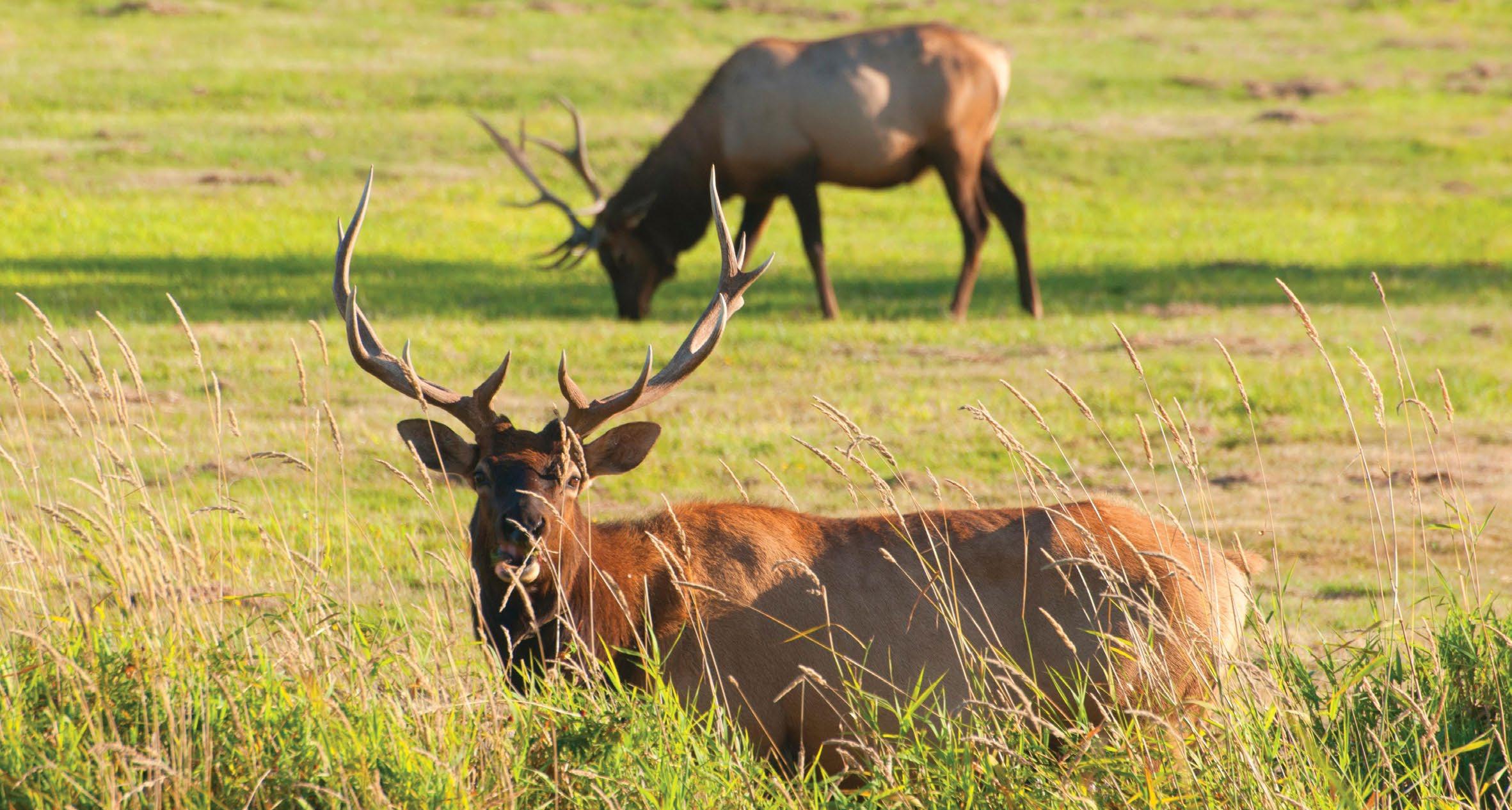
Dean Creek Elk Viewing Area
OREGON STATE SCENIC BYWAY
McKENZIE RIVER
The steely blue McKenzie River sets the course for this 34-mile/55-kilometer riverside route, which links the fruitful Willamette Valley to the fragrant fir forests of the Cascade Mountains.
One of Oregon’s most beloved fly-fishing rivers, the clear blue McKenzie tumbles and surges over waterworn rocks on its scenic run from forest to farmland, where it joins the Willamette River near Eugene. This byway zigzags along its bank, where a string of riverside commu-
nities provides welcoming gateways to the river valley’s attractions.
WALTERVILLE
Spring-fed from wilderness aquifers, the McKenzie River provides outstanding habitat for native redside rainbow trout
and cutthroat trout, ample hatchery trout, spring chinook salmon and summer steelhead. A display at the 1 Hendricks Bridge County Park illustrates the way prospectors, trappers and homesteaders utilized different ways of crossing the powerful river. Here in the 1800s, the Hendricks Ferryboat provided a vital link for people, livestock and goods to safely make their way from bank to bank just upstream from the current bridge.
Family farms thrive on the broad plains of the western McKenzie. Near Walterville, farm stands open in spring with baskets of plump local strawberries and end the season with holiday wreaths made from local holly and Christmas trees. In July the region hosts the McKenzie River Lavender Festival, with U-cut fields, a lavender labyrinth, a craft bazaar and other festivities.
LEABURG
Continuing east, the 2 LeaburgWalterville Hydroelectric Project is a complex that earned a spot on the National Register of Historic Places. Renowned sculptor Harry Camden Poole created the bas-relief panels on the powerhouse, considered among the state’s finest examples of art deco architecture. The complex is also notable for its innovative 1920s engineering design, including the dam’s 100-foot-long roller gates.
The structure slows the river flow here, creating Leaburg Lake. For access to the water, visit 3 Lloyd Knox Park, which offers a lakeside trail, boat ramps and some picnic areas with free electric stovetops. At the adjacent 4 Leaburg Hatchery,
TYLER ROEMER 52 TRAVELOREGON.COM/BYWAYS
Drift boat fishing on the McKenzie River
you can check out sturgeon and trout in show ponds or watch for spawning salmon
Old McKenzie is also on the National Register of Historic Places, preserving a 1907 hatchery complex with 17 buildings and ponds that appear as they did a century ago. Now a county park, it includes an out door visitor kiosk, trails and interpretive signs explaining the hatchery’s legacy. In addition, plans are now moving forward to construct a new state-of-the-art McKenzie River Interpretive Center to tell the story of the area’s unique geology, fisheries and guiding heritage.
The famed McKenzie drift boat originated here in the 1930s, a dory specifically designed to deftly navigate the river’s rocky runs and provide a stable casting platform. River guides run the McKenzie in these time-tested boats. (Contact the McKenzie River Chamber of Commerce or Travel Lane County for a list of professional guides and outfitters.) Anglers will also find plenty of public river access at boat ramps and parks all
Onward into Vida, the 1938 Goodpasture Bridge
165 feet/50 meters across the river. The state’s second-longest covered bridge is also one of the prettiest with arched and louvered windows. At the site of


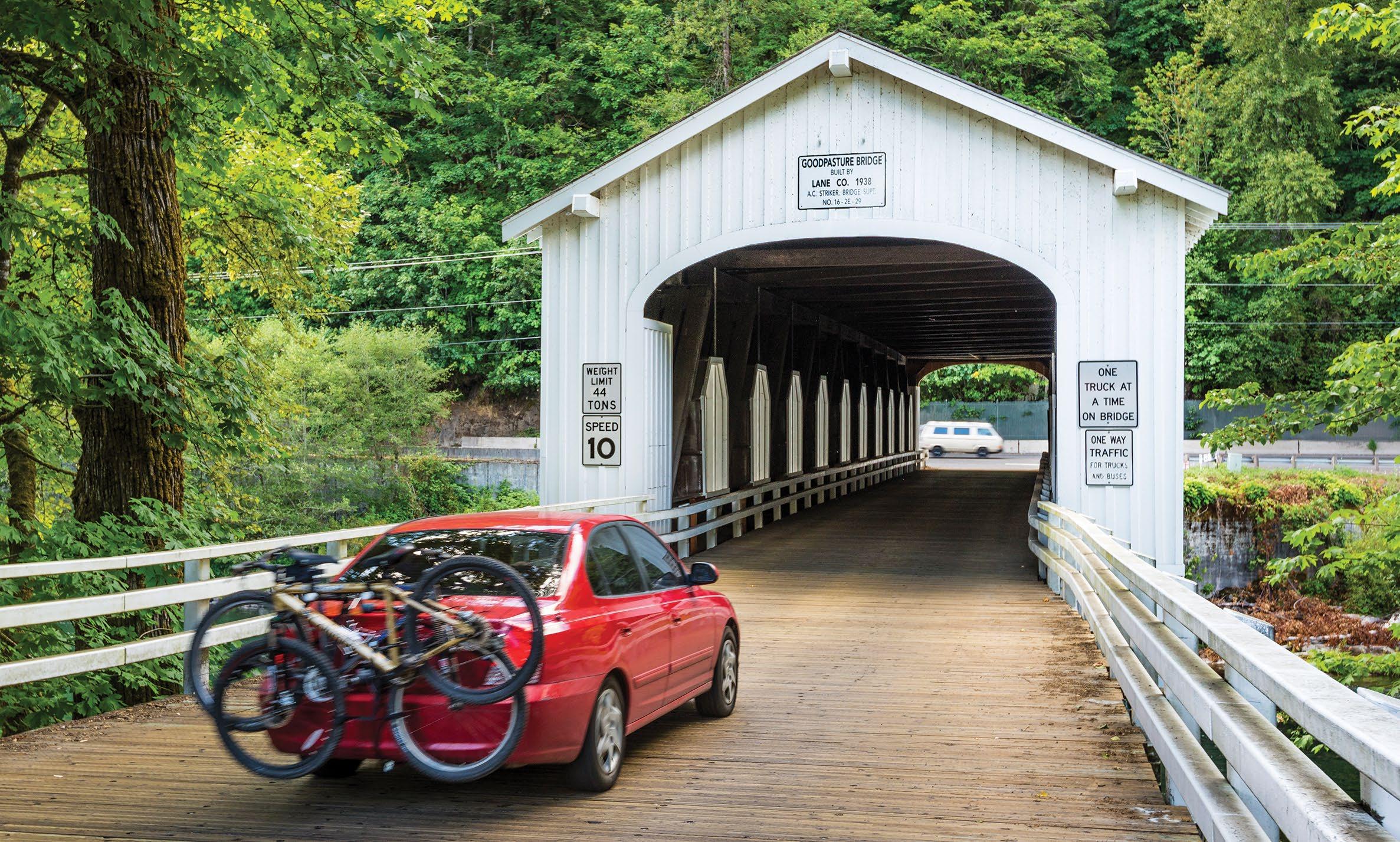
marks a historic stage stop.
The river runs wilder here, tumbling through boulder fields and Class III
access with picnic sites, a boat landing and a half-mile trail to one of the river’s best-known rapids. The rugged trail rewards hikers with exciting views of boaters navigating challenging waters.
is one of several fishing lodges offering signature McKenzie River hospitality. The lodge each McKenzie River Inn features art workshops with instruction from internationally renowned artists.
Moving along Forest Road 15 is a gateway to the recreational wonderland , with camp ing, boating and hiking as well as access to Wolf Rock, Oregon’s largest and the


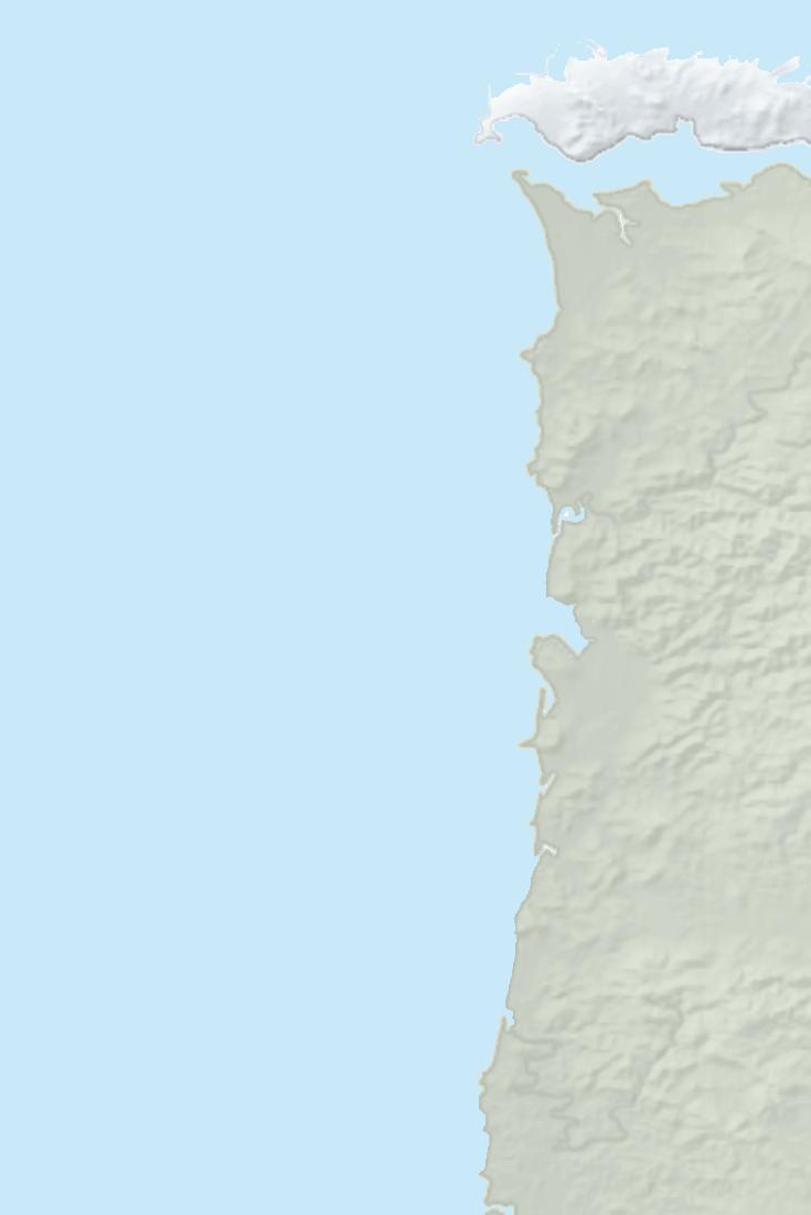
The east end of the McKenzie River West (p. 26) , which McKenzie Pass(p. 23).
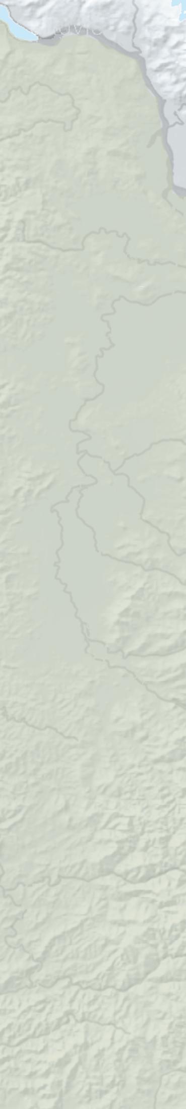
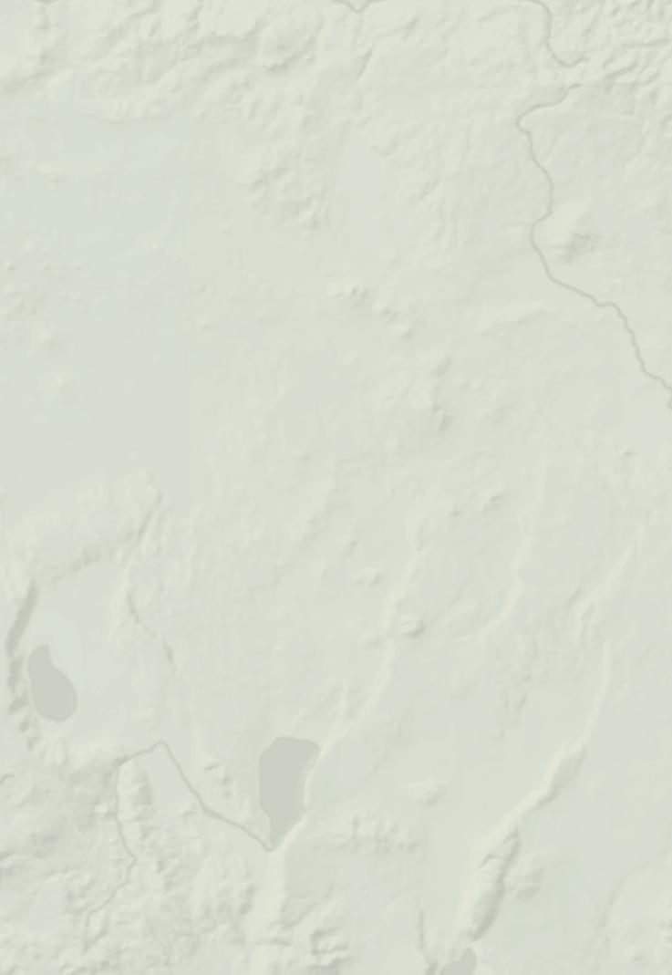
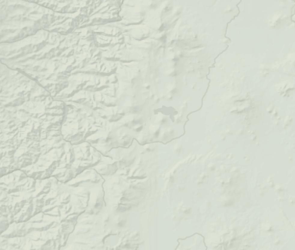
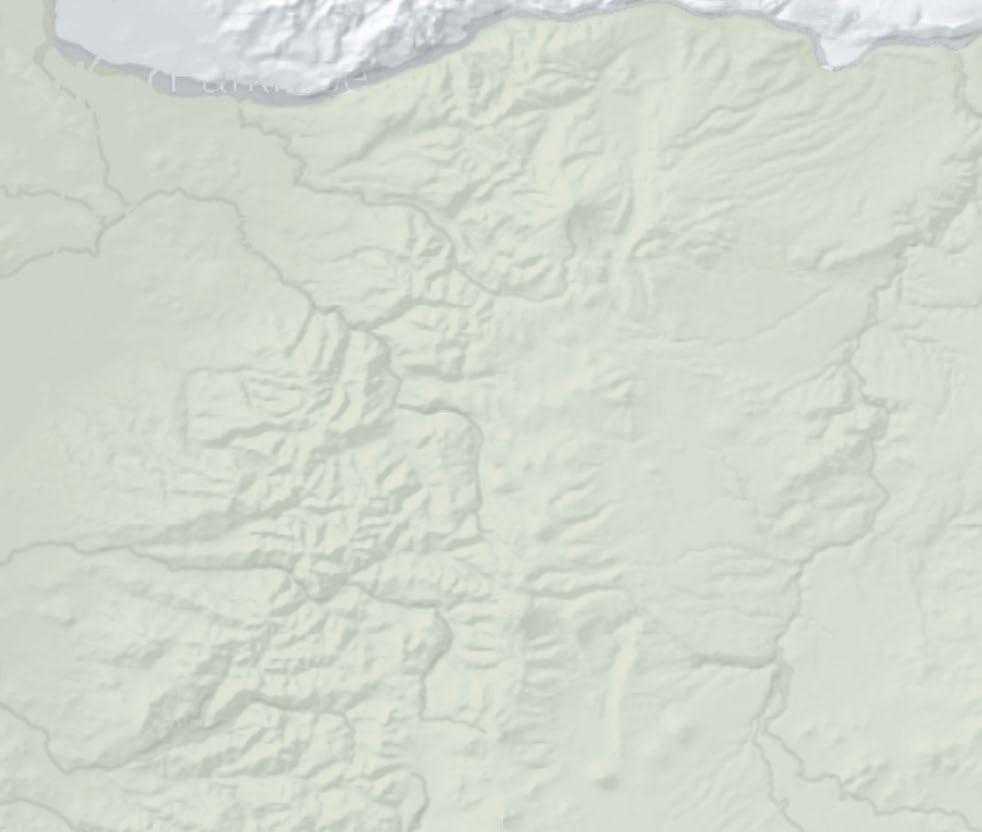
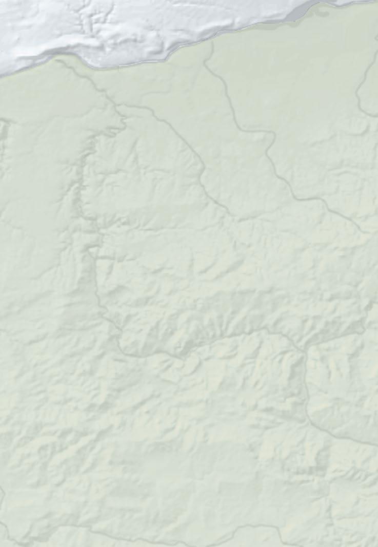
58 19 Seasonal road 126 2 Westfir est oburg Oakridge Oa M enz Ri e Caapo i Ri er i dl F illamet iver gfield eneEugen ge e sw Lowell w L ve Cottage Grov C Walterville Vida 126 Nimrod 1 2 3 4 5 6 7 8 Oregon Scenic
McKenzie
MT T HOO H D
Byway
River
GREG VAUGHN TRIPCHECK.COM 53
Goodpasture Bridge
OVER THE RIVERS & THROUGH THE WOODS SCENIC BYWAY
Travelers get a sampling of Oregon’s diversity along this 66-mile/106-kilometer byway, climbing through five ecosystems on its route from the Willamette Valley to the West Cascade Mountains.
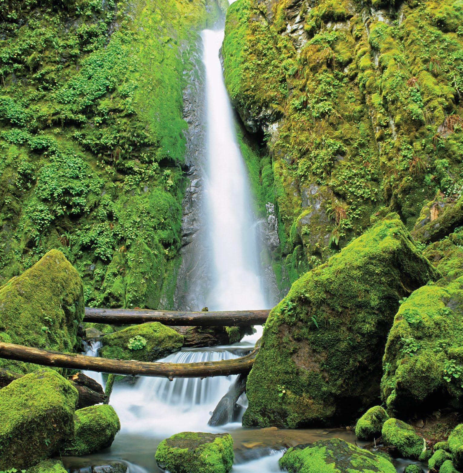
Some of Oregon’s earliest settlements can be found along the Willamette Valley, the fertile swath of land between the Coast and Cascade ranges that was a destination for many Oregon Trail pioneers. Not surprisingly, archaeologists discovered signs of much early occupation, too. Today this rich and
bountiful region provides a pleasurable day trip wandering from the valley up into the forests and rivers of the Cascade Mountains.
EAST THROUGH THE WILLAMETTE VALLEY
From I-5, the byway quickly reaches
Brownsville, Oregon’s third oldest town, founded in 1846. A self-guided downtown walking tour leads visitors past numerous century-old buildings. The 1 Linn County Historical Museum, housed in the Brownsville train depot and six adjacent rail cars, includes a pioneer wagon and replicas of early shops. The well-preserved town impressed Hollywood; Brownsville was the setting for the 1986 film “Stand by Me,” an event still celebrated every July with cast visits and tours on Stand by Me Day.
The grassy fields outside Brownsville attract large numbers of tundra swans and bald eagles each winter. The byway follows OR-228 toward Crawfordsville, where the 105-foot 2 Crawfordsville Covered Bridge, built in 1932, spans the Calapooia River. Near the small logging town of Holley, which dates back to 1847, the byway bends north toward Sweet Home and meets US-20.
CLIMBING INTO THE FOOTHILLS
Pioneers settled Sweet Home in the mid-19th century, building sawmills and felling the towering trees in the nearby Cascade Mountains. A prehistoric forest once thrived here, making the Sweet Home area a prime destination for fossils, agates and petrified wood.
The route follows US-20 east past Foster Reservoir, a flowage of the South Santiam River and a popular fishing spot for trout. Above that is 3 Green Peter Reservoir known for kokanee salmon. Below the dam, anglers pursue spring chinook and summer steelhead. As the road ascends into the Cascades,
OREGON
STATE SCENIC BYWAY
DENNIS
54 TRAVELOREGON.COM/BYWAYS
Soda Creek Falls
FRATES
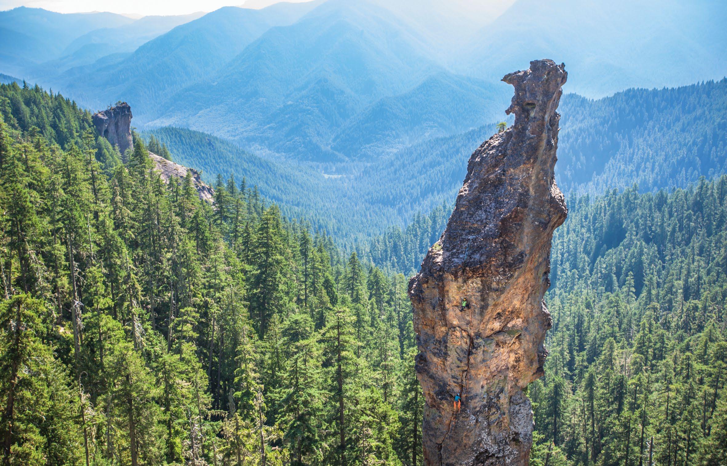
20 20 226 34 99E 242 22 126 5 22 Gates Lyons Scio Tangent Waterloo Halsey Idanha Detroit Marion Forks Albany Lebanon Mill City Jefferson Green Peter Reservoir Detroit Lake North Santiam River Calapooia River South SantiamRiver 20 228 Sweet Home Brownsville Crawfordsville Cascadia 1 2 3 4 5 6 7 8
BEN HERNDON / TANDEM STILLS + MOTION TRIPCHECK.COM 55
Rock climbers on Turkey Monster in the Menagerie Wilderness
OREGON STATE SCENIC BYWAY
MARYS PEAK TO PACIFIC
From the highest point in the Coast Range to the broad, sandy beaches of the Central Coast, one of Oregon’s newest byways follows the Alsea River on a delightfully meandering 72-mile/116-kilometer tour.
It’s always tempting to make a beeline for Oregon’s magnificent coast, but this byway encourages you to take it slow — not only to navigate the often narrow, twisting road but to discover the many attractions hiding just beyond the highway.
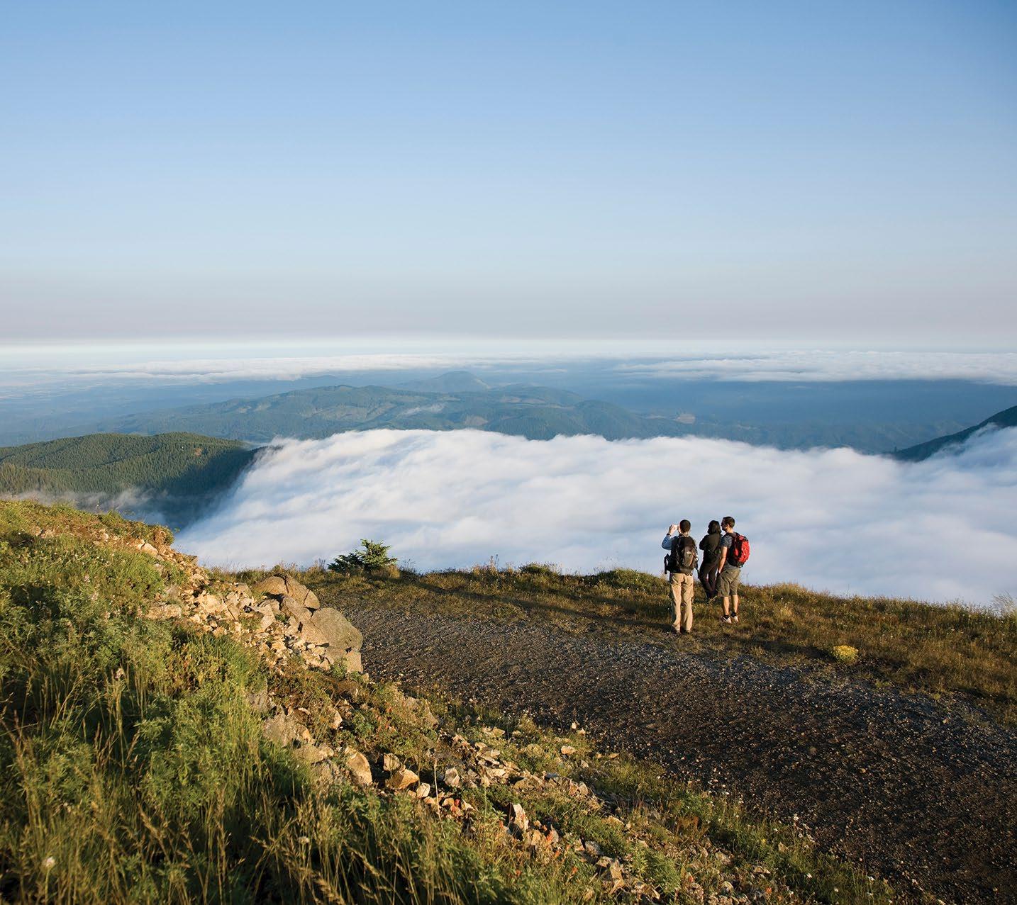
WILLAMETTE VALLEY TO MARYS PEAK
The byway begins near Interstate 5 and Tangent, where farmers established the state’s first grange. The agriculturally abundant Willamette Valley produces most of the nation’s turf grass seed, along
with hazelnuts, berries, mint and many other crops.
1 Oregon State University, in neighboring Corvallis, has long been a leader in farming and forestry research. The lively college town hosts a roster of arts, music, lectures and sporting events throughout the year. Beyond campus, an impressive network of multiuse trails makes it easy to enjoy the city’s riverside parks, natural areas and renowned Willamette Valley wineries.
A few miles south, the 2 William L. Finley National Wildlife Refuge pre-
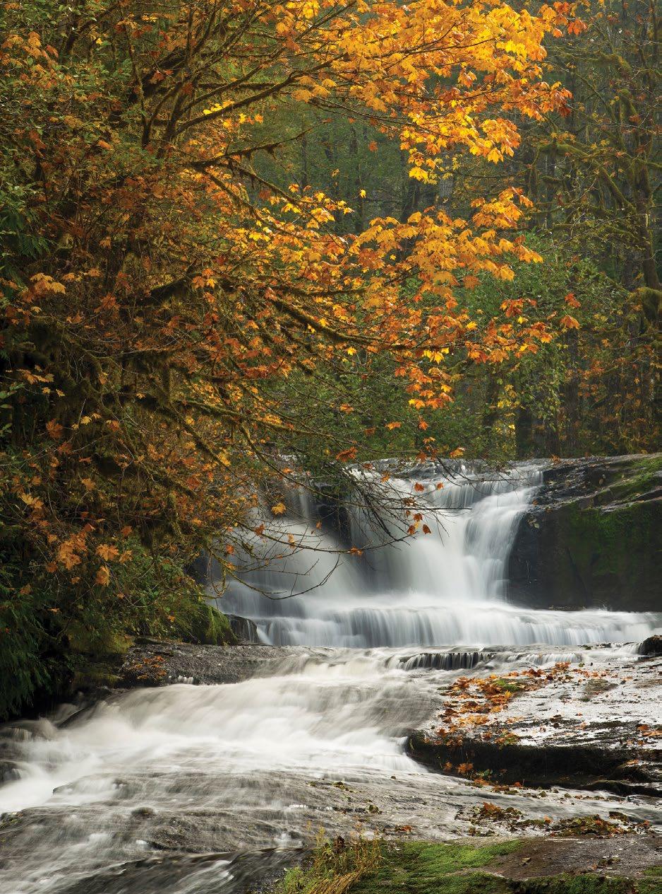
serves vast camas fields, a harvest staple of the native Kalapuya people. Twelve miles/19.3 kilometers of trails meander through diverse habitats, with interpretive signs about area wildlife and culture. The Benton County Historical Museum shares more history in the 1867 Philomath College building, one of two colleges that operated here in the late 1800s.
West of Philomath, the byway turns southwest onto OR-34. In 10 miles/ 16 kilometers is the first of two unique spurs on this byway: Marys Peak Road — built by the Civilian Conservation Corps —
FROM LEFT: JUSTIN BAILIE; GREG VAUGHN 56 TRAVELOREGON.COM/BYWAYS
Marys Peak Alsea Falls
ascends past waterfalls and stonework lookouts toward 3 Marys Peak. At 4,097 feet/1,249 meters, it’s the highest point in the Oregon Coast Range. In late spring and summer, wildflowers dapple the summit meadows. Hiking trails stitch through this designated Scenic Botanical Special Interest Area, with views that encompass a string of Cascade peaks and the distant Pacific.
ALSEA RIVER VALLEY


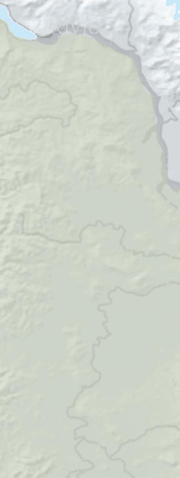

Returning to OR-34, the byway follows the Alsea River through its verdant valley and little burgs like Alsea, settled by pioneers traveling the Applegate Trail. The second spur, South Fork Road, leads 10 miles/16 kilometers to the 4 Alsea Falls Recreational Site, with a campground and trails along the lovely stair-step falls. Nearby, mountain bikers enjoy a growing network of single-track at the Fall Creek State Recreation Area, named by the Bureau of Land Management as one of their top 20 mountain-bike destinations in the nation.
Back on the byway, the century-old Hayden covered bridge charm 2 miles/3.2 kilometers west of Alsea, where the river begins to coil tighter on its westward journey. Plenty
provide ample oppor tunities to picnic, camp, fish or float the river. The state’s salmon fishery is the focus Oregon Hatchery Research a few miles up Fall Creek Road. Exhibits (and tours, by appointment) explain how scientists are studying hatchery salmon and steelhead, with the goal of improving rearing practices and protecting wild fish populations.
Just beyond the communities of Tidewater and Little Albany, Risley Creek Road (FR-3446) leads into the Drift Creek Wilderness growth Sitka spruce, Western hemlock and Douglas fir. The Siuslaw National Forest district ranger office in Waldport has maps and information.
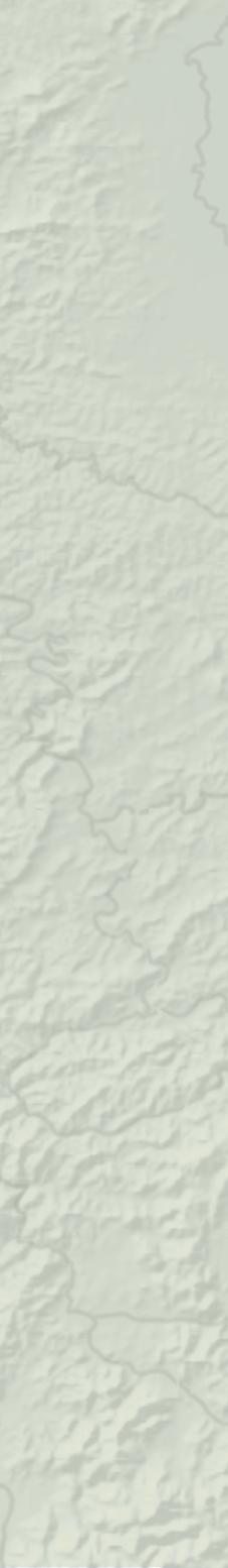

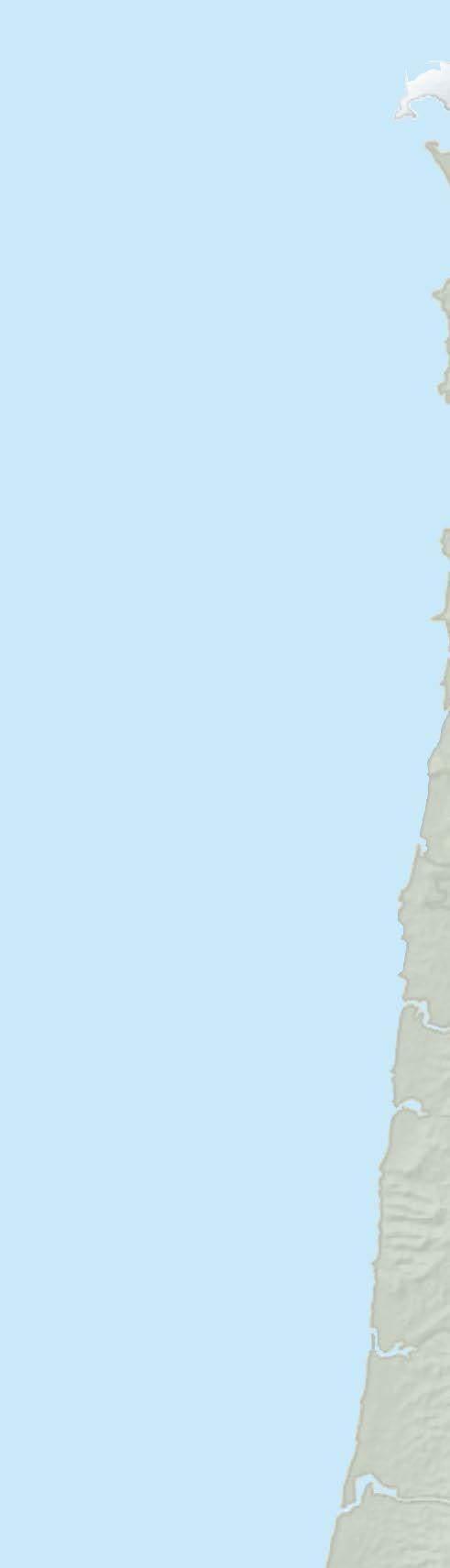
The Alsea River slows and widens into as it approaches coastal Waldport. Mill Street leads north to the , where boaters can launch a kayak or rent a small runabout to explore the expansive bay. The 10-mile/16-kilometer
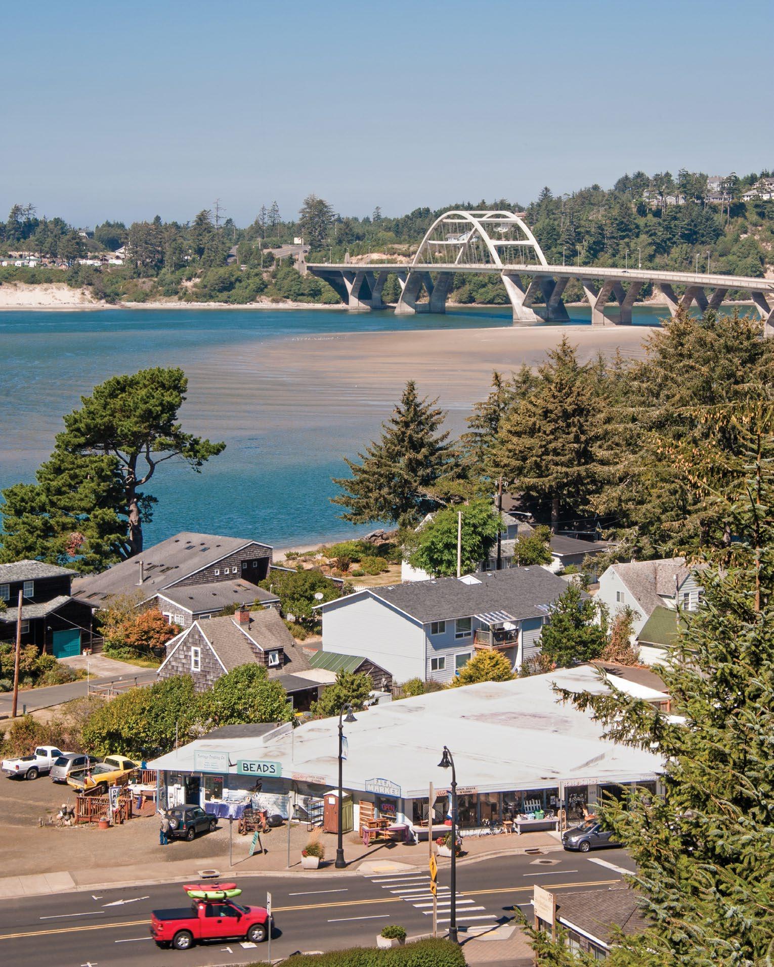
Alsea River Water Trail


through Alsea Bay, Drift Creek and Lint Slough — an estuary thriving with fish, waterbirds and seals. The sandy flats under Waldport’s Alsea Bridge are a top spot for crabbing and clamming. At the foot of the bridge, the Alsea Bay Historic Inter pretive Center offers crabbing and clam ming demonstrations, and exhibits about the artistic bridges of the Oregon Coast.
junction of US-101, the Scenic Byway
harbor seals haul out across from the Keady Wayside swirls into the Pacific. To the north, a spine of rocky islands and tide pools at Seal Rock State Recreation Site cases the sublime beauty of the Coast.

Medical: Medical services/hospitals 20 Alsea River quinaR Harrisbur wpor MT T HOO H D 223 W i l a e t t e r Alse quina iv r Ha H s alsey Halsey y wport Newport o Tooledo ledo Yachats Monroe bany y Alb Adair Village r V Junction City 34 Waldport Philomath Tangent Corvallis Alsea 1 2 3 4 5 6 7 8 Oregon Scenic Byway Marys Peak to Paci c Waldport LARRY ANDREASEN TRIPCHECK.COM 57
OREGON STATE SCENIC BYWAY TREES TO SEA
Witness the forces of nature along this 68-mile/109-kilometer drive, from trails through grand forests to a ragged headland that displays the foamy power of the Pacific.
You can’t miss Oregon’s rugged beauty as you travel along rushing rivers and wild coastlines on this newly designated byway. The route also introduces you to the region’s equally dramatic history — leading the way to some unsung treasures.
TUALATIN VALLEY
Thirty miles/48.2 kilometers west of Portland, the Oregon Coast Range begins to rise up at Banks, an agriculture community dotted with farms, vineyards and U-pick orchards. It’s the southernmost trailhead for the 21-mile/33.8-kilometer
1 Banks-Vernonia State Trail, a paved car-free path through rural landscapes and woodlands. Highlights include a high wooden trestle at Buxton and L.L. Stub Stewart State Park. From Banks, the byway follows OR-6 West, past tasting rooms that showcase the renowned wines of Tualatin Valley.
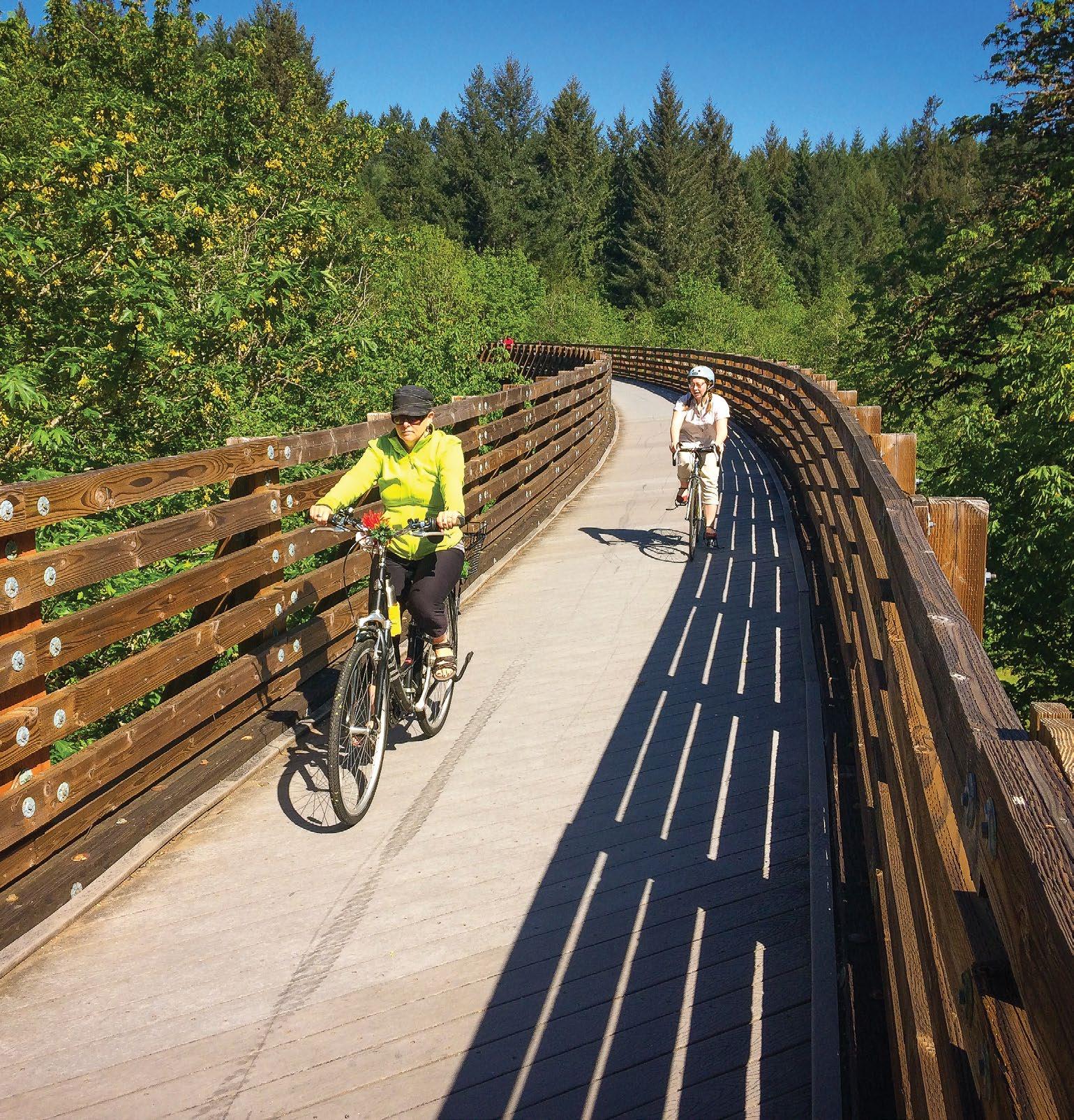
TILLAMOOK STATE FOREST
You enter the Tillamook State Forest near the Gales Creek Overlook, around mile marker 34. One of the West’s largestknown series of wildfires — collectively dubbed the Tillamook Burn — began near this site in 1933. This and subsequent burns in 1939, 1945 and 1951 eventually encompassed some 355,000 acres. A kiosk briefly explains the incredible restoration effort.
The byway twists along the Devils Lake Fork of the Wilson River, with plenty of pullouts to stop and enjoy the views. At staging areas like 2 Browns Camp, dirt bikes and other off-highway vehicles (OHVs) access around 250 miles/ 400 kilometers of OHV trails in the surrounding forest.
A 40-foot-high replica fire lookout marks the entrance to the Oregon Department of Forestry’s hands-on 3 Tillamook Forest Center. Interactive exhibits tell the stories of the area's native tribes, early settlers, and how Oregonians helped turn the Tillamook Burn into a thriving forest. Aided by citizens of all ages hand planting 72 million seedlings, the Oregon Department of Forestry pioneered many of the tools and replanting techniques still used today. Behind the center, a
ROBBIE M c CLARAN 58 TRAVELOREGON.COM/BYWAYS
Banks-Vernonia State Trail
suspension bridge spans the Wilson River, where you can spy salmon and access the 24-mile/38.6-kilometer Wilson River hiking and mountain-biking trail.
TILLAMOOK
As the byway descends from the Coast Range, the landscape broadens into grassy pastures where dairy cows graze. A million hungry visitors a year get a taste of Tillamook’s dairy industry at the Tillamook Creamery tours, exhibits, yummy menu and lots of cheese samples. Nearby, French Cheese Company farm animals plus wine-and-cheese pairings. Dairy products once traveled from Tillamook Bay to Portland by railroad. Now the public can ride those rails from Bay
, where you cycle on tracks through meadows and over estuaries on custom-made, pedal-powered carts.
Three miles/4.8 kilometers south


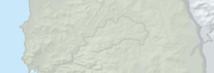
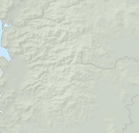

Tillamook Air displays an array of aircraft, from early gyrocopters to decorated fighter jets. The most remarkable artifact might be the building itself: Built in 1942 to house World War II surveillance blimps, the immense


wooden structure arches 15 stories high and more than 1,000 feet/304.8 meters long. This little-known national treasure is one of the few remaining structures of its kind.
NETARTS HIGHWAY TO CAPE MEARES

From Tillamook, the byway crosses Highway 101, continuing west on OR-131 to meet the Pacific at Netarts, where a long spit (part of 6 Cape Lookout
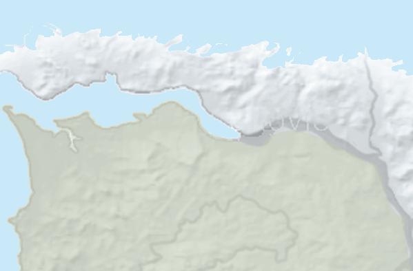
of sandy Netarts Bay, famous for its succulent oysters and harvested salt. The byway hugs the Coast as it continues Oceanside beaches, good surf waves and lovely views Three Arch Rocks
The byway reaches its dramatic end at Cape Meares State Park, a rocky promontory 200 feet/61 meters above the crashing ocean waves. The 1889 8 Cape Meares Lighthouse marks the point, notable for its large first-order Fresnel lens, visible to mariners for 21 miles/ 33.8 kilometers. The park’s overlooks offer vantage points for spotting migrating gray whales and thousands of seabirds — including whimsical tufted puffins that frequent the rocky cliffs and islands.
You’ll also find ample salty scenery heading south: The Three Capes Scenic links Cape Meares with Cape Lookout and Cape Kiwanda, and joins the grand Pacific Coast Scenic Byway at Pacific City.
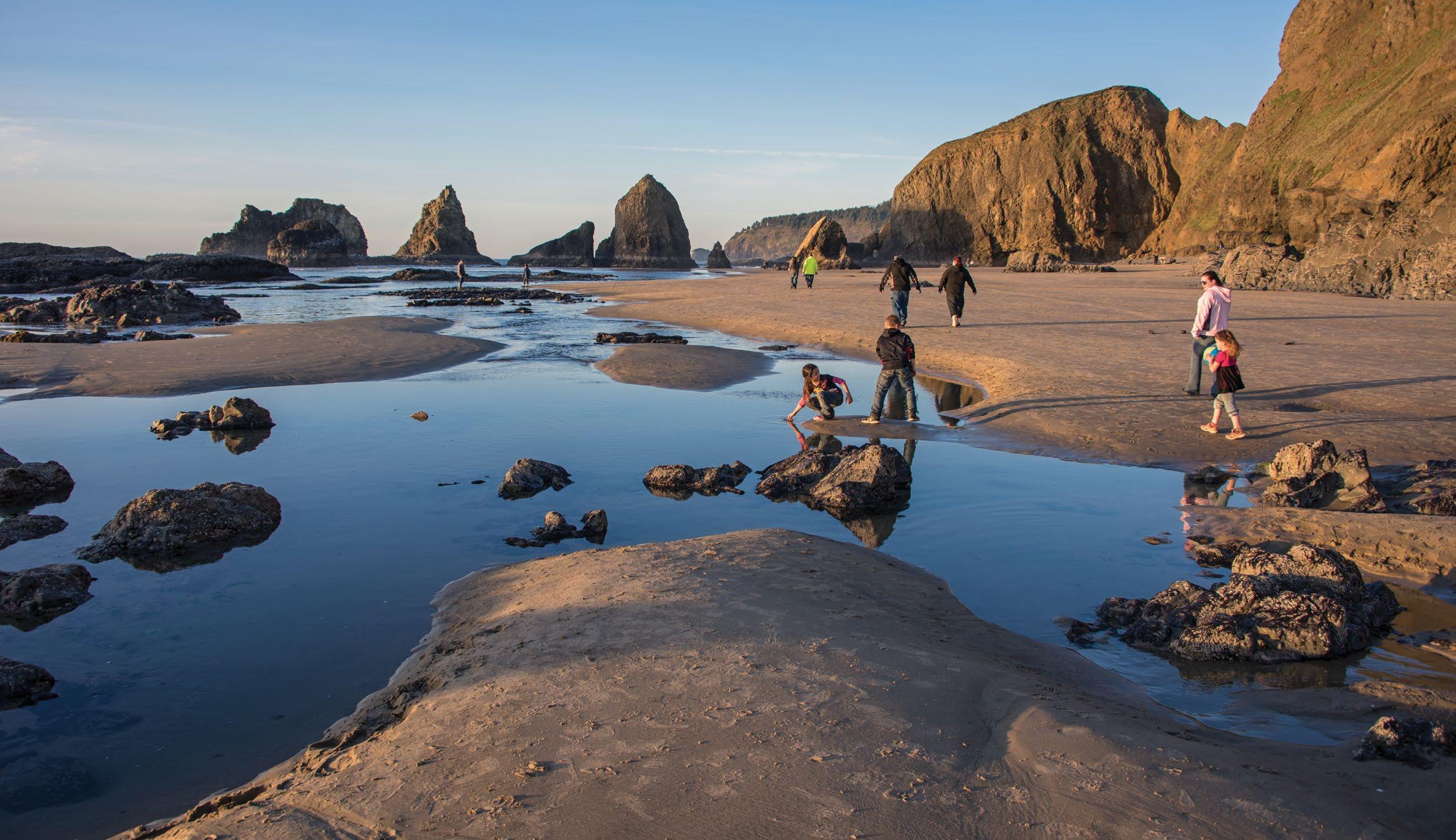
TREES TO SEA SCENIC BYWAY 68 miles / 109 kilometers (allow 2 to 3 hours) Weather: services/hospitals located in Banks and Tillamook. m Hillsbor appoose arren MT T HOO H D Hagg Lake mRiver 47 101 Manzanita ta Wheeler W Rockaway Beach y B Bay Cit City Garibaldi Yamhill od derrwoo wooo She e ro o b Hillsbo erg g Newbe wbe N be rest Grove rov a Warren 6 Tillamook Banks Netarts Oceanside 131 1 2 3 4 5 6 7 8 See p. 79. Oregon Scenic Byway Trees to Sea Oceanside LARRY ANDREASEN TRIPCHECK.COM 59
OREGON TOUR ROUTES
Short on mileage but long on beauty, these 10 Oregon Tour Routes offer up the high vista of Steens Mountain, the waterfalls of the Willamette Valley, the rugged southern Oregon Coast and everything in between.
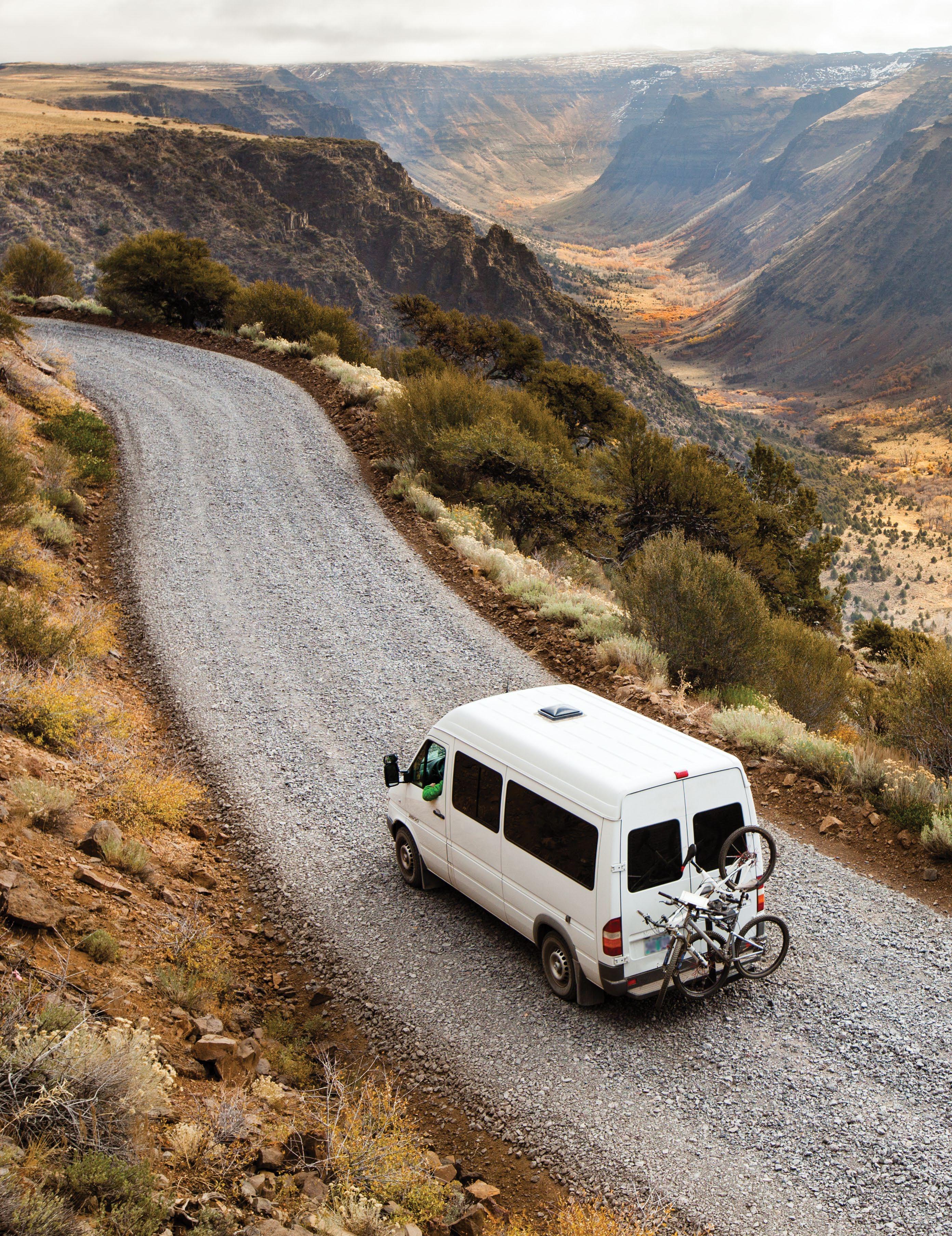
TYLER ROEMER
60 TRAVELOREGON.COM/BYWAYS
Steens Loop Tour Route
OREGON TOUR ROUTE
CHARLESTON TO BANDON TOUR ROUTE
Like a tiny tide pool brimming with life, this short 41-mile/66kilometer route off the Pacific Coast Scenic Byway packs a lot of natural wonders into a concentrated coastal area.
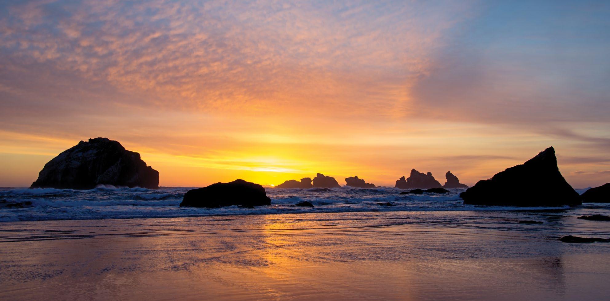
CHARLESTON AND CAPE ARAGO
The fishing port of Charleston at the entrance to the deep-water port of Coos Bay, where fishing fleets and freighters find refuge from the open ocean. Fishing charters and whalewatching excursions depart from the Charleston marina.
The Cape Arago Highway to a rocky headland rising high above the Pacific. Just beyond the Cape Arago Lighthouse, 1 Sunset Bay State Park wraps around a shallow, protected
LARRY ANDREASEN 101 101 Coquille North Bend Coos Bay 42 CoquilleRiver PACIFIC OCEAN Charleston Bandon Cape Arago Lighthouse Coquille River Lighthouse See p. 80. 1 2 3 4 TRIPCHECK.COM 61
OREGON TOUR ROUTE SILVER FALLS TOUR ROUTE
A pleasing detour for I-5 travelers, this 55-mile/89-kilometer pastoral route loops through a verdant park filled with waterfalls and rolling farmlands with distant views of the Coast and Cascade mountain ranges.
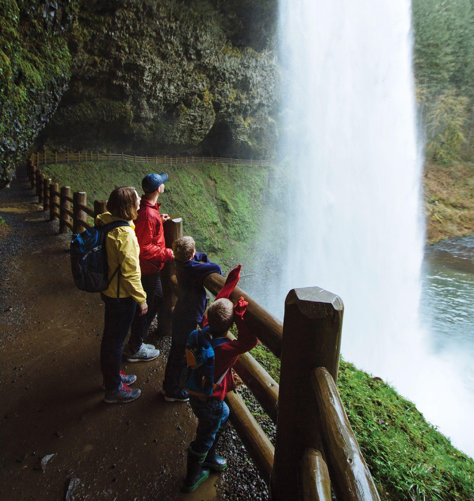
211 213 22 221 226 5 Gates Lyons Salem Molalla Keizer Amity Gervais Mill City Jefferson Sublimity Stayton NorthSantiam River W i l l a m ett e River 214 Silverton Mt. Angel Turner Woodburn Aumsville See p. 80. 1 2 3 4 62 TRAVELOREGON.COM/BYWAYS
Silver Falls State Park
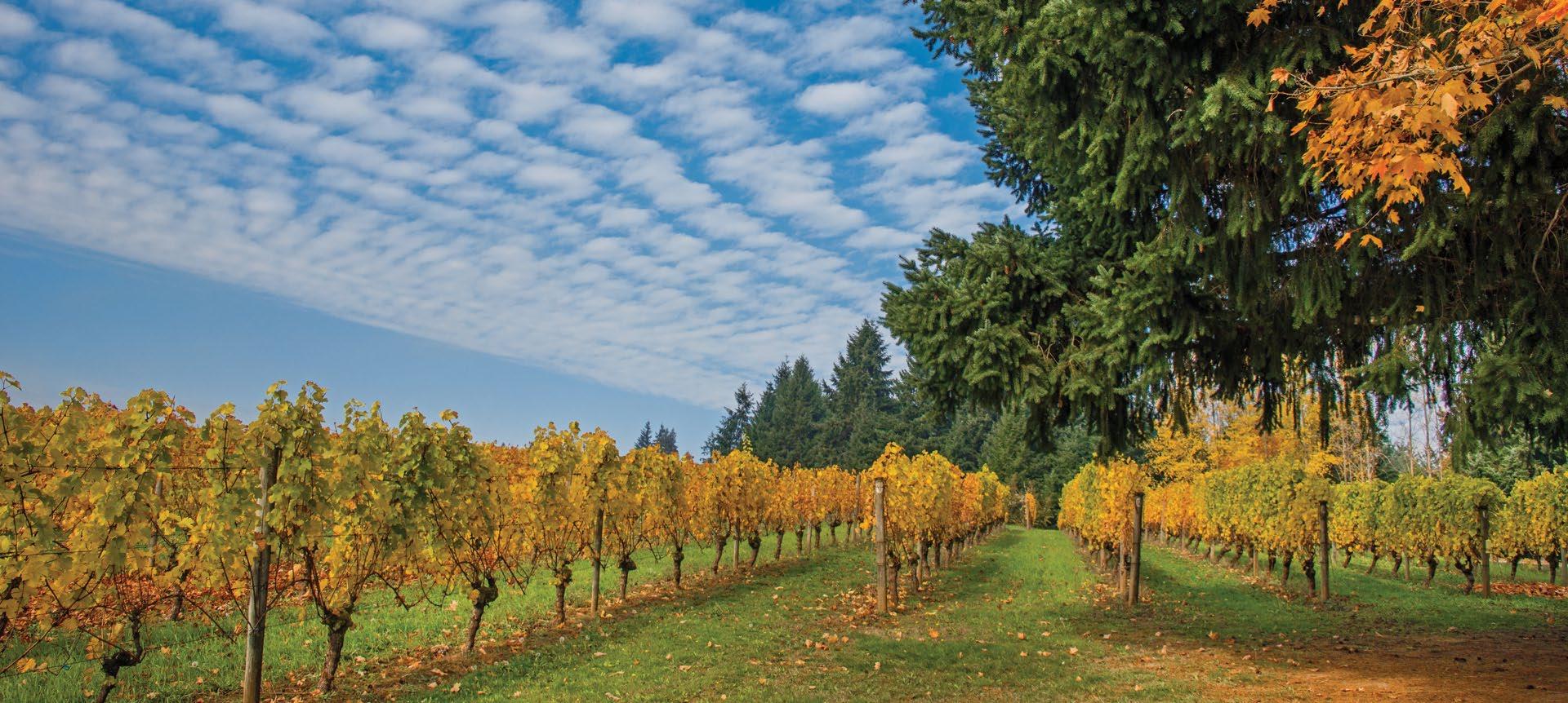


Forest Grove vineyards 7 99W Beav Wilson King City 217 219 26 wberg Forest res r Grove G Cornelius ornel r lius North N No Plains ins s Aloha a Tigard Beaverton to B Be n t rt Portland d P t rttland nd alatin atin Tua a nville lenvillWilsoilsoon Yamhill Hagg agg Lake ks g g C K Wi a eteRiver T l i iv Sherwood Gaston Hillsboro Helvetia Gales Creek See p. 80. See p. 79. 1 2 3 4 TRIPCHECK.COM 63
THE GRANDE RONDE RIVER
Follow the tour route north on OR-82 to meet up with the Grande Ronde River near Imbler. Popular among rafters
Chapel , an 1869 Episcopal church once visited by Desmond Tutu. In Union the tour route splits into a mini loop. Follow OR-203 as it climbs into the pines of the
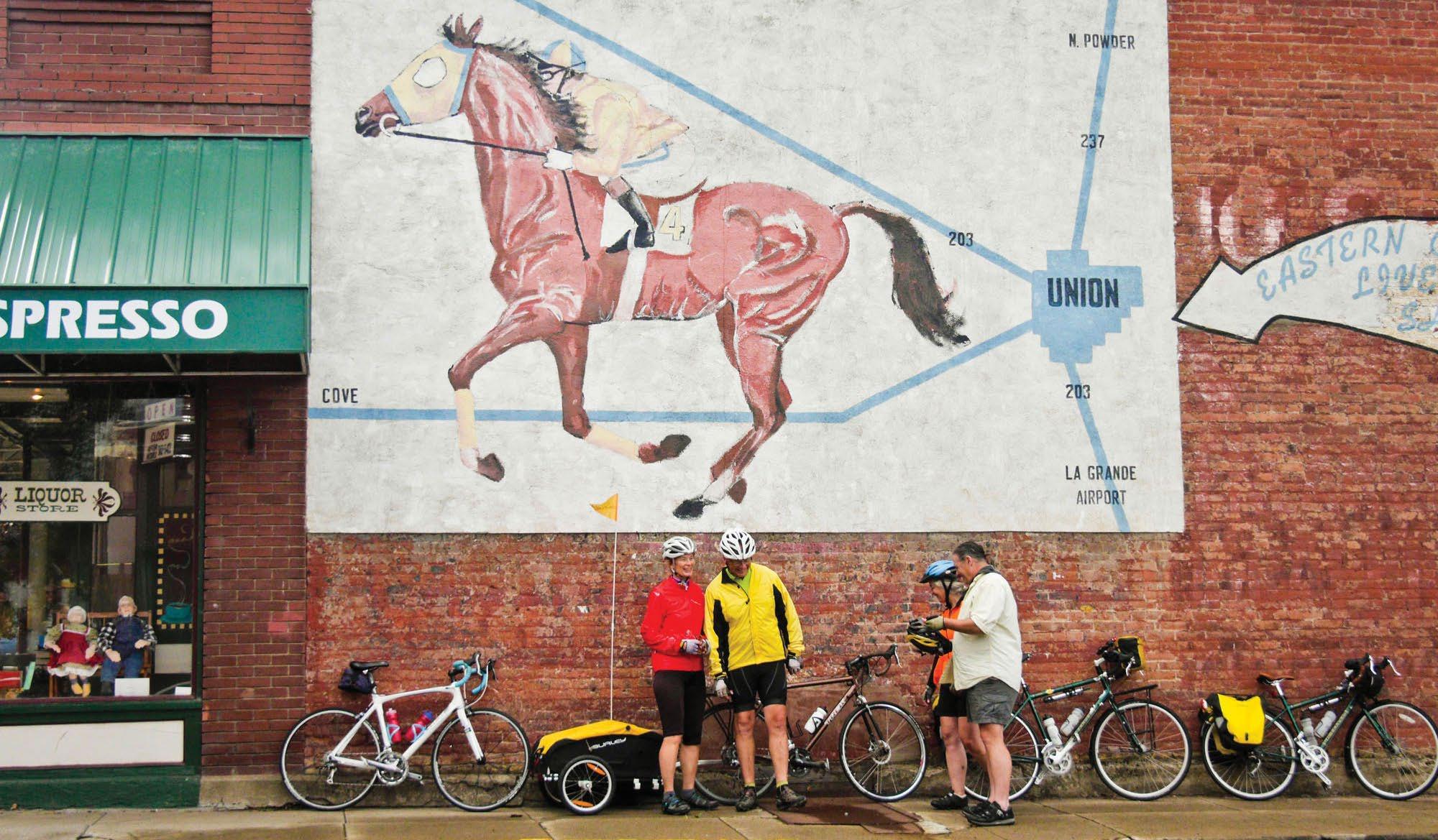
Union 86 244 73 53 84 39 84 82 82 237 Elgin North Powder Imbler Wallowa Joseph Enterprise Lostine Granite Sumpter Haines Baker City PowderRiver GrandeRonde River 203 237 Cove Union Medical Springs La Grande See p. 79. 1 2 3 4 64 TRAVELOREGON.COM/BYWAYS
the High Desert Discovery Scenic Byway to form a loop.
FIELDS
Settler Charles Fields established a stone roadhouse here in 1881 as a stagecoach supply station. 1 Fields remains a spot to grab supplies for exploring the remote Alvord Desert and Steens Mountain area. Travelers also know it as the place to savor a burger and milkshake at the end of an adventure.
ALVORD DESERT
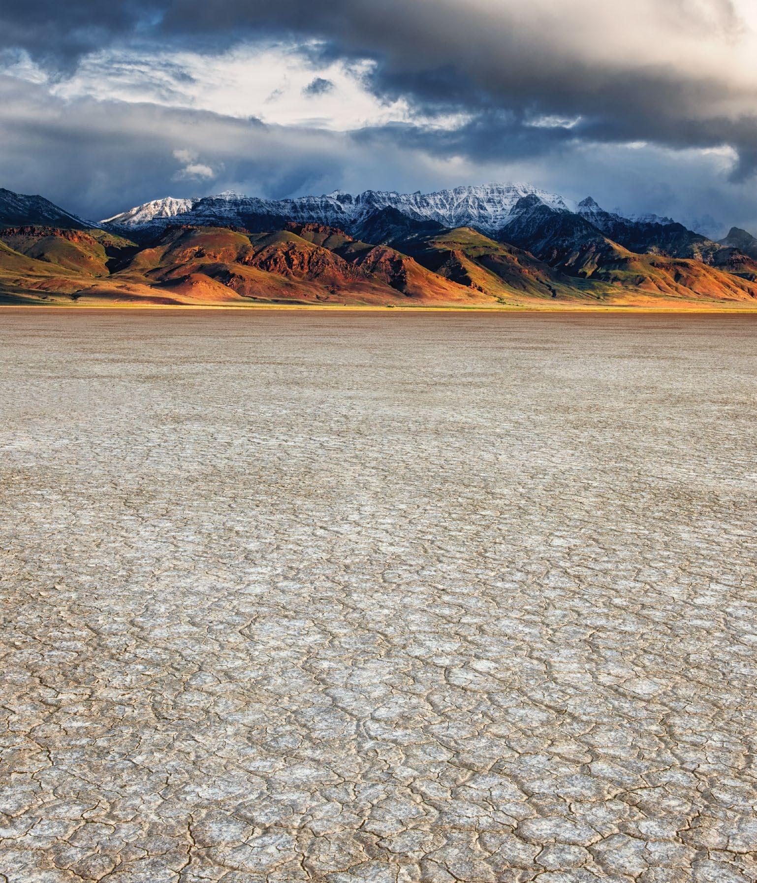
From Fields, the tour route heads north on Fields-Denio Road, a gravel-and-dirt surface that’s maintained for passenger vehicles. The 9,734-foot fault block of Steens Mountain towers to the west, a tremendous rain shadow responsible for the 2 Alvord Desert . Measuring some 60 square miles/96.5 square kilometers, this expansive desert playa can feel as remote as the moon. The unusual venue draws an interesting cross section of recreationalists, including ultralight pilots, motorcycle and ATV riders, and sailors captaining windsurfing boards and sailboats on wheels.
North of the tiny hamlet of Andrews , a corrugated metal shed on the east side of the road marks the 3 Alvord Hot Springs , one of several area hot springs open to the public. Waters here bubble to the surface at about 174 degrees but cool significantly before reaching man-made soaking pools.
hot springs.
The tour route ends in Burns , where it connects with the High Desert Discovery Scenic Byway (page 48).
to have plenty of gas before leaving Burns and Fields. Medical: Medical services/ hospital located in Burns.
LARRY GEDDIS
Alvord Desert
NEVADA 20 395 95 95 205 california Rome Riley Hines Drewsey Frenchglen Malheur Lake Harney Lake Diamond Alvord Desert Steens Mountain Donner und Blitzen River O wy hee River 78 Burns Fields Crane 4 3 2 1 TRIPCHECK.COM 65
Steens, climbing thousands of feet and topping out just shy of the summit at 9,734 feet/2,967 meters.

From 1 Frenchglen, the first 5 miles/ 8 kilometers of the route along North Loop Road traverse the southern end of the 2 Malheur National Wildlife Refuge.
1 mile/1.6 kilometers below. On a clear day, you can see beyond Oregon to Nevada, Idaho and California.
THE DESCENT
From the summit, the tour route eases down the mountain’s western slope.
Portions of the byway are typically closed in winter due to snowfall. Check TripCheck.com and local visitor centers for the most up-todate information. Gas: Be sure to have plenty of gas before leaving Burns and Fields. Medical: Medical services/hospital located in Burns.
TYLER ROEMER
Steens Mountain
NEVADA 95 95 78 205 california McDermitt Rome Riley Hines Burns Fields Crane Malheur Lake Harney Lake SteensMountain Alvord Desert Diamond Donner und Blitzen River O wy hee River Frenchglen 4 3 2 1 66 TRAVELOREGON.COM/BYWAYS
DIAMOND CRATERS OUTSTANDING NATURAL AREA
Turn north on Lava Beds Road, and the lowlands of the 1 Diamond Swamp suddenly turn into a desolate landscape of blackish, barren rock. These lava fields were formed 25,000 years ago, when molten basalt billowed up through fissures in the earth and spread across a dry lakebed. Before the initial layer cooled, more molten rock thrust it upward, creating some of the most diverse basaltic features found anywhere in the United States.
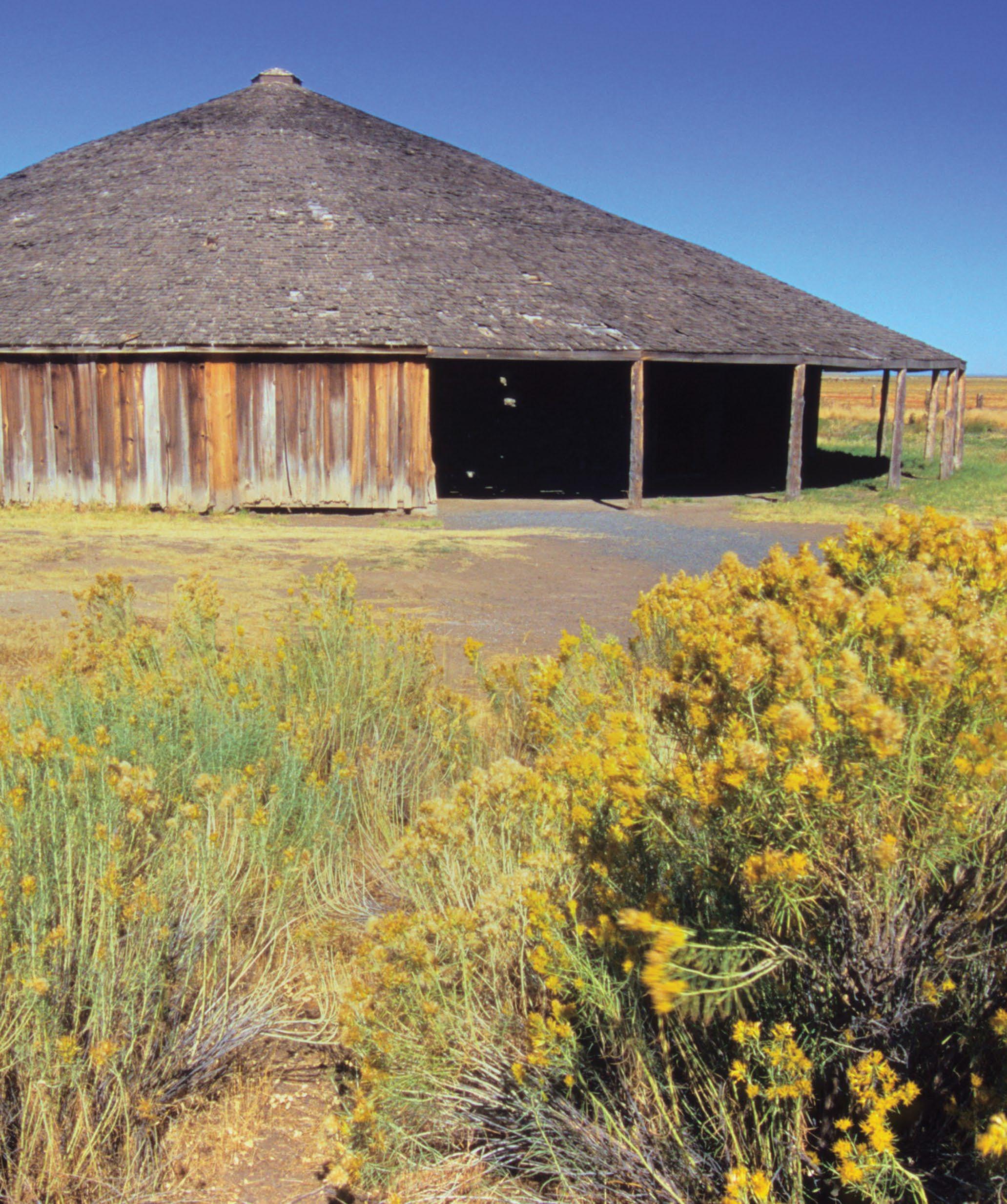
For the next several miles, the route leads through 2 Diamond Craters
Outstanding Natural Area , a curious array of collapsed craters, lava domes, lava tubes, wrinkled ridges, cones, spires and other formations. To learn more, download the federal Bureau of Land Management’s “Diamond Craters: Oregon’s Geologic Gem” brochure, or pick up a copy at the Harney County Chamber office in Burns.
DAVID M. COBB 20 78 205 california Hines Burns Fields Crane Frenchglen Malheur Lake Harney Lake SteensMountain Alvord Desert Donner und Blitzen River Diamond 4 3 2 1 TRIPCHECK.COM 67
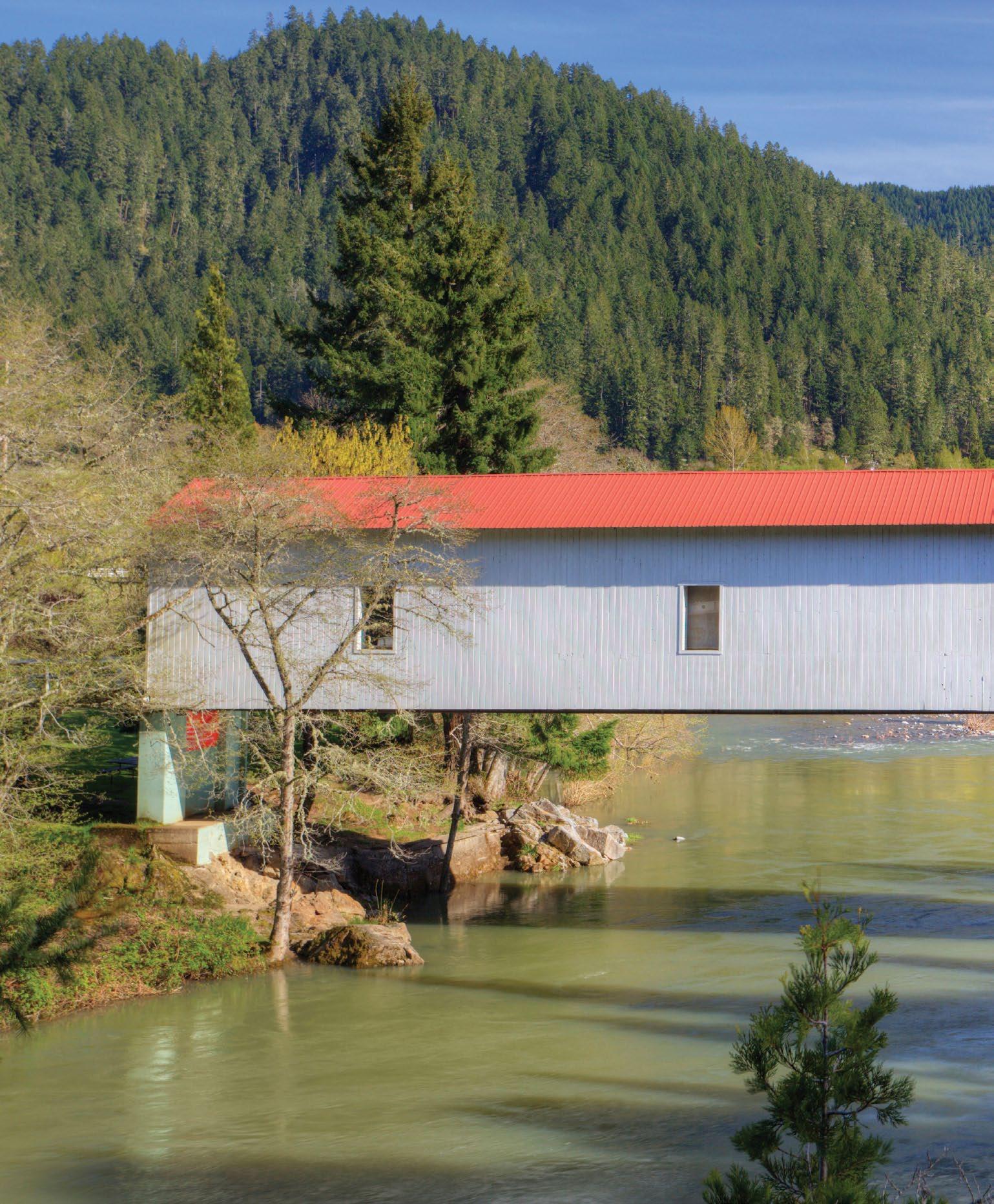
OREGON TOUR ROUTE MYRTLE CREEKCANYONVILLE TOUR ROUTE Milo Academy Covered Bridge 227 42 62 234 39 177 84 84 5 82 82 5 138 Merlin Galice Central Point Eagle Point Grants Pass Union Creek Prospect Shady Cove Gold Hill Roseburg Glendale North Umpqua River SouthUmpqua River Rogue River Cow Creek Myrtle Creek Canyonville 18 46 Tiller 2810 1 2 3 4 68 TRAVELOREGON.COM/BYWAYS
RIDDLE
Your tour begins 21 miles/33.7 kilometers south of only place to fuel up along the route. Follow Riddle Bypass Road toward railroad spurred on the area’s mining operations. You can still see remnants of the town’s nickel mine and mine tailings as you drive past lumber mills, ranches and farms.
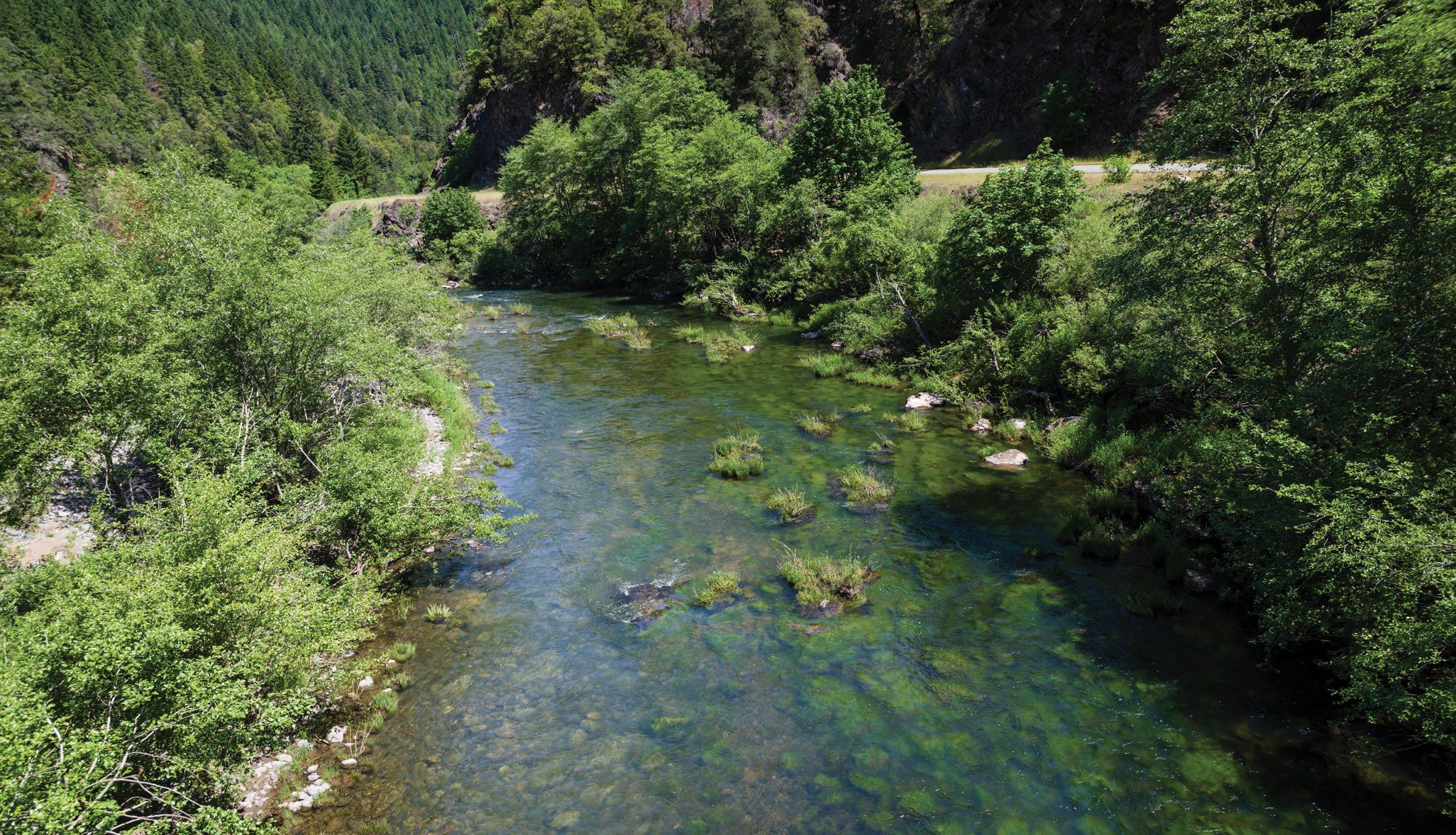
JOHN TRAX / ALAMY STOCK PHOTO Cow Creek 18 46 2810 227 42 62 234 84 5 5 Merlin Galice Eagle Point Grants Pass Union Creek Prospect Shady Cove Gold Hill Roseburg Tiller Myrtle Creek Canyonville SouthUmpqua River Rogue River Cow Creek 39 177 Glendale Riddle See p. 80. 3 2 1 4 TRIPCHECK.COM 69
the Mosby Creek Bridge. Built in 1920, this 90-foot-long charmer is Lane County’s oldest covered bridge. Its single lane remains open to vehicles in both directions.
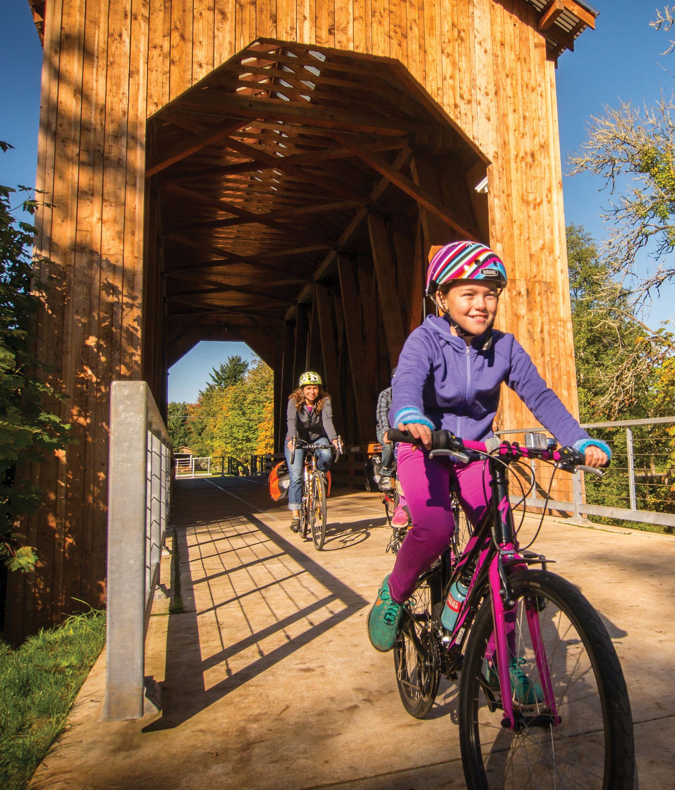
RUSS ROCA Chambers Bridge 126 58 99 5 Vida Marcola Walterville Oakridge Westfir Springfield Lowell Veneta Drain Eugene Creswell Dorena Reservoir MiddleForkWillametteRiver McKenzieRiver Cottage Grove Dorena
80. 1 2 3 4 70 TRAVELOREGON.COM/BYWAYS
See p. 79. See p.
You never know what’s waiting around the next bend. Start planning your journey with a free Willamette Valley Travel Guide.
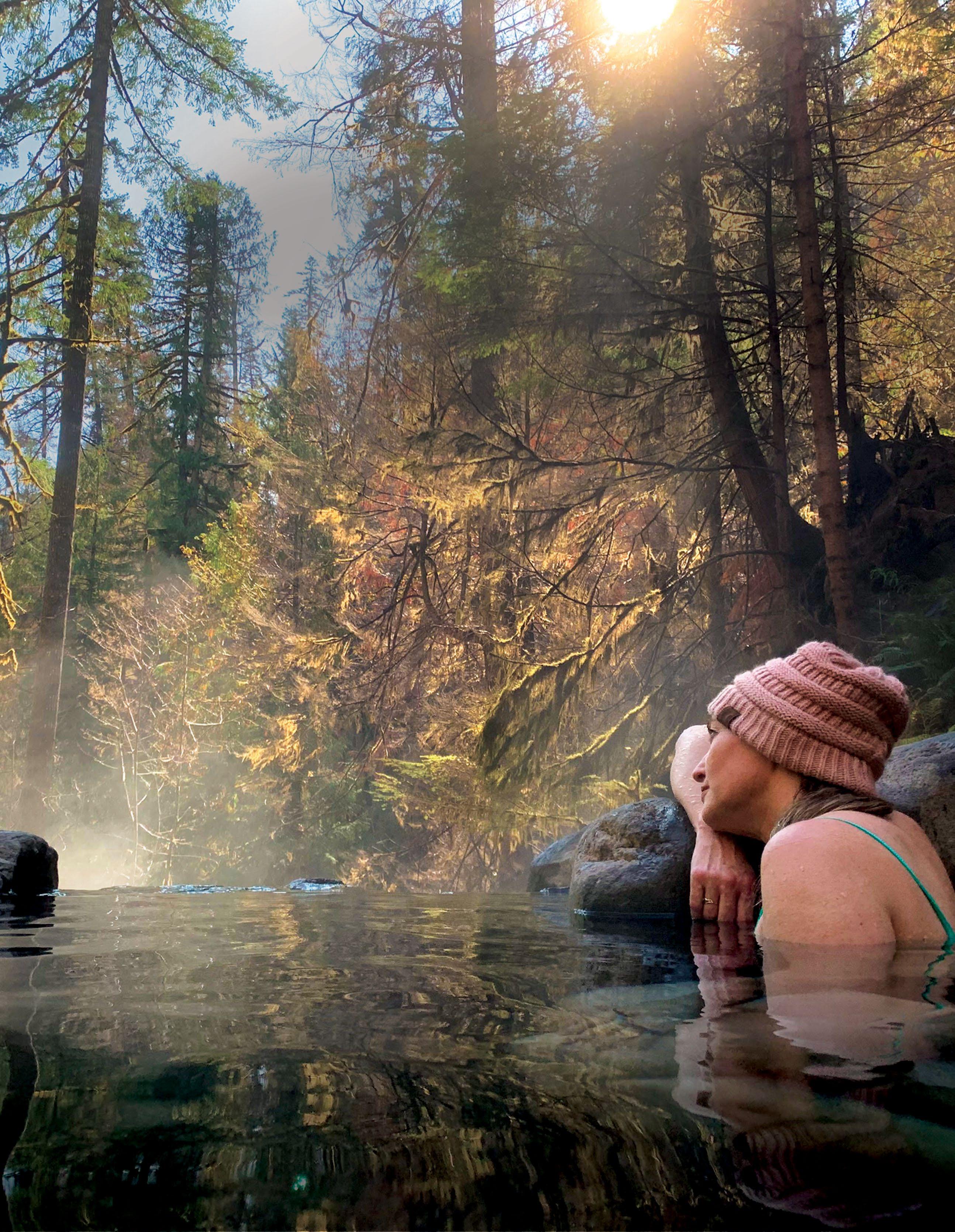
WillametteValley.org
Funded in part by
THE
DISCOVER


The Dungeness Crab Capital of the World


THERE’S SOMETHING FOR EVERYONE IN NEWPORT!


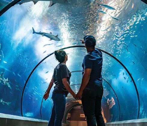
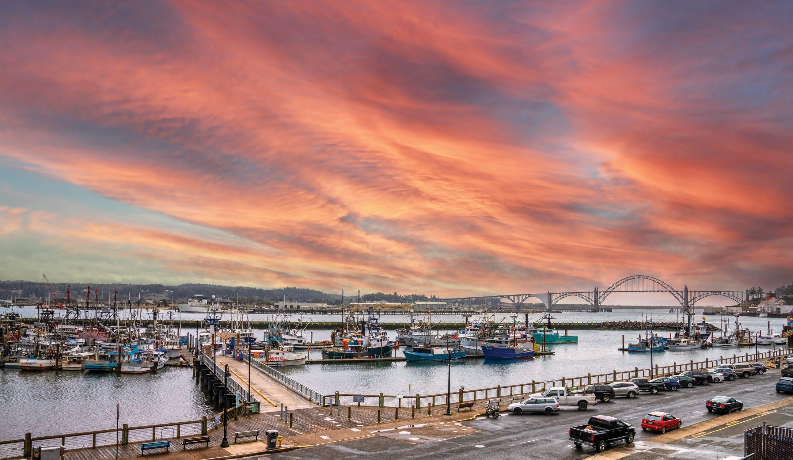
FOODIE FISHING
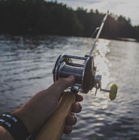
ADVENTURER FAMILY
HIKING BEACHES AND LANDMARKS


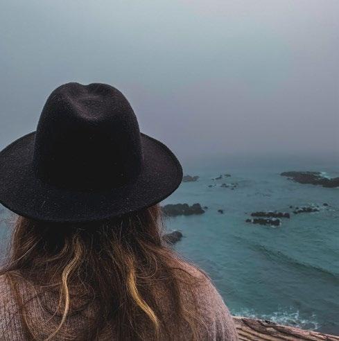

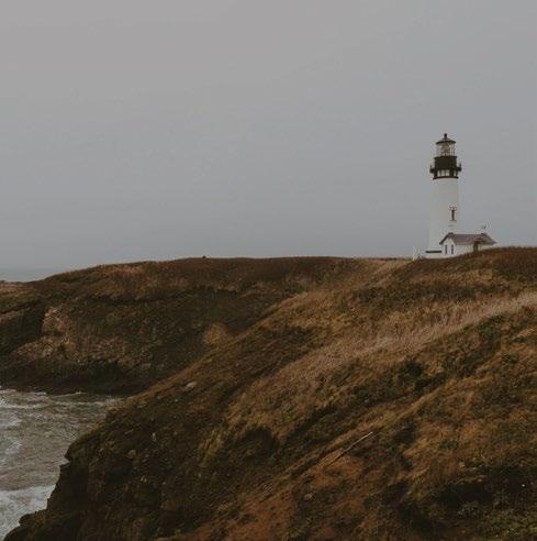

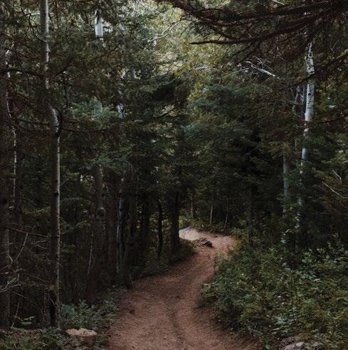
LOOKING FOR YOUR NEXT ADVENTURE?
NEWPORT
RESOURCES
STATE WELCOME CENTERS
Travel Oregon operates eight staffed Oregon Welcome Centers throughout the state, seven days a week May through September.* Each center features a treasure trove of amenities — well beyond free state maps and travel guides, Wi-Fi, and restrooms.
Ashland
Located at the ODOT Siskiyou Rest Area, off I-5 N., 13 miles/21 kilometers north of the California/Oregon border (milepost 12.7). Northbound access only. 541.625.0575
Boardman
Located at the SAGE Center, 101 Olson Road, off I-84 at Exit 164. 541.481.7243, VisitSage.com
Brookings
Located at Oregon State Parks’ Crissey Field State Recreation Site, 14433 Hwy. 101 S., a half-mile/0.8 kilometers north of the Oregon/ California border and 5 miles/8 kilometers south of Brookings. 541.469.4117
Klamath Falls
Located at the ODOT Midland Rest Area, off Hwy. 97, 9 miles/14.5 kilometers north of the Oregon/California border and 8 miles/ 12.8 kilometers south of Klamath Falls. 541.882.7330
Ontario
Located at the ODOT Ontario Rest Area, off I-84 W., a quarter-mile/0.4 kilometers west of the Oregon/Idaho border. Westbound access only. 541.889.8569
Oregon City
Located at The End of the Oregon Trail Interpretive Center, 1726 Washington St., off I-205 at Exit 10. 503.657.9336, HistoricOregonCity.org
Portland International Airport 7000 NE Airport Way, off I-205, located in the arrivals level near baggage claim carousel five. 503.284.4620
Seaside
Located at the Seaside Visitors Bureau, 7 N. Roosevelt (Hwy. 101) and Broadway St. 503.738.3097, SeasideOR.com
*Operating hours and days are subject to change; please call ahead.
Bend Portland Newport Corvallis Lincoln City Roseburg Coos Bay Gold Beach Brookings Medford Ashland Klamath Falls Eugene Albany Salem Hood River Astoria Seaside Tillamook John Day Burns Baker City La Grande Pendleton Joseph Ontario Lakeview Florence Mt. Hood Crater Lake McDermitt Oregon City Umatilla Boardman 146 mi / 235 km 62mi/100 km 52mi/84km 44mi/71 km 79mi/127 km 80mi/129km 132 mi / 213 km72mi/116km 130mi/209km 70 mi / 11 3 km 12 7 mi / 204 km 153 mi / 246 km 130mi/209km 51 mi/ 82 km 56mi/90km 129mi/208km/2.5hrs 122mi/196km 128 mi / 206 km 107mi/172km 13 7 mi / 22 1 km / 2.75 hr s 83 mi / 126 km 170mi/274km 96 mi / 1 55 km 77mi/124km 76 mi / 122 km 12 /mikm19 54mi/87km 1 33mi/214km 139mi/224km 96 mi / 155 km 134 mi / 216 km 78 mi / 1 26 km 48 mi / 77 km 50 mi/ 80 km 25 mi / 40 km 44 mi/ 71 km 49 mi / 79 km 17mi/27km 95mi/153km/2hr s 79mi/127km 88mi/142km 57 mi / 92 km 54 mi / 87 km / 1 hr 61 mi / 98 km / 1.25 hrs 47mi/76 km 32mi/52km 6943mi/ km mi/2947 km 40 mi / 64 km 24 mi / 39 km .5 hr s 70 mi / 113 km / 1.5 hrs 101mi/163km 147mi/237km 212mi/341km 1.5hrs 1 hr 2.5 hrs 2.5 hr s 4.5hrs .75hr 1.25hrs .75hr 1hr 2.5 hrs 2.5hrs 1. 25 hr s 2.5 hrs 2.25hrs 2.75hrs 2.75hr s 1.75 hrs 1.75hrs 1hr 1.5hrs 1.5 hrs 2.25 hrs 2.5hr s 71 mi / 11 4 km 1. 25 hr s 1. 5 hr s 3hr s 2 hrs 1. 5 hr s 2.5 hrs .5 hr 1 hr 1hr .5 hr 2.25hrs 1.75hrs .75 hr .75 hr .5hr 1 hr 2hrs .75 hr .75 hr .5hr 1 00 mi / 116 km 2 hr s 1 hr 1 hr 20 mi/ 32 km 40mi/64km .75hr 1.75hours 2.5hours PDX PDT RDM LMT MFR OTH EUG TRIPCHECK.COM 73
COAST OREGON COAST VISITORS ASSOCIATION
541.574.2679 visittheoregoncoast.com
Astoria-Warrenton Area Chamber of Commerce and Visitor Center 111 W. Marine Drive (Hwy. 101), Astoria 503.325.6311, 800.875.6807 travelastoria.com
Bandon Chamber of Commerce and Visitor Center
300 Second St. SE, Bandon 541.347.9616, bandon.com
Brookings City Hall Visitor Center 898 Elk Drive, Brookings 541.469.1137, brookings.or.us
Brookings-Harbor Chamber of Commerce
703 Chetco Ave., Brookings 541.469.3181, brookingsharborchamber.com
Cannon Beach Chamber of Commerce and Visitor Center
207 N. Spruce St., Cannon Beach 503.436.2623, cannonbeach.org
Charleston Visitors Center 91141 Cape Arago Highway, Charleston 541.888.2311 (May-Sept.) oregonsadventurecoast.com
Coos Bay - North Bend - Charleston Visitor & Convention Bureau 50 Central Ave., Coos Bay 541.269.0215, oregonsadventurecoast.com
Depoe Bay Chamber of Commerce
223 SW Highway 101, Ste. B, Depoe Bay 541.765.2889, discoverdepoebay.org
Florence Area Chamber of Commerce and Visitors Center
290 Highway 101, Florence 541.997.3128, florencechamber.com
Gold Beach Visitor Center
94080 Shirley Lane, Gold Beach 541.247.7526, 800.525.2334 visitgoldbeach.com
VISITOR INFORMATION
Explore Lincoln City 801 SW Highway 101, Lincoln City 541.996.1274, oregoncoast.org
Manzanita Visitors Center 31 Laneda Ave., Manzanita 503.812.5510, exploremanzanita.com
Discover Newport 555 SW Coast Highway, Newport 541.265.8801, 800.262.7844 discovernewport.com
North Bend Visitor Center
1380 Sherman Ave., Highway 101, North Bend 541.756.4613, 800.472.9176 northbendoregon.us/infocenter
Pacific City – Nestucca Valley Chamber of Commerce & Visitor Center 35170 Brooten Road, Pacific City 888.549.2632, pacificcity.com
Port Orford Visitor Center at Battle Rock
520 Jefferson St., Port Orford 541.332.4106 portorford.org/visitorcenter.html
Reedsport/Winchester Bay Chamber of Commerce 2741 Frontage Road, Reedsport 541.271.3495, reedsportcc.org
Rockaway Beach “Red Caboose” Visitor Center 103 S. First Ave., Rockaway Beach 503.355.2291, visitrockawaybeach.org
Seaside Visitors Bureau and Welcome Center 7 N. Roosevelt Drive (Highway 101), Seaside 503.738.3097, 888.306.2326 seasideor.com
Tillamook Area Chamber of Commerce 208 Main Ave., Tillamook 503.842.7525, gotillamook.com
Toledo Chamber of Commerce 311 NE First St., Toledo 541.336.3183, toledooregon.org
Waldport Visitor Center and Heritage Museum 585 NW Hemlock St., Waldport 541.563.2133, findyourselfinwaldport.com
Yachats Chamber of Commerce Visitors Center 241 Highway 101, Yachats 541.547.2345, yachats.org
PORTLAND REGION
TRAVEL PORTLAND VISITOR CENTER
1132 SW Harvey Milk St., Ste. 104, Portland 503.427.1372, 888.503.3291 travelportland.com
Beaverton Area Chamber of Commerce
12600 SW Crescent St., Ste. 160, Beaverton 503.644.0123, beaverton.org
Bonneville Power Administration Visitor Center 905 NE 11th Ave., Portland 503.230.4636, 800.622.4520 bpa.gov
Clatskanie Chamber of Commerce clatskaniechamber.com
Forest Grove/Cornelius
Chamber of Commerce 2417 Pacific Ave., Forest Grove 503.357.3006, visitforestgrove.com
Gresham Area Chamber of Commerce Visitors Center
1312 E. Powell Blvd., Gresham 503.665.1131, greshamchamber.org
Lake Oswego Chamber of Commerce 525 SW Third St., Ste. 233, Lake Oswego 503.636.3634, lakeoswegochamber.com
Oregon City Chamber of Commerce 1209 Seventh St., Oregon City 503.656.1619, oregoncity.org
Oregon’s Mt. Hood Territory mthoodterritory.com
End of the Oregon Trail Interpretive & Visitor Info Center 1726 Washington St., Oregon City 503.657.9336, 800.424.3002 historicoregoncity.org
Sherwood Chamber of Commerce 16273 SW Railroad St. 503.625.7800, sherwoodchamber.org
South Columbia County Chamber of Commerce
2194 Columbia Blvd., St. Helens 503.397.0685, sccchamber.org
Tigard Area Chamber of Commerce & Visitor Center 12345 SW Main St., Tigard (inside Symposium Coffee) 503.639.1656, tigardchamber.org
Tualatin Chamber of Commerce 8101 SW Nyberg St., Ste. 102, Tualatin 503.692.0780, tualatinchamber.com
Washington County Chamber of Commerce 5193 NE Elam Young Parkway, Hillsboro 503.648.1102 washingtoncountychamberor.com
Tualatin Valley/Washington County Visitors Association 12725 SW Millikan Way, Beaverton (inside Beaverton City Hall) 503.644.5555, 800.537.3149 tualatinvalley.org
West Linn Chamber of Commerce 503.655.6744, westlinnchamber.org
MT. HOOD / THE COLUMBIA
RIVER GORGE
MT. HOOD AND COLUMBIA RIVER GORGE REGIONAL TOURISM ALLIANCE 503.655.8458, hood-gorge.com
Bonneville Hatchery Visitor Center & Viewing Pond 70543 NE Herman Loop, Cascade Locks 541.374.8393
myodfw.com/bonneville-hatchery-visitorsguide
Bonneville Lock & Dam Visitor Center I-84 Exit 40, Cascade Locks 541.374.8820
nwp.usace.army.mil/bonneville
COAST EASTERN
SOUTHERN
CENTRAL
WILLAMETTE VALLEY
MT. HOOD & THE COLUMBIA RIVER GORGE
74 TRAVELOREGON.COM/BYWAYS
PORTLAND REGION
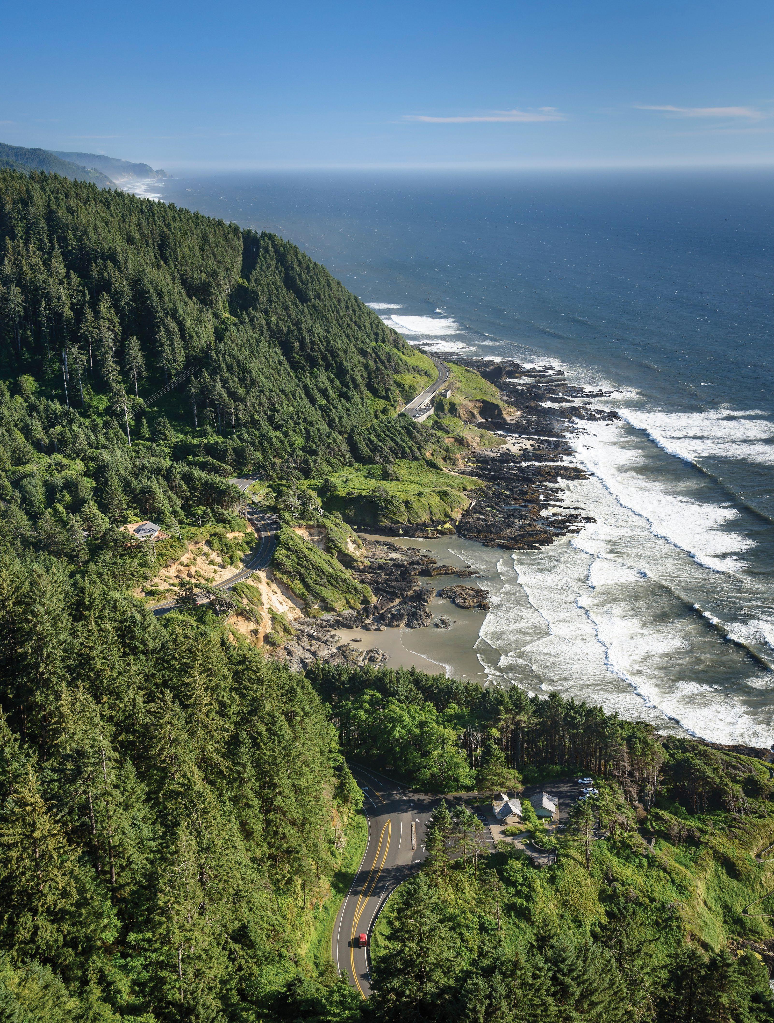
GREG VAUGHN
TRIPCHECK.COM 75
Cape Perpetua, along the Pacific Coast Scenic Byway
Cascade Locks City Hall cascadelocks.com
Estacada Chamber of Commerce and Visitor Center
475 SE Main St., Estacada (inside Estacada City Hall) 503.630.3483, estacadachamber.com
Hood River County Chamber of Commerce/Visit Hood River
541.386.2000, 800.366.3530 visithoodriver.com
Mt. Hood Cultural Center & Museum
88900 Government Camp Loop, Government Camp 503.272.3301, mthoodmuseum.org
Mt. Hood National Forest Zigzag Ranger Station Visitor Services 70220 E. Highway 26, Zigzag 503.622.3191, fs.usda.gov/detail/mthood
North Clackamas Chamber of Commerce
8305 SE Monterey Ave., Ste. 104, Happy Valley 503.654.7777, yourchamber.com
Sandy Area Chamber of Commerce 503.668.4006, sandyoregonchamber.org
The Dalles Area Chamber of Commerce 404 W. Second St., The Dalles 541.296.2231, thedalleschamber.com
Explore Troutdale’s Gateway to the Gorge Visitor Center 475 E. Historic Columbia River Highway, Troutdale 503.491.4000, exploretroutdale.com
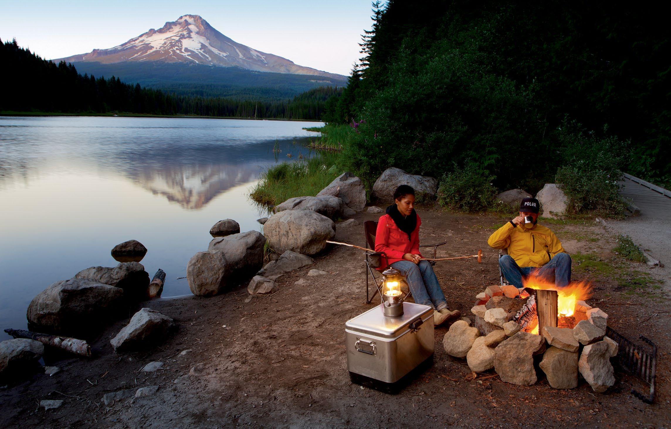
WILLAMETTE VALLEY WILLAMETTE VALLEY VISITORS ASSOCIATION
866.548.5018, willamettevalley.org
Albany Visitors Association 110 Third Ave. SE, Albany 541.928.0911, albanyvisitors.com
Aurora Colony Visitors Association auroracolony.com/wp
Brownsville Chamber of Commerce 541.928.0831, historicbrownsville.com
Canby Area Chamber of Commerce and Visitor Center 191 SE Second Ave., Canby 503.266.4600, canbyareachamber.com
Chehalem Valley Chamber of Commerce Visitor Information Center
112 N. Garfield St., Newberg 503.538.2014, tastenewberg.com
Coburg Main Street 541.682.7858, coburgchamber.com
Visit Corvallis Visitor Center
113 SW Third St., Ste. 101, Corvallis 541.757.1544, 800.334.8118 visitcorvallis.com
Cottage Grove Area Chamber of Commerce 836 E. Main St., Cottage Grove 541.942.2411, cgchamber.com
Creswell Chamber of Commerce 95 W. Oregon Ave., Creswell 541.895.4398, creswellchamber.com
Dallas Area Visitors Center 240 SW Washington St., Dallas 503.837.1999, exploredallasoregon.org
Eugene, Cascades & Coast –Travel Lane County
754 Olive St., Eugene 541.484.5307, 800.547.5445 eugenecascadescoast.org
Junction City, Harrisburg, Monroe (Tri-County) Chamber of Commerce 541.998.6154, tri-countychamber.com
Keizer Chamber of Commerce & Information Center
4118 River Road N., Keizer 503.393.9111, keizerchamber.com
Lebanon Area Chamber of Commerce & Visitor Center
1040 S. Park St., Lebanon 541.258.7164, lebanon-chamber.org
McKenzie River Chamber of Commerce 541.896.3330, mckenziechamber.com
McMinnville Area Chamber of Commerce 319 NE Fifth St., McMinnville 503.472.6196, mcminnville.org
Visit McMinnville visitmcminnville.com
Molalla Area Chamber of Commerce 109 E. Main St., Molalla 503.829.6941, molallachamber.com
Monmouth-Independence Chamber of Commerce & Visitors Center 355 Pacific Ave. N., Ste. B., Monmouth 503.838.4268, micc-or.org/visitors-center
Mt. Angel Chamber of Commerce 503.845.9291,mtangelchamber.com
Explore North Marion County 270 Montgomery St., Woodburn 503.980.6322,explorenorthmarion.com/ woodburn
North Santiam Chamber of Commerce 503.897.5000, nschamber.org
Oakridge/Westfir Area Chamber of Commerce 541.313.6758, oakridgechamber.com
Philomath Area Chamber of Commerce 1427 Main St., Philomath (inside Timber Towne Coffee) 541.929.2454, philomathchamber.org
Travel Salem Visitors Center 630 Center St. NE, Salem 503.581.4325, travelsalem.com
Silverton Area Chamber of Commerce and Visitor Center 426 S. Water St., Silverton 503.873.5615, silvertonchamber.org
Springfield Area Chamber of Commerce Historic Train Depot & Visitor Center 101 S. A St., Springfield 541.746.1651, springfield-chamber.org
Stayton-Sublimity Chamber of Commerce & Regional Visitor Center 175 E. High St., Stayton 503.769.3464 staytonsublimitychamber.org
Sweet Home Chamber of Commerce 1575 Main St., Sweet Home 541.367.6186, sweethomechamber.com
TYLER ROEMER / TRAVEL OREGON
76 TRAVELOREGON.COM/BYWAYS
Trillium Lake on Mt. Hood
Veneta/Fern Ridge Chamber of Commerce
24949 Highway 126, Veneta 541.935.8443, venetafernridgechamber.com
Wilsonville Chamber of Commerce 503.682.0411, wilsonvillechamber.com
SOUTHERN TRAVEL SOUTHERN OREGON
541.708.1994, southernoregon.org
Travel Ashland & Ashland
Chamber of Commerce
110 E. Main St., Ashland 541.482.3486, ashlandchamber.com
Canyonville Chamber of Commerce 541.839.4258, canyonvillechamber.org
Central Point Chamber of Commerce and Visitor Center
650 E. Pine St., Central Point 541.664.5301 centralpointchamber.org/visitors
Christmas Valley/North Lake Chamber of Commerce
541.576.3838, christmasvalleychamber.org
Travel Grants Pass Welcome Center
198 SW Sixth St., Grants Pass 541.540.6180, travelgrantspass.com
Illinois Valley Visitor Center
201 Caves Highway, Cave Junction 541.592.3326, ivchamberofcommerce.com
Jacksonville Chamber of Commerce & Visitor Center
185 N. Oregon St., Jacksonville 541.899.8118, jacksonvilleoregon.org
Discover Klamath
205 Riverside Drive, Ste. B, Klamath Falls 541.882.1501, 800.445.6728 discoverklamath.com
Lake County Chamber of Commerce
126 N. E St., Lakeview 541.947.6040, allaboutlakecounty.com
Travel Medford 541.779.4847, 800.469.6307 travelmedford.org
Travel Medford Visitor Information Center
Rogue Valley International-Medford Airport,
1000 Terminal Loop Parkway, Medford 541.772.8068
Oregon Caves National Monument
Information
19000 Caves Highway, Cave Junction 541.592.2100, nps.gov/orca
Rogue River Chamber of Commerce and Visitor Center
8898 Rogue River Highway, Rogue River 541.582.0242, rogueriverchamber.com
Experience Roseburg Visitor Center 555 SE Kane St., Roseburg 541.672.9731, experienceroseburg.com
Sutherlin Area Chamber of Commerce and Visitor Center
1310 W. Central Ave., Sutherlin 541.459.3280, visitsutherlin.com
Winston Visitor Information Center
30 NW Glenhart Ave., Winston 541.679.0118, winstonchamber.org
CENTRAL VISIT CENTRAL OREGON
541.389.8799, 800.800.8334 visitcentraloregon.com
Bend Chamber of Commerce 1567 SW Chandler Ave., Ste. 204, Bend 541.382.3221, bendchamber.org
Visit Bend/Bend Visitor Center 750 NW Lava Road, Ste. 160, Bend 541.382.8048, 877.245.8484 visitbend.com
Central Oregon Visitors Association
Welcome Center
The Village at Sunriver, 57100 Beaver Drive, Building 6, Ste. 130, Sunriver 541.389.8799, 800.800.8334 visitcentraloregon.com
Redmond Chamber of Commerce & CVB 446 SW Seventh St., Redmond 541.923.5191, visitredmondoregon.com
Culver Visitors Information Center at the Culver Market
411 First St., Culver 541.546.6032
La Pine Chamber of Commerce & Visitor Center 51429 Huntington Road, La Pine 541.536.9771, lapine.org
Madras-Jefferson County Chamber of Commerce Visitor Information Center 274 SW 4th St., Madras 541.475.2350, madraschamber.com
Maupin Area Chamber of Commerce
502 Deschutes Ave., Maupin 541.993.1708, maupinoregon.com
Metolius River/Camp Sherman metoliusriver.com
Prineville-Crook County Chamber of Commerce & Visitor Center
185 NE 10th St., Prineville 541.447.6304, prinevillechamber.com
Sisters Area Chamber of Commerce 257 S. Pine St., Ste. 102, Sisters 541.549.0251, sisterscountry.com
Sunriver Area Chamber of Commerce and Visitors Center
Sunriver Business Park, 58625 Venture Lane, Ste. 110, Sunriver 541.593.8149, sunriverchamber.com
EASTERN
EASTERN OREGON VISITORS ASSOCIATION 800.332.1843, visiteasternoregon.com
Baker County Chamber of Commerce & Visitors Bureau 490 Campbell St., Baker City 541.523.5855, visitbaker.com, travelbakercounty.com
Boardman Chamber of Commerce 101 Olson Road, Boardman 541.481.3014, boardmanchamber.org
Elgin Chamber of Commerce 541.975.0900
Grant County Chamber of Commerce
301 W. Main St., John Day 541.575.0547, gcoregonlive.com
Harney County Chamber of Commerce 484 N. Broadway, Burns 541.573.2636, harneycounty.com
Heppner Chamber of Commerce 133 N. Main St., Heppner 541.676.5536, heppnerchamber.com
Hermiston Chamber of Commerce 630 S. Highway 395, Hermiston 541.567.6151 hermistonchamber.com, travelhermiston.com
Irrigon Chamber of Commerce 490 NE Main Ave., Irrigon 541.626.2045, irrigonchamber.com
Milton-Freewater Chamber of Commerce 157 S. Columbia St., Milton-Freewater 541.938.5563, mfchamber.com
Nyssa Chamber of Commerce & Agriculture 105 Main St., Nyssa 541.372.3091, nyssachamberofcommerce.com
Ontario Chamber of Commerce and Visitor Center 251 SW Ninth St., Ontario 541.889.8012, ontariochamber.com
Oregon Frontier Chamber of Commerce 311 S. Main St., Condon 541.384.7777, oregonfrontierchamber.com
Pendleton Chamber of Commerce & Visitor Information Center 501 S. Main St., Pendleton 541.276.7411, 800.547.8911 pendletonchamber.com, travelpendleton.com
SAGE Center 101 Olson Road, Boardman 541.481.7243, visitsage.com
Umatilla Chamber of Commerce 100 Cline Ave., Umatilla 541.922.4825, umatillaorchamber.org
Union County Chamber of Commerce 207 Depot St., La Grande 541.963.8588, visitunioncounty.org
Wallowa County Chamber of Commerce 309 S. River St., Ste. B, Enterprise 541.426.4622, wallowacountychamber.com
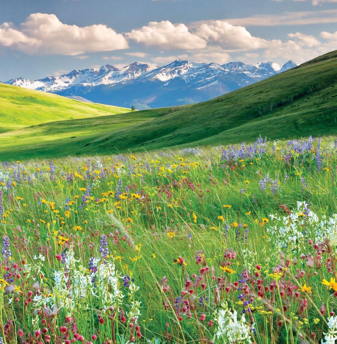
STATEWIDE
Oregon Bed and Breakfast Guild 503.893.4210, obbg.org
Oregon Department of Aviation 503.378.4880, oregon.gov/aviation
Oregon Department of Fish & Wildlife 503.947.6000, 800.720.6339 dfw.state.or.us
Oregon Governor’s Office of Film & Television 971.254.4020, oregonfilm.org
Oregon Restaurant & Lodging Association 503.682.4422, 800.462.0619 oregonrla.org
Oregon State Legislature Visitor Services 503.986.1388 oregonlegislature.gov/ capitolhistorygateway
Oregon State Marine Board 503.378.8587, oregon.gov/osmb
Oregon State Parks Park info: 800.551.6949 Reservations: 800.452.5687 oregonstateparks.org
DENNIS FRATES / TRAVEL OREGON
TRIPCHECK.COM 77
Zumwalt Prairie
IT’S NOT HARD TO MAKE A MEMORY LAST A LIFETIME –JUST DO SOMETHING UNFORGETTABLE.

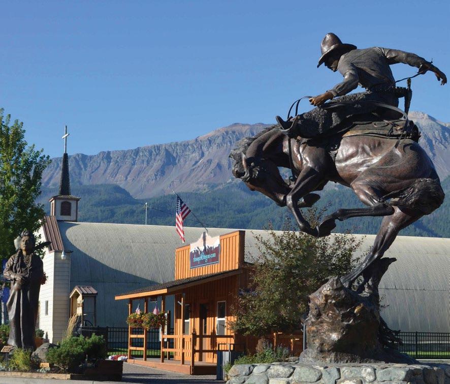
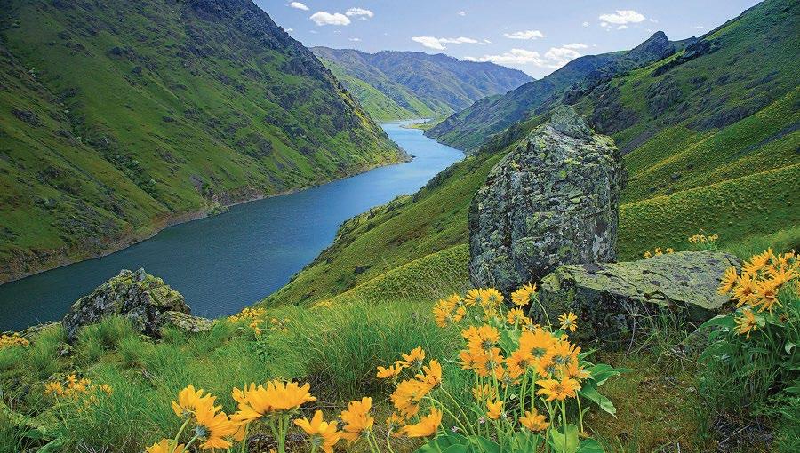
PLAN YOUR ADVENTURE


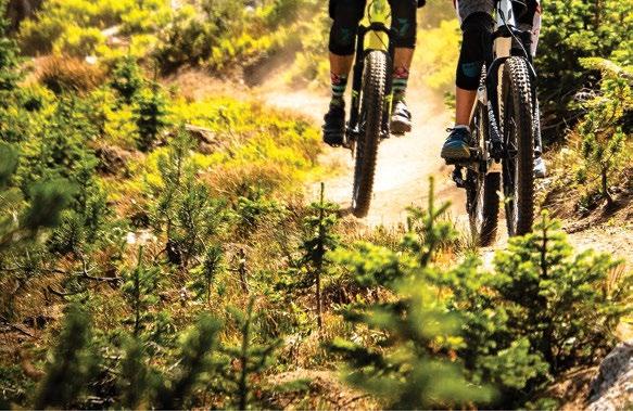
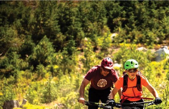
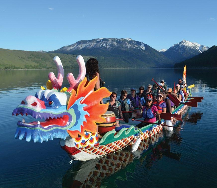

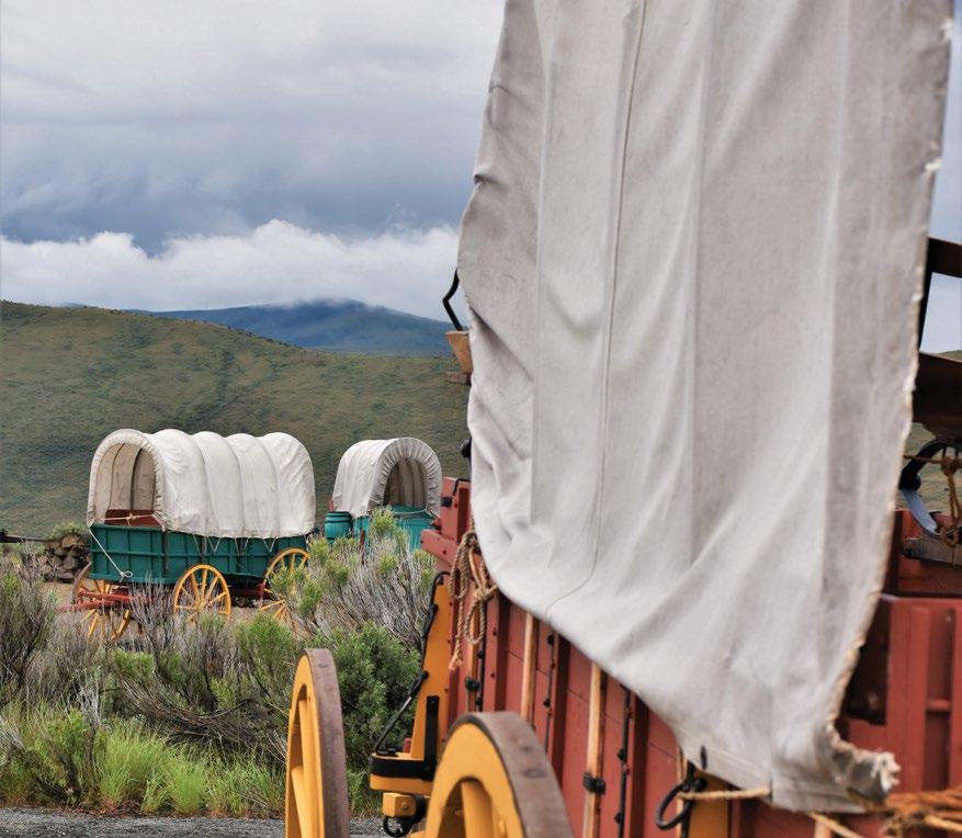
HELLSCANYONBYWAY.COM
offer the ultimate tours through some of the most scenic natural beauty the state has to offer. While you are enjoying these scenic bikeways, take care to follow the rules of the road and remember that you’re sharing the route with cars, farm equipment and wildlife. Visit TravelOregon.com/bicycling for more information.
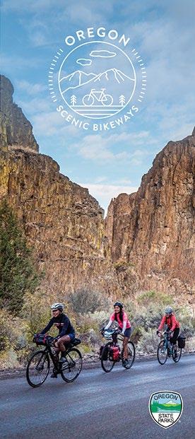
Designated Scenic Bikeways


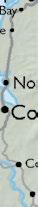
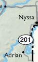
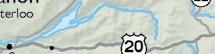


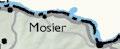

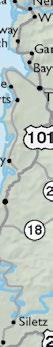


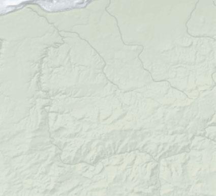


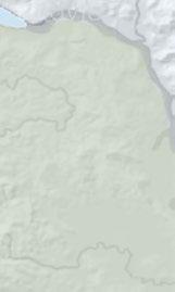


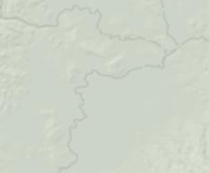

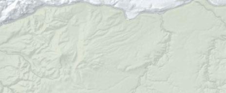


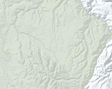


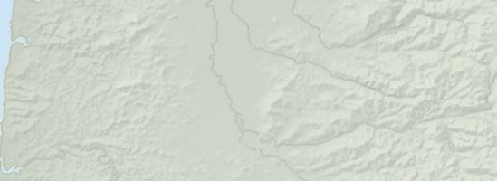


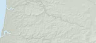
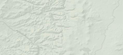


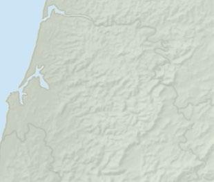


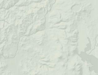


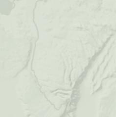

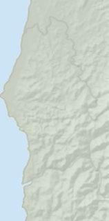
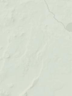


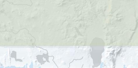


Order or download an Oregon Scenic Bikeways Guide at TravelOregon.com/guides.
Tualatin Valley
miles/82 kilometers moderate
Willamette Valley
miles/216 kilometers moderate
Covered Bridges
miles/58 kilometers mild
Wild Rivers Coast
miles/98 kilometers moderate
Cascade Siskiyou
miles/89 kilometers extreme
Cascading Rivers
miles/114 kilometers challenging
Sherar's Falls
miles/53 kilometers moderate
Madras Mountain Views
miles/47 kilometers moderate
Sisters to Smith Rock
miles/60 kilometers moderate
McKenzie Pass
miles/61 kilometers extreme
1
51
2
134
3
36
4
61
5
55
6
71
7
33
8
29
9
37
10
38
Bridges
moderate
River Canyon
moderate d 101 101 197 199 20 20 20 20 26 26 35 26 26 30 30 395 395 395 95 95 97 97 97 97 6 22 22 74 19 19 74 86 78 82 3 37 11 22 58 31 62 62 39 66 99W 223 226 126 126 216 216 218 206 206 244 237 203 245 205 204 207 207 138 138 227 140 140 140 18 34 38 42 350 47 47 126 138 224 211 213 39 140 5 84 84 84 5 126 46 Seasonal road 372 46 31 395 230 26 19 73 53 73 7 7 228 34 22 126 214 18 46 2810 227 39 177 36 33 202 53 Antelop Arlington Boardman Chiloquin Condon Culver Dayville Depoe Bay Toledo Elgin Elkton Fossi Gates Lyons Gold Beach Granit Grass Valley Haines Halfway Helix Heppner Huntington Idanha Imbler Ione Jordan Valley Joseph Lexington Lonerock Long C ek Lostine Malin Maupi Mitchel Monument Paisley Pilot Rock Port Orford Powers Richland Riddle Rogue River Senec Shaniko Sisters Spray Summerville Sumpter Sunriver Ukiah Unity Waldport Wallowa Yachats Imnaha Merlin Frenchglen North Powder Gearhart Canyo ille Jacksonville Veneta Dunes City Lakeside Drain Yoncalla Winston Glendale Shady Cove Gold Hill Central Point Talent Phoenix Butte Falls Oakland Westfir Coburg Harrisburg La Pine Bonanza Rufus Wasco Stanfield Adams Athena Weston Island City Co Greenhorn Merrill Clatskanie Rainier Prescott Columbia City Nehalem Manzanita Wheeler Rockawa Beac y City Falls City Philomath Tangent Monroe Halsey Brownsville Sodaville Wa Millersburg Scio Mill City Gleneden Beach Neskowin Cave Junction Fort Klamath Crescent Summer Lake Silver Lake Christmas Valley Fort Rock Chemult Plush Ade Steamboat Glide Idleyld Park Union Creek Prospect Trai Tiller 234 Biggs Service Creek Kimberly Starkey Fields Cascadia Medica Spring Crane Diamond Rome McDermitt Charleston Dorena Pacific City Netart Oceansid Otter Rock Seal Rock Mapleton Winchester Ba Agness Jewell Bandon Brookings Burns Coquille Enterprise Florence Harbor Hood River John Day unction City Cottage Grove Cr ll Lakeview Madras Molalla Estacada Sandy Welches Aurora Canby King City Dundee Banks Forest Grove North Plains Cornelius Aloha Myrtle Creek Myrtle Point Oakridge Sutherlin Reedsport Scappoose Vernonia yton Tillamook Umatilla Union Warrenton Astoria Baker City Hermiston Lincoln City Milton-Freewater Newport Ontario Prineville Redmond Seaside Silverton Dallas Independence St Helens Wa Sweet Home Blue River Walterville Warm Springs Crooked River Ranch Black Butte Ranch Echo North Bend Lowell Cannon Beach Garibaldi Canyon City Mt Vernon Prairie City Hines Vale Adair Villag Monmouth Aumsville Sublimity Turner Keizer Sheridan Grand Ronde Amity Gaston Yamhill Carlton Moro Cascade Locks Sherwood outdale Damascus Barlow Milwauki Beaverton Oregon City w Tualatin ood ood Village McKenzie Bridge Brightwood Rhododendron Zigzag Government Camp Parkdale Odell Austin Arch Cape Corvallis Medford Eagle Point Springfield Ashland Bend The Dalles Coos Bay Grants Pass Klamath Falls La Grande Lebanon g McMinnville Pendleton Roseburg oodburn Lafayette Dayto Gervais rd St Mt Angel Detroit Metolius Dufur Gladstone Hillsboro Tigard esha st Lin Wilsonville Eugene Po Salem OREGON NE VA DA WA SHING TO N ID AH O PA CIFIC OCEAN MT. ASHLAND OCHOCO MTNS STEENSMTN CALIFORNIA B L U E M T NS C A S C A D E R A N G E C O A S T R A N G E S T R A W B E R R Y R A N G E ALVORD DESERT W A LLOWA MOUNTAINS MT. HOOD CRATER LAKE TM 13 Oregon Outback 90 miles/145 kilometers extreme 14 Painted Hills 161 miles/259 kilometers extreme 15 Old West 174 miles/280 kilometers challenging 16 Blue Mountain Century 108 miles/174 kilometers extreme 17 Grande Tour 134 miles/216 kilometers challenging 1 2 4 3 5 6 7 8 9 10 11 12 14 15 16 17 13 TRIPCHECK.COM 79
11 Twin
36 miles/58 kilometers
12 Crooked
37 miles/60 kilometers
OREGON
SCENIC BYWAYS
The Official Scenic Byways & Tour Routes Driving Guide
An official publication of the OREGON TOURISM COMMISSION
Toll-free 800.547.7842
TravelOregon.com
Email: info@traveloregon.com
OREGON DEPARTMENT OF TRANSPORTATION
Toll-free 1-888-Ask-ODOT
www.oregon.gov/ODOT
Email: ask.odot@odot.state.or.us
OREGON ELECTRIC BYWAYS
As part of our commitment to sustainability, Oregon is proud to be a leader in electric vehicle (EV) travel with one of the largest and most robust network of EV charging stations in the country. As the number of EV drivers continues to rise, Travel Oregon is committed to supporting this trend as a way to offer green travel options to our visitors.
PUBLICATION TEAM
Jen Anderson, Ariana Bray-Sweet, Mark Senffner, Mo Sherifdeen, Kevin Wright
ODOT TEAM Amanda Pietz, Sandra Hikari
DIRECTOR OF CUSTOM PUBLISHING
Megan Kirkpatrick
CREATIVE DIRECTOR Nickie Bournias
SENIOR EDITOR Eileen Garvin
WRITER Tina Lassen
COPY EDITOR Morgan Stone
SENIOR ACCOUNT EXECUTIVE Betsy Hand
ADVERTISING SALES COORDINATOR Max Cyphers
DIGITAL PRODUCTION COORDINATOR
Alison Kattleman
Oregon Scenic Byways is published by MEDIAMERICA INC.
PRESIDENT/CEO CONTROLLER
Andrew Insinga Bill Lee
CORPORATE OFFICE
12570 SW 69th Ave, Suite 102 Portland, OR 97223 Phone: 503.223.0304 Fax: 503.221.6544 www.mediamerica.net
Among the 29 Oregon Scenic Byways and Tour Routes listed in this guide, many are EV friendly, including the Historic Columbia River Scenic Byway, the Mt. Hood Scenic Byway and the Umpqua River Scenic Byway The entire 363-mile Pacific Coast Scenic
EV
Byway supports EV travel with highspeed charging stations running along its entire route. We have included an EV icon in the map and information section to illustrate routes that are EV friendly. To plan your trip, browse PlugShare.com for the locations of fast-charging stations around the state. PlugShare is the world’s largest EV charging network with a database of more than 26,000 charging stations in the U.S. and Canada.
Travel Oregon has also created several EV itineraries, which outline what to see and do and where to eat and drink along EV routes in Oregon. Find these trip ideas and more at OregonElectricByways.com
Oregon Scenic Byways is published by MEDIAmerica Inc. for the Oregon Tourism Commission (dba Travel Oregon) and Oregon Department of Transportation. Specific visitor attractions, facilities and services mentioned in this publication serve only as examples of Oregon attractions. Mention does not constitute an endorsement by the State of Oregon. Data are subject to change. Copyright ©2023 State of Oregon. All rights reserved. Printed in Oregon by Journal Graphics.
LYNCH
SARAH
80 TRAVELOREGON.COM/BYWAYS
charging station at Sokol Blosser Winery
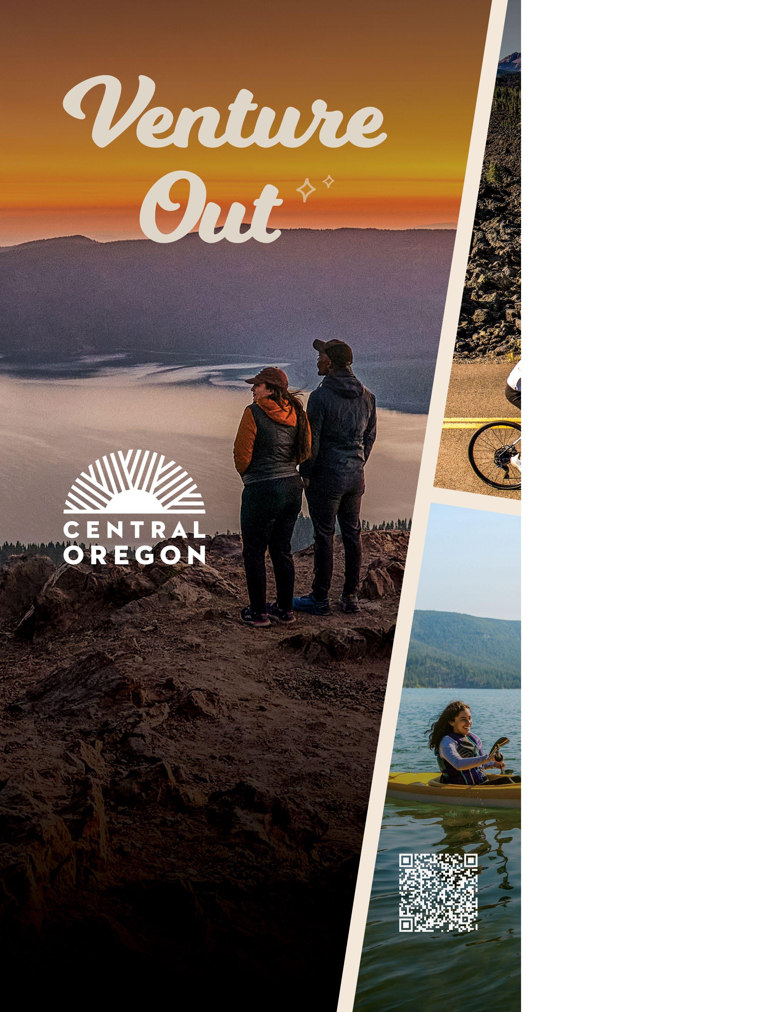

VINEYARD AND VALLEY SCENIC TOUR ROUTE
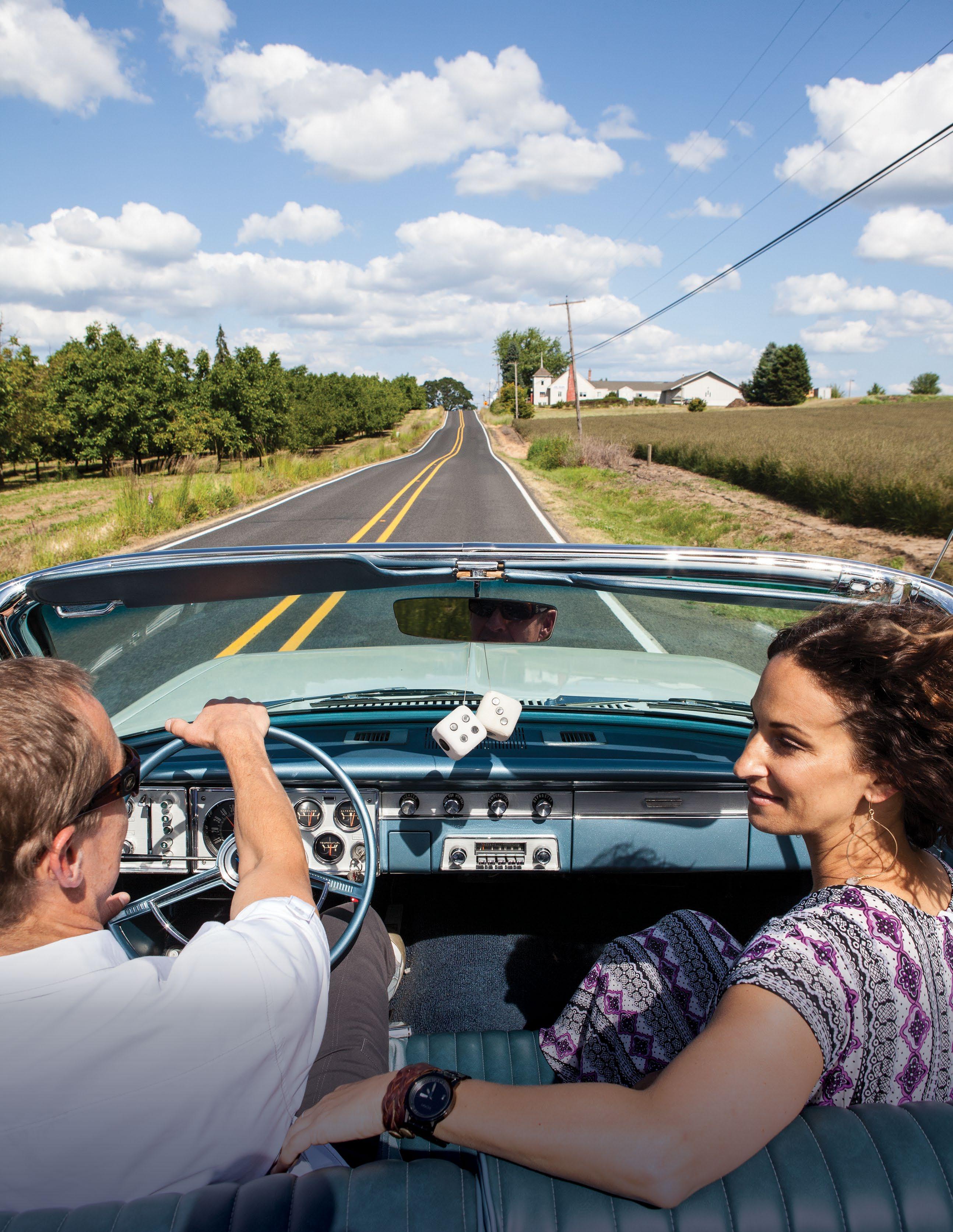
Take the scenic route in Tualatin Valley along the experiential Vineyard and Valley Scenic Tour Route. Funded in part by Learn more at tualatinvalley.org Learn More About Tualatin Valley’s Scenic Routes SCENIC AT EVERY TURN
