Travel expression of culture and art 14th Issue Free online edition Zanzibar, Tanzania: Vibrant People & Silvery Sand Beach Paradise A visit toIslanNagasakidofthe Gods is shouting your name An introductiontoSpanishGastronomy

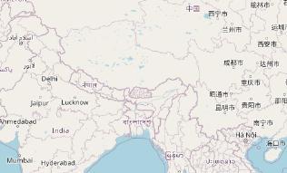
Trek inMansarKailashtoovarTibet
by Murli Menon TIBET
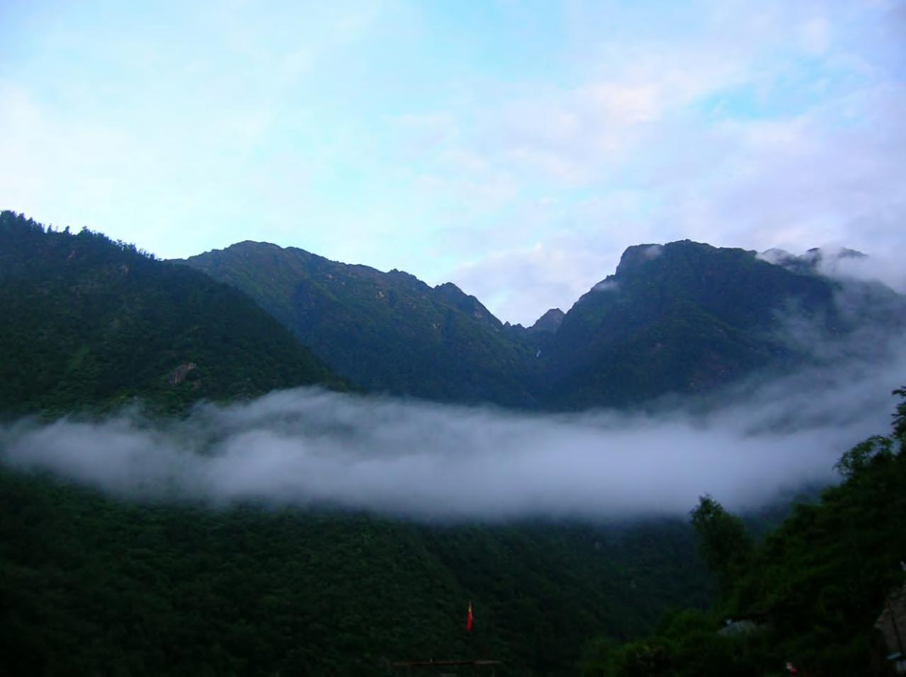
After completing three pre scheduled treks in the Nepal Himalayas, we decided that we would proceed to Mount Kailash through the Kodari border between Nepal and Tibet We left Kathmandu early and prepared for our 5 hour road journey to Kodari. The journey was pleasant and took us to the hill station of Dhulikhel (5500 feet), through the historic town of Bhaktapur. We drove 114 km. along the banks of the Kosi River. In the city of Kodari, we complete the immigration and customs formalities on the Nepalese side, cross the Nepal Tibetan Friendship Bridge, and then complete the immigration and customs formalities on the Chinese side to continue our journey. We drove 16 km from Nyalam to see the Bonpa cave dwellings We could see large terraced barley fields, watered by mountain streams, scattered across the Nyalam Valley. We also saw many “chorten” (buddhist architecture), monasteries, and Buddhist temples along the way Prayer flags flutter in the violent gusts of wind Toothless Tibetan men and women can be seen whirling prayer wheels or chanting with a necklace of beads in their hands putside the caves. Local Tibetans are courteous and friendly.
39
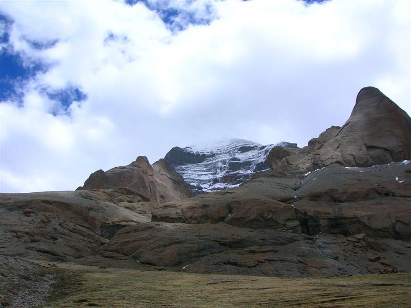
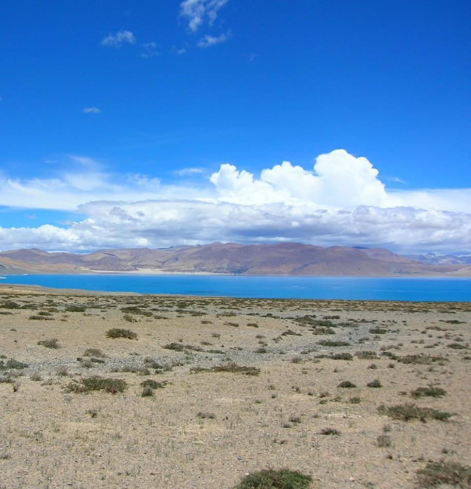
The most picturesque part of the journey begins as one reaches the fringes of the deep blue Paiku Tso lake Paiku Tso is one of the highest sweet water lakes in the world. We could also see the Sishapangma peak (27000 feet) during this drive. Approaching Saga, we drove for long hours alongside a mountain stream, which was none other than the mighty Brahmaputra. The Tibetans call this river the Yarlung Tsangpo (means mighty river) Saga is a slightly bigger town than Nyalam and appears to be in the middle of a high altitude desert. 40
The next day we started early in the morning from Saga to complete the 260 km drive to Paryang (14,200 feet) This 9 hour drive is over a mud road Giant barren mountains lined both sides of the dusty track There were few traces of human settlements along the way except a few tents of the Bon Pa, a nomadic tribe that has existed in this hostile environment for centuries. The desert with its sand dunes stretched for hundreds of kilometres. The weather is extreme. The mornings are frosty The afternoon is scorching hot and the high speed winds are icy at night There are no dwellings for thousands of miles, except for a few widely scattered Bon-Pa settlements There are grasslands around the lakes along the way We leave in the wee hours of the morning to drive the 280 km between Nyalam and Saga (13,500 feet). This scenic drive is a geologist’s delight. From the greenery of Nyalam to the snow capped peaks surrounding Paiku Tso Lake and the barren mountains surrounding Saga, the landscape is constantly changing As one makes the torturously slow ascent towards Saga, the vegetation cover slowly disappears. From trees to bushes to shrubs to cacti, one can see the effects of the diminishing oxygen levels We cross the windy Lalung La Pass (16700 feet) and drive across the Shishapangma High Altitude National Park
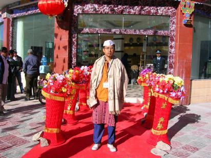
We saw some yaks grazing lazily on the grass Paryang is a small city that is mainly an overnight stopover for travellers. All the houses in Paryang function as guesthouses for trekkers, pilgrims, and tourists. The next morning we headed to Lake Mansarovar, which is 280 km away from Paryang. This drive is over rocks, pebbles, gravel, and stones There is neither a road nor a mule track. Along the way, we crossed the Mayum La Pass (17000ft) and could only see vast expanses of barren land, snow capped peaks, and sandy hills. After this eight hour cross country drive, we reached Chiu Gompa
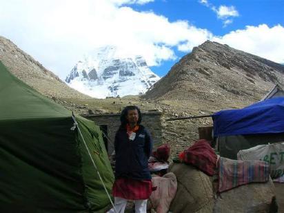
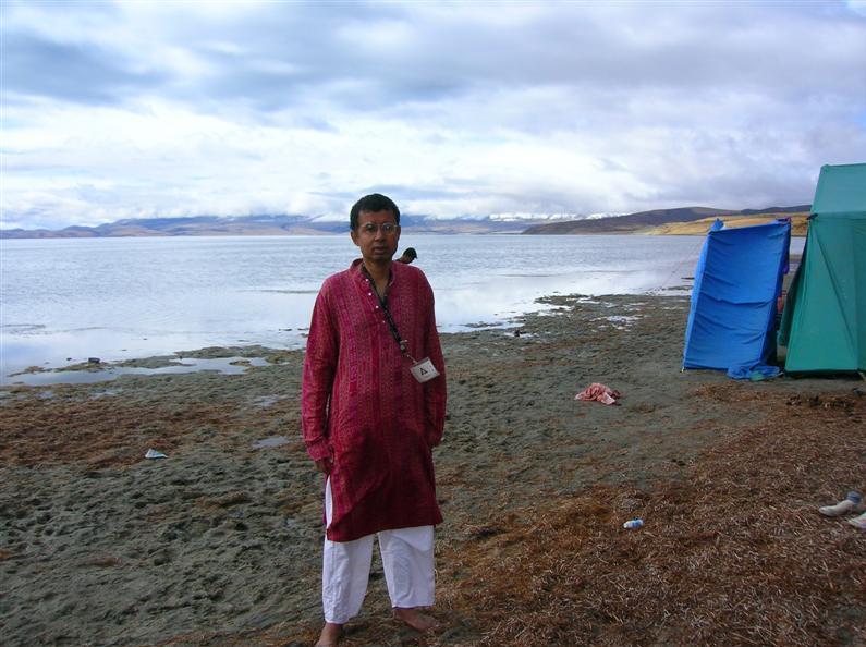
Tibetans come here to offer their clothes as a symbolic gesture of sacrificing their ego. The monastery in Chiu Gompa is strewn with thousands of pieces of discarded robes Stones are delicately balanced one above the other in an ancient ritual aimed at propitiating Sun (fire), Lake Mansarovar (water), and Mount Kailash (earth) We stayed the night at Chiu Gompa, camping alongside Mansarovar (14950 feet) in a windproof tent Spending the night alongside this lake is a magical experience. Thousands of stars are reflected in the crystal clearness of the lake The power that nature expresses through this show is fascinating. The clear skies, the altitude and the pitch darkness combine to create an energy aura that has to be felt to be believed Every year, only 5000 Indian pilgrims are fortunate to make this holy pilgrimage. The next day we woke up at 4 a m and headed for the hot water springs at Chiu Gompa for a refreshing warm water bath These sulphur springs are known for their medicinal properties We spend the day also at Mansarovar, bathing in its freezing waters. 41
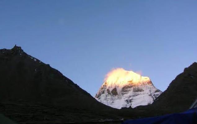
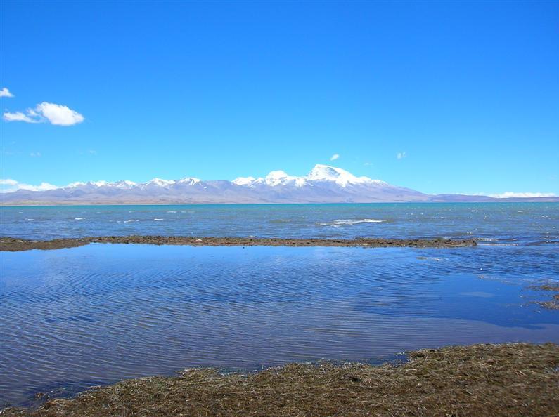
We also visited Rakshas Tal, the mythical lake where Ravana meditated on Shiva Rakshas Tal is extremely scenic, especially at sunrise and sunset. The water is famed for its medicinal properties. The ice cold dip in the waters of the world’s highest sweet water lake is a divine experience We spent the second night at Mansarovar and the next day we started the Kailash Parikrama from Darchen Mansarovar Lake is the source of the Indus, Brahmaputra, Karnali, Mekong, and Sutlej With the biting cold coupled with the freezing waters, we could enjoy the first rays of the rising sun, reflected on the waters of this mini ocean. Soon we were watching the golden rays of the setting sunlight up the evening sky The lake reflects molten gold as the horizon turns pink and crimson. The deep reddish hue of the sky is a stark contrast to the deep blue waters of the lake, setting a distinctive mark between the sky and the water. We started our Kailash Parikrama on foot from Darchen (15200 feet) The first part of the trek entails trekking 12km from Darchen to Diraphuk. We trekked over the narrow mountain trail, which ran parallel to the stream We travelled alongside the La Chu river through a serene, meadow lined valley, hopping over small streams, with the west face of Mount Kailash above us The river enters a narrow canyon with several cliffs and cascading waterfalls When we arrived at Diraphuk, we camped in a tent under the north face of Kailash Unfortunately, the day we arrived in Diraphuk, Mount Kailash was shrouded in unnatural fog, forcing us to confine ourselves to the tent In Kerala, where it rains throughout the day for three to four months, my grandmother had a traditional chant for keeping away the rain by scattering the clouds Before we stepped out of the house in Kerala, my grandmother made us recite the fifteen names of Arjuna (communication with Krishna who is the Divine God) in Bhagavad Gita from the Bhagavad Gita (Partha, Kapidwaja, Sabyasachi are among the 15). These fifteen names, if repeated mentally, had the instant power to scatter the clouds and dissolve them into thin air 42
After completing my Gayatri Japa (repetiting meditaion on the primordial sound 108 times), I started chanting the fifteen names of Arjuna mentally. Along with my silent chant, I began to visualise the clouds disappearing and the mist fading through a powerful gust of wind blowing the clouds away. Slowly, I visualised the first rays of the sun strike the peak of Mount Kailash till I could see Mount Kailash reflecting a crimson hue. I had creatively visualised one of the most spectacular sunrises that can be seen I continued to mentally chant the fifteen names of Arjuna. I went to deep restful sleep after the chant And when I woke up I could see that my visualisation had actualised and I could see Mount Kailash as clearly in the twilight hours of dawn, as I could see on a clear cloudless sunny afternoon. I took my digital camera, with a very low battery, because since I left Kathmandu I couldn't recharge it, since in most of the towns in Tibet there is no electricity I walked around my tent and scanned the eastern horizon for the sun After about an hour, I was witness to one of the most spectacular sunrises I have ever seen in my life. My digital camera, which is my trusted friend over the last two decades, did not let me down and I was able to take a photo of the sunrise, with the sunlight creating the head of Nandi the celestial vehicle of our beloved Lord Shiva, on the peak of Mount Kailash
Continued mental or oral chanting had the power of protecting the chanter from lightning, thunder, hailstorms, avalanches, and snowstorms. After having spent a lot of money to the atheist Chinese Government on Tibet permit for getting a tiny glimpse of Mount Kailash and for nine dips at Holy Mansarovar, and after an ice cold dip in the freezing waters of the snowy lake, I finished chanting nine “malas” (108 beads) of the Gayatri Mantra (meditation on the primordial sound (volcanoes oceans and earth's sounds) at the base of Mount Kailash (covered in mist and fog) between 3 a m and 4 a m
Posting this photo on my blog, once I returned to Kathmandu, hundreds of travel agents in Kathmandu started printing my photo on their brochures to encourage potential tourists to hike Mount Kailash. The weather turned cloudy and Mount Kailash was hidden behind the clouds Diraphuk is a small settlement with a few mud houses and tents.
43
It’s a tough climb to the prayer flag festooned summit, but it’s all worth if from the top as juniper incense burns and thousands of colourful prayer flags send prayers out into the surrounding valleys Below us lies the Lake of Compassion, Thukpe Dzingbu or Gauri Kund, one of the highest lakes in the world! The diversity of the terrain is unbelievable; from snowy peaks to craggy rocks to barren slopes to ice capped mountains Another seven hours of bright early morning trekking along a boulder filled river brings us to Zutulphuk Gompa (17,900 feet), with Milarepa’s meditation cave (The Buddhist monk, Milarepa, meditated in these caves for long years. The water from the Milarepa Lake near these caves is considered sacred by local Tibetans and imprints of his hand and foot are found in the cave on sheer rock). It’s a tough walk along some impressive gorges and around many Mani stones and Mani walls 44
We started the 22 km trek from Diraphuk to Zutulphuk the next morning We leave the Lha Chu Valley and enter the Dolma Chu valley, heading towards the 18,500 foot high Dolma La This pass is covered with snow throughout the year. We climb almost 3000 feet, during the 6 km hike to the top of this pass. The area was full of glaciers and surrounded by snow capped peaks After the slow descent of Dolma La, we find a wide expanse of snow and ice. The descent was as difficult as the ascent before we reached a small settlement of Tibetan nomads known as Dolma village. From Dolma village, it was a slow and steady 12 km uphill trek Although the altitude makes the trekking difficult, the masses of pilgrims performing their acts of devotion along the way are continuously Those extremely devout pilgrims prostrate themselves to the entire way around Kailash, kneeling down and extending their bodies and hands in front of them in prayer. The trail is lined with sacred sites, coin and flag covered rocks, rocks with footprints of saints, rocks to climb over, under, or through, and hillsides of discarded clothes as offerings.
We gently but steadily kept climbing over pebbles, rock, grass, mud, and streams. We soon reached a level walk and the peak of Mount Kailash rises to the right and can now be seen linked to a long spur, which joins the eastern ridge. This is the top edge of the glacial valley from which the Lha Chu (Divine River) flows We spent the night in a wind proof tent along the banks of the river before completing the final trek of the kora (circumambulation) We set off as the sun broke over the ridges above for this 22 km trek of uninhabited valleys to the nearest mud road, where we boarded the land cruiser for a 4 hour drive to Gurla Mandhata. This is the most challenging part of the trek. The kora is finished we have erased one’s sins, endured frosty nights and mornings, crossed one of the highest passes in the world, met countless fellow pilgrims, and sent prayers of peace out to the world We spent the night along the eastern shore of Mansarovar with Mount Gurla Mandhata to one’s right and Kailash to one’s left We saw innumerable snow capped peaks around
The water of Holy Mansarovar Lake is turquoise blue, clean, and fresh. We filled up the jerry can of water to carry back to India for family and friends. Meditating on the banks of this lake at dawn and dusk was a soothing experience The return trip from Kailash and Mansarovar takes 4 nights, one night each at Paryang, Saga, Zhangmu, and Kathmandu, and from there we flew back to India with the holy water, Tibetan souvenirs, and “Atma lingas” (rockscand pebbles that fall off Kailash when Gayatri mantra is chanted at the base at dawn or dusk). It was one of the closest experiences a human being can have with fire, water and earth, the primordial elements!
After the footbridge, the trail rises a rocky slope
Murli Menon ZeNLP ZeNLP learning through stories 45

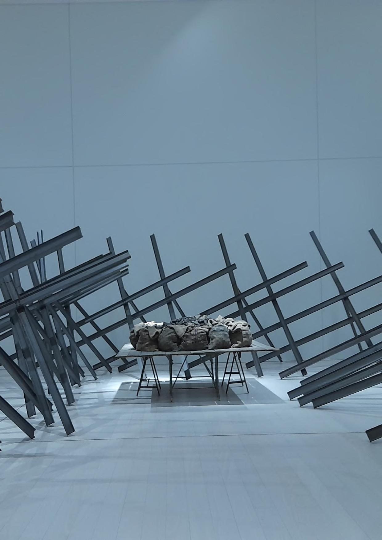
The ContemporaryMuseumNationalofArtAthens(EMST) by Antonis Tsapepas GREECE