The Paris Independent
November 25, 2023
12
L O C A L H I S TO RY
Paris, A Town of Many Names & Locals
Once upon a time, in the charming streets of downtown Paris, a group of friends embarked on an exploration of the town's rich history. As they strolled through the bustling avenues, their eyes were captivated by the magnificent buildings and thriving businesses that had stood the test of time. However, it was not just the architectural wonders that caught their attention, but also the intriguing nicknames given to different parts of the town, which served as convenient identifiers for the locals. One of the most enduring names was "Barkers Bush," a homage to the Barker family who had once owned the land and established the Barker House and Farm in the early days of Paris. This name, like many others, had seamlessly integrated into the fabric of everyday life. From the town's inception, Paris had been divided into four distinct sections: Upper Town, Lower Town, The Flats, and The Junction. Upper Town, also known as the old South End or South Ward, was home to the original "Main Street“ (Mockingbird Hill) It held great
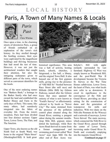
“Barracks Hill” 2023 credit Google Maps historical significance. This area was a hub of activity, hosting hotels, schools, churches, a fairground, a fire hall, a library, and the original Town Hall. It also housed one of the first gypsum mills, giving rise to the presence of “Old Mill St." Nestled between Race Street (the mill race) and Hillside (Mile Hill) lay Gilston Parkway, named after the Gilston Farm that once spanned the entirety of what is now known as "Fould's Survey" or affectionately referred to by locals as "Sewer City." The name stemmed from the presence of the pollution control plant situated along the Grand River, emitting a pungent odour during the summer months. Atop Mile Hill, gypsum mines dotted the landscape, while Rest Acres Road derived its name from a former campground and swimming pool resort called "Rest Acres" near Apps Mill. On the other end of Rest Acres was
The Norfolk
Schyler’s Hill with apple orchards surrounded by vast farmland. Highway #2 West was simply known as Woodstock Hill, and the post-World War II development became the Victoria St. Survey or the War Time Homes subdivision. Lower Town, the heart of Paris, was what locals now refer to as downtown. It owed its significance to the convergence of the Nith and Grand Rivers, providing an ideal setting for the construction of dams and the generation of waterpower for mills and industries. With two dams on the Nith (the Penmans & the Wincey) and a network of raceways, Lower Town thrived. The main raceway, which connected the Nith River to the Grand River, passed through the center of Lower Town, traversing under Grand River St. North and eventually emptying into the majestic Grand River. Continued on page 13