Draft Precinct Plan
Strategic Centre A Plan for the evolution of Norwest as a thriving mixed use Strategic Centre and hightly competitive employment precinct.
Norwest
May 2023
The Draft Norwest Precinct Plan was endorsed by Council for exhibition 8 November 2022, Minute No. 532. It has since been subject to graphic design and editing however there has been no material change to the content or outcomes presented to Council and endorsed for public exhibition.
Disclaimer
Every reasonable effort has been made to ensure that this document is correct at the time of printing. The Hills Shire Council disclaims all liability in respect of the consequences of anything done or omitted.
The indicative outcomes and planning controls identified within this Precinct Plan are for consultation purposes only to provide context. In some instances, they simply portray the types of outcomes that are currently being sought by landowners and developers through the relevant application process. In other instances, imagery has been used to assist in communicating the potential outcomes that may occur in the future, in accordance with the vision articulated within this Plan.
The images contained within this Precinct Plan have been included as a part of the analysis for this Plan, which is a study and review of development within the Precinct. These images are publicly available in the respective applications and have been referenced accordingly in this Plan.
Images within this document should not be taken to be final products or outcomes that have been endorsed or approved on any site (either formally or implicitly by way of their inclusion within this document). All future development will be subject to the relevant approval processes set out under the Environmental Planning and Assessment Act (including planning proposals and/or development applications) and detailed consideration and determination by the relevant planning or consent authority.
Copyright Notice
This document represents the collaboration of information from a number of sources, including Government plans and policies and plans and policies of The Hills Shire Council in addition to on-site investigations. This document may be reproduced for personal, in-house or non-commercial use. Reproduction of this document for any other purpose shall only be permitted with the written permission of The Hills Shire Council.
How To Read This Document
1. Executive Summary
Introduces the Norwest Strategic Centre and summarises the key vision and outcomes of the Precinct Plan.
2. Precinct Analysis
Provides an overview of the Norwest Strategic Centre, introduces the study area, strategic planning context and relationship to other work. It also considers demographic and economic trends along with Strategic Centre level analysis of the built and natural environment.
3. Vision Sets the guiding principles and vision that will inform future development within the Norwest Strategic Centre.
4. Norwest Innovation
5. Norwest Central
6. Norwest Service
Sections 4, 5 and 6 contain a finer grain, site-specific analysis and outcomes for each Precinct within Norwest. These sections provide a Precinct level analysis that outline key influences, opportunities and constraints, examine specific focus areas and provide a vision, structure plan, growth projections, actions and staging to guide future development.
7. Infrastructure
Investigates current infrastructure, expected demand and additional requirements to respond to growth within the Norwest Strategic Centre.
8. Implementation Plan
Sets out a three phase approach to implementation, identifying actions and responsibilities.
The Precinct Plan has been designed to allow readers to view individual Precincts in isolation should they have a particular interest in a specific area within the broader Norwest Strategic Centre. It is also supported by acronym and glossary lists, along with an overview of assumptions, provided as Appendix A.
2
Front Cover Image: Artist’s Impression of Commercial Development (Source: Tome Visuals)
 Artist’s Impression of Norwest Station Site (Source: Scott Carver)
Contents
Executive Summary 1.1 Vision for the Norwest Strategic Centre 05 1.2 Structure Plan and Key Desired Outcomes 07 1.3 Key Changes and Refinements 11 1.4 Implementation and Phasing 15 2. Precinct Analysis 2.1 Study Area 19 2.2 Strategic Context 21 2.3 Status of Planning Processes 23 2.4 Existing Land Uses 25 2.5 Existing Character and Public Domain 28 2.6 Strategic Planning Investigations 31 2.6.1 Technical Studies 31 2.6.2 Evolution of the Business Park 32 2.6.3 Economic Analysis 33 2.6.4 Market Attractiveness 35 2.7 Demographic Analysis 37 2.8 Key Strategic Influences 39 2.9 Existing Travel Behaviour And Trends 40 2.10 Public and Active Transport 41 2.11 Road and Freight Network 43 2.12 Natural Environment 45 3. Vision 3.1 Vision for the Norwest Strategic Centre 51 3.2 Norwest - A Mixed Use and Transit Oriented Centre 53 3.3 Guiding Principles 55 3.4 Environment and Sustainability 58 3.5 Evolution into a ‘Smart Norwest’ 59 4. Norwest Innovation 4.1 Context 63 4.2 Key Influences 65 4.2.1 Planning Processes to Date 65 4.2.2 Bella Vista Farm Park 66 4.2.3 State Significant Development Application 66 4.2.4 Planning Proposals 66 4.2.5 Key Constraints and Challenges 67 4.2.6 Key Opportunities 68 4.3 Focus Areas 69 4.3.1 Focus Area 1 - Preservation of View Corridors 70 Associated with Bella Vista Farm 4.3.2 Focus Area 2 - Height Control Mismatch Along 72 Lexington Drive 4.3.3 Focus Area 3 - Bella Vista Community Facility 73 4.3.4 Focus Area 4 - ResMed (1-11 Elizabeth Macarthur Drive) 74 4.3.5 Focus Area 5 - Circa Retail Shopping Centre 76 4.4 Vision and Structure Plan 77 4.5 Character Areas 83 4.6 Yields and Projections 85 4.7 Actions and Phasing 87 5. Norwest Central 5.1 Context 91 5.2 Key Influences 93 5.2.1 Planning Processes to Date 93 5.2.2 Planning Proposals 94 5.2.3 Key Constraints and Challenges 95 5.2.4 Key Opportunities 96 5.3 Focus Areas 97 5.3.1 Focus Area 1 - Designated Commercial Area 99 5.3.2 Focus Area 2 - Norwest Marketown and Surrounds 101 5.3.3 Focus Area 3 - Norwest Hillsong Campus 103 5.3.4 Focus Area 4 - Century Estate 105 5.3.5 Focus Area 5 - 1-9 Brookhollow Avenue 107 5.3.6 Focus Area 6 - Future Connections 109 5.3.7 Focus Area 7 - Open Space and Urban Plazas 111 5.3.8 Focus Area 8 - Long Term Residential 113 Investigation Area 5.4 Vision and Structure Plan 115 5.5 Character Areas 121 5.6 Yields and Projections 123 5.7 Actions and Phasing 125
1.
6. Norwest Service 6.1 Context 129 6.2 Key Influences 131 6.2.1 Planning Processes to Date 131 6.2.2 State Significant Development Application 132 6.2.3 Dwelling Cap and High Density Residential Approvals 132 6.2.4 Planning Proposals 132 6.2.5 Key Constraints and Challenges 133 6.2.6 Key Opportunities 134 6.3 Focus Areas 135 6.3.1 Focus Area 1 - Cattai Creek West 137 6.3.2 Focus Area 2 - Cattai Creek Greenway Link 139 Completion and Embellishment 6.3.3 Focus Area 3 - Amendments to Local Roads 140 and Pedestrian Links 6.3.4 Focus Area 4 - Carrington Road Upgrade and Extension 114 from Victoria Avenue to Windsor Road 6.3.5 Focus Area 5 - High Density Commercial 143 (Between Hudson Avenue and Victoria Avenue) 6.3.6 Focus Area 6 - Height Mismatch Along Windsor Road 145 6.3.7 Focus Area 7 - Height Mismatch within the 146 High Density Residential Area 6.3.8 Focus Area 8 - Land Along Eastern Side 147 of Cattai Creek 6.3.9 Focus Area 9 - Protecting and Encouraging 149 Urban Services 6.3.10 Focus Area 10 - Local Road Network and 151 Pedestrian Connections 6.3.11 Focus Area 11 - Activating High Density Residential Areas 152 6.4 Vision and Structure Plan 153 6.5 Character Areas 159 6.6 Yields and Projections 161 6.7 Actions and Phasing 163 7. Infrastructure 7.1 Infrastructure Analysis 167 7.1.1 Active Open Space 169 7.1.2 Passive Open Space 170 7.1.3 Traffic and Transport 171 7.1.4 Regional Public Transport 179 7.1.5 Community Facilities 181 7.1.6 Education Facilities 182 7.1.7 Water Management 183 7.2 Actions 185 8. Implementation Plan Appendix A Acronyms 197 Glossary 198 Assumptions 199 Disclaimer and Copyright Notice on Flooding and GIS Data 200 Implementation Plan 189
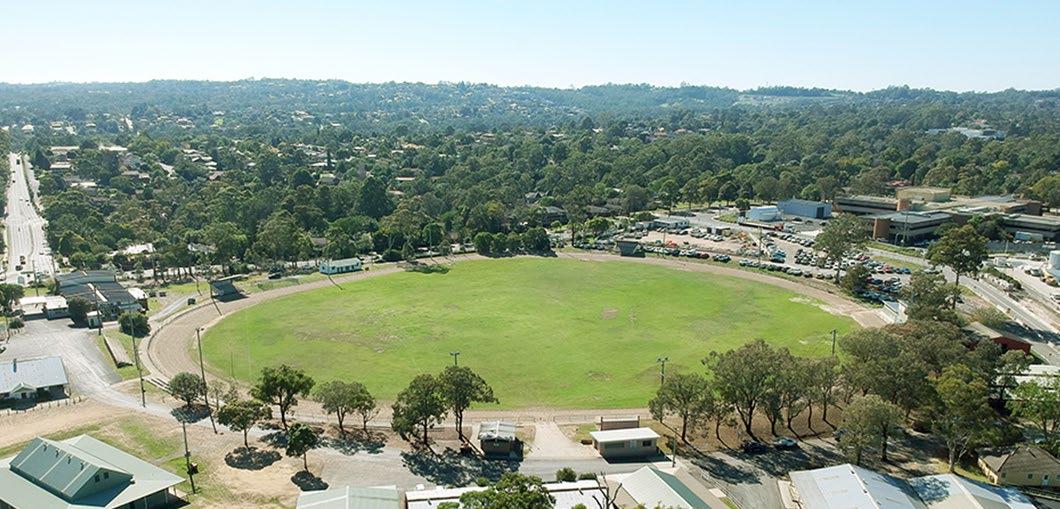
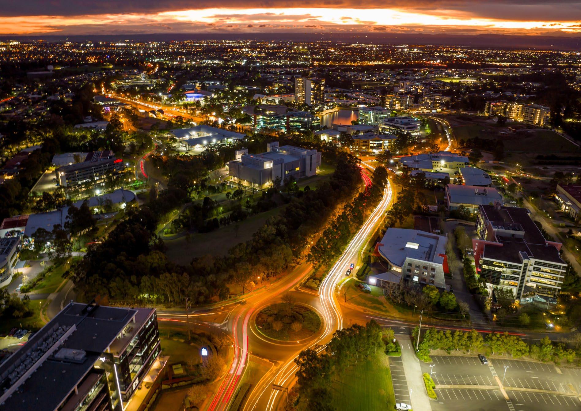 Aerial View of Norwest Strategic Centre
01
Executive Summary
1.1 Vision for the Norwest Strategic Centre
This Precinct Plan sets the framework for Norwest to emerge as a thriving mixed use Strategic Centre and highly competitive employment Precinct. The vision for the Strategic Centre builds on previous strategic work by Council and the NSW Government, including technical investigations focused on the Shire’s Strategic Centres that provide insight into their unique features, role and function in the Greater Sydney Region. This Plan is the next step and advances the planning into finer grain, site specific detail to inform potential changes to planning controls and the infrastructure framework, which can occur in a logical and staged manner.
By 2041, Norwest Strategic Centre will be a prime location for knowledge intensive businesses focused on health, education, science, technology, finance and advanced manufacturing. Business will enjoy the proximity and ease of access to complementary services and facilities at nearby strategic centres of Castle Hill and Rouse Hill and the economic competitiveness offered by enhanced connections to Sydney CBD, Greater Parramatta and the Western Sydney Airport. Norwest will be a key part of a linked network of strategic centres and prominent office markets that spans across the Sydney Region. It will offer a range of employment opportunities for the highly skilled workforce that lives in The Hills Shire.

Over the next 20 years Norwest Strategic Centre will continue to evolve into a location valued by workers, residents and visitors for its vibrancy and amenity. It will transform from its sprawling, low scale origins to a more walkable centre with taller, well designed buildings at its core. In addition to hosting prestige office space, it will provide appealing and safe places to shop, dine, socialise, live and enjoy cultural and leisure experiences, all within the walking catchment of high frequency mass public transport.
Lifestyle will be enhanced by improved walking and cycling tracks, connecting employment areas and Stations, opening up creek corridors and increasing access to Castle Hill Showground and Bella Vista Farm Park. The centre will have a distinguishable local character and sense of place founded on the rich local history and Garden Shire identity and strengthened by enhancing and protecting areas of the public domain.
With its unique lifestyle offer, access to skilled workforce, capacity to grow and increased accessibility resulting from existing and planned public transport investment, the Local Government Area (LGA) has the right ingredients to become a magnet for employment growth and business activity.”
- Mecone 2021
5
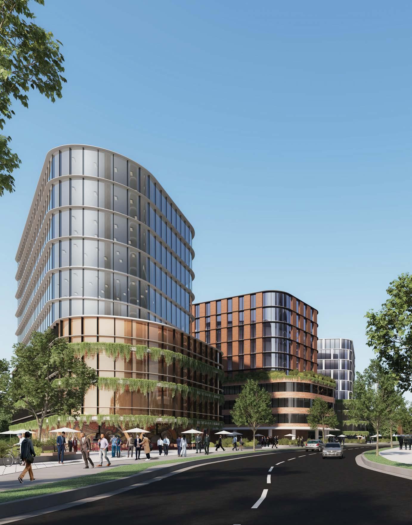
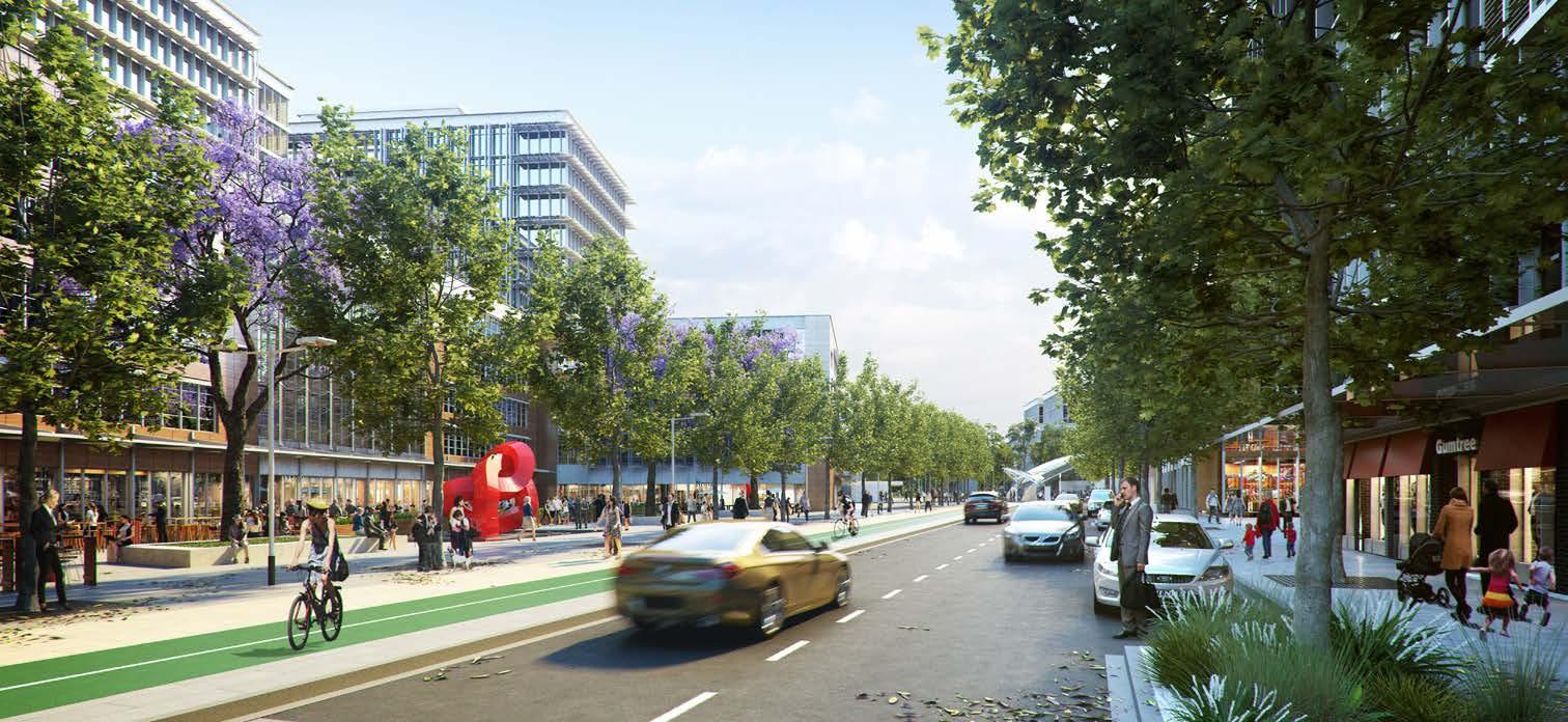
Artist’s Impression of Brookhollow Avenue (Source: Tome Visuals)
Purpose
This Precinct Plan serves as a tool to:
Address the principles and actions identified for Strategic Centres within the Greater Sydney Region Plan and Central City District Plan and strengthen each of the Strategic Centres.
Engage and discuss with the community and stakeholders about how the Strategic Centre will grow and evolve into the future.
Establish a clear vision and parameters to guide medium to longer term growth for key strategic locations.
Create a structure for urban development that is place based, resolves competing issues and gives certainty and confidence to Council, the local community, developers and businesses. Inform changes to planning controls to facilitate implementation of planned outcomes in the short term.
Identify the need for any new or additional infrastructure to support the anticipated growth and inform associated discussions with the NSW Government.
The Hills Shire Council Draft Precinct Plan Norwest Strategic Centre 6
4,693 Dwellings People
5,398 21,078 22,820 9,386 10,796 42,156 45,642 34,159 39,705 56,562 64,277 2016 (Actual) 2036 (Forecast) 2021 (Estimate) 2041 (Forecast)
Jobs
Growth Forecast
1.2 Structure Plan and Key Desired Outcomes
Metro Station
Metro Line (Underground Tunnel)
Norwest Strategic Centre
Proposed Road

Low Density Residential
Medium Density Residential
High Density Residential
Local Centre / Retail Area
High Density Commercial Offices
Urban Support Services
Mixed Use
Private Open Space
Public Open Space
Drainage Land
Special Use
Signalised Intersection
Pedestrian Bridge
Left-in-left-out
Urban Plazas
Roundabout
Seniors Housing
Pedestrian Link
7
T T T T T T T T T T T T T T T T T T T T T T T T T T T T T T T WINDSORRD OLD WINDSOR RD MEMORIALAV FAIRWAY DR VICTORIA AV BALMORALRD EDGEWATERDR SOLENT CCT RESTON GRA CECILAV NORBRIKDR SHOWGROUND RD
Figure 1. Structure Plan - Norwest Strategic Centre
T
Employment
• Capacity for a total of around 64,000 jobs (approximately 30,000 additional jobs) by 2041, with further capacity beyond this development horizon subject to market take-up.
• Designated commercial areas between Old Windsor Road and Windsor Road.
• New opportunities for high density commercial outcomes within the Cattai Creek West Area.
• A new business spine along Carrington Road and its planned extension from Victoria Avenue to Windsor Road.
• Around 50,000m² of additional retail floorspace.
Retail
• At least three new supermarkets (Showground Station, Bella Vista Station and Norwest Marketown), along with specialty retail and hospitality.
• Active shopfronts and outdoor dining around Norwest Lake, along Cattai Creek, near Metro Stations and in centrally located high density residential areas.
• Capacity for around 22,820 dwellings (approximately 18,130 additional dwellings) by 2041, interspersed throughout the Strategic Centre with most of these dwellings within 1.2km walking distance from a Metro Station.
Residential
• Diverse housing choice of varying sizes and typologies, to cater for the unique demographic and demand profile within The Hills.
• Transit oriented neighbourhoods with convenient access to stations, shops, jobs, cafes and recreation.
Urban Services
• Around 11,400m² of additional specialised retail (bulky goods) floorspace.
• Retention of a specialised retail (bulky goods) spine along Victoria Avenue to cater for expected demand for household goods.
• Areas of light industrial land uses in appropriate locations to provide urban support services for the growing population.
Mixed Use
• A mixed use area at Norwest Marketown, as the active heart of the Norwest Strategic Centre (providing a minimum 50% commercial uses).
• A mix of retail, business, office, leisure, entertainment, community uses and some higher density housing.
Connectivity and Sustainability
• Enhanced connectivity through new local road connections, pedestrian links and pedestrian bridges.
• Extension of Carrington Road (from Victoria Avenue to Windsor Road) to strategically integrate the three Precincts and provide a single spine and bus corridor between Showground Road to Old Windsor Road.
• Upgrade key intersections to support new road connections and improve vehicular connectivity.
• Enhanced network of footpaths, forecourts and boardwalks to create an attractive environment for pedestrians and cyclists.
Open Space and Community
• Castle Hill Showground will be a regional scale attraction that builds upon its significance as a cultural and leisure facility.
• New local urban park adjacent Norwest Lake.
• Restoration and embellishment of the Cattai Creek Corridor to enable it to be enjoyed by residents and workers.
• Active street level uses to provide attractive, vibrant and safe streets.
• Height allowed as a mechanism to achieve better built form and public domain outcomes (increased landscaping, setbacks and separation at the ground plane to minimise perceived bulk from the pedestrian realm and public domain).
• Transit oriented development - taller buildings located near the Metro Stations, seamlessly transitioning into lower density areas.
Built Form
• Landmark buildings at Norwest Marketown and Norwest Station, featuring building heights of up to 35 storeys, to signify its strategic importance and to put Norwest on the map. Taller buildings of up to 21 storeys will also be located near the Bella Vista and Hills Showground Metro Stations, as well as other gateway locations (such as 15 storeys at Circa Precinct), albeit at a lower scale to buildings within the immediate area surrounding the Metro Station and Local Centre within the Norwest Central Precinct.
• Low density residential areas (of approximately 2-3 storeys) located towards around the periphery of the Norwest Strategic Centre.
The Hills Shire Council Draft Precinct Plan Norwest Strategic Centre 8
Table 1. Key Desired Outcomes
The Norwest Innovation Precinct will be a busy health and innovation Precinct, anchored by Bella Vista Metro Station, Norwest Private Hospital, major corporations and contemporary place-based offices. It will be activated by improved public spaces for gathering, socialising and sharing ideas. It will feature high density commercial buildings varying in height from 4 – 21 storeys. Taller buildings will be carefully located to preserve key view lines to and from Bella Vista Farm and will be characterised by landscaped surrounds and active, vibrant ground floor uses.
Land north of the Bella Vista Employment Area is envisaged to transform into an attractive and well-connected neighbourhood that provides a diverse range of housing opportunities, supported by everyday services at the local centre. This will taper off into the well-established Balmoral Road Release Area, which features low and medium density housing opportunities for our family dominated demographic.
Bella Vista Farm will be a key drawcard for the Precinct – a major cultural destination – known for its rich history.
Bella Vista Station Precinct Proposal
The Norwest Central Precinct will remain a key employment destination, with a designated commercial area close to the Metro Station and mixed-use heart at Norwest Marketown. The highest densities will be concentrated around Norwest Marketown, Norwest Lake and Norwest Metro Station as the key visual landmarks for the centre of the Precinct. It will be supported by residential uses surrounding, but not within, the designated commercial area, all within a highly walkable distance to the Norwest Metro Station.
The area near the Metro Station and around the Lake will be the Precinct’s active heart, providing a carefully planned balance of high density housing, people friendly public spaces and a focus on serving the needs of locals and visitors with a diverse mix of retail, business, office, leisure, entertainment and community uses. It will feature the tallest buildings in the Strategic Centre (up to 35 storeys) and will display a high standard of architectural design, distinctly marking the vibrant heart of the Norwest Strategic Centre. The density and scale of development will gradually decrease away from the centre and Metro Station.
DECEMBER 2015
Norwest Service Precinct
The Norwest Service Precinct will become an attractive and wellconnected neighbourhood with diverse housing and employment opportunities. It will be a vibrant, safe and desirable place to live and work, valued for convenient access to the station, shops, cafes, Castle Hill Showground and supported by new schools, new road connections, pathways and quality landscaped surrounds. With a focus on transit oriented development, the highest densities and tallest buildings (of up to 21 storeys) will be located near the Metro Station, transitioning to lower density areas.
Specialised retail offerings (bulky goods) and light industrial areas will continue to be a mainstay for urban support services that meet the needs of the growing population base, whilst also providing opportunity for smaller businesses to establish and thrive. New commercial developments along Carrington Road extending towards Windsor Road will include taller office style buildings, enhanced by quality landscaping, landscaped medians, wide footpaths and mature street trees.
These areas will also be complemented by recreational areas such as the Cattai Creek Corridor and Castle Hill Showground.
SHOWGROUNDROAD
corridor are currently held in private ownership. The redevelopment of land adjacent to the corridor provides opportunity for these parts to become public open space, with greater linkages over the creek linking Cockayne Reserve, the Castle Showground, and Fred Caterson Reserve beyond.
9
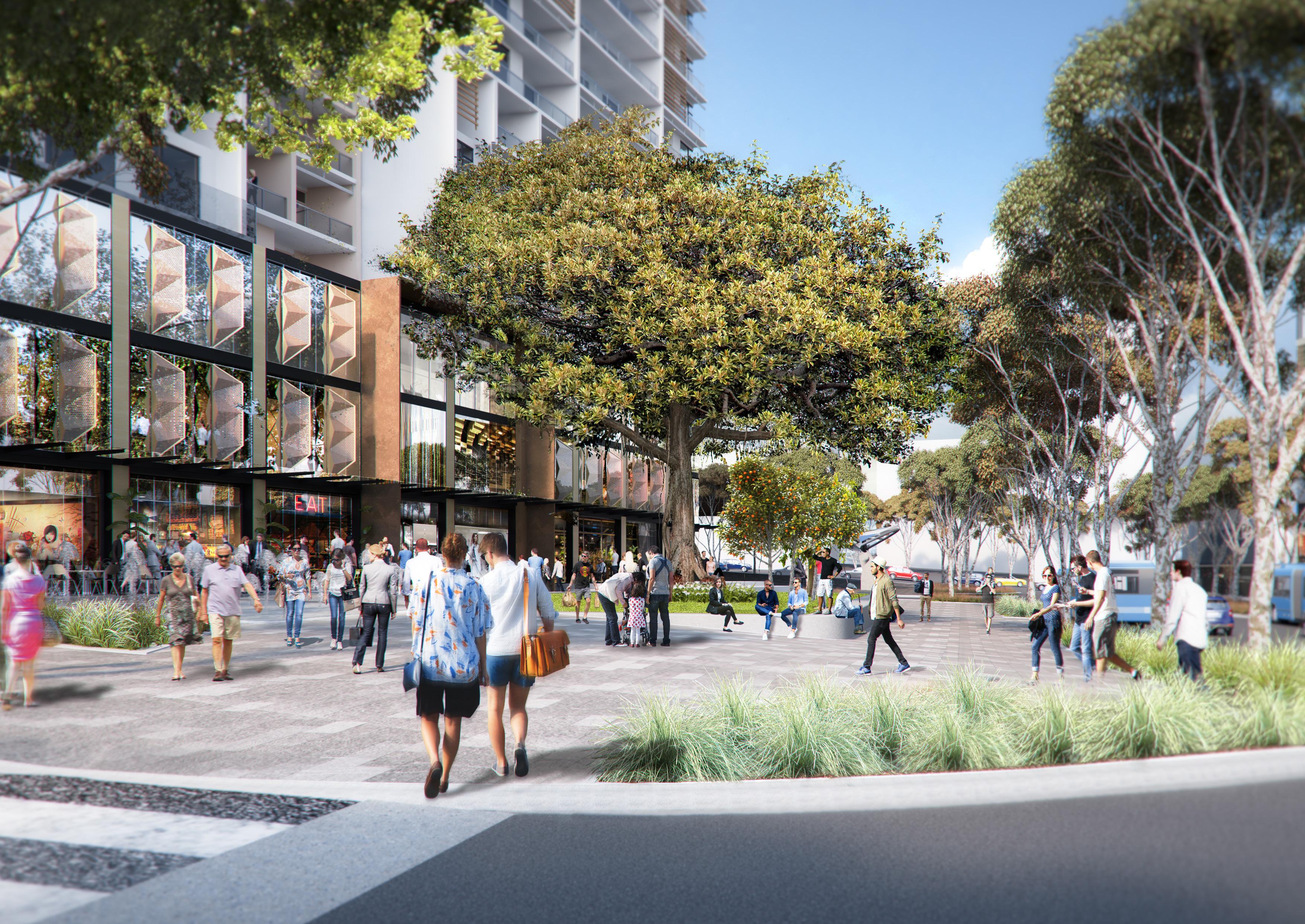
Artist’s Impression of 11-13 Solent Circuit (Source: Turner)
Cattai Creek Corridor
LEGEND
5.
neighbourhood park
There is an opportunity for the Cattai Creek corridor to be revitalised and made more accessible to the community. Significant tracts of the creek
1. Cattai Creek 2. Cockayne Reserve
3.
Upgraded playground
4.
Shared pedestrian/cycle path
Potential for an enlarged
8. Showground Station 9. Fred Caterson Reserve 10. Location of artist impression illustrated in Figure 29
Figure 28. Cattai Creek corridor - potential enhancements
Figure 29. Impression of the revitalised Catti Creek Corridor, looking north.
CARRINGTONROAD
Artist’s Impression of Bella Vista Station Precinct (Source: Department of Planning and Environment)
Norwest
Artist Impression of Showground Station Precinct (Source: Department of Planning and Environment)
Norwest Innovation Precinct
Central Precinct
 Artist’s Impression of Castle Hill Showground (Source: McGregor Coxall)
1.3 Key Changes and Refinements
Strategic Work Completed
Significant planning work has already been completed within the Norwest Strategic Centre in recent years, including the State Government’s Planned Precinct Programs for the Bella Vista, Kellyville and Showground Station Precincts, the rezoning of the Balmoral Road Release Area and site-specific planning proposals.
Many of these areas are expected to remain unchanged or continue to develop under the existing planning controls. There is already substantial development potential in these areas under the existing controls, as they have not been fully developed, with many of these sites remaining underutilised (or in some instances vacant).
This Precinct Plan does not anticipate any additional uplift in these areas, beyond that already envisaged and available under the existing controls.
Metro Station
Metro Line (Underground Tunnel)
Norwest Strategic Centre
Strategic Work Completed

11
*Note: A full list of implementation actions is provided in Section 8 of this Precinct Plan.
Housekeeping Amendments
Various housekeeping amendments are identified within this Precinct Plan, to facilitate more desirable and orderly development outcomes.
While most of the Norwest Innovation and Norwest Service Precincts were already rezoned in 2017 as part of the State Government’s Planned Precincts Program, there is a mismatch between the height of building and floor space ratio controls in some locations. These are located along Lexington Drive, the high density residential area within the Norwest Service Precinct and a couple of pockets along Windsor Road. This mismatch will lead to excessive bulk and site coverage, along with breaches to other key development controls. This Precinct Plan identifies changes to resolve this issue and encourage higher quality urban design outcomes.
This Precinct Plan also identifies minor amendments to the proposed road layout and pedestrian connections in the Norwest Service Precinct (within the high density residential area). A few local roads within the residential area that were identified as part of the Planned Precinct Program are unlikely to be deliverable. One of the links is located within the medium density residential zoned land and it would not be feasible for a developer to deliver. The other road link will not facilitate orderly development outcomes, which would ultimately impact vehicular movement.
Metro Station
Metro Line (Underground Tunnel)
Norwest Strategic Centre
Strategic Work Completed

Phase 1: Housekeeping Amendments

The Hills Shire Council Draft Precinct Plan Norwest Strategic Centre 12 WINDSORRD OLD WINDSOR RD NORWESTBLVD MEMORIALAV FAIRWAY DR VICTORIA AV BALMORALRD EDGEWATERDR CARRINGTONRD SOLENT CCT LEXINGTON DR RESTON GRA CECILAV NORBRIKDR SHOWGROUND RD CELEBRATIONDR Hills Showground Station
Norwest Station Bella Vista Station
Figure 3. Areas Where Housekeeping Amendments are Required
A
of
8
*Note
full list
implementation actions is provided in Section
of this Precinct Plan.
Council-Led Change
Council-Led change will be targeted to three key areas, being the designated commercial area in the Norwest Central Precinct, the Cattai Creek West Focus Area and the Cattai Creek Corridor.
A designated commercial area will be provided in the Norwest Central Precinct, providing knowledge intensive employment opportunities to meet the needs of the highly skilled population. This Plan identifies increased floor space ratios (ranging from 2:1 to 2.5:1) and building heights (ranging from 8 – 15 storeys) to facilitate feasible redevelopment and the creation of new employment opportunities.
The Cattai Creek West Focus Area is envisaged to transform into a bustling high density commercial office area, with office buildings ranging from 6-12 storeys, transitioning down to the adjacent Cattai Creek Corridor. It will also feature active ground floor uses (particularly along Carrington Road) to create vibrant streets and interfaces. Activating the western edge of Cattai Creek is critical to the future success of this area. This edge will become an active promenade overlooking the creek with a range of land use frontages including retail, commercial and open space. The promenade will be prioritised for pedestrians and cyclists with limited vehicular access.
The Cattai Creek Corridor will be transformed from an underutilised corridor into a revitalised recreational green hub for residents and workers.
*Note: A full list of implementation actions is provided in Section 8 of this Precinct Plan.
Metro Station
Metro Line (Underground Tunnel)
Norwest Strategic Centre
Strategic Work Completed

Phase 1: Housekeeping Amendments
Phase 2: Council-Led Change
13 WINDSORRD OLD WINDSOR RD NORWESTBLVD MEMORIALAV FAIRWAY DR VICTORIA AV BALMORALRD EDGEWATERDR CARRINGTONRD SOLENT CCT LEXINGTON DR RESTON GRA CECILAV NORBRIKDR SHOWGROUND RD CELEBRATIONDR Hills Showground Station Norwest Station Bella Vista Station
Figure 4. Areas Flagged for Council-Led Change
Landowner-Initiated and Market Driven Change
A number of sites have been identified for future market driven change. These sites are generally larger in size (greater than 4 hectares), face significant constraints to redevelopment (such as highly fragmentated ownership) or are critical to the achievement of infrastructure outcomes identified within this Plan.
It is expected that any change to the planning controls to enable these development opportunities would be facilitated by landowner-initiated planning proposals that would be considered by Council in the future, along with associated Development Control Plan amendments and appropriate infrastructure contribution mechanisms. Any planning proposal would be expected to address the relevant design principles for that Focus Area, as set out within Sections 4.2, 5.2 and 6.2 of this Plan.
It is not anticipated that these areas will be subject to redevelopment in the short term or at the same time. They have been grouped into two categories, being ‘short to medium term’ and ‘longer term’.
• Short to Medium Term
It is expected that planning proposals for short to medium term sites would eventuate over the next 5 to 10 years, as market-driven solutions and redevelopment opportunities for these sites are likely to be logical, orderly and feasible within this period. Most of these sites are earmarked high density commercial development, except for Norwest Marketown at the centre of the Precinct.
• Longer Term
Market driven solutions and planning proposals for longer term sites are unlikely to eventuate within this same period and are expected to occur beyond a 10-year horizon (10-20 years). These sites are either substantially more complex, require amalgamation of fragmented areas or are unlikely to be feasible (at an appropriate density and scale outcome) within this initial 10-year horizon.
*Note: A full list of implementation actions is provided in Section 8 of this Precinct Plan.
Metro Station
Metro Line (Underground Tunnel)
Norwest Strategic Centre
Strategic Work Completed
Short to Medium Term Change
Longer Term Change
Phase 1: Housekeeping Amendments
Phase 2: Council-Led Change
The Hills Shire Council Draft Precinct Plan Norwest Strategic Centre 14
WINDSORRD OLD WINDSOR RD NORWESTBLVD MEMORIALAV FAIRWAY DR VICTORIA AV BALMORALRD EDGEWATERDR CARRINGTONRD SOLENT CCT LEXINGTON DR RESTON GRA CECILAV NORBRIKDR SHOWGROUND RD CELEBRATIONDR Hills Showground Station Norwest Station Bella Vista Station
Figure 5. Areas Flagged for Market Driven Change
1.4 Implementation and Phasing
This Plan sets a vision and ‘blueprint’ for future development within the Norwest Strategic Centre. It includes a list of actions that will be subject to future processes and decisions of Council. It will be necessary to work through these actions over time, to establish the planning framework that facilitates the visions and outcomes articulated in this Plan.
The Plan identifies areas where strategic work has been completed and where development is expected to either remain unchanged or continue to roll-out under the current planning framework. It then groups actions into three distinct phases, having regard to potential timing and responsibility for each action.
Implementation actions, grouped by phase, are contained within Sections 4.6, 5.6 and 6.6 of this Plan as they relate to each of the three Precincts within Norwest Strategic Centre. A consolidated list of actions for the entire Strategic Centre is provided in Section 8 of this Plan.
Strategic Work Completed
Areas where strategic planning work has already been completed (or is underway and nearing completion), where development is starting to be rolled out (including development applications and/or construction) or where no further change is anticipated.
Phase 1: Housekeeping Amendments
Areas where Council-led housekeeping amendments are recommended to facilitate improved and/or orderly development outcomes. These housekeeping amendments are expected to take place over the next few years.
Phase 2: Council-Led Change
Short to medium term actions that could be led by Council. Changes to the planning controls and framework in these areas would allow for the achievement of the vision and outcomes in this Plan and would be contingent upon Council-initiated planning proposals, along with associated Development Control Plan, Public Domain Plan and Contributions Plan amendments.
Phase 3: Market Driven Change
Metro Line (Underground)
Norwest Strategic Centre
Strategic Work Completed
Phase 1 - Housekeeping Amendments
Phase 2 - Council-Led Change
Phase 3 - Market Driven Change
Actions that will be market driven. These would be contingent on further investigations and the ability of the market to overcome complex problems to unlock the development potential of the land. Whilst some market driven solutions may be achievable in the short to medium term, feasible redevelopment in other market driven areas is unlikely to occur until beyond the short to medium term horizon.
Changes to the planning framework would be driven by landowner-initiated planning proposals, along with associated amendments to the Development Control Plan, Public Domain Plan and appropriate infrastructure contribution mechanisms. It is expected that planning proposals for short to medium term sites would eventuate over the next 5 to 10 years. However, market driven solutions and planning proposals for longer term sites are unlikely to eventuate within this same period and are expected to occur beyond a 10-year horizon (10-20 years), as these sites are either substantially more complex, require amalgamation of fragmented areas or are unlikely to be feasible (at an appropriate density and scale outcome) within this initial 10-year horizon.
15
PHASING
WINDSORRD OLD WINDSOR RD NORWESTBLVD MEMORIALAV FAIRWAY DR VICTORIA AV BALMORALRD EDGEWATERDR CARRINGTONRD SOLENT CCT LEXINGTON DR RESTON GRA CECILAV NORBRIKDR SHOWGROUND RD CELEBRATIONDR Hills Showground Station Norwest Station Bella Vista Station
6.
Station
Figure
Phasing Approach
Metro
 Indicative Concept for Showground Station Precinct (Source: Oculus and Cox Architecture)
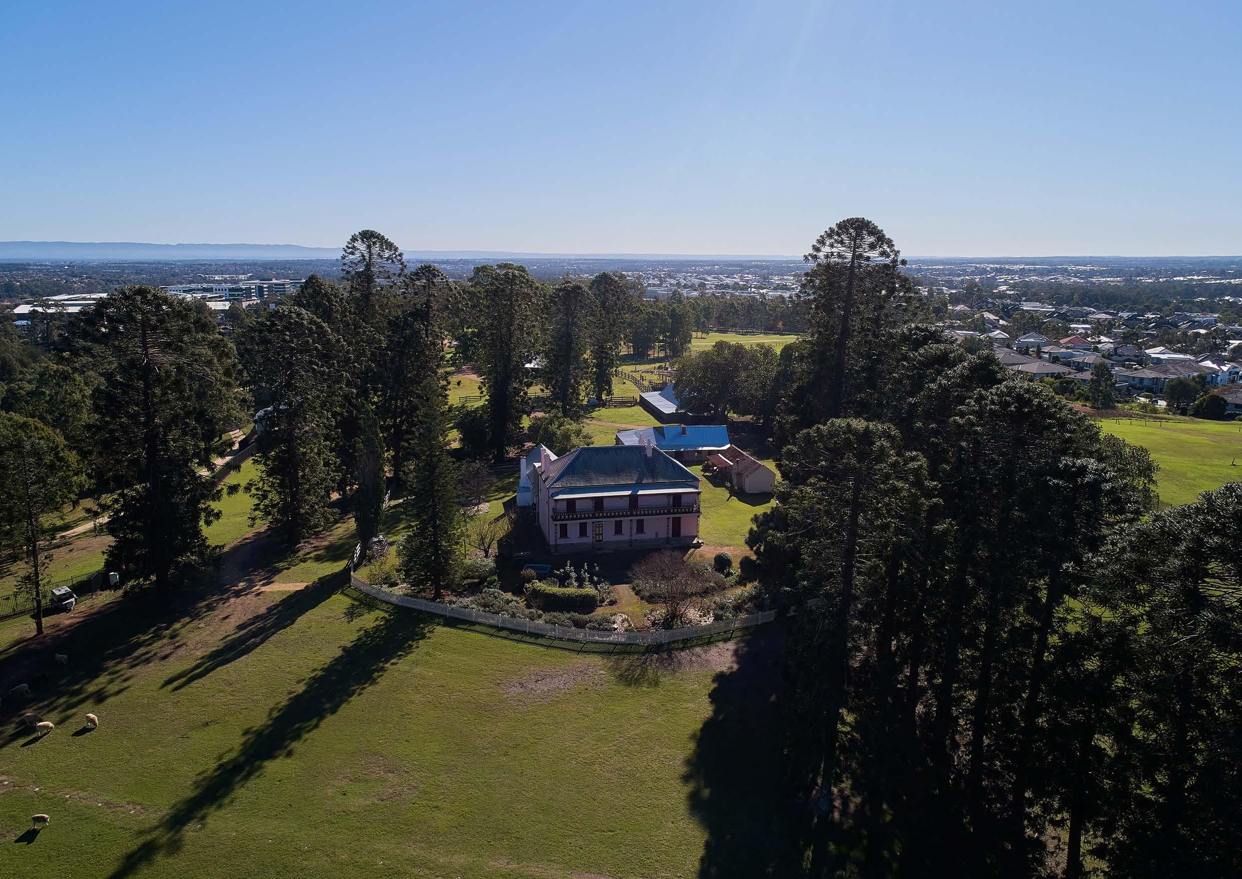 Aerial View of Bella Vista Farm.
Executive Summary 01 Precinct Analysis 02
2.1 Study Area
Regional Context
The Norwest Strategic Centre is one of three Strategic Centres within The Hills Shire, alongside Castle Hill and Rouse Hill Strategic Centres. They are expected to be flexible and diverse places targeted to attract high levels of private sector investment and a range of activities that are located together.
Whilst Norwest has traditionally been renowned as a business park, the Greater Sydney Region Plan and Central City District Plan have re-set its role and function, identifying it as a Strategic Centre and Commercial Office Precinct.
Our Strategic Centres will accommodate the majority of jobs within The Hills Shire, providing employment opportunities close to home for our residents (and residents within the rapidly growing North West Region), with a focus on knowledge-intensive jobs that align with their skillsets and interests. This will be critical to achieving the ‘30-minute’ city vision and continued economic growth within The Shire.
The Norwest Strategic Centre is strategically positioned along the Sydney Metro North West Corridor and contains three Metro Stations (Showground, Norwest and Bella Vista), which opened in May 2019. The Metro provides high frequency services between Tallawong and Chatswood Stations and is envisaged to be a major catalyst for change.
It is also serviced by quality vehicular connections (including the Northwest T-Way direct bus service), with access to the M2/M7, Windsor Road and Old Windsor Road. These road and rail connections provide good access to other key employment areas within the Greater Sydney Region, such as the Sydney CBD, North Sydney, St Leonards, Chatswood, Macquarie Park and Parramatta. They also provide good access for the large and rapidly growing residential population within a 30 minute catchment of the Norwest Strategic Centre.
Norwest Strategic Centre is centrally located between the future Western Sydney Aerotropolis and Parramatta CBD. Planned future transport connections will be pivotal in realising the vision for Norwest, particularly the future connection to the Western Sydney Aerotropolis (via the extension from St Marys Station to Tallawong Station), the mass transit corridor from Norwest to Parramatta, the Outer Sydney Orbital and the final stages of the Sydney Metro connection to the city and beyond.
Metro Station
Metro Line
Norwest Strategic Centre
Strategic Centre
Train Station
Train Line
North-West T-way
The Hills Shire
19
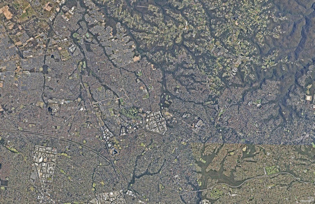
Figure 7. Regional Context (Source: Nearmap Aerial Imagery, copyright Nearmap)
T T
T
Rouse Hill Blacktown
Quakers Hill Kings Park
To Richmond
North-West T-way to Parramatta
Norwest
Castle Hill
Future extension to Western Sydney Aerotropolis
Future Mass Transit Link to Parramatta (via Baulkham Hills)
To Chatswood and Sydney CBD
T
Local Context
The Study Area generally reflects the catchments surrounding the Showground, Norwest and Bella Vista Station Precincts, as defined within the State Government’s 2013 North West Rail Link Corridor Strategy. It is bound by Memorial Avenue and Windsor Road to the north, Showground Road, Kathleen Avenue and Whitling Avenue to the east, Bella Vista Drive and Norbrik Drive to the south and Old Windsor Road to the west.
Under the Government’s Corridor Strategy, the boundaries for each Station Precinct were typically based on the nearest road boundary within an 800 metre radius from each Metro Station (to reflect a 10 minute walking distance), with adjustments then made having regard to the existing character, predominant land uses, built form and natural environment of the area.
Much of the Study Area has been subject to more detailed planning processes led by either Government, Council or landowners. While it is not intended to materially revisit the recently established planning outcomes for these areas, they are nonetheless considered to form part of the broader Study Area which contributes to the strategic vision and objectives for the Norwest Strategic Centre.
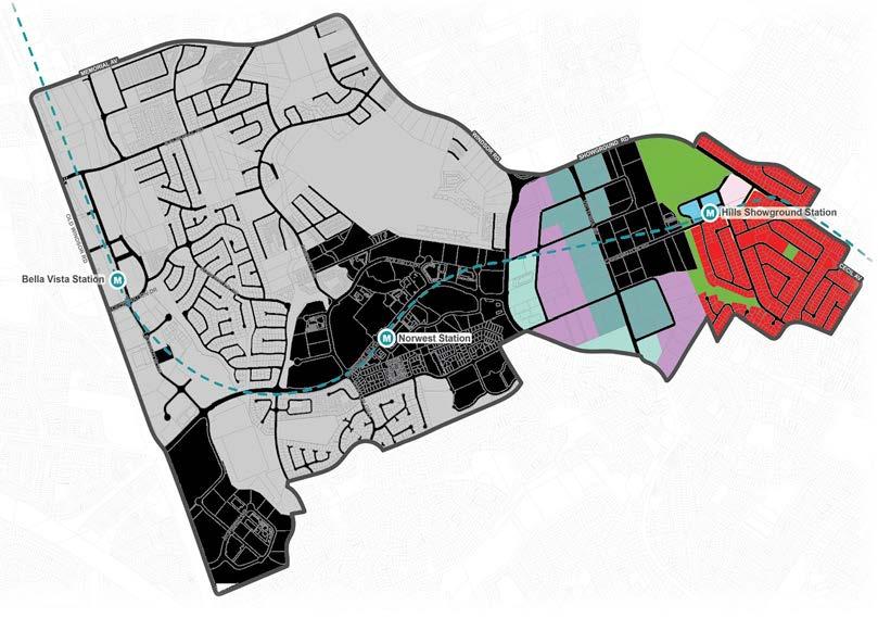
Given the magnitude of the Norwest Strategic Centre, it has been divided into three Precincts:
1. Norwest Innovation
This Precinct includes the Bella Vista Station Precinct and the Circa Commercial Precinct and is generally bound by Old Windsor Road to the west, Norbrik Drive to the south, Bella Vista Farm Park and the Balmoral Road Release Area to the east and Memorial Avenue to the north. The Norwest Innovation Precinct is the focus of Section 4 of this Precinct Plan.
2. Norwest Central
This Precinct includes the Norwest Station Precinct and is generally bound by Fairway Drive and Edgewater Drive to the west, Memorial Avenue to the north and Windsor Road and Mackillop Drive to the east. The Norwest Central Precinct is the focus of Section 5 of this Precinct Plan.
3. Norwest Service
This Precinct includes the Showground Station Precinct, comprising the Castle Hill Industrial Area and ‘Showground Residential’. It is generally bound by Windsor Road to the south and west, Showground Road to the north and Whitling Avenue and Parsonage Road to the east. The Norwest Service Precinct is the focus of Section 6 of this Precinct Plan.
Metro Line (Underground Tunnel)
Norwest Strategic Centre
Norwest Service
Norwest Central
Norwest Innovation
800m Walkability Catchment (current / existing connections)
The Hills Shire Council Draft Precinct Plan Norwest Strategic Centre 20
Norwest Innovation Norwest Central Norwest Service WINDSORRD OLD WINDSOR RD NORWESTBLVD MEMORIALAV FAIRWAY DR VICTORIA AV BALMORALRD EDGEWATERDR CARRINGTONRD SOLENT CCT LEXINGTON DR RESTON GRA CECILAV NORBRIKDR SHOWGROUND RD CELEBRATIONDR
Figure 8. The Precincts - Norwest Innovation, Norwest Central and Norwest Service Metro Station
2.2 Strategic Context
2013 2015 2018 2019 2021-2023
North West Rail Link Corridor Strategy
The North West Rail Link (NWRL) Corridor Strategy was released by the State Government in 2013 to guide development along the NWRL Corridor over a 20-25 year period.
It includes a structure plan for each of the Station Precincts within the Norwest Strategic Centre, including the Showground, Norwest and Bella Vista Station Precincts. These structure plans identify areas with potential for growth and articulate the desired development outcomes for these key growth areas.
The Hills Corridor Strategy
The Hills Corridor Strategy was adopted by Council in November 2015, to articulate Council’s vision for future growth in each of the seven (7) Station Precincts within The Hills Shire.
It demonstrates how the Norwest Strategic Centre can accommodate a mix of retail, commercial, industrial and residential uses and emphasises the importance of enabling a mix of uses to occur, whilst also protecting and maintaining some well-located areas of dedicated employment lands within Strategic Centres. The Strategy also recognises the importance of aligning infrastructure with growth.
Greater Sydney Region Plan and Central City District Plan
The Greater Sydney Region Plan – A Metropolis of Three Cities was released in 2018 by the Greater Cities Commission (formerly, the Greater Sydney Commission). It provides a vision for the Greater Sydney Region that will encourage productivity, sustainability and liveability. It is supported by the Central City District Plan, which translates the objectives articulated within the Region Plan to a more localised context for each District.
Norwest is identified as a Strategic Centre, along with Castle Hill and Rouse Hill. These are expected to be places that feature:
• High levels of private sector investment.
• Flexibility, so that the private sector can choose where and when to invest.
• Co-location of a wide mix of land uses, including residential.
• High levels of amenity and walkability and being cycle friendly.
• Areas identified for commercial uses and where appropriate, commercial cores. These strategies are now being reviewed by the Greater Cities Commission (GCC) to establish a new strategic framework for the ‘Six Cities’ Region.
Hills Future 2036
Hills Future 2036 is Council’s Local Strategic Planning Statement (LSPS). It was formally made on 6 March 2020 and sets a vision for growth in The Hills Shire over the next 20 years. It is supported by a suite of strategies including Housing, Productivity & Centres, Recreation, Integrated Transport & Land Use, Environment and Rural Lands. It identifies Norwest as a Strategic Centre, encompassing the Bella Vista, Norwest and Showground Station Precincts.
The Norwest Strategic Centre is expected to grow and evolve to serve the new population and bring more knowledge-intensive jobs to the area. Council’s Productivity and Centres Strategy articulates the importance of building Strategic Centres through a structure planning and phasing approach that encourages the right mix of employment-related land uses and enhances the design and amenity of our Strategic Centres. It states that Norwest will continue to contain a cluster of higher order employment, where businesses can take advantage of opportunities to agglomerate.
The LSPS identifies that, in the context of the significant capacity of zoned land available for residential growth throughout The Shire, it is imperative that residential development is not allowed to encroach into the limited remaining areas of key employment lands, as this could limit viability, development potential and the ability to accommodate the necessary growth in employment opportunities for current and future residents.
Regional Traffic Modelling
Regional Traffic and Transport Modelling is currently underway for the Castle Hill and Norwest Strategic Centres. The modelling is required to assess capacity for growth and to identify required upgrades to the regional road network. The Assessment is being prepared by Cardno and is being led by Transport for NSW.
The preliminary findings of this modelling have identified that if existing policy settings are retained, the expected growth within the Strategic Centres would result in unacceptable impacts on the existing road network, with most intersections on the regional road network failing during both the AM and PM Peak Hours by 2036.
The Modelling identifies several key upgrades to the regional road network that will be needed as redevelopment occurs (as discussed further in Section 7 of this Plan). However, these upgrades alone will be insufficient and if the strategically identified development is to occur within the Norwest Strategic Centre, this will be contingent on a significant modal shift in travel behaviour towards public transportation to alleviate pressures on the road network.
The assessment is expected to be finalised in 2023 and will inform infrastructure planning and future reviews of relevant development controls.
21
+31,400 jobs +12,350 dwellings +40,537 jobs +13,717 dwellings +20,600 jobs +11,000 dwellings +23,900 jobs Growth Projection (2012 - 2036) Growth Projection (2012 - 2036) Growth Projection (2016- 2036) Growth Projection (2016 - 2036) Table 2. Strategic Context
 Bella Vista Farm
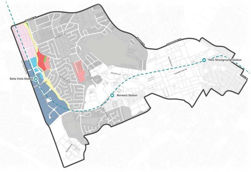
2.3 Status of Planning Processes
Planning work has recently been undertaken and completed with respect to extensive areas of the Norwest Strategic Centre, led by Government, Council and landowners, as shown on the following page in Figure 10.
This Plan recognises and builds on this significant body of work and planning processes which have already occurred. Whilst it holistically considers outcomes for the Strategic Centre, it is appropriate for many areas to either remain unchanged or to continue to develop under the current framework applied as an outcome of these recent planning processes.
The Study Area includes large areas of low and medium density housing in the Balmoral Road Release Area, Bella Vista and Bella Vista Waters (coloured pink in Figure 9) that are not contemplated for change or uplift due to their recent age, high quality of housing stock and distance from Metro stations. These areas serve an important function for the wider precinct in providing a diversity of housing options within the Norwest Strategic Centre.
Planning work for the Showground and Bella Vista Station Precincts (coloured light blue in Figure 9) has progressed well beyond the North West Rail Link Corridor Strategy and Hills Corridor Strategy, with detailed precinct planning, contributions planning and rezonings now completed. The development application and implementation phase is now underway.
Various sites have also been rezoned outside of the State Government led precinct planning process by way of site-specific planning proposals (coloured orange in Figure 9). This Precinct Plan does not change the planning controls for these sites. Rather it seeks to ensure surrounding development is compatible and encourage holistic and orderly development outcomes. Other areas (coloured dark blue in Figure 9) have not yet been subject to detailed precinct planning processes and minimal redevelopment activity has occurred in these areas.
Metro Station
Metro Line (Underground Tunnel)
Norwest Strategic Centre
Considered As Part Of NSW Government’s Planned Precinct Program
Open Space
Site-Specific Planning Proposal
(Finalised - As At April 2023, Or Gateway Approved)
Focus Areas for Change
Low and Medium Density Housing Areas
23
WINDSORRD OLD WINDSOR RD NORWESTBLVD MEMORIALAV FAIRWAY DR VICTORIA AV BALMORALRD EDGEWATERDR CARRINGTONRD SOLENT CCT LEXINGTON DR RESTON GRA CECILAV NORBRIKDR SHOWGROUND RD CELEBRATIONDR
Figure 9. Status of Planning Processes
*Notes:
1.
Metro Station Metro Line (Underground Tunnel)]
Norwest Strategic Centre
B1 Neighbourhood Centre
B2 Local Centre
B7 Business Park
IN2 Light Industrial
R1 General Residential
R2 Low Density Residential
R3 Medium Density Residential
R4 High Density Residential
RE1 Public Recreation
RE2 Private Recreation
SP2 Infrastructure
B5 Business Development
B6 Enterprise Corridor
**Note: The State Government’s Employment Zone Reforms implemented in April 2023 have amended the business and industrial zones.
The Hills Shire Council Draft Precinct Plan Norwest Strategic Centre 24
No changes proposed to residential areas within the Balmoral Road Release Area or Bella Vista Waters (refer coloured areas).
2. The Bella Vista Precinct was rezoned in 2017 as part of the State Government Planned Precinct Program.
3. The Showground Precinct was rezoned in 2017 as part of the State Government Planned Precinct Program.
4. Various site specific planning proposals have progressed (finalised or Gateway) within the Norwest Strategic Centre over the past 5 -10 years.
2017 (Showground)
2017 - 2023
Pre-2017
2017 (Bella Vista)
1 2 3
Figure 10. Overview of Planning Processes
4
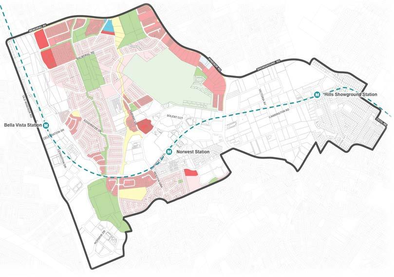
2.4 Existing Land Uses
The Norwest Strategic Centre is a diverse Precinct, comprising a mix of business, commercial, retail, industrial, residential, recreational and infrastructure land uses, within walking distance of the three Metro Stations.
Employment Uses
Norwest currently supports a large and diverse workforce, offering approximately 1.2 million square metres of commercial, industrial and retail floor space (Mecone, 2021). This places it as one of the largest employment precincts within Sydney, second only to Parramatta in the Central City District. In 2016, there were approximately 34,159 jobs within the Norwest Strategic Centre (2016 Travel Zone Data).
Currently, approximately 43% of developable land within the Centre is zoned for business and industrial uses, with a cluster near each of the three Metro Stations. There are also a few smaller centres scattered throughout the residential areas (along Windsor Road, Carrington Road and Balmoral Road) which meet the day-to-day needs of nearby residents and workers.
Historically, the B7 Business Park zone (now SP4 Enterprise zone) has proven to be an effective policy tool in protecting employment lands and has been a crucial component in attracting knowledge-intensive and innovative industries and encouraging and providing certainty for large corporations and other key anchors to invest in Norwest. It currently comprises approximately 22% of developable land within the Strategic Centre (17% of all land within the Centre).
The Norwest Strategic Centre also contains areas of land for industrial and urban services, providing jobs, supporting ongoing growth and providing essential, everyday services. Urban services typically have specific land use, floor space, operational or accessibility characteristics that require them to locate in non-residential areas (generally industrial zoned areas or areas previously zoned B5 Business Development). Nearly 18% of developable land within the Norwest Strategic Centre is currently zoned as industrial and urban services land (14% of all land within the Centre). This is all located in the Norwest Service Precinct.
The Transit Centres (being Showground, Norwest and Bella Vista Metro Stations) are also key hubs that provide the day-to-day needs of residents and workers. These have evolved over the past few years, providing a range of retail services to meet the day-to-day needs of residents and workers.
25
Figure 11. Breakdown of Existing Land Use Zones
Metro Station
Metro Line (Underground Tunnel)
Norwest Strategic Centre
Local Centre
Productivity Support
General Industrial
Infrastructure
Enterprise
General Residential

Low Density Residential
Medium Density Residential
High Density Residential
Public Recreation
Private Recreation
1.2km Walkability Catchment (existing / current connections)
The Hills Shire Council Draft Precinct Plan Norwest Strategic Centre 26
Figure 12. Existing Land Use Zones
E1 E3 E4 SP2 SP4 RE1 RE2 R1 R2 R3 R4
Residential Uses
There is a substantial amount of residential areas within the Strategic Centre, with residential uses permitted on approximately 60% of developable land (and approximately 67% of developable land within a 1.2km walking catchment from the three Metro Stations). This spans from low density living in the Balmoral Road Release Area all the way through to high-rise residential living in close proximity to the Metro Stations and surrounding and weaving throughout the designated commercial areas within the Norwest Central and Norwest Innovation Precincts.
In 2016, there were approximately 4,700 dwellings within the Norwest Strategic Centre (ABS, 2016). However, recent planning work within the Norwest Strategic Centre has predominantly focused on unlocking further residential opportunities. This has resulted in significant capacity under the current controls for nearly 18,250 dwellings within 1.2 kilometres of the three Metro Stations within the Strategic Centre, approximately 70% of which is yet to be delivered by the market.
Council’s strong focus on planning for residential growth over the past 1020 years means Council is well on track to meet (and exceed) the residential targets established in the relevant strategic planning policies. The vibrancy and activity created by residential yields within the centre will continue to grow over the next 10-20 years as the market delivers on the opportunities already available under the current controls.
Other Uses
RE1 Public Recreation zoned land is scattered throughout the Norwest Strategic Centre, spanning from large destinations such as Castle Hill Showground and Bella Vista Farm Park, through to active open space facilities such as Balmoral Road Reserve and smaller local parks.
The Strategic Centre also features a few pockets of SP2 Infrastructure zoned land, generally covering the creeks, other water bodies and water storage facilities.
Land where residential uses are permited
Land where only employment uses are permitted

27
Norwest Innovation Norwest Service Norwest Central 5,422 2,874 9,125 No. of Dwellings Location 0 1,000 2,000 3,000 4,000 5,000 6,000 7,000 8,000 9,000 10,000
Figure 13. Permissibility of Land Uses on Developable Land within 1.2km Walking Catchment of Metro Stations*
Figure 14. Total Residential Capacity within 1.2km Walking Catchment of Metro Stations
33% 67%
*Note: Residential uses also permitted in the E1 Local Centre zone.
2.5 Existing Character and Public Domain
Commercial Development
The Bella Vista Employment Area (north of Norwest Boulevarde) features large campus-style commercial developments with generous car parking (generally at-grade) and landscaped setbacks. The Circa Precinct is an emerging area, featuring the Norwest Private Hospital, Circa Retail, Quest Hotel and a seniors’ living facility.
A continuous brick path is provided along Norwest Boulevarde. However, given it is a high speed road with limited crossing points, it is not overly permeable and restricts walkability.
Norwest Innovation features a range of lower density and executive housing within Bella Vista and Kellyville. There are various undeveloped areas, particularly surrounding the Bella Vista Station Precinct, where development activity is beginning to take place and a Concept State Significant Development Application has recently been approved.
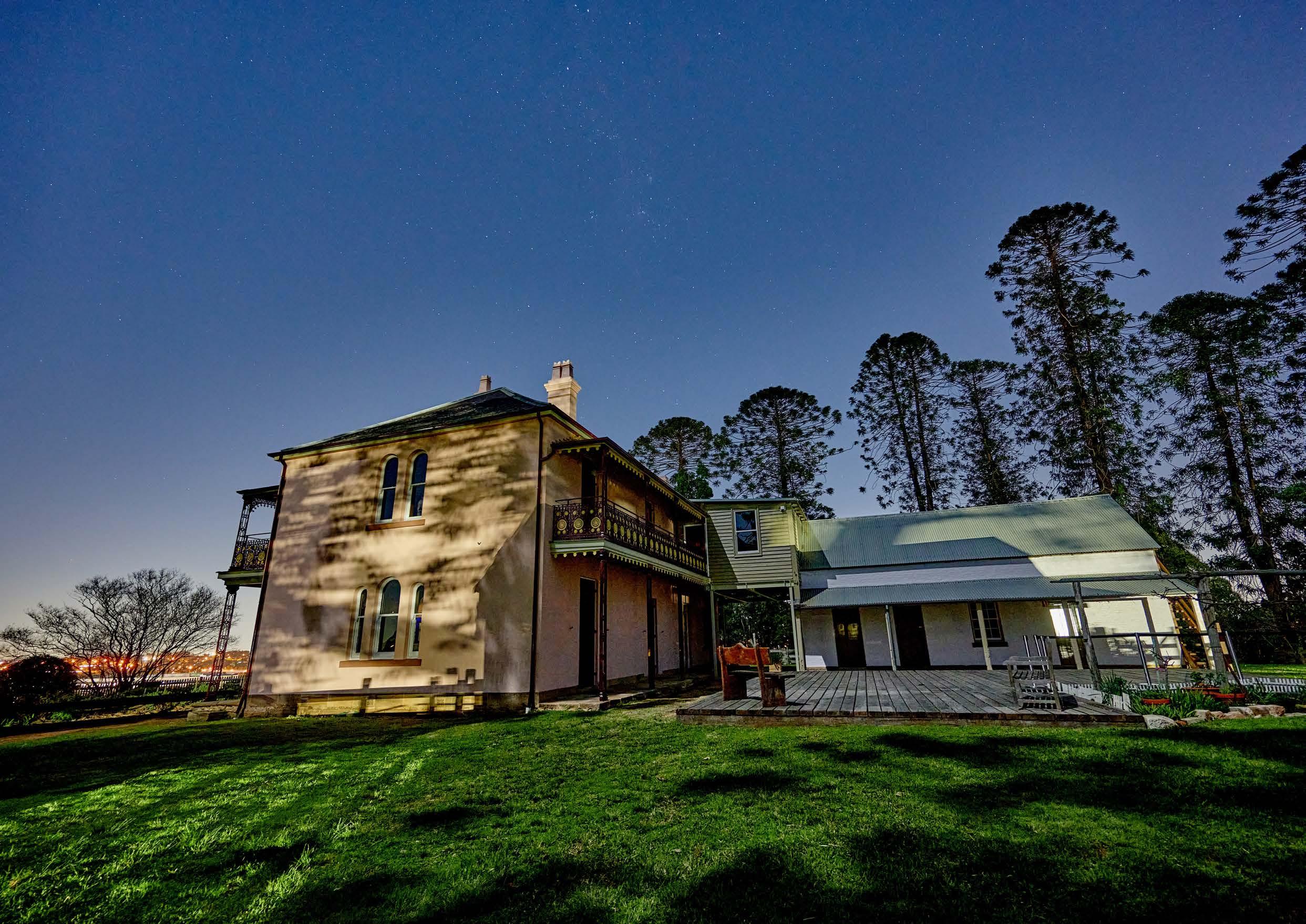
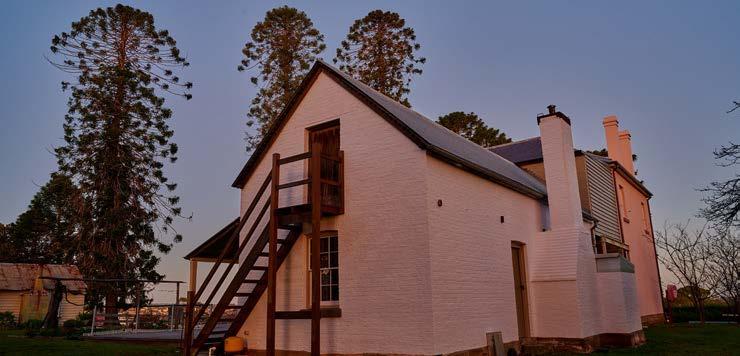
Bella Vista Farm Park is an intact historic complex of cultural significance to the nation. Established in the late 1700s, it features a two storey homestead, a Bunya Pine lined driveway and various farm outbuildings set on a prominent hilltop. It also includes various facilities for the enjoyment of the community.
The Hills Shire Council Draft Precinct Plan Norwest Strategic Centre 28
Bella Vista Farm
Bella Vista Station Precinct
Bella Vista Metro Station
Norwest Boulevarde
Existing Character Norwest Innovation (Source: Aspect Studios, 2020)
Bella Vista Farm
Commercial Development
Norwest Innovation Precinct
Commercial Development
The designated commercial area is characterised by large campus-style commercial developments, with large floor plates, generous car parking (generally at-grade) and landscaped frontages. Buildings in this area were constructed up to 30 years ago.
Apartment Development
Emerging high density residential areas are located to the north of Norwest Lake, providing a sympathetic transition to nearby low density areas. They feature setbacks and landscaping, along with activated ground floors (such as cafes) in some locations. There are still vacant landholdings in this area, with significant potential for residential development, which is currently being rolled out.
Marketown and Metro Station
Norwest Marketown is a low-scale retail building with a large at-grade carpark. Neighbouring sites, such as The Esplanade, are reimagining the lakeside area through public domain improvements and active ground floor uses, making it a vibrant, pedestrian-focused area. Norwest Metro Station features high quality treatments such as generous paving, integrated seating, landscaping, water features and public art.
Existing Terraces
Further north and in the south of the Precinct, there is a range of medium density residential development and low density executive housing. These are generally quite large dwellings (approximately 2-3 storeys in height), featuring generous setbacks and a landscaped street feel.
29
Existing Apartments
Norwest Metro Station
Existing Terraces
Commercial Development
Norwest Central Precinct
Norwest Service Precinct
Urban Services
Anchored by The Hills Super Centre and the Showground Metro Station, Norwest Service is characterised by light industrial, warehouse and specialised retail development on large lots. The age of building stock typically varies between 30-50 years, with newer development fronting Victoria Avenue.
This area features predominately concrete (and often interrupted) footpaths, which feel like a ‘service path’ along the adjacent highspeed roads. The palette of public domain elements lack consistency and appear vastly different to those within the Norwest Central and Innovation Precincts.
Residential Area
The eastern portion of the Precinct is a well-established low-density residential area, undergoing a period of significant transition to high density residential living. Some higher density residential development activity has commenced in this area in recent years.
Castle Hill Showground
The Cattai Creek Corridor is an important ecological corridor that dissects the Precinct and is currently underutilised, with limited public access.
The Castle Hill Showground is located in the heart of the Norwest Service Precinct. It contains an oval, a spectator stand and a range of other community buildings that are used throughout the year and during large events.
The Hills Shire Council Draft Precinct Plan Norwest Strategic Centre 30
Cattai Creek Corridor
Existing Dwellings
Existing Character and Streetscape
Existing Character Norwest Service (Source: Aspect Studios, 2020)
Cattai Creek Corridor
Existing Bulky Goods Stores
Castle Hill Showground
2.6 Strategic Planning Investigations
2.6.1 Technical Studies
In late-2020, Council engaged various consultants to establish a robust evidence base to assist with precinct planning, including:
• Shire Economic Health Check
Prepared by .ID Consulting, December 2020)
• Shire Economic Profile
(Prepared by .ID Consulting, December 2020)
• COVID-19 Business Implications
(Prepared by McCrindle, December 2020)
• Investment Attraction Study
(Prepared by McCrindle, December 2020)
• Strategic Centres Discussion Paper
(Prepared by Mecone, January 2021)
• Retail Floorspace Analysis
(Prepared by SGS Economics and Planning, February 2021)
• Commercial Floorspace Demand
(Prepared by SGS Economics and Planning, October 2021)
• Transit Centres Parking Requirements Report
(Prepared by PeopleTrans, January 2021)
• Housing Market Report
Prepared by Bis Oxford Economics, December 2020)
• Public Domain Audit and Analysis
(Prepared by Aspect Studios, January 2021)
• Big Data Analytics
(Prepared by Place Intelligence, April 2021)
These studies confirmed that Norwest is an economic powerhouse, comprising a significant proportion of our jobs and bringing in approximately $5.048 billion worth of Value Added* in 2019 (well over 50% of the total Value Added within The Hills Shire). Norwest is also set to benefit from various key infrastructure connections, such as the Sydney Metro Northwest and planned future connections to Parramatta and Western Sydney Airport.
The studies also indicated that Norwest lacks a sense of identity when compared to other competing centres and suggested securing a major anchor would assist in repositioning Norwest as a more competitive employment destination. Connectivity within Norwest was found to be a key challenge, generally due to walkability issues and the current car-oriented style of development.
*Note: Value Added is defined by Mecone as being the value of output after deducting the cost of goods and services inputs from the production process
31
Figure 15. Strategic Planning Investigations
2.6.2 Evolution of the Business Park
The earliest development in the Norwest Strategic Centre was in the light industrial area along the spine of Victoria Avenue, which was rezoned in 1971 in response to increased enquiries for industrial land and the need for industrial activities near developing residential areas. Over time, this area has evolved from traditional warehousing and light industrial units to a location for emerging businesses and a specialised retail (bulky goods) cluster along Victoria Avenue, servicing residential development in the established residential areas nearby and the North West Region.
The Norwest Business Park was conceived and developed in the 1980s and 1990s, growing rapidly from a brick and tile factory and rural land to become a major employment centre for the Region, catering for the growth in demand for a different type of floor space – larger, air conditioned, architecturally modern and set in landscaped surrounds, integrated with retail facilities and areas dedicated for quality residential development. By 1992 the first stage opened, development by the first occupants Australia Post, Cathay Pacific and Hillsong started in 1993 and Norwest Boulevarde opened in 1998.
Since this time, the Norwest Business Park has been renowned as a prestigious business location serving the needs of the highly skilled and rapidly growing North West Region.
The Hills Shire Council Draft Precinct Plan Norwest Strategic Centre 32
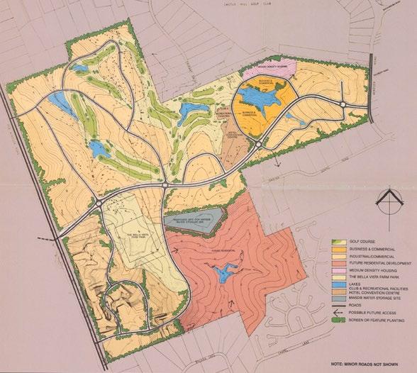
Figure 16. Norwest Estate Concept 1987 (Source: GHD, 1987)
2.6.3 Economic Analysis
The key economic findings from the investigations and evidence base relevant to Norwest are summarised below.
Norwest is the Shire’s Economic Powerhouse
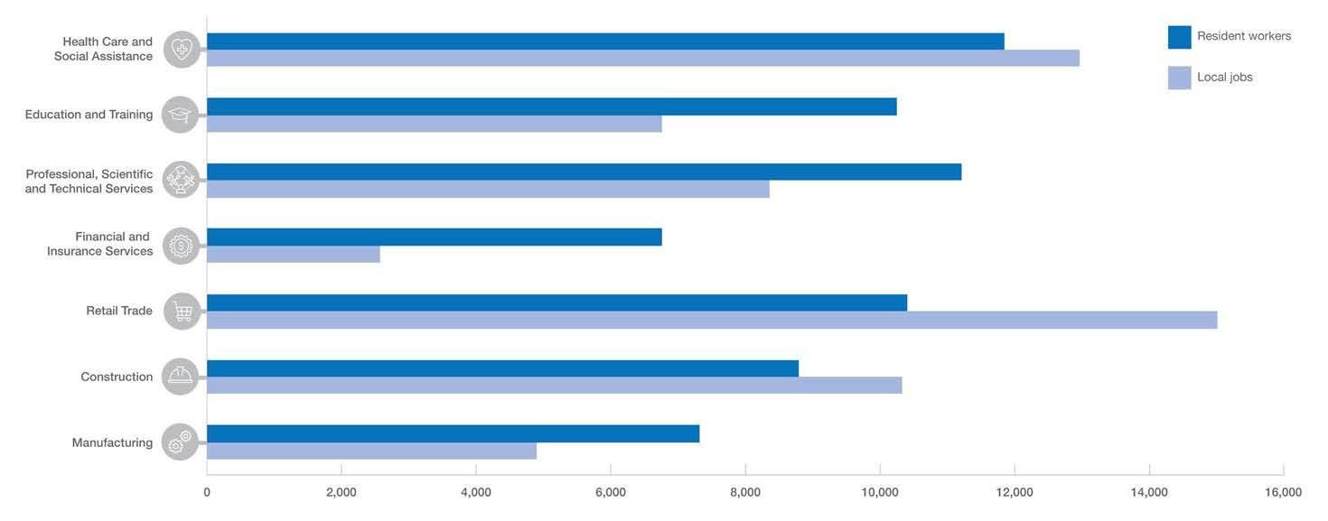
Norwest supports a large and diverse workforce. With around 33,000 workers in 2016, the Norwest Strategic Centre accounts for around 45% of total jobs in the Shire. Norwest is a mature and diverse economy with clear specialisations in health, retail and professional services. The mix of employment reflects the wide range of land uses and site offerings across the strategic centre (as shown in Figure 17).
Based on Travel Zone Projections provided by SGS, it is anticipated that over the next 10 years, Norwest will grow by an additional 7,750 jobs, increasing to an additional 13,190 jobs by 2041 (SGS 2021) as a baseline scenario. These projections do not factor in Council’s employment objectives to maintain the current ratio of jobs to the growing Shire workforce. They do however provide an understanding of the complexities of demand and key industries to be targeted. A ‘business as usual’ trend would see that in 2041, the key industries would be Retail Trade, Health Care and Social Assistance, Professional, Scientific and Technical Services, Construction and Manufacturing (as shown in Figure 17).
Enabling Norwest to Grow and Evolve
The investment in Sydney Metro Northwest has strengthened the Shire’s links to the Eastern City and it is now well placed to capitalise on planned ‘city shaping’ projects such as the Western Sydney Airport, Sydney Metro West and mass transit connection from Norwest to Parramatta (via Baulkham Hills).
Future job growth, above ‘business-as-usual’ trends, will rely upon targeting key knowledge industry sectors of Professional, Scientific and Technical Services, Hospitals, Tertiary Education and Advanced Manufacturing (medical and surgical equipment). Norwest’s ‘brand’ will need to evolve to compete with newer style place-based office precincts, attract more businesses and secure major anchor tenants. This Precinct Plan and Council’s Economic Growth Plan will uphold a pivotal role in the evolution of Norwest, particularly in attracting and retaining talent and investment.
This Precinct Plan identifies the expected capacity for commercial growth with flexibility and choice for higher productivity industries and major anchors.
*Note: 1. Productivity is measured by value added which is the value of outputs after deducting the cost of inputs in the productive process.
33
Industry Category Value Added¹ 2019 Employment 2016 Norwest $M % Jobs % Population Serving $1,369 27.1 13,657 41.7 Knowledge Intensive $1,989 39.3 7,809 23.9 Industrial $477 9.5 6,018 18.5 Health & Education $1,213 24.0 5,154 15.8 Total $5,048 100 32,638 100 Compared To Shire $10,382 67,189
Table 3. Norwest employment and value added across big industry categories within the Norwest Strategic Centre (Source: Adapted from Strategic Centres Discussion Paper (Mecone 2020)
Industry
Jobs Wholesale Trade Retail Trade Accommodation and Food Services Professional, Scientific and Technical Services Other Services Financial and Insurance Services Education and Training Rental, Hiring and Real Estate Services Information Media and Telecommunications Administrative and Support Services Construction Remainderindustrial 0 1,000 2,000 3,000 4,000 5,000 6,000 7,000 8,000 9,000 Health Care and Social Assistance Public Administration and Safety Manufacturing Forecast employment 2021 Forecast employment 2031 Forecast employment 2041
Figure 17. Forecast Employment Growth by Industry Sector for Norwest Strategic Centre (Source: Travel Zone Projections 2019)
of Employment
Retail Floor Space Demand
The Norwest Strategic Centre (including the Showground Station Transit Centre, which is identified separately from the Norwest Strategic Centre in SGS’ Retail Floorspace Analysis) is projected to have a retail floorspace gap of approximately 32,000m² (including 11,820m² household goods, 8,960m² supermarket and 5,490m² hospitality). The identified gaps already account for some anticipated future supply growth, meaning careful consideration is needed of how longer-term retail demand can be appropriately addressed as part of redevelopment in the Strategic Centre.
The analysis recommends household goods provision continue as per Council’s current direction. It further recommends additional supermarket floorspace (5,000m²) and additional specialty retail (2,500m²) can be supported at Norwest (additional to current and future anticipated supply). Redevelopment of the Marketown local centre will be required to demonstrate how the longer-term retail demand (including additional supermarket, hospitality and specialty retail floorspace) can be accommodated having regard to the findings of the Retail Floorspace Analysis (SGS 2021).
Industrial and Urban Services
A Discussion Paper prepared by Mecone articulated that the Norwest Service Precinct is strategically located along Windsor Road, which has been the Precinct’s key strength, providing a high level of exposure and vehicular accessibility to large format retailers and urban services. These areas are also co-located with local residential catchments and other similar services.
It found that Greater Sydney’s industrial market has performed strongly over the past 3-5 years. This has largely been due to strong growth in the logistics and e-commerce sectors, coinciding with historic supply pressures, which has resulted in fierce competition for industrial property and strong retail and land value appreciation.
Whilst there are uncertainties following the COVID-19 Pandemic and the resultant recession, the investigations anticipate market conditions in the industrial sector to remain strong. Mecone found that this is due to many factors, such as:
• Large scale transport infrastructure projects underway and in the pipeline stimulating industrial activity.
• Stable population growth across Greater Sydney driving demand for urban services which meet local population needs (e.g. waste recycling, automotive services, utilities and small scale manufacturing).
• Further growth in internet penetration rates driving demand for data storage in large, purpose-built facilities (i.e. data centres).
• Major new industrial land releases across Western Sydney (particularly in and around the Aerotropolis).
• Increasing rollout of large distribution/fulfillment centres and a network of smaller distribution centres located closer to population hubs to meet growing consumer demands for ‘next day’ delivery services.
• Further uptake in the use of e-commerce and online shopping platforms.
11,820m2 Household Goods
8,960m2 Supermarket
5,490m2 Hospitality
2,380m2 Other Food
2,340m2 Other Retail
1,350m2 Clothing
The Hills Shire Council Draft Precinct Plan Norwest Strategic Centre 34
Anticipated Future Supply Additional Recommended Norwest Centre 18,000m² 7,500m² Showground Station Transit Centre 7,160m² 2,500m² Bella Vista Station Transit Centre 14,000m² Nil Total 39,160m² 10,000m²
Figure 18. Projected Retail Gap by Commodity (m²) to 2036 - Combined Norwest Retail Centres (Source: Adapted from Retail Floor Space Analysis SGS, 2021)
Table 4. Anticipated Future Retail Floorspace Supply to 2036 - Key Centres Within the Norwest Strategic Centre (Source: Adapted from Retail Floor Space Analysis SGS, 2021)
2.6.4 Market Attractiveness
What Businesses Want
The Norwest Strategic Centre has the potential to be part of a linear city that spans across the Greater Sydney Region, connecting the Region’s major employment precincts, universities, hospitals and community service (Mecone, 2021).
However to achieve this and attract knowledge-intensive industries, it is critical that consideration be given to what businesses want and need to be successful.
The Discussion Paper prepared by Mecone in 2021 identified that office-based businesses are most sensitive to location and amenity with knowledge intensive business actively seeking to attract and retain skilled labour through their property decisions. Apart from the cost and suitability of premises to suit operational requirements, key selection criteria include:
• Employee Amenity: High levels of employee amenity are crucial in attracting and retaining businesses, as well as talent. This includes access to high quality hospitality, recreational facilities and other key services. The current level of amenity for Norwest is considered moderate with limited retail offer and car-based activity.
• Public Transport and Accessibility: Growing traffic congestion and work-life balance makes high quality public transport a key requirement for knowledge workers. All three Precincts benefit from strong public transport accessibility with opportunities for improved pedestrian and cycle connectivity. Low traffic congestion and availability of parking were key attractors for industries when looking to relocate.
• Skilled Workforce: Businesses that depend on skilled labour will select locations accordingly. The Shire has a large and growing skilled labour pool with a greater proportion of managers and professionals compared to the Greater Sydney average.
• Market Catchment: Businesses will gravitate to locations that are close to key customer and supplier pools. The perception of distance from Sydney CBD and knowledge intensive sectors in eastern and north shore suburbs is a challenge. This is shifting with the completion of the Metro, but more is needed to improve the Norwest’s brand.
• Critical Mass: Critical mass of occupiers is needed for facilities that support worker amenity to be viable - cafes, restaurants, gym and fitness centres. As one of the largest employment precincts in Greater Sydney (and the largest west of Parramatta), the future development pipeline can amplify critical mass.
• Protecting Employment Capacity: Centres with high volumes of residential uses can struggle to attract large corporates as the ‘prestige’ factor of the location can be affected by co-location with residential uses (Mecone, 2021).
Convenient for employees (25%)
Cost of renting or buying commercial property in the area (27%)
Corporate Image & Brand
Access to Skilled Workforce Market Catchment
Site Selection Criteria for Businesses
Place and Amenity
Suppliers/ Supply Chain

Proximity to customers/ clients (31%)
Availability of parking (27%)
Certainty & Ease of Doing Business
Accommodation Cost
Availability of parking (29%)
Low traffic congestion (27%) Proximity to customers/ clients (27%)
Low traffic congestion (33%)
Proximity to customers/ clients (22%)

35
Manufacturing + Construction Wholesale Trade + Retail Trade Accommodation And Food Services + Arts And Recreation Services Education And Training Health Care And Social Assistance Low traffic congestion (32%) Low traffic congestion (30%) Low traffic congestion (37%) Access to public transport (34%) Availability to suitable premises (34%) Availability of parking (36%) Availability of parking (30%) Access to public transport (30%) Availability of parking (30%)
Figure 19. Site Selection Criteria for Business (Source: Adapted from Mecone Discussion Paper, 2021)
Table 5. Top Three Attractors for Industries to Relocate or Add an Additional Location in The Hills (Source: Adapted from McCrindle ‘Investment Attraction Study’, 2020)
Norwest Metro Station
2.7 Demographic Analysis
To better understand the characteristics of the local catchment, a demographic analysis has been undertaken using the 2021 ABS Census Data for The Hills Shire.
As of 2021, the Shire was home to a resident workforce of around 101,770 people – that is, people who live in the Shire and are employed – and around 84,157 local jobs. However, of the jobs in the Shire, 30,075 (or 31%) are filled by residents. The number of local workers increased by around 7,300 people of 12% from 2016 to 2021. Approximately 96% of residents engaged in the labour force are employed. Unemployment in The Hills has historically remained much lower than that of Greater Sydney, though fluctuations in the unemployment rate have followed similar trends.
In terms of jobs in the Shire, the top industries are retail trade, health care and social assistance, construction and professional and technical services. While retail is still one of The Hills biggest employers, as a percentage of overall employment, retail has been decreasing, as has professional and technical services. Health care and social assistance is the fastest growing industry in The Hills. Construction is experiencing a sharp increase related to steady construction of new homes in the North West Growth Area, which is expected to continue in the short term owing to development around Station Precincts.
In terms of the resident workforce, the highest proportions of Hills residents are employed in technical and highly skilled industries including professional and technical services, finance, health care and education. This reflects the comparatively high levels of education attained by Hills residents. Health care and social assistance is the fastest growing industry both for the resident workforce and for local jobs.
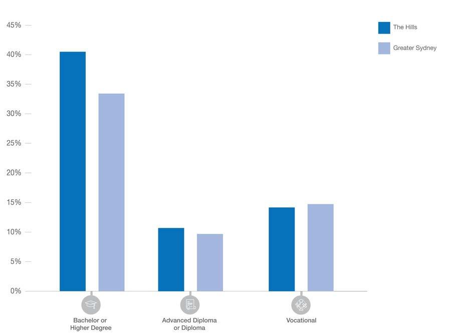
The Hills has a predominantly highly educated, highly skilled, highly paid resident workforce. In 2021, The Hills had a larger proportion of high income earners than Greater Sydney, with over 47% of households earning over $3,000 per week. Hills residents also benefit from high levels of education. Over 60% of residents have undertaken some form of higher education: 40.5% of residents attained a Bachelor degree or higher, compared with 33.4% in Greater Sydney.
It is evident that the jobs currently available within The Hills Shire do not sufficiently align with the knowledge intensive and technical skills of working residents, forcing most working residents to travel outside of The Hills for work.
% of Population
37
Figure 20. Comparison of local jobs vs skills of resident workers
Figure 21. Higher education attainment (% all people over 15)
No. of Workers
Education Attainment
Aligning Jobs Growth With Demand
Within The Hills Shire, there are over 8 jobs within the Shire for every 10 working residents, meaning there is theoretical opportunity for more than 80% of working residents to live and work within The Hills Shire.
Despite this, there is currently a job containment rate of just over 30% within The Hills Shire - which means that only 31.2% of the resident workforce works in The Hills Shire. Approximately 65.3% of working residents travel outside of the Shire for work (14.6% travel to Sydney and 10.1% travel to Parramatta). This reflects that the jobs currently available within the Shire are not well-enough aligned with the skills of working residents and means that we are essentially exporting a large proportion of our highly skilled and educated workforce to other Local Government Areas where they participate in knowledge intensive and technical jobs.
From a simple numerical perspective, if Council is to retain this same ratio and quantum of employment opportunities as we experience the projected population growth, then there will be a need for just over 50,000 additional jobs within the Shire by 2036. This quantum and objective are identified within Council’s Local Strategic Planning Statement and links back to the goals and benefits of the 30 minute city objective and providing good access to jobs for residents within easy travel from their home.
Taking into account the potential within Strategic Centres, as well as other medium and longer term locations, such as Annangrove Road and Box Hill, there is theoretical capacity more broadly across the Shire to accommodate growth in employment opportunities, however the key challenges will be to stimulate the take-up of opportunities and delivery of jobs by the market in the short and medium term and to encourage the delivery of jobs that better align with the skills and education of our residents, particularly a greater proportion of knowledge intensive jobs.
As reflected in the job targets set by the Greater Cities Commission, it is the three strategic centres that are critical to achieving these goals and overcoming these challenges, as these are the areas where Council can expect short term economic interest and investment on the back of the Sydney Metro Northwest and delivery of jobs, in locations that are well serviced and accessible for residents of the Shire.
These are also the locations which are the most conducive to the delivery of co-location of knowledge intensive jobs, technical jobs and health and education. As a result, both the State and Local strategic planning frameworks establish and reinforce the importance of the Strategic Centres doing the heavy lifting in terms of short to medium term provision of jobs.
The Hills Shire Council Draft Precinct Plan Norwest Strategic Centre 38
Figure 22. Job Containment by Occupation in The Hills Shire 2016 (Source: Adapted from Council’s Productivity and Centres Strategy)
Population Resident Workers Local Jobs Ratio Of Shire Workers To Jobs Existing (2016) 162,500 80,170 63,865 0.8:1 Forecast (2036) 290,900 143,500 114,500 0.8:1 Growth 2016 – 2036 128,400 63,500 50,600 0.8:1
Table 6. Implied Demand - Number of Jobs to Maintain the Ratio of Shire Workers to Jobs
When more residents can work locally, commute times and congestion will lessen, helping to meet the vision of Greater Sydney as a 30-minute city. This will encourage a better work-life balance, increased local spending and stronger local communities.”
Occupation No. of People 0 5,000 10,000 15,000 20,000 25,000 29.6% 40.6% 24.4% 46.8% 32.3% 42.4% 25.0% 25.9% Live and work in the area Work outside the area No fixed place of work
-
Council’s Local Strategic Planning Statement, Hills Future 2036
Technicians and trades workers
Sales workers Machinery operators and drivers Professionals Labourers Clerical and administrative workers Community and personal service workers Managers
2.8 Key Strategic Influences
Challenges
• Competition with Parramatta for new office stock and Blacktown for industry.
• Lack of clear Norwest brand – not ‘on the radar’ for larger organisations.
• Market uptake inhibited by various factors (e.g., land cost, speculation and traffic issues etc.).
• Continued pressure for ‘highest and best use’ residential or mixed-use outcomes.
Economy
Access and Movement
• Retaining local industry and urban support services.
Opportunities
• Improved mass transit links to Parramatta and the Western Sydney International Airport.
• Strategically positioned to link into a network of Strategic Centres and prominent office markets.
• Access to highly skilled and educated local workforce.
• Large, vacant or underdeveloped land holdings.
• Critical mass – one of the largest employment precincts in Greater Sydney.
• Congestion from regional and local traffic.
• Roads, topography and sprawling Precinct inhibits pedestrian and cycle movements.
• Limited vehicular connectivity that forces traffic onto a handful of key roads.
• Increased pedestrian and bicycle connectivity.
• Introduction of reduced parking rates and car share provisions for non-residential developments.
• New vehicular connections to divert traffic away from roads already at capacity.
• Encouraging a mode shift towards public transportation, leveraging off investments in key transport infrastructure (such as the Sydney Metro Northwest).
Amenity and Place
• Limited vibrancy outside of business hours, in advance of the market delivering on significant residential opportunities already available within the centre over the next 5-20 years.
• Poor pedestrian connectivity and limited activated ground floor frontages.
• Limited amenity given the Precinct is bisected by high speed roads such as Norwest Boulevarde.
• Lack of passive open space in the heart of the Precinct to enable incidental social interactions.
• Increased activated frontages, supported by an array of through site links.
• Encouraging a stronger night-time economy to attract and retain workers and visitors.
• Improved public domain including upgraded streetscape, new and widened footpaths, public art and attractive street furniture.
• Establish a distinct and identifiable local character and sense of place.
• Diverse housing opportunities that suit the varied needs of our unique demographic.
• School capacity to cater for increased population.
• Uncertainty of future local and regional infrastructure contribution costs.
• Limited land available to facilitate new active open space areas.
Infrastructure
• Delivery of new open spaces and plazas in the heart of commercial areas.
• Various new road connections and road upgrades.
39
Table 7. Key Strategic Influences that will Guide and Shape Future Development within Norwest Strategic Centre
2.9 Existing Travel Behaviour And Trends
In 2016, there were approximately 1.8 cars per household on average in Norwest (slightly lower than the average for The Hills Shire, being 2 cars per household). It is estimated that if current car ownership trends within The Hills Shire continue, by 2036, there will be an additional 70,000 vehicles on our roads. If this is the case, the roads and infrastructure will not be able to cope, as they are already at capacity in many locations throughout the Norwest Strategic Centre.
This is largely reflective of our unique family dominated demographic and the slow rate of modal shift following the opening of the Metro. Many families will need to a car for private use on weekends for travel to sport and other activities that are not easily accessible via the Metro or other forms of public transport. Whilst car share, increased public transport usage and reduced parking rates may be part of the solution to solving our traffic issues, ultimately many families will continue to require access to a private vehicle and associated parking.
Whilst this does not necessarily mean that residents will utilise their vehicles to drive to work (as further explained below), this needs to be thoughtfully considered to ensure that the narrative correctly reflects the transit behaviours of our residents on weekends and that new residential developments continue to accommodate space for private vehicles and lifestyle choices.
This approach focuses on the modal shift for trips to Norwest during peak periods, not necessarily preventing residents from being able to own a car and store it at their place of residence.
Whilst Norwest has traditionally been a car dependent destination, the arrival of the Sydney Metro Northwest poses an opportunity to reimagine the travel behaviours of our local residents and workers. It provides a convenient rail connection from The Hills Shire to Chatswood, Macquarie Park and the Sydney CBD. When the project is extended, it will provide a direct connection to the Sydney CBD and through to Bankstown. There are also plans to expand the network to ultimately connect The Hills Shire with the new Western Sydney Airport.
A Parking Analysis undertaken by PeopleTrans in late 2020 revealed that between 2011 and 2016 there was a significant increase in public transport to access the Norwest Strategic Centre (+4.7% to 15.6%) and a subsequent reduction in trips to the Centre via car (-6% to 62.9%). An analysis of demand within more established comparable transit centres across Sydney shows that approximately 37% of workers travel to work by car, indicating potential for even greater mode shift to public transport to occur in The Hills, particularly for trip to/from the inner walkable catchment of stations. It could be reasonably assumed that this mode shift towards public transportation will continue, especially given the Metro did not open until after the 2016 Census.
•
•
•
•
•
•


The Hills Shire Council Draft Precinct Plan Norwest Strategic Centre 40
Figure 23. Factors Influencing Mode Choice (Source: Adapted from Council’s Integrated Transport and Land Use Strategy)
Demographic Details Castle Hill Norwest Rouse Hill The Hills Shire Journey to work (residents) Mode share Car 64.7% Public transport 17.5% Car 62.9% Public transport 15.6% Car 70.0% Public transport 13.1% Car 65.7% Public transport 16.1% Changes (2011 vs 2016) Car -3.3% Public transport +3.2% Car -6.0% Public transport +4.7% Car -1.8% Public transport +3.3% Car -2.5% Public transport +3.1% Journey to work (workers) Car (driver) 62.9% Public transport 9.0% Car (driver) 80.3% Public transport 5.3% Car (driver) 62.3% Public transport 7.1% Car (driver) 70.6% Public transport 5.0% Car ownership (average) 1.9 cars per household 1.8 cars per household 2.04 cars per household 2 cars per household Household size (average) 3.05 persons per household 2.78 persons per household 3.47 persons per household 3.18 persons per household Economic Physical Psychological Social • Fare Costs • Vehicle Operating Costs • Parking Costs • Road Use Costs • Distance to and Availability of Public Transport.
Routes and Travel Times
Accessibility
Table 8. Summary of Key Travel Behaviour (Source: Adapted from PeopleTrans – Transit Centres Car Parking Report, 2020)
•
•
Comfort of Personal Vehicle
of Service
• Reliability
Origin and Destination
Availability of Parking at
‘Freedom’ of Car Use
Personal Safety Concerns
Social Status Linked to Car Ownership
Life Stage Based Difficulties (e.g. Travelling with Small Children)
2.10 Public and Active Transport

Public Transport
• The arrival of the Sydney Metro Northwest in May 2019 has begun to transform travel behaviour within The Hills Shire, by providing a rapid transit service that stretches from Tallawong Station through to Chatswood Station. The next phase, stretching from Chatswood to Sydenham, is currently under construction and once complete, the indicative travel time from Norwest to Martin Place will be approximately 30-35 minutes. It is set to open in 2024.
• The Strategic Centre is well-serviced by local bus services, providing direct connectivity to other key centres such as Parramatta, Blacktown and Rouse Hill. Local buses also travel to nearby areas that are not serviced by the Sydney Metro Northwest, including the Circa Commercial Precinct, Glenwood and North Kellyville.
Metro Station
Metro Line (Underground Tunnel)
Norwest Strategic Centre
Bus Routes
Every 15 Minutes
Every 20-30 Minutes
Every 60 Minutes
Peak Hours Only
Night Service
Metro Connect Catchment
41
WINDSORRD OLD WINDSOR RD NORWESTBLVD MEMORIALAV FAIRWAY DR VICTORIA AV BALMORALRD EDGEWATERDR CARRINGTONRD SOLENT CCT LEXINGTON DR RESTON GRA CECILAV NORBRIKDR SHOWGROUND RD CELEBRATIONDR
Figure 24. Public Transport
Active Transport

• Walkability across the Strategic Centre varies considerably due to topography, existing lot sizes and patterns, lack of fine grain links and physical barriers to movement such as major roads and creek corridors.
• A major existing gap in terms of walkability is the Circa Commercial Precinct, which is outside the walkability catchment as shown in Figure 25. (which is based on existing connections, noting that these areas will expand as development takes place and additional connections are provided).
• Most of the high density residential areas are relatively walkable, except for the northern most part of the Norwest Innovation Precinct. However, it is noted that this is near Kellyville Station.
• Residential areas within the Norwest Service Precinct are relatively walkable with most of these areas falling within a 1km walking catchment of the station. Walkability within the employment areas within the Norwest Service Precinct is quite limited, due to the size of the area, topography and large lots with little permeability.
• The Strategic Centre is bisected by various roads with high traffic levels (including Norwest Boulevarde, Windsor Road and Victoria Avenue), serving as a major impediment to pedestrian permeability and walkability. It is noted that some mechanisms are already in place to address this, including the existing underpasses near Bella Vista Farm and Century Circuit.
Metro Station Metro Line (Underground Tunnel)
Norwest Strategic Centre
Up to 5 Minutes Walk (400m)*
5 to 10 Minutes Walk (800m)*
10 to 15 Minutes Walk (1200m)*
The Hills Shire Council Draft Precinct Plan Norwest Strategic Centre 42 WINDSORRD OLD WINDSOR RD NORWESTBLVD MEMORIALAV FAIRWAY DR VICTORIA AV BALMORALRD EDGEWATERDR CARRINGTONRD SOLENT CCT LEXINGTON DR RESTON GRA CECILAV SHOWGROUND RD CELEBRATIONDR
Figure 25. Current Walkability Catchments
*Note: Walkability Catchments are based on existing connections, noting that these areas will expand as development takes place and additional connections are provided.
2.11 Road and Freight Network
Road Network
• The Study Area is serviced by an extensive network of roads which are utilised by pedestrians, bicycles, buses, freight and general traffic. Roads are managed by a framework of regional and local roads. Classification is based on connectivity and the importance of the road to the broader road network (volume of traffic) with State roads (arterial roads) managed and funded by Transport for NSW and regional and local roads managed and funded by Council.
• It is currently serviced by various key arterial roads, being Old Windsor Road, Norwest Boulevarde, Windsor Road and Showground Road. The arterial road network provides connections to and from neighbouring centres, as well as beyond to the City, outer Western Sydney and the future Western Sydney Airport. Sub-arterial and collector roads provide links between key areas, as well as the arterial road network and local roads.
• With travel demand expected to significantly increase as a result of uplift within the Strategic Centre, further upgrades will be needed to ease pressure on the existing road network, improve connectivity and provide additional entry/exit points.
• The arterial road network currently experiences significant congestion during peak hours, with some areas already operating at Level of Service (LoS) E and F (the poorest LoS on the scale), particularly along Old Windsor Road near Memorial Avenue and Bella Vista Station. Congestion is also experienced in the peak along Showground Road, Victoria Avenue, Norwest Boulevard, Memorial Avenue and Windsor Road, as well as some local roads within the Balmoral Road Release Area and Castle Hill Trading Area.
Metro Station
Metro Line (Underground Tunnel)
Norwest Strategic Centre
Intersection
Key Congested Areas
Arterial Road

43
T
Freight Network
• Efficient freight links facilitate smooth and effective movement of goods, allowing supply chains to function smoothly and influence new markets. Planning for freight and servicing of residential and commercial development is crucial to how the Shire works and connects to adjoining areas, Greater Sydney and beyond. It is a shared responsibility between the NSW Government and Councils.
• Generally, within The Hills Shire, the freight network is confined to the road network in the absence of heavy rail infrastructure. As such, congestion on the local and regional road network presents a challenge for freight movements and for residents living within and around The Hills.
• The Precinct contains two tertiary freight routes being Old Windsor Road and Windsor Road. Tertiary freight routes provide connections from the local road network, serving numerous major business and freight origins and destinations.
• These roads carry lower volumes of heavy vehicles (<2,000 heavy vehicle annual average daily traffic) than primary routes such as the M7 and M2 Motorways which typically carry volumes of more than 4,000 heavy vehicle annual average daily traffic.
The Hills Shire Council Draft Precinct Plan Norwest Strategic Centre 44 WINDSORRD OLD WINDSOR RD NORWESTBLVD MEMORIALAV FAIRWAY DR VICTORIA AV BALMORALRD EDGEWATERDR CARRINGTONRD SOLENT CCT LEXINGTON DR RESTON GRA CECILAV NORBRIKDR SHOWGROUND RD CELEBRATIONDR ToParramatta To Parramatta To Rouse Hill Hills Showground Station Norwest Station Bella Vista Station
Metro Station Metro Line (Underground Tunnel) Norwest Strategic Centre Freight Network
Figure 27. Freight Network
2.12 Natural Environment
Topography

• A major north-south ridgeline runs along Windsor Road between the Norwest Central and Norwest Service Precincts (shown as red and orange in Figure 28).
• A secondary ridgeline diverts off Windsor Road through a major development site south of Barina Downs Road (shown as orange in Figure 28).
• The heritage listed Bella Vista Farm is located a visually prominent high point immediately east of the Norwest Innovation Precinct.
• There is considerable variation in ground level across the Strategic Centre which impacts on walkability, particularly towards the periphery.
Views and Vistas
• The undulating topography of the Strategic Centre results in numerous view corridors.
• The heritage listed Bella Vista Farm and Windsor Road are both located on visually prominent high points and take advantage of scenic views.
• A Restricted Development Area (RDA) extends along Windsor Road. Buildings on the western end of the Windsor Road Ridgeline are required to have a 30m front setback. It aims to retain ecological and topographical features and broadly protect views to and from the ridgeline.
• Bella Vista Farm features significant views towards the Blue Mountains along with numerous district views of Kellyville, Baulkham Hills, Castle Hill and Western Sydney.
• However, it is likely that views to the Blue Mountains will mostly be obstructed from future development under current height controls (sites to the west of the Bella Vista Farm are currently subject to a maximum permissible height starting from RL 116).
• There are also various views of the Bunya Pines at the Bella Vista Farm Park, often rising above building envelopes and sporadically along local roads.
• Views to the Pearce Family Cemetery are also visible when viewed from the Bella Vista Farm Homestead. This view corridor is particularly significant as it signifies historic associations between the Farm and the Pearce Family Cemetery.
45 WINDSORRD OLD WINDSOR RD NORWESTBLVD MEMORIALAV FAIRWAY DR VICTORIA AV BALMORALRD EDGEWATERDR CARRINGTONRD SOLENT CCT LEXINGTON DR RESTON GRA CECILAV NORBRIKDR SHOWGROUND RD CELEBRATIONDR Hills Showground Station Norwest Station Bella
Vista Station
Metro
Metro
Norwest Strategic Centre 9 - 39 RL 40 - 63 RL 64 - 71 RL 72 - 78 RL 79 - 85 RL 86 - 99 RL 100 - 106 RL 107 - 114 RL 115 - 138 RL
Figure 28. Topography
Station
Line (Underground Tunnel)
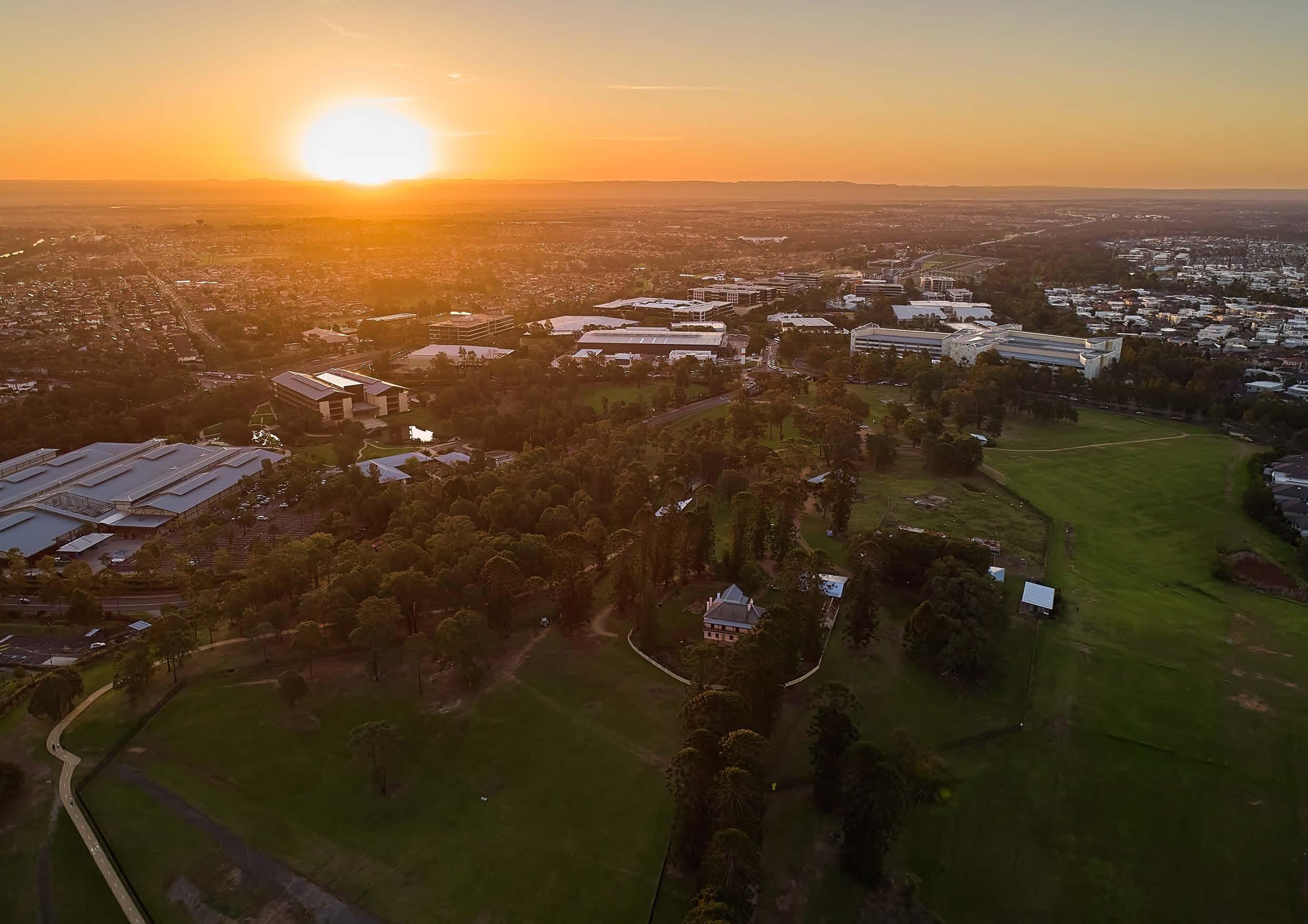 Bella Vista Farm.
Open Space and Vegetation
• The Norwest Strategic Centre currently features four (4) active open space areas, including Balmoral Road Reserve, Kellyville Memorial Park, Bella Vista Oval and a shared synthetic field at Bella Vista Public School.
• Balmoral Road Reserve Sports Complex officially opened in July 2022. It features multi-purpose fields, tennis courts, two multi-use ball courts, an amenities building, a separate building to accommodate grounds staff and storage for sports clubs, a car park, playground, picnic facilities, a kick about area and extensive shared pedestrian and cycling paths.
• Kellyville Memorial Park has been recently upgraded, comprising full size playing fields, plus senior and junior baseball fields.
• There are also various active open space areas within the broader 2km catchment. However, these facilities already service other precincts within the Shire and will not have capacity to accommodate future growth within the Norwest Strategic Centre.
• The Norwest Strategic Centre showcases two regional open space areas - Bella Vista Farm and Castle Hill Showground. These areas are key cultural hubs that will significantly contribute to the sense of place within the Strategic Centre both now and in the future.
• The Norwest Strategic Centre is supported by approximately 103 hectares of passive open space. This primarily comprises active greenway links along drainage corridors that connect existing district and regional open space facilities. However, these are generally located towards the periphery of the Precincts and are not overly accessible (especially the Norwest Service Precinct).
• Passive open space areas also include various pocket parks in the existing residential areas. However, as these are located towards the periphery of the Strategic Centre, they are unlikely to service more central areas where future growth is anticipated.
• Given the Norwest Strategic Centre is highly urbanised, it is generally void of substantial natural vegetation apart from patches of Cumberland Plain Woodland in the northern and southern portions of the Norwest Central and Norwest Innovation Precincts. This is unlikely to hinder development activity moving forward as it is fairly sparse and much of the vegetation has already been removed as a result of recent development.
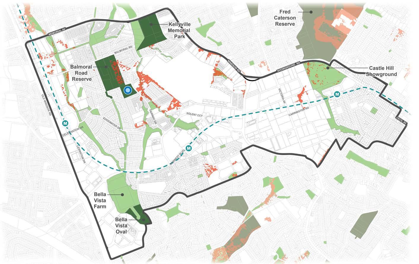
Metro Station
Metro Line (Underground Tunnel)
Norwest Strategic Centre
Vegetation
Existing Active Open Space
Existing Passive Open Space
Shared Synthetic Field
47
Figure 29. Open Space and Vegetation
Hydrology
• The Study Area features a number of hydrological considerations, including flood prone land, creeks, overland flow paths and Norwest Lake. These factors have formed key considerations in developing this Precinct Plan, as they will substantially influence future development outcomes.
• Norwest Lake is located in the heart of the Strategic Centre and is a key defining feature.
• The Precincts currently drain into various catchments, with creek lines running through each Precinct. These catchments include Caddies Creek, Lalor Creek, Elizabeth Macarthur, Strangers Creek, Toongabbie Creek, Cattai Creek (upper) and Smalls Creek.
• The northern portion of the Strategic Centre drains into the Hawkesbury Nepean through the Strangers Creek and Elizabeth Macarthur Creek sub-catchments. The southern portion of the Strategic Centre primarily drains into the Lalor Creek Catchment.
• The Norwest Central Precinct drains into Norwest Lake and Strangers Creek basins, which are located within zoned drainage corridors.
• Land around the Norwest Innovation Precinct drains into a dedicated corridor along Elizabeth Macarthur Creek.
• The Norwest Service Precinct predominately drains to Cattai Creek which is generally zoned for open space (with portions in private ownership).
Metro Station
Metro Line (Underground Tunnel)
Norwest Strategic Centre
Creek Catchment Boundary
Creek / Overland Flowpath
100 Year Flood Extent

The Hills Shire Council Draft Precinct Plan Norwest Strategic Centre 48
Elizabeth Macarthur Creek
Cattai Creek (Upper)
Strangers Creek
Caddies Creek
Lalor Creek
Figure 30. Hydrology
*Note: The information presented in this map on flood extent is subject to disclaimer and copyright notice. Please refer to appendix A for details.
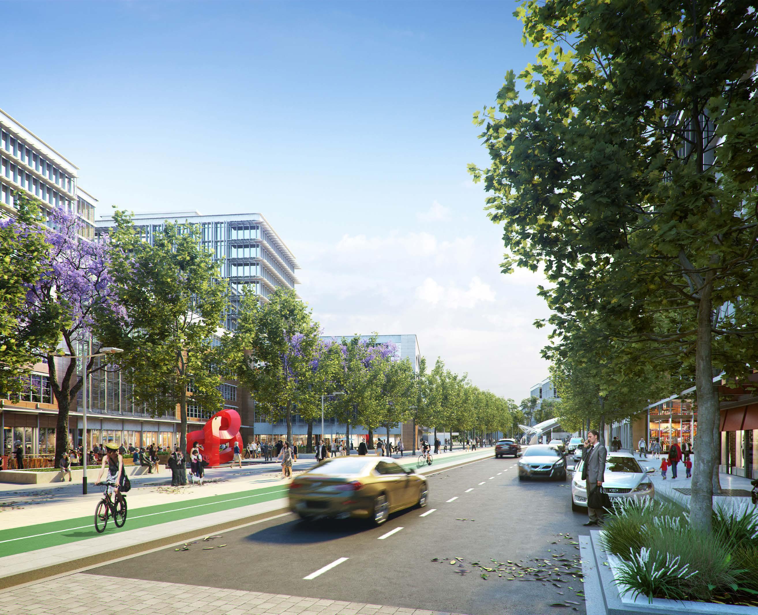 Artist’s Impression of Bella Vista Local Centre and Town Square
(Source: Department of Planning and Environment)
Artist’s Impression of Bella Vista Local Centre and Town Square
(Source: Department of Planning and Environment)
Executive Summary 01 Vision 0 3
3.1 Vision for the Norwest Strategic Centre
This Precinct Plan sets the framework for Norwest to emerge as a thriving mixed use Strategic Centre and highly competitive employment Precinct. The vision for the Strategic Centre builds on previous strategic work by Council and the NSW Government, including technical investigations focused on the Shire’s Strategic Centres that provide insight into their unique features, role and function in the Greater Sydney Region. This Plan is the next step and advances the planning into finer grain, site specific detail to inform potential changes to planning controls and the infrastructure framework, which can occur in a logical and staged manner.
By 2041, Norwest Strategic Centre will be a prime location for knowledge intensive businesses focused on health, education, science, technology, finance and advanced manufacturing. Business will enjoy the proximity and ease of access to complementary services and facilities at nearby strategic centres of Castle Hill and Rouse Hill and the economic competitiveness offered by enhanced connections to Sydney CBD, Greater Parramatta and the Western Sydney Airport. Norwest will be a key part of a linked network of strategic centres and prominent office markets that spans across the Sydney Region. It will offer a range of employment opportunities for the highly skilled workforce that lives in The Hills Shire.
Over the next 20 years Norwest Strategic Centre will continue to evolve into a location valued by workers, residents and visitors for its vibrancy and amenity. It will transform from its sprawling, low scale origins to a more walkable centre with taller, well designed buildings at its core. In addition to hosting prestige office space, it will provide appealing and safe places to shop, dine, socialise, live and enjoy cultural and leisure experiences, all within the walking catchment of high frequency mass public transport.
Lifestyle will be enhanced by improved walking and cycling tracks, connecting employment areas and Stations, opening up creek corridors and increasing access to Castle Hill Showground and Bella Vista Farm Park. The centre will have a distinguishable local character and sense of place founded on the rich local history and Garden Shire identity and strengthened by enhancing and protecting areas of the public domain.
A targeted vision for each of the three individual Precincts within the Norwest Strategic Centre is included in Sections 4, 5 and 6, respectively.
Showground Station Precinct Proposal
The Strategic Centres of Castle Hill, Norwest and Rouse Hill will be part of a linear city that spans across the Metropolis of 3 Cities, connecting the region’s major employment precincts, universities, hospitals and community services.”
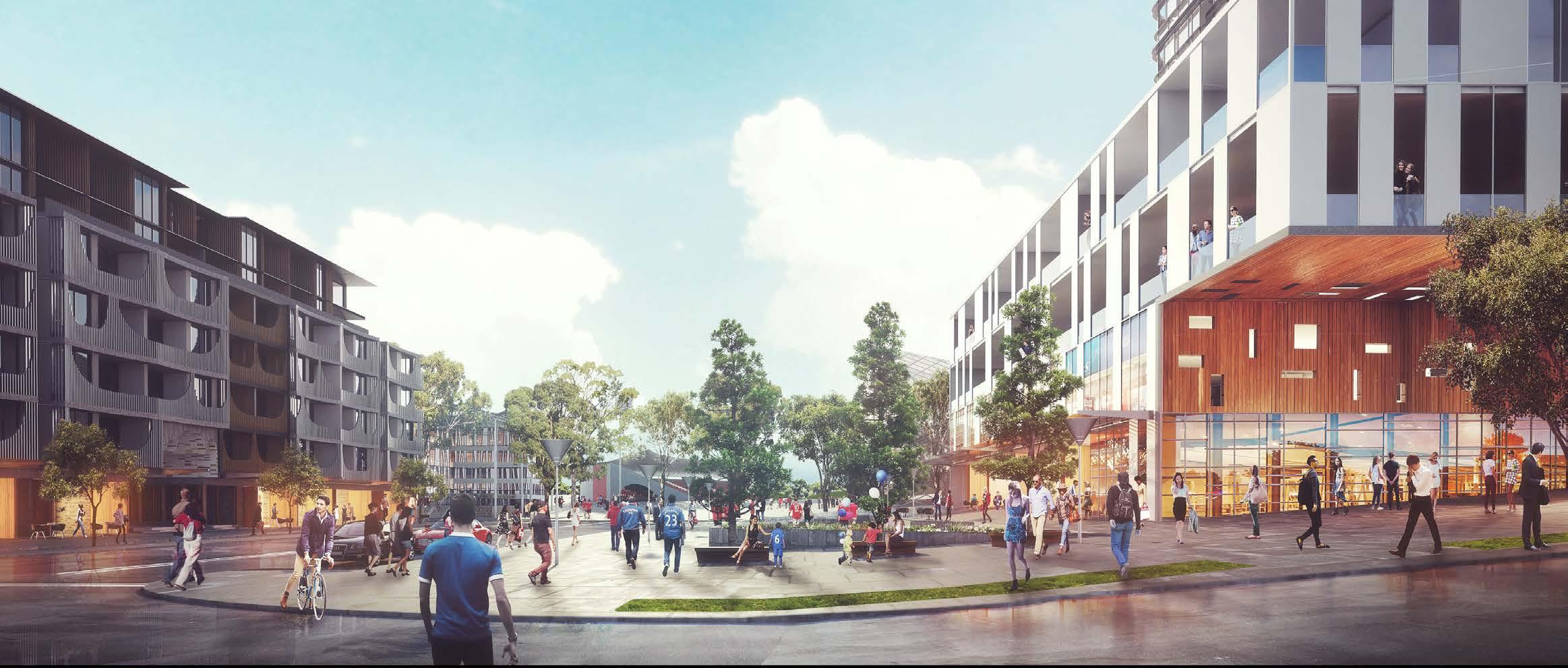 - Mecone 2021
51
DECEMBER
Artist Impression - Showground Station Precinct (Source: Department of Planning & Environment)
Metro Station
Metro Line (Underground Tunnel)
Norwest Strategic Centre
Proposed Road
Low Density Residential
Medium Density Residential
High Density Residential
Local Centre / Retail Area
High Density Commercial Offices
Urban Support Services
Mixed Use
Private Open Space
Public Open Space
Drainage Land
Special Use
Signalised Intersection
Pedestrian Bridge
Left-in-left-out
Urban Plazas
Roundabout
Seniors Housing
Pedestrian Link
The Hills Shire Council Draft Precinct Plan Norwest Strategic Centre 52 T T T T T T T T T T T T T T T T T T T T T T T T T T T T T T T WINDSORRD OLD WINDSOR RD MEMORIALAV FAIRWAY DR VICTORIA AV BALMORALRD EDGEWATERDR SOLENT CCT RESTON GRA CECILAV NORBRIKDR SHOWGROUND RD
T
3.2 Norwest - A Mixed Use and Transit Oriented Centre
This Precinct Plan will apply the principles of transit-oriented development to future growth in Norwest Strategic Centre and promote compact and walkable Precincts which accommodate a mix of uses, all centred around the three Metro Stations. Transit Oriented Development is the concept of maximising the density of development (be it housing, employment, retail, services and leisure) within walking distance of public transport to create walkable and high-amenity precincts. The concept of Transit Oriented Development is more relevant in the context of how the broader catchment areas around transport nodes are planned and work together as an agglomeration of land, as opposed to referring to a specific outcome on an individual site in isolation.
Generally, the catchment for Transit Oriented Development is measured based on walkable distance from a transport node, with a focus on land that is within 800 metres (or sometimes 1.2km) from a transport node. This specific distance can vary, often depending on how walkable an area is having regard to factors such as slope and the quality pedestrian connections. However, it generally correlates with how far the average person could walk in 10 - 15 minutes and how far someone will be willing to walk between their origin or destination and a transport node. In short, it is the threshold under which we observe behavioural changes and in particular, a shift to rely on public transport versus private vehicle usage.
Some of the key benefits of Transit Oriented Development are that it:
Reduces car dependence and traffic congestion and encourages the use of public and active transport over private vehicle trips.
Allows for the creation of pedestrian friendly areas with greater emphasis on place-making, amenity and active transport, in comparison to more traditional vehicle dominated areas.
Maximises the efficient use of public transport infrastructure, such as the Sydney Metro Northwest.
Reduces the relative cost of servicing new development with infrastructure able to be provided more efficiently to service growth in a consolidated and compact area, as opposed to a sprawling greenfield area.

Creates active and vibrant areas where local economic activity and investment can be focused with confidence.
Achievement of the long-term vision and objectives for Norwest as a thriving mixed use Strategic Centre will require a planning framework allowing a broad mix of retail, commercial, residential and leisure uses to occur close to each other and within the walkable catchments around the three Metro Stations. This will help to create engaging and vibrant areas where a diversity of activities and functions can occur and where a viable day, night and weekend economy can exist.
In the context of a mixed use and transit-oriented precinct, it remains important that certain areas can be designated for specific outcomes. A clear land use framework provides certainty, confidence and viability for the market and landowners to make informed investment and development decisions with the clear knowledge of highest and best use. This will facilitate the achievement of short and long term strategic planning objectives for the Centre and avoid potential land use conflicts and amenity issues. It will also reduce the risks associated with investment decisions spurred by speculation around the permissibility of higher value uses, which can artificially drive up land values to the point where other development outcomes are no longer viable. In recent times, it has generally been the case that speculation around the potential for residential outcomes to become permitted on land can artificially inflate land values such that the feasibility of strategically identified urban services or commercial outcomes becomes less viable.
The concept of a mixed use Strategic Centre is not incompatible with also designating specific areas for viable urban services and commercial development. This philosophy is supported within the strategic planning framework, including the Greater Sydney Region Plan, Central City District Plan and Council’s Local Strategic Planning Statement which envisage Norwest as a mixed use Strategic Centre, containing designated commercial areas, urban services and low, medium and high density residential development.
Currently, residential development outcomes are permitted on approximately 67% of all developable land within 1.2km walking distance of the three Metro Stations. As this zoned capacity for nearly 18,250 dwellings is realised by the market over the next 10-20 years, a significant residential population (well in excess of 35,000 people) will reside within 1.2km of the Metro Stations, bringing with it the activity, vibrancy and viability. In contrast to residential outcomes, which are permitted on the majority of land within the Strategic Centre, only 33% of developable land within 1.2km walking distance of the three Metro Stations is designated specifically for employment and urban services outcomes.
In the context of significant incoming residential development and acknowledging the underlying economic goal of employment growth within the Strategic Centre, it remains important that these scarce areas continue to be retained for commercial and office development outcomes, even if the pace at which the market capitalises on these opportunities is more moderate than has been experienced for residential outcomes over recent decades.
This Plan will set the framework for Norwest’s continued evolution into a thriving mixed use Strategic Centre, building on the recent planning work completed by State Government and Council and the emerging mix and distribution of uses throughout the Centre. It will ensure that the Centre contains adequate and appropriately defined areas of land to facilitate the varied range of urban uses that can be expected to deliver a truly mixed use and transit oriented Strategic Centre.
53
400m 800m M Metro Station Metro Line Road Link Local Roads, Pedestrian and Cycle Paths Land Use Intensity / Density
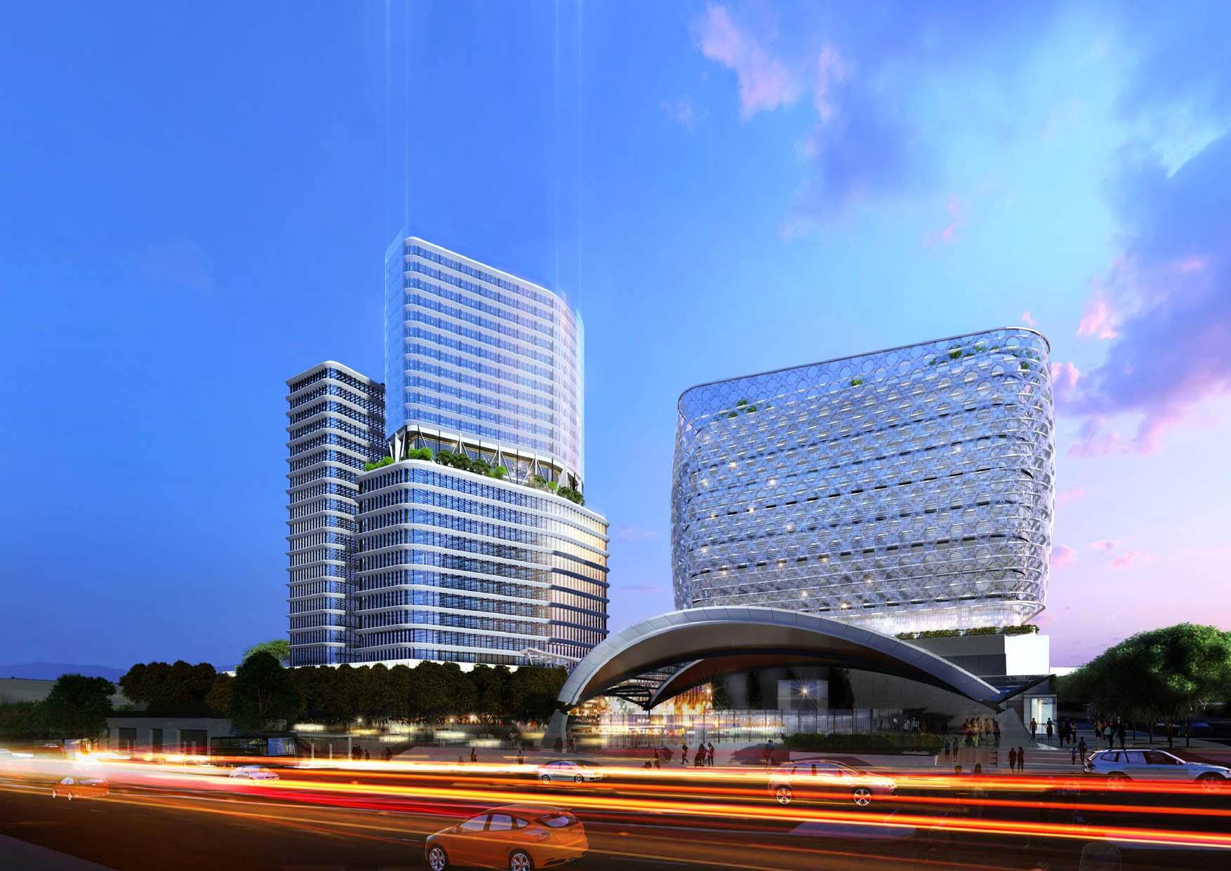 Artist Impression of Norwest Station Site (Source: Scott Carver)
3.3 Guiding Principles
The Precinct Plans for all three of Council’s Strategic Centres are underpinned by 12 guiding principles, which provide a framework for them to reach their full potential as highly diverse, liveable and desirable places to work, live and play for existing and future workers, residents and visitors. These guiding principles have been derived from the guidance and objectives provided within the relevant strategic planning policies, along with the strategic planning investigations commissioned by Council in late 2020. They also reflect Council’s aspirations for the strategic centres as articulated within the Local Strategic Planning Statement and the objectives identified within Council’s Community Strategic Plan.
Growing Employment
Delivering quality jobs so that our residents can have a genuine choice to work locally in fields that suit their individual needs and skillsets, whilst simultaneously reaping the lifestyle benefits that our strategic centres have to offer. In addition to matching the skillsets of local workers, the attraction of investment in knowledge intensive and innovative industries will bring a higher value and resilience to the local economy enabling our centres to grow into competitive, productive and thriving employment hubs.
Delivering Transit-Oriented Development (TOD)
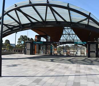
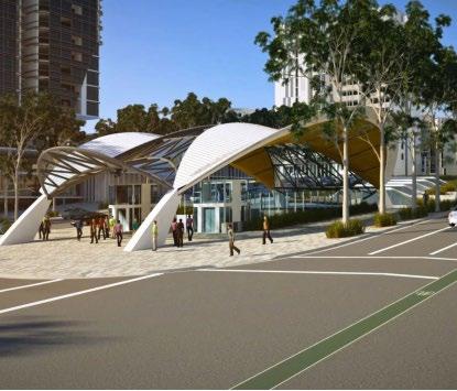
This principle is central to urban renewal and focuses on locating the highest density of development in closest proximity to transport hubs, enhancing walking and cycling connections and carefully managing parking locations and delivering compact, walkable and liveable centres which contain a mix of uses. Building height will be used in moderation, to allow for appropriate densities in the context of each individual site and prioritise the experience of the urban environment for pedestrians at the ground plane through generous landscaping, plazas, setbacks and building separation.
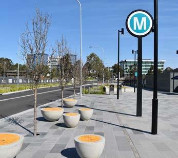
Improving Regional Connectivity
Quality connectivity to the wider Greater Sydney Region will be pivotal in enhancing the desirability of the Strategic Centres as places to live, work and visit. In addition to capitalising on the existing public transport system and connections to the Sydney Central Business District, the realisation of mass transit connections to Parramatta City Centre and the Western Sydney Airport provides opportunity to transform how the Shire’s Strategic Centres are perceived and thereby leverage investment and economic growth.
Achieving a 30-Minute City
Ensuring that people live within 30 minutes of their nearest Strategic Centre, when accessed by public transport, will enable more residents to work close to home, decrease commute times, reduce traffic congestion and improve the lifestyles of our residents. Whilst the Strategic Centres collectively benefit from proximity to Metro Stations, improving active transport connections and place-making are key considerations in precinct planning to encourage a shift from reliance on private car use to more sustainable transport modes.
Infrastructure to Meet Needs
Our residents and workers require and deserve adequate local and regional infrastructure to enable them to go about their everyday lives. The provision of regional facilities including schools, emergency services, public transport and traffic upgrades will require meaningful collaboration with State agencies informed by anticipated growth projections. The provision of local infrastructure facilities including playing fields, parks, traffic and transport works, libraries, community facilities and stormwater works will require appropriate infrastructure contribution mechanisms to be put in place in line with any changes to planning controls.
Supporting Business and Residents with Urban Services
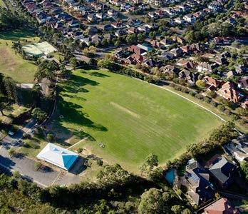
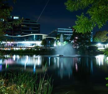
The term ‘urban services’ covers a range of industries and activities that are fundamental to how the Shire functions and are critical to supporting population and jobs growth. The need for services close to homes and workplaces such as motor vehicle services, repairers, printers, waste management and food preparation, is only going to increase with expected growth. As the Shire undergoes transition and urban renewal, protecting industrial and urban services land will ensure capacity is maintained for a range of essential activities to co-exist with new development.
55
Urban Support Services
Lakeside Commercial Developments
Impression of Showground Station and surrounding development
(Source: Department of Planning and Environment)
Bella Vista Station
Bella Vista Oval
Norwest Metro Station
Diversity of Housing
Providing a choice of housing opportunities is essential in meeting the needs of a range of budgets and lifestyles. With the Shire’s demographic expected to continue to feature family groups, there is a need to plan for an adequate amount of apartments to cater to these groups. Future residential development will be guided by transit oriented development principles and focused upon walkability, activation and vibrancy. With sufficient land zoned within the Shire to meet and exceed housing targets to 2036 and beyond, the provision of additional housing must not be at the expense of ensuring that key employment lands are protected and identified, providing certainty to the market and facilitating the necessary commercial investment to achieve the Shire’s job targets.
Creating Places for People
The COVID-19 Pandemic has highlighted the importance of having access to everyday necessities and feeling connected within a ‘5-minute neighbourhood’, especially with people now valuing their local communities more than ever before. A focus on quality urban design outcomes and public domain improvements together with access to a range of everyday necessities will draw people to the Precincts and enable the Strategic Centres to evolve to great places for residents and workers.
Enhancing the Public Domain
Providing a desirable, accessible, safe and functional public domain that is usable by all people will be pivotal to the success of the Norwest Strategic Centre. The Precinct Plans will continue to protect, enhance and showcase the successful elements that already exist, such as the Norwest Lake and Creek Corridors, as these are assets valued and regularly utilised by the local community. With people now becoming more active and looking to alternative modes of transportation, active movement opportunities will be prioritised through additional walking and cycling routes. This will be supported by a variety of rest and gathering opportunities along local streets. A unified palette of materials and finishes, along with public art and informative wayfinding, will also assist in creating a clear ‘brand’ for our centres.
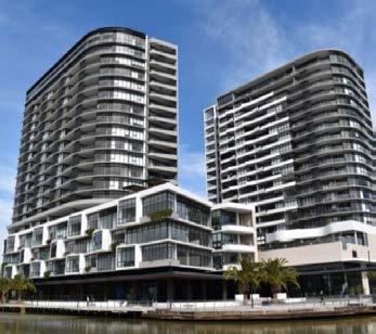
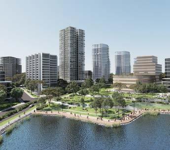
Showcasing Local Character
The Shire has a rich local culture and heritage and extensive open space network which can draw people to the precincts. A focus on the key landmarks throughout the precincts such as Bella Vista Farm Park, Castle Hill Showground, heritage items and riparian corridors will help to deliver spaces that the community are proud of and want to visit. Fostering a unique and distinguishable local character will be a key ingredient in building local connections and encouraging a strong sense of place.
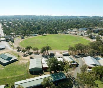
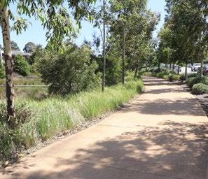
Integrating ‘Smart’ Technology

To ensure our Strategic Centres keep pace with technological advancements, the Precinct Plans will seek to integrate technology as they continue to evolve into competitive employment destinations in a bid to better support residents, workers and visitors.
Encouraging Sustainability
Sustainability will be a key driving factor in planning for future growth within Norwest over the next 20 years. Sustainable practices will be increased and prioritised within future developments, such as green walls and roofs, solar panels, lighter colour palettes, active movement corridors, stormwater management or utilising sustainable materials in the public domain. Green infrastructure will be expanded where possible. Natural environments, such as the Cattai Creek Corridor and Norwest Lake, will also be protected and maintained. These areas will also be enhanced where possible, so they can be enjoyed by residents, workers and visitors, providing places where they can socialise and relax.

The Hills Shire Council Draft Precinct Plan Norwest Strategic Centre 56
Norwest Lake and Surrounds (Source: Tome Visuals)
Public Domain (Source: Aspect Studio)
Castle Hill Showground
Smart City
Natural Environment
Esplanade, Solent Circuit

Natural Environment
3.4 Environment and Sustainability
The Norwest Strategic Centre offers a diverse array of environmental assets and features that are regularly used by the community. Spanning from the existing green links, public domain areas (such as Norwest Lake) and local creeks and tributaries, all the way through to major cultural attractions such as Bella Vista Farm Park, Castle Hill Showground and the Cattai Creek Corridor.
As Norwest continues to grow and evolve, further consideration must be given to sustainability and the environment. Sustainable practices must be embedded within any new developments, upgrades and improvements to the public domain. Examples of this may include stormwater management, active movement corridors, reducing urban heat or utilising sustainable materials in the public domain (for example solar panels and green buildings).
Given Norwest has historically been quite a car-dependent area, encouraging a shift towards public transportation will be a major way to improve sustainability. This could be through increasing the proportion of trips by public transport (capitalising on the arrival of the Metro), providing additional walking and cycling links, or reduced parking rates. Not only will this improve traffic flow on the road network, but this will also have substantial benefits for the environment, by reducing emissions and improving air quality. Implementing a high quality and well-connected public domain that focuses on active transport opportunities will be pivotal to achieving this.
Green links will be enhanced throughout the Norwest Strategic Centre, particularly north-south connections, providing high quality pedestrian and cycling connectivity within and surrounding the Centre. This will be through additional through-site links, along with a handful of pedestrian bridges over major vehicular thoroughfares (such as Norwest Boulevarde and Windsor Road).
The natural environment will also be enhanced. In particular, the Cattai Creek Corridor and Castle Hill Showground. These areas will undergo major transformations and are set to become key cultural and recreational hubs that will be highly valued and utilised by workers, residents and visitors for years to come.
Increasing the urban tree canopy cover within the Norwest Strategic Centre will be key to managing and mitigating urban heat. The urban tree canopy is a form of green infrastructure providing shade, which reduces ambient temperatures and mitigates urban heat. The urban heat island effect is where large amounts of hard and dark-coloured surfaces like roads and roofs cause localised warming.
It is envisaged that trees will be carefully planned throughout the Centre to increase the number of trees and plants within the urban area. Having regard for the urban context, this may be through the traditional street tree planting and landscaped areas, along with new and diverse habitat types such as green roofs and walls. This will serve a dual function in reducing urban heat and contributing to the public domain and appeal of Norwest.
This Precinct Plan envisages more trees along local streets, in parks and other public spaces, as well as on privately owned land where large areas of individual sites will be expected to accommodate soft landscaping and deep soil zones capable of supporting mature trees. It anticipates that more efficient glazing, shading, water capture and storage and passive solar heating design will be incorporated into future developments to reduce use of electricity and water.
The Hills Development Control Plan will be the key mechanism to achieve this vision, along with the Public Domain Plan. While development controls and objectives relating to sustainable design are already being rolled out in Station Precincts and in association with site-specific planning proposals, this Plan seeks to apply these policy settings more broadly across the Centre, in a consistent and streamlined manner.
Future DCP amendments will seek to achieve this by incorporating controls relating to the following:
• Green Star Ratings.
• NABERS energy and water ratings.
• Cool roofs, green walls and green roofs.
• Tree plantings in street verges.
• Photovoltaic facades and shading devices.
• Maximisation of natural light and cross ventilation.
• Reduced reliance on mechanical heating and cooling (through the use of eaves, awnings, good insulation and landscaping).
• Energy efficient light fittings and water fittings.
This is further discussed in Section 4.5 of this Precinct Plan.
The Hills Shire Council Draft Precinct Plan Norwest Strategic Centre 58
3.5 Evolution into a ‘Smart Norwest’
To ensure that Norwest keeps pace with technological advancements and strategies being employed in other major employment destinations, this Precinct Plan aims to facilitate discussion and feedback on the types of infrastructure that Council or the private sector, may wish to pursue over the coming years as Norwest grows and evolves.
Achieving a Smart Norwest will assist in cementing the Norwest Strategic Centre as a competitive employment destination that attracts and retains highly skilled talent. The delivery and use of evolving technologies can also improve operational efficiency, better meet the needs of our community, boost economic investment and improve sustainability measures.
What are Smart Places?
There is no global definition for smart places, as this can vary from place to place, tailored to the unique local situation at hand having consideration for the following:
• Converging technological advancements with place making.
• Helping business thrive and attract highly skilled talent.
• Fast and efficient movement of data, not just people.
• Fostering collaboration, innovation and creativity.
• Encouraging future education opportunities.
• Driving competitive advantage.
• Prioritising amenity, liveability and the overall user experience with people at the heart of decisions.
Given technology is quickly becoming a part of everyday life, this Precinct Plan presents potential options that Council or other key stakeholders may wish to pursue moving forward. These will be further explored in a future Council-led policy which will supplement Council’s Strategic Centre Precinct Plans and guide the delivery and use of evolving technologies in the urban environment to provide better connected and informed communities.
It is intended that this policy will serve as an overarching guiding document that will assist in establishing partnerships between Local, State and Federal Governments, along with the private sector, to maximise investments in smart initiatives.
Early planning and consideration of how to integrate these technologies during master planning will make it easier and more cost effective for the private sector to deliver these technologies as they become more widespread. Ensuring the right digital plumbing (being the necessary digital infrastructure provisions) is in place early in the process will be critical in digitally futureproofing Norwest, to ensure opportunities to integrate smart technologies within developments remains achievable and viable for Developers moving forward.
This is further discussed in Sections 4, 5 and 6 of this Precinct Plan.
Case Study: Smart Mobility, City of Newcastle
The City of Newcastle is striving to create a city with connected technology-enabled infrastructure. This idea of ‘smart mobility’ focuses on how people move around the city and use technology to support transport network design/function and to promote active and multi-modal travel.
City of Newcastle will have a lead role in various areas, including the deployment of traffic monitoring systems, collecting cycling data, delivering wayfinding systems and developing a strategy for transitioning Council’s fleet to electric vehicles and providing E-bikes for staff for work trips.
City of Newcastle will also uphold key supportive, advocative and collaborative roles in achieving a smart city. It is anticipated that it will collaborate with key stakeholders (such as developers and research partners) to pilot new programs and test new mobility technologies.
It will also investigate opportunities to integrate technologies into Council’s everyday operations. This includes investigating opportunities to include rideshare (e.g. GoGet) as part of Council’s fleet to reduce fleet costs and vehicle use.
- LSPS Action 22.1

59
Council will prepare and endorse a policy to guide the delivery and use of evolving technologies in the urban environment.
Easy Park App (Source: CIty of Newcastle)
Governance
Collaboration across government, industry and business.
• Develop a series of smart places training programs to build awareness, understanding and confidence in the use of data and digital technologies.
• Work with local businesses to integrate smart technologies that support economic recovery and sustainability.
• QR codes for planning application notices and other uses.
• Virtual and augmented reality apps that can enable citizens to see and experience proposed developments and projects to inform their feedback.
• Pedestrian counters at stations to monitor pedestrian flows.
Living
Connects people and uses technology-enabled infrastructure.
• Outdoor benches which allow residents/visitors to charge their phones/devices.
• Smart signage which provide live travel information to pedestrians/road users.
• Digital touch screens which help people find their way around and find out what’s on.
• Delivery of energy efficient and green buildings.
• Provision of electric vehicle charging points.
Economy
Digital infrastructure to support business growth, investment and sustainability.
• Investment in co-working spaces to support workers.
• Outdoor ‘work hubs’ which allow office workers or students to work outdoors, connect their laptops and connect to free Wi-Fi.
• Roll-out of 5G network to enable high speed internet and data.
• High-speed Wi-Fi throughout the public realm in Strategic Centres.
• Roll out of underground fibre optic cabling.
• Delivery of future education opportunities.
People
A strong and connected community using technology that enables everyone to participate.
• Develop an app that allows users to pay, start, stop or extend their parking with their phone.
• Install sensors in the streets of the Strategic Centres which help guide drivers to the best available parking near a destination.
• Sensor-based interactive lighting to create a dynamic public domain and provide entertainment and bring innovation to the streets.
• CCTV to improve safety after dark and encourage greater numbers of businesses and creative organisations to participate in the night-time economy.
• Interactive play features in our local parks (e.g. sensor based interactive lighting and water features).
Environment
Technology and innovation to improve the environment
• Bin sensors to help improve waste management services.
• Council vehicles transitioning to electric vehicles.
• Provision of e-bikes to support sustainable transport options.
• Energy harvesting i.e. solar panels and wind generators as alternative energy sources for power.
• Sensors by plants and trees that send alerts when public gardens need to be watered.
• Access to environmental monitoring data to help determine environmental quality, such as soil moisture, air quality and pollution monitoring.
*Note: this page builds on the principles identified in Council’s LSPS and presents a list of potential indicative options that stakeholders may wish to consider moving forward. It does not commit Council or other stakeholders to delivering the abovementioned items, it just presents potential options to facilitate discussions moving forward.
The Hills Shire Council Draft Precinct Plan Norwest Strategic Centre 60
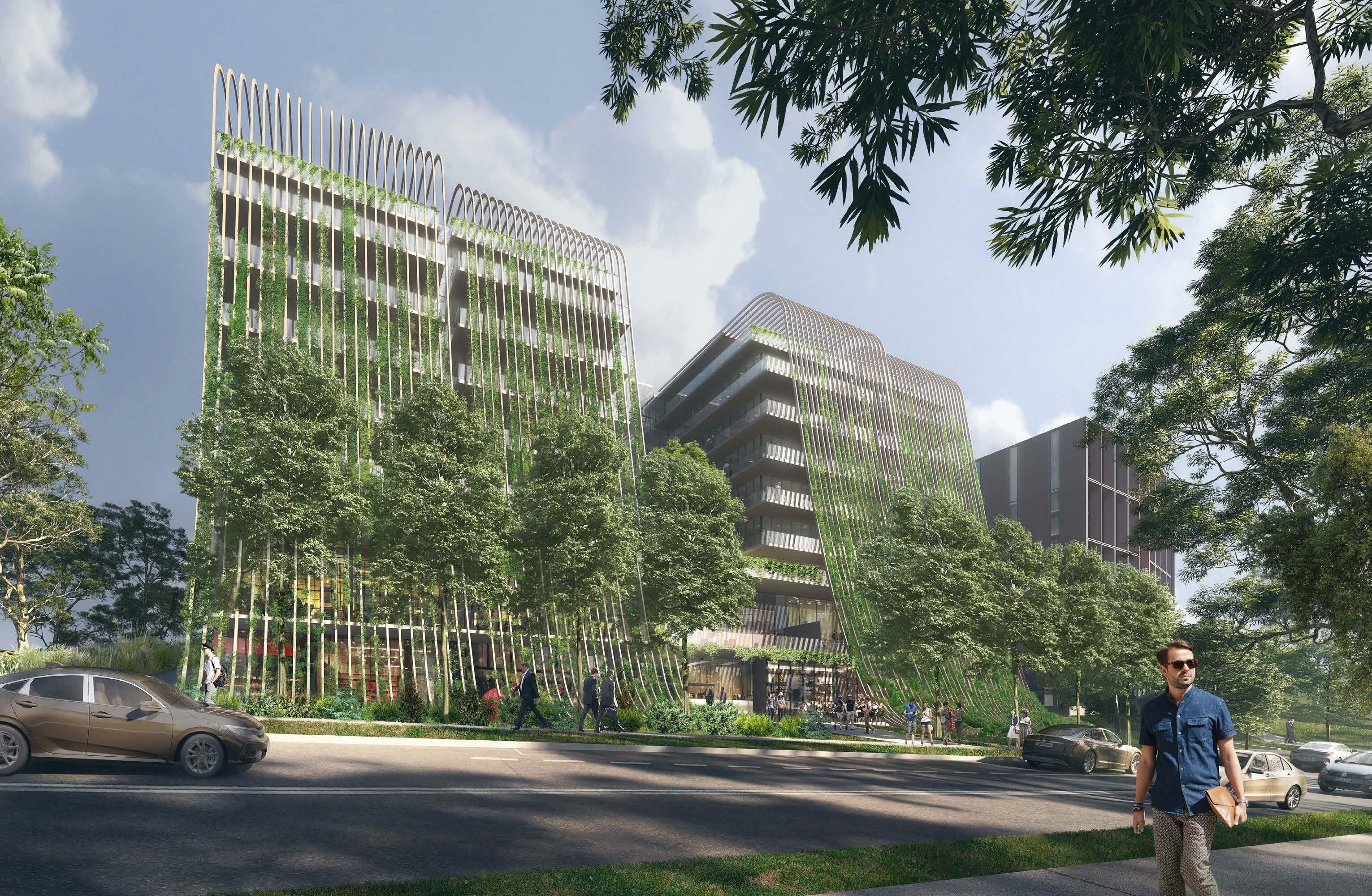 Artist Impression of 21-23 Lexington Drive (Source: Koichi Takada Architects)
Executive Summary 01 Norwest Innovation 0 4
4.1 Context
The Norwest Innovation Precinct generally extends from Memorial Avenue to the north, Circa Commercial Precinct to the south, Old Windsor Road to the west and Strangers Creek, Fairway Drive and from Westwood Way to the east. The Precinct is bisected by Norwest Boulevarde and Elizabeth Macarthur Creek, which run east-west and north-south through the Precinct, respectively.
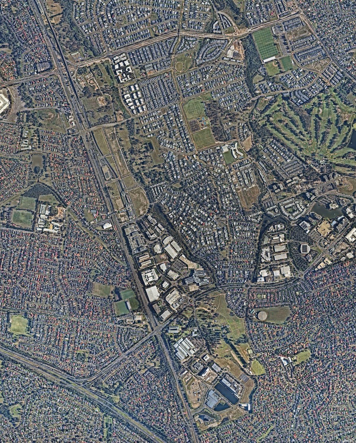
It has an area of approximately 372 hectares and contains around 1,430 dwellings (2016 ABS Census) and 14,520 jobs (2016 Travel Zone Data).
The south-western portion of the Precinct primarily comprises employment land (including the Bella Vista Employment and Circa Commercial Areas). Currently, this area contains campus style office and industrial buildings, generally up to 4-5 storeys in height. The Precinct currently has a strong health focus with major tenants including Resmed and the Norwest Private Hospital. Bella Vista Farm lies immediately east of the Circa Commercial Precinct, providing an important recreation and leisure space for residents and workers.
The north-west of the Precinct primarily comprises the Bella Vista Station Precinct, with large areas of vacant land between Old Windsor Road and Elizabeth Macarthur Creek. This land was recently up-zoned to facilitate high density residential and commercial development with a new local centre around Bella Vista Station.
The remaining areas to the north-east of the Precinct contain low density dwellings with some pockets of medium density housing, as well as apartments near the future Hector Court Local Centre. Additionally, there are some existing Seniors Living developments south of Memorial Avenue. This area contains Balmoral Road Reserve - a premier sporting facility and active recreation space for residents.
A substantial amount of strategic planning work (including planning control amendments) has already been completed for this Precinct, along with the associated contributions planning to secure the necessary infrastructure requirements to support future growth.

63
Figure 32. Locality Map (Source: Nearmap Aerial Imagery, copyright Nearmap)
Bella Vista Public School
Bella Vista Farm Park
Norwest Private Hospital
Quest Hotel Circa Retail
Bella Vista Station
Baptist Care Aged Care and Retirement Village
Bella Vista Employment Area
Circa Precinct
Balmoral Road Reserve
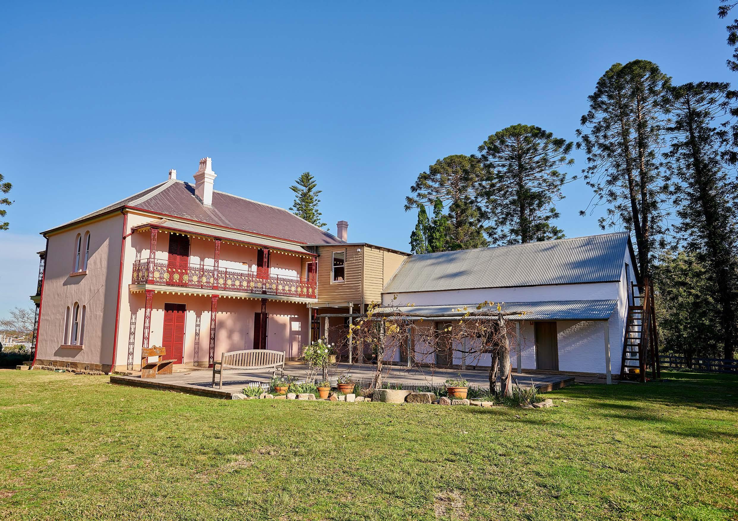 Bella Vista Farm House and Garden.
4.2 Key Influences
4.2.1 Planning Processes to Date
1992
Norwest Association –Master Scheme
Land within the Norwest Business Park is subject to a general planning scheme conceived and jointly operated by Council and the Norwest Association.
Primarily, the Master Scheme has provided guidance on the compliance with development standards (such as those contained within the Local Environmental Plan and Development Control Plan). It also outlines specific requirements regarding the following:
• Membership of the Norwest Association Limited.
• Restrictions and positive covenants imposed by Council relating to (but not limited to) compliance with the Master Scheme, membership requirements, involvement of the Planning and Design Review Panel and improvement requirements.
• Deeds relating to the development and ongoing maintenance of the Norwest Business Park.
• Agreement regarding the sale of individual lots within the Norwest Business Park.
• Specific development guidelines for the Estate regarding landscaping, services, facilities, site standards, car parking, building design, landscaping, engineering, signage and lighting.
2006 2017 2021-2023
Balmoral Road Release Area
The Balmoral Road Release Area was rezoned by Council in September 2006 to accommodate a variety of land uses including residential, retail, open space and trunk drainage. It was intended to deliver approximately 6,000 dwellings and was earmarked as a key greenfield area that would facilitate a substantial proportion of lower density residential growth within The Hills Shire. Development activity continues to occur throughout the Release Area in accordance with planned outcomes.
Development Control Plan
The Development Control Plan includes controls to regulate future built form and ensure high quality development outcomes that reflect the intended character for the Precinct as a highly liveable Release Area.
Contributions Plan
This Contributions Plan originally came into effect on 26 September 2006. It identifies approximately $201 million of infrastructure works and land acquisition costs to meet the increased infrastructure demand within the local community. It was most recently reviewed in 2020.
Planned Precinct Program
The Bella Vista Station Precinct was rezoned by the Department of Planning and Environment as part of its Planned Precincts Program in December 2017.
The Bella Vista Precinct is expected to provide capacity for up to 4,200 additional homes over the next twenty years. Bella Vista is also earmarked to provide 9,400 new jobs, transforming the area around Bella Vista Metro Station into a vibrant employment destination.
Section 7.12 Contributions Plan – Norwest Innovation
Council prepared this Contributions Plan which levies development within the Bella Vista Employment Area and Circa Precinct for the delivery of $56.4 million worth of infrastructure to support future growth. It came into force in November 2021.
Planning Processes to Date
Contributions Plan
No. 18 – Bella Vista and Kellyville Station Precincts
This Plan came into force in 2022. It identifies approximately $150 million of local infrastructure to be provided within and surrounding the Bella Vista and Kellyville Station Precincts, encompassing the areas rezoned by the State Government in 2017 through the Planned Precinct Program.
Development Control Plan
The DCP will guide future development outcomes on land within the Bella Vista and Kellyville Station Precincts that was rezoned by the Government in 2017 through the Planned Precinct Program, excluding the areas currently subject to a State Significant Development Application. The DCP seeks to ensure high quality development outcomes that reflect the intended character for the Station Precincts. The DCP was adopted by Council in early 2023 and is now in force.
65
Table 9.
*Note: This Section should be read in conjunction with the strategic planning context discussed in Section 2 of this Precinct Plan, which also discusses strategies such as the Greater Sydney Region Plan, Central City District Plan, North West Rail Link Corridor Strategy, Hills Corridor Strategy, Council’s Local Strategic Planning Statement (and supporting strategies), plus others. This Section identifies additional planning processes and considerations specifically relevant to the Norwest Innovation Precinct.
4.2.2 Bella Vista Farm Park
Bella Vista Farm is an 18.5 hectare site located near Old Windsor Road and Norwest Boulevarde. It is an intact historic farm complex of ‘exceptional’ heritage significance to The Hills Shire and NSW. Established in the late 1700s, the complex features a two storey homestead, Bunya Pine lined driveway and various farm outbuildings.
The surrounding grounds are open to the public and feature barbeque facilities, picnic tables, walking tracks and toilets. The farm provides a rare surviving link between the community today, the first European settlers and some of Australia’s earliest rural development.
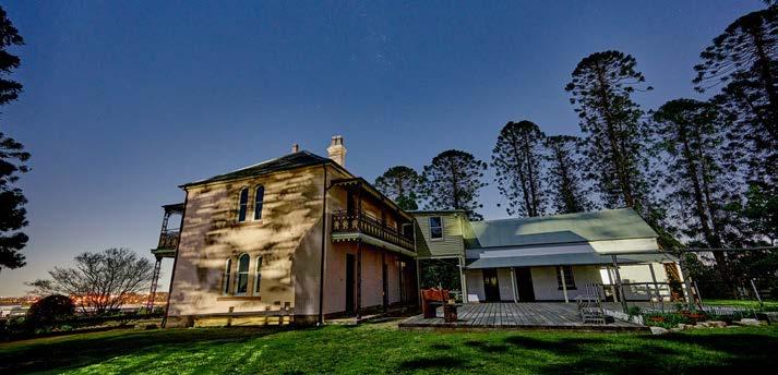
The site is covered by the Bella Vista Farm Park Plan of Management (PoM). The PoM was prepared by Spackman & Mossop and was adopted by The Hills Shire Council in December 2007. The Plan aims to facilitate the restoration and long-term conservation of the property and provide for a range of complementary uses.
4.2.4 Planning Proposals
In addition to the NSW Government’s Planned Precinct Program, two (2) planning proposals within the Norwest Innovation Precinct were recently finalised, including:
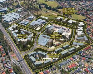
1. Circa Commercial Precinct
In 2015, Mulpha Norwest Pty Ltd lodged a planning proposal for the Circa Commercial Precinct which sought to increase the Floor Space Ratio to a range of between 1.2:1 and 3:1 and increase the Maximum Building Height controls to enable buildings of between 7 - 15 storeys in height. A substantial amount of technical work and planning work underpinned this proposal to facilitate, a high density commercial development including a range of commercial offices, café and restaurant developments. The proposal was finalised in 2021.
2. 21-23 Lexington Drive
The planning proposal for 21-23 Lexington Drive increased the maximum floor space ratio applicable to the site from 2:1 to 2.7:1 to facilitate the conversion of two floors of above ground car parking to commercial floor space, resulting in approximately 284 additional jobs. The proposal was finalised in 2022.
4.2.3 State Significant Development Application
In 2019, Landcom (on behalf of Sydney Metro) lodged State Significant Development Applications (SSDA) for NSW Government-owned land within the Bella Vista and Kellyville Station Precincts. They were approved by State Government in late-2022.
The Bella Vista SSDA is bound by Memorial Avenue to the north, Old Windsor Road to the west, Elizabeth Macarthur Creek to the east and Celebration Drive to the south and forms part of the Norwest Innovation Precinct.
The SSDAs sought consent for a concept proposal for new residential, retail and commercial development near the Bella Vista Metro Station. They include concept master plans (including allocation of uses and gross floor area across the Precincts), Urban Design Guidelines (against which future applications for physical works would be assessed) and Stage 1 subdivision of lots which are identified as areas of public domain. The application will facilitate up to 3,800 residential dwellings and approximately 7,000 new jobs.
Metro Station
Metro Line (Underground Tunnel)

Norwest Innovation Precinct
Approved State Significant Development Application
Finalised Planning Proposal
The Hills Shire Council Draft Precinct Plan Norwest Strategic Centre 66
1 2 2 1 OLD WIINDSOR ROAD MERIDIANPL LEXINGTON DR NORWESTBLVD ELIZABETH MACARTHUR DR ELIZ.MACARTHURDR NORBRIKDR NORBRIKDR CELEBRATIONDR CELEBRATIONDR UNAIPONAV BALMORALRD MEMORIALAV FLOREYAV IRVINEPL
Figure 33. Finalised Planning Proposals and State Significant Development Application
Bella Vista Farm Park
Indicative Concept Circa Precinct (Source: Mulpha Norwest)
Indicative Concept 21-23 Lexington Drive (Source: Capital Corporation)
4.2.5 Key Constraints and Challenges
Traffic Movement
There are limited access points into and out of the Precinct, particularly areas accessed via Old Windsor Road, Norwest Boulevarde and Memorial Avenue, which are highly congested in peak hours. Elizabeth Macarthur Drive and Lexington Drive are single lane carriageways with narrow verges, which will suffer increased pressure as the employment area grows.
Permeability
and Walkability
There is currently poor walkability due to the large sites with minimal through-site pedestrian connections and major natural and road barriers (Norwest Boulevarde and Elizabeth Macarthur Creek).
Heritage, Views and Vistas
The Bella Vista Homestead Complex is a state heritage conservation area of environmental and cultural significance. Development in the vicinity of this conservation area will need to preserve and complement the significance and curtilage of this item. Protecting views and vistas will also be another key consideration for surrounding development given the item’s prominent hilltop location. This was carefully considered in consultation with State Government as part of the Circa Commercial Precinct Planning Proposal.
Land Tenure and Rail Corridor
Existing strata and community title arrangements will impact on the uptake of redevelopment. Redevelopment must also consider the underground rail tunnel, as it limits the ability for some sites to undertake any significant excavation or basement carparks.
Age of Existing Housing Stock
There are various pockets of well-established residential areas (generally located east of Elizabeth Macarthur Creek) which are unlikely to turn over predominately due to the age and high quality of the building stock and fragmented ownership.
Stormwater and Flooding
Elizabeth Macarthur Creek provides a major drainage and recreation function. Surrounding properties are subject to flood related development controls. Overland flow paths must be appropriately considered and managed as part of future redevelopment.
Bella Vista Employment Height Control Mismatch
Floor Space Ratio amendments implemented in the Bella Vista Employment Area by the NSW Government as part of the 2017 Planned Precinct Program are largely unachievable within the current height control. This mismatch in planning controls limits redevelopment potential and the ability to achieve high quality built form.
Metro Station
Metro Line (Underground Tunnel)
Norwest Innovation Precinct
Heritage Item
Height Control Mismatch
Recent Development Activity
Major Roads and Barriers

Strata Development
Precinct View
Heritage View Corridor
Lack of Pedestrian Connectivity
Creek / Overland Flowpath
67
OLD WIINDSOR ROAD MERIDIANPL LEXINGTON DR NORWESTBLVD ELIZABETH MACARTHUR DR ELIZ.MACARTHURDR NORBRIKDR NORBRIK NORBRIKDR DR CELEBRATIONDR CELEBRATIONDR UNAIPONAV BALMORALRD MEMORIALAV FLOREYAV IRVINEPL
Figure 34. Constraints and Challenges
4.2.6 Key Opportunities
Employment Growth
The Circa Commercial Preceinct and Bella Vista Station Precinct presents a short term opportunity for high quality commercial development to provide employment opportunities suited to the needs and skillsets of local residents.
Housing Delivery and Diversity
Large vacant landholdings within the Bella Vista Station Precinct provide the opportunity for high quality and master planned residential developments. Future development will feature a variety of housing types to suit different needs, particularly the Shire’s strong family demographic. Having consideration for transit-oriented development principles, higher density residential development should be concentrated in areas closer to the Metro Station and supporting services with lower density development within the peripheries of the Precinct.
Traffic Upgrades
There are opportunities to provide key road and intersection upgrades, particularly within the employment area and the Bella Vista Station Precinct, to support future growth. Such upgrades include the widening of Elizabeth Macarthur Drive and Lexington Drive, intersection upgrades at key junctions with the arterial road network and a new cross-creek vehicular connection at Hodges Road.
Active Transport Links
As part of future redevelopment there are opportunities to provide active transport connections through large landholdings as well as across major barriers such as Norwest Boulevarde and Elizabeth Macarthur Creek. Providing these improvements will reduce travel time between key destinations and contribute to a more attractive and walkable Precinct.
Heritage,
Views and Vistas
The topography may provide opportunities to capitalise on significant views including those to and from the Bella Vista Farm Homestead Complex.
Public Domain
There are potential opportunities to deliver other public domain improvements including urban plazas with high quality embellishments providing central hubs of activity at key locations.
Metro Station
Metro Line (Underground Tunnel)
Norwest Innovation Precinct
Diverse Housing Opportunities
Embellish Elizabeth Macarthur Creek Corridor
Bella Vista Farm
High Density Commercial Offices
Proposed School
Provide / Improve Open Space
Community Facility
Resolve Height Control Mismatch
Proposed Pedestrian Bridge
Intersection Improvement
Urban Plaza
New Road
Road Upgrade
Shared Pedestrian / Cycle Link (Existing)

Shared Pedestrian / Cycle Link (New)
Pedestria Link (New)
The Hills Shire Council Draft Precinct Plan Norwest Strategic Centre 68
OLD WIINDSOR ROAD MERIDIANPL LEXINGTON DR NORWESTBLVD ELIZABETH MACARTHUR DR ELIZ.MACARTHURDR NORBRIKDR NORBRIKDR CELEBRATIONDR CELEBRATIONDR UNAIPONAV BALMORALRD MEMORIALAV FLOREYAV IRVINEPL
Figure 35. Opportunities
I
4.3 Focus Areas
A number of “Focus Areas” have been identified for the Precinct. These build on the planning work completed to date and guide the achievement of the vision for the Precinct. These outcomes are reflected in the vision and structure plan in Section 4.4 of this Precinct Plan.
Metro Station
Metro Line (Underground)
Norwest Innovation Precinct
1 2 3 4 5
Preservation of View Corridors associated with Bella Vista Farm
Height Control Mismatch Along Lexington Drive
Bella Vista Community Facility
ResMed
Circa Retail Shopping Centre
69
Figure 36. Focus Areas
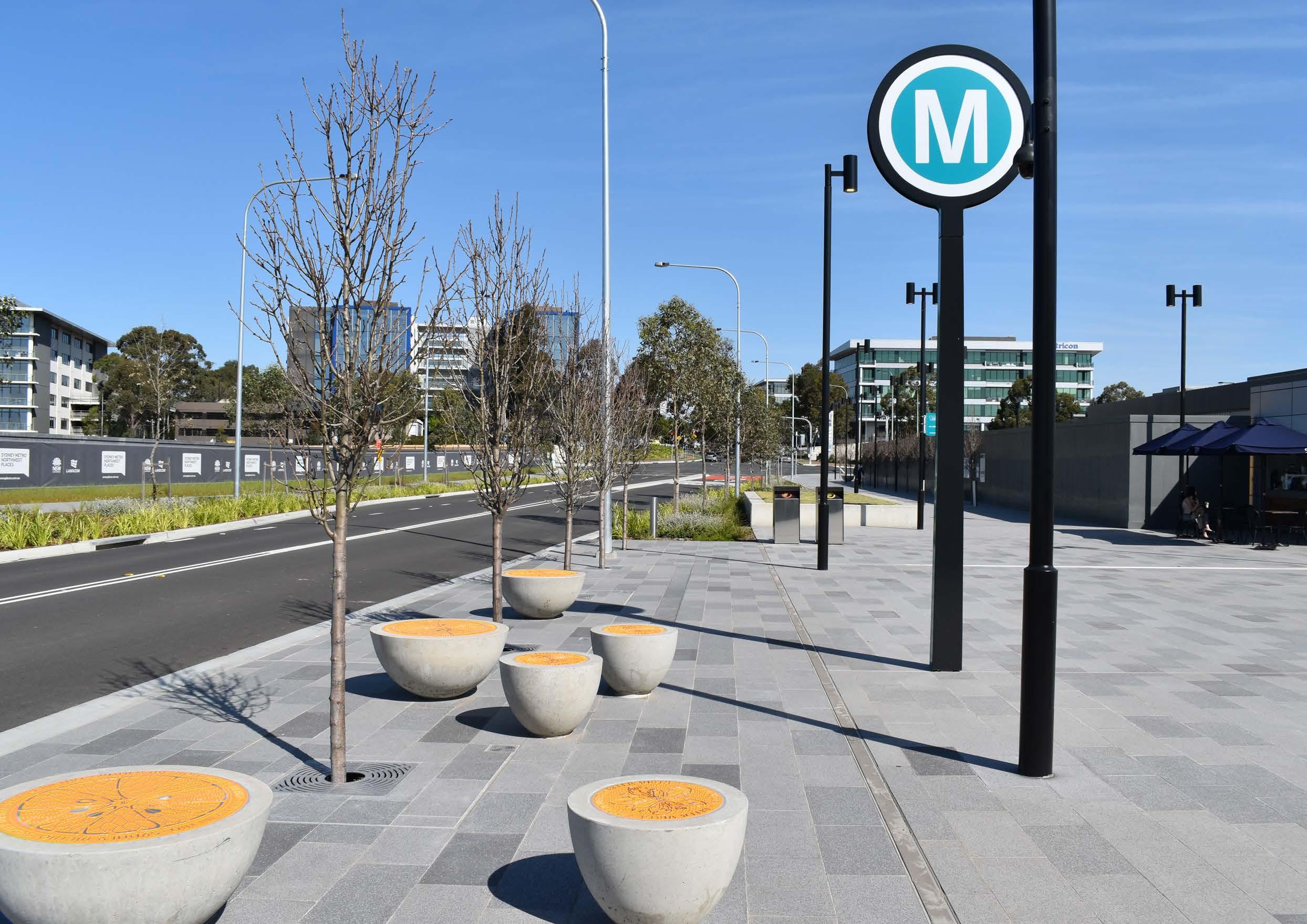 Bella Vista Metro Station and Surrounds.
4.3.1 Focus Area 1 - Preservation of View Corridors associated with Bella Vista Farm
Given the extent of growth identified across the Strategic Centre, some loss of existing views to and from the Bella Vista Farm will be unavoidable. A review of potential existing views was undertaken to identify opportunities for view retention and where the loss of some views may be reasonable.

There may also be potential to preserve additional views as part of the redevelopment of 1-11 Elizabeth MacArthur Drive (the RedMed Focus Area). Future buildings on this site will need to be carefully designed and sited to preserve key view lines to the mountains. Future outcomes for the ResMed Site are discussed in Focus Area 4 (refer Section 4.3.4 of this Precinct Plan).
The remaining view corridors to be preserved include:
• District views to the north
• District views to the east
• District views to the south-east
• Views into the site from Old Windsor Road (west)
• Views into the site from Norwest Boulevarde (north-west)
• Views into the site from the intersection of Norwest Boulevarde and Westwood Way
• Distant views to the site from the Pearce Family Cemetery (south)
• Views to Bunya Pines from ridgetops at Windsor Road (east)
Potential mechanisms to preserve these view corridors will be explored through future amendments to The Hills DCP 2012, as well as any future planning proposal (or development application) for land within the vicinity of Bella Vista Farm. Any further amendments to building heights within the Norwest Innovation Precinct will be undertaken in consultation with State Government.
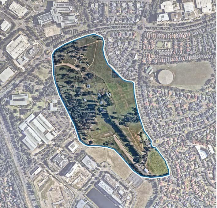
Land along Lexington Drive within the Bella Vista Employment Area is currently subject to a building height restriction of RL116. This height control was historically applied to areas surrounding Bella Vista Farm Park with the intention of achieving consistent built form (height plane) outcomes.
Southerly views have been re-interpreted in consultation with State Government as part of the Circa Commercial Planning Proposal to facilitate high density commercial developments within the Circa Precinct. The preservation of shorter range southerly views have been identified as a more feasible approach for future high density development within the Circa Commercial Precinct. Additional urban design controls have been established within the site specific Development Control Plan (DCP) Section for the Circa Precinct to preserve the culturally significant view corridor between the Bunya Pines and Pearce Family Cemetery.
71
Figure 37. Focus Area 1 (Source: Nearmap Aerial Imagery, copyright Nearmap)
Bella Vista Farm
Event at Bella Vista Farm
4.3.2 Focus Area 2Height Control Mismatch along Lexington Drive
The LEP contains a mismatch between the floor space ratio and building height controls for the Bella Vista Employment Area identified in the figure below.
Currently, a height restriction of RL116 applies to most land along Lexington Drive (outlined in Figure 38), which operates as a maximum height plane. This means that the maximum permitted height on each site varies depending on the height of the natural ground above sea level. Currently the ground RL within the Precinct ranges from RL75 near Celebration Drive to RL100 adjoining Norwest Boulevarde. This enables building heights of around 41m (9-10 storeys) near Celebration Drive and only 16m (3-4 storeys) near Norwest Boulevarde.
The floor space ratio applying to this land was increased from 1:1 to 2:1 in November 2017 as part of the State Government’s Planned Precinct Program. However, the height restriction of RL116 remained unchanged. Typically, a Floor Space Ratio of 2:1 would facilitate heights of up to 8-10 storeys. Land within the southern portion of the Precinct, near Irvine Place and Woolworths Way are therefore unlikely to be able to achieve the applicable Floor Space Ratio and the intended development outcome under the existing height control. This mismatch will also result in poor built form outcomes as Developers are incentivised to compress the floor area proposed as part of future development downwards to fit within the existing height plane control.
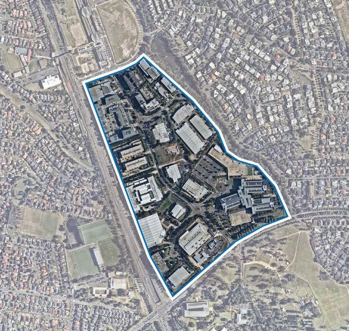
This will likely lead to outcomes such as:
• Non-compliance with setbacks.
• Reduced building separation.
• Bulky buildings with large floor plates.
• Inadequate landscaped open space and deep soil areas.


• Excessive overshadowing of open space and adjoining sites.
The sites that are most affected by the mismatch are located to the southern end of Lexington Drive (close to Norwest Boulevarde) and are generally non-strata subdivided, which means that these sites would have the greatest potential to redevelop if this issue was rectified.
Subject to future detailed analysis, there is opportunity to correct the mismatch and enable heights in the order of 6-10 storeys. This is intended to be addressed as part of a future Council-initiated planning proposal and associated amendments to The Hills Development Control Plan (DCP) 2012.
Importantly, this would not increase the permissible yield on this land (as established by the existing floor space ratio control). Rather it would facilitate more desirable built form outcomes compared to what could be achieved under the current controls.
The Hills Shire Council Draft Precinct Plan Norwest Strategic Centre 72
Figure 38. Height Control Mismatch along Lexington Drive (Source: Nearmap Aerial Imagery, copyright Nearmap).
Figure 39. Example of Height Control Mismatch (Left) and Example of Potential Height Control Correction (right)
Metro Station
Metro Line (Underground Tunnel)
Focus Area
Low Density Residential
Medium Density Residential
Local Centre / Retail Areas
High Density Commercial Offices
Open Space
Drainage Land
Special Use
Intersection
Urban Plaza
T
4.3.4 Focus Area 4 - ResMed (1-11 Elizabeth Macarthur Drive)
ResMed is a large 12 hectare site under single ownership. Given its strategic location as the western gateway site, coupled with its size and ownership pattern, it has great potential to redevelop for future high density commercial offices in an exemplary built form. Employment outcomes at this location will provide a seamless transition from the Bella Vista Employment Area through to the Circa Commercial Precinct.
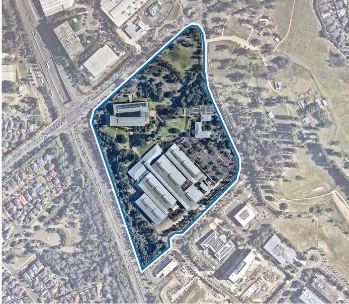
This Focus Area is subject to unique characteristics which will need to be carefully addressed. Any redevelopment of this site will require a future landowner initiated planning proposal to amend the Local Environmental Plan. Associated amendments to the Development Control Plan will also be required to establish a suite of development controls to guide redevelopment. These controls would include height distribution, setbacks and pedestrian links.
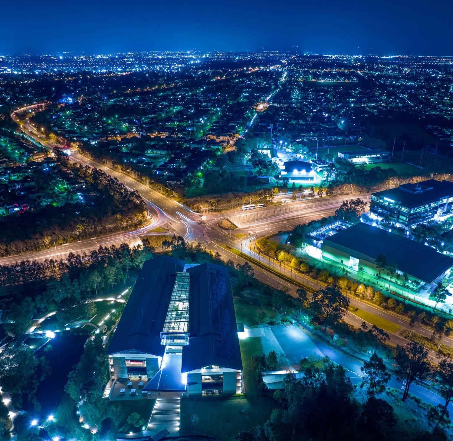
The Hills Shire Council Draft Precinct Plan Norwest Strategic Centre 74
Figure 42. Resmed and Surrounds (Source: Nearmap Aerial Imagery, copyright Nearmap)
Aerial View of ResMed and Surrounds
Various design principles have been developed to guide future outcomes for the Focus Area, as follows:
Land Uses
• This Focus Area is envisaged to accommodate high density commercial office development.
• Active ground floor uses will be encouraged to facilitate vibrant streets and interface.
Built Form
• Building heights will range from 6-10 storeys.
• Taller building elements must be strategically sited to preserve view lines to and from Bella Vista Farm, as well as Pearce Family Cemetery.
• Buildings should be carefully sited to avoid overland flowpaths.
• Building designs will have regard to the Precinct’s unique topography.
Public Domain and Open Space
• The public domain and interface activities will be active, attractive, safe, functional and accessible for workers.
Focus Area
High Density Commercial Offices
Open Space
Intersection
Pedestrian Bridge
Roundabout
Pedestrian Link
75
T
Focus Area
Local Centre / Retail Areas
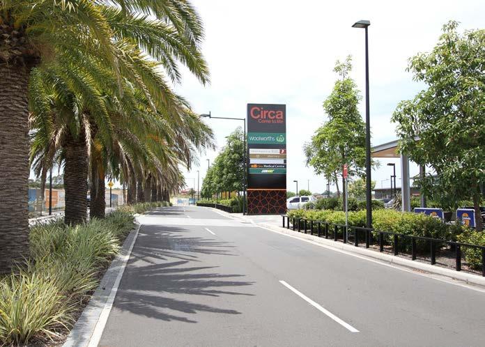
High Density Commercial Offices
Special Use
Intersection
Urban Plaza
Seniors Housing Pedestrian Link
The Hills Shire Council Draft Precinct Plan Norwest Strategic Centre 76
Circa Retail and Surrounds
T
Figure 44. Circa Retail Shopping Centre (Source: Nearmap Aerial Imagery, copyright Nearmap)
Figure 45. Indicative Layout Plan
4.4 Vision and Structure Plan
residential aged care home and a range of facilities to meet most of the daily needs of residents.
The site is ideally suited to retirement living given the growing aged population base within the Hills Shire. This is coupled with the area's attraction to many young families, thus creating an opportunity and appeal for grand-parents to follow their children and grandchildren to an expanding employment precinct.
The Norwest Innovation Precinct will be a busy health and innovation precinct, anchored by Bella Vista Metro Station, Norwest Private Hospital, major corporations and contemporary place-based offices. It will be activated by improved public spaces for gathering, socialising and sharing ideas. It will feature high density commercial buildings varying in height from 4 – 21 storeys. Taller buildings will be carefully located to preserve key view lines to and from Bella Vista Farm and will be characterised by landscaped surrounds and active, vibrant ground floor uses.
Land north of the Bella Vista Employment Area is envisaged to transform into an attractive and well-connected neighbourhood that provides a diverse range of housing opportunities, supported by everyday services at the local centre. This will taper off into the well-established Balmoral Road Release Area, which features low and medium density housing opportunities for our family dominated demographic.
Bella Vista Farm will be a key drawcard for the Precinct – a major cultural destination – known for its rich history.
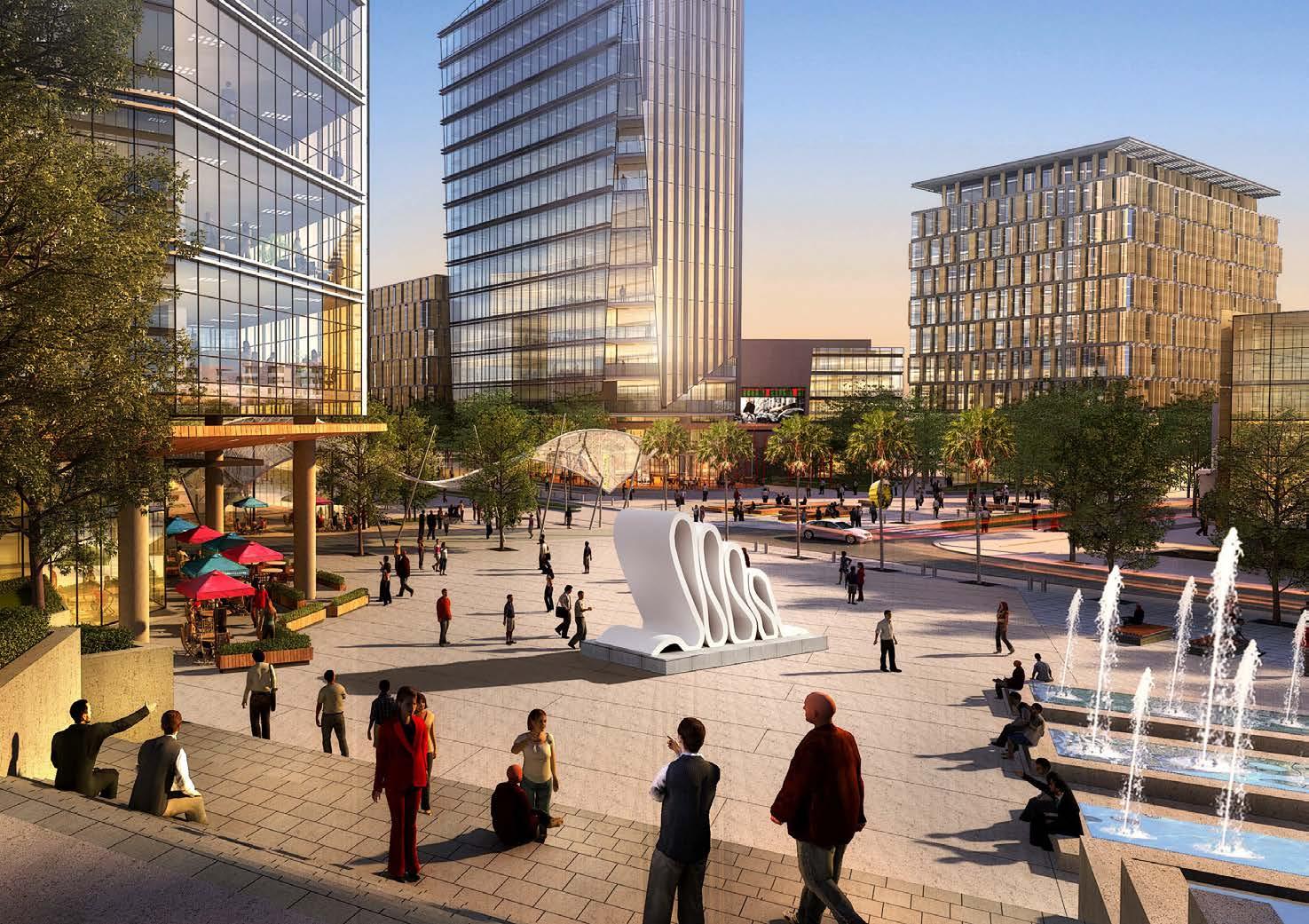
While primarily a residential use, this precinct will deliver significant employment generation through the implementation of the Aveo Group ‘continuum of care’ model in both independent housing and aged care facilities.
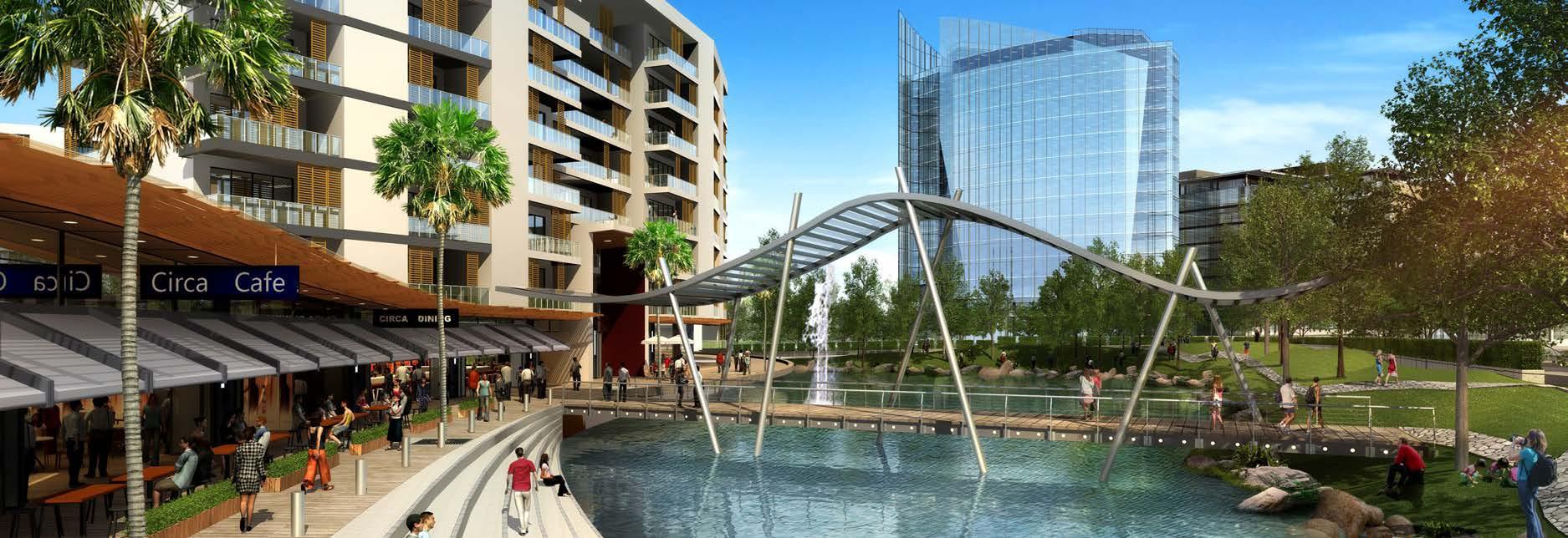
77
24
NORWEST BUSINESS PARK CIRCA DEVELOPMENT CONCEPT
Figure 4.12 Artist's Impression of pedestrian environment at the Lakeside
shopping and healthcare. The further development of additional
Figure 4.11 Massing Key Plan
facilities in the Core Precinct will only serve to increase the desirability of the retirement village.
Artist Impression of Public Domain at Circa Precinct (Source: DEM)
Artist Impression of Circa Precinct (Source: DEM)
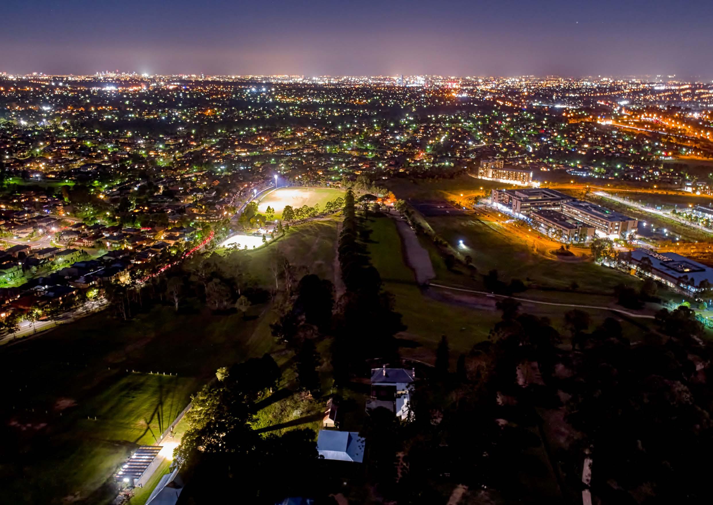 Aerial View Towards Bella Vista Oval and Circa Precinct.
Connectivity
• Road and Intersection Upgrades: New local roads are proposed within the developable Government land north of Celebration Drive and surrounding Bella Vista Metro Station. Upgrades are proposed within the existing employment area along Lexington Drive and Elizabeth Macarthur Drive, together with key intersection enhancements to improve public domain and traffic flow.
• Pedestrian Connections: Pedestrian through site links will improve walkability by breaking up large blocks and reducing walking distances. Pedestrian bridges and shared paths will also be delivered along major roads, within the Elizabeth Macarthur Creek Corridor and over Norwest Boulevarde to encourage walking and cycling and to improve pedestrian movement.
• Elizabeth Macarthur Creek Corridor: Elizabeth Macarthur Creek Corridor will be expanded and enhanced for the existing and future community. This Corridor will include pedestrian bicycle paths, parks and pedestrian bridges.
Metro Station
Metro Line (Underground Tunnel)
Norwest Innovation Precinct
Intersection
Pedestrian Bridge
Roundabout
Road Upgrade
New Road
Existing Cycleway / Shared Path
Proposed Cycleway / Shared Path
Pedestrian Link
79 OLD WIINDSOR ROAD MERIDIANPL LEXINGTON DR NORWESTBLVD ELIZABETH MACARTHUR DR ELIZ.MACARTHURDR NORBRIKDR NORBRIK NORBRIKDR DR CELEBRATIONDR UNAIPONAV BALMORALRD MEMORIALAV FLOREYAV IRVINEPL
T
Land Use
• High Density Commercial Areas: New commercial development will be provided at various locations within this Precinct, providing opportunities for taller office style buildings over varying heights, with setbacks that incorporate quality landscaping and public domain improvements.
• High Density Residential Area: Land north of Bella Vista Employment Area will primarily accommodate high density residential apartment buildings. It will include local parks, a district park and a new primary school.
• Bella Vista Local Centre: The new local centre will be active and concentrated around Bella Vista Metro Station, as well as a future community facility and urban plaza. It will incorporate high density apartments along Celebration Drive with high density commercial office developments and a new community facility along Mawson Avenue. It will provide a range of shops, cafes, restaurants and local services to meet the needs of residents and workers.
• Circa Retail Area: The retail area will complement and support future commercial development and will accommodate a mix of uses including a range of shops, cafes and restaurants to provide for the convenience needs of the growing workforce and creating a pleasant environment for workers to gather and socialise. It will benefit from increased demand and patronage as surrounding vacant landholdings develop.
• Seniors Housing: The existing seniors housing area will remain at the southern periphery of the Circa Commercial Precinct.
Metro Station
Metro Line (Underground Tunnel)
Norwest Innovation Precinct
Proposed Road
Local Centre / Retail Areas
Low Density Residential Medium Density Residential High Density Residential High Density Commercial Offices
Open Space
Drainage Land
Special Use
Urban Plaza
Seniors Housing
The Hills Shire Council Draft Precinct Plan Norwest Strategic Centre 80 OLD WIINDSOR ROAD MERIDIANPL LEXINGTON DR NORWESTBLVD ELIZABETH MACARTHUR DR ELIZ.MACARTHURDR NORBRIKDR NORBRIK NORBRIKDR DR CELEBRATIONDR UNAIPONAV BALMORALRD MEMORIALAV FLOREYAV IRVINEPL
Figure 47. Land Use
Density
• The floor space ratio control will be the primary control that dictates density.
• Highest densities will be concentrated near the Bella Vista Metro Station (up to 4:1) and the Circa Commercial Precinct (up to 3:1), tapering off to the creek corridor and lower density residential areas.
• The floor space ratio controls will be in keeping with the controls established by the NSW Government as part of the Planned Precinct Program.
Metro Station
Metro Line (Underground Tunnel)
Norwest Innovation Precinct
Proposed Road
Flagged for Potential Change
81 OLD WIINDSOR ROAD MERIDIANPL LEXINGTON DR NORWESTBLVD ELIZ.MACARTHURDR NORBRIKDR NORBRIK NORBRIKDR DR CELEBRATIONDR CELEBRATIONDRUNAIPONAV BALMORALRD MEMORIALAV FLOREYAV IRVINEPL
1.0:1 1.5:1 1.8:1 - 2.2:1 2.0:1 2.7:1 3.0:1 4.0:1 G A B C D E F
Built Form
• The tallest buildings (of up to 21 storeys) will be located near Bella Vista Station and the Circa Commercial Precinct (up to 15 storeys), tapering down to 4-5 storeys at the interface with low density residential areas (generally 2-3 storeys in height).
• There will also need to be a transition of building heights to facilitate a varied and interesting skyline, which also has regard to key view corridors through the precinct (especially those to and from Bella Vista Farm).
• Higher built form controls are proposed to encourage higher quality and elegant developments (rather than short and box-like development outcomes), with improved ground plane outcomes through generous landscaping, setbacks, plazas and building separation.
• Refinements to the height of building standard around Lexington Drive are proposed to ensure they appropriately align with the respective FSR controls (facilitating buildings up to 6-10 storeys).
Metro Station
Metro Line (Underground Tunnel)
Norwest Innovation Precinct
Proposed Road

Flagged for Potential Change
2-3 Storeys
3-4 Storeys
4-5 Storeys
4-6 Storeys
4-8 Storeys
5 Storeys
5-15 Storeys
6-10 Storeys
7 Storeys
7-15 Storeys
9-21 Storeys
The Hills Shire Council Draft Precinct Plan Norwest Strategic Centre 82 OLD WIINDSOR ROAD MERIDIANPL LEXINGTON DR NORWESTBLVD ELIZ.MACARTHURDR
CELEBRATIONDR CELEBRATIONDR UNAIPONAV BALMORALRD MEMORIALAV
IRVINEPL
NORBRIKDR
FLOREYAV
Figure 49. Built Form
A B C D E F G H I J K
4.5 Character Areas
A High Density Commercial
These areas will be bustling commercial office precincts characterised by elegant buildings, highly connected and walkable streets and attractive public domain and landscaping, reinforcing the brand of Norwest. Buildings within the Circa Commercial Precinct will range in height from 7-15 storeys, and between 6-10 storeys in the area north of Norwest Boulevarde along Lexington Drive. Buildings will provide a human scale to the street and seamlessly transition into adjoining developments, achieved through appropriate height graduations and landscaped street setbacks (of at least 10-20m). Views to significant landmarks will be available from key locations. Circa Shopping Centre will be a focal point of activity providing shops, cafes, restaurants and services for workers and visitors.
B Bella Vista Local Centre
The local centre adjoins Bella Vista Station and will be a hub for shopping, working and socialising. Buildings within the local centre will vary between 5-21 storeys. The area will include shops, offices, cafes and a community facility and town square plaza. The centre will provide a mix of retail and commercial uses that are integrated with the transport interchange. Commercial office buildings will be concentrated around Mawson Avenue whilst high quality residential developments will line Celebration Drive above the street level. Active retail and commercial uses will be provided along the ground floor to activate the Precinct and create vibrant streets and public spaces. Accessibility will be improved by reducing potential barriers and increase pedestrian, cycling and vehicular permeability. Uses that address the potential for the noise impacts along Celebration Drive and Old Windsor Road are also encouraged.
C High Density Residential
Residential areas will be highly desirable and accessible, providing a range of housing choices that meets the diverse needs of residents. This area will be highly walkable, with generous street setbacks for pedestrians, and importantly, taller buildings will be concentrated towards the station tapering down to the well-established low density areas. The proposed primary school and adjoining district park will be a hub of activity providing opportunities for passive recreation. Developments would also be expected to provide high quality communal open spaces for the enjoyment of residents.
Elizabeth Macarthur Creek Corridor
The Elizabeth Macarthur Creek Corridor will be a key defining feature that will be showcased through future development within the Precinct. It is set to transform into a space that offers a variety of recreational and lifestyle opportunities for the enjoyment of local residents and workers, including walkways and cycleways that connect into the broader network, providing quality connections within and around the Precinct. Development adjacent to the creek will facilitate restoration of the creek corridor and benefit from the natural setting, open space and amenity provided by the area.
Bella Vista Farm
Bella Vista Farm is an intact historic farm complex of heritage significance, including a two storey homestead, a Bunya Pine lined driveway and farm outbuildings. It is a rare surviving link to the first European settlers and some of Australia’s earliest rural development. It will continue to provide a recreation space for the surrounding community, workers and visitors, and be home to major community events. Future development will respect and maintain the Precinct’s rich heritage, including the Bella Vista Farm and the Pearce Family Cemetery. Where possible, views to and from the Farm will be retained.
Balmoral Road Release Area
The Balmoral Road Release Area will continue to develop under existing controls. This area will provide a mix of low and medium density development in traditional garden settings, supported by local parks, greenway links and playing fields. Generous primary setbacks of at least 6m will continue to be encouraged to maintain a high-quality residential streetscape and character.
83
OLD WIINDSOR ROAD MERIDIANPL LEXINGTON DR ELIZABETH MACARTHUR DR ELIZ.MACARTHURDR NORBRIKDR NORBRIKDR CELEBRATIONDR CELEBRATIONDR UNAIPONAV BALMORALRD MEMORIALAV FLOREYAV IRVINEPL C D F B E A
Figure 50. Character Areas
D E F G
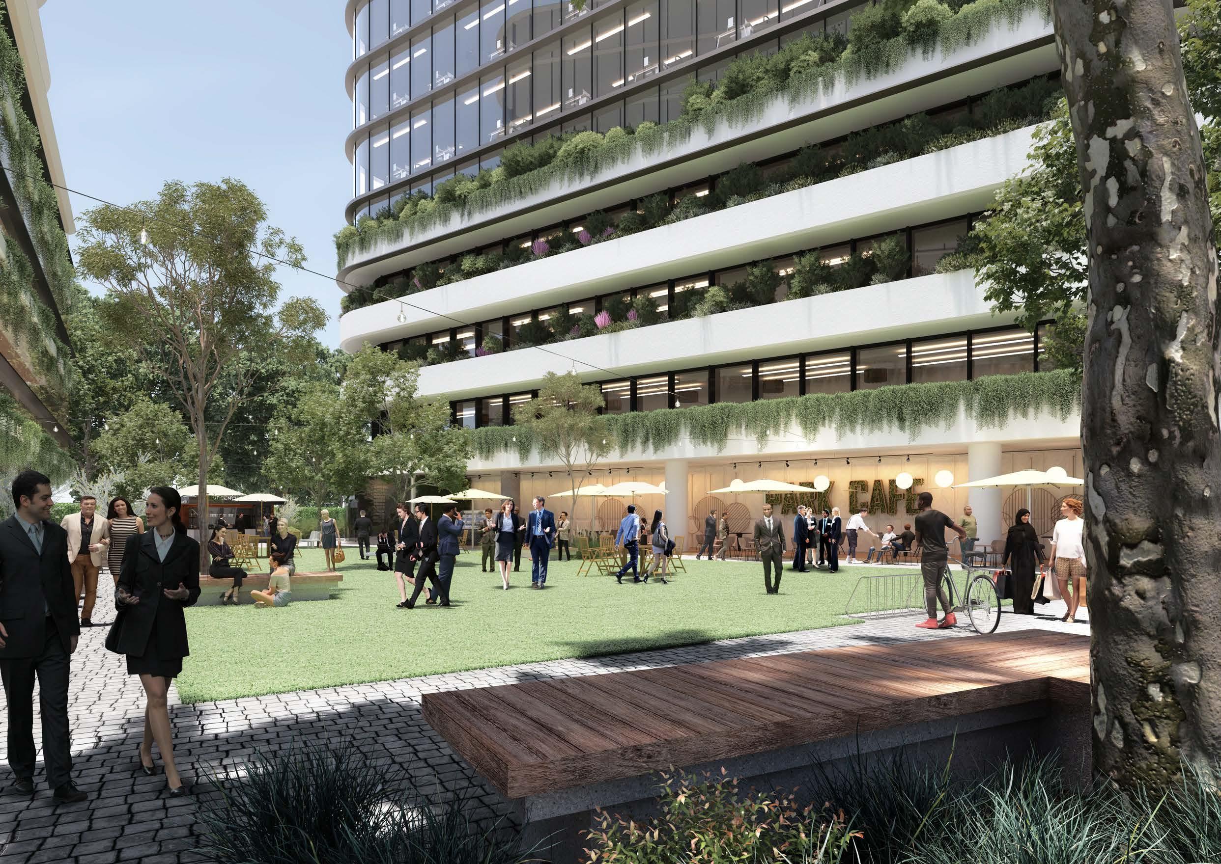 Artist’s Impression of Commercial Development (Source: Tome Visuals)
4.6 Yields and Projections
• In 2016, there were approximately 1,430 dwellings within the Norwest Innovation Precinct accommodating an existing population of approximately 2,850 people (based on an average occupancy rate of 2 people per household). Under this Plan, it is anticipated that there is growth potential for 4,250 additional dwellings by 2036 (approximately 8,500 additional people) and 5,240 additional dwellings by 2041 (approximately 10,490 additional people). Residential yields are based upon an uptake rate of between 80% and 100% by 2041, noting that there will still be some remaining capacity for additional dwellings post-2041. A substantial proportion of this growth will occur on the developable Government land within the Bella Vista Station Precinct.
• In 2016, there were approximately 14,520 jobs within the Norwest Innovation Precinct. Under this Plan, there is anticipated to be capacity for approximately 9,580 additional jobs by 2036, and an additional 12,570 additional jobs by 2041. These assumptions are based upon uptake rates for commercial developments of between 15-55% by 2036 and 25-100% by 2041
• Not all properties will be subject to redevelopment at the same time and uptake rates have been applied to each development type within each identified development area. The uptake rates which have been applied depend on the density being proposed and the extent of development which is likely to occur, having regard to opportunities and constraints affecting the land. Higher uptake rates are applied where higher densities are envisaged. However, in locations that are subject to development constraints, a lower uptake rate has been applied. Longer term investigation sites have also been given lower uptake rates given they are unlikely to be feasible in the short to medium term and may be contingent on the market solving certain issues or delivering certain outcomes.
Metro Station
Metro Line (Underground Tunnel)
Norwest Innovation Precinct
85
OLD WIINDSOR ROAD MERIDIANPL LEXINGTON DR NORWESTBLVD ELIZABETH MACARTHUR DR ELIZ.MACARTHURDR NORBRIKDR NORBRIK NORBRIKDR DR CELEBRATIONDR CELEBRATIONDR UNAIPONAV BALMORALRD MEMORIALAV FLOREYAV IRVINEPL
Figure 51. Yield Areas
M A B C D
The Hills Shire Council Draft Precinct Plan Norwest Strategic Centre 86 2016 Dwellings 2021 Dwellings Residential Uptake Rate (2036) Additional Dwellings (2036) Residential Uptake Rate (2041) Additional Dwellings (2041) Total Dwellings (2041) A 0 0 N/A 0 N/A 0 0 B 0 0 N/A 0 N/A 0 0 C 0 0 59% 2,788 80% 3,781 3,781 D 1,426 1,640 100% 1,463 100% 1,463 2,889 Total 1,426 1,640 69% 4,251 85% 5,244 6,670 2016 Jobs 2021 Jobs Employment Uptake Rate (2036) Additional Jobs (2036) Employment Uptake Rate (2041) Additional Jobs (2041) Total Jobs (2041) A 3,254 3,742 20% 4,374 25% 5,468 8,722 B 11,267 12,957 15% 1,153 25% 1,922 13,189 C 0 0 55% 3,850 74% 5,180 5,180 D 422 422 100% 200 100% 200 622 Total 14,521 17,121 26% 9,577 34% 12,570 27,091
Table 10. Residential Yield Analysis
Table 11. Employment Yield Analysis
4.7 Actions and Phasing
Strategic Work Completed
Areas where strategic planning work has already been completed (or is underway and nearing completion), where development is starting to be rolled out (including development applications and/or construction) or where no further change is anticipated.
Phase 1: Housekeeping Amendments
Areas where Council-led housekeeping amendments are recommended to facilitate improved and/or orderly development outcomes. These housekeeping amendments are expected to take place over the next few years.
Phase 2: Council-Led Change
Short to medium term actions that could be led by Council. Changes to the planning controls and framework in these areas would allow for the achievement of the vision and outcomes in this Plan and would be contingent upon Council-initiated planning proposals, along with associated Development Control Plan, Public Domain Plan and Contributions Plan amendments.
Phase 3: Market Driven Change
Actions that will be market driven. These would be contingent on further investigations and the ability of the market to overcome complex problems to unlock the development potential of the land. Whilst some market driven solutions may be achievable in the short to medium term, feasible redevelopment in other market driven areas is unlikely to occur until beyond the short-to-medium term horizon. Changes to the planning framework would be driven by landowner-initiated planning proposals, along with associated amendments to the Development Control Plan, Public Domain Plan and appropriate infrastructure contribution mechanisms.
In terms of timing, it is expected that planning proposals for land in short to medium term areas would eventuate over the next 5 to 10 years. Market driven solutions and planning proposals for sites in longer term areas are unlikely to eventuate within this same period and are expected to occur beyond a 10-year horizon (10- 20 years).
Metro Station
Metro Line (Underground Tunnel)
Norwest Innovation Precinct
Strategic Work Completed
Phase 1: Housekeeping Amendments
Phase 2: Council-Led Change
Phase 3: Market Driven Change
87
PHASING
Figure 52. Phasing Approach
Phase Action Responsibility
Housekeeping Amendments (Phase 1)
Action A1 - Correction of Height Control Mismatch within Bella Vista Employment: Council will initiate a planning proposal to increase the height of building controls to better reflect the maximum Floor Space Ratio control implemented by the State Government and accommodate the intended development outcomes being 6-10 storey buildings. Further analysis of appropriate heights will need to consider a range of factors including but not limited to the possible retention of views associated with Bella Vista Farm (where appropriate). Development Control Plan amendments may also be required to guide built form on individual sites.
Council-Led Change (Phase 2)
Action A2 - Bella Vista Community Facility and Urban Plaza: Council will continue its role in working with Landcom and the State Government to deliver a community facility and urban plaza within the Bella Vista Station Precinct, in accordance with the Precinct Support Scheme Funding Agreement.
Action A3 - Amendments to Contributions Plan, Development Control Plan and Public Domain Plan: Council will initiate amendments to the applicable Contributions Plan, Development Control Plan and Public Domain Plan for the Norwest Innovation Precinct to facilitate some of the character and infrastructure outcomes envisaged under this Precinct Plan.
NSW Government / Developers / Council
Market Driven Change (Phase 3)
Action A4 - ResMed: Any redevelopment of this Focus Area will occur as part of a future landowner initiated planning proposal having regard to the design principles set out within Section 4.3 (Focus Area 4) of this Plan. Associated amendments to the Development Control Plan, Public Domain Plan and Contributions Plan will be required.
Action A5 - Circa Retail: It is open to landowners to revisit land use permissibility in the future (once surrounding commercial developments come to fruition) by way of a landowner-initiated planning proposal as set out within Section 4.3 (Focus Area 5) of this Plan. Any future planning proposal must be accompanied by a detailed Economic Impact Assessment (EIA), which shows that there is sufficient demand for the proposal without compromising the ability of other existing or proposed centres to fulfil their roles in the centres hierarchy.
Landowners / Developers
Landowners / Developers
The Hills Shire Council Draft Precinct Plan Norwest Strategic Centre 88
Council
Council
Table 12. Overview of Phasing and Implementation
Artist’s Impression of Norwest Station Site (Source: Scott Carver)
Executive Summary 01 Norwest Central 0 5
5.1 Context
The Norwest Central Precinct is anchored by the Norwest Metro Station, Norwest Marketown and Norwest Lake. It is generally bound by Fairway Drive and Edgewater Drive to the west, Memorial Avenue to the north and Windsor Road and Mackillop Drive to the east. It is bisected by Norwest Boulevarde, a major vehicular corridor for the broader Strategic Centre. It accommodates a broad mix of land uses and development, with a prestigious commercial area, a retail centre, low to high density residential development areas and some key recreation and public domain areas, all within the walkable catchment of the Norwest Metro Station.
It features a prestigious employment area that is designated specifically for employment purposes, where more than 11,300 people are currently employed (2016 Travel Zone Data). It is characterised by a mix of ‘campus style’ commercial office buildings and warehouses. It currently features a range of businesses spanning from a mix of major international and national businesses, all the way through to smallmedium enterprises, generally in the medical, finance and business services sectors. There are many underutilised sites that are zoned for employment uses, but which have not yet met their full potential. Many of the buildings have been around since the creation of the Business Park in the 1980s and 1990s and have a lower built form and density, with outdoor parking areas often occupying prime areas of real estate or public interfaces.
The Norwest Central Precinct is home to approximately 5,020 people and about 2,510 dwellings (2016 ABS Census), including free standing dwellings, townhouses and apartments. There is an emerging high density residential area to the north of Norwest Lake and blending into the mixed use local and retail centre, which has been the focus of significant planning work and increasing development activity over the past few years. This is typified by ‘The Esplanade’ development on Solent Circuit, which is a prominent residential building with a range of cafes, restaurants and business on the ground floor fronting the lake, as well as an emerging high density residential precinct the northern side of Solent Circuit.
There are large, consolidated and vacant landholdings with substantial zoned capacity in this area for the market to deliver increased housing opportunities over the next 10-20 years within the walking catchment of the Metro Station. This high density residential area tapers off into the Balmoral Road Release Area, which is also a well-established low to medium density residential area that has been developing over the past 15 years.
Land in the southern portion of the Precinct is a well-established medium to low density residential area, which offers a range of executive housing options. While some of the building stock in this area is beginning to age, it is unlikely that any large-scale redevelopment will occur within this area in the short to medium term given the value of the land and properties, extent of strata title tenure, extent of fragmentation and abundance of land already zoned for short and medium term residential supply in other areas of the Precinct.
There are also a few recreation areas including the Castle Hill Country Club (privately owned) and Kellyville Memorial Park (public open space), as well as a few pocket parks scattered throughout the Precinct. The Norwest Lake and creek corridors also provide opportunities for passive recreation and enjoyment.
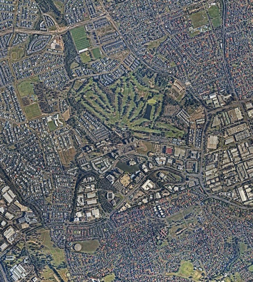
91
Figure 53. Locality Map (Source: Nearmap Aerial Imagery, copyright Nearmap)
Castle Hill Country Club
The Hills Shire Council Norwest Station St Joseph’s College
Lakeview
Norwest
Kellyville Memorial Park
Hospital Norwest Lake Esplanade
Marketown Hillsong
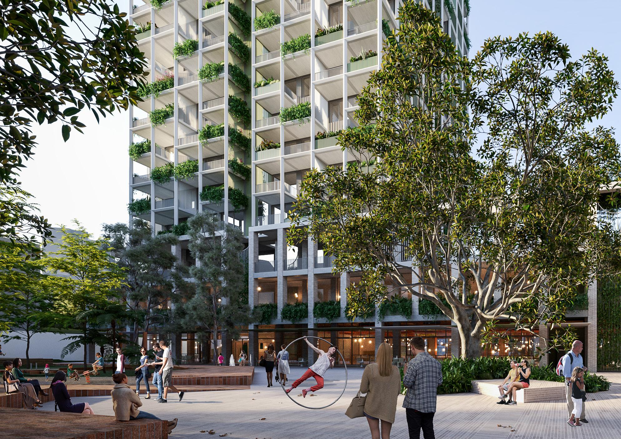 Artist’s Impression of Residential Building (Source: Bates Smart)
5.2 Key Influences
5.2.1 Planning Processes to Date
1992 2005 2006
Norwest Association – Master Scheme
Land within the Norwest Business Park is currently subject to a general planning scheme conceived and jointly operated by Council and the Norwest Association.
Primarily, the Master Scheme has provided guidance on the compliance with development standards (such as those contained within the Local Environmental Plan and Development Control Plan). It also outlines specific requirements regarding the following:
• Membership of the Norwest Association Limited.
• Restrictions and positive covenants imposed by Council relating to (but not limited to) compliance with the Master Scheme, membership requirements, involvement of the Planning and Design Review Panel, and improvement requirements.
• Deeds relating to the development and ongoing maintenance of the Norwest Business Park.
• Agreement regarding the sale of individual lots within the Norwest Business Park.
• Specific development guidelines for the Estate regarding landscaping, services, facilities, site standards, car parking, building design, landscaping, engineering, signage and lighting.
Norwest Town Centre Residential Development
Originally this area was intended for low and medium density housing options that would have delivered 518 dwellings.
However, various areas to the north of Norwest Lake and Norwest Marketown have been rezoned for high density residential development since the commitment to the delivery of the Sydney Metro Northwest, with Development Applications underway and many already constructed or under construction. This high density residential area will make a major contribution towards our housing targets for the Norwest Strategic Centre.
Development Control Plan
A site specific section of The Hills Development Control Plan applies to residential land situated between Solent Circuit and Spurway Drive. The DCP includes controls to regulate future built form and ensure high quality development outcomes that reflect the intended character for the area, being a highly desirable, accessible and liveable Precinct. It also contains various general development controls related to adaptable housing, site facilities, access, safety and security, pedestrian and cycleway linkages, public roads and stormwater management.
Balmoral Road Release Area
The Balmoral Road Release Area was rezoned by Council in September 2006 to accommodate a variety of land uses including residential, retail, open space and trunk drainage. It was intended to deliver approximately 6,000 dwellings and was earmarked as a key greenfield area that would facilitate a substantial proportion of lower density residential growth within The Hills Shire. Development activity continues to occur throughout the Release Area in accordance with planned outcomes.
Development Control Plan
The Development Control Plan includes controls to regulate future built form and ensure high quality development outcomes that reflect the intended character for the Precinct as a highly liveable Release Area.
Contributions Plan
This Contributions Plan originally came into effect on 26 September 2006. It identifies approximately $201 million of infrastructure works and land acquisition costs to meet the increased infrastructure demand within the local community. This was most recently reviewed in 2020.
*Note: This Section should be read in conjunction with the strategic planning context discussed in Section 2 of this Precinct Plan, which discusses strategies such as the Greater Sydney Region Plan, Central City District Plan, North West Rail Link Corridor Strategy, Hills Corridor Strategy, Council’s Local Strategic Planning Statement (and supporting strategies), plus others. This Section identifies additional planning processes and considerations specifically relevant to the Norwest Central Precinct.
93
Table 13. Planning Processes to Date
5.2.2 Planning Proposals
There has been significant planning activity within the Norwest Central Precinct in recent years, driven largely by landowner-initiated planning proposals. There are 13 planning proposals either under assessment or finalised (as of April 2023) within this Precinct.
Various applications have been accompanied by Voluntary Planning Agreements. These generally require the completion of works and payment of monetary contributions towards traffic, open space, community facilities and public domain improvements to service growth within Norwest. These contributions will be held by Council and applied towards the new and upgraded infrastructure required to enable strategically identified uplift to occur. These applications are at various stages in the process, with some not yet having been formally considered or endorsed by Council.
To encourage orderly development outcomes, consideration has been given to how these site-specific planning proposals can integrate back into the Precinct Plan. This Precinct Plan focuses on filling in the gaps to provide a holistic framework to guide future development and to enable Norwest to reach its full potential as a Strategic Centre.

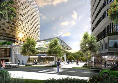
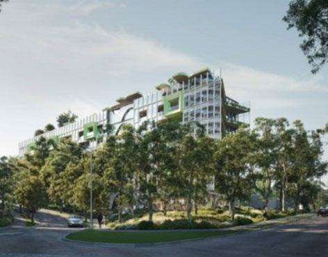
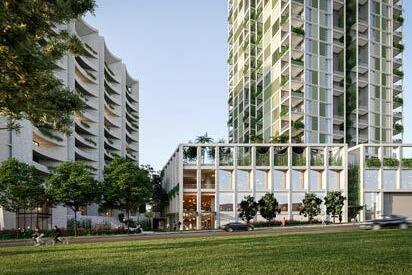
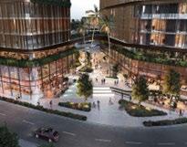
Metro Station
Metro Line (Underground Tunnel)
Norwest Central Precinct
Approved Controls (Finalised or Gateway Approved)

Proposed Controls Under Assessment
Proposed Controls Refused or Withdrawn
Indicative
Indicative
Indicative
The Hills Shire Council Draft Precinct Plan Norwest Strategic Centre 94
6 5 4 2 3 1 NORWESTBLVD NORWESTBLVD BROOKHOLLOW AV SPURWAY DR PRIVATE ) SPURWAYDR(PRIVATE) WINDSORRD COLUMBIA CT SOLENT CCT SOLENT CCT BARINADOWNSRD BARINADOWNSRD WINDSORRD MEMORIALAV FAIRWAY DR FAIRWAY DR STONE MASON DR STONEMASONDR MACKILLOP DR MAITLANDPL CTEVESHAM RESTON GRA EDGEWATER DR FAIRMONTAV
1 3 2 4 6 The Proposed Indicative Dancers Square Edging Activation 5
Figure 54. Planning Proposals
Indicative Concept Central Plaza at 34-46 Brookhollow Avenue (Source: Merc Capital, PBD Architects)
Indicative Concept ‘The Greens’ (Source: Mulpha Norwest)
Indicative Concept for 14-16 Brookhollow Avenue (Source: PBD Architects)
Concept for Development Application at 7 Maitland Place (Source: Turner’s Studio)
Concept - Dancer’s Square (Source: FJMT Studio, Merc Capital)
Concept - Norwest Station Site (Source: Scott Carver, Landcom)
5.2.3 Key Constraints and Challenges
Age of Building Stock and Development Potential
There are various pockets of well-established residential areas which are unlikely to turn over in the foreseeable future predominately due to the recent age and high quality of the building stock and fragmented ownership of land.
Traffic Congestion
The traffic network is already under stress with significant wait times at key intersections and will not cope with additional cars on the roads. The efficient movement of traffic will hinge upon the outcomes of Regional Traffic Modelling, future infrastructure upgrades and a mode shift towards public transportation.
Connectivity
There is currently limited connectivity within and surrounding the Norwest Central Precinct. It is bound and bisected by various major roads and vehicular barriers, including Windsor Road, Norwest Boulevarde and Fairway Drive. This poses a challenge in terms of walkability and pedestrian permeability, given there are limited pedestrian crossings at present along these roads.
Topography
Steep and varying topography is a key consideration not only from an urban design perspective, but also in terms of heritage, views and vistas and walkability.
Environmental Constraints
Whilst mostly free from environmental constraints, there are some minor affectations present within the Norwest Central Precinct, such as threatened species, flood prone land and tributaries.
Limited Public Open Space
Whilst Kellyville Memorial Park is located at the edge of the Precinct these facilities primarily service the needs of existing residents. The Castle Hill Country Club is under private ownership and is not readily accessible by the public. There is limited accessible public open space for future residents and workers within the Precinct.
Land Tenure and Rail Corridor
Existing Strata and community title arrangements will impact on the uptake of redevelopment. Redevelopment will also need to manage its impact on the underground rail tunnel, which runs through the Precinct and limits the ability for some sites to undertake any significant excavation or basement carparks.
School Infrastructure
There is currently a lack of school infrastructure, which will need to be resolved by the NSW Government and Schools Infrastructure to appropriately service the needs of the future population.
Metro Station
Metro Line (Underground Tunnel)
Norwest Central Precinct
Strata / Community Development
Endangered and Critically Endangered Species
Recent Development Activity
Special Uses / Private Open Space
Open Space
Urban Overland Flowpaths / Creeks
Major Roads and Barriers

95
Figure 55. Challenges and Constraints
5.2.4 Key Opportunities
Employment Growth
There is opportunity to continue to grow employment opportunities within the Norwest Central Precinct, enabling it to become a magnet for economic growth through the preservation of a designated commercial area. There is an opportunity to harness the economic benefits associated with the projected growth, to attract new jobs and business activity, to solidify Norwest as a premier employment that offers diverse and highly skilled employment opportunities.
Maximising Underdeveloped Sites
Capitalise on underdeveloped and minimally constrained sites in the commercial area in the short and medium term (employment land along Brookhollow Avenue, Columbia Way and Solent Circuit) where large landholdings can facilitate quality master planned outcomes.
Mass Transit Corridor
Continue advocating for a transit corridor from Norwest through to Parramatta (via Baulkham Hills) as this will be critical in achieving a 30-minute city, attracting highly skilled and knowledge intensive workers to the Precinct and reducing pressures on the road network.
New Vehicular Links
The provision of new vehicular links within the Norwest Central Precinct will ease congestion on existing entry and exit points and will improve walkability. This will be critical near the Norwest Hillsong Campus, Marketown and Spurway Drive.
Local Pocket Parks and Urban Plazas
There is scope to deliver additional local pocket parks and urban plazas throughout the Precinct, particularly near high activity areas such as Norwest Lake and Norwest Metro Station, providing informal open space areas that can be enjoyed by local workers and residents.
Enhanced Pedestrian and Cycling Links
There is potential to improve pedestrian and cycling links within the Norwest Central Precinct, including new pedestrian bridges to improve permeability, especially across high traffic environments such as Norwest Boulevarde and Windsor Road.
Public Domain Improvements
There is potential for a variety of public domain improvements throughout the Precinct, particularly to make the Norwest Lake a core attraction and to create vibrant and safe streets and places for people to gather or rest.
Metro Station
Metro Line (Underground Tunnel)
Norwest Central Precinct
Commercial Offices
Diverse Housing Opportunities
Mixed Use
Open Space
Proposed Pedestrian Bridge
Intersection Improvement
Urban Plazas
Improved Connection to Norwest Service
Improved Connectivity
The Hills Shire Council Draft Precinct Plan Norwest Strategic Centre 96
Future
NORWESTBLVD NORWEST BLVD BROOKHOLLOW AV SPURWAYDR(PRIVATE) WINDSORRD SOLENT CCT SOLENT CCT BARINADOWNSRD BARINADOWNSRD MEMORIALAV FAIRWAY DR FAIRWAY DR STONE MASON DR STONEMASONDR MACKILLOP DR CTEVESHAM RESTON GRA EDGEWATER DR FAIRMONTAV
Mass Transit Corridor to Parramatta (via Baulkham Hills)
Figure 56. Key Opportunities
I
5.3 Focus Areas
A number of “Focus Areas” have been identified for the Precinct. These build on the planning work completed to date and guide the achievement of the vision for the Precinct. These outcomes are reflected in the vision and structure plan in Section 5.4 of this Precinct Plan.
Metro Station
Metro Line (Underground Tunnel)
Norwest Central Precinct
1 2 3 4 5 6 7 8
Designated Commercial Area
Norwest Marketown and Surrounds
Norwest Hillsong Campus
Century Estate
1-9 Brookhollow Avenue
Encouraging and Facilitating Future Connections
Open Space and Urban Plazas
Long Term Residential Investigation Area
97
Figure 57. Focus Areas
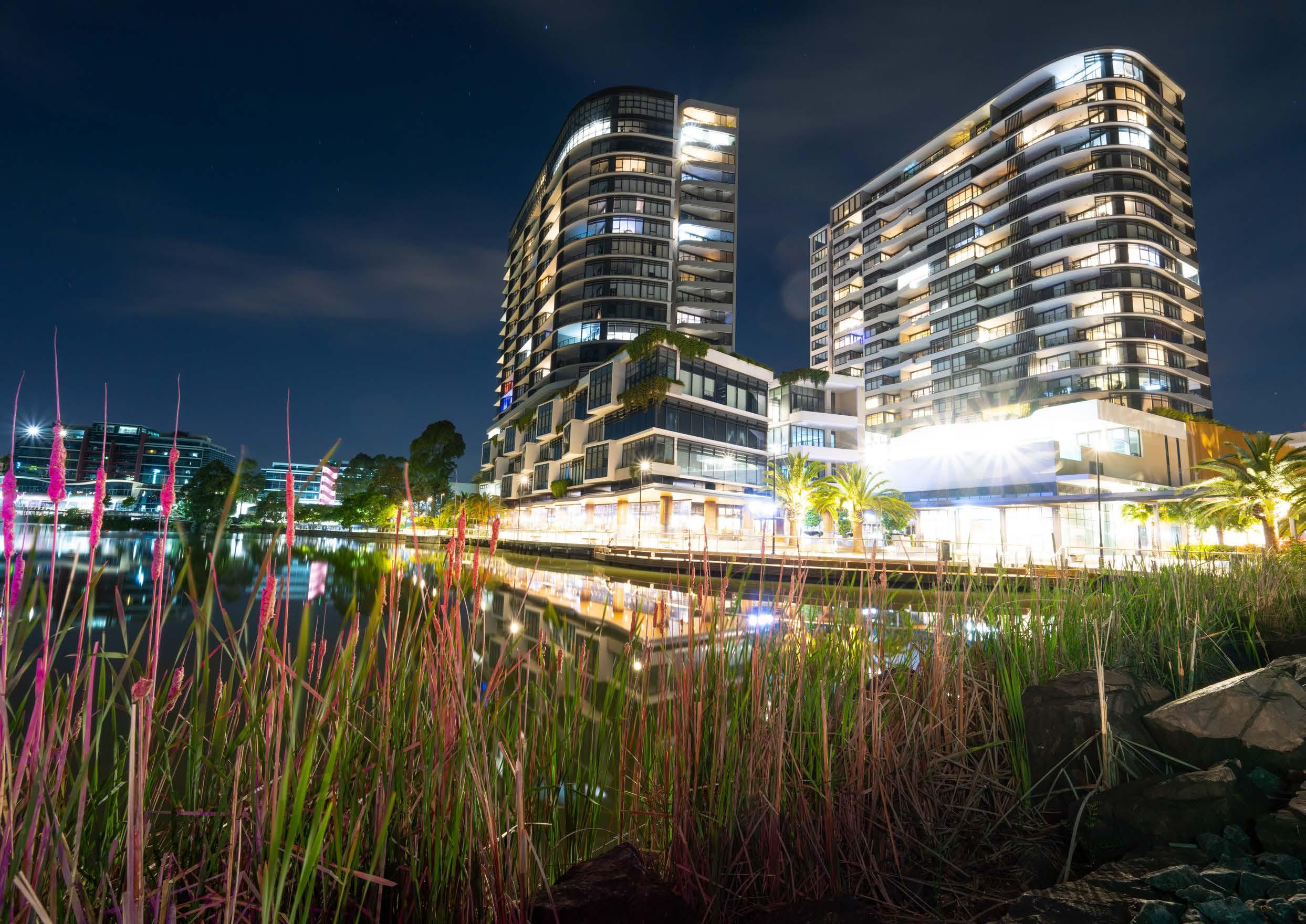
Esplanade Norwest Lake and surrounds.
5.3.1 Focus Area 1Designated Commercial Area
With economic growth being the principal underlying economic goal for the Norwest Strategic Centre, this Precinct Plan establishes a framework within which diverse local employment opportunities can grow, that are tailored to the needs of our highly skilled residents.
The Norwest Central Precinct is relatively underdeveloped, with significant potential for additional employment uplift. It is important that the right policy settings are put in place to enable Norwest to be a magnet for economic growth and transform into a thriving and competitive employment destination.
Whilst it is recognised that there are various site-specific planning proposals progressed or under assessment within the Norwest Central Precinct, it is critical that a coordinated approach be implemented to fill in the gaps and enable the Precinct to reach its full potential. This approach to planning is essential in achieving complementary and orderly development outcomes and assessing infrastructure needs.
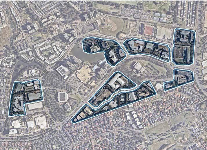
This Precinct Plan flags the need for a future Council-led planning proposal for the designated commercial area within the Norwest Central Precinct, to encourage master planned development outcomes and enable feasible commercial uplift to occur in line with market demand and without the need for further site-specific planning proposals.
The proposed infrastructure items are detailed later in this Precinct Plan. A planning proposal should secure a critical future vehicular connection, providing a direct link from Norwest Boulevarde through to Fairway Drive. However, this should be designed as a pedestrian friendly environment given its proximity to Norwest Marketown, which is envisaged to be the active heart of Norwest Central. It is expected that this road will be transferred to Council as part of future redevelopment, in association with the landowner-initiated planning proposal.
Signalised intersection upgrades at the Solent Circuit and Fairway Drive intersection will also be required and could be captured within the relevant Contributions Plan.
Metro Station
Metro Line (Underground Tunnel)
Focus Area
Proposed Road

Medium Density Residential
High Density Residential
High Density Commercial Offices
Mixed Use
Public Open Space
Private Open Space
Drainage Land
Special Use
Signalised Intersection
Pedestrian Bridge
Urban Plaza
Roundabout
Pedestrian Link
T
99
Figure 58. Focus Area 1 (Source: Nearmap Aerial Imagery, copyright Nearmap) Figure 59. Indicative Layout Plan
Various design principles have been developed to guide future outcomes for this Focus Area:
Land Uses
• Commercial developments will be the key focus, significantly contributing to job growth within Norwest.
• No residential uses are anticipated in the designated commercial area, as this would reduce the long-term viability of the employment area. Residential uses are better suited to the extensive areas already zoned and identified for residential purposes.
• Active ground floor uses will be encouraged to facilitate vibrant streets and interfaces.
• Provide a range of dining and entertainment opportunities where people can socialise outside of working hours, contributing to a night-time economy within the commercial area.
Built Form
• Taller buildings are to be strategically located towards Marketown and Norwest Metro Station, away from the peripheries of the Precinct and interface with residential areas.
• Building heights will be carefully sited having regard to the topographic constraints within the Precinct.
• Building heights will be varied creating visual interest in the skyline and minimising potential overshadowing impacts on surrounding properties.
• Appropriate height transitions will be provided across the commercial area, to seamlessly integrate with surrounding sensitive uses.
• Built form along Brookhollow Avenue will be designed to be sympathetic with adjoining low rise residential development and Fairmont Avenue Reserve, with respect to visual amenity, overshadowing and visual privacy.
• Development will be sited, angled and designed to provide high levels of solar access.
• Layouts should be flexible and adaptable to suit the diverse needs of potential tenants.
• Larger floorplates (>1,000m²) are encouraged.
Public Domain and Open Space
• The public domain will be attractive, safe, functional and accessible.
• Public domain will comprise well defined and comfortable places for people to gather, including informal seating.
• A unified hierarchy of materials and furniture elements will be used to create a sense of place and clear brand for Norwest. High quality treatments are to be provided including generous paving, integrated seating, landscaping, water features and public art.
• Significant landscaping and public urban spaces will be provided to create a sense of place.
• Reinforce the brand of Norwest with high quality and robust materials and finishes.
Connectivity
• Future development will be transit oriented by reducing car dependency and encouraging walking and cycling to and from the nearby Norwest Metro Station.
• Active movement opportunities will be encouraged by providing additional cycling and pedestrian links.
• Reduced parking provisions to encourage a shift towards public transportation, away from the current car-dependent business park model.
Infrastructure
• Tangible infrastructure solutions (including traffic, open space and water management) and an appropriate funding and delivery mechanism will be required to ensure that the uplift can be appropriately serviced.
• Integrate evolving technologies, including digital infrastructure provisions, within future developments to provide better connected and informed communities.
A number of sites within the designated commercial area have been identified for future market driven change. These sites are generally larger in size (greater than 4 hectares) where transformational masterplanned and exemplary outcomes can be accommodated or where the achievement of infrastructure outcomes identified within the Plan is necessary. These sites are addressed in further detail in Focus Areas 3-5 of this Precinct Plan.
The Hills Shire Council Draft Precinct Plan Norwest Strategic Centre 100

 Figure 61. Indicative Layout Plan
Various design principles have been developed to guide future outcomes for this Focus Area:
Land Uses
• Development will strike an appropriate mix of land uses, to prioritise employment opportunities and everyday services on the lower levels, complemented by some residential living on the upper levels.
• Land uses are to be clustered together to create functional and desirable working and living environments.
• Any future planning proposal that seeks to rezone the land to MU1 Mixed Use must include a planning mechanism (such as a local provision) that ensures minimum non-residential development outcomes on the land (a minimum of 50% of the floor space will be designated to commercial uses). This certainty is crucial to ensuring the appropriate land use mix and distribution to achieve the outcomes identified within the strategic planning framework.
• Active uses will be incorporated into the ground floor level to create a desirable and vibrant streetscape.
• Redevelopment needs to demonstrate how the longer term retail demand (including additional supermarket, hospitality and specialty retail floorspace) can be accommodated having regard to the findings of the SGS Retail Floorspace Analysis (2021).
Built Form
• Buildings will be tall and slender and will display a high standard of architectural design, to mark the heart of the Strategic Centre.
• Tower elements are to be strategically positioned to maximise solar access, natural ventilation and views (both into and through the site and from key vantage points in the public domain).
• Taller buildings (up to 35 storeys) are to be strategically located towards Norwest Boulevarde and Century Circuit to signify the entrance to the mixed use heart of the Precinct.
• Shorter buildings are to be provided adjacent to public spaces, to sympathetically frame these areas and reduce visual impacts.
• Building articulation is to be provided to soften visual impact of the towers and create a human scale.
• Residential tower floor plates are to be a maximum GFA of 750m².
• Building lengths are to be a maximum of 65m.
Public Domain and Open Space
• High quality public domain and plaza areas should be integrated with key pedestrian movement routes within and beyond the site.
• Create well defined and comfortable public spaces around Norwest Lake for casual recreation and relaxation.
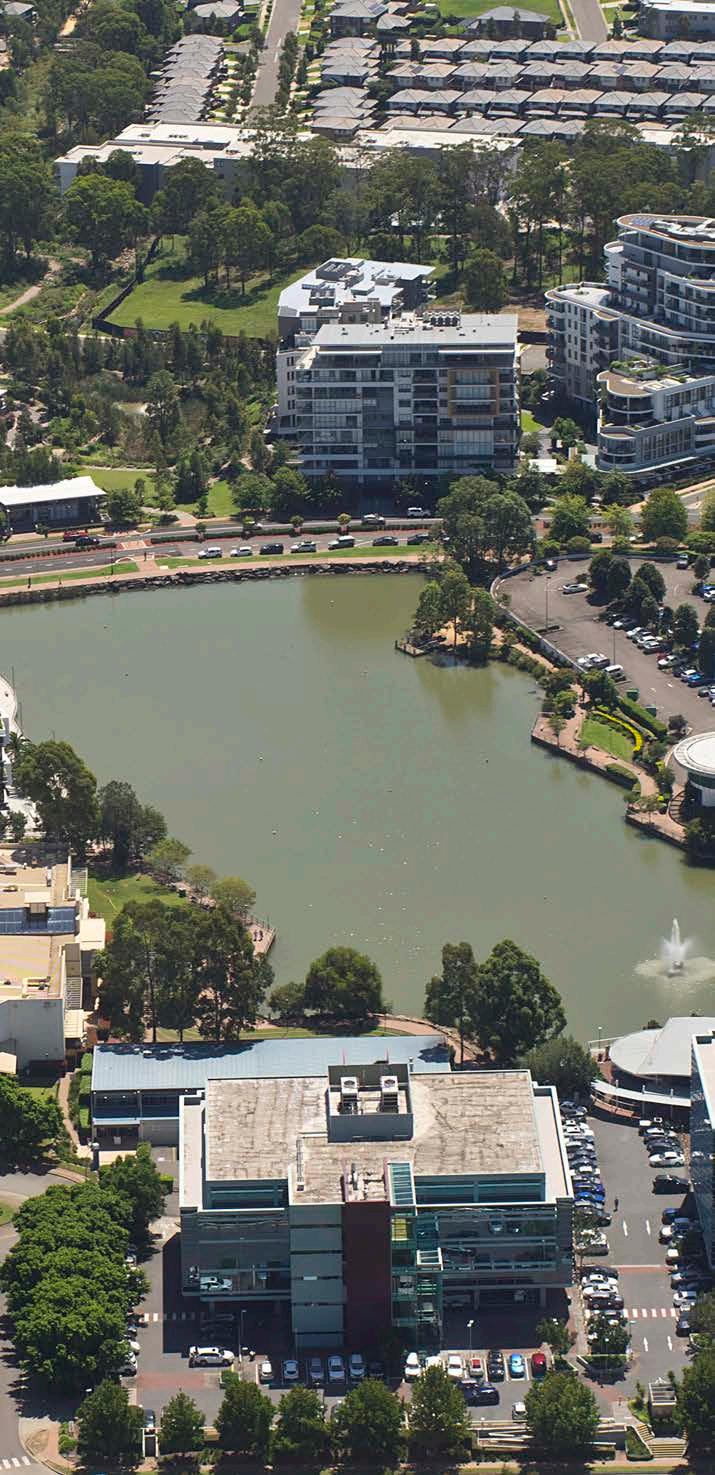
• Incorporate public art and informative wayfinding signage to strengthen Norwest’s identity.
• Create a pedestrian friendly environment.
Connectivity
• Future development will be transit oriented by reducing car dependency and encouraging walking and cycling to and from the nearby Norwest Metro Station.
• Reduced parking provisions to encourage a shift towards public transportation, away from the current car-dependent business park model.
• Maximise active movement opportunities by providing cycling routes, pedestrian through site links and re-thinking the street structure.
• The local road network will be reconfigured to provide enhanced permeability through the Precinct, including a new road connection from Norwest Boulevarde to Solent Circuit.
Infrastructure
• Tangible infrastructure solutions (including traffic, open space and water management) and an appropriate funding and delivery mechanism will be required to ensure that the uplift can be appropriately serviced.
• Integrate evolving technologies, including digital infrastructure provisions, within future developments to provide better connected and informed communities.
The Hills Shire Council Draft Precinct Plan Norwest Strategic Centre 102
Aerial View or Norwest Lake and Surrounds.
5.3.3 Focus Area 3Norwest Hillsong Campus
The Norwest Hillsong Campus, formally known as 2 Century Circuit, is an underdeveloped site that is well-positioned opposite the Norwest Metro Station. This site is envisaged to have a strong commercial focus, contributing to future job growth within Norwest.
It is anticipated that future uplift will be facilitated by a landowner-initiated planning proposal. This is intended to further explore key urban design considerations such as the height of building controls, maximum floor space ratio controls and facilitation of the future road corridor. Careful consideration will be needed throughout the master planning process for this site, to determine how the continued operation of the Hillsong Campus and future commercial outcomes can work in tandem.
Associated Development Control Plan (DCP) amendments will be required to guide future development outcomes on this site, including identification of the proposed road layout. Such DCP amendments will complement the suite of development controls envisaged more broadly for the commercial area.
A planning proposal should secure a critical future vehicular connection, providing a direct link from Norwest Boulevarde through to Fairway Drive. However, this should be designed as a pedestrian friendly environment given its proximity to Norwest Marketown, which is envisaged to be the active heart of Norwest Central. It is expected that this road will be transferred to Council as part of future redevelopment, in association with the landowner-initiated planning proposal. Signalised intersection upgrades at the Solent Circuit and Fairway Drive intersection will also be required and could be captured within the relevant Contributions Plan.
Various design principles have been developed to guide future outcomes for this Focus Area, as follows:
Land Uses
• Commercial outcomes will be the primary focus of the site, complemented by the existing Hillsong Campus and supporting uses.
• Residential uplift is not appropriate for this Focus Area as it would not align with the economic and employment goals for the Precinct and would be beyond the residential population that can be serviced by the necessary infrastructure.
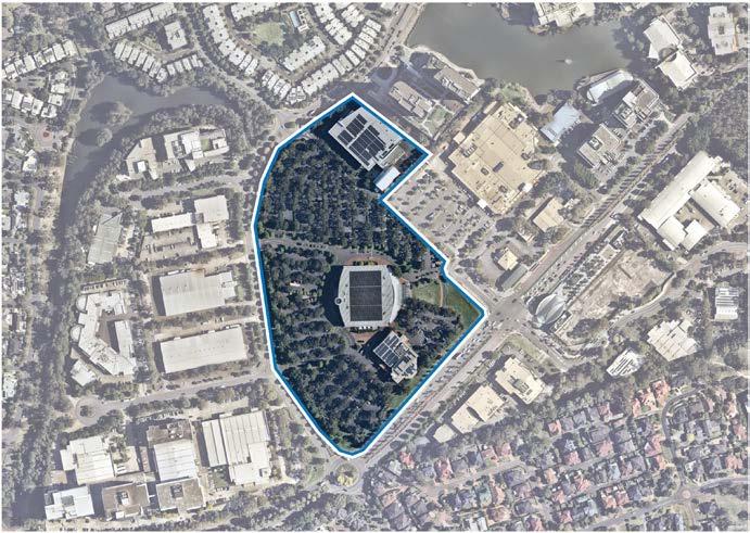
• Active uses will be incorporated into the ground floor level to create a desirable and vibrant streetscape.
Built Form
• Building heights should transition down from key landmarks at Norwest Marketown and Norwest Station, providing a smooth transition across the site towards other employment areas on the western side of Solent Circuit.
• Taller buildings will be located towards the southern end of the site (near the Norwest Metro Station).
Future development will be centred upon transit oriented development principles, whereby building heights taper down from landmark buildings closest to Norwest Marketown and Norwest Metro Station. This Precinct Plan envisages future building heights of around 8-15 storeys for this site. Future planning controls must strike an appropriate balance in terms of encouraging employment growth and business investment, whilst simultaneously delivering appropriate built form outcomes that transitions away from the Metro Station to other surrounding employment and residential areas.
Connectivity will be a major focus for this site to provide increased pedestrian and vehicular accessibility through to Solent Circuit and other employment areas along Burbank Place and Inglewood Place.
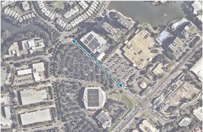
• Building heights of around 8-15 storeys are envisaged.
Public Domain and Open Space
• High quality urban plazas are to be incorporated and located in central areas.
• Public domain will be attractive, safe, functional and accessible. It will also feature high quality treatments including generous paving, integrated seating, landscaping, water features and public art.
103
Figure 62. Norwest Hillsong Campus (Source: Nearmap Aerial Imagery, copyright Nearmap)
Figure 63. Proposed Vehicular Link between Norwest Hillsong Campus, Marketown and Surrounds (Source: Nearmap Aerial Imagery, copyright Nearmap)

T
5.3.4 Focus Area 4Century Estate
Century Estate, formally known as 2-12 Inglewood Place, is a large and underutilised site on prime employment land in the Norwest Central Precinct. It currently comprises a warehouse and associated office development, complemented by ancillary uses.
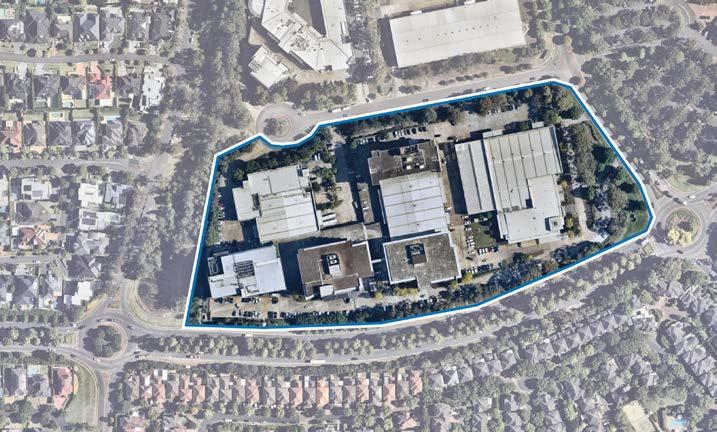
It is envisaged to transform into a high density commercial office area, that features significant landscaping and a high prioritisation of pedestrian access. The area will be highly activated, featuring activated uses and well-lit lobbies on ground floor levels, creating a sense of place for future workers and visitors to enjoy. Future development will also feature transit oriented development principles, with taller buildings concentrated towards Solent Circuit tapering down to the creek interface and nearby low-density residential areas.
TWhilst guidance is provided in this Precinct Plan, it is anticipated that relevant changes to the planning framework will be achieved through a landowner-initiated planning proposal for Century Estate. An associated site specific Development Control Plan would also be required to establish a suite of controls to guide redevelopment.
NORBRIK
Focus Area
Low Density Residential
Medium Density Residential
High Density Residential
High Density Commercial Offices
Drainage Land
Signalised Intersection

Pedestrian Bridge
Roundabout
Pedestrian Link
Figure 65. Century Estate (Source: Nearmap Aerial Imagery, copyright Nearmap)
T
Various design principles have been developed to guide future outcomes for this Focus Area:
Land Uses
• Commercial development will be the key focus, significantly contributing to job growth.
• Active ground floor uses will be encouraged to facilitate vibrant streets and interfaces.
• Future development will activate the site and encourage activity outside of commercial business hours, by including activated land uses on the ground floor and well-lit lobbies, creating an inviting and safe environment for workers (particularly near the creek edge).
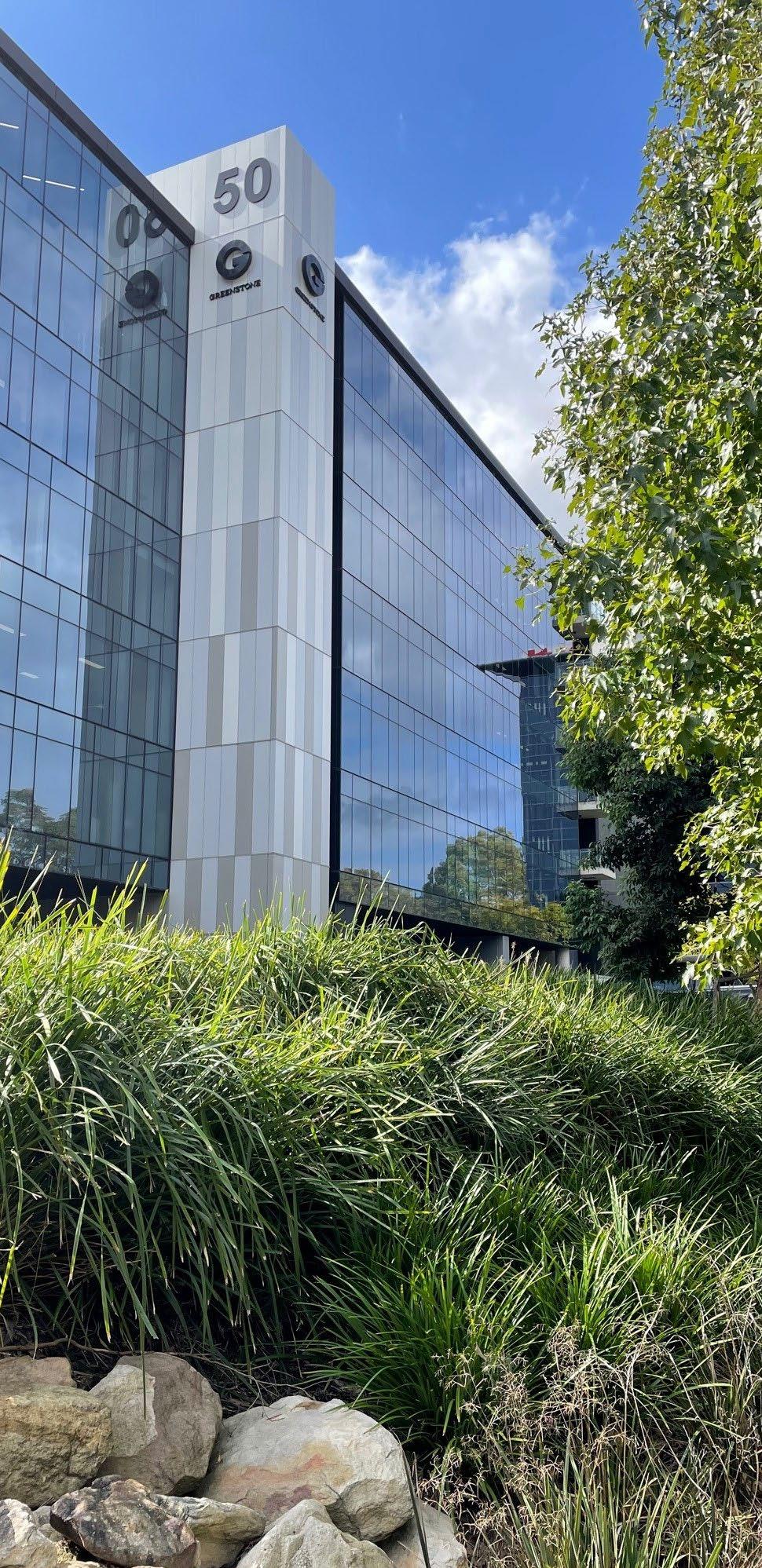
• Residential uplift is not appropriate for this site as it would not align with the economic and employment goals for the Precinct and would be beyond the residential population that can be serviced by the necessary infrastructure.
Built Form
• Moderate building heights are envisaged of up to 8-10 storeys.
• Tallest buildings should be located towards Solent Circuit, transitioning down towards Strangers Creek (at the western boundary).
• Buildings should be strategically sited to be sympathetic to the natural surroundings, avoiding visual bulk near the creek corridor.
• Building heights will be varied creating visual interest in the skyline.
• Development will be sited, angled and designed to provide high levels of solar access, particularly across Norwest Boulevarde, the creek and drainage land, as well as future open space within the site.
• Layouts should be flexible and adaptable to suit the diverse needs of potential tenants.
Public Domain and Open Space
• The public domain will be attractive, safe, functional and accessible. It will prioritise pedestrian access and feature a pedestrian friendly ‘street feel’.
• The western edge of the site will become an active promenade that overlooks Strangers Creek.
• High quality urban plazas are to be incorporated and located in centralised areas.
• Greenery and natural characteristics are to be drawn in from the adjoining Strangers Creek Corridor, providing a seamless transition from the natural environment to the urban hub.
Connectivity
• Future development will be transit oriented by reducing car dependency and encouraging walking and cycling to and from the nearby Norwest Metro Station.
• Reduced parking provisions to encourage a shift towards public transportation, away from the current car-dependent business park model.
Infrastructure
• Tangible infrastructure solutions (including traffic, open space and water management) and an appropriate funding and delivery mechanism will be required to ensure that the uplift can be appropriately serviced.
• Integrate evolving technologies, including digital infrastructure provisions, within future developments to provide better connected and informed communities.
The Hills Shire Council Draft Precinct Plan Norwest Strategic Centre 106
Century Estate
Metro Line (Underground Tunnel)
Focus Area
Proposed Road

High Density Residential
High Density Commercial Offices
Mixed Use
Drainage Land
T
Land Uses
• Commercial developments will be the key focus, significantly contributing to job growth within Norwest.
• Active ground floor uses will be encouraged to facilitate vibrant streets and interfaces.
• Residential uplift is not appropriate for this Focus Area as it would not align with the economic and employment goals for the Precinct and would be beyond the residential population that can be serviced by the necessary infrastructure.
Built Form
• High density office buildings up to 8-15 storeys are envisaged, with taller buildings concentrated closer to the Metro Station and Norwest Boulevarde frontage.
• Building heights will be carefully sited having regard to the topographic constraints across the site.
• Building heights will be varied creating visual interest in the skyline and minimising potential overshadowing impacts on surrounding properties.
• Buildings will be appropriately setback from the street to minimise building bulk and create a highly desirable pedestrian environment.
• Layouts should be flexible and adaptable to suit the diverse needs of potential tenants.
Public Domain and Open Space
• Public domain will be attractive, safe, functional and accessible. It will also feature high quality treatments including generous paving, integrated seating, landscaping and public art. High quality urban plazas are to be incorporated and located in central areas.
Connectivity
• Through site links will be provided to increase pedestrian and cycling permeability between Brookhollow Avenue and Norwest Boulevarde.
• A new road entry point could be provided from the Norwest Boulevarde and Solent Circuit intersection, subject to further traffic assessment.
• Development must integrate with the proposed pedestrian bridge across Norwest Boulevarde.
• Future development will be transit oriented by reducing car dependency and encouraging walking and cycling to and from the nearby Norwest Metro Station.
• Reduced parking provisions to encourage a shift towards public transportation, away from the current car-dependent business park model.
Infrastructure
• Tangible infrastructure solutions (including traffic, open space and water management) and an appropriate funding and delivery mechanism will be required to ensure that the uplift can be appropriately serviced.
• Integrate evolving technologies, including digital infrastructure provisions, within future developments to provide better connected and informed communities.
The Hills Shire Council Draft Precinct Plan Norwest Strategic Centre 108
Various design principles have been developed to guide future outcomes for this Focus Area, as follows:
1-9 Brookhollow Avenue
5.3.6 Focus Area 6Future Connections
Given the sheer quantum of growth expected in the Norwest Strategic Centre over the next 20 years and beyond, it is imperative that consideration be given to potential future regional transport connections.
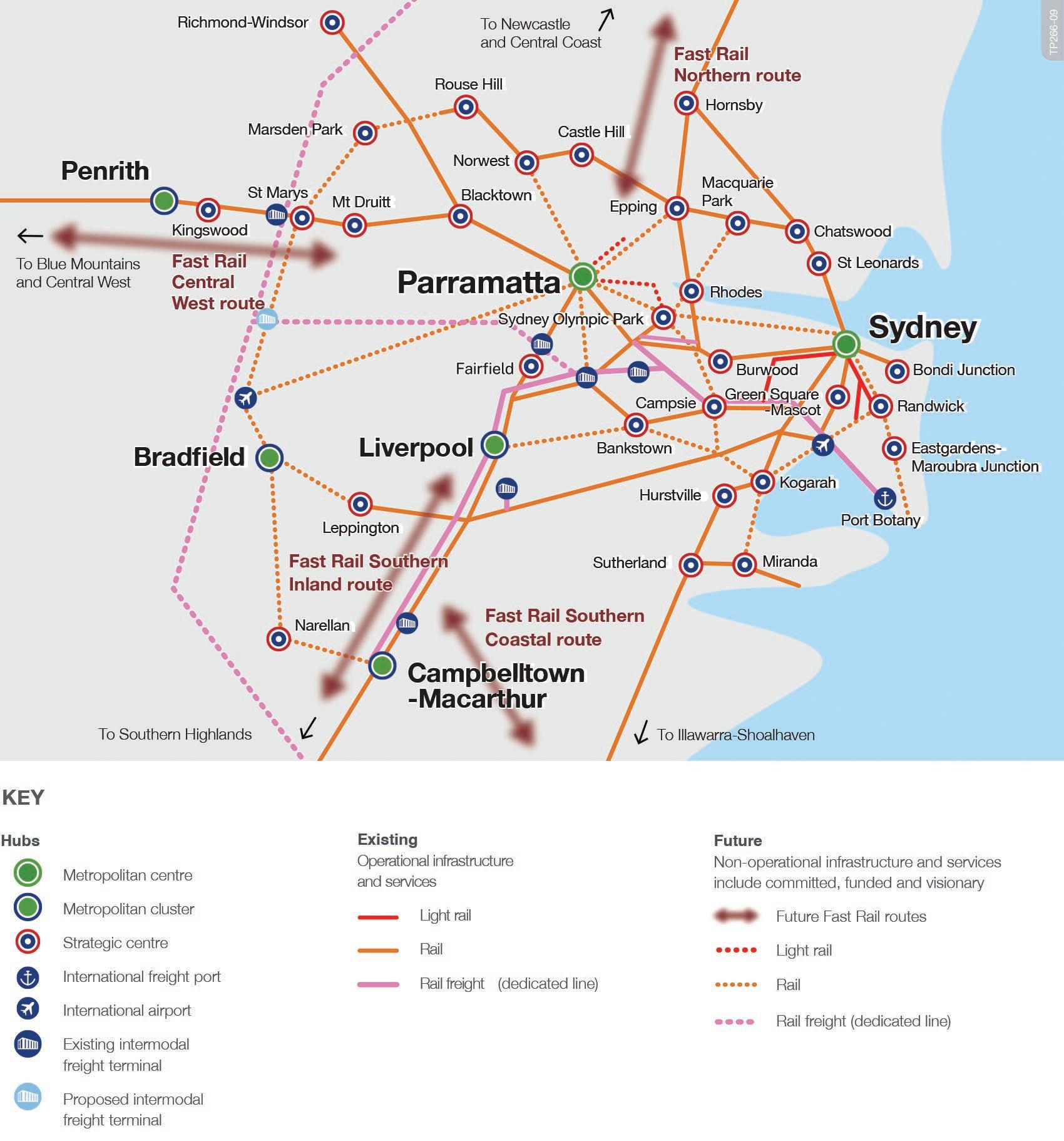
Regional Connections
Given the sheer quantum of growth expected in the Norwest Strategic Centre over the next 20 years and beyond, it is imperative that consideration be given to potential future regional, local and active transport connections.
The Norwest Central Precinct is anchored by the Norwest Metro Station, which provides connectivity through to the Chatswood Interchange, ultimately leading to the Sydney CBD. However, this connection is set to be further improved through the extension of the Metro line that will provide a direct connection from Norwest to Martin Place in approximately 30-35 minutes.
The extension of the North South Rail Link from Tallawong Station to St Marys Station will provide access for Hills residents to the Western Sydney International Airport and serve workers who travel to The Hills Shire from Western Sydney.
It is prudent that the NSW Government fast track the extension of the North South Rail Link from Tallawong Station to St Marys Station as a priority over the next few years to support the significant population growth anticipated within Norwest (and The Hills Shire more broadly) and reduce car dependency by encouraging a modal shift towards public transportation.
A potential mass-transit connection from Norwest to Parramatta has been identified by the State Government (as shown in Figure 69). This is set to provide another rapid and reliable transport connection within the Central River City that will assist in cementing the economic ties between Parramatta and Norwest.
To safeguard this connection, it is pivotal that the NSW Government progressively conduct feasibility studies to preserve the transport corridor and transport hubs to protect the future mass transit link indentified in the Future Transport Strategy.
Council will continue to lobby the NSW Government for the funding, early planning and delivery of these regional transport connections, as they are critical to the success of Norwest moving forward.
The Regional Traffic Modelling that is currently underway will assist in enabling the road network to operate more efficiently and is expected to assess capacity and identify the necessary upgrades to the regional road network. Associated amendments to the parking controls will also be necessary to complement these upgrades, which is further discussed in Section 7 of this Precinct Plan.
109
Figure 69. Potential Future Transport Connections (Source:Transport for NSW, Future Transport Strategy)
Local Road Network and Associated Upgrades

Enhancing the local road network and pedestrian connections will be pivotal to the success of the Norwest Central Precinct, as it is currently quite a car-dominant environment.
As previously flagged, a new load road connection is proposed alongside the Norwest Hillsong Campus, providing a direct connection from Norwest Boulevarde through to Solent Circuit.
Similarly, local road connections will also be provided through to Spurway Drive. Given the level of residential uplift already envisaged, coupled with the development potential in the remainder of the Norwest Central Precinct, these connections will uphold a critical role in diverting traffic away from Norwest Boulevarde. Major upgrades to Columbia Way will also assist in ensuring that future commercial developments in this part of the Precinct have quality access, particularly given the current road is quite narrow.
Enhanced vehicular connectivity between the Norwest Central and Norwest Service Precincts will be a strategic game changer for Norwest. An extension of Carrington Road is proposed from Victoria Avenue through to Windsor Road. It will also assist in strategically connecting the three Precincts. This is further discussed in Sections 6 and 7
A new road vehicle entry point could be considered into 1-9 Brookhollow Avenue, which will provide a fourth leg at the Norwest Boulevarde and Solent Circuit intersection. This would provide better connectivity in the heart of the Precinct. It will also trigger intersection upgrades.
These outcomes will be delivered in line with key redevelopment opportunities or, where necessary, incorporated into a future Contributions Plan.
Cycling and Pedestrian Upgrades
The Norwest Central Precinct is bound by Windsor Road and bisected by Norwest Boulevarde that limits pedestrian permeability and walkability. As we encourage a mode shift towards active and public transport, it is critical that this is also complemented through increased pedestrian and cycling connections, including pedestrian bridges to enable the simultaneous movement of traffic.
A pedestrian bridge over Windsor Road near the Norwest Boulevarde intersection is planned to achieve this vision. Given Norwest Boulevarde is a key barrier to efficient movement within the Precinct, various pedestrian crossings are also proposed across Norwest Boulevarde.
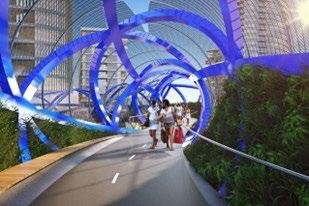
These infrastructure items will need to be incorporated into the applicable Contributions Plan to ensure Council has an appropriate funding mechanism to deliver them in the future.
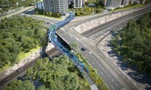
The Hills Shire Council Draft Precinct Plan Norwest Strategic Centre 110
NORWESTBLVD NORWEST BLVD BROOKHOLLOWAV SPURWAY DR PRIVATE SPURWAYDR(PRIVATE) WINDSORRD COLUMBIA WAY ( PR ) COLUMBIA CT SOLENT CCT SOLENT CCT BARINADOWNSRD BARINADOWNSRD WINDSORRD MEMORIALAV FAIRWAY DR FAIRWAY DR STONE MASON DR STONEMASONDR MACKILLOP DR MAITLAND PL CTEVESHAM RESTON GRA EDGEWATER DR FAIRMONTAV
Figure 70. Key Vehicular Connections
Metro Station Metro Line (Underground Tunnel) Norwest Central Precinct Signalised Intersection Roundabout New Road Road Upgrade T
Lachlan’s Line Bridge (Source: Architecture AU)
Lachlan’s Line Bridge (Source: Architecture AU)
5.3.7 Focus Area 7 –Open Space and Urban Plazas
The Norwest Central Precinct currently lacks sufficient passive and active open space given the extent of future growth identified. Kellyville Memorial Park is the only public active open space within the Precinct, located in the far north-western corner. Whilst there are other public open space areas within the broader Strategic Centre, these do not meet the benchmarks established within Council’s Recreation Strategy.
Overcoming open space shortfalls will hinge upon the delivery of new open spaces. However, it is acknowledged that given Norwest is a relatively established area, finding appropriate sites for active open spaces (such as playing fields) may prove particularly challenging. This will be further discussed in Section 7 of this Precinct Plan.
To better meet the needs of the community for passive recreation, an additional pocket park is proposed on the northern side of Norwest Lake. It is expected that this could be delivered in tandem with potential future commercial uplift on the adjoining land. The relevant land acquisition and capital works will also need to be incorporated into a future contributions plan to ensure that it can be delivered by Council in the future. Having regard to the lost development potential, a higher floor space ratio control may be warranted for the adjoining land. This will be considered as part of a future Council-initiated planning proposal for the broader commercial area (Focus Area 1).
An additional local park is also anticipated as part of the future redevelopment of Mackillop Drive (in accordance with the site specific planning proposal).
Given the urbanised nature of the Norwest Central Precinct, urban plazas will be a defining feature, especially along the ground floors of future commercial developments, near the Norwest Metro Station and Norwest Lake.
It is also recognised that there are various north-south tracks and trails. However, there is a clear shortfall in east-west connections, linking the three Precincts together.
The embellishment of existing and future open space areas will also be essential in enabling these spaces to be properly enjoyed by residents and workers. Creating desirable and practical spaces are drawcards in attracting residents and workers to the Norwest Strategic Centre as they provide spaces for people to relax and enjoy. This may include the provision of park benches, playgrounds and walkways.
111
Kellyville Memorial Park
Figure 71. Proposed Future Open Space between Solent Circuit and Norwest Lake (Source: Nearmap Aerial Imagery, copyright Nearmap)
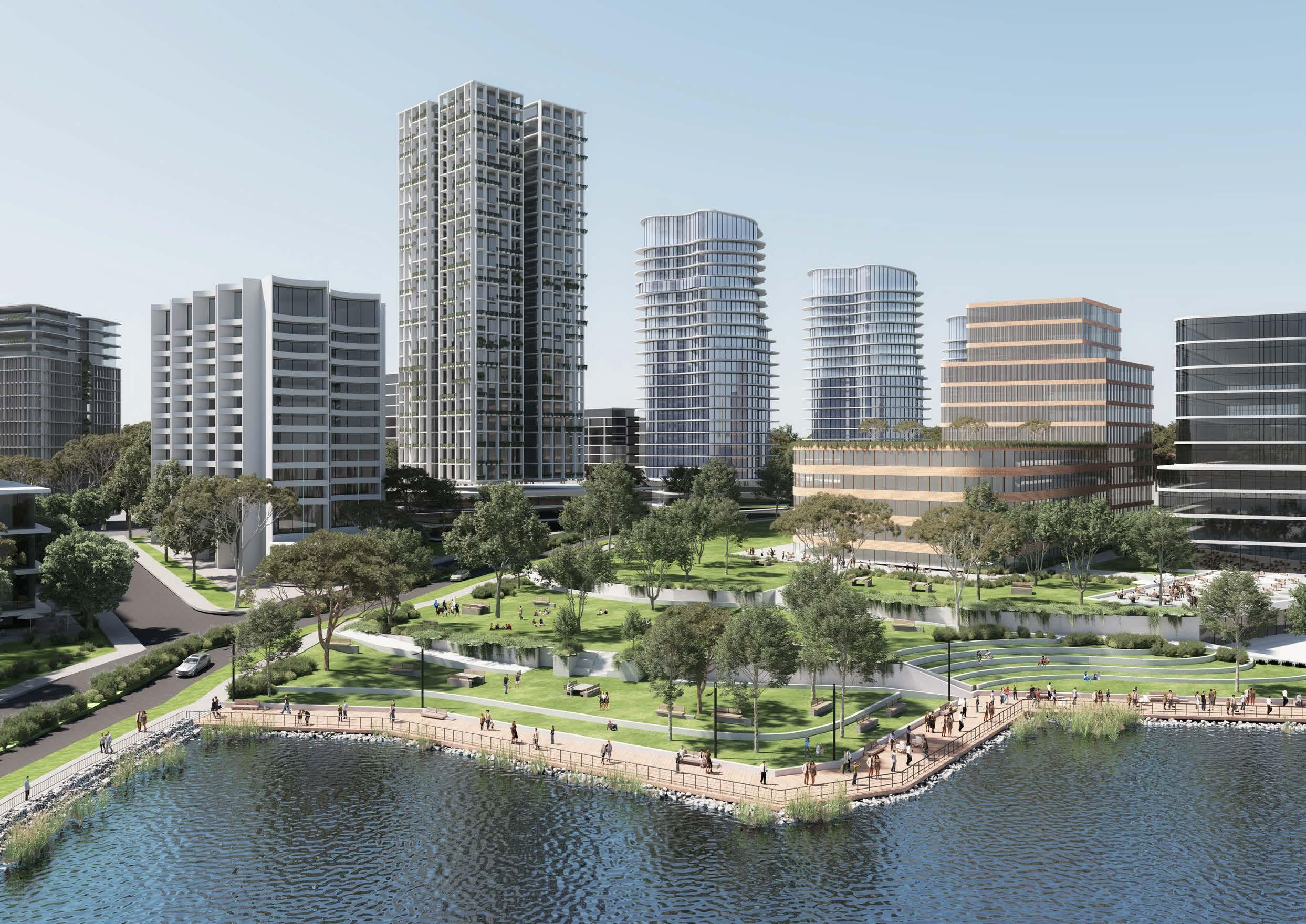 Indicative Concept for Potential New Park alongside Norwest Lake (Source: Tome Visuals)
5.3.8 Focus Area 8Long Term Residential Investigation Area
The Norwest Central Precinct is highly diverse, offering a range of land uses spanning from low density residential through to high density residential, along with various retail and commercial land uses. However, it also features an undulating topography, which poses a key challenge when determining appropriate built forms throughout the Precinct, particularly within higher density areas.
Future development within the Norwest Central Precinct must have regard to these unique sensitivities to ensure that development is compatible with surrounding uses and to provide a seamless transition from higher density areas through to the well-established low density residential areas. This will be particularly important in the southern portion of the Precinct where there is a well-established residential area generally comprising free-standing dwellings, along with some residential flat buildings.
Those properties directly adjoining the commercial area have been identified as longer-term investigation sites, where additional uplift could be considered to encourage a transition throughout the Precinct. Better master planned outcomes may be possible if this land was amalgamated with commercial land to the north (fronting Brookhollow Avenue), however this would be subject to the market.
Various design principles have been developed to guide future outcomes for this Focus Area:
Land Uses
• Where possible, mixed use outcomes could be considered if amalgamation with developments along the southern side of Brookhollow Avenue (minimum size of 10,000m²) could occur.
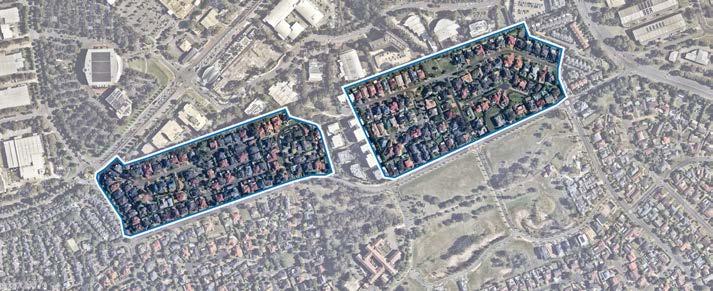
• Provision of diverse housing options, for example larger apartment sizes and terrace housing, to cater for the unique family dominated demographic within The Hills Shire.
• Integration of active uses on the ground floor level of highdensity residential developments to help create vibrant and lively streetscapes and provide for the day-to-day needs of residents in closer proximity of their homes.
Built Form
• Deliver a high quality built form outcome that seamlessly transitions from the commercial developments fronting Brookhollow Avenue, through to the existing lower density residential areas (approximately 2-3 storeys in height) south of Barina Downs Road.
• Lower scale apartment developments must be sympathetically designed to minimise adverse amenity impacts on existing low density residential areas and community title subdivisions.
• Explore opportunities for a mix of dwelling typologies, comprising apartments transitioning to terrace style housing fronting Barina Downs Road.
Infrastructure
• Tangible infrastructure solutions (including traffic, open space and water management) and an appropriate funding and delivery mechanism will be required to ensure that the uplift can be appropriately serviced.
• Additional local road connections may be required to facilitate the proposed uplift and to ensure the efficient movement of traffic within and surrounding the area.
• Evolving technologies, including digital infrastructure provisions, within future developments to provide better connected and informed communities.
Orderly Development
• Amalgamations with nearby landowners would be required to facilitate orderly, holistic and master planned development outcomes with minimum site areas of 10,000m² required. This is a key barrier that must be overcome by the market in order for redevelopment opportunities in this location.
Redevelopment of these sites is unlikely to be feasible in the shortterm. Some of this land is also challenged by strata and community title arrangements, which is a constraint for redevelopment. It is expected that these investigation sites could potentially be developed for high density residential uses, at a density of 96 dwellings per hectare (approximately 1:1). This would accommodate lower scale apartment style developments to transition to nearby lower density residential areas.
Noting the long-term prospect of feasibly redeveloping these areas, this Precinct Plan does not recommend that Council initiate any changes to the current controls. Retaining the current housing stock and character would not be an adverse outcome. Any future uplift would need to be facilitated by a future landowner-initiated planning proposal, guided by design principles.
Connectivity
• Improve pedestrian connectivity between Barina Downs Road and Brookhollow Avenue with new publicly accessible through site links.
113
Figure 72. Proposed Long Term Residential Investigation Area (Source: Nearmap Aerial Imagery, copyright Nearmap)
Metro Station
Metro Line (Underground Tunnel)
Focus Area
Proposed Road
Low Density Residential
Medium Density Residential
High Density Residential
High Density Commercial Offices
Mixed Use Open Space
T


114
Figure 73. Indicative Layout Plan
5.4 Vision and Structure Plan
The Norwest Central Precinct will remain a key employment destination, with a designated commercial area close to the Metro Station and mixed-use heart at Norwest Marketown. The highest densities will be concentrated around Norwest Marketown, Norwest Lake and Norwest Metro Station as the key visual landmarks for the centre of the Precinct. It will be supported by residential uses surrounding, but not within, the designated commercial area, all within a highly walkable distance to the Norwest Metro Station.
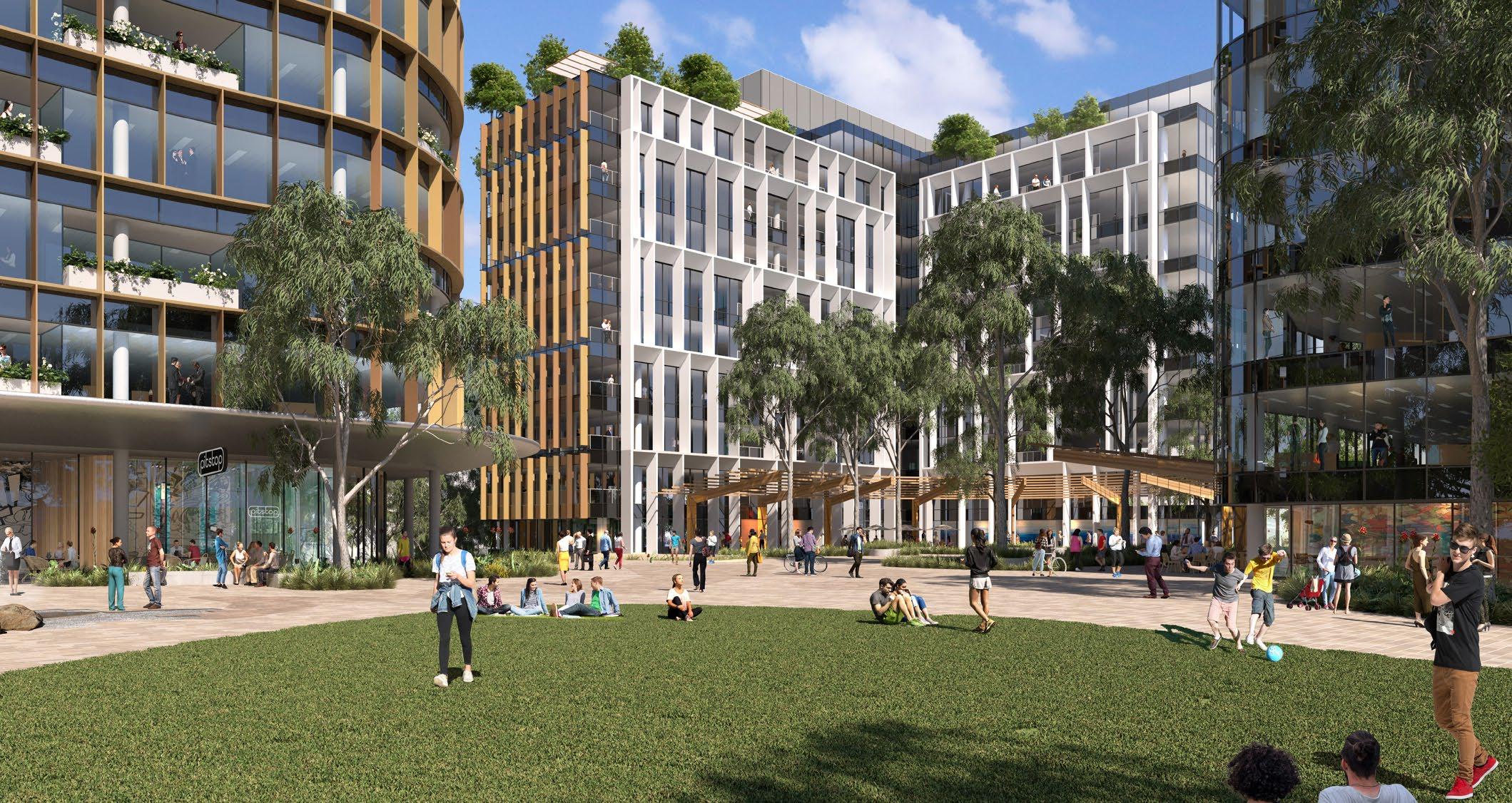
The area near the Metro Station and around the Lake will be the active heart, providing a carefully planned balance of high density housing, people friendly public spaces and a focus on serving the needs of locals and visitors with a diverse mix of retail, business, office, leisure, entertainment and community uses. It will feature the tallest buildings in the Strategic Centre (up to 35 storeys) and will display a high standard of architectural design, distinctly marking the vibrant core of the Norwest Strategic Centre. The density and scale of development will gradually decrease away from the centre and Metro Station.

115
Artist’s Impression of Residential Building (Source: Turner)
Artist’s Impression of Commercial Development at 7-15 Columbia Way (Source: Turner’s Studio)
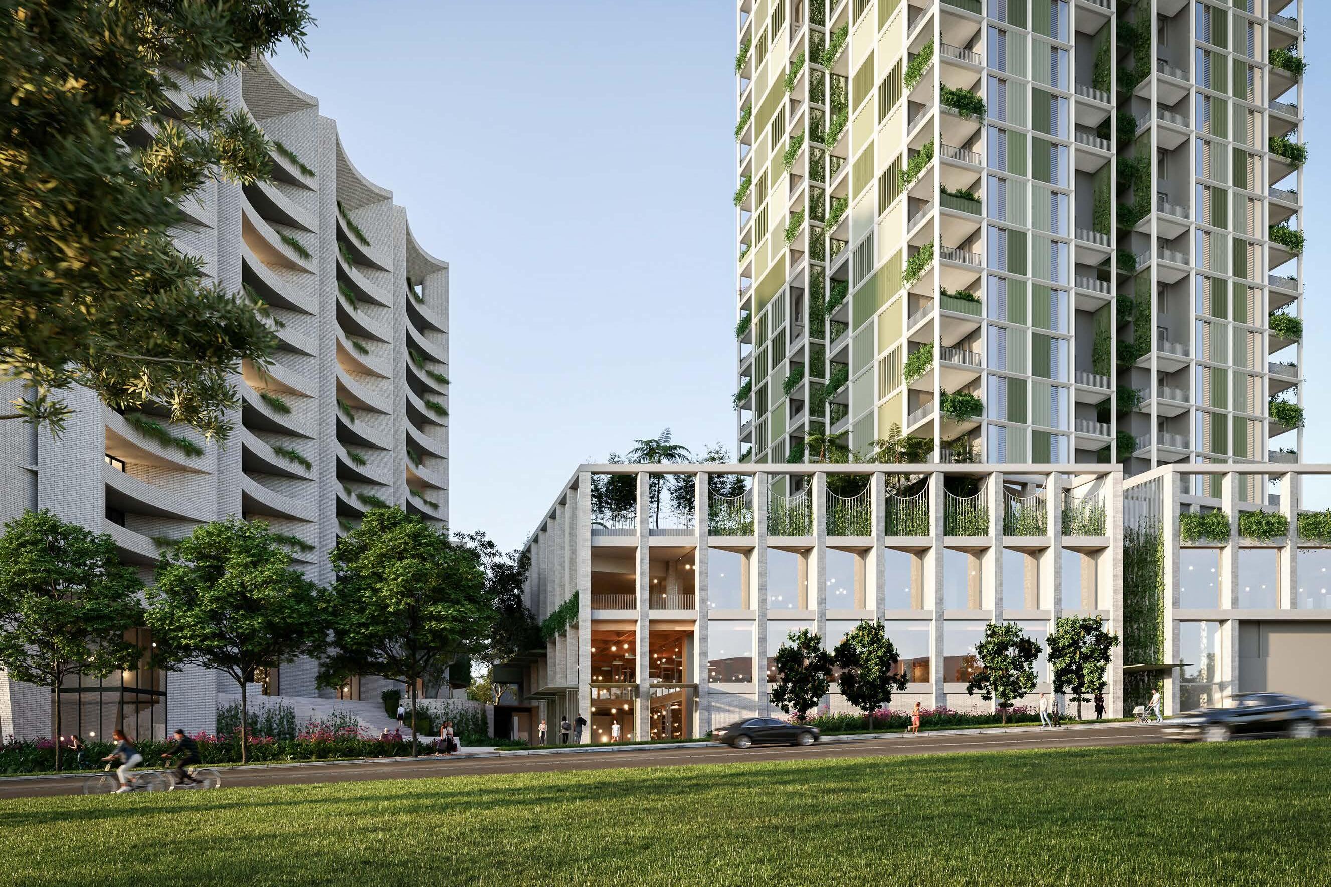 Indicative Concept of The Greens (Source: Bates Smart)
Connectivity
• Regional Connections: Council will continue to lobby the NSW Government for the funding, early planning and delivery of regional transport connections, as they are critical to the success of Norwest moving forward.
• Enhanced Connectivity: New local roads, along with various other traffic related works, are identified to improve the flow of traffic within the Norwest Central Precinct. This will also assist in breaking up large sites and improving pedestrian permeability. Enhanced pedestrian and cycle paths are identified to encourage alternative modes of transport and to reduce reliance on private vehicles as the main mode of transportation.
Metro Station
Metro Line (Underground Tunnel)
Norwest Central Precinct
Signalised Intersection

Pedestrian Bridge
Roundabout
Pedestrian Link
New Road Road Upgrade
117 NORWESTBLVD NORWEST BLVD BROOKHOLLOWAV SPURWAY DR SPURWAYDR WINDSORRD COLUMBIA WAY COLUMBIA CT SOLENT CCT SOLENT CCT BARINADOWNSRD BARINADOWNSRD WINDSORRD MEMORIALAV FAIRWAY DR FAIRWAY DR STONE MASON DR STONEMASONDR MACKILLOP DR MAITLAND PL CTEVESHAM RESTON GRA EDGEWATER DR FAIRMONTAV
Figure 74. Connectivity
T
Land Use
• Mixed Use Area: Norwest Marketown and immediate surrounds will be the heart of the Precinct, offering a mix of retail, business, office, leisure, entertainment and community uses with some higher density housing.
• Designated Commercial Area: A designated commercial area is identified to safeguard key employment land for commercial offices, enabling Norwest to transform into a highly competitive employment destination.
• New Open Space Areas: Land adjoining the Hospital and Norwest Lake will offer prime public open space for the enjoyment of local workers and residents. There will also be future open space areas and plazas incorporated into major development sites such as ‘The Greens’ and sites along Brookhollow Avenue (including the Norwest Station Site).
• Diverse Housing: The Norwest Central Precinct will contain a diverse range of housing opportunities interspersed throughout the Precinct (excluding the designated commercial area), spanning from wellestablished low to medium residential areas through to emerging high density apartment buildings in the northern portion of the Precinct and longer term opportunities in the south.
Metro Station
Metro Line (Underground Tunnel)
Norwest Central Precinct
Proposed Road
Low Density Residential
Medium Density Residential
High Density Residential
Local Centre / Retail Area
High Density Commercial Offices
Mixed Use
Public Open Space
Private Open Space
Drainage Land
Special Use
Urban Plaza
The Hills Shire Council Draft Precinct Plan Norwest Strategic Centre 118 WINDSORRD WINDSORRD MEMORIALAV FAIRWAY DR MACKILLOP DR EDGEWATER DR NORWESTBLVD NORWEST BLVD BROOKHOLLOWAV SPURWAY DR SPURWAYDR COLUMBIA WAY COLUMBIA CT SOLENT CCT SOLENT CCT BARINADOWNSRD BARINADOWNSRD FAIRWAY DR STONE MASON DR STONEMASONDR MAITLAND PL RESTON GRA FAIRMONTAV
Figure 75. Land Use
Density
• The floor space ratio controls will be the primary control that dictates density.
• Highest densities (up to 6.5:1) will be located near Norwest Metro Station, as well as Norwest Marketown and its surrounds. Densities in the broader commercial area are expected to be slightly less, generally in the order of 2:1-2.5:1, depending on proximity from the metro station and having regard for sensitive interfaces (such as well-established residential areas, creek corridors and public domain and open space areas).
• Some areas are not earmarked for any change, being areas where the existing character and outcomes are to remain, or areas where planning work (such as planning proposals) has already been completed and development is expected to roll-out over the next 5-20 years.
• In locations flagged for potential change indicative floor space ratio outcomes should not be viewed as an entitlement. Floor space ratio controls will be subject to detailed built form modelling and urban design analysis throughout the subsequent planning processes to ensure they are appropriate, functional and viable.
119 NORWESTBLVD NORWEST SPURWAY DR SPURWAYDR COLUMBIA CT BLVD SOLENT CCT SOLENT CCT BARINADOWNSRD BARINADOWNSRD WINDSORRD MEMORIALAV FAIRWAY DR FAIRWAY DR STONE MASON DR MACKILLOP DR CTEVESHAM RESTON GRA EDGEWATER DR FAIRMONTAV
Figure 76. Density
Metro Station Metro Line (Underground Tunnel) Norwest Central Precinct Proposed Road Area Flagged for Potential Change 1.0:1 1.5:1 2:1 - 2.3:1 2.0:1 2.1:1 2.2:1 2.36:1 2.42:1 2.0:1 - 2.5:1 2.5:1 2.6:1 2.65:1 2.8:1 2.9:1 3.0:1 3.2:1 4.1:1 4.0:1 - 4.5:1 6.5:1 A B C D E F G H I J K L M N O P Q R S
Built Form
• There will need to be a transition of building heights to facilitate a varied and interesting skyline, which also has regard to key view corridors through the Precinct (refer to Section 2).
• Norwest Marketown and surrounds will be the key landmark for the Norwest Strategic Centre, with opportunity for tall and varied building heights that are the beacon for the Precinct.
• Building heights will also be sympathetic to the surrounding established low density residential areas, as well as the topography of the Precinct.
• There will be opportunity for taller office buildings over varying heights (up to 15 storeys), with setbacks that incorporate quality landscaping and public domain improvements.
• Longer-term investigation sites south of the commercial core have been identified for potential high density residential outcomes, however the planning controls will be subject to future investigations and a separate landowner-initiated planning proposal process.
• In locations flagged for potential change, building height controls will be subject to built form modelling and urban design analysis throughout the subsequent planning processes to ensure they are appropriate, functional and viable.
• No changes are proposed to low-medium density areas (2-3 storeys in height), generally to the north and south of the commercial area, where the existing character and outcomes are to remain.
• No changes proposed to areas where separate planning work has already been complete (e.g. site-specific planning proposals or the Balmoral Road Release Area).
The Hills Shire Council Draft Precinct Plan Norwest Strategic Centre 120 Metro Station Metro Line (Underground Tunnel) Norwest Central Precinct Proposed Road Area Flagged for Potential Change 2-3 Storeys 5 Storeys 7-12 Storeys 8-10 Storeys 8-15 Storeys 3-19 Storeys 8-35 Storeys 10 Storeys 11 Storeys 12 Storeys 20 Storeys 25 Storeys 26 Storeys A A A A E E E E E E B B H H C J J L L G M K F D D D D NORWESTBLVD NORWEST SPURWAY DR SPURWAYDR COLUMBIA CT BLVD SOLENT CCT SOLENT CCT BARINADOWNSRD BARINADOWNSRD WINDSORRD MEMORIALAV FAIRWAY DR FAIRWAY DR STONE MASON DR MACKILLOP DR CTEVESHAM RESTON GRA EDGEWATER DR FAIRMONTAV
Figure 77. Built Form (Storeys)
A B C D E F G H I J K L M
5.5 Character Areas
A Commercial Area
The designated commercial area will enable Norwest to grow into a fullyfledged Commercial Office Precinct and cement itself as a competitive economic and employment hub. Buildings will have regard for transit oriented development principles, with the tallest buildings (up to 15 storeys) located towards the Metro Station. Technology will enable the Norwest Central Precinct to transform into a ‘Smart Place’ where businesses want to establish themselves. Generous front setbacks (of at least 15m) will be provided, as well as upper level setbacks (ranging from 3m-6m depending on the building height) for high density buildings. The identity of the Precinct will be strengthened through public art and informative wayfinding signage. The Precinct will also feature an attractive and practical public domain that incorporates landscaped setbacks, generous deep soil areas and sturdy planting. It will be a highly walkable and pedestrian focussed destination.
B Mixed Use Area
Norwest Marketown and surrounds will be the key landmark for the Precinct, featuring buildings of up to 35 storeys and a diverse range of uses that are compatible with the local surroundings. It will feature activated ground floor uses to create a sense of vibrancy and draw people to the area. Active movement will be prioritised by implementing additional pedestrian links and re-thinking the street structure. Improved footpaths, public furniture and outdoor dining opportunities will be prioritised, comprising durable materials. Established trees will be integrated with the new urban fabric to create a strong urban identity. A minimum of 50% of the floor space within the mixed use area shall accommodate non-residential uses such as supermarkets, shops, restaurants and commercial offices.
C Residential Apartments
Residential apartments are envisaged in areas already earmarked for high density residential outcomes in a landscaped setting. Having regard to transit oriented development principles, these areas are generally located closer to the Metro Station as the transition between high density commercial development and well-established lower density areas. Generous setbacks (of at least 10m) are envisaged to maintain the landscaped character, whilst simultaneously allowing flexibility in the siting of buildings. Activated ground floor uses are also encouraged to create vibrant streets and public spaces.
Low and medium density housing will be encouraged to provide a diversity of housing types and to define the boundaries of the Precinct. These areas will remain unchanged or continue to be developed under the existing controls. Generous setbacks (of at least 6m) will also be encouraged, along with landscape streets, public domain elements and high quality open spaces. High levels of permeability will be provided through quality pedestrian and cycling links.
The local centre will be of a smaller scale (approximately 2-3 storeys) and will provide a diverse range of services that meet the day-to-day needs of residents and workers within the Balmoral Road Release Area. Materials and planting palettes will reflect the character of the centre. Liveability will be increased through a quality public domain. Footpaths will also be easily connected into the network, avoiding dead ends and providing wayfinding signage. Setbacks of at least 6m will provide opportunities for high quality landscaping and an attractive streetscape.
121
D Low and Medium Density Residential E Local Centre NORWESTBLVD NORWEST SPURWAY DR SPURWAYDR COLUMBIA CT BLVD SOLENT CCT SOLENT CCT BARINADOWNSRD BARINADOWNSRD WINDSORRD MEMORIALAV FAIRWAY DR FAIRWAY DR STONE MASON DR MACKILLOP DR CTEVESHAM RESTON GRA EDGEWATER DR FAIRMONTAV A A A B C C E D D D
Figure 78. Character Areas
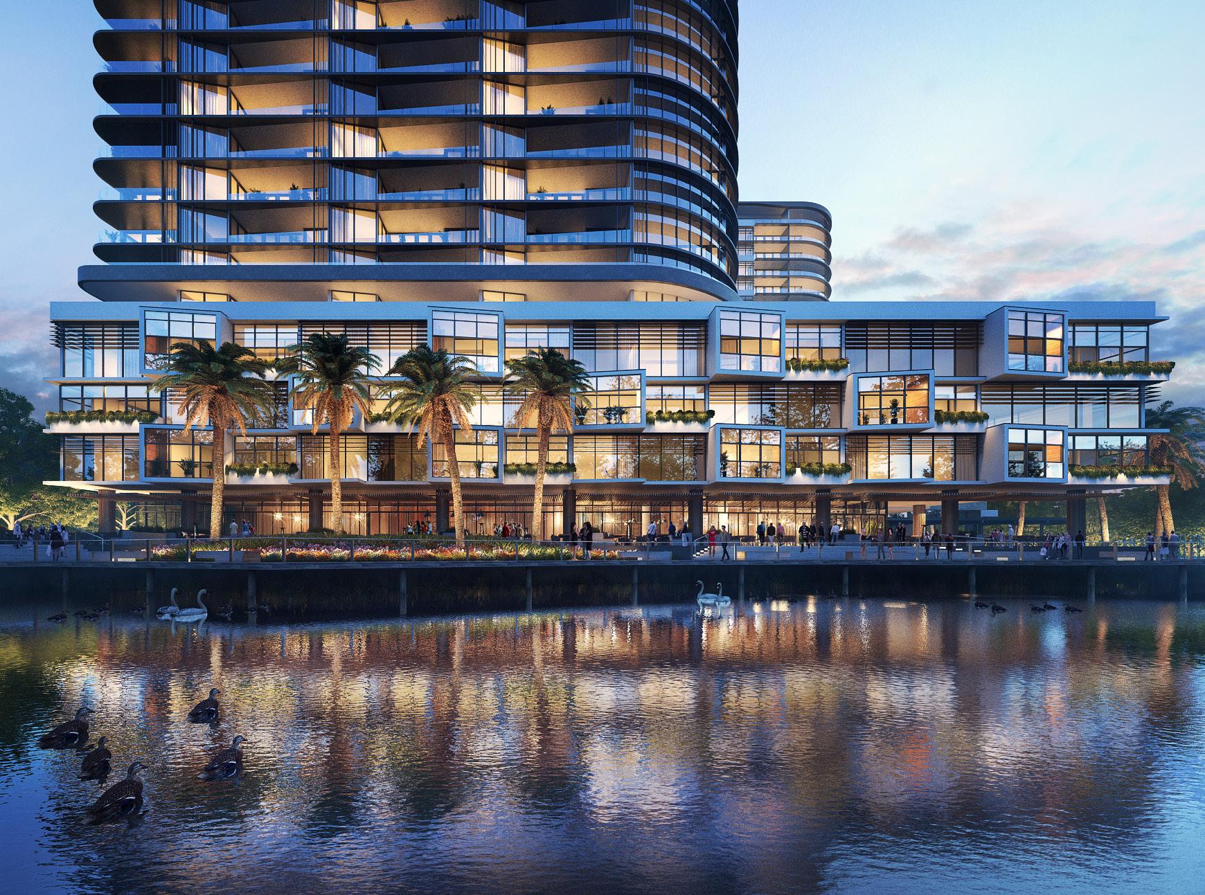 Indicative Concept for Esplanade Development (Source: Turners)
5.6 Yields and Projections
• In 2016, there were 2,510 dwellings within the Norwest Central Precinct accommodating an existing population of approximately 5,020 people (based on an average occupancy rate of 2 people per household). Under this Plan, it is anticipated that there is growth potential for 5,060 additional dwellings by 2041 (approximately 10,130 additional people). Residential yields are based upon an uptake rate of between 40% and 100% by 2041, noting that there will still be some remaining capacity for additional dwellings post-2041
• In 2016, there were approximately 11,340 jobs within the Norwest Central Precinct. Under this Plan, the Norwest Central Precinct is expected to accommodate nearly 8,060 additional jobs by 2036 and an additional 10,710 jobs by 2041 (depending on market factors). These assumptions are based upon uptake rates varying between 10-23% by 2036 and 14-32% by 2041. A small number of jobs are also dispersed in local centres and surrounds.
• Not all properties will be subject to redevelopment at the same time and uptake rates have been applied to each development type within each identified development area. The uptake rates which have been applied depend on the density being proposed and the extent of development which is likely to occur, having regard to opportunities and constraints affecting the land. Higher uptake rates are applied where higher densities are envisaged. However, in locations that are subject to development constraints, a lower uptake rate has been applied. Longer term sites have also been given lower uptake rates given they are unlikely to be feasible in the short to medium term and may be contingent on the market solving certain issues or delivering certain outcomes.
Metro Station
Metro Line (Underground Tunnel)
Norwest Central Precinct

123
A B C E G F D NORWESTBLVD NORWESTBLVD SPURWAY DR SPURWAYDR COLUMBIA CT SOLENT CCT SOLENT CCT BARINADOWNSRD BARINADOWNSRD WINDSORRD MEMORIALAV FAIRWAY DR FAIRWAY DR STONE MASON DR MACKILLOP DR CTEVESHAM RESTON GRA EDGEWATER DR FAIRMONTAV A B C D E F G
The Hills Shire Council Draft Precinct Plan Norwest Strategic Centre 124 2016 Dwellings 2021 Dwellings Residential Uptake Rate (2036) Additional Dwellings (2036) Residential Uptake Rate (2041) Additional Dwellings (2041) Total Dwellings (2041) A 268 308 100% 2,842 100% 2,842 3,110 B 0 0 100% 1,274 100% 1,274 1,274 C 0 0 N/A 0 N/A 0 0 D 0 0 N/A 0 N/A 0 0 E 207 238 40% 408 40% 408 615 F 756 869 N/A 0 N/A 0 756 G 1,279 1,471 100% 539 100% 539 1,818 Total 2,510 2,887 82% 5,063 82% 5,063 7,573 2016 Jobs 2021 Jobs Employment Uptake Rate (2036) Additional Jobs (2036) Employment Uptake Rate (2041) Additional Jobs (2041) Total Jobs (2041) A 235 270 100% 200 100% 200 435 B 2,475 2,846 14% 2,180 14% 2,180 4,655 C 2,464 2,834 10% 698 20% 1,436 3,900 D 5,151 5,924 23% 4,827 32% 6,745 11,896 E 146 168 100% 22 100% 22 168 F 204 235 100% 31 100% 31 235 G 663 762 100% 99 100% 99 762 Total 11,338 13,039 18% 8,056 24% 10,713 22,051 Table
Residential
Employment Yield
14.
Yield Analysis Table 15.
Analysis
5.7 Actions and Phasing
Strategic Work Completed
Areas where strategic planning work has already been completed (or is underway and nearing completion), where development is starting to be rolled out (including development applications and/or construction) or where no further change is anticipated.
Phase 1: Housekeeping Amendments
Areas where Council-led housekeeping amendments are recommended to facilitate improved and/or orderly development outcomes. It is noted that no housekeeping amendments are identified currently for this Precinct, however this phase has been retained for the purposes of engagement, as landowners or stakeholders may have a view with respect to the need for such changes.
Phase 2: Council-Led Change
Short to medium term actions that could be led by Council. Changes to the planning controls and framework in these areas would allow for the achievement of the vision and outcomes in this Plan and would be contingent upon Council-initiated planning proposals, along with associated Development Control Plan, Public Domain Plan and Contributions Plan amendments.
Phase 3: Market Driven Change*
Actions that will be market driven. These would be contingent on further investigations and the ability of the market to overcome complex problems to unlock the development potential of the land. Whilst some market driven solutions may be achievable in the short to medium term, feasible redevelopment in other market driven areas is unlikely to occur until beyond the short-to-medium term horizon. Changes to the planning framework would be driven by landowner-initiated planning proposals, along with associated amendments to the Development Control Plan, Public Domain Plan and appropriate infrastructure contribution mechanisms.
In terms of timing, it is expected that planning proposals for land in short to medium term areas would eventuate over the next 5 to 10 years. Market driven solutions and planning proposals for sites in longer term areas are unlikely to eventuate within this same period and are expected to occur beyond a 10-year horizon (10- 20 years).
*Note: Please refer to Section 1.3 of this Precinct Plan for details on sites identified for short to medium term change and those identified for longer term change.
Metro Station
Metro Line (Underground Tunnel)
Norwest Central Precinct
Strategic Work Completed
Phase 1: Housekeeping Amendments
Phase 2: Council-Led Change
Phase 3: Market Driven Change

125
B1 B1 B1 B1 B4 B5 B5 B7 B8 B8 B8 B6
PHASING
Phase Action Responsibility
Housekeeping Amendments (Phase 1)
N/A -
Council-led Change (Phase 2)
Action B1 - Planning Proposal – Designated Commercial Area: Council will commence a planning proposal for SP4 Enterprise zoned land (that have not yet been rezoned and excluding Focus Areas) to further explore potential planning controls to increase heights, floor space ratio controls and ensure the land is ready for commercial redevelopment Development Applications as the market grows. This is further discussed in Section 5.3 (Focus Area 1) of this Precinct Plan.
Action B2 - Amendments to Contributions Plan, Development Control Plan and Public Domain Plan: Council will initiate amendments to the applicable Contributions Plan, Development Control Plan and Public Domain Plan for the Norwest Central Precinct to facilitate some of the outcomes envisaged under this Precinct Plan.
Action B3 - Future Mass Transit Connection: Council will continue lobbying for a mass transit connection to Parramatta (via the Baulkham Hills Town Centre), as well as the extension of the North South Rail Link from Tallawong Station to St Marys Station.
Council Council Council / NSW Government
Market Driven Change (Phase 3)
Action B4 – Norwest Marketown and Surrounds: Future uplift will be facilitated through a landowner-initiated planning proposal for Norwest Marketown and surrounds to increase heights and floor space ratio controls and permit the range of envisaged uses, having regard to the design principles set out in Section 5.3 (Focus Area 2) of this Plan. Site-specific DCP amendments will also be required to guide future development outcomes.
Action B5 – Norwest Hillsong Campus: Future uplift will be facilitated through a landowner-initiated planning proposal for Norwest Hillsong Campus to increase heights and floor space ratio controls and permit the range of envisaged uses, having regard to the design principles set out in Section 5.3 (Focus Area 3) of this Plan. Site-specific DCP amendments will also be required to guide future development outcomes.
Action B6 – 1-9 Brookhollow Avenue: Future uplift will be facilitated through a landowner-initiated planning proposal for 1-9 Brookhollow Avenue to increase heights and floor space ratio controls and permit the range of envisaged uses, having regard to the design principles set out in Section 5.3 (Focus Area 5) of this Plan. Site-specific DCP amendments will also be required to guide future development outcomes.
Action B7 – Century Estate: Future uplift will be facilitated through a landowner-initiated planning proposal for Century Estate to increase heights and floor space ratio controls and permit the range of envisaged uses, having regard to the design principles set out in Section 5.3 (Focus Area 4) of this Plan. Site-specific DCP amendments will also be required to guide future development outcomes.
Action B8 - High Density Residential Investigation Area: Any high density residential uplift south of the commercial area will be facilitated via a landowner-initiated planning proposal, having regard to the design principles set out in Section 5.3 (Focus Area 8) of this Plan.
Landowners / Developers
Landowners / Developers
Landowners / Developers
Landowners / Developers
Landowners / Developers
The Hills Shire Council Draft Precinct Plan Norwest Strategic Centre 126
Table 16. Overview of Phasing and Implementation
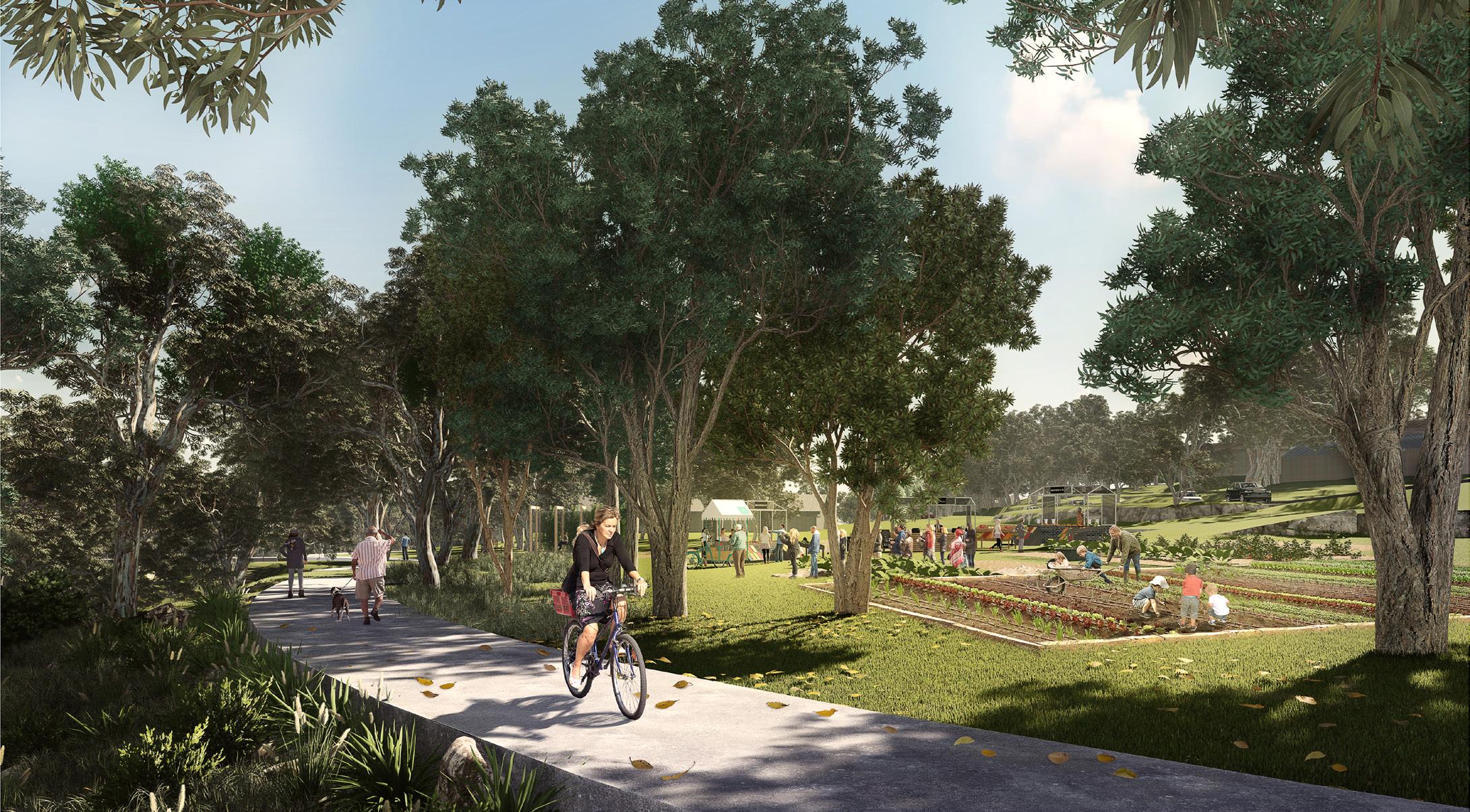 Indicative Concept for Castle Hill Showground - The Paddocks (Source: McGregor Coxall)
Executive Summary 01 Norwest Service 0 6
6.1 Context
The Norwest Service Precinct is bound by Showground Road and Kathleen Avenue to the north, Windsor Road to the west and south and Whitling Avenue to the east. It is strategically located along Windsor Road - a key factor contributing to the success of the Precinct over the years. It is also bisected by Carrington Road and Victoria Avenue. There are currently around 750 houses (2016 ABS Census) and 8,300 jobs (2016 Travel Zone Data) within the Precinct.
The Norwest Service Precinct has an area of approximately 246.70 hectares and contains several distinct character areas.
It currently features an employment area west of Cattai Creek, characterised by light industrial uses, specialised retail (bulky goods retail) and warehousing. This area comprises generous green setbacks, large roads and predominately concrete footpaths that lack continuity.
It plays an important role in meeting the needs of the residents in surrounding suburbs, with The Hills Super Centre being a major drawcard, comprising approximately 52,000m² of large format retail floorspace and multiple national retailers. There are also various industrial occupants within the Precinct, providing a range of essential urban services for residents and workers.
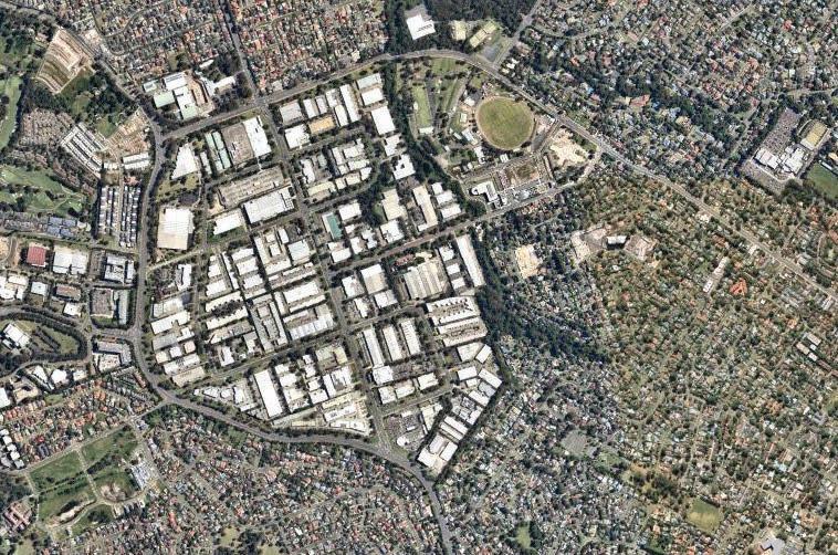
Land east of Cattai Creek (south of Carrington Road) is a well-established low density residential area, generally comprising free-standing dwellings. It was rezoned by the NSW Government for high and medium density development in late 2017 as part of the Planned Precinct Program. Some high density residential developments have already been approved and are now under construction.
A key focal point for the Precinct is Castle Hill Showground, comprising an oval, a spectator stand and a range of other community buildings that are used throughout the year and for large events. Council has adopted a Master Plan to revitalise the Showground and establish it as an economically viable recreation Precinct and vibrant regional destination.
The Cattai Creek Corridor is a greenway link that vertically bisects the Precinct from Cockayne Reserve to the Castle Hill Showground. Council has adopted a Landscape Master Plan that will transform this currently underutilised corridor into a green spine with active links and passive recreation.
129
Figure 81. Locality Map (Source: Nearmap Aerial Imagery, copyright Nearmap)
Castle Hill Showground
Showground Residential
Cockayne Reserve
Cattai Creek
Showground Service
Hills Super Centre Castle Hill Tavern
Hills Super Centre
6.2 Key Influences
6.2.1 Planning Processes to Date
2017 2018 2020 - 2021
Planned Precinct Program and Rezoning
The Showground Station Precinct was rezoned in December 2017 by the Department of Planning and Environment as part of the Planned Precinct Program.
The planning framework provides capacity for around 9,000 dwellings and 2,300 jobs. However, there is currently a cap limiting the Precinct to a maximum of 5,000 dwellings until the regional infrastructure shortfall can be resolved.
State Government identified Cattai Creek West as a ‘Deferred Matter’, which was excised from the Planned Precinct Program rezoning process.. In February 2020, the Department provided Council with a Draft Master Plan which proposed mixed use development adjoining the Creek Corridor, with higher density commercial office uses further to the west. However, this did not progress beyond a draft document. This Precinct Plan addresses the potential for uplift in this deferred area.
Showground Station Precinct
In August 2018, Council adopted the Showground Station Precinct Development Control Plan, Contributions Plan and Public Domain Plan to guide redevelopment on land that was rezoned by the State Government through the Planned Precinct Program.
Contributions Plan
The Contributions Plan enables Council to levy new residential and employment development to collect the funds necessary for the provision of local infrastructure required to support the additional growth.
Development Control Plan
The DCP includes controls to regulate future built form and ensure high quality development outcomes that reflect the intended character for the Precinct as a highly liveable transit centre.
Public Domain Plan
The Public Domain Plan seeks to enhance the image and amenity of the Precinct through the provision of street trees, footpath paving, furniture and landscaping to give the Precinct a unique urban identity, whilst complementing the character of the surrounding area.
Castle Hill Showground Master Plan
In 2020, Council adopted the Castle Hill Showground Concept Master Plan, prepared by McGregor Coxall. The Plan represents a 30 year vision for Castle Hill Showground. The Master Plan seeks to create a thriving cultural hub supporting current users and a variety of community, arts, sporting and leisure activities. The aim is to modernise the Showground, as well as pay homage to the site’s traditional roots.
Cattai Creek Landscape Master Plan
In 2021, Council adopted the Landscape Master Plan to show the vision for the Cattai Creek corridor. The vision is to connect the community with the creek and deliver environmental, social and recreational needs of the community. The project will also improve access to the Cattai Creek Corridor while protecting the natural environment. The aim is to also create a link between the Creek and the Castle Hill Showground as well as existing open spaces in the area.
Precinct Support Scheme
Funding under the NSW Government’s Precinct Support Scheme has been provided to Council to support key projects such as the Cattai Creek Landscape Master Plan.
*Note This Section should be read in conjunction with the strategic planning context discussed in Section 2 of this Precinct Plan, which also discusses strategies such as the Greater Sydney Region Plan, Central City District Plan, North West Rail Link Corridor Strategy, Hills Corridor Strategy, Council’s Local Strategic Planning Statement (and supporting strategies), plus others. This Section identifies additional planning processes and considerations specifically relevant to the Norwest Service Precinct.
131
Table 17. Planning Processes to Date
6.2.2 State Significant Development Application
In February 2021, the NSW Government approved a concept development application applying to Government Land on the Hills Showground Station Site. The concept approval proposes high density mixed use buildings up to 21 storeys in height, future roads and open space.
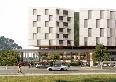
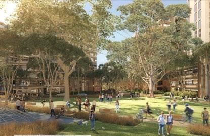
The approval would facilitate up to 1,620 residential units, 13,940m² of retail and commercial floor space (including a 3,000m² supermarket). It will facilitate around 530 jobs that will be supported by 4,900m² of public open space and 500m² of community facilities.
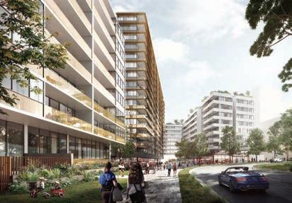
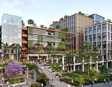
Future built form development applications will be lodged for each super lot. These will also be State Significant Development Applications (SSDAs), with the State Government as the determining authority. These applications will be assessed in accordance with the guidelines established within the concept master plan approval issued by the State Government.
6.2.4 Planning Proposals
The following planning proposals are currently under assessment within the Norwest Service Precinct:
1. 21-23 Victoria Avenue, Castle Hill
The planning proposal seeks to facilitate a mixed use development including retail, commercial and hotel floor space, facilitating approximately 1,434 jobs, in a built form ranging up to 13 storeys. Specialised retail would be concentrated within podium levels, whilst commercial floor space would be provided in towers above. Activation of the ground floor level would be realised through restaurants, cafes and shops.
2. 27 Victoria Avenue, Castle Hill
The planning proposal seeks to facilitate a commercial development, facilitating 305 jobs, comprising a range of uses, including specialised retail premises (bulky goods), within a built form of up to 6 storeys.
3. Showground Station Key Sites, Castle Hill
The planning proposal seeks to facilitate residential development that would accommodate approximately 2,533 dwellings, in a built form of up to 25 storeys and distributed between various sites immediately south of the Metro Station. This application has not progressed since May 2021 when the latest correspondence was sent to the Proponent.
(Source:
6.2.3 Dwelling Cap and High Density Residential Approvals
When the Showground Station Precinct was rezoned in 2017, the NSW Government imposed a cap of 5,000 dwellings within the Precinct. Once the cap has been reached, no additional dwellings can be approved until such time as the cap is lifted. It is understood that this is contingent on the provision of school infrastructure to service future growth, noting the Precinct has zoned capacity for approximately 9,000 dwellings. A number of Development Applications have been approved permitting high density residential developments within this area, some of which are currently under construction.
Metro Station
Metro Line (Underground Tunnel)

Norwest Service Precinct
Controls Under Assessment (Planning Proposals)
Approved (Development Applications)
The Hills Shire Council Draft Precinct Plan Norwest Strategic Centre 132
1 2 URBAN DESIGN REPORT SHOWGROUND STATION PRECINCT, SITES 2A-2E 11 EXECUTIVE SUMMARY SEXTON AVENUE LOOKING ALONG MIDDLETON WALK TOWARDS CARRINGTON ROAD (SITE 2A) 3 2 1 3
Figure 82. Planning Proposals and Development Applications
Indicative Concept Precinct Park East (Source: Oculus)
Indicative Development Concept21-23 Victoria Avenue
Ethos Urban)
Artist’s Impression of Proposed Development (Source: PBD Architects)
Artist’s Impression of Showground Key Sites Proposal
(Source: Stanisic Architects)
6.2.5 Key Constraints and Challenges
Ecology and Riparian Corridor
The Precinct is generally cleared of vegetation, except for garden landscaping, street trees and some pockets of Shale Sandstone Transition Forest (a Critically Endangered Ecological Community) along the Creek Corridor and a privately owned tributary adjoining Salisbury Road and Anella Avenue.
Cattai Creek bisects the Precinct, extending from Middleton Avenue to Showground Road and passing through Castle Hill Showground. Sections of the creek and its riparian corridor are currently privately owned. Future development will need to account for the Riparian Corridor and corresponding setback requirements.
Heritage
There are two items of environmental heritage within the Precinct along Showground Road which reflect the rural heritage of The Hills Shire.
Stormwater and Flooding
A significant overland flow path runs from Victoria Avenue to Cattai Creek, through private land. Buildings will need to be carefully sited to avoid overland flow paths and substantial upgrades to the existing stormwater network may be required as redevelopment occurs.
Electricity Substation
An electricity substation is located at the junction of Salisbury Road and Victoria Avenue.
Land Tenure and Rail Corridor
Existing Strata and community title arrangements will impact on the uptake of redevelopment. The underground rail tunnel limits the ability for some sites to undertake any significant excavation or basement carparks.
Permeability/Walkability
There is poor pedestrian permeability in the employment area due to the large lot and block sizes, with a lack of pedestrian links or formalised crossings.
Traffic Movement
The Precinct is bound by an arterial road network and features limited limited access points. Existing intersections currently experience substantial congestion at peak times.
Regional Infrastructure
The scale of residential growth already permitted within this Precinct will result in a shortfall of regional infrastructure, including schools. New school infrastructure and regional road upgrades to support the future growth, which will need to be resolved by the State Government.
Contamination
There is potential for land contamination due to the existing industrial uses within the Precinct, which will require further investigation as sites redevelop.
Metro Station
Metro Line (Underground Tunnel)
Norwest Service Precinct
Employment Area
Electricity Substation
Heritage Item
Open Space
Height Control Mismatches
Strata Controlled Lots
Vegetation
Urban Overland Flowpaths / Creeks
Major Roads and Barriers
133
Figure 83. Constraints and Challenges
6.2.6 Key Opportunities
Retaining Urban Support Services
Retaining the existing light industrial and specialised retail (bulky goods) area will continue to provide critical urban support services for residents, workers and visitors. Investigations have found that Norwest has a retail gap of around 11,400m² for household goods and bulky goods. These uses could be generally located outside the walkable catchment of the Metro Station, which reflects the traffic generating and car dependent nature of these uses.
High Density Commercial Outcomes and Job Creation
Establishing high density commercial office areas could assist in creating jobs near Showground Station and encouraging the expansion of the historical extent of the Norwest Business Park.
Diversity of Housing
Encouraging diverse housing opportunities near the Metro Station to create a highly walkable and transit oriented Precinct, where higher densities are located close to the station tapering down to lower density developments on the outer edges.
Improve Integration of Precincts
Upgrading and extending Carrington Road from Victoria Avenue through to Windsor Road would provide a strong single connection from Showground Road to Old Windsor Road, supported by bus services.
Improve Traffic Movement
Road upgrades, intersection improvements and delivery of new local roads, would improve vehicular access.
Open Space (Acquisition and Embellishment)
Acquiring and embellishing the Cattai Creek Corridor would improve the amenity of the Precinct for residents, workers and visitors, by providing an ecological and public recreation corridor. These upgrades could also support future upgrades to the Castle Hill Showground, by improving accessibility from the west and providing an active address to the open space.
Improve Walkability and Pedestrian Connections
Improved walkability within the Precinct and access to the Metro Station will be achieved through the delivery of pedestrian links, pedestrian bridges, new local access roads, footpaths and shared paths.
Revitalisation of the Castle Hill Showground
The Castle Hill Showground has the potential to transform into a major regionally significant recreational and cultural hub, increasing amenity and serving as a key drawcard for the Precinct.
Metro Station
Metro Line (Underground Tunnel)

Norwest Service Precinct
Open Space
Diverse Housing Opportunities
High Density Commercial Offices
Pedestrian Bridge
Intersection Improvement
Creek Embellishment and Activation
Improved Connection to Norwest Central
Improved Connectivity
I
The Hills Shire Council Draft Precinct Plan Norwest Strategic Centre 134
Figure 84. Opportunities
Metro Station
Metro Line (Underground Tunnel)
Norwest Service Precinct
Cattai Creek West
Cattai Creek Greenway Link Completion and Embellishment
Amendments to Local Roads and Pedestrian Links
Carrington Road Upgrade and Extension from Victoria Avenue to Windsor Road
High Density Commercial (Between Hudson Avenue and Victoria Avenue)
6 7 8 9
Height Control Mismatch Along Windsor Road
Height Control Mismatch within the High Density Residential Area
Land Along Eastern Side of Cattai Creek
Protecting and Encouraging Urban Services
135
7 9 1 9 6 8 2 6 4 3 3 5 SHOWGROUNDRD HUDSONAV ANELLAAV SALISBURYRD CARRINGTONRD DECLAMBEDR SHOWGROUNDRD WINDSORRD CECILAV GLADSTONERD HUDSON AV MIDDLETON AV PACKARDAV WHITE CEDARDR ASHFORD AV DAWESAV WARWICK PDE VICTORIA AV Figure 85. Focus Areas
6.3 Focus Areas
1 2 3 4
5
A number of “Focus Areas” have been identified for the Precinct. These build on the planning work completed to date and guide the achievement of the vision for the Precinct. These outcomes are reflected in the vision and structure plan in Section 6.4 of this Precinct Plan.
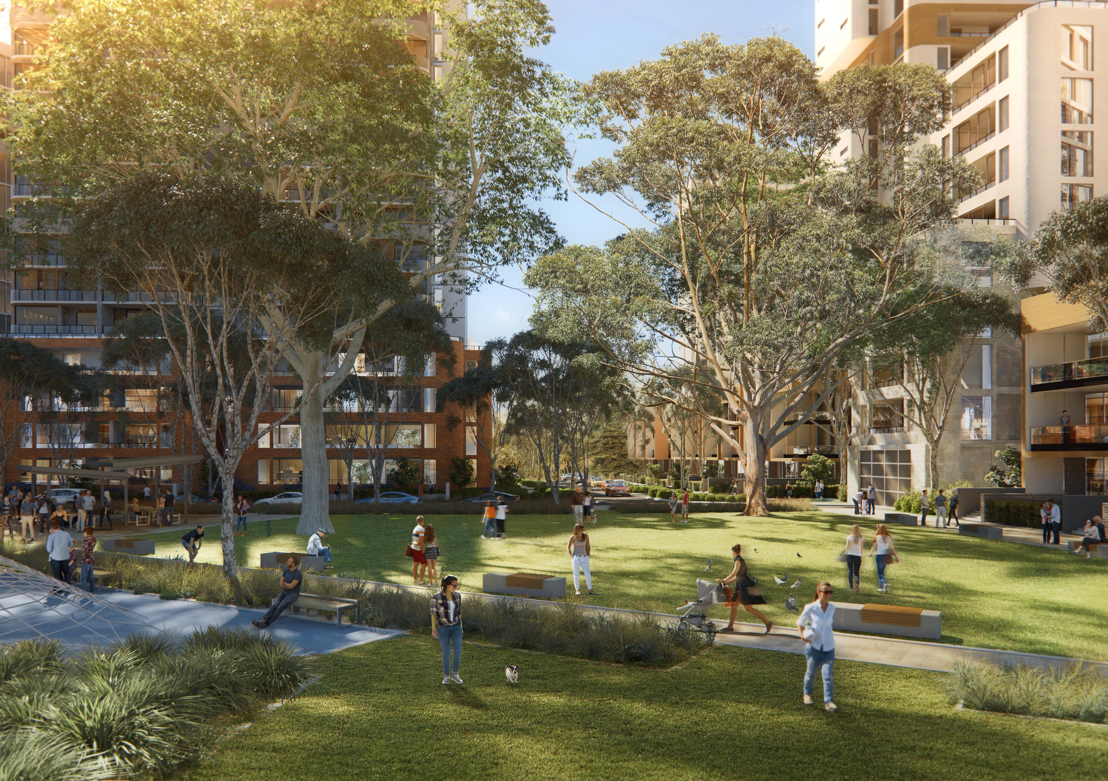 Indicative Concept of Showground Station Site (Source: Cox Architecture and Oculus)
6.3.1 Focus Area 1 -Cattai Creek West
As part of the NSW Government’s Planned Precinct Program in 2017, the Cattai Creek West Sub-Precinct was deferred from the final Showground Station Precinct rezoning. Whilst the original industrial zoning has since been reinstated, this Precinct Plan earmarks this area for high density commercial office developments (ranging from 6-12 storeys).
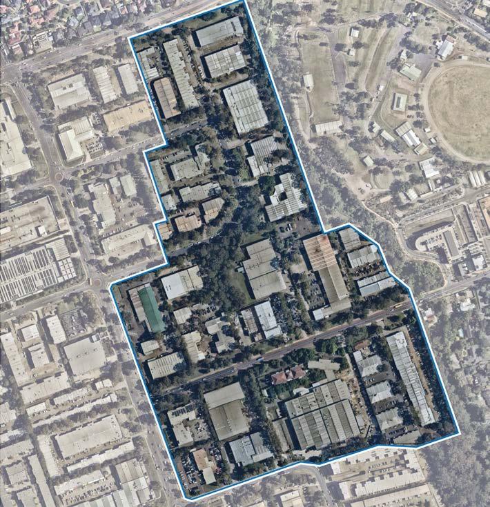
The boundary has been defined based on the previous planning work undertaken by the NSW Government as part of their Planned Precinct Program subsequent Draft Master Plan. Generally, the areas within the Cattai Creek West Focus Area are those that are within an 800 metre walking distance from the Station (accounting for new connections). These boundaries also seek to ensure sufficient land remains available within the Norwest Service Precinct for urban services (refer to Focus Area 9).
Associated amendments to The Hills Development Control Plan (DCP) 2012 will also be amended to establish an updated suite of development controls to guide redevelopment. These controls would include height distribution, setbacks, new local roads and profiles and pedestrian links.
The Public Domain Plan will be updated to guide treatment of the public areas and the Contribution Plan will be reviewed to account for updated growth projections, new infrastructure (including land acquisition) and updated infrastructure cost estimates.
Given the unresolved regional infrastructure constraints within the Precinct, most notably the lack of school infrastructure, this Precinct Plan does not identify additional residential growth within this Focus Area. Rather, this Plan recommends that the land west of Cattai Creek be retained for employment and urban support development.
Metro Station
Metro Line (Underground Tunnel)
Focus Areas
Proposed Road

Medium Density Residential
High Density Residential
Local Centre
High Density Commercial Offices
Urban Support Services
Open Space
Signalised Intersection
Pedestrian Bridge
Left-in-left-out
Urban Plaza
It is envisaged that heights will transition away from the Metro Station, with taller buildings located near Carrington Road to accentuate the junction. Building heights must be sympathetic to the adjoining creek corridor.
A Council initiated planning proposal will include changes to land zoning, Floor Space Ratios, Height of Buildings and Land Acquisition Maps within The Hills Local Environmental Plan (LEP 2019). The future planning proposal will need to address the design principles established for the Focus Area.
Roundabout
Creek Embellishment and Activation
Improved Connectivity
137
WINDSORRD WINDSORRD CECILAV PACKARDAV WHITE CEDARDR DAWESAV BRITANNIARD PATRICKAV WARWICK PDE T T T T T T T T T T T T
Figure 86. Cattai Creek West (Source: Nearmap Aerial Imagery, copyright Nearmap).
T
Figure 87. Indicative Layout Plan
Various design principles have been developed to guide future outcomes within this Focus Area:
Land Uses
• High density commercial office buildings will be provided.
• Active ground floor uses will be encouraged to facilitate vibrant streets and interfaces.
Built Form
• Building heights will range up to 6-12 storeys.
• Higher densities and taller buildings will be located closer to Showground Station, transitioning downward away from the station.
• Buildings taller than 8 storeys will incorporate upper level setbacks of at least 6m above the third storey.
• Buildings up to 8 storeys will include upper level setbacks of at least 3m above the fourth storey.
• Basement car parking will be provided, facilitating substantial areas for landscaping and pedestrian connectivity for at-grade areas.
• Buildings should be carefully sited to avoid overland flowpaths.
• Substantial upgrades to existing old stormwater pipes will be required as redevelopment occurs.
• Endangered ecological communities are to be preserved (where possible) and managed as redevelopment occurs.
Public Domain and Open Space
• The public domain interface will be attractive, safe, functional and accessible for workers.
• Delivery of pedestrian through site links and high quality footpaths as part of future redevelopment will improve pedestrian movement and walkability.
• Significant areas of sites for landscaping, tree canopy and deep soil planting.
• Active uses will be located along Carrington Road, new local roads and pedestrian through site links, providing visual interest from the street and creating a connection between public areas and future development.
• Activating the western edge of Cattai Creek is critical to the future success of this Focus Area. This edge will become an active promenade overlooking the creek featuring a range of land uses including retail, commercial and open space. The promenade will be prioritised for pedestrians and cyclists with limited vehicular access. A minimum setback of 10m will give a sense of scale and proportion to the built form while allowing for large tree plantings.
• Designs must align with Council’s Landscape Master Plan for the Creek Corridor. Connectivity
Infrastructure
• Tangible infrastructure solutions (including traffic, open space and water management) and an appropriate funding and delivery mechanism will be required to ensure that the uplift can be appropriately serviced.
• Integrate evolving technologies, including digital infrastructure provisions, within future developments to provide better connected and informed communities.
• Future development shall provide new local roads to increase vehicular access to future development sites and increase vehicular connectivity, at no cost to Council.
• Entry points to Carrington Road will be restricted. Vehicular access to development sites should occur via side streets.
• Future redevelopment must ensure that vehicular movement within and surrounding the site is safe and efficient.
The Hills Shire Council Draft Precinct Plan Norwest Strategic Centre 138
6.3.2 Focus Area 2 - Cattai Creek Greenway Link Completion and Embellishment
Council has adopted a Landscape Master Plan that will guide future embellishment of the Cattai Creek Corridor.
Land within the Corridor south of Carrington Road will be public open space and is either already owned by Council, or will be acquired by Council through the applicable Contributions Plan. Further investigations will be undertaken (in association with Focus Area 1) on the possible transfer of land within the Cattai Creek Riparian Corridor (north of Carrington Road) to create a more logical edge to the Greenway Link and ensure good public access and holistic maintenance for the full length of the Corridor.
Embellishment of the Greenway Link will occur in multiple stages, as follows:
1. Stage 1
Land south of Carrington Road.
2. Stage 2
Land north of Carrington Road (which will be contingent upon land ownership constraints and potentially, the timing of redevelopment).
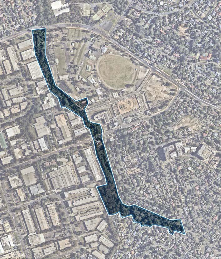
The initial stage will be the embellishment of Cockayne Reserve in accordance with the Landscape Master Plan, with the use of Government Precinct Support Scheme funding and funds collected through the Contributions Plan. Once the remainder of the Greenway Link is secured, the second portion of the corridor will be progressively embellished as funding permits and in association with the redevelopment of adjoining sites.
A pedestrian and cycle bridge will also be provided over Carrington Road to provide safe and unencumbered north south movement along the length of the corridor for pedestrians and cyclists.
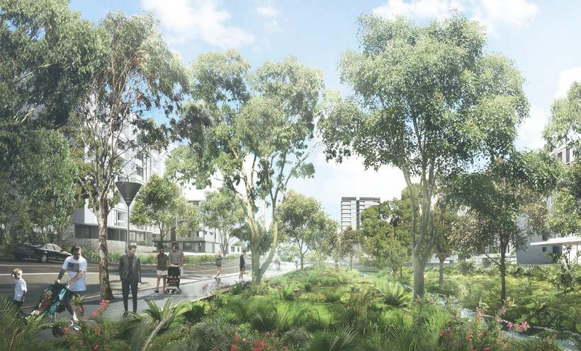
139
Showground Station Precinct Proposal 19
Figure 88. Cattai Creek Corridor Concept Master Plan (Source: McGregor Coxall)
LEGEND 1. Cattai Creek 2. Cockayne Reserve 3. Upgraded playground 4. Shared pedestrian/cycle path 5. Potential for an enlarged neighbourhood park 6. Vegetated drainage corridor 7. Castle Hill Showground 8. Showground Station 9. Fred Caterson Reserve 10. Location of artist impression illustrated in Figure 29
There is an opportunity for the Cattai Creek corridor to be revitalised and made more accessible to the community. Significant tracts of the creek corridor are currently held in private ownership. The redevelopment of land adjacent to the corridor provides the opportunity for these parts to become public open space, with greater linkages over the creek linking Cockayne Reserve, the Castle Hill Showground, and Fred Caterson Reserve beyond.
Figure
28.
Cattai Creek corridor - potential enhancements
Figure 29. Impression of the revitalised Catti Creek Corridor, looking north.
Figure 89. Cattai Creek Greenway Link Completion and Embellishment (Source: Nearmap Aerial Imagery, copyright Nearmap)
Artist’s Impression of Cattai Creek Corridor (Source: Department of Planning and Environment)
CARRINGTON ROAD
CARRINGTON ROAD
6.3.3 Focus Area 3 - Amendments to Local Roads and Pedestrian Links
A few proposed local roads within the residential area that were identified by the NSW Government as part of the Planned Precinct Program require review to facilitate orderly and viable development.
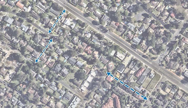
DORAN T
One of the links (between Fishburn Crescent and Warwick Parade) is located within the medium density residential area and would not be feasible for a developer to deliver. The additional cost of delivering the road connection, coupled with the reduced yield, will likely render redevelopment economically unviable. The link also crosses an existing strata medium density development which is unlikely to be redeveloped.
DECLAMBEDR T
The proposed road link between Chapman Avenue and Showground Road includes a dog-leg which will impact on vehicular movement. The original intent was for the road to line-up with Britannia Road. However, this will create an isolated pocket of high density land and is unlikely to facilitate orderly development.
The removal of these links is not anticipated to impact the planned road network and it is recommended that the following amendments be considered to the road layout identified in the Showground Precinct Development Control Plan:
Metro Station
Metro Line (Underground Tunnel)
Delete Proposed Local Roads and Change to Pedestrian Links
Signalised Intersection

Roundabout
T
High Density Residential
Open Space
Delete Proposed Local Road
Improved Connectivity
*Note: Outcomes for this Focus Area will be influenced by intended outcomes described in Focus Area 6.
The Hills Shire Council Draft Precinct Plan Norwest Strategic Centre 140
1. Replacement of proposed future road link connecting Chapman Avenue and Showground Road at the junction of Britannia Road with a pedestrian link.
2. Deletion of proposed future road link connecting Chapman Avenue and Cecil Avenue.
RD AV
Figure 91. Amendments to Currently Planned Local Roads and Pedestrian Links (Source: Nearmap Aerial Imagery, copyright Nearmap)
PACKARDAV WHITE CEDARDR ASHFORD AV A AV
CARRINGTONRD T
Medium Density Residential
6.3.4 Focus Area 4 - Carrington Road Upgrade and Extension from Victoria Avenue to Windsor Road
This Precinct Plan identifies an extension of Carrington Road from Victoria Avenue through to Windsor Road, creating a single boulevarde between Showground Road and Old Windsor Road to improve connectivity between the Norwest Service and Norwest Central Precincts.
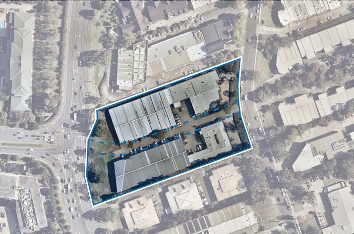
It will pass through land already up-zoned as part of the NSW Government’s Planned Precinct Program as well as sites that are currently zoned E3 Productivity Support and E4 General Industrial (being most of the block bound by Victoria Avenue, Gladstone Road, Hudson Avenue and Salisbury Road).
6-8 Hudson Avenue
Given the planned road extension will impact the redevelopment potential of 6-8 Hudson Avenue, consideration will need to be given to the acquisition of part of this land through the applicable Contributions Plan, along with a Local Environmental Plan amendment to rezone the corridor to SP2 Infrastructure. It is expected that the corridor will be secured as the land is redeveloped for higher density commercial development. Capital costs for the new road (through 6-8 Hudson Avenue) will need to be included within the applicable Contributions Plan.
Metro Line (Underground Tunnel) Focus Area Proposed Road High Density Commercial Offices Urban Support Services Signalised Intersection
Bridge
Land Bound by Victoria Avenue, Hudson Avenue, Salisbury Road and Gladstone Road (refer to Focus Area 5)

Part of the corridor will be secured as part of a future landowner-initiated planning proposal (being the section between Hudson Avenue and Victoria Avenue) to facilitate high density commercial outcomes on this land (refer to Focus Area 5). As part of this planning proposal consideration would be given to a planning agreement or amendment to the applicable Contributions Plan.
Connection to Norwest Central
141
WINDSORRD CECILAV MIDDLETON AV PACKARDAV WHITE CEDARDR ASHFORDAV DAWESAV TRICKAV WARWICK PDE T T T T T T
SHOWGROUNDRD DECLAMBEDR SHOWGROUNDRD
Figure 92. Carrington Road Upgrade and Extension from Victoria Avenue to Windsor Road (Source: Nearmap Aerial Imagery, copyright Nearmap)
6-8 Hudson Avenue will be impacted by the future extension of Carrington Road from Victoria Avenue to Windsor Road
Roundabout Improved
Improved
T
Pedestrian
Connectivity
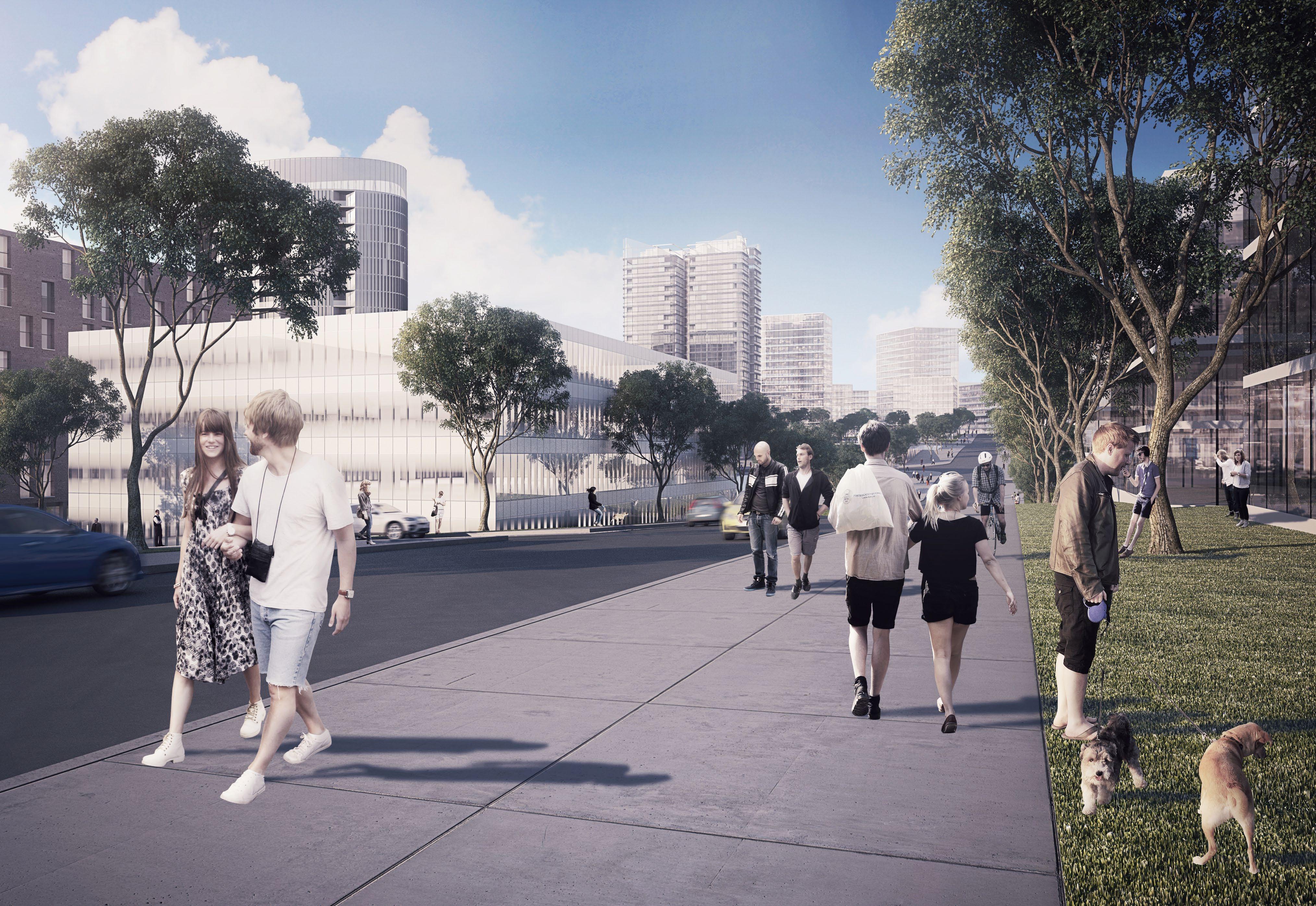 Artist’s Impression along Carrington Road (Source: Department of Planning and Environment)
6.3.5 Focus Area 5 - High Density Commercial (Between Hudson Avenue and Victoria Avenue)
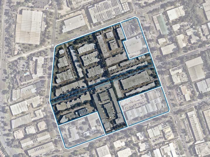
This Precinct Plan identifies most land bound by Victoria Avenue, Salisbury Road, Hudson Avenue and Gladstone Road as a Focus Area. This Focus Area has capacity to provide substantial employment growth and will facilitate key infrastructure upgrades.
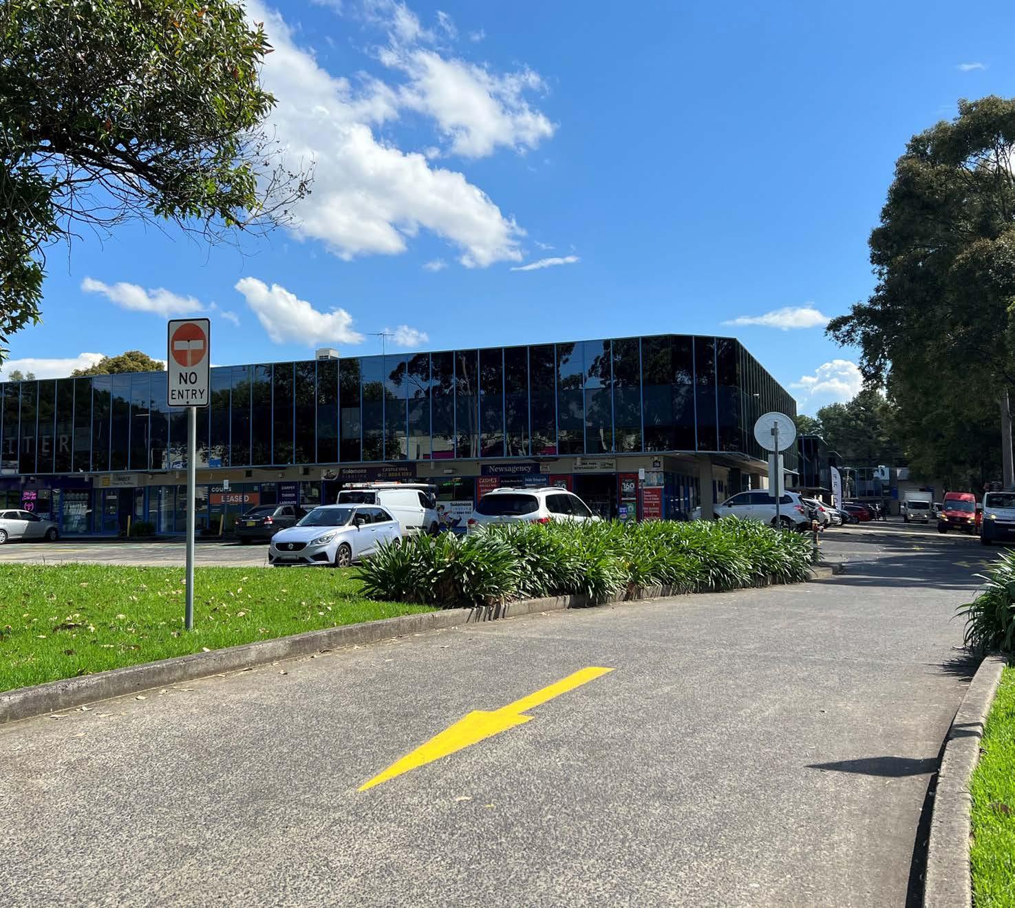
Higher density commercial office development is contingent on the delivery of the planned new road, noting its public benefits and accessibility improvements. The feasibility of this corridor is currently being investigated. If the road corridor does not progress, it would be appropriate for this land to remain as urban services land (in line with the outcomes anticipated within Focus Area 9).
Any redevelopment of these sites will occur as part of a future landownerinitiated planning proposal addressing the design principles established for this Focus Area. Associated amendments to the DCP will also be required to establish a suite of development controls to guide redevelopment, including height distribution, setbacks, new local road locations and profiles and pedestrian links.
Updates to the Public Domain Plan will be required to guide the treatment of the public domain, along with updates to the applicable Contributions Plan (or establishment of an alternative contribution mechanism) to account for increased growth, new infrastructure items and updated infrastructure cost estimates.
143
Figure 94. High Density Commercial Focus Area (Source: Nearmap Aerial Imagery, copyright Nearmap)
Existing Development in Focus Area
Various design principles have been developed to guide future outcomes:
Land Use and Built Form
• This Focus Area is earmarked for high density commercial office development with building heights up to 8 storeys along the new road corridor. Other land fronting Salisbury Road and Gladstone Road will continue to accommodate light industrial and specialised retail premises.
• Active ground floor uses will be encouraged to facilitate vibrant streets.
Connectivity
• Redevelopment will secure the corridor for the Carrington Road extension from Victoria Avenue to Hudson Avenue. Increased density will be tied to the provision of this road corridor (land and capital), at no cost to Council.
• Future development shall facilitate the delivery of a new local road connecting Salisbury Road and Gladstone Road to increase vehicular access to future development sites and increase vehicular connectivity within the Precinct. New roads would be at no cost to Council and restricted to lots that contain land that is proposed to be up-zoned.
•
Public Domain and Open Space
• The public domain interface will be active, attractive, safe, functional and accessible for workers.
• An urban plaza / open space shall be centrally located within the site.
• Redevelopment shall improve pedestrian movement and walkability within the Precinct. This will be facilitated through the delivery of pedestrian through site links and high quality footpaths.
• Active uses will be located along the Carrington Road extension, the new local cross road and pedestrian through site links. This will provide visual interest from the street and will create a connection between public realm and future development.
• Future redevelopment must ensure that vehicular movement within and surrounding the Focus Area is safe and efficient.
• Entry points to the Carrington Road extension will be restricted.
Infrastructure
• Tangible infrastructure solutions (including traffic, open space and water management) and an appropriate funding and delivery mechanism will be required to ensure that the uplift can be appropriately serviced.
• Integrate evolving technologies, including digital infrastructure provisions, within future developments to provide better connected and informed communities.
Metro Line (Underground Tunnel)
Focus Area
Proposed Road
High Density Commercial Offices
Urban Support Services
Signalised Intersection

Roundabout
Improved Connection to Norwest Central
Improved Connectivity
T
The Hills Shire Council Draft Precinct Plan Norwest Strategic Centre 144
CARRINGTON T
6.3.6 Focus Area 6Height Control Mismatch Along Windsor Road
As part of the State Government’s Planned Precinct Program, two areas along Windsor Road were rezoned B6 Enterprise Corridor (now E3 Productivity Support), with a maximum floor space ratio control of 2.3:1 and maximum height of building control of 27m (approximately 6 storeys).
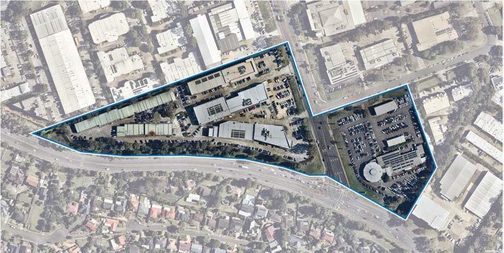
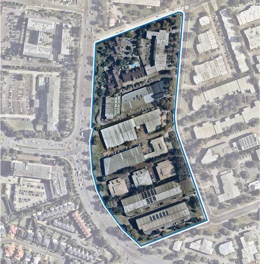
The application of the current controls have created a mismatch with the planning controls, as achieving the permitted FSR of 2.3:1 translates to approximately 8-10 storeys (rather than 6 storeys as identified in the applicable LEP and DCP controls). This will lead to excessive building bulk, excessive site coverage and breaches to key development controls.
To rectify this issue and to encourage more desirable built form outcomes, a Council-initiated planning proposal is proposed to increase the maximum height of building control from 27m to 42m (an increase from 6 storeys to 8-10 storeys). Consequential amendments will also be required to the Development Control Plan (DCP) to reflect the revised height controls. No change to the permitted density or yield as established through the NSW Government’s Planned Precinct Program is proposed on this land.
Metro Line (Underground Tunnel)
Focus Area
Proposed Road

High Density Commercial Offices
Urban Support Services
Signalised Intersection

Pedestrian Bridge
Roundabout
Improved Connection to Norwest Central
Improved Connectivity
*Note: Outcomes for this Focus Area will be influenced by intended outcomes described in Focus Area 4.
These areas include the following:
• Area 1:
• Area 2:
145
Figure 96. High Density Commercial Pocket along Hudson Avenue (Area 1) (Source: Nearmap Aerial Imagery, copyright Nearmap)
HUDSONAV ANELLAAV T T T SHOWGROUNDRD HUDSONAV ANELLAAV CARRINGTONRD DECLAMBE SHOWGROUND WINDSORRD HUDSON AV WHITE VICTORIA AV T T T T T T T
Figure 98. 1-3 Packard Avenue and 2A Victoria Avenue (Area 2) (Source: Nearmap Aerial Imagery, copyright Nearmap)
T
6.3.7 Focus Area 7 - Height Control Mismatch within the High Density Residential Area
There is a mismatch between the floor space ratio and height of building controls within the LEP for the 6 storey, 8 storey and 12 storey areas within the Showground Residential Area, which was rezoned by the NSW Government in 2017.
To rectify this, a Council-initiated planning proposal is proposed to amend the height of building controls as follows:
• 6 storeys to become 7 storeys.
• 8 storeys to become 9 storeys.
• 12 storeys will generally remain as 12 storeys, although the height limit (as expressed in metres) will be slightly increased to facilitate higher quality built form outcomes and ensure a 12 storey form can be compliant with the height limit.
These recommended height amendments would better align the height standard with the incentive floor space ratio. Consequential development control plan amendments will also be required.
Importantly, this would not increase the permissible yield on this land (as established by the existing floor space ratio control). Rather it would ensure the envisaged outcomes can achieve more desirable built form and urban design
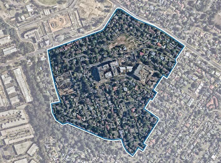
The height control mismatch results in poor built form outcomes as the floor area is compressed downwards, placing pressure on other development controls and resulting in:
• Setback non-compliances.
• Reduced building separation.
• Bulky buildings with large floor plates.
• Inadequate landscaped open space.
• Excessive overshadowing of open space and adjoining sites.
• Poor solar access for residents.
Metro Station
Metro Line (Underground Tunnel)
Focus Area

Medium Density Residential
High Density Residential
Local Centre
Commercial Offices
Open Space
Urban Services
Urban Plaza
The Hills Shire Council Draft Precinct Plan Norwest Strategic Centre 146
Figure 101. Height Control Mismatch within the High Density Residential area (Source: Nearmap Aerial Imagery, copyright Nearmap)
HUDSONAV ANELLAAV CARRINGTONRD
WINDSORRD CECILAV GLADSTONERD HUDSON AV PACKARDAV VICTORIA AV
SHOWGROUNDRD
SHOWGROUNDRD
6.3.8 Focus Area 8Land Along Eastern Side of Cattai Creek
This Focus Area is heavily constrained by the Riparian Corridor, which extends into a substantial portion of private land (along a majority of the residential interface).
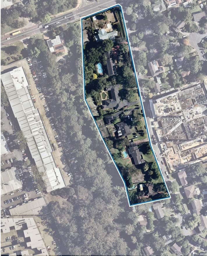
Riparian Corridor distances are established by the Office of Water. This area is classified as a ‘2nd Order Stream’, whereby the Riparian Corridor distance is 20m from the top of bank on each side of the watercourse.
For certain locations, the riparian setbacks coupled with the built form setbacks and height limit reduce the available developable area by such an extent that development is not able to achieve the full incentivised floor space ratio (FSR) permitted within the Local Environmental Plan (LEP). The combination of development constraints and the mismatch between the height and incentive FSR and the maximum height standard in the LEP will result in a poor built form outcome.
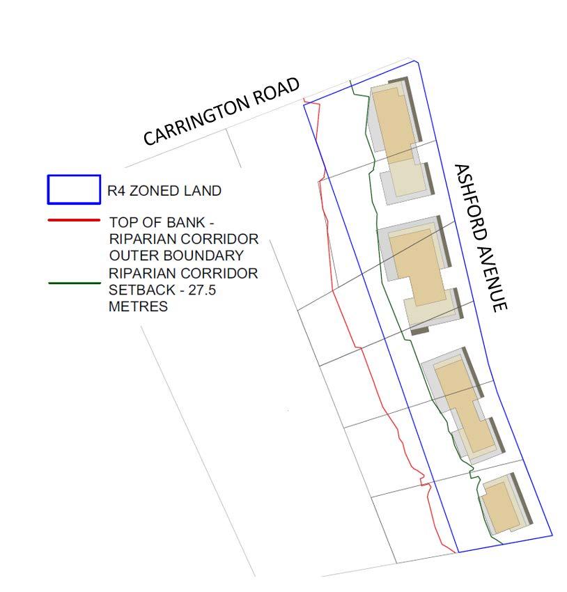
To facilitate more appropriate development outcomes, a more targeted approach will be required for these sites. Further built form modelling will be required for this land to establish a site specific response, potentially through amendments to the LEP and DCP.
This modelling may demonstrate that the required building height to achieve the maximum incentivised FSR would result in a poor built form outcome. In determining the appropriate controls for this land, achievement of the maximum incentive FSR will not take precedence over the achievement of high quality design outcomes.
To encourage quality built form outcomes, setbacks from the Riparian Corridor are desirable. Council’s Development Control Plan (DCP) seeks to reinforce this through further built form setbacks of 7.5m (measured from the Riparian Corridor).
147
Figure 102. Constrained Residential Land Adjoining Riparian Corridor
Figure 103. Land Along Eastern Side of Cattai Creek (Source: Nearmap Aerial Imagery, copyright Nearmap).
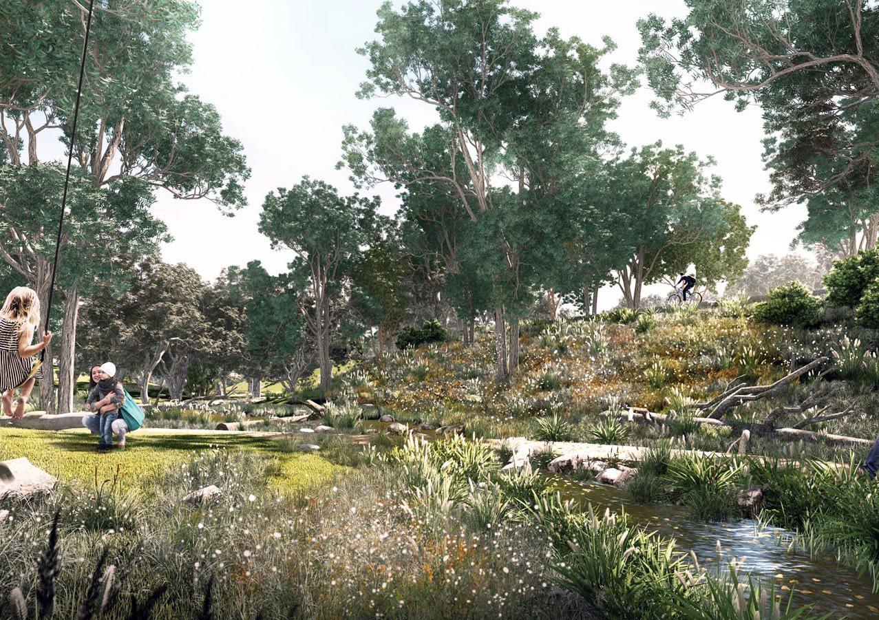 Artists Impression of Cattai Creek Corridor (Source: McGregor Coxall)
6.3.9 Focus Area 9 - Protecting and Encouraging Urban Services
The term ‘urban services’ covers a range of industries and activities that are fundamental to how The Hills Shire functions and are critical to supporting future growth. Industrial and urban services land contains a range of land uses including panel beaters, mechanics, lawn-mower repairers, small-scale manufacturing companies, children’s play facilities, food preparation and catering facilities and gyms.
Ensuring that pockets of industrial and urban services land are strategically distributed throughout The Hills Shire will provide people the opportunity to live and work close to these services. For this reason, key urban services land within the Norwest Service Precinct will be retained and protected.
Under the State Government’s Employment Zone Reforms, the B5 Business Development zone was merged with the B6 Enterprise Corridor zone, becoming the new E3 Productivity Support zone. Historically, the B5 Business Development zone has proved to be a useful and simple tool for clustering specialised retail uses together and it is intended that this will continue within the new E3 Productivity Support zone.
Unfortunately, whilst the State Government’s proposed Employment Zone reforms intended to provide increased flexibility for land use permissibility, the collapsing of land use zones into a simplified hierarchy and consolidation of permissible uses has impacted Council’s ability to tailor a zone to specifically encourage specialised retail premises in any given location (such as the Norwest Service Precinct).
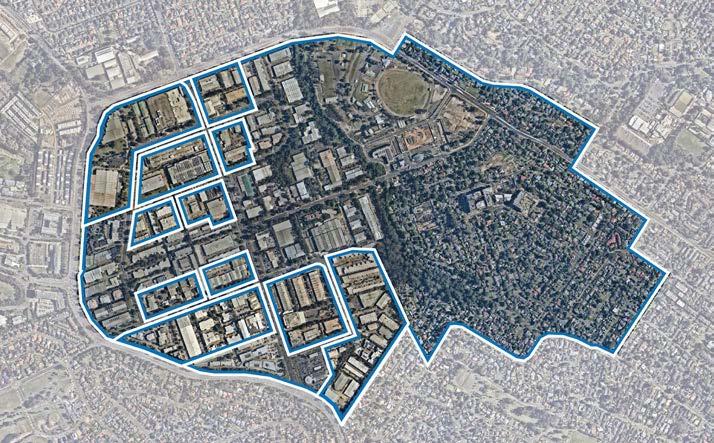
Given the increased flexibility proposed under the State Government’s Employment Zone Reforms, Council will continue to monitor the uptake of urban services opportunities following the implementation of the State Government’s Employment Zone Reforms.
This may prompt the need for Council to initiate various consequential amendments to The Hills Development Control Plan (DCP) 2012, to provide further guidance and certainty on development outcomes that should be provided in specific areas.
Council may be open to landowner-initiated planning proposals to enable small amounts of uplift in this area to ensure that increased provisions of urban services is viable for landowners and developers. However, this is only for urban services, rather than other employment uses. This is only intended to facilitate incremental increases to floor space ratio controls, and the provision of urban services, up to a maximum floor space ratio of 2:1. Any additional uplift would also need to be of an appropriate height and scale, providing a seamless transition down from nearby high density commercial areas.
Urban services have historically been a very car-dependent land use, as people generally require cars to transport their bulky goods purchases. Therefore, it is anticipated that higher levels of parking will still be required to meet travel behaviours and consumer needs. However, any parking will need to be provided underground, or at grade to avoid excessive bulk and scale arising from above ground parking within the building envelopes.
The demand for these services will continue to increase as the population grows. Therefore, protecting and encouraging urban services is a key priority. With the increasing pressure placed on industrial Precincts in the face of rising land values and land use conflicts, there is finite land available for urban services to keep pace with population growth.
A Retail Floorspace Analysis undertaken by SGS Economics and Planning found that bulky goods or ‘big box’ retailers are particularly well suited to outer-metropolitan growth areas, as well as former industrial precincts in inner and middle ring areas of cities. The report highlighted the importance of land use permissibility, particularly in ensuring that uses better suited to activity centres (such as small supermarkets and mini-majors) are not located in bulky goods precincts, as they would effectively function as outof-centre competition for centres.
The SGS report found that Norwest has a retail gap of around 11,400m² for household goods and bulky goods. It also concluded that it seems reasonable for Norwest to continue under its existing direction, so long as this does not compromise Council’s direction to preserve key employment and industrial lands.
Metro Station
Metro Line (Underground Tunnel)

Norwest Service Precinct
Proposed Roads
Urban Services
149
Figure 105. Protecting and Encouraging Urban Services (Source: Nearmap Aerial Imagery, copyright Nearmap)
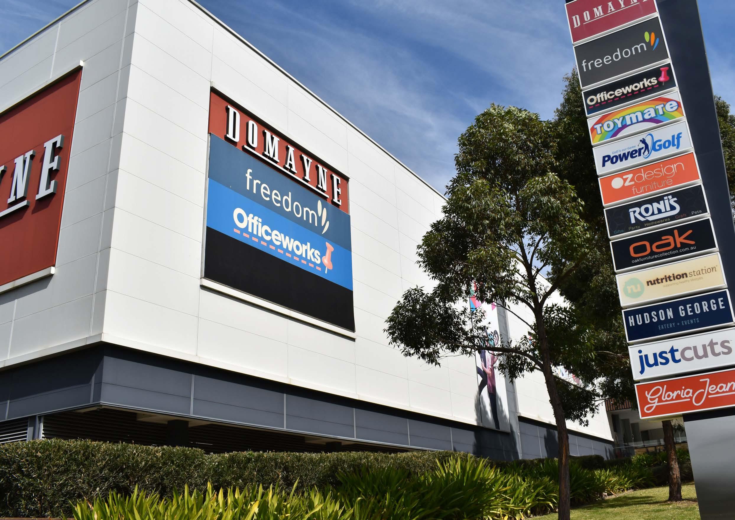
Home Hub
6.3.10 Focus Area 10 - Local Road Network and Pedestrian Connections
Enhancing the local road network and pedestrian and cycling connections will be pivotal to the success of the Norwest Service Precinct, particularly on the western side of Cattai Creek, given it is a car-dominant environment some distance from the Hills Showground Metro Station.
New local roads are concentrated in the areas identified for employment uplift, including Focus Area 1 and Focus Area 5. Various traffic and transport upgrades are also flagged along Victoria Avenue and Carrington Road.
The existing footpaths are predominately concrete, however the network is not complete. This is exacerbated by the large lot sizes, which significantly limit pedestrian permeability, combined with the lack of safety measures along the adjacent high speed roads.
To address these accessibility issues, this Precinct Plan seeks to establish a more walkable environment through additional pedestrian through site links in key locations to break up larger lots. These issues will be addressed through a future Public Domain Plan and Development Control Plan Amendments.
Pedestrian bridges are proposed in key locations, such as across the Cattai Creek Corridor (providing connectivity between the Cattai Creek West Focus Area and Castle Hill Showground), across Carrington Road and across Windsor Road to better connect the Norwest Service and Norwest Central Precincts.
Various links are also proposed in the residential area, as already identified within the NSW Government’s Planned Precinct Program, except for the minor tweaks to the local road network flagged in Focus Area 3.
Metro Station
Metro Line (Underground Tunnel)

Norwest Service Precinct
Signalised Intersection
Pedestrian Bridge
Left-in-left-out
Roundabout
Road Upgrade
New Road
Pedestrian Link
151
Figure 106. Connectivity
T
6.3.11 Focus Area 11 –Activating High Density Residential Areas
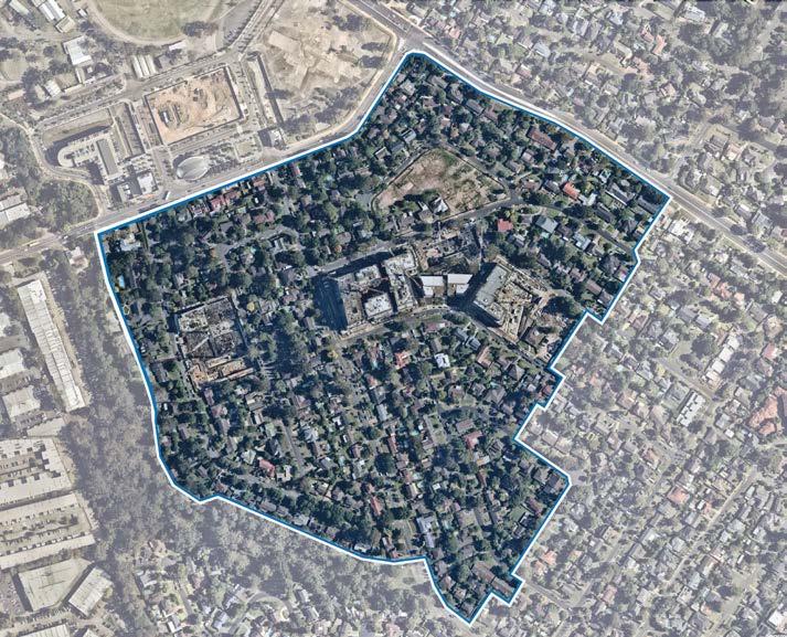
As previously flagged within this Precinct Plan, the COVID-19 Pandemic has highlighted the importance of having access to everyday necessities and feeling connected within a ‘5-minute neighbourhood’. Therefore, it is prudent that future high density residential areas not only provide additional housing opportunities but are also great places to live that positively influence people’s lifestyle.
Developments within high density residential areas should be active and provide a strong connection between buildings and the street to help create vibrant and walkable neighbourhoods. Encouraging appropriate active uses on the ground floor of high-density residential developments will be essential to providing safe and lively streetscapes whilst also providing for day-to-day conveniences in closer proximity to residents.
Street activating uses typically include non-residential uses on ground level that enhance the liveliness of a neighbourhood by providing places to shop, sit and/or socialise. These include ‘neighbourhood shops’, ‘neighbourhood supermarkets’, ‘business premises’ and ‘cafes and restaurants’.
Currently, there are limited opportunities to provide active uses in the R4 High Density Residential Zone under Council’s Local Environmental Plan, with ‘neighbourhood shops’ being the only active use that is permitted with consent (noting that other such uses such as ‘neighbourhood supermarkets’, ‘business premises’ and ‘restaurants and cafes’ are prohibited).
Developers in higher density residential areas have sought to incorporate active uses in recent years. However, due to land use permissibility constraints, they have been unable to do so, and have subsequently been removed from applications and replaced with ground floor apartments.
Various planning proposals have also sought to incorporate active ground floor uses by listing additional permitted uses within Schedule 1 of Council’s Local Environmental Plan (such as 2 Natura Rise and 40 Solent Circuit –both located in the Norwest Central Precinct). These proposals have been supported by Council given the merits of the outcomes sought.
To address this issue and to encourage more vibrant high density residential developments, a Council-initiated planning proposal is proposed to permit more activated uses within the high-density residential area in the Norwest Service Precinct (likely to be listed as additional permitted uses under Schedule 1 of Council’s Local Environmental Plan). The planning proposal will explore suitable locations for activation prioritising R4 High Density Residential zoned areas that are located in closer proximity to the Metro Station and along main thoroughfares.
While this outcome will not achieve uniformity across the area, the opportunity for developers to choose to incorporate these outcomes into their residential developments will allow for a scattering of these uses throughout the area.
It is anticipated that restrictions on the size of these active uses will also be required to strike the right balance between providing flexibility for developers and managing potential amenity impacts. Consequential amendments may also be required to the Development Control Plan and Public Domain Plan to reflect the revised land use permissibility.
Metro Station
Metro Line (Underground Tunnel)
Focus Area
Medium Density Residential
High Density Residential
Local Centre
Commercial Offices
Open Space
Urban Services
Urban Plaza
The Hills Shire Council Draft Precinct Plan Norwest Strategic Centre 152
Figure 107. Activating High Density Residential Areas (Source: Nearmap Aerial Imagery, copyright Nearmap)
SHOWGROUNDRD HUDSONAV ANELLAAV CARRINGTONRD SHOWGROUNDRD WINDSORRD WINDSORRD CECIL GLADSTONERD HUDSON
PACKARDAV VICTORIA
Whole Cafe and Surrounds
AV
AV
6.4 Vision and Structure Plan
The Norwest Service Precinct will become an attractive and well-connected neighbourhood with diverse housing and employment opportunities. It will be a vibrant, safe and desirable place to live and work, valued for convenient access to the station, shops, cafes, Castle Hill Showground and supported by new schools, new road connections, pathways and quality landscaped surrounds. With a focus on transit oriented development, the highest densities and tallest buildings (of up to 21 storeys) will be located near the Metro, transitioning to lower density areas.
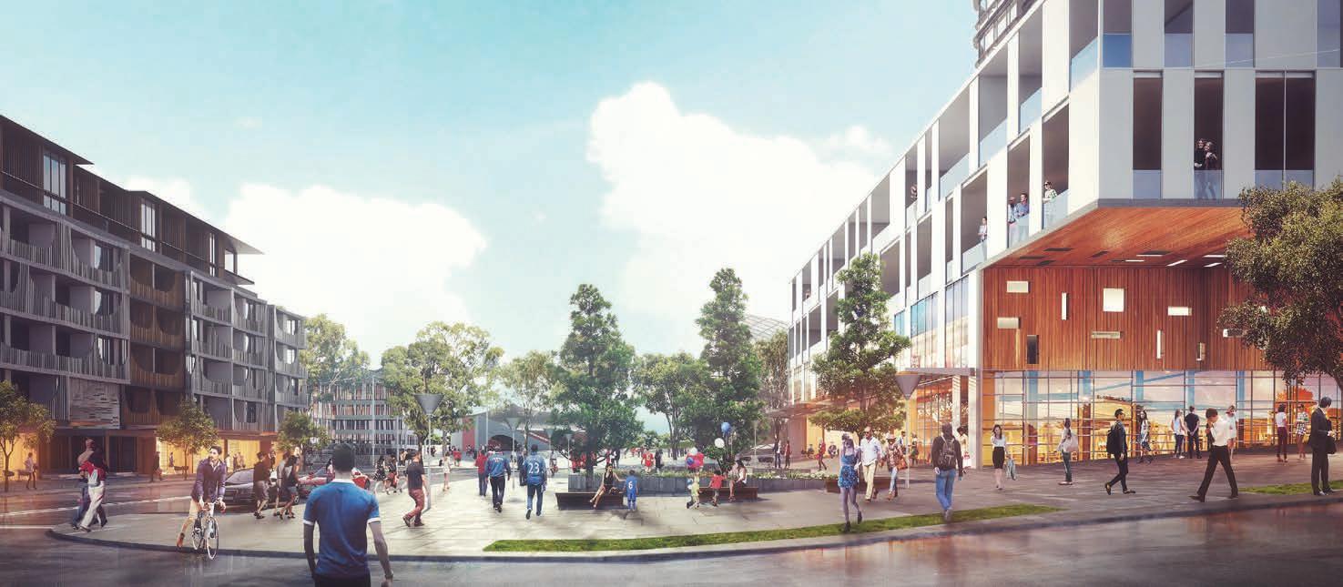
Specialised retail offerings (bulky goods) and light industrial areas will continue to be a mainstay for urban support services that meet the needs of the growing population base, whilst also providing opportunity for smaller businesses to establish and thrive. New commercial development along Carrington Road extending towards Windsor Road will include taller office style buildings, enhanced by quality landscaping, landscaped medians, wide footpaths and mature street trees.
These areas will also be complemented by recreational areas such as the Cattai Creek Corridor and Castle Hill Showground.
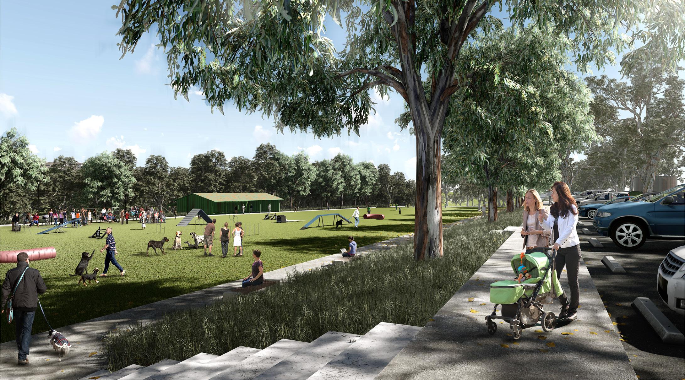
153
Artist’s Impression of Showground Station Local Centre and Town Square (Source: Department of Planning and Environment)
Artist’s Impression of Castle Hill Showground (Source McGregor Coxall)
Indicative Concept of Showground Station Site (Source: Oculus and Cox Architecture)
Connectivity
• New Local Roads: New local roads are proposed to improve vehicular connectivity within the Precinct and to assist in breaking up large sites. These new roads will be supported by other road upgrades at key intersections within the Precinct.
• Carrington Road Extension and Upgrade: Carrington Road will be upgraded to include a landscaped median, wide footpaths and mature street trees. The road will be extended from Victoria Avenue and connect to Windsor Road. This will create a single boulevarde from Showground Road to Windsor Road and facilitate improved integration between the Norwest Service Precinct and the remainder of the Norwest Strategic Centre.
• Pedestrian Connections: Pedestrian through site links will improve walkability within the Precinct by breaking up block length and reducing walking distances. Pedestrian bridges will be used to overcome significant barriers such as Showground Road, Windsor Road and Carrington Road.
Metro Station
Metro Line (Underground Tunnel)
Norwest Service Precinct
Signalised Intersection
Pedestrian Bridge
Left-in-left-out
Roundabout
Road Upgrade
New Road
Pedestrian Link
155
Figure 109. Connectivity
T
Land Use
• High Density Commercial/ Office Area: New commercial development will provide opportunities for knowledge intensive jobs in taller office style buildings between 6-12 storeys in height, with setbacks that incorporate quality landscaping to complement existing areas.
• Urban Support Services: The specialised retail (bulky goods) spine along Victoria Avenue will be retained (excluding land identified for high density commercial office development), together with industrial areas, to provide continued urban support services for the incoming population and land for further growth to meet the identified retail (households bulky goods) gap in the catchment.
• High Density Residential Area: The high density residential area (south of Carrington Road) will be green and walkable, providing a lifestyle alternative. The highest density development will be located closest to the Metro Station with more compact urban form and high quality building design and finishes. Building heights will transition downward further from the Station and local centre, with active frontages and non-residential uses on ground floor levels.
• Local Centre: The new local centre will be a vibrant and active central focus for the Precinct. It will accommodate a mix of uses including residential apartments, a supermarket, specialty shops, cafes, restaurants and local services.
• Castle Hill Showground and Cattai Creek Corridor: The Castle Hill Showground will be a regional scale attraction and build upon its significance as a cultural and leisure facility.
Metro Station
Metro Line (Underground Tunnel)
Norwest Service Precinct
Proposed Road
Medium Density Residential
High Density Residential
Local Centre
High Density Commercial Offices
Urban Support Services
Open Space
Public Plaza
The Hills Shire Council Draft Precinct Plan Norwest Strategic Centre 156
Figure 110. Land Use
Density
• The floor space ratio (FSR) control will remain the primary control that dictates density.
• Higher densities will be located near the Metro Station and along the proposed Carrington Road extension, transitioning down to areas further away from the Metro Station.
• FSR controls will been carefully selected to strike an appropriate balance between feasible and serviceable developments, along with facilitating an appropriate bulk and scale.
• FSR controls will range from 5:1 at the Metro Station, transitioning down to 1:1 in the urban services area.
• Some areas are not earmarked for any change, being areas where the existing character and outcomes are to remain, or areas where appropriate redevelopment potential already exists under the current planning controls. In this regard, where land has been rezoned by the NSW Government, the identified floor space ratio controls are in keeping with the controls established as part of the Planned Precinct Program.
• In locations flagged for potential change indicative floor space ratio outcomes should not be viewed as an entitlement. Floor space ratio controls will be subject to detailed built form modelling and urban design analysis throughout the subsequent planning processes to ensure they are appropriate, functional and viable.
157
Metro Station Metro Line (Underground Tunnel) Norwest Service Precinct Proposed Road Potential Area Of Change a 1.0:1 1.5:1 - 2.0:1 1.6:1 1.8:1 2.1:1 2 2.3:1 2.7:1 3.0:1 3.1:1 4.0:1 5.0:1 A B C D E F G H I J K
Built Form
• The tallest buildings will be located on the Station Site, accommodating buildings up to 21 storeys.
• A transition of building heights will facilitate a varied and interesting skyline.
• Building heights within the residential area will transition down from between 7 - 12 storeys in the high density area, to 2-3 storeys within the medium density area.
• High density residential land adjoining the creek corridor constrained by Riparian Corridor setbacks will be subject to further built form testing to establish appropriate heights.
• Within the employment area building heights will be up to 12 storeys near the creek. These heights will transition down to 8 and 6 storeys further from the station. However, land directly adjoining the future Carrington Road extension, and along Windsor Road will accommodate 8 and 10 storey commercial office buildings. A gateway site (of up to 12 storeys) will also be provided at the junction of Carrington Road and Victoria Avenue.
• In locations flagged for potential change, building height controls will be subject to built form modelling and urban design analysis throughout the subsequent planning processes to ensure they are appropriate, functional and viable.
Metro Station
Metro Line (Underground Tunnel)
Norwest Service Precinct
Proposed Road
Potential Area Of Change
Subject to Detailed Built Form Modelling
*Note: The 2-3 storey height outcomes for identified Urban Support Services reflects the existing built form in these locations.
The Hills Shire Council Draft Precinct Plan Norwest Strategic Centre 158
A A A A B B B E F C H H I K J G G G D D 2-3 Storeys* 6 Storeys 7 Storeys 8 Storeys 9 Storeys 8-12 Storeys F A B C D E 10 Storeys 12 Storeys 16 Storeys 20 Storeys 21 Storeys G H I J K
6.5 Character Areas
A Mixed Use Local Centre
The new local centre will be a vibrant and active central focus for the Precinct. It will provide a range of shops, cafes, restaurants and local services and quality public spaces including wide footpaths and plazas. A main village plaza will connect the Station and Castle Hill Showground. Buildings will have a dense urban character, ranging in height from 1621 storeys and comprising urban active edges. Residential uses will be provided on the upper levels and commercial development close to the retail heart of the centre. The eastern part of this area will have more of a suburban character, primarily comprising residential uses in a more relaxed and green setting (characterised by reduced site coverage, finer grain built form and denser landscaped areas).
B High Density Residential
The high density residential area will be green and walkable, providing a lifestyle alternative to the traditional suburban home. Built form will be an appealing scale to pedestrians by providing generous street setbacks (of 5m to 10m) and upper storey setbacks (of at least 4m), variety of materials and colours and green elements. The highest density development will be located closest to the Metro Station and local centre, transitioning from approximately 12 storeys down to 7 storeys. Site coverage would be limited to a maximum of 50%. Developments will be expected to provide high quality communal open spaces for the enjoyment of residents.
C Medium Density Housing
This area will have a distinct urban character that is sympathetic to existing and future development. The residential area will transition to terraces and townhouses within landscaped settings on the edges of the Precinct to provide genuine diversity in housing stock. Green spaces will bring a sense of nature through open spaces, tree lined streets and garden areas within street setbacks. Front setbacks of at least 3m will be provided to encourage tree lined streets and garden areas within street setbacks. High quality building facades will also be provided and designed to reduce the visual bulk of buildings.
D High Density Commercial Office
The employment area will be an attractive, walkable, competitive and thriving destination. Buildings will vary in height from between 6 and 12 storeys, with setbacks that incorporate high quality landscaping. Development adjoining Cattai Creek will be appropriately setback at least 10m (with upper levels setbacks varying between 3m-6m) and will facilitate the restoration and activation of the creek corridor and benefit from its natural setting. Carrington Road will be aesthetically enhanced and extended to Windsor Road.
E Urban Support Services
The bulky goods spine along Victoria Avenue and light industrial areas in the west of the Precinct will generally be retained to provide shopping and services for the incoming population. These areas will continue to be characterised by traditional industrial/warehouse buildings with large setbacks (of 15m to 30m). Building heights will generally range from 2-3 storeys and have setbacks varying between 15-30m. Buildings should be appropriately sited to provide an adequate buffer between industrial development and nearby residential developments. The façade of these buildings is to utilise elements that are visible to passing motorists and articulate the key components of the building (such as entries, showrooms and the like).
F Cattai Creek Corridor and Castle Hill Showground
Castle Hill Showground will be a regional scale attraction that builds upon its significance as a cultural and leisure facility. The delivery and embellishment of the Cattai Creek Greenway Link will contribute toward increasing the amenity for surrounding employment and residential development. It will also optimise access to the Station facilities from nearby commercial and residential developments. A minimum setback of 10m from this corridor will enable for high quality footpaths and large tree plantings. Development adjacent to the creek will facilitate restoration of the creek corridor and benefit from the natural setting, open space and amenity provided by the area.
159
SHOWGROUNDRD HUDSONAV ANELLAAV SALISBURYRD CARRINGTONRD DECLAMBEDR SHOWGROUNDRD WINDSORRD CECILAV GLADSTONERD HUDSON AV MIDDLETON AV PACKARDAV WHITE CEDARDR ASHFORD AV DAWESAV WARWICK PDE VICTORIA AV A B C C E E F D D
Figure 113. Character Areas
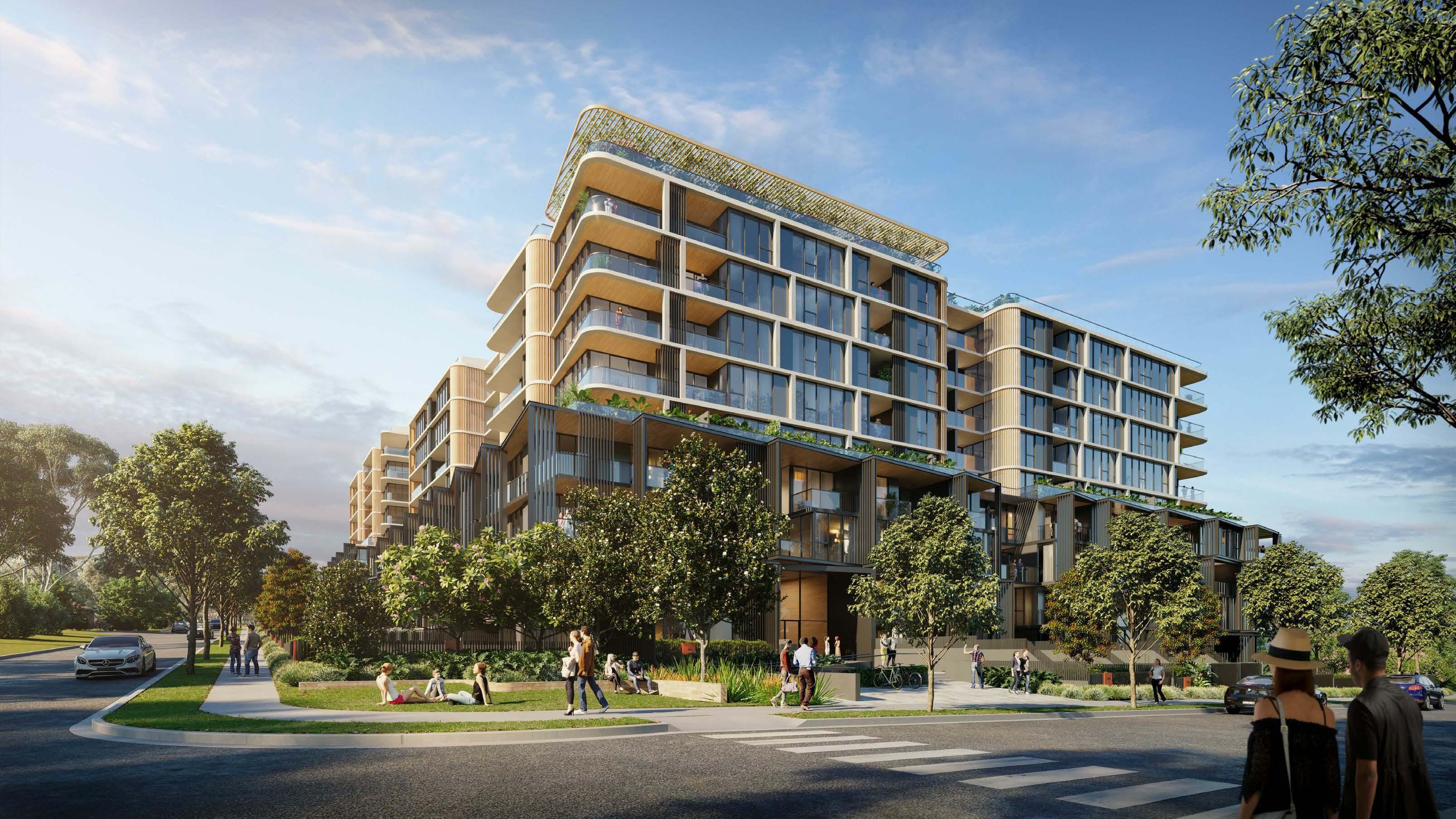 Artist’s Impression of Residential Development (Source: PTW Architects)
6.6 Yields and Projections
• In 2016, there were approximately 760 existing dwellings within the Norwest Service Precinct accommodating an existing population of approximately 1,510 people (based on an average occupancy rate of 2 people per household). Under this Plan, it is anticipated that there is growth potential for approximately 7,070 additional dwellings by 2036 (approximately 14,140 additional people) and approximately 7,820 additional dwellings by 2041 (approximately 15,640 additional people). Residential yields (for high density and mixed use developments) are based upon current controls established by the NSW Government with an uptake rate of between 80-100% by 2036 and between 90-100% by 2041. Medium density development is projected to have an uptake rate of 20% by 2036 and 30% by 2041.
• In 2016, there were approximately 8,300 jobs within the Norwest Service Precinct. Under this Plan, the Norwest Service Precinct is expected to accommodate nearly 4,770 additional jobs by 2036 and approximately 6,840 additional jobs by 2041 (depending on market factors). This is based upon uptake rates for commercial developments of 15% for the employment land west of Cattai Creek and 100% for the commercial/ retail development on the Station Site.
• Not all properties will be subject to redevelopment at the same time and uptake rates have been applied to each development type within each identified development area. The uptake rates which have been applied depend on the density being proposed and the extent of development which is likely to occur, having regard to opportunities and constraints affecting the land. Higher uptake rates are applied where higher densities are envisaged. However, in locations that are subject to development constraints, a lower uptake rate has been applied. Longer term sites have also been given lower uptake rates given they are unlikely to be feasible in the short to medium term and may be contingent on the market solving certain issues or delivering certain outcomes.
161
A B C E G M F L I H J K D
Figure 114. Yield Areas Metro Station
Metro Line (Underground Tunnel)
A B C D E F G H I J K L M
Norwest Service Precinct
The Hills Shire Council Draft Precinct Plan Norwest Strategic Centre 162 2016 Dwellings 2021 Dwellings Residential Uptake Rate (2036) Additional Dwellings (2036) Residential Uptake Rate (2041) Additional Dwellings (2041) Total Dwellings (2041) A 0 0 100% 1,620 100% 1,620 1,620 B 349 401 80% 5,266 90% 5,925 6,274 C 313 360 20% 131 30% 197 510 D 95 109 20% 53 30% 80 175 E 0 0 N/A 0 N/A 0 0 F 0 0 N/A 0 N/A 0 0 G 0 0 N/A 0 N/A 0 0 H 0 0 N/A 0 N/A 0 0 I 0 0 N/A 0 N/A 0 0 J 0 0 N/A 0 N/A 0 0 K 0 0 N/A 0 N/A 0 0 L 0 0 N/A 0 N/A 0 0 M 0 0 N/A 0 N/A 0 0 Total 757 871 77% 7,071 86% 7,821 8,578 2016 Jobs 2021 Jobs Employment Uptake Rate (2036) Additional Jobs (2036) Employment Uptake Rate (2041) Additional Jobs (2041) Total Jobs (2041) A 0 0 100% 202 100% 202 202 B 100 115 50% 24 100% 47 147 C 90 104 50% 22 100% 43 133 D 0 0 N/A 0 N/A 0 0 E 1,627 1,871 15% 2,976 20% 3,969 5,596 F 1,287 1,480 0% 0 0% 0 1,287 G 284 327 0% 0 0% 0 284 H 39 45 15% 304 20% 405 444 I 166 191 15% 473 20% 631 797 J 527 606 15% 769 30% 1,539 2,066 K 794 913 0% 0 0% 0 794 L 2,008 2,309 0% 0 0% 0 2,008 M 1,378 1,585 0% 0 0% 0 1,378 Total 8,300 9,545 13% 4,770 19% 6,835 15,135
Yield Analysis
Employment Yield Analysis
Table 18. `Residential
Table 19.
6.7 Actions and Phasing
Strategic Work Completed
Areas where strategic planning work has already been completed (or is underway and nearing completion), where development is starting to be rolled out (including development applications and/or construction) or where no further change is anticipated.
Phase 1: Housekeeping Amendments
Areas where Council-led housekeeping amendments are recommended to facilitate improved and/or orderly development outcomes. These housekeeping amendments are expected to take place over the next few years.
Phase 2: Council-Led Change
Short to medium term actions that could be led by Council. Changes to the planning controls and framework in these areas would allow for the achievement of the vision and outcomes in this Plan and would be contingent upon Council-initiated planning proposals, along with associated Development Control Plan, Public Domain Plan and Contributions Plan amendments.
Phase 3: Market Driven Change*
Actions that will be market driven. These would be contingent on further investigations and the ability of the market to overcome complex problems to unlock the development potential of the land. Whilst some market driven solutions may be achievable in the short to medium term, feasible redevelopment in other market driven areas is unlikely to occur until beyond the short-to-medium term horizon. Changes to the planning framework would be driven by landowner-initiated planning proposals, along with associated amendments to the Development Control Plan, Public Domain Plan and appropriate infrastructure contribution mechanisms.
In terms of timing, it is expected that planning proposals for land in short to medium term areas would eventuate over the next 5 to 10 years. Market driven solutions and planning proposals for sites in longer term areas are unlikely to eventuate within this same period and are expected to occur beyond a 10-year horizon (10- 20 years).
*Note: Please refer to Section 1.3 of this Precinct Plan for details on sites identified for short to medium term change and those identified for longer term change.
Metro Station
Metro Line (Underground Tunnel)
Norwest Service Precinct
Proposed Road

Strategic Work Completed
Phase 1: Housekeeping Amendments
Phase 2: Council-Led Change
Phase 3: Market Driven Change
163
PHASING
Housekeeping Amendments (Phase 1)
Action C1a - Correct Height Control Mismatch within the High Density Residential Area (excluding properties along Cattai Creek Corridor): Amend the Local Environmental Plan Height of Buildings Map to include maximum heights which reflect the Incentive FSR controls and environmental constraints within the Precinct.
Action C1b - Correct Height Control Mismatch within the High Density Residential Area along Cattai Creek Corridor: Amend the Local Environmental Plan Height of Buildings Map to include maximum heights which reflect the Incentive FSR and environmental constraints within the Precinct. This will be subject to further detailed design testing.
Action C2 - Amendments to DCP Pedestrian and Road Layouts: Some proposed roads identified within the Development Control Plan are unlikely to be deliverable within the Showground High Density Residential Area. Amend The Hills Development Control Plan 2012 to delete these road links and identify a new pedestrian connection.
Action C3 - Correction of Height Control Mismatch along Windsor Road: Amend The Hills Local Environmental Plan to increase the maximum height of building controls within the Local Environmental Plan, along with associated Development Control Plan amendments.
Action C4 - Activating High Density Residential Areas: Amend The Hills Local Environmental Plan to permit additional uses within the high density residential area (east of the Cattai Creek Corridor). Consequential amendments may also be required to the Development Control Plan and Public Domain Plan.
Council-Led Change (Phase 2)
Action C5 - Cattai Creek West: Council will initiate a planning proposal to facilitate high density commercial office developments ranging in height from 6 – 12 storeys. Associated amendments will also be required to the Development Control Plan, Public Domain Plan and Contributions Plan.
Action C6 - Carrington Road Extension (between Hudson Avenue and Windsor Road): Council will initiate a planning proposal to identify part of 6-8 Hudson Avenue for acquisition and amend the Contributions Plan to fund the land and capital cost of the road link. This could occur in combination with other actions.
Action C7 - Cattai Creek Greenway Link Completion and Embellishment: Some amendments are required to the Contributions Plan. Open space upgrades will occur progressively in accordance with the Landscape Master Plan and in association with the redevelopment of adjoining sites.
Action C8 - Showground Master Plan and Associated Upgrades: The Castle Hill Showground will be upgraded in line with the outcomes envisaged within the Castle Hill Showground Master Plan (adopted by Council in 2020).
Action C9 - Amendments to Contributions Plan, Development Control Plan and Public Domain Plan: Council will initiate amendments to the applicable Contributions Plan, Development Control Plan and Public Domain Plan for the Norwest Service Precinct to facilitate some of the character and infrastructure outcomes envisaged under this Precinct Plan.
Market Driven Change (Phase 3)
Action C10 - Carrington Road Extension and High Density Commercial Corridor (between Hudson Avenue and Victoria Avenue): Any redevelopment of this Focus Area (between Hudson Avenue and Victoria Avenue) will occur as part of a future landowner initiated planning proposal, having regard to the design principles set out within Section 6.3 (Focus Area 5) of this Plan. Associated amendments to the Development Control Plan, Public Domain Plan and Contributions Plan will also be required. For the land bound by Hudson Avenue and Victoria Avenue, the road corridor will need to be secured through a landowner initiated planning proposal where increased density would also be anticipated.
Landowners / Developers
The Hills Shire Council Draft Precinct Plan Norwest Strategic Centre 164
Phase Action Responsibility
Council Council Council Council Council
Council Council Council / NSW Government Council / NSW Government Council
Table 20. Overview of Phasing and Implementation
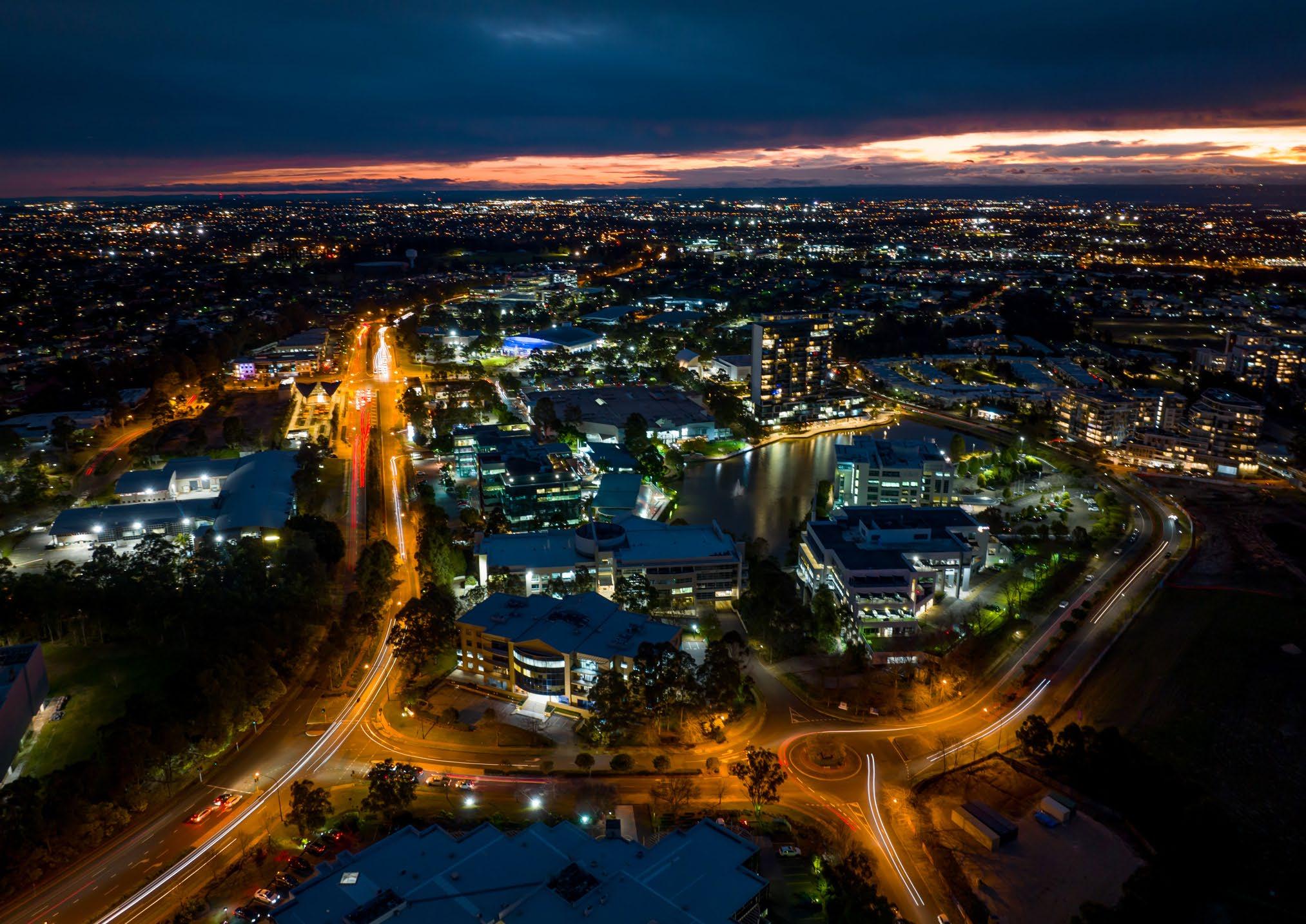 Aerial view of Norwest Central Precinct and surrounds.
Executive Summary 01 Infrastructure 07
7.1 Infrastructure Analysis
The level of growth expected within the Norwest Strategic Centre will place increased pressure on existing local and regional infrastructure. One of the guiding principles for this Precinct Plan is that existing and future growth will be appropriately catered for with new local infrastructure, as these facilities are integral to the daily lifestyles of residents and workers. This includes local infrastructure such as playing fields, parks, traffic and transport works, community facilities and stormwater works.
Council has recently completed infrastructure planning and updates for the Showground Residential Area, Balmoral Road Release Area and Norwest Innovation Precinct (including Circa Commercial Precinct and the Bella Vista and Kellyville Station Precincts). Therefore, this Section mainly focuses on the remaining areas that require further infrastructure analysis being the Norwest Central Precinct and employment areas within the Norwest Service Precinct. Areas which have been subject to previous investigations to identify the required local infrastructure and where this Precinct Plan is not proposing any significant change, do not form part of the analysis. However, infrastructure upgrades that are already planned and identified for funding are noted to provide a holistic analysis.
Local infrastructure can be delivered by developers or Council and is funded through a combination of Contributions Plans and Planning Agreements. Contributions Plans include a schedule of infrastructure and costs and establish contribution rates. As development occurs, Developers pay contributions, and these contributions are allocated toward the rollout of infrastructure listed within the Contributions Plan. Alternatively, Developers can enter into a Planning Agreement with Council. These Agreements can include land, work or monetary contributions for local infrastructure. These Agreements are voluntary and are typically entered into as part of site specific proposals to increase density, where the infrastructure that is required to support the growth is not included within an applicable Contributions Plan.
Metro Station
Metro Line (Underground Tunnel)
Norwest Strategic Centre
Voluntary Planning Agreements*
Contributions Plan No. 8
Kellyville / Rouse Hill
Contributions Plan No. 12

Balmoral Road Release Area
Contributions Plan No. 18
Bella Vista and Kellyville Station Precincts
Contributions Plan No. 19
Showground Station Precinct
Section 7.12 Contributions Plan (only)*
Section 7.12 Contributions Plan
Norwest Innovation Precinct
*Note: Where the Agreement has been executed or received in-principle support from Council. Council’s Section 7.12 Contributions Plan applies Shire-wide.
167
Figure 116 identifies the existing local contributions framework (both Contributions Plan and Planning Agreements) that apply across the Srategic Centre.
Figure 116. Existing Contribution Plan and VPA Framework
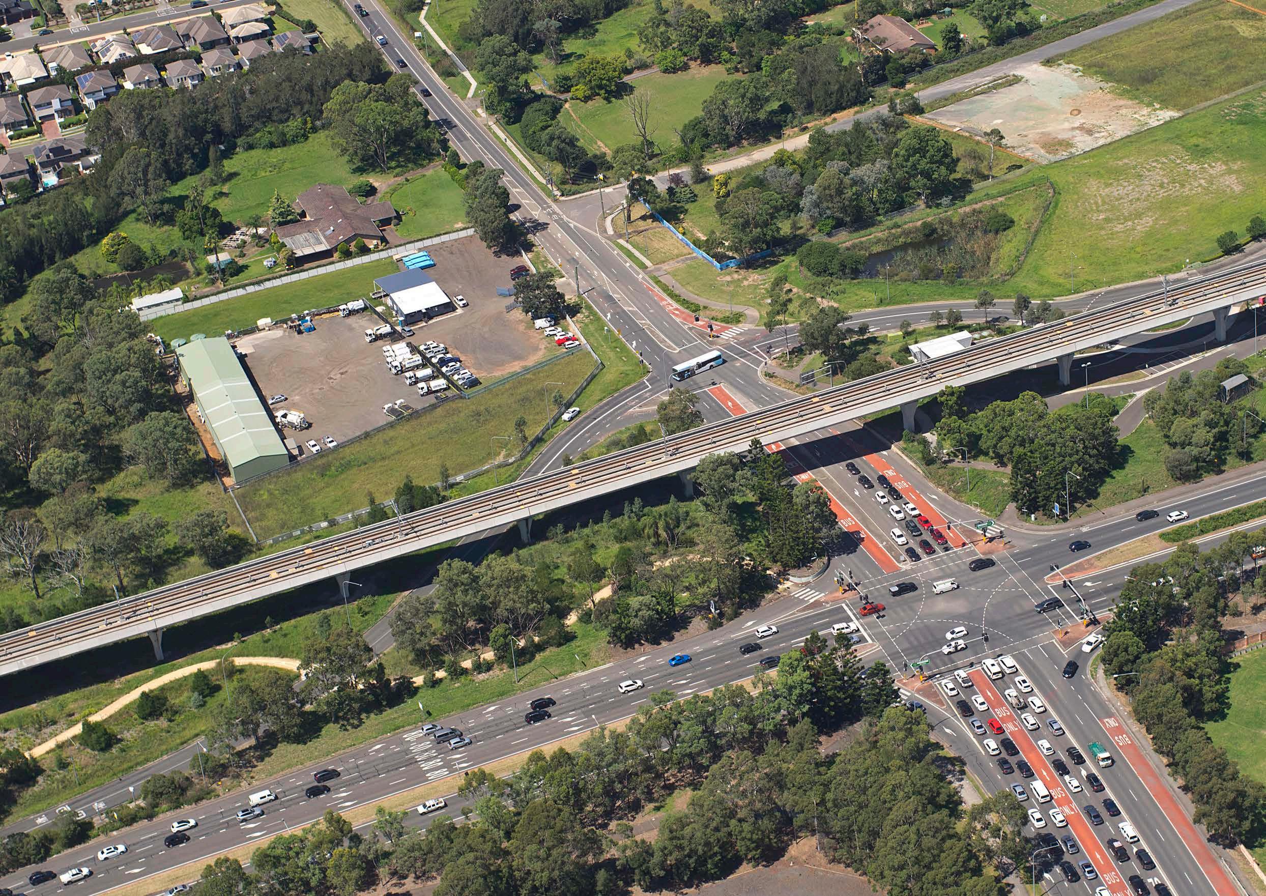 Aerial View of Memorial Avenue and Surrounds
7.1.1 Active Open Space


Active open spaces are areas for physical activity and organised sport. This Precinct Plan assesses the expected active open space needs of future residents and recommends solutions to address demand.
Existing Situation
There are currently four (4) existing active open space areas within the Norwest Strategic Centre (including Balmoral Road Reserve, Kellyville Memorial Park, Bella Vista Oval and a shared synthetic field at Bella Vista Public School). There are an additional 13 active open space facilities within the broader 2km catchment. These facilities primarily service the needs of existing (and already planned) residents.
Proposed Demand
Council’s Recreation Strategy indicates that dwellings should be located within 1-2km of a local active open space facility, where possible. The preferred benchmark provision identified within Council’s Recreation Strategy is 1 playing field per 2,000 people for low density areas and 1 playing field per 4,000 people (2,000 dwellings) for high density residential areas.
Recent analysis and infrastructure plans for the Showground Residential Area (within the Norwest Service Precinct) and the Bella Vista and Kellyville Station Precincts have already identified additional local infrastructure to meet the needs of future residents within the Precinct Norwest Service and the Bella Vista and Kellyville Station Precincts.
These are funded through Contributions Plan No. 19 – Showground Precinct and Contributions Plan No. 18 – Bella Vista and Kellyville Station Precincts. Key new active open spaces include:
• Expansion of Caddies Creek Reserve: 4 new playing fields.
• Expansion of Fred Caterson Reserve (Castle Hill Pony Club): 3 new playing fields.
• Enhancement of Castle Glen Reserve Playing Fields (to allow for Winter use).
• New field in Castle Hill (To be determined - potentially co-located with an existing school).
The additional residential population within the existing contributions framework for which active open space solutions have not yet been identified is concentrated in the Norwest Central Precinct, equating to approximately 4,000 dwellings. These dwellings will primarily be apartments concentrated in the high density areas around Norwest Metro Station. This growth will require a minimum of 2 new playing fields.
Proposed Locations for Further Consideration
New playing fields should ideally be located within a 2km catchment, although in exceptional circumstances, sites further away can be considered. Possible locations for new playing fields to service additional residential development in the Norwest Central Precinct are:
• AH Whaling Reserve, Baulkham Hills: Formalise 1 playing field surrounded by synthetic athletics track (consistent with Council’s Recreation Strategy).
• 1 synthetic field in association with a future school within the vicinity of the Norwest Strategic Centre. This could be a shared use arrangement, or the land could be acquired for open space. Further consultation is required with the NSW Government to secure the delivery of this infrastructure.
• Identified vacant land on Harrington Avenue, Kellyville owned by the State Minister for Education and Training, subject to further investigations and discussions with Schools Infrastructure NSW.

Metro Station
Metro Line (Underground Tunnel)
Norwest Strategic Centre
Shared Synthetic Field

Current Active Open Space
Future Active Open Space
Private Open Space
2km Catchment Buffer
169 Bella Vista Station
Figure 117. Existing Private and Public Open Space Areas
7.1.2 Passive Open Space
Passive open spaces are areas for play and quiet relaxation, providing an opportunity to connect with the community and outdoor environment and includes local parks, urban plazas and green corridors containing a footpath and cycleway. This Precinct Plan assesses the expected passive open space needs of both residents and workers and recommends solutions to address demand.
Existing Situation
Within the Norwest Strategic Centre, there is currently approximately 103 hectares of passive open space spread across approximately 35 passive open spaces. The guiding principle when planning for new local parks is to ensure that all residents and workers are within 400m of a local park. Where possible, existing parks will be enhanced to a higher quality.
Proposed Demand
Council’s Recreation Strategy indicates that dwellings should generally be located within 400m of passive open spaces where possible.
It is also acknowledged that there is higher demand for passive open areas by workers. Passive open spaces play an essential role in employment Precincts in attracting and retaining employees by providing opportunities to take pleasant breaks. These spaces assist in achieving good urban design outcomes, enhancing the image of the Norwest Strategic Centre and providing amenity for workers and visitors.
Proposed Solutions
Previous infrastructure analysis for areas within the Strategic Centre has established a framework to provide new facilities to meet the demand of future residents and workers. These facilities are funded through Contributions Plans and Planning Agreements and include:
• Expansion and embellishment of Chapman Avenue Reserve.
• Revitalisation of Cattai Creek Corridor.
• New urban plazas adjoining Hills Showground Station, Norwest Station, Bella Vista Station, Norbrik Drive and Solent Circuit.
• Embellishment of Castle Hill Showground and Cockayne Reserve.
• New local park at Norbrik Drive, including a through site link to Bella Vista Farm.
• New local and district parks within the corridor between Bella Vista and Kellyville Stations.
• New local park at Mackillop Drive.
It is noted that this Precinct Plan (Section 5.3.7 - Focus Area 7) also identifies opportunities for new passive open space areas in the Norwest Central Precinct, adjoining Norwest lake (to the north) and within future redevelopment of Norwest Marketown and surrounds.
The existing and planned open spaces will ensure that all residents and workers have access to passive open space. However, there will be a portion of the Norwest Service Precinct (generally proposed to be retained as urban services land) which will be outside of a 400m catchment to open space. As this Precinct is further master planned, opportunities for new parks and urban plazas will need to be investigated in this location, especially as part of consideration of future development outcomes in the area bound by Hudson
Metro Station
Metro Line (Underground Tunnel)
Norwest Strategic Centre
Current Passive Open Space
Future Passive Open Space
400m Catchment
Urban Plaza
Investigation Area

The Hills Shire Council Draft Precinct Plan Norwest Strategic Centre 170
Figure 118. Existing and Proposed Passive Open Space
Figure 118 shows all existing and planned passive open space areas within the Strategic Centre, with a 400m walkable catchment around each open space. The map also includes privately owned, but publicly accessible, greenway/drainage links which form an integral part of the open space network within the Strategic Centre.
Avenue and Victoria Avenue (Focus Area 5 in Section 6.3 of this Plan).
7.1.3 Traffic and Transport
The Norwest Strategic Centre is serviced by an extensive network of arterial, sub-arterial, collector and local roads which provides links between key areas and to surrounding centres. The roads are heavily congested during morning and evening peak periods, causing long delays for road users.
Future growth will substantially increase traffic volumes within the Norwest Strategic Centre, along Norwest Boulevarde, Windsor Road, Showground Road and the local feeder roads. While it is expected that road users will likely experience some worsening traffic congestion, even with planned road upgrades, it will be the focus of traffic and transport planning to ensure that the future road network operates at an acceptable level of service and that modal shift towards reliance on public transport to access the Strategic Centre is encouraged.
Ensuring that the road network continues to operate at an acceptable level of service will require the implementation of a combination of measures. These include:
• Reduced parking rates that recognise the accessibility of high frequency public transport services to and from the Strategic Centre.
• Modal shift toward increased public transport usage to access the Strategic Centre (assisted through reduced parking rates, improved access to Metro Stations, the delivery of a mass transit link between Norwest and Parramatta and connectivity and public domain improvements).
• Upgrades and expansion of certain roads and interSections to increase capacity. This will contain the impact, as much as possible, to the walkable catchment of each Metro Station, whilst ensuring that traffic continues to flow efficiently.
These matters are discussed further within this Section.
Metro Station
Metro Line (Underground Tunnel)
Norwest Strategic Centre
Primary Arterial
Arterial

Sub Arterial
Major Collector
Minor Collector
171
Figure 119. Existing Road Network
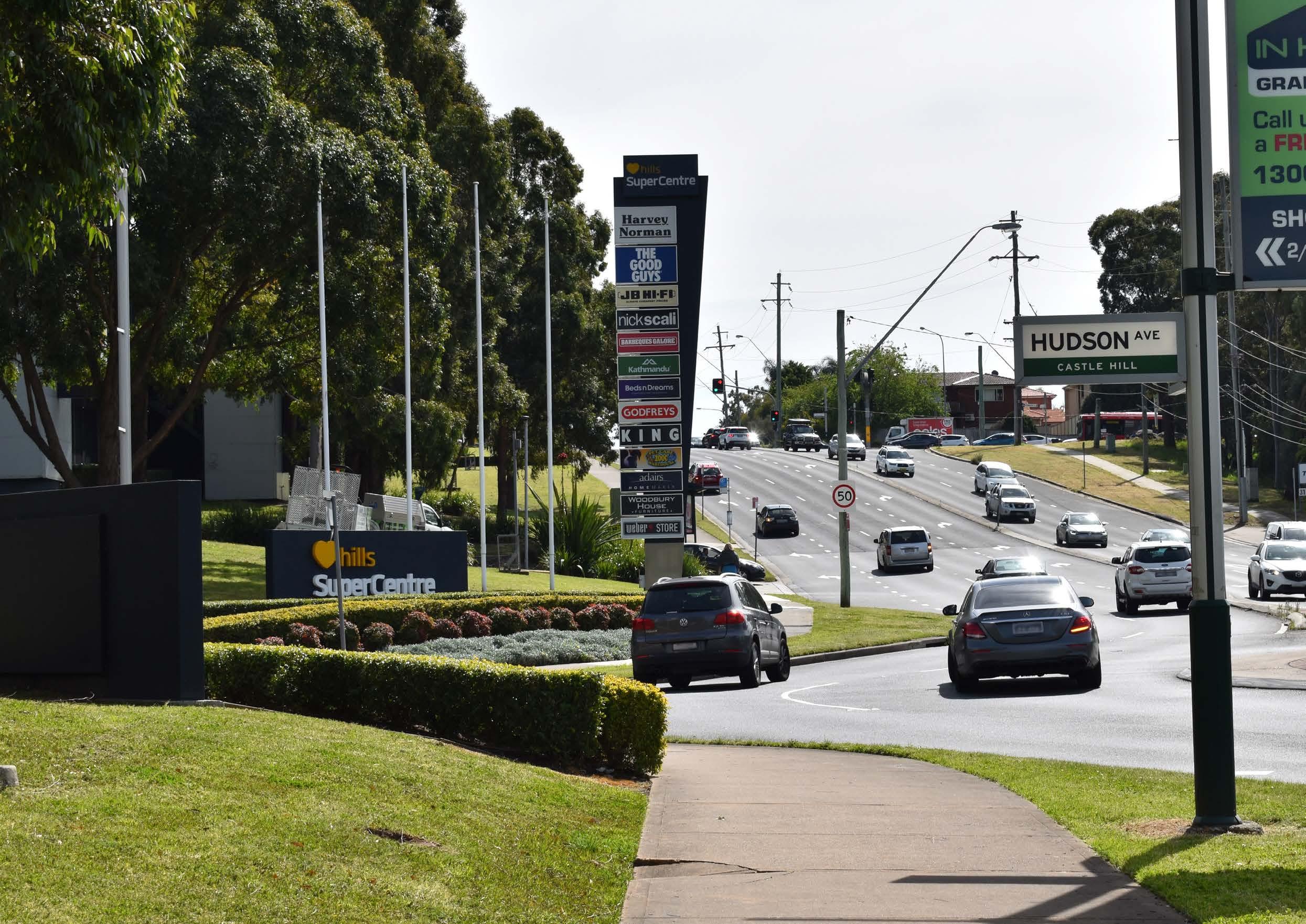
Victoria Avenue and Hudson Avenue Intersection
Regional Road Network
The NSW Government (Transport for NSW) is responsible for the regional road network, which includes Norwest Boulevarde, Windsor Road, Showground Road and Old Windsor Road.
Regional Traffic Modelling is currently being finalised by Cardno (an external Traffic Engineering Consultancy) to assess capacity for growth and potential upgrades required within the Castle Hill and Norwest Strategic Centres. It is anticipated that the findings of this modelling will identify that if existing policy settings are retained, the expected growth within the Strategic Centres will result in unacceptable impacts on the road network, with most intersections on the regional road network failing during both the AM and PM Peak Hours by 2036.
Various upgrades will therefore be identified to assist in increasing the capacity of the regional road network (for land within the Norwest Strategic Centre), as shown in Table 21. The delivery of the upgrades will primarily be the responsibility of the NSW Government.
Item
173 5 6 9 10 1 7 8 2 4 3
Figure 120. Regional Road Upgrades
Metro Station
Metro Line (Underground Tunnel)
Norwest Strategic Centre
Regional Roads
The Hills Shire Council Draft Precinct Plan Norwest Strategic Centre 174 No. Item Description Responsibility Norwest Innovation Signalisation of Norwest Boulevarde and Lexington Drive intersection TfNSW / Council Upgrade of Old Windsor Road and Celebration Drive intersection TfNSW Upgrade of Old Windsor Road and Memorial Avenue intersection TfNSW Upgrade of Old Windsor Road from 2 lanes each way to 3 lanes each way (between Celebration Drive and Memorial Avenue) TfNSW Norwest Central Upgrade of Norwest Boulevarde, Columbia Court and Brookhollow Avenue intersection (signalisation including restricted right turn movements onto Brookhollow Avenue and Columbia Court) TfNSW / Council Signalisation of Norwest Boulevarde and Reston Grange intersection TfNSW / Council Upgrade of Windsor Road adjoining the Balmoral Road Release Area from two to three continuous lanes TfNSW Norwest Service Upgrade of Windsor Road and Showground Road intersection TfNSW Upgrade of Showground Road and Victoria Avenue intersection (including bus priority on Green Road) TfNSW Upgrade of Showground Road and Carrington Road intersection TfNSW Table 21. Regional Road Network Upgrades 1 2 3 4 5 6 7 8 9
Local Road Network

In addition to the regional road upgrades, several local road improvements (including new road connections, intersection upgrades, new signalised intersection, roundabouts, left-in-left-out upgrades, road widening and general upgrades) are identified within the Norwest Strategic Centre. These are principally feeder roads onto the regional road network.
These improvements will result in the following benefits:
• Ease traffic congestion.
• Improve vehicular connectivity.
• Facilitate active transport links.
• Facilitate improved amenity for residents and workers.
The suite of local road improvements will work in tandem with reduced parking rates, improved public transport services and improved connectivity and public domain. Typically, local road improvements will either be funded through local Contributions Plans or will be delivered by Developers (at no cost to Council) as redevelopment occurs.
Most of the upgrades listed in the following table are already identified for delivery and funding responsibilities. The strategically identified items have not yet been finalised and do not have a current funding source. Where needed, Council may consider including the capital and land acquisition costs associated with upgrades within an applicable Contributions Plan. Where appropriate, land required for road widening will be zoned for acquisition within The Hills LEP.
Metro Station
Metro Line (Underground Tunnel)
Norwest Strategic Centre
Road Upgrade
New Road
Item
175
Figure 121. Local Road Upgrades
*Note: All other local roads to provide direct access to development sites are to be delivered by each developer as development occurs.
The Hills Shire Council Draft Precinct Plan Norwest Strategic Centre 176 Table 22. Local Road Network Upgrades No. Item Description Responsibility Norwest Innovation 1 Upgrade Lexington Drive Council 2 Upgrade Elizabeth Macarthur Drive Council 3 Upgrade of left-turn lanes from Elizabeth Macarthur Drive onto Norbrik Drive Council 4 Upgrade of left-turn lanes from Old Windsor Road onto Norbrik Drive Council/ TfNSW Norwest Central 5 Completion of Spurway Drive Developer 6 Upgrade of Columbia Way to a public road Developer 7 New Road Link between Spurway Drive and Maitland Place Developer 8 New Road Link between Columbia Court and Spurway Drive (and associated intersection upgrades) Developer 9 New Road or Shared Link between Norwest Boulevarde and Solent Circuit Developer 10 Signalisation of Fairway Drive and Solent Circuit intersection Council Norwest Service 11 Upgrade Carrington Road Council 12 Signalisation of Carrington Road and Victoria Avenue intersection Council 13 Signalisation of Victoria Avenue and Gladstone Road intersection Council 14 Signalisation of Victoria Avenue and Salisbury Road intersection Council 15 Victoria Avenue / Hudson Avenue (left-in and left-out) Council 16 Upgrade of Carrington Road and Middleton Avenue intersection Council 17 Roundabout at Middleton Avenue and Fishburn Crescent intersection Council 18 New Road connecting Victoria Avenue and Norwest Boulevarde Strategically Identified 19 New Road connecting Gladstone Road and Salisbury Road Developer 20 New employment roads connecting Carrington Road and Hoyle Avenue Developer 21 New employment roads connecting Carrington Road, Salisbury Road and Anella Avenue Developer 22 New Roundabout at Hudson Avenue and Carrington Road Extension Strategically Identified 10 11 12 13 14 1 2 3 4 5 6 7 8 9 15 16 17 18 19 20 21 22
Car Parking
The Hills Shire currently has very high private car ownership rates and usage patterns, with nearly 80% of trips made by private vehicles. With the population set to increase over the next 20 years, this will in turn drastically increase the number of cars on the road network (estimated to be an additional 72,000 cars across The Hills Shire based on existing car ownership levels), subsequently placing increased pressure on the road network.
Regional Traffic Modelling is currently being undertaken to assess capacity for growth and potential upgrades required within the Castle Hill and Norwest Strategic Centres. Whilst this work has not yet been completed, preliminary findings have identified that if existing policy settings are retained, the expected growth within the Shire’s strategic centres will result in unacceptable impacts on the road network, leading to catastrophic impacts for road users, even if all identified upgrades are completed.
The application of reduced parking rates, that recognise the accessibility of the Strategic Centre with high frequency public transport services, will substantially reduce traffic generation. The reduced traffic generation coupled with road upgrades will assist in minimising the impact of growth on the level of service of the road network. This will contain the impact, to the Strategic Centre as much as possible, whilst ensuring that traffic continues to flow efficiently and the road network functions at an acceptable level.
Reduced parking rates have many other benefits, including encouraging a mode shift towards public transportation and prioritising transit oriented development principles. It will assist in enhancing local amenity and creating great places that attracts residents, workers and investments.
They also improve commercial feasibility, with many Developers challenged by the high cost of parking within a construction project, combined with high minimum parking rates and the need for public domain improvements. It is estimated that basement parking spaces cost on average between $50,000 - $60,000 per space. Therefore, introducing more constrained parking rates will make redevelopment more economically attractive, enable Developers to develop at a high design standard and provide a greater contribution towards the embellishment of the public domain.
Council already has a reduced residential parking rate of 1 space per dwelling within the Station Precincts. This rate is proposed to be retained. However, for non-residential development, however it is recommended that the proposed reduced parking rates, based on walkable catchments, be rolled out within the Strategic Centre (refer Table 23). This would occur through an amendment to The Hills Development Control Plan (DCP), in line with the recommendations contained within the Transit Centres Parking Requirements Report prepared by PeopleTrans.
The commercial parking rates proposed represent a significant reduction to the current parking requirements (in some cases being 75% less than the current required parking rate). If applied, the proposed rates would enable the development outcomes envisaged under this Plan to occur with a reduction in the number of commercial parking spaces available in the Norwest Strategic Centre, in comparison to what could be expected to occur at full development under the current controls. Coupled with targeted upgrades to the local and regional road network, this will assist in mitigating some of the potential for increased traffic congestion associated with higher density development.
Metro Station
Metro Line (Underground Tunnel)
Norwest Strategic Centre
Inner Catchments
Outer Catchments
Proposed Commercial Parking Rates
Minimum Maximum
Inner Walkable Catchment: 1 space per 100m² of GFA
Outer Walkable Catchment: 1 space per 75m² of GFA
Proposed Retail Parking Rates
Inner Walkable Catchment: 1 space per 75m² of GFA
Outer Walkable Catchment: 1 space per 60m² of GFA
Minimum Maximum
Inner Walkable Catchment: 1 space per 60m² of GFA
Outer Walkable Catchment: 1 space per 50m² of GFA
Inner Walkable Catchment: 1 space per 30m² of GFA
Outer Walkable Catchment: 1 space per 25m² of GFA
177
Table 23. Proposed Parking Rates
Figure 122. Parking Catchments
Active Transport Network
The delivery of a safe and well-connected pedestrian and bicycle network is essential to improving the amenity of the Norwest Strategic Centre and achieving transit oriented developments. The existing impediments to cycle and pedestrian movement within the Norwest Strategic Centre include:
• Regional Roads (barriers): The Strategic Centre is bisected by busy roads such as Old Windsor Road, Windsor Road, Norwest Boulevarde and Carrington Road. Access points across these roads are currently limited.
• Large impermeable lots: Large lots with no pedestrian through-site links reduce permeability and increases the time and distance for pedestrians to walk between different points within the Strategic Centre.
• Topography: Steep land reduces pedestrian mobility by making walking a less attractive option for residents and workers.
• Incomplete network: There are already existing paths, which assist in facilitating active transport. However, the paths in certain parts of the Norwest Strategic Centre are not complete.
The above issues can be mitigated through the following:
• Provide shared paths in association with road upgrades.
• Identify through site links to improve pedestrian movement.
• Complete missing portions of the cycle network.
• Require footpaths adjoining development sites.
• Identify pedestrian bridges (or improved pedestrian access) across roads with high traffic volumes.
The walkability catchment and existing and planned pedestrian and cycle connections are identified within this Plan and shown in Figure 123.
Council’s policies and controls aim to improve the active transport facilities by integrating active transport methods with other forms of available transport modes in the Norwest Strategic Centre to increase public transport use and promote a healthier lifestyle. For example, dual-mode travel can be encouraged by providing an integrated network of active routes ensuring good local connections between residential areas and attractors, such as educational institutions, shopping centres, major bus interchanges and secure bicycle parking facilities.
Further, the Public Domain Plan that will support this Precinct Plan and will provide further guidance around improvements to active transport facilities.
Norwest Strategic Centre
Proposed Road
Up to 5 Minutes Walk (400m)*
5 to 10 Minutes Walk (800m)*
10 to 15 Minutes Walk (1200m)*
Pedestrian Bridge
Existing Cycleway
Proposed Cycleway
Proposed Pedestrian Link
The Hills Shire Council Draft Precinct Plan Norwest Strategic Centre 178
7.1.4 Regional Public Transport
The Norwest Strategic Centre has the highest jobs targets of any Strategic Centre in the Central City District outside of Greater Parramatta. It is imperative that the centre is accessible and has frequent and efficient public transport connections to surrounding regions and economic centres. This will make Norwest a viable and attractive option for future businesses and workers.
The Sydney Metro Northwest addresses the critical east-west connection along the Macquarie Park/Chatswood and City Economic Corridor. The extension of the Sydney Metro Northwest from Tallawong Station to St Marys Station will also greatly improve public transport to the Western Sydney Employment Area and future Western Sydney Airport. The investigation of this Corridor is identified in the Region Plan as a 0-12 year priority.
The NSW Government’s Greater Sydney Region Plan and Future Transport Strategy also nominate a city-shaping link between Norwest and Parramatta as a 10-20 year visionary project with no firm commitment to planning at this stage. This is flagged as a future rail connection in the Future Transport Strategy. Currently all connections between Parramatta and the Hills Shire are via arterial roads. These roads are extremely congested during peak periods and even with the completion of local and regional road upgrades this congestion will only worsen as the population grows.
To safeguard this connection earmarked by the NSW Government, it is pivotal that the NSW Government progressively conduct feasibility studies to preserve the transport corridor and transport hubs to protect the future city-shaping mass transit link identified in the Future Transport Strategy.
Council will continue to lobby the NSW Government for the funding, early planning and delivery of these regional transport connections, as they are critical to the success of Norwest moving forward.
A mass transit link between Norwest and Parramatta will secure the longterm viability of Norwest and support the growth of the Greater Parramatta and Olympic Peninsula (GPOP) economic corridor, cementing Parramatta’s role as the Central River City CBD.
The following key actions will be required as part of the long term planning for improved public transport services to and from Norwest:
• Collaborate with State Government in the preparation of a business case for the mass transit link between Norwest and Parramatta. This will include the type of service required and identify options for a corridor.
• Collaborate with State Agencies as part of the planning and delivery of the extension of the Sydney Metro Northwest from Tallawong Station to St Marys Station.
179
Figure 124. Potential Mass Transit Link between Parramatta and Norwest (Source: Transport for NSW – Future Transport Strategy)
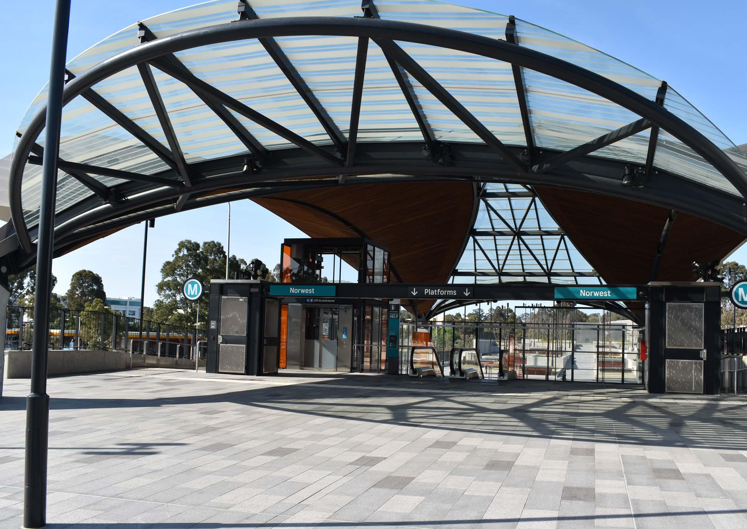
Norwest Metro Station
7.1.5 Community Facilities
Existing Situation
The Norwest Strategic Centre contains two regionally significant community and open space Precincts, being The Castle Hill Showground and Bella Vista Farm Park. These cultural Precincts are extremely valued by the community and will be protected and enhanced in the future.
The Castle Hill Showground is located in the far eastern portion of the Strategic Centre and is a place where residents and visitors meet for social gatherings, sporting events, markets, fundraisers and festivals. It Showground offers a range of community facilities. A key facility is the Harvey Lowe Pavilion located next to the Castle Hill Showground Main Arena, with seating capacity for around 350 people. It features a stage, commercial style kitchen, parking, tressle tables and chairs, among many other amenities and features. It is suitable for a range of community, corporate, private and recreation uses.
Bella Vista Farm Park is located in the western part of the Strategic Centre and is an intact historic farm complex. It features a two storey homestead, Bunya Pine lined driveway and various farm outbuildings. The grounds are open to the public, and feature BBQ facilities, picnic tables and walking tracks. It is regularly used for festive events and concerts.
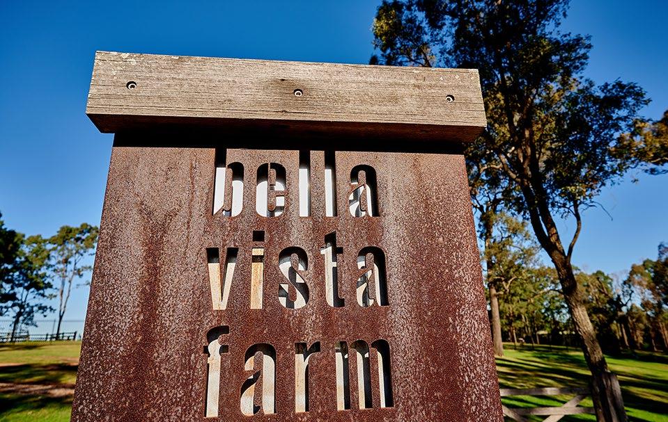
There are currently no library facilities within the Norwest Strategic Centre. It is located between the Castle Hill Library (district), Vinegar Hill Memorial Library (district) and Baulkham Hills Library (branch catchments). Substantial population growth within the Strategic Centre and surrounding suburbs will warrant the provision of new library facilities.
Whilst there is currently a lack of such facilities within the Norwest Strategic Centre, this is given Council is unable to fund the capital cost for these types of facilities under local Contributions Plans (as they are not on IPART’s Essential Works List).
Projected Demand
The increased residential population will generate demand for a new community facility (between 2,500-4,000m² within the Metro Corridor), as well as increased demand for library services that are unlikely to be catered for by Castle Hill, Baulkham Hills or Vinegar Hill libraries.
Proposed Solution
In 2020, Council adopted a Master Plan for the Castle Hill Showground which represents a 30 year vision. The Master Plan seeks to create a thriving cultural hub supporting current users and a variety of community, arts, sporting and leisure activities. Future embellishment of the Showground will occur in-line with the adopted Master Plan.
The Master Plan earmarks key areas within Castle Hill Showground, including the following:
• ‘The Promenade’ - an active transition between the Metro Station and the adjoining local centre and the Showground.
• ‘The Arena’ - a large open space that will support daily uses and will have capacity for large community events.
• ‘The Village’ - will provide a wide variety of new spaces for the community to gather in.
• ‘The Icon’ - an architectural feature that will be a destination building for events and entertainment purposes.
• ‘The Terraces’ - regional parklands for The Hills Shire, which utilises the topography of the site for a variety of recreational uses.
• ‘The Paddocks’ - will provide formalised linkages for bicycles and pedestrians from Fred Catterson Reserve to Carrington Road and beyond.
These areas will weave together to create a thriving cultural hub, providing existing and future residents and workers with a variety of community, arts, sporting and leisure activities.
There is an existing Plan of Management (PoM) for the Bella Farm Park, which aims to facilitate the restoration and long-term conservation of the property and provide for a range of complementary community uses. Future use of the park will occur in-line with the plan of management.
Contributions Plan No.18 Bella Vista and Kellyville Station Precincts identifies a 1,600m² site for a community facility adjoining Bella Vista Station. A further 1,600m² of land adjoining this site is also identified for a public plaza, bringing the total area to 3,200m². As previously discussed, funding has been secured under a Funding Agreement between the NSW Government and Council towards the capital works. It is also anticipated that Landcom (on behalf of Sydney Metro) will make a monetary contribution towards this facility. The size and design of the facility will depend on the available budget.
Opportunities will also be explored to provide new community floor space within Norwest Marketown (Focus Area 2 in Section 5.3 of this Precinct Plan). Opportunities for new library floorspace (potentially in the form of concierge libraries) will be investigated.
181
Bella Vista Farm Artist’s Impression of Castle Hill Showground - The Village (Source: McGregor Coxall)
7.1.6 Education Facilities
The delivery of high quality primary and secondary schools is an integral part of ensuring liveable neighbourhoods and servicing the needs of our family dominated demographic.
The projected growth will generate significant demand for new school infrastructure for both primary and secondary schools. Some of the demand may be met through additional private schools and/or expansion of capacity within some existing schools. The remaining demand will need to be catered for through new NSW Government schools.
There is currently a lack of education infrastructure within the Strategic Centre, with there only being one (1) primary school (Bella Vista Public School) and provision for a primary school as part of the concept approval for the Bella Vista Station Precinct. The substantial growth anticipated within the Strategic Centre will place significant demand on the existing education infrastructure.
Previous strategic planning identified possible residential expansion west of Cattai Creek within the Norwest Service Precinct. However, based on the difficulties in identifying additional school infrastructure, coupled with the economic and employment objectives for this land and design considerations, further residential growth within this area is not proposed in this Precinct Plan. Council is also not responsible for the delivery of such infrastructure, as it is predominately the responsibility of the NSW Government and Schools Infrastructure NSW, along with the private sector.
Metro Station
Metro Line (Underground Tunnel)
Norwest Strategic Centre
Caddies Creek Public School
Castle Hill Public School
Samuel Gilbert Public School
Chatswood Public School
Parklea Public School
Matthew Pearce Public School
Bella Vista Public School
Kellyville Public School
Excelsior Public School
Sherwood Ridge Public School
Metro Station
Metro Line (Underground Tunnel)

Norwest Strategic Centre
Castle Hill High School
Crestwood High School
Model Farms High School
Kellyville High School
Glenwood High School
The Hills Shire Council Draft Precinct Plan Norwest Strategic Centre 182
Castle Hill Public School Samuel Gilbert Public School Excelsior Public School Parklea Public School Caddies Creek Public School Sherwood Ridge Public School Kellyville Public School Bella Vista Public School
School
Model Farms High
Crestwood Public School
Crestwood High School
Crestwood High
School
Kellyville High
School
Castle Hill High School
School
Model Farms High School
Glenwood High School
Figure 125. Primary School Catchment Area
Figure 126. High School Catchment Area
7.1.7 Water Management
Stormwater Network
Stormwater infrastructure within the Norwest Innovation and Norwest Central Precincts will be capable of accommodating the increased densities envisaged under this Precinct Plan. However, the stormwater network within the Norwest Service Precinct is old and unlikely to be capable of accommodating the stormwater flows resulting from increased densities.
An assessment will be required for the Norwest Service Precinct to identify its available capacity and hydrological level of service. This assessment will identify what upgrades are required to facilitate safe and sustainable development.
Overland Flowpaths
There are numerous overland flowpaths throughout the Norwest Strategic Centre, predominately located on existing roads and dedicated drainage lines. There are various flowpaths located on private land across the Strategic Centre.
Overland flowpaths convey stormwater during storm events. Underground stormwater pipes have a limited capacity. When these pipes are blocked, or when the volume of stormwater exceeds the capacity of the pipes, the stormwater will spill over and flow over land until it reaches a creek or basin. These flowpaths are to be reserved from development and must be kept clear.
Where an overland flowpath is located on private land, future development must be designed to avoid the flowpath. Where possible through site links and future roads will be strategically located to align with these flow paths so that the stormwater pipes can be located within road reserve.
The following key actions will be required as part of the long term planning for improved stormwater management:
• Prepare a Flood Study for the Norwest Service Precinct to identify capacity of the existing stormwater network and identify required upgrades. This will have two (2) stages:
- Stage A: Norwest Service Residential – Applying to land that was rezoned by the NSW Government in 2017; and
- Stage B: Norwest Service Employment – Applying to land west of Cattai Creek within the employment area.
• The costs of future upgrades to the stormwater network will be included within applicable Contributions Plans.
• Reinforce, through development controls, the need for development to avoid overland flowpaths. Where possible locate through site links and new roads along these flowpaths.
Metro Station
Metro Line (Underground Tunnel)
Norwest Service Precinct
Flood Study Area
Stage A: Norwest Service Residential - Identify capacity and required upgrades
Stage B: Norwest Service Employment - Identify capacity and required upgrades
100 Year Flood Extent
Creek / Overland Flowpath
183
STAGE A STAGE B
*Note: The information presented in this map on flood extent is subject to disclaimer and copyright notice. Please refer to Appendix A for details.
Figure 127. Future Flood Investigations*
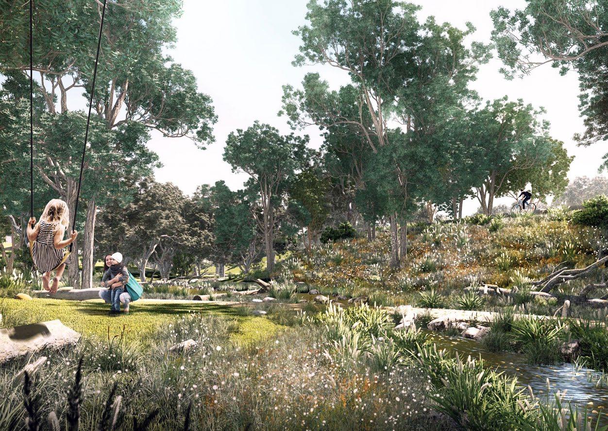 Artist’s Impression of Cattai Creek Corridor (Source: McGregor Coxall)
7.2 Actions
The delivery of regional infrastructure will be the responsibility of State Government (regional traffic, mass transit corridors, schools etc.). Council will be responsible for the delivery of local infrastructure (land and physical works) including playing fields, parks, traffic and transport upgrades, community facilities and stormwater works.
There are four (4) Contributions Plans which currently apply to land within the Norwest Strategic Centre. These include:
• The Hills Section 7.12 Contributions Plan.
• Section 7.12 Contributions Plan – Norwest Innovation.
• Contributions Plan No. 19 – Showground Precinct.
• Contributions Plan No. 18 – Bella Vista and Kellyville Station Precincts.
This Plan recommends a review and rationalisation of the Contributions Plan framework applicable to the Norwest Strategic Centre. This would include additional land and capital costs for new items identified through this Plan and streamline, to the maximum extent possible, the framework of Plans and Developer levies across the Centre.
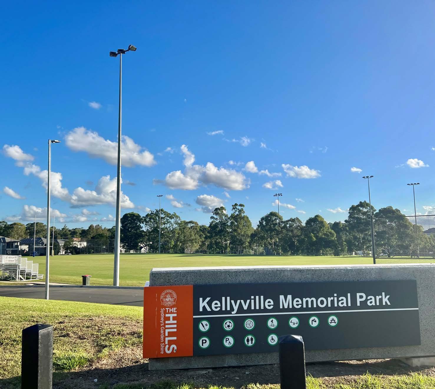
185
Kellyville Memorial Park
Phase Action Responsibility
Housekeeping Amendments (Phase 1)
Council-Led Change (Phase 2)
Action D1 – Rationalisation of Contribution Plan Framework: Council will review and rationalise the contributions plan framework applying to the Norwest Strategic Centre. This will include the addition of new local infrastructure items identified in this Precinct Plan.
Action D2 – Collaboration with NSW Schools Infrastructure: Council to work with Schools Infrastructure NSW to investigate opportunities for a synthetic field to be delivered in association with schools within the vicinity of the Strategic Centre to meet demand arising from residential development.
Action D3 – Collaboration with Landcom: Council will work with Landcom as part of the delivery and transfer of infrastructure within the Bella Vista and Kellyville Station Precincts.
Action D4 – Norwest Service Flood Studies: Council will prepare Flood Studies for the Norwest Service Precinct (including Stage A: Norwest Service Residential and Stage B: Norwest Service Employment). Council will also then subsequently update the applicable Contributions Plans to include new and updated stormwater infrastructure costs, as required.
Action D5 – Development Control Plan Amendments: Council will amend The Hills Development Control Plan 2012 to implement reduced nonresidential parking rates and reflect the planned pedestrian and cycle links for the Norwest Strategic Centre.
Action D6 – Planning Proposal – Road Widening: Council will initiate a planning proposal to rezone land required for road widening along Lexington Drive, Elizabeth Macarthur Drive and the Carrington Road extension (only land previously zoned B6) as SP2 Infrastructure.
Market Driven Change (Phase 3)
Action D7 – Market Driven Sites: Council will continue to work with landowners and developers to secure infrastructure solutions that will support future uplift on market driven Focus Areas.
Council / NSW Schools Infrastructure
Council / Landcom / Sydney Metro
Council / Landowners / Developers
The Hills Shire Council Draft Precinct Plan Norwest Strategic Centre 186
Table 25. Actions
N/A -
Council
Council Council Council
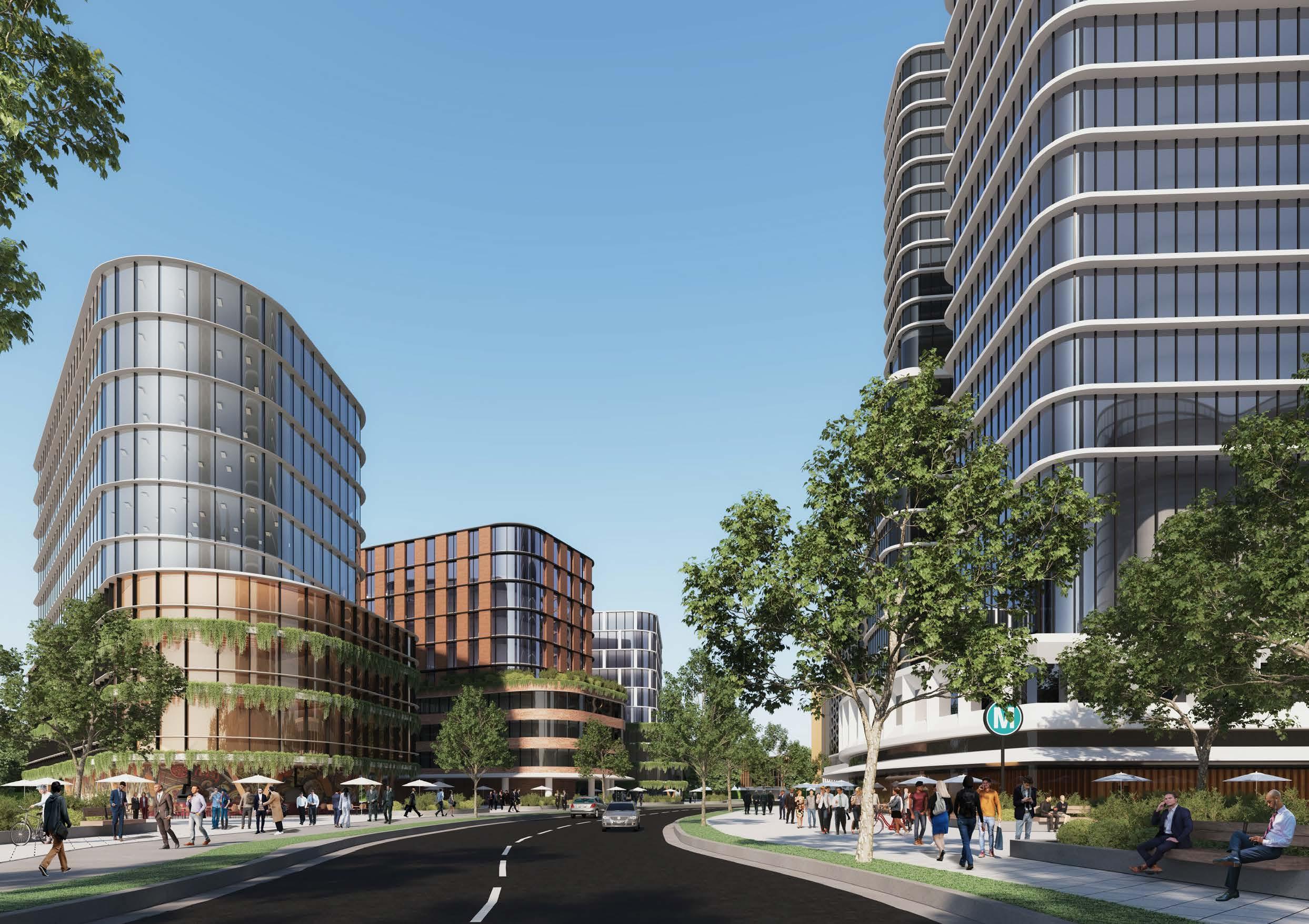 Artist’s Impression of Brookhollow Avenue (Source: Tome Visuals)
Executive Summary 01 Implementation Plan 0 8
This Plan sets a vision and ‘blueprint’ for future development within the Norwest Strategic Centre. It includes a list of actions that will be subject to future processes and decisions of Council. It will be necessary to work through these actions over time to establish the planning framework that facilitates the visions and outcomes articulated in the Plan.
The Plan identifies areas where strategic work has been completed and where development is expected to either remain unchanged or continue to roll-out under the current planning framework. It then groups actions into three distinct phases, having regard to potential timing and responsibility for each action.
Strategic Work Completed
Areas where strategic planning work has already been completed (or is underway and nearing completion), where development is starting to be rolled out (including development applications and/or construction) or where no further change is anticipated.
Phase 1: Housekeeping Amendments
Areas where Council-led housekeeping amendments are recommended to facilitate improved and/or orderly development outcomes. These housekeeping amendments are expected to take place over the next few years.
Phase 2: Council-Led Change
Short to medium term actions that could be led by Council. Changes to the planning controls and framework in these areas would allow for the achievement of the vision and outcomes in this Plan and would be contingent upon Council-initiated planning proposals, along with associated Development Control Plan, Public Domain Plan and Contributions Plan amendments.
Phase 3: Market Driven Change*
Actions that will be market driven. These would be contingent on further investigations and the ability of the market to overcome complex problems to unlock the development potential of the land. Whilst some market driven solutions may be achievable in the short to medium term, feasible redevelopment in other market driven areas is unlikely to occur until beyond the short to medium term horizon. Changes to the planning framework would be driven by landowner-initiated planning proposals, along with associated amendments to the Development Control Plan, Public Domain Plan and appropriate infrastructure contribution mechanisms.
Metro Station
Metro Line (Underground)
Norwest Strategic Centre
Strategic Work Completed
Phase 1 - Housekeeping Amendments
Phase 2 - Council-Led Change
Phase 3 - Market Driven Change
In terms of timing, it is expected that planning proposals for land in short to medium term areas would eventuate over the next 5 to 10 years. Market driven solutions and planning proposals for sites in longer term areas are unlikely to eventuate within this same period and are expected to occur beyond a 10-year horizon (10- 20 years).
*Note: Please refer to Section 1.3 of this Precinct Plan for details on sites identified for short to medium term change and those identified for longer term change.
189
PHASING
WINDSORRD OLD WINDSOR RD NORWESTBLVD MEMORIALAV FAIRWAY DR VICTORIA AV BALMORALRD EDGEWATERDR CARRINGTONRD SOLENT CCT LEXINGTON DR RESTON GRA CECILAV NORBRIKDR SHOWGROUND RD CELEBRATIONDR Hills Showground Station Norwest Station Bella Vista Station
Figure 128. Phasing Approach
Housekeeping Amendments (Phase 1)
Action A1 - Correction of Height Control Mismatch within Bella Vista Employment: Council will initiate a planning proposal to increase the height of building controls to better reflect the maximum Floor Space Ratio control implemented by the State Government and accommodate the intended development outcomes being 6-10 storey buildings. Further analysis of appropriate heights will need to consider a range of factors including but not limited to the possible retention of views associated with Bella Vista Farm (where appropriate). Development Control Plan amendments may also be required to guide built form on individual sites.
Council-Led Change (Phase 2)
Action A2 - Bella Vista Community Facility and Urban Plaza: Council will continue its role in working with Landcom and the State Government to deliver a community facility and urban plaza within the Bella Vista Station Precinct, in accordance with the Precinct Support Scheme Funding Agreement.
Action A3 - Amendments to Contributions Plan, Development Control Plan and Public Domain Plan: Council will initiate amendments to the applicable Contributions Plan, Development Control Plan and Public Domain Plan for the Norwest Innovation Precinct to facilitate some of the character and infrastructure outcomes envisaged under this Precinct Plan.
Market Driven Change (Phase 3)
Action A4 - ResMed: Any redevelopment of this Focus Area will occur as part of a future landowner initiated planning proposal having regard to the design principles set out within Section 4.3 (Focus Area 4) of this Plan. Associated amendments to the Development Control Plan, Public Domain Plan and Contributions Plan will be required.
Action A5 - Circa Retail: It is open to landowners to revisit land use permissibility in the future (once surrounding commercial developments come to fruition) by way of a landowner-initiated planning proposal as set out within Section 4.3 (Focus Area 5) of this Plan. Any future planning proposal must be accompanied by a detailed Economic Impact Assessment (EIA), which shows that there is sufficient demand for the proposal without compromising the ability of other existing or proposed centres to fulfil their roles in the centres hierarchy.
The Hills Shire Council Draft Precinct Plan Norwest Strategic Centre 190
Table 26. Overview of Implementation and Actions - Norwest Innovation Precinct
Phase Action Responsibility
Council
NSW Government / Developers / Council Council
Landowners / Developers
Landowners / Developers
Housekeeping Amendments (Phase 1)
Council-Led Change (Phase 2)
Action B1 - Planning Proposal – Designated Commercial Area: Council will commence a planning proposal for SP4 Enterprise zoned land (that have not yet been rezoned and excluding Focus Areas) to further explore potential planning controls to increase heights, floor space ratio controls and ensure the land is ready for commercial redevelopment Development Applications as the market grows. This is further discussed in Section 5.3 (Focus Area 1) of this Precinct Plan.
Action B2 - Amendments to Contributions Plan, Development Control Plan and Public Domain Plan: Council will initiate amendments to the applicable Contributions Plan, Development Control Plan and Public Domain Plan for the Norwest Central Precinct to facilitate some of the outcomes envisaged under this Precinct Plan.
Action B3 - Future Mass Transit Connection: Council will continue lobbying for a mass transit connection to Parramatta (via the Baulkham Hills Town Centre), as well as the extension of the North South Rail Link from Tallawong Station to St Marys Station.
Market Driven Change (Phase 3)
Action B4 – Norwest Marketown and Surrounds: Future uplift will be facilitated through a landowner-initiated planning proposal for Norwest Marketown and surrounds to increase heights and floor space ratio controls and permit the range of envisaged uses, having regard to the design principles set out in Section 5.3 (Focus Area 2) of this Plan. Site-specific DCP amendments will also be required to guide future development outcomes.
Action B5 – Norwest Hillsong Campus: Future uplift will be facilitated through a landowner-initiated planning proposal for Norwest Hillsong Campus to increase heights and floor space ratio controls and permit the range of envisaged uses, having regard to the design principles set out in Section 5.3 (Focus Area 3) of this Plan. Site-specific DCP amendments will also be required to guide future development outcomes.
Action B6 – 1-9 Brookhollow Avenue: Future uplift will be facilitated through a landowner-initiated planning proposal for 1-9 Brookhollow Avenue to increase heights and floor space ratio controls and permit the range of envisaged uses, having regard to the design principles set out in Section 5.3 (Focus Area 5) of this Plan. Site-specific DCP amendments will also be required to guide future development outcomes.
Action B7 – Century Estate: Future uplift will be facilitated through a landowner-initiated planning proposal for Century Estate to increase heights and floor space ratio controls and permit the range of envisaged uses, having regard to the design principles set out in Section 5.3 (Focus Area 4) of this Plan. Site-specific DCP amendments will also be required to guide future development outcomes.
Action B8 - High Density Residential Investigation Area: Any high density residential uplift south of the commercial area will be facilitated via a landowner-initiated planning proposal, having regard to the design principles set out in Section 5.3 (Focus Area 8) of this Plan.
Council
Council
Council / NSW Government
Landowners / Developers
Landowners / Developers
Landowners / Developers
Landowners / Developers
Landowners / Developers
191 Phase Action Responsibility
N/A -
Table 27. Overview of Implementation and Actions - Norwest Central Precinct
Phase Action Responsibility
Housekeeping Amendments (Phase 1)
Action C1a - Correct Height Control Mismatch within the High Density Residential Area (excluding properties along Cattai Creek Corridor): Amend the Local Environmental Plan Height of Buildings Map to include maximum heights which reflect the Incentive FSR controls and environmental constraints within the Precinct.
Action C1b - Correct Height Control Mismatch within the High Density Residential Area along Cattai Creek Corridor: Amend the Local Environmental Plan Height of Buildings Map to include maximum heights which reflect the Incentive FSR and environmental constraints within the Precinct. This will be subject to further detailed design testing.
Action C2 - Amendments to DCP Pedestrian and Road Layouts: Some proposed roads identified within the Development Control Plan are unlikely to be deliverable within the Showground High Density Residential Area. Amend The Hills Development Control Plan 2012 to delete these road links and identify a new pedestrian connection.
Action C3 - Correction of Height Control Mismatch along Windsor Road: Amend The Hills Local Environmental Plan to increase the maximum height of building controls within the Local Environmental Plan, along with associated Development Control Plan amendments.
Action C4 - Activating High Density Residential Areas: Amend The Hills Local Environmental Plan to permit additional uses within the high density residential area (east of the Cattai Creek Corridor). Consequential amendments may also be required to the Development Control Plan and Public Domain Plan.
Council-Led Change (Phase 2)
Action C5 - Cattai Creek West: Council will initiate a planning proposal to facilitate high density commercial office developments ranging in height from 6 – 12 storeys. Associated amendments will also be required to the Development Control Plan, Public Domain Plan and Contributions Plan.
Action C6 - Carrington Road Extension (between Hudson Avenue and Windsor Road): Council will initiate a planning proposal to identify part of 6-8 Hudson Avenue for acquisition and amend the Contributions Plan to fund the land and capital cost of the road link. This could occur in combination with other actions.
Action C7 - Cattai Creek Greenway Link Completion and Embellishment: Some amendments are required to the Contributions Plan. Open space upgrades will occur progressively in accordance with the Landscape Master Plan and in association with the redevelopment of adjoining sites.
Action C8 - Showground Master Plan and Associated Upgrades: The Castle Hill Showground will be upgraded in line with the outcomes envisaged within the Castle Hill Showground Master Plan (adopted by Council in 2020).
Action C9 - Amendments to Contributions Plan, Development Control Plan and Public Domain Plan: Council will initiate amendments to the applicable Contributions Plan, Development Control Plan and Public Domain Plan for the Norwest Service Precinct to facilitate some of the character and infrastructure outcomes envisaged under this Precinct Plan.
Market Driven Change (Phase 3)
Action C10 - Carrington Road Extension and High Density Commercial Corridor (between Hudson Avenue and Victoria Avenue): Any redevelopment of this Focus Area (between Hudson Avenue and Victoria Avenue) will occur as part of a future landowner initiated planning proposal, having regard to the design principles set out within Section 6.3 (Focus Area 5) of this Plan. Associated amendments to the Development Control Plan, Public Domain Plan and Contributions Plan will also be required. For the land bound by Hudson Avenue and Victoria Avenue, the road corridor will need to be secured through a landowner initiated planning proposal where increased density would also be anticipated.
Landowners / Developers
The Hills Shire Council Draft Precinct Plan Norwest Strategic Centre 192
Council Council Council Council Council
Council Council Council / NSW Government Council / NSW Government Council
Table 28. Overview of Implementation and Actions - Norwest Service Precinct
Housekeeping Amendments (Phase 1)
Council-Led Change (Phase 2)
Action D1 – Rationalisation of Contribution Plan Framework: Council will review and rationalise the contributions plan framework applying to the Norwest Strategic Centre. This will include the addition of new local infrastructure items identified in this Precinct Plan.
Action D2 – Collaboration with NSW Schools Infrastructure: Council to work with the Department of Education to investigate opportunities for a synthetic field to be delivered in association with schools within the vicinity of the Strategic Centre to meet demand arising from residential development.
Action D3 – Collaboration with Landcom: Council will work with Landcom as part of the delivery and transfer of infrastructure within the Bella Vista and Kellyville Station Precincts.
Action D4 – Norwest Service Flood Studies: Council will prepare Flood Studies for the Norwest Service Precinct (including Stage A: Norwest Service Residential and Stage B: Norwest Service Employment). Council will also then subsequently update the applicable Contributions Plans to include new and updated stormwater infrastructure costs, as required.
Action D5 – Development Control Plan Amendments: Council will amend The Hills Development Control Plan 2012 to implement reduced nonresidential parking rates and reflect the planned pedestrian and cycle links for the Norwest Strategic Centre.
Action D6 – Planning Proposal – Road Widening: Council will initiate a planning proposal to rezone land required for road widening along Lexington Drive, Elizabeth Macarthur Drive and the Carrington Road extension (only land previously zoned B6) as SP2 Infrastructure.
Market Driven Change (Phase 3)
Action D7 – Market Driven Sites: Council will continue to work with landowners and developers to secure infrastructure solutions that will support future uplift on market driven Focus Areas.
Council
Council / NSW Schools Infrastructure
Council / Landcom / Sydney Metro
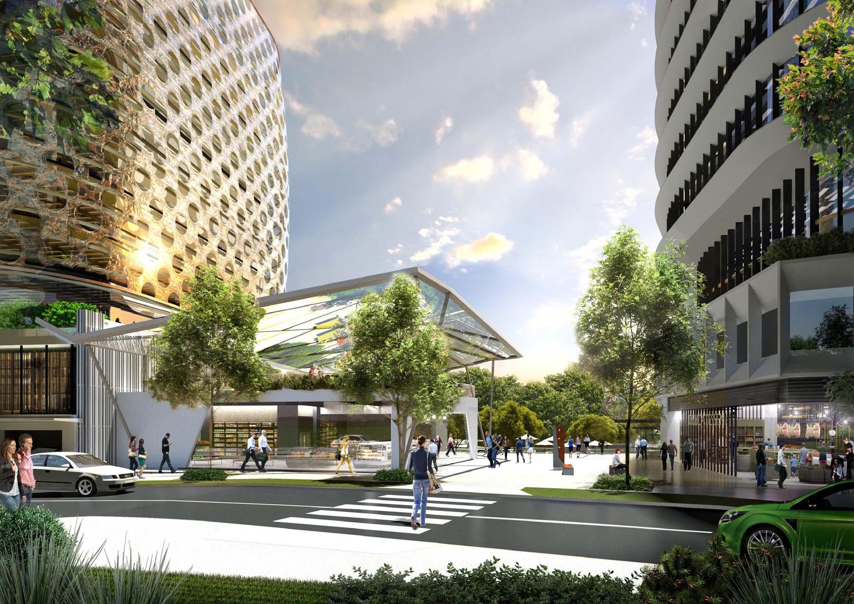
Council
Council
Council
Council / Developers
193
Responsibility
Phase Action
N/A N/A
Table 29. Overview of Implementation and Actions - Infrastructure
Artist’s Impression for Norwest Station Site (Source: Scott Carver)
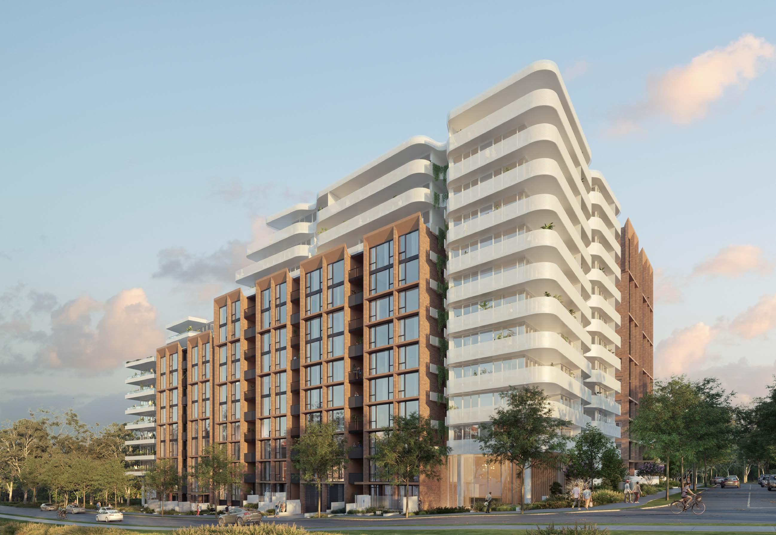 Artist’s Impression of Residential Development (Source: Turners)
Executive Summary 01 Appendix A
Acronyms
Acronym Meaning
CBD Central Business District
CP Contributions Plan
DA Development Application
DCP Development Control Plan
DPE NSW Department of Planning and Environment
DRP Design Review Panel
EP&A Act Environmental Planning and Assessment Act 1979
FSR Floor Space Ratio
GCC Greater Cities Commission
GSC Greater Sydney Commission
HoB Height of Building
LEP Local Environmental Plan
LGA Local Government Area
LoS Level of Service
LSPS Local Strategic Planning Statement
NWRL North West Rail Link
NSW New South Wales
PoM Plan of Management
PDP Public Domain Plan
Acronym Meaning
RDA Restricted Development Area
RL Reduced Level
SEPP State Environmental Planning Policy
SME Small-Medium Enterprise
SSDA State Significant Development Application
TfNSW Transport for New South Wales
THSC The Hills Shire Council
VPA Voluntary Planning Agreement
197
Glossary
Active Frontage: Street frontages where there is an active visual engagement between those in the street and those on the ground floors of buildings.
Active Transport: Modes of transit that include walking, cycling, skateboarding and scootering that promote increased sustainability, personal wellbeing and healthy, active lifestyles.
Contributions Plan: A Plan prepared by councils to levy new development to fund additional or improved local, public infrastructure needed by the development and used by the whole community.
Community Strategic Plan: A document that identifies the aspirations of The Hills Shire community. It identifies a vision for the next 10 years, details how the vision will be achieved and outlines how the effectiveness of the outcomes will be measured.
Density: A measure that indicates the size and scale of a development (often dictated by a Floor Space Ratio control).
Development Contribution: A contribution made by a Developer towards the infrastructure needed to support the development.
Development Control Plan: A detailed guideline that stipulates the controls that apply to a particular type of development or in a particular area.
Floor Space Ratio: The primary measure of the density of development on an individual site.
Housekeeping Amendments: Minor amendments intended to correct insignificant or immaterial errors.
Land Use Zoning: A categorisation that dictates what land uses can take place and guides the local character within a specific area.
Liveability: How suitable a place is to live in; where the built environment supports and responds to the way in which people live, promoting safety, comfort, enjoyment, environmental quality and access to services. Where a place contributes to the overall quality of life experienced by its residents and the broader community.
Local Environmental Plan: A statutory instrument prepared for a specific area that defines what purpose land may be used for. It consists of a written instrument and maps and includes legal definitions of development that is permissible in each zone. It also contains key development standards and special provisions to address land constraint issues, such as land acquisition, biodiversity and flood prone land.
Local Government Area: This refers to the land that encompasses The Hills Shire.
Local Strategic Planning Statement: A local policy that supports future planning decisions as well as drive future land use planning and informs how Council will manage population, housing and economic growth in The Hills. It draws on an understanding of economic, social and environmental needs over the next 20 years and sets planning priorities and corresponding actions that will provide more housing, jobs, parks and services.
Mass Transit: A large-scale public transport system provided in a specific area which supports ease of use and improved connectivity. It usually comprises buses and trains/metro services.
Mode Share: The share of people using a particular mode of transport (including cycling and walking) within the overall transport usage of an area.
Permeability: Refers to the ability to move freely and efficiently throughout an area.
Place-based planning: Place-based planning examines locations in their entirety – land use, function, look and feel, design of buildings and environment – and plans and manages them as places for people rather than simply locations. It considers an area’s existing character as well as its desired future character, which is largely informed by its community.
Planning Agreements: Voluntary agreements entered into by Council and a person, usually a developer, to deliver public benefits. Public benefits may include the dedication of land to Council, monetary contributions, public infrastructure, community facilities, affordable housing, any other material public benefit or any combination of these.
Planning Proposal: A document that explains the intended effect of a proposed local environmental plan (LEP) and sets out the justification for making that plan. A planning proposal is submitted when a change is proposed to an existing LEP.
Public Domain: Public spaces used with little or no restriction on a daily basis by the community, including parks, plazas, streets and public infrastructure
Precinct Planning: A Plan for an area which involves investigations into appropriate land use and built form options, physical environment constraints, infrastructure requirements, community values and expectations.
Rezoning: When the zoning of land is change in a planning instrument. For land to be rezoned, a planning proposal is required to be submitted and go through the Gateway process and be made with the Minister’s (or a delegate’s) approval.
Smart Technology: The delivery of information to enhance the quality of services, such as energy, transportation and infrastructure, to improve the liveability and sustainability of a city or region.
Smart Places: Places that integrate technologies into the built environment to capture and convey data and insights.
Specialised Retail Premises (Bulky Goods): A building or place that is used for the sale, hire, or display of goods that are of a size, weight or quantity, that requires a large area for handling, display or storage.
State Environmental Planning Policy: State policies prepared by the NSW Government that deal with land use and urban and regional development in a state-wide context.
Strategic Centre: Flexible, diverse places targeted to attract high levels of private sector investment that will co-locate a range of activities. Within The Hills Shire, they include Norwest, Castle Hill and Rouse Hill.
Streetscape: Refers to the view from the public domain, usually the street (and possibly a laneway or public reserve).
Structure Plan: A plan that indicates where we will focus jobs and housing in strategic centres over the next 20 years. For the purposes of this Precinct Plan, it focuses on desired land uses, built form, density and connectivity.
Sustainable: Relates to the endurance of systems, buildings, spaces and processes – their ability to be maintained at a certain rate or level, which contributes positively to environmental, economic and social outcomes.
Through-site Links: Pedestrian and bike links that improve permeability and assist in breaking up large lots and increase the potential for direct and clear connections between buildings.
Transit Oriented Development: The concept of maximising the density of development (be it housing, employment, retail, services and leisure) within walking distance of public transport and creating walkable and high-amenity precincts.
Value Added: The value of output after deducting the cost of goods and services inputs on the production process.
Walkability: The ability to safely walk to amenities within a reasonable distance, usually defined as a walk of 15 minutes or less.
30-Minute City: Where people can access jobs and services in their nearest metropolitan and strategic centre within 30 minutes by public transport, seven days a week.
The Hills Shire Council Draft Precinct Plan Norwest Strategic Centre 198
Assumptions
Employment Density
Future job capacity within the Norwest Strategic Centre has been calculated as follows:
• For vacant land, where available, the projected floorspace has been determined based on development application or planning proposal data. Otherwise, it has been calculated by multiplying the land area by the applicable or assumed floorspace ratio controls, then applying an assumed employment yield.
• For developed land, an analysis was undertaken to determine the existing employment floorspace. Then the net achievable additional floorspace was calculated based on assumed floorspace ratio controls. An assumed employment yield was then applied to determine the job capacity.
It is recognised that in this current climate, employment density ratios remain uncertain given the transition towards remote working. This may result in businesses wanting to reduce their long-term floorspace requirements due to the increased acceptance of working from home. It may also result in increased demand for new office formats within The Hills Shire, including small office suites and co-working spaces.
Higher floorspace per worker ratios may be required to accommodate social distancing for workers who remain in the office. There is also uncertainty around the nature of hybrid working and proportion of days each week workers will spend remote rather than in the office.
Council’s Productivity and Centres Strategy anticipates an employment yield assumption of 30m2 per job for business parks. However, Norwest is envisaged to transform into a commercial office precinct (rather than the traditional business park model). This, coupled with changing working patterns, has led to a revised employment density assumption of 1 job per 25m² being utilised for the purposes of this Precinct Plan.
The appropriateness of this employment density assumption will continue to be monitored over time and adjusted if necessary, in response to market demands and other credible evidence bases that may become available in the future.
Residential Density
The majority of the land identified for residential development is already rezoned or the subject of site specific planning proposal applications. Future residential yield within the Norwest Strategic Centre has been determined based on the following:
• For vacant land, where available, the projected number of dwellings has been determined based on development application, planning proposal data or prevailing development standards. Otherwise, it has been calculated by applying the density assumptions outlined in this Precinct Plan together with a dwellings per hectare rate (identified within Table 30).
• For developed land, the same approach specified above has been utilised, however an analysis of the existing number of dwellings was undertaken first to determine the net additional residential yield.
• This Precinct Plan also assumes an occupancy rate of 2 people per household.
Uptake Rate
It is not envisaged that all properties will be subject to redevelopment at the same time and uptake rates have been applied to each development type within each precinct. The uptake rates which have been applied depend on the density being proposed and the extent of development which is likely to occur. Higher uptake rates are applied where higher densities are envisaged. However, in locations that are subject to development constraints, a lower uptake rate has been applied. The uptake rates are included within the yield table for each Precinct.
199
Employment Ratio (m² per job)o (m² per job) Employment Ratio 1 job per 25m² of Gross Floor Area Dwelling Density Gross Floor Area (GFA) per apartment Average 100m² per apartment Dwelling Occupancy Rate Average 2 persons per apartment
Table 30. Density Assumptions
Disclaimer and Copyright Notice on Flooding and GIS Data
Disclaimer
The information presented on the flood map is assembled from multiple sources and is the best information currently held by The Hills Shire Council (THSC) in relation to the subject site. In using this flood map, the user acknowledges the following:
• The flood map is for exhibition purposes only.
• THSC does not warrant that the flood map does not contain errors and that THSC shall be in no way liable for any loss, damage, or injury suffered by a legal user or any other person or corporation consequent upon the existence of errors in the flood map.
• The flood map or part of it will not be copied, lent, resold, altered, decompiled, disassembled, or otherwise disposed of without the consent of THSC. The user shall use all reasonable efforts to protect the flood map from unauthorised use, reproduction, distribution, or publication and to ensure that the information, which is confidential to the data custodian and to which the user may have obtained access because of the exhibition, is not made available to any other party or used for any other purposes.
• On termination of the exhibition, the user shall cease using the flood map and erase the same from all forms of storage.
• THSC may, at any time, revise the flood map without notice.
Copyright Information
• Flood maps and other flood related data copyright remains with THSC and Sydney Water.
• Base cadastre copyright remains with Land and Property Information NSW (LPI).
• Cadastre updates (including Council generated data) copyright remains with THSC.
• Contour information copyright remains with THSC and the Department of Climate Change, Energy, the Environment and Water (formerly known as The Department of Environment and Climate Change).
• Topographic survey data remains the property of THSC.
The Hills Shire Council Draft Precinct Plan Norwest Strategic Centre 200
201 www.thehills.nsw.gov.au
