Welcome to the March 2023 edition of The Emergency Drone Responder Magazine. The primary aim of the Drone Responder Magazine is to report, educate, validate and promote the use of drones and emerging technologies in support of the work of the emergency services and the Emergency Drone Responders worldwide.
The Drone Responder Magazine is the global voice for the operational Fire, Law Enforcement, Search and Rescue & cUAS teams.
In this edition, we have fantastic articles covering a wide spectrum of subjects that will form an important part of the EDR mission to promote the global exchange of knowledge. I would like to thank Charles Werner, Vendelin Clicques, Lee Newman, Mike Parsons, Philip Hicks, Graham Brown, Tom Nash, Darryl Ashford-Smith, Rich Gatanis, Kenny Åserud, Brandon Karr, Richie Moore, Dr Ian Greatbatch and Dr Anna Jackman for their fantastic articles and their enthusiasm to share their knowledge and experiences.
Also a big thank you to Altitude Angel, Coptrz, Convexum, DRONERESPONDERS, DroneControl, Enterprise UAV and I.E.D.O for your continued collaboration & support.
To ensure that we maximise the reach of the magazine, The Emergency Drone Responder magazine is available as an eMagazine free of charge on the website www.emergencydroneresponder.com
You also have the option to subscribe (see page 38 for more details) and every 8 weeks receive a full colour hard copy magazine direct to your door.
EDR Magazine have committed to donate 10% of ALL subscription revenue to volunteer and self funding Drone Operations to assist with the buying of equipment they so desperately need.

The Emergency Drone Responder is a Bi-Monthly magazine wholly dedicated to Emergency Drone Operations, robotics and innovative new technologies that will assist Law Enforcement, Fire, Search and Rescue teams.
The primary aim of the Drone Responder Magazine is to report, educate, validate and promote the use of drones and emerging technologies in support of the work of the emergency services and Emergency Drone Responders worldwide.
The Emergency Drone Responder Magazine is the global voice for the operational Fire, Police, Search and Rescue, Counter UAS teams, and will cover and promote drone use & emerging technologies and robotics with input and opinions from experts from around the world promoting the use & value of operational drone teams within a fire, law enforcement and rescue arena. Paul Budgen
Tel: + 44 (0) 1305 831 768
Coordinator Tel: + 44 (0) 1305 831 771
lora.lammiman@edicogroup.net Adam Long Design & Production
+44 (0) 1305 831 786
Chief Charles L. Werner Ret. from DRONERESPONDERS gives us valuable insight from his position as a leader in drone use for emergency service response.
Lee Newman, RPAS Manager at London Fire Brigade talks us through the history and progress of implementing drones in Urban Search and Rescue.
Mike Parsons, an expert in aerial necrosearch gives insight in how drones can be used to recover bodies from unmarked grave sites.
Representatives from ARPAS-UK, The drone industry association discuss how drone use can help overcome some of the new challenges search and rescue teams face.
The IEDO association (the International Emergency Drone Organization) organized the first world emergency drone conference IEDO CONF in Paris on December 12 and 13, 2022.
A case study showing how drone technology was used to combat the Dartford Heath wildfire.
Tom Nash and Darryl Ashford-Smith (SARAA) Discuss the Considerations for Introducing Drone Capability to SAR Operations.
Rich Gatanis, UAS Coordinator at SMFR outlines the difficulties of tradition when trying to adopt new and innovative technology for fire and rescue teams.
"The Gjerdrum landslide serves as a reminder of the power and destructive force of natural disasters and the importance of preparedness and response efforts."
In this article we learn about the necessary steps and planning that were taken when setting up Pearland's Drone as a First Responder (DFR) program.
Drone supplier, Enterprise UAV gives a company overview and provides an interview for how drones are used within law enforcement.
Richie Moore and Dr Ian Greatbatch from The West Midlands Fire and Rescue Service present a framework for successfully leading emergency response drone teams.
Convexum talk us through the growing necessity for Counter UAS solutions when using drones as first responders.
Research explores opportunities, barriers and potential futures of drones in UK emergency response.
A case study looking at UK-based company 'Altitude Angel' as leaders in Unified Traffic Management.
Enterprise UAV announce that the Autel Max 4T is available to order.
Echolocation could give small robots the ability to find missing persons.
As a way of providing shared learning to our community, The Emergency Drone Responder Magazine will be shining a light on select individuals who are at the forefront of drone use within emergency services. Our 'Leaders in Industry' section offers a deep dive into their expertise, history and insights in the hope that their work and achievements will provide valuable knowledge and inspiration to a wider network of emergency drone responders.
Chief Charles L. Werner Ret. has served 49 years in public safety. Charles started his career as a firefighter with the Charlottesville VA Fire Dept. and served for 37 years, serving the last ten years as fire chief. Charles also served two years as a reserve deputy with the Albemarle County Sheriffs Office. Following retirement, Chief Werner served for 2 years as senior advisor and acting deputy state coordinator for the Virginia Dept of Emergency Management. He presently serves as Director/Founder of DRONERESPONDERS and is an FAA Certificated Remote Pilot. Charles also serves on numerous UAS Advisory Boards. In 2022, Charles joined the Virginia Department of Aviation as an aviation technology advisor on UAS, CUAS and Advanced Air Mobility.
Charles serves on the International Fire Chiefs Technology Council, International Association of Chiefs of Police Aviation Committee, International Public Safety Association Advisory Board, and appointed by Virginia's governor to serve on the Secure and Resilient Commonwealth Panel.
Chief Werner is a contributor to numerous magazines with over 300 nationally and internationally published articles.
The DRONERESPONDERS Public Safety Alliance
In 2019, DRONERESPONDERS was formed for the specific purpose of advancing public safety Uncrewed Aircraft Systems (UAS). The first step was to provide a Resource Center that would help guide public safety agencies on the process of implementing UAS Programs.
The DRONERESPONDERS Resource Center has over 800 documents including but not limited to best practices, lessons learned, SOPs, community outreach, checklists, reports and information on counter UAS, Uncrewed Traffic Management (UTM) and Advanced Air Mobility (AAM). DRONERESPONDERS has over 7000 members, participation from 85 countries and 1400 website visits per week. DRONERESPONDERS.org is open to public safety organizations, government, academia, non-governmental organizations and industry. MEMBERSHIP AND ACCESS TO ALL RESOURCES IS FREE.
DRONERESPONDERS partnered with the NASA AMES Research Center and ESRI to develop a Global Public Safety Drone Directory/Dashboard which is managed by former Pearland TX Police Officer Brandon Karr.
As of January 2023, the dashboard is nearing 1300 agencies which are providing each of their UAS program information such as start date, types of missions they fly, number of remote pilots, payloads and more which promotes coordination and collaboration with nearby agencies for new program startups, facilitates regional training and development of regional UAS response teams. The dashboard allows for filtering by state, discipline and more.
DRONERESPONDERS has partnered with NIST to promote the use of the Standard Test Methods for Small Unmanned Aircraft Systems which provides an objective way to train and evaluate basic manoeuvring skills. This is available in the FREE Resource Center.
On waivers, DRONERESPONDERS worked with public safety agencies to facilitate the first FAA Tactical Beyond Visual Line of Sight (TBVLOS) waiver to allow emergency remote pilots to fly BVLOS during dangerous missions like SWAT, hazmat response and more.
This year will be huge for the Drone as a First Responder (DFR) Program with a DFR Guidance Template from the FAA and our DFR International
Initiative partnership with UAS Norway. The DFR concept involves launching a drone BVLOS at the time of emergency incident dispatch to fly over an emergency incident to provide real time situational awareness prior to arrival of ground units.
On the Counter UAS aspect, DRONERESPONDERS initiated a CUAS Working Group to share information on CUAS, and promote CUAS authority to the state, local, tribal and territorial agencies.
EDR: What peaked your interest in drones?
Charles: Throughout my 49 year public safety career, I have always been interested in technology. I had worked with computers, smart devices, GIS, broadband, WiFi, remote sensing, communications and interoperability. I quickly saw a drone convergence across all of these technologies. So drones rose to the top of my interest quickly.
I had also already seen the value of aviation operations in public safety but helicopters and fixed wing aircraft are too expensive and crewed aircraft in public safety were only operated by bigger cities and counties with bigger budgets.
Drones now offered a similar opportunity for almost every public safety organization.
EDR: How did you go about learning more about drones for public safety?
Charles:I started scanning the internet and national news for stories about public safety use of drones by early adopters. I would search for the responder who was quoted and I would call and basically interview them. I would ask about their use cases, how the drones performed, how was it received by the community, how was it received by the department members, what were their successes, their challenges and asked if others wanted to start a drone program what would you tell them?
EDR: As you explored drones in the beginning, what did you learn?
Charles: I quickly learned that programs were all over the place. Some were sold on larger, more expensive drones ($50K) that they never ended up using. I learned that very few people knew much about drones and had nowhere to look. I learned that there was great concern over privacy issues. Interestingly, I learned that many department members saw drones as toys and had no use for them until they saw their utility - then their response was, "Where's the drone?". Some states would require law enforcement to have a search warrant to fly.
EDR: After exploring the potential on drones for public safety, what did you do?
Charles: Realizing that there was very little and fragmented information, I worked with a number of the public safety UAS early adopters to develop the National Council on Public Safety UAS. And started the first online Resource Center to capture the early policies and procedures to share. There were about 100 documents at first. Unfortunately this group was a community of like minds but there was no way to enter into agreements or get corporate sponsors. Then in 2019, I was introduced by my good friend Jay Willmott to Chris Todd with the Airborne International Response Team (AIRT - a 501C3 non-profit organization) who proposed that we create a new program under the AIRT nonprofit and The DRONERESPONDERS Public Safety Alliance (DRONERESPONDERS) was born. News spread fast and the Resource Center quickly grew and presently has over 800 documents. We first focused on information needed to start programs.
DRONERESPONDERS quickly grew to 500 members and now going into our 4th year, membership (FREE) has risen to over 7000 members, participation from over 85
countries, 400+ international members, 1400 persons/week to the website. In 2020 we partnered with NASA AMES Research Institute and ESRI to launch the Global Public Safety Drone Directory/Dashboard which now has nearly 1300 public safety agencies sharing their drone program information. Former Pearland TX Police Officer maintains this dashboard.
DRONERESPONDERS purpose is to
EDR: How were your next actions received by public safety?
Charles: It was slow at first because people didn't know DRONERESPONDERS existed. Then DRONERESPONDERS started holding general webinars and also began a monthly Webinar with the Federal Aviation Administration's (FAA) Michael O'Shea to explain and demystify some confusing rules and regulations. Interest really picked up and in the 2020 DRONERESPONDERS research study revealed over 17 major public safety use cases and many of them could be divided into sub categories. In 2019, DRONERESPONDERS partnered with AUVSI XPONENTIAL and Commercial UAV Expo to conduct annual global and national summits respectively. In March 2023, DRONERESPONDERS will start another annual Public Safety UAS Conference at Busch Gardens in Historic Williamsburg, VA.
EDR: What are the biggest mistakes made by starting public safety drone programs?
Charles:
• Before starting a program, be sure to conduct community outreach to include citizens, elected and appointed officials and the local civil liberties organization to address their concerns. Many programs had to restart when there was community backlash. DRONERESPONDERS has a customizable Community Outreach program in its Resource Center.
• Not knowing what they are getting into as to missions to be flown, best aircraft to start, regulatory requirements, the costs for aircraft, payloads and batteries (often cost more over time than the aircraft).
• Starting with aircraft too large or too sophisticated.
• Not realizing the requirements for remote pilot certifications and amount of initial and recurring training necessary to maintain perishable skills.
• Not realizing that remote pilots are aviation pilots with the same requirements for safety as a crewed aircraft pilot.
EDR: What have been some of the benefits of public safety drones?
Charles:
• Enhances safety of responders, citizens and community
• Improves better operational effectiveness as there is more information available
• Serves as a de-escalation tool
• Provides real time situational awareness
• Creates a collaborative environment across disciplines
• Serves as a force multiplier, especially during times of law enforcement staffing shortages
EDR: How are drones being used by public safety?
Charles:
• Law enforcement tactical operations (SWAT, Hostage situations, drug enforcement, room clearing)
• Forensic investigations
• Traffic Crash Reconstruction
• Traffic Safety Enforcement
• Traffic Pattern Review
• COVID Vaccination Site Planning
• Structural Firefighting
• Wildfires (6 sub categories)
• Hazmat Response
• Interior flight operations
• Search for Lost Persons
• Beach shark overwatch
• Ocean lifeguard rescue flights with personal flotation drops
• Tethered drones for stationary reconnaissance
• Major Disasters (hurricanes, tornadoes, floods, mudslides, earthquakes,
• Drone as a First Responder

• Pre-fire site planning
EDR: What is the NIST Standard Test Methods for sUAS?

Charles: This program established multiple sUAS test lanes for basic drone manoeuvring skills and proficiency. This is being used in the U.S. and other countries as well.
EDR: Will drones replace crewed helicopters?
Charles: No not at this time, drones have a limited operational area. Helicopters have a much larger area of operation, can do other operations like rescue of persons, large area search and damage assessment.
EDR: What are the next significant developments ahead?
Charles:
• Beyond Visual Line of Sight (BVLOS) operations will enhance the distance and effectiveness of public safety drone programs.
• Drone as a First Responder is the next major use case for public safety NOW, which originated with the Chula Vista CA USA Police Department. This concept launches a drone from the moment of incident dispatch, usually arrives first and provides eyes in the sky to dispatch and directly to officers in the field. This real time streaming situational awareness provides critical information, enhances safety, serves as a de-escalator and returns officers to service more quickly.
• New FAA waivers will soon allow for preincident flights for early wildfire detection and suppression.
• Drone Swarms will expand coverage areas for numerous reconnaissance operations.
• Larger drones will be able to conduct significant 24 hour wildfire suppression operations which will allow flights at night and through smoke incursions without any danger to a pilot.
• Best guess estimates are that people transportation will occur in 5 years which will hopefully lead to air ambulances and other emergency services.
EDR: What do you consider the biggest accomplishment?
Charles: The opportunity to work with the best of the best to learn, collaborate and share information to the larger public safety drone community.
To find out more information about DRONERESPONDERS please visit their website or contact them directly.
info@droneresponders.org https://www.droneresponders.org/

The DRONERESPONDERS Global Public Safety Drone Map Dashboard was a result of a partnership with NASA AMES Research Institute and ESRI The Map Dashboard was designed to serve as a way to share Public Safety Drone Program information between agencies around the world It has also been used to help facilitate regional mutual aid cooperation and regional training The Map Dashboard is open to all public safety agencies and is managed by former Pearland TX Police Officer Brandon Karr. This also allows for filtering by state, discipline and more.
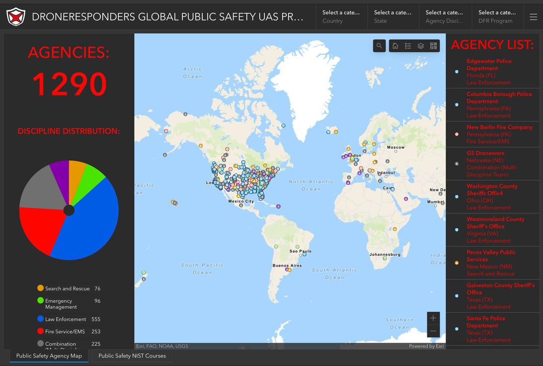
Here's a 3 minute survey to add your organization's info: https://bit.Lu/2RHlwyj
Here is the Map Dashboard link to nearly 1300 already participating: https://droneresponders.maps.arcgis.com/apps/dashboards/5dd2710f19e24
703823789eb9c2a7b70
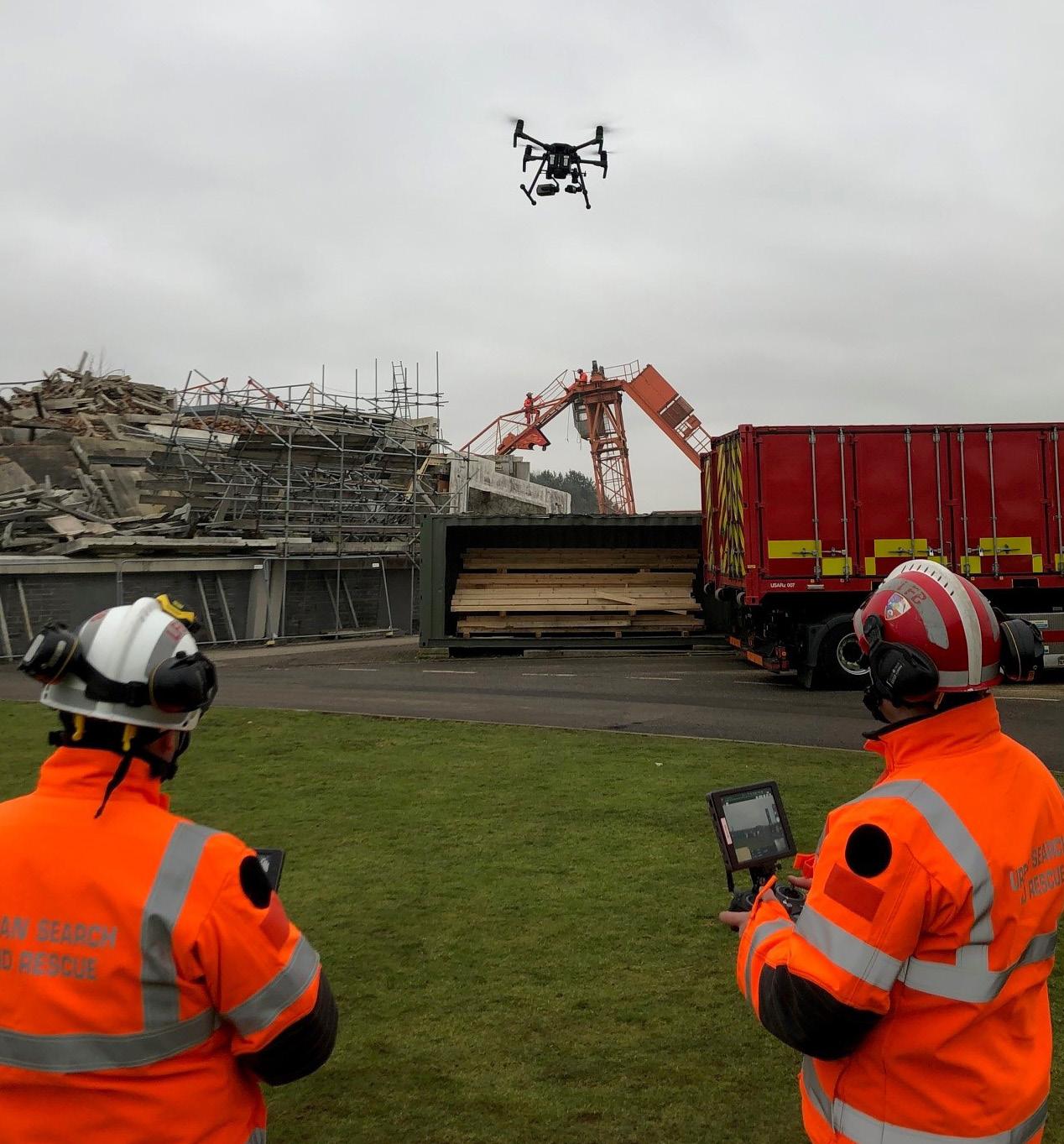
Urban Search and Rescue in its purest form has been with us in various forms since way back and in a more uniformed and developed capability form since World War 2. During the war years it was mainly a dig by hand process, maybe some tools and if lucky some heavy plant. By the end of the war the capability had grown in technical and practical know how to the point where some shoring techniques are a direct consequence of this knowledge learned. From the war years through until today it has increased immeasurably in what it can deliver at an incident if called upon with various hi-Tec equipment, enhanced technical skills and advanced methods of rescue. Advanced technology should see further changes to capability including, robotic search dogs (SPOT is already in service https://www.bostondynamics. com/spot), artificial intelligence sensors, nano technology and drones. The use of drones in the urban search and rescue environment is the main thrust of my work within the London Fire Brigade along with the organisations aim of driving innovation into different areas of the service.
This article will explore how drones could effectively be used in a USAR environment and what it will mean for teams overall planning, searching and rescuing using the information harnessed from the drone. I will discuss how I have tested drones within exercise simulations, the benefits gained and the feedback from the staff and technicians received was.
Information at the scene of a USAR incident and any incident really, is incredibly important so those in charge can assess the situation quickly and make value judgement decisions and plan a course of action. The stages of a USAR incident are broken down into Assessment, Search & Rescue (ASR) levels which will range from wide area assessments down to individual search sites. Before drones the information over a wide land mass was gathered by ground intel, satellite images
and aerial photography sometimes using planes or helicopters. The information captured allow for a picture to be built of what teams are going into and to help break it down into sizable chunks thus allowing a more efficient approach to be taken when allocating work sites to teams. Although this has proved successful for incidents in the past, evolving technology has now opened a new source of information gathering that can prove game changing for future incidents.
The new age of drone technology within USAR will be a potential game changer in respect to continuous 360° situational awareness and additional capabilities it can provide. At a recent USAR exercise at
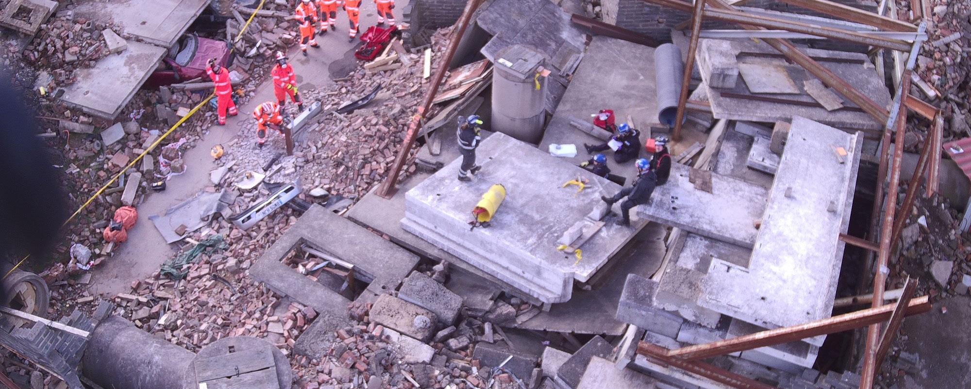
the Fire Service College (UK) I used the drone for the initial assessment to feed back to the command cell. I was able to identify hazards, locate victims and send back the images for the officers to start making plans from. The drone was also used to fly above the line and hail rubble pile sweep to give a wider view and to spot any potential hazards not seen from the ground. The operator with a radio relayed the information to the team leader in a rapid manor to give early warning of potential hazards. This role moving forward could be done autonomously and the live feed received via a team leader tablet and will be a normal integrated process within a few years. At a recent incident in London a three-story house had partially collapsed, and a full search had to be made to locate
the missing occupants. The access to the top floor was a slow process due to the need for a platform to be built plus shoring around the structure to enable a safe work environment. All of this took time and by the time shoring systems had started being put in place the aerial appliance had arrived that was then used to gain access for USAR technicians to look inside and clear it of any victims.
I thought about the timescale we have in USAR to save life and the time it takes to erect safety systems to gain access there is a gap in which we could exploit using drones. I tested the ability to fly small sized drones through windows, doors or any general sizable gap to see if this would be an ideal procedure to explore voids and spaces not easily assessable by technicians for the reasons of having to put safety systems in place first. The flight in our USAR training rig was fairly easy and once we were familiarised and spatially aware, we could fly about the room and use the camera to assess and systematically search the area. I then took it to the next level when I flew it from outside of the USAR rig up to the 6th floor of the tower block and into the lobby, I used this flight to test the limits of drone use and how far into a building you could go before losing signal or any other limiting factor.
The only limiting factor was the drone that at the initial stages of an incident we can assess and search from a stand-off position which will limit USAR technicians from entering buildings unnecessarily increasing their safety and providing critical information to incident planners.
Aside from the physical flying of drones at USAR incidents the other options they give us are, Mapping and planning, 3D modelling and situational awareness. At any incident we can take photos and print them off for incident commanders to use to draw up search sectors and for briefing crews with, however the capability of the drone and associated software via computers means the mapping can be far superior to just a piece of paper.
It is possible to show this as a live visual with floating icons to denote specific points of interest or cordons and can be as dynamic as the incident and will aid the situational awareness to be maintained remotely.
3-D modelling is fast becoming an application which in some cases can be turned around within 20 minutes and enables the viewer to look round the whole building from floor level or a bird's eye view. This will be the go-to for any incident and as the incident progresses the 3-D models will almost be a time lapse of the incident and show progression and or deterioration of the building.
These models will form part of the post incident brief and any subsequent investigations and will enable people who attended the incident to remember actions and events better through a visual representation.
The use of drones within the USAR world is slowly increasing in use and its untapped
potential is only now being realised to what it can bring to the table. Through innovation and education, we will start to see a rapid increase in utilising drones in this field of operations. Using them as a safety tool primarily for firefighter safety coupled with their ability to aid in information gathering and post flight mapping and planning processes. The next generation of drones will incorporate robotic search dogs to undertake a multitude of functions, artificial intelligence drones to aid in search and rescue and nano robots or drones to enter voids and send back data of conditions and casualty information. A few years ago, this would have seemed like fantasy but the reality is a lot closer than we think.
Lee NewmanI am a Station Officer in the London Fire Brigade and have served 25 years in an operational role. I assumed the role of Drone Project Lead for LFB and am now responsible for its growth and expansion.
Mike Parsons, an expert in aerial necrosearch gives insight in how drones can be used to recover bodies from unmarked grave sites
Not a day goes by without seeing an article or news report on the use of drones in modern society, sadly, most stories are on the misuse of drones; either interrupting football matches, flying in areas they shouldn't be, or engaging in criminal activity, however, these are often exceptional circumstances, and most drones are actually used for beneficial purposes, such as surveying, mapping, crime prevention and medical deliveries. Often they are flown by pilots with specialist training.
Specialist operators are constantly demanding state of the art technology to keep up with the demands of their roles, with one specialist operator breaking ground, quite literally, with their use of drones and technology. Mike Parsons is a forensic scientist and CAA qualified drone pilot from North Wales, who, for the last 5 years, has been pushing the boundaries of what drones can be used for in the search for human remains. Mike is researching the use of Aerial Multispectral Imagery in the detection of clandestine burials; a multiyear research project spanning from his undergraduate degree in Forensic Science into his PhD and, hopefully, beyond. His initial findings already published in the National Police Library, Mike hopes that his research will have long lasting benefits to both law enforcement and search & rescue (SAR) teams.
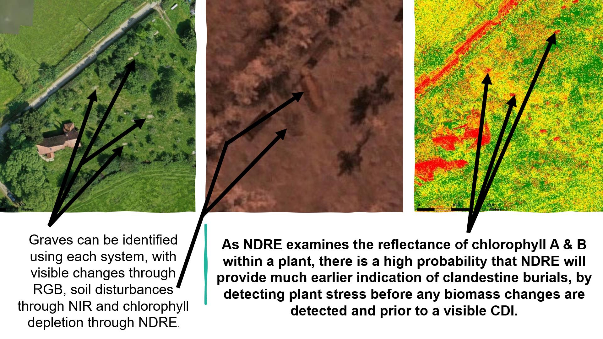
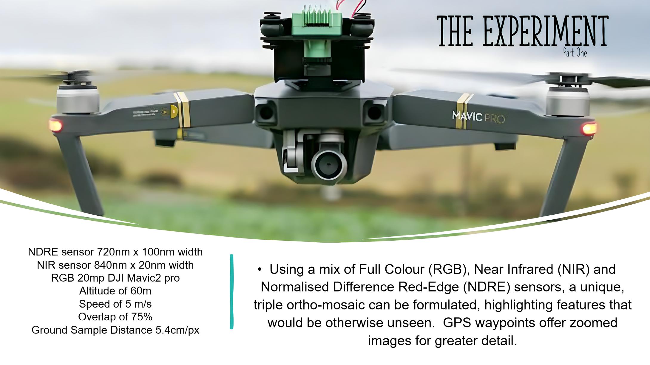
Mike explains that multispectral imaging examines both visible and invisible light frequencies; from the full set of colours to near-infrared and red-edge. The sensor records images in colour (RGB), nearinfrared (NIR) and red-edge (NDRE) and these can be observed in different layers, each of which shows a detail that isn't visible in the others. The RGB are like Hi-Res photos which can show details not observable at ground level, the NIR images can highlight changes in the reflectivity of
soil compaction and NDRE examines the overall health of vegetation...but how does this help identify a grave?
Anyone involved with forensics, cadaver search teams or law enforcement have a degree of training on fieldcraft; identifiable markers that could distinguish a burial site from any other piece of land.
These markers could be identification based, with trees, rocks or other local markers near to a grave, or the use of triangulation between landmarks. Other elements of fieldcraft include practical elements, such as convenience of carrying a body from a vehicle to the grave, so access routes are a must. Concealment from view whilst digging a grave can often rule out some locations; it takes considerable time to dig a grave and
privacy is essential to not being caught. This is also true with types of soil, with softer soil easier to dig, so graves tend not to be in heavy clay soil. When a body is buried, either the grave is totally refilled, leaving a lump in the ground, (as the body is taking up space in the grave) which is easy to distinguish, or only some of the soil is returned in order to will leave a spoil heap nearby; a spoil heap is the leftover earth left from the grave.
Changes in the topography of the area, spoil heaps and identifiable grave cuts in the soil are the key factors that are looked at using the RGB imaging.
The NIR imaging examines a number of unseen elements, all of which could be crucial to understanding burial locations. Firstly the sensor can detect changes in
the direction of vegetation, for instance, if someone has walked through a field of grass, the direction the grass is pushed is different from the grass around it and these trails could be indication of the route tend not to be in heavy clay soil. When a body is buried, either the grave is totally refilled, leaving a lump in the ground, (as the body is taking up space in the grave)
which is easy to distinguish, or only some of the soil is returned in order to will leave a spoil heap nearby; a spoil heap is the leftover earth left from the grave.
Changes in the topography of the area, spoil heaps and identifiable grave cuts in the soil are the key factors that are looked at using the RGB imaging.
The NIR imaging examines a number of unseen elements, all of which could be crucial to understanding burial locations. Firstly the sensor can detect changes in the direction of vegetation, for instance, if someone has walked through a field of grass, the direction the grass is pushed is different from the grass around it and these trails could be indication of the route
the murderer took to the grave; these areas could provide valuable forensic evidence as well as building part of chain of events. More importantly, the NIR sensor detects a change in reflectance between compacted soil and turned over soil. As a grave is dug, the compacted soil breaks apart and allows air and moisture between the finer particles and, even when squeezed back down, these air gaps and moisture saturation remain, showing a distinctive pattern when observed next to soil that has been compacted for hundreds or thousands of years.
It is widely accepted that the vegetation above a grave is fundamentally altered, due to the decomposition of the body below, due to the chemical changes in the soil, primarily the nature of the microbial activity within it.
When a body starts to decompose, one of the chemicals it releases in ammonia, which ordinarily would be converted by bacteria into nitrites and then into nitrates and is a valuable source of food used by plants for photosynthesis, however, around a decomposing body the ammonia stays as it is or is halted in the conversion process to nitrites, both of which are toxic to plant life; this results in the plants not being able to grow and start to die off.
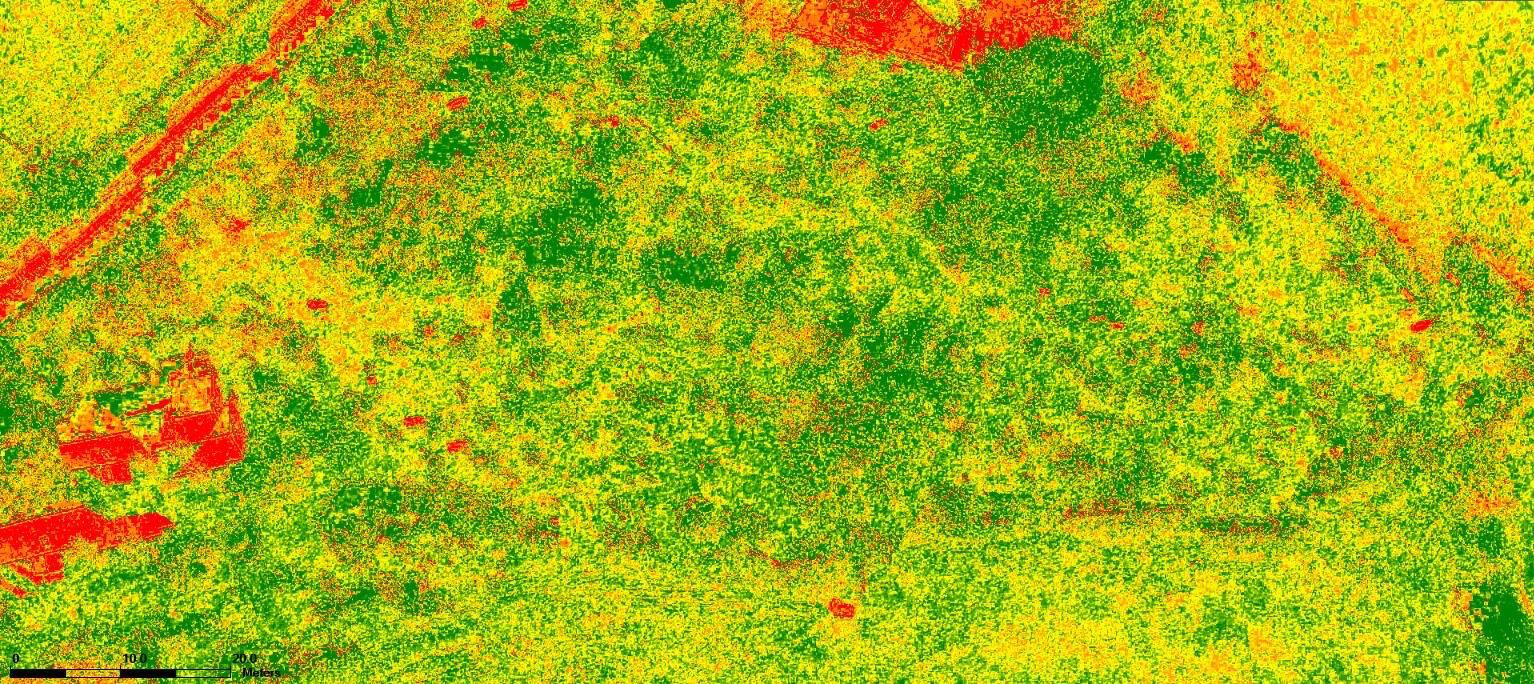
The damages area around a grave site is referred to as a cadaver decomposition island (CDI) and this is where the red-edge (NDRE) sensor comes into play. Originally designed as an agricultural sensor, the NDRE unit examines the amount of available chlorophyll in plant leaves and identifies areas of poor health as a series of red pixels and healthy vegetation as green pixels. Combining the 3 layers of images allows a unique perspective into the locations of anomalous areas that could be potential grave sites.
Mike's fascinating look into the unseen side of clandestine graves has been made possible with the support of several scientists, professors, institutions, search teams, law enforcement professionals, and drone pilots, as well as agricultural specialists; this meeting of disciplines has enabled Mike to undertake hundreds of experimental flights using both "human analogue" graves and natural (human) burial grounds to collect the data he is now sharing with the world. These experiments have also allowed Mike to be involved with several search & rescue operations and
his dedication has now been recognised as he takes his place alongside experts in their field at Kenyon International Emergency Services, adding to their 115 years of crisis management and disaster incident response. Mike explained "I feel that I am at the age where I need to do something to give back to this world and Kenyon allows me to use my skill set to do that very thing. With recent events like the earthquake in Syria and Turkey or the conflict in Ukraine, the world needs people who can make a difference, to make a difference".
In 2022, a landmark team of disaster victim identification (DVI) experts were assembled to address the ongoing situation in the Ukraine; specifically, how international standards of practice could assist and, possibly, improve the capability and procedures of the underpressure, Ministry of Justice of Ukraine. The experts ranged from pathologists to lawyers, odontologists to family liaison, crime scene imaging to CBRN (Chemical, Biological, Radioactive, Nuclear) and antiterrorist police officers; all with decades of experience in DVI. Mike was asked to become a member of the team at ETAFDVI; the European Training Center of Active Forensic Sciences & Disaster Victim Identification, journeying to Hungary, to join the Hungarian Federal Police and ETAFDVI, to host and train delegates of the Kyiv Scientific Research Institute of Forensic Sciences in the use of drones in the detection of single and mass clandestine graves.
Speaking about this momentous event, Mike said "It was a hugely humbling experience. To be around people with such vast experience was inspiring, but the stories we heard from our Ukrainian counterparts were horrifying; made even worse, when, two days after they returned to Kyiv, the first of the drone strikes hit the city. We were sent live videos they recorded of the explosions outside their facility, shared messages of support and concern as they waited for evacuation during the bombardment...suddenly, everything we heard about became so very real. Fortunately, they were safe and, as a testament to their resolve, went back to work the following day, recovering the bodies of their fallen countrymen. Its those type of people who we aim to emulate in our own actions".
The interview concluded with the question
of what brought Mike into this field of research, he elaborated "having visited a number of UAV trade shows and reading numerous research journals, it became very obvious that the types of detection methods were unavailable to most police forces, due to the huge costs involved. I wanted to develop a low cost, portable system that was using currently available technology and that could be retro-fitted to existing drone fleets; that way, a high quality multispectral sensor could be purchased for the same cost as a dive team or helicopter would cost them for the day. The more accessible this technology is, the cheaper it becomes and the wider the usage. Drones are used often in search & rescue operations but not so much in forensic searches and that is something I would like to see change in the future".
Mike's research can be found at: https:// library.college.police.uk/docs/theses/ PARSONS-Drones-Detection-HumanRemains-2020.pdf
 Mike Parsons
Aerial Necrosearch Specialist. PhD Researcher. Kenyon International Team Member. ETAF DVI Trainer
Email: mikeparsons1974@gmail. com
helicopter service (SAR) for HM Coastguard. The CAMCOPTER® S-100 (VTOL) UAS needs no prepared area or supporting launch or recovery equipment. It operates day and night, under adverse weather conditions with a range of payloads, out to 200 km, both on land and at sea.
Difficult to access environments, bad weather, treacherous mountains, avalanches, or stranded at sea, all add up to emergency response challenges of varying degrees.
The recent tragedies following the deadly earthquakes in Southern Turkey and Northern Syria, are current examples of the difficulties that first responders face, with the sheer volume of requests for help, and the daunting race against the clock to find survivors.
Now, with drones becoming increasingly common currency with blue light services, there is an immediate response available, able to replace or augment manned aircraft and tactics that require more time to access search patterns or affected areas. Drones, of course, come in all shapes and sizes from small quadcopters through to uncrewed helicopters/VTOL (Vertical Takeoff and Landing) and fixed wing UAVs with payloads more than 25kg; with obvious use for medical deliveries, logistics of military applications. Drones can carry different types of payloads that can be used in different situations. Two of the popular payloads are the 4K wide-angle camera and the thermal camera that are extensively used during search and rescue missions.
No better example of how drones can be integrated, comes in the form of the recent announcement of a 10-year
contract awarded to Bristow, the global leader in vertical flight, by the UK Maritime Coastguard Agency (MCA) to deliver the Second-Generation Search and Rescue (UKSAR2G) programme. The contract includes the operational deployment of Schiebel's CAMCOPTER® S-100 Unmanned Air System (UAS).
The new contract expands and builds on the existing capabilities Bristow has delivered to the MCA since 2015, most notably the life-saving search and rescue
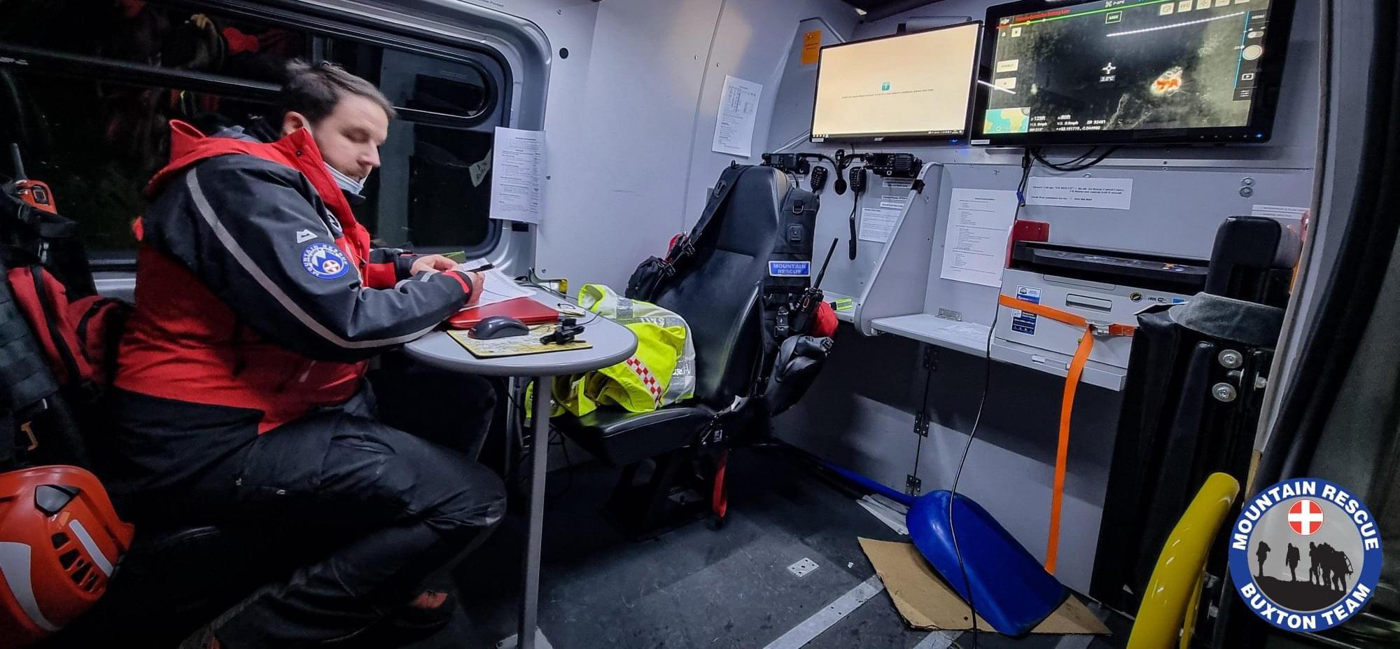
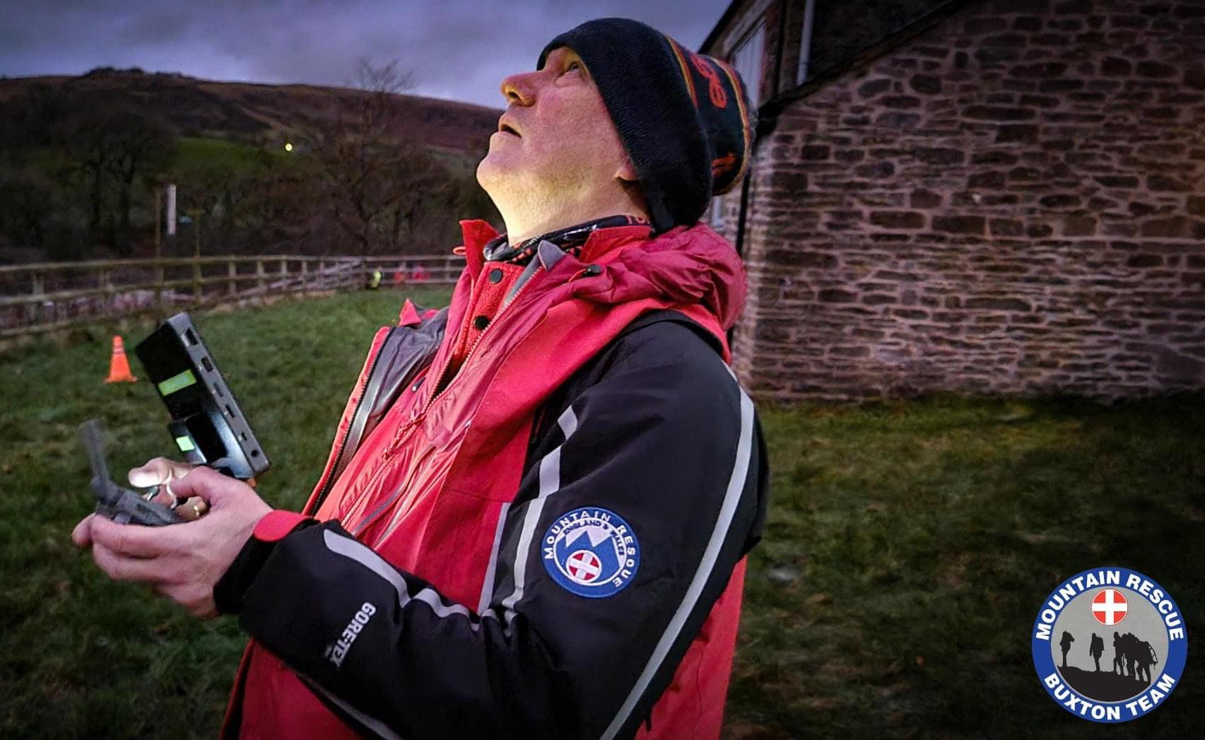
At the other end of the scale, Buxton Mountain Rescue Team became the first Mountain Rescue England and Wales team to be granted approval by the Civil Aviation Authority (CAA) for the use of drones. The team has eight trained pilots, known locally as the "Drone Team", ready to be tasked to searching for missing persons on call outs. Last year Derbyshire Constabulary's Drone Unit donated a DJI Mavic 2 drone to Buxton Mountain Rescue Team to help in the search for vulnerable or missing people.
 By Philip Hicks of disruptive tech consultancy Pravo Consulting and Graham Brown Chair of ARPAS-UK, the UK drone industry association

ARPAS-UK
Email : membership@arpas.uk
Tel: 0203 985 0904
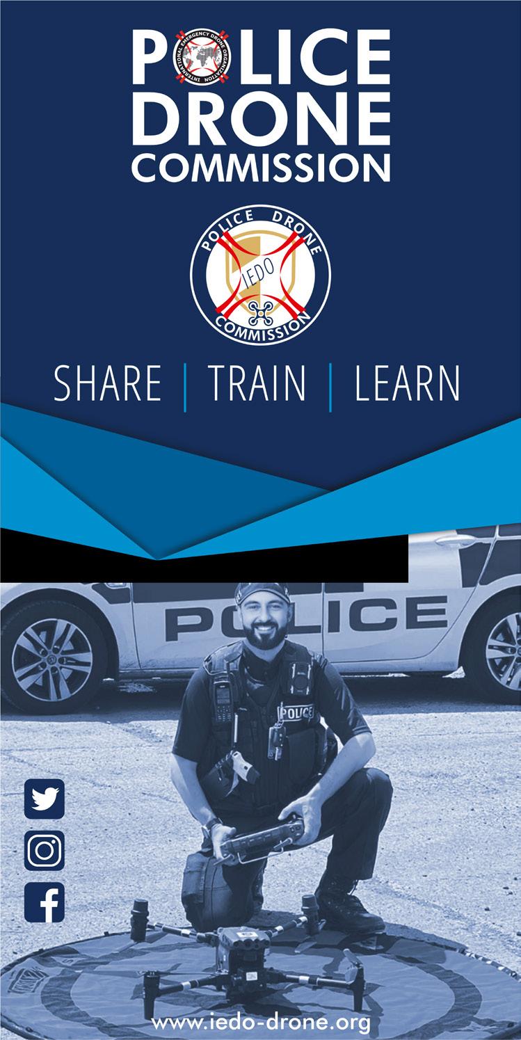
Founded in 2018, the international non-profit association IEDO is the only community in the world composed solely of first responders using drones to save and protect the population.
This community has grown over the years to reach in 2023 just under 800 members from 55 countries (firefighters, civilian and military police, volunteers from rescue associations, customs officers, coast guards, paramedics, etc.) . The objective of this community is to meet the needs and expectations of first responders saving lives by drone.
IEDO is supported by 2 international federations: the International Police Association representing 400,000 police officers and the CTIF (International Association of Fire and Rescue Services) representing 4 million firefighters. In addition, this organization supports

many projects such as the international report of good drone practices for fire and rescue services (AUVSI Public Safety Award 2021) but also working groups to deepen and innovate in drone practices.
The numerous conferences, seminars and webinars organized by IEDO aim to create and support exchanges of knowledge and experience which are essential to accelerate the development and secure control of the use of drones in public security agencies.
After a full year of preparation, the World Emergency Drone Conference was held on December 12 and 13, 2023 at the Cité des Sciences (famous national science museum). This event brought together more than 200 people from 31 countries
agencies, 19 search and rescue associations, 1 coast guard service, and 1 medical service.
IEDO has always discreetly dreamed of an international conference to bring together emergency pilots so that quality exchanges enrich them and that they bring data, knowledge and contacts back to their respective countries. Create bridges of knowledge between countries for more efficiency and security in the drone operations of public security agencies. Supported by the presence of Damian CRUMMEY representing the International Police Association and that of Milan DUBRAVAC, president of the CTIF, but also supported by the sponsors XSUN, FOTOKITE and SECURITON, the conference welcomed 26 international speakers. The many presentations dealt with a wide variety of subjects from the inter-agency team, the use of drones in a CBRN environment (with 2 experts from the USA), innovation with autonomous or solar-powered drones,
landslides in Norway, the ambitious DFR program of Pearland PD, the impressive standards of operation of the Romanian national team, medical triage, explosions in Hamburg and Beirut, standard UAS tests from NIST, version V2 of the IEDO report from good drone practices, etc.
This new commission created within IEDO reveals itself by organizing its first event during the IEDO CONF: the blue room, a police seminar with restricted access and dedicated to more sensitive and confidential themes. 32 Law Enforcement Officers from 13 countries (Germany, Belgium, Italy, Ireland, Spain, Latvia, France, the Netherlands, Poland, Romania, Sweden, Japan and the USA) met to discuss techniques use of the drone in support of a tactical intervention team, management of a national drone program, crowd control and location of buried bodies. The discussions were very fruitful and fun. The majority of participants asked for more seminars of this type.
This new commission aims to meet the needs for exchange between police drone pilots on good practices, to lead working groups on professional themes, to organize seminars, training and to develop the law enforcement community. within IEDO. Moreover, an announcement was made on the joint organization with the IPA (International Police Association) of a 5-day training in Germany in Gimborn from October 2 to 6, 2023. A great opportunity to share knowledge and experience between pilots from several countries.
Another highlight of this conference was the IEDO Award ceremony, the very first edition for IEDO. It is essential and indispensable to reward and highlight the good initiatives and efforts of deserving drone teams around the world. From the best fire or police operations, promising
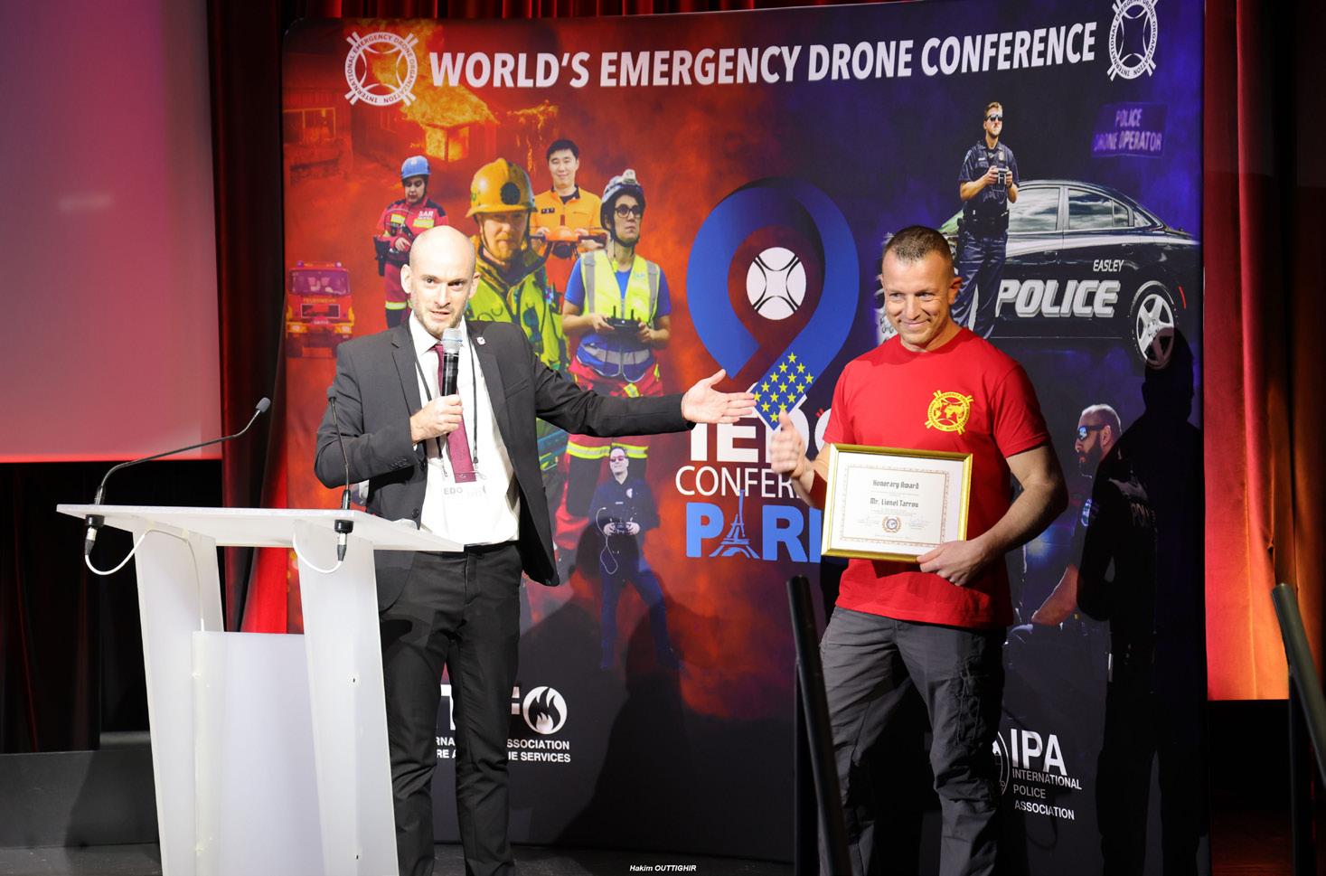
young teams, the innovative or the most communicative team, 7 drone teams in the world have been rewarded for their commitment and their results.
This 2022 edition was only possible thanks to the organization team made up entirely of volunteers, a great team. This conference made it possible to formalize the new Police drone commission which aims to develop the activities of the police community of IEDO, to announce the creation of a fire and rescue drone commission for 2023 with already many participants . The feedback from the participants was incredibly positive, they all expressed great satisfaction at having been able to be part of this first international IEDO CONF conference. Many of them have asked for the date of the next edition to be held in Paris in the same establishment. The presentation of the new policy of IEDO: the decentralization of the international association into national sections has aroused many vocations. And we can already announce the future creation of Belgian, Italian and German national sections.
www.iedo-drone.org
info@iedo-drone.org
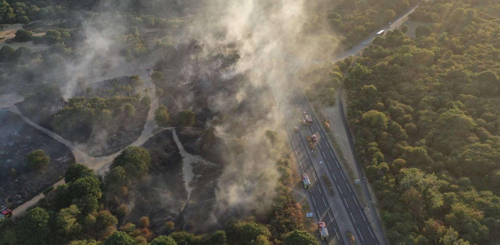
If you are a passionate emergency drone pilot and you have volunteer time to give, join IEDO, the many projects and ambitions need strong forces.One evening last August, the sky burned crimson as flames spread across the green canopy of Dartford Heath. This was not just a wildfire, but the fifth one of the month. The wail of sirens swiftly approached, flashing red and blue lights barely smudges of light through the thick smog. At the rate it was spreading, the team either needed a miracle or exceptional, pin-point accurate situational awareness. But that's impossible, right?
With clocks ticking, how do you build a strategy and predict the path of a fire all while keeping the whole team safe.
With resources stretched thin, volunteers from Kent Search and Rescue Drone team deployed the DJI Matrice 30 thermal drone to support the fire and rescue team. Aerial footage of the fire informed them of the
ten-hectare land fire which was tearing towards a block of houses nearby.
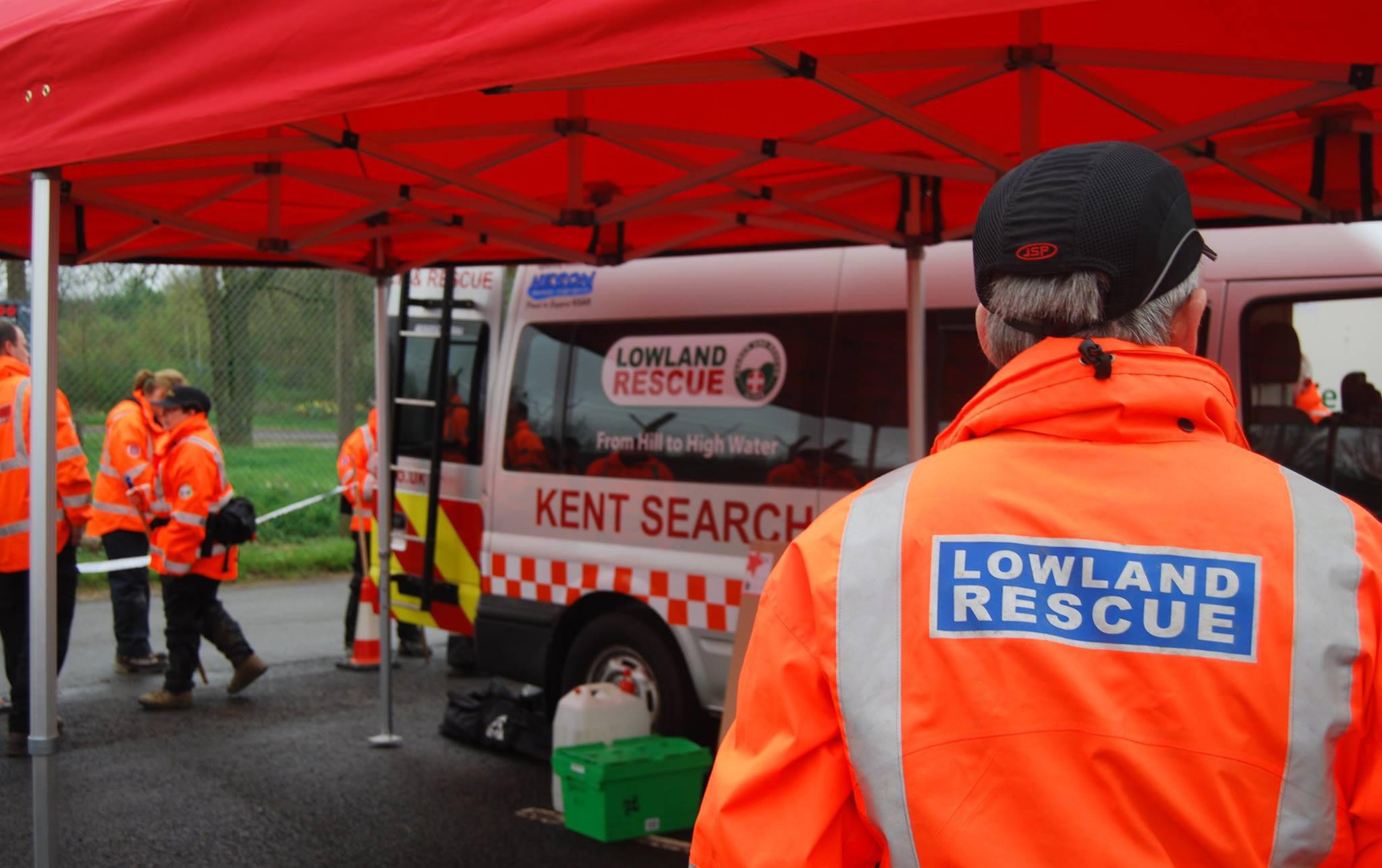
Entirely built upon volunteer work, Kent Search and Rescue are experienced specialists in high risk and vulnerable missing person search and rescue missions. Three years ago, commercial drone experts, COPTRZ had the pleasure of meeting Stephen Gore, drone leader at the charity, a dynamic individual who had quite the interest in adopting new aircraft.
Stephen expressed, "When someone goes missing it becomes a time critical event, so anything that we can do to reduce search time or improve efficiency is worth looking into. As a team we are constantly looking at emerging technologies and how they might integrate into the work we do."
COPTRZ recommended the popular Matrice 30T which has become a valuable asset to the team. Stephen explains that "We have had our current M30T since August 2022, and whilst we have tried various drones since our first Phantom 3, the M30T is by far the best drone we have had. It strikes a good balance between flight time, ease of deployment, and image quality with the ability to fly in most weather and environmental conditions on a reliable platform."
As the fire continued to roar across the heath, a mosaic of smoke covered the landscape for miles. With no ground visibility, communication was impaired, and teams were unable to describe their location accurately.
In under a minute, Kent Search and Rescue launched the Matrice 30T into the smoke. Stephen explains how the drone offered the situational awareness they needed to begin tackling the fire.
"We integrated the RMTP feed from the DJI drones into SarSYS, our Incident Search Management software. Not only does this provide the Incident Commander in the control vehicle a live stream video feed of from both the RGB and thermal cameras, but it also allows a video feed straight to the mobile phones of the team members deployed on the search."
Although there is no visibility to the naked eye, the infrared camera can detect heat signatures, allowing first-responders to see through smoke-filled environments. With this clarity, Kent Search and Rescue monitored the location, size, and direction of the fire, and led the fire and rescue team. Thermal imagery also revealed hotspots within the fire where firefighters at Kent Fire and Rescue could focus their efforts to tackle the fire.
Kent Search and Rescue have been using drones since 2016 for countless time-sensitive rescue missions. Stephen emphasises that drones have had a huge benefit for them when searching open, rural areas. With the ability to cover vast areas in minutes, drones have changed the game. With the Matrice 30T, operators can detect the heat signature of a missing person, lighting them up on the visual map. This colourful beacon can be seen even
when filtered through thick tree coverage and vegetation. Before drones, search and rescue operations could take several hours, if not days, by foot.
Supplying real-time information about the exact nature of the search environment, drone footage also enables a better allocation of the correct search resources. Operating around dangerous terrains like steep slopes, open water, and muddy tidal flats pose as a risk to the team. A new aerial perspective from drone technology allows the team to unlock a new level of situational awareness to approach these dangerous environments in a safe and effective manner.
The charity commended the help they received from COPTRZ, from receiving
a detailed demonstration of the kit to the expertise and depth of knowledge we provide as experts in the field. In emergency situations, every second matters and integrating powerful equipment like drone technology can be that difference.
COPTRZ have helped over 1000 businesses to access the benefits of drone technology, providing cheaper, faster and safer operational capability.
Get in touch now at:
Phone: 0808 588 0526
Enquiries: sales@coptrz.com
Customer Services: services@coptrz.com
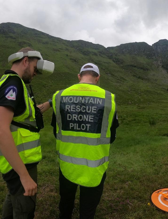
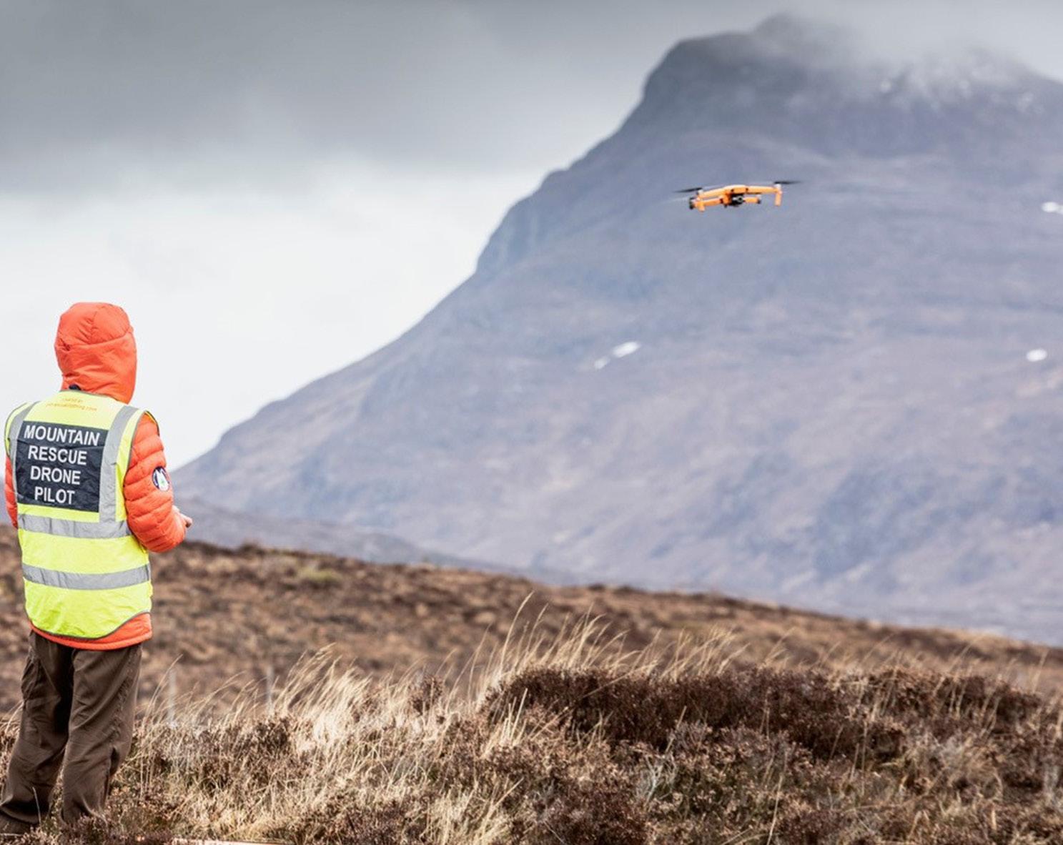
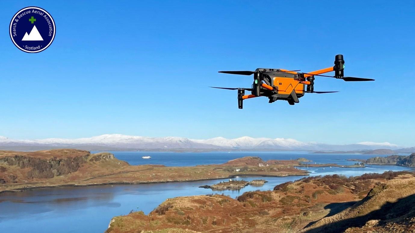
This article discusses considerations for mountain rescue teams looking to introduce an drone capability to their SAR assets. As a volunteer organisation, facing the myriad of legislation and guidance published by the Civil Aviation Authority can be very daunting for any team, especially if it doesn't have people with an aviation background. With misuse of drones now being actively pursued, an example being a recent court case https://www.bbc.co.uk/ news/uk-england-derbyshire-64214988, teams cannot afford to get it wrong.
The author, Tom Nash, is the SARAAScotland Chair and member of the Tweed Valley Mountain Rescue Team. With his previous experience of over 1900 hours of military flying, owner of his own UAS business as an instructor and Civil Aviation Authority NQE Flight Examiner, Tom
understands what is expected by the CAA for a safe operation But piloting experience is only one side of the coin when it comes to searching. Co-author Darryl is a Pilot in SARAA-Scotland, has served as a team member in the Royal Air Force and Scottish Mountain Rescue Teams and is a veteran of USAR in the London Fire Brigade for over 21 years..
This article uses Search and Rescue Aerial Association (SARAA)-Scotland's experience to discuss the considerations and options that may be used to establish a search and rescue drone capability specifically for mountain rescue teams. It is applicable for UK rules and regulations and it should be noted that these may differ in other countries and your own country rules should be checked.
The Search and Rescue Aerial Association - Scotland (SARAA-Scotland) was formed in 2018 following the conclusion of a yearlong feasibility study. One of the core recommendations of the feasibility study was that a new constituted organisation was established to facilitate governance, training and operational use of drones in land SAR operations across Scotland. This differs from other areas of the UK as each team seems to be approaching it independently which Tom finds extremely frustrating, seeing so much wasted effort and money with little coordination or leadership at a national level.
SARAA-Scotland is made up from existing members of a mountain rescue teams across Scotland. This is important as the 'parent' MRT provide the core skills of an MRT member with SARAA-Scotland layering an additional skillset over the top.
Initially SARAA-Scotland held all the drones however, with a small cadre of pilots and very limited funding, expansion was becoming limited by finances. Over the past two years SARAA-Scotland has moved to a model of supporting teams to establish themselves as UAS Operators in their own right so spreading the financial burden of capital and maintenance across those teams wishing to have a drone capability. SARAA-Scotland ensure pilot training is standardised, have developed their own 'combat ready' workup and provide the CONOPS and Pilot Handbook documentation to those pilots and teams so that there is one common standard of training and search tactics that is understood and practiced across all 21 pilots. In addition, all pilots are actively encouraged to feed in
their experiences of their own (each area is very different in terms of geography and terrain) to help continuously improve the Pilot Handbook.
SARAA-Scotland pilots all operate in the Open Category which provides greatest operational flexibility and is deemed the lowest risk by the CAA as drones are either sub 2kg or, if larger, are operated >150m from congested areas - not generally a problem in the Scottish hills and mountains!
Tom's view is that moving into the Specific Category doesn't really bring about great operational advantages but significantly increases the administrative and financial burden on a Charity and volunteers who are all doing this in their 'free' time. To step up into that category, and certainly if teams wanted to fly beyond visual line of sight for example, is a significant additional responsibility and one he feels cannot be achieved confidently and competently with part-time pilots and managed by best effort rather than an employed flight operations manager for example. A similar sized pilot team in the Police force would likely see at least a full-time Sergeant overseeing the team and managing the flight operation.
As you can see from the above already, there are key aspects in setting up a drone capability. Every national aviation authority will have its own requirements which should be checked in detail.
As discussed, a feasibility study was the starting point to identify what exactly was required and how it would function. The time taken to do this and set robust systems up right from the start is critical to ensure facilitation of a capability that is effective, safe and within the law. To not do this would put the organisation and pilots at safety, financial and reputational risk at the very least.
The key areas that SARAA-Scotland used as part of their feasibility study included:
Rules and regulations
• Insurance liability
• Data protection and data security
• Deployment strategies and operational structure
• Drone team composition
• Training and competence
• Concept of Operations.
Operational considerations
• Aircraft performance
• Through life cost
• Inspection and maintenance
• Portability
• Roll out plan.
For an organisation considering setting up a drone capability it may be very prudent to have in mind a gradual and progressive approach. This not only allows pilots time to gain experience but also allows the capability within the organisation to grow at a comfortable pace and time to evaluate step-by-step as it progresses. Again, if organisations are unsure of committing, even a basic capability is worthwhile as it allows a foundation to be established and built upon.
Some specific areas within the above to address are the following:
• What are the operational gaps that might be filled with having a drone capability and what positive impact will they have on team member safety and efficiency and effectiveness of a missing parson search?
• What regulatory frameworks are in place that have to be adhered to?
• What types of technology are being used in the design and manufacture of UAS (including limitations e.g. size, weather resistance, flight duration, equipment lifespan etc.)
• What types of payloads are required to be carried?
• What type of software programming is used to communicate between the UAS and the pilot?#
• What protocols will need to be developed within the organisation to allow the safe, effective and efficient legal use of UAS in their area of responsibility?
• What training and accreditation is required to comply with current regulations/laws?
• What are the costs of the training, accreditation, equipment, operation, insurance?
• How might the capability be funded, staffed, equipped and deployed?
The ConOps is the 'heart' of how SARAAScotland operates. It includes limitations of the aircraft flown; CAA, State designated, manufacturer stipulated limitations and also the operating constraints for the tasks that the organisation will carry out. Factors such as weather limitations etc. will be included. Also within the ConOps will be reference to the incident chain of command, the licence holders, the Chief pilots and any restrictions to operations and so on. This is the real guiding principle and 'rule book' that any Operator with more than one pilot needs, in some form, to have.
The Pilot Operations Handbook
This manual has been developed by the pilot cadre and drawn together by Darryl.
It is more about the practical aspects of attending an incident and carrying out a search in a consistent and structured format. It includes on arrival actions, setting up and positioning, scene assessment and situational awareness, principles of a drone search, drone search terminology, search strategy, search types and post-flight actions. The information contained within the manual means that each pilot is talking the same language and adopts similar processes and strategies which is vital to ensure that the search managers can be given a confidence factor of the area that has been searched.
When choosing equipment, especially when the entry cost is high for the charity/ humanitarian sector, it is vital that any purchase is approached with an effectsbased mentality and not just what's shiny and new on the market. As an example, when teaching a CAA course, Tom was approached with great excitement by a statutory emergency service pilot who was planning to start using a thermal camera on their two new drones worth tens of thousands of pounds. When told that the drones they had purchased had physically different and incompatible connections to the available thermal camera they were somewhat dismayed!
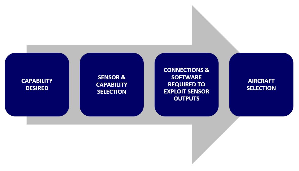
The capability desired drives the sensor or capability selection which drives the connections and software required to use and exploit the sensor outputs which eventually drives the aircraft selection and training required.
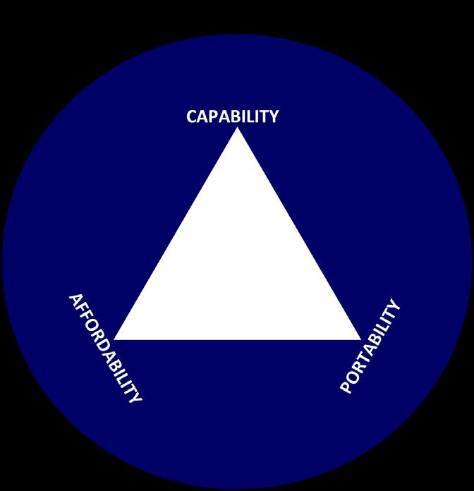
SARAA-Scotland's experience is that the Operator ends up in a triangle of compromise all inside the bubble of safety.
• Electronic conspicuity
• Procedures
• Training
• Competence & confidence
Capability
• Day/night
• Wind=power=weight
• IP rating
• Endurance=power=weight
Portability
• Rucksack v vehicle
• Power v weight
Affordability
• Scale of capability.
An operational drone capability is not that dissimilar to a search dog capability in the fact that it is a search tool, available to an Incident/Search Manager that may be deployed to work alongside other search assets. SARAA-Scotland opted for a simple structure for a drone team as follows:
• Pilot
Responsible for the flying of the aircraft including all safety measures and compliance with the CONOPS; in simple terms, not crashing, not running out of battery and flying the best search pattern they can. The pilot is also the advisor to the Mountain Rescue Incident Manager providing advice on the capability and accept appropriate tasking.
• Sensor Operator
Equipped with immersive goggles, the sensor operator is the person doing the searching.
If something out of the ordinary is seen, the first word of command is Stop. At that point the pilot stabilises the aircraft in a hover and then they can have a discussion about what has been seen.
For mountain rescue teams, the portability of equipment is always an issue and always a fine balance between what the risks are (types of incidents and potential use) within their area of responsibility and how they get the equipment to the scene of operations with weight and bulk being a key factor. Some organisations have multiple types of risks from roadside to mountain and may have the luxury of a range of equipment to suit their types of incident. It is not uncommon for a drone pilot in Scotland to have to walk up a mountain to their operating site which may take hours or conversely, it is about speed in the case of an avalanche incident for example where small and light are important. It is for this reason that SARAA-Scotland has chosen to use small, off the shelf drones with a zoom and thermal image capability along with a set of goggles for the sensor operator.
Keeping it simple is key. It is an aviation operation and although the risk is low (small aircraft, generally remote areas), it needs to be well managed and monitored especially as there could well be other air assets (Police/Air Ambulance etc.) supporting, flights could often be on the limits of aircraft performance and added pressure of life v death acting as a subconscious distraction increasing the risk of human error.
It is for this reason that checklists, independent sensor operators and robust procedures are needed to be in place and used.
Someone within the operation needs to understand 'aviation', where to find new regulations, interpret and offer guidance and advice to the rest of the pilots.
It is really important for any organisations considering a start up to talk to others with similar SAR responsibilities that have gone through the full process so any pitfalls can be avoided. SAARA-Scotland has had the privilege of being in a position to offer advice to teams and pass on knowledge and experiences. SARAA
Scotland has spoken at global webinars and has given advice to organisations as far away as New Zealand to as close as other UK MRTs and Police Forces.
It should be noted that this is all done by volunteers, SARAA-Scotland is indebted to parent MRT's, families, employers and donors, who all allow us to build the capability. To donate, scan the QR code or click this link - SARAA Scotland are currently fundraising for a new drone to develop tactics in tight spaces such as caves, gorges and gulley's so any donation is hugely appreciated.


Darryl has served in the Royal Air Force Mountain Rescue Service and Scottish mountain rescue for a number of years and has served many years in the London Fire Brigade in Urban Search and Rescue operations and training in the UK and internationally.
 Picture credit: SARAA Scotland
Tom Nash - Chair Person & Team Lead at SARAA Campaign Manager | Military Veteran | Mountain Rescue Volunteer | Charity Trustee | Drone Team
Darryl Ashford-Smith - SARAA Drone Pilot
Picture credit: SARAA Scotland
Tom Nash - Chair Person & Team Lead at SARAA Campaign Manager | Military Veteran | Mountain Rescue Volunteer | Charity Trustee | Drone Team
Darryl Ashford-Smith - SARAA Drone Pilot
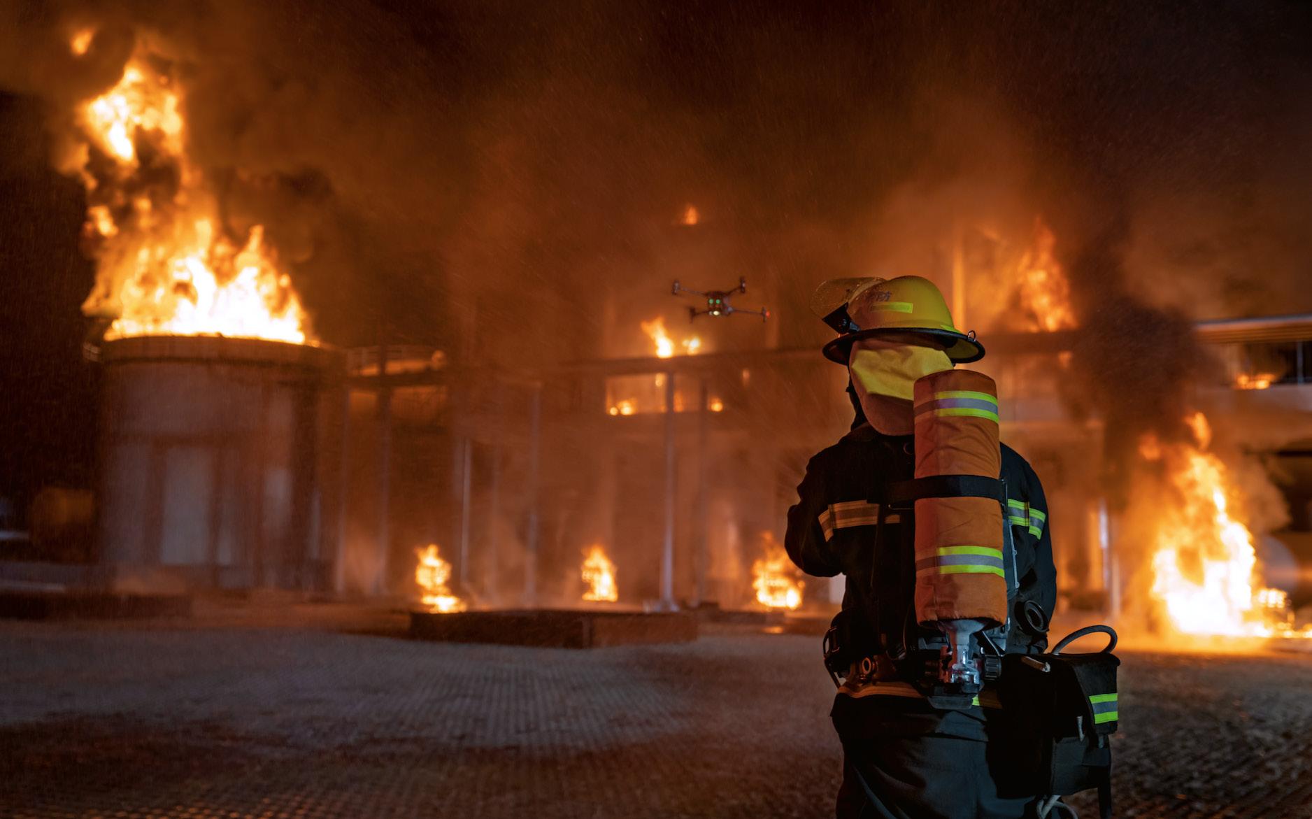
The fire service has always fought technology. An industry that has been built on tradition has fought the introduction of technology for the last 200 years. Firefighting, at it's bedrock is made of tactics, strategy and men and women willing to lay it down at all costs to preserve life and property.
The last 20 years has seen a cultural shift in how the modern firefighter performs his/her duties. Technology has had a significant impact in every aspect of firefighting. From our communications and station alerting systems to CAF systems on our apparatus and even the tools we use.
The firefighter of today has access to a fire service driven by technology that our predecessors would have dreamed of with the embrace of modern technology. There is a saying in fire houses today, "The fire service is made up of 200 years of tradition unimpeded by progress". Times are changing though. With younger and more innovative firefighters entering the job, technology is finding it's way more and more into every aspect of the fire service. None more than drone technology.
Drone technology, in fairness is a relatively new technology. Especially within the fire service. Truth be told only about a small fraction of the fire departments within the US (even lower globally) have embraced this technology.
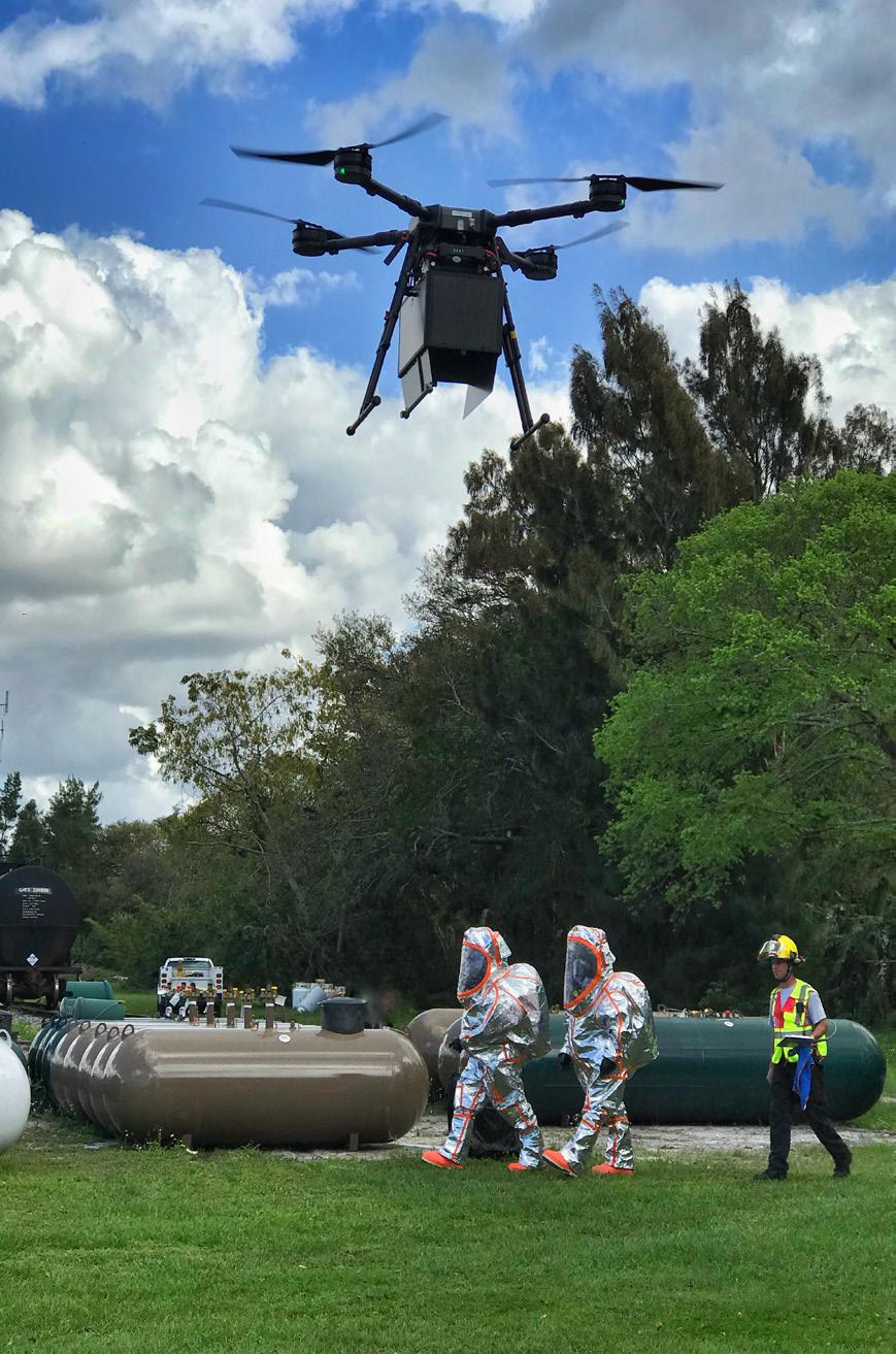
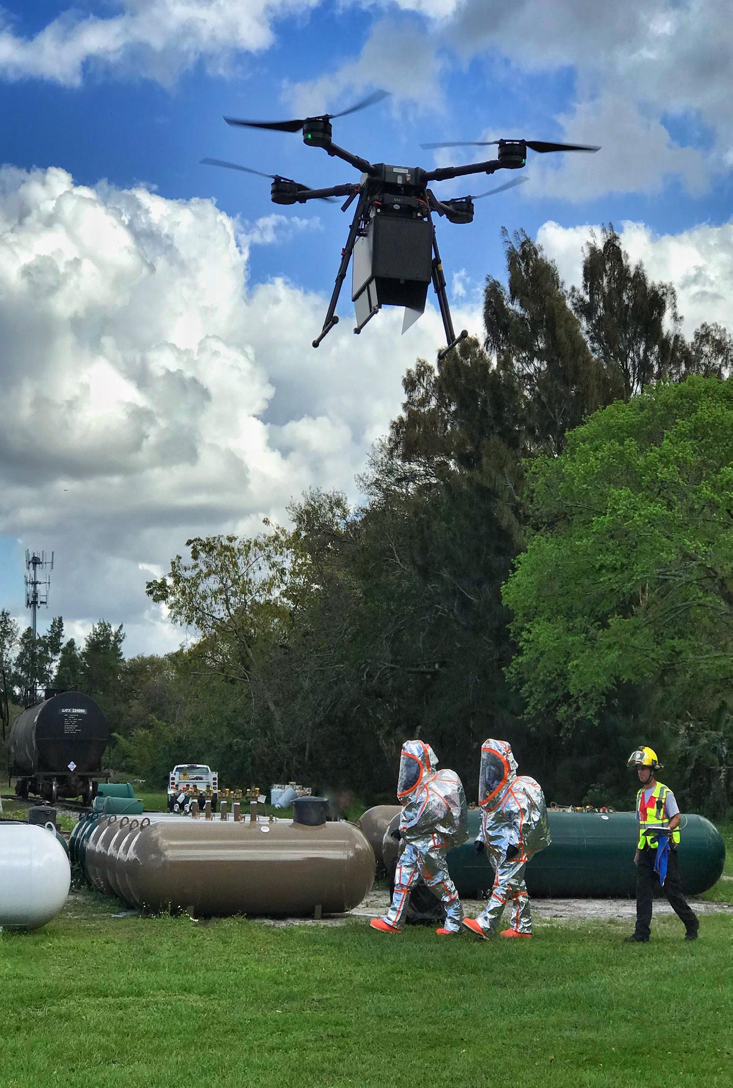
One area within the fire service where technology, more specifically drone technology has seen gains is Hazardous Materials response. At least at Southern Manatee Fire Rescue.
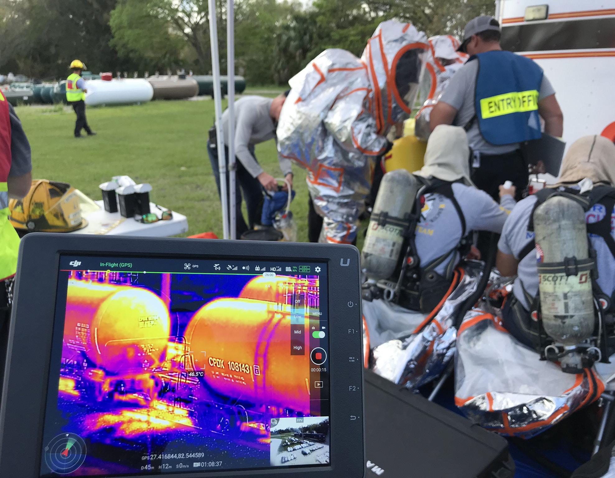
SMFR is a smaller fire department located just south of Tampa FL. We are made up of 5 stations, covering a 36 square mile patch of Manatee County. Our HazMat team, however, covers the entire county and even assist surrounding counties with a tri-county agreement.
Southern Manatee began looking into UAS to augment our hazardous materials response back in 2015. The idea was outlandish at the time and was met with resistance, a lot of which honestly, came from me. As I began digging into drones and understanding their strengths and limitations more, I began to see how this technology could fundamentally change how we approach hazmat response.
This of course was not going to be an easy battle. HazMat response has decades of tried-and-true tactics and strategies handed down from generations of firefighters. Adding a "flying toy" (as many have labelled them over the years) to a sophisticated and specialized niche' in emergency response was not going to be easy. We were ready for the challenge though.
The first challenge was "buy in". Not only did we need to get the buy in from our department and administration, but we needed support form the community and our constituents. Transparency had to be the utmost importance.
This technology and what we planned to do with it had to be made accessible to our community, media and anyone who had questions regarding our use of drones. We opened our program up to anyone who was willing to listen. From news stories to public education "truck shows", we we're flying drones for everyone. With a lot of public attention, this also meant we needed to make sure we were "flying by the book". At the time, the Federal Aviation Administration (FAA) was difficult to wade through. Admittedly the FAA had their hands full with hundreds of agencies all jockeying to do the same thing. Today that pathway is much easier and more streamline.
The next hurdle was figuring out when, and how to deploy. There was no established response matrix for drone deployment. Drones were, at the time, being used predominantly by law enforcement and a few fire agencies had started similar programs but no one was using them for hazardous materials response.
Rich Gatanis, UAS Coordinator at SMFR outlines the difficulties of tradition when trying to adopt new and innovative technology for fire and rescue teams.
We were literally writing the book. We had no idea when the proper time to put the drone in the air was. We knew most agencies were using them for large fires and many wouldn't put the drone up until later in the event. Almost as an afterthought. "Fires out, drone out". We felt that mindset led to lost opportunity.
Meaning, the drone, in its simplest form, is a camera in the sky. The potential reconnaissance that early use of UAS could offer incident commanders is ultimately lost the longer the drone sits on the ground. This was the first mindset we needed to change. UAS Ops needed to be made a critical part of our response. This led to us offering our pilot positions to Technicians only. Technicians all have the
same level of training and understand of the flow of how a hazmat scene plays out. The typical rank and file firefighter would be at a disadvantage in our workflow thus potentially hindering response efforts. Also, having our line personnel rather than officers be our dedicated pilots was different from the norm. In most agencies, firefighters/technicians on the scene were needed more in operational capacities rather than standing by the truck flying a drone. Our HazMat technicians are highly trained and extremely technical in this niche part of special operations which is why it made sense for our technicians to become our pilots.
Once we figured out who was going to fly and when, we were off.
We began flying mostly as a situational awareness tool in the beginning. This allowed us to become very good at piloting in almost any environment. We did have our hiccups throughout this journey, but you can't be successful if you're not pushing yourself and your equipment.
The more we learned about drones, the more we were interested in figuring out ways to use our UAS as more than just an "eye in the sky". This led us down a rabbit hole that I believe has fundamentally changed how fire departments and hazmat teams operate in today's theatre of hazardous materials response.
Future posts:
• Drone Flammability testing
• Air monitoring with UAS
• Drone Decontamination
• Mapping Spills in Waterways
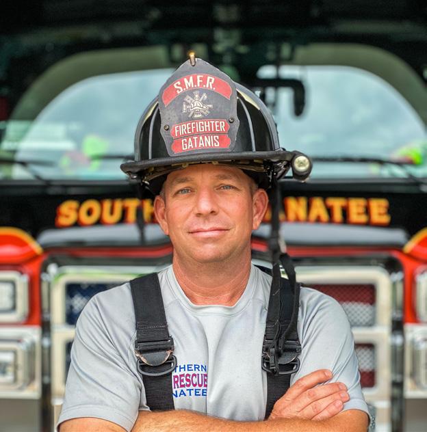
Rich Gatanis
Rich Gatanis began his career in 2003 as a Firefighter/EMT/HazMat Technician with Southern Manatee Fire Rescue located in Manatee County, Florida. In 2015, Rich took on the role of UAS Coordinator at SMFR by creating a UAS program within his agency. His innovative and forward thinking led him to develop a device that allows a drone to carry chemical, gas, and radiation detectors into an area to remotely monitor the air in real time using on-board camera systems.
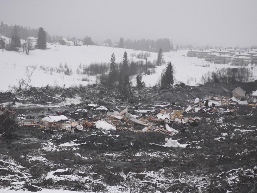
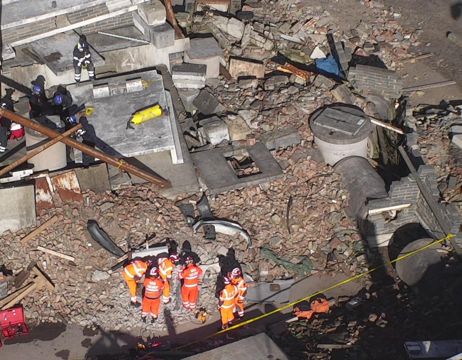
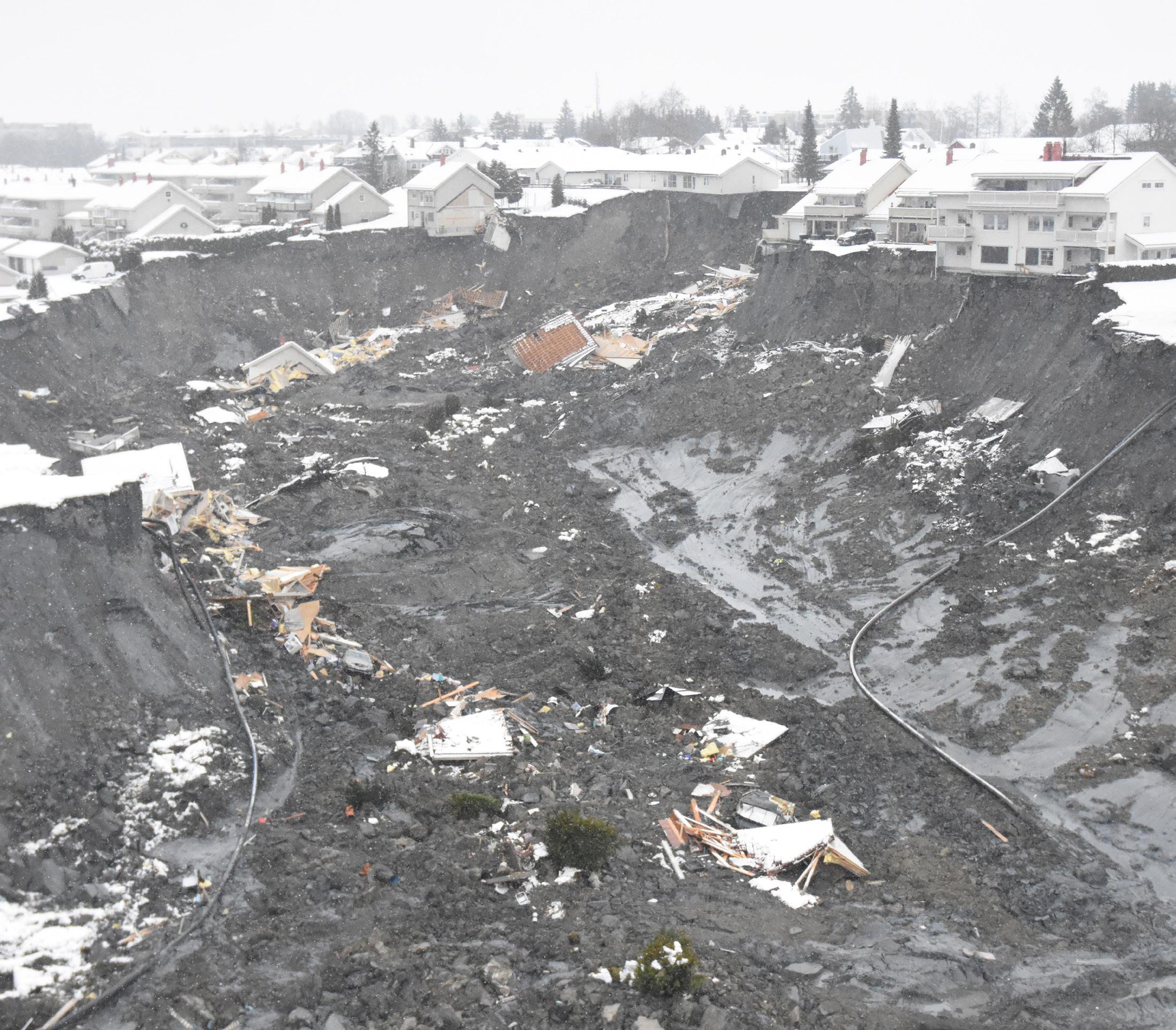
“The Gjerdrum landslide serves as a reminder of the power and destructive force of natural disasters and the importance of preparedness and response efforts.”
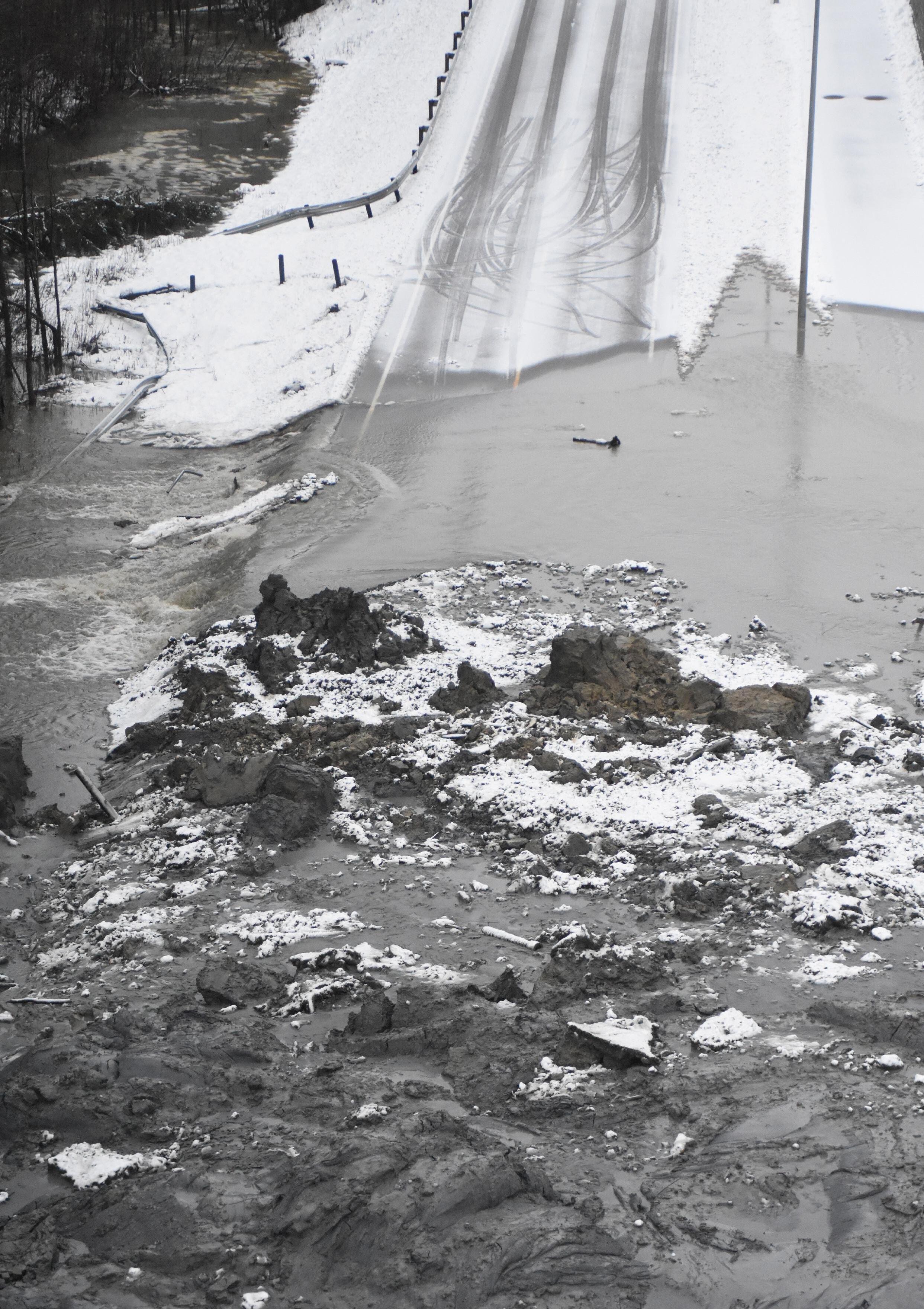
The early morning of December 30, 2020, brought a devastating event to the village of Gjerdrum, Norway, as a quick clay landslide occurred, causing widespread destruction and loss of life. The weather conditions were harsh, with temperatures dropping down to minus 22 degrees Celsius and rising up to plus 3 degrees Celsius. Quick clay is found below the marine level (the present elevation of where the sea level was at end of the last ice age) in Scandinavia. The Scandinavian peninsula (Norway and Sweden) was covered with an ice layer of about 3 000 meters (about 20 000 years ago). When the ice started to melt, the small clay particles flowed with the water and sedimented in the marine environment in salt water along the sea shore.
The salt made the clay particles form a highly unstable structure.
As the ice melted, the land formation slowly rose due to the loss of wight from the ice. Parts of the area with clay, which was situated under water, now was elevated above the sea water level.
Today the marine boarder is at about 220300 meters above sea level.
Over the years after the land elevation after the last ice age, the salt in the clay layers has been washed out due to the fresh water in the ground. When the salt, which caused the electrostatic bindings in the clay, was washed away, the strength characteristics of the clay were drastically changed.
If such clay is overloaded, the clay structure (similar to a house of cards) will suddenly collapse. Such clay is denoted as "quick". If the clay is exposed to sustained loading, is subjected to remoulding from natural causes or by man-made action, the clay masses will suddenly transform into a floating liquid in its own pore water. Quick clay slides can propagate very quickly backwards (retrogressively) over large areas, and the slide debris will float over considerable Quick clay landslides are a relatively rare but have a tragic history in Norway, with several major incidents occurring in the past century.
As a firefighter and drone pilot, I, Kenny Åserud, was among the first responders
called to the scene of the Gjerdrum landslide. Along with the army, police, and other fire departments, we utilized drones as a tool for search and rescue operations. The use of drones proved to be a success in this disaster response operation, providing valuable information and assistance in the search for survivors and assessment of the damage.
One of the major successes of the operation was the early gathering of all drone pilots to establish better communication and planning. By coordinating our efforts, we were able to effectively survey the affected area, identify potential hazards, and search for survivors. We were careful to fly the drones at the same time as the helicopters to avoid any disturbance to the helicopter's rescue operation of people in the landslide.
The data collected by the drones in the Gjerdrum landslide provided a comprehensive understanding of the extent of the disaster and the challenges that lay ahead in the recovery process. The drones were equipped with high-resolution cameras and thermal imaging sensors, which allowed us to identify survivors and assess the structural integrity of buildings and infrastructure in the affected area. The data collected by the drones was analyzed by the drone team and shared with other emergency responders, including the army, police, and other fire departments, which helped them to make informed decisions and respond more efficiently.
The drones also provided real-time updates on the situation on the ground, which helped the command center to monitor the progress of the operation and make adjustments as needed.
The drone where used to patrol and inspect the landslide border for significant changes that were of importance to the personnel working in the landslide.
This was carefully considered with the help of a geologist and done very often to gather information on any changes. Icing on the propellers was controlled with every landing and removed carefully, icing on the propellers cause lower flight time
and also weakens the drone's properties. With all the drones and helicopters being airborne at the same time, it is extremely important to talk about safety.
After some days, the Norwegian airforce came alongside a team called JTAC (Joint Terminal Attack Controller). JTAC was from NORSOF (Norwegian special forces) this team ensured the safety for all airborne units. When the operation gets as big as this landslide, it is of importance to have somebody controlling all the operations and maintaining the greater overview. Tragically, 10 people and an unborn baby died and 1,200 people were evacuated from the area. After the initial search and rescue operation for survivors, the fire department continued to use drones to evacuate the bodies. Early on, the drone team was teamed up with a geologist who interpreted the landslide at all times, which helped better understand possible incidents.
Introduction:
On December 30, 2020, a quick clay landslide occurred in the village of Gjerdrum, Norway, causing widespread destruction and loss of life. Emergency responders, including firefighters and drone pilots, were called to the scene to assist in the search and rescue operations. This report aims to analyze the use of drones in emergency response efforts during the Gjerdrum landslide and highlight key findings and lessons learned.
Methodology:
The report is based on an article written by a firefighter and drone pilot who participated in the response efforts of the Gjerdrum landslide. The article provides a detailed account of the use of drones in the search and rescue operations and the challenges faced during the disaster response.
Key Findings:
Drones were effectively used in search and rescue operations and provided valuable information and assistance in the search for survivors and assessment of the damage. Coordination and communication among drone pilots was crucial for the success of the operation.
Drones were used to patrol and inspect the landslide border for significant changes and gather information for the personnel working in the landslide.
The use of drones in adverse weather conditions and at the same time as helicopters presented challenges, but these were overcome with proper planning and safety measures.
The use of a geologist or other expert interpreting the data collected by drones helped make informed decisions. Safety is of the utmost importance when flying drones in emergency situations and having a dedicated team or person responsible for maintaining the overall safety of all airborne units is important. The importance of taking care of the equipment and making sure it is in optimal condition before flight, as icing on the propellers can cause lower flight time and weaken the drone's properties.
Lessons Learned:
Drones can play a vital role in emergency management and disaster response, and their use should be considered in the planning and execution of such operations.
The importance of coordination and communication among drone pilots can not be overstated. It is crucial to establish clear communication channels and protocols before an emergency situation occurs. It is important to have a geologist or other expert interpreting the data collected by drones in order to make informed decisions. Safety is of the utmost importance when flying drones in emergency situations. It is important to have a dedicated team or person responsible for maintaining the overall safety of all airborne units. The importance of taking care of the equipment and making sure it is in optimal condition before flight, as icing on the propellers can cause lower flight time and weaken the drone's properties.
Conclusion:
The Gjerdrum landslide serves as a reminder of the power and destructive force of natural disasters and the importance of preparedness and response efforts. The use of drones in emergency management and disaster response is becoming increasingly important, and the success and challenges encountered in Gjerdrum highlights the need for continued development and improvement of this technology. The use of drones in the search and rescue operations provided valuable information and assistance, and the data
collected by the drones helped emergency responders to make informed decisions and respond more efficiently. The report's findings demonstrate that the coordination and communication among drone pilots, the use of a geologist or other expert interpreting the data, maintaining the equipment in optimal condition, and ensuring safety were all crucial for the success of the operation. These lessons learned can be applied to future emergency response efforts and can help save lives and minimize damage in the event of natural disasters.
 Kenny Åserud
Drone Pilot with Nedre Romerike Fire and Rescue
Kenny Åserud
Drone Pilot with Nedre Romerike Fire and Rescue
Drone as a First Responder (DFR) program has become a transformational method of policing that has demonstrated the ability to increase officer and community safety and reduce overall police response times. DFR provides the ability to see what is occurring at an incident before emergency personnel arrive on scene. In addition to the overhead perspective that traditional air support has always provided, DFR allows a trained incident commander to "virtually" arrive on scene first, sometimes minutes before officers are in harm's way. The City of Pearland DFR program is modeled after the Chula Vista, CA Police Department's Drone as First Responder Program. In 2018, CVPD was granted the ability to partner with the FAA through their UAS Integration Pilot Program. This
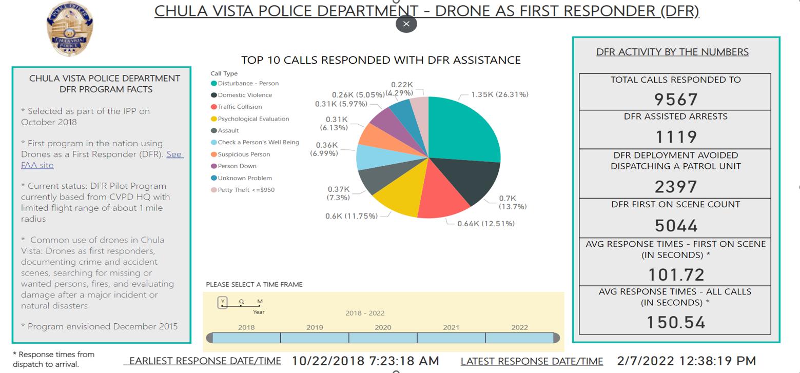
program focused on testing and evaluating the integration of civil and public drone operations into our national airspace system. From 2018 to 2022 their DFR program has responded to 9,294 calls for service.
However, the CVPD DFR program model always has a pilot and visual observer on the roof of their launch locations during their hours of operations. The personnel assigned to the roof are due to their limitations of their FAA authorizations. Due to our environment, we are attempting to eliminate the personnel on the roof and deploy completely autonomously or remotely. The only personnel that would be required to temporarily be in the elements is a logistics technician to replace batteries, payloads, and do inspections of the aircraft during the hours of operations.
With the partnerships, equipment, and support we have developed, I am confident we can achieve a more affective approach to the DFR program. If authorizations are granted by the FAA, we will be the first agency in the nation to have the authorizations to implement drones for public safety in this manner. If approved, we will be pioneering and developing how public safety responds to all calls for service across the nation. This method would be scalable, affordable, and relatively easy to replicate for any police department in the nation.
DFR is not only a technical solution, involving the rapid deployment of drones, but also a systemic improvement over traditional policing model.
In this article we learn about the necessary steps and planning that were taken when setting up Pearland's Drone as a First Responder (DFR) program.
Typical police departments, in these times of limited resources and personnel, often find they are sending uniformed officers to every reported incident with little time to problem-solve prior to arrival. Dispatchers barely have time to keep up with the incoming calls for service, often only recording what is the caller reports into the Computer Aided Dispatch (CAD) System and then moving on to the next incoming 911 call. The call then waits in the queue until there are available officers to respond. In the meantime, there is no one with the ability and time to truly problem solve and strategize the appropriate response. Often the call for service is related to a social or mental health issue that is longer-term and not immediately solvable by officers with limited time and ability to address it. Or the incident, which may be escalated by the arrival of uniformed officers with limited knowledge, can be de-escalated if a trained incident manager who is not in harm's way can observe the situation early, identify the appropriate resources needed, formulate the proper practical and tactical response required, and then direct first responders in a way that increases the safety and effectiveness. The locations for launch sites have been strategically chosen due to their proximity to the highway.
1. DJI M300 and H20T is mission-ready, preflight and operational checks complete.
2. Dispatch requests UAS support at a location.
3. DFR Operations supervisor approves and requests UAS launch.
4. The flight plan is created
5. PIC autonomously launches the aircraft
6. PIC has the ability to communicate with Hobby airport using cell phone or landline if UAS is required to enter Class B surface areas.
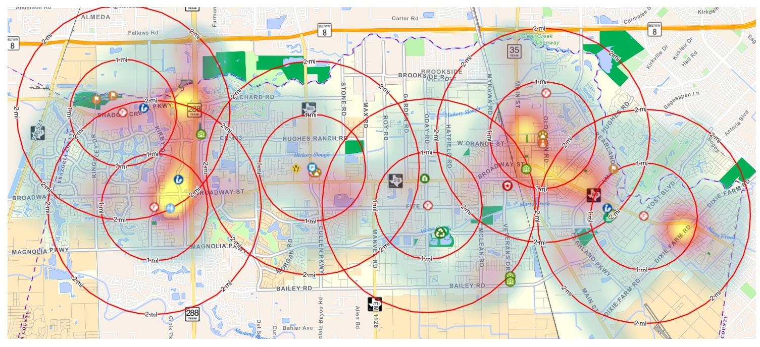
7. TLS 1.2 Encrypted telemetry and image transmission is received by authorized personnel.
8. UAS Operations Sergeant or his designee requests aircraft and/or camera position and orientation changes if needed.
9. Flight control input requests via the Pearland Police Radio Primary Channel are near-instantly approved by PIC so long as those requests meet mission and geofence parameters.
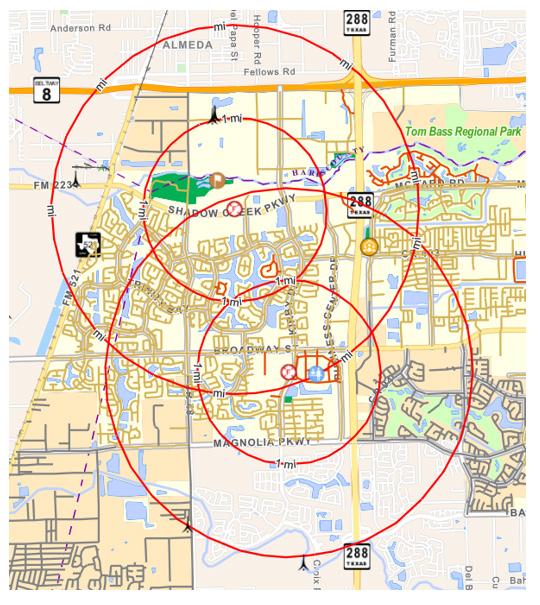
10. PIC monitors and maintains complete control of aircraft through entire operation.
1) PIC and DFR Operations Supervisor monitors:
i) Iris Automation Cameras and ADSB for manned aviation incursions
ii) WhiteFox Technologies for unmanned aviation incursions
11. DroneSense software requires the UAS to initialize an automated RTH mission with enough battery life remaining to ensure the UAS lands with 25% battery at original launch point. DroneSense geofencing, RTH procedures, and omnidirectional anti-collision systems ensures the UAS avoids all marked obstacles within the geofence on the automated return flight home.
12. If the incident no longer requires sUAS support, the system will RTH to be available for the next emergency incident.
13. PIC recovers the UAS and conducts post-flight checks and prepares aircraft for next launch.
14. Mission is conducted under these parameters.
Phase 1 (1-6mths)
Phase one will be the initial roll out of the DFR Program.
The initial operational area will consist of concentric two-mile radius from two designated launch locations in C district:
1) Pearland Fire Department Station 5
2) Pearland Fire Department Station 8
These locations were chosen due to their locations being within close proximity to high crime rate areas and the furthest away from Hobby Airport:
Phase two will be the expansion of the DFR program to the east side of the City to focus on those areas. During this phase, night operations will start to be tested to determine safety case and best practices.
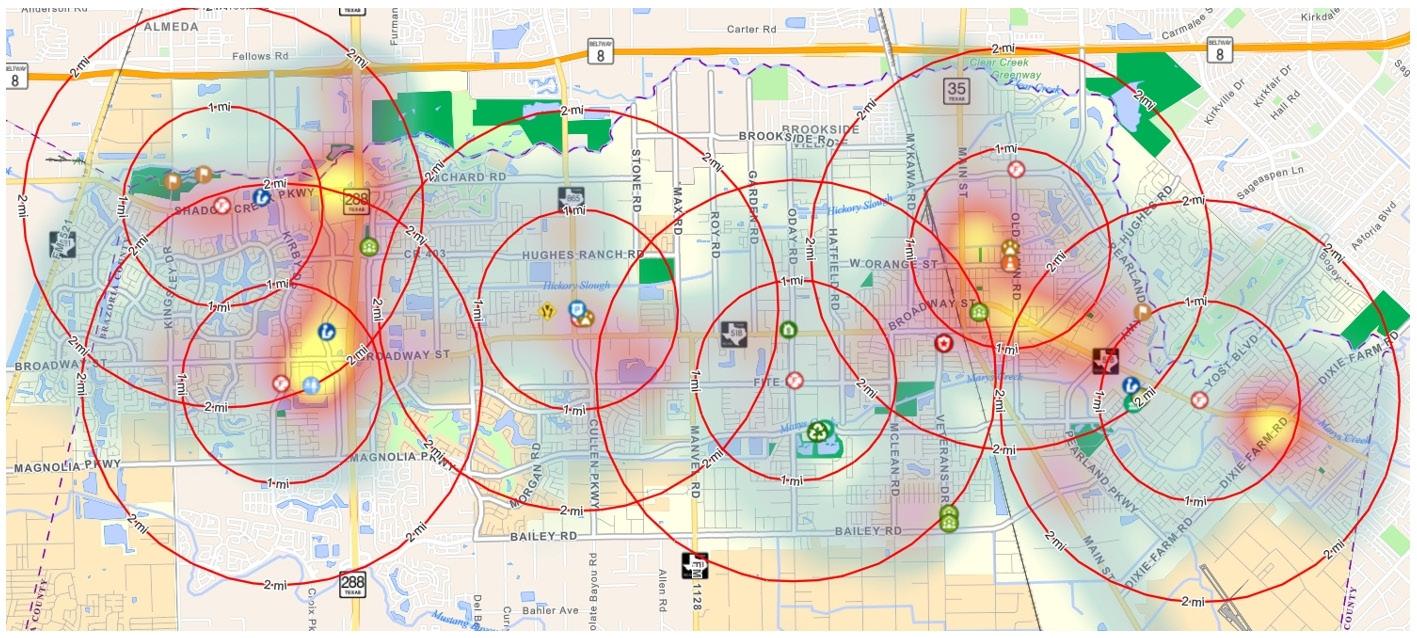
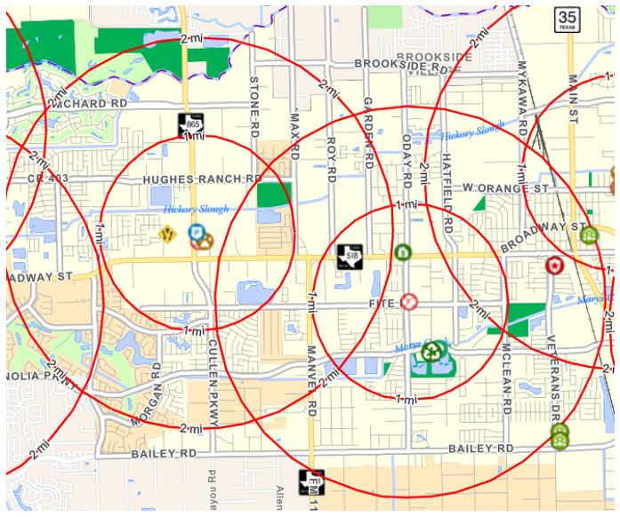
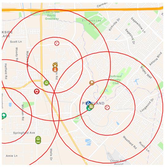
The drone has a powerful on-board camera that streams high-definition video back to the DFR Incident Supervisor. A Teleoperator not only controls the drone remotely but communicates with the units in the field giving them information and tactical intelligence about what they are responding to and the behavior of the identified subject to be contacted. The system also streams the video feed to the cell phones or mobile computers of the first responders, supervisors, and command staff so they too can see exactly what the drone is seeing prior to arriving onscene. Widespread deployment of DFR Systems will transform the way public safety agencies serve their communities, increasing safety, efficiency, and accountability.
Phase 3 will expand the DFR program to cover the rest of the city by adding launch locations to the PD and Fire Station 2.
DroneSense has created the ability to autonomously or manually deploy the DJI M300 system from a remote location to the scene for a call for service or 911 call. This could eventually allow for the ability to deploy a drone from any fixed launch site from a centralized remote piloting location. The controls for manual flight are user friendly and easily trainable. DroneSense also has a user friendly flight planning system for autonomous flights to an area. There are partnership integrations between Iris Automation, Whitefox Technologies, and DroneSense to create a single point of display for airspace deconfliction of manned and unmanned aircraft for the pilot.
The streaming capabilities provided by DroneSense would allow for all participating stakeholders to observe the
scene live. This will provide responding personnel the opportunity to observe the incident while en route to better prepare their response tactics. This will also provide the opportunity to provide situational awareness for the responding officers in the event of a dynamic scenes, such as fleeing suspects or runaways.
Traditional response to emergency events relies on on-scene personnel to determine if more resources need to be requested or disregarded. Due to the drone providing live feeds of the incident, resources allocation can be accurately determined while responding personnel are still en route. This will allow for Officers to return to service prior to arrival if not needed or allow for the proper resources to be allocated to the incident to bring the incident to closure sooner.
Brandon Karr is from Pearland, Texas and is currently the Chief Pilot, UAS Program Coordinator, and night shift patrolmen for the Pearland Police Department. Brandon is a committee member on two subcommittees for the State of Texas regarding the implementation of sUAS for major disasters or incidents.
Brandon is also President of the Gulf Coast Regional Public Safety UAS Response Task Force. The regional team has responded to multiple incidents across the state, provides a variety of UAS training to the region, and assists Public Safety agencies develop UAS programs.

The Emergency Drone Responder is the global voice for the Fire, Law Enforcement, Search & Rescue and cUAS teams Promoting drone use and emerging technologies with input and opinions from public safety drone professionals from around the world Subscribe to The Emergency Drone Responder and receive a magazine every 2 months packed full of essential information for the public safety drone responder delivered directly to your home, office, or station
When you subscribe to The Emergency Drone Responder, not only will you receive your magazine, but also 10% of the value of your subscription will be donated to provide equipment to voluntary organisations and self-funding public safety units, helping them obtain the drones and equipment they need to help their communities

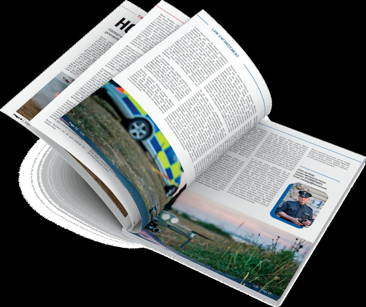
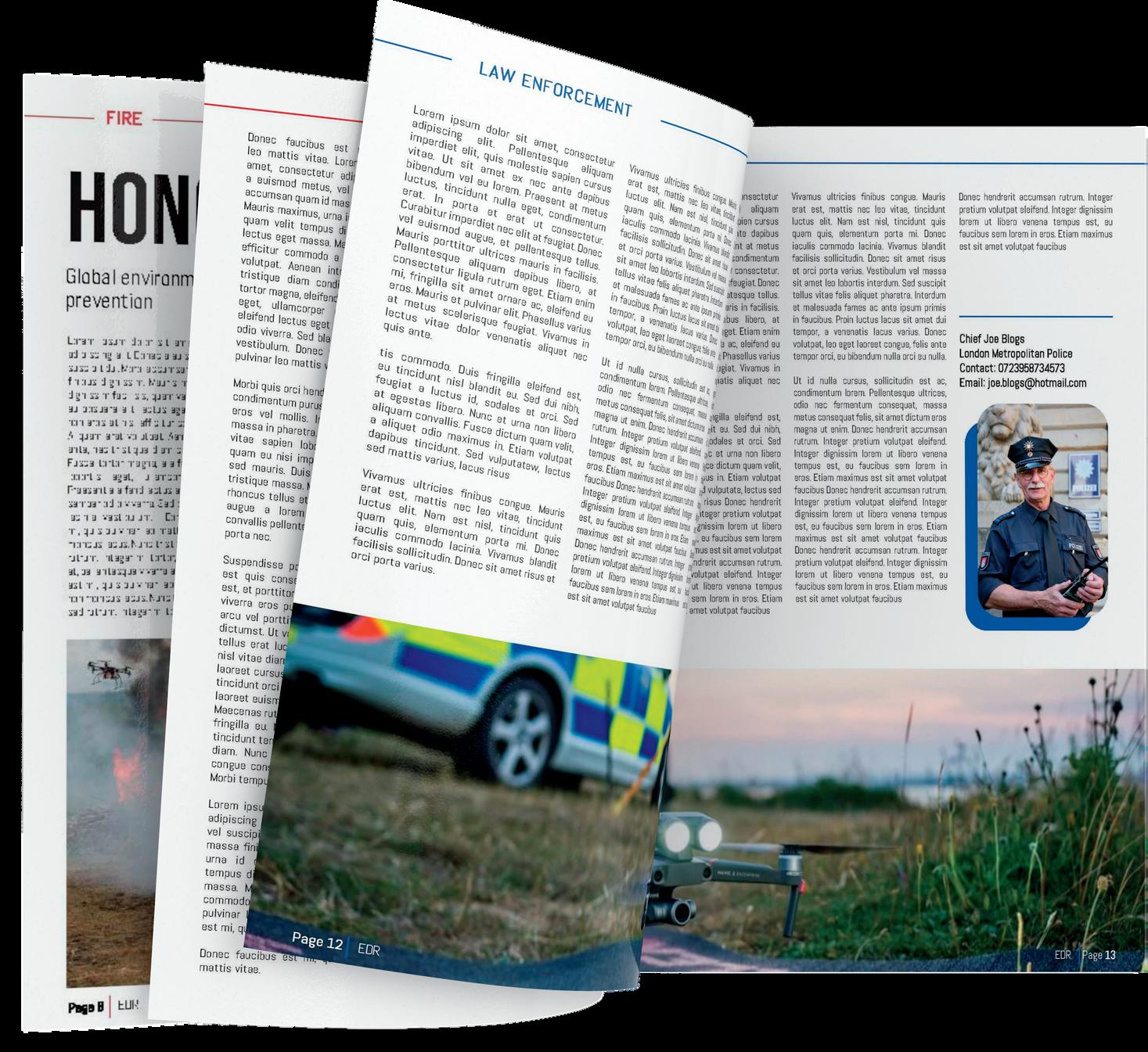
Each issue will include
• Leaders in Industry
• Regulatory updates
• Special reports
• Case studies
• Product reviews
• Drone team profiles
• Latest tech
Caelus Drones Ltd was formed in January 2018 and in that time we have been proud to work with many important organisations such the Police, Fire Service, the Ministry of Defence and Ministry of Justice to name a few but we soon found our passion for working with any organisation using drones for good.
Fast forward 5 years and we decided it was time to rebrand which is why we are pleased to launch the new name of Caelus Drones to Enterprise UAV. We believe the new trading name much better suits our ethos and tells the customer instantly what we do!
We supply drones, payloads and C-UAS systems from Autel, Parrot, DJI, Dedrone, CZI Industries, Elistair and many more high-quality manufacturers with a variety of specialisms allowing Enterprise UAV customers to be at the forefront of technology and be the best at what they do whatever the application.
We can also help with training and CPD at all levels. We are delighted to have Chris Rainford on board who is one of the most experienced Emergency Response UAV pilots and trainers in the industry. Chris can help with all training from entry level for new recruits to bespoke CPD training for any specific areas that your organisation needs help with.
Caelus Drones Ltd t/a Enterprise UAV Limestone Suite
Fern Court Business Centre
22A Moor Lane Clitheroe
Lancashire BB7 1BE
(please note: visits by appointment only)
tel:+44(0)1200 871 146
info@enterpriseuav.co.uk

We have been supplying drones to Lancashire Police for a few years so we decided to ask PC Simon Carnegie from Lancashire Police Tactical Operations Drone / Counter Drone Team about the drones they have used in the past and how they find the latest drones in comparison!
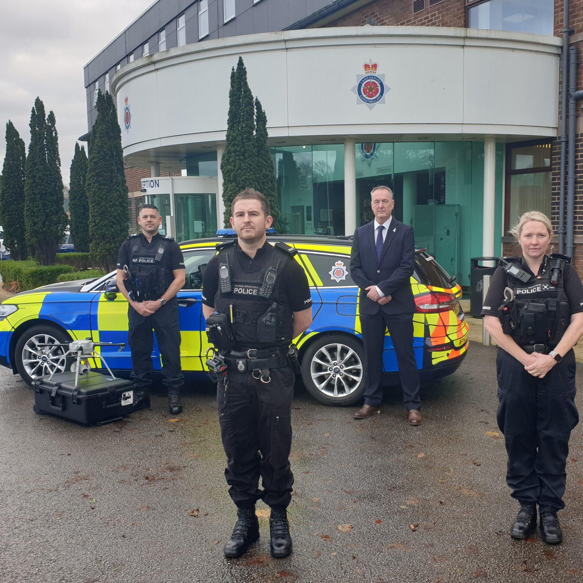
What drone did you used to use and how the drones you use today compare?
Aeryon R60 SKYRANGER was the prior big drone, this was a great first drone which proved very reliable, the wind resistance was its biggest selling point, being tested in constant wind speeds of 50mph, which even to this day is very impressive, its manoeuvrability was a slight issue with it being controlled by a tablet.
What types of missions do you use drone for?
We use our drones for a mixture of reasons, some of these reasons are as follows: locating missing persons / locating offenders / overwatch for warrant execution / pursuit resolution footage with tracking of runners / scene recreation videos for court / scene imagery and firearms incidents.
Have you had any success in the first months of use?
The M300 is considerably more used friendly in the sense that you can fly it with sticks, to get the angles you require much quicker and smoother, the set-up time is drastically reduced, 1 minute on the M300, however the R60 was closer to 7 minutes. Which when time is critical, every second counts. The only downside is the reduced wind resistance, which has meant we have had to decline some requests which could have been flown with the Skyranger. This number isn't a lot.
Signal wise, the R60 used a base station, which came often with connection issues, the M300 doesn't use one, signal on a whole has been good with the M300,
only locating signal black spots occasionally, which forced the drone back to home and land. In these instances, the drone has behaved as expected.
The R60 could only have one payload at a time, therefore, the choice was optical zoom or Thermal, which was a huge shame. The M300 uses both Thermal and optical in the single payload, there is a huge bonus given that you can attach the dual payload bracket, we now fly with both the H20T camera and a spotlight, which assists with negating subjects and directing officers to a heat source.
Have you had any success in the first months of use?
We located a missing person who was located in a wooded area, the thermal was incredible, the officers were easily guided in as we lit the area up with the spotlight.
What is your favourite feature and why?
The dual payload option is my favourite feature, its really useful out there in the field.
Would you recommend this to other forces and blue light organisations?
Yes, I would recommend this drone, the amount of features and multiple payload options is great, the quality of the thermal camera is excellent. Battery life is around 45 minutes per flight, depending on conditions, Geo fencing is an issue in the beginning, but once you have completed the QE forms and unlocked all your controllers, there are no issues accessing geo zones.
Overall how would you rate the drones you purchased and dealing with Caelus Drones from enquiry to delivery?
Richard from Caelus drones was superb to deal with, made it very easy and personal, he was always quick to respond and was very reasonable on price. He is a genuine, trustworthy person and I am more than pleased that we purchased 4 full systems / payloads and Peli cases through Caelus, we will certainly be purchasing with them in the future.
The use of drones in Firefighting and Search and Rescue (SAR) is now becoming a well-accepted practice, with most UK Fire Services having a drone capability themselves or partnerships in place to access drones.
Although this is still an emerging and developing technology, the principles have been widely accepted across the sector, with drones being routinely employed for situational awareness, oversight, search and rescue, thermal imaging, fire investigation and scene documentation. Work with the UN World Food program to establish new formula for SAR effectiveness is also underway, and, in a UK context, it is rare for a SAR team to be without some aerial capability.
Given drone usage is such a fast-moving developing field it is unsurprising that much of the published work and guidelines have been technical in nature. This is reflected in both academic and operational research work, and in the scarce material available for emergency services in sector literature. However, to date there is little work on the management and leadership
skills required to make drone teams effective. While there is an abundance of material available on the flight characteristics, weight, payload potential and the operation of new aircraft, there is very little on the tactics and leadership required for effective drone use within an emergency organisation.
The much-welcomed establishment of this new publication will surely see more of a focus on evidence-based practice, in addition to the important technical information, and this will serve our current and future leaders in drone applications well. Of course, technical understanding and practical operational skills will always form a large part of the learning and professional development associated with drone operations, but equally even the most technically competent and knowledgeable team will struggle to perform with poor leadership.
And it goes without saying, there are well established works on leadership, team management and organisation, and many of these are specific to fire and emergency services. It is also clear that these vastly outnumber what technical material exists for drone operation, as you would expect.
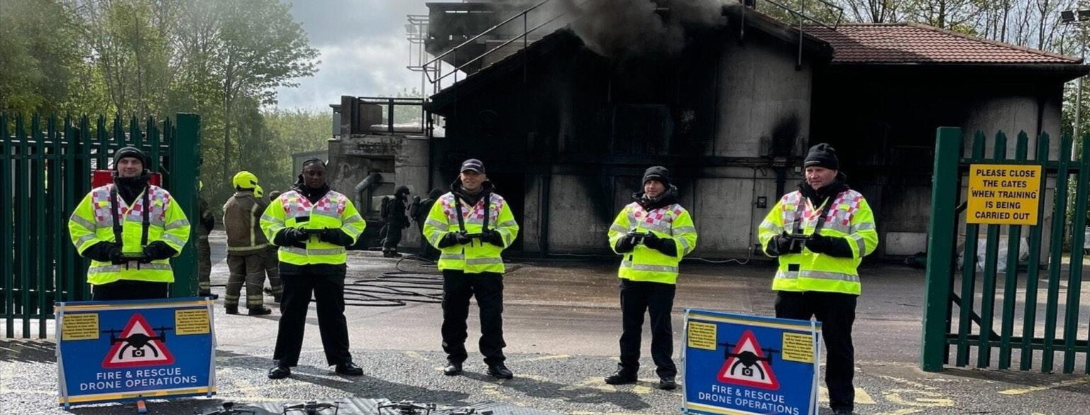
It is also well established, and well accepted that effective leadership in Fire and Rescue requires a mix of technical and non-technical skills, as described by Butler et al (2019). Put simply, an example of these would be a knowledge or procedure, or tools and equipment (technical) and skills such as leadership, communication, and effective decision-making (nontechnical). It is recognised that leadership in a fire or emergency context requires a set of skills that go beyond technical understanding - requiring empathy, emotional intelligence, selflessness, communication skills and an even temper.
What is interesting though is that the recognition of the importance of these traits as in many cases come from other risk critical sectors, like surgery or aviation. The establishment of empathetic non-technical skills was encouraged in response to a series of high-profile disasters where a leaders' judgement or interpretation could not be challenged by a subordinate, and so a correction could not be put in place. As a result, wholesale re-evaluation and retraining was conducted across both of the sectors and the principles of empathetic emotionally intelligent leadership was envisaged.
Personal Impact Encourage open communication and freely enter into dialog - not conflict.
Look to learn from mistakes and encourage a ‘just culture’. Leadership is about an opportunity to learn develop your own skills and help those in the team develop theirs.
People sometimes make mistakes, and rather than ridiculing these, they should be seen as opportunities to learn. We need to create a team culture where feedback about performance is an everyday part of team growth.
Success and achievements within the team should be recognised and celebrated.
Inappropriate behaviour, bullying, offensive or discriminatory language needs to be recognised as wrong and challenged. It is important to understand the impacts leaders have on the team and seek ways to improve how you work with others.
Outstanding Leadership As a high-profile team, with significant media and public interest in our activities, a drone team needs to take being an ambassador for the service seriously. Communications need to be professional, so take care with grammar and spelling, and never engage in arguments online or in public view.
Do not be unwilling to share expertise with others; or withholds relevant information.
Don’t exhibit aggressive, defensive, overpowering, bullying, or defensive behaviour.
Never refuse to take part in feedback, avoid debriefs, or be unaware or uncaring of team well-being and mental health.
Avoid employing obstructive behaviours rather than progressive ones.
If things go wrong, don’t look to blame others, or pass on accountability.
make sure that others in the team area able to put in different views in meetings.
OFFICIAL
Take responsibility and accountability for the quality of your own work, and the work of the team. This means ensuring that documents are up to date, deadlines are met and promises are not broken.
encourage all team members to speak and share their views on the teams work and understand the team in order to best utilise the diversity of strengths and skills within the team.
OFFICIAL
Work with the team and with others to set the strategic direction of the team within the organisation, communicate that clearly, and take responsibility for any tasks assigned to yourself.
Service Delivery As a leader it is important to plan ahead and prioritise both your work and the work of the team, managing everyone's time effectively to get things done.
Support any opportunities to improve the way we do things for the community or a service, and actively contribute to problem solvingmaking time to understand issues fully and take appropriate actions.
Remember, decisions or actions need to be based on evidence, risk and a good knowledge of what good practise looks like.
Seek the views of others in terms of improving quality and effectiveness, and evaluate the impact of any changes objectively, so that we can be confident the change is for the good. Consider putting systems in place to monitor the quality of decision-making and automatically generate intelligence.
Work hard to build trust with others and be able to constructive relationships for greater collaboration. encourage innovation, including new technology, but also different ways of working.
Never show stubbornness in the face of opposition, even when proved wrong, and never challenge others in a way that intimidates or undermines.
Absolutely never use stigmatising behaviours or language and has little interest in understanding or working with diversity.
Don’t be preoccupied with you own agenda, or development, rather than driven by service delivery.
You should not see leadership as a route to fame or recognition rather than for good of organisation.
Organisational Effectiveness
Be clear about the teams’ goals, and how all team members can make a difference. Understand the role of the team, and you as a leader, in contributing to wider organisational priorities.
OFFICIAL
Do not overlook bullying or is party to bullying. Do not avoid longstanding issues requiring leadership.
OFFICIAL
Continually seek to improve your own performance, and the performance of your team. Actively seek feedback, and positively engage with new ways of working.
Take ownership of change, help others to understand it and to implement it. Demonstrate that you are willing to adopt to new ideas once new information emerges.
Strive to understand risk across all the projects in the team. Consider risk to reputation, team well-being and risk to efficiency and effectiveness.
Aim to create the conditions within and around the team for innovation and change to occur organically, and for the right reasons.
Never reject ideas quickly without reflection or insight. Fails to see relevance of wider issues.
Do not be obstructive towards change, and improvement.
You cannot refuse to let the team bring innovation.
Never be obstructive towards learning and progress.
Of course, this brings us back full circle. It makes complete sense for us as leaders in drone operations to draw from lessons learned in aviation, because drone operations literally are aviation. And the reason aviation and surgery are often given as exemplar risk critical sectors should also be obvious: the potential for widespread injury or death in the case of an aviation accident is self-evident, and this absolutely applies to Fire Service and Search and Rescue drones. If even one of the smaller drones is flown dangerously or control is lost, the potential for widespread harm is clear.
So clearly the risk of poor leadership, or lack of established leadership protocols is serious, but relatively simple to address in the short term. What we need to do is take the existing risk critical leadership protocols already associated with emergency response, coming from a tradition in aviation, and apply them to our emergency response aviation activities. As a guide for drone team leaders, we have taken just one example of a leadership framework, in this case specifically related to fire, and highlighted where we think there is an obvious relevance to drone operation leadership. The framework we have used is the UK National Fire Chiefs Council
Leadership Framework (available here), and the table that follows is hopefully of use to leaders in an exciting emerging field. So, in conclusion, leading a drone team shouldn't really be any different to leadership in any team. Yes, the technology is new, the practices and tactics are still being ironed out, but there is no excuse for our leadership not being excellent. People rely on us to be professional in all of our endeavours, leadership included. The broad principles are to serve as a leader with integrity, openness, empathy and to be led by evidence and objectivity. As long as we don't stray too far from that base, the leadership of a drone team should be a straightforward as leading any team.
Richie has worked for WMFS for nearly 25years in a number of operational roles. He is currently responsible for the Implementation of WMFS strategic priorities in relation to Response alongside the wider provision of integrated Service Delivery through Prevention, Protection and Response.

As drone manager, he has established a strong team approach that provides a robust drone capability for WMFS, which supports incident commanders to make effective command decisions at incidents. Utilising the learning already gained, he is continually working with Innovation and Sustainability to horizon scan, ensuring the drone team is using the most up to date technology and continues to evolve the capability.
FRGS, FInSTR, FICPEM
Watch Commander, Organisational Intelligence. West Midlands Fire Service (WMFS)
Ian works on the "operations" side of Organisational Intelligence at WMFS and was previously a firefighter in the London Fire Brigade. He has also been an intelligence officer for the RNLI and was formerly an Associate Professor in a Geography Department of a UK university. He is part of the editorial team of the Journal of Search and Rescue and holds an emeritus academic position at the University of Portsmouth, UK.
References
Butler, P.C., Honey, R.C. and Cohen-Hatton, S.R. (2019) "Development of a behavioural marker system for incident command in the UK fire and rescue service: THINCS," Cognition, Technology & Work, 22(1), pp. 1-12. Available at: https://doi.org/10.1007/s10111-019-00539-6.

who may or may not hover in the sky with their own UAVs just because they want to post a 'cool' story on Instagram
The rapid advancement in drone technology has led to an increased use of Unmanned Aerial Vehicles (UAVs) in various applications, including emergency response. While drones have proved to be beneficial to first responders - providing eyes on a scene prior to the arrival of ground units - as well as in search and rescue, firefighting, and other emergency operations, they also pose significant risks to first responders and the public.
As this Saint Leo poll finds, nearly threequarters (72%) of people polled think that drones are great for use by local police forces. While that may sound like good news, don't be mistaken - initiating a drone program is not an easy task for most agencies. The devil is in the details.
There are many challenges first responder teams face when using drones. In growing order of difficulty, we can list:
- The requirement to obtain a Certificate of Waiver or Authorization (COA) to fly and operate drones.
- The much-needed training about the best way to manage drones before, during,
and after deployment.
- The privacy concerns the general public has with drones.
Although the above challenges are all relevant, they are not the focus of this specific paper. In this article, we will discuss a much more painful challenge - which assumes that all the above difficulties have been overcome, and yet can put live operations to a halt. The challenge we'd like to talk about is the difficulty to manage the traffic of multiple drones above a restricted area and the conflicts of interest that can emerge in emergency situations between authorized drone operators and unauthorized drone owners.
First responder live operations often face a lack of orchestration between the different parties that typically attend emergency sites:
- The different teams of first responders themselves
- Journalists and reporters who - rightfully from their perspective - want to cover the sensational item and bring their media drones to capture high-quality footage
- And sometimes crowds of curious people
The uncontrolled and unauthorized use of commercial drones in restricted airspace can cause disruptions and delay operations, jeopardize the safety of first responders and the public by flying in close proximity to them - endangering their lives - and compromise the privacy of individuals. That's why the Standard Operating Procedure is to pause any live operation, the second an unauthorized drone has been detected. This raises an additional difficulty faced by first responders in such situations: detecting drones, especially in night-time conditions and beyond visual line of sight, which can make it challenging to identify the drones and their operators. The inability to detect and defeat the threats caused by drones in real time can also lead to delays in responding to emergencies, putting the safety of first responders and the public at risk.
So why does it remain so difficult to deal with drones in 2023? There are 4 main reasons behind this challenge:

• Firstly, the global commercial drone market is exploding. According to the Grand View Research Commercial Drone Market Size & Share Report, 2021-2028, it was valued at USD 13.44 billion in 2020 and it is expected to expand at a compound annual growth rate (CAGR) of 57.5% from 2021 to 2028. Their usage is proliferating in many industries but also among criminals with malicious intentions and a mainstream public simply unaware of the restrictions and rules around drone flying.
• Secondly, it sounds obvious, but an additional difficulty lies in the fact that drones are small. It is therefore more difficult to see them and more complex to neutralize them.
• A third difficulty is that drones fly at a low altitude. Hence one can't afford to 'simply' take them down - especially in urban or dense areas - as it could potentially cause physical damage and casualties.
• Lastly, drones use the same communication frequency as we all do. That's why "confusing" drones about their location or jamming their communication signals, are obviously not valid options for first responder operations as they also disrupt all the GPS, telecommunications or Wi-Fi signals in the surroundings.
Why aren't counter-drone systems more widely used by first responders?
The use of counter-UAV systems can help address the challenges faced by first responders during drone operations, especially - but not only - during night-time or when there's no line of sight. They can also be the ideal solution for providing a picture of what's going on in the sky: what drones are flying in a defined perimeter, where and at what altitude are they flying, Etc.
The lack of usage of counter-drone technologies by first-response teams probably comes from the fact that for quite some time, counter-drone solutions could be bucketed into 2 main categories:
- Solutions that detect, track and identify drones
- Solutions that focus on neutralizing them, more or less violently
Each bucket - if they didn't regularly fail - potentially solved only one part of the equation and therefore it meant more than one technology was needed in order to meet the entirety of first responders' operational needs. Additionally, traditional counter-drone solutions can be heavy and complex to operate; and they often require skills that are missing in a first responders' squad.
But counter-drone systems have evolved and have become extremely relevant to live operations. In recent years, new technologies have emerged and matured, which now offer more integrated solutions. They can detect and identify unauthorized commercial drones, track multiple drones simultaneously and locate their remote
controls, but also safely override them and land them in a predefined zone, or send them back to their home locationthereby reducing the risks associated with uncontrolled drone usage.
This is an important point to remember as only integrated solutions can truly meet first responders' operational needs end-toend and in real time.
The most advanced of these solutions are entirely autonomous and require minimum training to be operated. They are lightweight, can be deployed in a matter of minutes, or even mounted on a vehicle, thus always "ready to go" when an emergency occurs. This also means they can protect either a permanent or temporary perimeter, a protest march, or a convoy.
Not less importantly, unlike traditional C-UAV mitigation technologies that involve jamming(1) or spoofing(2), those more advanced anti-UAV solutions are safe for any environment. And by that, we don't mean that they don't impact climate change (although true!) But rather that they are suitable for open as well as urban environments:
- They create no interference with other means of communication and Global Navigation Satellite Systems (GNSS). This is key, as we know how crucial communication and coordination between different members of a crew are, in a firstresponse situation.
- They enable the standard usage of firstresponder drones during live operations as they do not impact authorized drones. This means that the serial numbers of authorized drones can be listed in the C-UAV software and they will be 'ignored' and allowed to operate normally, while unauthorized drones will be detected, tracked and mitigated.
- They allow for safe mitigation by disconnecting the drone's communication with its remote control, flying the drone to a safe altitude, and either sending it back to its 'Home' as originally configured by the owner or safely landing it in a predefined zone which enables the crew to easily collect it.
In summary, integrated counter-drone solutions provide first responders with the ability to keep operating their own drones, while enabling them to identify the location of unauthorized drones in real-time, and safely land them. By doing so, they ensure that first-responder teams can quickly respond to emergencies without drone disruption.
When searching for and looking to procure counter-drone technologies, first responders should have in mind the below criteria:
- An integrated counter-drone solution
- A reliable and accurate UAS picture
- Safety for the environment
- A low total cost of ownership
- Suitability for all operational needs
This article is the first in a series of 3 articles. In our next edition, we will review in detail the main Counter-drone available technologies on the market today.
(1) Jamming in wireless networks is defined as the disruption of existing wireless communications by decreasing the signal-to-noise ratio at receiver sides through the transmission of interfering wireless signals.
(2) GPS Spoofing happens when someone uses a radio transmitter to send a counterfeit GPS signal to a receiver antenna to counter a legitimate GPS satellite signal. Spoofing can apply to emails, phone calls, and websites, or can be more technical, such as a computer spoofing an IP address, Address Resolution Protocol (ARP), Domain Name System (DNS) server or GNSS Signal Spoofing.
Sources:
-Polling Institute - Saint Leo University, https://polls.saintleo.edu/saint-leo-pollfinds-as-the-public-learns-more-aboutdrones-opinions-split-on-the-best-civilianuses/
- Grand View Research Inc. - Commercial Drone Market Size & Share Report, 20212028
- https://www.grandviewresearch.com/ industry-analysis/global-commercialdrones-market
Emergency responders are increasingly turning to drones as tools to assist in a range of pre-planned, routine and ad hoc operations. Yet while increasingly deployed as tools to gain insight from the air, and assist and inform wide-ranging emergency response operations, there remain both challenges and barriers to use, and further opportunities to be explored and exploited.
Exploring the use, perception, and impact of drones in changing UK airspace, Dr Anna Jackman's Economic and Social Research Council funded Diversifying drone stories research project engages with diverse stakeholders (including emergency services and responders, lawyers, industry, local authorities, pilots, air traffic controllers, and members of the public) who deploy, design, and live with drones, to understand different perspectives on how drones may be (re)shaping UK airspace and everyday life below.
The research involves focus groups bringing together groups of emergency responders, including members of UK police, fire, search and rescue, as well as relevant charitable organisations and volunteer groups, to share their views on: the use and benefits of drones; the challenges, barriers and limitations of drone use; encountering and responding to drone misuse; and visions for future drone use.
In addition to mapping out existing wideranging use cases and applications, the focus groups explored challenges, barriers and constraints that participants felt currently limited their drone use. These ranged from:
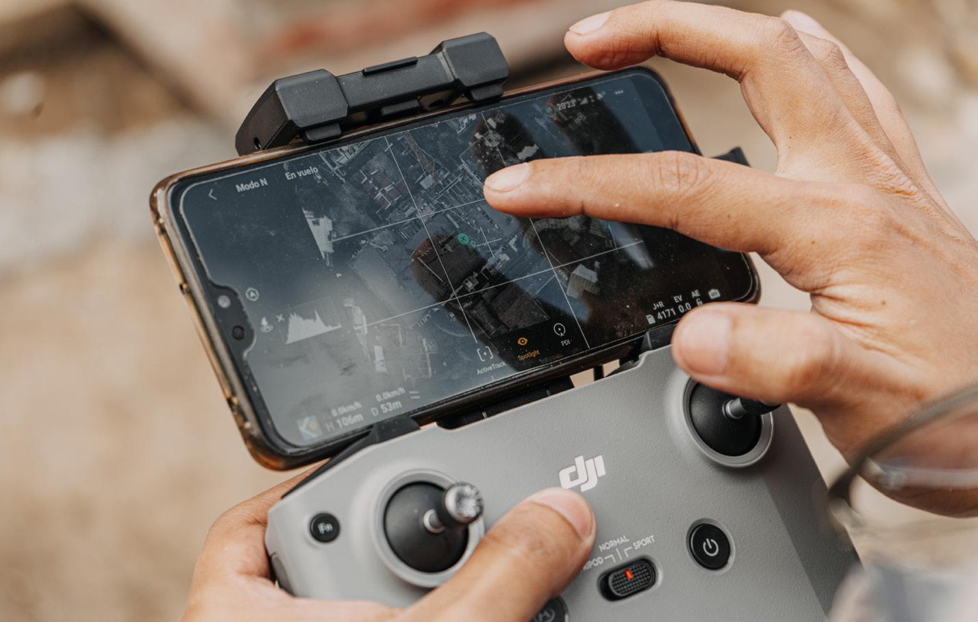
• Questions about regulatory exemptions and liability;
• Impact of weather on the ability to fly and the efficacy of cameras and sensors;
• Limitations of VLOS flight and desire for BVLOS operations;
• Funding for and lifespan of equipment;
• Permissions challenges for charities and volunteer organisations;
• Impacts of frequency, including challenges of urban operations and constraints at large scale events;
• Challenges of indoor operation (e.g. interference, dust);
• Limitations on the lifting and pulling potential of drones;
• Challenges of navigating different guidance (e.g. from CAA and NPCC) and need for further centralisation of guidelines and training;
• Concerns around the pace of regulatory change and misunderstanding around frequent updates.
In dialogue with the research's wider interest in drone misuse, the focus groups also explored emergency responder encounters with and responses to drone
misuse, spanning both accidental or reckless, and intentional or malicious misuse. Emergency responder participants described wide-ranging experiences, from: flight over TV sets, horseraces and football games; flight in FRZs and proximity to manned aircraft; flight in proximity to critical and national infrastructure; flight over and in proximity to schools and parks; the use of drones to deliver contraband into prisons; as well as issues caused by media, journalist and hobbyist flight in proximity to and jeopardising emergency operations; and reckless flights by hobbyist users lacking awareness and familiarity with existing regulations and flyer responsibilities. In discussing responding to drone misuse, participants primarily stressed the importance of engaging with and educating the public, while also reflecting on enforcement, such as the powers to land, inspect and seize a drone (per the Air Traffic Management and Unmanned Aircraft Act 2021); access, use of and costs associated with counterdrone technologies; and the difficulties surrounding prosecution. Participants also described challenges around implementing and communicating an emergency event/ area; and challenges around subject matter
expertise and resourcing to keep patrol officers abreast of relevant regulation, particularly as auditors increasingly seek to challenge officers for 'Youtube clout' (participant).
Lastly, the focus groups were interested in how emergency responders imagined drones being used in the future. Alongside a wish list around regulatory clarity, the centralisation of standards and guidelines, and improved permissions processes, in sharing their visions, participants described drones as/with:
• Equipped with vital attachments (e.g. defibrillators, trauma kits, EpiPens);
• Reliable 2 ways communications;
• Self-charging and/or battery improvements;
• Improved operation in inclement weather;
• CBRN 'sniffer' advancements;
• Low speed capabilities / slow mode for missing persons search;
• Obstacle avoidance in low light;
• Facial recognition and machine learning;
• Dropping extinguishing agents;
• Dragging bodies through water (water rescue);
• Operated from multiple control rooms/ command centres;
• The potential for augmented reality to enable assistance in unfamiliar areas.
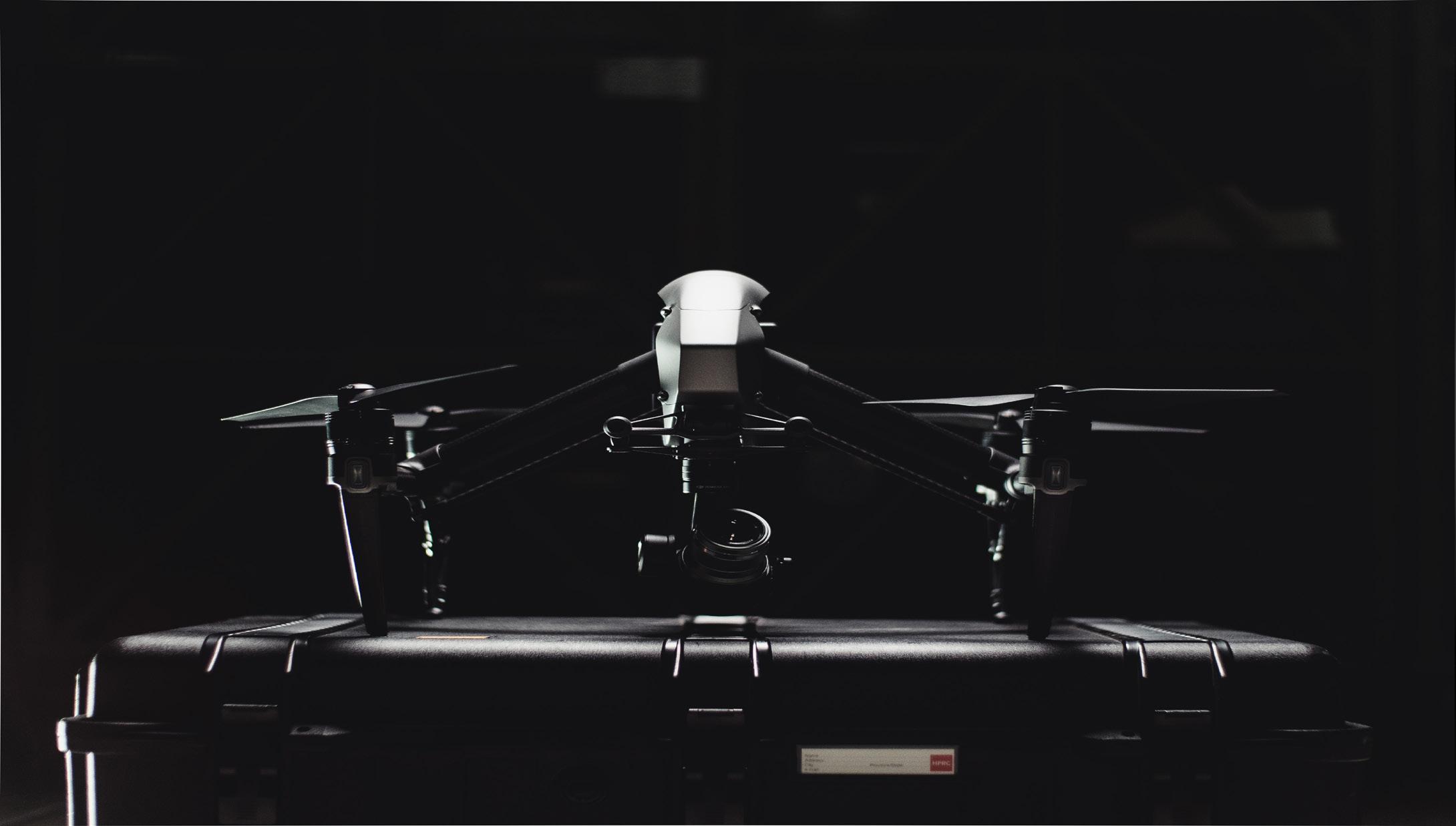

The Diversifying Drone Stories Research project is ongoing and welcomes participation from emergency responders and members of the emergency services. If you are interested in learning more or participating in upcoming focus groups or otherwise sharing your views, please contact Dr Anna Jackman at a.h.jackman@ reading.ac.uk. You can find out more about the research on the project website (Drone Stories). Stay tuned for further updates!
Dr Anna Jackman is a Lecturer in Human Geography at the University of Reading. Anna acted as the Specialist Adviser to the Science and Technology Committee Inquiry into 'Commercial and recreational drone use in the UK', and as an expert witness for the Defence Committee's Inquiry into the 'Domestic threat of drones'.
You can reach Anna at: a.h.jackman@reading.ac.uk or on Twitter @ahjackman.
Dr Anna Jackman"essentially the 'air traffic control' for drones"
Drones are increasingly being used by emergency services for a variety of purposes, whether it be for Search & Rescue (SAR), firefighting, law enforcement, traffic management, hazardous materials response and damage assessment following a natural disaster.
We're all becoming more familiar with the hardware. But one of the most important aspects of using drones in emergency situations is the software. And more specifically, the software providing the airspace picture.
One company which is making a name for itself within the Emergency Services is Altitude Angel. It's Drone Assist app has become almost the default app for recreational as well as professional drone operators when they're planning their drone flight or operation.
But Altitude Angel has more to offer than just a shiny app. It's at the forefront of UTM (unified traffic management) technology - essentially the 'air traffic control' for drones - and will play an integral part in enabling the use of drones by the emergency services in every conceivable scenario as the technology develops.
"Since the business was started nearly eight years ago, the goal has been to enable drones to fly safely and securely in any airspace," says Phil Binks, Altitude Angel's Head of Air Traffic Management. "We've always believed the technology we're enabling can change the world for the better in an infinite number of ways. And helping the emergency services has been a central theme in all we do."
And they've been true to their word. Back in 2019, Altitude Angel made a joint announcement with Inmarsat, a world leader in global mobile satellite communication, to say the companies has developed a 'Pop-Up UTM' capability with search and rescue teams in mind.

"It sounds clich'd," says Binks, 'but after a particularly long day a few of us called in to the local pub before heading home. We began discussing a story which had been recently shared in the office of pilots operating the fire planes and helicopters in California refusing fly because drones had been seen in the area. It later transpired the drones were being operated by the ground crews looking for fires so they could direct operations more effectively. The left hand didn't know what the right hand was doing.
"If the fire fighting team had access to a UTM platform, they could have given assurances to the crewed operations the drones reported were friendly and were operating at safe levels. They [the drones] could even have been grounded for minutes as the planes and helicopters came in before renewing operations. We knew we had the foundations for a service, but it would need some external help."
One of the issues facing Altitude Angel was the connectivity to the drone. In a disaster zone like a Californian wildfire, or more recently in Turkey and Syria, the ground infrastructure is destroyed, and with it the mobile connectivity needed to provide the drones real-time location.
Fortunately, around the same time Altitude Angel were speaking to Inmarsat about possibly working together. They just needed a project.
Inmarsat's strength was its satellite network which meant with the correct hardware on the drone, it could be tracked and monitored anywhere on the planet without the need for any ground-based connectivity.
The two companies set about building on Altitude Angel's GuardianUTM platform to jointly develop what would become the 'Pop-Up UTM' platform. Utilising Inmarsat's sector-leading global network of satellites and leveraging its substantial experience in Air Traffic Management (ATM) communications, it took a little under six months for the platform to be ready and accessed rapidly and deployed worldwide.
Then, during October and November 2020, Altitude Angel and Inmarsat brought in drone operator, A-TechSYN to test and prove the platform's capability. Over the two months A-TechSYN flew numerous BVLOS flights, connected and tracked using Inmarsat's global L-band satellite network. The fully autonomous flights were initiated and monitored by a pilot 60km from the take-off and landing area near Ankara, Turkey, and were tracked, monitored, and managed using the Pop-Up UTM platform by a team at Altitude Angel's HQ in Reading, United Kingdom. The test flights produced excellent results, with the UTM platform offering full situational awareness to the operator team. During the tests, the system detected a possible conflict with a commercial aircraft - which could have been a blue-light helicopter in a real-world scenario. As designed, the Pop-Up UTM correctly triggered a warning to de-conflict the two aircraft, allowing appropriate avoidance action to be taken.
"Drones have become an essential tool in SAR for all the obvious reasons; they're quick to deploy, can stay aloft for a good length of time and they're cost effective," says Binks. "But they're only useful when they're flying! If you can't get them in the air because crewed aviation are operating near by or in the same airspace, all the benefits are lost. Which is why UTM will play a crucial part in blue-light drone operations going forward. It's about bringing all technology together, so we have the complete picture. Drones can help find victims or missing persons, but helicopters may be called in to get them out. Having the complete airspace picture makes this possible."
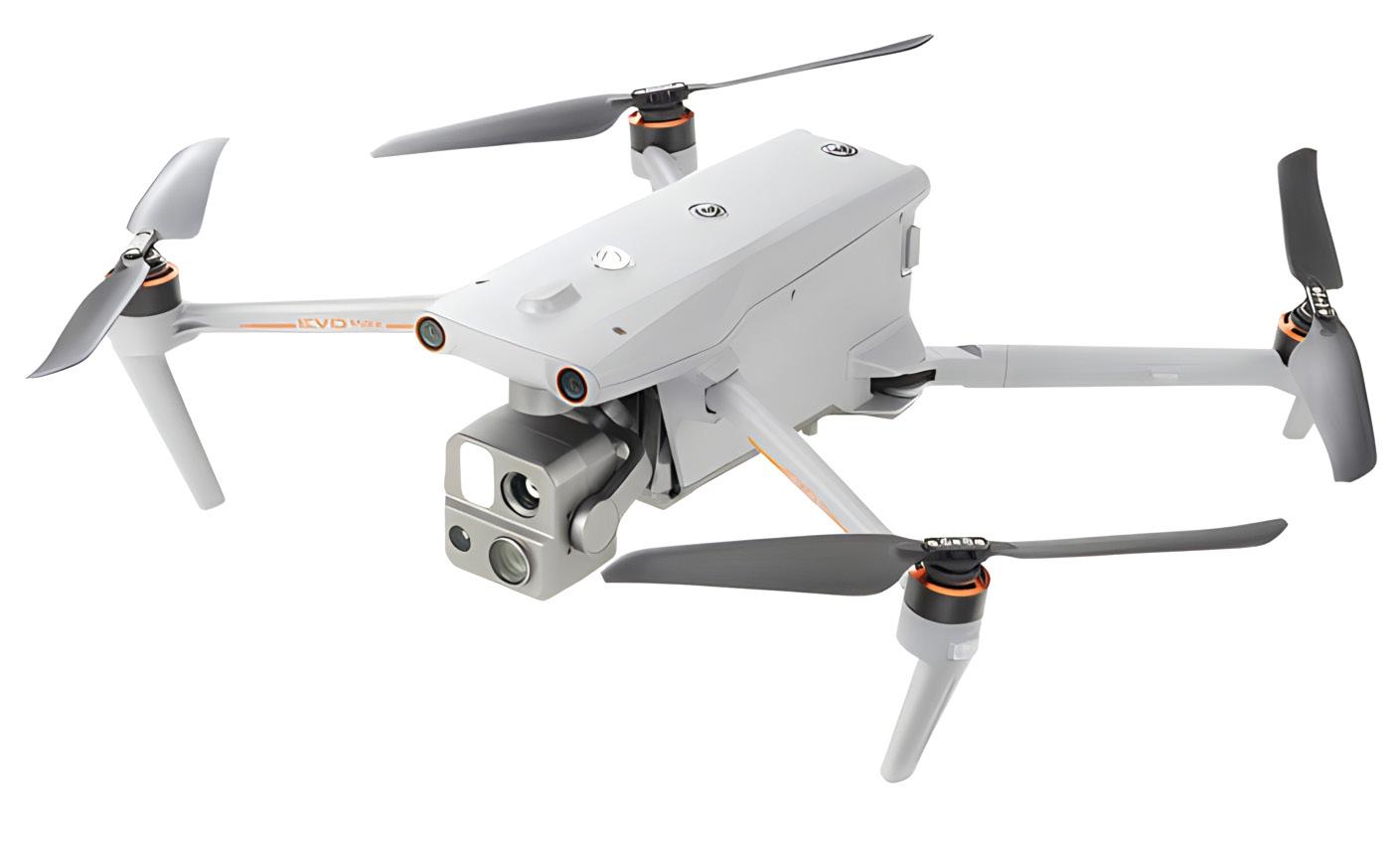
Recently Autel released the hotly anticipated Autel Max 4T, slotting neatly size wise in between a DJI M30T and a DJI Mavic 3 it has a IPXX rating, no geo fencing, mesh technology
Enterprise UAV are proud to be an authorised Autel Dealer – The Max 4T is available to order from stock today, we have also invested in a Max 4T demo drone so if you want to see it physically let us know! Check out the key features of this new drone
• No Blind Spots
• Anti Jam
• Anti Interference
• 15s Take Off
• 8K 10x Optical Zoom
• IP43 Weather Rating
• Hot-Swappable Batteries
• Navigation In GPS Denied Environments
• 4 miles Transmission Range
• 42 mins Max. Flight Time
• 720° Obstacle Avoidance
The anti-collision and flights in GPS denied environments are huge benefits and combined with their new A Mesh technology enabling drone-to-drone autonomous communication, connection, and collaboration shows this isn't just another "me too" drone!
Enterprise UAV can provide highly competitive lease finance where you keep the asset at the end of the agreement, personal interest free credit. We can also offer hardware demonstrations and we are pleased to be able to offer the Parrot ANAFI USA and Parrot ANAFI AI free of charge through the Parrot Enterprise Drone Programme where selected partners will receive a complete set of hardware (drone, controller, batteries) and software (piloting app, SDK documentation, third party apps and services) please note an application process is required.
Caelus
Limestone Suite
Fern Court Business Centre
22A Moor Lane
Clitheroe
Lancashire
BB7 1BE
(please note: visits by appointment only)

Scientists and roboticists have long looked at nature for inspiration to develop new features for machines. In this case, researchers from Ecole Polytechnique Fédérale de Lausanne (EPFL), Switzerland were inspired by bats and other animals that rely on echolocation to design a method that would give small robots that ability to navigate themselves - one that doesn't need expensive hardware or components too large or too heavy for tiny machines. In fact, according to PopSci, the team only used the integrated audio hardware of an interactive puck robot and built an audio extension deck using cheap mic and speakers for a tiny flying drone that can fit in the palm of your hand.
The system works just like bat echolocation. It was designed to emit sounds across frequencies, which a robot's microphone then picks up as they bounce
off walls. An algorithm the team created then goes to work to analyze sound waves and create a map with the room's dimensions.
In a paper published in IEEE Robotics and Automation Letters, the researchers said existing "algorithms for active echolocation are less developed and often rely on hardware requirements that are out of reach for small robots." They also said their "method is model-based, runs in real time and requires no prior calibration or training." Their solution could give small machines the capability to be sent on search-andrescue missions or to previously uncharted locations that bigger robots wouldn't be able to reach. And since the system only needs onboard audio equipment or cheap additional hardware, it has a wide range of
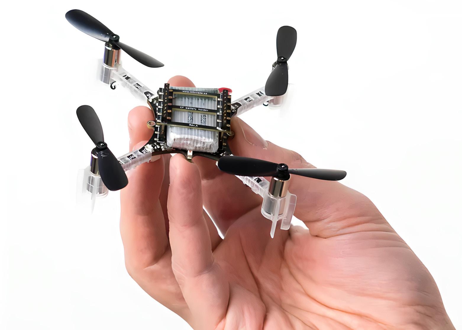
The researchers found during their tests that their technique is still not quite as accurate as systems that use bigger and more expensive hardware, such as GPS sensors or cameras. They're hoping to improve its accuracy in future versions, though, and to eliminate the need for the system to generate sounds. Instead, they want their system to be able to echolocate using the sounds the drone itself produces, such as the whirl of its own propellers.
SOURCE:
https://tinyurl.com/43payvy5
SCAN THE QR CODE TO BOOK NOW


THE LATEST FROM