Strengthening and Transforming the Lower Eastside Supporting LEAP Phase III
Strengthening and Transforming the Lower Eastside
Strengthening and Transforming the Lower Eastside
Xuewei Chen, Leah Gerber, Cassie Hackel, Yu-Wei Hsu, Allison Kappeyne van de Coppello, Taylor LaFave, Rosie Pahl Donaldson, Grant Priester, Ziyang Shu, Shien-Min Teo, Roman Yanke
Urban and Regional Planning Program
A. Alfred Taubman College of Architecture and Urban Planning
University of Michigan
May 2017
Strengthening and Transforming the Lower Eastside
We thank our community partner, Eastside Community Network, for their assistance throughout the creation of this plan and their generous funding for this project. We also thank the members of the LEAP Advisory Committee:
Donna Givens - Eastside Community Network
Suzanne Cleage - Eastside Community Network
Orlando Bailey - Eastside Community Network
Tonja Bolden Stapleton - LAND, Inc and Crossroads Consulting
Sam Butler - Doing Development Differently in Metro Detroit
Anika Goss Foster - Detroit Future City
Victoria Olivier - Detroit Future City
Darnell Adams - Detroit Land Bank Authority
Erin Kelly - Detroit Department of Planning and Development
Esther Yang - Detroit Department of Planning and Development
Barbara Martin - Resident Leader, Crane Street Block Club
Jay Henderson - Resident Leader, Riverbend Community Association
Donna McDuffie - Resident Leader, Chandler Park Neighborhood
Joyce Wells - Resident Leader, Chandler Park Neighborhood
Miguel Pope - Youth Voice Coordinator, Mt. Elliott Business and Community Association
Monique Holliday - Youth Voice Coordinator, HOPE Community Outreach and Development
Andrea Brown - Michigan Association of Planning
Ron Omillian - LEAP Steering Committee, 42nd Parallel Group, LLC
Sarida Scott - Community Development Advocates of Detroit
Madhavi Reddy - Community Development Advocates of Detroit
Payton Heins - Center for Community Progress
Erma Leaphart - Sierra Club
Libby Levy - University of Michigan and ProSeeds Consulting
Professor Margaret Dewar - University of Michigan
The following resident Quadrant Leaders also provided expertise and insight into the LEAP area’s neighborhoods and people:
Tammara Howard - Northwest Quadrant
Rosie M. Baggett - Northwest Quadrant
Brenda Butler - Northeast Quadrant
Patricia Reid - Northeast Quadrant
Toyia Watts - Southwest Quadrant
Jeanine Hatcher - Southwest Quadrant
Jackie Richmond - Southeast Quadrant
In addition, we thank the following individuals for their valuable contributions to this plan:
Professor Mark A. Wyckoff - Michigan State University
Professor Larissa Larsen - University of Michigan
Sara Toering - Center for Community Progress
Professor Joan Nassauer - University of Michigan
Jeff Bross - Data Driven Detroit
Carol Hufnagel - Tetra Tech
Darryl Albert - Tetra Tech
Khalil Ligon - Alliance for the Great Lakes
Emilie Evans - Brick + Beam
Heather Seyfarth - OHM Advisors
Juliana Fulton - Detroit Parks & Recreation Department
Kelsey Shaw - Possibility Place Nursery
Guy Williams - Detroiters Working for Environmental Justice
Linda Smith - U-SNAP-BAC
Alexa Bush - Detroit Department of Planning and Development
Marcus Jones - Detroit Training Center
Finally, we give special thanks to Professor Margaret Dewar and Libby Levy for their guidance and encouragement throughout this project.
Strengthening and Transforming the Lower Eastside
Figure
Table
Table
Table
Table
Table
Table
Strengthening and Transforming the Lower Eastside
This plan supports the development of the Lower Eastside Action Plan (LEAP) Phase III. LEAP is a community-driven plan, created by Warren/Conner Development Coalition, now Eastside Community Network (ECN), that focuses on repurposing vacant land and improving quality of life in the LEAP area. Since LEAP Phases I and II were released in 2012, needs and conditions have evolved and the plan requires an update to reflect these changes.
Current conditions in the LEAP area informed the strategies within this plan, such as:
• Notable assets: ample green space and connection to natural features; several key sites of commercial activity; active community development organizations; religious and social service institutions
• Declining population and increasing vacant land—about half of all properties in the LEAP area are vacant lots
• Several areas targeted by the City of Detroit and other public and private entities for future investment and improvements
• A variety of neighborhoods with a range of densities and housing conditions
Strengthening and Transforming the Lower Eastside addresses 2 specific goals identified by the LEAP Steering Committee: Strengthening Chandler Park and Transforming Open Space. Each of these goals includes several strategies that propose projects and policies.
LEAP Phase III’s goal of strengthening Chandler Park builds on LEAP Phases I and II, which sought to “stabilize active residential and commercial districts, which in turn greatly improve the quality of life.” The LEAP Steering Committee saw an opportunity to reinforce Chandler Park as an active residential district.
Strengthening Chandler Park includes 2 guiding principles and 6 strategies. Suggested projects and policies are outlined for each strategy.
Principles
• Rely on resident voices
• Improve quality of life
Strategies

LEAP Phase III can support existing community organizations and neighborhood associations and advocate for more neighborhood groups and block clubs. Strengthening neighborhood organizations ensures resident representation and enables other strategies. Potential partners include the Department of Neighborhoods and Immanuel Lutheran Church.
Projects and Policies:
• Strengthen neighborhood organizations and organize new block clubs: support Chandler Park Neighborhood Association (CPNA); formally register community organizations and block clubs with the Department of Neighborhoods
• Support Small Ville Learning Farm with community partnerships: connect to educational institutions; encourage resident engagement; foster new and continued advisory connections
• Reinforce social ties: target areas that seem less connected; coordinate a Neighborhood Day with ARISE Detroit!
• Ensure adoption of neighborhood organizational structure: include representation from block clubs in neighborhood associations, and from neighborhood associations in community development organizations
• Engage with City government on repurposing vacant land: arrange meetings with various departments for resident feedback on open space projects
• Advocate for additional Community Development Block Grant (CDBG) funding for community-based organizations like ECN that strengthen neighborhoods

Reduce Blight
LEAP Phase III can call for demolitions and side lot leasing or purchasing.
Projects and Policies:
• Advocate for demolitions: not all structures needing demolition are in the City’s demolition pipeline; some Detroit Land Bank Authority (DLBA)-owned structures are eligible for the Hardest Hit Fund
• Encourage homeowners to purchase lots next door: ownership helps to increase maintenance of vacant lots
• Advocate for Chandler Park to be included in the new side lot leasing program: DLBA plans to launch a pilot program called Your Neighborhood, Your Lot
• Enroll residents in Detroit Training Center’s Blight Removal Training Program: program provides students with licensing, credentials, soft skills, and future job placements
Many residents in Chandler Park neighborhood will likely face rising stormwater drainage charges. Installing GSI in targeted areas may improve the drainage system and reduce charges to residents.
Projects and Policies:
• Advocate for transformation of vacant lots into GSI: 13 suitable sites exist
• Support investment in Hamilton Academy Rain Garden Learning Lab
• Create a basement cistern next to Small Ville Learning Farm: a DLBA-owned structure scheduled for demolition is adjacent to the garden and could be repurposed
• Advocate for homeowners to receive stormwater drainage fee credit for adjacent bioretention gardens that can capture and detain a 2-inch rainstorm event
• Install GSI to reduce stormwater drainage fees: target those most likely to see increased fees with ECN’s rain garden minigrants or shared GSI projects

As of April 2017, 118 properties in Chandler Park had been foreclosed for nonpayment of taxes, or were about to be. ECN has notified residents about tax foreclosure prevention measures.
Projects and Policies:
• Partner with United Community Housing Coalition (UCHC) on homeowner workshops or counseling sessions: help residents address probate issues and acquire proper ownership documentation
• Offer workshops and counseling on lowering future tax bills: help homeowners who qualify for exemptions and tax credits
• Create a neighborhood home resource center: provide comprehensive information about property taxes and tax foreclosure prevention (also see Facilitate Home Repairs strategy)
• Advocate for retroactive poverty exemption: allow property owners to be reimbursed for previous years’ property taxes if they meet the requirements

Many Chandler Park residents express an urgent need for home repairs, but these activities are often difficult to accomplish because of the high cost and time commitment.
Projects and Policies:
• Help residents apply for funding for repairs
• Advocate for the City to allocate U.S. Department of Housing and Urban Development (HUD) funding to home repair grants
• Create a neighborhood home resource center: provide onestop access to resources that can help residents make repairs (also see Prevent Tax Foreclosures strategy)
• Establish partnerships for construction training: potential collaborators are Detroit Training Center, Detroiters Working for Environmental Justice, and Brick + Beam Detroit
• Advocate for rental property registration and inspection: ensure that renters’ homes are up to code and in good condition
• Organize tenants’ rights workshops in partnership with UCHC: help renters exercise their rights if landlords are not keeping properties in good condition

The City envisions 20-minute neighborhoods where residents have access to day-to-day amenities within a 20-minute walk or bicycle ride.
The argument to designate Chandler Park as a 20-minute neighborhood could include:
• Chandler Park has many assets that could qualify it as a 20-minute neighborhood, including a large park with a regional draw that has seen recent investment with the assistance of the Chandler Park Conservancy.
• Chandler Park has qualities similar to those of the Fitzgerald neighborhood, a selected 20-minute neighborhood.
• Numerous opportunities exist to capitalize on the 20-minute designation. Potential future projects might include: creation of a community land trust; creation of a tech center; and transformation of the Chandler Park Drive streetscape.
LEAP Phase III aims to support land transformation and neighborhood stabilization. The open space portion of this plan proposes a systematic approach to transforming vacant land in a coordinated manner, based on historical and existing natural features. In contrast to a series of stand-alone projects, the suggested projects can accumulate over time to provide ecological benefits to the entire Lower Eastside. Suggested projects for open space transformation differ inside and outside multi-family housing investment areas, where development is more likely.
The LEAP area has approximately 19,400 vacant lots encompassing approximately 2,032 of its 6,202 total acres. Of these vacant lots, a land suitability analysis suggested using 8,310 lots (33%) of the vacant lots for the 5 open space transformation strategies. When combined with existing uses for vacant lots (parking, gardens, play lots, or side yards), Hantz Farms, and Hantz Woodlands, 12,285 (63%) of vacant lots have been accounted for.
Transforming Open Space includes 2 guiding principles and suggests 5 strategies to support LEAP’s goal of transforming vacant land into an asset as part of a coordinated open space system. The strategies prioritize DLBA-owned vacant lots and a variety of land characteristics when suggesting specific projects.
Principles
• Match recommendations to natural features
• Tailor suggested interventions to density and planned investment
Natural areas are low-maintenance landscapes that can help restore ecosystems by transforming large amounts of vacant land. Natural areas can:
• Improve water quality by root systems’ filtration
• Improve air quality by reducing urban heat island effect and treating particulate matter
• Provide a variety of recreational areas for residents
• Provide habitat for plants and animals, including rare and endangered bird species
• Provide the opportunity to use locally sourced trees, plants, and seedlings to generate revenue for local businesses and jobs for residents
This plan considers 4 types of natural areas that are consistent with historical land cover, could restore tree canopy, and could enhance historical creeks as landscape features: oak-hickory forest; flexible use; mixed hardwood marshland; and riparian buffers.
Widespread implementation of GSI can alleviate flooding and combined sewer overflows. GSI installations can:
• Improve public water quality by reducing pollution in stormwater runoff
• Reduce basement flooding caused by backups of the City’s combined sewer system when it is overwhelmed during a storm event
• Increase property values by increasing vegetation and tree canopy
This plan considers 3 types of GSI that range in size from single lots to multiple acres, could mitigate flooding, and could reduce drainage fees: constructed wetlands; bioretention/biofiltration; and basement cisterns.
Productive uses lead to the creation of a range of products and services. Productive uses can:
• Improve food access and public health outcomes associated with nutrition
• Clean air, soil, and water
• Generate revenue and create jobs
• Reduce greenhouse gas emissions and utility costs through the use of renewable energy
This plan considers alternative energy and agriculture production, which offer opportunities to generate income within the LEAP area and provide access to fresh, local produce.
Quality public green space can strengthen neighborhoods and become part of an open space system. In stable neighborhoods, parks and greenways can catalyze economic development and increase property values. In areas with a high amount of vacant land, parks and greenways can connect open space. This plan seeks to:
• Expand existing parks through adjacent City- and DLBAowned vacant lots
• Support existing and planned greenways
• Connect other open space uses
Given the presence of Interstate 94, the Chrysler plant, and arterial streets such as Gratiot Avenue and Jefferson Avenue, implementing tree buffers throughout the LEAP area can improve quality of life for residents. Tree buffers can:
• Block hazardous particulate matter that causes asthma and other health problems
• Absorb noxious fumes
• Reduce noise and block unpleasant views
This plan considers 3 types of tree buffers: highways, industrial areas, and arterials.
The Detroit Zoning Ordinance does not ensure longevity for open space uses. The City could adopt several changes to their land use regulations to address this issue. Changes could include: downzoning (restricting new development to preserve natural features); green area ratio (GAR) and landscape requirements (requiring developers to cover a certain amount of surface with a vegetative layer or other green infrastructure); an expanded overlay zone (adding additional open space restrictions to the Far Eastside Overlay District); and a riparian ordinance (protecting riparian systems through regulation). A long-term solution is comprehensive zoning reform through the creation of a new citywide master plan and new Detroit Zoning Ordinance.
Detroit’s Lower Eastside is a diverse community that includes neighborhoods such as Chandler Park, Jefferson-Chalmers, and the Villages. Like most of Detroit and other industrial cities in America, the Lower Eastside experienced population loss after 1950, resulting in property disinvestment and structure demolition. Today, opportunity abounds in remaining active neighborhoods and swaths of open space. The desire to improve quality of life through strong neighborhoods, and to transform vacant land into places that stabilize those neighborhoods, gave shape to the Lower Eastside Action Plan (LEAP). Created by Eastside Community Network (ECN), previously Warren/Conner Development Coalition, LEAP is a community-driven response and award-winning plan that engages residents in a process of transforming open space
and stabilizing neighborhoods. The LEAP planning process was initiated in 2009 through community group discussions and stakeholder meetings, and Community Development Advocates of Detroit (CDAD) joined the process in 2010.1 Phase I of LEAP was published in January 2012, followed by Phase II in October 2012, which shifted the northern boundary of the LEAP area from Warren Avenue to Interstate 94.2 LEAP engaged over 5,300 residents in envisioning a future for the Lower Eastside by repurposing vacant land in coordination with strengthening neighborhoods.3
By 2017, neighborhood needs and conditions had changed, with vacant land increasing and some housing markets strengthening. Many projects and policies proposed in Phases I and II had been implemented. ECN realized that these changes and successes warranted an update to the plan: LEAP Phase III. This plan contributes to the spring and summer 2017 update by analyzing current conditions and offering strategies to strengthen the Chandler Park neighborhood and to transform open space throughout the LEAP area (Figure1.1).
Figure 1.1: The boundaries of the LEAP area within Detroit are Alter Road to the east, the Detroit River to the south, Mt. Elliott Street to the west, and Interstate 94 to the north.
Sources: Michigan Open Data, Cities, 2013; U.S. Census Bureau, TIGER/Line: All Roads, 2014 (see Appendix A)
1. LEAP, Reinventing Detroit’s Lower Eastside: A Summary Report of the Lower Eastside Action Plan - Phase II (Detroit: Warren/Conner Development Coalition, October 2012), 10.
2. Ibid; LEAP, Reinventing Detroit’s Lower Eastside: A Summary Report of the Lower Eastside Action Plan - Phase I (Detroit: Warren/Conner Development Coalition, January 2012).
3. LEAP, A Summary Report of the Lower Eastside Action Plan - Phase I, 9; LEAP, A Summary Report of the Lower Eastside Action Plan - Phase II, 12.
The LEAP area contains many physical, social and organizational assets, and the City of Detroit has identified some neighborhoods within it for new investment. However, continuing population loss, unoccupied housing, and vacant lots require thoughtful strategies for both neighborhood stabilization and open space transformation.
Declining population in the LEAP area and a resulting increase in housing vacancy highlight the need to focus on strengthening neighborhoods, retaining residents, and listening to resident input.
Population loss (Figure 2.1) and increased housing vacancy (Figure 2.2) have led to demolitions, causing an increase in vacant lots (Figure 2.3). This land presents an opportunity to transform the area and serve as a model for repurposing open space.
Figures 2.1 and 2.2: Though some neighborhoods in the LEAP area are seeing an influx of new residents, the overall population is unlikely to increase in the near future. Housing vacancy has also continued to rise in the LEAP area since 2000.
Sources: United States Decennial Census, 2000, 2010; American Community Survey 5-year estimate, 2011-2015
Figure 2.3: About half of the lots in the LEAP area are vacant and this number will likely continue to increase due to planned demolitions.
Sources: City of Detroit, Parcel Map, 2017; Created from City of Detroit BSEED, Detroit Building Permits, 2017 & Detroit Building Authority, Recent Demolitions, 2017 & Motor City Mapping, MCMSurveyData (Parcel map), 2014; U.S. Census Bureau, TIGER/Line: All Roads, 2014 (see Appendix A)
Assets in the LEAP area will be helpful in planning the future of the Lower Eastside (Figure 2.6). They include:
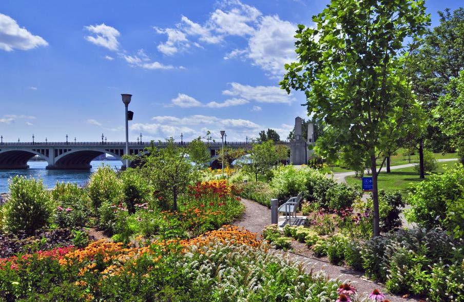
• Green space and connections to natural features: 517 acres of parkland distributed across 35 parks, such as Chandler Park, Pingree Park, Brewer Park, Sylvester-Seyburn Park, Latham Park, Hansen Park, and Dueweke Park; existing and proposed greenways; access to the riverfront and Belle Isle (Figure 2.4)
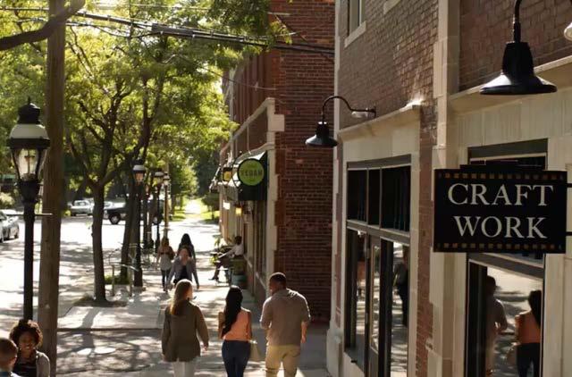
• Commercial activity: new businesses opening, particularly along Jefferson Avenue and Kercheval Street; shopping areas; high-traffic arterials including Gratiot Avenue, Mack Avenue, Jefferson Avenue, Warren Avenue, and Conner Street (Figure 2.5)
• Social and residential hubs: community development organizations (Figure 2.7); dense residential neighborhoods, including Chandler Park, East English Village, Indian Village, Islandview, Jefferson-Chalmers, Pingree Park, and West Village
• Institutional presence: 14 public schools; Wayne County Community College Eastern District; religious organizations; service centers including Samaritan Center and Northeast Guidance Center
Routes
Commercial Nodes
Commercial Development Multi-Family Investment Areas

Butzel Family Center

DLBA Community Partner Purchases


Health Center

Samaritan Center
Wayne County Community College
Figure 2.6: The LEAP area benefits from many assets.
Sources: City of Detroit, Parcel Map, 2017; City of Detroit Housing and Revitalization Department, Targeted Multifamily Housing Areas (aka 20-Minute Neighborhoods), 2017; Created from City of Detroit Planning and Development Department, Non-motorized Routes, 2016 & City of Detroit Planning and Development Department, Greenways, 2016; Data Driven Detroit, Detroit Churches 2011, 2011; Data Driven Detroit, Parks & Landmarks, Detroit, 2016; Data Driven Detroit, Schools Detroit2014, 2014; DLBA, Community Partner Sales, 2017; BSEED, Issued Building Permits, 2017; Created from Google, Imagery, 2017 & Google, Map Data, 2017; Hopkins, Church, 2017; Ivanov, Graduation, 2017; Michigan Department of Licensing and Regulatory Affairs (LARA), Federally Qualified Health Centers, 2017; Roberts, Sport Balls, 2017; Shlain, Health Care, 2017; Created from U.S. Census Bureau, TIGER/Line: All Roads, 2014 (see Appendix A)
Family Center


Since the first 2 phases of LEAP were published, more plans have taken shape that impact the LEAP area. LEAP Phase III may strive to integrate with them, or advocate for a different approach.
For example, in 2012, Detroit Future City (DFC) conceived a 50-year land use scenario for Detroit (Figure 2.8). Because of the large proportion of vacant land in the LEAP area, DFC emphasized open space over residential or commercial development. This was at odds with LEAP’s goals and many residents’ desires to see their neighborhoods stay in place, and DFC has since acknowledged LEAP’s approach in its work.
The City of Detroit has also begun work on several plans that may impact the LEAP area. Several targeted multifamily housing
Productive or Innovation Ecological land uses.
Source: Detroit Future City, The Land Use Element: The Image of the City, 2012
areas fall in the LEAP area. As of April 2017, the City is working with consultants to “develop and implement a comprehensive neighborhood, landscape, and Green Stormwater Infrastructure plan for Islandview and the Greater Villages,” the next step in the plan is to invest in these selected neighborhoods.1 A portion of East Jefferson Avenue within the LEAP area will also see improvements in 2017, aimed at increased pedestrian and cyclist safety.2
In addition, new projects and intended redevelopments are underway in the LEAP area. City agencies support many of these efforts. For example, the DLBA offers a Community Partnership Program, in which faith-based and community organizations can acquire vacant lots or structures owned by the DLBA for projects like “home rehabilitation projects, deconstruction projects, new
construction, lot beautification, community gardens, and pocket parks.”3 As of March 2017, community partners have made 157 purchases of lots in the LEAP area through this program, including 74 for the Mack-Ashland supportive housing project (Figure 2.9).
Though public entities own the largest number of properties in the LEAP area, private individuals and businesses are also undertaking projects and investments (Figure 2.10). The following own the most lots among private property owners in the LEAP area:
• Hantz Farms: a large urban hardwood tree farm, with additional proposed agricultural projects (1,901 lots)4
• New Far East Side: a proposed housing development on the border with Grosse Pointe Park, which has not materialized and remains vacant (538 lots)5
• Bert Dearing and associated businesses: a major residential landlord (240 lots)
• Michael Kelly and associated businesses: a land speculator based in Grosse Pointe Woods who invests in “specific properties needed for other plans” (93 lots)6
• Phoenix Enterprise of Michigan: operated by the Ellis family, who own about 30 acres of land around their businesses and the proposed Beltline (57 lots)
Legend
B&D/Dearing Kelly and Associates
Phoenix Enterprise of Michigan Hantz
New Far Eastside
Figure 2.10: Some large private property owners in the LEAP area cluster their properties for specific projects; others buy scattered sites for rental or speculative purposes.
Sources: City of Detroit, Parcel Map, 2017; U.S. Census Bureau, TIGER/Line: All Roads, 2014 (see Appendix A)
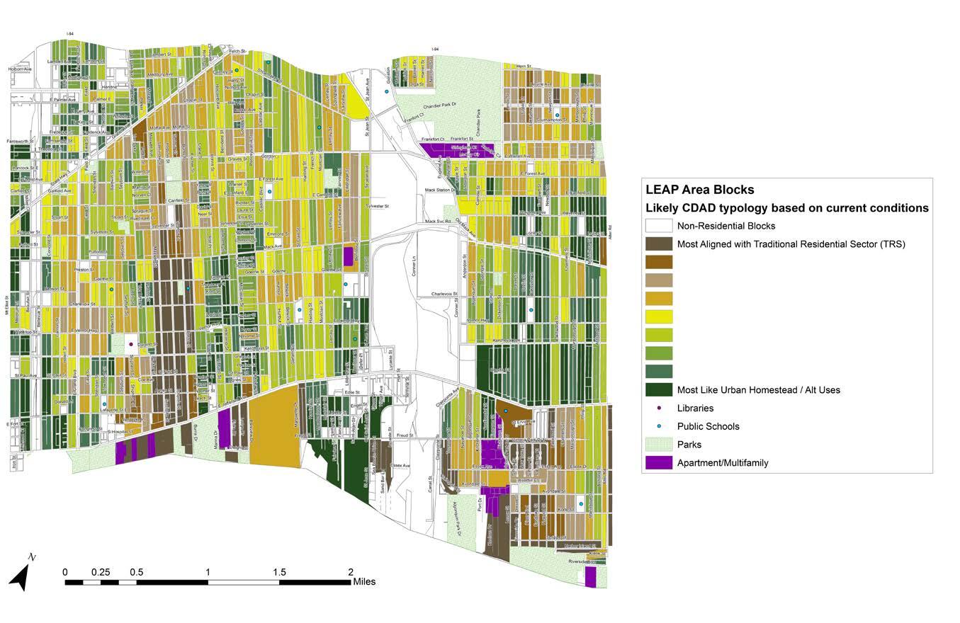
Figure 2.11: The LEAP area includes several sections that possess Traditional Residential characteristics, as well as areas that are more like Urban Homestead.
Sources: Created from Data Driven Detroit, Residential Typology Analysis, 2015 & LEAP area residents (see Appendix A)
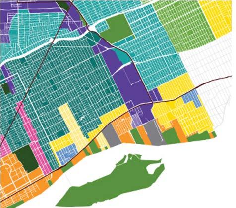
LEAP Phases I and II built on CDAD’s strategic framework, which combines many factors into a set of 10 neighborhood typologies (Figure 2.11; see Appendix B for descriptions). CDAD collaborated with Data Driven Detroit (D3) to analyze each block in Detroit and determine how closely it aligned with either the Traditional Residential Sector typology, or the Urban Homestead typology. The data for these typology maps included City of Detroit assessor data from 2013, U.S. Census data from 2010, American Community Survey 5-year estimates from 2008-2013, and the Motor City
Mapping survey from 2014 (see Appendix B for D3’s methods).7
In order to reflect the changes in the LEAP area since the data were collected, residents offered their input at LEAP quadrant meetings in March 2017, indicating which blocks may have experienced changes in condition in the intervening years.
Strategies to strengthen neighborhoods and transform vacant land within the LEAP area, discussed in the following sections, respond to these conditions.
1. City of Detroit Office of Contracting and Procurement, “Islandview/Greater Villages Request for Proposal, 2016.”
2. Robin Runyan, “Here’s what East Jefferson Avenue could look like soon,” Curbed Detroit, March 2, 2017, http://detroit.curbed.com/2017/3/2/14794900/east-jefferson-street-design-intersection.
3. “Community Partnership Program,” Detroit Land Bank Authority, accessed March 30, 2017, http://www.buildingdetroit.org/community-partnership-overview/.
4. “Hantz Farms Detroit,” Hantz Farms, accessed April 6, 2017, http://www.hantzfarmsdetroit. com/.
5. The Associated Press, “Six years later, site of proposed $258M Detroit housing project is a dumping ground,” MLive, April 14, 2011, http://www.mlive.com/news/detroit/index. ssf/2011/04/six_years_later_site_of_propos.html.
6. Michigan Radio Newsroom, “Gilbert owns downtown Detroit, but who owns the most private land in the whole city?” Michigan Radio, June 20, 2013, http://michiganradio.org/post/gilbertowns-downtown-detroit-who-owns-most-private-land-whole-city.
7. Data Driven Detroit, “Data Driven Detroit Residential Typology Analysis based on the Community Development Advocates of Detroit (CDAD) Strategic Framework Planning Process,” 2015 [Excel], received January 2017.
and
Goal
• Strengthen the Chandler Park neighborhood
Principles
• Rely on resident voices
• Improve quality of life
Strategies1
Strengthen Neighborhood Organizations
Reduce Blight
Encourage Green Stormwater Infrastructure (GSI)
Prevent Tax Foreclosures
Facilitate Home Repairs
Advocate for 20-Minute Neighborhood
Introduction
and 3.2). In addition, the neighborhood’s large park has seen recent investment due to efforts led by the Chandler Park Conservancy.3
An analysis of current conditions in the Chandler Park neighborhood, best practices, and engagement with LEAP area residents and ECN yielded guiding principles and strategies to support the goal of strengthening Chandler Park. This section will describe those strategies, and suggested projects and policies that can enable them.

LEAP Phases I and II sought to “stabilize active residential and commercial districts, which will in turn greatly improve the quality of life.”2 Given that Chandler Park has a higher concentration of traditional residential housing than many parts of the LEAP area and that much of the housing stock is in good condition, the LEAP Steering Committee saw LEAP Phase III as an opportunity to reinforce Chandler Park as an active residential district (Figures 3.1
Figure 3.1: The Chandler Park neighborhood sits in the northeast corner of the LEAP area on both sides of the park of the same name.
Sources: U.S. Census Bureau, TIGER/Line: All Roads, 2014 (see Appendix A)
The Chandler Park neighborhood possesses many characteristics of a strong residential neighborhood but faces some challenges related to vacancy and population loss (Figures 3.3 and 3.4).
Lack of financial resources is an obstacle for many Chandler Park residents. According to the 2011-2015 5-year American Community Survey estimate, per capita income in the neighborhood was $11,813, 21% lower than the citywide per capita income of $15,038.4
27% of residential structures in Chandler Park went through mortgage foreclosure between 2005 and 2013 (Figure 3.5).5
3.2: Chandler Park has many qualities of a strong residential neighborhood.
Figures 3.3 and 3.4: Although Chandler Park’s population continues to decline, the rate of loss is slowing. The housing vacancy rate in Chandler Park has also been increasing.
Sources: American Community Survey 5-year estimate, 2011-2015; United States Decennial Census, 2000; United States Decennial Census, 2010
Mortgage Foreclosures, 2005 - 2013
Figure 3.5: There were 249 mortgage foreclosures in Chandler Park between 2005 and 2013.
Source: City of Detroit, Parcel Map, 2017; Wayne County Register of Deeds, Detroit sales transactions, 2012-2013; Wayne County Register of Deeds, Detroit sales transactions, 2008-2011; Social Compact, Detroit sales transactions, 2005-2010; U.S. Census Bureau, TIGER/Line: All Roads, 2014 (see Appendix A)
Price
$90,000
$80,000
$70,000`
$60,000
$50,000
2005(60)
2006(51)2007(27)2008(13)2009(8)
Compact WCROD Zillow 2010(6)2011(12)2012(15)2013(19)2014(14)2015(19)2016(7)
Figure 3.6: Home sale prices in Chandler Park have been increasing but are still 50 percent of 2006 levels.
Sources: Wayne County Register of Deeds data 2008-2013; Social Compact Records 2005-2010; Zillow. com, 2017, Recent Sales, accessed March 2017
49% of housing units in Chandler Park were owner-occupied, according to the 2011-2015 ACS 5-year estimate. This is on par with the citywide rate of 48% and higher than the LEAP area rate of 40%, but a decrease from 51% in 2000, likely due to mortgage foreclosures and the recession.6
The median home sale price in Chandler Park decreased sharply starting in 2008, likely due to mortgage foreclosures and the recession; however, it began to increase again in 2012 (Figure 3.6).7
Figure 3.7: 75% of owner-occupied structures were in good condition, as compared to 68% of renter-occupied structures.
Sources: City of Detroit, Parcel Map, 2017; Motor City Mapping, Field investigation, February-March 2017
As of March 2017, 600 of 933 structures in Chandler Park (64%) were in good condition, and 246 were in fair condition (26%) (Figure 3.8). Owner-occupied structures were more likely than renter-occupied structures to be in good condition (Figure 3.7).8
Though many structures in Chandler Park are well-maintained, tax foreclosure is a threat to the neighborhood and its housing stock. As of April 2017, 118 properties in Chandler Park had been foreclosed for nonpayment of taxes, or were about to be.9 ECN has notified residents about foreclosure prevention measures.
Figure 3.8: Most structures in Chandler Park are in good condition.
Sources: City of Detroit, Parcel Map, 2017; Field investigation, February-March 2017; U.S. Census Bureau, TIGER/Line: All Roads, 2014 (see Appendix A)
Figure 3.9: Vacant lots are distributed throughout the Chandler Park neighborhood, with a high concentration in the Heights in the northwest corner.
Source: City of Detroit, Parcel Map, 2017; Field Investigation February-March 2017, data are available on Motor City Mapping; U.S. Census Bureau, TIGER/Line: All Roads, 2014 (see Appendix A)
The number of vacant lots in Chandler Park is increasing due to demolitions. These lots offer a chance to reimagine and strengthen the neighborhood with uses that will benefit residents. In March 2017, there were 411 vacant lots in Chandler Park (Figure 3.9).10
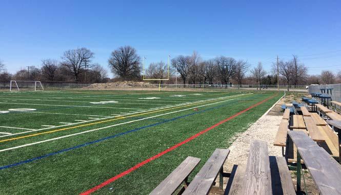
Assets in and around the Chandler Park neighborhood include churches, day care centers, an elementary-middle school, a public library, and 2 major commercial streets. Chandler Park’s recreational facilities have a regional draw, and have been bolstered by recent investments including a newly installed football field and tennis courts. The park also offers a multi-purpose sports field and opportunities for organized recreation.11

LEAP Phase III can support existing community organizations and neighborhood associations and advocate for more neighborhood groups and block clubs. Potential partners include the City of Detroit Department of Neighborhoods (in particular, the District Manager and Deputy District Manager for District 4) and Immanuel Lutheran Church. In addition to ECN, the following nonprofits, block clubs, and institutions serve the Chandler Park neighborhood (Figure 3.10):
• Chandler Park Conservancy: Provides education, recreation, and conservation opportunities for local residents12
• Chandler Park Neighborhood Association (CPNA): Advocates for neighborhood unity and beautification efforts in Chandler Park13
• Friends of Parkside: Convenes meetings and maintains an online presence to keep Villages at Parkside residents informed about job and volunteer opportunities and events in the neighborhood14
• Mayell-Newport Block Club: President Patricia Reid (LEAP Northeast Quadrant Leader)
• Villages of JW Finney: President Brenda Butler (LEAP Northeast Quadrant Leader)
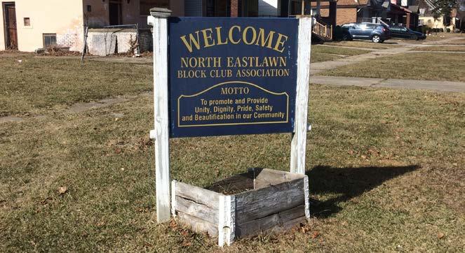
• North Eastlawn Block Club
• Drexel Heritage Block Club
• Lakeview Block Club
Strong block clubs enable residents to better organize and advocate for their needs. The City offers resources for residents to create block clubs in partnership with District Managers.15 Chandler Park has a few active block clubs, but not all are formally registered with the City.16 ECN could take the following actions:
• Organize new block clubs to increase resident representation throughout the neighborhood
• Organize an informal gathering spearheaded by the LEAP Northeast Quadrant Leaders such as a meet and greet with the District 4 Manager, CPNA, block club leaders, and partner organizations like ECN
• Create a Facebook page, add to the Chandler Park Nextdoor page, or create another online presence for new block clubs to inform residents of neighborhood events and initiatives
• Formally register block clubs and community organizations with the Department of Neighborhoods so residents can stay informed of upcoming meetings, announcements, and events, as well as be recognized by the City17
• Acquire Community Development Advocates of Detroit (CDAD) membership for block clubs, which provides joint memberships with Community Economic Development Association of Michigan (CEDAM), access to professional trainings and technical assistance, and an opportunity for further advocacy (ECN and CPNA are already members of CDAD)18
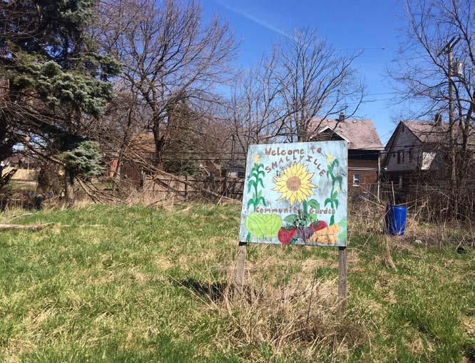
The Small Ville “Learning Farm” is a community farm located in the northwest portion of Chandler Park (referred to as the Heights) (Figure 3.11). Michelle Jackson, a Chandler Park resident and Executive Director of Sustainable Community Farms, runs the farm.
Small Ville provides opportunities for residents to access fresh food and to learn and volunteer alongside their neighbors.
• Educational Institutions: Ms. Jackson is already doing educational outreach. ECN could partner with Ms. Jackson to do the following: bring outdoor education to neighborhood schools in Chandler Park [Hamilton Elementary-Middle, Hutchinson Elementary, Wayne County Community College (WCCC), Michigan State University Extension-Center for Urban Food Systems]; coordinate with Ms. Jackson for the next Neighborhood Summit to be at the WCCC Eastern District location instead of downtown; host workshops on food access and farm-to-table resources.19
• Resident Engagement: Ms. Jackson accepts volunteers at her community farms. ECN could: encourage residents to volunteer with Small Ville Learning Farm; host a community event at the garden; publicize events in ECN newsletters and at ECN meetings.20
• Advisory Connection: Foster new and continued partnerships for neighborhood community gardens and farms with ECN, Michigan Community Resources (MCR), and Keep Growing Detroit (KGD). ECN could assist in the purchase or long term leasing of land. A partnership with KGD or MCR could help explore the potential of additional resources for community gardening.
ECN’s door-to-door surveys in Chandler Park could target areas where residents seem less connected. Surveying helps record existing social ties in the neighborhood and reveal opportunities for collaboration. Suggested survey questions:
• Please list 5 neighbors that you are most connected to and their approximate addresses.
• Do you attend neighborhood activities/events?
◦ (If yes) Who organizes these activities?
• What organizations would you like to be more engaged with?
• Are there any block clubs in your neighborhood?
◦ (If yes) What is the name of the group?
◦ (If yes) Is the group a formally registered block club?
• Where do neighborhood events and activities take place in the Chandler Park neighborhood?
These responses can help ECN to identify ways to connect ECN, residents, business owners, and other neighborhood organizations.
ECN and Small Ville Farm could coordinate a Neighborhood Day with ARISE Detroit!, as Ms. Jackson has already been involved with this event.21 Neighborhood Day is held each August in various locations across the city in partnership with community organizations and leaders.22
Eastside Community Network
Neighborhood Associations
Chandler Park Neighborhood Association
Other Contributing Organizations
Chandler Park Conservancy
Department of Neighborhoods
Detroit Land Bank Authority
Ensure Adoption of Neighborhood Organizational Structure
Having multiple levels of neighborhood representation can help in advocating for resident voices. Neighborhood associations can collectively represent block clubs, and each neighborhood association can have representatives on the board of a Community Development Organization (CDO) (Figure 3.12). This structure is reflected in the Grandmont Rosedale Development Corporation (Box 3.1). ECN can work with Building the Engine for Community Development in Detroit on policies to assist in capacity building.
Box 3.1: Grandmont Rosedale Development Corporation (GRDC)
The following neighborhood associations have representatives on the GRDC board:
• Grandmont Community Association
• Grandmont #1 Improvement Association
• Minock Park Block Association
• North Rosedale Park Civic Association
• Rosedale Park Improvement Association
Many parts of the area have block captains, who participate in the neighborhood associations.23

The Chandler Park neighborhood has many opportunities for open space projects (see Transforming Open Space chapter for examples). As the CDO in the proposed neighborhood organizational structure, ECN could reach out to departments working on open space and GSI projects, such as Detroit Water and Sewerage Department (DWSD), Parks and Recreation, Planning and Development, and Housing and Revitalization, to arrange meetings with residents where they can provide feedback to the departments. This may encourage the City to incorporate resident feedback into project decisions.
Allocate Additional CDBG Funding for Neighborhood Organizations
City government allocates funds from the U.S. Department of Housing and Development (HUD) to CDOs through the Community Development Block Grant (CDBG) subrecipient program. In the 2016-2017 fiscal year, ECN requested $225,000 of CDBG funding from the City of Detroit, but City officials recommended only 44% of their requested amount.24 CDOs like ECN contribute to neighborhood vitality and benefit from increased funding.

LEAP Phase III can call for demolitions and side lot leasing or purchasing to reduce blight in Chandler Park.
In March 2017, 67 structures in Chandler Park were in poor condition, and 20 were in need of demolition.25 19 of the structures needing demolition are not in the City of Detroit’s demolition pipeline (Figure 3.13). Of these 19 structures, 14 are owned by the Detroit Land Bank Authority (DLBA) (see Appendix D for addresses).26 A structure in the demolition pipeline (5826 Malcolm Street) is located next to a community garden and is a proposed site for a cistern to collect stormwater for the garden’s use. DLBAowned structures are eligible for the Hardest Hit Fund, which can pay for demolitions.27 In addition, the City can use fire escrow funds for demolitions if private owners had insurance when the structure burned.28
ECN can advocate for demolitions in Chandler Park in the following ways:
• Work with CPNA and District 4 Manager Letty Azar to advocate for the DLBA to move its properties into the demolition pipeline
• Work with Brian Farkas at the City of Detroit Building Authority to advocate for moving properties with fire escrow funds into the demolition pipeline
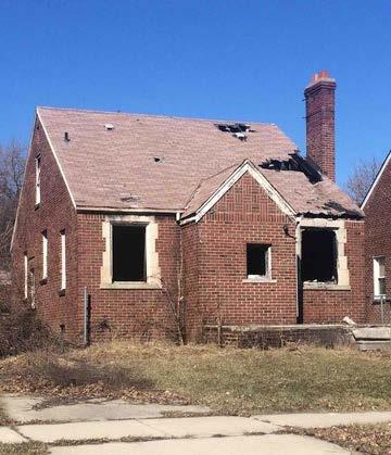
Figure 3.13: Some structures suggested for demolition are not in the demolition pipeline.
In order to increase use and maintenance of vacant lots, the DLBA offers residents the opportunity to purchase side lots next to their homes for $100 each. The DLBA sells these properties on a first come, first served basis. Priority is given to adjacent owners who already maintain the lot (Figure 3.14). Residents are required to maintain purchased side lots and pay all taxes.29
As of April 2017, there were 120 occupied structures in Chandler Park adjacent to a DLBA-owned vacant lot, representing
opportunities to encourage side lot purchases and transform potentially blighted vacant land (Figure 3.15). Residents may consider turning these side lots into community gardens, for example, which can encourage gardening and other beautification projects.
Advocate for Chandler Park to be Included in the New Side Lot Leasing Program
In addition to side lot purchases, ECN can encourage residents to lease lots. The DLBA plans to launch a pilot program called Your Neighborhood, Your Lot, encouraging residents to lease and improve vacant lots in their neighborhoods. These lots do not have to be located next to the lessee’s property. Program applicants must:
• Be approved by a neighborhood association or block club
• Be a Detroit resident
• Pay all taxes and be on schedule
• Pay a $75 fee for the 3-year term on the side lot30
In order to further strengthen this policy, ECN can advocate for lease terms to include right of first refusal for the lessee to purchase the lots or extend the lease. This will limit the DLBA’s ability to take back side lots to sell them at the end of the lease term, during which time a resident may have invested considerable effort in improvements.31
Chandler Park residents could benefit from this initiative by claiming and reusing vacant lots and involving neighbors in the process. Fewer unimproved vacant lots may lead to increased housing values and lower housing vacancy rates.
Figure 3.15: DLBA-owned vacant lots next to occupied structures show possible locations for side lot transfers (see Appendix E for addresses). Sources: City of Detroit, Parcel Map, 2017; Field investigation, February-March
ECN can partner with the Detroit Training Center (DTC) to enroll Chandler Park residents in DTC’s blight removal training program. This program costs $4,500 per individual; students can learn about funding qualifications at DTC’s free orientation. The training program provides students with:
• Licensing
• Credentials (e.g. first aid/CPR, lead abatement worker/ supervisor, aerial lift operator)
• Soft skills such as community building
• Future job placements32
ECN can encourage residents to participate in the Blight Removal Training Program to gain practical skills to use in the neighborhood. DTC also offers GSI contractor training.
Residents in Chandler Park neighborhood are likely to face rising stormwater drainage charges due to DWSD’s changing fee structure, especially residents whose properties contain larger proportions of impervious surface. Encouraging GSI in the neighborhood is one way to reduce runoff and possibly reduce charges to residents. In addition, advocating for GSI can facilitate the transformation of vacant land into assets.
Using vacant lots in Chandler Park neighborhood for GSI, including bioretention gardens, is an approach to reducing water runoff while simultaneously beautifying the area (Figure 3.16).
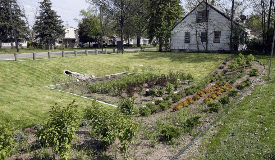
There are 411 vacant lots in Chandler Park, 332 of which are owned by the DLBA. Sites suitable for bioretention gardens have an area of at least 0.25 acre (may be a single lot or a group of adjacent lots), are owned by the DLBA, and are within 20 feet of a catch basin. Proximity to catch basins facilitates diverting water runoff, and the size requirement allows sufficient area for construction of gardens. Vacant lots in Chandler Park were analyzed based on these criteria, revealing 13 locations suitable for GSI, comprised of 47 total lots (Figure 3.17) (see Appendix F for addresses). Facilitating the transformation of vacant lots in Chandler Park could improve stormwater management and aesthetics, both of which play a role in improving quality of life.
ECN has funding for some small-scale GSI projects in Chandler Park. Additional funding is needed to implement more or larger projects, as bioretention gardens can cost up to $125,000.33 Potential funding sources can be found in the Implementation chapter of this plan.
The structure at 5826 Malcolm Street, adjacent to the Small Ville Farm, is scheduled for demolition. This is an opportunity to repurpose the foundation of the demolished structure for garden water storage, which is discussed in more depth in the Transforming Open Space chapter of this plan.
DLBA Owned Vacant Lots
Basins Suitable GSI Sites
Figure 3.17: 13 sites in Chandler Park are suitable for GSI projects.
Source: City of Detroit, Parcel Map, 2017; Field Investigation February-March 2017, data are available on Motor City Mapping; Tetra Tech, Catch basin and storm water data in LEAP area, 2017; Detroit Land Bank Authority, DLBA owned properties in LEAP area, 2017; U.S. Census Bureau, TIGER/Line: All Roads, 2014 (see Appendix A)
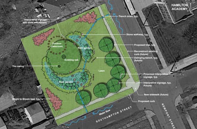
In April 2017, the Kresge Foundation granted $2 million for 17 neighborhood projects in Detroit. ECN received some of this funding for a rain garden learning lab near Hamilton Academy, the only public school in the Chandler Park neighborhood (Figure 3.18).34
Bioretention gardens are designed to retain stormwater before it infiltrates or is discharged downstream. This reduces the quantity
of water flowing off-site into the municipal stormwater system. Thus, residents living next to these gardens should receive drainage credits. If the bioretention gardens can manage peak flow, adjacent homeowners could receive up to 80% credit on their bills.35
Currently, homes may not receive a credit for adjacent bioretention gardens on DLBA-owned land. DWSD could allow for changes in how runoff is calculated to accommodate adjacent GSI benefits.36
In 2016, DWSD launched a drainage credit program. Customers who reduce the peak flow and volume of stormwater runoff on their property – by planting rain gardens or installing pervious pavement, for example – can earn credits to be applied to their bill.37
DWSD has not yet finalized residential drainage rates and policies on the fee structure. If residents are charged based on a planned 5-year rollout, starting at $125/impervious acre per month in 2017, the rate would reach $651/impervious acre per month by 2021. In this scenario, 85% of residential properties in Chandler Park would see an increase from the current base monthly drainage fee of $20.36 by 2021.38 Figure 3.19 shows the range of impervious acreage on residential parcels. ECN can identify those owners who might see a large increase in drainage fees and assist them by:
• Targeting homes most likely to see an increase with ECN’s $1,500 rain garden mini-grants
• Assisting in the construction of shared GSI on vacant lots
Source:
Figure 3.19: Impervious acreage reveals potential priority sites for GSI projects.
Sources: City of Detroit, Parcel Map, 2017; Field investigation, February-March 2017; Detroit Water and Sewerage Department, 2017; U.S.

In late 2015, 499 properties in the Chandler Park neighborhood were at risk of foreclosure for failure to pay property taxes. Of those that went into tax foreclosure, 24 were sold and 42 were unsold.39 The unsold properties were transferred to the DLBA.
As of April 2017, 118 properties had been foreclosed, or were about to be (Figure 3.20).40 These properties will be offered at auction in fall 2017 unless the owners arrange payments. Of those 118 properties, 59 were renter-occupied structures, 46 were owneroccupied, 4 were commercial properties, and 9 were vacant lots. Of the structures, 56 of the rental properties and 42 of the owneroccupied properties appeared to have people living in them in March 2017.41
ECN and partners can therefore take actions to reduce the number of property owners facing foreclosures and reduce their future tax burdens.
Several agencies provide outreach to residents aimed at preventing tax foreclosure. The Wayne County Treasurer publishes the tax foreclosure timeline and provides a list of properties at risk of foreclosure. ECN staff have canvassed to publicize tax foreclosure prevention workshops offered by UCHC. However, there is no single place in Chandler Park that provides comprehensive information about property taxes or tax foreclosure prevention. A resource center could provide such services combined with information and resources related to home repair (Box 3.2).
Partner with United Community Housing Coalition (UCHC) on Homeowner Workshops or Counseling Sessions
Many homeowners may not have correct documentation to indicate ownership. Workshops and counseling sessions could address these topics:
• Probate issues:
◦ Clear titles require clear transfers of property ownership from a decedent. Residents may inherit a property, but the estate will have to go through probate in the absence of a will.
• Proper documentation indicating owner occupancy:
◦ Ensure property owners have proper documentation stating ownership status, i.e. a legal title for the home in their name;
◦ Clarify the process of property purchase or transfer, i.e. a land contract does transfer ownership, but the buyer must also file a Property Transfer Affidavit to notify the local assessing office.42
Figure 3.20: 118 properties had been foreclosed, or were about to be, in Chandler Park as of April 2017.
Source: City of Detroit, Parcel Map, 2017; Wayne County Treasury, 2017 Wayne County Tax Foreclosure Risk, 2017; U.S. Census Bureau,
ECN can partner with United Community Housing Coalition (UCHC) to help residents reduce property tax burden through workshops and counseling sessions. Several policies assist lowincome homeowners with their property taxes, including:
• Poverty Exemption: If a property owner meets the federal poverty level, he/she is exempt from paying property taxes.43
• Principal Residence Exemption: A principal residence is exempt from the tax levied by a local school district for up to 18 mills.44
• Disabled Veteran’s Exemption: A disabled veteran, who has been determined as totally disabled and receives pecuniary assistance or is individually unemployable, is exempt from all property taxes.45
• Homestead Property Tax Credit: Citizens older than 65, paraplegic, hemiplegic and quadriplegic persons, the permanently disabled who are not over age 65, and eligible veterans can receive property tax credits.46
Retroactive poverty exemption would allow for property owners who meet poverty standards to be reimbursed for previous years’ property taxes. ECN could pursue this policy together with the City and other policy-focused organizations. For example, ECN could work with CDAD’s policy committees and UCHC to propose that the Department of Neighborhoods advocate with the mayor to lobby the legislature for the passage of retroactive poverty exemption.47
Property tax exemptions are available to senior citizens and the disabled in the State of Washington. If property owners meet the requirements of age, disability, and/or income, but did not receive exemptions previously, they “may be able to get the exemption 3 years retroactively…[and] a refund of taxes they already paid out.”48
Retroactive exemptions also exist in California. The disabled veterans’ exemption can be retroactively granted when “the exemption would have been available but for the taxpayer’s failure to receive a timely disability rating from the United States Department of Veterans Affairs (USDVA).”49

Many Chandler Park residents express an urgent need for home repairs, but these activities are often difficult to accomplish because of the high cost and time commitment (Figure 3.21). Although most structures in the neighborhood were in good condition, as of March 2017, 26% were in fair condition and 7% were in poor condition (Figure 3.22). This indicates that at least one-third of structures in Chandler Park need repair, and structures in good condition may also need to be repaired, or will require work in the future.
Homeowners can get help paying for repairs, but applying for financial assistance can be overwhelming, and available funding is limited. ECN can partner with U-SNAP-BAC to hold workshops for residents of Chandler Park who need home repairs. These sessions would focus on the details, eligibility requirements, and application process for funding sources. Follow up sessions might include one-on-one application assistance. Funding sources include:
◦ The City lends this money directly to homeowners in amounts ranging from $5,000 to $25,000. Home Repair Loans are funded by CDBG funds, through a partnership between the City, Local Initiatives Support Corporation (LISC), and Bank of America.
◦ Applicants must be homeowners who have resided in their house for at least 6 months, and are current on homeowners insurance and property taxes.


Figure 3.21: Material cost estimates for selected home renovations demonstrate potential financial barriers to repairs.
Source: Josh Bails, Sarah Clark, Fan Fan, Nicholas Fazio, Seul Lee, Evan Markarian, Jamie Simchik, and Xiang Yan, Stabilizing MorningSide Housing Renovation Guide (University of Michigan Urban and Regional Planning Program), 2015
Figure 3.22: Many structures in Chandler Park are in good condition, but about ⅓ are in visible need of repairs.
Source: City of Detroit, Parcel Map, 2017; Field investigation, February-March 2017; U.S. Census Bureau, TIGER/Line: All Roads, 2014 (see Appendix A)
◦ Chandler Park falls in a designated target area, meaning that homeowners of any income in the neighborhood are eligible to apply.
◦ Loans carry no interest, but applicants must be in a financial position to repay the principal.50
• Michigan State Housing Development Authority (MSHDA) Property Improvement Program Loans
◦ MSHDA-approved Participating Lenders or Community Agents loan homeowners up to $25,000 for repairs.
◦ Applicants must be homeowners with a household income of $105,700 or lower, and a credit score of at least 620. Loans must be used for the applicant’s primary residence.
◦ Loans are offered on terms up to 20 years, and interest rates vary based on household income (ranging from 4% to 8%).51
• Neighborhood Impact Program (NIP) Grants
◦ NIP grants are offered by the Federal Home Loan Bank of Indianapolis, through participating members Fifth Third Bank and Chemical Bank in Detroit.
◦ Grants are available for up to $7,500.
◦ Applicants must be homeowners at or below 80% of area median income (AMI), who have resided in their homes for at least 18 months.52
• Liberty Bank Home Restoration and Acquisition Program
◦ This program offers non-traditional mortgages that can be used for the purchase and rehabilitation of homes in Hardest Hit Priority Neighborhoods, in amounts up to $15,000.
◦ Borrowers must occupy the home as their primary residence and complete a homebuyer’s education program.53
• FirstMerit Corporation Down Payment Assistance Program
◦ FirstMerit loans up to $30,000 for the purchase and rehabilitation of homes bought from the DLBA.
◦ Debt is forgiven for homeowners who stay in their house for 5 years.
◦ Borrowers must complete a financial literacy course.54
• Traditional Private Bank Loans
◦ In 2015, Chandler Park residents took out 8 loans for home repair and 4 for refinancing, which are sometimes used to pay for repairs.55
Advocate for the City to Allocate HUD Funding to Repair Grants
The City’s Housing and Revitalization Department directs some funds received from HUD to help pay for home repairs, largely through 0% Home Repair Loans. However, the City may also use CDBG or HOME Investment Partnerships Program (HOME) funds for individual home repair grants that do not need to be repaid. ECN and other neighborhood groups can organize to advocate that the city allocate funding in this way. ECN may receive these grants, and can then distribute funding to residents.56 In previous years, more funding was available for repair grants, and continuing resident advocacy may help make the case for reallocation. However, due to limited HUD funding, this is likely a long-term effort. Linking home repair grants to the mayor’s goal to retain residents in Detroit may be an effective strategy.
Home repair requires materials and information that are not always easily accessible. Residents could visit a neighborhood home resource center to borrow tools, learn more about funding opportunities, or select a trusted contractor to hire. The center could also provide financial literacy counseling related to tax foreclosure prevention (Box 3.2).
Chandler Park residents need easy access to resources to maintain their homes. A neighborhood home resource center could focus on tax foreclosure prevention and home repairs, 2 major areas of concern. Through a combination of digital platforms and a physical space for residents to visit and call, this center may provide:
• Financial literacy counseling focused on tax foreclosure prevention with volunteers from UCHC—also a first step in helping residents apply for home repair funding
• Information on the tax foreclosure timeline and a place for homeowners to look up whether their property is at risk of foreclosure
• Connection to a tool lending library, such as Retool Detroit, which is planned to open in late 2017 at the Jefferson branch of the Detroit Public Library
By partnering with UCHC, ECN can distribute important information to renters about how they can exercise their rights if landlords are not keeping properties in good condition.
• List of vetted contractors. Brick + Beam Detroit is developing this resource, which will be publicly available online. The center could provide a physical copy of this list and accept feedback from residents who have worked with those listed to pass on to Brick + Beam
• Skillshare opportunities, where neighbors can exchange services with one another, including home repairs. These may be posted online as well as in physical form
• Space for workshops related to foreclosure prevention and home repair (e.g. funding assistance, tenants’ rights, ownership documentation). Some sessions may be combined into multi-part workshops, for example, when home repair financing is contingent on financial literacy training
A Chandler Park center might be located at a publicly accessible space like the ECN office, Immanuel Lutheran Church, or a public library (such as the Chandler Park or Jefferson branch). ECN could lead the effort with support from organizations mentioned above.
Partnerships between ECN and local repair- and constructionfocused organizations can provide more in-depth training to residents, which would enable them to perform repairs in the neighborhood and to gain new job skills. Several organizations in Detroit offer related training and education, and may be potential collaborators for regular neighborhood workshops:
• Detroit Training Center (DTC)
◦ DTC is planning to open a second location on the Eastside, and intends to collaborate with ECN on outreach to residents.
◦ Homeowner workshops train attendees in home repair skills and are offered at $35 per session per participant.57
• Detroiters Working for Environmental Justice (DWEJ)
◦ DWEJ’s Workforce Development Program trains residents for jobs in construction and environmental industries, including certifications in skills like asbestos removal, weatherization, deconstruction, and more.58
• Brick + Beam Detroit
◦ Brick + Beam is open to partnering with ECN for workshops focused on a geographic area, such as Chandler Park, and/or a specific repair topic, which can be chosen based on resident priorities.
◦ Repair workshops can be held at residents’ homes who need specific work done, in line with the workshop topic.59
Brick + Beam brings a number of home repair resources to Detroiters, including an online Q&A forum, skill workshops, and social events. This project typically offers workshops free of charge, and classes fill up very quickly. Participants can learn skills such as asbestos and lead abatement, masonry repair, and weatherization. Informational sessions have also focused on topics like navigating homeowners’ insurance and acquiring vacant houses for rehabilitation.60
The City requires landlords to register rental properties, which are then subject to an annual inspection by the Building, Safety Engineering and Environmental Department (BSEED). If a rental property passes inspection and the landlord is current on property taxes, the landlord will receive a Certificate of Compliance, indicating the property is safe for occupancy.61 Due to the large number of rental properties in Detroit, enforcement and inspection of all properties is infeasible for BSEED. To address this problem, the Center for Community Progress recommends increased communication between BSEED and residents and neighborhood groups to identify rental properties that may not be up to code and advocate for enforcement (Figure 3.23).62 A field investigation revealed rental properties in Chandler Park that are in fair or poor condition (see Appendix G).63 ECN could accept anonymous reports from tenants on housing condition and work with block clubs to compile addresses of properties that may not be compliant.
Renter-Occupied, Suggested Demolition Renter-Occupied, Poor Condition
Figure 3.23: 73 rental properties in Chandler Park are in fair condition, and 17 are in poor condition.
Sources: City of Detroit, Parcel Map, 2017; Field investigation, February-March 2017; U.S. Census Bureau, TIGER/Line: All Roads, 2014 (see Appendix A)
The City has begun increased enforcement and outreach in selected pilot neighborhoods, of which Chandler Park is not one. Organized resident advocacy for maintenance of rental properties could push the City to prioritize these programs in Chandler Park.
Although a neighborhood home resource center would start small, Cleveland Heights’ Home Repair Resource Center shows what such a center could become.
Home Repair Resource Center (HRRC) offers financial counseling, skills training, and access to information about home repairs, particularly for low- and moderate-income and senior homeowners in Cleveland Heights and surrounding communities. HRRC offers a tool lending library, repair classes, homebuyer counseling, and access to a resource library including contractor evaluations and physical and digital information on repair specifications. Some programming is aimed specifically at seniors and women. The organization’s revenue and support in 2015 totaled $398,000, of which 61% comes from grants and 22% from donations.64

The City of Detroit is piloting 20-minute neighborhood investment projects throughout the City. A 20-minute neighborhood is “an active, safe, walkable, convenient, predominantly residential neighborhood” with day-to-day goods and services available within a 20-minute walk or bicycle ride.65 In 2016, Detroiters made 71.6% of their purchases outside of their 20-minute neighborhood boundary. In recent years, Detroit residents have seen slight improvements in their access to desired merchants.66 However, residents of Chandler Park and the rest of Detroit can continue to advocate for more accessible amenities.
The City of Detroit seeks to advance the following principles in targeted 20-minute neighborhoods:67
Strengthen density, increase affordable housing, and rehabilitate present structures
Leverage assets already present, like churches and recreational centers
Better connect and expand mobility options
Retail + Commercial + Institutional
Identify the gaps, workforce potential, and development opportunities68
Figure 3.24: The City of Detroit Planning and Development Department identifies 4 guiding principles for the 20-minute neighborhood philosophy. Sources: City of Detroit, Planning & Development Department Presentation, “Neighborhood Planning : Islandview / Greater Villages”, March 2017
The City has begun a planning process in one investment area in the LEAP area, the Greater Villages/Islandview, and expects to do the same in Jefferson-Chalmers in 2017-2018. Chandler Park already has economic and social characteristics that make it a viable choice as another 20-minute neighborhood (Figure 3.25). Another opportunity to include more residents in investment areas would be to expand the Greater Villages area boundary north to Gratiot and Gratiot Woods, and west to East Grand Boulevard.
Make the Case for the Chandler Park Neighborhood as the City’s Next Investment Area
By highlighting assets, drawing comparisons to selected investment areas, and proposing future improvements, ECN can advocate for the City to invest in Chandler Park as a 20-minute neighborhood.
• Chandler Park has many assets that could qualify it as a 20-minute neighborhood:
◦ Housing structures are in good condition (64% of structures in good condition).69
◦ Chandler Park is a large park with a regional draw, one of 4 parks in Detroit that is larger than 200 acres.70
◦ The Samaritan Center, just west of Conner Street, is home to Incite Focus L3C, a fabrication academy that offers hands-on learning and social services. See Figure 3.25 for additional resources and amenities.
Legend


Childcare
Church
Community Farm
Grocery Store

Health Clinic
Library

School
Park
20-Minute Neighborhood Boundary
Commercial Development
Commercial Nodes
Samaritan Center
Wayne County Community
College
Arterials
Bus Route
Chandler Park Drive
Foot Bridge
Non-Motorized Route
Figure 3.25: Chandler Park neighborhood already has many assets within a 20-minute walk.

Source: Michigan Department of Licensing and Regulatory Affairs (LARA), Federally Qualified Health Centers, 2017; City of Detroit, Parcel Map, 2017; Created from City of Detroit Planning and Development Department, Non motorized Routes, 2016 & City of Detroit Planning and Development Department, Greenways, 2016; Data Driven Detroit, Detroit Churches 2011, 2011; Data Driven Detroit, Parks & Landmarks, Detroit, 2016; Data Driven Detroit, Schools Detroit2014, 2014; BSEED, Detroit Building Permits, 2017; Google, Imagery, 2017; Google, Map Data, 2017; Hopkins, Church, 2017; Ivanov, Graduation, 2017; Roberts, Sport Balls, 2017; Shlain, Health Care, 2017; Iconsphere, Flower, 2017; Khoon Lay, Baby Playing Foam Mat, 2017; Bilotta, Shopping Cart, 2017; Novalyi, Library, 2017; Created from U.S. Census Bureau, Wayne County, All Roads, 2014; United Way of Southeast Michigan’s Regional Resource Center, Child Care Providers, 2014; Field investigation, February-March 2017; Data Driven Detroit, Grocery Stores, 2015 (see Appendix A)
◦ Mobility options include non-motorized routes to the east and west of Chandler Park Drive, and proximity to main arterials of Conner Street and Warren Avenue, bus routes, and I-94. Foot bridges exist across I-94 which may be affected by the freeway expansion.
◦ Retail, commercial and institutional presence includes 2 main commercial corridors along Conner Street and Mack Avenue within a 20-minute walk of the neighborhood. Additionally, Wayne County Community College Eastern District is just west of Conner Street.
• Chandler Park has qualities similar to those of the Fitzgerald neighborhood, a selected 20-minute neighborhood. These similarities can highlight the rationale for the City to invest in Chandler Park.
◦ Fitzgerald has received a $4 million grant through Reimagining the Civic Commons, which the City will match.71 Similarly, Chandler Park Conservancy has assisted in acquiring millions of dollars to invest in new recreational facilities and increased sports programming at Chandler Park (Figure 3.26).72
◦ Fitzgerald is anchored by Marygrove College and the University of Detroit Mercy. Nearby commercial corridors are along Livernois and McNichols.73 Similarly, Chandler Park is adjacent to Wayne County Community College Eastern District and the Samaritan Center, and includes Hamilton Academy elementary and middle school.74 Nearby commercial corridors to Chandler Park include Warren Avenue, Mack Avenue and Conner Street. The Warren Avenue commercial corridor in Chandler Park is comparable to the East Jefferson Avenue commercial corridor in Jefferson-Chalmers, which is also a city investment area.75
◦ Plans for Fitzgerald include the creation of a greenway, a 2-acre park, the rehabilitation of 115 structures, and the transformation of 192 vacant parcels into landscaped gardens.76 Chandler Park already has adequate housing density and good housing structure conditions. 35 structures in Chandler Park are owned by the DLBA and in either good or fair condition. These structures are an opportunity for rehabilitation. Additionally, Chandler Park offers multiple recreational activities for youth and families including organized walking groups, soccer, football, golf, cheerleading, softball, t-ball, tennis, and an aquatic center.77
• Numerous opportunities exist to capitalize on the 20-minute designation. Potential future projects might include:
◦ Preserve good housing structures with home repair services, blight reduction interventions and tax foreclosure prevention strategies. City investment in multi-family homes in Chandler Park, close to Wayne County Community College, could provide affordable housing and encourage a residential campus.
◦ Create a community land trust. ECN is considering this approach to maintain affordable housing and mitigate displacement of current residents.78
◦ Create a community tech center. ECN is looking to enhance resources and amenities to provide workshops for residents.
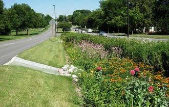
◦ Transform the Chandler Park Drive streetscape with increased access for non-motorized transportation to better connect residents to main arterials. Additionally, GSI along the center median could reduce flooding and beautify the neighborhood (Figures 3.27 and 3.28).
◦ Invest in commercial fronts along Conner Street and Warren Avenue. ECN could partner with Motor City Match to bring more businesses to these corridors.
1. Foreclosure icon, “Foreclosure” by Luis Prado from the Noun Project; 20-min icon, from www. knowtrans.org; Neighborhood organizations icon, by Peter van Driel from the Noun Project; Reduce blight icon, “Home Repair” by BomSymbol from the Noun Project. Home repair icon, by b farias from the Noun Project; Project icon, “Shovel” by Adam Simpson from the Noun Project; Policy, from www.villanyiborfesztival.hu/vorosbor/informaciok/hazirend
2. LEAP, Reinventing Detroit’s Lower Eastside: A Summary Report of the Lower Eastside Action PlanPhase II (Detroit: Warren/Conner Development Coalition, October 2012), 3.
3. Rochelle Riley, “Chandler Park to rise again with $20M makeover,” Detroit Free Press, February 16, 2015, http://www.freep.com/story/news/columnists/rochelle-riley/2015/02/15/chandlerparks-million-makeover/23471197/
4. U.S. Census Bureau, “Per Capita Income,” in 2011-2015 American Community Survey (Washington D.C.: U.S. Census Bureau’s American Community Survey Office, 2015).
5. Foreclosure data was obtained from the Wayne County Register of Deeds for the years 20082013, and from Social Compact for the years 2005-2010. A property was considered foreclosed if it was listed in either source, and overlapping records were deferred to Social Compact; Detroit Data Collaborative, “Detroit Residential Parcel Survey “[Excel], 2009, accessed April 21, 2017 from http://detroitparcelsurvey.org/; Wayne County Register of Deeds, Detroit sales transactions [Excel], 2012-2013, received from Data Driven Detroit; Wayne County Register of Deeds, Detroit sales transactions [Excel], 2012-2013, received from Michigan Community Resources; Social Compact, Detroit sales transactions [Excel], 2005-2008, received from Michigan Community Resources.
6. U.S. Census Bureau, “Tenure,” in 2000 Census (Washington D.C.: U.S. Census Bureau, 2000); U.S. Census Bureau, “Tenure,” in 2011-2015 American Community Survey (Washington D.C.: U.S. Census Bureau’s American Community Survey Office, 2015).
7. The sales data in 2008 and 2009 are from 2 different datasets, so the number of sales represents the average number of sales between the datasets.
8. Field investigation, February-March 2017, data are available on Motor City Mapping. The Detroit Parcel Map includes assessor’s data, which was used to determine tenure by comparing taxpayer addresses to property addresses. If the addresses matched, the structure was assumed to be owner-occupied, though the assessor’s “owner” field is not 100% accurate.
9. Wayne County Treasurer, properties foreclosed for nonpayment of taxes [Excel], April 2017, retrieved April 2017 from Loveland Technologies.
10. Field investigation, February-March 2017, data are available on Motor City Mapping.
11. “Fund A Project,” Chandler Park Conservancy, accessed April 13, 2017, https://www. chandlerparkconservancy.org/fund-a-project.
12. “Chandler Park Conservancy,” Chandler Park Conservancy, accessed April 17, 2017, https:// www.chandlerparkconservancy.org/.
13. “Chandler Park Neighbors and Partners Association,” Neighborhood Exchange, accessed April 17, 2017. http://www.neighborhood-exchange.com/network/chandler-park-neighbors-partnersassociation/.
14. “Friends Of Parkside,” Friends of Parkside (FOP), accessed April 17, 2017, http:// friendsofparkside.org/.
15. “Join a Block Club,” City of Detroit Department of Neighborhoods, accessed April 17, 2017, http://www.detroitmi.gov/Detroit-Opportunities/Improve-Your-Neighborhood/Join-A-BlockClub.
16. Patricia Reid (Chandler Park resident and LEAP Northeast Quadrant Leader), interview by authors, April 13, 2017.
17. One can formally register block clubs and community organizations using the Department of Neighborhoods Block Club Starter kit and filling out a Community Organization Registration Form: http://www.detroitmi.gov/Portals/0/docs/Neighborhoods/ BlockClubStarterKit2014Public.pdf. Forms should be emailed or mailed to the District 4 Manager.
18. “Membership,” Community Development Advocates of Detroit, accessed April 17, 2017, http:// cdad-online.org/membership/; CDAD membership registration requires downloading and completing the Membership application: http://cdad-online.org/wp-content/uploads/2012/02/ CDAD_Membership_Application_2014_original-form_distributed-1.pdf. Further memership application instructions can be found at http://cdad-online.org/membership/becoming-a-cdadmember/.
19. “Small Ville Learning Farms,” last modified April 18, 2017, https://sites.google.com/a/ smallvillefarms.com/www/
20. Sign up for volunteer opportunities at Small Ville farm by emailing: volunteer@smallvillefarms. com or michelle.jackson@smallvillefarms.com.
21. “Small Ville Learning Farms.”
22. “Arise Detroit,” ARISE Detroit, accessed April 17, 2017, http://www.arisedetroit.org/.
23. “Grandmont Rosedale Development Corporation,” Grandmont Rosedale Development Corporation, accessed April 17, 2017, http://grandmontrosedale.com/.; “Home - My Grandmont Rosedale,” My Grandmont Rosedale, accessed April 20, 2017, http:// mygrandmontrosedale.org/.
24. City of Detroit, FY 2016-17 CDBG Public Services & Public Service Homeless, PFR and Commercial Facade Proposal Ranking Summary (Detroit: City of Detroit, April 2016), http://www.detroitmi.gov/Portals/0/docs/Legislative%20Policy%20Reports/City%20 Planning%20Commission/FY%202016-2017%20CDBG-NOF%20FUNDING%20 RECOMMENDATIONS_rev.4-18-16.pdf?ver=2016-05-12-112237-743.
25. Field investigation, February-March 2017, data are available on Motor City Mapping. Though none of the structures suggested for demolition appeared to be occupied, occupancy status should be verified before advocating for demolition.
26. City of Detroit, 2017, Demolition Pipeline [Excel], retrieved April 17, 2017 from https://data. detroitmi.gov/Property-Parcels/Demolition-Pipeline/m5mj-ruj3; Detroit Land Bank Authority, February 10, 2017, DLBA owned properties in LEAP area [Excel], received February 14, 2017 from DLBA
27. “Hardest Hit Fund/Demolition,” Detroit Land Bank Authority, accessed April 10, 2017, http:// www.buildingdetroit.org/our-programs/hardest-hit-funddemolition/.
28. “Fire Insurance Withholding FAQ,” Michigan Department of Insurance and Financial Services, accessed April 13, 2017, http://www.michigan.gov/difs/0,5269,7-303-13648_60666_77179--,00.html.
29. “Side Lot Rules,” Detroit Land Bank Authority, accessed April 7, 2017, http://auctions. buildingdetroit.org/sidelots/home/Rules.
30. “Purchase a Side Lot,” Detroit Land Bank Authority, accessed April 7, 2017. http://auctions. buildingdetroit.org/sidelots/Home.
31. Orlando Bailey (Manager of Business and Resident Development, Eastside Community Network), interview by authors, April 12, 2017.
32. “Blight Removal Training Program,” Detroit Training Center, accessed April 5, 2017, http:// detroittraining.com/blight-removal/.
33. Donna Givens (CEO/Executive Director, Eastside Community Network), interview by authors, March 20, 2017.
34. “$2 million from Kresge supports 17 projects in neighborhoods across Detroit,” Kresge Foundation, last modified April 17, 2017, http://kresge.org/news/2-million-kresge-supports-17projects-neighborhoods-across-detroit.
35. Joan Nassauer (Professor, University of Michigan School of Natural Resources and Environment), interview by authors, March 5th, 2017.
36. Libby Levy (Community and Economic Development Professional, ProSeeds LLC, Detroit), interview by authors, April 7th, 2017.
37. “Drainage,” City of Detroit, accessed April 9, 2017, http://www.detroitmi.gov/drainage.
38. Tetra Tech, Catch basin and storm water data in LEAP area [Excel], received April 1st, 2017 from Tetra Tech.
39. Wayne County Treasurer, 2016 Wayne County tax foreclosure auction [data file], retrieved February 2017 from https://makeloveland.com/2016/mi/wayne/detroit#b=neighborhoods.
40. Wayne County Treasurer, properties foreclosed for nonpayment of taxes [Excel], April 2017, received April 2017 from Loveland Technologies.
41. Ibid; City of Detroit, Parcel Map [shapefile], 2017, retrieved January 2017 from https://data. detroitmi.gov/Property-Parcels/Parcel-Map/fxkw-udwf; Field investigation, February-March 2017, data are available on Motor City Mapping.
42. Michigan State Tax Commission, Transfer of Ownership Guidelines (Lansing: State of Michigan, December 2014), https://www.michigan.gov/documents/treasury/ TransferOwnershipGuidelines_423898_7.pdf.
43. Michigan Consolidated Laws (MCL) 211.7u
44. Michigan Consolidated Laws (MCL) 211.7cc
45. Michigan Consolidated Laws (MCL) 211.7b
46. Michigan Homestead Property Tax Credit Claim MI-1040CR
47. State Representative Wendell Byrd (D-House District 13) introduced a bill in the State House in December 2015 that would allow for retroactive homestead poverty exemptions in Michigan, but it has not moved forward in the legislature (House Bill 5179).
48. “Property Tax Exemptions for Senior Citizens and Disabled People,” Northwest Justice Project, last modified May 2014, http://www.washingtonlawhelp.org/resource/property-tax-exemptionsfor-senior-citizens-a?ref=ZxXdq.
49. California State Board of Equalization, Legislative Division, Property Tax Legislation 2000 (Sacramento: State of California, 2000), https://www.boe.ca.gov/legdiv/enact/ptleg/00PTLEG. pdf .
50. “0% Interest Home Repair Loans,” City of Detroit Planning & Development Department, accessed April 7, 2017, http://www.detroithomeloans.org/.
51. “Home Improvement Loans for Homeowners,” Michigan State Housing Development Authority, accessed April 7, 2017, http://www.michigan.gov/ mshda/0,4641,7-141-45866_47906_49317---,00.html.
52. “Neighborhood Impact Program,” Federal Home Loan Bank of Indianapolis, accessed April 16, 2017, https://www.fhlbi.com/products-services/communities-and-housing/NIP; Linda Smith (Executive Director, U-SNAP-BAC, Detroit), interview by authors, April 11, 2017.
53. “Home Restoration and Acquisition Program,” Liberty Bank, accessed April 16, 2017, https:// www.libertybank.net/community/detroit.cfm.
54. FirstMerit Corporation, “FirstMerit Bank Partners with Detroit Land Bank On Homebuyers
Down Payment Assistance Program,” PR Newswire, September 15, 2015, http://www. prnewswire.com/news-releases/firstmerit-bank-partners-with-detroit-land-bank-on-homebuyersdown-payment-assistance-program-300143220.html.
55. Consumer Financial Protection Bureau, Home Mortgage Disclosure Act [Excel], 2015, accessed March 13, 2017 from https://www.consumerfinance.gov/data-research/hmda/explore.
56. Department of Housing and Urban Development (HUD), “Homeowner Rehabilitation Activities,” in Building HOME: A HOME Program Primer (Washington D.C.: HUD, February 2012), https://www.hudexchange.info/resource/2368/building-home-a-home-program-primer/.
57. Marcus Jones (President, Detroit Training Center), interview by authors, April 5, 2017.
58. “Workforce,” Detroiters Working for Environmental Justice, accessed April 11, 2017, https:// dwej.org/workforce/.
59. Emilie Evans (Brick + Beam Detroit), interview by authors, March 28, 2017.
60. “Brick + Beam Detroit,” Brick + Beam Detroit, accessed March 29, 2017, https://www. brickandbeamdetroit.com; Evans, 2017.
61. “Quick Steps to Obtain a Certificate of Compliance,” City of Detroit, accessed April 16, 2017, http://www.detroitmi.gov/How-Do-I/Apply-for-Permits/Property-Maintenance-Information/ Quick-Steps-to-Obtain-a-Certificate-of-Compliance.
62. Center for Community Progress (CCP), Building an Effective Rental Registration and Certification Program to Strengthen Detroit’s Neighborhoods (Flint: CCP, 2016).
63. The Detroit Parcel Map includes assessor’s data, which was used to determine tenure by comparing taxpayer addresses to property addresses. If the addresses matched, the structure was assumed to be owner-occupied, though the assessor’s “owner” field is not 100% accurate. Properties that were not determined to be owner-occupied or publicly owned were assumed to be renter-occupied.
64. “Mission,” Home Repair Resource Center (HRRC), accessed April 8, 2017, http://hrrc-ch.org/ about-us/mission/; HRRC, Growing Stronger, Building Together: Home Repair Resource Center 2015 Annual Report (Cleveland Heights, OH: HRRC, 2015), http://www.hrrc-ch.org/wpcontent/uploads/2012/07/2015-HRRC-Annual-Report.pdf.
65. Robin Boyle, “Could the 20-minute neighborhood work in Detroit?” Detroit Free Press, June 14, 2016, http://www.freep.com/story/opinion/contributors/2016/06/14/could-20-minuteneighborhood-work-detroit/85847554/.
66. Diana Farrell, Lindsay Relihan, and Marvin Ward, Going the Distance: Big Data on Resident Access to Everyday Goods (New York: JP Morgan Chase & Co. Institute, March 2017), https://www. jpmorganchase.com/corporate/institute/document/institute-access-to-consumption-brief.pdf.
67. City of Detroit Planning and Development Department, Neighborhood Planning : Islandview / Greater Villages (Detroit: City of Detroit, 2017), http://detroitmi.gov/Portals/0/docs/ Planning/East%20Region/IVGV/2017March_%20IslandviewVillagesPlanningIntro_ sm.pdf?ver=2017-03-31-113200-583; Alexa Bush (Senior City Planner, City of Detroit Planning and Development Department), interview by authors, April 8, 2017.
68. The City of Detroit uses Motor City Match to connect businesses to real estate opportunities; “Motor City Match,” Motor City Match, accessed April 22, 2017, http://www.motorcitymatch. com/.
69. Field investigation, February-March 2017, data are available on Motor City Mapping.
70. “About,” Chandler Park Conservancy, accessed April 7, 2017, https://www. chandlerparkconservancy.org/about1.
71. Robin Runyan, “Fitzgerald neighborhood to receive $4M grant through ‘Reimagining the Civic Commons’,” Curbed Detroit, September 9, 2016, http://detroit.curbed. com/2016/9/9/12851612/fitzgerald-detroit-neighborhood-grant-civic-commons; “Detroit,” Reimagining the Civic Commons, accessed March 31, 2017. http://civiccommons.us/detroit/.
72. Rochelle Riley, “Chandler Park to rise again with $20M makeover.”
73. Runyan, “Fitzgerald neighborhood to receive $4M grant through ‘Reimagining the Civic Commons.”; “Detroit,” Reimagining the Civic Commons.
74. Field investigation, February-March 2017, data are available on Motor City Mapping.
75. Givens, 2017.
76. Bush, 2017; Kirk Pinho, “Fitzgerald neighborhood’s $4 million-plus project to be led by The Platform, Century Partners,” Crain’s Detroit Business, April 5, 2017,, http://www.crainsdetroit. com/article/20170405/NEWS/170409919/fitzgerald-neighborhoods-4-million-plus-project-tobe-led-by-the.
77. Reid, 2017; “Recreation,” Chandler Park Conservancy, accessed April 7, 2017, https://www. chandlerparkconservancy.org/recreation.
78. “Tools and Resources,” National Community Land Trust Network, accessed April 17, 2017, http://cltnetwork.org/tools/.
Strengthening and Transforming the
Goal
• Transform vacant land into an asset as part of a coordinated open space system Principles
• Match recommendations to natural features
• Tailor suggested interventions to density and planned investment Strategies
Generate Natural Areas
Increase Green Stormwater Infrastructure (GSI)
Support Productive Uses
Enhance Parks and Greenways
Create Buffers
This plan focuses on transforming open space through a series of guiding principles and actionable strategies using the 5 open space types in Detroit Future City’s Achieving an Integrated Open Space Network in Detroit.1 For each strategy, the plan suggests projects and policies.
In contrast to previous efforts, this plan places specific emphasis on planning for open space as a natural system that contributes to neighborhood stabilization using the LEAP area’s significant amount of vacant land.2 Much of this work relies on the Reimagining a More Sustainable Cleveland plan, which proposes a regional open space system using vacant land and natural systems in Cleveland.3
The open space system proposed here suggests a framework for implementing specific projects. This promotes a coordinated long-term approach to the transformation of vacant land in LEAP Phase III and the City of Detroit’s forthcoming open space plan. Additionally, suggested land use regulations can ensure the longevity of these uses and greater certainty for those making investments in open space transformation.
The LEAP area has approximately 19,400 vacant lots encompassing approximately 2,032 of its 6,202 total acres, excluding streets (Figure 4.1). The Detroit Land Bank Authority (DLBA) owns the majority of these vacant lots. Future ownership options involve varied land ownership and leasing arrangements, as described in the 2015 Center for Community Progress report Open Space in Detroit. 4
Legend
DLBA-Owned Vacant Lots
Other Publicly Owned Lots
Privately Owned Vacant Lots
Figure 4.1: Privately, and especially publicly, owned vacant lots provide the opportunity to establish a connected open space system.
Source: Created from City of Detroit BSEED, Detroit Building Permits, 2017 & Detroit Building Authority, Recent Demolitions, 2017 & Motor City Mapping, MCMSurveyData (Parcel map), 2014; City of Detroit, Parcel Map, 2017; DLBA, DLBA-Owned Properties in LEAP Area, 2017; U.S. Census Bureau, TIGER/Line: All Roads, 2014 (see Appendix A)
Legend
Beech-Maple Forest
Emergent Marsh
Oak-Hickory Forest
Mixed Hardwood Marsh
Historical Creeks
Figure 4.2: Natural features, such as historical land cover circa 1800 and creeks, can help determine what types of future open space strategies are appropriate and where. Conner Creek is culverted, Fox Creek is canalled, and the remaining creeks are approximate locations.
Sources: SEMCOG, Historic Land Cover, 2016; Created from DWSD, Historical Detroit Watersheds, 2002; FEMA, National Flood Hazard Layer, 2012; U.S. Census Bureau, TIGER/Line: All Roads, 2014 (see Appendix A)
Figure 4.3: Dense neighborhoods like Jefferson-Chalmers and the Villages enjoy a higher percentage of tree canopy than most of the LEAP area.
Source: USFS Remote Sensing Applications Center, NLCD 2011 USFS Tree Canopy analytical, 2011 (see Appendix A)
(somewhat poorly drained)
Figure 4.4: The LEAP area primarily has soil classified as type D (“poorly drained”) due to its high proportion of clay, which increases runoff potential.
Source: NRCS, NRCS soils, 2017 (see Appendix A)
Natural features in the LEAP area guide this plan and provide the basis for an open space system, in contrast to a series of stand-alone projects.5 Historical creeks and land cover indicate the feasibility of different approaches for repurposing vacant land (Figure 4.2):
• 2 floodplains cover the southeastern portion of the LEAP area and influence the location of suggested GSI.
• Historical creeks offer opportunities for riparian restoration, stormwater management, and future creek daylighting.
• Historical land cover guides the type of natural areas suggested on vacant lots.
While natural features are the basis for this plan, land conditions have changed significantly since 1800. The current soil conditions vary in drainage potential, as their hydrologic types range from “poorly drained” to “well drained” (Figure 4.4). This information was used to prioritize suggested GSI projects. Tree canopy in the area is approximately 9% compared to 16% in the city as a whole, but American Forests suggests a tree canopy cover of at least 30% for urban areas (Figure 4.3).6
Another guiding principle is to consider structure density and planned investment areas. Open space strategies differ inside and outside multi-family housing investment area boundaries. Figure 4.5 shows the distribution of vacant land in relation to the City’s planned investment areas.
Vacant Lots
Investment Areas
Figure 4.5: The City-designated multi-family investment areas provide guidance for suggesting projects when considering possible future development. Source: Created from City of Detroit BSEED, Detroit Building Permits, 2017 & Detroit Building Authority, Recent Demolitions, 2017 & Motor City Mapping, MCMSurveyData (Parcel map), 2014; City of Detroit, Parcel Map, 2017; City of Detroit Housing and Revitalization Department, Targeted Multifamily Housing Areas, 2017; U.S. Census Bureau, TIGER/Line: All Roads, 2014 (see Appendix A)
A land suitability analysis was performed for each strategy. This analysis used land characteristics to match vacant land—including privately owned and improved lots such as parking lots—with potential open space strategies.7 The location of vacant publicly owned land—especially DLBA-owned land—and feedback from residents and professionals influenced siting suggestions. When criteria suggested more than one strategy in the same location, specific site characteristics and resident feedback determined prioritization. All potential project sites were field verified to ensure the appropriateness of projects in relation to current conditions and surrounding uses. Appendices A and H describe the data and GIS methods used so that this work can be replicated.
Suitability Criteria
Size: 1 or more vacant lots
Size: 1 future vacant lot
Size: 0.25 ac. or more, aggregated adjacent vacant lots
Size: 1 ac. or more, aggregated adjacent vacant lots
Size: 5 ac. or more, aggregated adjacent vacant lots and across roads x
Land owner: DLBA or LAND, Inc. only
Land owner: City of Detroit only
Land owner: anyone
Soils: poorly drained to somewhat poorly drained soils (C+D)
Adjacency: outside of 1% floodplain
Adjacency: outside of 0.2% floodplain
Table 4.1: The land suitability analysis used a wide variety of criteria to site the five open space types.
Sources: See Appendices H and I
Adjacency: within 20’ of storm structure (catch basin)
Adjacency: park
Adjacency: within 100’ of off-street greenway
Adjacency: within 100’ of historical creek
Adjacency: on or next to current or previous industrial or commercial site
Adjacency: within 500’ of industry
Adjacency: within 500’ of heavy traffic
Adjacency: within 100’ of productive use (urban agriculture)
Adjacency: outside of high food access areas
Adjacency: outside of commercial corridors
Natural areas are low-maintenance landscapes that can help restore ecosystems by transforming large amounts of vacant land.8 Natural areas can:
• Improve water quality by root systems’ filtration9
• Improve air quality by reducing urban heat island effect and treating particulate matter10
• Provide a variety of recreational areas for residents
• Provide habitat for plants and animals, including rare and endangered bird species11
• Provide the opportunity to use locally sourced trees, plants, and seedlings to generate revenue for local businesses and jobs for residents
This plan considers 4 types of natural areas based on historical land cover: oak-hickory forest, mixed hardwood marshland, flexible use, and riparian buffers.
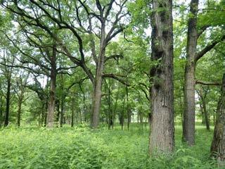
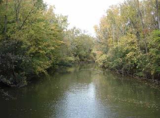
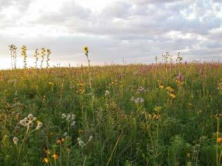
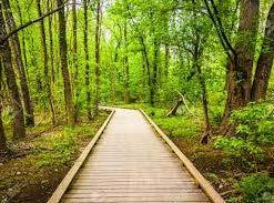
Figure 4.6 (clockwise from top left): Oak-hickory forest is native to Southeast Michigan and can help to increase the LEAP area’s tree canopy. Meadows are an example of flexible use and are a cost efficient way to use large amounts of vacant land. Mixed hardwood marshland is native to Southeast Michigan and provides opportunities to increase the LEAP area’s tree canopy and preserve the productivity of riparian systems. Riparian buffers are important for maintaining healthy water systems throughout the LEAP area.
Source: Forest Preserves of Cook County, Wildwood Park, Friends of the Rouge
Legend
Oak-Hickory Forest
Mixed Hardwood Marshland
Flexible Use
Riparian Buffer Lots
Riparian Buffers
Projects
Figure 4.7: The land suitability analysis shows 12 potential sites and several riparian buffers suitable for natural areas.
Sources: Created from City of Detroit BSEED, Detroit Building Permits, 2017 & Detroit Building Authority, Recent Demolitions, 2017 & Motor City Mapping, MCMSurveyData (Parcel map), 2014; City of Detroit, Parcel Map, 2017; Created from City of Detroit Housing and Revitalization Department, Targeted Multifamily Housing Areas, 2017 & LEAP area residents; Created from DWSD, Historical Detroit Watersheds, 2002; SEMCOG, Historic Land Cover, 2016; U.S. Census Bureau, TIGER/Line: All Roads, 2014 (see Appendix A)
While open space can provide numerous benefits, its implementation and maintenance often causes concern among residents. If not maintained, open space can be perceived as blighted and detract from the surrounding neighborhoods. Cues to care and maintenance must be included when planning for open space (Figure 4.8). Cues to care indicate that a lot is cared for and maintained:
• Mowed edges and pathways
• Fences and bollards
• Flowering plants and trees
• Linear planting design
• Signage that explains the purpose of open space12
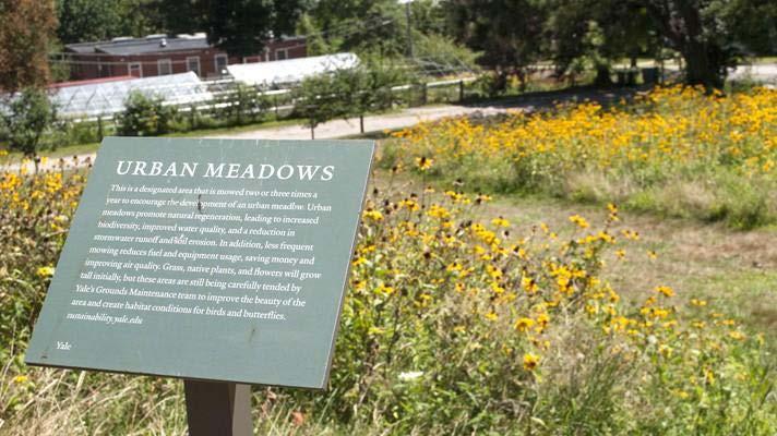
Salt Lake City implemented a citywide comprehensive maintenance program to maintain healthy native vegetation, stabilize soils, minimize disturbance, and control recreation activities while reducing weeds and erosion.13 Oakland County, Michigan, has implemented a regional maintenance plan for Stony Creek Ravine Nature Park that seeks to restore open space damaged by extensive agricultural activity.14 Both of these plans detail tasks, labor, equipment, resources, and costs.
Oak-hickory forests are native to Southeast Michigan and provide an opportunity to increase Detroit’s tree canopy. Increasing tree canopy can improve air and soil quality, as well as reduce the urban heat island effect.15 The land suitability analysis (Table 4.1) resulted in 2 potential sites consisting of multiple aggregated lots and streets with an average size of 10.2 acres. Provided here are 2 examples of oak-hickory forest projects.
This project is a high priority because it provides an opportunity to connect a forested area with Saint Anthony Playground and offers opportunities for environmental education.
• 87 lots encompassing 10 acres
• Primarily owned by the DLBA
• Addresses resident concerns regarding illegal dumping and the redevelopment of the nearby Packard Plant
• Fosters additional recreation types due to its physical connections to Saint Anthony Playground
• Links Saint Anthony Playground to potential development on a nearby former school site16
Kettering High School (Closed)
Anthony Playground
Oak-Hickory Forest
Non-Motorized Route
DLBA-Owned Vacant Lots
Figure 4.9: The proposed location of the Northwest Oak-Hickory Forest is between the former Kettering High School and Saint Anthony Playground, where bioretention for GSI can be implemented.
Source: Created from City of Detroit BSEED, Detroit Building Permits, 2017 & Detroit Building Authority, Recent Demolitions, 2017 & Motor City Mapping, MCMSurveyData (Parcel map), 2014; City of Detroit, Parcel Map, 2017; Created from City of Detroit Housing and Revitalization Department, Targeted Multifamily Housing Areas, 2017 & LEAP area residents; Created from City of Detroit Planning and Development Department, Non motorized Routes, 2016 & City of Detroit Planning and Development Department, Greenways, 2016; DLBA, DLBA owned properties in LEAP area, 2017; SEMCOG, Historic Land Cover, 2016; U.S. Census Bureau, TIGER/Line: All Roads, 2014 (see Appendix A)
Implement Mack Avenue Oak-Hickory Forest
• 80 lots encompassing 10.4 acres
• Partially owned by the City of Detroit Planning and Development Department
• Provides an amenity for patients from nearby Detroit East Community Mental Health facility and Professional Medical Center
• Buffers health facilities and homes from light industrial uses to the east
• Provides an opportunity to connect to the proposed Beltline Greenway
• Builds upon an already partially forested area
• Because private entities own most of the site, creation of the forest would be a longer-term project
Oak-Hickory Forest
Industrial Buildings
Non-Motorized Route
DLBA-Owned Vacant Lots
City-Owned Vacant Lots
Figure 4.10: The Mack Avenue Forest is on the western edge of the LEAP area between manufacturing and residences.
Source: Created from City of Detroit BSEED, Detroit Building Permits, 2017 & Detroit Building Authority, Recent Demolitions, 2017 & Motor City Mapping, MCMSurveyData (Parcel map), 2014; City of Detroit, Parcel Map, 2017; Created from City of Detroit Housing and Revitalization Department, Targeted Multifamily Housing Areas, 2017 & LEAP area residents; Created from City of Detroit Planning and Development Department, Non motorized Routes, 2016 & City of Detroit Planning and Development Department, Greenways, 2016; DLBA, DLBA owned properties in LEAP area, 2017; SEMCOG, Historic Land Cover, 2016; SEMCOG, Buildings Detroit, 2015; U.S. Census Bureau, TIGER/Line: All Roads, 2014 (see Appendix A)
Flexible use natural areas can become meadows and woodlot forests.17 They can offer habitat for rare species, recreational benefits for residents, and the opportunity to reuse large amounts of vacant land at a lower cost than other uses. They can also decrease stormwater runoff.18 The land suitability analysis (Table 4.1) resulted in 7 potential sites for flexible use, with most sites consisting of multiple aggregated lots and streets with an average size of 5.8 acres. Provided here is an example of a flexible use project.
• 58 lots encompassing 5.9 acres
• Primarily owned by the DLBA
• Rejuvenates meadow ecosystems and serves as an asset to the neighborhood19
• Assists in stormwater management and helps ease the burden on existing infrastructure
• Serves as a retreat for residents with pathways and cues to care that create a welcoming natural space and support a safe neighborhood through maintained sightlines
DLBA-Owned Vacant Lots
Figure 4.11: The proposed meadow near East Outer Drive and Interstate 94 can be a less expensive way to reuse vacant land.
Sources: Created from City of Detroit BSEED, Detroit Building Permits, 2017 & Detroit Building Authority, Recent Demolitions, 2017 & Motor City Mapping, MCMSurveyData (Parcel map), 2014; City of Detroit, Parcel Map, 2017; Created from City of Detroit Housing and Revitalization Department, Targeted Multifamily Housing Areas, 2017 & LEAP area residents; DLBA, DLBA owned properties in LEAP area, 2017; SEMCOG, Historic Land Cover, 2016; U.S. Census Bureau, TIGER/Line: All Roads, 2014 (see Appendix A)
Mixed hardwood marshland often act as a transitional area into riparian areas and constructed wetlands (see Increase GSI strategy). Marshlands provide a range of ecosystem services such as helping to manage stormwater, filtering pollutants, and mitigating floods.20 The land suitability analysis (Table 4.1) resulted in 2 potential sites for mixed hardwood marshland. These sites consist of multiple aggregated lots and streets with an average size of 11.7 acres. Provided here is an example of a mixed hardwood marshland project.
• 147 lots encompassing 23.3 acres
• Primarily privately owned
• This project is 2 marshland sites physically separated by 1 DLBA-owned lot with a vacant structure that is likely to be demolished
Trinity Cemetery
Legend
Hardwood Marshland
Cemetery
Non-Motorized Route
Riparian Buffer
DLBA-Owned Vacant Lots
DLBA-Owned Lots with Structure
Figure 4.12: This proposed marshland overlaps with the approximate location of the riparian buffer of a historical creek and is adjacent to a non-motorized route.
Sources: Created from City of Detroit BSEED, Detroit Building Permits, 2017 & Detroit Building Authority, Recent Demolitions, 2017 & Motor City Mapping, MCMSurveyData (Parcel map), 2014; City of Detroit, Parcel Map, 2017; Created from City of Detroit Housing and Revitalization Department, Targeted Multifamily Housing Areas, 2017 & LEAP area residents; Created from City of Detroit Planning and Development Department, Non motorized Routes, 2016 & City of Detroit Planning and Development Department, Greenways, 2016; DLBA, DLBA owned properties in LEAP area, 2017; Created from DWSD, Historical Detroit Watersheds, 2002; SEMCOG, Historic Land Cover, 2016; U.S. Census Bureau, TIGER/Line: All Roads, 2014 (see Appendix A)
Traditional riparian buffers are frequently flooded areas adjacent to rivers or creeks that can be forested or planted with grass and lowlying shrubs.21 Vacant land within 100 feet of an historical creek can also be considered as a riparian buffer to reduce flooding, improve water quality, serve as an educational asset, and provide access to Detroit’s aging infrastructure for culverted creeks (Figure 4.14). Implementation of riparian buffer projects will depend on more investigation of the exact historical creek locations. The Bloody Run Creek or Conner Creek riparian buffers can begin an investigation into the importance, exact location, and opportunities associated with Detroit’s historical creeks. The land suitability analysis (Table 4.1) resulted in 1,293 potential lots where the 387.1 acres of riparian buffers can be located. Provided here are 2 examples of riparian buffer projects.
Implement Conner Creek Riparian Buffer
• 128 lots intersecting 54.7 acres of the Conner Creek 100-foot riparian buffer
• Physically connects to the Mack Avenue Green T and Conner Creek Greenway
• Can educate residents on historical creeks and their associated wetlands and how alteration to the landscape has changed the flow of water, creating a new urban natural area
Riparian Buffer Lots Riparian Buffer
Figure 4.13: The proposed location of the Conner Creek Riparian Buffer can connect to the adjacent Mack Avenue Green T.
Source: Created from City of Detroit BSEED, Detroit Building Permits, 2017 & Detroit Building Authority, Recent Demolitions, 2017 & Motor City Mapping, MCM Survey Data (Parcel map), 2014; City of Detroit, Parcel Map, 2017; Created from City of Detroit Planning and Development Department, Non motorized Routes, 2016 & City of Detroit Planning and Development Department, Greenways, 2016; DLBA, DLBA owned properties in LEAP area, 2017; Created from DWSD, Historical Detroit Watersheds, 2002; U.S. Census Bureau, TIGER/Line: All Roads, 2014 (see Appendix A)
Implement New Far East Side Riparian Buffer
• 63 lots with 5.7 acres
• All owned by New Far East Side Development Group, a real estate development company
• Expected that the developer will eventually build there
• Despite the uncertain locations of historical creeks, a creek likely existed in this development area
• Promoting riparian buffers in the New Far East Side Development area could set an example for green development practices
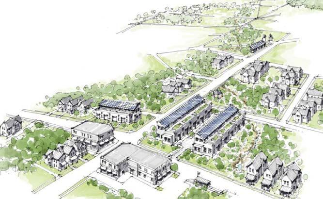
Figure 4.14: Site design can include riparian buffers in both commercial and residential areas, as shown in the lower right corner.
Source: Terry Schwarz, “Reimagining a More Sustainable Cleveland: Citywide vacant land management strategies” (presentation, UM Detroit Center, Detroit, MI, Feb. 10, 2017) Legend
Kervcheval Ave Vernor Hwy
Riparian Buffer Lots
Riparian Buffer
Multi-Family Investment Areas
Commercial Nodes
Figure 4.15: A historical creek runs through a large area planned for development that could incorporate a riparian buffer that would enhance residents’ quality of life.
Source: Created from City of Detroit BSEED, Detroit Building Permits, 2017 & Detroit Building Authority, Recent Demolitions, 2017 & Motor City Mapping, MCMSurveyData (Parcel map), 2014; City of Detroit, Parcel Map, 2017; Created from City of Detroit Planning and Development Department, Non motorized Routes, 2016 & City of Detroit Planning and Development Department, Greenways, 2016; DLBA, DLBA owned properties in LEAP area, 2017; Created from City of Detroit Housing and Revitalization Department, Targeted Multifamily Housing Areas, 2017 & LEAP area residents; Created from DWSD, Historical Detroit Watersheds, 2002; U.S. Census Bureau, TIGER/Line: All Roads, 2014 (see Appendix A)
ECN and partners can advocate for several policy changes to facilitate the creation of natural areas. First, they can advocate for an adjustment to the Property Maintenance Code that only allows grasses to grow to 8 inches.22 Additionally, a riparian buffer ordinance—similar to Cleveland’s Riparian and Wetland Setback Ordinance—could help to create and maintain buffers in the LEAP area (see Land Use Regulation section).
Widespread implementation of GSI can alleviate Detroit’s flooding and combined sewer overflows, particularly in the LEAP area. GSI installations can:
• Improve public water quality by reducing pollution in stormwater runoff
• Reduce basement flooding caused by backups of the City’s combined sewer system when it is overwhelmed during a storm event
• Increase property values by increasing vegetation and tree canopy23
In addition to these benefits, GSI might be more cost-effective for the Detroit Water and Sewerage Department (DWSD) than traditional “gray” infrastructure over the long term.24 GSI can take many forms, from large- to small-scale improvements. This plan considers 3 types of GSI: constructed wetlands, bioretention/ biofiltration, and basement cisterns (Figure 4.17).
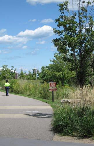
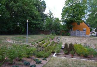
Figure 4.16 (clockwise from left): Constructed wetlands with cues to care, like the one pictured here in Milliken State Park, can effectively manage a high volume of stormwater while providing recreational uses as a neighborhood asset. Bioretention gardens, like this example in the Warrendale neighborhood of Detroit, can transform vacant lots to relieve stormwater flooding and signify cues to care in an attractive landscape. The basement of a demolished home can be used in basement cistern projects.
Source: Margi Dewar, Mark Lindquist, Crain’s Detroit Business
Legend Constructed Wetlands
Bioretention/Biofiltration
Basement Cisterns
Projects
Figure 4.17: All 3 types of GSI are appropriate in a wide variety of locations throughout the LEAP area, with 442 suggested sites.
Sources: Created from City of Detroit BSEED, Detroit Building Permits, 2017 & Detroit Building Authority, Recent Demolitions, 2017 & Motor City Mapping, MCMSurveyData (Parcel map), 2014 & DLBA, DLBA owned properties in LEAP area, 2017; City of Detroit, Parcel Map, 2017; SEMCOG, Historic Land Cover, 2016; Created from CDAD, Residential Typology Analysis, 2015 & LEAP area residents; DWSD, Detroit Impervious Data 2015, 2015; FEMA, National Flood Hazard Layer, 2012; NRCS, NRCS soils, 2017; Tetra Tech, Catch basin and storm water data in LEAP area, 2017; U.S. Census Bureau, TIGER/Line: All Roads, 2014 (see Appendix A)
Constructed wetlands are large planted areas that contribute to stormwater management and improve water quality.25 They can act as low-maintenance installations in areas with many vacant lots and offer recreational opportunities in denser residential areas (Figure 4.16). The land suitability analysis (Table 4.1) resulted in 163 potential sites for constructed wetlands, with most sites consisting of multiple aggregated lots and an average size of 2.09 acres.
Install Constructed Wetlands North of the JeffersonChalmers Neighborhood
Severe flooding issues in Jefferson-Chalmers make this project a priority.
• 15 lots encompassing 1.12 acres, 15 lots encompassing 1.12 acres, 15 lots encompassing 1.23 acres, and 16 lots encompassing 1.19 acres
• All lots owned by the DLBA
• Located outside of the City’s multi-family housing investment areas and in lower density blocks identified in the Community Development Advocates of Detroit (CDAD) typology map (Figure 2.11)
• Installed north of Jefferson-Chalmers to help alleviate the heavy water flow “downhill” into the area of the neighborhood where flooding is most severe
Other suggested sites for constructed wetland projects are highlighted in Figure 4.17. They include a DLBA-owned site near Islandview that can help mitigate the high levels of imperviousness in the area, and a site within the New Far East Side Development area that can act as a neighborhood asset as redevelopment occurs. These projects are considered lower priority because they will not relieve flooding in Jefferson-Chalmers, and the lots located in the New Far East Side Development area are not DLBA-owned.
Figure 4.18: These 4 suggested constructed wetland sites are located in a sparsely populated area.
Sources: Created from City of Detroit BSEED, Detroit Building Permits, 2017 & Detroit Building Authority, Recent Demolitions, 2017 & Motor City Mapping, MCMSurveyData (Parcel map), 2014; City of Detroit, Parcel Map, 2017; SEMCOG, Historic Land Cover, 2016; Created from CDAD, Residential Typology Analysis, 2015 & LEAP area residents; DWSD, Detroit Impervious Data 2015, 2015; FEMA, National Flood Hazard Layer, 2012; NRCS, NRCS soils, 2017; Tetra Tech, Catch basin and storm water data in LEAP area, 2017; U.S. Census Bureau, TIGER/Line: All Roads, 2014 (see Appendix A)
This type of GSI contributes to stormwater management by retaining water on site or increasing infiltration (Figure 4.16). This could occur in bioretention gardens on large sites or in smallerscale bioswales. The land suitability analysis (Table 4.1) resulted in 272 potential sites for bioretention/biofiltration, with most of sites consisting of multiple aggregated lots and an average overall size of 0.89 acres.
• 1 lot encompassing 1.71 acres at 5330 Field Street
• Owned by the City
• Located in an area defined as traditionally residential by the CDAD typology map (Figure 2.11)
• Soil classified as type A (well-drained), which allows for better stormwater infiltration (Figure 4.4)
Cathedral Abbey of Saint Anthony GratiotAve
Figure 4.19: The Cathedral Abbey of Saint Anthony can support the Saint Anthony Playground bioretention site.
Sources: Created from City of Detroit BSEED, Detroit Building Permits, 2017 & Detroit Building Authority, Recent Demolitions, 2017 & Motor City Mapping, MCMSurveyData (Parcel map), 2014; City of Detroit, Parcel Map, 2017; Google, Map Data, 2017; Created from CDAD, Residential Typology Analysis, 2015 & LEAP area residents; DWSD, Detroit Impervious Data 2015, 2015; FEMA, National Flood Hazard Layer, 2012; Tetra Tech, Catch basin and storm water data in LEAP area, 2017; U.S. Census Bureau, TIGER/Line: All Roads, 2014 (see Appendix A)
Basement cisterns use the basement of a demolished home as a trench to retain water and allow soil infiltration (Figure 4.16). They are most feasible in areas that can use the collected water.26 Urban agriculture can use the stormwater collected in a basement cistern, and the location of cisterns can be coordinated with the location of suggested urban agriculture sites. The land suitability analysis (Table 4.1) resulted in 6 lots with an average size of 0.08 acres.
This project is near suggested urban agriculture projects.
• 1 lot encompassing 0.11 acres at 13201 Charlevoix Street
• Privately owned
• Identified as having a structure in “poor condition” that should be demolished27
• Located adjacent to a 1.17 acre area suggested for urban agricultural use (see Productive Uses strategy)
Basement Cistern
Uses
Figure 4.20: This suggested basement cistern project is sited near suggested urban agriculture in order to establish a mutually beneficial relationship. Sources: Created from City of Detroit BSEED, Detroit Building Permits, 2017 & Detroit Building Authority, Recent Demolitions, 2017 & Motor City Mapping, MCMSurveyData (Parcel map), 2014; City of Detroit, Parcel Map, 2017; Created from CDAD, Residential Typology Analysis, 2015 & LEAP area residents; DWSD, Detroit Impervious Data 2015, 2015; FEMA, National Flood Hazard Layer, 2012; NRCS, NRCS soils, 2017; Tetra Tech, Catch basin and storm water data in LEAP area, 2017; U.S. Census Bureau, TIGER/Line: All Roads, 2014 (see Appendix A)
Other Suggested Projects
The following addresses may also be appropriate sites for basement cisterns:
• 5900 Pennsylvania Street (recent demolition)28
• 10201 Shoemaker Street (suggested demolition)
• 9227 Chapin Street (suggested demolition)
• 4603 Ashland Street (suggested demolition)29
• 5826 Malcolm Street (demolition pipeline)30
Allow for Adjacent Homeowners to Receive Stormwater Drainage Charge Credit for Bioretention Gardens
Bioretention gardens are designed to retain stormwater before it infiltrates or is discharged downstream. This reduces the quantity of water flowing off-site into the municipal stormwater system. Thus, residents living next to these gardens could receive drainage credits if the water from their properties flows into the garden. If the bioretention gardens can manage peak flow, adjacent homeowners could receive up to an 80% credit on their bills.31
Currently, homes do not receive a credit for adjacent bioretention gardens on DLBA-owned lots. DWSD could allow for leniency in how runoff is calculated to accommodate adjacent bioretention installations.32
Productive uses lead to the creation of a range of products and services.33 Productive uses can:
• Improve food access and public health outcomes associated with nutrition
• Clean air, soil, and water
• Generate revenue and create jobs
• Reduce greenhouse gas emissions and utility costs through the use of renewable energy
This plan considers 2 types of productive uses: agricultural use and alternative energy use (Figure 4.22).
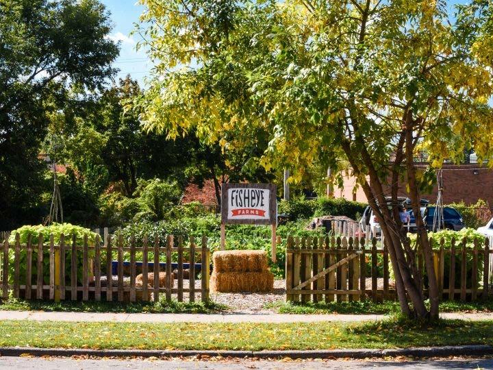
Legend
Agricultural Use
Alternative Energy Use
Projects
Figure 4.22: The land suitability analysis resulted in 74 potential sites suitable for productive uses.
Source: Created from City of Detroit BSEED, Detroit Building Permits, 2017 & Detroit Building Authority, Recent Demolitions, 2017 & Motor City Mapping, MCMSurveyData (Parcel map), 2014 & DLBA, DLBA owned properties in LEAP area, 2017; City of Detroit, Parcel Map, 2017; Data Driven Detroit, Food Accessibility, 2012; FEMA, National Flood Hazard Layer, 2012; SEMCOG, Traffic Volumes, 2017; U.S. Census Bureau, TIGER/Line: All Roads, 2014 (see Appendix A)
The large amount of vacant land in the LEAP area and Detroit could allow DTE Energy and interested neighborhoods to pursue renewable energy production at a scale rarely possible in an urban setting.34 The growing opportunity for solar production is indicated by upcoming projects like the Beltline Solar District and transformation of O’Shea Park.35 As DTE Energy pursues more solar energy production, this analysis can help identify potential solar energy projects. The land suitability analysis (Table 4.1) resulted in 6 potential sites for alternative energy production, with sites consisting of aggregated lots with an average size of 1.3 acres.
Create Parkview Street Solar Field and Community Garden
• 20 lots encompassing 1.4 acres (solar field)
• 30 lots encompassing 2.9 acres (community garden)
• Primarily owned by the DLBA and Detroit Planning and Development Department
• A medium-voltage transmission line runs through the site which might facilitate integration into the electric grid
• Lined with trees that can block wind and the view of the agricultural site and can prevent soil erosion
Other suggested sites for solar energy are highlighted in Figure 4.22. These projects include a solar field near Interstate 94 and a solar field on the Saint Jean Berm. The solar field near Interstate 94 would be located 1.75 miles from a DTE substation. The solar field on the Saint Jean Berm would be located 0.5 miles from a DTE substation. These projects are on properties that are currently being maintained.
Legend
Agricultural Use
Alternative Energy Use
City Owned Vacant Lots
Hantz Farms Lots
Non-Motorized Route
DLBA-Owned Vacant Lots
Figure 4.23: The suggested location of the Parkview Street Solar Field and Community Garden can be accessed through an adjacent non-motorized route. Source: Created from City of Detroit BSEED, Detroit Building Permits, 2017 & Detroit Building Authority, Recent Demolitions, 2017 & Motor City Mapping, MCMSurveyData (Parcel map), 2014 & DLBA, DLBA owned properties in LEAP area, 2017; Created from City of Detroit Planning and Development Department, Non motorized Routes, 2016 & City of Detroit Planning and Development Department, Greenways, 2016; City of Detroit, Parcel Map, 2017; Data Driven Detroit, Food Accessibility, 2012; FEMA, National Flood Hazard Layer, 2012; Google, Map Data, 2017; Google, Imagery, 2017; SEMCOG, Traffic Volumes, 2017; SEMCOG, Buildings Detroit, 2015; U.S. Census Bureau, TIGER/Line: All Roads, 2014 (see Appendix A)
ECN can advocate for changes to zoning regulations to include protecting solar fields from shade through regulating surrounding buildings and enabling solar permits. Before a solar project can be installed on a lot, owners must go through a permitting process. The permitting process is often unclear and complex; but ECN can partner with GreenLancer, a Detroit-based company, to help residents and organizations interested in installing solar projects navigate the process.36
Agricultural production offers the opportunity to use vacant land to improve access to fresh, local produce and may generate revenue for garden operators through other cash crops. The land suitability analysis (Table 4.1) resulted in 69 potential sites for agricultural production, with sites consisting of aggregated lots with an average size of 2.4 acres.
• 208 lots encompassing 16.8 acres (6 sites)
• Primarily owned by the DLBA
• Clustered and connected to allow for equipment and knowledge sharing
• Can be influential in advocacy for agricultural infrastructure37
Agricultural Use
DLBA-Owned Vacant Lots
Figure 4.24: The proposed location of the Eastside Agricultural Network can encourage a system of urban farms that allow for crop diversification, including food production and cut flower farms.
Source: Created from City of Detroit BSEED, Detroit Building Permits, 2017 & Detroit Building Authority, Recent Demolitions, 2017 & Motor City Mapping, MCMSurveyData (Parcel map), 2014 & DLBA, DLBA owned properties in LEAP area, 2017; City of Detroit, Parcel Map, 2017; Data Driven Detroit, Food Accessibility, 2012; FEMA, National Flood Hazard Layer, 2012; Google, Map Data, 2017; Google, Imagery, 2017; SEMCOG, Traffic Volumes, 2017; SEMCOG, Buildings Detroit, 2015; U.S. Census Bureau, TIGER/Line: All Roads, 2014 (see Appendix A)
Other suggested sites for agricultural production are highlighted in Figure 4.22. These projects can include a native and urban plant nursery and a wildflower garden. While there are many traditional plant nurseries in Detroit, none focus on native plants. The nearest native plant nursery is in Ann Arbor, demonstrating the potential for market demand in Detroit. A wildflower farm is a productive use that can reduce nuisances related to urban farming, such as smell and appearance, and yield economic returns. Examples of wildflower farms include Fresh Cut Flower Farm, located near Corktown, and Detroit Abloom in Jefferson-Chalmers. Lots used for agriculture can be lined with trees that can block the view of the agricultural site.
Alter Zoning Regulations to Allow for Creation and Longevity of
The City has taken steps to streamline their process for residents to access land for community gardens and urban agriculture. ECN could work with Keep Growing Detroit and the Michigan Environmental Law Center to advocate for further policy changes to increase the use of land for agricultural production. One policy may include advocating for an overlay zone that would allow for more intensive agricultural production within the LEAP area (see Land Use Regulation section).
Quality public green space can strengthen neighborhoods and become part of an open space system. In stable neighborhoods, parks and greenways can catalyze economic development and increase property values. In areas with a high amount of vacant land, parks and greenways can connect open space.38
The LEAP area has 34 parks. Many greenways are in the planning and implementation phases across the LEAP area (Figure 4.27).39 This plan seeks to:
• Expand existing parks through adjacent City- and DLBAowned vacant lots
• Support existing and planned greenways
• Connect other open space uses
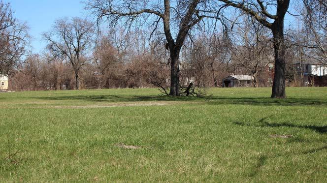
vacant lots.
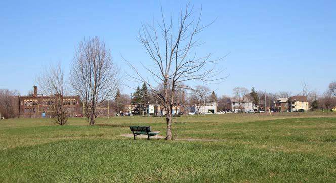
Legend
Parks
City Owned Vacant Lots
DLBA-Owned Vacant Lots
Vacant Lots
Non-Motorized Route
Projects
Figure 4.27: The land suitability analysis identified 15 parks that could be expanded using adjacent vacant lots. There are 24.7 miles of planned and existing greenways in the LEAP area.
Source: Created from City of Detroit BSEED, Detroit Building Permits, 2017 & Detroit Building Authority, Recent Demolitions, 2017 & Motor City Mapping, MCMSurveyData (Parcel map), 2014; City of Detroit, Parcel Map, 2017; Created from City of Detroit Planning and Development Department, Non motorized Routes, 2016 & City of Detroit Planning and Development Department, Greenways, 2016; DLBA, DLBA owned properties in LEAP area, 2017; U.S. Census Bureau, TIGER/Line: All Roads, 2014; City of Detroit, Parks, 2017 (see Appendix A)
The Parks and Recreation Department is currently improving Dueweke, Latham, and Hansen Parks through their “Neighborhood Parks” program.40 The Department will next prioritize the expansion and improvement of Brewer and Sylvester-Seyburn Parks through their “Turning Vacant Detroit Public School Sites Into Parks” program. Brewer and Sylvester-Seyburn Parks are high priority projects for the Department, and the Department has the funding to improve these parks and both own and maintain the adjacent vacant land. They are both large neighborhood parks adjacent to lots where former Detroit Public School (DPS) buildings have been demolished.41 The land suitability analysis (Table 4.1) identified a total of 15 parks with adjacent City- and/or DLBA-owned vacant lots for expansion.
Brewer Park is 8.3 acres at 4819 Fairview Street (Figure 4.25). A site visit confirmed that it is a good location for a large community park if the baseball diamond, football field, and playgrounds are improved. It has a Pistons-Palace basketball structure, DPS play structure, benches, asphalt trail and a football field. There are some homes around the site. Most of the fencing for the baseball backstop has been cut off.
• 30 lots encompassing 12.8 acres
• Primarily owned by the DLBA and the City
• Play equipment: Multiple play structures present, but need repairs and maintenance
• Recommendation: Expand park with the potential to plant a meadow
• Estimated needs: $750,000 - Sports field repairs, walking path, basketball court, playground improvements, and skate park in the northeast corner42
City-Owned Vacant Lots
DLBA-Owned Vacant Lots Other Vacant Lots
Figure 4.28: The vacant DPS site adjacent to Brewer Park is a large open area that can become part of the neighborhood park.
Source: Created from City of Detroit BSEED, Detroit Building Permits, 2017 & Detroit Building Authority, Recent Demolitions, 2017 & Motor City Mapping, MCMSurveyData (Parcel map), 2014; City of Detroit, Parcel Map, 2017; DLBA, DLBA owned properties in LEAP area, 2017; U.S. Census Bureau, TIGER/Line: All Roads, 2014; City of Detroit General Services Department, Parks, 2016; City of Detroit General Services Department, Parks Improvement Map, 2017 (see Appendix A)
Expand Sylvester-Seyburn Park
Sylvester-Seyburn Park is 4 acres at 7701 Sylvester Street (Figure 4.26). A site visit confirmed that it could become a better community park if play equipment, sports fields, paths, and picnic areas were installed. The vacant DPS lot adjacent to the park is lined with mature locust trees. Sonora Missionary Baptist Church is across Sylvester Street. The church frequently uses the park in the summer and is looking forward to improvements.
• 17 lots encompassing 5.3 acres
• Primarily owned by the DLBA and the City
• Play equipment: Needed
• Recommendation: Expand park
• Estimated needs: $350,000 - Playground, basketball court, walking path, picnic area, sports field, and security43
Sylvester-Seyburn Park
Legend
Park
City-Owned Vacant Lots
DLBA-Owned Vacant Lots
Other Vacant Lots
Figure 4.29: Many children live in the neighborhood, and occupied homes abut the park.
Source: Created from City of Detroit BSEED, Detroit Building Permits, 2017 & Detroit Building Authority, Recent Demolitions, 2017 & Motor City Mapping, MCMSurveyData (Parcel map), 2014; City of Detroit, Parcel Map, 2017; DLBA, DLBA owned properties in LEAP area, 2017; U.S. Census Bureau, TIGER/Line: All Roads, 2014; City of Detroit General Services Department, Parks, 2016; City of Detroit General Services Department, Parks Improvement Map, 2017 (see Appendix A)
Greenways are paths of linear open space or bike lanes along streets that provide opportunities for recreation and non-motorized transportation. They are vital for creating a connected open space system.44 The buffers analysis later in this chapter shows vacant lots adjacent to streets that could also be incorporated into planned and existing greenways. There are plans to build 24.7 miles of greenways in the LEAP area through projects such as:
• Conner Creek Greenway
• The Beltline Greenway
• Mount Elliott Connector
• Kercheval Greenway
Extend the Conner Creek Greenway
The Conner Creek Greenway is 7 miles long with completed sections from 8 Mile Road to the Detroit River.44 ECN has the opportunity to work with the Detroit Eastside Community Collaborative and the Alliance for the Great Lakes to expand the Conner Creek Greenway while also installing GSI and other amenities. 2 sites along the Greenway south of Jefferson Avenue could accommodate GSI and add interest to the Greenway.
• 16 lots encompassing 0.35 acres, 10 lots encompassing 0.69 acres
• Primarily owned by the DLBA and the City
• Located adjacent to areas defined as traditionally residential by the CDAD typology map (Figure 2.11), which allows a bioretention garden to serve as an attractive flowering area for residents while also reducing stormwater runoff
• Located outside of the 1% annual chance floodplain
• Located within 20 feet of a stormwater catch basin
Publicly Owned Vacant Lots
Privately Owned Vacant Lot
Non-Motorized Route
Figure 4.30: These suggested bioretention garden sites are located along the Conner Creek Greenway.
Source: Created from City of Detroit BSEED, Detroit Building Permits, 2017 & Detroit Building Authority, Recent Demolitions, 2017 & Motor City Mapping, MCMSurveyData (Parcel map), 2014; City of Detroit, Parcel Map, 2017; Created from CDAD, Residential Typology Analysis, 2015 & LEAP area residents; DWSD, Detroit Impervious Data 2015, 2015; FEMA, National Flood Hazard Layer, 2012; SEMCOG, Historic Land Cover, 2016; Tetra Tech, Catch basin and storm water data in LEAP area, 2017; U.S. Census Bureau, TIGER/Line: All Roads, 2014 (see Appendix A)
The Beltline Greenway was part of the initial GREEN Task Force Greenways Plan for the LEAP area and was recognized as a priority connection by residents.
• 28 lots encompassing 16.8 acres
• Primarily privately owned
• Located along a former railbed connecting the former Uniroyal Site to Gleaners Community Food Bank and Gratiot Avenue
• Partial funding secured through the Michigan Natural Resources Trust Fund46
Figure 4.31: Vacant lots are located within 100 feet of the former railbed where the Beltline Greenway is proposed to be built.
Source: Created from City of Detroit BSEED, Detroit Building Permits, 2017 & Detroit Building Authority, Recent Demolitions, 2017 & Motor City Mapping, MCMSurveyData (Parcel map), 2014; City of Detroit, Parcel Map, 2017; Created from City of Detroit Planning and Development Department, Non motorized Routes, 2016 & City of Detroit Planning and Development Department, Greenways, 2016; U.S. Census Bureau, TIGER/Line: All Roads, 2014; City of Detroit, Parks, 2017 (see Appendix A)
Given the presence of Interstate 94, the Chrysler plant, and arterial streets such as Gratiot Avenue and Jefferson Avenue, implementing tree buffers throughout the LEAP area can improve quality of life for residents (Figure 4.34). Tree buffers can:
• Block hazardous particulate matter that causes asthma and other health problems
• Absorb noxious fumes
• Reduce noise and block unpleasant views47
This plan considers 3 types of tree buffers: highways, industrial areas, and arterials.48
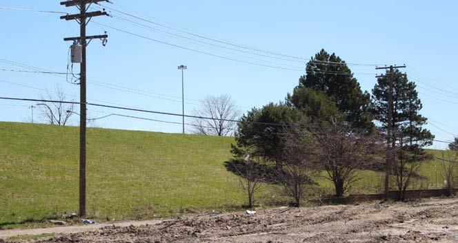
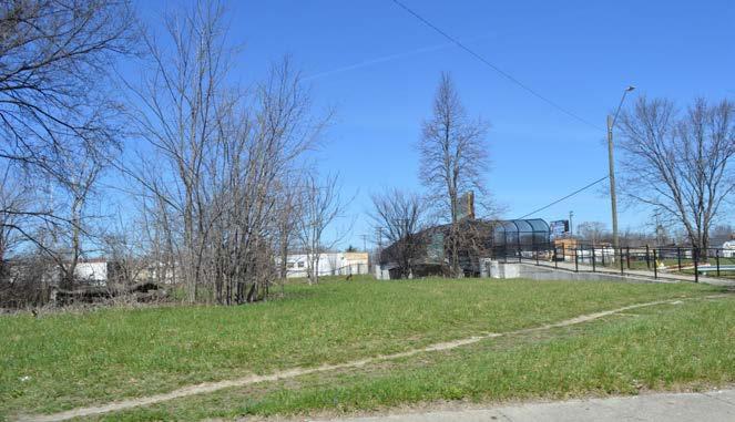
Vacant Land
Legend Average Daily Traffic Volume
7,771 - 15,381
15,382 - 37,665
37,666 - 73,258
DLBA-Owned Vacant Land
Low Priority
Medium Priority
High Priority
Figure 4.34: The land suitability analysis (Table 4.1) resulted in 3,374 lots encompassing approximately 230 acres of land suitable for tree buffers. Priority was determined by traffic volume.
Source: Created from City of Detroit BSEED, Detroit Building Permits, 2017 & Detroit Building Authority, Recent Demolitions, 2017 & Motor City Mapping, MCMSurveyData (Parcel map), 2014; City of Detroit, Parcel Map, 2017; Detroit Land Bank Authority, DLBA owned parcels, 2017; SEMCOG, Traffic Volume, 2017; U.S. Census Bureau, TIGER/Line: All Roads, 2014; City of Detroit, Parks, 2017 (see Appendix A)
The LEAP area’s northern border is Interstate 94, one of the most heavily traveled routes in the region. There is no sound barrier wall or tree buffer along Interstate 94 in the LEAP area (Figure 4.33). The land suitability analysis (Table 4.1) resulted in 341 lots encompassing 24.3 acres for a highway buffer.
Create Tree Buffer Along Interstate 94 in the Chandler Park Neighborhood
The first phase of this project—between Outer Drive to the east, Dickerson Avenue to the west, Linville Avenue to the south, and Interstate 94 to the north—lies between Interstate 94 and the Chandler Park neighborhood.
• 85 lots encompassing 6.8 acres
• All lots owned by the DLBA
In the long term this project can include the additional 256 suitable lots encompassing 17.5 acres along the rest of Interstate 94 in the LEAP area (Figure 4.34).
Figure 4.35: A tree buffer on vacant land between Interstate 94 and occupied homes can provide a more pleasant transition out of the Chandler Park neighborhood.
Source: Created from City of Detroit BSEED, Detroit Building Permits, 2017 & Detroit Building Authority, Recent Demolitions, 2017 & Motor City Mapping, MCMSurveyData (Parcel map), 2014; City of Detroit, Parcel Map, 2017; Detroit Land Bank Authority, DLBA owned parcels, 2017; SEMCOG, Traffic Volume, 2017; U.S. Census Bureau, TIGER/Line: All Roads, 2014; City of Detroit, Parks, 2017 (see Appendix A)
The largest industrial site in the LEAP area is the Chrysler plant, which borders several neighborhoods. The Saint Jean Berm lies along the west side of the plant. It has scattered trees and maintained grass but is not a true tree buffer (Figure 4.32). A solar field could locate on 27 vacant lots encompassing 2.8 acres near the Berm (see Support Productive Uses strategy), but the rest of the vacant lots along the west and east sides of the plant are suitable for a tree buffer. No buffer exists along the east side of the plant. The land suitability analysis (Table 4.1) resulted in 283 lots encompassing 5 acres for an industrial buffer.
Create Tree Buffer Along the West and East Sides of the Chrysler Plant
This is a project that can have a considerable impact on residents’ quality of life due to the Chrysler plant’s prominence in the LEAP area.
• 48 lots encompassing 4.5 acres, 235 lots encompassing 20.5 acres
• All lots owned by the DLBA
• Can act as a transitional area between the plant and surrounding neighborhoods
• Trees exist on the lots, and the rest of the area can be planted with coniferous trees, which remain green all year
Mack Ave
Canfield St Charlevoix St
Kercheval St
E Jefferson Ave
Legend
Chrysler Plant
DLBA-Owned Vacant Lots (High Priority)
Figure 4.36: Lots along Anderdon Street and Algonquin Street east of the Chrysler plant—and along the Saint Jean Berm west of the plant—can provide a tree buffer for nearby neighborhoods.
Source: Created from City of Detroit BSEED, Detroit Building Permits, 2017 & Detroit Building Authority, Recent Demolitions, 2017 & Motor City Mapping, MCMSurveyData (Parcel map), 2014; City of Detroit, Parcel Map, 2017; Detroit Land Bank Authority, DLBA owned parcels, 2017; SEMCOG, Traffic Volume, 2017; U.S. Census Bureau, TIGER/Line: All Roads, 2014; City of Detroit, Parks, 2017 (see Appendix A)
Main arterials in the LEAP area include Jefferson, Gratiot, Kercheval, and Mack Avenues. The City has announced plans for streetscape improvements along Jefferson Avenue, and the others offer an opportunity to create segments of green thoroughfares on areas of aggregated vacant land.49 The land suitability analysis (Table 4.1) resulted in 1,254 lots encompassing 82.3 acres for arterial buffers.
Create Green Thoroughfares Along Gratiot, Kercheval, and Mack Avenues
Green thoroughfares are vacant land along former commercial corridors that can be reused for trees, low-maintenance plants, and GSI. Green thoroughfares have been part of previous LEAP plans, and ECN has experience implementing them. ECN has installed a green thoroughfare project from LEAP Phase I with the Mack Avenue Green T.
• 1,254 lots encompassing 82.3 acres
• All lots owned by the DLBA
• Can provide lighting, wayfinding directions to nearby neighborhoods, and bus and bike lanes
• Can improve appearance and safety50
Legend
DLBA-Owned Vacant Lots (Low Priority)
DLBA-Owned Vacant Lots (Medium Priority)
Traffic Volume (7,77115,381)
Traffic Volume (15,38237,665)
Figure 4.37: The LEAP area is auto-centric, so buffers along main arterials are important for absorbing automobile exhaust fumes and reducing traffic noise.
Source: Created from City of Detroit BSEED, Detroit Building Permits, 2017 & Detroit Building Authority, Recent Demolitions, 2017 & Motor City Mapping, MCMSurveyData (Parcel map), 2014; City of Detroit, Parcel Map, 2017; Detroit Land Bank Authority, DLBA owned parcels, 2017; SEMCOG, Traffic Volume, 2017; U.S. Census Bureau, TIGER/Line: All Roads, 2014; City of Detroit, Parks, 2017 (see Appendix A)
Uses suggested in this plan encompass 8,310 lots (43%) of the vacant lots in the LEAP area (Figure 4.38). When combined with other existing uses for vacant lots—improved lots, Hantz Farms, and Hantz Woodlands—12,285 (63%) of vacant lots have been accounted for (Figure 4.40).
This plan provides a framework that can guide open space transformation through consideration of natural systems and designated investment areas. 8,310 lots fit the criteria for one of the strategies in this plan. Consideration must be given, however, to the 7,185 lots (37%) of vacant lots, that did not match this plan’s land suitability criteria and were not “improved” (used for parking, gardens, play lots, or side yards). Remaining land within the City’s multi-family housing investment areas (1,789 lots) and the Chandler Park neighborhood (156 lots) can be considered options for traditional development. This leaves 4,179 remaining vacant lots that could be considered for transformations not suggested in this plan, such as small community parks, sports fields, community gardens under 1 acre in size, event spaces, or other uses desired by residents and local businesses.
Legend
Natural Areas
Riparian Buffers
Riparian Buffer Lots
GSI
Productive Uses
Parks
Non-Motorized Routes
Buffers
Figure 4.38: The combination of all land suitability analyses resulted in 8,310 of the LEAP area’s approximately 19,400 vacant lots as suggested sites for open space transformation in ways that considered the area’s natural systems and areas targeted for future investment.
Source: Created from City of Detroit BSEED, Detroit Building Permits, 2017 & Detroit Building Authority, Recent Demolitions, 2017 & Motor City Mapping, MCMSurveyData (Parcel map), 2014; City of Detroit, Parcel Map, 2017; DLBA, DLBA owned properties in LEAP area, 2017; Created from City of Detroit Housing and Revitalization Department, Targeted Multifamily Housing Areas, 2017 & LEAP area residents; Created from DWSD, Historical Detroit Watersheds, 2002; SEMCOG, Historic Land Cover, 2016; U.S. Census Bureau, TIGER/Line: All Roads, 2014; Created from DWSD, Historical Detroit Watersheds, 2002; Created from CDAD, Residential Typology Analysis, 2015 & LEAP area residents; DWSD, Detroit Impervious Data 2015, 2015; Data Driven Detroit, Food Accessibility, 2012; FEMA, National Flood Hazard Layer, 2012; NRCS, NRCS soils, 2017; Tetra Tech, Catch basin and storm water data in LEAP area, 2017; SEMCOG, Traffic Volumes, 2017; Google, Map data, 2017; Google, Imagery, 2017 (see Appendix A)
Legend
All Strategies
Non-Motorized Routes
Riparian Buffers
Improved Lots
Strategies
Remaining Vacant Lots
Vacant Lots
Investment
Figure 4.39: When combined with lots available through the side lot program and improved vacant lots—including lots that Hantz purchased and is planting with trees—63% of the vacant lots in the LEAP area are accounted for.
Source: Created from City of Detroit BSEED, Detroit Building Permits, 2017 & Detroit Building Authority, Recent Demolitions, 2017 & Motor City Mapping, MCMSurveyData (Parcel map), 2014; City of Detroit, Parcel Map, 2017; DLBA, DLBA owned properties in LEAP area, 2017; Created from City of Detroit Housing and Revitalization Department, Targeted Multifamily Housing Areas, 2017 & LEAP area residents; Created from DWSD, Historical Detroit Watersheds, 2002; SEMCOG, Historic Land Cover, 2016; U.S. Census Bureau, TIGER/Line: All Roads, 2014; Created from DWSD, Historical Detroit Watersheds, 2002; Created from CDAD, Residential Typology Analysis, 2015 & LEAP area residents; DWSD, Detroit Impervious Data 2015, 2015; Data Driven Detroit, Food Accessibility, 2012; FEMA, National Flood Hazard Layer, 2012; NRCS, NRCS soils, 2017; Tetra Tech, Catch basin and storm water data in LEAP area, 2017; SEMCOG, Traffic Volumes, 2017; Google, Map data, 2017; Google, Imagery, 2017 (see Appendix A)
The Detroit Zoning Ordinance does not ensure longevity for open space uses. The City could adopt several changes to their land use regulations to address this issue. Changes could include green area ratio (GAR) and landscape requirements, downzoning, an expanded overlay zone, and a riparian ordinance. A long-term solution to this issue is the creation of a new citywide master plan and new Detroit Zoning Ordinance.52
In the short term, publicly owned lots suggested for open space uses could be rezoned to one of the following zoning districts within the current Detroit Zoning Ordinance:
• Parks and Recreation District - Allows publicly owned land over 4 acres for parks and preserved open space
• Planned Development District - Allows for planned developments, including “Parks and Open Space”
• Public Center District - Allows the use of recreational and cultural purposes of a particular or special civic importance, including outdoor entertainment facilities, outdoor recreation facilities, and all other public recreational and “Park and Open Space” uses
• Special Development District, Small-Scale, Mixed UseAllows urban agriculture uses in a neighborhood setting
• Transitional Industrial District - Allows urban agriculture uses
GAR requires developers to cover a certain amount of their lot surface with a vegetative layer or other green infrastructure: GSI, permeable pavements, green and cool roofs, or tree planting.53
Case Study: Hanover County, Virginia
Hanover County, Virginia, has a County Ordinance Illustration Manual that provides detailed guidelines for open space planning, specifically for buffers.54 Figure 4.40 lists requirements for a 20-foot buffer, as well as vegetation types.
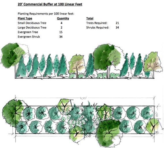
Source: Hanover County Planning
Adjusting landscaping requirements within Detroit’s Zoning Ordinance is another potential tool for zoning for open space in the LEAP area. Sec. 61-3-158 of Detroit’s Zoning Ordinance outlines criteria for open spaces, landscaping, and buffering. This section of the zoning ordinance could include more detailed guidelines for creating and maintaining open space.
An overlay zone is applied over a previously established zoning district. Establishing an overlay zone enacts additional criteria for properties within its zone, in addition to those of the underlying zoning district. Overlay zones can be used for a variety of goals, including the protection of natural features.55 An overlay district in the LEAP area could encourage GSI through methods like GAR and landscaping requirements.
Advantages of overlay zoning include the ability to tailor regulations to ensure the longevity of open space uses. Additionally, overlay districts are administratively feasible as the City already uses them.
In the LEAP area, the City created the Far Eastside Overlay District. Described in Sec. 61-11-381 of Detroit’s Zoning Ordinance, the Far Eastside Overlay District seeks to promote infill development in an area characterized by high amounts of vacancy.56 Focusing primarily on setbacks, housing type, and building height, the overlay area does not include open space—aside from briefly mentioning outdoor recreation facilities. Disadvantages associated with overlay zoning include introducing inequity by regulating some properties and not others, and discouraging development through increased regulations.57
A riparian ordinance seeks to protect riparian systems through regulation. A growing number of municipalities have adopted riparian ordinances, including the City of Cleveland. 1% annual chance floodplains are targeted in Cleveland’s Riparian and Wetland Setback Ordinance, which prohibits construction, dumping, motor use, and disturbances to vegetation in areas recognized as riparian systems.58 The setback ranges from 75 to 300 feet from the respective waterway. Model riparian ordinances are available from the Huron River Watershed Council and the Superior Watershed Partnership.59
The principal advantages of a riparian ordinance are protecting local water sources, contributing to stormwater management, and enhancing the appearance of open areas. The primary disadvantage is the limitation of construction and development in riparian areas.
A new Detroit Zoning Ordinance is a more comprehensive solution to planning for open space in the LEAP area. Other cities have accomplished this. Youngstown, Ohio’s internationally recognized and award winning comprehensive plan Youngstown 2010 guided the development of Youngstown’s Zoning Redevelopment Code, an example of a comprehensive zoning ordinance that takes open space into account (Figure 4.41). Youngstown’s code recognizes traditional zoning districts as well as 4 special purpose districts:60
• The Flood Protection Overlay district seeks to control development in the areas of the city that are prone to flooding.
• The Industrial Green district seeks to encourage investment in clean, alternative energy production that provides residents with power, while having little to no effect on the surrounding environment and residents.61 The Industrial Green district also offers incentives for developers such as annual tax deductions for developments that achieve a LEED certification of Silver.
• The Open Space district seeks to protect Youngstown’s open spaces. This district is intended for publicly owned land and private land with the consent of the property owner.
• The Agriculture/Wetlands district encourages agricultural use and wetland remediation.
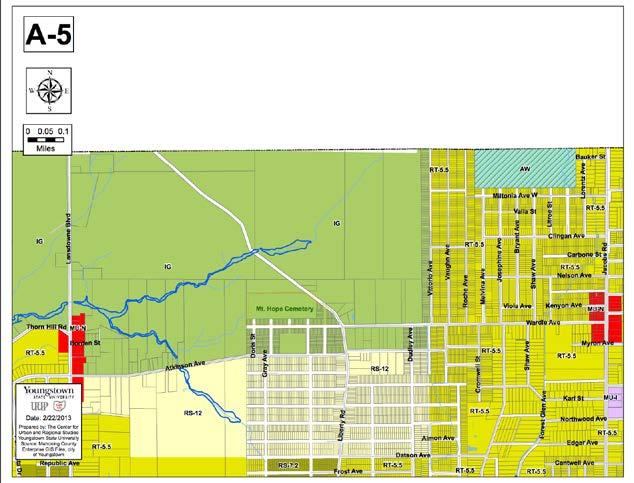
4.41:
Source: Youngstown State University
In 2016, Buffalo, New York, adopted a citywide form-based code: The Buffalo Green Code (Figure 4.42). A major component of this new code included 3 types of open space zones:
• The Square zone is meant for public squares.
• The Green zone addresses parks and other more formal landscaped green spaces.
• The Natural zone allows for maintained open spaces that are primarily undeveloped.
The specific standards for the Natural zone are:
A. Trails and related public amenities, such as boardwalks, pavilions, and observation towers, are encouraged provided they do not negatively impact sensitive habitats.
B. Substantial alteration to existing topography and landscape is permitted only as necessary to restore ecosystem services or a natural, predevelopment condition.
C. Native vegetation, such as grasses, shrubs, and trees, may be disturbed only as necessary to control noxious or invasive vegetation or to remove dead, dying, or diseased vegetation. Where removal of native vegetation is unavoidable to facilitate civic uses or public access, native or naturalized vegetation must be replaced in kind elsewhere on the site.
D. Materials used for elements, features, and objects within the site should use muted, natural colors. Bright, reflective colors, including white, are discouraged.
E. Site design should incorporate sustainable landscape design practices, in accordance with the Sustainable Sites Initiative Rating System and Reference Guide.
F. The following exterior facade materials are prohibited on principal buildings: 1. Reflective wall surface material with a Visible Light Reflectance (VLR) of greater than 15%.62
1. Detroit Future City Implementation Office (DFC), Achieving an Integrated Open Space Network in Detroit (Detroit: Detroit Future City (DFC), April 2016), 35.
2. Ibid, 14-16.
3. Cleveland Land Lab at the Cleveland Urban Design Collaborative, Re-imagining a More Sustainable Cleveland (Cleveland: printed by author, 2008), http://www.cudc.kent.edu/projects_ research/research/reimagining_cleveland.html.
4. Center for Community Progress (CCP), CH2M, Natural Resources Defense Council, Farr Associates, and Encourage Capital LLC, Open Space in Detroit: Key Ownership and Funding Considerations to Inform a Comprehensive Open Space Planning Process (Flint: CCP, 2015).
5. Cleveland Land Lab, Re-imagining a More Sustainable Cleveland.
6. American Forests, “Urban Tree Canopy Assessment & Planting Plan.” (Asbury Park, NJ: American Forests, 2014), http://www.americanforests.org/wp-content/uploads/2014/05/AFCommunity-ReLeaf-Assessment_Asbury-Park.pdf.
Figure 4.42: The Buffalo Green Code includes the Square zone, the Green zone, and the Natural zone, seen primarily along the Lake Erie shoreline.
Source: The Buffalo Green Code
7. Cleveland City Planning Commission, 8 ideas for vacant land reuse in Cleveland (Cleveland: City of Cleveland, 2012); LEAP, Reinventing Detroit’s Lower Eastside: A Summary Report of the Lower Eastside Action Plan - Phase I (Detroit: Eastside Community Network, January 2012); Pittsburgh City Planning, “Appendix B: Suitability Analysis Summary Matrix,” in Plan PGH: Pittsburgh’s Comprehensive Plan (Pittsburgh: City of Pittsburgh, 2013), http://apps.pittsburghpa.gov/dcp/ Appendices_-_Final.pdf.
8. DFC, Achieving an Integrated Open Space Network in Detroit, 36.
9. M.S. Sargent and K.S. Carter, eds., “Introduction to Wetland Management,” in Managing Michigan Wildlife: A Landowners Guide (East Lansing: Michigan United Conservation Clubs, 1999), http://www.dnr.state.mi.us/publications/pdfs/huntingwildlifehabitat/landowners_guide/ Habitat_Mgmt/Wetland/Wetlands_Intro.htm.
10. Christopher P. Loughner, Dale J. Allen, Da-Lin Zhang, Kenneth E. Pickering, Russell R. Dickerson, and Laura Landry. “Roles of urban tree canopy and buildings in urban heat island effects: Parameterization and preliminary results.” Journal of Applied Meteorology and Climatology 51, no. 10 (2012): 1775-1793.
11. Sargent and Carter, “Introduction to Wetland Management.”
12. Joan Iverson Nassauer, “Care and stewardship: From home to planet.” Landscape and Urban Planning 100, no. 4 (2011): 321-323, doi: 10.1016/j.landurbplan.2011.02.022.
13. BIO-WEST Inc., “Natural Areas Maintenance Techniques,” Salt Lake County: Natural Areas Land Management Plan Standards and Operations Manual (Salt Lake City: Salt Lake County Parks & Recreation, 2007), http://slco.org/recreation/planning/PDFdocs/NatAreasLMPSec5. pdf.
14. Benjamin VanderWeide, Doug Caruso, and Oakland Township Parks and Recreation, Stony Creek Ravine Nature Park Expansion Maintenance Plan (Rochester, MI: Oakland County Parks and Recreation, 2016), http://www.oaklandtownship.org/boards_and_commissions/parks_and_ recreation/docs/PRCMNRTF160009MaintenancePlan.pdf.
15. Larissa Larsen, “Urban Climate and Adaptation Strategies,” Frontiers in Ecology and the Environment 13, no. 2 (2015): 486-492, doi: 10.1890/150103.
16. City of Detroit General Services Department, Detroit Recreation Department, “Appendix D.2: Turning Vacant Detroit Public School Sites Into Parks” (unpublished draft report, March 2017).
17. DFC, Achieving an Integrated Open Space Network in Detroit, 40.
18. Ibid.
19. Ibid.
20. Ibid, 42.
21. E. Hawes and M. Smith, Riparian Buffer Zones: Functions and Recommended Widths (New Haven: Yale School of Forestry and Environmental Studies, April 2005).
22. Detroit Code of Ordinance §9-1-113(1).
23. “Benefits of Green Infrastructure,” U.S. Environmental Protection Agency (EPA), accessed April 19, 2017, https://www.epa.gov/green-infrastructure/benefits-green-infrastructure.
24. EPA, Case Studies Analyzing the Economic Benefits of Low Impact Development and Green Infrastructure Programs (Washington D.C.: Office of Wetlands, Oceans and Watersheds, EPA, 2013), publication no. EPA 841-R-13-004, https://www.epa.gov/sites/production/files/2015-10/ documents/lid-gi-programs_report_8-6-13_combined.pdf.
25. “Constructed wetlands,” EPA, last modified October 6, 2016, https://www.epa.gov/wetlands/ constructed-wetlands.
26. Stephanie Austin, Sarah Geise, Lin Lin, Bin Shao, and Yi Wang, Innovations for LEAP GI: Green Infrastructure Analysis, Design and Application in Detroit’s Lower Eastside (master’s project, School of Natural Resources and Environment, University of Michigan, 2013).
27. “Detroit,” Motor City Mapping, powered by Site Control from LOVELAND Technologies, accessed April 25, 2017, https://www.motorcitymapping.com.
28. Detroit Building Authority, “Recent Demolitions [Excel],” January 2017, received from Detroit Open Data.
29. “Suggested demolition” means that the surveyor for Motor City Mapping thought the structure should be demolished as of 2014.
30. City of Detroit, Demolition Pipeline, 2017
31. Joan Iverson Nassauer (Professor, University of Michigan School of Natural Resources and Environment), interview by authors, March 5th, 2017.
32. Libby Levy (Community and Economic Development Professional, ProSeeds LLC, Detroit), interview by authors, April 7th, 2017.
33. DFC, Achieving an Integrated Open Space Network in Detroit, 46.
34. Ibid, 51.
35. Allen Robert, “Urban solar farm in Detroit will power more than 450 homes” Detroit Free Press http://www.freep.com/story/news/local/michigan/detroit/2016/09/16/urban-solar-farm-detroitpower-more-than-450-homes/90490300/
36. Peter Suciu, “Michigan company helps cut the red tape for solar installers,” Midwest Energy News, July 8, 2015 http://midwestenergynews.com/2015/07/08/greenlancer-cuts-the-red-tape-forsolar-installers/.
37. DFC, Achieving an Open Space Network in Detroit.
38. City of Detroit General Services and Detroit Recreation Departments, 2016 Parks and Recreation Improvement Plan (Detroit: City of Detroit, 2016), 2.
39. “Detroit Project Map,” Detroit Greenways Coalition, last modified March 2017, http:// detroitgreenways.org/detroit-project-map/.
40. City of Detroit, 2016 Parks and Recreation Improvement Plan, 84.
41. Juliana Fulton (fellow with the City of Detroit, Conservation Legacy), interview by authors, March 2017.
42. City of Detroit, City of Detroit General Services Department, Detroit Recreation Department, “Appendix D.2: Turning Vacant Detroit Public School Sites Into Parks” (unpublished draft report, March 2017).
43. Ibid.
44. CCP et al., Open Space in Detroit, 110.
45. “Conner Creek Greenway,” The Detroit Eastside Community Collaborative (DECC), accessed April 22, 2017, http://www.connercreekgreenway.org/conner-creek-greenway-2/.
46. Todd Scott, “Governor approves Beltline Greenway funding & more,” Greenways (category archive), March 17, 2015, http://detroitgreenways.org/governor-approves-beltline-greenwayfunding-more/.
47. DFC, Achieving an Integrated Open Space Network in Detroit, 59.
48. Larissa Larsen, “Prioritized Tree Planting Areas to Enhance Vehicular Air Pollution Removal [map],” in “Prioritizing Tree Planting Locations to Enhance Air Pollution Removal Along Detroit’s Roadways” (manuscript, 2015). Map can be viewed at http://caphedetroit.sph.umich. edu/wp-content/uploads/2016/10/Resource-Manual-7.3-Buffers-and-Barriers-10-4-16-WebsiteVersion.pdf, 8.
49. John Gallagher, “Detroit’s riverfront plan includes a beach, more parks, fewer condos,” Detroit Free Press, March 1, 2017, http://www.freep.com/story/money/business/johngallagher/2017/03/01/detroit-riverfront-greenways-development-riverwalk/98544290/.
50. Community Development Advocates of Detroit (CDAD), Strategic Framework Neighborhood Typology (Detroit: CDAD, 2012), 6.
51. Motor City Mapping. 2014. MCMSurveyData (Parcel map) [shapefile]. Received from Loveland Technologies.
52. CCP, Open Space in Detroit, 5; DFC, Achieving an Integrated Open Space Network in Detroit, 78.
53. Melissa Keeley, “The Green Area Ratio: an urban site sustainability metric,” Journal of Environmental Planning and Management 54, no. 7 (2011): 937-958.
54. Hanover County Planning Department, Hanover County Zoning Ordinance Illustration Manual (Hanover, VA: Hanover County, n.d.), http://hanovercounty.gov/PN/Hanover_County_ Zoning_Ordinance_Illustration_Manual.pdf.
55. “Property Topics and Concepts,” Dorothy Ariail, American Planning Association, accessed April 25, 2017, https://www.planning.org/divisions/planningandlaw/propertytopics.htm.
56. Detroit Code of Ordinance §61-11-381
57. “Property Topics and Concepts,” Dorothy Ariail, American Planning Association, accessed April 25, 2017, https://www.planning.org/divisions/planningandlaw/propertytopics.htm.
58. “Riparian and Wetland Setback Ordinance FAQ,” Cleveland City Planning Commission, accessed April 25, 2017, http://planning.city.cleveland.oh.us/riparian/cpc.php.
59. Superior Watershed Partnership, A Model Riparian Buffer Implementation Plan (Marquette County, MI: Superior Watershed Partnership, 2003), http://mymlsa.org/wp-content/ uploads/2011/06/A_Model_Riparian_Buffer_Implementation_Plan.pdf; Huron River Watershed Council (HRWC), Model Ordinance: Riparian Buffer (Ann Arbor: HRWC, 2009), http://www.hrwc.org/wp-content/uploads/2009/11/HRWC_riparianbuffer_model_ordinance. pdf.
60. City of Youngstown, Youngstown Redevelopment Code (Youngstown, OH: City of Youngstown, 2013), http://www.cityofyoungstownoh.org/Uploads/20135683912_Youngstown%20Final%20 Adopted%20Published%20Version%204-13.pdf. Provides examples and illustrations in addition to the official ordinances.
61. Ibid.
62. Camiros, Unified Development Ordinance (Buffalo: City of Buffalo, 2016), http://www. buffalogreencode.com/December_2016/UDO_Dec_2016.pdf.
Strengthening and Transforming the Lower Eastside
This chapter lists strategies, projects (Tables 5.1 and 5.3), and policies (Tables 5.2 and 5.4) to help strengthen the Chandler Park neighborhood and transform open space in the LEAP area, including suggested partners, potential timing, and possible funding sources (Table 5.5).
Table 5.1 Strategies and projects for strengthening the Chandler Park neighborhood STRENGTHENING CHANDLER PARK
and Projects
Strengthen Neighborhood Organizations
Strengthen Neighborhood Organizations and Organize New Block Clubs Eastside Community Network (ECN), Department of Neighborhoods
Support Small Ville Farm with Community Partnerships
ECN
Reinforce Social Ties
Ensure Adoption of Neighborhood Organizational Structure
Engage with City Government on Repurposing Vacant Land
ECN
CPNA
ECN
District 4 Manager, Chandler Park Neighborhood Association (CPNA), LEAP quadrant leaders, block club leaders, Community Development Advocates of Detroit (CDAD)
LEAP quadrant leaders, Keep Growing Detroit, Michigan Community Resources
LEAP quadrant leaders, block club leaders, CPNA
ECN, block club leaders, LEAP quadrant Leaders
Detroit Water and Sewerage Department (DWSD), Planning and Development Department (P&DD), Detroit Land Bank Authority (DLBA), District 4 Manager, Housing and Revitalization Department
Reduce Blight
Advocate for Demolitions
Encourage Homeowners to Purchase Lots Next Door
Enroll Residents in Blight Removal Training Program
Encourage Green Stormwater Infrastructure (GSI)
Advocate for Transformation of Vacant Lots into GSI
Support Hamilton Academy Rain Garden Learning Lab
Create a Cistern Next to Small Ville Learning Garden
Install GSI to Reduce Stormwater Drainage Fees
Prevent Tax Foreclosures
Partner with United Community Housing Coalition (UCHC) on Homeowner Workshops or Counseling Sessions
Offer Workshops and Counseling on Lowering Future Tax Bills
Create a Neighborhood Resource Center (also applies to the following strategy: Facilitate Home Repairs)
ECN, CPNA DLBA; Detroit Building Authority (DBA); Building, Safety Engineering, and Environmental Department (BSEED)
ECN DLBA, CPNA
ECN Detroit Training Center (DTC)
ECN DLBA, DWSD
ECN InSite Design Studio, Inc.
DWSD, ECN DLBA, DBA, demolition contractors
ECN DWSD
ECN
UCHC, LEAP quadrant leaders
ECN UCHC
ECN
UCHC, Brick + Beam Detroit, U-SNAP-BAC, Detroit Public Library, Immanuel Lutheran, Retool Detroit
Facilitate Home Repairs
Help Residents Apply for Funding
ECN
Establish Partnerships for Construction Training
Organize Tenants’ Rights Workshops in Partnership with UCHC
U-SNAP-BAC, UCHC, City of Detroit, FirstMerit Liberty Bank
Brick + Beam Detroit, DTC, Detroiters Working for Environmental Justice
Table 5.2 Strategies and policies for strengthening the Chandler Park neighborhood
Strengthen Neighborhood Organizations
Allocate Additional CDBG Funding for Neighborhood Organizations
Reduce Blight
Advocate for Chandler Park to be Included in the New Side Lot Leasing Program
Encourage Green Stormwater Infrastructure (GSI)
Allow Adjacent Homeowners to Receive Drainage Fee Credit for Bioretention Gardens
ECN
Detroit City Council, Housing and Revitalization Department, Building the Engine of Community of Community Development of Detroit
Prevent Tax Foreclosure
Advocate for Retroactive Poverty Exemption
Strengthening and Transforming the Lower Eastside
Facilitate Home Repairs
Advocate for the City to Allocate Federal HUD Funding to Repair Grants
Advocate for Rental Property Registration and Inspection
Advocate for 20-Minute Neighborhood Designation
Make the Case for the Chandler Park Neighborhood as the City’s Next Investment Area
ECN, Mayor’s Office
CDAD’s policy committee, UCHC, Northwest Detroit Neighborhood Coalition, state legislators
ECN Housing and Revitalization Department, City Council, CDAD
ECN BSEED, LEAP quadrant leaders, block club leaders
ECN P&DD, Housing and Revitalization Department, CPNA
Table 5.3 Strategies and projects for transforming open space
Strategies & Projects
Generate Systems of Natural Areas
Implement Northwest Oak-Hickory Forests
Implement Low Grow Recreational Meadow
Implement Marshland Boulevard
ECN, P&DD, Greening of Detroit DLBA, U.S. Forest Service (USFS)
ECN, P&DD DLBA, Audubon Society
ECN, P&DD DLBA, USFS, DWSD
Implement Conner Creek Riparian Buffer ECN, P&DD DLBA, LAND, Inc., New Far East Side Development Group, DWSD, Detroit Eastside Community Collaborative (DECC)
Increase Green Stormwater Infrastructure (GSI)
Install Constructed Wetland North of the Jefferson-Chalmers Neighborhood DWSD, ECN DLBA, P&DD
Increase Drainage at Saint Anthony Playground DWSD, ECN Cathedral Abbey of Saint Anthony
Install Basement Cistern Near Future Urban Agriculture DWSD, ECN DLBA, DBA, demolition contractors
Support Productive Uses
Create Parkview Street Solar Field and Community Garden ECN, DTE Energy DLBA, Keep Growing Detroit, P&DD
Create Eastside Agricultural Network ECN DLBA, Keep Growing Detroit, P&DD
Enhance Parks and Greenways
Expand Brewer and Sylvester-Seyburn Parks Parks and Recreation Department ECN, DLBA
Extend the Conner Creek Greenway Alliance for the Great Lakes DECC, ECN, DLBA, Department of Public Works (DPW)
Build the Beltline Greenway Detroit Economic Growth Corporation Detroit Riverfront Conservancy, Detroit Greenways Coalition, Mt. Elliott Business and Community Association, DPW, DWSD, DLBA
Strengthening and Transforming the Lower Eastside
Create Buffers
Create Tree Buffer Along Interstate 94 in the Chandler Park Neighborhood
Create Tree Buffer along the West and East Sides of the Chrysler Plant
Create Green Thoroughfares along Gratiot, Kercheval, and Mack Avenues
ECN, DPW
ECN
ECN
Table 5.4 Strategies and policies for transforming open space
DLBA, The Greening of Detroit, MDOT, Community Action to Promote Healthy Environments (CAPHE)
DLBA, The Greening of Detroit, CAPHE
Detroit Greenways Coalition, DLBA, DPW, CAPHE
Generate Systems of Natural Areas
Update Policies to Accommodate Implementation of Natural Areas
Increase Green Stormwater Infrastructure (GSI)
Allow Adjacent Homeowners to Receive Stormwater Drainage Charge Credit for Bioretention Gardens
Support Productive Landscapes
Alter Zoning Regulations to Allow for Creation and Longevity of Renewable Energy Systems
Alter Zoning Regulations to Allow for Creation and Longevity of Agricultural Uses
ECN
P&DD, City Council
ECN
DWSD, The Nature Conservancy, The Erb Family Foundation, National Wildlife Federation
ECN
P&DD, City Council
ECN
P&DD, City Council, Keep Growing Detroit, Michigan Environmental Law Center
Table 5.5 lists some possibilities for financial support of the strategies, projects, and policies listed in Tables 5.1 to 5.4, categorized by applicability to the Chandler Park neighborhood, open space transformation, or both. In addition, the Center for Community Progress report, “Open Space in Detroit: Key Ownership and Funding Considerations to Inform a Comprehensive Open Space Planning Process,” provides guidance on the key factors related to funding that should be considered by a range of decision-makers as they embark on an open space planning and implementation process.”1
Table 5.5 Possible funding sources for strengthening the Chandler Park neighborhood and transforming open space
POSSIBLE FUNDING SOURCES
Grant Name/Funding Source
Strengthening Chandler Park
Bank of America Charitable Foundation
Grant Description
City of Detroit Neighborhood Opportunity Fund (NOF)
Detroit Training Center
Home Depot Foundation Community Impact Grants
Accepting applications in the focus area of “Economic mobility by addressing community development needs.” These grants are meant to enable economic mobility by investing in areas like affordable housing and community revitalization.2 ECN could use this grant to preserve housing through repairs or support financial counseling for tax foreclosure prevention.
Neighborhood organizations like ECN may apply for NOF funds for a variety of uses, including home repair. NOF grants are part of the City’s CDBG program and amounts vary from year to year.3
Offers funding by application to students who enroll in the Blight Removal Training Program.4 ECN can encourage residents to apply for this funding to participate in the program.
Grants up to $5,000 in the form of Home Depot gift cards for the purchase of tools, materials or services. These must support volunteer work for “the renovation, refurbishment, retrofitting, accessibility modifications, and/or weatherization of existing homes, centers, schools and other similar facilities.”5
Michigan Economic Development Corporation (MEDC) Michigan Public Spaces Community Places (PSCP) Crowdfunding Initiative
Motor City Match
Wells Fargo Housing Foundation
Allows residents to be a part of the development of projects in their communities and be backed by the State through crowdfunding up to $50,000 in partnership with Patronicty.6
Detroit Economic Growth Corporation (DEGC), the City of Detroit Economic Development Corporation (EDC), and the U.S. Department of Housing and Urban Development (HUD) partner to provide financial assistance to businesses and building owners that qualify. Businesses are matched with available real estate.7
Works with nonprofit organizations to build affordable and sustainable housing for low and moderate income households. ECN can reach out to a local Wells Fargo bank branch to participate in the Team Member Volunteer Program (TMVP). TMVP grant amounts vary based on the number of volunteer hours, from Level 1 (up to $10,000) to Level 6 (up to $75,000).
The average grant size for the Homeownership Counseling Grant Program (HCGP) is approximately $7,500. ECN can apply to HCGP for its foreclosure prevention workshops or to help residents apply for home repair funding.8
DTE Energy and DTE Energy Foundation
EPA Clean Water State Revolving Fund (CWSRF) Loans
EPA Great Lakes Restoration Initiative (GLRI) Funds
Provides grants for employment and educational opportunities, environmental stewardship, economic progress, and neighborhood revitalization.9 ECN can apply for a grant for projects related to greening the LEAP area: natural areas, GSI, parks, and greenways. Additionally, ECN can partner with DTE Energy on the proposed solar energy projects.
Functions like an environmental infrastructure bank and provides low interest loans to eligible recipients for water infrastructure projects.10 ECN can apply directly for loans through this program.
Targets the biggest threats to the Great Lakes ecosystem and focuses on long term goals.11 ECN can advocate for the City to apply for GLRI funds to support projects that help manage water resources.
Fred A. and Barbara M. Erb Family Foundation
Michigan Council for Arts and Cultural Affairs (MCACA)
Michigan Department of Natural Resources (DNR) Heritage Trust Fund
Provides funding for a variety of environmental initiatives including GSI and healthy food systems.12 ECN can apply for grants up to $2,000,000 for any open space project.
Aims to encourage, initiate, and facilitate an enriched artistic, cultural, and creative environment in Michigan.13 ECN can apply for a variety of grants: discretionary, operational, and capital improvement grants. All grants provide opportunity to incorporate art into any open space project.
Provides for long term outdoor recreation benefits. Trails/greenways and projects located in urban areas are priority funding areas.14 ECN can apply for funding relating to any open space project, especially greenway projects.
Michigan DNR Community Forestry Grants
Michigan Department of Transportation (MDOT): Interstate 94 Expansion
Provides information and technical assistance to municipal governments, schools, non-profit organizations, and volunteer groups for urban and community forest activities e.g. tree inventories, management plans, planting, and other maintenance activities. Community Forestry grants up to $20,000 are available for buffer and forest projects.15
Responsible for the ownership and maintenance of highway buffers.16 ECN can work with MDOT to target transportation improvements such as a tree buffer along Interstate 94 and Gratiot Avenue.
The Michigan Good Food Fund
National Endowment for the Arts
Features a $30 million public-private partnership loan fund that provides financing to good food enterprises and benefits underserved communities across Michigan.17 ECN can apply for a loan from the fund to support agriculture projects.
Supports arts learning and promotes equal access to the arts in communities across America.18 ECN can apply for a grant to provide opportunity to incorporate art into any open space project.
Ralph C. Wilson Jr. Foundation
Transportation Alternatives Program (TAP) - Southeast Michigan Council of Governments (SEMCOG)
Focuses on risk-taking projects centered on children and youth, young adults and working-class families, caregiving, and healthy communities.19 Part of the healthy communities initiative includes creating and designing community space. ECN can apply for a grant for any open space project.
Offers funding opportunities for transportation improvements like pedestrian and bicycle infrastructure, safety programs, and environmental mitigation activities.20 ECN can apply for funding for greenway projects.
Trust for Public Land
U.S. Forest Service Community Forest Program
Water Infrastructure Finance and Innovation Act Program (WIFIA) Loans
William Davidson Foundation
The Carls Foundation
Helps state and local governments create new public funds for parks and land conservation.21 ECN can work with the City to apply for technical assistance to generate funding for park projects.
Authorizes the Forest Service to provide financial assistance to local governments, tribal governments, and qualified nonprofit entities to establish community forests that provide accessible community benefits.22 ECN can apply for grants up to $400,000 for buffers and forests.
Provides long term and low-cost supplemental loans for regionally and nationally renowned projects.23 ECN can apply for funding for GSI projects.
Offers funding for neighborhoods throughout Southeast Michigan through signature “spaces and experiences” initiative that seeks to transform public spaces.24 ECN can apply for a grant for any open space project that aims to create a signature public space.
Supports land conservation in Michigan and children’s welfare. ECN can apply for a grant to create a land conservancy to manage portions of the open space plan and fund projects that aim to enhance residents’ quality of life.25
City of Detroit: Parks and Recreation Department
Community Foundation for Southeast Michigan
Cultivating Healthy Communities Grant Program
Detroit Future City (DFC) mini-grants
Hudson Webber Foundation
J. P. Morgan Chase Foundation
The Kresge Foundation
Aims to promote healthy lifestyles, crime reduction, community interaction, climate change management, and educational opportunities.26 ECN can apply for the Community Engagement grant.
Supports critical infrastructure improvements like housing, streetscapes, landscape, commercial real estate, and recreational space. ECN could work with the Villages CDC and Jefferson East Inc. to propose an open space project for funding.27
ECN may request $50,000 to $100,000 from this program of the Aetna Foundation for a variety of uses, like improving the built environment and community safety, and/or addressing environmental exposures with open space projects.28
Provides assistance to residents, community organizations like ECN, and businesses with vacant lot revitalization projects. Grants are intermittent.29
Supports non-profit organizations that concentrate investments in physical revitalization, economic development, safe communities, and the arts. ECN can apply for grants to support the suggested open space and Chandler Park projects.30
The Partnerships for Raising Opportunity in Neighborhoods fund could support ECN’s work to prevent tax foreclosures, repair homes, build social cohesion, and support open space projects.31
Invests in Detroit neighborhoods through its “green, active, healthy” neighborhoods program.32 ECN can apply directly for Kresge Planning Grants to fund the planning of any open space project and then can apply for an implementation grant. ECN could also apply under the Healthy Housing and Neighborhoods initiative to support home repair for improved resident health or 20-minute neighborhood projects.33
Michigan Community Resources (MCR)
Quicken Loan/Rock Venture Foundation
W.K. Kellogg Foundation
Supports implementation of green infrastructure and nonprofits working in low-income communities in Detroit neighborhoods through competitive mini-grant programs. Each recipient can receive $5,000 in cash from MCR for materials.34 As a non-profit community organization, ECN can apply for mini-grants for assistance with design and installation of GSI projects as well as to support planning and development of community-related projects.
Serves and connects with Quicken Loans and more than 100 companies. Key initiatives include real estate development, community investments, and economic development.35ECN can apply for a grant related to any of the open space projects and/or Home Repair Training via Quicken Loans in the Community.
Supports children and working families and aims to create vibrant, engaged, and equitable communities.36 ECN is eligible to apply for a grant under the Healthy Kids initiative for up to $150,000 in relation to projects focused on agricultural production to improve food access.
This plan offers ECN and LEAP area residents data analysis and ideas for strengthening and transforming the Lower Eastside in the Phase III planning process. The strategies in this action plan support 2 goals. The first is to strengthen the Chandler Park neighborhood by relying on residents’ voices and improving their quality of life. ECN and LEAP area residents can improve living conditions by implementing these proposed strategies and suggested projects and policies. The second is to transform vacant land into an asset as part of a coordinated open space system. This can be achieved by matching recommendations to natural features and tailoring suggested projects to density and planned investments.
1. Detroit Future City Implementation Office (DFC), Achieving an Integrated Open Space Network in Detroit (Detroit: Detroit Future City (DFC), April 2016).
2. “Bank of America Charitable Foundation strategy and funding opportunities,” Bank of America, accessed April 27, 2017, http://about.bankofamerica.com/en-us/global-impact/charitablefoundation-funding.html.
3. “CDBG and NOF Information,” City of Detroit, accessed April 21, 2017, http://www. detroitmi.gov/How-Do-I/Obtain-Grant-Information/CDBG-and-NOF-Information.
4. “Blight Removal Training Program,” Detroit Training Center, accessed April 21, 2017, http:// detroittraining.com/blight-removal/.
5. “Community Impact Grants,” Home Depot Foundation, accessed April 27, 2017, https:// corporate.homedepot.com/grants/community-impact-grants.
6. “Michigan Economic Development Corporation,” Invest in Public Spaces and Community Places, accessed April 21, 2017, http://www.michiganbusiness.org/community/public-spacescommunity-places/.
7. A multi-tenant commercial building is available on the Conner Street commercial corridor with 7,250 square footage (4685, 4691-699 Conner Street); A 2,800-square foot commercial building is available at 15711 Warren Avenue; “Motor City Match,” accessed April 22, 2017, http://www. motorcitymatch.com/.
8. “Wells Fargo Housing Foundation,” Wells Fargo, accessed April 21, 2017, https://www. wellsfargo.com/about/corporate-responsibility/community-giving/housing-foundation/.
9. “About the Foundation,” DTE Energy, accessed April 21, 2017, https://www.newlook.dteenergy. com/wps/wcm/connect/dte-web/home/community-and-news/common/dte-energy-foundation/ about-the-foundation.
10. “Learn about the Clean Water State Revolving Fund (CWSRF),” EPA, accessed April 21, 2017, https://www.epa.gov/cwsrf/learn-about-clean-water-state-revolving-fund-cwsrf.
11. “Great Lakes Restoration Initiative (GLRI),” EPA, accessed April 21, 2017, https://www.epa.gov/ great-lakes-funding/great-lakes-restoration-initiative-glri.
12. “What We Fund,” Fred A. and Barbara M. Erb Family Foundation, accessed April 27, 2017, http://www.erbff.org/programs/.
13. “Michigan Economic Development Corporation,” MEDC, accessed April 21, 2017, http://www. michiganbusiness.org/community/council-arts-cultural-affairs/#about-mcaca.
14. “Natural Resources Trust Fund Grants,” Michigan Department of Natural Resources (DNR), accessed April 21, 2017, http://www.michigan.gov/dnr/0,4570,7-153-58225_58301---,00.html.
15. “Community Forestry Grants,” Michigan DNR, accessed April 21, 2017, http://www.michigan. gov/dnr/0,4570,7-153-30301_40936_74679_74684-125031--,00.html.
16. “Grant Programs,”Michigan Department of Transportation, accessed April 21, 2017, http:// www.michigan.gov/mdot/0,4616,7-151-9621_17216---,00.html.
17. “Michigan Good Food Fund,” Michigan Good Food Fund, accessed April 21, 2017, http:// migoodfoodfund.org/.
18. “About the NEA,” National Endowment for the Arts, accessed April 21, 2017, https://www.arts. gov/about-nea.
19. “Our Focus,” Ralph C. Wilson, Jr. Foundation, accessed April 21, 2017, http://www. ralphcwilsonjrfoundation.org/our-focus/.
20. “Transportation Alternatives Program (TAP),” SEMCOG, accessed April 21, 2017, http:// semcog.org/Plans-for-the-Region/Transportation/Transportation-Alternatives-Program-TAP.
21. “Fund,” The Trust for Public Land, accessed April 26. 2017, https://www.tpl.org/how-we-work/ fund
22. “Community Forest Program,” U.S. Forest Service, last modified January 18, 2017, https://www. fs.fed.us/cooperativeforestry/programs/loa/cfp.shtml.
23. “Water Infrastructure Finance and Innovation Act (WIFIA),” EPA, last modified April 13, 2017, https://www.epa.gov/wifia.
24. “What We Support,” William Davidson Foundation, accessed April 27, 2017, http:// williamdavidson.org/impact/.
25. “The Carls Foundation,” The Carls Foundation, accessed April 28, 2017, http://www.carlsfdn. org.
26. “Detroit Parks and Recreation,” City of Detroit, accessed April 21, 2017, http://www.detroitmi. gov/Recreation.
27. “Detroit East-Side Neighborhood Revitalization,” Community Foundation for Southeast Michigan, accessed April 28, 2017, “https://cfsem.org/initiative/detroit-east-side-neighborhoodrevitalization/.
28. “2017 Cultivating Healthy Communities Grant Program,” Aetna Foundation, accessed April 27, 2017, https://www.aetna-foundation.org/grants-partnerships/grants/cultivating-healthycommunities-rfp.html.
29. “2017 Field Guide Mini-Grant Winners,” DFC, accessed April 24, 2017, https:// detroitfuturecity.com/2017/01/2017-field-guide-mini-grant-winners/.
30. “How to Apply,” Hudson Webber Foundation, accessed April 28, 2017, http://www.hudsonwebber.org/grants/how-to-apply
31. “Global Philanthrophy,” JP Morgan Chase & Co., accessed April 28, 2017, https://www. jpmorganchase.com/corporate/Corporate-Responsibility/global-philanthropy.htm.
32. “Programs and Practices: Detroit,” The Kresge Foundation, accessed April 27, 2017, http:// kresge.org/programs/detroit.
33. “Developing Healthy Place,” The Kresge Foundation, accessed April 17, 2017, http://kresge.org/ programs/health/developing-healthy-places.
34. Nina Ignaczaki, “Detroit Future City, Michigan Community Resources mini grants spur green infrastructure projects,” Model D: Development News, November 8, 2016, http://www. modeldmedia.com/devnews/gi-mini-grants.aspx.
35. “Leaders,” Rock Ventures, accessed April 21, 2017, http://www.rockventures.com/leaders/.
36. “What We Do,” W.K. Kellogg Foundation, accessed April 21, 2017, https://www.wkkf.org/ what-we-do/overview.
Strengthening and Transforming the Lower Eastside
Bilotta. 2017. Shopping Cart [icon]. Received from The Noun Project.
City of Detroit. 2017. Parcel Map [shapefile]. Received from Detroit Open Data.
City of Detroit Buildings, Safety Engineering & Environmental Department (BSEED). 2017. Detroit Building Permits [Excel]. Received from Detroit Open Data.
City of Detroit General Services Department. 2016. Parks 2016 [shapefile]. Received from Detroit Open Data.
City of Detroit General Services Department. 2017. Parks Improvement Map [online map]. Received from Detroit Open Data.
City of Detroit Housing and Revitalization Department. 2017. Targeted Multifamily Housing Areas (aka 20-Minute Neighborhoods) [shapefile]. Received from Detroit Open Data.
City of Detroit Planning and Development Department. 2016. Greenways [shapefile]. Received from Detroit Open Data.
City of Detroit Planning and Development Department. 2016. Nonmotorized Routes [shapefile]. Received from Detroit Open Data.
Data Driven Detroit. 2015. CDAD Residential Typologies [shapefile]. Received from Data Driven Detroit.
Data Driven Detroit. 2011. Detroit Churches 2011 [shapefile]. Received from Data Driven Detroit Data Portal.
Data Driven Detroit. 2012. Food Accessibility [map]. Received from Data Driven Detroit. http://datadrivendetroit.org/files/PPS/ FoodAccessibility_Updated.pdf.
Data Driven Detroit. 2015. Grocery Stores [shapefile]. Received from Data Driven Detroit Data Portal.
Data Driven Detroit. 2014. Schools Detroit2014 [shapefile]. Received from Data Driven Detroit Data Portal.
Data Driven Detroit. 2016. Parks & Landmarks, Detroit [shapefile]. Received from Data Driven Detroit Data Portal.
Detroit Building Authority. January 2017. Recent Demolitions [Excel]. Received from Detroit Open Data.
Detroit Land Bank Authority (DLBA). 2017. Community Partner Sales [Excel]. Received from DLBA.
DLBA. 2017. DLBA owned properties in LEAP area [datafile]. Received from DLBA.
Detroit Water and Sewer Department (DWSD). 2002. Historical Detroit Watersheds [map]. Detroit: DWSD, 2002. http://www.dwsd. org/downloads_n/about_dwsd/masterplan_wastewater/volume3/Urban_ Streams_Restoration,_City_of_Detroit.pdf.
DWSD and Tetra Tech. 2015. Detroit Impervious Data 2015 [shapefile]. Received from DWSD.
Federal Emergency Management Agency (FEMA). 2012. National Flood Hazard Layer [shapefile]. Received from FEMA. https://fema. maps.arcgis.com/home/index.html.
Field investigation, February-March 2017 [shapefile]. Available from Motor City Mapping.
Google. 2017. Imagery. Received from Google Maps.
Google. 2017. Map data. Received from Google Maps.
Hopkins. 2017. Church [icon]. Received from The Noun Project. Iconsphere. 2017. Flower [icon]. Received from The Noun Project.
Strengthening and Transforming the Lower Eastside
Khoon Lay. 2017. Baby Playing Foam Mat [icon]. Received from The Noun Project.
Ivanov. 2017. Graduation [icon]. Received from The Noun Project
Wayne County Treasury. 2017. 2017 Wayne County Tax Foreclosure Risk [Excel]. Received from Loveland Technologies.
Michigan Department of Licensing and Affairs (LARA). 2017. Federally Qualified Health Centers [shapefile]. Received from Detroit Open Data.
Michigan Open Data. 2013. Cities [Framework v16, shapefile]. Received from Michigan GIS Open Data.
Motor City Mapping. 2014. MCMSurveyData (Parcel map) [shapefile]. Received from Loveland Technologies.
Natural Resources Conservation Service. 2017. NRCS soils [shapefile]. Received from Tetra Tech.
Novalyi. 2017. Library [icon]. Received from The Noun Project.
Roberts. 2017. Sport Balls [icon]. Received from The Noun Project.
Shlain. 2017. Health Care [icon]. Received from The Noun Project.
Social Compact. 2005-2010. Detroit sales transactions [datafile]. Received from Michigan Community Resources.
Southeastern Michigan Council of Governments (SEMCOG). April 2015. Buildings Detroit [feature service]. Received from SEMCOG.
SEMCOG. 2016. Historic Land Cover [shapefile]. Received from SEMCOG Open Data.
SEMCOG. 2017. Traffic Volumes [shapefile]. Received from SEMCOG Open Data.
Tetra Tech. 2017. Catch basin and storm water data in LEAP area [shapefile]. Received from Tetra Tech.
U.S. Census Bureau. 2014. TIGER/Line Shapefile, 2014, county, Wayne County, MI, All Roads County-based Shapefile [shapefile]. From Master Address File/Topologically Integrated Geographic Encoding and Referencing (MAF/TIGER) Database (MTDB). Received from Data. gov.
U.S. Environmental Protection Agency (EPA). 2006. Detroit River AOC Boundary [shapefile]. Received from EPA. https://www.epa.gov/ detroit-river-aoc/detroit-river-aoc-boundary-map.
U.S. Department of Agriculture Forest Service (USFS) Remote Sensing Applications Center. 2011. NLCD 2011 USFS Tree Canopy analytical. In National Land Cover Database 2011. Received from MultiResolution Land Characteristics Consortium (MRLCC). https://www. mrlc.gov/nlcd11_data.php.
United Way of Southeast Michigan’s Regional Resource Center. 2014. Child Care Providers [shapefile]. Received from Data Driven Detroit.
Wayne County Register of Deeds. 2008-2011. Detroit sales transactions [datafile]. Received from Michigan Community Resources.
Wayne County Register of Deeds. 2012-2013. Detroit sales transactions [datafile]. Received from Data Driven Detroit.
CDAD Typology
Traditional Residential
Spacious Residential
Urban Homestead
Naturescape
Green Thoroughfare
Higher density single-family homes along with some duplexes and quadplexes. Yards can range from 30-ft to 60-ft lots.
Low and medium density single family homes along with some duplexes and quadplexes. Yards can range up to a quarter acre.
Low and extremely low density. Lots can be as large as an acre or more.
Recreational uses and passive aesthetic uses. Focused in areas that have extremely low density, and that are most ecologically important.
Sections of former 5-10 lane commercial corridors that once provided entertainment, restaurants, and retail goods and services for a population of 2 million, have been reinvented as “green gateways” into the various other sectors of the City.
Green Venture
Industrial
Shopping Hub
Village Hub
City Hub
Manufacturing areas with minimal negative externalities (pollutants either through the air, water, or noise). Uses developed from vacant land and buildings producing flowers, fish, food, and wood.
Heavier industrial uses, adjacent to and buffered from either green job areas or Naturescapes, which act as buffers between these zones and the Residential types.
Focused along existing major surface commercial corridors and inter-state thruways, these are low commercial density, low-rise shopping sectors. Mainly car-oriented, these are areas that allow big-box retail stores, comparison shopping, and tall signposts.
Medium to high density with mid- and low-rise buildings connected to narrower, walkable “main street” commercial districts occupied primarily by locally owned businesses providing retail and service amenities to surrounding residents.
The primary location for governmental and cultural uses, but only one of several major employment centers and may compete with other areas in the region as an entertainment region.
Source: Excerpted from Community Development Advocates of Detroit, “Neighborhood Revitalization Strategic Framework Neighborhood Typology,” 2012
Figure 2.11 displays the results of Data Driven Detroit’s (D3) analysis, placing each residential block in Detroit on a spectrum between Traditional Residential Sector (TRS) and Urban Homestead (UH). D3 used the following data for their calculations:
PctParcels_PRE100
Source: Data Driven Detroit, January 2015, Data Driven Detroit Residential Typology Analysis based on the Community Development Advocates of Detroit (CDAD) Strategic Framework Planning Process [Excel], received from Data Driven Detroit
The date for the Motor City Mapping data indicates when data cleaning was complete. The property survey took place in late 2013 and early 2014.
Composite scores were calculated for each block on a TRS and UH index, by averaging the Z-scores for the following variables:1
• TRS Index
◦ Percent change in population, 2000-2010
◦ Population density, 2010
◦ Total occupied housing units, 2010
◦ Percent of housing units owner-occupied, 2010
◦ Median housing value for Census block group, 2009-2013 estimate
◦ Average residential structure condition rating, 2014
◦ Percent of parcels with a residential structure, 2014
◦ Percent of parcels with a Primary Residential Exemption, 2013
• UH Index
◦ Total occupied housing units, 2010
◦ Total residential structures surveyed as either good or fair condition, 2014
◦ Average residential structure condition rating, 2014
◦ Percent of parcels with a residential structure, 2014
◦ Percent of parcels with a Primary Residential Exemption, 2013
Certain values automatically excluded blocks from either TRS or UH:
• Exclude from TRS if:
◦ Total survey parcel objects is Null or <1
◦ Percent of parcels with structure is <15
◦ Total parcels surveyed with residential structure is <2
◦ Percent of parcels surveyed with residential structure is <25
◦ Median housing value for block group is Null
◦ Total occupied housing units is <2
• Exclude from UH if:
◦ Total survey parcel objects is <1
◦ Percent of parcels with structure is >=50
◦ Average residential structure condition is Null
◦ TRS Index composite score is >=0
Composite scores in TRS and UH were divided into quintiles. D3 staff then mapped the UH blocks as a bottom layer in GIS and the TRS blocks as a top layer. For blocks that fell into both types of areas, the block took the TRS group’s score.2
1. Data Driven Detroit, “Data Driven Detroit Residential Typology Analysis based on the Community Development Advocates of Detroit (CDAD) Strategic Framework Planning Process,” 2015 [Excel], received January 2017.
2. Jeffrey Bross (Data Driven Detroit), phone communication with M. Dewar, January 18, 2017.
In order to assess current land use and structure condition in the Chandler Park neighborhood, the planning team conducted a field investigation in February and March 2017, using the Motor City Mapping survey and the Loveland Technologies “blexting” application. Each parcel within the boundaries of the Chandler Park neighborhood was evaluated with the questions below, used by Motor City Mapping:
Survey Key1
Is there a structure on the site?
Yes: A structure is a permanent building located on the site. This includes houses, garages, buildings - anything built on a foundation
No: If the site is empty or has temporary structures, like trailers, temporary sheds, or mobile homes, then it does not have a structure on site.
Is the structure occupied?
Occupied: The structure shows visible activity and consistent use or maintenance. Common characteristics are: porch furniture; a well-kept lawn; good landscaping; fences; cars in the driveway; a maintained garden; or a play area.
Unoccupied: Common characteristics are: neglected facades; eviction notices; empty interiors; substantial physical or structural damages; extensive security measures; uncut or tall grass; weeds; scrub trees; trash or debris accumulated over time; or accumulated flyers on the porch or door.
Partially Occupied: One or more units in a multi-unit dwelling are occupied, while others are clearly vacant.
Possibly Unoccupied: The property displays characteristics from both categories above, making it difficult to assess whether there is consistent use or maintenance.
Residential: Includes single-family homes, duplexes, apartment buildings, senior living facilities, condominiums, and row houses.
Commercial: Includes properties used for retail, office, entertainment, hotels, parking, and other services.
Mixed-use Residential / Commercial: Includes multi-level structures where the ground level supports commercial uses like retail, while the top levels support residential uses like apartments, condominiums, lofts, etc.
Industrial: Includes properties used for manufacturing, storage areas, warehousing, junk yards, landfill operations, and waste disposal sites.
Institutional: Includes all public and religious buildings, including churches, schools, government offices, libraries, permanent park structures, and hospitals.
Unknown: The use of the property cannot be determined from looking at the outside alone.
Garage or Shed: A detached garage or shed which is the only structure on the parcel.
Single Family: A house designed for occupancy for one family and has only one address number.
Multi-Family: A single building designed for occupancy for 2 to 3 families with multiple addresses
Apartments: Individual or multiple buildings designed for occupancy by 4 or more families.
What type of commercial occupant(s)?
Restaurant / Bar: Stand-alone eateries and drinking establishments
Grocery: Stand-alone stores where people can buy food. Sale of food may not be the primary purpose of the business. Includes liquor stores.
Retail: Stores that sell items to the general public.
Service: Businesses that provide a service to the general public, including banks, hair salons, tattoo parlors, auto repair shops.
Offices: Businesses that provide services or office spaces for individual or multiple tenants. Entertainment: Structures whose sole purpose is to provide entertainment.
Multi-occupant: A building housing multiple commercial business, but no residential units. Strip malls.
Other: For when you’re unsure about what the commercial building is being used for.
What type of industrial occupant(s)?
Industrial: Manufacturing and production plants that generally don’t do business with the public.
Warehouses: Buildings that store goods, but don’t produce them. Indicators include large loading docks and signage indicating warehouse use. May be multi-story.
Multi-Occupant: Multi-occupant industrial buildings have multiple tenants or companies, and are sometimes located in industrial parks.
Other: For when you’re unsure about what the industrial building is being used for.
What type of institutional occupant(s)?
Schools: Any building whose primary purpose is that of education.
Religious: Any building whose primary purpose is religious in nature. This includes a wide gamut of buildings from cathedrals down to storefronts. Primarily places of worship, but also buildings where religious services are offered.
Public Safety: Primarily police and fire stations. Does not include private security firms.
Health: Hospitals, health centers, medical clinics. Any place where medical services are offered, including doctors offices.
Recreation: Different from a park in that it has a permanent structure on it for the purpose of recreation.
Government: Government buildings are offices through which the local, state, and federal government operate out of. Includes libraries.
Nonprofit/Charity: Organizations providing services to the needy, including soup kitchens, homeless shelters
Other: For when you’re unsure about what the institutional building is being used for.
What is the condition of the structure?
Good: No obvious repairs needed.
Fair: Needs minor repairs. Windows and doors intact, but roof may be missing shingles, exterior elements may be sagging, paint/siding missing, graffiti.
Poor: Needs major repairs. Windows and doors are broken or boarded up. Light fire damage that can be repaired. Non-loadbearing elements like awnings, porches collapsed. Holes in roof.
Suggest Demolition: No longer shaped like a building. Damaged beyond practical repair or renovation. Structural damage including collapse of roof, walls, foundation. Uninhabitable.
Is the structure fire-damaged?
Yes: Indications of fire in or around the structure that caused visible damage, from as small as melted siding to buildings that have burned down to the ground.
What is the level of fire damage?
Minor: Visible damage to the building that is superficial or repairable and does not render the building uninhabitable. Includes soot marks around doorways and windows.
Major: Significant damage to the building that would be costly to repair and makes it uninhabitable. Major may include holes in the roof, but once there is any sort of structural collapse, the damage level is considered collapsed.
Collapsed: Fire that has caused partial or total structural collapse, making it no longer building-shaped. This includes buildings that have burned down to the foundation. Walls may still be standing, but parts or all of the roof have caved in.
Is the building secure or open to trespass?
Secured: A building is secured when all windows or doors are intact or secured. This includes occupied buildings with original windows/ doors, and buildings that may be vacant but are not open to trespass.
Open to Trespass: If a building has missing windows, doors or is otherwise open and accessible to scrappers, squatters, or vandals, it is open to trespass.
What is the site used for?
Vacant Lot: A lot that is not being used.
Parking Lot: Lot used for parking, can be paved or unpaved. Does not include cars on lawns.
Park: A lot that is clearly designated or has some permanent indicator of park use such as playground equipment and trails.
Garden: Land being used for agricultural purposes, includes personal gardens and larger farms.
Other: For when you’re unsure about what the lot is being used for.
Attached Lot: A lot adjacent to or in between occupied houses that is clearly maintained or used as an extension of an existing property. Attached Lots are not considered vacant lots because they are in use.
Is the lot maintained?
Yes: A lot is maintained when the lot shows sign of care and maintenance, regardless of what is physically on the lot. Grassy lots are mowed with some regularity and paved lots show signs of consistent care.
No: Characteristics of an unmaintained lot include tall grass, overgrown trees or bushes, weeds in the cracks of pavement, and so on.
Is there dumping on the site?
Yes: A building or vacant lot is considered to have dumping when debris has been purposely left or placed on the property. This does not include litter or debris from a recent fire or ongoing demolition
1. Quoted from Motor City Mapping, “Survey Key,” accessed January 27, 2017, https://www.motorcitymapping.org/survey-key.
Appendix D: Structures in Chandler Park Suggested for Demolition, Not in City of Detroit Demolition Pipeline
Not DLBA-Owned
14304 Frankfort 5518 Lakeview 5027 Lakewood
5316 Lakeview 5560 Lakewood
DLBA-Owned
5825 Barrett 5922 Lakewood 5250 Newport 5985 Chalmers 6009 Malcolm 5258 Newport
14328 Frankfort 6024 Malcolm 5300 Newport 5858 Gunston 6044 Malcolm 12113 Olga
5314 Lakewood 5051 Newport
Sources: Field investigation, February-March 2017, data are available on Motor City Mapping; City of Detroit, Demolition Pipeline, 2017; Detroit Land Bank Authority, DLBA-owned properties in LEAP area, 2017 (see Appendix A)
6018 Barrett 5254 Dickerson 5552 Eastlawn 5210 Lakeview 5034 Newport
6057 Barrett 5942 Dickerson 5566 Eastlawn 6103 Lakeview 5236 Newport
5889 Barrett 6126 Dickerson 5586 Eastlawn 5927 Lakeview 5985 Newport
5871 Barrett 6138 Dickerson 5774 Eastlawn 5519 Lakeview 5969 Newport
5847 Barrett 5975 Drexel 5259 Eastlawn 5291 Lakeview 5937 Newport
5883 Barrett 5286 Drexel 5209 Eastlawn 5065 Lakeview 5751 Newport
5977 Chalmers 5306 Drexel 13338 Frankfort 5580 Lakewood 5517 Newport
5961 Chalmers 5500 Drexel 13318 Frankfort 5790 Lakewood 11937 Olga
5953 Chalmers 6000 Drexel 13134 Frankfort 5236 Lakewood 12001 Olga
5733 Chalmers 5530 Drexel 13032 Frankfort 5266 Lakewood 13300 Southampton
5251 Chalmers 5564 Drexel 13026 Frankfort 5550 Lakewood 13131 E Warren
5241 Chalmers 5918 Drexel 14342 Frankfort 5749 Lakewood
13950 Chandler Park Dr 5936 Drexel 14124 Frankfort 5251 Lakewood
6006 Coplin 5911 Drexel 13335 Frankfort 5840 Leidich
6003 Coplin 5757 Drexel 5850 Gunston 5888 Leidich
5987 Coplin 5575 Drexel 5880 Gunston 5900 Leidich
5939 Coplin 5056 Drexel 6020 Gunston 5912 Leidich
5300 Coplin 5919 Drexel 5834 Harrell 5559 Lenox
5307 Coplin 5293 Drexel 5900 Harrell 5285 Lenox
5541 Coplin 5989 Eastlawn 6042 Harrell 5237 Lenox
5287 Coplin 5967 Eastlawn 6084 Harrell 5538 Lenox
5939 Coplin 5787 Eastlawn 6081 Harrell 6125 Lenox
5300 Coplin 5781 Eastlawn 6073 Harrell 6009 Lenox
5307 Coplin 5786 Eastlawn 5782 Lakeview 5995 Lenox
5541 Coplin 5806 Eastlawn 5920 Lakeview 5939 Lenox
5287 Coplin 5310 Eastlawn 5014 Lakeview 6063 Malcolm
Source: Field investigation, February-March 2017, data are available on Motor City Mapping; Detroit Land Bank Authority, DLBA owned properties in LEAP area, 2017 (see Appendix A)
6011, 6101 Coplin
6017, 6009, 6003 Coplin
5913, 5901 Chalmers
6100, 6110, 6118, 6126 Dickerson
5952, 5958, 5966, 5972, 5984 Drexel 14140, 14138, 14126, 14124 Frankfort
5045, 5035, 5027 Lakeview
5815, 5821, 5827, 5831, 5839, 5845 Leidich
5840, 5844, 5850, 5856, 5862, 5868 Leidich
5538, 5546 Lenox
5939, 5931, 5925, 5917, 5911 Lenox
6008, 6014, 6020 Malcolm
5026, 5034 Newport
Sources: Field investigation, February-March 2017, data are available on Motor City Mapping; Tetra Tech, Catch basin and storm water data in LEAP area, 2017; Detroit Land Bank Authority, DLBA-owned properties in LEAP area, 2017 (see Appendix A)
Fair Condition
Poor Condition
5051 Chalmers 5753 Eastlawn 5985 Lakeview 5993 Chalmers
5317 Chalmers 5813 Eastlawn 5202 Lakewood 5990 Coplin
13930 Chandler Park Dr 5930 Eastlawn 5309 Lakewood 6014 Coplin
13935 Chandler Park Dr 13038 Frankfort 5732 Lakewood 5806 Drexel
13951 Chandler Park Dr 13044 Frankfort 5740 Lakewood 6016 Drexel
5040 Coplin 13118 Frankfort 5750 Lakewood 5281 Eastlawn
5050 Coplin 14204 Frankfort 5757 Lakewood 13137 Frankfort
5056 Coplin 14220 Frankfort 5731 Lenox 5864 Harrell
5500 Coplin 14222 Frankfort 5749 Lenox 5060 Lakeview
5505 Coplin 14242 Frankfort 5750 Lenox 5074 Lakeview
5560 Coplin 14244 Frankfort 5961 Lenox 5217 Lakeview
5588 Coplin 6001 Harrell 6117 Lenox 5242 Lakeview
5579 Coplin 6030 Harrell 6069 Malcolm 5213 Lakeview
5918 Coplin 5034 Lakeview 5060 Newport 5566 Lakewood
5278 Dickerson 5250 Lakeview 5243 Newport 5758 Lakewood
5292 Dickerson 5282 Lakeview 5265 Newport 5982 Lakewood
5910 Dickerson 5500 Lakeview 5525 Newport 5275 Newport
6018 Dickerson 5529 Lakeview 5551 Newport
5234 Drexel 5550 Lakeview 5743 Newport
5277 Drexel 5551 Lakeview 5929 Newport
5278 Drexel 5606 Lakeview 5951 Newport
5517 Drexel 5745 Lakeview 5975 Newport
5744 Drexel 5767 Lakeview 5915 Norcross
5737 Eastlawn 5785 Lakeview
5750 Eastlawn 5934 Lakeview
Sources: Field investigation, February-March 2017, data are available on Motor City Mapping; City of Detroit, Parcel Map, 2017 (see Appendix A)
The suggested locations for open space transformation strategies come partly from a land suitability analysis. This is a GIS-based process to determine the fitness (or suitability) of a “considered use” within a “defined area.”1 In this analysis, the considered uses are the five open space transformation strategies, and the defined areas are vacant parcels or aggregations of vacant parcels within the LEAP area.
Each strategy, and each type of transformation within each strategy, has attributes that become criteria to determine the suitability of vacant parcels for that use. Thus, the criteria determine which areas appear suitable for a given use and which areas do not. Research, interviews, and discussions with professionals informed the criteria choices and lend legitimacy to the land suitability analysis (see Appendix I). For a site to be considered suitable for a given strategy, it must meet all criteria associated with that strategy. Analysis showed thousands of vacant parcels suitable for the different types of open space transformation. Additional criteria were applied to identify sites for specific projects, such as field investigations of the sites and the logic behind locating certain uses adjacent to others.
Other planning projects could use different criteria and derive different suitable sites using the same GIS methods.The steps below outline how the land suitability analysis for this plan was conducted within ESRI’s ArcMap 10.4.1 for a constructed wetland as a type of green stormwater infrastructure (GSI). All data used in the analyses are cited in Appendix A. ArcMap 10.4.1 tools are bolded.
Strategy: Increase Green Stormwater Infrastructure
Type: Constructed Wetland
Criteria used for locating constructed wetlands:
• On vacant parcels
• 1 acre or larger (after aggregating vacant parcels) site
• Outside the 1% and 0.2% annual chance flood hazards
a. Poorly drained to somewhat poorly drained soil types (hydrologic classes “C” and/or “D”)
1. Aggregate vacant parcels using Aggregate Polygons (Cartography)
a. Input Features = vacant parcels layer
b. Output Feature Class = VacantAgg
c. Aggregation Distance = 1 foot
2. Calculate areas in acres of “VacantAgg” features
a. Add a field in the “VacantAgg” attribute table
i. Name it “Area”
ii. Use a “Double” type
b. Right-click on the column “Area” and select “Calculate Geometry”
i. Select “Acres” as the unit
ii. Use the projected coordinate system of choice
3. Select all sets of aggregated vacant parcels with areas greater than or equal to 1 acre using Select by Attributes
a. Select “VacantAgg” as the layer
b. Select “Area”
c. Enter “>= 1”
d. Click “OK”
4. Export the selection of “VacantAgg”
a. Right-click “VacantAgg”
b. Go to “Data”, then “Export Data”
c. Choose file destination and name (ex. VctAgg_1acre)
d. Add layer to map
5. Select features from “VctAgg_1acre” that are outside of the 1% and 0.2% annual chance flood hazards using Select by Location
a. Select “VctAgg_1acre” as the target layer
b. Select the flood hazards as the source layer
c. Use “intersect the source layer feature” as the spatial selection method
6. Export the selection of “VctAgg_1acre”
a. Right-click “VctAgg_1acre”
b. Go to “Data”, then “Export Data”
c. Choose file destination and name (ex. VctAgg_1a_F)
d. Add layer to map
7. Select features from “VctAgg_1a_F” that are within areas of poorly drained to somewhat poorly drained soil types (hydrologic classes “C” and/or “D”) using Select by Location
a. Select “VctAgg_1a_F” as the target layer
b. Select the soils as the source layer
c. Use “are within the source layer feature” as the spatial selection method
8. Export the selection of “VctAgg_1a_F”
a. Right-click “VctAgg_1a_F”
b. Go to “Data”, then “Export Data”
c. Choose file destination and name (ex. VctAgg_1a_F_S)
d. Add layer to map
e. Rename “VctAgg_1a_F_S” to something else to distinguish this layer as the one depicting constructed wetland sites
1. Sudabe Jafari and Narges Zaredar, “Land Suitability Analysis using Multi Attribute Decision Making Approach,” International Journal of Environmental Science and Development 1, no. 5 (2010).
Size: 1 or more vacant lots
• Natural Areas - Riparian Buffer
Note: Riparian buffer policy implementation would occur on any vacant lot that exists within the buffer.
Cleveland Land Lab at the Cleveland Urban Design Collaborative, Re-imagining a More Sustainable Cleveland (Cleveland: printed by author, 2008), 17, http://www.cudc.kent.edu/projects_research/ research/reimagining_cleveland.html.
• Parks
Juliana Fulton (Urban Parks Planner, National Park Service & City of Detroit), interview by authors, March 28, 2017.
• Greenways
Libby Levy (ProSeeds Consulting, Detroit), in discussion with authors, April 24, 2017.
• Buffers
Larissa Larsen, “Prioritized Tree Planting Areas to Enhance Vehicular Air Pollution Removal [map],” in “Prioritizing Tree Planting Locations to Enhance Air Pollution Removal Along Detroit’s Roadways” (manuscript, 2015). Map can be viewed at http://caphedetroit.sph.umich.edu/wp-content/uploads/2016/10/ Resource-Manual-7.3-Buffers-and-Barriers-10-4-16-WebsiteVersion.pdf, 8.
Size: 1 future vacant lot
• Green Stormwater Infrastructure (GSI) - Basement Cistern
Stephanie Austin, Sarah Geise, Lin Lin, Bin Shao, and Yi Wang, Innovations for LEAP GI Green Infrastructure Analysis, Design and Application in Detroit’s Lower Eastside (master’s project, School of Natural Resources and Environment, University of Michigan, 2013).
Size: 0.25 ac. or more, aggregated adjacent vacant lots
• GSI - Bioretention
Carol Hufnagel (National Wet Weather Practice Leader, Tetra Tech, Ann Arbor), interview by authors, March 30, 2017.
Size: 1 ac. or more, aggregated adjacent vacant lots
• GSI - Constructed Wetlands
J. Tyndall and T. Bowman, “Iowa Nutrient Reduction Strategy Best Management Practice cost overview series: Constructed wetland” (draft, Department of Ecology & Natural Resource management, Iowa State University, 2016), http://www.nrem.iastate.edu/ bmpcosttools/files/page/files/2016%20Cost%20Sheet%20for%20 Constructed%20Wetlands.pdf.
• Productive Uses - Energy
Cleveland Land Lab at the Cleveland Urban Design Collaborative, Re-imagining a More Sustainable Cleveland (Cleveland: printed by author, 2008), 30, http://www.cudc.kent.edu/projects_research/ research/reimagining_cleveland.html.
Detroit Future City Implementation Office (DFC), Achieving an Integrated Open Space Network in Detroit (Detroit: Detroit Future City (DFC), April 2016), 9.
LEAP, Reinventing Detroit’s Lower Eastside: A Summary Report of the Lower Eastside Action Plan - Phase I (Detroit: Eastside Community Network, January 2012), 16-17.
Note: Green Venture and Urban Homestead typologies are designated on a block basis, which is approximately 1 acre (see Appendix B).
• Productive Uses - Agriculture
Cleveland Land Lab, Re-imagining a More Sustainable Cleveland, 26.
DFC, Achieving an Integrated Open Space Network in Detroit, 8.
LEAP, Reinventing Detroit’s Lower Eastside: A Summary Report of the Lower Eastside Action Plan - Phase I (Detroit: Eastside Community Network, January 2012), 16-17.
Note: Green Venture and Urban Homestead typologies are designated on a block basis, which is approximately 1 acre (see Appendix B).
Pittsburgh City Planning, “Appendix B: Suitability Analysis Summary Matrix,” in Plan PGH: Pittsburgh’s Comprehensive Plan (Pittsburgh: City of Pittsburgh, 2013), http://apps.pittsburghpa. gov/dcp/Appendices_-_Final.pdf.
Size: 5 ac. or more, aggregated adjacent vacant lots and across roads
• Natural Areas - Oak-Hickory Forest, Mixed Hardwood Marsh, Flexible Use
DFC, Achieving an Integrated Open Space Network in Detroit, 8.
Mike Davis Jr., Alexis Gomez, Susan Landfried, Kathleen Reilly, Drew Phillips, Alexander Rosen, Dana Wall, Bonnie Wang, and Jianzhao Zheng, City in Nature (master’s project, Urban and Regional Planning Program, University of Michigan, 2016), 27.
Shannan Gibb-Randall (landscape architect, InSite Design Studio, Inc., Ann Arbor), interview by authors, March 22, 2017.
Land Owner: DLBA or LAND, Inc. only
• GSI - Basement Cisterns
Note: Basement cisterns use the basements and foundations of demolished homes to collect stormwater and allow for stormwater infiltration. The DLBA has been awarded funding from the U.S. Department of Treasury’s Hardest Hit Fund since 2010, which cities like Detroit can use for residential demolition. These demolitions, which are on properties owned by the DLBA, allow for basement cisterns to be installed on publicly owned lots.
• Productive Uses - Energy and Agriculture
LEAP Advisory Committee (Detroit), in discussion with authors, January 2017.
Note: There is still community hesitancy and sometimes frustration with productive uses, especially agriculture, as well as the many plans and suggestions that offer productive uses as the solution to a complex set of problems. Siting all productive uses on DLBA-owned lots and assuring the uses are buffered from nearby residences can ease implementation.
• Parks
Juliana Fulton (Urban Parks Planner, National Park Service & City of Detroit), interview by authors, March 28, 2017.
• Buffers
DFC, Achieving an Integrated Open Space Network in Detroit, 66.
Land Owner: City of Detroit Only
• Parks
Juliana Fulton (Urban Parks Planner, National Park Service & City of Detroit), interview by authors, March 28, 2017.
Note: Generally, the DLBA owns residential vacant lots and the City owns non-residential (commercial, industrial, etc.) vacant lots. The concern for any non-residential lots is potential environmental contamination, which depends on previous land use.
Land Owner: anyone
• Natural Areas, Constructed Wetlands, Bioretention, and Buffers
Note: Over the long term, ownership will change, possibly into ownership more amenable to open space projects. Furthermore, private ownership of a lot does not guarantee a private plan for that lot. If residential or commercial development occurs on vacant lots designated as open space in this plan, the plan could act as a basis for encouraging green development strategies.
Soils: poorly drained to somewhat poorly drained soils (C+D)
• GSI - Constructed Wetlands
EPA, A Handbook of Constructed Wetlands (Washington D.C.: USDA, October 2016), 38, https://www.epa.gov/sites/production/ files/2015-10/documents/constructed-wetlands-handbook.pdf.
Carol Hufnagel (National Wet Weather Practice Leader, Tetra Tech, Ann Arbor), interview by authors, March 30, 2017.
Adjacency: outside of 1% floodplain
• GSI - all types
EPA, A Handbook of Constructed Wetlands, 38.
Carol Hufnagel (National Wet Weather Practice Leader, Tetra Tech, Ann Arbor), interview by authors, March 30, 2017.
Adjacency: outside of 0.2% floodplain
• GSI - all types
EPA, A Handbook of Constructed Wetlands, 38.
Carol Hufnagel (National Wet Weather Practice Leader, Tetra Tech, Ann Arbor), interview by authors, March 30, 2017.
Note: The 0.2% floodplain coincides with the area in JeffersonChalmers that collects water during rain events.
• Productive Uses - Agriculture
DFC, Achieving an Integrated Open Space Network in Detroit, 50.
Kubi Ackerman, Eric Dahlgren, and Xiaoqi Xu, Sustainable Urban Agriculture: Confirming Viable Scenarios for Production (New York: New York State Energy Research and Development Authority, 2013), 1-4, http://urbandesignlab.columbia.edu/files/2015/04/2_ Sustainable-Urban-Agriculture_NYSERDA.pdf.
• Productive Landscapes - Energy
Cleveland City Planning Commission, 8 ideas for vacant land re-use in Cleveland (Cleveland, OH: City of Cleveland, 2012), 24.
Adjacency: within 20’ of storm structure (catch basin)
• GSI - Basement Cisterns and Bioretention
Carol Hufnagel (National Wet Weather Practice Leader, Tetra Tech, Ann Arbor), interview by authors, March 30, 2017.
Adjacency: park
• Parks
City of Detroit, City of Detroit General Services Department, Detroit Recreation Department, “Appendix D.2: Turning Vacant Detroit Public School Sites Into Parks” (unpublished draft report, March 2017).
Juliana Fulton (Urban Parks Planner, National Park Service & City of Detroit), interview by authors, March 28, 2017.
Adjacency: within 100’ of off-street greenway
• Greenways
Libby Levy (ProSeeds Consulting, Detroit), in discussion with authors, April 24, 2017.
Adjacency: within 100’ of historical creek
• Riparian Buffer
Michigan Administrative Code R 281.55(v).
Michigan Department of Environmental Quality (MDEQ), “Riparian Buffers,” in MDEQ NPS BMP Manual (Lansing: State of Michigan, 2015), https://www.michigan.gov/documents/deq/wrdnps-bmp-rb_456916_7.pdf.
T. Tiwari, J. Lundstrom, L. Kuglerova, H. Laudon,K.Ohman, and A. M. Ågren, “Cost of riparian buffer zones: A comparison of hydrologically adapted site-specific riparian buffers with traditional fixed widths,” Water Resources Research 52, no. 2 (2016): 1056-1069, doi: 10.1002/2015WR018014.
Adjacency: on or next to current or previous industrial or commercial site
• Productive Landscapes - Energy
Cleveland Land Lab, Re-imagining a More Sustainable Cleveland, 26. DFC, Achieving an Integrated Open Space Network in Detroit, 52.
Adjacency: within 500’ of industry
• Buffers
Larissa Larsen, “Prioritized Tree Planting Areas to Enhance Vehicular Air Pollution Removal [map].”
National Institute of Health and Environmental Sciences, RO1ES022616, the Fred A. and Barbara M. Erb Family Foundation, Community Action To Promote Healthy Environments, 2016
Adjacency: within 500’ of heavy traffic
• Buffers
Larissa Larsen, “Prioritized Tree Planting Areas to Enhance Vehicular Air Pollution Removal [map].”
Amy. J. Schulz, Stuart A. Batterman, Guy O. Williams, and Kristina L. Rice, “Moving Research to Action to Reduce Adverse Health Effects of Air Pollution: Community Action to Promote Healthy Environments (CAPHE)” (presentation, National Institute Of Environmental Health Sciences, North Carolina, January 12, 2016), http://caphedetroit.sph.umich.edu/wp-content/uploads/2016/02/ NIEHS-Grantees-Meeting-Presentation-1-12-16-FINAL.pdf.
Adjacency: within 100’ of productive use (urban agriculture)
• GSI - Basement Cistern
Note: Cisterns store large volumes of water and require substantial resources and frequent care. Urban agriculture can use the water collected by a cistern and handle the regular maintenance required.
Adjacency: outside of high food access areas
• Productive Landscapes - Agriculture
Cleveland Land Lab, Re-imagining a More Sustainable Cleveland, 26.
Adjacency: outside of commercial corridors
• Natural Areas - Oak-Hickory Forest, Hardwood Marshland, and Flexible Use (e.g. meadow)
Cleveland Land Lab, Re-imagining a More Sustainable Cleveland, 9.
Note: Commercial corridors are more likely to see development; transforming vacant land into a permanent and large-scale open space use would be a hindrance to development.
• Productive Landscapes - Agriculture
Cleveland Land Lab, Re-imagining a More Sustainable Cleveland, 26.
Cleveland Land Lab, Re-imagining a More Sustainable Cleveland, 29.
Cleveland City Planning Commission, 8 ideas for vacant land re-use in Cleveland, 12.
• Productive Landscapes - Energy
Cleveland Land Lab, Re-imagining a More Sustainable Cleveland, 30.
Determined by historical land cover
• Natural Areas - Oak-Hickory Forest, Hardwood Marshland, and Flexible Use (e.g. meadow)
Mike Davis Jr., Alexis Gomez, Susan Landfried, Kathleen Reilly, Drew Phillips, Alexander Rosen, Dana Wall, Bonnie Wang, and Jianzhao Zheng, City in Nature (master’s project, Urban and Regional Planning Program, University of Michigan, 2016)