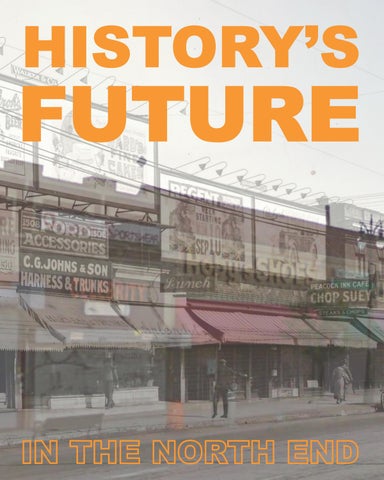
Cover Image: Early 20th-century photo of the North End along Woodward Avenue between Milwaukee Street and East Grand Boulevard, overlaid with an image of the same location from Google Street View.
University of Michigan Library, “Early Detroit Images from the Burton Historical Collection of the Detroit Public Library: View along Woodward between Milwaukee & East Grand”; Brooks, H.W., c.195. http://quod. lib.umich.edu/d/dpa1ic/x-dpa4529/dpa4529.tif; Google Maps, “Detroit, Michigan.” 2009. http://maps.google. com.
HISTORY’S FUTURE IN THE NORTH END
Meagan Elliott, Daniel Feinglos, Rob Pressly, Emily Provonsha, Laura Reading, Simone Robinson, Yuanhao Wang, Shu Yang, and Shanshan Zhou
Urban and Regional Planning Program
Taubman College of Architecture and Urban Planning
University of Michigan
May 2013
ACKNOWLEDGEMENTS
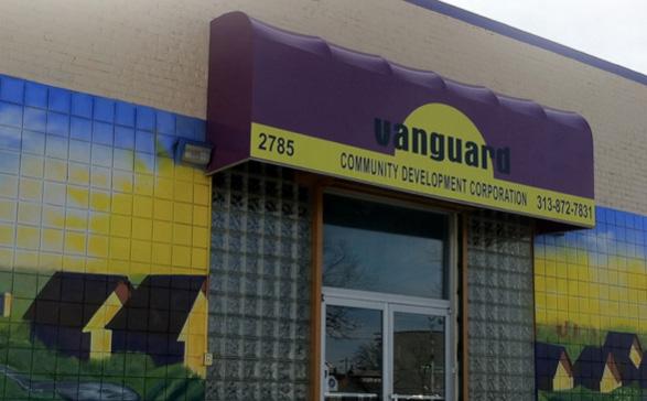
We would like to thank Khalilah Gaston of Vanguard Community Development Corporation as well as the members of the “History’s Future in the North End” advisory group for providing their expertise, feedback, and support:
Karen Gage
Roger Robinson
LaDonna Walker-Little
We would also like to thank the following individuals for helping us learn more about the North End’s history:
Pecola Bell
Delores Bennett
Regina Campbell
Halima Cassells
Nick Collins
Ashley Cook
Gerald Cook
Catherine Craig
Ara Howrani
Gar Sims Jones
Eugene Moore
Ulysses Newkirk
Jeff Nolan
Dorris Rue
Sandra Sims
Lawrence Taylor
Stephen Ward
We thank Vanguard Community Development Corporation for funding to cover our expenses in this project.
Lastly, we want to extend our gratitude to our faculty advisors Margaret Dewar and Eric Dueweke for their dedication to this project and to the City of Detroit.
Figure
Figure
Figure
Figure
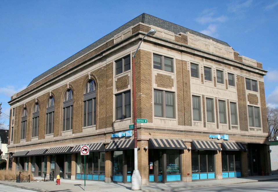
Figure 6.2. Lithuanian Hall.
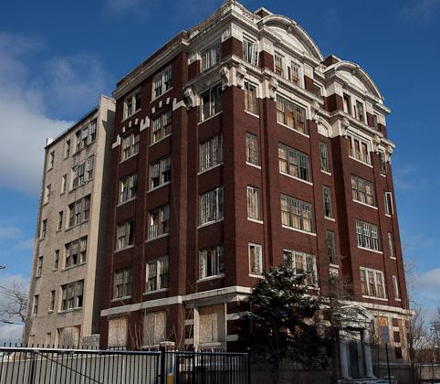
Figure 6.3. St. Rita Apartments. .....................................................................................
Figure
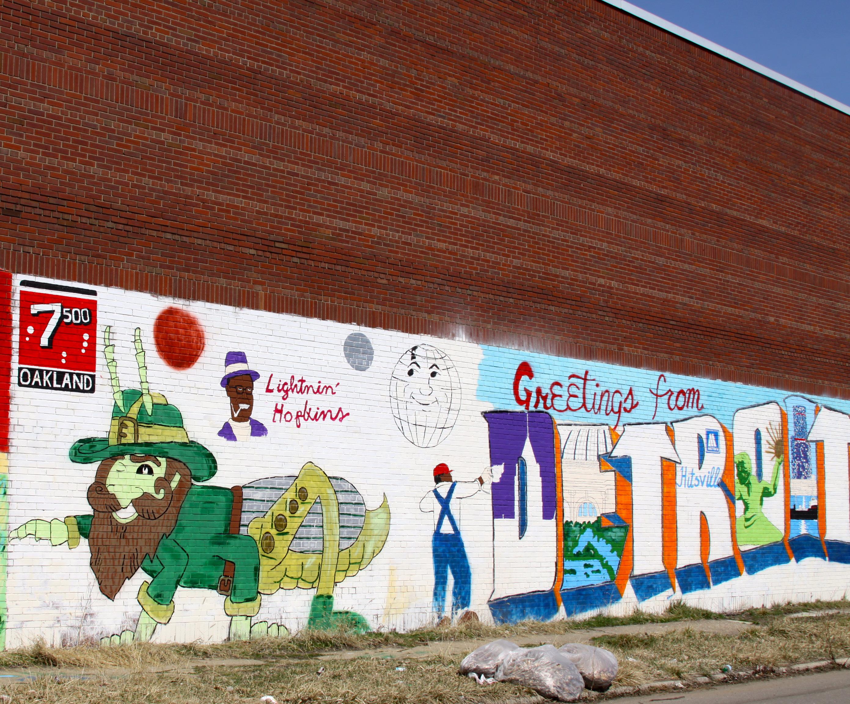
Figure 7.1. Black Splash mural at 7332 Oakland Avenue.
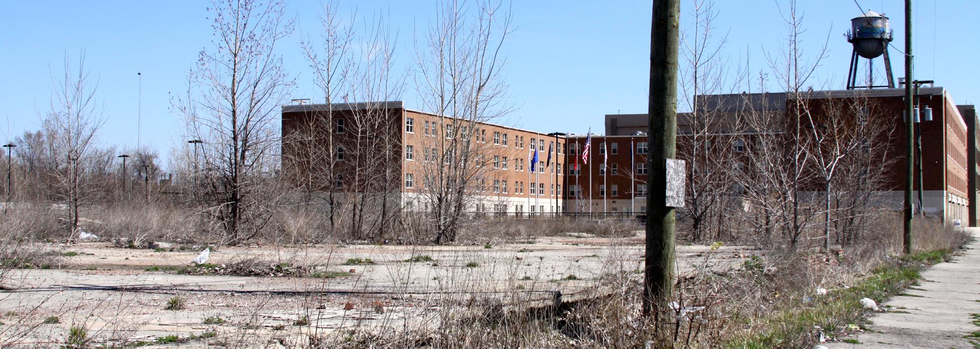
Figure 7.2. Milwaukee Junction buildings in 1949 (top) and 2009 (bottom). ..................
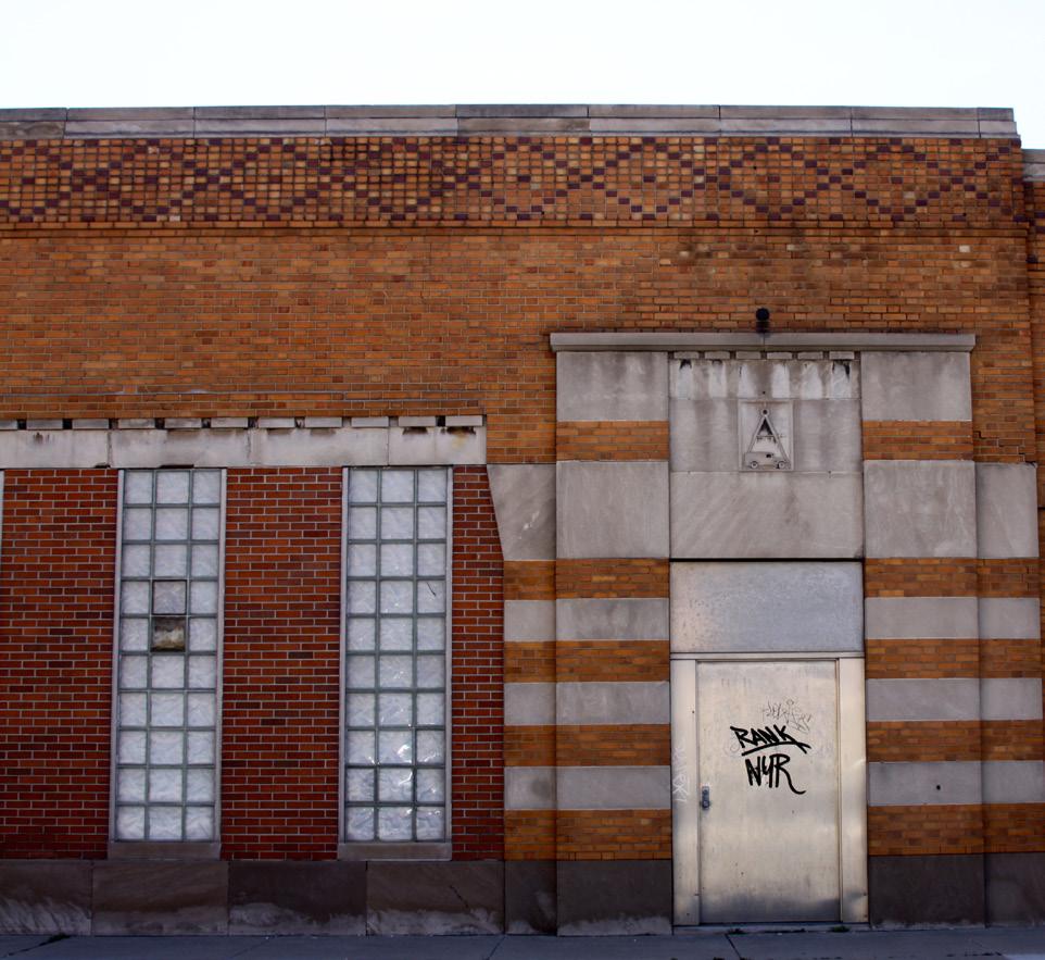
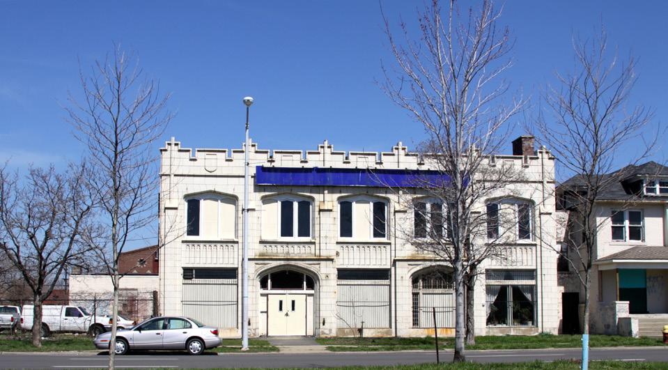
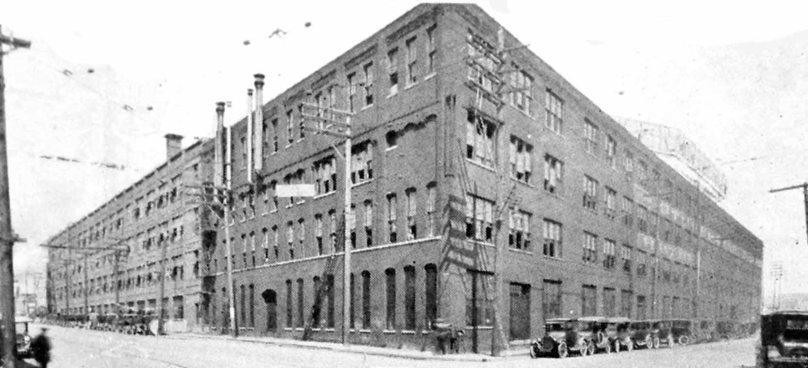
Figure 7.3. Ford’s factory (today known as the T-Plex) at 411 Piquette St. is an example of New England mill-style construction. 92
Figure 7.4. The former Autocar Sales building at 290 Piquette St. is an example of the Art Deco style. ...................................................................................................... 93
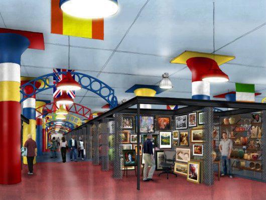
Figure 7.6. Potential sites to demonstrate strategies in Milwaukee Junction.
Figure 7.7. Potential trail marker with QR code. .............................................................
Figure 7.8. Footprints lead pedestrians along the trail. ..................................................
Figure 7.9. Potential route of bike and pedestrian trail in Milwaukee Junction. 97
Figure 7.10. Potential location of welcome mural on Woodward Avenue at Harper. ...... 98
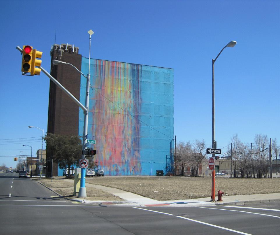
Figure 7.11. The northeast corner of Woodward and Harper Avenues as it appears today. 98
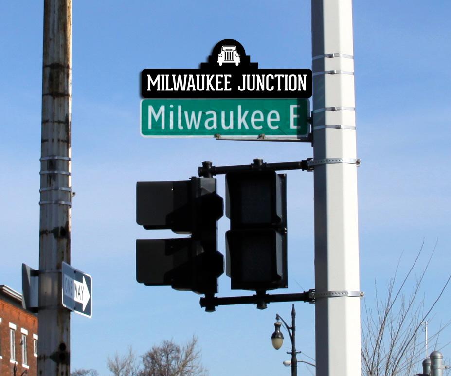
Figure 7.12. One potential location of street sign topper at the intersection of E. Milwaukee and Brush streets. 99
Figure
Figure
Figure
Figure
Figure
Figure
Figure
Figure
Figure
Figure 7.39.
Table B.2.
Figure C.1.
EXECUTIVE SUMMARY
Although the North End has many historic assets, Vanguard Community Development Corporation and others have not celebrated the district’s history in ways that could help achieve their other community development goals. In addition, some residents are not familiar with the North End’s history. Thus, this plan provides information, resources, and best practices to assist Vanguard, residents, and others to capitalize on the North End’s rich history to achieve three goals:
• Re-establish a sense of place
• Bring together diverse residents
• Encourage economic development
The North End in Context
The North End’s rich history comes from its industries, people, and events. The Milwaukee Junction area within the North End was a primary hub for early automobile manufacturing and has an abundant stock of historic industrial buildings. In the early 20th century, Jewish people and later African Americans moved into the North End. After 1950, the population declined, and businesses left. Disinvestment in property left increasing numbers of deteriorated buildings and vacant lots.
The North End Today
The North End experienced severe population loss after 1950 and has only about 10% of its peak population. It is now a predominantly African-American district with many low-income residents. Although many residential structures remain in good condition, a high vacancy rate and the neglect that results threaten the North End’s historic housing stock. While some
industrial activities continue and some historic buildings have been reused, the Milwaukee Junction area contains many unused industrial buildings.
Re-establish a sense of place
A sense of place builds on historic character and serves as an identity for the North End. Strategies for re-establishing a sense of place fall into two categories: identify historically significant sites and help residents and tourists engage with those sites.
Identify historically significant sites
A sense of place can benefit from residents and visitors who have a strong understanding of a place’s history. Vanguard and others can identify historically significant sites with the purpose of enabling residents and visitors to learn about the North End’s history:
• Create an interactive online map that enables users to pinpoint historical sites, post relevant photos, and fill in historical facts.
• Create a fold-out map/poster: a physical version of the online map.
Help residents and tourists engage with historically significant sites
Residents and visitors can experience and engage with historic sites through the following:
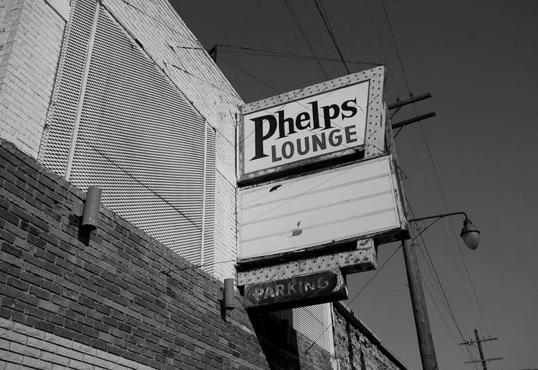
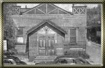
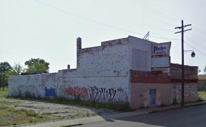
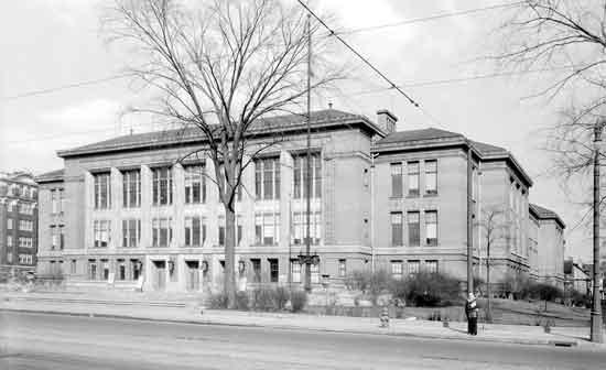
• Achieve historic designation for additional historic sites. Potential sites include: Northern High School (the site of a 1966 walkout), Russell Street Missionary Baptist Church (a longtime site for African-American religious services) and Phelps Lounge/Bizerte Jazz Bar (a landmark nightclub).
• Create signage and murals to enable visitors to recognize where they are. Historically significant sites would be more recognizable with signage and murals.
• Create a wayfinding system to connect historically significant sites and enable visitors to identify where they want to go and how to get there.
• Coordinate with local schools to develop history curricula. A map-making curriculum that includes analyzing historical maps, investigating historic sites, and creating maps could help students engage with historic sites.
Use the North End’s history to bring together diverse residents
Vanguard and others can enable North End residents to learn about the district’s history with more access to information and provide opportunities for diverse resident populations to engage with each other.
Enable North End residents to learn about the district’s history and increase access to information
The following strategies provide ways to collect history and to increase access to historical information:
• Create an oral history program to document stories of longtime residents.
• Create a portable local history exhibit to display at North End events.
• Create a bicycle and pedestrian trail connecting historical sites to bring visitors, new residents, and longtime residents together as well as increase the awareness of North End’s history.
• Publish a book that includes information and materials collected from the oral history program, interviews, and other research activities for North End residents to publicize the North End’s history.
Provide opportunities for diverse residents to engage with each other Residents can share their experiences, pass down historical knowledge and celebrate history through the following:
• Create a program for North End students to use businesses’ past advertisements and history to design new advertisements and connect North End students with local businesses.
• Recruit retiree volunteers to tutor and share local history with students.
• Open an outdoor library that contains a local history collection, including local artists and children in the project’s design and construction.
• Create a welcome package that includes neighborhood history and history trail brochures to encourage interaction between new and longtime residents.
Encourage economic development by using the history of the North End
The following strategies recommend sites where new development could be appropriate, given the North End’s history, and describe how attracting and creating new businesses and jobs can reinforce the historic context.
Support local job creation and entrepreneurship using historic and historically-appropriate buildings
The preservation of the district’s buildings and the construction of new ones compatible with their context can create jobs and business opportunities while supporting history.
• Develop local jobs through the reuse of historic structures, providing space for small businesses and creating new work opportunities for residents.
• Develop local jobs through new construction that complements existing historic structures, reinforcing the district’s historic physical character while creating benefits for residents and businesses.
Develop
historical tourism
Historical tourism aims to use the North End’s history to attract visitors to the district, which can help to create new jobs as well as increase revenue for local businesses.
• Create museums, trails, and tours to celebrate history by hosting exhibits, providing historical information, and directing visitors to significant sites within the North End.
• Establish a training program to provide workers for the operation of potential museums and historic trails.
• Publicize district heritage sites to improve awareness of the North End’s heritage.
Guide economic opportunities that arise to preserve and protect the district’s history
Three strategies help to prevent new development from destroying the North End’s historical characteristics:
• Obtain historic district status for areas in the North End to ensure any new additions or renovations to historic buildings will have similar height, scale, and setbacks.
• Pursue zoning changes, such as SD1 zoning and Traditional Main Street Overlay Areas, that support historically-appropriate development.
• Encourage development on brownfield sites to create new activity in contaminated structures and sites and preserve the area’s historic character.
Building on history in Milwaukee Junction
The Milwaukee Junction area within the North End is the historic birthplace of Detroit’s automobile industry. Implementing several recommendations in Milwaukee Junction could re-establish a sense of place, bring together diverse residents, and encourage economic development. This chapter recommends the following:
• Create bike and pedestrian trails throughout Milwaukee Junction to attract automotive and history enthusiasts to visit the North End and learn about its history.
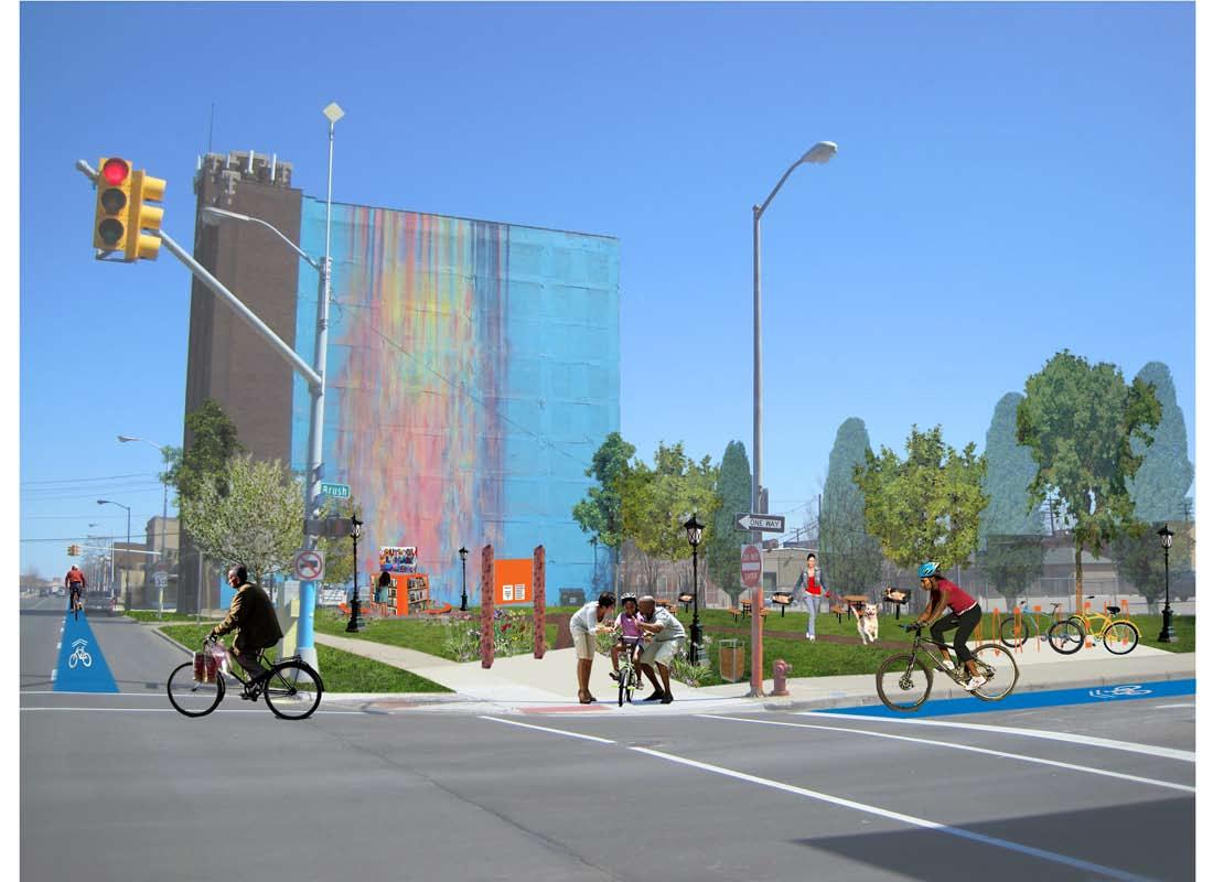
• Develop a welcome mural that reflects the history of the automobile and film industry at the northeast corner of Woodward and Harper.
• Install street sign toppers that reflect automotive history throughout Milwaukee Junction and involve local artists and metal workers in the design process.
• Develop a park adjacent to the Illuminated Mural at the corner of Brush Street and E. Grand Boulevard. Involve residents in the creation of public art that reflects local history at the park, open an outdoor library with a local history collection there, and display a portable local history exhibit during events at the park.
• Reuse the Art Stove Company building as office space or a community gathering space and obtain historic designation for it.
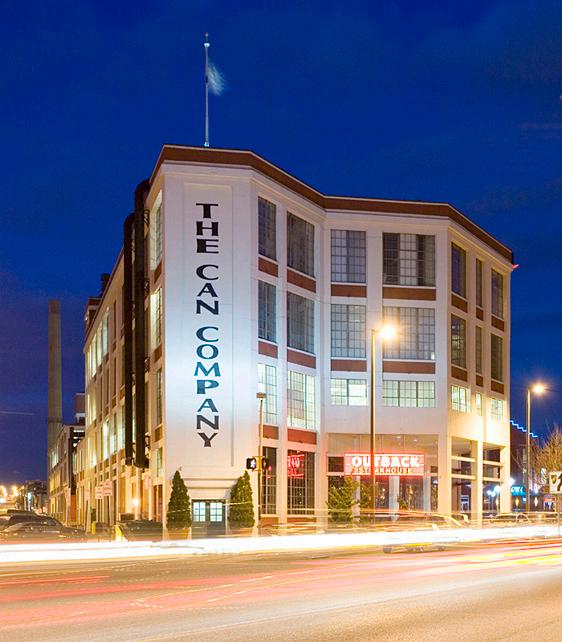
• Reuse the American Can Company building as a music studio and obtain historic designation for it.
• Obtain historic designation for and implement an oral history program in the Jam Handy Building.
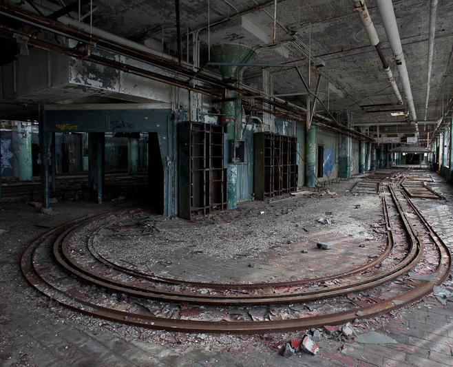
• Preserve Fisher Body Plant No. 21 and remediate contamination on the site.
• Obtain historic designation for the Russell Industrial Center.
• Encourage new development at the northeast corner of John R and Piquette to create new short-term and long-term jobs. Pursue SD1 zoning there to preserve the site’s historic physical character.
Vanguard can prioritize the implementation of strategies based on:
• Length of time until start
• Effort needed to sustain the project or program
• Required funding
• Whether the project requires partners
Based on the criteria above, Vanguard and its partners could implement the plan’s strategies in several phases.
Vanguard could begin to implement strategies with existing staff with relatively low costs in Phase 1:
• Create an online map.
• Create a fold-out map.
• Create signage and murals.
• Document stories of longtime residents.
• Introduce new residents to the North End’s history.
• Connect North End students with local businesses to learn about the district’s entrepreneurial history.
• Recruit retiree volunteers to tutor and share local history with students.
• Publicize district heritage sites.
Vanguard could begin the following strategies in Phase 2. Many of them depend on the completion of strategies in Phase 1 and also require additional logistics such as outreach to partner organizations and volunteers and additional funding.
• Achieve historic designation for additional sites.
• Coordinate with local schools.
• Design and implement a wayfinding system.
• Open an outdoor library.
• Display a portable history exhibit at local events.
• Create a trail connecting historical sites to promote the North End’s history.
• Involve residents in the creation of pubic art that visualizes local history.
• Establish training programs for tourism-related jobs and new business opportunities.
• Pursue zoning that supports historically-appropriate development.
Vanguard could start work on the following strategies in Phase 3: they have even greater funding and time needs than Phase 2’s strategies and also depend on the completion of the previous phases’ strategies.
• Publish a book for North End residents that documents local history.
• Develop local jobs through the reuse of historic structures.
• Develop local jobs through new construction that complements existing historic structures.
• Encourage development on brownfield sites.
• Create historical tourism, trails, and museums.
Conclusion
By using history to re-establish a sense of place, bring together diverse residents, and encourage economic development, Vanguard and its partners will both celebrate the district’s storied past and strengthen today’s North End.
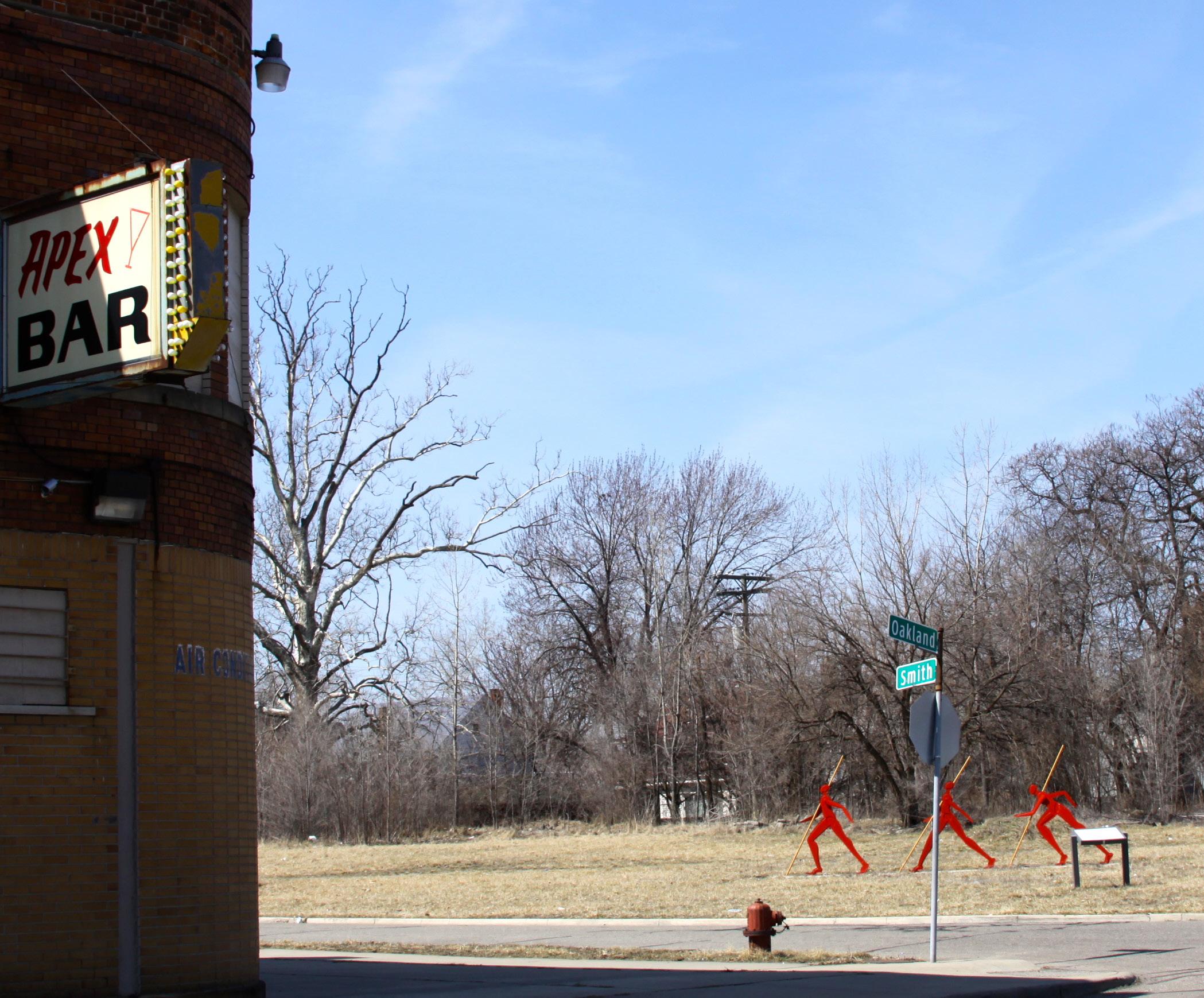
Figure 1.1. “How We Move” sculpture at Oakland Avenue and Smith Street.
CHAPTER 1 INTRODUCTION
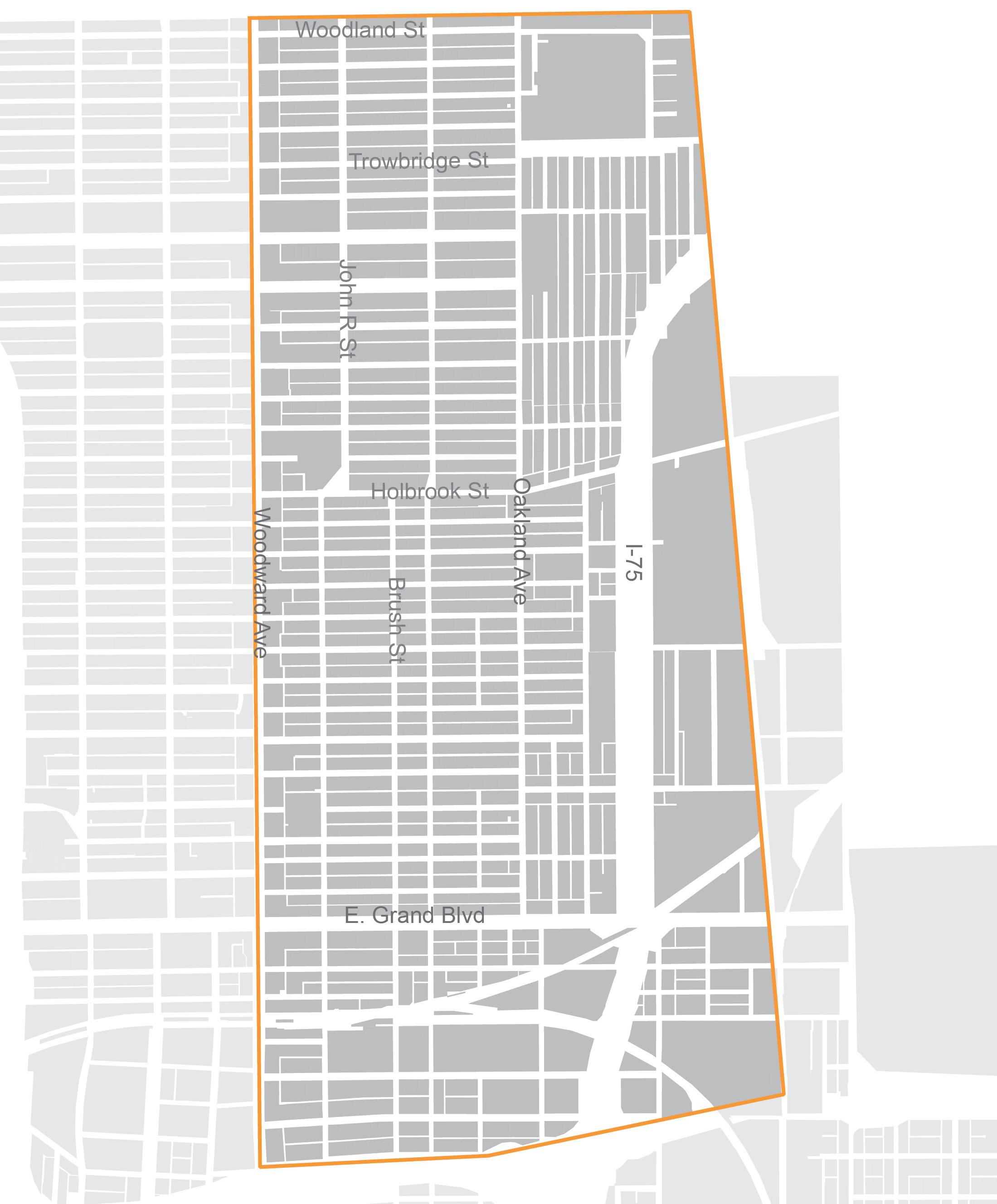
This plan aims to provide information, resources, and best practices for Vanguard Community Development Corporation, residents, and other stakeholders to capitalize on the North End’s rich history for future initiatives. Detroit’s North End is the district roughly bounded on the west by Woodward Avenue, on the south by Interstate 94, on the east by the Canadian National tracks, and on the north by the alley between Woodland and Tennyson streets that marks the boundary of Highland Park (Figures 1.2 and 1.3).
Vanguard was founded in 1994 to aid revitalization of the physical, social, and economic condition of the district after decades of disinvestment. Part of Vanguard’s mission is to facilitate collaborative planning with residents, neighborhood organizations, local businesses, and foundations. The use of history is central to the redevelopment of the district as it can help to cultivate neighborhood identity, bring together diverse residents, and foster future economic development. This plan offers strategies to achieve these three goals.
The North End
The City of Detroit annexed the land where the North End district sits today from the original Hamtramck Township in 1891, and a year later in 1892, Arden Park became the earliest platted development within the district. Figure 1.4 demonstrates this annexation and how at the time, this area constituted the northern boundary of Detroit.
The North End continued to develop through the 1920s and 1930s as the auto industry attracted many immigrants from Eastern Europe as well as African-American families. Jewish immigrant communities had a particularly strong presence throughout the Great
Figure 1.2. The North End and its boundary.
Depression. In the 1940s and 1950s, the Jewish population began moving northwest to Detroit’s periphery and to the suburbs. African-American families have constituted the largest share of population in the district since the mid-1950s.
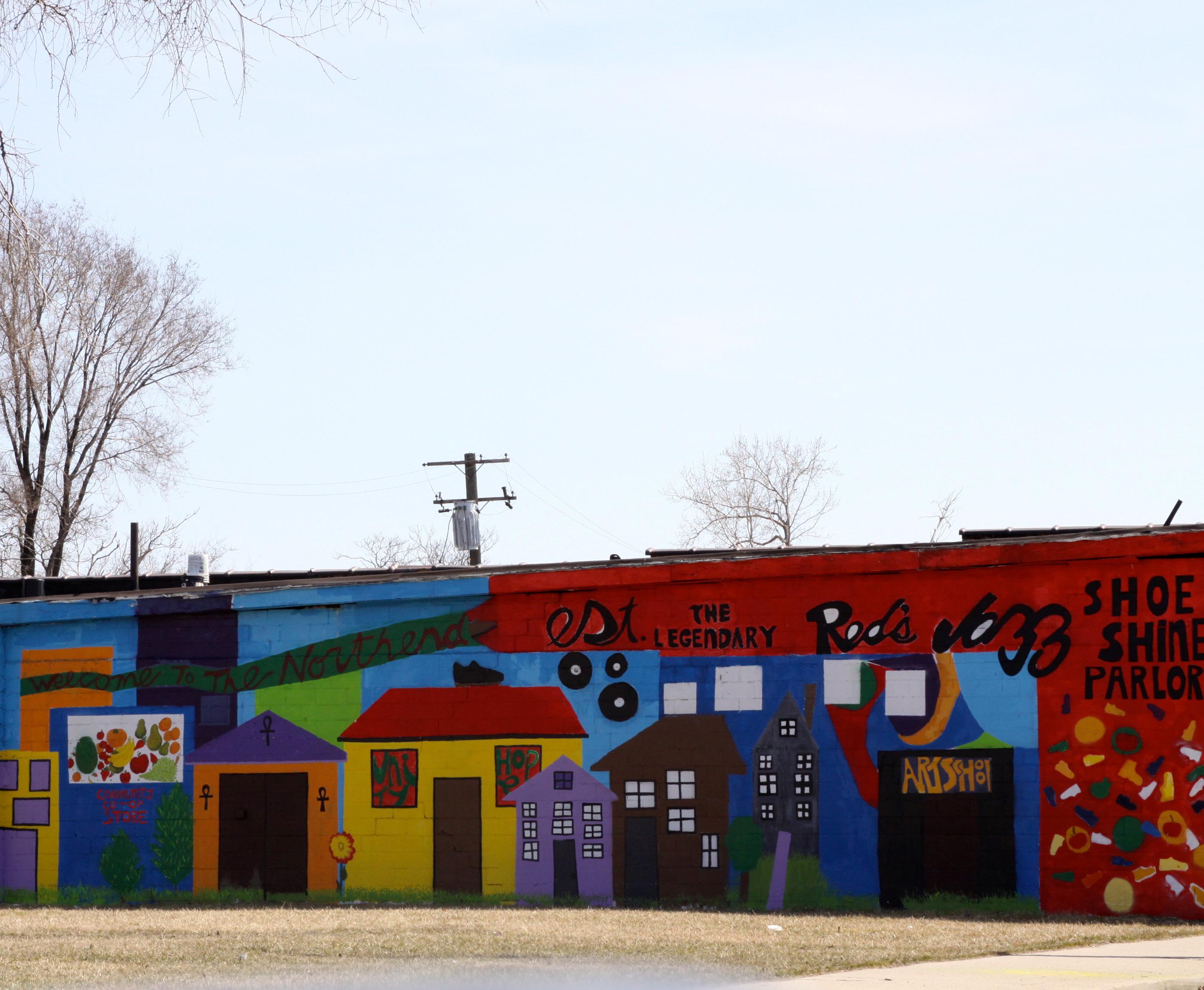
Functioning as a northern extension of the more famous Hastings Street, the Oakland Avenue corridor became the heart of jazz and entertainment in the North End, and was home to many clubs, bars, and locally owned businesses.1
After World War II, the loss of manufacturing jobs and suburbanization weakened the North End as families left and shops closed. In later decades, regional deindustrialization along with the construction of I-75 further devastated the North End’s physical structure and identity as many homes and businesses were removed.2
In spite of the disinvestment and dwindling population in the district, many residents and organizations remained committed to the area and worked to improve the
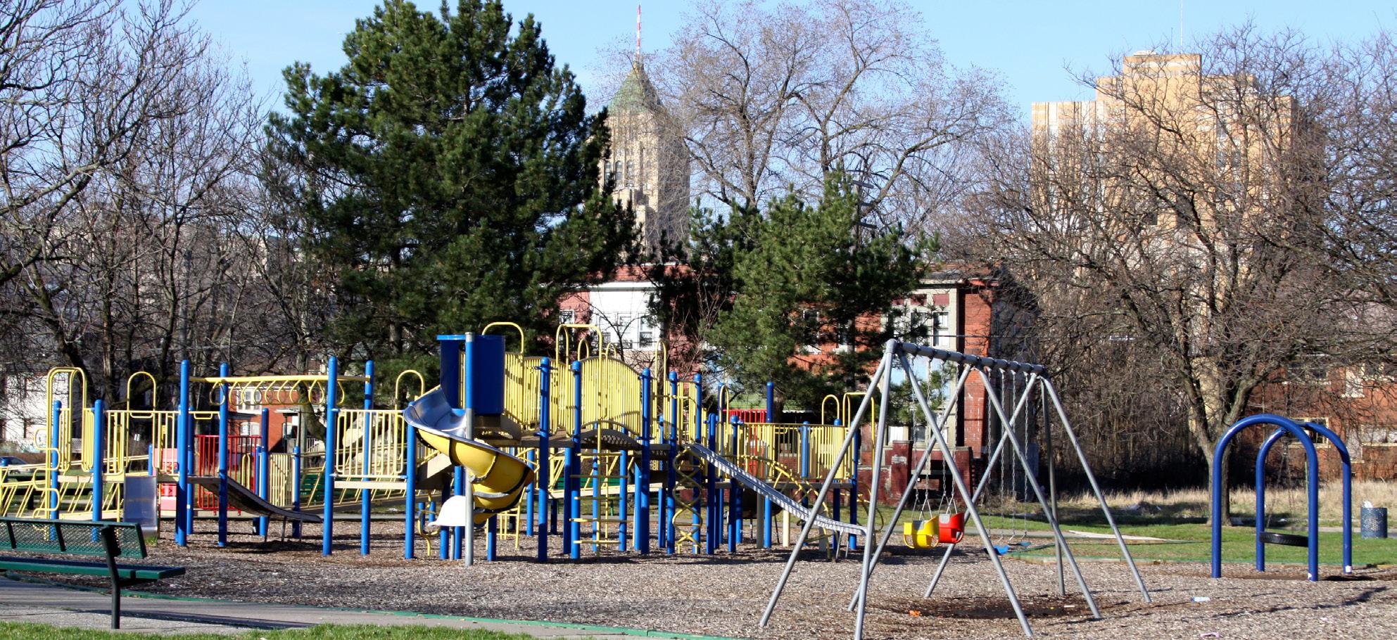
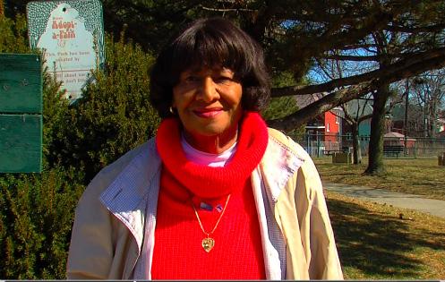
North End’s assets. For example, North End neighborhood activist Delores Bennett recognized the need for a neighborhood playground and park and led the effort to gain support for a new recreation area. After 13 years of working with North End residents and city officials, she succeeded in 1977 in turning an area previously used as an informal dump into today’s Delores Bennett Park (Figure 1.5).3
While a number of planning efforts in the North End are already underway, they have often overlooked the history of the neighborhoods in this district. In addition, there is a perceived influx of artistic new residents attracted by the availability of affordable properties and vacant land near major institutions such as the College for Creative Studies and the Detroit Institute of Arts. This has led to tensions among residents, with longtime residents concerned that the younger newcomers lack an understanding of neighborhood context. With this in mind, Vanguard asked Master of Urban and Regional Planning students from the University of Michigan
Figure 1.3. The North End district in Detroit.
Figure 1.4. The North End was the northernmost area within Detroit’s city limits as of 1907.
1907 Detroit Boundary North End Boundary
to craft a plan that uses the North End’s history as a means of re-establishing the district as a desirable place to live, work, and visit.
Goals of the Plan
The following three goals guide this plan for Vanguard’s efforts to celebrate the North End’s history and enhance the area’s quality of life:
• Re-establish a “sense of place”: recognizing the North End’s long history in order to help re-establish a shared identity about what the district represents and what makes it an exceptional place to live and visit
• Bring together diverse residents: helping bridge the gap between long-term and new residents, younger and older residents, and residents of different racial and ethnic groups
• Encourage economic development: using the context of history in the North End to aid job creation and entrepreneurship
This plan provides strategies, best practices, and case studies to guide Vanguard in achieving these three goals. Chapter 2 provides a brief history of the North End, highlighting its physical and population changes over time. Chapter 3 reviews the current physical status of the North End, people living in the district, and recent planning initiatives. Chapter 4 focuses on how to create a sense of place that builds on the North End’s history. Chapter 5 provides strategies for a diversity of residents to learn about the North End’s history and to engage with one another. Chapter 6 identifies ways that historic assets can strengthen economic development in the North End, providing opportunities for entrepreneurship and job creation.
This plan also provides details on how to move from the strategies suggested in this plan to their implementation in the North End. Chapter 7 offers a guide tailored to the Milwaukee Junction area, proposing strategies for re-imagining a space whose
Figure 1.5. Delores Bennett Park on Smith Street between Brush and Beaubien Streets.
buildings and scale are very different from the remainder of the district. Chapter 8 provides a timeline for implementing strategies to meet the goals for the entire North End district.
Notes
1 Oliver Zunz, The Changing Face of Inequality: Urbanization, Industrial Development, and Immigrants in Detroit, 1880-1920 (Chicago: University of Chicago Press, 1982); Lars Bjorn and Jim Gallert, Before Motown: A History of Jazz in Detroit 1920-60 (Ann Arbor: University of Michigan Press, 2001).
2 Vanguard Community Development Corporation, The North End: Preserving the Past & Embracing the Future by Enriching the Present, January 2013.
3 North End Youth Improvement Council, “About the Founder.” Accessed on February 7, 2013, http://neyic.org/aboutthefounder.asp.
Image Sources
1 Image courtesy of Meagan Elliott.
2 Map Data Source D (Appendix A).
3 Map Data Source A, C, D (Appendix A).
4 Map Data Source A, B, C (Appendix A).
5 Image courtesy of Meagan Elliott.
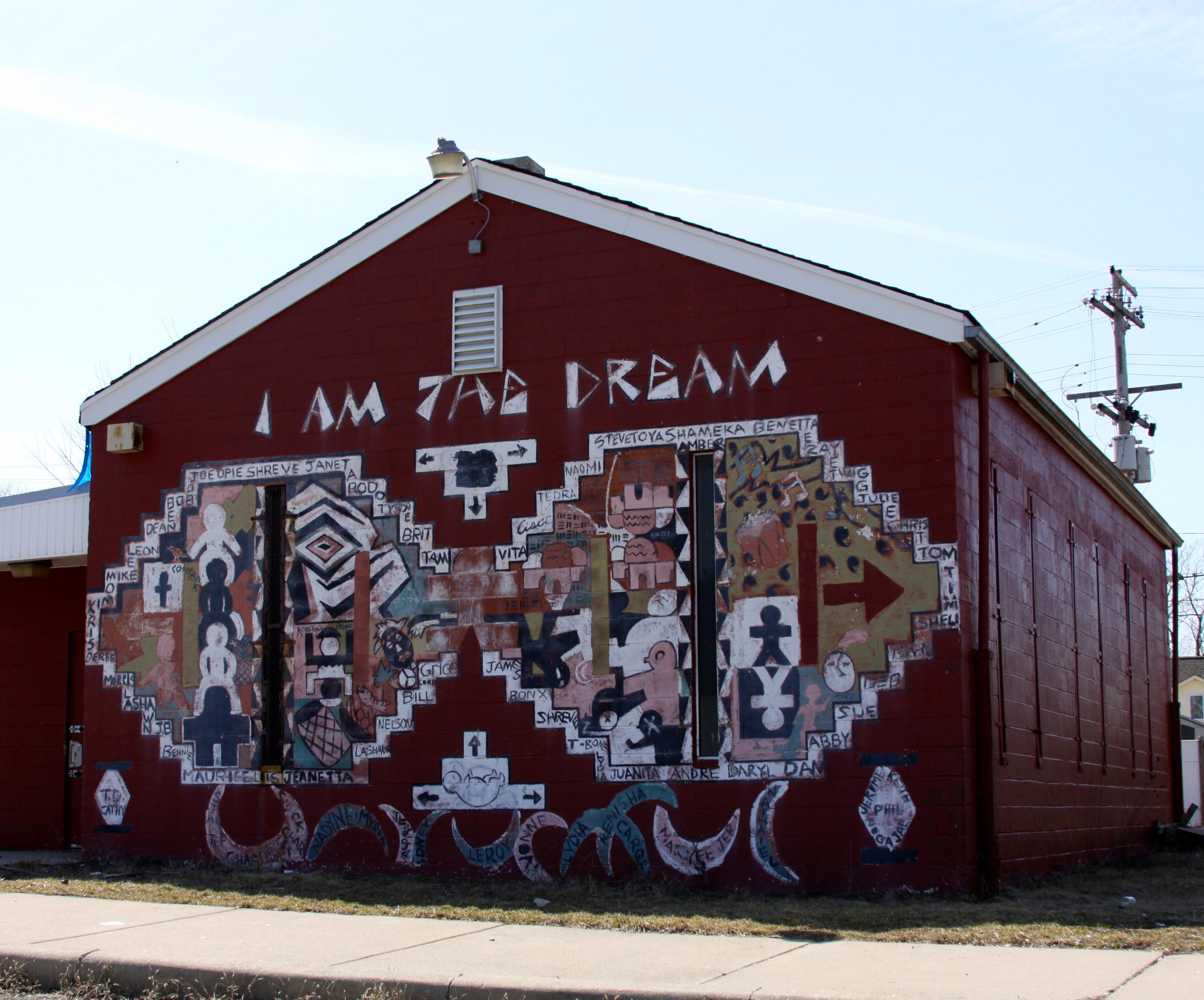
Figure 2.1. “I am the Dream” mural.
CHAPTER 2
THE NORTH END IN CONTEXT
The history of the North End is best expressed by discussing the people, industries, and events that contributed to its making, unmaking, and remaking: from the original households who settled in Arden Park to those looking out their front windows today; from the automobile industry that built Model T’s at the Ford Piquette Plant to the art galleries now in Milwaukee Junction; from those who planned and built the Chrysler Freeway to those who work to strengthen neighborhoods that the freeway affected. The North End has a rich history that is often absorbed into Detroit’s history. This chapter describes the North End’s distinct history through an overview of some of the major local events of the last 120 years.
1890-1919
The Beginnings of the North End
The City of Detroit annexed the area that constitutes the North End from Hamtramck Township by 1907. At the time, the newly added land (which also included what is now New Center) was the northernmost part of the city – its literal north end (Figure 1.4).1
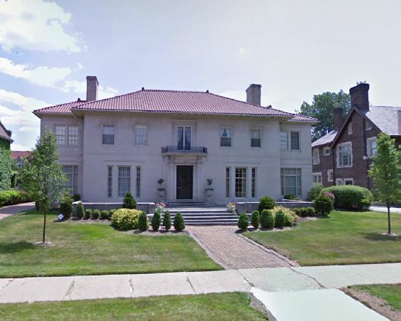
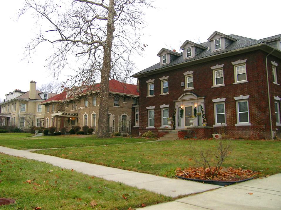
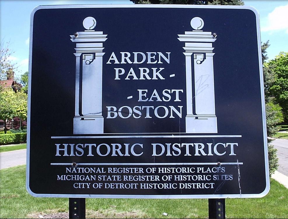
Arden Park became the earliest residential development within the district in 1892 (Figure 2.3). Arden Park, whose name was likely a reference to the fictional Arden Forest in Shakespeare’s play As You Like It, was planned as a luxury residential area.2 By the turn of the 20th century many corporate leaders in Detroit had made the neighborhood their home, including notables like Frederic J. Fisher (Fisher Body Co.), John Dodge (Dodge Brothers), Clayton and Albert Grinnell (Grinnell Bros. Pianos), and J.L. Hudson (Hudson’s department store). In 2013, it remains one of the most impressive and diverse collections of residential architecture in Michigan, including examples of the Renaissance, Tudor, Colonial, and Prairie
styles. Arden Park is a historic district listed on the State Register of Historic Sites and National Register of Historic Places.
The rest of the district developed over the next few decades. By the 1910s, most of the area south of Holbrook Avenue consisted of single-family homes as well as some apartments closer to Woodward. Woodward itself would not see today’s extensive commercial development for several more years.3 Nevertheless, the streets running parallel to it (John R, Brush, Beaubien, and Oakland) developed many attached row house structures, some with first floor businesses such as neighborhood delis, bakeries, and cleaners. As the district developed with homes, retail establishments, and factories, new residents began to demand more city services, leading to the construction of eight new schools in less than two decades.
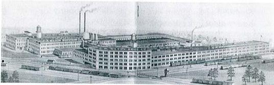
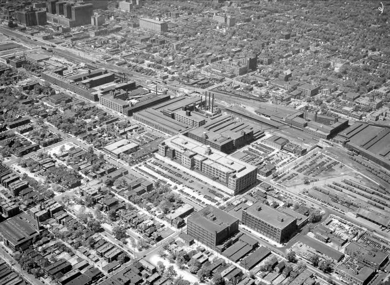
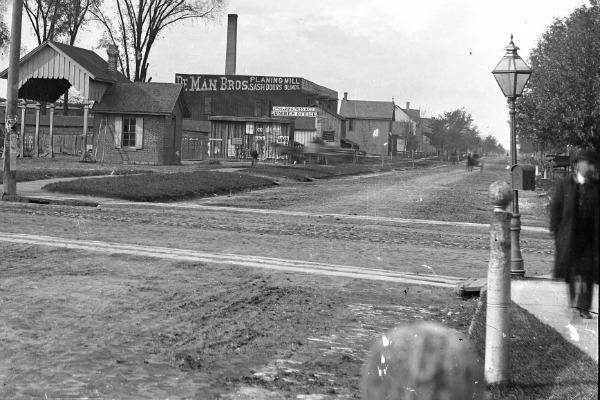
Milwaukee Junction and the Auto Industry
Towards the end of the 19th century, Detroit’s industrial growth primarily concentrated around the rail lines that skirted what was then the city boundary. This location provided factories with easy access to the national rail network and kept them somewhat isolated from the city’s historic core. The intersection of the Detroit, Grand Haven, and Milwaukee Railway and the Chicago, Detroit, and Canada Grand Trunk Junction Railroad provided a name for the new neighborhood of Milwaukee Junction. Automotive companies flocked to the area; soon after the Ford Motor Company introduced the Model T, it opened an Albert Kahndesigned sales and service building on the corner of Woodward and East Grand Boulevard in 1909. As companies such as Ford, Fisher Body, and Studebaker set up sales and production facilities in the area through the first decades of the 1900s, Milwaukee Junction became one of the primary hubs for the automobile industry
Figure 2.3. The Arden Park neighborhood is established.
Figure 2.2. Most of the North End is annexed from Hamtramck Township.
within the city. Ford left for neighboring Highland Park by 1919, and the Milwaukee Junction area’s importance as a major industrial center began to decline.4
1920-1940
Jewish Residents
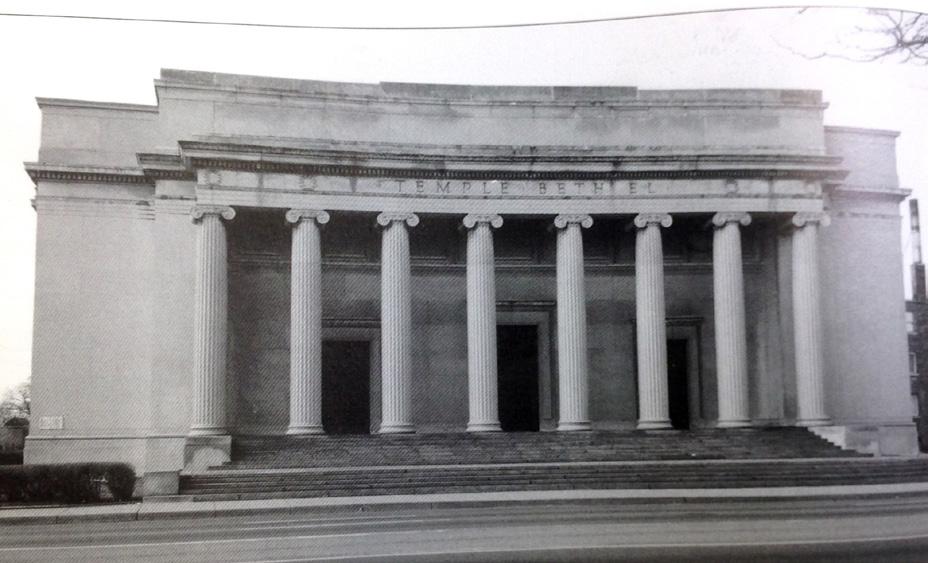
As Detroit’s automobile industry expanded, demand for labor was high. As a result, the 1920s and 1930s saw a massive influx of immigrants to Detroit, especially from eastern and central Europe. Many who came in search of work were working class Jewish immigrants who settled in the North End. The district’s new residents established a dense network of religious and social institutions, including synagogues such as Ahavas Zion and Temple Beth El and organizations such as the United Hebrew School and the North End Clinic. The Jewish Child Care Council Home and the Jewish House of Shelter provided a safety net for people in need.5 While many physical examples of the North End’s Jewish history remain today, most surviving buildings were converted
into Christian churches as the population shifted from predominantly Jewish to Christian.
The Purple Gang
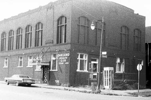
Detroit’s proximity to the Canadian border positioned it as a “bootlegger’s dream town” when alcohol was banned in the United States from 1920 to 1933. The infamous Purple Gang, a Jewish “mafia” organization in Detroit, was primarily based in the Brush Park neighborhood. In the North End, the Oakland Sugar House Gang preceded the Purple Gang, operating out of a house at the corner of Oakland and Hague. This house served as a base for bootleggers, supplying all the necessary ingredients to distill liquor.6
On the site of a former dance hall a few blocks away at Oakland and Melbourne, Purple Gang associate Harry Meltzer, Jr., opened the Oakland Health Club in 1930. Known today as the Schvitz Health Club (Yiddish for “sweat”), this Russianstyle bathhouse is still in operation.7 The
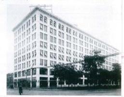
Figure 2.4. Ford opens the Lakeshore Building at E. Grand Boulevard and Woodward Avenue.
Figure 2.5. Temple Beth El opens at Woodward Avenue and Gladstone Street.
Purple Gang likely spent a great deal of time in the bathhouse, evidenced by the numerous bullet holes in a painting in the lobby. The baths may have served as a watering hole for the gang during Prohibition because of its status as a private club, which placed it outside of direct police scrutiny.
African-American Residents
African Americans from the South migrated to Detroit with the success of the automobile industry, which offered steady jobs with good pay in the 1920s. Concentrations of African Americans lived in sections of Highland Park and Hamtramck, on north Russell Street, and near Milwaukee Junction by 1920. By the 1930s, the North End’s Oakland Avenue had become a hub for black musical innovation, making it the heart of Detroit’s Blues and Jazz scene. Oakland Avenue functioned as an extension of the city’s famous Hastings Street, rivaling the music scenes of the “Miracle Mile” in Los Angeles. This North End thoroughfare
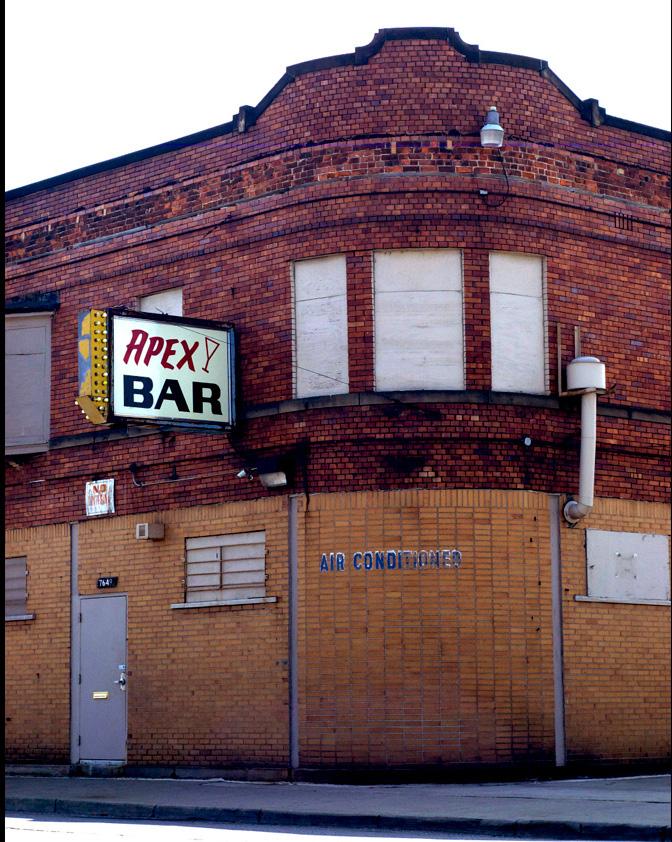
hosted its share of music venues and black-owned businesses, such as the Apex Bar at 7649 Oakland that is still in operation today. Other jazz spots, such as Phelps Lounge, were Jewish-owned but catered to integrated or all-black audiences and often had black managers.8
By 1940, census data show that African Americans made up over 40% of the district’s population. Black professionals, such as Dr. Dewitt Burton (the founder of Burton Mercy Hospital) had begun to move into the previously all-white Arden Park neighborhood.9
1941-1945
Effects of World War II on the North End
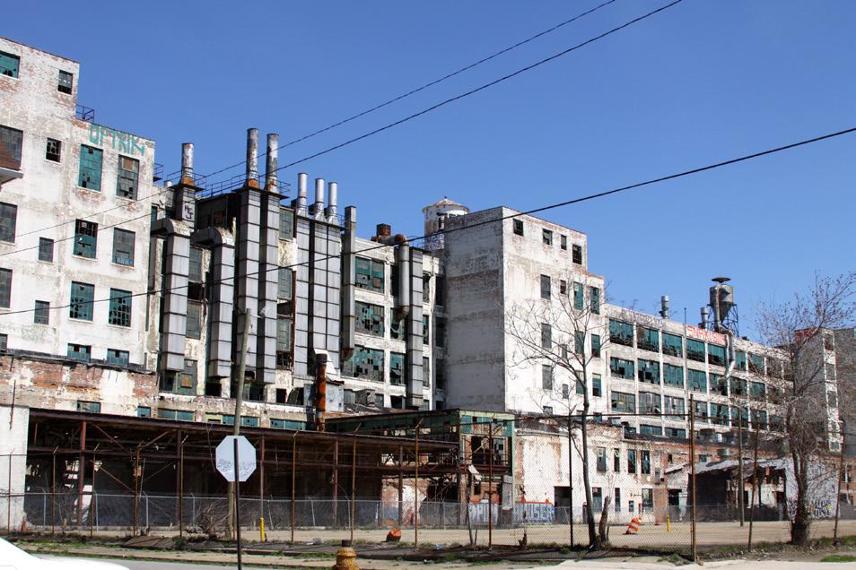
During World War II, U.S. automakers shifted from producing automobiles to manufacturing military equipment and airplanes. After the U.S. entered the war in 1941, the Army Air Corps took over the Fisher Body Plant No. 21, located at 700 Piquette in Milwaukee Junction. There, over a thousand workers assembled daily
Figure 2.6. The Schvitz opens as the Oakland Health Club.
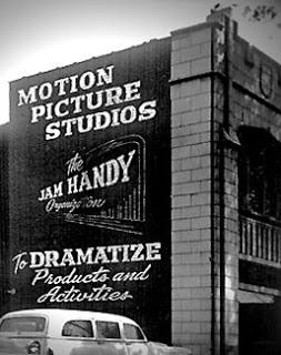
Figure 2.7. The Jam Handy Organization produces films for the armed services.
to build planes such as the P-80 Lockheed Shooting Star, F9-4 Corsair Shipboard Fighter, and parts for the B-52 bomber.10
Planes were not the North End’s only contribution to the war effort. The Jam Handy Organization, perhaps best known for producing the animated film Rudolph the Red-Nosed Reindeer, spent the war years producing educational and training films for the armed services. Established before the war in a 4,000 square foot studio at 2900 E. Grand Blvd, the company originally focused on producing training and promotional films for General Motors. Between 1939 and 1945, Jam Handy created over 7,000 films – more than all of Hollywood had produced up to that time.11
1950-1965
Everyday Life in the North End
The North End experienced population loss starting in the 1950s, but the district was still thriving, supporting its residents with grocers, shops, and places for
entertainment. To its remaining residents, who were mostly middle-class African Americans, life in the North End seemed stable. Many Jewish synagogues were converted into churches as AfricanAmerican Christians moved into the North End. For example, the Beth Moses Synagogue at 586 Owen is now the Greater New Mount Moriah Missionary Baptist Church, and the Ahavath Zion Synagogue at 446 Holbrook is home to the Alpha & Omega Spiritual Church of Christ.12
By day, Oakland Avenue provided grocery stores, small businesses, corner stores, churches, and other gathering spaces throughout its neighborhoods. The North End also had corner stores, churches, and other gathering spaces throughout its neighborhoods. By night, the exciting entertainment scene along Oakland Avenue characterized the area. Clubs like the Royal Blue Bar, Lee’s Sensation, Phelps Lounge, and Apex Bar were full of patrons. Apex Bar was the home venue of John Lee Hooker, who claimed to have
Figure 2.9. The Phelps Lounge opens on Oakland Avenue near Josephine Street.
Figure 2.8. The Beth Moses Synagogue is converted into the Greater New Mount Moriah Missionary Baptist Church.
written his hit 1962 single “Boom Boom” as a reflection on his time spent there. Musical acts like the Temptations and Bettye LaVette also spent time at Phelps.13 Interviews with longtime residents revealed an appreciation for the stability, security, and vitality of life in the North End during this decade.
DIVERSITY AND FAMILIARITY: 1950s
Mrs. Pecola Bell, currently the President of the Women’s Auxillary of Metropolitan Detroit and involved with the Boys and Girls Bible Club, moved to the North End from Alabama with her family of nine at age 15. It was 1952, and her father became a pastor at Pleasant Grove Baptist Church on Dequindre Street.
Growing up on the tree-lined streets of the North End, neighbors knew each other well. She recalls diversity
in her neighborhood, a mix of AfricanAmerican and Polish families. In the great snow of 1965, she remembers, neighbors worked together like family to clear the streets. She also remembers a time when there was no need to lock the door at night, and there was no fear of crime.14
THE NORTH END THROUGH THE EYES OF A CHILD: 1960s
Nick Collins, currently the Director of the Center for Educational Outreach at the University of Michigan, moved with his family from a nearby neighborhood into the North End at the age of 12. It was 1962, and Collins’s first memory of the area was the dramatic upgrade in his summer baseball games from playing in the street to playing on a proper baseball diamond.
While Collins was busy playing baseball,
Figure 2.10. Students stage a walkout at Northern High School.
Figure 2.11. Looters hit Oakland Avenue businesses.
1965-1989
his older sister joined a girl’s social club that called themselves El Dricos. She and her friends paraded the streets in light blue poplin jackets, the name of their crew embroidered across the back in just the way that the play Grease popularized a decade later with the “Pink Ladies.” Their family attended neighborhood theaters, held picnics in the summertime, and hosted record parties in their basement.
Collins and his friends were industrious. They mowed and raked lawns and shoveled sidewalks depending on the season. In the summer and on weekends, Collins worked at the market on the corner of his block, one of a dozen local markets that carried fresh, locally sourced produce. He remembers stocking boxes on the corner, enticing everyone that walked by with piles of peaches, tomatoes, and anything else in season. For Nick Collins, life in the North End was good.15
Civil Rights, Urban Renewal, and Social Upheaval
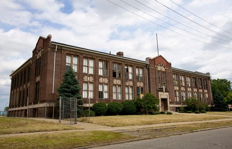
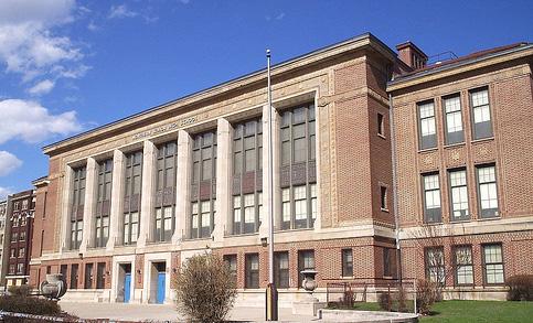
The tumultuous 1960s would have a lasting effect on the North End. The district was very much a part of national events, playing a role in Detroit’s Civil Rights Movement. During this period, the district’s population was roughly 90% AfricanAmerican. In 1966, students at Northern High School (now the Detroit International Academy for Young Women) began to notice a striking difference in the quality of educational as compared to majoritywhite high schools in the city. In response to this inequality, student Charles Colding penned an editorial promptly censored by Northern High School’s principal. This event catalyzed meetings among the student body that were held in secret. With the support of a small group of progressive teachers who believed in their cause, the students led a walkout. While not attending their scheduled classes, the students organized a Freedom School housed just down the street in St. Joseph’s
Figure 2.12. The Chrysler Freeway is built through the North End.
Figure 2.13. Delores Bennett creates a playground at Brush and Bethune Streets.
Episcopal Church and taught by Wayne State professor Karl Gregory, among others. In addition to civil rights leaders, in October 1966 Robert F. Kennedy visited the North End in support of local candidates, making a stop on Oakland in the heart of the district.16
Although the violence that struck Detroit in July 1967 began outside of the North End, the district was strongly impacted. Shortly after 5:00 p.m. on the first day of the turmoil, police recieved a report that 3,000 looters had descended onto Oakland between Westminster and Owen. Shops and homes burned as tanks rolled down the partially-completed Chrysler Freeway.17
Although the 1967 civil disorder subsided by the beginning of August, the impacts of the 1960s permanently changed the district. Most prominently, by the time the Chrysler Freeway was completed in 1970, it cut through the district, severing the eastern blocks from the rest of the North End. Thousands of residents, mostly white,
continued to move to Detroit’s suburbs, as they had since 1950, accompanied by their businesses and social institutions. African Americans also left the North End in large numbers, likely relocating to other neighborhoods within Detroit that residents left behind. They were often unable to move out of Detroit due to antagonism of suburban whites and discriminatory policies that effectively disqualified African Americans for mortgages until the late 1960s. Between 1950 and 1970, the North End lost over half its population, resulting in fewer residents to pay taxes, patronize local businesses, and maintain local buildings.18 As its people left, the district’s structures fell into disrepair.
Abandoned Neighborhoods and the Need for Redevelopment
Despite the area’s physical changes, many North End residents refused to give up on the district. Beginning in the late 1960s, North End community activist Delores Bennett led a decade-long effort to create a new park. She recognized that lots
Figure 2.14. Over thirty acres north of Caniff are cleared for the Bing Group.
Figure 2.15. North End population by race from 1940 to 1990.
located at Brush and Bethune, owned by a neighborhood church, had become an illegal dumping ground. With permission from the church’s pastor, she cleaned up the site and created a playground for local children. Ms. Bennett gathered petitions and on July 2, 1977, Bennett Park became a reality.19
As longtime resident Pecola Bell recalls, starting in the late 1970s and early 1980s, as elderly generations of residents passed away, their children began to rent out their homes or often let them become run down. This, she notes, is when the neighborhood began to lose its “sense of closeness.” Ms. Bell’s perception of a loss of closeness reflects a dramatic decrease in the district’s population and housing stock. During the period from the North End’s peak in 1950 to 1990, the district’s population shrank much faster than the city’s. In 1950, the North End had a population of 51,709; by 1990 the number had declined to 11,019. Housing numbers in the North End tell a
similar story: 11,577 housing units with a vacancy rate of 1% in 1950 would become 5,341 by 1990 with a vacancy rate of 14%.20
The 1990s into the present
In recent years, the district has continued its transition from density to vacancy. Within the last four years, Detroit Public Schools demolished the former Breitmeyer and Sherrard schools on Cameron Street, and a fire claimed the former theater that had housed the Latin Quarter on the Boulevard. Houses continue to deteriorate and are periodically razed. As of the 2010 census, housing vacancy stands at 37% (Figure 2.16).21
Responding to the issues facing the residents of the North End, Bishop Edgar Vann II of Second Ebenezer Church founded Vanguard Community Development Corporation in 1994, the same year that the church moved to the North End. Vanguard seeks to facilitate
Figure 2.16. Percentage of vacant housing in the North End from 1940 to 2010.
Figure 2.17. Bishop Edgar Vann II establishes Vanguard Community Development Corporation.
the revitalization of the physical, social, and economic fabric of the North End and expand the possibilities for the district after decades of disinvestment.22 In partnership with over 100 public, private, and philanthropic stakeholders and initiatives, Vanguard has led housing, education, and community investment projects throughout the North End.
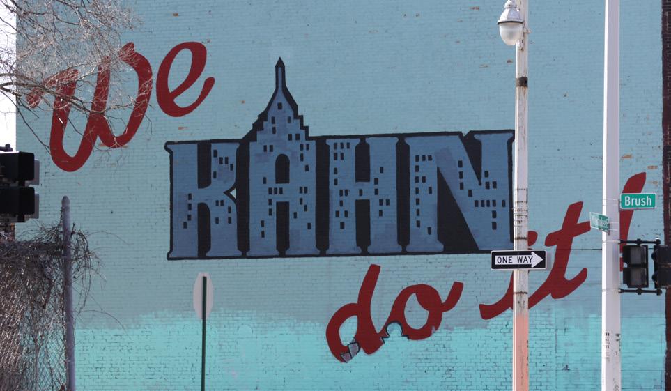
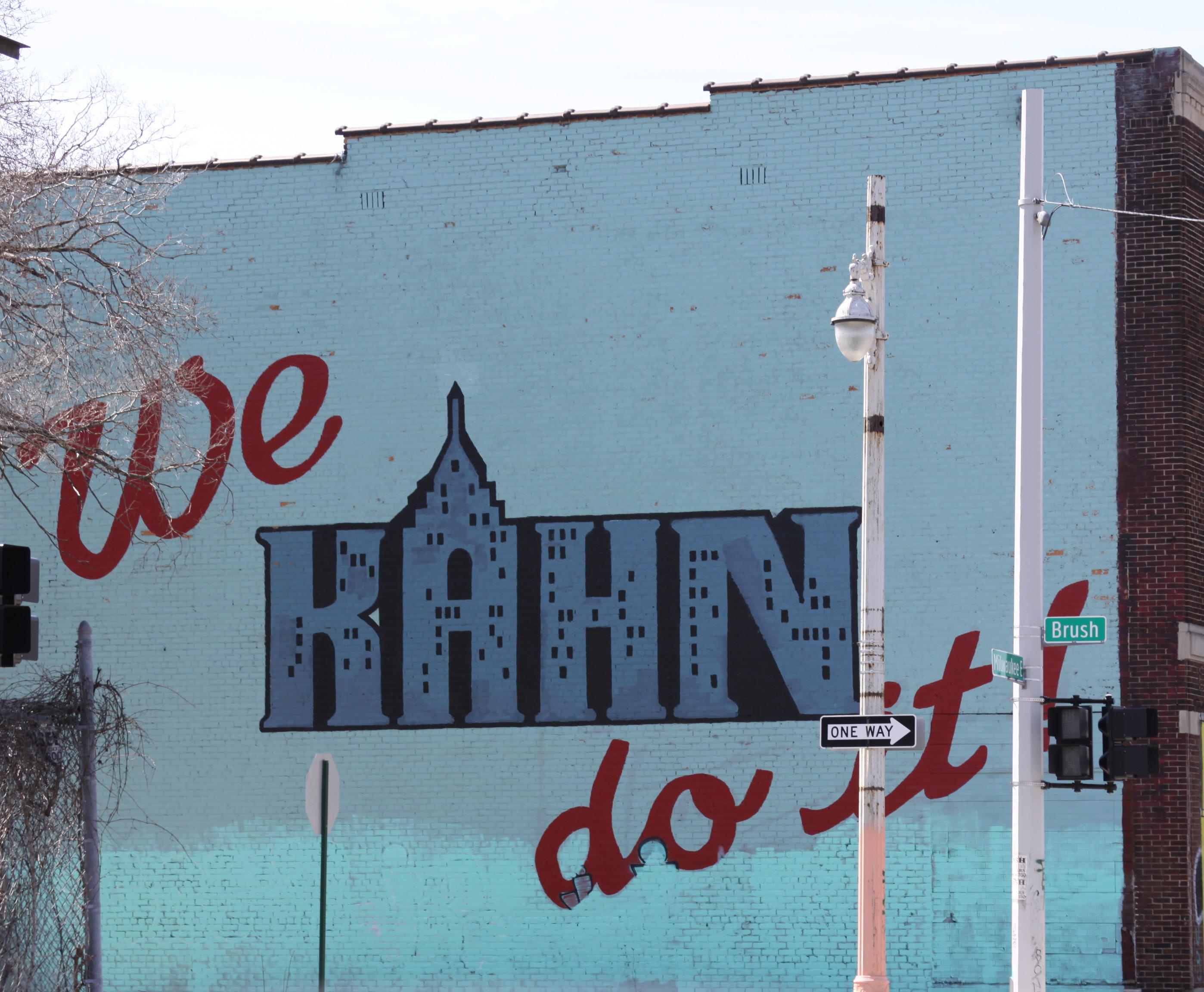
Despite empty lots and buildings, many people in addition to Vanguard are improving quality of life in the district. Other nonprofit organizations, such as YouthVille and Detroit Soup, have provided programs and services for area residents and businesses. Artists have taken up residence in the area, producing and showcasing their work at places like Tangent Gallery. Professional and non-professional artists have created murals like Reaching Out, We Kahn Do It, and the Illuminated Mural which has visually defined the district for travelers going east along the Boulevard since 2009. Urban agriculture organizations
like the Moore Family Food Garden and the Oakland Avenue Community Garden have promoted new kinds of activity in the area, at the same time that more traditional businesses like Red Door Digital and Pete’s Chocolates are continuing the legacy of the district’s entrepreneurial heritage. Both the Detroit Police Department and Detroit Public Schools opened new facilities in the district. New housing – both subsidized homes for groups like seniors and veterans, and market-rate developments like the Chap or Landsberg Lofts – enables diverse new residents to move into the area. Finally, the possible construction of North End stations for both the light rail and the commuter rail to Ann Arbor will help to integrate the district into the rest of the region and create new opportunities for transitoriented housing and businesses.
Along with local artists, entrepreneurs, organizations, and devoted individuals, Vanguard is now leading the way toward a new chapter in the history of the North
Figure 2.18. Katie Craig designs and paints the Illuminated Mural with artists from North End Studios and North End youth.
Figure 2.19. The Breitmeyer School on Cameron Street is demolished.
End. In collaboration with Detroit LISC, Vanguard published the Grand Woodward Quality of Life Plan in 2012 to help guide the district at the sime time that the City was preparing the Detroit Future City framework for its 2013 release. These formal and informal plans show that the district’s stakeholders have many distinct visions for it. Some see the North End as a place where everyone knows each other and helps encourage new business growth. Some see it as a space to reconnect to the history of the mid-20th century – when residents had access to fresh food grocers on every block –through urban farming. Others see it as the home it has always been, with a chance to capitalize on the area’s strengths and make it a better place for the people who live here.
By understanding the North End’s history, district stakeholders will be able to move beyond disinvestment to see a different history, one rich with manufacturing, musical innovation, and social welfare
organizations that supported everyday life in a culturally diverse district. The following chapter discusses the existing physical, social, and economic conditions of the North End. It also discusses recent plans and ways that history is already being used to revitalize the district.
Notes
1 Sustainable Detroit, “Annexation of North End from Hamtramck Township.” Accessed on April 20, 2013, http://www.sustainabledetroit.org/?page_ id=288.
2 City of Detroit Historic Designation Advisory Board, “Proposed Arden Park-East Boston Historic District.” Accessed on January 25, 2013, https:// www.detroitmi.gov/LinkClick.aspx?fileticket=U7L vOJDikBU%3D&tabid=3096&mid=4357; Thomas Turner, “The North End: Preserving the Past and Embracing the Future by Enriching the Present,” research for Vanguard CDC, 2013.
3 Sanborn, “Insurance Maps of Detroit, Michigan 1910 & 1915.”
4 Olivier Zunz, The Changing Face of Inequality: Urbanization, Industrial Development, and Immigrants In Detroit 1880-1920 (Chicago: University of Chicago Press, 1982), 297; Detroit Historical Museum, “Milwaukee Junction: Cradle of Detroit’s Automobile Industry,” 2005; Emporis
Figure 2.20. Detroit LISC and Vanguard CDC publish the Grand Woodward Quality of Life Plan.
Figure 2.21. Detroit Future City framework is published.
18
Building Data, “7310 Woodward Avenue.” Accessed on February 4, 2013, http://www.emporis.com/ building/7310-woodward-detroit-mi-usa; Eric J. Hill, and John Gallagher, “AIA Detroit: The American Institute of Architects Guide to Detroit Architecture,” 2003.
5 Irwin J. Cohen, Jewish Detroit (Chicago: Arcadia Publishing, 2002), 91; Gerald S. Cook, “The North End/Oakland Jewish Neighborhood in Detroit: 1910-1940,” Draft Article, 2013.
6 The Detroit News Online Photo Gallery, “Detroit During Prohibition: A Bootlegger’s Dream Town.” Accessed on January 28, 2013, http:// apps.detroitnews.com/apps/multimedia/gallery. php?id=13200; Rabbi David E. Lipman, “Detroit’s Purple Gang Bootlegging, fraud, and murder by a gang of Detroit Jews.” Accessed on February 4, 2013, http://www.myjewishlearning.com/history/ Modern_History/1914-1948/American_Jewry_ Between_the_Wars/Gangsters/Detroits_Purple_ Gang.shtml.
7 Paul R. Kavieff, Detroit’s Infamous Purple Gang (Chicago: Arcadia Publishing, 2008); Gary Sosnick, “The Oakland Avenue Bath House.” Accessed on February 4, 2013, http://www.garysosnick.com/ OABH1930/index.html.
8 Oliver Zunz, The Changing Face of Inequality: Urbanization, Industrial Development, and Immigrants in Detroit, 1880-1920 (Chicago: University of Chicago Press, 1982), 353; Lars Bjorn and Jim Gallert, Before Motown: A History of Jazz in Detroit 1920-60 (Ann Arbor: University of Michigan Press, 2001), 67.
9 City of Detroit Historic Designation Advisory Board, “Proposed Arden Park-East Boston Historic District.” Accessed on January 25, 2013, https:// www.detroitmi.gov/LinkClick.aspx?fileticket=U7LvO JDikBU%3D&tabid=3096&mid=4357; U.S. Census Bureau, “Population and Housing Characteristics,” 1940-2010.
10 Samantha Cleaver, “The Story of Fisher Body 21.” Accessed on January 30, 2013, http://www2. metrotimes.com/culture/story.asp?id=13124.
11 Robert T. Eberwein and Bill Sandy, “Contributions of the Jam Handy Organization to American commerce and culture,” Oakland Journal, no.4 Spr (2002): 82-92.
12 Lost Synagogues of Detroit, “Beth Moses Synagogue.” Accessed on February 4, 2013, http:// www.shtetlhood.com/Beth_Moses_Owen_shul.htm.
13 Jas Obrech, Rollin’ and Tumblin’: the Postwar Blues Guitarists, (San Francisco: Miller Freeman
Books 2000), 426.
14 Pecola Bell, interview with Meagan Elliott, March 28, 2013.
15 Nick Collins, interview with Meagan Elliott, February 8, 2013.
16 U.S. Census Bureau, 1960; Nick Collins, 2013; Ulysses Newkirk, “Oakland Avenue.” Accessed April 12, 2013, http://oaklandave313.blogspot. com/2013/02/bobby-kennedy-visits-north-end.html.
17 Sidney Fine, Violence in the Model City: The Cavanagh Administration, Race Relations, and the Detroit Riot of 1967 (East Lansing: Michigan State University Press, 2007), 185; LaDonna WalkerLittle, interview with the authors, January 15, 2013.
18 Thomas Sugrue, The Origins of the Urban Crisis: Race and Inequality in Postwar Detroit (Princeton: Princeton University Press 1996); U.S. Census Bureau, 1950-1970.
19 North End Youth Improvement Council, “About the Founder.” Accessed February 7, 2013, http:// neyic.org/aboutthefounder.asp.
20 Pecola Bell, 2013; U.S. Census Bureau, 19501990.
21 U.S. Census Bureau, 2010.
22 Vanguard CDC, “Our Story.” Accessed on April 24, 2013, http://www.vanguardcdc.org; Turner, 2013.
Image Sources
1 Image courtesy of Meagan Elliott.
2 University of Michigan Library, Early Detroit Images from the Burton Historical Collection of the Detroit Public Library; “Mr. & Mrs. Hamtramck at residence, 1881-1891.” http://quod.lib.umich.edu/d/ dpa1ic/x-eb02e758/eb02e758.tif.
3 University of Michigan Library, Early Detroit Images from the Burton Historical Collection of the Detroit Public Library; “Frederick J. Fisher residence in Arden Park, George D. Mason & Co.” http://quod.lib.umich.edu/d/dpa1ic/x-mr0956/ mr0956.tif.
4 Mike Imirie, “Ford’s Boulevard Building: Branch Office and So Much More,” Story of the Week, MotorCities National Heritage Area. Accessed on April 4, 2013, http://www.motorcities.org/Story/Ford s+Boulevard+Building++Branch+Office+and+So+M uch+More+br+By+Mike+Imirie-173.html.
5 Irwin J. Cohen, Jewish Detroit (Chicago: Arcadia Publishing, 2002), 91.
6 Ibid.
7 Matinee at the Bijou, “Finding Ko-Ko.” Accessed
on April 28, 2013, http://matineeatthebijou.blogspot. com/2008/04/finding-ko-ko.html.
8 Irwin J. Cohen, Jewish Detroit (Chicago: Arcadia Publishing, 2002), 91.
9 Detroiturbex: Exploring and Understanding the City of Detroit, “Phelps Lounge.” Accessed on April 4, 2013, http://detroiturbex.com/content/ parksandrec/index.html.
10 Flickr, “Northern High School.” Accessed on April 4, 2013, http://www.flickr.com/photos/71288712@ N00/505202081/.
11 Alvin Quinn, “On This Day: 12th Street Riot Devastates Detroit,” Associated Press, Finding Dulcinea. Accessed on April 4, 2013, http://www. findingdulcinea.com/news/on-this-day/JulyAugust-08/On-this-Day--Twelfth-Street-RiotsDevastate-Detroit.html.
12 Turner, 2013.
13 Detroit 2010, “Adopt-A-Park.” Accessed on April 4, 2013, http://detroit2020.com/2011/03/29/adopt-apark/.
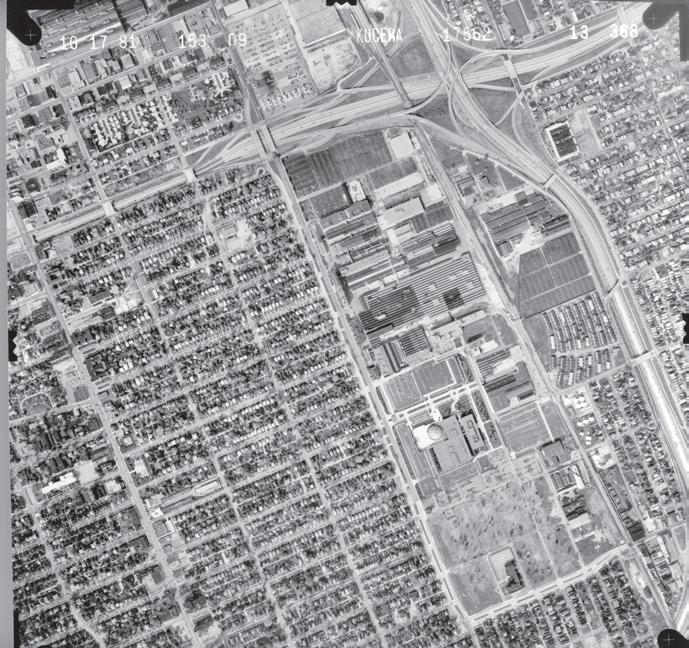
14 DTE Aerial Photo Collection, “City of Detroit 1981,” Wayne State University. Accessed on April 4, 2013, http://www.clas.wayne.edu/photos/part1/ low_res/aerial_photos/wayne/1981/detroit81Index. pdf.
15 U.S. Census Bureau, “Population and Housing Characteristics, 1940 to 2010,” Social Explorer. Accessed on March 28, 2013, http://www. socialexplorer.com.
16 Ibid.
17 The North End Briefing Powerpoint, “Vanguard,” Vanguard CDC, 2013.
18 Image courtesy of Emily Provonsha.
19 Detroiturbex: Exploring and Understanding the City of Detroit, “Breitmeyer Elementary.” Accessed on April 12, 2013, http://detroiturbex.com/content/ schools/breitmeyer/index.html.
20 Detroit Local Initiatives Support Corporation (LISC), “Grand/Woodward Neighborhoods Quality of Life Plan,” Sustainable Community Initiatives, 2012. Accessed on April 12, 2013, http://www. lisc.org/detroit/images/home/asset_upload_ file583_17791.pdf.
21 Detroit Works Project, “Detroit Future City Strategic Framework,” The Framework, 2013. Accessed on April 12, 2013, http:// detroitworksproject.com/the-framework/.
Figure 3.1. Mural at the Oakland Avenue Community Garden.
CHAPTER 3
THE NORTH END TODAY
This chapter discusses the population and physical characteristics of the North End, recent plans that involve the district, and ways that people already celebrate the North End and its history. By illustrating these characteristics, this chapter provides a foundation for the rest of the plan to recommend ways that Vanguard can use history to strengthen the North End.
Who lives in the North End
At its peak in 1950, the North End was home to 51,709 Detroiters. According to the 2010 census, just 5,585 of Detroit’s 713,777 residents lived in the North End – a population loss of 89%.1 Between 2000 and 2010, the North End experienced a 33% decrease in population, while Detroit as a whole lost 25% of its residents. This population loss also contributed to the fact that the North End’s population density (3,252 people/sq.mi.) was two-thirds of Detroit’s (5,144 people/sq.mi.).
Approximately 94% of North End residents were African-American in 2010, compared to 83% for the city.2 Significantly fewer white residents lived in the North End compared to the rest of Detroit, making up only 2.4% of the district’s population. Residents have the impression that recently, more young whites have moved into the neighborhood. As the population in the North End evolves, bringing together diverse residents will be an important process to create a shared sense of place for the district.
The average age of North End residents is 38, which is slightly older than Detroit’s at 35. Residents aged 45-55 make up the largest age group in the North End at 15.4% of the
total population. Nearly 1/3 of all North End residents are under the age of 25, while only about 1/8 of the population is 65 or older (Figure 3.2).3 Given the increase in residents aged 45-65 over the last decade, collecting stories and histories from the district’s older residents will be important to ensure that the North End’s history is preserved, while also providing a way to bring young and old residents together.
In 2010, as national economic conditions began to improve, the North End’s 29% unemployment rate remained higher than the state and national averages. North End households had a slightly lower median income than households in the rest of Detroit. The median household income of North End residents was $26,451, compared to $27,862 for Detroit households. Nearly 28% of households in the North End earned less than $10,000.4 New opportunities for jobs in the North End could reduce the North End’s high unemployment rate and raise the median household income.
Physical Characteristics
Residential Areas
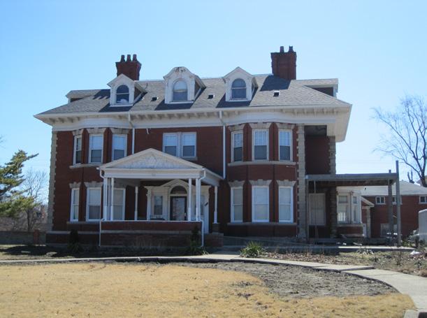
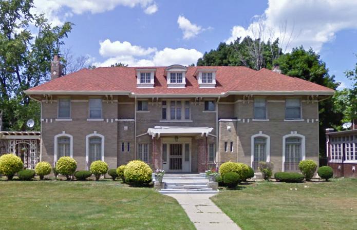
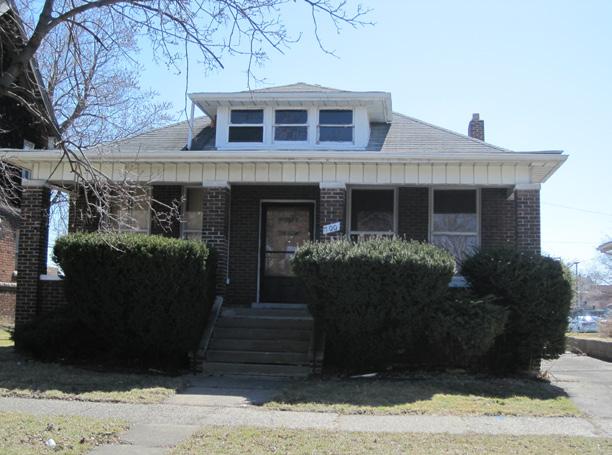
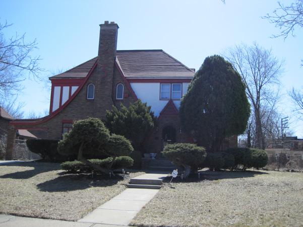
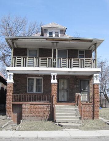
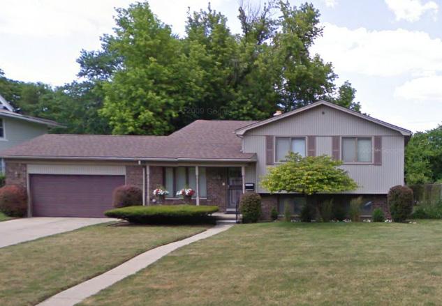
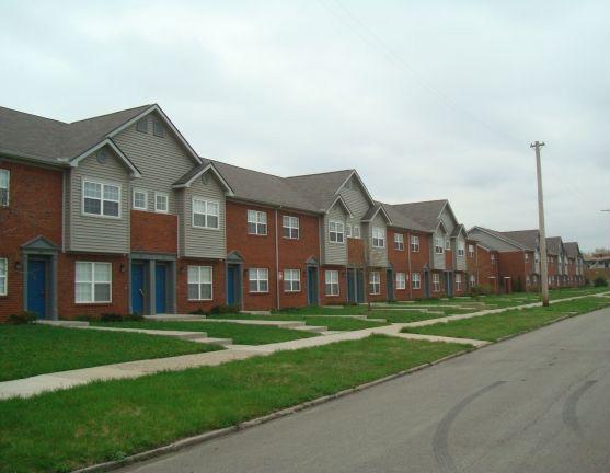
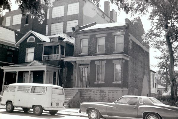
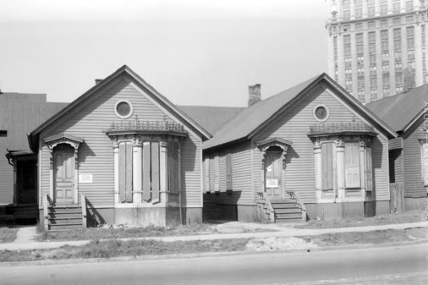
The North End boasts a wide variety of housing styles in its residential areas ranging from Colonial Revival homes built in the 1800s, to the Craftsman style of the early 20th century, to split level ranches from the 1950s and 60s (Figure 3.6). Eighty percent of the existing housing stock was built prior to 1950, most of which predates World War II.5
The North End’s high vacancy rate threatens its historic housing stock. As of 2010, the residential vacancy rate in the North End was 37%, higher than Detroit’s vacancy rate of 23%.6 Without enough households to fill most of the housing units, more structures will suffer disinvestment and need demolition. Many structures have already been demolished. As seen in Figure 3.3, vacant lots occur in clusters throughout the district, including in the areas east of Oakland and north of Holbrook, and between Chandler and East Grand.
Figure 3.2. Distribution of age in the North End.
Figure 3.3. Vacant residential lots in the North End.
Despite the North End’s high vacancy rate, much of the housing remains in good condition. The 2009 Detroit Residential Parcel Survey assessed housing conditions throughout Detroit, including 1,943 residential structures in the North End. This survey found that 1,660 of the houses in the district were in “good” or “fair” condition. However, 233 houses were ranked “poor,” while another 50 were recommended for demolition (Figure 3.5).7 As Vanguard hopes to attract new residents to the area, ensuring that the North End’s historic housing stock remains in good condition can provide ample living spaces for newcomers and allow for renovations to take advantage of financial incentives for historic preservation and rehabilitation.
Given the North End’s low median income, high vacancy rate, and aging population, a number of organizations, including Vanguard, have created new affordable housing and senior housing developments.
Built in 2003, Marwood Apartments, at 53 Marston Street, offers 55 low-income units. North End Village, along Alger Street near Oakland, has provided 50 new low-income units since 2005 (Figure 3.7). In 2009, Vanguard opened the Cameron Court Senior Village at 8600 Cameron Street, providing 48 one- and two-bedroom units for senior citizens in the North End. In 2011, Vanguard completed another 45 new 3- and 4-bedroom homes in the West Oakland Homes development. This infill development is bounded by Oakland, East Grand, Holbrook, and Beaubien.8 While new developments can help fill vacant areas in the North End, incorporating design guidelines that match existing housing styles will help maintain a cohesive identity for the district.
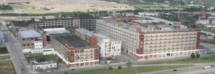
Industrial Areas
Though much of the North End is residential, the Milwaukee Junction area south of East Grand and west of I-75 is home to the district’s industrial sites. Milwaukee Junction was once the cradle
Figure 3.4. Percent of housing stock in the North End by decade built.
Figure 3.5. Housing conditions in the North End.
Colonial Revival
1880-1955
Accentuated front door, normally with decorative crown supported by pilasters, windows frequently in adjacent pairs, typically symmetrical
Italian Rennaissance
1890-1935
Upper-story windows smaller and less elaborate, widely overhanging roof eaves, recessed entry, fulllength first-story windows
Years When Most Frequently Built
Tudor
1890-1940
Facade dominated by one or more cross gables, steeply pitched roof, tall, narrow windows, commonly in multiple groups
Craftsman
1905-30
Porches supported by square columns, typically extending from roof to ground, full- or partial width porches
Split Level Ranch
1955-75
Two-story unit intercepted at mid-height by a one-story wing to make three levels of interior space to reflect three types of spaces: quiet, noisy, and sleeping
Figure 3.6. A brief history of North End housing.
CHAPTER 3
of the nation’s automotive industry, home to manufacturers including Ford, Packard, and Dodge, among many others. Today, many of the industrial buildings and lots in Milwaukee Junction are vacant, a drastic change from its peak in the mid-20th Century (Figure 3.8). Though a number of factory structures in the area remain, many like the historic Fisher Body No. 21 sit unused.
Despite the loss of much of the industrial activity, Milwaukee Junction maintains some of its automotive and industrial past. Founded in 1989, New Center Stamping provides stamped components and welded assemblies for clients including Ford, General Motors, and Mazda. Since 1923, Fred Barton Co. has provided plumbing and HVAC services for residential and commercial buildings. Michigan Paper Die has provided paper packaging design and manufacturing since the late 1960s.9
A number of new businesses, organizations, and entrepreneurs are also
taking advantage of the many unused industrial buildings in Milwaukee Junction. Detroit Soup uses the Jam Handy Building to host micro-funding and community events. The Russell Industrial Center provides space for artists, designers, and small manufacturers, with over 100 commercial tenants.10
The repurposing of existing commercial and industrial building stock can provide space for new businesses and shops in the North End, creating new jobs while preserving the district’s historical assets. Such opportunities for development are available along the Woodward Avenue commercial corridor and in the industrial Milwaukee Junction neighborhood, south of E. Grand Boulevard (Figure 3.9).
Amenities
While abundant physical space exists for new residents and entrepreneurs, the North End lacks many amenities to attract residents and visitors.
Figure 3.7. North End Village at 1400 Alger Street.
Figure 3.8. Milwaukee Junction buildings in 1949 and 2009.
• Food: Though nearby grocery stores exist, none are located in the North End. The only options for food are three corner markets and 12 dining establishments –most of which are fast food restaurants. This limits the choice for dining for visitors to the North End, which may inhibit tourism opportunities in the district.
• Public spaces: Residents of the North End lack access to public space and services as well. Delores Bennett Park and Bradby Park provide the area’s only park spaces, albeit at opposite corners of the North End, and the industrial Milwaukee Junction area has no city parks. New public spaces in Milwaukee Junction and other North End areas could create opportunities for diverse resident groups to interact with one another.
• Schools: Many children in the North End attend Loving Elementary, but for middle and high school they leave the district, unless they attend the all-girls Detroit International Academy high school. Public libraries are also absent in the North End, limiting residents’ access to information,
technology, and cultural/educational programs to learn about the North End’s history.11
• Transportation: The Detroit Department of Transportation (DDOT) provides mass transit service to the North End, with six bus lines connecting other Detroit neighborhoods to the North End.12 The southern portion of the district is near Detroit’s Amtrak station. With the development of the light rail line or bus rapid transit along Woodward, new opportunities will exist to transport visitors to museums, trails, and art projects in the North End.
Plans for the North End
In the last five years, many plans have sought to improve the quality of life for North End residents and spur economic development. Many of these plans have proposed ways to prioritize planning initiatives that address the effects of decline in the district, but no plans have thus far focused on how organizations could leverage the North End’s rich
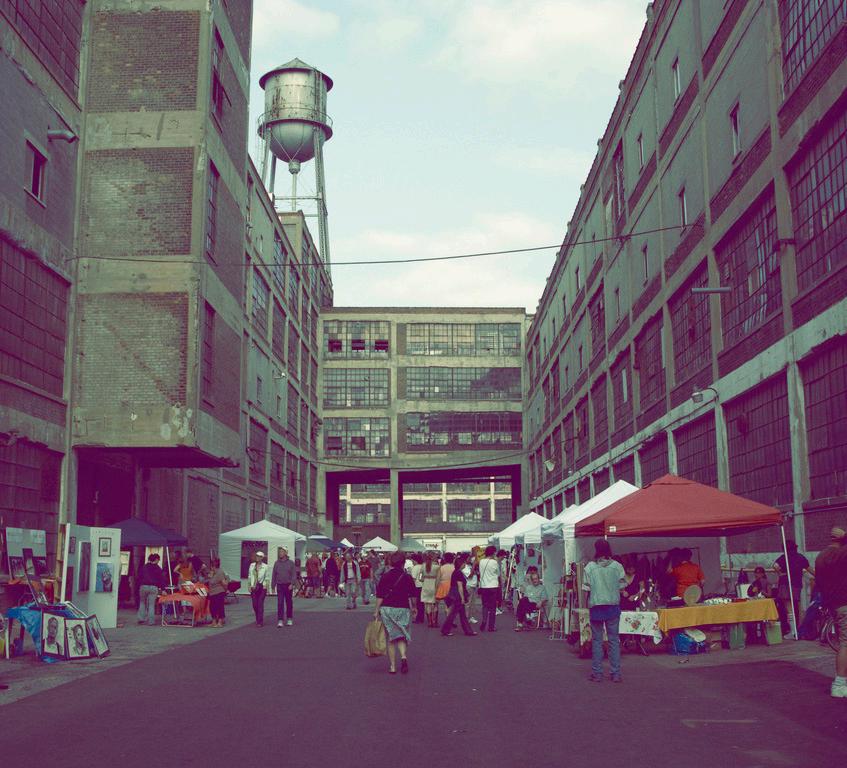
Figure 3.9. People’s Art Festival at Russell Industrial Center.
Figure 3.10. North End zoning.
history for revitalization. Organizations such as Detroit Local Initiatives Support Corporation (LISC) and the Woodward Corridor Initiative have consulted with Vanguard on various planning initiatives in the North End. The Detroit Works Project Long-term Planning and regional transit authorities have also facilitated citywide planning efforts that include the North End.
In 2009, Vanguard worked with Detroit LISC to plan for the revitalization of housing, education, and economic development with the Central Woodward/ North End Communities Investment Briefing Book (CWNE). The plan assessed the programs and resources in the North End and recommended ways to prioritize future investment. The 2009 CWNE plan’s purpose is to identify specific projects to create a vision for a vibrant, walkable urban neighborhood of choice capitalizing on the pending developments in the area, including light rail or bus rapid transit. In 2011, Vanguard partnered with the Woodward Corridor Initiative to plan
future investments based on research and feedback from North End residents through community engagement meetings.13
Vanguard partnered with Detroit LISC again in 2012 to create the Grand Woodward Quality of Life Plan.14 The 2012 Detroit LISC plan guides further public and private investment in the North End, but it also focuses on strategies to ensure that residents benefit from investment. It provides a guide for how Vanguard, partner organizations, and residents can work together to leverage resources to improve the quality of life for everyone in the district. These recent plans provide a foundation for how Vanguard can prioritize investment in the North End to improve the quality of life, but they are missing a sense of place and identity for the North End rooted in history that this plan sets forth.
The Detroit Future City framework provides strategies to address the effects of shrinking for Detroit as a whole. Its “Neighborhoods” chapter illustrates how
Figure 3.11. Central Woodward/North End Communities Investment Briefing Book.
Figure 3.12. North End Neighborhood Investment Strategy.
historically industrial areas, such as Milwaukee Junction, can be adapted to housing, studio, or new live+make building forms. This framework calls for reusing industrial areas and low-density residential areas to create new neighborhood forms as social conditions change. Transportation plans also include the North End, with the creation of a light rail or bus rapid transit system along Woodward Avenue.15 These proposals for improved public transportation could provide more efficient ways to access the North End without a car.
Although these recent plans provide the North End with long-term planning and neighborhood investment strategies, they do not recognize the North End’s history as an asset to improve quality of life or stimulate economic development. This plan provides strategies with a range of short, middle, and long-term phasing that use the North End’s rich history to identify the district, bring people together, and encourage economic development.
Initiatives that Celebrate History in the North End
The North End has a rich and varied Jewish, African-American, arts and automobile history. A number of organizations and social institutions host programs and initiatives that celebrate its historic assets. Vanguard has the opportunity to partner with these organizations, along with many other potential ones, to enhance the neighborhood through history.
The following organizations are examples of those currently celebrating the North End’s history. Chapters 4-6 will provide more information about how Vanguard can partner with these and other groups to improve the district.
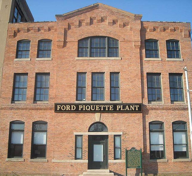
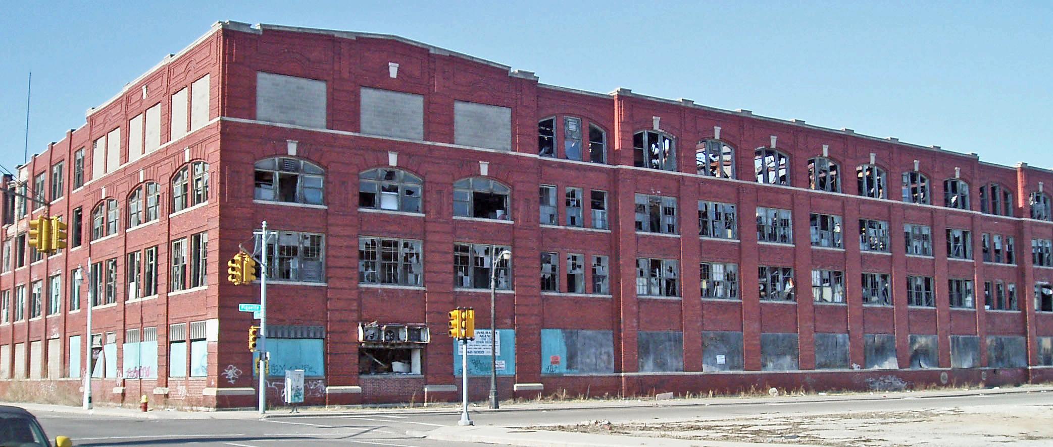
The T-Plex Museum
Model T Automotive Heritage Complex, Inc., 461 Piquette
Originally the Ford Piquette Avenue Plant,
Figure 3.13. Grand Woodward Quality of Life Plan 2012.
Figure 3.14. Detroit Future City framework.
the building is located within the Piquette Avenue Industrial Historic District in Milwaukee Junction. The plant was Ford Motor Company’s second automobile production plant and is famous as the birthplace of the Ford Model T. The building was placed on the National Register of Historic Places in 2002, became a Michigan State Historic Site in 2003, and was designated a National Historic Landmark in 2006.16
Model T Automotive Heritage Complex, a non-profit organization, bought the building in 2000 and has operated a museum out of it since. The museum operates from April to October. With many historic Ford automobile models displayed, people have the opportunity to learn about the plant, the automobiles produced there, and Detroit’s automotive history.
Phone: 313.872.8759
E-Mail: info@tplex.org
Hours and Admission:
April - October
Wednesday - Friday: 10 a.m. - 4 p.m.
Saturday: 9 a.m. - 4 p.m.
Sunday: 12 p.m. - 4 p.m.
$10 per person17
Churches
Numerous historic and important churches exist within the North End, including Cathedral of the Most Blessed Sacrament, St. Joseph’s Episcopal Church, and Russell Street Missionary Baptist Church.
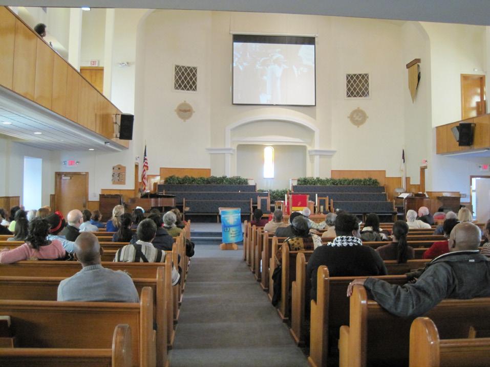
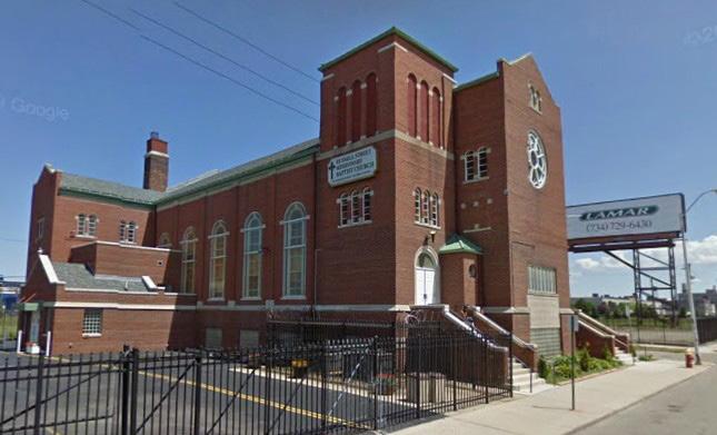
The Russell Street Missionary Baptist Church, the oldest continuously operating African-American church in the North End, has an annual African-American history program where church members, residents of the North End, and visitors come to the church to learn about African-American history. During this annual event the church displays historic photos, newspapers, books, and videos and invites a speaker to talk about history.
Figure 3.16. Arden-Park East Boston Historic District.
Figure 3.15. Russell Street Baptist Church.
Neighborhood Associations
The North End has several neighborhood associations and block clubs, some of which are specifically related to historic preservation and revitalization.
Some of the associations interested in history include:
• Arden Park-East Boston Historic Association
The Arden Park East Boston Historic District includes 92 homes and two churches. The district is located on two streets – Arden Park and East Boston, between Woodward and Oakland. The district received historic designation in May 1981. It is a Locally Designated Historic District and became a site on the National Register of Historic Places in 1982.18 The neighborhood association organizes various events around the neighborhood for the benefit of the residents.
• Friends of Milwaukee Junction
Friends of Milwaukee Junction is a revitalization and historic preservation group focused on the historic Milwaukee Junction industrial district. They aim to help developers with projects in Milwaukee Junction, preserve the district’s history, and secure funding for projects. http://milwaukeejunction.org/ http://www.modeldmedia.com/features/ northend213.aspx
Historic Designated Sites
Many buildings in the district have received historic designation at both state and national levels. For further details, please refer to the list of historically designated
places in the North End in Chapter 4.
Historic Tours
The Michigan Jewish Historical Society organizes bike and bus tours throughout Detroit, with stops at prominent historic Jewish sites in the North End. Sites along the bike tour include Temple Beth El on Woodward, The Schvitz on Oakland, and Ford’s Piquette Avenue Plant in Milwaukee Junction.19
Music Festivals
Jazz on John R is an annual jazz festival organized by the Holbrook-King Block Club. The block club has hosted this festival each August for the last 10 years on John R near King. Eugene Moore, a member of the Holbrook-King Block Club, is the primary organizer of this event. Eugene works with Vanguard, which provides financial and promotional support, and many other organizations, such as Second Ebenezer Baptist Church, for additional financial support. The festival provides those in the North End an opportunity to enjoy live music and celebrate the district’s historic jazz scene.20
Conclusion
The current conditions of the North End highlight the strengths and weaknesses of the district and lay the foundation for new opportunities to enable Vanguard to continue improving the North End through its history. Chapters 4, 5, and 6 will provide an array of recommendations for ways Vanguard can move forward in this process. Though they vary by goal, the strategies share four common themes, which are symbolized by the following icons:
Information
These strategies involve the collection and distribution of information to North End residents and visitors.
People
These strategies focus on individual and social participation.
Physical Design
These strategies offer ways to improve landscape and building design.
Movement
These strategies emphasize people’s interaction with their surroundings.
Notes
1 U.S. Census Bureau, “Population and Housing Characteristics, 1940 to 2010,” Social Explorer. Accessed on March 28, 2013, http:// www.socialexplorer.com; U.S. Census Bureau, “Population Characteristics, 2000 to 2010,” Social Explorer. Accessed on March 28, 2013, http://www. socialexplorer.com.
2 Ibid.
3 Ibid.
4 U.S. Census Bureau, “State and County QuickFacts.” Accessed on April 12, 2013, http:// quickfacts.census.gov/qfd/states/26/2622000.html.
5 Ibid.
6 U.S. Census Bureau, American Community Survey, 2011 American Community Survey 5-year Estimates, Table DP04 Selected Housing.
6 U.S. Census Bureau, Census 2010 Summary File 2 (SF2).
7 Map Data Source H (Appendix A).
8 Find the Data, “Marwood Apartments Low Income Housing Tax Credits.” Accessed on April 12, 2013, http://lihtc.findthedata.org/l/12418/MarwoodApartments; Find the Data, “North End Village Low Income Housing Tax Credits.” Accessed on April 12, 2013, http://lihtc.findthedata.org/l/12559/NorthEnd-Village; Vanguard CDC, “Vanguard Community Development Corporation Unveils Cameron Court State-of-the-Art Senior Living Center and Plans for 15th Anniversary Celebration,” PR News Wire, May 19, 2009. Accessed on April 15, 2013, http://www.prnewswire.com/news-releases-test/ vanguard-community-development-corporationunveils-cameron-court-state-of-the-art-seniorliving-center-and-plans-for-15th-anniversarycelebration-61923497.html; Vanguard CDC, “75 Low Income Families Move Into New Homes Just In Time for the Holidays,” Tell Us Detroit, December 13, 2011. Accessed on April 15, 2013, http://www. tellusdetroit.com/local/new-maxwell-homes-ribboncutting-120611.html.
9 New Center Stamping, “About Us.” Accessed on April 15, 2013, http://newcenter.net/index.php/ about-us; Fred Barton Co, “Main Page.” April 15, 2013, http://fredbartonco.com/; Michigan Paper Die, “About Us.” Accessed on April 15, 2013, http://www. michiganpaperdie.com/.
10 Russell Industrial Center, “Welcome to the Russell.” http://ricdetroit.org/2010/?id=home.
11 Detroit Public Library, “About Us.” Accessed on April 20, 2013, http://www.detroit.lib.mi.us/library/ about-us.
12 Transportation Riders United, “SMART and
DDOT.” Accessed on March 25, 2013, http:// www.detroittransit.org/UserFiles/Map%20 SMART+DDOT%202010.pdf.
13 LISC Detroit, “CWNE Investment Briefing Book,” 2009; North End Neighborhood Investment Strategy, 2011. http://woodwardcorridorinitiative.org/ index.php/land-use-policies-practices/north-endneighborhood-investment-strategy/.
14 Grand Woodward Quality of Life Plan, 2012. http://www.lisc.org/detroit/images/home/asset_ upload_file583_17791.pdf.
15 Detroit Future City Strategic Framework, 2013. http://detroitworksproject.com/wp-content/ uploads/2013/01/The-DFC-Plan.pdf; M-1 Rail, “M-1 Rail.” Accessed April 22, 2013, http:// www.m-1rail.com; Ryan Felton, “Planners seek community input in implementing bus rapid transit from Detroit to Pontiac,” Crain’s Detroit Business, April 4, 2013. Accessed on April 20, 2013, http://www.crainsdetroit.com/article/20130404/ NEWS/130409928/planners-seek-community-inputin-implementing-bus-rapid-transit-from.
16 Michigan State Housing Development Authority, “Ford Piquette Avenue Plant.” Accessed on April 20, 2013, http://www.michigan.gov/ mshda/0,4641,7-141-54317_19320_ 61909-227473--,00.html.
17 Model T Automotive Heritage Complex, “About the Club.” Accessed on March 25, 2013, http://www. tplex.org/4_piqtclub.html.
18 Arden Park East Boston Historic District, “Boston-Edison.” Accessed on March 20, 2013, http://www.historicbostonedison.org/apeb.shtml.
19 My Jewish History, “Tours.” Accessed on April 22, 2013, http://www.michjewishhistory.org/tours/; My Jewish Detroit, “J-Cycle Bike Tour Rides Again.” Accessed on April 22, 2013, http://myjewishdetroit. org/2012/06/j-cycle-bike-tour-rides-again-makinghistory-in-the-d/.
20 Eugene Moore, interview with Emily Provonsha, April 24, 2013.
Image Sources
1 Image courtesy of Meagan Elliott.
2 U.S. Census Bureau, “Population Characteristics, 2000 to 2010.” Prepared by Social Explorer, accessed March 28, 2013, http://www. socialexplorer.com.
3 Map Data Source H (Appendix A).
4 U.S. Census Bureau, American Community Survey, 2011 American Community Survey 5-year Estimates, Table DP04 Selected Housing.
5 Map Data Source H (Appendix A).
6 Images courtesy of Meagan Elliott and Emily Provonsha.
7 KMG Prestige, “North End Village.” Accessed on April 18, 2013, http://rentlinx.kmgprestige.com/ Property.aspx?PropertyID=142234.
8 Map Data Sources A, D, I (Appendix A).
9 Flickr, “People’s Arts Festival at the Russell Industrial Center.” Accessed on April 18, 2013, http://www.flickr.com/photos/carianoff/2877055135/.
10 Map Data Source E (Appendix A).
11 Detroit LISC, “Central Woodward/North End Communities Investment Briefing Book.” http:// www.lisc.org/detroit/who_we_are/detroit_lisc_staff. php, 2009.
12 North End Neighborhood Investment Strategy, The Woodward Corridor Initiative. http:// woodwardcorridorinitiative.org.
13 Detroit LISC, “Grand Woodward Quality of Life Plan.” http://www.lisc.org/detroit/images/home/ asset_upload_file583_17791.pdf, 2012.
14 Detroit Works Project Long-term Planning, “Detroit Future City Detroit Strategic Framework Plan,” 2012. http://detroitworksproject.com/theframework/.
15 Image courtesy of Emily Provonsha.
16 Wikimedia Commons, “Street scene in Arden Park-East Boston.” Accessed on April 18, 2013, http://en.wikipedia.org/wiki/File:Street_scene_in_ Arden_Park-East_Boston.jpg.
Figure 4.1. The Illuminated Mural at 2937 E. Grand Boulevard.
CHAPTER 4
RE-ESTABLISHING A SENSE OF PLACE
This chapter offers recommendations that Vanguard and others can follow to establish a stronger sense of place in the North End through the use of history. The plan defines “sense of place” as a meaningful identity for the North End that is recognizable and distinctive to both residents and visitors. A sense of place is also something that accumulates over time, building on the North End’s historic character.
Vanguard can use several approaches to help encourage a sense of place in the North End. In what follows, this plan provides strategies to help Vanguard achieve this goal: first, identifying historically significant sites in the region, and second, enabling residents and tourists to engage with those sites.
Identify historically significant sites in the North End
Creating a sense of place using the North End’s history is achievable if residents and visitors have a strong idea of what that history is or where specifically it happened. Local residents or newcomers are more aware of the history in the North End when they can see the historically important places in person or online. Therefore, identification of historically significant sites is a first step for the North End to make its history known to its residents and visitors. Two ways to achieve this are a demonstration of historically significant sites in an online map and a printed publication with the sites’ information.
Create an Online Map
An online map is an interactive approach to attracting visitors and helping residents learn about their area. The online map of the North End enables users to identify historical sites, upload their photos, and fill in historical facts. As history unfolds and more resources about the past become available, an online map can reflect changes and show newly identified historical sites.
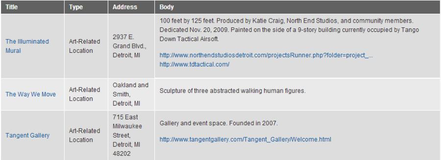
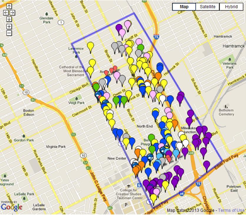
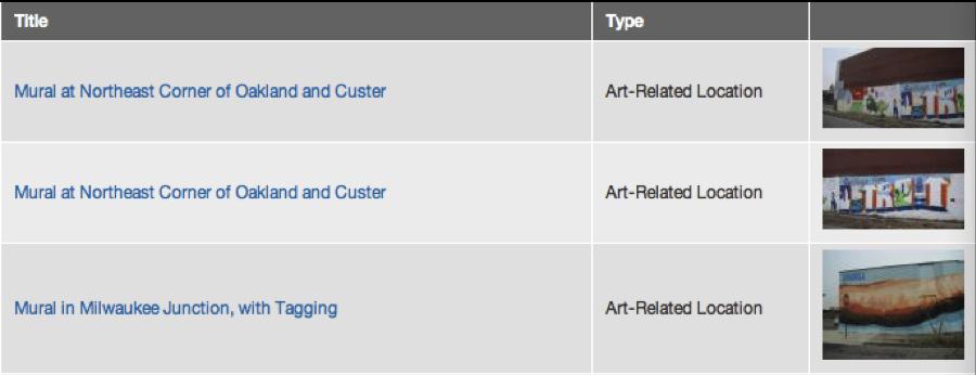
This plan offers an online map of the North End at http://contextualcity.com/northend/. This website is an interactive platform, allowing registered users to select key historic sites, write descriptions about those sites, and upload photos. The site has three sections: the Content List, the District Map, and Photos. The Content List section collects the name, type, address, and detailed description of notable sites.
Under the District Map section of the website, users can see a map with the boundary of the North End and markers indicating the historically significant sites. Markers with different colors represent different types of historical sites, including public art sites, religious institutions, theaters, schools, businesses, residences,
Figure 4.2. The online map’s list of notable sites.
Figure 4.3. The online map of the North End.
social services, government offices, industrial spaces, and green spaces. By clicking on the markers, users can explore more information about the historic sites, such as specific addresses, building descriptions, and photos.
Under the Photo section of this website, users can view photos of the key locations and read notes for each photo. The list under the photo sections shows the title of the historical site, the type of site, and a preview of the photo associated with the site. By clicking the title, users can see more detailed information about each map location.
Potential Partners
Vanguard can provide access to the map through the publicly-accessible computers at their headquarters. Vanguard could also publicize access to the online map in libraries such as Walter P. Reuther Library at Wayne State University and Detroit Public Library branches across the city.
The online map helps to build the database of historically significant sites in the North End and enhance a sense of place in the area. As users upload and add more sites that they think are historically important to the district, more people become aware of its historical assets.
Potential Funding
One of the strengths of having this online map is that it is a free resource. However, this website may need regular maintenance to make sure it contains accurate information and operates smoothly. Vanguard will host this map as part of their own website and may wish to assign one staff member or volunteer the duty of maintaining the website.
Figure 4.4. Photos uploaded to the online map website.
Mapping Historic Aggieland (College Station, TX)
Mapping Historic Aggieland is an online map (Figure 4.5) designed to present the campus heritage and history of Texas A&M University. The project mapped 100 years of campus sites and landmarks from 1875 to 2013. Users of the map are able to select markers on the map to reveal historic photographs and facts about the history. The online map for the North End is more interactive because users can select their own sites and upload their own photos.1
Create a Fold-out Map/Poster
Many North End residents and visitors may not have the ability to access an online map or may prefer a paper map. Tourists may wish to have a portable version of a map for their reference. Printed maps can be distributed at community meetings, included in a welcome packet for new North End residents, or displayed at Vanguard’s offices. (See Chapter 5 for more information about a welcome packet.)
As part of its deliverables to Vanguard, this plan includes a printed map showing several dozen historical sites in the North End. As with the online map, different types of historically significant sites are marked by different colors. The map also shows the boundaries for the North End. A defined boundary will help locals and newcomers to have a clear idea of what
the North End actually is and thus helps to enhance a sense of place in the district.
In addition to the printed map, a printed brochure that includes descriptions and photos of historical sites in the North End may be useful. A smaller version of the map could be included in a brochure, along with a map of cultural trails connecting many of the district’s historical sites. One important caveat is that some historically significant sites are privately owned homes, and the brochure should note that visitors should not disturb the residents. Additionally, the map could illustrate paths for cultural tours through the district. (See Chapters 5 and 6 for more information on potential trails.)
Although the printed brochure and map are convenient for residents and visitors, the printed versions have limitations. For example, their information may not be upto-date. Vanguard could periodically create updated versions to solve this problem.
Potential Partners
While the online and poster maps have already been created, Vanguard may wish to partner with local artists, designers, and organizations to update them and to create a brochure. For example, Cityscape Detroit, a nonprofit organization dedicated to the preservation of Detroit’s history, could help Vanguard to identify historically significant sites in the North End, set up the cultural trail, and distribute the brochure. The Walter P. Reuther Library and Detroit Public Library could help distribute the brochure to a larger group of people who are interested in the North End as part of the material they already have available about different Detroit neighborhoods.
Help residents and tourists engage with historically significant sites in the North End
The previous two recommendations lay the groundwork for using history
to re-establish a sense of place in the North End, giving an overall view of its boundaries and historic sites. Vanguard can also encourage residents and visitors to move beyond recognizing what the North End is and towards experiencing it for themselves. The following sections suggest strategies for helping people engage with the sites on the online and printed maps.
Achieve Historic Designation for More Sites
One way to bring the map “to life” is through historic designation of relevant sites in the North End. In most cases, historic designation can facilitate rehabilitation projects using federal preservation tax credits that help to support preservation efforts. Historic designation also helps both residents and visitors to learn about the district’s history.
Figure 4.5. Mapping Historic Aggieland.
CASE STUDY
The
McIntire Historic District (Salem, MA)
The National Park Service and the Salem Partnership developed a brochure for Salem’s McIntire Historic District. Funded by the Essex National Heritage Commission, the project produced a brochure including descriptions and photos of historically significant sites and buildings. Current photos illustrate buildings that are on the site today, and old photos illustrate buildings that no longer exist (Figure 4.6).
This brochure also included a map of a one-hour walking trail of historic sites. The map divided the sites into two categories: buildings open to the public and private homes. Although the trail did not avoid the privately owned properties, the brochure noted that the visitors should not disturb the homeowners at the beginning of the brochure and above the trail map (Figure 4.7).2
Figure 4.6. Descriptions and photos of historically significant sites.
Figure 4.7. Notes for protection of private homes.
4.8.
Figure
The McIntire Historic District trail map.
The North End has numerous historically significant sites in need of designation and lists resources to illustrate how to obtain historic designation at both state and federal levels. For sites that have historic designation but are extremely deteriorated, the plan suggests historic preservation when possible. Historic preservation focuses more on saving and restoring historic sites and buildings. Historic preservation also helps preserve an area’s distinctive characteristics and becomes an important investment that could bring economic, cultural, environmental, and educational benefits. (For more information on historic designation, see Appendix C and Chapter 6.)
Places in the North End that already have historic designation
Arden Park-East Boston Historic District: General boundaries: Arden Park, East Boston, Woodward, Oakland.
City of Detroit Designated Historic District
National Register of Historic Places: 1982
Cathedral of the Most Blessed Sacrament: 9844-9898 Woodward Avenue
National Register of Historic Places: 1982
Little Rock Missionary Baptist Church: 9000 Woodward Avenue
Vanguard may wish to solicit the services of a consulting firm specially focused on historic designation and preservation work. Kidorf Preservation Consulting3 is a local consultant offering a variety of services for public and private clients, including preparing for meetings with historic district commissions and historic study committees, assistance with preservation planning, Section 106 reviews, and historic tax credit applications. According to Kidorf, the cost for listing individual properties in the National Register of Historic Places is around $7,000 per property. For complexes or districts, the budget will range from $10,000 to $15,000.
Potential Sites
Russell Street Missionary Baptist Church 8700 Chrysler Service Drive
The Russell Street Missionary Baptist Church has been a vital site for AfricanAmerican religious services in Detroit since 1916. Originally organized in the home of Deacon and Mrs. West Ross, the church moved to its current site in 1954. The church grew and expanded to meet the needs of the neighborhoods around it and today remains an important anchor both for the North End and for its congregants.
Phelps Lounge/Bizerte Jazz Bar
9000 Oakland Avenue
Although its building is now vacant and physically deteriorated, the Phelps Lounge was a landmark nightclub in Detroit’s soul music scene. The bar’s namesake was music producer / promoter Eddie Phelps, who bought the former Bizerte Jazz Bar in 1960 and turned it into a showcase for soul music. Acts such as the Temptations, James Brown, B.B. King, Etta James, Little Richard and the Impressions performed in the 450-person venue. Billboard noted in 1978 that Phelps Lounge “has been an almost mandatory stop for touring soul performers for almost two decades…”4 The lounge is a historically significant cultural site for the North End, and an important part of Detroit’s musical legacy.
Northern High School 9026 Woodward Avenue
Now known as the Detroit International Academy for Young Women, the former
Northern High School was the site of a famous 1966 walkout, when students protested a weak curriculum, a shortage of books, and general harassment. In May 2011, the Mosaic Youth Theater staged a play about the walkout called Northern Lights.
In addition to the sites listed above, the North End has many other potential candidates for historic designation, such as Greater New Mt. Moriah Church (formerly the Beth Moses Synagogue) at 586 Owen Street and the Schvitz Health Club at 8295 Oakland Avenue. For more sites and detailed information please refer to the online map discussed earlier in this chapter.
List of possible opportunities for historic designation within the state of Michigan
Detroit Designated Historic Districts
State of Michigan Historic Structures
State of Michigan Informational Designations
Figure 4.9. Historic photo of Russell Street Missionary Baptist Church.
Figure 4.10. Russell Street Missionary Baptist Church today.
State of Michigan Literary Landmarks
State of Michigan Registered Historic Districts
Motor City’s National Heritage Area/ National Park Service
National Historic Landmarks in Michigan
Religious Structures of Woodward Avenue
Thematic Resource
For further information about the application process for historic designations, please refer to the historic designation guide in Appendix C.
Potential Funding
Vanguard may wish to apply for financial support from the Michigan Historic Preservation Grant Program. The National Historic Preservation Act of 1966 provides federal government funds for projects designed to identify, assess, designate and protect districts, sites, buildings, structures and objects significant in the history, architecture, archaeology, engineering and culture of the United States. Michigan’s
State Historic Preservation Office (SHPO), Michigan Historical Center, administers and receives funds annually from the National Park Service of the U.S. Department of the Interior.5 Please refer to the historic designation guide in Appendix C for more details.
Create Signage and Murals
Another way to help residents and tourists to engage with historic sites is to create signage and murals throughout the district. Signage systems include the banners, labels, and other visual cues that announce to visitors where they are. They also serve as visual improvements to the North End that can help to instill pride of place.
Today, the North End is already well known for its murals such as Katie Craig’s “Illuminated Mural” (Figure 4.14)
Figure 4.11. The Phelps Lounge today.
Figure 4.12. Historic photo of Northern High School.
or “We Kahn Do It!” created by Detroit Lives! (Figure 4.15). These two public art installations serve as recognizable entry points to the district. Vanguard can help support the North End’s reputation as a district of public art by commissioning local mural projects that announce its boundaries, similar to the mural at the boundary of Hamtramck (Figure 4.16). To encourage a sense of place through history, the selection criteria should favor pieces that reflect the North End’s historic importance. This can be through explicit reference to history, as well as through abstract representations of the North End’s past that also make reference to its future. Additionally, because historic buildings may no longer be standing, murals offer a physical destination along tours where the history of those sites can be discussed.
Similarly, banners on streetlights or utility poles could help establish a sense of place in the North End. Currently, several different types of banners hang throughout the district; their varying designs and
labels give the impression that the district is not a single, coherent place. This plan recommends removing the current banners and replacing them with a single design, in order to establish a consistent signage system for the entire district. This design should reflect the North End’s historic character.
Potential Partners
Vanguard could work with local art studios to create designs for banners and murals. Academic institutions such as Wayne State University, the University of Michigan, and the University of Detroit Mercy could provide volunteer designers. Organizations such as the Detroit Area Art Deco Society and Summer in the City with experience in the creation of large-scale murals could also help to create historically themed murals in the district.
Potential Sites in the North End
Banners should be placed at highly visible places throughout the North End, particularly along Woodward, East Grand
Figure 4.13. Detroit International Academy for Young Women, formerly Northern High School.
Figure 4.14. The Illuminated Mural at 2937 E. Grand Boulevard.
Boulevard, and throughout the Milwaukee Junction area.
CASE STUDY
Murals depicting vanished buildings (Marion, KY, and Hayward, CA)
Public art can connect with a district’s history in order to help instill a sense of place. The cities of Marion, Kentucky,6 and Hayward, California,7 have used murals as a way to preserve history in locations where significant buildings are no longer standing. Some of these murals depict the physical buildings that used to stand on vacant lots, and others depict the activities that went on inside them or their broader significance in history. In both cases, these murals offer a destination for residents and visitors learning about neighborhood history.
Murals can be commissioned on prominent structures that either have historical significance or are close to historical sites. Possible sites include famous places such as Phelps Lounge and the North End Clinic, as well as smaller stores such as Walker’s Barber Shop at 8002 Oakland Avenue.
Murals that welcome visitors to the North End could be commissioned for the district’s major entrances: where east-west streets intersect Woodward Avenue, where north-south streets cross I-94, and where they cross the alley between Woodland and Tennyson Streets at the boundary with Highland Park. Vanguard could determine specific appropriate sites for the murals and reach out to property owners to evaluate their interest in participating.
Additionally, Vanguard may wish to establish a signage system that emphasizes the history of particular neighborhoods within the North End district. One example is street sign
Figure 4.15. We Kahn Do It mural at E. Milwaukee and Brush Streets.
Figure 4.16. Welcome signage for Hamtramck.
toppers: these small placards are typically modest in design but present at every intersection in a given neighborhood. A street sign topper’s design should consider the particular heritage of the neighborhood. For example, in Portland’s Pearl District (Figure 4.18) a prominent water tower represents the neighborhood’s industrial heritage. (See Chapter 7 for an illustration of how this could work in Milwaukee Junction.)
Potential Funding
Michigan Economic Development Corporation coordinates several community development programs that could provide funding for Vanguard to establish wayfinding and signage systems throughout the North End. (See the funding section of the next recommendation for additional details.)
Create a Wayfinding System
“Wayfinding” is the system of signs, maps, and other visible cues that direct visitors around the district and to historic locations or interesting sites. A clear wayfinding system could make the North End’s historic sites more accessible to visitors and at the same time demonstrate how they link together. This plan recommends implementing a simple “do-it-yourself” wayfinding system that emphasizes the district’s history and gives visitors and residents clear directions for how to reach significant sites. The most effective wayfinding systems recognize that people will move throughout the North End in a variety of ways: on foot, by bike, and by car.
Potential Partners
Walk [Your City]: As Walk [Your City] (Figure 4.20) expands, Vanguard may wish
Figure 4.17. Two different North End banners.
Figure 4.18. Street sign toppers in Portland, Oregon’s Pearl District use a design derived from a prominent water tower.
to partner with the organization to institute its style of wayfinding system in the North End. Yet while Walk [Your City] represents the kind of wayfinding recommended in this plan, the Baton Rouge project demonstrates a much greater awareness of history. A combination of these two approaches could help Vanguard to create the type of wayfinding system that emphasizes history to create a sense of place in the district.
Field Trip/Historicdetroit.com: The siteidentifying smartphone application Field Trip already recognizes several historic sites in the North End (Figure 4.22). Vanguard could work with organizations such as Historic Detroit and Arcadia Books to help make sure this application recognizes the North End’s important historic sites.
Block clubs and neighborhood associations in the North End such as the Arden Park Neighborhood Association could help
to select appropriate sites and organize relevant historic information.
Potential Sites in the North End Maps with “you are here”-style orientation and historic photos could be placed along major streets in the area, such as East Grand, Oakland, and Woodward.
Wayfinding information integrated into sculptures or other kinds of outdoor art would be appropriate in the district’s open public spaces, such as Delores Bennett Park, or the area in front of the Illuminated Mural.
Potential Funding
Michigan Economic Development Corporation offers several community development programs that could offer funding for Vanguard to establish a wayfinding and signage system throughout the North End. One incentive program available from the Michigan Strategic Fund (MSF) in cooperation with the Michigan Economic Development Corporation
Baton Rouge’s Downtown Development District developed a wayfinding and signage project which aimed not only to develop signs for the district but also to capture the essence of Baton Rouge’s character and history in an innovative way. Through a series of 34 individually designed interpretive panels, the project tells a story about the distinct culture of the region, blending color and architectural patterns with elements of local history. In addition, the project’s wayfinding component makes downtown attractions easy to locate by foot, car or trolley.8 The project took special care in emphasizing both the geographic landmarks and historic moments of the district. Local residents were involved in every phase of the project, from design to implementation, further enhancing the downtown neighborhood’s sense of place.
Figure 4.20. Walk [Your City] pilot program.
Walk [Your City] is a do-it-yourself online and offline way for helping residents learn about the places they live. Walk [Your City] started as a pilot program in Raleigh with 27 plastic
signs that gave directions to downtown attractions, as well as their distances on foot and by car (Figure 4.21). The project also incorporated a smartphone application that helped direct walkers to the locations depicted on the signs.
Citizens printed and installed all signs. Two months later, a petition with 1300 signatures helped convince the Raleigh City Council to adopt Walk [Your City] as a three-month pilot project. The project subsequently began a grassroots funding campaign to raise funds to support the creation of additional signs and expansion to over 40 other cities.9
Figure 4.19. Downtown Baton Rouge wayfinding.
Walk [Your City] (Raleigh, NC)
Field Trip by Google (Nationwide)
Field Trip is a smartphone application that uses your phone’s GPS location to notify you of nearby locations that may be interesting.10 Under the “settings” tab of the application, users can choose which types of sites they would like to learn about most, including historic sites in the area. Field Trip incorporates significant historic information from local sources. In Detroit specifically, much of their history-related information comes from HistoricDetroit.org and Arcadia’s Detroit History publications (Figure 4.21).
Figure 4.21. The Field Trip application in use in the North End.
Library of Congress “Mapping My Spot” Lesson Plan (Nationwide)
To help students between 3rd and 8th grade learn about map-making and “appreciate their own role in affecting and making history,” the Library of Congress created a month-long curriculum about local map-making practices. This involves first analyzing historical maps and investigating students’ own homes, blocks, and neighborhoods; it finishes with students creating their own maps. The Library of Congress offers worksheets, documents, and web links to help facilitate lesson planning for teachers.
The more students learn about the places they live, the more they value them.13 One way that Vanguard can create a strong sense of place is by partnering with local schools to create a mapping curriculum. History, arts, or language arts teachers are the most likely to be able to work this curriculum into their curriculum plan.
provides grants, loans and other economic assistance for qualified investment projects to help promote community revitalization.11
Vanguard can apply for a grant with the National Park Service under its Preserve America Grant Program, which funds signage systems, historical tourism, education, and preservation planning. (See Chapter 5.)
Coordinate
with Local Schools
One of the best ways to help encourage a sense of place through history is to cooperate with existing institutions. When asked which were the most important locations in the district when she was growing up, longtime North End resident Sandra Sims said, “Churches and schools.
Those were the gathering places, and there were lots of neighborhood [events] that connected those two places to other things going on.”12 The North End has a wealth of religious institutions, but only two schools. However, many students who attend these schools do not live in the North End and therefore do not spend much time in this area. Students who do live in the North End often attend schools outside the district and as a result do not learn about their neighborhood history.
Potential Partners
Vanguard can consider connecting classrooms at North End schools with local organizations that can help carry out programing. Area organizations focused on youth development and empowerment include the Detroit YMCA, Summer in the City (which would necessarily be a summer school program), and YouthVille Detroit.
Potential Sites in the North End
The two principal educational institutions in the North End are New Paradigm Loving Academy and the Detroit International Academy for Young Women. Vanguard can establish a relationship with teachers and administrators from both schools to learn about their participation interest and education objectives. This partnership can also clarify how a program similar to “Mapping My Spot” may work best in this neighborhood.
Potential Funding
Potential funders for a project similar to “Mapping My Spot” include the Skillman Foundation, the Do It For Detroit Fund, and the GM Foundation. These three foundations have a specific interest in aiding community development through youth empowerment.
Conclusion
This chapter has focused on creating a sense of place in the North End through identifying historically significant sites in the district and enabling residents and tourists to engage with those sites. The following chapters build on these initial strategies for helping create a sense of place with a consistent emphasis on the rich history of the North End. Chapter 5 focuses on the use of history to bring together diverse residents. Chapter 6 details how the use of history can aid economic development.
library.tamu.edu/flexviewer/V1.3.1_Prerelease/.
2 National Park Service, “The McIntire Historic District: Architectural Walking Trail.” Accessed on April 24, 2013, www.nps.gov/sama/planyourvisit/ upload/McTrail.pdf.
3 Kidorf Preservation Consulting, “Kidorf Preservation Consulting.” Accessed on April 24, 2013, http://www.kidorfpreservationconsulting.com/; Kristine Kidorf, phone interview with authors, April 24, 2013.
4 Detroiturbex.com, “The Phelps Cocktail Lounge.” Accessed on April 24, 2013, http://detroiturbex.com/ content/parksandrec/phelps/index.html.
5 State of Michigan, “MSHDA - Introduction to Historic Preservation Grants.” Accessed on April 26, 2013, http://www.michigan.gov/ mshda/0,4641,7-141-54317_54760_ 27123-56929--,00.html.
6 Forgotten Passages, “Forgotten Passages: Preserving Some Of Marion’s Past History Through Murals.” Accessed on April 24, 2013, http:// ourforgottenpassages.blogspot.com/2012/05/ preserving-some-of-marions-past-history.html.
7 Hayward Public Art Mural Program, “Mural Guide Cover 120621.ai-Mural_Flyer_Full.pdf.” Accessed on April 24, 2013, www.hayward-ca.gov/blogdocs/ mural/Mural_Flyer_Full.pdf.
8 Downtown Development District | Baton Rouge, Louisiana, “Downtown Development District | Baton Rouge, Louisiana.” Accessed on April 24, 2013, http://www.downtownbatonrouge.org/ aroundWayfinding.asp.
9 Knight Foundation, “How might we improve the way citizens and governments interact?” Accessed April 24, 2013, https://www.newschallenge.org/ open/open-government/submission/an-offlineonline-citizen-powered-wayfinding-platform-/
10 Gizmodo, the Gadget Guide, “Google Field Trip: Exploration Without the Effort.” Accessed on April 24, 2013, http://gizmodo.com/5989321/google-fieldtrip-exploration-without-the-effort.
11 Michigan Economic Development Corporation | The Michigan Advantage, “Michigan Community Revitalization Program | Michigan Economic Development Corporation.” Accessed on April 24, 2013, http://www.michiganadvantage.org/michigancommunity-revitalization-program/.
Notes
1 Texas A&M University Library, “ArcGIS Viewer for Flex.” Accessed on April 24, 2013, http://arcgis.
12 Sandra Sims, interview with Meagan Elliott, February 25, 2013.
13 Library of Congress, “Overview - Local History: Mapping My Spot - Lesson Plan | Teacher
Resources - Library of Congress.” Accessed on April 24, 2013, http://www.loc.gov/teachers/ classroommaterials/lessons/mapping/index.html.
Image Sources
1 Image courtesy of Emily Provonsha.
2 North End Database, “District Map | North End Database.” Accessed on April 24, 2013, http:// contextualcity.com/northend/.
3 Ibid.
4 North End Database, “Photos | North End Database.” Accessed on April 24, 2013, http://www. contextualcity.com/northend/photos.
5 Texas A&M University Library, “ArcGIS Viewer for Flex.” Accessed on April 24, 2013, http://arcgis. library.tamu.edu/flexviewer/V1.3.1_Prerelease/.
6 National Park Service, “The McIntire Historic District: Architectural Walking Trail.” Accessed on April 24, 2013, www.nps.gov/sama/planyourvisit/ upload/McTrail.pdf.
7 Ibid.
8 Ibid.
9 Russell Street Missionary Baptist Church, “Church History - Russell Street Missionary Baptist Church.” Accessed on April 24, 2013, http://www. russellstreetmbc.org/history.htm.
10 Google Maps, “Detroit, Michigan.” 2009. Accessed on April 23, 2013, http://maps.google. com.
11 Ibid.
12 Ibid.
13 Flickriver, “Northern High School (Now Detroit International Academy for Young Women)--Detroit MI - a photo on Flickriver.” Accessed on April 24, 2013, http://www.flickriver.com/photos/71288712@ N00/505202081/.
14 Image courtesy of Emily Provonsha.
15 Image courtesy of Meagan Elliott.
16 Flickr, “Welcome to Hamtramck mural.” http://www.flickr.com/photos/ excusemysarcasm/6950921083/.
17 Image courtesy of Meagan Elliott.
18 Flickr, “Portland, OR Water Tower.” http:// farm3.staticflickr.com/2287/2221123024_846 5914529_z.jpg; Chris Young, “Neighborhood Branding: Determining What To Change and How | Neighborhood Notes,” Portland Oregon Neighborhood News & Events. Accessed on April 24, 2013, http://www.neighborhoodnotes. com/news/2012/05/neighborhood_branding_ determining_what_to_change_and_how/.
19 WHLC Architecture, “Downtown Baton Rouge wayfinding.” Accessed on April 24, 2013, www.whlarchitecture.com/projects/ masterplanning/04-015/01.jpg.
20 Knight Foundation, “How might we improve the way citizens and governments interact?” Accessed on April 24, 2013, https://www.newschallenge. org/open/open-government/submission/an-offlineonline-citizen-powered-wayfinding-platform-/gallery/ wyc-knight-image-1-1.jpg/.
21 Images courtesy of Meagan Elliott.
Figure 5.1. Reaching Out mural at the corner of E. Grand Boulevard and St. Antoine Street.
CHAPTER 5
USING THE NORTH END’S HISTORY TO BRING TOGETHER DIVERSE RESIDENTS
Vanguard staff and North End residents have observed that new residents have been moving to the North End due to the availability and affordability of buildings and land. Many of these new residents are young white adults interested in art and urban gardening. Some longtime residents, predominantly African-American and spanning a wide range of ages, express concerns about new residents’ apparent lack of understanding of neighborhood context and community building efforts already underway.
This chapter focuses on using the North End’s history to bring together these diverse residents. The relationships that connect people are valuable both for the individuals themselves and for bystanders. Crime rates in a neighborhood fall when neighbors know one another well, benefiting even residents who are not themselves involved in neighborhood activities.1
This plan suggests opportunities for diverse residents to engage with each other through the discovery and sharing of information about the North End’s history. One way to bridge differences is through storytelling. Stories help people learn about and relate to one another. Through the collection, preservation, and presentation of shared stories, diverse residents can gain a better understanding of the history of the North End and develop ways to celebrate it together.
Place Matters conducts a citywide survey of New York residents called the Census of Places that Matter to identify places of public historical and cultural significance. The census is published on its website to promote the places it has discovered. To further collect, promote, and preserve historical information, Place Matters creates digital and print publications, cultural tours, maps, and discussion series events. To promote knowledge of the past and encourage greater appreciation for the people and places of New York neighborhoods, Place Matters creates Community Focus programs such as the Labor History and South Bronx project. Vanguard could use the two following Community Focus programs as models for collecting oral histories that can engage diverse residents in the North End through the collection and sharing of personal histories.3
Labor History project: The New York Labor History Association and Place Matters conducted a survey and created public programs to discover places throughout the
Enable North End residents to learn about the district’s history and increase access to information
This section serves as a guide for residents to learn about and compile the history of the North End through research, storytelling, and interviewing. It provides examples of how to increase access to the collected history through preservation, presentation, publication, and the creation of historically themed trails.
Create a program to document stories of longtime residents
One of the best methods to recover history is to facilitate an oral history project. Oral history is the collection of an individual’s testimony about his or her experiences. The process of interviewing
should allow people of all ages to apply the techniques of asking and listening to learn about history.2 An oral history project can increase interaction among residents of different ages, genders, and ethnic backgrounds and raise the historical awareness of North End residents. Interviewing residents to document the past provides the opportunity to compile rich memories to share with the public. Vanguard volunteers can use the information in the plan’s Research Guide (See Appendix B) to develop themes and interview questions. To encourage interaction between adolescents and seniors, Vanguard can facilitate youth-led interviews with older North End residents.
Potential Partners
Local Organizations: To provide awareness of an oral history project and to recruit project volunteers, Vanguard can partner with North End churches like St. Matthew’s and St. Joseph’s Episcopal Church and
city important to the history and traditions of New York’s labor movement. The “Tell Us a Story” program organized storytelling by elders to residents of the community. Each storyteller was given five minutes to share a story about the local labor history. At the end of the program, residents who participated could vote for the ten stories they thought should lead to future history projects.4
Mambo to Hip Hop project: In an effort to convert the musical heritage of the Latino South Bronx into a resource that could be used for cultural and civic renewal, Place Matters conducted over 30 oral history interviews with musicians, dancers, industry figures, and fans. Place Matters used information collected from oral histories and other research to form the basis for a variety of projects that aimed to publicize the neighborhood’s music history and preserve its legacy. In addition to a transcribed series of oral histories, the project held four community conversations where participants in the local musical scene shared memories with other residents and the general public. Place Matters recorded each of these events to collect information about the individual places described and the ways they contributed to the development of music in the city.5
the Historic Little Rock Baptist Church. Vanguard could also partner with one of the many block clubs active in the North End or a neighborhood association such as Holbrook King Block Club, and the Arden Park-East Boston Historic Association. These churches and organizations likely have members who are willing to participate in or promote a project to collect stories from longtime North End residents. For further instruction on and assistance with story collection, Vanguard could obtain resources and collection services from StoryCorps.
StoryCorps is a Brooklyn-based nonprofit whose mission is to record, share, and preserve peoples’ stories. As of 2013, “StoryCorps has collected and archived more than 45,000 interviews with nearly 90,000 participants. Each conversation is recorded on a free CD to share, and with the subjects’ permission, is preserved at the American Folklife Center at the Library of Congress.”6
StoryCorps works with community-based organizations to preserve the stories of the places it visits through the following:
• MobileTour Community Partnership: an initiative in which mobile booths travel the country year-round to collect stories
• StoryCorps Griot Initiative: a program to collect the experiences and life stories of African Americans across the country
• Door-to-Door Service: a fee-based onsite recording service for organizations facilitated by StoryCorps
Potential Sites in the North End Vanguard can take advantage of the North End’s family and youth resource centers including Considine Little Rock Family Center, Loving New Paradigm Elementary, and Detroit International Academy, along with its own facilities, to host oral history collection events and activities.
Potential Funding
The National Storytelling Network: The National Storytelling Network (NSN) is a member-driven organization based in Tennessee dedicated to advancing the art of storytelling. NSN provides an annual grant to community organizations called the Brimstone Award for Applied Storytelling to increase understanding of the ways storytelling can promote change in individuals and neighborhoods. The grant supports a model storytelling project that is service-oriented, based in a neighborhood or organization, and replicable in other places.
Many types of projects can be considered for the $5,000 award including neighborhood, organizational or institutional programs, curricular activities, short residencies, and projects combining complementary art forms.7 Brimstone Award applicants who are not members of the National Storytelling Network must become NSN members in order to obtain funding.
Create a portable local history exhibit to display at local events
A portable history exhibit can display information for residents and visitors. In addition to storing documents in an archive at Vanguard or some other location, Vanguard can laminate copies of historical documents and photos for public display. Exhibits could take many forms such as a flipbook, poster, or a glass display like the Comerica Park history exhibit (Figure 5.2) and could cover a variety of topics. Like the Indiana Historical Society (See Case Study: Indiana Historical Society), Vanguard can provide such exhibits to North End schools and organizations. Additionally, exhibits can be featured at current and proposed outdoor festivals, farmers’ markets, and community meetings to increase awareness of North End history.
Figure 5.2. Detroit Tigers’ Walk of Fame in Comerica Park.
Figure 5.3. Indiana Historical Society Traveling Exhibits.
Indiana Historical Society Traveling Exhibits (Indianapolis, IN)
The Indiana Historical Society has created several portable exhibits (Figure 5.3) that libraries, schools, and organizations can rent for $100. These exhibits cover a variety of topics, and many are interactive and tailored for all ages. The exhibits are tall accordion-style walls with historical information on either side. The Historical Society delivers the exhibits to the site.8
Potential Partners
Local Organizations: Vanguard can partner with North End organizations and institutions that may have historic photos, documents, or oral histories, such as Russell Street Baptist Church, and neighborhood associations like Arden Park-East Boston Historic Association or Holbrook King Block Club. Members of these North End organizations may also be interested in collecting further historical information for the portable history display. In addition, these organizations could provide support with the set-up and teardown of the portable history exhibit.
Potential Sites in the North End
Vanguard can display the portable history exhibit at the North End’s semi-public spaces such as Loving Elementary School, Considine Family Center, Vanguard CDC, and the Oakland Avenue Community Garden. It could also be set up at festivals in the North End, such as the Jazz on John R Festival organized by Holbrook King Block Club.
Potential Funding
Preserve America Grant Program: The Preserve America grant program, offered by the National Park Service, is a matching-grant program that provides funding for historic programming such as education, promotion, planning, and research. These grants support projects that preserve natural heritage assets, and boost the economic vitality of historic places.9
National Endowment for the Humanities: The National Endowment for the Humanities (NEH) grant program provides funding for the implementation of public programming focusing on local history. Through its “America’s Historical and Cultural Organizations Implementation” grants, NEH provides support for organizations that produce public programs such as exhibits, historic interpretations, or living history displays.10
CASE STUDY
Cultural Tourism DC (Washington, D.C.)
Cultural Tourism DC’s Neighborhood Heritage Trails are self-guided walking trails of the history of Washington, DC. Each trail sign includes stories, historic photos, and maps (Figure 5.4).
Historically themed trails like the one on U Street (Figure 5.5) are found in neighborhoods throughout DC, and are created using stories and neighborhood images collected from residents to celebrate the heritage and diversity of that particular neighborhood.11
Create a bicycle and pedestrian trail connecting historical sites to promote the North End’s history
Based on the sites identified in Chapter 4, a bicycle and walking tour could use historical markers throughout the North End to connect visitors and new residents to longtime residents. Vanguard can identify sites through a series of signs, public art murals and sculptures, or a mix of both. Vanguard can place brochures and maps for the trail at locations such as the proposed Illuminated Park (See Chapter 7), Delores Bennett Park, Vanguard headquarters, and Considine Family Center and also make these available on a future North End website.
Potential Partners
Vanguard could work with organizations such as Wheelhouse Detroit to identify
the parts of the district best suited for a trail. Wheelhouse Detroit is a bicycle shop that offers guided bicycle tours. Wheelhouse works with community partner organizations to design neighborhood tours to ensure that the most accurate and interesting information is shared with their riders.12 Community partners who work with Wheelhouse to create tours receive a portion of the proceeds collected from their particular tour.
Potential Sites
The trail could connect historical sites throughout the North End and could also connect to the larger Detroit Greenway system to encourage others to explore the district. Locating the trail along streets with businesses could also encourage shopping and eating at local establishments (Figure 5.6).
Potential Funding
Preserve America Grant Program: Vanguard can apply for a grant with the
National Park Service under its Preserve America Grant Program, which funds signage systems, historical tourism, education, and preservation planning.13
Michigan Economic Development Corporation Grants and Assistance: Michigan Economic Development Corporation offers several community development programs that could offer funding for Vanguard to establish a signage system throughout the North End. One incentive program available from the Michigan Strategic Fund (MSF), in cooperation with the Michigan Economic Development Corporation, provides grants, loans and other economic assistance for a qualified investment project to help promote community revitalization.14
Publish a book for North End residents that documents local historical information
Publishing the history of the North End preserves and provides access to its history. The Baltimore Neighborhood Heritage Project and the Old North St. Louis Project (See Case Studies) each used information collected from oral histories to produce and publish a book on their neighborhood’s history.
Using information and materials collected through North End resident research activities, Vanguard could facilitate the creation of a neighborhood history publication. This book could feature quotes from interviews, photographs donated by residents, and short histories of North End neighborhoods, institutions, and cultures. Vanguard could use information in the book to publicize the district’s history
Neighborhood activists, academics with an interest in local history, and city personnel worked on the Baltimore Neighborhood Heritage Project from 1978 to 1982. With a grant from the National Center for Urban Ethnic Affairs, the group created an oral history project, and conducted more than 200 interviews with older residents of Baltimore to uncover information about aspects of neighborhood life and the experience of neighborhood residents from their own perspective. Residents were interviewed on such topics as migration and adjustment to life in Baltimore, racial and ethnic identity, neighborhood institutions, the impact of national and local events on the neighborhood, neighborhood and family life, work and religion, and perceived changes in the neighborhood over time. The project preserved and presented this history through a traveling museum that toured the city and exhibited photographs, documents, and other materials gathered from residents. Oral histories were also used to produce a book called Baltimore People, Baltimore Places, which features quotes from the interviews and photographs donated by participants.15
Old North St. Louis Project (St. Louis, MO)
In September 2001, the University of Missouri-St. Louis collaborated with the Old North St. Louis neighborhood in an effort to create a sense of place in the neighborhood using history. To accomplish this, the university carried out an oral history project. Approximately 30 people differing in age, gender, and ethnic background were interviewed. Some informants grew up in Old North St. Louis and then moved away, while others spent their entire lives there. Others never lived in the neighborhood but worked, worshiped, or shopped there. Information collected from the oral histories was combined with archaeological data and historical documents to create a website, a heritage bicycle tour, a
community museum, K-12 educational programs, a video documentary, and a published history entitled From Village to Neighborhood: A History of Old North St. Louis. Project participants hoped that an inclusive public archaeology project would help repair rifts that had developed between lower-income renters and more affluent homeowners over the previous decades.16
Figure 5.7. From Village to Neighborhood: A History of Old St. Louis.
throughout the Detroit area. Having this published historical resource could also help Vanguard facilitate future projects to bring residents together through history.
Potential Partners
To access residents who can provide stories and photographs, Vanguard will need to partner with block clubs and neighborhood associations such as the Arden Park-East Boston Historic Association that can identify and refer participants and potential volunteers. Churches and other religious organizations that collect and archive documents and other information, such as Russell Street Baptist Church and St. Matthew’s and St. Joseph’s Episcopal Church, can also be resources for obtaining materials. Institutions like Wayne State University could provide guidance or student support with historic research for this publication.
Potential Funding
Websites such as CreateSpace and Lulu that provide information on and assistance with self-publishing can reduce the time and resources required to publish a North End history book. Vanguard will need to secure grant funding from Preserve America Grants or the National Endowment for the Humanities for publication costs. However, Vanguard may recover costs of publication with proceeds from selling the book.
CreateSpace: CreateSpace is an online company that helps people independently publish and distribute books in physical or digital formats. It is an affordable way to create, design, edit, and market
publications. Vanguard could create a book on the North End’s history using CreateSpace. The book could be distributed by Vanguard or CreateSpace’s various distribution options. For example, fifty 50-page books with color images would cost approximately $217.50 ($4.35 per book) using CreateSpace.17
LuLu: LuLu is an online company offering publishing, printing, and distribution services for self-publishers of books and e-books. Similar to CreateSpace it provides many options to create and design a publication. LuLu offers a range of services or package deals. Fifty 50page books with color images would cost approximately $770.50 ($15.41 per book) using LuLu.18
Provide opportunities for diverse resident populations to engage with each other
This section proposes opportunities for new and longtime residents to share experiences, pass down historical knowledge, and celebrate the North End’s rich history.
Create a program to connect North End students with local businesses to learn about the North End’s entrepreneurial history
Vanguard runs a program that places youth in an internship for the summer. To build on this program, Vanguard could develop a program such as the McWhorter project (See Case Study) to allow North End
The McWhorter Book (Lubbock, TX)
McWhorter Elementary School students produce a book that they finance by selling student-designed ads for community businesses. Each student has a quarter-page in the book for original writing, and all children are encouraged to participate in the advertising section. Classroom discussions about economic concepts and field trips help children to understand and design ads for local businesses. With many students designing ads, the business itself selects the “winning” entry for publication, generating competition among students and recognition for the young creators of the published ads.19 Although the McWhorter project did not focus on the businesses’ history, Vanguard could use the same process to create a book focused on entrepreneurial history in the North End.
youth to design and sell advertisements for local businesses. To contribute to the design of these advertisements, the youth could collect past advertisements, if available, of a particular business to show how they changed over time. The historic advertisements and the youth’s new advertisements could be incorporated into a brochure displaying the North End’s entrepreneurial history.
Potential Partners
Vanguard can partner with local schools such as Loving Elementary to connect students with local businesses in the North End. New and historic advertisements compiled by students could be published by Rusas Printing Co., a printing company in Milwaukee Junction.
Recruit retiree volunteers to tutor and share local history with students
Longtime residents of the North End could volunteer to tutor students who attend schools in the North End and students who live in the North End but attend school elsewhere. Retirees could benefit from regular, scheduled meetings with neighborhood children, while the children can practice reading and writing and can gain an appreciation of local history. Programs like the Experience Corps Program (See Case Study) provide retirees with a small monthly stipend to pay for transportation, lunches, and other expenses related to the program.
Potential Partners
Vanguard can partner with organizations such as New Beginnings Assisted Living Center and W.C. Turner Living Center to recruit retirees to serve as tutors.
Experience Corps Program (Philadelphia, PA)
Experience Corps volunteers are retirees who commit fifteen hours a week to CookWissahickon Elementary School, tutoring four to six children three times a week. The fifteen-hours-a-week volunteers receive a monthly stipend of just under $250, paying for transportation, lunches, and other expenses related to the program. The program connects generations. One of the Cook volunteers who was active in the civil rights movement in the 1960s shows students her photographs of events from those times and recounts her personal experiences, thereby passing on the history to the youngest generation, bringing their shared heritage to life.20
Outdoor Libraries (Detroit, MI)
Following multiple Detroit Public Library branch closings, in 2012, fourth grade students from Detroit’s Marcus Garvey Academy partnered with University of Michigan undergraduate students to create an outdoor library project. The elementary school students decorated the bookshelves and banners promoting the library, while the college students worked to handle the logistics of the library, including how to protect the books from the elements – a problem they solved by using plexiglass to cover the shelves, as seen in Figure 5.9. Omnigraphics, a publishing company based in Detroit, the University of Michigan Office of Academic Multicultural Initiatives, and residents donated many of the books used for the project. Although the library did not specifically promote history, Vanguard could use the same processes to create a library with a strong historical focus.21
Figure 5.9. Outdoor library in Detroit, 2012.
Figure 5.8. Students painting banners for an outdoor library, 2012.
Vanguard could connect retirees with students from Loving Elementary School or the Detroit International Academy for Young Women, or from organizations such as the North End Youth Improvement Council or Youthville Detroit.
Potential Sites in the North End Tutoring could take place at Loving Elementary, the Detroit International Academy for Young Women, at Youthville Detroit, or at Vanguard’s headquarters.
Potential Funding
Experience Corps is an AARP program that provides funding to engage older adult tutors in improving K-3 student literacy in disadvantaged schools.22 AARP Experience Corps is a part of the AmeriCorps national service network, which gives volunteers the opportunity to provide service to nonprofit organizations for a period of one year. Vanguard could submit a request with AARP Experience Corps to obtain volunteers to support a tutoring program.
Open an outdoor library that contains a local history collection
An outdoor library could engage North End artists and children to work together to increase access to information on the history of the North End. Outdoor libraries also provide free and convenient access to books. As demonstrated in the Detroit outdoor library project, Vanguard could use their connections with local youth to paint bookshelves and signs for the outdoor
library and with local artists to weatherproof the bookshelves, e.g. installing plexiglass doors. Signs announce the presence of the library and could offer to “Take a book; leave a book.” Vanguard can solicit and collect donated books, and monitor when new books need to be added to the collection. By requesting and placing primarily historical books in the library, Vanguard could use this community development technique to promote the district’s history.
Potential
Partners
Vanguard could assemble the local history books for the collection using staff or partner with the Burton Historical Collection at the Detroit Public library to identify books and resources for an outdoor library. Vanguard could also partner with local artists in the North End such as North End Studios or Tangent Gallery to work with local youth to create the bookshelves. Vanguard could partner with a school such as Loving Elementary School to recruit youth for this project.
Potential Sites
Due to the large size of the North End, establishing several dispersed outdoor libraries would be ideal but would depend on collecting a significant number of donated books. Vanguard could locate an outdoor library at the potential Illuminated Park at the intersection of Brush and E. Grand Boulevard (See Chapter 7), and at public spaces in the North End such as Delores Bennett Park and Considine Family Center.
Dig Your Neighborhood (North End Neighborhood of Kelowna, BC Canada)
Creative writing and visual art students from the University of British Columbia Okanagan created a welcome packet for Kelowna’s North End neighborhood to teach residents about the neighborhood’s history. To create the package, called Dig Your Neighborhood, the students collected information about the area’s history from local archives and through resident interviews. The Dig Your Neighborhood package provides residents with information about the neighborhood’s past, and includes: a calendar; a trivia board game with questions about local sites; a CD with music inspired by the North End; a children’s book with games about local animals and plants; and postcards of a local park. The North End’s welcome committee distributes these packages to new residents along with complimentary items from local businesses.23
Lost
Creek Neighborhood Association (Austin, TX)
The Lost Creek Welcome Committee is a group neighborhood volunteers who provide new residents with a welcome packet that contains important information about Lost Creek. The welcome packets that committee members personally deliver contain a welcome letter, a neighborhood association membership form, a map, contact information for neighborhood representatives, and a listing of local businesses with coupons.24 Although the project did not specifically promote history, Vanguard could use the same processes to create a welcome packet that highlights the North End’s history.
Create a program to introduce new residents to the history of the North End
Creating a welcome packet with an emphasis on history could provide a way for longtime residents to engage new residents around a common interest. A welcome packet could introduce new residents to the North End, increase access to information on its history, encourage interaction between new and longtime residents, and promote the support of local businesses.
A welcome packet could include historical information such as district history, individual neighborhood history, and history trail brochures. It could also include important district information such as neighborhood maps, a listing of district organizations and institutions, event calendars, a North End business listing, public service information and contacts, and city government information. To create a welcome packet, Vanguard could determine the content and facilitate its creation by building upon the 2013 North End brochure and use information from the oral history project described earlier in this chapter to create the historical content. To collect additional information on local services and resources, Vanguard could request information from North End businesses and organizations, or use volunteers to research and compile the desired information.
Potential Partners
Like the Dig Your Neighborhood project
(See Case Studies), Vanguard could partner with local institutions like the College for Creative Studies and Wayne State University for student volunteers to create the content for a welcome packet. Vanguard could then partner with the North End block clubs and neighborhood associations to distribute welcome packets to new residents in their neighborhood. Like the Lost Creek Neighborhood Association (See Case Studies), North End neighborhood organizations such as the Holbrook King Block Club could use existing welcome committees or create new ones to engage new residents and distribute welcome packets. Vanguard could also partner with local businesses such as Park’s Old Style Bar-B-Q and Red Door Digital to donate information and coupons for the welcome packet.
Potential Funding
Vanguard could sell advertising space in the North End brochure or potential business directory to North End and city businesses or require a small fee for the inclusion of business ads to cover the cost of printing packet materials.
Conclusion
The recommendations in this chapter could help Vanguard and district residents to collect, preserve, and display the North End’s history and to create activities that would bring people together through the discovery and sharing of history.
The next chapter builds upon the previous chapters’ recommendations by showing how building on history can lead to cultural tourism and economic development.
1 Robert Putnam, Better Together (New York: Simon & Schuster, 2003).
2 Judith Moyer, “Step-by-Step Guide to Oral History,” 1999. Accessed on March 10, 2013, http:// dohistory.org/on_your_own/toolkit/oralHistory.html.
3 Place Matters, “About Us.” Accessed on March 15, 2013, http://placematters.net/projects.
4 Ibid., “Labor History.”
5 Ibid., “South Bronx.”
6 StoryCorps, “About Us.” Accessed March 15, 2013, http://storycorps.org/about/.
7 National Storytelling Network, “Brimstone Award for Applied Storytelling.” Accessed on March 15, 2013, http://storynet.org/grants/brimstone.html.
8 Indiana Historical Society, “Traveling Exhibits.” Accessed on March 19, 2013, http://www. indianahistory.org/our-services/local-historyservices/traveling-exhibits.
9 National Park Service (NPS), “Preserve America Grants.” Accessed on April 12, 2013, http://www. nps.gov/history/hps/hpg/PreserveAmerica/index. htm.
10 National Endowment for Humanities, “America’s Historical and Cultural Organizations Implementation Grants.” Accessed on April 12, 2013, http://www.neh.gov/grants/public/ americas-historical-and-cultural-organizationsimplementation-grants.
11 Cultural Tourism DC, “Neighborhood Heritage Trails.” Accessed on March 15, 2013, http://www. culturaltourismdc.org/things-do-see/tours-trails/ neighborhood-heritage-trails.
12 Wheelhouse Detroit, “Tours.” Accessed on March 15, 2013, http://www.wheelhousedetroit. com/tours/.
13 NPS, “Preserve America Grants.”
14 Michigan Economic Development Corporation, “Michigan Community Revitalization Program,” The Michigan Advantage. Accessed on March 15, 2013, http://www.michiganadvantage.org/michigancommunity-revitalization-program.
15 Maryland Historical Society, “The Baltimore Neighborhood History Project.” Accessed on March 15, 2013, http://www.mdhs.org/baltimoreneighborhood-heritage-project-1978-1982.
16 Timothy Baumann et al., “Economic Stability and Social Identity: Historic Preservation in Old North St. Louis.” Historical Archaeology, 2008, 42(1):70–87. Accessed on March 19, 2013, http:// gbl.indiana.edu/baumann/Baumann%20et%20 al%202008%20-%20HA%2042(1).pdf.
17 CreateSpace, “About CreateSpace.” Accessed
on April 18, 2013, https://www.createspace.com/.
18 Lulu, “About Lulu: Corporate Profile.” Accessed on April 18, 2013, http://www.lulu.com/us/en/about.
19 Robert Putnam, Better Together (New York: Simon & Schuster, 2003).
22 AARP Experience Corps, “About Us.” Accessed on March 15, 2013, http://www.aarp.org/ experience-corps/.
23 Kelly Shepherd, “Dig Your Neighborhood: Reimagining the Welcome Wagon,” Good Magazine Website, April 19, 2013. Accessed on April 22, 2013, http://www.good.is/posts/dig-yourneighborhood-reimagining-the-welcome-wagon.
24 Lost Creek Neighborhood Association, “Welcome Committee.’’ Accessed on April 18, 2013, http:// www.lcna.com/welcomecommittee.php.
Image Sources
1 Image courtesy of Meagan Elliott.
2 The Ballpark Guide, “The Ballpark Guide.” http:// www.theballparkguide.com.
Figure 6.1. Greetings from Detroit mural at 7500 Oakland Avenue.
CHAPTER 6
ENCOURAGING ECONOMIC DEVELOPMENT
Economic development is an important component of any plan for strengthening the North End. This plan recommends sites where new development could be appropriate and describes how attracting and creating new businesses and jobs can effectively reinforce the historic context of the North End. Although bringing new capital into the district is a priority, Vanguard can make clear that developers should not demolish the remaining built heritage and that new structures can be compatible with the area’s historic physical character. Recognizing history will ensure that new construction in the North End complements the sense of place that Vanguard wants to foster.
Lithuanian Hall (Detroit, MI)
Support local job creation and local entrepreneurship using history
The preservation of the district’s buildings and the construction of new ones compatible with their context can create jobs and business opportunities while supporting history.
Develop local jobs through the reuse of historic structures
Vanguard could work to preserve the North End’s historic built environment before encouraging new construction. Preserving the buildings and areas that have played historically significant roles in the North End helps to maintain the physical characteristics that have defined the district and may provide economic benefits:
• Historic buildings typically provide smaller spaces at a lower cost, creating
The Lithuanian Hall building, located at the corner of West Vernor and 25th Street in Detroit, was the center of social and cultural events for Lithuanians in southwest Detroit. In the 1980s and 1990s, neglect and disuse damaged the building to the extent that it was considered for demolition. In 2005, Southwest Housing Solutions began the renovation of the building, with the goals of preserving the historic character of the building,
spaces more appropriate for small businesses and new entrepreneurs.1
• Historic preservation can be a more labor-intensive than materials-intensive process, thereby creating jobs for locally recruited workers.
• Preservation of historic structures could support the creation of a historic district that may provide tax credits to developers with appropriate projects and increase property values.
• Preserving the district’s buildings allows for heritage-based tourism in the district. Tourism creates business opportunities and allows Vanguard to market the area’s historical character to new companies and entrepreneurs.
Potential Partners
To encourage the reuse of historic structures in the North End, Vanguard could attract entrepreneurs to occupy a building and partner with developers and architecture firms that focus on historic renovation projects. One potential partner
Figure 6.2. Lithuanian Hall.
while providing space for new local businesses such as coffee shops, restaurants, and a dance studio in the building’s old ballroom.2 Southwest Housing Solutions secured funding from preservation tax credits and grants, as well as loans, to fund the $2.2 million renovation cost. At the building’s reopening, 14 months after renovation began, a group of Lithuanian-Americans reminisced about the time they spent at the community center.
is Quinn Evans Architects, who specialize in the adaptive use of historic buildings and have worked on a number of projects in Detroit.
Potential Sites in the North End
As seen from the examples of the reuse of buildings like Lithuanian Hall and the Martinsville Lofts Project (See Case Study), the reuse of historic structures provides an opportunity to preserve historic buildings while at the same time providing space for new businesses and creating jobs through the renovation process. The St. Rita Apartment Building (Figure 6.3), at 35 Owen St., is one potential site in the North End for this type of reuse. Built around 1916,3 this English Renaissancestyle building was once described as one of “the most richly appointed and best equipped buildings in Detroit.”4 The City of Detroit targeted the building for demolition in 2008; it currently sits unused. Once renovated, the St. Rita Building could provide new space for businesses, apartments, or a mix of both. The building
would suit both residential and commercial tenants, with its location just off Woodward, as well as its proximity to the proposed light rail line, religious organizations, and amenities such as King Cole Foods.
Potential Funding
Projects like the renovation of the St. Rita Apartment Building could take advantage of the state and federal historic preservation incentives, including the Federal Historic Preservation Tax Incentives Program and the Michigan Historic Preservation Tax Incentives Program. The building will need to be listed as a state and/or federal historic site before being eligible for these funds.
State and federal incentives exist for the North End to seek historic district recognition for sites and areas within the district. Both Michigan and the federal government offer historic preservation tax credits to help fund the rehabilitation of historic sites that will generate future economic growth in the North End.
Figure 6.3. St. Rita Apartments.
The Russell Industrial Center (Detroit, MI)
The Russell Industrial Center is a seven-building, 2,200,000 square-foot complex, constructed in 1925. Murray Manufacturing, an auto body supplier, was the first occupant. For decades, the complex prospered along with the auto industry but fell on hard times with it as well. In 1960, the complex’s buildings were leased out to printing companies. After a series of owners,
the complex was left vacant in 1998 following a severe storm. It remained empty until new owner Dennis Kefallinos began an adaptive re-use project on the site, converting the industrial buildings into artists’ studios and flexible spaces for small-scale manufacturing and light industrial work. Approximately 650,000 square feet of the complex is currently in use, but the rest of the space remains available for development. The complex’s website suggests that its 102 tenants employ at least 121 people.5
The Martinsville Lofts Project (Martinsville, VA)
The Martinsville Novelty Corporation was built in 1929, including a three-story factory building, drying kilns, a wood-storage area, a one-story storage building, and a factory restaurant. The 2011 renovation project transformed the historic manufacturing plant into 60 residential units for working families while preserving the plant’s original appearance. As a result, the project created 65 construction jobs and 83 permanent jobs.6
Figure 6.4. The Martinsville Lofts project.
Fairmount and 19th St.
(Philadelphia, PA)
In Philadelphia’s Francisville neighborhood, the lot at the northeast corner of Fairmount Avenue and 19th Street has remained vacant for almost three decades. As the corridor becomes home to more new businesses, a developer has begun construction on a four-story mixed-use building that provides new residences and retail spaces. Providing approximately 25,000 square feet of space, the project
Projects in the North End can also potentially take advantage of federal grants to plan for, promote, and carry out the preservation and renovation of historically and culturally important buildings and sites within in the district. (See Appendix C.)
Develop local jobs through new construction that complements existing historic structures
Many blocks throughout the North End contain vacant lots. Although the North End is not presently experiencing major new development, some commercial construction that has taken place since the 1950s has been characterized by large parking lots and windowless walls. These types of features undermine Vanguard’s emphasis on creating a sense of place and honoring North End history. Vanguard could benefit from being prepared for
broke ground in December of 2012 and should finish by Fall 2013. The project’s architects, Canno Architecture and Design, have provided renderings demonstrating how the new building will integrate into its surroundings.7
future development – a possibility if light rail, commuter rail, and bus rapid transit are implemented as planned or if the area’s educational or medical institutions expand towards the district. By encouraging historically-appropriate new construction, Vanguard could help to restore the district’s historic walkable character, create jobs for area residents both during construction and throughout the life of a building.
Potential Partners
Vanguard could partner with development companies involved with similar projects throughout the city, such as Rich and Associates (Southfield-based architects who worked on the Ellington Lofts development on Woodward, Figure 6.6), or the Roxbury Group (developers of the Auburn mixed-use project in Midtown, Figure 6.7).
Potential
Sites in the North End
In the North End, the vacant lots at
Figure 6.5. A rendering of the development at Fairmount Avenue and 19th Street.
the northeast corner of Bethune and Woodward marked by Farbman for-sale signs8 provide an opportunity for new development. Sited along Woodward Avenue, this space influences car visitors’ visual experience of the North End as they approach the district. With a location just a few blocks from the planned light rail stop at E. Grand, this two-acre site could provide an opportunity for housing for people who do not own cars or for retail that people using rail transit could frequent. Such development can provide a higher density of buildings and jobs to area residents. In the event that new transit results in increased demand for residential and retail space in the North End, historically-appropriate development on these properties could provide a first impression of the North End that supports Vanguard’s goals for the district.
Potential Funding
Although new construction can be very expensive, the costs of development will likely be paid by the developer, rather
than Vanguard. Vanguard can serve as an intermediary organization that utilizes a holistic vision for the district to guide specific redevelopment opportunities.
Develop historical tourism
Historical tourism provides an opportunity for Vanguard to preserve and share the North End’s history while improving the local economy with new jobs and business opportunities. Historical tourism offers residents and visitors alike a chance to learn about the North End’s culture, tradition, arts, and history.9
Tourists already come to sites in and near the North End. The Motown Museum a mile west of the North End draws in tens of thousands of visitors each year, and the Model T Automotive Heritage Complex (sometimes shortened to T-Plex) on Piquette sees up to 7500 visitors annually.10 Historical tourism has the potential to attract more visitors to the North End, generating new economic activity in the district.
Figure 6.6. The Ellington Lofts project on Woodward Avenue.
Figure 6.7. The Auburn mixed-use project in Midtown.
Old North St. Louis (St. Louis,
MO)
In Missouri, the Old North St. Louis Restoration Group is working to revitalize its neighborhood by connecting the area’s past with its present. One way that the communitybased nonprofit is accomplishing this is through a community museum that displays historic artifacts from the neighborhood, an oral history project, and historic photos and videos. The Old North St. Louis Restoration Group has also created a bicycle tour through the neighborhood. The trail takes users to historic sites including churches, factories, schools, parks, and bathhouses. To advertise the trail, the Old North St. Louis Restoration Group
Create museums, trails, and tours
Vanguard can work to bring historical tourism to the North End, providing an opportunity for anyone to learn about the district’s history. The creation of a North End Museum would provide the opportunity to display exhibits that highlight important events and locations in the North End. A North End Museum could display historic photos, videos, and artifacts from the district. Oral histories could be shared (See Chapter 5). Photos, videos, and other material from church archives could be displayed.
raised funds to create historical markers and signage to attract users.11
Walking and bike tours can guide tourists through the district, allowing them to learn about sites important to the North End.
Potential Partners
Potential Museum Partner: One potential partner for Vanguard in creating a North End museum is the Michigan Jewish Historical Society, which organizes regular bus and bike tours through Detroit’s old Jewish neighborhoods and periodically takes tour groups into Beth El’s former synagogue in the North End.12 Creating a static exhibit and local office to support those tours could make them easier to organize. Additionally, if the 1922 Beth El building at Woodward and Gladstone is selected as the museum site, the current
Figure 6.8. The Old North St. Louis museum.
California Auto Museum Docent Training Program (Sacramento, CA)
The Auto Museum’s 21-week training program teaches potential museum tour guides about the history of the auto industry so that they can share the information with others. Although the museum’s tour guides are volunteers, the same teaching methods could apply to a program to train paid employees.17
Temple Beth El in Bloomfield Hills might also be interested in providing volunteer support, funding, and material from its archives.
Potential Tour Partner: To aid in the creation of such tours, Vanguard could partner with D:hive and Wheelhouse Detroit, which already provide walking, bus, and bike tours throughout Detroit.13 For specifically Jewish history, the Michigan Jewish Historical Society provides bus and bike tours of Detroit’s former Jewish neighborhoods and could be a partner for tours featuring that aspect of the area’s history.
Potential Sites in the North End
Potential Museum Sites: The 1922 Temple Beth El building, an architecturally and historically significant site that is recognizable to residents, could be appropriate for use as a museum. Although the building may be renovated to serve as a performing arts venue, its large interior space and the intermittent nature
of the performances should preclude any conflicts.14
Another possible museum site is the former Mounted Police Stables at the corner of Bethune and John R. Unused today, the Victorian-style building once provided stalls for Detroit’s mounted police units. Due to budget constraints and a decreasing number of mounted police officers, the Detroit Police Department discontinued its use of the stables in 2005.15 Given the site’s distinct history and architectural style, the former Mounted Police Stables could be an appropriate location for a museum in the North End.
Potential Tour Areas: Vanguard can create walking and biking tours through the North End, connecting people to important locations. Vanguard could create tours centered around the North End’s Jewish history, or its automotive history, taking visitors to Ford’s Model T Plant on Piquette and other historic automotive factories.
Museum Studies Programs
Vanguard could work with the Museum Studies programs at the University of Detroit - Mercy and the University of Michigan in Ann Arbor to develop training programs for potential North End tour guides. By collaborating with the institutions to send students to intern with the North End Museum as part of their graduate practicum or other relevant courses, Vanguard could spread knowledge of the North End’s history and create a pool of potential employees.18
Potential Funding
The Michigan Strategic Fund’s Community Revitalization Program can provide up to $10 million in loans or $1 million in grants to projects on historically designated or blighted sites, or sites adjacent to properties that meet those criteria.16
Establish training programs for tourism-related jobs and new business opportunities
Historical tourism is a viable economic development strategy for the North End. As museums and tours are created, Vanguard can work to provide training programs for tour guides and museum staff. These programs could teach trainees about the North End’s historic sites, events, and general information. The museum training program could also familiarize the staff with the skills to maintain a museum building.
Potential Partners
Many organizations throughout the North End and the city of Detroit, such as D:hive and YouthVille presently run job training programs for youth and unemployed individuals. The Milwaukee Junction Small Business Center’s business training programs might be able to serve historyfocused enterprises in the same way that it serves other businesses in the district.19
Potential Sites in the North End
Vanguard could provide the museum staff training program in the new museum itself (perhaps at the proposed Temple Beth El site) or in existing ones like the T-Plex. Vanguard could also offer the tour guide training program in its own space.
Potential Funding
The National Park Service’s Preserve America program provides matching grants in support of heritage tourism, education,
and similar projects. The program explicitly recognizes the economic benefits that can result from effective preservation of cultural heritage assets.20
Publicize district heritage sites
Promotion and marketing of the North End’s heritage sites would help the North End to attract more visitors. This could help North End businesses to generate more revenue from visitors and attract more long-term investments. Vanguard could develop a marketing and promotion plan to publicize the district’s many attractions. Any marketing plan21 should identify groups that might be interested in the different sites: churches, synagogues, and music camps may all want to tour the North End for different reasons. Publicity can take many forms: Vanguard and its partners can distribute printed materials in a variety of venues; they can send digital
materials to news aggregation websites such as Model D, Curbed Detroit, and Deadline Detroit.
Additionally, Vanguard or its partners could organize a festival or fair to help raise awareness of heritage sites. Without specifically commemorating the district’s history, an event held as a celebration could draw residents and visitors to celebrate a historic site. For example, Vanguard might persuade the Albert Kahn Associates architecture firm to create a festival to celebrate its namesake and founder who designed many buildings in the North End.
Potential Partners
Online Promotion: To promote the North End’s historic sites online, Vanguard could work with the Detroit Convention and Visitors Bureau, whose website already provides visitors with information about historic sites around the city. Furthermore, the National Park Service has a program called Discover Our Shared Heritage,
Figure 6.9. D:hive.
Historic Lake City Marketing and Outreach Plan (Lake City, CO)
Established in 1874, the Town of Lake City has over 200 historic buildings. To preserve local history and support historical tourism, Lake City’s Downtown Improvement and Revitalization Team developed a marketing plan for the town’s historic areas. The plan presents many techniques for promoting heritage sites, such as online promotion, printed materials and a special history month.22
which maintains many online travel itineraries on its website for destinations around the U.S.23
Local Groups: Local artists and art organizations, such as North End Studios, could be potential partners for Vanguard in developing promotional elements like logos, short videos, brochures, or posters. To organize festivals or fairs, Vanguard could work with venues that have the space to hold them. For example, Vanguard could partner with the Russell Industrial Center, whose People’s Arts Festival (Figure 3.9) showcases local work in music, fashion, poster art, and more. The lessons learned while holding this festival could apply to another festival designed to promote the district’s history.24
Potential Sites in the North End
The North End has many officially designated heritage sites that Vanguard and its partners could promote. These include the Arden Park-East Boston Historic District, Little Rock Missionary
Baptist Church, and St. Matthew and St. Joseph’s Episcopal Church (See Chapter 4).
Potential Funding
To support its work with local groups and some of its online material, Vanguard could draw on the National Endowment for the Humanities’ “America’s Historical and Cultural Organizations” grants, which fund research, development, production, and installation of projects providing information on culture and history.25
Guide economic opportunities that arise to preserve and protect the district’s history
Once businesses become interested in developing the North End, Vanguard and its partners can use several tools to steer development along paths that support the district’s historical character. Through historic designation, rezoning, and brownfield incentives, Vanguard can encourage developers to build in ways that
Arden Park/East Boston Historic District (Detroit, MI)
The Arden Park/East Boston Historic District is a historic neighborhood in Detroit that has been on the National Register of Historic Places since 1982. The historic district contains 92 homes , many of which were built in the late 19th and early 20th centuries. While the architectural style of the houses varies, historic designation for the Arden Park/East Boston neighborhood preserves the consistency of the height, scale, and setback of the houses, as the Detroit Historic District Commission must approve any renovations or additions to a house’s exterior.26
reinforce the physical patterns of the North End’s history.
Obtain historic district status for areas in the North End
Historic designation for sites and areas in the North End can help preserve the North End’s architectural heritage for future generations, while ensuring that new developments adhere to design guidelines that reflect the historic character of the district and provide significant economic benefits.
Potential Partners
Vanguard can work with the Detroit City Council and the Historic Designation Advisory Board, as outlined in the Historic Designation Guide in Appendix C, to achieve historic designation for important residential, social, and cultural sites in the North End. This preserves the district’s history while providing new economic
opportunities and incentives.
Potential Sites in the North End
The North End already contains historic districts and sites, yet numerous additional areas in the district could qualify for designation. Historic designation for the residential blocks bounded by Alger to the north, Philadelphia to the south, Beaubien to the east, and John R to the west could preserve the architectural history of the area. As noted in the Historic Designation Guide in Appendix C, sites with distinct architectural or design characteristics that represent a specific style or period may be eligible for historic designation. These Tudor-style homes, built between 1900 and 1920, represent an important part of the district’s historic fabric. This area has low vacancy, and the houses are in good structural condition.
Areas along Woodward and Oakland contain numerous culturally significant sites that could be candidates for historic designation. One potential site is the Apex Bar. Located at 7649 Oakland, the Apex
was a prominent club during the height of the North End’s jazz scene. John Lee Hooker played his first show there in 1943.27 Given the bar’s history and cultural prominence, Apex Bar would be an ideal candidate for historic designation.
Pursue zoning that supports historicallyappropriate development
The City of Detroit’s zoning category SD1 allows buildings with several floors of apartments on the upper floors and stores and offices on the bottom. This category applies to individual properties where developers have proposed dense construction. Vanguard could prepare to pursue SD1 zoning for some large properties, especially in Milwaukee Junction, in the event that demand increases as a result of the new commuter, light rail, and bus rapid transit stations planned to open just to the west of the district. The compact, pedestrian-friendly
development that SD1 permits will aid Vanguard in reinforcing the area’s historic character.
Other potentially useful zoning tools include Traditional Main Street Overlay Areas,28 which today apply along the E. Grand and Woodward corridors in the North End and in several others around the city. The guidelines behind these overlay areas explain and mandate walkable and dense development.
New construction within these overlay and special development districts is subject to review and approval by the city’s Planning and Development Department.
Potential Partners
Vanguard or collaborating organizations would need to work with the City of Detroit’s Planning and Development Department and City Planning Commission to pursue rezoning.
Figure 6.10. The Arden Park/East Boston Historic District.
Figure 6.11. The Apex Bar on Oakland Avenue.
Potential Sites in the North End
Rezoning and zoning overlays could be appropriate along Piquette Street, Oakland Avenue, or other streets where Vanguard wants to encourage dense development that supports the district’s historic character.
Potential Funding
To apply for a rezoning, Vanguard or its partners would need to pay a fee depending on the size of the property: $350 for the first acre, increasing by $25 per additional acre up to a $1000 maximum.29 As this cost is small compared to the total cost of the project, it would most likely be paid by the developer.
Encourage development on brownfield sites
Many sites in the North End, mostly in Milwaukee Junction, have been contaminated by decades of industrial use. Cleanup of and development on these sites (known as brownfields) can provide new economic opportunities for the North End if demand for a property exists. Brownfield cleanup can allow Vanguard and its partners to enable new activity in otherwise unusable parts of the district and preserve the area’s historic character. Using existing properties and infrastructure can help lower development costs, and historic buildings may attract new businesses and investors.
Potential Partners
Although new construction can be very expensive, the costs of development will likely be paid by the developer, rather than Vanguard.
Potential Sites in the North End
The North End’s industrial heritage has left a significant legacy of contaminated sites that require cleanup before redevelopment. A prominent structure that could be redeveloped is Fisher Body No. 21 at 700 Piquette, built in 1919 and vacant since 1993. Although the building has suffered from physical decay as well as chemical contamination, it represents thousands of square feet of developable historic space.31 (See Chapter 7 for more information on this recommendation.)
Potential Funding
Projects on brownfield sites can take advantage of funds disbursed through the Michigan Business Development and Michigan Community Revitalization Programs. These programs can provide up to $10,000,000 to projects meeting specific criteria, including environmental contamination and general blight. Projects that are eligible for state incentives can also be eligible for federal ones: taxpaying property holders can work with the Environmental Protection Agency to deduct cleanup expenses from their taxable income.32
Conclusion
Economic development will be a key element in the revitalization of the North End. In partnership with local organizations, Vanguard has the
CASE STUDY
The American Can Company (Baltimore, MD)
The American Can Company began operations in its Baltimore factory in 1895.30 At its peak, the company employed over 800 workers, but after a merger with the National Can Company in the 1980s, the original factory closed, and the property sat vacant for over a decade. The site’s soil was heavily contaminated with lead and PCB; and shattered glass, cardboard, and other trash littered the site. In 1997, Streuver Brothers purchased 4.3 acres of the site for the Can Company mixeduse development. Taking advantage of federal brownfield and historic preservation funds, Streuver Brothers cleaned up the site and preserved the most important historic elements from the American Can Company’s facilities. The site now provides over 60,000 square feet of retail space and 140,000 square feet of commercial space.
Figure 6.12. The Can Company development.
opportunity to support the creation of new jobs in the North End, attract new visitors and tourists to the district, and promote new development while preserving the North End’s history. To show how re-establishing a sense of place, bringing together diverse residents, and encouraging economic development could work together to strengthen the North End, the following chapter will demonstrate how recommendations from Chapters 4, 5, and 6 could be implemented in the Milwaukee Junction neighborhood.
Notes
1 Donovan Rypkema, “Economic Benefits of Preservation.” Accessed on April 27, 2013, http://www. preservation.org/rypkema.htm
2 O’Brien Construction Company, “Lithuanian Hall.” Accessed on March 24, 2013, http://www. obriencc.com/Lithuanian_Hall_Feature.php; O’Brien Construction Company, “West Vernor Revival in the Works.” Accessed on March 24, 2013, http://www. obriencc.com/uploads/Detnews.com_Lithuanian_Hall. pdf.
3 Curbed Detroit, “St. Rita Apartments.” Accessed on March 25, 2013, http://detroit.curbed.com/places/ saint-rita-apartments.
4 Justin McEachren, “The St. Rita, Detroit.” Valve
, 1918.
5 Russell Industrial Center, “About the Directory.” Accessed on April 27, 2013, http://ricdetroit. org/2010/?id=directory; National Park Service, “Annual Report on the Economic Impact of the Federal Historic Tax Credit for FY 2012.” Accessed on April 27, 2013, http://www.nps.gov/tps/tax-incentives/ taxdocs/exec-summary-economic-impact-for-2012. pdf.
6 Rehab Engineering, “Projects.” Accessed on April 27, 2013, http://www.rehab-eng.com/re/55.html.
7 Naked Philly, “Noam Chomsky Looks Concerned as He Prepares to be Covered Forever.” Accessed on April 27, 2013, http://nakedphilly.com/francisville-2/ noam-chomsky-looks-concerned-as-he-preparesto-be-covered-forever/; Canno Design, “19th & Fairmount Ave., Philadelphia.” Accessed on April 27, 2013, http://www.cannodesign.com/fairmount.html.
8 Farbman, “22 Bethune St., Detroit, MI.” Accessed on April 27, 2013, http://www.farbman.com/Properties/ Bethune22.pdf.
9 Georgia Historic Preservation Division, “Georgia Heritage Tourism Handbook.” Accessed on April 27, 2013, http://www.georgia.org/ SiteCollectionDocuments/Industries/Tourism/ Product%20Development/GA%20Heritage%20 Tourism%20Handbook.pdf.
10 Model T Automotive Heritage Complex, phone call with authors, April 20, 2013.
11 Old North St. Louis Restoration Group, “Celebrating History.” Accessed on March 25, 2013, http://www. onsl.org/celebrating-history/.
12 Bloomfield-Bloomfield Hills Patch, “Settlers to Citizens: A Tour of Historic Jewish Detroit.” Accessed on April 27, 2013, http://bloomfield-mi.patch.com/ events/settlers-to-citizens-a-tour-of-historic-jewishdetroit.
13 D:hive Detroit, “Tours.” Accessed on April 02, 2013, http://dhivedetroit.org/tours/; Wheelhouse Detroit, “Tours.” Accessed on April 02, 2013, http://www. wheelhousedetroit.com/tours/.
14 Roger Robinson, interview with Daniel Feinglos, April 3, 2013.
15 Ben Schmitt, “Detroit’s mounted police unit is down to only 9 horses, 8 people.” Detroit Free Press, February 16, 2005.
16 Michigan Economic Development Corporation, “Michigan Community Revitalization Program.” Accessed April 27, 2013, http://www. michiganadvantage.org/cm/Files/Fact-Sheets/ CommunityRevitalizationProgram.pdf.
17 California Automobile Museum, “Docent ~ Volunteer Tour Guide.” Accessed on April 27, 2013, http://www.calautomuseum.org/html/docent_training. html.
18 University of Michigan Museum Studies Program,
“Graduate Curriculum.” Accessed April 27, 2013, http:// ummsp.lsa.umich.edu/content/graduate-curriculum; University of Detroit - Mercy, “Museum Studies Minor.” Accessed April 27, 2013, http://liberalarts.udmercy. edu/programs/depts/history/Museum%20Studies%20 Minor/index.htm.
19 Woodward Corridor Initiative, “Business Incubators.” Accessed on April 26, 2013, http:// woodwardcorridorinitiative.org/index.php/business/ business-incubators/.
20 National Park Service, “Preserve America Grant Program.” Accessed April 27, 2013, http://www.nps. gov/history/hps/hpg/PreserveAmerica/index.htm.
21 Manitoba, “Guide to Marketing and Promoting Heritage Organizations.” Accessed on April 27, 2013, http://www.gov.mb.ca/chc/hrb/pdf/heritage_guide_to_ marketing.pdf.
22 Lake City DIRT, “Marketing and Outreach Plan.” Accessed on April 27, 2013, http://issuu.com/lc_dirt/ docs/hlc_marketingplan_updated_2008.
23 Detroit Metro Convention and Visitors Bureau, “Visitdetroit.com.” Accessed on April 27, 2013, http:// www.visitdetroit.com; National Park Service, “Discover Our Shared Heritage Travel Itinerary Series.” Accessed on April 27, 2013, http://www.nps.gov/nr/ travel/.
24 User electrorefutedrobo, “Russell Industrial Center/ People’s Arts Festival/J. Paul Ghetto/Progress,” borrowed city: a new yorker spends a month in detroit, August 31, 2009. Accessed on April 27, 2013, http://amonthindetroit.wordpress.com/2009/08/31/ russell-industrial-centerpeoples-arts-festivalj-paulghettoprogress/.
25 National Endowment for the Humanities, “America’s Historical and Cultural Organizations: Implementation Grants.” Accessed April 27, 2013, http://www.neh. gov/grants/public/americas-historical-and-culturalorganizations-implementation-grants.
26 Historic Boston Edison Association, “Arden Park East Boston Historic District.” Accessed on April 27, 2013, http://www.historicbostonedison.org/apeb.shtml; Detroit Historical Society, “Arden Park-East Boston Neighborhood.” Accessed on April 27, 2013, http:// detroithistorical.org/learn/encyclopedia-of-detroit/ arden-park-east-boston-neighborhood; City of Detroit Planning and Development Department, “Arden ParkEast Boston Historic District.” Accessed April 27, 2013, http://www.detroitmi.gov/historic/districts/arden_park. pdf.
27 Kelli Kavanaugh, “Model D-troiter: Marvelous Persell.” Model D, October 31, 2006. Accessed April 27, 2013, http://www.modeldmedia.com/ features/marvelous66.aspx; MT Music Staff, “Detroit Music: The Ultimate sightseer’s guide.” Metrotimes, December 14, 2011. http://metrotimes.com/news/ detroit-music-the-ultimAccessed April 27, 2013, http://
28 City of Detroit, “Traditional Main Street Overlay Areas.” Accessed on April 27, 2013, http://www. ci.detroit.mi.us/Portals/0/docs/planning/planning/ urbandesign/pdf/DSG_TMS_OA_Entire.pdf.
29 City of Detroit, “Application for a Zoning Change.” Accessed April 27, 2013, http://www. detroitmi.gov/LinkClick.aspx?fileticket=688J7TC8aE%3d&tabid=2617&mid=3715.
30 The Can Company, “Can History.” Accessed April 27, 2013 via the Internet Archive, as it appeared April 23, 2012, http://web.archive.org/ web/20120423100928/http://www.thecancompany. com/canhistory.htm.
31 Detroit Urbex, “Detroit Fisher Body Plant 21.” Accessed April 27, 2013, http://detroiturbex.com/ content/industry/fisher/index.html.
32 State of Michigan, “Snyder signs new business, community revitalization programs into law”, December 13, 2011. Accessed April 27, 2013, http:// www.michigan.gov/snyder/0,4668,7-277--267361--,00. html; Michigan Economic Development Corporation, “Michigan Community Revitalization Program.” Accessed April 27, 2013, http://www. michiganadvantage.org/cm/Files/Fact-Sheets/ CommunityRevitalizationProgram.pdf; U.S. Environmental Protection Agency, “Brownfields Tax Incentive Guidelines.”, Accessed on April 27, 2013, http://www.epa.gov/brownfields/tax/ti_guidelines.pdf.
5 Naked Philly, “Update: More Info on Proposal for 19th and Fairmount,” May 2, 2012. http://nakedphilly. com/wp-content/uploads/2012/05/1833-sg-lookingwest-560x400.jpg.
6 Ram Real Estate, “The Ellington.” http://www. ramrealestate.com/listings/The_Ellington/02.jpg.
7 Curbed Detroit, “Half of the New Auburn Apartments are Already Leased.” http://detroit.curbed.com/ archives/2012/10/half-of-the-auburn-apartments-arealready-leased.php.
8 Old North St. Louis Restoration Group, “Recent Events.” http://onsl. org/blog/wp-content/uploads/2012/08/
11 Flickr, “The Apex Bar.” http://www.flickr.com/photos/ thos/7168304382/sizes/l/in/photostream/.
12 National Trust for Historic Preservation, “Green Cities.” http://www.preservationnation.org/assets/ photos-images/main-street/main-street-news/story-ofthe-week/090520/CanCompany_web.jpg.
Figure 7.1. Black Splash mural at 7332 Oakland Avenue.
CHAPTER 7
BUILDING ON HISTORY IN MILWAUKEE JUNCTION
The three previous chapters outlined strategies for using the North End’s history to reestablish a sense of place, bring together diverse residents, and encourage economic development. As the historic birthplace of Detroit’s automobile industry and the southern gateway to the North End, Milwaukee Junction provides an opportunity to implement several of these recommendations that display the North End’s history in the context of a relatively dense area with residents, businesses, and organizations.
History of Milwaukee Junction
Milwaukee Junction is an area of the North End district with a distinctly industrial urban form with several significant transportation corridors: two railroads and two highways (I-94 and I-75). Milwaukee Junction’s name came from the 1858 intersection of the Detroit & Milwaukee and Chicago, Detroit & Canada Grand Trunk Junction railroads. Access to the railroad was a key factor in this area’s industrial significance. By 1910, Ford and EverittMetzger-Flanders (E-M-F) were the world’s largest automakers and were located in Milwaukee Junction. Other auto plants located nearby included Anderson Electric, Brush, Cadillac, Dodge, Hupp, Packard, and Regal. In 1971, I-75 was built as part of the Federal Interstate Highway System and destroyed most of Hastings and Rivard Streets running north from downtown. Freeway construction caused the relocation of many businesses and auto suppliers including Art Stove, Fisher Body, Goodyear Tire & Rubber, Square D Electric, Wolverine Stamping and others.1
Milwaukee Junction also has many highway and railroad bridges. The rail bridges date mostly from the 1920s when the City of Detroit forced the railroads to separate their
grade crossings from Milwaukee Junction southwest almost to River Rouge. The Art Deco style underpass where Woodward Avenue crosses the Conrail/Canadian National lines, which was built in 1934, is one of the longest in the area. The Beaubien Street underpass is one of the few with a builder’s plate that marks that it was built in 1928 by the Mt. Vernon Bridge Company of Mt. Vernon, Ohio.2 With the Detroit Amtrak station located just across Woodward at East Baltimore and the proposed light rail line along Woodward as well, transportation may continue to influence development in Milwaukee Junction in the future.
Architecture of Milwaukee Junction
Surviving Milwaukee Junction buildings represent American industrial architecture from the late 19th through the first half of the 20th century. Commercial buildings range from basic frame and brick structures to architect-designed industrial plants. The oldest buildings
are New England mill construction with load-bearing brick walls, rows of multiple pane windows and up to four or more wood floors supported by heavy wood posts and beams. By the 1920s industrial buildings evolved into massive reinforced concrete structures with brick veneers and large steel-framed multi-pane windows. While most of the designs are utilitarian, examples exist of Art Moderne, Romanesque Revival, Mediterranean Revival and other architectural styles. Detroit’s leading architects and engineers produced these designs, including Charles N. Agree; Esselstyn, Murphy & Hannaford; Albert Kahn; Richard Raseman; and Smith, Hinchman & Grylls.3
Piquette Avenue Industrial Historic District
The Piquette Avenue Industrial Historic District was listed on the National Register of Historic Places in 2004. The historic district is bounded by the Grand Trunk Railroad to the north, Hastings Street to
Figure 7.2. Milwaukee Junction buildings in 1949 (top) and 2009 (bottom).
Figure 7.3. Ford’s factory (today known as the T-Plex) at 411 Piquette St. is an example of New England mill-style construction.
the east, Woodward Avenue to the west, and Harper Avenue to the south. The historic district contains several buildings significant to Milwaukee Junction’s automotive heritage such as the Autocar Service Building, E-M-F/Studebaker Plant, Ford Piquette Avenue Plant, Fisher Body Plant 21, and Fisher Body Plant No. 23.4
Detroit Future City framework
The neighborhood chapter of the Detroit Future City (DFC) framework focuses on leveraging existing assets and strengths to address quality of life challenges, create dense, walkable neighborhoods, regenerate neighborhoods through the fusion of art and industry, and repurpose vacant land. The framework identifies the North End’s Milwaukee Junction as a zone for a “live+make” typology. This urban form is a way to reuse areas that were previously industrial for residential, studio, office, and business uses.5
Using history to strengthen Milwaukee Junction
The following ideas suggest ways to contribute to Milwaukee Junction’s historical and architectural assets while building upon the suggestions of the DFC framework. Several sites will be used to demonstrate some of the recommendations outlined in the previous three chapters to re-establish a sense of place, bring together diverse residents, and encourage economic development. To learn more about the details of implementation, refer to the chapter noted next to each strategy. In addition, the Historic Designation Guide (Appendix C) provides more detailed information on preserving the architectural features of a building while promoting reuse, one of the key strategies for Milwaukee Junction.
Figure 7.4. The former Autocar Sales building at 290 Piquette St. is an example of the Art Deco style.
Figure 7.6. Potential sites to demonstrate strategies in Milwaukee Junction.
LWAUKEEJUNCTION HERITAGETRA
Strategies
Create a trail connecting historical sites to promote the North End’s history (See Chapter 2)
Create museums, trails, and tours (See Chapter 3)
Historical tourism in Milwaukee Junction provides the opportunity to attract Detroiters and non-Detroiters to visit the North End and learn about its history. As the cradle of the U.S. automotive industry, Milwaukee Junction has the potential to draw automotive and history enthusiasts who otherwise might not visit the North End. Biking and walking trails aid in helping re-establish a sense of place and create a context that can help bring together diverse residents who may not
currently use the same outdoor spaces. The potential route map (Figure 7.9) could be distributed to visitors and tour groups in Detroit to bring them to Milwaukee Junction and the North End. The route connects historical sites with the sites identified in this chapter as strategy demonstration sites. The route could also intersect with the proposed greenway along Woodward Avenue and E. Grand Boulevard to connect to other areas of Detroit and attract visitors who had not initially planned to stop in this area.
Figure 7.7. Potential trail marker with QR code. Figure 7.8. Footprints lead pedestrians along the trail.
Figure 7.9. Potential route of bike and pedestrian trail in Milwaukee Junction.
WELCOME MURAL
Strategies
Install a wayfinding and signage system to mark historically important sites throughout the district (See Chapter 4)
A welcome mural, potentially located at the northeast corner of Woodward and Harper Avenues, could welcome visitors to the North End. Vanguard could send out a call for mural design entries open to Detroit-based artists. The mural content would reflect North End and Milwaukee Junction history, including references to the automobile and film industries while also offering a glimpse into Milwaukee Junction’s future. Vanguard may also wish to facilitate an event where local youth learn about the process of mural-making and the history depicted in this mural from the commissioned artist.
Figure 7.10. Potential location of welcome mural on Woodward Avenue at Harper.
Figure 7.11. The northeast corner of Woodward and Harper Avenues as it appears today.
STREET SIGN TOPPER
Strategies
Design a wayfinding and signage system to mark historically important sites throughout the district (See Chapter 4)
Historic districts often have ways to let tourists know when they are within the limits of a historic area. One signage method that would not conflict with other suggested signage is street sign toppers. These toppers are modest in design but are present at every intersection in the area. Designs for the street sign topper could involve local artists and metalworkers and reflect Milwaukee Junction’s automotive history in order to develop a coherent symbol for the neighborhood.
Figure 7.12. One potential location of street sign topper at the intersection of E. Milwaukee and Brush streets.
Figure 7.13. Potential street sign topper design.
ILLUMINATED PARK SOUTHEAST
Strategies
Open an outdoor library that contains a local history collection (See Chapter 5)
Create a portable local history exhibit to display at local events (See Chapter 5)
The Illuminated Mural is now a North End landmark. Its location next to an existing vacant lot provides an opportunity to create the first public park in Milwaukee Junction at a highly visible intersection. Residents could participate in a workshop with local artists to design a park for all ages using public art to visualize local history and bring together diverse residents. Involving
residents in the design could provide a creative outlet both in the design and use of the park. Potential elements of the park could include an outdoor library that contains a local history collection, bike racks, grills, and a variety of seating options. Preserving as much open green space in the park as possible could create a more flexible space, allowing the users to interact in this space in a variety of ways.
Figure 7.14. Location of potential Illuminated Park.
Figure 7.15. Existing conditions at potential Illuminated Park.
E Milwaukee St
E Baltimore Ave
Harper Ave Piquette St
E Grand Blvd
Figure 7.16. Rendering of potential Illuminated Park.
Figure 7.17. Potential location of outdoor library within Illuminated Park.
JAM HANDY BUILDING
Strategies
Obtain historic designation for particular sites in the district (See Chapter 4)
Create a program to document stories of longtime residents (See Chapter 5)
The building was originally built as the Marantha Baptist Church in a Neo-Gothic style in 1919. From the 1930s to 1970s, this building was the headquarters of the Jam Handy Organization, which was the world’s largest commercial motion picture producer and largest film studio outside of Hollywood. During World War II, Jam Handy produced 40% of the Army and Navy’s 5,000 training films. Postwar, the primary clients of the firm included Chevrolet and Fisher Body.6 Historic designation at this site could help reinforce the distinct history of Milwaukee Junction
and the North End.
Detroit Soup – a monthly dinner funding micro-grants for creative problem-solving projects in Detroit – currently operates out of this building. Because Detroit Soup events mainly happen in the evening, the building may serve as a continuation of Detroit Soup’s work, offering space for local job training or as an incubator for local entrepreneurship. The Jam Handy building can also serve as a potential venue for hearing and recording stories of longtime residents during the day to bring together diverse residents.
E Milwaukee St
Figure 7.18. Location of Jam Handy Building.
Figure 7.19. Historic photo of Jam Handy Building.
Figure 7.20. Jam Handy Building today.
AMERICAN CAN CO. COMPLEX 6234
Strategies
Promote reuse of existing historic structures (See Chapter 6)
Obtain historic designation for particular sites in the district (See Chapter 4)
The American Can Company built this six-building complex in 1905. The earliest standing buildings date from 1916. From 1940 to 1980, the Kirlin Company, an electrical lighting fixture maker, occupied the building. Kirlin is notable for having patented the first automobile cruise control.7 All buildings of the complex are currently vacant except for 1500 Trombly Street, the Art Moderne style building which is occupied by Metro Industrial Services.
Since one of the buildings is currently
used for industrial activities, reuse of the other buildings could complement this use. A music studio is one example of a complementary use that reflects the history of the North End. By the 1930s, Oakland Avenue had become a major blues and jazz thoroughfare in Detroit, attracting talent that rivaled the “Miracle Mile” of Los Angeles.8 Providing affordable space for music recording could help reignite the North End’s music scene. Musicians, producers, and other volunteers could also use a second building as an event space to host seminars and activities about the music history of the North End.
Figure 7.21. Location of American Can Co. Complex.
Figure 7.22. Historic photo of American Can Co. Complex.
Figure 7.23. American Can Co. Complex today.
Piquette St
ART STOVE CO. BUILDING
Strategies
Promote reuse of existing historic structures (See Chapter 6)
Obtain historic designation for particular sites in the district (See Chapter 1)
The Art Stove Company building was built in 1907 and was originally used as an office building and showroom. Art Stove was one of the five major stove companies in Detroit when the city was known as “The Stove Capital of the World” before becoming the Motor City. Detroit’s casting expertise in stove parts was one of the reasons the automobile industry flourished here. From about 1940 to 1970 F.L. Bromley Properties used the building for warehousing, but now it is vacant.9 This ornate building could be used as office space or a community gathering space.
This building would also be a good host site for a portable history exhibit (See Chapter 5) depicting Detroit’s status as “The Stove Capital of the World.”
Figure 7.24. Location of Art Stove Co. building.
Figure 7.25. Historic photo of Art Stove Co. building.
Figure 7.26. Art Stove Co. building today.
Piquette St
Strategies
Obtain historic designation for particular sites in the district (See Chapter 1)
In 1905 architect Albert Kahn designed the Russell Industrial Center, an eightunit reinforced concrete building complex originally occupied by the Anderson Carriage Company. Anderson produced 3,000-5,000 Anderson Electric autos annually in the 1910s. In 1924, the building was sold to Murray Body Company, which closed in 1955.10 Dennis Kefallinos purchased the Russell Industrial Center in 2003 and subdivided the building to provide space for multiple small tenants (102 tenants as of 2013). It now contains artists’ studios and serves as a professional center for commercial and creative arts. However, only 650,000 of the 2.2 million square feet are being used as of 2013.
Historic designation would help Russell Industrial Center gain more attention and provide opportunities for further development. It would also help honor the industrial history of the district and contribute to the North End’s sense of place.
Figure 7.27. Location of Russell Industrial Center.
Figure 7.28. Mural outside Russell Industrial Center.
Figure 7.29. Inside Russell Industrial Center Bazaar.
Figure 7.31. Russell Industrial Center, mid-2000s.
Figure 7.30. Russell Industrial Center, early 20th century.
FISHER BODY PLANT NO.
Strategies
Promote reuse of existing historic structures (See Chapter 6)
The Fisher Body Plant is one of a very small number of historic automotive manufacturing facilities remaining in Detroit.11 This building was built in 1919 and designed by Albert Kahn. Fisher Body used this six-story reinforced concrete building to produce Buick and Cadillac bodies from 1930 to 1956 when it became Fisher Body’s engineering design facility. In the 1980s it returned to auto production as Cadillac’s limousine assembly plant, known to be “the slowest assembly line in the world.”12 In 1991, Cameo Color Coat acquired the building – its logo appears on the water tank.13 The building has been vacant since the mid-1990s.
This plant is one of only five historic automotive manufacturing facilities that
retain the visual integrity of their original construction. Due to the significance of this building, it is designated as part of the Piquette Avenue Industrial Historic District. Fisher Body Plant No. 21 demonstrates the contributions of Albert Kahn to industrial architecture. Compared to the Ford Piquette plant completed 15 years earlier, this plant has glass wall construction, allowing significantly more natural light into the building. In addition, while the Ford Piquette plant has oak floors that were in danger of burning when soaked with grease and oil, Fisher Body Plant No. 21 has reinforced concrete floors that supported the weight of heavy equipment and were not at risk of burning.14
This building has great potential for reuse due to the glass wall construction and its high level of visibility from Interstates 94 and 75. Inside the building, most of the production line still remains on the top floor and could be preserved as an exhibit on assembly line production. A portion of the assembly line exhibit’s visitor fees could
Figure 7.32. Location of Fisher Body Plant No. 21.
Figure 7.33. Production line on top floor of Fisher Body Plant No. 21.
E Milwaukee St
Piquette St
fund job training programs for students.
The remainder of the building could be transformed into a site that celebrates Detroit’s industrial heritage. In many cases, preserving the industrial heritage of a site does not mean renovation of the factory itself, but the maintenance of basic safety standards and brownfield remediation. The preservation of industrial heritage can, “provide a valuable opportunity to give postindustrial cities a visual identity to preserve a sense of pride in their citizens and to foment creative cultures and industries that attract interest and eventual investment.”15 Because the site is already publicly owned, the property may be transferred to a non-profit steward with a mission of conserving the remaining structure. The preservation of industrial heritage can allow for the repurposing of the site to come from interested local stakeholders inspired by postindustrial landscapes rather than those who may be interested in demolition of the site.
Figure 7.34. Historic aerial view of Fisher Body Plant No. 21.
Figure 7.35. Fisher Body Plant No. 21 today.
FORMER SITE OF E-M-F and STUDEBAKER BUILDING
Strategies
Develop local jobs through new construction that complements existing historic structures (See Chapter 6)
Pursue zoning that supports historicallyappropriate development (See Chapter 6)
In Detroit, the site immediately to the west of Piquette Square would be ideal for new development due to its central location in Milwaukee Junction. The lot is on the northeast corner of John R and Piquette streets on the former site of the E-M-F and Studebaker building. New construction could continue a similar building form to reinforce the block’s historic character. The construction process would create jobs for contractors, carpenters, and general laborers and, upon completion, operation of the building would create jobs such as
maintenance, general office, retail, and food service.
SD1 zoning allows buildings with several floors of apartments on the upper floors and stores and offices on the bottom floor. Although Milwaukee Junction does not presently see demand for this kind of development, Vanguard could seek this zoning change in the event that demand increases and work with the private owner to assure development conforms to the historic physical character of the area. Demand could increase for several reasons such as the new commuter and light rail stations planned to open just to the west of the district or expansion of nearby institutions like Wayne State University or the College for Creative Studies. The compact, pedestrian-friendly development that SD1 permits could aid Vanguard in reinforcing the area’s historic character.
Figure 7.36. Former site of E-M-F and Studebaker building.
E Milwaukee St
E Baltimore Ave Harper Ave
Figure 7.37. E-M-F and Studebaker building in the early 1900s.
Figure 7.38. E-M-F and Studebaker building in 2005, before the fire.
Figure 7.39. Site of E-M-F and Studebaker building in 2013.
Conclusion
Physical changes to these ten sites can have valuable, long-term social impacts. Implementing these strategies in Milwaukee Junction could create a sense of place, bring diverse residents together, and promote economic development. Building on the neighborhood’s existing assets, such as its density, distinct architecture, historic significance, central location, residents, businesses, and organizations, this chapter shows that Milwaukee Junction is a prime area for the implementation of strategies that showcase the North End’s history.
Notes
1 Detroit Historical Museum. “Milwaukee Junction: Cradle of Detroit’s Automobile Industry.” 2005.
5 Detroit Future City Strategic Framework Plan, Detroit Works Project Long-term Planning, http:// detroitworksproject.com/the-framework/, 2012.
6 Detroit Historical Museum. “Milwaukee Junction: Cradle of Detroit’s Automobile Industry.” 2005.
7 Ibid.
8 Lars Bjorn and Jim Gallert, Before Motown: A History of Jazz in Detroit 1920-60 (Ann Arbor: University of Michigan Press, 2001), 67.
9 Detroit Historical Museum. “Milwaukee Junction: Cradle of Detroit’s Automobile Industry.” 2005.
10 Ibid.
11 Brent D. Ryan and Daniel Campo, “Autopia’s End: The Decline and Fall of Detroit’s Automotive Manufacturing Landscape,” Journal of Planning History 12, no. 2 (2013): 95-132.
12 Detroit Historical Museum. “Milwaukee Junction: Cradle of Detroit’s Automobile Industry.” 2005.
13 Ibid.
14 Ryan and Campo, “Autopia’s End.”; Ren Farley. “Fisher Body Plant Number 21,” Last Modified May 2010, http://www.detroit1701.org/Fisher21.htm
15 Ryan and Daniel Campo, “Autopia’s End”: 127.
Image Sources
1 Image courtesy of Meagan Elliott.
2 Map Data Source A,D,I (Appendix A).
3 Image courtesy of Meagan Elliott.
4 Image courtesy of Meagan Elliott.
5 Map Data Source A,D (Appendix A).
6 Map Data Source A,D,F (Appendix A); Google Maps, “Detroit, Michigan.” 2009. http://maps. google.com.
7 Image created by Laura Reading.
8 Image courtesy of Laura Reading.
9 Map Data Source A,D (Appendix A).
10 Map Data Source A,D,F (Appendix A).
11 Image courtesy of Meagan Elliott.
12 Map Data Source A,D,F (Appendix A).
13 Image courtesy of Meagan Elliott and Laura Reading.
14 Map Data Source A,D,F (Appendix A).
15 Image courtesy of Emily Provonsha.
16 Image created by Emily Provonsha.
17 Image created by Emily Provonsha.
18 Map Data Source A,D,F (Appendix A).
19 Detroit Historical Museum. “Milwaukee Junction: Cradle of Detroit’s Automobile Industry.” 2005.
20 Image courtesy of Meagan Elliott.
21 Map Data Source A,D,F (Appendix A).
22 Detroit Historical Museum. “Milwaukee Junction: Cradle of Detroit’s Automobile Industry.” 2005.
23 Image courtesy of Meagan Elliott.
24 Map Data Source A,D,F (Appendix A).
25 Detroit Historical Museum. “Milwaukee Junction: Cradle of Detroit’s Automobile Industry.” 2005.
26 LoopNet. “6500 Russell, Detroit, MI 48211.”
Accessed on April 28, 2013, http://www.loopnet. com/Listing/14490720/6500-Russell-Detroit-MI/.
27 Map Data Source A,D,F (Appendix A).
28 Image courtesy of Meagan Elliott.
29 Facebook. “Russell Industrial Center.” Accessed on April 28, 2013, https://www.facebook.com/ RussellIndustrialCenter.
30 Detroit Historical Museum. “Milwaukee Junction: Cradle of Detroit’s Automobile Industry.” 2005.
31 Digital Corvettes. “This is where the C7 reveal will take place.” Accessed on April 28, 2013, http:// www.digitalcorvettes.com/forums/showthread. php?t=164393.
32 Map Data Source A,D,F (Appendix A).
33 Detroiturbex. “Detroit Fisher Body Plant 21.” Accessed on April 28, 2013, http://detroiturbex.com/
content/industry/fisher/index.html.
34 Ibid.
35 Image courtesy of Meagan Elliott.
36 Map Data Source A,D,F (Appendix A).
37 “Everitt-Metzger-Flanders/Studebaker Auto Plant”, http://www.detroit1701.org/Studebaker%20 Plant.html, (Accessed April 28, 2013).
38 The Road to 67, “The 1950s: A Most Damning Time”, http://www.detroits-great-rebellion.com/TheRoad-to-67-.html, (Accessed April 28, 2013).
39 Image courtesy of Meagan Elliott.
Figure 8.1. We Kahn Do It mural at E. Milwaukee and Brush.
CHAPTER 8 IMPLEMENTATION
While Chapter 7 demonstrated how Vanguard and its partner organizations can implement selected strategies from this plan in Milwaukee Junction, this chapter summarizes how all the recommended strategies could be implemented in the North End. Figure 8.2 categorizes the strategies into three phases based on the amount of startup time, ongoing effort, and funding required. This chart can help Vanguard prioritize strategies based on short-term capacity and needs versus long-term goals.
Phase 1
Strategies in Phase 1 are those that Vanguard could quickly begin with existing staff with relatively low costs. Some of the strategies in this phase, such as creating an online map, a wayfinding system, or welcome packet for new residents, are also highly visible, allowing Vanguard to showcase their work in the early stages of implementation.
Phase 2
The strategies in Phase 2 will require more time for Vanguard to start, due to the need to establish partnerships. Vanguard will also not be able to begin some strategies in Phase 2 until those in Phase 1 are complete – for example, Vanguard will need to document stories from longtime residents before creating a portable exhibit.
Phase 3
Strategies in Phase 3 will generally require working with established partnerships, working with volunteers, and obtaining funding from grants or other sources, as well as continuing to build on the progress in Phases 1 and 2.
In addition to separating strategies into phases, Figure 8.2 categorizes the strategies in each phase based on the amount of startup time, ongoing effort, and funding required. The following icons represent the criteria for these categories:
Startup Time
Vanguard can begin these strategies with existing staff.
Vanguard will need to partner with other organizations before starting these strategies.
Vanguard and any partners will need to seek volunteers to begin these strategies. Working with volunteers increases the complexity of the strategy, as work among Vanguard, partners, and volunteers will need to be coordinated, potentially increasing the time required to begin.
Cost
$ Vanguard will be able to implement these strategies without outside funding.
$ $ These strategies will require funding from both Vanguard and potential partners.
$ $ $ Vanguard and any partners will need to pursue outside funding and grants for these strategies.
Ongoing Effort
These strategies will require little or no continuing effort from Vanguard staff after Vanguard and others implement a project or a program.
Vanguard will need to continue involvement or obtain assistance from partner organizations to keep these strategies going.
Vanguard and any potential partners will need volunteer support to maintain these strategies. Coordinating efforts among Vanguard, partners, and volunteers may add to the level of effort needed to continue work on the strategy.
3
Below, Figure 8.3 shows the relationship between goals and groups of strategies. While each strategy group primarily supports one goal (indicated by a dark dot), it may also contribute to others (indicated by a lighter dot).
Re-establish a distinct sense of place
Bring together diverse resident populations
Encourage economic development
Identify historically significant sites in the North End
Help residents and tourists engage with historically significant sites in the North End
Enable North End residents to learn about the district’s history and increase access to information
Provide opportunities for diverse resident populations to engage with each other
Support local job creation and local entrepreneurship using history
Develop historical tourism
Guide economic opportunities that arise to preserve and protect the district’s history
Figure 8.3. The relationship between goals and groups of strategies.
Conclusion
Detroit’s North End has a rich and varied history that is often unfamiliar to both residents and visitors. This plan provides Vanguard with ideas for resources, strategies, and best practices to build on existing efforts and use the North End’s history to re-establish a sense of place, bring together diverse residents, and encourage economic development.
Image Sources
1 Image courtesy of Meagan Elliott.
APPENDIX A MAP DATA SOURCES
A. City of Detroit, “Download GIS Files,” 2006, http://www.detroitmi.gov/ DepartmentsandAgencies/PlanningDevelopmentDepartment/Planning/ InformationServiceandMapping/CommunityInformationandMapping/AdvancedMaps/ DownloadGISFiles.aspx. Layers selected from this source: Zoning, City Boundary, Roads, Rails.
B. Sustainable Detroit, “Maps,” 2013, http://sustainabledetroit.org/?page_id=288. Data selected from this source: City of Detroit annexation map.
C. Great Lakes Information Network, “Maps and GIS of Great Lakes Region,” 2007, http://gis.glin.net/ogc/services.php?by=geography. Layer selected from this source: AOC Boundary (Detroit River).
D. Data Driven Detroit, “Parcel Data,” 2012, received January 2013. Layers selected from this source: Parcel Boundaries, Parks, City of Detroit Assessor’s parcel characteristics.
E. Data Driven Detroit, “Land Use,” 2010, received January 2013. Layers selected from this source: Land Use.
F. Southeast Michigan Council of Government, “Wayne County Building Footprints,” 2012, received February 2013 from Data Driven Detroit.
G. Eric Dennis, Isaac Gilman, Ting Ma, Amanda Peterson, Brent Schleck, Stephanie Simon, Michael Vos, Greenways parcel file, Urban & Regional Planning Program, University of Michigan, Ann Arbor, April 2012.
H. Detroit Residential Parcel Survey, “Vacant Residential Properties,” 2009, http://www. detroitparcelsurvey.org/, received January 2013.
I. Wayne State University, “Aerial Photos of Detroit.” http://www.clas.wayne.edu/photos/ ap_index.htm. Data selected from this source: 1949 City of Detroit aerial.
APPENDIX B
RESEARCH GUIDE FOR LEARNING MORE ABOUT THE NORTH END’S HISTORY
Accessing resources on neighborhood history enables residents to understand the importance of their place through time. Researching a neighborhood’s history may involve visiting the local library, historical archive, or history museum; doing an Internet search; conducting site visits; or facilitating an interview. First, come up with a research question or topic of interest. Before visiting a historical archive or organizing an interview, do initial research online or at a library to get a broad understanding of the neighborhood. Then, after preliminary historical evidence is identified, visiting a historical archive or conducting an interview can uncover further details.
This research guide is designed to direct research on the North End and is organized in a way that could be most helpful in doing research on the district. Its organization suggests a place for you to start and steps to take throughout your research process to further your knowledge. It is not a comprehensive research guide, but it provides many ways to access historical information.
Primary Research: Original documentation from an archive or interview
Researching a Place
1. Burton Historical Collection at the Detroit Public Library, 5201 Woodward Avenue, Detroit, MI 48202
Tu, W: 12 p.m. - 8 p.m.
Th, F, Sa: 10 a.m. - 6 p.m.
Su, M: CLOSED
Contact Information
(313) 481-1401
bhc@detroitpubliclibrary.org
How to Use the Burton Historical Collection (BHC)
The BHC is a special historical collection open to the general public at the main library on Woodward. Identification or a Detroit Public Library card is not necessary for use of the BHC. All materials, such as books, maps, newspapers, records, archives, or photos, are available for reference and cannot leave the reading room. Items in the collection can be identified at the library by using the traditional card catalogs.
Example Card Catalog Search at BHC for “North End”
• Locate the “Local History” section of the card catalog.
• Find the drawer in the local history section named “Neighborhoods.” In this drawer, neighborhoods of Detroit are listed alphabetically.
• The North End is listed as a neighborhood here and the cards list includes books and newspaper articles on the North End.
• Find the drawer in the local history section named “Streets.” In this drawer, the streets are listed alphabetically.
• Oakland Avenue is listed as a street here, and the cards included list various newspaper articles that refer to Oakland Avenue.
The listings you find in the card catalog might be books, magazines, or newspaper articles located in the historical collection or in the main library. The BHC has staff available to provide guidance. Photocopies of these materials can be made with permission from BHC staff. Since many items in the BHC are fragile or oversized, many materials may not be photocopied. Use of a digital camera may be permitted for materials not approved for photocopying. Inquiries about this collection may be made by phone, mail, email, and in person.
Examples of Resources Found at the Burton Historical Collection
Newspaper article on Oakland Avenue. Call number F 1973-1-18, Author 3A 12A. [This item was found using the card catalog in the Local History Area in the Streets drawer under Oakland Avenue.]
2. Bentley Historical Library, University of Michigan, 1150 Beal Avenue, Ann Arbor, MI, 48109
Hours
M-F: 9 a.m - 5 p.m.
Example Card Catalog Search at BHC for “Oakland Avenue”
• Locate the “Local History” section of the card catalog.
W: 6 p.m. - 9 p.m. (March 6, 13, 20, 27 and April 3, 10).
How to Use the Bentley Historical Library for Your Research
The Bentley Historical Library is a historical archive. It is open to the public and located on University of Michigan’s North Campus. All materials are to be used for reference and cannot leave the reading room. Researchers are allowed to bring cameras to take photos. Also, the Bentley Historical Library provides photocopies for a small fee.
To view collections in person, researchers are asked to first register at the front desk and are then guided to the Reading Room. All researchers must agree to the rules before engaging in research at the Bentley Historical Library. All materials can be identified on the library’s website. First, researchers can use the Mirlyn online catalog system to search for books and use the online finding aids system to search for other materials. Second, researchers may find information of interest in the Detroit section of the Subject Guides and Indexes system. Researchers are encouraged to narrow the scope of their research topic as much as possible before their visit. During a visit to the Bentley Historical Library, research could also be conducted with help from a staff member.
Examples of Resources found at the Bentley Historical Library
Journal, The Oakland Lion, (1969: June 26)-(1969: Nov 1), Call Number: NB D483 O11
The Oakland Lion is a newspaper about the Historic North End. The newspaper shows events, social problems, people’s daily life and other important information about the neighborhood.
St. Matthew’s and St. Joseph’s Episcopal Church
• Series 1, The records of St. Matthew’s (before the 1971 merger), Boxes 1-3
• Series 2, The records of St. Joseph’s (before the 1971 merger), Box 4, 5, 6, 7, 12
• Series 3, The records of the merged church (1971 to present), Box 7, 8, 9, 10, 11
• Series 4, Photographs, Box 13
• Series 5, Oral history project, Box 13
• Series 6, Sara Hunter collected materials, Box 14
Researching a Particular Site or Building 3. Polk Directory at Burton Historical Collection
The Polk city directory is a six-volume copy of the original city directory that contains a list of all building addresses by street name and the name of the head of the household. More information on how this resource can be used to find information on housing in the North End can be found later in this Appendix in “A Guide to Researching Your Corktown Home.”
4. Sanborn Maps at Burton Historical Collection
Sanborn maps are aerial property maps made for fire insurance purposes that show the footprints of buildings with details about uses. They are helpful in learning the names and locations of businesses in the North End through time.
The Burton Historical Collection contains both original/microfilm and digital copies of Sanborn maps for the North End and the rest of Detroit. The original copies are located in the Social Science Department in the south end of the building. A librarian will need to assist you in finding specific map sheets. Making copies is not permitted, but you can take photographs of the maps. The benefit to using the original maps is that unlike the digital versions, they provide more detail.
To access digital copies of the maps, use the Proquest Sanborn Maps Geo Edition database on any of the library computers. A librarian can assist you in determining which map sheet shows a specific area. A map sheet can be printed out and saving the image to a flash drive is advisable as the library’s technology can be unreliable. Further information about using Sanborn maps can be found later in this Appendix in “A Guide to Researching Your Corktown Home.”
Wayne State University received a donation from DTE Energy to provide researchers with access to digitized copies of aerial photos of Detroit and its
Figure B.1. Sanborn map of the North End from E. Grand Boulevard to Smith Street, 1951, Detroit 1910-July 1951 vol. 10, 1915-Mar. 1951
metropolitan area. These photos, from 1949 - 1997, show how the density of buildings changed over time in the North End. To access these photos, visit the website and use the chart to find the photos for the City of Detroit, which is at the bottom of the list. Clicking a link for a year will make a page appear showing the border of Detroit with many links to aerial photos within it. These links correspond to the area for which the photo was taken.
Researching Events and People’s Lives
6. Church Archives
St. Matthew’s and St. Joseph’s Episcopal Church Archives (See section on Bentley Historical Library)
Russell Street Missionary Baptist Church
Contact Information
8700 Chrysler Service Drive
Detroit, MI 48211-1249
Phone: (313) 875-1615
Church History Contact: LaDonna WalkerLittle
Detroit Church Project
Website
http://detroitchurches.history.msu.edu/
The Detroit Church Project is dedicated to preserving records and memories of Detroit religious institutions, focusing particularly on the African-American churches that were created during the 1930s and 1940s. Its website has a collection of digitized historical documents (sermons, bulletins, pamphlets, posters, photos, event programs, financial reports) from a variety of churches in Detroit.
North End Churches Featured in the Detroit Church Project Collection
• Greater New Mount Moriah Missionary Baptist Church
• Little Rock Missionary Baptist Church
7. E. Azalia Hackley Collection of African Americans in the Performing Arts at the Detroit Public Library, 5201 Woodward Avenue, Detroit, MI 48202
Hours
T, W: 12 p.m. - 8 p.m.
Th, F, Sa: 10 a.m. - 6 p.m.
Su, M: CLOSED
Contact Information (313) 481-1401
bhc@detroitpubliclibrary.org
How to Use the E. Azalia Hackley Collection for Your Research
The E. Azalia Hackley Collection is a special historical collection open to the public at the main library in Detroit. All materials such as books, newspapers, or photos are available for reference and cannot leave the reading room. Many rare books, manuscripts and archives of performing artists are available.
Resources Found at the E. Azalia Hackley Collection
This collection has an abundance of materials from Detroit’s jazz and Motown history. Research here might uncover information about the jazz and Motown clubs that existed along Oakland Avenue in the North End in the 1950s and 1960s, the many artists who played in the North End, and Artie Field’s recording studio.
8. Walter P. Reuther Library of Labor and Urban Affairs at Wayne State University, 5401 Cass Avenue, Detroit, MI 48202
To schedule an appointment, contact William Lefevre by phone at (313) 5774024 or by email at reutherreference@ wayne.edu.
How to Use the Reuther Library for Research
The Reuther Library is a special historical archive of labor and urban affairs, predominantly pertaining to Detroit. It is open to the public and located on the Wayne State University campus on Cass Avenue across from the Detroit Public Library in Detroit. All materials are to be used for reference and cannot leave the reading room. Researchers using the Reuther Library are encouraged to contact the Reference Archivist in advance of their visit.
Some of their materials are accessible online, such as images, audio clips, selected speeches, publications, exhibits, and many informational blogs. You can also browse abstracts of their manuscripts and records online. To view collections and engage in research in person, patrons first register at the front desk and are then guided to the Reading Room. All researchers must agree to the rules before engaging in research at the Reuther Library. All materials such as books, newspapers, or photos can be identified using the catalog records online.
Researchers are encouraged to narrow the scope of their research topic as much as possible before their visit. To do this, researchers can access the collection abstracts online or visit other libraries. During your visit to the Reuther Library, limited research may also be conducted with help of a staff member. To preserve the collection, digital imaging is the option for reproducing materials. The Reuther Library asks that patrons bring digital cameras with them, although a limited
number of cameras are available at the library that can be used for a fee. The archivist at the Reading Room desk is there during your entire visit for your assistance.
Examples of Resources Found at the Reuther Library
Jewish Community Archives (JCA), North End Clinic, Box 87.
JCA, National Council of Jewish Women.
JCA, Small Collections (papers, photos, newspapers, recordings 1867-2003).
• Box 4: 1920s and 1930s Jewish Detroit
• Box 29 & 30: The Jewish Chronicle Newspaper 1917-1949
• Box 36: The Purple Gang (Section 11 Oakland Sugar House Gang)
• Box 44: United Hebrew Schools
• Boxes 46, 47, 48, 49: Jewish Federation of Metropolitan Detroit Collection (formerly the Jewish Welfare Federation records 1899-1990)
• Series 1, Subseries B, Histories, Boxes 120- 125
• Series 2, Subseries E, Community Service, Boxes 227-231
• Series 2, Subseries F, Culture & Education, Boxes 232-2569.
Materials Collected by Other Researchers
Stephen Ward, a professor at the University of Michigan’s Residential College, and his students compiled research from church archives on the North End walkout of 1966. They collected research in a notebook that includes contact information for students who facilitated the walkout, interviews with key students, and also several newspaper
Contact Information for Stephen Ward
Email: smward@umich.edu
Phone: (734) 647-4356
10. Conducting Interviews
This section explains how to conduct in-person interviews with local residents. It details the materials needed before getting to the interview and what to do before beginning, during the interview, and after the interview. It also includes a list of prompts and questions specific to the North End.
What is the Purpose of an Interview?
Interviews are one of the best tools for learning about a neighborhood. They rely on the knowledge of neighbors and local business owners, and can help to fill in the gaps that books, newspapers, and other sources of information may leave empty. An in-person interview is often better than a phone interview because you get to see the interviewee’s facial expressions and body language which add more meaning to the story they are telling.
Setting
The best place to conduct an interview is a comfortable and quiet place. Often, this means interviews are held in the interviewee’s home (if the interviewer is invited), in a community center, or in a public place that may typically be quiet. Allow the interviewee to make the first suggestion of where to meet.
Before beginning
Collect all materials
Materials Checklist:
• Recording device
• Back-up batteries for recorder
• Plenty of paper for note-taking
• Pen
• List of questions
Ask Permission if Recording
Being recorded makes some people uncomfortable that the information they share might be used out of context. Explain to the interviewee that even if they agree to a recording, they can ask to turn the recorder off or ask to exclude certain portions in what you use of the interview.
During the Interview
Begin with easy questions that do not require much emotional investment from the interviewee. Basic questions include “When were you born?” and “Do you have any siblings?” and open-ended prompts include “Tell me about a time when you felt really happy.” A first question might also ask the interviewee how he thinks of the North End and whether or not he called it that growing up.
Ask questions that prompt storytelling rather than yes or no (closed) responses. Below is a guide to help reformulate closed questions into storytelling questions.
Try to limit interviewers’ responses in order to let the words of the interviewee come through; use body language to show interest or support.
Sample Closed Questions Turning them into Storytelling Questions
When did you move into the North End?
materials and whether to transcribe the interview (type out the recording) or just use the audio and notes.
What is the first thing you remember about the North End?
Did you attend any local churches? What role did church (if any) play in your life growing up?
Was it harder to have this job as a woman?
What was the race “rebellion” or “riot” of 1967 like for you?
* this question is not closed but instead so open-ended that it can prompt a quick or nondirected response
What were the expectations of women during your generation when it came to getting jobs? Did other women you knew work as well?
Describe the context leading up to the “rebellion” in 1967. Was this something you could tell was coming, or did it catch you off guard? How was your block affected?
Be sensitive to the interviewee. Make it clear that she does not have to answer if she does not want to and that she can take a break if needed.
After the Interview
Review interview notes and fill in impressions or striking points from the interview.
Develop a plan for how to use the interview
Thank the interviewee. Send the interviewee a copy of any transcript for review. If the interview contributes to a presentation, send an invitation.
Sample Structured Questions
• Were you born in the North End or did you move there at some point?
• Were you coming from within Detroit or elsewhere?
• What year did you move here?
• What were your first impressions?
Where was your home?
• Intersection? Address?
• What was your impression of this neighborhood?
• Was it mostly other families?
• A mix between businesses and homes?
• Do you remember calling this area the “North End”?
• Was it called something different at that time?
What were your neighbors like?
• Did you spend a lot of time together?
• What were the main ways you interacted with neighbors?
• What is the most fun thing you remember about growing up in the North End?
Where did you spend the most time outside of the home?
• Any restaurant the family might go to for something special?
• Bars?
• Churches? Synagogues?
• Community centers?
Where did you go to school?
• What was your experience of the school you attended?
• What did children typically do after school?
Sample Storytelling Prompts
How do you see the North End right now? How do you see the North End changing in the future?
What was this neighborhood like when you were growing up? Describe your first memory of moving to the North End.
Tell me about your neighbors. Did everyone on your block get along?
Describe the context leading up to the rebellion in 1967. Was this something you could tell was coming, or did it catch you off guard? How was your block affected? What role did church (if any) play in your life growing up?
11. Conducting Research About Your Home
After “Secondary Resources,” there is a guide to help residents learn about the history of their homes. It was written by history enthusiast Paul Sewick, a resident of the Corktown neighborhood in Detroit. He has given his permission to share this guide here in case it is relevant for residents of the North End.
Bjorn, Lars, and Jim Gallert. Before Motown: A History of Jazz in Detroit, 19201960. Ann Arbor: University of Michigan Press, 2001.
This is an excellent resource to learn about the importance of Jazz music in the history of Oakland Avenue in the North End. The North End had four prominent jazz clubs in the 1940s: Bizerte (9006 Oakland), Lee’s Sensation (1300 Owen), Club Zombie (8825 Oakland), and Royal Blue Bar (8401 Russell). These clubs helped establish Oakland Avenue as a hotspot in jazz entertainment as many establishments were closing and musicians and audiences left Paradise Valley behind.
Bolkosky, Sidney. Harmony and Dissonance : Voices of Jewish Identity in Detroit, 1914-1967. Detroit: Wayne State University Press, 1991.
This book gives a thorough history of Detroit’s Jewish community from 1914-1967. This book discusses the religious institutions, businesses, social organizations, and daily life in the North End from roughly 1914 until the early 1940s.
Cohen, Irwin J. Jewish Detroit. Images of America. Chicago: Arcadia Publishing, 2002.
This book provides a visual history of Jewish Detroit which includes religious
institutions, schools, organizations, homes, and influential people. Many photos in this book show historical sites in the North End, and many of the buildings no longer exist.
Dillard, Angela. Faith in the City: Preaching Radical Social Change in the City. Ann Arbor: University of Michigan Press, 2007.
This book offers an investigation of pastors’ roles in advocating for social change in Detroit. It briefly discusses specific churches in the North End.
Powers, Thomas E. and Leonard A Coombs. Detroit: A Guide to the Resources in the Bentley Historical Library. Ann Arbor: University of Michigan Press, 2001.
This book lists the historical resources at the Bentley Historical Library at the University of Michigan that relate to Detroit. It provides a description of books, maps, early documents, church archives, business records, newspaper articles, political and religious documents, and other visual materials.
Saltzstein, Harry C. Sinai Hospital and the North End Clinic: Reminiscences of the History of the Jewish Hospital Movement in Detroit. Detroit: Wayne State University Press. 1963.
This book tells the story of the establishment of the North End Clinic in 1926, its significance in the North End for Jewish people, and its decline after the establishment of Sinai Hospital in 1952.
Sugrue, Thomas J. The Origins of the Urban Crisis: Race and Inequality in Postwar Detroit. Princeton: Princeton University Press, 1996.
This book provides a detailed history of the racial inequalities that existed in postwar Detroit in relation to housing, employment, civil rights. There are many photos, maps, and diagrams that deal with racial inequalities during this time period, and the North End district is included.
Zunz, Olivier. The Changing Face of Inequality. Chicago: University of Chicago Press, 1982.
This book provides a detailed overview of the impact that urbanization and industrialization had on social inequality in Detroit from 1880 to 1920. In particular, the 1920 section has material specific to the North End. There is a succession of maps that show the location of businesses, industrial areas in Milwaukee Junction, and information on where African Americans lived in the North End.
A Guide to Researching Your Corktown Home
By Paul Sewick
1. Find your Pre-1921 Address
For most of Detroit’s history, the city had no organized street address system. The first house on a street closest to the Detroit River or Woodward Avenue was simply numbered “1”. Since all streets obviously do not begin at the same point, confusing discrepancies resulted. Around the block from 75 Leverette, for example, was 31 Church Street--which in turn was one block south of 455 Michigan Avenue. After the reformed numbering system went into effect on January 1, 1921, all three of those addresses became 1519 on their respective streets.
The easiest way to find out your house’s previous address is to look it up in the 19201921 city directory. The Burton Historical Collection at the Detroit Public Library has a six-volume re-print of this directory. The back of the directory contains a list of all of the addresses by street name--both new and old--and the name of the head of the household. This reverse-address portion of the 1920-1921 directory runs from page 2357 in volume five to page 2807 in volume six.
The example above indicates my previous home at 1733 Wabash. In this directory,
the new address is always listed on the left, and the old one is on the right. 1733 Wabash was previously 195 Wabash, and the occupant in 1921 was Henry Eiden.
It is also important to remember that many of Corktown’s streets changed their names at some point in their history. Much of Michigan Avenue outside of downtown used to be known as Chicago Road. Leverette Street used to be spelled “Leverett”. Below is a list of Corktown streets with their old names and the year in which the change occurred.
Bagley (c. 1930) - Baker (south of Michigan Ave only)
Brooklyn (1898) - Seventh
Cochrane (c. 1962) - National
Fifteenth (1867) - Lafontaine
Fourteenth (1867) - Godfroy
Rosa Parks Blvd. (1976) - Twelfth (1867), Thompson
Temple (1921) - Bagg
Tenth (1867) - Dudley (Below Church St.; above Church was Wesley until c. 1890s)
Now that you have your pre-1921 address, you can find out who previously lived in your house using the other city directories at the Burton Historical Collection. All of the directories from 1888 onward have the same reverse address lookup that the 1921 directory did. You can begin with 1921 and work your way backward, or start with the earliest date you knew your house existed and work forward. Directories were not printed during World War II, and the library’s collection of directories after that point is very sporadic.
Don’t just write down the name that appears by your address in the back section of the directory. Once you have that name, look it up in the main body of the directory. That listing will provide the individual’s full name and occupation. It is also possible to spot other adult family members living at the same address. Sometimes the directory will list other useful information, such as when an adult city resident died or moved to another city.
Common abbreviations used in the city directories include:
bds - boards
clk - clerk
collr - collector
h - house; appears after the head of household
lab - laborer
mach - machinist
r - rear, for small homes built on the alley side of a property
rms - rooms
wid - widow
This part of your research can be tedious, but it is essential if you are serious about documenting the history of your house. Don’t simply show up to the library with a pencil and a piece of scrap paper. Bring a notebook and write down everything--the year, the spelling (or misspelling) of the name, the occupation, etc. Be prepared to take a lunch break. This is going to take awhile.
An alternative to visiting the Detroit Public Library is the genealogical website Fold3.com, which has searchable images of the directories from 1861 to 1923 accessible here:
http://www.fold3.com/browse.php#11|hOKBe_5Qx
The site costs money, but you may be eligible for a free trial. I find it easier to copy the information from the directories at the library, and then use Fold3.com to search for the
information I could not find there. Their search function is not perfect, but invaluable once you become familiar with its idiosyncrasies.
3. Obtain the Legal Description of Your Property
Before Corktown was a neighborhood, the land consisted of ribbon farms, the boundaries of which were originally drawn the government of New France. As Detroit expanded and the land became too valuable for farming, the landowners divided their property into blocks of private parcels and then sold them off. The legal description of a home in Corktown commonly contains the name of the farm (or at least whatever name given to that subdivision), the block number, parcel number, whether it is only part of a parcel (they are often divided in half), and its dimensions.
If you own your home and are a good record keeper, then you should be able to find the legal description of your property on a tax bill, a tax statement, the deed to your house, or in your original mortgage paperwork. The less circumspect among you who have lost track of these documents--presumably crumpled and stained with coffee rings the last time you saw them--can still find this information online.
Go to waynecountylandrecords.com, the website for the Wayne County Register of Deeds, and click on “Search Real Estate Index”. Type in the last and first name of the property’s current owner and click “Search”. Find a listing that is associated with your property and click on the link that appears under “Instrument #”. You will then come to a page that looks like this:
Click on the link next to “Tax ID”. That should bring a popup window that looks like this:
The lines of text following “Legal Description” are exactly what you need. This example describes the Bechstein House at 1733 Wabash. Here is a breakdown of what this particular legal description means:
W WABASH - West side of Wabash Street
92 - Lot number 92
PLAT OF PT OF PETER GODFROY FARM - Plat of Part of Peter Godfroy Farm. This is technically the name of the subdivision. By the time Corktown was platted, the ribbon farms had reached three miles long, resulting in many subdivisions that contain the name of a particular farmer.
L1 P132 PLATS W C R - As recorded in liber/book 1, page 132 of plats (subdivision plans) of the Wayne County Register 10/24 - I’m not going to lie. I do not know the significance of this number. I’m an amateur blogger, not a lawyer.
50 X 141.18 - The lot measures 50 feet by 141.18 feet. Fractions of a foot are usually written in decimals and not inches.
Legal descriptions don’t necessarily follow this exact format. They often also include a block number and describe the parcel as comprising only a portion of the original lot. For another example:
N BAGLEY E 56.56 FT OF 8BLK 57 LABROSSE FARM L13 P85 DEEDS, W C R 6/6
56.56 IRREG
This describes the Buchanan House at 1242 Bagley and translates to: “North side of Bagley, the east 56.56 feet of Lot 8, Block 57 of the Labrosse Farm as recorded in Liber 13, Page 85 of Plats by the Wayne County Register.” The parcel is not a neat rectangle, but an irregular shape that measures 56.56 feet wide.
Do not skip this step. You will need this information in order to complete several steps below.
4. Find a Plat Map of Your Property
When the ribbon farm owners divided and sold off their land, they could not draw up new divisions at their discretion. They had to hire civil engineers to draw out plans in accordance with the law, including allowances for public rights-of-way such as streets and alleys.
The State of Michigan has made copies of these plans available free of charge on the following site (note: you must have Java installed for this site to work):
http://www.dleg.state.mi.us/platmaps/sr_subs.asp
Finding the map you’re looking for can be tricky. The subdivision name attached to the map probably won’t be verbatim what appears in your legal description, but it’s good to
start with the last name of the original farm owner. It is helpful to be very familiar with the layout of the streets immediately surrounding your property before browsing these maps. Also refer to the previous list of street names that have been changed. Property owners tended to submit plans with streets named after themselves, and the city would subsequently rename them.
Below is an example of what you should find--a drawing of the lots, streets, and alleys with a lot of legal language written next to it. This plat is for the portion of the Woodbridge Farm (approximately between 8th and 10th Streets) south of Michigan Avenue.
Unfortunately, there is no way to conveniently download the maps. Normally I will zoom in on an area I want to save and take a screenshot.
The maps will indicate block and lot numbers, and you should have no trouble identifying your property if you know its legal description. The legal writing might yield helpful information, such as the date that the plat was submitted to the county, the name of the civil engineer who drew the plans, etc.
Combing through the city directories has only provided you with the names of the past occupants of your home, but without a way to know whether those individuals were owners or renters. In order to establish a chain of ownership from the time your property was platted to the present day, you need to obtain copies of all past deeds from the Wayne County Register. I recommend that you request just the first page of each deed, since it will contain all of the information you need. You also have the option of obtaining copies of mortgages and other documents associated with the property, but they are not necessary to determine past ownership. Decide ahead of time how far back you want the search to go. I prefer starting with the year the local subdivision was platted.
Your request for copies of deeds can be done either in person at the Wayne County Register’s office or through the mail. In order to make a request in person, go to the 7th floor of 400 Monroe Street in Greektown. When you find the Register of Deeds office, take a numbered ticket from the area for Search and Copy Services. Be sure to bring with you the legal description of your property and at least $5.00 in the form of cash or a money order to perform the search. When your documents are ready (which could take weeks), you will owe an additional $1.00 per page for all of the documents that the search yields.
Searching by mail costs $15.00 up front. This fee includes the first five pages of documents, with additional pages costing $1.00 each. There is no way to know what the total cost will be. One house I researched had so few past owners that the deeds cost only $15.00--others have totaled nearly $50.00.
I find mail searches to be more convenient. Below is a sample request letter. Wayne County Register of Deeds
400 Monroe Street, 7th Floor Detroit, MI 48226
Subject: Search & Copy Request
I would like to request copies of the first page of each deed on the following address going back to the year [XXXX]:
[FULL ADDRESS]
[FULL LEGAL DESCRIPTION]
I need a record of every transfer to establish a chain of ownership from [YEAR] (the year the [XXXXXXXXXX] Farm was platted) to the present day. I only require copies of deeds (first pages only) and not mortgages.
Enclosed is a $15.00 money order for the search fee and first five pages of copies. Feel free to contact me at (XXX) XXX-XXXX with any questions. The clerks at the county register do not photocopy actual paper deeds when collecting your requested documents. All of the deeds have been photographed and the images are stored on microfilm. What you receive will be printouts from their microfilm machine, the legibility of which can vary. The good employees of Wayne County will usually print out a page at different levels of exposure in order to make sure you can read the entire document, but only charge you for the one copy.
The most recent deeds on your house will be neatly typed and easily readable. Depending on how far back in time you search, you might also end up with handwritten, 200-year-old pages like this:
Do not despair when attempting to decipher barely-legible legalese. I advise you to take your time and carefully transcribe documents like this in full. If you’re like me, you might
have to frequently look up words like “remise” and “appurtenances.” I’m still not even sure what those mean.
6. Search the Building Permit Index
For this step you will need to have at least a rough idea of when your house was built. Hopefully your research into the city directories has given you something to go on (e.g., you kept going backward in time until the address just stopped appearing).
For homes built before mid-1880:
You’re out of luck. Building permits simply were not required at this time. I guess by 1880 the free market by itself had failed to supply the people of Detroit with safe housing.
For homes built between 1880 and 1908:
The building permit indexes are available on microfilm at the Burton Historical Collection at the Detroit Public Library. Certain series of microfilm reels are given a collective record number. The series you will need for this time period have been designated BHC # 960. Each roll of film contains images of the pages of several separate volumes of building permit indexes. The contents are as follows:
REEL 1
Vol. 1. 1880-1882
Vol. 2. 1882-1885
Vol. 3. 1885-1887
Vol. 4. 1887-1889
REEL 2
Vol. 5. 1890-1891
Vol. 6. 1892-1893
Vol. 7. 1894-1897
Vol. 8. 1898-1901
REEL 3
Vol. 9. 1902-1904
REEL 4
An index to the building permit index.
Begin with Reel 4. It is an index of building permit dates arranged by address. The beginning of the reel is missing, but Baker Street and the rest of Corktown should still be intact. When you find the street you’re looking for, the page will contain only addresses and dates. (Please note that numbered streets are spelled out--e.g., 12th Street appears as “Twelfth” and is alphabetized accordingly.) Because permits are listed chronologically and not by house number, you will need to go through the pages line by line to find the address you are looking for. When you find your house number, write down the date next to it.
Note: Addresses are frequently misnumbered. More than once I have found the right permit only by looking under the “wrong” number. 89 Leverette was labeled 91, and 20 Baker street appeared as 18. (I confirmed that I had the right houses based on the lot and block numbers, which are included in the building permit index.) The builder or architect pulling a permit might have had an idea of what the house’s address would be based on its location, but for whatever reason this may have changed by the time the home was actually built. This is one instance in which knowing your property’s legal description is essential.
Now that you have a specific date to look up, load whichever reel (from 1 to 3) that corresponds to the date you are looking for. As I’ve mentioned, each reel contains several volumes of handwritten indexes. For example, volume one on reel one lists the building permits in chronological order from mid-1880 to mid-1882. After the normal permits, that same volume will then list the permits for alterations and additions to existing structures for the same time period. This is followed by volume two: permits for new structures from 1882 to 1885, and then permits for alterations and additions within that same date range. When scrolling through the film looking for a specific date, pay attention to the heading at the top of the page. More than once I’ve gotten confused and wasted time searching for a date only to realize that I didn’t advance the film far enough and was still in the permits for additions from the previous time period.
Each entry in the building permit index contains the following information: permit number, date, the individual to whom the permit was issued (not necessarily the owner, but possibly the builder or architect), the number of stories in the structure, the type of structure (dwelling, store, church, etc.), composition, dimensions, location on the lot, lot and block numbers, farm or subdivision name, street address, and estimated cost of construction.
Unfortunately, permits for alterations and additions are not indexed. If you know for a fact that your home had an addition built in a specific time period, and you are determined to locate the details in the index, be prepared to search through hundreds of lines of fading, handwritten entries.
For homes built between 1909 and 1924:
The indexes to building permits for this time period are also held at the Burton Historical Collection. They are only available in bound volumes, and not on microfilm. They are in six volumes and organized by street name:
City of Detroit - Index to Building Permits 1909-1924
Vol. 1. A - Central
Vol. 2. Chalfonte - F
Vol. 3. G - Lawton
Vol. 4. Lawton - Paulus
Vol. 5. Pearl - Townsend
Vol. 6. Traverse - Zug
There is no index to this index, and both permits for new structures and for additions are mixed together. To find your address you will need to search the pages for your street line
by line. These entries contain less information than the older index. These data include the permit date, street address, composition, type of structure, permit number, whether the permit is for an addition or structural moving, and lot number.
A page from the permits for Ash Street. The Cymbre Apartments are indicated on the fifth line from the bottom.
It is possible to view copies of the actual building permits on microfilm at the City of Detroit’s Historic Designation Advisory Board Office in room 204 of the Coleman A. Young Municipal Center. Contact the office at (313) 224-3487 to schedule an appointment, and be sure to bring with you the building permit number and the rest of the information contained in the building permit index. Their microfilm machine displays very small images, so I would advise you to take digital photos of the display with a steady hand and enlarge them on your computer. Below is an example of a building permit for a 1917 apartment building in North Corktown. Whether or not the amount of information it contains warrants the inconvenience, I leave up to you.
Permit to construct the Cymbre Apartment Building, 1533 Ash Street.
For homes built after 1924:
You will need to contact the City of Detroit at: Permit Information Center
Buildings & Safety Engineering Department
4th Floor, Coleman A. Young Municipal Center Detroit, MI 48226
(313) 224-2733
Thanks to Allan Machielse for informing me of the 1909-1924 permit index and the process for obtaining permit copies from the Historic Designation Advisory Board!
7. Locate Your Property in Real Estate Atlases
Real estate atlases are highly detailed maps that show the outline of every man-made structure in the vicinity. They are useful in determining whether or not additions have been made to a structure and what types of buildings stood nearby that may no longer exist. Larger buildings such as churches and factories are labeled and described, and colorcoded versions indicate the kinds of building materials used for all structures.
If your home was standing in Detroit in 1885, then it should appear in Elisha Robinson’s Atlas of the City of Detroit and Suburbs. The maps in that atlas are available free of charge online as either color JPGs or black-and-white PDFs. Corktown and North Corktown are covered from pages 44 to 65.
An even greater level of detail can be found in the Sanborn Maps, although they are not as conveniently accessible. Sanborn Maps of the Corktown area are available for 1884 (1889 west of 12th Street), 1897, and 1921. The 1921 edition is especially useful because it displays both the old and new addresses for each structure.
The Sanborn Maps can be accessed free of charge through any computer terminal with
internet access at the Detroit Public Library. From their website, click on “Research & Resources”. Under Databases, click on “Maps” and then “Digital Sanborn Maps”. When you find a map you need, it is possible to download it in the form of a PDF. The file may have a name like this: Detroit+1884-1899+vol.+1,+1884,+Sheet+15_a.pdf Keep in mind that thelast year displayed in a file name is the edition in which the map appears.
8. Search Photo Archives
• The Detroit Urban Conservation Project
In 1976, the State Historic Preservation Office photographed buildings in historically significant areas of Detroit as part of the Detroit Urban Conservation Project. If your Corktown home or commercial building stood in 1976, it was photographed. I found out (again from my friend Allan Machielse) that the film negatives for these images were kept at the City of Detroit’s Historic Designation Advisory Board Office. The staff very graciously allowed the negatives to be scanned and the images to put posted online for free distribution. They can be accessed here: http://www.flickr.com/photos/ corktownhistory/sets/72157628099965522/
The available images at the site above are almost exclusively from the Corktown historic district. Only a handful of North Corktown photos have been scanned and posted.
Image Courtesy of the Burton Historical Collection, Detroit Public Library
1227 Bagley in 1976. Compare to a modern image. Courtesy of the State Historic Preservation Office of Michigan.
Although these images are only 36 years old, they are valuable documentation of both the improvement and deterioration of many homes, as well as perhaps the only surviving images of structures that have since been demolished.
•The Burton Historical Collection
The Burton Historical Collection contains thousands of historic photographs, including streetscapes and images of houses indexed by street name. The attending librarian can show you how to search the index and request the folder for a particular street. You are free to make a photocopy of the images or photograph them with a digital camera, but digitally scanning them entails fees which vary according to your intended use.
However, the University of Michigan has made available over 12,000 digitized images from the BHC online. The archives can be searched on the following page: http://quod.lib.umich.edu/d/dpa1ic?page=index
The odds of finding a historic photograph of your house in this collection are very low. But exploring a 125-year-old photograph at full resolution taken even just a few blocks away from your house is the closest you can get to traveling back in time.
The northwest corner of Michigan and Trumbull, c. 1880. Courtesy of the Burton Historical Collection, Detroit Public Library.
• Virtual Motor City
These photographs, originally from the archives of The Detroit News, are now held at the Walter P. Reuther Library at Wayne State University. The archive is searchable through the following link: http://dlxs.lib.wayne.edu/cgi/i/image/image-idx?page=index;c=vmc
Homes on 14th Street by Marantette in 1935, now demolished. Image courtesy of Walter P. Reuther Library, Wayne State University.
Most of the images are from the 20th century, but the collection is important for anyone interested in local history.
9. Search the Historical Detroit Free Press Archives
Searchable images of the Detroit Free Press from 1831 to 1922 are available free of charge to any holder of a Detroit Public Library card. Unlike the Sanborn Maps, these records can be accessed on your home computer. From the DPL’s website, click on “Research & Resources.” Under “Databases”, click on “Newspapers”, then “ProQuest Historical Newspapers: Detroit Free Press (1831-1922)”. You will need to enter your library card number.
Search for everything you possibly can! Search for your “old” address, your street name, nearby cross streets, the names of previous occupants of your home, the names of previous owners, the name of the builder--anything you can think of. When researching the Joseph Kingston House on Bagley, I found in the Free Press archives a very entertaining story about his divorce case. It was also in these records that I found a detailed account of the first occupant of the O’Donnell House being brutally attacked on the job just two months after joining the Detroit Police. Even a minor find can be a lead to much more important information.
Of course, the search function has its own idiosyncrasies. The database, for example, might read “Patrolman” in a headline as “Petrolman”, and therefore searching for “patrolman” will not bring you to that article. Read the site’s search tips and try an advanced search in order to find what you’re looking for.
10. Utilize Genealogical Records
If you are interested in learning more about the people who once lived in your house, you will need to exploit any available genealogical resources. I recommend starting a family tree on Ancestry.com explicitly for your house research. Building family trees on that site is free, but access to their records requires a paid membership. There is also a free version that can be accessed on the computer terminals at the Detroit Public Library.
Perhaps the most important genealogical resources are the U.S. Federal Census records. Unlike the city directories, the censuses have recorded the names of every man, woman and child in every household.
The census can also reveal connections between people whose names you already know from other sources. For example, someone performed research on the Bechstein House on Wabash before I lived there. The description that was provided noted that Frederich Bechstein, the first owner and supposed builder of the house, sold it to a woman named Lena Eiden, wife of Henry. One day I looked up their names in the 1900 census:
It lists Henry Eiden, his wife Lena, and their children. I was surprised to see that Frederich Bechstein, then 74 years old, was still living in the home. It listed his relationship to the head of the household as “father-in-law”. Lena was his daughter--an important fact that the previous researcher apparently was not aware of!
Federal Census records are available for every year ending in zero until 1930. In a matter of days, the 1940 census will be released to the public. The only year missing is 1890, which was lost in a fire in 1921. Slightly different data were recorded each year, but they generally included an individual’s name, age, race, marital status, occupation, country of origin, and birthplace of parents. Although the censuses from 1880 onward include the household address, they are only searchable by the individuals’ names.
There is not enough space here to adequately cover the ways that genealogical resources can help you learn about your home’s past occupants. The best I can do is urge you to get started and give an idea of what you might find. At the very least, you can generally expect to uncover the three most important dates in the lives of those who lived in your home: their births, marriages, and deaths. Some people have no interest in such boring statistics. For me personally, when I know that these events occurred in my home and in the homes of my neighbors, and that the joyful and tragic moments of their lives unfolded in the very same wood-framed houses where our own daily lives play out, then I believe that our shared experiences connect us to those who came before us almost as closely as our own ancestors.
I have found these other resources to be helpful:
FamilySearch.org - This is an excellent source of data that covers much of what Ancestry. com lacks. In particular, it contains indexes of Michigan marriages through the 1920s.
SeekingMichigan.org - This website contains images of all Michigan death certificates from 1897 to 1920.
The Detroit Death Index - A record on microfiche of the names of individuals who died within the city limits of Detroit from 1920 to 1988. It contains the individual’s name, date of death, and age at the time of death.
The Burton Historical Collection Biographical Index - This collection contains thousands of obituaries and other newspaper clippings on everyday Detroiters as well as prominent citizens.
Local Cemeteries - Although some mind find this morbid, I feel it is appropriate when renovating or researching a historic home to pay one’s respects at the final resting place of its previous residents. It is also an opportunity to experience the beauty and serenity of Detroit’s historic cemeteries.
Notes
Sewick, Paul. A Guide to Researching your Corktown Home. Corktown History http://corktownhistory. blogspot.com/2012/03/guide-to-researching-your-corktown-home.html (Feb. 16, 2013).
APPENDIX C
HISTORIC DESIGNATION GUIDE
This guide provides information, tools, and strategies for preserving historic and culturally significant locations in the North End. Earning historic designation for sites and neighborhoods within the district can strengthen the district’s sense of place. It also helps protect the North End’s architectural heritage for future generations and ensures that new developments fit with the character of the district.
Historic designation could be achieved at the city, state, or federal level.
Why Achieve Historic Designation?
Many reasons exist to pursue historic district designation at sites in the North End. Historic designation can enable:1
• formal recognition from city officials for historically and architecturally significant structures and sites.
• future generations to learn about the North End’s history through the enjoyment of culturally important sites.
• unified design guidelines for structural improvements and new developments access to state and federal funds for building rehabilitation projects.
• incentives for entrepreneurs to move into the North End, generating new economic activity in the district.
• stabilization and potential increases in residential and commercial property values.
Send designation request
City Clerk assigns a petition number City Council addresses the petition Advisory Board report
What Counts as Historically Significant?
A historic district is one that the City of Detroit formally recognizes as an area of historic importance.2 A district can include a multi-block area, a site with multiple buildings, an individual building or structure such as a church or synagogue, or other areas like monuments and parks.
Not every site or location within the North End will be eligible for historic designation. In order to determine which sites are appropriate for such a designation, Detroit’s Historic Designation Advisory Board looks for sites, buildings, or structures that meet one or more of the following criteria:
• Places of cultural, social, religious, economic, or political importance to the North End, Detroit, or the U.S.
• Places associated with important historical persons or events in the North End, Detroit, or the U.S.
• Places with distinct architectural or
design characteristics that represent a specific style or period
• Building or structures from notable architects or designers3
The Process of Historic Designation
This section will mainly discuss historic designation opportunities in the state of Michigan. National historic designation opportunities include being listed on the National Register of Historic Places or as a National Historic Landmark.
For further details and resources about obtaining national historic designation, please visit:
National Register of Historic Places Program: http://www.nps.gov/nr/about.htm
National Historic Landmark: http://www. nps.gov/nhl/
The City of Detroit
The following steps outline the process for any area or site within the North End to
Figure C.1. City of Detroit historic designation process.
Public hearing after 60 days
Advisory Board presents recommendation to City Council City Council agrees achieve historic district designation.4
1. A Detroit resident must first send a request to the City Council to consider a proposed designation. Requests should be sent to:
Detroit City Council
Detroit City Clerk
200 Coleman A. Young Municipal Center
Detroit, MI 48226 and Historic Designation Advisory Board
204 Coleman A. Young Municipal Center
Detroit, MI 48226
The initial request must provide the address or location boundaries of the site(s) or area(s), along with their historical significance (as outlined above).
2. The City Clerk will receive the request and assign a petition number to it before sending the request to the City Council.
3. The City Council addresses petitions in the order they are received. If the council deems the request to be of potential interest, it will adopt a resolution requesting the Historic Designation Advisory Board to study the proposed historic district, which can consist of only one building.
4. The advisory board will then prepare a preliminary report of the proposed historic district, outlining its architectural and historic importance.
5. After providing a 60-day waiting period for public notice and comments, the advisory board will hold a public hearing where all involved groups can share opinions and concerns.
6. The advisory board will update its
preliminary report and prepare a final review that contains recommendations for historic designation approval or disapproval. The board will then present its recommendation to the City Council.
7. If the City Council agrees with the Historic Designation Advisory Board’s recommendation for historic designation, it will follow the ordinary course for the passage of an ordinance.5
The Detroit Historic District Commission must approve any changes to the exterior of a historic site.
Michigan Historic Sites
The Michigan State Historic Preservation Office is in charge of the listing of historic resources of local, state, and national interest in the state of Michigan. Properties listed by the Michigan State Historic Preservation Office are known as Michigan State Historic Sites.
The Michigan State Historic Preservation Office operates similarly to the National Register of Historic Places, and properties eligible for inclusion on the state register meet similar criteria.6 Properties include: buildings, lighthouses, bridges, roads and trails, and many other features and places deemed important in the history of Michigan.7
An online database shows historic sites: http://www.mcgi.state.mi.us/hso/
State Historic Preservation Office:
Staff is typically available Monday through Friday during regular office hours (8 p.m. - 5 p.m.). The SHPO recommends that researchers make an appointment before coming in to use materials. To schedule an appointment, contact the front desk at (517) 373-1630.8 To email a staff member, use the email prefix listed + @michigan. gov. For example: Giacomo VignolaVignolaG@michigan.gov.
Staff in charge of the historic designation section, updated April 11, 2013:
Laura Ashlee
Public Relations and Outreach
AshleeL@michigan.gov
517-335-2725
Robert Christensen
National Register of Historic Places Coordinator ChristensenR@michigan.gov 517-335-2719
Ted Grevstad-Nordbrock
Historic Data and Geographic Information Systems Coordinator
GrevstadT@michigan.gov 517-335-2722
Todd Walsh
Preservation Analyst and Web Coordinator WalshT@michigan.gov 517-373-1979
For an application to add a property to the list of historic sites, contact the Michigan
Benefits of Historic Designation
A historic district designation enables projects to access federal and state tax credits for historic preservation projects.
Federal Tax Credits
The Tax Reform Act of 1986 created a tax credit program to incentivize the renovation and preservation of historic properties. Under this federal act, commercial and rental residential properties can receive a 20% tax credit for the “substantial, certified rehabilitation of certified historic structures.”9 Nonresidential buildings built before 1936 are eligible for a 10% tax credit for substantial rehabilitation projects.
Eligibility Requirements
For a project to be eligible for federal tax credits, it must meet four main requirements:10
1. Any building or site must be listed in the National Register of Historic Places or be part of a federal historic district.
2. The renovation must cost more than the value of the site prior to renovation. The following formula can be used to calculate the renovation cost: A-B-C+D = adjusted cost basis, where:
A = the purchase price of the land and building
B = the purchase price of the land
C = depreciation of the property
D = price of capital improvements since purchase
credit is based on.
3. Any rehabilitation must comply with the Secretary of the Interior’s Standards for Rehabilitation. The Standards are applied to projects in a reasonable manner and can be found at: http://www.nps.gov/tps/ standards/rehabilitation.htm
4. The rehabilitated building must be used to generate income for a minimum of five years. Eligible activities include commercial, industrial, and rental residential use.
Combined Federal-State Tax Incentive Programs
The Michigan Historic Preservation Tax Incentives Program allows for a combination of federal and state credits to apply to qualified projects that meet at least one of the following criteria:11
• The project is located within a locally designated historic district.
• The project is listed as a historic district in the State Register of Historic Sites or the National Register of Historic Places and is within a unit of government with fewer than 5,000 people.
• The resource is listed as a historic district in the State Register of Historic Sites or the National Register of Historic Places, and is located in a chartered summer resort and assembly association.
• The project is listed as a historic district in the State Register of Historic Sites or the National Register of Historic Places, and is part of a historic preservation easement.
The adjusted cost basis must be more than $5,000 and is the amount the 20% tax
A project has the opportunity to achieve three types of credit combinations: Basic Combined, Enhanced, and Special
Consideration.12 Basic Combined credits can total up to 5% of a project’s expenditures. Enhanced credits can be added to the Basic Combined credits for an additional 15% of a project’s expenditures. Enhanced credits are given on a firstcome, first-served basis, and are capped annually. Special Consideration credits are similar to Enhanced credits, but do not have annual caps.
Historic Preservation Grant Program
Set up by the National Historic Preservation Act of 1966, this federal program provides funding to help identify and designate buildings, sites, and areas that are historically significant.13 The funds are administered by Michigan’s State Historic Preservation Office, and provide a 60-40 matching grant program. Various types of projects can be eligible for this funding, including:14
• Nominations: This allows for the preparation of sites or districts to be added to the National Register of Historic Places.
• Planning: These projects set the historic context for identification and evaluation of assets in an area.
• Public Education: Activities can include providing information to the public about historic resources in a neighborhood and events in local history.
• Restoration: Projects can include restoration studies, facade specifications, and marketing strategies for historic sites.
• Development: Projects can work towards preserving and rehabilitating sites included in the National Register of Historic Places.
Notes
1 City of Detroit Historic Designation Advisory Board, “What is a Historic District?” Accessed on April 12, 2013, http://www. detroitmi.gov/CityCouncil/LegislativeAgencies/ HistoricDesignationAdvisoryBoard/ WhatisaHistoricDistrict.aspx.
2 Ibid.
3 City of Detroit Historic Designation Advisory Board, “Evaluation Criteria for Proposed Historic Districts.” Accessed on April 12, 2013, http://www. detroitmi.gov/CityCouncil/LegislativeAgencies/ HistoricDesignationAdvisoryBoard/ WhatisaHistoricDistrict/ EvaluationCriteriaforProposedDistricts.aspx.
4 City of Detroit, “The Historic Designation Process.” Accessed on April 12 and 21, 2013, http://www. detroitmi.gov/CityCouncil/LegislativeAgencies/ HistoricDesignationAdvisoryBoard/ TheHistoricDesignationProcess.aspx.
5 Ibid.
6 National Park Service Discover History Cultural Resources, “Section II: How to Apply the National Register Criteria for Evaluation, National Register of Historic Places Bulletin (NRB 15).” Accessed on April 21, 2013, http://www.cr.nps.gov/nr/ publications/bulletins/nrb15/nrb15_2.htm.
7 Detroit Historic District Commission, “Historic District Commission, City of Detroit, Michigan.” Accessed on April 12, 2013, https://www.detroitmi. gov/historic/application.htm.
8 State of Michigan, “MSHDA - SHPO Staff.” Accssed on April 12, 2013, http://www.michigan. gov/mshda/0,4641,7-141-54317_54760_ 61869---,00.html.
9 State of Michigan, “MSHDA - Federal Tax Credits for Historic Properties.” Accessed on April 12, 2013, http://www.michigan.gov/mshda/ 0,4641,7-141-54317_19320_62001-54165--,00. html.
10 U.S. National Park Service - Experience Your America, “Eligibility Requirements—Technical Preservation Services, National Park Service.” Accessed on April 12, 2013, http://www.nps.gov/tps/ tax-incentives/before-apply/eligibility-requirements. htm.
11 State of Michigan, “MSHDA - Combined Federal and State Tax Incentives Programs.” Accessed on April 12, 2013, http://www.michigan.gov/ mshda/0,4641,7-141-54317_19320_ 62001-57846--,00.html.
12 Ibid.
13 State of Michigan, “MSHDA - Introduction to the Historic Preservation Grant Program.” Accessed on April 12, 2013, http://www.michigan.gov/ mshda/0,4641,7-141-54317_19320_ 61958-54145--,00.html.
14 State of Michigan, “MSHDA - What Can Be Funded?” Accessed on April 12, 2013, http://www. michigan.gov/mshda/0,4641,7-141-54317_ 19320_61958-56696--,00.html.
Image Sources
1 City of Detroit, “The Historic Designation Process.” Accessed on April 12, 2013, http://www. detroitmi.gov/CityCouncil/LegislativeAgencies/ HistoricDesignationAdvisoryBoard/ TheHistoricDesignationProcess.aspx; Image produced by authors.