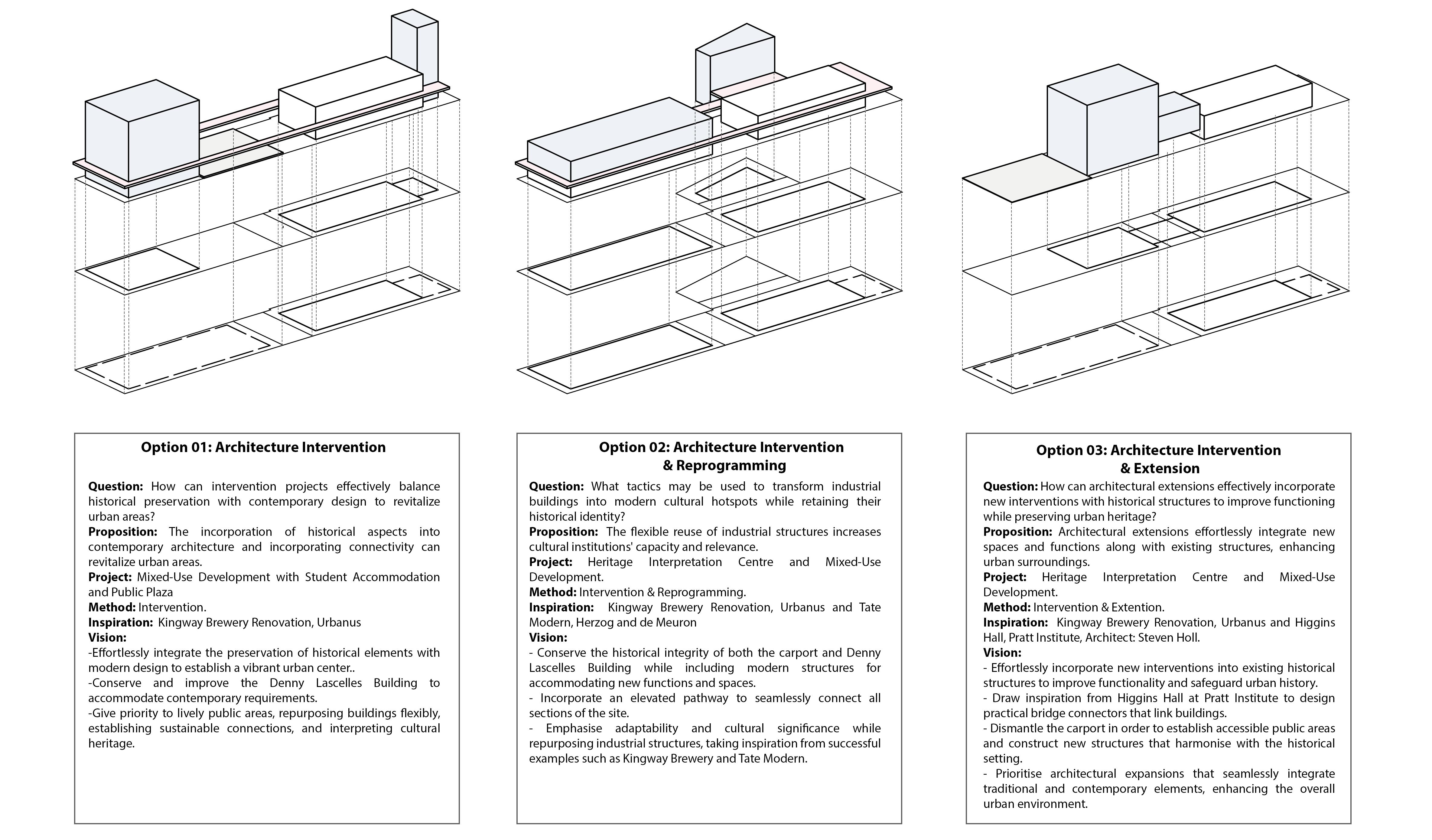
ACHITECTURE RESEARCH MASTERCLASS PREPARATION
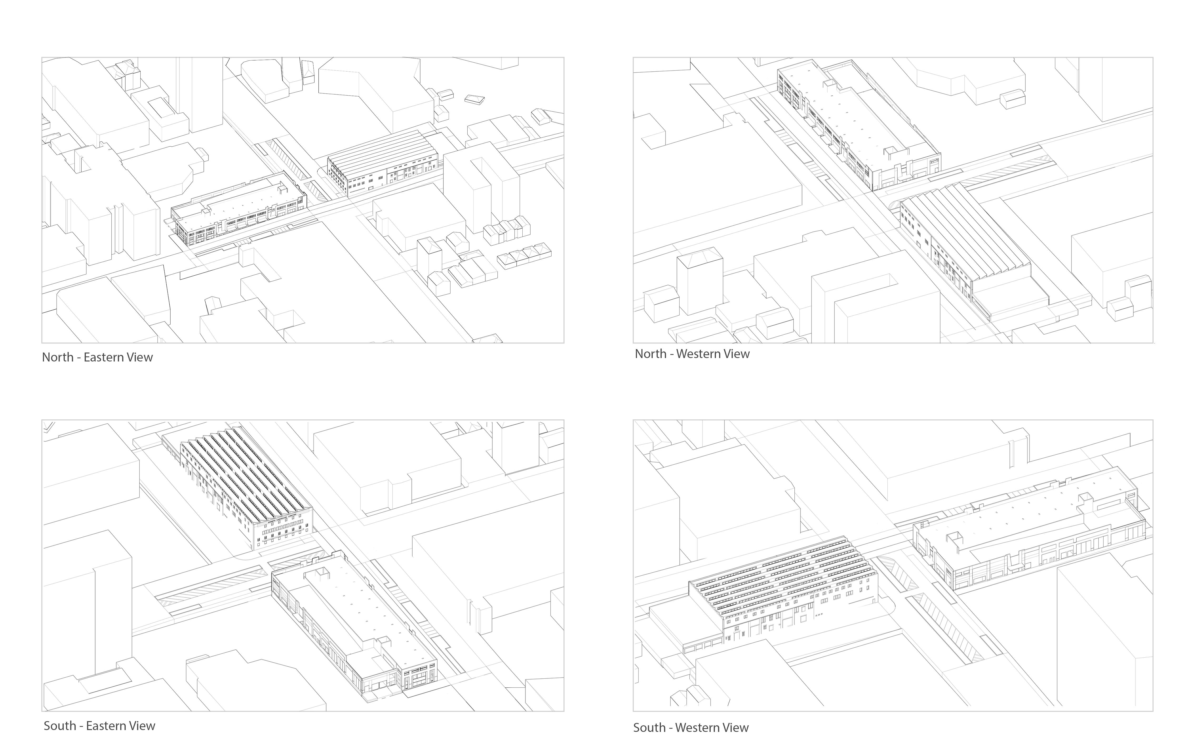
DRAWINGS OF THE SITE AND EXISTING

Scale: 1:600
Scale: 1:600
Scale: 1:600
Scale: 1:600
Scale: 1:600
Scale: 1:600
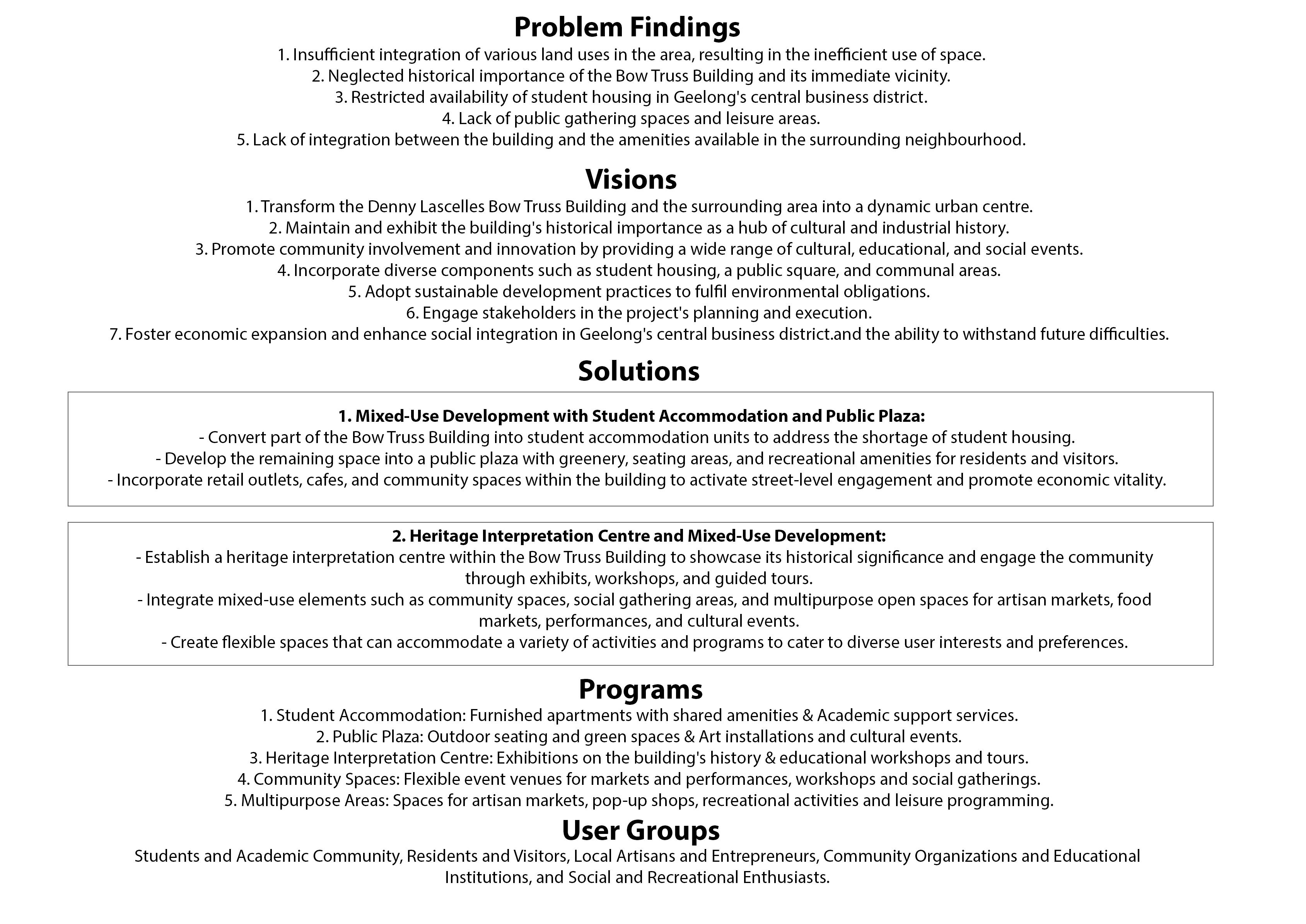
Geelong Precinct Mapping & Data Analysis
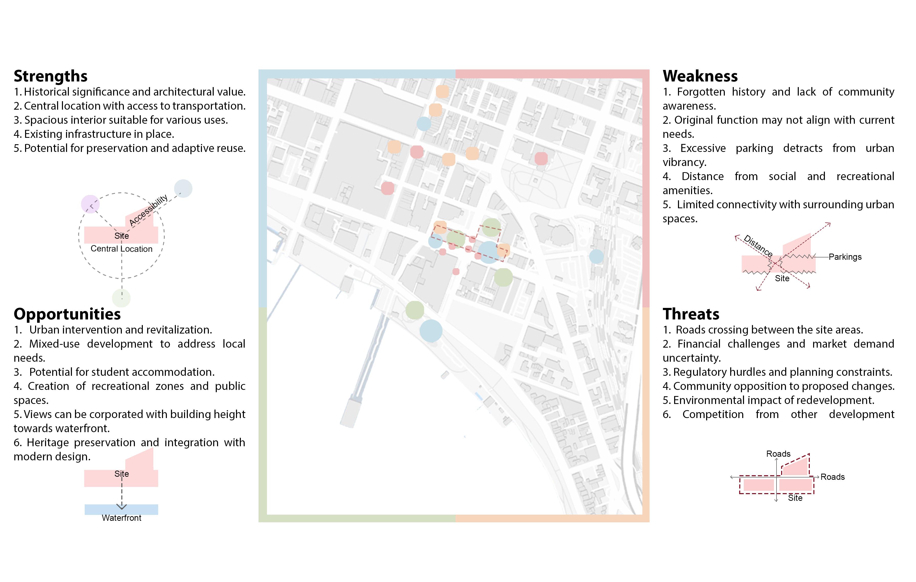
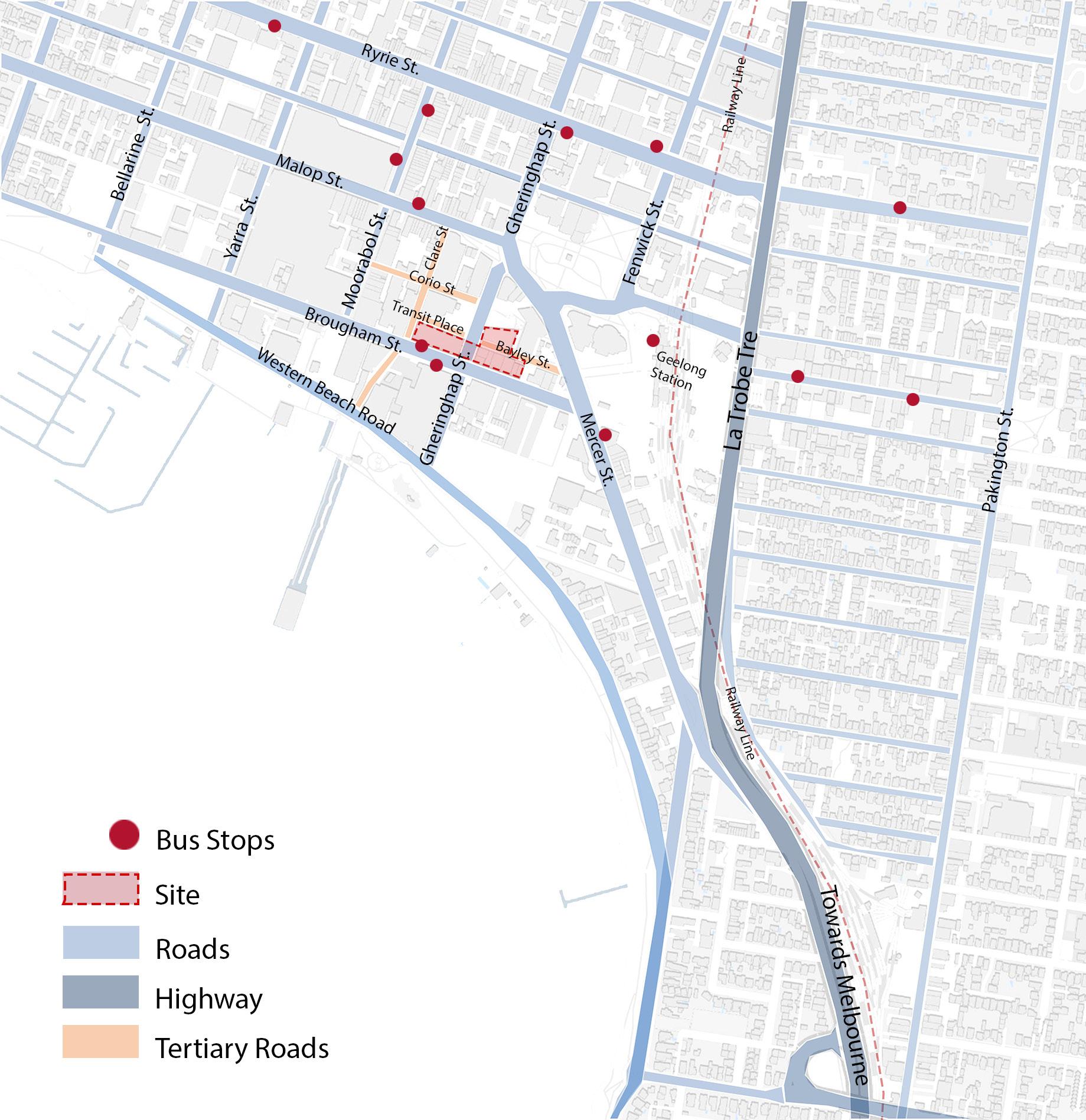
The analysis of accessibility mapping indicates that the Denny Lascelles Building and its surrounding area benefit from excellent access to major highways and public transportation, improving connectivity for residents and visitors. The easy access to this location allows for the development of sustainable mobility options in addition to making it an ideal site for urban interventions that aim to improve livability and community involvement.
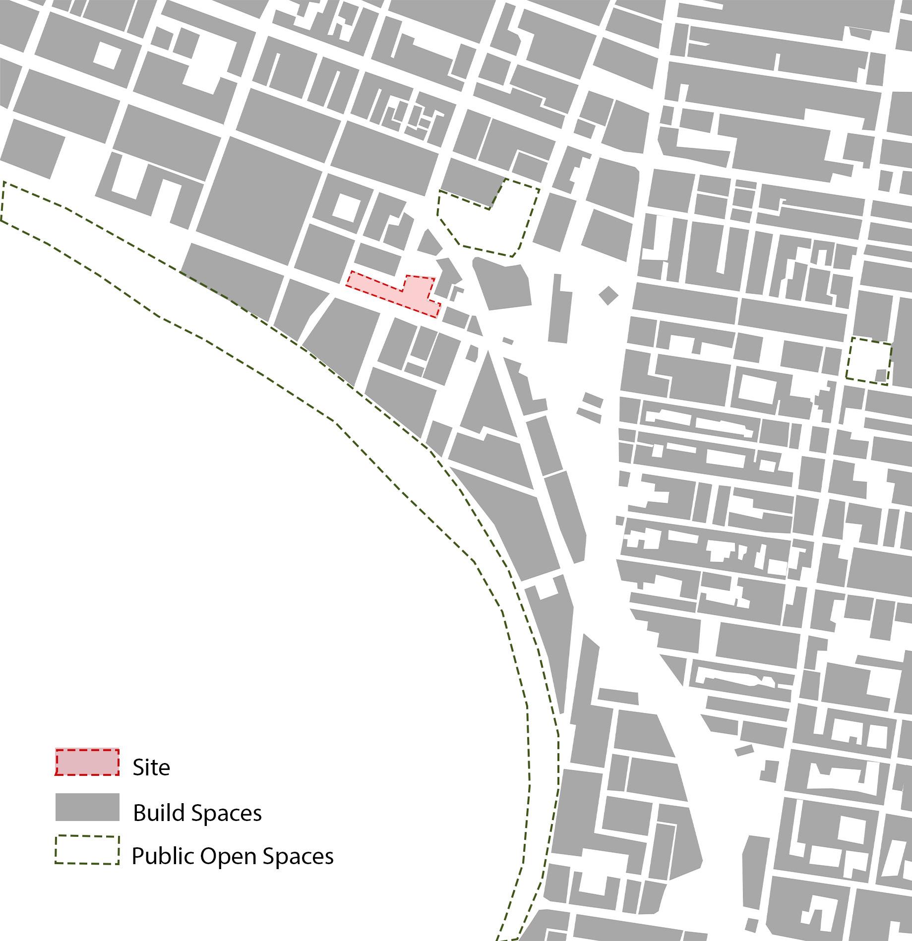
The analysis of figure-ground mapping highlights a lack of available open spaces in the central business district of Geelong, underscoring the necessity for well-planned urban interventions. By utilising existing parks such as Johnstone Park and incorporating new public recreation areas, we can improve community well-being and tackle the lack of available open spaces.
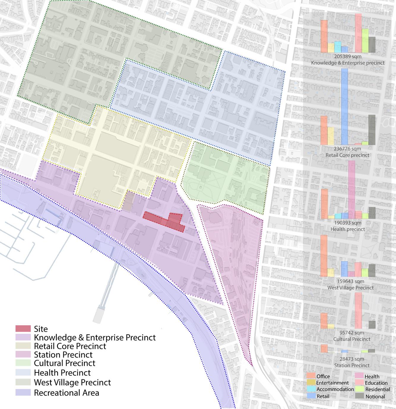
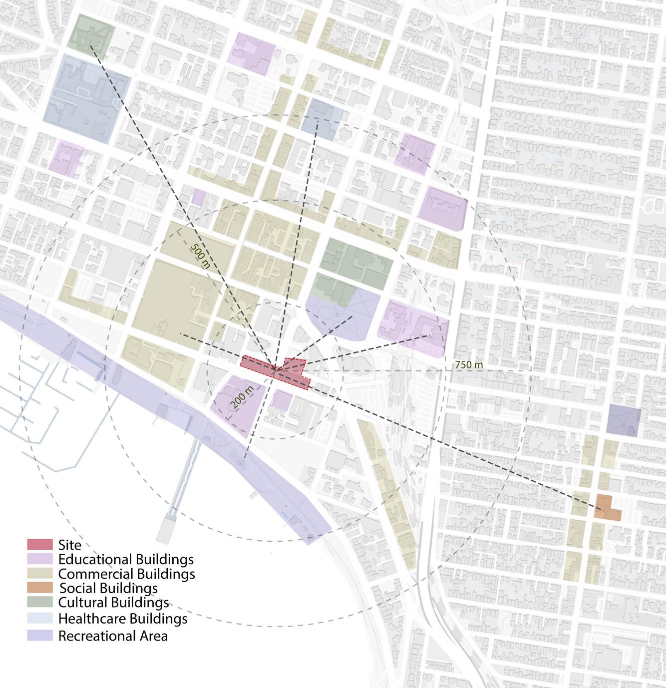
The site study indicates that the given site is located near important precincts, particularly the education precinct, which suggests a possible emphasis on meeting the requirements of students. The close proximity to retail and recreational areas allows for strategic urban improvements that cater to a variety of user groups and enhance the general liveliness of the city.
Proximity Mapping
The proximity mapping emphasises the site's closeness to recreational areas, Deakin University, and economic zones, suggesting potential prospects for collaboration. Nevertheless, the absence of local cultural and social spaces indicates the necessity of including such facilities in the urban intervention project in order to promote community involvement and enhance cultural development.
Existing Building Height Mapping
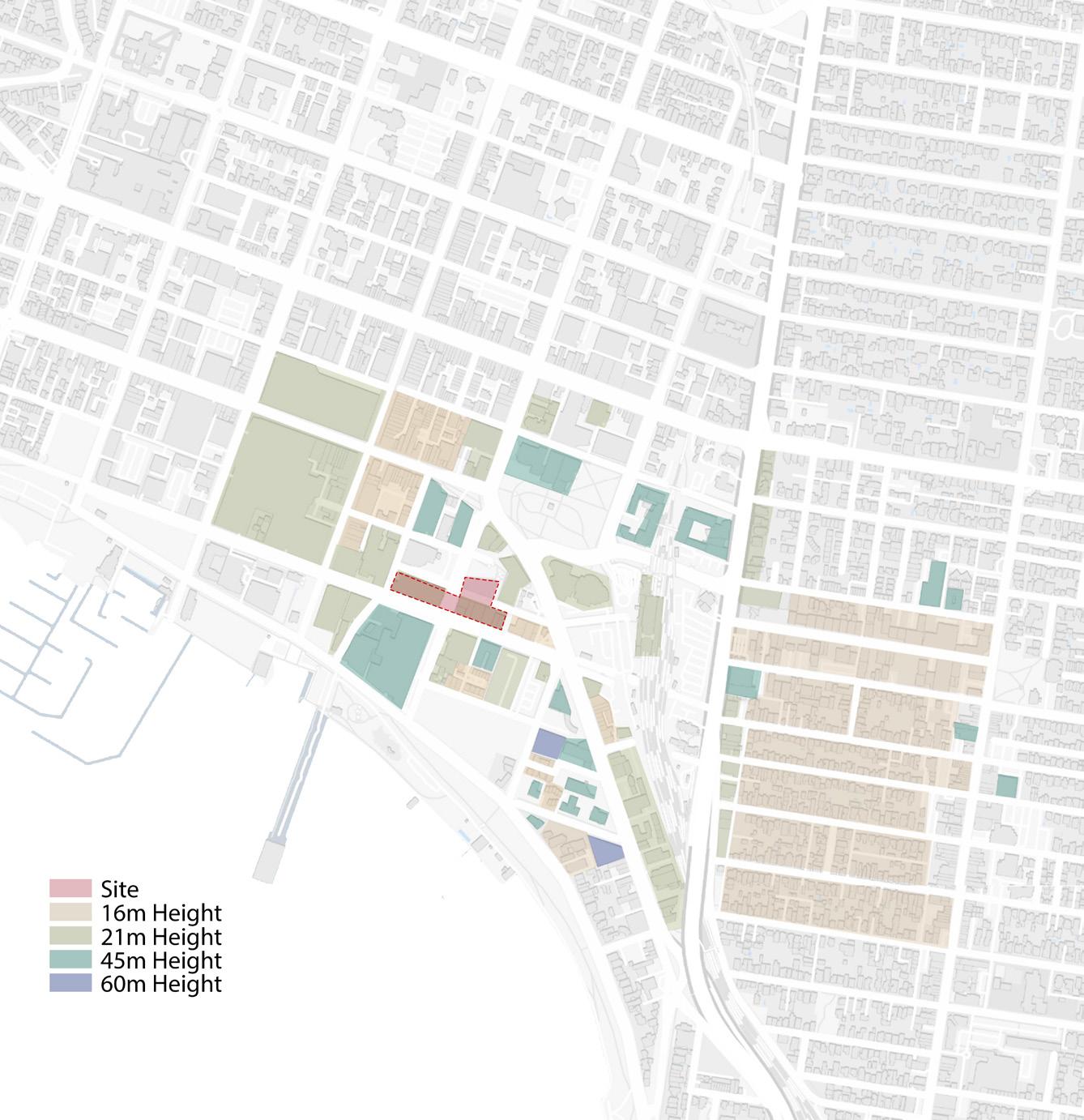
The prevailing mapping of building heights indicates compliance with Geelong's height regulations that is maximum 45m, allowing for potential extensions within the limits set by the authorities. In addition, intervention of taller buildings will optimize the panoramic views of the waterfront from higher levels, thus increasing the appeal and urban ambiance of the location.
Heritage Buildings Mapping
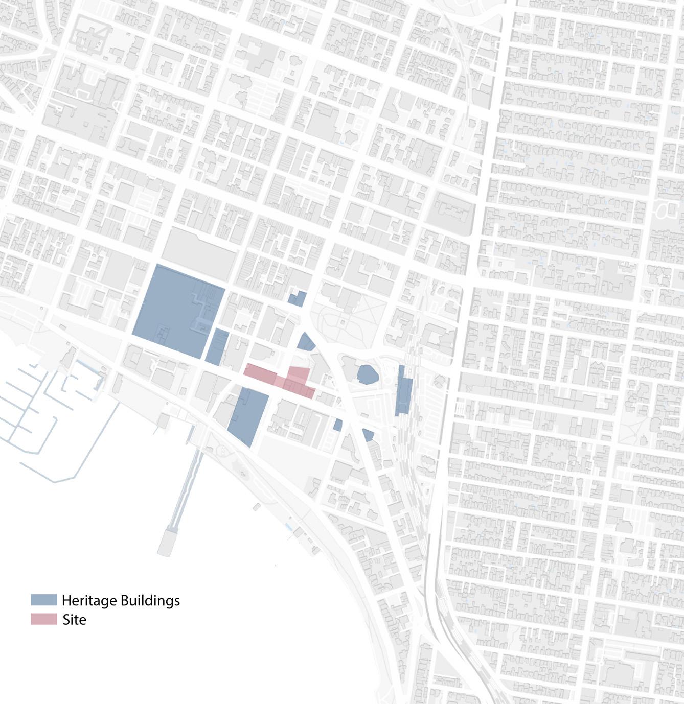
The process of mapping the heritage buildings in Geelong highlights the city's extensive historical framework, indicating the possibility of incorporating a museum or heritage centre into the urban intervention project. This would serve as a platform to exhibit the city's history and cultural importance. Incorporating such facilities can enrich the site's distinctiveness and foster community involvement with its cultural legacy.
Demographic Analysis
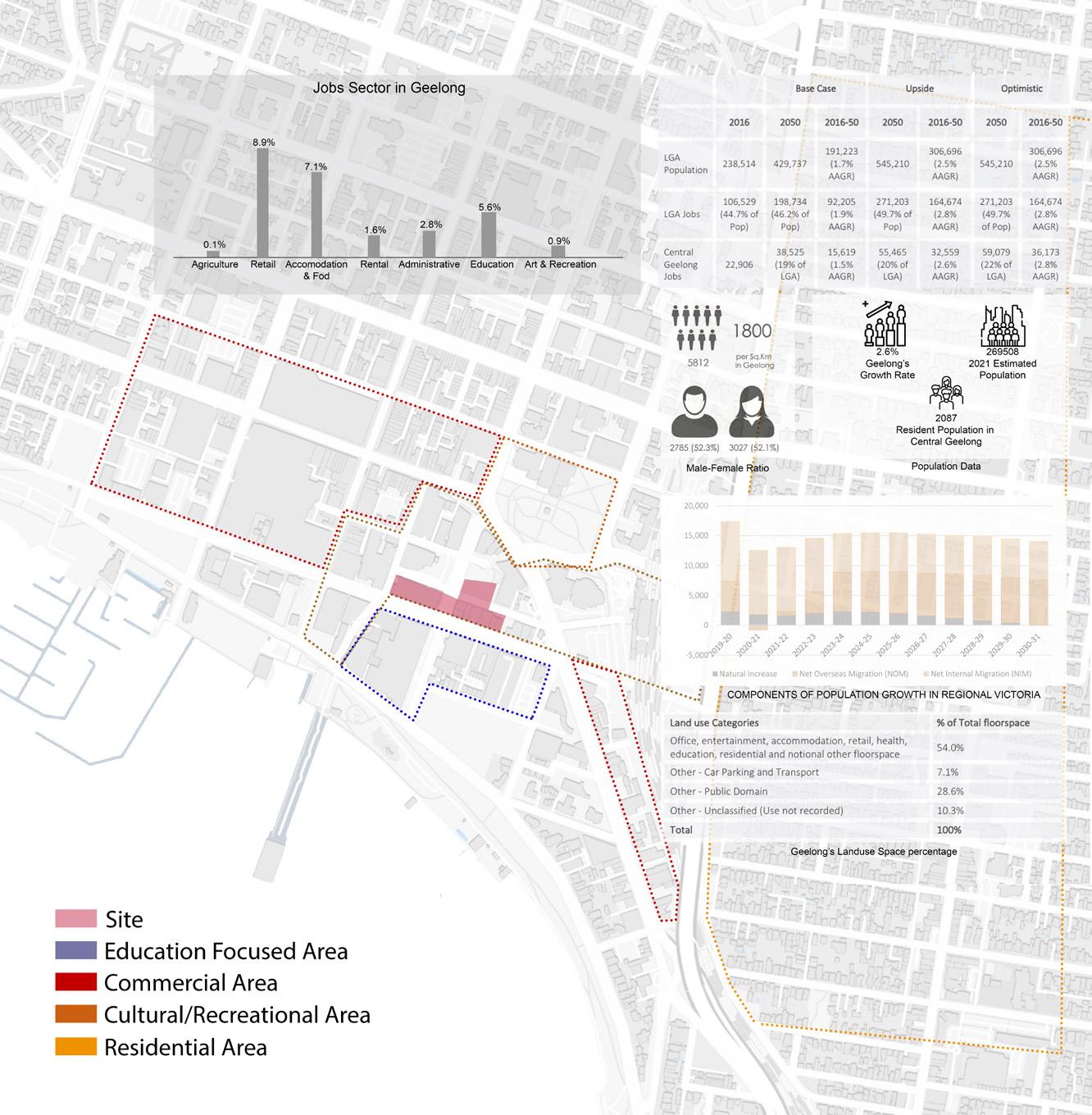
Demographic research predicts a large rise in labour opportunities in Central Geelong by 2050, highlighting the need for urban improvements. Mixed-use developments like museums can meet community needs while enhancing economic and cultural vitality, especially in locations with a growing population and limited parking and public spaces.
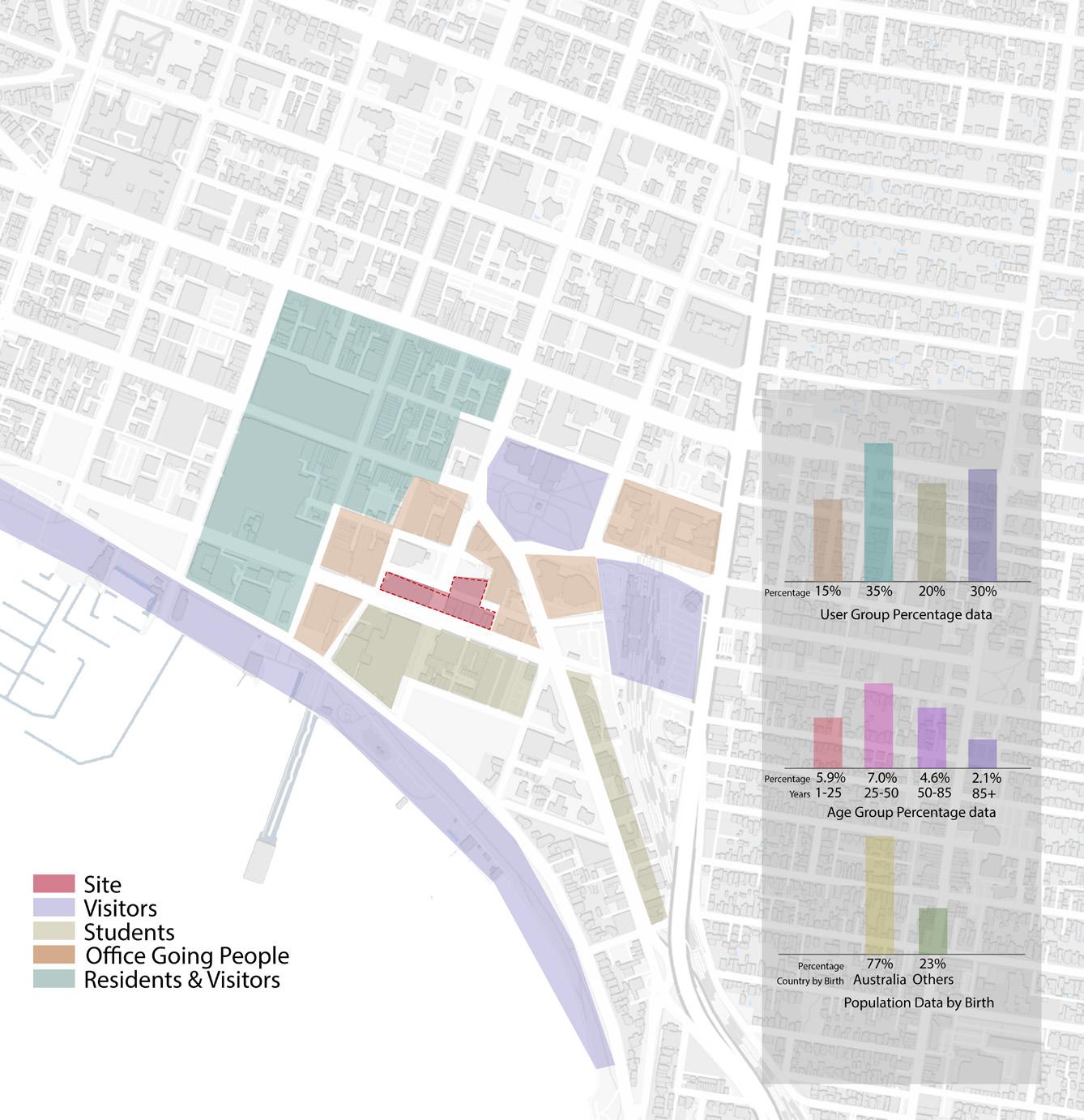
User Group Analysis
The examination of the user group in Geelong indicates a varied demographic profile, characterised by a substantial number of migrants and a prevailing age group of individuals between 25 and 50 years old. The utilisation of recreational and commercial areas is primarily by residents and tourists, underscoring the significance of developing inclusive urban solutions that accommodate the diverse requirements of students, office-goers, and other user groups.
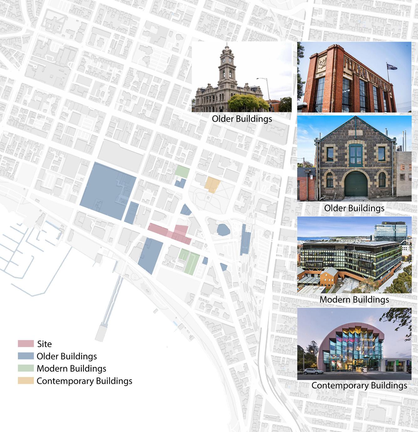
Value of Buildings & Material Analysis
Building values and materials highlight the region's architectural diversity, with old buildings featuring blue stone and red brick, modern buildings featuring glass, steel and concrete, and dynamic designs. Using the site's architectural heritage and range of materials can help create urban projects that honour the site's history while using modern and innovative construction methods for environmentally responsible advancement.
SRD755- Architecture Research: Masterclass preparation
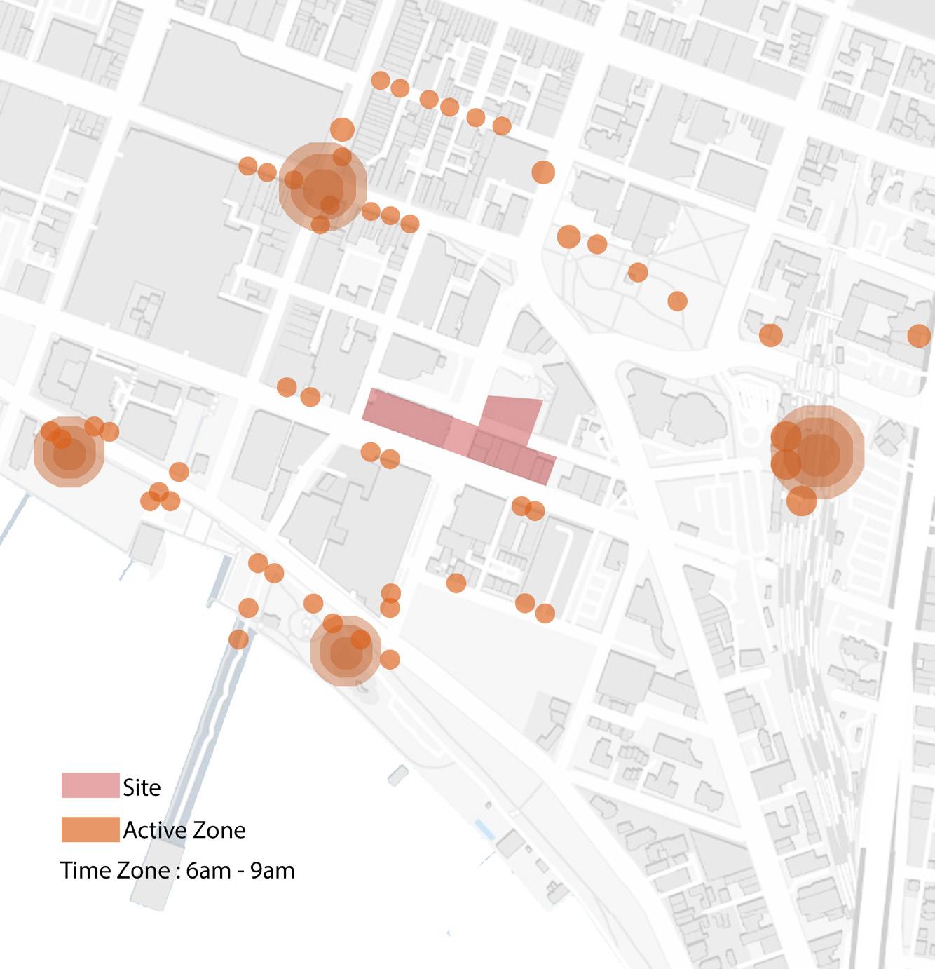
Activity Mapping : 6am - 9am
The site surroundings experience high activity levels between 6 and 9 am as a result of the nearby presence of educational institutions and office buildings.
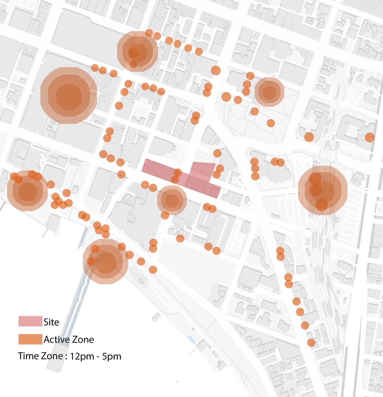
Activity Mapping : 12pm - 5pm
The site surroundings are quite calm from 12 to 5 pm, except for the commercial establishments and station area and recreational area in the vicinity, which experience a significant increase in activity during lunch hours.
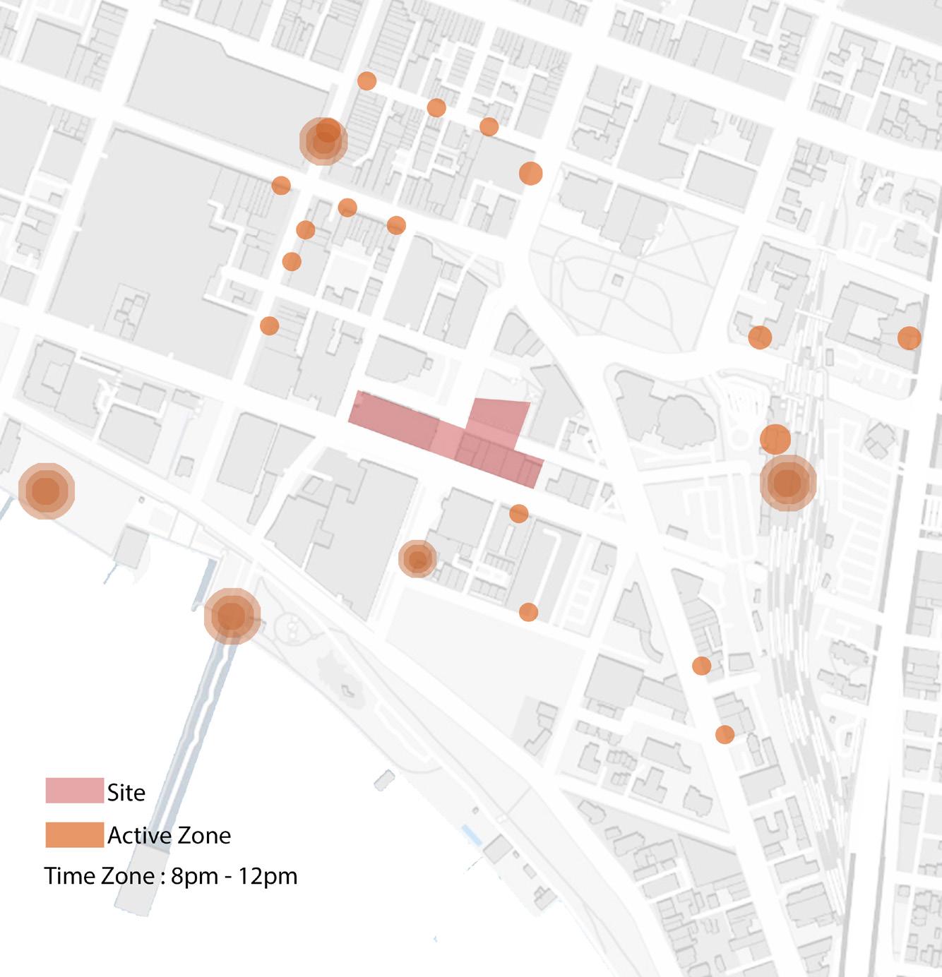
Activity Mapping : 8pm - 12pm
The site surroundings are uninspiring from 8 to 12 pm, with just a few areas of the waterfront experiencing moderate activity, including several local restaurants.
The activity mapping shows varying levels of activity throughout the day, with peak periods aligning with lunch hours and morning commutes because of the presence of adjacent commercial establishments, educational institutions, and office buildings. Gaining insight into these patterns can guide the development of urban initiatives aimed at maximising the use and liveliness of public areas and utilities at various times of the day. More functions can be introduced in order to activate the site and its surroundings.
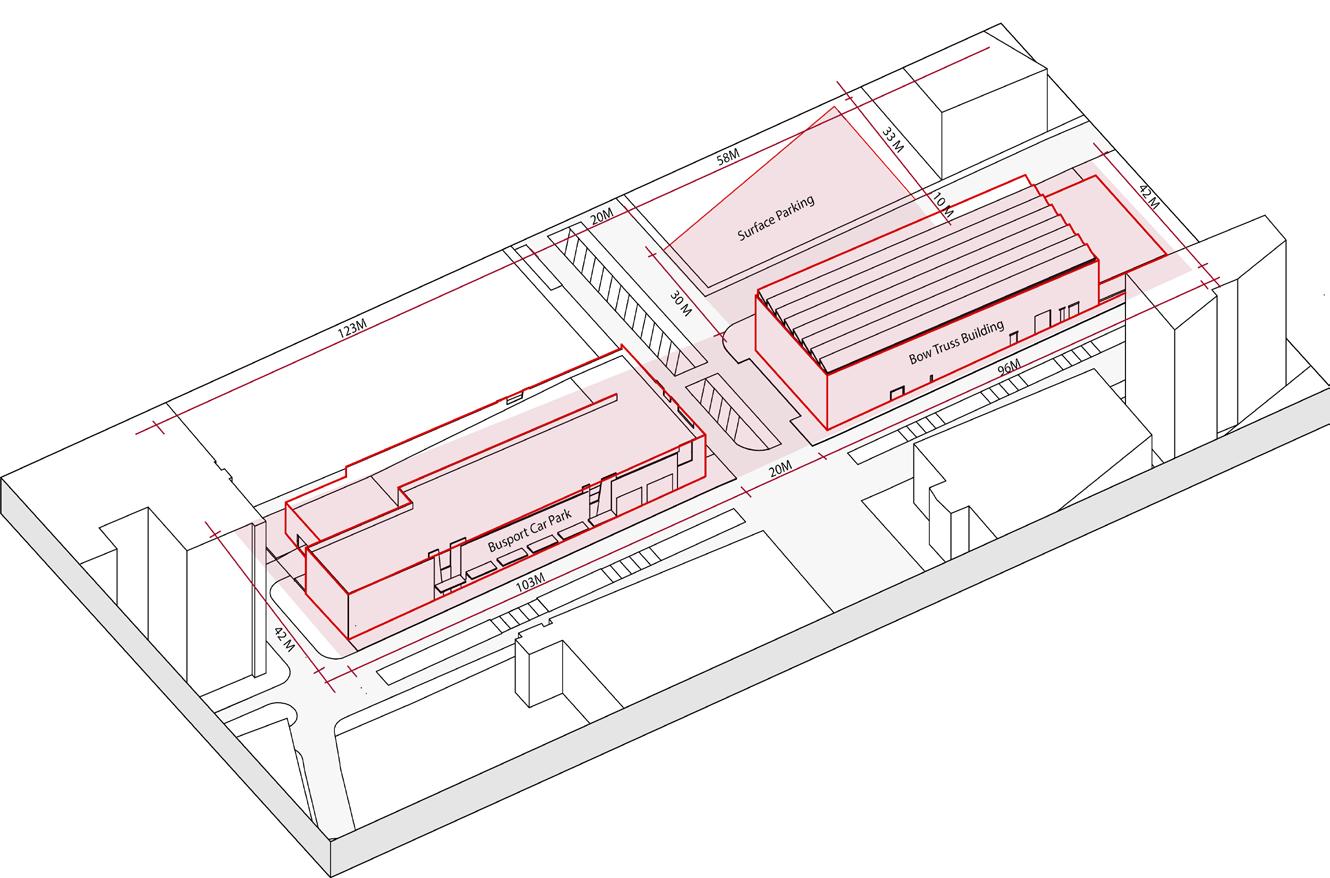
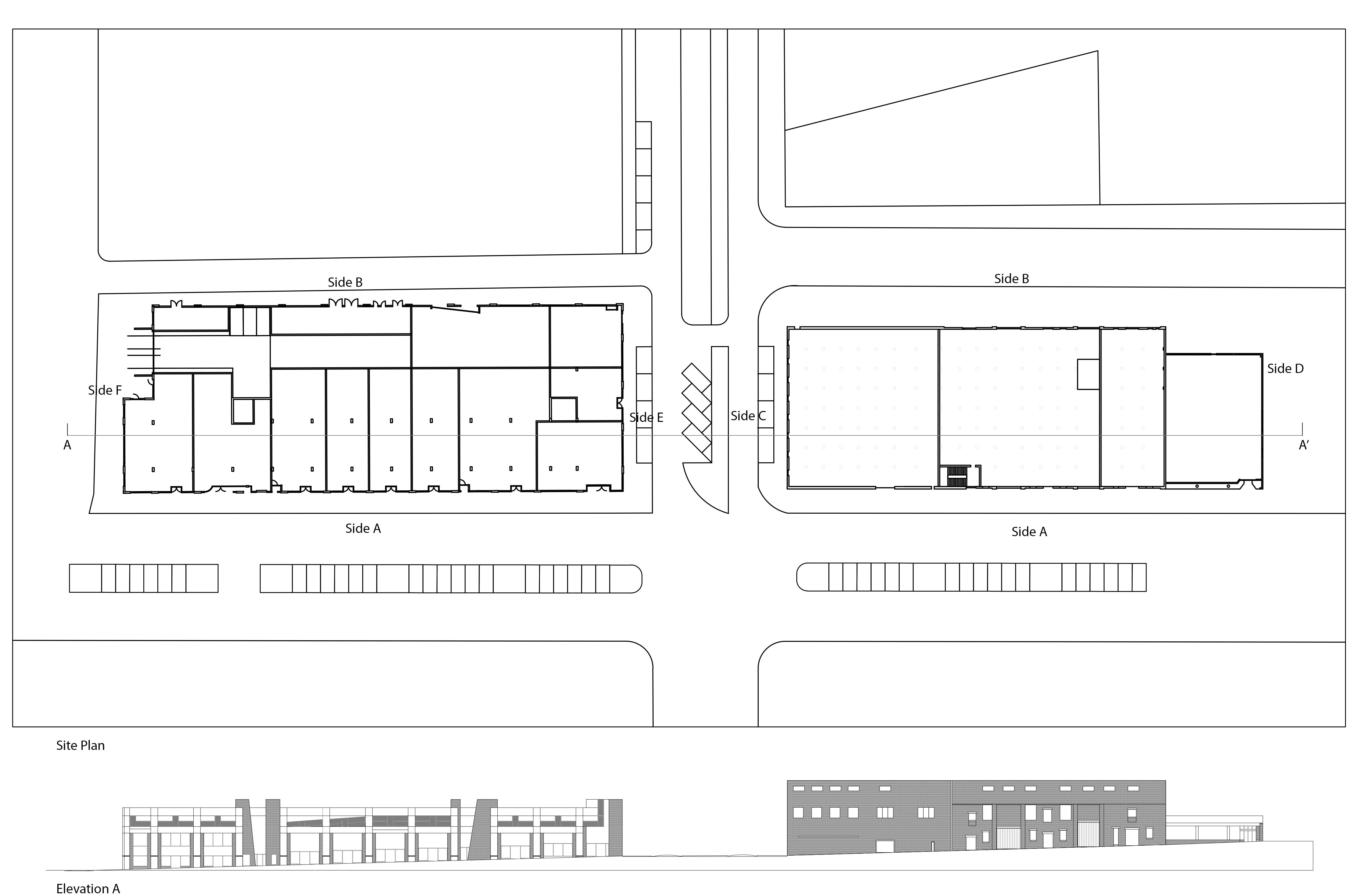
Site Dimentions
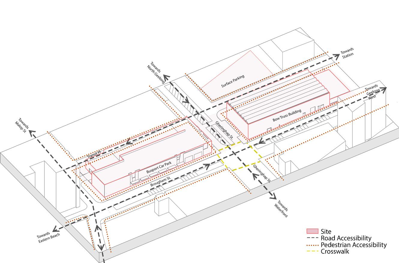
Site Surrounding Accessibility Mapping
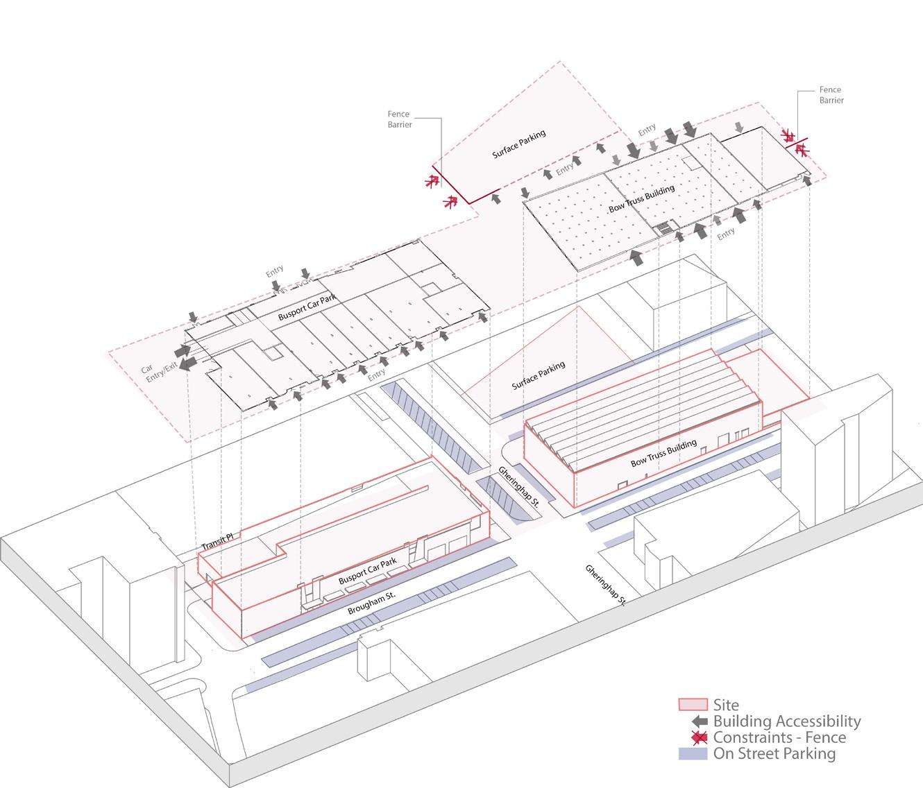
Existing Scenario Mapping
The site accessibility mapping indicates the presence of scattered street parking and limitations on building accessibility, despite the availability of sufficient pedestrian and road access. Nevertheless, the existence of roadways that separate the different portions of the land poses a difficulty for creating a unified urban intervention design. This requires careful planning to maximise connectedness and usefulness throughout the site.
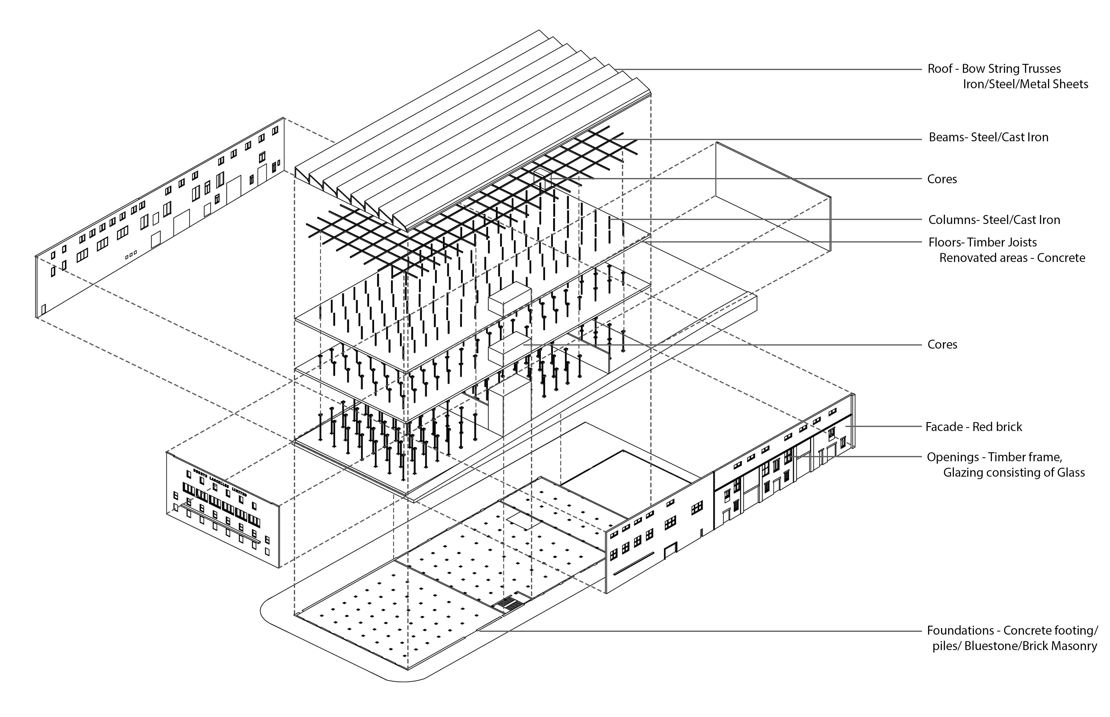
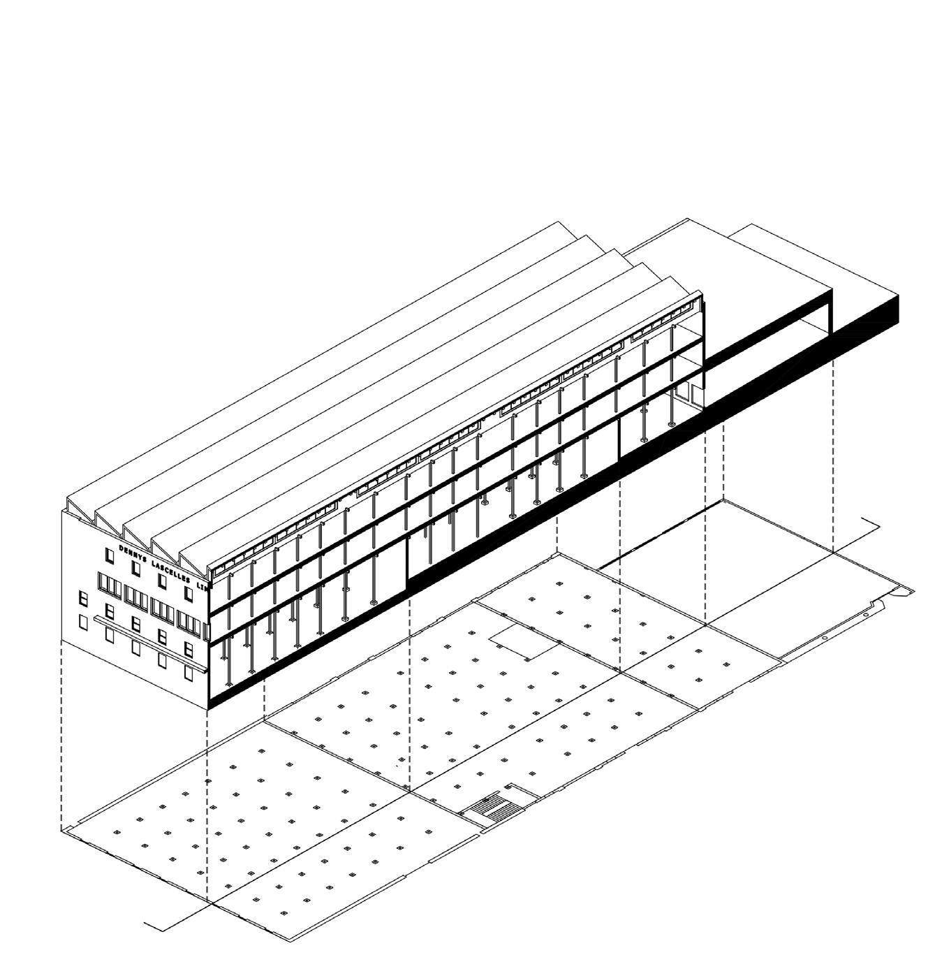
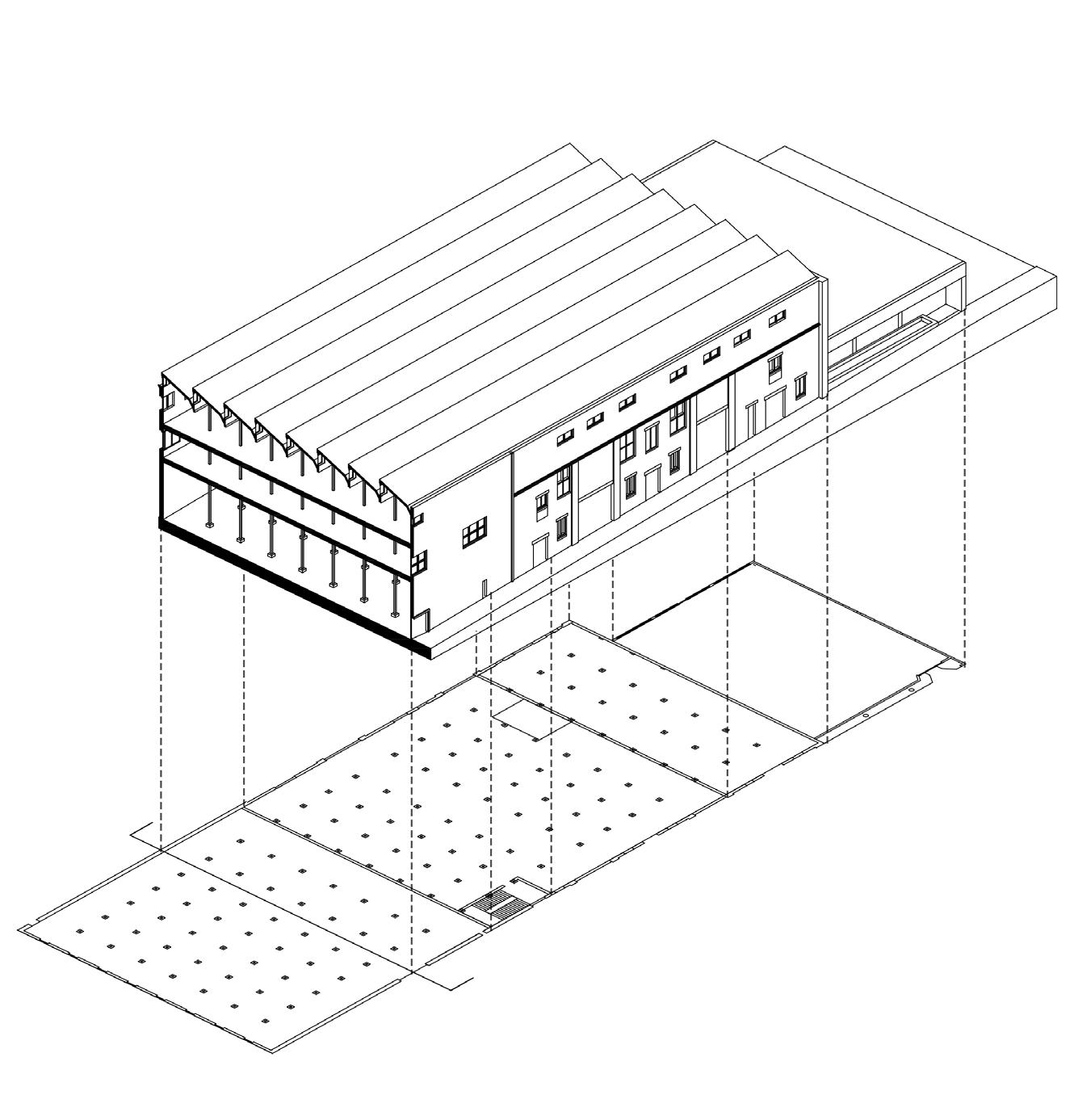
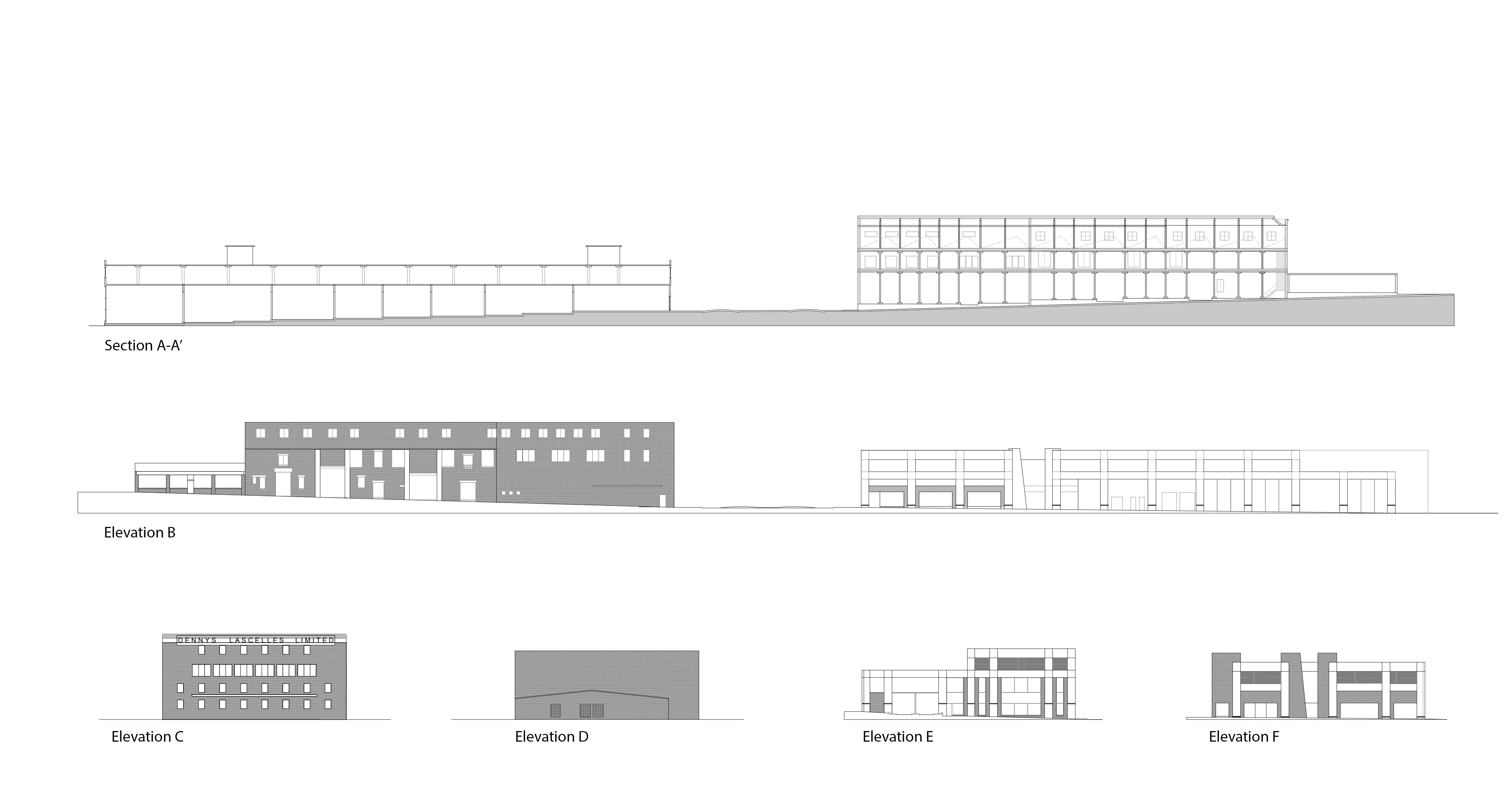
Building Fabric Analysis
The research of the building fabric highlights the employment of various materials in the facades, floors, roofs, and windows, which represents both the architectural history of the area and current design trends. By incorporating these material palettes into the urban intervention project, it is possible to create a seamless integration of historical setting and contemporary design features. This will enhance the visual attractiveness and cultural importance of the site.
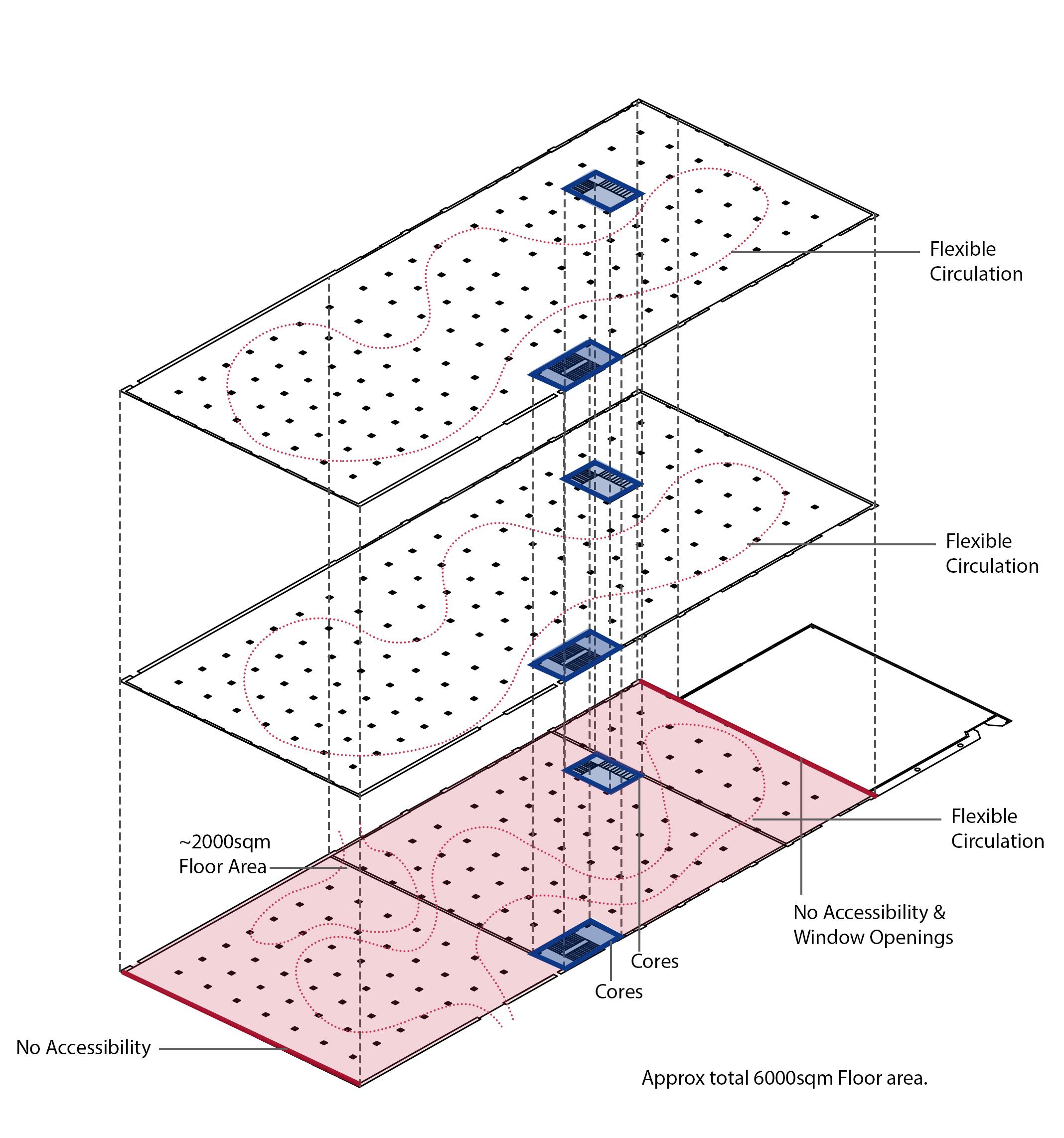
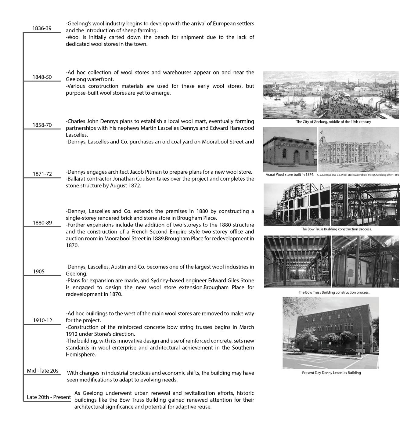
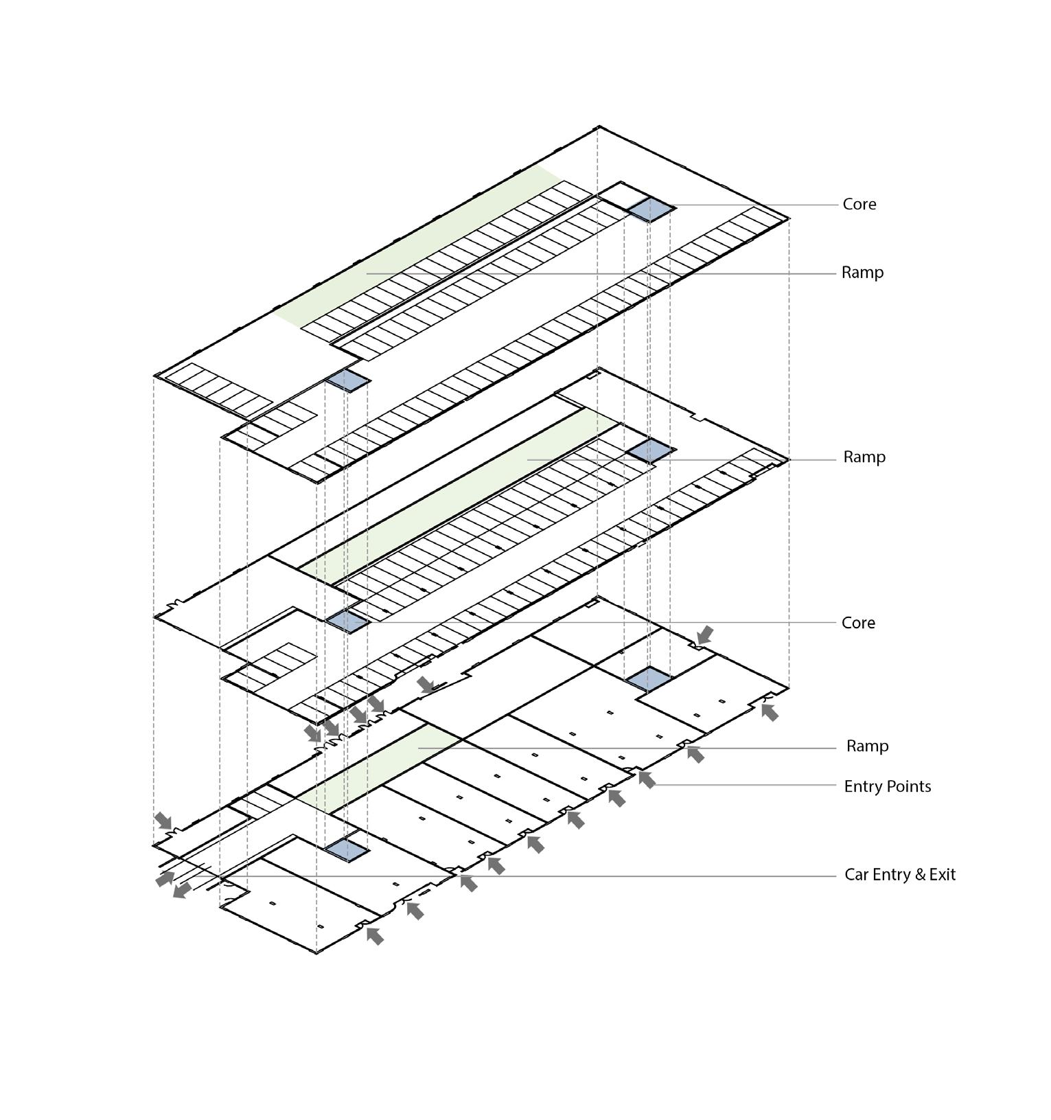
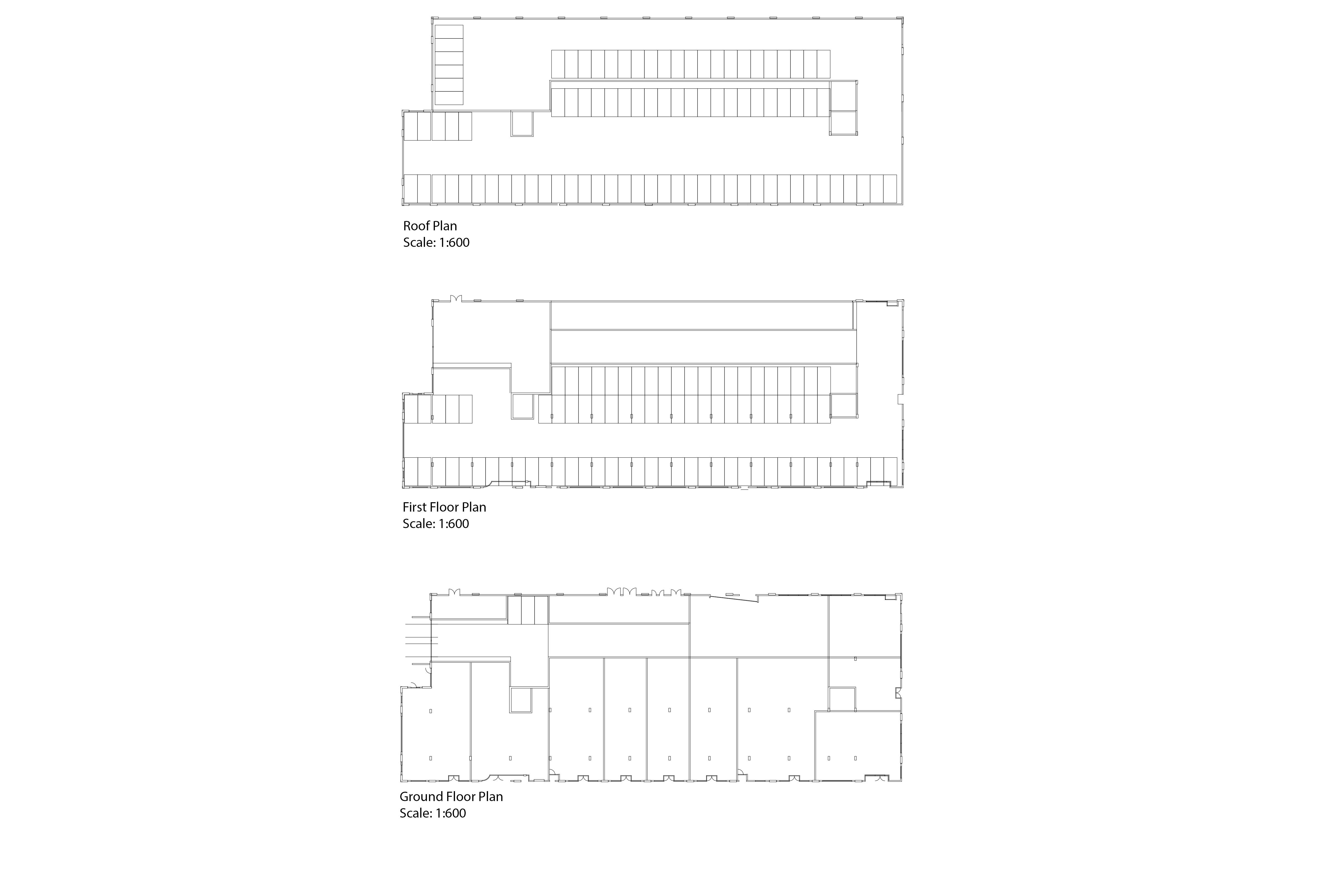
Building Spacial Analysis
The spatial study of the building indicates the presence of expansive spaces that are well-suited for versatile functional purposes, such as hosting exhibitions. Nevertheless, the current cores may present limitations for future expansion, indicating the requirement for further vertical circulation features to enhance space utilization and accessibility in the urban intervention project.