INSTRUMENT PRODUCT GUIDE SUPERIOR PRODUCTS DISTRIBUTORS,INC. 1967-2022 SUPERIOR YEARS

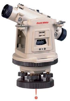
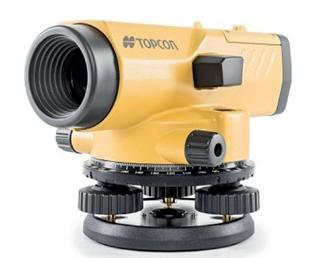
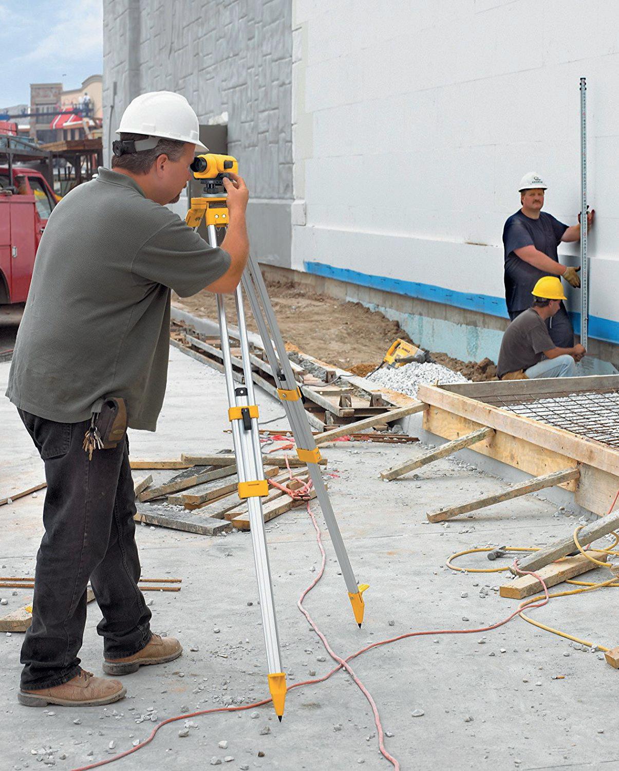
An optical instrument used to establish or verify points on to same horizon plane. Great for transferring benchmarks, calculating elevation differences and setting grades. This is typically a twoperson operation; 1 at the instrument and the 2nd holding the grade rod plumb an level.
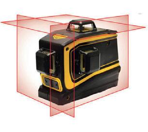
Intended for interior use. Produces a visible horizontal and/or vertical laser line. Primarily used for installing drop ceilings, cabinets, and interior walls. Limited to distances less than 75’.
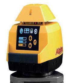
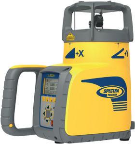
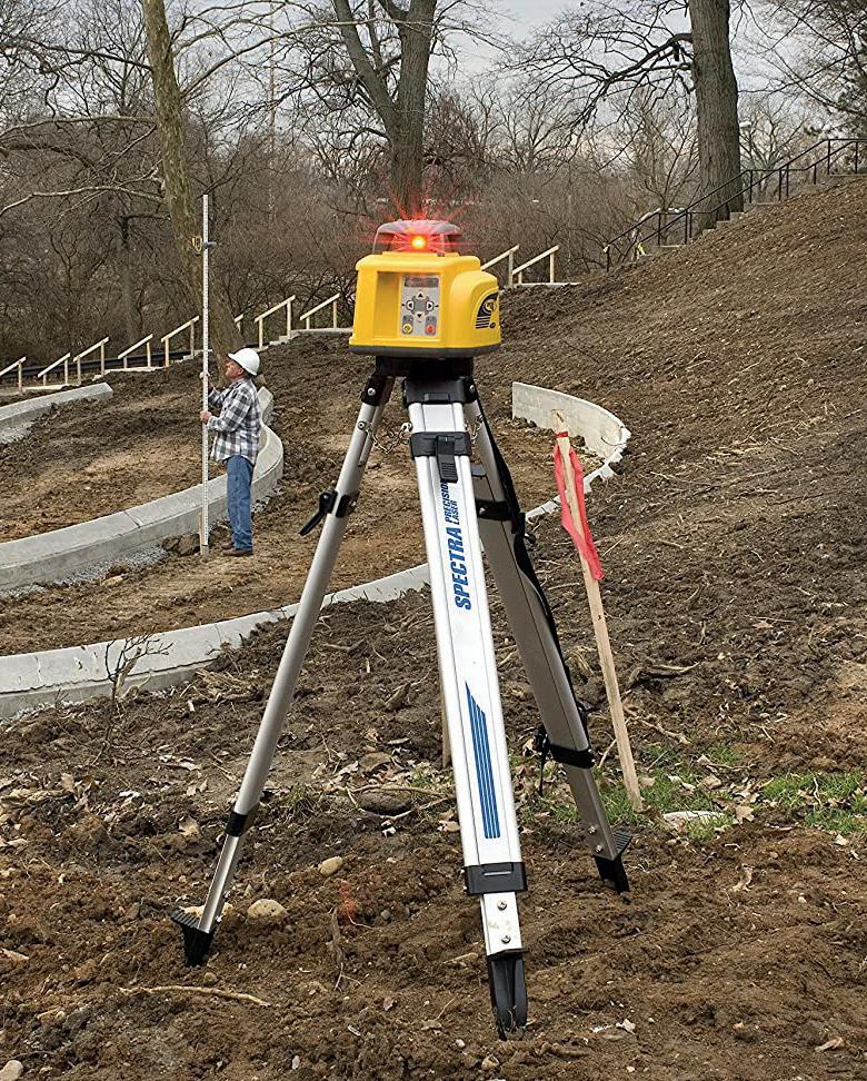
Typically, an exterior battery powered rotating laser that emits a visible or invisible laser beam in a horizontal and/or vertical plane. Uses a laser detector to indicate direction to reach a precalculated elevation. The laser detector uses both visual and audible cues to determine the direction to adjust the grade rod for desired elevation.
Visual laser detector cues are arrows indicating the rod needs to be adjusted up or down and uses a horizontal bar to indicate on grade. Audible cues are typically a quick beeping indicating the grade rod is too high, slow beeping to indicate grade rod is too low, and a steady tone to verify on grade.
Slope lasers come in a variety of choices: single or dual slope, dial-in grade or grade match. Slopes lasers are perfect for quickly establishing grades on a continuously sloping plane such as a garage floor, water shed or sporting fields. Uses the same detector as the grade laser.
Creates a continuous slope in a circular pattern. Specialty laser used to grade baseball diamonds.
Primarily used to accurately align pipe during installation. Keeping pipe in a straight line while maintaining correct slope is extremely important with any pipe job.
Multi-purpose optical instrument. Uses include setting grades, establishing base lines, turning rough angles, and accurately alighting pipe lasers. Should be limited to use under 400’. 10-minute angle accuracy.
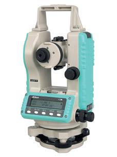
More advanced/accurate transit using digital encoders to read horizontal and vertical angles. Commonly used to establish base lines, accurately turn 90-degree angles, align column lines and anchor bolts. 10-second angle accuracy.
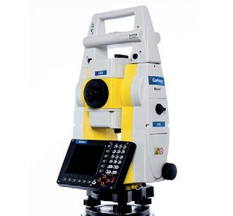
A total station is an extremely accurate combination of a digital theodolite and electronic distance measurement (EDM). Total stations have an onboard computer to calculate and record angle and distance measurements. Surveyors, site contractors, and concrete contractors use total stations. Uses include land surveying, construction site/building layout, and asbuilt recording. Total stations come in a variety of accuracies and types, conventional (2-man), robotic (1-man), and hybrid (a combination of robotic and GPS).
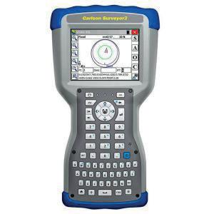
Data collectors work in conjunction with both total stations and GPS receivers to aid in quickly and accurately calculating and recording data points. Data collectors can import/export coordinate files. Use coordinate files or AutoCAD drawings to assist in complicated layout. Data collectors can display AutoCAD drawings display the operator’s position as well as display the calculated position. Making navigating to the desired point very easy. When position is recorded, information such as cut/fill is displayed.
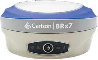
GPS Receivers work in a similar fashion as a total station but uses GPS satellites and land based correction services to calculate the receiver’s position. GPS receiver accuracies are typically within 1 cm horizontally and within 2 cm vertically. Short term averaging or long term static observations can improve accuracy to within millimeters. Typical uses are recording survey control points, topographical survey, construction layout, and asbuilt data recording.
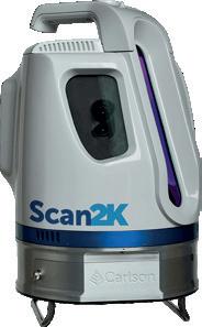
A survey device that can quickly collect millions of accurately measured points. Most laser scanners also capture photographs as well. When the data from the scanner is processed, using powerful computer software can generate a 3D rendering with amazing precision. Laser scanners can reduce the survey time from days to hours compared to conventional survey methods. Uses include interior/exterior as-builds, stockpile volume calculation, and quarry/mining surveys.
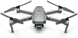
Unmanned Aerial Vehicles or drones are used by industries. There are almost unlimited applications. Real estate photography, first responders emergency scene assessment/search and rescue. Survey and construction progress photos/videos, and structure inspections. Using specialized software stockpile/pit calculations, as well as topographic surveys. With specialized cameras, agricultural professionals can monitor soil moisture and plant health.
An auto level is an optical instrument used to establish or verify points on to same horizon plane. Great for transferring benchmarks, calculating elevation differences and setting grades. This is typically a two-person operation; 1 at the instrument and the 2nd holding the grade rod plumb an level.
1. Setup your tripod as level as possible, step on tripod legs to drive into the ground.
2. Attach auto level to the tripod.
3. Adjust level so bubble is centered in vial.
4. Adjust reticle until crosshairs are clear.
5. Adjust the objective lens until the object you are viewing is clear.
1. Set grade rod on benchmark.
2. Record the height the auto level reads on the grade rod.
3. Add the height to the BM to find the HI (Height of Instrument).
4. Now move the grade rod to a new location (where you want to transfer the elevation).
5. Record the height the auto level reads on the grade rod.
6. Subtract the height from the HI to find the new elevation at the bottom of the grade rod.
Nedo Z28 (#.209366)
Nedo Z32 (#.206147)
Nedo F28 (#.207230)
Nedo F32 (#.208419)
Topcon AT-B4A (#.201768)
Topcon AT-B3A (#.201767)
Seco 24x Level (#.199290)
The pricing of these levels range from $200-$2,000.
Applications:
Building fences, installing foundations, constructing decks, road work and excavation.
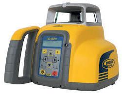
Typically, an exterior batter powered rotating laser that emits a visible or invisible laser beam in a horizontal and/or vertical plane. Uses a laser detector to indicate direction to reach a precalculated elevation. The laser detector uses both visual and audible cues to determine the direction to adjust the grade rod for desired elevation.
Visual laser detector cues are arrows indicating the rod needs to be adjusted up or down and uses a horizontal bar to indicate on grade. Audible cues are typically a quick beeping indicating the grade rod is too high, slow beeping to indicate grade rod is too low, and a steady tone to verify on grade.
1. Set up the tripod on a flat surface ensuring it is firmly and securely set.
2. Mount the laser on the tripod at the desired height.
3. Turn on the unit.
4. Allow a moment for the laser to self level.
5. Once the leveling is complete, you are ready to begin.
Grade lasers can be used in a number of situations including building a deck, setting up drainage, and alignment of concrete forms among others.
Grade Laser: Spectra Precision LL100N (#.205654)
Spectra Precision LL300N (#.186354)
Spectra Precision LL500 (#.94063)
Topcon RL-H5A (DB) (#.209689)
Topcon RL-H5A (RB) (#.209692)
Single Slope: Spectra Precision GL412N (#.209661)
Spectra Precision GL612N (#.206388)
Topcon RLSV1S (#.209693)
Dual Slope: Spectra Precision GL622N (#.195270)
Topcon RLSV2S (#.171949)
The pricing of these lasers range from $700-$3,000.
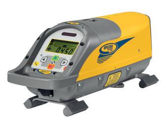
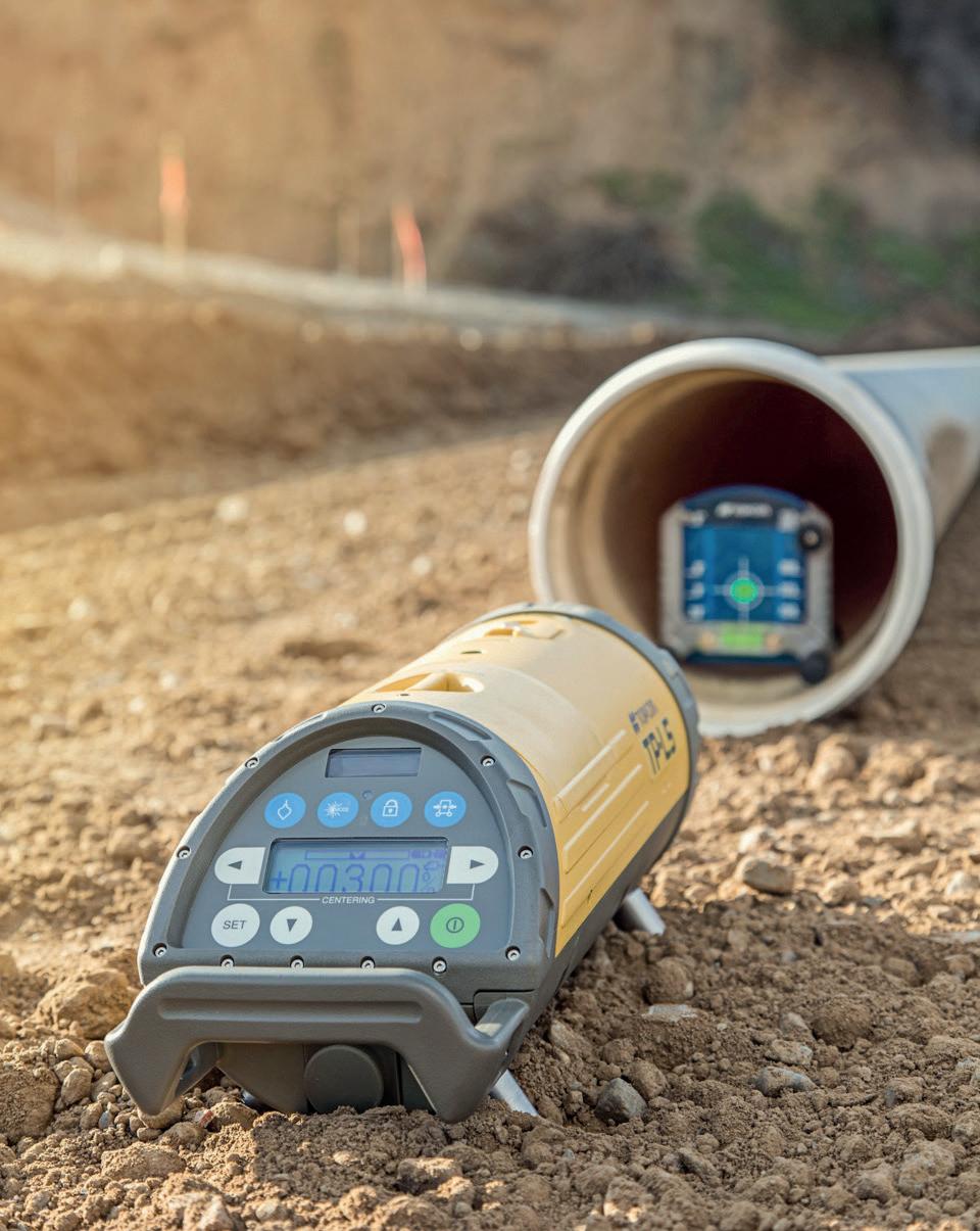
Primarily used to accurately align pipe during installation. Keeping pipe in a straight line while maintaining correct slope is extremely important with any pipe job.
A pipe laser can be setup a few different ways. The first is with the pipe laser set in the pipe, it can set in a pipe 6” or greater. It can also be used on a tripod or trivet plate that goes in the manhole or setup on a spreader bar that spans the manhole.
Setup:
1. Align the laser in the pipe or invert.
2. Using a trivet plate, set the height of the pipe laser so it is at the invert elevation.
3. Using a transit, align the beam of the pipe laser to the center of the next manhole or down line of pipe run.
4. Set the percent of slope needed for the pipe run.
5. Use a laser receiver to locate the beam in the pipe and make sure you are laying the pipe straight.
1. Determine the elevation difference between the two manholes.
2. Find the distance between the two man holes.
3. Divide the elevation difference by the run.
4. If the pipe laser you are using reads pipe slope in percent (that is what the rise is at 100 feet) then multiply rise for one foot of pipe times 100 to get percent of slope.
Turn the laser on by pressing the power key. The laser beam and display will flash with the last entered value. Use the plus and minus keys to select the desired grade. Plus is upward from the exit window.
When the desired grade is displayed, press the set key. The laser will then self-level to the entered grade. When the laser beam remains on and the “HOR” is constantly displayed on the LCD, the unit has been self leveled.
Line adjustment is adjusted by either left or right arrow keys. Starting with the line adjustment in the center is advised.
Topcon TP-L6 (#.227162)
Spectra Precision DG613 (#.199232)
Spectra Precision DG613G (#.209690)
Spectra Precision UL633N (#.208768)
The pricing of these lasers range from $3,000-$5,000.
Multi-purpose optical instrument. Uses include setting grades, establishing base lines, turning rough angles, and accurately alighting pipe lasers. Should be limited to use under 400’. 10-minute angle accuracy.
1. Set up tripod so the head is as level as possible. This will make leveling the instrument easier. Drive tripod legs into the ground by stepping on each leg.
2. Release horizontal clamp screw and turn instrument until the telescope bubble is directly over a pair of leveling screws.
3. Turn both screws either toward or away from each other. One screw will then be loosened by the same amount that the other is tightened until bubble is level.
4. Turn the telescope 90 degrees until over the other set of leveling screws or when you have only three leveling screws then over the third screw and adjust.
5. Repeat the leveling procedure above alternating from one pair of leveling screws to the other until transit is level.
1. Align Transit to sight point A.
2. Turn dial so it reads Zero when sighting point A.
3. Turn Transit to the desired angle but be careful not to touch dial.
4. Pull tape to desired length and sight the distance with the transit.
5. Place stake at sighted location.
1. Set grade rod on benchmark.
2. Record the height the auto level reads on the grade rod.
3. Add the height to the BM to find the HI (Height of Instrument).
4. Now move the grade rod to a new location (where you want to transfer the elevation).
5. Record the height the auto level reads on the grade rod.
6. Subtract the height to the HI to find the new elevation at the bottom of the grade rod.
1. Set up transit in an area that is as level as possible and about 220 feet long. Place two matching level rods or two pieces of strapping in the ground about 200 feet apart with the faces toward each other. Position and level the instrument so that the distance from the instrument to each rod is the same measure.
2. Take a reading on each rod with the instrument (or mark each piece of strapping where the crosshair is sighted).
3. Move transit to another spot on the line, take readings and mark both rods again.
4. The difference between the marks on the rod will be the error of the instrument.
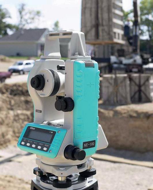
Some Transits/Theodolites We Carry:
Nikon NE-100 (#.112915)
David White LT8-300LP (#.127295)
David White LT8-300LTU-LP (#.163361)
David White LT6-900 (#.3774)
The pricing of these range from $1,000$5,000.
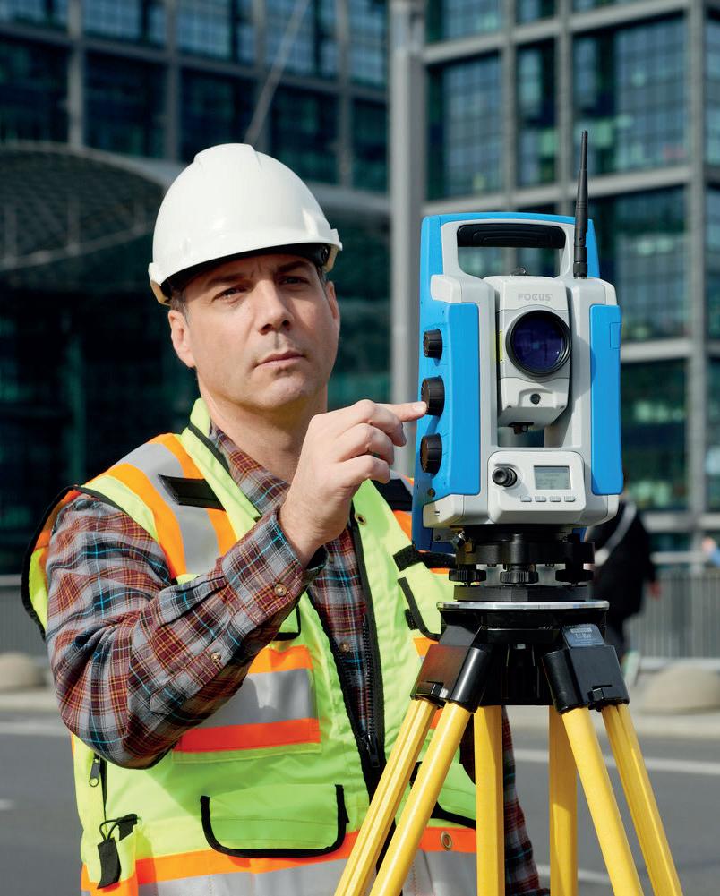
A total station is an extremely accurate combination of a digital theodolite and electronic distance measurement (EDM). Total stations have an on-board computer to calculate and record angle and distance measurements. Surveyors, site contractors, and concrete contractors use total stations. Uses include land surveying, construction site/building layout, and as-built recording. Total stations come in a variety of accuracies and types, conventional (2-man), robotic (1-man), and hybrid (a combination of robotic and GPS).
Set up the instrument at a known point and set the horizontal circle.
Enter the coordinates of the point to be staked out. (The program automatically calculates direction and distance to the point – the two parameters needed for staking out.)
Turn the total station until the horizontal circle reads zero.
Position the reflector at this point (point P).
Measure the distance. (The difference in the distance D to the point P will be displayed automatically.)
The coordinates of the points to be staked out can be transferred beforehand from your computer to the total station. Under these circumstances, you only need to select the point number. If two points are known you can also use the resection method to set up and orient your instrument.
The total station instrument is mounted on a tripod and is leveled by operating leveling screws. The instrument is capable of adjusting itself to the level position within a small range. Then vertical and horizontal reference directions are indexed using on-board keys.
It is possible to set required units for distance, temperature and pressure (FPS or SI). Surveyor can select measurement mode as fine, coarse, single or repeated.
When target is sighted, horizontal and vertical angles, as well as sloping distances, are measured and recorded along with point number by pressing appropriate keys. Heights of instrument and targets can be keyed in after measuring them with tapes. The processor computes various information about the point and displays on screen.
This information is also stored in the electronic notebook. At the end of the day, or whenever electronic note book is full, the stored information is downloaded to computers.
The point data downloaded to the computer can be used for further processing. Software such as Auto Civil and Auto Plotter clubbed with AutoCad can be used for plotting contours at any specified interval and for plotting cross- section along any specified line.
Manual Total Stations: Nikon XS Nikon XF Nikon N Series
Nikon K Series
Robotic Total Station: Carlson CR+
Carlson Zoom 50 Spectra Focus 35
The pricing of these range from $9,000-$60,000.
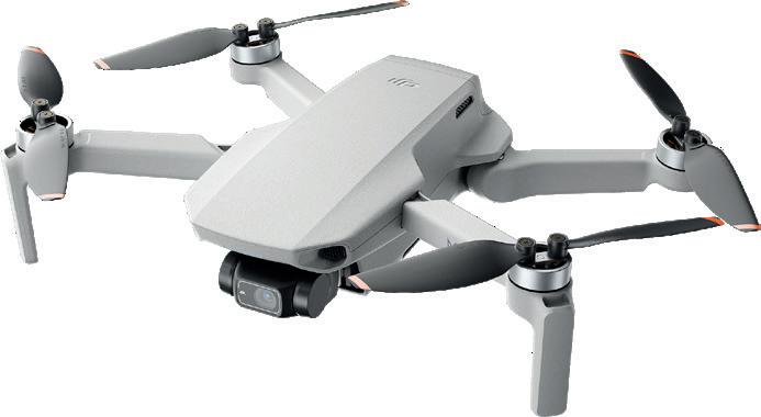
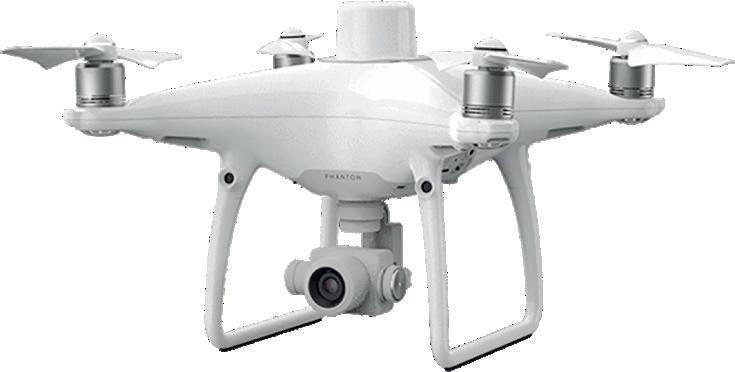

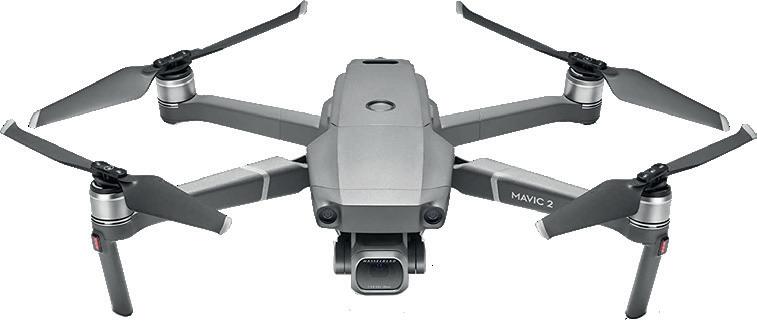
Unmanned Aerial Vehicles or drones are used by industries. There are almost unlimited applications. Real estate photography, first responders emergency scene assessment/search and rescue. Survey and construction progress photos/videos, and structure inspections. Using specialized software stockpile/ pit calculations, as well as topographic surveys. With specialized cameras, agricultural professionals can monitor soil moisture and plant health.
UAVs and Drones are a great addition to the surveyors toolbox. They are easy to use and get your jobs done faster than ever!
Quick and Easy Topo’s. Accurate within 3cm for fixed wings and can be as accurate as 1mm for quadcopter drones.
Safe and Fast Inspections. Whether they are video or photo inspections you won’t have to risk getting on a ladder.
IR Mapping. Inspect Solar farms for dead panels, Farms for crop growth, fertilizer spread and more.

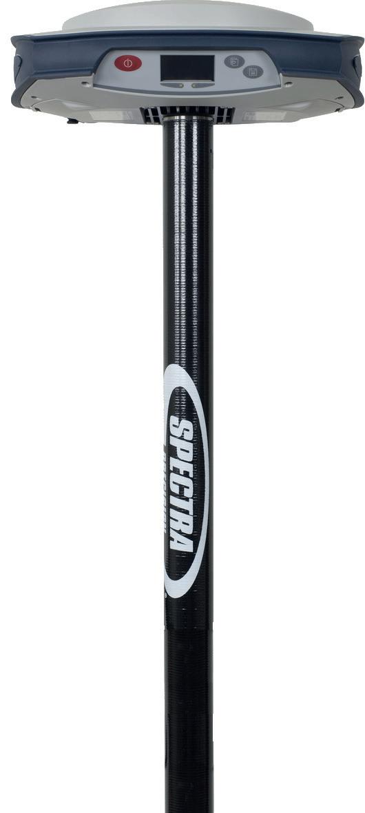
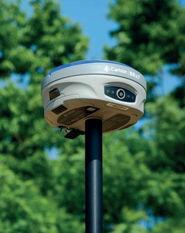
GPS Receivers work in a similar fashion as a total station but uses GPS satellites and land based correction services to calculate the receiver’s position. GPS receiver accuracies are typically within 1 cm horizontally and within 2 cm vertically. Short term averaging or long term static observations can improve accuracy to within millimeters. Typical uses are recording survey control points, topographical survey, construction layout, and as-built data recording.

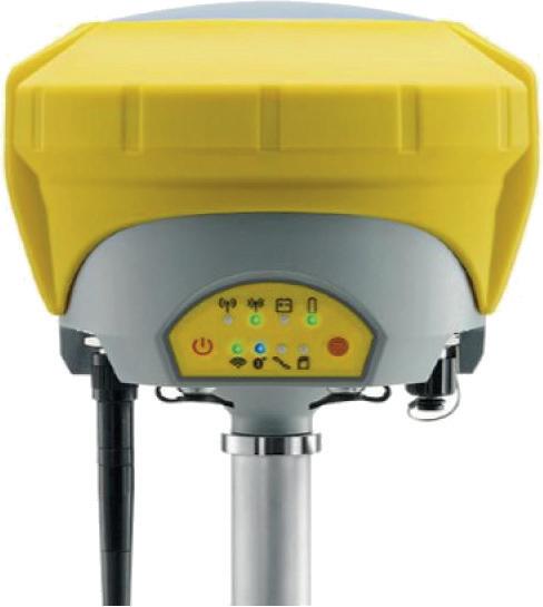
GNSS receivers determine the user position, velocity and precise time (PVT) by processing signals broadcast by satellites. Since the satellites are always in motion, the receiver has to continuously acquire and track the signals in order to compute an uninterrupted solution.
Corrections are required for cm accuracies. The two common ways are via RTN (or RTK Network) like our Superior Network or with a Base/Rover setup.
A RTN requires an internet connection and a RTN that services the area the customer is going.
A Base/Rover requires two GNSS Receivers with UHF/900Mhz radios. One receiver is set on a known point and transmits its data to the second receiver for accurate data.

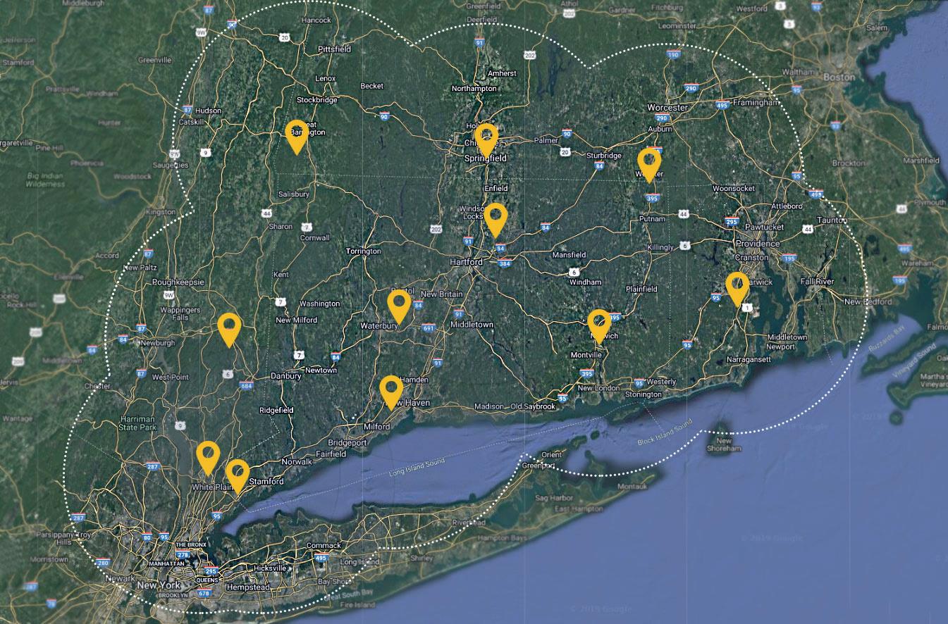
The Superior GPS Network saves you money, and speeds up your return on investment. Working with a GPS Network allows you to invest in only the “productive” part of a GPS system, and not in a “base station” that sits idle on site. A subscription to the Superior GPS Network provides more than just a reliable data stream, it also provides you with the support necessary to keep you working.
Join the Superior GPS Network today, and start profiting from your investment!
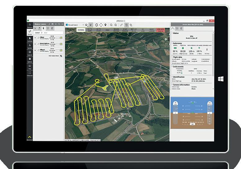
Look to Carlson Software Inc. for one-source technology solutions for the entire project cycle for civil engineering, land surveying, GIS, construction, and mining. Available worldwide and specializing in CAD design software, field data collection, laser measurement, GNSS, and machine control products.
Carlson Survey is a Windows software application for the Surveyor’s office to manage the complete job cycle from field data collection to drafting a final plan with several CAD options. With minimum effort and time, Carlson Survey allows users to design and produce a 2D drawing, an enhanced 3D surface model and construction layout data sets, for increasing their efficiency and profitability. Add this Carlson Survey to your AutoCAD or use the included IntelliCAD engine!

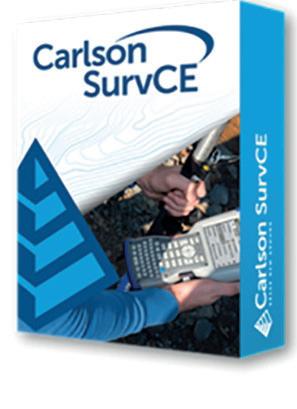
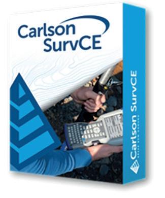
Carlson SurvCE is the first choice in data collection software combining advanced functionality, ease-of-use and sheer capability. Get the software that supports a wide variety of equipment, new or old! Enjoy excellent, free and prompt technical support. Be heard – Carlson listens to its customers’ input for new features or drivers for all of its products. Carlson SurvCE is a complete data collection system for Real Time (RTK) GPS and Total Stations with in-field coordinate geometry. It supports the widest range of popular and new release RTK GPS and conventional/ robotic total stations.
Carlson Construction is an integrated cut/fill takeoff and 3D surface modeling software solution designed for site and road construction. It offers powerful inspection and 3D viewing tools for elevating 2D designs to 3D model files. Material Quantities Reports are now available in Construction. This gives estimators the volume, area, length and/or count for items such as asphalt, gravel, curb, or any “subgrade” or “select fill” they define. Notable new commands include added methods to process, reverse the polyline, and to pick the point, plus added support for up to 7 subgrades, a command to color the surface TIN using the color assignments in Define Layer Target, and a method to apply textures to design layers in addition to the colors for viewing in 3D.
Carlson Construction includes powerful tools for designing and modeling different aspects of road design, from new construction to road widening and repaving. Fully supporting all of the major 3D Machine Control formats for today’s heavy equipment with 3D Machine Control Systems, Carlson Construction gives you the tools you need for taking your data into the 3D environment.

Carlson Survey is a Windows software application for the Surveyor’s office to manage the complete job cycle from field data collection to drafting a final plan with several CAD options. With minimum effort and time, Carlson Survey allows users to design and produce a 2D drawing, an enhanced 3D surface model and construction layout data sets, for increasing their efficiency and profitability. This Carlson Survey includes the AutoCAD engine and runs as a “stand alone” product.

Aerial surveying is rapidly becoming a vital part of any surveyor’s toolkit. Thousands of people use drone site flyovers every day to help boost efficiency and lower costs. With Carlson Photo Capture processing, you can use flyover data to: quickly generate interactive 3D maps of sites; capture highly accurate 3D site data from any camera share site maps with customers – anywhere, anytime; save man-hours in the field; and Carlson’s proprietary technology helps you track and share every metric about your site from anywhere in the world.
With tools for data capture and linking, data labeling, import/export of SHP files, polygon topology creation and analysis, and more, Carlson GIS is an awesome GIS “Swiss Army Knife” for the surveyor or engineer. Carlson GIS includes the ability to utilize higher resolution Google Earth images even over large areas with the use of auto-tiling. And, more map types are available besides aerial for roads, terrain, or hybrid. The GIS editor also supports the import and export of the Esri® geodatabase and provides a smoother workflow with Esri ArcGIS® services.
Bridge the gap between drones and CAD Designed for use by surveyors, civil engineers, and contractors, Precision 3D Topo allows users to import survey data, points, polylines, surfaces, point clouds, both traditional LIDAR and aerial drone survey data, and more from a wide variety of programs and entities to create usable 3D surfaces.
Carlson Civil provides the most robust automation and ease-of-use of any civil design solution available today, and it does dynamic updating without a single custom object. Carlson software is provided as a perpetual license with no requirement to update every year. CAD managers can share command settings company-wide. Carlson Civil is the civil engineering design software that puts you in the passing lane! What might take days with other civil engineering software takes just hours, or even minutes, with the powerful and intuitive Carlson Civil–it’s advanced technology that will work for you.
Carlson Point Cloud is a modular program that provides this powerful ability to go from field scan to finished plat, all with seamless integration to Carlson Survey, Carlson Civil and Carlson Mining. Carlson Point Cloud delivers a whole new level of powerful automation for large data sets. It gives laser scanner users the ability to process millions of data points with Carlson Software ease-of-use. Register your scan to local coordinates, filter or decimate the points, overlay raster images in 3D, snap to edges and code the descriptions for automated field-to finish processing of linework and symbols and create contours, profiles, sections, and breaklines. You will be able to read scan data from many instruments, view and process up to 1 billion points, and then perform the Field-to-Finish from the scanned data. This Carlson Software office product allows users to export surface models, points, contours, breaklines, grid and profiles to CAD.


Carlson Software’s Civil Suite is a powerful software bundle made up of: Carlson Survey, Carlson Civil, Carlson Hydrology, and Carlson GIS. These four civil-related modular programs, working together, will allow you to create all of your deliverables at a fraction of the long-term costs compared to other software alternatives.