‘Once the revolt was crushed, the East India Company was replaced by direct rule by the British Crown in India from 1858. Administrative reforms included converting the ‘GovernorGeneral’ to a ‘Viceroy’, inclusion of non-official members in his council, creating the Indian Civil Service, and its superior in Britain, the India Office. Departments were formed for sanitation, health, education, forestry, military, policing and finance, forming a gigantic bureaucratic state. Large-scale investments, notably a railway system across the subcontinent, facilitated imperial trade and resource extraction.’1
Following the Revolt of 1857, India came under the direct rule of the Crown. This shift in power, made the British Generals look for permanence in India, while also seeking distance from the Indian Natives. The heat of the plains in India, and diseases such as Malaria and Cholera brought up a fear of fear of tropical degeneration. The British Generals were on the lookout to establish sanitaria in the hill stations of India to recover from the heat and disease of the Tropics. This led to the search for elevation, isolation and climates that reminded them of home. With the increase in the British force in the country, the British Generals also wanted a place to call home for their memsahibs (wives) and families that were slowly moving to India What began as a search for recuperation and recreation, developed into a much larger establishment of small towns as seats of governance for the British and developed into the ‘medicalisation of leisure’. 2
The building of these sanitoriums were seen as individual to the colonisation of the rest of the country. This was partially due to the geographical location of the hill stations, as they were at a distance to centre of operations. The elevation of these sanitoriums reminded them of the climate back home, therefore the quest to transport the Europeanised idea of forest to the Indian context began. The hills were looked at through a romantic lens, which brought the landscape to the foreground, displacing the history of the natives of that land. The essay makes an attempt to explore how the romantic vision of the hills set out an extraction process of resources from India. Through this romanticised visualisation, began the construction of the Hill Stations in India, which entailed the extractive use of labour and resources of that land. To establish this argument, the essay starts with the definition of a Hill Station in the Indian context, laying focus on Simla from the early 19th century to the early 20th century. The essay is further divided into two main parts. The first discusses how the romanticism of these hills led to a separation from the Indian experience, which resulted in the building of Simla into a replica of the British countryside. The second explores how the building process of Simla employed tools such as the importation of British cartography on Indian topography, using the ‘hill people’ as labour and building routes of travel to connect Simla to the rest of the country
1 T. Sengupta, Indian Subcontinent, 1750-1947, p. 5
2 D Kennedy, The Magic Mountains, (University of California Press, 1996), p 31
THE HILL STATION
‘The climate! No wonder I could not live down below! We never were allowed a scrap of air to breathe now I come back to the air again. I remember all about it. It is a cool sort of stuff, refreshing, sweet, and apparently pleasant to the lungs ’3
-Lady Eden
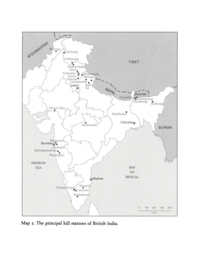
The definition of a hill station is important to contextualise the idea of a hill station into the Indian landscape. Before the construction of these hill stations the concept of a leisure town was alien to India. The terms ‘hill’ and ‘station’ can be broken down to understand where they were derived from. The term ‘hill’ was used for the Himalayan, Nilgiris and Aravalli ranges, the three mountain ranges in India, to differentiate between other mountain ranges found in Europe, such as the Swiss Alps. The term ‘station’ has many conflicting arguments. Some historians speculate that the origin of the term came about because of railway stations that were built in the 19th century under the surveillance of the British and were frequently used by them. ‘Hagerstrand, in his attempt to understand the term, defines ‘stations’ as ‘the stopping places in which the physical mobility of agents’ trajectories is arrested or curtailed for the duration of the encounter’ 4 One other explanation for using ‘station’ is that it refers to the station or the social class of the British in India. Only someone of a high station moved to the hills to enjoy a life of leisure and was thought to confer prestige on the travellers. These ‘stations’ were originally developed as stopping places rather than permanent settlements. This is an important point in the development of hill stations, as the understanding of these stopping places changed with the urbanisation of the hill stations. Other terms used to define these ‘stations; were ‘retreats’, ‘resorts’ or ‘health spas.’ Fig. 1 marks the principal hill stations that were developed in India under the British Raj in the 19th century, the principal ones of this time period being Simla in the North, Darjeeling in the North-East and Ooctamund in the South. For the purpose of this essay, the hill station under study is Simla. Simla was chosen as the focus subject since it was integral to the colonial rule in India Eventually, it became the summer capital of India in 1856, although it started out as a hill station meant to help the British recuperate from the heat of the plains. In the words of British colonial doctor, Joseph Fayrer, hill stations, ‘play so important a part in the social and physical economy and well-being of our Countrymen in India.’5
3 Q. Pradhan, Empire in the Hills: The Making of Hill Stations in Colonial India, (Delhi: Oxford University Press, 2017), p. 7
4 Pradhan et al (2017), p. 104.
5 J Fayrer, On the Hill Stations of India as Health Resorts, (The British Medical Journal, Vol.1, No. 2,058, 9June1900), p. 1,393
SIMLA:
QUEEN OF THE HILLS
‘Do you not see Semla on your map? A little to the north of the 31°of latitude, a little to the east of the 77° of longitude, some leagues from the Sutledge.’ 6
Simla (now known as Shimla), was one of the most popular destinations for the British in the 19th century. Marked in red in Fig. 1, Simla is situated in what is now Himachal Pradesh in the northern part of India and historically formed a part of the Punjab Province in British India, at the height of about 7000ft. Captain Charles Kennedy, the political agent for the hill states, was the first among many British Generals to make a Pucca (permanent) house in Simla, in the early nineteenth century. Building along a forested ridge discovered by Kennedy’s predecessor, Lieutenant Ross, on a hunting expedition in 1819, his residence became a reference point for the development of the hill station. The acquisition of Simla from local ownership came about after the Gorkha war in 1815-16. After the war, the British kept possession of large localities under the guise of developing military posts. The argument offered by them was that the hills serve as strategic surveillance posts. The reasons for the British acquiring Simla in formal documents from 1816 are as follows, ‘…it would be necessary for us, however averse to territorial acquisition within the hills to retain such portions of the country as appeared best adapted for military positions’7
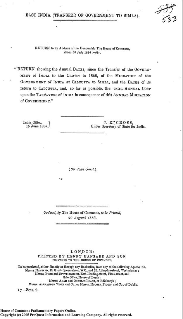
Following the Gorkha war and some 30 houses already built along the ridge in Simla, political arrangements were made to acquire all the land of Simla, through what is said to be an exchange agreement between the British and the Rajas (Kings) of Patiala and Keonthal, though there are underlying hints of forced takeovers in contrasting texts provided from the angles of the British and Indian historians. Therefore, the takeover may not have been as ‘natural’ as suggested in formal documents published at the time. Lord Jacquemont, a Parisian man recording his travels around India under the orders of the French Government, soon called Simla, ‘the resort of the rich, the idle, and the invalid.’8 By 1858, the British applied to the Crown to make Simla the Summer Capital of the Raj, and asked to govern the country from this hill station for the period of six months during the peak of summer, to escape the heat and humidity of the then capital, Calcutta (now known as Kolkata). The documents shown in Fig.2, shows the formal request for Transfer of Government from Calcutta to Simla, for the summer months. Captain Mundy, the aide-de-camp to Lord Combermere, British Commander-in-chief, wrote of his arrivals to Simla ‘We have reason to be thankful that we are here far elevated above the atmospheric strata that have hitherto been subjected to the cholera, a disease now raging at Calcutta’. 9
6 J. Buck, Simla Past and Present, (Calcutta: Government of India Central Press, 1904) p. 11
7 Punjab District Gazetteer: Simla District, (Calcutta: Part-A, 1904), p. 11.
8 V Jacquemont, Letters from India, vol. 1 (London, 1834), p. 226
9 Buck et al, (1904) p. 11
2: Documents from the Transfer of Government, 1858 printed in 1884.
Figure
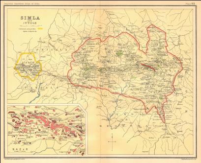
Figure 3 Map of Simla, British India, 1931.
Fig. 3 shows the Map of Simla, as drawn by J.G. Bartholomew in 1831. The area of Simla is shown here outlined in red, and the line in the centre of the highlighted part shows the ridge, where the British Generals originally started building their residences.
And thus, began the building of Simla, into a small resort town to favour the British in India. Dotted with cottages dotted along the ridge, churches, lakes, English gardens, and clubs for recreation, Simla became a favourite for the British to visit and for some a permanent residence. Simla, acquired the name the ‘queen of the hills’ around this time, once the seat of governance had move to this hill station. The colonial inhabitation of Simla, led to the popularisation of hill stations as resorts or spas for frequent travellers to India in the 19th century.
ROMANTICISM OF THE HILLS:
SEPARATION FROM THE INDIAN EXPERIENCE
‘Who that has visited Simla can forget its pine covered hills and cultured valleys, gleaning away far below the mountain sides into the misty “straths” and the purple glens and gorges; its flush of rhododendron forests and gorges of oak and ilex, its wild flowers and breezy ridge, haunts of the chikor.’
- General Newall 10
The romanticisation of these hill stations, brought on a lens that separated the colonial masters from the history of this area. The hill stations were a transitory point between the two lands, their homes back in Europe and India. There was also a strong sense of nostalgia that brought about this thinking. In the colonial imagination, it helped them reduce their sense of alien-ness. While building these sanctuaries of escape, there was a conscious effort to replicate the European landscape and create reproductions of small English towns. This helped mask the artificial sense of the town and make them feel more at home. While describing an afternoon in the hills, Lord Lytton wrote, ‘The afternoon was rainy, and the road muddy, but such beautiful English rain, such delicious English mud.’11 These modes of appropriation brought in a sense of illusion, allowing them to feel like these ‘stations’ were built just for them. The hills were presented as picturesque, with descriptions such as ‘romantic’, ‘grand’, ‘gigantic’ The reality of the space was relegated to a lower stance, one that was of no concern to them.
10Pradhan et al (2017), p. 11
11Pradhan et al (2017), p. 10
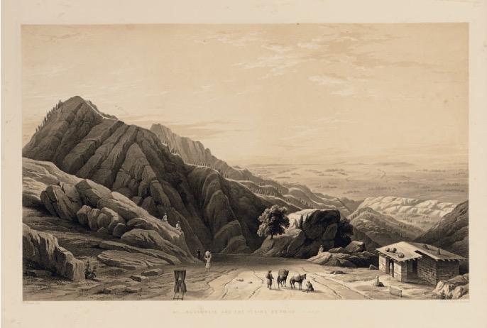
Figure 4: Views in the Himalayas by Mrs. W.L.L Scott
Fig. 4 is a view of the Himalayas painted on the spot by Mrs. W.L.L Scott. She resided in Simla in the mid 19th century and ran an orphanage for the orphans of British soldiers. While living in Simla, she painted many portraits of the landscape around her but with a romantic point of view. The reality of the hill station was not shown in these paintings and can be easily overlooked. Any woman of her stature would have been carried in a jhampani (sedan) accompanied by a plethora of servants (themes explored in use of labour) who catered to all her needs. Therefore, it brings about the point of the separation from the Indian context. The landscape was brought to the foreground, ignoring the past of the land.
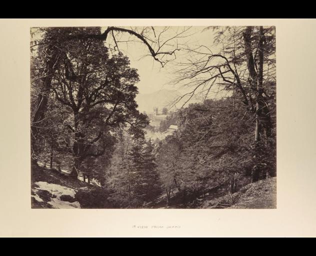
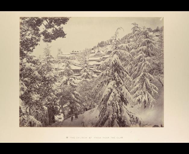
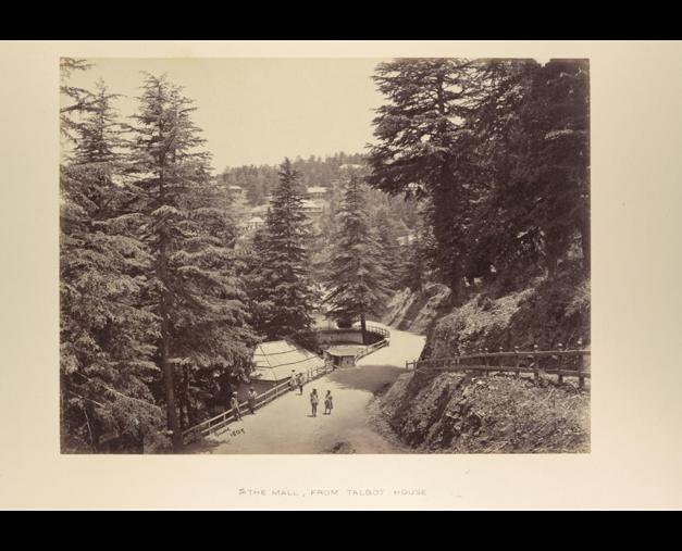
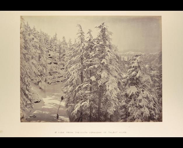
Fig(s). 5-8 show views of Simla captured by Samuel Bourne between the years 1860 to 1869. These views show beautiful landscape images of the land, very similar to European landscape. They are devoid of any Indian context and show how the discovery of the hills was restricted for the benefit of the Imperial rulers. With the romanticisation of the hills came the desire to improve it. They were enamoured by the wilderness found in the hills but had a desire to tame and civilise this space, claiming ownership and control. The wilderness was seen as primitive and uncivilised. The landscape was appropriated to create a home for themselves, relinquishing the natives or ‘hill people’ any right to their own land. ‘It seems that the past of the hills with its particular life systems is erased.’12 With this romantic vision in mind, the British went on to build hill stations that were central to the colonial experience in the country, as surrogates of home.
12 Pradhan et al (2017), p. xx.
Figure 5: Samuel Bourne, Views of Simla, 1860-69
Figure 6: Samuel Bourne, Views of Simla, 1860-69
Figure 7: Samuel Bourne, Views of Simla, 1860-69
Figure 8: Samuel Bourne, Views of Simla, 1860-69
BUILDING SIMLA:
CARTOGRAPHY, LABOUR AND TRAVEL
Over the years the hill station saw an urbanisation and development that changed from 1819, when it was first inhabited by Lord Kennedy leading up to changes after it became the summer capital in 1858. After it became the summer capital, there was a desire to urbanise to a scale where it could be used as a functional capital, which meant adding police stations, courts and municipal offices to aid this change in governance. This was done with the use of labour, materials and resource extraction from the hills in and around Simla. This will be explored in the next three sections covering cartographic appropriation of Indian developments, use of forced labour, and travel routes built by them starting from roads leading up to the railways.
When the British started inhabiting and urbanising the land of Simla as early as 1819 it was mostly wilderness and was native to what they called the ‘hill people ’ The local inhabitants of this area lived in houses that were usually made of mud and thatch. The wilderness was mistaken for bare land, one without a history or past. Many generals visiting Simla, wrote firsthand accounts of their visits painting a sloppy image of the ‘forest’ and ‘hill’ people rising a sense of hostility for the local inhabitants. A writer for The Statesman wrote, ‘The hill men dressed in coarse, mud-hued clothes, with round pointed caps on their shaggy black hair ’13 While talking about their way of life, Edgar Thurston, British superintendent of the Madras Government Museum wrote, ‘In a pitch dark stable, inches deep in the dirty litter, was buffalo being milked by a young woman who appeared quite happy in the disgusting smell and horrible surroundings’.14
Over time many changes were brought about in that area to build small towns reproducing European landscapes by replicating the English countryside to revive memories of home. It was almost as if the British Generals were mirroring practices back in their homeland, where industrialisation had caused a large wave of building leisure towns around Europe. Here they created safe havens for themselves, away from India’s harsher climates.
A. SUPERIMPOSITION OF BRITISH CARTOGRAPHY ON INDIAN TOPOGRAPHY
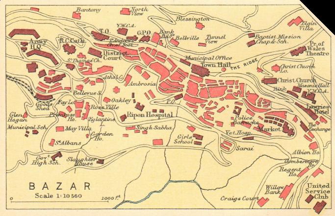
In their quest to familiarise the unfamiliar, there was a superimposition of British cartography on Indian topography The use of names in cartography from the colonial rule in India, can be seen in Fig. 9 shown below. Fig. 9 shows a map of the local bazaar in the heart of Simla (refer
13 The Statesman, (28 May 1916)
14 Pradhan et al (2017), p 76.
to Fig. 3 for location). The buildings in light pink are the houses built along the famous ridge. The buildings in dark pink are all the public buildings used to service people in the area. As one reads the map, we can see the names of these buildings. While studying the map, one must remember that in the early 19th century the generals lived by themselves with their platoons of servants, but by mid 19th century families also moved with them to these health towns, or stayed there while the men were off to their postings in different parts of British India.
The villas or houses, in light pink in most cases took the names of the people who they were built for. In some cases, we see the names such as May Villa, Rose Villa, Oakley, Ambrosia among others in the map. The churches were important to the settlements developing in the area. Christ Church, an important church built in 1857, took the primary spot at the top of the ridge. Of this church, novelist Constance Cumming wrote, "The church at Simla is the central point at which all diverging lines seem to meet, here for once mosques and temples have retired into the background.” Interestingly, the church’s Chancel window was designed by John Lockwood Kipling, father of Rudyard Kipling, author and poet. Another church in the area was St. Albans. For recreation purposes, there were clubs exclusively built for the British, one of which was the Gymkhana Club, and a theatre called Prince of Wales Theatre. Schools and hostels were built for the children of the British Generals. The way these sites were named can be seen as an example of the superimposition on Indian topography to reinstate the European presence in the area. The governors of Simla made sure their memory was embedded in the land they were cultivating under their rule and ‘opening’ up to the Europeans of the Empire. The dominance of the Imperial representatives can be read through the map. If one was to look at the map without the context of British India, it could be read as a map of any English town. This process of appropriation was used among most hill stations and can be perceived as an attempt to wipe out any traces of the native context of the local inhabitants. The land with forests around was seen as blank state wiping off any history of the land ignoring the existing
Figure 9: Map of Lower Bazaar, Simla, British India, 1931
indigenous sensibilities in their attempt to improve this land. Queeny Pradhan in her book, Empire in the Hills: Making of Hill Stations in India, writes ‘These hill sites were appropriated as ‘mini-England’ in the tropics and a similarity with Europe and ‘home’ was constantly invoked thereby giving rise to a strong sense of nostalgia and community solidarity among the English settlers.’15
Another recurring theme in the development of these settlements was social class. ‘.. When one traces the urban ecology, the hierarchy is embedded in the spatial layout.’16 The structure and layout of the hill facilitated the imperial hierarchy spread by the colonial masters. The Viceroy and Commander-in-Chief took the highest point on the hill, followed by the rest of the bureaucracy and the army. These were also the members who had exclusive rights to enter the Gymkhana clubs, and other recreational resorts. Followed by this was the English middle class, and other commercial classes, which held the role of shopkeepers, and were called ‘boxwallahs’ by the Anglo-Indian Elite. They were given the end of the hill in the European spatial layout. In their pursuit of transporting Victorian culture and building a replica of small English towns, they were also successful in transporting the class consciousness of Victorian England present in the 19th century.
B. USE OF LABOUR: EXPLOITATION OF THE ‘HILL PEOPLE’
‘Though it was desired to banish the Indian to some other horizon, the very enterprise of establishing hill stations demanded the labour and services of many Indians...’17
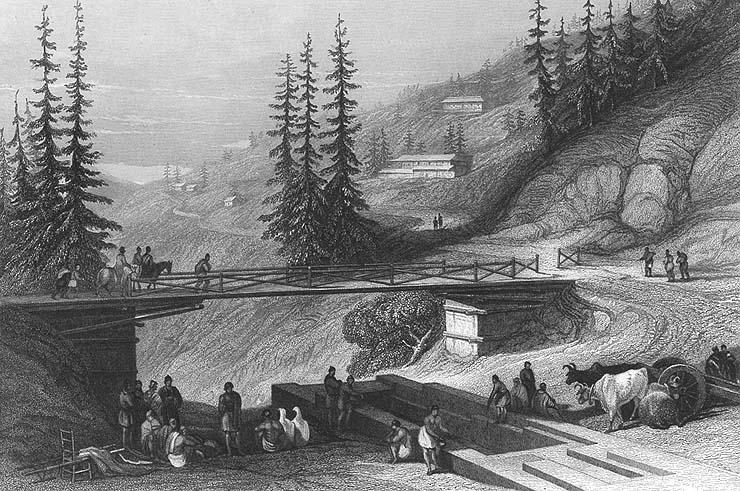
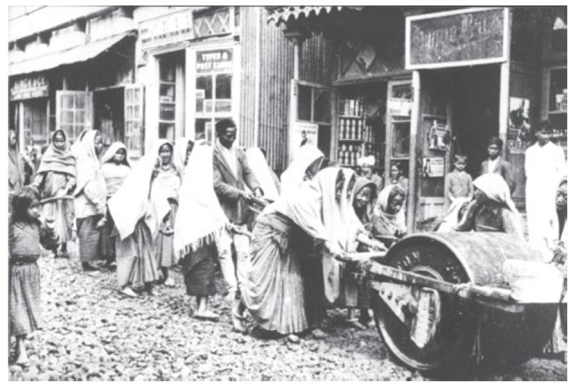
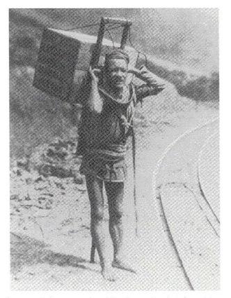
In their pursuit of building Empire Towns for themselves in the hills, the British required the use of labour. There was an enormous demand for labour for various tasks such as felling trees, clearing land, constructing road and bridges (Fig. 10 & 11), providing water, fuel, fodder, carrying luggage for visitors (Fig. 12), carrying ladies on their jhampans (sedans) (Fig. 13), and other domestic drudgeries. For this purpose, the British required the natives or hill people to work for them. In reports of travel provided from the past, we learn that as early as 1827, Lord Amherst used the services of 1000 men to carry him and his belongings up the hill, this number increased to about 1500 by the time Lord Auckland made his way in 1831, and double that on his journey down the hill. Lord Dalhousie used about 3000, and a few years later there were as many as 15,000 people accompanying the British Masters in their journeys. This was not a new practice in India, but their wide use of labour increasingly crossed traditional limits set by the Maharajahs of India in the past. A summer census of 1904 shows that together, porters, sweepers and other low-skilled labourers made about 20% of the employed Indian
15 Pradhan et al (2017), p 1.
16 Pradhan et al (2017), p 131.
17 V. Lal, Hill Stations: Pinnacles of the Raj, (Delhi: The Book Review 17, no. 9, Sept. 1993) p 8-9
population in Simla. Servants fell under the largest single occupation category making up about 37%.
Fig 10. shows the construction of the Combermere Bridge in 1840. The bridge was constructed under the supervision of Lord Combermere, across a deep ravine with a stone tank to alleviate the scarcity of water, which is a common occurrence in the hills. The labour employed can be seen carrying out jobs around the bridge with help of animals to carry the materials. Lord Mundy, the cam-de-aide of Lord Combermere, noted in his accounts the intelligence and dedication with which the project was carried out under his supervision, with no mention of the contribution of the labour employed, except that they received payment in the form of two sheep. The Combermere Bridge still stands to this day bearing Lord Combermere’s name.
Figure 10: The Combermere Bridge, 1840.
Figure 11: Indian labour at work constructing roads to the hill station of Darjeeling.
Figure 12: Coolie (Porter) carrying luggage on a mountain road
Fig. 11, on the other hand shows men and women working on constructing a road in the hill station of Darjeeling. Building roads was tough on the hills as materials needed to be carried on small mountain paths and only human labour could carry this out. This led to the exploitation of the system of Begaree (beggars), where no compensation was given for their work. Fig. 12 shows a coolie (porter) carrying luggage on his back on a mountain road. Another form of labour employed at this time was convicts. Convicts were brought to work on road construction projects or as porters to help with the growing demand of labour.
The British viewed the ‘hill people’ as ‘docile’, ‘quiet’ and ‘submissive’,18 finding it easy to rule and own them, compared to the people of the plains. In their view, there was immense potential to add them to their labour pool as ‘Their limbs are stout, and the sinews in the legs strongly developed from constantly climbing the hills’19 The natives of the area quickly assimilated into this lifestyle and learnt work that provide them with employment within the colonial regime. This brought about a dilemma for the British as they needed the labour, but also did not want them to obstruct the social walls they had so carefully constructed to maintain a distance from them. ‘This station is not a native town,’ 20 a public health official announced in Simla, in a bid to get rid of the menial labour from the hill station. In the view of the Imperial rulers, the hill stations were English towns and not native ones. This brought about heavy restrictions for the natives and pushed them out of the areas in which the British resided and carried out their daily activities, relegating them to small villages outside of the hill stations.
The process of using the natives and ‘hill people’ as labour was exploitive and unfair. They were dehumanized and looked at through a colonial lens, present to serve the Imperial vision. The natives of the area were commodified along with the resources and goods In the accounts of Lady Eden, the sister of Lord Auckland, the Governor General of India at one point, she talks about the number of people who accompanied them on their travels. Lady Eden remarked in her journals, ‘We 105 Europeans being surrounded by at least 3000 mountaineers, who wrapped in their hill blankets looked on at what we call our polite amusements and bowed to the ground if a European came near them ’21
C. TRAVEL IN THE HILL STATIONS: BUILDING THE ARTERIES OF AN EMPIRE
‘Here live all those who minister to the wants of the glad city jhampanis who pull the pretty ladies' rickshaws by night and gamble till the dawn ’22
18 Pradhan et al (2017), p. 132.
19 Pradhan et al (2017), p. 76.
20 Kennedy et al, (1996), p 186.
21 Pradhan et al (2017), p. 71
22 R Kipling, Kim, (London: Macmillan 7 Co. ,1901) Chap 8.
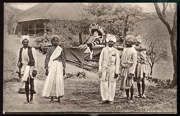
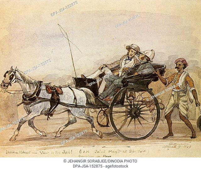
When the British first ‘discovered’ the hills, there were no formal roads leading to the areas that would go on to become hill stations. The roads were made for walking or at the most could take a tiny cart. Therefore, one had to change their mode of transport multiple times till they reached their destination. At that time there were only a few modes of conveyance such as carts, jhampans (Fig.8), tongas (Fig. 9) and rickshaws. The British generals used to travel by Jhampans to Kalka, crossing rivers and using bullock carts for their luggage. Many even travelled on the backs of camels, elephants or horses. From Kalka, a tonga would take them up the hill for about eight hours till they made it up the hill to Simla. The journey was extremely long and uncomfortable as one traveller described the discomfort as lots of ‘bumps and jolting.’23 ‘The road to it seem[s] impracticable except for mules … [and] several days march.’24
Fig. 13 shows a European Lady carried in her jhampani (sedan). Each jhampan required at least five to six people to carry it, and the women travelled with their convoy who carried their belongings on their travels. Fig 14. Shows a British man on a tonga, driven by a horse. The
23 Pradhan et al (2017), p. 113.
24 Jacquemont et al (1834), p. 234.
Figure 13: A European Lady carried in her Jhampan (sedan)
Figure 14: A British man travelling in a Tonga
tonga at the time had two seats at the back and two at the front and in some cases the travellers had to share the front seat with the driver.
The first road that was built in the hill station of Simla was in 1850, under the surveillance of Lord Dalhousie. Named the Hindustan-Tibet Road it was a 58-mile cart road connecting Kalka to Simla. Resources and labour were extracted from the mountains and the surrounding areas around them. Modern European technology was transported to India in this manner, for which the Imperial system can be given credit. Though none of it could be done without the exploitive use of resources and labour from India.
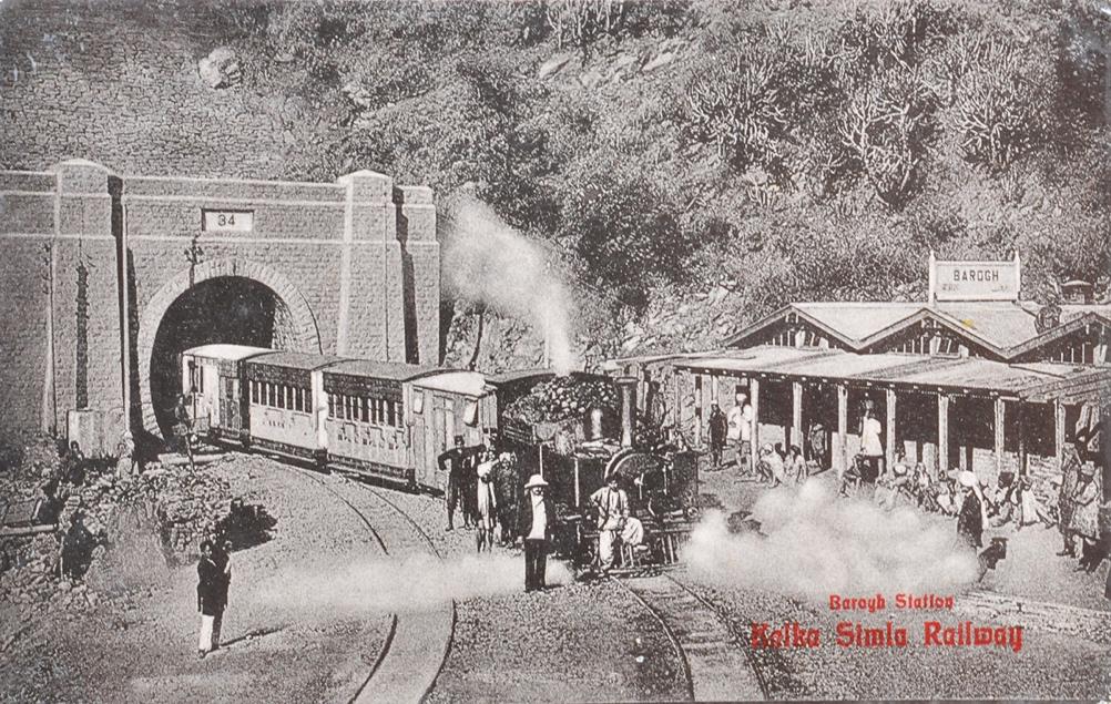
After Simla became the summer capital, there was a desire to make it more accessible and well connected to Europeans and the rest of the Empire. The advent of railways had already begun in British India, but the work on the Kalka-Simla railway line began in 1900 and finally opened to the public in 1903. Fig 15. shows the newly constructed railway line at the Barog Station, which fell on the line from Kalka to Simla. With the introduction of railways, the traffic to the hill stations increased by a large margin. To filter the traffic of the natives, coolies and carts, several tunnels were constructed so they would not use the newly constructed roads and railways. This kept the sanctity of the European town intact, and therefore created barriers for the natives of the area.
Through these three parts of building Simla, the dominance of the colonisers is brought forward Through the construction of Simla, we can see that the British made deliberate effort to separate themselves from the natives, geographically and politically. They started off as health resorts but went on to become political stations that were glorified as achievements of the colonial rule. ‘Health and familiarity led Europeans to construe hill stations as safe places, climatically of course, but also politically.’25
25 E. Jennings, Hill Stations, Spas, Clubs, Safaris and Colonial Life, The Routledge History of Western Empires Routledge, (2013)
Figure 15: Kalka Simla Railway, Barog Station 1903.
CONCLUSION
Hill stations were perceived as isolated retreats, segregated from the imperial experience of the rest of the country. Simla is just one example of many such hill stations that were built around the country. Each hill station has the very same spatial layout. With a church or a cathedral in the centre, the seats of governance took priority over the space, followed by the governors of the stations, and after that the middle class or merchants. The geographical location provided them the distance that they so craved, from the ongoings of the rest of the country. ‘You might be up there in the hills almost as much separated from the natives as in England,’ remarked an official in a report on the hill stations. It appears that the British in seeking solace and an escape from the natives built towns on the backs of the very same people. Through the building of these hill stations, one realises how integral they were to the colonial construction of the country. The process of decolonisation is a long one therefore the histories of these spaces should not be forgotten as they endorse the idea of the ‘other ’ so deeply ingrained in our society and uphold the idea of ‘European identity as a superior one in comparison with all the nonEuropean peoples and cultures.’26
Over time the hill stations went through a wave of Indianisation, as the elite and upper middleclass Indians began to move into the very same places built for isolation. They were meant to be places where the British could live by their own set of laws and culture, but as the British rule in India carried on, there came about a set of Westernised Indians who adopted these set of values, and therefore moved to these parts of the country as well. Post-independence most British left the country, leaving in their departure towns that carried with them the past of the colonial rule. These hill stations today are frequented tourist spots and have assimilated into the culture of the country. But in the same way as the rest of the country they carry the history of the past imperial rule.
26 E. Said, Orientalism, (London & Henley: Routledge & Kegan Paul Ltd, 1978), p. 15.
LIST OF FIGURES
Fig. 1: Map of principal Hill Stations in British India (Simla marked in red), D. Kennedy, The Magic Mountains, (University of California Press, 1996), p xv.
Fig. 2: Documents from the Transfer of Government, 1858 printed in 1884, J. Gorst, East India (Transfer of Government to Simla), (London: Henry Hansard & Sons, 1886), p 1, p.3.
Fig. 3: Map of Simla, British India, 1931, ‘Simla and Jutogh’ by J G. Bartholomew, 1931
Fig 8: Samuel Bourne, Views of Simla, 1860-69, S. Bourne, Royal Commonwealth Society, Simla in winter: View from the south verandah of the Talbot House, Y3022E/25.
Fig. 10: The Combermere Bridge, 1840, D.Pradhan, Empire in the Hills: The Making of Hill Stations in Colonial India, (Delhi: Oxford University Press, 2017), p. 142.
Fig. 11: Indian labour at work constructing roads to the hill station of Darjeeling, D.Pradhan, Empire in the Hills: The Making of Hill Stations in Colonial India, (Delhi: Oxford University Press, 2017), p. 143.
Fig. 12: Coolie (Porter) carrying luggage on a mountain road, Kennedy, The Magic Mountains, (University of California Press, 1996), p 189.
Fig. 13: A European Lady carried in her Jhampan (sedan), Library of Louisiana State University, Imperial Diversions: Postcard, (Umballa: Herman Das & Sons, !890s)