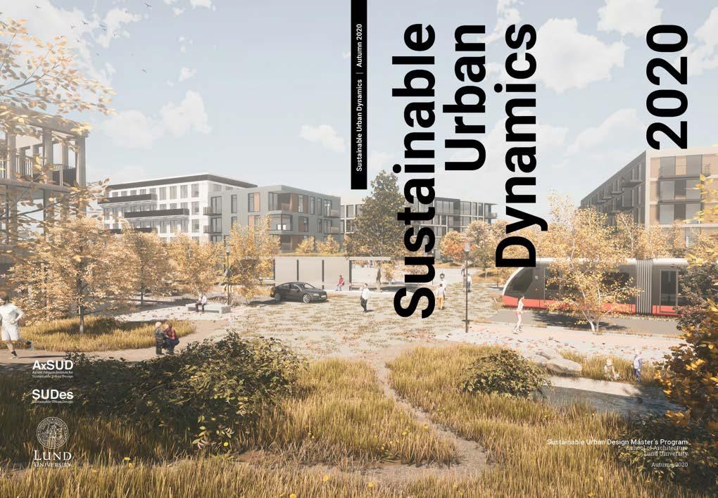

Urban Dynamics
Projects by Areas of Transformation
Chodov Metro Station Area
Strip: Life between buildings by Anastasiia Berg
Bridging Prague 11 by Anusha Muralidhar
Connecting District 11- A new community to bring people closer together by Mayra Alves Zanin
South-West Area
Regrow by Mikaela Ledin
Shrink & Link by Óli Geir Kristjánsson
Growing Community by Pimruetai Maneekorn
Spill
From edges to closeness by Annija Bodniece
Nové Srdce pro Jižní Město by August Grundtman
XXX by Caitlin Schultz
Praha 11: Small interventions - large impact by Katarzyna Maria Starczewska
Cyklistická Vesnice by Lina Blomqvist
Come
- Opatov center by Linnéa Hanell
Growing in steps by Matilda Alsterberg
Embracing Green Living by Mingyue Xu
The Green Path by Nina Allberg
Fringe City by Pontus Wirf
Prahabitat by Tommy Lumitaival Janram
Opatov Transit Plaza by Viktor Högberg
Overlapping by Yuchen Liu
Háje Metro Station Area
Step by Step towards a more walk- and bikeable Háje by Erica Välimaa
Get into the gro(o)ve by Johannes Rydbo
Háje Park by Josefin Axén
Common Grounds by Nada Dhaiba
Sending an invitation by Nellie Stenvall Meetro by Siri Jeppsson
Caring Corridor by Sushanta Saha
SUDes Team:
Lars-Henrik Ståhl
PhD, Professor Director of SUDes Master’s Program School of Architecture, LTH Lund University.
Peter Siöström
Associate Professor, Architect SAR / MSA
Chairman of Ax: son Johnson Institute for Sustainable Urban Design Lund University
Andreas Olsson
Architect SAR/MSA Course Leader, SUDes School of Architecture, Lund University
Teresa Arana Aristi
Architect /Urban Designer Course Assistant
Workshop Lecturers:
Rozalie Kašparová
Architect & Urban Designer IPR Prague
Judita Eisenberger
Urban Planner & International Relations Specialist IPR Prague
Jiří Deyl
Architect & Urban Planner
IPR Prague
Lucie Pára Head of Strategy and Development Offi ce IPR Prague
Štěpán Špoula
Landscape Architect IPR Prague
Verleure Wouter
Landscape architect & Urban Designer IPR Prague
Martin Špičák Architect IPR Prague
Michaela Janečková
Architect & Architectural Theorist Paneláci
Guest Lecturers:
Fiona de Heer, Landscape Architect /Urban Designer
Peter Siöström, Associate Professor
Jonna Ekholm, Architect /Urban Designer, Gehl
Simon Sjökvist, Architect, COBE
Niels Björn, Urbanist Ph.D.
Guest Critics:
Jonna Ekholm, Architect /Urban Designer, Gehl
Nevena Krilic, Architect principal at MMX YYZ Architecture
Rozalie Kašparová, Architect /Urban Designer, IPR Prague
Simon Sjökvist, Architect, COBE


Students:
Adriana Heglewicz, Poland
Alessia Col, Italy
Anastasiia Berg, Russia
Annija Bodniece, Latvia
Anusha Muralidhar, India
August Grundtman, Sweden
Caitlin Schultz, Canada
Erica Välimaa, Sweden
Johannes Rydbo, Sweden
Josefi n Axén, Sweden
Katarzyna Maria Starczewska, Poland
Lina Blomqvist, Sweden
Linnéa Hanell, Sweden
Matilda Alsterberg, Sweden
Mayra Alves Zanin, Brazil
Mikaela Ledin, Sweden
Mingyue Xu, China
Nada Dhaiba, Morocco
Nellie Stenvall, Sweden
Nina Allberg, Sweden
Óli Geir Kristjánsson, Iceland
Pimruetai Maneekorn, Thailand
Pontus Wirf, Sweden
Siri Jeppsson, Sweden
Sushanta Saha, Bangladesh
Tommy Lumitaival Janram, Sweden
Viktor Högberg, Sweden
Yuchen Liu, China
Course Outline
Sustainable Urban Dynamics
During the autumn term of 2020, the students at Lund University, School of Architecture participated in the advanced course ‘Sustainable Urban Dynamics’ (ASBN31) and its complementary theory course ‘Sustainable Urban Dynamics - Theory and Tendencies (ASBN41), focusing on creating a sustainable vision for the Prague 11 District. The aim of the design course was to challenge the misconceptions about large housing estates built in the Modernist era, especially when comparing the conditions of these areas in Western Europe and Central Eastern Europe.
Students focused on questions for the development of the city’s fringe, Prague 11 district’s borders – both mental and physical- and strategies to revitalize housing estates as part of an urban transformation for the post-socialist cities, while paying attention to the site’s unique characteristics and adapting to the needs of the community. These themes were explored throughout the whole semester in various seminars, guest lectures, and project tutorials with the goal that each student explores and presents a ‘context sensitive’ urban design proposal for the transformation of the assigned district. The design process was separated into several parts - analysis, strategy, and individual design - combing both the group and individual work of the students.
Due to the on-going COVID-19 pandemic, the study trip was replaced with a five-day intensive online workshop, divided in a theoretical and a practical part, organized with the help of SUDes alumni Rozalie Kašparová, who is currently working at the Prague Institute of Planning and Development (IPR), which Upon finalizing the workshop, the students spent seven weeks developing their individual design proposals.
The student projects were presented online to the international guest jury, on the 8th and 9th of December 2020. This course booklet presents a summary of the design site, workshop and introduces a brief presentation of 28 unique individual design proposals as result of this semester’s design studio.
For further information on the course and the International Master’s Program please visit our website at www.stadsbyggnad.lth.se.

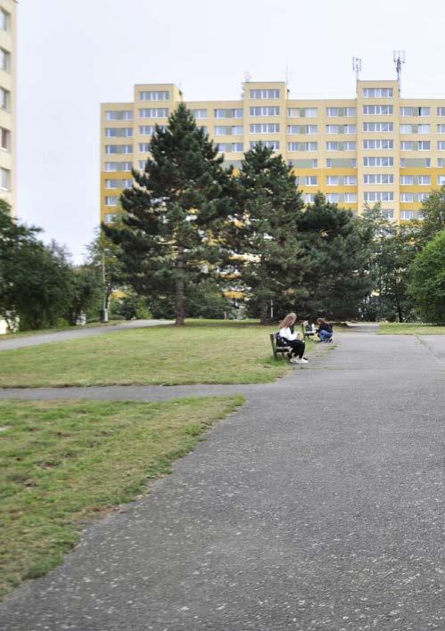
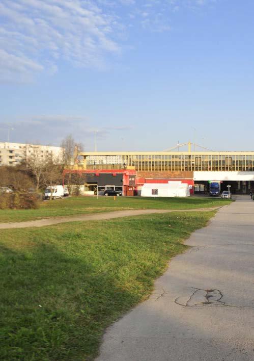
VIEW FROM CENTRAL PARK TOWARDS HÁJE STATION

Design Site
Praha 11 District and Jižní Město - Prague, Czech Republic
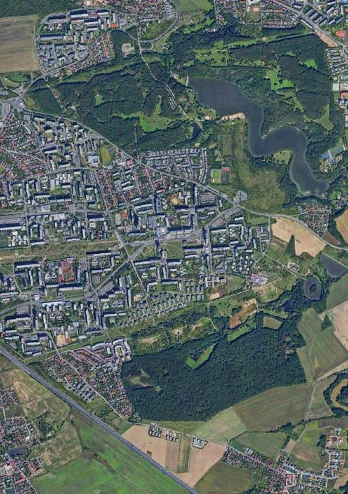
In 2020 and for the first time, the course’s focus was the city of Prague, in the Czech Republic. The students were tasked with the urban regeneration and renewal of the Jižní Město or “South City” area, Prague’s largest housing estate, in the Prague 11 District.
Around 80,000 people live in this area, which highlights how different the large housing estates are perceived in the Easter European countries compared to the West. Even though it is considered to be a suburb located in the city’s fringe, the district has a very strategic location, surrounded by great nature features – forests, lakes and streams- and excellent accessibility to public transportation, which makes it a great place to live.
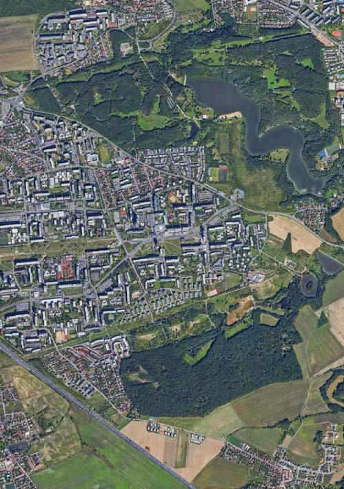
This municipal district is located eight kilometers south-east from the city center, with the D1 highway running through the area and dividing it in two, with few underpasses and tunnels for pedestrians and cyclist. The road network and infrastructure has caused the different neighborhoods to be disconnected, thus forming individual islands that encourage the use of private cars. The same can be said of the built form, with big, prefabricated panel buildings “panelák” – like the large housing estates Jižní Město 1 & 2- placed in the middle of vast under-utilized green areas which do not mix with the single-family housing areas, creating very homogenous islands. Prague 11 is served by Roztyly, Chodov, Opatov and Háje stations, the final four stops on the southern end of Line C of the Prague Metro and the areas around these stations have been identified by the Prague Institute of Planning and Development (IPR), in their Metropolitan Plan, as areas of transformation.
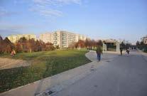
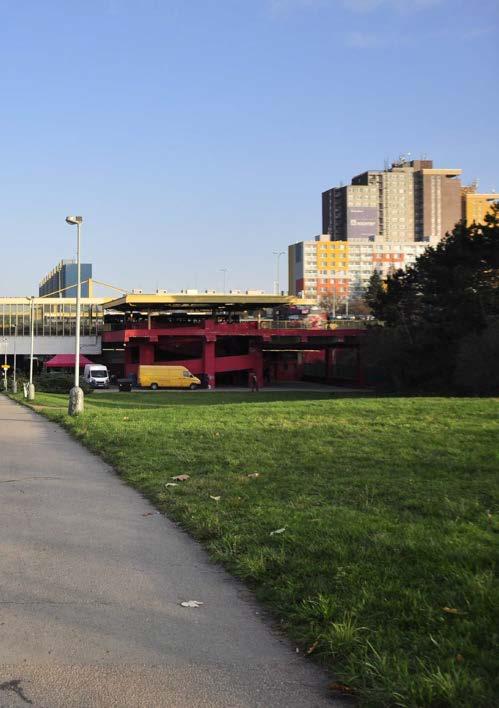
The Central Park located, as its name suggest, in the middle of the district, is an important asset that can become an important generator for the area. The students were encouraged to use the existing qualities of the area, to enhance and improve the quality of life for the existing and future residents.

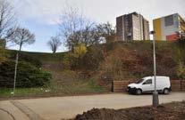
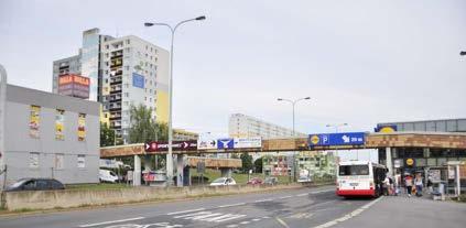
VIEW LOOKING TOWARDS OPATOVSKÁ AVENUE
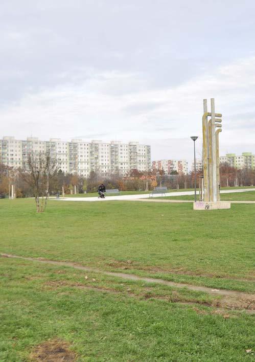
VIEW FROM CENTRAL PARK
TOPOGRAPHY CHANGE OUTSIDE OPATOV METRO STATION
GREEN AREAS AND ENTRANCES
PARKING LOTS AND GREEN AREAS
LOCAL MEETING PLACES
PRAGUE CITY CENTRE

Areas of Transformation - Prague 11 District, Design
OPATOV STATION
CHODOV STATION
SOUTH-WEST AREA
HÁJE STATION
Workshop Week When Vision meets Reality
From an overall perspective to detailing Prague 11’s Public space
The five-day online workshop WHEN VISION MEETS REALITY focused on acquiring knowledge from the experts at Prague Institute of Planning and Development (IPR), an institution that is responsible for ensuring the continuity efforts to fulfi l basic values and principles of a well-functioning city; as well as Paneláci, a five-year research project about the panel housing estates in the Czech Republic as a part of the urban environment. The lectures varied from an overall perspective of the city, the IPR office, the new zoning plan, the city’s fringe, the housing estates, and the importance of public space.
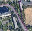
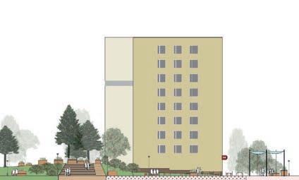
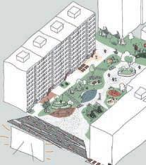
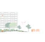
For the practical part of the workshop, the students made a jump from a large-scale perspective of Prague 11 to detailing a public space within the district in a competition format. The group was divided in six teams and they had three afternoons plus one full day of work before they presented their designs. The proposals were then presented to Rozalie Kašparová, a guest jury from the Prague Institute of Planning and Development (IPR), who selected a winner and a runner-up at the end of the workshop. Even though the students did not have the opportunity to do a study trip due to the COVID-19 pandemic, the proposals showed a deep understanding of the site and it’s context.






AXONOMETRY - GROUP 3



Projects by Areas of Transformation
The semester schedule was broken down into 5 parts, each ending in student presentations. The 6th and final part concluded the semester and provided the students a chance to improve and reflect upon their work. This structure allowed for the students to focus on specific components of their projects and design process as well as get feedback on a consistent basis.
In general, the structure worked from the large over-arching scale of globalization towards the development of design details within the final project. Each 3-week period required the students to go one step further in the development of their projects while at the same time bringing with them knowledge from their previous explorations. Through the guest critics comments and weekly individual tutorials, each student work grew in depth and detail in an attempt to tackle the challenges posed by the site and the course requirements.
For the first time, each student had the opportunity to choose their own design site within the Prague 11 District. After doing an in-depth research and mapping of the district and its context within the city - first in groups and after individually - they framed the key issues to be addressed and the opportunities for the future development of the area according to their personal reflections.
They were asked to draw out the area that interested them the most based on their own conclusions after Phase 02, as the students were one step closer to doing their thesis semester, in which they have complete freedom when it comes to design site. The end product is wide range of solutions to transform this post-socialist district into a more sustainable and liveable place.
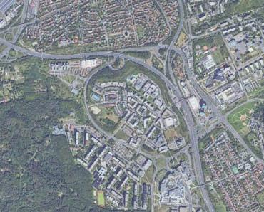
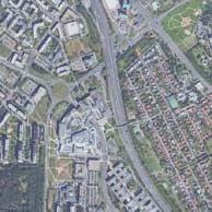
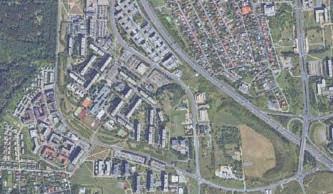
Since the beginning of Phase 04, it was clear that the design sites chosen by the students could be grouped within four overall transformation areas, starting with the Chodov metro station area to the west, the open space in the south-west area, the Opatov metro station area with the Central Park and the Háje metro station area.
Therefore, the student projects presented in this booklet have been organized in the same way, stating with the Chodov area and ending with Háje area. It is our hope that all the hard work and energy from the students can be translated in the next pages and you can be inspired by their designs.
SOUTH-WEST AREA
Chodov Metro Station Area - Design Site

OPATOV STATION
CHODOV STATION


HÁJE STATION




Strip: Life between buildings
Anastasiia Berg, Russia
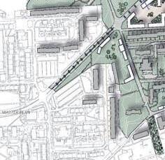
MASTERPLAN
“My main intention for this project is to re-invent the area to be suitable for families and small
This urban concept is focused on a plot in one of the districts of Prague. The project is called STRIP, life between buildings.
businesses in the area.”
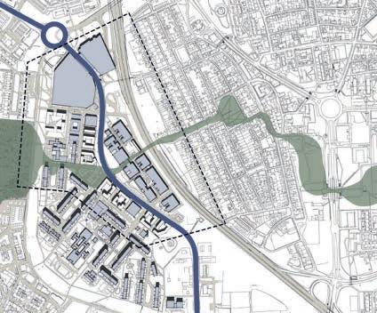
The location was chosen south of the Khodov metro station. The existing section from south to north separates two roads: a highway connecting the city center and the outskirts and leading to other major cities in the Czech Republic, and a four-lane street Rostilska, which goes from the metro.
The most pressing question is how to use the remaining places along the Rostilskaya road. A clear difference in the functional difference, density and development of the eastern and western sides of the territory can be noted.
The main idea is how to turn these roads or the area around them into a connecting line that will benefit both the region and the local people.
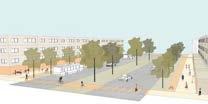
The four-line street of Rostilska turns into a boulevard with a green lawn between them, with good conditions for cycling and public transport, with a reduction or ban on entry of heavy vehicles and a speed limit of up to 40 km / h.
The intention is to transform the public space into new nodes of interest and investment.
The intention of this proposal is to reinvent the area to be suitable for families and small businesses in the area.
The intention is to diversify this area, add recreational facilities, improve the existing connection to active basements, and create a safe area.


TYPOLOGIES


SECTION
Bridging Prague 11
Anusha Muralidhar, India
MASTERPLAN
“The main vision for Prague 11 was to form a cohesive green structure, to bring together the green and the built structure. the same concept has been applied to the smaller scale in case of Jizni Miesto II through the green streets and the adjoining pocket parks. ”
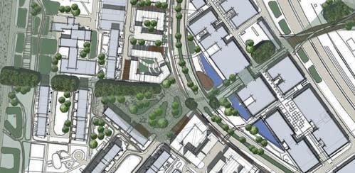
The area of Jižní Město II is flanked by the highway on the right and larger green space on the west. The area was chosen due to its proximity to the green space, while being situated in the middle of two metro stations. The area is also dominated by commercial and institutional functions, which is rarely the case in Prague 11.
Jižní Město II is bordered on the east by institutional functions and the west by commercial functions. The residential functions are scattered in the middle.
There is a main road that runs through the area, which divides the area into two parts, much like the highway divides Prague 11.
The presence of two metro stations, so many commercial and institutional functions makes the area a hotspot for densification.
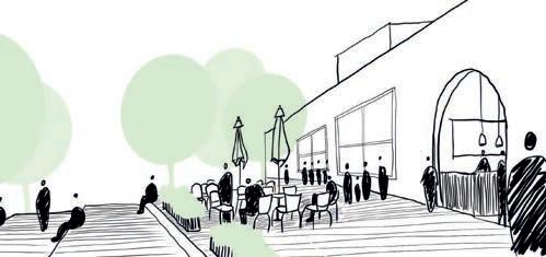
The are is, unfortunately, the home of one too many parking spaces, which take up large open areas, right next to the main road. The idea is to connect the parts and the larger green space through greet streets and pocket parks along the green streets.
There are opportunities for densification along the main roadn as well. There is a potential to transform the area into a diverse, economically and socially sustainable neighbourhood.


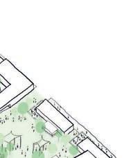


AERIAL VIEW OF GREEN STREET AND POCKET PARK
SECTION SHOWING POCKET PARK, INNER COURTYARD
Connecting District 11
Mayra Alves Zanin, Brazil

A new community to bring people closer together
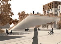

ARRIVING AT THE TRAM STOP IN THE MAIN SQUARE
“...once a barrier, now the link that bring people together.”
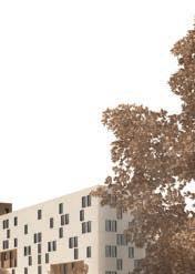
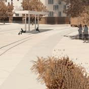
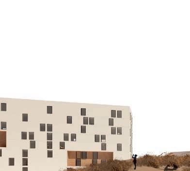
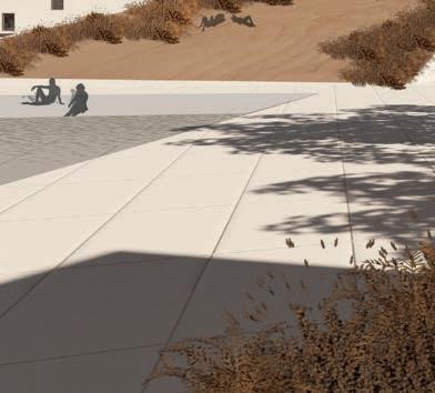
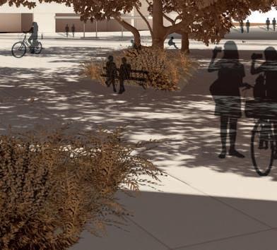
Located in the heart of Europe, Prague is a city of rich culture where one can read the layers of time on the architecture and urban fabric. One of these layers is the Housing States, a legacy from the modernism during communism where, unfortunately, specifically in District 11, the roads pose mental and physical barriers with, where one, if not inside a car, can feel uncomfortable and lost when passing by.
With this in mind, the project seeks to connect the neighborhoods and the residents by turning the roads into streets and repurposing the disused areas alongside these roads by developing them into a sustainable and lively community.
To reach this goal, on a city-wide level, the project will strengthen public transportation by extending the tram line into the neighborhood. The goal is to create a foundation for future developments and also promote
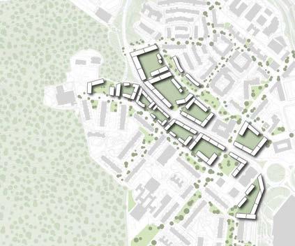
a decrease in car usage in the city. Located on the west side of District 11, Roztylská road will be the place for an experiment for a development with a new block typology that takes into consideration the existing structure. Within the new block structure, new building typologies will promote higher density around transportation nodes such as the tram stops, and also, ensure the diversity of people in the area throughout different uses.
Positioned on the top of the local basin, a new infrastructure focused on pedestrians and cyclists, beyond enhancing the local connections, will also incorporate green and blue structures, creating new public spaces and increasing the biodiversity of local fauna and flora, ensuring that a strong, local, and vibrant community can thrive.


MAIN STRATEGIES

BLOCK TYPOLOGY





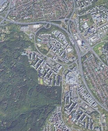
SOUTH-WEST AREA

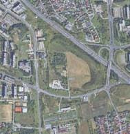
South West Area - Design Site

OPATOV STATION
CHODOV STATION


HÁJE STATION


Regrow
Mikaela Ledin, Sweden


Masterplan






!


“The area combines the positive aspects from living on the countryside and living in the city!”


Strategy:


I’m suggesting a housing area that is almost self-sustainable in terms of food production. I’m also suggesting an educational centre that is focusing on sustainable farming.
Cherish agriculture - Cherish and develop the existing agriculture land or create new farming solutions in order to make the area more self sustainable in food production.
Why:
Due to human impact, the climate changes is a fact and we need to act now in order to milder the future consequences. The farm land in Czech Republic has decreased a lot over the last century and they are importing 67% of their vegetables supply. Therefore I’m suggesting a housing area that’s almost self sustainable in food production. The existing farming land will be developed



and allotments can be placed on the surrounding green spaces. A lot of the houses don’t have traditional courtyards so the allotments can function as meeting places instead.
I’m imagine that the people that will move into this area, are people that wants to combine the positive aspects from living on the countryside and living in the city. To have the closeness to the city life but still have the opportunity to grow your own crops in your backyard.


The allotments between the row houses
Section over the row houses and terrace houses
Shrink & Link
Óli Geir Kristjánsson, Iceland

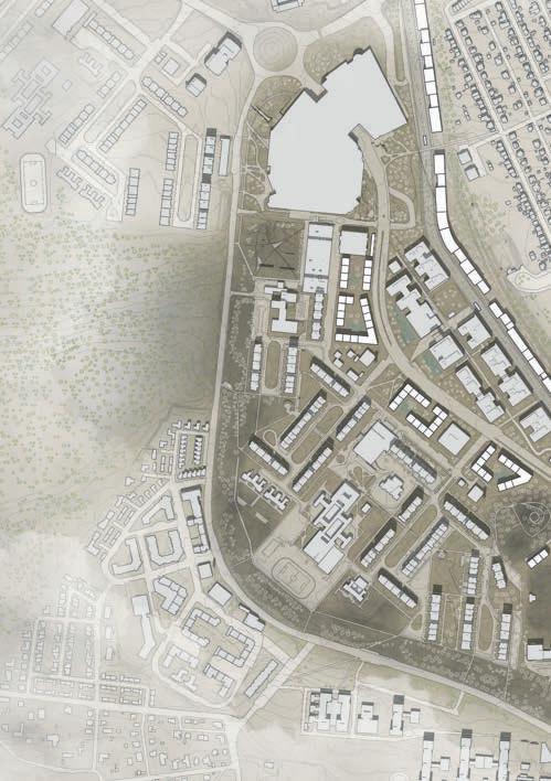
Zoom-in plan
“Shrink the enormous dimensions - Link the new and existing interventions”
Praha 11 is one of the municipal districts of Prague. It‘s located in the southeastern part of the city, about 8 km away from the city center. The highway E1 runs through the area of Praha 11 and divides it into smaller fragments. The municipality of Prague has been working on the “Ring road project” for some time, where the focus is to direct the traffic from the city center to the fringe of it, this can also be applied here.
Today the highway also consists of noise barriers, both natural slopes as well as concrete walls. The straight forward thing to do would be to remove those, but instead I looked for the opportunities of them being a part of my plan for the site.
With the integration of the Ring road project, the highway will be transformed into a boulevard.
The “natural” slope that was created around the same time that the highway was built will be integrated in to the urban setting by „bleeding“ out to the boulevard and connecting through a new „green belt“ to the Central Park in the east and the forest in the west.
This “bleeding” of the slope happens around the middle of it and connects over the boulevard with permeable pavement and the newly introduced tram line will be covered with grass. On top of the slope, facing the boulevard with spectacular view to the citycenter, a viewing platform is located in between the existing trees. The journey through the green belt offers several different experiences, from rural to urban and on the northern side of the boulevard the green plaza will be located.The green plaza faces south with great opportunities for bars, cafés and restaurants to blossom.
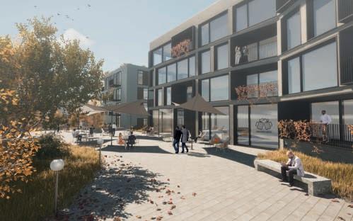
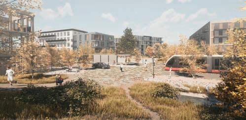
Perspective looking towards the green plaza
Tram stop
Tram stop
Exisiting office area
Chodov metro station
The forest


Tram stop
Tram stop
Opatov metro station
Tram stop
Tram stop
The green plaza
Central park
Viewing platform
The slope
Existing green
Existing green
Rowhouses Punkt houses Community center
Growing Community
Pimruetai Maneekorn, Thailand
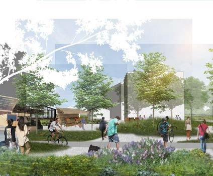
“The new node of residential that filled up with mixed characters and identities of the district.”
The overall vision of the whole district at first would be to strengthen the connection both tangible and intangible by connecting the loop of transportation around the district and purpose tram route on the Western. While at this phase the project mainly focuses on gathering character and identities of the district and imply them to the new development area, together with offering more dynamic to create an interactive and socially-engaging experience to attract people.
In order to achieve the vision, the three main strategies have been introduced; 1) Connect – To connect the site area with other parts of the district and introduce a more bike-able and walkable culture.
2) Urban farming – Introduce the new lifestyle that synergized with the existing condition outside the site area to continue agricultural approach from the Southern and spotlight it to be the main function of the area.
3) Lively – With more dynamic of urban farming activities and mixed-use and commercial that will be introduced, the site area would offer more of the public spaces that has a different function and character and flexible enough for various of activities.
With the new lifestyle of urban farming, people will have their own garden and be able the share their products to the neighborhood or even can educate generation of urban children to understand where their foods come from. The new character of the site area will strengthen the identity and connect to continue the flow of the whole district to its’ surrounded area. As the city expand, this knowledge and lifestyle will be share and imply even more in many other places. Prague would be able to live sufficiency under their root of agricultural knowledge.
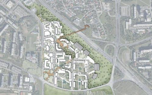
MASTERPLAN


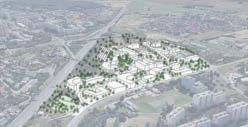

MAIN PLAZA - URBAN PARK - URBAN FARMING


SOUTH-WEST AREA


OPATOV STATION
CHODOV STATION


HÁJE STATION


Framing Central Tissue
Adriana Heglewicz, Poland
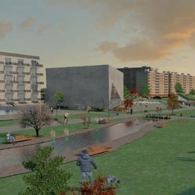

PERSPECTIVE IMAGE
“New frame to the central park!”

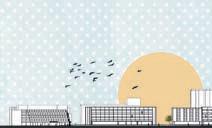
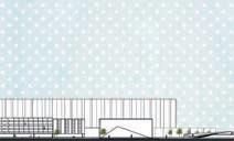
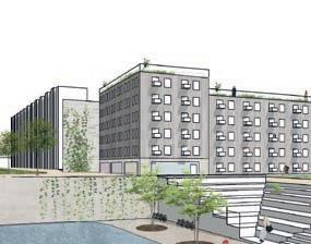
The location of the site is in The Czech Republic, in the capital city, in the Prague 11 district. As a continuation of working with my fi ndings, I decided to base my strategies for this site on activating framing the „central park” area, by blending the existing functions of the site, with the new building typology, which would support the current situation and make it stronger. The project represents a vision that assumes a better human-scale structure and typologies that could work in balance with creating a balanced life between private and public life aro- und and creating an easier way to establish social relations between people. The project also aims to strengthen the connection between two neighboring schools and creates a dialogue between them, where the buildings in between represent the functions of a library and an art gallery, where students and outsiders will be able to gain knowledge and easier associate with culture in a wonderful green setting.




Spill Out
Alessia Col, Italy


MASTERPLAN
“My


proposal for the site aims at creating a platform for social life in which the community spirit could have a physical manifestation through the appropriation of space”


My proposal for the site aims at creating a platform for social life in which the community spirit could have a physical manifestation through the appropriation of space. To achieve this goal, “social rooms” are created by subdividing the large public spaces and giving them a character that could encourage different uses and respond to the Prague 11 inhabitants’ needs. Moreover, the threshold between the facades of the buildings and the outside space is extended and designed in different ways, to allow appropriation from the residents and a clearer defi nition of the boundaries between public and private spaces. Both these strategies involve scaling down the built structures and public spaces, which leads to a human scale environment that fosters social life and encourages sustainable mobility in the area. The typologies are varied and aim at naturally connecting the existing ones through different heights and scales


and they are primarily organized in clusters. This layout favours the creation of smaller communities by promoting casual meetings and a closer relationship between residents. They can indeed see each other and feel responsible for the common areas they are sharing, building a constructive dialogue that can lead to a stronger community and sense of belonging.


AXONOMETRY OF COURTYARD
SECTION





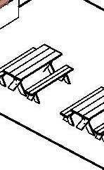


From edges to closeness
Annija Bodniece, Latvia


“Sustainable journey through Prague 11! ”


Located 11km south-east from Prague the district of Prague 11 holds a great geographical location, lots of greenery, well-used public transport as well as a cultural legacy.
However, the district is quite cardominant, there is lack of human scale and mobility for pedestrians and cyclists is quite poor.
Based on these site analysis & fi ndings the project narrative aims towards breaking down the physical and mental barriers of the area – transforming edges into closeness – in order to enhance pedestrian and bicycle mobility, increase safety, comfort, and interest to be outdoors, use public spaces, as well as develop a sense of belonging and owning something.
The urban design principles supporting the vision are the following:
Barrier-free mobility:
- more safe passages across the roads
- new bike road structure within the site, as well as at crossings
- new attractive pedestrian paths, shared spaces and enhancing the existing flows
- connectivity and accessibility to public transport stops
Human scale public space: decreasing the scale gap by:
- natural elements in architecture
- more greenery in a variety of sizes
- more programmed green spaces
- new built developments in max 4-5 stories
The project urban design alternations aim to create Prague 11 more sustainable by creating comfortable human-scale public spaces, accessible mobility, lively community spirit, high biodiversity, and excitement to be outdoors.
Bird view of Opatov station public space







Opatov square section
Nové Srdce pro Jižní Město
August Grundtman (Ekman Öhrn), Sweden
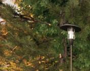
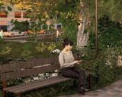

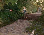

The new heart will give Jižní Město a steady circulating pulse, balanced by the calm breath of variety.
With ample green space and good public transport links to the centre, the Jižní Město housing estate in Prague 11 is popular with its residents. However, the area’s values are diminished by large scale, unfriendly housing, poor pedestrian wayfi nding and a traffic solution putting the car fi rst.
My project “Nové Srdce pro Jižní Město”, freely translated “A new heart for Prague 11”, is based upon three strategies:
A NEW HEART · To give the area a pulsating core, I suggest a dense development around the metro station of Opatov. This will form a natural centre, both making soft transportation modes more attractive and making wayfi nding easier.
CIRCULATE · To counter the spatial separation of the area, I suggest connecting it better to its neighbours and integrating the street network. To strengthen public transport, tram lines

are added linking adjacent areas. To strengthen readability and ease traffic flows on the collector roads, the culde-sacs of the area are integrated into a continuous street network, with low speeds and pedestrian priority.
BREATHE · To make the area more diverse, I suggest adding a greater range of scales, of blocks, buildings, public areas and green space. Buildings of different sizes will help wayfi nding and give various living and working opportunities to residents. Public space of different sizes and types will give the area its own character and urban life. Various forms and dimensions of green space will give opportunities for both picnics, running exercise and fi nding a secluded location for teenage shenanigans.
Together, these three strategies form a holistic approach, that should be repeatable in other modernistic housing estates around the city.
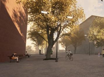
THE GREEN STREET ON A COLD FEBRUARY DAY. The open stormwater solution integrates green and blue in the street design.


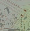


Caitlin Schultz, Canada
Praha 11: Small interventions - large impact
Katarzyna Starczewska, Poland

BIKE PAVILION, VIEW
“Great things are done by a series of small things brought together”
It is clear how the he neighborhood still lacks coherence—and a comfortable everyday environment. Incoherent and low-density living environment of the housing estates offers great potential for the formation of new spatial relations, so the project focuses on the housing estates and tries to fi nd a way to improve the low quality public spaces but also create a new ones.
Project brings the diversity of urban life to housing estates’ areas without discrediting the heritage of panel housing, but working with it, maintaining the uniqueness of the environment established.
The project works with new type of urban public space. It is a pedestrian street with bike path that appears within the boundaries of the existing street lines. With its complex spatial organization and a variety of social functions, the project makes the scattered block more compact, uniting its disparate parts.
The project is both transit and place but also architecture and landscape.
Identifying these relationships in an existing residential environment requires a gentle attitude. The project happens in one of the ‘blocks’ of Praha 11, but the principles are potentially applicable in other parts or cities with similar types of residential development.
LINEAR PLAYGROUND, PLAN


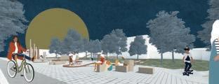
LINEAR PLAYGROUND, VIEW


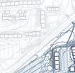


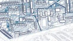





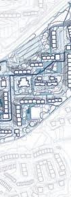


AMPHITHEATRE, PLAN
AMPHITHEATRE, SECTION
SCULPTURE PLAZA, PLAN
SCULPTURE PLAZA, VIEW
Cyklistická Vesnice
Lina Blomqvist, Sweden


Axonometric drawing of intervention, screenshot from animation.
“How
modifying the existing car oriented infrastructure and introducing new bike infrastructure can change the modernist city planning and increase the quality of the public realm.“
Prague 11 is a modernistic suburb, planned to facilitate the car. The bike network exists today, but it is perceived as unsafe and it’s badly connected. This project aims to connect and flourish the city with a new sustainable transport option and by doing so strengthening the public realm of the area with the help of the bike’s culture and infrastructure.
Today, the car is interrupting the public realm and dividing the district into different isolated islands due to the unsafe and overscaled streets. The bike lanes on the other hand, comes with another character that works as a tool for glueing these islands together.
This is to be done by decreasing the accessibility of the car, replacing the connected routes with cul-de-sacs, deleting the street parking by building parking garages and introducing car pools. The bike network is then divided


into two different characters, the slow speed and “the bike highway”. The slow speed embracing the speed of discovery and the highway is making the bike an effective alternative.
The bike network as an opportunity to change the city planning to be more human oriented. It creates another grid, introduces different flows of people which is leading to new nodes of interests. It also creates a green belt by connecting the districts to the outer green areas and strengthening the flow through public space by connecting them.
The new circular form of the Opatov Station promotes motion and biking. The intervention manifests the new bike concept and the form and scale is a statement of the new city planning as well as a fun addition of the continuous journey one now can have as a biker.


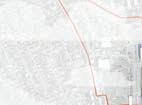

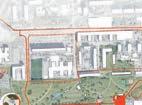
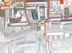
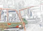
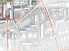
Above: Plan drawing of intervention
To the left: Concept diagram, showing the change in the daily journeys.
Below: Masterplan of the new infrastructure


KIOSK
Come together - Opatov center
Linnéa Hanell, Sweden
“Make the existing areas come together and the people will meet and create a local identity.”
Come together everybody, in the Opatov center. In the middle of the pandemics, the priorities of our needs in the city become even more clearer. This space is simply enabling people to inhabit the place themselves, in what way they ever desire. This community should offer a place where people can come together and support each other and create their own kind of local identity. In order to create a more urban and livable space, the proposal focuses on framing streetscapes and neighbourhoods. There will be a big focus on taking down the scale and introducing a new kind of pedestrian and bike network integrated with the streets.
The proposal introduces a new building typology in the area that has a focus on both inside and outside. The typology connects

the existing low scale with the high scale and at the same time it creates opportunities for people to meet and come together. The big street that goes from north to south in the middle of the site will together with the two different squares become the civic spine. From the villas in the west you enter a natural square, and when you come out of the metro on the other side, you enter an urban square facing the park and the high rise.
My project is called “come together” because it seeks to make existing areas come together. The project aims to connect and create a coherent neighborhood that offers a diverse range of possibilities. The project is also about how the inhabitants can come together and create a new local identity.
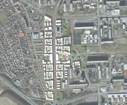
Site plan
A-A, from high rise to the entrance to the parkB-B, the big street and civic spine
C-C, row houses to higher scale
bridge between existing clear orientation more possibilities
dynamic neighbourhood
well defined spaces spaces for people


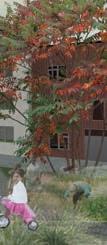
Urban sqaure next to the metro station, to the east
Urban section: from the villas - through the two sqaures - to the park
Growing in steps
Matilda Alsterberg, Sweden

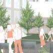
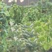

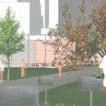


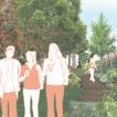
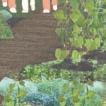
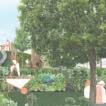
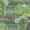

“Growing in steps takes advantage of the former agricultural value in Prague 11 and enables possibilities to meet the future needs of local food production”
In Czech Republic, the agricultural lands decrease with 9 ha per day due to building construction and erosion. Prague 11 district is an example of this were Prague 11 was an agricultural area with small farming villages with farm plots around until the 60s when the area developed, and the agricultural land moved further south.
Grow in steps takes advantage of the former agricultural value in Prague 11 and enables possibilities to meet the future needs by creating spaces for residents and visitors to grow their own food, buy or eat local organic food and learn about food as a self-sufficient opportunity. The aim is to create a farming hub at Central Park and the metro station Opatov which enable interaction among people locally, regional and global.
The farming hub will include farmers markets, farm education among people about, eat organic and to create
meetings. The residents which commute to Opatov station can walk by their plot, water the crops and bring the harvest home to cook the diner. This creates an interplay between Central Park and the existing and new buildings.
To reach the concept a system of Public and private buildings and spaces has been developed. This system has been the main driver in the design of the project to defi ne the spaces, its purposes and its relation to the new and existing buildings.
The project is using the various topography on the site to urban farming where some farming will be placed in the slopes with inspiration of the terraced farming in the mountains
Growing in steps are creating an ecological, social and economic sustainable future where the project links Prague’s urban and rural areas into a farming hub.
EDUCATION FARMING AT ONE OF THE EXISTING SCHOOLS
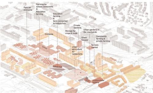
AXONOMETRY OF THE DESIGN SYSTEM

SECTION OF THE PARK WITH CULTURE HUB WITH TERRACED FARMING AND EXISTING HOUSING BLOCK WITH FARMING POSSIBILITIES

Embracing Green Living
Mingyue Xu, China
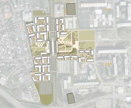
MASTER PLAN
“Embracing a healthy lifestyle that uses green mode for commuting and enjoys social interaction in a green environment. ”
My vision is embracing green living. Four strategies are proposed: Add bike facilities, no car-parking randomly on the street (only park in improved parking lots), programmed green spaces and activate the street by ground-floor shops.
The project will start from the small intervention with new bike facilities,share-car parking lots and green activities.
In phase two, the eastern part of the site connect with the Opatov metro station will be constructed. Currently, the terrain close to the metro station makes the connection less tight and convenient so a bridge is applied to strengthen the connection and make the flow smooth for people who are inconvenient with level changes. Also, commercial building structures with lively rooftops are proposed to link the different levels of space including the ground level (entrance of metro station), bridge level (bus station) and upperlevel space with social steps. Space
will be divided by bridge into recreation space with nature grass slope, social steps, bio-swales, tree pools with seats and commercial space with shops, grassland, social steps, lively ground level squaresand rooftop.
In phase three, the western part of the site will be densified. Three new passways will be added on the main street. The new building typology (large apartment, small apartment, offices) with the commercial ground floor will be built. The height of the new building is around 3-5 floors. The building along the main street with ground floor commercial, side-walk trees, wellplanned walkway and bikeway will create a friendly strip public space. The new pattern of the building create inside of site will bring human-scale semi-private space for residents. Each unit will include the commercial, playground, other recreational space with a variety of plantings and stormwater management system.
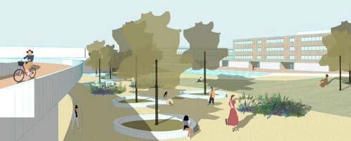
FROM LEVEL-PLATFROM TO RECREATION SQUARE

SECTION CLOSE TO METRO STATION

Bio-swale
Bio-swale
MAIN STREET TYPOLOGY
NEIGHBORHOOD STREET TYPOLOGY
THE GREEN PATH
Nina Allberg, Sweden


“Socially & environmentally sustainable infill of space”


The proposal aims to provide a longterm change for better social- and environmental sustainability in Prague with a decreased carbon footprint. It focuses on Prague 11 by connecting it within itself by deprioritizing the car and by integrating a new mobility plan for bicycles and pedestrians.
It aims to offer improved and defi ned public- and private spaces along sustainable green paths. The goal is to create a sense of identity with in-fi ll development to provide smaller clusters for encounters, comfort, and safety.
To make the area more attractive for the users, the roads are less wide and parking lots are replaced with multi-use parking houses. The existing road is blocked off with office buildings, stores, and green corridors, providing noise and visual barriers.


The residential buildings are placed to create a safe walk from the metro station by activating the area all hours of the day. They are placed in a scattered scheme to provide daylight, stormwater management, green space and to prevent new barriers.
For incorporating the new buildings into the existing context, the design has been inspired by a mix of single-family houses to the west and panel buildings to the east of the site.
To provide a sense of ownership and improved management the new residential buildings and existing panel buildings have been given semi-public gardens.
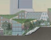
SECTION RESIDENTAL AREA EAST SIDE
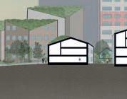


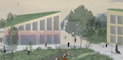
THE WALK TO THE METRO
Fringe City
Pontus Wirf, Sweden

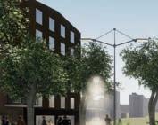

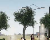

PERSPECTIVE
“Turning the city fringe into a Fringe City, developing the underutlized road fringes”
The project aims to answer to the growth of Prague and at the same time improving quality of life for the people in Jižní Město. Quality of life can of course vary in the eye of the beholder, but for this situation the design specifies four different topics to improve.
Firstly, offer a more varied catalogue of dwellings in Jižní Město. The need for housing is normally constant, but what changes over time is family size and situation. A more diversified housing stock answers to that need.
Secondly, the health of people living in the area can be improved with more active modes of transportation like biking and walking but also with attractive public space for recreation. The area has already today great parks with good capacity so the focus will be on the street typologies.

Thirdly, the aspect of relations to maintain. This is also connected to the housing stock – that people stay in the area for a longer period in their lives –but also that a denser neighborhood gives more neighbors and more potential relations.
And fourthly, proximity to services, workplaces and other people. Proximity gives you more time for what you value most in your lives and not spending too much time on commuting.
The densification takes place in the roadside fringes where a lot of space is underutilized. The area around the roads Opatovska, Chilska and Hviezdoslavova makes the project wholistic for all of Jižní Město and with street integrated solutions for biodiversity this is a project that aims to contribute to a more sustainable area.

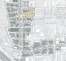

Road fringes offers space for densification
DESIGN CONCEPT

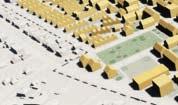
Holds public life and connects with the surrounding buildings
Characteristic scale and identity with central Prague
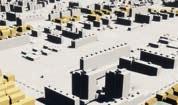

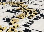
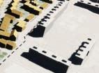
Prahabitat
Tommy Janram, Sweden
MASTER PLAN
“A habitat with the choice to stay or go”
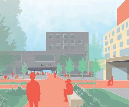
The area aims to be a social habitat where people have the option to stay regardless of life situation. Sustainable mobility is key with a development of the metro station to a mixed-use area as well as added functions at street level and adjust the area for future proposed tramline traffic.
The habitat connects to surrounding areas and nature with added northsouth axis green paths in addition to the existing west-east axis central park to make Praha 11 more accessible and connected with much appreciated (by inhabitants), existing recreational areas such as forests and parks.
The proposal of additional diverse housing options with active bottom floors offers opportunities for existing inhabitants, e.g. with changed life situation, to move and still live in an area they prefer.
A developed metro center with mixeduse creates a defined center in the area that both connects the surrounding districts as well as the city with Praha 11, diversifying the functions in the site.
The goals are to enhance public transport, improve walkability (green paths, safer streets), improve public spaces by tying them together into a green network likened to pearls on a string and diversify the housing situation to offer options to stay in the area when life situation changes. Furthermore, the main objective is to create lively neighborhoods with additional choices in daily life activities such as cafés, shops and recreational areas, thus creating a more engaging and interactive habitat.
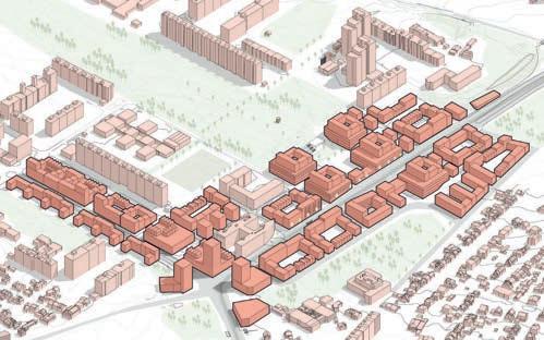


DEVELOPING NETOWRKS AND HABITAT



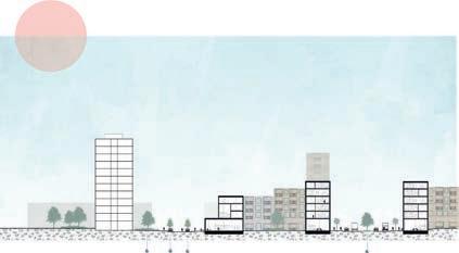
AXO


Opatov Transit Plaza
Viktor Högber, Sweden

“Adding value to an important !”
The Central park area in Prague 11 is both a huge asset and a big problem for the city district.
Through my research of the area it seems the park is absolutely essential in the day to day life of the citizens of the area. Here lies the all important subway station with its connecting busses. Its also one of the few great big green areas in the entire area. Its also massive. However, the area has many big problems leading to it not being very attractive for the residents at all. Why is that?
Through research Ive concluded that the size and geografy of the area has isolated the place from the rest of the city.
Physical barriers make it a hard area to reach sometimes and sightlines are blocked both to and from the area, creating unese for people approching the area by foot. The lack of safe and
convenient path for bicycles are also a mayor issue and something that cant be forgotten in any future development
The core features of the project is therefore;
Sightlines
Making sure you can see where you are and where you are going.
Parks
Interesting green spaces.
Positive barriers
New walls and plants that make you feel more safe.
Landmark
Making the sight stand out.
The Underpass
Improving bicycle connections with a new underpass through the road.
Main plaza outside the metro station


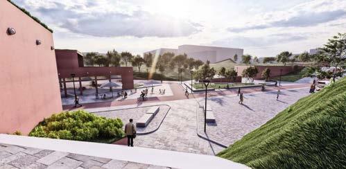
Fractured landscape creating interesting parks
Sunken plaza surrounded by wild parks
View of plaza from bus stations
Overlapping
Yuchen
China
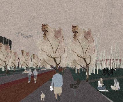
“Overlapping areas mean sharing, so overlapping is a good way to improve resource utilization and develop sustainable.”
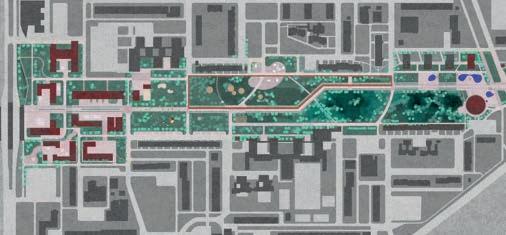
Central Park is located in the center of Prague 11, between the two subways. It has an excellent location and convenient transportation. It is the largest opening public green area in Prague 11. It is such an important central node, but rarely people get here. Why the situation here does not match the location? Based on this point, I started my project. By analyzing the population composition and urban functions near the central park, the daily movement of people is obtained. If you visualize the time data of people, you can fi nd that people’s time distribution in this area is linear and cannot be formed into blocks, which is why the flow of people in this area is rare. If the timeline is turned into time blocks, this problem can be solved and the land utilization of the central park can be greatly improved.
The whole project is divided into three areas: from west to east, urban, green, and community. The green refers to opening classrooms and forest parks.
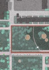
These three areas are run through by a whole walking street with different architectural languages. Office buildings and commercial squares are in the urban area; Opening classrooms, circular runways are in the green area; urban playgrounds and picnic hills are in the community area. They are the urban content that allows people to form time blocks.
Residents’ time block could be residents shopping in the urban area, training in the green area, and having parent-child activities in the community area. The student’s time block could be students having class in the opening classroom. Office workers are in the urban area, but they also can go for a walk in the green area if they get tired of work. Tourists could use the walking street to enjoy the beautiful scenery along the street and feel the local cultural atmosphere. The walking street could bring together all types of people here. Thus, people’s time blocks begin to overlap.
FOREST OF GREEN AREA
Liu,








SOUTH-WEST AREA

Háje Metro Station Area - Design
Site

OPATOV STATION
CHODOV STATION


HÁJE STATION


Step by Step towards a more walk- and bikeable Háje
Erica Välimaa, Sweden


HÁJE - THE CENTRAL NODE IN PRAGUE 11
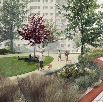
“A place where people, instead of cars, have access to the majority of the public space”


The current situation in the area is characterized by large transportation infrastructure systems taking up a lot of space. The existing amenities and functions in the area are mainly located inside shopping malls or residential buildings, resulting in a lack of connection to the street. By building upon the existing amenities and functions in the area today and identifying what’s missing, the project aims to turn Háje into a place where people, instead of cars, have access to the majority of the public space.
The project builds upon three steps: Mini, Midi and Maxi.
Mini involves small interventions that can be done all around Prague 11 in order for pedestrians and bicyclists to appropriate the streets. The mini interventions include adding bike parking, painting bike lanes and removing car parking from sidewalks.
Midi involves the permanent reorganization of the existing road network and turning the roads into streets that invite pedestrians and bicyclists in order to create a safe and coherent soft mobility network.
Maxi involves the large scale strategy of turning the station area into a defi ned node in Prague 11 while at the same time promoting walking and biking. The two design strategies influencing this step are to Frame the streets and Activate the station area. These are done by adding functions and other amenities that have been identified as missing in the analysis phase.
By implementing the three steps, diversity will be added to Háje by the introduction of different typologies, sequences of spaces, functions and streetscapes, all contributing to the overall aim of Háje being an area that favors all people no matter their mode of transportation.


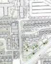
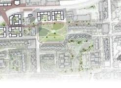
DESIGN STRATEGIES: ACTIVATE THE STATION AREA AND FRAME THE STREETS


LONG




Get into the gro(o)ve
Johannes Rydbo, Sweden


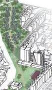


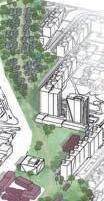


“A continous green path reconnecting Prague 11 with the nature”


In the future, Prague 11 will be reintroduced to the nature, as it was intended from the beginning. In Prague 11, the nature and urban will meet and integrate.
The area will also become more human oriented, instead of only focusing on the most effective transportation. By scaling down, Prague 11 will get a new groove. This will be done by implementing two main strategies on the site, downsizing & enhancing.
The downsizing focuses on taking down the scale by introducing new typologies, shrinking the car oriented road network and rearranging the area so that the urban space becomes more defi ned.
Enhancing is focusing on turning grey areas to green areas, crowding the public space with people instead of cars, integrating the nature by transforming underused green spaces and renovating underachieving buildings.

The main result of these interventions is a continuous green spine that will continue the central park and increase the movement within Prague 11, better connecting the nature parks with area. Along this green spine the inhabitants will be able to have a continuous movement without interruption, except for playgrounds etc. but that’s just fun and by your own choice!


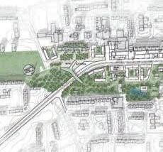
Master plan


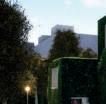
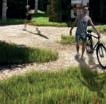
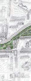
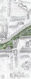


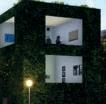
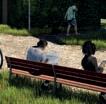


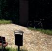
Different characters of the area
Diagram over new typology
Háje Park
Josefin Axén, Sweden


BIRD’S-EYE VIEW


“A project that connects three areas of high nature value, by clarifying the in between space”


In analyzing Prague 11 it is clear that it has a great variety of typologies and functions. However, they are separated by infrastructure, parking, and large undefi ned green spaces – forming monotonous islands separated by barriers. The scale is overall big, both regarding the built and the in between spaces. On the outside of Prague 11 there are three areas of high nature value.
I saw an opportunity to connect the high value nature by clarifying the in between space, and integrating functions, activities, and typologies along this connection. The area around the Háje metro station has a lot of possibilities in achieving this.
In extending Central park going east to “Hostivař Forest Park” a green corridor is created that connects Opatov metro station – through Háje metro station –and to the forest.


The street “Opatovská” is rearranged to create an uninterrupted walkable green path in the extension of Central park. The green also spills out in the surrounding built structure and leads down to the south to “Milíčovské hills”.
The green corridor ends up in a new visitor’s center that guides you towards the forest in the east. Along the path there are different activities, and the space has a variation in intimacy and openness.
The built takes its form from the existing. The dimensions, displacements and the varying building heights are some features that have influenced the design of the new. However, the new buildings are placed so that they frame a semi open courtyard, defi ning the edges between private and public. The scale is brought down towards the park, and the green corridor is framed by built and by nature. Defi ning the undefi ned in between spaces.

MASTERPLAN
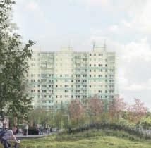
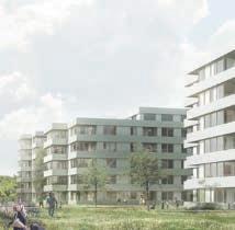

SCATTERED GREEN
CONNECTED GREEN
Common Grounds
Nada Dhaiba, Morocco


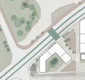


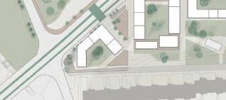
Detail plan
“Common
grounds are the combination of old and new, public and private, vibrant and calm.”
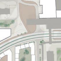
The future Háje district is a vibrant place that caters to diverse lifestyles in a dense and composite urban fabric. It’s a project that integrates the new and old, where everyday life unfolds.
It seeks to establish a new node not through a single destination, but through a patchwork of urban spaces that reflect their surroundings and are shaped by their users. It identifies a starting point for the new development, that enhances the existing, and a series of interventions aim at enhancing the public character and advance accessibility to the existing assets.
The existing fabric is an asset that is enhanced to create more opportunities and affordances. The new district will be layered on the existing. Small interventions will give a peak of what future life in Háje can be like, by opening up ground floors, activating edges, and adding light structures to support new activities.

The new district is walkable. It creates more space for pedestrians and more opportunities for encounter. Creating a compact development allows residents and users to get by on foot from one place to the other. The more walkable the district, the more it invites people in, which will make for populated and activated streets, squares and public facilities.
Creating social anchors will reinforce the community spirit, and allow locals to share values regarding the future development of the district. The growth of Háje needs to continue accommodating changing factors, while preserving the diversity of lifestyle choices on site. Common grounds are the combination of old and new, public and private, vibrant and calm.
Haje station
Ramp & access to Metro
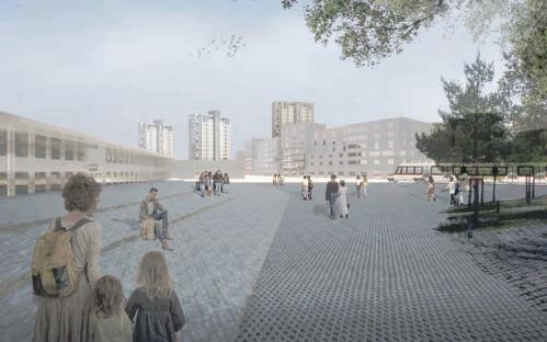






View of the station square and new tram route
Sending an invitation
Nellie Stenvall, Sweden


“People are invited to use the area they have instead of finding functions and activity somewhere else.”


The project Sending an invitation is about different ways of inviting the people of Hajé to use their surrounding environment, even more then they are doing today. Use their courtyards as extensions of their apartments, use the promenades for both recreational purposes but also as the nicest way of transportation, use cafés, restaurants and bars in the area instead of going into the city. I want to invite them to explore their area, or maybe better, to give them even more reason to do so.
The concept is to invite, and the idea is that it can become reality through three different intervention strategies. With three different levels of participation from the citizens. The fi rst one is about strengthening and creating private community spaces as courtyards and rooftops, where the inhabitants of every building design and program the spaces themselves through a catalogue of community interventions. The second strategy is more of an urban experiment.
To encourage people to explore, use and improve Hajé I had to invent a tool, a special intervention. It is called Luma and is (simply put), interactive public furniture, that also work as lights. People can move them around in the area, and in that way, people in Hajé can program public space by themselves and together with their neighbours. The third strategy is on a larger scale and acquires municipal involvement and more of a classic urban process, for example creating a new tram line in Hajé, or strengthening the existing green connection with new meadows and parks.
So, with the concept and the three strategies Hajé can become a more diverse area, which will lead to higher proximity in a higher grade, people are invited to use the area they have instead of fi nding functions and activity somewhere else. They can explore it, use it and maybe even like it more and more.
THE URBAN EXPERIMENT LUMA - IN 5 FIVE DIFFERENT DESIGNS


LUMAS IN THE LANDSCAPE.
LUMA WAIT
LUMA SEAT
LUMA LANTERN
LUMA BEAN
LUMA CLIMB
Meetro
Siri Jeppson, Sweden






“Activating the empty spaces is about givng every person a place they appreciate”


The aim of Meetro is to develop an area in the central part of Háje where everyone can fi nd it interesting to be. By using the well developed public transport system and by adding a new metro line the stations will be the center of the project.
By activating the empty spaces people in the area hopefully feel safe and can fi nd their own spots in the area. Activate the empty spaces is about using what is already there. To frame public spaces and to program what is not programmed. It is about putting the eyes on the street, to put the people fi rst and design for the human scale. By thinking of all ages the aim is to design a place for everyone. Buildings that are placed in the area today will still be there, some new buildings will be added for people to live in, work in or practice sport, practice cultural or having a workshop in.


Since recreation and spending time in the nature is good for everyone the closeness to the nature will be taken in advantage. By working with the strategies walkability, connection and meetpoints the aim is to make Háje to an area where everyone can feel at home neither you live here or you are just here visit.
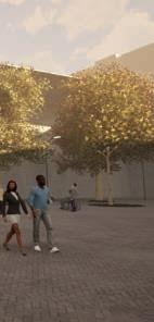
TOOLBOX
Caring Corridor
Sushanta Saha, Bangladesh
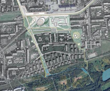
“The Caring corridor will create a network of vibrant, human scaled, pedestrian-bike oriented quality public spaces, weaving the green islands into a network of choices for people intended to become a meeting place and connecting the existing green blue elements to enhance the existing biodiversity and water management.”
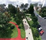
Haje Central station area has many isolated activity points and less of night life and activities specially for young generations that’s why still people prefer to be in old town. At the haje center it feels like the city park is suddenly breaks into nothing. The main road works as a barrier for pedestrians and bikers to reach existing market place and route to the eastern and southern natural areas are not encouraging.
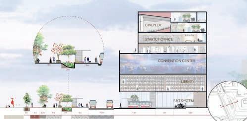
Art and Culture as tool: Prague is currently looking for a location for a Gallery for Alfons Mucha’s Slovanská epopej which is a common tourist attraction and probably should be a multifunctional cultural hub. The proposed caring corridor takes this into an opportunity. The design of new Museum with cultural performances facilities can be new tourist destination and new identity for the area. The design of the Museum can be an international Competition to bring more limelight into the area.
Metro Plus Property : Development of central Haje is also inspired from Metro plus property concept of Hong Kong to make the station area most attractive for young generation with new sports and convention center, cultural activities and night life, idea hub for start-ups to bring on their innovation.
Bringing Human Scale: The existing road between Haje Metro stations to eastern side will be transformed for only public and public transports. The bus station and the bus depo is moved to new place nearby intending for seamless mobility, safety and better experience for the pedestrians and bicycle riders.
Densify the area: Developing the area near Haje metro station with residential facilities to meet the future crisis of accommodation demand.
Connect important places and destinations: Connect the important destinations with Green blue corridors so that people have freedom of choices within and beyond neighbourhood.

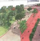
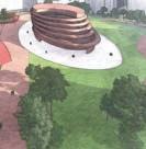
Haje new central square
Proposed natural corridor
Sustainable Urban Dynamics 2020
Ax:son Johnson Institute for Sustainable Urban Design Lund University
Sustainable Urban Design Master’s Program
School of Architecture
Lunds Tekniska Högskola
P.O. Box 124, 221 00
Lund, Sweden
+46 46 222 00 00 www.stadsbyggnad.lth.se

Lund University
P.O. Box 117, 221 00
Lund, Sweden
+46 46 222 00 00 www.lunduniversity.lu.se
Prague Institute of Planning and Development (IPR) http://en.iprpraha.cz/
Published May 2021
