RETHINKING 322

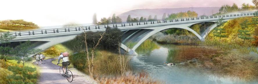
“Imagine a beautiful U.S. Route 322 bridge arching over Spring Creek and its floodplain. Imagine a regional park and trail system connecting the valley.”
Image: Jacob Hutton, Midjourney AI

“Imagine a beautiful U.S. Route 322 bridge arching over Spring Creek and its floodplain. Imagine a regional park and trail system connecting the valley.”
This short guide includes excerpts from Volumes 1-4 of Rethinking 322, Strategies for the proposed State College Area Connector in Penns-Brush Valley. The four volumes, researched and produced by students in the Penn State Stuckeman School’s Department of Landscape Architecture “Advanced Transportation Studio,” showcase strategies to rethink the design of a new U.S. Route 322 roadway between Potters Mills and Boalsburg. Developed between fall of 2022 and fall of 2024, the guidebooks outline over 35 strategies across 540 pages of text, charts, maps, photographs, and design concepts. From highway safety, multi-modal trails, and wildlife crossings to watershed management, historic resources, and working farms, the volumes have been designed to provide users with important information addressing all the aspects and impacts of a potential freeway in Penns-Brush Valley.
We hope the following pages will inspire you to Rethink 322.
Paul Daniel Marriott, Associate Professor of Landscape Architecture, June 2025
Thank you to the Hamer Center for Community Design and the Centre County Historical Society for underwriting the design and printing of this introductory guide.
The Hamer Center seeks to empower communities by providing information for responsible development through research and analysis of specific issues and by providing planning and pre-design services.
The Hamer Center serves as a clearinghouse for research, projects, and case summaries related to community design and planning. The Hamer Center compiles research and community design/planning documentations for dissemination, summarizes documents relating to topics or themes and relates the material back to community issues in the Commonwealth and its unique regional conditions.
Founded in 1904, the Centre County Historical Society (CCHS) is the oldest and largest history organization in the county, serving as the official historical society of Centre County. It is a membership and volunteer based educational non-profit organization that works collaboratively with local, regional, county and state organizations to preserve and promote the area’s historic, cultural, and natural resources through programs and exhibitions, archival and artifact collections, and publications.
Our mission is to build a critical understanding of our past, engage the issues of the present and guarantee a future which preserves our history and heritage for a diverse Centre County.

To view the four volumes and access other resources for Rethinking 322, please visit: centrehistory.org/research-explore/connector/ PennState College of Arts and Architecture Department of Landscape Architecture

A safer and more beautiful U.S. Route 322 traversing Penns-Brush Valley between Potters Mills and Boalsburg. Imagine a roadway that lies lightly on the land in a corridor that encourages bike and pedestrian use and accommodates wildlife. Imagine a roadway that is significantly safer and environmentally sustainable. Imagine a valley corridor made more livable, greener and efficient for both its residents and those travelers passing through the valley.
Safety First - Vol. 1, Vol. 2
The transition of the four-lane Nittany Valley Expressway with the two-lane rural section of U.S. Route 322 in Boalsburg is a high accident, high fatality location. Learn how immediate safety modifications could improve this segment.
Roadways and Health: Air and Noise Pollution - Vol. 2, Vol. 3
Highway safety is of paramount importance and influences the design of all roadways. Learn how roadways also impact health of homes and businesses along a busy route.
Addressing Stormwater Along Roadways - Vol. 2, Vol. 3
High-intensity rain events require new approaches to stormwater management. Learn how state Departments of Transportations (DOT) use landscape architects to design artificial wetlands, manage runoff, and create vibrant habitats.
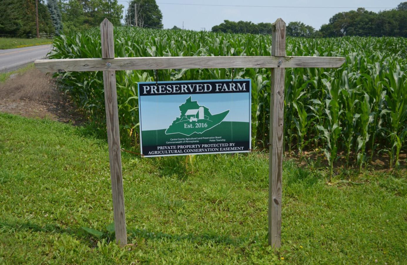
Agricultural Conservation and Penns-Brush Valley Viewsheds - Vol. 2, Vol. 3, Vol. 4
Penns-Brush Valley is a patchwork of historic family farms. The farms, hedgerows, and historic barns are reflective of Pennsylvania’s agricultural legacy. Learn how farmlands can be protected for sustainable agriculture.
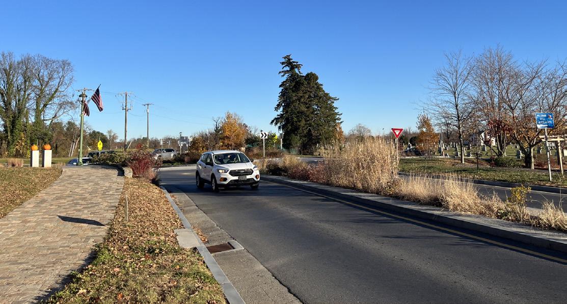
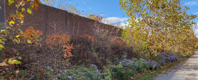
Reimagining Boalsburg and Spring Creek - Vol. 2, Vol. 3, Vol. 4
Spring Creek in Boalsburg has been buried and lost under U.S. Route 322. Learn how a new roadway design can inspire a regional park and trail system along Spring Creek.
When studying crash history on any road, it is important to distinguish among design factors such as the alignment of the road and the provision of safety features including: barriers, traffic signals, and posted warnings; environmental factors, including weather conditions such as blinding sunlight or freezing temperatures; off-road distractions such as billboards; and driver behavior factors such as speeding, driving under the influence, and aggressive driving. Sadly, driver behavior is irregular and the most difficult factor to predict or design for.
Therefore, the first course of action to improve safety on any road is to address design and environmental factors. For example, if we factor out driver behavior and find that a road segment has a high crash rate, that may suggest that there could be a design flaw in the geometry of the road, something such as an abrupt change from two lanes to four lanes that, if corrected, could improve safety. Similarly, for environmental factors, if there is a pattern of crashes during icy weather in one segment, textured pavement could be installed to improve safety. For driver behavior, it is still important to consider if any design or environmental factors contribute to poor behavior. For example, is aggressive driving the result of a random angry driver or chronic frustration with the design of the roadway (crossing the double yellow line when trying to pass slow moving trucks when no truck climbing lane is provided)?
These were factors that were considered in assessing the information in the PEL (Planning and Environmental Linkages) study for the Boalsburg Transition
When looking at Figure 1.0, which shows the crashes from 2020 to 2022, there are three main crash locations at the Boalsburg Transition. The first, starting on the topleft (A), is an outlier location; this crash included alcohol, speeding, and aggressive driving involved as factors.


The location where the most crashes have occurred is in the middle of the map (B, C, E, F, H, I, and J). This crash location occurs just after the road changes from a four-lane divided highway into a two-lane highway. These crashes have a variety of different factors: all seven of the crashes happened when the road was dry; four involved aggressive driving; one involved excessive speed; and one involved alcohol. For the aggressive driving and excessive speed crashes, the change from four lanes to two lanes should be considered as a possible influence on driver behavior.
This strategy was developed to address safety for the Boalsburg Transition. By rethinking the current alignment and geometry of the intersection, the proposed ideas outlined below could improve the safety and function of the area with minimal cost and effort.
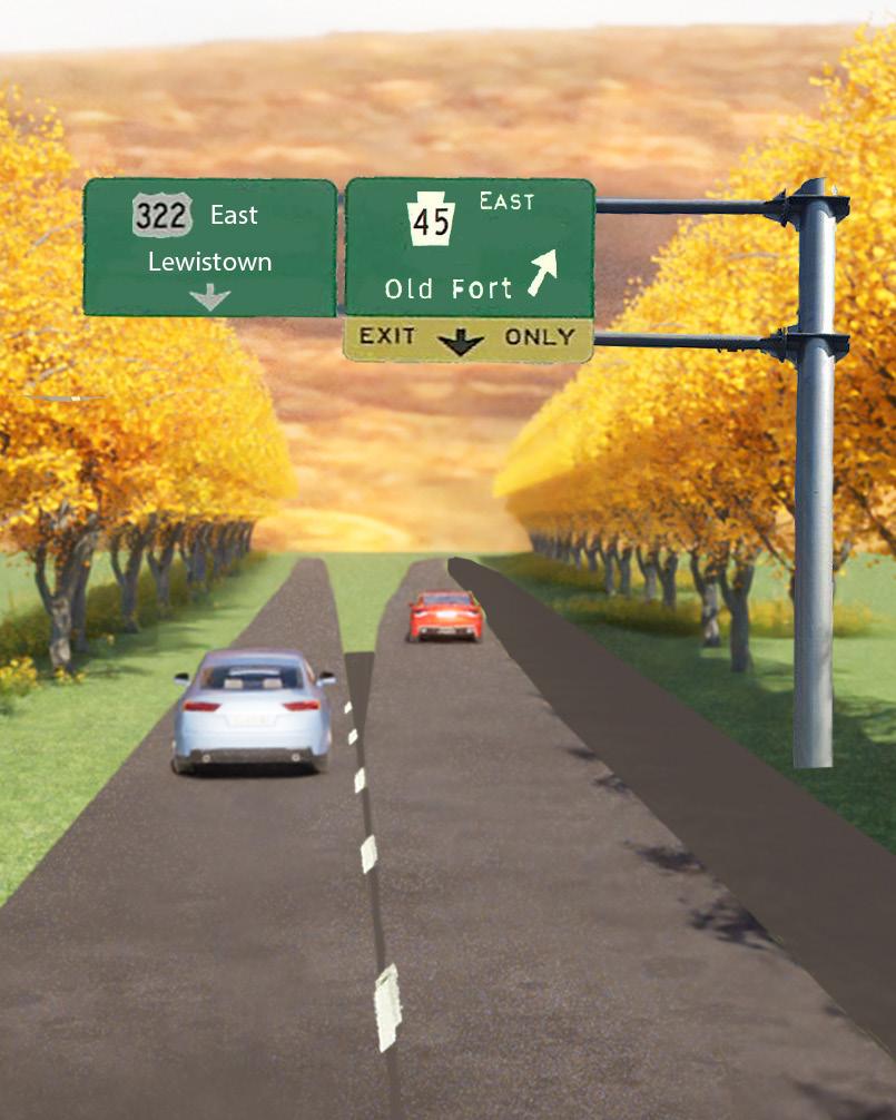
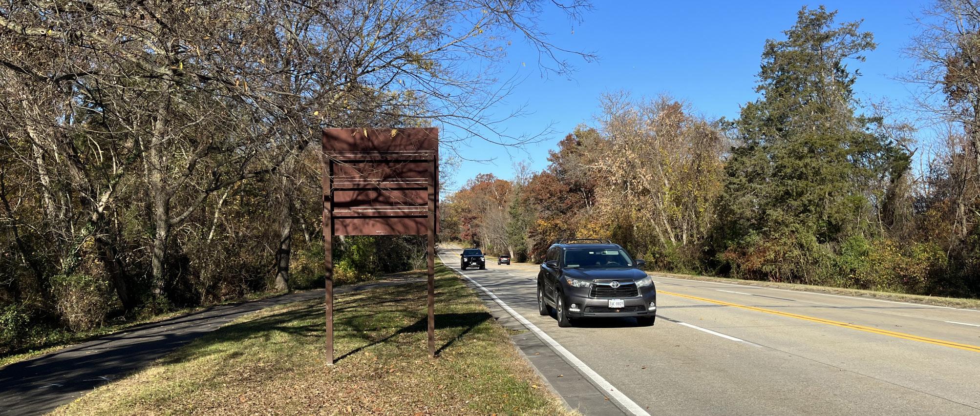
When traveling east on the Nittany Expressway (U.S. Route 322) from State College, U.S. 322 transitions from a four-lane divided highway to a two-lane highway with a double yellow line. Immediately before this transition is the exit toward Old Fort, PA 45. At the exit, U.S. Route 322 is a four-lane divided highway with a median. Immediately after the exit, eastbound U.S. Route 322 compresses from two lanes into one lane. Then, in less than 1,000 feet, the road changes from a divided highway to a two-lane arterial road. This area of transition has a high crash rate that may be attributed to design factors (the highspeed merge from two lanes to one lane) and driver behavior factors (drivers speeding to get ahead of other drivers before the merge ends).


To improve the segment, it is proposed to make the existing right lane approaching the PA 45 exit into an “Exit Only” lane. This would separate the through traffic to Potters Mills (and points east) from the local traffic going to Boalsburg and Old Fort in advance of the exit at Boalsburg. The “Exit Only” lane will eliminate the two-lane to one-lane high-speed merge just beyond the exit. With this simple change, all through traffic would be single file by the time it passed the PA 45 exit, thus eliminating the existing high-speed merge. This will help give drivers continuing east to Potters Mills advance warning, before the exit at PA 45, that the road is transitioning to a single lane, and encourage slower speeds before the divided highway transitions to the two-lane highway. It is hoped that this change will reduce the aggressive driving around the pinch-point of the road.

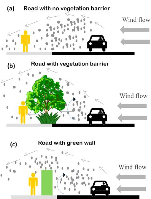
Research from the Environmental Protection Agency (EPA) indicates that typical roadways can influence air quality within a few hundred meters (500-600 feet) of the right-of-way. The distance will vary by location, time of day or year, weather, topography, nearby land use, and traffic patterns. To better illustrate this, let’s look at the Boalsburg exit in Pennsylvania (Figure 2.0). The image to the left highlights the limit of effect and the power of the pollutant per distance by color. Now, think of a road near where you live, work, or send your children to school. Regarding the distance chart, in which category of air pollution might you be currently residing?
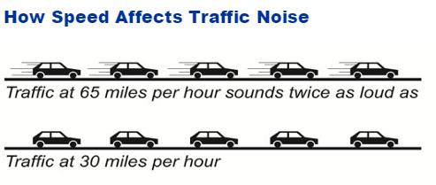
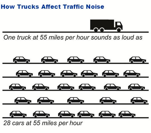
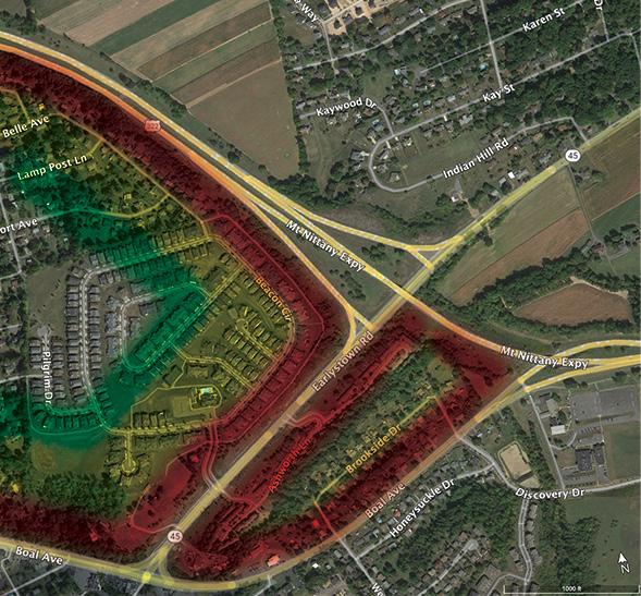
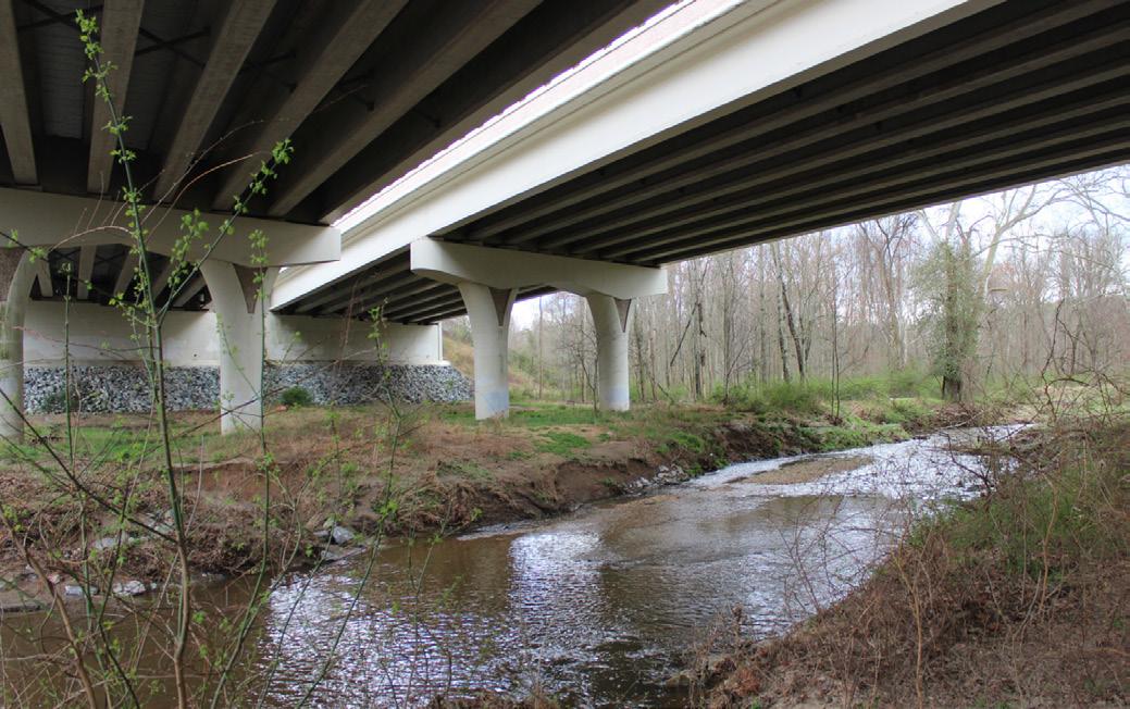
Figure 2.1 illustrates bridge drainage practices. This specific example is located at the intersection of Sellers Lane and I-99. Rainwater enters the drain inlet in the center of the bridge via a PVC pipe and directly flows onto flat ground below. With no filtration system in place, this allows pollutants and chemicals from highway traffic to enter local streams and eventually reach the Chesapeake Bay.
In Figure 2.2 Maryland Route 200 and Briggs Chaney Road in Fairland, Maryland. Stormwater is diverted away from the center of the bridge. After entering the drain inlet and passing through PVC piping, water is directed into a bed of river rock that filters and cools the polluted stormwater. Subsequently, the water flows through a swale, further filtering it before it reaches the local stream system.

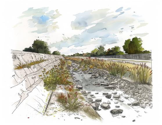
Figure 2.3 showcases a bioretention pond along Maryland Route 200, an excellent example of good stormwater management practices. Abundant vegetation surrounding the pond, utilizing native plants, and designed by landscape architects to replicate natural wetlands, breaks up the monotony of highway driving and provides additional nutrients and filtration. In Pennsylvania, however, highway bio-retention ponds are rarely designed by landscape architects, making most stand out as intrusions within the natural landscape. The most recent plans for the proposed State College Area Connector (SCAC) show a series of rectilinear retention basins that would be more urban in character. By Rethinking traditional stormwater basins from engineered pits designed to capture water to designed wetlands and ponds, we can not only improve stormwater management but also create new habit and pollinator spaces that contribute to the beauty of the rural landscape.
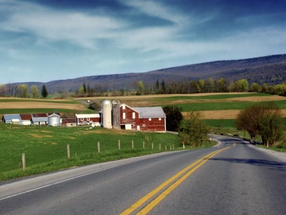
The proposed expansion of U.S. Route 322 will have a significant impact to the surrounding agricultural community. This new roadway will directly intersect or adversely affect adjacent farms along the chosen corridor, permanently altering the landscape of these farms. Using conservation easements, state agriculture programs, and local land use and policy tools can significantly improve agricultural conservation. This initiative is a collaborative effort among government entities and nonprofit organizations, united in their goal to protect prime farmland. The agricultural history of Centre County is a cornerstone of the region, cherished by local residents while visitors value its preservation. Pennsylvania leads the nation in the preservation of farms and agricultural acreage, resulting in an abundant food supply and a robust economy. To fully capture the story of Penns-Brush Valley, it’s crucial to highlight the individuals who uphold the longstanding tradition of farming in the limestone valleys of Centre County, Pennsylvania.
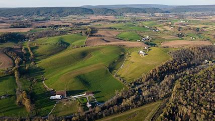
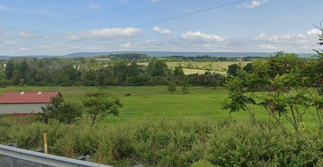
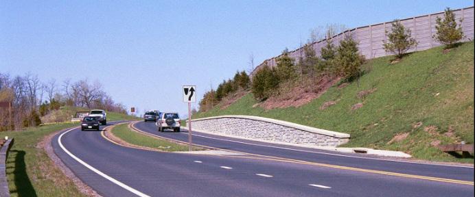
Thoughtful roadway design in many states protects or enhances important views of the countryside and landscape from the roadway. Such views, cherished by local residents and awe-inspiring for visitors, are an important part of the U.S. Route 322 arrival corridor.
When it comes to deciding what viewshed are important, topography can play an important factor. If we consider the sequence of the road, 322 winds through Seven Mountains to then pass through a break in the mountain, all the while the road slowly descends into the valley. When arriving at Potters Mills, the road is elevated just high enough to catch a glimpse, as mentioned above. As the road continues, it descends further, enhancing the experience of The Arrival into the Penns-Brush Valley (Figure 3.3).
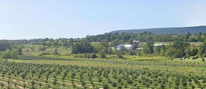
When driving into the Penns-Brush Valley from Potters Mills, visitors are welcomed to an expansive view across the valley floor. Rolling hills, sprawling farm fields, and in the far distance stands a proud Mount Nittany. For visitors to the valley, whether it be students, football fans, or travelers, this viewshed is their first glimpse of what the landscape of the valley looks like (Figure 3.4 and Figure 3.5).
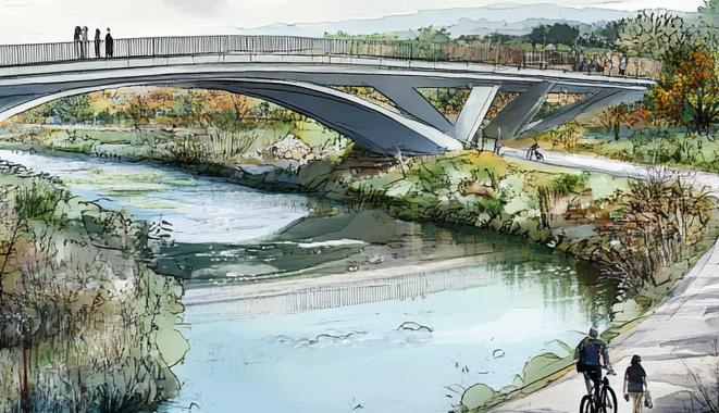
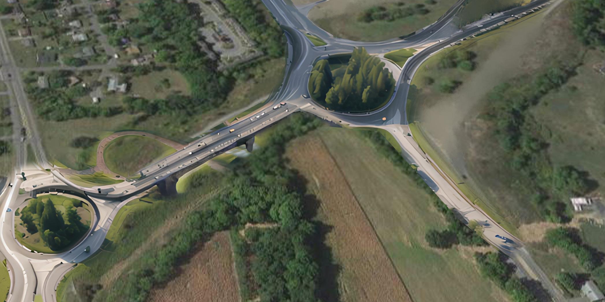
The Boalsburg roundabout concept is a proposal to dramatically rethink the function and safety of the current intersections on U.S. Route 322 bewtween PA Route 45 and Discovery Drive within the regional and environmental context of Penns-Brush Valley. The design is based on both the models of successful higher-speed and higher-volume roundabouts in the United States, and an improved road footprint that restores Spring Creek as a regional park.
This site requires a unique design. At right is the proposed redesign for the Boalsburg Interchange. This design solution gives the region an opportunity to rethink this highway utilizing roundabout strategies that have been successfully employed in other states. It can respond to the needs of local communities as well as the needs of the nation through recent infrastructure and design movements.
Incorporating the wealth of research gathered over the previous two years, this design increases the safety of all users in and around the site. Proper consideration for local communities and user groups can result in more equitable transportation options and usable public spaces. Restoration of Spring Creek from a box culvert to a freely flowing stream will improve local ecosystems critical to Centre County. A better transition from from Mt. Nittany Expressway to twolane U.S. Route 322, and a two-way street (Boal Avenue) to a highway (U.S. Route 322) can act as a template for better transitions that would not only serve travelers but benefit all communities in contact with the highway. The new Boalsburg Interchange can provide more to Pennsylvania than just a means of travel.
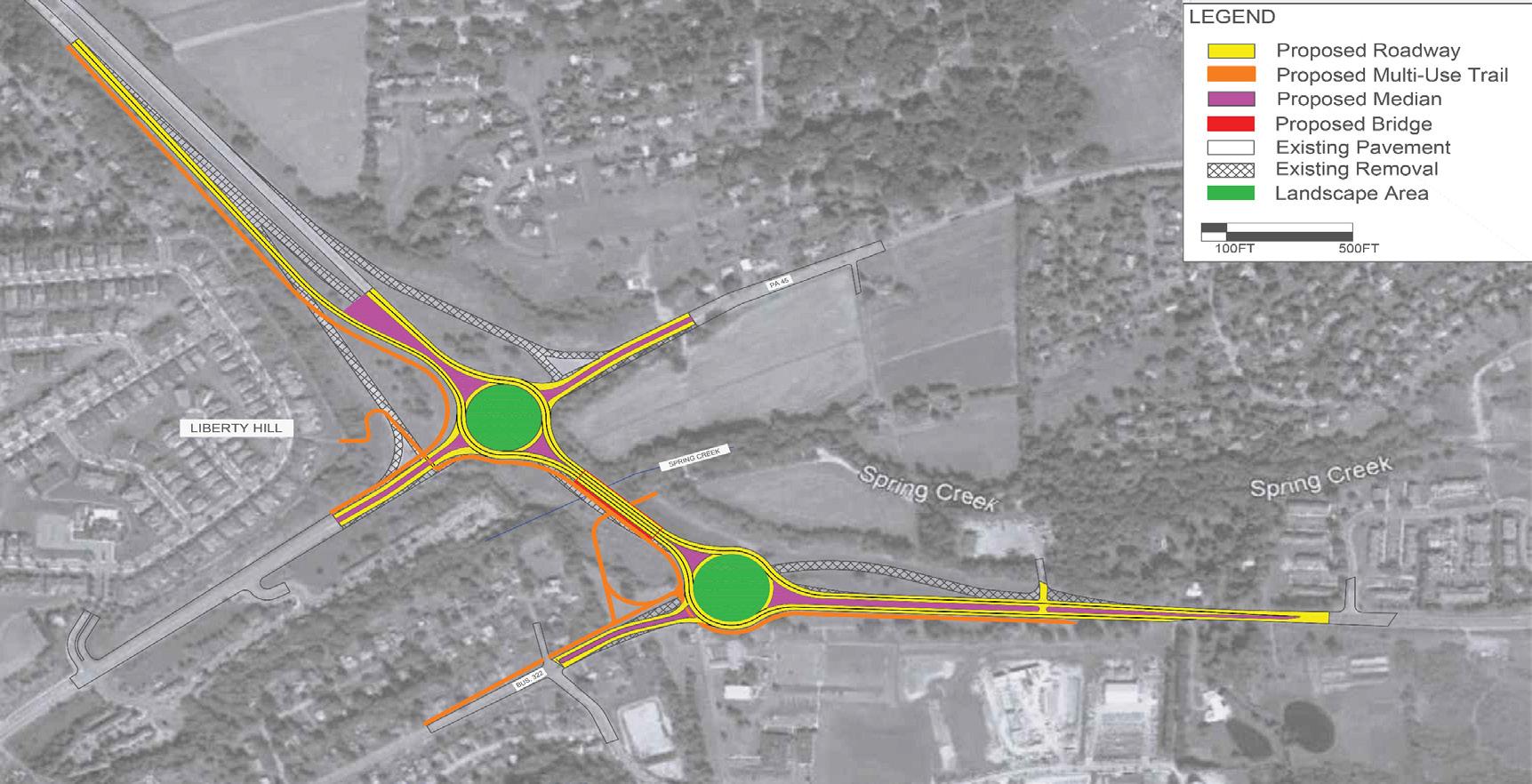
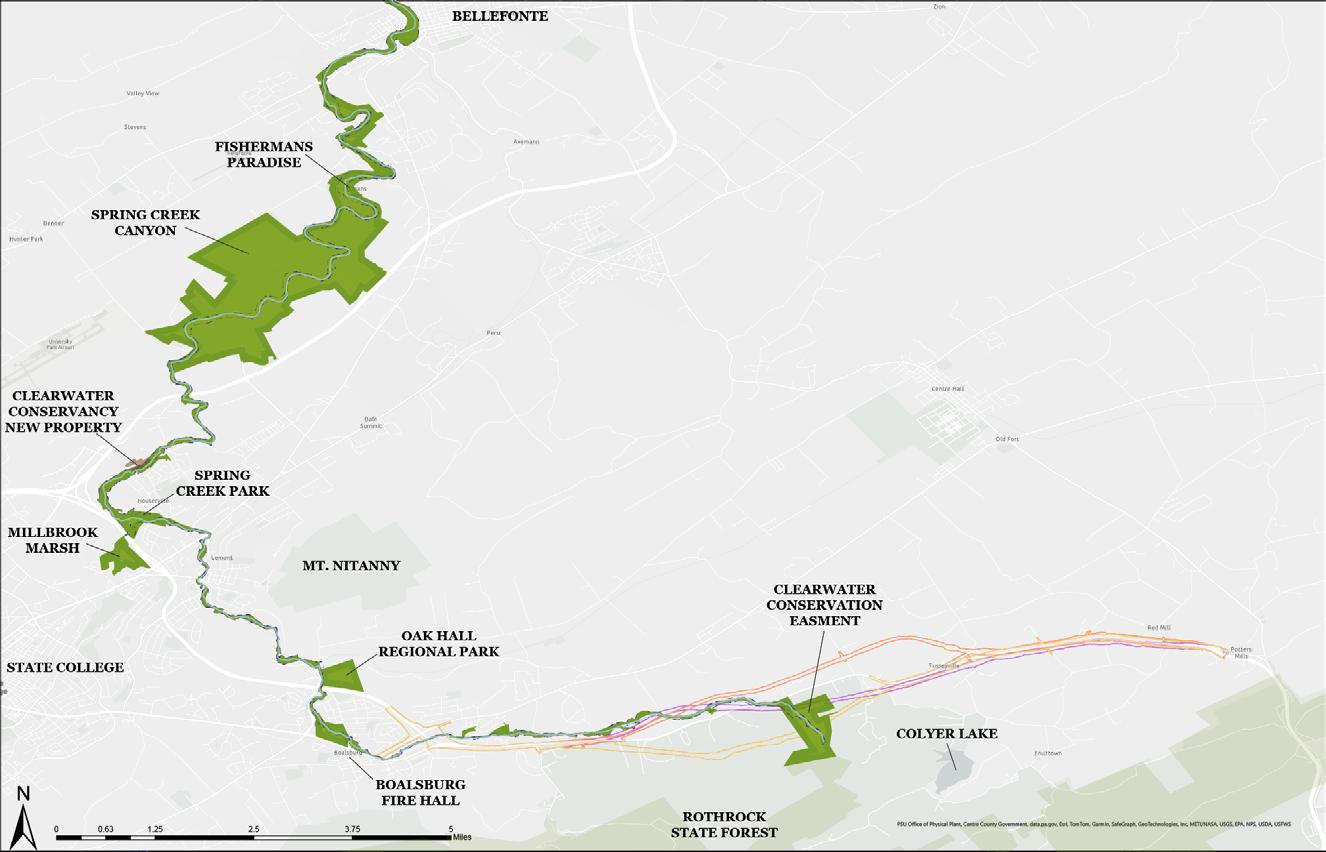
Through strategic long-term planning, design, and acquiring of easements the Spring Creek floodplain corridor could be transformed into a public green space. This will connect local communities to public parks and land in the form of a nearly 20-milelong regional park from the headwaters of Spring Creek to Fisherman’s Paradise. Planning for this long-term regional vision in conjunction with the SCAC planning process provides opportunities for additional and purposeful wildlife crossings, wetland preserves, recreational activities, and park connections. This will require the Centre Region, local municipalities, private landowners, and local conservation stewards like Clearwater Conservancy to work together and identify important connections and mitigation opportunities, especially in areas where the proposed expansion of U.S. Route 322 will negatively impact the Spring Creek corridor.
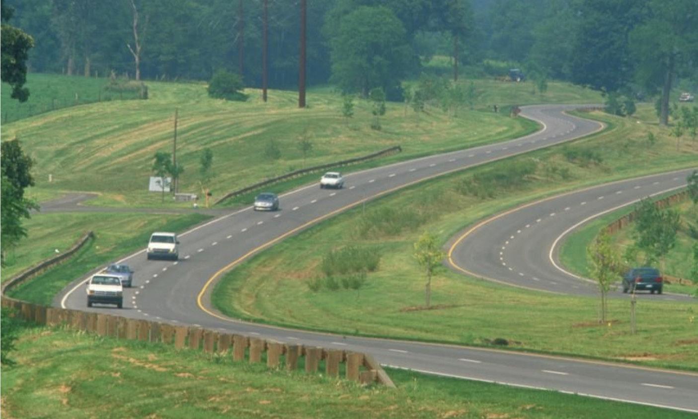
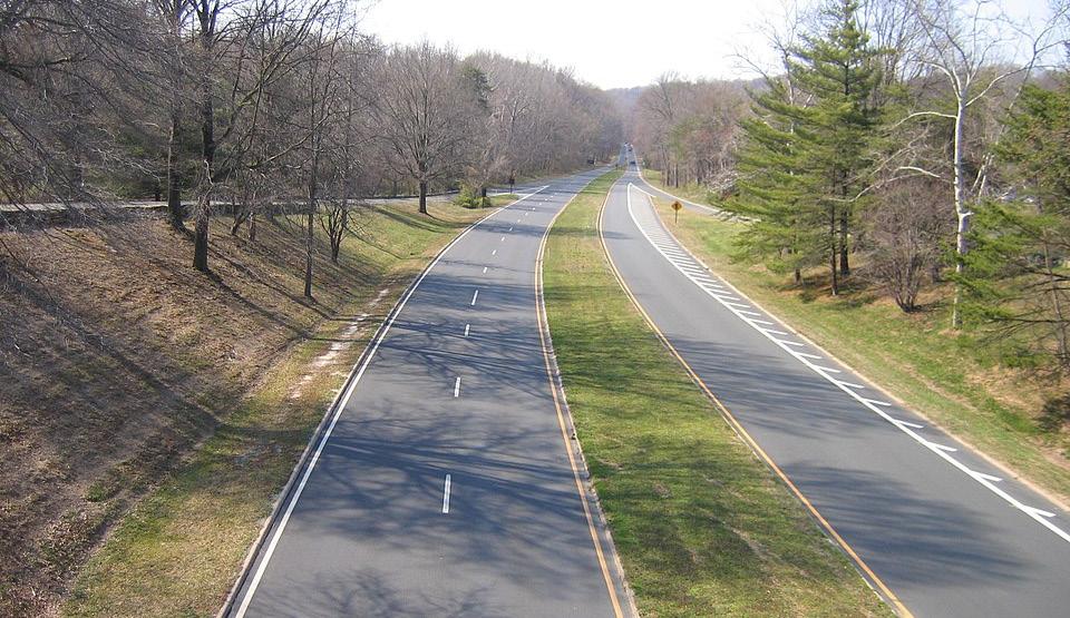
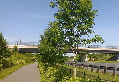
The images above are reflective of the many state DOTs that have landscape architecture divisions or contract with landscape architecture firms experienced in transportation design. From highway alignments and safety features to designed stormwater wetlands and restored landscapes, landscape architects help civil engineers create beautiful and sustainable roadways. Imagine a new U.S. Route 322 that features the design and environmental elements that only licensed landscape architects provide.