All rights reserved. No part of this publication may be reproduced or transmitted in any form or by any means, electronic or mechanical, including photocopy, recording, or any information storage and retrieval system, without prior permission in writing from the publisher.
Student Participant Project Results provided shall be used solely for Sponsor’s internal review and analysis. Any and all rights to the Student Participant Project Results, including all Intellectual Property Rights, if any, shall remain the rights of the individual Student Participants as appropriate under the law regarding rights to and ownership of intellectual property unless there is a separate written agreement addressing the ownership of intellectual property. Prior to any commercial use or subsequent transfer of any Student Participant Project Results, Sponsor must obtain the appropriate rights from the respective owners. This publication is available in alternative media on request. The University is committed to equal access to programs, facilities, admission and employment for all persons. It is the policy of the University to maintain an environment free of harassment and free of discrimination against any person because of age, race, color, ancestry, national origin, religion, creed, service in the uniformed services (as defined in state and federal law), veteran status, sex, sexual orientation, marital or family status, pregnancy, pregnancy-related conditions, physical or mental disability, gender, perceived gender, gender identity, genetic information or political ideas. Discriminatory conduct and harassment, as well as sexual misconduct and relationship violence, violates the dignity of individuals, impedes the realization of the University’s educational mission, and will not be tolerated. Direct all inquiries regarding Penn State’s non-discrimination policy to the Office of Equal Opportunity and Access, The Pennsylvania State University, 328 Boucke Building, University Park, PA 16802-5901, Email: oeoa@psu.edu, Tel (814) 863-0471.
1 Introduction
Project background
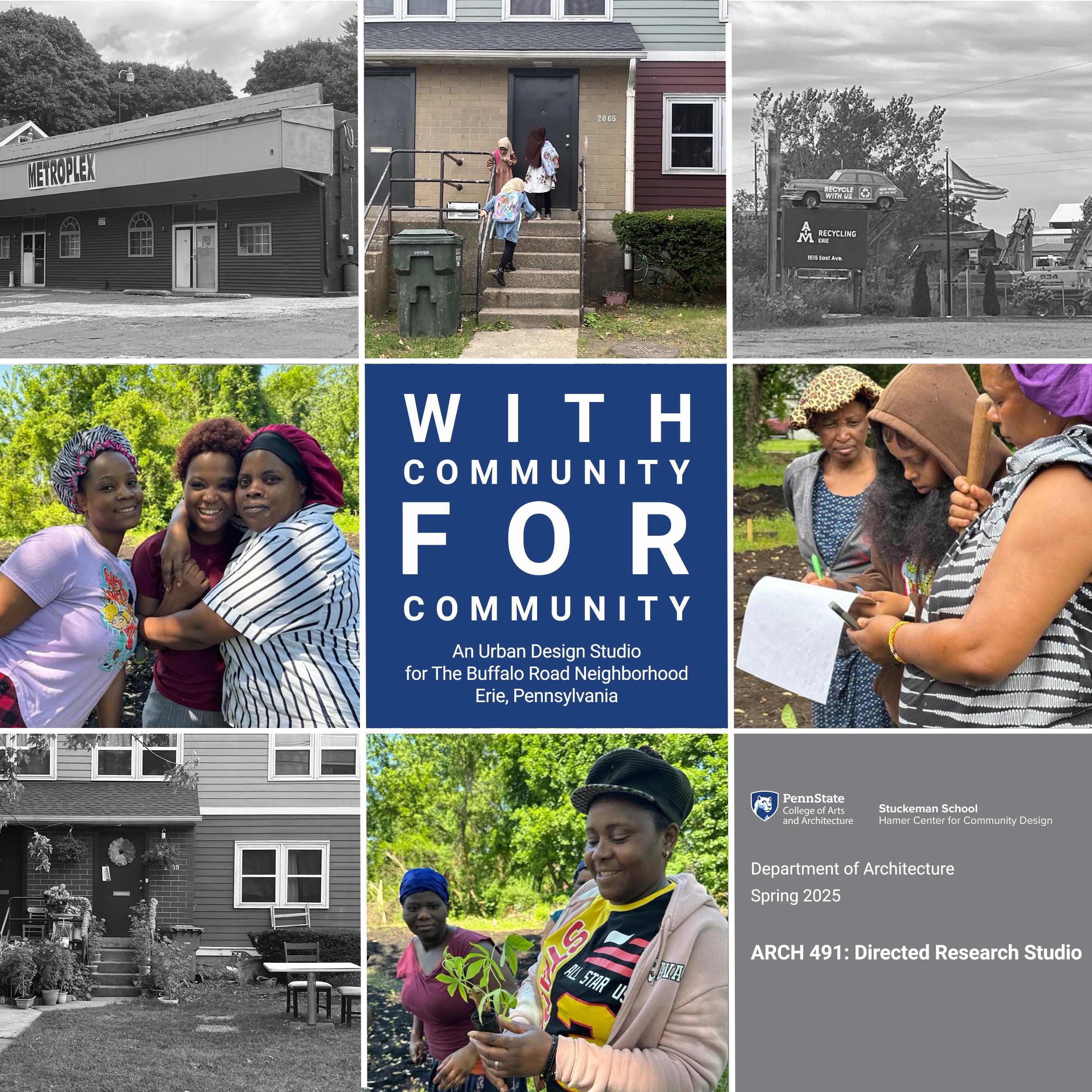
Erie has historically been one of Pennsylvania’s most populous cities, yet despite the city’s rich cultural diversity, continued investments in the downtown and bayfront areas, and vibrant neighborhoods, Erie’s population is shrinking. The Infinite Erie initiative was established in 2022 to coordinate inclusive growth strategies for transformative change through implementing an investment “playbook.” In this process, East Erie’s Buffalo Road neighborhood has been identified as a priority for socially and environmentally conscious urban design and development.
Overview
The Buffalo Road neighborhood is bordered by Bayfront Parkway, East 12th Street, Franklin Avenue, and 16th Street and has, for many years, been predominantly inhabited by African Americans. In recent years, the neighborhood’s demographics have changed, as legacy residents were joined by New American refugees from countries in Europe, Africa, and Asia, including South Sudan, Somalia, Eritrea, the Democratic Republic of Congo, Nepal, Burundi, Tanzania, Kenya, Liberia, Bhutan, Iraq, Ukraine, Syria, and Afghanistan.
The neighborhood today is home to approximately 7,000 residents (3,000 households) with a diverse of backgrounds, cultures, and family structures. Despite Erie’s declining population, the housing occupancy rate in the Buffalo Road neighborhood remains higher than the city average. Many housing structures in the area are subsidized by the U.S. Department of
Housing and Urban Development (HUD).
Site and Program
In an urban design studio in the Department of Architecture in Penn State’s Stuckeman School, student design teams worked with community members to develop design proposals for the Buffalo Road neighborhood. Individual students then developed and refined selected sites within the urban project. Design proposals addressed the interests, values, and needs of the community and worked to support community cohesion in ways that were socially and environmentally sustainable. Program development and site selection were established through a co-design process with community members.
Strategic aims for the neighborhood plan included providing access to affordable housing, improving infrastructure, attracting investments, fostering youth development and education, providing employment and entrepreneurship opportunities, and developing options for community health and access to open space and fresh food.
Throughout the semester students worked in teams across scales, from the urban design of the neighborhood to specific architectural interventions. Design work was informed by the existing plans, developed by Infinite Erie in collaboration with Urban Erie Community Development Corporation and local community organizations:
• Minority Community Investment Coalition’s (MCIC) Grow Erie project.
2 Site Research
2.1 History
Established in 1805, Buffalo Road originally served as a vital connection between the city of Erie and New York state. Beginning at 18th Street in Erie, Buffalo Road extends eastward through the city and into the surrounding area, eventually merging with West East Main Street in Harborcreek.
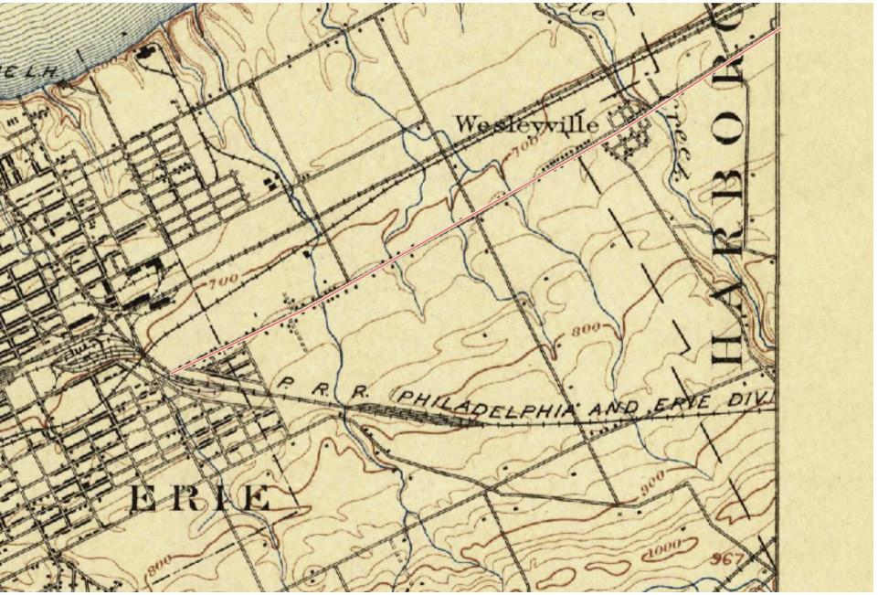
Erie expanded due to the Civil War, World War I, and then World War II. Manufacturing and ship building provided an industrial base, along with the coal and metal industries. From the nineteenth to early twentieth centuries, the neighborhood was just a few houses along Buffalo Road, surrounded by farmland.
After World War II, Erie’s population initially rose, partially due to jobs created through a federal highway act that would build 41,000 miles of interstates by 1956. The earliest map that shows Buffalo Road as a neighborhood is from 1957.
Year: 1900. Displays the road with few houses alongside.
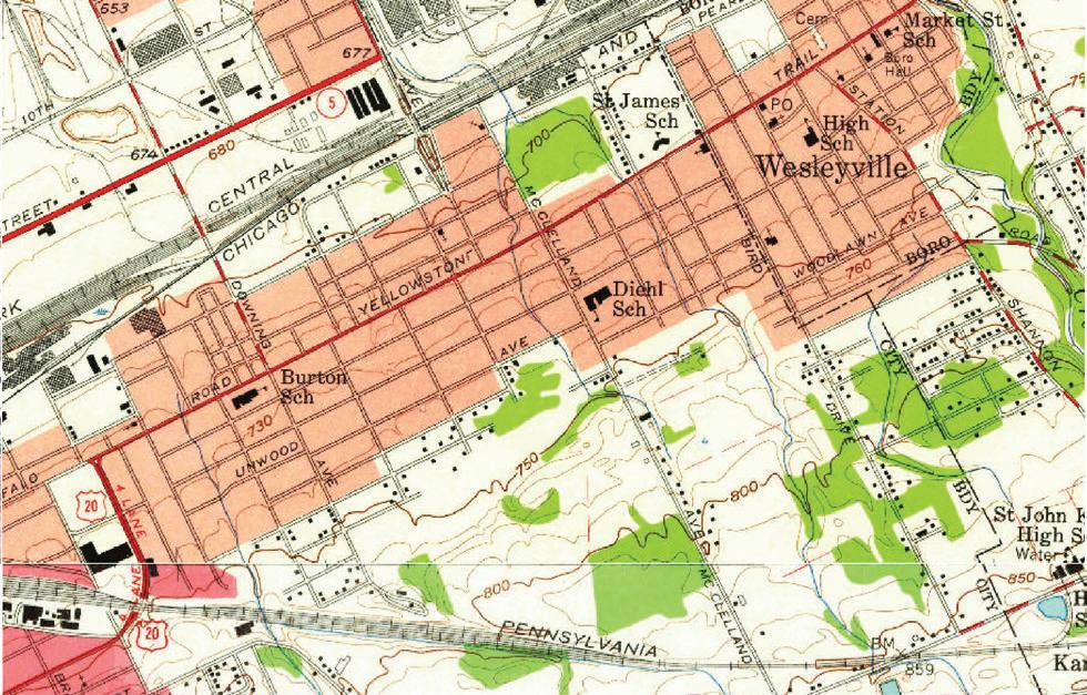
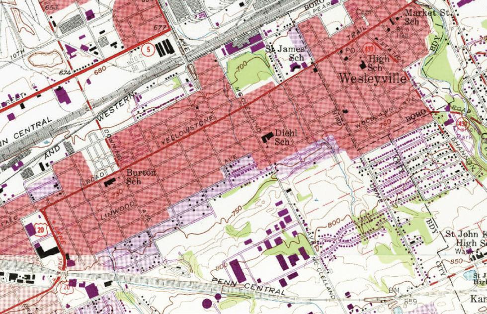
Two maps, one from 1957 and the other from 1976, show the neighborhood’s growth. The neighborhood is still largely residential but we can see some larger areas containing businesses starting to form.
After the 1970s, Erie began to see a decline in population. From 1970 - 2000, the city saw a 21% decline in manufacturing jobs.
Despite these losses, the Buffalo Road neighborhood continued to grow. Maps show the change in housing density and, with that, in population.
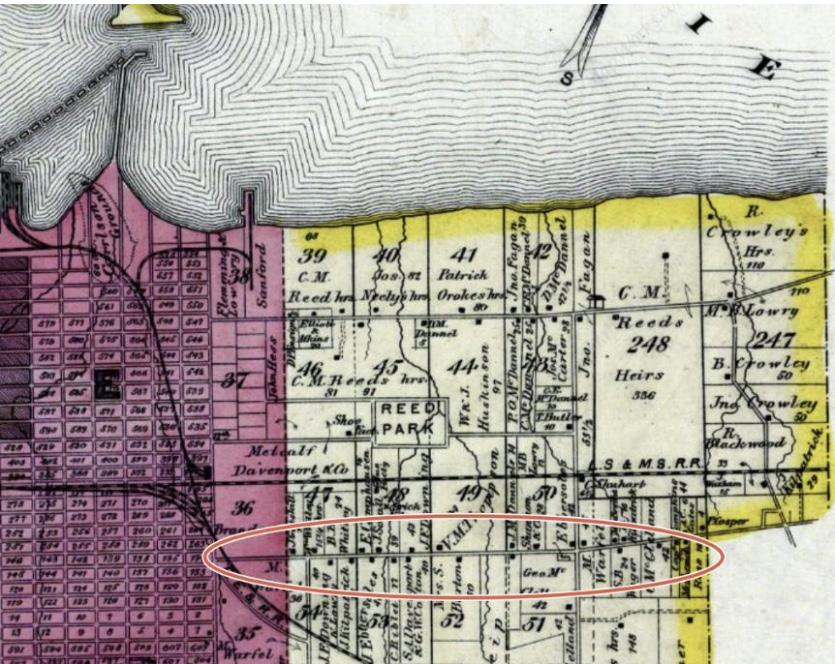
Year: 1876. Displays mainly broken up farmland and spread out houses, with most being around Buffalo Road. Source: https:// www.historicmapworks.com/Atlas/US/7102/
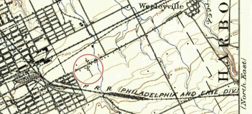
Year: 1900. Displays some small growth within the neighborhood. Source: https://www.historicmapworks.com/Atlas/US/7102/
Years 1957 - 1976. Source: https://ngmdb.usgs.gov/topoview/viewer/#14/42.1349/-80.0296
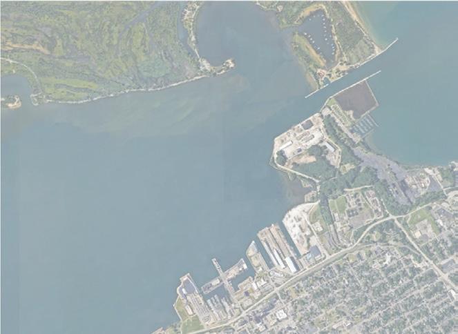
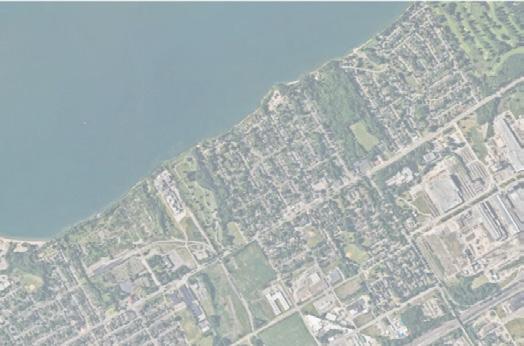
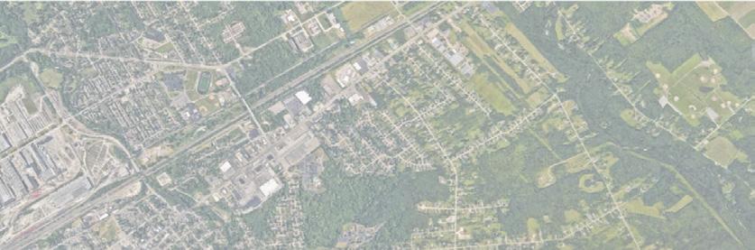
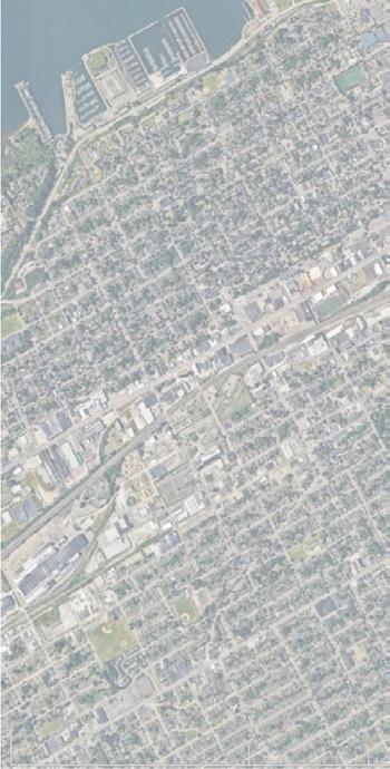
While the neighborhood experienced growth from 1976 to1987, the maps below show that there have been few morphological changes since. Throughout the years, many businesses have moved out of the neighborhood, leading to a loss of job opportunities. The neighborhood now has little retail and few stores where residents can purchase everyday goods such as food or fresh produce. Today, many residents must drive to nearby Wesleyville to get groceries and other supplies – a problem for those who do not have cars.
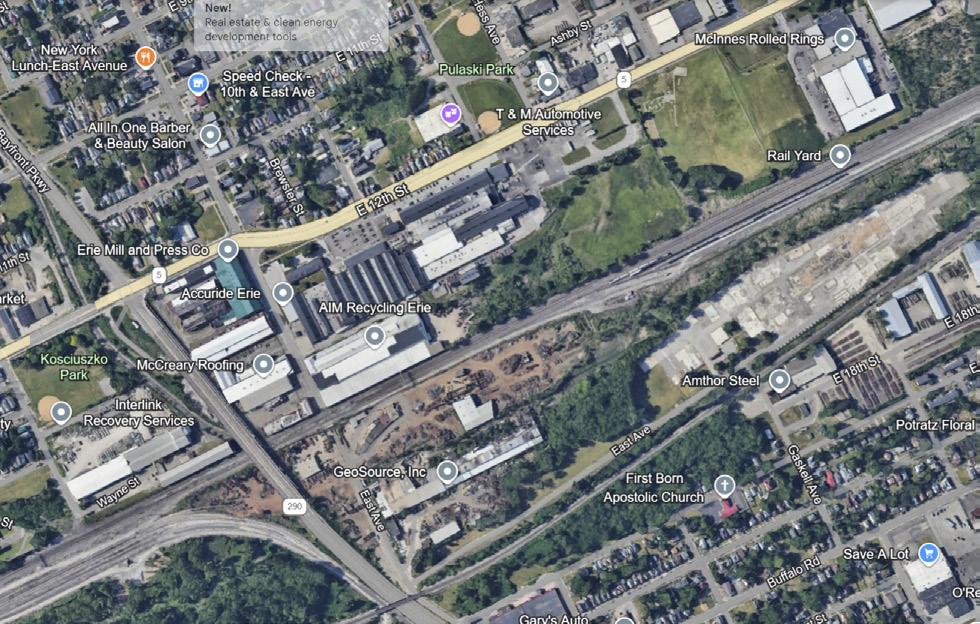
The businesses that have remained in the neighborhood are associated with light or heavy industry, including a scrap metal and recycling company that owns much of the land bordering the site to the north.
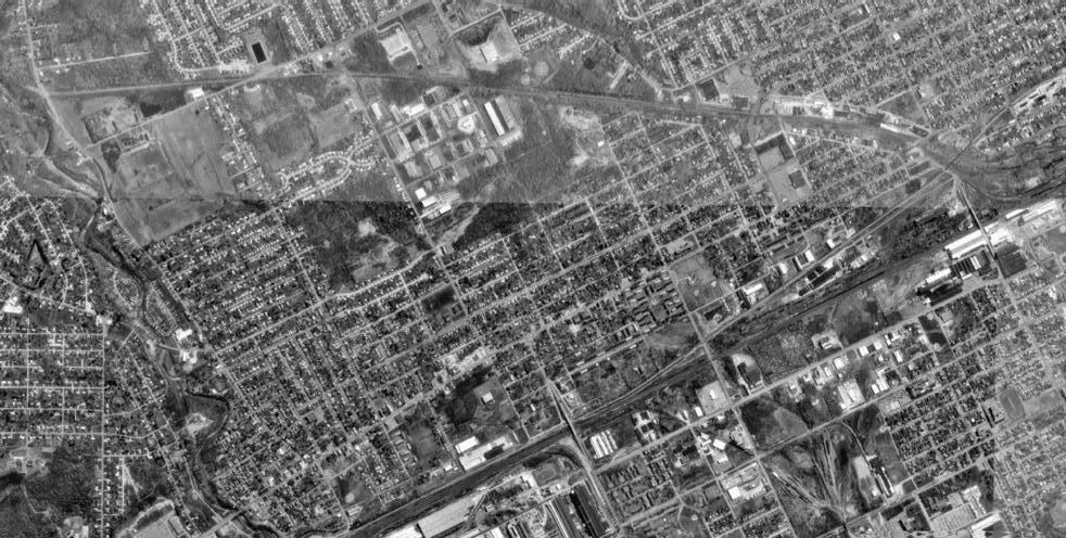
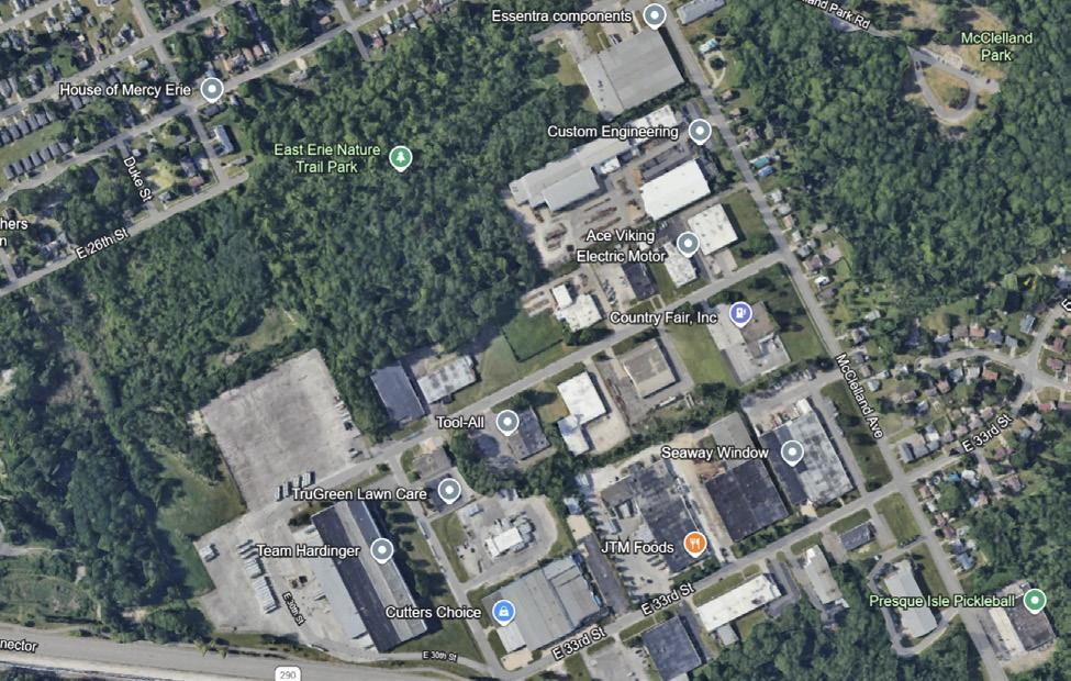
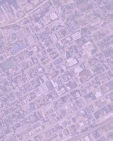
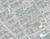
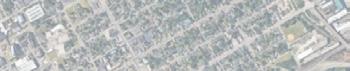
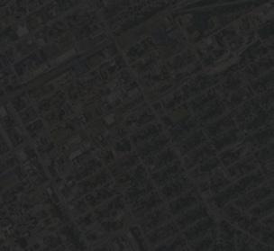
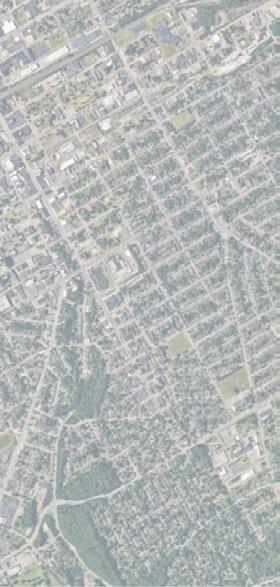
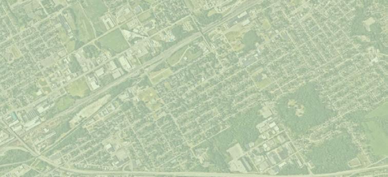
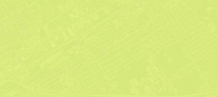
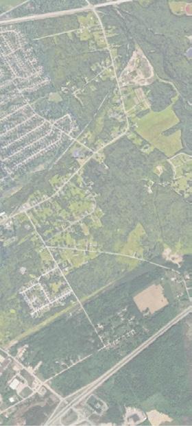
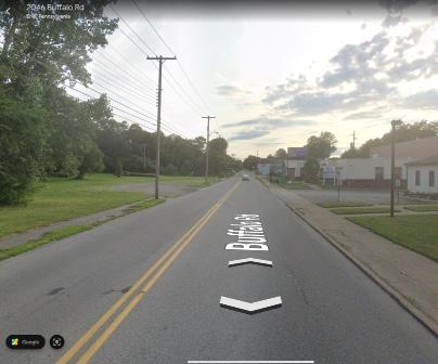
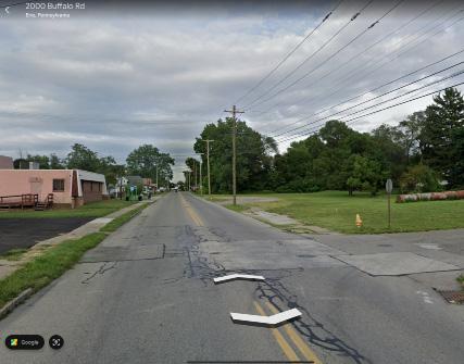
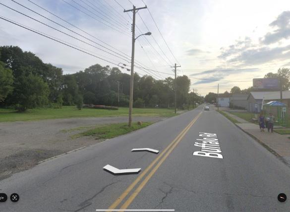
The two sets of images show few morphological changes from 1987 to today. Images taken from Google Earth. Images taken from Google Earth.
Source: Google Earth.
2.2 Demographics
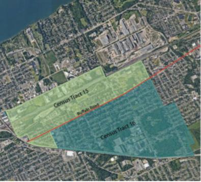
The Buffalo Road neighborhood was named after the four-lane road that passes through the area, connecting the eastern side of Erie to neighboring Wesleyville and beyond. The neighborhood is divided into two census tracts: Census Tract 15 and Census Tract 16, which lie north and south of Buffalo Road, respectively.
While Buffalo Road joins the two tracts as their “spine,” a demographic analysis reveals that Buffalo Road also represents a social, cultural, and economic division of the neighborhood.
Population
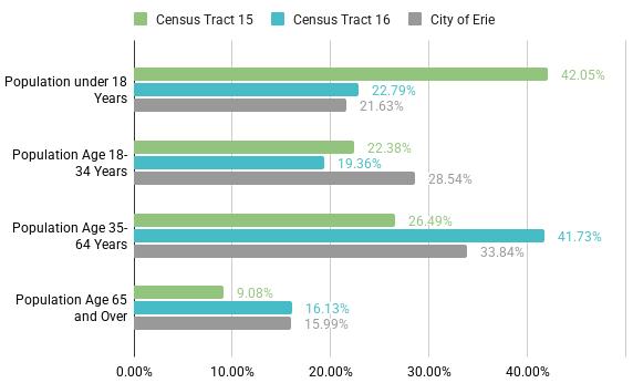
Overview: Age
Census Tract 15 has twice as many children by percentage compared to Census Tract 16. The nonsenior adult population in Census Tract 16 trends older.
DATA Pool - Total Population in Numbers
Census Tract 15: 2,797
Census Tract 16: 4,055
City of Erie: 94,156
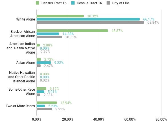
Population Overview: Racial Makeup
Approximately 30% of people in Census Tract 15 are white, compared to over 60% in Census Tract 16. Roughly 45% of people in Census Tract 15 are Black or African American, compared to only 15% in Tract 16.
DATA Pool - Total Population
Census Tract 15: 2,797
Census Tract 16: 4,055
City of Erie: 94,156
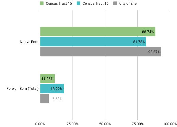
Native Born & Foreign Born Population
Both Census Tract 15 and 16 have two-to-three times as many New Americans by percentrage than the city of Erie as a whole.
DATA Pool - Total Population
Census Tract 15: 2,797
Census Tract 16: 4,055
City of Erie: 94,156
ACS 2023, 5-year estimates
ACS 2023, 5-year estimates
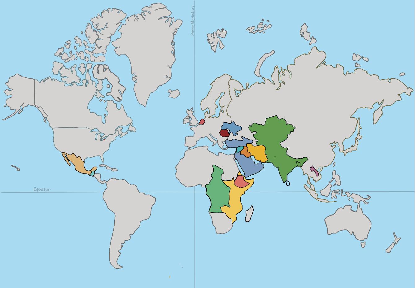
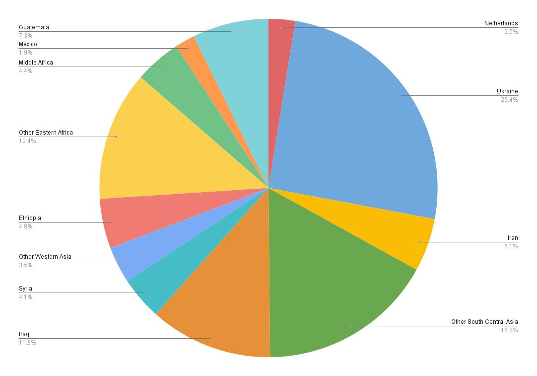
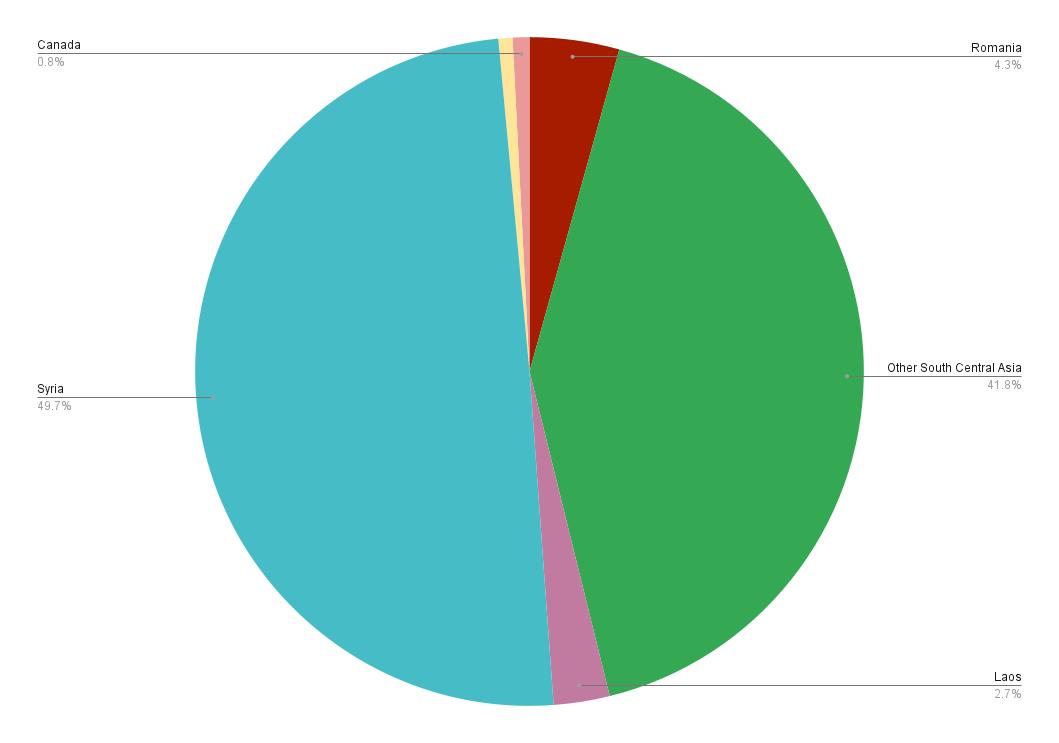
Country of Origin
Census Tract 15 shows a greater diversity when considering country of origin for its New American population, while nearly all New Americans in Tract 16 are from Syria or other South Central Asian countries.
DATA POOL- Foreign Born Population
Census Tract 15: 315
Census Tract 16: 739
Percentage of Foreign Born Population (%)
Census Tract 16
Percentage of Foreign Born Population (%)
ACS 2023, 5-year estimates
ACS 2023, 5-year estimates
Census Tract 15
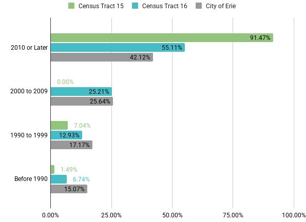
Year of Entry to United States
Nearly all New Americans in Census Tract 15 arrived in the United States after 2010, while nearly as many New Americans by percentage in Census Tract 16 arrived after 2000.
DATA POOL - Foreign Born Population
Census Tract 15: 315
Census Tract 16: 739
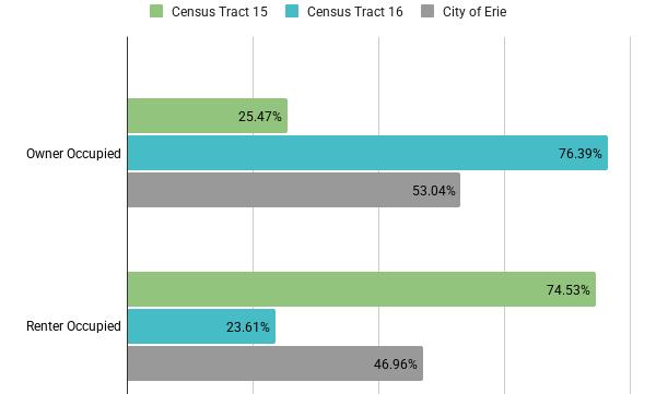
Home Ownership
Only one quarter of occupied housing units in Census Tract 15 are owner occupied, compared to three quarters in Census Tract 16. Tract 15 contains a significant amount of Housing Authority housing.
Median household income ACS 2023, 5-year estimates.
DATA POOL- Occupied Housing Units
Census Tract 15: 1,072
Census Tract 16: 1,864 City of Erie: 39,419
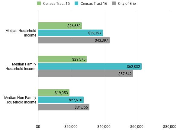
Income
Households in Census Tract 15 earn less than households in Tract 16, especially for family households.
Median Household Income ACS 2023, 5-year estimates.
DATA POOL- Occupied Housing Units
Census Tract 15: 1,072
Census Tract 16: 1,864
City of Erie: 39,419
ACS 2023, 5-year estimates
ACS 2023, 5-year estimates
ACS 2023, 5-year estimates
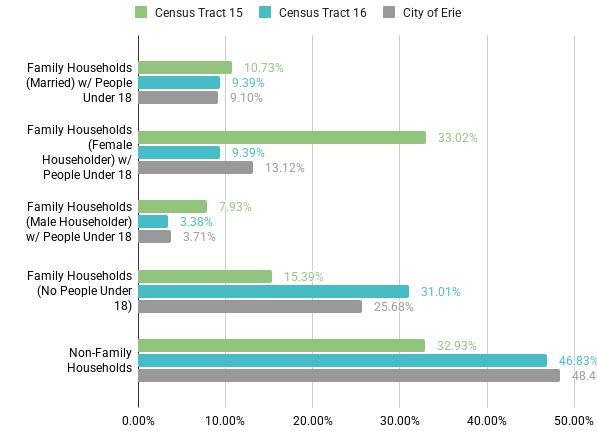
Family Households & Children
One third of households in Census Tract 15 have a Female Householder with children. Nearly three quarters of households in Tract 16 are either family households with no children or non-family households.
Household by family, structure, and presence of people under 18 years. ACE 2023, 5-year estimates
DATA POOL - Occupied Housing Units
Census Tract 15: 1,072
Census Tract 16: 1,864
City of Erie: 39,419
estimates
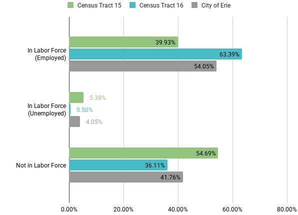
Employment
Census Tract 16 leads employment with approximately 60% of people 16 years and over being employed. In Tract 15, more people are unemployed than are employed.
DATA POOL - Population 16 years and over
Census Tract 15: 1,896
Census Tract 16: 3,190
City of Erie: 76,002
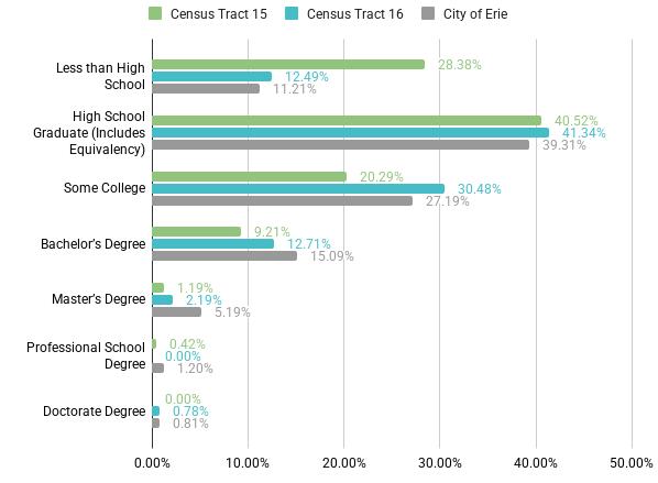
Education
A higher percentage of people have less than a high school education in Census Tract 15, compared to Tract 16. A lower percentage of people in Tract 15 have attended college than in Tract 16.
DATA POOL - Population 25 Years and over
Census -Tract 15: 1,434
Census Tract 16: 2,690
City of Erie: 61,747
ACS 2023, 5-year
ACS 2023, 5-year estimates
ACS 2023, 5-year estimates
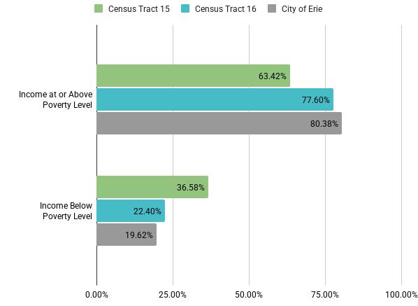
Poverty
One third of family households in Census Tract 15 have incomes below the official poverty level.
Census Tract 16 has a higher percentage of family households with income levels below the poverty level compared to the city of Erie.
Family Households by Poverty Status
ACS 2023, 5-year estimates
DATA POOL - Family Households
Census Tract 15: 719
Census Tract 16: 991
City of Erie: 20,339
ACS 2023, 5-year estimates
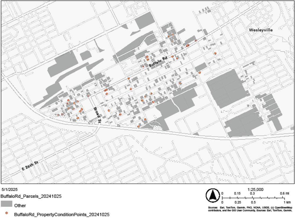
Analysis of Urban Vacant Property Lots and Properties in Poor Condition
2.3 Existing Context
Transportation
An analysis of Erie’s public transit system helped us identify key locations for design interventions in our Urban Design Proposal, emphasizing the role of accessibility in a neighborhood with limited private vehicle ownership or access to alternative modes of transportation.
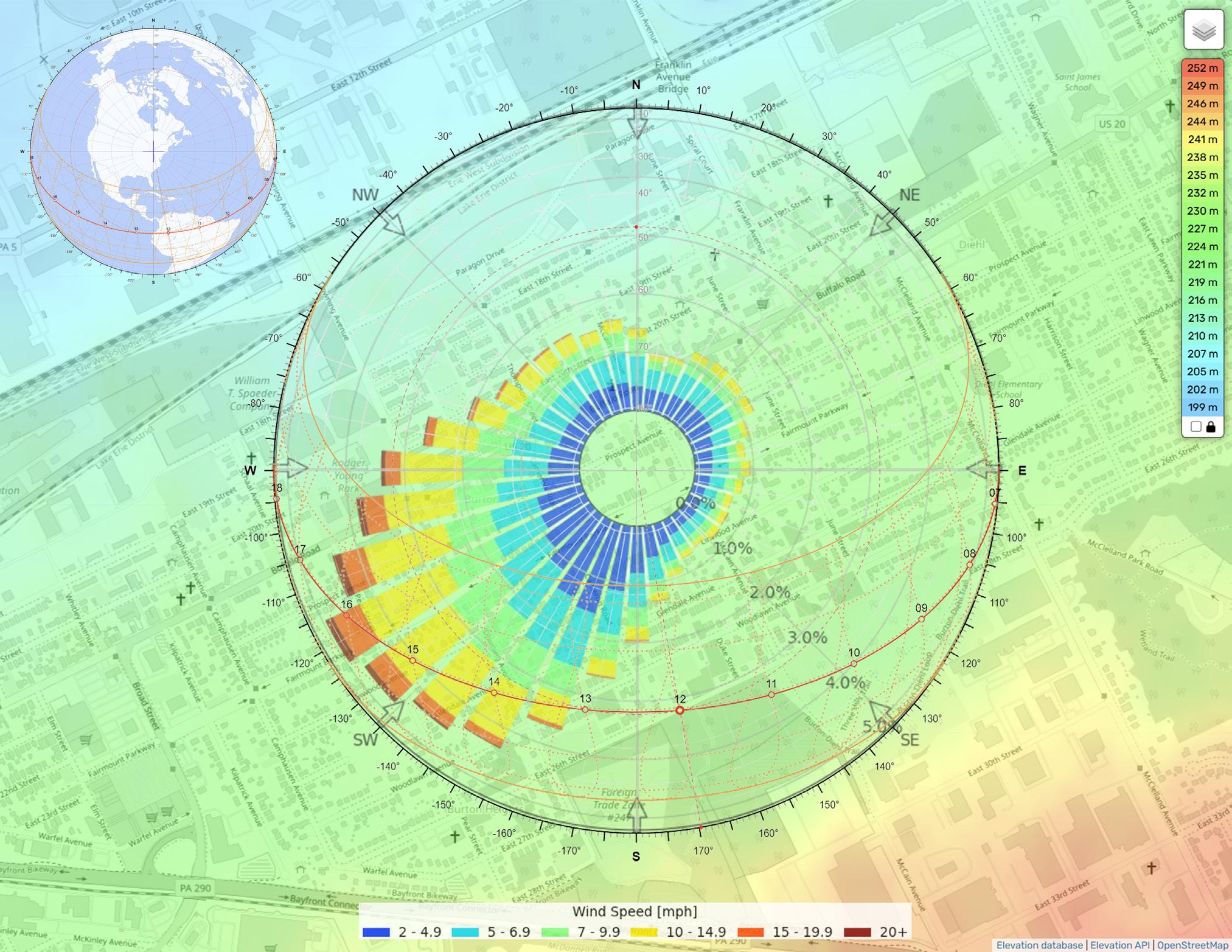
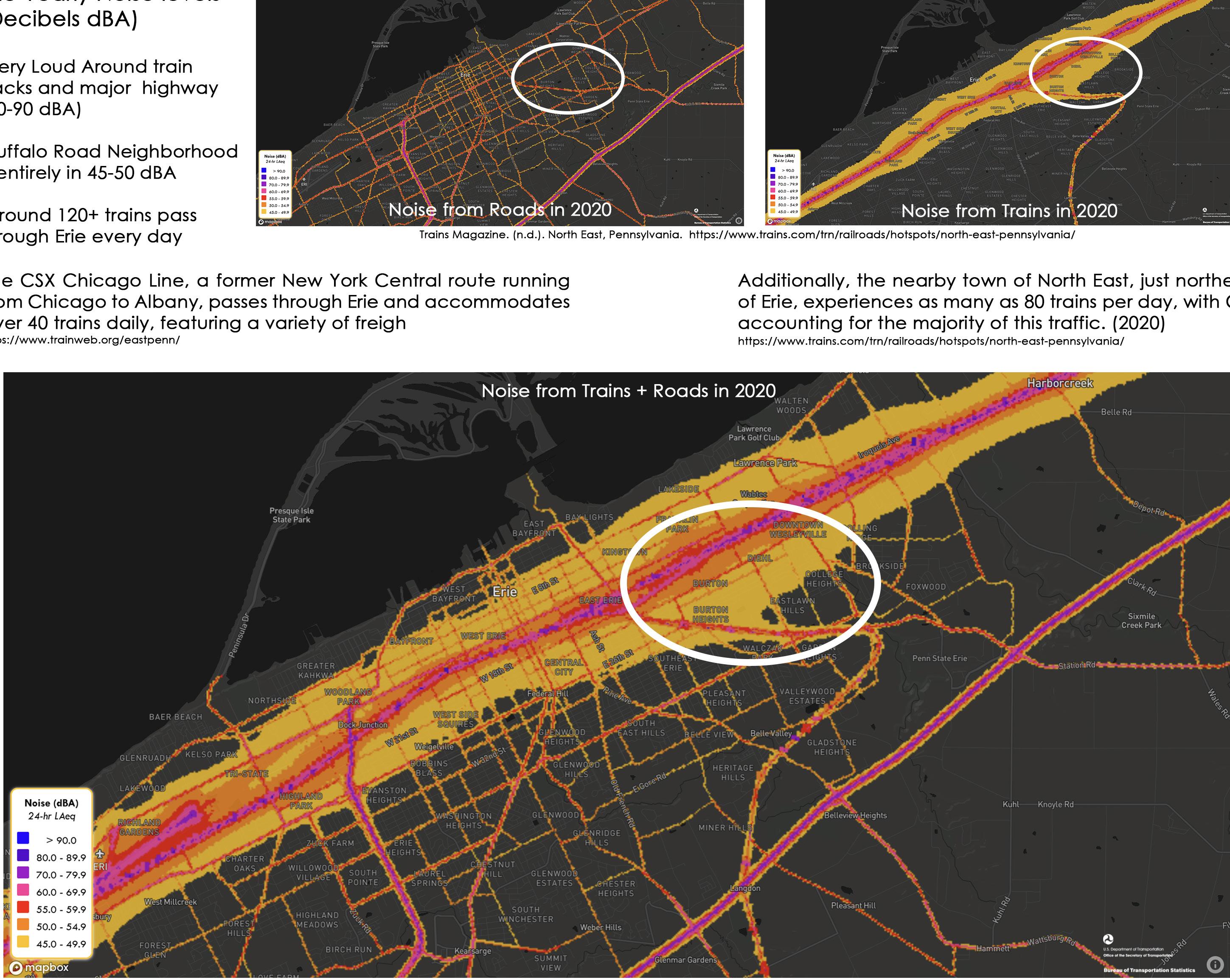
Noise Levels
Erie Yearly Noise Levels (Decibels dBA)
• Very loud around train tracks and major highway (70-90 dBA)
• Buffalo Road neighborhood is entirely 45-50 dBA
A noise level analysis highlights the intensity of sound generated by vehicular traffic surrounding the neighborhood and identifies opportunities for mitigating noise pollution. These findings directly informed the strategic placement of greenary in the Urban Design Proposal.
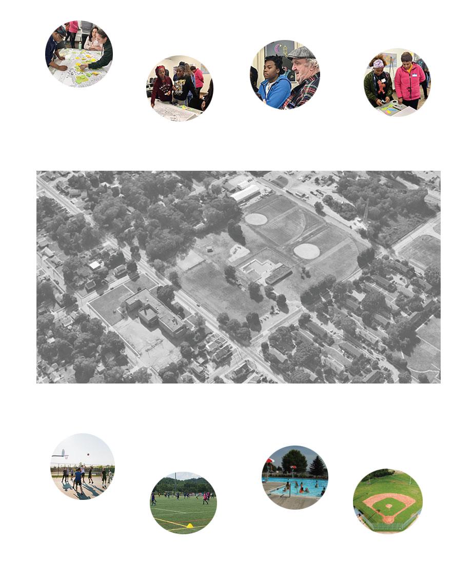
3 Community Engagement
Students and community members took part in two separate workshop sessions to collect data and share ideas. The first session was held via video conference and the second session was held in person in Erie. These sessions aided in understanding stakeholders’ perspectives within the community. The first session, on February 6, 2025, helped us understand the areas within the Buffalo Road neighborhood residents thought had potential or needed work. A SWOT analysis (Strengths, Weaknesses, Opportunities, Threats) and mapping exercises were the primary methods of data collection. The second session, on February 27, 2025, took place in the Urban Erie Community Development Corporation (UECDC) Center in the Buffalo Road neighborhood. In-depth activities developed the initial ideas and helped us specify programmatic, systematic, and environmental desires for the community. This data was collected through the use of a card-based activity, color mapping, and a “proximity of importance” activity.
February 6 Workshop
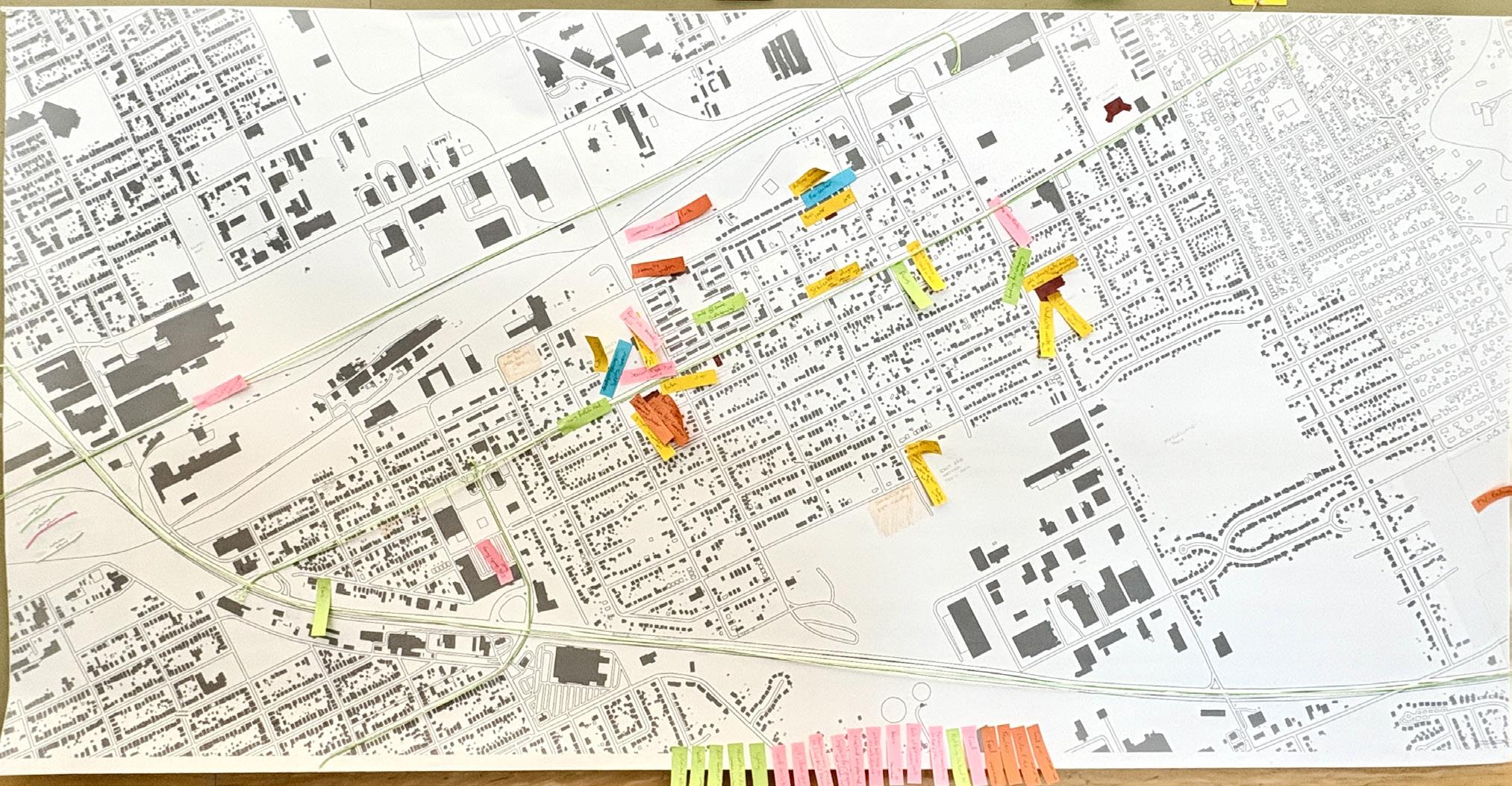
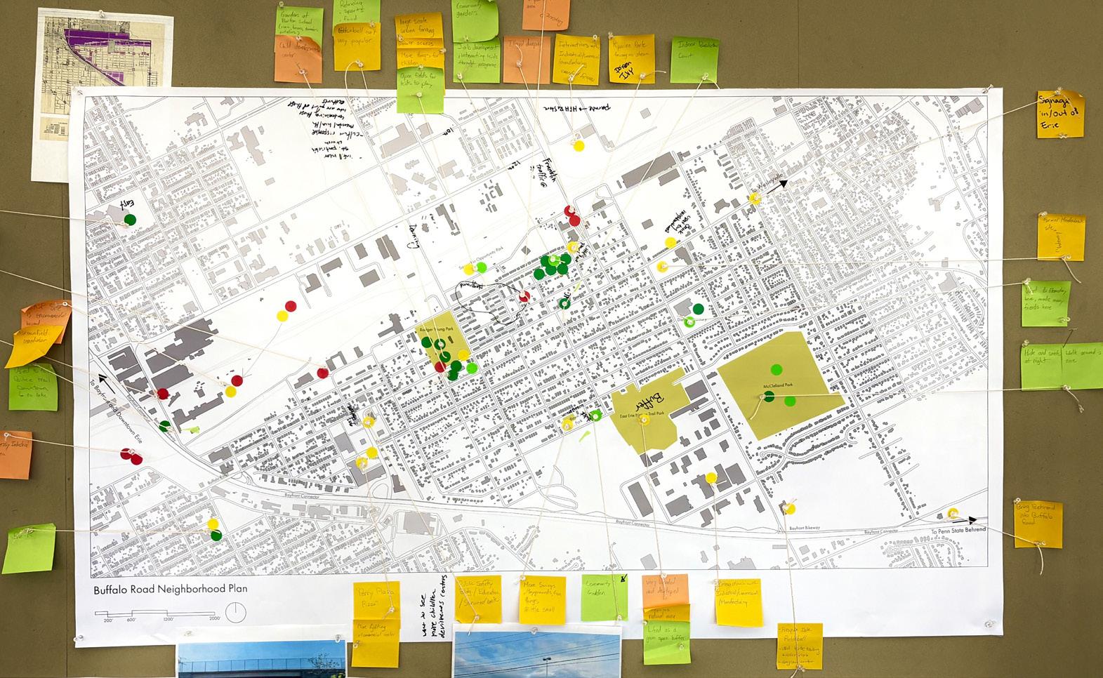
The online workshop had two parts: a question mapping activity and a SWOT analysis. The question mapping activity was comprised of five color-coded questions that provided “lenses” through which stakeholders could view the community and its spaces. Feedback from community members was noted on a neighborhood map, indicating locations for improvement.
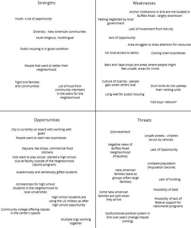
Furthering the mapping exercise, we conducted a SWOT analysis with the community to collect information about spaces as well as programmatic opportunities and desires. This information further clarified the community’s needs, providing distinctions between what works well, what doesn’t work, and what can be improved to better serve the community.
Initial Mapping of Community Needs
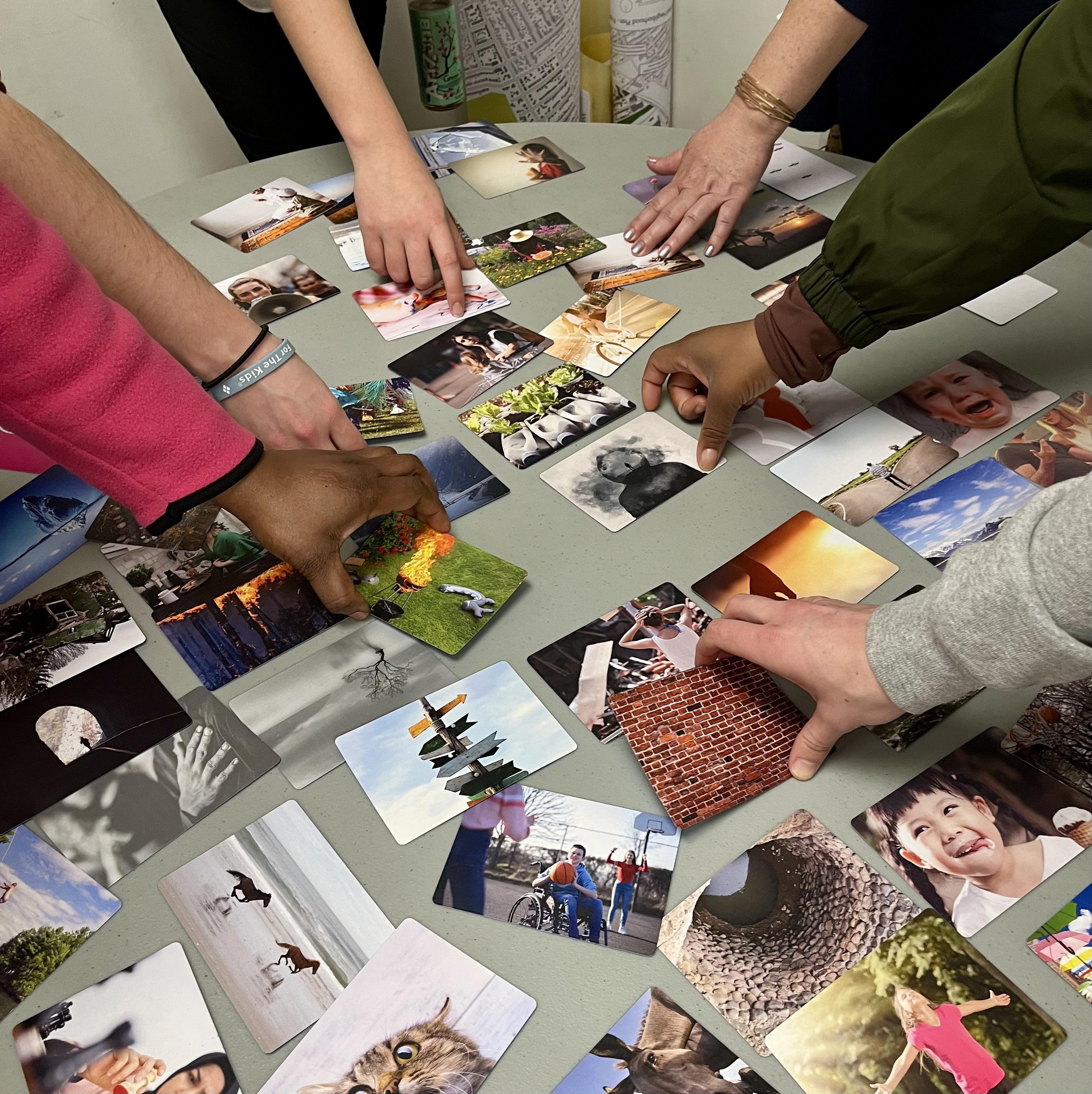
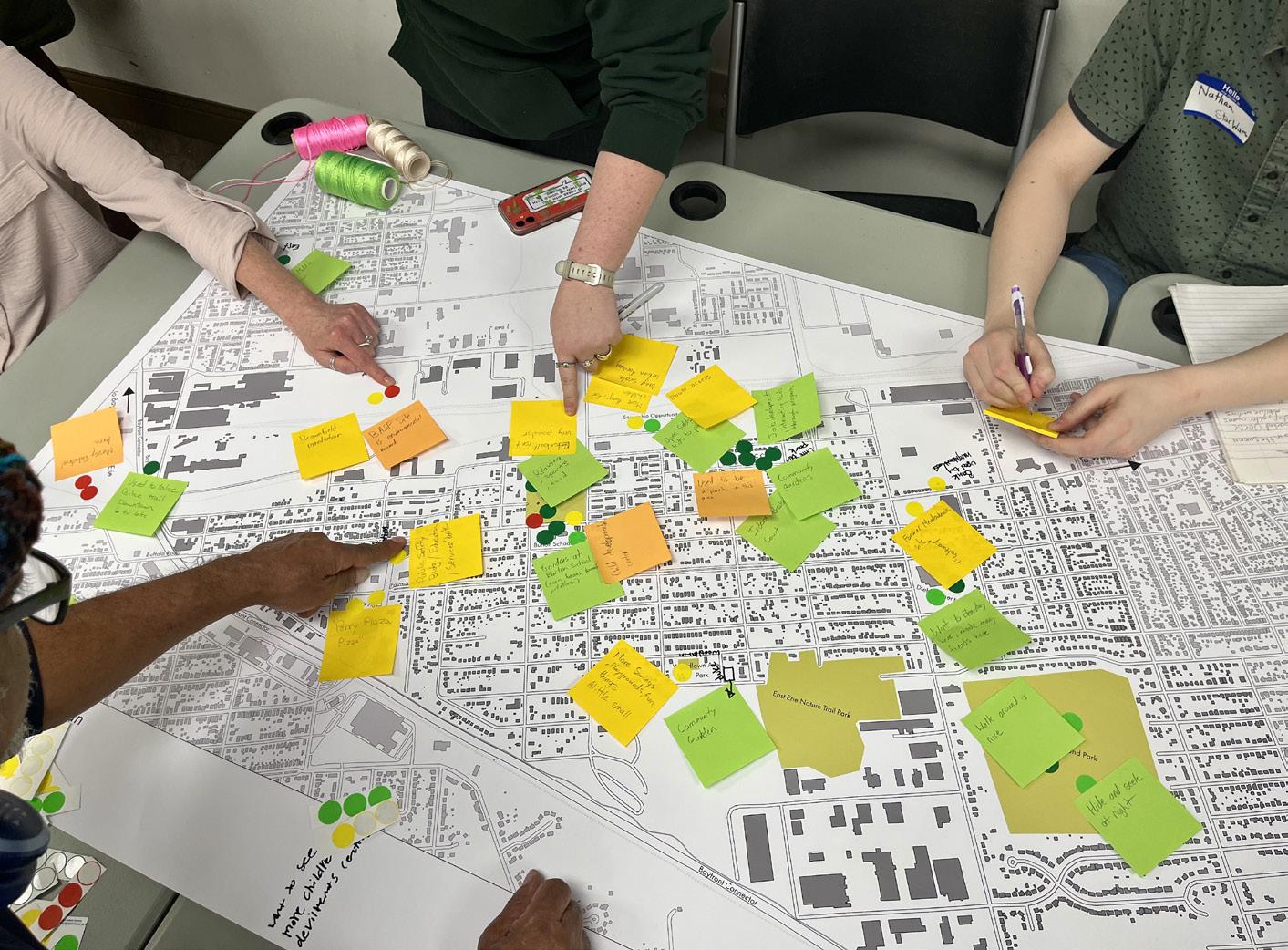
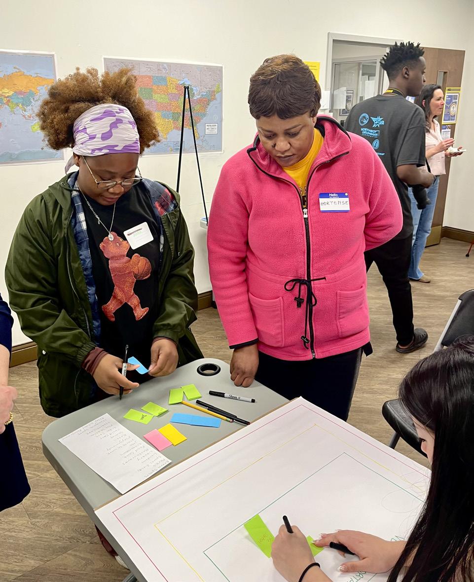
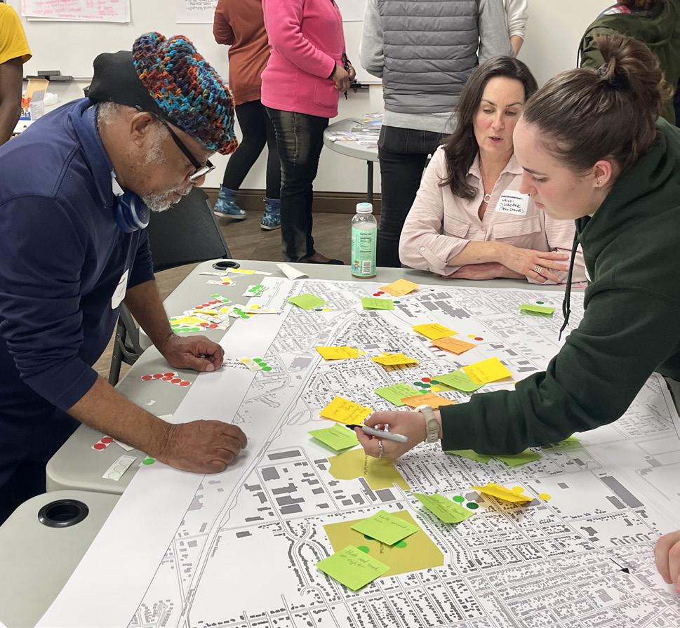
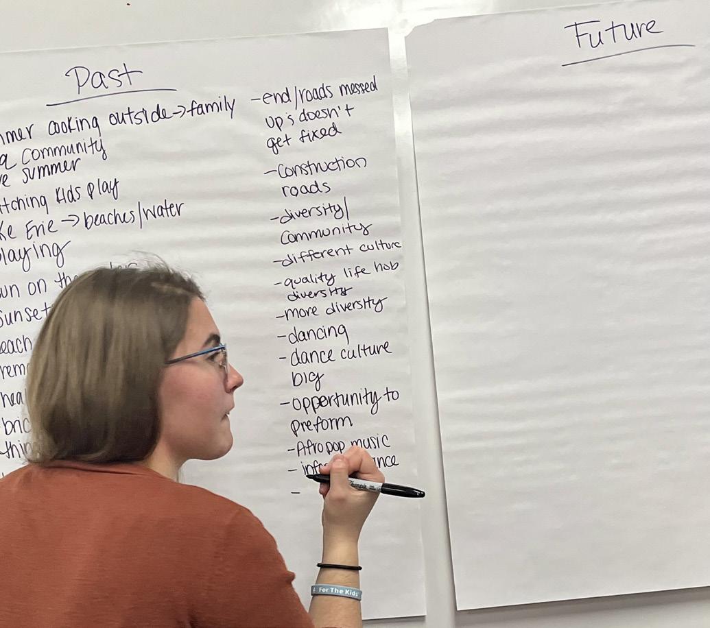
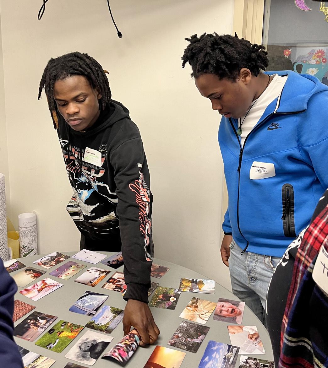
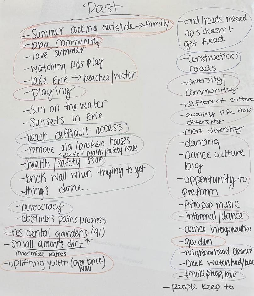
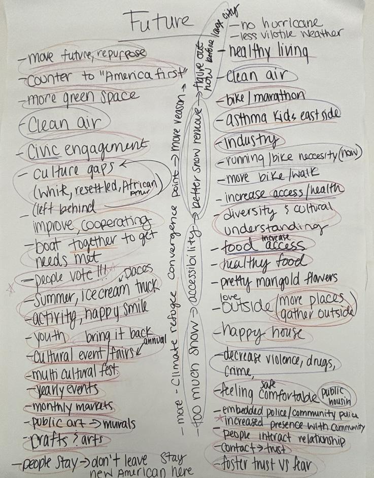
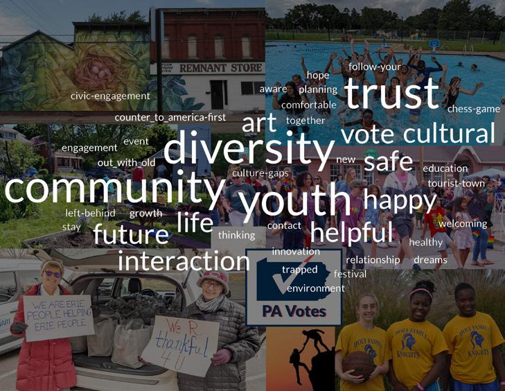
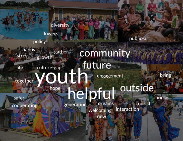
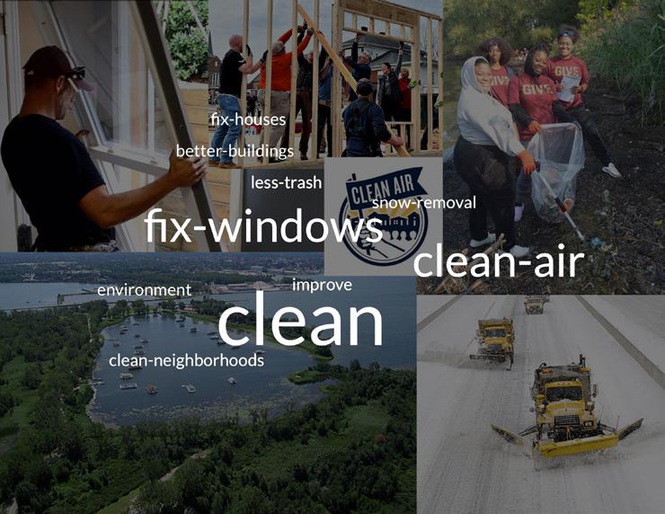
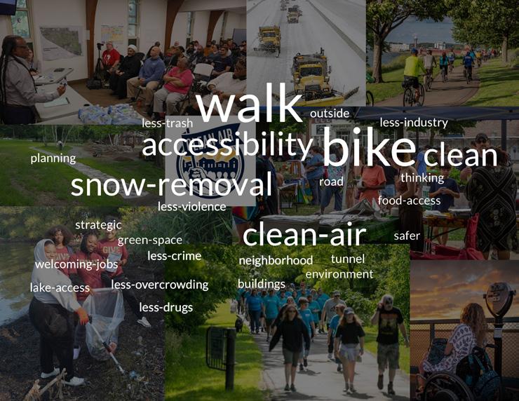
The in-person workshop held on February 27 at the UECDC center in the Buffalo Road neighborhood saw community members rotate through three different stations: a card-based activity, color mapping, and a “significance bullseye” activity. These activities offered important insights into the neighborhood. The card activity consisted of two parts: past-present and future. Participants were asked to select three cards with images that represented how they feel about and what they see in their neighborhood in the past-present and in the future. We documented their comments as they explained their thoughts, feelings, and emotions.
The color mapping activity documented the community’s impression of specific areas in their neighborhood. The colors corresponded to “good feelings,” “bad feelings,” and feelings of indifference about specific places. Red meant an area needs improvement, yellow that the area has potential, and green indicated areas that were community favorites or important in some way.
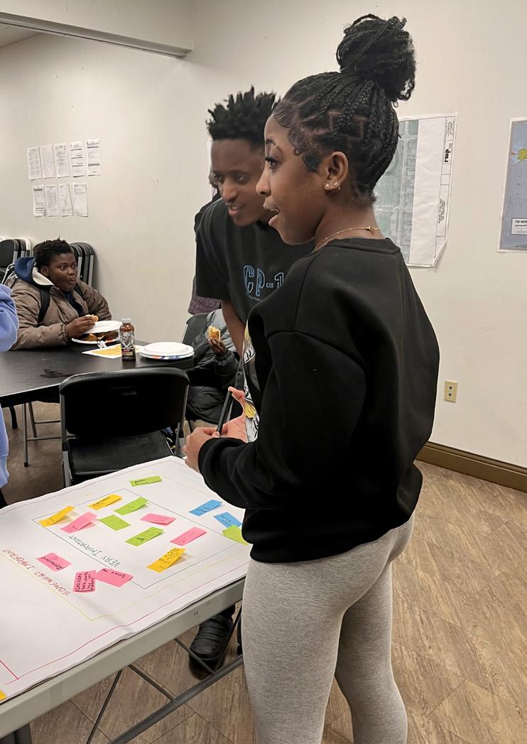
In the “proximity of importance” activity, participants ranked programmatic elements in a concentric format as “not important,” “somewhat important,” and “very important.”
Images above: Proximity of importance and color mapping activities. Images next page: Color mapping and card-sorting activities.
The data collected from the activities was compiled into formats that enabled analysis. The color mapping exercise provided spatial context for interventions and the card exercise notes for past and future were sorted into five categories: 1) perception of the neighborhood, 2) to be mended, 3) infrastructure, 4) community, and 5) activities.
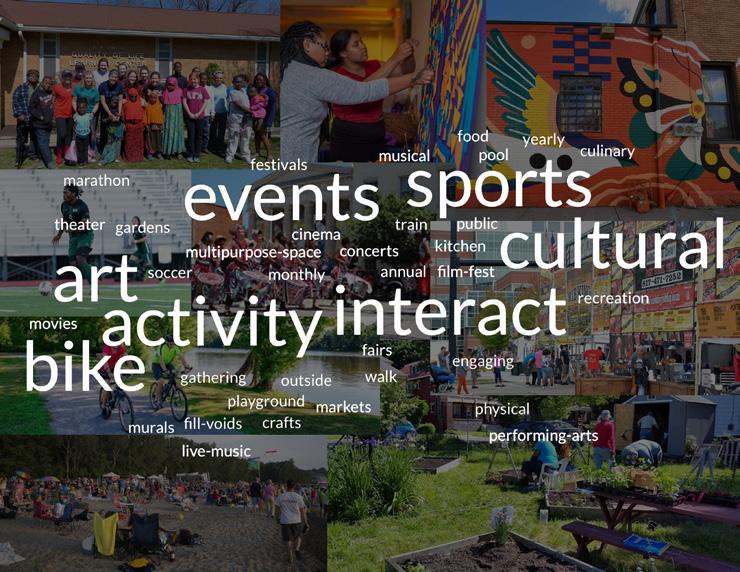
Words and phrases community members used were recorded on the notation pages and assigned one of the data categories. They were then tallied for frequency of use through a “word cloud.” The most important words and phrases for each of the categories were noted and became the basis for a design focus. The concepts uncovered in this exercise helped students determine design opportunities that would support, fix, and cultivate community amenities now and in the future, based on community values and desires.
Perception of the neighborhood
To be mended
Infrastructure
Activities
Community
4 Urban Design
Taylor Coulter, Arianna Davis, Ian Landers, Emma Lawson
Design Plan
Mixed-use Residential and Commercial
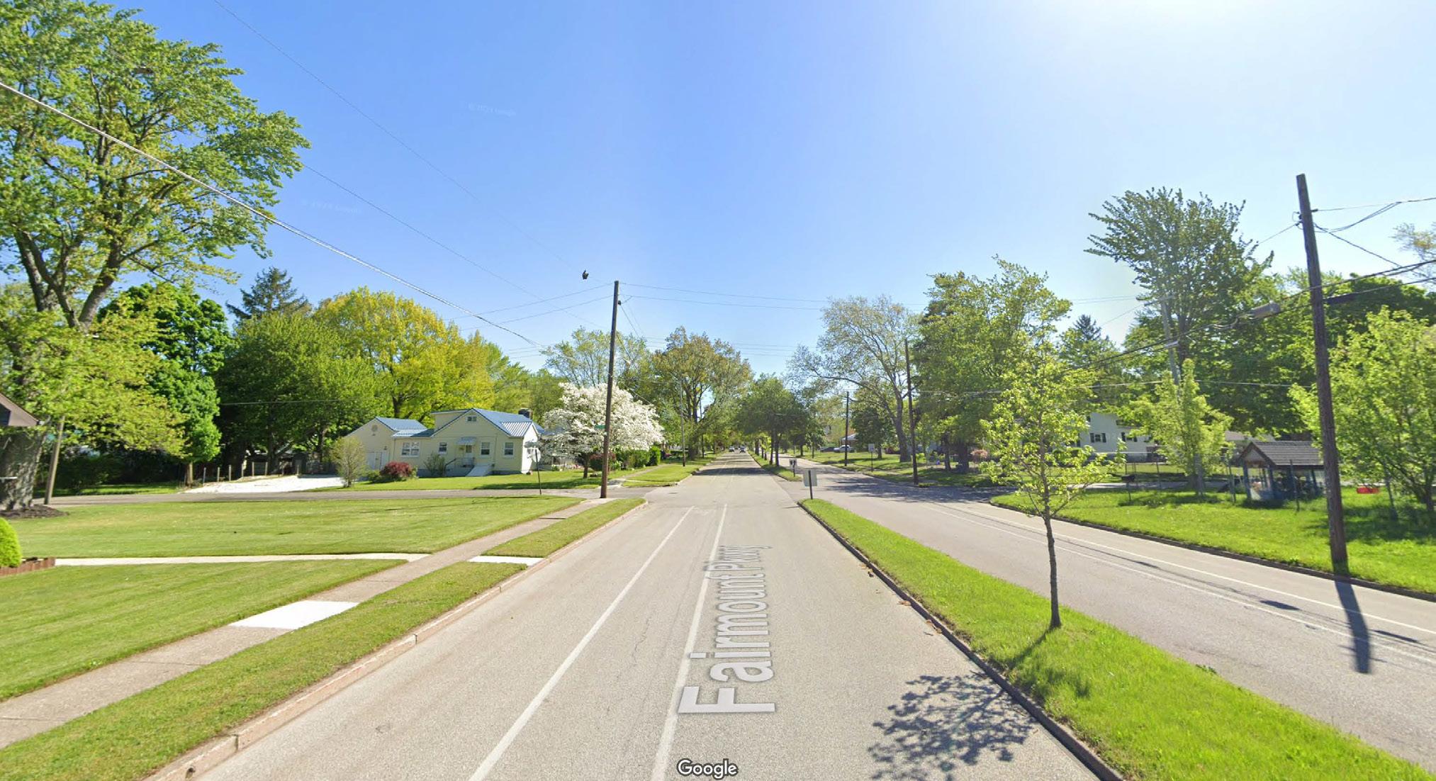
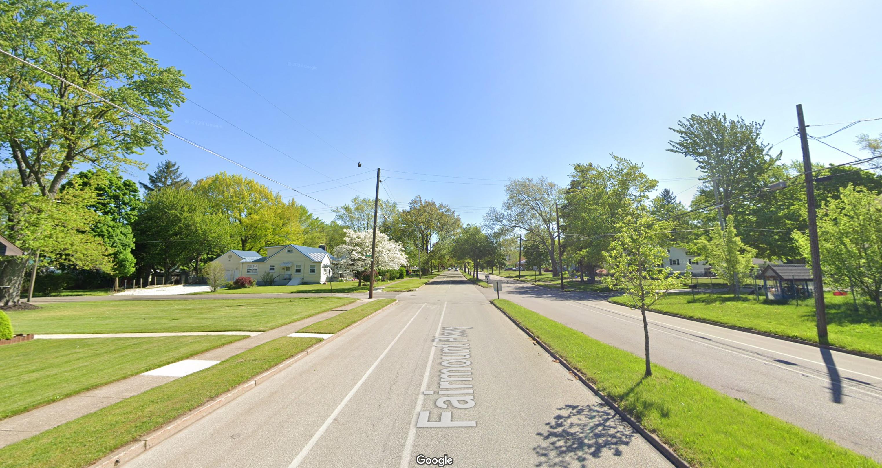
Fairmount Parkway
Fairmount Parkway is an important connector in the Buffalo Road neighborhood, running just a few blocks south of Buffalo Road, the major thoroughfare. Several streets in the neighborhood, including Buffalo Road, Broad Street, and East 12th Street, were labeled as dangerous for pedestrians to cross. Fairmount Parkway, however, offers an opportunity to be redesigned as a pedestrian-focused corridor that runs from Broad Street to Diehl Elementary School. Currently, Fairmount Parkway is a wide roadway with a bike lane positioned between on-street parking and traffic lanes, as well as a grass median dividing opposing lanes of traffic. The proposed redesign prioritizes safety for both pedestrians and cyclists. Street parking will be removed, as every house along the road already has its own driveway for parking. The bike lane will be repositioned next to the road verge, separated from traffic by a buffer. Travel lanes will be shifted to make room for an expanded central grass median that can serve as a shared space for walking and recreation.
Fairmount Parkway will primarily serve local traffic, while Buffalo Road will continue to prioritize heavier through-traffic. This approach will help differentiate the two streets and transform Fairmount Parkway into a safer alternative for pedestrians and cyclists.
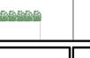
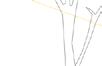
Fairmount Parkway Before
Fairmount Parkway After
Fairmount Parkway Before
Fairmount Parkway After
Transportation
The neighborhood redevelopment plan focuses on creating safer, more accessible routes for walking and biking, for those without access to car travel. Strategic improvements will be made in areas where people frequently gather, such as near new hubs, schools and parks. New bike lanes will be added with clear separation from vehicle traffic, while sidewalks will be upgraded with green road verges and planted trees. The goal is to build a network of greenways, sidewalks, and bike lanes that support safe transportation throughout the neighborhood.
Biking Routes
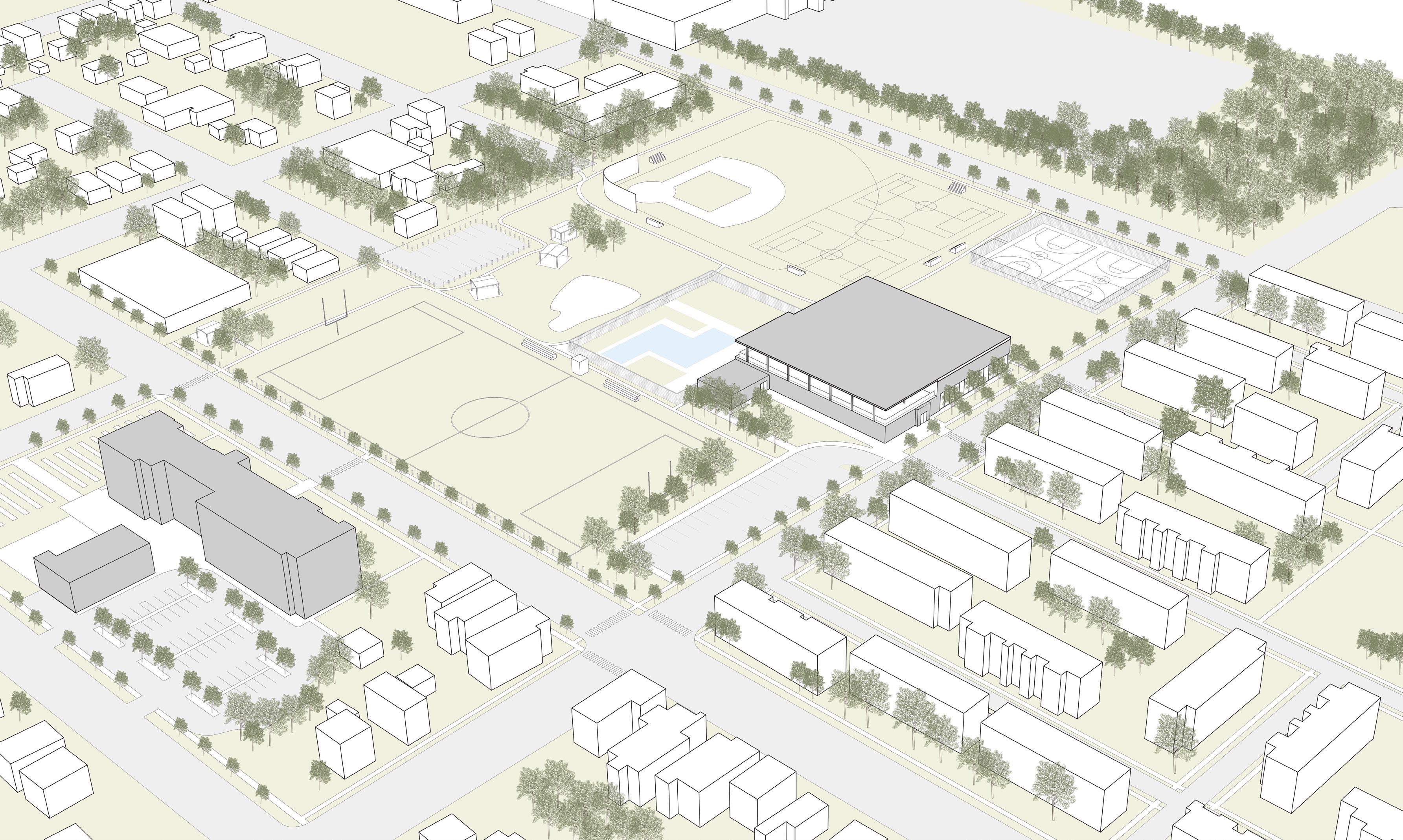
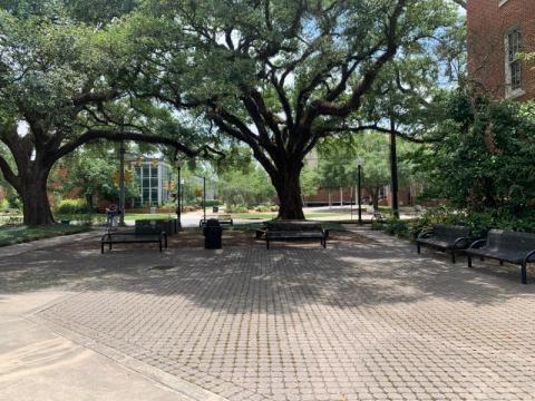
4.1 Rodger Young Park
Emma Lawson
Rodger Young Park is a community anchor on Erie’s east side, serving as both a recreational hub and a social gathering place for the Buffalo Road neighborhood. The park is on Buffalo Road and directly across from the historic Burton School, which is currently undergoing a major renovation to become a new neighborhood center. The park thus has potential to play an even greater role in community life. Families regularly gather here to watch their kids play soccer or football games. The park also has baseball fields, a shaded picnic area, basketball courts, and an outdoor swimming pool with pool building run by the YMCA. As the area around it evolves, there is an opportunity to reimagine Roger Young Park based on community needs.
Families come to the park to watch their kids play soccer. Soccer is the preferred sport among New Americans.
More sports elds and indoor eld wanter.
“There isn’t enough to do in the Park.”
The Basketball courts
Existing sports eld. Not correct
Partnership with Erie Sports and International Soccer club of Erie. Possibility of opening U5 league.
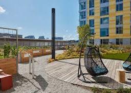
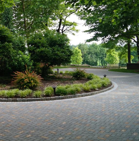
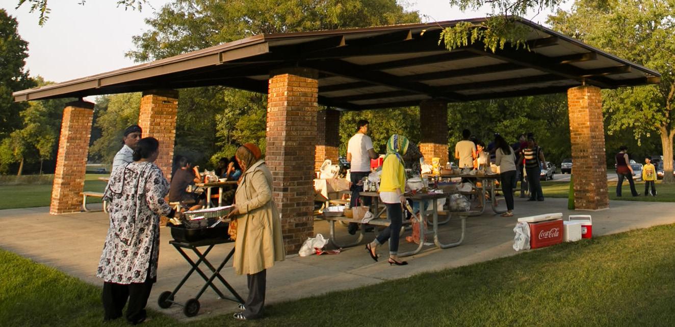
People like to eat lunch, have a picnic, and barbecue at the park. There is currently one covered pavilion.
People love the green space and the owering trees planted at the park.
Pool and pool building run by YMCA during the summer. The program runs from June-August for ages 6-18 and includes free lunch.
Two existing baseball elds. Recieved feedback that one can be removed.
There is an interest in keeping one of the elds. It is also used for a league
need to be cleaned up.
size for full size soccer.
Extend Parking and Picnic Area.
Remove 1 Baseball eld and improve the in eld on remaining Baseball eld.
New U10 (7v7) and U5-U8 (4v4) Soccer elds overlapping with Baseball out eld.
Move Basketball Courts to be closer to HUD Housing.
Use extra space to make eld the correct USA standard for 11v11 soccer.
Create a network of paths for walking and to connect neighborhood.
Proposed Conditions
Remove Pool Building and replace with new larger YMCA building for extended opperation during Fall-Winter.
Inside new Facility: Indoor 3v3 soccer for U5 or skill training, indoor Basketball hoops, classrooms.
Site Selection shown in Neighborhood Context
Context Plan
Burton School
Roger Young Park
HUD Housing
Savacchio Park
Connections to Roger Young Park
A key aim of the urban design was to connect Roger Young Park to the surrounding neighborhood. To the west, a new Service Hub offers new resources, while the east side features a new Cultural Hub and the HACE Harbor Home Apartments. Currently, East 19th and 20th Streets end at the park’s boundaries.
Extending these routes through the park via walking paths helps establish a continuous connection between the Service and Cultural Hubs. Additionally, an internal path system within the park promotes movement throughout the space.
Movement through Roger Young Park
Program Diagram
Indoor Sports Facility Ground Floor Plan
DENTIST/RES.
MEDICAL EDUCATION BUILDING
COMMUNITY GARDEN
DAYCARE/RES.
URGENT CARE
PHYSICAL THERAPY
Taylor Coulter
As part of the Urban Design Plan, the Services area was created to provide neighborhood access to facilities that the community needs and would benefit from. Community members had stated that health and wellness facilities were not accessible to the neighborhood.
The new Services area is intended to provide health and wellness, education, a community garden, as well as residencies.
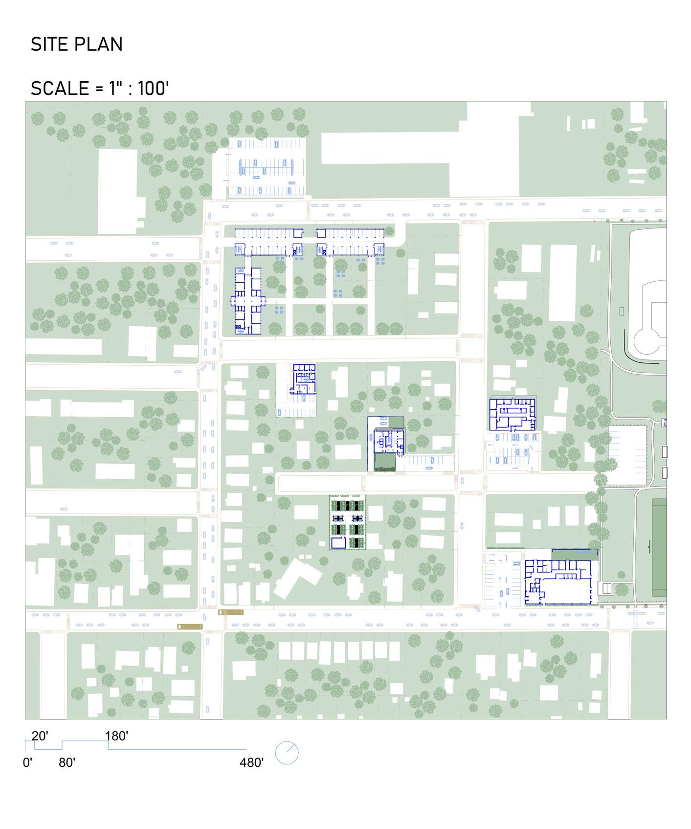
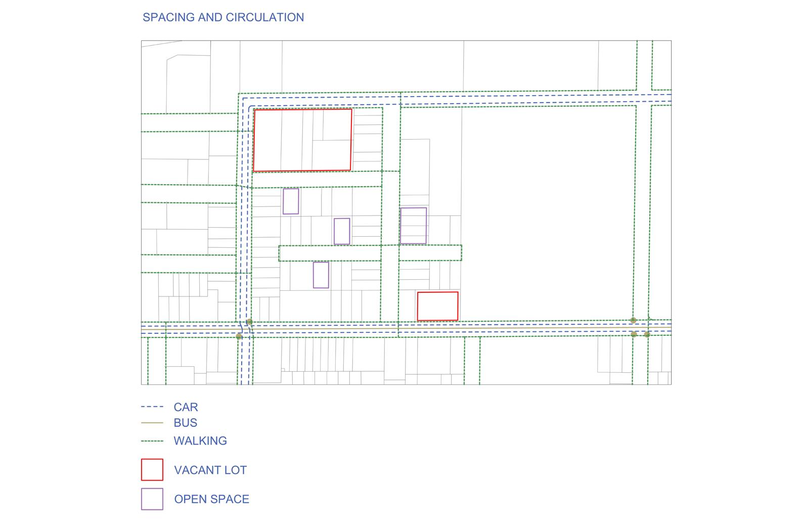
Site selection was determined based on the site’s promixity to Rodger Young Park, the Burton School, and Buffalo Road. Services were inserted into the many vacant lots within the area. Our goal was to create spaces the community needed while working with pre-existing conditions.
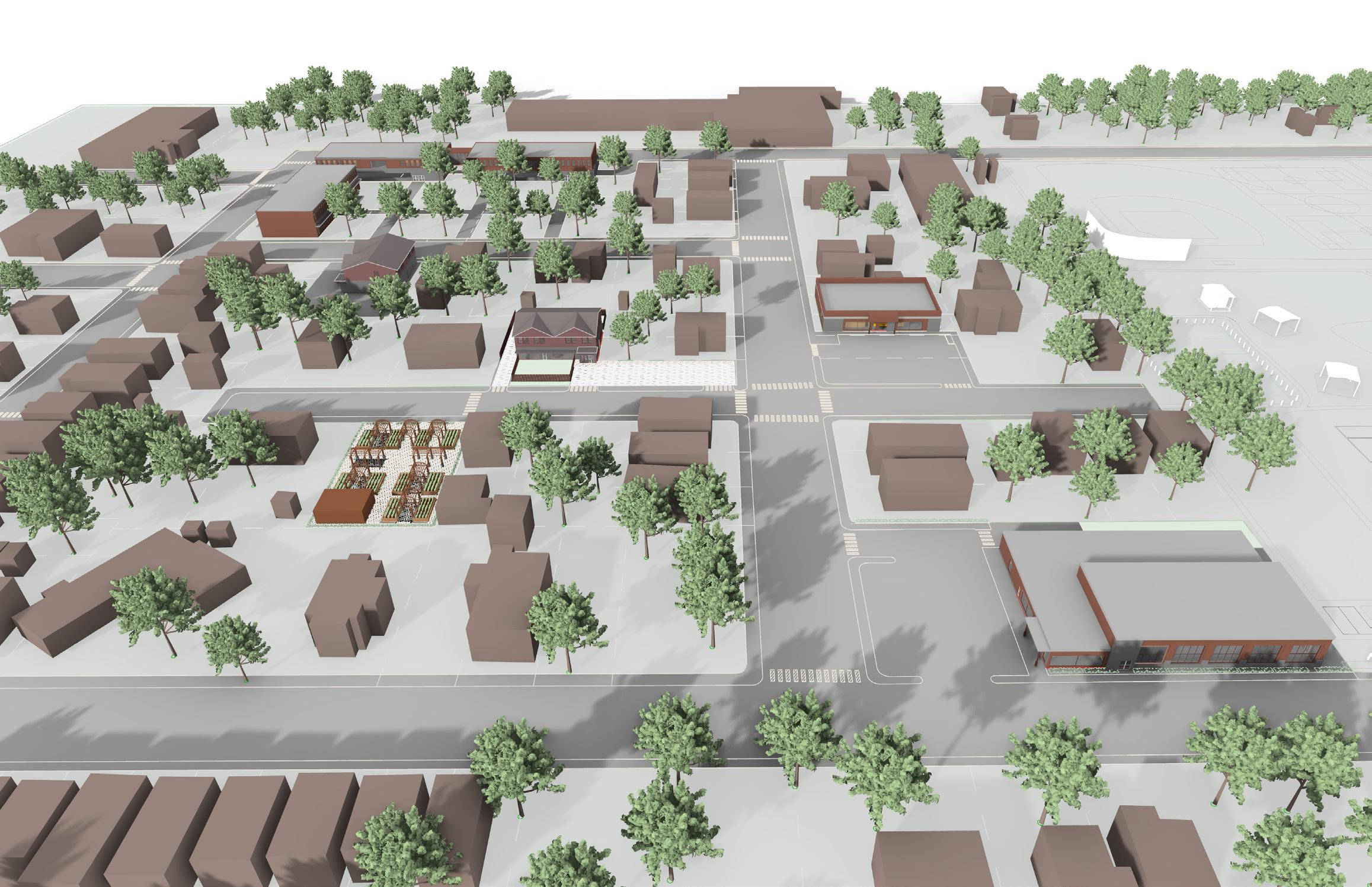
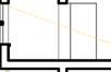
The Service Area site plan shows building placement within the site. Buffalo Road is located to the south and Rodger Young Park is to the east. The cars in the image indicate streets meant for traffic, compared to the rest of the neighborhood where walking/biking would be the main mode of transportation. Bus stops are displayed in yellow
A medical educational facility (top left) was placed in a larger vacant lot.
A Physical Therapy Building (bottom right), is located near Rodger Young Park and Burton School. This allowed connections to the park and to medical and wellness facilities planned for the Burton School community center.
A dental office and childcare facility round out the plan.
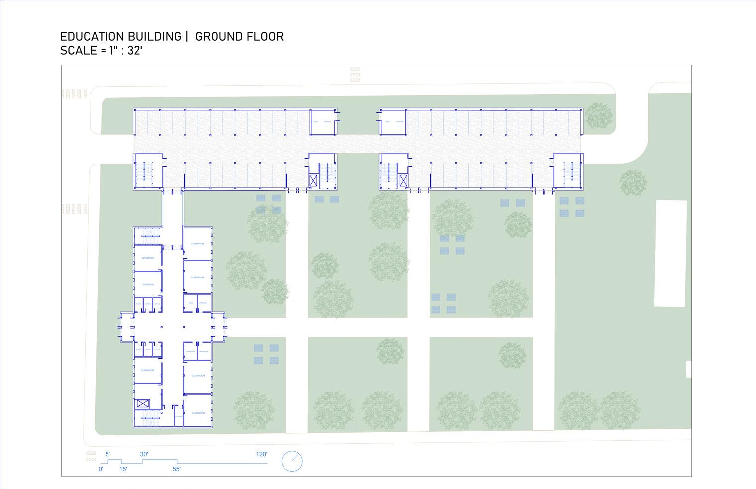
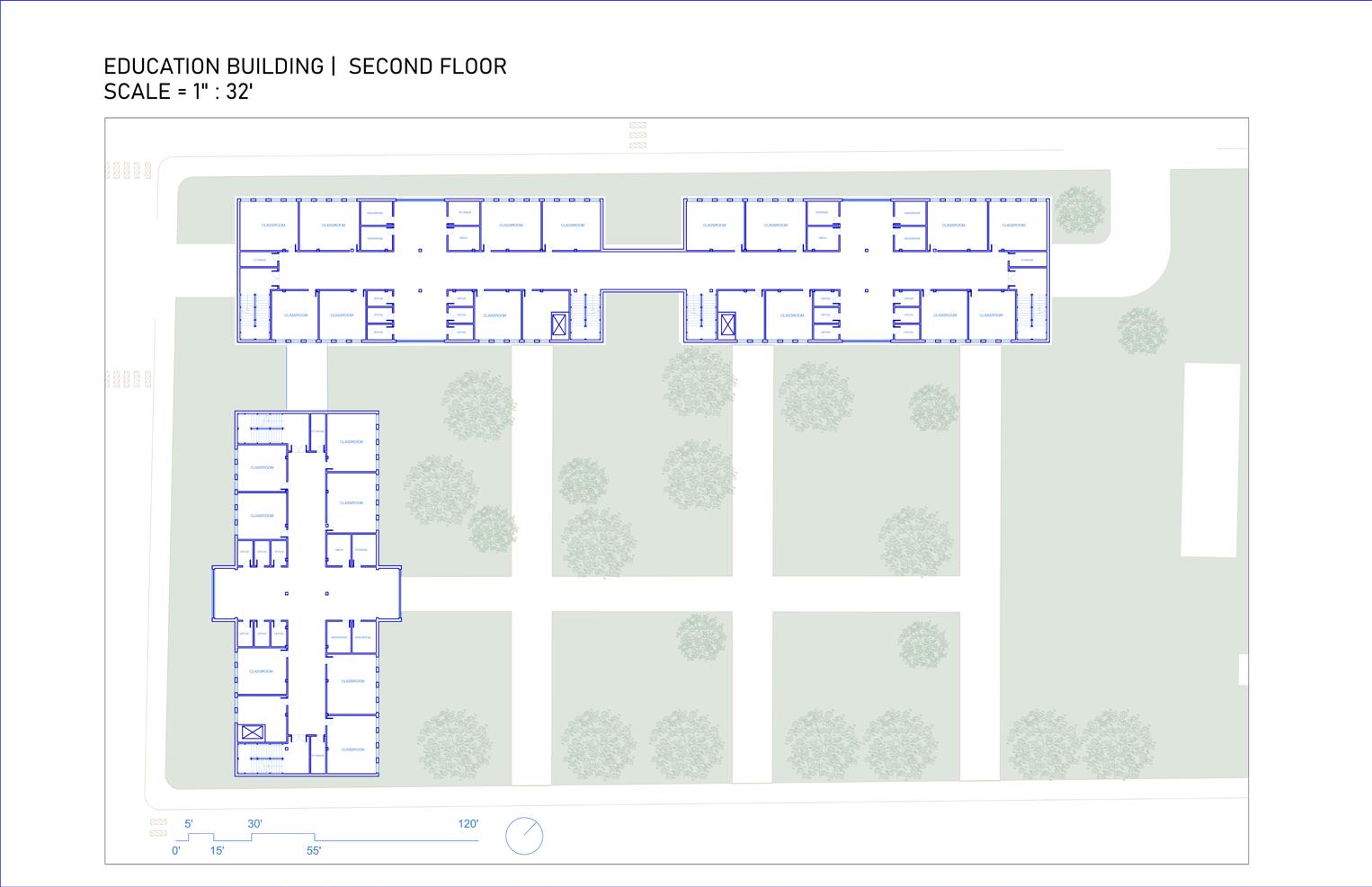
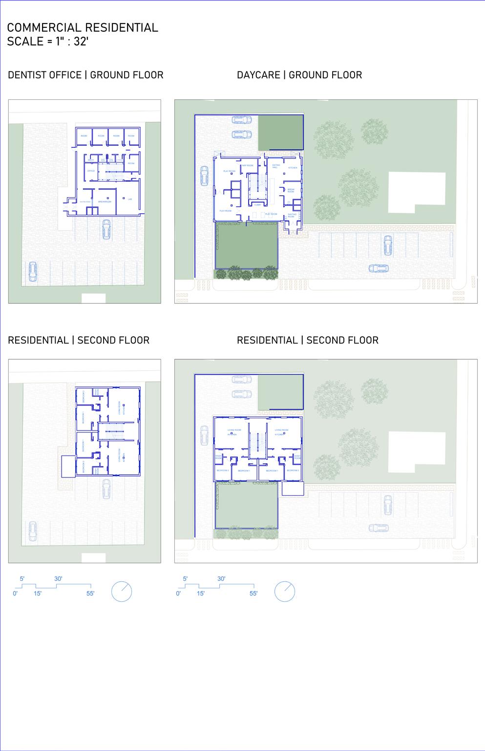
FLOOR PLANS
Education Building.The education building
floor plans display a possible placement of spatial qualities along with a parking garage meant for students and educators.
COMMERICAL/RESIDENTIAL
A commercial-residental building provides medical and child care centers missing in the area. Including residencies was based on on the lack of affordable housing for workers in the area.
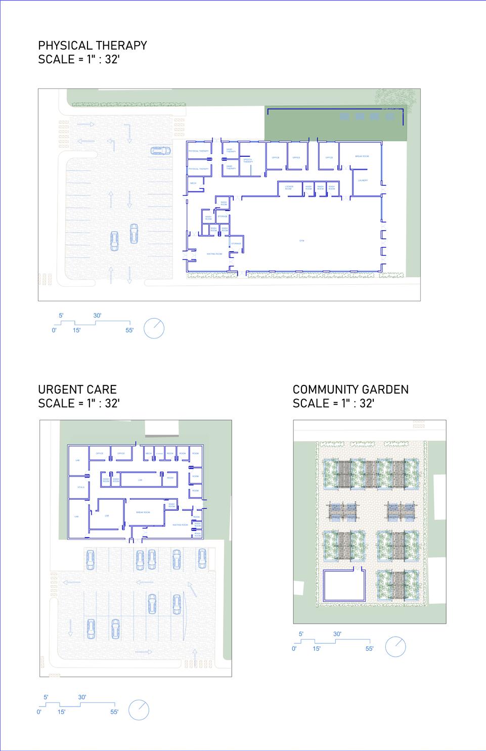
HEALTH AND WELLNESS
Physical therapy and Urgent Care facilities are designed to serve community needs.
GARDENS
Community gardens were placed in a current vacant lot. Such lots could be used as spaces that allow community members to further shape their own surroundings.
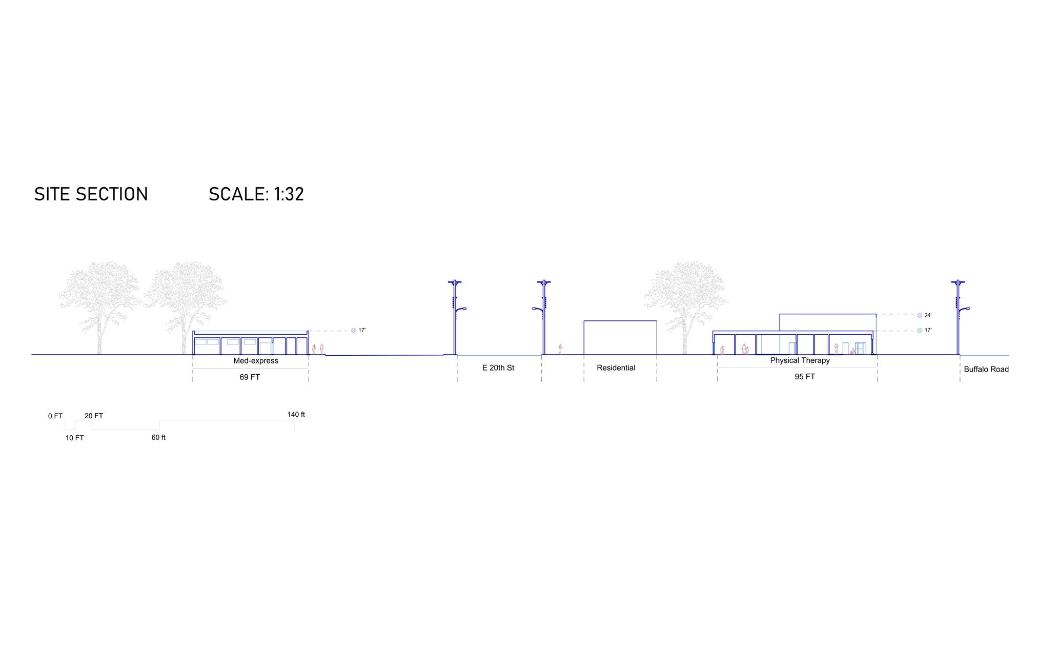
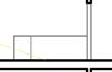
The section shows the medical facilities in conjunction with the roads, showing context within the drawing. The Urgent Care facility (hypothetically named “Med-Express”) is shown, as is the Physical Therapy. building.
Diagram of vacant lots and circulation through the site.
A birds-eye view of the Services Area with part of Rodger Young Park shown for context. The design goal was to allow the buildings to blend in with the surrounding area, allowing for new structures without taking away from the original neighborhood community.
Perspectives of the Daycare/ residential buildings, along with gardens.
Urban plan of the Services Area with surrounding context.
4.3 Cultural Hub
Ian Landers
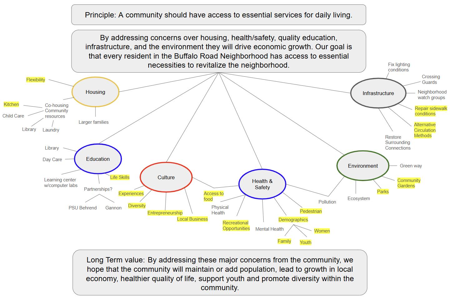
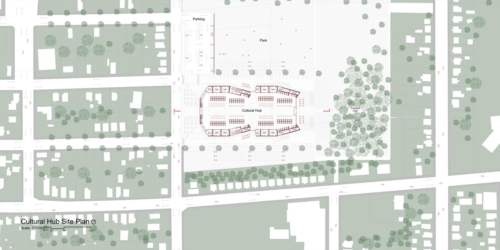
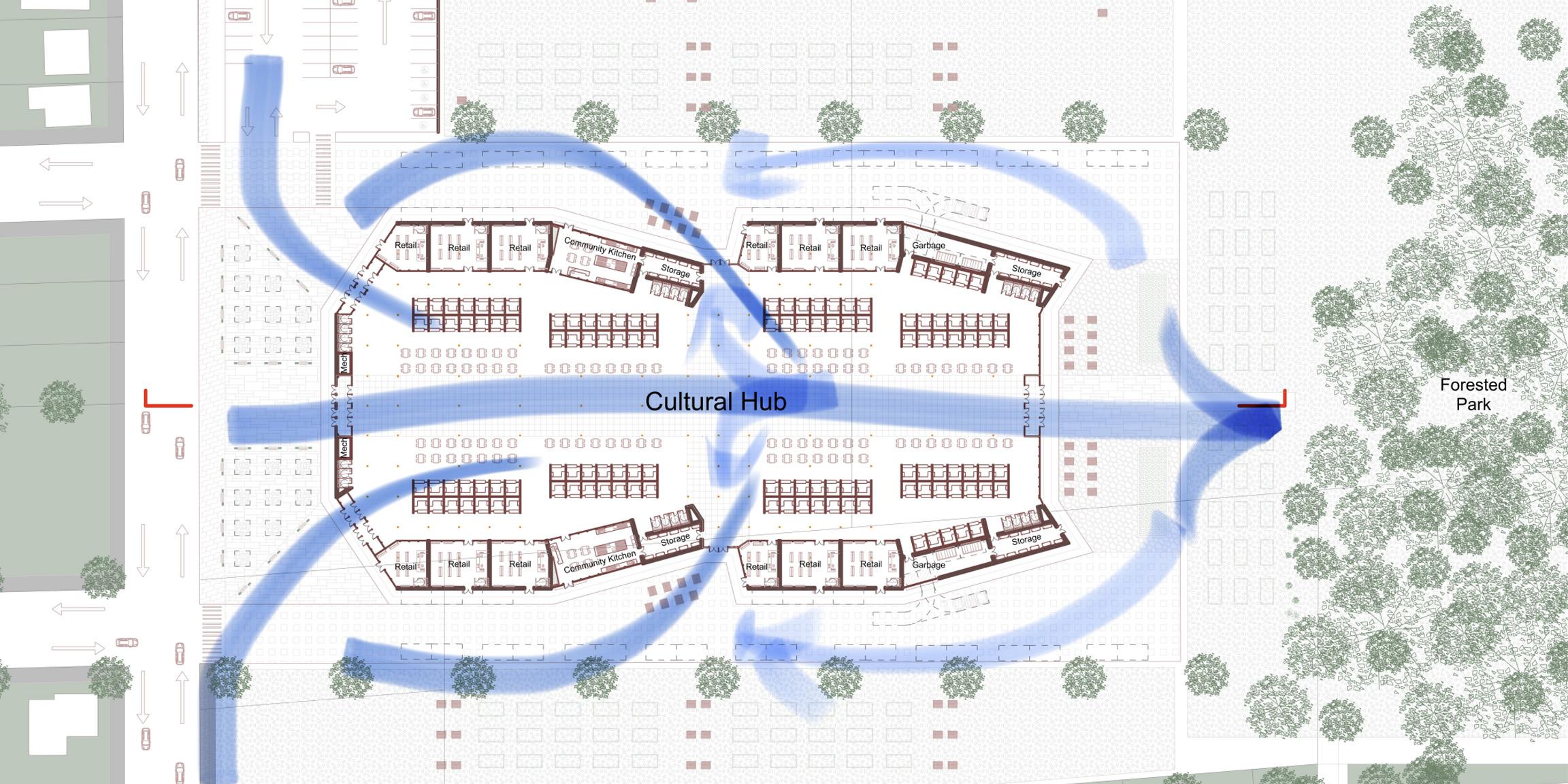
As part of the studio’s urban design revitalization plan, the Cultural Hub was conceived as a space to celebrate local culture with a strong emphasis on food, directly reflecting community feedback from Buffalo Road Neighborhood residents. The Hub is intended to serve as a vibrant destination, drawing visitors both from within and beyond the neighborhood, thereby generating economic activity and supporting community development. The site was strategically located in the northeastern portion of the neighborhood—a zone identified as lacking in commercial activity and food access. This location also offered sufficient space for the building with minimal interference to exisitng conditions. Good visibility and connectivity to the main road that circulates through the neighborhood enhance accessibility to the site.
The Cultural Hub’s design is directly informed by community feedback, shaping core concepts, programmatic elements, and guiding principles. This diagram illustrates how each principle is identified through public input and is then reflected in the design process of the building and its spaces.
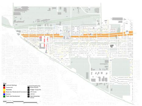
The plan shows how the Cultural Hub integrates the existing site context with the proposed building and landscape design, highlighting connections to surrounding streets, green spaces, and pedestrian pathways.
Cultural Hub Building Plan
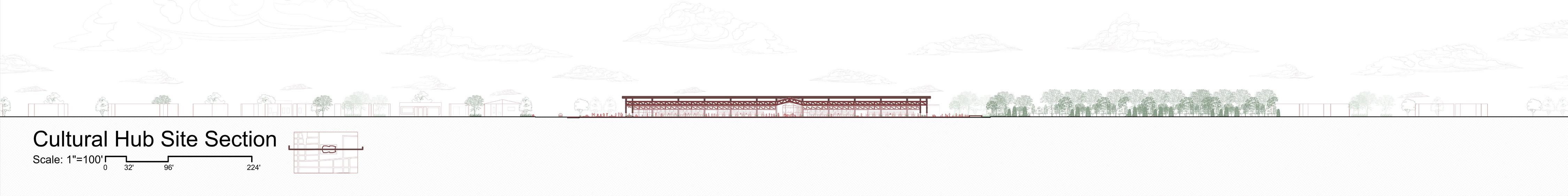
The Cultural Hub Plan shows the overall spatial layout and architectural form of the structure, while also conveying its relationship to the immediate natural and built context of the site. The modular building is designed to be expandable if more space is needed in the future.
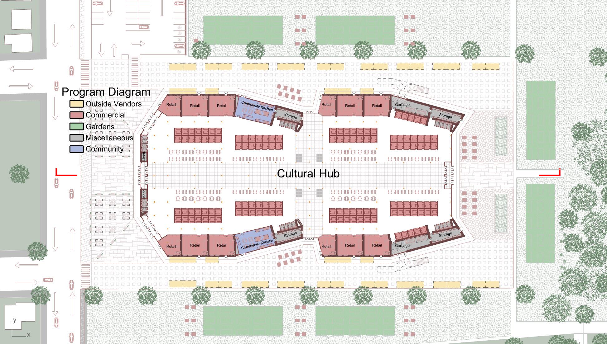
The Cultural Hub Program Diagram breaks down the proposed spaces into functional categories, each represented by a color to indicate spatial relationships and similar programmatic uses within the plan.
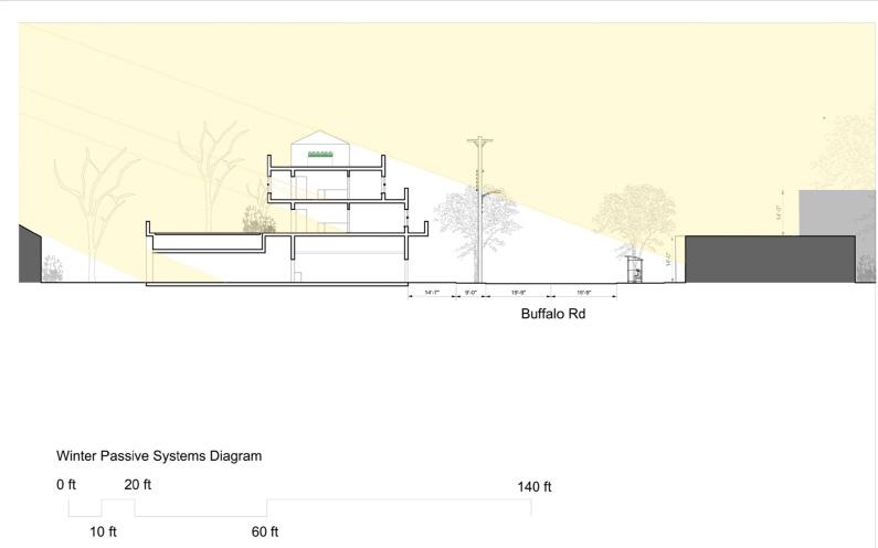
Cultural Hub Building Section
Scale: 1"=32' 0 8' 24' 56'
Cultural Hub Detail Section
Scale: 1"=16' 0 4' 12' 28'
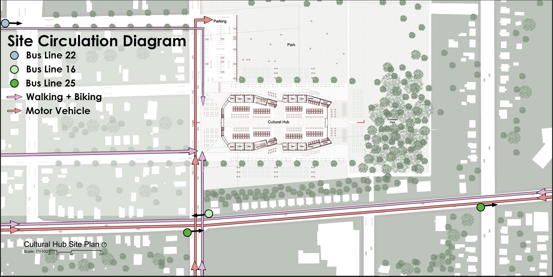
The Site Circulation Diagram illustrates the primary access routes and directional flow leading to the Cultural Hub, highlighting the key methods of arrival and movement through the surrounding area.
This Circulation Diagram informs the building’s façades, which are designed in direct response to site conditions. The front entrances are angled to align with the primary flow of users arriving on foot or from the parking lot, while the side entrances facilitate seamless movement between the building and its existing site.
Visitors are guided through the interior spaces before being directed toward the rear exit, which opens onto the park and garden areas.
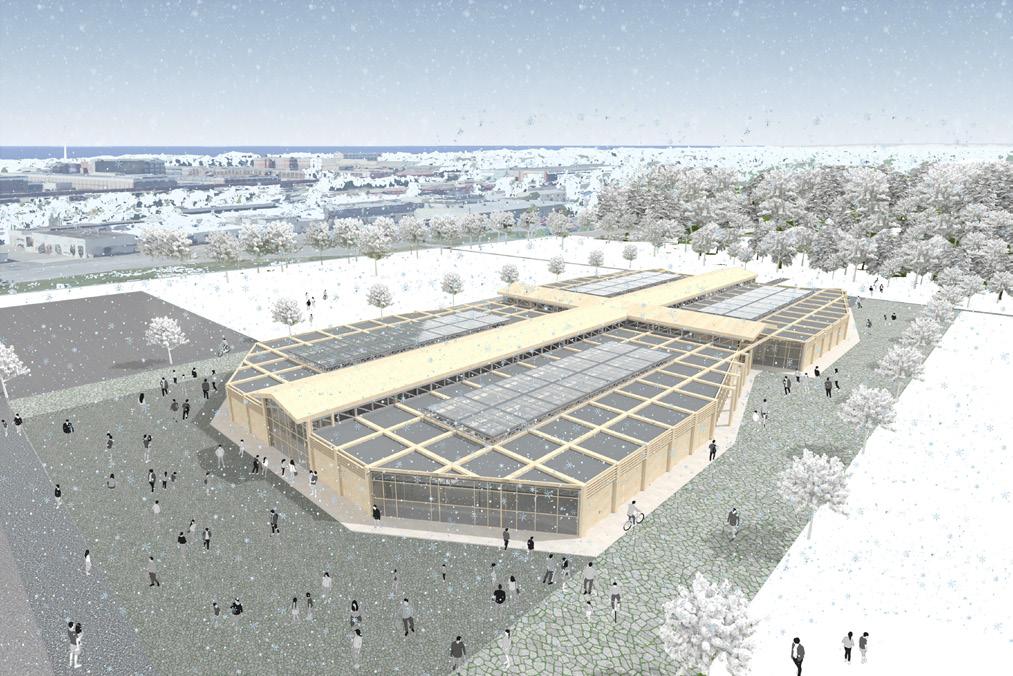
Overhead Perspective
A bird’s eye view of the Cultural Hub during the winter season captures the existing site conditions in relation to the building, highlighting its contextual placement alongside the expansive open fields and adjacent park. It also shows the paths that guide users into and around the Hub, emphasizing its integration into the surrounding landscape.
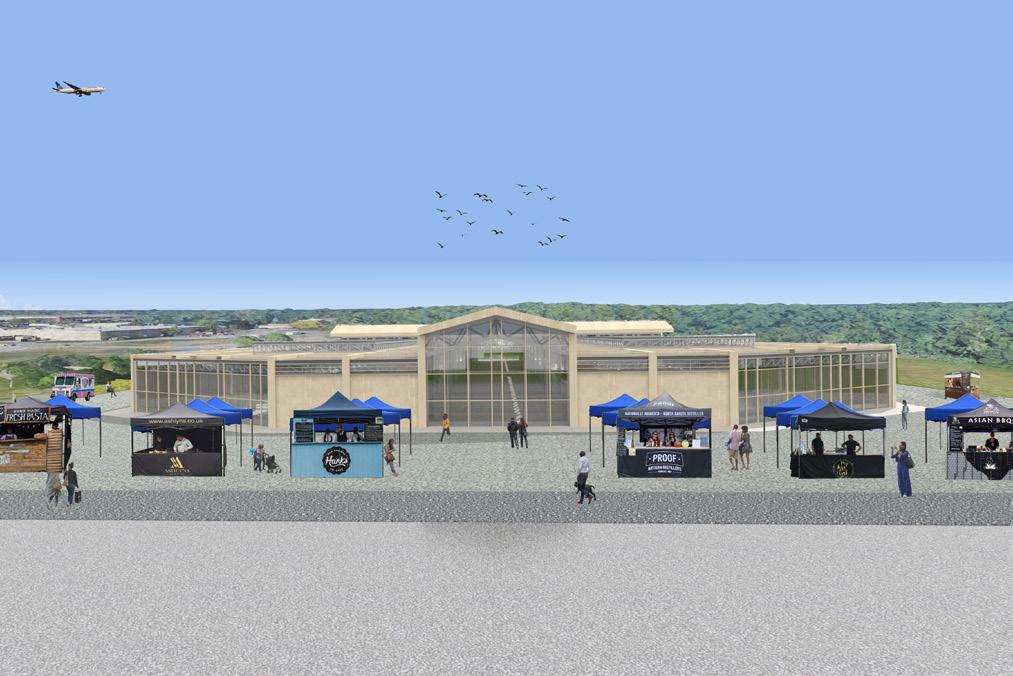
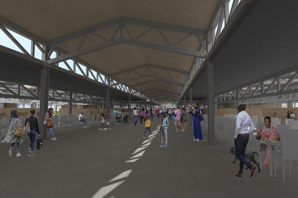
There are three distinct entrances at the front of the Cultural Hub with two angled at the side and one facing the road. The front area offers ample space for temporary stalls to be set up during favorable weather conditions, enhancing visibility into interior activities and fostering an inviting, engaging atmosphere for the public.
The interior features a generous circulation space at the center, allowing users to move freely. Seating and vendor stalls are positioned along the periphery. Skylights allow natural light to penetrate the structure, providing illumination and creating a welcoming environment.
Interior Perspective
Front Facade Perspective
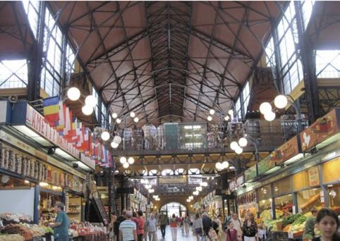
Budapest, Hungary
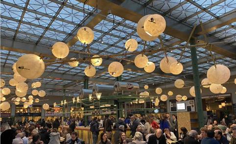
Brussels, Belgium
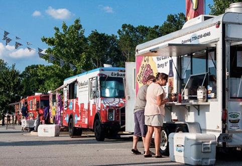
Georgia, U.S.
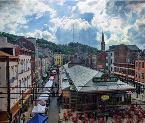
Cincinnati, US.
Cultural Hub Precedents
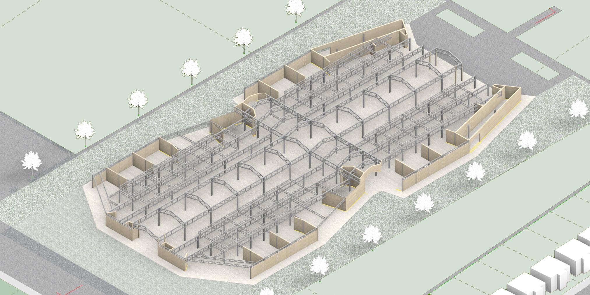
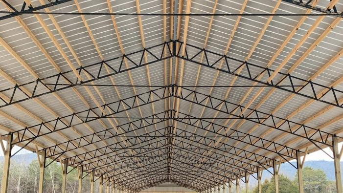
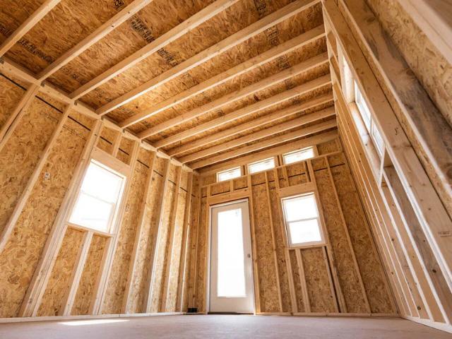
The Structural Diagram of the Cultural Hub shows how the wood stud load-bearing walls, steel beams, and trusses function together to provide structural stability while defining the building’s form.
Existing Conditions
4.4. Buffalo Road Corridor and Mixed-use
Arianna Davis
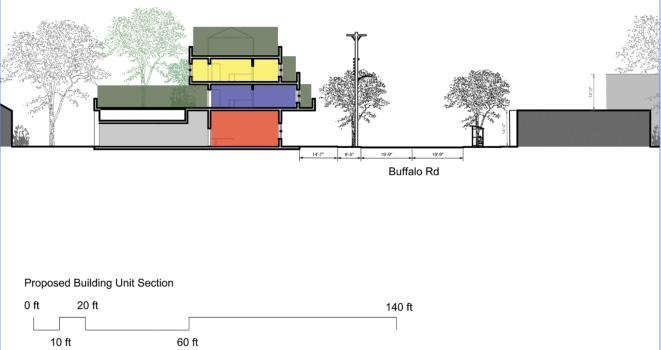
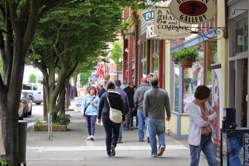
Part of the our proposed urban revitalization plan saw Buffalo Road as a commercial and residental mixed-use corridor. There are currently many vacant lots or structures in poor condition along Buffalo Road. The open spaces and demolition of buildings beyond repair provides an opportunity to create density through new infill units. The proposed units follow a modular sustem that allows them to be inserted as needed along Buffalo Road.
Mixed-use housing along Buffalo Road is designed to offer cohousing opportunities, where residents share common areas. The area has many larger families, multigenerational families, elderly residents, and single parents. This provided an opportunity to rethink what housing can look like and to shape housing that is flexible enough to support different household types. By having accessible jobs in proximity to community-based housing, single parents can more easily saccess child care, jobs, and housing.
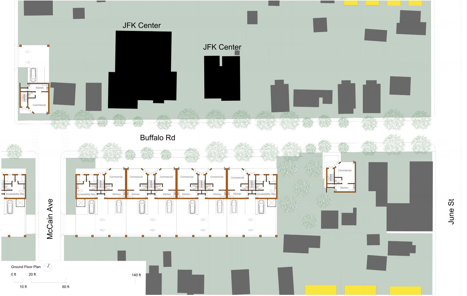
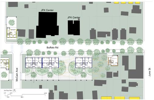
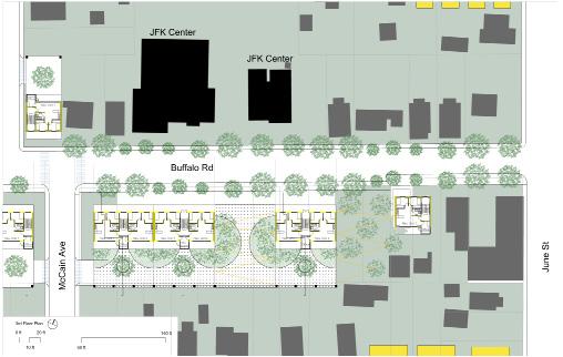
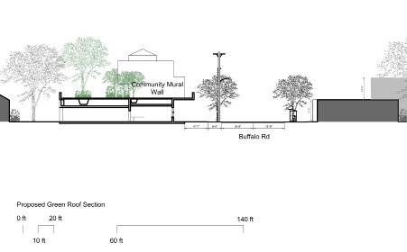
Site plan showing proposed mixed use infill units along Buffalo Road. Ground floor spaces provide commercial areas and accessible dwelling units. Sidewalks in front of the commercial units allow for outdoor seating and pedestrian traffic along Buffalo Road. Easy visual and physical connections invite people to become a part of the community. Resident parking is provided behind the buildings.
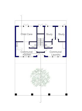
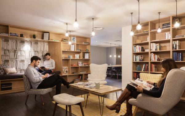
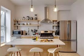
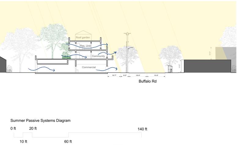
The second floor of each mixed use building is for community programming: laundry services, office/work spaces, child care, community kitchens, and shared living spaces. Immediately outside is a mixture of hardscape and greenscape as part of the larger greenscape that provides storm water migitigation, supports native ecosystems, and provides opportunities for enviromental education and community gardens.
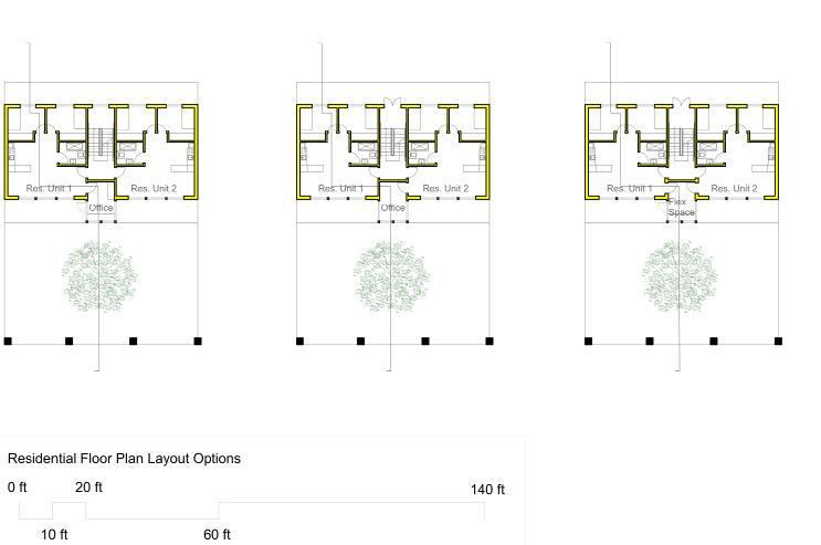
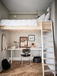
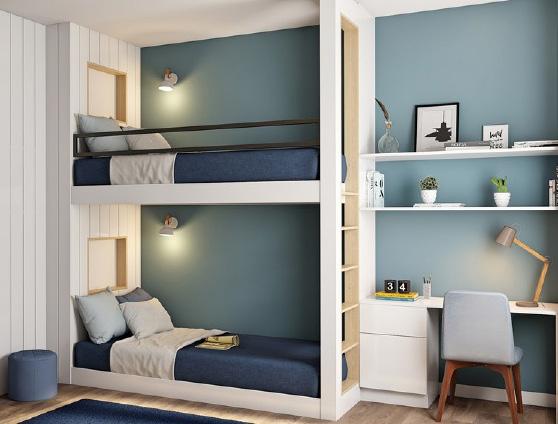
The third floor of the mixed use units provides residential dwelling units with bedrooms, kitchens and bathrooms, a living space, and access to outdoor spaces. The porch on both sides of the dwelling unit allows easy visual connections to community green spaces below as well as to Buffalo Road.
Isometric render with context demonstrating different use and spatial conditions.
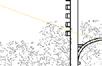
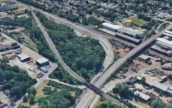
During the community workshop events, several residents showed concern that the city had removed a pedestrian bridge that had connected the Buffalo Road Neighborhood to the Erie waterfront. The replacement Bayfront Connector is less pedestrian friendly and became an additional barrier cutting the neighborhood off from the city.
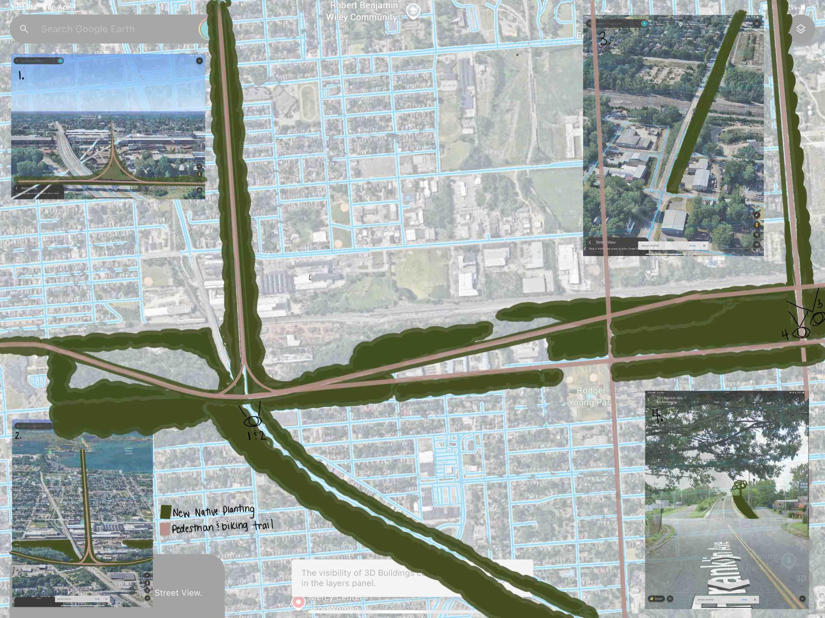
In the diagram below, we see how greenway systems can reconnect the community to surrounding neighborhoods. The goal is to provide safer connections, promote local fauna through native plantings, and help with storm water management.
Xxxxxxxxx Xxxxxxxx.
Urban Design Greenway Plan connecting various programatic elements.
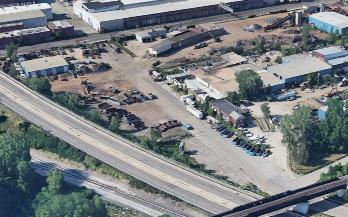
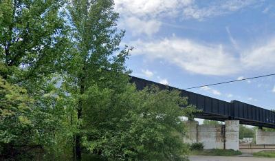
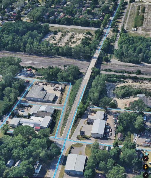
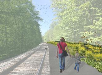
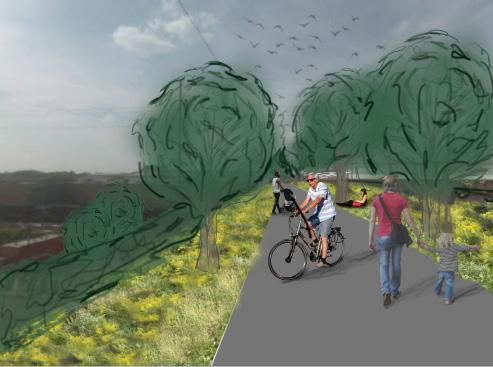
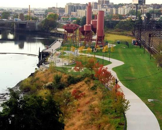
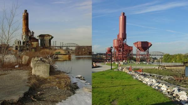
The Bayfront Connector Highway is not pedestrian friendly and became an additional barrier cutting off non-vehicular connections to and from the neighborhood. Adaptive reuse of former industrial lands can reestablish connections. In the example at bottom left, the existing test railway track becomes a rails to trails project that provides access to the waterfront. The example to the right shows a proposed greenway pedestrian extension to an existing bridge over the railway system to the water.
Perspective from the proposed trail addition along the railway system
Perspective from the proposed pedestrian green bridge re-establishment of the bridge
5 Urban Design
Nathan Mongell, Phoebe Morrill, Ella Pedersen
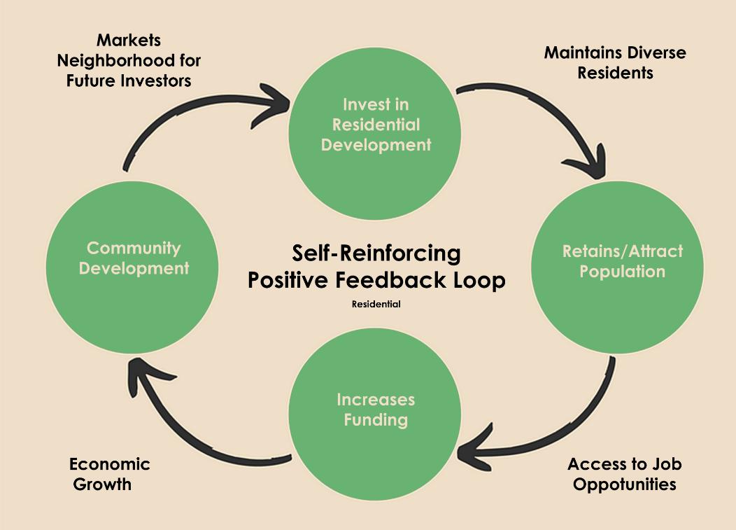
Based on our workshops with community members, we developed the urban design and individual development projects presented here. The Buffalo Road corridor was identified as an area of focus and development. This urban design plan sees Buffalo Road as a catalyst for change, beginning with the strategic development of vacant parcels.
In this plan, several areas branch off from Buffalo Road, three of which were developed in more detail.
All areas of the urban design are connected by a network of transportation improvements. Since access to cars in this community is low, improvements focused on sidewalks, bike lanes, bus routes, and new van services.
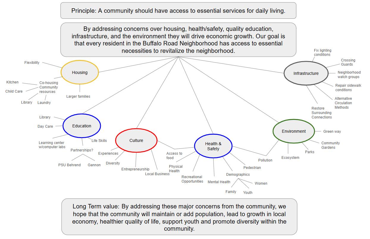
Our design group worked through the process below. One of the earlier products of our work was six guiding principles that helped form our design decisions. These principles reinforce positive aspects and concerns we heard from community stakeholders at the design events..
1. Support youth by fostering multicultural interactions and providing a diverse and lively community.
2. Improve safety by making the neighborhood well-lit and more pedestrian friendly.
3. Combat the detrimental health effects of industrially zoned land surrounding the neighborhood.
5. Extend and improve relationships with various organizations to broaden economic opportunities within the neighborhood.
4. Create a fun, welcoming, and safe atmosphere by implementing a “downtown” (main street) for easily accessible and consistent community interaction.
6. Provide access to housing for all residents to aid in stabilizing the population.
Examples of Action Items and physical examples that could be implemented to fulfill them. While these lists are not exhaustive, they were used as a blueprint to plan interventions in the larger neighborhood plan. Interventions in any action item category are also aligned with the overall design principles laid out earlier in the design process.
Design Principles
February 27 Workshop
Action Items
Activities Services
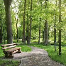
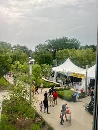
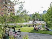
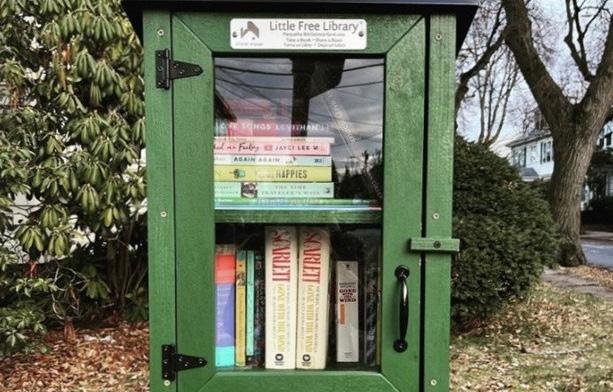
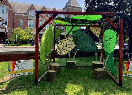
Forest Preserves of Cook County pavilion, Chicago, IL (1) Little
Transportation Community Engagement
Self Sufficiency
Environment
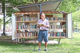
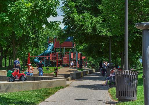
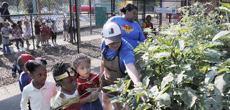
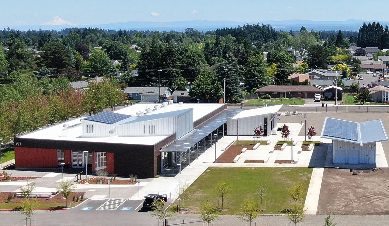
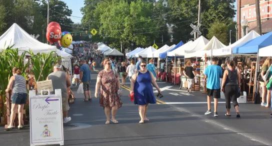
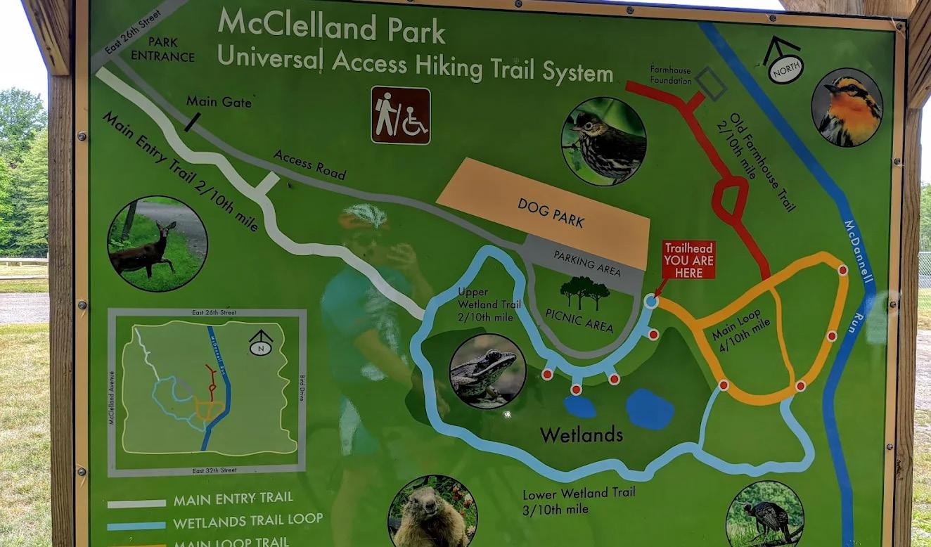
Examples of Action Items. The action items were presented to the community through images of precedents. Above are some of the pictures that were included for each action item. Sources: (1) https://fpdcc.com/permits/picnics-event-permits/ (2) http://ajc.com/news/ local-education/preschoolers-win-fight-sell-their-homegrown-fruits-and-veggies/Nm4emZ4ow520bTTI4om8nN/ (3) https://www.alt.dk/ boern/hvad-kan-du-lave-i-koebenhavn-med-boern/1940614 (4) https://dorishigh.com/2016/08/21/lititz-craft-show/ (5) https://ffadesign.com/ projects/chemeketa-community-college-agricultural-complex/ (6) https://erietrails.org/mcclelland-park/#
Ones Learning Center garden - Forest Park, GA (2)
Traffic Playground - Copenhagen, Denmark (3)
Lititz Craft Show - Lititz, PA (4)
Chemeketa Community College Agriculture Complex Salem, Oregon (5)
McClelland Park directory - Erie, PA (6)
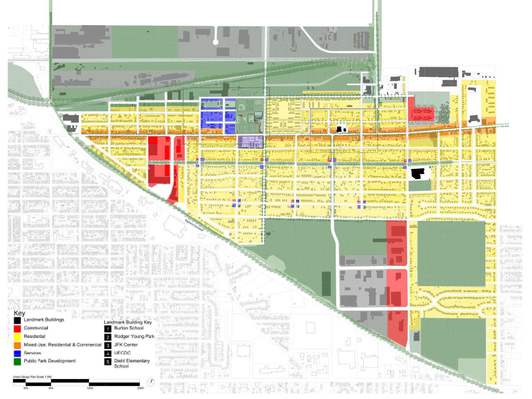
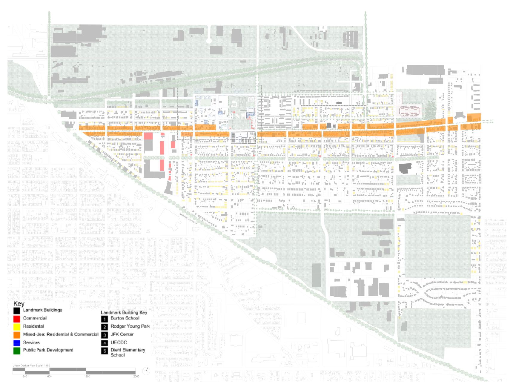
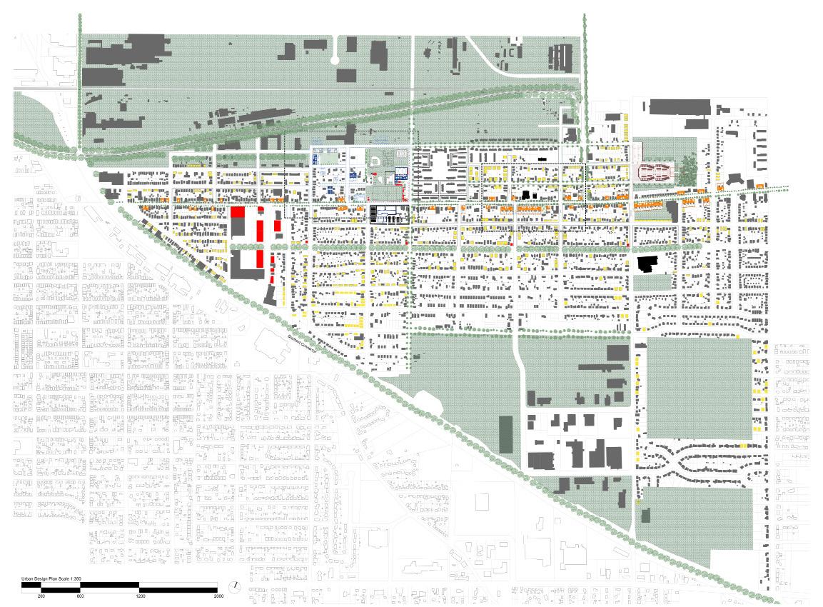
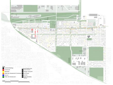
Buffalo Road Neighborhood Plan
Retail - Existing
Retail - Proposed
Community Services - Existing
Community Services - Proposed
Residential - Proposed
Residential - Existing
Green Space - Proposed
Green Space - Existing
Industrial and Commercial - Existing
Brownfield Remediation - Proposed
Bike Lanes - New Built
Bike Lanes - New Painted
Bike Lanes - Existing
Pedestrian Improvements
WoodlawnAve.
McClellandPark
FairmountParkway
FairmountParkway BuffaloRoad
Vacant Parcels and Mixed-Use Development
This plan takes advantage of under- or misused land, making it a space for the community. By adding programs or making space for existing programs we hope to help community members restore areas of the neighborhood. Program elements fill in void spaces in the short term, with the long term goal of shifting Buffalo Road away from a street with single family homes to a mixed-use development “main stree”’.
Proposed transportation improvements and exsiting bus routes through the Buffalo Road Neighborhood. The proposed van service loops will provide more flexibility for neighborhood residents than buses. Sidewalk improvements are proposed for many areas with new bike lanes.
Community Events
Parks and streets both present opportunities for community events, supported by how both areas are considered as major areas of development in the urban design plan.
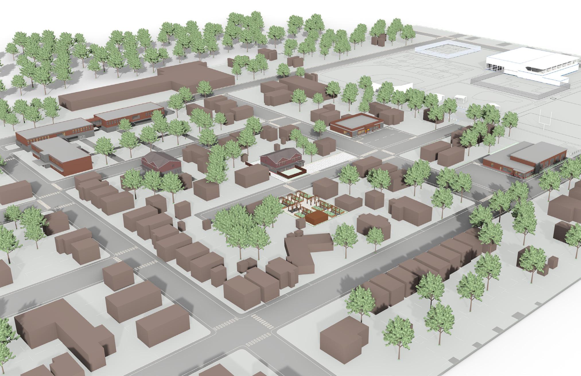
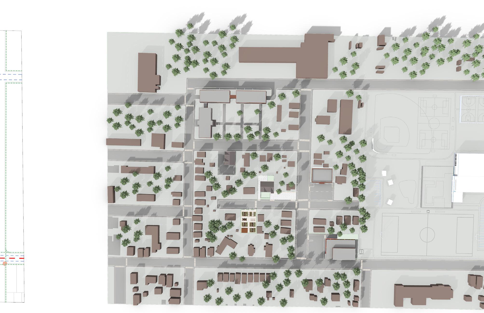
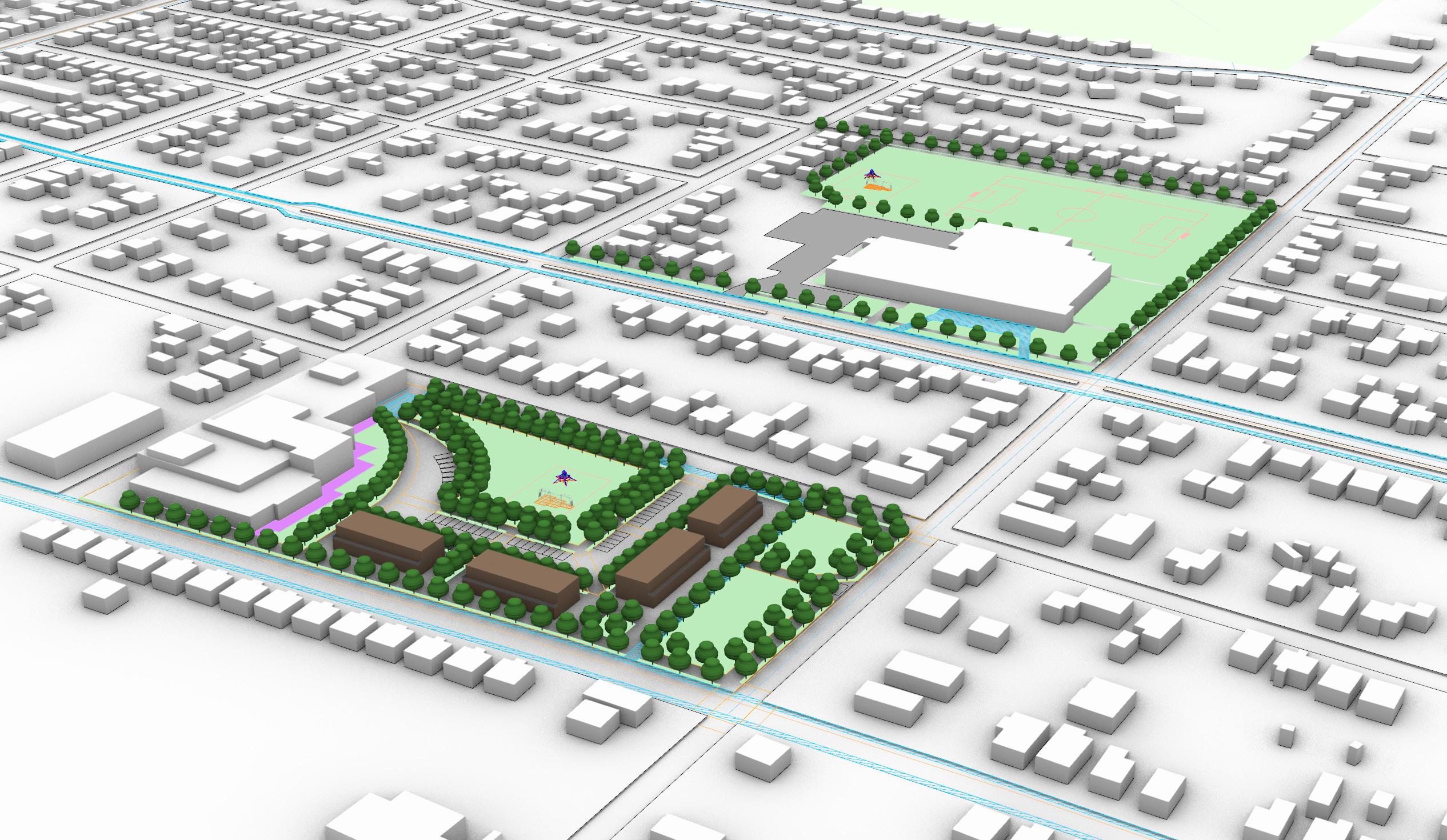
The Meadowbrook Hub provides unique programmatic elements based on the principles and action items set forth in the urban design plan. The Hub is part of a new “main street”, promotes community engagement, and provides after school spaces for youth. It also acts as a transportation hub, creating safe methods of movement throughout the neighborhood. In addition, it provides housing to densify the program within this space. Through these strategies, the Meadowbrook Hub creates an enticing and supportive environment for members of the community.
Ella Pedersen
Within the context of the larger urban design plan, the Meadowbrook site serves as a hub for the community. It is a destination on Fairmount Parkway and a gateway to nearby Wesleyville. The site provides a retail hub and expansive park space, while expanding pedestrian and bike access. Improvements around the Meadowbrook site also connect it to nearby Diehl Elementary school, making it easily accessible for after school events.
Four modular buildings are placed on the Meadowbrook site to house ground-floor retail with housing above, creating a multi-use streetscape.
The site connects varying types of transportation, including existing bus lines, neighborhood-based van loops, car parking, bike infrastructure, and spaces for pedestrians.
Above: Bird’s Eye Perspective of Site Right: Overall Site Plan
Diehl
Existing
Proposed
Existing
The retail portion of the community hub not only provides space for local businesses but also space for community members to enjoy low-stakes sales venues via pop-up stores in some of the modules.
Top: Longitudinal Section through Meadowbrook Site Bottom: McClelland Street Elevation, Meadowbrook and Diehl Elementary School.
Top Right: Transverse Section Through Meadowbrook Site
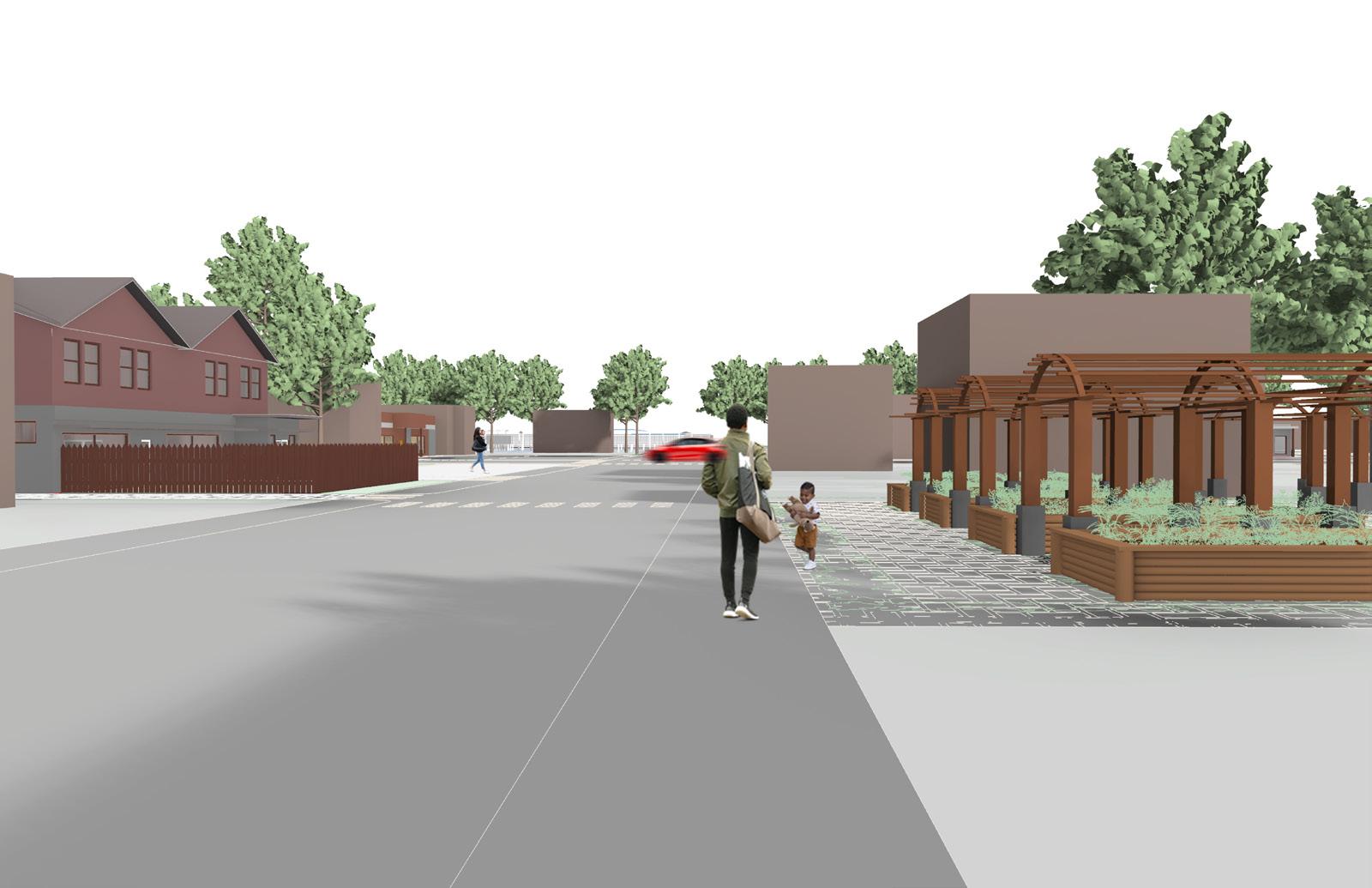
Placing retail spaces along Buffalo Road and along the proposed bike/pedestrian paths increases their visibility. An axis connects the playground/park area, parking, retail, pedestrian walkway, bike lanes, park space, and terminates at the van loop stop. This connects four different methods of transportation to the retail spaces. Additional pathways branch off of the central gathering space (playground/ park area) and join together further program areas.
Fairmount Pkwy.
Glendale Ave.
Diehl Elementary School
Playground
5.2. Potratz Development
Phoebe Morrill
The Potratz Development and surrounding buildings is one of three more focused studies within the neighborhood site plan. The concept references specific guiding principles and action items as it uses programming to connect the site to the Meadowbrook Hub and Rodger Young Park. The program includes spaces for education. While providing more immediate resources to the community, a further stage will re-imagine Perry Plaza as a new hub for the community.
New Amenity Space
The Potratz Development takes advantage of the traffic along Buffalo Road. In order to show commuters and community members Buffalo Road Neighborhood’s potential, an expansion to an existing local retailer, the Potratz garden center, is proposed. New spaces will provide an educational facility and an event space across Buffalo Road. The relationship between these two buildings also provides a safer crossing condition across the main throughway. Future development could include partnerships with Grow Erie and local community gardeners as well as the reopening of Erie County Farms. These steps would attract local shoppers in addition to those traveling through the neighborhood on Buffalo Road. The proposed plans take into account the street wall in this area by making use of existing structures.
The program in the adaptively reused building across from Perry Plaza and Potratz provides spaces for community based businesses. These spaces also function independently providing further amenities for the community.
5.3. Rodger Young Park and Savocchio Opportunity Park
Nathan Mongell
During our workshops with community members, Rodger Young Park and Savocchio Opportunity Park were both identified as important areas in the Buffalo Road Neighborhood.
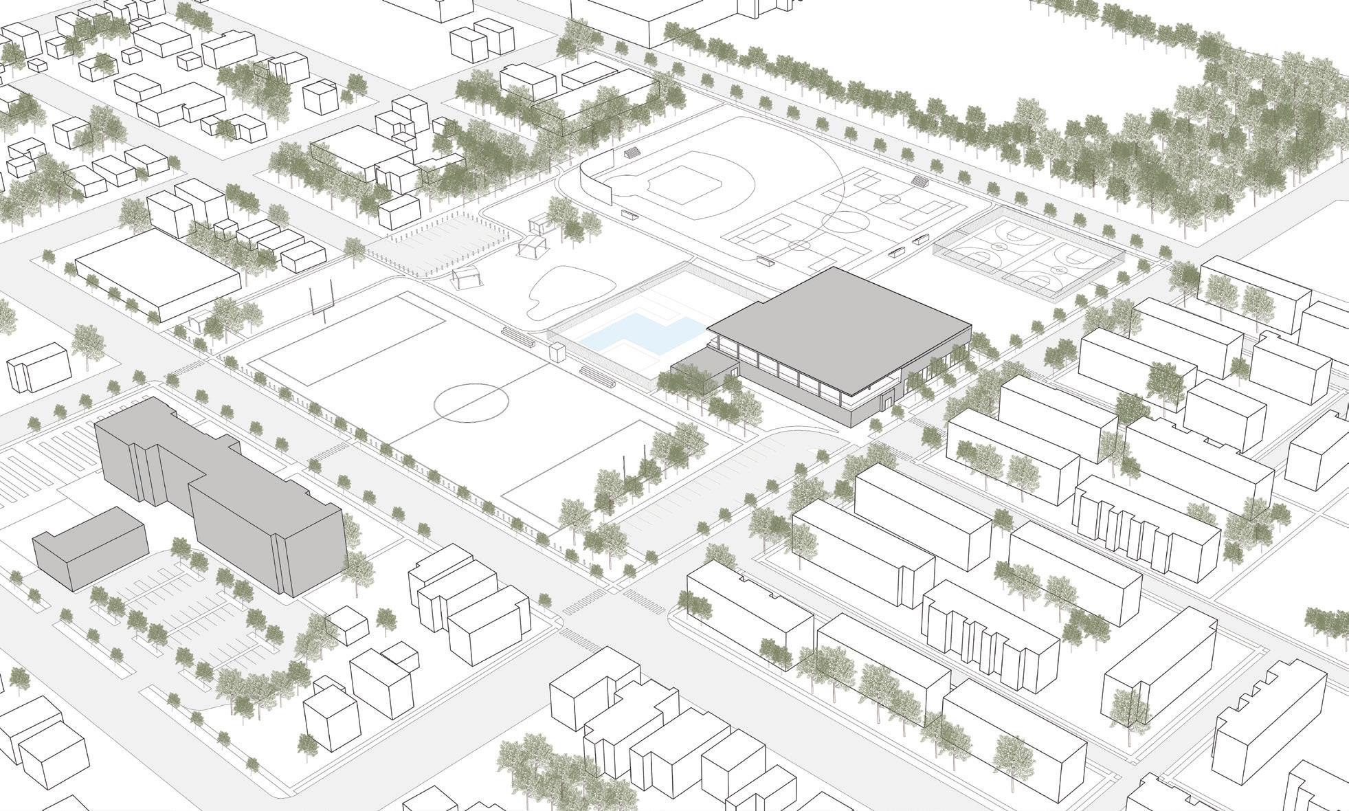
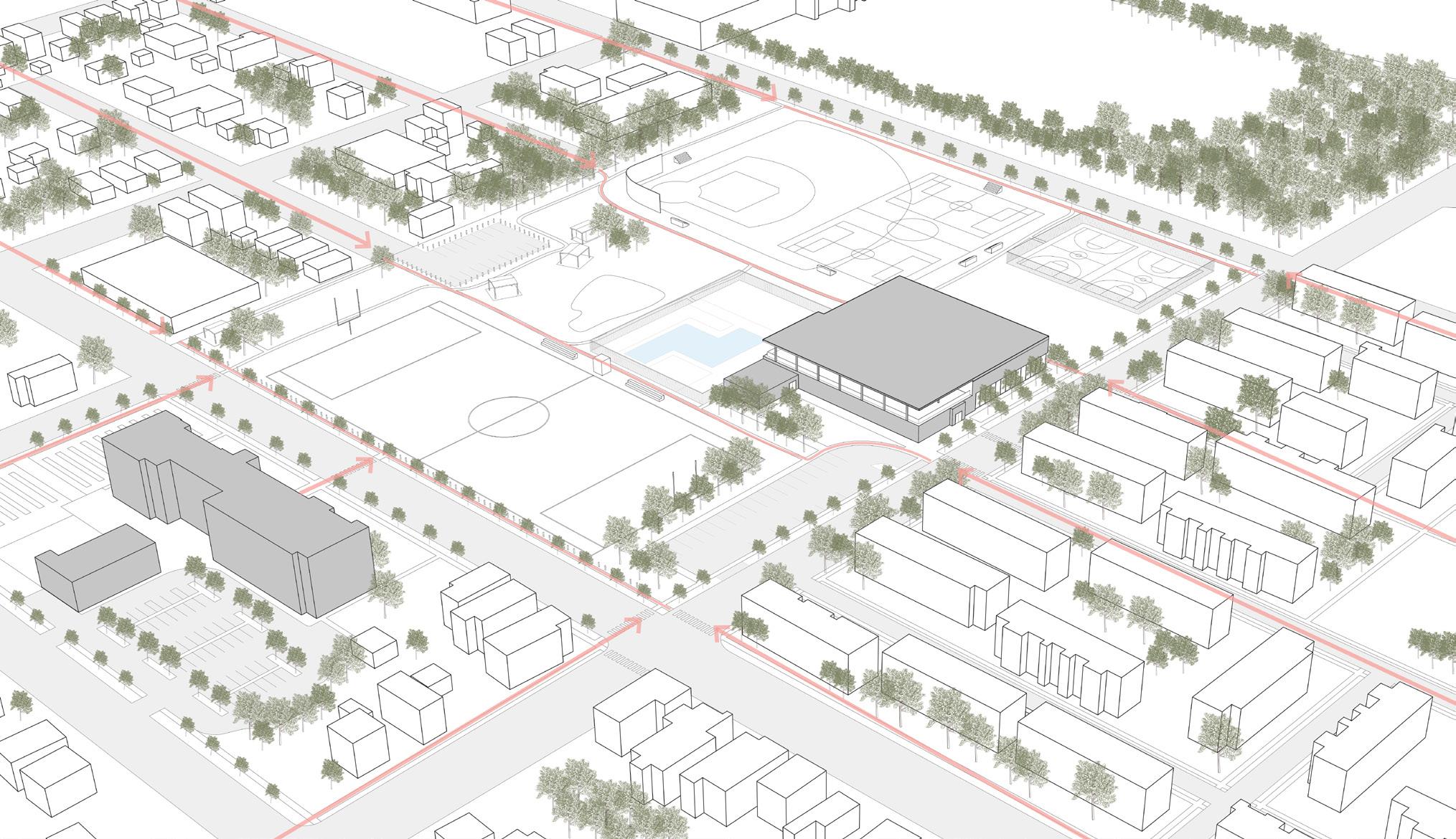
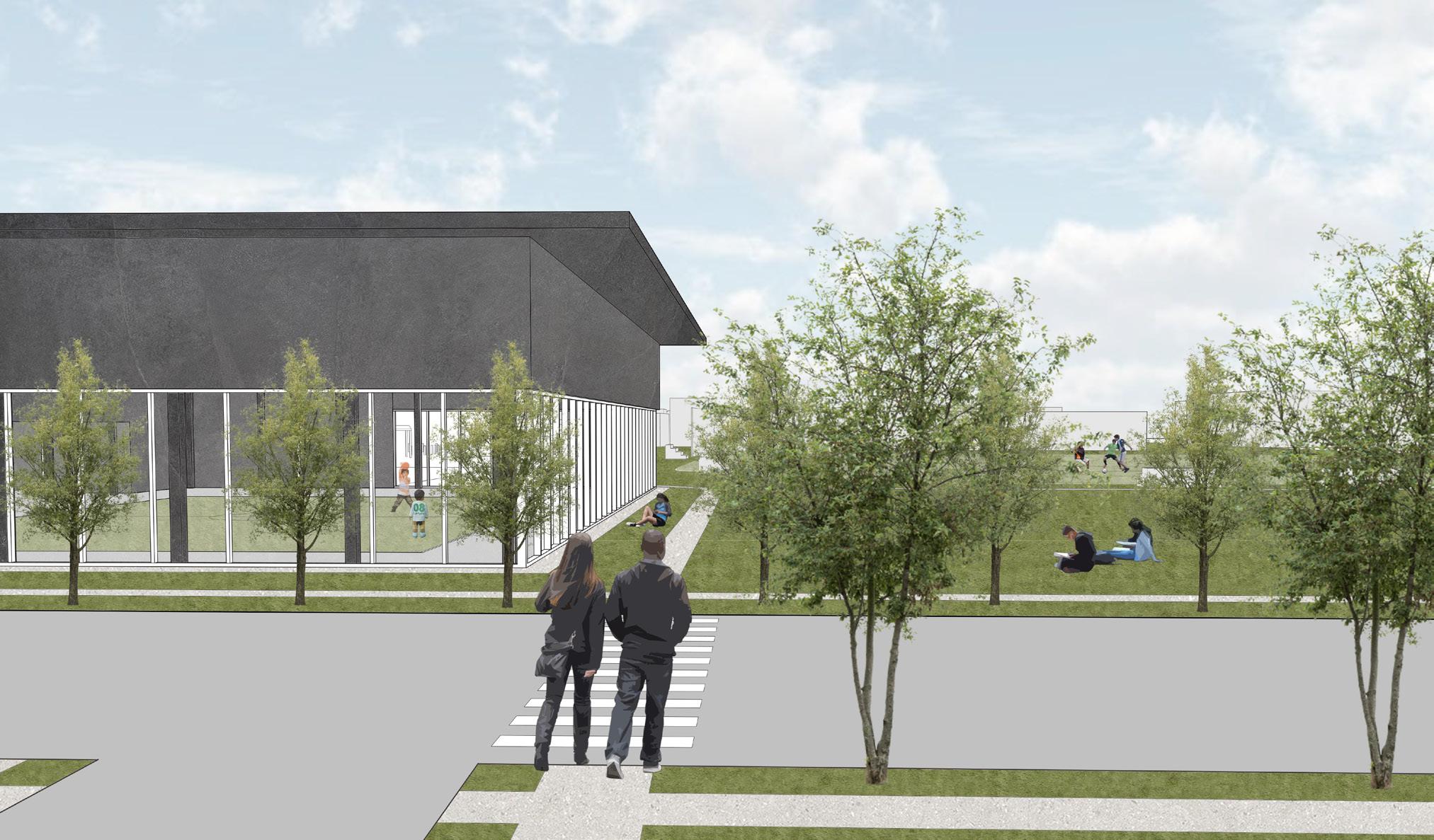
Rodger Young Park is a major gathering space in the community, especially for children and teens. The goal of this proposed development is to enhance the park’s existing amenities through new loops and connections, while removing the underused baseball fields in favor of more soccer field space. The existing football field would become a multi-use plaza space with strong connections to the Burton School project, with potential year-round use.
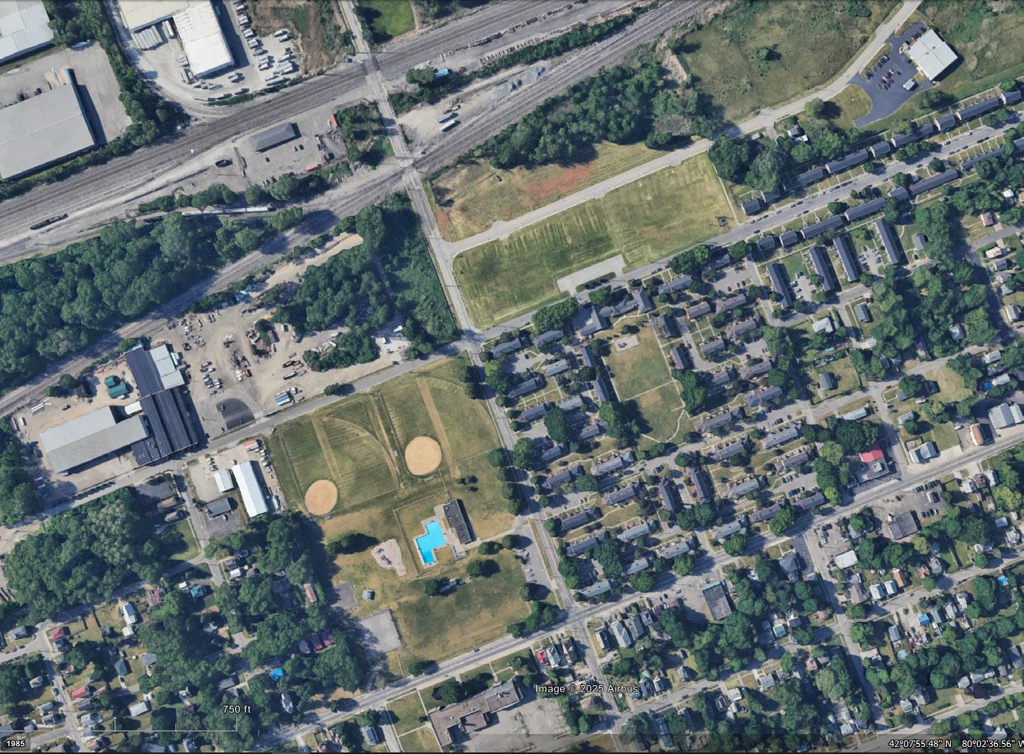
Savocchio Opportunity Park is an area with great potential as new projects such as the Grow Erie greenhouse facility are completed. This proposed development places a community-run agriculture center across from the commercial enterprise, providing educational and economic opportunities to a community already focused on the importance of urban agriculture.
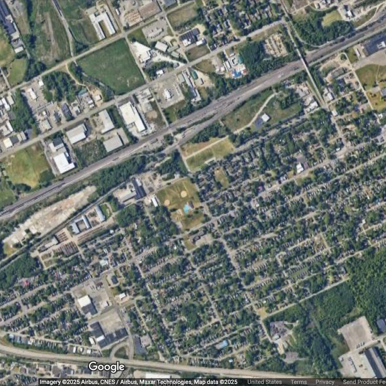
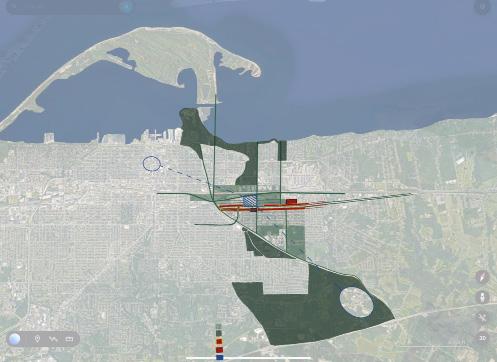
The initial diagram for the project consisted of a continuous park joining Rodger Young Park and Savocchio Opportunity Park. This large green area would have different uses: Savocchio would be used for agriculture and Rodger Young for recreational activities.
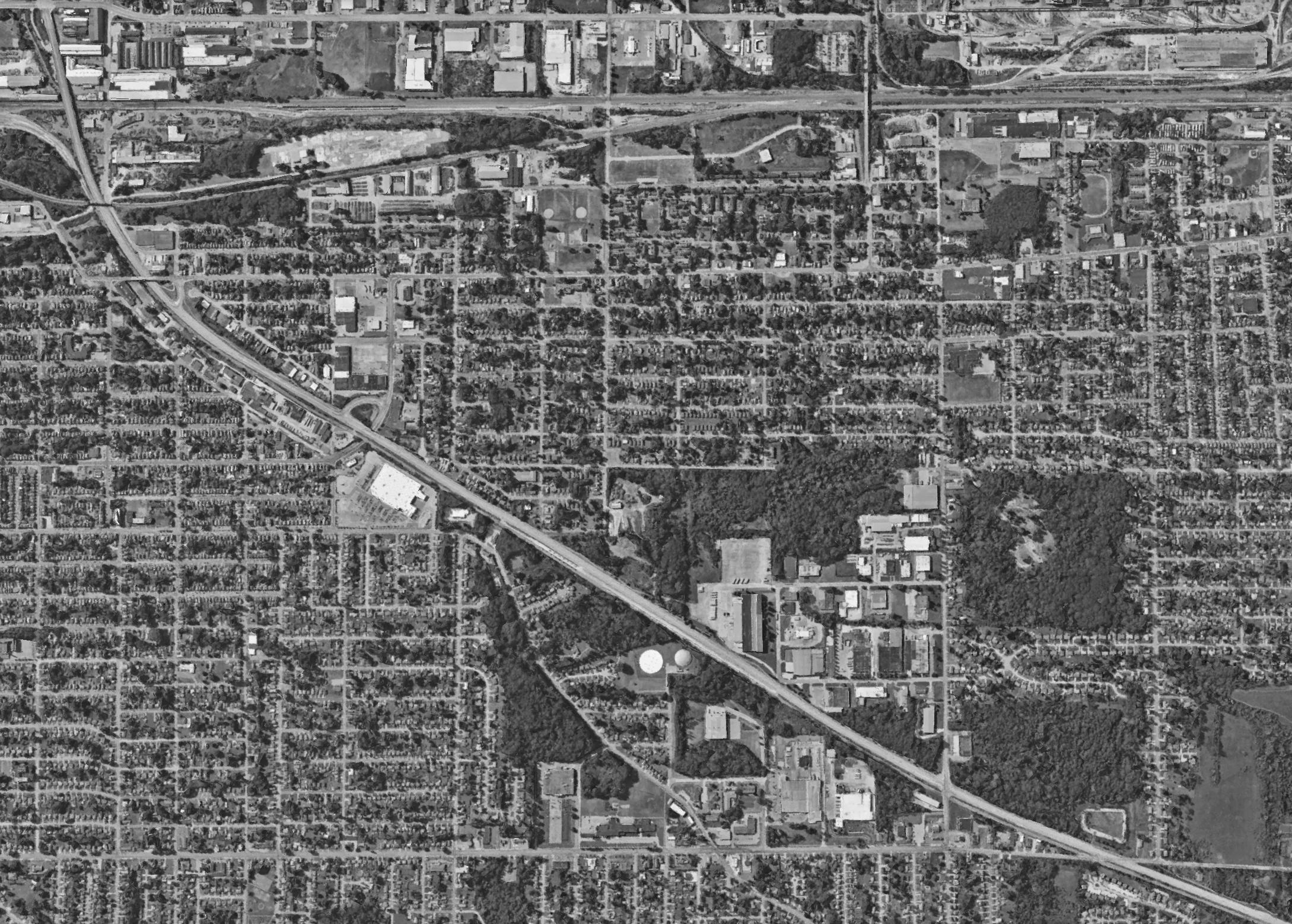
Diagram of the area
Satellite Image of the area (Google Earth)
Rodger Young Park - Active Park
School
Grow Erie Greenhouse
Axonometric
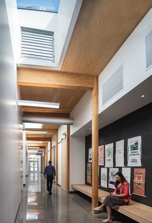
Chemeketa Community College Agriculture Complex Hallway
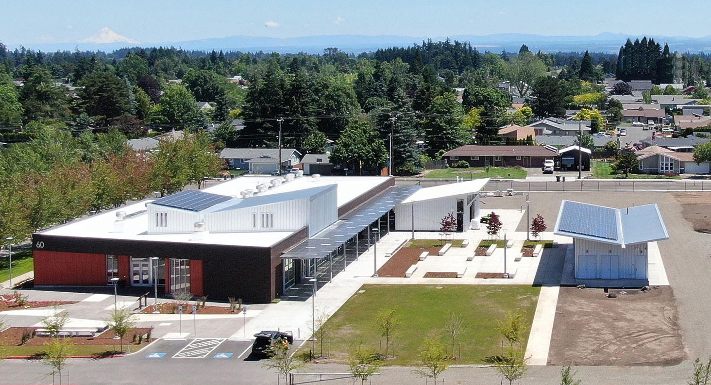
Chemeketa Community College Agriculture Complex from Above
Precedent. The Chemeketa Community College Agriculture Complex was a main source of inspiration for the development of this project. Designed by FFA Architecture + Interiors and Lango Hansen Landscape Architects, the complex is located in Salem, Oregon. Designed to serve the wider communtiy with classroom spaces, outreach, and growing areas, it greatly informed the design of the Community Agriculture Center for Savocchio Opportunity Park. Image Sources: https://ffadesign.com/ projects/chemeketa-community-collegeagricultural-complex/
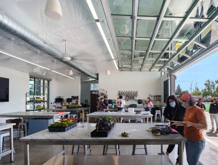
The proposed Community Agriculture Center for Savocchio Opportunity Park includes a moderately sized community building with several commercial greenhouses. The community building includes two spaces to be used for classrooms or other events, as well as supporting spaces for the center. A central corridor passes through the building from the main entrance to the greenhouses. The interior finishes would be inspired by the Chemeketa Community College Agriculture Complex. Image Source: https://ffadesign.com/projects/chemeketacommunity-college-agricultural-complex/ Chemeketa Community College Agriculture Complex Workspace
The Hamer Center for Community Design is an endowed research center that seeks to utilize the expertise of faculty and students in the Penn State Stuckeman School to address a range of issues impacting the quality of communities, with a focus on issues with relevance to the Commonwealth of Pennsylvania. Hamer Center activities entail two distinct but related types of undertakings: 1) applied research; and 2) theoretical investigations on issues related to community design/planning. The Hamer Center’s work addresses public issues such as community-based design/planning, affordable housing, development of design guidelines, sustainability, park and recreation planning, environmental and ecological analysis, and more.
The mission of the center is to encourage building community through building knowledge. It fulfills its mission through engagement in three interrelated activities: teaching, research, and service. For more information, visit the Hamer Center website at https://arts.psu. edu/research-creative/hamer-center.
This booklet represents student projects from a studio course developed in association with the Hamer Center’s curricular-based Project Support Program.