
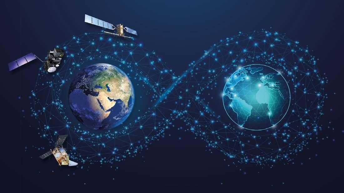
Eyes on the Earth
Space is playing an increasingly important role in helping us monitor and tackle climate change. OpenSpace spoke to Simonetta Cheli, Director of Earth Observation Programmes at the European Space Agency (ESA) and Head of the ESA Centre for Earth Observation (ESRIN), to find out how space is helping, which current ESA missions and initiatives are important, and the Agency’s plans for further related missions and programmes.
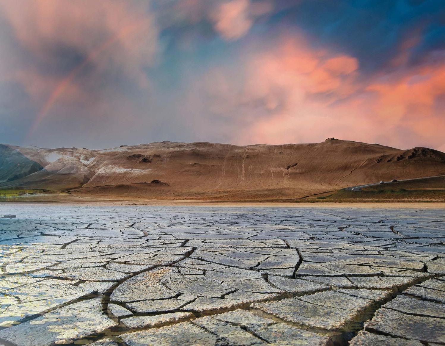
Climate change due to human activities is undeniable. In the decade up to 2020, the Earth’s global surface temperature reached 1.1°C above the level in 1850-1900, primarily through the emission of greenhouse gases due to human activity1
In May, the World Meteorological Organization estimated that the global average temperature could exceed 1.5°C above pre-industrial levels by as soon as 2027 2 – a level seen as significant in terms of being able to avoid or reduce adverse impacts and related losses and damages. There have already been widespread changes in the atmosphere, ocean, cryosphere and biosphere, including increasing numbers of extreme weather events, melting ice, snow and permafrost, and rising sea levels.
We can be confident about the extent of many of these undesirable changes because of measurements made from space. Data on some of these areas has been collected for decades; other measurements are comparatively new, thanks to novel instruments launched relatively recently to add to the breadth of our knowledge.
Among the organizations playing a key part in gathering such data, turning it into meaningful information and making it available is ESA. The primary section of ESA involved in climate changerelated activities is the Directorate of Earth Observation Programmes, the biggest directorate in terms of 2023 budget share, with around a quarter of the overall ESA budget of €7 billion. This is as a result of funding decisions taken by the 22 ESA Member States at the Ministerial meeting in November 2022, in response to the increasing relevance of the environmental domain at a political level and changing priorities associated with climate change.
At the ESA Ministerial meeting, Member States agreed to allocate €2.7 billion to ESA’s Earth observation (EO) programme. This funding will enable the continuance of existing missions to ensure continuity of collection of data, which is essential to monitor changes to the climate, and ambitious new missions. The funding agreed for FutureEO, ESA’s Earth science, research and development programme, was not as high as had been proposed, but at €1.2 billion it still exceeds any previous annual funding levels.
ESA and climate change
Simonetta Cheli, Director of Earth Observation Programmes, summarizes ESA’s position on climate change: “Today we have 16 missions in operation and more than 40 in the making that can support activities around the climate crisis. Then we have programmes such as our new Climate-Space, which is devoted to integrating satellite data into models that support the Climate Variables, which are indicators associated with monitoring the world from the climate point of view. Our work through Climate-Space supports more than half of the 56 Climate Variables, and this number will increase with our increased funding.”
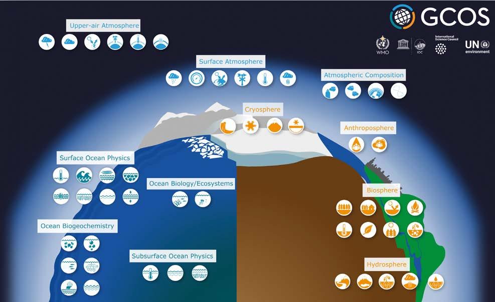
(An Essential Climate Variable [ECV] is a physical, chemical or biological variable, or group of linked variables, that can be used to characterize the Earth’s climate. The ECVs are specified by the Global Climate Observing System [GCOS], which submits reports and plans to the United Nations Framework Convention on Climate Change [UNFCCC].)
“In addition, we attend all COP [United Nations Conference of the Parties] meetings as observers, supporting the Convention and making it clear to decision-makers how satellite data and space in
general are relevant, and the proactive work we do in the context of the UNFCCC.
“Then there are the priorities set out in ESA’s Agenda 2025, our current programmatic policy framework, of which sustainability and tackling climate change are key elements.”
ESA’s activities around climate change are supported by huge archives of climate-related data. “When you work on climate issues, you need long-term datasets. In Europe, we have the biggest wealth of valuable data to support environmental challenges and the climate crisis worldwide, both in the archives spanning over 30 years and from current Copernicus and science missions. And we have arrangements with third parties to access relevant data from their missions.
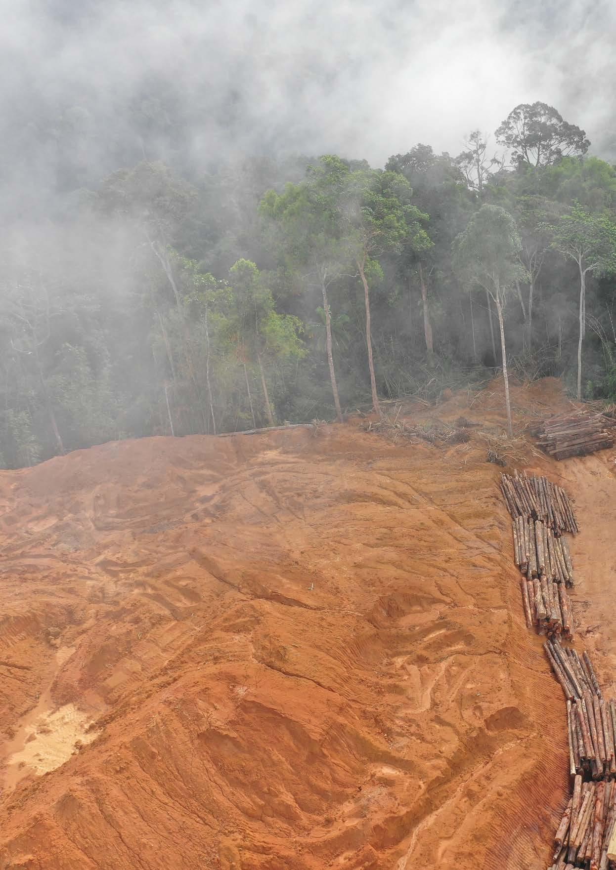
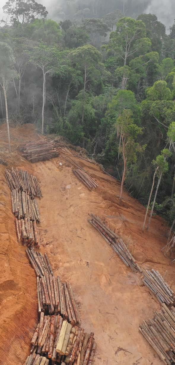
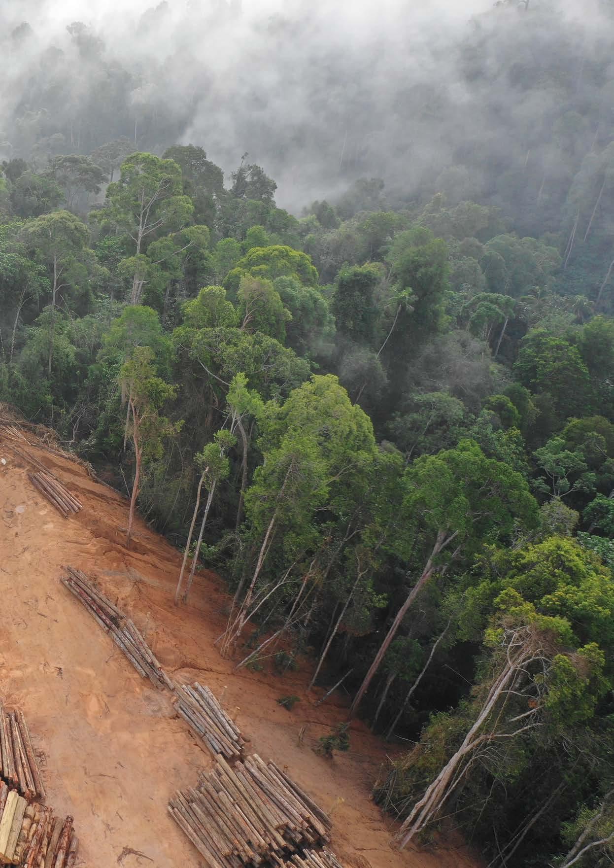
“This is one element showing how space in general, but in particular EO missions, can support the European Union’s (EU’s) Green Deal priorities. In support of EU regulations related to the reduction of CO2 emissions, for many years we have been using satellite data to study many parameters linked to climate, including the quality of the atmosphere, deforestation and melting ice.”
GCOS specifies the Essential Climate Variables that help characterize Earth's climate, and are used to guide mitigation and adaptation measures.
ESA’s climate missions
ESA develops and operates satellite missions that provide a broad range of data on the Earth.
“The Copernicus missions contribute to climate monitoring in support of the climate change crisis in different ways, and in support of related EU policies, such as its Arctic and forestry policies,” says Simonetta Cheli. “For example, LSTM [Land Surface Temperature Monitoring – a Copernicus Sentinel Expansion Mission due to launch in 2028] will help not just by monitoring the evolution of agriculture coverage but land cover more generally, complementing data from Sentinel-2, which looks at forestation.
“In another example, Sentinel-5P looks at methane and NO2. It is very important to be able to identify, for example, methane leaks from pipelines or discharges from dumping trash. Related to that, during the COVID-19 pandemic, we developed a dashboard with NASA and JAXA [Japan Aerospace Exploration Agency] using data on emissions from different satellite sources to look at environmental and economic aspects related to the pandemic. Even though the pandemic is over, we have continued running the Earth Observing Dashboard because what it shows is so important.”
“Operationally, we are working with industry and institutions to develop and use satellites not only in support of EU policies, but what is happening overall in the world in terms of changes in the environment.”
Some of the missions operated by ESA are designed to provide long-term datasets, with follow-on satellites planned in advance to ensure continuity of data on a specific topic. Others are initiated as one-off missions, such as CryoSat, which has been providing information on ice extent and thickness for over 10 years. However, it has been so successful that it will have a successor in the form of CRISTAL (Copernicus
Polar Ice and Snow Topography Altimeter), a Sentinel Expansion mission planned for launch in 2027.
LSTM is also a follow-on from what was planned as a one-off science mission – namely SMOS (Soil Moisture and Ocean Salinity), launched in 2009.
“In Europe, we have the biggest wealth of valuable data available to support environmental challenges and the climate crisis worldwide.”
“Many missions born as science one-offs have gone on to be developed into operational Copernicus missions because they have been so successful and proven their worth in climate monitoring,” Simonetta Cheli notes.
Existing and new initiatives
The increase in the Earth Observation Programmes Directorate budget following the 2022 Ministerial will enable ESA to continue with its existing plans and start on new initiatives.
Work on the next generation of Sentinel satellites is already underway to continue the impressive output of the first generation. Aeolus-2 will follow on from the hugely successful Aeolus science mission, which ended recently, having delivered valuable data about Earth’s winds for over 4 years. (Not only did this help improve weather forecasts and climate modelling, but also reportedly brought economic benefits to Europe of around €3.5 billion – a figure that Aeolus-2 could more than double.)
Among the new missions are the 10th Earth Explorer, called Harmony, and the Next-Generation Gravity Mission, which will form part of MAGIC (Mass Change and Geophysics International Constellation), a cooperative venture with NASA.
aspects of the Earth that relate to climate change and societal issues, such as availability of food, water and energy. The Harmony mission, which was already approved but received a further funding commitment last November, will consist of two identical satellites orbiting Earth in convoy with a Sentinel-1 satellite to deliver a wide range of high resolution observations of motion that occurs at or near the Earth’s surface. Among the areas it will help us study are interactions between the oceans and the atmosphere, changes in ice sheets and glaciers, and shifts in land surface related to earthquakes and volcanic activity. Harmony is scheduled to be launched in 2029.
In the meantime, MAGIC is designed to deliver measurements of gravity. That may not seem to have anything to do with climate change; however, such measurements will enable studies of where Earth’s water – in liquid and solid form – is stored and how it moves. As Simonetta Cheli explains: “Ocean circulation and hydrology are extremely important in the context of work on climate.”
ESA and NASA will each fly a pair of identical satellites as part of MAGIC, with the data combined to produce fast and accurate information about the water cycle, helping us monitor droughts, floods, ice melt and sealevel rise.
meteorological missions, such as MTG-I1, launched in December 2022. “These missions will increase the precision, resolution and timeliness of data to predict extreme weather events in Europe and contribute to climate activity,” notes Simonetta Cheli.
Digital twins
One of the exciting technological developments that holds great promise for modelling climate change and predicting future scenarios is that of digital twins. In Europe, the highest profile example is the EC’s Destination Earth (DestinE), which aims to produce digital replicas of the Earth’s complex systems. The first two digital twins should be ready next year, one of which is the Climate Change Adaptation digital twin, with a complete digital replica of the Earth available by 2030.
ESA is one of the key players in the development of DestinE, along with the European Centre for MediumRange Weather Forecasts (ECMWF) and EUMETSAT. ESA is responsible for the DestinE Core Service Platform, the user-friendly front-end that will give access to space-based observation data, applications
ESA also has its own Digital Twin Earth (DTE) project, funded by the Member States. Simonetta Cheli is keen to emphasize that ESA’s DTE is not a competing digital twin platform, but a research project in collaboration with the science community that is testing and
demonstrating various technologies, such as artificial intelligence. One output of this so far is Digital Twin Antarctica, which models the Antarctic ice sheet system, looking at its hydrology, ocean, atmosphere and biosphere.
“Digital twins will provide a platform where scientists, decision-makers and citizens will be able to access data on the state of our planet, on topics such as sea level height, deforestation and extreme weather events. And not only the state today but also the potential evolution of our environment. We will be able to integrate all the big data sources to have an interactive model of evolution and prediction, which should be very useful to support decision-making.”
Free and open data
The EU’s Copernicus programme has a policy of providing full, free and open data. This keeps the barrier to access low to ensure the widest use –something that has been shown in a number of studies to have huge economic benefits. However, when considering climate change, there is a different incentive: that of allowing decision-makers and scientists access to as much information as possible to tackle the climate crisis.
“The policy of free and open data benefits everybody. Scientists working on topics related to climate and the environment need access to such data. And it benefits decision-makers in a similar way.”
ESA is one of the key players developing digital replicas (twins) of the Earth in the EC's Destination Earth (DestinE) programme © ESA
Changing the future
All of these missions and initiatives are providing huge amounts of data, but this in itself will not slow down the impact of climate change. It is yet to be seen how many decision-makers will make use of digital twins and climate dashboards. So can space really make a difference?
With that in mind, Simonetta Cheli points to a new Sentinel Expansion mission that is designed specifically to monitor anthropogenic carbon emissions in support of the next Global Stocktake of CO2 emissions in the context of the COP21 Paris Agreement and the Glasgow Climate Pact of COP26. The CO2M (Copernicus Anthropogenic Carbon Dioxide Monitoring) mission will consist of a pair of satellites to be launched in 2026.
“Satellite data and space-related tools are extremely valuable for decision-makers, not only in terms of monitoring the implementation of the regulations that they set in place, but also in terms of taking informed decisions about what needs to be done. They have a strategic role in the planning of regulations and their implementation, and in analyzing the geopolitical evolution of regions where the availability of natural resources may change.
“In Europe, a large proportion of the EU budget goes on the Common Agricultural Policy, and space can support that by providing information about
land coverage in terms of agricultural production. Satellite data not only supports the implementation of regulation on subsidies, but can support initiatives to reduce CO2 emissions and the use of pesticides associated with agricultural production.
“Space data and tools are also useful for citizens, because if you are a citizen, there are lots of regulations associated with the Green Deal and the ambitions for the decarbonization of Europe that are impacting citizens, such as recycling, electric vehicles and so on. If citizens can access the data, we can show them that the efforts they are making are useful.”
The actions of citizens and decision-makers are both important for tackling climate change. What is evident is that we need a clear picture from space of as many aspects as possible related to climate change in order to fully understand and address the challenges that lie ahead for all of us. And for that, the work of ESA’s Directorate of Earth Observation Programmes is essential. n

For more information, visit:
ESA Directorate of Earth Observation Programmes: bit.ly/3XLiCGD
ESA Climate Office: climate.esa.int
The importance of data calibration and validation
Satellite data is only useful for monitoring climate variables if it is accurate, so that it can be meaningfully compared with previous readings and those from other satellites. For it to be accurate, it must be both calibrated and validated:
• Calibration – quantitatively defining a system’s response to known and controlled signal inputs.
• Validation – assessing, by independent means, the quality of the data products derived from those system outputs.
ESA’s Simonetta Cheli explains: “Calibration and validation activities are an integral part of our work. We use data from current missions to prepare for future missions. Then once we have launched a satellite, we need to calibrate and validate the data to check if each instrument is performing the way we think it is performing. To do this, we perform ‘ground truth’ validation to see if the data collected from the satellite matches measurements taken on the ground.
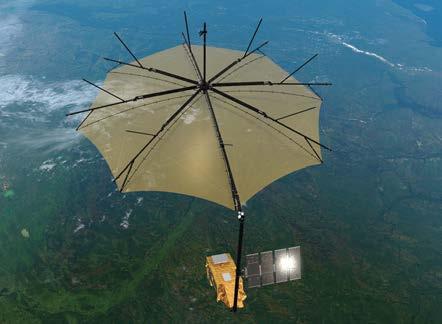
“This is an area where there is very strong international collaboration. For example, we are preparing a mission called Biomass that will be launched next year to look at forest coverage
Sources
1. IPCC; AR6 Synthesis Report – Climate Change 2023
and different types of forest canopy. For this, we collaborated with partners such as NASA to acquire data from aeroplanes for calibration. Sometimes we exchange data from different missions for validation purposes, such as our CryoSat mission and NASA’s ICESat.
“Another contribution to calibration comes from ground calibration facilities, such as the validation sites within the Pandonia Global Network 3: a joint initiative with NASA that provides real-time, standardized values for air quality data. This supports mission validation and calibration for our Sentinels.”
2. public.wmo.int/en/media/press-release/global-temperatures-set-reach-new-records-next-five-years
3. pandonia-global-network.org/
“The policy of free and open data benefits everybody. Scientists working on topics related to climate and the environment need access to such data, and it benefits decision-makers in a similar way.”
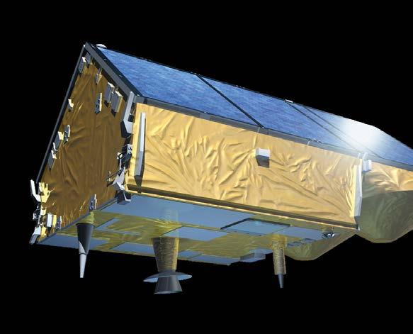
The Biomass mission, set for launch in 2024, will capture date on forests.