Portfolio Portfolio
Landscape Architecture | Hsuan Cheng

Landscape Design
scale: 13.5 ha
Project Type: Integrated Park Design
QinShui geothermal powerplant and park, Yilan, Taiwan
˙Renewable energy & outskirt issues
Regional Planning
Urban Design
Parametric Design
LuZhou Luiti Residential Park
˙Natue-based Solution, Design with Caron, Ecological History scale: 1 ha
Project Type: Residential Park Design
Project Type: Strategies and Typologies
Scale: site1- 2.9ha. site2- 7.67ha.
Project Type: Urban Design
Kolkata, India
˙Anthropocene issue, Bio-geochemical cycle, Eutrophication
˙Nature-inspired, Circular Systems,
Fazhi river, Taichung, Taiwan
˙Historical Fingdings, Perceived Sacredness
˙Nature-based Solution, Biomimicry, Resilience design
Scale: 4 86 ha
Project Type: Housing Complelx
Professional Project
Scale: 4 stations
Project Type: Urban Landscape, Train Station
Xiaogang, Kaoshiung, Taiwan
˙Waterscape
˙Plaza
Jiji, Nantauo, Taiwan
˙Waterscape
˙Plaza

+886 0909012357
Passionate about bridging the gap between humans and nature, I developed a deep understanding of the natural environment through exploring Taiwan's mountains and rivers. With a Bachelor's degree in Landscape Architecture from National Taiwan University, I have gained experience in regional design through an exchange program at the University of Illinois Urbana-Champaign (UIUC), where I worked on ecological projects with leading experts. Additionally, my professional experience further deepened my understanding of translating conceptual ideas into real-world designs . I am particularly inspired by the Dutch approach to landscape resilience and environmental problem-solving. With an interest in large-scale, nature-based projects, I aim to pursue advanced studies at TU Delft, learning from interdisciplinary, innovative landscape design practices. I aspire to join leading landscape firms in Europe to tackle environmental challenges and contribute to the sustainable future of Taiwan’s landscapes.
Floral Arrangement, Playing Violin, Travel, Outdoor Activities
English, Mandarin, Taiwanese, French
// Software // Language
Austodesk Adobe
3D modeling Rendering
CAD Revit
Ai Ps Id Pr Rhino Grasshopper Sketch Up Lumion Enscape Twinmotion
Geographic Info Interactive Generative ArcGIS Arduino SD
< National Finalist > Our Memory: Commemorative Forms for Local Memories in Hakka Community
<National Best Selection Award > Generative City DNA: Chiayi Wood Industry Tectonic Competition
< National First Place Award > National Youth Landscape Competition, Design Category
< Thesis Publication > The Ignored Background: The Influences of Activities on the Attention of Surrounded Environment
Published on Journal of Landscape Architecture, Landscape Architects Society, Republic of China
< Representative of NTU > TILA Landscape NewStar Exhibition Competition of the final project
< Selected Finalist > MOE for Architecture and Landscape Design
< National First Place Award > Design Competition for Slope at Kilometer 35 Southbound of National Highway No. 3 and Kansai Interchange
MA in Advanced Architectural Design
Tunghai University, Taichung, Taiwan
Exchange Student in Landscape Architecture University of Illinois Urbana-Champaign, Illinois,USA
BLA in Horticulture and Landscape Architecture
National Taiwan University, Taipei, Taiwan
YuYen Design | Landscape Designer | Part time dA Vision Design | Landscape Planner& Designer | Full time
Jiayi General Canal - life alingside canal way
Dongshi Cultural Heritage
Yang-ming Mountain Private Garden
Ocean Onsen Resort
Taoyuan Railroad Undergroudization Projects
Jiji Railroad Train Stations
Science Museum South-North Corner
Hsinchu Civic Park and Green Network
Taipower Trainning Center
Classic Engineering Consultants | Landscape Designer | Part time
YinCang Landscape Design | Landscape Designer | Internship
Participate Phases

Academic WorkGraduation Design
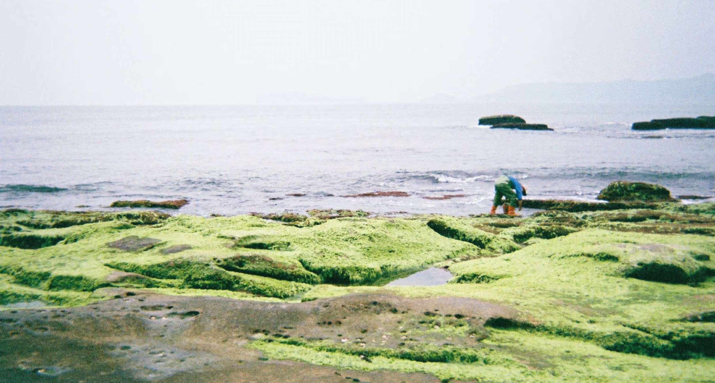
Location| YiLan, Qinshui, Taiwan
Group work(2)| All concepts and drwaings developed and finished together equally.
Supervisor| C.K. Cheng chiakuen@ntu.edu.tw.
The outskirts are the transition zone where urban and rural uses mix and often clash. It can also be characterized by certain land uses which have either purposely moved away from the urban area, such as power plants which provide power for urban areas. In those areas, conflicts could be observed frequently between power plants, other usages of the outskirts, and natural environments. On the other hand, how to introduce green energy to the public while resolving the aforementioned conflicts is an urgent issue for outskirts development.


The surrounding tourist attractions near the site are mostly forest recreation. Currently, long queues at the park often forming on weekends. To alleviate traffic congestion, it is advisable to increase public transportation shuttle bus services. Qingshui geothermal park is a popular outskirts tourist attraction in Taiwan, but the adjacent underconstruction geothermal power plant could deteriorate the natural experiences. It is the aim of this project to propose a solution for the conflicts between power plants, tourism, and the environment.


4 strategies: Food chain, water cycle, geofood cycle and control level to solve the conflicts between poerplants, torism and environments. Combinig geothermal energy education and environmental education into this park, providing healing effect to the public and redifine the relationship between power plants and the public.


The design includes designated routes for tourism, service operations to support daily maintenance and supply needs, and emergency evacuation routes near the areas of the Qingshui river and geothermal hotspring source, ensuring prompt rescue operations.


From introductory experiences at hot springs and museums to exploring industrial sites and outdoor adventures, this progression aims to immerse participants in their surroundings and foster a deep appreciation for nature's gifts. Such engagement not only sparks initial interest but also encourages return visits and promotes environmental stewardship."


Linking energy source and sinks . By doing so, we can facilitate cascading of residual heat to minimize exergy destruction and entropy production (Dobbelsteen et al., 2007 ).
By reusing by-products and wastes,GEO Industries and tourism make up circular economy which aimed at eliminating waste and the continual use of resources.
[Water resources sustainable development] and [River pollution prevention] : Take the advatage of injection well of geothermal powerplant, hot spring waste water and domestic sewge will be purified and inject.
Enable people to get closer to energy appropriately to solve the conflict of different usages. Staged authenticity theory(Cohen, 1979) can fulfill tourists whereas remain the reality of back stages.
This project simultaneously included four concepts: Food chain,Geofood cycle, Water cycle and Control level. Such innovative combinations could enhance energy and resources use efficiency, and also initiate a more intelligent and sustainable outskirt development style. As a result, a harmony, eco-friendly and energy efficient paradise could be reached in those area.


GEOFOOD CYCLE


WATER CYCLE


CONTROL LEVEL


2.Demonstration
3.Tail-
4.Observatory
5.Injection


During non-flood seasons from December to April, setting up temporary large pools to blend 100-degree hot spring water with stream water for use.

Unveiling the buried 100-degree hot spring, showcasing its majestic and awe-inspiring natural features to the public, fostering a sense of reverence for nature.

Paving clear pathways with river gravel to reduce visitor risks and minimize impacts to the riverbed. Temporary designed for easy removal to prevent environmental pollution in case of flash


Eco-frinedly Planting Strategy
"Plant Database of Yilan County" (2016), including Chinese windmill palm, Oxalis corniculata, and Carex baccans. Tree species selection focuses on native Camphor family species thriving at 300-500m altitude in Yilan County, such as Machilus thunbergii, Machilus zuihoensis, and Cinnamomum camphora, valued for their aesthetics and ecological fit with neighboring vegetation. Given the park's proximity to thermal sources, the landscaping design involves planting shallow-rooted and heat-tolerant species like mosses, lichens, maidenhair ferns, and Rhododendron.


Eco-frinedly lighting Strategy
Lower color temperature: yellow light to deter animals from approaching.
Light spectrum : 520 to 610nm minimizes disturbance to green plants.
LED bulbs: their spectrum emits minimal ultraviolet light, which typically attracts insects. Form: Full-cutoff lampshades helps reduce light scattering and thereby decreases light pollution.


Academic Work |National Youth Landcape Competition "Fist Award "
Location| Luzhou, New Taipei, Taiwan
Groupwork(2)| All processes developed together
Supervisor| Mary Pat, McGuire. mpm1@illinois.edu

As a focal point for education and community life in Lujhou, this site intersects with various educational institutions, providing opportunities to connect students and residents and serve as a platform for low-carbon education experiments, reshaping the low-carbon lifestyle in the area. The project's primary goals are to restore the connection between humans and nature by recreating Lujhou's historical landscape and to develop a carbon sequestration system suitable for modern urban environments.


This project is situated in Lujhou District, New Taipei City, at the lowest part of the Taipei Basin and within the tidal reach of a river. Historically known for its wetlands and ponds, it's affectionately called "蘆洲泛月" due to its scenic reflection of the natural environment. Serving as a vital carbon sink, it boasts flourishing ecosystems with diverse wildlife and crops, symbolizing a harmonious relationship between humans and nature. However, the construction of the Erh-Jung Floodway, while mitigating flood risks, has disconnected people from nature and diminished carbon sequestration capacity.


1.


The green corridor prioritizes linking educational institutions, green spaces, and green belts to create a low-carbon transportation axis, extending to recreational areas


A.Zhongyi Elementary School is spatially connected to create a low-carbon, comfortable and friendly school corridor and to increase the dialogue between the park and the school.
B. Using recycled water as water mist to cool down the area and giving associations of wetland Landscape. You can also pump water to find low-carbon riddles hidden among the stones.
C.Green spaces are provided for neighbors/students to participate in activities, experience the succession of natural landscapes, and realize the sustainable awareness of life cycle.

In the cocpet of climate positive design, it is crucial to quatify the countable benefits, like: carbon footprints of the materials, carbon sequestration amount, water recycle amount and so on... to really get the true sense of how climate change metigation can be realized through thoughtful landscape design


Expectation Circular System Sec A

Academic Work | 2024 MOE (10 days) workshop
Individual Project | Loaction | Kolkata City, India Instructors | Fei Wang. fwang100@syr.edu
Fertile Landscape
Blue Print:
Back to 2025
Adaptable Design Strategies help reclaim shrinking wetlands


This fertile landscape in Kolkata is a prototype system combining ecological and traditional wisdom with modern techniques to improve quality of life, boost economic benefits, restore ecosystems and further offer opportunities for education and tourism. Starting with four sites in Kolkata, these flexible strategies can expand to the Ganga Basin and beyond.


Nitrogen and Phosphorus are essential elements for humans and vegetation. However, when they enter water as waste, they cause severe issues such as Eutrophication, Ocean dead zones, land degradation, habitat loss (80%), and health risks to humans. The levels of N and P have surpassed the safe boundary of the Anthropocene, approaching a tipping point of no return. Fifty percent of Nitrogen and Phosphorus come from agriculture, while the other fifty percent originates from industrial and urban waste. This design proposes reclaiming and reusing these wastes to enrich the landscape through waterfront designs and future agricultural practices, forming a nature-based circular system.


Globally, regions affected by nitrogen and phosphorus issues are nations that heavily rely on fertilizers in agriculture, yet they spend lots of money import fertilizers from elsewhere. Imagine the economic and environmental benefits if we could reclaim these resources from the water!


Kolkata is an ecologically rich delta characterized by wetlands, marshes, and mangrove forests, with the Hooghly River flowing through its heart. The Ramsar-designated East Kolkata Wetlands have long served as a natural treatment system for human wastewater. However, urban expansion and eutrophication are gradually compromising the wetlands' capacity to function effectively, endangering both the local and regional ecosystems.

A cross-section of the city reveals the interconnectedness of these ecosystems. The quality of water in this region not only impacts urban life but also poses a significant threat to the entire regional ecological balance.

Learn from Nature:
Ssurrounding ecosystems perform outstanding ability of nutrient removal.


4 Typologies Analysis


Purposed Circular System


The landform design, inspired by the floodplain, incorporates layered features such as oxbows and levees, creating diverse habitats for various species.


The canal front draws inspiration from riparian forests, featuring a layered landscape design.
Nutrient-removing vegetation can be processed into biomass for energy production, while the organicrich soil can host microbial fuel cells to power riverfront and street lighting on-site.
Environmental education will be promoted by connecting schools to the river. School labs can produce molds and photosynthetic bacteria to enrich the soil and enhance nutrient uptake.


Vegetations like cattail and water hyacinth, along with floating cut flower farms, will aid in nutrient removal. These plants and their biomass can be used to produce biochar and energy, creating economic opportunities for Dapha Village and helping to alleviate poverty.
Floating laboratory will act as a community center where residents can share daily information and monitor water quality. Additionally, the system will include automated sluice gates to regulate water flow at the inlets and outlets efficiently.

Water circulation pattern, inspired by nature, is both efficient and visually appealing, potentially serving as land art to be admired.

The agricultural system emphasizes water circulation. Water from the canal will flow sequentially through vegetated buffers, constructed wetlands, free water surface wetlands, aquaculture systems, and finally into agricultural fields. Biochar and molds produced by schools and wetland eco-villages can further enrich the fields, enhancing soil fertility and sustainability.

Agricultural fields will coexist with wetland ecosystems, fostering a healthy balance that welcomes freshwater flora and fauna During the monsoon season, water outflow will be filtered through vegetated buffers, supporting eco-tourism and providing opportunities for daily recreation.
Academic Work| MA 1 Urban Design Studio + MA
2 biomimicry student thesis Loaction| Fazhi River, Taichung Group+Individual Work | Regional and Citywide Analysis Objetcives structured with teammates, all drawings drawn and revised by me. Concept, strategy and Site1 design by me
Site 2 is an extension
Instructor| Kuo-Wei Eleazar-Godfrey, Chiu kc@thu.edu.tw
A Call from the Mother River: Revitalizing and Restoring the Fazhi River through Archaeological Research and Biomimicry Design to Manifest Its Sacredness.
The Fazhi River, known as the "Mother River" of Taichung holds deep cultural, historical, and spiritual significance for the local community. Beyond its cultural value, the river also has critical urban ecological importance. However, years of environmental degradation and urbanization have compromised its health. This project seeks to restore the river, honoring its sacred role, through a combination of archaeological research and biomimicry design, while also revitalizing its function as an ecological corridor for wildlife preservation.


By integrating cultural, historical, and ecological priorities, the project aims to restore the river's health and ensure its continued role in supporting both the


Process of finding the location, the meaning and its importance
Research Approach


Beneath the contemporary activities and land use, significant archeology findings and historical documents showing that at the center of Taichung were once a sacred and spiritual deep pond. The precise location was further estimated through above mentioned clues, historical maps and Toponymy that Malongtan might be an wide area including the pond and vegetation surrounded. These arcaeology findings are internationally reknowned and should be understood and respected by replanning and redesigning the area.

How to Restore the Sense of Sacredness at a Messy Space?

Perceived Sacredness
- Experience - Mysterious and Dominant of the land
- Story-telling Landscape
Site 1: Malongtan
Focus more on Areas' perceived Sacredness to recall the admiration of nature and perceived sacredness.
The Nature of Sacredness
- Clean and Pure
- Dynamic Balance
Site 2 : Lintsu
Focus more on river's nature of sacredness. Integrate Biomimicry and nature-based solutions to regain water's purity and dynamic healthy ecosystem
Site Analysis Proposed Design Intentions


Sacred Axis: focuses on controlling views along the main axis and sacred focal points. Along the lakeside, cobblestone walls guide visitors from the entrance to a narrow path, offering a new perspective of paradise upon reaching the lakeside.
Pilgrim Experience: Designed for a solemn and graceful walking rhythm using terrain, observation decks, and water scenes. Elevated viewpoints and water reflections create a sense of sacredness.
Time and Season:
Aligns trails and observation decks with sunrise and sunset orientations, enhancing the connection between visitors and the natural rhythms of flora and fauna. Native Taiwanese plants used by indigenous people to mark seasons are also cultivated.
Relocating unregistered factories in this area to government-planned industrial zones, and preserve paddie fields and creating sunken areas with increased permeable surfaces to enhance flood control. Planting aquatic vegetation known for its purification capabilities.
Brownfield Remediation and Storm Water Management
Ecological restoration & brownfield remediation,factories relocate, agricultural land preservation,


Sense of Local Living Bring people back (make good circulation, attraction, activites)


Revival of History:
1.Creating historical landscape and the lively lifestyle and at the same time
2.Providing opportunities for environmental education & Ecological community.

Biomimicry is both a mindset and methodology for improving how we live on this planet. Biomimicry is a practice that learns from and mimics the strategies used by species alive today.
The site was originally agricultural land located in a floodplain. This design aims to reclaim the disappearing farmland and illegal construction sites, transforming it into an enhanced river wetland with high purification capabilities. While wetlands naturally have purifying functions, this design focuses on the dynamics of water flow and seeks to align with biological mechanisms, creating a common form language. The goal is to move beyond traditional, engineering-driven wetland designs and develop a more ecological, natural approach.

Site Size: 7.67 ha

Redirect traffic from flood prevention road to main road and reclaim the road for pedestrian walkway. (At emergency, cars could pass by.)


Academic Work| MA 1 Innovative Architectural Design Studio
Loaction| Xiaogang, Kaohsiung Group Work(2) | Instructor| Hao-Hsiu, Chiu hchiu@thu.edu.tw
of penalties and the total fine amounts.
An attempt to address air pollution in architecture and landscape design and demontrations of better indoor and outdoor relationship utilizing parametric design, CFD wind simulation and BIM technology.
Xiaogang industrial area faces severe and deadly pollution. In addition to source control, environmental design, through wind simulation and the strategic placement of mitigating factors we developed a design from morphology. This design can significantly reduce the harm caused by air pollution and at the same time create a better relationship between indoor and outdoor , environment and architecture and have a positive impact on the surrounding cities and environment.

The air pollutants measured in the industrial area include 11 substances that are classified as Group 1 carcinogens by the World Health Organization (WHO), and 5 substances that are classified as Group 2A carcinogens (likely to be carcinogenic).


The air pollution problem in the Kaohsiung Xiaogang Industrial Zone is severe, primarily due to emissions and pollutants from industrial activities. These pollutants include sulfur dioxide, nitrogen oxides, suspended particulate matter and carcinogenic components severely impacting air quality. The industrial zone's high concentration of industries, coupled with its geographical location, exacerbates the air pollution situation and poses a threat to the health of local residents.
The site is located in a coastal industrial zone in Kaohsiung city, serving as both accommodation and living facilities for employees of China Steel Corporation (CSC).
Area: 48600 m2
The original site's building functions for employee living facilities.
Weak monsoons hinder pollutant dispersion, while evening sea breezes and unstable climate condition help reduce pollution.


The unstable nature of sea breezes helps alleviate overall air pollution by promoting the dispersion and dilution of pollutants.
Prioritizing tree planting in the direction of land breezes can help directly purify the air in the frontline
Spacing strategies based on average capability of air purification / per tree (H10m *W25m* D25m)

Research shows that planting urban street trees and increasing forest cover is a cost-effective measure to improve air quality. If addressing both PM concentration and high temperatures simultaneously, the attractiveness of tree coverage remains unparalleled. Trees also provide additional co-benefits such as carbon sequestration, aesthetic appeal, and regulation of stormwater runoff.
High humidity facilitates the condensation of water vapor, aiding in the settling of pollutants and reducing air pollution. Increasing humidity aids in the settling of pollutants in the air, thus necessitating the addition of various water bodies.
Placing these water bodies along wind corridors allows the wind to lift moisture, enhancing humidity levels in the air and facilitating pollutant deposition.


Existing Building Wind Simulation :
Wind field simulations of existing building volumes show that strong eddy winds tend to form at the corners of buildings, and these winds do not effectively guide or promote the overall flow of air across the site.


By harnessing the clean sea breeze that can help mitigate air pollution, the building mass and void spaces (where trees can be planted) are defined through the simulation processes.
L-shape


By eliminating the corners of the building, turbulent wind flow can be reduced. Switch the oreintation of some buidings.


T he design of building heights and spacing should create airflow that moves pollution upward, helping to disperse it and improve air


Through wind simulation and adjustments to building mass and spacing, the final design effectively directs the clean ocean breeze toward Xiaogang city, creating dynamic airflow while maintaining acceptable thermal comfort.


The landscape and open space design follow the microclimate patterns created by the wind field, ensuring that the functional layout is suited to the conditions. The main circulation paths and open plazas are placed in areas with calmer winds, creating an engaging walking experience and spatial feel as they connect throughout the site. Outdoor sports areas are arranged based on the wind resistance requirements of each sport, ensuring optimal conditions for performance and comfort. Water features (such as ponds and rain gardens) are placed along the areas with the strongest wind flow, allowing moisture to be carried by the breeze into the air, helping to facilitate the settling of airborne particles.


A. Swimming Pool

B. Swimming Pool Ameneties A
C. Swimming Pool Ameneties B
D. Basketball Court
E. Badminton Court
F. Pocket Park/ Garden Playground


Professional Work | Public Competition Group Project | 2 senior designers leading the projects. Planning research and concept 80% by me, design developed 50% by me. Detail design by me. Loaction| Jiji, Taiwan Landscape Architect| Chung-Hsun Wu https://www.davision-design.com/
The Jiji Line: An Industrial Branch Line Closely Linked to the Environment, Winding Through Mountains and Water
The Jiji Line is an industrial railway branch line created to serve local industries. It climbs nearly 250 meters in elevation, winding through plains, hills, and mountains, transporting products from the sugar industry, agriculture, forestry, and water resources industries. Passengers on the train can experience the changing landscape as they travel, and upon disembarking, they can observe various industrial settlements shaped by local economic development, which is the unique charm of the Jiji Line.


Through environmental improvements and integration, this project aims to enhance the station's landscape with the following objectives:
- Bring the water-rich and green characteristics of the surrounding environment into the station space, highlighting the local environmental features.


- Create a better microclimate experience by incorporating water and greenery into the environment.
- Revitalize the open space around the station, making it a central area for tourists to experience or for local residents to engage in daily life activities.
Hsitorical Strucutres
The restoration focuses on reinterpreting the architectural paradigm, not freezing it in a historical moment.
#Lightweght #Permeable #Minimalism
A common design language for recognition creates a unified identity
- Jiji Branch Line is transitioning from transportation to cultural/recreational use
- Jiji Branch Line stations, with a history of over 100 years, showcase distinctive features of Japanese wooden (1910) and modernist (1930) architecture, making them valuable historical assets.
#Lightweght #Permeable #Minimalism
Landscape as Extension of the Plaza
Cultural function and openness, supporting diverse uses like arts events, festivals, and transit waiting.
In alignment with the environmental conditions of each station, showcase the element of water in various forms
In the green spaces at each station, include plantings that evoke a sense of a moist, nurturing environment. Starting with common field and water-channel plants found in plains,and as the elevation increases, introduce subtropical understory plants, local mountain trees.
Examine the relationship between each station and the mountains, focusing on angles where the mountains are visible and can be felt. Simplify the environmental structure to allow the contours of the mountains to stand out more clearly, enhancing the spatial impression of the Jiji Line as it winds through the mountains.
Utilize unique local materials along the Jiji Line within the station landscapes, whether in paving, facilities, or landscaping elements. In order to connect to the region's lifestyle and heritage.


Installation


Elevation


Yuanquan Station acts as a community "living room," hosting various activities despite its limited space. The design maximizes its open area, integrating the platform into the station square for visitors to enjoy local views. It emphasizes water elements and the surrounding irrigation channels, creating a unique, memorable space. The design also enhances connectivity and flexibility to support diverse community activities, fostering a shared, multifunctional environment.


The platform elevation difference and long interval between train services result in low platform usage. Strategies
Local daily activities and large events often take place here, but the plaza’s limited space makes it difficult to use effectively.
Natural water sources flow through the station, but they have not been highlighted.


